
Sunday May 10, 2015
It was 20 degrees with rain in the forecast and the Japanese Cherry Trees in High Park were in full bloom. Unfortunately, several thousand other people went to view them as well and there was simply no parking. (This would have been a good time to use the subway). Fortunately, the Old Mill is very close and has some interesting things to explore. Parking in the parking lot on the east side of the Humber River we chose to walk as far north as the old dam and then from there back to the mill.
False Solomon’s Seal is growing in the woods along the east bank of the river. This plant can be eaten in the spring when the stems are still tender. The native peoples used it for it’s strong laxative properties. When it is a young plant is strongly resembles another highly toxic plant so please make sure that it is positively identified.

Robins lay their eggs in clutches of 3 to 5 eggs. They hatch about two weeks after they’re laid and the bald babies with their eyes closed are protected by both male and female birds. A couple of weeks later and the young birds are already proficient fliers. A mating pair will raise two or three broods in a season. Only about 25% of the young will survive the first year with the longest known life span being 14 years. Robins take the egg shells and throw them at some distance from the nest. This is to keep predators from robbing the nest.

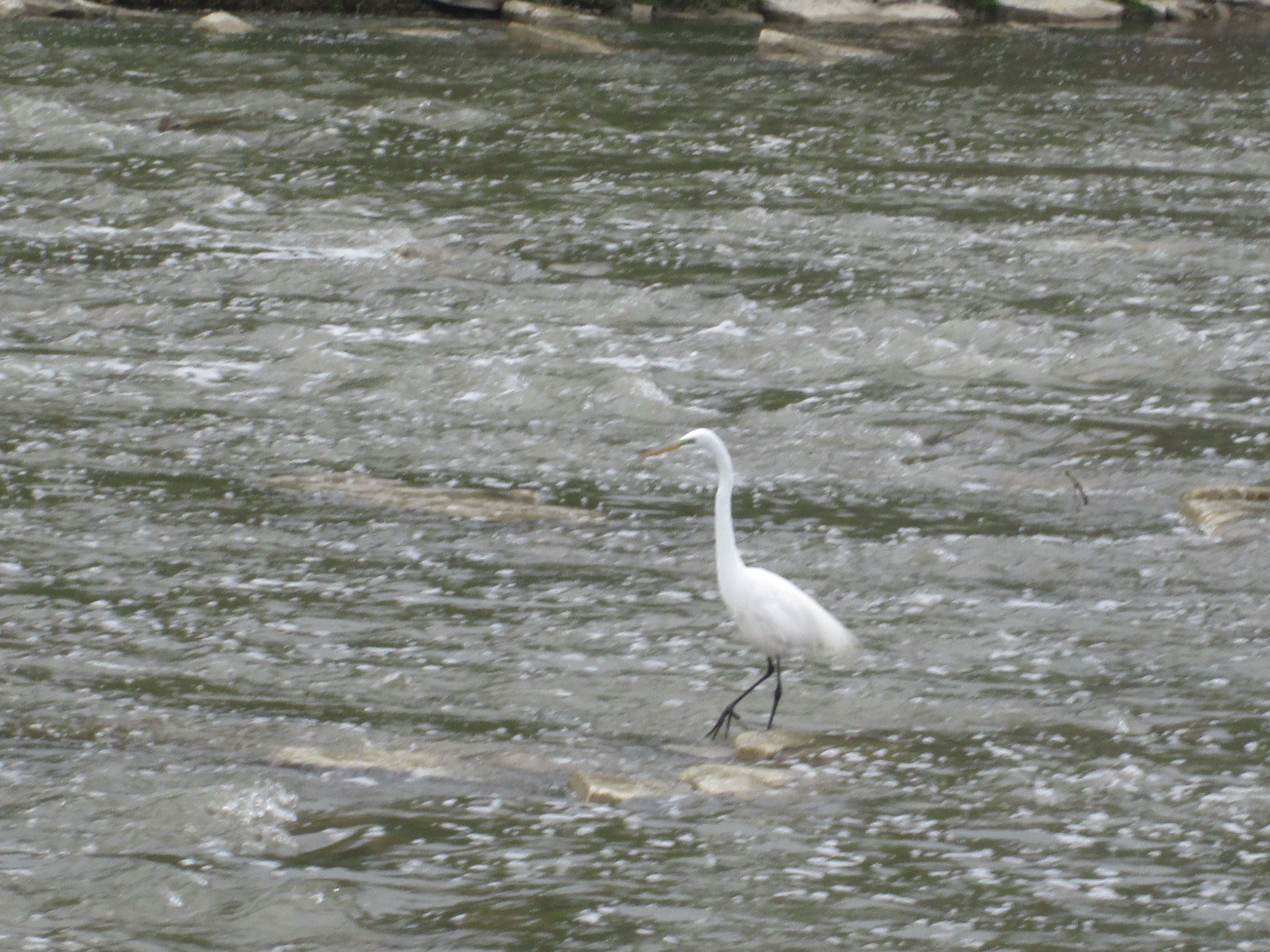
The Humber was dammed just north of the Old Mill. Today, most of this has been removed for flood control following Hurricane Hazel in 1954. An egret stands fishing in the waters just below the water falls.
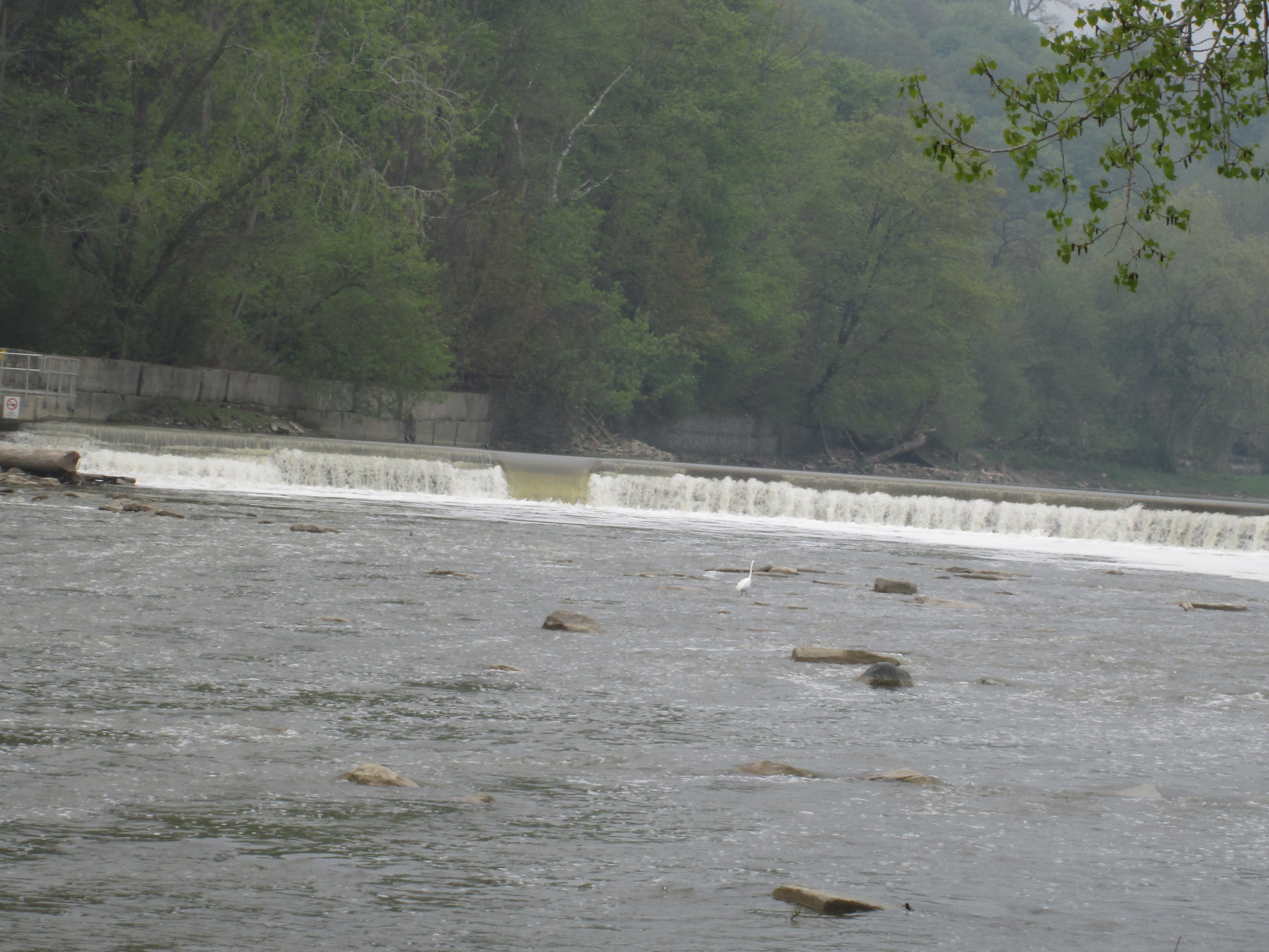
In the 19th century people had a love for the plumage of the egret and this led to their demise. Egrets are monogamous with both male and female protecting the young in the nest. The little ones are fiercely aggressive with the stronger ones often killing the weaker so that they don’t all reach the fledgling stage. Over hunting lead to their near extinction and the implementation of some of the first conservation laws protecting birds.
The cormorant in the picture below looked like he was having fun. He rode the river straight toward the fastest part of the water falls. He did his last second launch and landed gracefully to score a perfect ten.

An earlier mill bridge over Catherine Street was made of steel truss with a wooden decking and it was lost in the spring ice break up of 1916. The picture below shows the bridge on Mar. 29th in the ice field. Two days later it was gone.

The bridge was replaced the same year by this three arch stone structure. Stone arch bridges date back to Roman times and the frequent loss of bridges on the Humber led to the decision to construct this more substantial one. Frank Barber had pioneered the use of concrete in Canadian bridge construction in 1909 and by 1913 had designed all nine that had been built in Upper Canada. His design for the bridge at the old mill has survived 99 spring ice break ups and Hurricane Hazel while others up and down the river have been lost. The Humber River divided York County and the Township of Etobicoke at the time of construction and their crests are carved in stone on either side of the centre arch.

Water from the dam on the river was brought under Catherine Street via the head race which flowed through this passage.
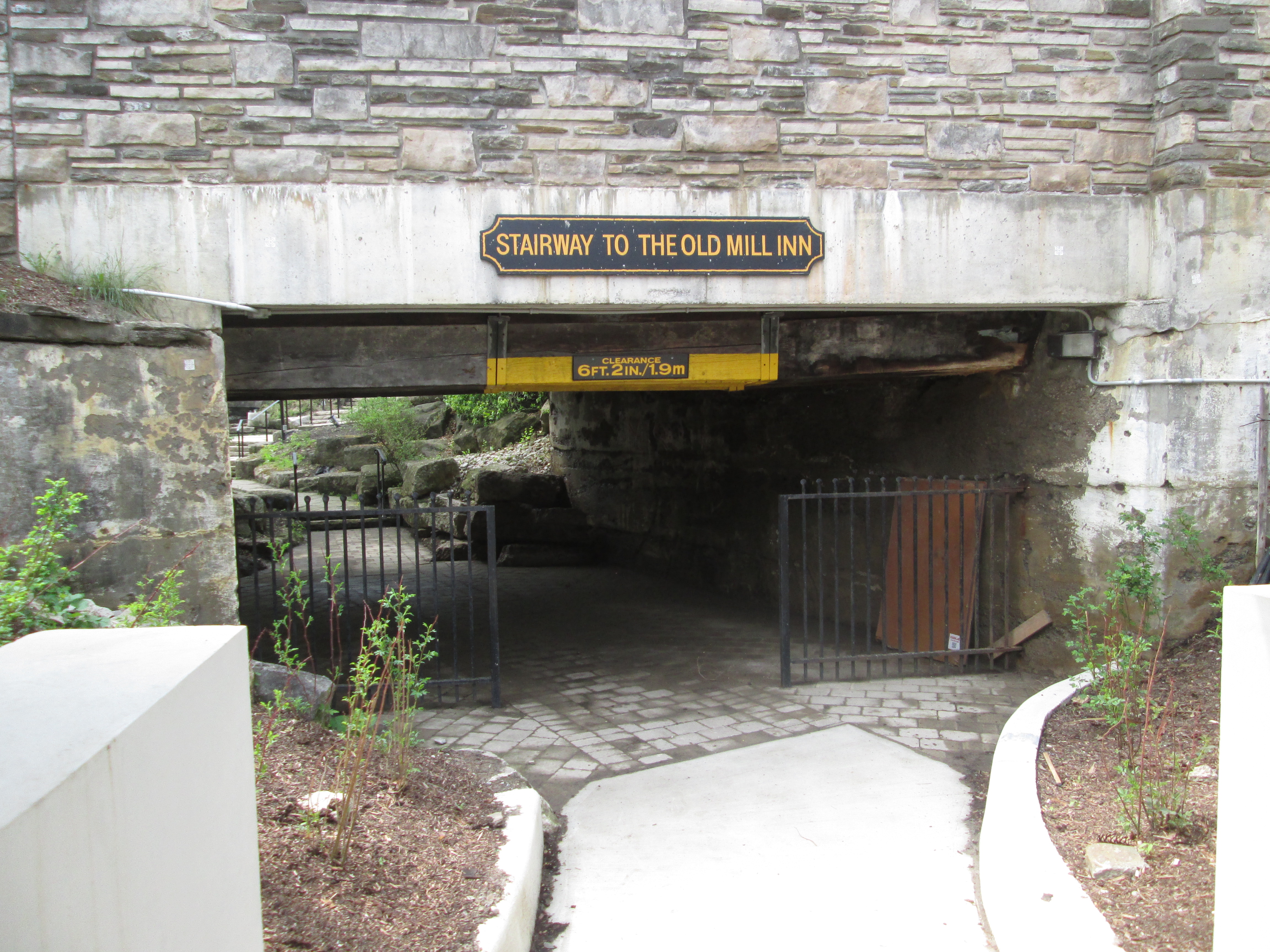
From here it was dropped onto the water wheel. This type of water wheel is known as over-shot because the water comes from above. Close examination of the wall in front of the wheel shows that the tail race used to pass through here but has been closed off with new stone. There is a straight line up the wall that marks the old passageway.

The first mill in York (Toronto) was constructed in 1793 at the request of Lieutenant-Governor Simcoe and this was the first industrial site in Toronto. It was known as the King’s Mill after King George III of England who was the reigning monarch at the time. The mill went into operation the following year when the mill wheels and gear systems arrived from England where they had been forgotten the year before. The government elected to lease the mill and ended up with a long series of mill operators. The first mill was a saw mill but while Thomas Fisher was the miller he replaced it with a grist mill in 1834. William Gamble bought the mill and replaced it with a new larger mill. This mill was destroyed by fire in 1849. The fourth mill was built on the same location by Gamble. During this time it was known as Gamble’s Mill and the upper story was used to store apples. During the winter a wood burning stove was kept going to keep the apples from freezing. This practice ended badly when the stove overheated in the winter of 1881 and burned the mill down. It sat abandoned until 1914 when Robert Home Smith, who was instrumental in developing the Port Lands, bought 3000 acres in the area of the mill to create a subdivision. He converted part of the site into the Old Mill Tea Garden. Various additions were made over the next 80 years as the area became a focal point in the community. In the 1990’s significant restoration and reconstruction of the original grist mill was undertaken and in 2001 the Old Mill Inn was opened with 57 luxurious suites. The picture below shows some of the original stonework from the 1849 mill with the new English Tudor style hotel on top.

The stone on the lower portion of the mill is darker and may represent the foundations of Fisher’s mill. The cover photo shows the abandoned mill as it looked in 1913 just prior to the start of redevelopment.

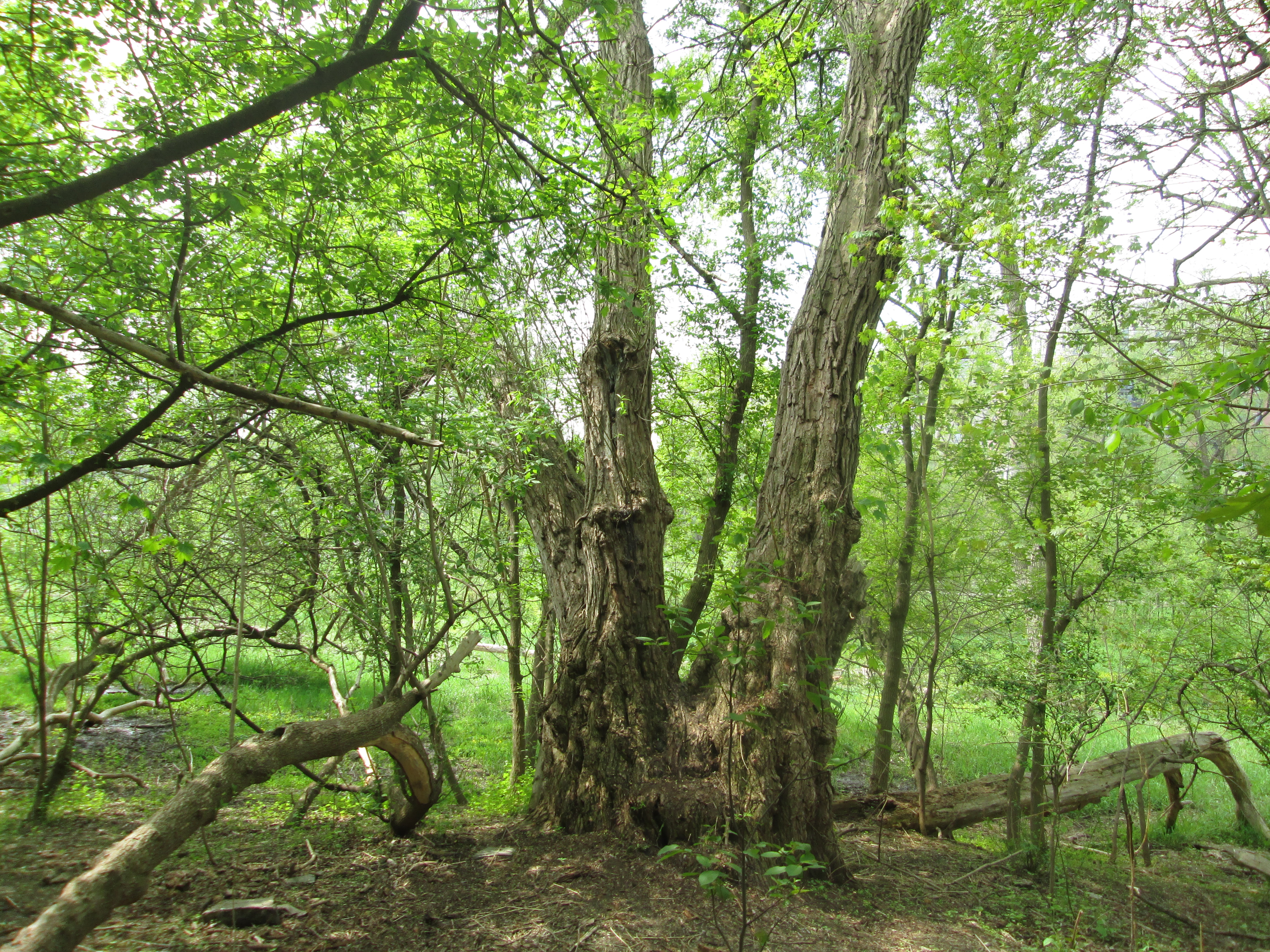
I close with this majestic tree simply because it’s nice after months of brown and white photo’s to have a vibrant green one.
Google Maps Link: The Old Mill
Like us at http://www.facebook.com/hikingthegta
Follow us at http://www.hikingthegta.com

Pingback: Hiking the GTA #100 – Amazing Animals | Hiking the GTA
Pingback: Toronto’s Only Suspension Bridge | Hiking the GTA
Pingback: Old Mills of Southern Ontario | Hiking the GTA
Pingback: Ovens Above Old Mill | Hiking the GTA
Pingback: Todmorden Mills | Hiking the GTA
Pingback: Abandoned Don Mills Road | Hiking the GTA
Pingback: Abandoned Kirby Road | Hiking the GTA
Pingback: Old Major Mackenzie Drive | Hiking the GTA