
Saturday, April 29, 2017
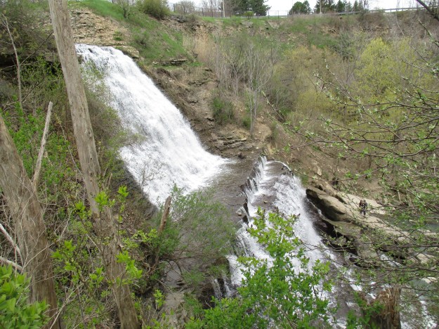
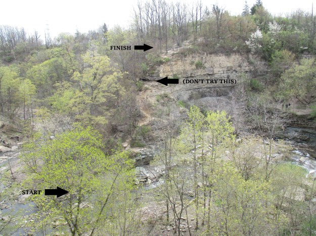
Albion Falls is known as a classical, cascade, complex falls because of the stages in the falls. The total height and width where Red Hill Creek flows over the escarpment are very similar with the height being 19 metres and the width being 18 metres and this makes it a classical waterfall. It plunges to a terrace and then cascades down to the creek bed. Having both a plunge and cascade makes it a complex waterfall.
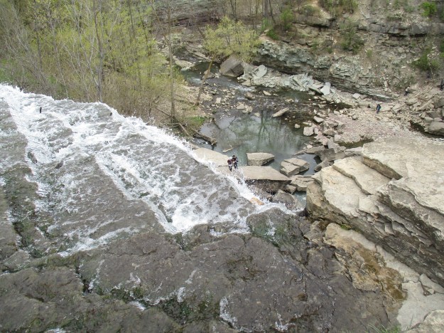
There is free parking in the Albion Falls parking lot which is a short walk from the bridge on Mountain Brow Blvd. The view from the crest of the falls gives you a perspective of height when you take into account the size of the people in the ravine below.
William Davis owned a plantation in North Carolina until the American Revolution. He fought on the side of the British, sheltering their soldiers. After the war, he fled the country and came to Upper Canada where he landed in 1792. He was granted 2000 acres of land for his service in the war and it included 500 acres at Albion Falls. William established a grist mill and named it Albion Mills. The settlement was soon growing and blacksmith shops and taverns were added. A church and general store joined the village and in 1880 it received a post office and a name change. Mount Albion had a main street named Mud Street but by 1880 a stone road had been established to connect the village to Hamilton. To pay for upkeep on the stone road a toll was implemented. The road keeper collected 15 cents for a return trip with a one horse wagon or 20 cents for a two horse wagon. The falls plunge half the distance to the ravine floor before landing on a ledge of hard dolostone. A series of steps forms a cascade to the pool at the bottom of the falls.
In 1907 Robert Grassie owned and operated the mill but he fell in the wheel housing and was killed. No one ran the mill after this accident and it was demolished in 1915. The picture below shows the wheelhouse, which was excavated by hand in 1792, looking into it from the floor level of the mill. There is a cut, or tail race, for the water to return to the river through which you can see the water far below. Robert Grassie had no chance of survival if he fell through the tail race and down to the creek level. A tree is getting well established in the wheelhouse as nature marches on.
Many people climb to the bottom of the ravine to view the falls from close up and get their pictures.
Several layers of the escarpment are exposed in the gorge below the falls. Just above the water level in the creek is a reddish layer known as the Grimsby formation. Directly above it is a grey-green layer known as the Thorold formation. The contact point between these two layers is the location that contains much of the natural gas in Ontario. Albion Mills is said to be the first place where natural gas was discovered in Ontario. This gas was used to light the mill for over 100 years. There is an exposed natural gas leak in the creek bed which can be lit with a match when the water level is low. It is said that the gas was kept alight with a two-foot flame which became a local tourist attraction.

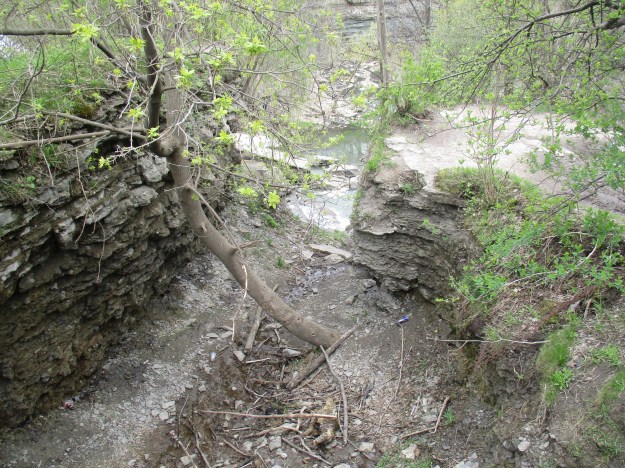
The pathway to the bottom beside the falls is moderately challenging and most people should be able to navigate it safely. There is a trail that leads back up the point opposite the falls but it doesn’t get a lot of use. That is because the trail is complicated by a large outcropping of dolomite that you either have to climb over or inch your way around. There are several stories of people who have slipped and fallen to their death in the gorge and this is one candidate location for that kind of accident.
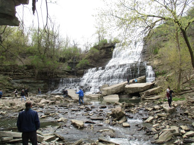
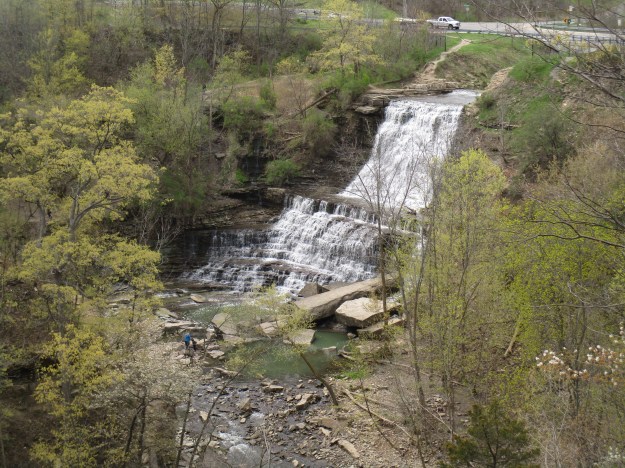
When you get to the top on the other side you are treated to this view of the falls. Before it was removed, the mill stood on the left side of the falls.

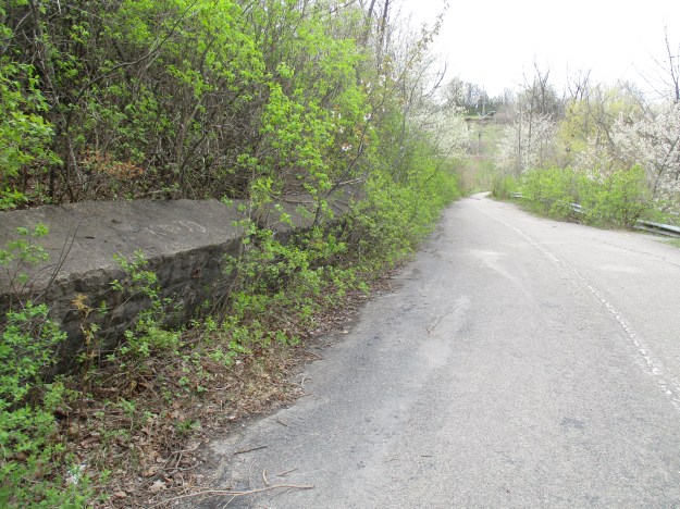
Mud Street used to run on an alignment closer to the creek so that potential customers could bring their grain to the mill. Since the new road has been in place the old one has become the Red Hill Trail and is a much safer way to get the view in the picture above. It connects to the road near the parking lot.
An old set of stone stairs leads down the hill to old Mud Street and the back access to the mill.

Foundations and the water wheel housing remain on the site of the mill at Albion Falls. The grinding wheel was preserved and is on display near the viewing platform for the falls. Grooves in the wheel caused the ground grain to move through the wheel to where it could be collected and bagged for sale. Millers typically took a percentage of the flour in exchange for the service of grinding a farmer’s crop.

Paranormal investigators love to visit the falls because there are stories of several deaths at the falls. On Sept. 4th, 1915, it is said that Jane Reilly jumped over the falls to her death when told that she couldn’t marry her childhood sweetheart. On certain nights they say you can still hear her sobbing in the gorge below the falls. The gorge has also been used to dispose of several murder victims and on March 16, 1946, the dismembered body of John Dick was dumped there by his wife Evelyn. John still roams the gorge, perhaps with Jane Reilly. The spirit from a haunted house down the road has also been reported near the falls.
Swamp Darners are large dragonflies that have bright blue eyes and green thoracic stripes. The females have flat appendages while the male appendages appear to be hairy. They like to feed on flying insects and can be seen feeding high up in the air or in packs closer to the ground. Their main prey is mosquitos, which we expect to make an appearance in the next week or two. This female swamp darner appears to be a little bit too cold to fly and was sitting waiting for the day to warm up a few degrees.

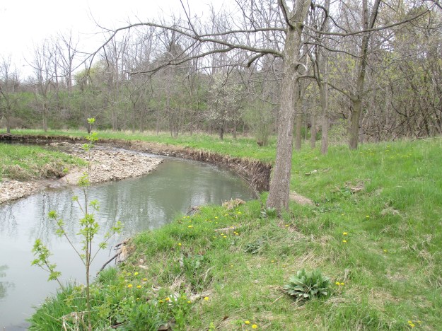
Above the bridge, the creek is flanked by a flood control pond. This pond is smaller than the original mill pond that supplied the grist mill. The dam is gone and so the pond has drained and the floodplain has now grown back into a forest.
Albion Falls is just one in a string of 100 waterfalls that line the escarpment in and around Hamilton.
Google Maps Link: Albion Falls
Like us at http://www.facebook.com/hikingthegta
Follow us at http://www.hikingthegta.com

thank you
Pingback: Waterfalls Of The Golden Horseshoe | Hiking the GTA
Pingback: The Best of 2017 | Hiking the GTA
Pingback: Buttermilk Falls | Hiking the GTA
Pingback: Our Favourite Hikes | Hiking the GTA