Tag Archives: Turkey tail fungus

Meadowvale Conservation Area

Saturday, January 5, 2019

Armed with the new camera I got for Christmas and the promise of a warm sunny day we set off for Meadowvale Conservation Area in Mississauga.  We have previously written about much of the history of the conservation area from the perspective of the various dams and berms associated with Silverthorne’s grist mill.  We won’t cover that again here and the link will be supplied again at the end of this story.  Today we were interested in the western side of the conservation area where the Toronto Suburban Railway used to run.  The Toronto Suburban Railway operated 5 electric commuter lines, including the one that ran up Yonge Street known as the Toronto & York Radial Railway   The line to Guelph was the longest in the system at 49 miles.  Stop 47 was a small station in Meadowvale after which the line crossed the Credit River and ran through the property that would become the conservation area.

When visiting the conservation area in the 1990’s there was quaint little suspension bridge that carried the pedestrian trail across the Credit River.  It was demolished in 2009 leaving only the metal posts on the river bank.  A decaying sign in the woods announces the removal of the bridge but it isn’t really needed any longer.  To see a picture of what the bridge looked like you can follow this link to a similar bridge in Warden Woods.

img_0364

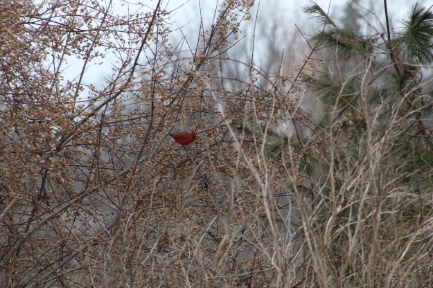
My new camera allows me to get much better shots of birds and the cardinal in the photo below was only a small red spot to the naked eye.  I think I’m going to like having it along.

img_0417

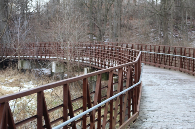
The new bridge is a little farther south and considerably longer.  It crosses an area that is likely under water when the river is flooding.

img_0397

From the west end of the bridge there is a line that can be seen running horizontal through the woods.  This is the right of way for the former Toronto Suburban Railway.  The official opening of the railway came on April 14, 1917 and soon trains were running between Lambton and Guelph every two hours.  The trip lasted two and half hours and was very popular until the early 1930’s.  Rising costs, poor profits and a string of accidents coupled with a new love of the automobile led to the line being closed in August of 1931.  The tracks were removed in 1936 and in many urban areas the line has been built over with housing developments.

img_0400

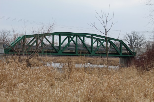
The bridge that carries Old Derry Road over the Credit River was built in 1948.  It is known as a camelback truss bridge and is part of the Meadowvale Cultural Heritage District.

img_0420

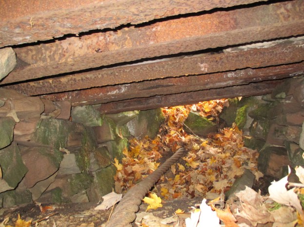
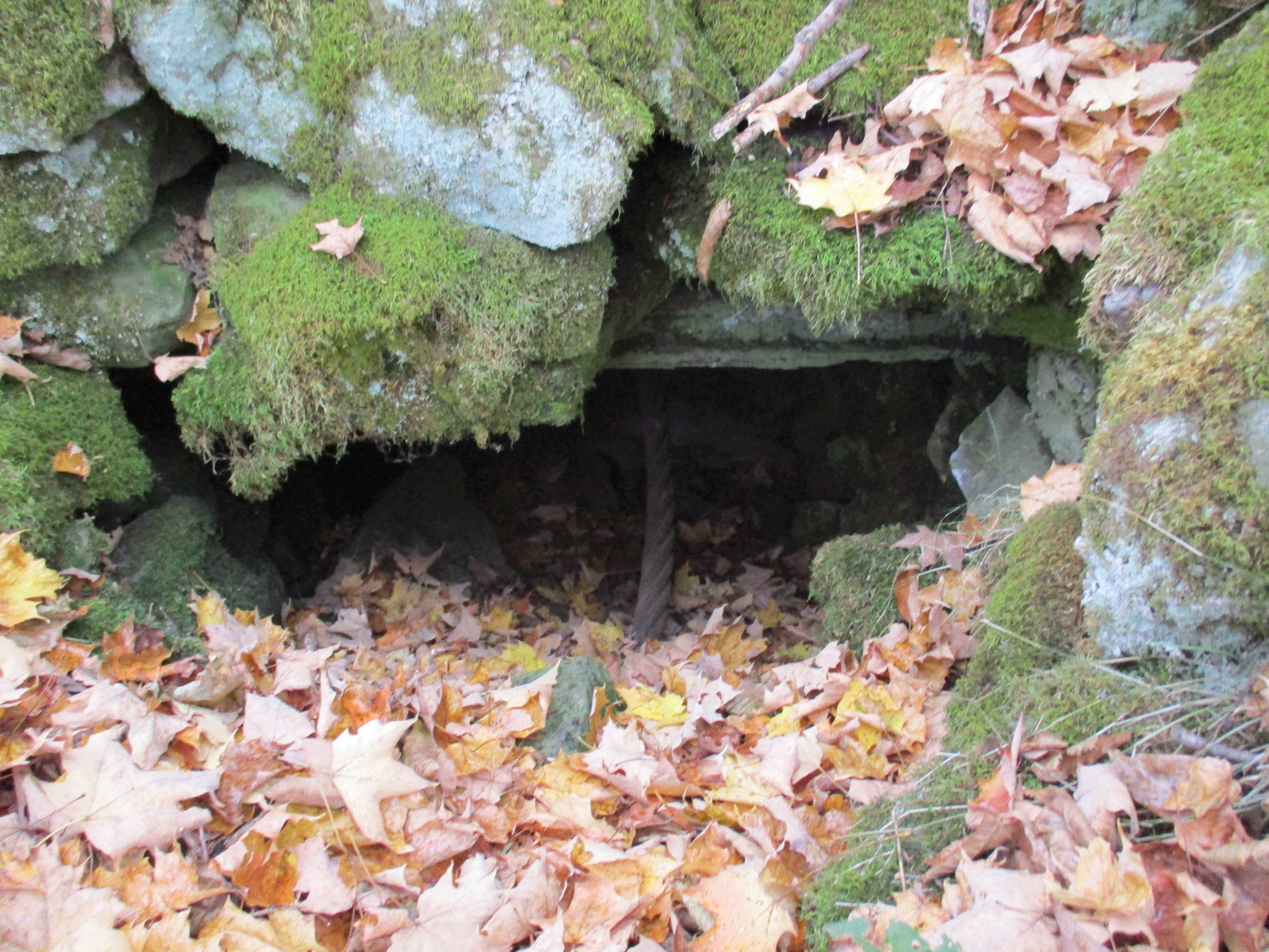
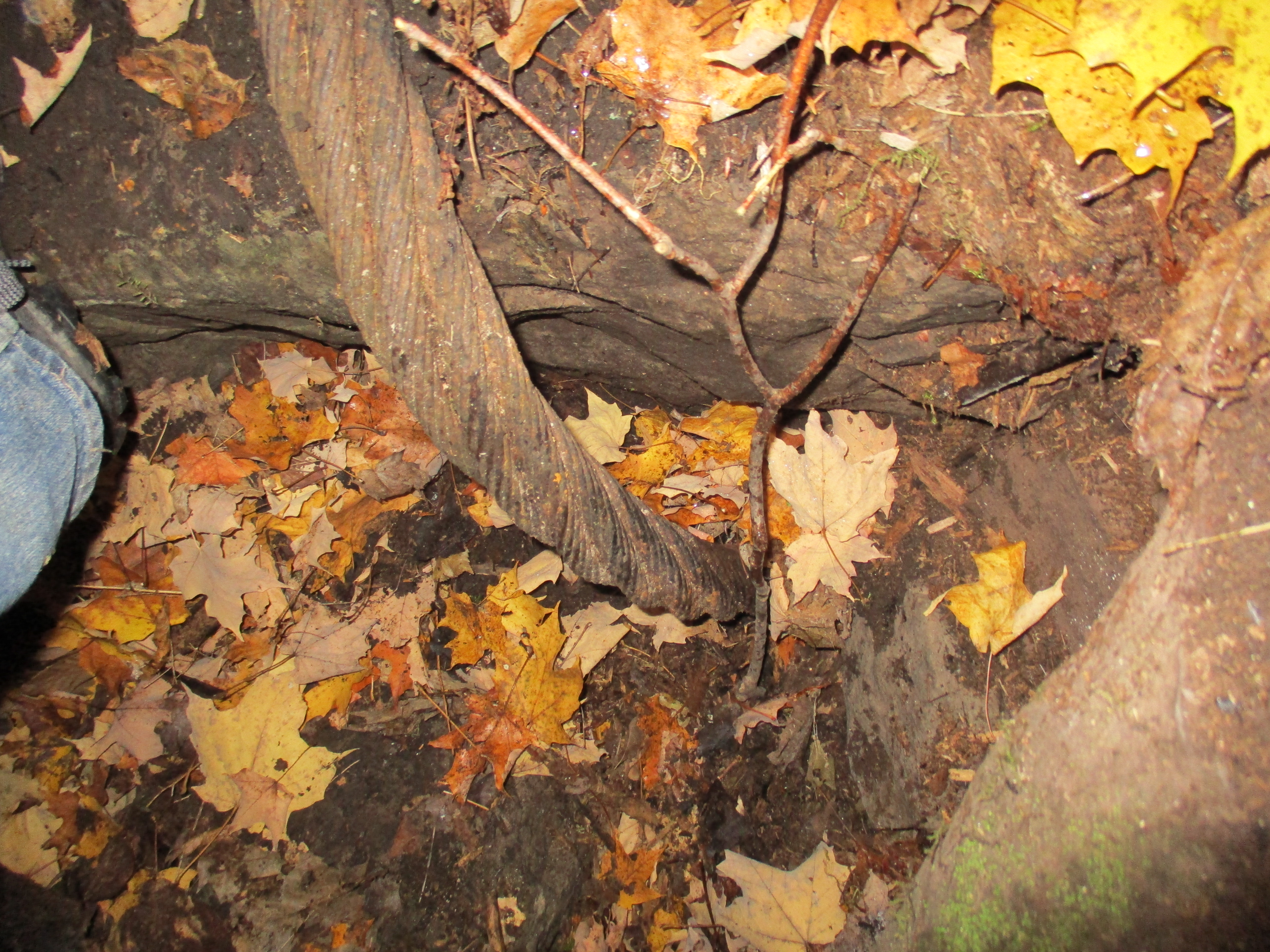
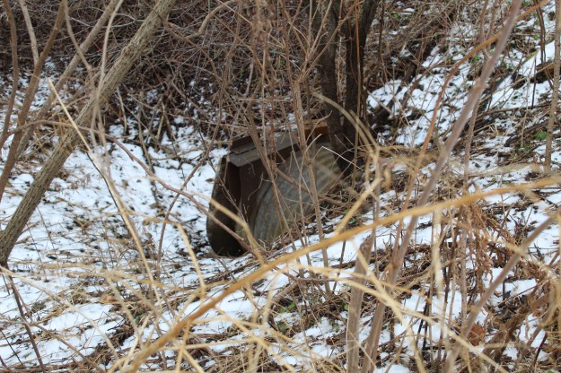
The tail race for the Silverthorne grist mill joined the river just north of the bridge.  The tail race was crossed by the radial line near the last house on Willow Lane.  Both of the abutments are crumbling after 100 years with no maintenance.  This picture was taken at the time we explored the side of the conservation area with the mill foundations in it.

img_3041

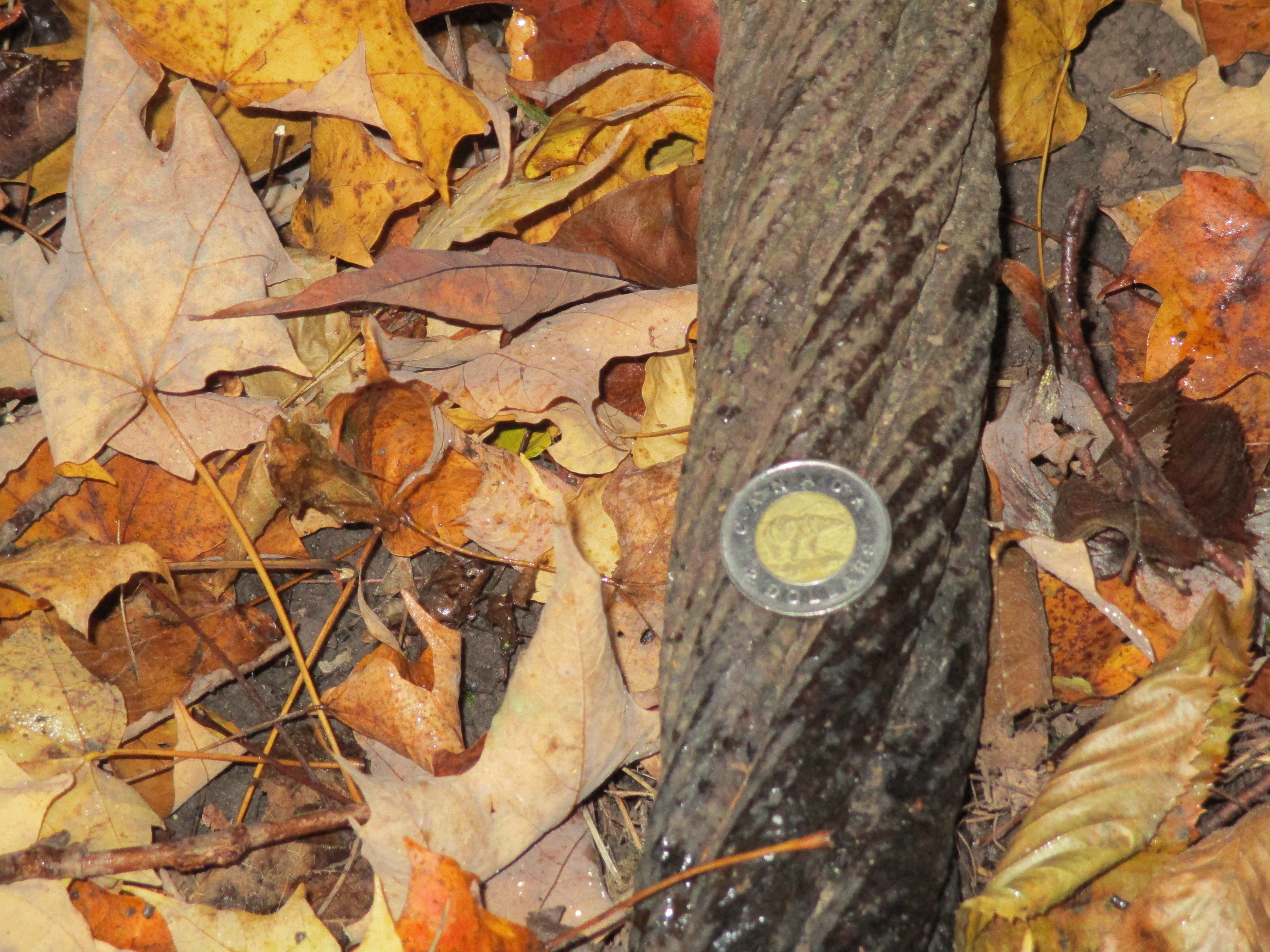
The abutments for the crossing of the Credit River are still easy to locate a short distance north of the truss bridge.  The picture below shows the south abutment as seen from across the river.

img_0424

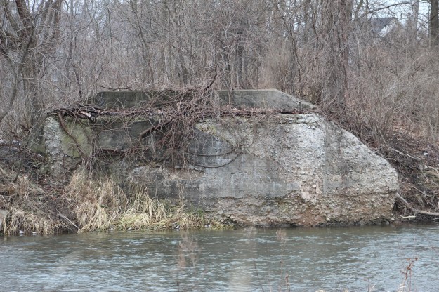
The last house on Willow Lane is undergoing a restoration.  The south abutment can be seen in the lower corner of the picture and the abutments for the crossing of the tail race are basically in the front yard.  With frequent passenger and cargo service this must have been a great place for train enthusiasts or a noisy place for anyone else.

img_0428

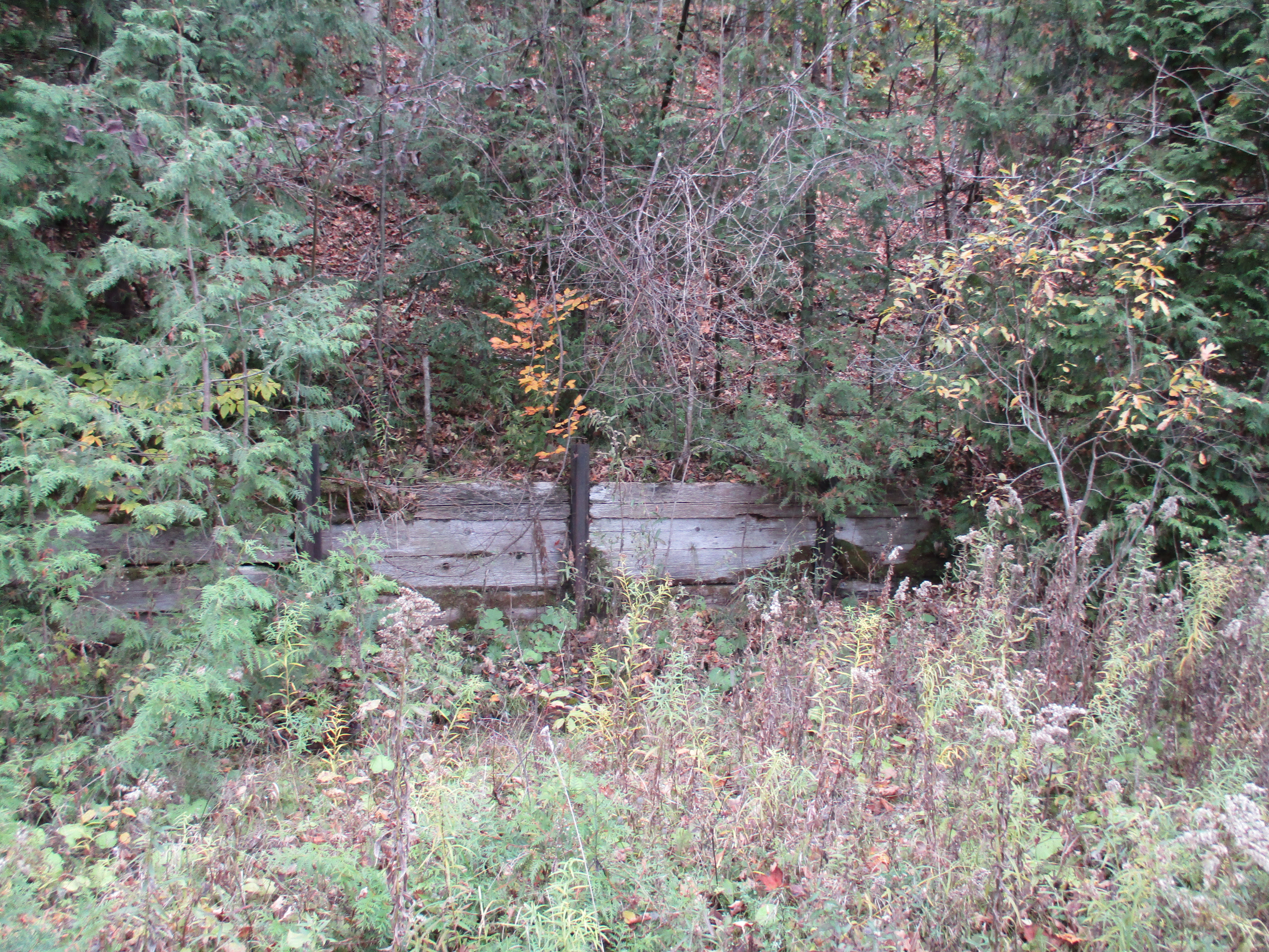
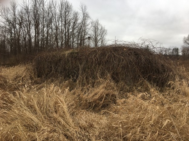
The abutment on the north side of the river has become completely overgrown with vines and must be all but hidden in the summer when the grass is full height.  Behind the vines the century old concrete is crumbling badly.

img_9384

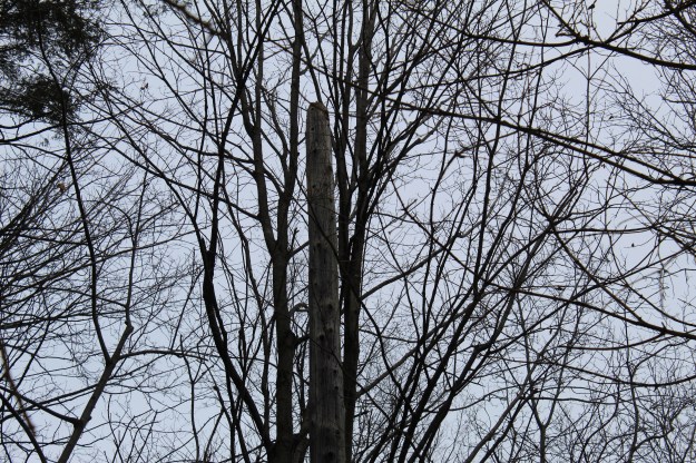
Where the radial line ran through the park there are still about ten of the old electric poles standing.  The poles supported an overhead caternary system that delivered 1500 volt DC to power the cars.  They can be picked out because of their straight lines and flat tops.  In several cases the pole has a blue slash on it as can be seen on the extreme left in the cover photo.

img_0461

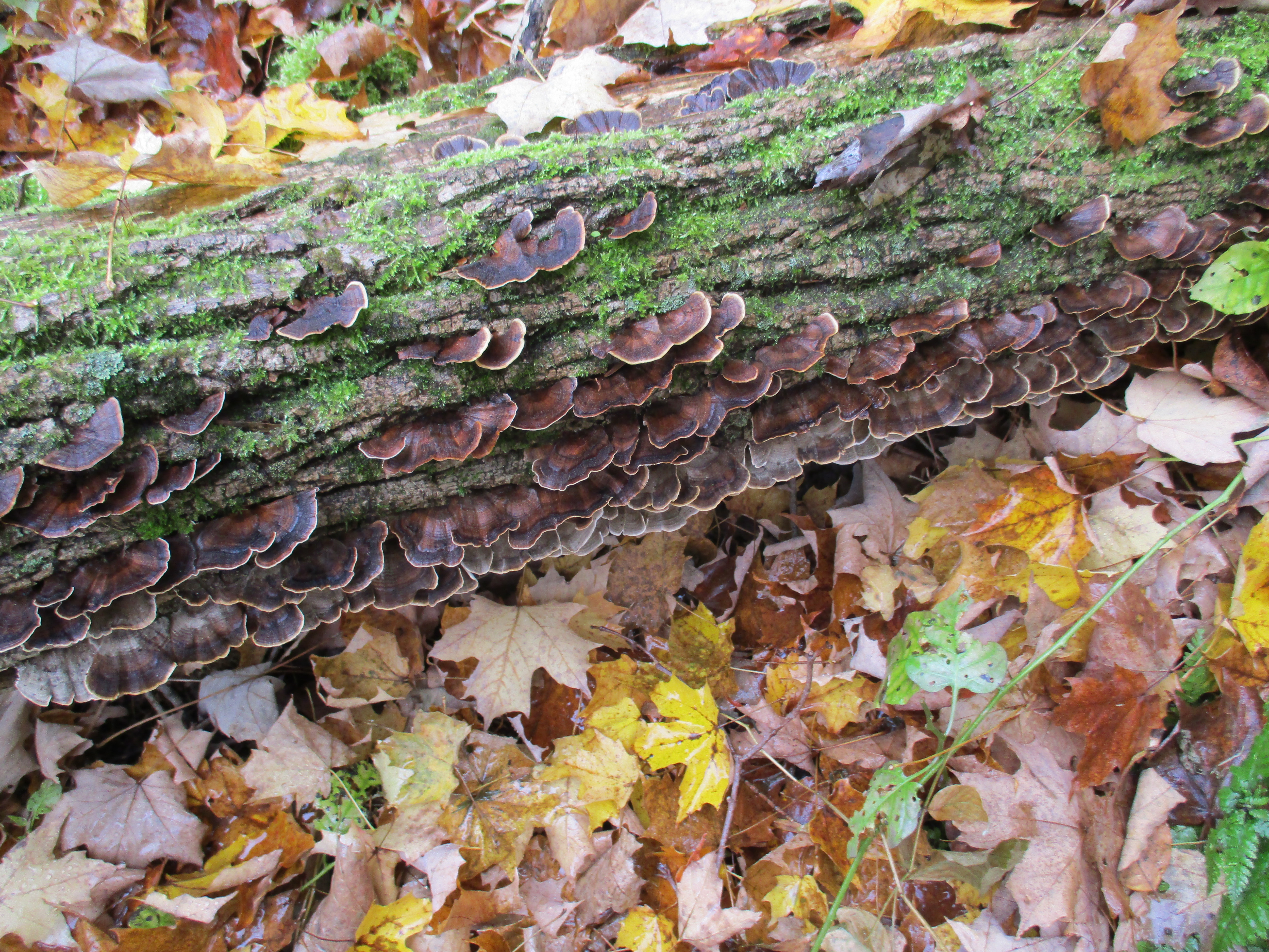
Fungus can still be found in the winter and it often adds colour and interesting patterns to what can be an otherwise drab landscape.  These turkey tail fungus entirely surrounded this old stump.

img_9394

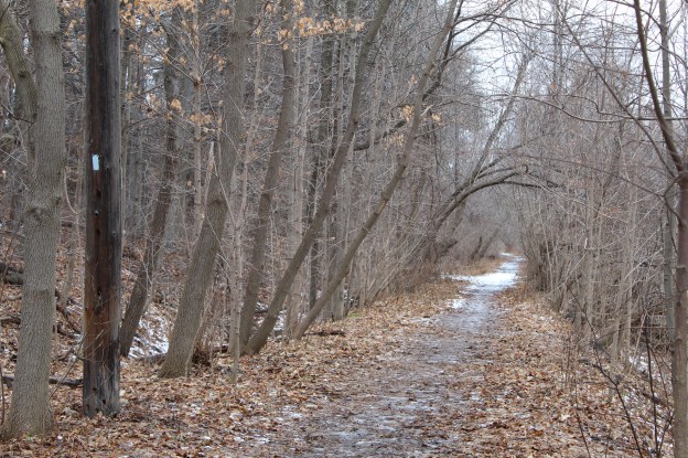
The intersection of the radial line with the active Canadian Pacific Railway appears to lie somewhere under the six lanes of the new Derry Road.  North of Derry, the Samuelson Circle Trail continues on the old right of way.  The berm can be identified in many places along here because it rises a couple feet above the surrounding land.  Culverts allowed drainage from one side of the berm to the other and one can be found in this section.

img_0474

Cinnabar-red polypore can grow p to 14 centimetres in size and those pictured here are some of the larger specimens.  They grow all year and some will produce spores in the second and third years.  This fungus is not edible.

img_9398

Meadowvale Conservation Area is full of interesting historical artifacts for those who like to look for such things in the area in which they are hiking.  Many of these are associated with the Silverthorne Grist Mill which we covered in detail in a previous blog. The Guelph Radial Line has left only a few clues to the former right of way as it passed through the GTA.  A ghostly set of piers that cross the old mill pond in Limehouse is one example of interesting place to visit.

Google Maps Link: Meadowvale Conservation Area

Like us at http://www.facebook.com/hikingthegta

Follow us at http://www.hikingthegta.com

The Caledon Aerial Tramway – The Cox Property

Saturday Oct. 24, 2015

For over 100 years a steam powered aerial tramway has been hidden away in the Caledon hills. It was 8 degrees when we set out and it started lightly raining almost as soon as we found the west end of the tramway.  Having parked on The Forks Road near Dominion Street we walked up the hill to the hairpin turn.  This is where the Credit Valley Railroad (CVR) built their station.  The CVR was absorbed into the Canadian Pacific Railroad (CPR) who took over transportation for the mineral extraction activities in the area.  The embankment on the side of the railway has been reinforced by driving steel rails into the ground to support boards.

IMG_0883

The medina sandstone in the Caledon hills had not been exploited with much success until the coming of the CVR.  McLaren’s Castle was built in 1864 and is a rare example of local stone prior to the arrival of the railway in 1879.  For the next thirty years quarries mined all the easily accessed deposits until one by one they were closed.  In 1900 an aerial tramway was built to bring stone from the eastern embankment of the Credit River to the railway line.  This avoided bringing it down to Dominion Street and then back up the hill on the Forks of the Credit Road. McLaren’s castle is shown in the archive photo below but it was destroyed in a series of fires in the 1960’s.

the grange

The Cox Property is the east half of lot 9 concession 4 while the west half of lot 9 is the Willoughby Property which features the Stonecutter’s Dam.  Both properties are owned by the Credit Valley Conservation Authority.  The CVC has taken a “hands off” approach to managing the Cox property.  No formal trails have been established and the area is being allowed to return to it’s naturally vegetated condition.  Almost immediately we found an area of disturbed rocks where steel rails could be seen underneath.  After a brief investigation we located the two inch steel cable from the tramway running through a chamber below ground.

IMG_0885

A little farther along several steel railway rails have been exposed.  These rails support chunks of stone that hide the chamber below where the cable runs.  Inside, the curving end of the tramway cable can be seen.

IMG_0904

I climbed into the chamber that the cable ran through.  After cleaning a bit of debris away I still couldn’t see where the cable went as it curved around a large block of cut stone and down deeper into the underground chamber.  Without preparations, or permission, it wasn’t possible to dig all the stone fill out of the chamber and discover if the cable turns on a hidden drive below.  The cover photo shows the cable from inside the chamber looking to the east where it entered this end of it’s route.  The walls are lined with cut stone and the roof is supported on a series of steel rails.  Above ground the rails are covered with a layer of stone that has been spread over the top.

IMG_0902

The steel wire rope used on the tramway had a two inch diameter as can be seen relative to the 28mm (1.1 inch) coin in the picture below.  The rope appears to have a 6 X 7 construction which means that it has 6 strands made of 7 wires each.  The six strands are wrapped around a central core. Without seeing a cross section it isn’t possible to determine of there is a 7th strand in the core making it a 7 X 7 rope.  Using 7 wires per strand allows for larger outer wire diameter which greatly improves abrasion resistance but reduces flexibility.  The wires in the strands of this rope run in the same direction as the stands and this is known as a “lang lay”. Depending on the exact construction this wire rope should have a breaking strength somewhere between 175 and 200 tons.

IMG_0915

Other evidence of past industrial use of the land is seen in the remains of a steel ladder.

IMG_0913

There is a small patch of horsetail growing on the side of the hill and most of it has been chewed off.  White tail deer will sometimes eat horsetail and we saw the departing end of a deer as we came through this part of the woods.

IMG_0907

Stone was brought from the quarry on the other end of the tramway and unloaded to waiting train cars on the CPR.  A large steel spike is seen protruding out of the side of the hill near where the tramway ended. This spike is similar to the ones I saw on the 1855 Gore and Vaughn Plank Road I reported in Dufferin Creek.

IMG_0912

The Cox Property was the site of quarry number two as well as several smaller quarries.  The picture below shows the face of one of the smaller quarries.  We found various metal and wire scraps in this overgrown quarry.

IMG_0927

Turkey tail fungus is known by the scientific name Trametes Versicolor and it grows on fallen hardwood and stumps.  This fungus contains a protein called PSK which has been shown to have anti-cancer properties.  It inhibits growth of breast and lung cancers as well various ones in the digestive system.  Treatment with turkey tail proteins has shown very little negative side effects.

IMG_0929

The eastern end of the tramway was at a much higher elevation than the western end and I could see that cable making an excellent zip-line across the Credit River valley.  This picture looks from near the terminus on the Cox Property across the valley to where the steam boiler that powered it hides at the other end.

IMG_0892

The Caledon aerial tramway has given up some of the secrets it guarded for the past century but I suspect that there is even more buried in that underground chamber.  The Cox property also contains a couple more quarries and access roads but after a couple of hours of non-stop rain, we decided to call it a day, leaving the rest for another time.

Please note that the Credit Valley Conservation considers this property to be private and as noted above, no trails are maintained on it.  Access to the property is by permission only.

Like us at http://www.facebook.com/hikingthegta

Follow us at http://www.hikingthegta.com