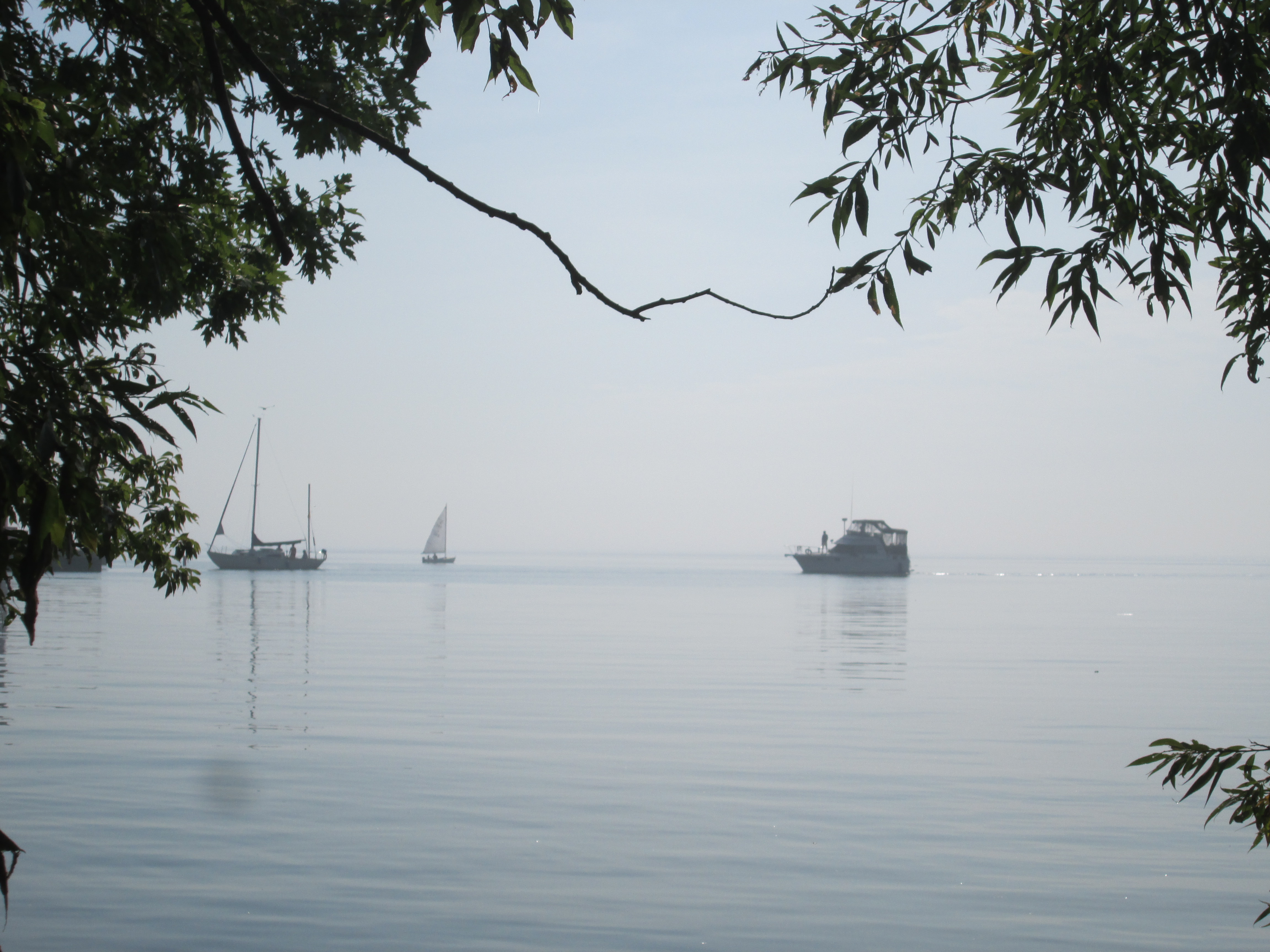
Tag Archives: Oakville

Turner Chapel

February 19, 2023

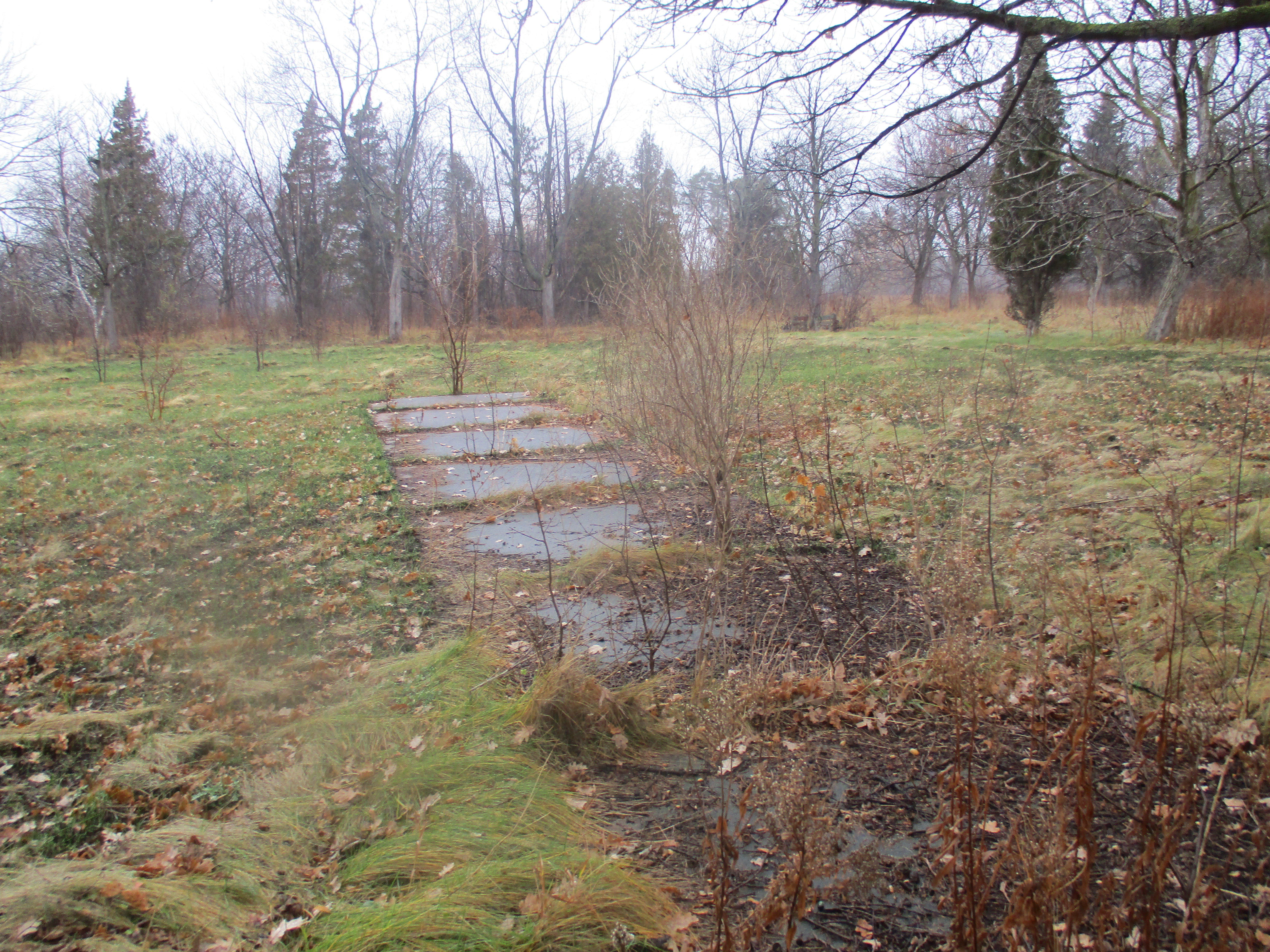
Fugitive slaves and other black people began to arrive in Bronte and the Oakville area as early as 1830. The Act Against Slavery had been passed in Upper Canada, later renamed Ontario, in 1793 and was one of the first pieces of anti-slavery legislation in the world. It banned the importation of slaves and allowed children born to female slaves to go free at the age of 25. This meant that slavery would slowly disappear from the province. Britain banned slavery in Canada and other colonies in 1833 but the underground railroad was already in full swing bringing fugitive slaves into Canada. Many of these people ended up in the Oakville area.

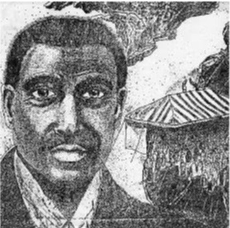
One of these former slaves was James Wesley Hill who escaped to Canada inside a packing box and settled on a local farm. Over the next few years he returned to the United States many times and helped an estimated 700-800 African Americans escape to Canada. He offered them temporary work on his strawberry farm while they worked to establish themselves. James was also referred to as “Canada Jim” and he has been honoured by having a local school named after him. The following picture of James Wesley Hill is from the James Wesley Hill school page.

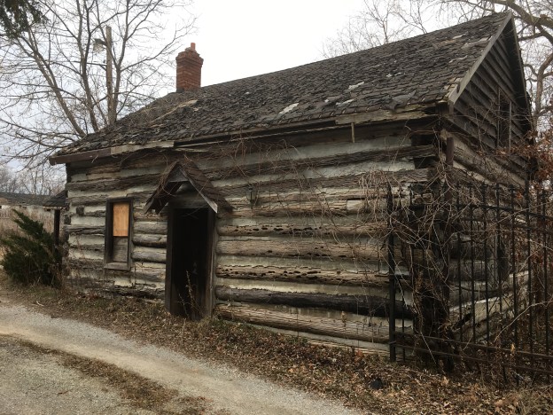
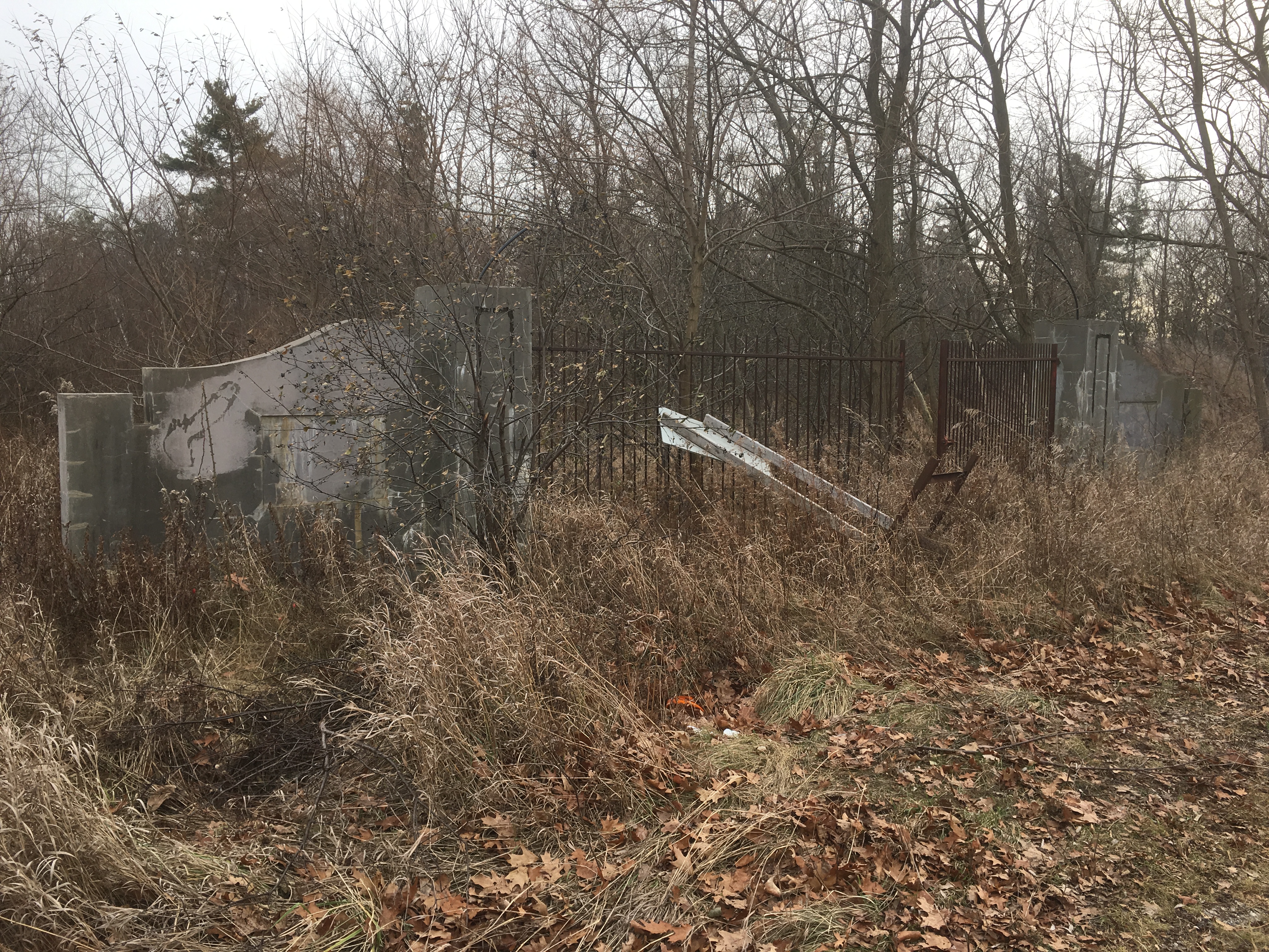
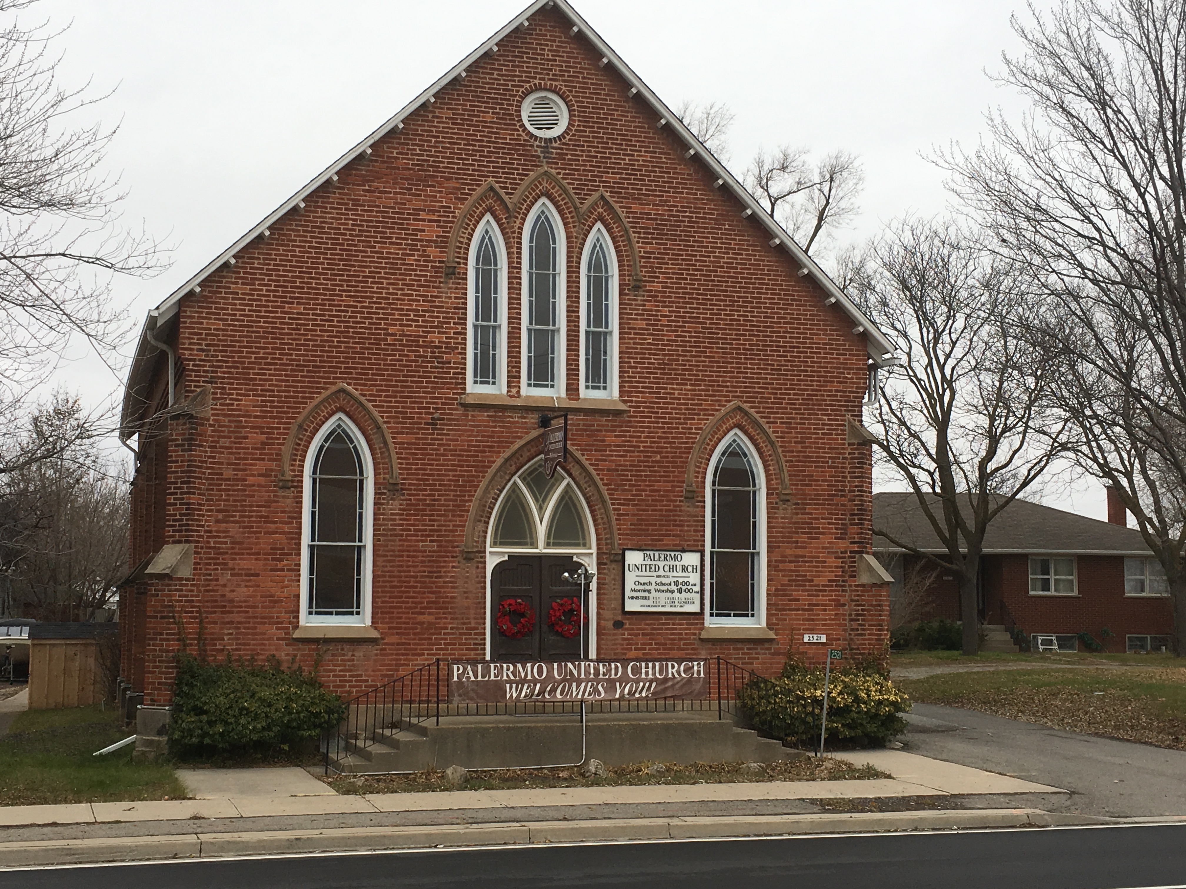
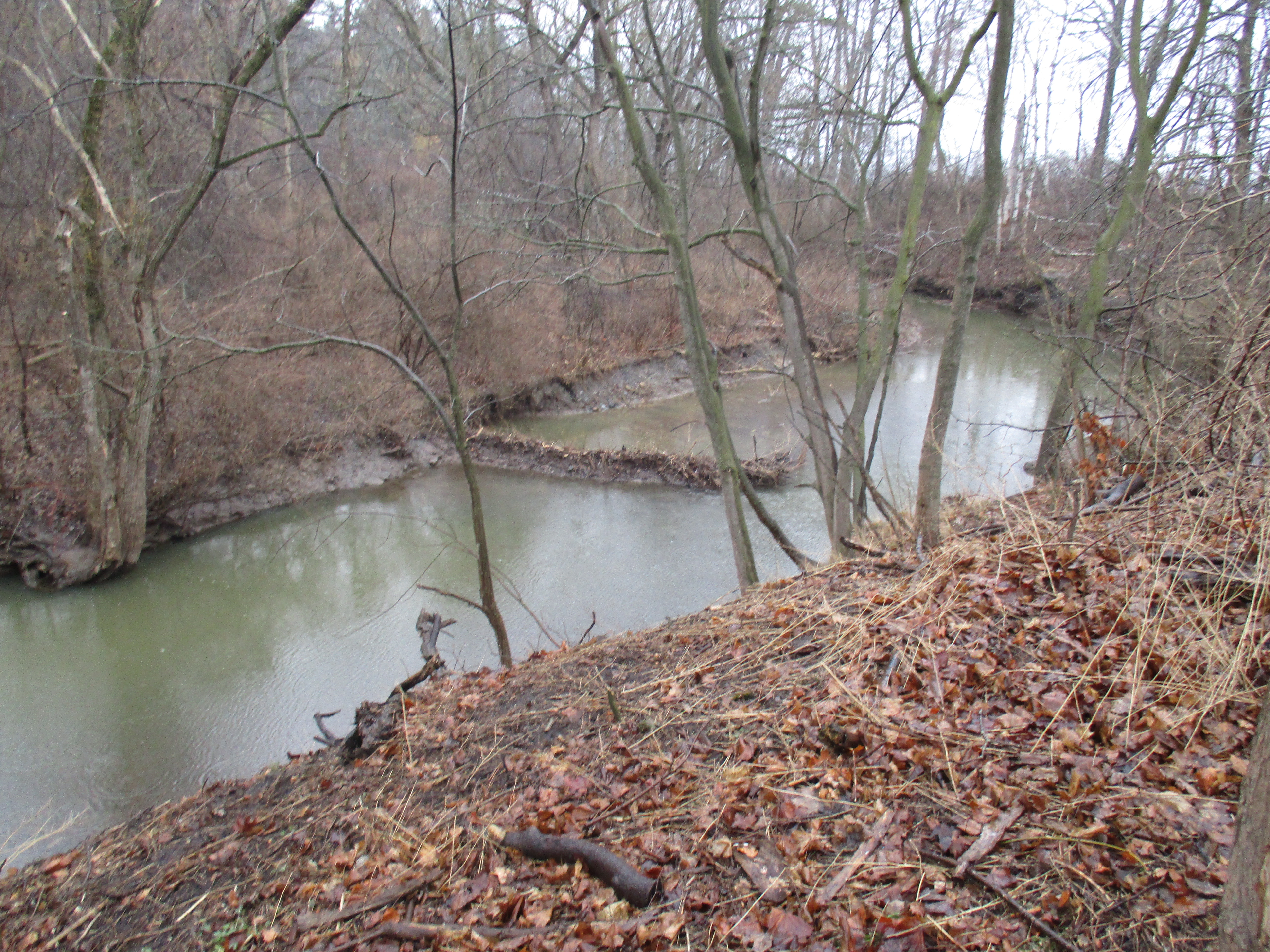
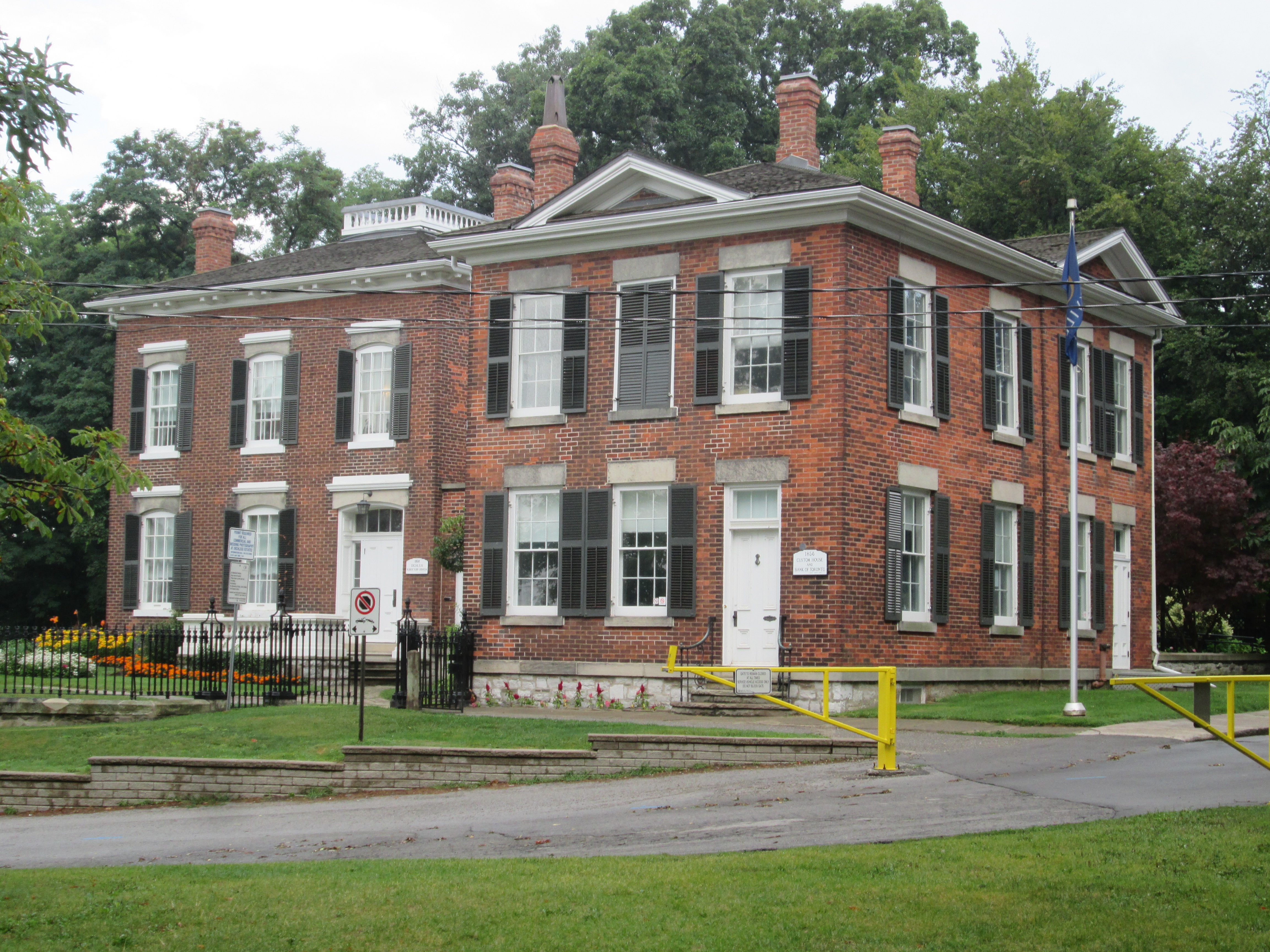
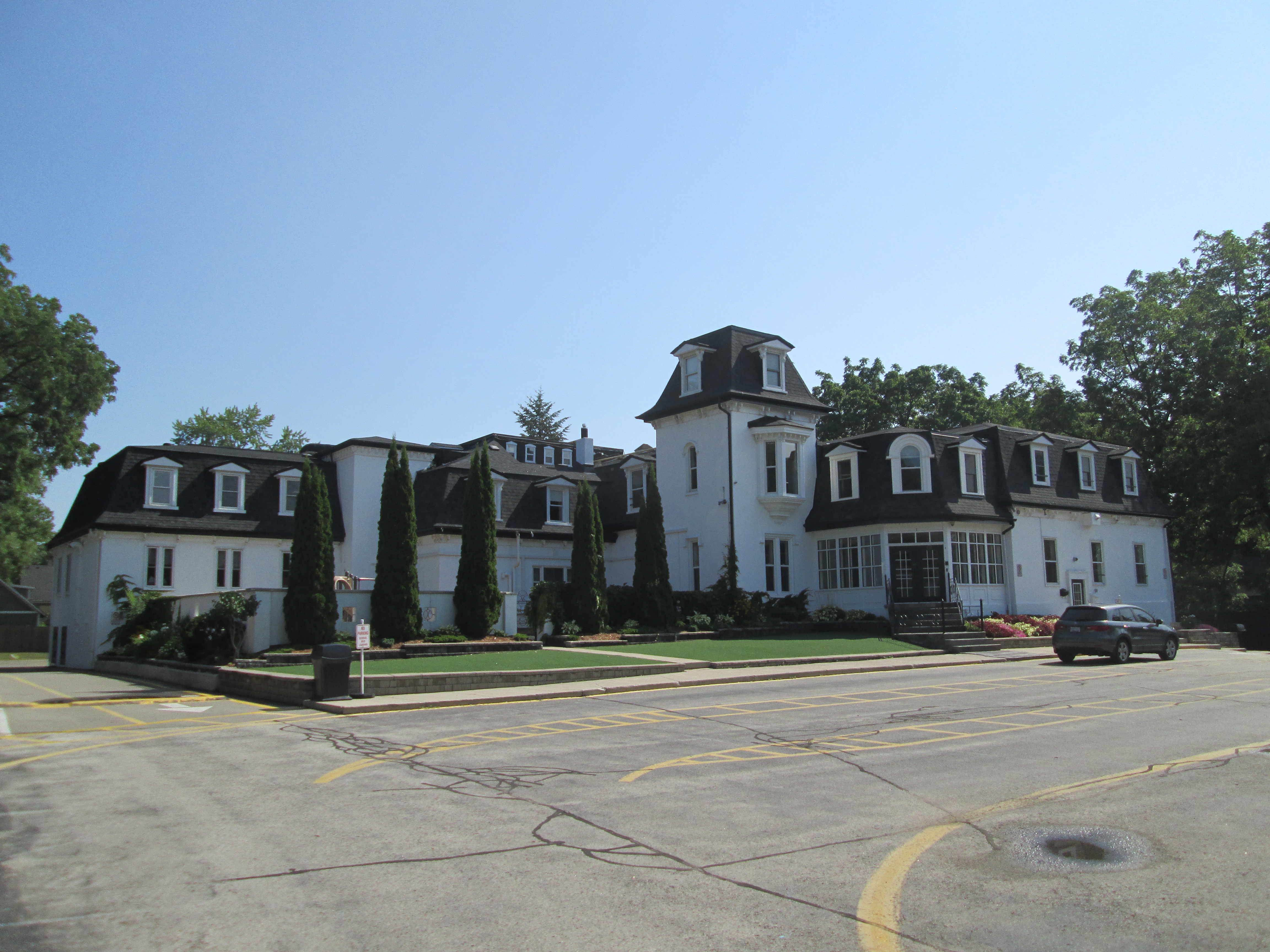
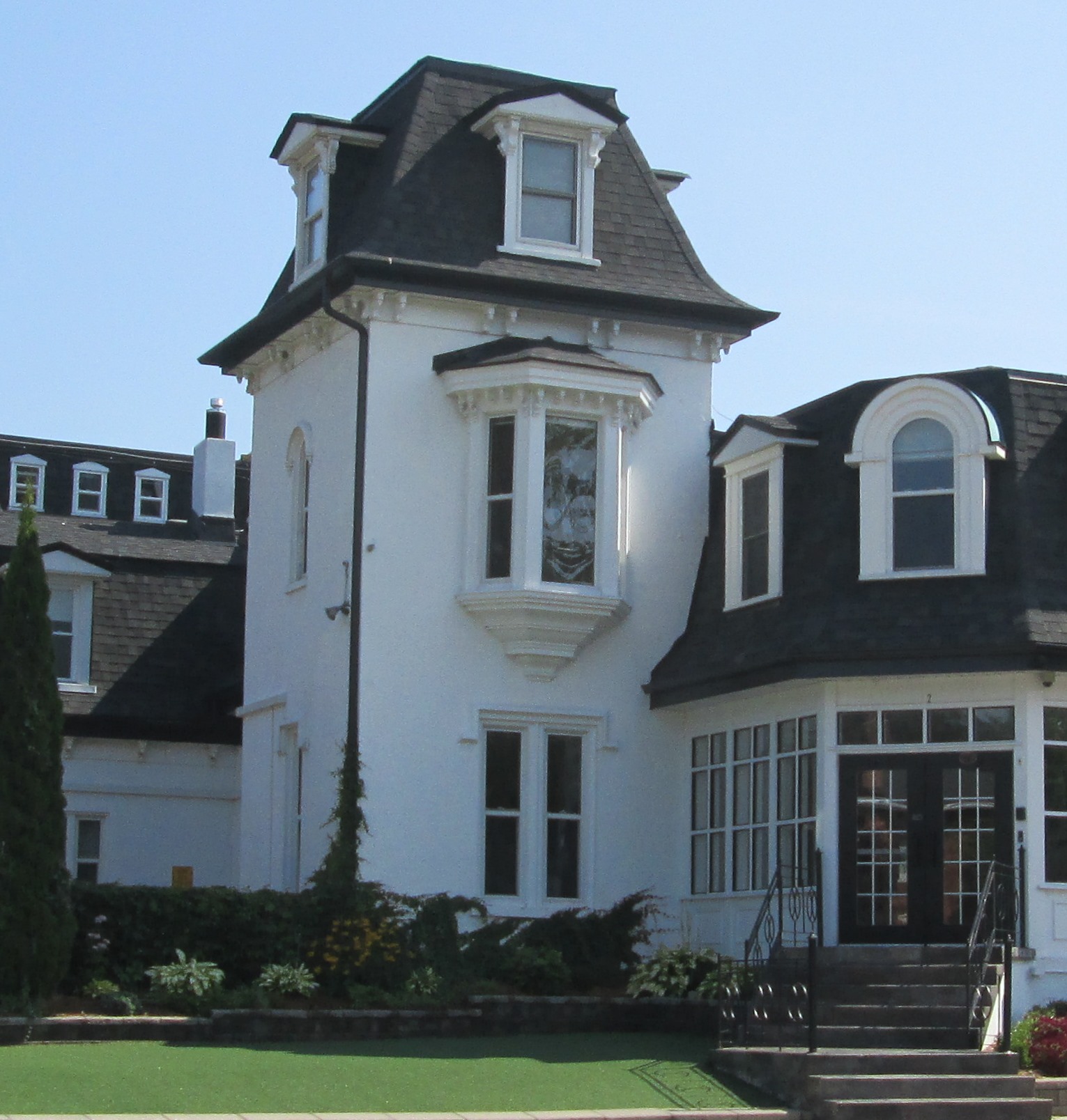
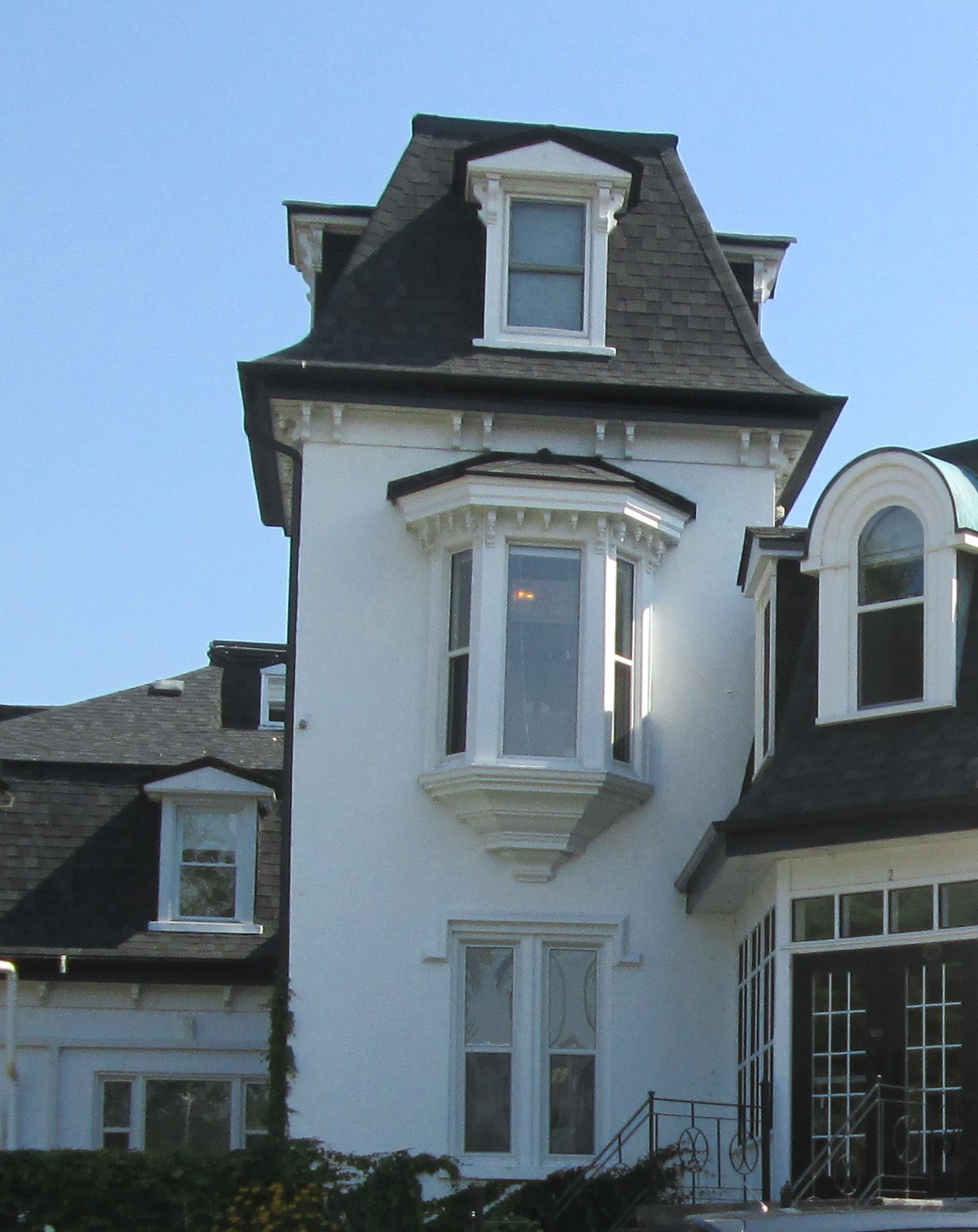
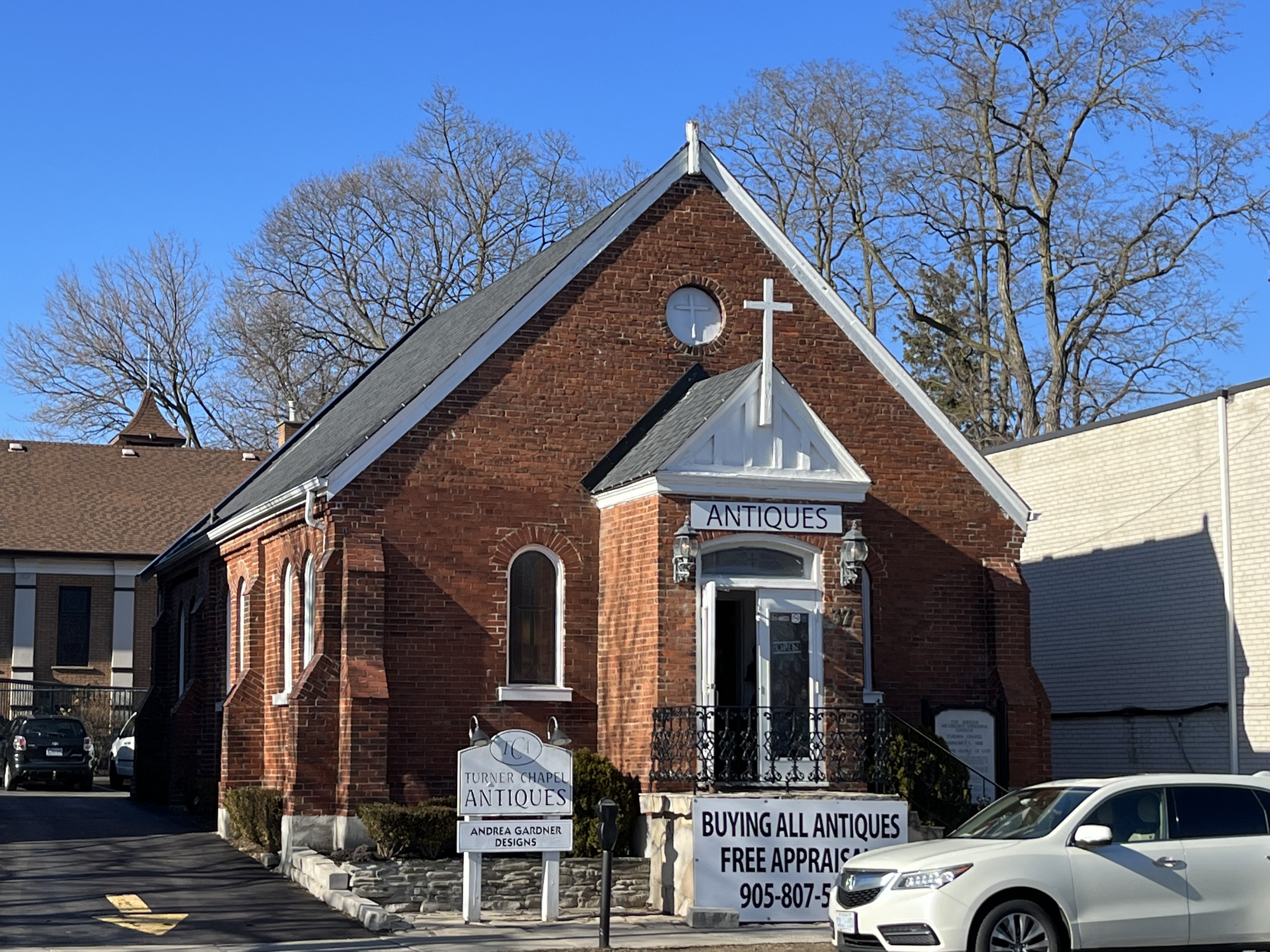
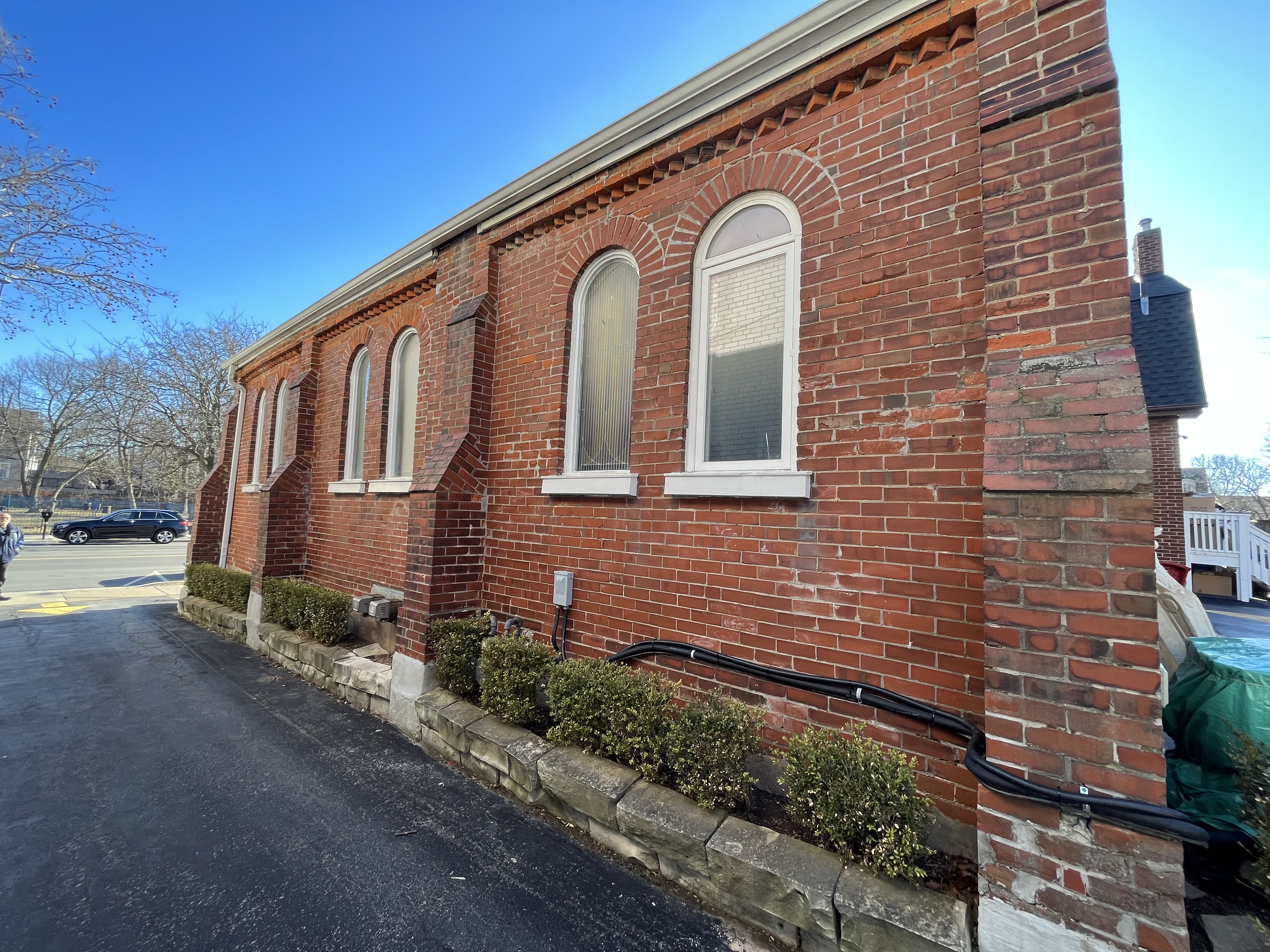
Around 1860 Samuel Adams and his brother in law, Rev. William Butler organized between 300 and 400 former slaves in the area to form a congregation of the African Methodist Episcopal Church. They were able to build a small church on the east side of Sixteen Mile Creek. This church burned down and in 1890 a plot of land was gained on the west side of the creek. Several setbacks occurred and construction didn’t begin until 1891 with the first service being held on Jan. 1, 1892. The side view of the church in the picture below shows the rounded arches of the windows which shunned the pointed arches of the gothic architecture common in churches of the era. The row of bricks turned on an angle under the roof line is the sole form of ornamentation in the brickwork.

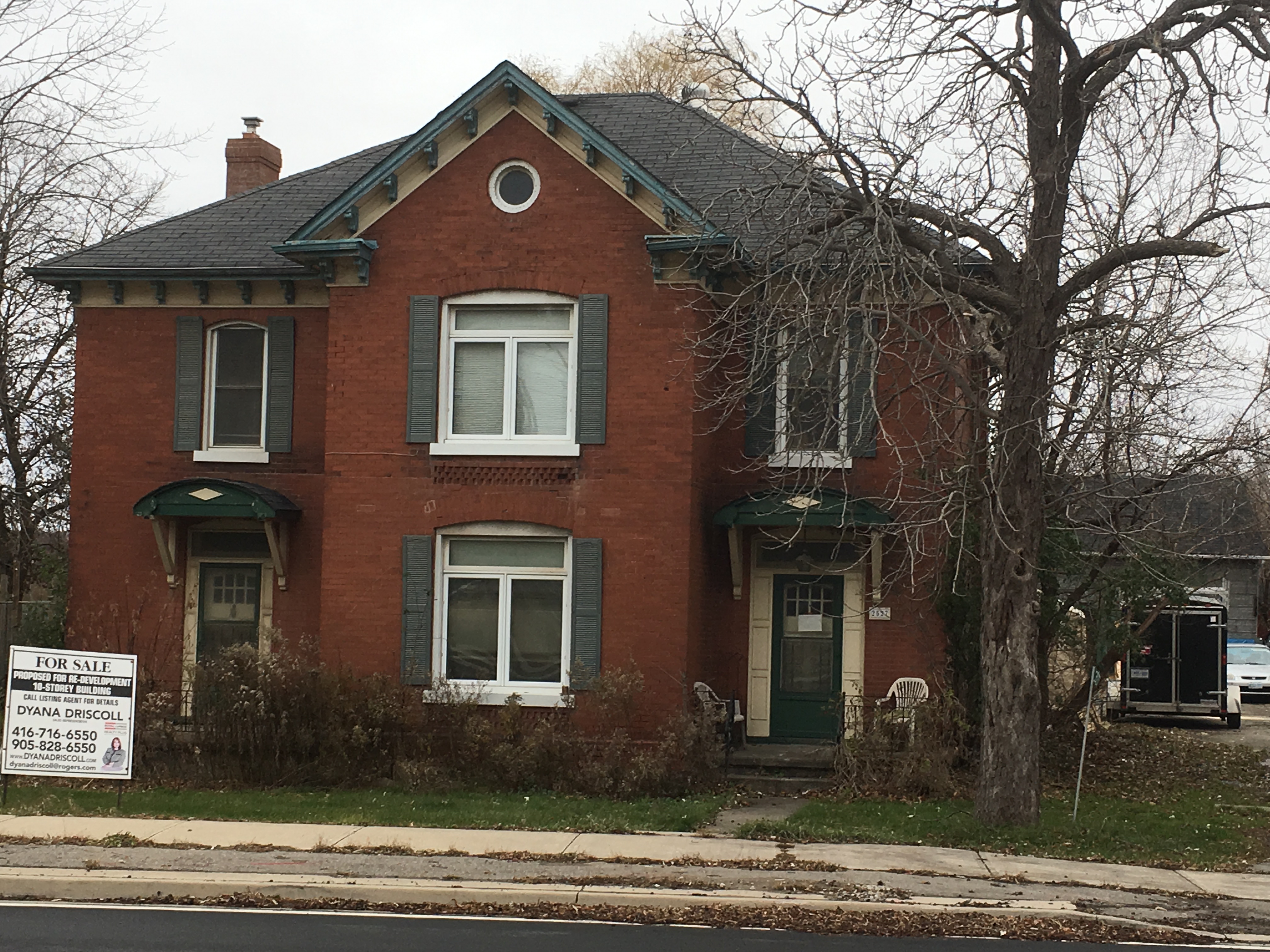
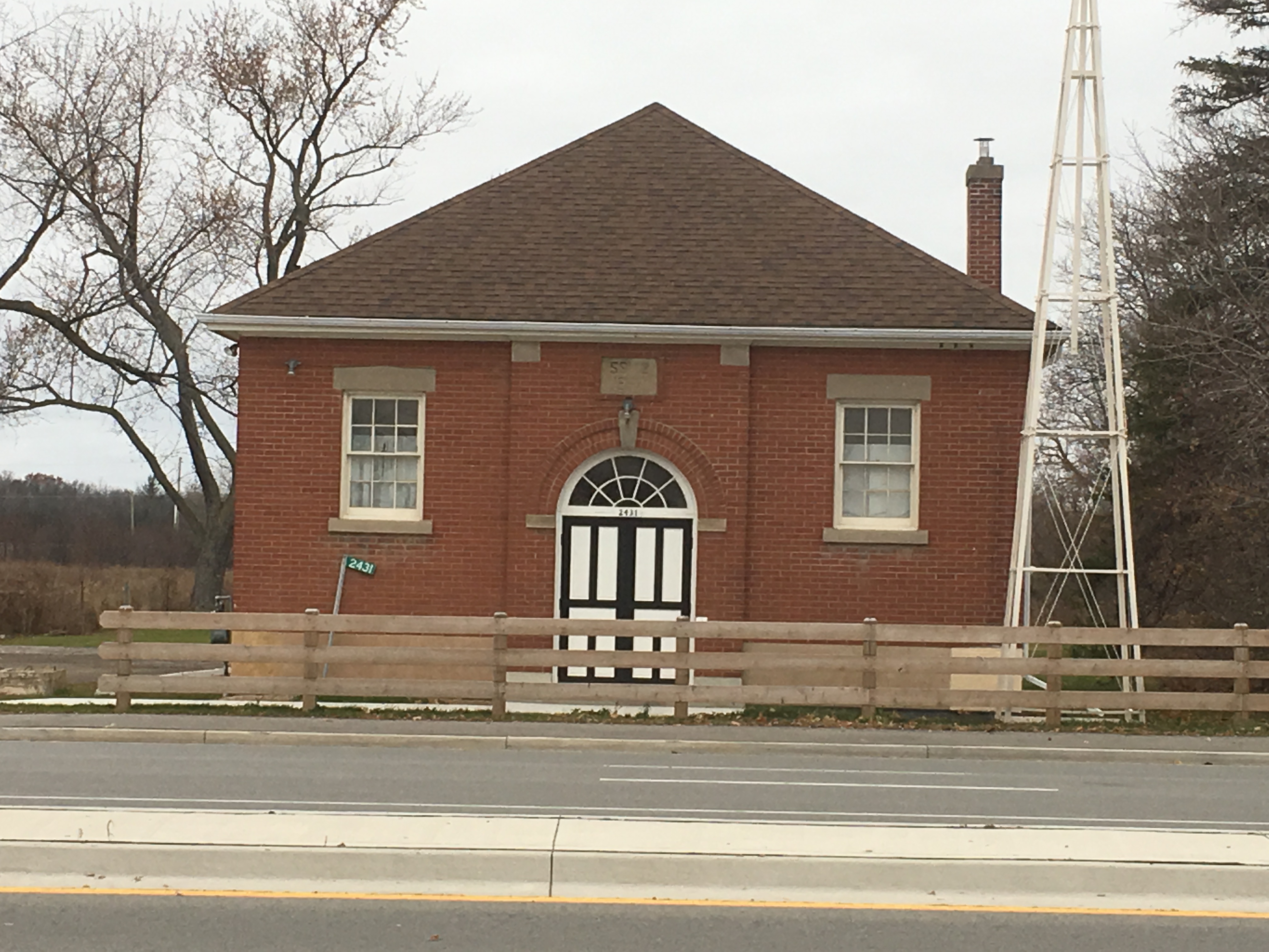
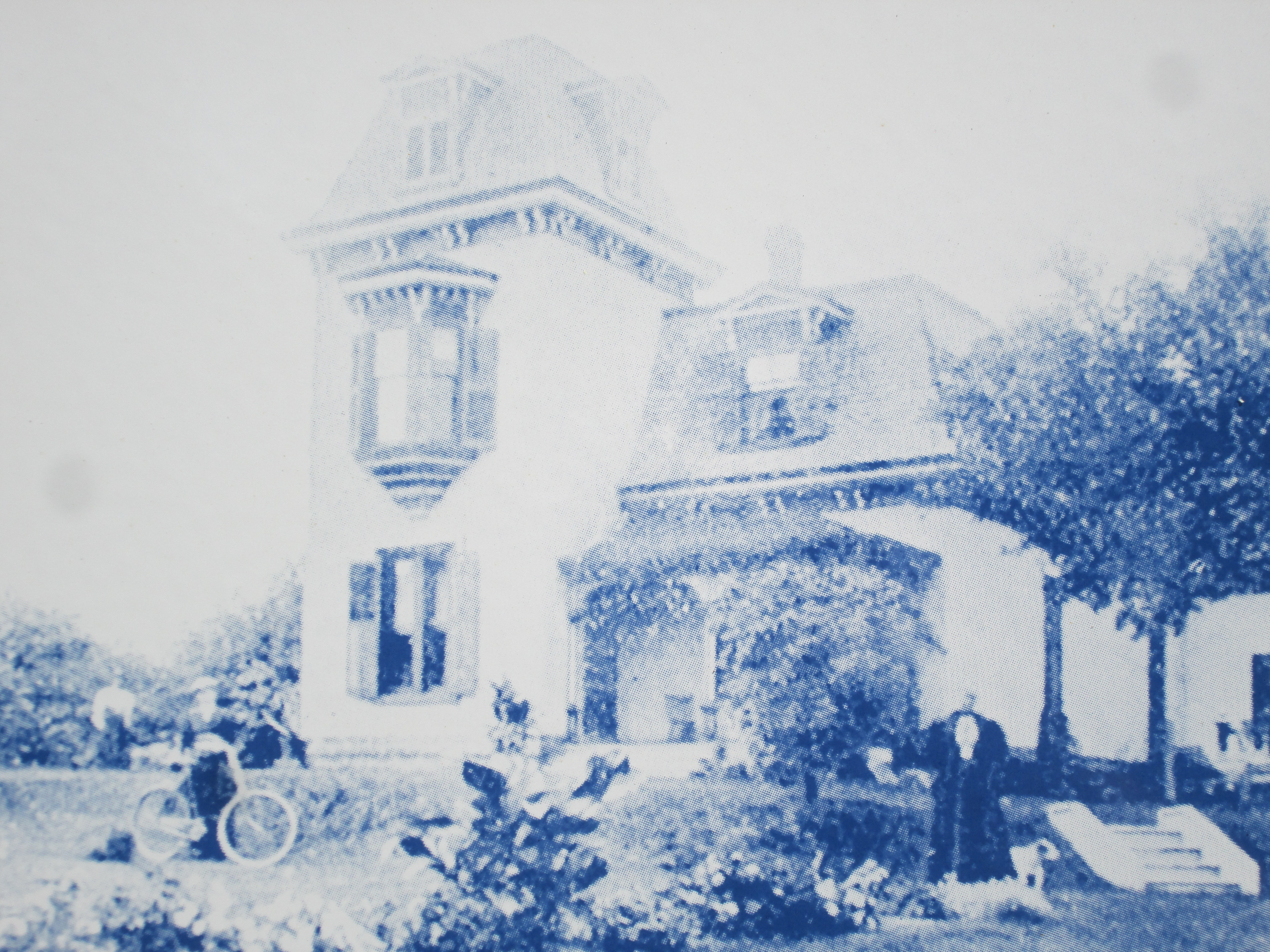
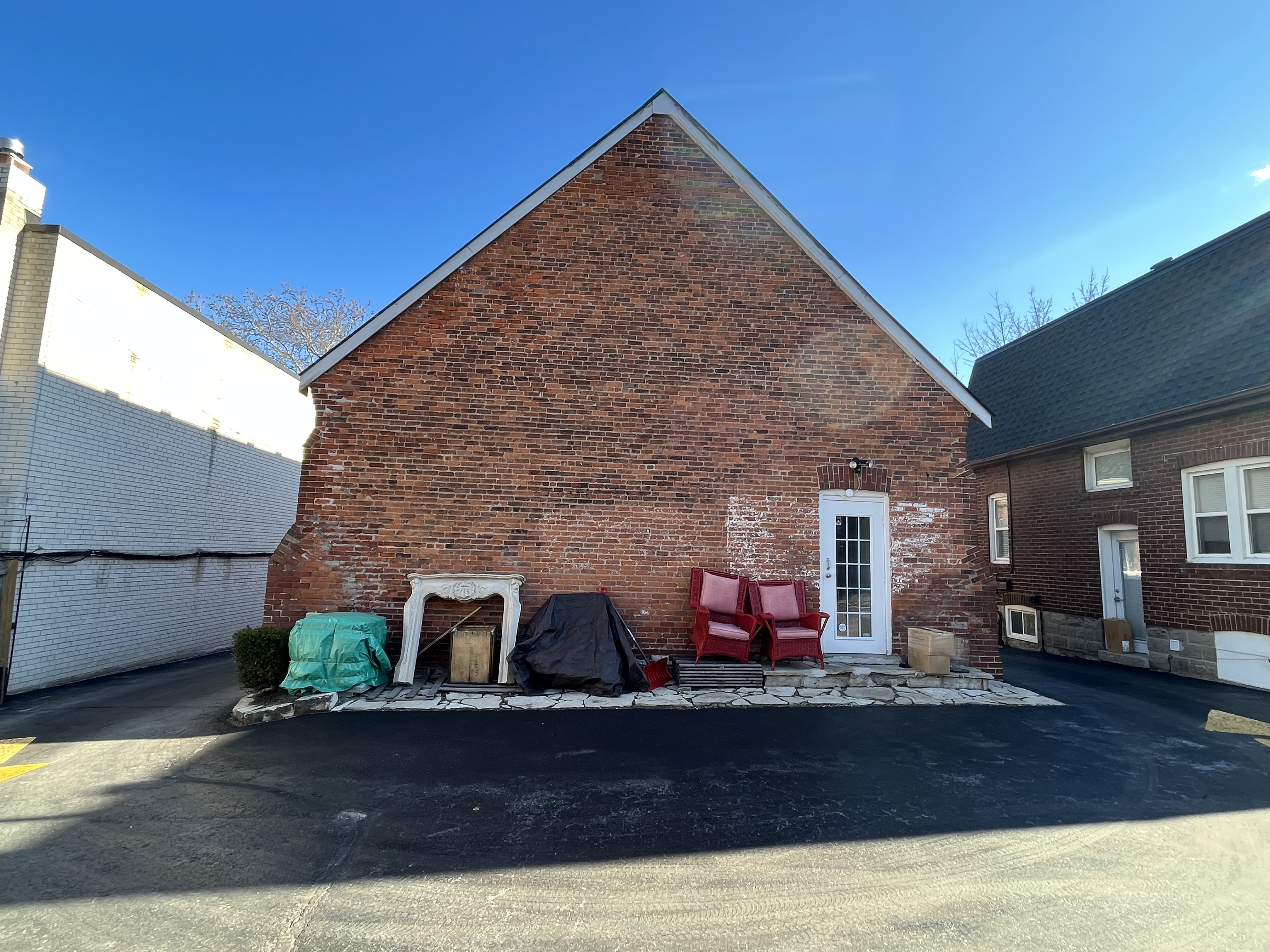
The church was named after Bishop Henry McNeal Turner who had been an advocate of the “Back to Africa” movement in the United States. Turner was the first black chaplain appointed by Abraham Lincoln during the American Civil War. The church was dedicated as Turner Chapel to honour the bishop. A manse was built in the 1930s to the west of the church to house the pastor of the congregation. The manse can be seen on the right of the picture below which also shows the rear of the church.

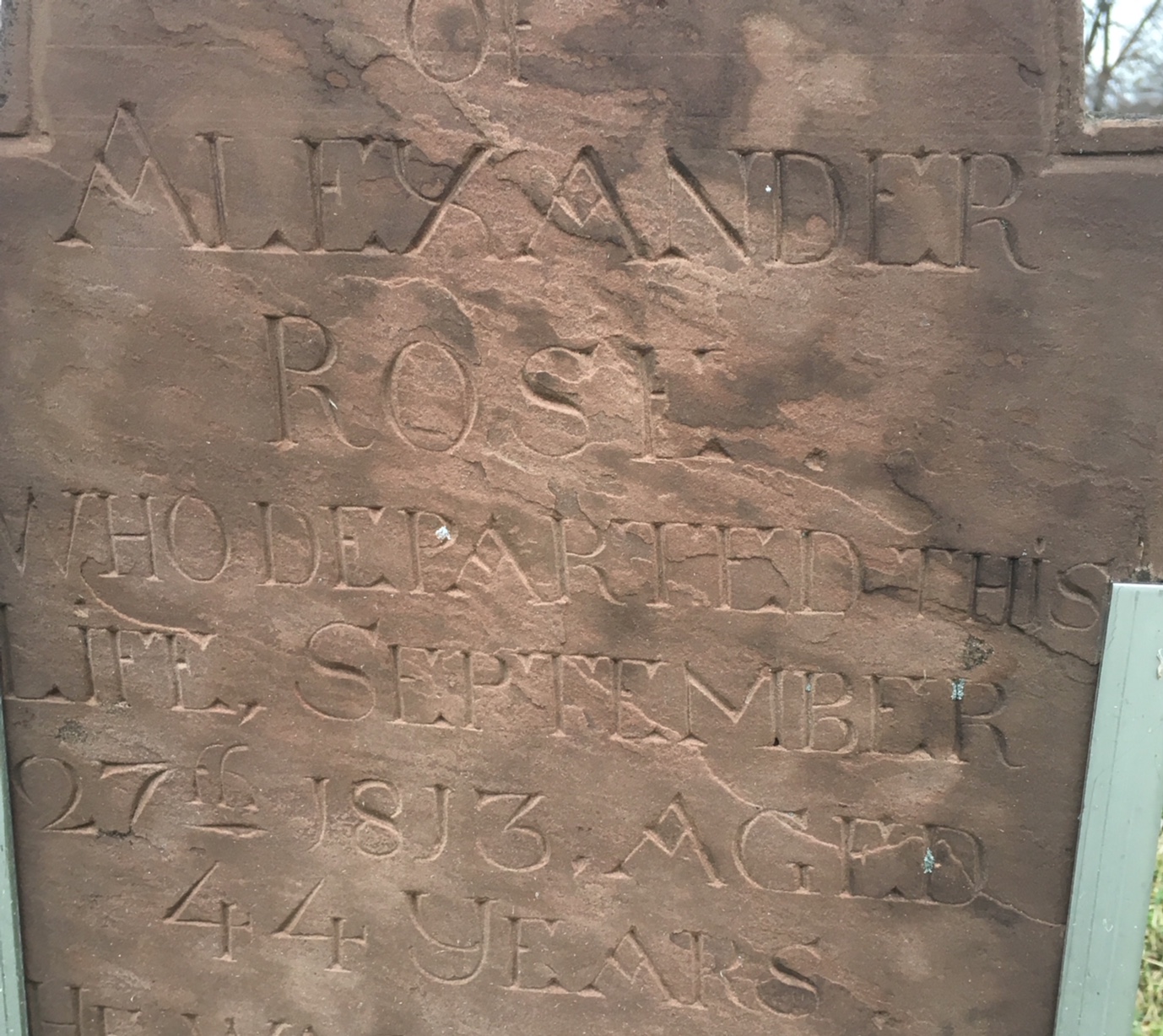
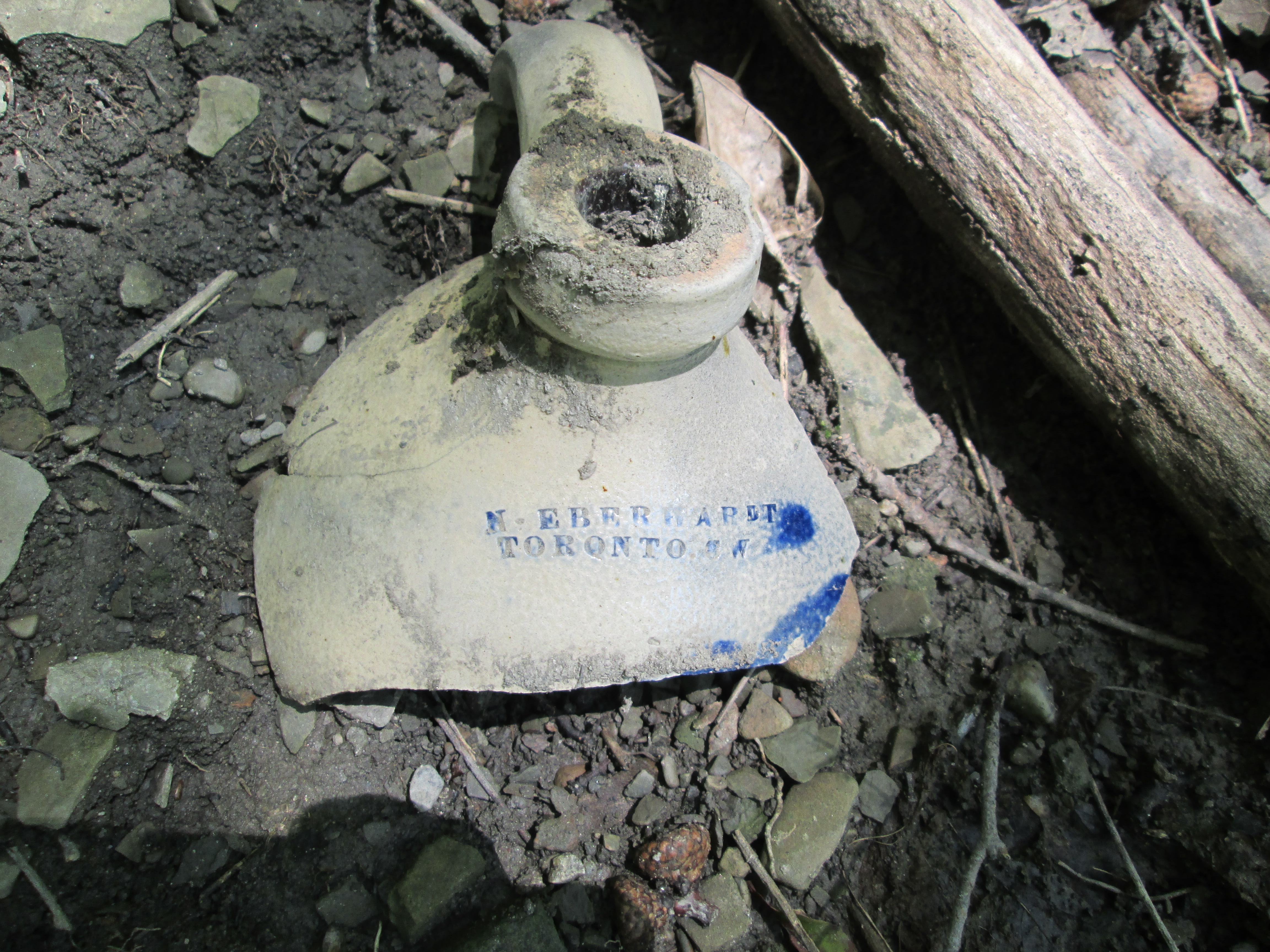
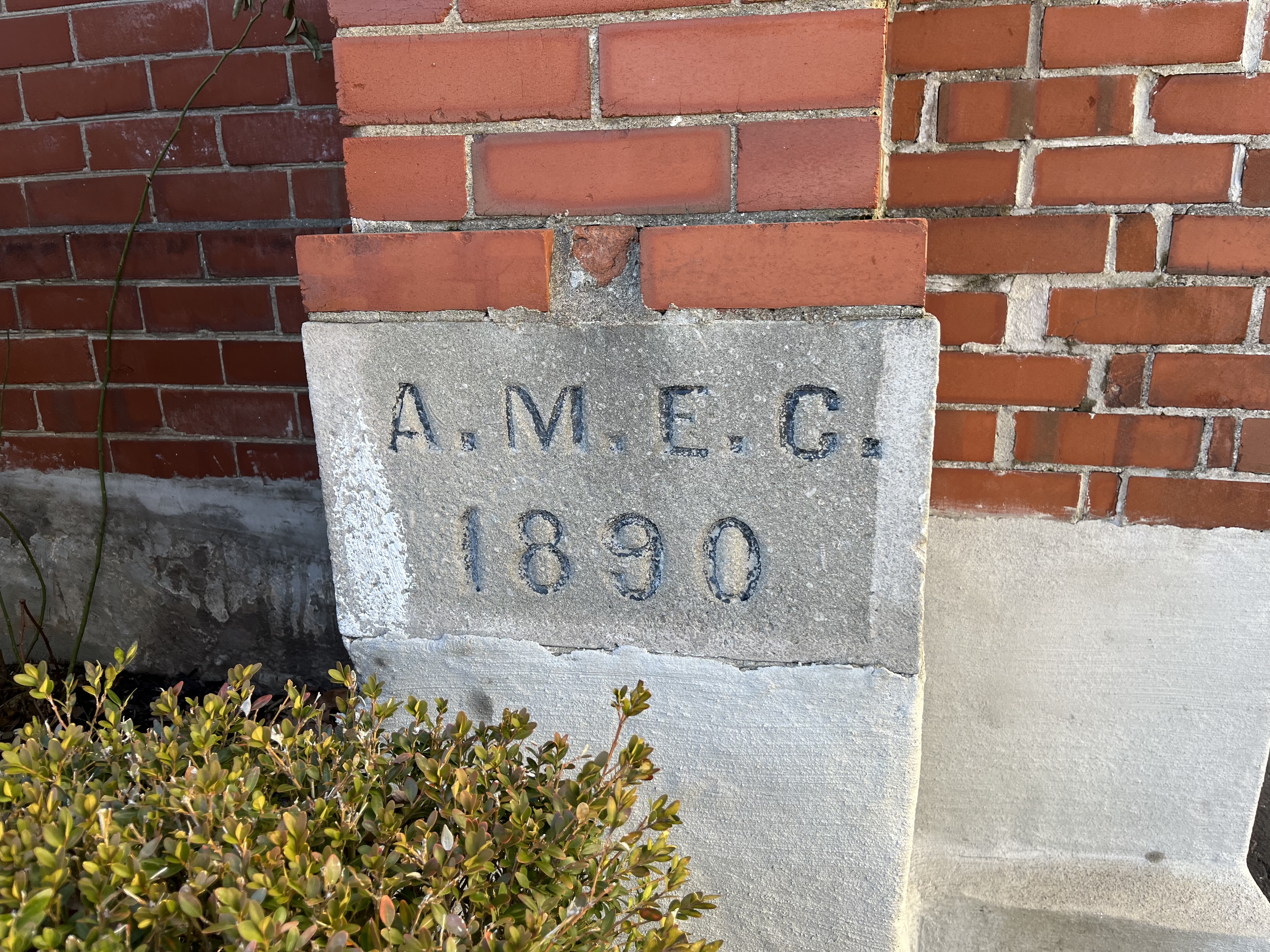
Although the cornerstone of the church is dated 1890 it wasn’t laid until 1891. It also has lettering which denotes the African Methodist Episcopal Church.

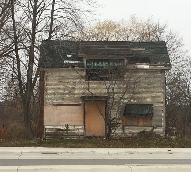
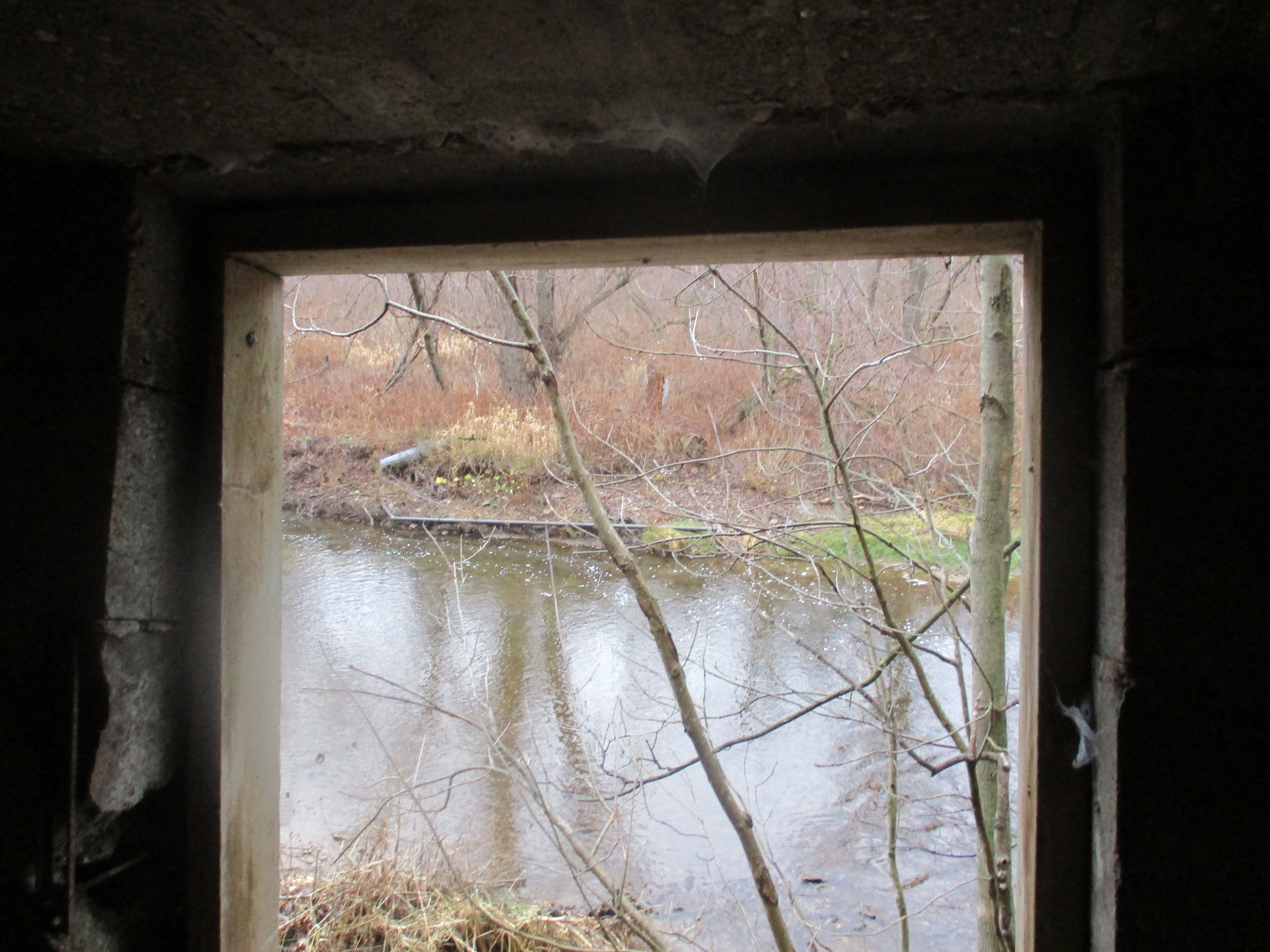
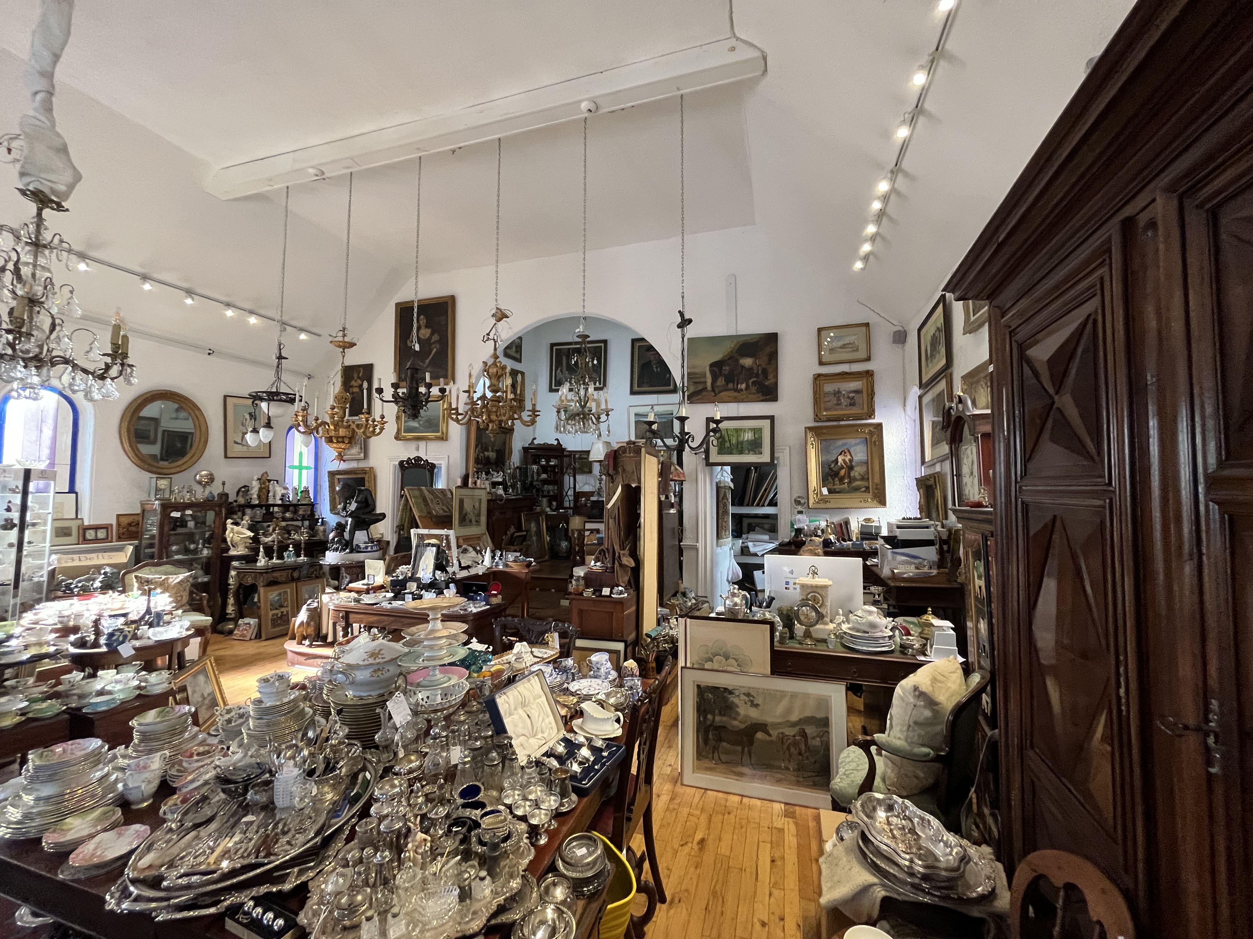
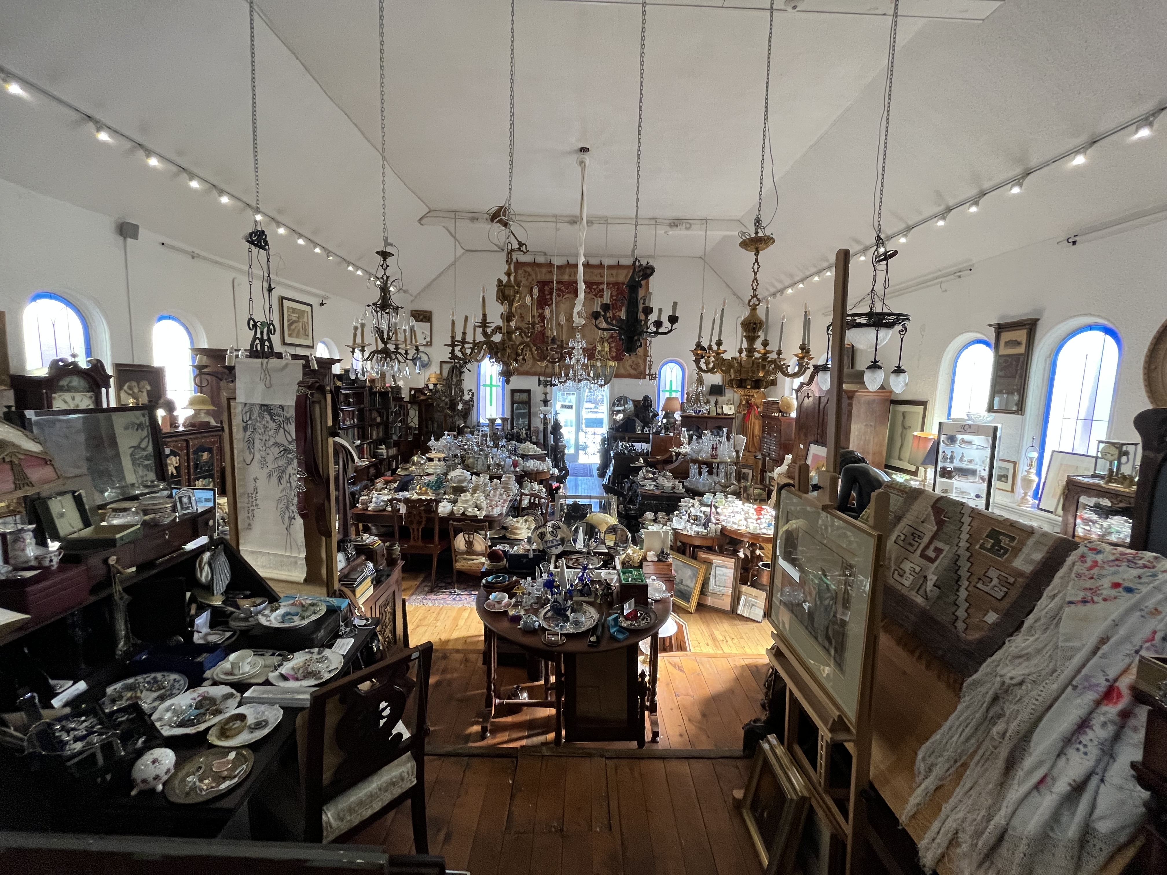
The church was in use until the later part of the twentieth century when the congregation had dispersed to other communities. For awhile the church was leased to an offshoot of the Anglican Church. However, in 2000 the building was put up for sale. Since the Oakville Historical Society has strict guidelines on what can be done with the building, it wasn’t attractive to developers. In 2002 Jed Gardner decided to buy both the church and the manse to house his antique business. The picture below shows the interior of the chapel looking from the rear toward the front of the chapel.

The following picture shows the view from where the pastor used to stand looking toward the entrance. The antique shop is an interesting place to wander around and explore and you just might find something to add to your collection.

The Oakville Historical Society has put a sign on the front of the building to bring attention to the history of the chapel.

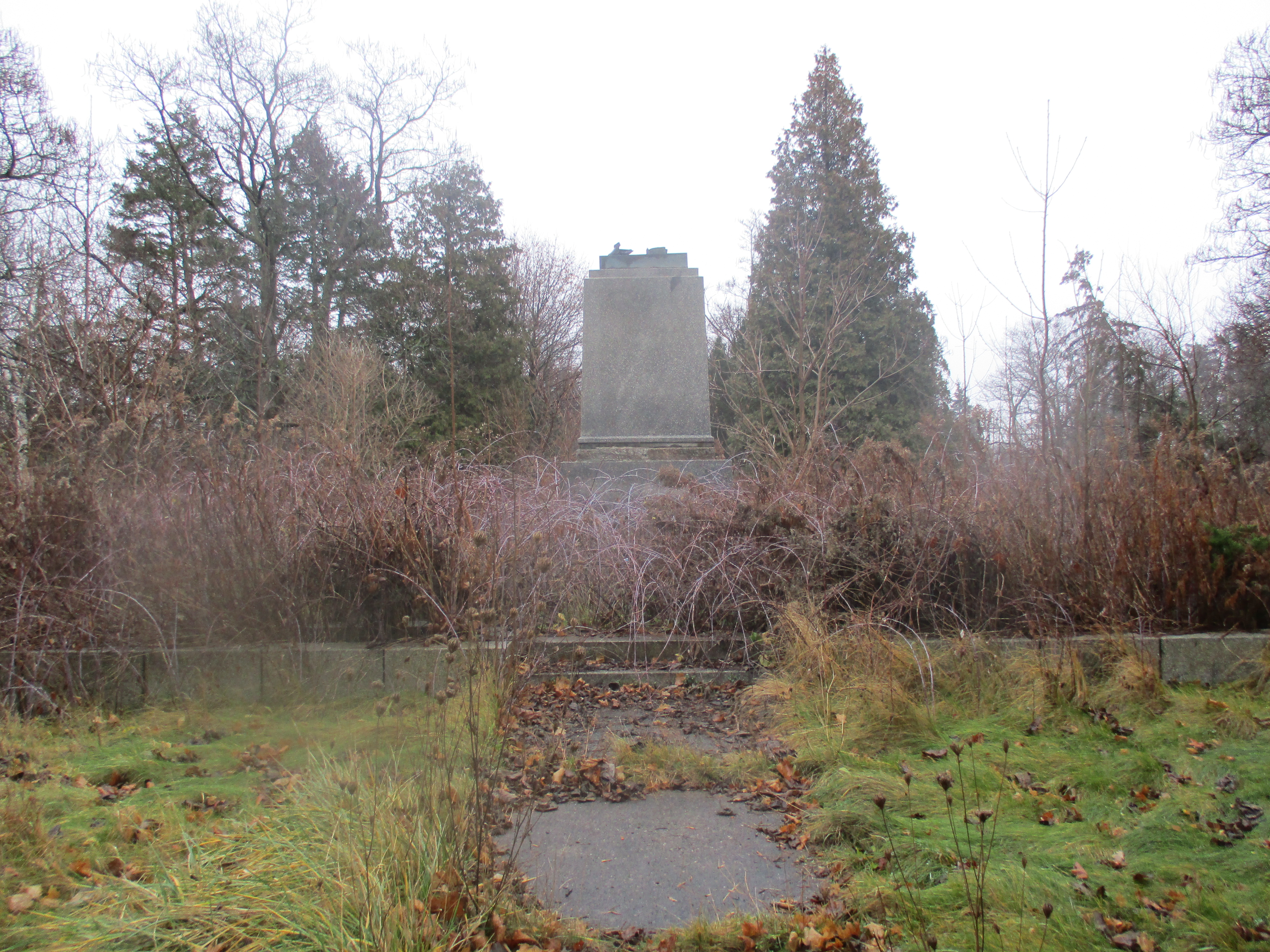
Turner Chapel is an important part of the history of the Black Community and the underground railroad in Oakville.

Google Maps Link: Turner Chapel

Like us at http://www.facebook.com/hikingthegta

Follow us at http://www.hikingthegta.com

Also, look for us on Instagram

Glenorchy – Ghost Towns of the GTA

Saturday, December 9, 2017

The community of Glenorchy never had a large population and had all but vanished until the city of Oakville started to expand into the area.  It won’t be long before the community will have lost all of its historical charms among new townhouses and subdivisions.  The few original houses and a school stood along the fourth line near Burnhamthorpe Road.

Glenorchy Schoolhouse

The 1877 county atlas below shows the east branch of Sixteen Mile Creek in blue as it flows under the fourth line which is marked in brown.  Glenorchy is not marked on the map, perhaps because it didn’t have a post office.  The name is likely of Scottish origin and means valley of tumbling waters.  Sixteen Mile Creek and the picturesque valley it flows through could easily give rise to a name like that.

Glenorchy (2)

This picture shows the fourth line with the bridge in the foreground.  A set of stairs leads down the side of the hill to the school which is located in the ravine.  The county atlas above shows the school to the west of the road which means that the earlier road and bridge alignment likely took a more direct route to the bottom and may be still visible behind the stairs at the time of this picture.  This photo was supplied by Neil Omstead.

Glenorchy Schoolhouse

We parked on the Fourth Line south of Lower Base Line near the entrance to Glenorchy Conservation Area.  Glenorchy Conservation Area protects 400 hectares of environmentally sensitive land containing both the Sixteen Mile Creek Valley and Trafalgar Moraine.  The trail follows the old road south and into the ravine.

IMG_1507

The fourth line makes a steep descent to the creek and on this day the ice was just forming in the water.

IMG_1510

As you follow the fourth line south down the side of the ravine you see the back of the remaining abutment from the former bridge.

IMG_1554

The fourth line bridge over Sixteen Mile Creek is shown in the county atlas of 1877.  The exact location of this bridge has been hidden by time.  In 1898 Dr Ansun Buck of Palermo, a nearby ghost town, designed a new bridge over the creek.  It was built with the north abutment made of cut stone.  The picture below shows the bridge around 1900 and was taken from close to the location of the public school which was built in the floodplain of the creek.

Glenorchy Bridge 1900

Only the north abutment remains today.  The south approach to the bridge can still be identified by a pathway that has a ridge of earth piled on each side from the levelling of the road.  The north abutment has a major crack in it where the soil has washed away from behind the cut stones and they are slowly shifting.  There is a possibility that this abutment may partially collapse.

IMG_1590

The bridge stood until 1964 when it collapsed.  There was construction in the area and traffic was being diverted onto the fourth line.  A fully loaded potato truck followed the detour onto the bridge but it collapsed under the weight.  The picture below from the Halton Archives shows the truck in the ravine and the crane that was brought in to retrieve it.  The picture is dated March 1965 however that is the date it was printed and not the date it was taken.  In those days, you didn’t get to upload your pictures from the side of the river, you had to wait until the whole roll of film was finished and take it in for development.

glenorchy truck

A new bridge was built over the creek in the 1980’s and online sources say it was built on the same abutment as the earlier bridge.  Having visited the site it seems likely that it was built a hundred metres downstream where today’s footbridge crosses.  This bridge was closed in 2001 on a permanent basis.  The steep slope of the northern approach combined with a hairpin turn onto the bridge meant that it was closed for the winter every year anyway.  The road was closed to vehicle traffic but left open for pedestrians and cyclists.  Looking below the new footbridge you can see the larger cut stone abutment for the 1980’s bridge.

IMG_1571

Looking from the south toward the bridge you can see the sharp turn in the road and the steep incline as the road makes its way toward Lower Base Line.  It is easy to see why a fully loaded truck was out of place coming down the steep hill onto the hairpin turn that leads onto the bridge.

IMG_1595

In 1835 George Ludlow and his wife Francis moved to Trafalgar and built this log cabin which stands at the end of Burnhamthorpe Road in Glenorchy.  Francis gave birth to their six daughters in this three-room cabin.  Similar to the first house on the Stong property (now Black Creek Pioneer Village) this house has two bedrooms and a living room where the cooking, weaving and dining would have been done.  The end of the house with the chimney had this family room in it.  The bedrooms are on the end of the house with no window.  The cabin is known as the Ludlow/Slacer cabin because of Martha, the second oldest daughter, who lived here after she married John Slacer.  The cabin is marked with a red arrow on the county atlas above.

IMG_1496

In 1991 there was a sign welcoming people into Glenochy.  The population was 18 at that time.  This house is near the corner of the Fourth Line and Burnhamthorpe Road.  It is one of several that appear to be uninhabited although this one has a light on over the front porch, not exactly common among abandoned places.  There is very little information on historic houses in Glenorchy, unlike nearby Palermo but this house stands on property that also belonged to John Slacer in 1877.

IMG_1604

Kings Christian College is located at the corner of the old Fourth Line and Burnhamthorpe where it replaces a couple of historic homes.  This set of gates stands on the south side of Burnhamthorpe Road but a quick investigation shows that whatever they originally announced, remains here no more.  Perhaps they once led to the farmhouse of T.L. Johnson and I’ve marked a potential laneway in green on the map above.

IMG_1599

Glenorchy may have had only 18 people in 1991 but since then it has a brand new subdivision and the town of Oakville is approaching quickly.  The Glenorchy Conservation is yet to be explored and so a future visit is in order.

Google Maps Link: Glenorchy

Like us at http://www.facebook.com/hikingthegta

Follow us at http://www.hikingthegta.com


Palermo – Ghost Towns of the GTA

Saturday, November 25, 2017

While investigating The Devil’s Cave we had the opportunity to drive through the former town of Palermo.  Today there are several historic buildings left but they are being threatened by the expansion of Oakville.  Widening of Bronte Road and then a bypass when highway 5 and 25 were moved has left the town with mostly empty buildings.

Palermo (2).jpg

Lawrence Hagar arrived in 1805 and founded the town which was named Hagartown after him.  In 1836 it was renamed Palermo after Horatio Nelson,  Lord of Palermo.  The Lawrence Foundry and Agricultural Works was founded in 1842 and became the main employer in the new community.   The town grew quickly and by 1869 there were three hundred people living in the community at the intersection of Bronte Road and Dundas Street.   In addition to the usual blacksmith shops and hotels, they also had a harness shop, a wagon shop, and a brick schoolhouse.  Later the town included a telegraph company office as well.  The picture below shows the town around 1900.  The house in the foreground on the right remains but little else still does.  The foundry is on the left but it burned down in the 1950’s.

Palermo 1900

Lawrence Hagar built his original log home in 1805 and replaced it with a two-story Georgian home in 1848.  That home was listed as vacant in 2008 but has since been removed.  The third Hagar house was built in 1870 by Jonathan Hagar.  Jonathan had moved out of Palermo when he was 25 in search of fortune in gold mines in Australia and California.  When his father Lawrence died in 1857 he returned to Palermo to take over the family business.  The house also features a small barn that was constructed around 1900 to house the family horses.  The Hagar General Store stood just to the west of the house until it was removed for the widening of Dundas Street.  This property is currently being rezoned for a 10 story apartment building that appears to incorporate the house in the main entrance to the tower.  The house is registered with the historical society but does not have protection as a designated property.

IMG_1177

Lawrence Hagar was a devout Methodist and the first worship services in town were held in his home.  In 1824 land was deeded for a chapel on a property that had been used for a few burials beginning in 1813.  A chapel was built but when the Methodist Episcopal Church of Canada and the Wesleyan Methodist church of England merged there was a split in Palermo and for a while two chapels existed.  One was located on either side of the cemetery.  In 1867 work began on a new church to house both congregations.  The brick church was opened in 1869 with a steeple that has been removed since then.  The church is still active under the name of the United Church of Canada.

IMG_1178

The cemetery has a surprising number of pioneer stones in it.  The first burial was in 1813 and we found this stone which reads in part: Alexander Rose who departed this life September 27th, 1813 aged 44 years.

IMG_1203

The present school is the fourth one to serve the community.  As early as 1819 there was a one-room log school in town.  It was one of only 3 schools in Trafalgar Township.  A brick school was built in 1842 and then replaced in 1875.  In 1940 this third school was damaged in a storm and many of the original materials were incorporated into the new building that opened in 1942.  The school building has the 1875 date stone incorporated into the back of the building.  It was closed in the early 1960’s and converted into the Palermo Police department.  Today it houses the historical society and has been registered but not given a historical designation.

IMG_1207

Dr Ansun Buck served the community for over 40 years.  He built a surgery in his house in the 1860’s and from there took care of the medical needs of Palermo and surrounding area.  Buck also designed one of the early bridges over Bronte Creek.  When he died in 1919 he was buried in the Presbyterian Church cemetery.  His house is an excellent example of Italianate architecture with a few Gothic touches to make it stand out.  This is one of only two houses in town that is designated as a heritage structure

IMG_1164

H. M. Switzer purchased 24 acres of land in 1861 and built this Italianate house in 1868. Switzer was the postmaster and a merchant in town.  This is the other house in town to have a heritage designation.

IMG_1179

Caleb Smith built this house in 1875.  His father was Benjamin Smith who was the town carriage maker in 1806.  Smith built a large Georgian style house in 1822 that was the oldest home in Palermo.  It was allowed to deteriorate and it finally collapsed in 2007.  Caleb’s house is currently empty as are all the other original homes on the south end of Old Bronte Road.  I hope they restore it because it has some very interesting bracketing on the front porch.

IMG_1157

This gothic revival style house was built in 1880 beside the Methodist Church (now United Church).  It served as a parsonage for the next 32 years with one of the ladies groups being charged with preparing it for each new minister.  It was moved from the original location on Dundas Street to the present one on (old) Bronte Road around 1912 when the church sold it.  There appears to be a plan to restore and move some of the homes to save them but it is unclear which ones.

IMG_1165

This house on Dundas Street is one of the few that really look like they should be decommissioned.  Rather, it looks to be in the process of collapsing as several other original structures in town have done.  The cover photo shows the front door to be off centre, perhaps it was some kind of store at one time.

IMG_1182

A park has always been central to Palermo life.  The park used to be on the west side of town but was in the way of the revised intersection for highway 5 and 25.  A new park with ball diamonds was created on the north side of Dundas Street.  There is a pond that stands between the schoolyard and the new park.  I imagine that there is no shortage of waterfowl in the summer months.

IMG_1194

It remains to be seen what will come of the original community of Hagartown which flourished under the name of Palermo.  I hope they don’t allow it to become a name on a signpost on a cemetery, commemorated by two or three original structures scattered among the new urban sprawl.

Google Maps Link: Palermo

Like us at http://www.facebook.com/hikingthegta

Follow us at http://www.hikingthegta.com

Joshua Creek

Saturday, March 25, 2017

Joshua Creek is the largest of Halton’s urban creeks.  These 14 watercourses run through Oakville and Burlington but have their headwaters and the entire stream confined within the city.  Joshua Creek has it’s headwaters near the 407 and runs close to the border between Mississauga and Oakville.  The creek passes through fully engineered sections with armour stone or gabion baskets while other parts flow through naturally forested areas.  The sections on the northern reaches still flow through open farmland and the creek boasts one of the best water qualities in the county.  The hike roughly covers the section of Joshua Creek highlighted in blue on the 1877 County Atlas below.  Note the rows of apple trees shown on the map between the creek and the lake.  Some of these orchards remain and can be seen as you walk along the creek.

Joshua

A set of stairs descends from a trail linked to Breton Close where there is free parking.  These stairs come with a “V” channel on one side to make it a lot less bumpy if you wish to bring a bicycle onto the Joshua Creek Trail.  The section of Joshua Creek near the stairs has been plated with armour stone but much of the creek from this point to Lake Ontario has been left in a more natural channel.

IMG_7219

American Beech is one of a half a dozen species, mostly oak, that can hold their leaves over the winter.  These beech trees can live for 300 years and tend to grow slowly, taking 20 years to reach 13 feet in height.  In Ontario they are late succession trees that form a part of the Beech – Maple climax forest.  Cleared land will progress from low bushes like sumac and hawthorn to ash and birch trees.  Maple, Beech and Oak trees are signs of a mature forest.  Beech trees can reach 100 feet tall and the canopy can spread to 70 feet wide.  Small beech trees grow in several stands along the creek.  Emerald Ash Borer is a significant problem in Joshua Creek and many of the trees have had to be removed.  This opens up the canopy and will allow the beech trees to have their moment in the sun.

IMG_7210

Footprints leading up to this fallen tree indicate that humans and the local wildlife both use it as a bridge.  It is certainly wide enough but being wet and slippery precluded crossing on this wet morning.

IMG_7203

The lower trail was muddy in places, unlike the main trail up on the top of the ravine which has been treated to chipped up pieces of Christmas trees.

IMG_7196

Snowdrops are native to Europe and the Middle East.  They were brought to North America as an ornamental plant for use in gardens.  Non-native plants can be divided into two categories, those that need human intervention to survive in their new environment and those that don’t. The ones that can survive on their own can further be divided into naturalized and invasive. Naturalized plants can survive on their own and in time become part of the local flora.  Those that are invasive will crowd out native plants and often release toxins into the soils to prevent the growth of competing plants.  Snowdrops are considered to be naturalized rather than invasive because they don’t spread rampantly and they fit in with the local habitat.

IMG_7184

Beavers once filled the rivers and streams of Ontario.  Trapping for the fur trade had virtually eliminated the beaver from Southern Ontario by the 19th century.  Beaver moving back into urban centres has become more common over the past few decades as water qualities have been improved.  New York City, for instance, saw its first beaver in over 200 years in 2007 and High Park in Toronto now has a lone beaver living in Lower Duck Pond.  Beaver can be very destructive and the trees along Joshua Creek show significant damage from the local beaver. At one point we saw a place where it appears that the beaver have built a lodge under the roots of a tree along the embankment.  Further downstream we found the place where the beaver have built their dam.  The dam has been breached by recent high water but they won’t take long to repair it.

IMG_7119

Several foundations line the creek from the days before the estate lands were divided for smaller homes.  The cover photo shows a set of stone stairs that lead down to the edge of the ravine above the creek.  The steps suddenly end with a long drop into the water.  Whatever once stood at the end of that stairway is long gone as is the building that once stood on the foundation below.

IMG_7143

Charles Powell Bell and his wife Kathleen Harding moved into their estate home near the mouth of the creek in 1938.  The house and garage originally stood on 60 acres and had the early name “Fusion” although it was usually known as Harding House.  It is said that the spirit of a woman can be seen regularly at the house and spirits of a boy and an angry spirit of a man have also been uncovered by paranormal investigators.  The house has been given a heritage designation in 1989 and currently is used as an event facility.  The house has been known as Holcim Waterfront Estate but it is being renamed Harding Waterfront Estate.

IMG_7160

The mouth of Joshua Creek has had a few pieces of armour stone dropped in to create a small break wall to provide some protection.

IMG_7163

Looking to the east from the mouth of the creek you can see the Petro Canada refinery dock that extends 700 metres out into the lake.  Equipment towers stand on the end of the dock to transfer oil from tankers.  To the west, there is a brief shingle beach revealing the natural shoreline along this part of the lake. The point in the distance marks the beginning of the armour stone that has been applied to the shore in an attempt to slow down erosion.  The lake was crashing into the chunks of limestone and sending spray high above them.

IMG_7170

Taking the upper trail on the return trip leads past the Oakville South East Waste Water Treatment Plant.

IMG_7228

The creek runs north from Breton Close as well, and hopefully, we’ll return next week and see what lies in that direction.

Google Maps Link: Joshua Creek

Like us at http://www.facebook.com/hikingthegta

Follow us at http://www.hikingthegta.com

The Vandalized Memorial – Taras Shevchenko Museum

Dec. 13, 2015

On the side of Sixteen Mile Creek stand the remains of a memorial park that has been vandalized on multiple occasions. The scattered remnants stand abandoned waiting to see if they will fall victim to land developers or be restored as a public park. We parked on the fourth line where it dead ends south of Dundas Street and set out in the light rain and 6 degree temperatures.
Taras Shevchenko was born in Ukraine in 1814 in the feudal system of the era. He was orphaned at the age of 11 and went on to become one of the country’s most prolific writers composing over 1000 works. Some consider him to be the Ukrainian version of Shakepeare. When his writing was seen as agitating against the czarists regime he was sentenced to serve in a military outpost and banned from writing. Although he could have lived in luxury from his work he chose to live humbly like the people he loved.  He died in 1861 just the day after his 47th birthday.  Ukrainians began to emmigrate to Canada in 1891 and by 1939 there was already a plan to erect a statue in honour of Taras. The Second World War prevented the community from getting things started but in 1950 it was picked up again. The plan was revised this time with a park and statue envisioned for the following year. Ten thousand people attended a performance in Maple Leaf Gardens on June 30th, 1951 which featured 1,500 performers. The following day the park was opened with up to 45,000 in attendance. An archive picture from the opening ceremonies is shown below.

mem_ph4

The 15 foot tall statue stood on top of a 70 tonne granite monument. It was a gift to Canada from Ukraine and was shipped here in 121 pieces which included the pedestal and garden stones. The total weight was 51 metric tonnes and the assembly work was completed by two local brothers. The statue was controversial from the start with a split between Communist and Czarist Russia causing the statue to be under 24 hour guard for some time after it opened. The Taras Shevchenko monument is seen below as it looked when the park opened on July 1, 1951.

Tass

The Taras Shevchenko Museum opened a year later on July 1, 1952.  It housed over 500 exhibits, mostly from the museum in Kiev.  It included 23 of Taras’ oil paintings as well as carvings and Easter eggs.  On September 16, 1988 the museum was destroyed by an arson. The death mask, an original bronze copy of the mold was the only thing rescued from the museum. It has been moved to the new museum which was opened at 1604 Bloor Street W.  Today an old sidewalk runs to the field where the museum stood until 27 years ago.

IMG_1904

Park benches are scattered around the formerly landscaped park. 16.5 acres were planted with over 600 trees and 500 pounds of grass seed. The grass near the bench shows signs of a recent grass fire that threatened to consume the remnants of the park.

IMG_1925

The old flag pole still stands in the open field near the monument.

IMG_1908

Sometime around Christmas 2006 thieves drove a truck up to the statue. They attached ropes to the statue using a ladder stolen from the caretaker’s property and pulled it to the ground. The scrap value was estimated at $20,000 by police and only the head was recovered. It alone weighs 170 lbs and has been placed in the new museum on Bloor Street.

IMG_1912

There was a smaller statue of Taras sitting in a chair reading a book near the entrance to the park but it was stolen in 2001 just a few days after the July 1st celebration of the park’s 50th anniversary. There also used to be ornate iron gates that welcomed visitors off of Dundas street but they too appear to have been stolen for their scrap value. The cover photo shows the entrance to the park with the broken monument in the background. Even the granite marker naming the park has been vandalized by graffiti.

We followed the trail to where an old access road leads down to the level of Sixteen Mile Creek. There is a limited range one can travel upstream on this side before you must climb the ravine to cross a shale cliff. Near here is an old pump house on the side of the creek. There are intake pipes in the river as well as pipes running to the top of the hill. The pump house appears to have been associated with a children’s campground that occupied 47 acres adjacent to the Memorial Park. The children’s campground was closed in 1998.  The picture below shows the view through the open door facing the creek.  Pieces of PVC pipe can be seen on the far embankment and in the water.

IMG_1879

The eastern red-backed salamander lives in woodlands and is considered to be the salamander species of least concern for preservation in Southern Ontario. They typically breed in the fall but can also breed in the spring. They can reach population densities as high as 1,000 salamanders per acre. This salamander has a short hibernation period compared with other salamanders and have been known to be seen even in winter. The slow start to the winter season this year seems to have kept this one still active.

IMG_20151213_124021 (2)

Before the current Dundas Street bridge was built the road used to climb the side of the ravine in a switchback that connected with the fourth line. That road was closed to traffic and now provides a link to the hiking trails. We previously visited this site when investigating the Ghost Town of Sixteen Hollow.

IMG_1930

The future of the Taras Shevchenko memorial park is uncertain. The park owners had been in negotiations with the City of Oakville to donate the property as a city park when the statue was stolen. At the same time the surrounding land from the children’s camp has been bought by developers who plan 205 single family homes and 125 townhouses on their land. They have been actively trying to acquire the memorial site for part of their development. I’m not sure what is in store for this repeatedly vandalized memorial.

IMG_1916

Like us at http://www.facebook.com/hikingthegta

Also visit:

https://www.facebook.com/ShevchenkoMuseum/

Kerosene Castle – Oakville

Saturday Aug. 15, 2015

This hike examined some of the early history of Oakville as well as the Kerosene Castle.  It was another of those very hot and humid summer days when the morning temperature read 21 but felt like 28.  Having parked on the end of King Street we set off to look at the mouth of 16 Mile Creek where it empties into Lake Ontario.  The picture below shows the view looking downstream toward the harbour break wall with it’s lighthouse.  Note the masts to the many ships that dock in the harbour.

IMG_7341

William Chisholm was born in Nova Scotia in 1788 and in 1827 he purchased 960 acres of land at the mouth of 16 Mile Creek.  William Chisholm’s nickname was White Oak and it is thought that the name Oakville may come from this.  Chisholm quickly established a shipbuilding business and had the first privately owned harbour in Upper Canada.  The large supply of white oak trees supported the shipbuilding industry and may also have been the source of the town’s name.  In 1834 the harbour was officially recognized as a port of entry for Canada and Chisholm became the first customs inspector.  The building on the right in the picture below is the 1856 Customs House and Bank of Toronto Building. The left part of the building is known as Erchless Estate and was home to the Chisholm Family.

IMG_7347

Behind the Customs House is an art exhibit called the Moose and Wolves.  It was donated by the people of Neyagawa Japan, which is the sister city to Oakville.

IMG_7353

This building served as the post office from 1835 until 1856 with William Chisholm as post master.  A lower mill stone is being used as a landing at the bottom of the stairs.  William died in 1842 and his son Robert Kerr Chisholm became post master and customs inspector.

IMG_7367

Electric lighting arrived in Oakville in 1892.  An old paint factory from 1870 was converted into a generating station.  There were 152 street lights in Oakville in the early days running for 7 hours per night at a daily cost of $3.50.  The generator experienced ongoing problems and was replaced with power generated in Niagara Falls in 1909.  The building was later used as a tea room under the name of The Electric Light Cottage.  It currently serves as a private residence.

IMG_7362

Many of the early homes in Oakville belonged to people in the shipbuilding or sailing business. The smaller homes on Thomas Street from 1852 belonged to Duncan Chisholm, shipbuilder, and were known as the workmen’s houses. This 5 bay home pictured below was built in 1835 by David Patterson who was also a shipbuilder.  He apprenticed in Dublin but moved to Oakville in 1827 to work at the Chisholm Shipyard.  In 1857 Patterson was appointed “pathmaster” which meant that he was in charge of the roads.  Men had to work an annual amount of statute labour maintaining roads or pay a fee instead.  Patterson organized the labour and collected the fees to pay for materials. When he died in 1877 the house was sold and the brick veneer was added to the outside in the early 1880’s.

IMG_7374

George and Mary Lyon were married in England in 1868 and sailed for Canada that same summer.  They bought 50 acres of land on Trafalgar Road near the Oakville Townhall.  This cabin dates to about 1810 and was already standing on the property.  George added a lean-to for his buggy and 9 children to the tiny home.

IMG_7386

This is the home as it looked in 1973 when construction workers found it while clearing the property for new development.

IMG_7387

We sat for a few minutes on the rocks along the side of Lake Ontario in Lakeside Park and enjoyed the morning activity on the lake.  A swim club was doing laps around a floating marker and boats were coming and going through the mouth of 16 Mile Creek.  Along with canoes and kayaks there was also one guy on a stand up paddleboard.

IMG_7398

We moved the car to Inglehardt street so that we could investigate the Kerosene Castle as well as look for evidence of the Oakville Oil Refinery.  Richard Shaw Wood built a coal oil refinery on the side of 16 Mile Creek to convert coal to kerosene.  It quickly became one of the largest kerosene refineries in Canada.  Kerosene had been around for centuries but burned with a black smoke that made it useless for interior lighting.  In 1846 a Canadian named Abraham Gesner perfected a method of distilling it into a clear liquid that would burn cleanly. In 1856 Wood built a mansion across the street from the refinery. The mansion would take on the name of the Kerosene Castle and would serve as a family residence until the mid 1900’s.  The house was then divided into a nursing home on one side and apartments on the other.  In 1978 it was converted into MacLachlan College.

IMG_7404

When I was reviewing the pictures I took I found that one of the eight that featured the tower has what appears to be a face covering the entire centre window on the front of the tower. This is especially creepy when blown up a bit.  Another picture taken seconds later from a slightly different angle shows nothing abnormal.  This window is known as an oriel window and along with the tower was the main reason for the property to gain an historical designation.

IMG_7400 faceIMG_7401 no face

On July 13, 1866 the refinery burned down, likely as a result of a faulty new still that had just been installed.  Burning oil floated on 16 Mile Creek and lit the water up all the way to the harbour.  Oil seeped out of the ground for more than a century afterward.  We were unable to access the creek area where the refinery stood as it has been redeveloped for private housing. The picture below shows the Kerosene Castle around 1890.

IMG_7416

We found the neck of a clay jug on the creek embankment.  This jug was known as a blue flowered jug and was produced by Nicholas Eberhardt.  Eberhardt came to Canada in 1860 from France.  Between 1863 and 1865 he worked for Toronto’s Don Bridge Pottery.  After 1865 he operated his own pottery making business.  The fragment we found contains the markings N Eberhardt, Toronto CW.  The CW is interesting because it identifies the jug with Canada West, a title used for the area of Ontario between 1841 and 1867.  Following 1867, and Confederation, the name was changed to Ontario.  This jug was therefore manufactured between 1865 and 1867.

IMG_7410

Richard Shaw Wood operated the Oakville Oil Refinery on the side of 16 Mile Creek across the road from the Kerosene Castle.  Although it was destroyed and not rebuilt it was not the end of the oil industry in Oakville.  Just east of here along the Lakeshore is the Suncor Refinery.  Two other refineries along the lake shore have been closed in recent decades.

IMG_7428

Why not enjoy a summer hike in one of the top 15 places as selected in this special edition.

Like us at http://www.facebook.com/hikingthegta