July 5, 2025
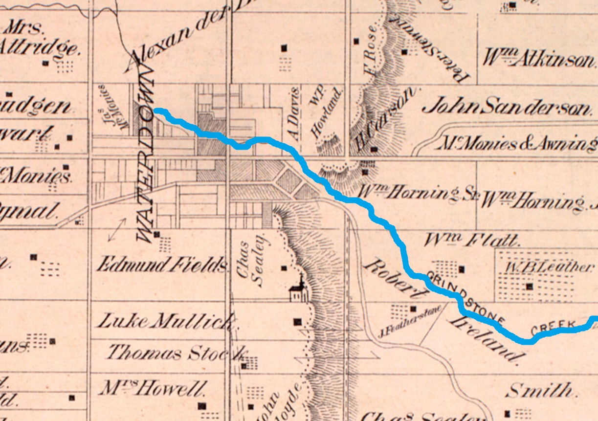
The first Europeans arrived at the future site of Waterdown in 1669. The indigenous people had been living there since at least 7,500 BC. Following Treaty No. 3 the area was laid out for settlement with one of the first settlers being Alexander Brown who bought 800 acres of land and built a log cabin and saw mill above the Great Falls in 1802. Ebenezer Griffin bought much of this land and divided it into town lots in 1830. He was largely responsible for the founding and development of Waterdown. The image below shows the 1877 County Atlas of the town.
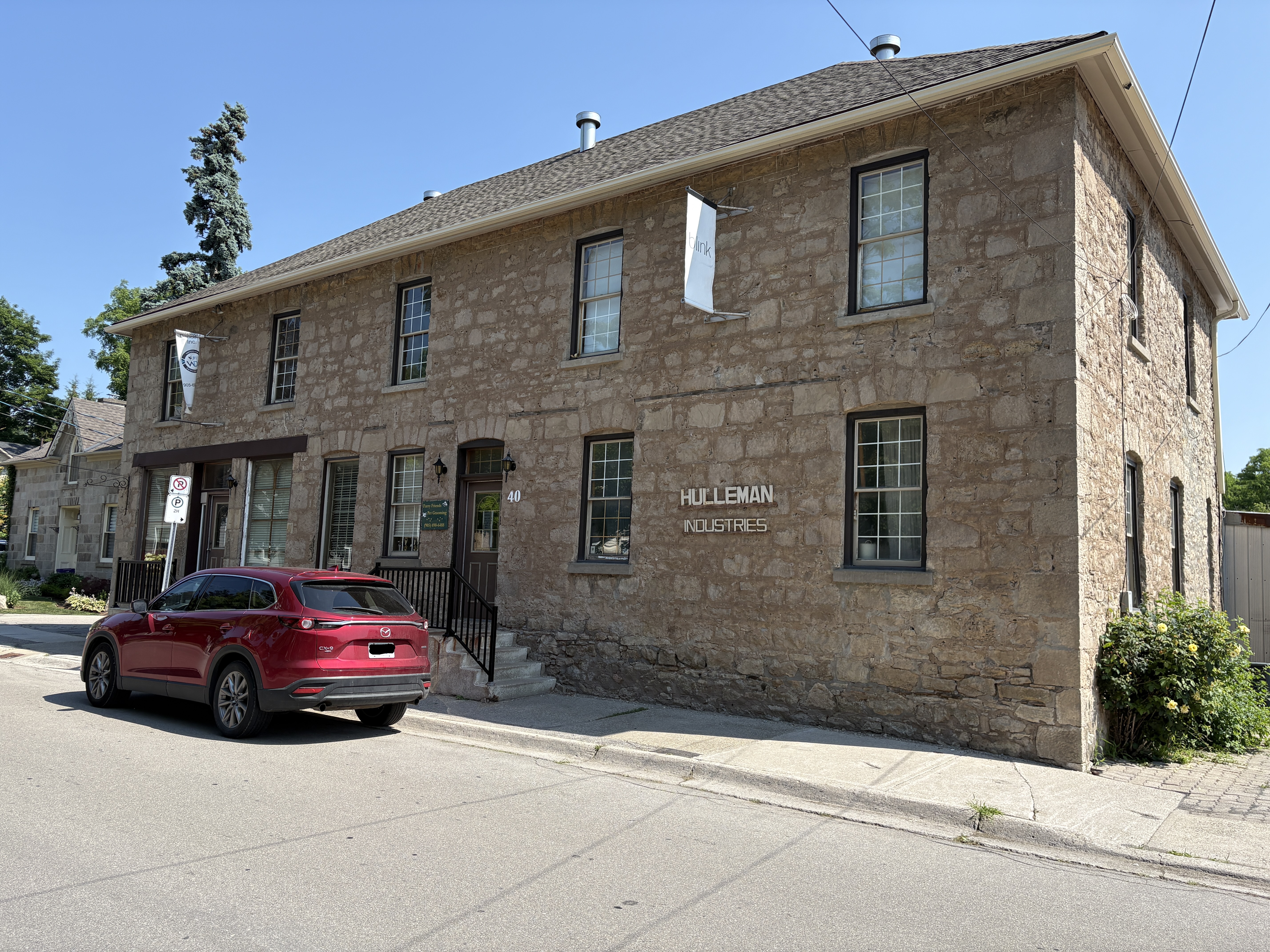
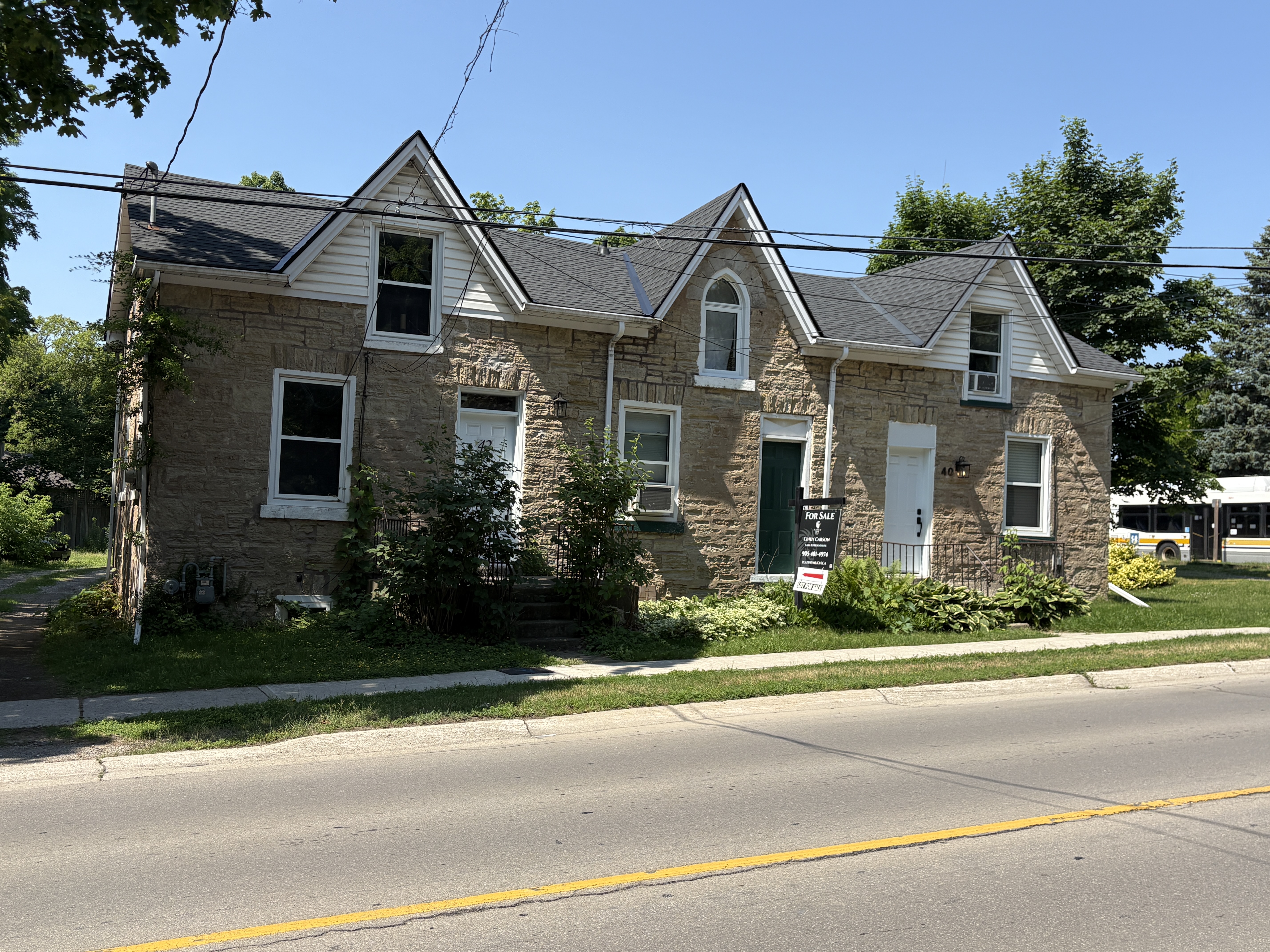
The former factory at 40 Mill Street North has had many functions over the years. It was built prior to 1870 as this is the date of record for its purchase by Charles Sealey. It has served as a flour and feed mill, was home to many stores and a toy factory. In 1925 Harlan Stetler and George Nicholson bought the building and opened their jam factory. It operated into the 1980s before closing. It is currently in use as offices for an engineering firm.
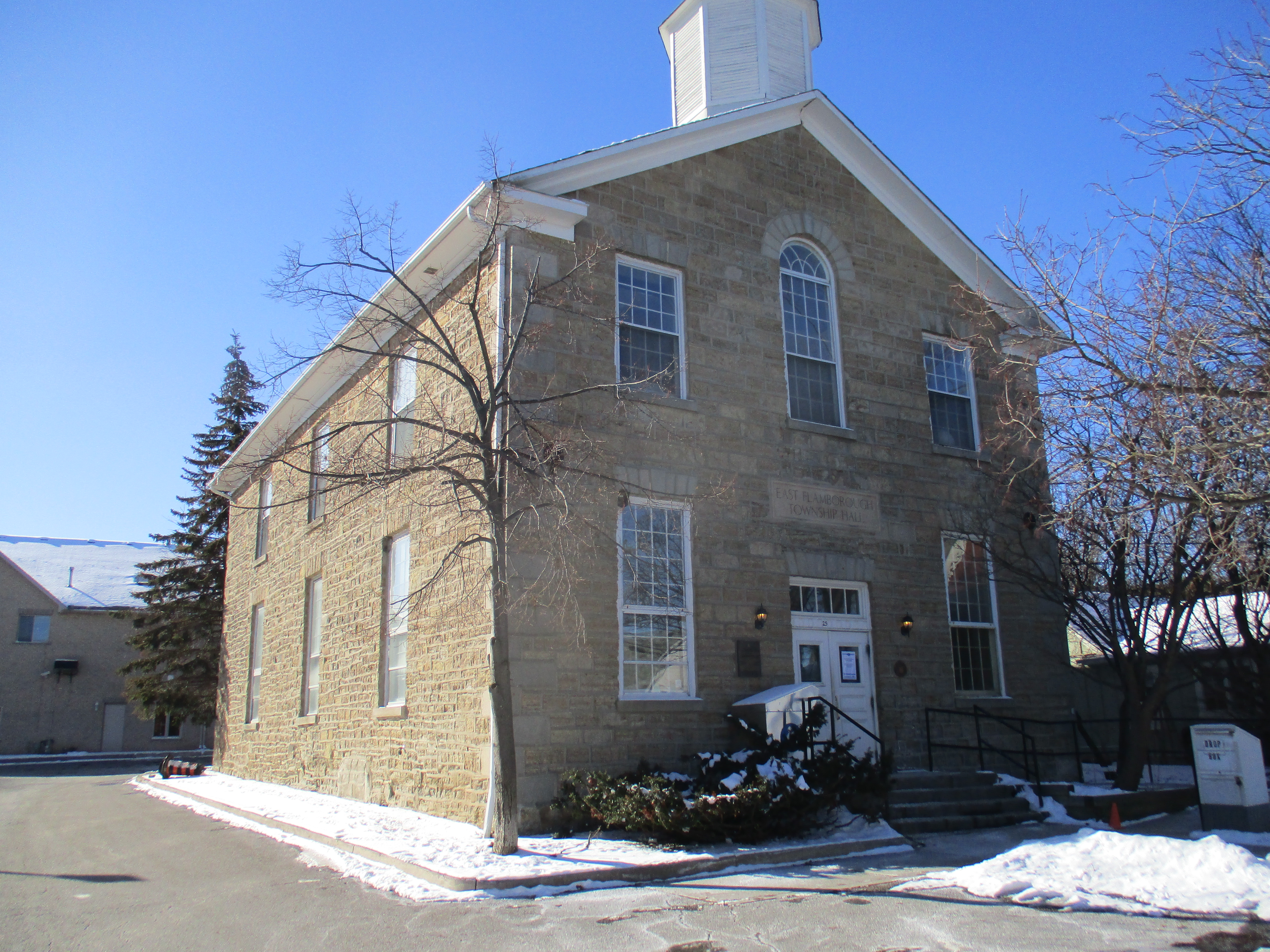
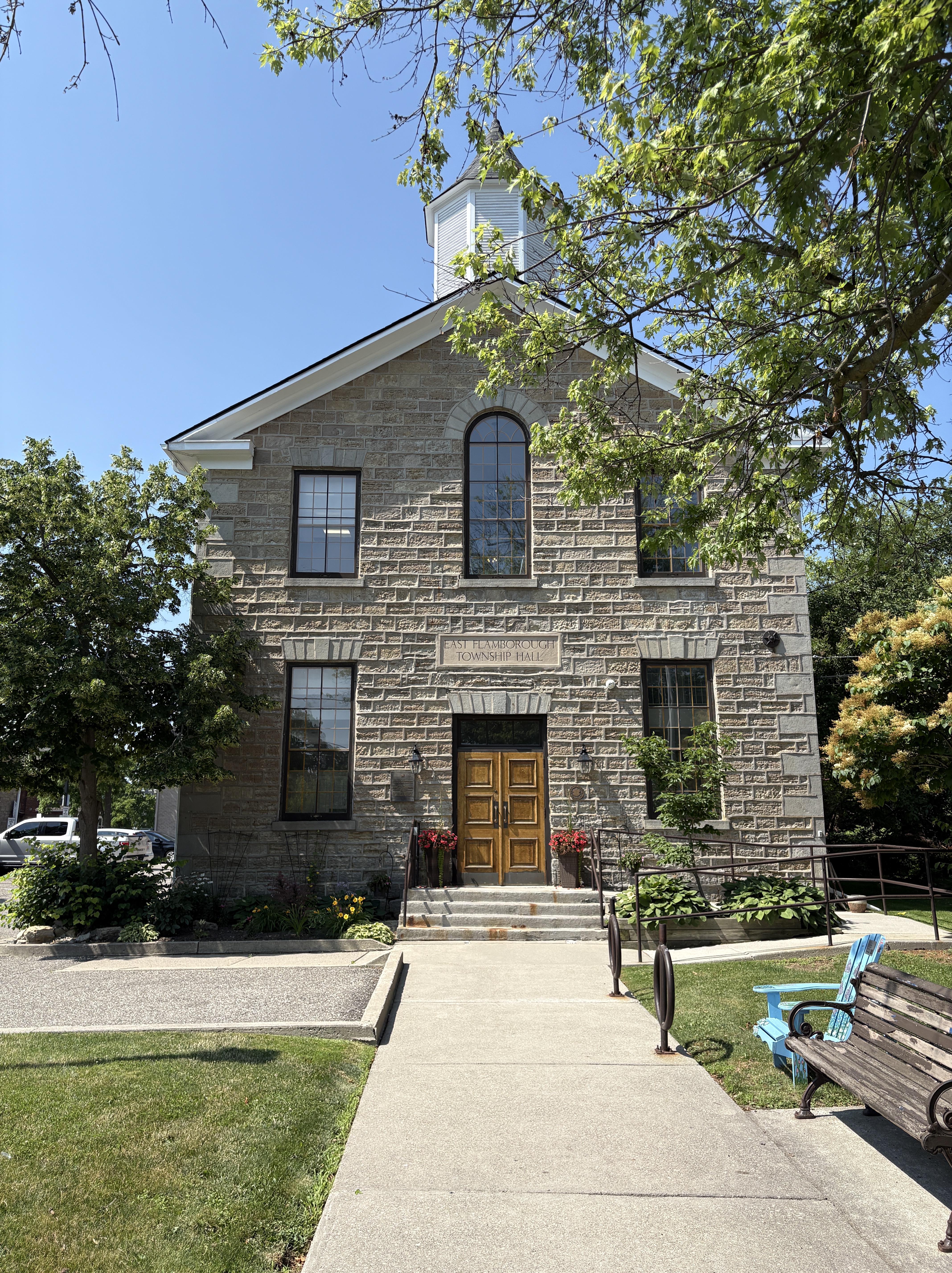
The Town Hall site was purchased in 1856 and was opened two years later. It was constructed from limestone which was quarried locally. The structure was used as the town library from 1979 to 2015. Two grave stones of early Waterdown settlers were located inside the library. The markers for Alexander Brown and Merren Grierson were moved to the new library and the building was renovated to house a law firm.
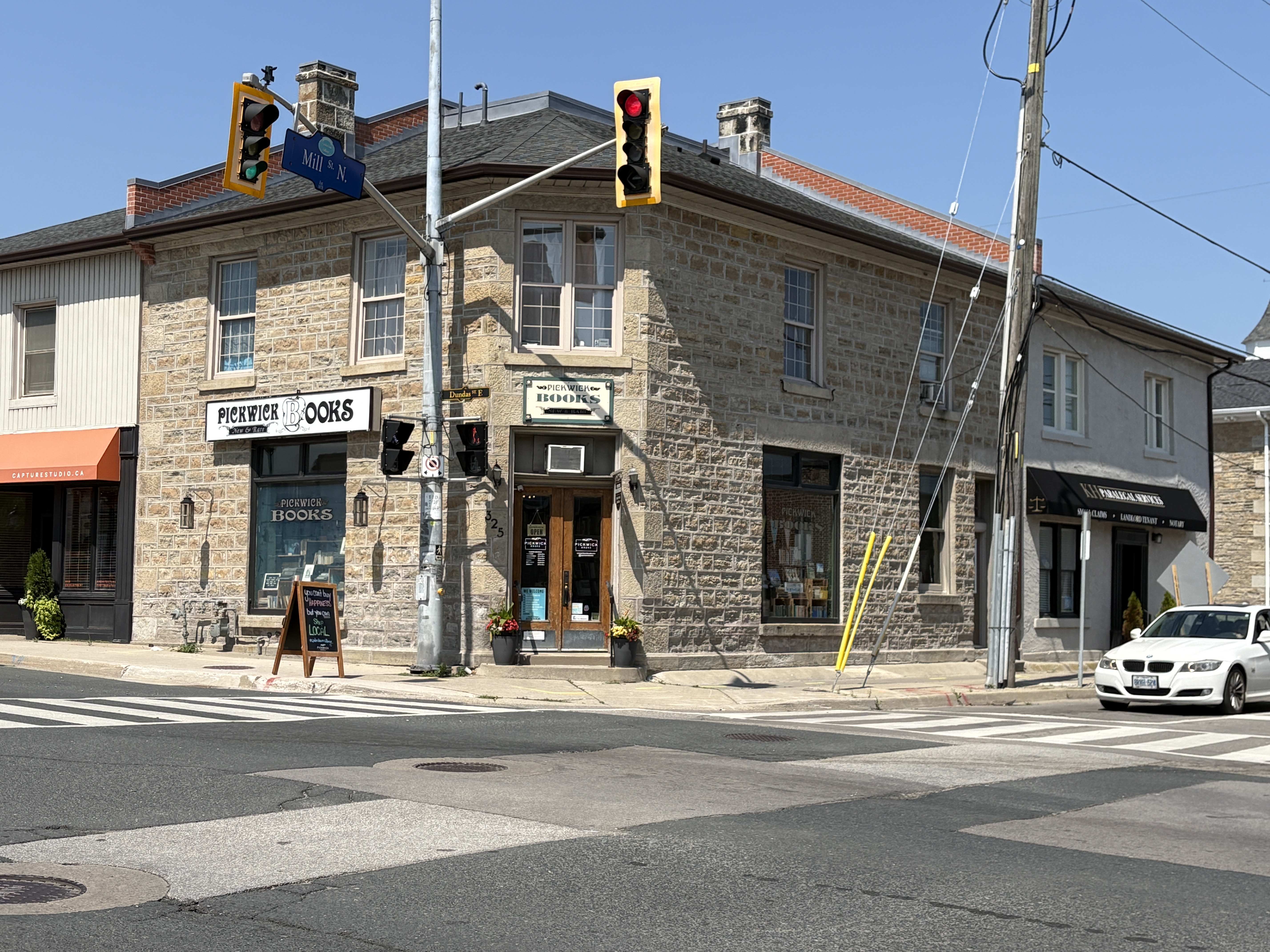
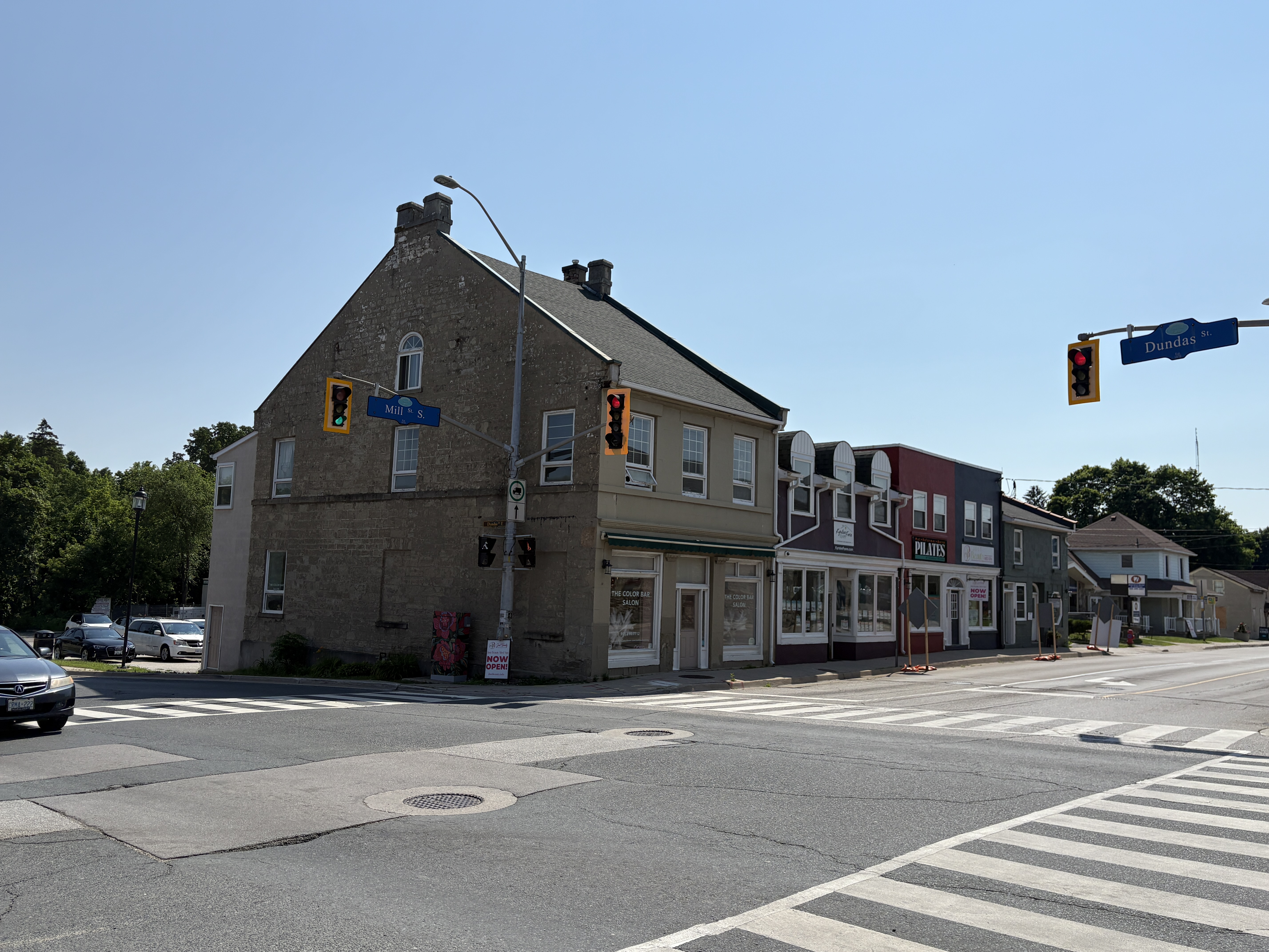
The Traders Bank operated in Waterdown from 1909 to 1921 and was located in the building on the north west corner of Mill Street and Dundas Street. The building has been used for several purposes over the succeeding years and is currently home to Pickwick Books.
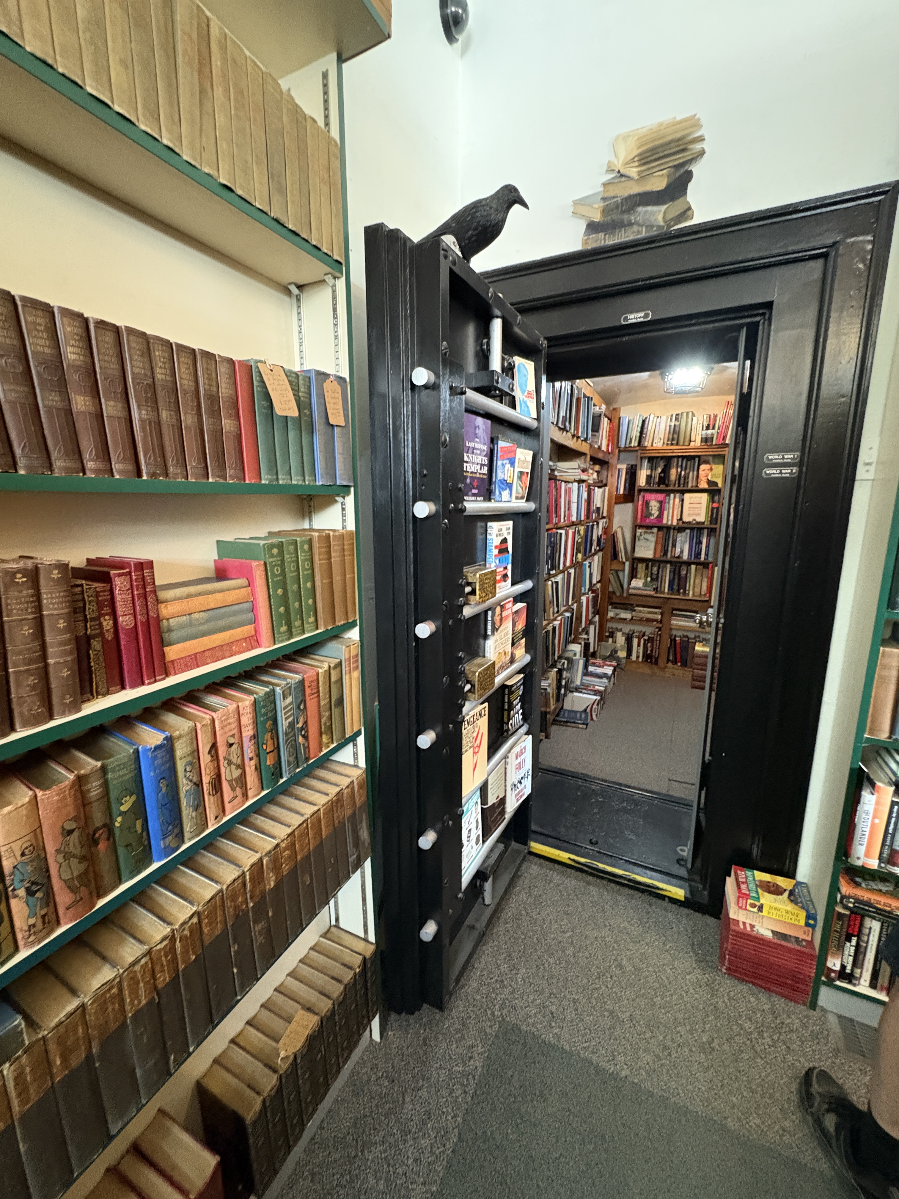
One would think that the most valuable books in the store would be kept in the old bank safe. However, what we found inside was biographies about Canadian Prime Ministers and American Presidents.
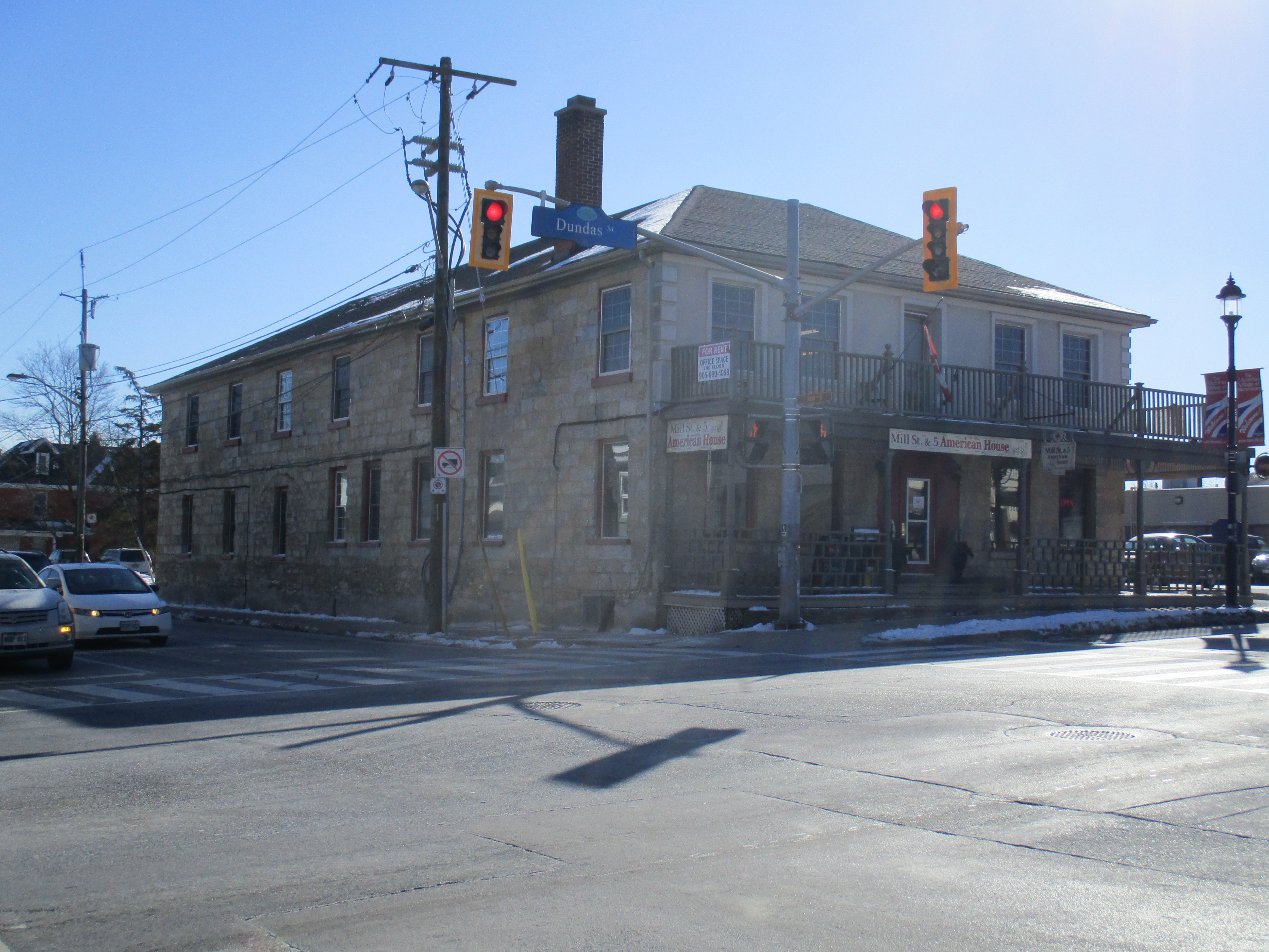
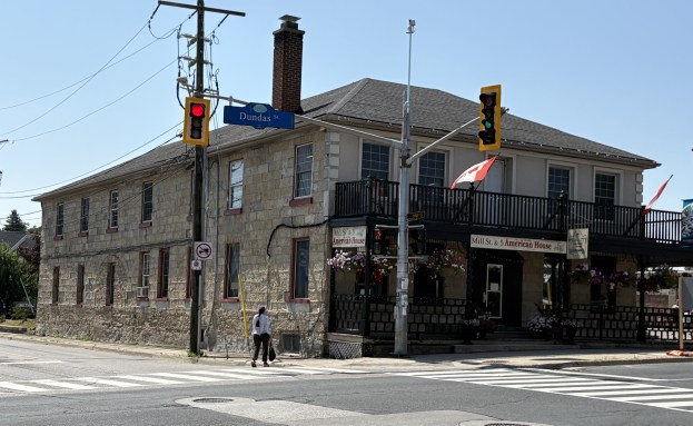
The site on the south west corner of Mill and Dundas streets was originally the location of the first log school building in the area. The American House hotel was built in 1824 and has been a permanent fixture in town ever since. At one time there were seven hotels in operation in town but only this one remains. At least a dozen different owners have operated the hotel over the years and these records appear to be incomplete. The hotel was closed during prohibition but was reopened in 1933. It has been extensively renovated with the original floors, tin ceiling and stand up bar being removed. We had a nice lunch here while visiting the town.
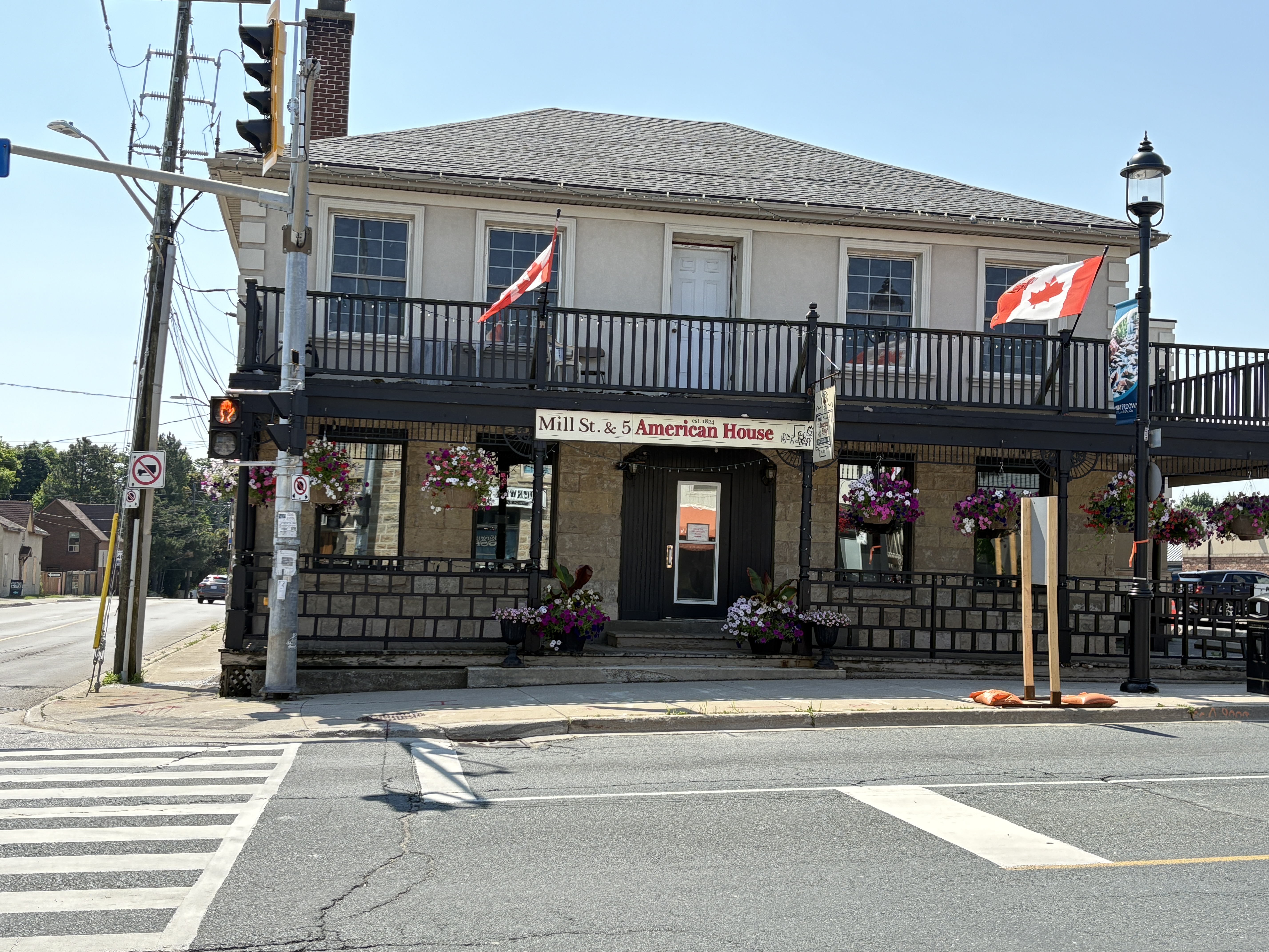
The side of the American Hotel has been modified over the years. There is a round arch that can be seen above the centre window on the ground floor in the image below. It used to allow the carriages to come into the building in bad weather to let guests to disembark with some shelter from the weather.

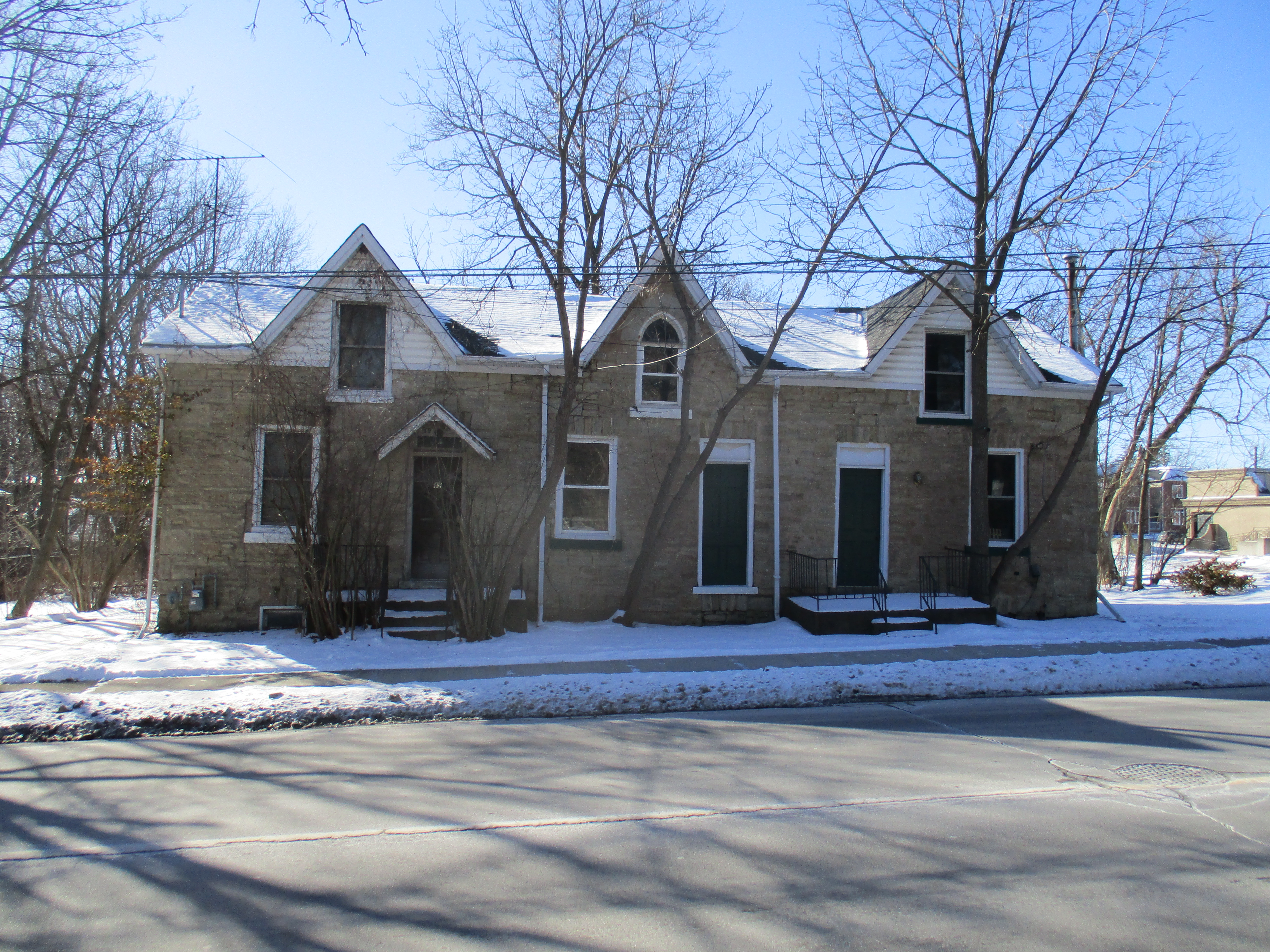
Workers cottages can be found in several places in Waterdown with this three unit example being found on Mill Street South. These ones are for sale along with the property. Let’s hope they don’t get demolished.
Maplebank was built on town lot 12 and included limited water rights to Grindstone Creek. Henry Ferguson Graham was an entrepreneur and tanner by trade. His water rights allowed him to grind bark for tanning and operate his equipment. The stone house was built in 1847 and replaced an earlier one story frame house.
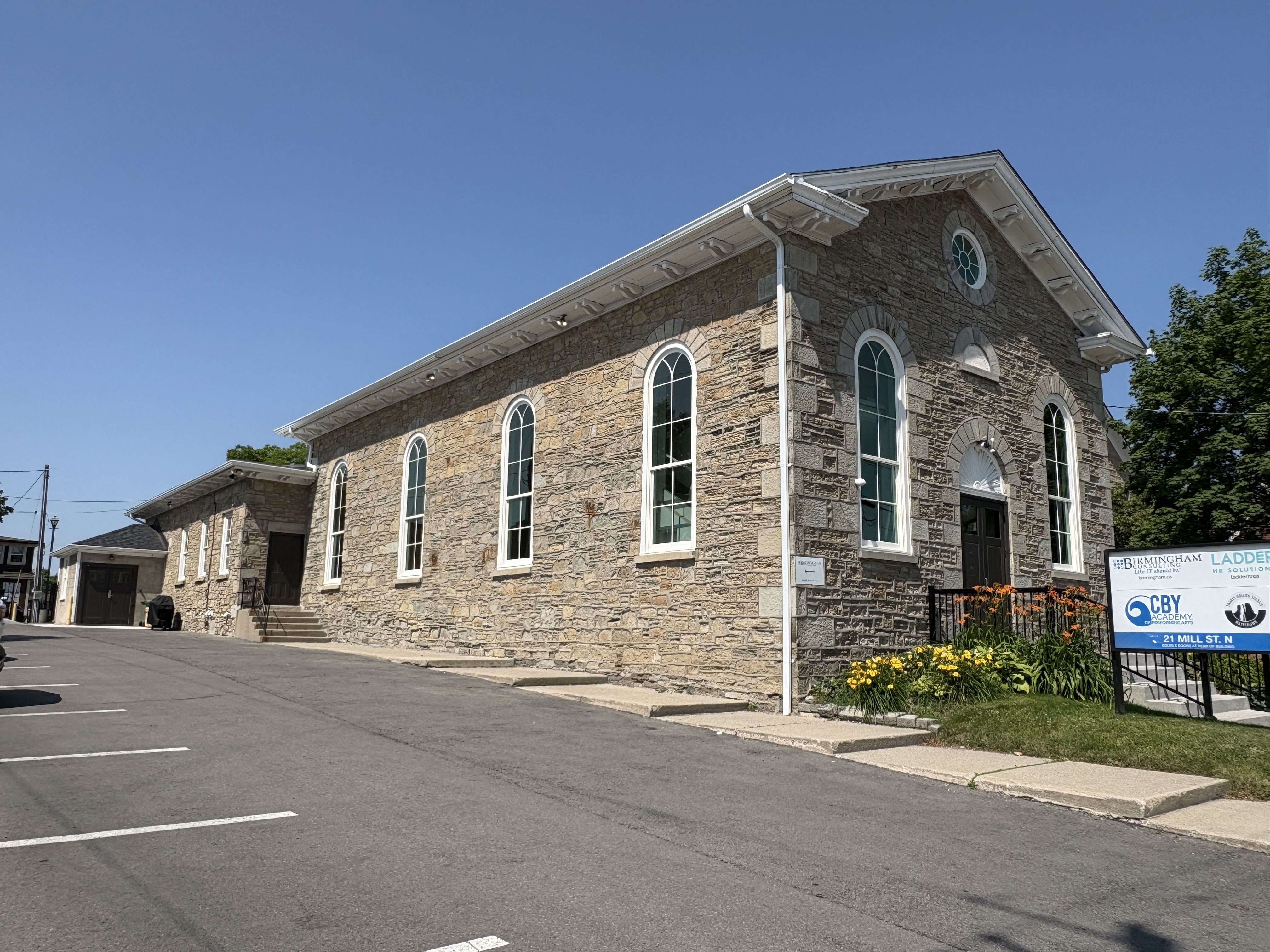
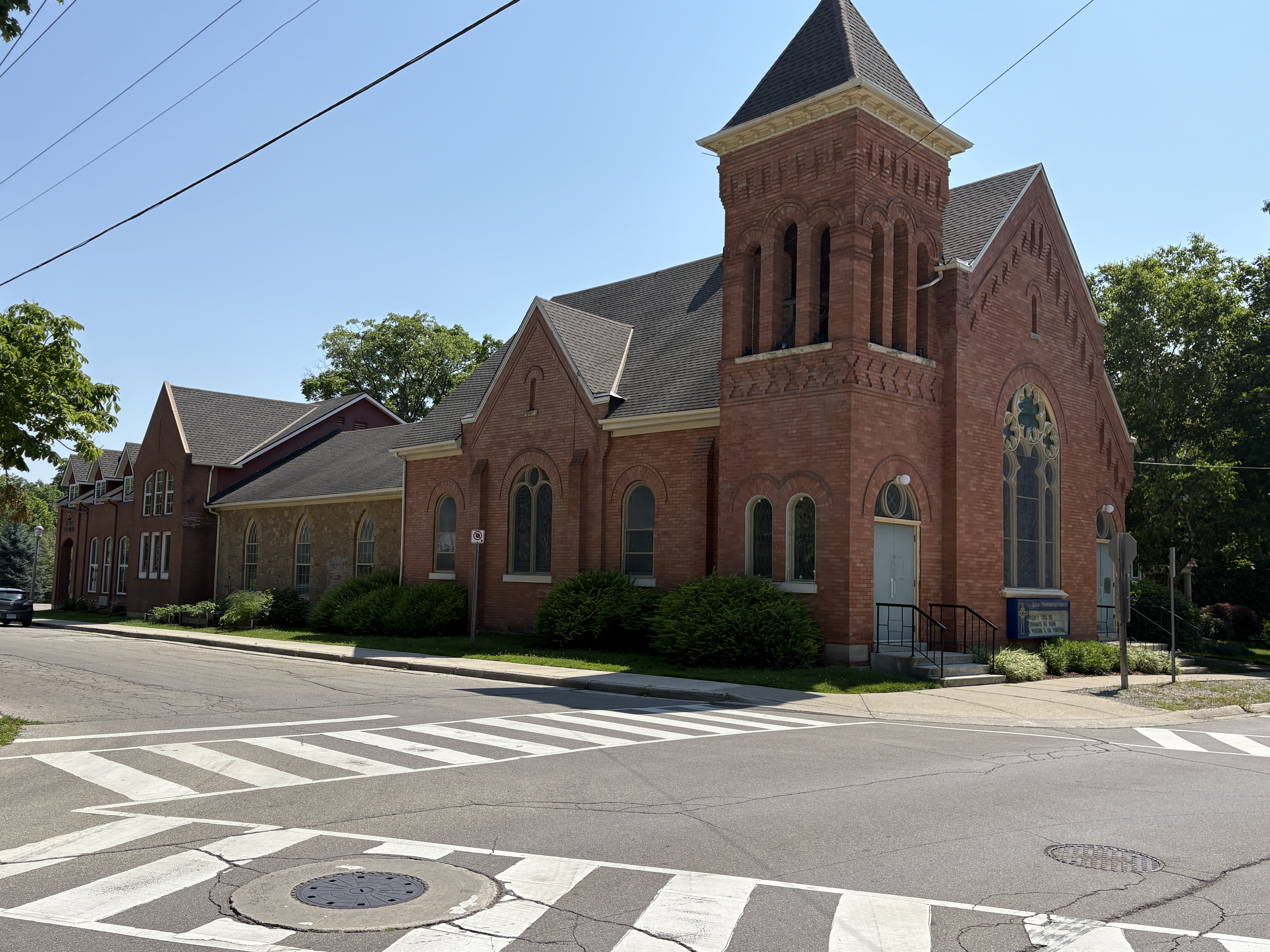
The former Methodist Church stands beside the Town Hall. The date stone above the door says Wesleyan Methodist Church Re-erected 1865. The 1840 frame church had been built for $1400.00. In 1865 the building was covered in stone and a Sunday School was added at the rear in 1880. The building became the United Church in 1925 with the union of Methodists and Presbyterian Churches. In 1957 a new church building was erected and this one is now used by a consulting firm.
The Presbyterians began meeting in Waterdown in the 1820s, most likely in the schoolhouse in Vinegar Hill. In 1855 a stone church was built which can still be seen behind the brick church on the corner of Mill Street and Church Street. The brick building in the front was erected in 1901 at a cost of $5,000. The section at the rear is where the kitchen and washrooms were built in 1959-1960. They were demolished and replaced with the present extension in 1997.
Across the street from the American House sits the original general store which was built by Ebenezer Griffin around 1824 along with the hotel. These were some of the first permanent buildings erected along The Governor’s Road (now Dundas Street) in Waterdown.
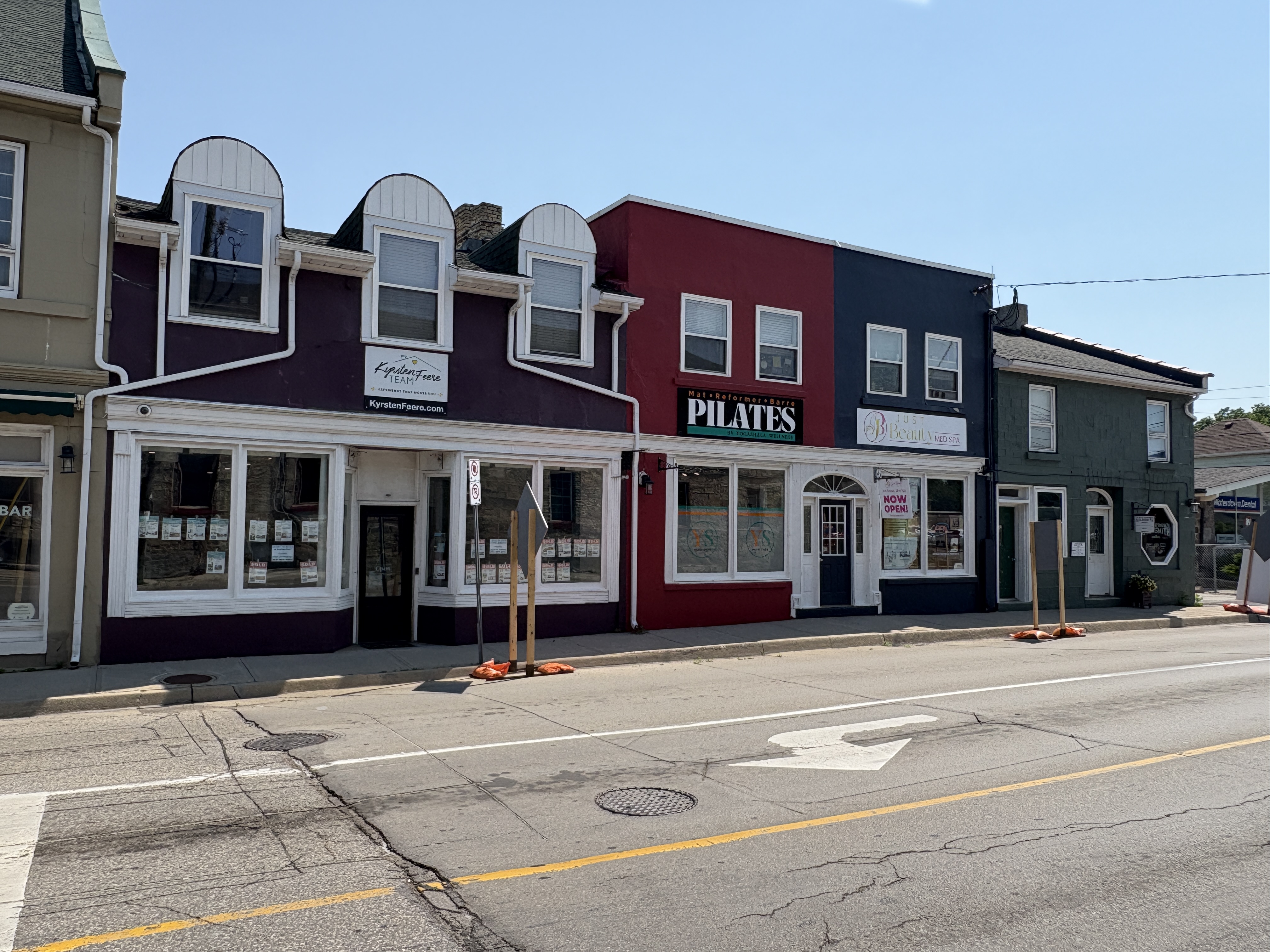
Several other vintage stores line Mill Street
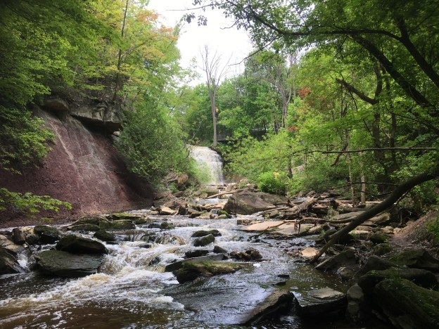
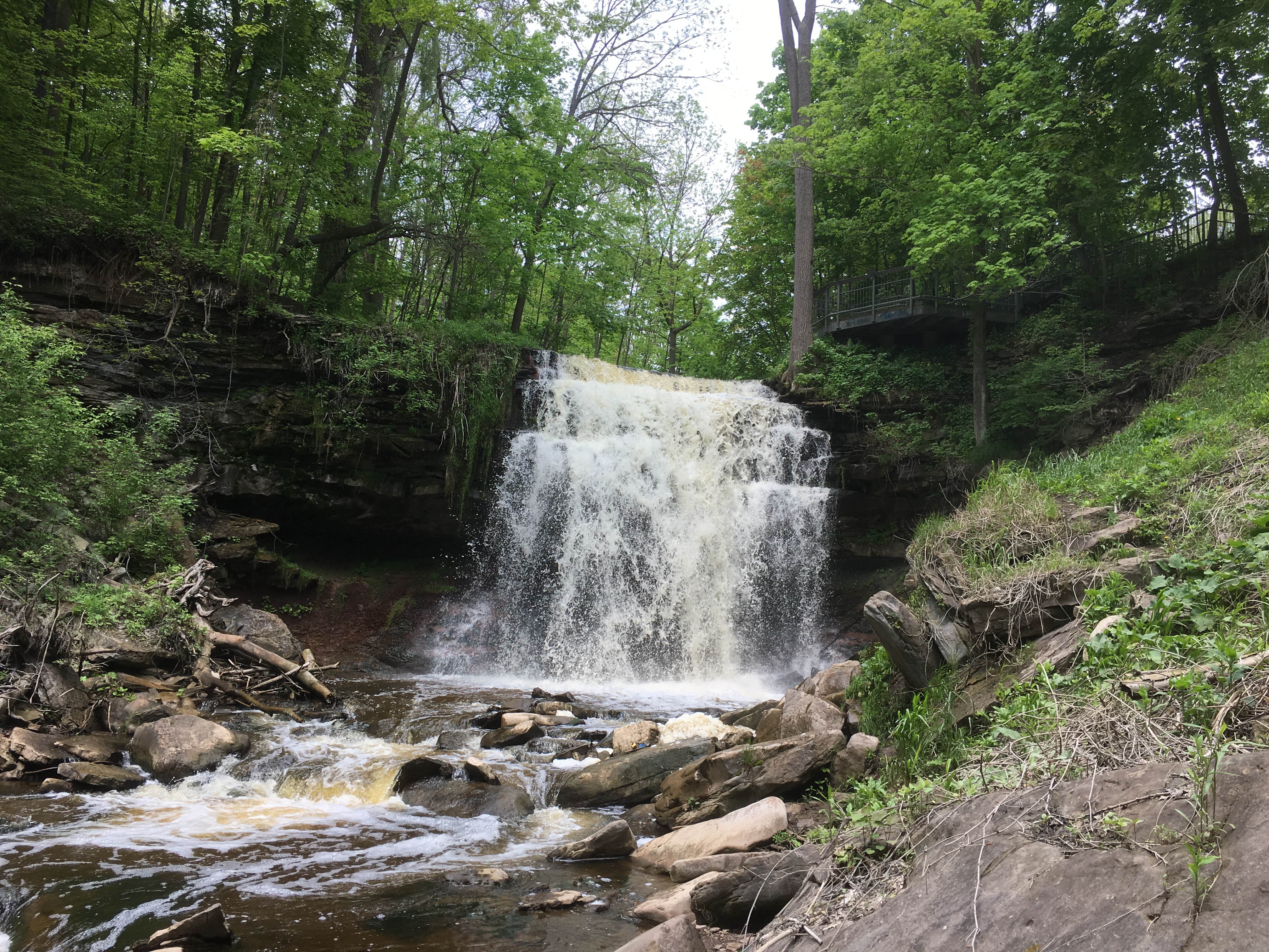
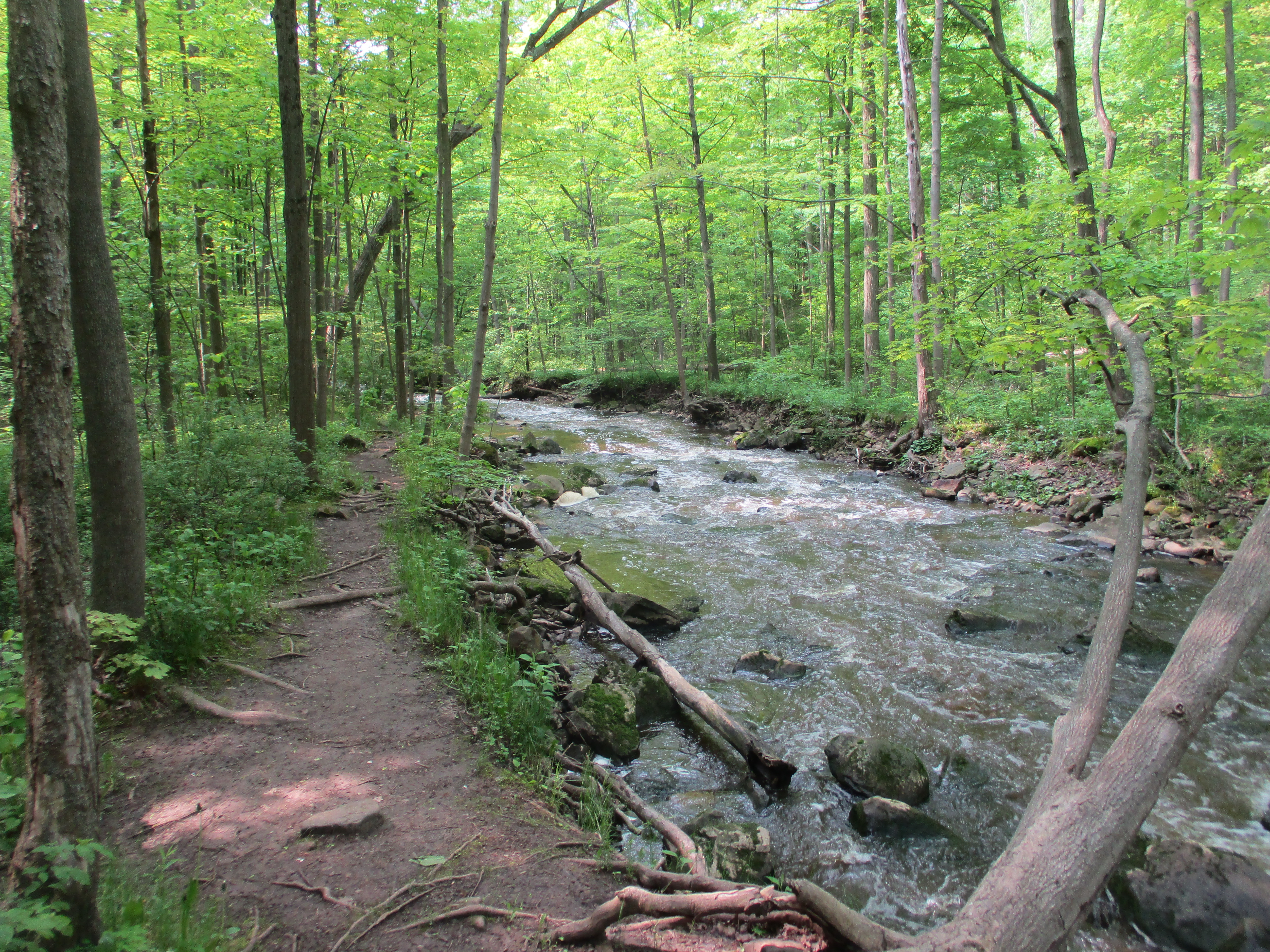
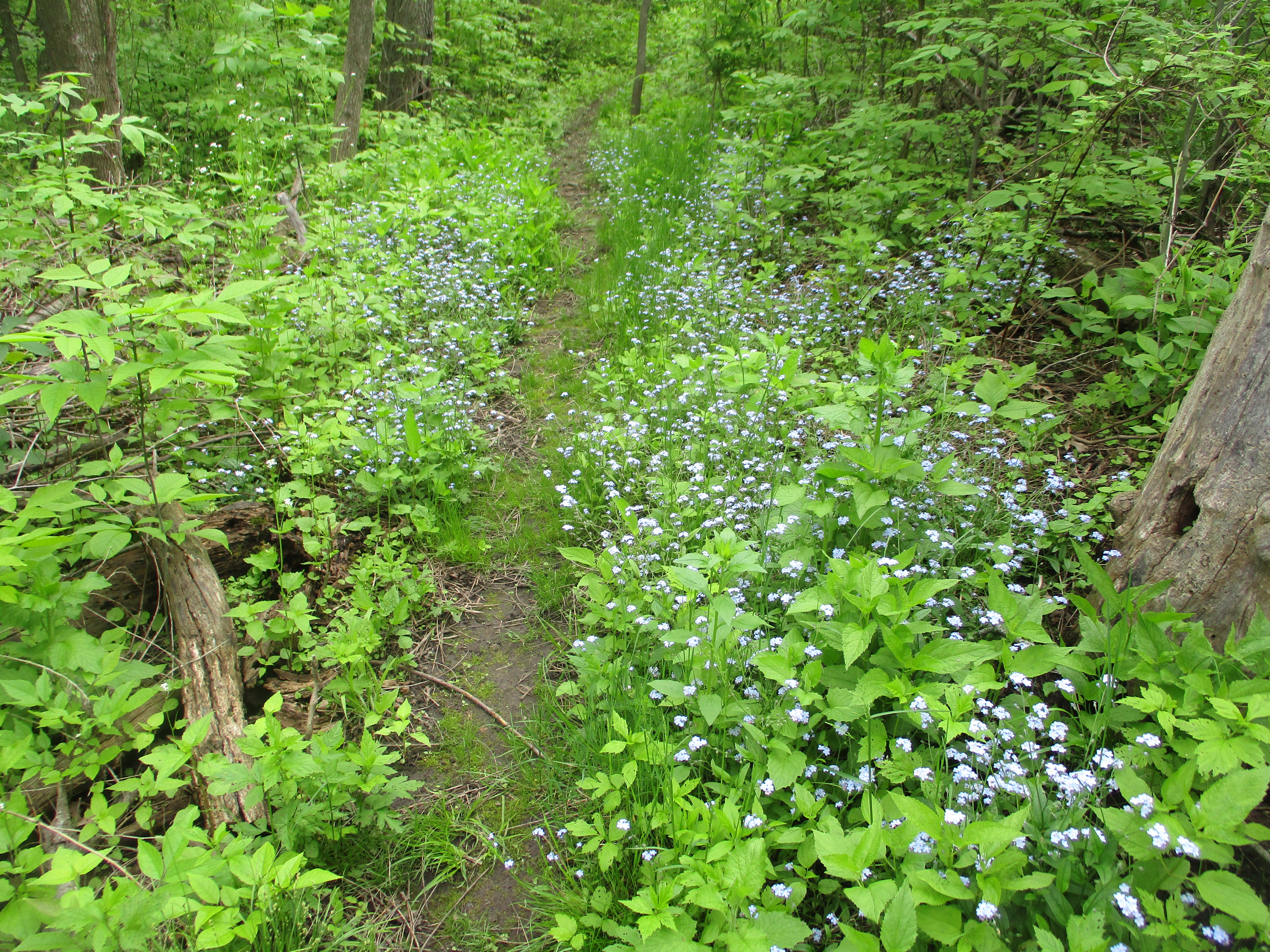
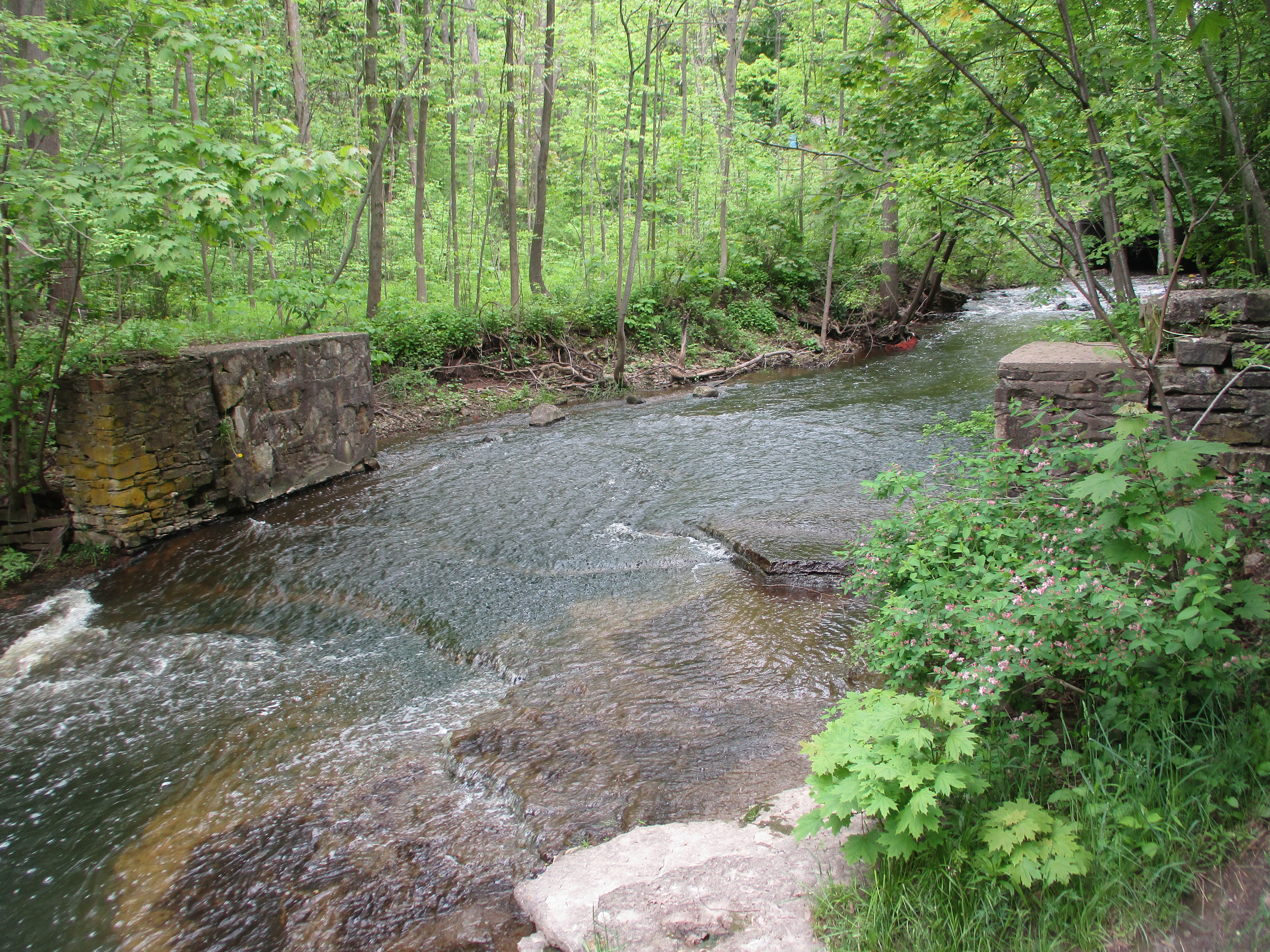
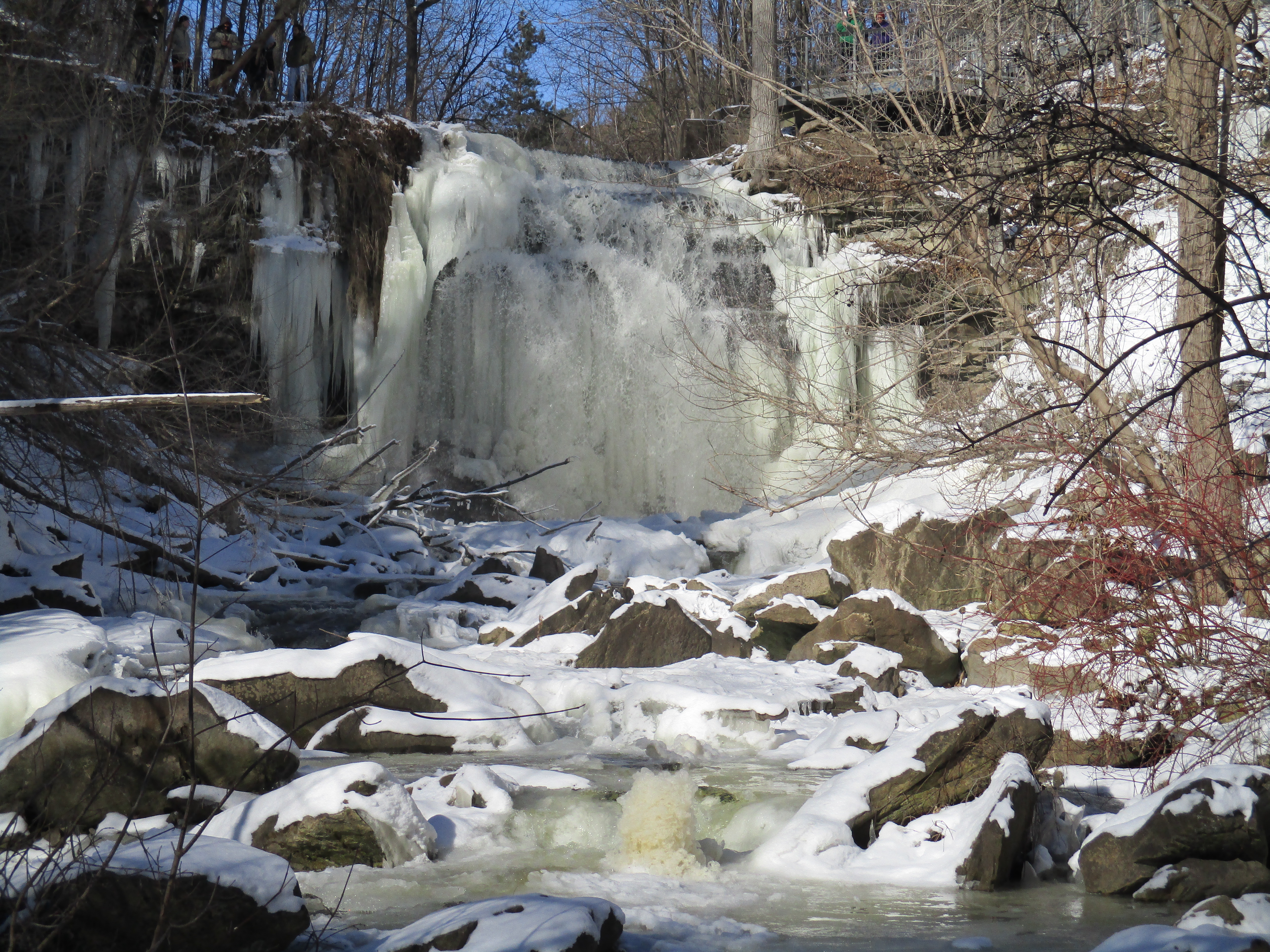
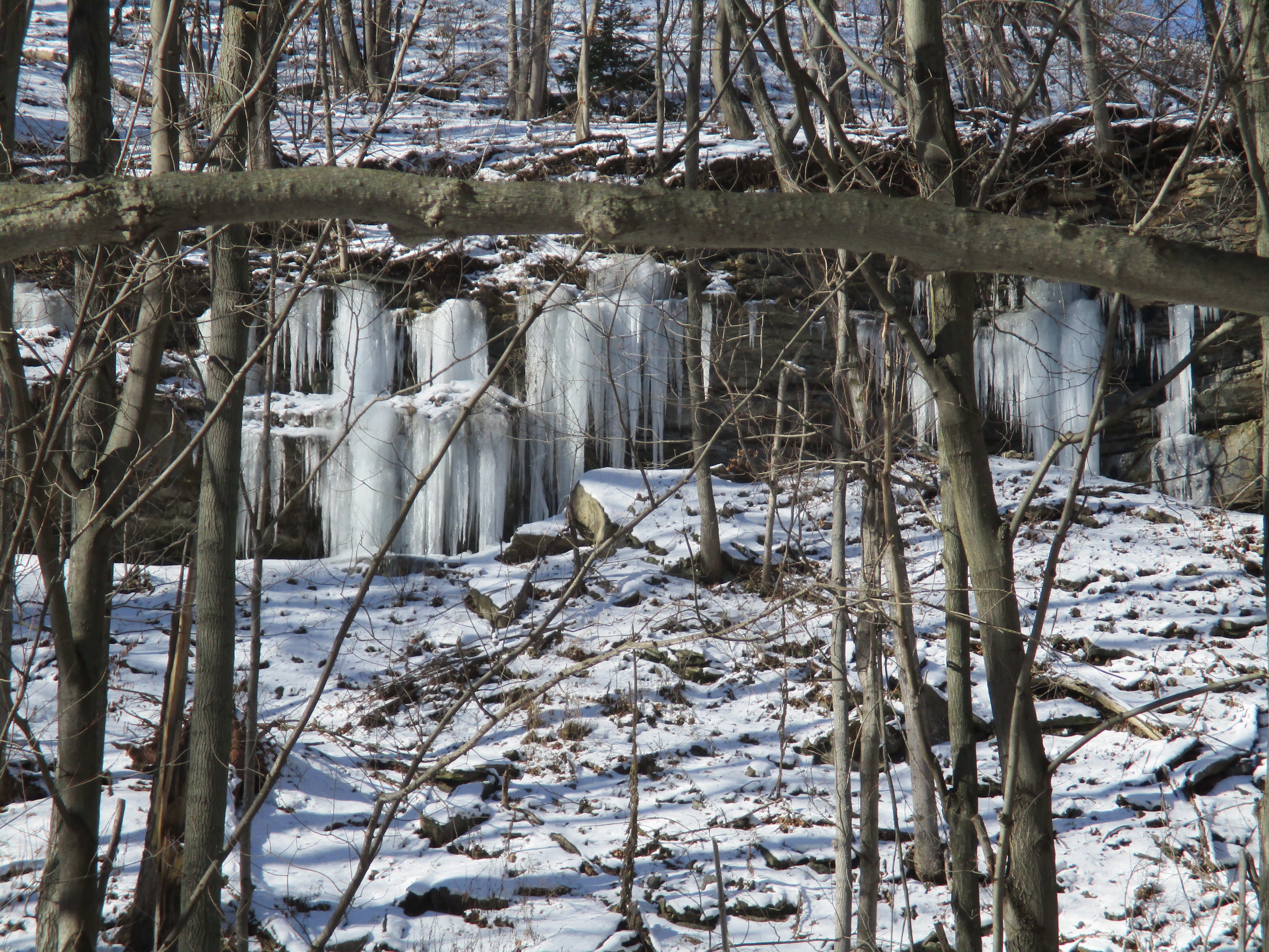
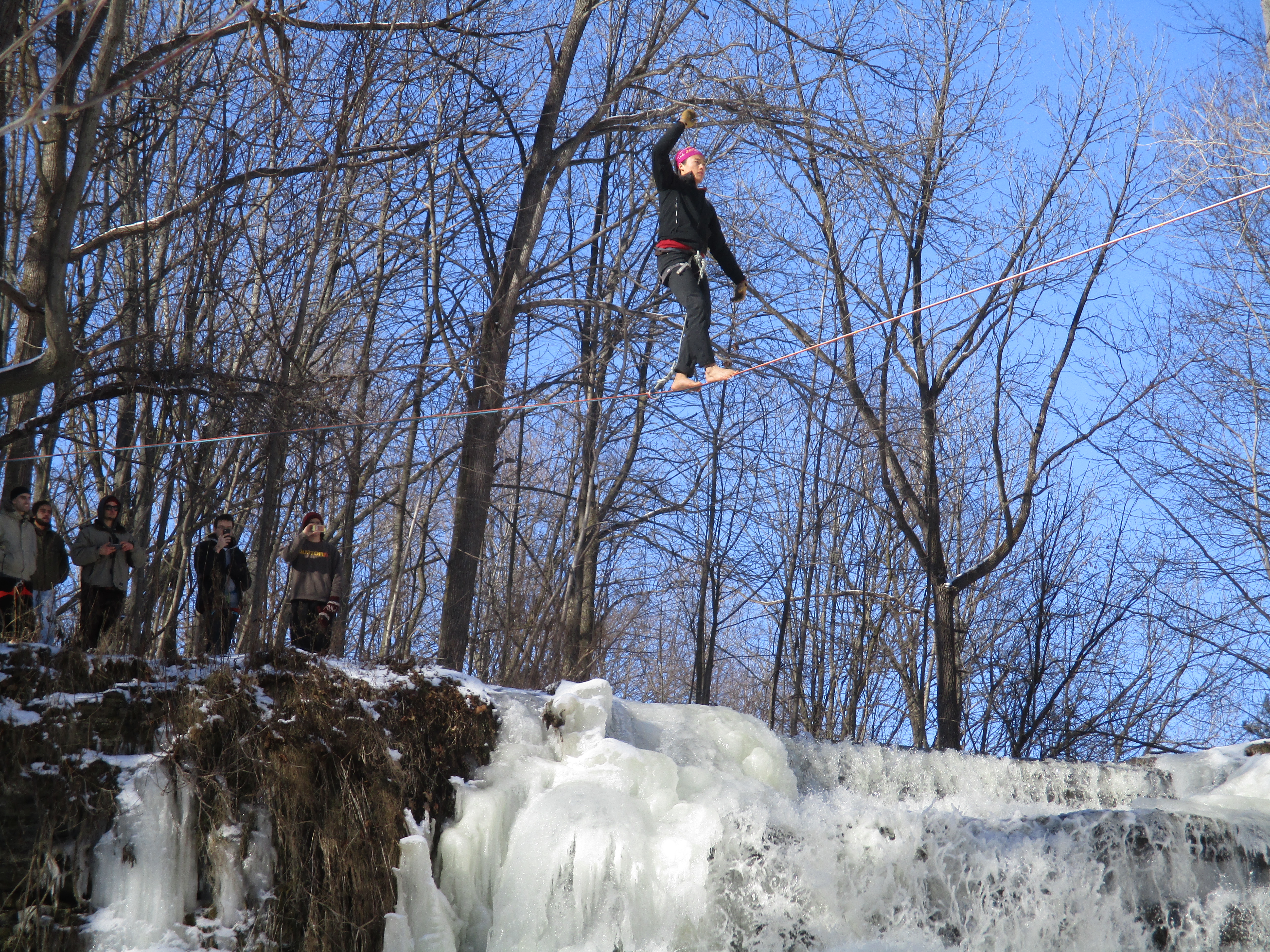
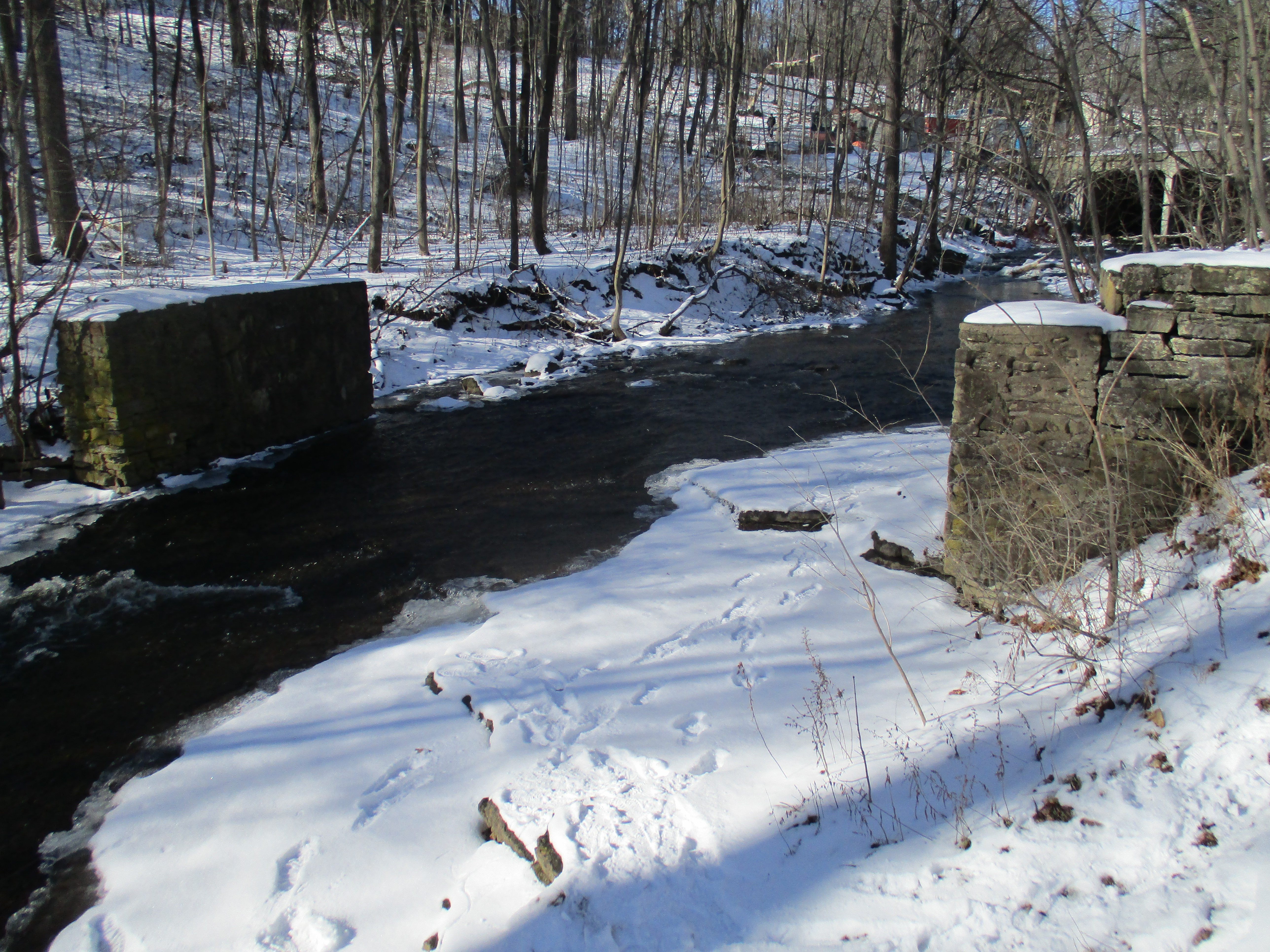
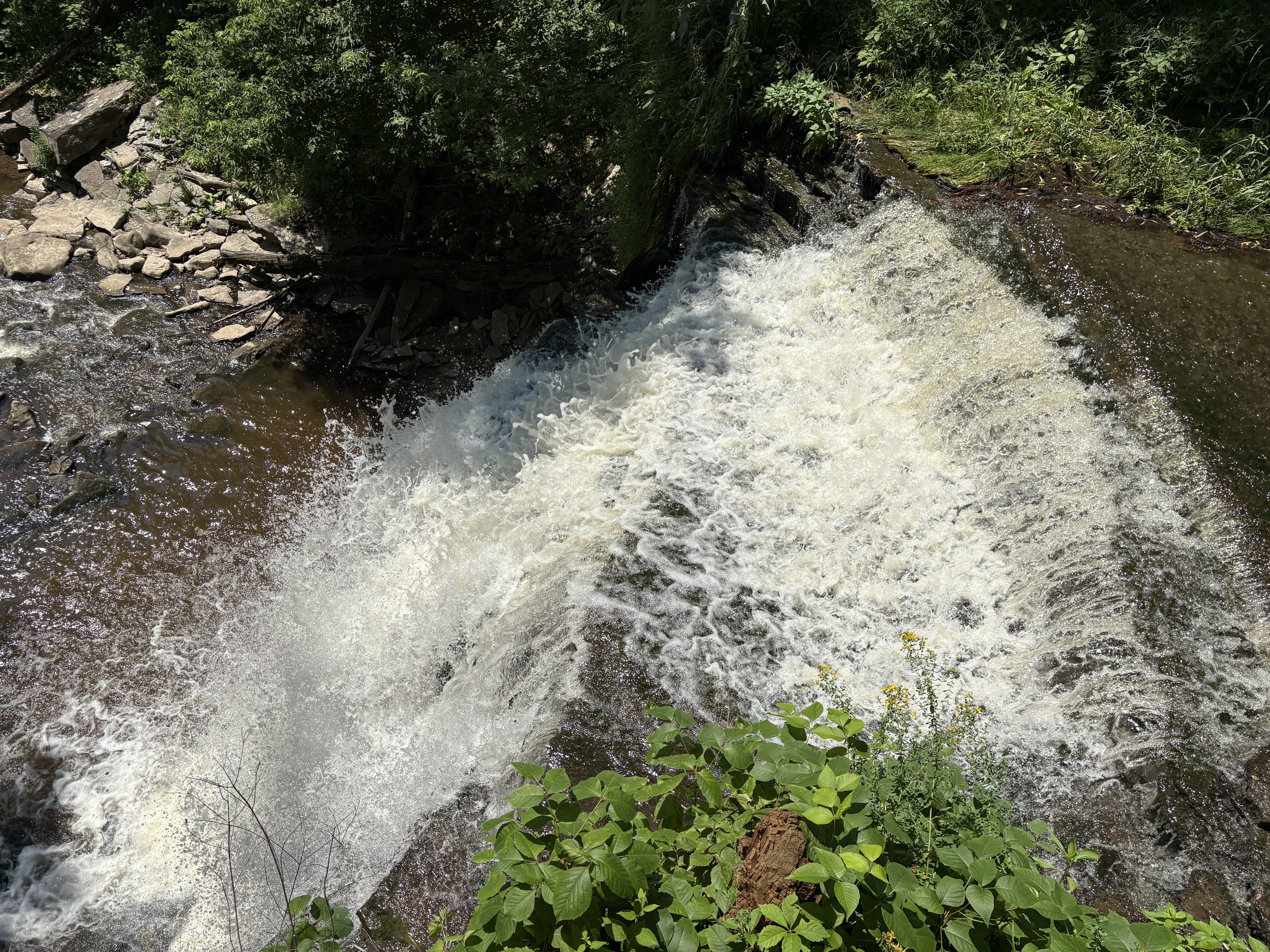
Following Mill Street south will bring you to The Great Falls on Grindstone Creek. The view below is from the viewing platform but we have a series of pictures from below the falls in our Slacking In Smokey Hollow story.
Waterdown was one of the early industrial centres in Upper Canada and has managed to retain much of it’s historic stone architecture. It is certainly worth investigating if you are in the area.
Related stories: Slacking In Smokey Hollow
Google Maps Link: Waterdown
Like us at http://www.facebook.com/hikingthegta
Follow us at http://www.hikingthegta.com