Tag Archives: Grist mill

Watson’s Mill – Manotick

October 30, 2022

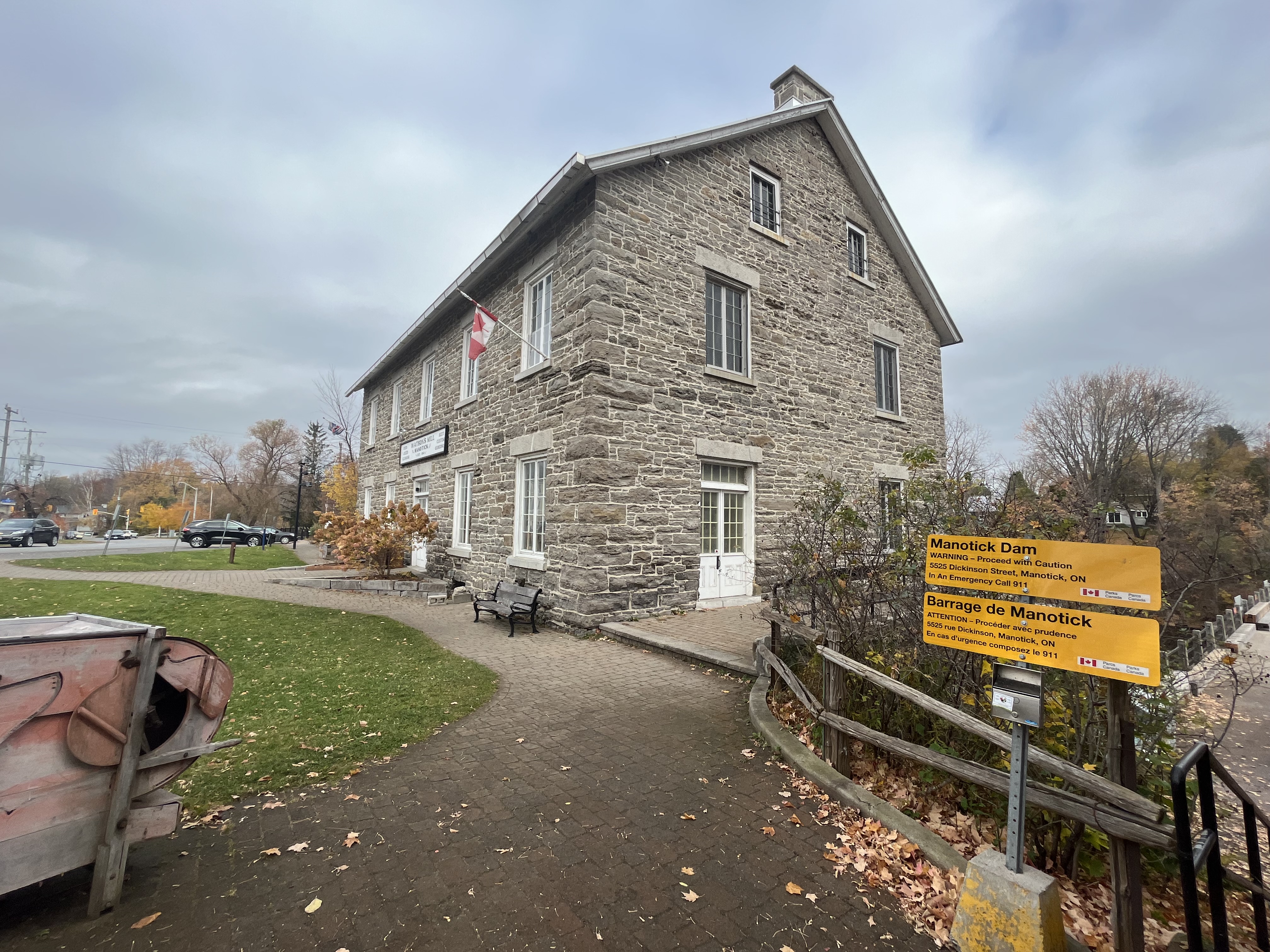
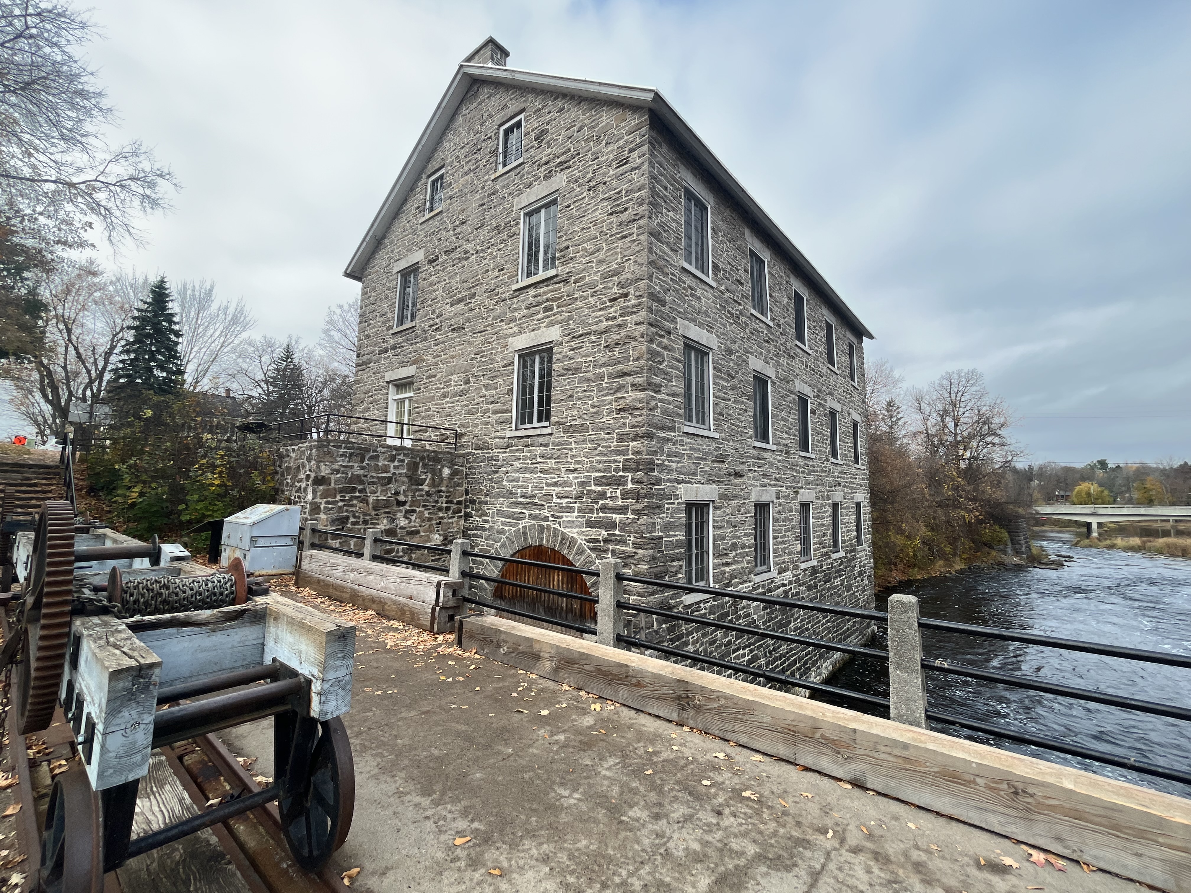
My job as self-employed inspector under contract to various government inspection agencies gives me the opportunity to travel all over the province of Ontario. This past week, I spent 3 days working in the Ottawa area. During my travels I drove past the Watson Mill in Manotick and stopped to check it out. This mill continues to operate at select times and can be seen grinding grain which it sells as flour, along with baked bread. It wasn’t open when I was there, but you can take a virtual tour of the inside by clicking here.

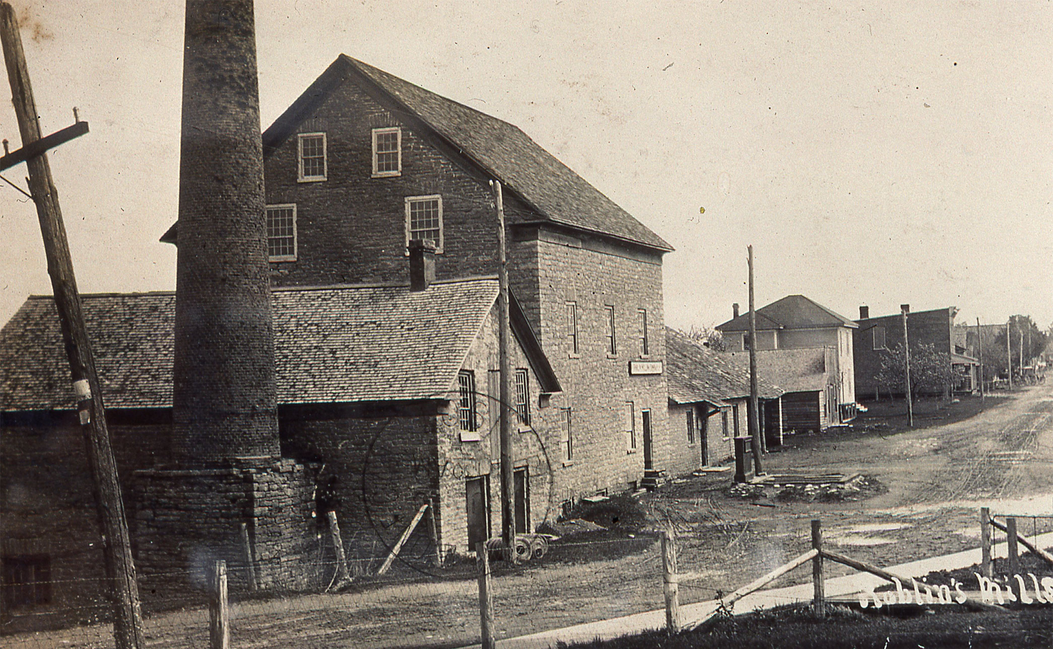
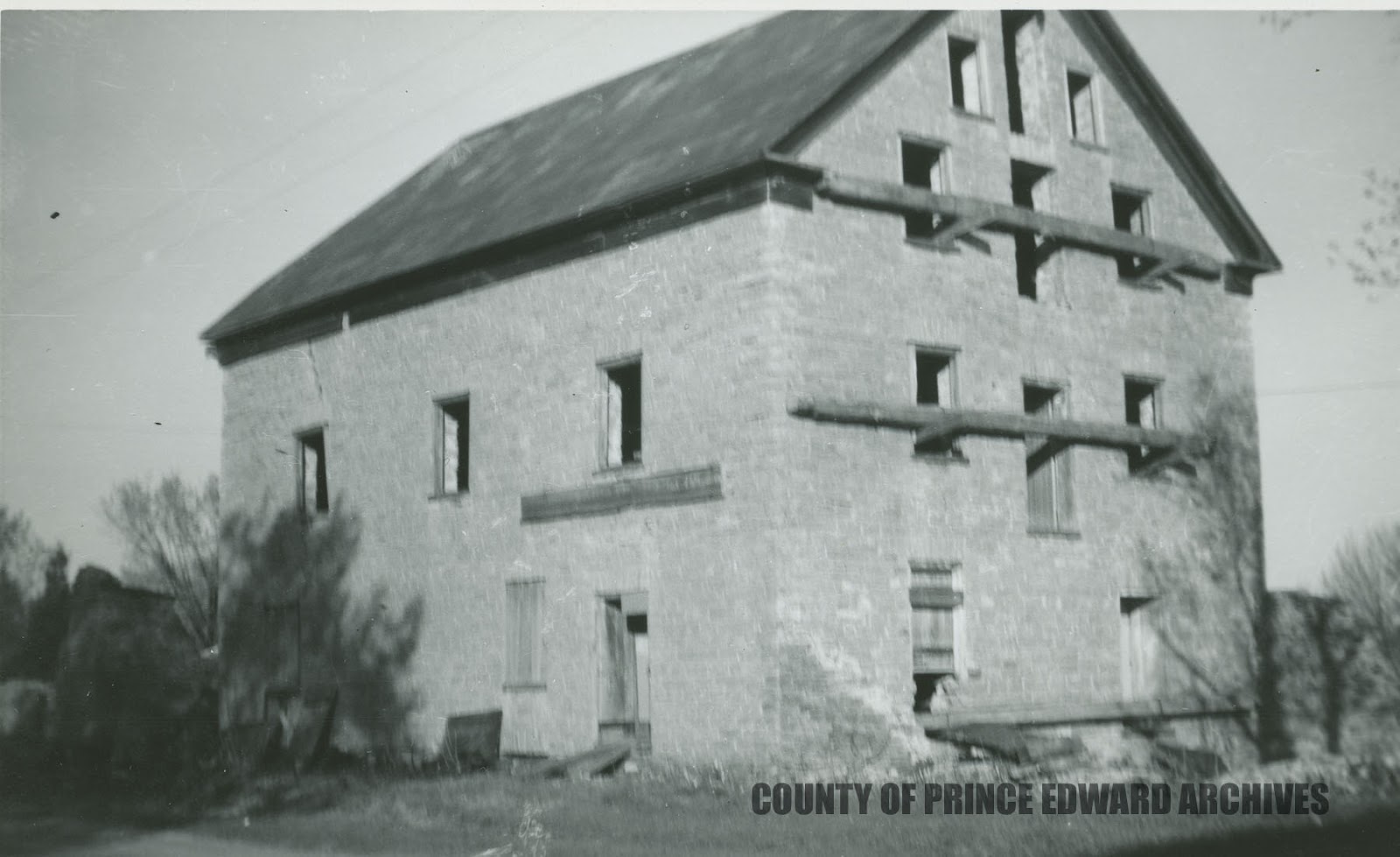
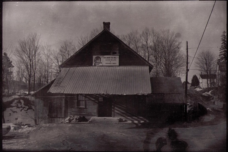
Following the War of 1812 there was a general fear that the Americans would invade Canada again and so plans were put in place to create an inland military transportation route to supplement the St. Lawrence River. The construction of the canal brought many labourers and stone masons into the area and for the next few years most immigrants also came to the area via the canal. Moss Dickinson was 10 when the canal opened in 1832 and he saw the opportunity to commercialize the river and canal system. In 1858 a wooden dam was constructed at the future mill site using wood beams that were fastened to the rock with steel pins. The original dam can be seen in the archive image below.

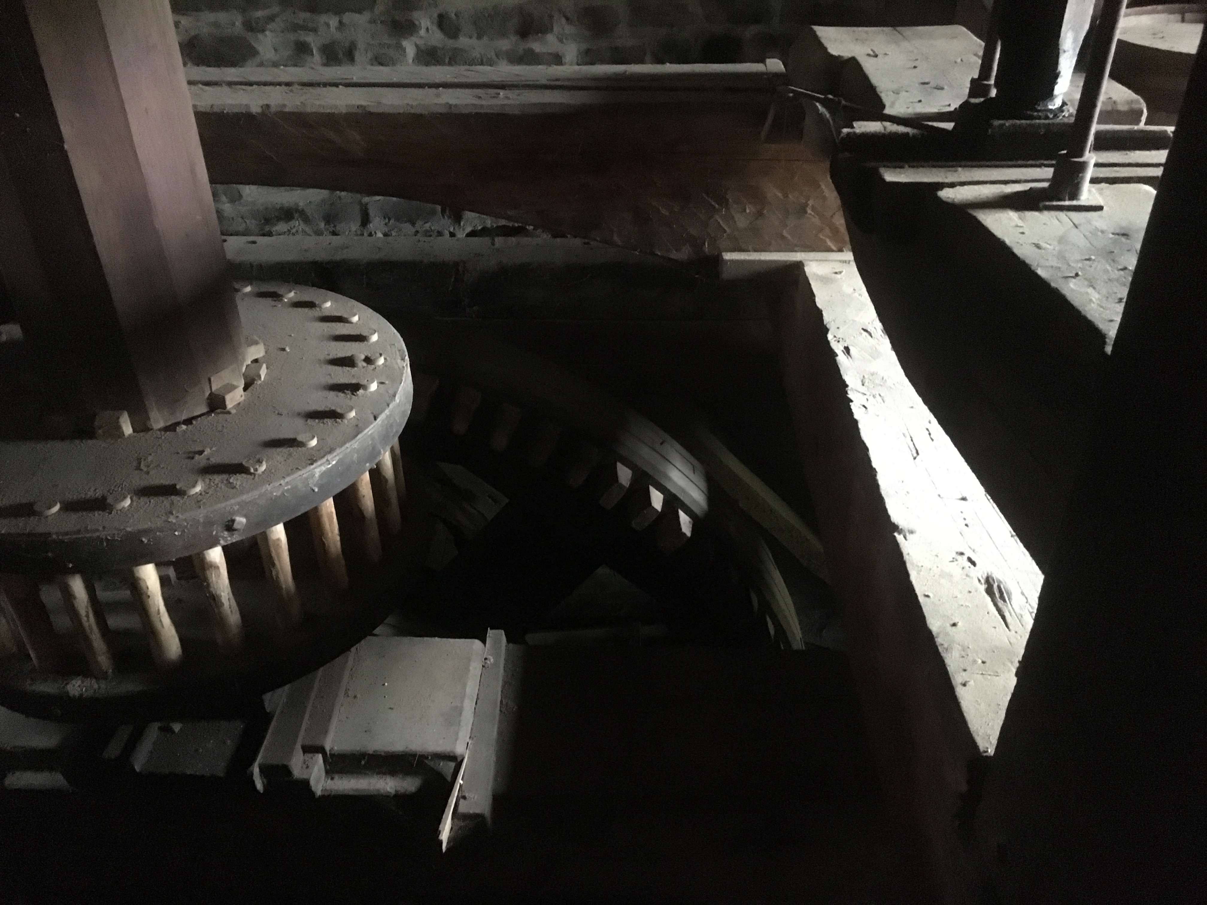
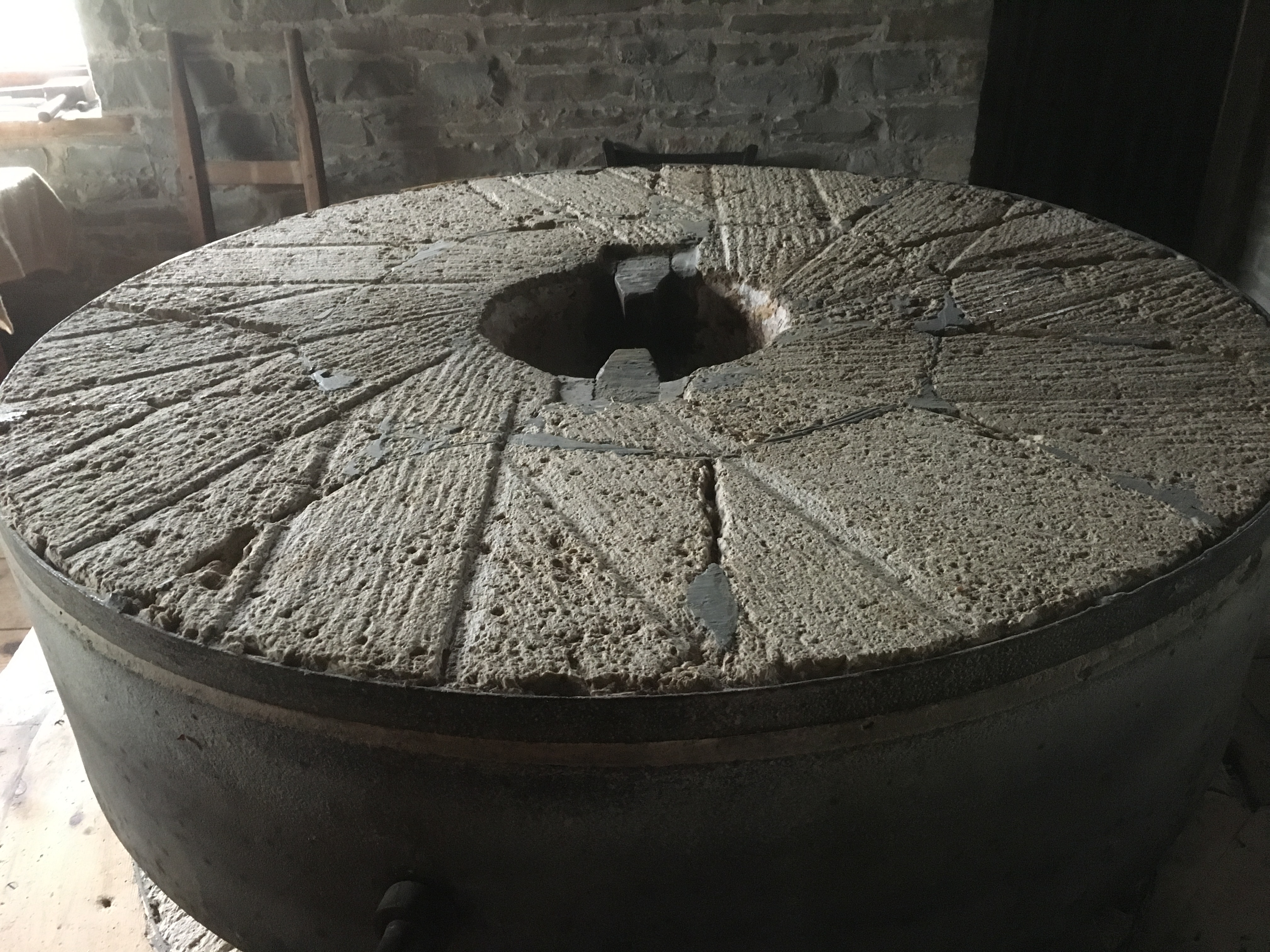
In the late 1850s, Moss K. Dickinson and Joseph M. Currier owned a sawmill on the Rideau River, and they contracted Thomas Langell of Ottawa to build a grist mill to add to their growing industrial operations. It opened in 1860 with four runs of grinding stones which were powered by turbines that had been manufactured in Ottawa. In 1862 they added a woolen mill to the complex and the need for labour drew people to the area and the town of Manotick began to grow around the mills. In 1863 Dickinson bought out his partner and the mills remained in the family until 1929, operating under the name of The Long Island Mill. The Rideau Valley Conservation Authority purchased the mill in 1972 and restored it along with the Dickinson house and drive shed.

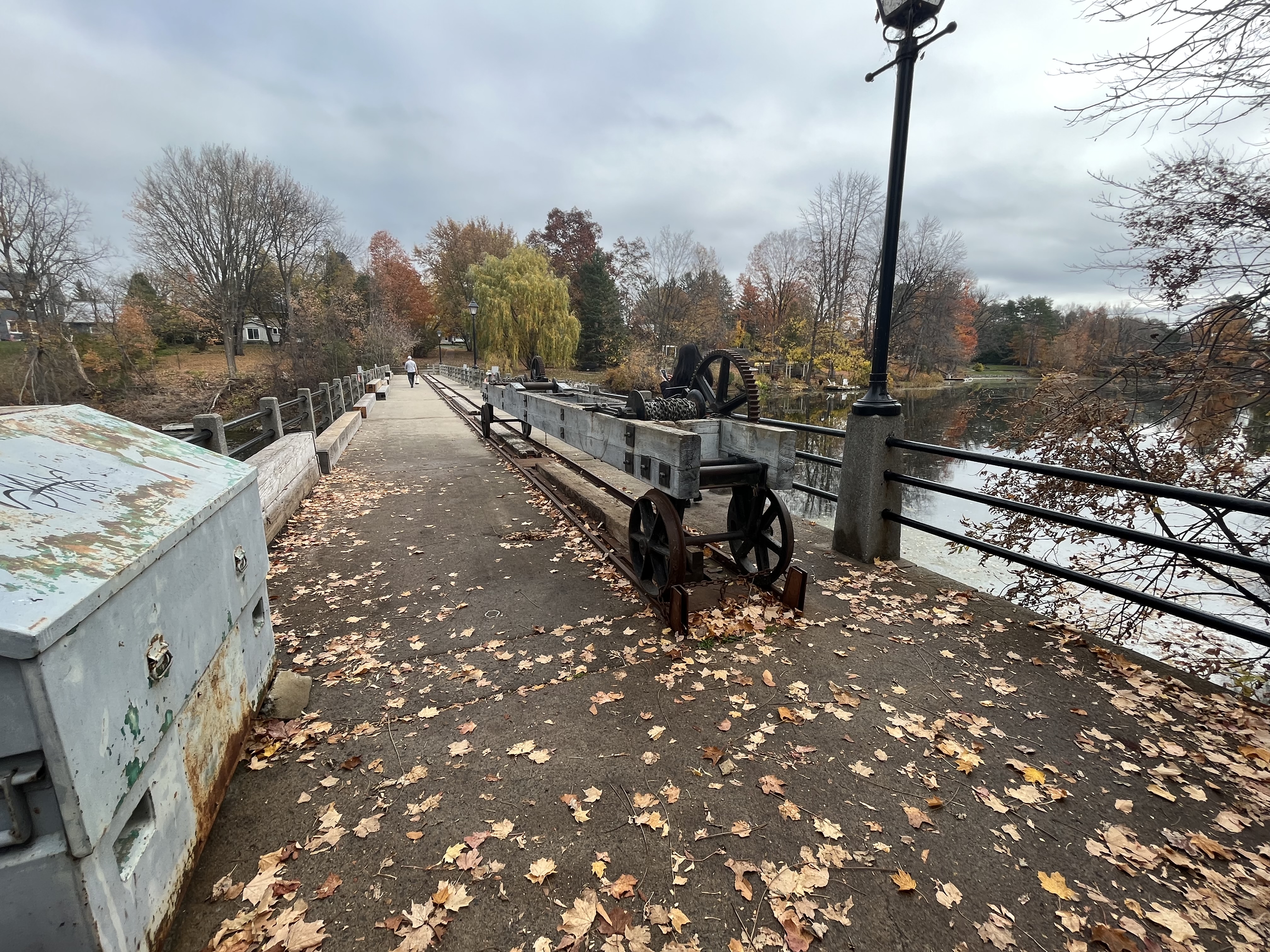
The construction of a sawmill, grist mill and carding or woolen mill provided the locals with the three basic necessities of life without the manual labour that had previously been required. The sawmill provided cut lumber for the construction of shelter, the grist mill provided flour for food and the woolen mill provided clothing. Alexander Spratt owned the mills after the Dickinson family and his family operated them until after the Second World War. Harry Watson bought the mill in 1946 and promptly changed the name to Watson’s Mill. He rebuilt the dam out of concrete in 1956 and today you can walk across the top of the mill to Long Island. A crane on wheels and rails was installed to raise and lower the stop logs that control the water level behind the dam.

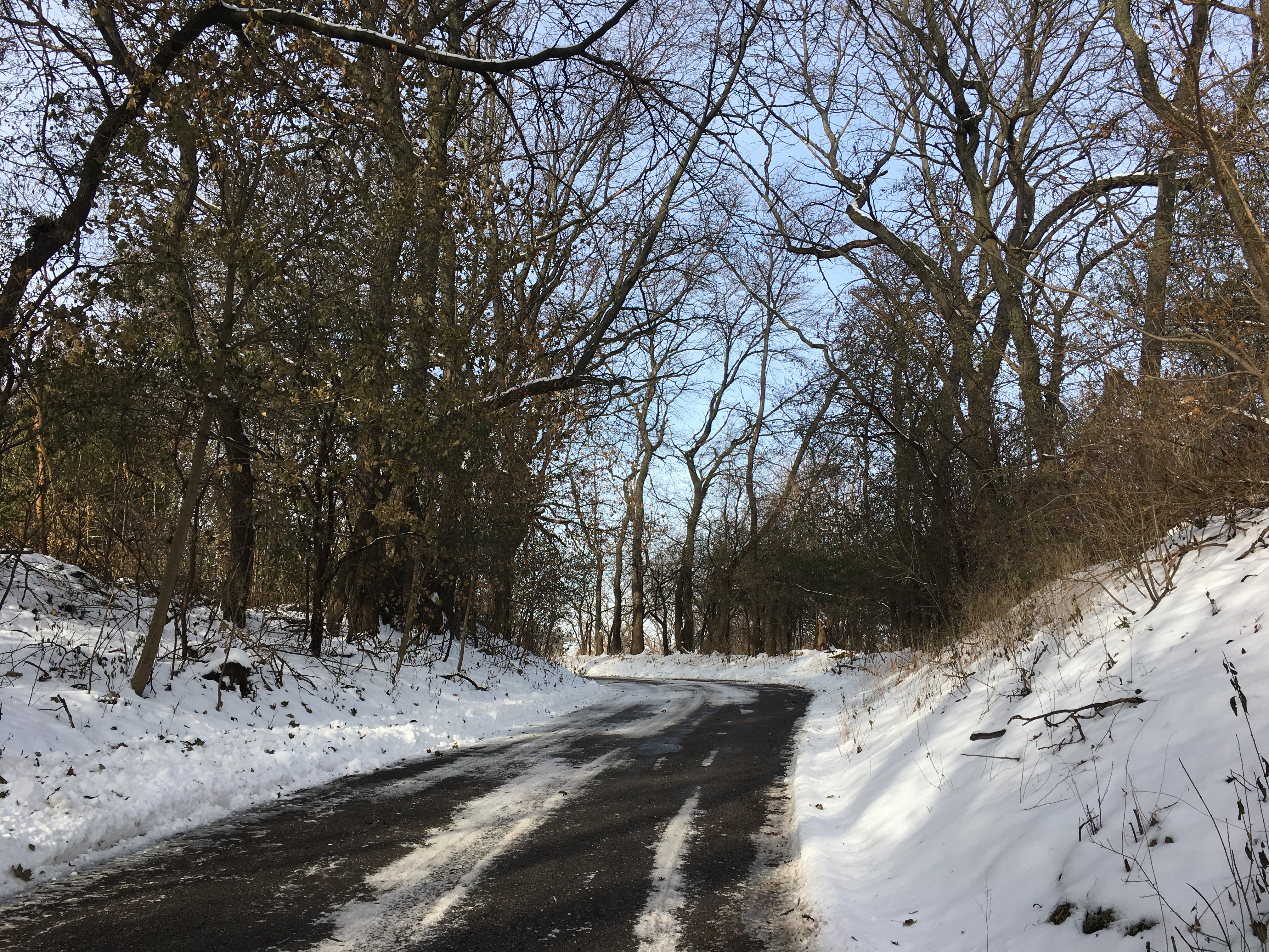
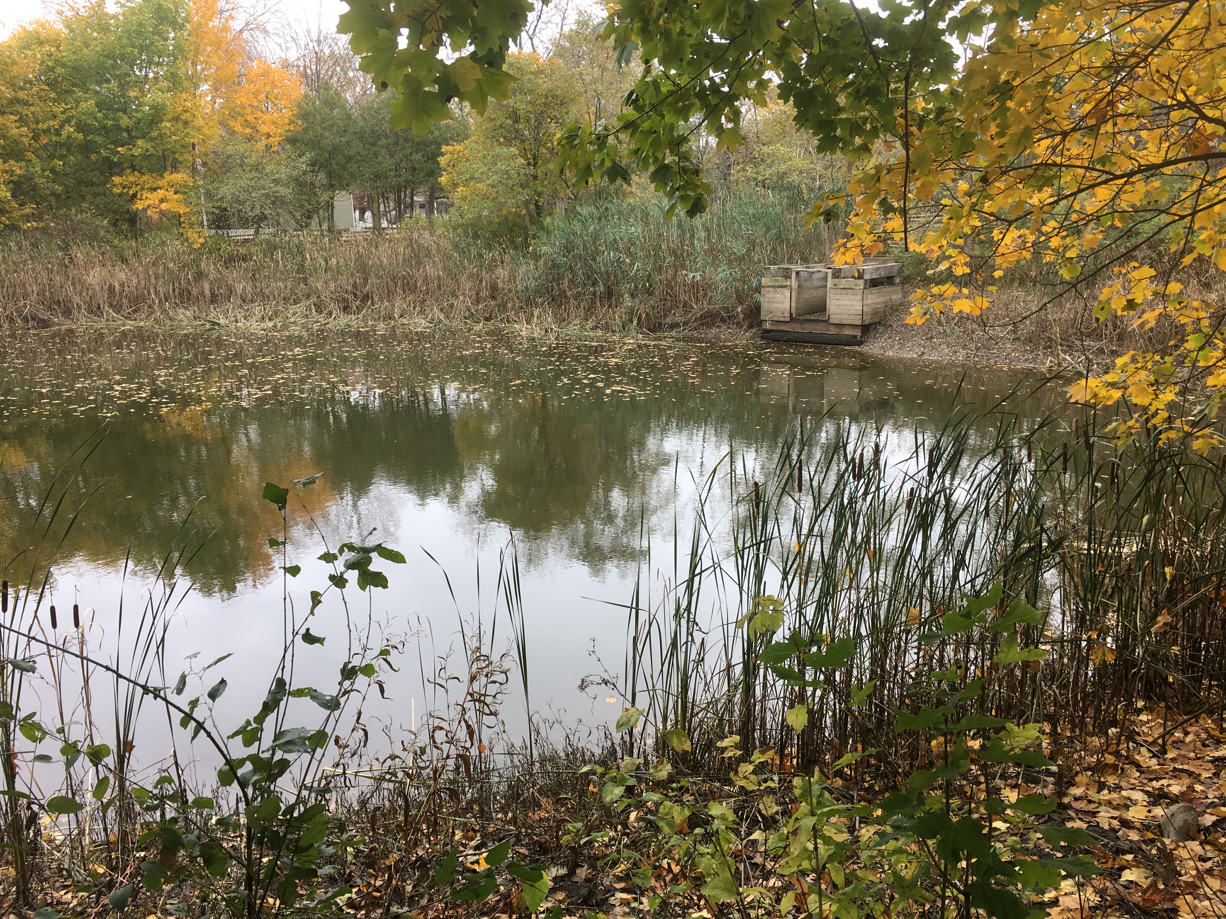
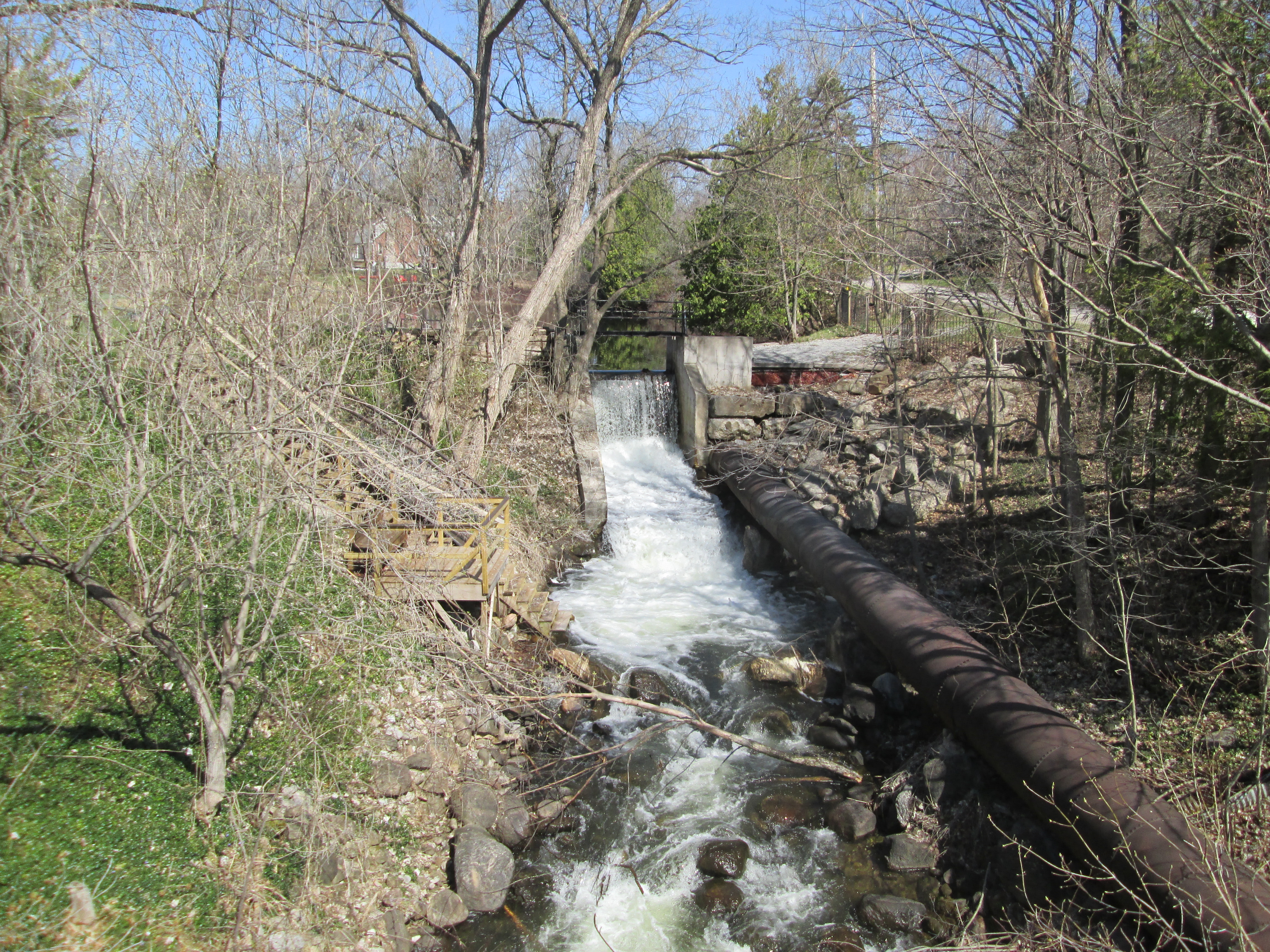
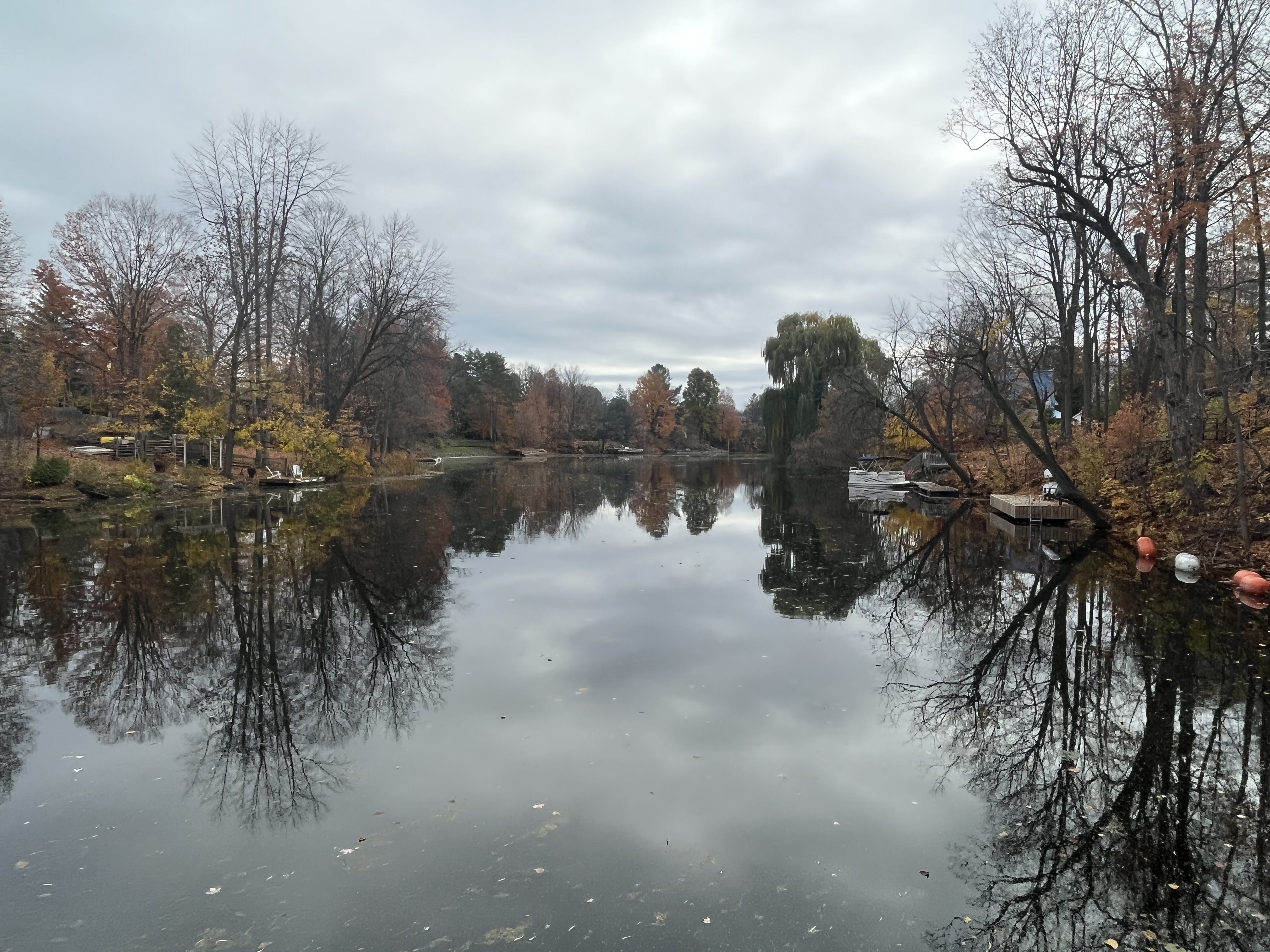
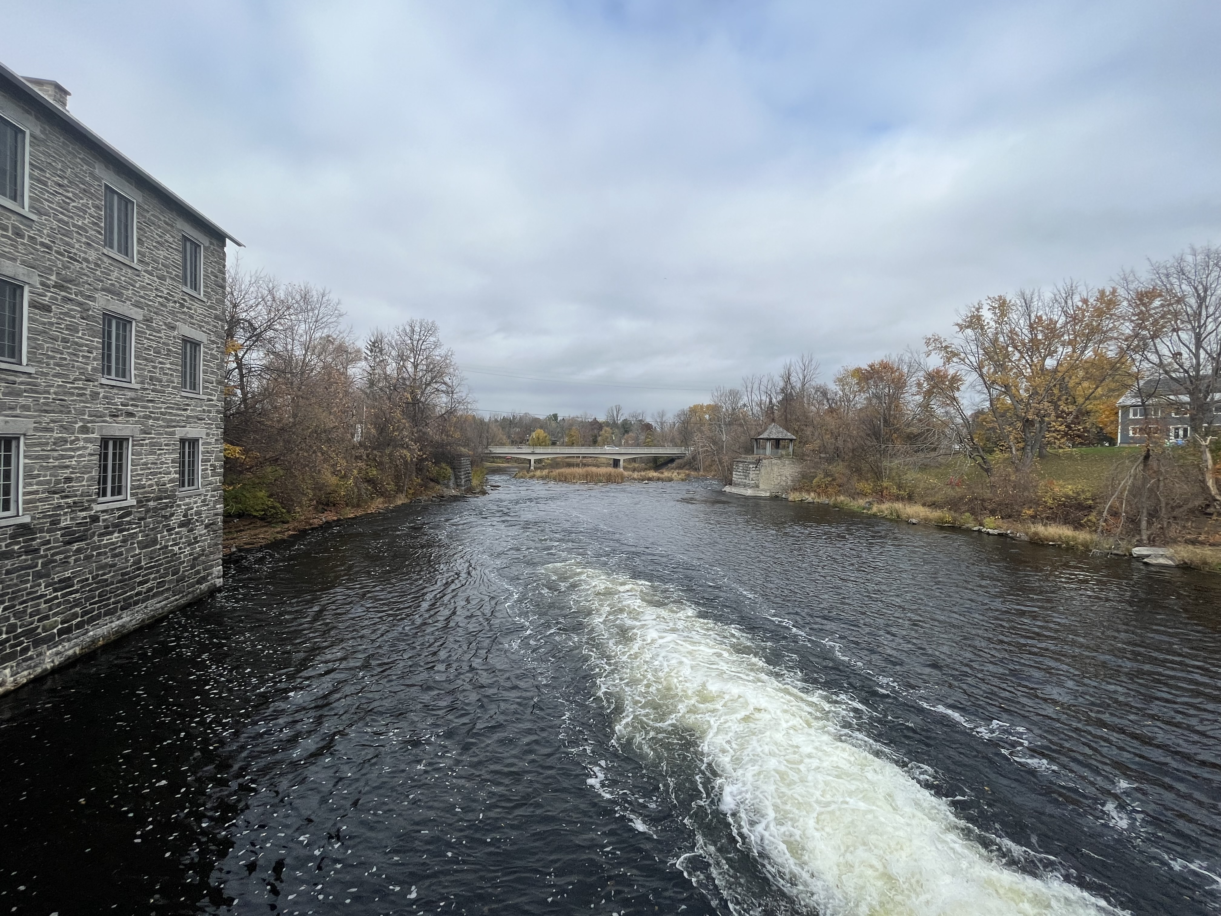
Milling operations would cease in 1963 but the mill and dam remained as the most recognizable feature in the town of Manotick. From the middle of the dam the view upstream shows the slow-moving water behind the dam. Most of the fall colours had disappeared from the Ottawa region by this late in October but the scenery was still very beautiful.

In 1963 the National Capital Commission entered into an agreement with Watson to restore the mill and keep it as a functioning water-powered grist mill. In 1972 Watson sold his interests in the mill to the Rideau Valley Conservation Authority on condition that the mill remain known as Watson’s Mill. They completed the restoration and opened the mill as a tourist attraction in 1974.

Looking downstream you can see the cut-stone foundations from an earlier bridge across the Rideau River.

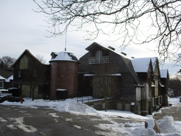
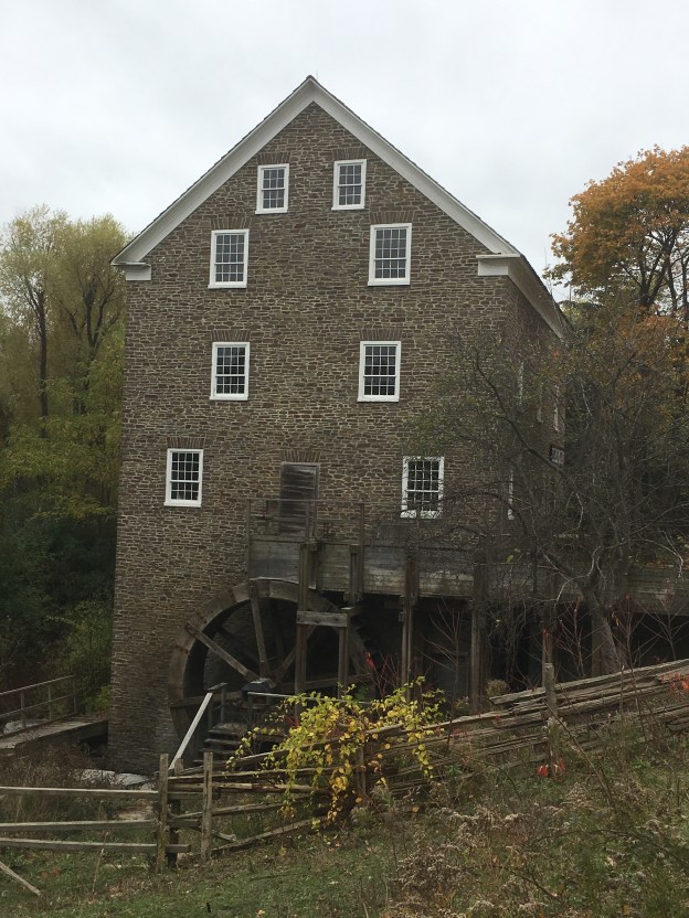
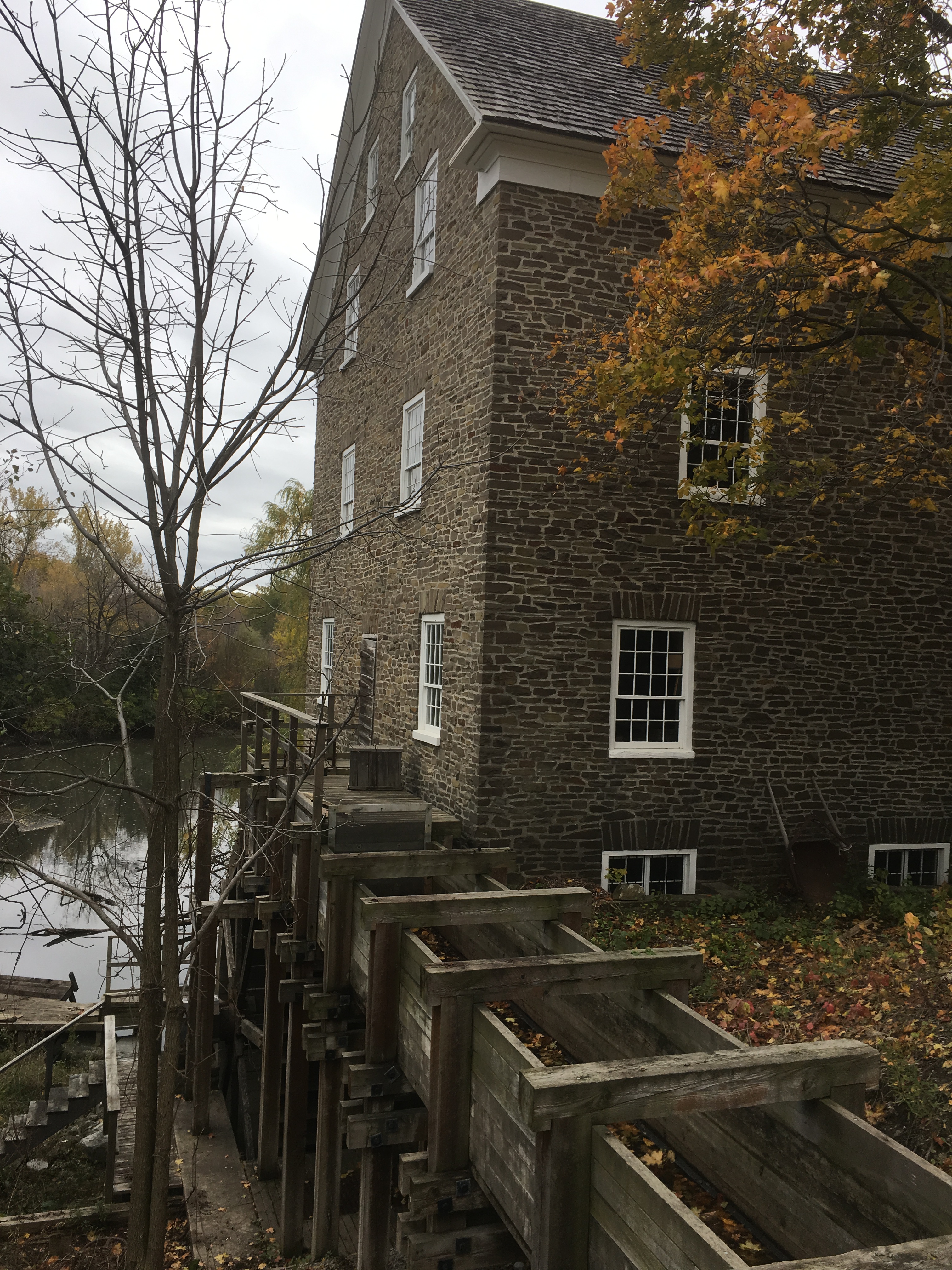
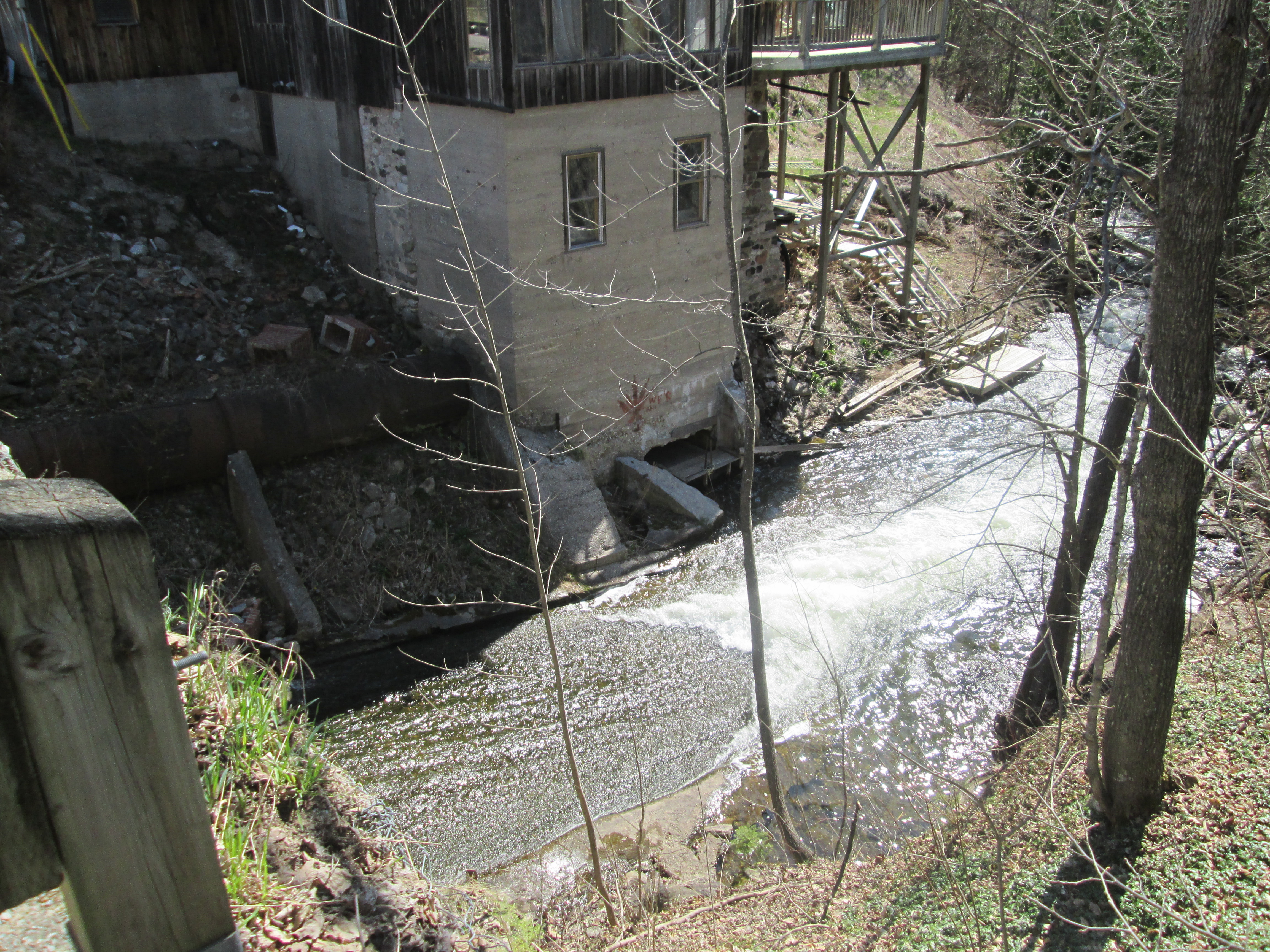
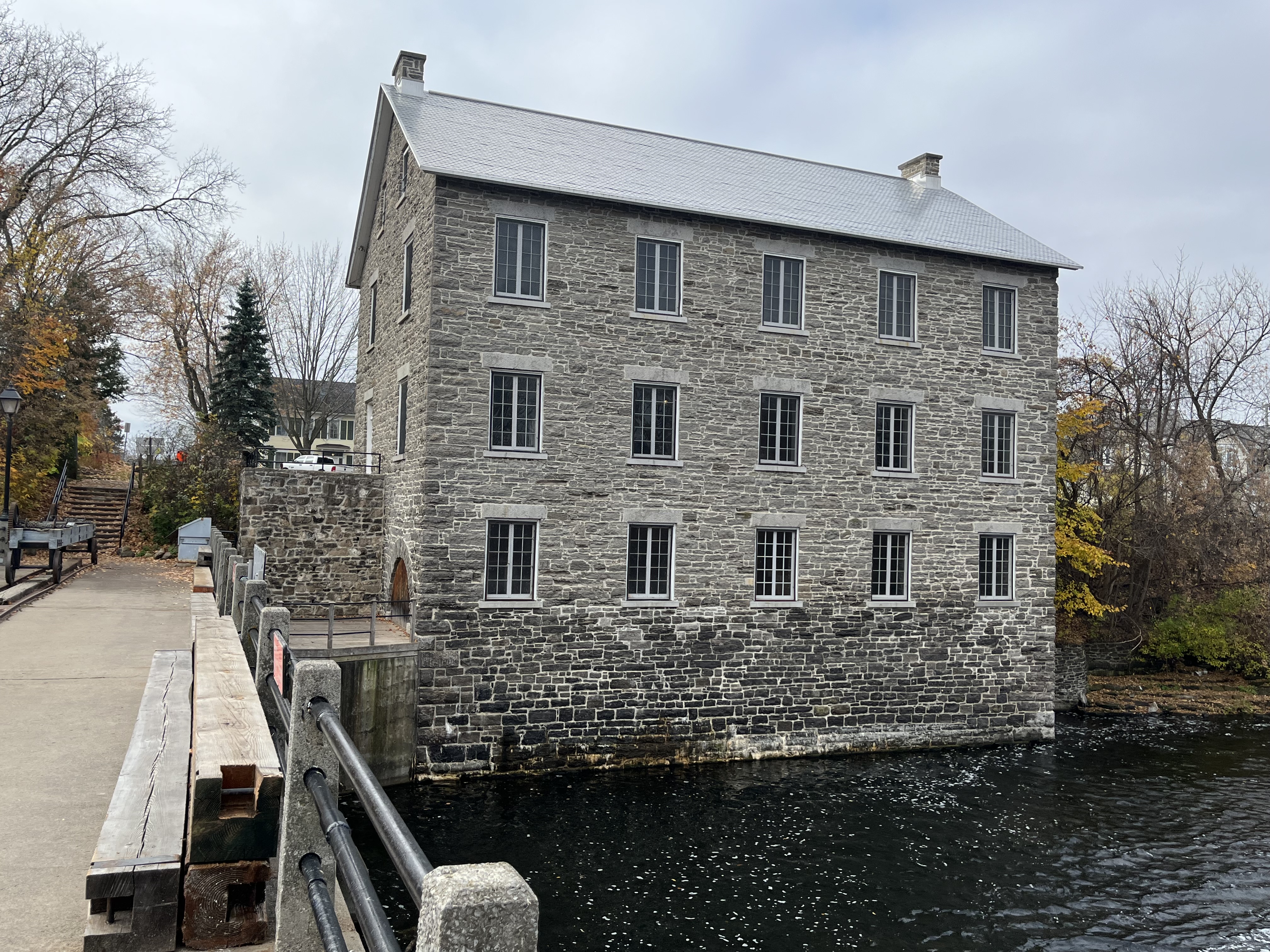
The view from the river side of the mill shows the Georgian symmetry of its three floor, five-bay construction.

Watson’s Mill in Manotick is one of only a few water-powered mills that still produce flour in all of Ontario and it is worth stopping for a visit if you are in the Ottawa area.

Google maps link: Watson’s Mill Manotick

Like us at http://www.facebook.com/hikingthegta

Follow us at http://www.hikingthegta.com

Also, look for us in Instagram

The Distillery District.

Sunday, July 12, 2020

The story of the Distillery District starts in 1832 with the idea for a grist mill on the east end of York (Toronto) harbour.  James Worts had been a miller in Suffolk, England before moving to York.  He built a 70-foot tall windmill that was a prominent feature on the York skyline and started a milling business with his brother-in-law William Gooderham.  Together they started a business that led to the largest distilling operation in Canada.  However, disaster struck in 1834 when James Worts lost his wife in childbirth.  Distraught, he jumped in the well at the mill and drowned himself just two weeks later.  Gooderham adopted his children and raised them along with his own thirteen.  Among the adopted was James Gooderham Worts who would become his partner in the business.

Their position on the waterfront provided easy access to large quantities of grain and so Gooderham decided to use some of it to make whiskey.  The distillery began in 1837 and being an entrepreneur, Gooderham began selling the spent grain wash to local farmers as feed.  Over the next four years he set up 9 acres of cattle sheds on the east side of Trinity Street and started a dairy operation as well.  The company kept fantastic records and appreciated their own history and so they retained the original millstone that was shipped from England in 1832 and used at the windmill.

img_4222

The Toronto Archives photo below shows the distillery as it appeared in the 1890’s on a post card.  It gives an idea of the scope of the enterprise that developed from that humble beginning with a windmill and a millstone.

Captions/Presentation slides. - 1903-1982, predominant 1978-1982

 In April of 1859 work started on the first wave of expansion for the company.  They began to build the most ambitious industrial building in the city, up to that time.  Built of Kingston limestone it is 80 feet wide and 300 feet long.  One half is five stories high to contain the mill while the west end is a story and a half and contained the distillery.  Working with lanterns in a dusty environment creates a serious fire hazard and many grist mills burned down because of it.  Gooderham has his constructed to be fire proof and when it burned in 1869 only the interior was lost.  This was quickly rebuilt and it is said that the grain that fell from the upper floors protected the milling equipment below and saved it from burning.  The cover photo shows the south side of the building which originally faced the Grand Trunk Railroad Tracks.

IMG_4237

The Boiler House is known as building number two and it is attached to the north side of the mill.  It was originally a single story limestone building but it has been radically altered overt the years.  When the boilers were upgraded in the 1880’s the limestone wall was removed to accommodate the equipment and was replaced with the present brick structure.  Just behind the smoke stack is building number four which was part of a major expansion in 1863.  The boiler house was using 30 tons of coal per day to fire the 100 horsepower engine in the mill.  The ashes from all this coal were taken and spread around the neighbourhood streets leading to some of the best packed streets in the young city.

IMG_4226

Several buildings were added to the north of the mill and west of Trinity Street in 1863 including new offices, cooperage buildings and the four story rectifying house for the purification of alcohol.   The modest offices pictured below served the growing business until they were replaced with a new office building on Wellington Street in 1892 known as the Flatiron Building.

IMG_4224

David Roberts Sr. was the architect for most of the early buildings in the compound while his son oversaw the construction of the later ones.  They were also responsible for designing several Gooderham family homes as well as the Flatiron Building.  Although the buildings served a utilitarian manufacturing function, Roberts made sure to include some purely aesthetic features.  Most of the brick buildings were set on limestone foundations so they would tie in visually with the stone mill.  The Rectifying House still has its decorative cupola and patterned brickwork.  This design is known as “arcaded corbelling” with a saw-tooth surmount.

IMG_4201

In the 1870’s another round of expansion took place.  The cattle sheds on the east side of Trinity Street were torn down and replaced with new ones on the east side of The Don River.  The Pure Spirits building, tank houses and store houses were built on their former site.  The Still Houses featured in the picture below were used to adjust the proof level of the spirits to ensure a consistent 40% alcohol.

IMG_4217

A dozen Tank Houses were added throughout the 1880’s for the storage of copper tanks of whiskey and later some were converted to hold up to 5,000 barrels per building.  

IMG_4166

Tankhouse Lane runs from Cherry Street to Trinity Street and is lined on both sides by these storage buildings.

IMG_4169

A shipping building was added in 1883 to store cases and barrels of whiskey that were ready for distribution to the markets.

IMG_4184

Meanwhile, the cattle sheds continued to function across the river and fifty years of disposing of the manure into Ashbridges Bay had contaminated it to the point where it was decided to fill it in and it was turned into The Port Lands.  During the First World War the company converted to producing acetone for the military under the name British Acetone.  The picture below is from the Toronto Archives and is dated November 30, 1916.

Acetone

After the war was finished the temperance movement succeeded in implementing Prohibition.  The company survived by distilling whiskey for export, although much of it passed through Quebec where it was legal and back into Ontario.  In 1927 the business was sold to Hiram Walker and continued to operate in a lesser fashion until the complex was closed in 1990.  

IMG_4192

The entrance to the Rectifying House was deliberately made grand to allow light into the interior of the building but it also has some awesome woodwork.  Two wooden arches support a circular oculi.  The original windmill was removed after the factory was converted to steam power and the site partially built over with the Rectifying House.  The semicircle of brighter red bricks in the lower corner of this picture marks the site of the windmill that started the enterprise.

IMG_4228

Rather than being turned into a museum like Black Creek Pioneer Village the site has been developed into The Distillery District which preserves the heritage in a unique way.  The factory buildings are full of interesting shops and activities that bring new life to one of the most complete Victorian Industrial Complexes in Canada.  The map below provides some insight into what awaits visitors to the area.

IMG_4162

The view below looks east along Gristmill Lane with the Stone Mill on the right and the chimney for the boiler room in the background.  The Coopers Shops and Rectifying House are on the left.

IMG_4239

This is one historic site that definitely needs another visit when I can go into the buildings and look around.

Just across Cherry Street stands the Palace Street School which was built in 1859 and served the children of many distillery workers.

Google Maps Link: Distillery District

Like us at http://www.facebook.com/hikingthegta

Follow us at http://www.hikingthegra.com

Look for us on Instagram


Donalda Farm

Sunday, December 8, 2019

The property of the current Donalda Golf Club contains some of the oldest farm buildings remaining in the city of Toronto as well as one of the earliest surviving grist mills.  The property was deeded to William and Alexander Gray in 1825.  They quickly built a small milling empire along the sides of the Don River.  The County Atlas from 1877 shows the grist mill on one side of the river and the saw mill on the other.  The saw mill vanished when the timber industry ran out of local wood to use.  The grist mill was incorporated into later structures and the old lane way to the grist mill survives today as an access road. Please note that the golf course is private property and is not open to the public, even in the off season.

Donalda

The lane way has been recognized for its historical significance and is now protected under the heritage act.  It served as an access road to allow farmers to bring their grain to the mill to sell it or have it ground for flour.  It served as a given road between the modern day Don Mills Road and Victoria Park Avenue.  The eastern half of this given road has been closed and serves the golf course.

IMG_3110

Around 1840 the two brothers built brick homes that stood side by side and just across the lane way from the grist mill.  These two houses still survive on the property and unfortunately it looks like the front of one of them has been painted red.  This hides the patterned brick work that is still evident on the side.  This house has a Georgian Style, a design that was popular between 1790 and 1875.

IMG_8679

The second house lacks the patterned brick but has a more Gothic design, popular from 1830-1890.  Based on the architectural styles it would appear that this house was constructed some time after the first one.

IMG_8680

The grist mill was built in the 1830s and operated until the farm was sold in 1916.  The Grays ground their own brand of flour which they called Wee MacGregor.  It is the oldest surviving grist mill in the city that stands on the original site.  The grain elevator shaft can still be found at the rear of the old mill.

IMG_8687

One of the doors on the top floor of the old grist mill appears to have shifted in its track.

IMG_8692

In 1916 David A Dunlap and Jesse Donalda Dunlap bought the farm from the Grays with the intention of building a model farm.  They had some ideas for sanitary husbandry that were ahead of their time and they wanted to showcase them to the world.  They hired the architects Wickson & Gregg to design and build their new barn, incorporating the old barn into the structure.  The cattle enjoyed soft radio music in the barn that featured fresh air ventilation.  In the winter they had steam heating to keep them warm and comfortable.  The pigs were bathed in olive oil and washed with toilet soap.  The front side of the old grist mill can be seen in this picture on the left of the new barn.

IMG_8681

The farm expanded to include 1800 acres of land with over 40 farm buildings and 30 employees .  A lot of attention to detail and fine workmanship went into everything including something as functional as the silo where the animal feed was kept.  No boring old poured concrete for this granary but rather some rather beautiful tiles have been used.

IMG_8693

This picture shows the farm buildings and the old grist mill from the side of the river where the saw mill once stood.

IMG_8684

David Dunlap made his fortune by founding the world’s greatest silver mine followed by founding the second greatest gold mine.  Although they never lived there permanently in 1920 the Dunlaps decided to build a new home that would be used as their country retreat.  The house was given doric columns and wrought iron was used to create a classical design.  When David died in 1924 he left a 5 million dollar estate farm that his wife operated with their son until it was sold in 1952.  By 1960 it had become the Donalda Golf Club and the home was renovated to become the club house.

IMG_8678

David Dunlap left a quarter million dollars each to several schools, hospitals and churches.  His donation to Toronto General Hospital funded the Dunlap Radiological Science Department.

Google Maps Link: Donalda Golf Course

Like us at http://www.facebook.com/hikingthegta

Follow us at http://www.hikingthegta.com

Also look for us on Instagram


Roblin’s Mill

Sunday, November 19, 2017

Black Creek Pioneer Village is built around the homestead of Daniel and Elizabeth Stong.  Their story and a brief history of the village can be found in this earlier post.  Once the decision had been made to collect historic buildings to allow people to glimpse the life the settlers lived it was time to identify potential buildings to put in the village.  Since most pioneer villages were founded around a saw mill, grist mill or woollen mill it was necessary to move a mill to the site at Steeles Avenue and Jane Street.

Owen Roblin took possession of a land grant not too far from Trenton that included a lake that came to be known as Roblin’s Lake.  Owen blasted a head race from the lake to a point where he could create a 75 foot head of water to turn his 30-foot overshot water wheel.  He divided part of his property to create town lots which were the beginning of the town of Roblin’s Mills.  He added a sawmill and carding mill and the town attracted blacksmiths, a harness maker hotels and a general store.  Today the town is known as Ameliasburgh.  The picture below shows the mill around the time it closed.  The building in the foreground is the carding mill and the water wheel is between the two buildings.  The head race runs under the road.  The building in the background with the sloping roof is the File Brothers General Store which closed in 1951.

Roblins-Mills-archive-photo

During the peak period around the time of the American Civil War, the mill was producing up to 100 barrels of flour per day.  Most of this was shipped to the northern states where it supported the army.  The mill was closed in 1920 and sat abandoned until 1965 when it was decided to demolish it.  The Toronto Region Conservation Authority (TRCA) was looking for a mill for Black Creek Pioneer Village and decided to purchase Roblin’s Mill and relocate it to the village.

IMG_0456

A mill pond was created at the village using Black Creek as a source of water.  There is a second mill pond behind the mill where the water goes after it flows over the water wheel.  This picture shows the upper pond and the entrance to the headrace which also flows under the road.

IMG_0492

The five-story stone mill was built in 1842 and soon became the focus of the community and included a post office.  As a commercial mill, it operated 24 hours per day with three run of stones.  The picture below and the cover shot show the open wooden flue that carries the water to the wheel.

IMG_0442

Inside, large wooden gears turned by the water wheel drove the three mill stones.

IMG_0480

Millstones relied on fine grooves that had to be dressed at least once a month when the mill was running 24 hours per day.

IMG_0468

Samples of grain and flour were moved from one floor to the other using these belts and cups.

IMG_0458

The ground flour was stored in dry barrels that were produced next door in the cooperage.  A dry barrel was less precise than ones known as wet barrels which were used for liquids such as whiskey.

IMG_0465

Black Creek has added the cooperage of John Taylor to their collection of buildings.  The building dates to the 1850’s and was moved to Black Creek Pioneer Village in 1976.  It wasn’t restored or opened until 1988.  Coopers often located next to mill complexes so that there was a ready market for their wares.

IMG_0450

Inside John Taylor’s Cooperage, you can see several types of barrels that were produced in the shop when it was located in Paris, Ontario.

IMG_0452

We close with an archive picture of the mill before it was moved to the village.

A1987_001_005_001

I have yet to see the mill in operation although I have purchased a bag of flour that was milled there.

Google Maps Link: Black Creek Pioneer Village

Like us at http://www.facebook.com/hikingthegta.com

Follow us at http://www.hikingthegta.com

Marchmont Grist Mill

Saturday May 2, 2015

It was 18 degrees with just occasional clouds.  I had the occasion to meet my parents and an older brother in Orillia for breakfast.  West of Orillia is the village of Marchmont, named after the Earl of Marchmont.  It grew up as a small farming community where the mill served initially to grind grain then primarily as a feed mill preparing food for local farmers for their livestock. Other local industries such as the blacksmith also served the needs of the farmers in the adjacent land grants.

Some records indicate a government operated mill here as early as 1834 built to provide employment for local natives.  This didn’t work as expected and by 1843 the mill was sold into private hands.  When the original mill burned in1884 the town went without one for about three years.  A new mill was built in 1887 by Charles Powley who installed two runs of mill stones.  He used one for grinding flour and one for making livestock feed for the local farmers. In 1947 it was converted to a full time feed mill and the flour rollers were removed.  The mill records indicate 13 different people operated the mill until it closed for good in 1987.  It has been used as a private residence since 1989.  In the picture below the dam on the North River creates the beautiful Marchmont mill pond.  The residents used the pond for swimming in the summer and skating in the winter.

IMG_4050

Water flows out of the mill pond and over the dam to maintain the water level in the mill pond. When the mill was in operation water was allowed out of the pond and through a flume to the water wheel.  The original wooden flume was replaced in 1910 with the present metal one which is four feet in diameter.  It runs under Marchmont Road and into the mill.  Before the mill was closed the aging pipe had sprouted many leaks.  In the winter natural ice sculptures 15 feel high would be created around the leaks.

IMG_4055

The Marchmont Grist Mill as it appears today in service as a home.  The mill is featured in the cover photo as it appeared in the early 1900’s.

IMG_4057

The flume is seen entering the side of the mill a few feet above the river level.  At first there was a large water wheel here which was later replaced with the more efficient turbines.  The water was returned to the river through the chute at the bottom.

IMG_4058

The spiral casing for the turbine was connected to the end of the flume.  Water is forced into the spiral casing spinning the turbine blades.

IMG_4068a

The spinning turbine blades power a system of drive shafts, belts and pulleys inside the mill.  A chute would be opened with a hand cranked wheel to allow water to flow into a chamber about 30 feet below the lower floor of the mill.  When running at full speed the turbine could produce 75 horse power.

IMG_4070a

Corn was brought in by the wagon load, and later on trucks, to be prepared as food for livestock. It would be dumped into a slot on the floor just inside the door where it would drop into a bin below.  Customers brought grains for processing or came to purchase products such as Swift’s Dairy Feed that was produced on site.  In this archival photo we see the front side of the mill where customers would have entered.  In the background we can see the Baptist Church and then the Blacksmith’s house.

Marchmont

Marchmont Baptist church celebrated it’s 127th Anniversary this past weekend.  It’s formation dates back to 1877 when church meetings were held in people’s homes.  Jacob Powley owned a town lot just to the west of the mill pond.  He sold it for $1.00 for the purpose of erecting a church.  In October 1888 thrity-one members of Orillia Baptist Church formed the new congregation that came to be known as Marchmont Baptist Church. In 1923 the church numbered 61 and had outgrown the building.  The abandoned Gospel Hall was purchased and moved as an addition to the back of the church.  In 1962 a new church lot was acquired in trade for the old lot and building.  The cemetery in town belongs to the Baptist Church but is dated to 1832.  This contains the earliest settlers and came under the care of the Baptist church at a later date.  The old church building is gone but the owner of the house pictured below has added a considerable history of the place in the comments at the end of this post.

IMG_4060

Across the lane from the old church building stands the former blacksmith shop and an 1860 home from it’s former owner.

IMG_4061

Built of local logs in the 1840’s, this house is the oldest one in Marchmont and one of the oldest on it’s original site in Ontario.  It is currently in use as an artist’s studio.

IMG_4065

This old board and batten building has the appearance of being an old garage.  The White Rose sign contains the logo for a Canadian motor oil company with roots to the early 1900’s.  By the 1920’s they were opening up stations to serve the growing need for gas for cars.

IMG_4072

Old gas pumps stand beside the old garage.  Imperial Oil is Canada’s second biggest oil company, operating under the brand name Esso.

IMG_4073

Built in 1898 the old union school building has also been converted into a residence.

IMG_4080

It was nice to get out of town and see an historic community that hasn’t been surrounded by development.  It should take the GTA a few more years before it expands to the point that high rises are needed in Marchmont.