Saturday March 12, 2016
Rattlesnake Point is located on a mesa-like outlier where the Niagara Escarpment makes a rise in elevation from about 240 meters to 440 meters. A glacial ravine divides it from the vertical rock faces of the escarpment to the west. This ravine, known as Nassagaweya Canyon, is partially filled in with glacial stream deposits.
On the 1877 County Atlas map below the escarpment is marked by a series of scalloped lines that indicate a quick change in elevation. Just west of Milton the shape of the escarpment reminded the surveyors of the shape of a rattlesnake’s tail. The southern promontory of this geological formation was known as Rattlesnake Point at least 140 years ago when the map was drawn. Timber Rattlesnakes were seen here by the hundreds sunning themselves on the rocks but they have been gone for over 60 years. The land is rugged and covered with rocks but the map shows that it has all been granted as homesteads to settlers. Joseph Dice owned the property with Rattlesnake Point on it while his father, Matthew owned the one just below it. The little square of small dots beside the larger one on Joseph’s property indicate an apple orchard planted near the house. In a twist of the macabre, Joseph died on Aug. 1, 1917 when the wagon load of hay he was harvesting rolled over. He jumped clear from the wagon but the horses bolted and they dragged the wagon wheel over his abdomen, fatally wounding him.
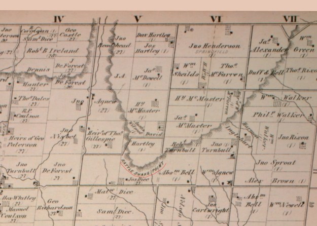
Joseph Dice never opened the road allowance up the side of Rattlesnake Point and it is shown as a dashed line on the map above. It has since been opened and now features a tight hairpin curve as you climb the escarpment. Whereas the land on top of the escarpment was predominantly open in the 1870’s it has now been largely reforested. Some of the new tree cover was planted in straight rows while other areas have been reclaimed naturally over the years.

Eastern White Cedar trees can live to be hundreds of years old. Starting in 1998 the Niagara Escarpment Ancient Tree Atlas Project began identifying trees that are between 500 and 700 years old. These cedar trees cling to the cliff face where their ecosystem has remained undisturbed during the clearing of the table land for farming. They also tend to be small in size making them less desirable than the trees that the farmers harvested for fence posts and other building materials. Prior to opening the park to sport rock climbing it was necessary to conduct a study to make sure that none of these ancient trees were disturbed. At Rattlesnake Point one cedar, for instance, was identified at 588 years old but only 3.2 meters tall. The cedar tree clinging to the rock face in the picture below is not that specific tree but demonstrates how they can find a way to survive almost anywhere.

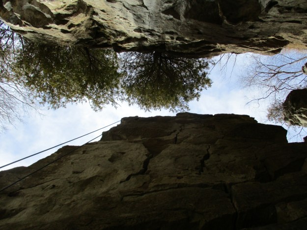
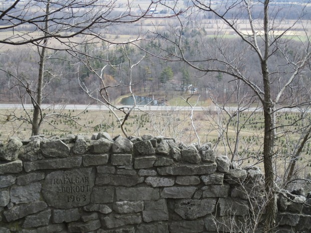
The Trafalgar Lookout is seen in the cover photo and is near to one of the rock climbing areas. in 2006 a series of bolts were installed on the top of the cliff face in areas where the vertical face was clear of vegetation. These bolts are inspected regularly to provide a safe anchor for top-roping. Once the rope has been run through the anchor it is dropped over the side. At this location there is a set of stairs to provide access to the cliff bottom. Top-roping is usually how most rock climbers get started. We saw a licensed instructor teaching first timers how to rope off at the top of the cliff. A second type of climbing, known as lead climbing, is done near the same location on a tall thin fragment of rock that stands a few feet out from the cliff face. In lead climbing a rope is clipped to the rock wall every few feet to limit the amount of a potential fall. The climber removes the clips as they ascend and fixes them to their belt. On the way back down they replace them for the next climber. We watched the guy in the picture below as he made his way up onto that thin sliver of rock. Notice the collection of clips on his belt.

The picture below is taken from beside the rock face that the individual above was climbing. Looking up you can see some small cedars clinging to the rock face on the side where climbing is not allowed.
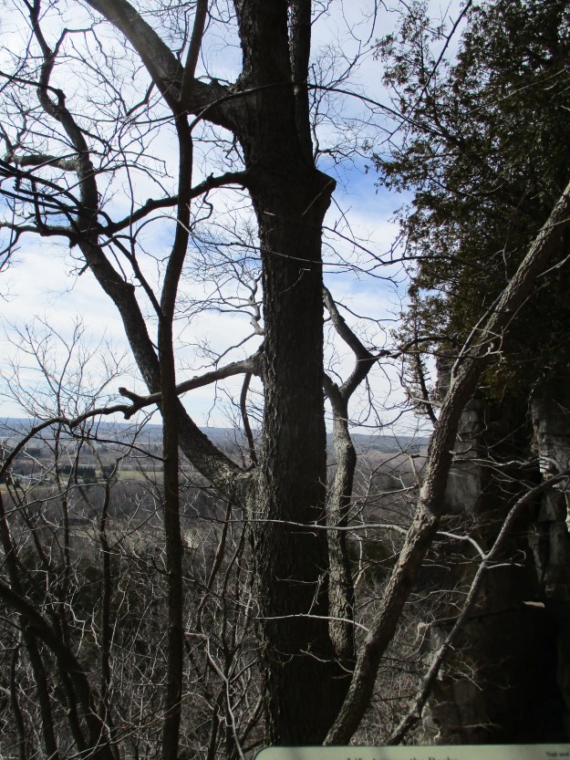
The hackberry tree is a member of the hemp family and can live up to 200 years. It has a light grey bark which has extensive ridges and warts on it. It will bloom between late April and early May and produces both male and female flowers on the same tree making it a monoecious plant. The natives used hackberry bark to treat sore throats, sexual diseases and menstrual cramps. They also ate the fruit in a form of a porridge. Today, the fruit is eaten fresh or in the form of jam. Leaves from the tree provide food for deer and small mammals and birds eat the fruit. The hackberry tree does not grow farther north than Halton and is part of the Carolinian Forest, the richest vegetation zone in Canada.
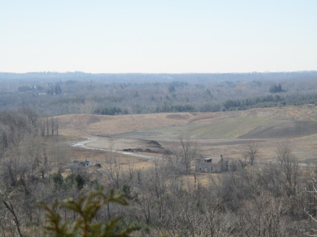
Around 12,000 years ago, at the end of the last ice age, glacial melt and raging rivers carved out sections of the escarpment. The Nassagaweya Canyon is one of these meltwater channels. The canyon runs between the Milton Outlier which contains Rattlesnake Point and Crawford Lake with it’s historic village of Longhouses. The mouth of the canyon is filled with glacial outwash till and is home to sand and gravel quarries like the one in the picture below.
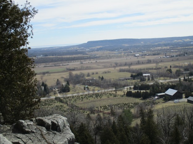
Lowville Valley extends 5 kilometers between Rattlesnake Point and Mount Nemo. It is drained by Bronte Creek which was a powerful river when the glaciers were melting. Lake Ontario can be seen in the distance.
Eastern chipmunks hibernate in the winter and are a sign of the return of spring. They live in solitary except during mating season which happens in early spring and again in early summer. We saw several pairs of them playing their little chipmunk games. A litter of four or five will emerge from the den about six weeks after they are born. Within two weeks the newborns will set off to build their own dens. Those that don’t end up as prey to hawks, snakes or a wide variety of predatory mammals will live for three years or possibly longer.

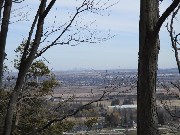
Looking to the east you can see the towers of Mississauga and on a clear day, the CN tower.
Rattlesnake Point contains several trails including the Bruce Trail, the Vista Adventure trail and Buffalo Crag trail. The Nassagaweya Canyon trail also connects at Rattlesnake Point.
Google Maps link: Rattlesnake Point
Like us at http://www.facebook.com/hikingthegta
Pingback: Nassagaweya Canyon | Hiking the GTA
Pingback: “Long” Weekend Hikes | Hiking the GTA
Pingback: Mount Nemo | Hiking the GTA
Pingback: River and Ruin Side Trail | Hiking the GTA
Pingback: Crawford Lake Trails | Hiking the GTA
Pingback: The Gap | Hiking the GTA
Pingback: Above and Below the Fall Colours at Rattlesnake Point – AWayWithACamera
You know? Remember the other day I told you (and others) about my father’s slides? One batch of them was a boy scout camp in 1977 at Rattlesnake Point and a few were at that rock wall!