Friday, April 14, 2017
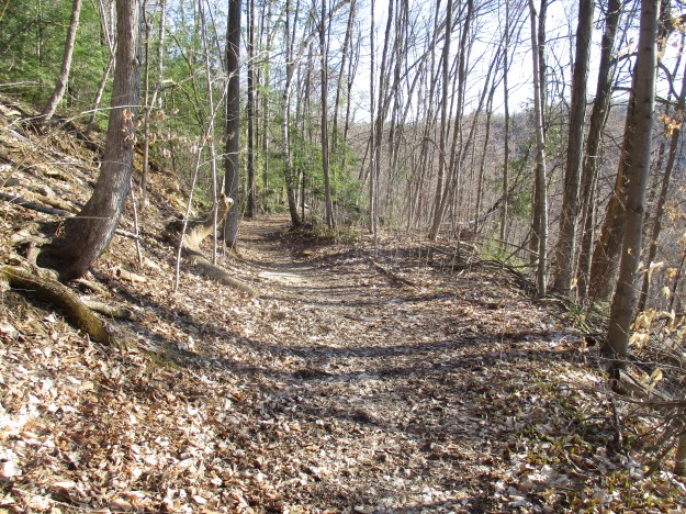
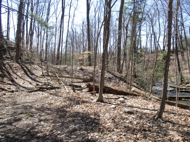
The Niagara Escarpment stretches between Niagara Falls and Tobermory and is the most prominent geological feature in Southern Ontario. Early settlers who received land grants along the escarpment found it difficult to farm and often looked to their natural resources as a source of income. This was true for those who took possession of land in Esquesing Township along the edge of the escarpment. Today the area is known as Silvercreek Conservation Area and we returned to carry on from last week’s exploration of Fallbrook Farm. This time we made our way along the bumpy and curving road known as Fallbrook Trail to where there is free parking at the Bruce Trail crossing near 27 Sideroad. One objective of today’s exploration was the Irwin Quarry which now is traced by a Bruce Trail Side Trail. The trail is marked with blue slashes and in many places follows the old access road for the quarry.
By the 1960’s there were 13 large quarries producing construction materials from the Niagara Escarpment. Nearly 50 other, smaller quarries had come and gone. There are three factors that determine the economic success of a quarry and these are 1) proximity to the market, 2) quality of the stone and 3) the ability to access the stone easily. The escarpment around Hamilton and Toronto was found to meet all of these requirements in many places. The cost of shipping stone products determines the competitiveness of a quarry. If it costs 10 cents per kilometre to ship the stone, then a producer of a million tonnes annually spends $100,000 per year in transportation for every extra kilometre away from the job site he is located. The quality of stone in many places along the escarpment is excellent. Finally, the soil that has to be removed to access the stone is known as the overburden. The limestone and dolomite are often very near to the surface along the escarpment leaving little digging to be done and in general no quarry will be started where there are more than 6 metres of overburden. The picture below shows a view of the exposed limestone in the former Irwin Quarry and the relatively little soil that is on top of it.

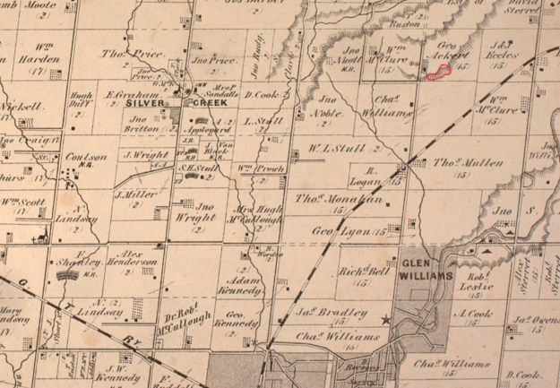
The site of the Irwin Quarry is formally known as lot 26, Concession 9 in Esquesing Township. Samuel Irwin owned the property for a short time around 1877 and it may have been his lime kiln that still stands near the quarry. At the time of the county atlas, the property belonged to George Ackert and it was located directly across the road from William McClure’s property with the two mills marked on it. The quarry has been outlined in red and is a piece of the escarpment known as the Glen Williams Outlier.
Life can grow in the harshest conditions and trees have taken root in small pockets of soil between the layers of dolomite. The white birch tree below has a precarious hold on the rocks on which it grows.

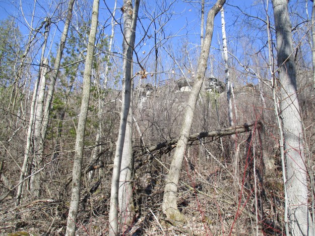
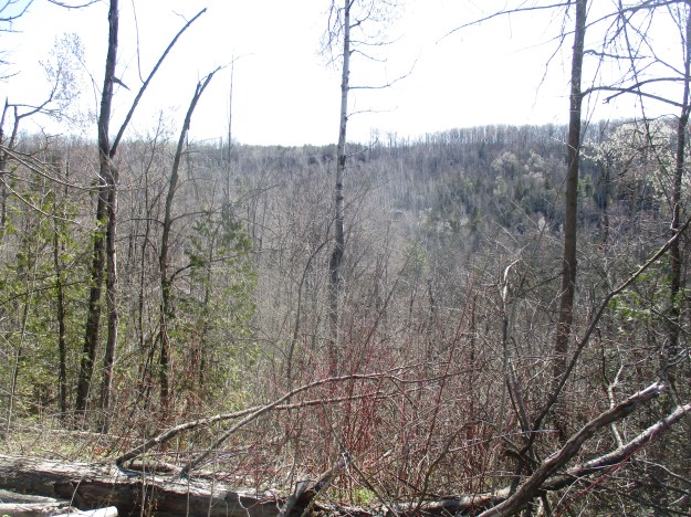
The Industrial Sand and Gravel Company Limited operated the quarry in the exposed Amabel dolomite formation. This 30-foot formation exposed white to buff dolomite on the top with light grey to dark grey Reynales Dolomite below this. The quarrying operation was conducted in the mid-1960’s and used for local road construction. It is quite likely that the base of Fallbrook Trail is made of gravel extracted from Irwin Quarry. The quarry has been closed for about 50 years and has a full forest cover in most areas. The picture below shows the view from about halfway up the side of the ravine looking up at the metal railing of the lookout from last week.
Silver Creek flows in a deep ravine through the escarpment that is far in excess of the channel needed for the amount of water it carries today. During the retreat of the last ice age, the deep ravine was cut exposing the rock face for the quarry.
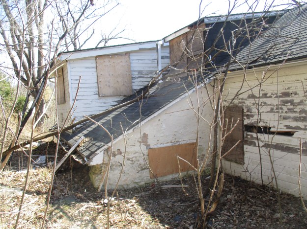
Last week we featured the house at Fallbrook Farm and noted that the house had been added onto by extending it to the east end. Here is another look at the house, this time looking at the additions from the rear of the building. This must have been interesting for the kids who could come and go through their bedroom windows!
This time we ventured down the east side of the creek where the mills were located. The saw mill was built where the stone has been placed to protect the embankment from erosion.
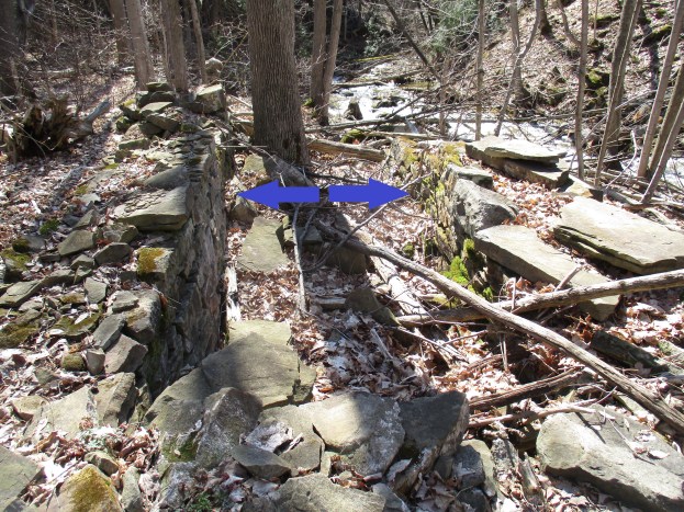
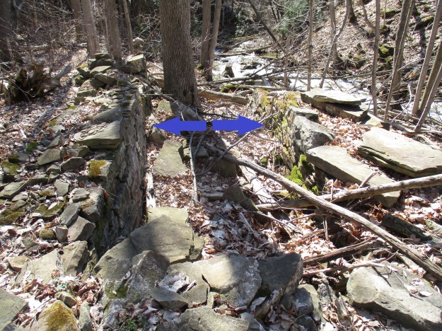
The grist mill was built on the flats about 130 metres downstream from the mill pond. This allowed for a drop of 11 metres from the pond to the waterwheel. There isn’t very much left of the mill anymore except the foundations for the wheelhouse. Based on the footprint of the housing the wheel is estimated to have been 1.3 metres wide by 4 metres tall. When the water flow was good it would have produced 25 hp of power to operate the mill. The two sides of the wheelhouse are indicated by arrows in the picture below.
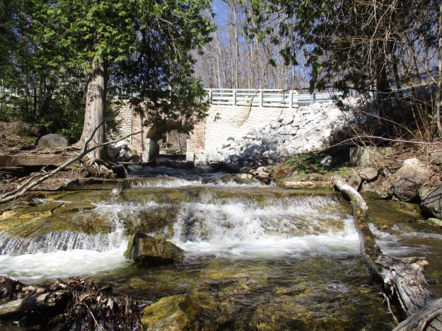
Upstream from the bridge, the creek drops over several little steps creating multiple little waterfalls as it rises 11 metres to the old dam. The dam was built where the ravine is narrow and a small floodplain was available to create a pond. The early dam was made by filling a wood crib across the creek with rocks. The portion of the dam that was built on land was created by scooping dirt into a mound. In the picture below, the trail climbs over the mound of the old dam while a hollow behind the dam marks the site where the earth was extracted.
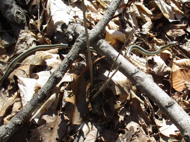
Garter snakes mate soon after waking from hibernation. The female can produce up to 80 snakes in a single litter. In the wild a garter snake will live for about 2 years but can survive up to 10 years in captivity.
Once again we left Silvercreek Conservation Area with large portions left unexplored.
Google Maps Link: Silvercreek Conservation Area
Like us at http://www.facebook.com/hikingthegta
Follow us at http://www.hikingthegta.com

Pingback: Bruce Trail – Toronto Section | Hiking the GTA
Pingback: Scottsdale Farm | Hiking the GTA
Pingback: Scotsdale Farm | Hiking the GTA
My wife’s cousin owned a house built on the McClure farm next to the Irwin quarry. There was another quarry there as well as a lime kiln.