Saturday, August 19, 2017
The River and Ruin Side Trail explores the property that formerly belonged to James Cleaver. James built the mill in Lowville and a stone house for his family. The mill still exists as a private residence but the house has been ruined for many years. There are four or five official parking places along the side of Britannia Road at the intersection with the Blind Line. The Bruce Trail follows the right of way for the Blind Line and it descends to the level of Twelve Mile Creek. Just before you reach the creek you will come to the River and Ruins Side Trail which is marked with blue blazes on the trees. It is a 2.5 km trail that wanders through some heavy patches of Wild Parsnip, a poisonous plant.
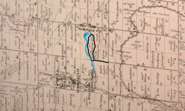
James Cleaver was born in Pennsylvania on January 30, 1800, and was 5 when his family moved to Upper Canada. In 1813 James went with the family horses when they were conscripted for use in the War of 1812. It is said that James and his team were at the Battle of Stoney Creek. It was around this time that he took an interest in becoming a Public Land Surveyor and started to attend school to qualify for this occupation. He was 20 years old and teaching in the Lowville one room school house when he completed his studies. The County Atlas pictured above shows the land as belonging to Cleaver PLS or Public Land Surveyor. It was uncommon for a land owner’s occupation to appear on the map and perhaps James put this here himself.
The house was added onto at least once and it appears that there was certainly a need for it. James married Angeline DeMond on November 3, 1827, and they had 7 children before she died in 1841. James took Jane Watson as a second wife and had 11 more children with her. Cleaver died March 30, 1890, leaving his land holdings to his sons. Instructions were given for the leasing of the Cleaver Grist Mill in Lowville with the money being divided among the seven living daughters.
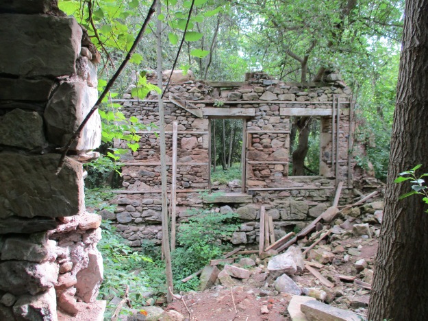
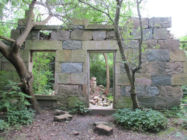
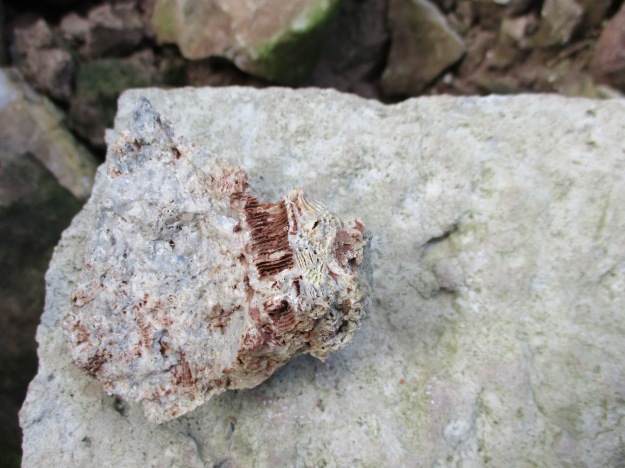
The stone that James used to build his house was taken from the property. Larger pieces of dolomite were used for the front walls as an expression of the status and importance of the occupants. The rear and side walls were made of smaller pieces of limestone. The front walls had dolomite window sills and lintels while the back of the house had rough-hewn logs for the window framing. The cover photo shows the front side of the house and the second story can be seen in the form of window sills along the top of the wall. The walls are about 20 inches thick with wood strips set into the inside of them to allow for the application of the inner wall coverings. These can be seen in the picture above which looks at the front wall from the inside. The door easily accommodated James’ six-foot two height. The story circulates on the internet that the house burned down in the 1920’s but there appears to be no physical evidence of this. All of the wood framings are free of char marks that would indicate a fire. The limestone pieces that have fallen down contain many interesting fossils including the crinoids in the sample pictured below.
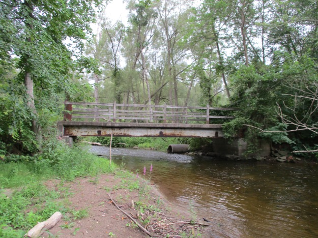
Following the trail will eventually bring you to Twelve Mile Creek, otherwise known as Bronte Creek near an old concrete and steel beam bridge. The opposite side of the creek is clearly marked as no trespassing and the bridge claims to be under video surveillance. Both ends of the bridge are closed with steel gates. Notice the large concrete culvert in the creek, just behind the bridge.
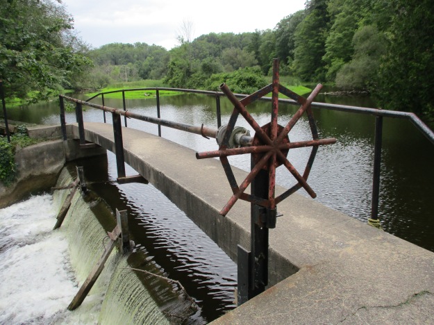
The Cleaver Mill Pond has been drained but a concrete dam still remains in place, close to Guelph Line in Lowville. The approach along the river follows a well-used trail that likely represents the old Cleaver laneway. Once you cross over the dam you will find that you are on the wrong side of a no trespassing sign that blocks access from the road.
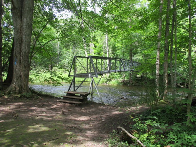
The river portion of the River and Ruin Side Trail splits at one point to provide a winter and early spring trail called the High Water Trail that keeps you out of the mud and water along the side of the creek. The Low Water Trail is more scenic and is the one to follow in the summer and autumn months. When you get back to the point where the side trail connects with the main Bruce Trail you will find an elevated bridge that carries the Bruce Trail across Bronte Creek.
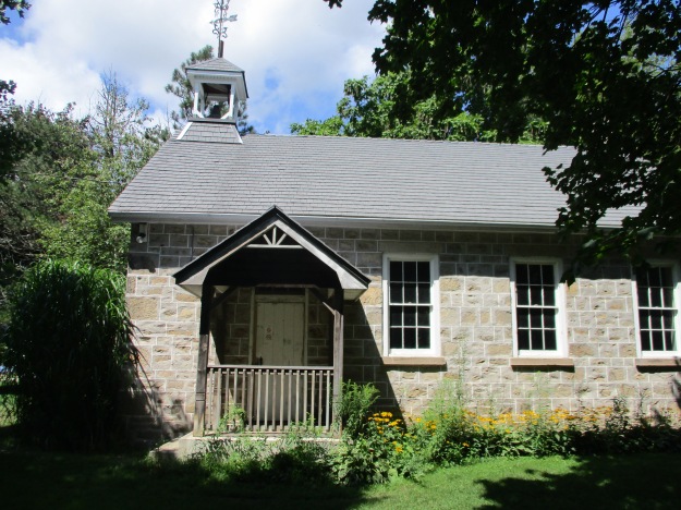
There are several historic buildings in Lowville including the old grist mill, churches, and the pioneer cemetery. Lowville Park stands just beside the old school house built in 1889 and pictured below. This is a replacement for the school that Cleaver once taught in.
The Bruce Trail and its side trails around Lowville make for an interesting outing and are close to several other great hikes including the following:
The Longhouse People Of Crawford Lake
Google Maps Link: Lowville
Like us at http://www.facebook.com/hikingthegtaFollow us at http://www.hikingthegta.com
Follow us at http://www.hikingthegta.com
