January 2, 2022
Enniskillen Conservation Area is a 65-hectare park in Durham Region that has 5.5 kilometres of trails. The conservation area is mostly forested but has diverse forest cover and some wetlands. Be aware that there is a $6.00 parking fee that can only be paid by Visa or Mastercard. Cash is not accepted, so follow the map link at the end of the post but come prepared.
The Google Earth capture below shows the conservation area with an old mill pond outlined in blue while the current pond is just a small blue dot. The yellow line roughly follows the figure eight of the trails I took around the outer edge.
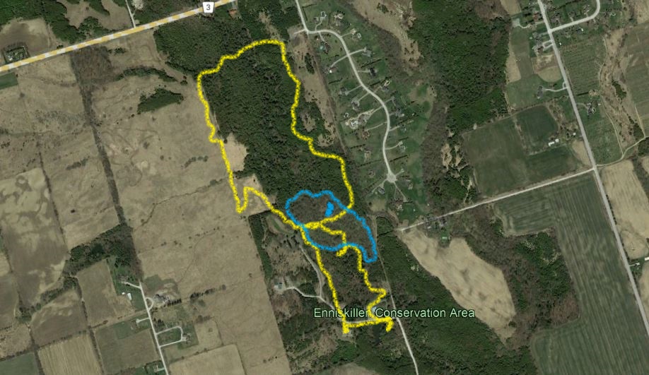
The conservation area has a network of five trails that are each loops, which share some common sections where they intersect. From the lower parking area, you can either choose the Turtle Trail, which takes you through a wetland around a small pond, or the Moorey Mill Trail which connects you to the other trails in the northern part of the conservation area. Not expecting to see very many turtles on this visit, I chose the Moorey Mill Trail. This trail is a 1.2 kilometre loop that takes you up one side of Bowmanville Creek and then down the other side.
Near picnic area 3 the trail crosses Bowmanville Creek on a small footbridge. This is also where the Moorey Mill Trail Meets up with the Cedar Trail. The Moorey Trail from this point heads back toward the car and so I saved it for the return trip.
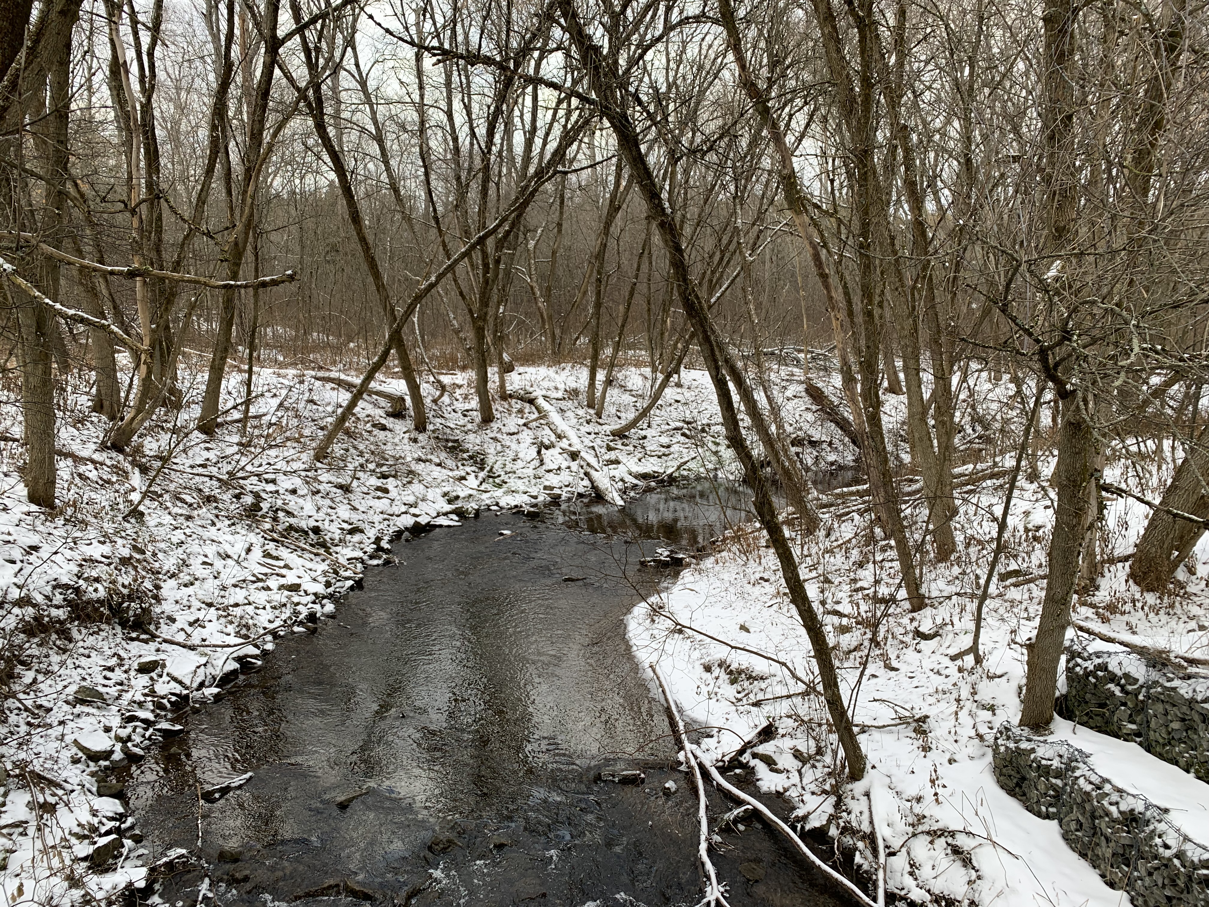
The remnant of the millpond has a thin layer of ice on it but during the summer is likely alive with activity. A much larger mill pond existed here between 1874 and 1954 but we’ll get to that later.

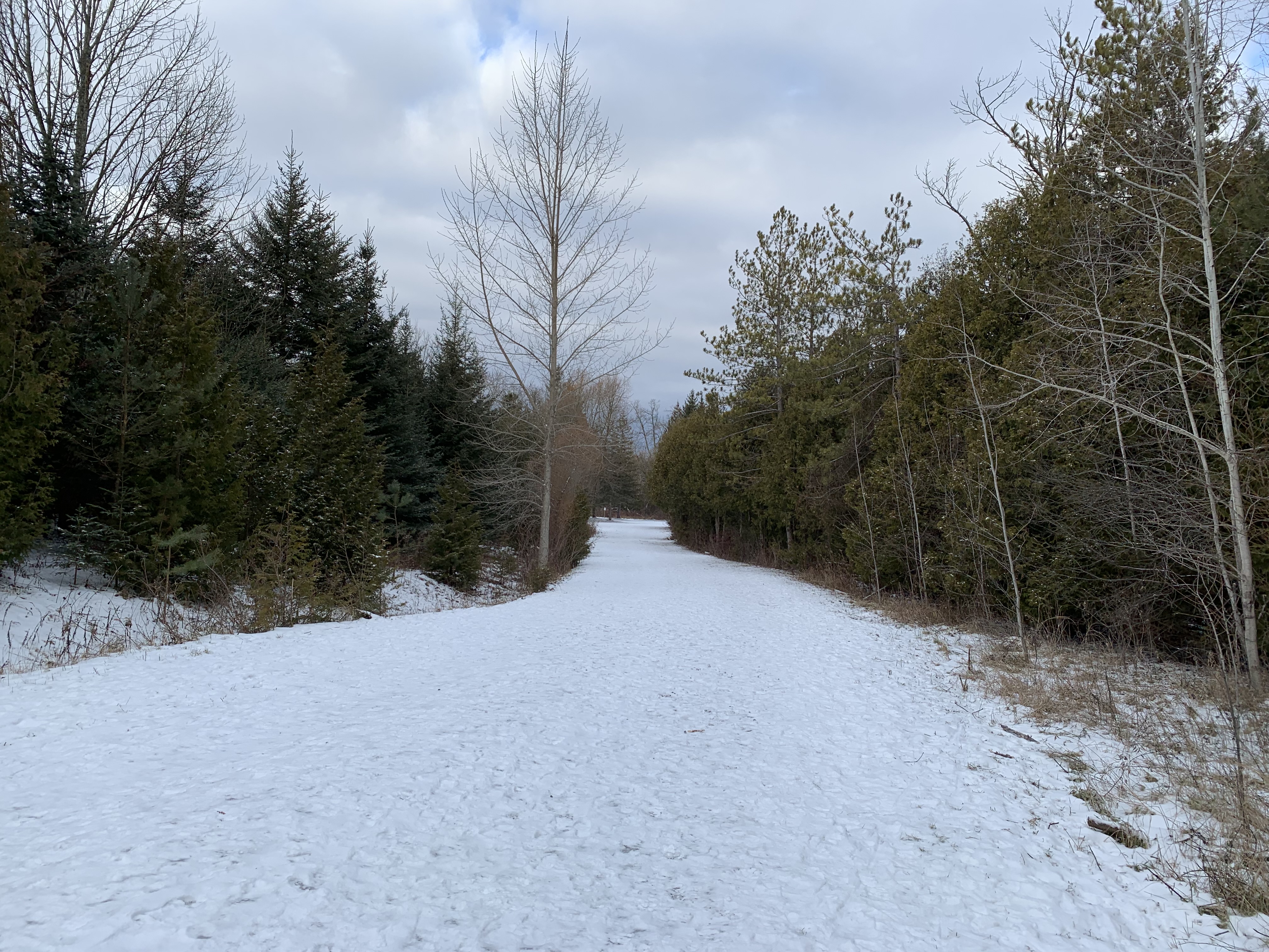
For now, I turned and followed the Cedar Trail up the hill and into the cedar forest. This 1-kilometre trail winds through a dense forest which, in places, shows the obvious straight lines of having been planted. In other places, it appears quite random and grows very close together. You could be just a few feet away from something in the forest and never see it.
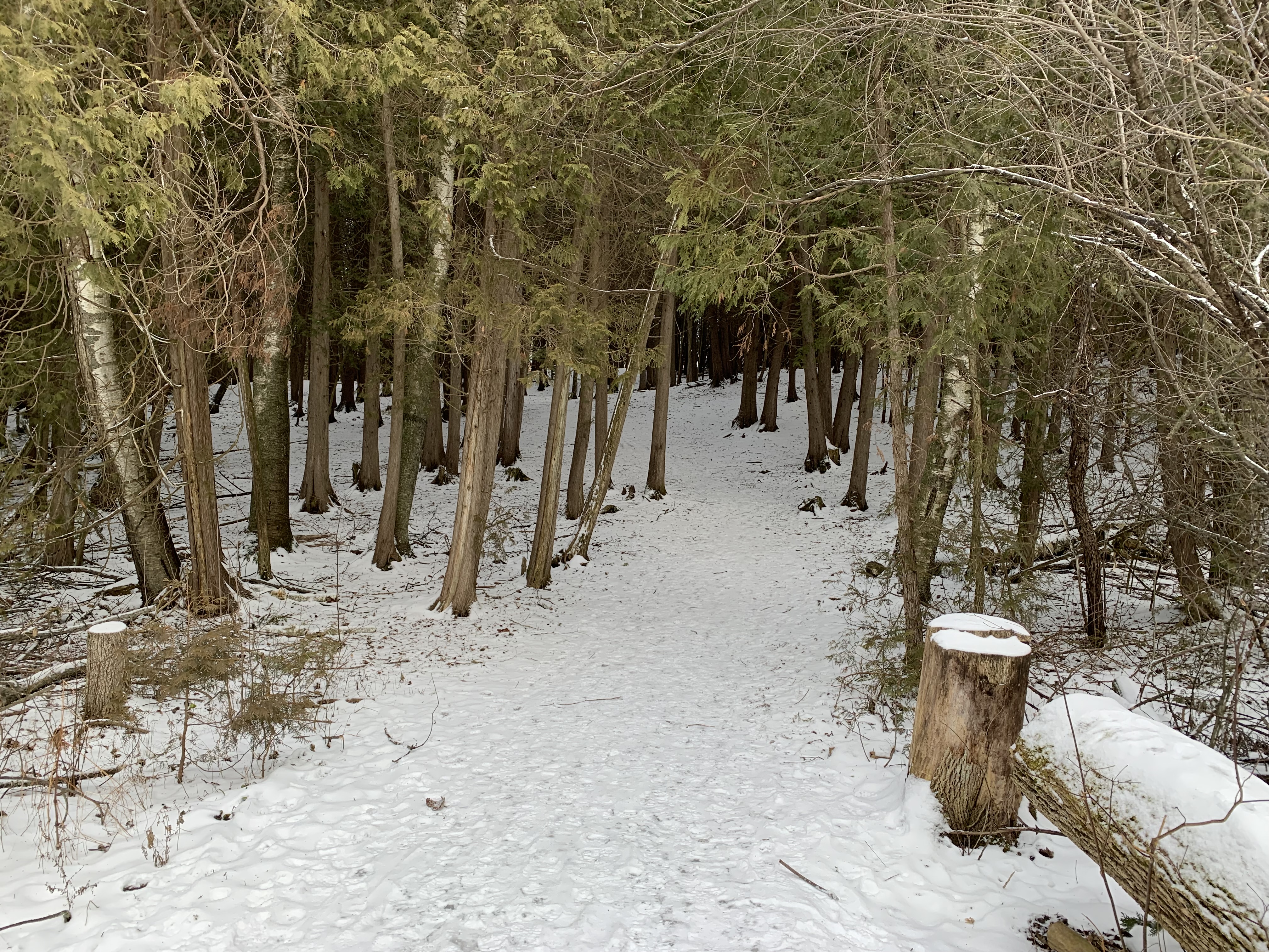
We have reviewed the trails in several parks over the years and some of them are quite well marked while others seem to invite you to get lost. The trails at Enniskillen Conservation Area are very well marked. The trail marker below indicates that the Cedar Trail turns here or that you could choose to follow the Ruffed Grouse Trail. This is what I decided to do.

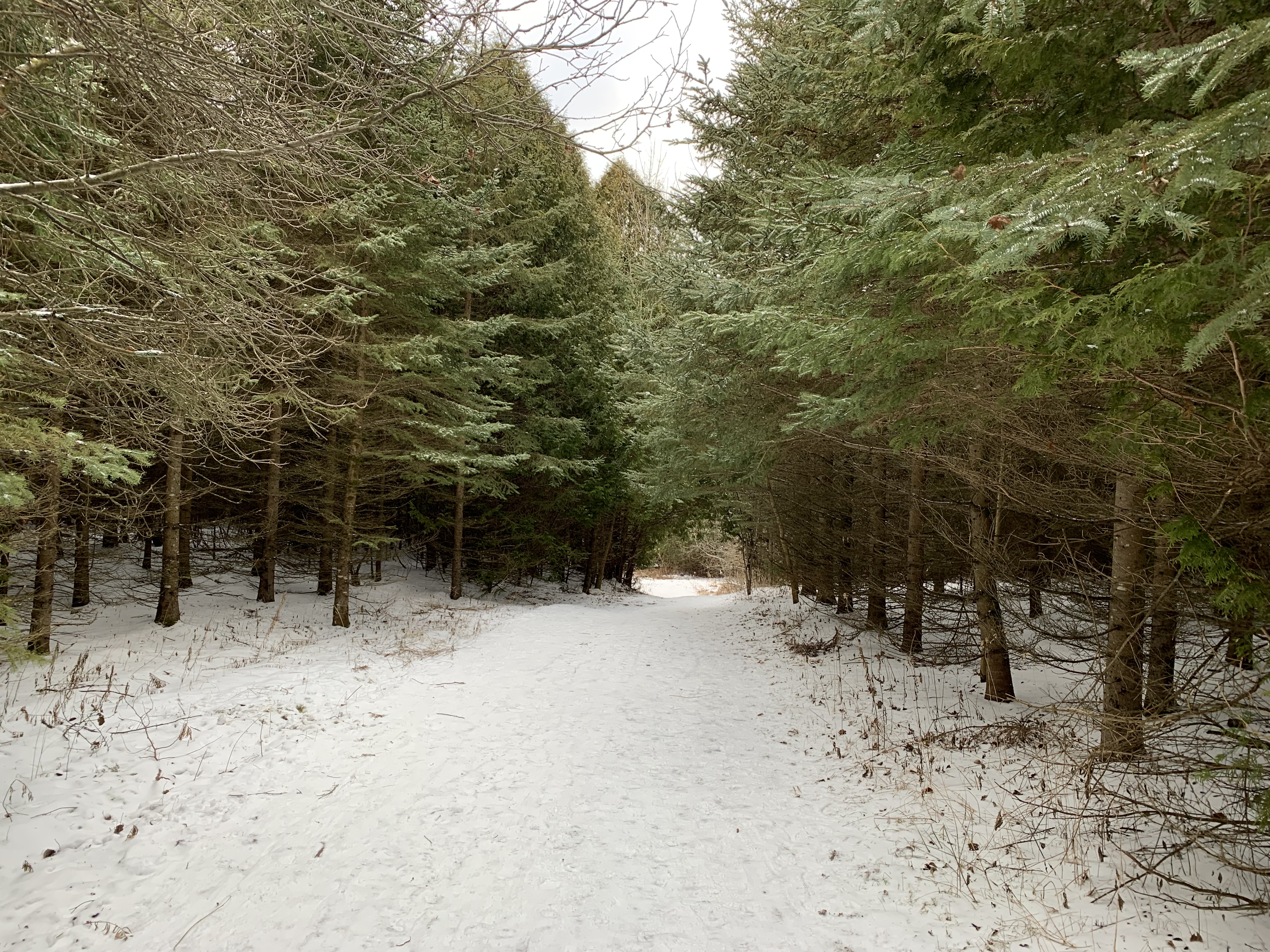
The cedar forest gives way to a mixed coniferous one which is suitable habitat for roughed grouse. In the winter they will eat seeds and the buds of deciduous trees. I didn’t see any roughed grouse or very many birds at all. The forest was silent except for the approach of a lone hiker clacking along with his walking poles and disturbing the wildlife.
The Roughed Grouse Trail carries you out of the woods and returns south on a trail along the edge of a field. This part of the conservation area provides habitat for a whole different range of plants and grasses, insects, and the small birds that feed on them. None of which were to be seen today but it won’t be long before they start to return. The fields have been planted with trees by Forests Ontario as part of their 50 million trees project. Through sponsorship from the Federal Government, landowners have been able to plant over 34 million trees at greatly reduced costs. This is part of Canada’s response to the global Trillion Tree Campaign which has planted over 14 billion trees since the fall of 2018 in an attempt to restore the global forest cover. This grassland habitat will slowly be returned to forest just as the rest of the conservation area has. The butterflies and a host of other pollinators will have to find somewhere else to hang out, but not for several years.

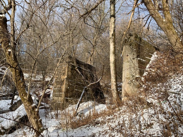
Within the present confines of the park, a 4-storey grist mill was built by Alexander Secord in 1874 which was known as the Boyne Water Mill. The wooden building had the unusual configuration of a horizontal water wheel that turned two sets of millstones. In 1914 James Moorey bought the mill and upgraded the sluice gates at the mill pond to concrete. These concrete gates stand along the creek however, at least one set and probably two have been washed out and have collapsed into the creek. This could have happened during any flooding event but Hurricane Hazel in 1954 fits the right time frame. The mill was closed in 1953 and dismantled in 1956, the wood is reused in several local homes.

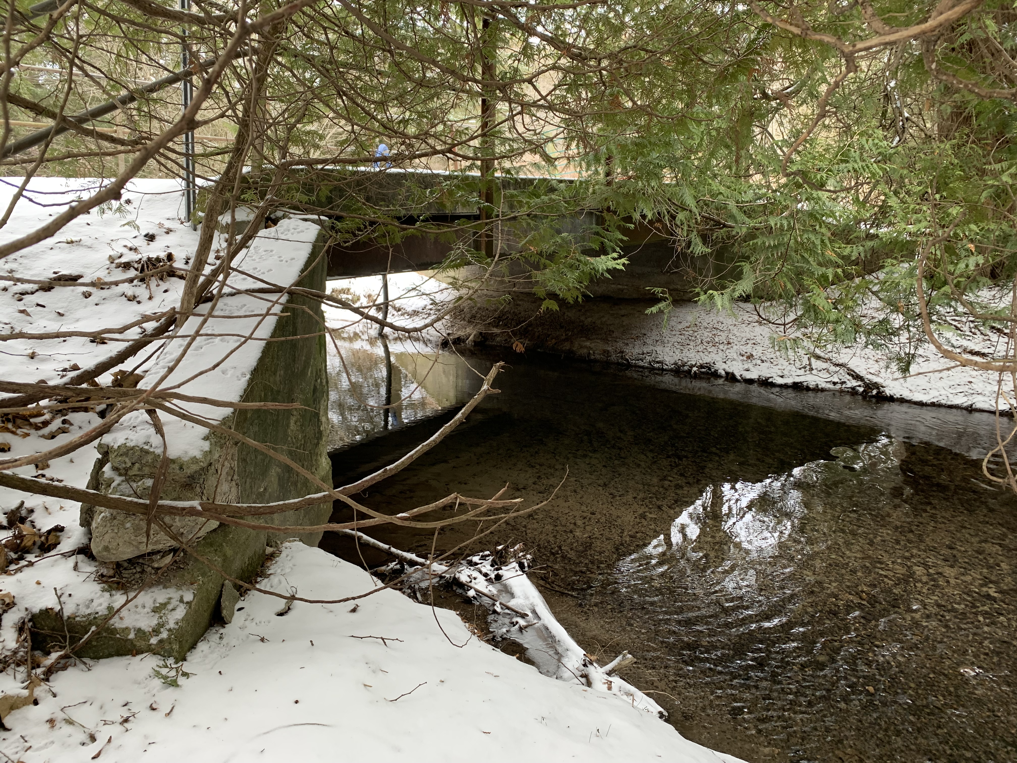
The earthen berm of the dam is cut by the trail near a verticle slab of concrete where something was once mounted with large bolts. Perhaps the flume used to carry water from the pond to the water wheel at this location. The berm is still quite distinguishable as it crosses the ravine floor marking the forward edge of the former millpond.

The trail continues south toward the parking lot following an old access road that led from the dam to the mill. The concrete bridge is still in use for pedestrians and maintenance vehicles.
Although I didn’t see much wildlife in the conservation area during this visit it seems likely that there’s plenty to see at other times. This will be an interesting place to visit again in the future.
Google Maps Link: Enniskillen Conservation Area
Like us at http://www.facebook.com/hikingthegta
Follow us at http://www.hikingthegta.com
Also, look for us on Instagram
