Saturday Sept. 12, 2015
The area known as Sixteen Hollow was home to an industrial community that became a ghost town by the 1880’s. We decided to ignore the light rain that was falling, don a light jacket for the first time in months, and go to check it out. There is free parking in the parking lot under the Sixteen Mile bridge on Dundas Street.
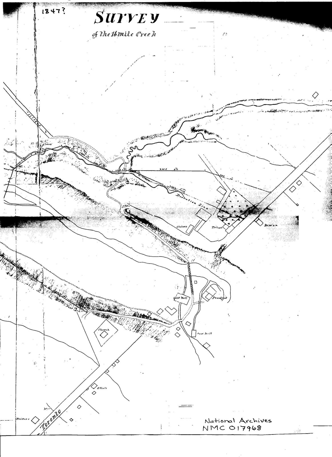
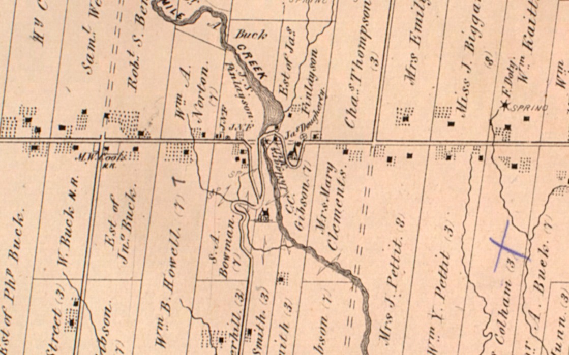
Dundas Street was surveyed in 1795, two years after the founding of York (Toronto), as a link to Hamilton. The road was opened in 1806 after the Mississauga Purchase transferred the land to the British. George Chalmers arrived in 1825 and opened a merchant shop where Dundas Street met Sixteen Mile Creek. Next, he built a dam on the creek north of Dundas and opened both a saw and grist mill. Sixteen Hollow was known for awhile as Chalmer’s Mills and was a thriving community with a tavern, stables, a distillery, a blacksmith shop several houses and an ashery. In the early 1840’s Chalmers over-extended himself and became bankrupt. He ended up selling everything to John Proudfoot and the community briefly became Proudfoot’s Hollow. The town continued to grow and a three story inn catered to stagecoach and weary traveler alike. Tailors and weavers as well as the makers of barrels, wagons and footwear all called The Hollow home. When the railroad bypassed the town, and Oakville grew, Sixteen Hollow suffered a fatal blow in the collapse of the grain market. By the 1880’s the mill was closed and only two houses and the church remained. The map below from the National Archives is dated 1847 with a question mark but show’s the community early in the days of John Proudfoot.
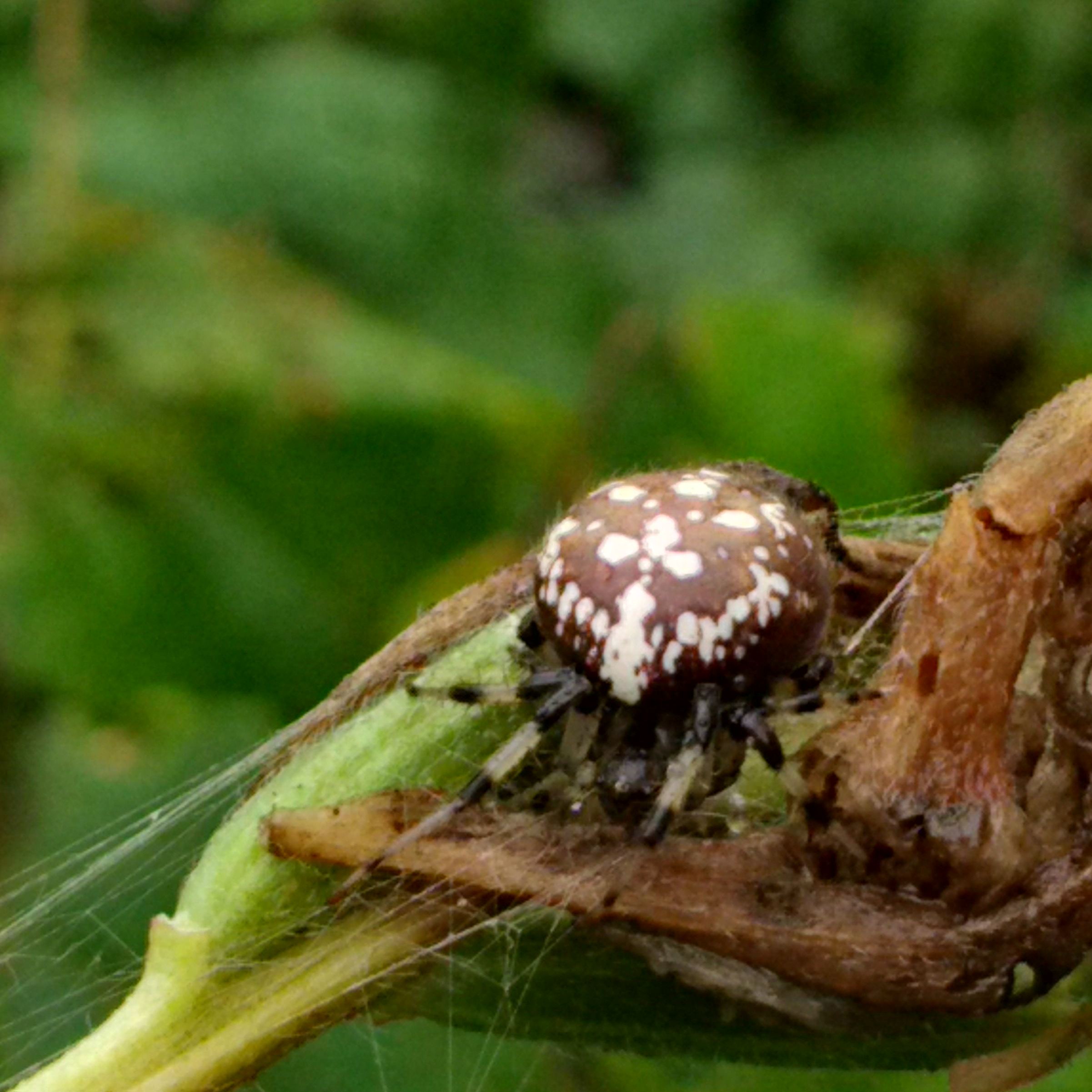
North of the bridge, in the area that was once covered by mill pond, we observed a female cross orbweaver spider. This large specimen was riding out the rain curled up in a plant stem. This species of spider is known to be mildly venomous with bite reactions lasting from 2 days to three weeks. It takes it’s name from the cross shaped markings on the body near the head.
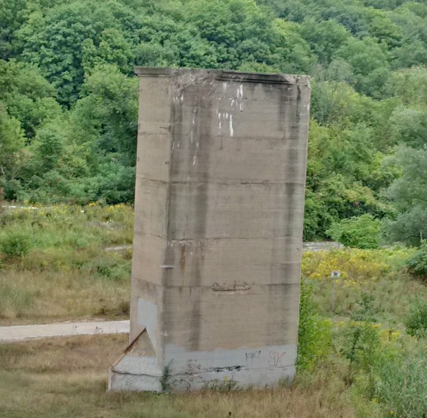
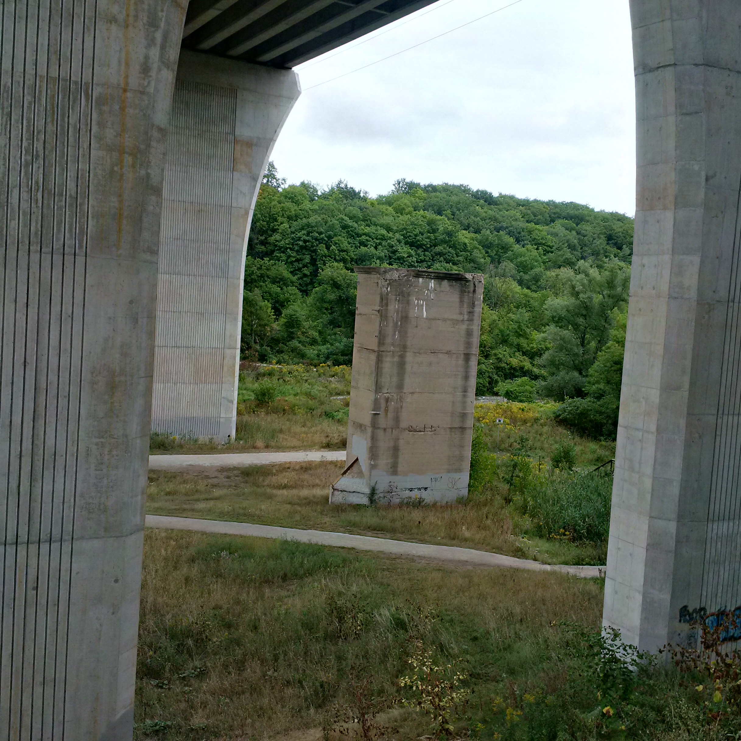
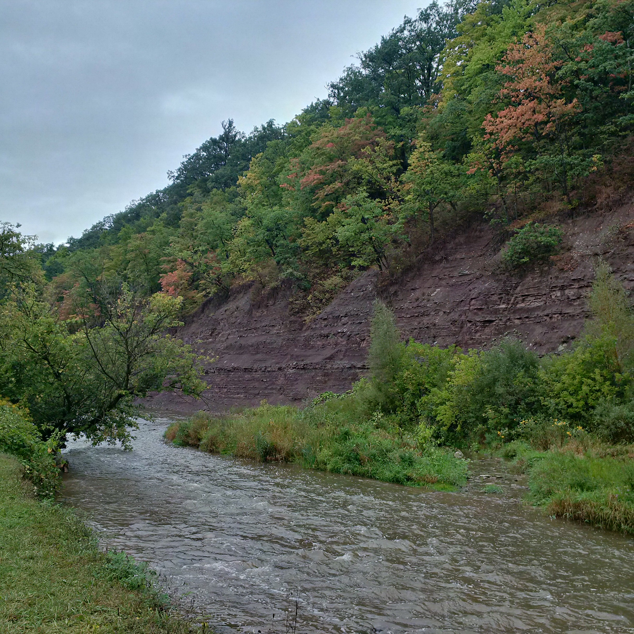
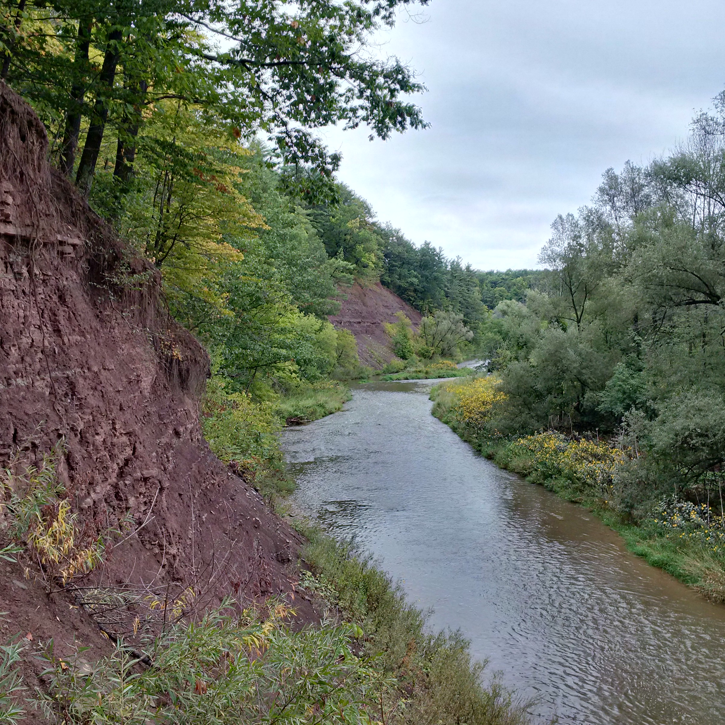
The first reliable bridge to replace the mill dam crossing was built in 1885 and was a steel truss bridge. It was replaced in 1921 with a concrete bridge that rose in elevation as it went westward eliminating the need for the switchback on the ravine side. A four lane bridge was built in 1960 which replaced it. The bridge decking was removed from the 1921 bridge but the piers were left standing. Notice in the picture below, and the cover photo, the metal capped point of concrete on the front side of the pier. This was on the upstream side and used to break up ice during the spring thaw to protect the bridge from damage. It indicates that the creek flowed around this pier in the 1920’s. Today the creek runs well to the east of here, just above the goldenrod field, and is visible in the cover photo. in 2008 another four lane bridge was added running along the line of the 1921 bridge piers.
The historical county atlas shows the grand detour that Dundas Street took as it passed through Sixteen Hollow and crossed the creek. The road passes across the middle of the map from the right to the left as one travels westward. Just before the mill pond the road takes a curve and descends the hill behind the Presbyterian church (still a wood frame structure in 1877). It crosses on or near the dam and then does a long hairpin curve south and back as it climbs the west ravine. By 1877 there are few buildings shown on the map and only one mill, near the church.
Fall was in the air and there are trees that are starting to change colour. The process of changing colour actually starts in the spring. The tree has a relatively short growing season which usually ends in about June. At this time they already have the bud for next year’s leaf ready but dormant until the spring thaw. Chlorophyll in the leaves is constantly being broken down by sunlight and replaced. As the day light hours grow shorter and the nights longer the tree prepares for winter. It starts to form a kind of scab between the leaf and the branch which cuts off the transfer of nutrients to the leaf. When the green chlorophyll is no longer replaced the yellow, red and orange pigments in the leaves are exposed. They too break down in UV light and eventually only the brown tannins are left as pigments.
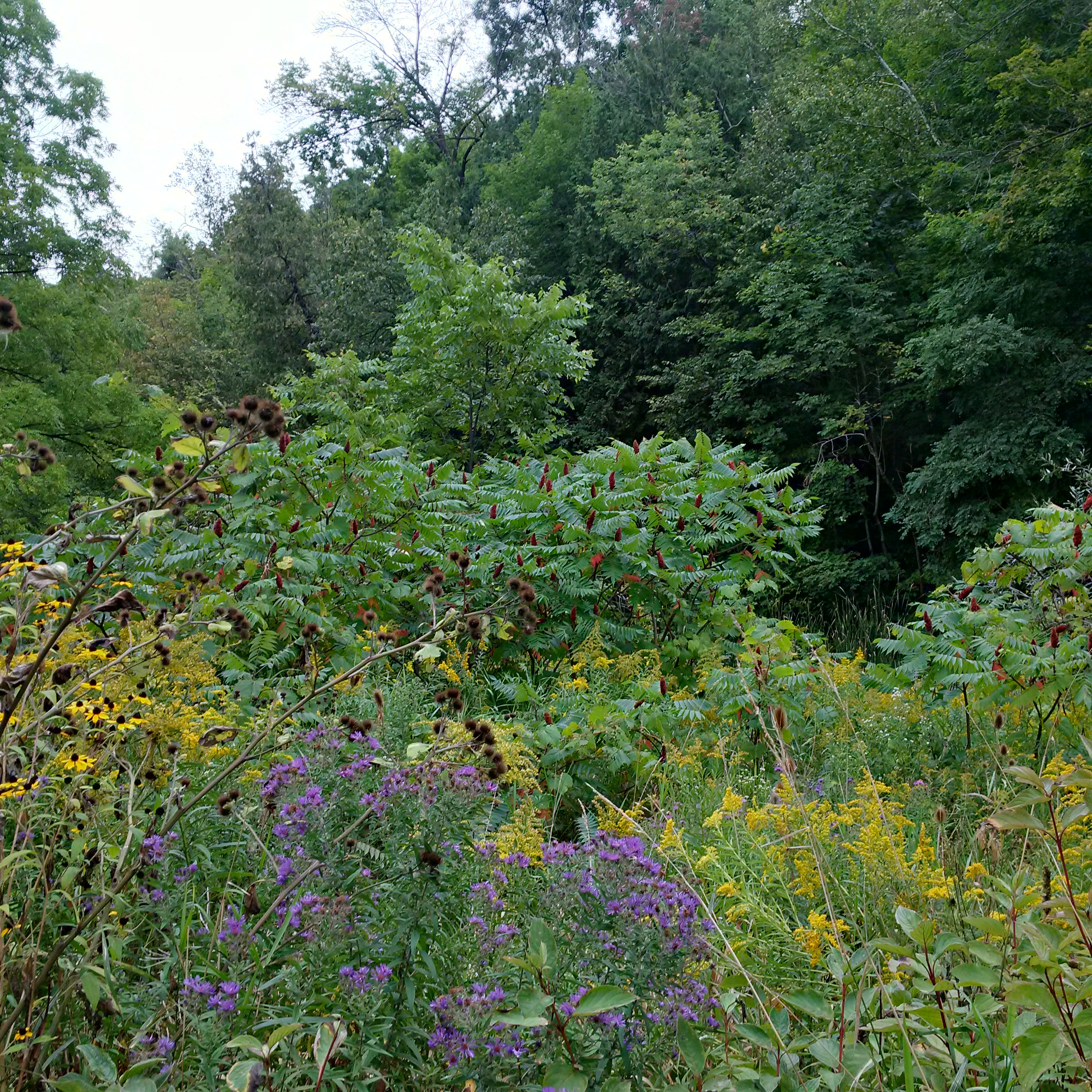
Yellow and purple flowers paint a picture of late summer. Black-eyed susan, also known as brown-eyed susan, are related to the sunflower and provide the yellow on the left below. New England asters like a lot of sunshine and their purple flowers colour the open areas throughout The Hollow. The yellow goldenrod plants on the right are also a member of the aster family and they are often mixed with their distant cousins. The sumac trees in the background have not started their change to bright red yet. This is one of the first and brightest transformations of the fall. The word sumac comes from the ancient word used for red in several languages.
Sixteen Hollow is a quiet place today but it’s past history was much different. Humans put a dam across the river and built an industrial community which has now vanished. The Sixteen Mile Creek is also much shallower today than when Upper Canada was settled. Clearing of the land led to lower water levels in Ontario. Water levels at the end of the last ice age were much greater as can be seen in the depth of the creek bed relative to the shale embankments along the sides.
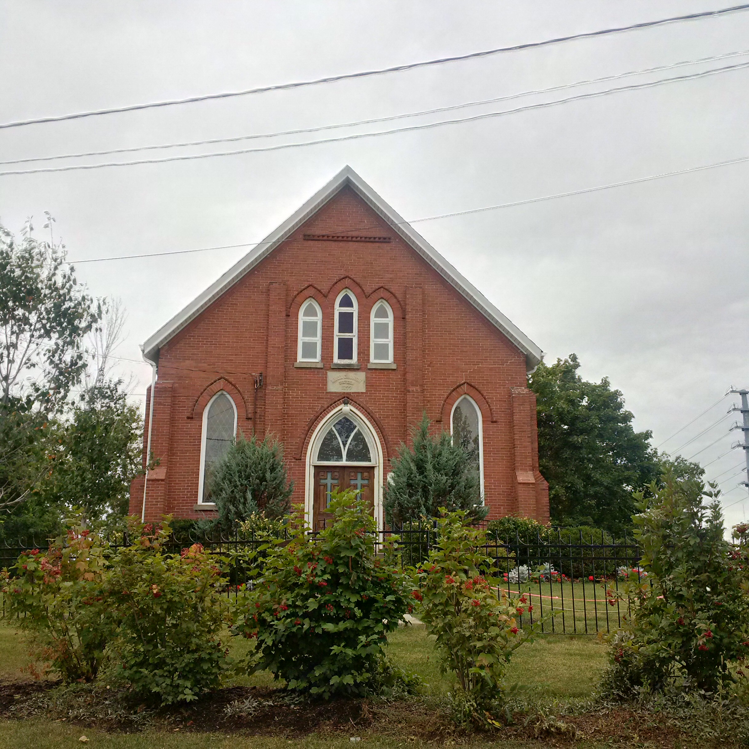
One of the central meeting places in an early community was the church. Sixteen Hollow had a Presbyterian church on the east bank of the river by 1844 and it is the only remaining building from the historical village. This frame structure was 40 feet long, 30 wide and 18 tall. The building was expanded in 1899 and given a brick veneer on the outside. Electric lights were installed in 1943 in time for the centennial celebrations the following year. The basement was added in 1994 for it’s 150th anniversary.
Sixteen Hollow is no longer a thriving town but there is a lot of space to hike along the Sixteen Mile Creek. We had previously looked at a small section going north from here on Canada Day.
Like us on Facebook at http://www.facebook.com/hikingthegta

Pingback: Trout Hollow | Hiking the GTA
Pingback: Hermit Hollow – Hillsburgh | Hiking the GTA
Pingback: The Vandalized Memorial – Taras Shevchenko Museum | Hiking the GTA
Pingback: Hiking The GTA – A 2015 Monthly Review | Hiking the GTA
Pingback: Hiking the GTA #200 – Greatest Treks 2 | Hiking the GTA
Pingback: All-Time Top Trails (So far…) | Hiking the GTA
Pingback: Ghost Towns of Halton Region | Hiking the GTA