Tag Archives: Omagh

Ghost Towns of Halton Region

Someday

Halton County was one of the earliest settled in the region as United Empire Loyalists began arriving in the 1780’s. They started Oakville and Burlington as well as Georgetown and Acton. Along with some of the familiar names are those of small communities that are only a shadow or ghost of what they once were. These small hamlets and towns dotted the crossroads around the county. This blog collects 5 of the ones that we have visited and arranges them in alphabetical order. Each has a picture that represents the community as well as a brief description. The link for each will take you to a feature article on the community which has the local history as well as pictures of any surviving architectural features. At the end of each feature article is a google maps link in case you should wish to explore for yourself someday. Future companion blogs in this series will cover the ghost towns of Peel Region, York Region, and the City of Toronto.

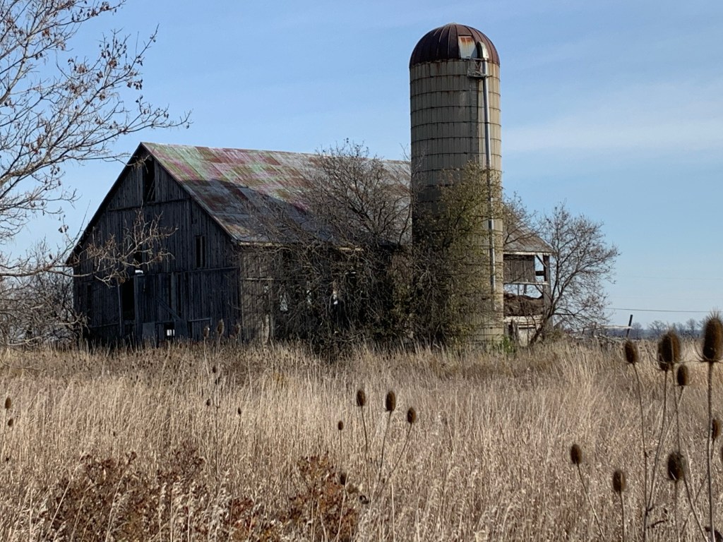
Glenorchy was never large community and it has lost pretty much all of the original buildings that it once had. Of note is the local disaster that happened in 1964 when a truck loaded with potatoes took a detour that carried it over Sixteen Mile Creek near the community. The truck was too heavy and the bridge collapsed under the weight leaving just a bridge abutment as a reminder. This three room home was built in 1835 by George and Francis Ludlow.

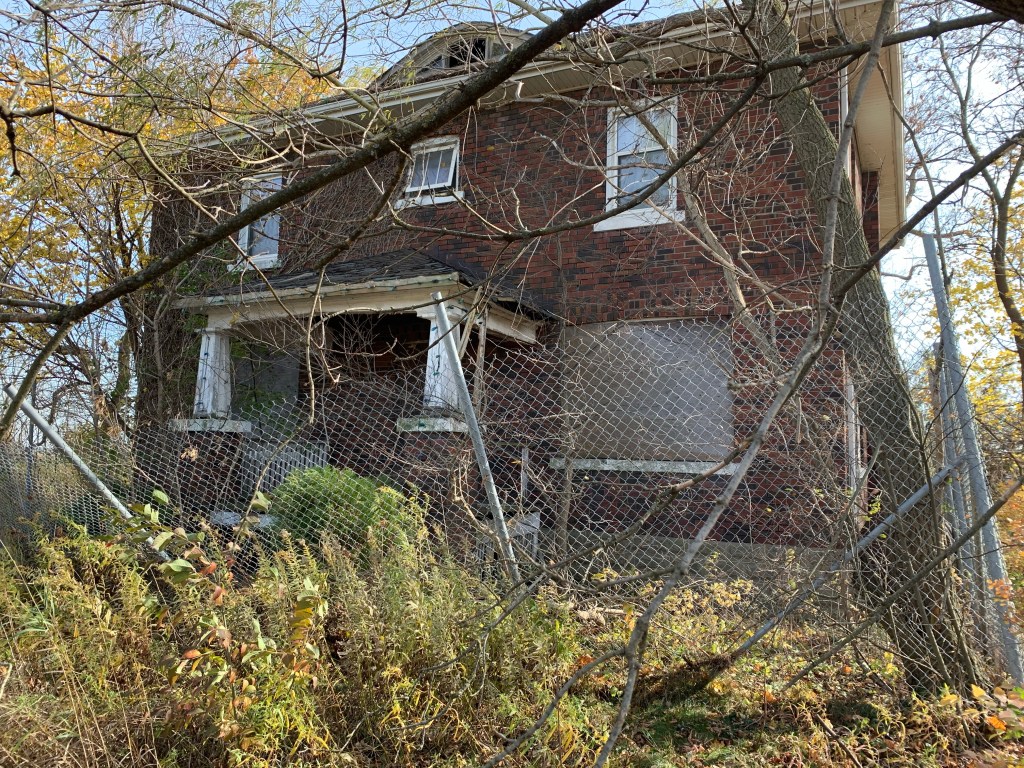
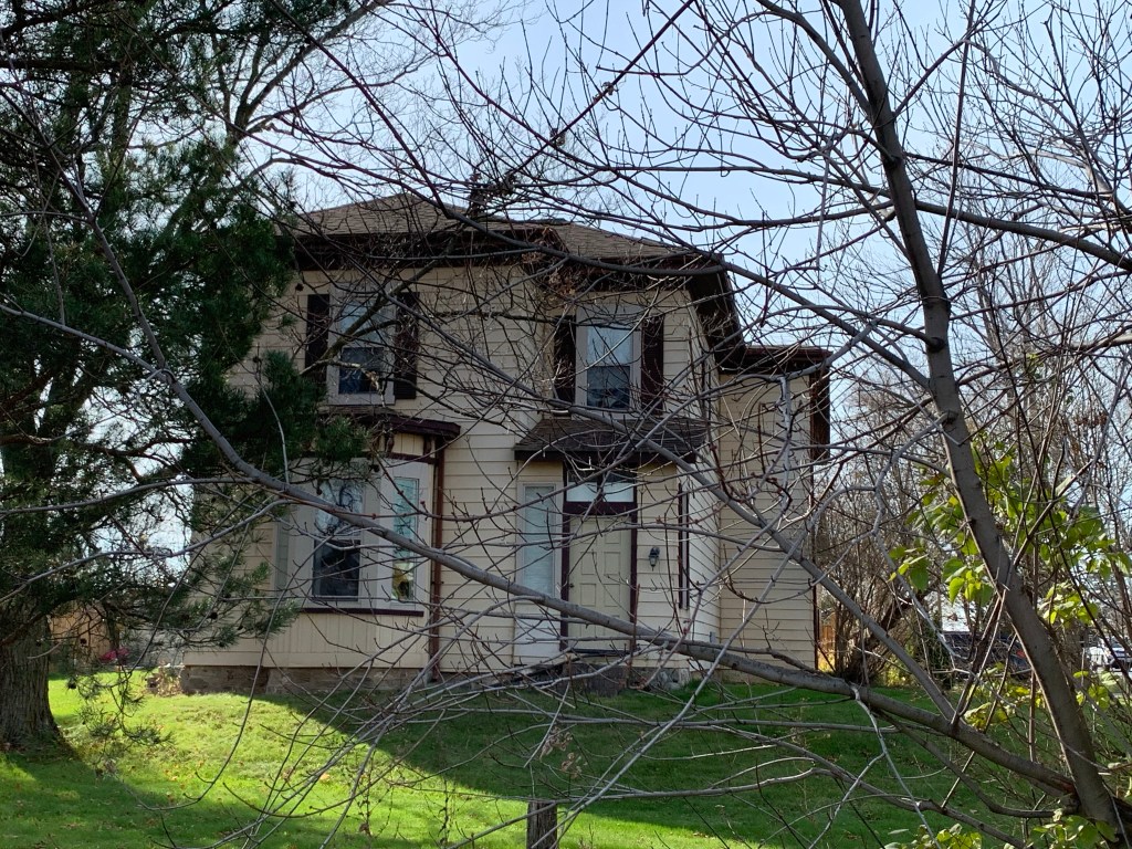
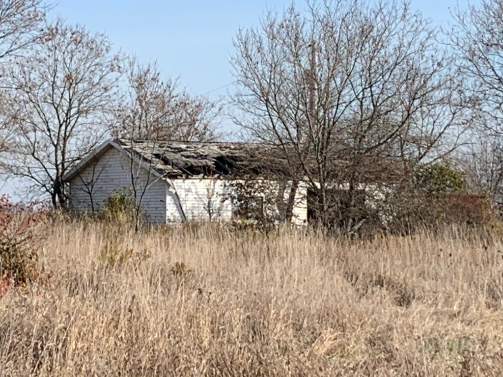
Hornby was stretched out along Steeles Avenue to the point where it was considered Hornby and West Hornby. A brick one room school building from 1870 and a church remain as well as a few houses. One of the early farm houses belonged to Samuel Brooks and although it has been assessed for its cultural significance it has also been damaged by fire and neglect.

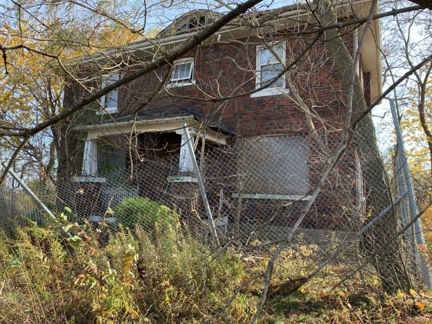
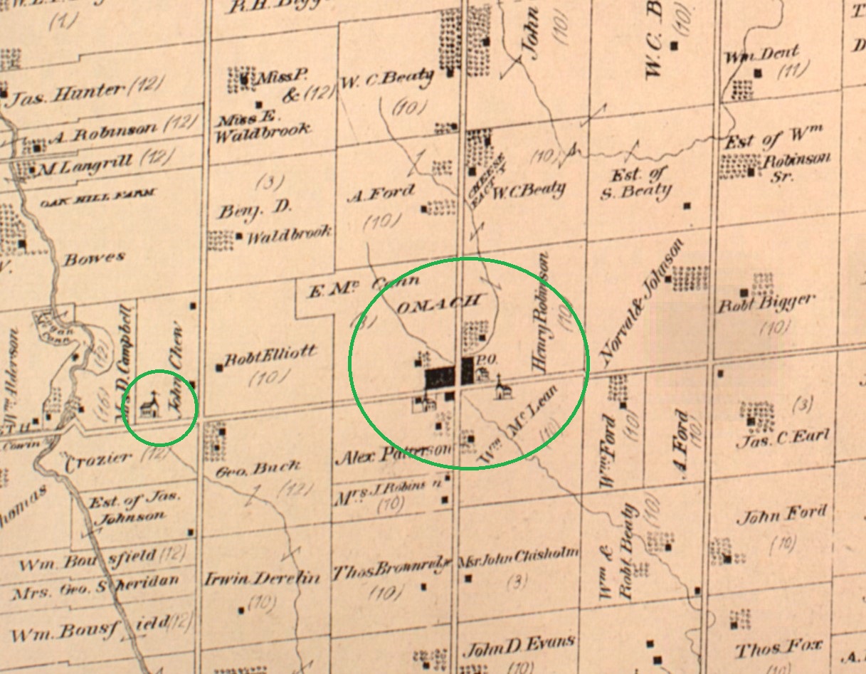
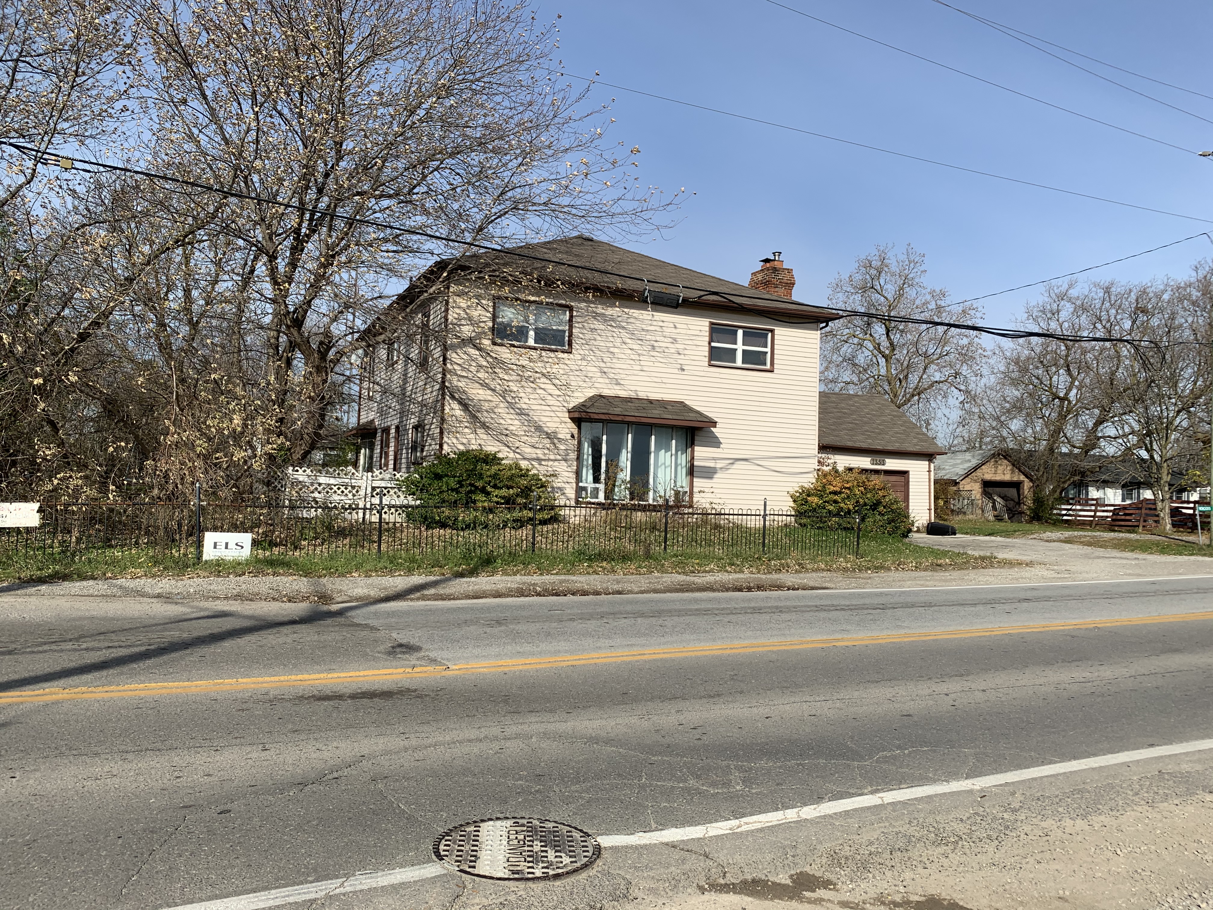
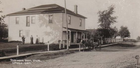
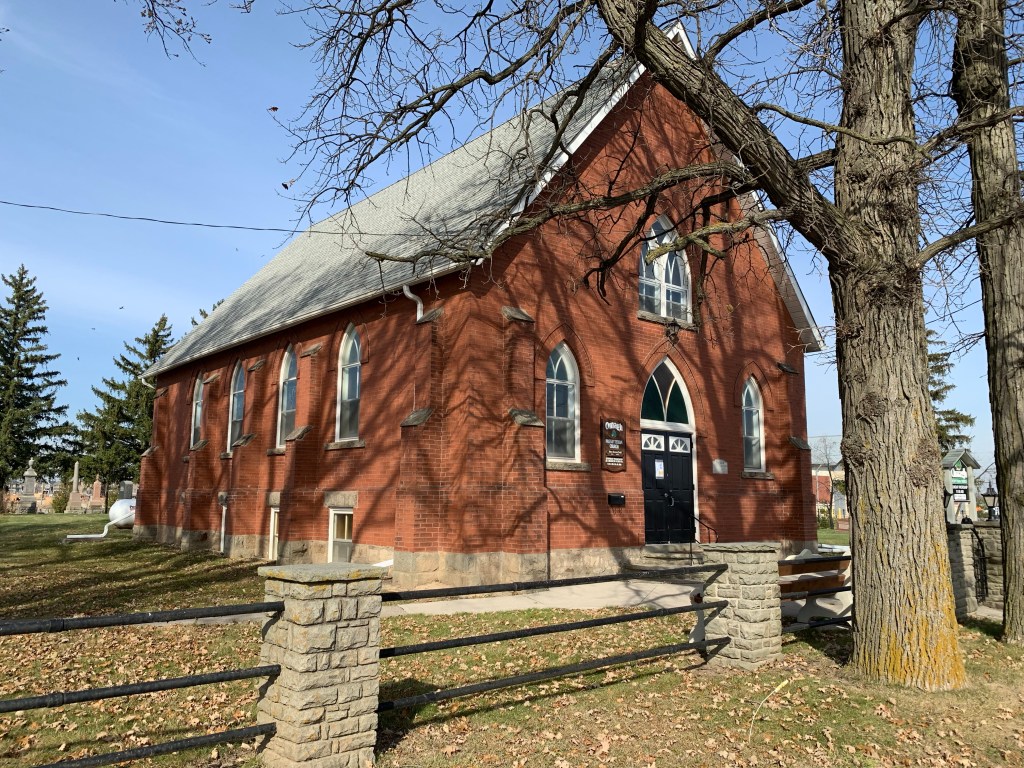
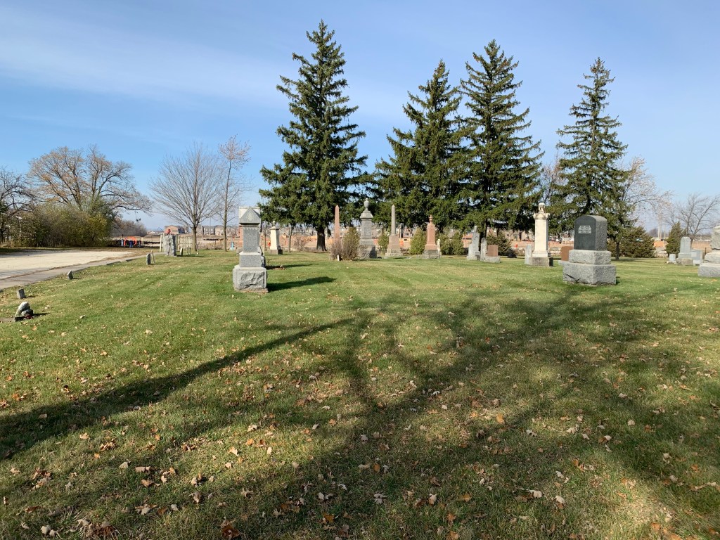
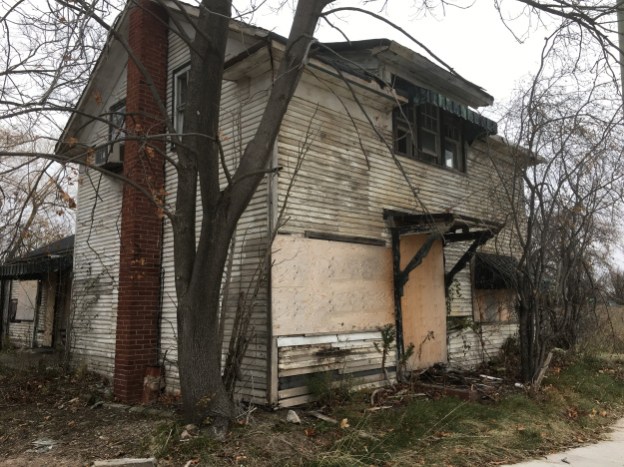
Omagh still has enough of its rural character that it is being considered for designation as a cultural heritage district. It still has two churches and cemeteries as well as the general store. The school is gone and the old Devlin house is starting to suffer. It’s too bad because it’s got a rare example of an eyebrow window.

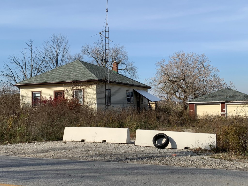
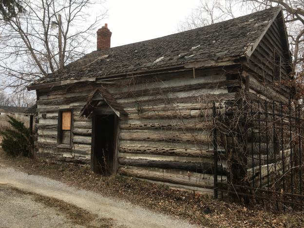
Palermo still has one of the largest collections of historic homes of the former communities in the region. Although many of them are vacant or abandoned it looks as if only two of them have historic designations and it will be up to developers to remove or incorporate the remaining homes. Past history hasn’t been kind to the homes in these situations.

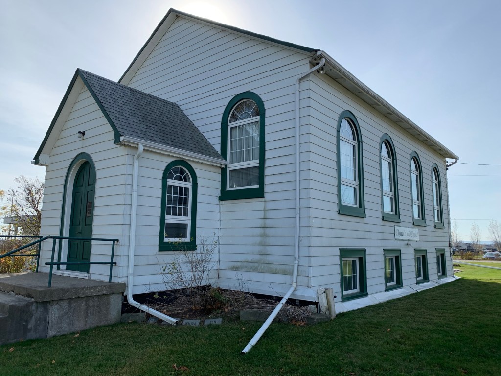
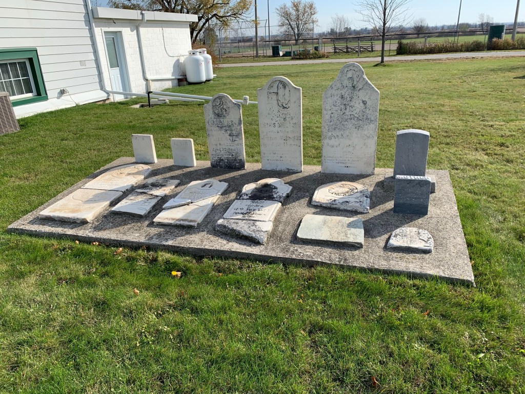
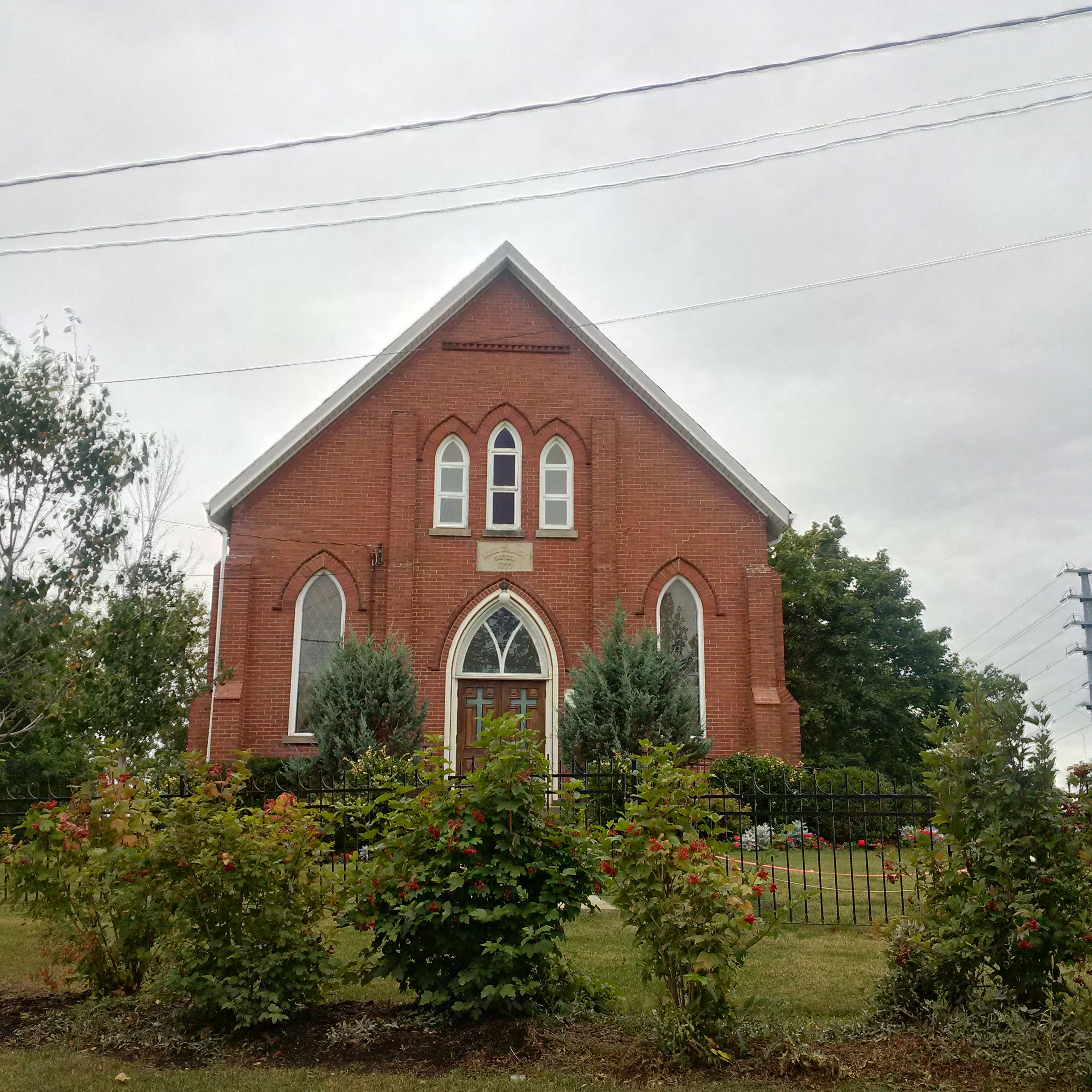
Sixteen Hollow was an industrial hub that developed where Dundas Street crossed Sixteen Mile Creek. It was vacated by the 1880’s very little remains except for the Presbyterian Church which was built in 1844. In 1899 it was expanded and given a veneer of bricks. An older set of bridge abutments crosses the hollow and marks a former course for the creek.

The County of Halton, now known as The Regional Municipality of Halton, had other historic communities that are yet to be explored. It’ll be interesting to see what secrets they still hold and to document before they change too much.

Another selection of Ghost Towns can be found in our companion blog Ghost Towns of Toronto

Like us at http://www.facebook.com/hikingthegta

Follow us at http://www.hikingthegta.com

Also look for us on Instagram

Omagh – Ghost Towns of the GTA

Sunday, January 24, 2021

The community of Omagh is the last one in Trafalgar township that still retains some of its rural characteristics. This is the reason that the town of Milton is considering designating it as a cultural heritage district. This would allow it to survive the encroaching development that threatens to over-run it. The photos presented below were taken early in November 2020 and have been held in reserve in case a future provincial lockdown might prevent extensive travel and exploration. As such, it’s time to explore the historic hamlet of Omagh. It was founded in 1818 and never grew much beyond the intersection of todays Britannia Road and Fourth Line near Milton. The 1877 county atlas image below shows the small cluster around the intersection as well as the Presbyterian Church to the west of town.

Trafalgar Township was settled in two parts. The southern section, now known as Oakville, was settled primarily by United Empire Loyalists (UEL) who came from the United States. The northern section, now Milton, was settled largely by people from the British Empire. The original name for Omagh was Howellville after John Triller Howell who arrived in 1805 as a boy. His family were UEL and the local MP John White didn’t want the town named after someone he considered to be a Yankee. He persuaded the local land owners, who were mostly Irish, that if they chose Omagh he would get them a post office with that name. Ironically, the post office ended up being in Howells store and hotel. The building has been altered greatly over the years but it still stands on the north east corner of the intersection. The side facing Britannia used to have a large porch and was the main entrance to the store.

This archive picture was taken before 1920 and shows the building when it served as a store but before it started to sell gasoline for those who were enjoying the newly developing automotive craze. By 1980 the store had closed and the building has served as a private residence for the past 40 years.

The south east corner of the intersection has one of the few actually abandoned homes in the little community. This property was originally deeded to Kings College (University of Toronto) in 1828. Between 1862 and 1883 the property belonged to William McLean and featured a home that faced the fourth line. By 1930 it belonged to Edward Delvin who built the current home which faces Britannia.

The small hamlet of Omagh once had four churches, which illustrates the significance the community had within the local rural area. The Wesleyan Methodist Church was built in 1854 with seating for 300. It was destroyed in a fire sometime around 1914. The Omagh Disciples of Christ built their church in 1850 and continue to operate to this day. They changed their name to the Church of Christ in 1930. This building features rounded windows as opposed the common pointed arches that were popular in Gothic Revival designs for churches of the era.

The church cemetery contains some of the earliest burials in the community, a few of which have been collected and restored into a small cement slab. Other more recent stones can be found on either side of the church.

An Anglican Church was built in 1868 and operated until 1946. It was demolished in 1947. The Omagh Presbyterian Church is west of town on a one acre lot of land which was purchased on April 31, 1838. The local Presbyterians originally built an small wooden building which they painted white. Seventy years later, in 1908, a building committee was formed to look into the construction of a new church building. A year later in 1909 they laid the cornerstone of the present brick building. In 1925 they resisted the movement to join the United Church and today continue to serve as a small community church with several members who have worshiped there for their entire lives.

Omagh Presbyterian cemetery continues to receive burials. The open area to the east of the church contained the original drive sheds for horses. These were removed when automobiles replaced carriages as the primary method of transportation. In 1877 there were 100 residents but by 1935 Omagh was down to 6 houses and 3 churches, 4 farms and the ball park which was created in 1930.

The house featured below was built in 1882 as the parsonage for the Methodist Church. In 1919 the Methodists sold the parsonage as their church had been destroyed and they no longer had a pastor. Standing on the south west corner, the house has the distinction of being the only parsonage in the small town.

Children in early Omagh had to walk a concession west to Boyne to go to school. The first school in the community may have been built as early as 1828 on a lot on the south east side of the intersection. In 1874 when a new School Section #6 building was erected, it was located across the street. It closed in 1956 and was demolished in 1968 with the bricks being recycled into the home that replaced it at 10095 Britannia Road. The bell was saved and installed in a memorial at the ball park.

This little house was built in 1928 according to tax records as a rental property, likely for a farmhand on the Devlin farm across the road. It has been left empty for several years now.

The barn on the former Devlin property was built in 1900 but is in fairly poor condition. The heritage farm house that stood on the property was demolished in 2001 which removes some of the heritage value of the barn. it’s unclear if there will be any effort to save the barn before wind and weather conspire to bring it down.

A large shed on the property is in even worse condition. With most of the rear roof missing, as seen from the ball park, it is unlikely to be standing for very much longer.

Milton town council made the decision in December 2019 to recognize Omagh as a Cultural Heritage Area and now a management plan has to be drawn up and implemented. This will help ensure that at least the structurally sound buildings in town will be retained as the surrounding farmland is developed for housing.

Google Maps Link: Omagh

Like us at http://www.facebook.com/hikingthegta

Follow us at http://www.hikingtegta.com

Also look for us on Instagram