Monthly Archives: March 2025

Speyside General Store

Saturday, March 22, 2025

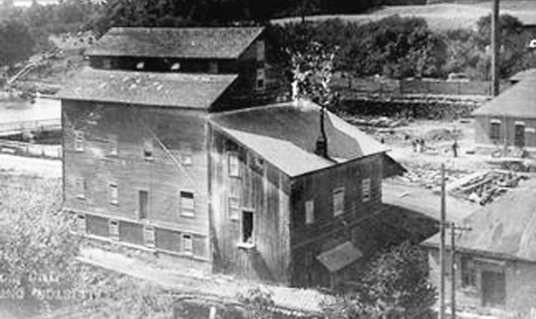
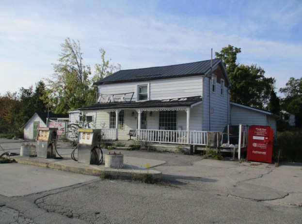
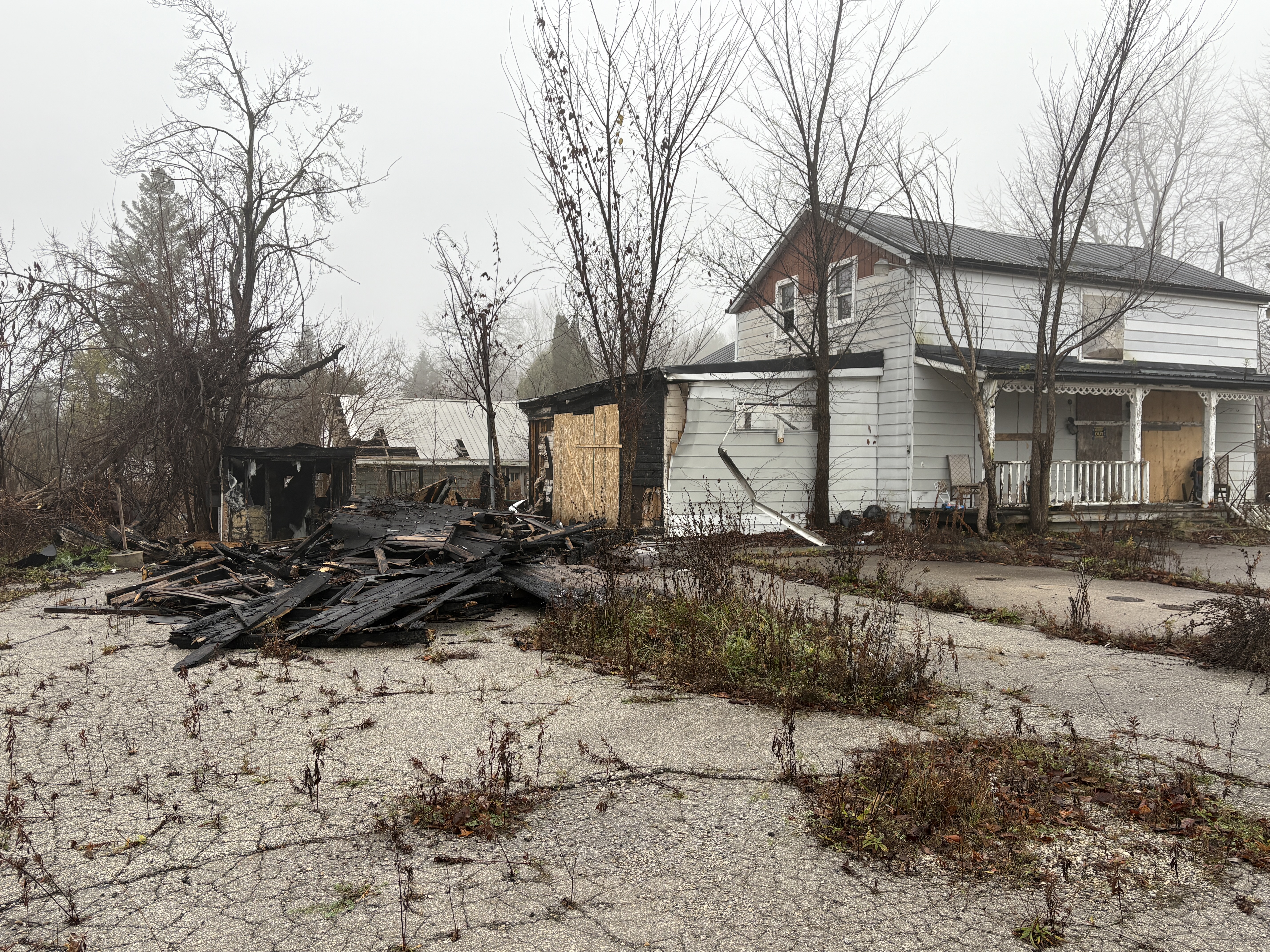
The village of Speyside had two hotels, two general stores, a tannery, a large stone quarry and a village hall. The cover picture is from September 2015 and shows the only remaining building from the original Speyside.  Newer homes have been added over the years but all the original buildings except for this one had been demolished. The Speyside store and gas station operated until the early 2000s when it closed. It has sat vacant for close to 2 decades with the exception of some squatters from time to time. The image below shows the building in November 2024.

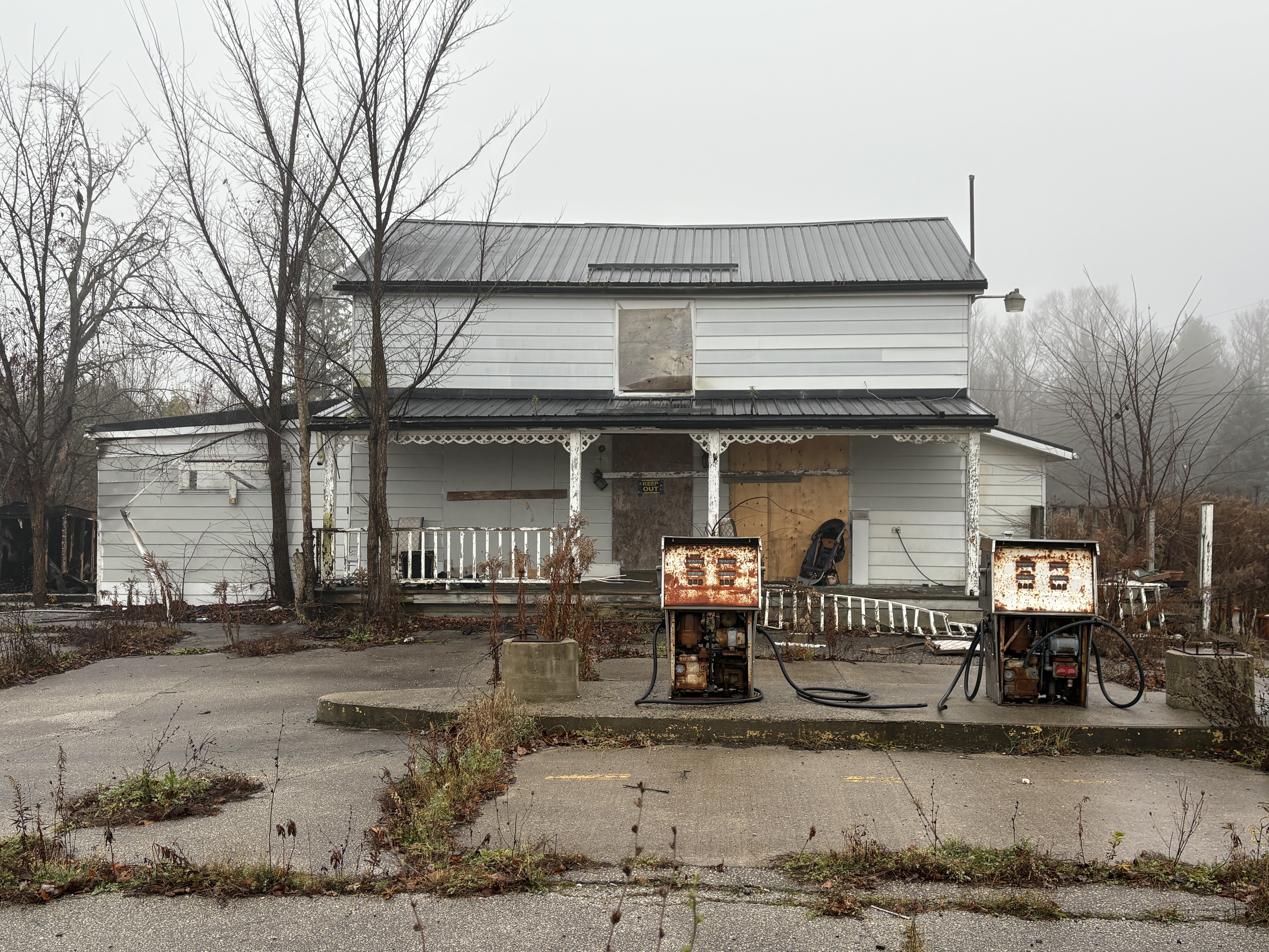
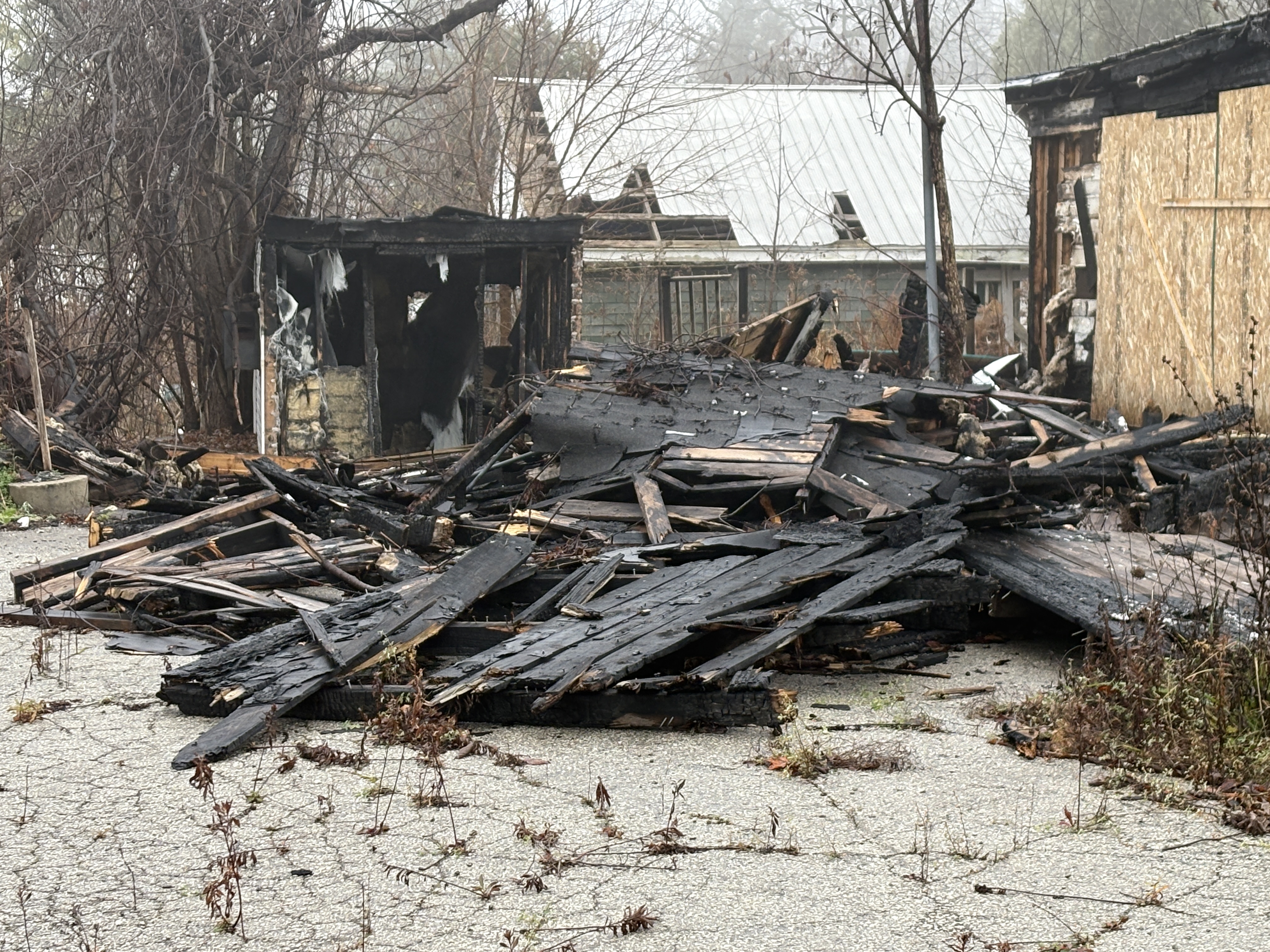
This structure operated as a store under many names and was even moved back from the road 17 feet in 1942 when the highway was paved.  On August 29, 2024 a fire broke out in the shed on the end of the building. When I passed by in November it looked like the store was still intact and only the shed had been destroyed.

Directly across the street from the store stood the original log cabin that served as a post office from 1873 until 1914.  The first postmaster was rumoured to have been illiterate and relied on the school children from SS #10 to help him sort the mail. The post office closed in 1914 when rural mail delivery made it obsolete.

For years I have been photographing thousands of historic buildings and this blog grew out of that passion. I have always been aware of the many historic buildings that have already been lost and wanted to get a photographic record of the ones that remain. Just in case one day they are lost. Sadly, that has been the fate of the lone historic building from 19th century downtown Speyside. On a recent trip past, I noticed that the store had been demolished. Apparently the fire had done more structural damage to the store than appeared from the outside.

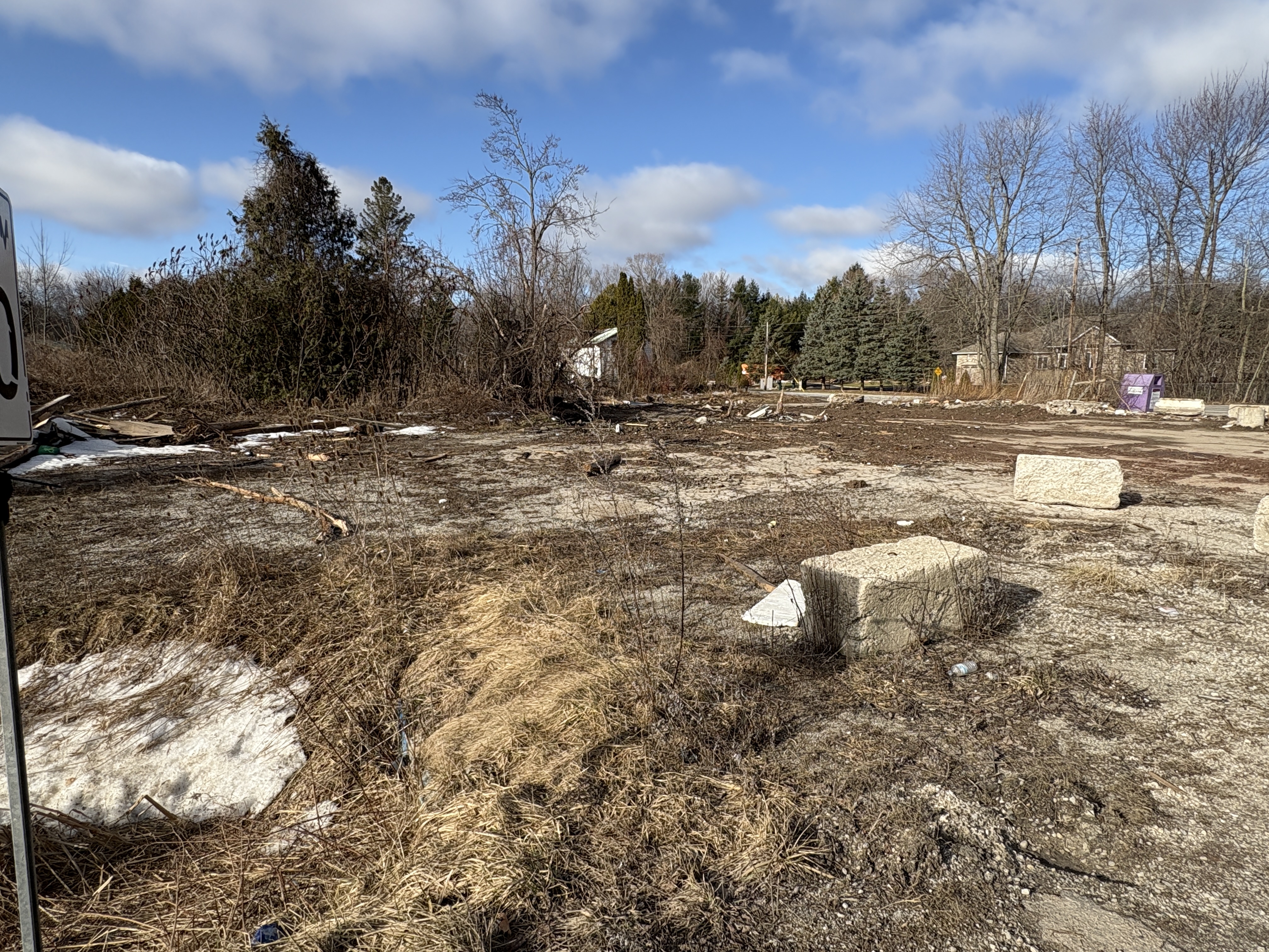
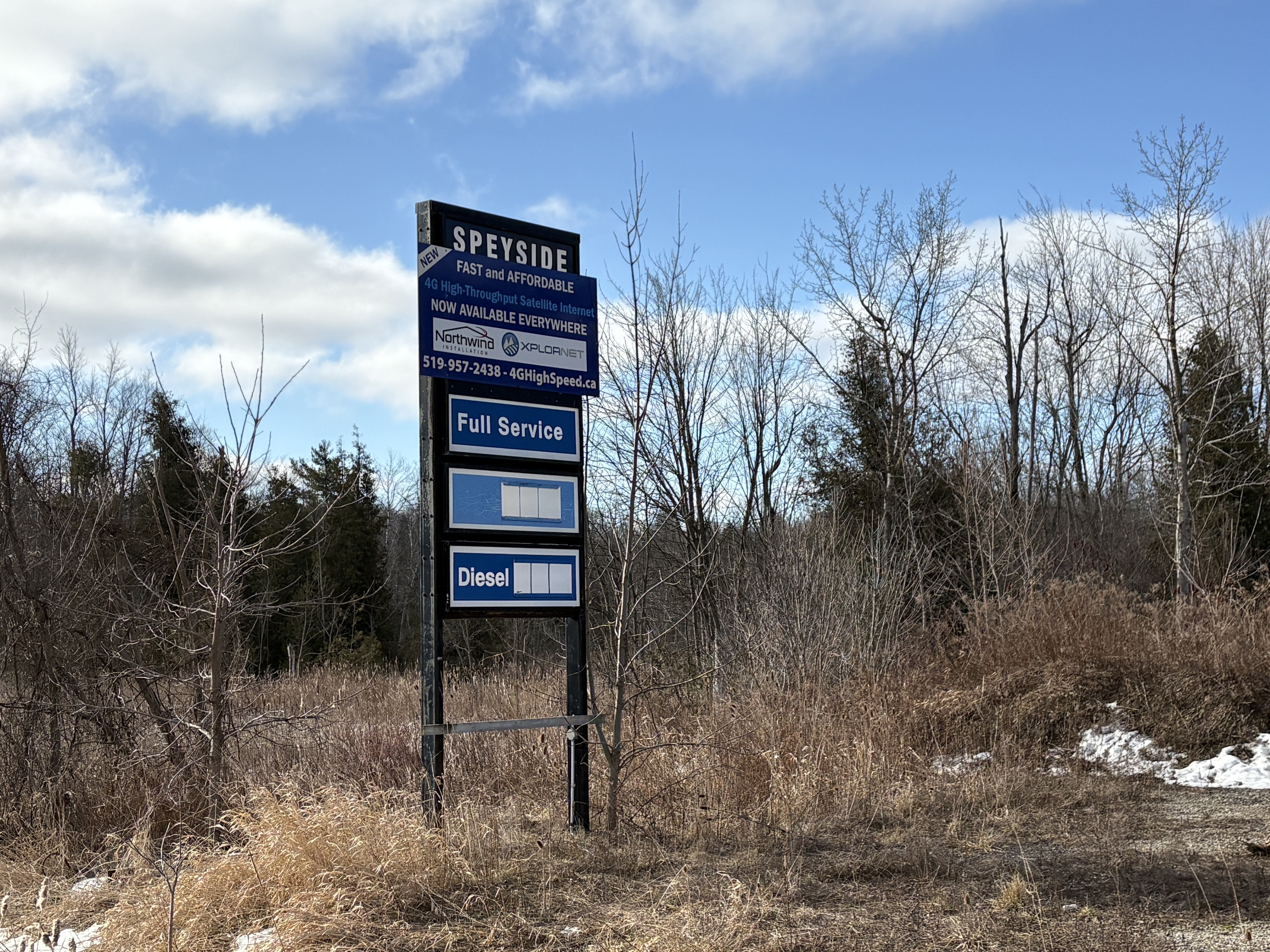
At any rate, there’s just the old store and gas station sign standing sadly in the grass beside the site of the former Speyside general store.

So, the chapter closes on another small piece of our local history. But, at least we have this record of it.

Related Stories: The Royal Oak Of Speyside, Bruce Trial – Speyside to The Gap

Google Maps Link: Speyside

Like us at http://www.facebook.com/hikingthegta

Follow us at http://www.hikingthegta.com

Earl Rowe Provincial Park

Saturday, March 15, 2025

Earl Rowe Provincial Park was always a favourite place to visit for a swim when we were growing up. At that time the park was only a decade old or so. The park was the brainchild of Earl Rowe who was the local Member of Parliament. Earl was a Conservative politician who was a member of both the provincial and federal governments as well as being the 20th Lieutenant Governor of Ontario. In the 1950s the idea for the park was born and the first land was purchased in 1957. The image below shows the approach to the dam on the Boyne River and has a sign which indicates that snakes and turtles could be seen crossing the road. In spite of the sunny day we didn’t see any. Perhaps the snow banks were still a little too tall for them to climb.

The first land purchase was from Dorothy and Bill Braden in 1957 when he was asked to sell some land on the south side of the Boyne River. The farm was 210 acres and he later agreed to sell an additional 60 acres on the north side of the river. The agreement included the provision that he would be given the position of park manager. With this understanding he resigned his job and started to plan the future park. The image below shows the Boyne River as it flows away from the dam.

Creating a park out of a farm is a lot of work but Braden was up to the task and started hiring people to lay out the roads, build fences and create campsites. Washrooms and water were also needed and all of this was set up over the next few years. We stuck mostly to the roads on this visit although my brothers dog was quite interested in exploring the muddy and snow covered side trails. These are best left for when the ground is dry and you can walk them without creating a mess and damaging the plant life along the way. This is the road leading away from the dam and around the front section of Earl Rowe Lake.

William John Fletcher was a member of the founding family of Alliston and when he passed away in 1962 his farm became available. The Parks Department was quick to purchase it because it contained the old Fletcher mill site, the natural location for a dam along with the flood plain behind it. The dream of creating a big park with a lake became a reality and several other surrounding farms were purchased to create an 800 acre park.

A lake was planned and a new dam built at the old dam site. Meanwhile the flood plain that had served as the former mill pond was sculpted to create a lake complete with islands and foot bridges. This undated archive photo of Fletcher’s mill shows one of his mills. The saw mill was erected in 1848 and the grist mill was opened in 1853. The grist mill closed in 1911.

There are six defined trails that run through the park and we basically stayed to the ones that connect West Beach with East Beach and forming a loop back to the parking lot.

The mill pond had been gone for decades but when the planks were finally dropped into the new dam the old flood plain was soon under water again. A fish ladder has been installed which allows fish to navigate around the dam and spawn in the upper parts of the Boyne River.

The lake now provides opportunities for people to go kayaking, canoeing, paddle boating and fishing. Many truckloads of sand were brought in to create two beaches. I remember the sand being blisteringly hot in the middle of the summer. For now it is still covered with snow.

An outdoor swimming pool was added which was said to be the largest in Ontario at the time. It was licensed for a maximum of 1,500 people. When we visited, the only sign of the swimming pool was the lifeguard stations rising out of the snow.

Earl Rowe Provincial Park is interesting in the winter but I remember many good times here in the summer and may need to return this year to enjoy the park in another season.

Google Maps Link: Earl Rowe Provincial Park

Like us at http://www.facebook.com/hikingthegta

Follow us at http://www.hikingthgta.com