Tag Archives: Sault Ste Marie

Sault Ste Marie Canal

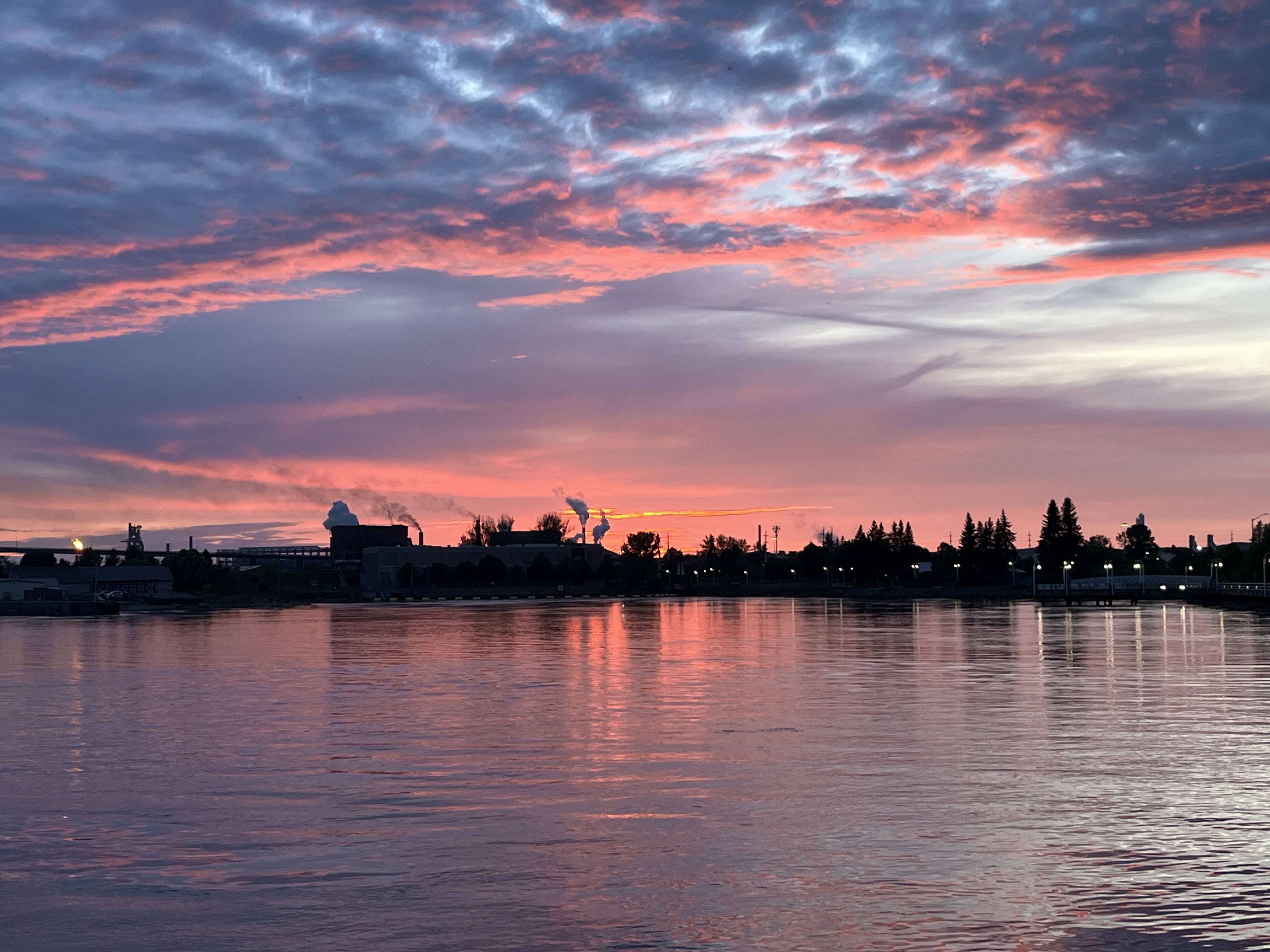
Saturday, June 1, 2024

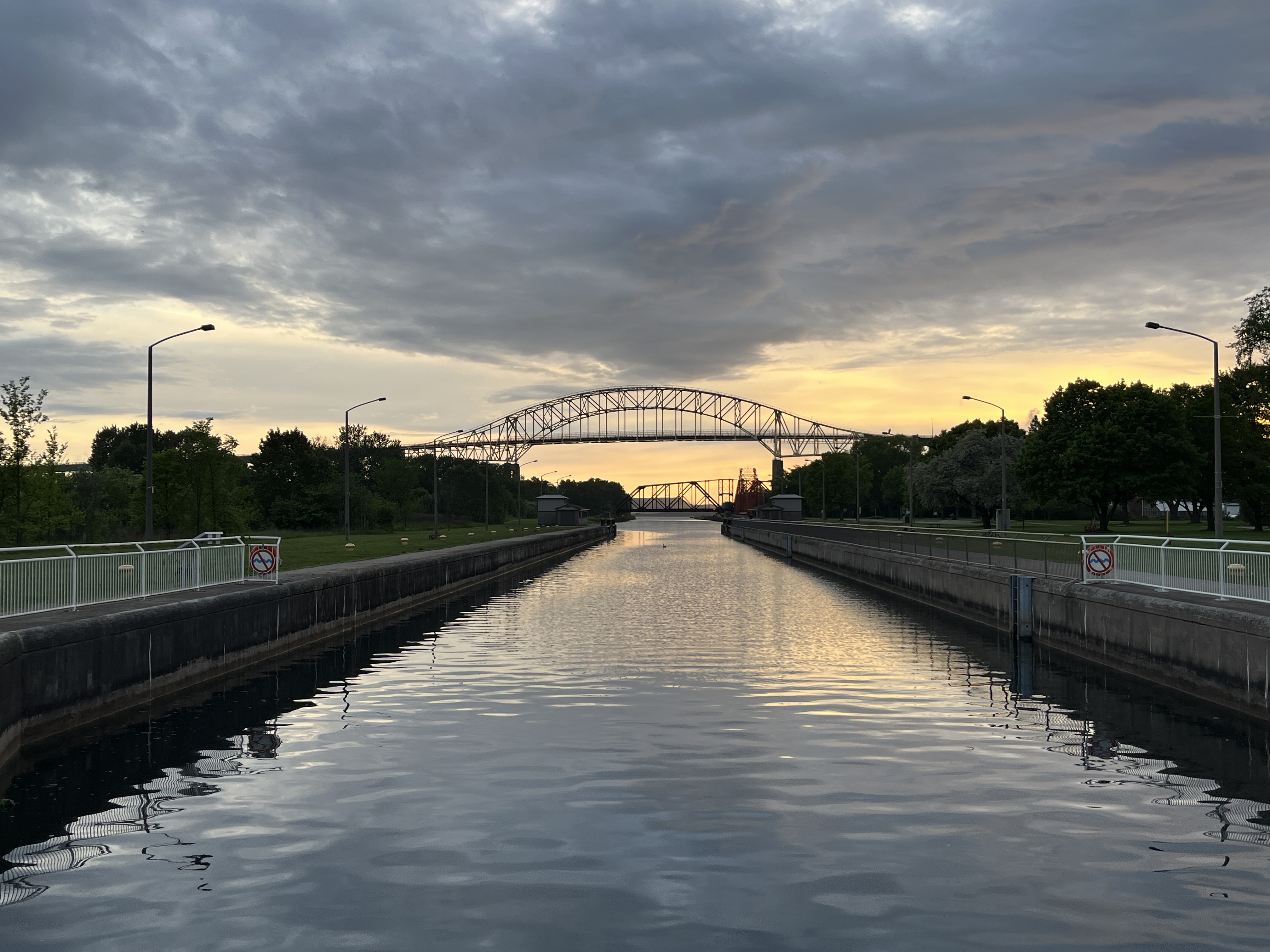
Another business trip took me back to Sault Ste Marie and since I had some time in the evening I decided to visit a Canadian National Heritage site. The Sault Ste Marie Canal. The city is located on the St. Mary River where water flows from Lake Superior to Lake Huron. The St. Marys Rapids were the site of the most significant change in elevation between the two Great Lakes. These rapids made an impediment for the fur trade and the first lock was built here in 1798 by the North West Fur company. This lock was destroyed by the Americans during the War of 1812 in an effort to disrupt the British control of the Great Lakes. A replacement lock was opened in 1895 and included the first electric operating system that was run by power created on site in a powerhouse. The image below shows the lower end of the single lock on the canal.

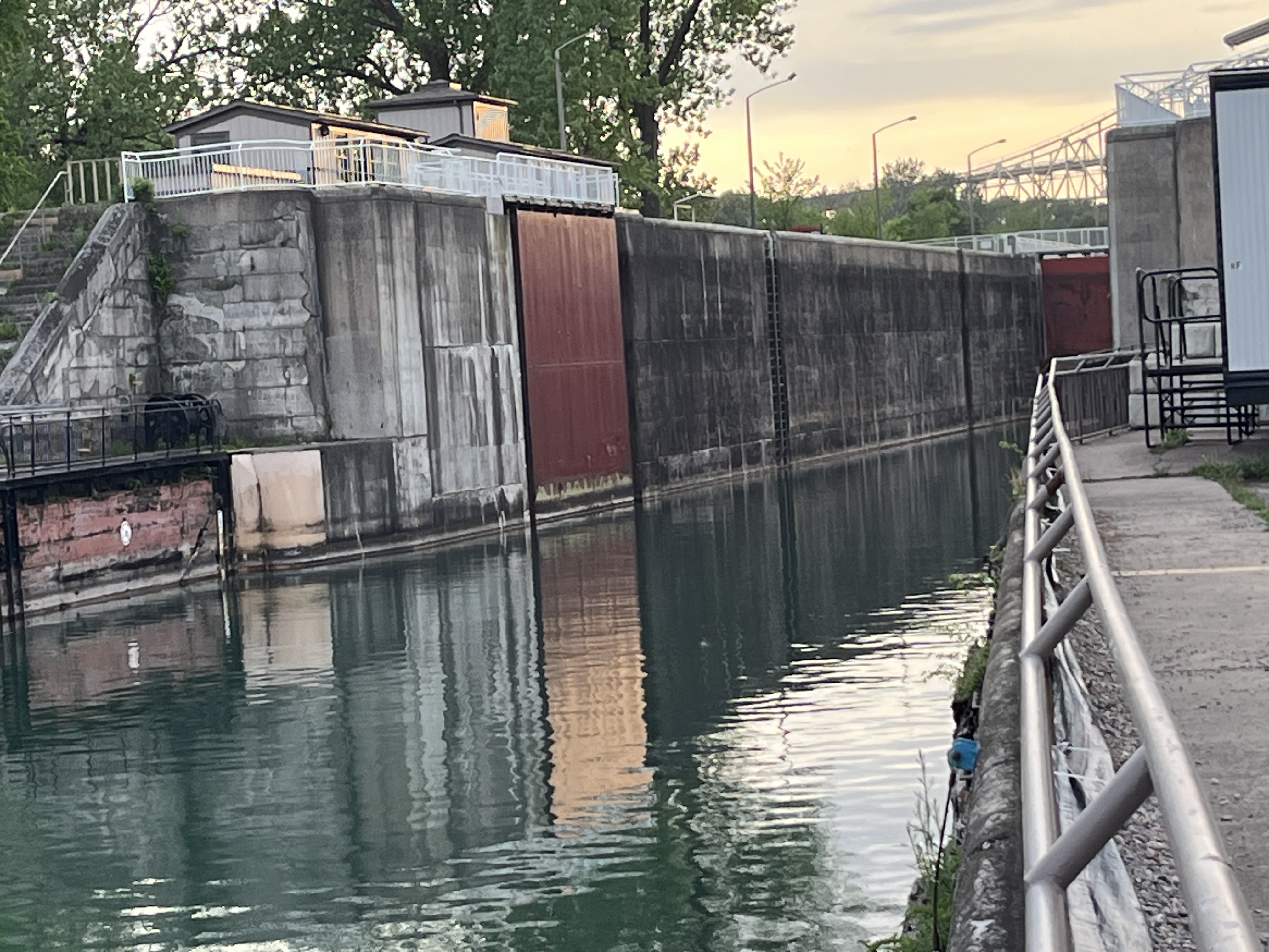
Lake Superior is about 23 feet in elevation higher than Lake Huron. The St. Mary’s River that connects the two lakes accommodates the elevation change through a series of rapids. The St. Mary’s Rapids were the site of a portage for centuries before Etienne Brule arrived there in 1621 as the first European to arrive at what would become Sault Ste. Marie. The St. Mary’s Falls Ship Canal Company started operating the first modern style lock in 1855. The image below shows the lock which is 253 feet long (77m), 51 feet wide (15.4m) and 44 feet deep (13.5m). It is normally at the water level of Lake Huron.

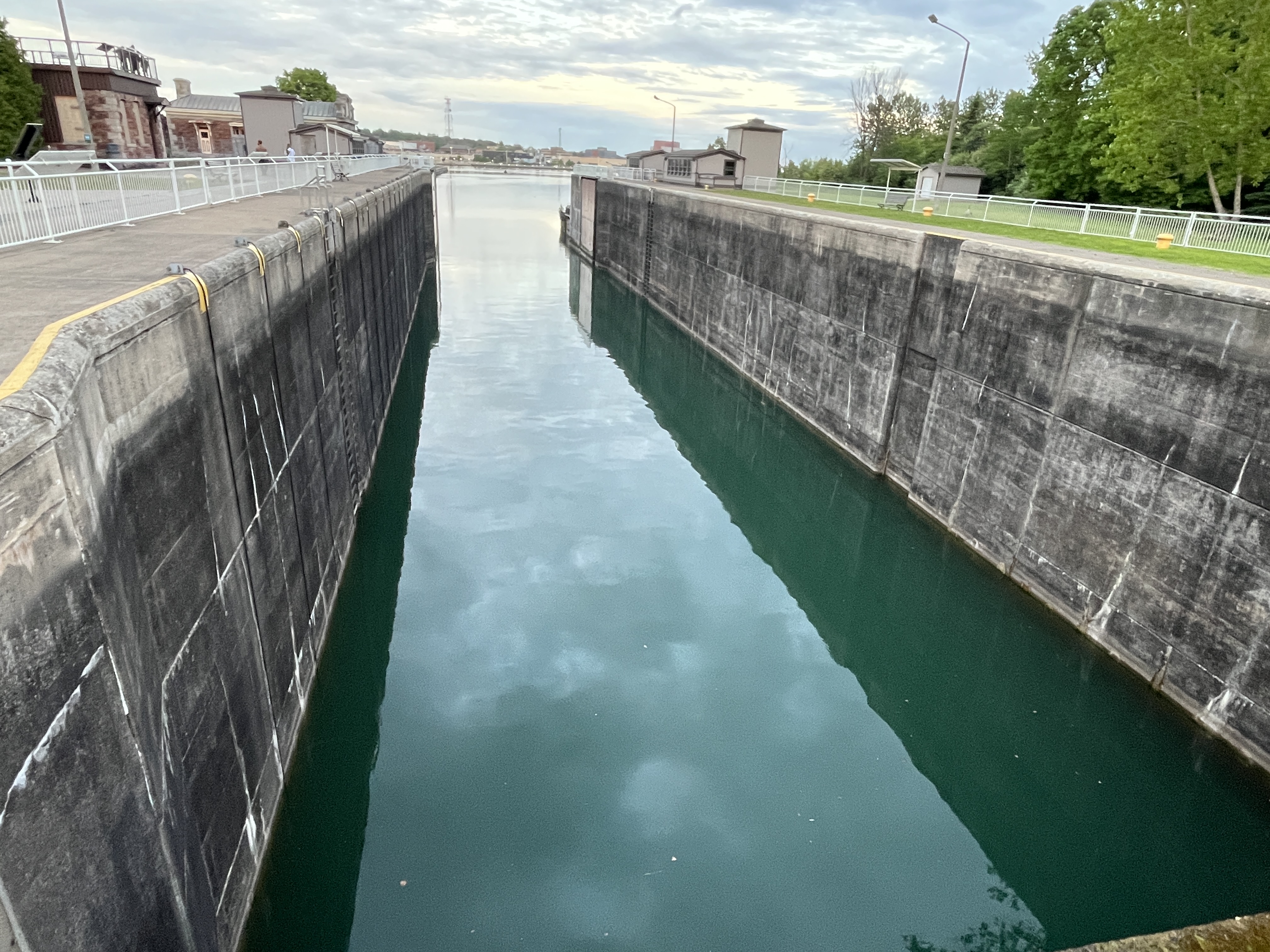
The other side of the gates shows the water level of Lake Superior.

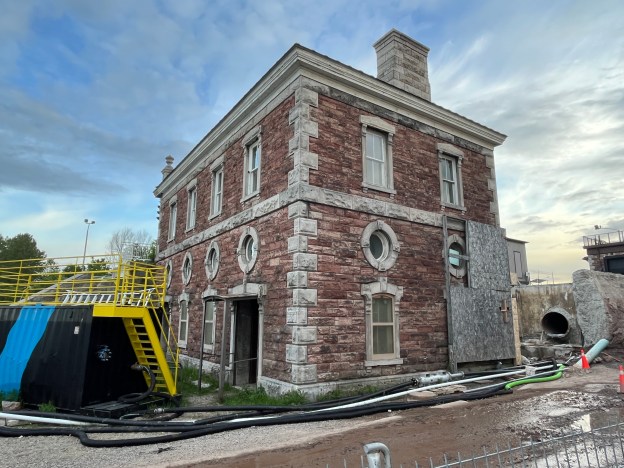
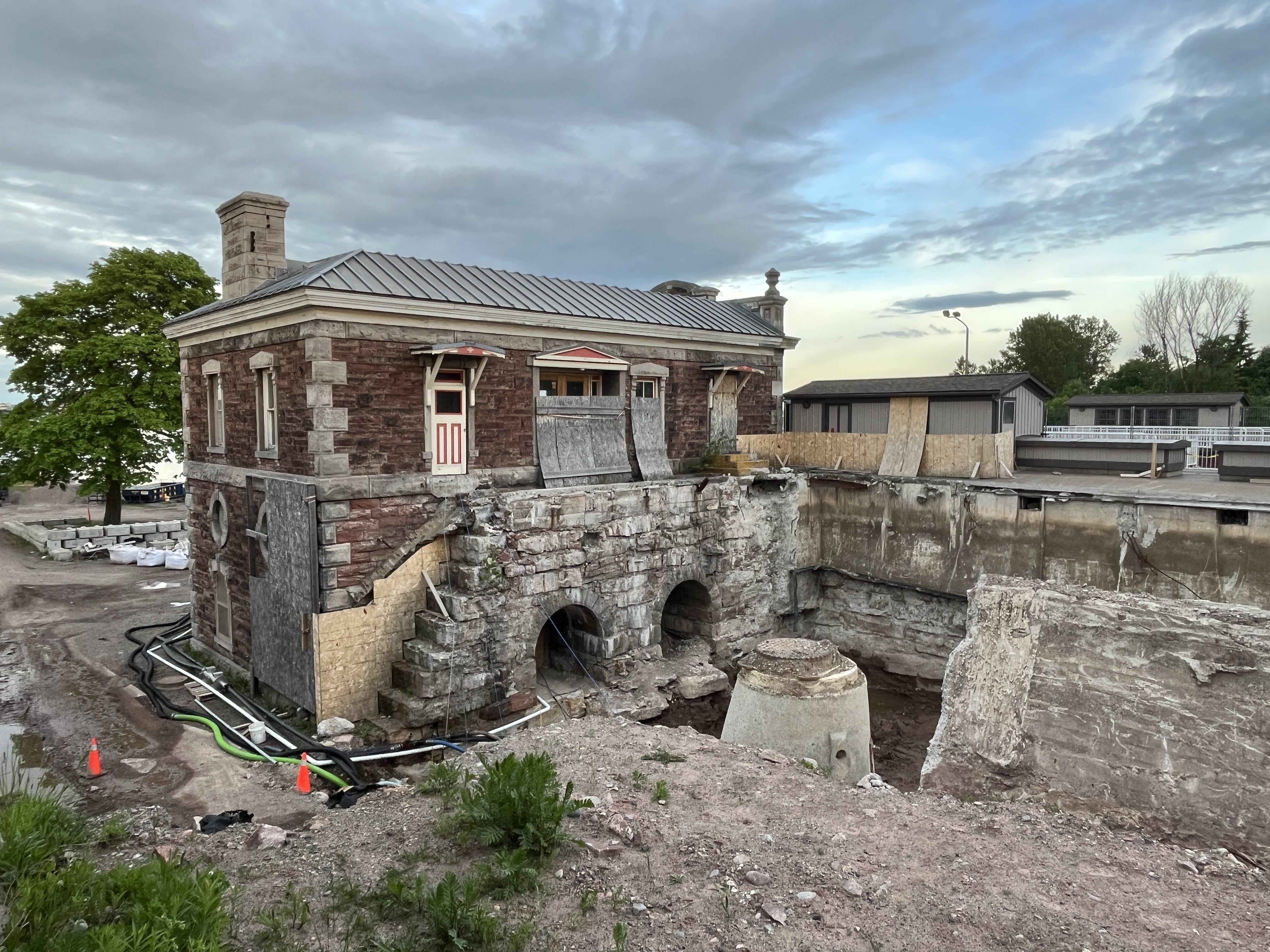
A powerhouse was constructed to supply power for the canal and to light the area. The building is currently under restoration and will be open to the public when completed. The original design from 1893 called for hydraulic power to operate the canal. A decision was made to convert it to electrical power making it the first electrically powered canal in the world.

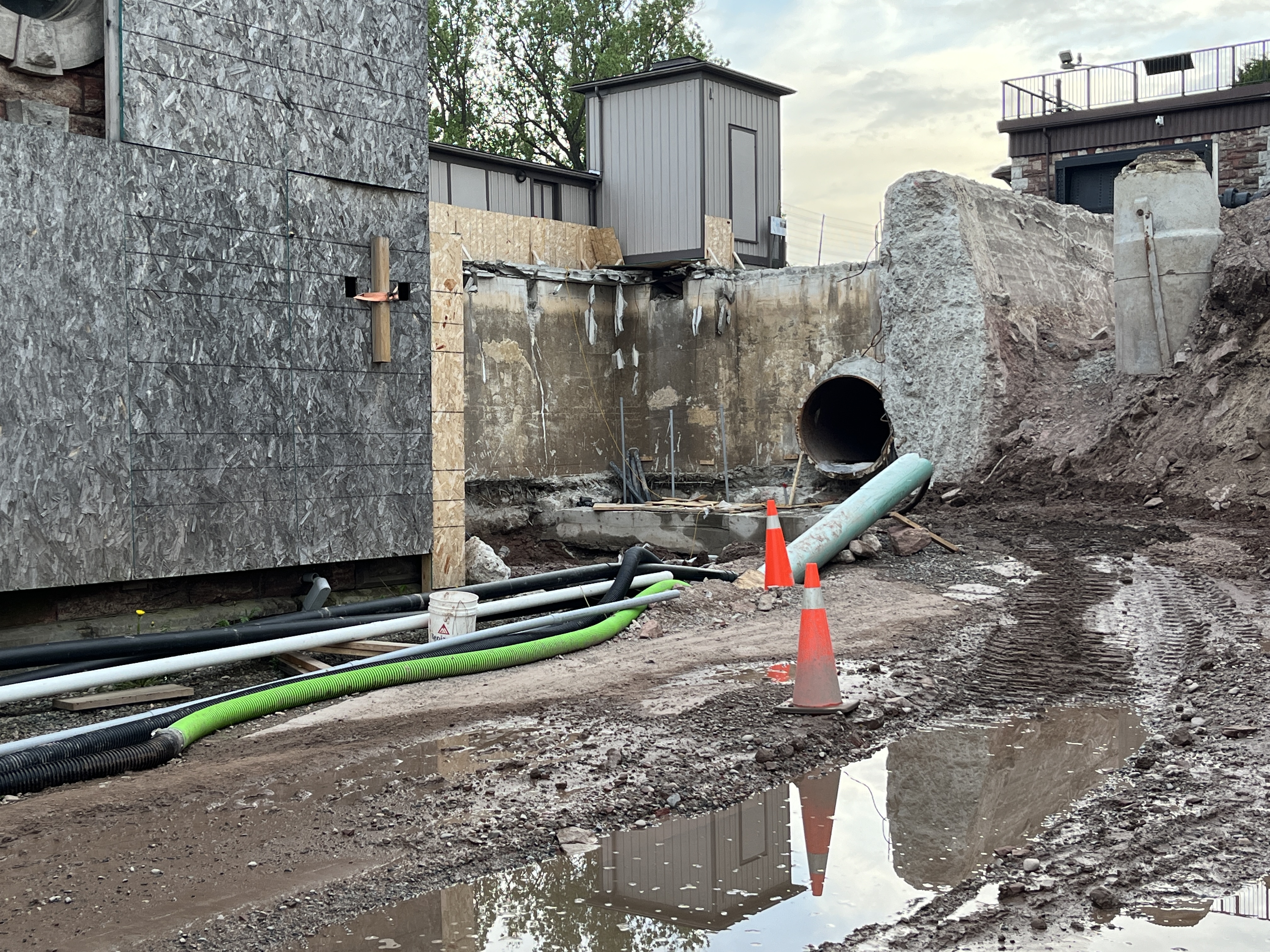
The power mill was operated using water from the canal. A 1,000 foot intake pipe was run from the top end of the canal to the back of the powerhouse. The excavations for repair show the size of the pipe that supplied the water to the powerhouse.

The water was gravity fed to the powerhouse and split into two smaller penstocks before entering the back of the building. There were two water turbines on the first floor and the force of the water entering them caused them to spin. A series of belts and pulleys turned the generators on the second floor where electricity was generated.

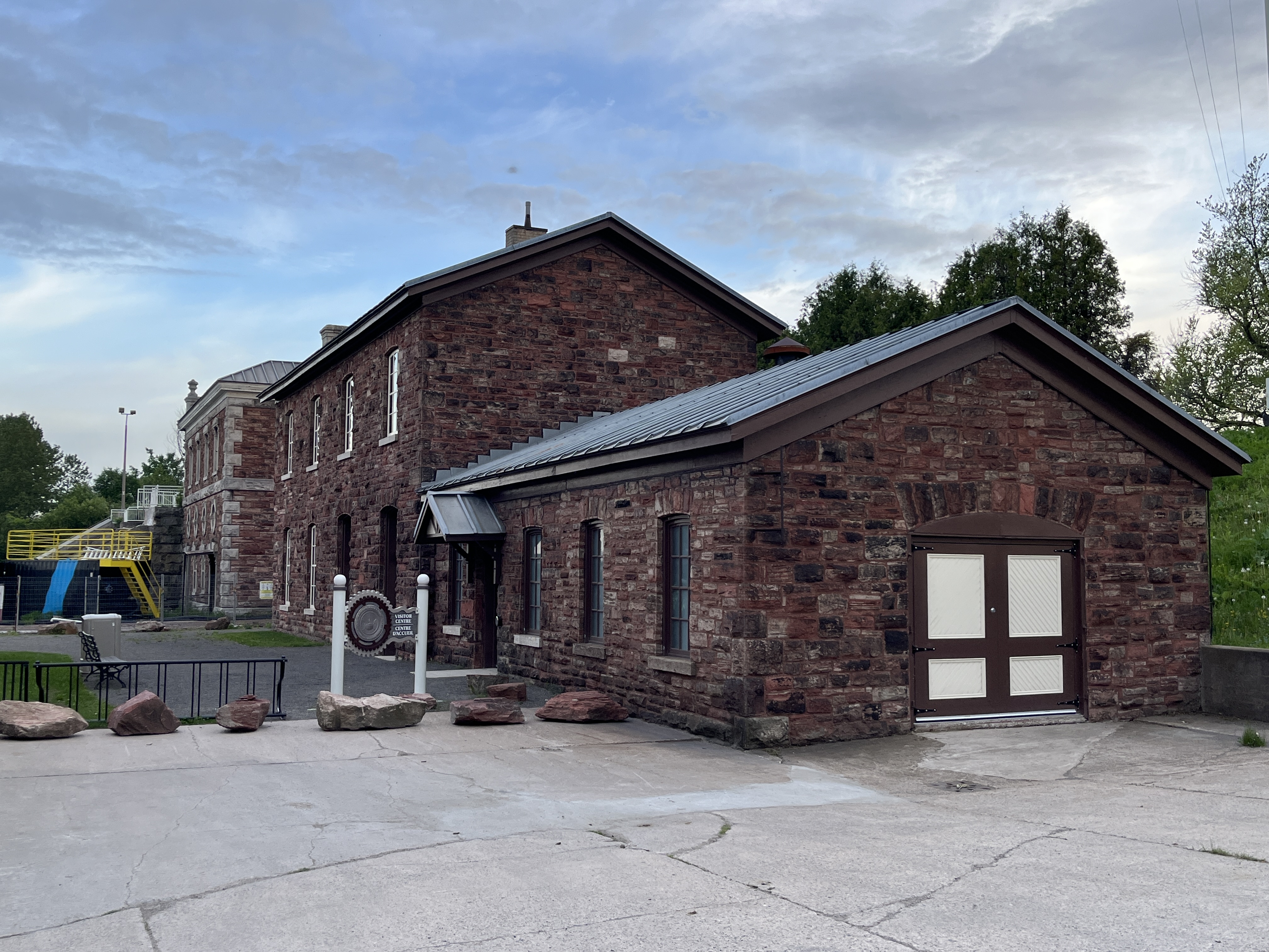
Another building was added in 1896 to act as the Stores building and Blacksmith Shop. The main building was used to store everything that was needed for the operation and maintenance of the canal. The single story portion on the end served as a blacksmith shop where metal parts were forged or repaired. The building was in terrible shape by 2010 and the foundation was collapsing. A major restoration has been completed and it now serves as the visitor centre.

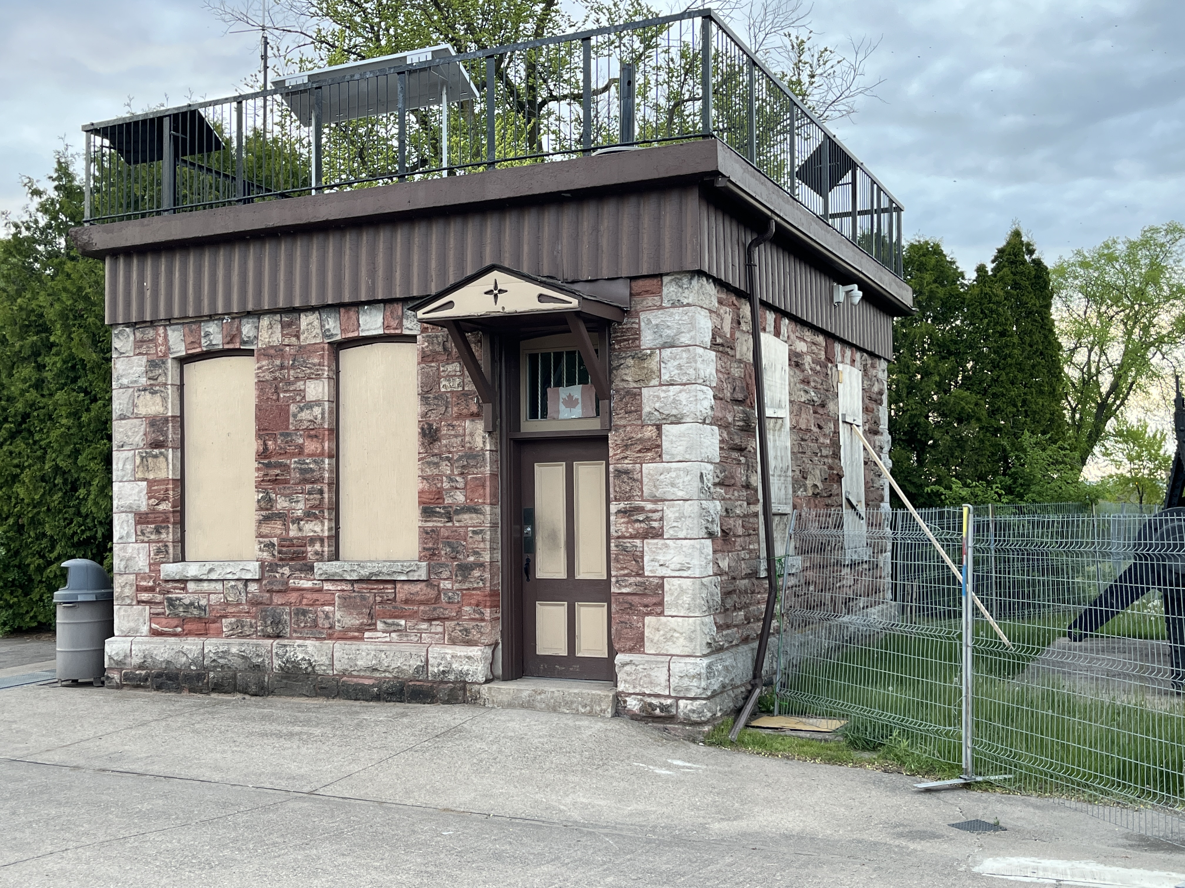
There’s a small building which was used for shelter for the canalmen. An observation platform has been constructed on the top of the building from which you can see the whole canal area.

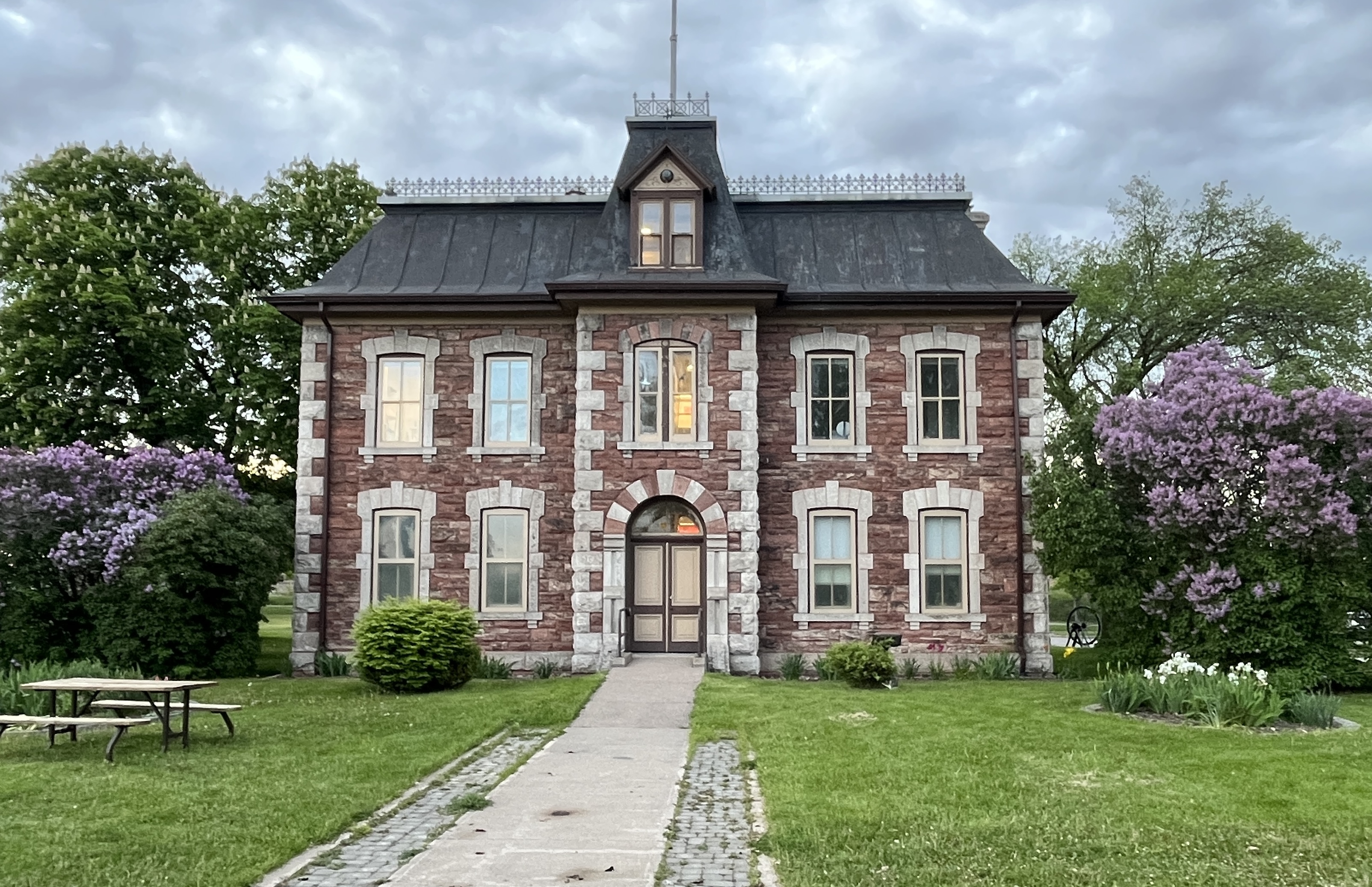
One of the most beautiful buildings in the area is the Administration Building. This Second Empire structure boasts a mansard roof and plenty of decorative stone work.

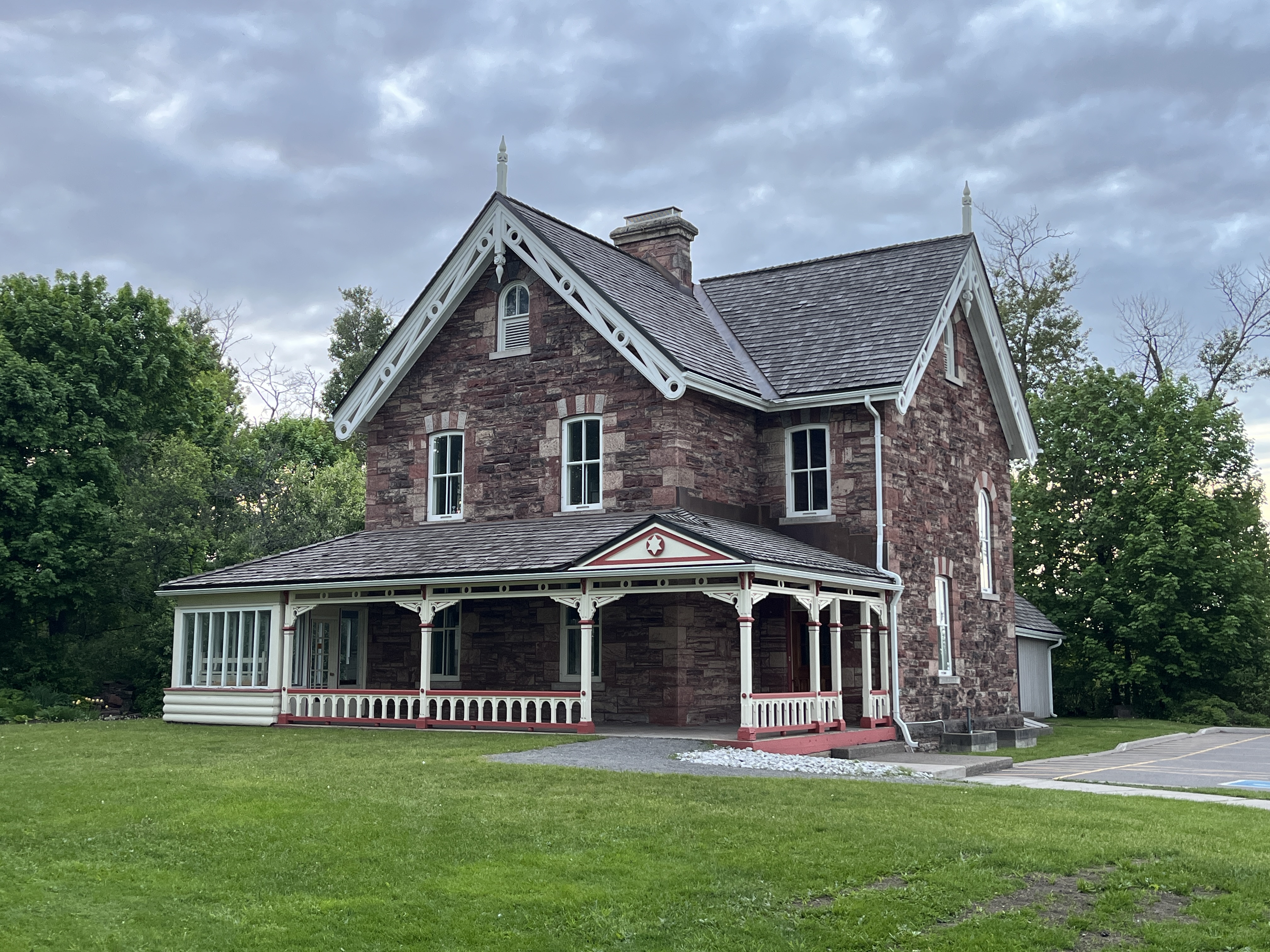
The Superintendent’s home is still located just a few feet from the canal and boasts Late-Victorian architecture.

The canal has the last remaining Emergency Swing Dam which is designed to prevent disaster in case of a failure of the canal retention system. On June 9, 1909 it was put into use when the gates were rammed from the top, allowing a torrent of water to enter the lock as two ships were preparing to transition the lock. The swing dam was put into action and the flow of water slowed down so that the auxiliary gates could be closed. It took 12 days to reopen the canal. In 1987 there was a lock wall failure and the canal was closed. When it reopened in 1998 it was made available to recreational craft who are the users of the canal up until now.

There are many interpretive signs to aid your exploration and a guided tour is also available, making this an interesting historical site to visit.

Related Stories: Burlington Canal, The First Three Welland Canals, Newmarket Ghost Canal, Peterborough Lift Lock

Google Maps Link: Sault Ste Marie Canal

Like us at http://www.facebook/com/hikingthegta

Follow us at http://www.hikingthegta.com

Also, look for us on Instagram

Mining The North

June 11, 2023

The first full week of June I spent in Northern Ontario on a work trip. Although we tend to focus on the GTA in this blog, it seemed like a good idea to “mine” my picture gallery to see if there is some information that could be shared with our readers. Although it was a business trip I found time to see some of the local history along the way. It soon became obvious to me that there could be a theme around mining and underground complexes and so in this post I present some short stories with a common theme. Links to each site will be provided in the text.

North Bay Airport is also home to 22 Wing Canadian Forces Base North Bay. It is the centre of air defence for the entire country and is partnered with the United States for the defence of all of North America. On May 12, 1958 Canada and the United States signed an agreement called NORAD to partner their resources in the defence of a possible nuclear attack from the Soviet Union. An underground complex was built at North Bay with initial excavation beginning in August 1959. The complex took $51 million dollars to construct and wasn’t completed until October 1963. It sits 180 metres below ground and has a floor space of 12,780 square metres. From down there the air defence was conducted in a bunker that was safe from nuclear attack.

After visiting my clients in North Bay it was time to make my way to Sudbury for the night. I made a stop at the East Duchesnay Falls site to do a little exploring. The falls cascade as they drop 100 metres over the escarpment. While the waterfalls are located close to the Trans Canada Highway, there are extensive trails that allow you to explore Duchesnay Creek.

In 1883 while blasting for the Canadian Pacific Railway in the area of Sudbury some interesting rock features were discovered. Soon the Sudbury basin was producing nickel, copper, gold, silver and platinum. In 1900 the Creighton mine was opened and soon became the largest nickel mine in the world. In 1949 the Bank of Canada launched a competition to design a coin to commemorate the 1751 isolation of nickel. The coin was issued in 1951 and features King George VI on the back. A giant replica of this nickel was created and in 1964 the “Big Nickel” was installed in Sudbury at the site of a proposed mining museum. The Big Nickel is 9.1 metres tall and 0.61 metres thick and is the largest coin in the world.

Sault Ste Marie boasts the oldest remaining house in Northwestern Ontario and this city was my next stop on my business trip. This 5-bay Georgian style house was built between 1814 and 1823. Charles Ermatinger was an employee of the North West Company and built this home when the town was still a small fur trading post on the Upper Great Lakes. For a time the home was the centre of the local social life with many visitors including Lord Selkirk. From Sault Ste Marie it was off to Kirkland Lake for the third night of my journey.

The railway was instrumental in the development of mining. Not only did it provide the means to access minerals and deliver them to markets it was also instrumental in the discovery of deposits. When workers were looking for trees to use for ties they sparked the largest silver rush in Canadian history. The town of Cobalt was founded on the silver mines that sprang up after this discovery. We will return to them later. The Temiskaming and Northern Railway was incorporated in 1902 and it was this lines construction that led to the discovery of silver. The railway Station in Temagami is one of the ones built on the line. Originally built in 1907 it has been subjected to alterations and fire damage. It is currently restored as a showpiece of railway architecture.

Prior to 1911 Kirkland Lake didn’t exist as a community. Two men were out hunting for rabbits when they discovered gold and changed local history forever. By 1940 there were over 24,200 residents in town and 20% of them worked for one of the seven mines that ran along the “Golden Mile” in town. Today there are only about 8,000 residents but Kirkland Lake Gold continues to find and exploit new sources of gold in the area. Over 700 metric tonnes of gold have been extracted from the local mines, roughly about 1/3 of a trillion dollars in today’s economy.

While Kirkland Lake was founded on gold, my next stop, Cobalt was founded on Silver. In 1903 the discovery of silver led to a major silver rush and the founding of over 100 active mines. By the 1920s the price of silver versus extraction costs had caused many of these to close but in the first 60 years of operations the combined outputs were over 420 million ounces of silver. The picture below shows Townsite Shaft number 1 which was sunk in 1907 and eventually reached a depth of 320 feet. The town has many other remaining sites and a well documented history which is displayed on historical information signboards throughout the town. The Right Of Way Mine headframe is seen in the cover photo for this post.

Kirkland Lake has a small park dedicated as a memorial to miners who have lost their lives while on the job. In Ontario over 1700 miners have been killed on the job since 1930 and their sacrifice is honoured here. There is a set of statues depicting mining operations as well as this three part memorial that lists the names and dates of the deaths of 286 people killed in local mining operations.

The Miner’s Memorial statue in Kirkland Lake.

There is so much to be discovered in Northern Ontario and I have to make a trip every four months so watch for future posts on some other aspects of this part of the province.

Google Maps Links are throughout the story.

Like us at http://www.facebook.com/hikingthegta

Follow us at http://www.hikingthegta.com

Also, look for us on Instagram