Saturday, March 18, 2017
Donald M. Gordon Chinguacousy Park is on the north-west corner of Bramalea Road and Queen Street in Brampton and contains an eclectic assortment of ways to entertain yourself. There is also plenty of free parking on site. This 100-acre park was formally known as the east half of Lot 6 in the 4th concession east Chinguacousy Township. Chinguacousy township is named after an Ojibwa chief named Shinguacose. The chief fought with the British in the War of 1812 but then went on to broker peace with the Americans and his tribe.
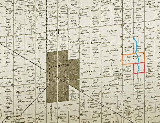
Lot 6 was granted to Richard Bristol in 1820 for service in the War of 1812. Ralph Crawford bought Lot 7 to the north in 1823 and it was around this time that Lot 6 started changing hands as two 100-acre half lots. Robert Crawford bought the east half, where Chinguacousy Park is today, in 1873. The historical county atlas below shows the location of the Crawford properties relative to the young town of Brampton. Chinguacousy Park is located on the property outlined in red while Robert Crawford’s other 200 acres are marked with orange. We followed a creek that feeds into the Etobicoke Creek north as far as Ralph Crawford’s Property.
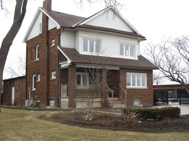
William Crawford owned it two years later and finally James Crawford worked the land. In 1925 Herb Crawford and his wife Elsie bought it from Herb’s father James. Like most pioneer farms the first house was a log cabin. It was located about where the base of the ski hill is today. The log house had been replaced with a wood frame house in the 1850’s but by 1925 it was in poor condition. The frame house also lacked the modern convenience of a furnace. Herb and Elsie decided to replace it with a new one. They started with a picture of a house that they clipped out of the newspaper. Elsie was a dressmaker by trade and her experience with sewing patterns came in handy. She sat down and drew up the plans for the house. The Crawfords did as much of the construction as they could and contracted the rest. They used their horses and a large scoop to dig out the basement, completing it by hand. They sold a field of alfalfa to pay for a carpenter to come by train on a weekly basis to work on the house. He was paid $10 per day. By the spring they were ready to hire bricklayers and so they sold off a field of wheat to pay them.
The house is a two-story vernacular farmhouse with architectural influences of the Craftsman style. This style emerged in the early 20th century with a movement toward craftsmanship and things handmade compared to machine made. The house has front gable that crosses almost the entire roofline. The porch is only partially as wide as the house.
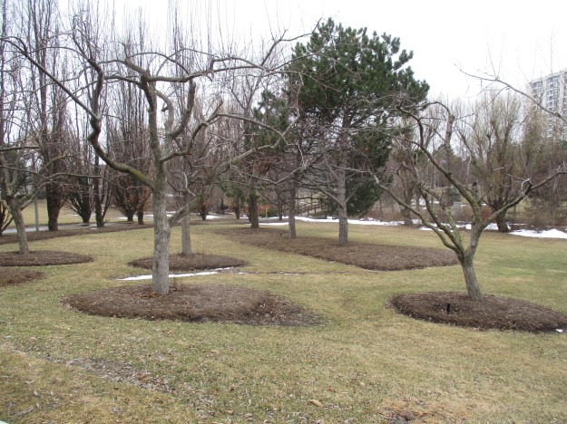
Like most pioneer families that lived off of the land there was an orchard near the house. The trees appear to be well tended as does the entire park. It was closed for renovations for a season while the ski chalet was replaced and other buildings were modernized to create a consistent look to the park facilities. The ski hill was also closed for a winter while a new belt lift was being installed.
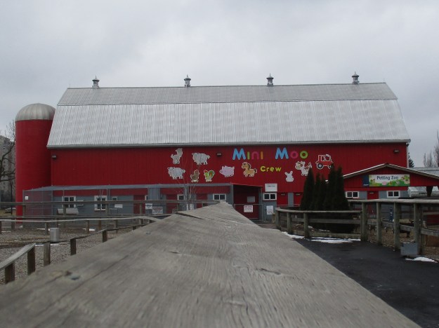
Looking for new income, and taking advantage of the spread of the personal automobile, the Crawfords built a gas station in 1933 on the property along the Queen Street frontage. In 1939 a new barn was needed and so Elsie went to work once again and designed the barn. Today, the barn has been converted into a petting zoo for children.
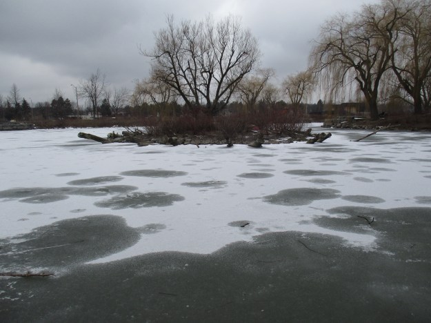
In 1970 the City of Brampton was designing the community of Bramalea with highrise residential surrounding the Bramalea City Centre shopping mall. The city wisely chose to buy the 100-acre farm from the Crawfords for use as a large city park for all the new people they planned to put in the community. The Crawfords dug a pond behind the barn for the use of the livestock. When the city took over managing the property they created a second pond. These two ponds provide habitat for a wide variety of waterfowl. With a fresh layer of ice on the pond, the little island stands out in the middle.
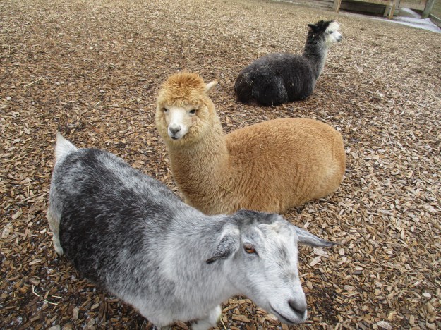
The petting zoo is housed in the barn but today many animals were in outside pens. Sheep, goats and alpaca were mixed in one pen while horses and asses were in another.
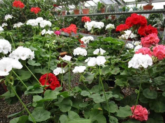
The greenhouses provide an opportunity to see tropical plants and there is a wedding chapel as well.

The greenhouse provides a wealth of colour during the otherwise drab winter months. The warmth and humidity caused both my glasses and camera to fog up badly.
A BMX and skateboard park along with mini-put, children’s playground and splash pad provide additional options for entertainment. The winter months see the reflecting pool converted into a skating rink. Tennis courts, curling and an outdoor track mean that you can’t experience it all in a single visit. In the summer months, a few rides are provided for the children.
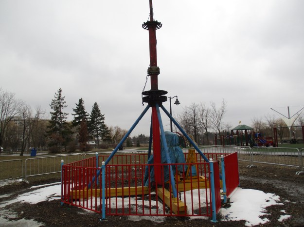
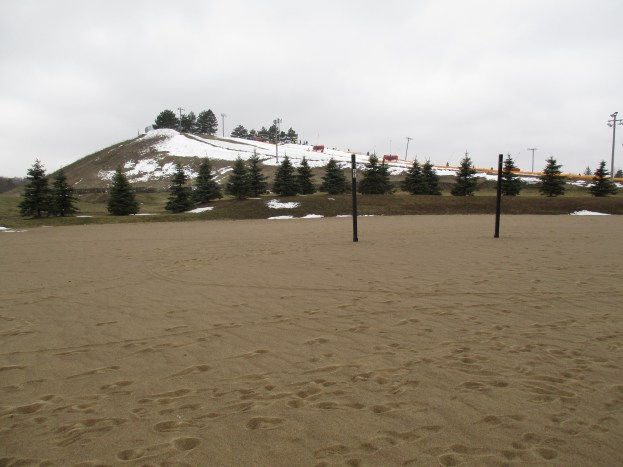
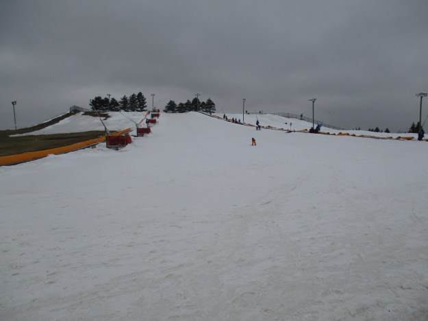
Mount Chinguacousy rises 69 feet off of the otherwise flat farmland. The mount was created in the 1970’s using earth removed from the basements and underground parking garages that were dug during the development of the surrounding area. The longest run is 617 feet and there are two runs. Tubing and skiing are both allowed and a modern ski chalet with Wifi is provided as well. At the base of the ski hill, as can be seen in the cover photo, are a series of beach volleyball courts. Brampton’s mini version of California.
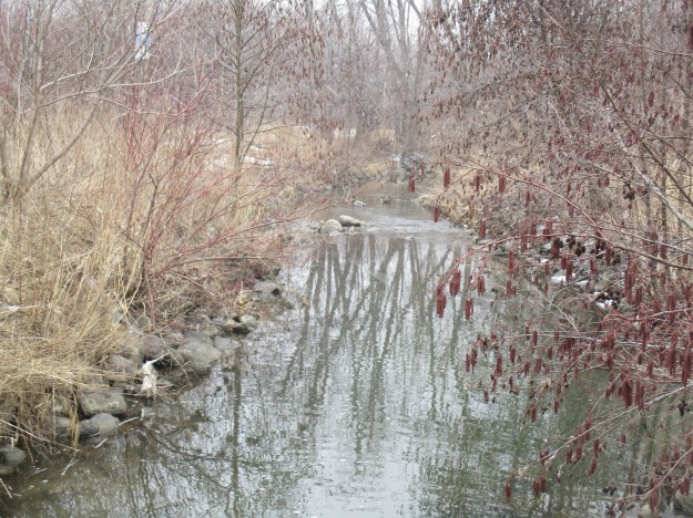
A tributary of Etobicoke Creek flows almost straight north on the historical atlas above. When Bramalea was developed it was common practice to create concrete channels for the waterways to flow through. Brampton had a history of flooding in their downtown core and putting Etobicoke Creek in a deep channel outside of town had solved the problem. Most of the creeks in the city were treated the same way. The waterways became linear parks and the Chinguacousy Trail runs for about 8 kilometres north from Victoria Park Arena. Some sections of the creek have been left in a natural condition and alders are common. Wetlands have been created in Maitland Park to help purify stormwater runoff and provide wildlife habitat.
Google Maps Link: Chinguacousy Park
Like us at http://www.facebook.com/hikingthegta
Follow us at http://www.hikingthegta.com

Are you aware of the underground tunnel that leads from the Bramalea Civic Center over to the Bramalea City Center? Here’s a photo of the stairs at the Civic Center that leads to the tunnel entrance (which is now closed): https://commons.wikimedia.org/wiki/File:Toward_Bramalea_City_Centre_via_the_Brampton_Civic_Centre.jpg
I am extremely curious to find out more about this but the link above is the only information I can find. I have a feeling the tunnel would have travelled underneath the parking lot and up into the side entrance of The Bay department store- there are/was steel doors beside some payphones inside the enclave of this side entrance that have always been bolted shut – I think this is where the tunnel would have emerged. To think that this tunnel is likely still there with the original lighting, etc but only closed on each end is fascinating. Do you have any information on this?
Hello, did you ever end up finding out more in regards to the tunnel? I find your comment fascinating and I’d love to know more!
The nearby Bramalea Civic Centre was also constructed around this time in the early 1970s, housing various municipal government offices, a theatre and the Brampton Public Library’s Chinguacousy branch. There was a short tunnel under Team Canada Dr. connecting the mall and Civic Centre outside areas, visible in early aerial imagery but since removed
Hello! I’m curious to know where you found the historic details of this park. Was there an article or a city archive you referred to?