Monthly Archives: July 2023

Malvern – Ghost Towns of the GTA

July 30, 2023

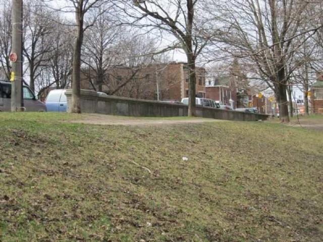
The former community of Malvern has disappeared under a massive railyard and multiple industrial buildings. There are still a few houses remaining that once stood on the outskirts of the town. Prior to 1850 the hamlet was known as Malcom’s Corners because John and Robert Malcom operated the Speed the Plough Inn and had a harness shop at the intersection of modern Sheppard Avenue and Markham Road. Senator David Reesor thought the community had the potential to become the capital of Scarborough Township and in 1857 he set out a plan to sell 50 foot by 150 foot lots for housing. He chose the name Malvern after a town in England where the water was said to cure the sick. Locals had told Reesor that the waters around Malvern would also cure the sick. He also planned for a grammar school, a fair grounds and a large community hall. The hall was built in 1860 and named Mammoth Hall. When it burned down in 1879 it was soon rebuilt. Unfortunately, an arson burned it down in 1988 and it was lost forever.

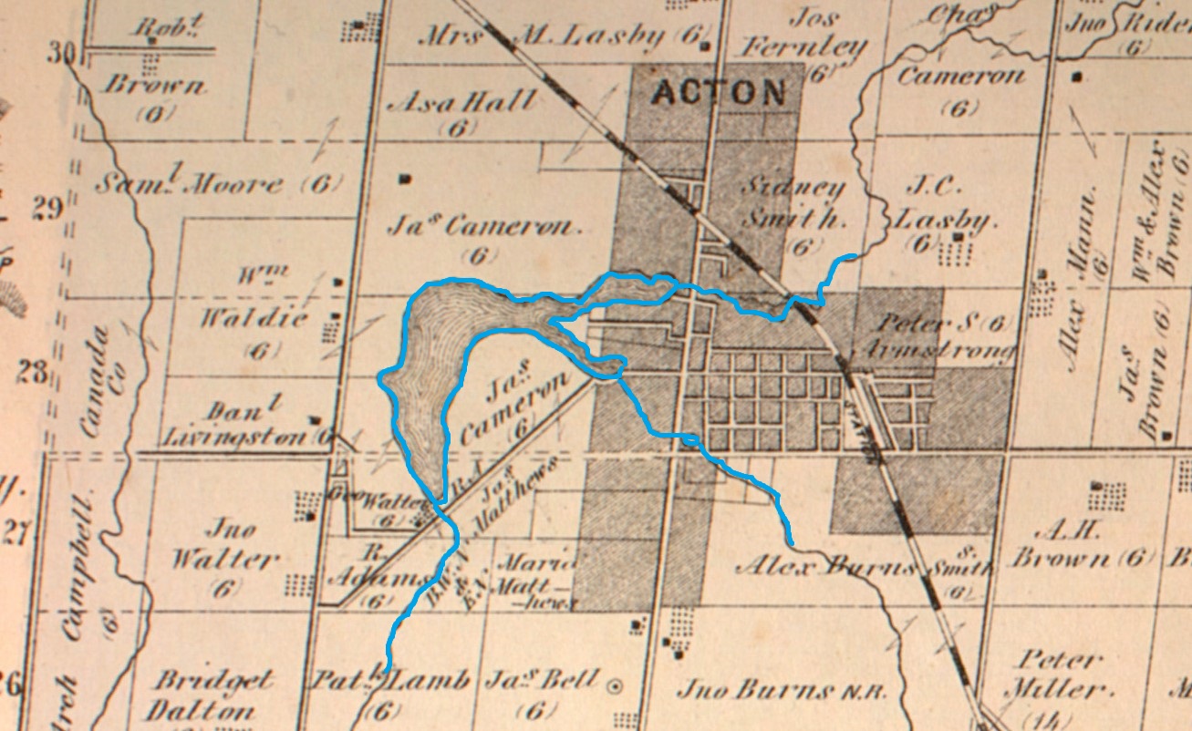
The map below is a section of the 1877 County Atlas and shows the location of the various properties that are pictured in this post. Three stone houses belonging to Weir, Stirling and Neilson and the school. Also circled is the Primitive Methodist Church that is pictured as an historical photograph.

For years there were two general stores that were operated by a series of men starting with Duncan Malcom. The village also had a blacksmith, a wagon shop, two hotels and a large woolen mill as well as a saw mill. One hotel was Thompsons Temperance Hotel and General Store and it contained the post office from 1865 until 1929 when the building was lost to a fire. The post office then moved to Cowans General Store in 1930 and remained there until 1956. The other hotel was the Standard Hotel where one could purchase an alcoholic drink that wasn’t available in the Temperance Hotel.

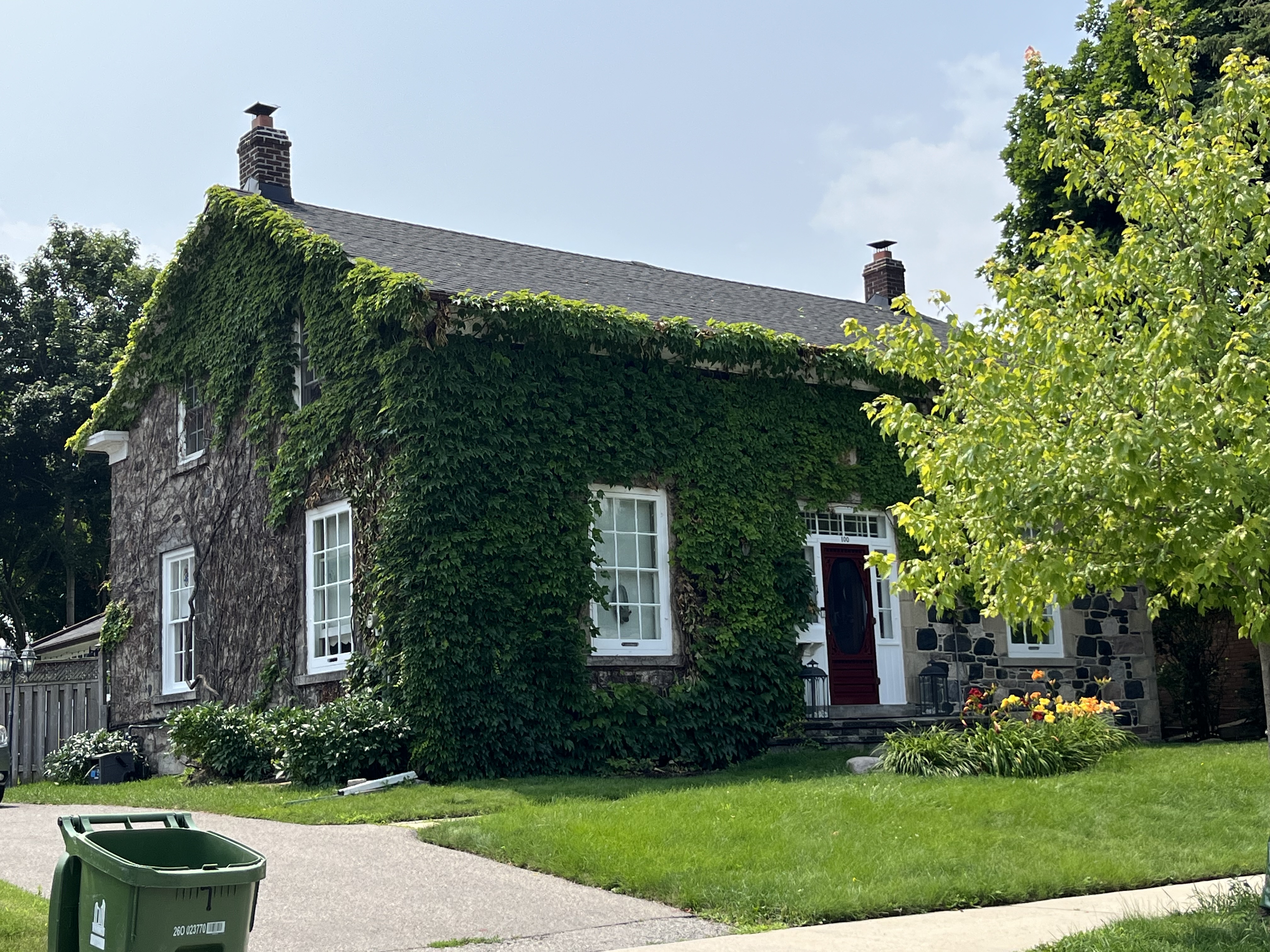
One of the prominent houses was the Neilson House which was built in 1856 and remains on Neilson Road today, serving as a community centre. It was partially destroyed by two fires in the 1970s but was restored and opened as the community centre in 1988. The cover photo shows this beautiful stone house from the front.

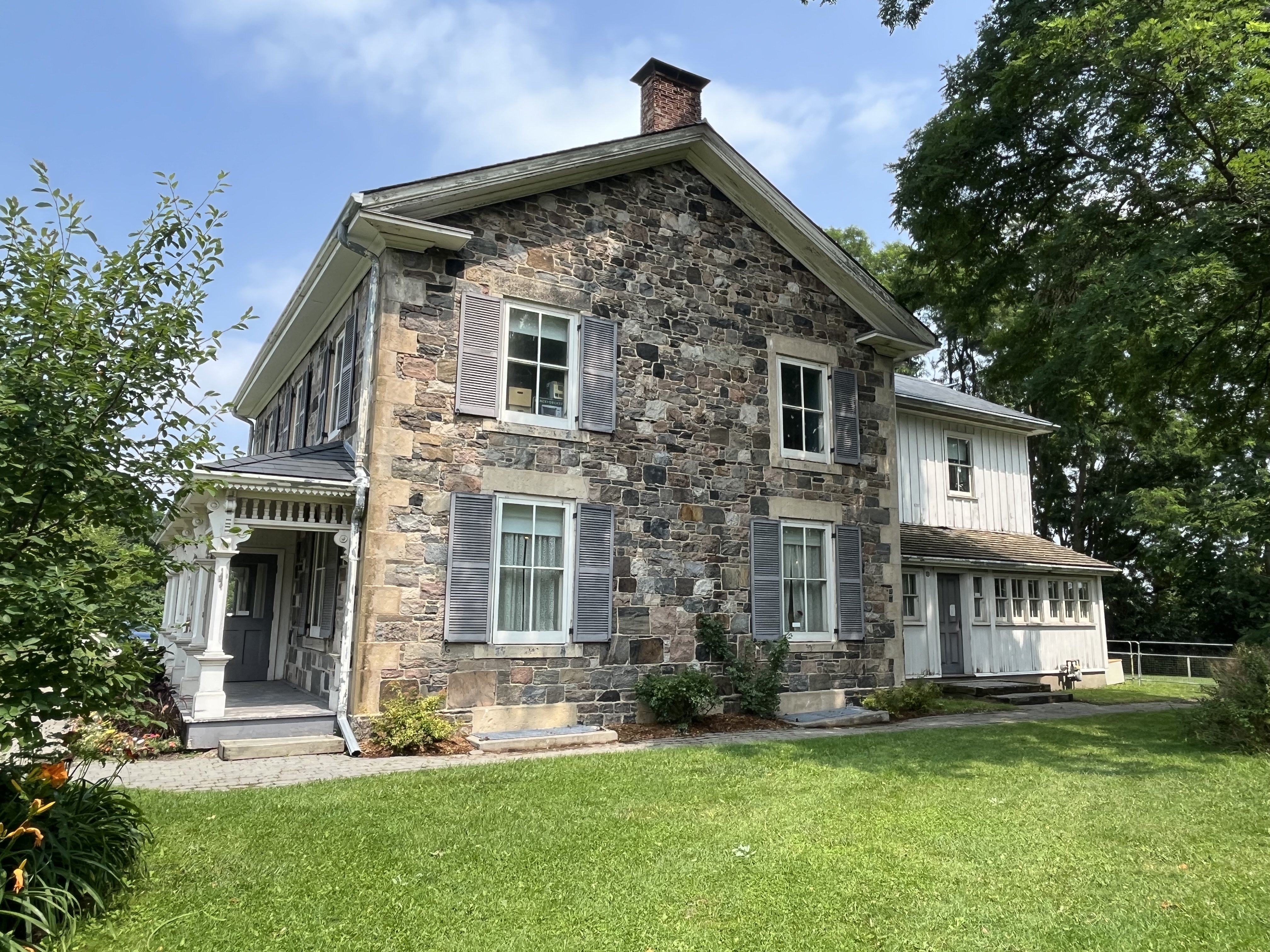
Malvern was a thriving farm community through the 1880s but when the railway bypassed it in favour of Agincourt that community prospered and Malvern went into decline. The Canadian Northern Railway built a station there in 1911 but it went bankrupt in 1917 and was taken over by the Canadian National Railway. Passenger traffic ceased in 1926 and the community stagnated until the 1950s when the Canadian Housing and Mortgage Company expropriated large tracts of land to build a housing development. One of the houses that was spared demolition was the James Stirling house which was built in 1860. This is another of the field stone houses that used to be found in the community.

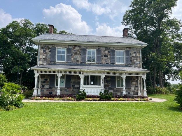
James Weir came to Scarborough in 1833 from Scotland and worked against the Mackenzie rebels in the 1837 Rebellion. He settled on this lot in 1840 and became a successful farmer, livestock importer and ploughman. Eventually he became one of the wealthiest landowners in Scarborough and erected this home made of fieldstone in 1861. The lintels above the windows and quoins on the corners are made of Kingston Limestone. The house used to stand in the middle of the property but in 1975 it was moved about 400 yards west to its present location.

The door on James Weir’s house is the most decorative part of the structure. It has side lights and windows in the transom above the door. It is also one of only a few historic houses that I have photographed that has a name plate and date stone, in this case just above the door. James Weir, 1861.

Malvern had a single church which was built in 1864 by the Primitive Methodist congregation. The building was demolished in the 1970s although some pieces of wainscotting and flooring were reused in the Scarborough Historical Museum. A small cemetery was located beside it and this still survives on the east side of Markham Road just north of Sheppard Avenue. The image below is from the Scarborough Historical Society website.

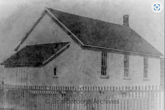
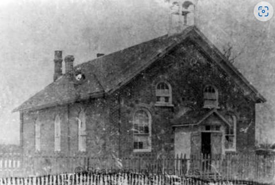
A log school house served the community from 1847 to 1851 when it was replaced with a small frame school which was built on the Stirling Farm. Alexander Muir got his start teaching in the log school house and his story can be found in our post on Burke Brook. The school was replaced again in 1872 by a one room brick school which still stands at the corner of Finch Avenue and Neilson Road.

The image below was taken from the Scarborough Historical Society and shows the school when it was surrounded by open farmland.

Whypers Boot and Harness Shop was relocated to Markham Museum where it is on display along with about 30 other historical buildings. Today the former community of Malvern is a thriving part of the uban sprawl of Scarborough and is commemorated in the names of streets, malls and the public library.

Related Stories: Markham Museum, Burke Brook, Agincourt

Google Maps link: Malvern

Like us at http://www.facebook.com/hikingthegta

Follow us at http://www.hikingthegta.com

Also, look for us on Instagram

Harbord Street Buried Bridge

July 9, 2023

Toronto has two bridges that were buried alive, so to speak. This week we are taking a look at the one on Harbord Street. The cover photo shows the bridge in 1910 when construction was nearly finished. Prior to the completion of the bridge the suburbs of the city were expanding quickly but because of the deep ravines there was a lack of through roads connecting the various parts of the city. Streetcars connected the city on routes that ran along College Street and Bloor Street but they were filling up and a new route was proposed. One proposal was to extend Harbord Street across the Garrison Creek Ravine at a cost of $110,000 in 1906. This would have amounted to about $3 million dollars in 2023 currency. Taxpayers didn’t approve the cost and in January 1907 it was shot down.

Garrison Creek vanished from the face of Toronto in the 1880s. The creek had originally been home to many species of fish including rock bass, large mouth bass, pumpkinseed, brown bullhead, white suckers, bow fin, and northern pike. By the 1880s it was so polluted that it was buried in a brick sewer. Later in 1907 City Council approved the purchase of a large portion of the ravine to build the bridge and create a park. The bridge was built to span the ravine and not to cross Garrison Creek which was already underground at this time. The image above shows that there was no water flowing in the ravine.

The bridge at Harbord street was a single span concrete arch bridge which opened in 1914. It is 23 feet high, 54 feet wide and 35.5 feet long. Between 1917 and 1930 the area around the bridge was filled in. The sides of the ravine were also filled in as back yards were extended so that there wasn’t a steep cliff leading down to the park.

The entire bridge, the valley and Garrison Creek have vanished underground. When the land was purchased for a park the city planned to designate the park as a landscape similar to Allan Gardens or High Park. However, by the 1920s new ideas were emerging about how parks should be built. The city made further plans to develop tennis courts, a bowling green and children’s playground in the ravine south of the bridge. In order to facilitate this the ravine was filled in and the bridge was buried. This is why the ravine south of the bridge is filled in while the north side remains as an open ravine.

Only the northern balustrade remains visible to mark where the bridge once stood.

Looking over the side of the bridge into the valley gives an idea of how far down the former creek lies below the table lands on either side.

Harbord Street bridge is just one of the buried bridges in downtown Toronto, but it was the first one. We will look at the other one in a future article.

Related stories: Allan Gardens, High Park

Google Maps link: Harbord Street Bridge

Like us at http://www.facebook.com/hikingthegta

Follow us at http://www.hikingthegta.com

Fairy Lake – Acton

July 1, 2023

Acton was founded in 1825 by two brothers named Adams who had been Methodist preachers but decided to settle into the farming life. Today, the community is known for The Olde Hide House which was made famous with the slogan “It’s worth the drive to Acton”. Acton is also lucky to have Fairy Lake as a scenic park in the centre of town. The lake is found at the headwaters of Black Creek and was created in 1830. That was the year the Adams brothers built a dam on Black Creek and flooded an area that was previously a wetlands. The dam was created to retain enough water to allow them to power a grist and flour mill in town. The image below is taken from the 1877 County Atlas and shows the lake relative to the small community that existed at the time.

The flooded area was only known as the mill pond until 1872 when it was given the name Fairy Lake. Then, in 1886 the town purchased land from Rufus Adams to allow the creation of Prospect Park.

There is an extensive playground with lots of swings and other attractions for children to play on. There’s even a small zip line for the enjoyment of the little ones.

There is a 1.6 km loop trail in the park that takes about 30 minutes to complete. The trail makes its way along the shore of the lake and has several places which are good for fishing or bird watching.

There is also a small beach but unfortunately the sand is covered with lots of Canada Goose poop. This has turned a quiet little spot for the children to wade in the water into a rather unsanitary place.

The geese are busy raising a brood of goslings and they have occupied several sections of the trail where they deter pedestrians by hissing at them and making a mess of the walkway. Each goose is capable of leaving up to two pounds of poop behind every day. They mostly do this while grazing or walking on land and are less likely to drop something while flying or swimming.

Yellow Iris are growing in the edge of the lake. This aquatic plant is not native to North America but was brought over from Europe in the late 1800s as an ornamental plant. It is sometimes planted in wetlands because it is known to absorb heavy metals and can be helpful in restoring the local environment. However, it forms dense mats that can displace wildlife and change wetlands into drier areas. It is poisonous to both humans and animals and its sap can sometimes cause severe dermatitis.

One of the features of the park is a kayak launching system. This allows paddlers to get in and out of their kayak with relative stability.

An old cemetery stands vigil in the corner of the park. This is the old Knox cemetery which is also known as Acton Pioneer Cemetery. In 1843 the Adams family sold land for the purpose of building a Scottish Kirk, or church, on. In 1848 a small lot behind the church was purchased to be used as a cemetery. Several members of the Adams clan had already been buried there making it an ideal spot. By 1886 the cemetery was deemed to be too small and a new cemetery was opened a few blocks away. Several of the interments from Knox Cemetery were moved to the new one and in 1933 the remaining head stones in the old pioneer cemetery were gathered into a cairn. A fence has been erected around the cairn but there is a gate so that people can go inside to look closer at the markers.

The original 1830 dam was repaired many times and eventually replaced with the present concrete one. This is now owned and maintained by the town so that the lake level can be controlled using the two sluice gates.

The flour mill in Acton is still in the same location as the original grist and flour mill that was built by Rev. Ezra Adams in 1835. The mill no longer runs on water power taken from Fairy Lake but it has been in business for nearly 200 years.

In 1974 a new legion number 197 was opened on the side of Fairy Lake. From Prospect Park you can see a war plane through the trees. This is located at the legion, the third such building in town. The plane is a Silver Star CT33 MK3 Jet Aircraft which was used in training flights and could reach speeds of 920 km/hr. It entered service in December 1952 and was retired in November 1972. It was placed at the legion in November of 1975.

Fairy Lake has been serving the local community for nearly two centuries and makes an excellent place for a picnic or a walk if you are in town. It is also a place you can take the kids for a fishing experience.

Google Maps Link: Fairy Lake

Like us at http://www.facebook.com/hikingthegta

Follow us at http://www.hikingthegta.com

Also, look for us on Instagram