July 9, 2023
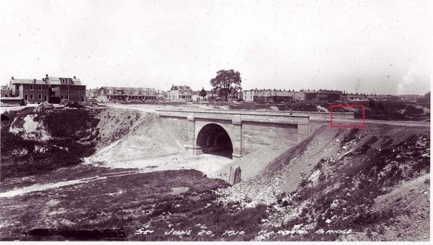
Toronto has two bridges that were buried alive, so to speak. This week we are taking a look at the one on Harbord Street. The cover photo shows the bridge in 1910 when construction was nearly finished. Prior to the completion of the bridge the suburbs of the city were expanding quickly but because of the deep ravines there was a lack of through roads connecting the various parts of the city. Streetcars connected the city on routes that ran along College Street and Bloor Street but they were filling up and a new route was proposed. One proposal was to extend Harbord Street across the Garrison Creek Ravine at a cost of $110,000 in 1906. This would have amounted to about $3 million dollars in 2023 currency. Taxpayers didn’t approve the cost and in January 1907 it was shot down.
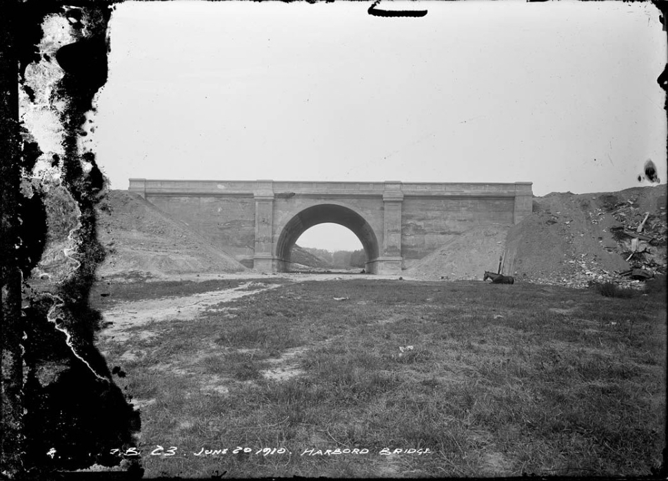
Garrison Creek vanished from the face of Toronto in the 1880s. The creek had originally been home to many species of fish including rock bass, large mouth bass, pumpkinseed, brown bullhead, white suckers, bow fin, and northern pike. By the 1880s it was so polluted that it was buried in a brick sewer. Later in 1907 City Council approved the purchase of a large portion of the ravine to build the bridge and create a park. The bridge was built to span the ravine and not to cross Garrison Creek which was already underground at this time. The image above shows that there was no water flowing in the ravine.
The bridge at Harbord street was a single span concrete arch bridge which opened in 1914. It is 23 feet high, 54 feet wide and 35.5 feet long. Between 1917 and 1930 the area around the bridge was filled in. The sides of the ravine were also filled in as back yards were extended so that there wasn’t a steep cliff leading down to the park.
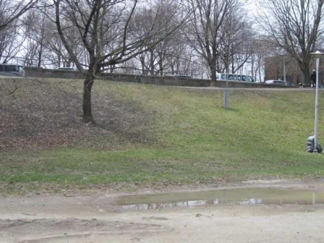
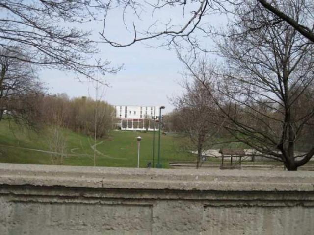
The entire bridge, the valley and Garrison Creek have vanished underground. When the land was purchased for a park the city planned to designate the park as a landscape similar to Allan Gardens or High Park. However, by the 1920s new ideas were emerging about how parks should be built. The city made further plans to develop tennis courts, a bowling green and children’s playground in the ravine south of the bridge. In order to facilitate this the ravine was filled in and the bridge was buried. This is why the ravine south of the bridge is filled in while the north side remains as an open ravine.
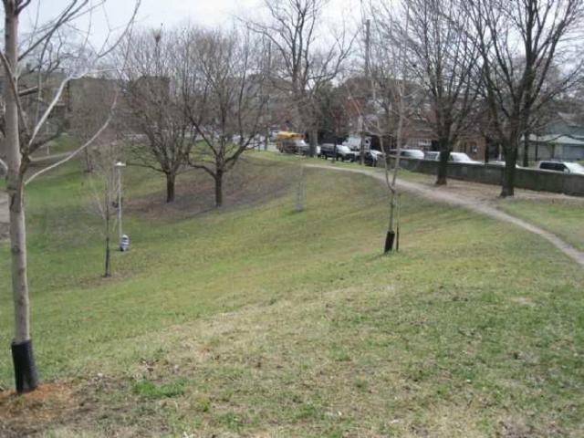
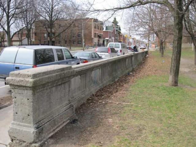
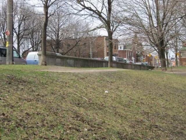
Only the northern balustrade remains visible to mark where the bridge once stood.
Looking over the side of the bridge into the valley gives an idea of how far down the former creek lies below the table lands on either side.
Harbord Street bridge is just one of the buried bridges in downtown Toronto, but it was the first one. We will look at the other one in a future article.
Related stories: Allan Gardens, High Park
Google Maps link: Harbord Street Bridge
Like us at http://www.facebook.com/hikingthegta
Follow us at http://www.hikingthegta.com

There are photos of the construction of the Harbord Street Bridge, which I have not seen elsewhere at the 1909 journal “Engineering and Contract Record” page 1164 of 1464 https://archive.org/details/contractrecordv23p02/page/n1163/mode/2up?q=%22harbord+street+bridge%22
Who else noticed the horse laying by the bridge when the ravine was still a pasture?