Saturday Dec. 20, 2014
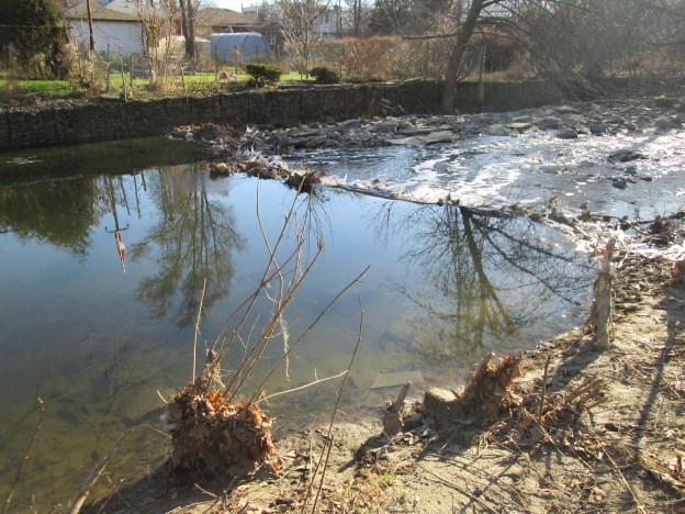
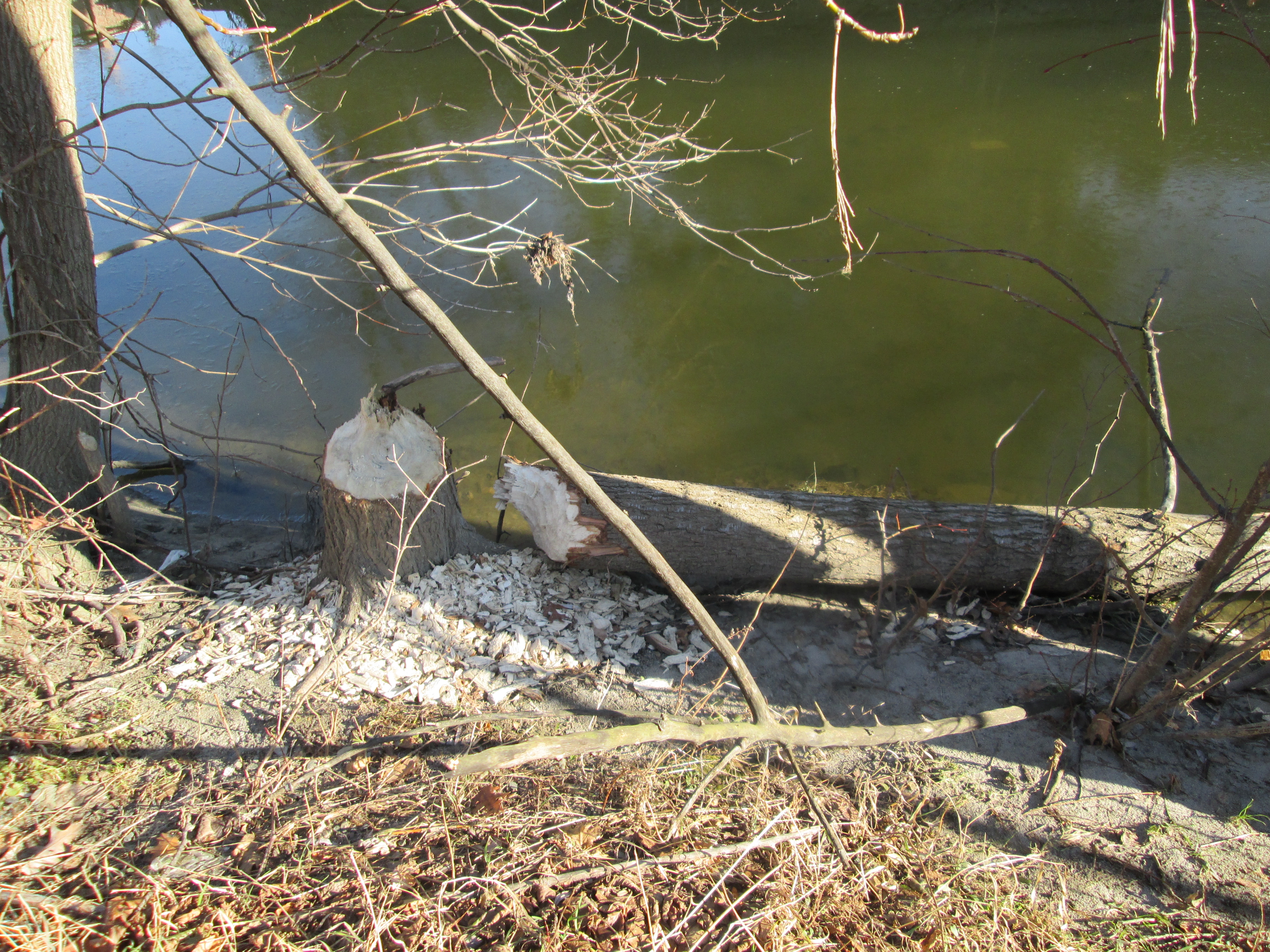
It was minus 5 with almost no breeze. The Canadian flag reflected on the creek in the cover photo hangs almost motionless. With the sun shining it made for beautiful day to mark the end of fall. Returning to the parking lot at Jeff Healey park we set out heading south to see what we could see. Steep shale embankments on the west side of Mimico Creek forced us to cross to the east side. It wasn’t too long before we began to see a lot of trees that had recently been chewed off by beavers. Beavers have strong jaws for cutting down trees and can bite through a 1.5 cm tree in a single bite. Larger trees, like the one in the picture below, are not used for construction of lodges or dams. Their bark is used for food and the upper branches are taken for building materials.
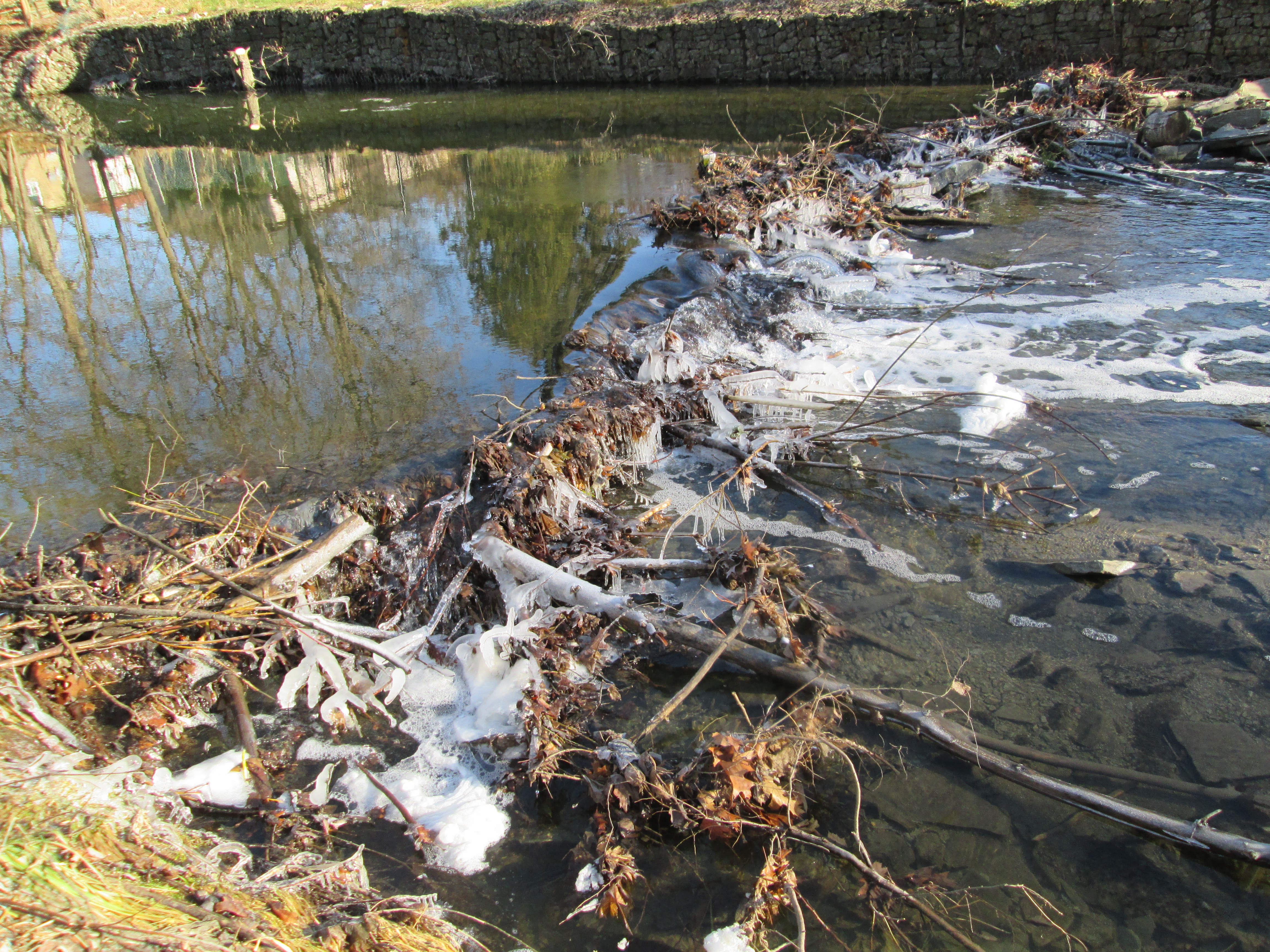
The beavers have started to build a dam across the creek. Left on their own they will continue to build their dam higher as they raise the water level in the creek. The dam is strengthened with mud and stone that is dug up off the bottom of the creek with their tails.
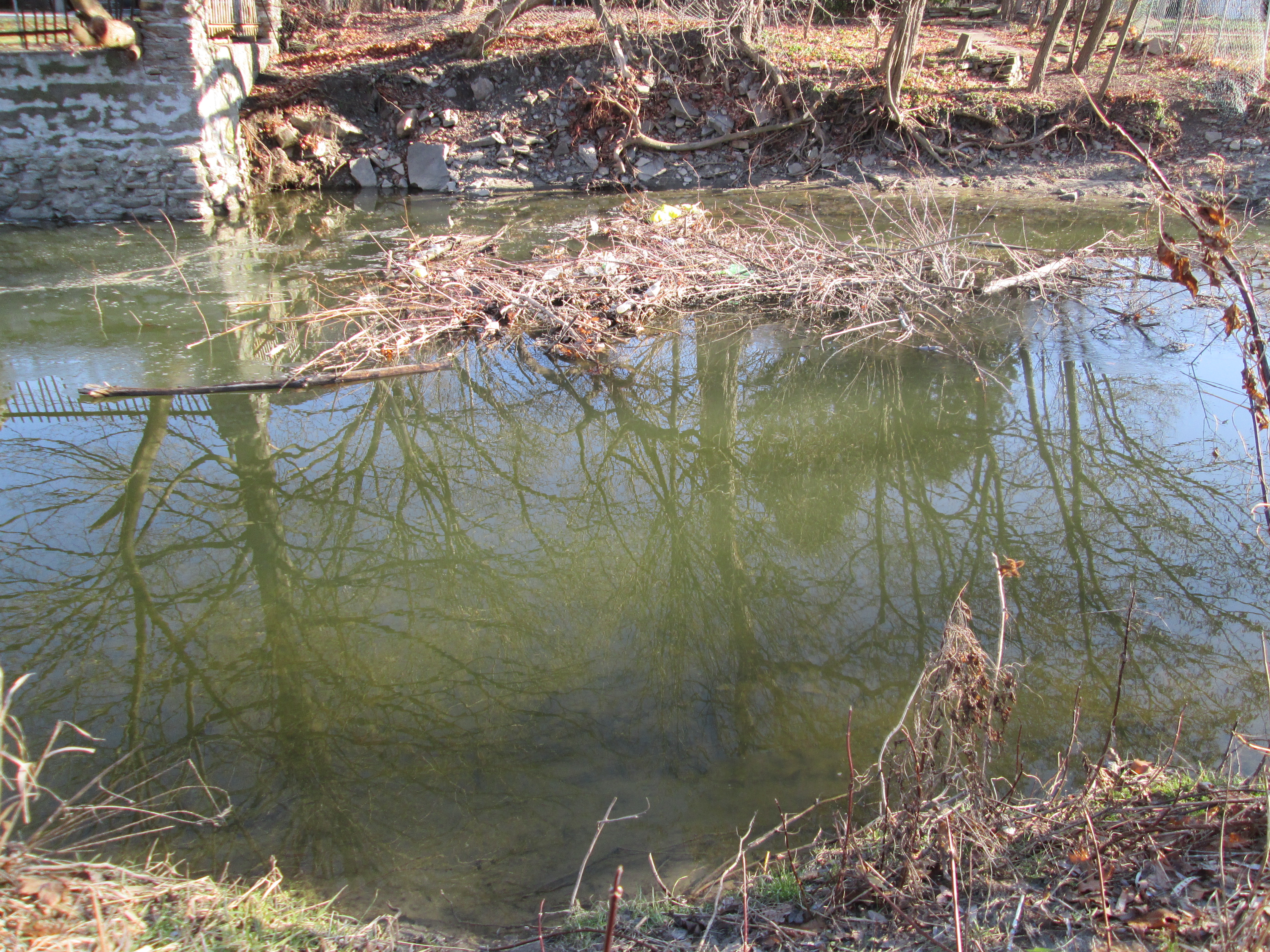
Beavers like to build a lodge which they use as a home for the winter. The entrance to the home will be from under the water but the home will eventually be built up to have room above the water to make a dry comfy home. This one is currently under construction. The beavers will raise the water level to close to a meter above the lodge entrance to keep it clear of ice during winter.
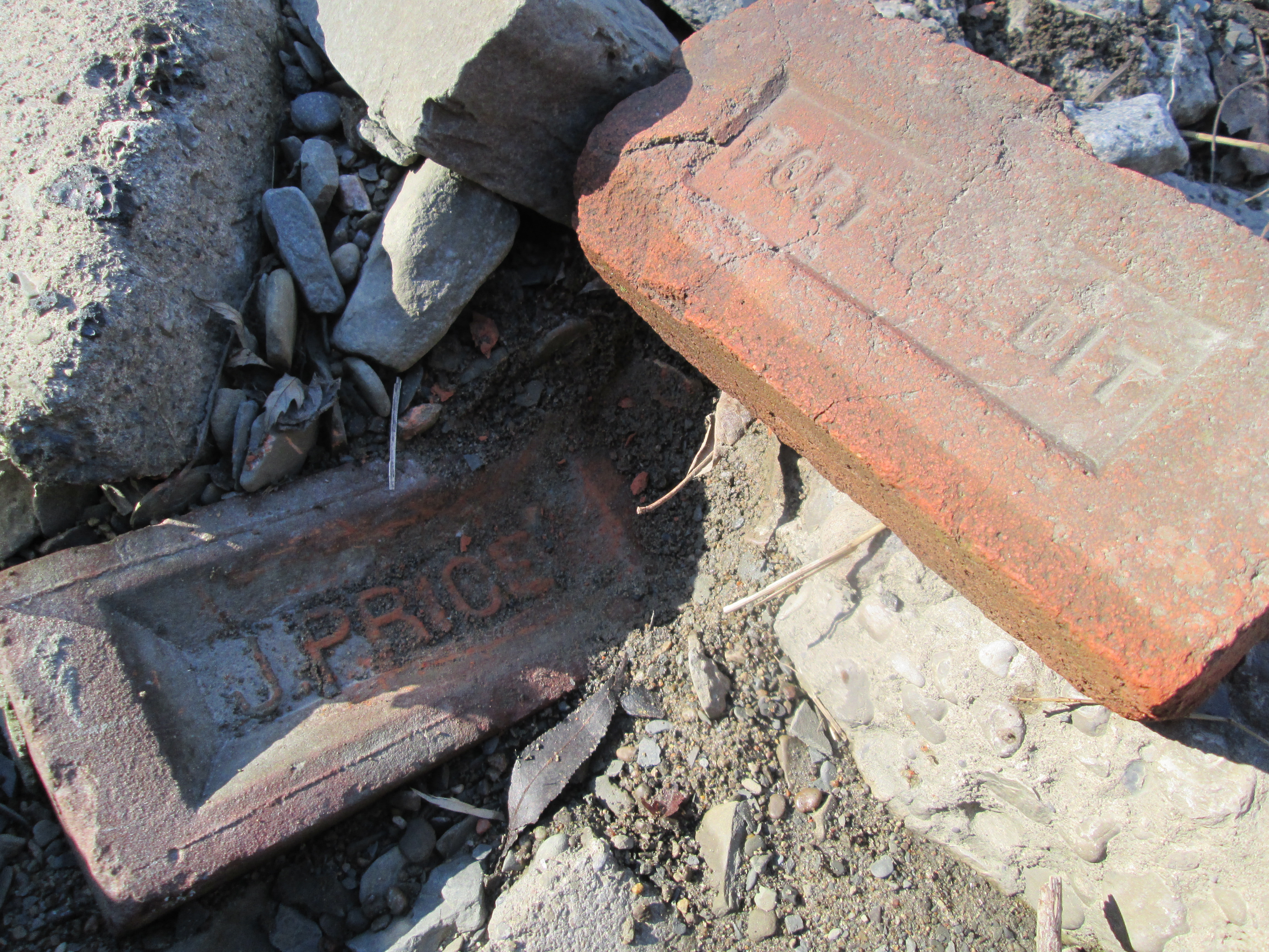
Along the creek bed a lot of old building materials have been dumped. The Port Credit brick in the picture below is like one described in Middle Road Bridge on Aug. 16th from a brickyard that closed in 1920. The J. Price brick is from a brickyard that operated on Greenwood Avenue in Scarborough from 1912 to 1962. Greenwood Avenue ran along a seam of clay which made it home to several brick makers during the 1900’s. John Price ran his brick yards producing a soft mud brick which is used for residential construction. The term “John Price Brick” is still used generically to refer to this type of brick.
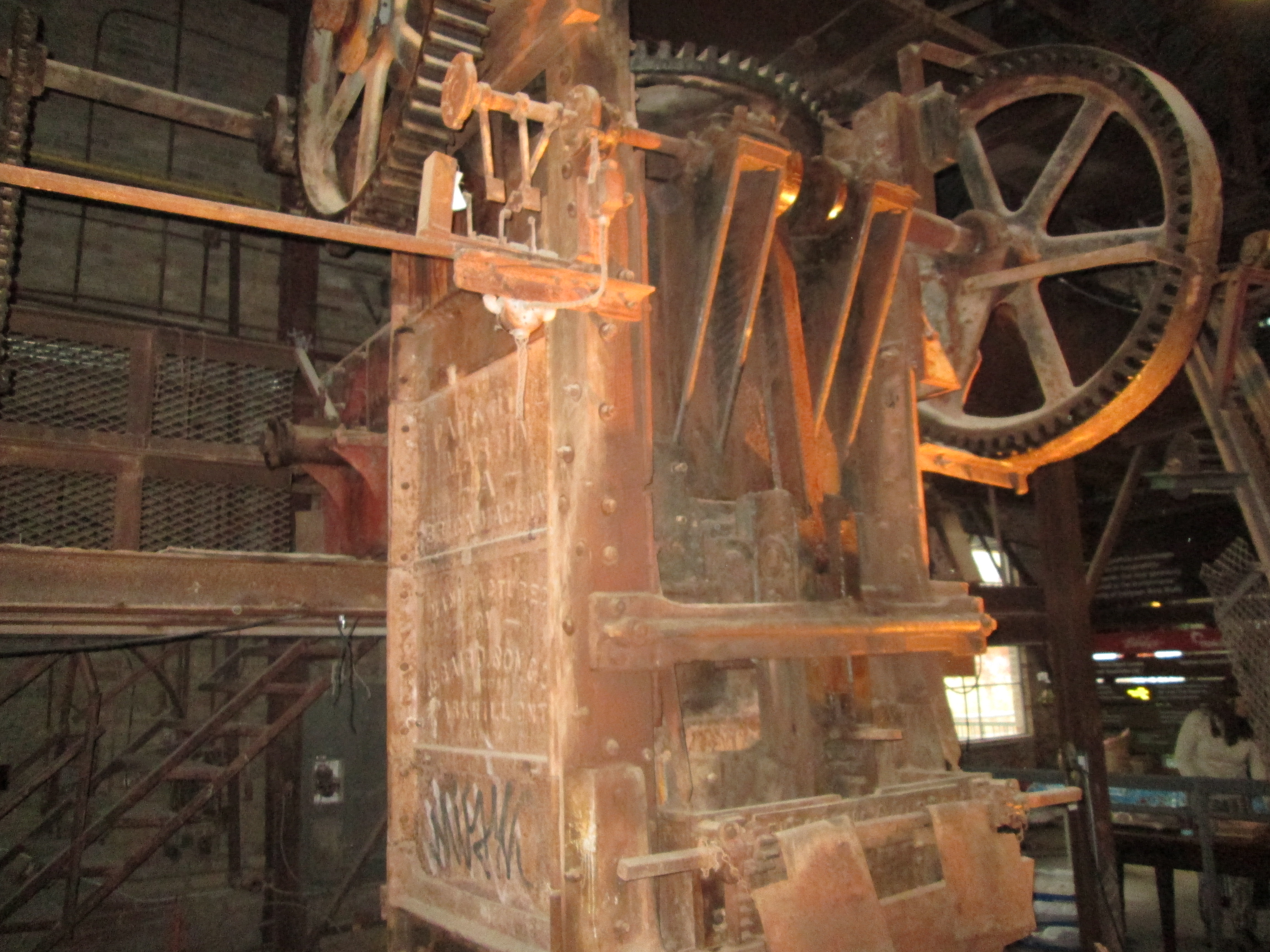
When the Price brickyards closed in 1962 the soft mud press was moved to the Don Valley Brick Works. The picture below shows Price’s soft mud brick press as photographed during an excursion to the Brick Works on Nov. 16th.
A little farther along we found an old beer bottle. The stubby, as it was affectionately known, was introduced to Canadian beer drinkers in 1961. Market research showed that women drank less beer than men and it was thought that making the bottle skinnier would appeal more to that untapped market. By the mid 1980’s all the stubbies had been eliminated in favour of the American style long neck bottle. The picture below shows a 1977 stubby.
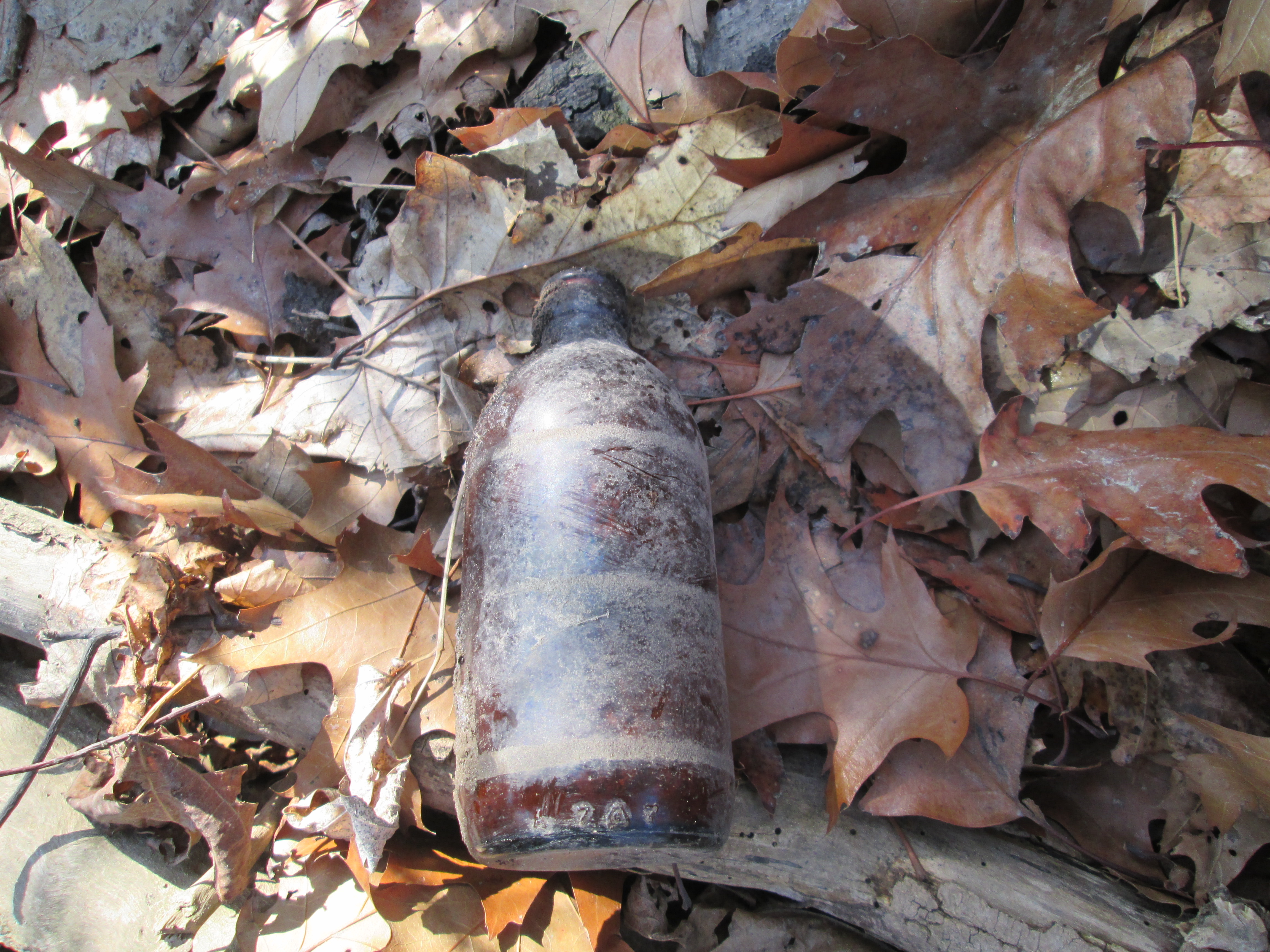
This is what it may have looked like when it was new.
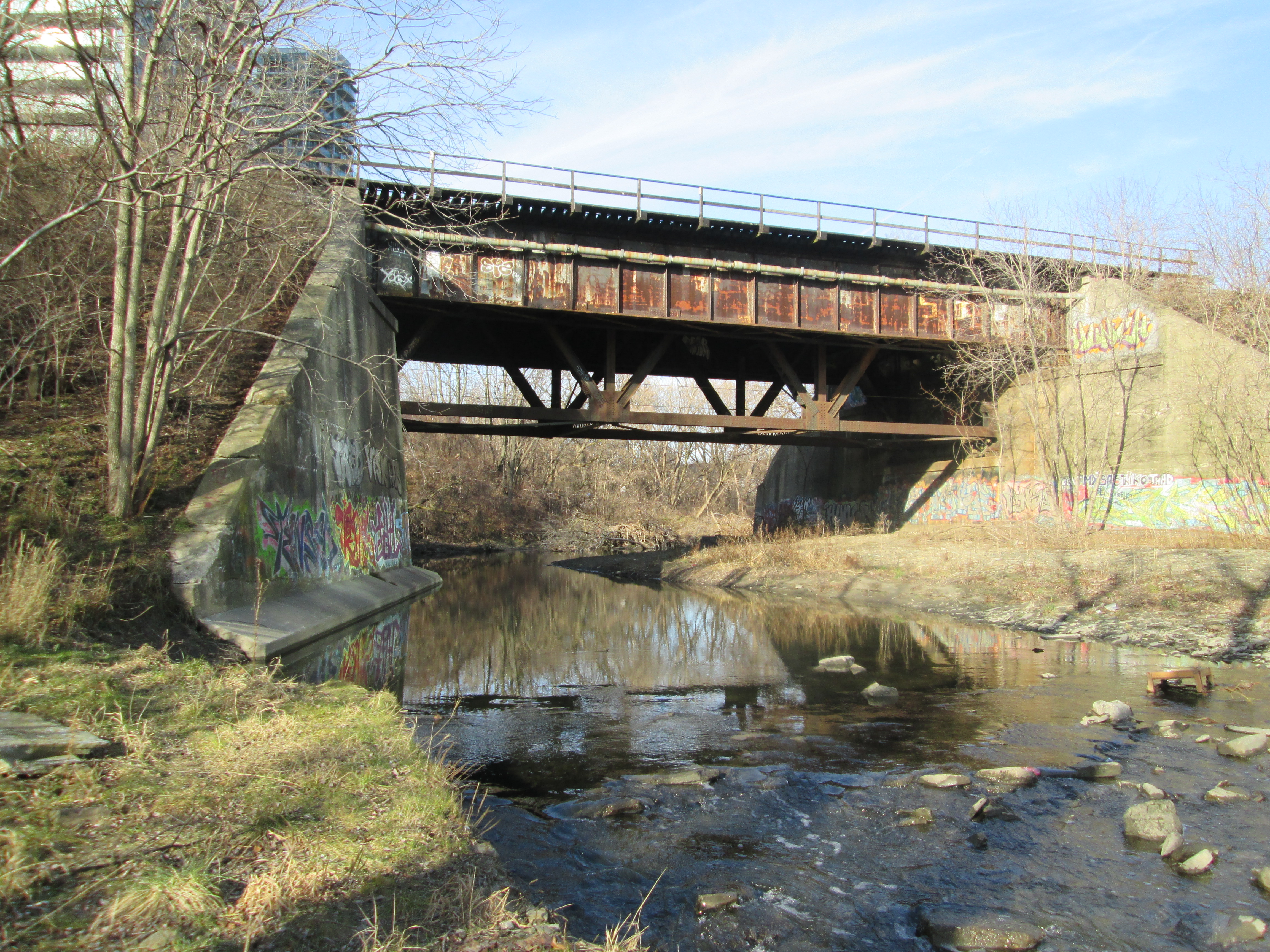
William Gamble built a saw mill on the Mimico Creek on the west side near the railway crossing. It is likely that it was located on the land that can be seen upstream, framed by the rail bridge. Gamble also owned the King’s Mill before it was destroyed by fire in 1881. Today we know that restored mill as The Old Mill.
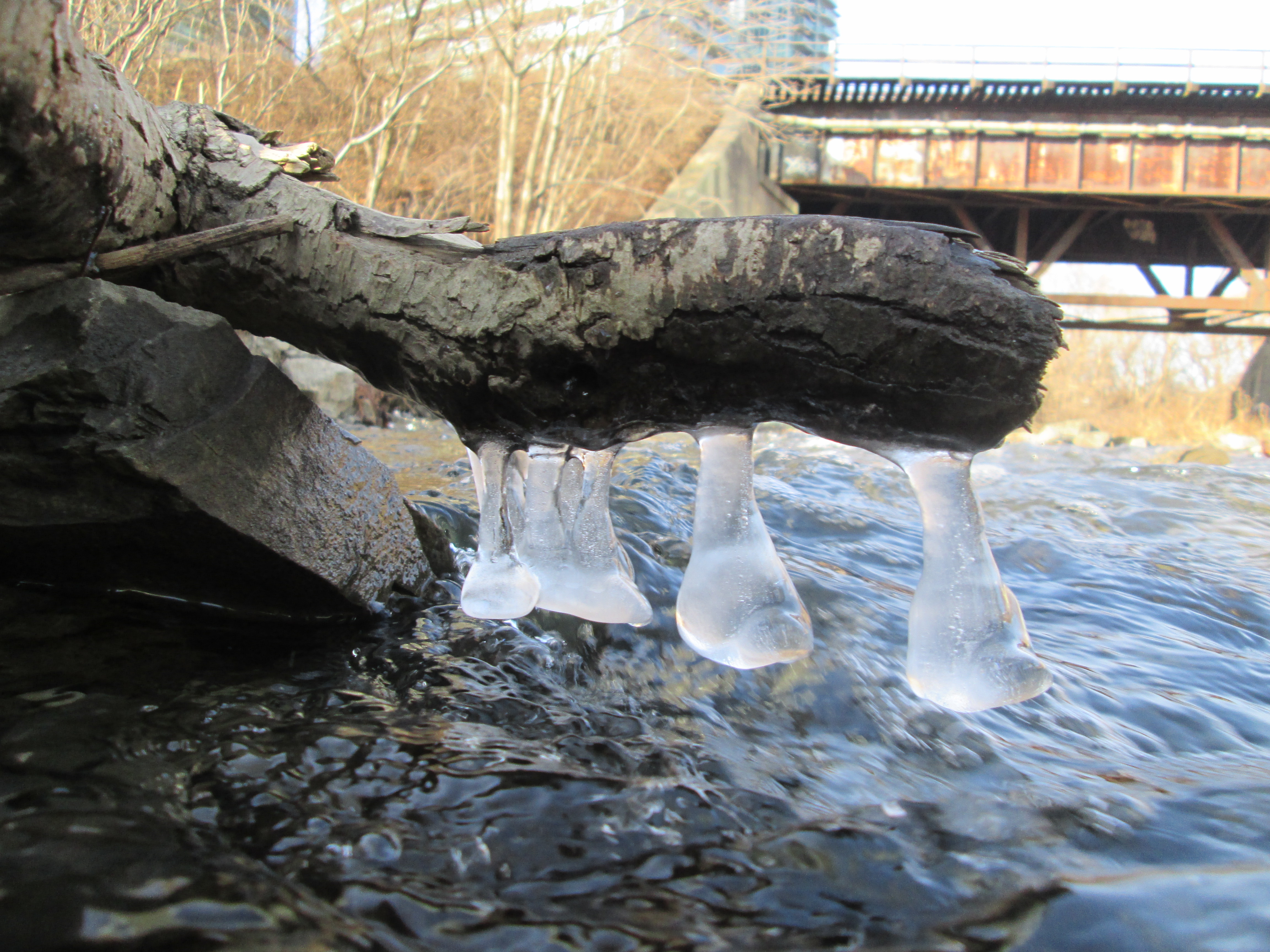
The creek had been splashing on this branch creating it’s own form of Christmas decorations.
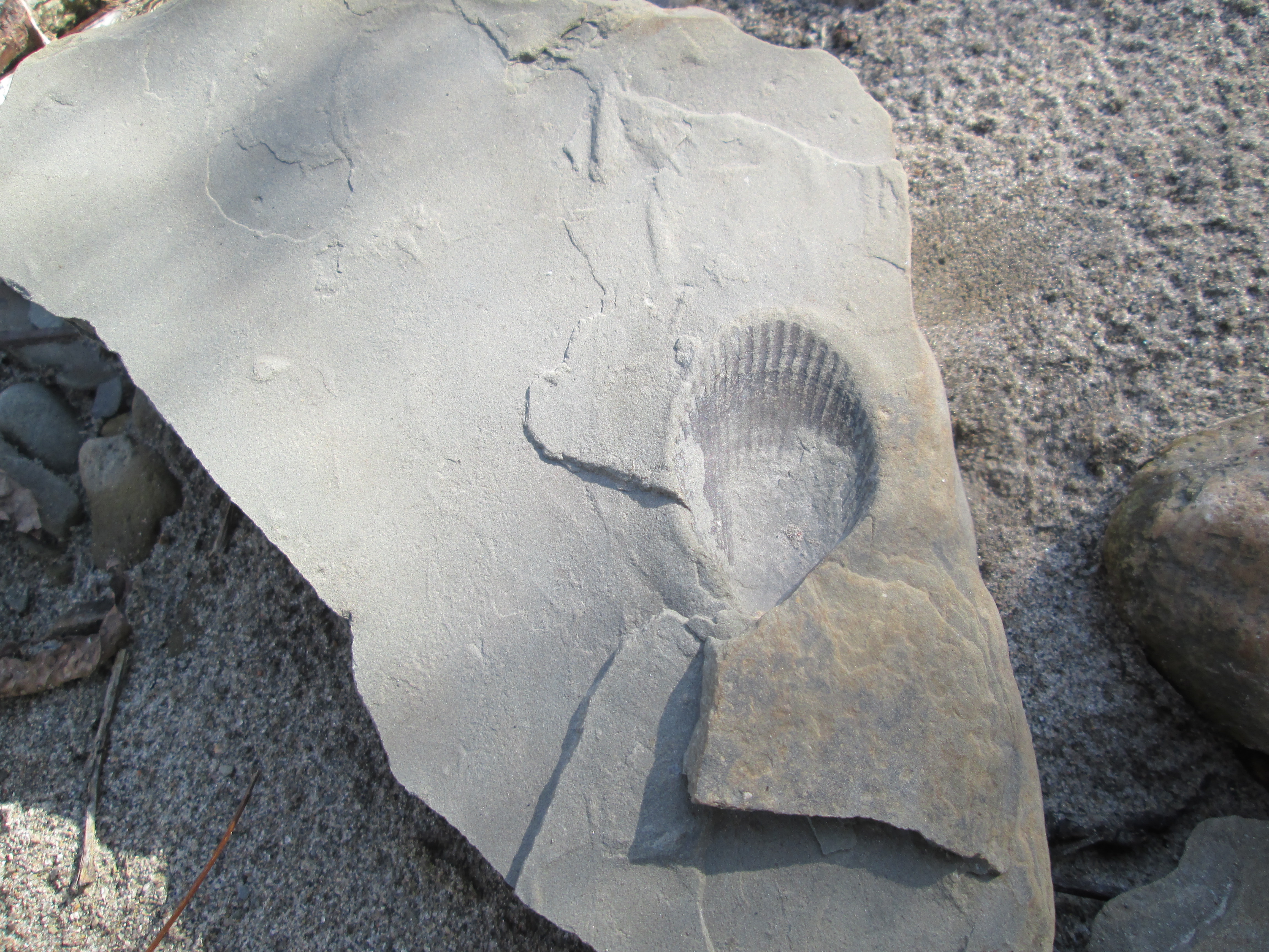
We found a couple of records of past lives along the creek bed. Below is a perfectly preserved shell from when this area was the bottom of Lake Iroquois. Davenport Road marks the approximate shoreline of this ancient inland lake.
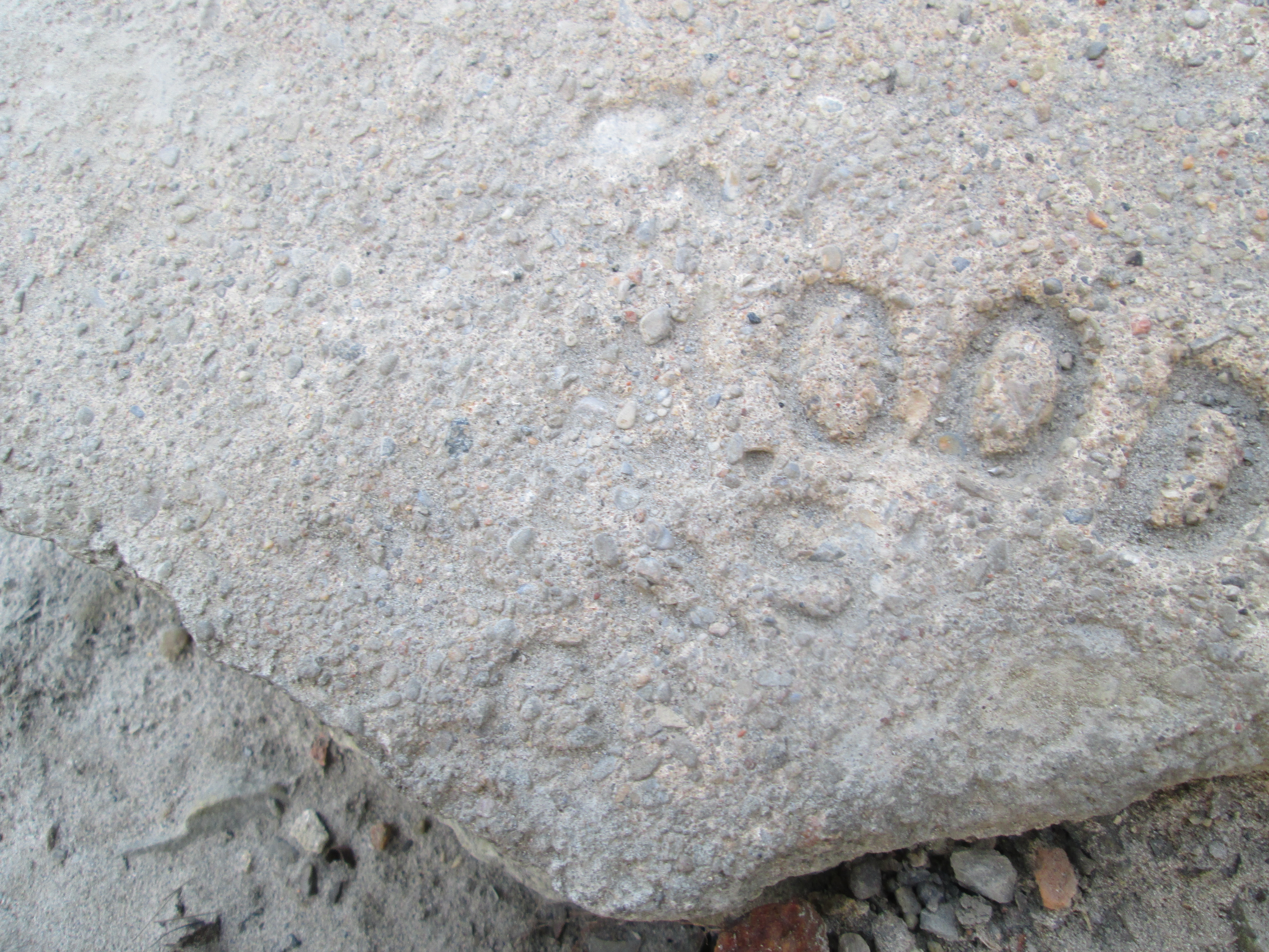
The past life recorded on this piece of rock is from a much more recent era. However, it is only possible to make out that the last 4 letters on the first line say “wood” while the second line ends with “sons”.
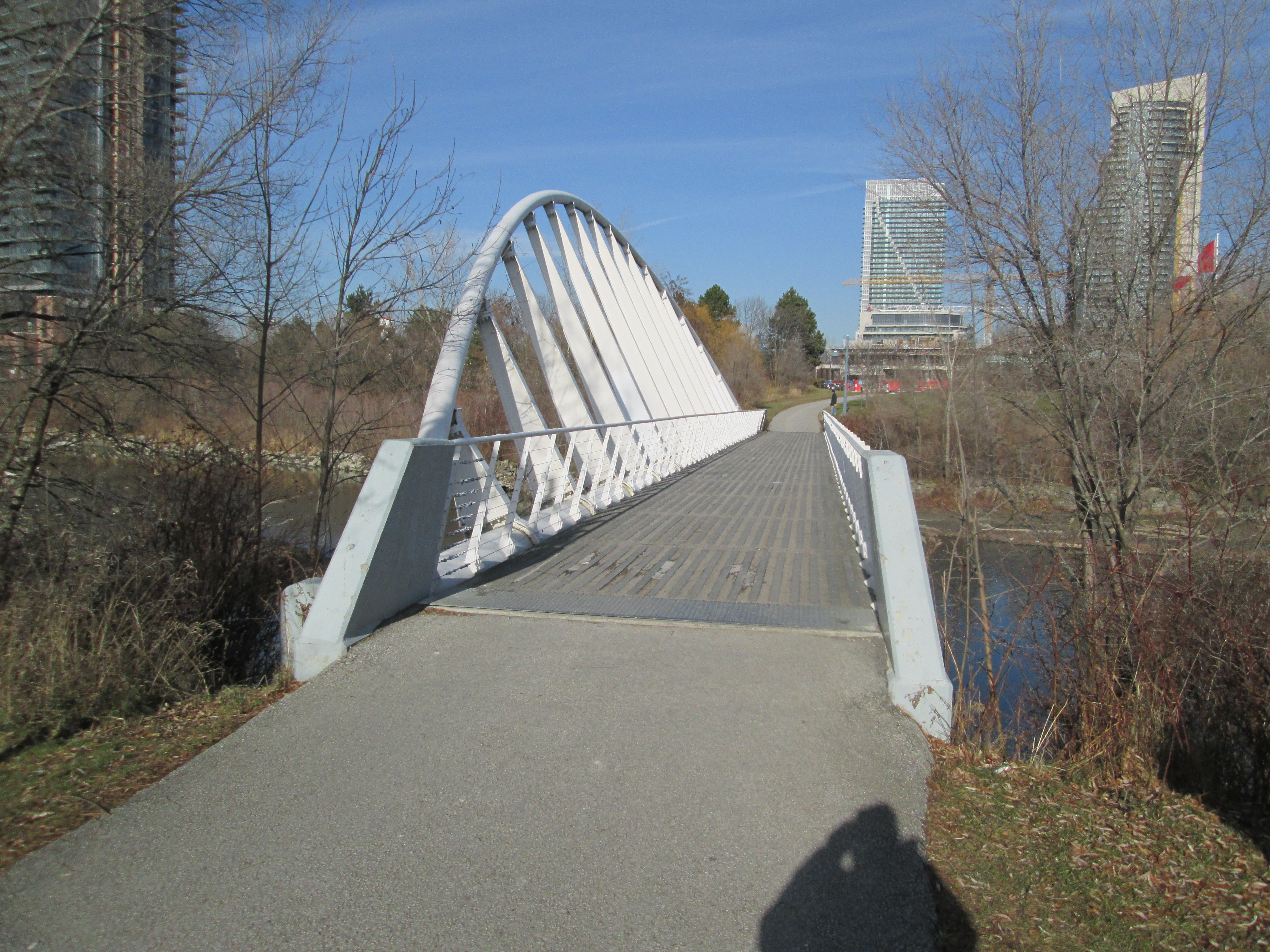
In 1997 the first single rib inclined arch bridge in North America was built across the Mimico creek near the mouth. The creek is 90 meters wide at this point but was reduced to 44 meters to keep construction costs down. The bridge deck was also reduced to just 2.5 meters to keep the project on it’s $650,000 budget. The narrowing of the creek provided wetlands around the bridge attracting wild life to the area.
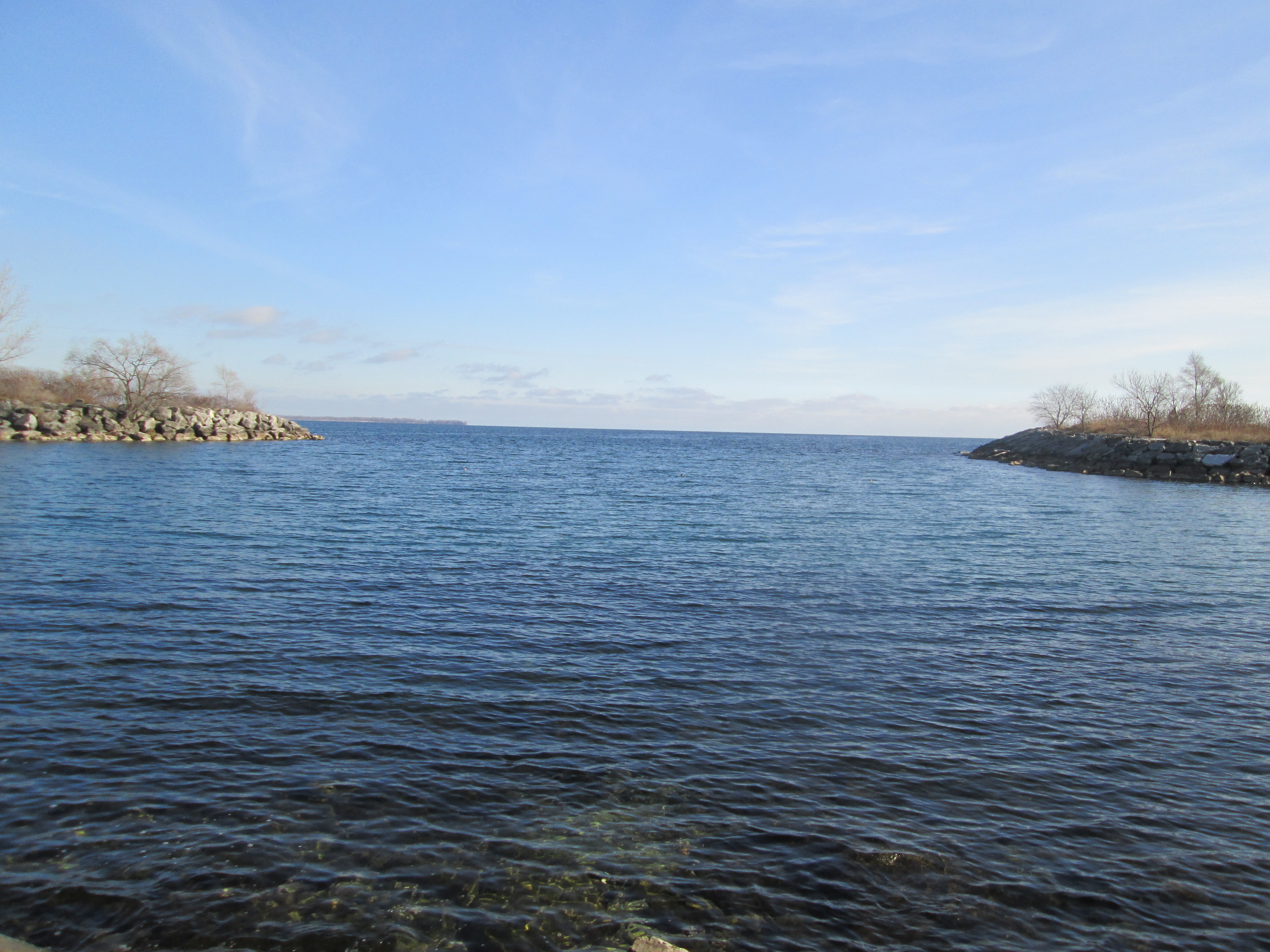
Where Mimico Creek empties into Lake Ontario is protected by a in-filling. The shoreline has been altered to create a safe harbour for boat launches. An earlier boat launch on the west side of the creek has been replaced with a new one in the sheltered cove. On the horizon near the left side of the picture, way off in the distance, is a large ship.
Visit us at http://www.facebook.com/hikingthegta for a gallery of unpublished pictures.
