Saturday, November 16, 2019
Long before the arrival of Europeans, the local peoples used The Carrying Place Trail north along the Humber River. They crossed a pristine Emery Creek near today’s Finch Avenue and Weston Road intersection. In the 1950s this area was built into an industrial park and the creek was buried in a concrete pipe. Unfortunately the creek came to carry industrial contamination which included lead, zinc and copper. During large rain events sewage was also carried directly into the Humber River. A recent project to improve the water quality is the result of over twenty years of work by local environmental and residential groups. We decided to investigate the results and so we took advantage of parking at Habitant Arena from which we set off on the west side of Weston Road.
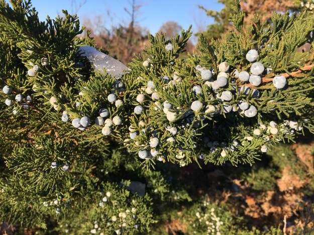
Eastern Red Cedar have a three year cycle. Their fruit begins as a flower in the first year. It then turns into a green berry for the second year and ripens into a blue berry in year three. The berries are harvested and dried after which they turn black. They are used as a spice and high in vitamin C. They may also help fight cancer because they are high in antioxidants and flavoniods.
North of Finch Avenue the headwaters of Emery Creek are buried under the industrial sprawl that became its poisoning. Once it flows under Finch it passes behind a four tower residential complex before emerging back into daylight. Emery Creek briefly flows in a naturalized watercourse before it reaches the storm water management ponds.

Milkweed seeds are blowing in the wind. The little parachute that carries the actual seed is known as the pappus. When attempting to grow milkweed on your property as an aid to monarch butterflies it is recommended that this part be removed. You can then disperse them on some gently disturbed soil without fear of them blowing away on you before they germinate.

The health of a river begins in the tributaries and so a $14 million dollar project was devised to use natural processes to remove and contain the main pollutants from Emery Creek. Starting in March 2016 three storm water management ponds were constructed beside Emery Creek. The plan is to clean the water before it is discharged into the Humber River. The first pond is designed for sedimentation and the bulk of solid particles are removed here. The water then flows through a short pipe into a shallow pond where the remaining heavy metals are removed. The third pond is the biggest one and the fine particles are removed here before water is discharged through a pipe into the Humber River somewhat upstream from the original confluence of the two. The concrete weir that diverts the waters of Emery Creek into the first pond was cast in place but includes a wooden section that allows for moderation of the water flowing into the ponds.

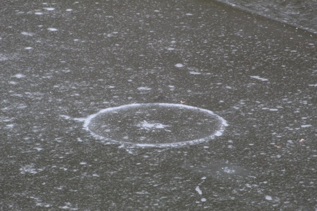
In spite of the fact that it is mid-November the water in the three ponds had frozen over. There are sometimes interesting patterns in the ice and these can take the shape of a circle. Ice circles form in slow moving water as it reaches freezing temperature. They usually occur where there is a bend in the water flow that causes an eddy. The water on the surface continues to move in the direction of the eddy as it freezes and this causes the ice circle.

If the rotational shear force is great enough the ice circles can cut away from the surrounding ice and form ice discs. These discs have been observed as large as 50 feet in diameter. The new ponds on Emery Creek have set up the slow moving water patterns to allow for sedimentation of solids in the water before it is discharged into the Humber River. This appears to have also set up the ideal conditions for ice circles to form. This one below looks like someone was getting ready for a faceoff in a hockey game.
The Humber River was in the process of slushing over with ice forming along the edges where the water is moving slowly or sitting in pools.

Not everyone is willing to hang around and look for food when they require open water to dig for water plants.. Most of the Canada Geese have formed into skeins and flow for easier foraging grounds. A group of geese in flight is also known as a team because they place the weakest ones behind the rest to take advantage of the air currents generated by the ones in front.

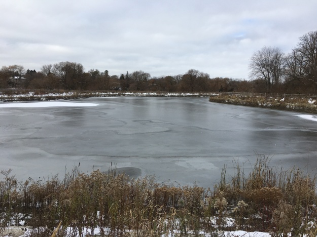
The ponds and trails around them were pretty quiet this morning but are perhaps enjoyed a little more in the summer sunshine.
Someone has thrown the life preserving equipment into the pond where it is now frozen in place.

Not all robins migrate south for the winter and seeing them in the colder months is becoming more common. Robins move around in response to food rather than temperature. Birds that move south follow their ability to collect worms and other insects for food. In the winter robins switch their diet to fruit and the bulk of them move to places where there are sufficient berries for everyone. The ones that stay behind move around as the sources diminish in each area.

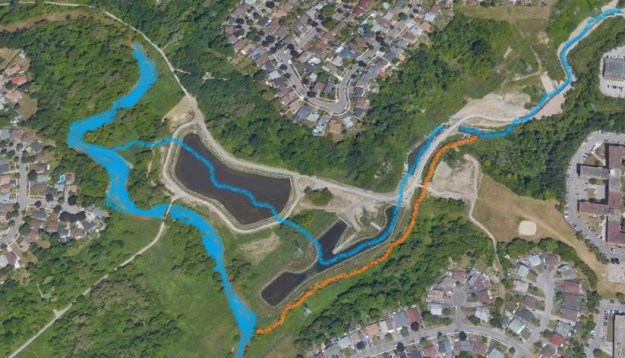
This view from Google Earth shows the area as the area looked in 2002. Emery Creek flows into the Humber River from the right hand side of the image. In its original creek bed the watercourse followed the southern embankment of a much wider ravine.

By 2019 Google Earth is showing a greatly altered geography. The creek has been diverted through the three new ponds and now enters the river farther north. The old creek still has a minimal flow of water that gets over the diversion dam and keeps it from becoming stagnant. The abandoned portion of the old creek has been coloured in orange.
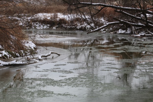
From the opposite side of the Humber River we were able to locate the original mouth of Emery Creek. The water coming out of here is moving very slowly compared to the main river and you can see a line of ice forming across the mouth of Emery Creek.

The engineering work has paid off in that the water that enters the Humber River is a lot cleaner than it was before. Given time, the new ponds will become home to their own ecosystems and the disruptions will be a thing of the past.
Google Maps Link: Emery Creek
Like us at http://www.facebook.com/hikingthegta
Followus at http://www.hikingthegta.com
Also follow us on Instagram
