
Sunday, December 19, 2021
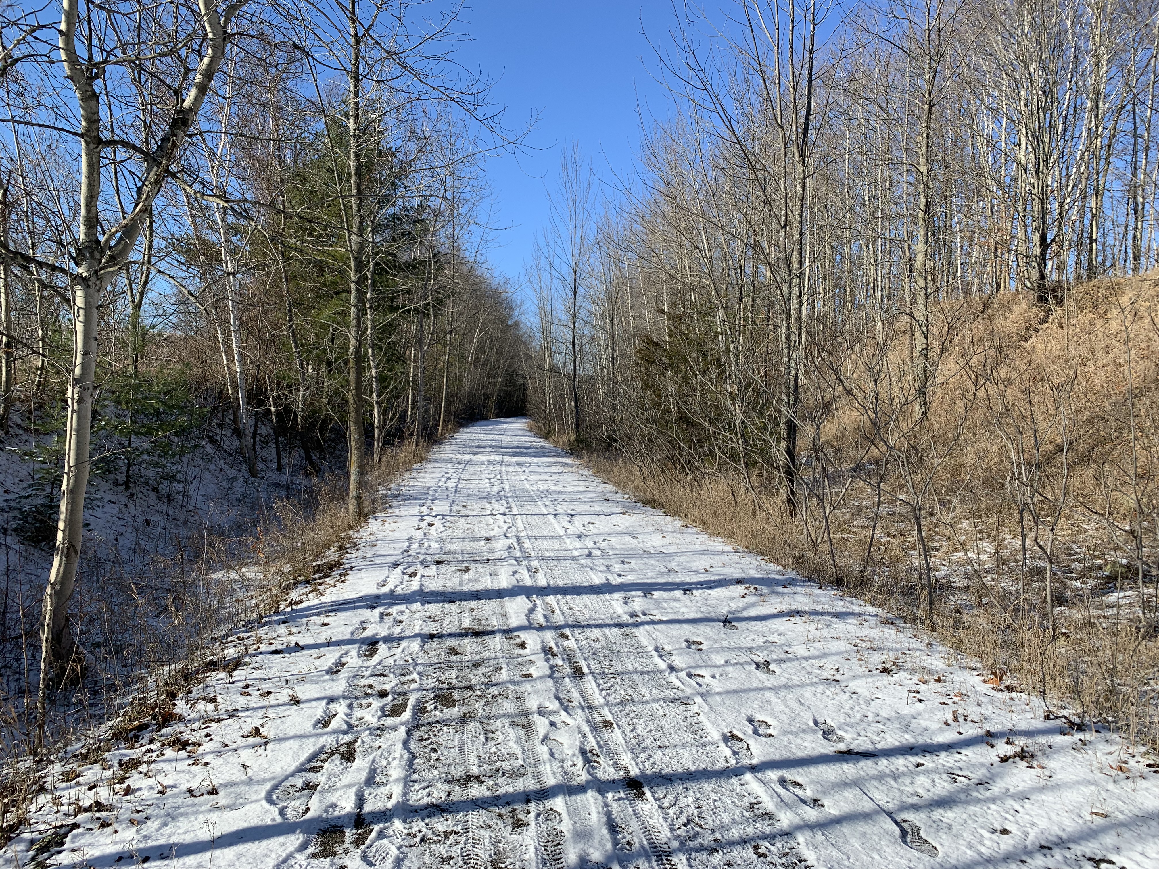
On June 1, 2021 The Great Trail reverted back to its origial name of The Trans Canada Trail, which better defines this 28,000 kilometre long national trail. There’s a 53.8 kilometre section of the trail that is known as The Kawartha Trans Canada Trail. I set out to cover a small section in the middle that contains the famous Doube’s Trestle Bridge. There are a few parking spots on Orange Corner Road where you can enjoy this location which is just a short drive north of the GTA.
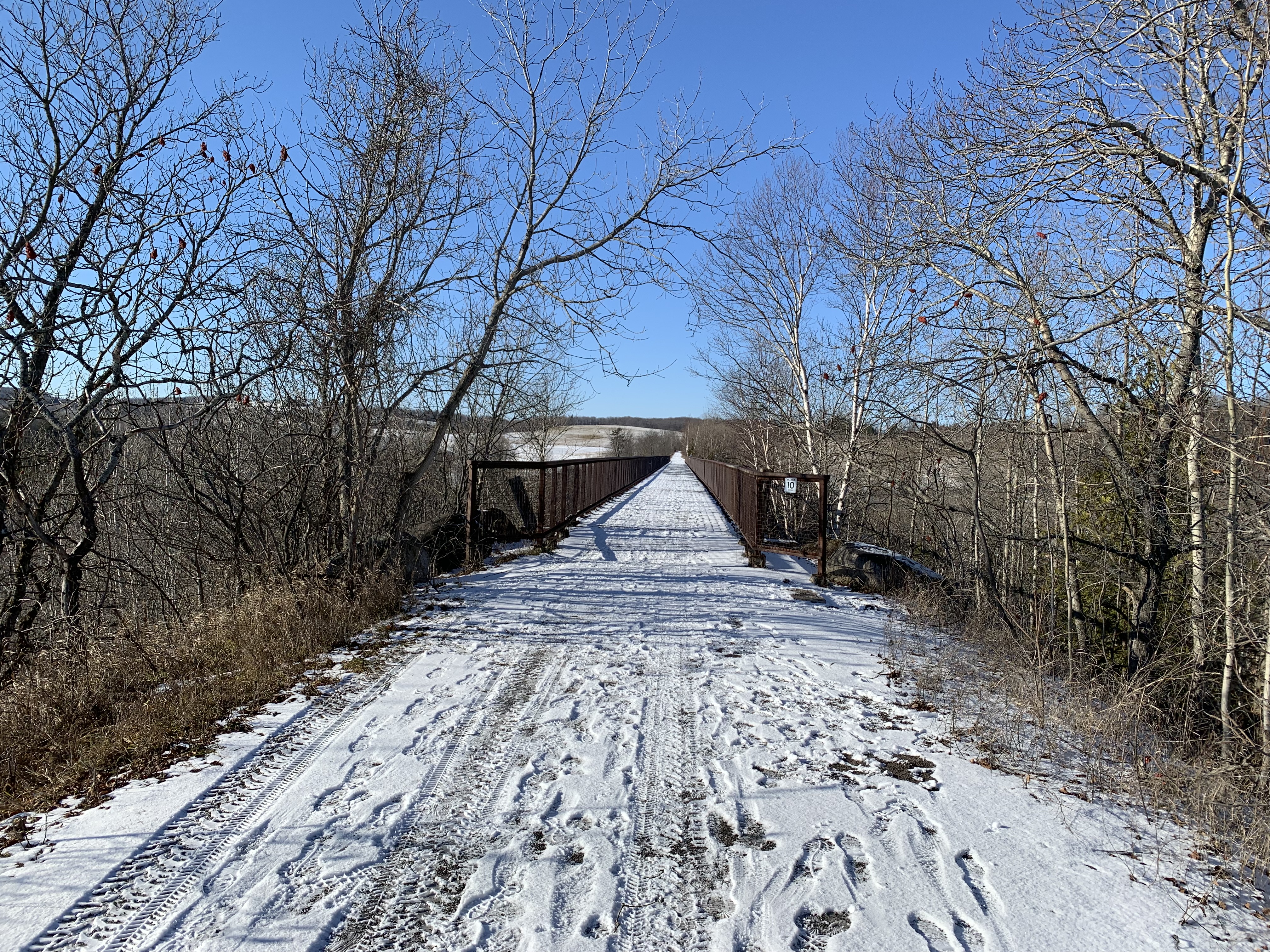
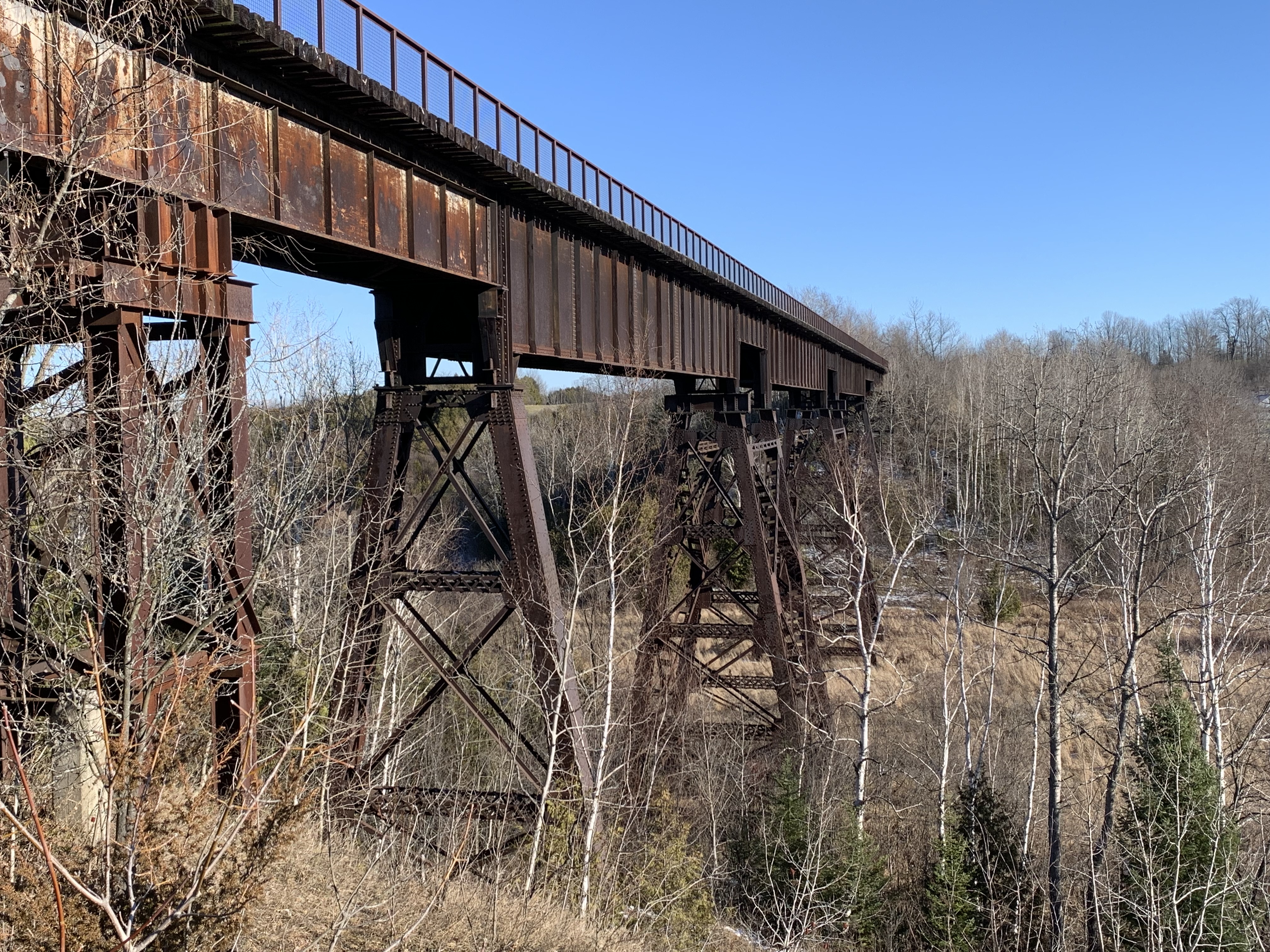
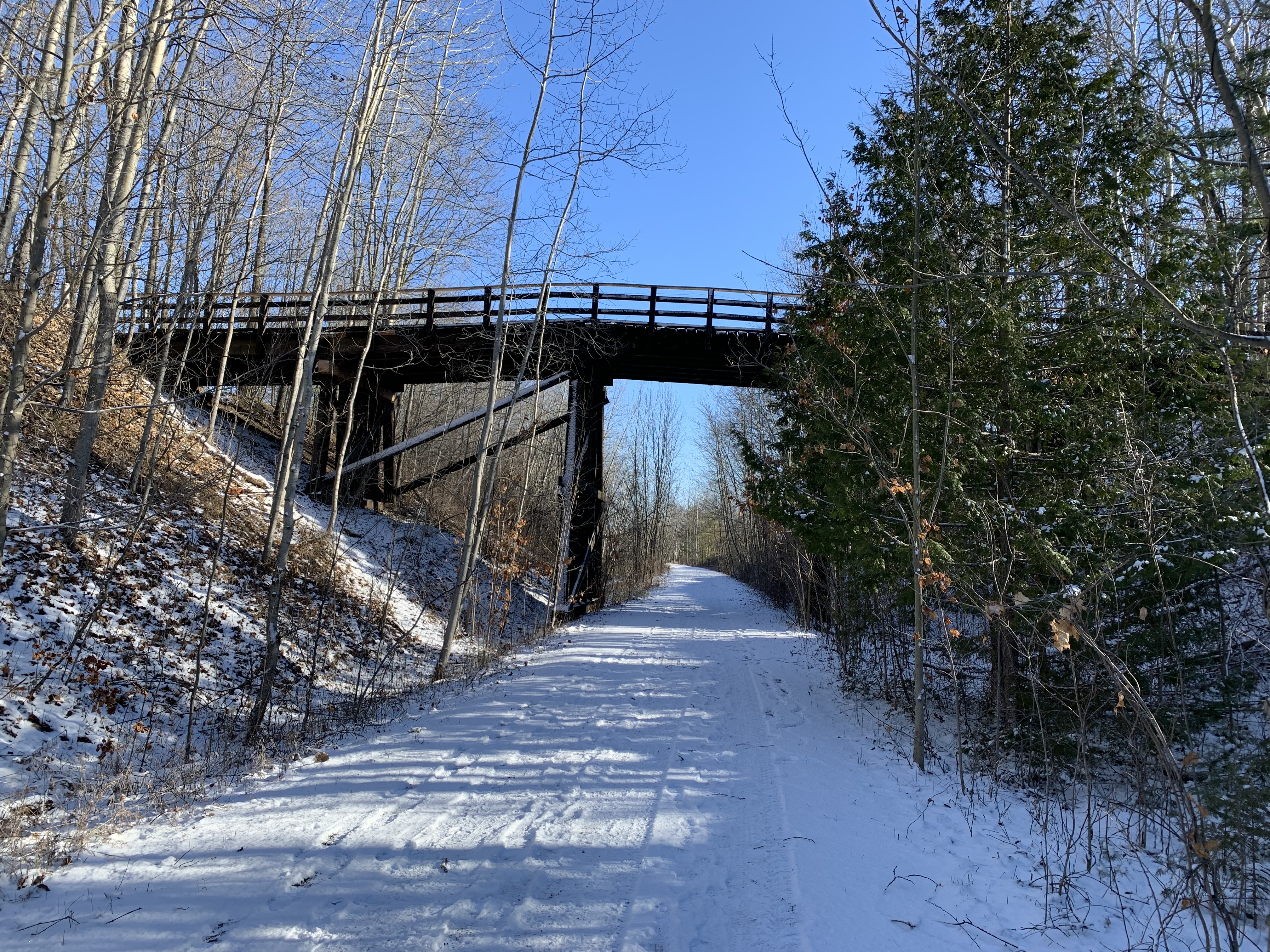
Starting in the 1850s, several railway lines were run north from communities along Lake Ontario including Whitby, Port Hope, Cobourg, Trenton and Belleville. These lines were intended to draw business from the larger towns to the north to their harbours and access to Toronto and Hamilton markets. Eventually these lines were connected by east west lines running between these northern towns. Peterborough and Lindsay were not connected and part of the solution was to run a line between the two. This line had to cross Buttermilk Valley and they built a 1500 foot (457 metres) wooden trestle to carry the rail line. It stood about 100 feet (29 metres) above the valley floor on the Omemee-Peterborough Line which was locally known as The Missing Link. The line was taken over by The Canadian National Railway in 1921 and track and trestle improvements were completed to accommodate heavier trains. The trestle was filled in from both ends and the centre span over the creek was converted to a steel trestle 500 feet long (150 metres). By the end of 1988 the line was abandoned and the rails lifted. Although the line was purchased in 2000 as a potential rail trail corridor it was the construction of the Trans Canada Trail that really got things moving as this was identified as a major link. By the end of 2010, 53 kilometers of the Kawarthas Trans Canada Trail was 95% complete and it would be finished in 2014. The railings below identify the steel bridge structure.
The view looking south from the bridge shows the small size of Buttermilk Creek compared to the wide ravine that stretches out on either side. About 12,000 years ago the last ice age was retreating and there was a large sheet of ice up to a kilometer thick covering this area. A large river of meltwater was flowing under the ice creating the valley below and depositing the large drumlins made of sand and gravel that dot the local countryside.

The view looking north is equally impressive with the tops of the cedars far below.

The south west end of the trestle has a park bench where you can sit and rest and look out over the valley. There’s a small trail here that will allow you to get a view of the side of the trestle. Going very far down this trail would be unadvisable because it would be easy to slip and require a rescue.
The photo below was taken from the book The Last Trains From Lindsay by Keith Hansen and shows the trestle and berm in May 1974. It gives a good idea of the height of the trestle and the size of the berm created when the ends were filled in. Also notice how the trees have been kept cleared off of the berm.

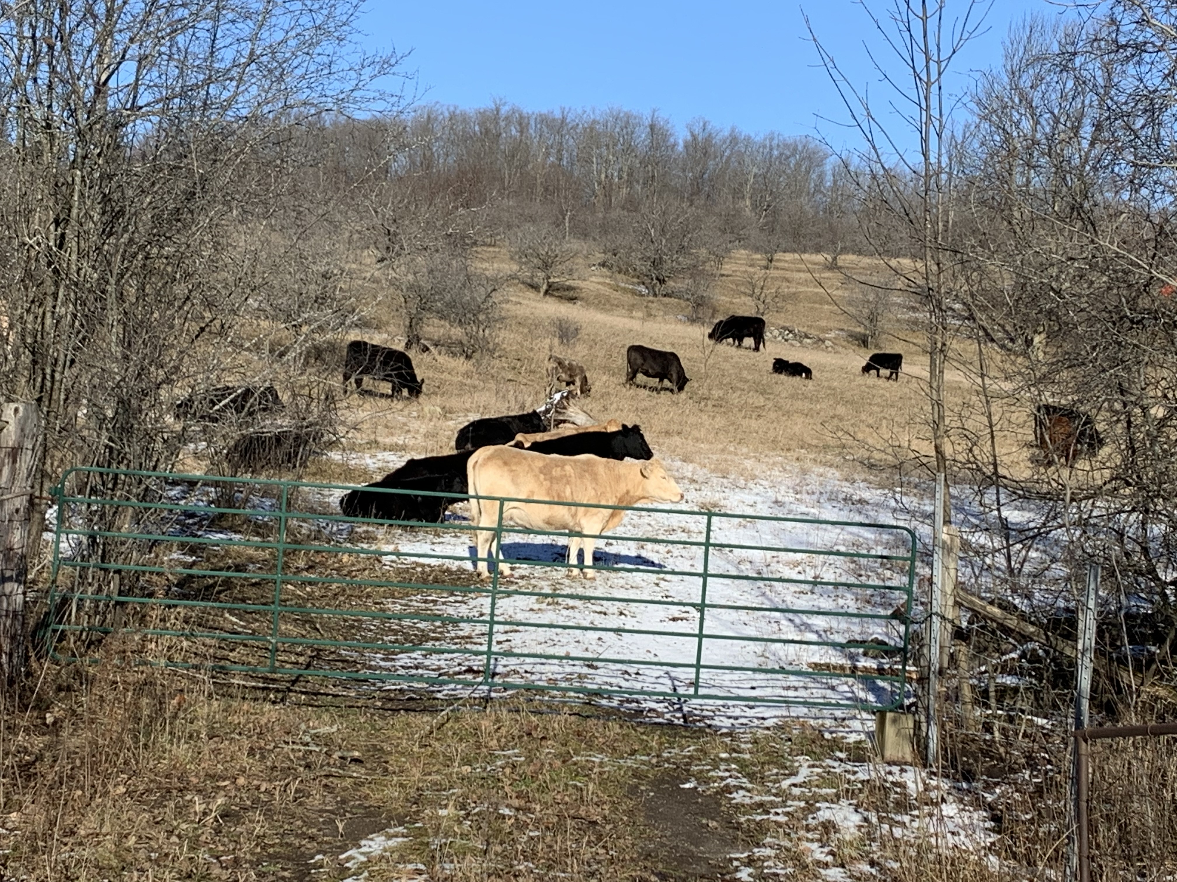
Just beyond the trestle there was a herd of cattle wandering around in the trees on the side of the hill. When they saw that I had a camera they all came down closer to the fence. They started to “Moo” at me as if I was supposed to open the gate and let them out. That wasn’t happening, there was already enough horse poo on the trail without letting 50 cows have a go at it.
There are two old trestle overpasses between Orange Corner Road and Highway 7. They allowed farmers to move livestock and equipment from one side of the tracks to the other as the rail lines often cut through the centre of a farmer’s property. This is the second of the two as you walk west and this one shows the depth of cut that the line made when it emerged from the Buttermilk Creek Valley and back onto the local topography. This part of the province is dominated by some pretty impressive glacial formations including large drumlins on the farmlands on both sides of the trail.
One of the least likely things to see on top of a tall berm is a stranded canoe. It’s obviously not going to be paddled too far in its current condition. It looks like it should have some wildflowers planted in it so that at least the local polinators can enjoy it.

Fire was always a threat in the days of steam engines because of sparks and cinders that would blow out of the smoke stack. To reduce the potential to start a fire the railway would keep the trees cleared away from the tracks for 50 feet on either side. That would have left the berm along this railway exposed to the sun and the wind and it would not have been a very nice hike on days with extreme weather conditions. Fortunately the slopes of the berm have been allowed to grow into a nice little strip of woodland.

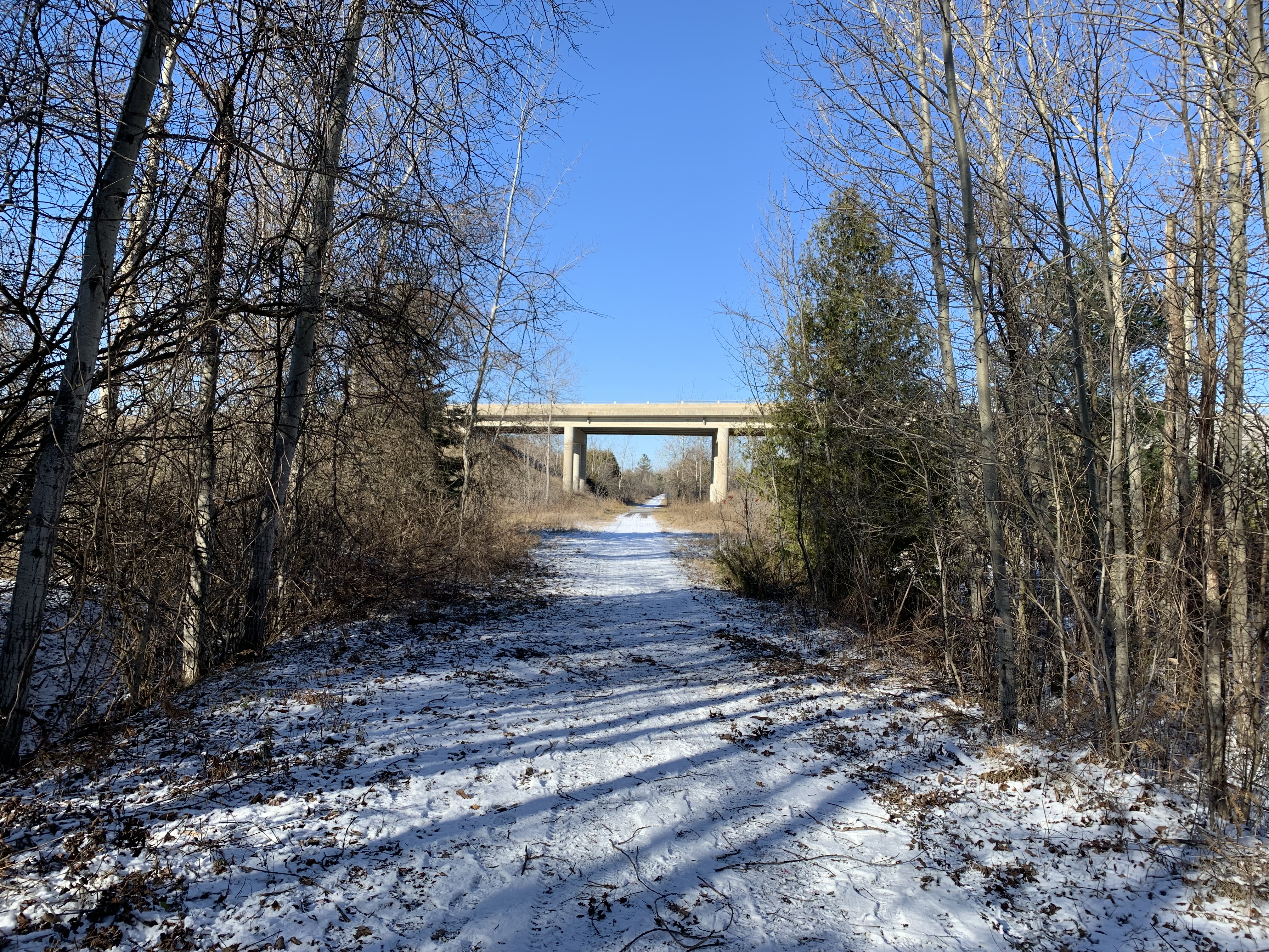
Highway 7 passes over the old rail line on a high level concrete bridge and this is the point at which I turned around. According to the trail map at the trestle bridge, this is 3.5 kilometres from the parking spots on Orange Corner Road.
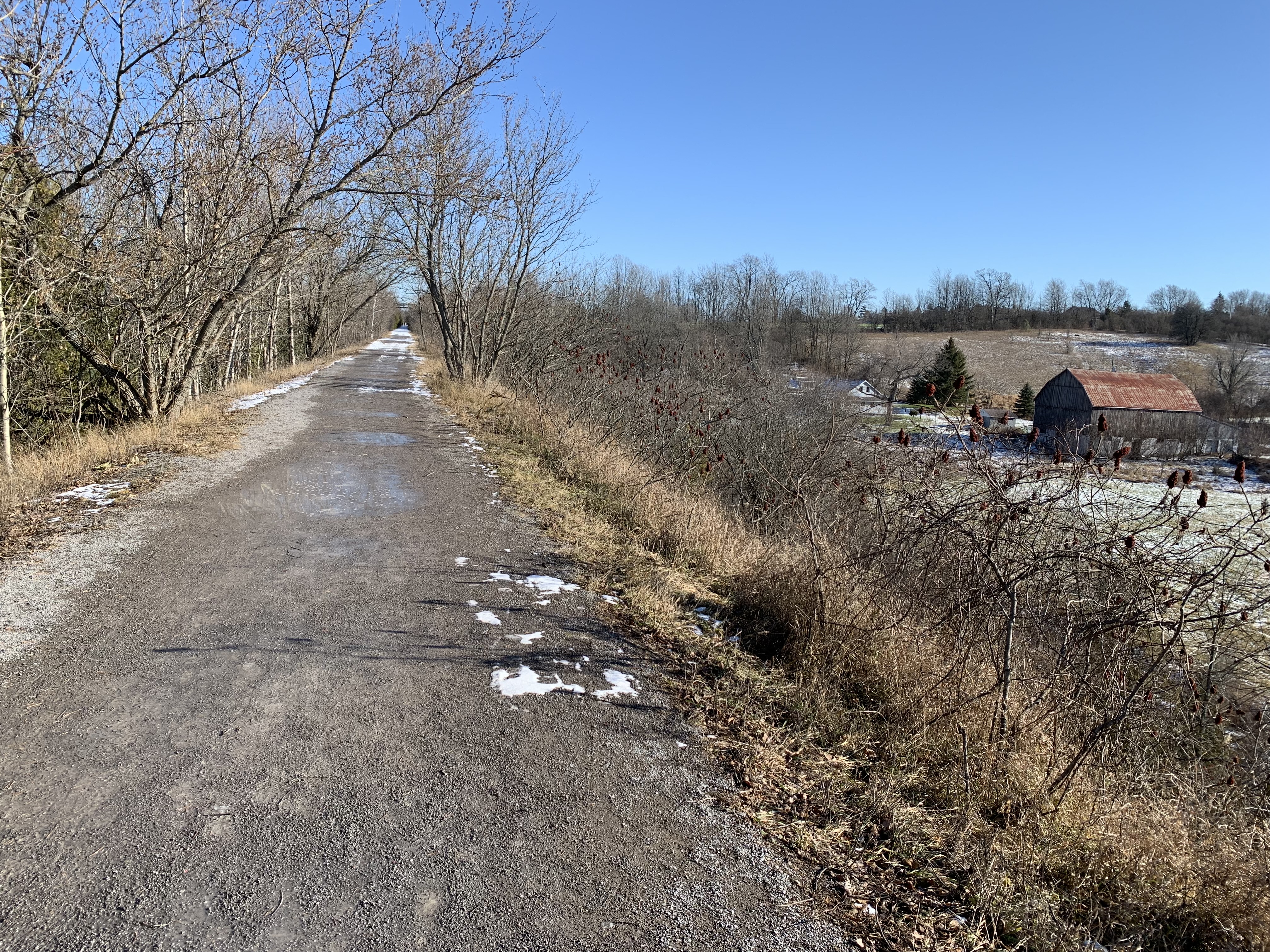
You really get to appreciate the height of the trestle above the surrounding farmland on the eastbound part of the trail. The filled-in section of the former wooden trestle runs well above the roof of the barn and the farm house just beyond it.
The views from the trestle will change with the seasons making this a year-round trail but we wonder how great it would be on a cold windy day in the middle of winter.
Google Maps Link: Doube’s Trestle Bridge
Like us at http://www.facebook.com/hikingthegta
Follow us at http://www.hikingthegta.com
Also, look for us on Instagram

Pingback: From locomotives to rail trail – Historic Doube’s Trestle Bridge a relic from the railroad era – Canadian Military History