It’s the end of an era for Buttonville Airport as the facility will be closing on November 30, 2023 after 70 years. It began in 1953 as a grass airstrip and eventually became an official airport in 1962. The airport was built on farmland well north of the city on property that used to belong to John Button, the founder of Buttonville. The image below shows the airport in 1960 with the community of Buttonville to the south east. Highway 404 wouldn’t be built until the 1970s and presently runs along the west side of the airport. The first construction of the Highway began in 1975 with it opening from Highway 401 to Steeles Avenue in 1977. The part running past the airport was completed in 1978. 16th Avenue is seen running along the top side of the airport. At this time it was a dirt road but now it is a major thoroughfare.
The airport was purchased by Michael Sifton in 1963 to add to their land holdings in the surrounding area. At that time, there was a metal hanger and a grass landing strip. The Sifton Family opened a new company called Toronto Airways Ltd and started to make improvements to the property. They built a terminal and in 1967 they added an air traffic control tower on the north end of the property near 16th Avenue.
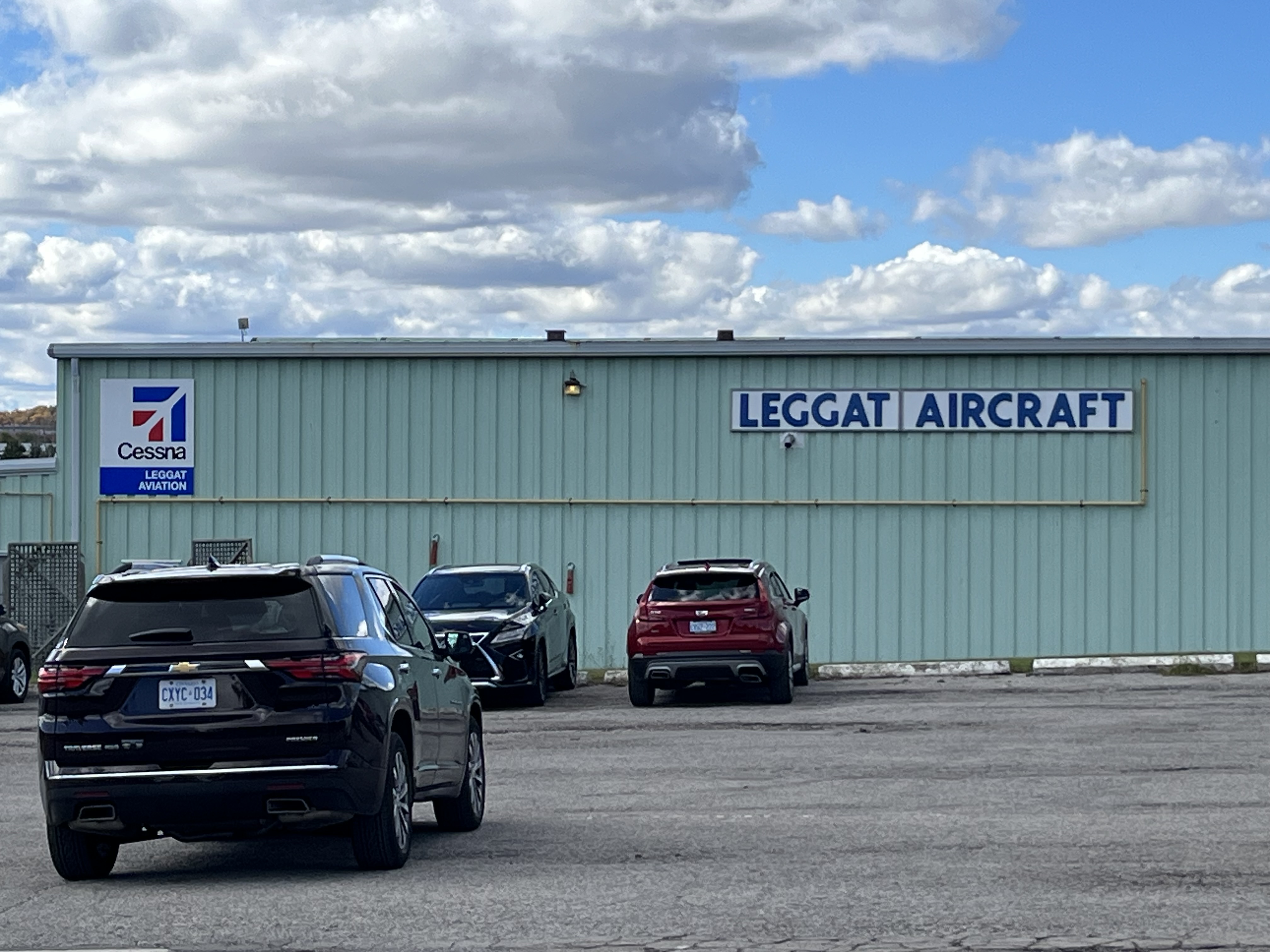
Over the years several more buildings have been added to the airport to support the tenants. Aside from charter companies, the airport also is home to Toronto Police Services and they fly their helicopter out of here. Seneca College has a flight training school as does Toronto Airways. York Regional Police and Canadian Traffic Network also call the airport home and make their flights from here.
There are between 160,000 and 170,000 aircraft movements each year out of the facility.
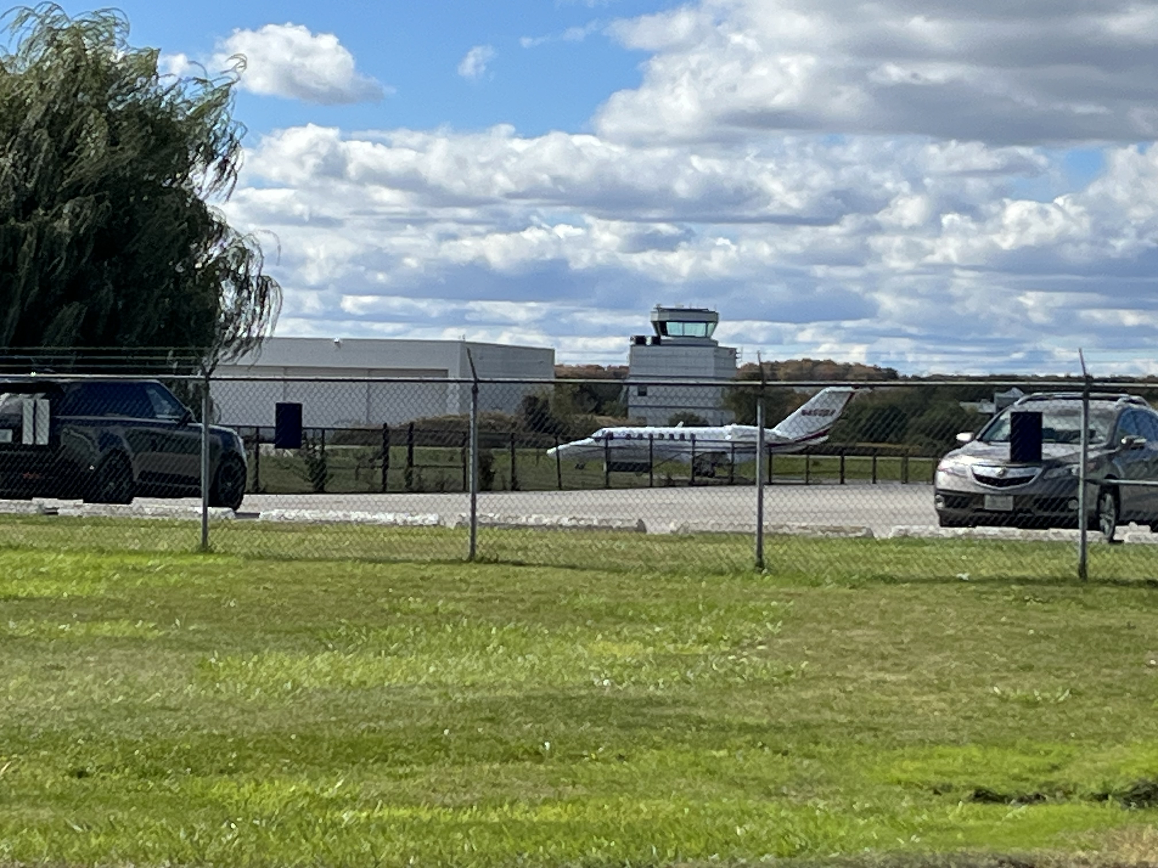
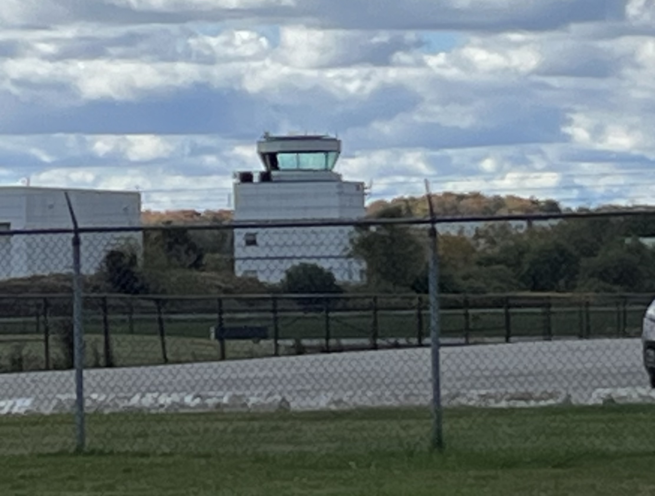
In 2006 Nav Canada built a new air traffic control tower on the south end of the property to replace the aging facility on the opposite end of the runways. They built it in a modular format so that it could be taken apart and moved elsewhere at some time in the future.
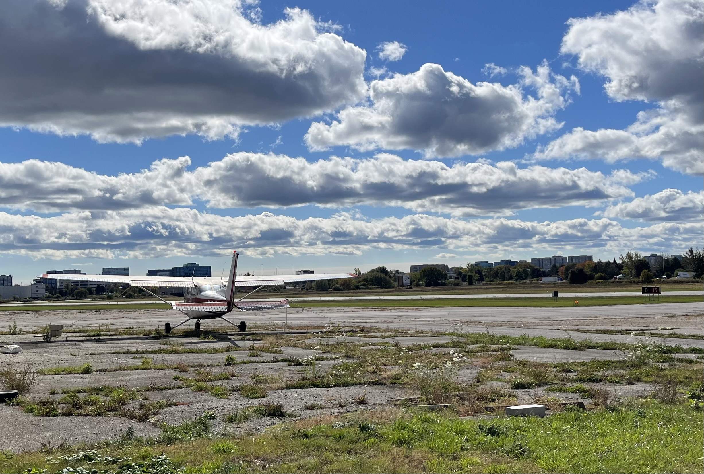
The Buttonville Flying club owns 70 aircraft out of the 300 that are stationed at the airport. Some claim that before Tom Cruise starred in Top Gun he took flying lessons here. Michael Sifton died in 1995 and since then there have been rumours that the airport will close. In 2009 the Greater Toronto Airport Authority cancelled a $1.5 million per year subsidy and the fate of the airport was effectively sealed. In October 2010 Armadale and Cadillac Fairview announced a residential and commercial redevelopment for the site.
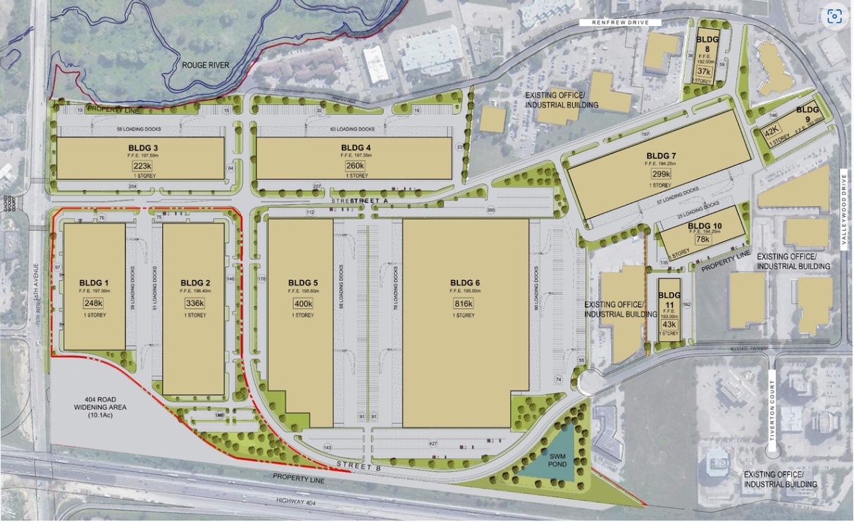
The closure date for the airport has been set for November 30, 2023 after which the current tenants will have to be relocated to other airports around the area. One source estimated that of the current airplane movements at the airport up to 70,000 wouldn’t be accommodated at other local airports. The most recent plan for the airport has the lands being used for industrial purposes. Eleven one story industrial buildings are planned to be built over the coming years. The image below was taken from Urban Toronto and shows the redevelopment proposal.
It is unclear where the current tenants will relocate and many of them may cease operations because other local airports can’t absorb all the airplane movements that will be lost.
The Big Apple in Colborne lays claim to having the largest apple shaped structure in the world. However, there’s a lot more to this attraction than just the structure. The site was created by George Boycott who immigrated to Canada in 1976 from Australia. He had been a pizza shop owner before moving to Canada and sold all six of his shops to finance his new enterprise. Based on The Big Pineapple near Queensland, he devised The Big Apple. He chose Colborne to settle in because it was one of the biggest apple producing regions in Ontario. In fact, it is the fourth largest apple growing area with over 3,000 acres under cultivation. Construction began in 1983 and the site was ready to open in 1987.
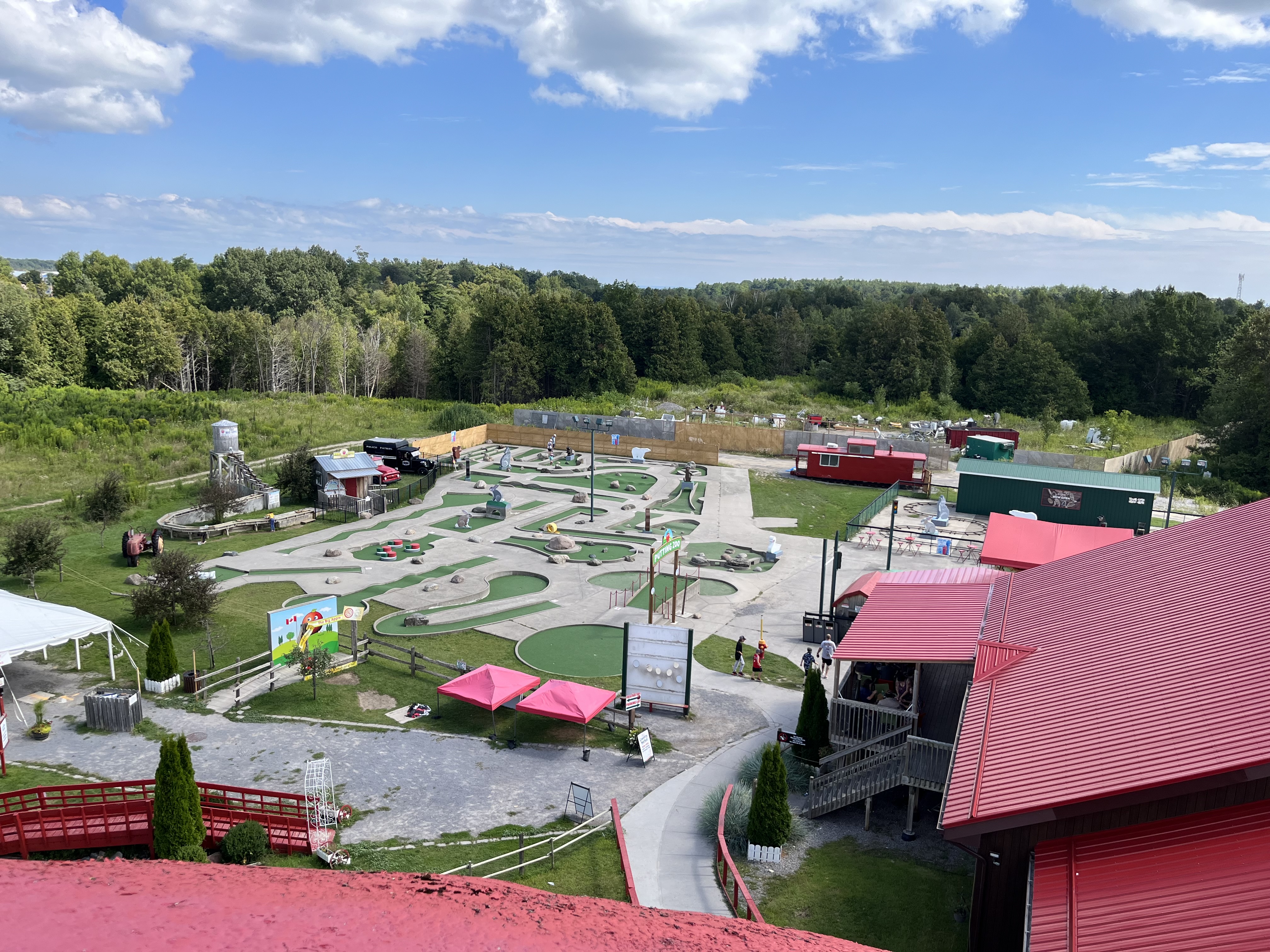
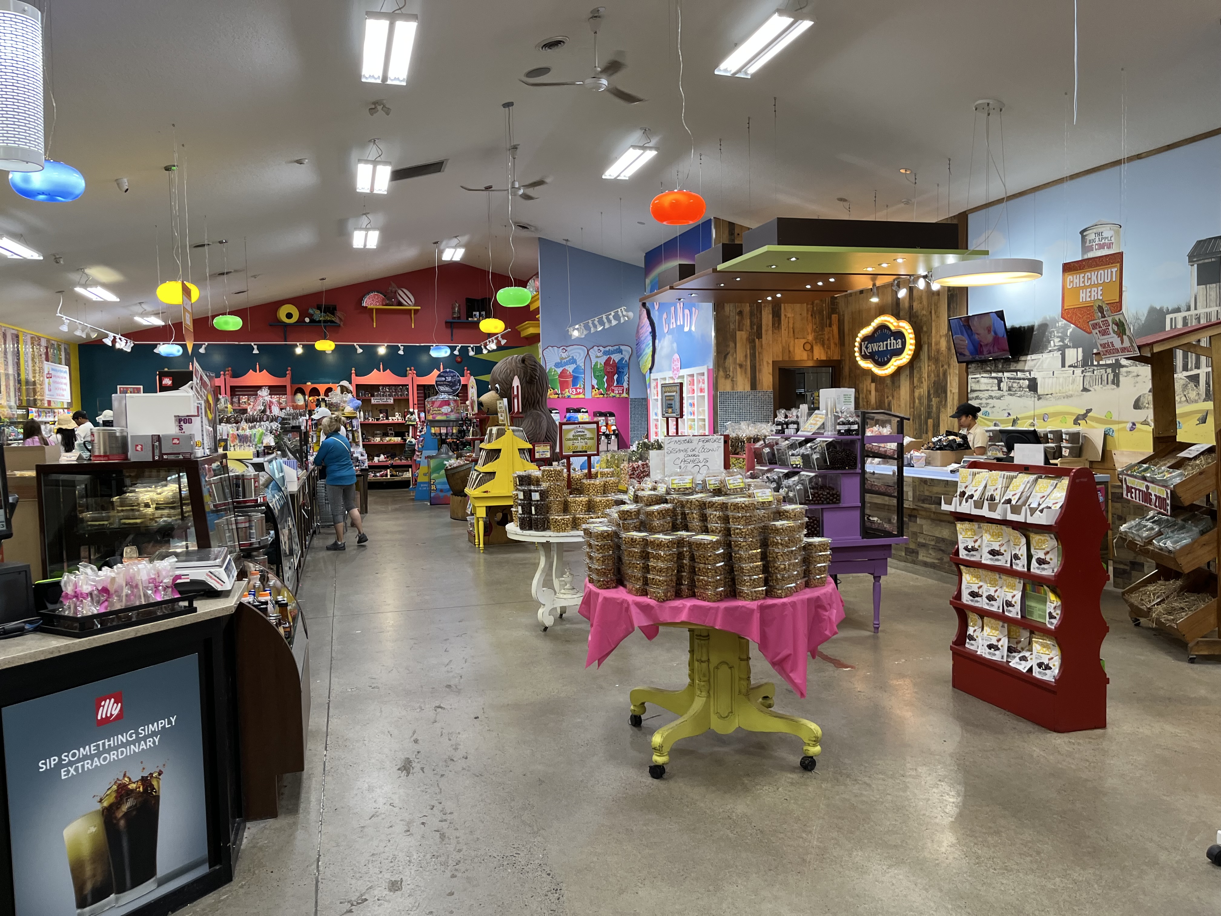
There has been a great deal of effort made to ensure that visitors have plenty to do aside from just buying apples. They have a small pond with a fountain and there’s a short nature trail that you can walk that goes around it.
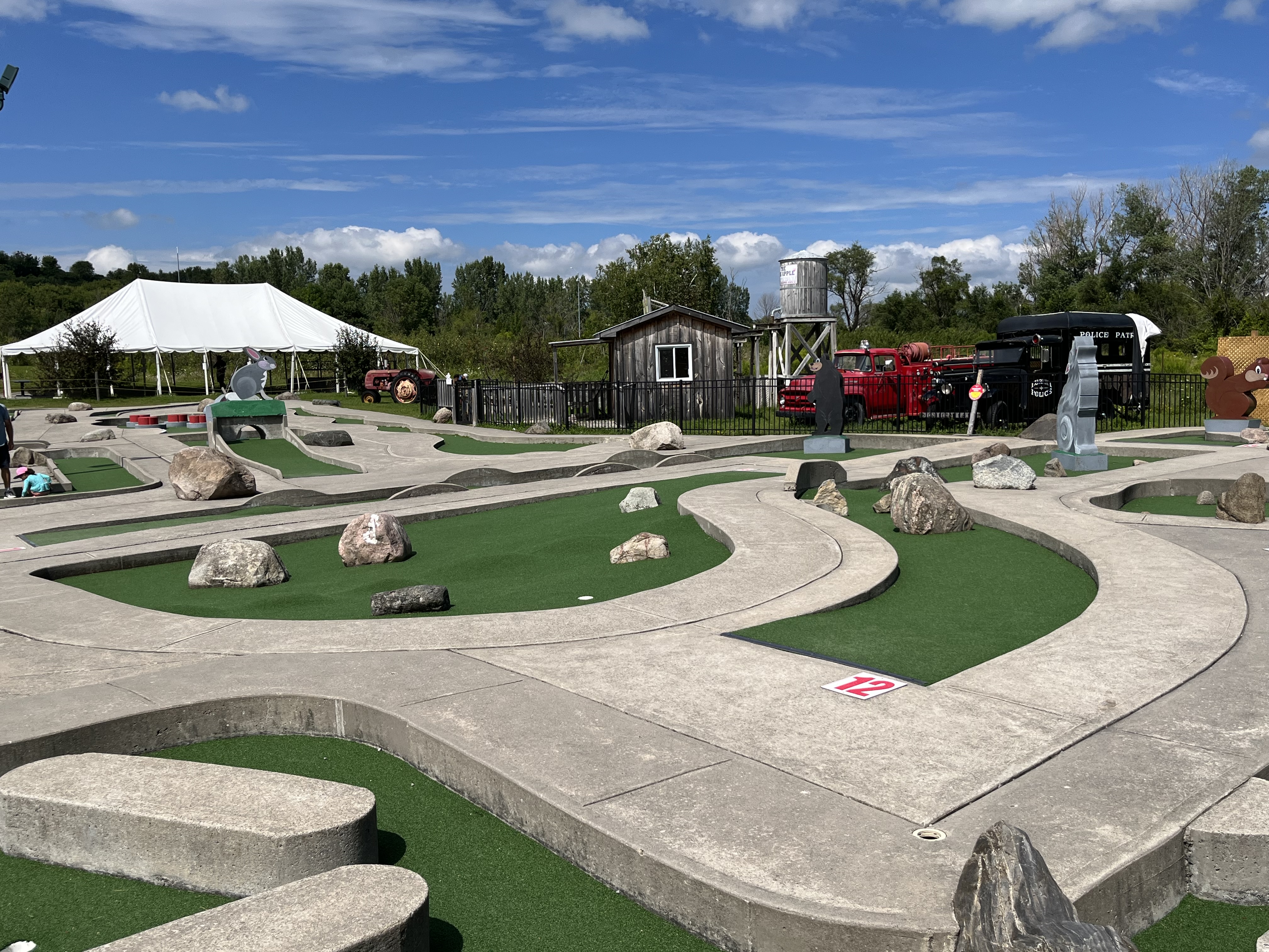
There are many attractions designed to entertain children and the mini-golf course is just one of them.
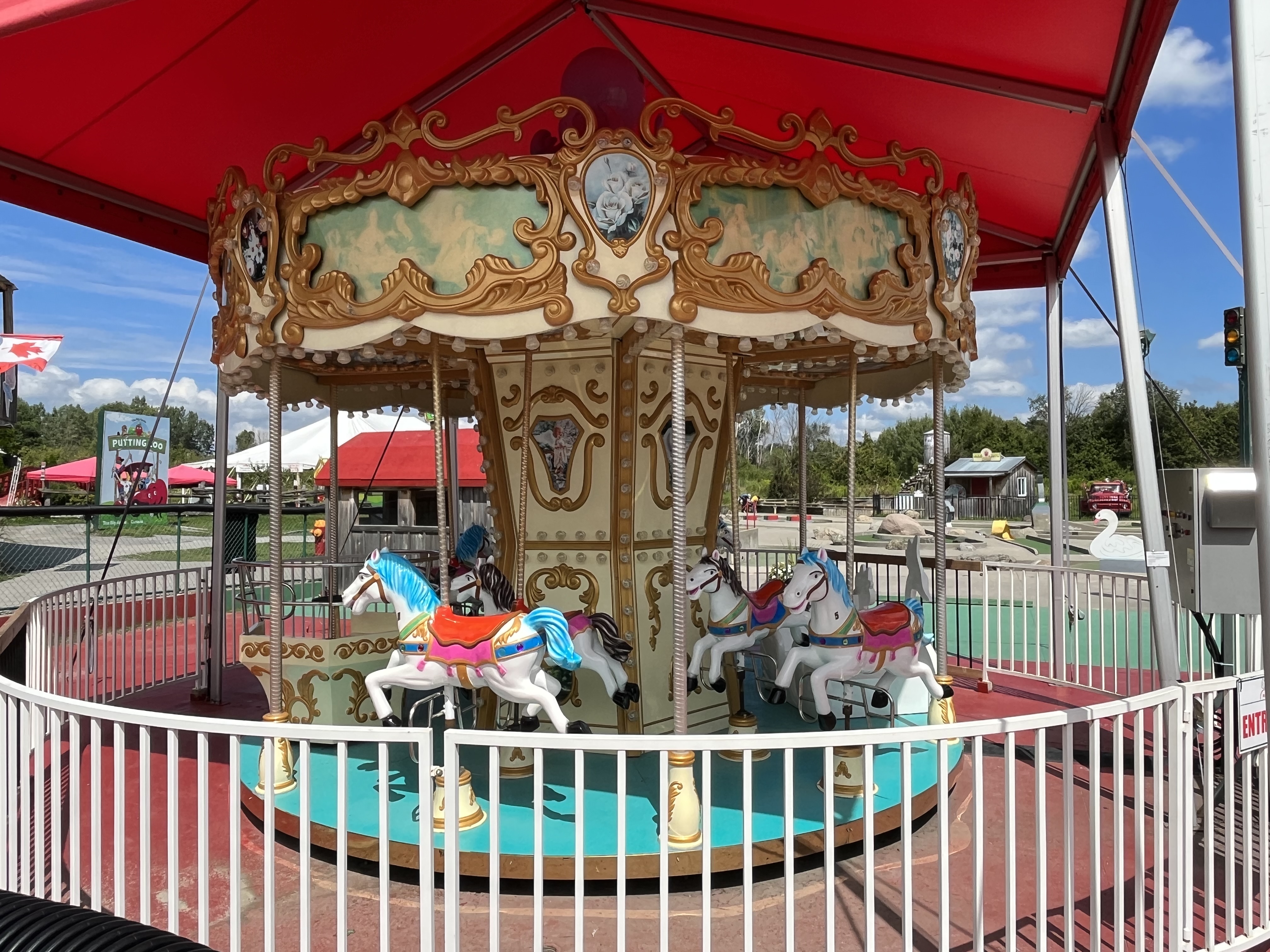
During the peak season in the summer there’s rides for the children to enjoy. This includes a train ride and access to the ping pong tables.
There’s also an old fire truck and an old police van to stir their active imaginations.
The Big Apple structure is affectionately known as Mr. Applehead. It is hollow inside and there’s a set of stairs that leads to an observation deck on the top. The apple is 40 feet tall and provides views across the surrounding countryside. Mr. Applehead weighs 42 tonnes and can hold 650,000 apples. In 2013 the cartoon face that can be seen in the cover photo was painted onto the highway side of the apple. It was covered with a facemask in 2020 as a show of support for front-line workers and hundreds of apple pies were donated to hospital workers.
There is an interesting gift shop where all kinds of collectibles can be purchased. Much of the goods in the store are geared toward making your garden unique. For the adults, there’s also a brewery which specializes in various ciders.
Other shops include a candy store, a sit down restaurant and a place to buy apples and pastries. They sell over 2,000 apple pies every week and you can watch them being made through a glass window. They do everything in house for the freshest, tastiest pies you can find anywhere. According to the sign on the side of the highway, they have sold over 6.2 million pies, and counting.
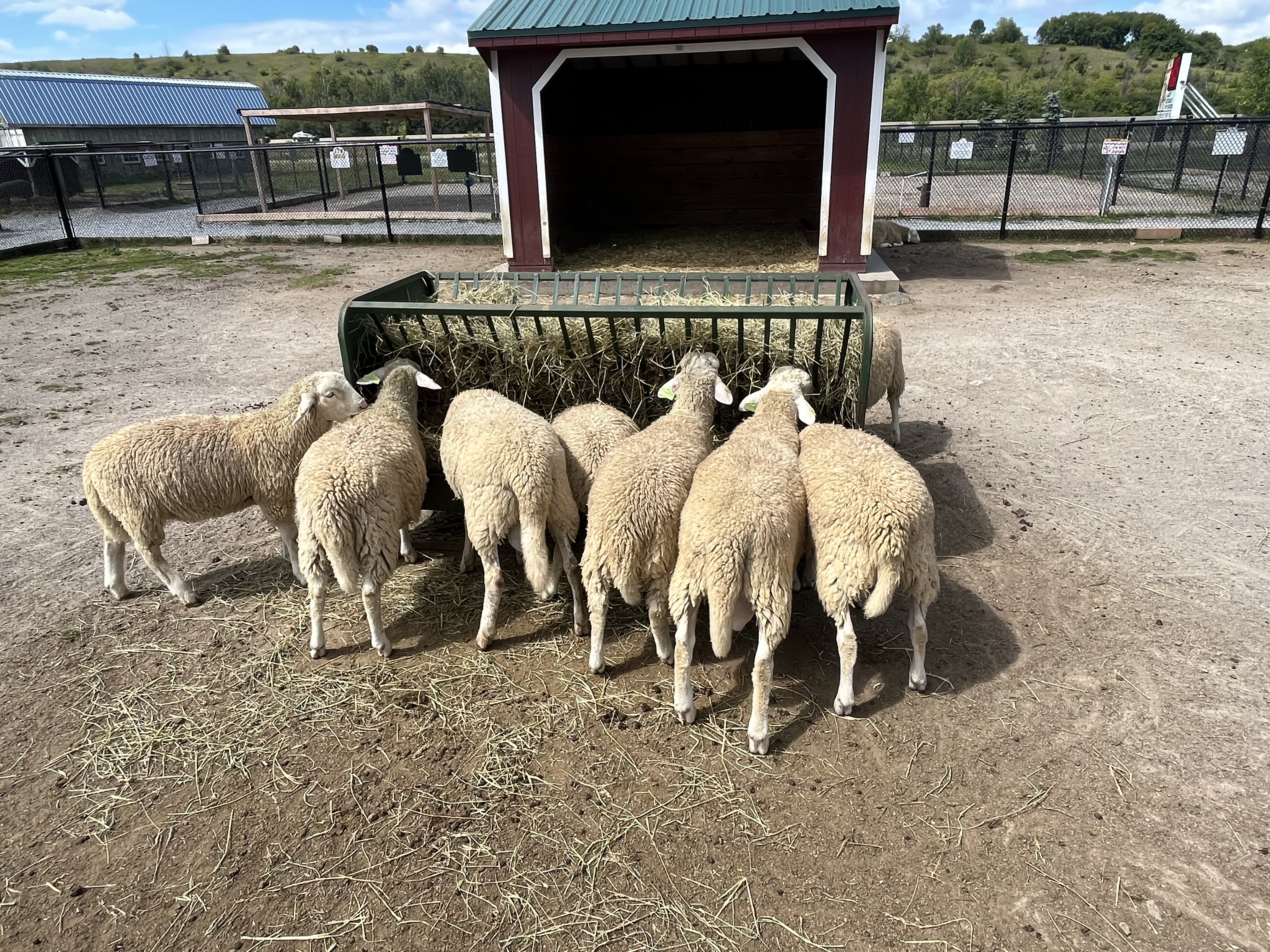
A petting zoo is included for the little ones to get an opportunity to see a selection of farm animals. You can buy little plastic containers full of animal food so that you can feed them a nutritional snack. It’s a lot of fun for the children and it lets the guests pay for the animal feeding which helps keep the costs of running the petting zoo under control.
One of the fun things is this sign post that show how The Big Apple is in the centre of everything. The distance in kilometres is given to 56 places around the world.
The Big Apple may be 14,750 kilometers from the South Pole but it’s only 130 kilometers from Midtown Toronto. It’s a great place to spend some time with the children or just a fun stop as you make your way along Highway 401. And, best of all, it’s free to enjoy (unless you start buying some of those yummy things that you’re going to see).
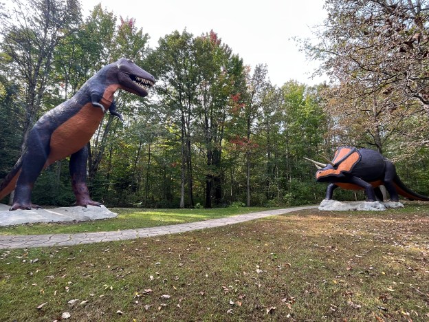
Prehistoric World is four hours east of Toronto so it’s not the kind of place you visit on a day trip. However, I get to travel around Ontario for work and it allows me the opportunity to visit some places between appointments. I had some time off when staying in Morrisburg and so I decided to make a visit to this secret prehistoric world which is a well kept secret on its own. There is no formal advertising and the website was taken down in 2015. A sign on the side of Highway 2 about 9 kilometers east of Morrisburg is the only indication of its existence.
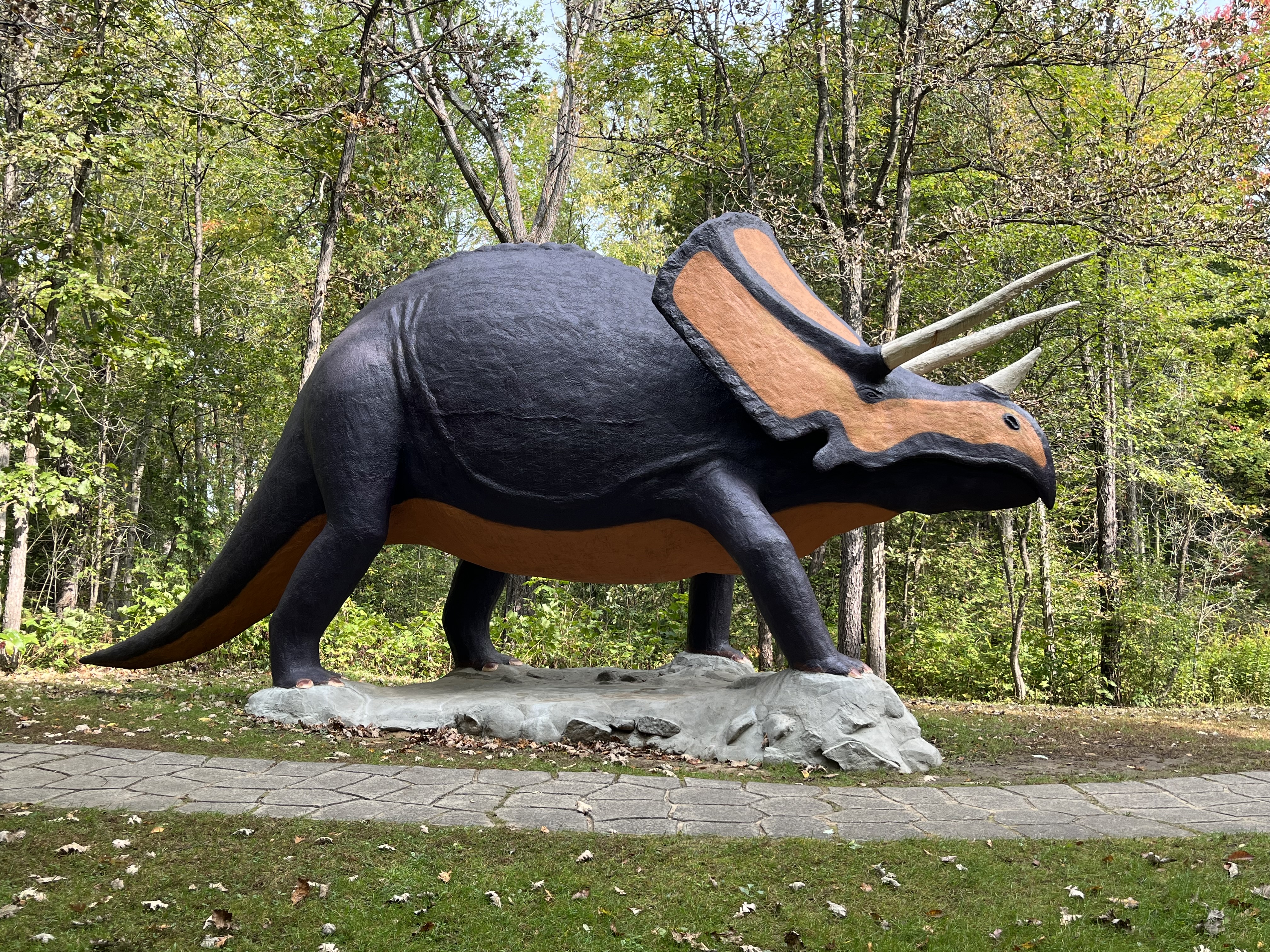
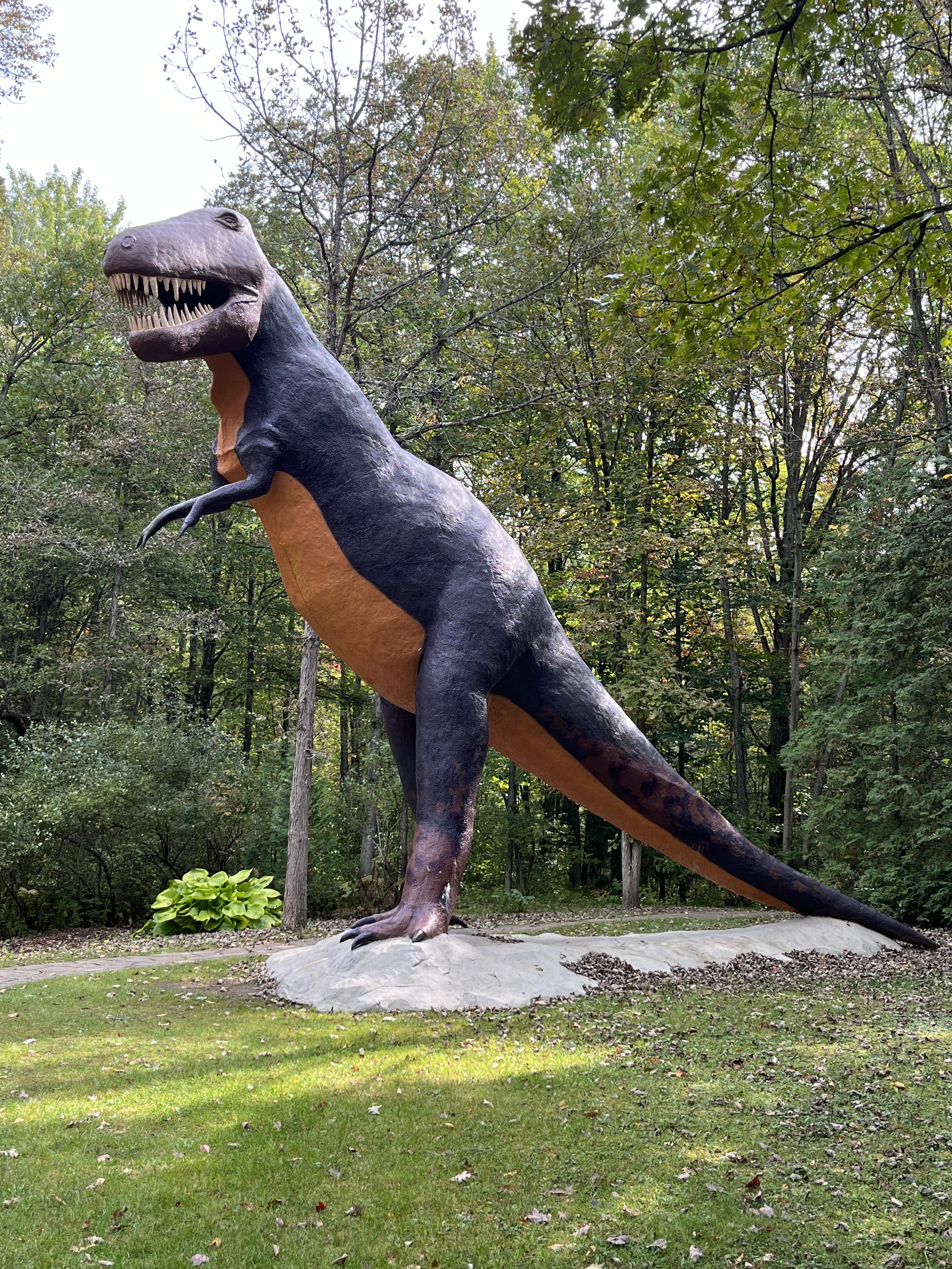
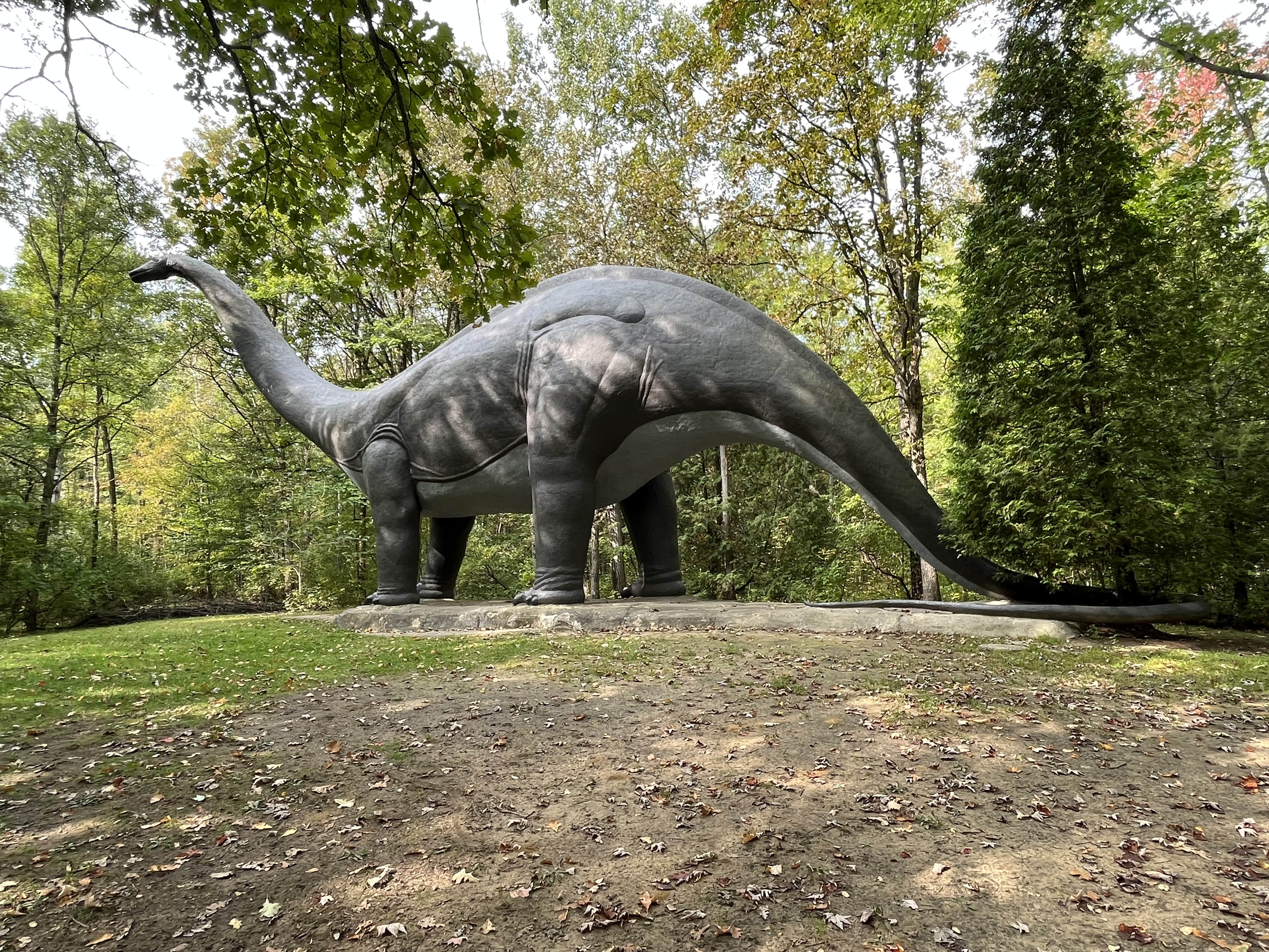
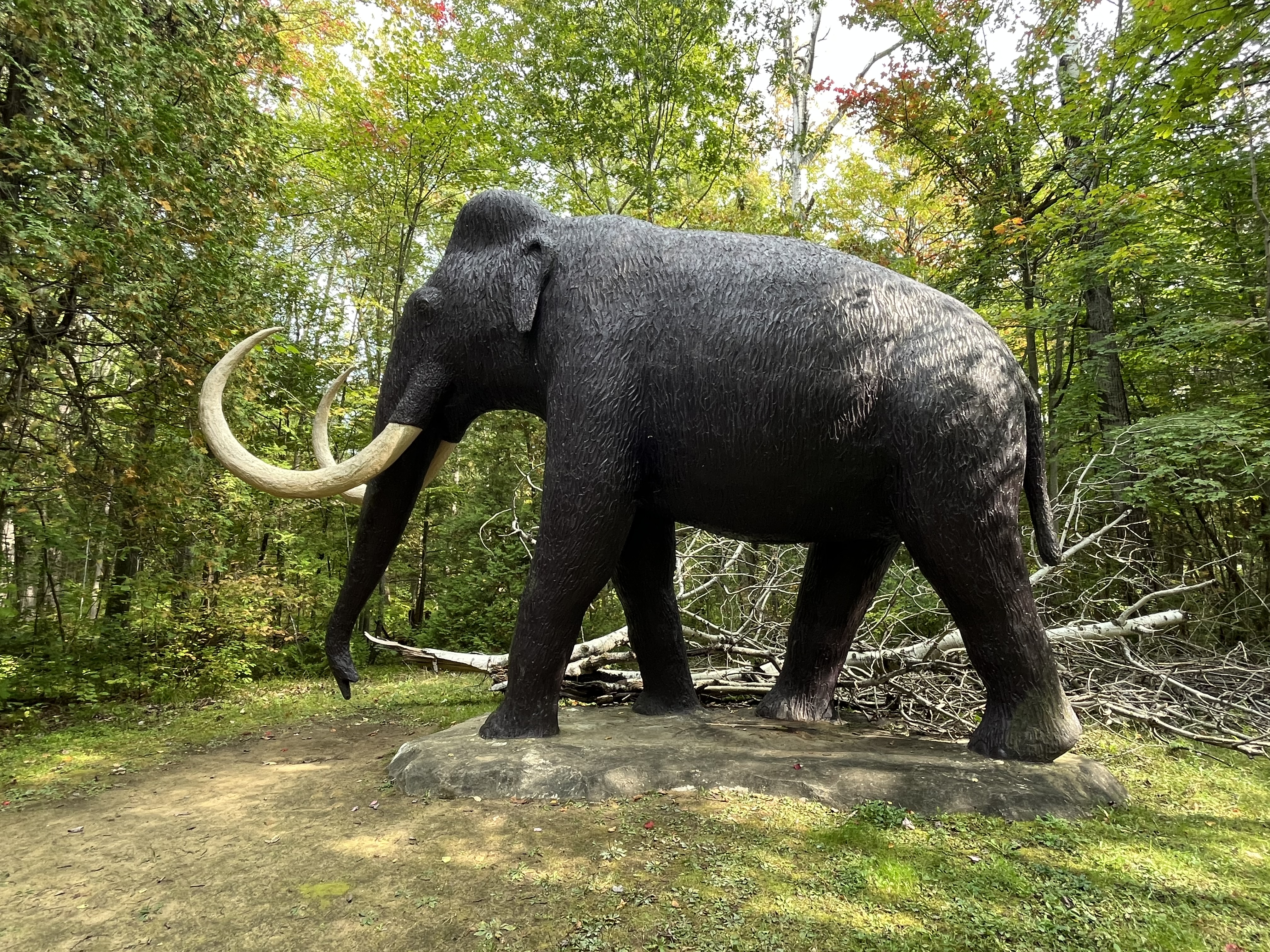
Prehistoric World came from the imaginations of two brothers who wanted to have a place to display their art. Together, Paul and Serge Dupuis decided to turn an 150 acre property into the back yard of their childhood dreams. So far they have transformed 28 acres with over 50 life size recreations of dinosaurs and other prehistoric animals. When they opened in 1981 they had many less statues than they had hoped to have but they have been constantly adding to their display as the years go by.
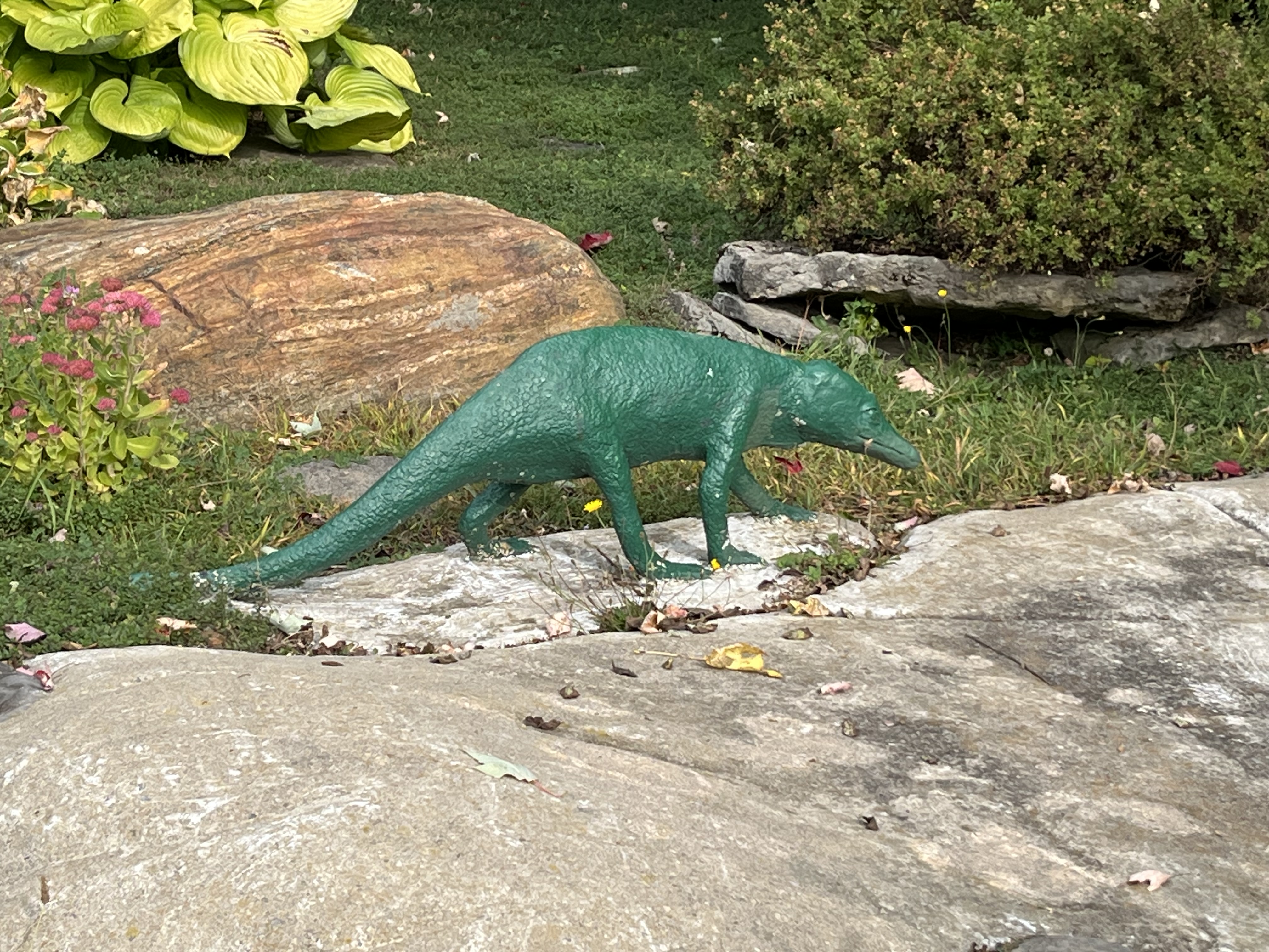
One of the earliest animals to be included in the park is Protosuchus. It lived about 200 million years ago and is said to be an ancestor of modern crocodiles. It was likely a good swimmer and a good runner and has sharp teeth that indicate that it was a meat eater.
New statues are worked on over the winter with the steel understructure being welded up in their workshop. In the spring they move the frame to its location along the trail and then cover it with concrete. Once the concrete has set, it is painted and a bilingual sign is installed to describe the animal that is being depicted.
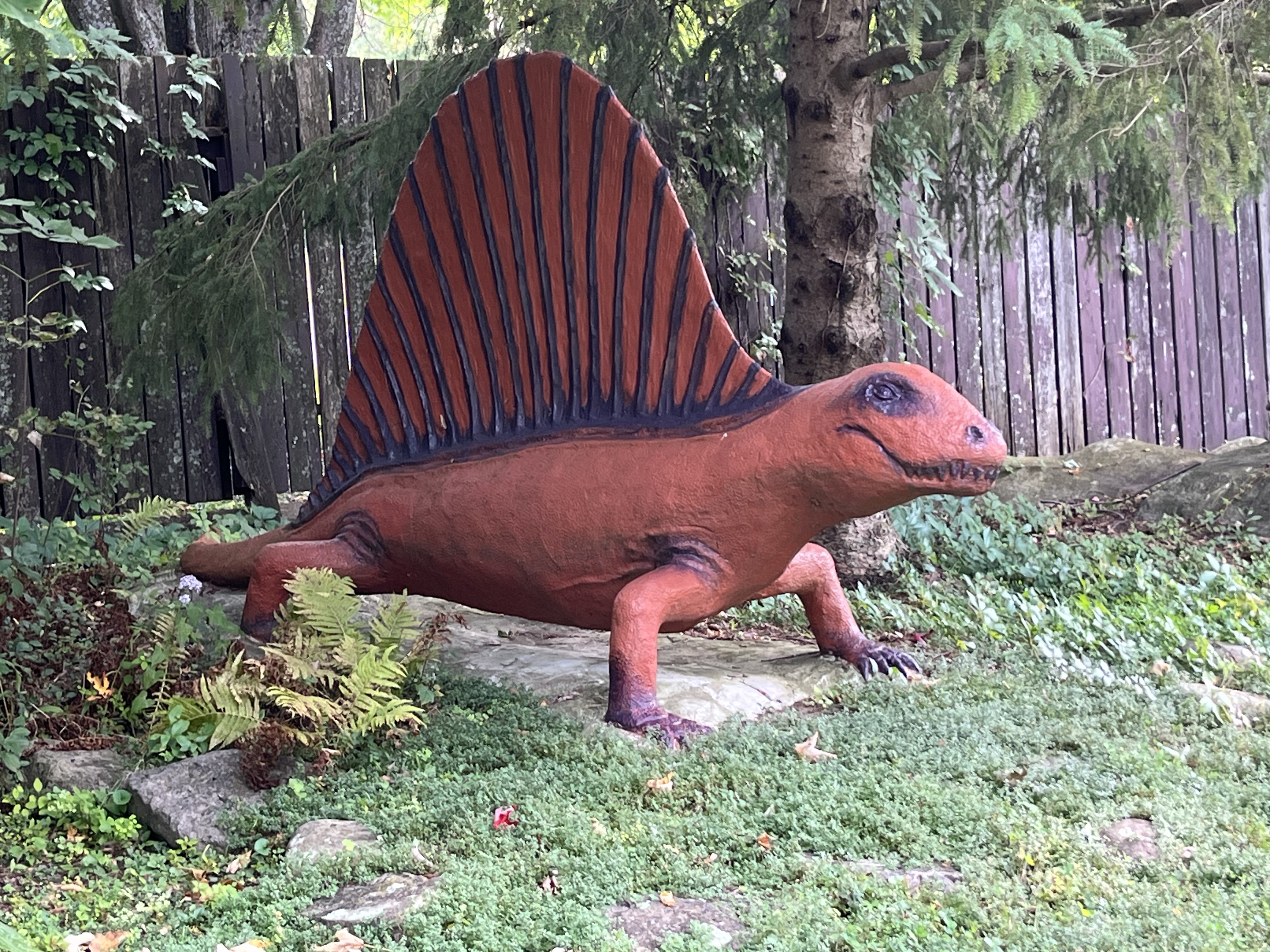
Dimetrodon lived about 300 million years ago and was the largest carnivore of its time. It has a large dorsal fan which was used to regulate its body temperature. It could absorb heat and also be used to radiate excessive heat.
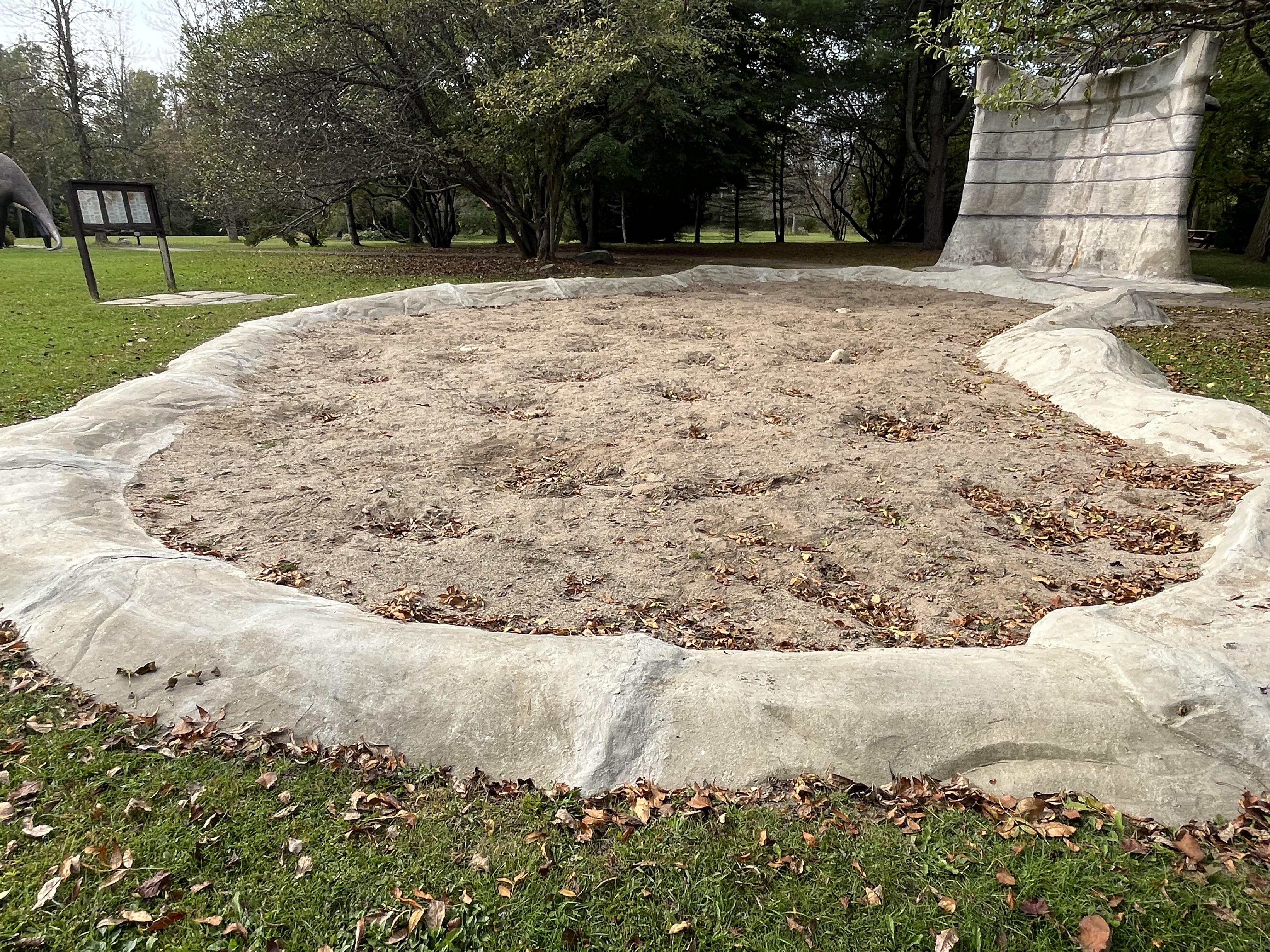
The displays start just outside the back door with the earliest lifeforms. As you make your way along the path the animals generally become larger as you follow the timeline. There is even a Fossil Pit for the budding archaeologist to play in. Hidden under the sand are 21 “fossils” that can be discovered. The only rule is that you can’t use any tools because the castings under the sand could get damaged. So, you are left to uncover them with just your hands. A few small pieces can be seen sticking up through the sand here and there.
The Ice Storm in January 1998 caused considerable damage and several sculptures were completely destroyed when trees fell on them. Paul estimates that they could likely have had about 70 statues by now if they hadn’t lost so many which were never replaced. The time spent on scaffolding doing repairs to the remaining statues prevented them from installing any new displays for quite some time.
Shunosaurus was one of the earliest sauropods and had a relatively short neck compared to later animals in this family. It was discovered in China and is the only member of this family to have a bone club on the end of its tail for defensive purposes.
There are several new sculptures in various stages of completion in the workshop and so new ones will continue to be added in the future. All of the work has been completed by Paul and Serge with no outside help. There is a long-term desire to have the park turned over to an artist collective that would carry on the work when the two brothers are no longer able to do so themselves.
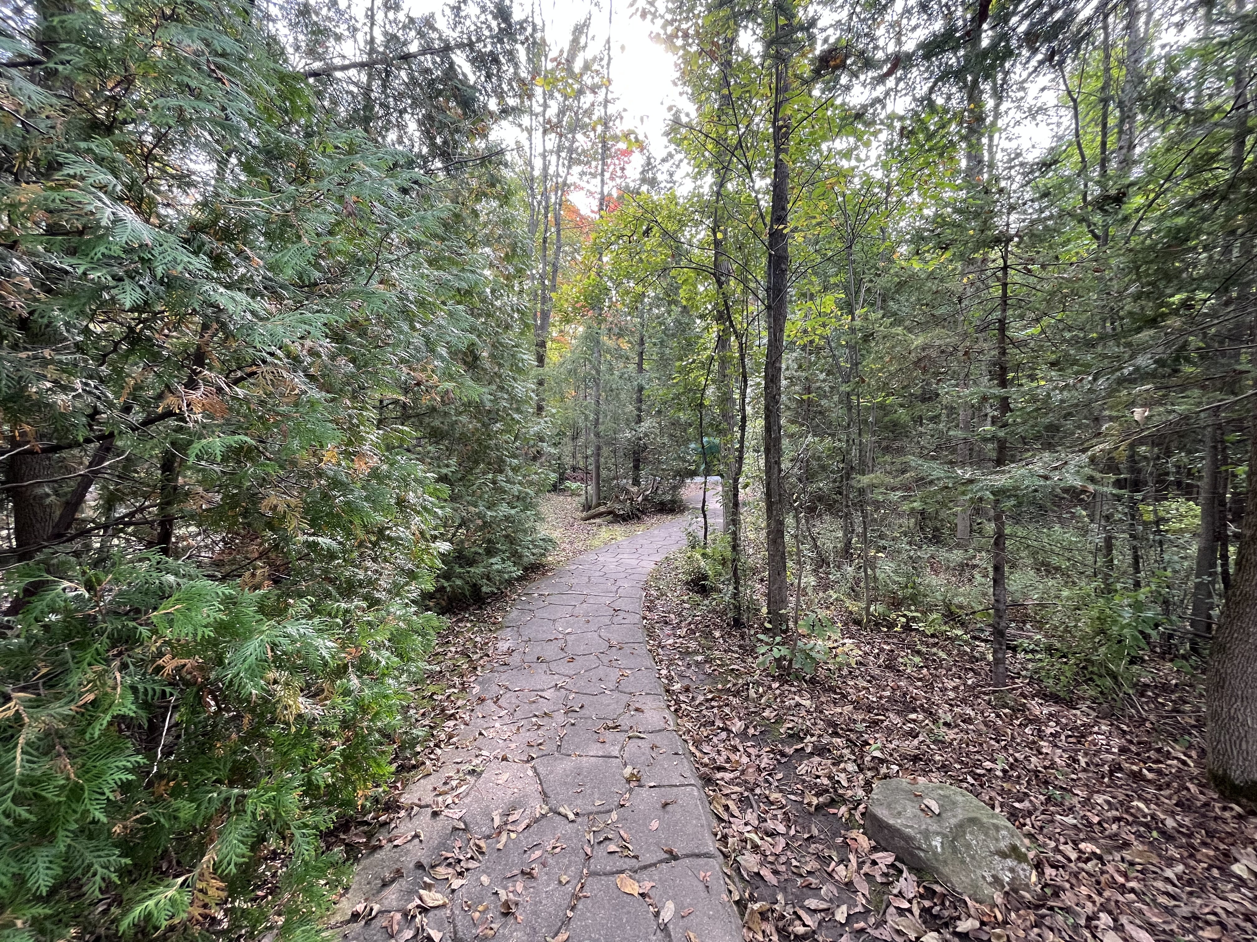
The path through the site is about one kilometer long and is made of poured concrete. This has been carefully scored by hand with a trowel to create the impression of cut stones laid into a pattern. The pathway leads from the back of the house, through the yard and into the woods where it makes a loop and comes back.
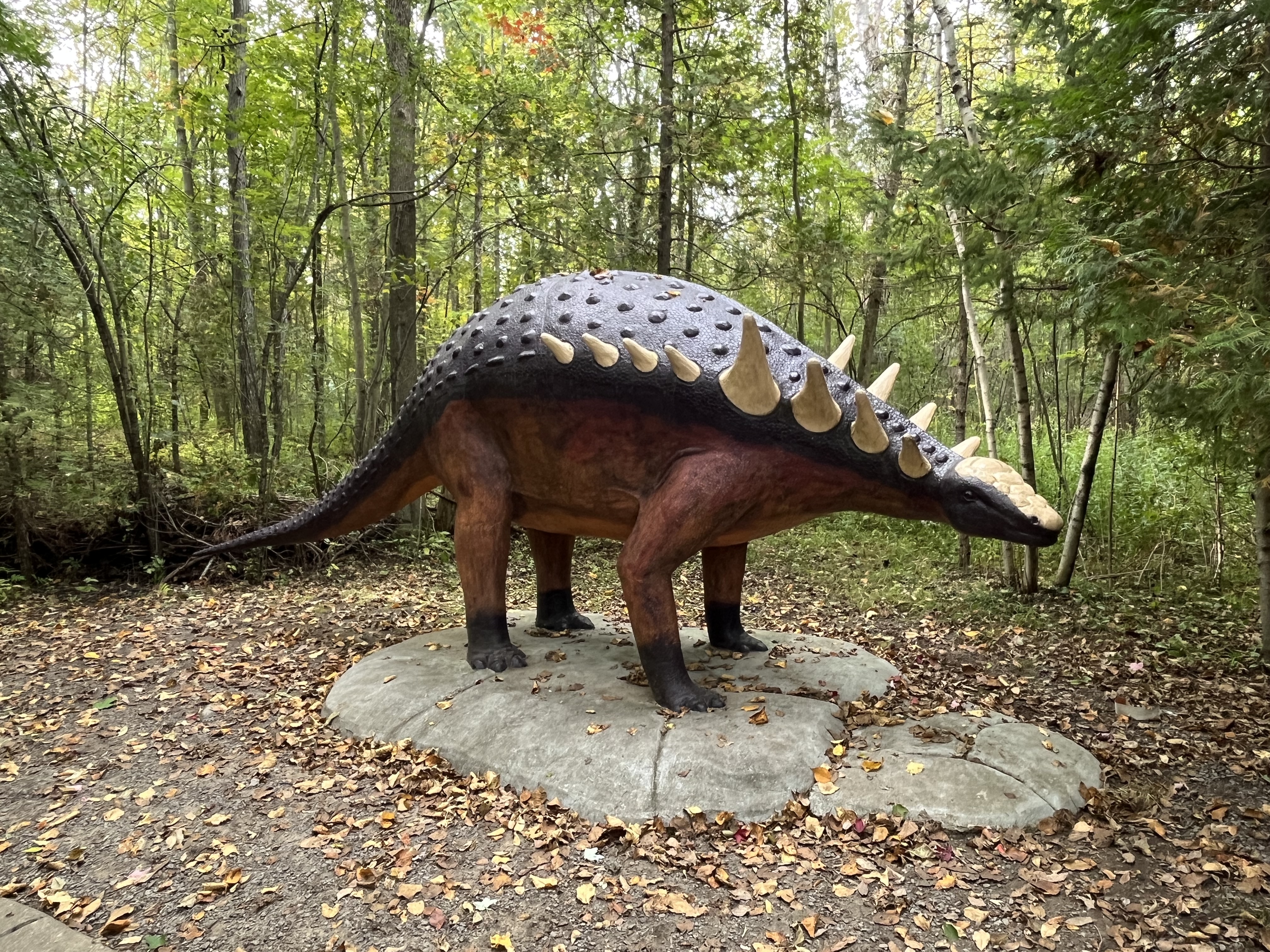
Nodosaurus was named for all the small nodes that cover the plates that protect its back. It was discovered in Wyoming and Kansas.
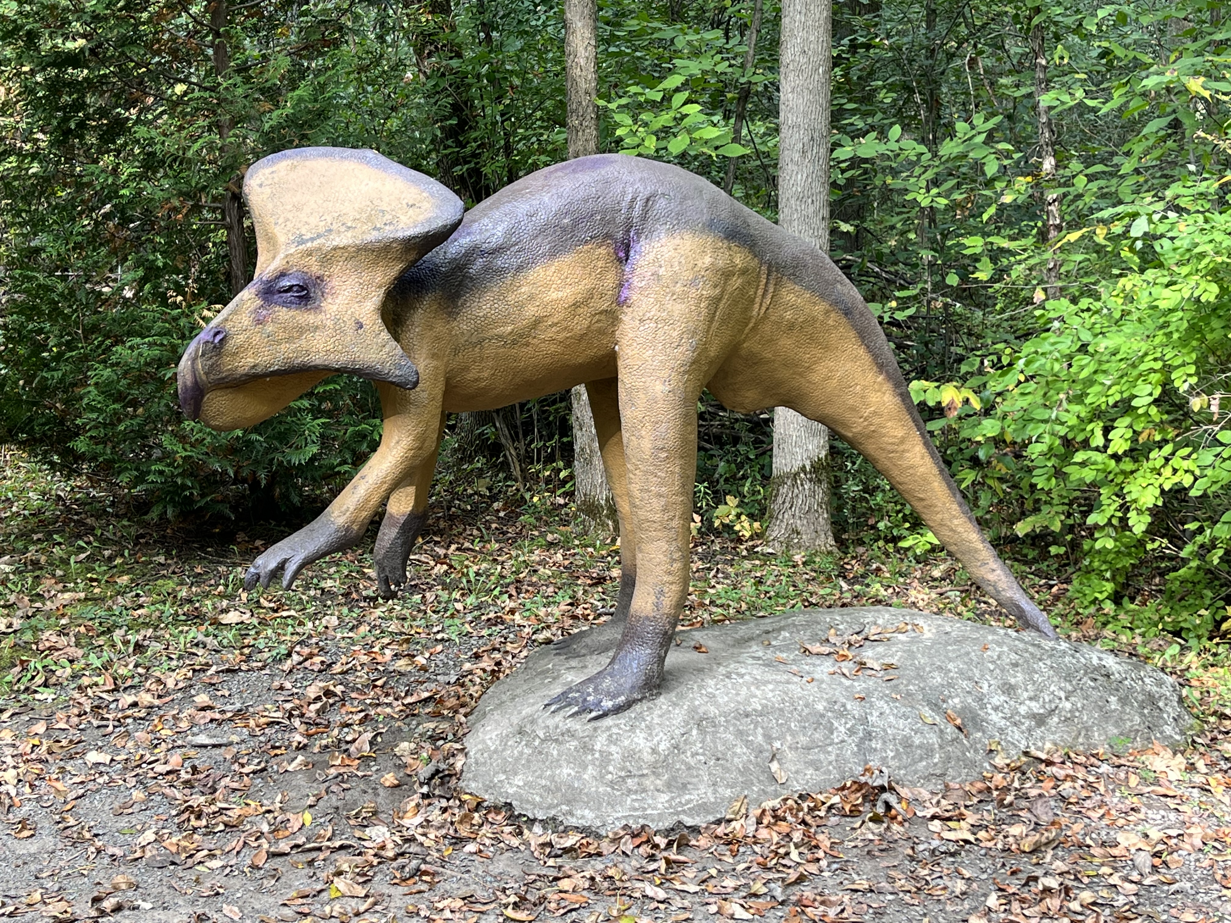
Protoceratops was one of the first “horned” dinosaurs and lived about 80 million years ago. It had a large neck shield but no actual horns and is the most famous dinosaur from the Mongolia area. It was often found with nests of eggs including partially hatched specimens.
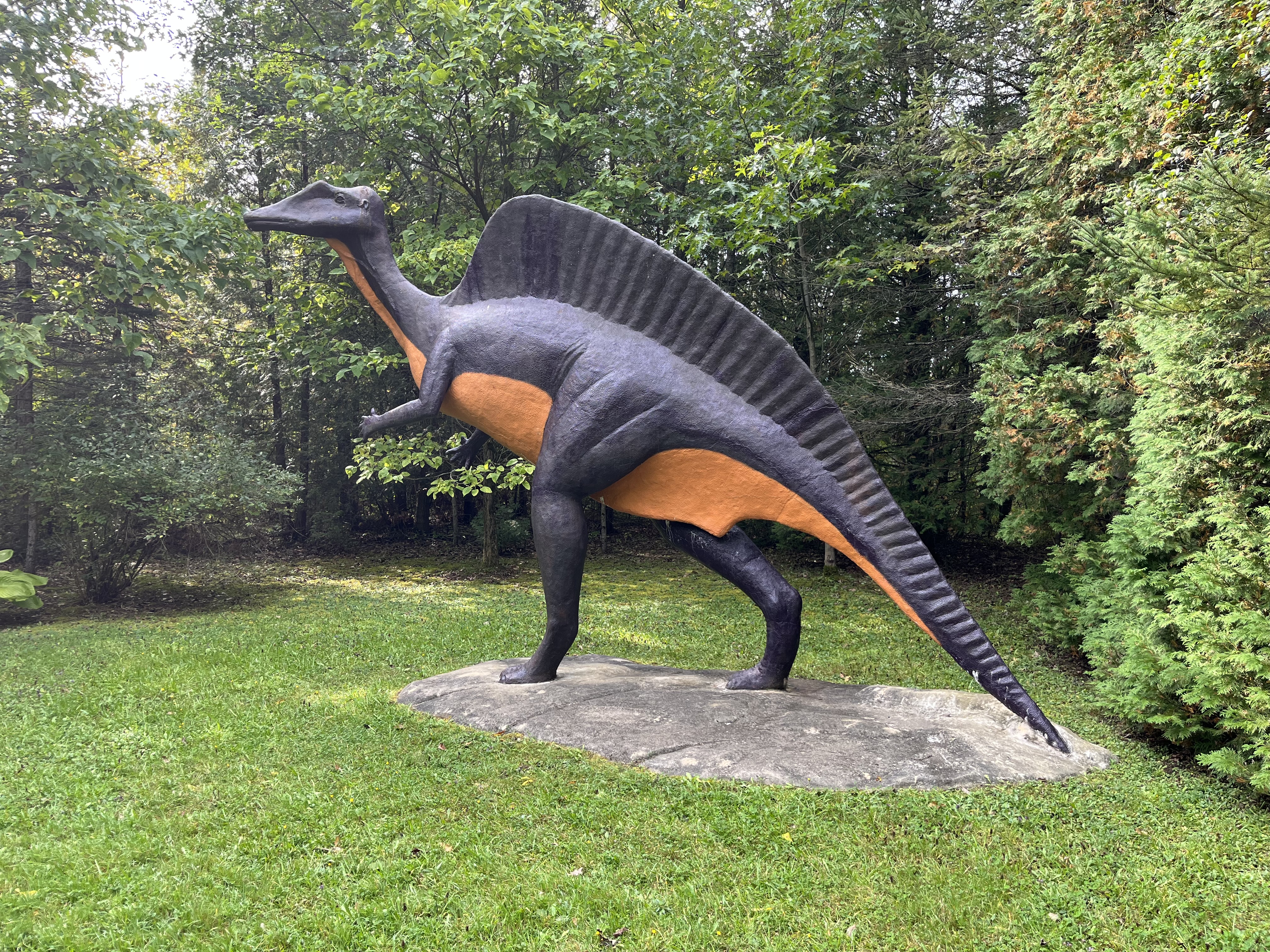
Ouranosaurus was first discovered in 1965 in Niger, West Africa. It lived about 110 million years ago and was distinctive for the large sail on its back. This set of extended spines was covered with skin and many blood vessels that allowed the animal to exchange heat and control its body temperature.
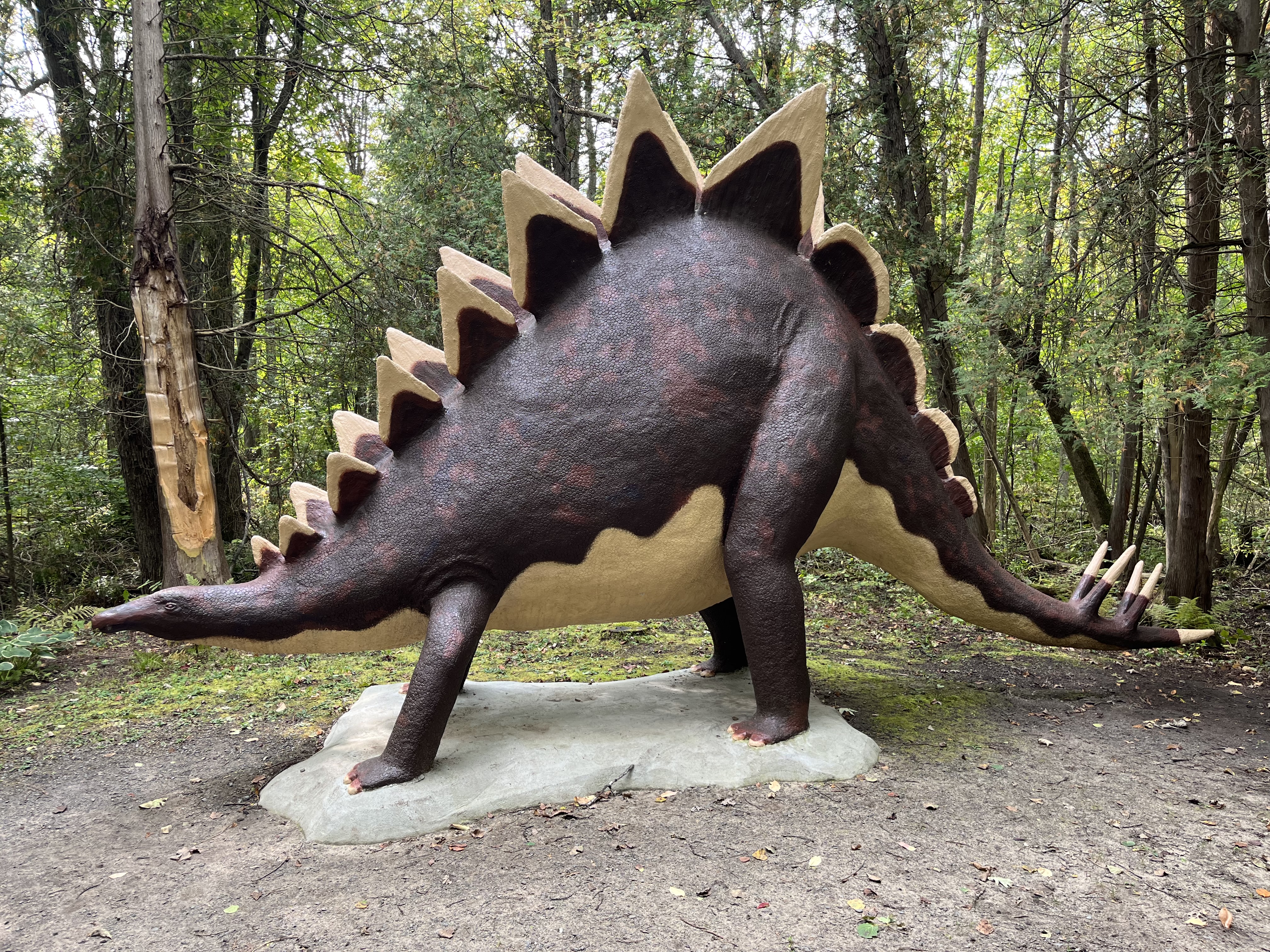
Stegosaurus lived in North America about 150 million years ago and is one of the dinosaurs that I was most impressed with as a child because of its body armor. The double row of plates on the back were used for temperature control while the spikes on the tail were a defensive weapon. This animal had a very small brain which was about the size of a walnut.
Triceratops had three horns on its face and a large bony shield to cover its neck. It lived in North America about 70 million years ago. It was the largest of the ceratopian, or horned, dinosaurs and if challenged it would likely have lowered its head and charged into the belly of its opponent. The horns would have provided a major defensive weapon.
Tyrannosaurus Rex was the largest of the carnivorous dinosaurs and could reach 8 tons in weight. It lived 65 million years ago and although Hollywood loves to show it as a top predator, it may have been more of a scavenger because smaller animals could have likely outrun it.
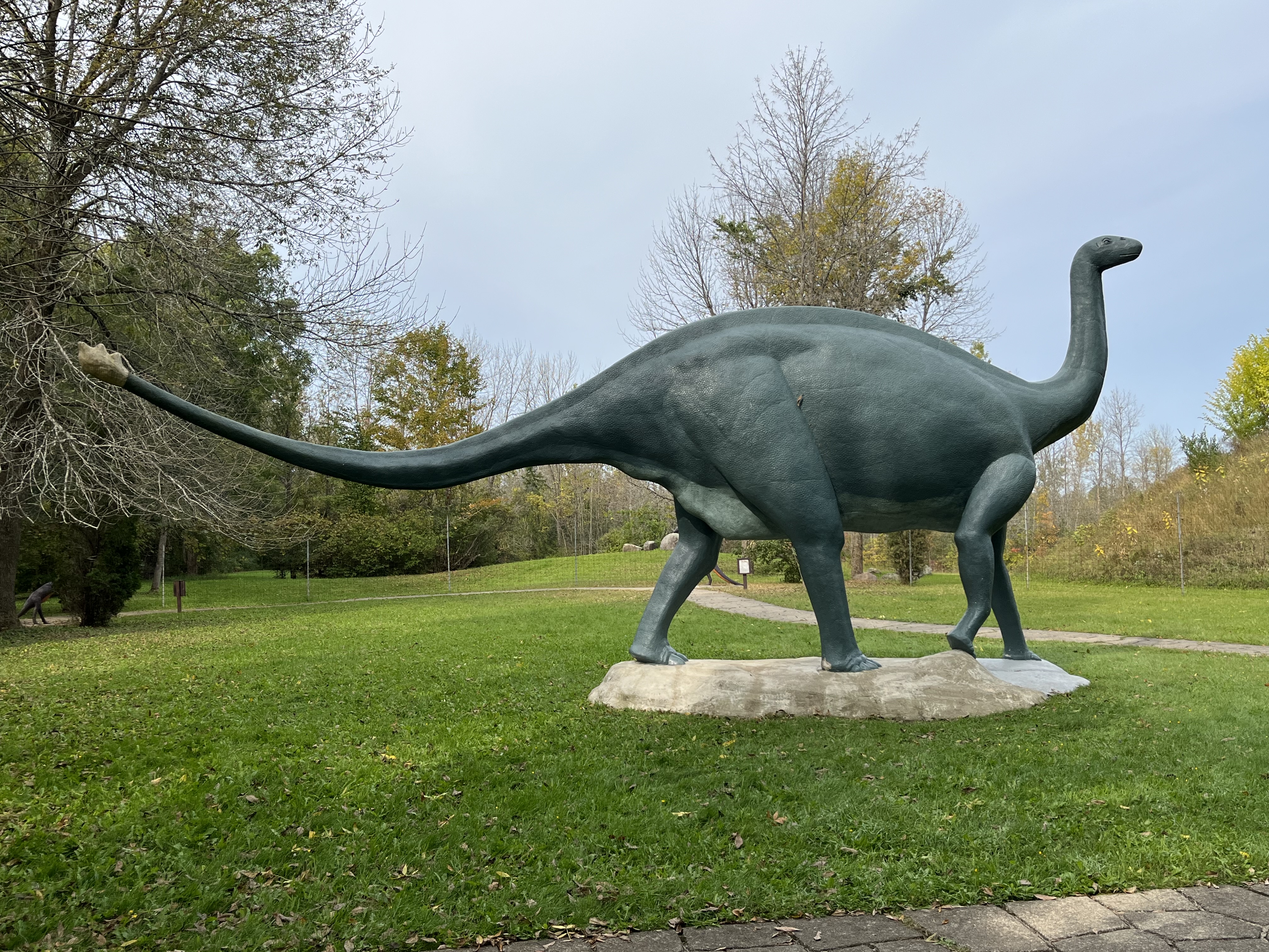
Brontosaurus is the biggest statue in the park, being one of the largest land animals to ever walk the Earth. From the nose to the tip of the tail it could be over 70 feet in length. Since the workshop isn’t big enough to accommodate the steel structure for this animal it was created in 14 pieces and assembled on site.
Wooly Mammoth stood 14 feet tall at the shoulder and are ancestors of the Elephant. They get their name from the thick coat of hair that covered their hides and they lived between 1 million years ago and about 10,000 years ago. Examples of this pachyderm have been found all over the Northern Hemisphere as well as entire animals being found frozen in the permafrost of Siberia and Alaska.
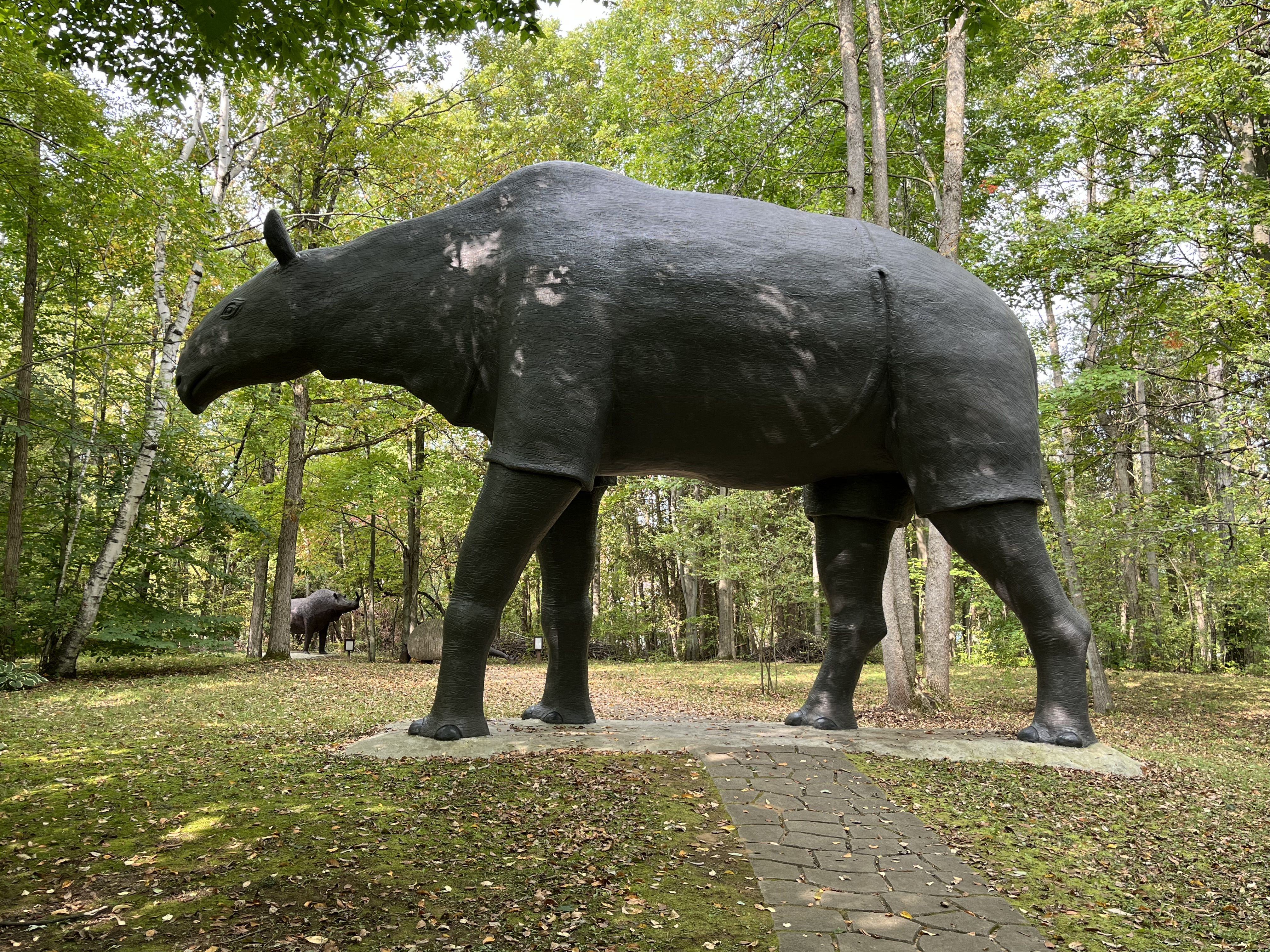
The largest mammal ever discovered was Baluchitherium which stood 18 feet tall at the shoulders. It weighed almost thirty tons and lived about 20 million years ago. It is said to have been an ancestor to the Rhinoceros. This statue is tall enough that the path leads right under its belly.
Prehistoric World will take a little over an hour to walk through if you stop to read each of the information plaques. The entry fee is only $10.00 for adults and $6.00 for children making it one of the affordable places to visit.
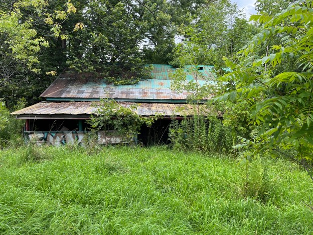
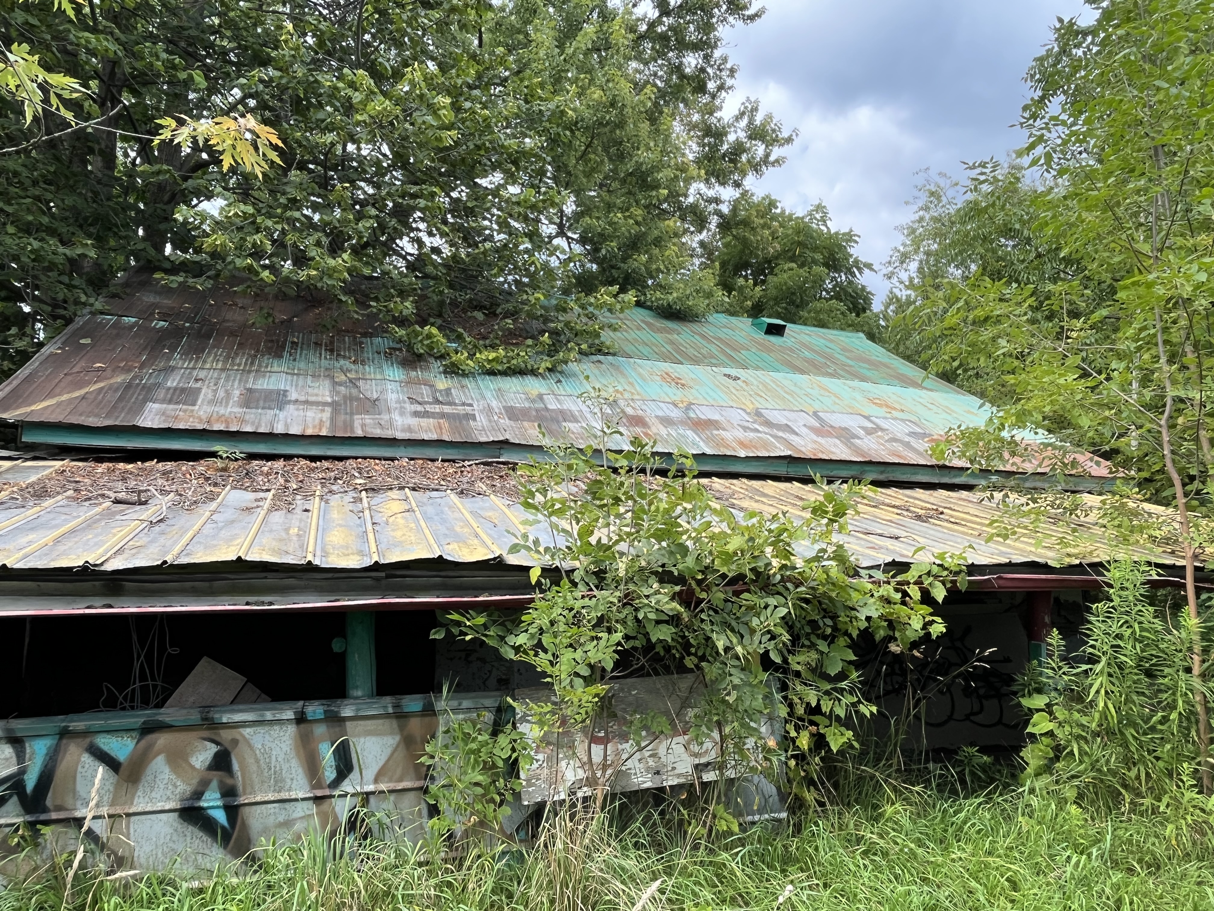
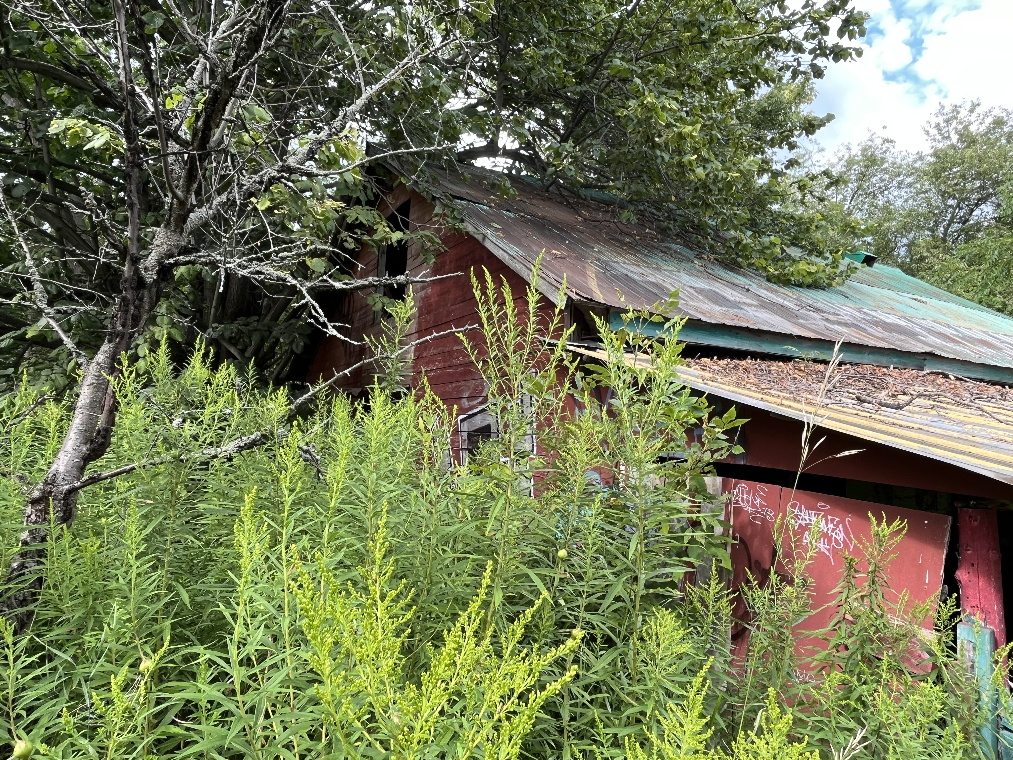
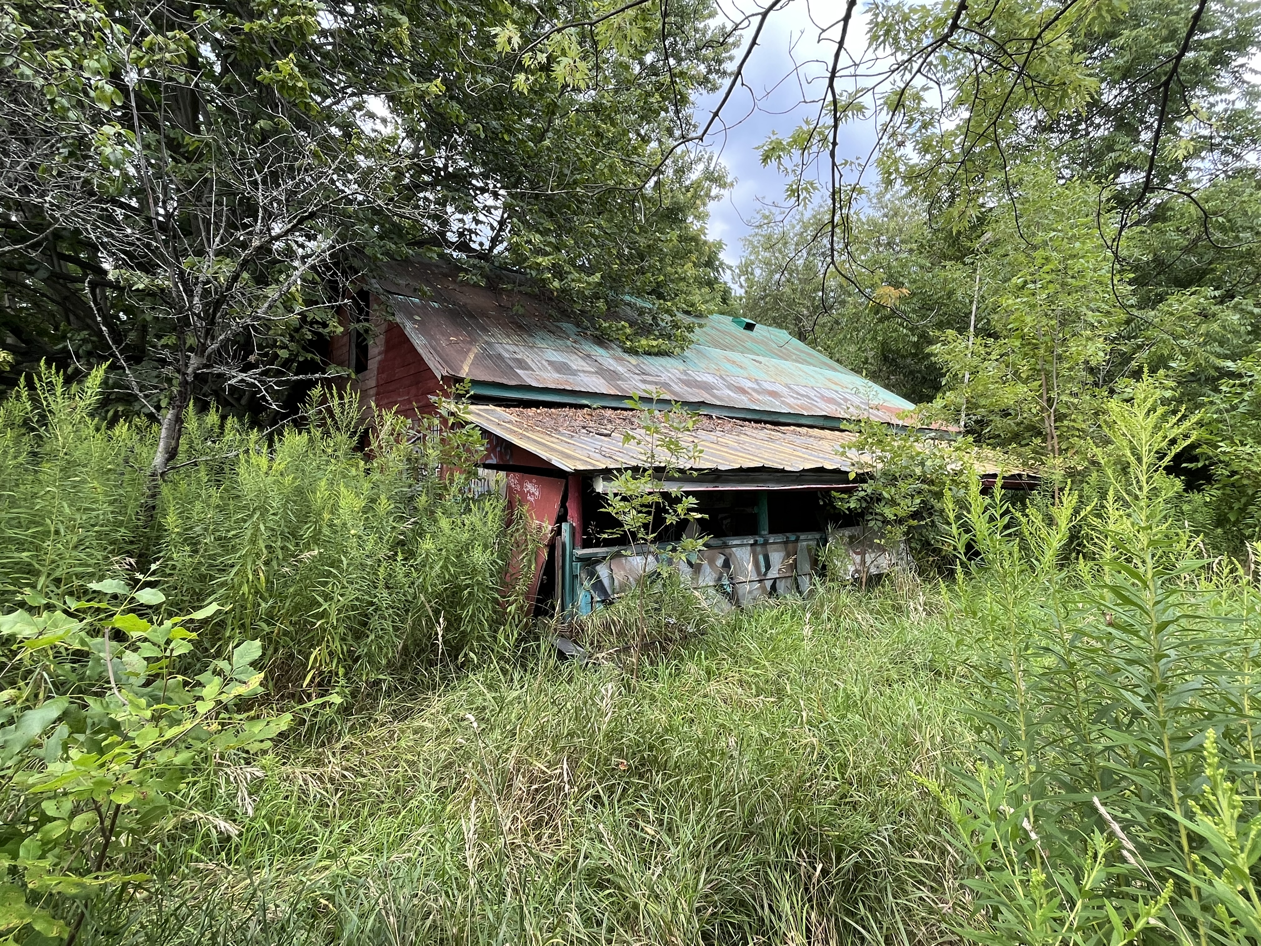
For many years I have seen an abandoned building that looks like former fruit and vegetable market. It can be seen on the north side of the 401 just east of the Newtonville exit. It is actually located where Elliot Road was cut in two by the building of the highway. Research has failed to turn up anything regarding the history of this building. I suspect that some of the readers of this blog may have shopped there before and if they can shed any light on the site I will update this post. For now I am presenting the pictures and letting the mystery remain.
Direct Farm Marketing is done is several ways including the simplest form which is a road side stand or a wagon selling produce such as fresh picked fruit and vegetables. Farm stores and markets usually involve a more permanent type of building like the one pictured here. These are sometimes seasonal but can also operate year around. Recently a new type of farm market has come into style and that is the full farm experience. In these cases people open up their farms as tourist attractions and often include many activities for the children to partake in. A market is always included which will allow the customer to buy produce and fresh baked goods. Be aware that some of these require payment of a fee to enter before you can actually buy anything. The Big Apple near Colborne is free and has many attractions included while Chudleigh’s near Acton requires a $14 per person entrance fee before you can buy a bag of apples. We will likely review The Big Apple in a future post.
The roof of the building has some writing on it that appears to read “Chunk” but it is hard to say if this is recent graffiti or the original name of the property. One thing is clear, and that is the deterioration of the property. The surrounding area has grown up with small trees and the grasses and weeds have taken over what used to be the lawn.
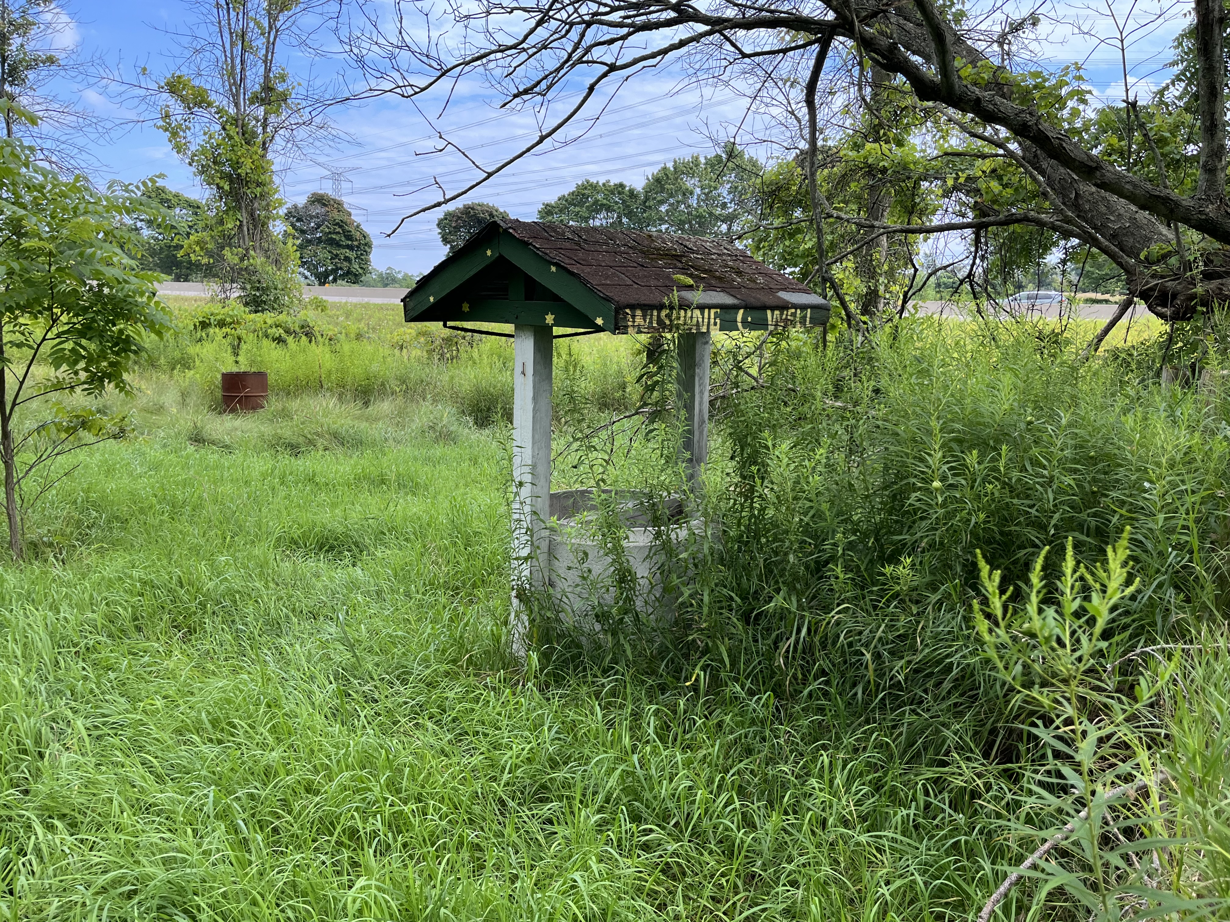
The concept of a wishing well goes back thousands of years. It was believed that gods inhabited the waters of the well and that they would grant wishes. Water is necessary for life and the community well has been a meeting place where news would be exchanged. The ancient Celtic and Bavarian peoples used to throw coins into the wells as a way of paying the local god for granting a wish. It was believed that if the coin landed on the bottom facing up the wish would be granted but if it landed face down the wish would be ignored. A well has been excavated in Bavaria that is around 3,000 years old and is full of ancient artifacts that were placed in it. On a practical point, the ancient people may have accidentally discovered the oligodynamic effect. This refers to the biocidal properties of both copper and silver, two metals used in ancient coins. These metals can help reduce bacterial infections and may have made the water safer to drink. People who frequented wells that had coins thrown into them may have had less infections and that could have led the ancient people to believe that the well was good luck. There’s an old wishing well in front of the building but it appears that the local god may have moved on because it is dry inside.
For now the building continues to silently watch over the traffic that passes by a few metres away on the highway. Most likely it will eventually be lost to deterioration from the weather and neglect
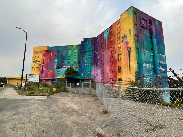
St. Joseph’s Health Centre in Sudbury has gone through many changes and will likely be demolished soon. The history goes back to 1944 when the sisters of St. Joseph at Sault St. Marie took on the project of building a new hospital in Sudbury. A group of doctors had contacted them and requested help in creating a facility in Sudbury. The government was not into financing hospitals at that time so the sisters mortgaged their homes to finance the construction. They started by purchasing a seven acre site on Paris Street. It took until 1950 to complete at a cost of $3.1 million dollars. The image below shows the entrance to the former hospital.
When it opened it had 200 beds but within 4 years another treatment wing was opened that added an additional 100 beds to the hospital. By 1960 there were 326 beds in the building which had originally been planned to serve 190 beds.
Eventually there were three hospitals in the Greater Sudbury Area and the General Hospital, as it came to be known, began to specialize in trauma care and surgeries. By 1980 a CAT scanner was added to go along with the Nuclear Medicine, Intensive Care, Neurosurgery and poison control departments. At this time the hospital had 375 beds.
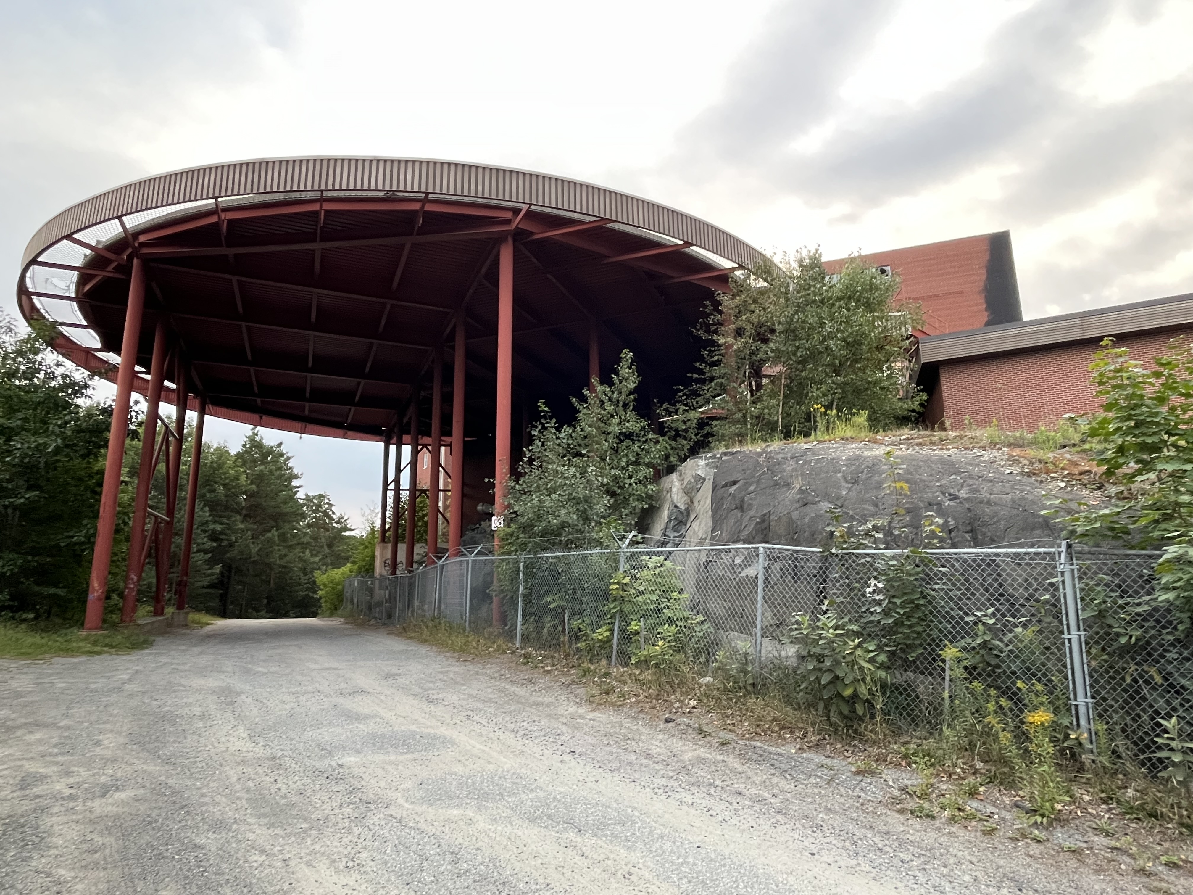
The hospital took on a greater role in trauma care in the region and consequently, on October 16, 1986 the new helicopter pad was opened. This allowed the hospital to receive air transported patients from great distances. All three Sudbury hospitals were amalgamated in 1997 under a provincial restructuring plan. Construction soon began on Health Sciences North and St. Joseph’s was closed on March 29, 2010.
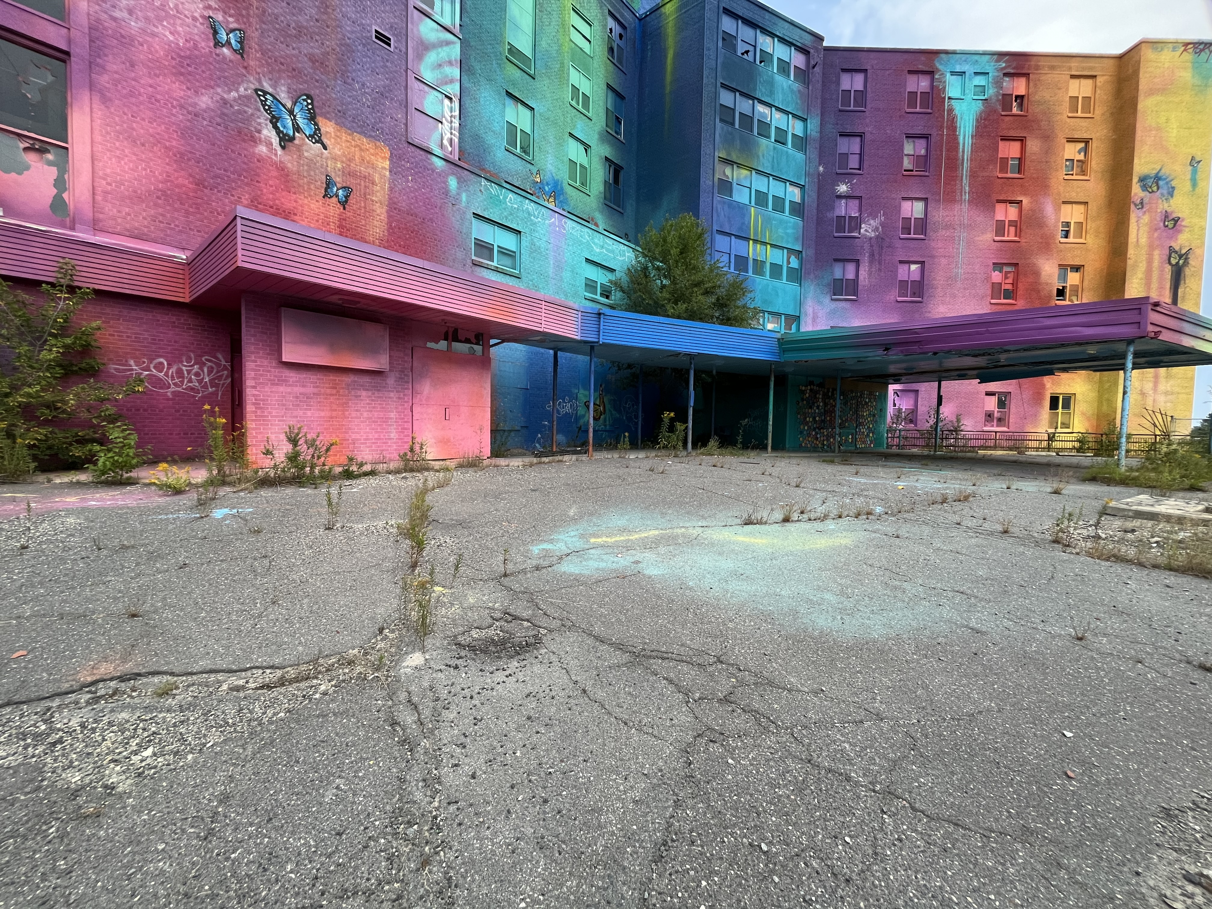
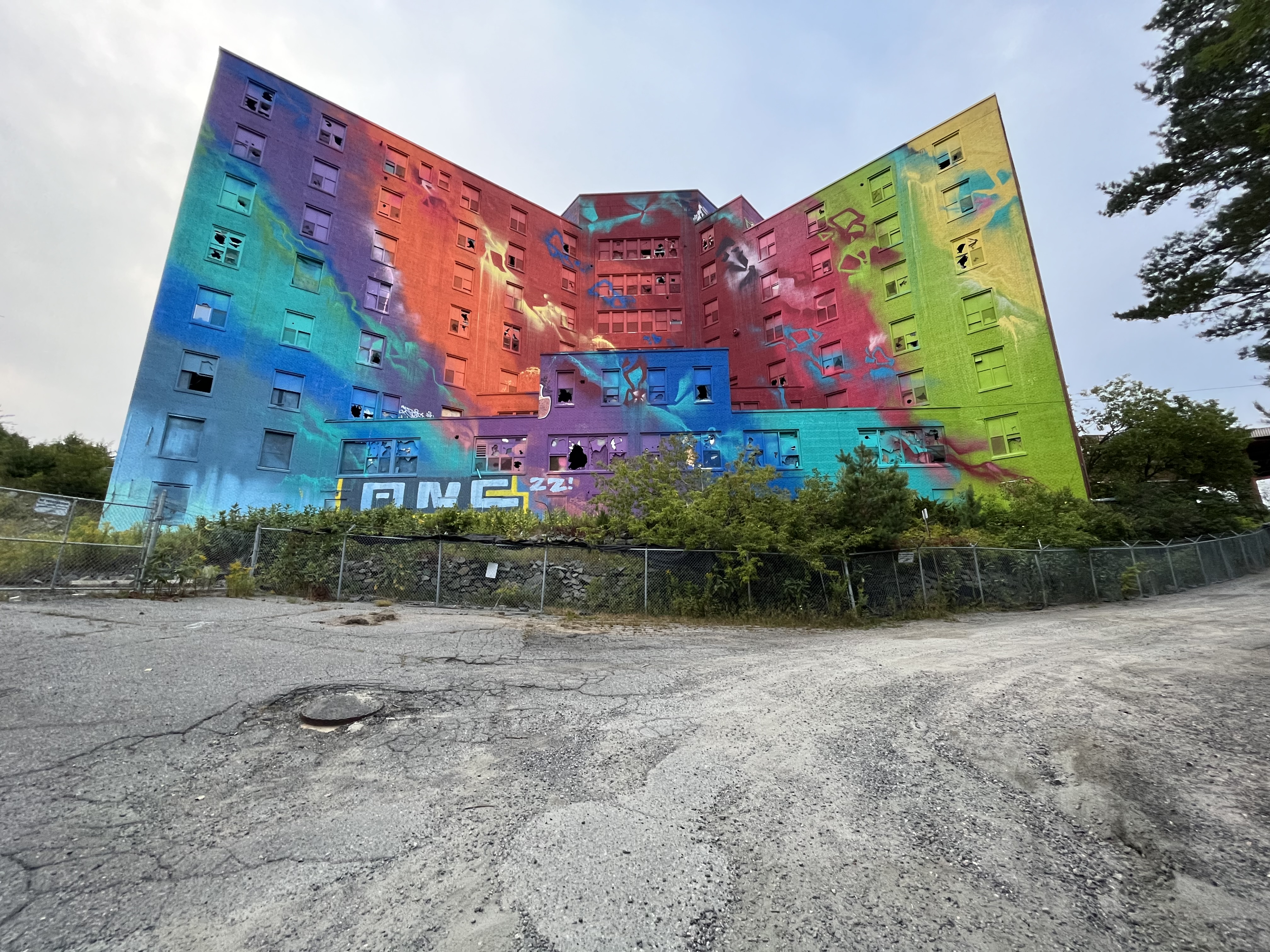
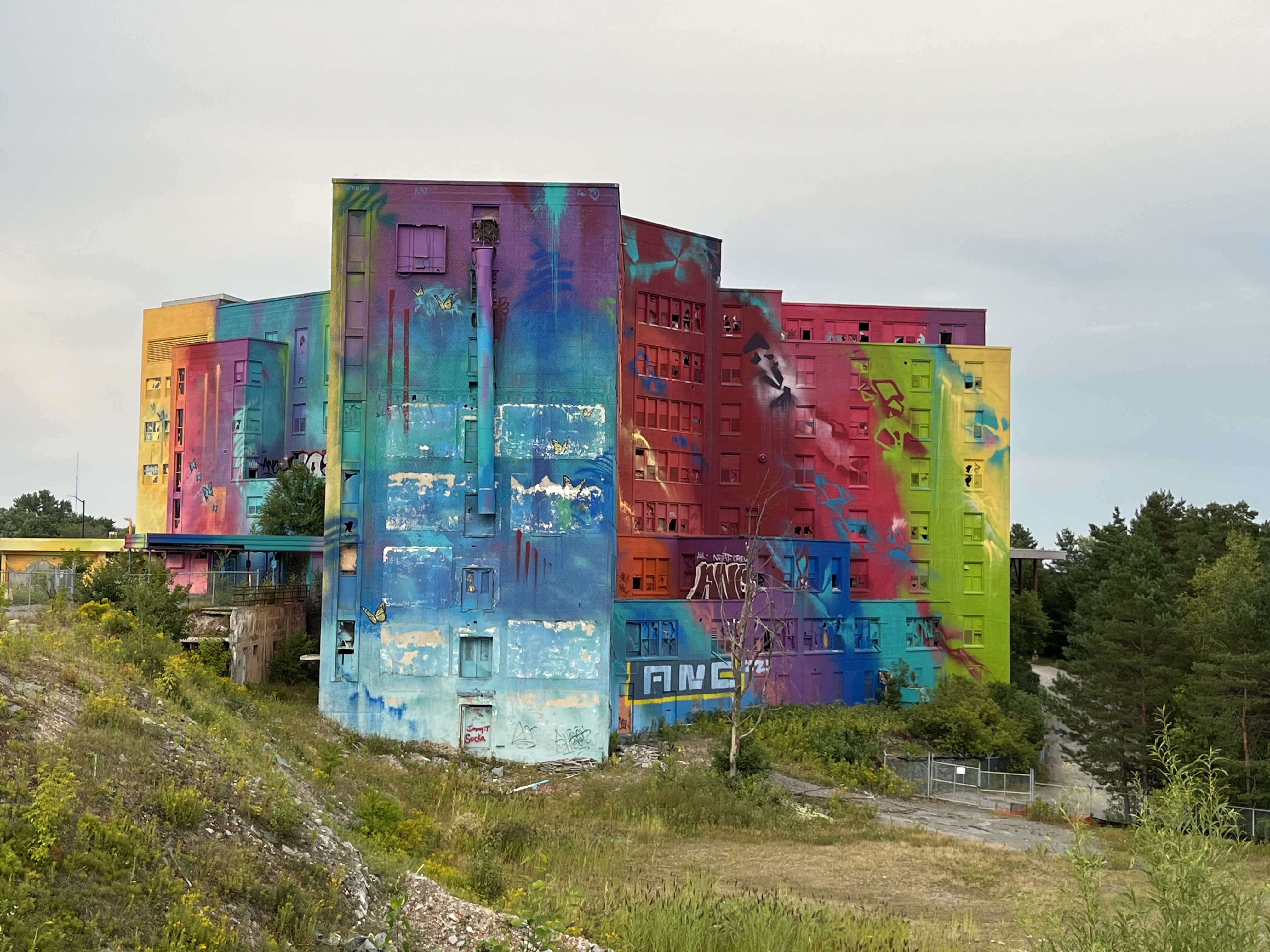
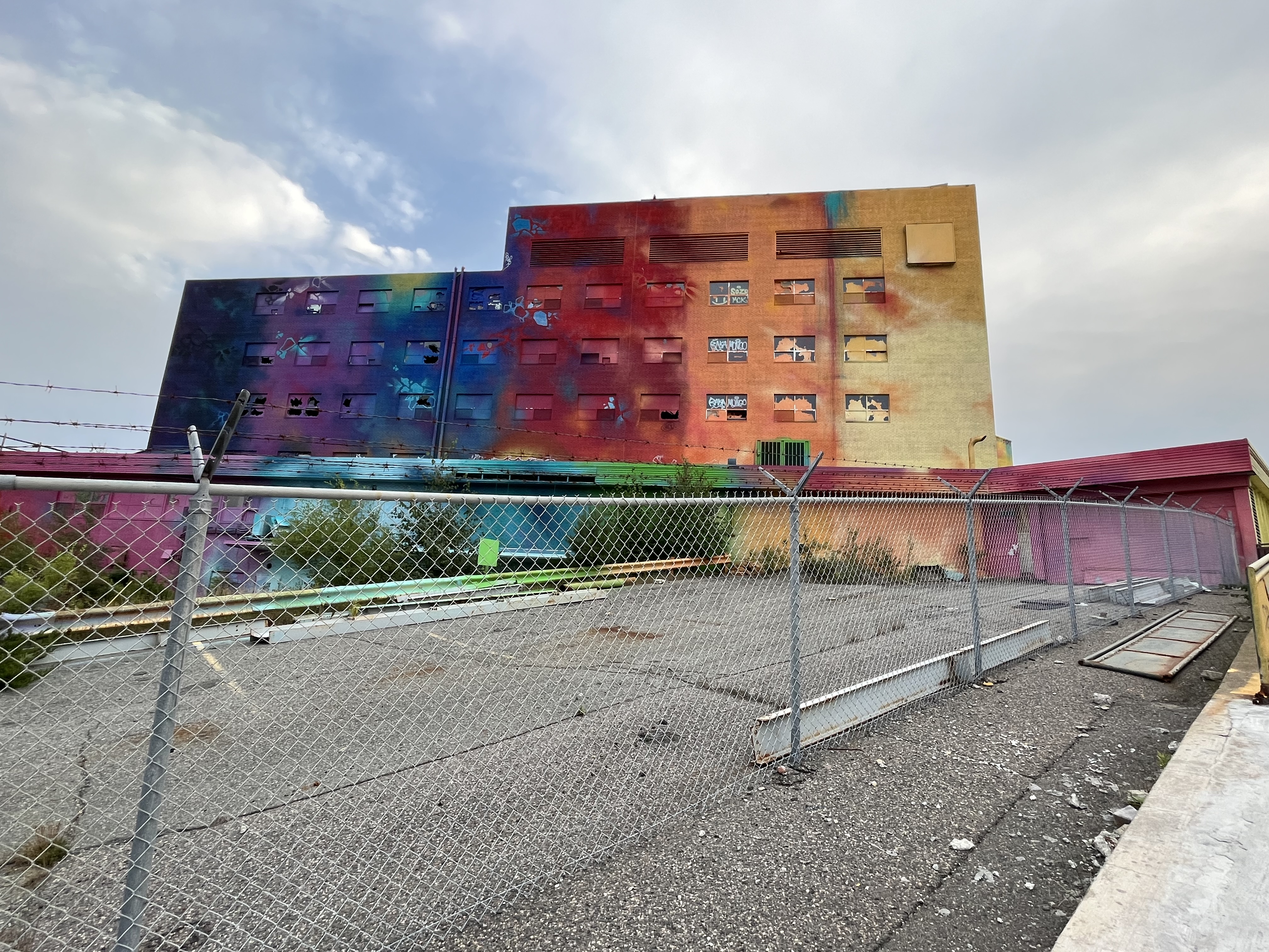
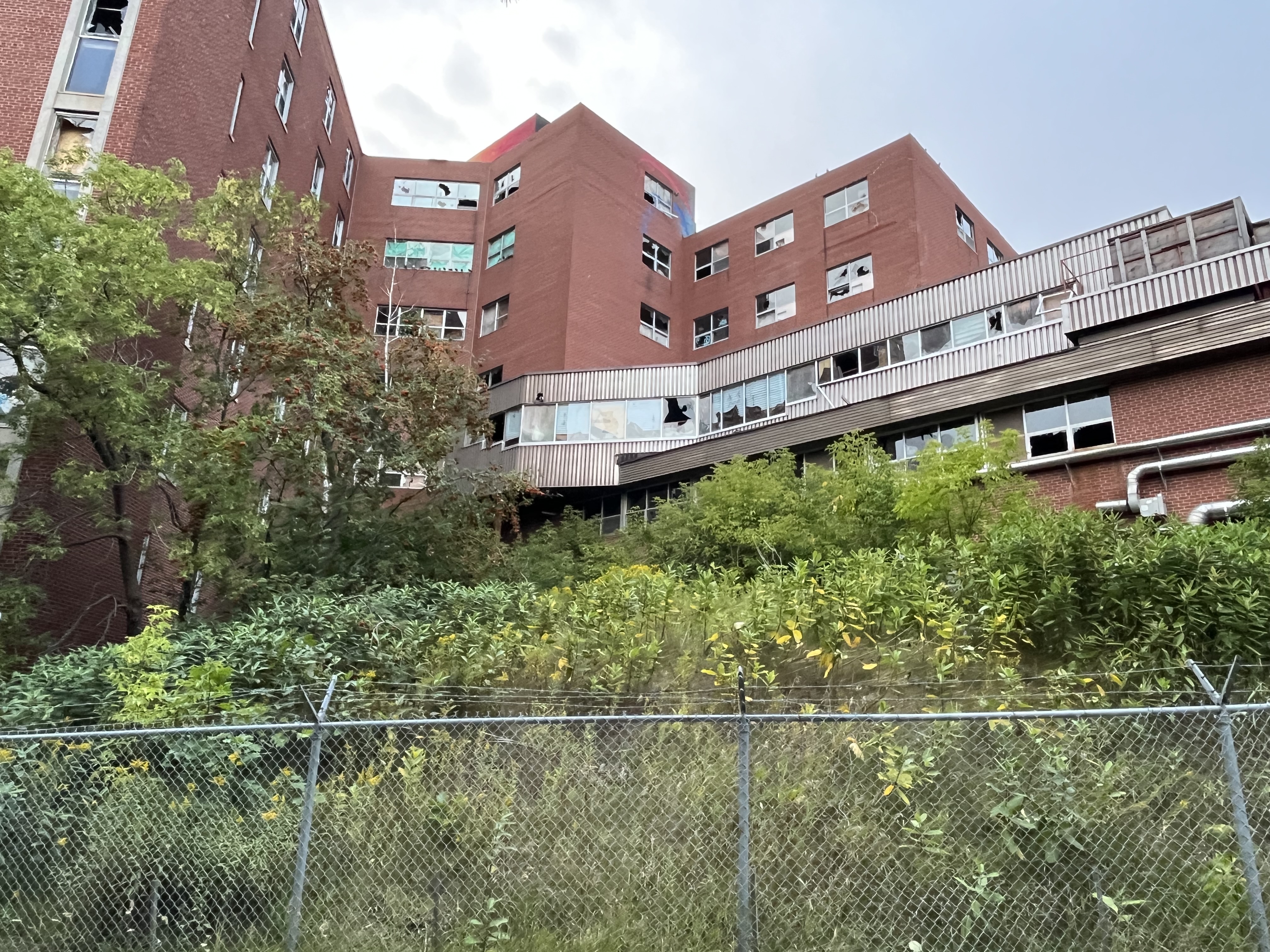
A study was completed to see if the building could be repurposed as a long term care facility but it wasn’t fiscally practical. Developers bought the site with the initial idea of making an apartment out of the old structure. Eventually this idea was abandoned and the building continued to sit untouched until 2019. That summer muralist RISK was commissioned to paint a mural on the outside of the structure as part of the annual urban art and music festival known as the Up Here Festival. The festival aims to beautify the city by installing murals and other public art as well as providing a music festival. When it was completed the 80,000 square foot mural became the largest mural in Canada.
The hospital was built backing into some rocky landforms and because it was out of sight of the road, the back side wasn’t painted with the mural. The image below shows how many of the windows have been broken by vandals.
On August 8, 2023 the developers put forward a new plan that includes the demolition of the existing hospital structure and the construction of three buildings. A 20 story condominium, a 16 story rental tower and a 12 story retirement residence. I am in Sudbury for work four times a year and will keep an eye on what happens to the site.
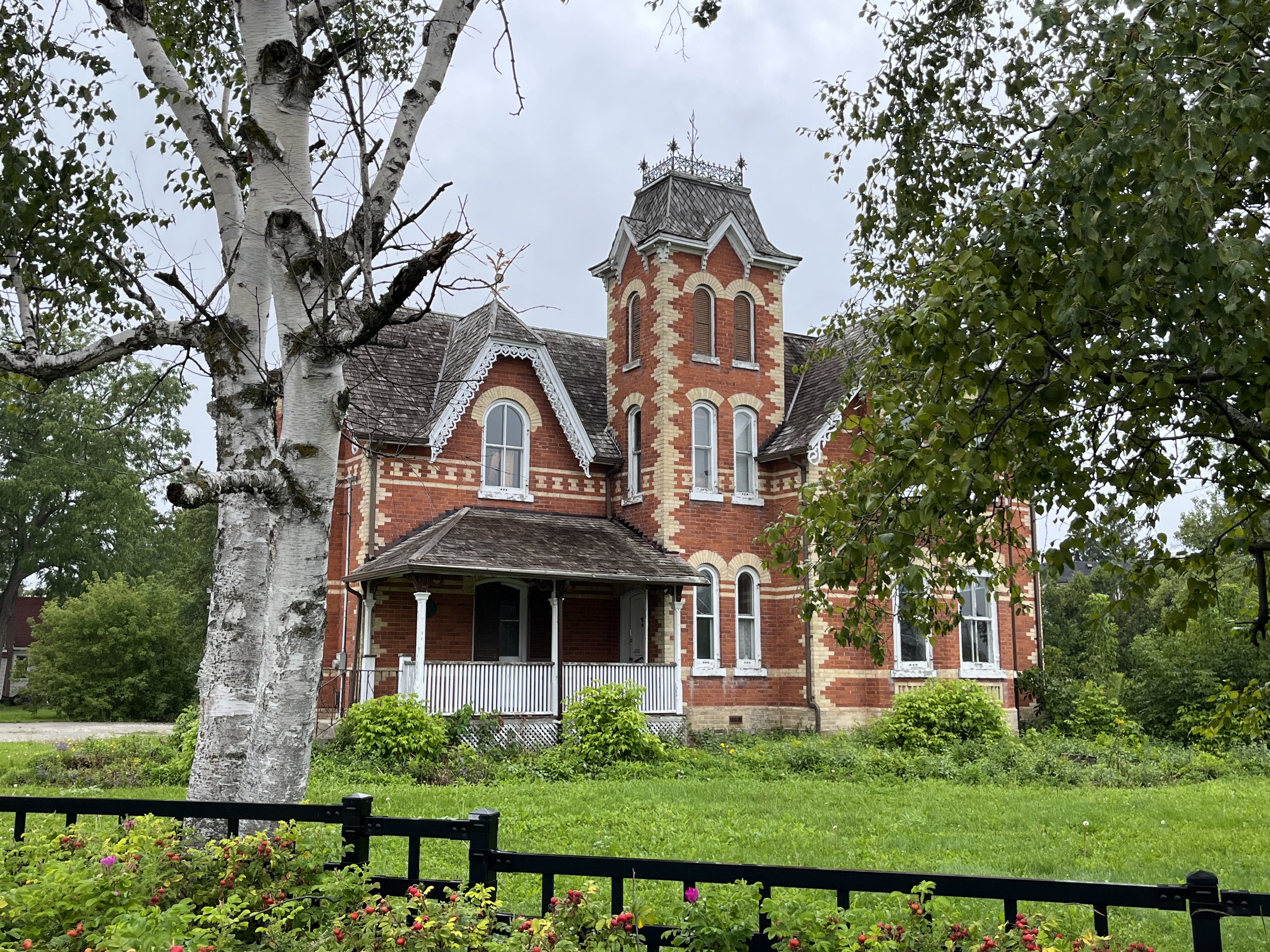
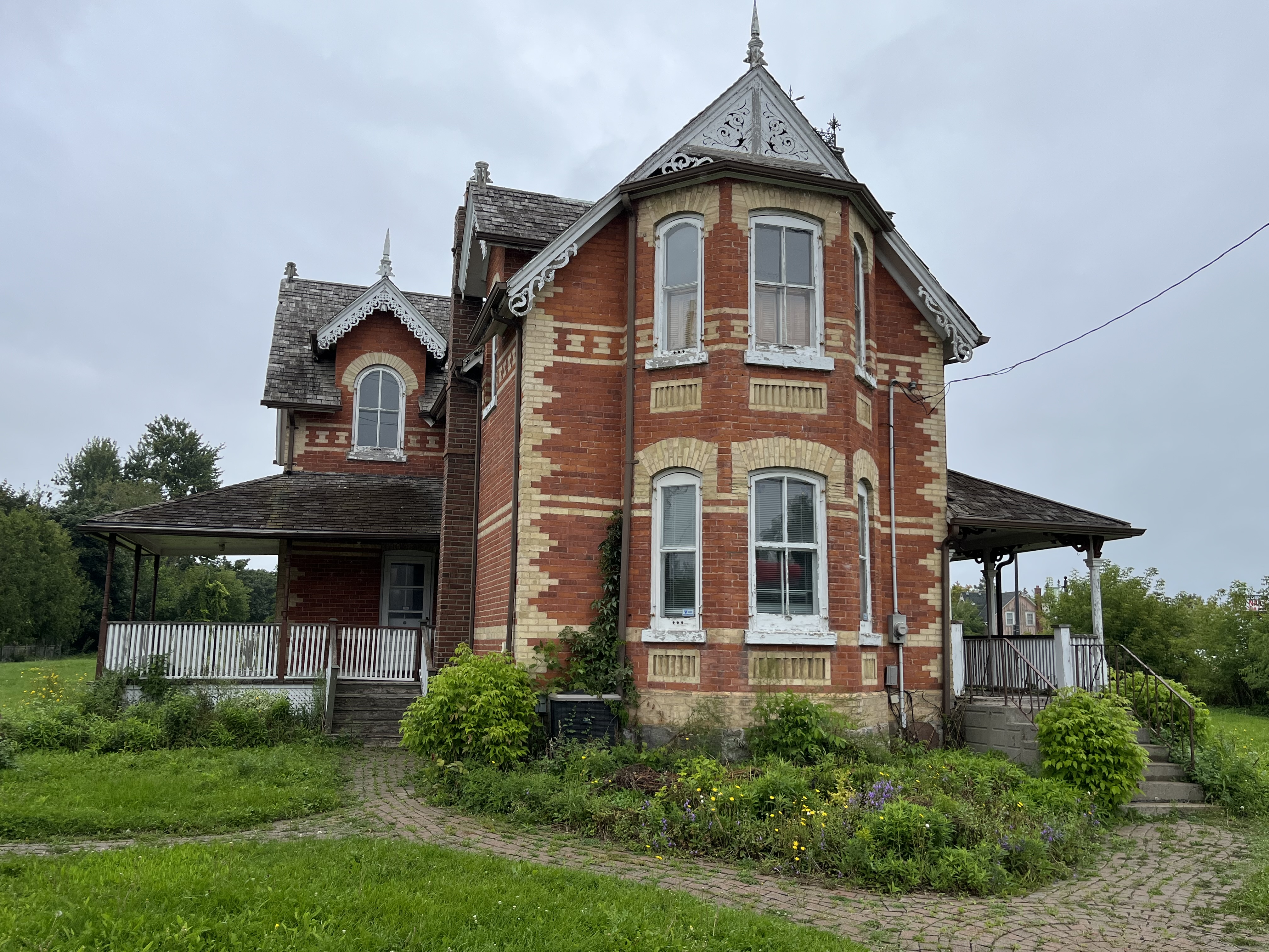
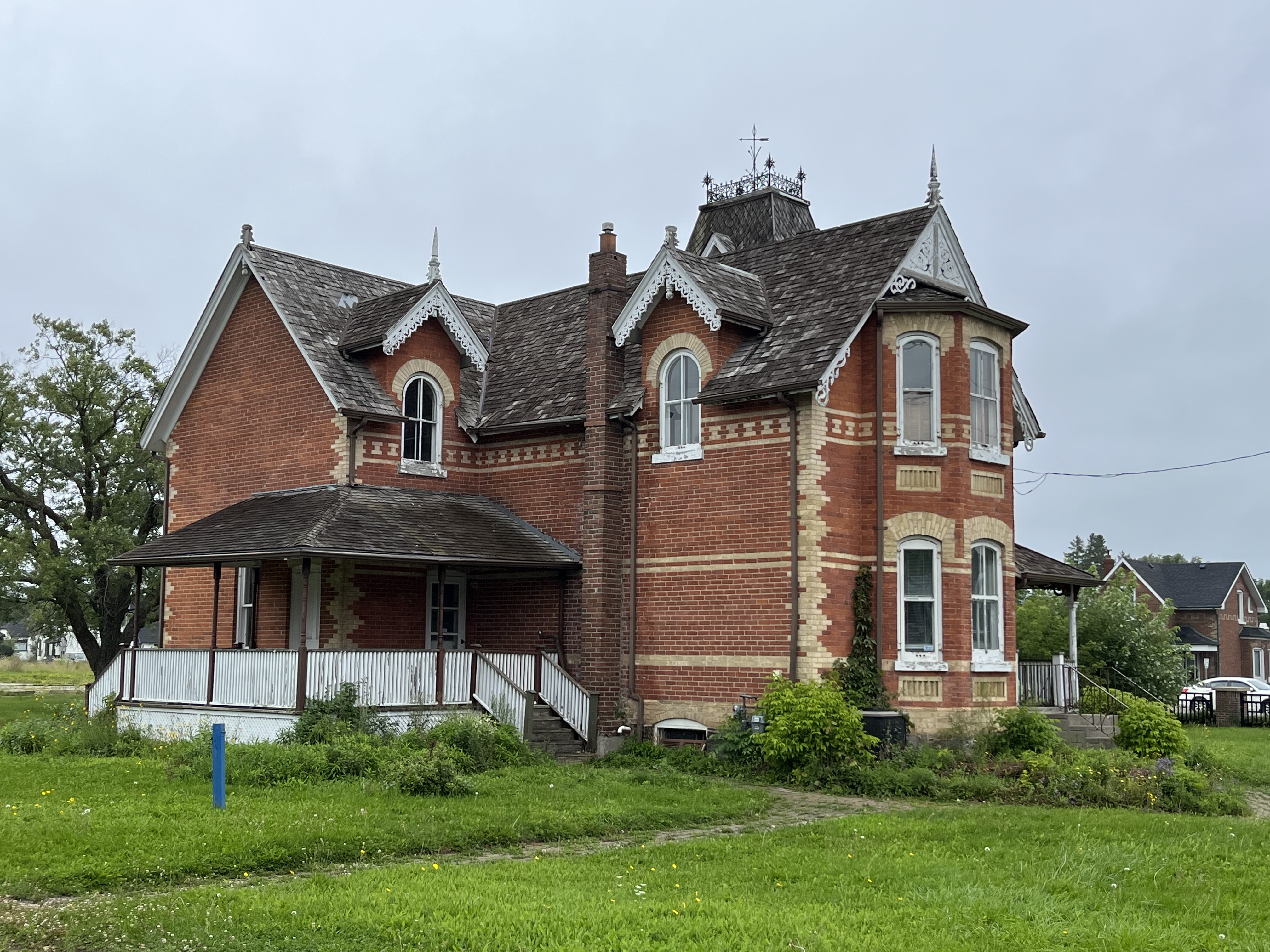
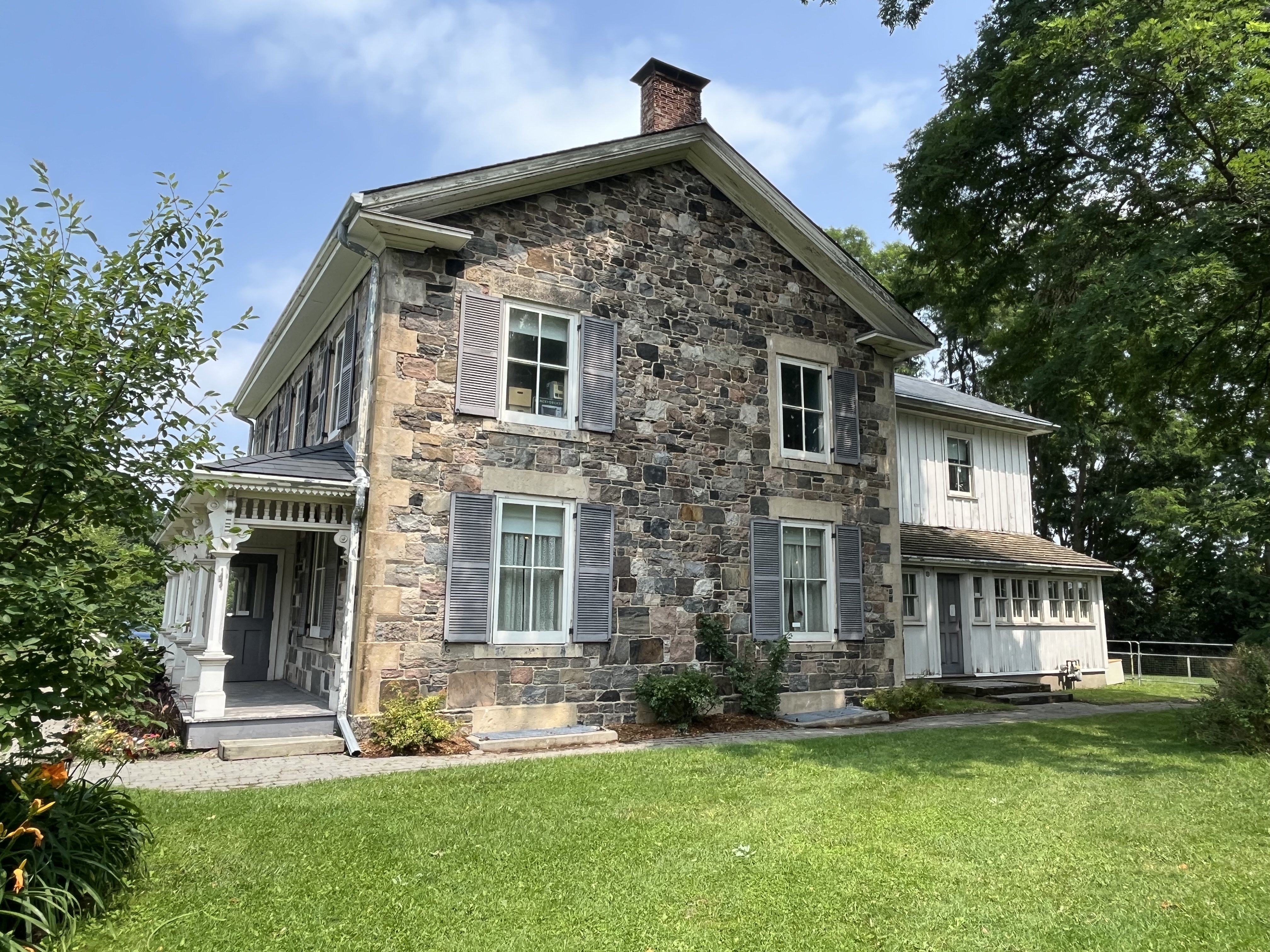
Nobleton was founded in 1812 and existed as a crossroads community for several decades before expanding with a series of side streets. Taverns and hotels were built as well as a couple of general stores and a post office. Joseph Nobel was a tavern owner and it is his name that was given to the community. The former blacksmith shop from Nobleton has been moved to Black Creek Pioneer Village. The image below is taken from the 1877 County Atlas and shows the modest size of the community at that time. The green arrow points to the location of the Hambly House.
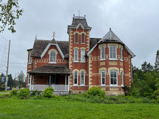
At the north west corner of the intersection of modern King Road And Highway 27 stands the Hambly House. A log cabin had stood on this corner until it was destroyed by a fire. William Hambly had come from the United States as a United Empire Loyalist. His son, Charles operated one of the two general stores in Nobleton and was also the Post Master. Starting in 1851 the mail used to come to Nobleton three times a week via the Gore and Vaughan Plank Road. Hambly had two sons, Elwood and George who both worked in their fathers store. When Charles replaced the log cabin in 1885 he did it in the grand style of the Victorian architecture of the era.
Bargeboards, or gingerbread, adorn the various gables found around the house and the red brick is accented with buff coloured ones through most of the home. Yellow brick forms the quoins found on the corners and also double banding along the second floor which is adorned with a series of the letter “X”.
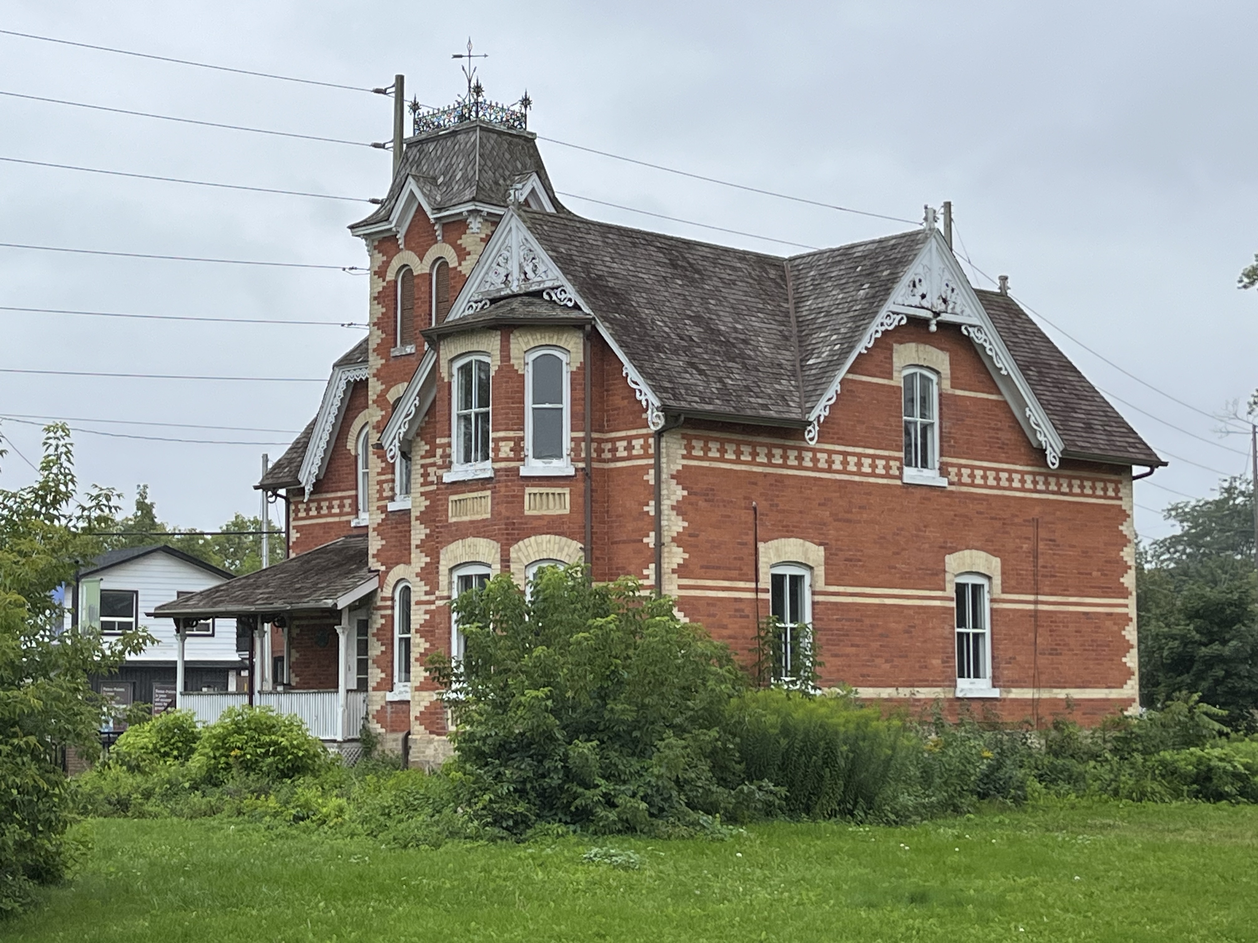
The house features a three story tower with a mansard roof, typical of the Italianate style of construction. The tower has iron cresting and a weather vane on top.
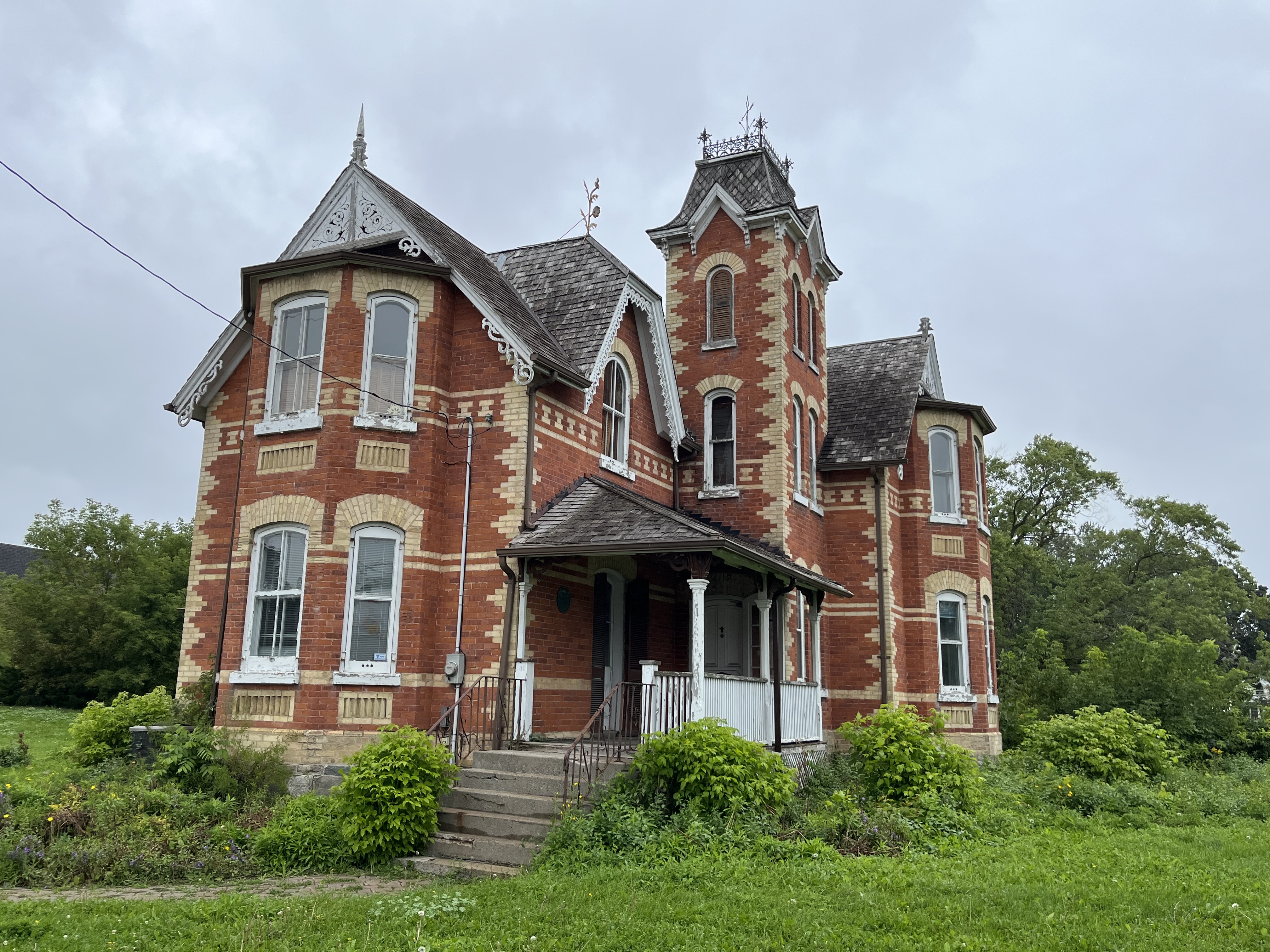
The south elevation and the north both feature two story bay windows which are adorned with segmental arches above and rectangles below. Pointed wooden finials rise from the tips of the gables.
The west elevation of the house does not have complete banding on the one section. There is a chimney on the back which was a later addition and is made of a darker colour of bricks.
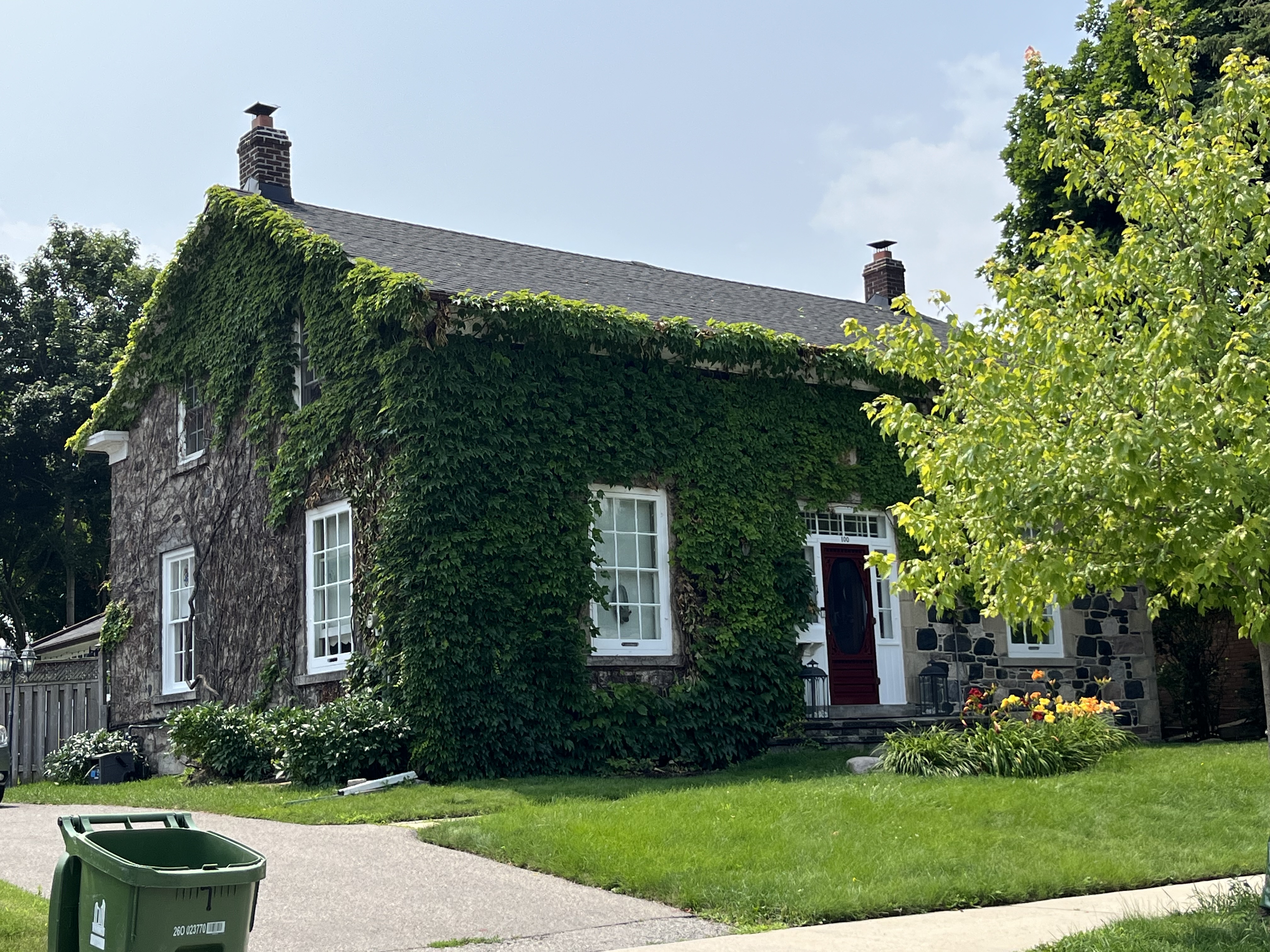
The Hambly House is currently empty and the adjacent property is under a development proposal. While the house is protected under the heritage registry number of 82-144 it is planned to be turned into office space as part of the proposal. As usual, it remains to be seen what the final outcome of the Hambly House will be.
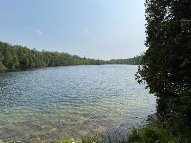
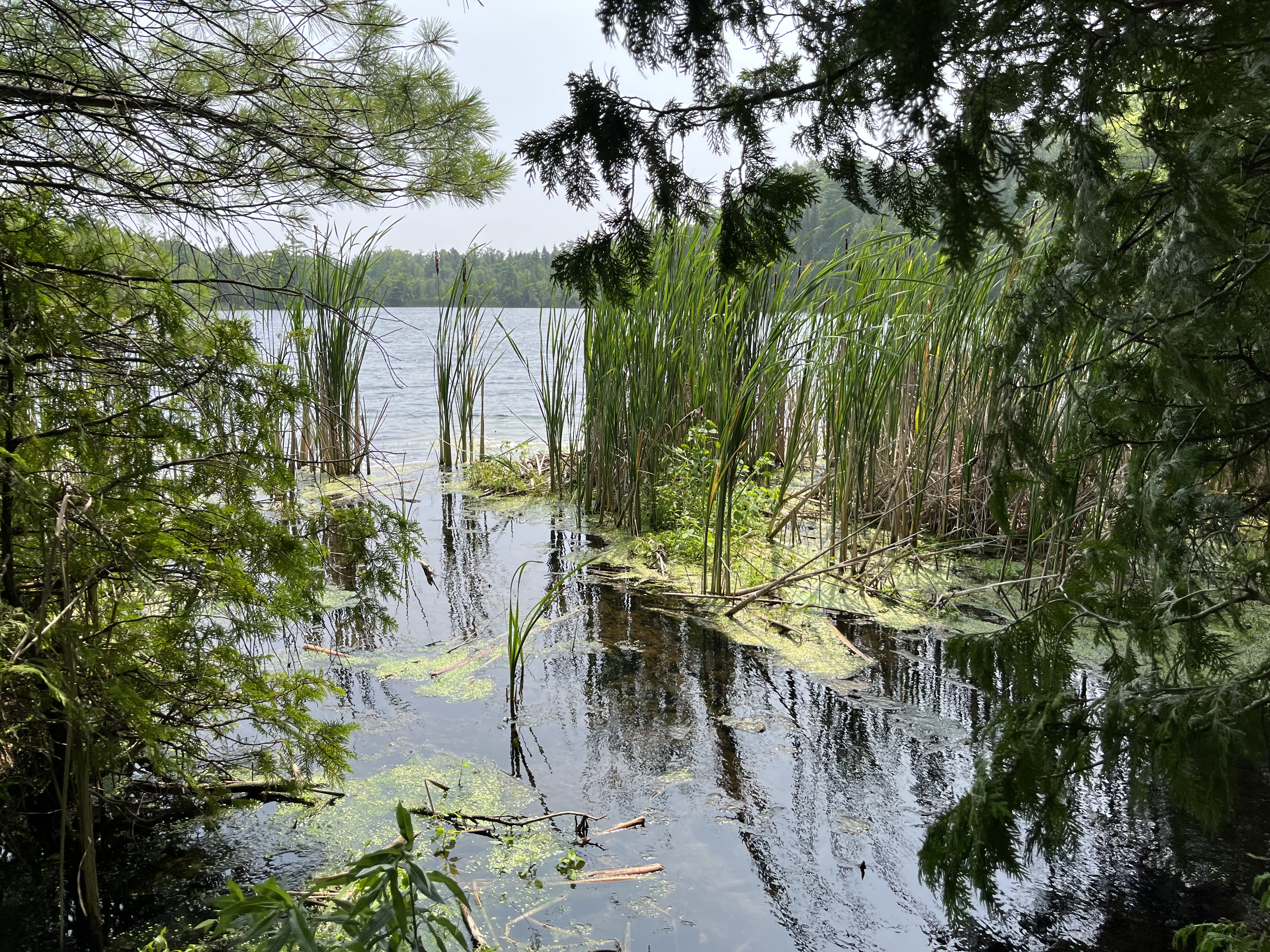
Crawford Lake near Milton has long been the site of an educational conservation area where people can go to relax, exercise and learn about the indigenous past of the area. We have previously covered the story of the longhouses in the park and will only briefly touch on the subject in this post. For the full article, please see our story The Longhouse People of Crawford Lake.
The lake is back in the news the past few months for another reason. The same conditions that allowed the researchers to identify the civilization that once existed beside the lake are now being used for another purpose. Since the sediments at the bottom of the lake don’t get disturbed due to the depth of the lake compared to its surface area, individual years can be identified by dark and light bands in the core samples. Scientists are now contemplating creating a new epoch on the geological time scale to identify the start of a time when humanity has begun to effect the natural world. Beginning in the 1950s a layer of plutonium from nuclear weapons testing, microplastics and ash from burning fossil fuels has started to be observed. After nearly 12,000 years of the Holocene epoch, which began at the end of the last ice age, they are thinking of creating a new epoch known as the Anthropocene epoch. This epoch is named after humanity. One site is chosen somewhere in the world to identify the start of each of the previous epochs and now Crawford Lake is being chosen to mark the start of this new one. These marker sites are known as the Golden Spike and other locations around the world will be measured against the time scale found at Crawford Lake.
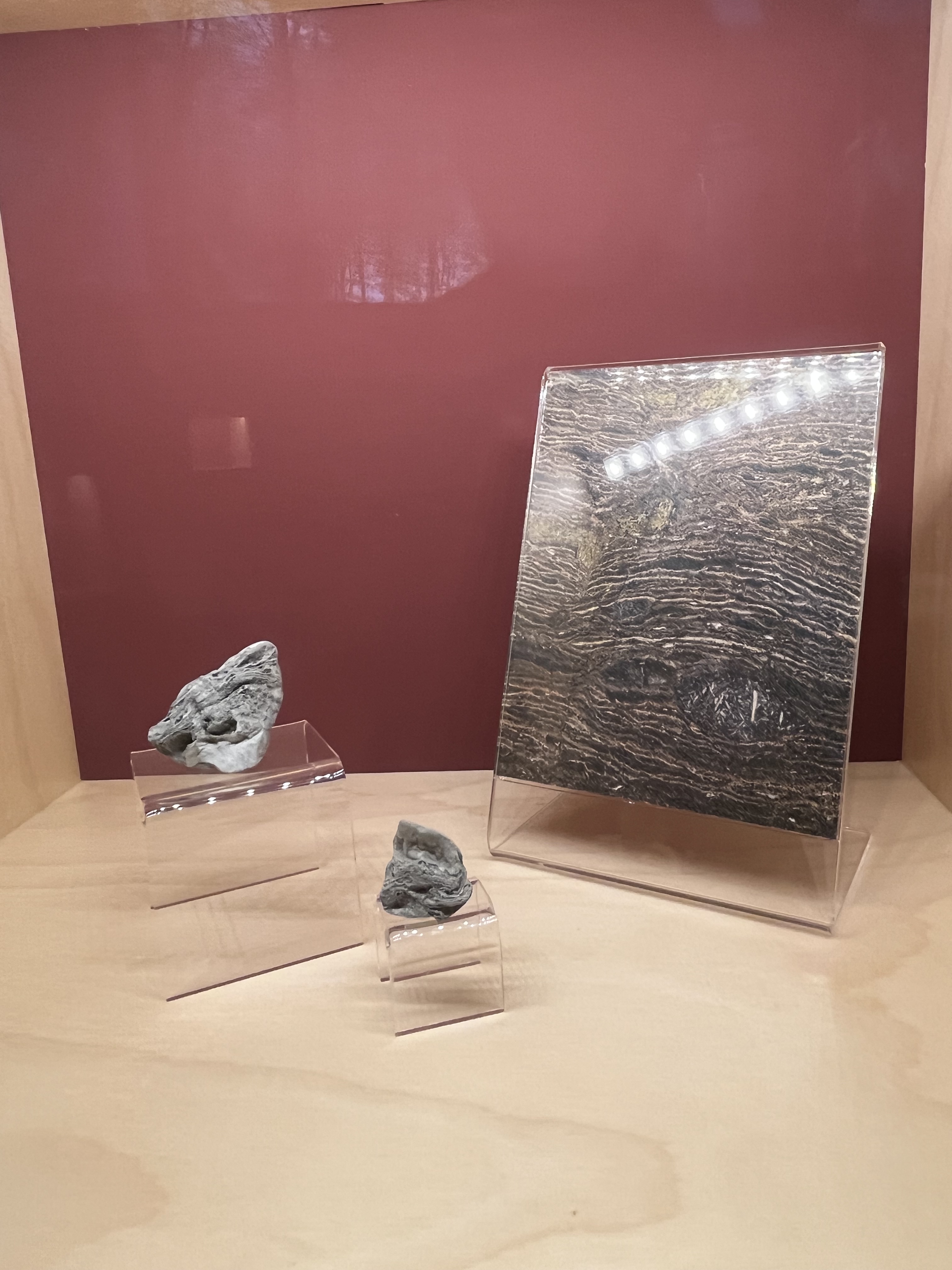
In the early 2000s scientists started using the term Anthropocene to identify the period when humanity started to alter the planet on a global scale. It lacked a global geological definition until 2009 when a committee started to look for an indicator site. Out of 12 possible locations they have chosen Crawford Lake to be the Global Boundary Stratotype Section and Point for the potential new epoch. Each summer the lakes PH and warm temperature cause crystals to develop that fall to the lake bed and lay undisturbed. These form layers that can be counted fairly precisely like rings on a tree. The image below shows a magnification of a section of one of the core samples taken from the bottom of the lake.
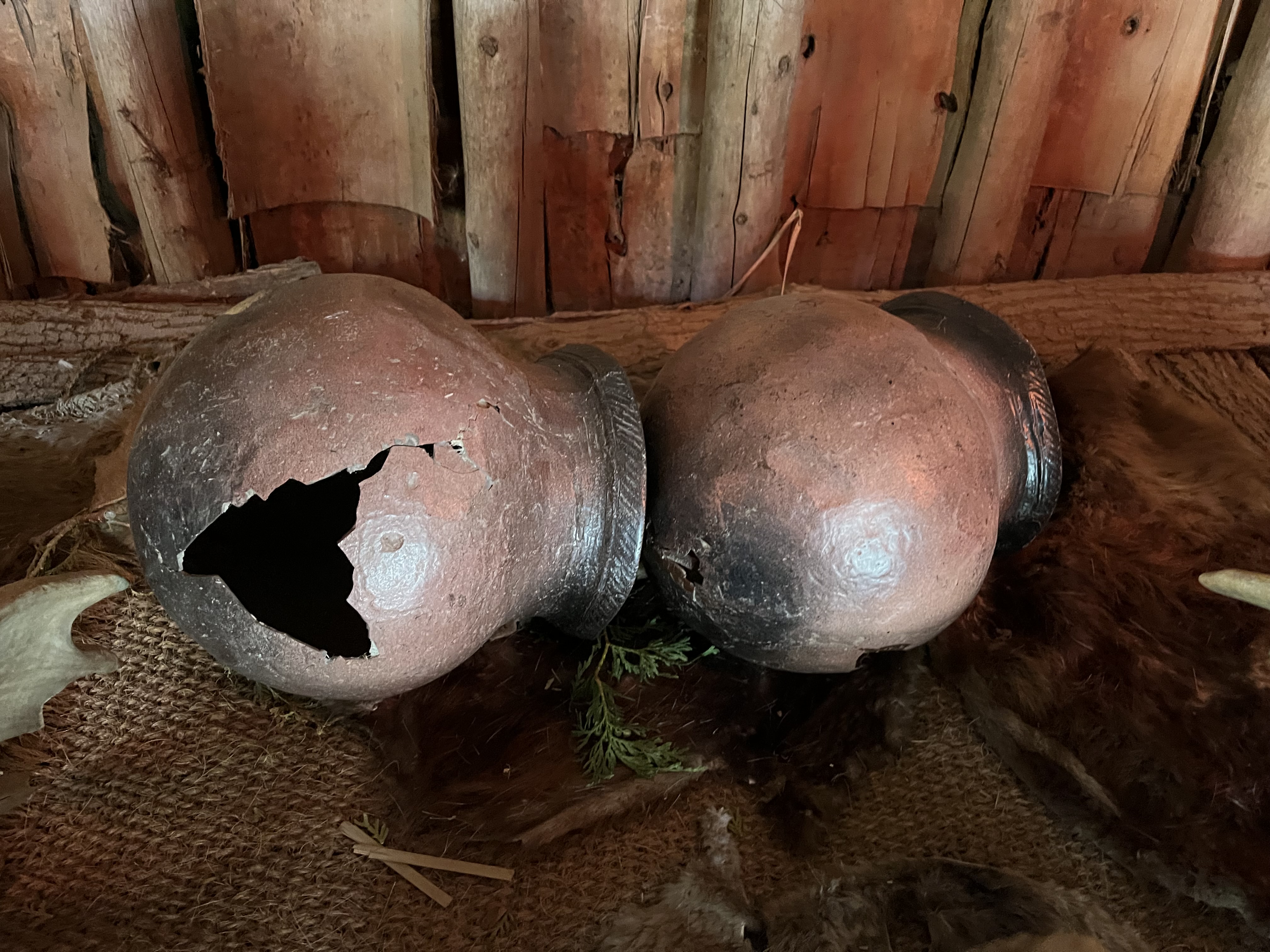
Not all scientists agree that the Anthropocene started in the 1950s or that it should even be an epoch at all. While the creation of a new epoch is still up for debate, there’s no doubt about the earlier presence of a human culture beside Crawford Lake. The many pieces of pottery and arrow heads that have been found at the site make for an interesting visit lo the conservation area.
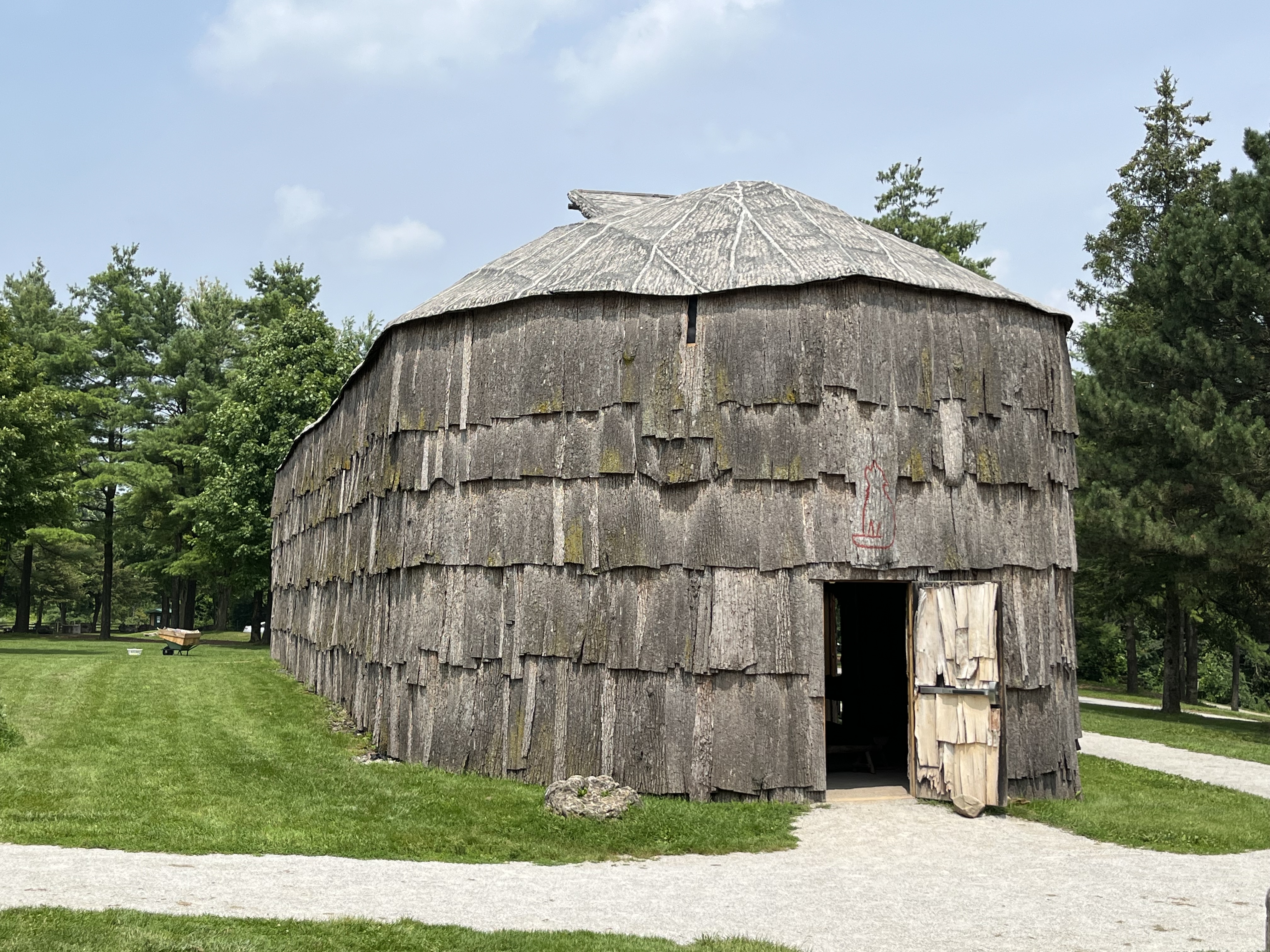
Four longhouses have been recreated in a small village to illustrate life at Crawford Lake in the time period just before the Europeans arrived and changed everything forever. Out of over 10,000 artifacts that have been discovered on the site a wide variety are on display in the village. The meromictic nature of Crawford Lake was instrumental in the discovery of this village because of the corn pollen that was found in soil samples taken from the bottom of the lake. Since the bottom of the lake is undisturbed, it was possible to determine when people were living near it and growing corn for food crops. This story is further developed in our previous post.
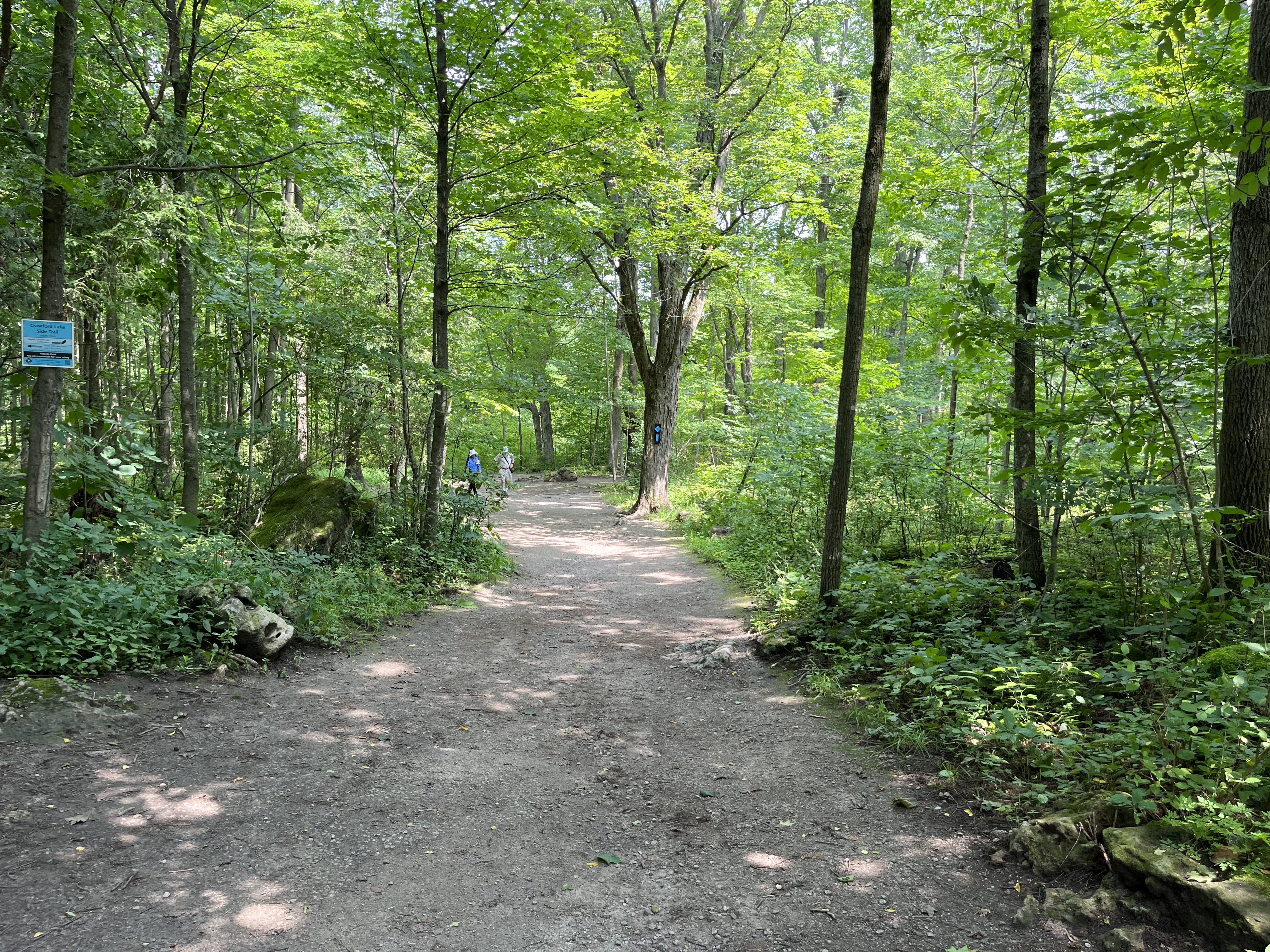
The trail system at Crawford Lake is connected to the Bruce Trail by the Crawford Lake Side Trail. The 232 acres in the conservation area are full of trails and we previously explored several of them in our post Crawford Lake Trails.
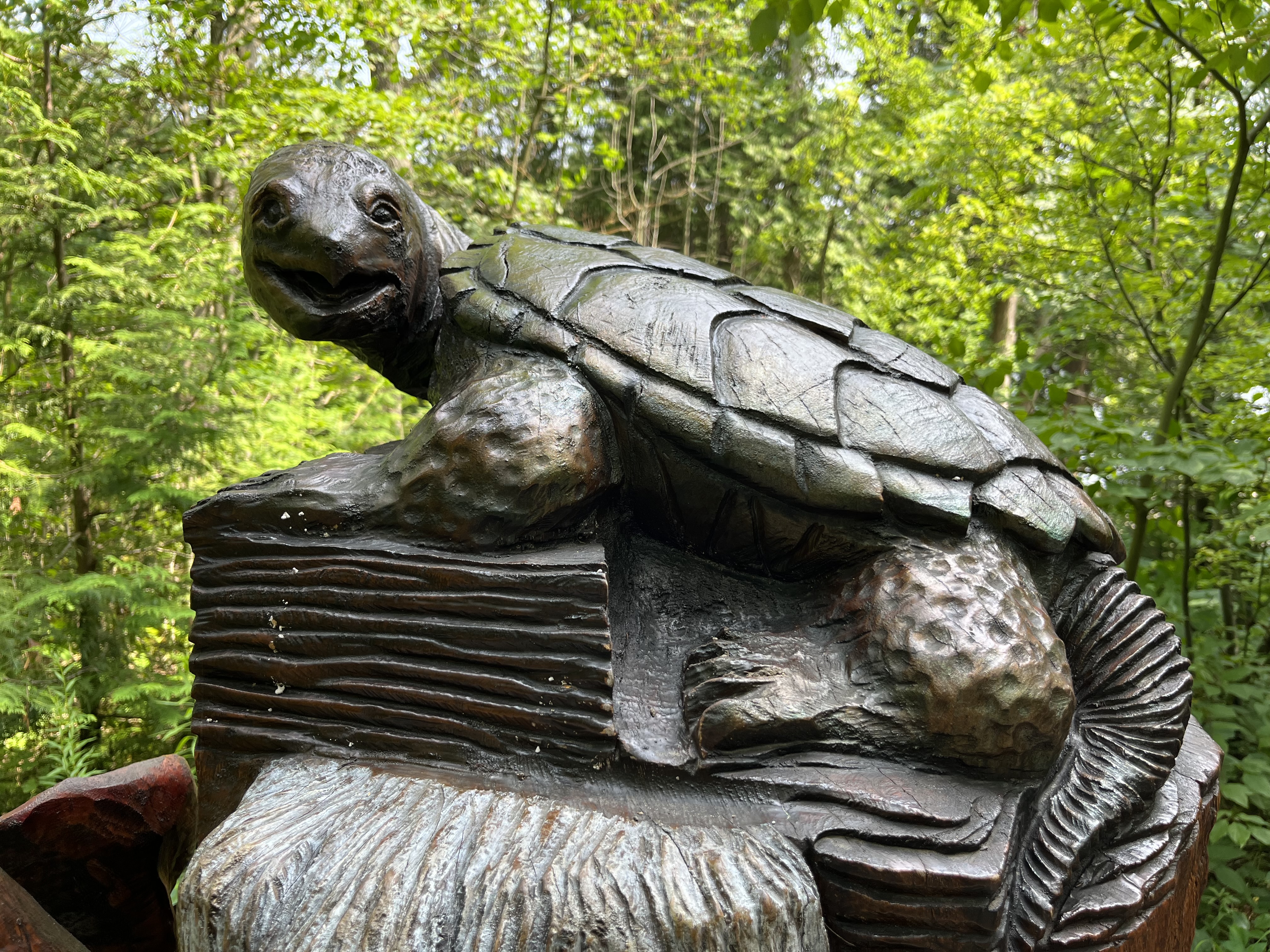
There are various large wooden carvings along the trail that leads from the longhouses to the lake. These depict various species that are at risk in Ontario. There are seven carvings along the Hide and Seek trail that illustrate some of the over 200 species that are at risk in the province.
The trail around Crawford Lake is just under 1.5 kilometres and is suitable for everyone as it is modest in difficulty. As we were making our way around we paused to let a family pass us that were taking a loved one for a walk in his wheelchair.
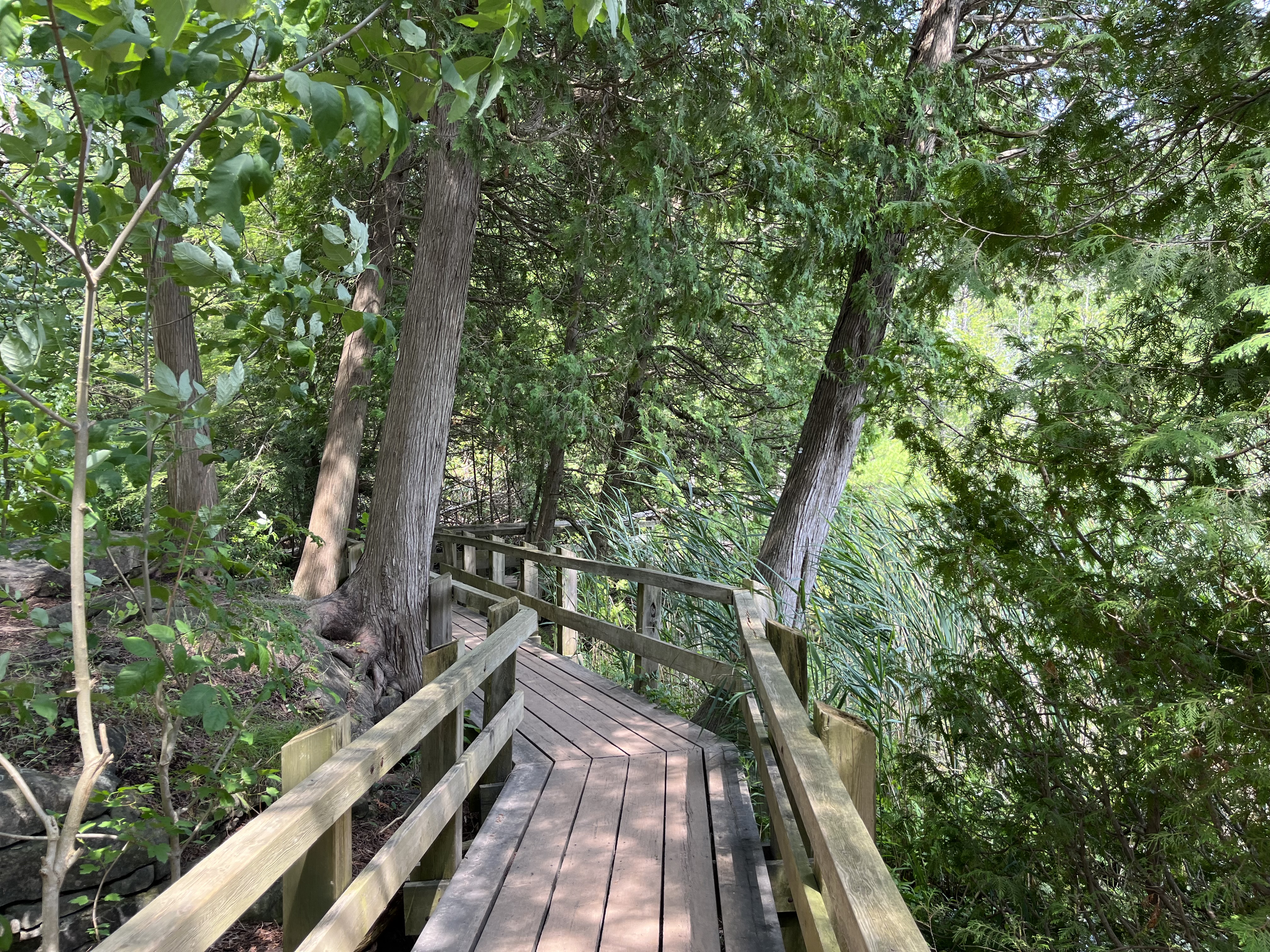
Crawford Lake is an ideal place for a visit and carries a small entry fee but is a fun outing in any season.
The former community of Malvern has disappeared under a massive railyard and multiple industrial buildings. There are still a few houses remaining that once stood on the outskirts of the town. Prior to 1850 the hamlet was known as Malcom’s Corners because John and Robert Malcom operated the Speed the Plough Inn and had a harness shop at the intersection of modern Sheppard Avenue and Markham Road. Senator David Reesor thought the community had the potential to become the capital of Scarborough Township and in 1857 he set out a plan to sell 50 foot by 150 foot lots for housing. He chose the name Malvern after a town in England where the water was said to cure the sick. Locals had told Reesor that the waters around Malvern would also cure the sick. He also planned for a grammar school, a fair grounds and a large community hall. The hall was built in 1860 and named Mammoth Hall. When it burned down in 1879 it was soon rebuilt. Unfortunately, an arson burned it down in 1988 and it was lost forever.
The map below is a section of the 1877 County Atlas and shows the location of the various properties that are pictured in this post. Three stone houses belonging to Weir, Stirling and Neilson and the school. Also circled is the Primitive Methodist Church that is pictured as an historical photograph.
For years there were two general stores that were operated by a series of men starting with Duncan Malcom. The village also had a blacksmith, a wagon shop, two hotels and a large woolen mill as well as a saw mill. One hotel was Thompsons Temperance Hotel and General Store and it contained the post office from 1865 until 1929 when the building was lost to a fire. The post office then moved to Cowans General Store in 1930 and remained there until 1956. The other hotel was the Standard Hotel where one could purchase an alcoholic drink that wasn’t available in the Temperance Hotel.
One of the prominent houses was the Neilson House which was built in 1856 and remains on Neilson Road today, serving as a community centre. It was partially destroyed by two fires in the 1970s but was restored and opened as the community centre in 1988. The cover photo shows this beautiful stone house from the front.
Malvern was a thriving farm community through the 1880s but when the railway bypassed it in favour of Agincourt that community prospered and Malvern went into decline. The Canadian Northern Railway built a station there in 1911 but it went bankrupt in 1917 and was taken over by the Canadian National Railway. Passenger traffic ceased in 1926 and the community stagnated until the 1950s when the Canadian Housing and Mortgage Company expropriated large tracts of land to build a housing development. One of the houses that was spared demolition was the James Stirling house which was built in 1860. This is another of the field stone houses that used to be found in the community.
James Weir came to Scarborough in 1833 from Scotland and worked against the Mackenzie rebels in the 1837 Rebellion. He settled on this lot in 1840 and became a successful farmer, livestock importer and ploughman. Eventually he became one of the wealthiest landowners in Scarborough and erected this home made of fieldstone in 1861. The lintels above the windows and quoins on the corners are made of Kingston Limestone. The house used to stand in the middle of the property but in 1975 it was moved about 400 yards west to its present location.
The door on James Weir’s house is the most decorative part of the structure. It has side lights and windows in the transom above the door. It is also one of only a few historic houses that I have photographed that has a name plate and date stone, in this case just above the door. James Weir, 1861.
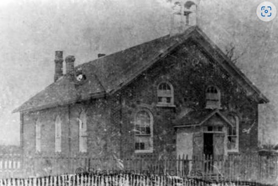
Malvern had a single church which was built in 1864 by the Primitive Methodist congregation. The building was demolished in the 1970s although some pieces of wainscotting and flooring were reused in the Scarborough Historical Museum. A small cemetery was located beside it and this still survives on the east side of Markham Road just north of Sheppard Avenue. The image below is from the Scarborough Historical Society website.
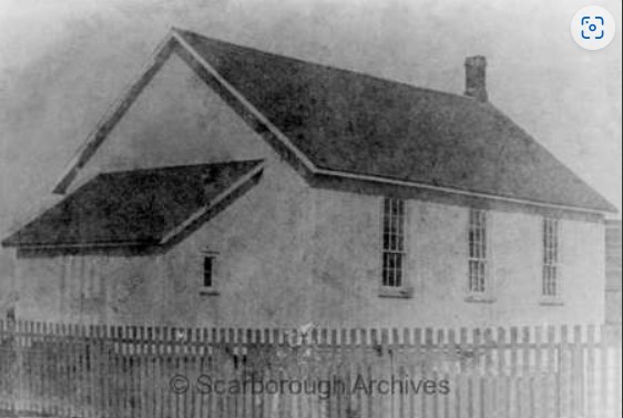
A log school house served the community from 1847 to 1851 when it was replaced with a small frame school which was built on the Stirling Farm. Alexander Muir got his start teaching in the log school house and his story can be found in our post on Burke Brook. The school was replaced again in 1872 by a one room brick school which still stands at the corner of Finch Avenue and Neilson Road.
The image below was taken from the Scarborough Historical Society and shows the school when it was surrounded by open farmland.
Whypers Boot and Harness Shop was relocated to Markham Museum where it is on display along with about 30 other historical buildings. Today the former community of Malvern is a thriving part of the uban sprawl of Scarborough and is commemorated in the names of streets, malls and the public library.
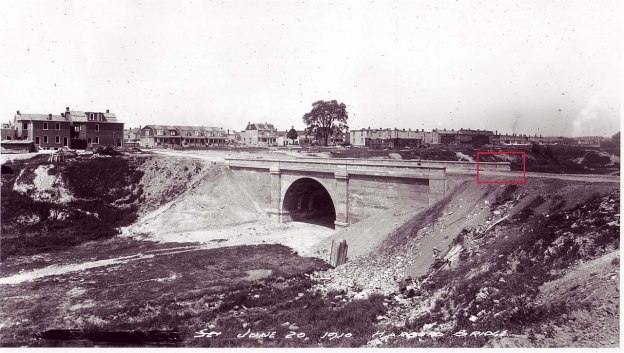
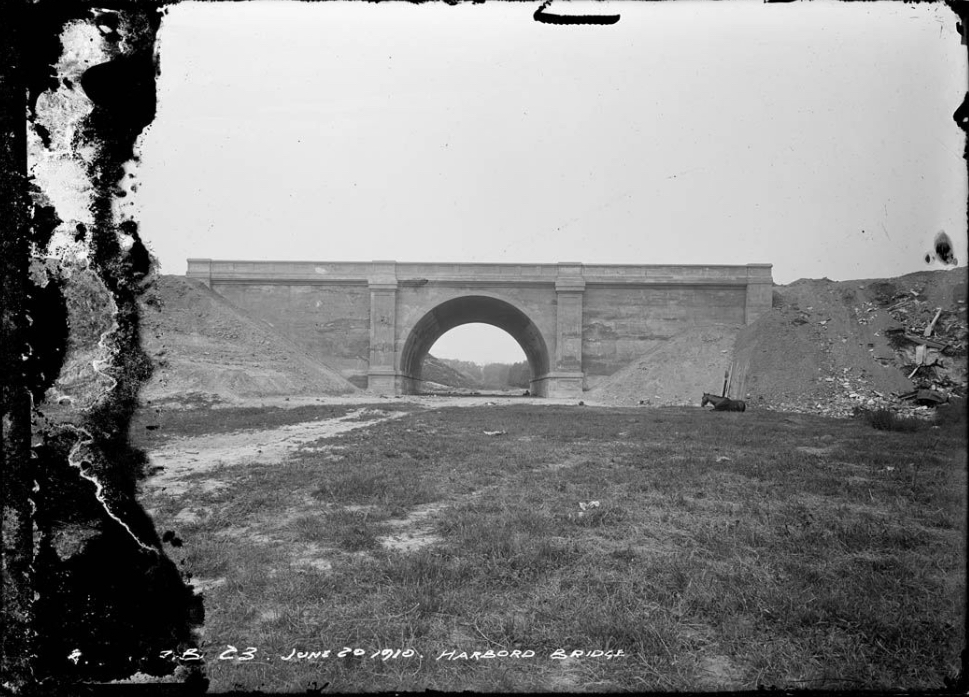
Toronto has two bridges that were buried alive, so to speak. This week we are taking a look at the one on Harbord Street. The cover photo shows the bridge in 1910 when construction was nearly finished. Prior to the completion of the bridge the suburbs of the city were expanding quickly but because of the deep ravines there was a lack of through roads connecting the various parts of the city. Streetcars connected the city on routes that ran along College Street and Bloor Street but they were filling up and a new route was proposed. One proposal was to extend Harbord Street across the Garrison Creek Ravine at a cost of $110,000 in 1906. This would have amounted to about $3 million dollars in 2023 currency. Taxpayers didn’t approve the cost and in January 1907 it was shot down.
Garrison Creek vanished from the face of Toronto in the 1880s. The creek had originally been home to many species of fish including rock bass, large mouth bass, pumpkinseed, brown bullhead, white suckers, bow fin, and northern pike. By the 1880s it was so polluted that it was buried in a brick sewer. Later in 1907 City Council approved the purchase of a large portion of the ravine to build the bridge and create a park. The bridge was built to span the ravine and not to cross Garrison Creek which was already underground at this time. The image above shows that there was no water flowing in the ravine.
The bridge at Harbord street was a single span concrete arch bridge which opened in 1914. It is 23 feet high, 54 feet wide and 35.5 feet long. Between 1917 and 1930 the area around the bridge was filled in. The sides of the ravine were also filled in as back yards were extended so that there wasn’t a steep cliff leading down to the park.
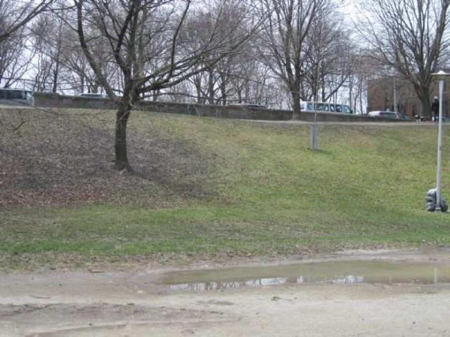
The entire bridge, the valley and Garrison Creek have vanished underground. When the land was purchased for a park the city planned to designate the park as a landscape similar to Allan Gardens or High Park. However, by the 1920s new ideas were emerging about how parks should be built. The city made further plans to develop tennis courts, a bowling green and children’s playground in the ravine south of the bridge. In order to facilitate this the ravine was filled in and the bridge was buried. This is why the ravine south of the bridge is filled in while the north side remains as an open ravine.
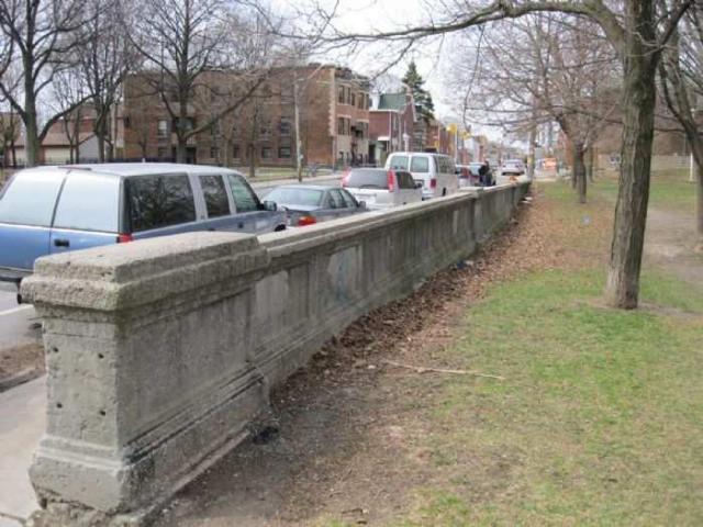
Only the northern balustrade remains visible to mark where the bridge once stood.
Looking over the side of the bridge into the valley gives an idea of how far down the former creek lies below the table lands on either side.
Harbord Street bridge is just one of the buried bridges in downtown Toronto, but it was the first one. We will look at the other one in a future article.
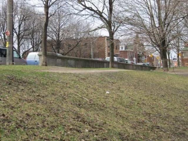
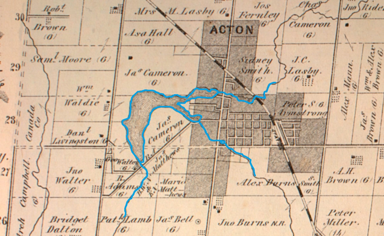
Acton was founded in 1825 by two brothers named Adams who had been Methodist preachers but decided to settle into the farming life. Today, the community is known for The Olde Hide House which was made famous with the slogan “It’s worth the drive to Acton”. Acton is also lucky to have Fairy Lake as a scenic park in the centre of town. The lake is found at the headwaters of Black Creek and was created in 1830. That was the year the Adams brothers built a dam on Black Creek and flooded an area that was previously a wetlands. The dam was created to retain enough water to allow them to power a grist and flour mill in town. The image below is taken from the 1877 County Atlas and shows the lake relative to the small community that existed at the time.
The flooded area was only known as the mill pond until 1872 when it was given the name Fairy Lake. Then, in 1886 the town purchased land from Rufus Adams to allow the creation of Prospect Park.
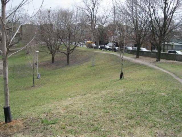
There is an extensive playground with lots of swings and other attractions for children to play on. There’s even a small zip line for the enjoyment of the little ones.
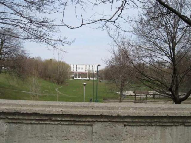
There is a 1.6 km loop trail in the park that takes about 30 minutes to complete. The trail makes its way along the shore of the lake and has several places which are good for fishing or bird watching.
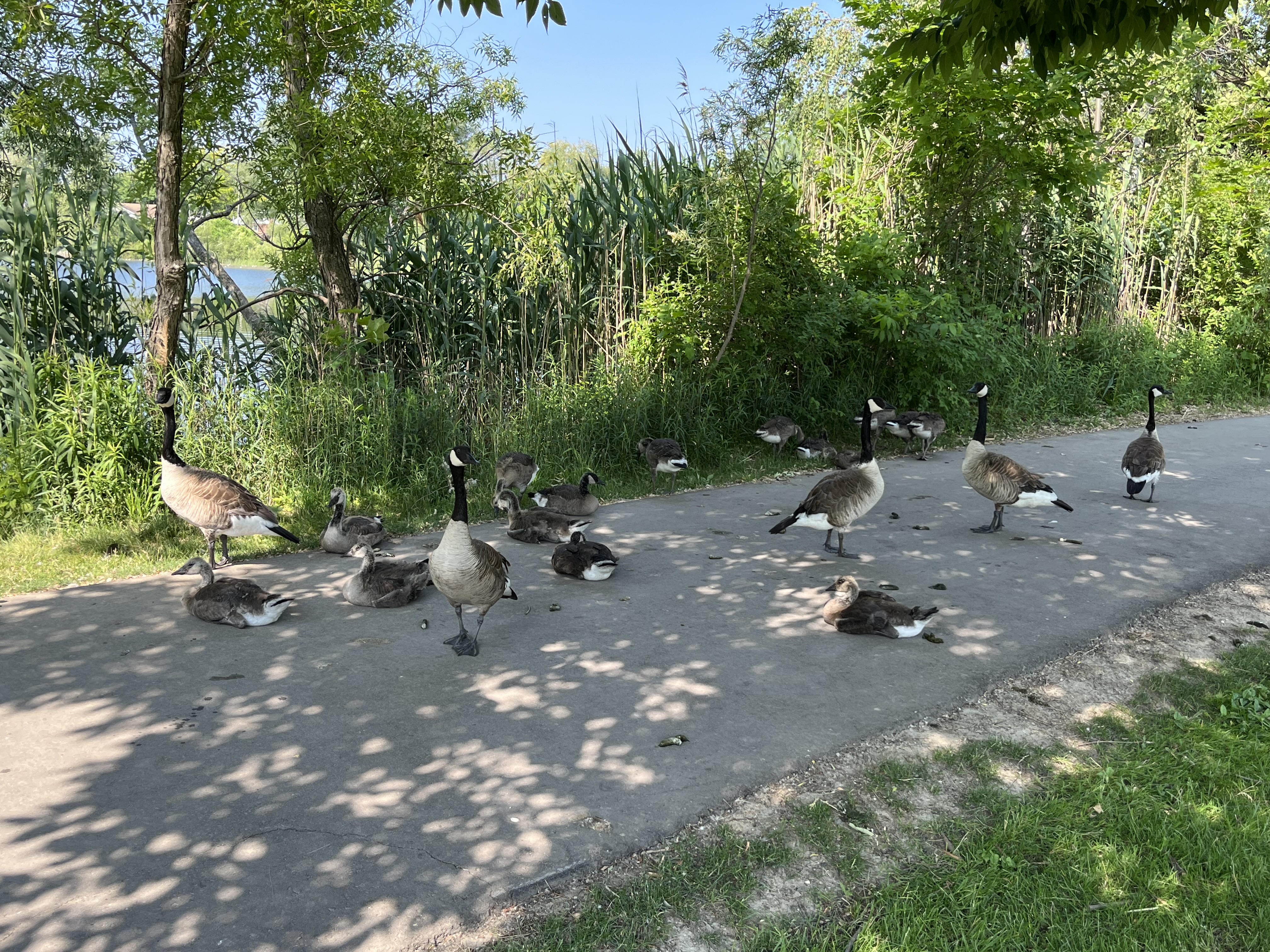
There is also a small beach but unfortunately the sand is covered with lots of Canada Goose poop. This has turned a quiet little spot for the children to wade in the water into a rather unsanitary place.
The geese are busy raising a brood of goslings and they have occupied several sections of the trail where they deter pedestrians by hissing at them and making a mess of the walkway. Each goose is capable of leaving up to two pounds of poop behind every day. They mostly do this while grazing or walking on land and are less likely to drop something while flying or swimming.
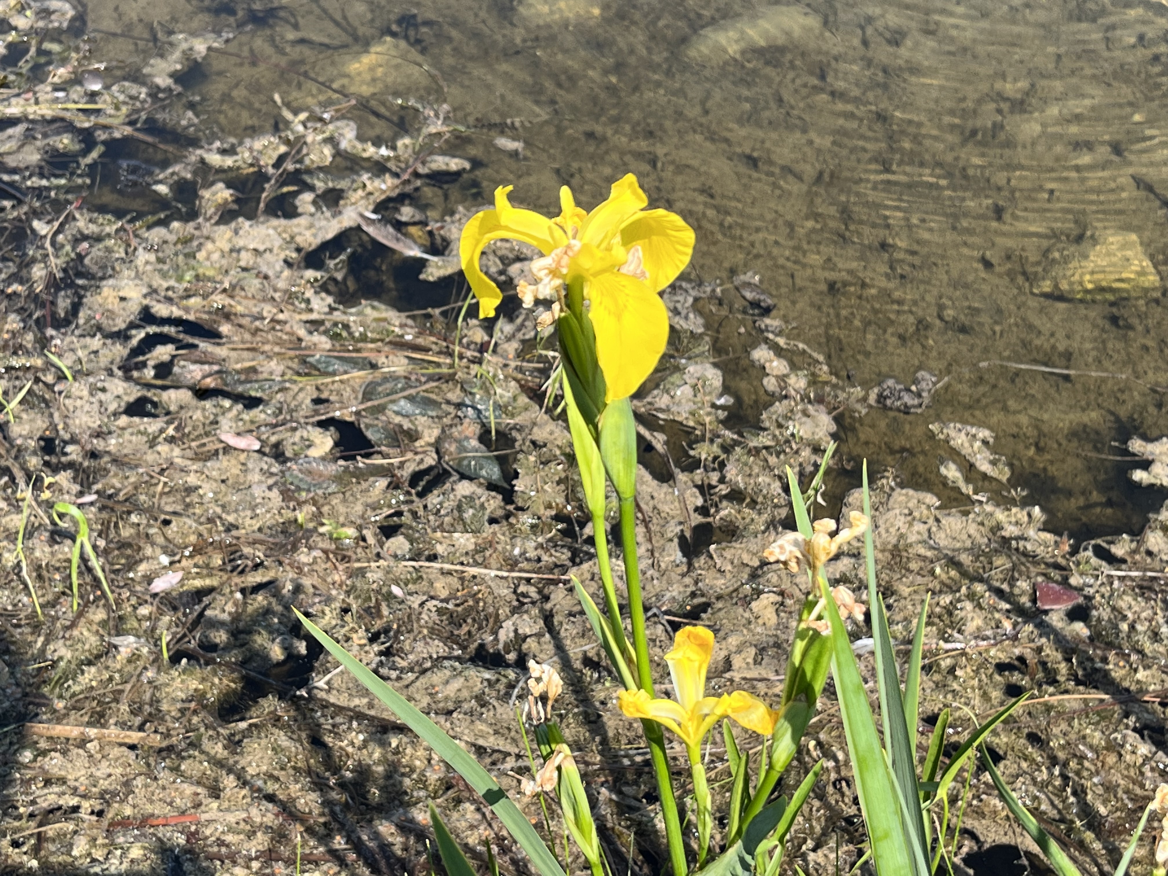
Yellow Iris are growing in the edge of the lake. This aquatic plant is not native to North America but was brought over from Europe in the late 1800s as an ornamental plant. It is sometimes planted in wetlands because it is known to absorb heavy metals and can be helpful in restoring the local environment. However, it forms dense mats that can displace wildlife and change wetlands into drier areas. It is poisonous to both humans and animals and its sap can sometimes cause severe dermatitis.
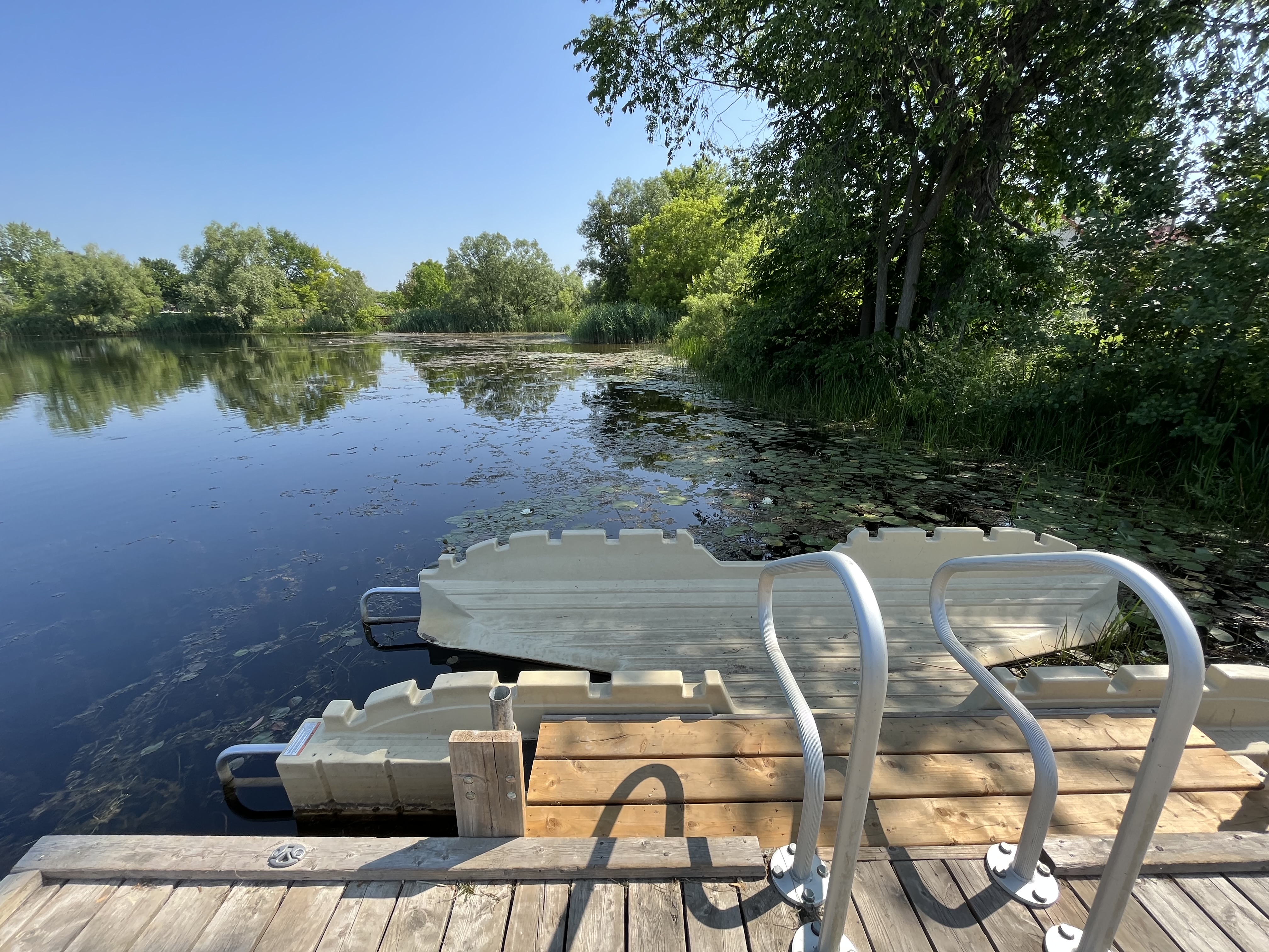
One of the features of the park is a kayak launching system. This allows paddlers to get in and out of their kayak with relative stability.
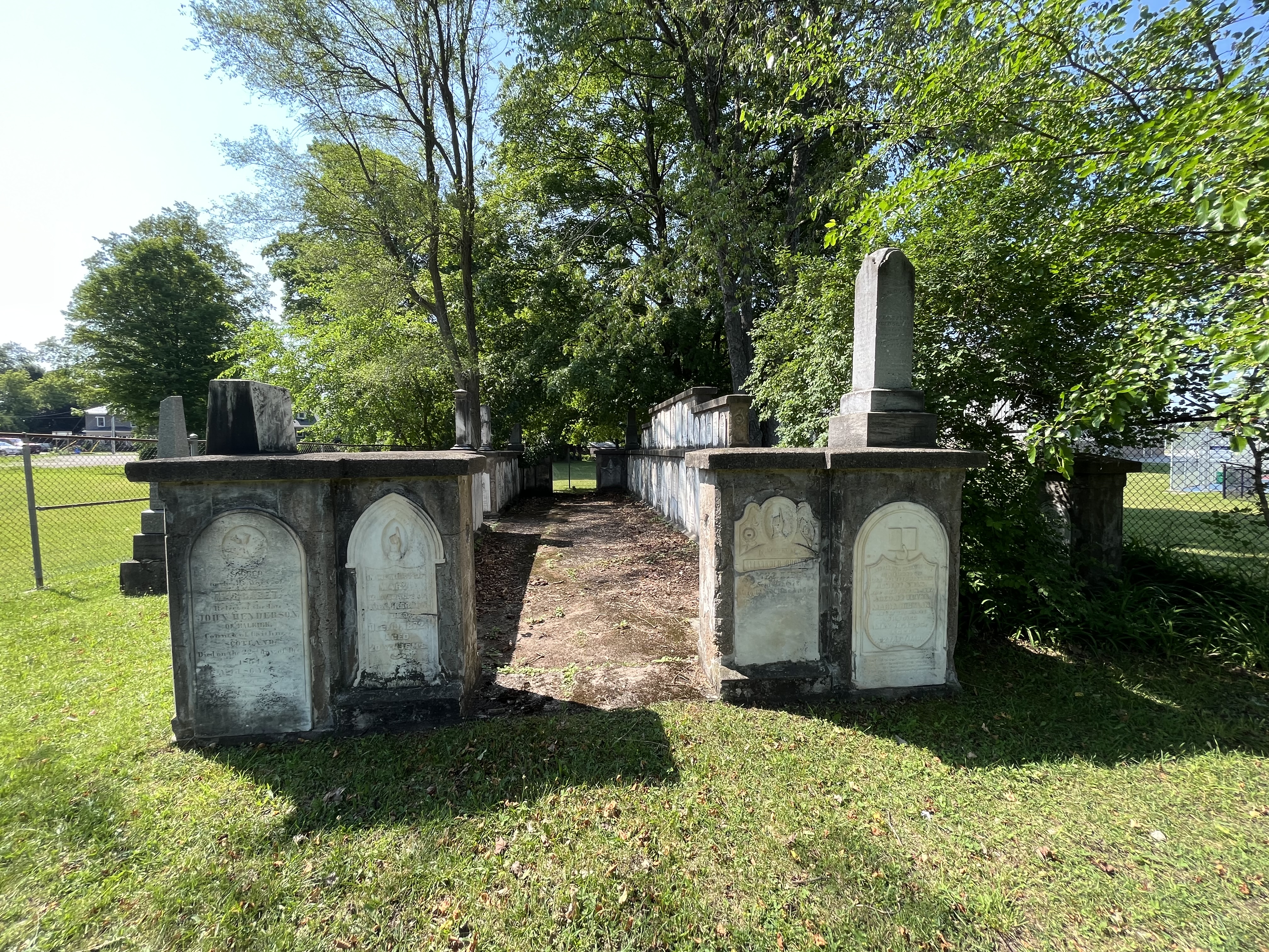
An old cemetery stands vigil in the corner of the park. This is the old Knox cemetery which is also known as Acton Pioneer Cemetery. In 1843 the Adams family sold land for the purpose of building a Scottish Kirk, or church, on. In 1848 a small lot behind the church was purchased to be used as a cemetery. Several members of the Adams clan had already been buried there making it an ideal spot. By 1886 the cemetery was deemed to be too small and a new cemetery was opened a few blocks away. Several of the interments from Knox Cemetery were moved to the new one and in 1933 the remaining head stones in the old pioneer cemetery were gathered into a cairn. A fence has been erected around the cairn but there is a gate so that people can go inside to look closer at the markers.
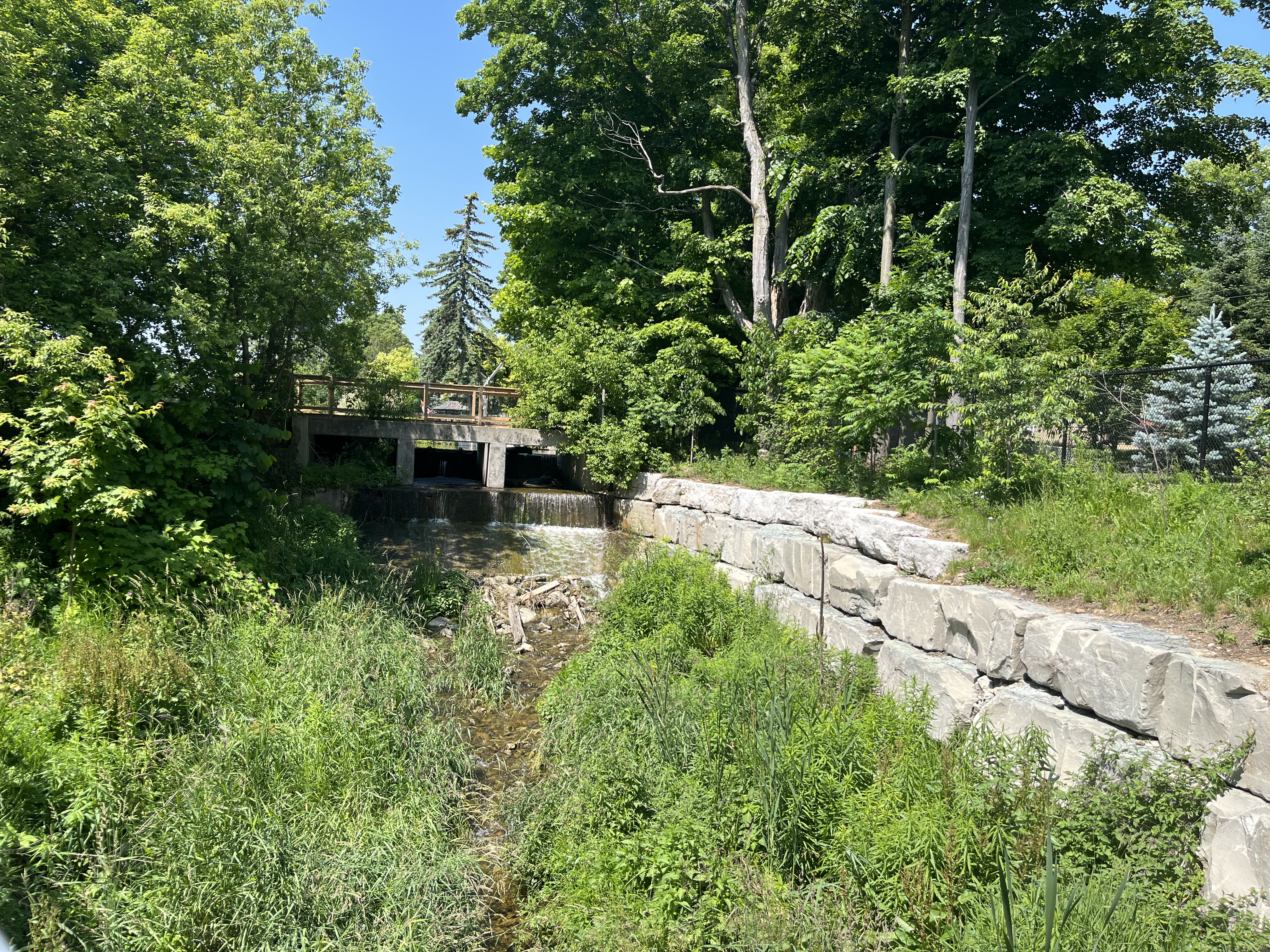
The original 1830 dam was repaired many times and eventually replaced with the present concrete one. This is now owned and maintained by the town so that the lake level can be controlled using the two sluice gates.
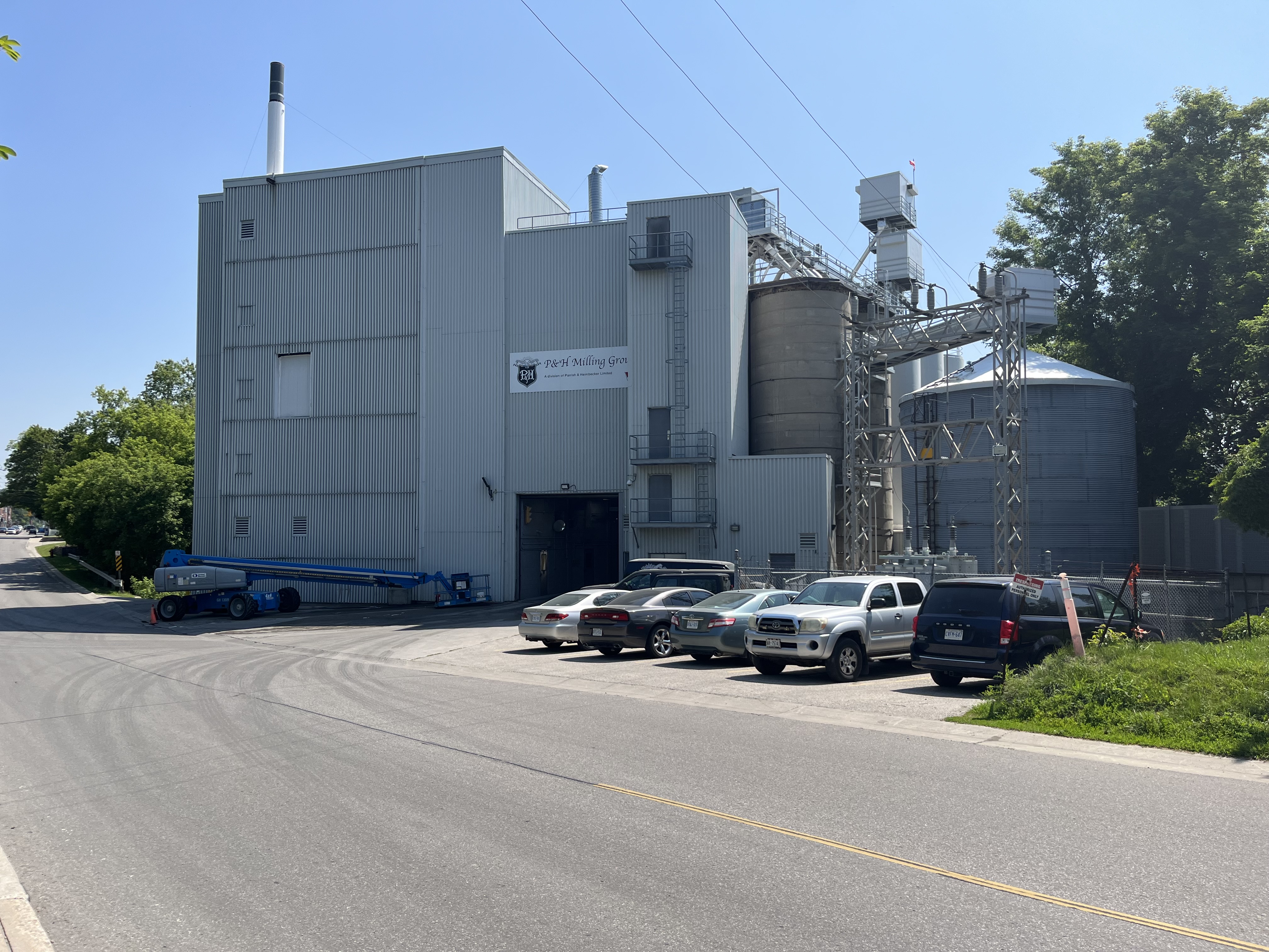
The flour mill in Acton is still in the same location as the original grist and flour mill that was built by Rev. Ezra Adams in 1835. The mill no longer runs on water power taken from Fairy Lake but it has been in business for nearly 200 years.
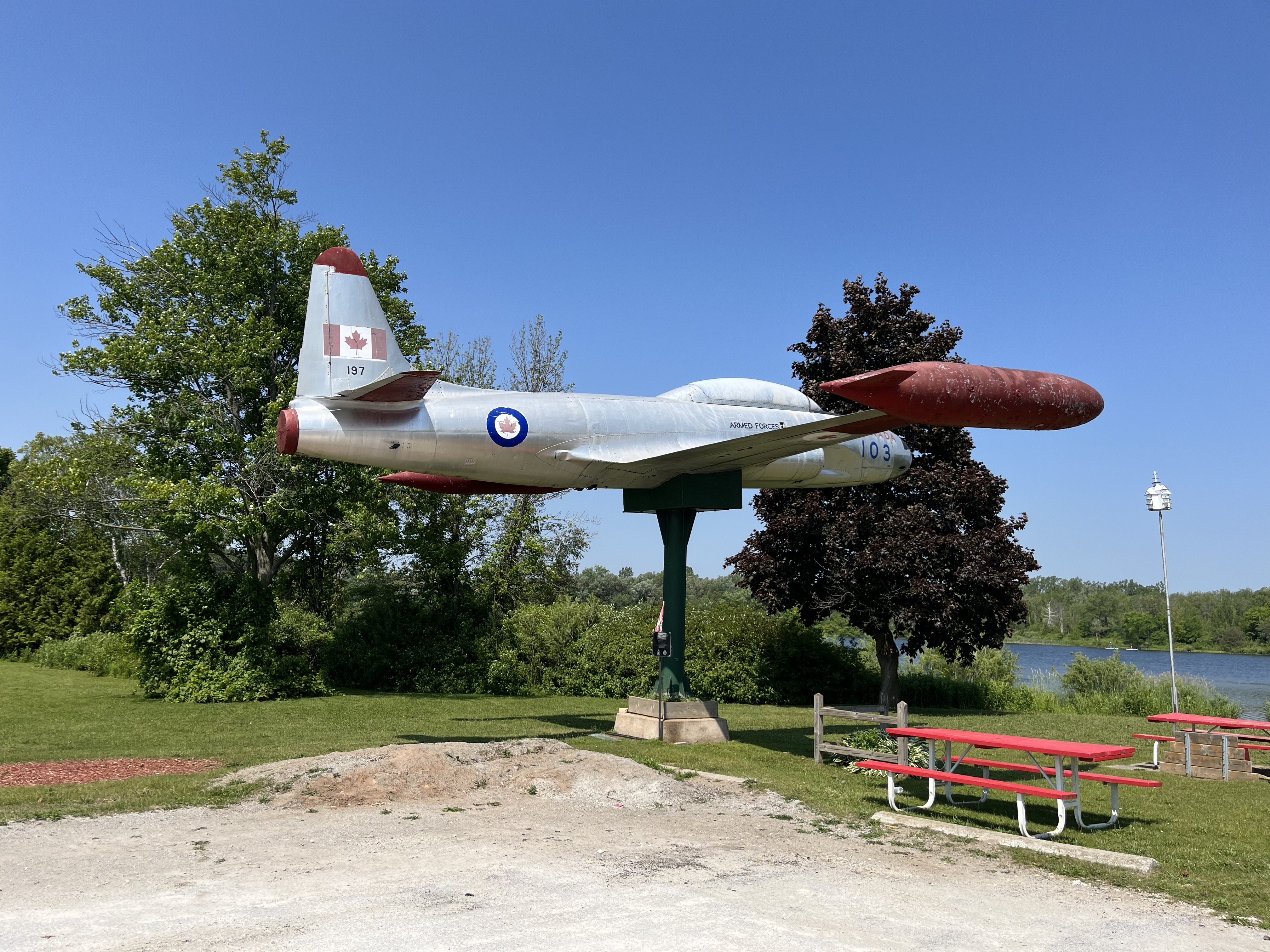
In 1974 a new legion number 197 was opened on the side of Fairy Lake. From Prospect Park you can see a war plane through the trees. This is located at the legion, the third such building in town. The plane is a Silver Star CT33 MK3 Jet Aircraft which was used in training flights and could reach speeds of 920 km/hr. It entered service in December 1952 and was retired in November 1972. It was placed at the legion in November of 1975.
Fairy Lake has been serving the local community for nearly two centuries and makes an excellent place for a picnic or a walk if you are in town. It is also a place you can take the kids for a fishing experience.