Saturday, April 20, 2014
Islington Avenue and Finch Avenue.
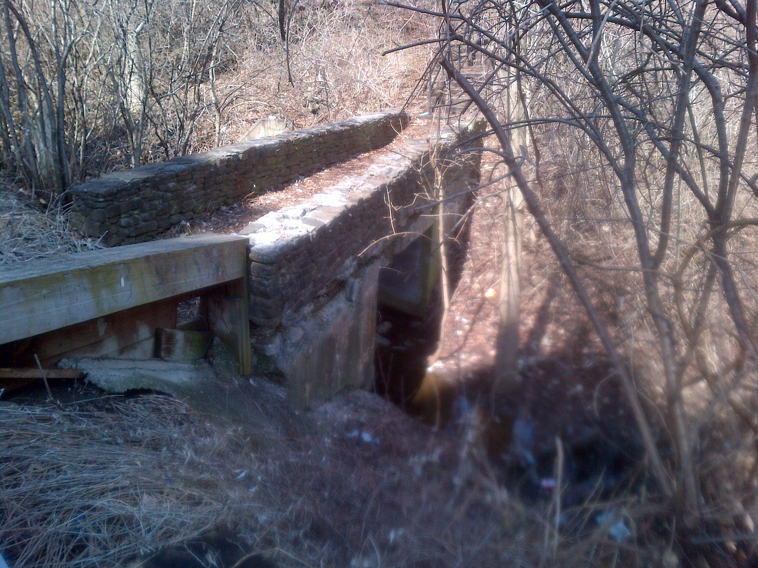
It was a sunny morning around 3 degrees C. The first part of the hike was in the south-west corner of the intersection. This is a small area where there is fairly recent growth with lots of underbrush. We found an old culvert set in shale rocks in the brush. The roadway that passed over it would have run north-south parallel to Islington. Aside from the culvert, we saw plenty of deer tracks in the woods.
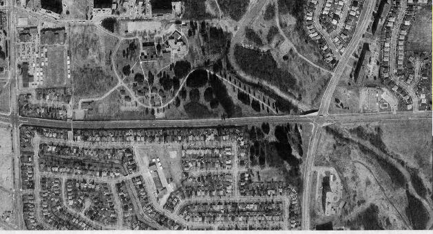
Crossing Finch, we hiked in the north-west corner of the intersection. Here there is an old roadway which has been closed off from its connection with Finch Ave. Research from the Toronto Archive aerial photographs shows this area was closed off between 1983 and 1992, likely when Finch was extended across the river.
A large deer, likely a buck was seen climbing the hill to the west of the old road. We didn’t see it again but there are lots of trails littered with piles of deer poop. We also saw the carcass of a dead animal, perhaps a beaver. Lots of birds were seen including woodpeckers, robins, ducks and geese. High up in the trees we could see that the buds were out but at ground level, there was still no sign of new growth.
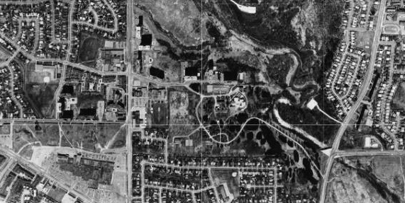
1983 Aerial photo of Islington and Finch.
1992 Aerial photo of Islington and Finch
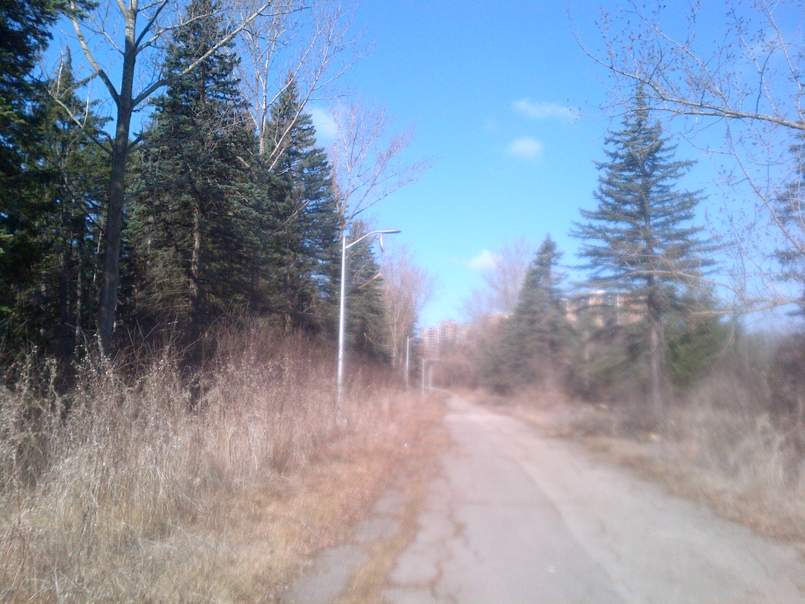
It has now been closed for about 25 years but it appears to be maintained at least enough that the broken trees from the Dec. 23, 2013 ice storm have been cleared away. On the south side of Finch all traces are lost except the culvert.
A little further along was found an older foot bridge across a side stream that runs through the ditch. This bridge is made of poured concrete with a layer of river rocks on the top which gives it its aged look.
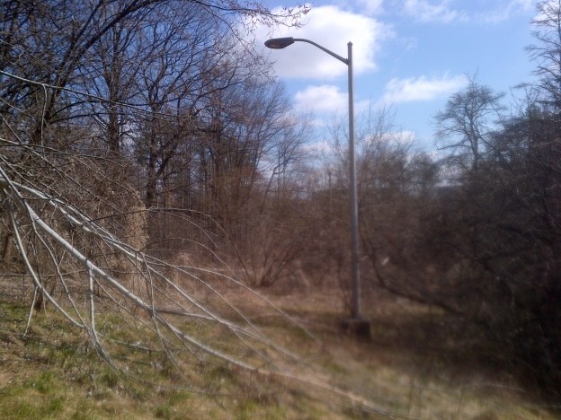
An older pathway down from a school ground to the roadway has been totally overgrown. The lamp posts are all that mark the pathway.

(A return visit in October 2016, told the story of this site as the Country Hospital For Sick Children)
Like us at http://www.facebook.com/hikingthegta
Follow us at http://www.hikingthegta.com

Pingback: Country Hospital For Sick Children | Hiking the GTA
Pingback: The First Seven Years | Hiking the GTA
I lived on taysam1961 to 1968..half the houses backed right onto the grounds/forest.. it was an amazing play ground
the only area we could not go was near the buildings we were alway told to stay away from the hospital.. not interact with the kids in there..
i think it was mostly what was referred to at the time were mentally disabled and juvenile problem children(kids kicked out of school not offenders It was low security situation and no fences .
I dont think tb was an issue by that time..
unfortunately the residents did not get to use the grounds much.
And along the south edge of the lands they de forested, graded and put sewers for finch to extend through in early sixties and then stopped ..it became overgrown after 20 years of being fallow..
I believe the issue was the bridge right at islington being conservation land.. and requiring complicated engineering as the whole intersection crosses the river on an angle and had to be redone as a single entity/construcion .It also needed to be raised to a new grade to ensure the new flooding regulations resulting from hurricaine hazel..
the west part of the land was given/sold land for the catholic school on kipling in mid sixties.
it looks like finch went through 20 years later after 1983 based on air photo.
it is great to see it is still a natural space..It would be an amazing space for a children’s hopital again.