Saturday May 21, 2016
The Brampton Esker is an example of a geological feature that is rare within the GTA. An esker is a ridge of sand and gravel left by the retreat of a glacier. Rivers of melt water form and run either on top of or under the ice pack. These rivers carry with them the sand and gravel that had been scooped up by the ice as it advanced. These deposits usually run in nearly straight lines that are normally parallel to the ice flow. The largest one in Canada is the Thelon Esker in Nunuvit and The Northwest Territories which is over 800 kilometers long. The average size is only a few kilometers long, about 100 meters wide and around 50 meters deep. Each period of glaciation scours away any previous eskers in it’s path. Therefore the current eskers are from the last ice retreat about 12,000 years ago. North Western Quebec is full of mining operations because there are many north-south eskers left behind from the Wisconsin Ice age. The 1877 county atlas below has been marked in brown to indicate roughly where the Brampton Esker is. The hike is marked in green while the waterways featured are marked in blue.

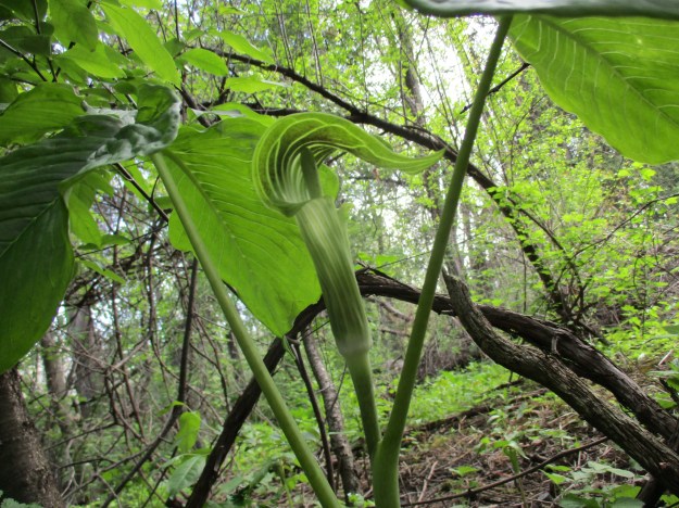
Most eskers are narrow and steep sided but the Brampton esker is broad and has gentle slopes to the sides. It is approximately 7 kilometers long and varies from 200 to 600 meters wide. It stands about 10 to 20 meters above the surrounding land. The esker consists of 11 layers or facies of sediment laid down as water flowed north west. Each facies is a distinct level of sediment, each with it’s own size and characteristics that indicate the strength of water flow. Twelve gravel pits operated along the esker and together they extracted over 80 million tonnes of sand and gravel. This high quality building material was used in the construction of Ontario Place, Pearson Airport, The Toronto Subway system and major roads including the Gardiner and QEW. Over the past 40 years these gravel pits have become exhausted or flooded and have been rehabilitated as parks and lakes. A trail runs along this linear park system called the Esker Lake Trail. This hike starts in Norton Place Park where there is parking at the community centre. The woods behind here and around the west side of the lake are full of Jack-in-the-pulpits. These plants can live up to 100 years and many of them were here in the mid 1980’s when I lived in the area.
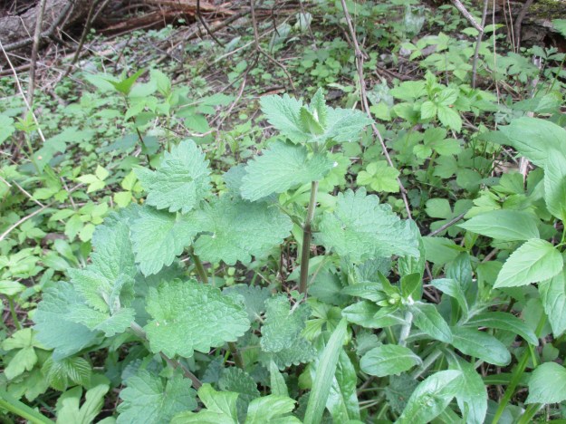
As a person who is owned by more than one cat, I am always interested in seeing where catnip grows. One patch is in Norton Place Park. This park is a naturalized quarry on the southern end of the esker. Over the years a surprising number of plants have found a home in the park. Catnip has been used as an herbal remedy, mostly in tea, but it’s most powerful reaction comes from cats. Leopards, cougars and other larger cats can also have a similar reaction to catnip. It is sometimes known as cat mint because the plant is a member of the mint family. It shares the square stem of this family of plants.
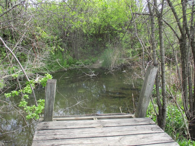
The Esker Lake trail has been developed in recent years but the section in Norton Place Park was one of the earliest components. The old boardwalk around the lake in the park has been abandoned and left to fall back into the swamp. The cover photo shows the sudden end to this boardwalk.
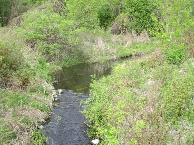
One by one the quarries were shut down when the sand and gravel was exhausted. Some of the pits were flooded creating a series of small lakes along the esker. The area around the flooded lakes was proposed for various housing developments. Due to the stratified sediment in eskers they become active from a hydrological standpoint. Prior to development a detailed study was commissioned to determine the effects on the local environment and aquifier. The picture below shows the water flowing between the lakes along the old esker in Laurelcrest Park
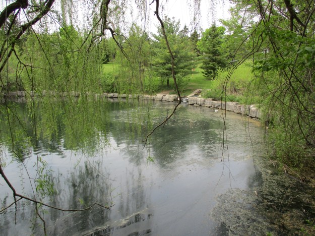
Two small lakes, left over quarries, straddle Vodden Street. Known as Parr Lake north and south these quarry pits were abandoned at the time that the 410 was built up the middle of the esker in the mid-1980’s. The picture below shows Parr Lake south.
North of Vodden Street the Esker Lake Trail continues past Parr Lake North. The north end of this lake is fed from a drain carrying water under the 410 from Major Oaks Park Lake. The outlet into Parr Lake North can be seen in the picture below.
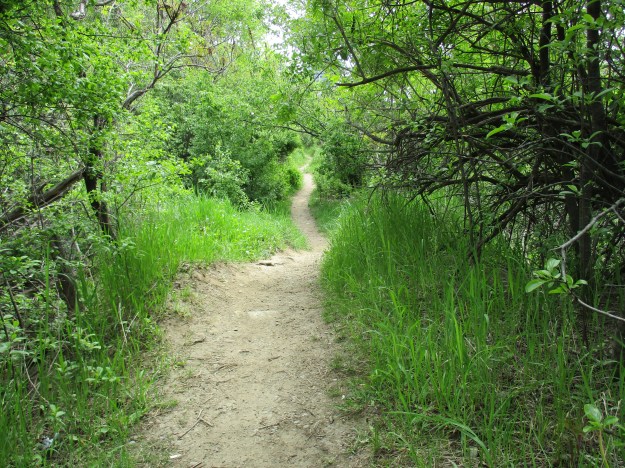
Secondary trails run around the eastern side of the three little lakes on this part of the journey. Norton Place Park is the most established one on this end of the trail and the east side has been left to regenerate naturally. The trails along here are much more overgrown.
Marsh Marigolds grow along the swampy side of the lake in Norton Place Park. They are very common in wetlands and the plant has had many uses over the years. The whole plant contains a toxin which is stronger in the older parts of the plant. It is destroyed by heat and the roots and older leaves must always be cooked. As a food source, the small flower buds can be eaten raw and the leaves can be cooked and eaten. The plant is also used as a diuretic when made into a tea and has other uses including as an expectorant and cold remedy.

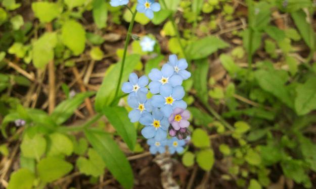
The forget-me-not is said to be “true blue” in colour and is used to symbolize true love. They are used to decorate packages and gifts in the hope that the recipient will not forget the giver. Traditional uses include treatment of several different eye ailments and when applied externally it is effective in stopping bleeding.
As of 2010 Brampton is also the only community in Ontario to have received two Bronze Plaque Awards for rehabilitating quarries. Professor’s Lake was recognized over 25 years ago and now the Esker Ridge Trail has been given the bronze award.
Here is a list of some
popular hikes and the links to their stories.


“As a person owned by more than one cat”…perfectly great quote 🙂
Great article!
Sent from my iPad
>
Pingback: The Great Esker | Hiking the GTA
Pingback: Fun Things to Do This Summer In Brampton | Seven Eleven Taxi
Pingback: Heart Lake – Treetop Trekking | Hiking the GTA
Pingback: 10 facts about Brampton you probably didn't know - Toronto News Station
Pingback: 10 facts about Brampton you probably didn't know - PostX News Canada
Pingback: 10 facts about Brampton you probably didn’t know | Toronto Tourism Guide – Toronto Tourism Guide
Hi there, where did you find the historic map of Brampton you’ve used here in this post? I’m doing some research on the Esker’s development through time and it would be super helpful to have this resource.
Thanks!
https://digital.library.mcgill.ca/countyatlas/searchmapframes.php