
September 12, 2016
A week of holidays in September is ideal because there are less tourists and, chances are, the weather will not be too hot for hiking. Many years ago I visited the southern cairn on the Bruce Trail at it’s location in Queenston. My Bruce Trail Guide Book has many stretches of the trail highlighted as completed but it had never worked out for me to visit the northern cairn in Tobermory. Well, today was the day, but first a trip around the Big Tub Harbour to check out the lighthouse at the northern tip of the Bruce Peninsula.
Charles Earl and Abraham Davis were Tobermory’s first settlers and the town grew quickly in the late 1800’s as it was established as a major fishing community. Tobermory has two harbours, both shaped like a bath tub and known as Big Tub and Little Tub. At the top end of Big Tub Harbour Charles Earl maintained an oil lantern on the end of a high pole to guide ships into the safety of the harbour. This job paid him $100 per year which was a considerable salary in that day. In 1885 a hexagonal lighthouse was built on the site and political sway landed the job for Abraham Davis who was Earl’s rival. Four lighthouse keepers held the job until 1952 when the light was automated.
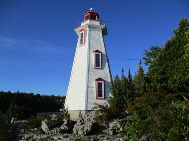
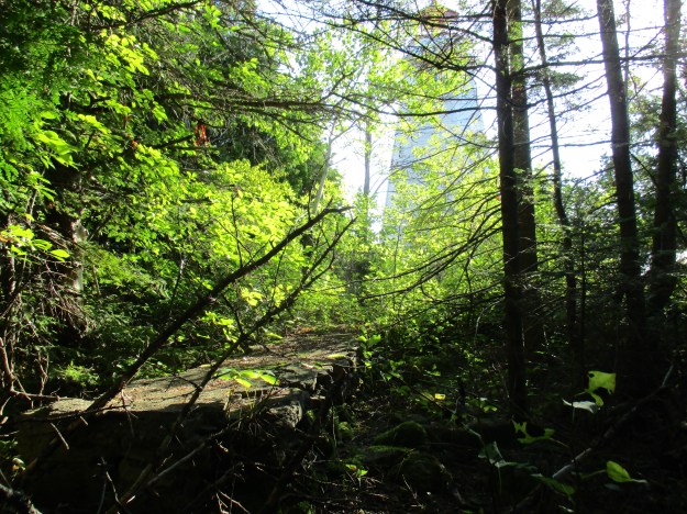
The lighthouse keepers at Big Tub had a small cottage just behind the tower. The foundation remains lie hidden in the trees and can be seen in the picture below with the outline of the lighthouse in the background.
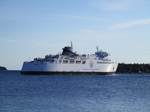
In the 1930’s a small wooden vessel named Kagawong began ferrying vehicles from Tobermory to South Baymouth on Manitoulin Island. Two other ferries operated on this route and on September 10th, 1974 the Chi-Cheemaun made her maiden voyage. Having just celebrated her 32nd year in service on the previous weekend the ship, whose name means “big canoe” in Ojibwa, has now carried over 100,000 vehicles and 250,000 passengers across Lake Huron to connect with the next section of Highway 6 on Manitoulin Island.
The Bruce Trail is the oldest marked hiking trail in Canada. Extending for 890 kilometers from Tobermory to Queenston Heights Park it also has over 400 kilometers of side trails. The cairn in Tobermory was unveiled in June of 1967 as part of the celebrations of Canada’s Centennial. It is located right on the waterfront in Tobermory’s commercial district and all the local parking has a two hour limit. This makes it hard to park near the cairn and go for a lengthy hike to start out your end-to-end journey. There is free parking at the Visitor Information Centre a short distance away from which you can set out on an extended hike. Inside, they suggested a more scenic hike would be found out of the immediate area of town where the trail winds along the coast of the peninsula.

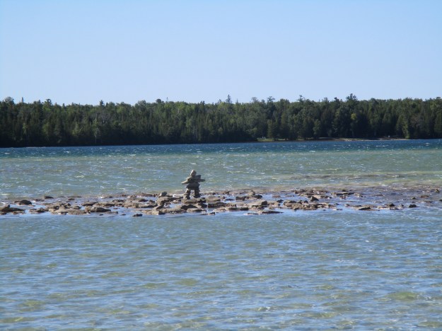
Cyprus Lake, in Bruce Peninsula National Park has access to the Bruce Trail as well as others for the price of parking ($11.75 at this time). The parking lot leads to Head of Trails where you can choose from several hikes including a 5.2 kilometer one around Cyprus Lake. Three other trails lead to the shore of Georgian Bay. According to the person at the park entrance the trails vary in difficulty with Horse Lake (1.2 kilometers) being moderate, Georgian Bay Trail (1 kilometer) being easy and Marr Lake (0.8 kilometers) difficult. The Bruce Trail along this section is listed as very difficult. I decided to take the Marr Lake Trail which is accessed from the Cyprus Lake Trail. The picture below shows Cyprus Lake and an Inukshuk that someone has built quite a distance out into the lake.
Marr Lake is separated from Georgian Bay by a boulder beach. This beach is visible on the other side of the lake in the picture below.

This photo shows the boulder beach which must be crossed as you connect the Marr Lake Trail with the Bruce Trail that runs along the shore of Georgian Bay.

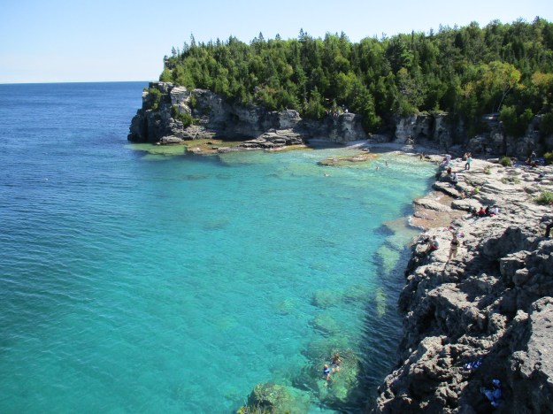
The Bruce Trail to the right leads to The Grotto. A grotto is a cave that has been created by water along a shoreline. Natural grottos are a type of karst topography and usually occur in limestone like the Niagara Escarpment. Carbon dioxide mixes with rainwater to form a weak carbonic acid that slowly breaks down the limestone or dolomite and turns small cracks into large caves. The grotto in the park can be climbed down into and makes a great place to explore. The cover photo also shows the grotto and reveals the beautiful colours of the water in the little cove near the cave. People were swimming here as well as jumping from he cliffs which is banned in the park. Being caught can lead to a fine and eviction from the park. Miscalculating and hitting a boulder or shale ledge could be much worse.

Another five minute walk along the Bruce Trail will bring you to Indian Head Cove. This scenic spot is much more easily accessed than the grotto. There are many places where you can climb up and down the escarpment to reach the cold, clear water or ascend to a spectacular view of Georgian Bay.
After leaving the cove, the Horse Lake Trail can be taken to go back to the parking lot. The Bruce Peninsula National Park has so much more to offer than just the small section that was explored in this visit and could be the subject of several future adventures. Here is a final look from the top of the escarpment down into the cove in front of The Grotto.

Google Maps link: The Grotto
Like us at http://www.facebook.com/hikingthegta
Follow us at http://www.hikingthegta.com

We went here on our honeymoon, and a few other times over the years. We also went on the glass bottom boat.
Pingback: The Niagara Gorge | Hiking the GTA