Saturday, February 4, 2017
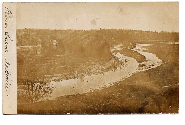
Last week we explored Sixteen Mile Creek on the west side looking for evidence of the old tunnel through the Hog’s Back. We found an old stone structure that looked like a tunnel entrance that had been filled in. Owing to the fact that it wasn’t in the location we expected, we determined that it was not the tunnel we sought. Having circumnavigated the hog’s back we had determined that the openings on either side had been closed off, either intentionally for safety or through a mud or talus slide. This week we returned to have a look on the east side of the creek for the remains of the old dam. The post card below is over 100 years old and shows Sixteen Mile Creek with the dam intact on the left of the photo. The earth and stone berm can be seen running out toward the creek where the water spills over the dam. The creek flows around the hog’s back and then under the railway bridge. The wood stave flume passes under the railway bridge on its way toward the mill.
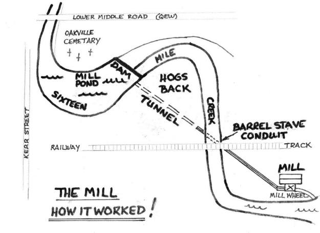
William Chisholm purchased 960 acres of land at the mouth of Sixteen Mile Creek in 1827 with the plan to create ship building yards there. Another of William’s early ventures was the construction of saw and grist mills both of which were completed by 1833. The grist mill was located downstream from the Hog’s Back but the mill pond was on the opposite side of this geological feature. The solution was to bring the water through the hog’s back in a tunnel.
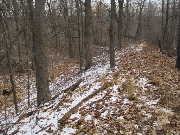
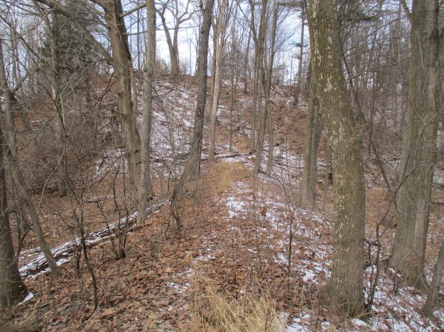
St. Mary’s Pioneer Cemetery contains the city’s earliest founders including William Chisholm. There are a few parking places on Lyons Lane near the entrance to the cemetery. Just inside the gate there is an opening in the fence and a small path. It is possible to descend to the creek level but caution is required as the footing is loose. The large “S” that Sixteen Mile Creek forms as it rounds the hog’s back makes directions a little odd when you reach the creek. You are on the east side of the creek but west of it. You’ll walk south toward Lake Ontario as you make your way upstream toward the old dam. The dam can be seen in the picture below as the white line running horizontal through the trees in the middle of the photo.
Looking back along the dam you can see where it met the embankment with St. Mary’s Pioneer Cemetery at the top of the hill.
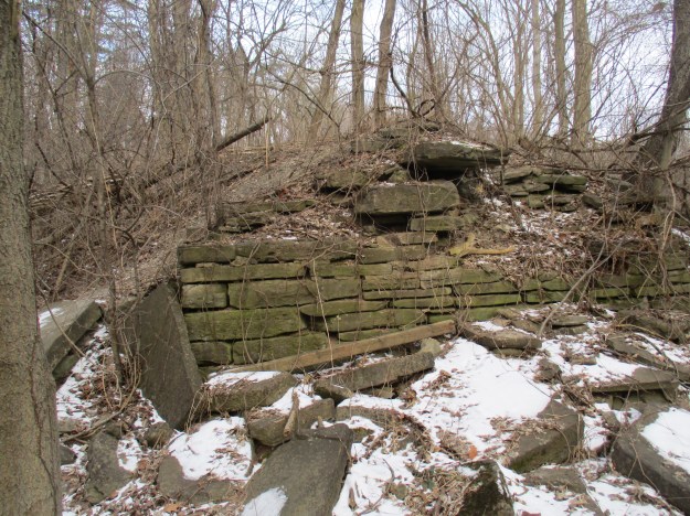
The dam stands eight to ten feet off of the creek floodplain. A cross section of the dam can be seen by walking out to the end and climbing down the side. Large pieces of dolostone were layered to form a sturdy wall. A layer of soil was scooped up off the floodplain to deepen the mill pond and provide a covering for the dam. A wooden crib filled with stone was used to span the creek. The dam was built in the winter when water levels were low and maintenance was also done during these months. The dam has been removed from the creek to help prevent flooding and reduce the danger downstream should it eventually fail.
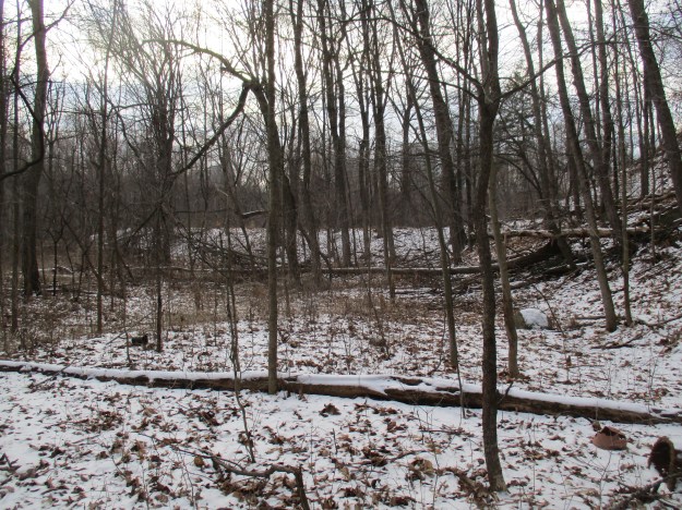
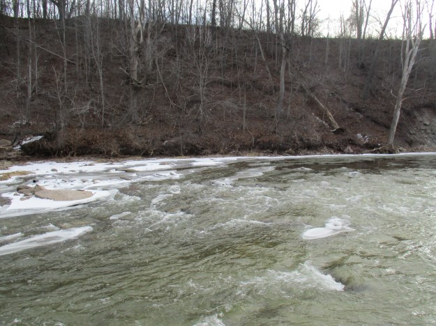
Tracing the line of the old dam to the creek’s edge you can see the stone in the water and on the far embankment that marked the dam’s east end at the hog’s back. The dam met the hog’s back at the extreme left in this photo. The now closed entrance to the water tunnel would have been along the embankment in this picture, perhaps near the large tree with the platform in it.
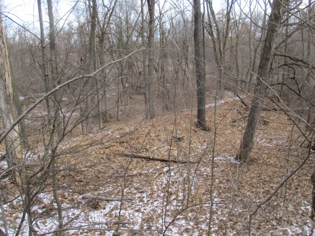
Following the dam back to where it meets the ravine side you will find a small path that leads back up to the cemetery. The picture below shows how obvious the dam is when seen from above, once you know that it is there.
Keep your eyes open as you walk through places where there is a lot of limestone because it can often be found with fossils in it. The piece pictured below has fossil worms and twigs and what appears to be a moth near the middle.

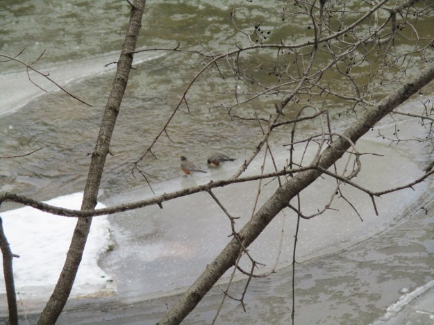
The woods near Sixteen Mile Creek were alive with robins. Groups of birds are not always called flocks and a group of robins is known as a “round”. In England, they are also known as a breast and in the USA they are called a wave. Perhaps this is where the term “round-robin” comes from. The round of robins by the creek was fat and obviously well fed. It is most likely that these birds have returned from their migration south, perhaps pushed north by storms below them. Two robins stop for a drink from the creek in the picture below.
Our fifteen all-time most popular hikes are featured in this special presentation.
Google Maps Link: St. Mary’s Pioneer Cemetery Oakville
Like us at http://www.facebook.com/hikingthegta
Follow us at http://www.hikingthegta.com

Lived in Oakville from 1955 to 1974 and never knew this existed. Crossed the train trestle so many times too.
Thank you for this delightful piece of history.
I lived on queen mary as a child in the early 70’s we went through the water tunnel many times we rode our bikes along the top of the hogs back almost daily I now live in bc but the memories of the creek and train tressle last forever miss oakville
hey kenton, it’s steve c, we should get together
Yes, my friends and I used to “play’ in that tunnel in the 80’s. We would enter on the east side, about 150ft north of the Speers bridge, about 30 feet from the rivers edge. Knees and elbows to get in, then it opened up inside. There was an exit on the west side, but it was really narrow by that time, could barely squeeze through it. I remember the location well and hunted for it a few years ago with no luck. It had been filled in, likely by the Town of Oakville for safety reasons. Totally reasonable. That was an accident waiting to happen.
I am well aware of this tunnel. My brother myself and a friend went through this tunnel from one end to the other back in the mid sixties. The main entrance was down slope north of the tracksc and at the back of the cavern was a smaller tunnel that opened into another cavern and then another small entrance which we also entered, thinking it would lead to a third cavern. It did not. Instead it got smaller and tighter to the point were we crawled through on our bellies and it started to get pretty tight and some what scary but we kept hoping for another cavern in which we could turn around. Instead we came to an opening at the base of the hill at the edge of the creek. Looking back I often think how easily we could have become three kids that disappeared without a trace.
One thing l remember at the time were portions of stone work we would come across which led me to believe in later years that part of it at least was man made. The stone work portion was mostly at ground level so I figured the ceiling had collapsed and were we had crawledthrough may have been above the original tunnel. Some years later My friend and I decided to see if we could find more out about this tunnel and it seems the tunnel or at least part of it was indeed built by an early settler who ran a lumber mill and the cave was a means of avoiding aboriginals in the area in case of trouble.