Tuesday, February 27, 2018
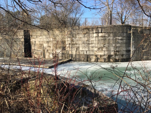
One lesson that was learned in the war of 1812-1814 was the need to move men and goods quickly and a period of road and canal building began. The British had largely controlled the Great Lakes during the conflict but Niagara Falls prevented movement between the lakes. In spite of this, the first canal built between the two lakes was a private enterprise. The government would build the next three Welland Canals culminating in the current Welland Shipping Canal. The first three canals have been abandoned but sections of each still remain, although active preservation does not appear to be happening. This picture of lock 15 on the third canal shows the partial collapse and deterioration of everything up to the gate recesses.
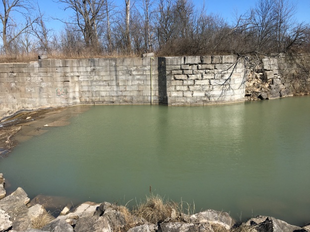
To look at some of the remnants, I made a day trip and planned four stops (to which links will be provided). The first stop was in St. Catherines to see the second lock on the third canal. Then to Welland Vale where the first and second canals diverted routes shortly, leaving evidence of both. Mountain Locks Park along Bradley Street contains a series of second canal locks. Finally South of Glendale Avenue is a series of third canal locks and the Merritton Tunnel. Rather than tell this story in the sequence of the visit it is being arranged in the sequence of the three canals.
Shipping on the Great Lakes was confined to Lake Ontario because goods on the Upper Great Lakes had to be portaged around Niagara Falls. Lake Erie was 325 feet higher than Lake Ontario. In 1818 a mill operator named William Hamilton Merritt proposed to divert water from the Welland River past his mill in Welland Vale to supplement the water flow of 12 Mile Creek. The idea was abandoned but just a month later he came up with the proposal that led to the building of the first Welland Canal. The Welland Canal Company was founded in 1824 to build the 40 kilometre canal. The channel was dug 24 feet wide and 8 feet deep and 40 wooden locks were built each capable of lifting a boat between 6 and 11 feet. The picture below shows a section of the first canal in Welland Vale.

The first canal was operated between 1829 and 1844 but it was clear from the beginning that the wooden locks were too small and required too much maintenance. In 1841 the government took over operation of the canal and started work on rebuilding it The path of the canal followed the first one so closely that most of the first canal was lost. There is a 1 kilometre stretch of the first canal in Mountain Locks Park that was left intact and one wooden lock, number 24, can still be found in that park. The locks on the second canal were built of stone and to slightly larger dimensions than their wooden counterparts. The channel was dug 36 feet wide and 9 feet deep with locks that were 150 feet long. The picture below shows the one of the locks on the second canal at Welland Vale. The height of the lock has been reduced and the stone work has been completely removed from one side of 12 Mile Creek to improve water flow and reduce flooding.

The first and second canals climbed the escarpment in a series of locks that now form Mountain Locks Park. Lock 19 of the second canal no longer has water flowing through it and this picture was taken from inside the lock
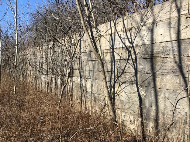
Lock 24 of the second canal is typical of the locks that climb the escarpment as boats moved toward Thorold. The creek flows deep in the bottom of these locks. The second canal was used from 1845 until 1935 even though a third canal came into operation in 1932.
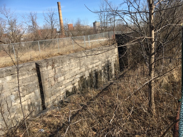
A third, larger canal was started with a new, straighter route in 1872. It was designed to carry the larger ships that were plying the Great Lakes by this time. The third canal was completed in 1887. Lock number two can be found in Jaycee Gardens Park in St. Catharines.

There is a 50 foot towpath that extends out into Martindale Pond at the second lock that allowed the ships to be towed through the lock. Towpaths allowed ships to be towed out of the lock by a team of horses until a point where they would have room to sail again. Towpaths were no longer needed when ships were equipped with engines. A concrete pole on the end, and another near the beginning of the towpath mark a later addition of electricity to power the lock. This relieved a lot of physical labour that was involved in operating the canal gates and was an advancement made on the third canal that wasn’t available on the first two. The gates from the lock can be seen half submerged beside the towpath.

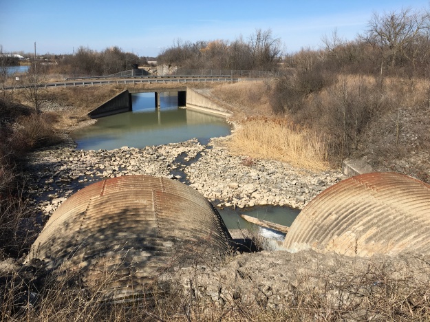
Lock 13 has had two large culverts placed in it to support Glendale Avenue. From this vantage point, lock number 12 on the third canal can be seen. Locks 13 through 18 can be found by following the river south.
As ships were being raised or lowered in the locks they needed to tie themselves to bollards located along either side of the lock. Many of these old concrete bollards can be found along the canals.
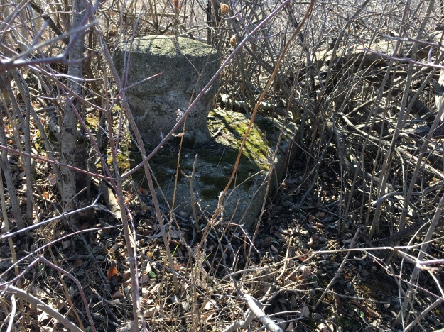
When the third canal was abandoned in favour of the new fourth canal, the gates were left in place. These have all fallen into the locks. One of the improvements in the third canal was the lining of the bottom of the locks with wood to protect the bottom of the ships as they passed through.

Locks on the third canal were 270 feet long and could lift a boat from 12 to 16 feet. The locks were 45 feet wide and a minimum of 14 feet deep. The picture below shows the lift in lock 15.
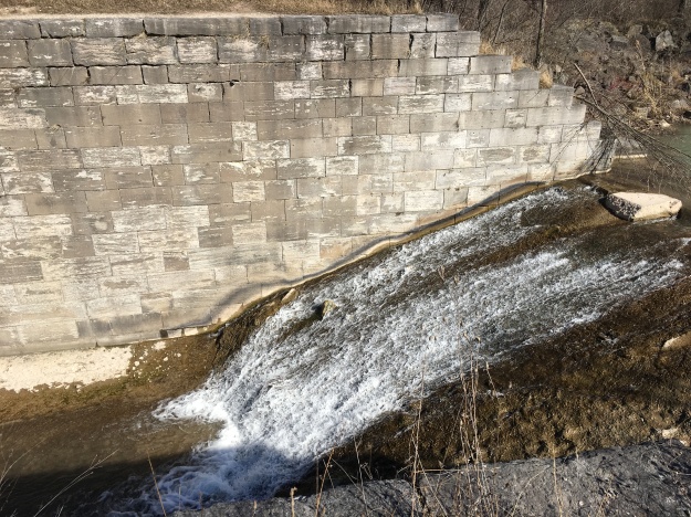
One of the innovations of the third canal was the inclusion of the water control system in the lock stonework. The walls of the locks were recessed so that the gates could swing back to allow clear passage of boats. The small openings behind the gates allowed water to be flooded into the locks.

Along the west side of each lock a series of control ponds was built that allowed the locks to be flooded when boats were passing through. Stone sluice gates were used to control the flow of water from the ponds into the locks. The picture below is taken from inside one of the control ponds looking at the sluice gates.
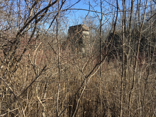
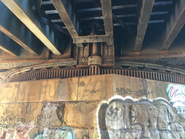
Between locks 16 and 17 there is an old swing bridge for the railway. It was completed in 1915 and allowed the railway tunnel beside lock 18 to be closed to rail traffic.
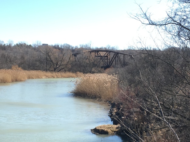
The swing bridge was designed to move out of the way of oncoming ship traffic. It hasn’t been moved since the canal closed in 1935 and the tracks on the top side have been replaced in such a way that it couldn’t move even if those gears are not seized.
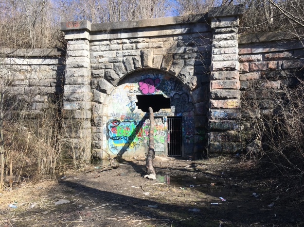
The Grand Trunk Railway needed to build a tunnel to allow the train to pass under the third canal. The Grand Trunk Tunnel was completed in 1876 and is discussed in more detail in this separate post.
The Fourth Welland Canal was opened in 1932 with only 8 locks and a much straighter route. Very quickly a fifth canal was proposed that would have had only one super-lock. This 1950’s dream was never built.
There are many interesting places to explore along the old abandoned canals and a return trip would definitely be in order.
Google Map Links: Port Colborne, Welland Vale Road, Thorold
Like us at http://www.facebook.com/hikingthegta
Follow us at http://www.hikingthegta.com
Love this! Did you take a peek at the old Lock one (where the harbour meets the bridge in Port Dalhousie)? Also*Jaycee Gardens is in St. Catharines (not Port Colborne).
Is this the correct height? “Lake Erie was 32.5 feet higher than Lake Ontario.” To the best of my knowledge Niagara Falls is about 188 feet high.
Perhaps a daytrip to the 150 foot incline between Erie and Niagara would be a fascinating future story.
Nice catch, Grant. It now reads 325 feet higher…
I did a fascinating hike around the third canal in the summer of 2017. An interesting area was the dam near the Merritton Tunnel west entrance. Reminded me of the Panama Canal scene from Team America.
Pingback: Decew Falls | Hiking the GTA
Pingback: Merritton Tunnel (Blue Ghost Tunnel) | Hiking the GTA
Pingback: Haunted | Hiking the GTA
I think the Grand Trunk Tunnel was completed in 1881.
Pingback: Sir Casimir Gzowski Park | Hiking the GTA
Pingback: The Battle Of Beaver Dams – June 24, 1813 | Hiking the GTA
Pingback: Peterborough Lift Lock | Hiking the GTA
Pingback: Sault Ste Marie Canal | Hiking the GTA
Pingback: Welland Canal Bridge 15 | Hiking the GTA