Tag Archives: Don River

Burke Brook

Sunday June 15, 2014

It was sunny and over 20 degrees.  I parked on Rosewell avenue and crossed the school playground.  Burke Brook flows under the playground and exits into an open channel just inside the woods at the east end of the baseball diamond.  This little section of the trail crosses the brook on a footbridge.  The ravine has been filled in at Duplex Ave which creates a steep climb up over the road.  The stretch of brook between Duplex and Yonge street is all underground.

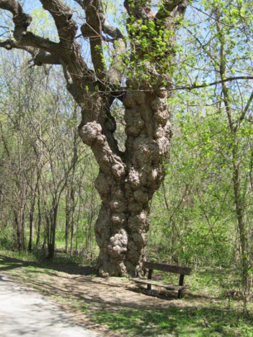
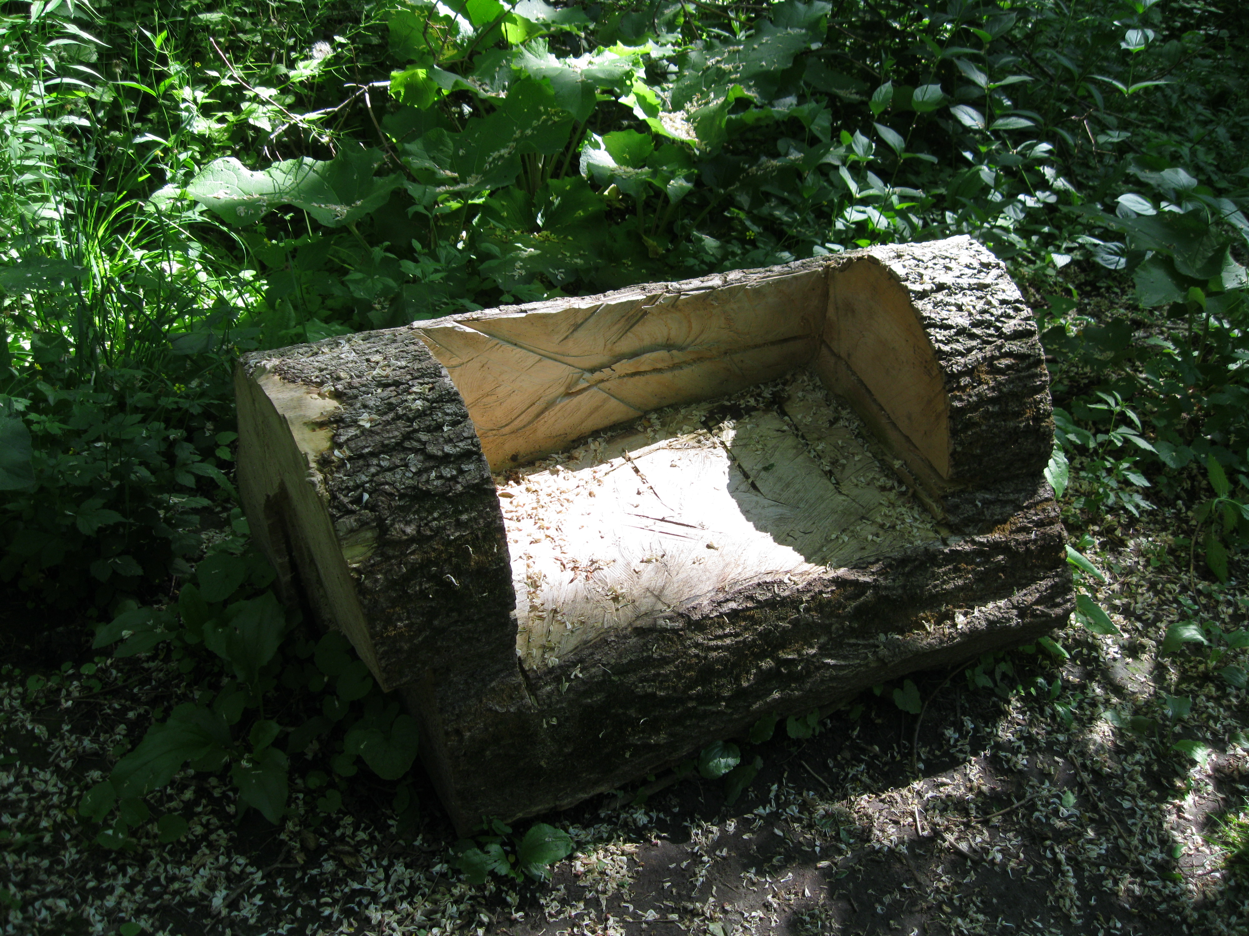
One of the city workers who cleaned up the mess of fallen trees that littered the parks after last December’s ice storm turned this log into a bench.

IMG_2247

Burke Brook crosses Yonge street underground where it enters Alexander Muir Gardens.

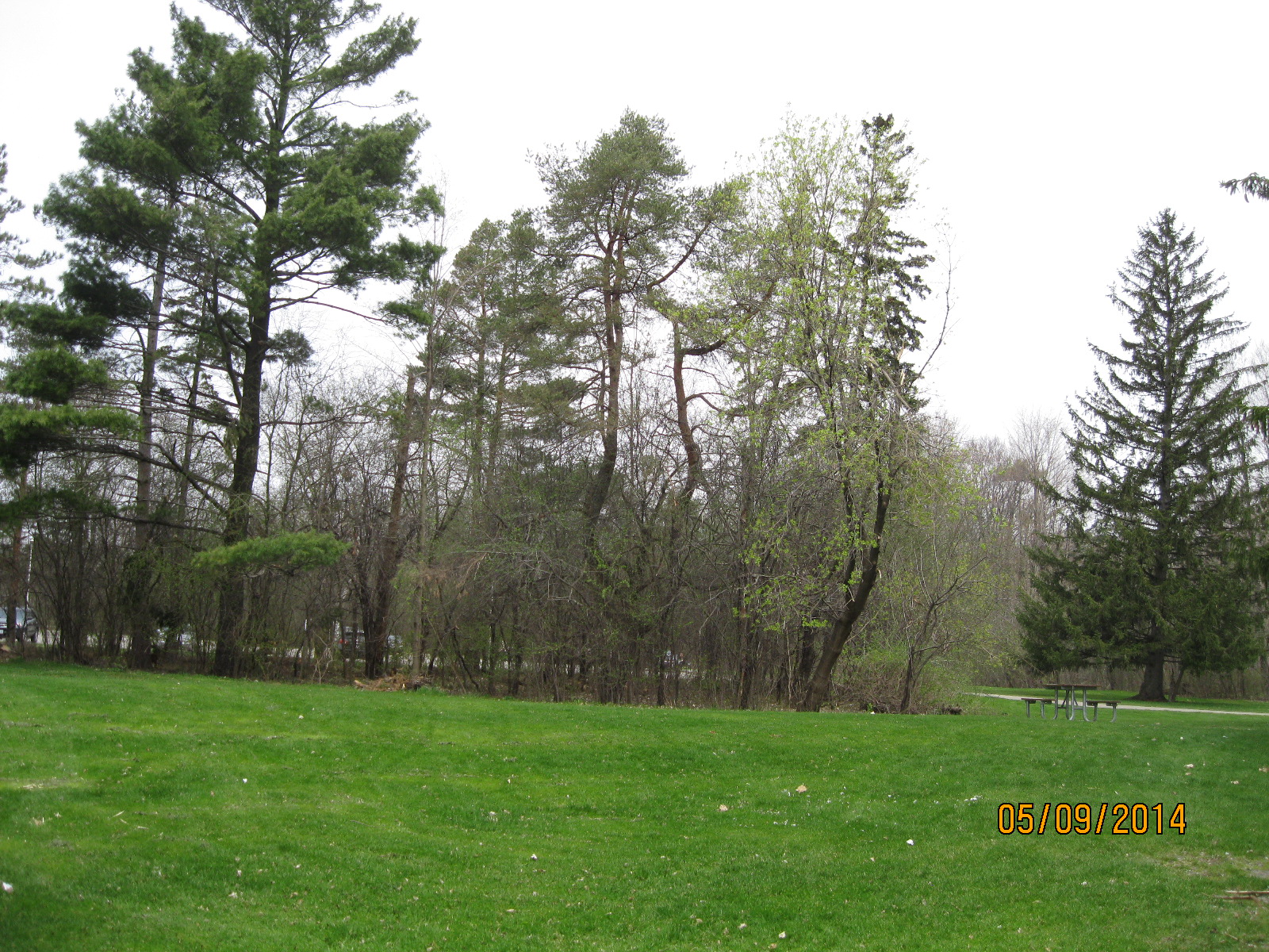
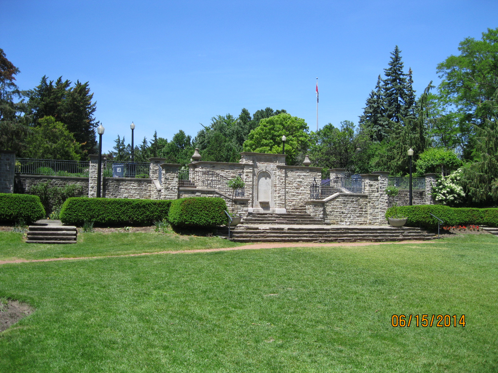
Alexander Muir was born in Scotland in 1830.  He died in Toronto in 1906 after serving as a teacher in several Toronto area schools.  In October 1867 Muir wrote The Maple Leaf Forever to commemorate Confederation.   It was Canada’s National Song but was not adopted by the french who had written O Canada in french in 1880.  In 1980 we adopted O Canada for our official National Anthem.  A large garden was built in his honour in 1933 on Yonge St, just north of Lawton Blvd.  It was moved to this location in 1952 to facilitate construction of the Yonge street subway.  The garden has a wide variety of trees and flowers and many looping paths and trails that make it an ideal place to get lost for awhile.

IMG_2287

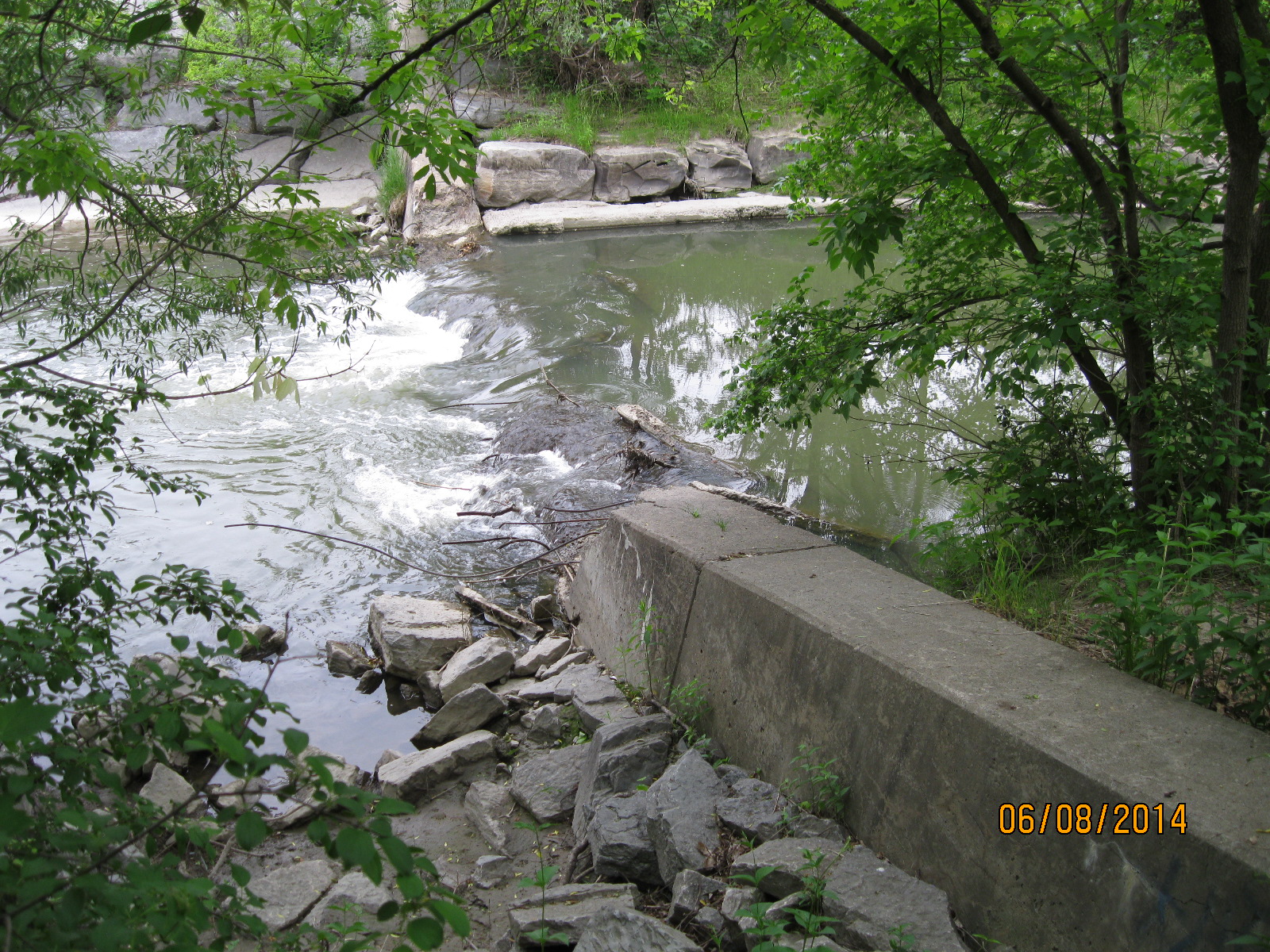
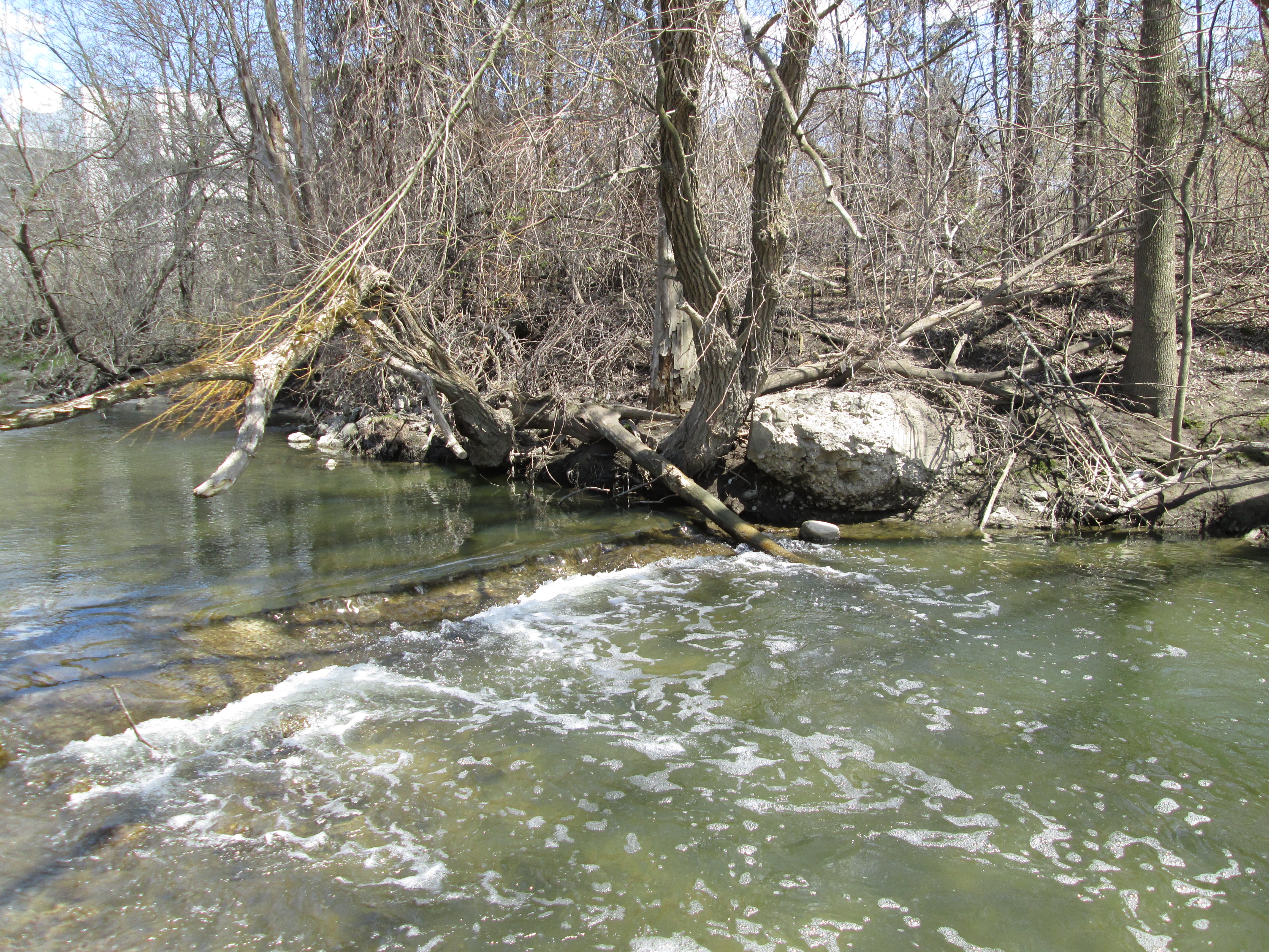
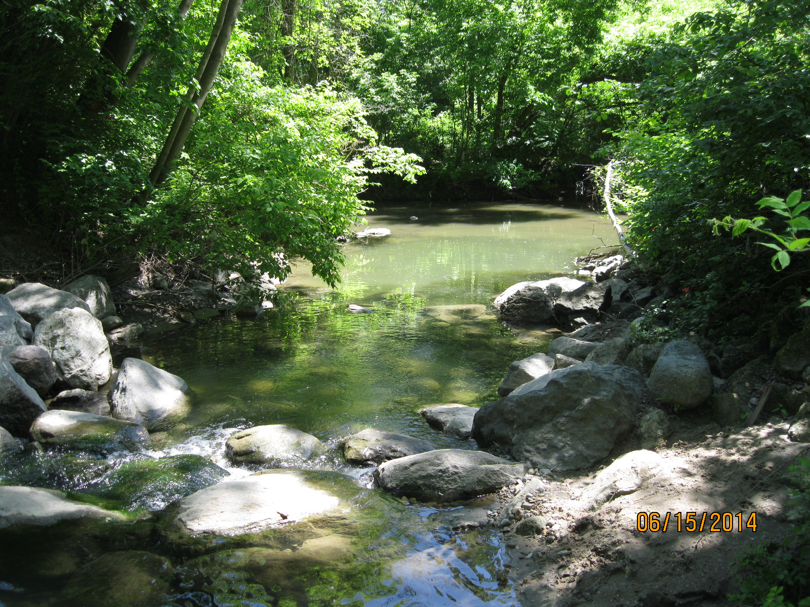
Just past the Alexander Muir gardens the brook flows out of its underground channel into the open.  It was lined with cut stone in 1964 to make a deep channel to prevent erosion. As the photo below shows, the water has little respect for the efforts of man.  The erosion extends out on both sides of the original stonework.  I was amazed at how much soil has been removed by such a small flow of water.

IMG_2253

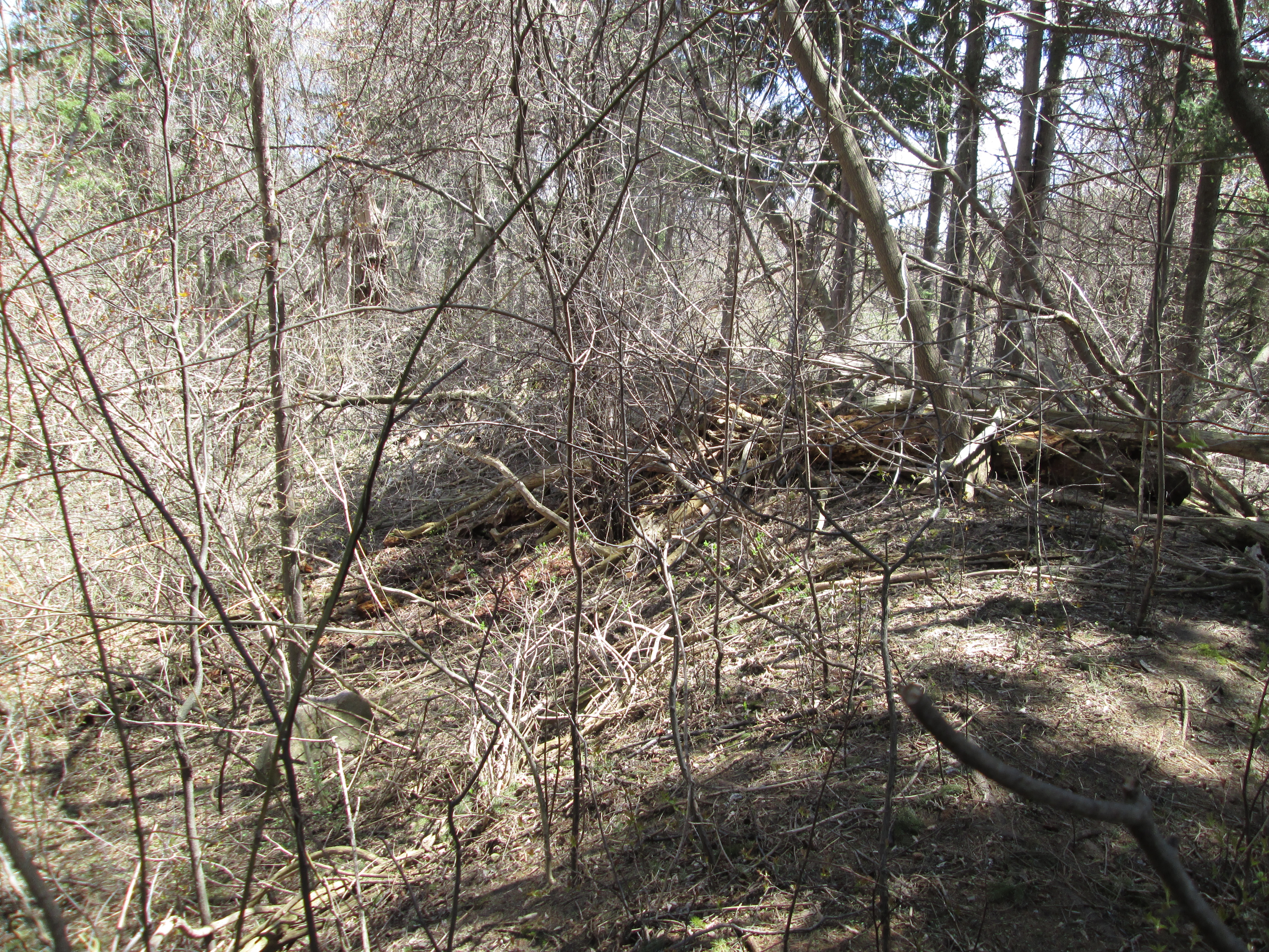
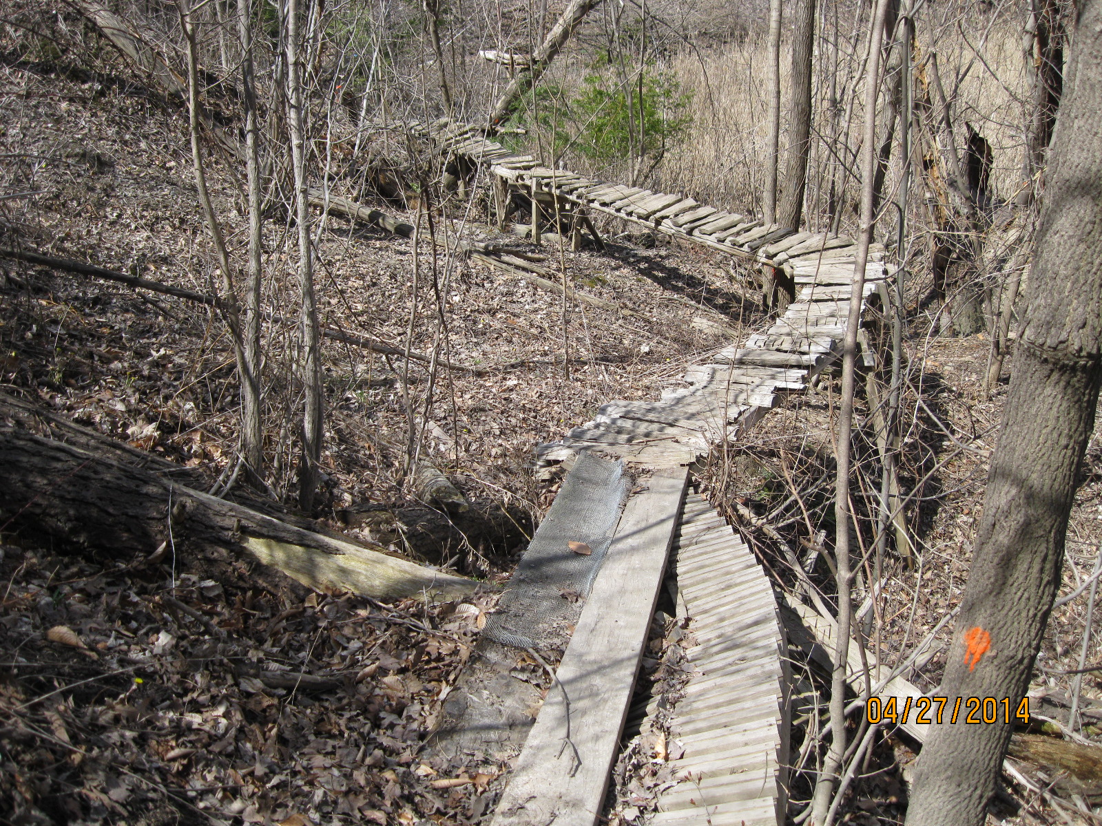
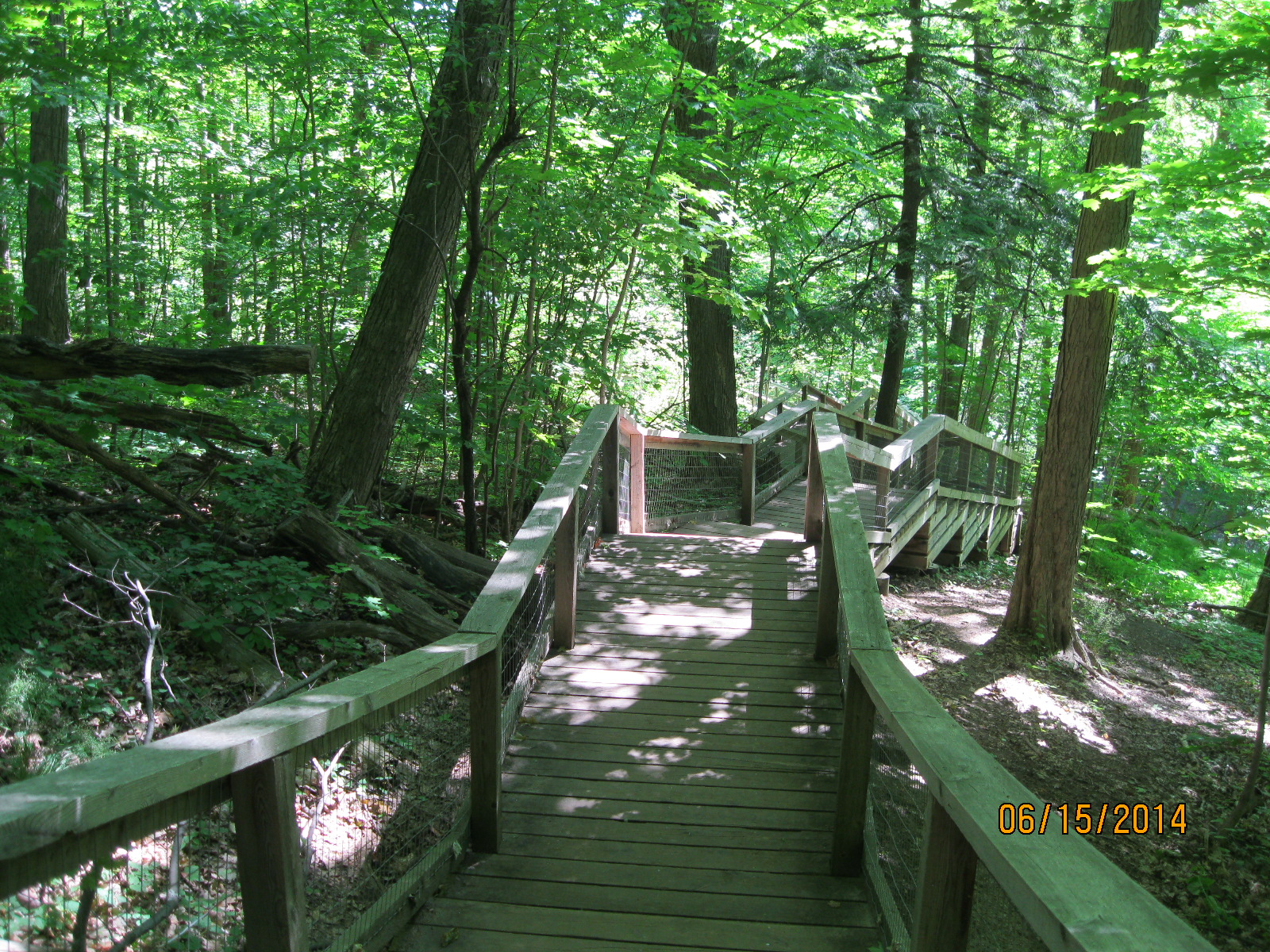
The brook passes through Blythwood Ravine and then into Sherwood Park.  The Carolinian Forest in the park contains White Pine, Eastern Hemlock, American Beech, Red and White Oak and Sugar Maples that are over 150 years old.  Along the way there is a lot of groundwater discharge and the hillsides are seeping with water.  A long stretch of the trail is covered with a boardwalk that seems to contain one too many stairs.

IMG_2259

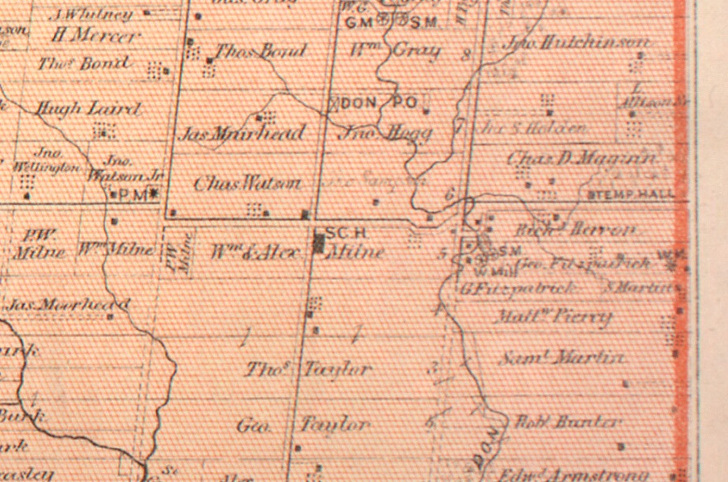
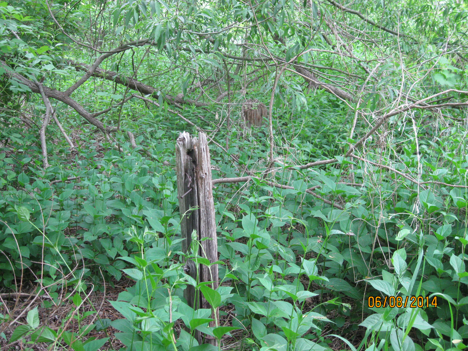
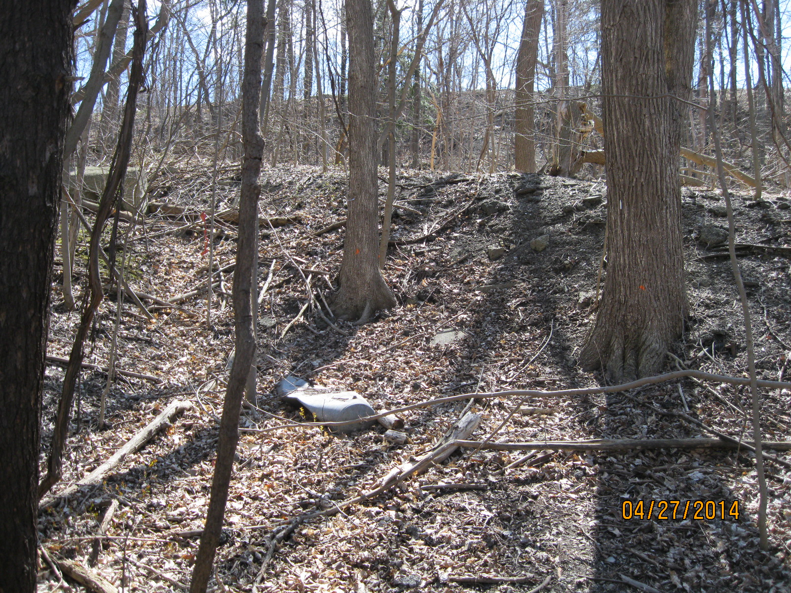
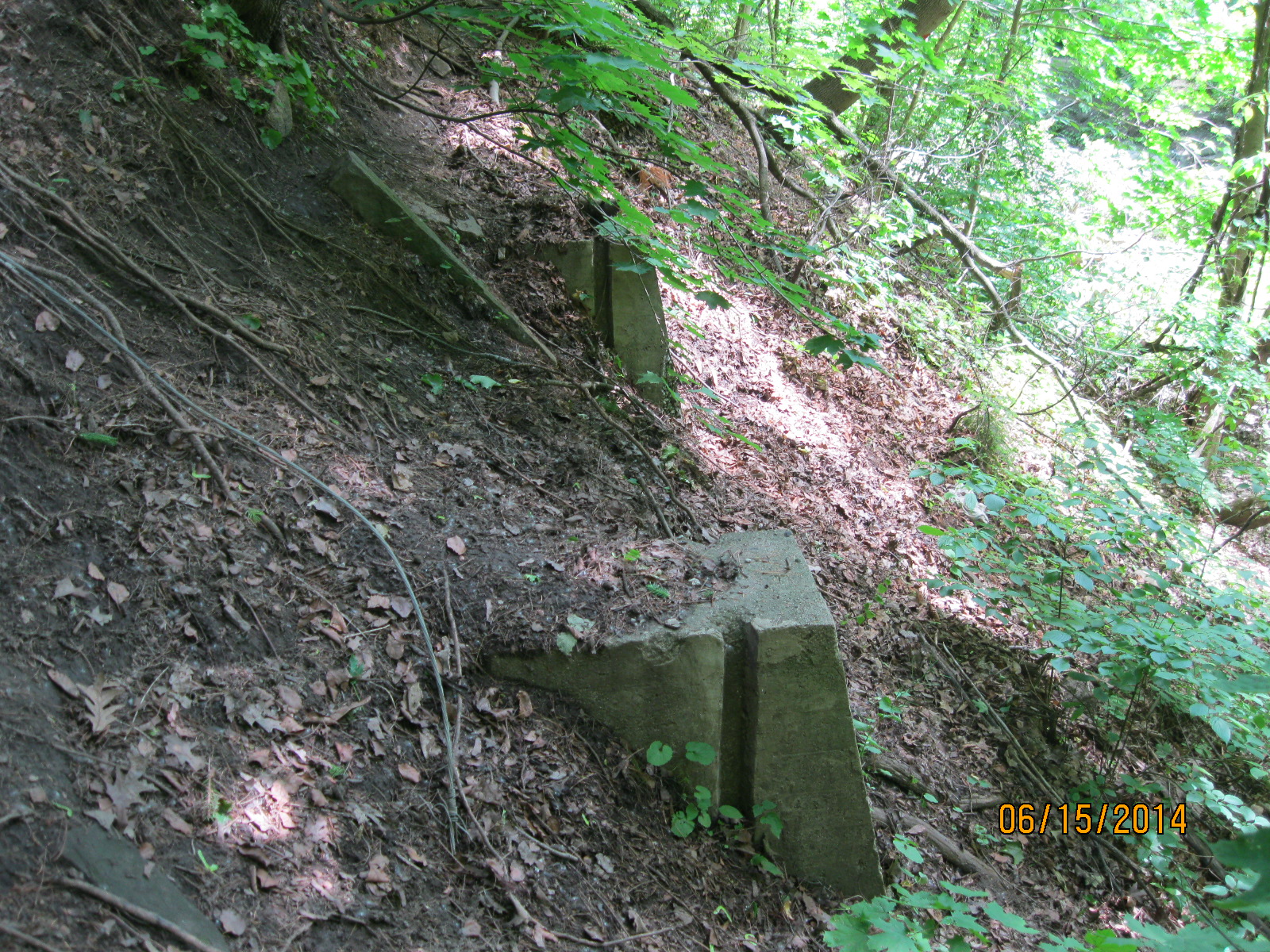
Just before you reach Bayview Avenue there are four concrete abutments about 10 feet up the hill on the north side of the valley.  They are somehow related to an old road alignment that brought Bayview down into the valley to cross Burke Brook.  It then climbed the hill behind what is now Sunnydene Crescent.

IMG_2264

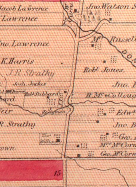
Bayview Avenue (1st Line East) runs up the middle of the historical Atlas map below.  The jog in the road (and the actual road allowance) are seen in the centre of the map.  Bayview Ave makes a little “s” curve where it crosses Burke Brook.  The road allowance has been drawn in by the mapmaker with dotted lines.  Between 1947 and 1953 the ravine had a large culvert installed and then a berm was built to fill in the valley to straighten out the road and make it almost level.

Bayview 1887

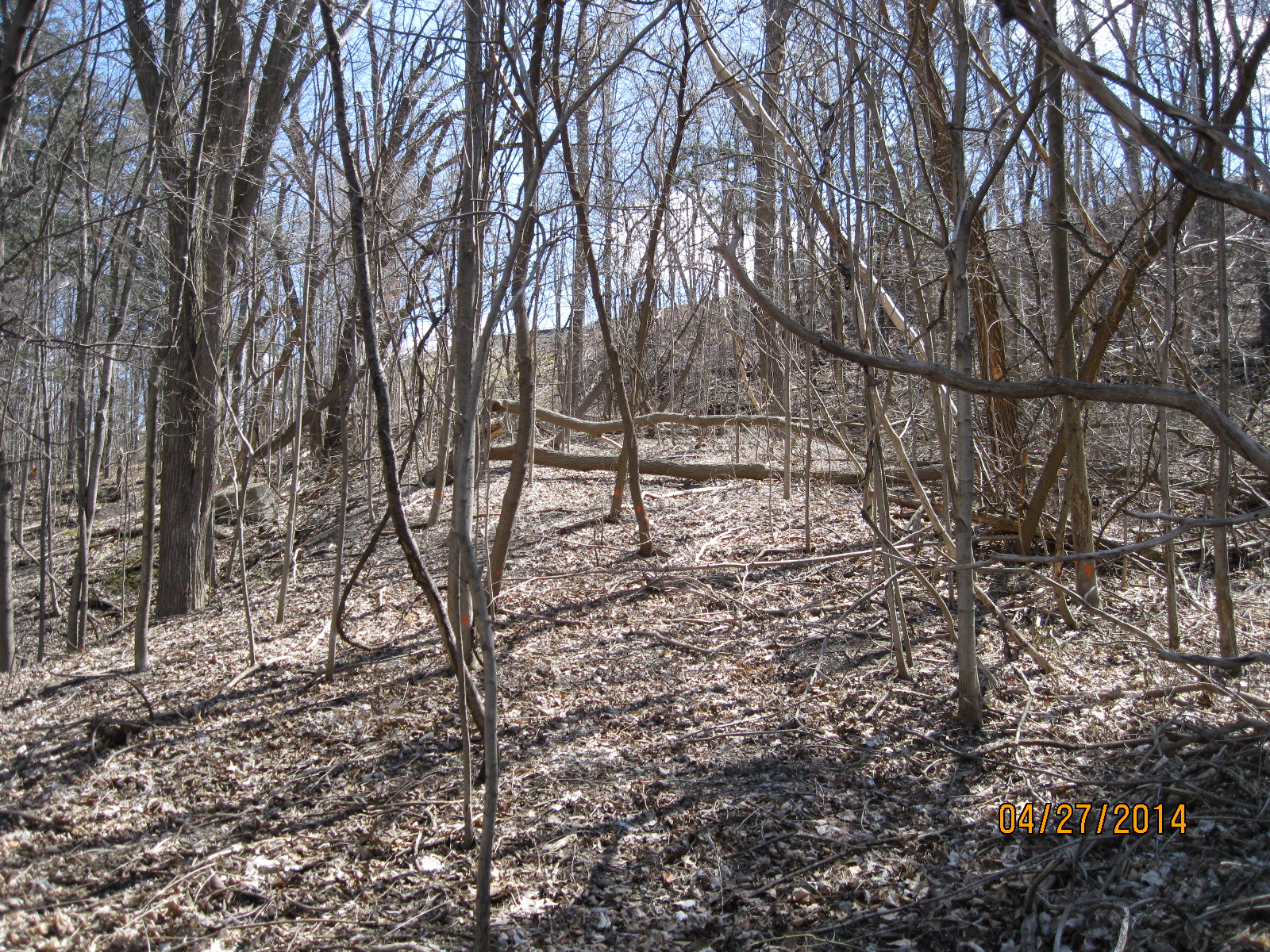
When you cross Bayview Ave to go back down to the bottom of the ravine you will find the descent is one of the steepest slopes on any trail in the GTA.  For this reason, the settlers chose to run the road west along the hillside as it angled toward the bottom of the ravine and then back up on an angle on the other side.

You are now in the ravine below Sunnybrook Hospital.  This property belonged to Joseph Kilgour who made his fortune as head of Canada Paper Company.  He owned a large estate which his wife donated to the city in 1928 as a public park called Sunnybrook Park. Sunnybrook Veterans Hospital, built on the corner of the property, was opened in 1946 to help deal with the influx of veterans following the second world war.  It is likely that the straightening of the road was done to improve access to the hospital from the south.

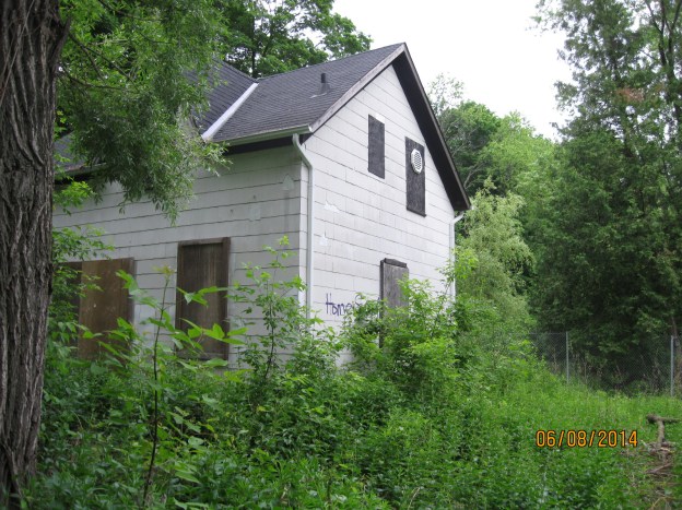
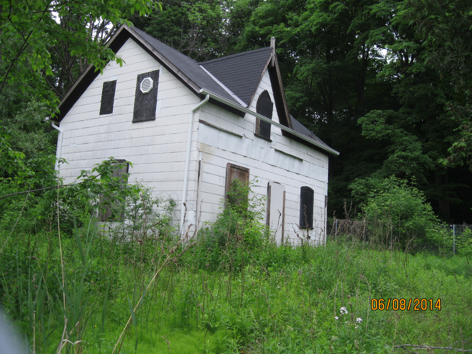
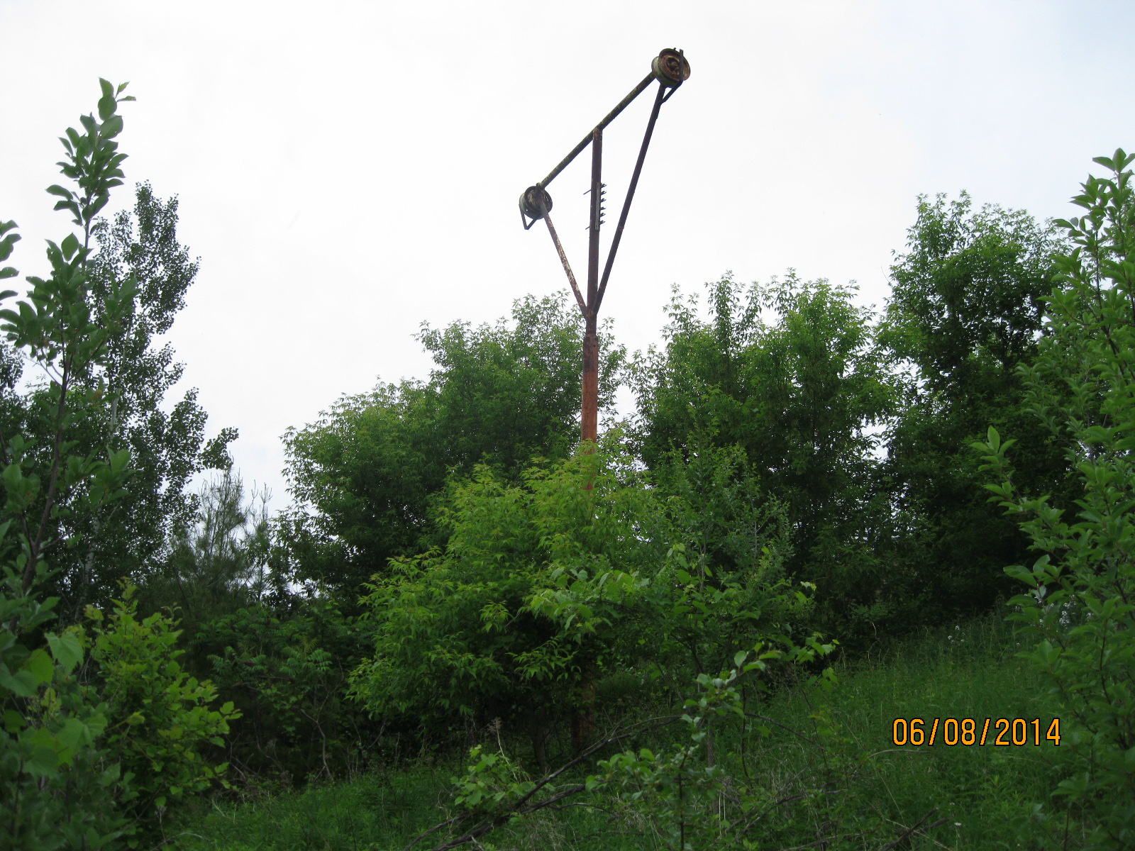
A building from the 1950’s now stands abandoned in the woods near the hospital.  This appears to have been an electrical generating building that has since become obsolete.

IMG_2285

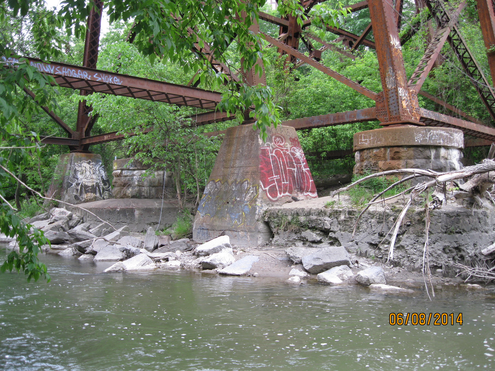
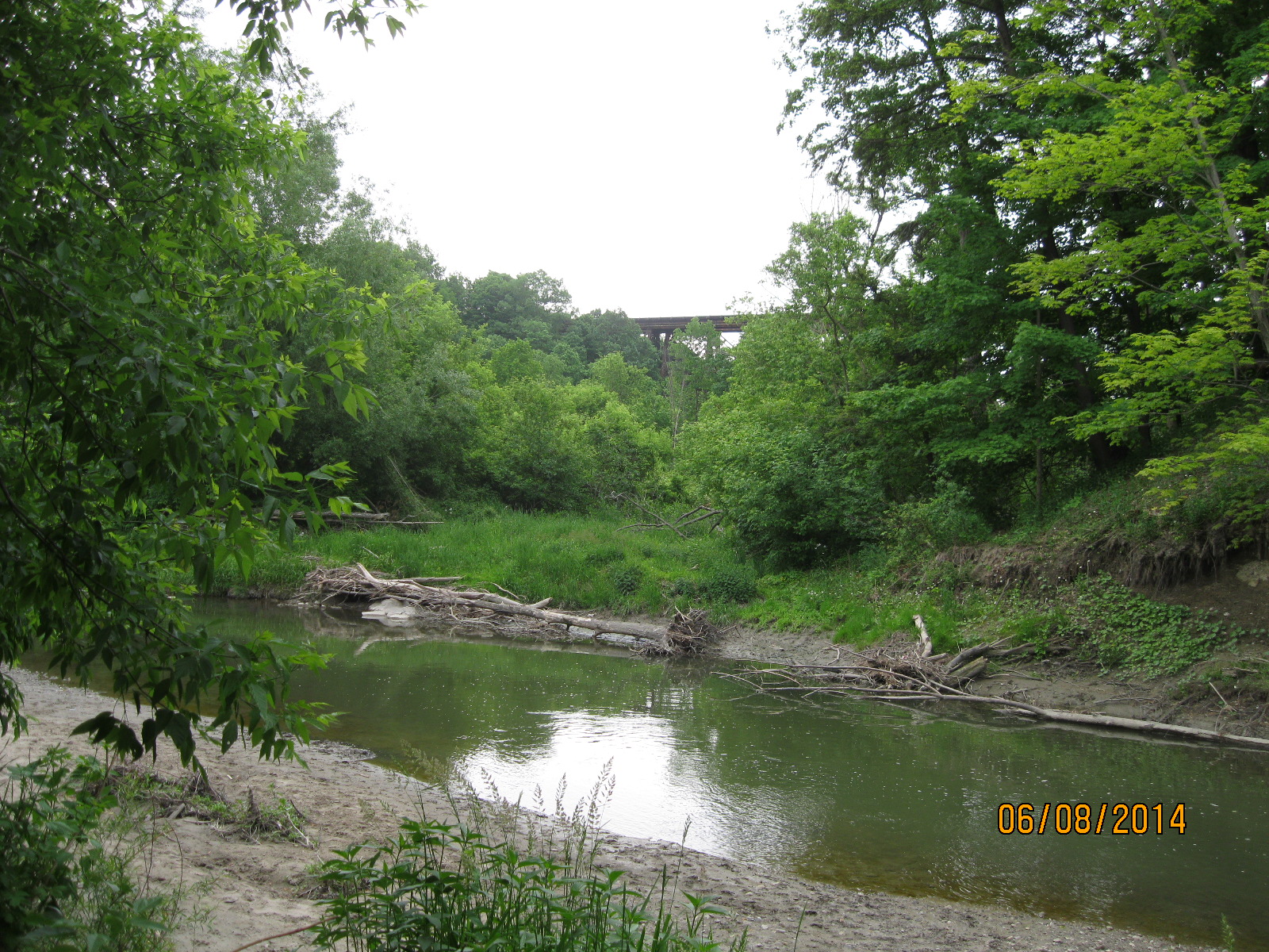
Turning to your right when you reach the main trail in Sunnybrook Park will bring you to the mouth of Burke Brook where it empties into the West Don River.

IMG_2274

Google Maps Link: Burke Brook

Like us at http://www.facebook.com/hikingthegta

Follow us at http://www.hikingthegta.com


Milneford Mills


Sunday June 8, 2014

It was cloudy but rain wasn’t predicted until later in the day.  I parked in the lower parking lot off of Lawrence just east of the Don Valley Parkway.  Lawrence Avenue used to take a small jog into the valley where it crossed the East Don River in Milne Hollow where the hamlet of Milneford Mills was developing.

Scottish miller, Alexander Milne, started a mill on his property on the South west corner of Leslie and Lawrence in 1817.  This site is currently home to Edwards Gardens.  Wilket Creek flows through the property but had inconsistent water levels and so he moved his mill and homestead to another property of his.

He owned 120 acres on the East Don river just south of Lawrence.  He moved his farmstead here in 1832.  The mill village that grew up near the mill was called Milneford Mills and included a dry goods store, a wagon shop and workers quarters.  In 1846 he built a woolen mill which was destroyed along with the entire mill village by the severe flooding of Sept. 13, 1878.  Milnes rebuilt and the woolen mill ran into the early 20th century. When the Don Valley Parkway was built in the mid 1950’s the remaining buildings were removed, all except the Milne family home.

In the 1880 County Atlas several buildings are marked as well as the two mills.  They are located on the river on the right hand side of the map, near the middle of the page.

Milne Hollow

The house was built in 1871 and is one of the oldest examples of gothic frame architecture in the city.  The front porch which used to look out over the mills has been removed.  Now abandoned, it is intended to be restored eventually.

IMG_2138

The eastern embankment south of the house was turned into a ski hill in the 1930’s and was run by the Don Valley Ski Club.  With three lifts, two rope and one Poma it also boasted a $70,000 snow making machine.  There were several 200 m runs dropping the 40 m of slope to the bottom of the hill.  It lasted until around 1976.  Today a lone ski lift tower stands halfway up the hill.  It is slowly disappearing in the new growth of trees that have been planted to rehabilitate the hill side.

IMG_2147

At the base of the hill, behind a large willow tree stands a series of wooden posts that once supported the loading platform for the ski lift.  Behind here two steel rails sit on the ground.

IMG_2144

As you walk along the edge of the river the trail is lush with sumac and aspen trees.  There are several wetlands along the way which are full of water fowl.  The trees are alive with the sounds of various songbirds.  A short walk past the old ski hill brings you to the ruins of an old dam.

IMG_2148

A little farther along I saw this group of silk worms.

IMG_2152

You will come to a bridge that gives you a choice to cross the river. Crossing the river leads to the display below and to Tim Horton’s a little farther along.

This display, known as High Water, marks the various flood waters.  The highest rock is from 1934 and must be at least 12 feet above the current water level.  Hurricane Hazel, which hit the west end of the city hardest, didn’t flood the Don severe enough to get a rock in the display.

IMG_2159

If you stay with the east side of the river you will have to climb up over the CN tracks.  On the far side the steep dirt hill leads to a trail that passes through a thick growth of trees.  After following the river for a while you will come to Anewen Park.

The Ontario & Quebec Railway was incorporated in 1871 and built a line north of the city of Toronto.  The high trestle bridge over the East Don River was constructed on round piers of cut stone.  When the CPR, who ran the line, double tracked it around 1898 new sets of piers were built of concrete.   In the photo below you can see the two original round bridge footings which were capped with concrete when the rail line was double tracked.

IMG_2164

The CPR bridge in the distance as it crosses the East Don river south of Lawrence Ave.

IMG_2166

Like us at http://www.facebook.com/hikingthegta

Follow us at http://www.hikingthegta.com

G. Ross Lord Park

G. Ross Lord Park runs from Steeles Ave south to Finch Ave. on the east side of Dufferin Street. The park was created in 1972, mostly for flood control purposes.  It was based on plans developed after Hurricane Hazel hit the Toronto area on Oct. 15, 1954 killing 81 people and causing $137 million worth of damage.

Two mills are marked on the 1887 map of the park area, along with their mill ponds.  A grist mill located on the second property south of Steeles Ave. is the site of Jacob Fisher’s original mill.  I have been unable to find any trace of the saw mill on the second property north of Finch.

Fisherville Mill

Fisherville was named after the Fisher family. Jacob Fisher emigrated from Pennsylvania with 22 members of his family in 1797. They were granted a tract of land which was on both sides of Steeles, east of Dufferin street. They ran a saw mill on the West Don River and later a grist mill which operated with different owners until about 1912.

The Presbyterian church that used to stand near the north east corner was built in 1856 on land donated by Jacob Fisher.  It was moved to Black Creek Pioneer Village in 1960 and I got married there in 2007.  It’s site is marked by a cemetery where this stone from 1840 marks an early settler in the area.

Fisherville stone

The park can be entered by a trail the follows the West Don River south from Steeles Ave. in the hollow east of here.  The trail follows the river winding its way through grand old trees like the one in the cover photo that dwarfs the park bench beside it.  When you are abreast of the old smoke stack on the left, you will be standing in the middle of the old Fisherville mill pond.

In the 1947 aerial photo below the dam still crosses the river in the lower right corner.  The three light patches that straddle the river just above it are the clear space at the bottom of the former mill pond.  The trail passes through the middle one of these.

mill pond 2

A little further along there is still some concrete from the old dam on the north side of the river.

IMG_0060

A curved wall of earth  about 10 feet high marks the retaining wall of the old mill pond.  There is a line of older trees behind it  that can be seen from the trail and marks the spot.  Staying on the foot path leads to a little bridge that will take you across the river.  From here it is possible to go back along the fence line to the old mill site.  The curve of the earthen wall is visible in this picture.

IMG_0062

The bottom of the mill pond is now growing over with small trees and brush.

IMG_0064

Across from Supertest Road there is an entrance to the park off of Dufferin Street.  Two parallel rows of evergreen trees mark the laneway of a home that stood here until the city bought the land and tore the home down in the early 70’s.  These trees were planted around 1950 and now are part of the off-leash area where dogs still run up and down the lane.

IMG_1877

The cluster of evergreen trees just to the south of the first parking lot was planted at the same time.  They were planted on the north side of the house to provide some shelter from the cold northern winter winds.  This was a common practice for country homes across Ontario.  This is the view from where the house once stood.  The house looked out over Westminster Creek down in the hollow.

IMG_1879

Close by in the woods is an old garbage dump, likely from this house.  The bottles here have all been smashed but date from the late 1800’s into the 1940’s.

IMG_0059

Following the trail will bring you to the parking lot off of Martin Ross Ave.  The lower mill pond and saw mill site is most likely somewhere below the new flood control pond built in 1973.  This picture looks at the possible site of the mill, now mud flats when the water level is low.

IMG_1880

Google Maps Link: G. Ross Lord Park

Like us at http://www.facebook.com/hikingthegta

Follow us at http://www.hikingthegta.com

Old Eglinton Road

Sunday April 27th, 2014

It was a bright sunny afternoon around 10 degrees.  I entered the woods at the east end of the Eglinton Ave. bridge over the East Don River.  As you go into the south east you come quickly to the first storm drain.  Cross above the drain and make your way through the cedar woods towards the bottom of the hill and the CPR tracks.

After skirting the edge of the hill for a short while you will come across a ramp coming down the hillside.  This is the end of Old Eglinton Road when it used to come down the hill and out to the railroad tracks as recently as the 1970’s.  There is some garbage along the north side of the roadway but nothing to specifically date the rubbish.  Lots of Ketchup bottles but unfortunately Heinz never took to dating their bottles.

Following the trail a little further brings you to a small stream that disappears under the railroad tracks and runs under the golf course to the East Don River.  If you take the trail away from the tracks and midway along the side of the hill you will come to a place to cross the stream where it flows out of a large culvert.  Crossing the culvert and turning to your right you will find a set of five footings from an old bridge.  The footings on the north side have been broken up, but still remain.  I disturbed a pair of cardinals who likely have a nest here.  As usual they’re a little camera shy and don’t sit still long enough to get their picture taken.

Old Eglinton Road as seen in this 1971 aerial photo.  The road can be seen cutting through the trees in the lower right hand corner.  The new Eglinton Ave is marked where it runs a couple hundred meters north of the old road.


Eglinton 1971

The north side of the bottom end of Old Eglinton Road as it descends the hill.

IMG_1839


Looking up the hill on Old Eglinton road the trees are well established.

IMG_1840


Hiking by myself, I decided not to try this bridge.  There is a little trail that will lead you up and around.

IMG_1844


Hiding in the trees and leading straight up the hill into the side of a building are five concrete supports for a bridge.  As of this writing I can’t find anything on them.


IMG_1848

Visit us at http://www.facebook.com/hikinthegta