Saturday June 6, 2015
After visiting the Barber Paper Mills we crossed the Credit River and made our way toward the Barber dynamo. The walk back to the dynamo is about 3 km and will take you up and down the 100 foot sides of the ravine three times. The former Grand Trunk Railway bridge is about half way back to the site.
The Grand Trunk Railway Bridge was built in 1855 and earned the nick-name the Iron Bridge. It crosses the 2000 foot wide river valley using 8 spans of 96 feet each and extensive berms on either side. The bridge rises 115 feet above the river. It was expanded in 2010 to accommodate a double track as part of GO Transit’s expansion of services. Provision has been made for a third track in the future. When you reach the rail bridge you will have the option of an upper or lower trail. Choose the upper trail as the climb is less severe here than further down the trail.

The paper mills were a growing business in the 1880’s when John Roaf Barber was running the company. Born in Georgetown in 1841, John became the plant manager in 1861 and took over full control upon his father’s passing in 1880. John was a visionary who had converted his mill to the use of paper pulp and was producing some of the finest paper in Canada. The Barbers had already moved their mills once to get a better head of water to run the water wheels. Now the water supply was proving to be inadequate again for the size of the business.
After you pass the train bridge you will descend back to the river level before climbing once more as you approach the dynamo. The trail will split with one trail headed further downstream while the one to the right heads to the dynamo. You will see a long earthen wall with a small bridge set into it. This is the weir that was built to help retain the power mill pond. The bridge sits above a former sluice gateway that has since disappeared.

When J.R. Barber was thinking about his shortage of power in the mill, the early uses of electricity were limited to a few street lighting applications. No one had thought about generating it and transmitting it across wires for use in industry. He contacted C. F. Brush, an early manufacturer of dynamo equipment, in Ohio and told him of his plans. Originally it was deemed impossible but Barber persisted and convinced Brush to manufacture a 100 hp dynamo for him when Brush’s previous largest one had been 30 hp. Barber selected a site downstream where he could dam the river and create a head of water 6.6 meters tall. This height of drop was used to power the turbines that ran the dynamo.
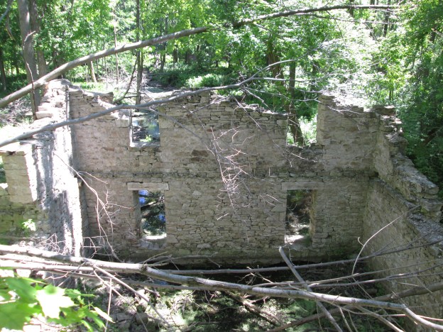
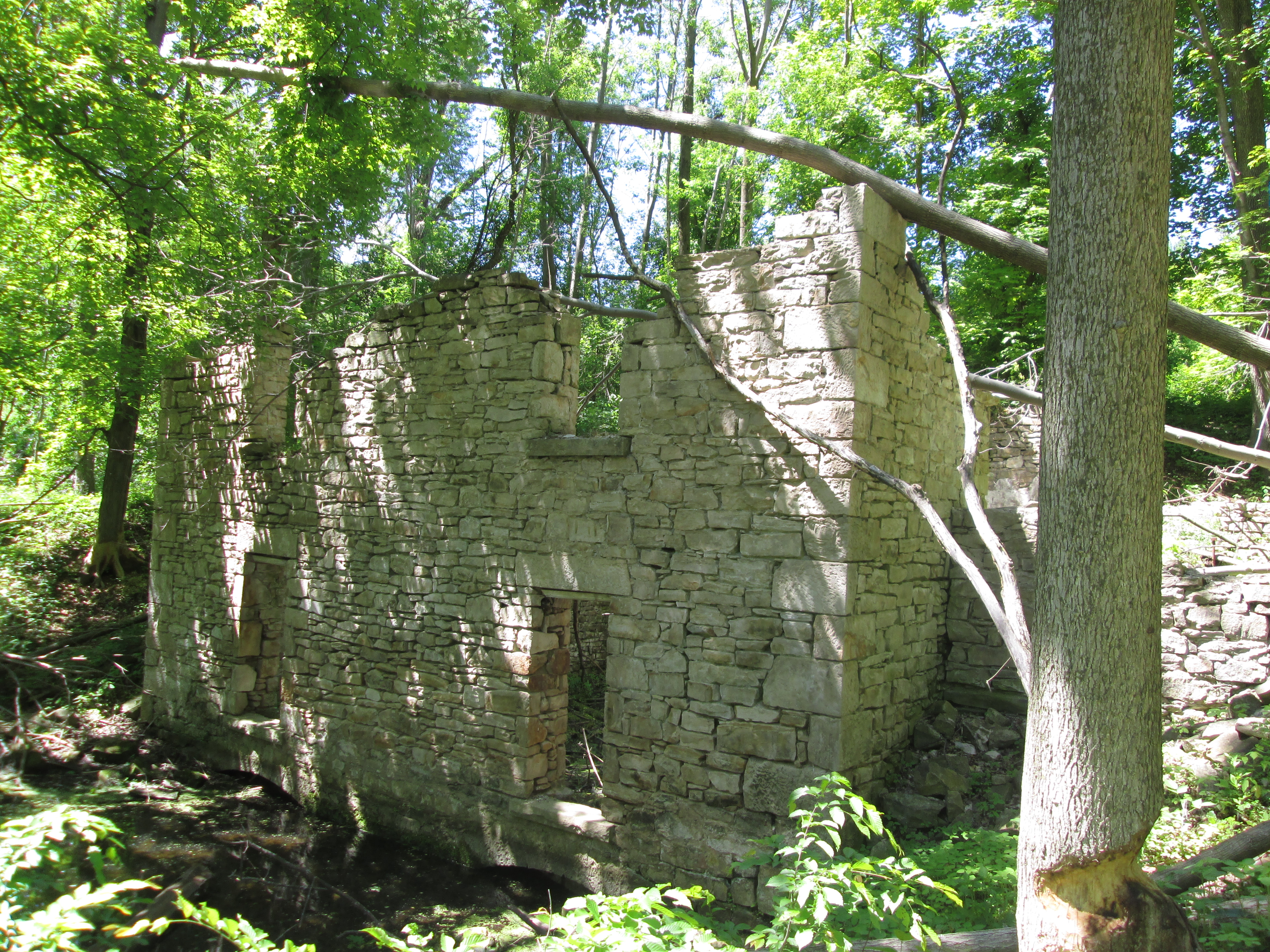
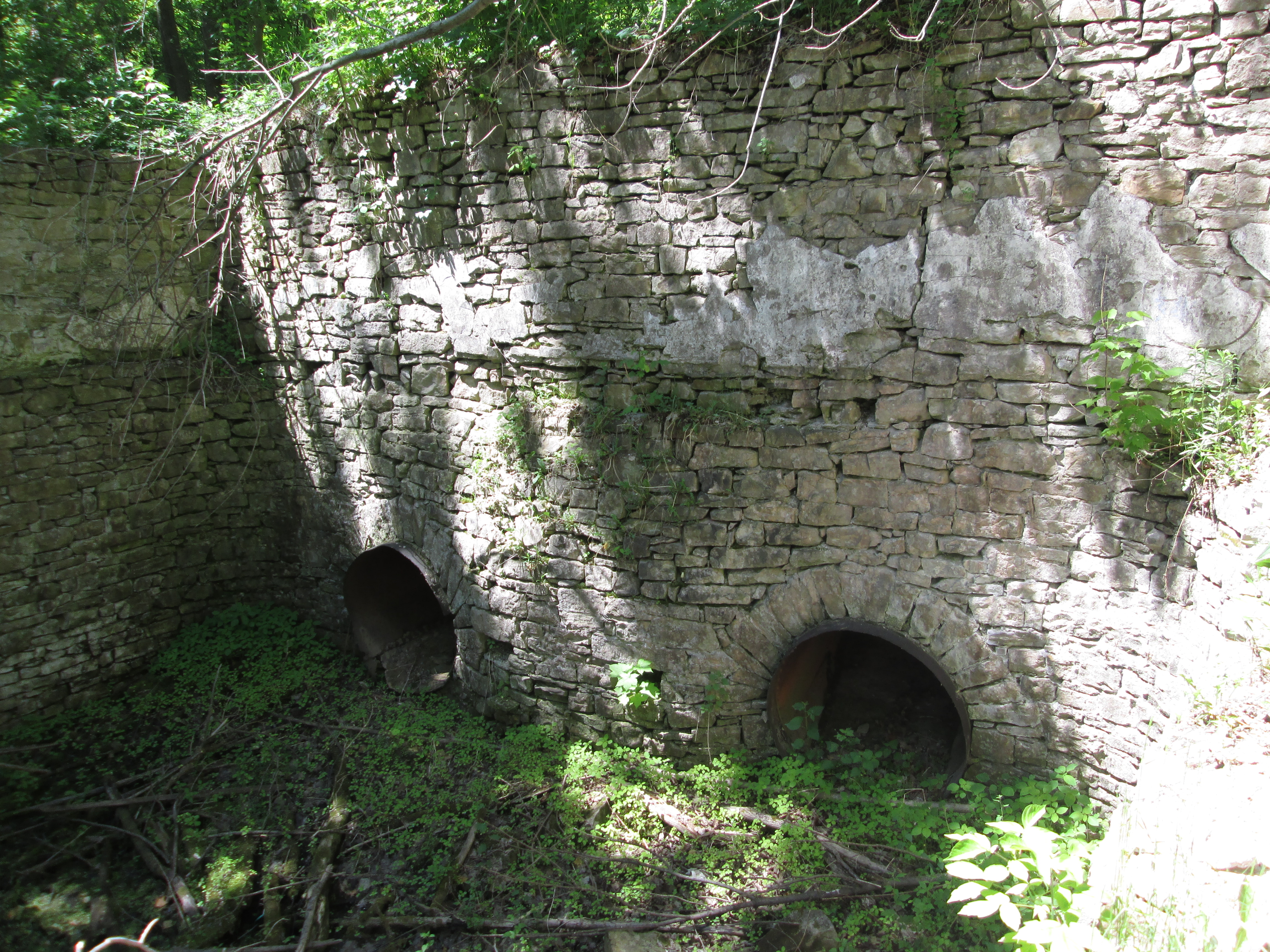
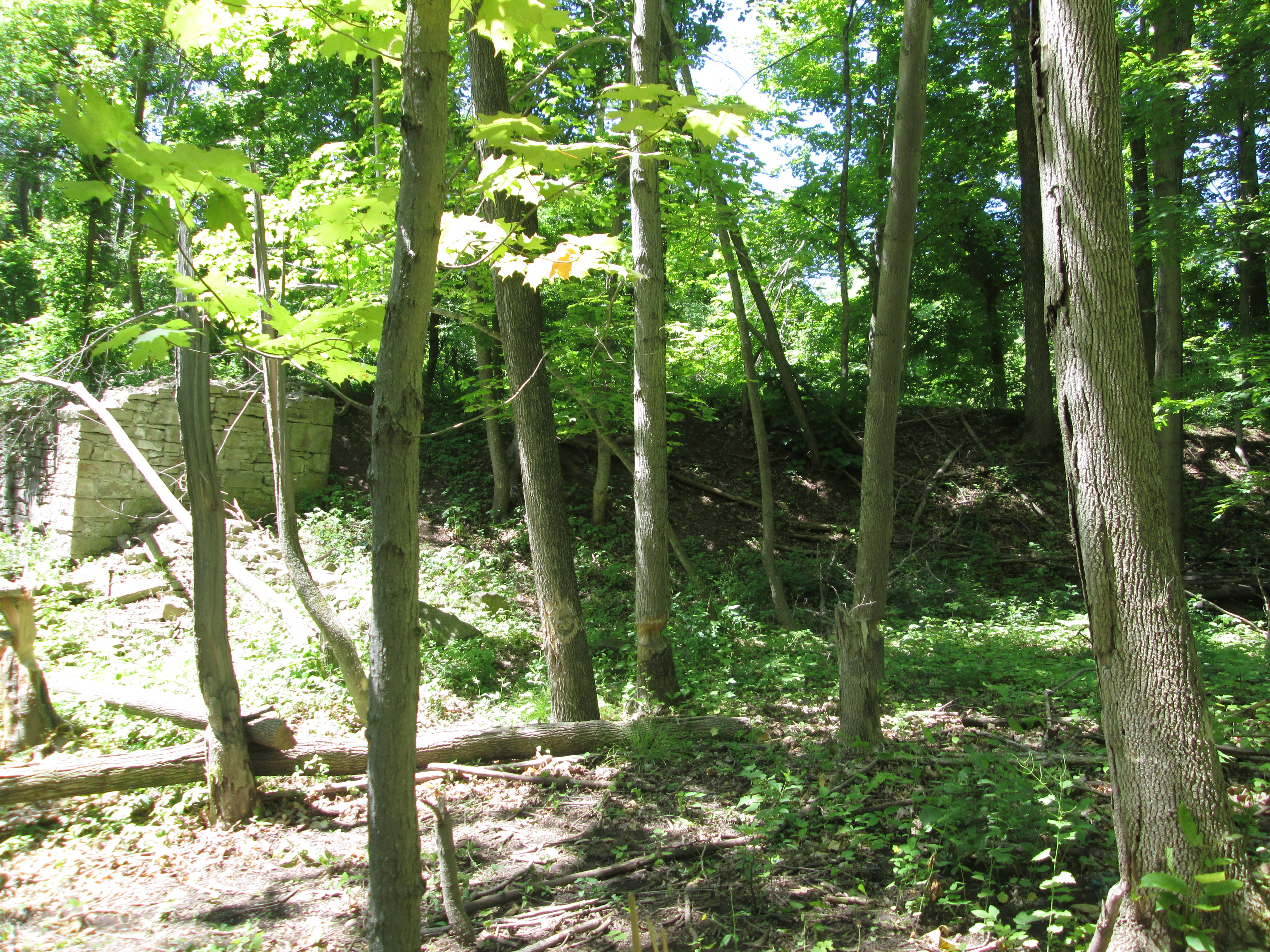
The cover photo shows the ruins as you approach them from the west where the water entered. Directly behind the dynamo building is a 3 meter deep intake channel. The dynamo was a three story building. Turbines were on the first floor, dynamo equipment on the second and living and eating quarters on the third. The east wall in the picture below shows the remains of the second story windows which were the same as those on the first floor. At water level a pair of stone arches were the outlets for the water after it was used to turn the turbines that powered the mill. The water flowing out of these arches formed the tail race and was returned to the river downstream.
Water from the inlet was fed into a “Y’ branch penstock, the two ends of which can be seen below. These in turn were connected to the turbines that were mounted in pairs in front of the water inlet ducts. The turbines were 1.5 meters in diameter and may be the very ones pictured in the Barber Paper Mills post.
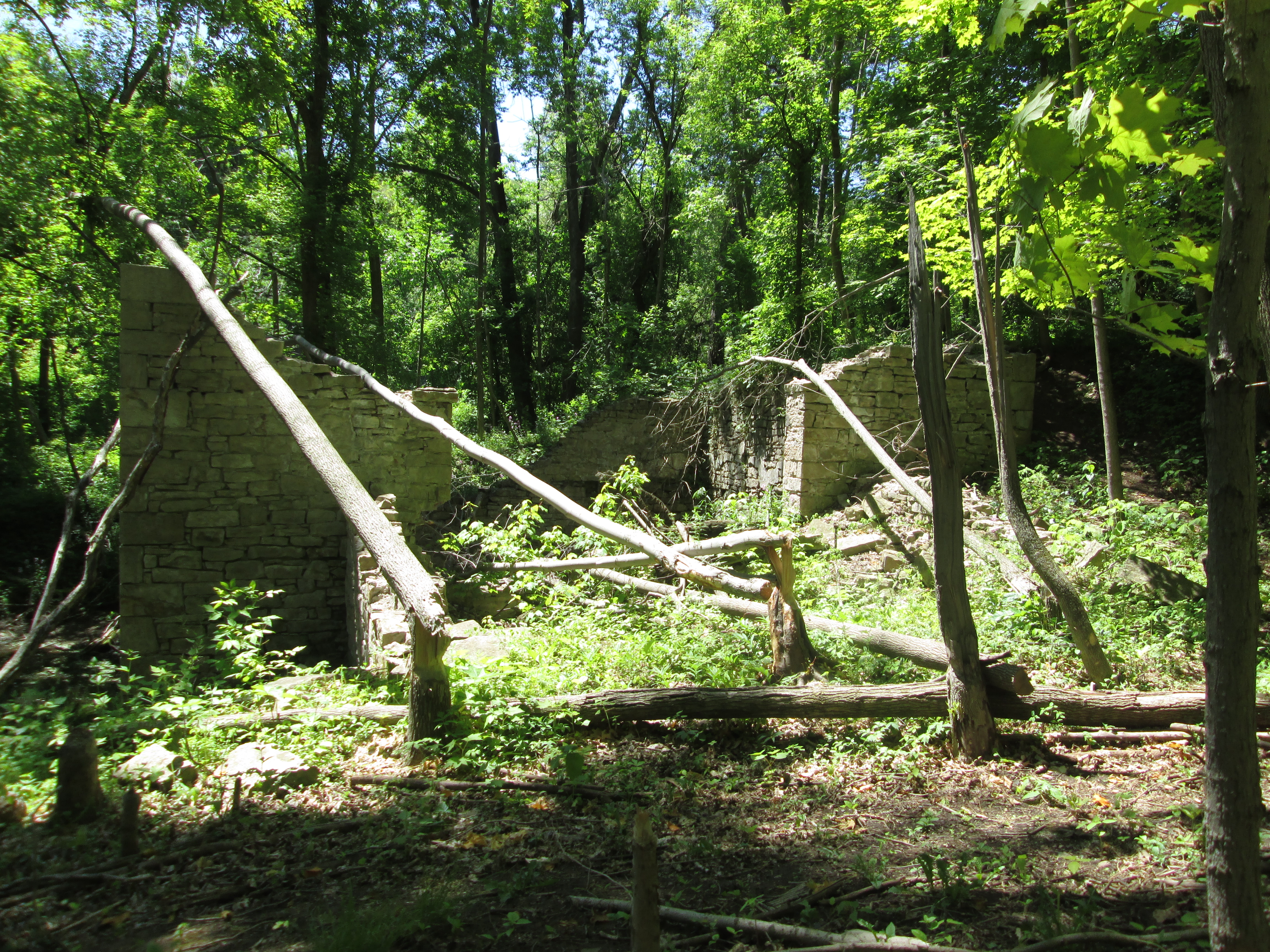
This view is from the south side of the dynamo looking across to the power house (now gone) on the north side. When I was last here there was a pair of beautiful stone arches in that square hole. Shafts ran through these arches to connect the dynamo to the turbines in the main room on the lower floor. The arches are now only so many stone blocks smashed on the floor inside.
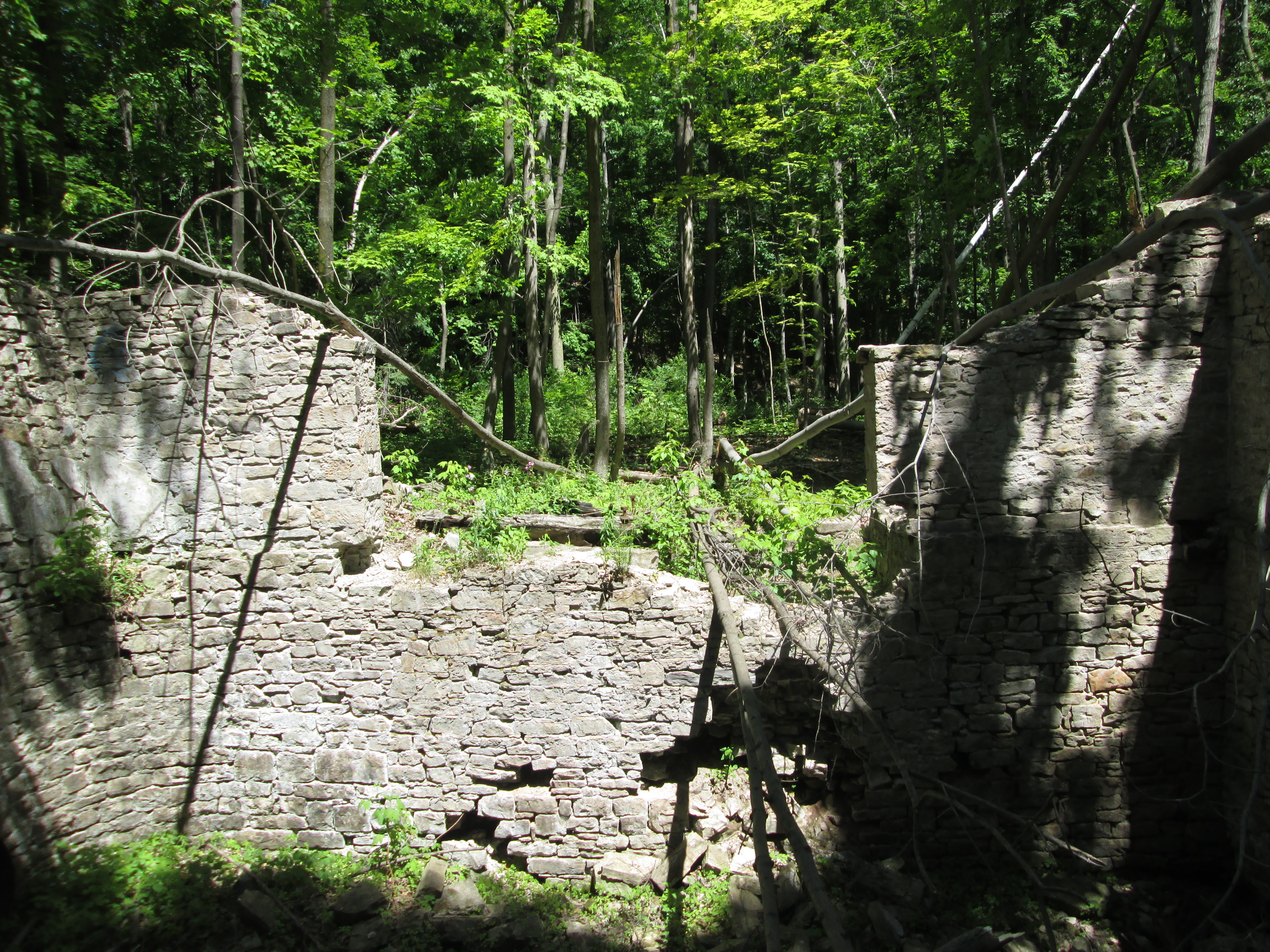
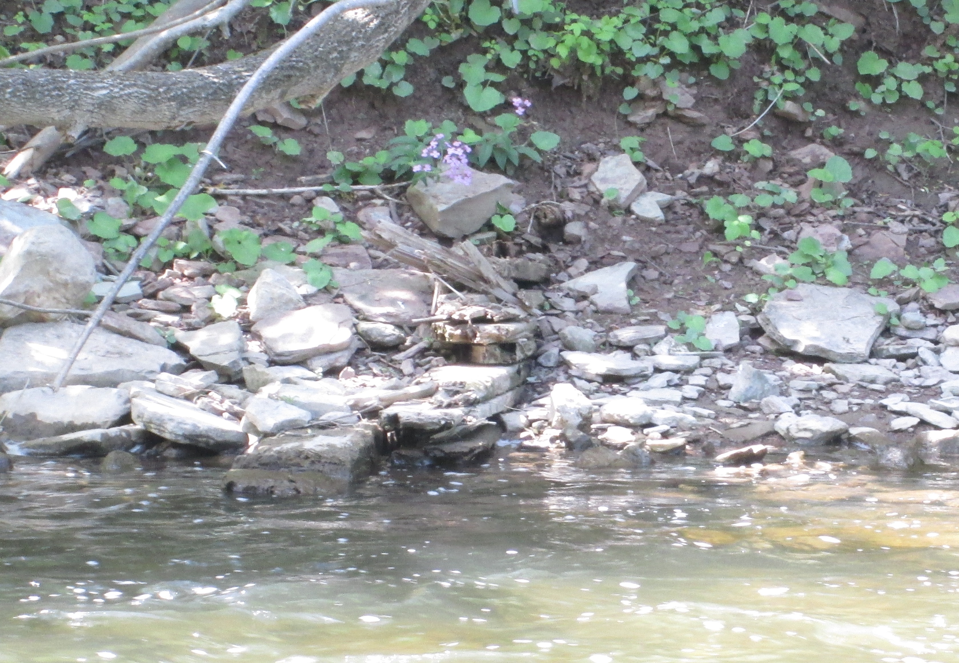
The larger of the two dynamos operated here was the 100 hp one that was mounted in the power house, a small extension on the north side of the building. A smaller 60 hp unit was mounted inside on the second floor. The 100 hp unit supplied power to the machinery at the mill while the smaller unit provided lighting. Each was connected to the mill by one of two wires strung on telegraph poles installed for the purpose. The larger unit was bolted down to rail ties. The remnants of the rail ties and mounting bolts can be seen in the picture below.

The weir can be seen in this picture as a the dark line running across the middle of the photo. The wall of the crumbling building can be seen at the left side of the weir.
By following the line of the old earthen berm toward the river it is possible to locate some of the original wooden crib that was the main part of the dam. Several flat rows of wood are stacked up just near the water line in the picture below. They would have been under water 127 years ago when they were installed.
The paper mill is under attack from developers. The dynamo building is under attack from beavers. John Roaf Barber chose this site because it was a suitable place to dam the river to create the pond he wanted to use to power his mill. The local beavers also think it is a great place for a pond. They are chewing down trees to make their dam and lodge out of. Several of the trees they have chewed through have fallen onto the old dynamo building. The same factors that led to the dynamo being constructed here are also speeding up the destruction of this historic building.
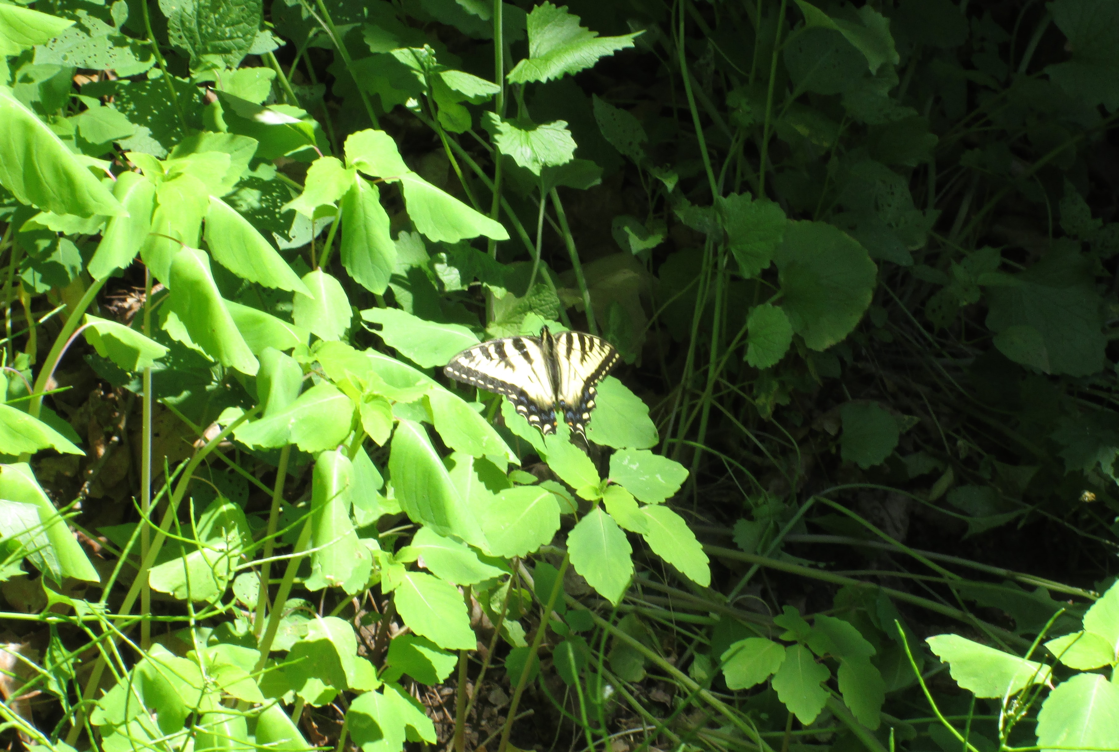
The Eastern Tiger Swallowtail on the plant in the picture below is a female. The female can be identified by the band of blue spots along the hind wing.
When public power came to Georgetown it was under the persuasion of J. R. Barber. He closed the dynamo in 1913 and let the Alexander family live there. Tragedy struck in 1918 when their young son fell off of the railway bridge and died. The dynamo was closed and left to the mercy of the weather, vandals and the beavers.
Like us at http://www.facebook.com/hikingthegta

Pingback: Barber Paper Mills – Georgetown | Hiking the GTA
Pingback: Glen Williams | Hiking the GTA
Pingback: Hiking the GTA #100 – Greatest Treks | Hiking the GTA
Pingback: Crooks’ Hollow – Upper Canada’s First Industrial Complex | Hiking the GTA
Pingback: Old Mills of Southern Ontario | Hiking the GTA
Pingback: Canada Day 2016 | Hiking the GTA
Pingback: “Long” Weekend Hikes | Hiking the GTA
Pingback: Flynntown – Ghost Towns of Toronto | Hiking the GTA
Pingback: The Credit Valley Trail | Hiking the GTA
Pingback: Credit Valley Footpath | Hiking the GTA
Pingback: Bruce Trail – Toronto Section | Hiking the GTA
Pingback: The Credit River – Georgetown | Hiking the GTA
Pingback: Our Favourite Hikes | Hiking the GTA