Category Archives: Historic Site

The Grand River In Galt

Sunday, June 13, 2021

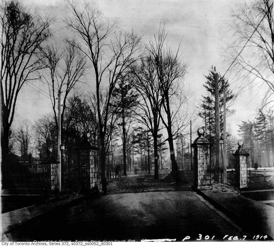
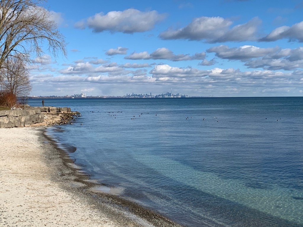
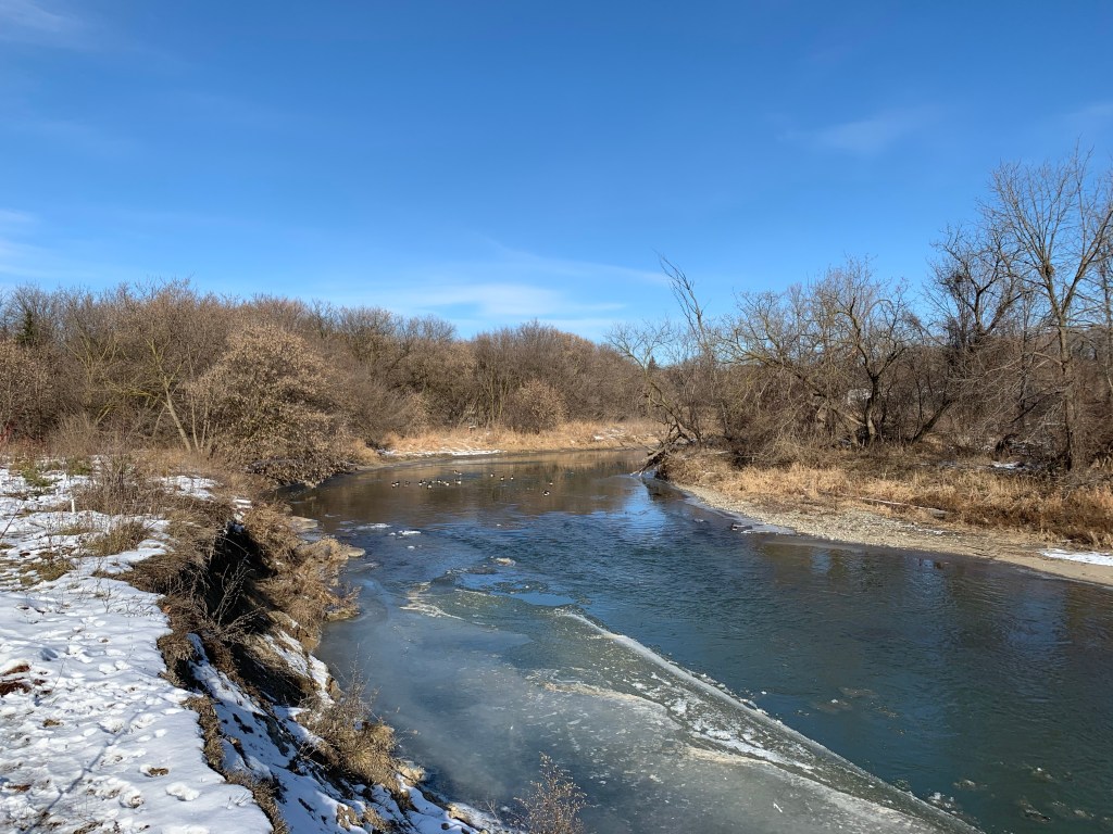
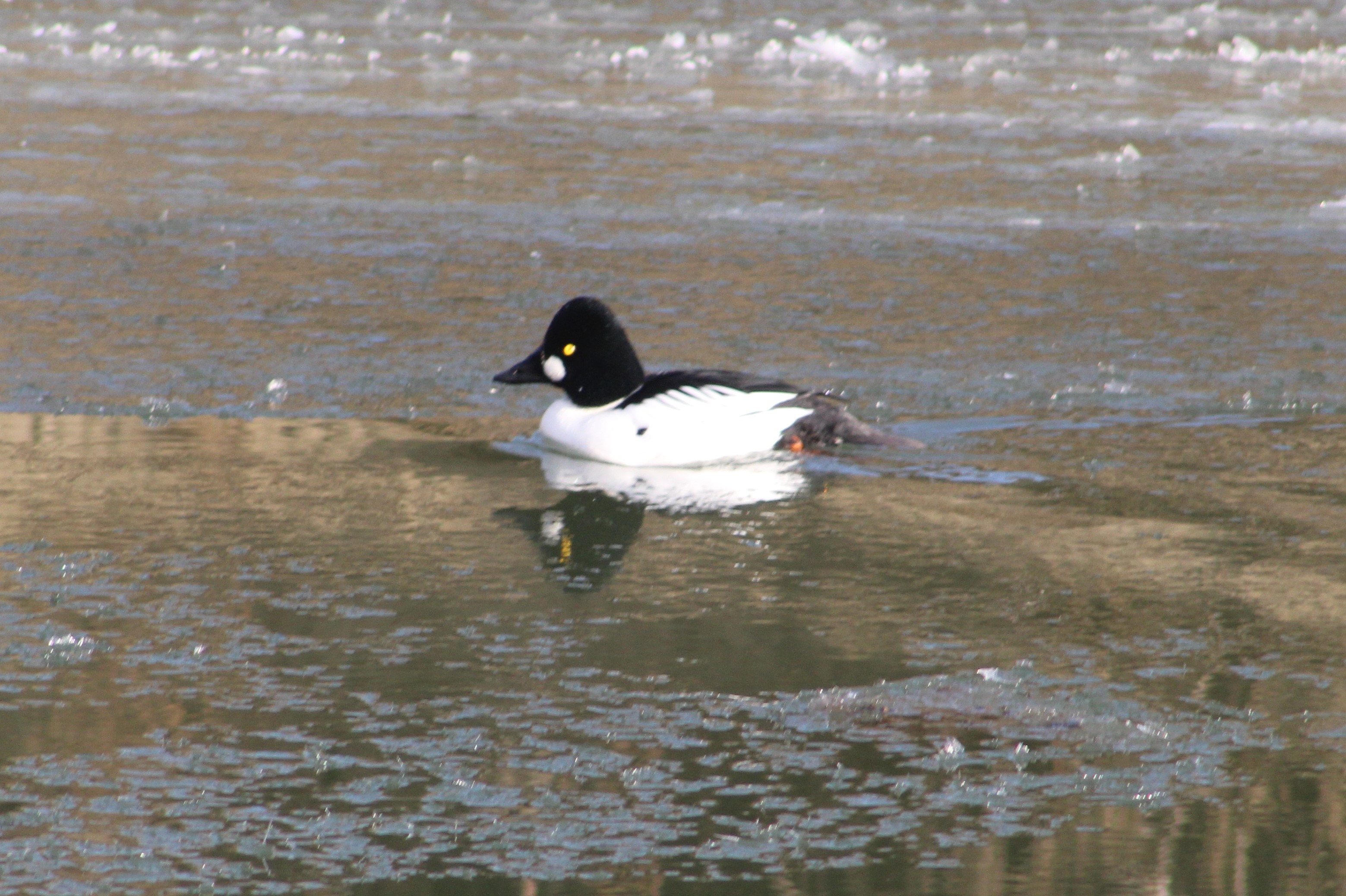
The Grand River is one of our Heritage Rivers and has been a means of travel and a source of power for centuries. William Dickson came to the Grand River area in 1816 and bought 90,000 acres of land with the intention of establishing a town and developing his land holdings. He built a mill at the confluence of Mill Creek and The Grand River and established Shade’s Mills which would be renamed Galt by 1827. The river made it possible for the establishment of Galt as an industrial centre. The residents built their early community along Water Street, an aptly named roadway.

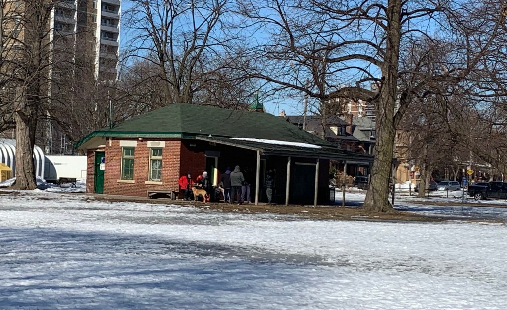
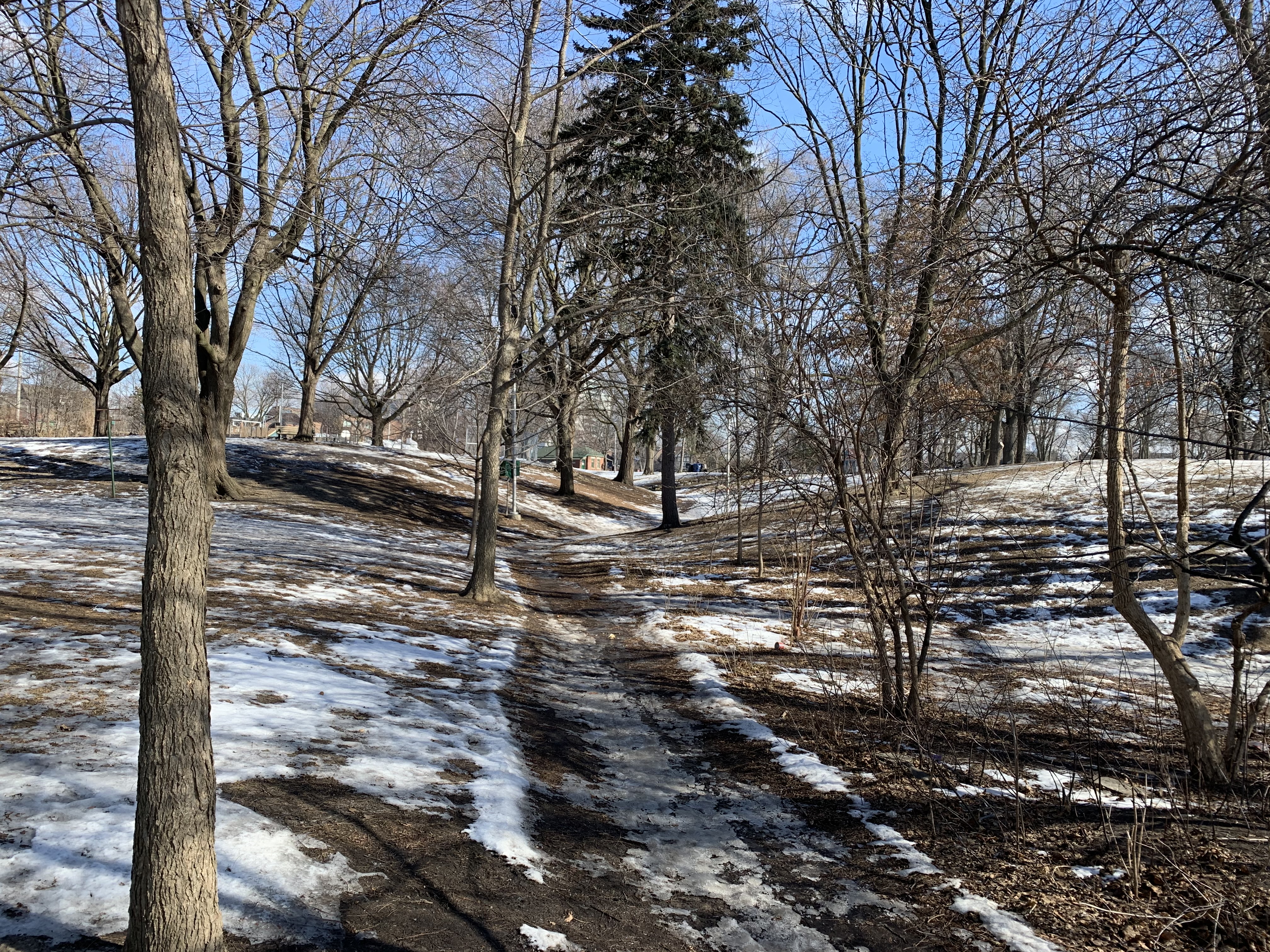
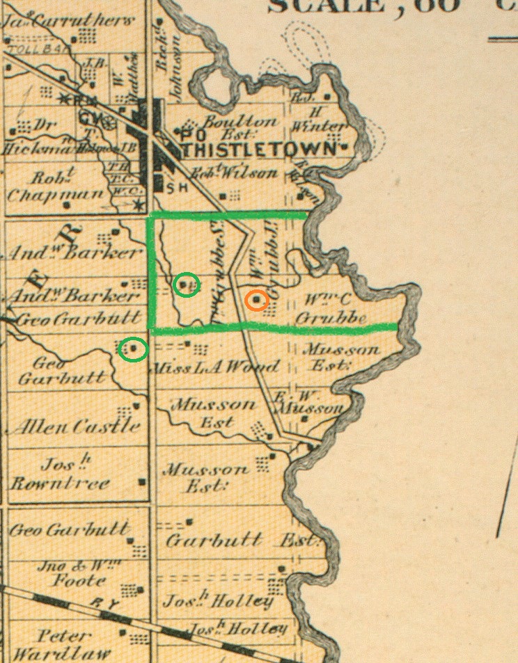
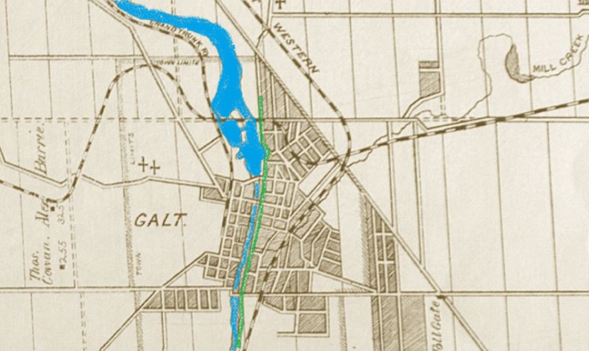
There’s lots to see in the old town of Galt but this post focusses on the buildings along Water Street. I parked in the parking lot near the Mill Restaurant and walked south along the river. The county atlas map below shows Galt in 1877. I’ve coloured the river blue and the section of Water Street that I explored is coloured green.

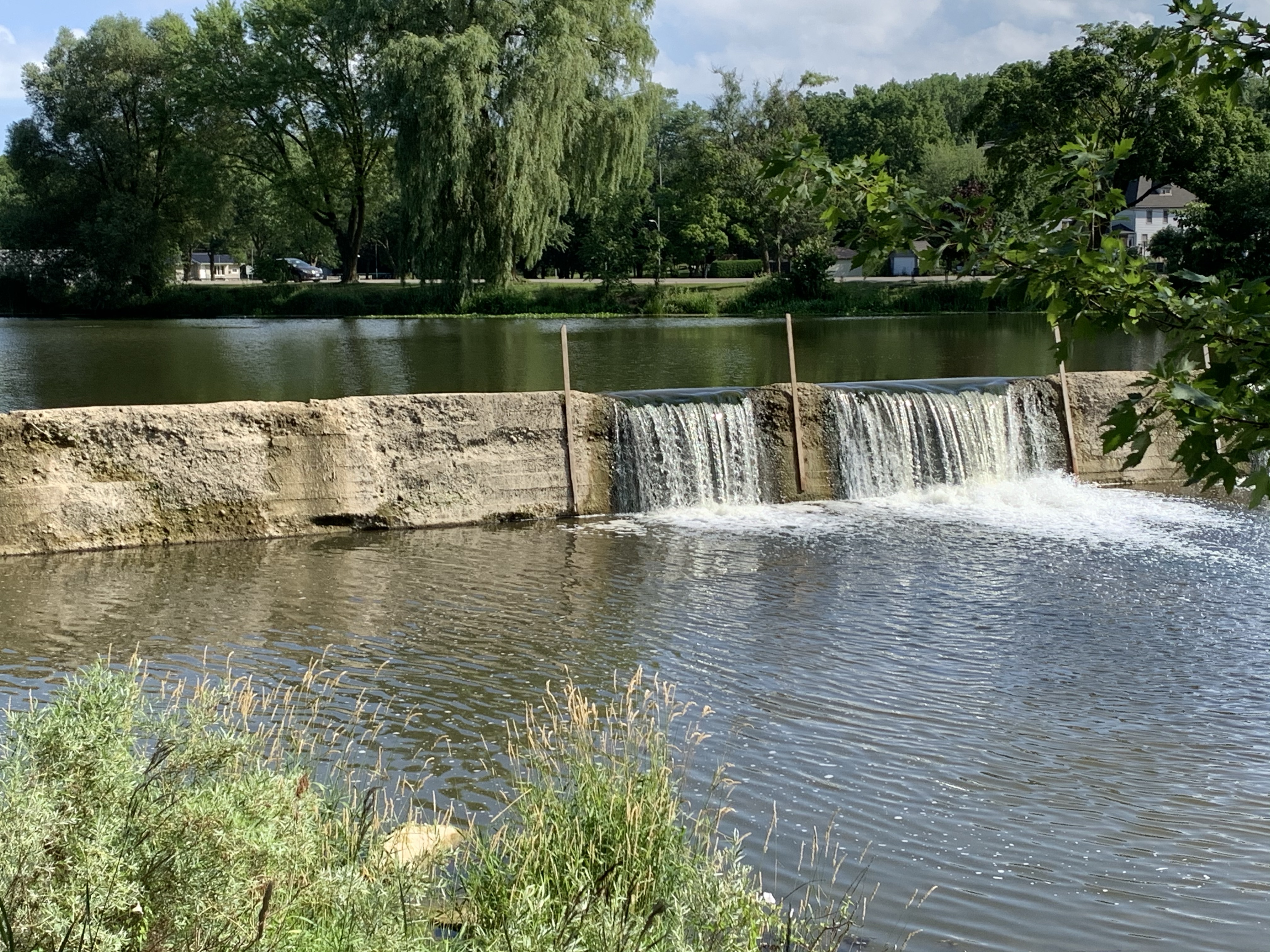
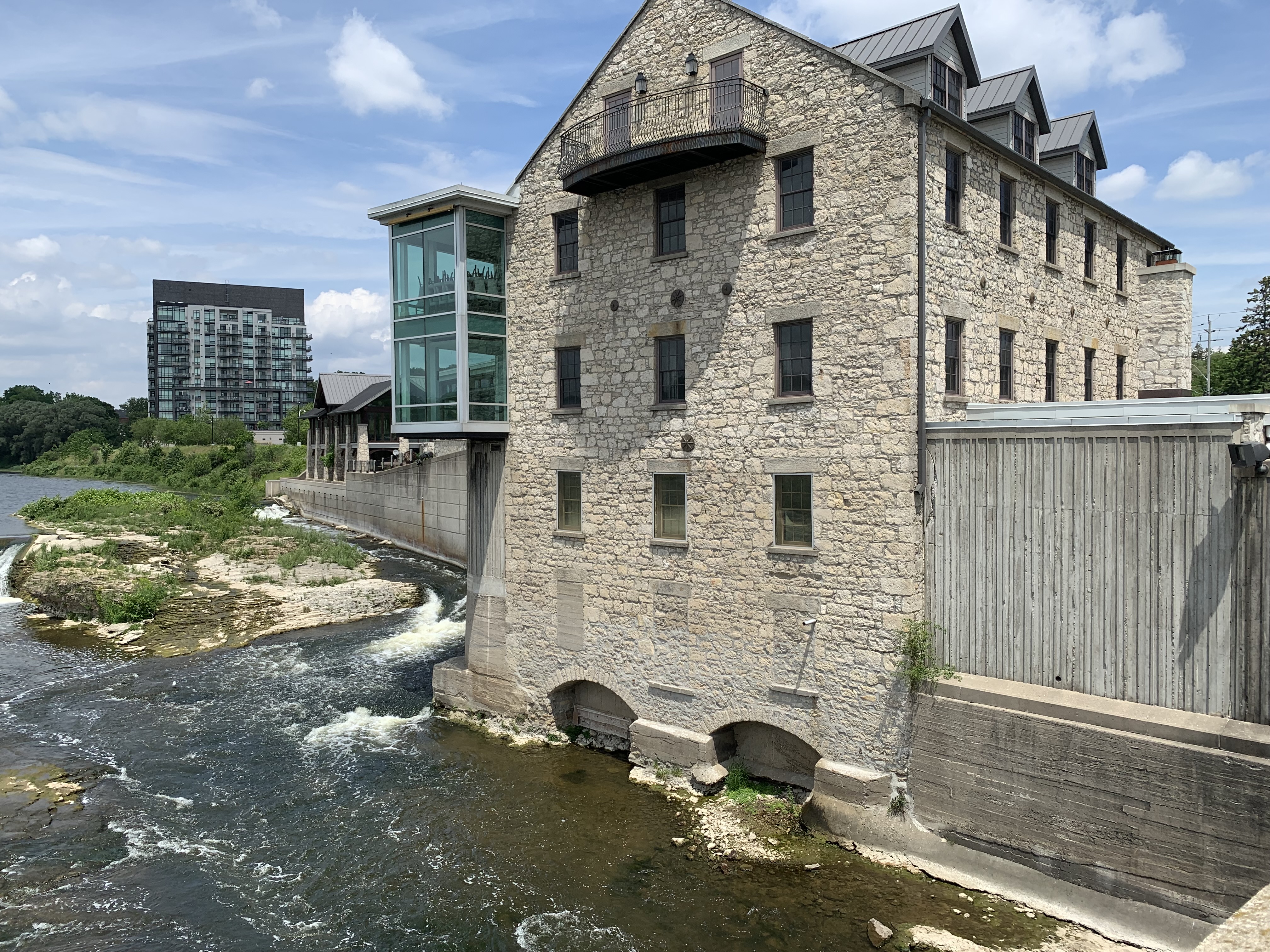
There has been a dam on the Grand River in Galt since 1837 when water was first harnessed for power in the Dickson Mill. This same dam would also provide power to the Turnbull Woolen Mill and several other downstream establishments.

The Dickson Mill was built in 1843 and named after Robert Dickson who was a son of Galt founder William Dickson. When its milling days were over it was converted into the Galt Gas and Light Company which generated electricity to light the streets and homes of town. They operated between 1889 and 1911 when power arrived in town from Niagara Falls. In 1980 it was converted into The Mill Restaurant.

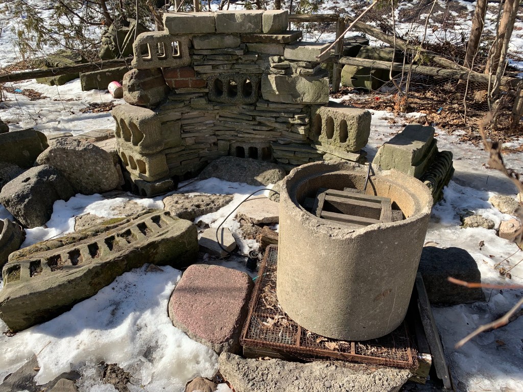
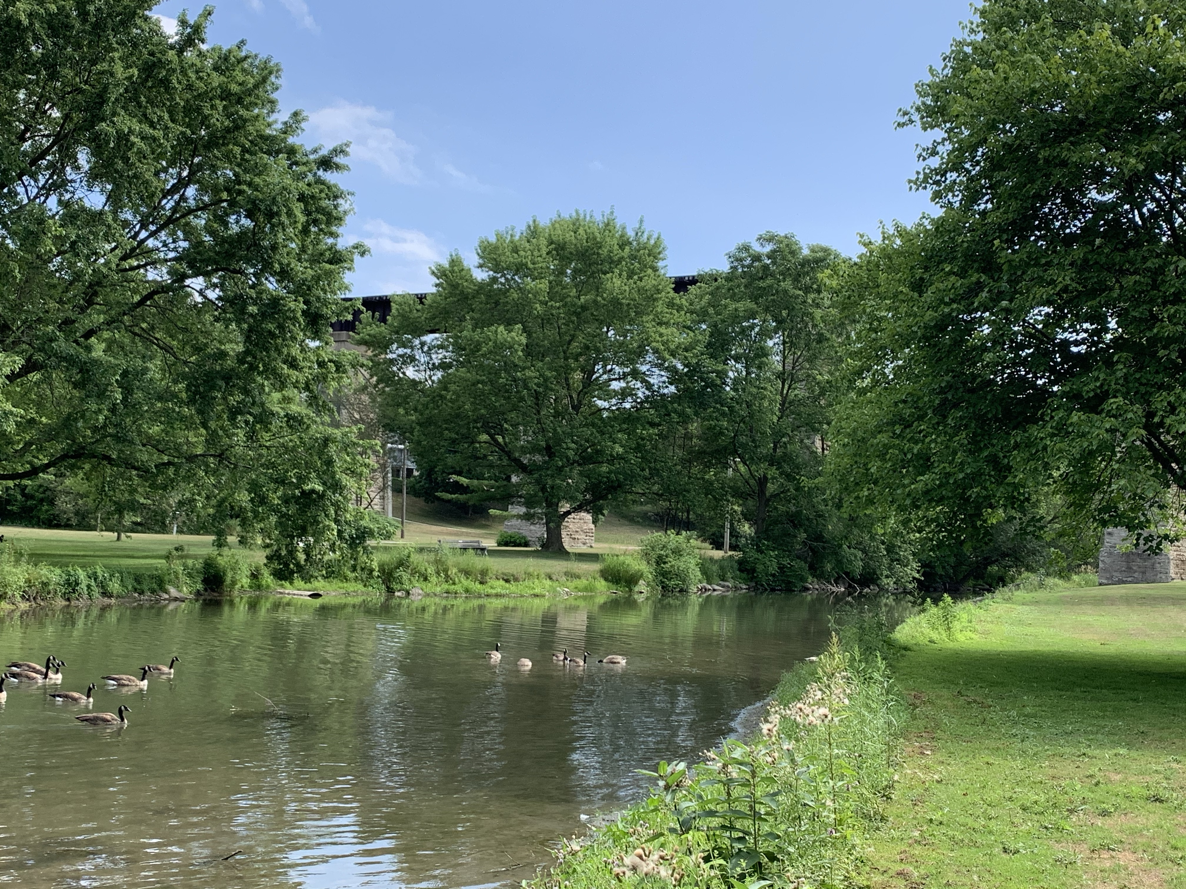
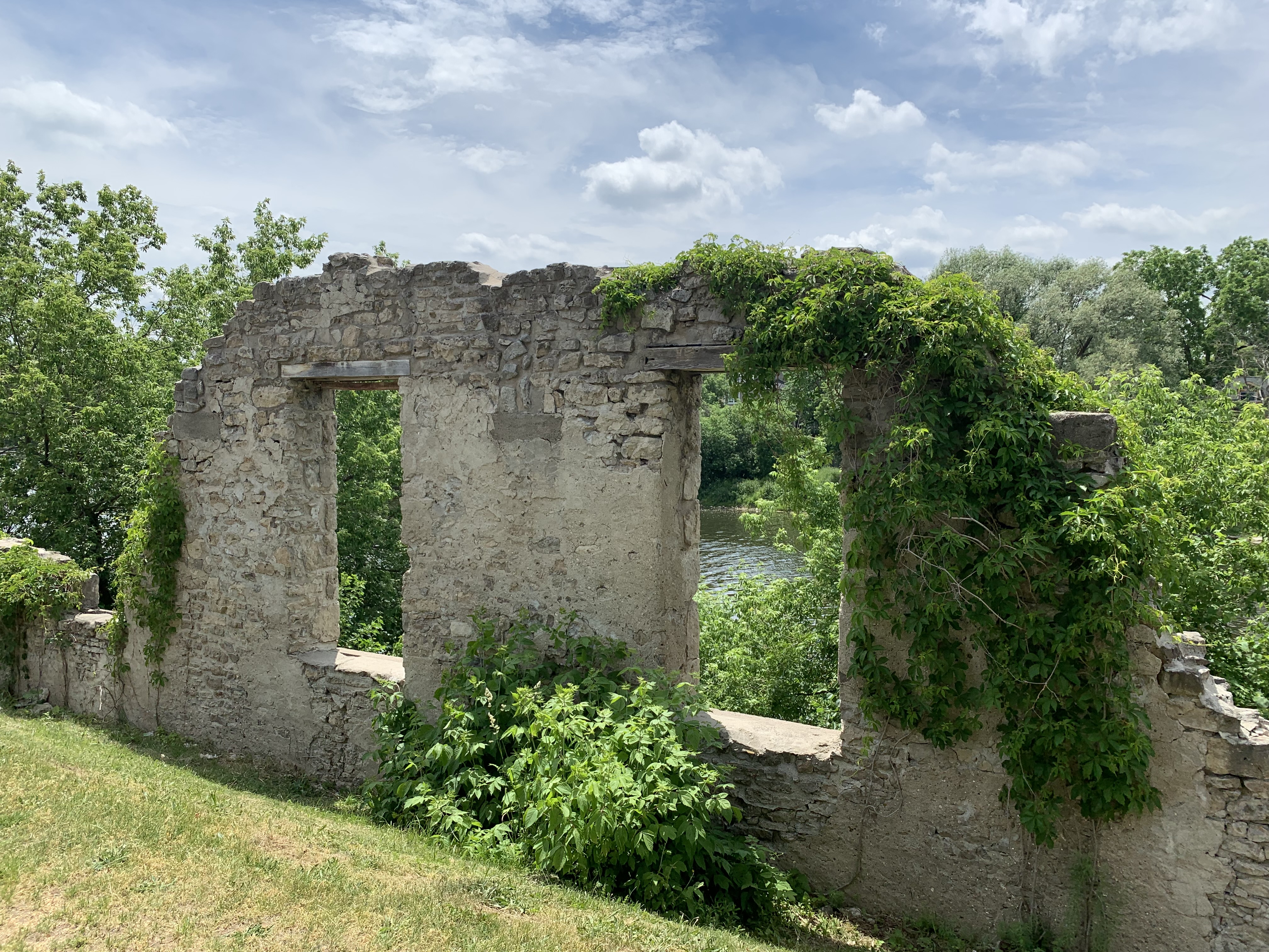
In 1974 there was a severe flood which caused damage to the riverbank and several historical structures along Water Street. This led the city to form a riverbank development program which saw the creation of Mill Race Park along with other stabilization projects. Robert Turnbull and John Deans had operated a knitting mill in Galt since 1859 and had taken over the old Wardlaw Mill on this site and used it between 1890 and 1897 when it burned down. It was rebuilt and operated under various names until 1972. The ruins have been incorporated into an amphitheater and park area for use by everyone.

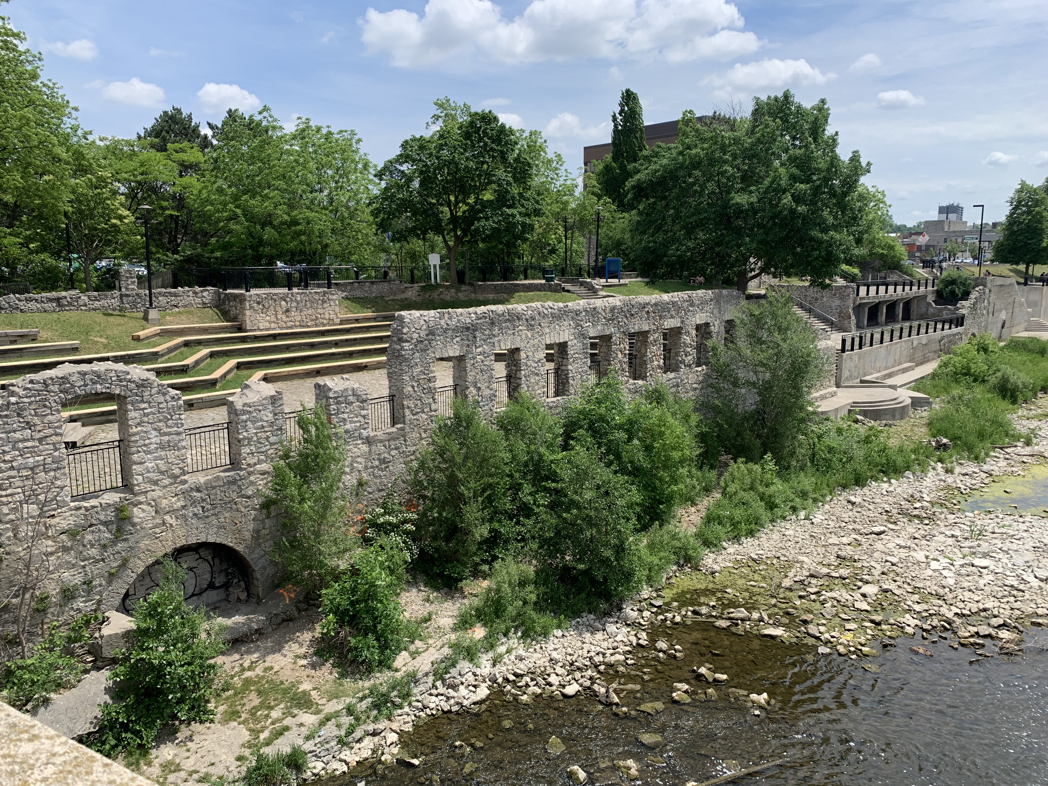
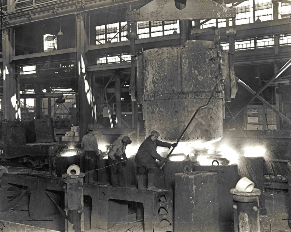
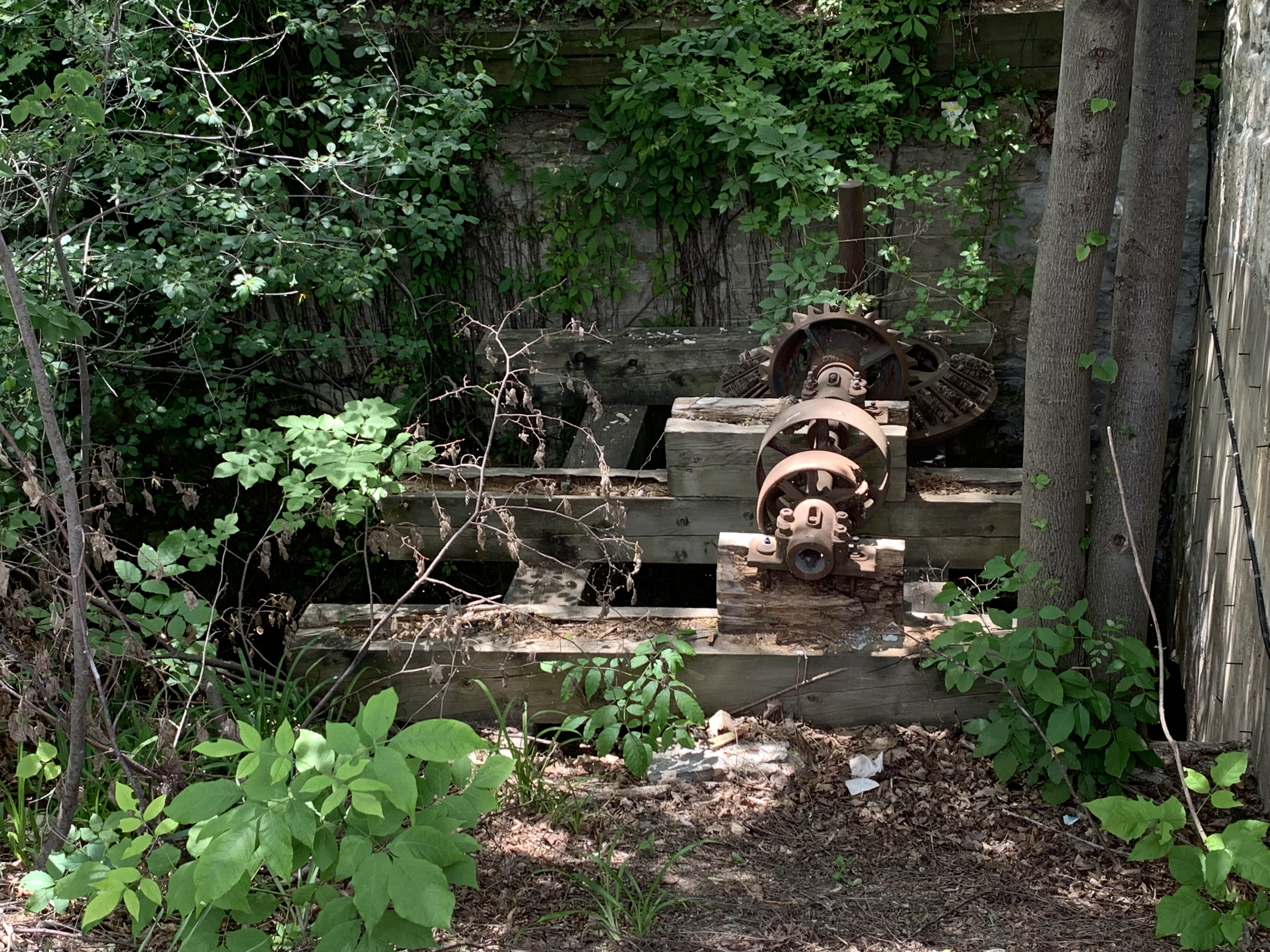
The mill race carried a flow of water from the dam and along the side of Water Street where it was used by a series of mills. The turbine still remains in the mill race beside the old Turnbull Woolen Mill. Water rushed through a penstock at the bottom of the mill race to turn the turbine. It turned the belts that ran on the smooth wheels and supplied power to the knitting mill.

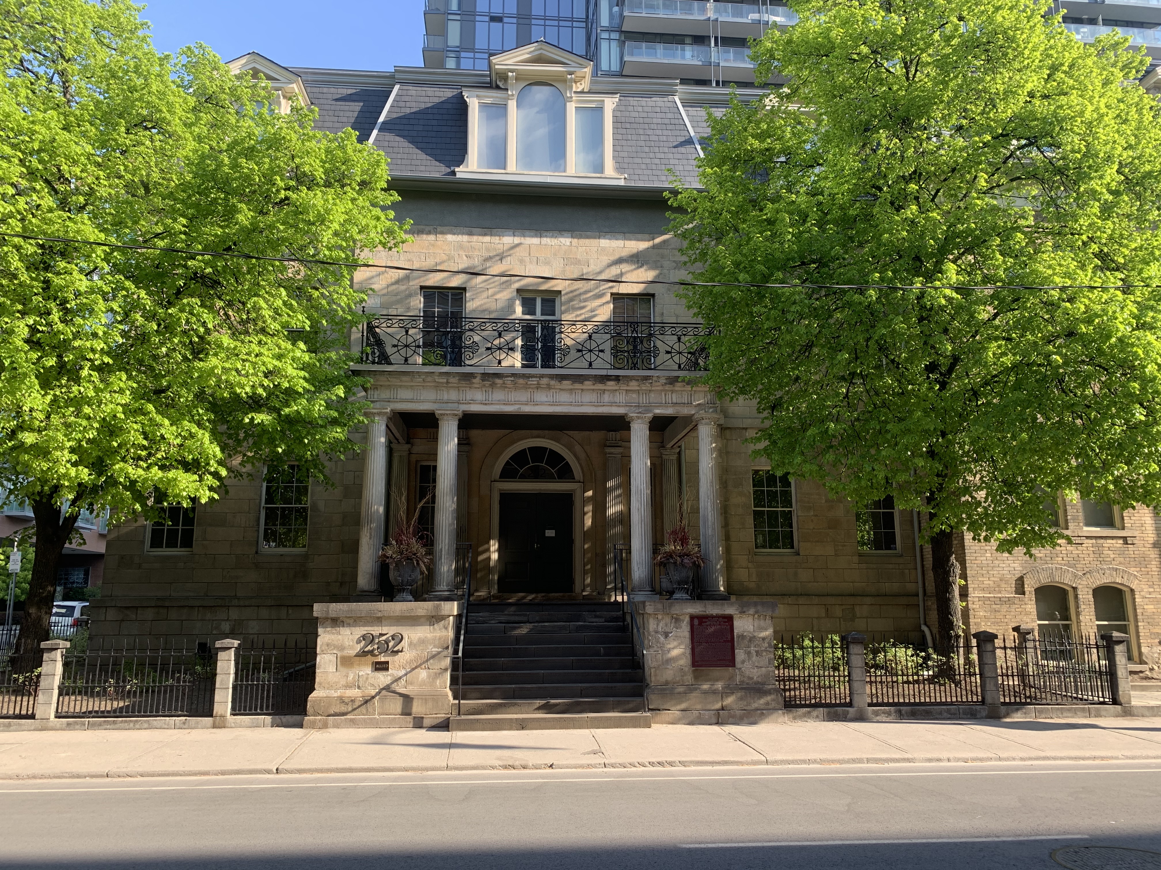
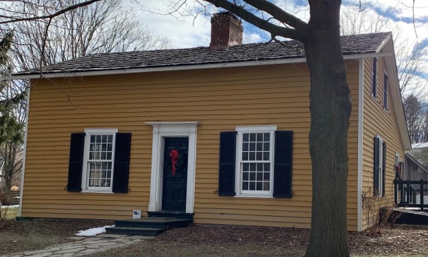
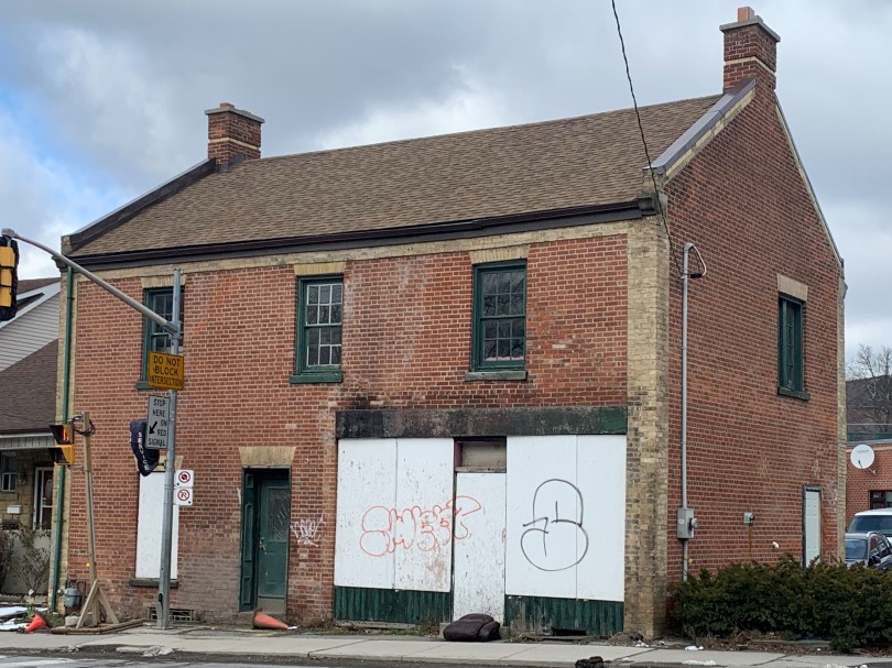
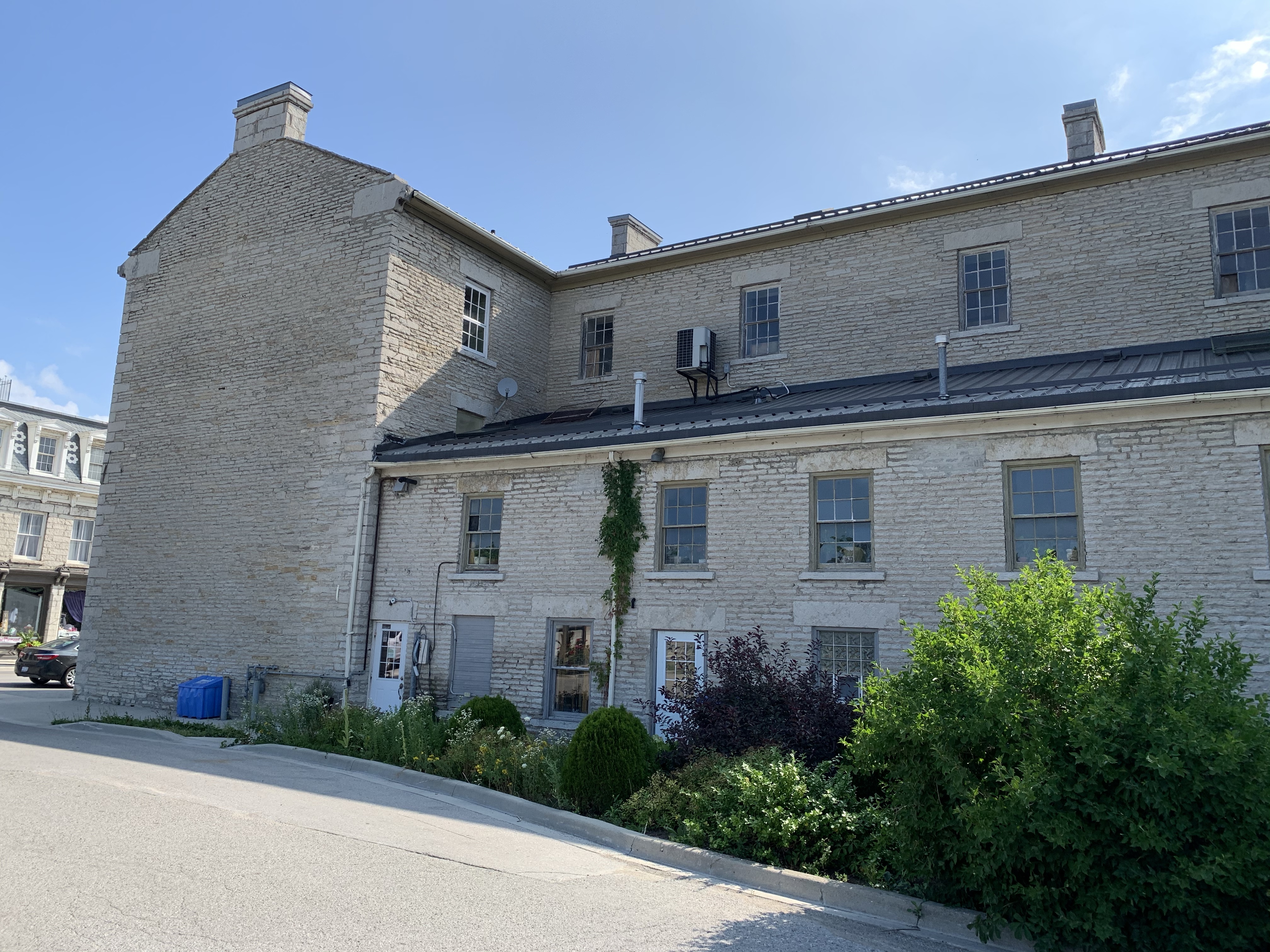
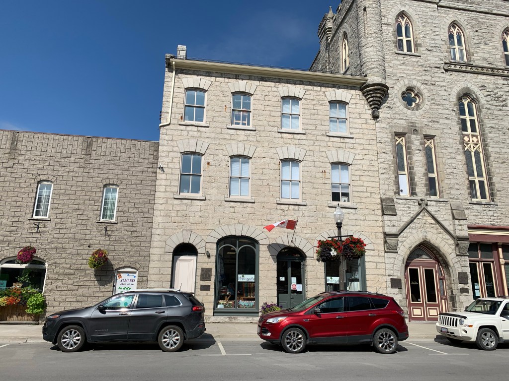
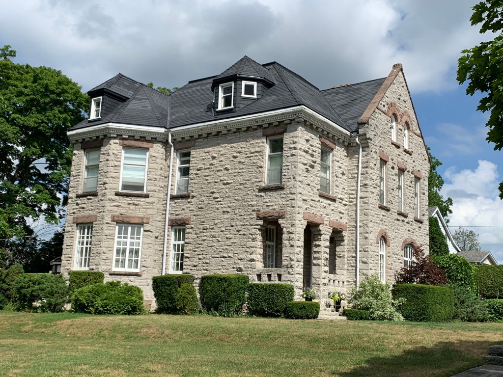
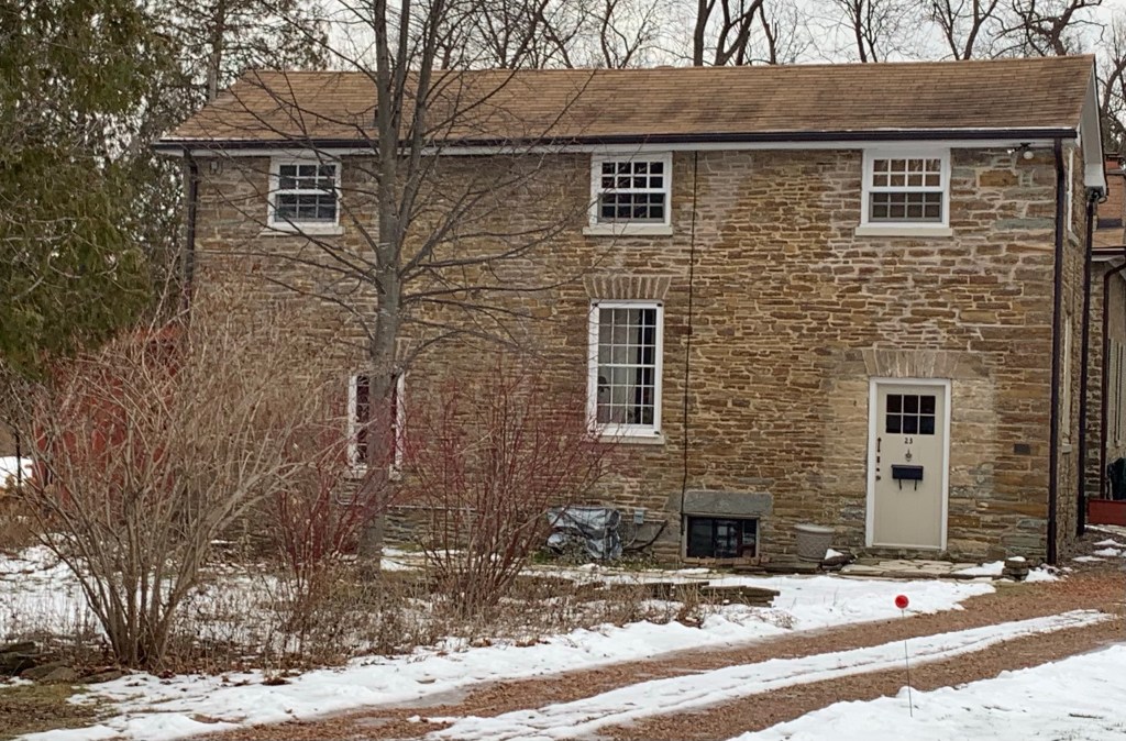
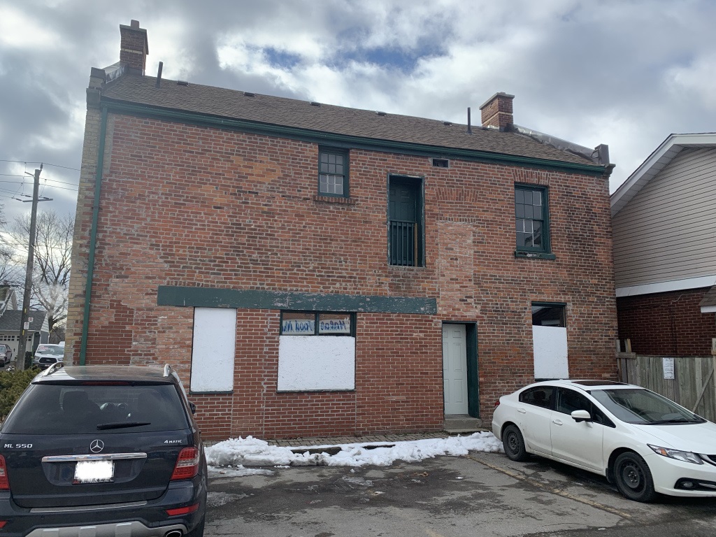
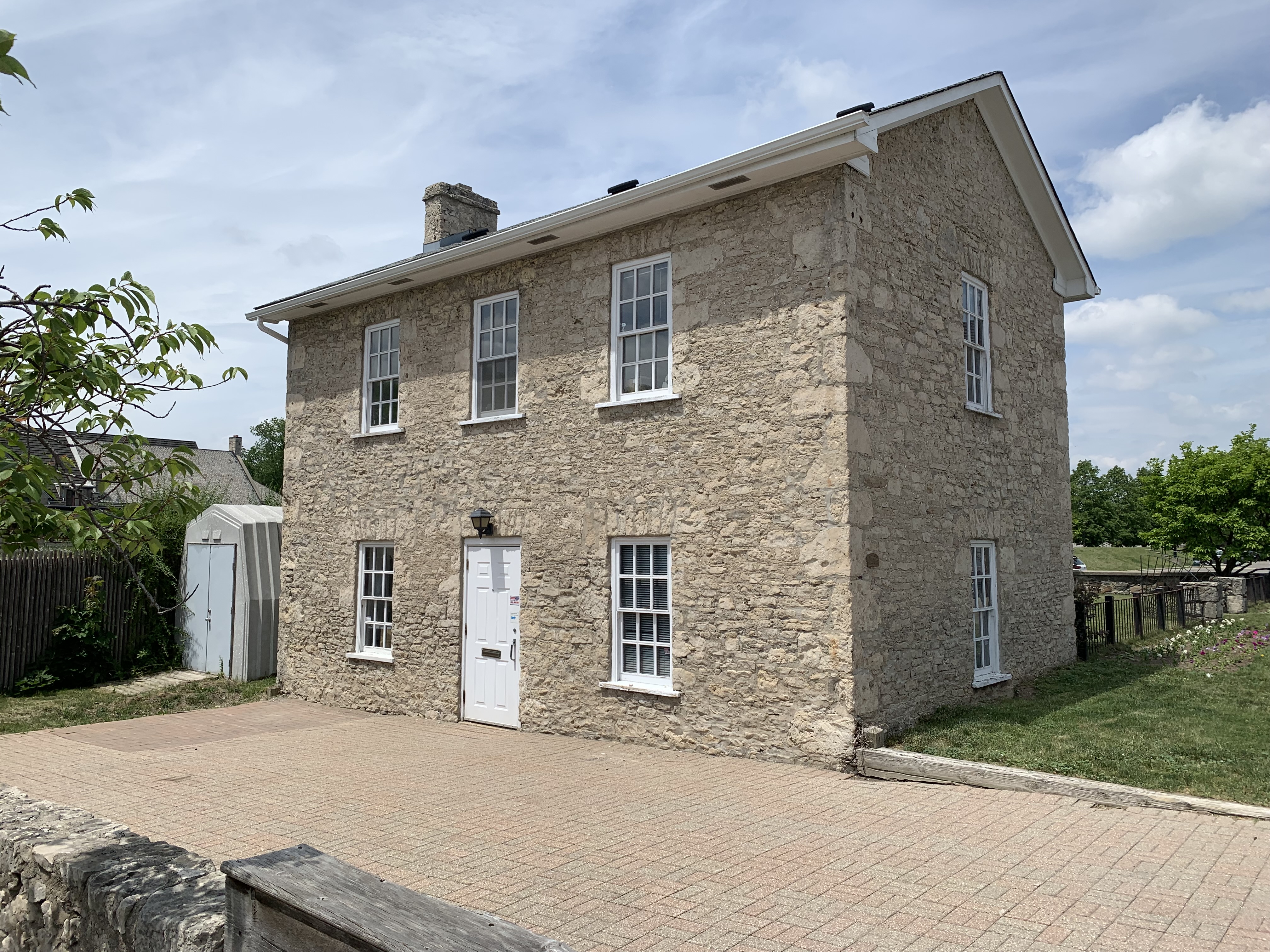
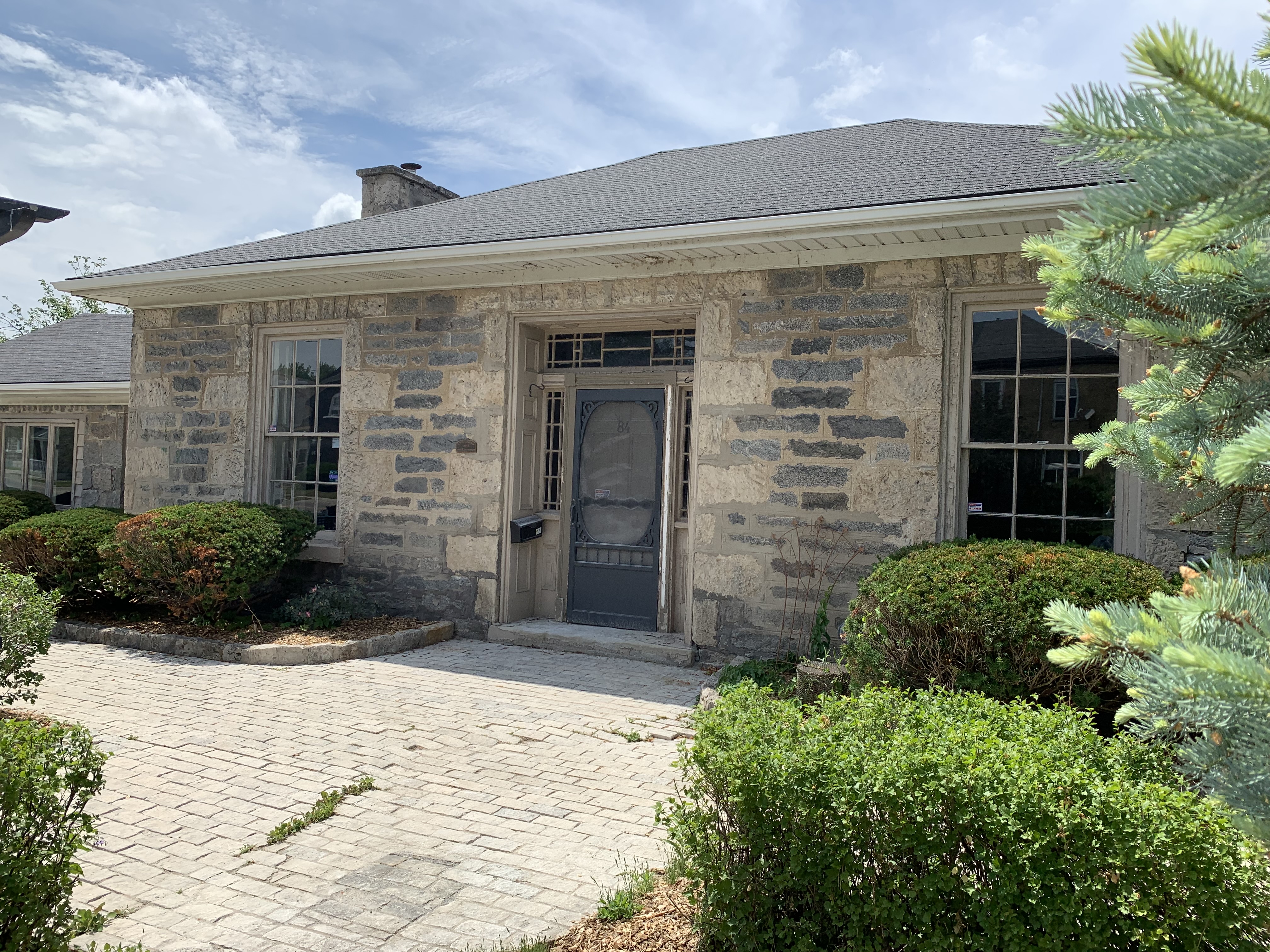
Morris Lutz built this Georgian style limestone house in 1850. Lutz had arrived in Galt in 1844 and became part of the Dumfries Foundry where he was foreman in the machine shop. Morris was elected to the first town council and when Galt was incorporated as a city in 1857 he was the first mayor.

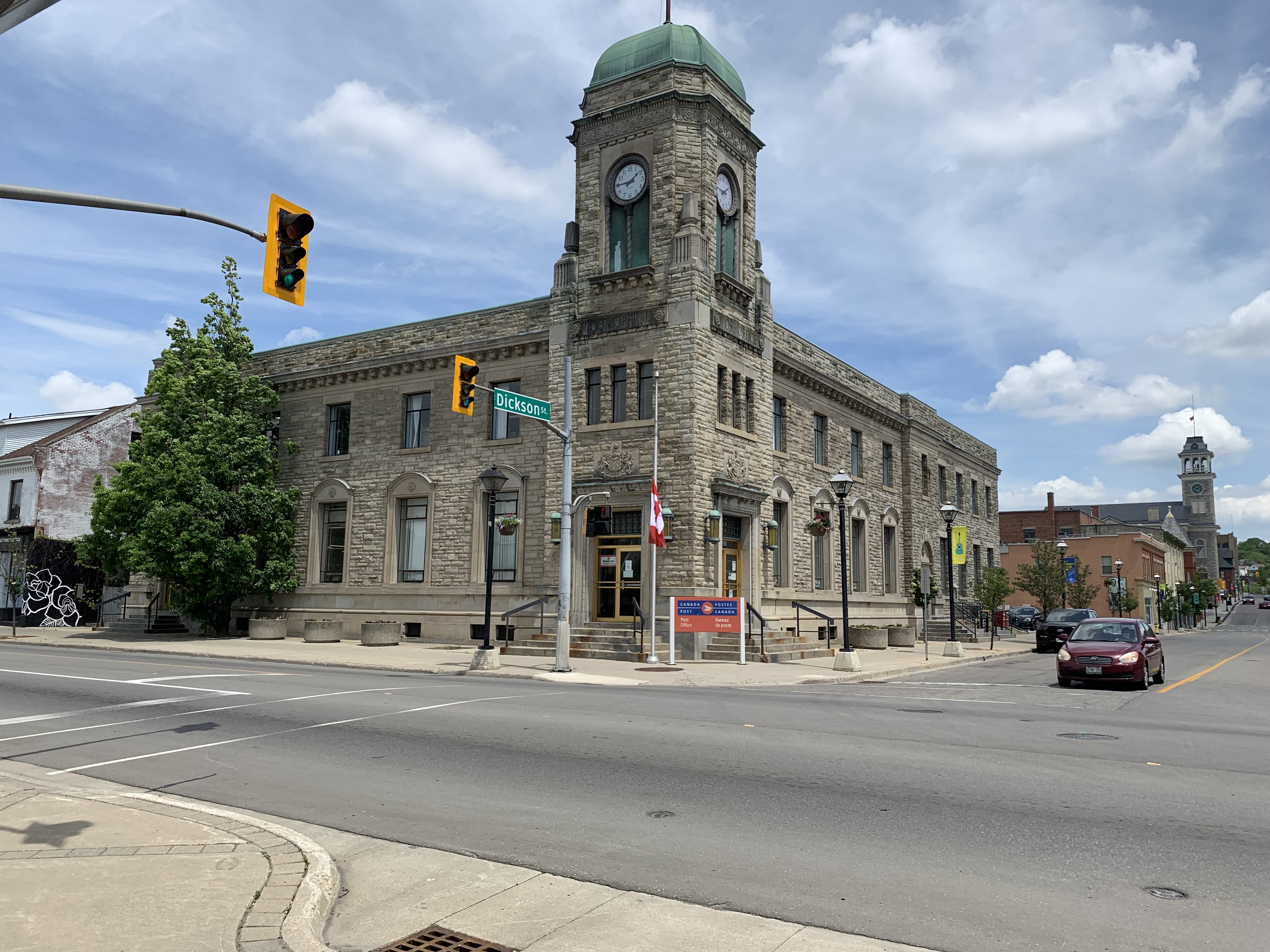
Galt got a new post office in 1936 which replaced the one that still stands a little farther down Water Street. This handsome stone building with clock tower has been home to the post office ever since.

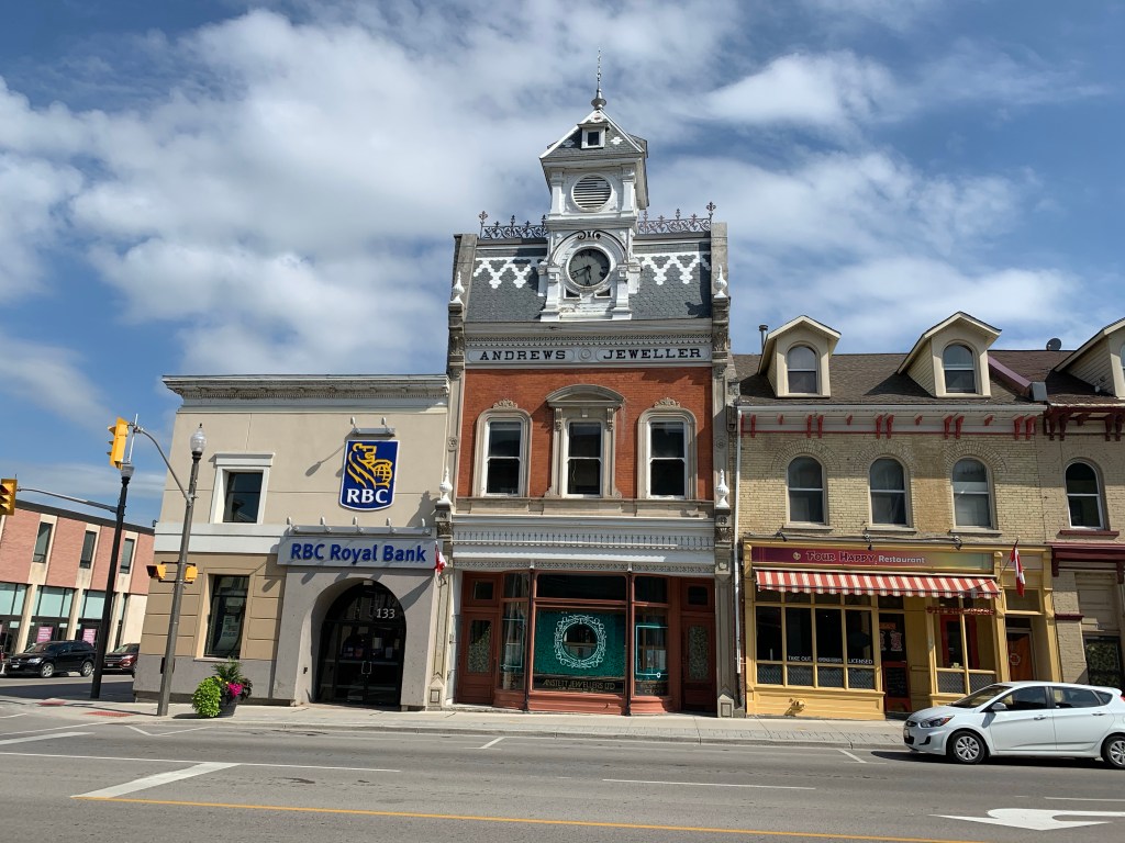
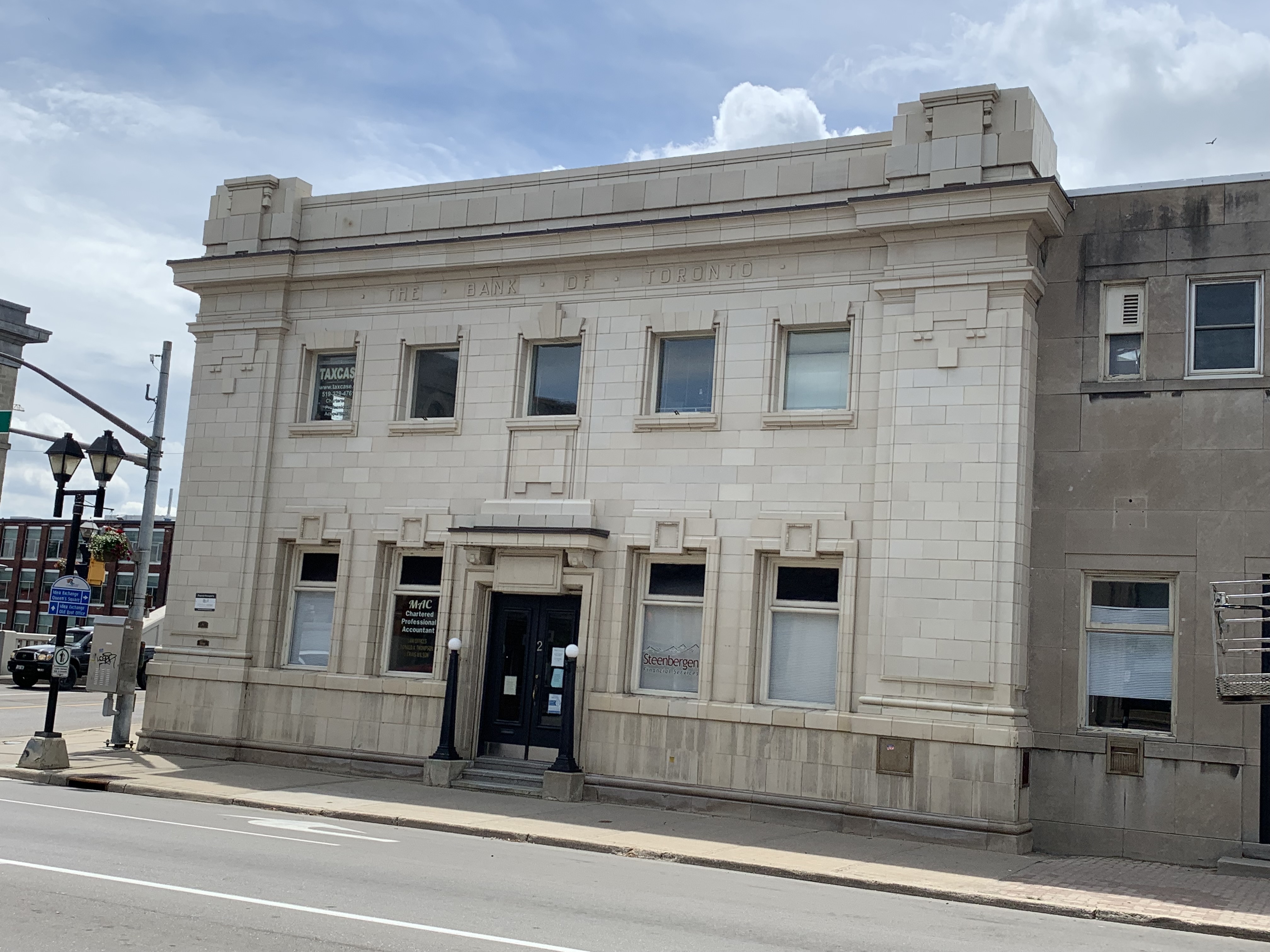
The Bank of Toronto opened a branch on Water Street in 1912 and this Beaux-Arts style building is unique in town. It has white glazed tiles on the exterior that are similar to pottery, another example of bank buildings that were designed to stand out from their neighbours.

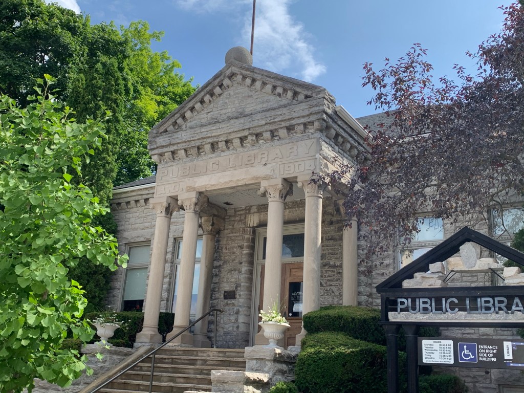
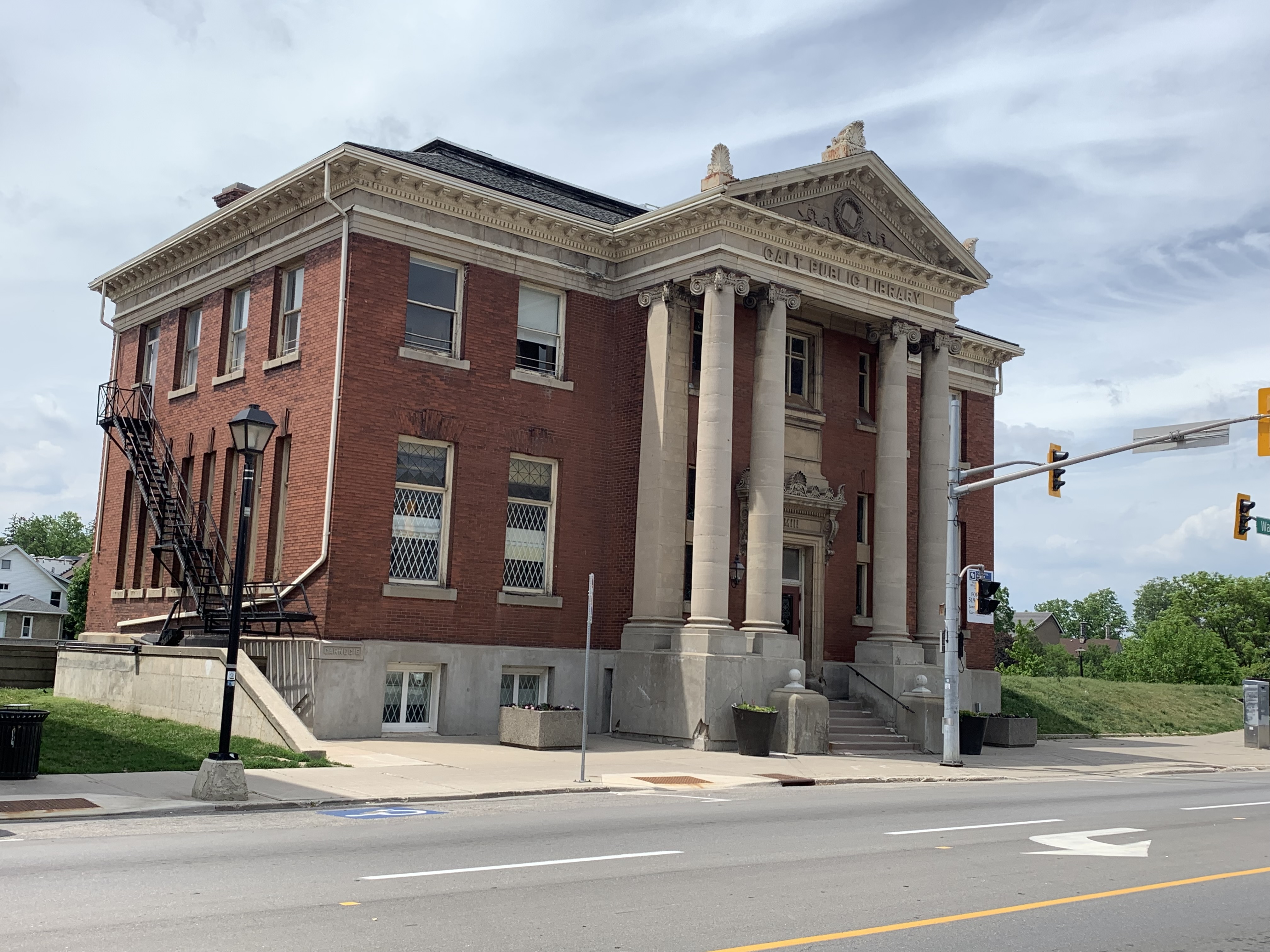
Andrew Carnegie donated $23,000 for the construction of a new library for the Town of Galt in 1905. Carnegie gave away 90% of his fortune which is roughly $5.2 Billion in 2021 value. He funded about 3,000 libraries in the belief that libraries should be free to the local community. This Beaux-Arts style building housed the library for over 60 years and has since been home to several businesses. It is currently available for lease.

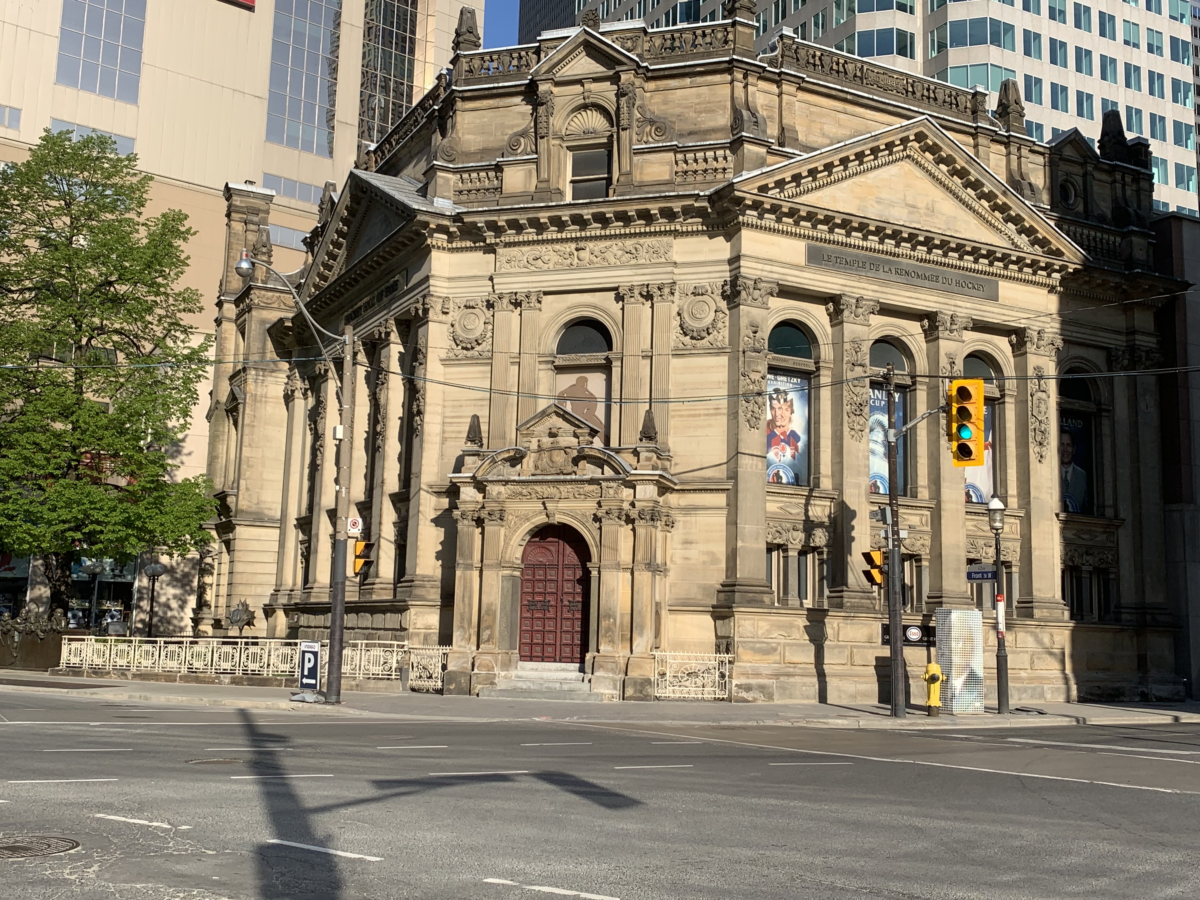
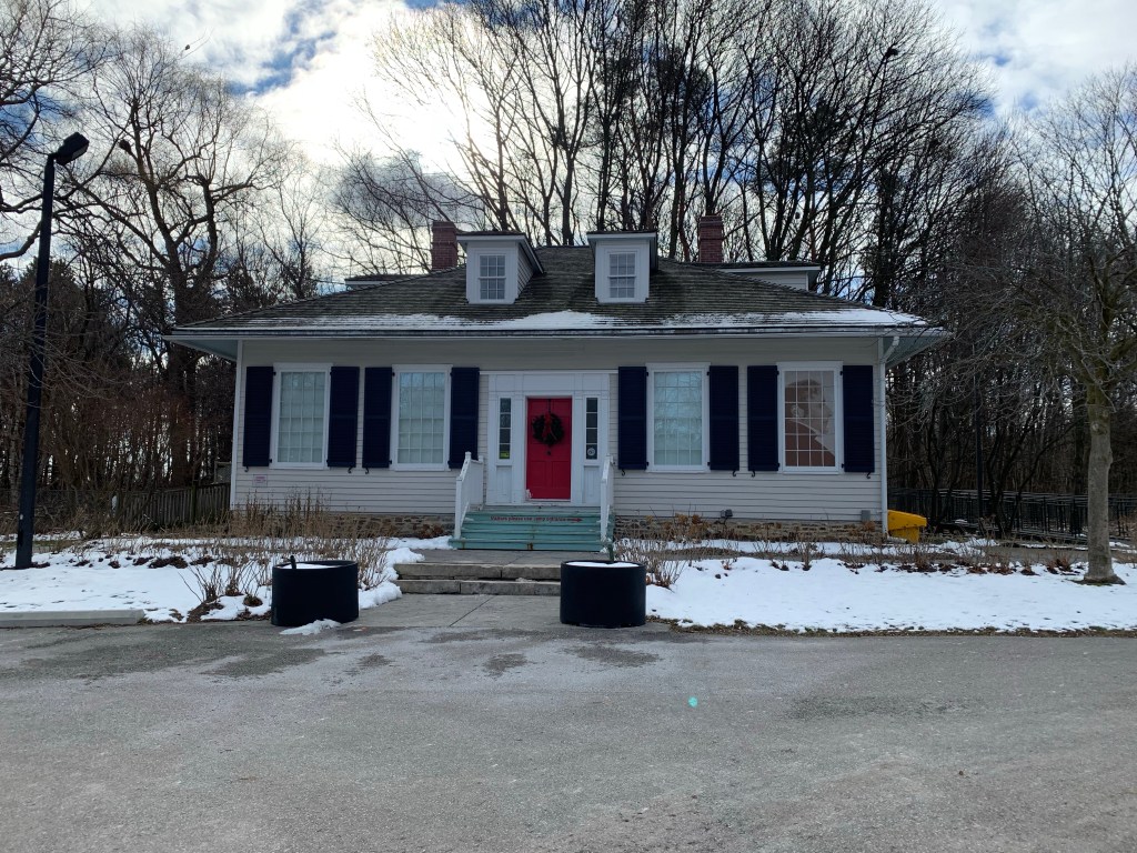
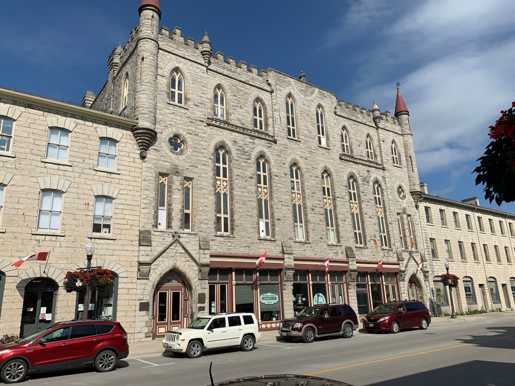
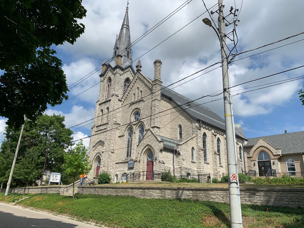
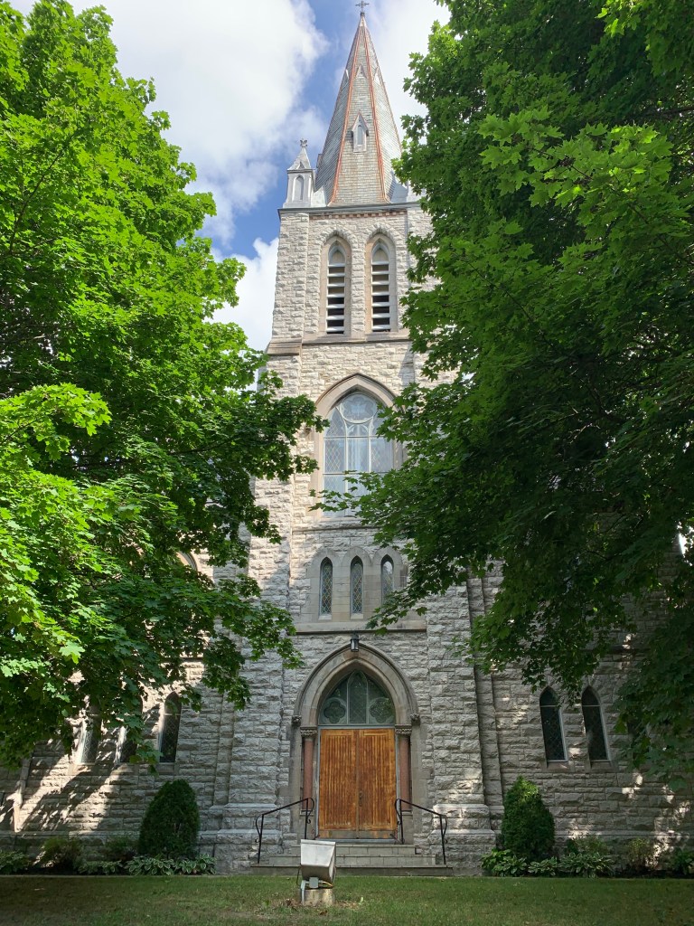
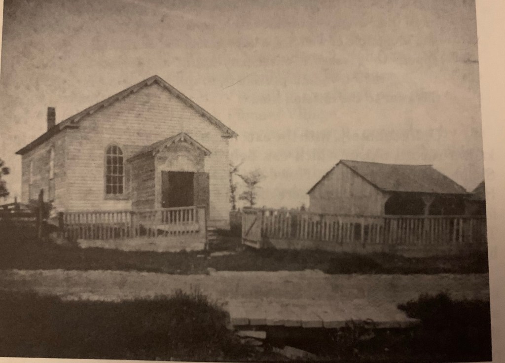
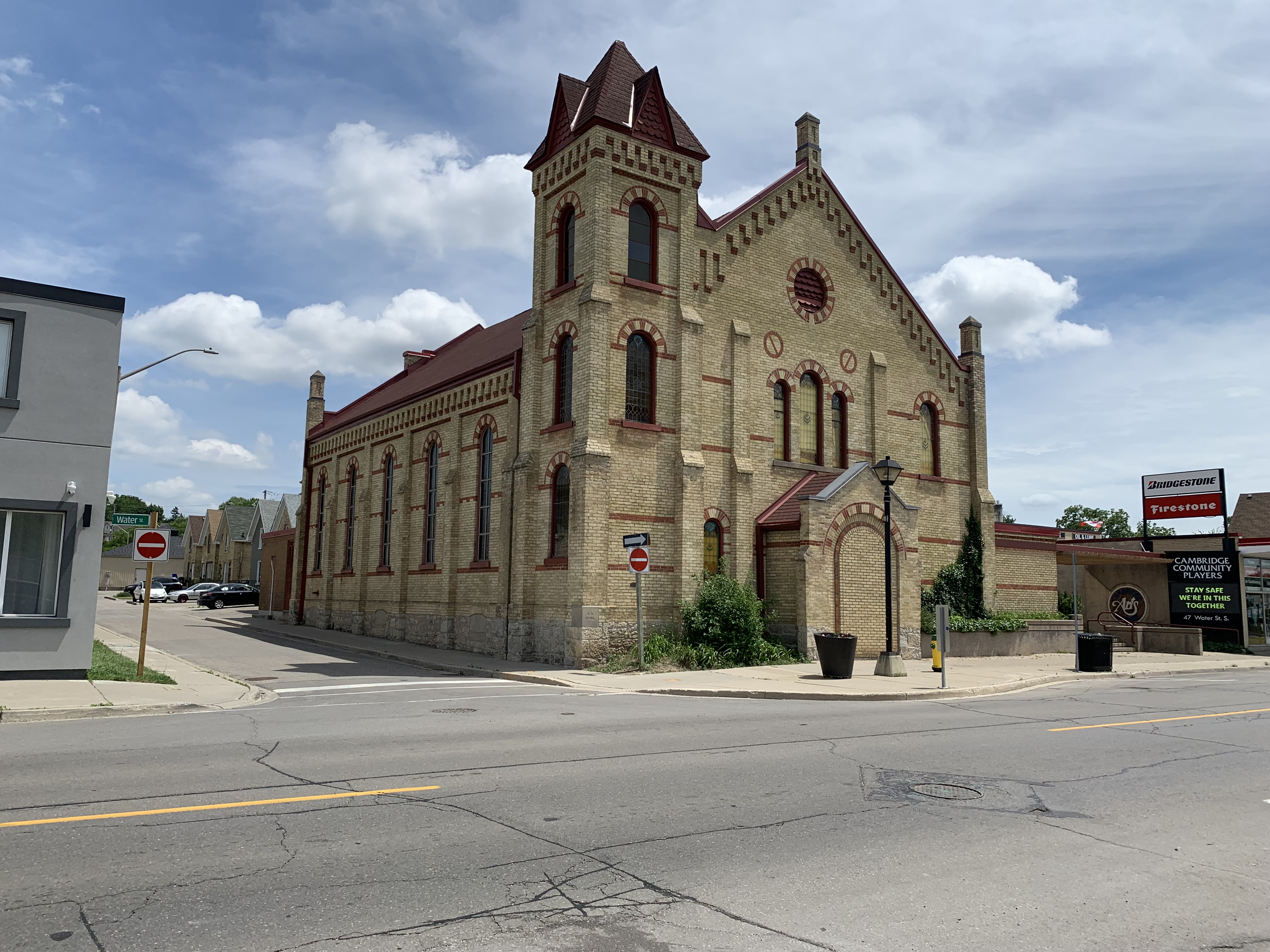
The First Delta Baptist Church was built in 1887 and is a mixture of Romanesque and Italianate styles. In Ontario it is rare for a church to be built with river or waterfront property. Usually they are on side streets, often conveniently named Church Street. The Baptist congregation formed in Galt in 1851 and they met in houses until 1872 when they started using the Primitive Methodist building. Robert Scott donated the land for the church which was deconsecrated in 1980 and then sold to the city for use as a theatre.

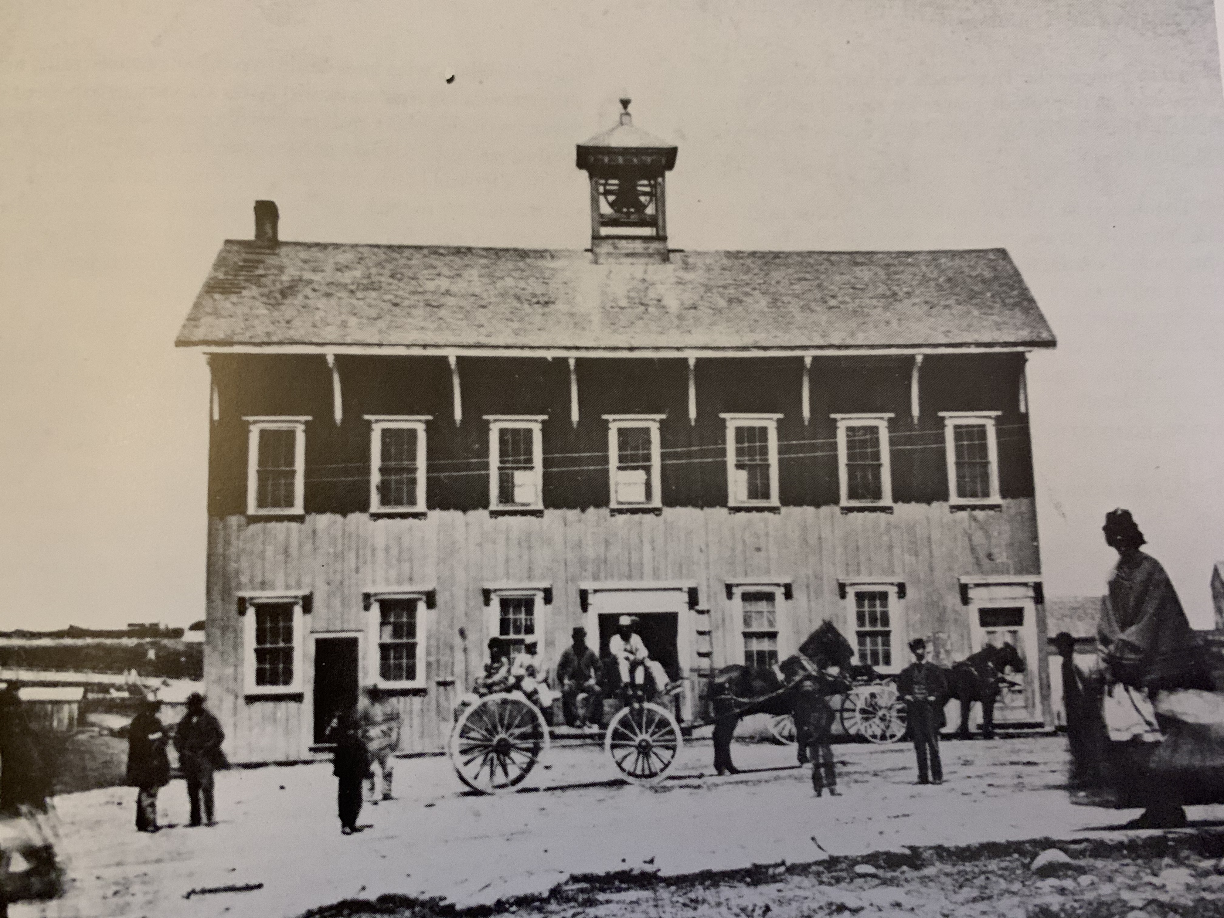
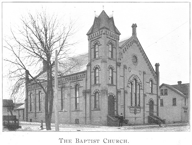
This archive photo shows the Baptist Church in 1902. It is interesting to see how the building has changed over the years. The main alteration is the elimination of the two doors on either corner and the opening of a central doorway. The side doors have been bricked in to disguise the fact that they ever existed. The new central door has also been closed in during the intervening years. There appears to be a new small window in between the two buttresses beside the new doorway.

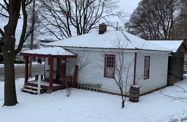
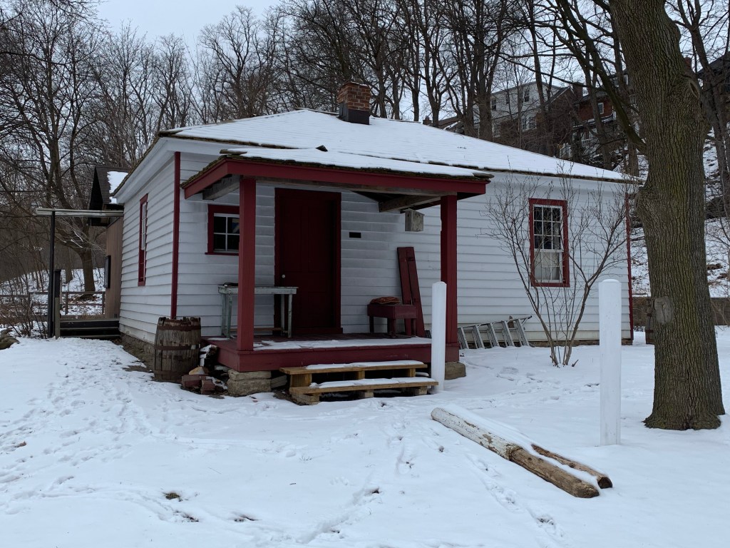
George Landreth arrived in Galt in 1831 and found work in one of the many mills in town. He had this Georgian Cottage built in 1858 and it still has its original doorway with the multipaned side lights and transom. Along with the Lutz home featured above, it is one of just two original homes that remain in the original core of Water Street.

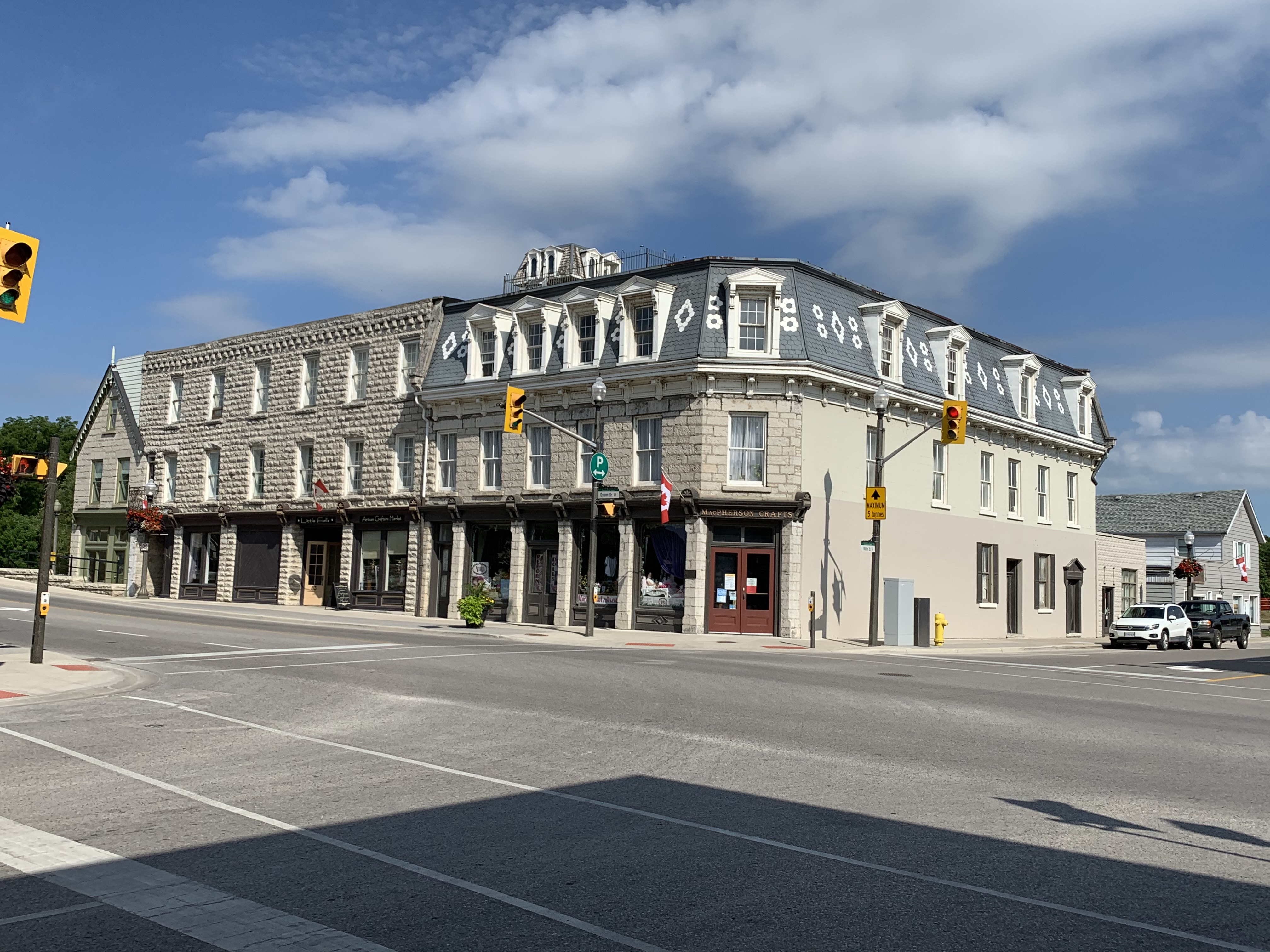
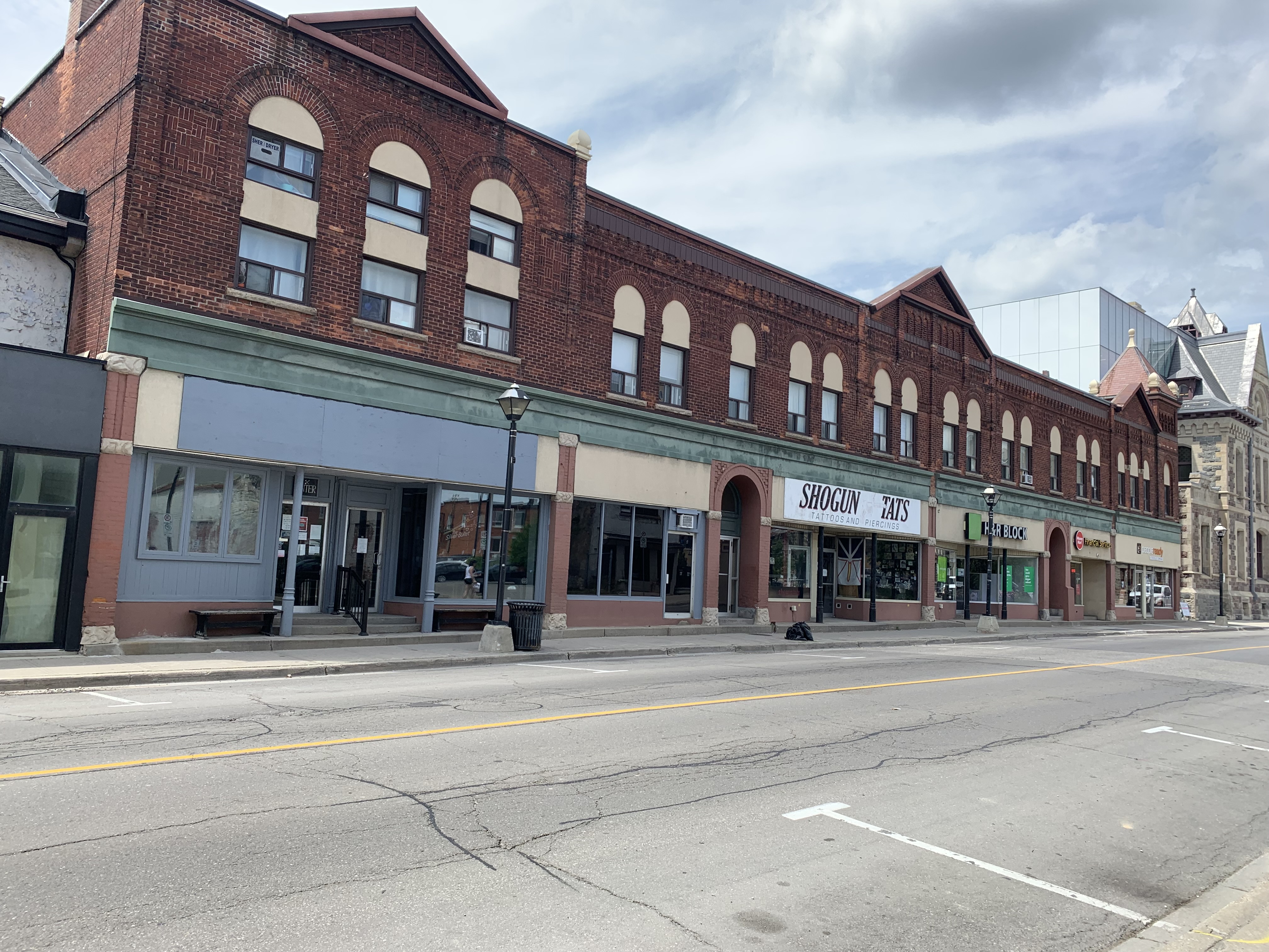
The Imperial Block was built in 1887 and was almost like an early strip mall. This Romanesque Revival structure at one time was home to the Commercial Bank, a grocery store, a tailor shop, a dress maker, tobacco dealer, hairdresser, dentist and a music store.

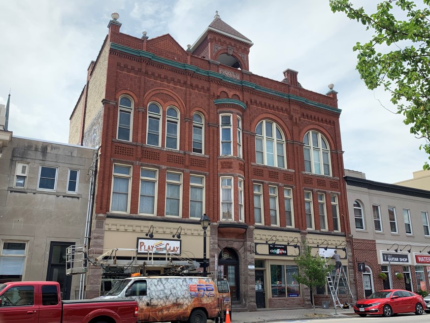
Scott’s Block was built in 1890 in the Romanesque Revival style. It has a terra cotta tower on top and detailed brickwork on the front. A two story oriel window stands out from the crowd of historic buildings on Water Street.

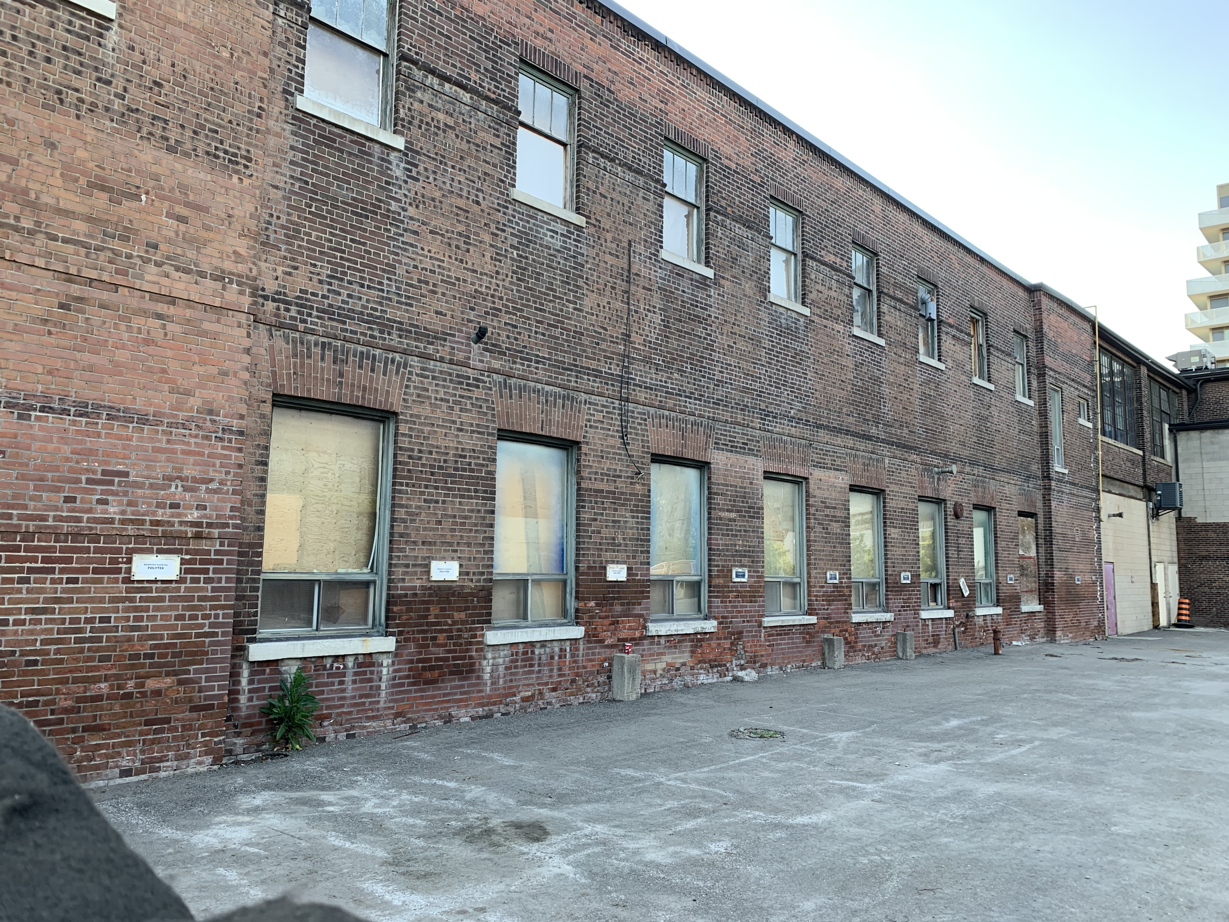
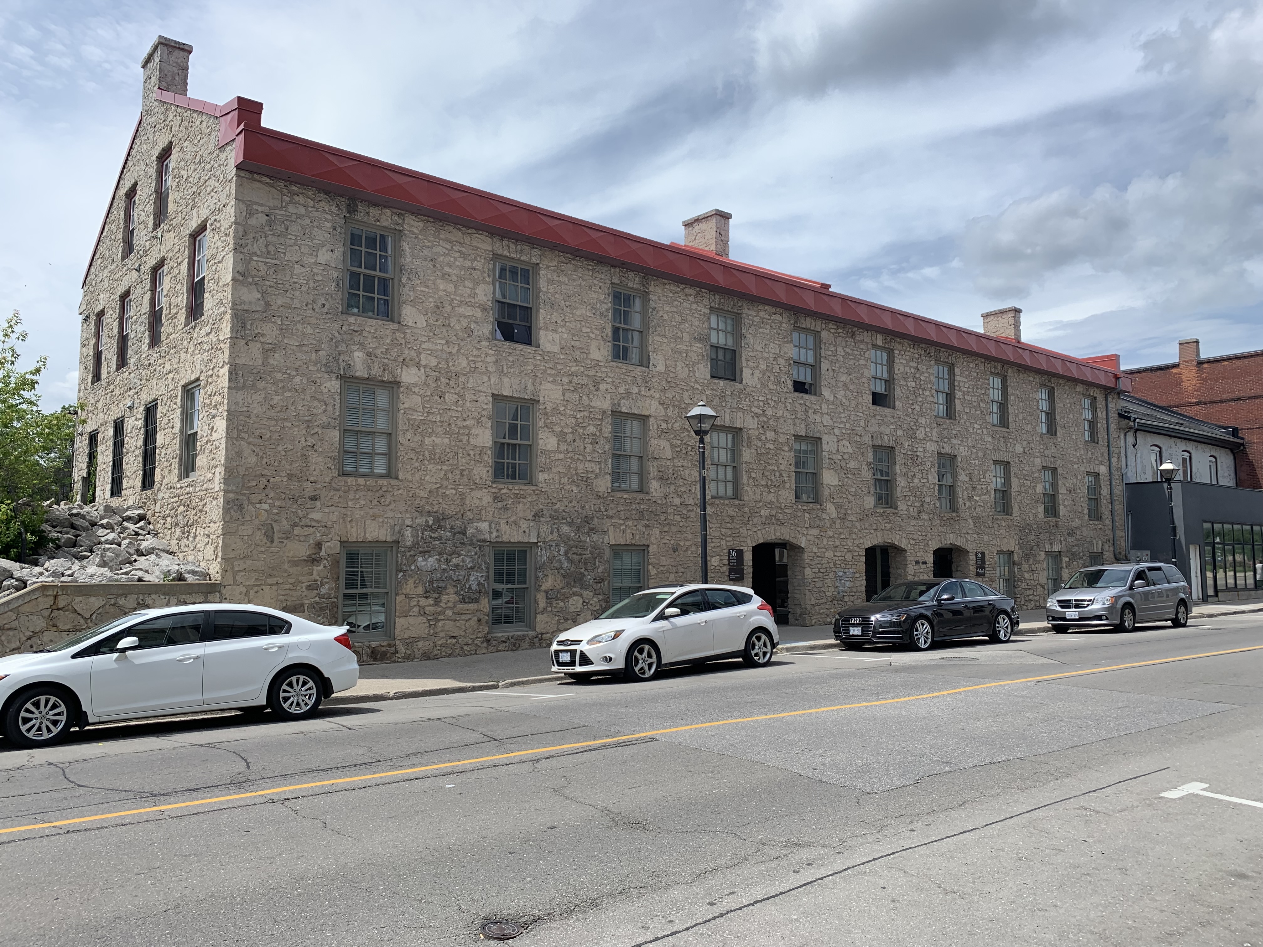
The Galt Woolen Factory is the oldest surviving textile mill in the city. It was built in 1843 for Isaac Sours who operated it until 1852. During this time his employees worked an average of 64 hours per week. In 1881 it became the Tiger Brand Knitting Company and today has been converted into offices and apartments.

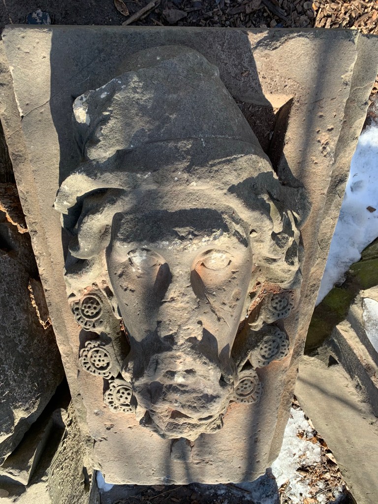
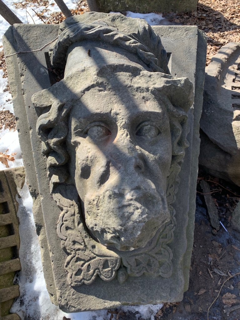
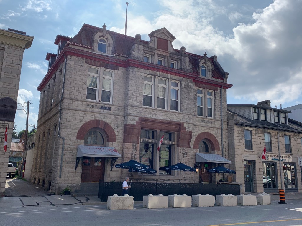
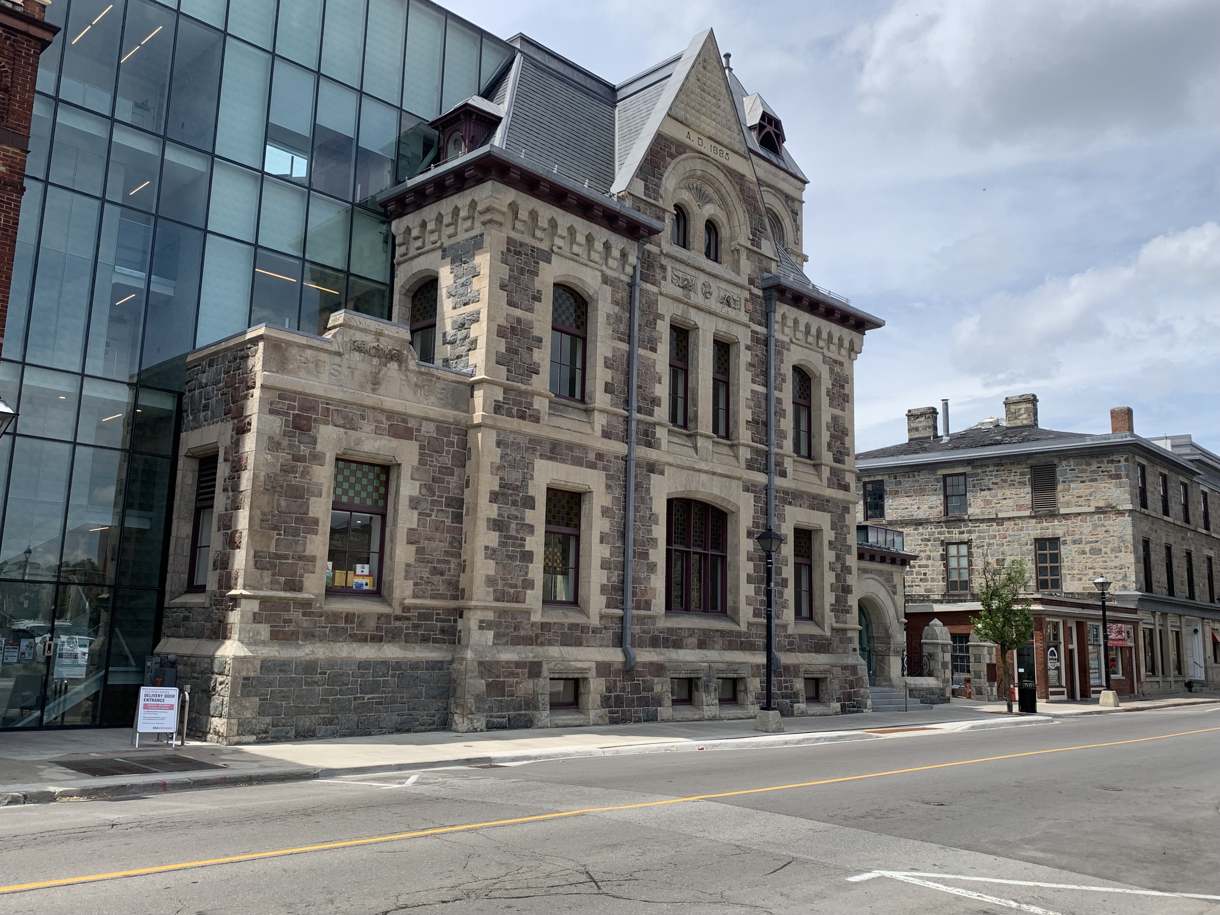
In 1885 the Federal Government commissioned a new post office for Galt which was also used for as a Customs and Inland Revenue Office. It has some of the most interesting masonry work of all the stone buildings in Cambridge which has been preserved in the restoration and expansion project that brought the glass section to the rear.

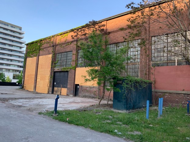
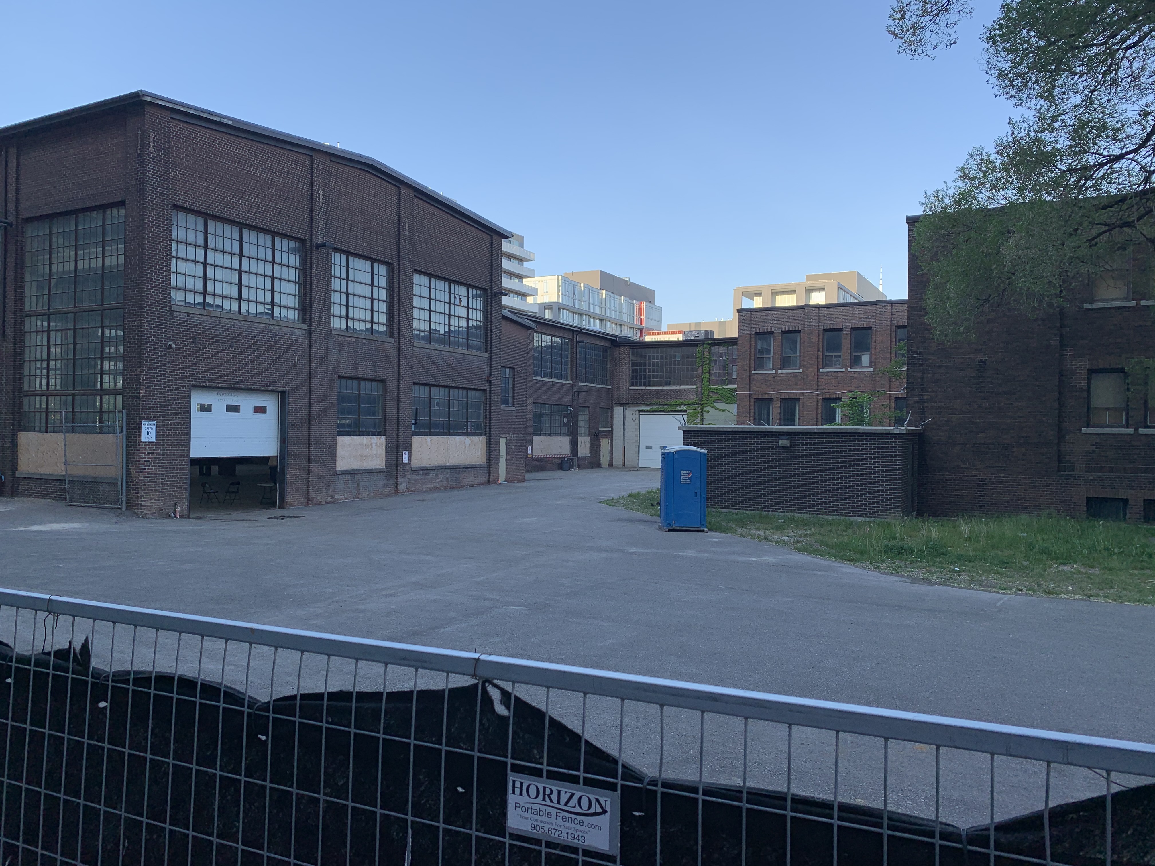
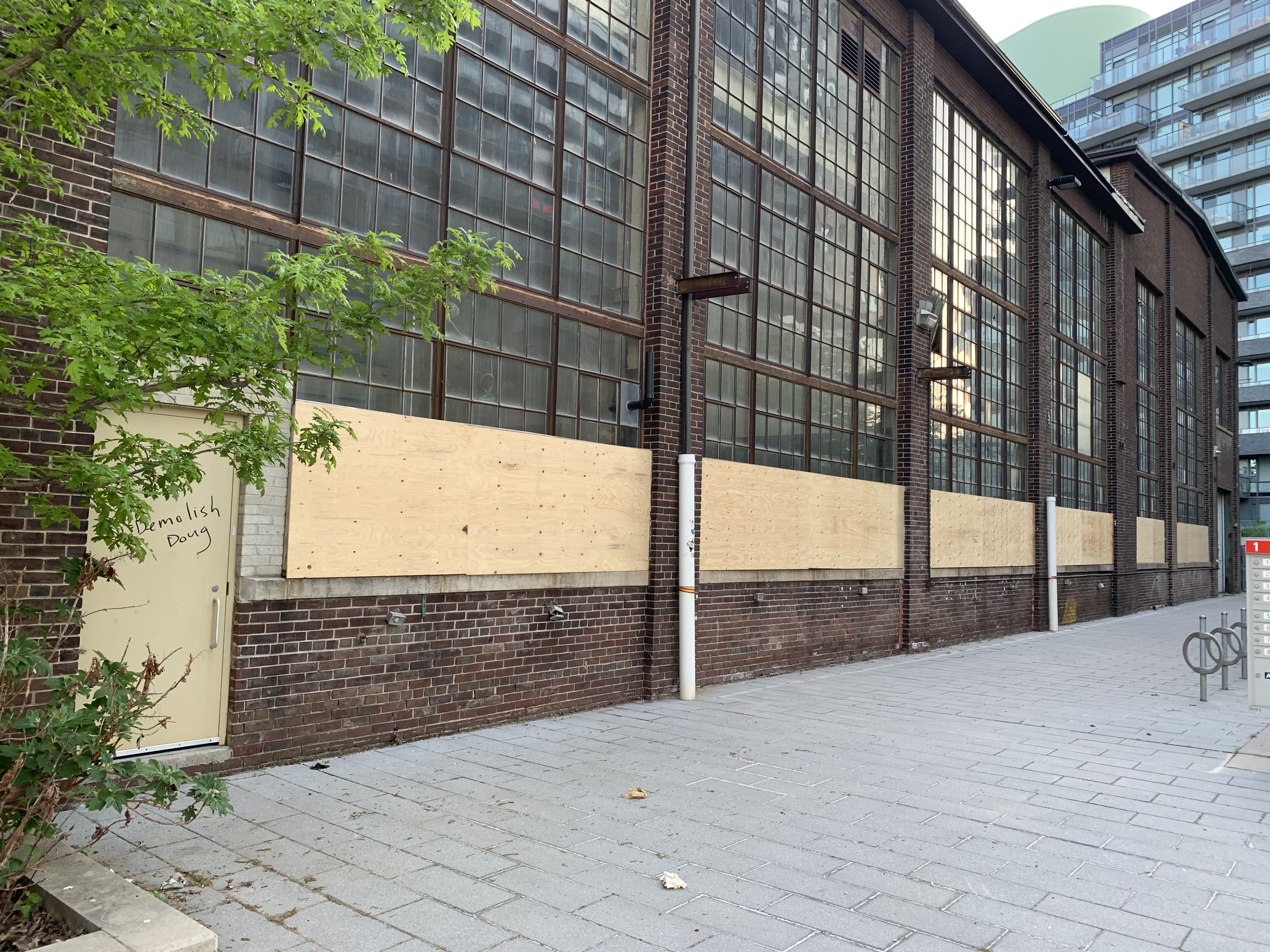
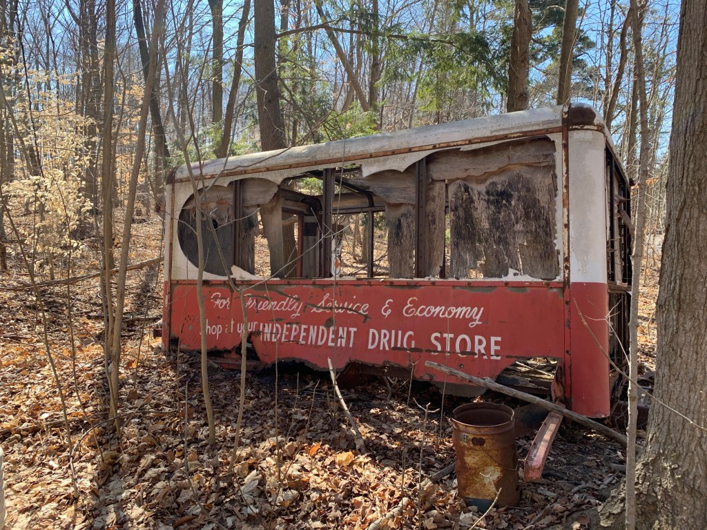
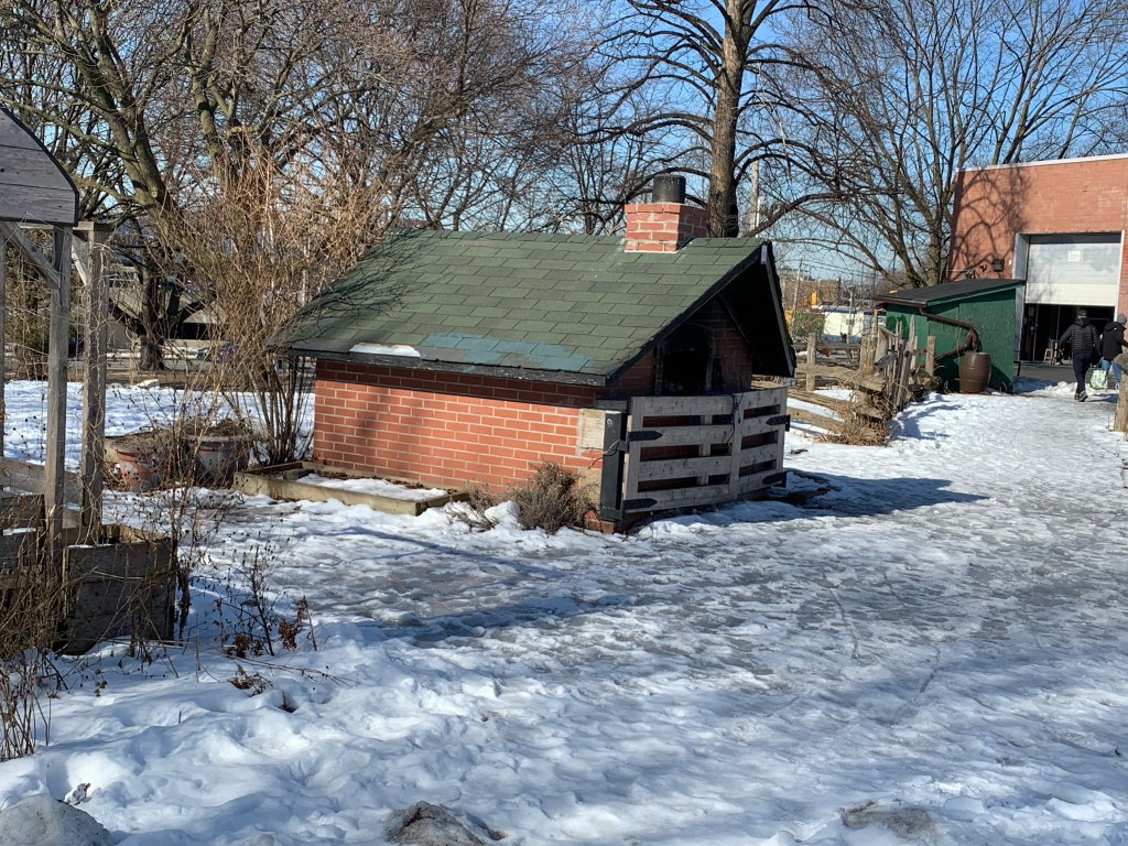
Partial ruins of old mills and factories line both sides of Water Street and there is a great deal of history being retained in creative ways. Plenty of communities could learn from this example. The Canada Machinery Corporation had a Pattern Works Shop and Stores building beside the river where it forged machinery parts. They operated until 1979 and in 1984 the remains of their building were incorporated into another public park with its history intact.

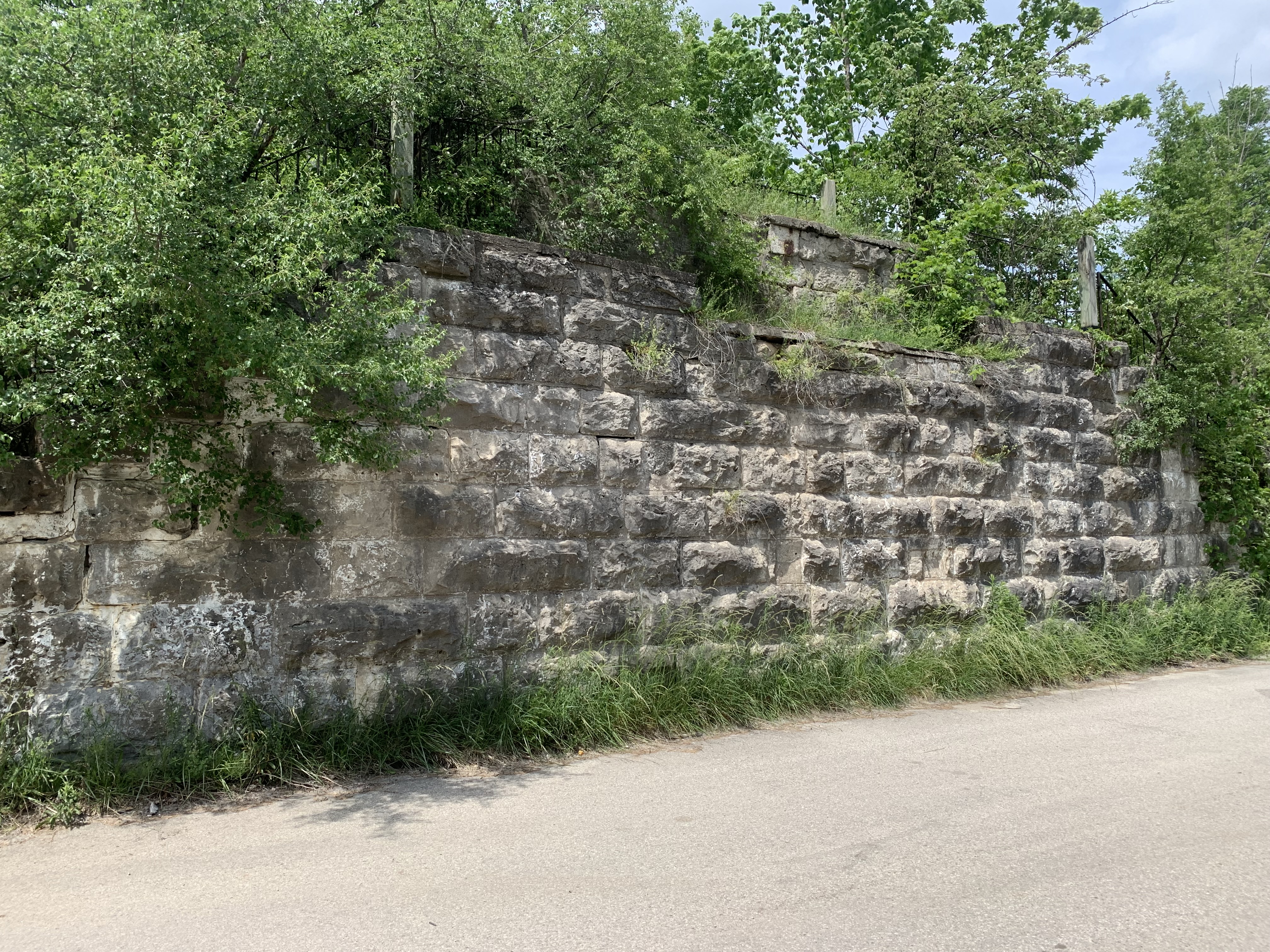
The Galt branch of the Great Western Railway opened in 1854. Some portions of the former right of way along Water Street can still be traced and the old stone abutments can be seen where it crosses a small creek.

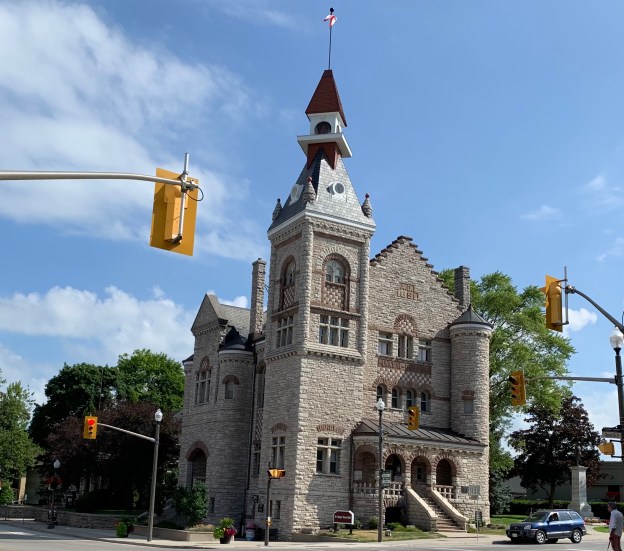
This blog is focused on Water Street and really doesn’t get into Main Street and some of the other parts of town. If you explore these areas you will find the 1857 Town Hall, the 1838 Dumfries Township Hall and the old Galt Firehall among the many interesting buildings in town.

Other Grand River stories: The Shand Dam, The Elora Gorge, West Montrose Bridge (Kissing Bridge)

Google Maps Link: Mill Race Park Cambridge

Like us at http://www.facebook.com/hikingthegta

Follow us at http://www.hikingthegta.com

Also look for us on Instagram

Dominion Wheel and Foundry Company

Sunday, May 30, 2021

Revised August 23, 2021

(The City, Province and community groups have reached an agreement that will retain the machine shops while the offices and warehouses will be demolished.)

The Dominion Wheel and Foundry Company supplied railway components to the Canadian Northern Railway and in 1914 started an operation in the industrial zone near Gooderham and Worts Distillery. They made car wheels, brake shoes, the nickel iron centres for passenger wheels and other cast iron car parts. Cone valves for stop and check, pressure regulating, liquid level and altitude controls were also made on site. Outside of the railway industry they were also involved in the manufacture of parts and equipment for paper mills and printing presses. They were originally owned by the Canadian Northern Railway and later by the Canadian National Railway.

The photo below was taken from the Toronto Archives and shows the extent of the operation in 1947 when it reached all the way to Cherry Street. The buildings outlined in green have already disappeared leaving only the four outlined in blue. These are the foundry, warehouse, offices and machine shop.

The foundry building was where metal ingots were heated and poured into molds to produce the parts for repairing the rolling stock of the railway. The foundry has a low pitched gabled roofline that is less common in industrial buildings.

This undated photo from Friends of the Foundry shows the interior of the foundry when it was in operation. I can only imagine the heat in this place in the middle of the summer.

The entrance to the office building was located on the north wall and had single story pilasters on either side. Unfortunately, It can’t be appreciated because of the hoarding that was recently installed.

The office building is the only one that has any type of extra ornamentation. The walls are buttressed with brick piers that have small cut stone detailing at the tops. There’s also brick corbelling along the roofline with small stone details worked in.

When the foundry closed down the buildings were temporarily occupied by MSR Inc. into the late 1980’s. Since then it has stood empty while debates over the future of the entire 80 acre industrial zone went on. The City and Province proposed to develop the entire area for affordable housing in 1988. It is located in the flood plain for the Don River and so flood control and years of contamination required extensive remediation before development could begin. This new community would have been called Ataratiri after the Huon village that was destroyed near Midland in 1649. In this plan, the entire area would have been razed and all the buildings lost. Property values declined in the early 1990’s and along with skyrocketing remediation costs led to the project being cancelled.

The picture below shows the side of the warehouse with its double rows of windows and lack of any ornamentation, except for a single row of corbel under the roofline.

The city added the four remaining buildings to their heritage inventory in 2004 and a plan was put forward that would have developed them into a community hub with a musical theme. There would have been studios and places to jam as well as community kitchens and meeting areas. This also didn’t happen.

The machine shop had a full wall of two story windows that let a lot of morning light in through its five bays.

The Pan Am Games were held in Toronto in 2015 and the 80 acre industrial zone became a new project. Now known as the West Don Lands, it was partially redeveloped as housing for the athlete’s village. When the games were being planned the foundry buildings were used for this purpose and during this time Prince Charles visited them. Since then, development has continued unabated with the whole area east of the old Canary Restaurant being turned into midrise condos .

In 2020 the foundry site was announced as the future home of Eastern Avenue Affordable Housing. In January 2021 the Provincial Government invoked a Minister’s Zoning Order (MZO) to allow the development to proceed without delay or further community consultation. Demolition began almost immediately. So did the public outcry. Within days the demolition was put on hold and the damaged sections of the foundry building were boarded over.

The southern elevation of the Machine Shop shows a lot of new wood that has been installed to replace the original window boarding on the buildings. This was done at the specific request of the provincial government who found the anti-demolition graffiti on the older boards to be disturbing. The local community had left chalk and encouraged anti-demolition comments which support the preservation of this part of our railway heritage. It appears from the door in the picture below that the city workers have left a few pro-demolition comments behind.

The 1959 surveyors map below shows the industrial area and how it was completely intertwined with the railways. Much of this railway heritage has already been lost to redevelopment and it remains to be seen what happens to the remnants. The Smithsonian Institute has recognized the cultural heritage of the industry and has one of Dominion Wheel and Foundry’s catalogues in their collection.

A few decades ago this would have vanished without thought but the tide has turned and people are more aware of the diminished cultural heritage that we retain. Hopefully we can continue to influence how it is retained and maintained.

Relevant Blogs: The Distillery District, Canary Restaurant

Google Maps Link: 153 Eastern Avenue

Like us at http://www.facebook.com/hikingthegta

Follow us at http://www.hikingthegta.com

Also look for us on Instagram

Toronto’s Early Banks

Sunday, May 23, 2021

Lots of history

Yonge Street has become the main street of Toronto but the city didn’t start there. The original town of York started in a small ten block section east of there. The town of York was bounded by George, Berkley, Adelaide and Front Streets and the oldest bank building in the city is to be found there.

The Bank of Upper Canada opened in 1821 in a local store and they began work on their new building in 1825. It opened in 1827 and because it was owned and operated by The Family Compact it came under constant attack from reformers. It was a target of the failed Rebellion of Dec. 1837. The building housed the bank until it failed in 1866 after which it had several uses before being abandoned by the late 1970’s. It was restored in 1982 and now serves as office spaces. The bank issued bank notes between 1822 and 1861 and ones in poor condition can sell for $750 in today’s market. More about the building can be found in our story Toronto’s First Post Office.

The Bank of Toronto was founded in 1855 by a group of grain dealers and flour mill operators including Gooderham and Worts. Throughout most of the 19th century the bank had farmers as their primary customers. By the 1880’s and 90’s they had started to extend loans to manufacturing, utilities and natural resource companies. Between 1856 and 1937 the bank issued several series of bank notes that continue to be collected today. In 1856 the bank opened their first branch at 78 Church Street. It was located in the building which is now numbered 80 Church Street and has the three small dormers on the top floor in the picture below.

The archive photo below was taken from the York University Library collection and is dated July 7, 1956. At this time the building was still numbered as 78 Church Street and the bank had recently merged with the Dominion Bank in 1955 to form the Toronto Dominion Bank (TD).

The Bank of British North America was founded by Royal Charter in London in 1836. It opened its first branch in Toronto in 1845 on the corner of Yonge Street and Wellington Street. Thirty years later it opened a new building at 49 Yonge Street and issued its own bank notes from 1852 until 1911. It merged with the Bank of Montreal in 1918.

The Bank of Montreal was founded in 1817 and was the first chartered bank in Canada. It served as the central bank for the country until the founding of the Bank of Canada in 1935. Legislation in 1824 prevented the bank from serving the town of York but it got its break in 1840 when it took over The Bank of The People. This was a reformer bank started in 1835 to provide loans to farmers that the Bank of Upper Canada wouldn’t serve. The Family Compact didn’t like the direct competition of reformers and plotted to have the bank taken over by the Bank of Montreal. In 1885 they opened a branch at Yonge and Front Streets and this building is one of the few in this area that survived the great fire of 1904. The building was designated in 1976 for its heritage value as one of the finest examples of 19th century bank buildings in Canada. It is now home to The Hockey Hall of Fame.

A little farther north on Yonge Street the Bank of Montreal opened another branch in 1887. Somewhat less ornate than the one built at Front Street two years earlier it survives today as an A & W restaurant.

Traders Bank of Canada was formed in Toronto in 1885 and survived until it was acquired by the Royal Bank of Canada in 1912. It was popular in rural Ontario but built a 15 story skyscraper on the corner of Yonge and King Streets in 1905. It was the tallest building in the British Empire upon completion, a title it would only hold until 1911. It was the first skyscraper in Toronto and one of the few remaining from the early 20th century. It is currently undergoing some restorations.

The Canadian Bank of Commerce was founded in 1867 by a group of Toronto businessmen. It grew rapidly and by 1907 had 172 locations across Canada. In 1961 they merged with The Imperial Bank of Canada to form the Canadian Imperial Bank of Commerce or CIBC. In 1905 they built this impressive 4 story building at 199 Yonge Street which has been preserved as part of the Massey Tower condos.

The Bank of Toronto erected a building at 205 Yonge Street in 1905 to a design by Toronto architect E. J. Lennox. He is famous for designing Old City hall and Casa Loma. This small building looks more imposing than its four stories because of the dome on top.

The Dominion Bank was founded in Toronto in 1869. In 1914 they constructed The Dominion Bank Building at the corner of King and Yonge Streets to replace the head office that had been located there since 1879. The building is 12 stories tall and was one of the earliest skyscrapers in the city. It was designed in the Beaux-Arts style with Renaissance Revival detailing.

On June 19, 1929 the Canadian Bank of Commerce started construction on their new 34 story building. When it was completed in 1931 it was the tallest building in the British Empire, a status that it held for the next 30 years while it served as head office for the bank. The site was originally home to a small wood chapel for York’s first Wesleyan Methodist Church starting in 1818. In 1887 the Canadian Bank of Commerce demolished a theatre on the site and built a 7 story head office which stood until 1927 when it too was razed for the current building.

The Dominion Bank built a new branch in 1930 at the corner of Yonge and Gerrard Streets. The building was designed in a simplified classical style is the work of prominent Toronto architect John M. Lyle and has fine detailing on the front and sides. Images of native plants and animals along with Canadian history adorn the building.

Following the Second World War designs had been simplified when the Bank of Nova Scotia built this branch in 1949. The Modern Classicism is enhanced with the rounded corner and smooth cladding.

In 1975 the Bank of Montreal completed their 298 metre tall building called First Bank Building in honour of the banks status as Canada’s first bank. It is the tallest building in Canada and only two metres short of being classified as our only Supertall Building. Two Supertalls are under construction and four more are in the planning phases. When they are completed it will be the first time in over 100 years that a bank building hasn’t been the tallest on Toronto’s skyline.

The banks have always held some of the most prominent buildings in the city, either in architectural design or for their height. It is only in the next couple of years that new condos will surpass the bank buildings in height but who knows how long that will last before a grander bank tower is constructed.

Associated blogs: The Rebellion of 1837, Toronto’s First Post Office, The Distillery District.

Google Maps Link : Yonge and Dundas

Like us at http://www.facebook.com/hikingthegta

Follow us at http://www.hikingthegta.com

Also look for us on Instagram

The Drug Trading Company

Monday, March 15, 2021

Todays post is evidence that you need to keep your eyes open when you’re driving around. On my lunch I decided to drive through the area of the former community of Purpleville to see if there was a potential pioneer community story. Out of the corner of my eye I saw a vehicle in the woods a short distance from the road. Naturally, I found a place to turn around and went back to see what had caught my attention.

The cab and chassis is missing and all that remains is the enclosed cargo area of the vehicle. The sides and any windows have been broken out but fortunately the printing is still clearly legible. In Canada we have two main independent drug stores. Guardian and IDA are owned and operated by their pharmacists.

The Drug Trading Company was founded in 1896 to supply independent pharmacies with medications and other products. This was one of their delivery trucks but as the front view reveals, the engine and passenger compartment is no longer here.

Both sides of the vehicle carried a slogan trying to attract customers into their stores. “For friendly service and economy shop your independent drug store.” In 1962 Shoppers Drug Mart was founded as a national chain and it soon dwarfed the smaller independent pharmacies. While the bigger chains evolved into grocery and cosmetic shops and moved the pharmacy into the rear of the store, the smaller pharmacies kept a more personal touch with their clients.

One of the rear doors has been propped open but the other one isn’t opening any time soon without a lot of WD40.

When viewed together the two halves of the door read “DT Co” in the black circle which stands for Drug Trading Company. Then it says “Serving Pharmacy 100” which would suggest a date of 1996. Therefore this vehicle was still in service just 25 years ago. Most of the trees in the woodlot appear to be young and may have grown after the Drug Trading vehicle made its last delivery. Faint lettering can still be seen from the original Drug Trading Company logo on the rear doors.

The inside might have been protected against the elements when it was left here but there’s no longer any roof and both sides are wide open. While this may have once been a relatively unique piece of Canadian history it looks to be suffering an all too common fate. Neglected and soon forgotten. However, its memory will live on in these photos.

This old vehicle is visible from the road and although there isn’t any fence, the property is obviously owned by someone and needs to be respected as such.

Google Maps Link: Respectfully withheld.

Like us at www,facebook.com/hikingthegta

Follow us at http://www.hikingthegta.com

Also look for us on instagram

Dufferin Grove Park

Friday February 26, 2021

I had a rare Friday off of work and found myself near one of the local parks that I had not explored previously. Dufferin Grove Park is on Dufferin Street just south of Bloor Street and is one of the older parks in the city and contains some carved stones that date back to 1876. Parking is limited on local side streets but I found some without any problem. The archive picture below is from February 1914.

The Cob Courtyard was built as a food preparation area and has a kind of “Flintstones” look to it. It is currently undergoing some restoration work to repair the deterioration that it has suffered over the years.

The local children have one of the best playgrounds in the city. There’s an enclosed playground with all the traditional slides and things to climb on. There’s also a large sandpit for little ones to play in with their toy trucks and diggers.

The park had a few parents with small children but for a Friday morning it was quite empty. I can imagine that Thursdays in the summer when the farmer’s market is on the park is quite busy. The snow that had fallen had been baked into ice which was tricky to walk on. In a few places there were even deep pools that people had walked over and broken through. The city was trying to pump water out of the deep one that had formed in the wading pool near the children’s playground.

There’s a small clubhouse in the north end but its days are numbered. There is a City of Toronto proposal to update the ice rink and clubhouse with a $3.5 Million replacement. It has gone through all the consulting and planning phases over the last three years. Construction should have started in 2020 but has been put on hold by the pandemic.

The park has a surprising number of amenities, some of which you don’t find in most places. The pizza ovens being a prime example. The revised clubhouse is expected to include a kitchen area.

The fifth Customs House in Toronto (or York) was built in 1876 and demolished in 1919, just over 100 years ago. All of them were located at Yonge and Front Streets. The archive picture below shows the building prior to demolition you can see stone faces that were carved into the keystone in the arches over the windows.

When the building was demolished the faces were repurposed into the upper façade of the Colonial Theatre which was later known as the Bay Theatre. It was demolished in 1965 and the faces were preserved with the idea that they would be incorporated into Simpson Tower which was being built on the site. Instead they ended up in High Park where they were setup in a circle near Colborne Lodge. They stayed here until 1991 when the city decided to remove them because they had become a party spot. In 1998 they were incorporated into an artwork in Dufferin Grove Park called Marsh Fountain.

The faces may represent people who were famous in that era. It is said that the faces may be those of John Cabot, Samuel de Champlain, and Mercury the god of commerce.

The park rises to a crest beside Dufferin Street and then is relatively flat stretching out to the soccer fields. There are plenty of mature trees even though there is no woodlot in the park. There’s even a Sakura Cherry Tree to provide some colour in the spring when the blossoms are out.

There is a second group of faces a little farther south along the side of Dufferin Street in the park. They can be found by looking for the fire pit where there is a little remembrance gardens to Garrison Creek and its tributary Dennison Creek which runs under the park. The concrete and bricks for the fire place appear to mostly be pieces of old buildings that have been brought here.

At the pit is a face of a lady with the only original (not vandals) inscription on it. The woman represents the city of Toronto and the old motto of the city of Toronto written below. “Industry, Intelligence, Integrity”.

Dufferin Grove Park is more than the average community park when it comes to amenities and also has some interesting historical artifacts to fire the imagination of the curious.

Google Maps link: Dufferin Grove Park

Like us at http://www.facebook.com/hikingthegta

Follow us at http://www.hikingthegta.com

Also look for us on Instagram

Bradley Museum and Watersedge Park

February 14, 2021

Bradley Museum is a collection of pioneer buildings situated near the waterfront in Mississauga. The Bradley house stands on its original property and the Anchorage has been moved from a neighbouring one. I went there on December 29, 2020 while on Christmas break from work to walk around the buildings and appreciate their architecture. While I was there I walked the narrow greenbelt down to Lake Ontario at Watersedge Park.

The oldest home in the collection is a Regency Cottage that was built in the early 1820’s near Lakeshore Road and Southdown Road. In 1838 it was purchased by a retired British Navy Commander named John Skynner. He is quoted as having referred to the home as being his anchorage and it became known as The Anchorage. After the home had been lived in as a private residence by various people, in 1953 Jim Davidson sold it to the National Sewer Pipe Company who used it as their offices until 1977. It was moved to the Bradley Museum in 1978 but wasn’t restored until 1991. The National Sewer Pipe Company is responsible for the red beach at Lakeside Park. Mississauga has another beautiful example of a Regency Cottage, this one from 1838. The Grange has considerably more detail in the doorcase windows with intricate side lights and transom.

Lewis and Elizabeth Bradley arrived in 1830 from Savannah Georgia and built this small three bay story and a half house. It had become common to limit houses to a story and a half because a full two stories was taxed at a higher rate. This house features a roof style known as “salt box” because one side of the roof was longer than the other. Bradley House was occupied by the family until 1846 when Lewis died and Elizabeth sold the home. The British American Oil Company (now SUNCOR) eventually bought the property and planned to demolish the house in 1959. It was saved and moved a short distance farther from the lake where it was restored and opened as a museum in 1967.

The log cabin on site is actually the newest of the three homes, having been built around 1850 near Mono Mills, Ontario. In 1967 the 4th Port Credit Scouts and Rovers moved it to the mouth of The Credit River and it seemed safe from neglect or demolition. This didn’t turn out to be the case as it was eventually slated for demolition again. The Bradley Museum got involved and added it to their small collection of buildings. It was rebuilt and opened to the public on December 15, 2007.

The drive shed was built on the site in 1973 from materials moved from a farm in Chingaucousy Township. The shed is typical of thousands that would have stood on farms and in church lots across the province. This one came from the Carberry farm and has the usual post and beam construction. Another great example of a drive shed in its original location can be seen at the Cober Dunkard Church in Vaughan.

Several typical artifacts are stored inside the drive shed including this old buggy.

The barn was added to the collection in 1977 made of old planks from a barn that was located on the south east corner of Burnhamthorpe Road and Erin Mills Parkway. Architecture for domestic rather than public use which is average is referred to as being the local vernacular. This barn is Ontario vernacular although on a smaller scale than many of the late 19th and early 20th century barns. One of the most common styles of barns was known as the Gambrel-roofed Barn, named after its roof style where each side had two separate pitches. The extension at the front of the roof is known as a hay sling and it allowed feed to be lifted up to the loft through a larger door. Gambrel-roofed houses are even less common, which is probably why I always thought the house I spent ten years of my youth at in Hillsburgh looked like a barn.

The image below shows the basic design of the Gambrel-roofed Barn. Livestock would be kept in the bottom while the loft would be used for hay or fodder. An earthen ramp would provide access to the loft from one side of the barn. Often the silo and this mound are the two remaining clues that mark the former site of a barn.

Heading toward the lake you can follow a main trail or one that runs a little closer to the fence on the edge of the SUNCOR oil tank farm. I followed the fence line but most of the tanks in the first row along the fence have been removed over the last few years. There’s hardly anywhere that you can even get a glimpse of one, even in winter. I imagine in summer it must be almost as if this big industrial tank farm wasn’t there.

Meadowwood Park connects Bradley Museum to Lake Ontario at Watersedge Park. Meadowwood Tennis Club maintains three courts here and there’s also a unmaintained rink. I wonder if the rink is just out of use for 2020 or if it has been awhile since it was maintained?

It’s only a short walk to Watersedge Park and certainly worth it. Although small, the park does have a beach with some excellent views including the Toronto Skyline.

On a calm day the water here is quite colourful because of the different composition of the lake bottom near the shore. The small shells of Zebra Mussels cover parts of the beach and create a brighter patch in the water off shore. They were introduced to the lake in the 1980’s and since then have developed huge colonies. This beach is also considered to be one of the best places in Mississauga to catch a great sunset.

I would imagine that this area is likely busy much of the time but on this day I was by myself on the trail. This is a short walk and if you’re looking for more you can also take the trail that leads to Rattray Marsh. There’s boardwalks and lots of wildlife, including white-tailed deer, that can be seen at the marsh.

I’m looking forward to the time when I’ll be able to return and have a look inside the restored homes at Bradley Museum but for now it was nice to enjoy them even from the outside.

For more on the Boy Scouts see our feature Camp of the Crooked Creek. Additional pictures of a drive shed in its original function can found in the Cober Dunkard Church. The red shingle beach is at Lakeside Park. The intricate Regency Cottage is called The Grange. Additional local hiking can be enjoyed at Rattray Marsh.

Google Maps Link: Bradley Museum

Like us at http://www.facebook.com/hikingthegta

Follow us at http://www.hikingthegta.com

Also look for us in Instagram

The Tollkeeper

Jan. 31, 2021

Davenport Road follows the bottom of the scarp that marks the old shoreline of Glacial Lake Iroquois. The Native Peoples who lived here for centuries had a portage trail that went between The Don River and The Humber River and connected to The Carrying Place Trail. Europeans found it convenient to use the same trail and it continues on its original route. John McGill built the first home accessed from the trail in 1797 and named it Davenport after Major Davenport who served at Fort York. It stood on the top of the scarp on the north east side of present Davenport and Bathurst.

In 1833 thirteen kilometres of Davenport Road was paved with planks. Five small cottages were built by the plank road company to house the men who were hired to collect the tolls. The tollkeeper lived with his family in the cottage which was situated directly beside the road. Known as Toll Gate #3, the little three room cottage that was built for the tollkeeper at Davenport Road and Bathurst Street was only 20 feet by 30 feet in size. It is listed as being the twelfth oldest residence remaining in Toronto and some sources claim it to be the oldest tollkeeper’s cottage in Canada, perhaps the only one. It is listed on Wikipedia as being built between 1827 and 1830 but this would seem to predate the planking of the road making this date too early. It is more likely to be 1832 or 1833. The space between the two posts in front of the house in the picture below represents the width of the road but the boards that represent the toll gate have unfortunately been knocked to the ground.

The inside was originally heated by a single fireplace which was later replaced with a pot-bellied stove. This meant that only the main room was heated. The two bedrooms would have been pretty cold on a winters night. During the 1860’s John Bullmin and his wife Elizabeth took up the position at the toll gate. They lived in this house with their seven children. One bedroom was used by John and Elizabeth while the other was used by the four daughters who slept two to a bed. The three boys slept in the main room and enjoyed the benefits of the fireplace, if not the comforts of a bed.

In 1851 the fees for using the plank road were based on the mode of transportation and the amount of livestock you had with you. A simple pedestrian paid no fees but if they had a horse it was two pence. A wagon pulled by a mule was 3 pence which went up to 6 pence if it was pulled by two horses. A pedestrian leading 20 cows or sheep would pay 1 pence. The toll keeper had to keep meticulous records to get their small percentage and the record books from this tollkeeper’s home still survive. These toll rates were likely unchanged a decade later when the Bullmin family arrived. John left his wife and children to perform household chores, fetch water from the Taddle Creek and collect the tolls while he worked 6.5 hectares of land to supplement their income. His wife used to churn and sell about 50 lbs. of butter per year from the family cows.

When roadside tolls were abandoned in 1896 the government placed road maintenance under the care of the municipalities. John Bullmin died in 1867 and is buried in The Necropolis while his wife survived him until 1912. The cottage became obsolete in 1896 and was sold to someone who moved it near Howland and Bathurst as a private home. A newer addition later obscured the original cottage and by the 1990’s it was in danger of demolition for a high rise development. A neighbour who recalled the story of the little cottage was instrumental in its being sold to a heritage group for a dollar. The TTC allowed them to move it to the Wynchwood Streetcar Barns where it was restored over a six year period. In 2002 it was moved to a small park kitty-corner to its original location. The house opened as a museum on July 1, 2003 with a small addition on the back for an interpretive centre.

The painting below is from 1875 and is by Arthur Cox. The vantage point is the top of the old escarpment looking toward the south east. The area below the hill is still farmland at the time and the church spires in Yorkville can be seen in the distance. The cottage sits with the front porch on the very edge of the road and the toll gate stretching across Bathurst. This picture was taken from taylorhistory.com.

There are a few other hints to our toll road systems of the past that can still be found throughout the city. In 1841 John Grubb founded the Weston Plank Road Company to improve his local roads by covering them with a layer of thick wooden planks. A few years later he also formed the Albion Plank Road Company. The building that the Weston Plank Road Company operated out of was built in 1846 and still sits on its original location about a kilometre south of the 401 on Weston Road.

The Gore and Vaughan Plank Road Company was established in 1855 to build a plank road along Dufferin Street. The road was to be built of local wood and various saw mills were engaged along the route to cut and prepare the planks. The picture below shows one exposed end of the plank road along with one of the steel spikes that held it together.  The planks were sixteen feet long and held together with spikes over two feet long though this section of the road.

Davenport Road is unique because it existed long before the time of the Europeans and still retains the Tollkeeper’s Cottage as a reminder of its era as a plank road.

Further reading and more pictures: The Gore and Vaughan Plank Road and Elm Bank and The Necropolis

Google Maps Link: The Tollkeeper’s Park

Like us at http://www.facebook.com/hikingthegta

Follow us at http://www.hikingthegta.com

Also look for us on Instagram

St. Marys – The Town of Stone

Sunday, January 31, 2021 (pictures taken July 24, 2020)

St. Marys was founded in 1841 when Thomas and James Ingersoll bought 400 acres of land near the junction of Trout Creek and The Thames River. They dammed the Thames River just below the confluence and built mills on the south side of the present Queen Street. The mill race that fed their mills was incorporated as an integral part of the Victoria Bridge when it was built in 1864. The mill race was restored in 1980 and now has its own heritage designation. I visited here in July when the first wave of Covid was just relaxing and took these pictures that I present now that travel is once again restricted due to the pandemic. Hopefully we’ll get back to newly explored material before too long.

By 1845 there were a number of small limestone quarries operating in the area and many of the early homes and buildings were constructed from this material. The town had already attracted several stone masons and had three stores to serve its 100 inhabitants. The number of stone buildings that survive in St. Marys makes it a beautiful place to visit when safe to do so. The stone mill still stands beside the river where it sparked the community that has such an interesting heritage to share.

The Millers Residence was built in 1858 beside the mill race and across the street from the mill. An entire commercial block has been added to the original two and a half story home but it can be seen in the left of the picture below. The gothic influenced gabled roof sets it apart from the three story Georgian commercial block in the middle and the mansard roof of the Queen Anne styled section on the end.

The Grand Trunk Railway split in St. Marys with one line headed to Sarnia while the other went to London. Both required high level bridges that were built in 1857-1858. The London bridge is seen below as it crosses over Trout Creek.

The Imperial Order of Oddfellows in St. Marys had been expanding and had outgrown their original frame building. They commissioned a new hall and opera house which they envisioned to be the finest Lodge anywhere in the Dominion. When the building opened in 1878 they occupied the third floor which used to have a central gable. The Opera House occupied the second floor and three retail businesses operated between the gothic entrances below the spires on each end. The building lost money for the Oddfellows and they were forced to sell it in 1904. For three years it was home to a harness maker before being converted into a mill that operated until 1973.

The limestone block to the south of the Opera House was built in 1868 to serve as a store for Theodore Hutton with his residence above. Starting in the 1930’s it served as as a drill hall for the local militia and is also known as the armouries building.

St. Marys post office and customs building stands across the street from the Opera House. It was built in 1903 and was replaced with a newer facility in 1956.

As St. Marys grew the original town hall on Water Street quickly became obsolete, being small and located away from where the town was now developing. In 1859 a new location was chosen on Queen street and a two story town hall was constructed which housed the town clerk, police, jail and several butchers. The smell of the slaughter and preparation of meat permeated the building and it was quickly deemed to be a problem. The picture below was taken in 1865 and is from the book Early St. Marys by L. W. Wilson and L. R. Pfaff.

By 1889 when the frame town hall was destroyed by fire no one considered it to be much of a loss. Plans were put in place to build a grander structure, this time from stone. It was completed in 1891 and remains one of the signature buildings in the community.

James Ingersoll donated land for churches including the Presbyterian Church in 1849. They built a frame church in 1852 which was replaced with the present stone building in 1879. The congregation had been split over the appointment of a certain pastor and Knox Presbyterian also operated in town. Both congregations survived the United Church movement in 1925 but continued to operate separately until 1964 when 46 year old peace talks finally mended the rift in the Presbyterian congregation in St. Marys.

The Catholic congregation in town is aptly named the Holy Name Of Mary Catholic Church. Their second building still houses the congregation in a stone structure dating to 1893. Unlike the smaller stone church that formerly stood on this site, this one has an impressive tower. An 18-metre steeple stands on top of the 21-metre tower.

St. Marys features some very interesting stone houses dating back to the earliest one which was built by the Ingersolls in 1843. Some are simple Georgian cottages while others are mansions built later in the 1890’s.

By 1899 the Thames River and Trout Creek were both polluted and the citizens approached the town council to call for construction of a waterworks system. This would include waterworks buildings near the Grand Trunk Trestle over Trout Creek, a stone water tower for storage and pipes running throughout the town. The system was completed and put into service in May 1900.

Andrew Carnegie was an American industrialist who had a passion for funding libraries. Originally he built libraries in his home town in Scotland and his adopted town of Pittsburgh. Eventually he spread his influence founding 2509 libraries between 1883 and 1929 of which 125 were in Canada. In 1904 he donated $10,000 for the library in St. Marys which was built in the Grecian style which was his personal preference.

Andrews Jewelers has been a fixture in St. Marys since 1869. The Andrews family had arrived in town in 1857 when Henry Andrews came to lend his stone mason skills to the stone abutments of the London Bridge. William Andrews replaced his original frame shop with a building that was considered to be architect and mason William Williams’ masterpiece. Opened in 1884 it is a rare example of a building that is essentially unaltered inside or out. The side and rear walls are made of St. Marys limestone while the front is made of bricks with finely worked stone dressings. The clock is 4.5 feet in diameter and cost over $1,000, about $25,000 in modern currency.

The Grand Junction Depot was built in 1907 to supplement the Junction Station and replace the earlier frame station on Elizabeth Street. It was built from a brown glazed brick known as Logan brick and is a departure from the stone architecture in town. Slated for demolition in the 1980’s it has been preserved and restored.

St. Marys is a unique town because it’s stone buildings have survived the test of time. There are many other examples that can’t be presented in this length of an article but are equally interesting.

Google Maps Link: St. Marys

Like us at http://www.facebook.com/hikingthegta

Follow us at http://www.hikingthegta.com

Also look for us on Instagram

Pine Point Golf and Country Club

Saturday, January 9, 2021

There are currently 13 golf courses in Toronto and another 87 within 20 miles of Toronto which attests to the popularity of golf. Between 1869 and 1919 there were thirty courses opened in the city but many of them have been built over with homes. At least two of them have been turned into parks that we’ve visited. The former York Downs Golf and Country Club is now Earl Bales Park. Similarly, Pine Point Golf and Country Club is now Pine Point Park.

Pine Point Golf and Country Club wasn’t one of these original 30, nor is it one of the remaining 13 as it came and went between then and now. In 1925 it got its start as the Riverside Golf Course. It consisted of 225 acres and was operated by Cecil White until 1932 when he sold it to Bert and Frank Deakin. This father and son partnership rebranded it as Pine Point Golf and Country Club. They built a new club house in 1932 to replace the existing one.

They experienced disaster on the night of August 6th, 1938. At 2:20 in the morning Frank Cech was watering the far greens on the course when he saw the glow of the blaze. The club house was completely destroyed before the Weston Volunteer Fire Brigade could put it out. As soon as the clean up was complete they set about building a new club house. Things carried on until 1950 when the government bought a strip through the middle of the golf course for construction of the 401. Another 22 acres were bought on the north side of the new highway for the creation of a new park. Pine Point Park was opened in 1957. The picture below shows the back of the club house and a bunch of newly planted trees.

The main chimney still sports the logo from the days when golfers would congregate here before and after a round of golf.

The chimney on the south side of the main door is crumbling badly and appears to be hazardous. You wouldn’t want to be walking below when one of those large stones dropped out.

Below is a 1953 aerial photograph from the Toronto Archives. The small circle on the left is the club house featured above. Shapes of greens and sand traps can be seen in the circle at the centre of the picture while the larger circle shows the bridge over the Humber River. Meanwhile, the new highway west of the river isn’t even fully laid out yet.

Seventy years have passed since the last game of golf was played at Pine Grove. In 1957 the city bought 22 acres of land on the north side of the 401 to create a new park. The club house was retained and the floodplain was turned into an open field of grass with a walking trail along the side of the Humber River. One large section of the park has been allowed to return to a more natural condition and second generation trees have become established. Throughout this wooded area there are several curved depressions in the ground that look suspiciously like old sand traps.

The Humber River had a thin layer of ice along the edges and a fair amount of slush floating downstream but surprisingly has not frozen over yet this season. Some years there could be large ice sheets pushed up on the banks that are several centimeters thick. This freezing and thawing could happen several times per winter.

Other than the club house and the general shape of some parts of the park there isn’t very much remaining from the days of Pine Point Golf and Country Club. Near the river stands an old lamp post that is likely hidden by vines for most of the summer. Notice the two bands of steel at the top which distinguish it from the modern lighting around the parking lot.

We often see tents and other temporary shelter for homeless people in the parks and this year there may be more than average as a result of the pandemic. One of the most unusual of these types of shelters is the one we found in Pine Point Park. Someone has found a group of trees which they have surrounded with industrial stretch wrap. Earth has been scooped up around the bottom to seal out the wind and water while ropes support a roof made of burlap. It’s just about the right size for a sleeping bag to be laid out inside of it. Although it seems like an environmental disaster, i give it high marks for creativity.

In the game of golf it is quite common to hit an errant ball that could come close to hitting another player. It might be more instinctual to yell “heads up” or “duck” but in golf the normal expression is “Fore!”. This appears to be tied to the idea that the player or caddie in danger is before, or in the foreground, of the incoming ball. Since the game of golf is no longer played here it is much more appropriate to whisper “duck” and point to the river. The Common Goldeneye pictured below is the female which has a chocolate brown head and a gray body.

The male Common Goldeneye has an iridescent green head which frequently looks black. They have a white patch behind their bill and white wings on a mostly white body. The wings appear to have little white windows on them. Goldeneye ducks often forage in small flocks and dive together, staying under for up to 20 seconds at a time.

Common Merganser males have a mostly white body with a green head and orange bill. The female has a brown head with a white chin and an orange bill. When migrating or during winter Mergansers are known for mixing with other species of diving ducks, including Goldeneyes, other Mergansers and Buffleheads.

Mallard Ducks were the most common birds we sighted, except perhaps Canada Geese, and a group of them were checking out the ice skating facilities.

Construction of the 401 brought an end to the Pine Point Golf and Country Club and the original highway has been expanded several times creating an extensive set of bridges over the Humber River. It appears that one effective method of reducing graffiti under the bridges is to allow the creation of public art on all the available surfaces. People seem reluctant to tag over the top of some of this creative artwork. The entire length of the trail under the 401 has been covered in some very impressive artwork.

Many people walk their dogs or go jogging through Pine Point Park without ever realizing the history they are passing through.

Additional reading: Earl Bales Park,

Google Maps Link: Pine Point Park

Like us at http://www.facebook.com/hikingthegta

Follow us at http://www.hikingthegta.com

Also look for us on Instagram

Elm Bank

Saturday, January 3, 2021

While on a walk along the West Humber Trail near Albion Road I had the opportunity to photograph the oldest building in Etobicoke as well as one thought to be number 3 or 4. This section of the trail on either side of Albion runs through property that was once the farm of the Grubb(e) family.

In 1833 John and Janet Grubb arrived in Etobicoke from Scotland. They bought 150 acres of land which included a two story home that had been built of river stone between 1802 and 1820. The house is unusual for its era because of the lack of symmetry. Often a three bay house would have the upper windows lined up with the first floor ones. The ground floor windows are different sizes and on different levels. There also appears to have been a small entrance porch at one time based on the discolouration of the stones around the door. Eight separate land owners held the property prior to Grubb and the original builder of the home is no longer known.

The Grubb family eventually included ten children and so they needed more space immediately. Using more stone from the Humber River, John built a second home just 20 feet south of the first one. The second home was built in 1834 and is a story and a half Regency Cottage design with a low hipped roof. Dormers face north and south and a large veranda looks from the south side down onto the river and floodplain below. The two houses are connected below ground with a tunnel. The second house can be seen behind the first one, on the left in the picture below. It is much larger as befits a family home but only the corner can be seen without walking right up onto the property, which isn’t appropriate without seeking permission first. The homes can be found at 19 and 23 Jason Road.

John Grubb was also the president of the Weston and Albion Plank Road Company until he passed away in 1850. In 1889 John’s son William also passed and the farm was sold to cover the expenses still owed on the former plank road company. The family continued to live in their home east of Albion road until 1930. This home is marked in orange on the atlas above and has been rescued and moved to Black Creek Pioneer Village. Across the street, a house has been built on the original stone foundations of the Grubb barn. The barn and a piggery next door were both constructed in 1835 when John was getting his farm established.

The house that was built on the foundations of the piggery is in poor shape, although it does appear to be lived in.

In addition to farming, the Grubb family also got into town building by laying out the original community of Thistletown. John Grubb was distressed at the condition of the early roads and decided to do something about them. In 1841 he founded the Weston Plank Road Company to improve the local roads by covering them with a layer of thick wooden planks. A few years later he also formed the Albion Plank Road Company. The building that the Weston Plank Road Company operated out of was built in 1846 and still sits on its original location about a kilometre south of the 401 on Weston Road.

The rear of the building is also quite interesting because you can see the way the building has been modified over the years. Where the ground level door is there are signs that another door or a window was previously bricked in just above it. The green beam that runs between the first and second floors matches the one on the front side of the building. The variations in the brickwork patterns reveal where sections of this have been closed off. It appears that this may have been one larger shipping door that was split into a couple of windows. The building was given an historic designation in 1987 but has sat neglected for a least a couple of decades now. It suffered a small fire in March of 2019 but fortunately it wasn’t completely destroyed.

Dufferin Street was also covered in planks around the same time. It was known as the Gore and Vaughan Plank Road and a small section still exists in a ravine south of Finch Avenue. Massive sixteen foot long boards held together with huge spikes were unearthed during recent erosion control work. The picture below shows one of these spikes compared to the size of my foot. The link above leads to an article with many more pictures of the planks and spikes.

The next image was taken from “A History of Vaughan Township Churches” by the Vaughan Historical Society and shows the 1851 Primitive Methodist Church in Shiloh. It is interesting because of the plank road that runs in front of the church. You can get a good idea of the size of the planks that were used and the amount of maintenance that must have been required to keep it from rotting away. These costs were not always offset by the tolls charged for using the roads.

On the way back out from Jason Street be sure to stop and admire the home of the Franklin Carmichael Art Centre. The home was built in 1934 and was converted into the Art Centre in 1971 to showcase the works of Franklin Carmichael who was one of Canada’s famous Group of Seven artists.

A little south of Elm Bank on a road known as Elmhurst sits the last remaining Victorian Era farm house in the area. The rear portion of this home was built in 1864 by George and Hannah Garbutt. This section has a nice row of buff coloured bricks just below the roof. In 1903 their daughter Alice married William Gardhouse. George passed away a few months later and Alice inherited the farm. When her family outgrew the home, an addition was built on the front of the original house. The family continued to farm the property until 1952 when it was sold to developers for a subdivision. Today this house sits at a funny angle to the street but it faces Islington Avenue squarely.

The Grubb and Garbutt family homes are note worthy because of their age and also the way in which they have been retained in spite of the urban sprawl that hit the area in the 1950’s.

Also check out our blog The Gore And Vaughan Plank road

Google Maps Link: Elm Bank

Like us at http://www.facebook.com/hikingthegta

Follow us at http://www.hikingthegta.com

Also look for us on Instagram