
Saturday Nov. 14, 2015
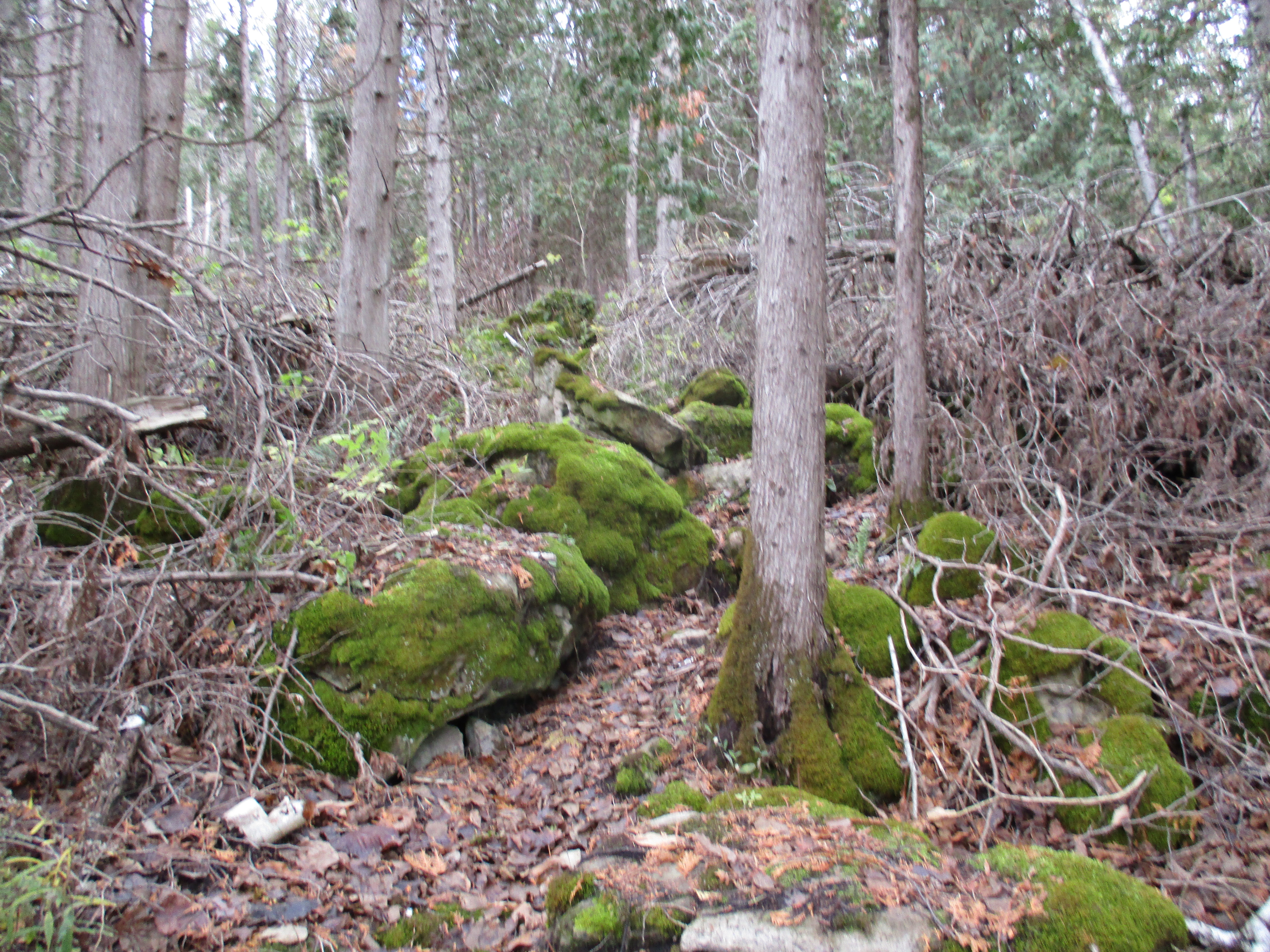
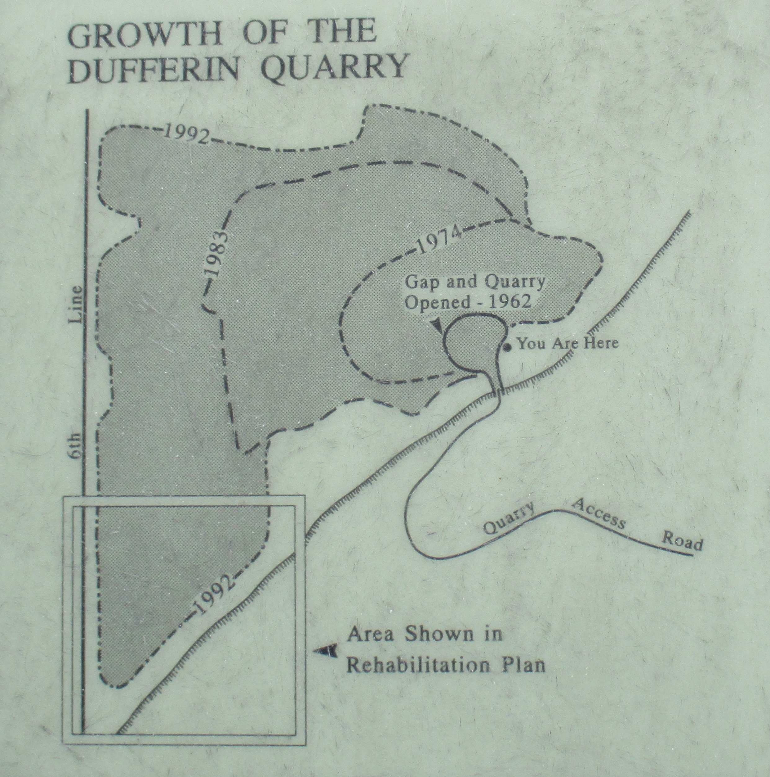
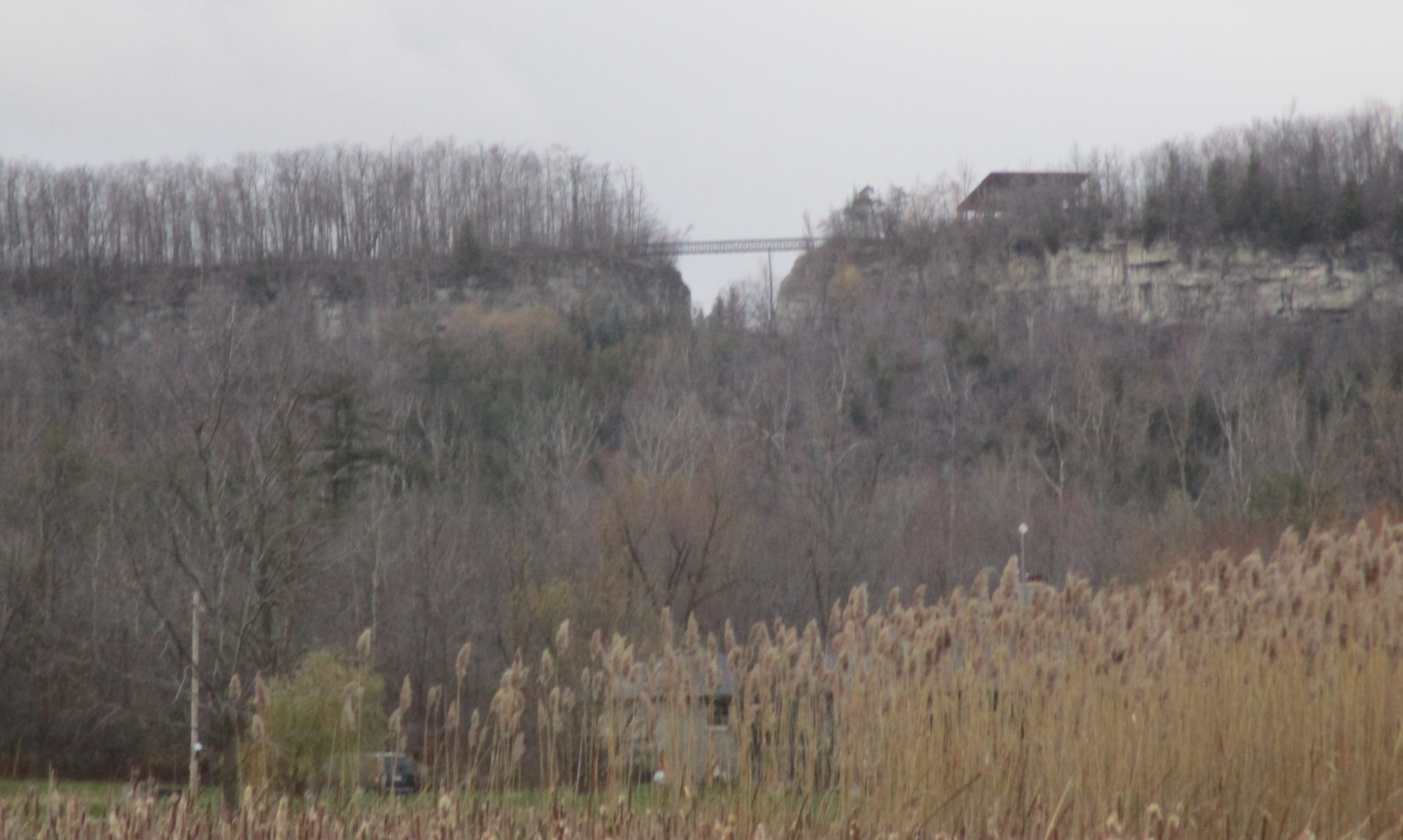
In 1962 a quarry blasted a huge gap in the Niagara Escarpment and set off a chain reaction that led to the escarpment being declared a World Biosphere Reserve by UNESCO. The gap in the escarpment can be seen from the 401 which is 3 km away. We parked at the turn around loop on Dublin Line and made our way along a small trail that departs from the cul-de-sac. It was 2 degrees but feeling like minus 2 as we started up the side of the escarpment. We followed a trail that led between the moss covered boulders, seeking the Bruce Trail that runs along the top of the escarpment.
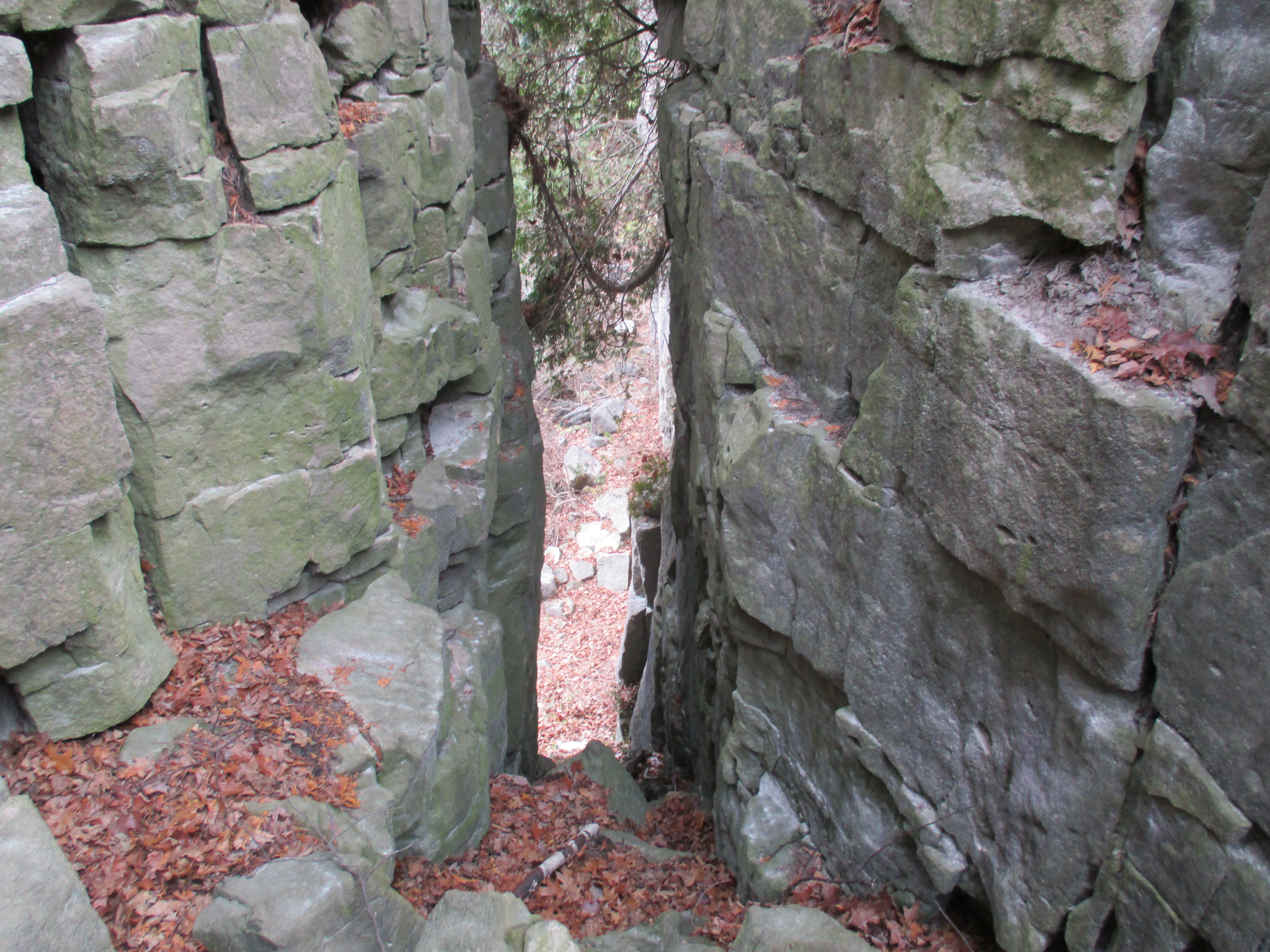
The escarpment is over 700 km long and is full of valuable natural resources. The area around Milton is important as a source of dolomitic limestone which is used in construction. The location is critical because there is about 30 meters of good limestone very close to the surface. It is also close to the highway for transportation and the GTA which is the largest market in the country. We needed to get to the top of the escarpment and found a natural gap in the rock where we were able to climb up.
Even from before the creation of the gap there had been a movement to keep quarries under some tighter controls. The Sixteen Mile Creek Conservation Authority was formed in 1956 and three years later they had acquired an 88 acre chunk of the escarpment to prevent quarry expansion. This would become Mount Nemo Conservation Area with Rattlesnake Point being created in 1961. Then, like a missing front tooth, came the visible scar of the gap.
From the top of the escarpment you can see the towers in the city. The CN tower has been a landmark for 40 years but now, taking their place on the right of the tower, are the so called Marilyn Monroe towers in Mississauga.

Concerned, Ontario Premier John Robarts commissioned a 1967 report on protecting the escarpment, the first of it’s kind. In 1973 the government passed an act creating the Niagara Escarpment Commission which began to control development. The Coalition on the Niagara Escarpment (CONE) was established in 1978 to make recommendations on preserving the escarpment. Through their efforts the Niagara Escarpment Plan would be passed by the government in 1985. In 1990 the Southern Ontario portion of the escarpment was designated a World Biosphere Reserve.
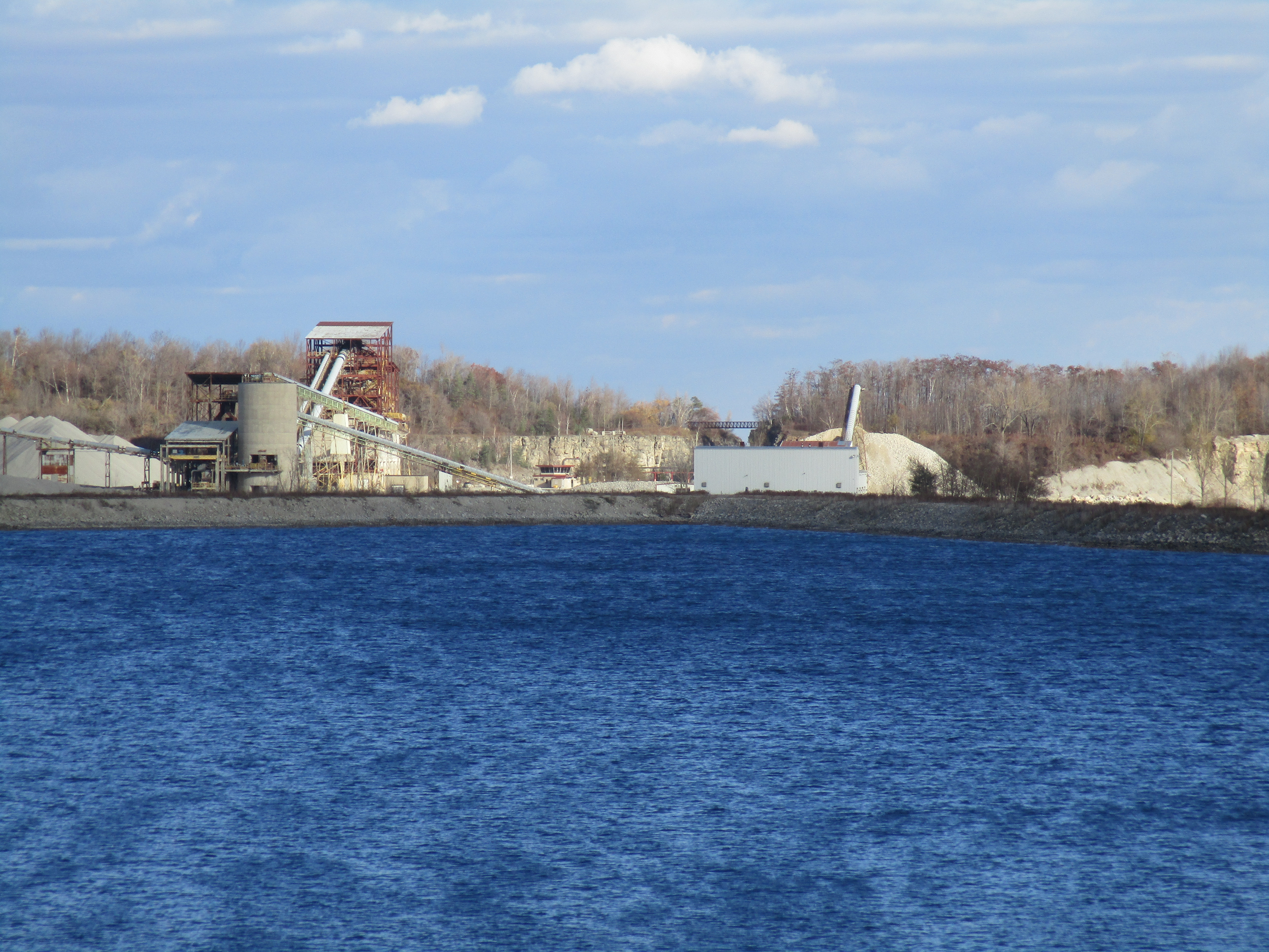
The processing plant can be seen from the highway, not only through the gap, but rising above the limestone cliffs to the east of it. This processing plant was built in 1974 and the earlier one closed down. It has since been removed and the site put into the rehabilitation plan.

This large size cable spool had rolled down the side of the excavation berm and come to rest on the fence. The steel fence post is about 2 feet shorter than the spool making it about 7 feet in diameter. Made in Japan, this Canada Belt product contained 925 feet of cable on the spool. There were a lot of empty Texaco lubricant tin buckets, a Zenith washing machine, a lawnmower and other trash in the same area.

In 1989 the Bruce Trail Association started a campaign to bridge the gap and connect their conservation lands on either side. $150,000 was raised through donations to build the 40 metre bridge. This allowed the trail to be relocated onto a better route. The bridge was officially opened in May 1991.

Over the years the quarry grew to take in larger and larger sections of the escarpment. In 2006 they applied for and later received an extension to the licensed area of the quarry.
Parts of the original quarry have now been put into a regeneration project. There will be wetlands and wild life habitat created. Every year since 1993 Scouts Canada has planted trees in the closed section of the quarry as part of their Earth Day celebrations. In 2008 they planted their 100,000th tree. Both forests and meadows are being created as well as lakes. When we got back to the natural gap in the rock and had descended, we decided to make our way along the front face of the limestone cliff. The large loose chunks hanging out over our heads and broken pieces under our feet were a constant reminder that they fall on a regular basis.

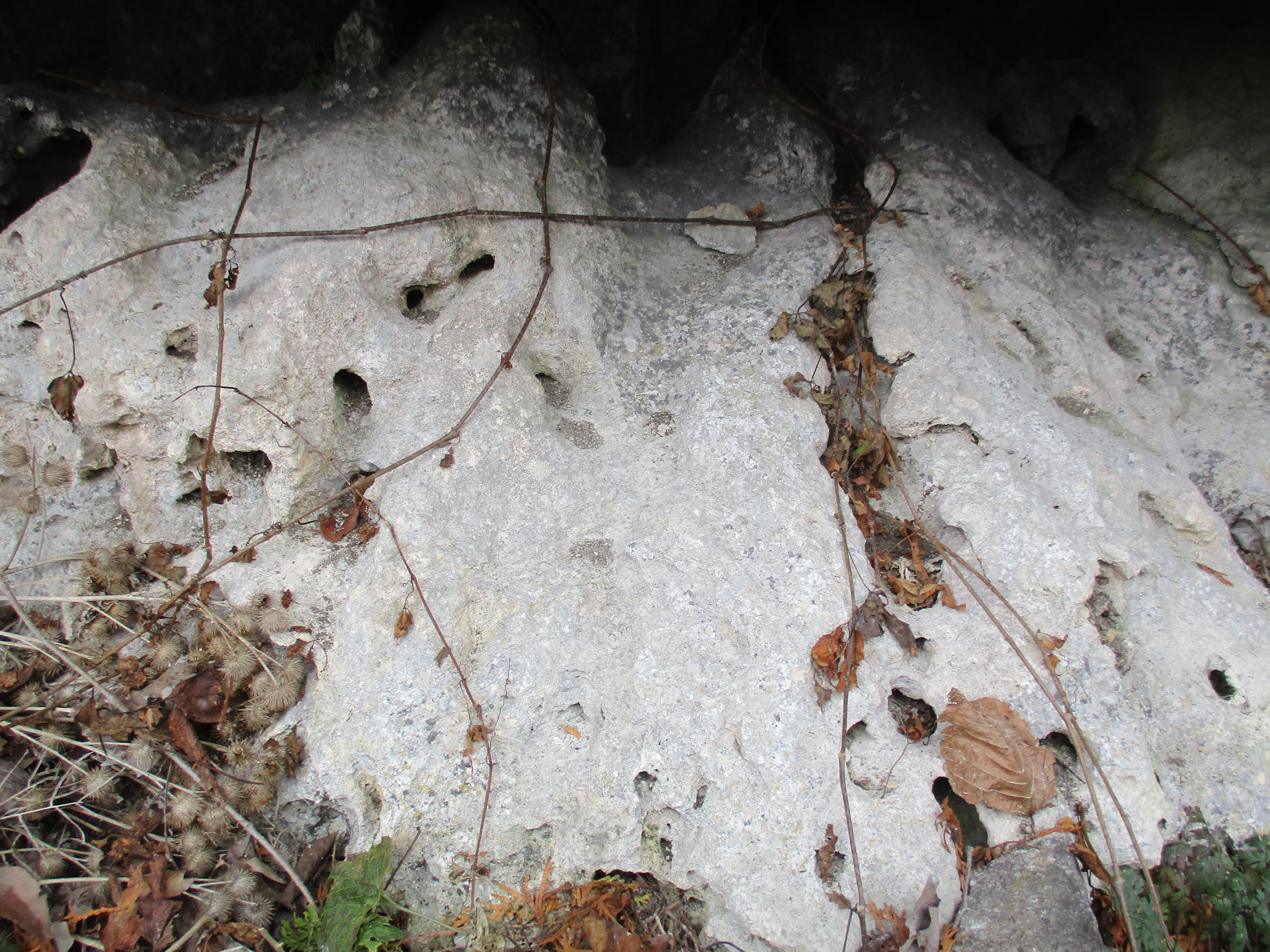
We found this hardened lime at the bottom of the cliff in a couple of places. It was drilled in several spots with little animal holes.
Based on current mining rates it is expected that the Dufferin Quarry site will run out in about 25 years or less. When the rehabilitation is complete over 400 ha of parkland will be handed over to the conservation authority creating one of the largest public land holdings in the entire GTA. The picture below was taken on November 1, 2015 during our Hilton Falls excursion. It shows the quarry lake and the back of the processing plant. The bridge across the gap is also seen in the distance in the centre of the picture.
Part of the recent approval for expansion that was granted included the company dealing with the industrial scar of the gap. In the short term they have planted as many trees as possible to screen the gap. When the quarry closes they will implement a more permanent solution. Filling the gap back in is one option but would restrict the animal traffic that now uses it. This could be overcome by creating a tunnel with fill on the top. Building a new land form behind the gap to create the illusion of it being closed is yet another option being investigated. A more creative idea includes building a terrace across the gap with trees planted on it.
Many believe that it was the destruction of this small section of the escarpment that led directly to the creation of the NEC and ultimately to recognition by the UNESCO (United Nations Educational Scientific and Cultural Organization).
Other popular hikes in the area include Rattlesnake Point and Mount Nemo.
Google Maps: The Gap
Like us at http://www.facebook.com/hikingthegta
Follow us at http://www.hikingthegta.com
