
Sunday June 10, 2018
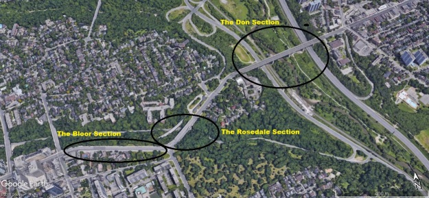
When people think of the Bloor Street Viaduct they usually think of the bridge over the Don River and Don Valley Parkway. Or, thoughts of Toronto’s suicide bridge may come to mind. Few people realize that the viaduct is comprised of two bridges and a length of landfill. These are known as the Don Section which spans the Don River and is 1620 feet long and 131 feet above the river. The Rosedale Section is another bridge, this one over the Rosedale Ravine while the Bloor Section is landfill along the side of the Rosedale Ravine, connecting the original portion of Bloor Street with the Rosedale Section.
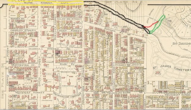
In 1899 when the fire map below was created, Bloor Street ended at Sherbourne Street and there was no easy access across the Rosedale Ravine and the Don River Valley. A plan was put forth to build bridges across the two waterways and connect Bloor Street with Danforth Avenue on the east end. The existing section of Bloor Street is coloured yellow. The Bloor section of the Bloor Viaduct is coloured black while the Rosedale Section is coloured green with the eventual TTC bridge in red.
By 1901 the city was expanding to the east but the only two bridges across the Don River were on Queen Street and Gerrard Street and they were unable to handle the increased traffic that expansion brought. A proposal was put forward to survey the best route for connecting Bloor Street with Danforth. Although the proposal would come up again in 1906 and 1907 it wasn’t until the area of Danforth was annexed to the city in 1909 that things got serious.
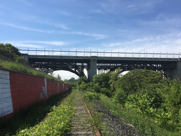
To investigate the viaduct in its entirety I had to do it in two portions, starting below the Don Section. This was accessed from Riverale Park using a combination of The Lower Don Trail and the abandoned Canadian Pacific tracks that run from Half Mile Bridge. The picture below shows the viaduct looking south. The abandoned railway and the Don Valley Parkway run between piers A and B. The Lower Don Trail runs between B and C.
On January 1, 1910 the people voted No to a referendum but the need for a bridge didn’t go away. City Council hired a firm of traffic consultants to see if a subway might be the answer to their traffic problems. Their report of August 25th, 1910 suggested a Yonge Street, Queen Street and Bloor Street subway line. They proposed a double deck bridge over both the Don Valley and Rosedale Ravine with a subway on the lower deck. On January 1, 1913 the people approved construction on the viaduct on an altered route that required an angled bridge across Rosedale Ravine and landfill between Sherbourne and Parliament Streets.
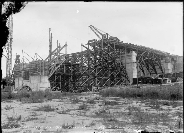
Seen from the opposite direction the archive picture below shows construction of the Bloor Viaduct. Pier C is in the foreground with the crane sitting above pier B. A series of falseworks were constructed below the bridge to support the steel structure during assembly and later removed. The steel girders of the bridge can be seen extending out from each pier to an eventual connection in the middle. Each girder has three hinges, one on either end and one in the middle.
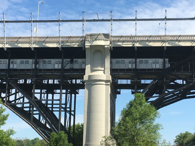
Rolland Caldwell Harris was Commissioner of Public Works and he supported the idea of including the subway decks for eventual use. The sod turning ceremony took place on January 16, 1915 with construction of the piers beginning immediately. Four of the piers across the Don River section are sunk over 40 feet below the river to sit on the bedrock. The subway line along Bloor Street didn’t open until February 26, 1966 but the lower deck saved the TTC millions of dollars in construction costs. A subway train makes its way east under Don Section in the picture below.
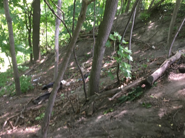
Having explored below the viaduct I wanted to examine the Bloor section and the Rosedale Section. I was able to find parking on Bloor Street right near Sherbourne and so I set off to explore the section of landfill that now carries five lanes of traffic and two bicycle lanes. The side of the embankment down to Rosedale Valley Road is steep in places but has developed a mature tree cover.
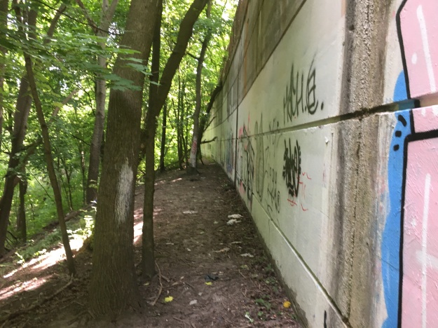
During construction the viaduct was opened in three phases with the Bloor Section opening to traffic last. The Rosedale Section being the shortest was completed and opened in October of 1917 and the Don Section was opened on October 18, 1918. As the fill settled in the Bloor Section it continued to crack and it wasn’t until August 23, 1919 that this last section was opened. A long portion of the embankment has been supported with concrete and provides an easy way down.
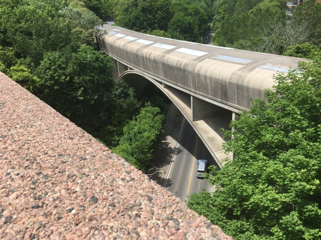
The Rosedale section is 190 feet long and stands 90 feet above the ravine floor. There is only one span in this section and the steel beams were assembled on the ground and then hoisted into position. This eliminated the need for falsework under this bridge.
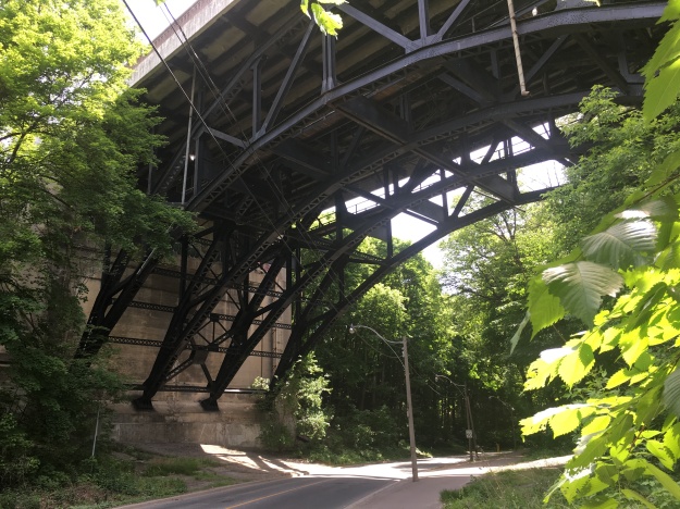
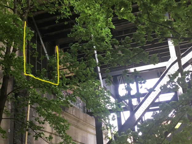
When it came time to build the subway it was decided that the curve created by the Rosedale Bridge was too severe for safe operation of the trains and so the subway deck was never used. From below the bridge you can still see the screened off openings for both the east and west lines. The eastbound lane is marked in yellow on this picture of the west abutment.
A new covered bridge for the subway was installed beside the Rosedale Bridge in 1966.
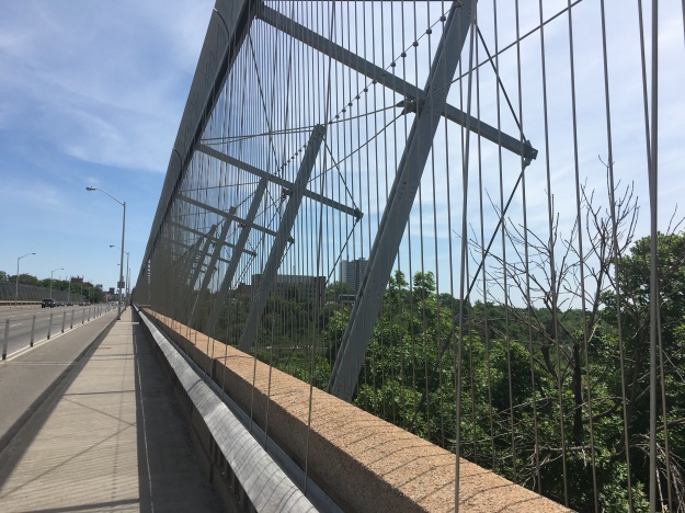
After passing Castle Frank and its subway station you come to the longer Don Section of the viaduct. The bridge had become the most popular place in Toronto to commit suicide and by 2003 nearly 500 people had jumped to their deaths. The city approved a barrier in 1998 but delayed 5 years over funding issues. Meanwhile, over 48 more people jumped creating a hazard to traffic below. The Luminous Veil was installed at a cost of $5.5 million dollars and has put an end to the unfortunate use of the bridge but suicide rates in the city remain unchanged .
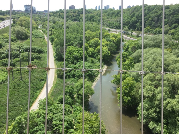
The view south from the bridge shows the DVP in the left corner and the Lower Don Trail beside it. The river separates the trail from the Canadian Pacific tracks and the Bayview Avenue Extension. The Luminous Veil does mess up the view to a large degree.
The Bloor Street Viaduct was officially named Prince Edward Viaduct when it opened in 1918 although it retains the more popular Bloor Street Viaduct as a common name. The abandoned railway under the viaduct belongs to Metrolinks and would make a good footpath between several downtown parks, even if only temporary. We make the proposal in our post Half Mile Bridge Trail.
Google Maps Link: Bloor Viaduct
Like us at: http://www.facebook.com/hikingthegta
Follow us at: http://www.hikingthegta.com

Kudos on an interesting and informative post! It’s a great stretch for walking in Toronto – both above and below.
I still cannot shake the feeling that there should be statues or something at the top of the piers, like in picture 6. That niche seems way too obvious to be empty…
A gargoyle would go well there
On Monday June 25 2018 I was driving on rosdale valley road, 10:45am when suddenly a body crashed through the trees into the road. About a cars lengrh in front of me. I had the radio on talk radio, I could hear the sound of the thump, and I would swear in court I heard him groan. He jumped from the rose dale bridge. It knocked his shoes off and his pants came undone. He wasn’t bleeding but his body was horribly broken. He almost immediately turned grey. This article came up while I was researching the area.
That sounds like a potentially traumatic event to witness. I hope you are okay, and if not, that you can find some help in dealing with any psychological consequences.
Pingback: Greatest Treks 3 | Hiking the GTA
Pingback: Riverdale Park | Hiking the GTA
Pingback: Trinity Bellwoods Park | Hiking the GTA
Pingback: Haunted | Hiking the GTA
Brilliant as always!!!
Pingback: Lower Don Trail | Hiking the GTA
Fascinating!!! Love learning about Toronto history and its secrets.
Pingback: Canada Linseed Oil Mills | Hiking the GTA
Pingback: Back Tracks – 8 Years of Trails | Hiking the GTA