Saturday, November 30, 2019
On January 7, 1964 Chedoke Winter Sports Park was officially opened. Mayor Vic Copps and head of the parks board Thomas Newlands cut the ribbon that opened the first run with its 900 foot tow rope. Over time two more tow ropes and a chair lift would be added along with sled runs. The park operated until 2002 when poor snow conditions caused the city of Hamilton to decide not to open it that year. The following year it was closed permanently with the city citing an annual loss of $250,000. The cost of upgrading the snow making equipment to be able to perform in warmer temperatures along with lift upgrades would have cost an additional $3,000,000. Over the next few years most of the poles and lift equipment was removed guaranteeing that it would never open again. The picture below was taken from The Hamilton Spectator and shows the ribbon cutting ceremony that opened the park.
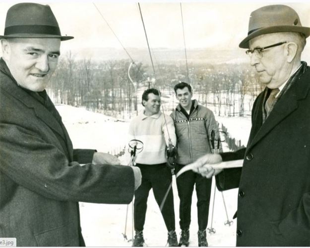
The winter sports park added additional ski runs over the years as well as more tow lifts. Eventually, a run would be opened from the top of the escarpment and it would be served by a chair lift. Sled runs were also added and the park served as a winter destination for the next four decades. Attendance declined over the years and the cost of operating the hill continued to increase until the city decided to close it permanently.
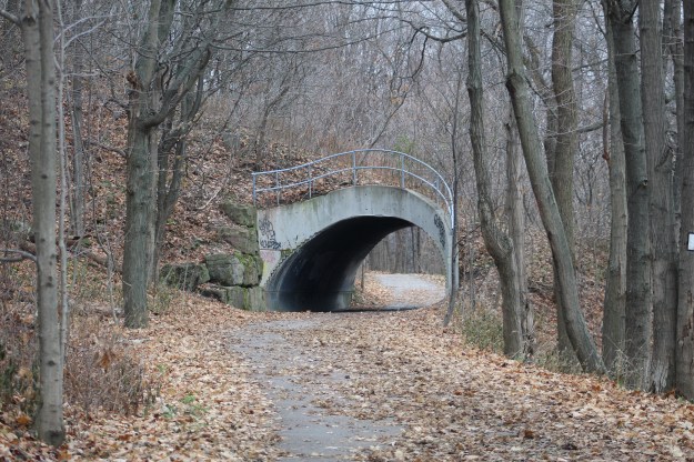
The Chedoke Rail Trail runs along the bottom of the escarpment near the Chedoke Golf Course and it has one unusual tunnel just north of the parking lot. This tunnel allowed pedestrians to pass under the tow rope that carried skiers back to the top of the hill. The tunnel is flanked on both sides by abandoned lamps that lit the former ski hill.
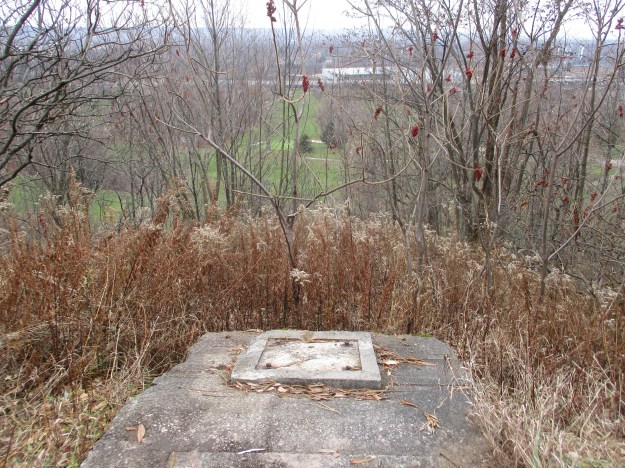
This tow rope supported one of the shorter runs and ended just a few metres above the Bruce Trail. The concrete pads where the upper wheel was located have been left behind. Near this spot is an open pit that contained snow making pipes and equipment so watch where you step if you explore this area.
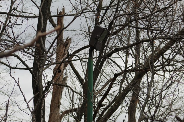
Each of the ski runs was lit for night skiing. Although the lift mechanisms have been removed, the light fixtures were left behind. They will slowly be overtaken by the new forest growth and will seem somewhat out of place to future explorers after the ski hills have been forgotten.
Between 2003 and 2009 most of the lift equipment was removed from the site. All of the lift poles and tow ropes were disassembled and carted away except for the main drive unit for the chair lift. It still stands at the bottom of the longest run, hiding in a green shed.
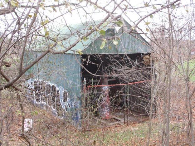
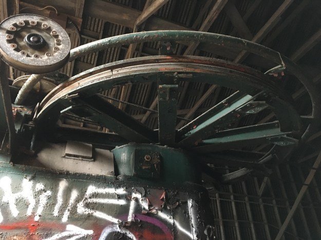
Inside the shed the main wheel and drive assembly still stands although the lift cable has been removed. The wheel assembly is mounted on a pit in the floor that allowed the mechanism to be pulled backward by means of a hand crank and a series of cables. This was used to keep the tension on the main lift cable.
From outside of the lift shed the view up the hill reveals how quickly the trees are creeping back onto the ski slope. The lift towers and chairs have been removed so we had to climb to the top. The Bruce Trail crosses the slope about half way up the picture.

Three rows of PVC pipe run down the length of the longest run. These were used for the snow making equipment. Expensive upgrades to this system to allow snow making in warmer temperatures were cited as part of the reason for closing the site down. The lift poles were removed that ran along beside these pipes and yet they were left behind. It wouldn’t have taken much more effort to cut these up and cart them away while they were at it. Estimates suggest that these pipes will still be laying here in the year 2500 if no one collects them.

From the top of the escarpment you get a nice view out across Burlington Bay. The first part of this run is pretty steep and was the adrenaline rush that the more experienced skiers were looking for.
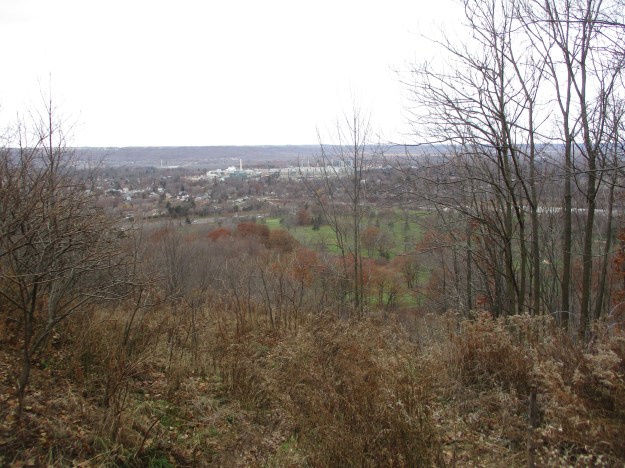
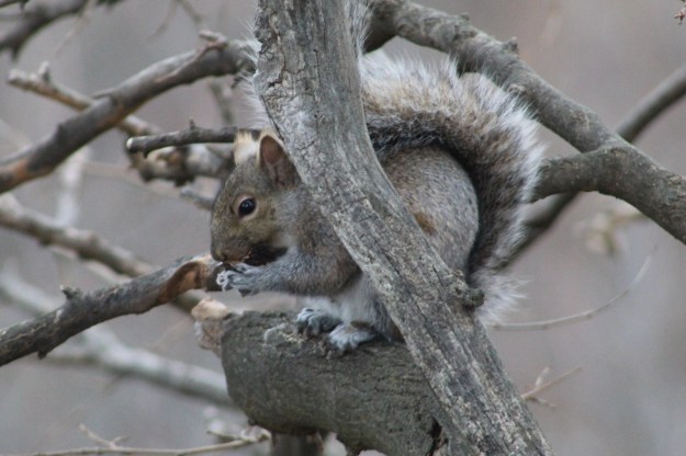
From this location on the top of the hill you are close to the old Mountain Sanatorium where they used to treat people with tuberculosis. The sanatorium is now abandoned and most of the buildings have been torn down. The Cross of Lorraine still stands at the top of the escarpment to mark the old hospital and it is visible from the trail below. The gray squirrel has an average lifespan of 6 years if they make it past their youth. Records show lives of up to 20 years in captivity.
We followed the Robert MacLaren Side Trail along the top of the escarpment with the plan of taking the Chedoke Stairs back down to the Chedoke Rail Trail and from there to investigate a couple of local waterfalls. From the trail you can see the top of Westcliffe Falls but the actual waterfall is hidden from view. A little farther along you come to a spectacular view of Cliffview Falls. The view from the top suggested that it would be worth the effort to follow the creek from the bottom of the escarpment back up to the bottom of the waterfall.
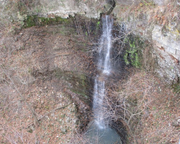
The waterfalls are located at the bottom of the Chedoke Stairs. There are two waterfalls that meet near the bottom of the ravine and share a lower falls. The Lower Cliffview Falls are on the left and Lower Westcliffe Falls on the right.

Westcliffe Falls is a 15-metre complex ribbon falls that is mostly hidden from the regular trails in the area. However, you can climb past the lower falls and from there it is a short, easy climb to the main falls. It is located in the ravine on the right above the combined lower falls.
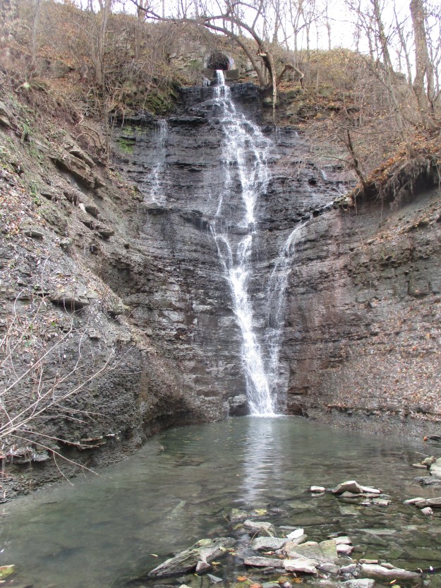
Cliffview Falls is 15 metres tall and is a terraced ribbon falls. Both of these waterfalls are nice in spite of the low flow of water. In the spring when the water is at its peak flow they are both likely to be quite spectacular, with Westcliffe being the more interesting of the two.
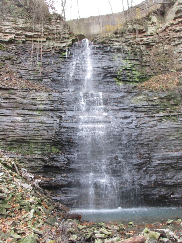
Having climbed up the ravine to view the two sets of falls we returned to the car having fully enjoyed the day.
Further reading about local attractions near Chedoke Ski Hill:
Escarpment Stairs, Mountain Sanatorium, Chedoke Rail Trail
Google Maps Link: Chedoke Stairs
Like us at http://www.facebook.com/hikingthegta
Follow us at http://www.hikingthegta.com
Follow us on Instagram

I learned how to ski here in 1970. Many happy hours!
Arlberg skis, cable bindings, screwed in edges.
I learned how to ski there too in 1970. I loved skiing there.