Category Archives: Uncategorized

Stonedene Estate

December 02, 2023

Starting in the 1920’s the wealthy of Toronto were building mansions in the area of Bayview Avenue and Lawrence Avenue. This was a rural setting at the time which featured the Don River for fishing and large lots with plenty of places to ride their horses. We’ve covered a number of these in past issues of our blog and they can be found in the links at the end of this post.

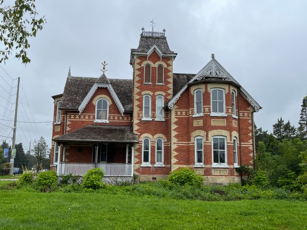
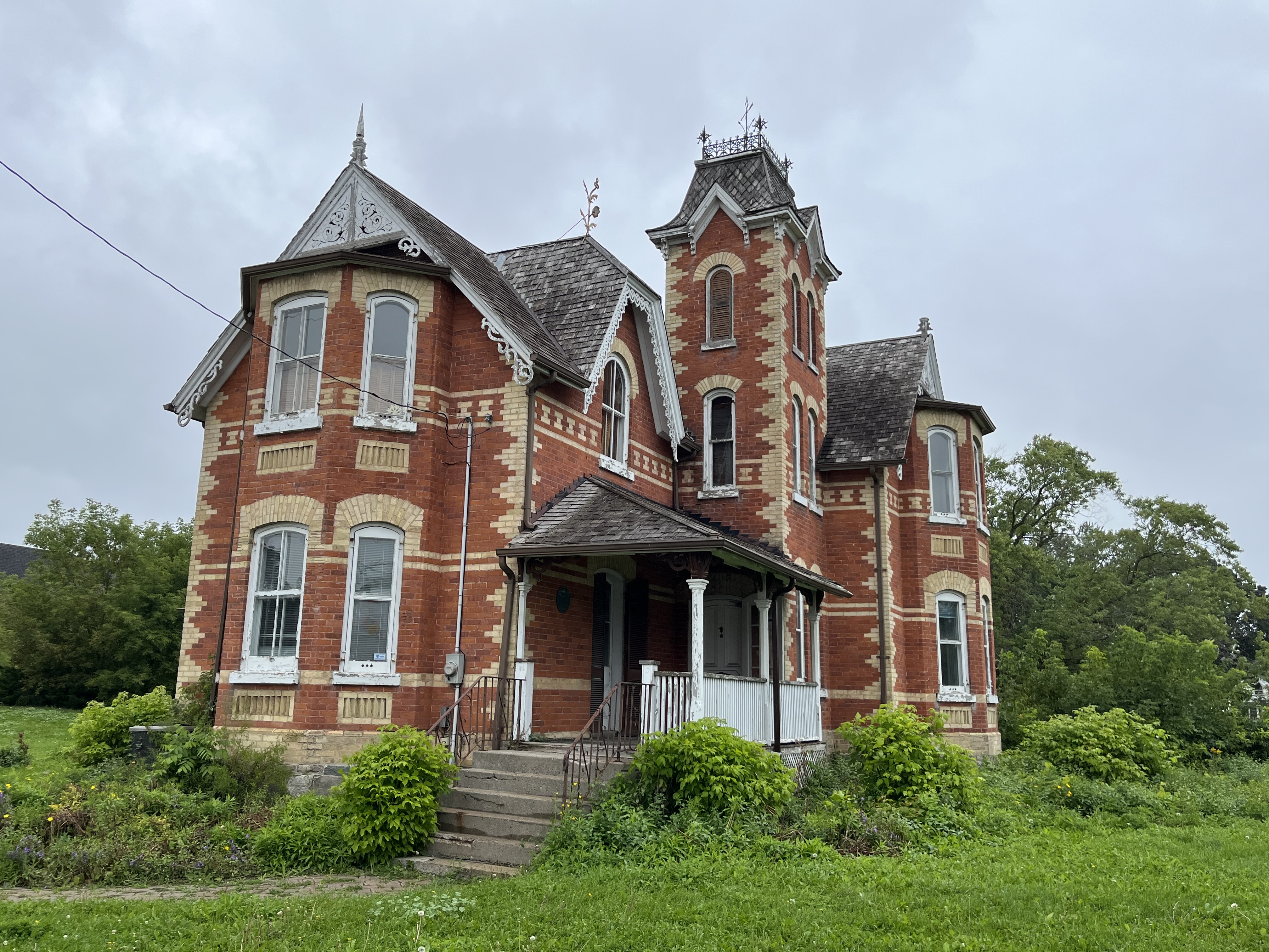
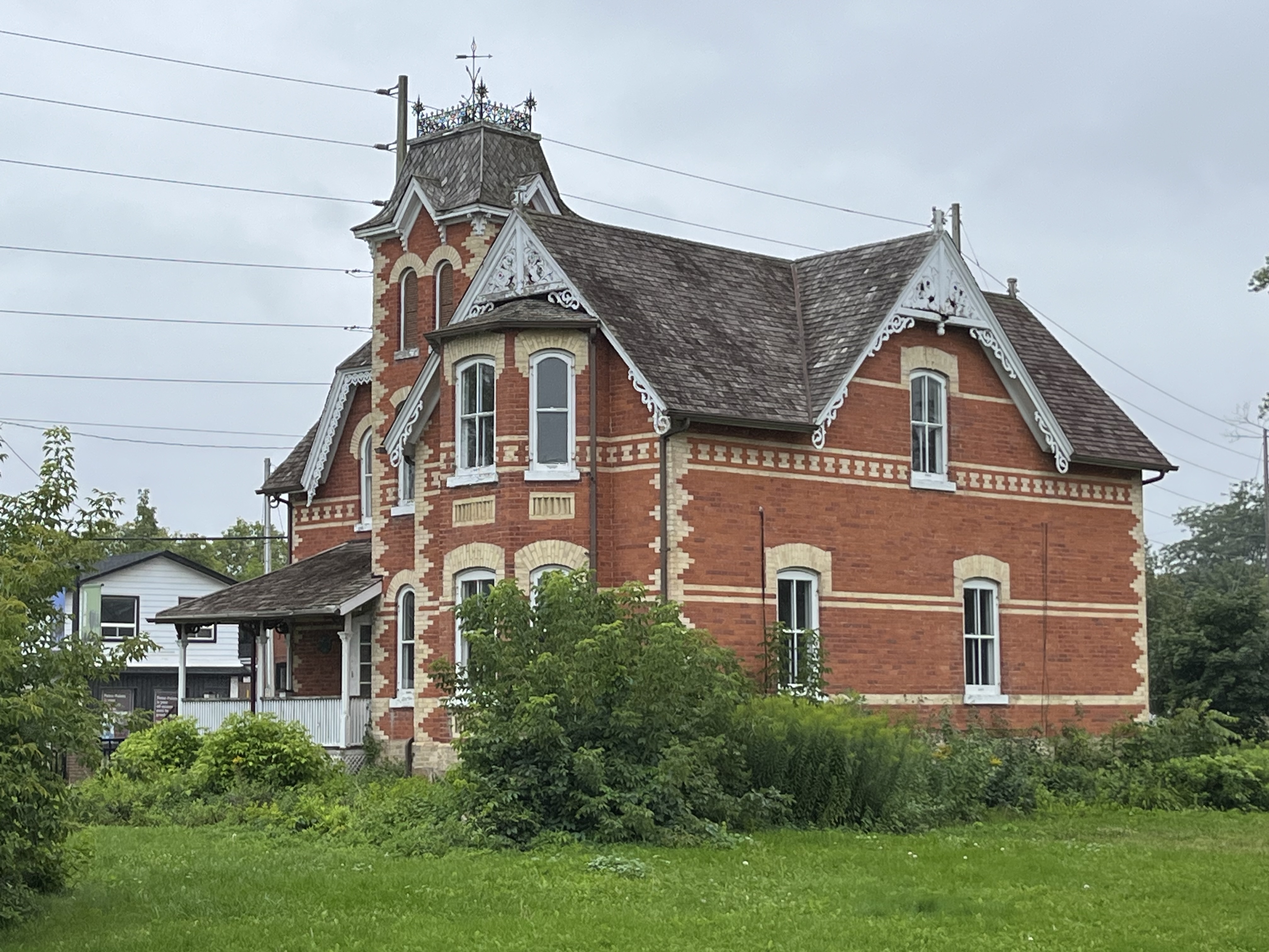
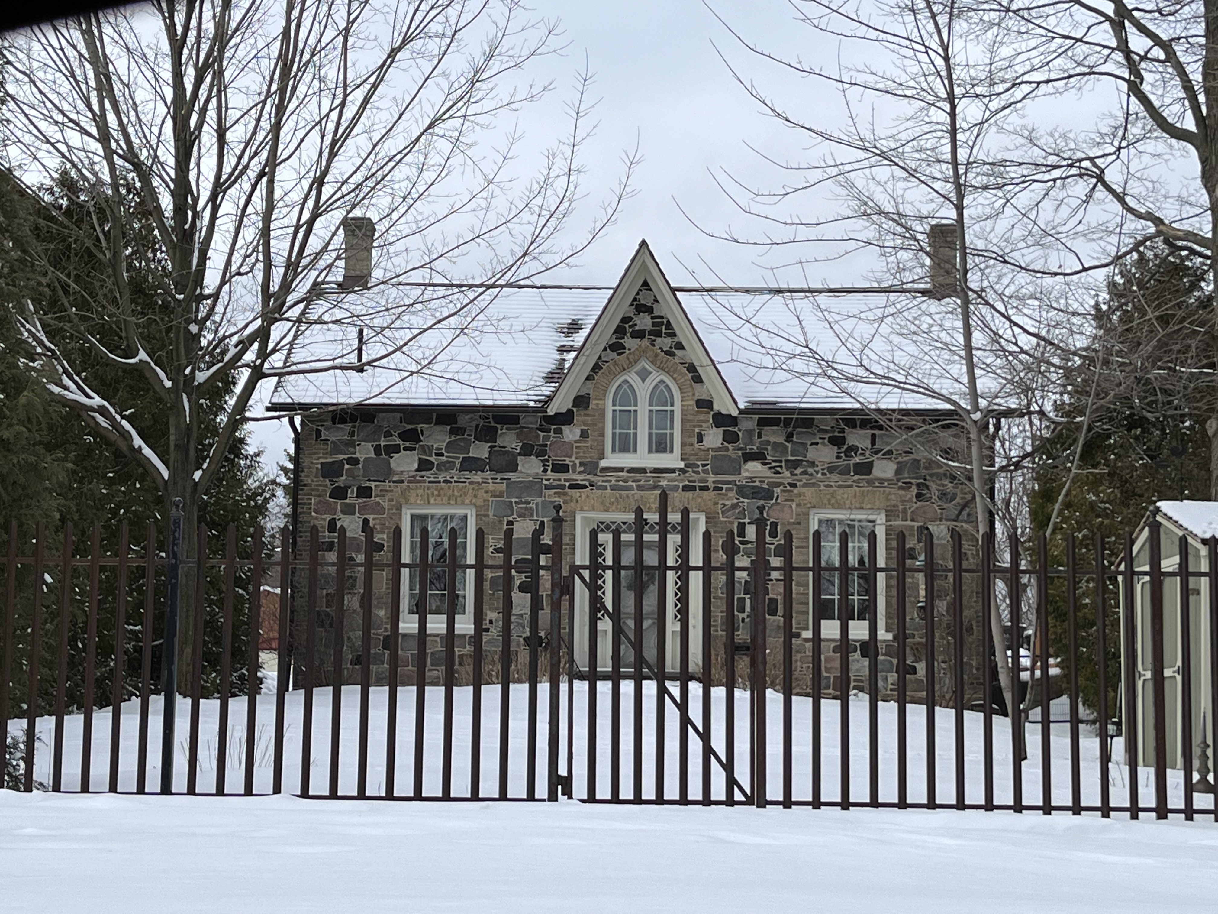
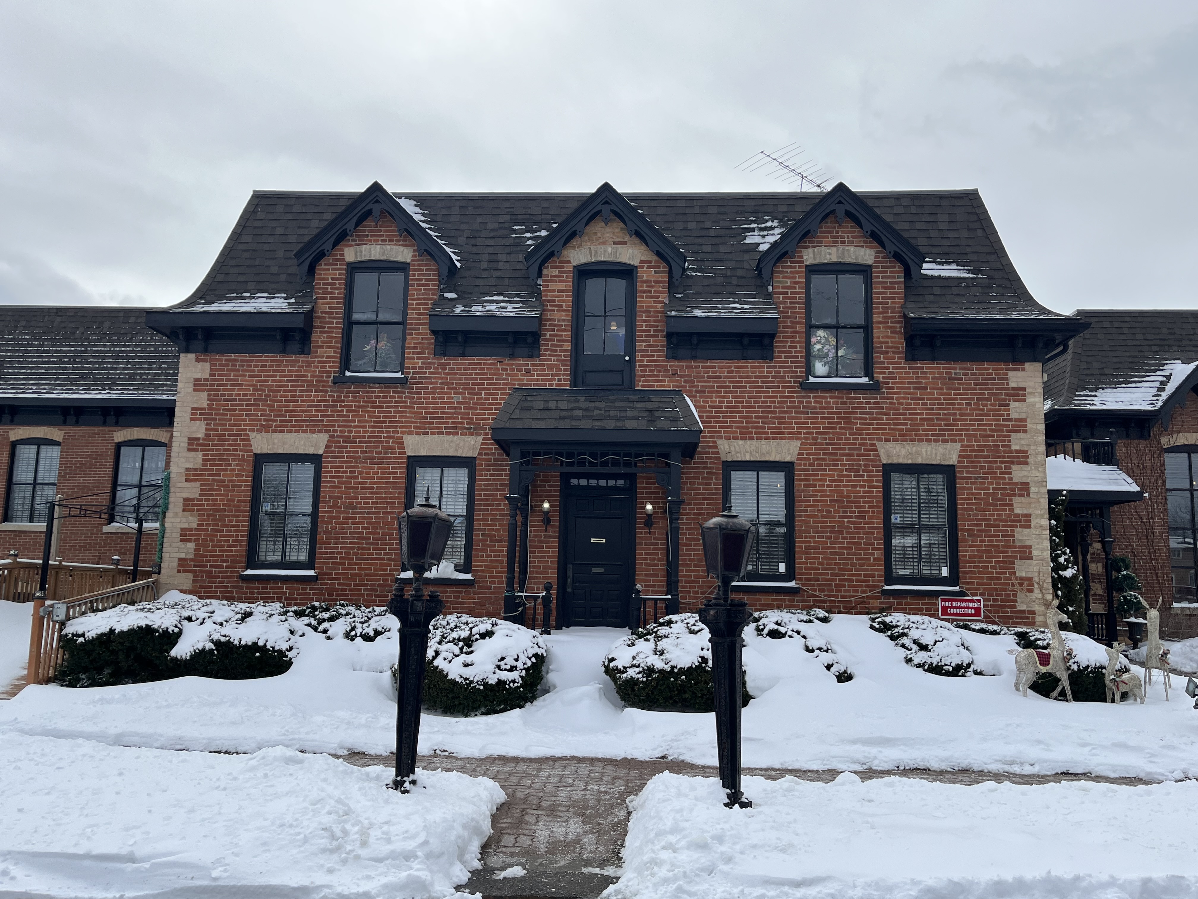
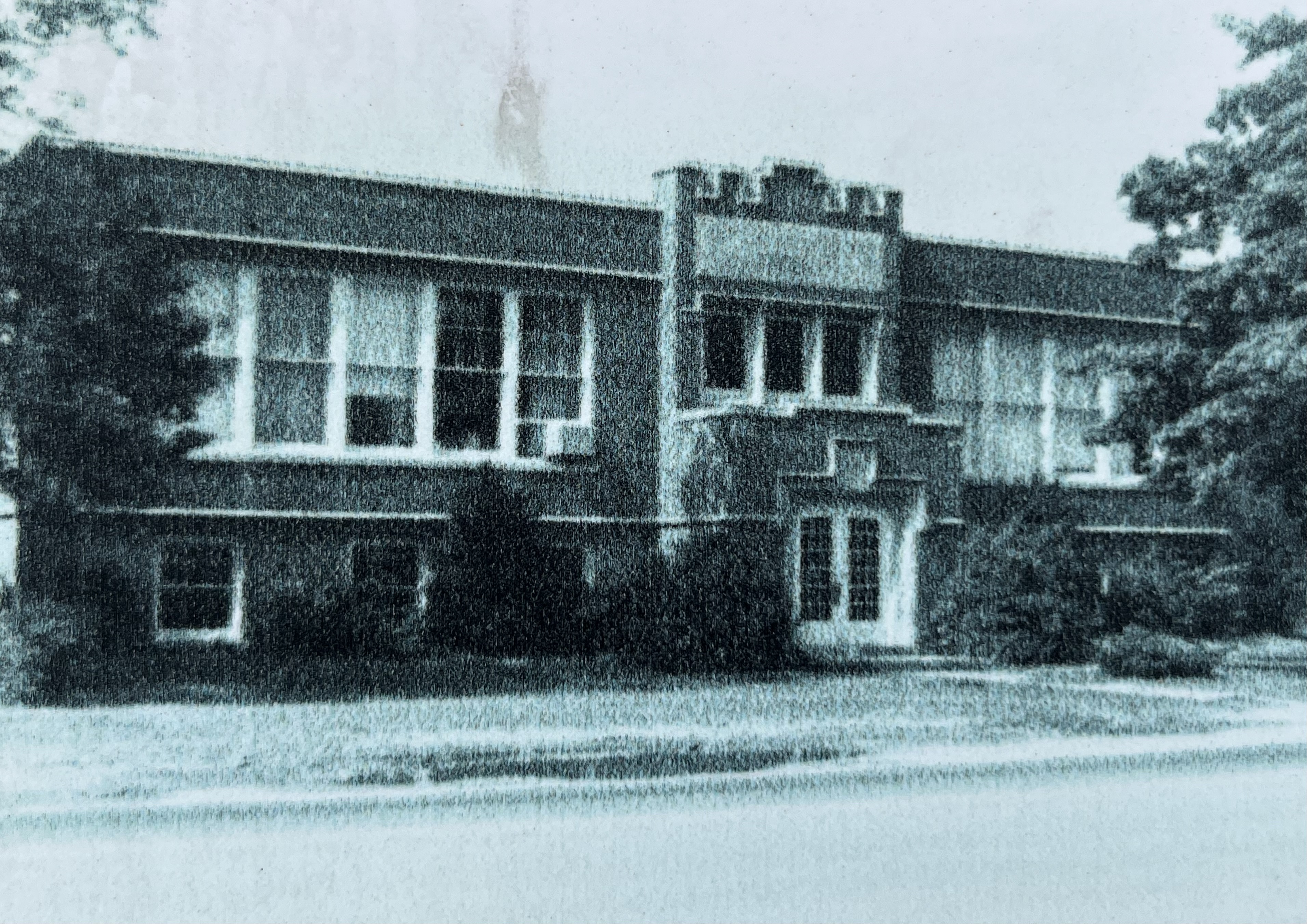
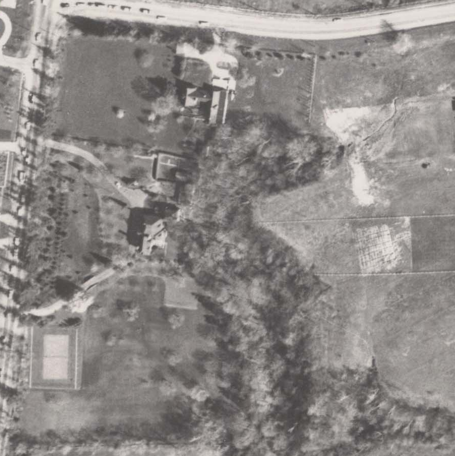
Today we’re looking at Stonedene which sat on Bayview just south of Post Road. It dates to the end of the 1920’s, reportedly built in 1929. The image below from the Toronto Archives aerial photograph collection shows the property as it was in 1957. Post road runs along the top of the picture and Bayview Avenue along the left hand side. The mansion can be seen near the middle of the image, set at the apex of a curved driveway.

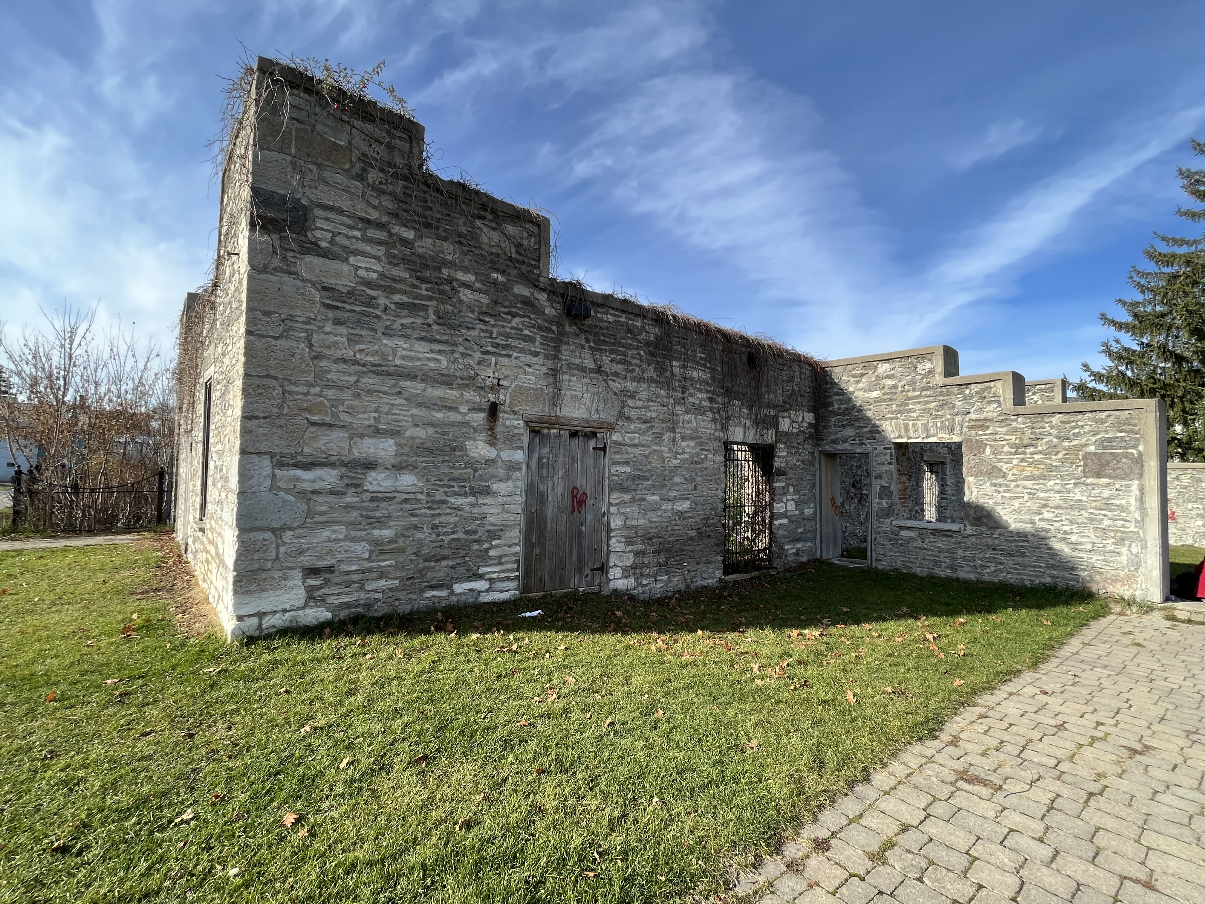
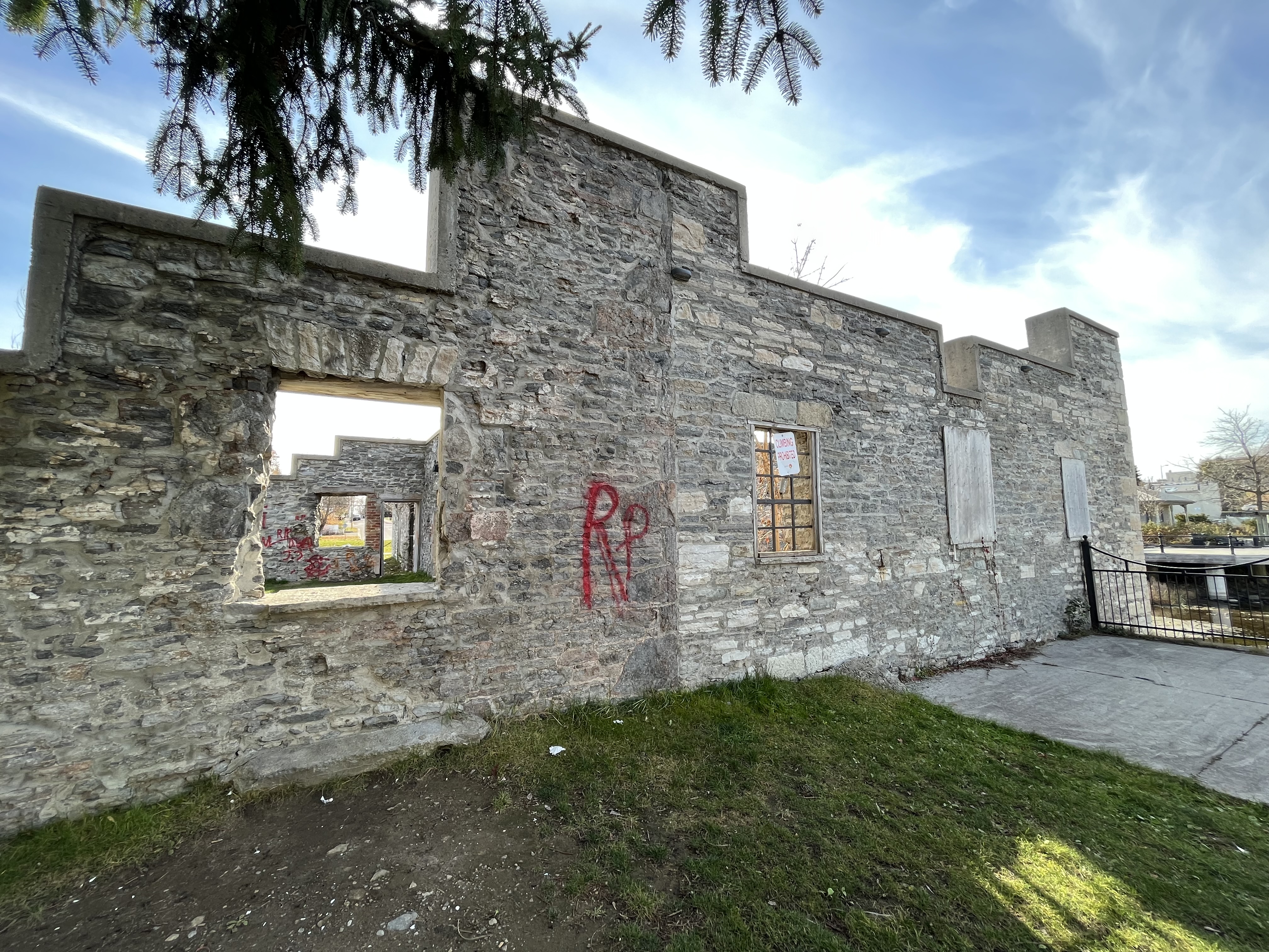
Living up to its name of Stonedene, even the gates are made of stone and the fence that once separated it from the road was supported on several stone pillars. The main entrance has the name Stonedene carved into it and the stone pillars still line Bayview Avenue.

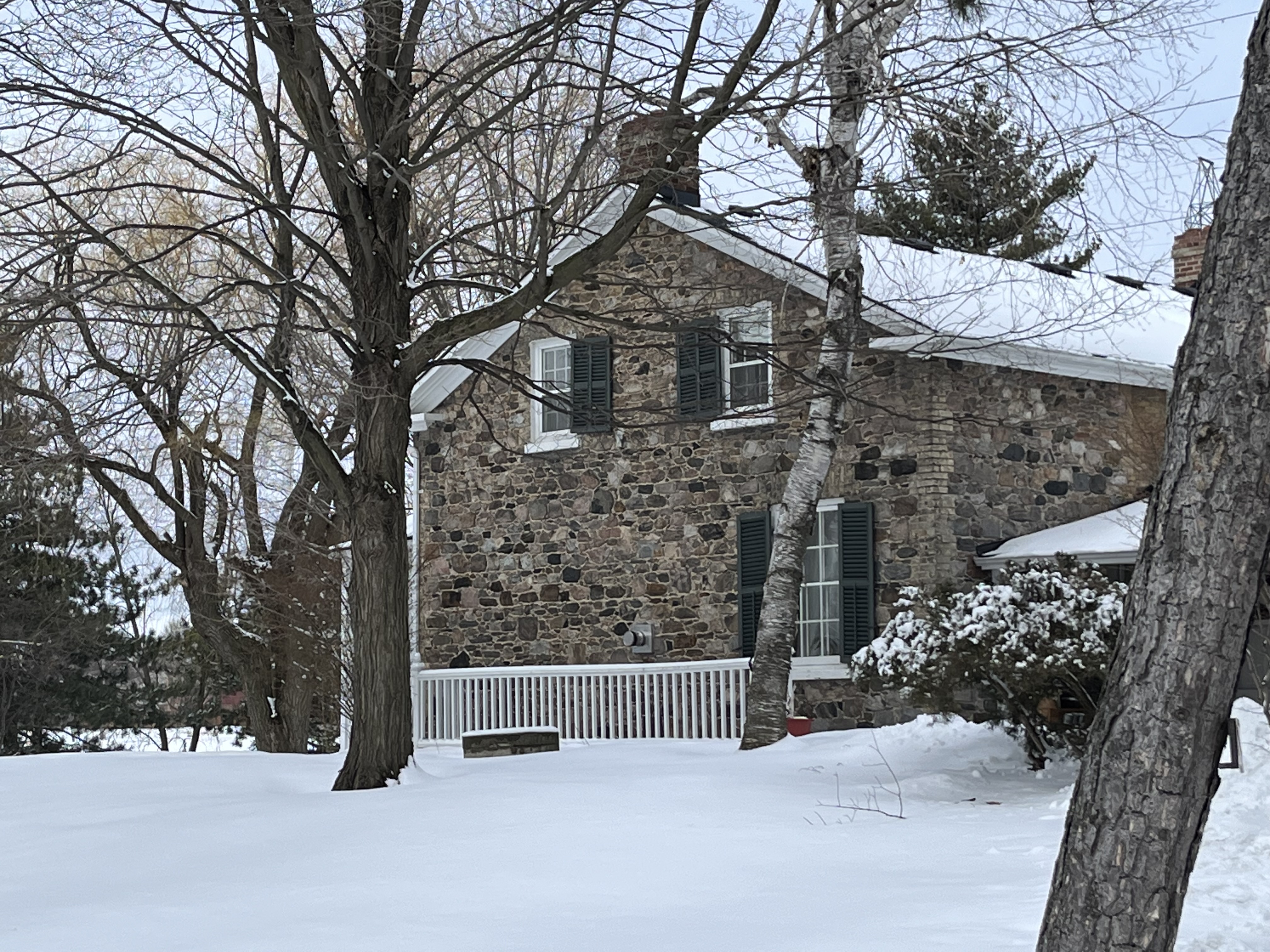
The home was built in 1929 according to city records and was originally constructed for Captain Harry Lynne Plummer and his wife Joyce. Plummer served in the First World War as a member of the 4th Canadian Mounted Rifles and as a Captain in the Canadian Railway Troops.

By 1949 it had been sold to General Albert Bruce Matthews and his wife Victoria. Matthews served in the Second World War as a member of the 1st Canadian Infantry Division. He was promoted several times during the war and as General Officer Commanding the 2nd Canadian Infantry Division he took part in the liberation of northern parts of the Netherlands. After the war he became chairman of Massey Ferguson and was President of the Liberal Party of Canada during the 1950s and 1960s.

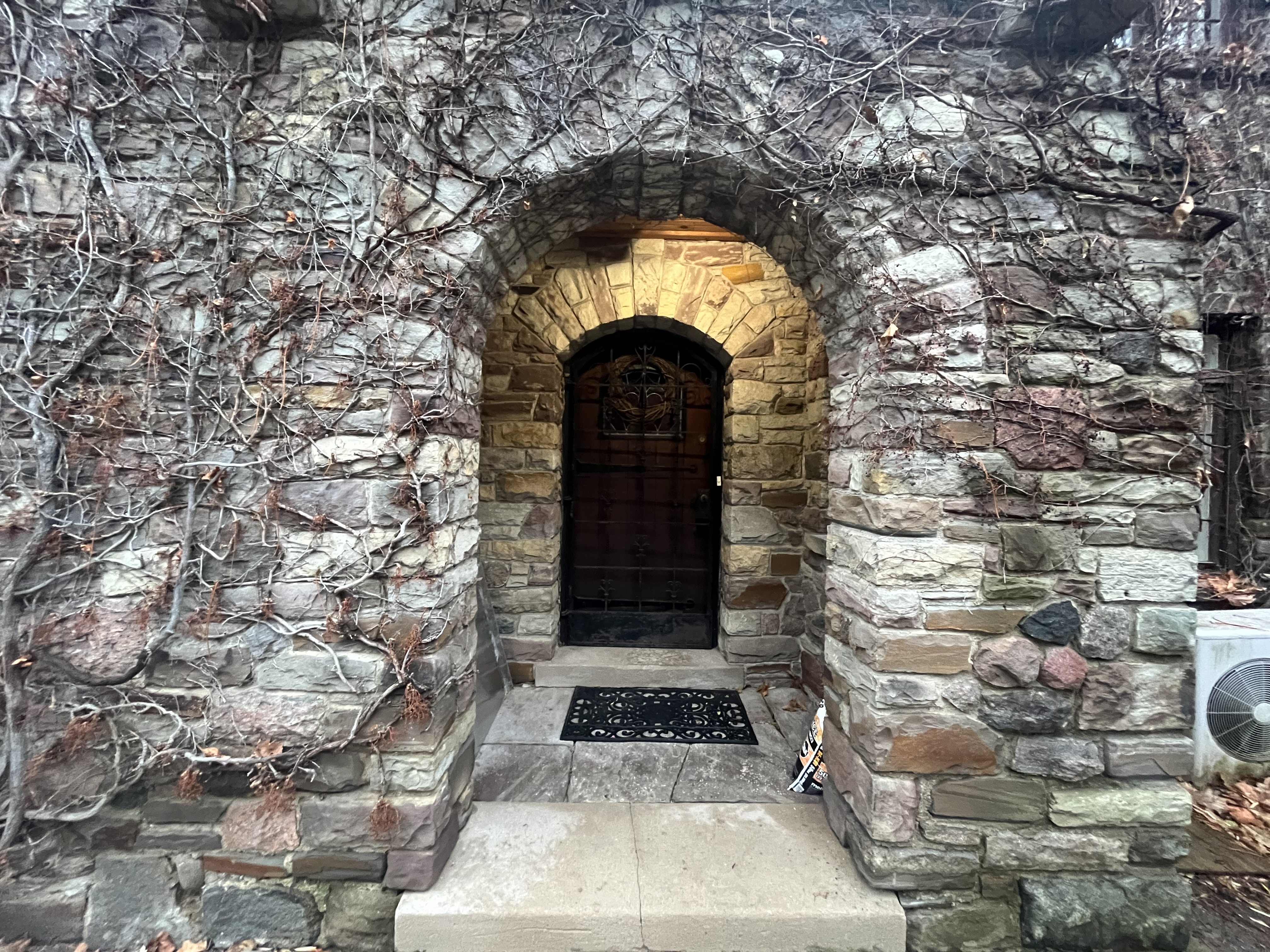
The home was sold in 1976 to the Ontario Mission of the Deaf and converted into administration offices. It has a front door that reminds me of the entrance to a castle.

A structure sits on the front lawn that looks like a stone chair or throne.

The back of the chair has a date stone which reads 1925 which is in conflict with the official date of the mansion.

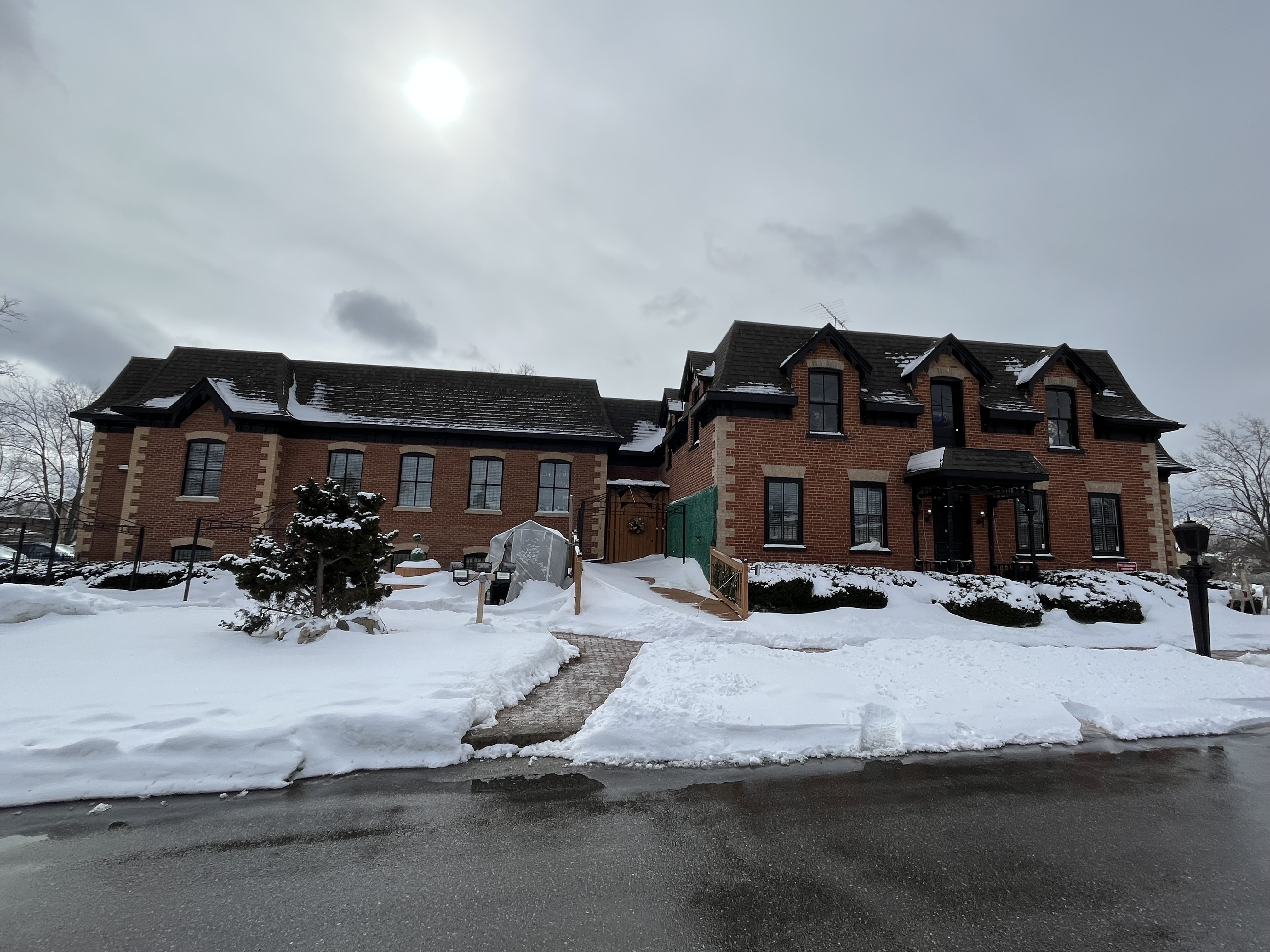
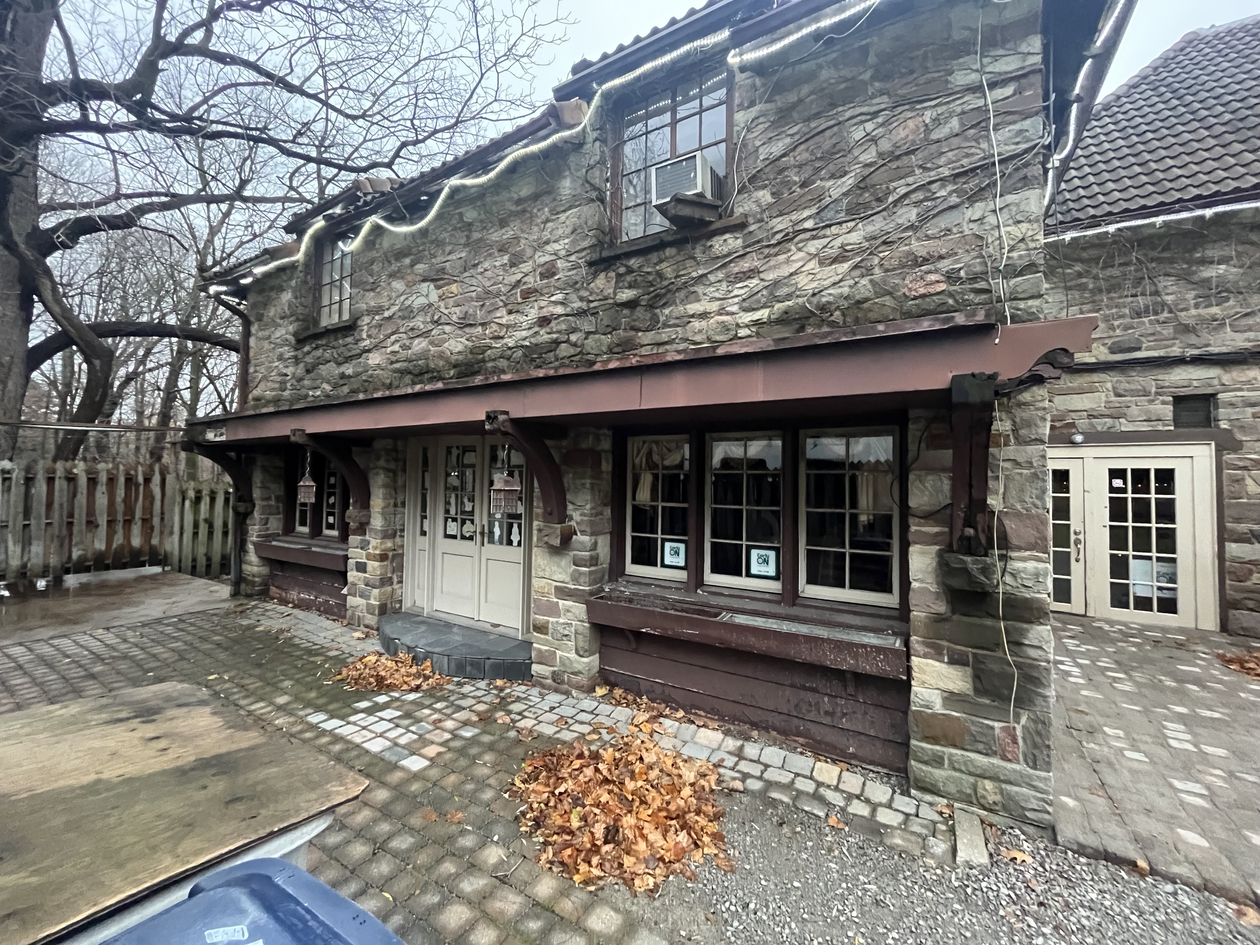
Everything about the home is grand including the side entrance which has an ornate double door with sidelights.

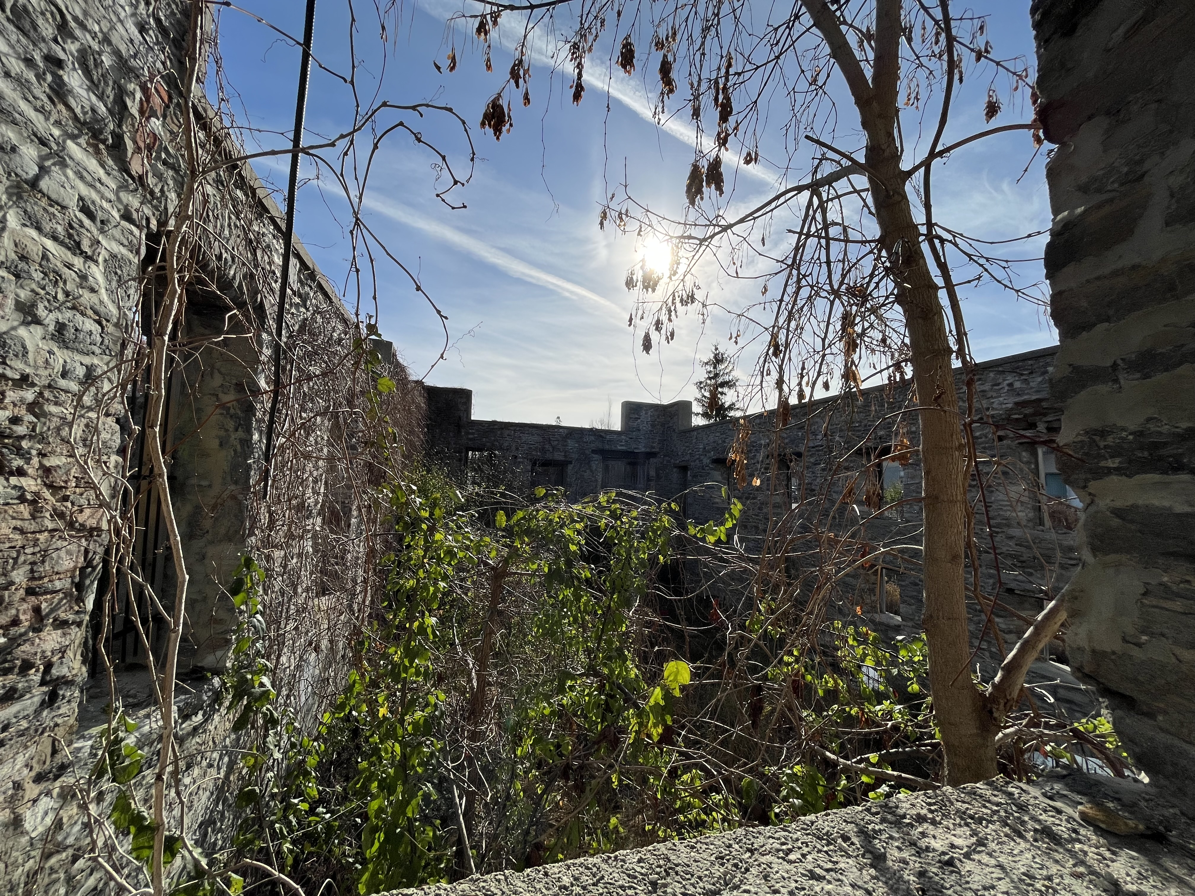
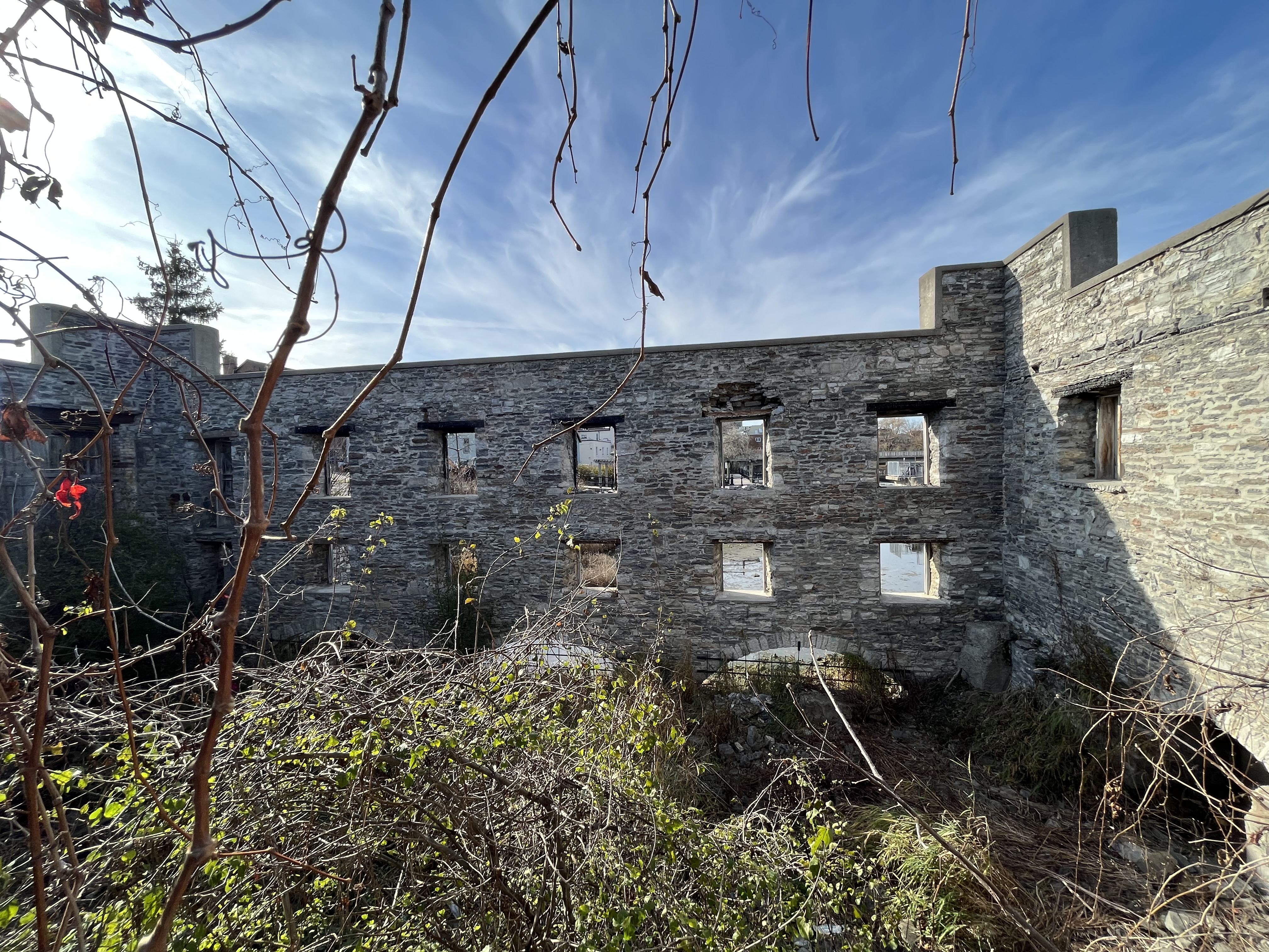
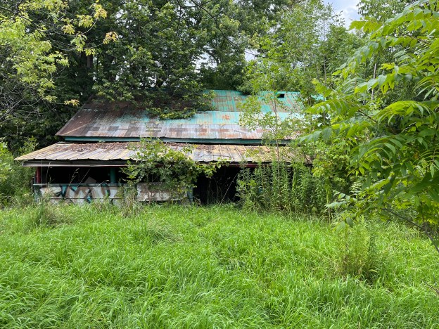
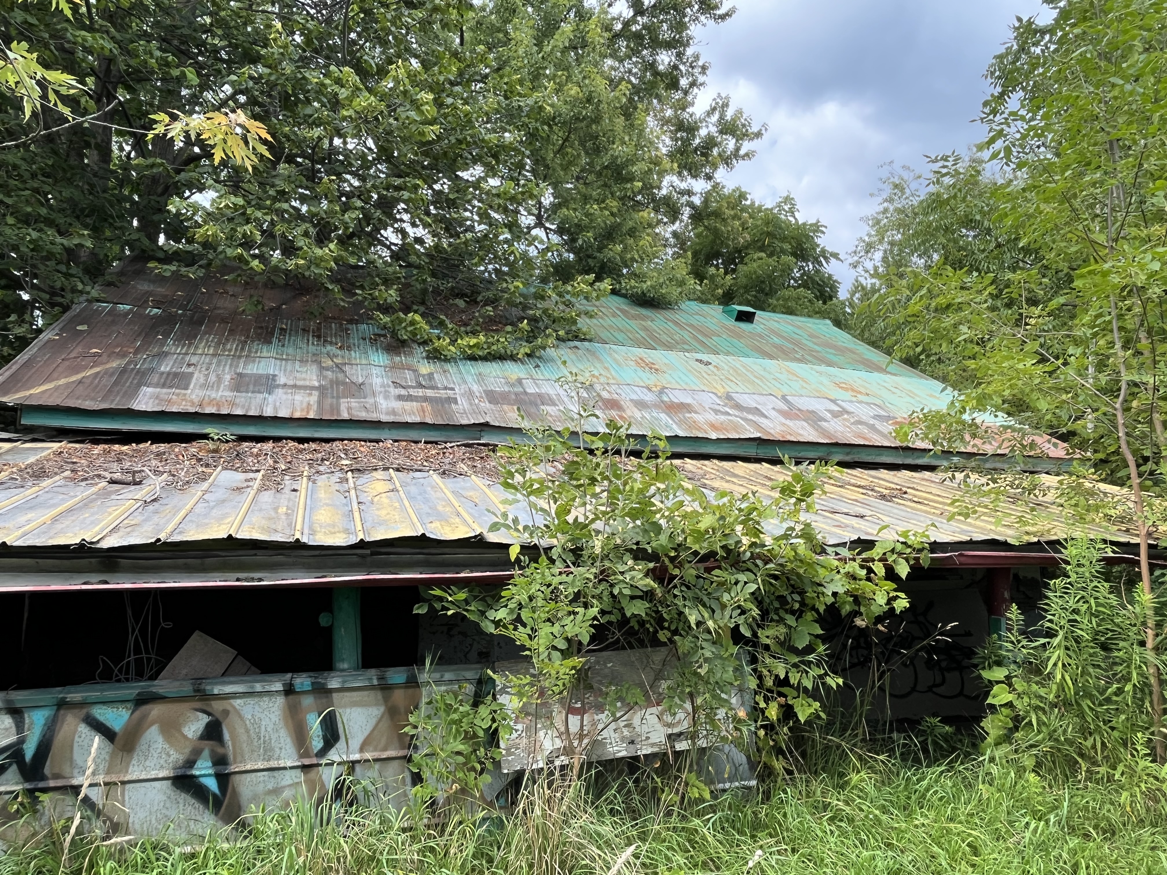
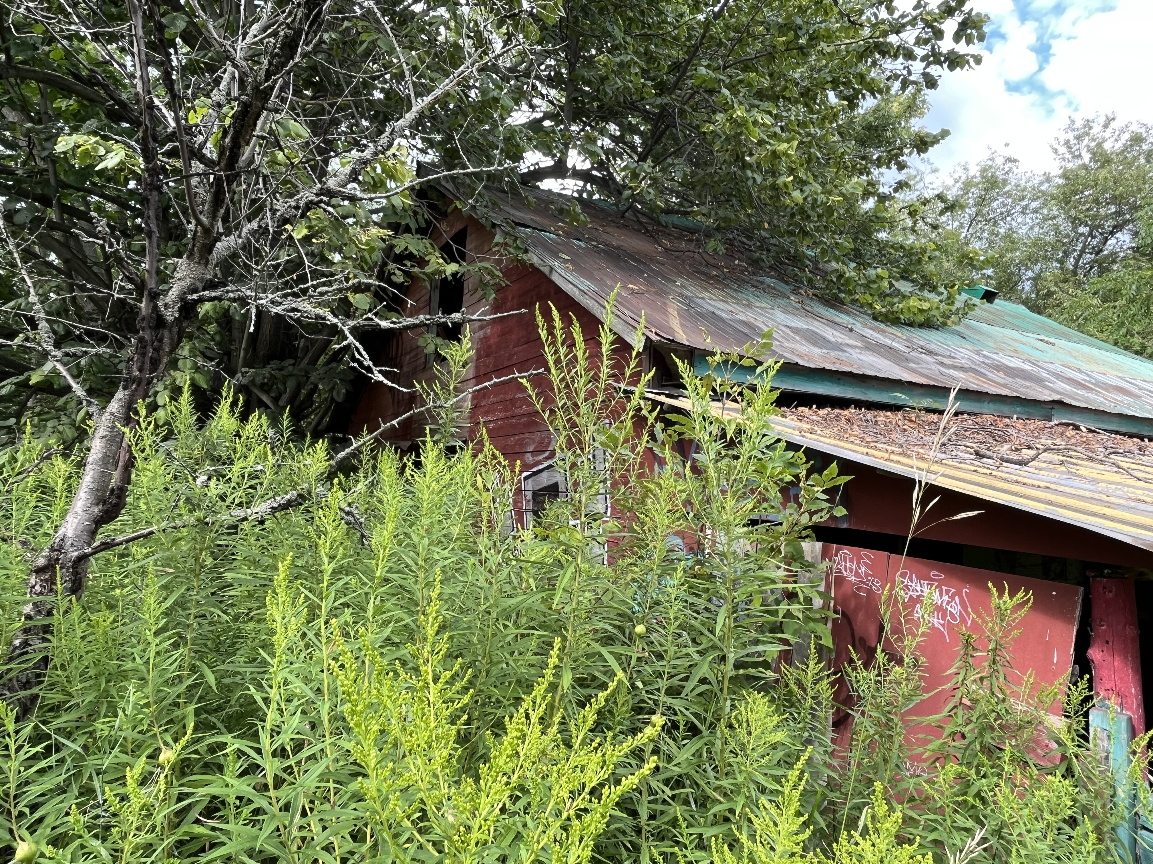
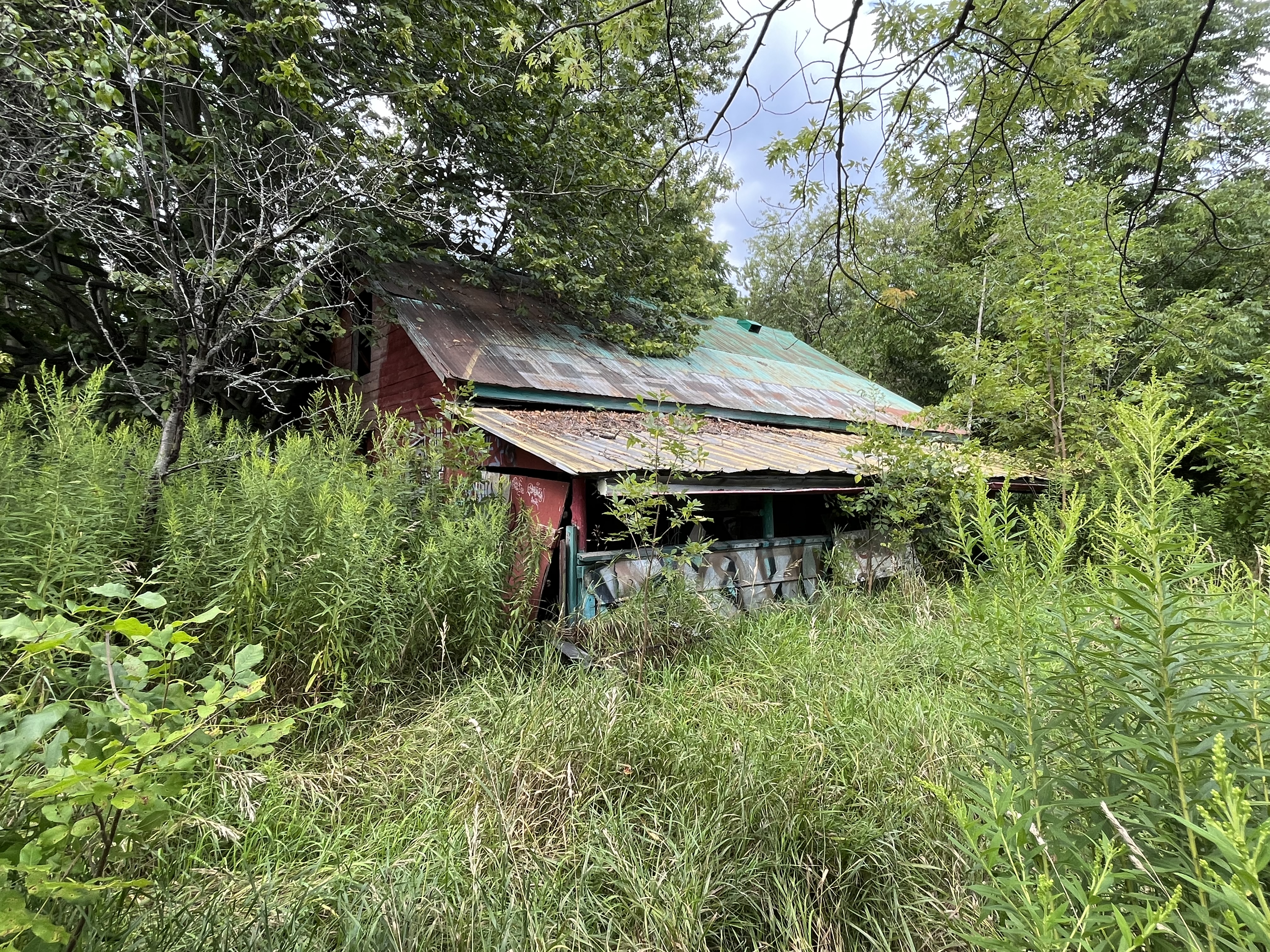
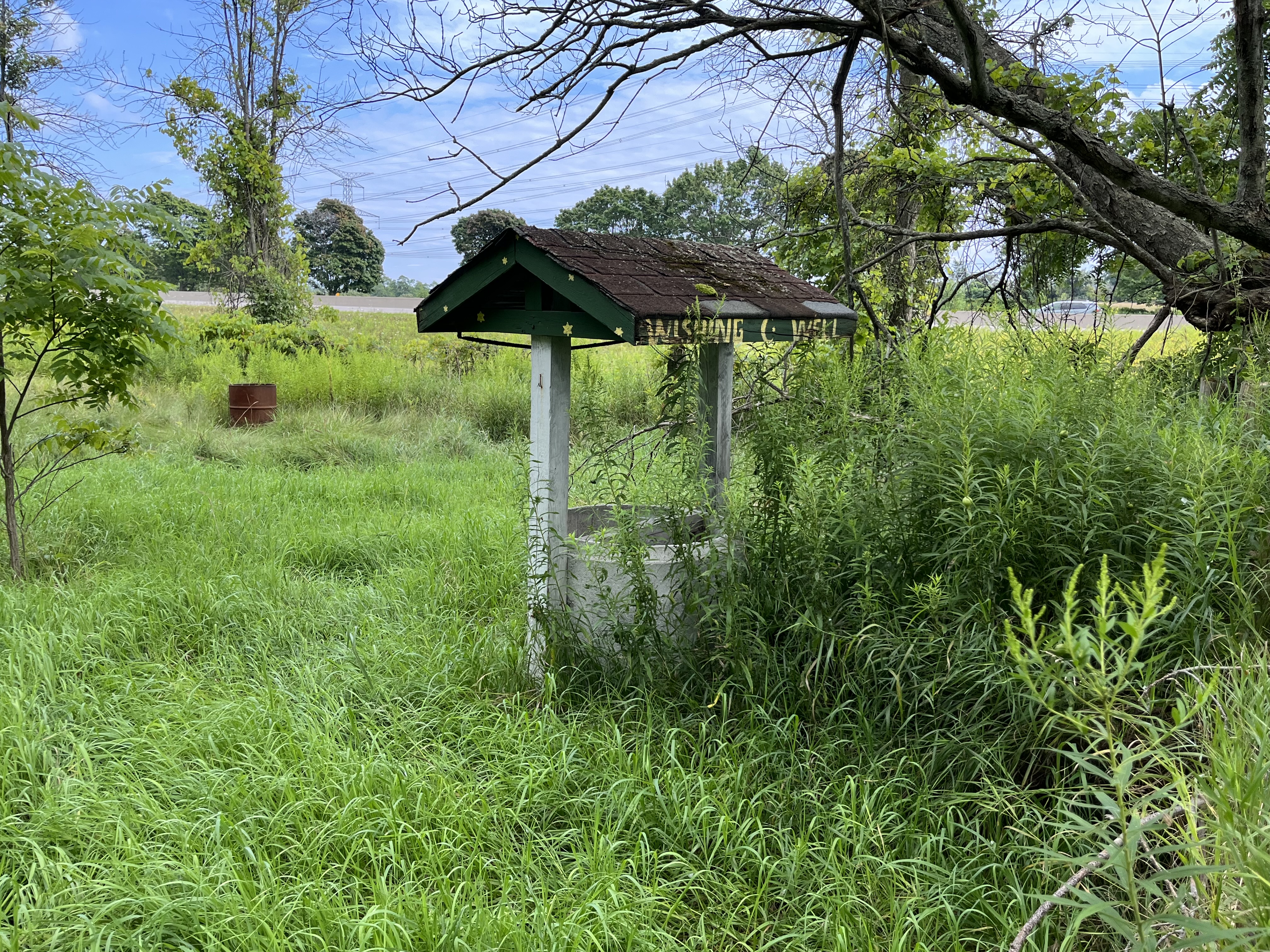
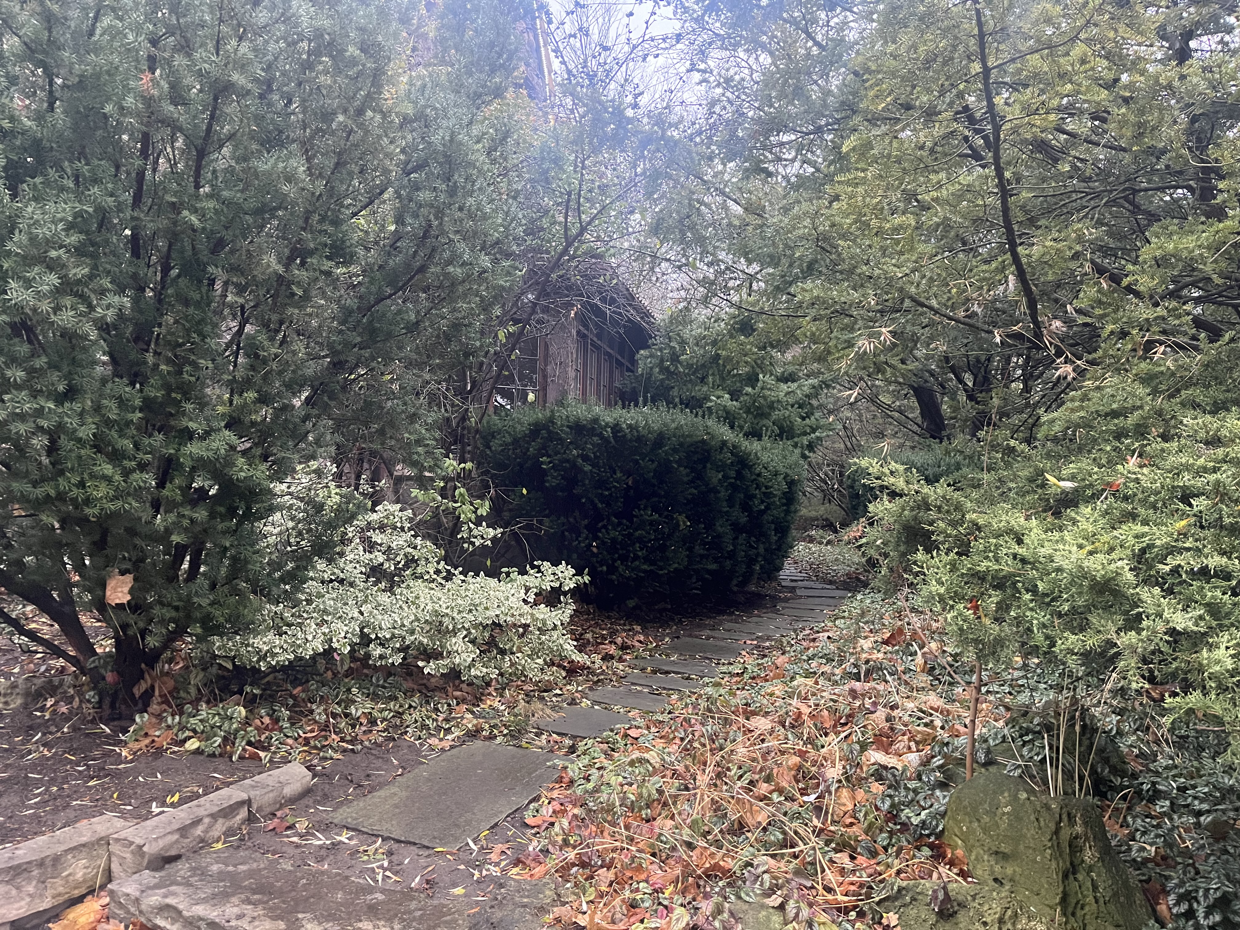
The gardens around the south side of the house have become a little overgrown but add to the character of the mansion.

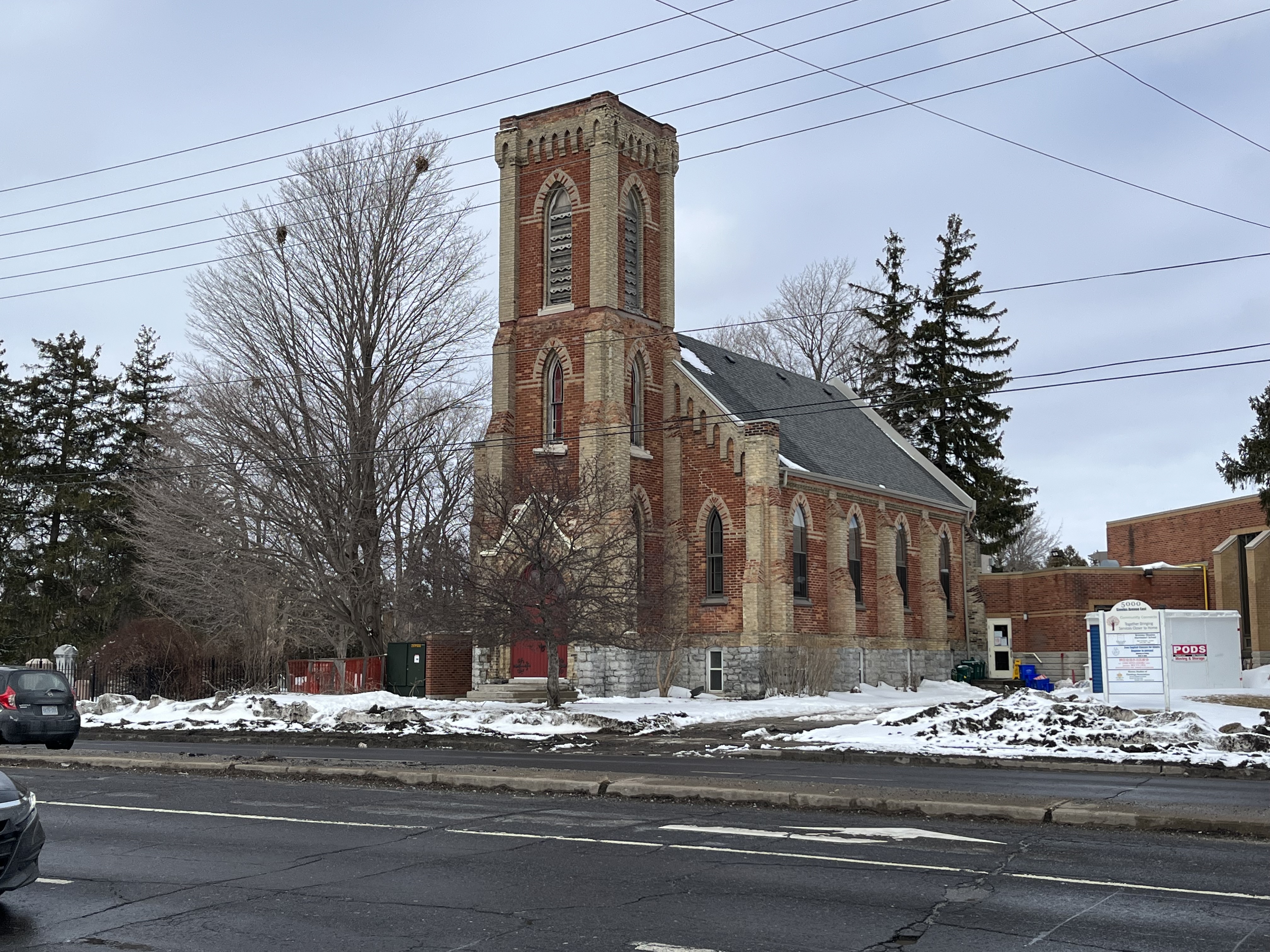
Ontario Premier William Davis laid the date stone for the Bob Rumball Community Centre for the Deaf on April 5, 1979. This multi purpose building is used to provide services for all ages of the hearing impaired. There are youth services as well as seniors programs and sign language courses. It was conceived by Bob Rumball who played football for the Toronto Argonauts and Ottawa Roughriders. He got financial support from Conn Smythe and Harold Ballard of the Toronto Maple Leafs.

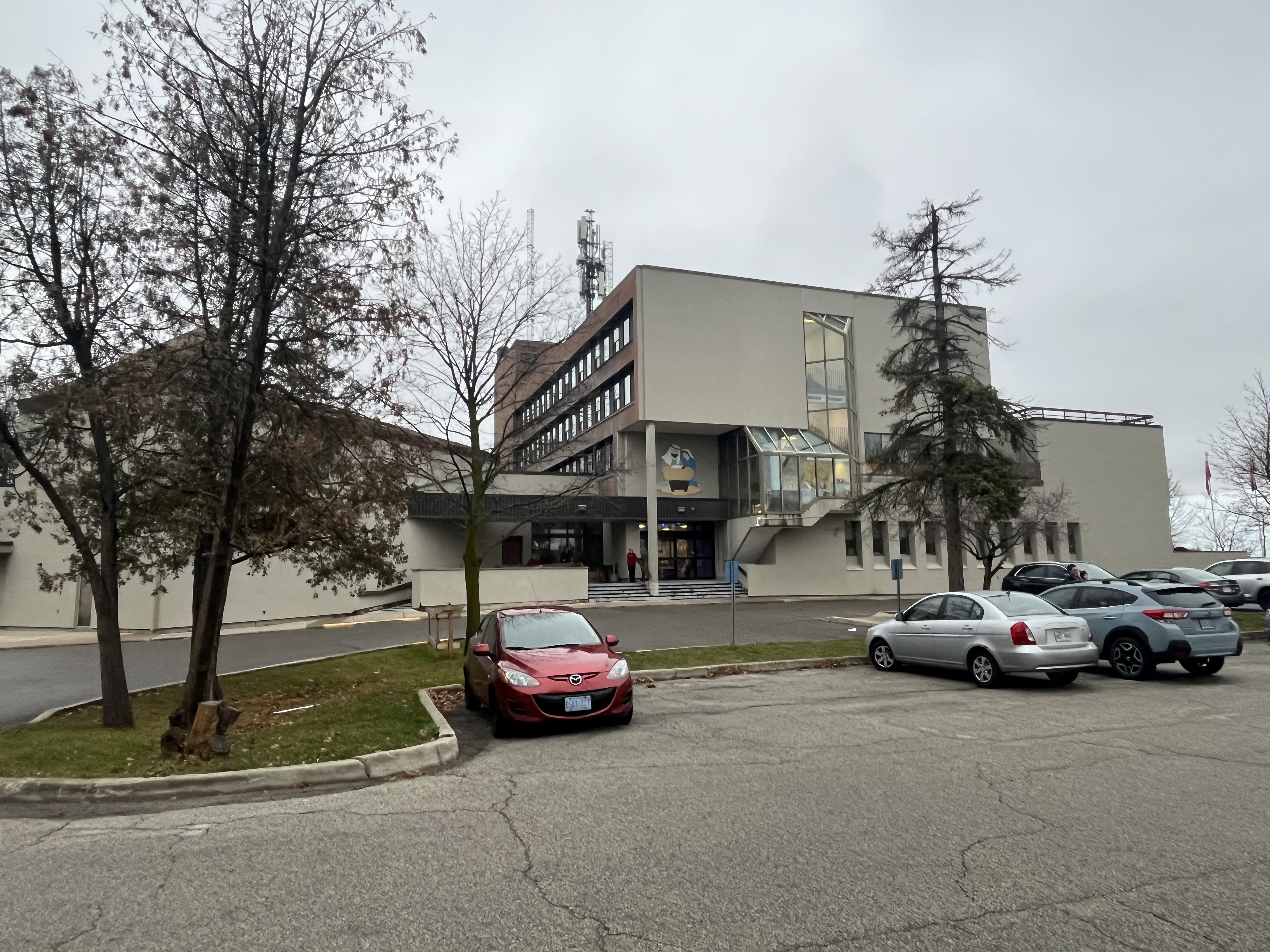
The historic photograph at the top shows all the freshly planted trees on the front lawn which today provide a forest that hides the house from the road. The mansion was given a restoration in 1996 when the administration offices were moved upstairs. The lower floor is now an event centre and can be booked for weddings.

Stonedene is a great example of the wealthy estates that were built in the area in the late 1920s by Toronto’s millionaires. Many of these still exist and can be viewed in the links below.

Related stories: Windfields Estate, Frank P Wood Estate, York Lodge, Bayview Estates

Google Maps Link: Stonedene

Like us at http://www.facebook.com/hikingthegta

Follow us at http://www.hikingthegta.com

Also, look for us on Instagram

Kakabeka Falls – Thunder Bay

November 25, 2023

One of the best things about my job is the travel because I can incorporate an element of pleasure and tourism into my working time. I get to go to places like Thunder Bay to do inspections and then experience things things that I otherwise would never get to see. I have the opportunity to share them through this blog so that you can experience them vicariously from the comfort of your homes. It may even inspire a few people to visit them if they are in the area at some time in the future.

Kakabeka Falls is about 30 kilometers (19 miles) and less than a half hour outside of Thunder Bay just off of Highway 11 in Kakabeka Falls Provincial Park. It is located on the Kaministiquia River where the water plunges 40 metres (130 feet) into a gorge cut into the shale. The falls are continually eroding the shale and have been doing so since the end of the last ice age 12,000 years ago. This shale is very unstable and contains some of the oldest known fossils on the planet. Some of these are dated back to 1.6 billion years ago. The name is an Ojibwa one which means “waterfall over a cliff” and it has taken on the designation of Niagara Falls of the north.

There are two distinct steps in the falls and the water flow was pretty good during my visit. In the winter the falls can freeze over and there used to be a hotel on the edge of the gorge that would get coated in ice in the winter. When the 5 square kilometre provincial park was created in 1955 the hotel was removed. The river was a major route that was used to get access to the north west and a mountain portage existed to get around the falls. It connected Lake Superior with Lake of the Woods and was used for centuries by the Indigenous peoples and later by the fur traders.

There’s a footbridge that lets you cross the river and look out over the brim of the falls. Notice how small the river looks as it appears in the distance, deep in the valley.

The falls have an Indigenous tale attached to them. According to legend, an Ojibwa Chief found out about an imminent attack from a band of Sioux and decided to try and prevent it. He asked his daughter Green Mantle to help him protect his people and she devised a plan to do so. She is said to have infiltrated the Sioux camp and acted as if she was lost. She bargained to save her life by promising to lead the Sioux to her father’s camp. Instead she tricked them into going over the falls in their canoes. She allegedly died along with them and now her spirit can be seen in the in the mist of the falls. Another version of the story suggests that she jumped out of the canoe at the last minute and saved herself by swimming to shore.

There is a boardwalk that allows you to walk along the gorge on either side of the falls and has several viewing platforms. Access is not permitted inside of the boardwalk due to the unstable shale along the sides of the gorge and no one is allowed into the gorge at the bottom of the falls.

Aside from the falls there are 17.9 kilometres of hiking trails in Kakabeka Falls Provincial Park including Little Falls Trail. This trail leads to a separate waterfall which I didn’t have time to explore during this visit but which I will plan to explore on my June trip next year. There’s also two campgrounds which combine for 169 campsites of which 90 have electricity. Cross-country skiing is available for the winter months.

Day use of the park is $6.50 per car and is well worth it, especially if you use the guided hike and interpretive programs.

Related Stories: Niagara Falls

Google Maps Link: Kakabeka Falls

Like us at http://www.facebook.com/hikingthegta

Follow us at http://www.hikingthegta.com

Also, look for us on Instagram

The Old Mill – Lindsay

November 18, 2023

Lindsay has a lot of history and while there on a business trip I took a visit to the Old Mill Park to view the remains of the mill. This structure is nothing compared to what it used to be but it is still a prominent feature in downtown Lindsay and was highly instrumental in the development of the town. The original land grant for the site included Lots 20 and 21 in Concession 6 which had been set aside as a potential mill site during the surveying of Ops Township.

William Purdy had been operating a large mill in Vaughan which was destroyed in 1828 and he applied for the land grant at the future site of Lindsay. His plan was to start in 1829 and have the mill operational in 1831. When his dam was destroyed in flooding in the spring of 1831 he was set back a couple of years and the mill didn’t open until 1833. As the mill prospered, the community that grew up around the mill came to be known as Purdy’s Mills. Town lots were laid out in 1834 and other industries started to come to the area including blacksmiths, hotels and taverns and a carding mill. The mill dam backed up the water flow and created Lake Scugog which upset the property owners that got flooded out. It also created a lot of breeding ground for mosquitos and so after many useless protests to the government the locals took matters into their own hands in 1844 and destroyed the dam. The mill dam was rebuilt and starting in 1869 the mill was replaced with a stone structure on a new foundation. The image below from the Lindsay Archives shows the the mill around 1900 when it was at its peak of production.

Kent Street was laid out in 1840 and it started to fill up with commercial and residential properties. In 1844 Purdy sold the mill to Hiram Bigelow who operated it until 1861 when it was destroyed in a large fire. The fire burned 91 of the wooden buildings in town and was a major setback for the mill. It wasn’t replaced until a new stone structure was built in 1869. This is the current building whose lower floor is all that remains in Old Mill Park. The image below shows the old wooden door which is interesting because the vines that now grow inside the building have found their way through the cracks to grow up the outside of the building.

The mill was run by William Needler and Thomas Sadler until it was sold to the Flavelle Family in 1884. Starting in 1899 it was rebranded as the Flavelle Milling Company.

The company went through several restructuring activities in the 1910s and Flavelle Milling Company was part of a merger of eight mills in the 1920s. The mill saw its peak production in 1904 but by the mid 1920s it was closed.

It reopened in 1927 as Lindsay Distillery but this only lasted until 1930.

In 1946 it was opened again, this time as Henderson’s Chick Hatchery. This venture lasted until 1971 when the building was vacant again.

There was a proposal to repurpose the structure as an accommodation facility of some type but when a $100,000 fire broke out in 1978 it was the end of the useful life of the building.

The mill dam is still in place and the remains of the building have been owned by the town since 1981.

It was recommended that the building be demolished in 1986 but instead the town has paid to stabilize the remains by capping the walls with cement. There have been a series of proposals to save the structure and develop it into something of a historical nature including a museum.

The old mill is currently a popular place for wedding pictures and is the focal point of the park but it still waits to see what its ultimate destiny will be.

Google Maps link: Lindsay Mill

Like us at http://www.facebook.com/hikingthegta

Follow us at http://www.hikingthegta.com

Also, look for us on Instagram.

Battle of Crysler’s Farm – Nov. 11, 1813

Nov. 11, 2023

As the second year of the War of 1812 drew to a close the Americans wanted to try to capture Upper Canada by taking Montreal and cutting off supplies to all of the area west of it. US Secretary of War John Armstrong developed a plan to use two armies to converge and take the city. General Wade Hampton was marching from Lake Champlain with his forces and Major General James Wilkinson was ordered to set sail from Sackets Harbor to join him. Wilkinson left Sackets Harbor on October 17, 1813 to sail down the St. Lawrence River to join forces with Hampton. British gunboats under William Mulcaster harassed the American fleet and fired shots at them before heading to Kingston to sound the alarm. Wilkinson became ill and ended up delegating responsibility for the army to Brigadier-General John Parker Boyd.

On November 10th Boyd set up his headquarters at a local tavern and
the British under Lieutenant Colonel Joseph Wanton Morrison were camped just a couple of kilometers away at John Crysler’s farm. Crysler was a wealthy loyalist and the leader of the Dundas Militia. The night was one of sleet and rain and many of the British troops slept outside with no protection from the weather.

On November 11, 1813 the British troops began an attack on the American position but it was unsuccessful and they were driven back. Subsequent American attempts to attack were repulsed as the infantry were overpowered by volleys from the well-trained and practiced muskets of the British 49th and 89th Regiments of Foot, which made up the bulk of Morrison’s army.

In order to attack the Americans were forced to cross two ravines and then navigate a field which was full of split rail fences. The canon in the image above has a date carved on the housing which reads 1800.

Boyd gave contradictory and inconsistent leadership which led to the confusion and lack of discipline among the American infantry. Most of the American soldiers ran out of ammunition and began to retreat before the calvary arrived as a back-up. Meanwhile the British maintained discipline and held their lines to deliver volley after volley of musket fire at the advancing American army. Boyd eventually called a retreat and the American troops fell back to French Mills for the winter. This was the last battle of the year in the war and the Americans had failed to make any serious advance in their efforts to capture British North America. The image below shows a replica 6 pounder muzzle loading gun similar to ones used by both sides during the battle. It could fire a six pound ball for 1200 yards.

The British forces were much smaller but managed to kill 340 men and capture another 100 while losing a little under 200 soldiers of their own. A monument to the battle was erected on Crysler’s Farm in 1895 and a bronze plaque was added in 1923 to commemorate the battle.

In 1958 Crysler’s Farm was flooded during construction of the St. Lawrence Seaway and the monument was moved. Soil from the site of the battle was dug up and used to build a mound on a plot of land near Upper Canada Village. The monument was placed on this new mound of soil and continues to look out over the former battle site, now under water.

In 1959 a small interpretive centre was built to describe the history of the battle and in 2012 a new visitor centre was built. Each year re-enactors come together to commemorate the battle.

Although Remembrance Day is usually considered as respect for those who fought in the First and Second World Wars, it is interesting that it also falls on the anniversary of this pivotal battle from the War of 1812.

This is the fifth installment in our War of 1812 series which may eventually extend to all the Canadian battle sites.

Associated Stories in our War of 1812 series: Battle of York, Battle of Queenston Heights, Battle of Stoney Creek, Battle of Beaver dams.

Google Maps Link: Crysler’s Farm

Like us at http://www.facebook.com/hikingthegta

Follow us at http://www.hikingthegta.com

Also, look for us on Instagram

Hiking the GTA at 10

October 29, 2023

As we approach our tenth anniversary we take the opportunity to step back and look at where we’ve been and where we’re headed.

Ducheseney Falls in North Bay

When I started my blog nearly ten years ago I wrote about places to hike and things to see in and around the GTA. Primarily it was about hiking. Initially we covered all the ravines along the Credit River, The Humber River and The Don River. We also covered the Waterfront Trail and all the local parks and conservation areas. This took up most of the first three years of the blog.

Bald Eagle near Iron Bridge

Over the years it has turned into more of a local history blog because this is my passion. The past two years I have had a job that takes me all over Ontario and so I share my experiences.

The East Block on Parliament Hill in Ottawa

If I was starting it over again I would probably choose another name. I could change it now, but going back and redoing the names and all the links in nearly 600 stories is an impossible task. So, I decided to leave it as Hiking the GTA and just keep sharing my photography and writing for those that care to come along for the journey. I hope you enjoy the stories or the photos even if they are sometimes outside of the GTA.

1896 Post Office in Arnprior, now a museum

Hiking the GTA by the numbers:

Our 600 posts averaged about 1,000 words each giving us a written content of about 600,000 words. A novel is about 100,000 words giving us the equivalent of six novels worth of text. Each post has an average of ten pictures which means that we’ve published about 6,000 photos. When added to the text it means that we’ve published about 12 books worth of material. We have over 42,000 followers of which about 15,000 reside in the GTA. So, about 60% of our readers are outside of the GTA and 13% are outside of Canada. WordPress lists 195 countries where our stories have been read which means that we’ve been read in almost every country in the world.

Thunder Bay

In the coming months and years we hope to be able to continue to bring you stories from around the GTA and beyond.

Like us at http://www.facebook.com/hikingthegta

Follow us at http://www.hikingthegta.com

Also, look for us on Instagram

The Big Apple

Saturday, October 7, 2023

The Big Apple in Colborne lays claim to having the largest apple shaped structure in the world. However, there’s a lot more to this attraction than just the structure. The site was created by George Boycott who immigrated to Canada in 1976 from Australia. He had been a pizza shop owner before moving to Canada and sold all six of his shops to finance his new enterprise. Based on The Big Pineapple near Queensland, he devised The Big Apple. He chose Colborne to settle in because it was one of the biggest apple producing regions in Ontario. In fact, it is the fourth largest apple growing area with over 3,000 acres under cultivation. Construction began in 1983 and the site was ready to open in 1987.

There has been a great deal of effort made to ensure that visitors have plenty to do aside from just buying apples. They have a small pond with a fountain and there’s a short nature trail that you can walk that goes around it.

There are many attractions designed to entertain children and the mini-golf course is just one of them.

During the peak season in the summer there’s rides for the children to enjoy. This includes a train ride and access to the ping pong tables.

There’s also an old fire truck and an old police van to stir their active imaginations.

The Big Apple structure is affectionately known as Mr. Applehead. It is hollow inside and there’s a set of stairs that leads to an observation deck on the top. The apple is 40 feet tall and provides views across the surrounding countryside. Mr. Applehead weighs 42 tonnes and can hold 650,000 apples. In 2013 the cartoon face that can be seen in the cover photo was painted onto the highway side of the apple. It was covered with a facemask in 2020 as a show of support for front-line workers and hundreds of apple pies were donated to hospital workers.

There is an interesting gift shop where all kinds of collectibles can be purchased. Much of the goods in the store are geared toward making your garden unique. For the adults, there’s also a brewery which specializes in various ciders.

Other shops include a candy store, a sit down restaurant and a place to buy apples and pastries. They sell over 2,000 apple pies every week and you can watch them being made through a glass window. They do everything in house for the freshest, tastiest pies you can find anywhere. According to the sign on the side of the highway, they have sold over 6.2 million pies, and counting.

A petting zoo is included for the little ones to get an opportunity to see a selection of farm animals. You can buy little plastic containers full of animal food so that you can feed them a nutritional snack. It’s a lot of fun for the children and it lets the guests pay for the animal feeding which helps keep the costs of running the petting zoo under control.

One of the fun things is this sign post that show how The Big Apple is in the centre of everything. The distance in kilometres is given to 56 places around the world.

The Big Apple may be 14,750 kilometers from the South Pole but it’s only 130 kilometers from Midtown Toronto. It’s a great place to spend some time with the children or just a fun stop as you make your way along Highway 401. And, best of all, it’s free to enjoy (unless you start buying some of those yummy things that you’re going to see).

Associated Stories: Abandoned Farm Market

Google Maps Link: The Big Apple

Like us at http://www.facebook.com/hikingthegta

Follow us at http://www.hikingthegta.com

Also, look for us on Instagram

Abandoned Farm Market

September 23, 2023

For many years I have seen an abandoned building that looks like former fruit and vegetable market. It can be seen on the north side of the 401 just east of the Newtonville exit. It is actually located where Elliot Road was cut in two by the building of the highway. Research has failed to turn up anything regarding the history of this building. I suspect that some of the readers of this blog may have shopped there before and if they can shed any light on the site I will update this post. For now I am presenting the pictures and letting the mystery remain.

Direct Farm Marketing is done is several ways including the simplest form which is a road side stand or a wagon selling produce such as fresh picked fruit and vegetables. Farm stores and markets usually involve a more permanent type of building like the one pictured here. These are sometimes seasonal but can also operate year around. Recently a new type of farm market has come into style and that is the full farm experience. In these cases people open up their farms as tourist attractions and often include many activities for the children to partake in. A market is always included which will allow the customer to buy produce and fresh baked goods. Be aware that some of these require payment of a fee to enter before you can actually buy anything. The Big Apple near Colborne is free and has many attractions included while Chudleigh’s near Acton requires a $14 per person entrance fee before you can buy a bag of apples. We will likely review The Big Apple in a future post.

The roof of the building has some writing on it that appears to read “Chunk” but it is hard to say if this is recent graffiti or the original name of the property. One thing is clear, and that is the deterioration of the property. The surrounding area has grown up with small trees and the grasses and weeds have taken over what used to be the lawn.

The concept of a wishing well goes back thousands of years. It was believed that gods inhabited the waters of the well and that they would grant wishes. Water is necessary for life and the community well has been a meeting place where news would be exchanged. The ancient Celtic and Bavarian peoples used to throw coins into the wells as a way of paying the local god for granting a wish. It was believed that if the coin landed on the bottom facing up the wish would be granted but if it landed face down the wish would be ignored. A well has been excavated in Bavaria that is around 3,000 years old and is full of ancient artifacts that were placed in it. On a practical point, the ancient people may have accidentally discovered the oligodynamic effect. This refers to the biocidal properties of both copper and silver, two metals used in ancient coins. These metals can help reduce bacterial infections and may have made the water safer to drink. People who frequented wells that had coins thrown into them may have had less infections and that could have led the ancient people to believe that the well was good luck. There’s an old wishing well in front of the building but it appears that the local god may have moved on because it is dry inside.

For now the building continues to silently watch over the traffic that passes by a few metres away on the highway. Most likely it will eventually be lost to deterioration from the weather and neglect

Google Maps Link: Elliot Road and 401

Like us at http://www.facebook.com/hikingthegta

Follow us at http://www.hikingthegta.com

Also, look for us on Instagram

Hambly House – Nobleton

August 19, 2023

Nobleton was founded in 1812 and existed as a crossroads community for several decades before expanding with a series of side streets. Taverns and hotels were built as well as a couple of general stores and a post office. Joseph Nobel was a tavern owner and it is his name that was given to the community. The former blacksmith shop from Nobleton has been moved to Black Creek Pioneer Village. The image below is taken from the 1877 County Atlas and shows the modest size of the community at that time. The green arrow points to the location of the Hambly House.

At the north west corner of the intersection of modern King Road And Highway 27 stands the Hambly House. A log cabin had stood on this corner until it was destroyed by a fire. William Hambly had come from the United States as a United Empire Loyalist. His son, Charles operated one of the two general stores in Nobleton and was also the Post Master. Starting in 1851 the mail used to come to Nobleton three times a week via the Gore and Vaughan Plank Road. Hambly had two sons, Elwood and George who both worked in their fathers store. When Charles replaced the log cabin in 1885 he did it in the grand style of the Victorian architecture of the era.

Bargeboards, or gingerbread, adorn the various gables found around the house and the red brick is accented with buff coloured ones through most of the home. Yellow brick forms the quoins found on the corners and also double banding along the second floor which is adorned with a series of the letter “X”.

The house features a three story tower with a mansard roof, typical of the Italianate style of construction. The tower has iron cresting and a weather vane on top.

The south elevation and the north both feature two story bay windows which are adorned with segmental arches above and rectangles below. Pointed wooden finials rise from the tips of the gables.

The west elevation of the house does not have complete banding on the one section. There is a chimney on the back which was a later addition and is made of a darker colour of bricks.

The Hambly House is currently empty and the adjacent property is under a development proposal. While the house is protected under the heritage registry number of 82-144 it is planned to be turned into office space as part of the proposal. As usual, it remains to be seen what the final outcome of the Hambly House will be.

Related stories: Gore And Vaughan Plank Road

Google Maps link: Hambly House

Like us at http://www.facebook.com/hikingthegta

Follow us at http://www.hikingthegta.com

Also, look for us on Instagram

Mining The North

June 11, 2023

The first full week of June I spent in Northern Ontario on a work trip. Although we tend to focus on the GTA in this blog, it seemed like a good idea to “mine” my picture gallery to see if there is some information that could be shared with our readers. Although it was a business trip I found time to see some of the local history along the way. It soon became obvious to me that there could be a theme around mining and underground complexes and so in this post I present some short stories with a common theme. Links to each site will be provided in the text.

North Bay Airport is also home to 22 Wing Canadian Forces Base North Bay. It is the centre of air defence for the entire country and is partnered with the United States for the defence of all of North America. On May 12, 1958 Canada and the United States signed an agreement called NORAD to partner their resources in the defence of a possible nuclear attack from the Soviet Union. An underground complex was built at North Bay with initial excavation beginning in August 1959. The complex took $51 million dollars to construct and wasn’t completed until October 1963. It sits 180 metres below ground and has a floor space of 12,780 square metres. From down there the air defence was conducted in a bunker that was safe from nuclear attack.

After visiting my clients in North Bay it was time to make my way to Sudbury for the night. I made a stop at the East Duchesnay Falls site to do a little exploring. The falls cascade as they drop 100 metres over the escarpment. While the waterfalls are located close to the Trans Canada Highway, there are extensive trails that allow you to explore Duchesnay Creek.

In 1883 while blasting for the Canadian Pacific Railway in the area of Sudbury some interesting rock features were discovered. Soon the Sudbury basin was producing nickel, copper, gold, silver and platinum. In 1900 the Creighton mine was opened and soon became the largest nickel mine in the world. In 1949 the Bank of Canada launched a competition to design a coin to commemorate the 1751 isolation of nickel. The coin was issued in 1951 and features King George VI on the back. A giant replica of this nickel was created and in 1964 the “Big Nickel” was installed in Sudbury at the site of a proposed mining museum. The Big Nickel is 9.1 metres tall and 0.61 metres thick and is the largest coin in the world.

Sault Ste Marie boasts the oldest remaining house in Northwestern Ontario and this city was my next stop on my business trip. This 5-bay Georgian style house was built between 1814 and 1823. Charles Ermatinger was an employee of the North West Company and built this home when the town was still a small fur trading post on the Upper Great Lakes. For a time the home was the centre of the local social life with many visitors including Lord Selkirk. From Sault Ste Marie it was off to Kirkland Lake for the third night of my journey.

The railway was instrumental in the development of mining. Not only did it provide the means to access minerals and deliver them to markets it was also instrumental in the discovery of deposits. When workers were looking for trees to use for ties they sparked the largest silver rush in Canadian history. The town of Cobalt was founded on the silver mines that sprang up after this discovery. We will return to them later. The Temiskaming and Northern Railway was incorporated in 1902 and it was this lines construction that led to the discovery of silver. The railway Station in Temagami is one of the ones built on the line. Originally built in 1907 it has been subjected to alterations and fire damage. It is currently restored as a showpiece of railway architecture.

Prior to 1911 Kirkland Lake didn’t exist as a community. Two men were out hunting for rabbits when they discovered gold and changed local history forever. By 1940 there were over 24,200 residents in town and 20% of them worked for one of the seven mines that ran along the “Golden Mile” in town. Today there are only about 8,000 residents but Kirkland Lake Gold continues to find and exploit new sources of gold in the area. Over 700 metric tonnes of gold have been extracted from the local mines, roughly about 1/3 of a trillion dollars in today’s economy.

While Kirkland Lake was founded on gold, my next stop, Cobalt was founded on Silver. In 1903 the discovery of silver led to a major silver rush and the founding of over 100 active mines. By the 1920s the price of silver versus extraction costs had caused many of these to close but in the first 60 years of operations the combined outputs were over 420 million ounces of silver. The picture below shows Townsite Shaft number 1 which was sunk in 1907 and eventually reached a depth of 320 feet. The town has many other remaining sites and a well documented history which is displayed on historical information signboards throughout the town. The Right Of Way Mine headframe is seen in the cover photo for this post.

Kirkland Lake has a small park dedicated as a memorial to miners who have lost their lives while on the job. In Ontario over 1700 miners have been killed on the job since 1930 and their sacrifice is honoured here. There is a set of statues depicting mining operations as well as this three part memorial that lists the names and dates of the deaths of 286 people killed in local mining operations.

The Miner’s Memorial statue in Kirkland Lake.

There is so much to be discovered in Northern Ontario and I have to make a trip every four months so watch for future posts on some other aspects of this part of the province.

Google Maps Links are throughout the story.

Like us at http://www.facebook.com/hikingthegta

Follow us at http://www.hikingthegta.com

Also, look for us on Instagram

Milliken – Ghost Towns of the GTA

Sunday, March 12, 2023

The community of Milliken was located at the intersection of Steeles Avenue and Kennedy Road. Part of it was in Scarborough and part in Markham as Steeles Avenue is the dividing line between the two townships. The area was first settled by Europeans in 1798 and Norman Milliken arrived around 1807 and set up a saw mill and lumber business. It was known as Milliken Corners and got a post office in 1858 when it became a postal village. The post office was located just west of the present United Church.

The map below was taken from the 1878 county atlas and shows the Scarborough portion of Milliken. The homes of William Hood, Marshal Macklin and George Stonehouse are circled in green as is the original location for the Methodist Church. These will be covered in more detail below as they are the remnants of the original community.

The Stonehouse-Lawrence house was built in 1871 and formerly fronted onto McCowan road although this is now the back yard of the home. When the farm was developed for housing access was cut off from McCowan which became a four-lane road. Delburn Drive was cut through the back yard and now this is the main entrance and driveway for the home.

The most visible reminder of Milliken is Ebenezer United Church at the corner of Brimley Road. The 1878 county atlas for Scarborough Township shows a Methodist Church on the south side of Steeles while the one for Markham Township places it on the north side of the road as it is today. This happened because 1878 was the year the congregation decided to replace their original building with with this brick one constructed in the gothic revival style. They worshiped in the first church while they erected the new one across the road.

Marshall and Mary Macklin purchased their lot facing Brimley Road in 1830. The stone house was completed in 1851 and was used to raise their family which included 17 children. A small creek used to run between the house and Brimley but it was replaced with a drainage ditch many years ago. The house remained in the Macklin family for over a century.

William Hood emigrated from Scotland in 1831 with his wife, mother and two young sons. In 1839 they purchased a farm lot in Scarborough and in 1850 they built a one-story brick farm house in the Georgian style. The original five-bay house was very symmetrical with a plain central doorway and transom window above it to let in some light to the main hallway. As the family grew a second story was added to the home along with a Second Empire style of roof.

William’s youngest son, Thomas inherited the property in 1892 and remained there for the next ten years with his family. William Francis Gough bought the estate in 1920 and he and his wife renamed it Devonsleigh after their homestead in England. They farmed the land until 1954 and lived in the house until 1966. In 1982 the home was renovated and enlarged again and preserved as Devonsleigh Place. For awhile it was used as a steakhouse. Today the 170 year old home is used as Casa Imperial, an upscale Chinese Restaurant.

The map below was taken from the Markham County Atlas of 1878 and shows that portion of Milliken. Circled in green are the homes of Benjamin Milliken II which was owned by William Milliken at the time, William Macklin house and the site of Ebenezer Primitive Methodist Church.

Benjamin Milliken II was the son of the founder of Milliken and he built this home in 1855. It now stands behind the Dairy Queen near Hagerman’s Corners and is used as Milliken Pub.

The first school to serve the community of Milliken Corners was established in 1838 not far from the school pictured below. Initially the school had 26 students under the teaching of William Galloway. When newer schools were opened a little north in Haggerman’s Corners and south at L’Amoreaux students were transferred to these schools. In 1929 two acres of land were sold for $600 by L. E. Morgan to the school board for the construction of a public school. The cost of the school, including the land and all of the furnishings was $28,000. Milliken Public School was known as a union school because it served students from both Scarborough and Markham townships. The school operated until 1968 when newer schools were built and it was closed. The building was then used by the Richmond College of Liberal Arts and then Scarborough Christian High School. The picture below shows how the school looked in 1977.

In 2010 the building was demolished except for the front facade which was incorporated in the Milliken Centre development.

The William Macklin house was built in 1840 at 2501 McCowan Road and has since been expanded and now houses a daycare. Recently it has been designated as 2501 Dennison Road as the laneway is now accessed from this street rather than McCowan.

Milliken Corners and Milliken Mills were rural communities but in the 1970s and 1980s were swallowed up by development, leaving only these few traces of the former farming communities.

Related stories: Milliken Park, Haggerman Corners

Google Maps Link: Milliken

Like us at http://www.facebook.com/hikingthegta

Follow us at http://www.hikingthegta.com

Also, look for us on Instagram