Sunday June 8, 2014
It was cloudy but rain wasn’t predicted until later in the day. I parked in the lower parking lot off of Lawrence just east of the Don Valley Parkway. Lawrence Avenue used to take a small jog into the valley where it crossed the East Don River in Milne Hollow where the hamlet of Milneford Mills was developing.
Scottish miller, Alexander Milne, started a mill on his property on the South west corner of Leslie and Lawrence in 1817. This site is currently home to Edwards Gardens. Wilket Creek flows through the property but had inconsistent water levels and so he moved his mill and homestead to another property of his.
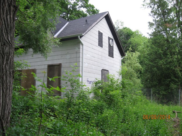
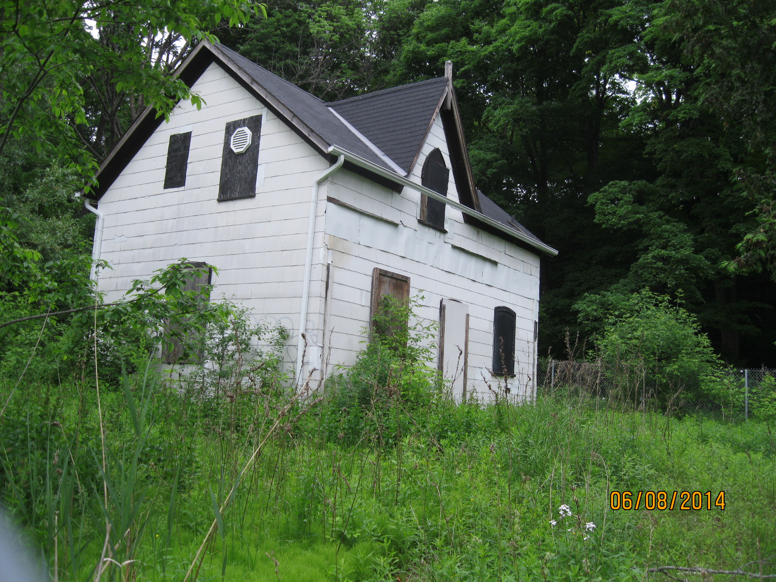
He owned 120 acres on the East Don river just south of Lawrence. He moved his farmstead here in 1832. The mill village that grew up near the mill was called Milneford Mills and included a dry goods store, a wagon shop and workers quarters. In 1846 he built a woolen mill which was destroyed along with the entire mill village by the severe flooding of Sept. 13, 1878. Milnes rebuilt and the woolen mill ran into the early 20th century. When the Don Valley Parkway was built in the mid 1950’s the remaining buildings were removed, all except the Milne family home.
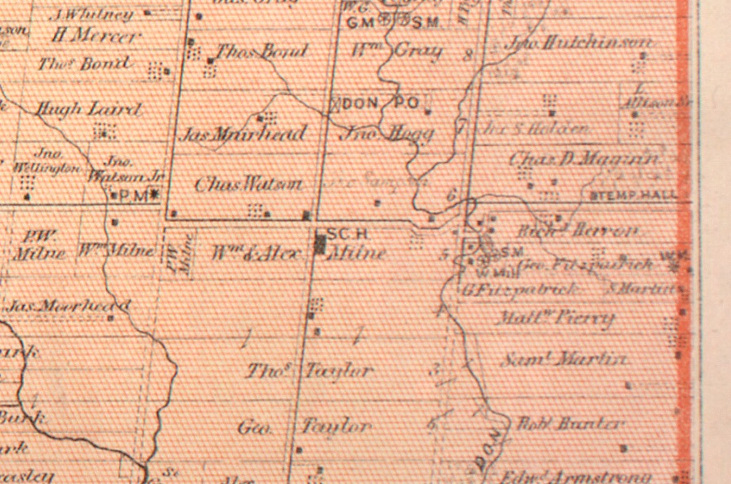
In the 1880 County Atlas several buildings are marked as well as the two mills. They are located on the river on the right hand side of the map, near the middle of the page.
The house was built in 1871 and is one of the oldest examples of gothic frame architecture in the city. The front porch which used to look out over the mills has been removed. Now abandoned, it is intended to be restored eventually.
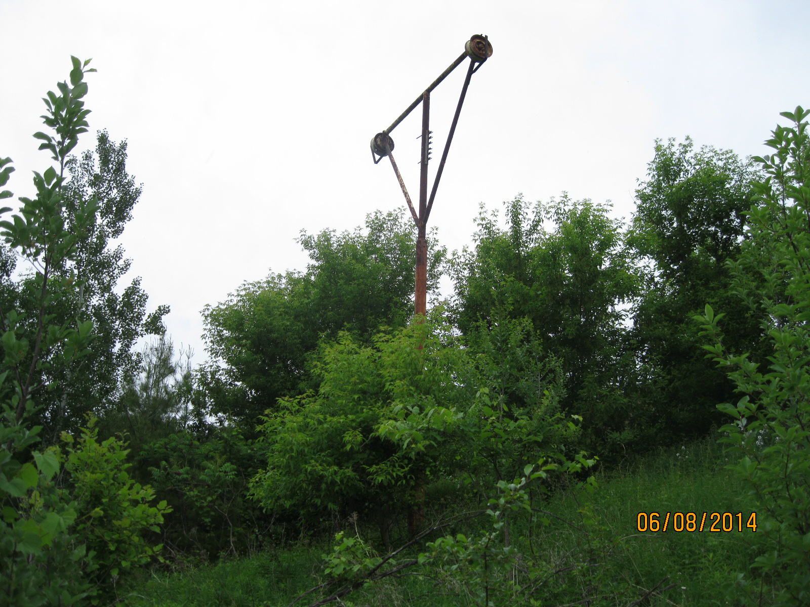
The eastern embankment south of the house was turned into a ski hill in the 1930’s and was run by the Don Valley Ski Club. With three lifts, two rope and one Poma it also boasted a $70,000 snow making machine. There were several 200 m runs dropping the 40 m of slope to the bottom of the hill. It lasted until around 1976. Today a lone ski lift tower stands halfway up the hill. It is slowly disappearing in the new growth of trees that have been planted to rehabilitate the hill side.
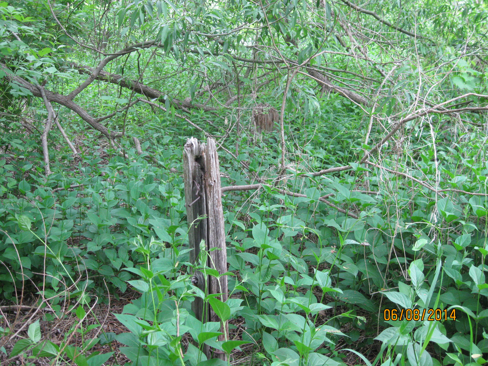
At the base of the hill, behind a large willow tree stands a series of wooden posts that once supported the loading platform for the ski lift. Behind here two steel rails sit on the ground.
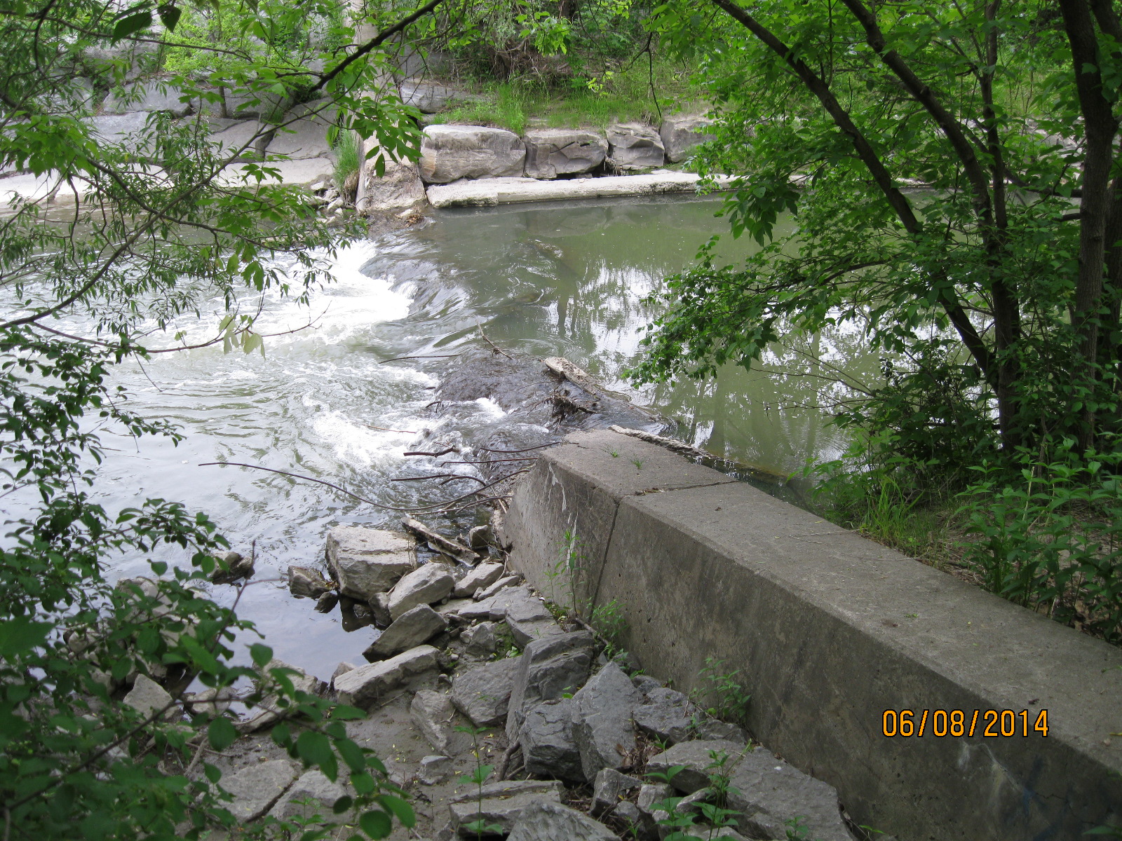
As you walk along the edge of the river the trail is lush with sumac and aspen trees. There are several wetlands along the way which are full of water fowl. The trees are alive with the sounds of various songbirds. A short walk past the old ski hill brings you to the ruins of an old dam.
A little farther along I saw this group of silk worms.

You will come to a bridge that gives you a choice to cross the river. Crossing the river leads to the display below and to Tim Horton’s a little farther along.
This display, known as High Water, marks the various flood waters. The highest rock is from 1934 and must be at least 12 feet above the current water level. Hurricane Hazel, which hit the west end of the city hardest, didn’t flood the Don severe enough to get a rock in the display.

If you stay with the east side of the river you will have to climb up over the CN tracks. On the far side the steep dirt hill leads to a trail that passes through a thick growth of trees. After following the river for a while you will come to Anewen Park.
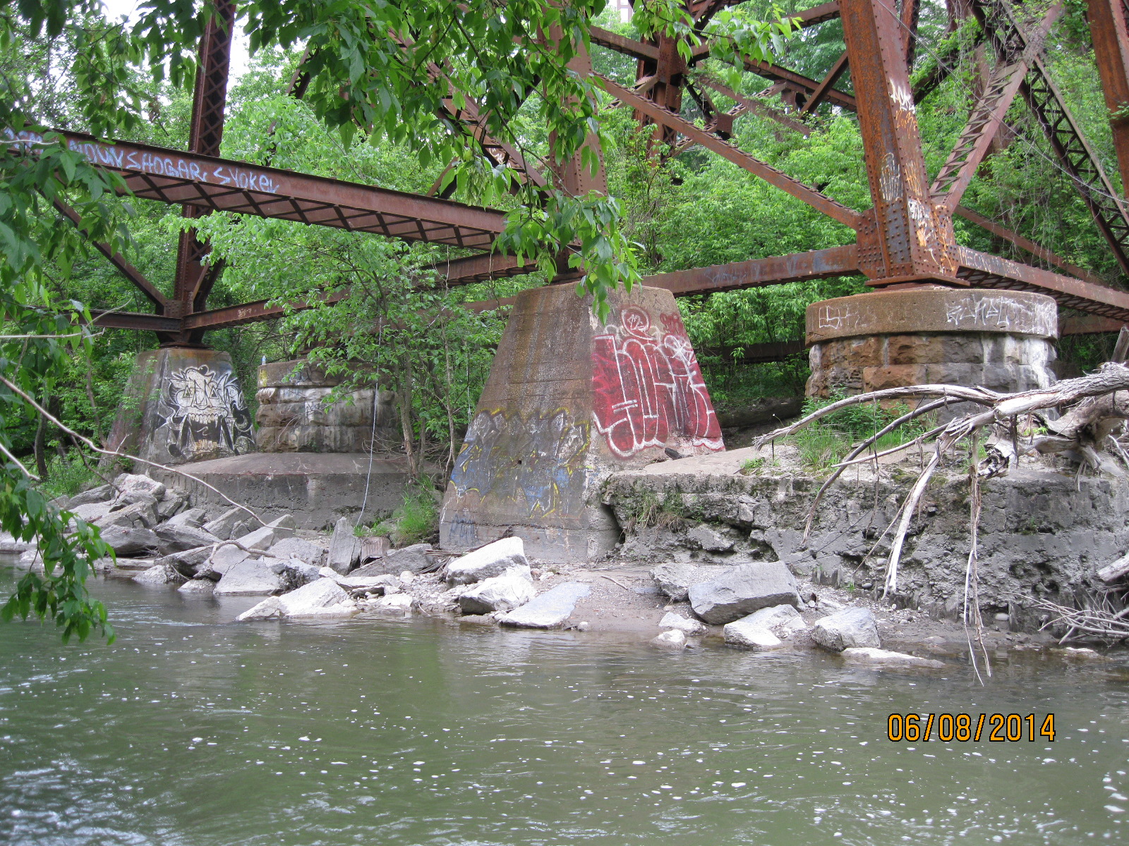
The Ontario & Quebec Railway was incorporated in 1871 and built a line north of the city of Toronto. The high trestle bridge over the East Don River was constructed on round piers of cut stone. When the CPR, who ran the line, double tracked it around 1898 new sets of piers were built of concrete. In the photo below you can see the two original round bridge footings which were capped with concrete when the rail line was double tracked.
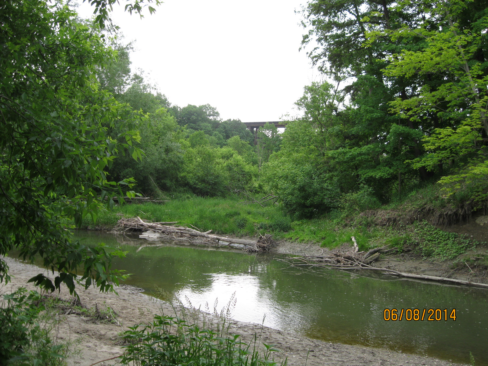
The CPR bridge in the distance as it crosses the East Don river south of Lawrence Ave.
Like us at http://www.facebook.com/hikingthegta
Follow us at http://www.hikingthegta.com

Pingback: Milne Dam Conservation Area | Hiking the GTA
I remember the ski hill as a child, played in that ravine but unfortunately never came upon the house. I do remember a house North of Lawrence not quite halfway to York Mills on the east side. This was before the Don Valley and Woodbine ended there. One small error Wilket Creek not Wiliket. Brings back sweet memories.
Good morning and thanks for your comment. Thanks for catching that typo too!
what a wonderful article. I remember going up by the ski hill, there was a small road at the bottom of the hill and my dad would tie the toboggan onto the back of the car n pulling us along the road….lord he would be arrested today for doing that lol lol but it was so much fun lol I also remember driving up don mills rd across the one lane bridge and going to the farmers stand ….which is now the corner of Overlea Blvd n Don Mills Rd. Wonderful memories..kca
Pingback: Anewen Greenbelt | Hiking the GTA
Pingback: Wexford – Ghost Towns of the GTA | Hiking the GTA
Thankyou for this .!!!
I do remember the ski hill even though I never used to go there..I love reading about the area that i grew up in Cabbage Town and Riverdale park iremeber the Don Valley parkway being built those ate great memories thank you for the posting and wonderful pictures