Yearly Archives: 2015

Connaught Labs

Thursday March 12, 2015

Thanks to my friend James, who hooked me up with historian Christopher Rutty, I was able to have a lunch hour tour of the museum at Sanofi Pasteur.  I have worked at Dufferin and Steeles for 17 years and often wondered about the history of the fancy old buildings near the south east corner.

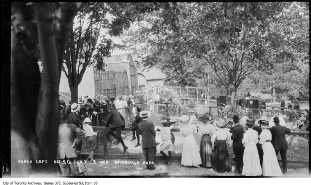
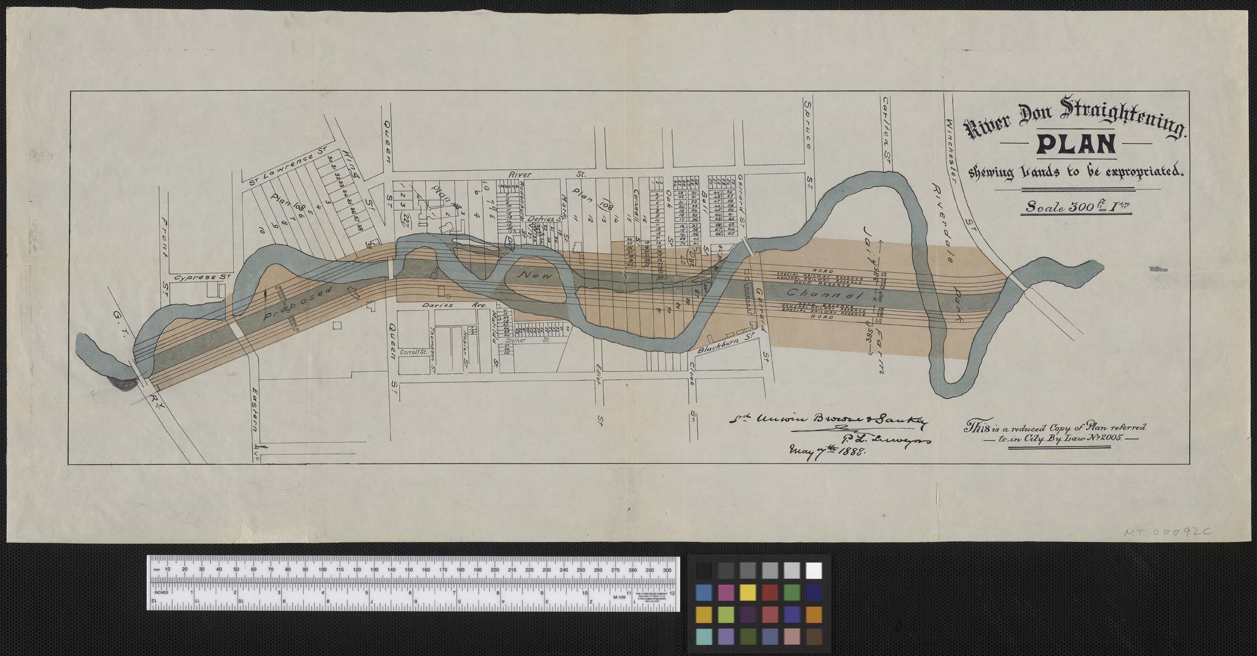
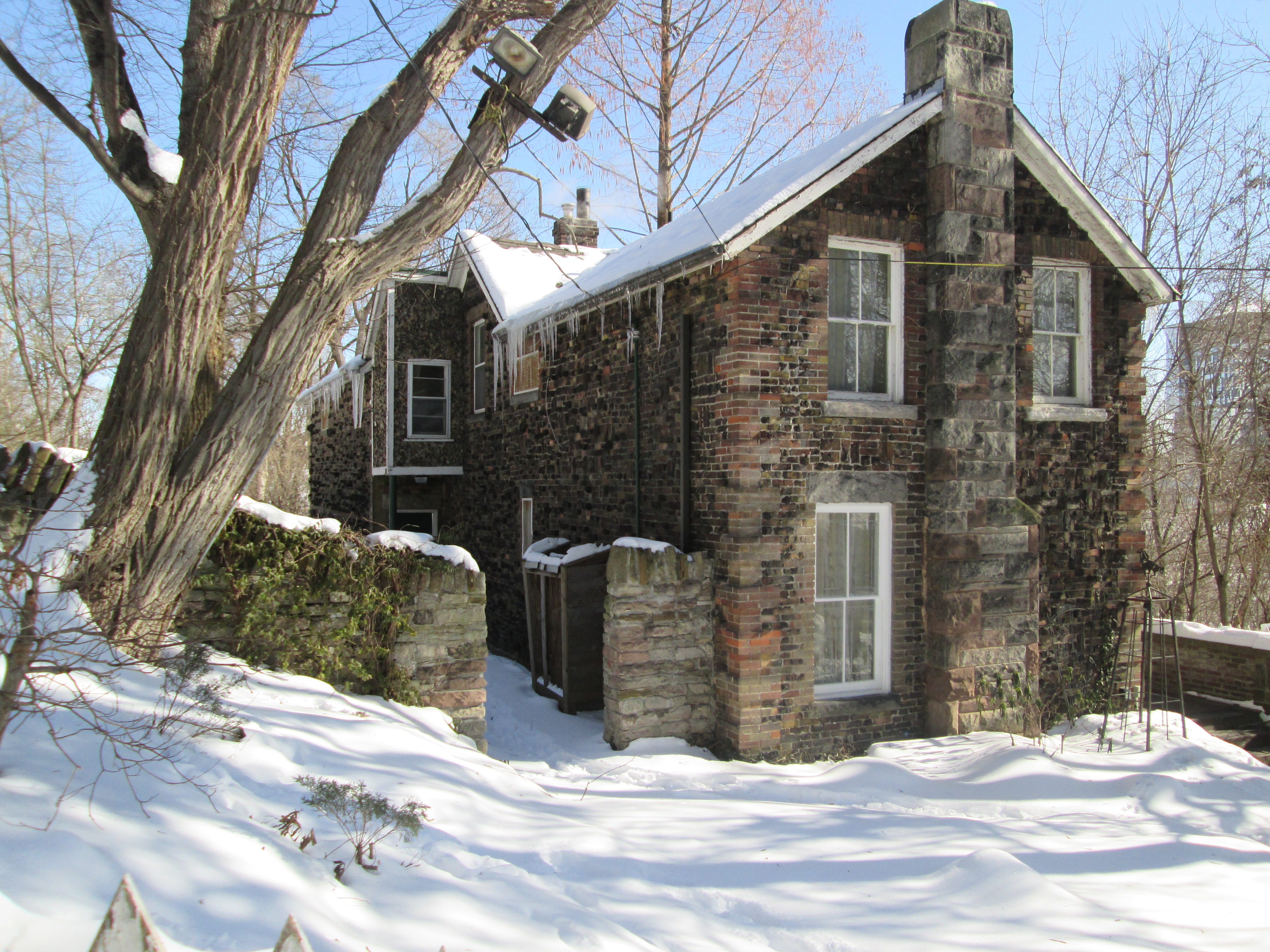
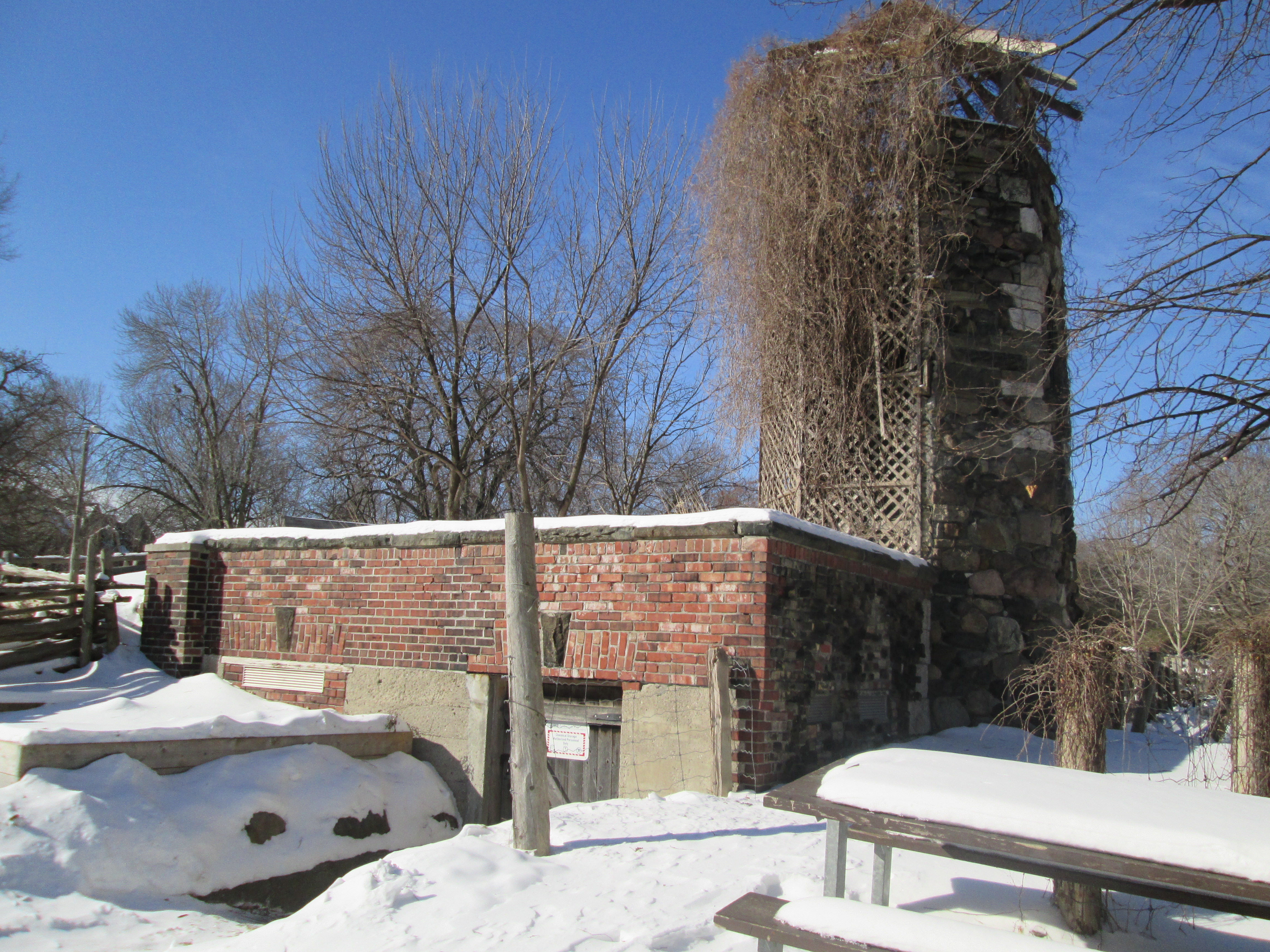
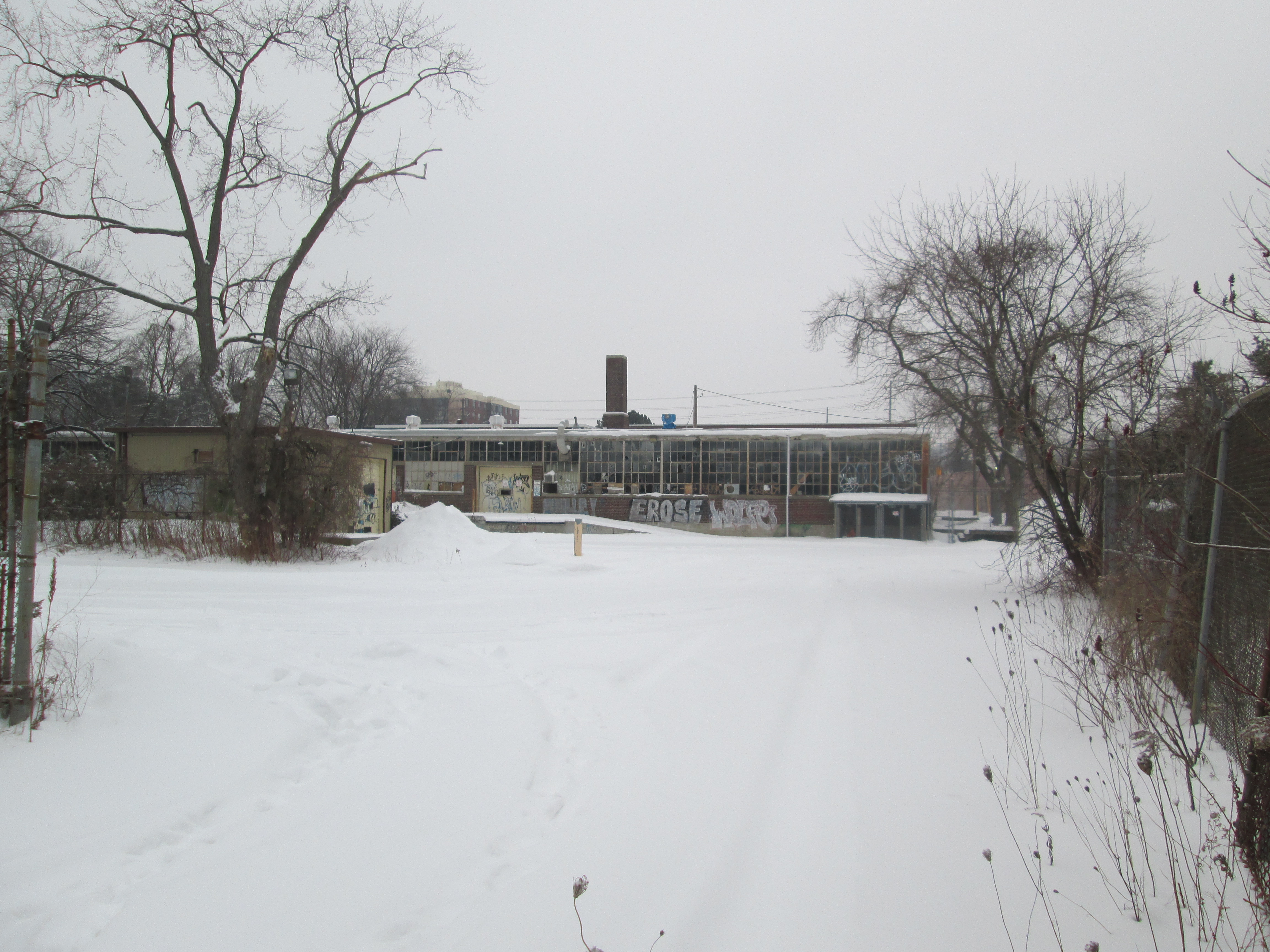
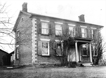
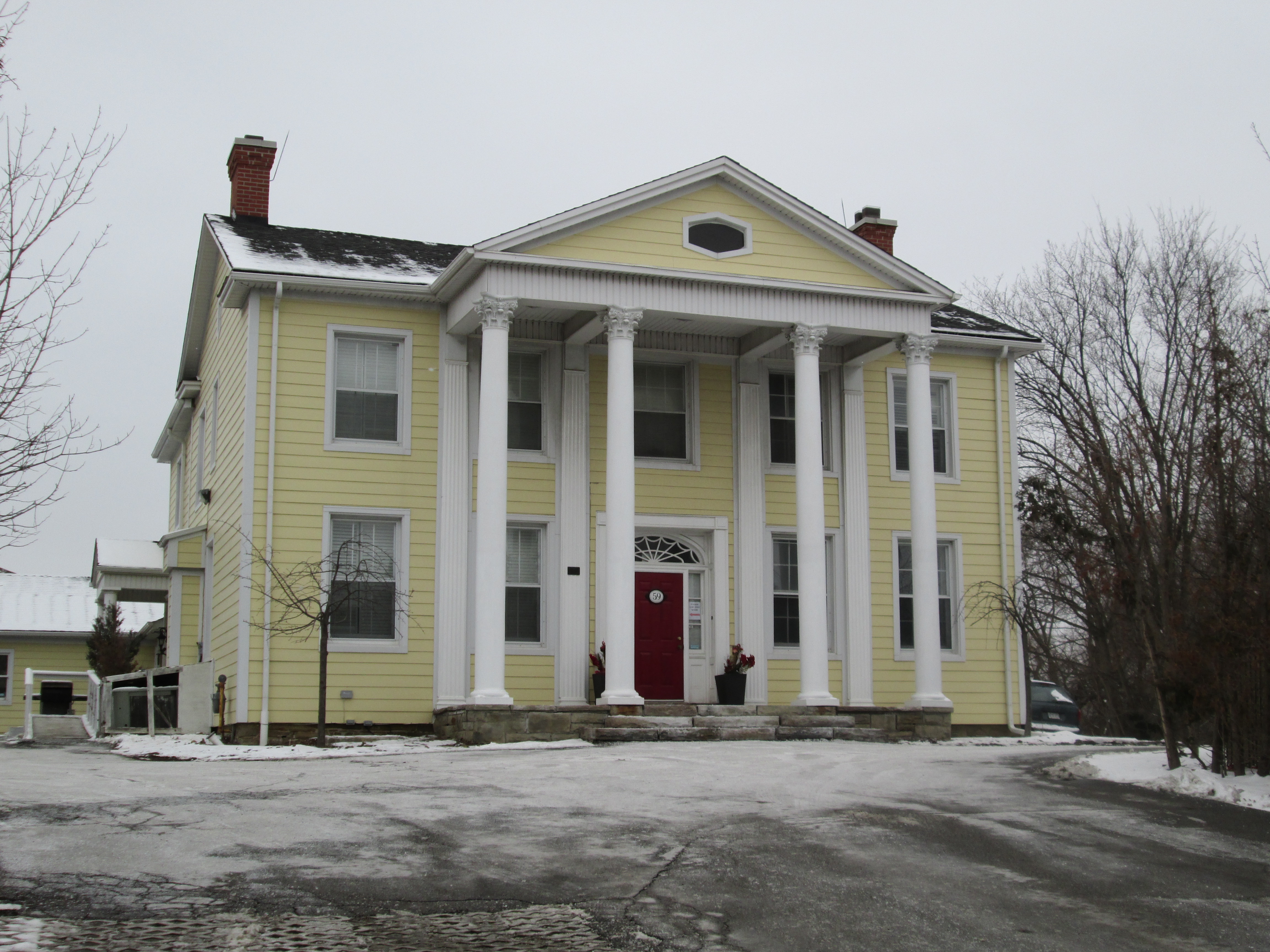
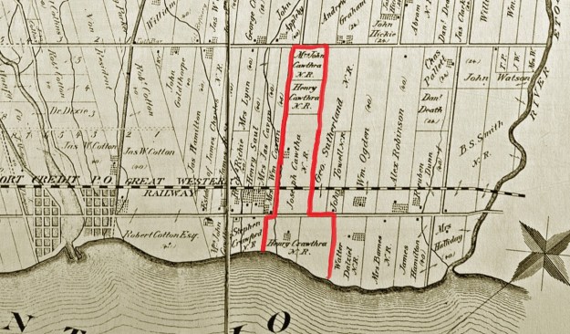
Fisherville was named after the Fisher family.  Jacob Fisher emigrated from Pennsylvania with 22 members of his family in 1797. They were granted lots 25 and 26 which were on both sides of Steeles, east of Dufferin street. They ran a saw mill on the West Don River and later a grist mill which operated with different owners until about 1912.  By the 1870’s the property had been divided and was under several owners with the Fisher house and mill in the hands of G. H. Appleby.

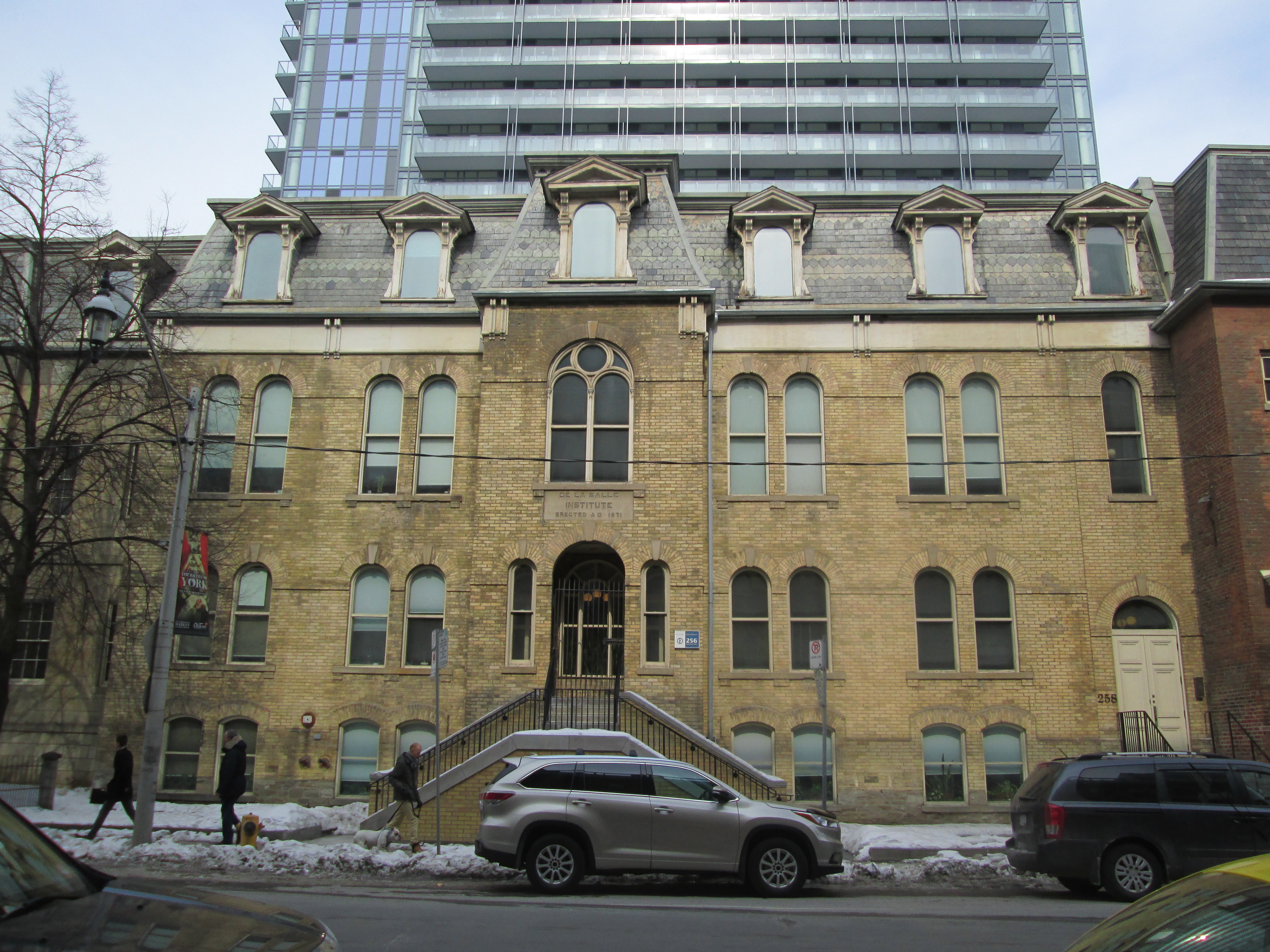
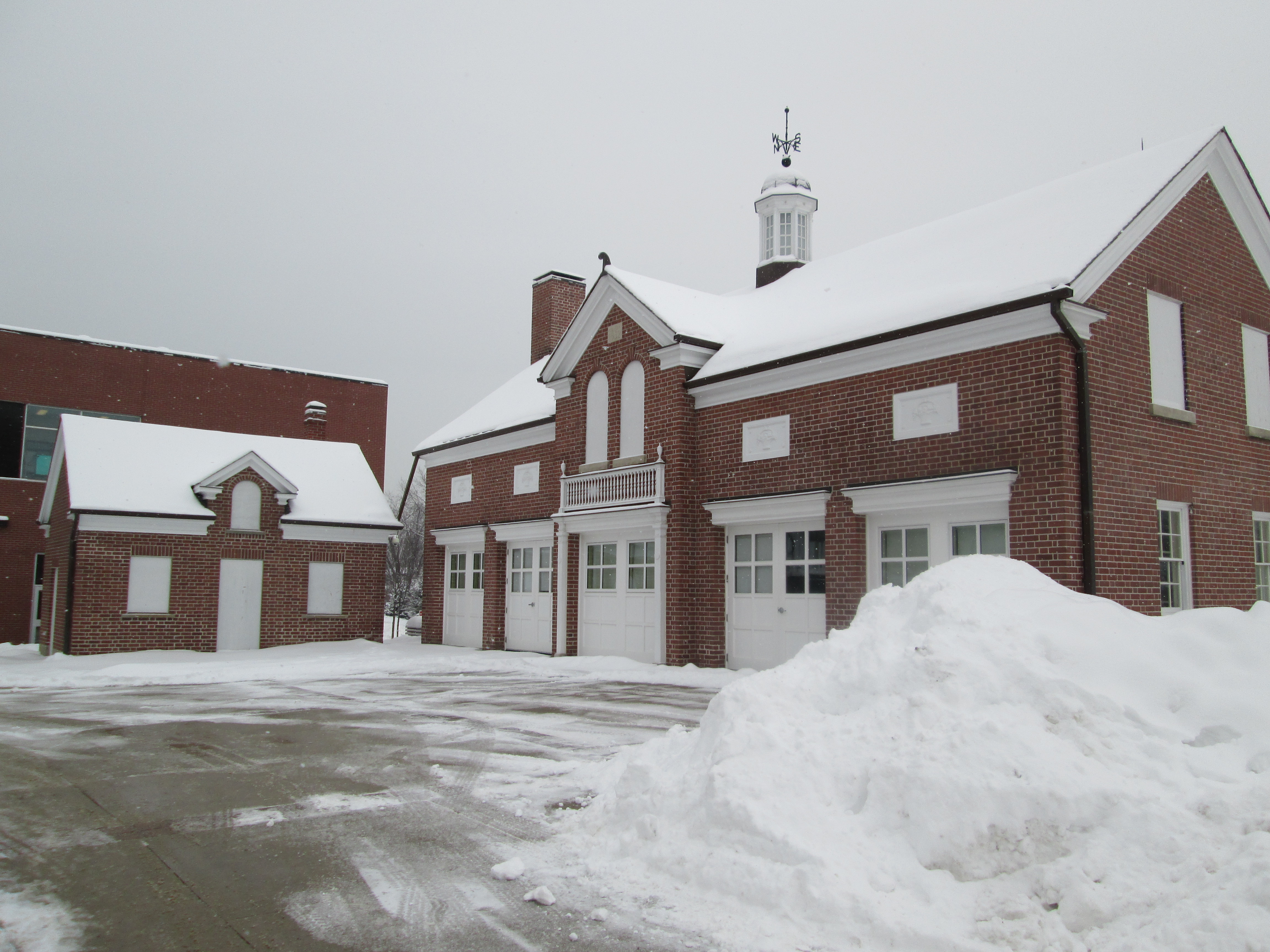
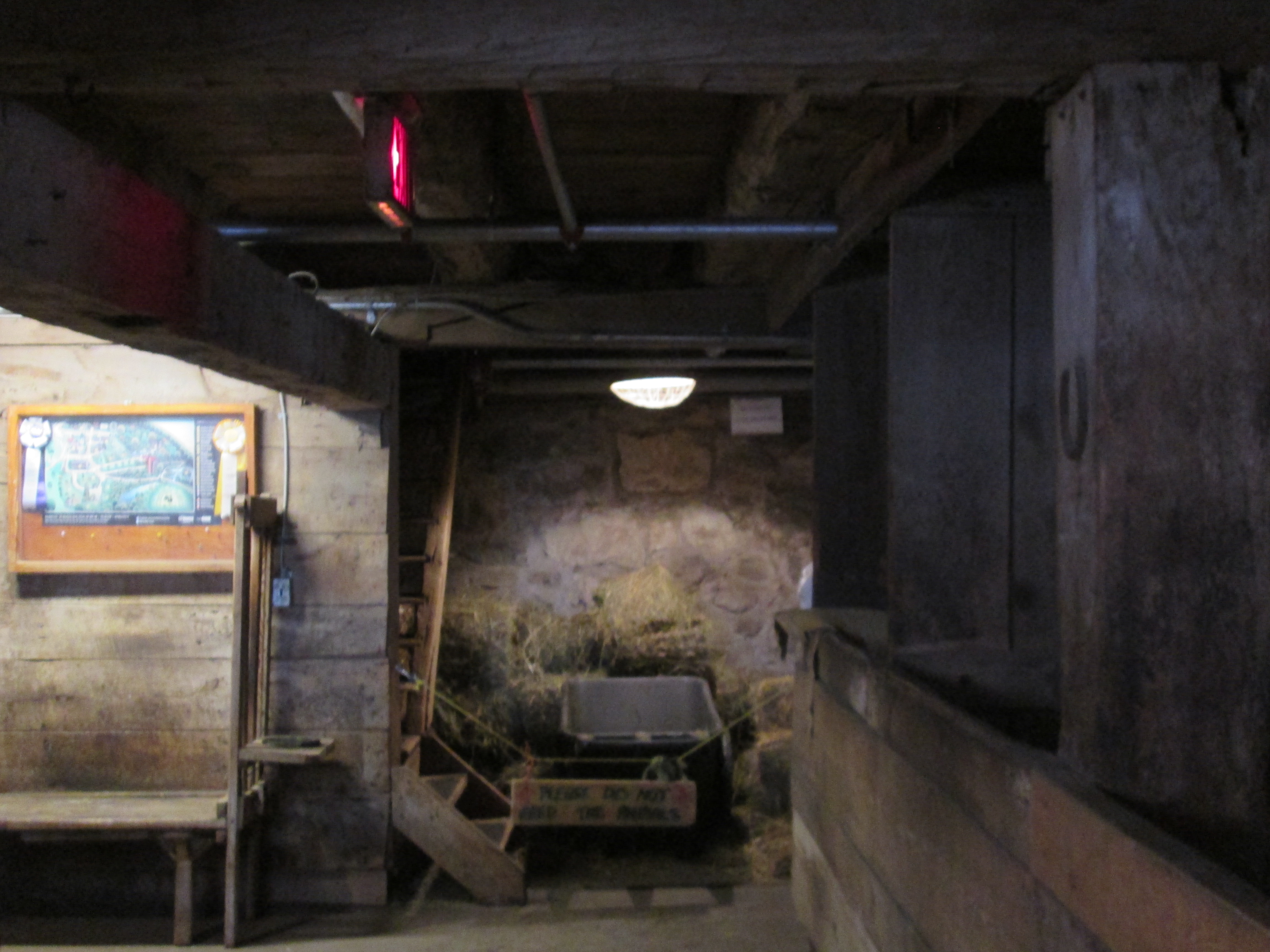
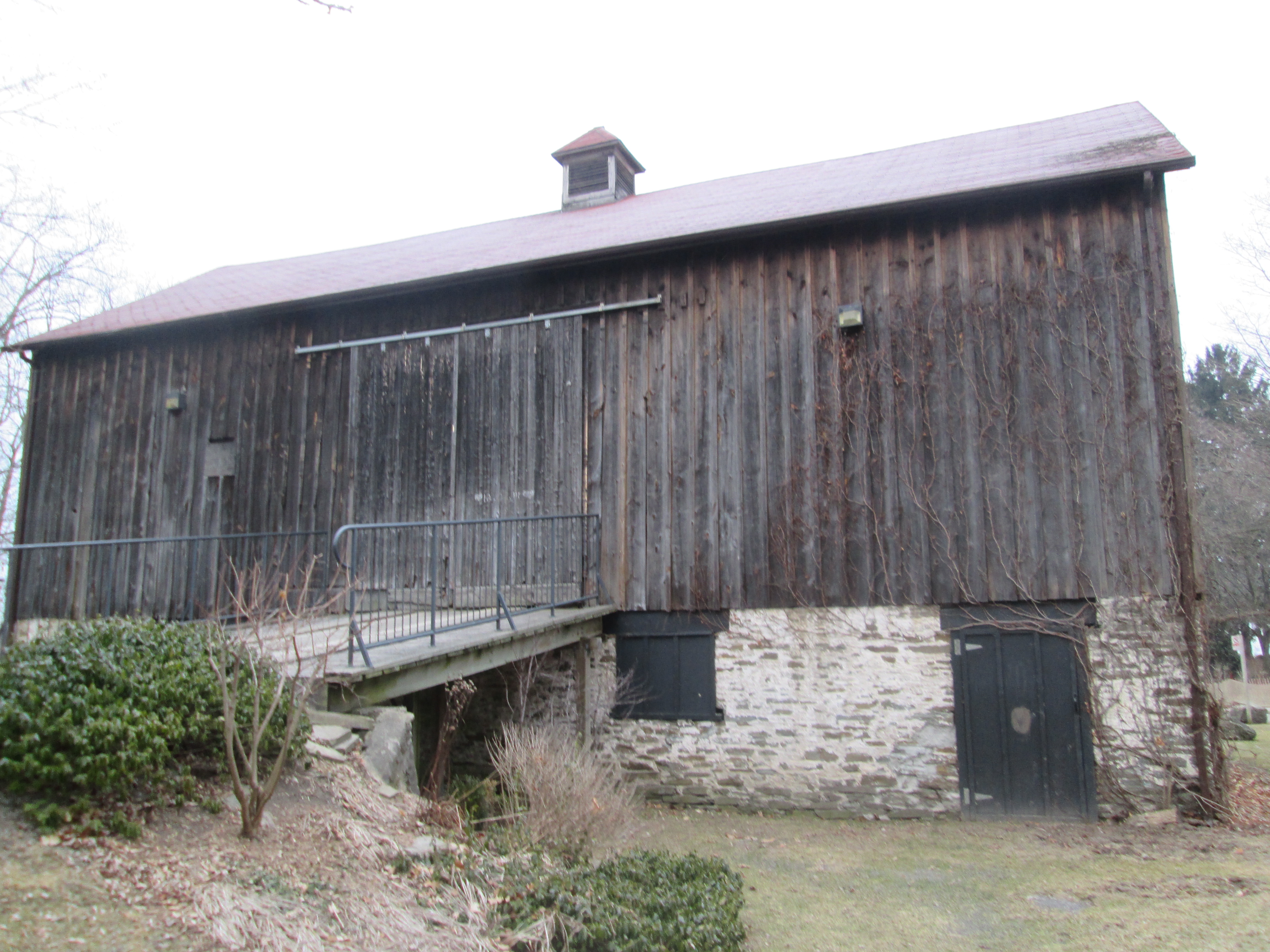
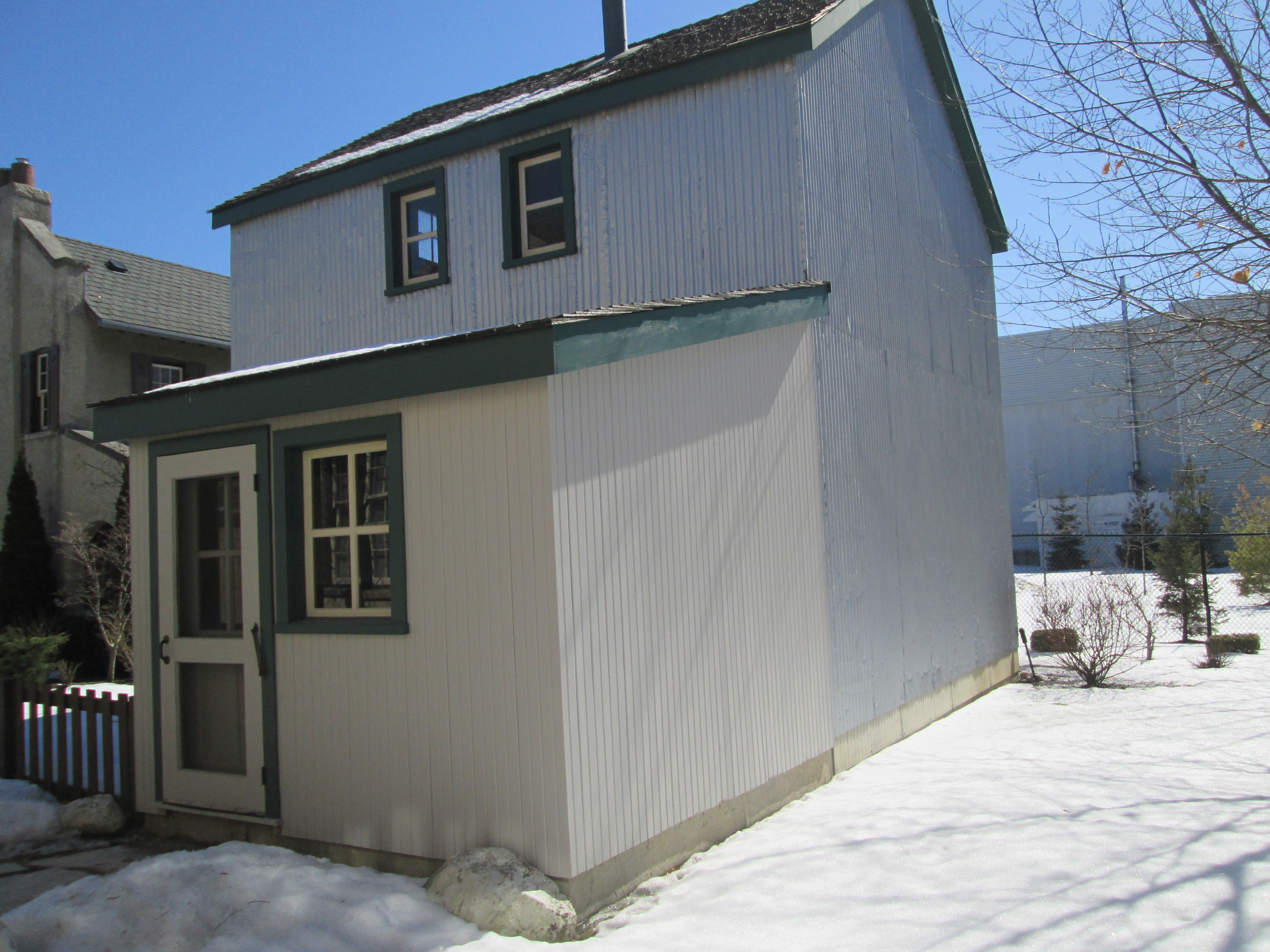
John G. Fitzgerald was born in 1882 in Drayton Ontario.  He attended the University of Toronto medical school where he graduated at the young age of 21.  In 1913 he became the professor of hygiene  at the university.  Using his wife’s inheritance money he built a back yard stable on Barton street and acquired a couple of horses.  He began to produce the antitoxin for diptheria which he sold to the Canadian Government at cost for free distribution.  The university decided to back him and in 1914 the Antitoxin labs were opened.  The original stable was in danger of being demolished and has been moved to the Fisherville site. One side of the stables has no windows because it used to stand against another building in it’s original location.

IMG_2787

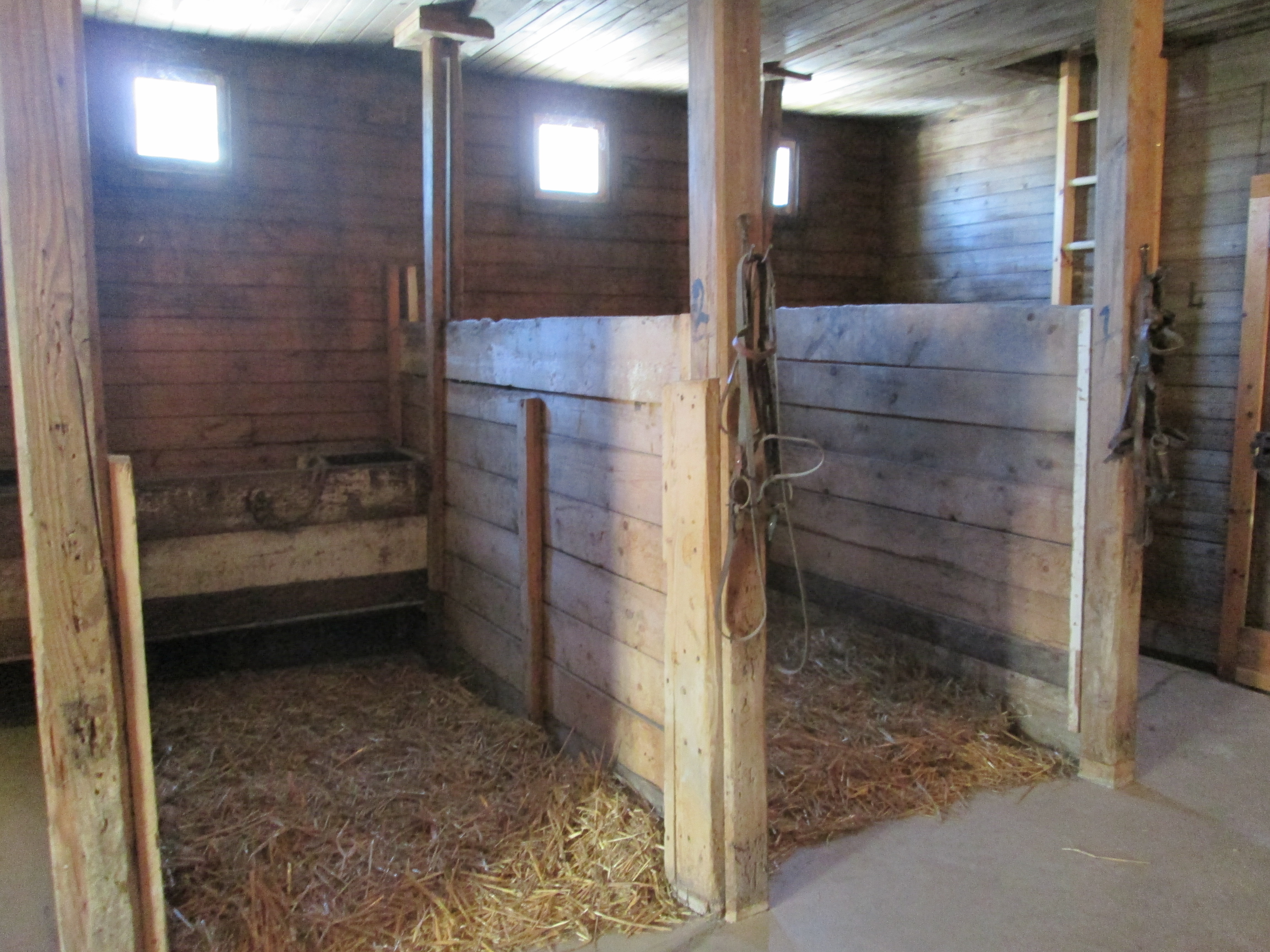
Inside, the old stable has been restored and served as a museum to celebrate the 90th anniversary of the antitoxin labs.

IMG_2785

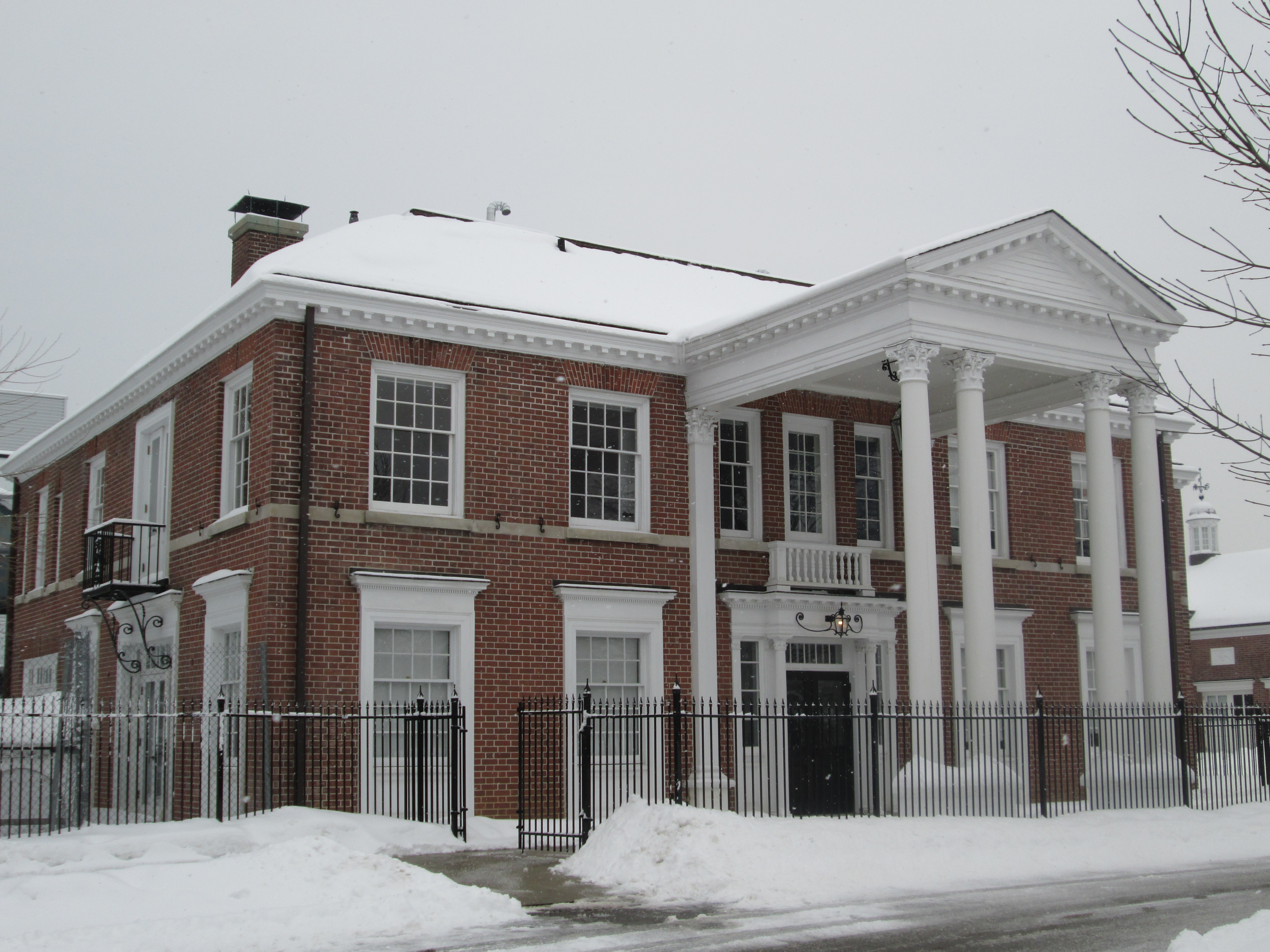
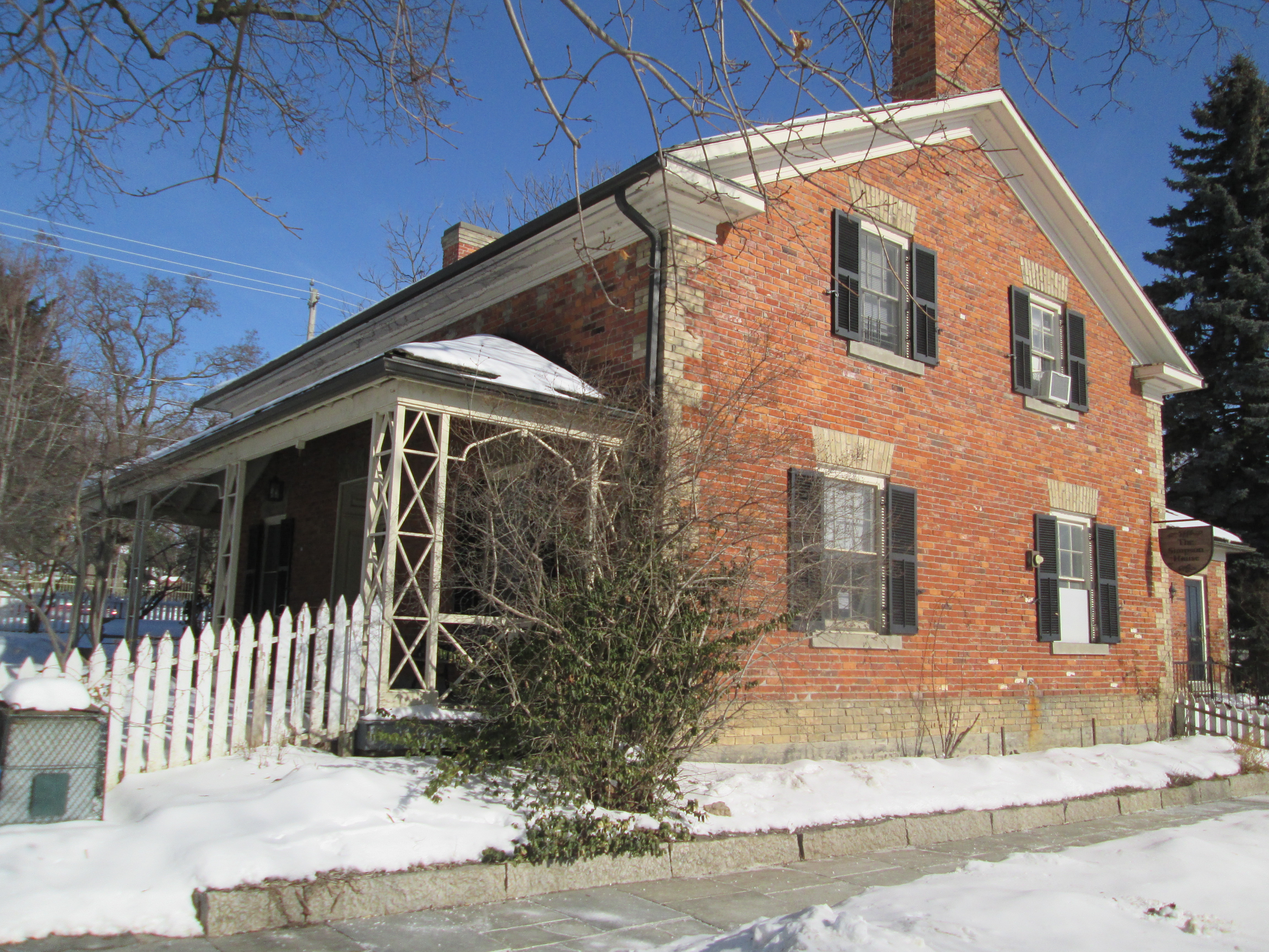
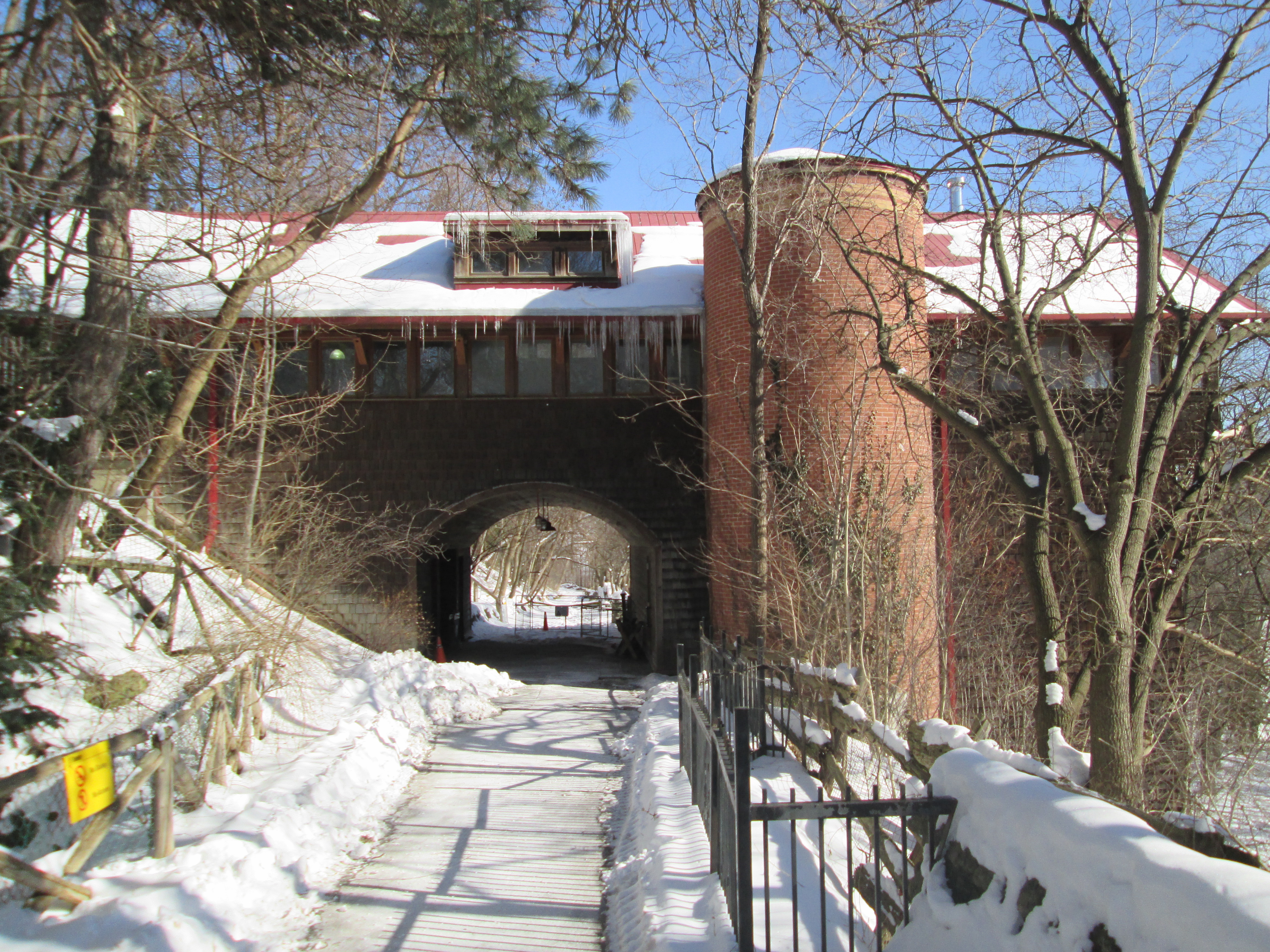
Albert Gooderham was the grandson of William Gooderham of Gooderham and Worts distillery and served as chairman of the Ontario branch of the Red Cross.  With the outbreak of World War 1 there was a shortage of tetanus shots for the soldiers.  In order to increase production, space was required to increase the number of horses that could be cared for.  Albert took John G. Fitzgerald for a country drive one day in 1915 and ended up at the old Fisher farm, now abandoned, but still complete with the mill and pond.  Albert bought the property and built the labs and stables which were opened on October 25, 1917.  The Connaught Antitoxin Laboratories and University Farm was named after the Duke of Connaught, Canada’s governor general during WW1.

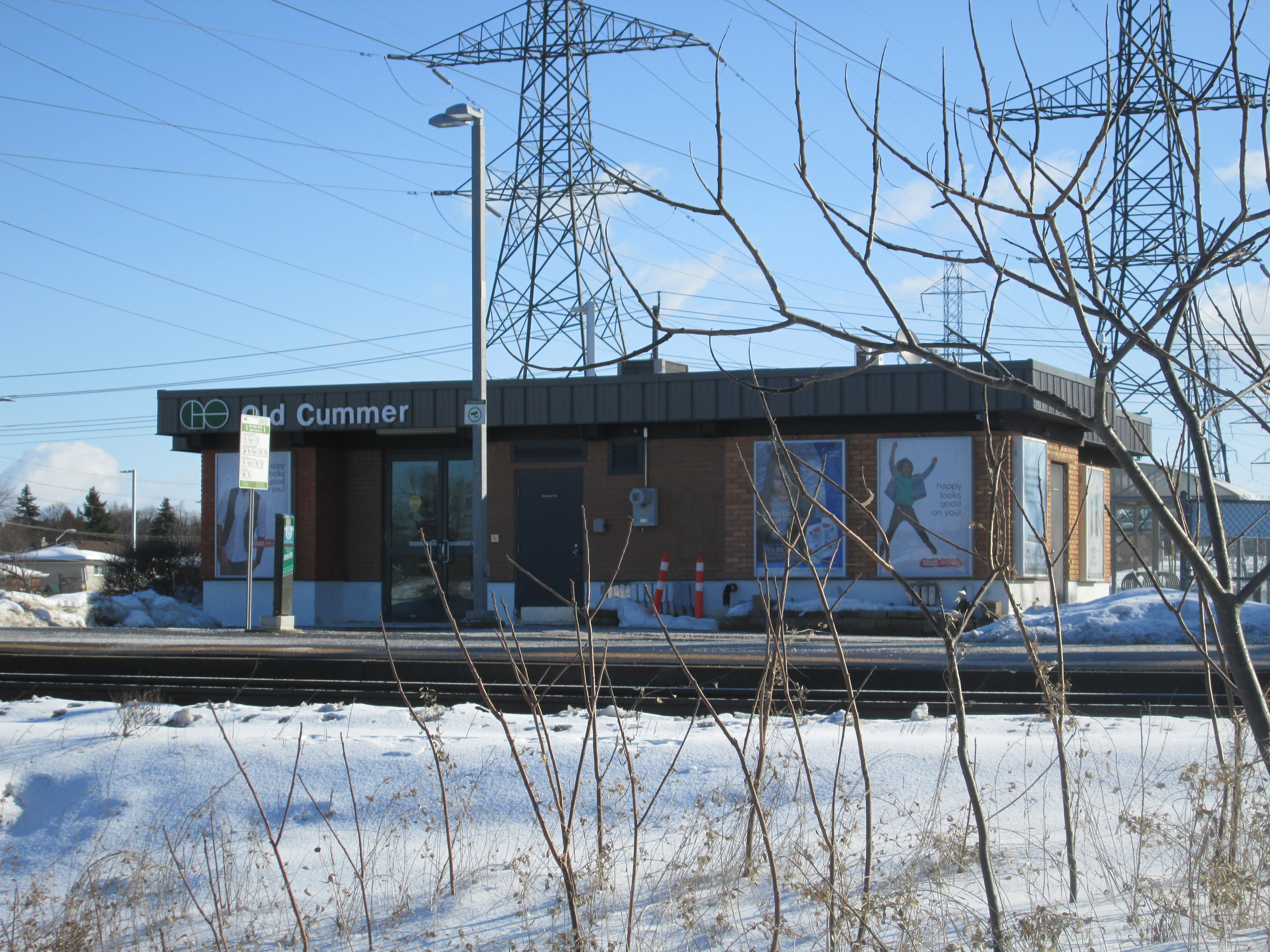
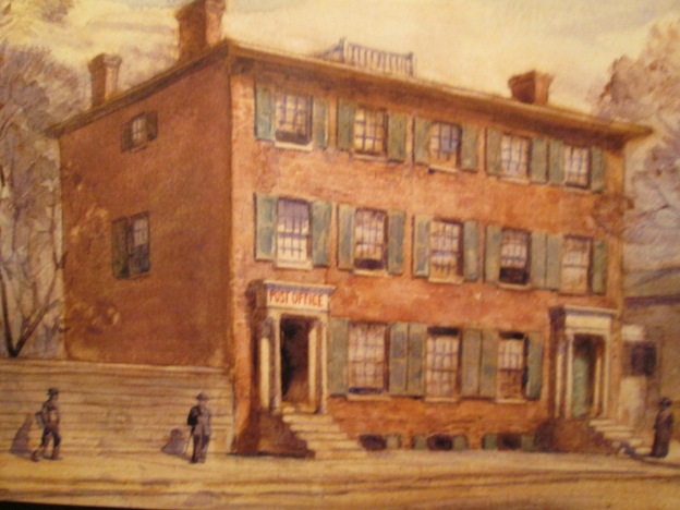
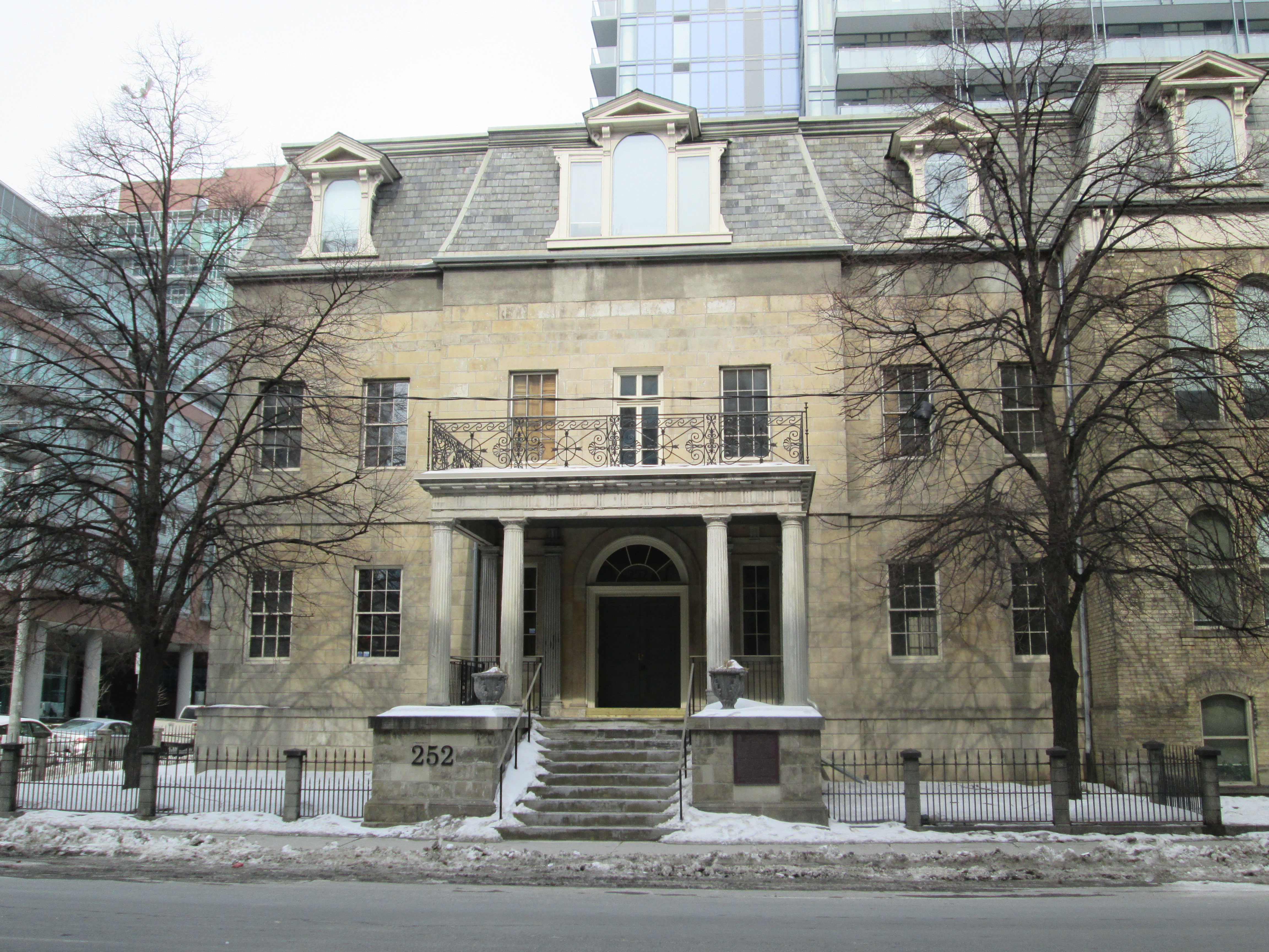
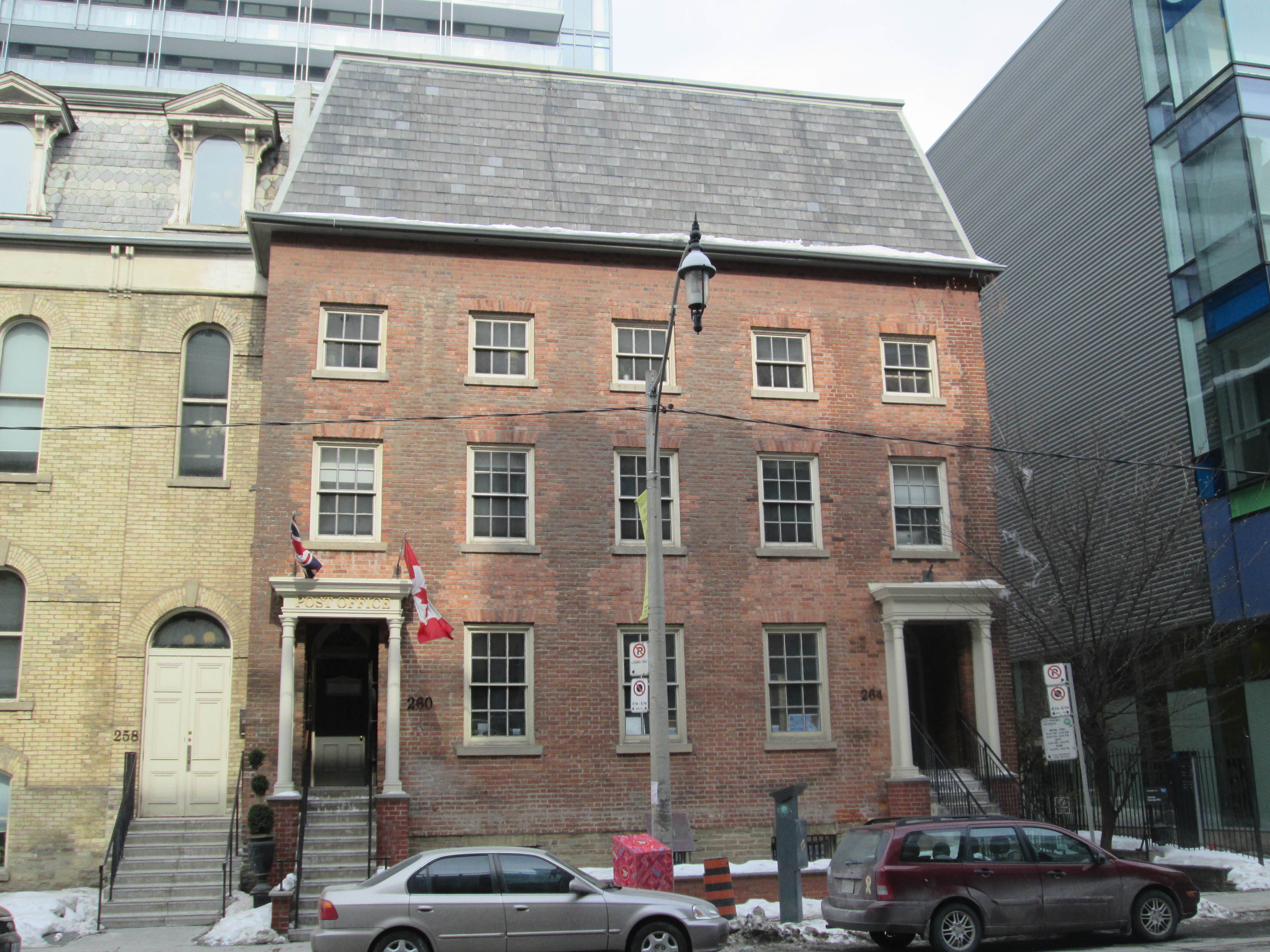
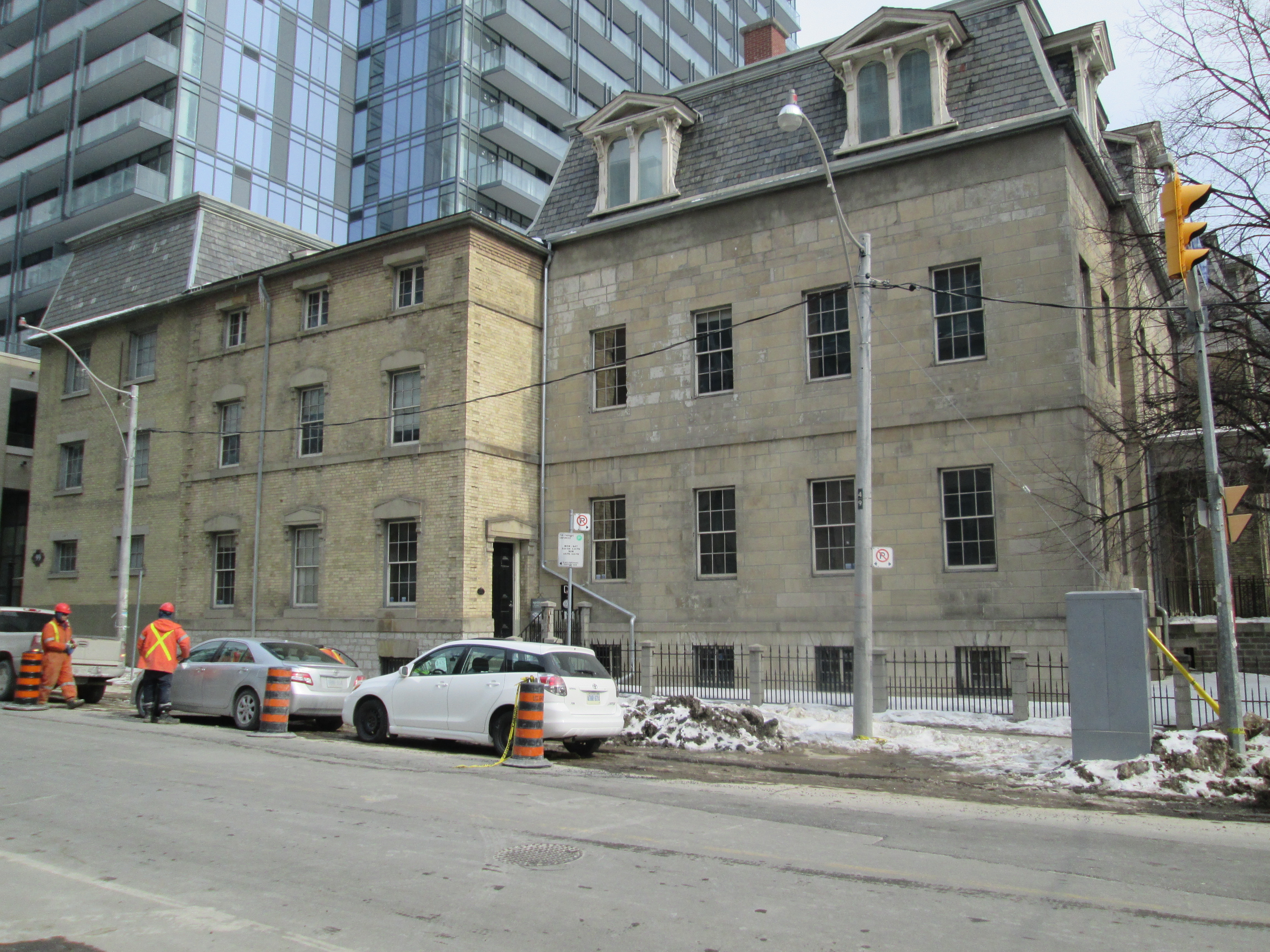
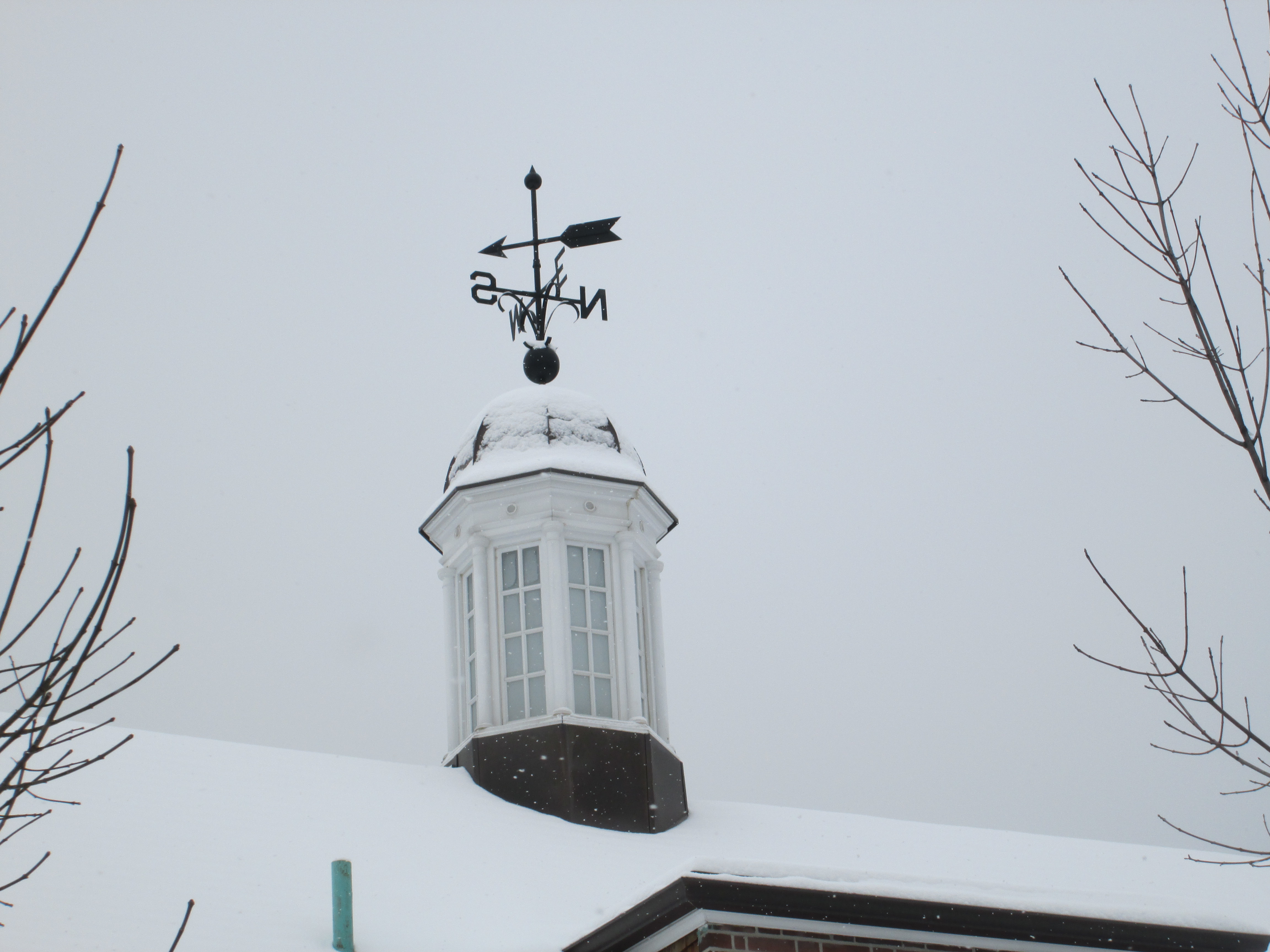
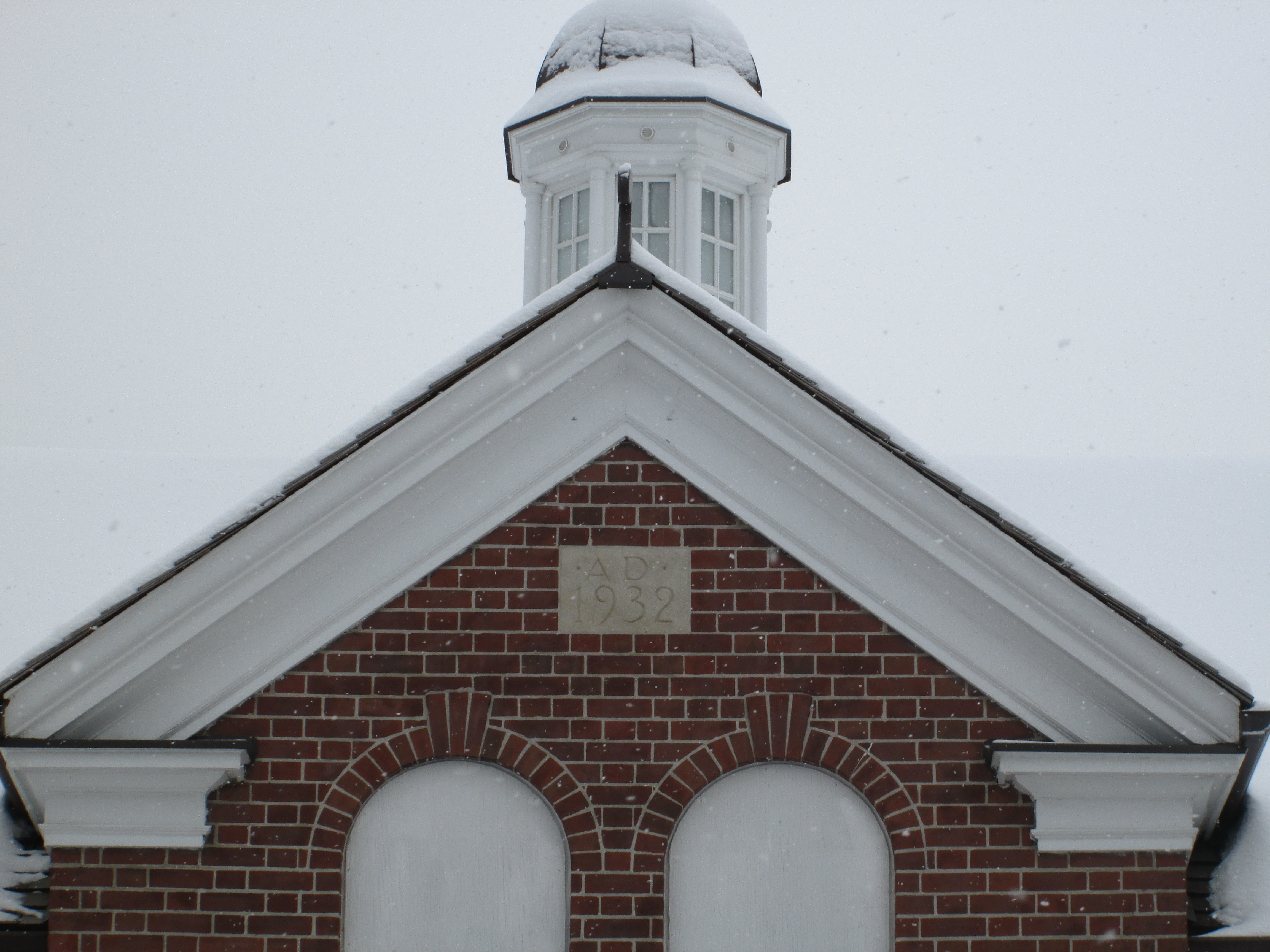
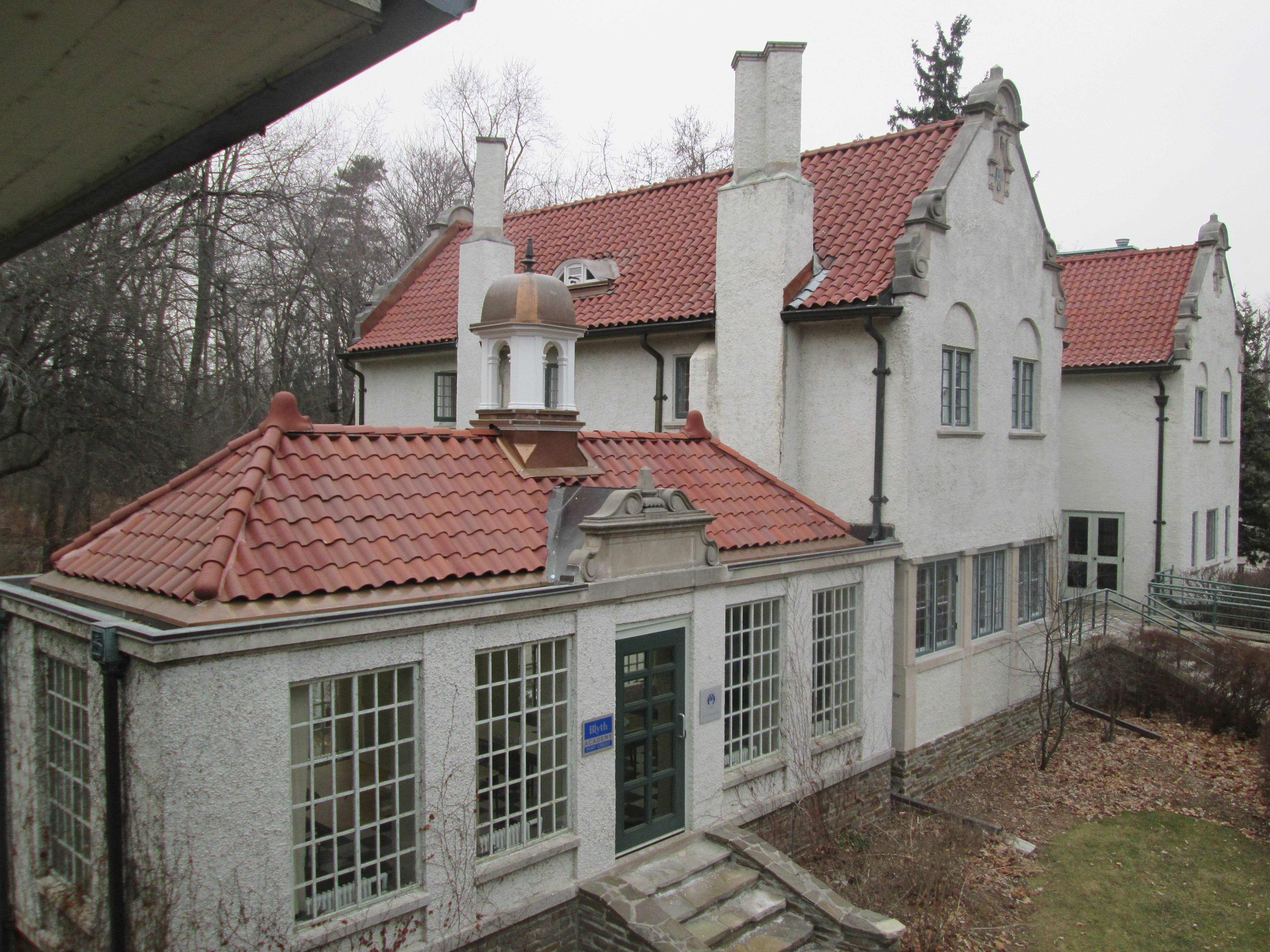
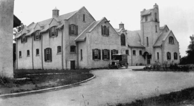
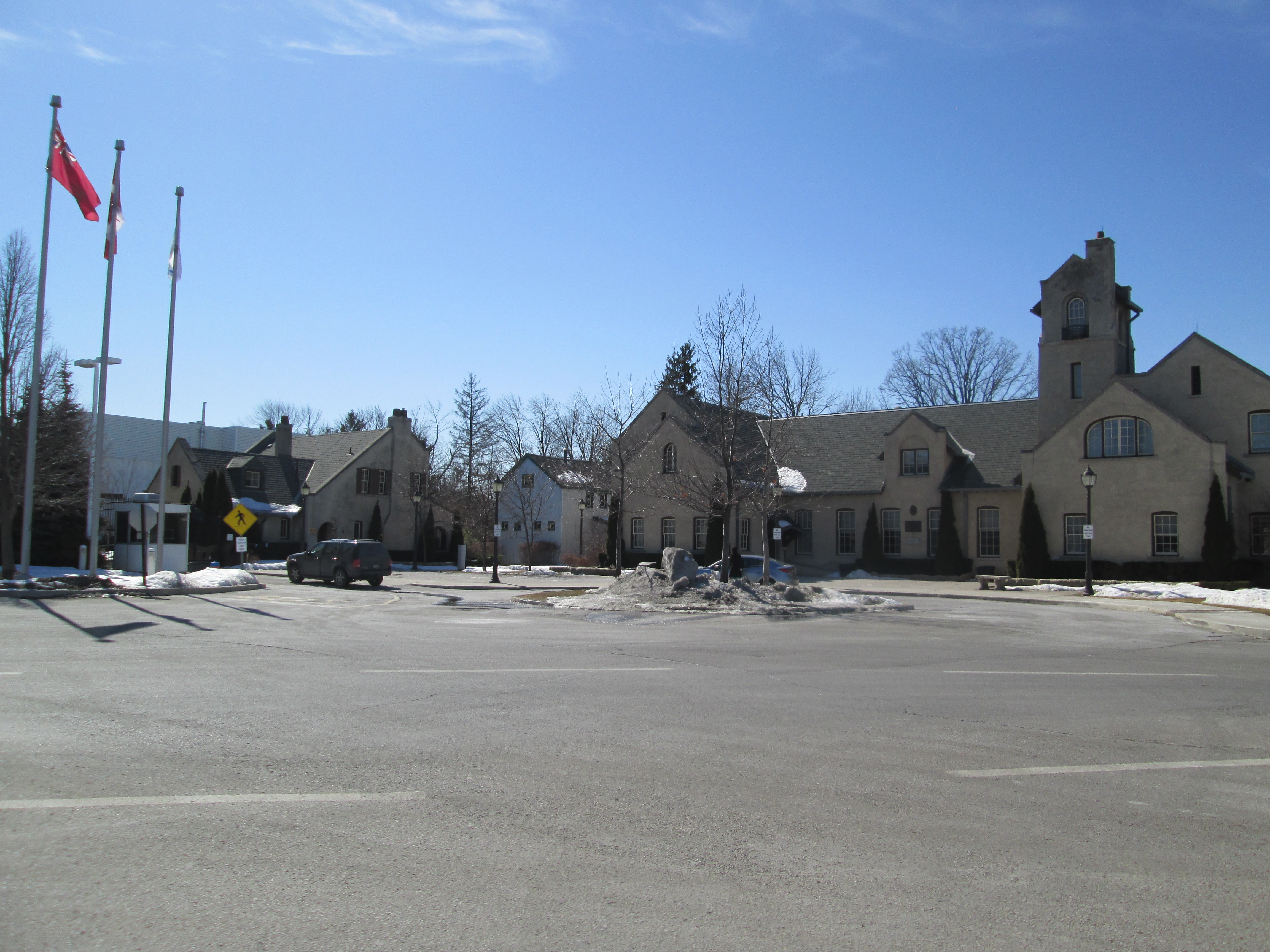
The cover photo was borrowed from the Sanofi Pasteur Canada Centenary Facebook page which I highly recommend for additional information on this historical site.  It shows the antitoxin labs with the company truck, also donated by Gooderham, which made the 20 mile trip back and forth to the university a couple times per week.  The photo below shows the labs today.  The middle section between the two towered ends of the right hand building contained stables while labs and production facilities were located in the rest of the two original buildings. The original 1913 stable has recently been relocated between the two 1916 buildings to form a heritage square.

IMG_2793

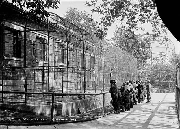
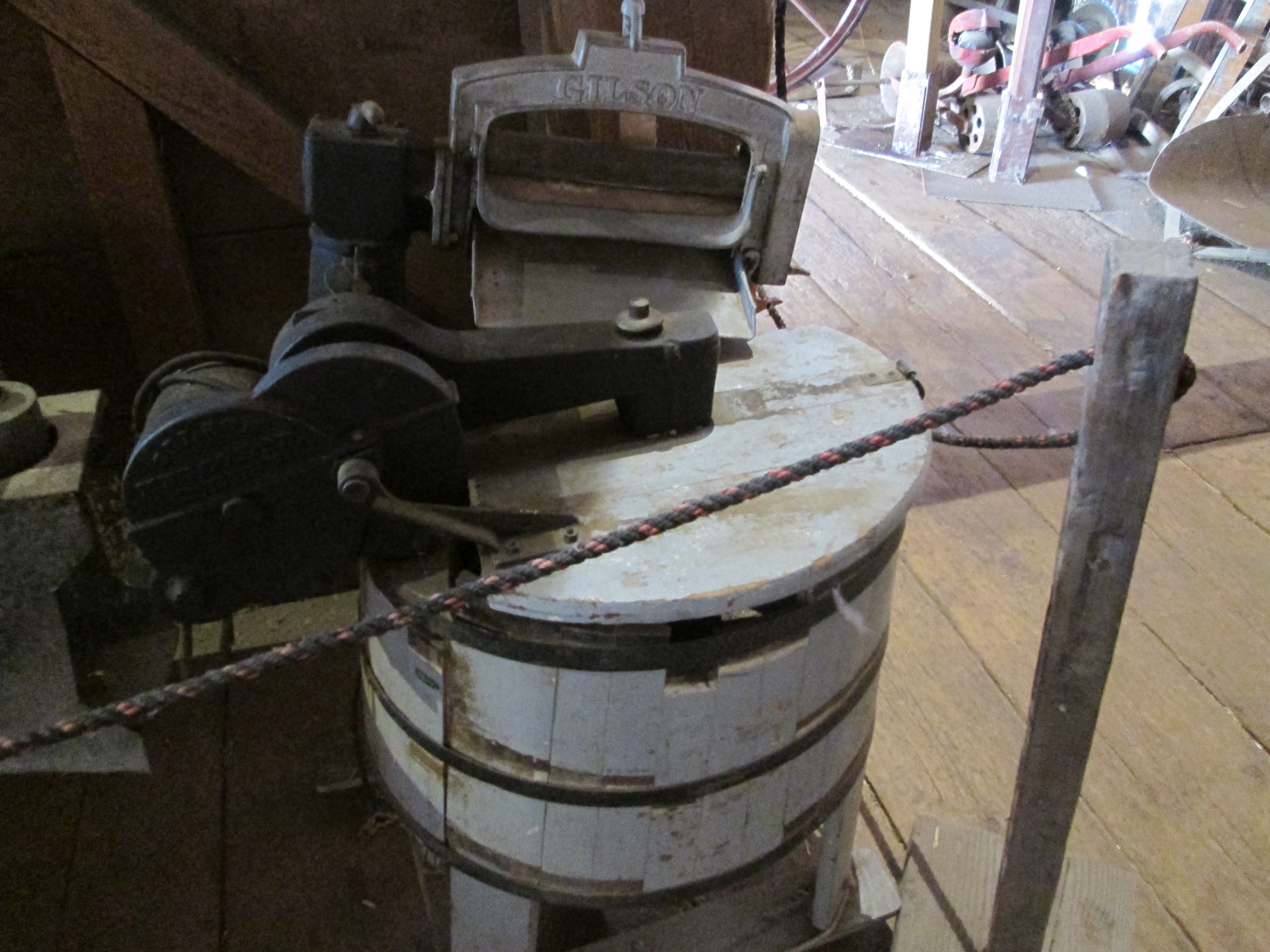
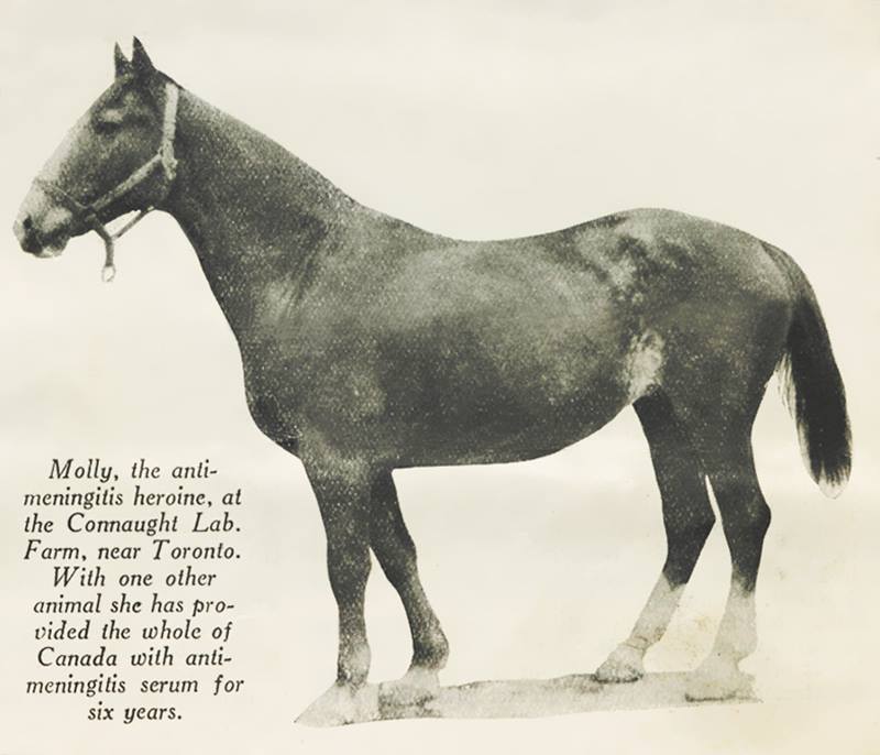
Horses were essential to the production of antitoxins.  Horses can be safely injected with small amounts of toxins that have no negative effect on the animal.  Their bodies produce an antitoxin that can be removed and administered to a human to make the person immune to the toxin. Horses were bought by Fitzgerald that were headed for the glue factory and given new life as living antitoxin producers.  For example, one horse could produce enough tetanus serum for 15,000 soldiers during WW1.  The picture below is from a January 25, 1928 Macleans article, but taken from the same Facebook page as the cover photo, describing how this horse and one other produced enough meningitis serum for all of Canada.

10415675_716544785058280_2051002745778299447_n

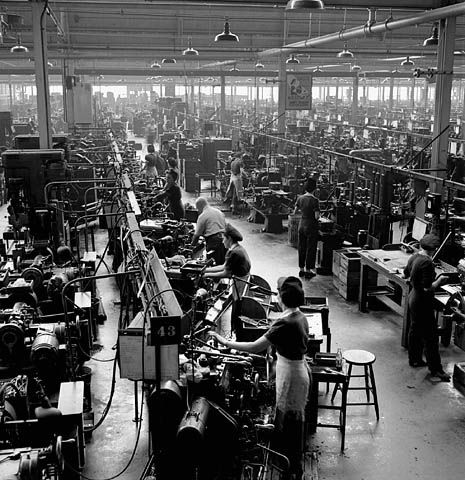
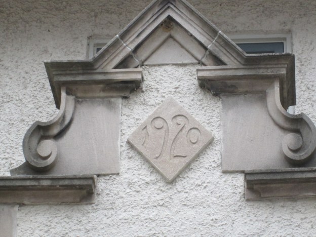
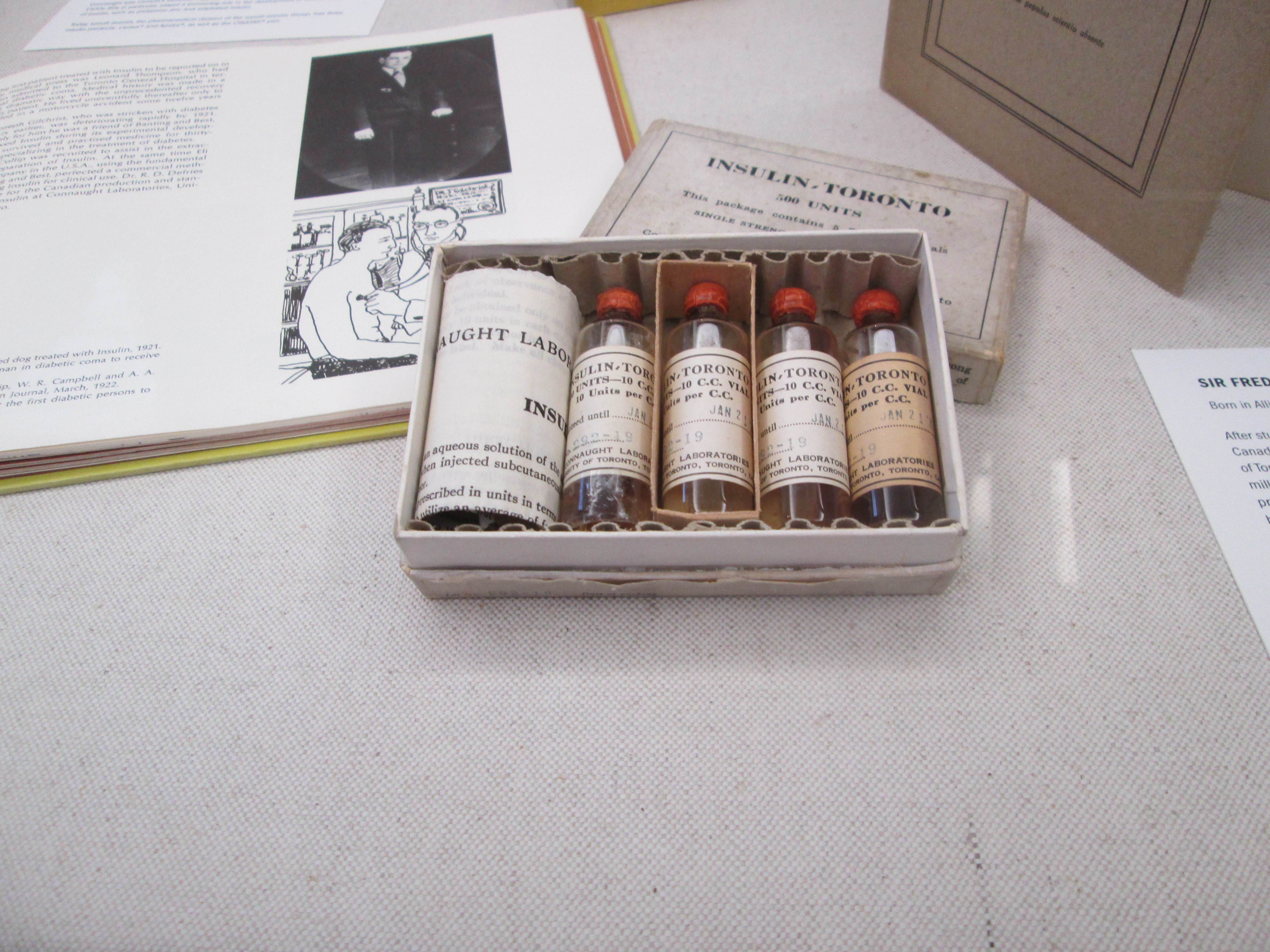
Prior to the discovery of insulin a person who had diabetes pretty much had a death sentence. In 1920 Dr. Frederick Banting had the idea that led to the discovery of Insulin.  He brought the idea to the University of Toronto where a small experiment was set up using dogs.  When human trials were successful a large scale production method needed to be perfected. Connaught Labs had the ability and in 1923 they began a sixty year history of supplying all the insulin used in Canada.  The historical insulin vials in the picture below are on display at the museum.

IMG_2781

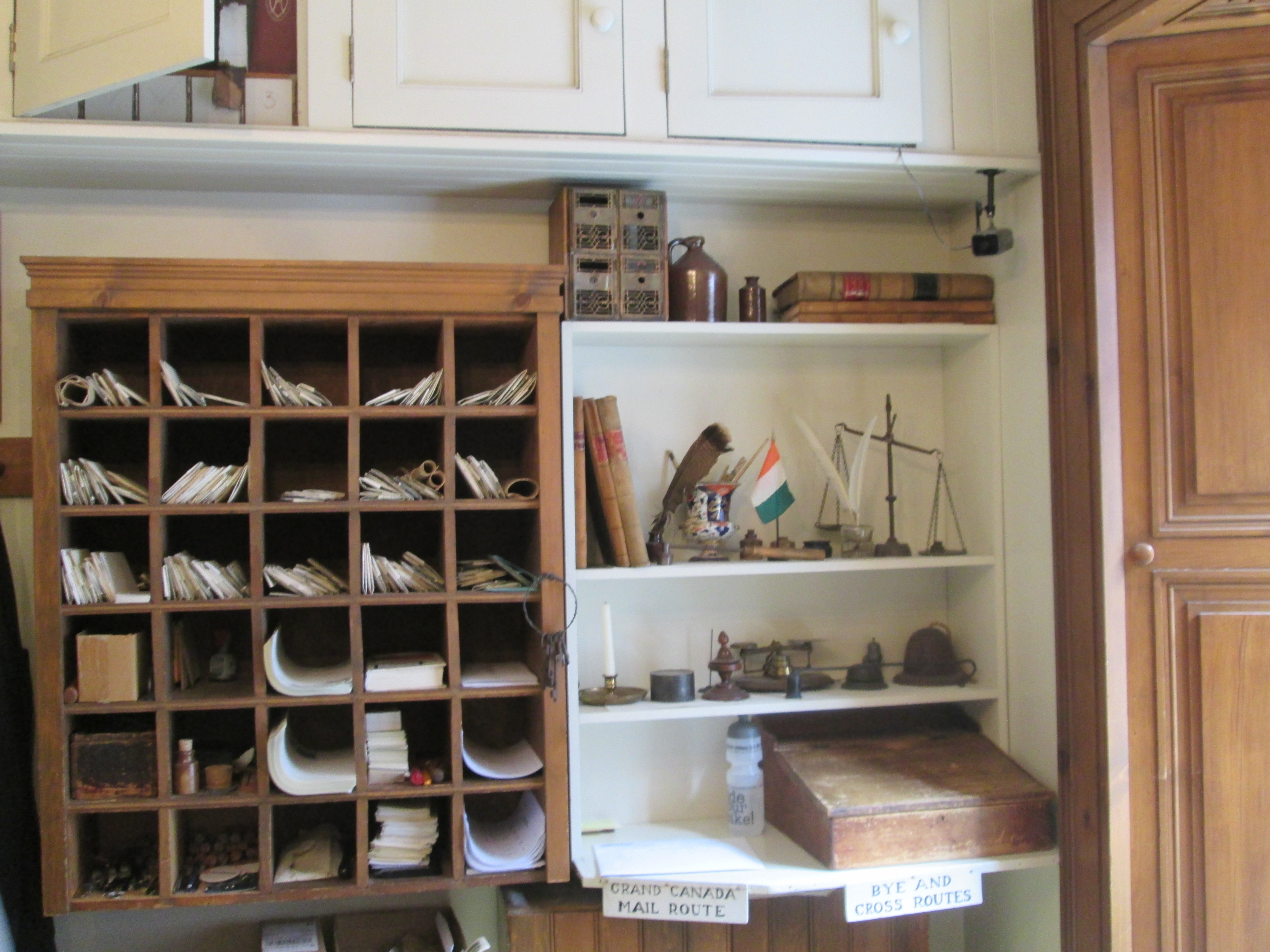
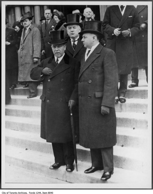
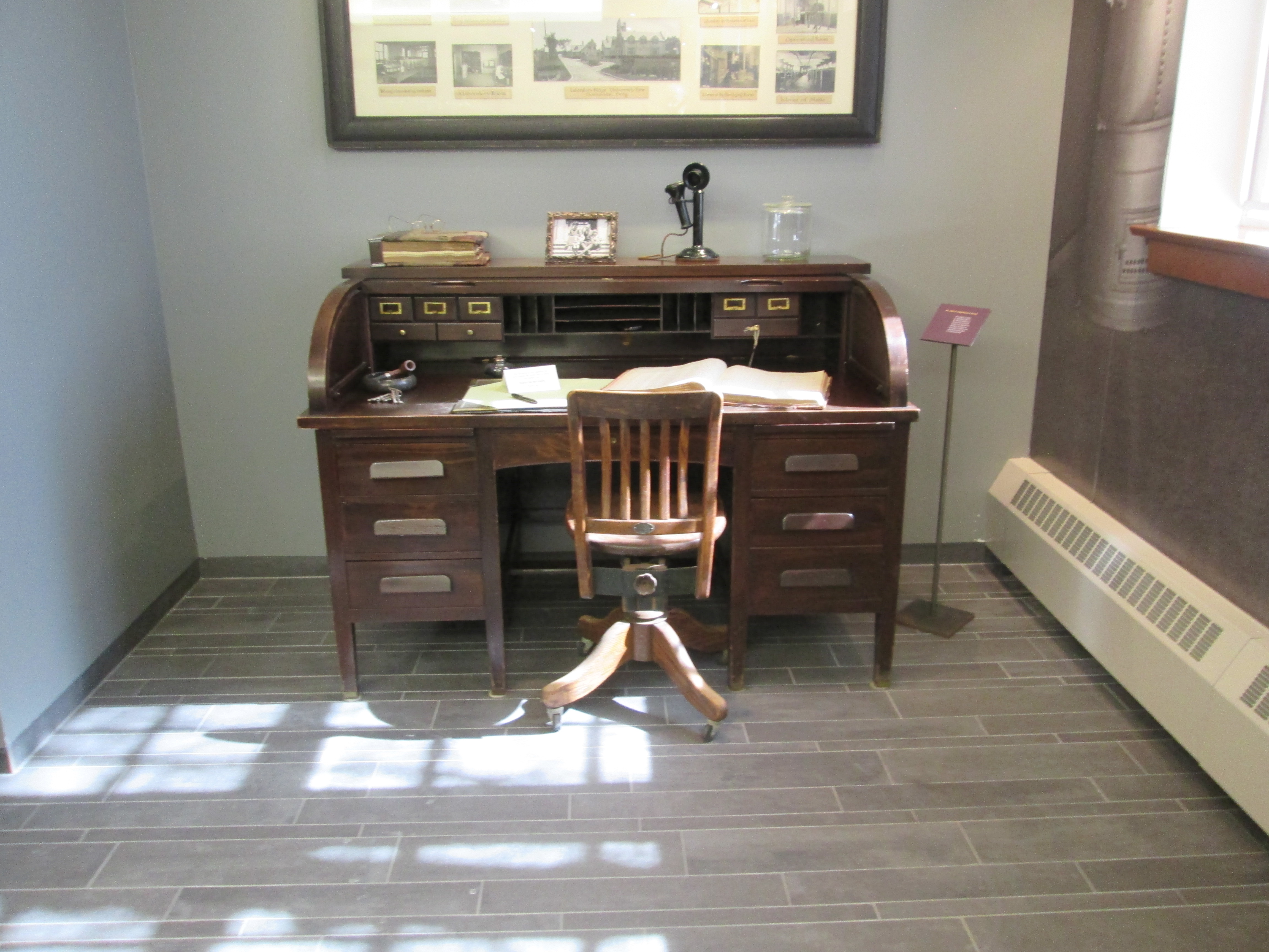
Fitzgerald passed away on June 20th 1940.  His desk, chair and an early ledger have been preserved in the heritage museum.  The picture above the desk shows the early days of Connaught Labs and he kept it above his desk at the university.

IMG_2779

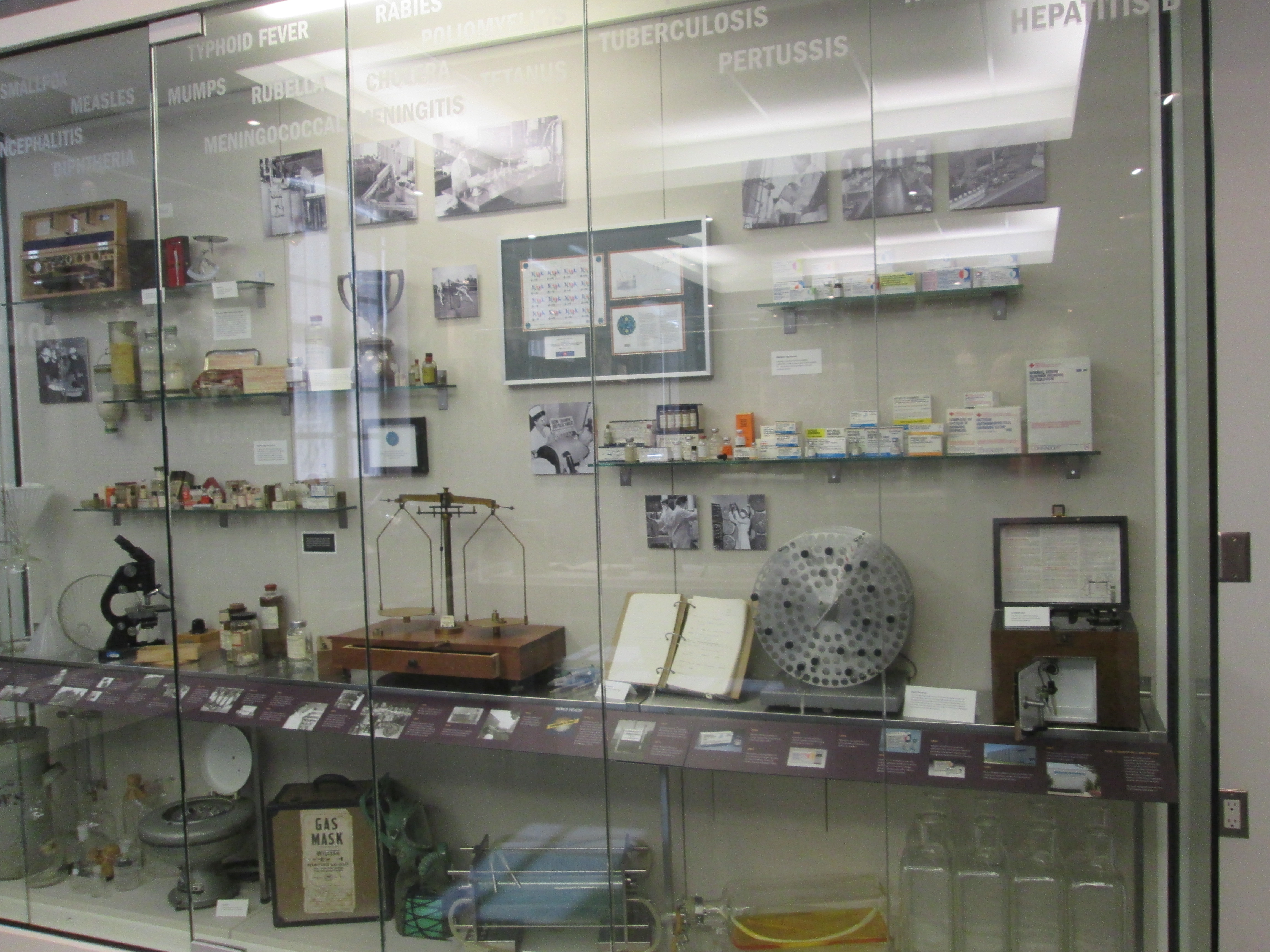
Connaught Labs pioneered the process of growing the poliovirus in rocking glass bottles that became known as the Toronto Method.  It involved culturing the virus using a purely synthetic tissue culture known as “Medium 199”. In 1962 Connaught Labs licensed the Sabin oral polio vaccine.  I was likely among the first people to be administered this vaccine.  Connaught Labs also played a key role in the eradication of small pox.  Povitsky bottles used for the Toronto Method are seen in the lower right of the display below.

IMG_2782

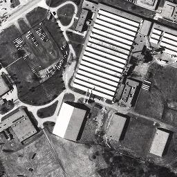
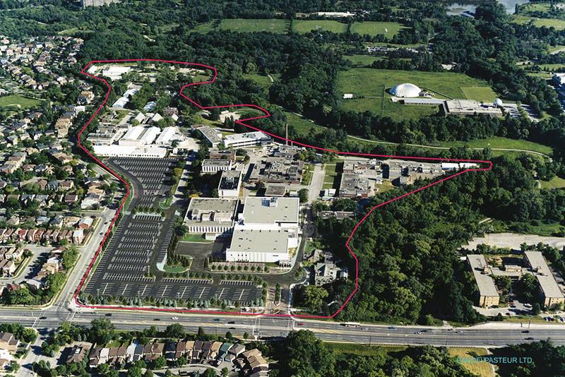
In 1972 the University sold Connaught Labs to the Canadian Development Corporation making it a “for profit” company for the first time.  Mergers and expansions in 1989, 1999 and 2004 resulted in the formation of Sanofi Pasteur which employs 1,100 people in it’s Toronto facility. Over the past 100 years they have played a key role in the development of public health in Canada and have a vision of a world in which no one suffers or dies from a vaccine preventable disease.  Nearly a hundred buildings, including research facilities, have been constructed on the compound which can be seen outlined in red in the recent photo below.  The two buildings that started it all are in the lower right of the property.

10616072_747052018674223_20829204398845157_n

The farm where Jacob Fisher settled his family and built his mill has been used to save the lives and reduce the suffering of countless millions of people around the world.  I think Mr. Fisher would be very proud of how the farm he worked so hard to clear over 200 years ago is being used today.

Old Cummer Road

Sunday, March 8th, 2015.

It was the first bright sunny day of plus temperatures at an enjoyable 2 degrees.  With the clear blue sky, sunshine and melting snow you could start to believe that spring might actually come after all.  I parked on Pineway Blvd where Old Cummer used to cross.

Jacob Cummer (Kummer) was born in 1767 and married 16 year old Elizabeth Fisher in 1791. They came to Upper Canada in 1797 and made their way north from York.  Jacob built a log house at Yonge and Eglinton where his wife and 3 children spent the first winter.  The following year they took possession of 300 acres about 6 miles further north.  The Cummers were the first settlers in what would be known as Kummer’s Settlement and later as Willowdale.

Jacob established himself on lot 22 (the second lot north of Finch).  His lot ran from Yonge Street east to half way between the first line (Bayview) and the second line (Leslie).  In 1819 he built a saw mill on the East Don River that five generations of Cummers would operate.  Jacob had a store on Yonge Street where he ran the first post office in the area.  He donated land for the Methodist church and is buried in it’s graveyard.  To allow people to access his mill he built a road along the north edge of lot 22 from Yonge Street to Leslie Street which we call Cummer Road today.  A grist mill was built to the north on lot 23 and a woolen mill was added as well. A large industrial site grew up along the river because of his road.  From where I parked the old road runs a short way east to the Old Cummer GO train station which further commemorates the founder of the neighbourhood.  The road no longer crosses the train tracks but continues east of here to Leslie Street as Old Cummer Road, home to a subdivision.

IMG_2742

As you descend the ravine toward the East Don River you come into view of the old Cummer Road bridge.  The view below is taken from a similar vantage point to the cover photo.  The road curves to the right of the hydro tower which stands about where the barn used to be.

IMG_2770

The old bridge was a single arch and decorated with a series of “X’s” along each side.

IMG_2747

Behind the old homestead the road climbs a small hill which has been cut away to reduce the steepness of the incline.  This was not likely done in the early days when the mill served the local community.  More likely, it was part of a road improvement that came with the advent of automobile traffic.

IMG_2767

In 1941 Ontario Hydro bought the property to construct a series of hydro towers.  The old farm house was occupied until 1958 and all the buildings were removed in the mid-1960’s.  Two other buildings on Old Cummer road, just north of the homestead, stood until the 1980’s.  In the 1950’s the portion of the old Cummer property south of the road and east of Bayview was still farmer’s fields.  By the 1960’s it was being sub-divided for a subdivision and the old one lane bridge was no longer adequate for the increased traffic.  The road was realigned to cross a new, 4 lane bridge that was completed in 1968.  After crossing the new bridge the road takes a turn north and leads out to Leslie.  Cummer’s mill road became Old Cummer Road and traffic was diverted off of it.  When the last of the buildings on the road were removed, access was closed by putting a row of large boulders across the entrance.  The view in the picture below is looking from Cummer Road where it used to turn south and head to the mills.

IMG_2759

Returning to the old bridge I crossed and made my way up the east side of the river.  Between the old bridge and the new one there are deer tracks and coyote tracks everywhere.  I didn’t see any wildlife though, likely because the wet snow made it impossible to walk quietly.  The sun was bright and where it was shining on the river it really made me think of spring.

IMG_2748

Jacob Cummer was a self trained doctor and veterinarian as well as a retailer and industrialist. He built what was known as a given road which now bears his name as does the Go station on his former property.  Of all the works that the Cummer family built only one house remains. The house at 44 Beardmore Drive would have been overlooking the river and the grist mill.  It has been altered over the years but stands out among the 1960’s cookie-cutter homes in the area.

IMG_2778

Toronto’s First Post Office

Saturday March 7, 2015

Toronto turned 181 yesterday.  On Thursday March 6, 1834 the town of York ceased to exist and was incorporated as the City of Toronto.  At that time there were about 9,000 people in the city.  That day the fourth post office of the town of York became the first post office of Toronto. The building has quite a history so I decided to go and check it out.  It was minus 5 and sunny promising to get above freezing later in the day.  I parked on Adelaide almost across the street.

The Bank of Upper Canada was chartered in 1821 and was instrumental in the development of York as the financial heart of the colony.  In 1827 they opened their second home in a new building on the corner of George and Duke (Adelaide) streets in the centre of the town.  The front portico was added around 1844 by John Howard, who owned Colborne Lodge.  An expansion was added to the rear of the bank in 1851.  The building in the picture below has a mansard roof dating to 1876.

IMG_2675

In 1833  the bank sold Postmaster James Scott Howard 60 feet on the east end of Town Lot #6. Here he built a new post office and closed the one around the corner on George street.  The cover photo shows a painting by Owen Staples called “Fourth York Post Office 1833-39”  At this time the postal service was part of the British Royal Mail and being postmaster was by appointment.  Having been born in Ireland in 1798 Howard had come to York in 1820.  He became postmaster in 1828.  Howard resided in the top of the building which originally had a flat roof.  The picture below shows the restored building today.

IMG_2671

Among James Scott Howard’s papers was a receipt from a contractor detailing the size and number of post boxes.  This allowed for a more accurate restoration inside the building.

IMG_2725

While I was there I bought a “penny ink well”.  These were made in the thousands and used for writing along with a pen made of a flight feather of a large bird, also known as a quill. Quills were kept sharp with a pen (pocket) knife.

IMG_2741

Howard would have stood behind a counter similar to the one below until the Rebellion of 1837 caused him to lose his position.  William Lyon Mackenzie and the rebels had set out to march down Yonge Street, attack the Bank of Upper Canada next door, and steal the gold stored there. Howard was falsely accused of aiding the rebels and his job was taken away and given to Charles Albert Berczy.  Charles was the son of pioneer Wiliam Berczy who founded the settlement of German Mills in 1794

IMG_2728

In 1839 Berczy moved the post office to Front street and Howard sold the building to a hardware merchant who lived there until 1870.  In 1871 it was sold to the Christian Brothers, a Catholic teaching school, who had bought the former Bank of Canada building in 1870.  They immediately built the De La Salle Institute building between the two.   Five years later they modified the windows with arches and realigned the floors to match the new building next door.

IMG_2673

It served as an educational facility until 1926 when the United Farmer’s Co-operative bought the three buildings.  They proceeded to brick those arched windows up and install floors that intersected them, turning the old post office building into a cold storage plant for eggs and dairy.  They operated a food processing plant and kept their offices in the other two parts of the old school. After being abandoned in 1971 it was struck by a fire on June 30, 1978.  By this time the early history of Toronto’s First Post Office was forgotten and the building slated for demolition.

IMG_2702

The painting in the cover photo led to the decision to restore the building to it’s 1833 configuration and open it as an historic post office.  Today it functions as a post office and free museum.  It is the only existing British Royal Mail Building in Canada.  By the time Canada Post was created in 1851 and the Three Pence Beaver stamp issued, the post office had moved from this location. The restored block with the post office on the right, school in the middle and Bank of Upper Canada building on the left.

IMG_2670

Looking at the west end of the Bank of Upper Canada you can see three distinct phases of construction.  The original bank building of 1827 stands at the front.  In the middle, with the flat roof, is the 1851 addition to the bank.  The rear portion with the mansard roof was added by the Farmer’s Co-operative in 1926.

IMG_2677

Directly across the street from the old post office stands the 1874 building of Christie, Brown and Co., Canada’s largest manufacturer of biscuits.  The original 3 story building was enlarged over the years finally being used in the mid 1950’s for a greeting card and paper company.  In 1971 George Brown College bought the building.  They kept the exterior walls and built a new educational facility inside.  Today, the tradition of education started a hundred years earlier by the Christian Brothers in the old post office carries on in the historical building across the street.

IMG_2731

Google Maps Link: Toronto’s First Post Office

Like us at http://www.facebook.com/hikingthegta

Follow us at http://www.hikingthegta.com

Etobicoke Valley Park

Saturday Feb. 28, 2015

It was a bright sunny morning starting out at -17 without a wind chill.  With only 3 weeks left until the first day of spring it is unusual for it to be so cold, but the sun had a nice warming effect on the skin.  We parked on Sherway Drive, formerly known as Middle Road, where it now dead-ends at the 1909  Middle Road Bridge.  In the 1880’s the property belonged to James Alderson who sold half an acre in 1864 for the construction of the Weslyan Methodist church. His daughter married into the Silverthorne family who were founders of near by Summerville. Today this area is known as Etobicoke Valley Park.

The single lane bridge in the photo below at one time served as a main route between Toronto and Hamilton.  The Etobicoke Creek is frozen solid as it passes under the old bridge.

IMG_2559

Crossing the bridge we followed the old road for a short distance before returning to the west side of the creek and heading north.  Middle road’s lamp posts are fading into the bushes along side of what was once a busy highway.

IMG_2560

The Etobicoke Creek was frozen solid and many animals and humans had been passing over freely.  As we walked up the west side of the creek we heard the yip and howl of coyote in what sounded like a multi-animal attack on some poor beast.  Curiosity led us to back track and eventually cross the river to see if we could see what was happening.  We came to a site that had a lot of snow trampled down, urine all over the place and spots of blood.  An area of fur chunks, some glistening with fresh blood, told a different tale.  Female coyote come into heat for 10 days, only once per year.  This season runs from the end of January until early March. Coyote are monogamous but if she isn’t in heat, she will fend of her partner with teeth and claws.  With the cold weather running late this year the breading season may be a little late as well.  It is likely that we had heard, and were now looking at the aftermath, of this seasonal encounter.

IMG_2574

Just north of the Queensway bridge the Little Etobocoke Creek joins the Etobicoke Creek.  There are a lot of old metal objects along the valley of both creeks.  Among them was this door from a 1978-1982 Chevy Corvette.  We identified the year range and model from the part number on the tire inflation label on the end of the door.

IMG_2586

The foundations of an old bridge on Little Etobicoke creek may mark the site of what appears to be an old mill on the 1971 aerial photographs.

IMG_2615

Even though it wasn’t plugged in this 1958 RCA Custom freezer was working perfectly. Everything inside it was frozen solid.  Retailing at $388, and still working after 57 years, it looks like it was quite a bargain.  It was a pretty cool find on a cold day.

IMG_2628

After hiking up Little Etobicoke Creek we returned to where it empties into the main flow of the Etobicoke Creek.  The view below is taken from standing in the middle of Etobicoke Creek looking back up Little Etobicoke Creek.

IMG_2642

Just south of the Queensway bridge on our return trip we found this round hole in the ice. Based on the chewed up trees and the little trail of footprints leading down the embankment and across the ice we concluded that it is an access hole for a beaver family.

IMG_2646

When Europeans realized that North America was not the spice rich orient they set their sights on other natural resources.  The beaver numbered up to 200 million and in the late 1600’s and early 1700’s the demand for fur top hats made beaver pelts a valuable resource.  The Hudson’s Bay Company was founded in 1670 and incorporated four beavers on a crest for their logo. Under the crest was written “Pro Pelle Cutem” (Skin For Leather).  During the peak of the fur trade 100,000 beaver pelts per year were  being shipped to Europe.  Much of the fighting in early Canadian history was over control of the fur trade.  Fortunately, silk hats came into style just in time to prevent beaver from becoming extinct.  Just down stream we found a beaver near a storm drain entrance where the water was being kept ice free.

IMG_2663

In 1851 Sir Sandford Flemming was asked to create a design for Canada’s first postage stamp. He chose the beaver and the stamp has become known as the three pence beaver, as seen in the cover photo for today’s story.  It was the first animal stamp issued anywhere in the world and today one in fine condition is worth $120,000.  In 1937 when Canada was updating it’s coins the beaver was chosen for the 5 Cent coin.  In 1975 the beaver was finally chosen as the official symbol of Canada.  This beaver doesn’t seem to mind the cold water and perhaps that’s why their fur made such popular hats.

IMG_2667

Along the trail heading back to the car someone has set up a number of stolen newspaper boxes.  At the time the Sun box was stolen a daily newspaper would have cost you ten of those little coins with the beaver on them.

IMG_2576

Winter hiking often reveals places that show great promise for discoveries when the snow is gone.  This is one of those places.


Frank O’Connor – Estates of the GTA

Sunday Feb. 22, 2015

Family emergencies precluded any extended hike this weekend but I was able to take a few minutes to visit an historic estate in my neighbourhood.

Frank O’Connor was born in Desoronto in 1885 and after marrying Mary Ellen Hayes he moved to Toronto.  In 1913 they opened a small candy store at 354 Yonge Street.  The city was busy celebrating the 100th Anniversary of the Battle of York (Apr. 27, 1813) from the war of 1812. To capitalize on the current air of patriotism the O’Connors decided to name their candy store after Canada’s most famous war heroine and mark the 100th anniversary of her legendary walk.

On the evening of June 21, 1813 the American military entered the Secord home in Queenston and forced Laura to serve them dinner.  After dinner she overheard their plans to carry out a surprise attack on the small British force at Beaver Dams (Thorold).  The following morning she began a 10 mile journey through swamps and briers to the stone house where the British lieutenant James Fitzgibbon was stationed.  As she climbed out of the swamp several hours later she was surrounded by a band of Iroquois who escorted her to her destination.  After an ambush by 400 Indian warriors, the American forces were ready to surrender and Fitzgibbon took 462 prisoners.  Laura Secord’s advance notice of the impending attack led to a decisive British victory and the use of her name led to a successful candy franchise.  Today there are over 120 Laura Secord stores, making it Canada’s largest chocolatier.

20130413ad1921

In the early 1930’s Frank O’Connor had become wealthy enough to purchase 600 acres of land north west of Lawrence Avenue and Victoria Park Avenue on which to build his estate.  He built stables, barns and raised a herd of Ayrshire cattle.  His prime Clydesdale and thoroughbred horses were shown each year at the Royal Agricultural Winter Fair in Toronto.  Frank named his farm Maryvale after his wife, Mary.  The restored house stands near today’s Rowena Park.

IMG_2547

The coach house has been restored for use as a conference centre while the smaller maintenance building on the left remains shuttered and off limits to the public.

IMG_2553

The cupola on the coach house has a weather vane on it with the four points of the compass and an arrow to indicate the direction of the wind.

IMG_2551

All three of the remaining buildings were constructed at the same time.  The date stone was placed in the coach house and it reads 1932.

IMG_2555

Frank O’Connor was a key player in the Liberal Party of Ontario and helped Mitchell Hepburn win the 1934 Ontario election to become the Premier of the province.  He was also involved in the federal election of 1935 in which Liberal leader William Lyon Mackenzie King became the 10th Prime Minister of Canada.  The cover photo shows Prime Minster King on the left, Premier Hepburn on the right and O’Connor in the back (like a typical back-bencher) on the steps of the legislature.  For his loyalty, O’Connor was awarded with a senate position in 1935.  O’Connor routinely gave his fortune away to several charities and when he died in 1939 he bequeathed his estate to a local religious community.  Over the year’s the estate was sold off for development and by the year 2000 the three remaining buildings were unoccupied and in danger of demolition.  The efforts of local community groups as well as federal, provincial and local governments were required to make the restoration possible and save the buildings, which have since been designated as historical sites.  O’Connor Drive is named after Senator Frank O’Connor.

Like us at http://www.facebook.com/hikingthegta

Riverdale Farm

Monday Feb. 16, 2015

Minus 19 feeling like minus 27 but it is Family Day in Ontario thus requiring that I do something with my day off other than sit around and worry about how cold it is.  I parked on Carlton Street near West Riverdale Park.

John Scadding had come to Upper Canada with Lieutenant-Governor Simcoe and after working as a government clerk he was granted land near York.  In 1856 the city purchased 119 acres from the Scadding estate on which to build a jail farm (Don Jail) and a park.  On Aug. 11, 1880 Riverdale Park officially opened.  In 1888 some deer were donated and by 1894 there were enough exotic animals to open Riverdale Zoo.

Around the same time that the animals were being collected, the city was hatching a plan to straighten the Don river where it flowed through the lower part of the city.  The Lower Don snaked back and forth and flowed through a series of marshes and wetlands similar to the Humber Marshes.  By placing the Don into a straight deep channel they hoped to make shipping accessible to the local industry.  Flooding and mosquitoes were also supposed to be better controlled by eliminating the marsh land  The project started where the river flowed through this piece of property.  The river was moved to the east and the section on the site of Riverdale Zoo was cut off from the rest of the river.  The ponds that exist on the lower zoo property are, in fact, left over pieces of the river.  In the May 1888 map below the river is shown on the Riverdale Park and Jail farm near the right side of the map.

s0725_fl0012_MT00092C_don straightening

Sitting in the middle of this section of the old river is an island which can only be reached by means of a stone arch bridge.  There are only three buildings remaining from the days of the Riverdale Zoo and one of them stands on the island.  Known as the Island House it still has the bars in the windows from its days as The Monkey House.  The picture below is from Dec. 14, 1921 when there were no trees on the little island.

below we see a stone bridge leading to what is variously known as the Island House or the Monkey House in the middle of a pond. All still exist.   1921

The Monkey House today serves as a storage shed for garden equipment.

IMG_2457

The residence was built in 1902 by captives of the Don Jail.  It served as a zoo keeper’s residence, staff building, animal hospital and temporary morgue for the Necropolis across the street.  The bricks on this home are made of regular pressed brick as well as a material that looks like coal slag.  The bricks have not been placed in even rows and some stick out from the side of the building giving it a most unusual look.

IMG_2474

The Donnybrook ruins stand near the cow paddock.  This building was originally a two story building with a tower but only the lower floor remains.  When the floor was poured, a hippopotamus sat in the wet concrete and left his rump print for posterity.  Kids have been sticking their feet in wet cement ever since.

IMG_2441

Riverdale Zoo, like other Victorian zoos, took little care to display the animals in their natural settings.  The city began to look for a new location for a modern zoo and a site in Scarborough was selected.  The new zoo opened in 1974 and the Riverdale zoo closed on June 30, 1974.

poi-template_clip_image002_0013 (1)

Over the next 4 years most of the zoo buildings and cages were torn down except for the three described above.  It was decided to turn the zoo into a working farm as an educational site for local school children.  Riverdale Farm opened in 1978 as a free public park.  Several new buildings were constructed to illustrate life in a 19th century farm.  The Simpson House is a replica of an 1852 home that stood on the Francey farm in Markham.

IMG_2421

Inside the pig and poultry barn there are several different types of chickens, ducks and turkeys.

IMG_2427

The Francey Barn was built in 1858 in Markham and was donated to Riverdale farm.  It is a rare surviving sample of a Pennsylvania bank barn.  Designed and built into a hill side or river bank these barns have ground floor access to both the upper and lower floors.  The picture below shows the huge hand hewn timbers that the barn was constructed from.  The trees on an individual’s land grant would be used to build their homes and barns.  This barn was taken apart, moved here and re-assembled in 1975.  Having grown up in small town Ontario I was taken back to my youth by the familiar smell inside the barn.

IMG_2434

When the dutch came to Ontario from Pennsylvania they brought some of their traditions with them.  The Mennonite’s call their places of worship a meeting house and one of the largest church groups in Ontario is called The Meeting House.  In keeping with the theme of the farm, the drop in centre is called the Meeting House.

IMG_2444

In the Francey barn are many antique items including old sleighs and carriages.  One that I found particularly interesting is this old wooden barrel washing machine.  Gilson was a manufacturer of washing machines, dryers, gas engines and furnaces that operated in Guelph from 1907 until 1977.  By 1920 enamel barrels had replaced the wooden ones to make cleaning easier and the machine much quieter.  Electric washing machines were first made in 1907 and the machine in the picture below was likely made within the first decade of production.

IMG_2486

Across the street from the farm sits the Necropolis.  This burying ground was opened in 1850 when the “potter’s field” cemetery at the north west corner of Yonge and Bloor was found to be on prime development land and was closed and moved.  A crematorium was added in 1933. Some of the early founders of the city are interred here including the old rebel himself, William Lyon Mackenzie.

IMG_2423

For now the Polar Bears have moved to the new Toronto Zoo where they have a much more natural habitat than the concrete pond they used to call home and the animals on the farm now enjoy a pastoral setting.

Polar bear cubs

Thanks to my brother Allan who suggested I visit this site.  It was a lot of fun and may need some more exploration in the summer.

Like us at http://www.facebook.com/hikingthegta


National Flag Day

Saturday Feb. 14, 2015

The weatherman has been calling for a very cold weekend with wind chills in the range of -40, but this morning it was only -7 feeling like -18.  We parked in West Deane Park and headed south along the east side of Mimico Creek.  After the trail passes under Martin Grove Road the park changes names to become Ravenscrest Park.

Sumacs are one of the first plants to take hold on previously cleared land.  They can reach heights of over thirty feet and produce a type of fruit known as a drupe.  These clusters of reddish fruit are known as sumac bobs and form the tips of each branch.  Sumac is used as a spice in some middle eastern foods and also as a dye.  The drupes are used as a winter source of food for birds who spread the seeds through their droppings.  In the picture below sumac bobs frame the sun as it was peeking out from behind the clouds.

IMG_2389

On July 21, 1793 the Queen’s Rangers under the direction of Lieutenant-Governor General Simcoe landed on the north shore of Lake Ontario and stuck a British flag in the soil where they would build Fort York.  This was the founding of the town of York (Toronto) and the beginning of Simcoe’s plans for the defense of Upper Canada.  Simcoe moved the capital of the colony from Newark (Niagara) to York in 1797.  In 1801 the British flag was modified to include a red saltire inside of the existing white one to represent the Irish who were united with England that year.  The British flag is known as the union flag.  It is only correctly called a union jack if it is flying on a naval vessel.

During the war of 1812 the Americans attacked Fort York on April 27, 1813.  The British, sensing defeat, decided to retreat to Kingston to prevent the army from being captured.  They left their flag flying at Fort York to fool the attackers into thinking they remained inside.  On the way out they detonated their munitions store to prevent it from falling into enemy hands.  When the dust settled the Americans replaced the British flag with their own and used the British one for a pillow for General Pike who was mortally wounded in the explosion.  This is the only British flag ever captured in battle that was never recovered.

British Union Jack sewn flag linen cotton cloth

The Union Flag was used in Canada until after confederation.  In 1868 Canada adopted a Red Ensign with the union flag in the upper corner, and featuring the arms of each of the four original provinces.  In 1922 the Royal Arms of Canada replaced the provincial arms and 3 green maple leaves adorned the bottom of the crest.  In 1957 the maple leaves were changed to red.

Canadian

Having the union flag as part of the Canadian flag became an issue during the Suez Crisis in 1956 as the Egyptian government objected to Canadian Peacekeepers because of it.  The flag was never popular in french Canada, also because of the union flag it contained.  In the early 1960’s a proposal came to create a uniquely Canadian Flag.  The new flag was to feature nothing distinctive to any group of people which meant it could not contain the union flag or the french fleur-de-lis.  A symmetrical design was chosen so the the front and back would look the same in the wind.  An 11 point maple leaf was selected because wind tunnel experiments showed there was the least distortion of the leaf in high winds.  The flag was officially flown for the first time in a ceremony on Parliament Hill on Feb. 15, 1965.  As I write this on Sunday afternoon of Feb. 15, 2015 the flag is celebrating it’s 50th birthday.  Happy Birthday to our flag!

As we walked through Ravenscrest Park we saw that one of the homes on the top of the ravine was flying our flag.  The picture below and the cover photo illustrate the majesty of the Canadian Flag.

IMG_2386

We followed the trail under Rathburn road into Echo Valley Park.  There is section of trail here that passes through a wooded area.  If you stand on the side of the trail for a few minutes all the birds that have been scattering in front of you will return.  We saw a selection of Blue Jays, Cardinals, Doves, Downey and Hairy Woodpeckers and Chickadees.  A Kestrel appears to have seen them as well.

Along here we saw an old utility pole on which someone has spray painted a heart with an arrow through it.  Since it was Valentine’s Day when we noticed the pole it seemed to be appropriate.  There are several traditions surrounding the origins of Valentine’s Day, some suggesting Christian roots and others Roman.  Either way, greeting card companies manage to sell 150 million cards each each year.  Valentine’s Day is special to me and my wife as well because eight years ago we got engaged on this day.

IMG_2408

A common tool used for inventory control in manufacturing is known as the Kanban System.  A tag is used to identify a quantity of an item.  When that quantity is consumed the tag becomes the ticket to order replacement stock.  Toyota has been credited with developing the system in 1953 but in reality it has been in use far longer than that.  In Toronto there were community dairies in various parts of the city.  Due to poor refrigeration, milk had to be delivered almost daily.  Houses had a milk chute (delivery door) like the one featured in the picture below.  If you needed milk you just left your empties and the money in the chute and when you came home there were fresh bottles of milk there instead.

IMG_2410

As we continued down stream we saw that someone’s playground toys have ended up frozen in the middle of Mimico Creek.

IMG_2411

The ice on Mimico Creek is several inches thick in most places and people have been going back and forth.  On the opposite side of the creek is an ornate bench that someone has crossed over to examine.  Perhaps it was just a two minute bench minor.

IMG_2399

There is a foot of snow on the ground but there appear to be some interesting areas here for exploring later in the year.

The Arsenal Lands

Saturday Feb. 7, 2015

Along the Lakeshore stands an abandoned water tower, part of a WW2 small arms factory and rifle testing range.  Today we are 49 days into winter with only 42 remaining which to me means its almost over. The forecasters are calling for up to 30 cm of snow over the next couple of days.  Even so, this is the first hike of the winter where I’ve switched from hiking to winter boots.  It was minus 4 with almost no wind chill and a steady light snow. I parked in the parking lot for Marie Curtis Park on the west side of the Etobicoke Creek.

Col. Samuel Smith was granted lots 4-7 in 1806 and they remained in his family until they were sold to the Halliday’s in 1877.  They were used for mixed farming for the next few years. Following confederation in 1867 the British Government wanted the new country of Canada to assume greater responsibility for its own defense.  In 1868 the Ontario Rifle Association was formed for the training of militia.  They used the garrison common at Fort York until 1891 but the increase in the use of the CNE grounds and the addition of a passenger wharf at the foot of Dufferin Street made firing rifles at the fort increasingly unsafe.  The property on the west side of Etobicoke Creek was purchased as the Long Branch Rifle Ranges.  A militia and cadet training camp was maintained on the site until WWI when the Royal  Air Force administration offices were located here.  Canada’s first aerodrome was at Long Branch and over 130 students had graduated, at a cost of $400 each, by the time it closed in December 1916.  William Faulkner, the famous author, was stationed here while training for the Royal Canadian Air Force.

The most prominent structure remaining on the site today is the old water tower.  It was built in 1941 to serve the needs of the industry on the site.

IMG_2274

In 1935 the Department of National Defense purchased the property with the idea of creating an arms manufacturing site.  Small Arms Limited was founded as a crown corporation on August 7, 1940 to supply the Canadian Military with rifles for use in WWII.  The 1957 picture below shows the factory and several out buildings.  The large building with the lines on the top is shaped like an “L” with the black circle in the inner corner of the “L” being the water tower. The rifle range building is in the lower left and the first several baffles can be seen below it.

arsenal 3

Women played a major role in the workforce at Small Arms Limited as can be seen in the cover photo making up most of the staff by 1943.  The factory produced its first weapons in June 1941 and by the end of the year had made 7,589.  By 1943 the plant was working three shifts, using 5,500 employees to produce over 30,000 units per month.  World War Two ended in 1945 and war-time production was completed in December with over 900,000 rifles and 126,00 machine guns having been produced.  Various military parts were produced in the facility from then until it closed in 1974. At the foot of the water tower stand two yellow gas regulators that were installed at the time the Small Arms company was founded.  They are dated 1940.

IMG_2280

In 1910 Canada’s Department of Militia and Defense (renamed the Department of National Defense in 1922) acquired the property and built the wooden baffles that remain in place today. The DND built firing booths in 1940 to assist with the training of militiamen for service in WWII. The rows of baffles and concrete backstop can be seen in the centre of the 1957 aerial picture below.

arsenal 4

On the short rifle range there are 16 remaining baffles after 105 years exposed to the elements. Originally there were 30 of these which were hollow and filled with sand and soil.  They were intended to stop any stray bullets from leaving the range but also served to provide sound barriers for the adjacent small arms factory.  The picture below shows one of the few that is intact and not over grown with brush.  These wooden baffles are the last of their kind from this era in Ontario and are considered a militarily significant heritage site.

IMG_2300

At the back end of the rifle range is a fifteen foot high and thirty-five foot wide concrete backstop which was constructed around 1925.  It’s surface is dotted with the impacts of hundreds of bullets from over the years.

IMG_2302

The only manufacturing building remaining on site is building number 12.  Dating to 1939, it was used as the rifle inspection facility.  It has a double fence, each with three strands of barbed wire surrounding it.  I guess they don’t want you to go in there.

IMG_2313

The various uses of the site over the years has taken the farm land and left it with a mix of PBC’s, VOC’s, metals and radioactive waste.  Over 72,000 tonnes of contaminated soil was removed from the site between 1998 and 2002.  The consolidation mound pictured here contains low level radioactive soil that has been buried in a containment facility since 2005.  It sits inside a third barbed wire fence behind the inspection building.  I guess they really don’t want you to go in there.

IMG_2311

Circling back through the Small Arms Ltd property I noticed that someone left the door open at the top of the water tower.  Anyone want to climb up that ladder on the roof and close it?

IMG_2317

Making my way across the Lakeshore Road edge of the arsenal lands I came to Etobicoke Creek. The trail along the creek’s edge brings you to a bridge that crosses the creek to the east side. Following the disaster of Hurricane Hazel in 1954 when the creek flooded destroying the homes along 43rd street (see Middle Road Bridge) this area was taken under authority of the conservation authority and Marie Curtis Park was created.  I walked that side of the creek to where it spills into the lake.  The ice on the railing at the edge of the lake is several inches thick and, to me, resembles baleen plates like those in the mouth of a baleen whale.

IMG_2331

Bufflehead ducks suddenly disappear when they are feeding and can pop back up several metres from where they dove.  They are distinct with their white and black markings and spend the winter in sheltered bays and inlets.  I watched a few of them right in the mouth of the creek.

IMG_2346

There are likely artifacts located here that will only be visible when the snow is melted.  I guess we’ll have to see sometime.

Like us at http://www.facebook.com/hikingthegta

West Deane Park

Sat. Jan. 31, 2015

It was -11 feeling like -12 which seemed like a nice temperature considering that the weatherman had been calling for -18 with a wind chill of -30. It started off cloudy but the sun came out a little later on.  We parked in the parking lot off of Martin Grove at West Deane Park.

Andrew and Martha Coulter emigrated to Etobicoke from Ireland in 1822 along with the first two of nine children.  They bought 100 acres of land which lay between highway 27 and Martin Grove Road, halfway between Rathburn and Eglinton in an area known as Richview.  Over the next few years they acquired an additional 150 acres.   The Coulter’s operated the farm until the 1880’s and in 1939 the land was purchased by construction magnate Percy Law.  He kept race horses here until he sold it for development in 1956.

We crossed Mimico Creek and headed uphill on the south side of the bridge.  At the top of the hill we found a small playground where there was a coyote sitting in the distance in  the snow. Coyote are related to the grey wolf and have become quite adept at living in close proximity to humans in urban environments.

IMG_2232

We started to sneak up on what we believe was a female but when she saw us she ran into the trees.  One advantage of fresh snow is the ability to follow animal tracks and we soon found where she had gone.  Following her we found ourselves in the middle of her hunting ground. The coyote started circling us at a distance and we were soon able to capture the short video below and the picture in the cover photo.

Tracking the coyote we found that the footprints were smaller than some we had seen previously suggesting that perhaps the animal was not fully grown.

IMG_2244

We came across the remnants of a Christmas party hanging in the trees.

IMG_2246

The sun came out at one point and lit up the valley in front of us.  For scale, the large tree laying in the bottom of the ravine once stood at the base of the hill but would not have been tall enough for the canopy to reach the upper rim.

IMG_2248

We followed the west side of Mimico Creek north and soon came to an area full of winter birds. A cardinal was singing in the trees above us and we soon spotted him.  Cardinals eat insects in the summer, raising their young almost exclusively on them.  In the winter cardinals will live off of seeds and will also eat the bark of elm trees.  There were several pairs of doves sitting in the trees.  Doves are one of 11 animals that mate for life, along with termites and Schistosoma mansoni worms.  Wolves, which are related to Coyotes, also mate for life.  This is perhaps the reason that doves come in pairs in the Twelve Days of Christmas.

IMG_2255

There was a flock of a dozen or more woodpeckers moving through.  There were both the larger Hairy, pictured below, and the smaller Downey flocking together.  These two birds are not actually birds of a feather as they are unrelated in spite of their nearly exact same marking and appearance.

IMG_2259

Andew Coulter built a saw mill on Mimico Creek and operated a farm on his property.  After his death in 1857 the farm was run by his 4 sons.  Andrew Coulter and his sons are buried in the Richview Methodist Cemetery which sits in the very middle of the highway 401 and 427 interchange.  By 1852 Andrew had built an 11 room 5 bay Georgian style farmhouse on the property.  The Coulter’s house was built of red brick with yellow quoins and lintels.  Percy Law modified this brick farm house to create a Kentucky colonial revival style home by adding white clapboard siding and a two story classical portico with four Corinthian columns.  He also built himself a horse ranch complete with stables and a carriage house.  The picture below shows the Coulter’s 1852 house as it appeared in 1929.

1ET_AndrewCoulterHouseIn1929BW_Content

The house remains today at 59 Beaver Bend Crescent but the white siding has been replaced with yellow aluminum.  The Law family retained the house and 11 acres surrounding it until it was sold for development in 1981.  The original patterned brick house is still hiding inside the veneer that has been added to the outside over the years.  I think I’d strip it all off.

IMG_2264

Law built a house for his farm manager which stands at 18 Deanewood Crescent.  It is conspicuous among the surrounding homes as it faces sideways to the rest of them.  It also sports a tv antenna indicating that it was constructed prior to the arrival of cable in the neighbourhood.  In Sept. 1952 CBLT, the Toronto CBC station began experimenting with cable broadcasts in the city.  By the time this part of the the farm was sold for development in 1981 cable would have been installed in the new built homes on the street.

IMG_2265

The Coulter’s oldest son, Robert built his house around the same time as his father’s.  It still shows it’s yellow brick quoins and lintels.  The house originally faced east and Martin Grove Road, overlooking what is now Glen Agar Park.  The board and batten addition that now serves as a front entrance and garage would have been a later addition.

IMG_2266

This was our first visit to this section of Mimico Creek but there is lots of unexplored area here for future visits both in the winter and after the snow has melted.


Adamson Estate

Saturday Jan. 24, 2015,

Joseph Cawthra came to York in 1802 and was given 400 acres of land near Port Credit where Lotten – Cawthra House would eventually be built.  He was a prominent reformer working with the likes of William Lyon MacKenzie to bring responsible government to Upper Canada.  Like Robert Baldwin, of Spadina house, he was elected to the government where he sought to bring about change.  Cawthra street in Mississauga used to be his driveway.  When his daughter Mabel married Agar Adamson they were given the lakefront property and it became known as the Adamson Estate.  The property remained in the hands of their son Anthony until 1970.

cawthra map

It was minus 2 feeling like minus 6 with the odd snow flurry.  Parking off of the end of Hampton Street will place you just east of where Cooksville Creek empties into Lake Ontario.  As we walked along the waterfront we found many species of birds including Mute Swans which have made their home along the waterfront.

IMG_2083

The icy waters of Cooksville Creek have been splashing off the branches along the creek edge creating an elaborate ice sculpture.

IMG_2087

Right at the mouth of Cooksville Creek we spotted a Snowy Owl sitting on the ice.  These owls spend their summers north of the Arctic Circle hunting lemmings.  Each bird can consume up to 1600 lemmings per year.  It is normal for a few Snowy Owls to be seen in Southern Ontario each winter.  Last year they appeared in record numbers for the first time in about 15 years.  When large numbers of birds are found outside of their normal migration zones it is called an irruption.  If it happens a second year in a row, as it has this year, it is termed an echo.  We observed this female from both sides of the creek as well as on a rooftop where she flew when we got too close.  We also saw what was likely a second one in the park near our cars when we returned at the end of the hike.

IMG_2092

My first encounter with a Snowy Owl came almost exactly 40 years ago in February 1975 when local band Rush released their album Fly by Night.

flybynight-1

From the mouth of the Cooksville Creek looking west you can see an old freighter.  This is the Ridgetown and it guards the entrance to Port Credit harbour at the mouth of the Credit River. Built in Chicago in 1905 it became grounded in a storm on it’s maiden voyage and suffered $100,000 worth of damage.  In 1970 it was sunk at Nanticoke to form part of a temporary break wall while construction of the Ontario Power Plant was being completed.  Later it was raised and brought to Toronto where it was filled with stone and sunk on June 21, 1974 in it’s present location.

IMG_2115

Giant Hogweed is a noxious plant that grows up to 10 feet tall and can cause severe burns and blindness.  There are many examples growing along the west bank of the Cooksville Creek.  If you hike here in the summer beware as the path leads right through a patch of them.

IMG_2117

As you enter the Adamson Property there are two old tree stumps that have been carved with animal figures.  One has three squirrels carved into it while the one in the picture below features raccoons.

IMG_2121

Built in 1932 by Anthony Adamson, son of Agar and Mabel, the Derry House sits on the east end of the Adamson property.   It’s “U” shaped construction frames a central fireplace and flagstone courtyard.  Anthony and his wife Augusta lived here until his mother passed away in December 1943.  After they moved into the family mansion this house was sold to the Derry family, whose name it bears today.  Anthony was awarded the Order of Canada for his contribution to Canadian architecture.

IMG_2122

The barn dates to 1870 and is one of the oldest surviving agricultural structures in the region. It is built with a foundation of field stones and mortar and an upper portion of board and batten. The farm was known as “The Grove” due to the large grove of white pine trees that were reserved to be used as masts for ships by the Royal Navy.

IMG_2136

The main house was built over the winter of 1919-1920 and it’s date stone is featured in the cover photo.  It replaced a summer cottage from 1866 that stood between it and the lake.  The site of the original log cabin from 1809 was identified in 1991 and stood close to the water front.  It appears that each time the family built a new home they moved a few feet further away from the lake.  This view is taken from the upstairs balcony below the bell on the gatehouse.

IMG_2163

The gatehouse or “Folly” was built in 1904 and is one of only three of this design in Canada.  The other two are in Ottawa at the residence of the Prime Minister and the Governor General.  The upstairs served as a nursery for Anthony who was born in 1906.

IMG_2150

The so-called orange room extends from the west end of the house and contains a unique rounded balcony and a small cupola.

IMG_2180

Rhododendron gardens grow under the evergreen trees on the front lawns of the house.

IMG_2147

By 1968 there were only 15 acres of the original property left that had not been sold off. Anthony applied to the city for permission to develop the site for apartment buildings and the city rezoned it for high rise in 1972.  After neighbours sent in 115 letters of objection the Credit Valley Conservation Authority stepped in and expropriated the land, buying out the Adamsons in 1975.

Like us at http://www.facebook.com/hikingthegta