Category Archives: Historic Site

One-Storey Worker’s Cottages

Sunday, December 26, 2021

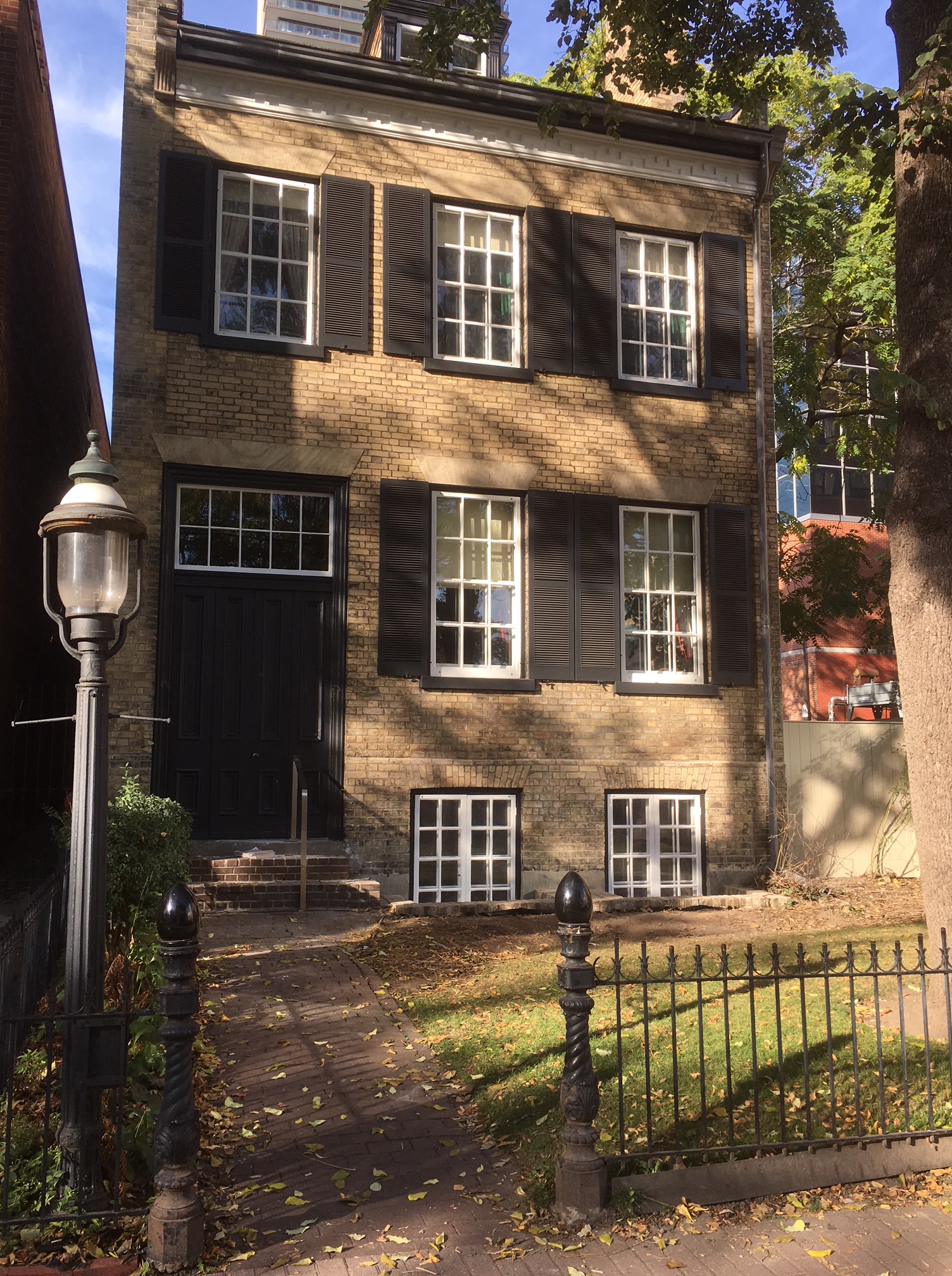
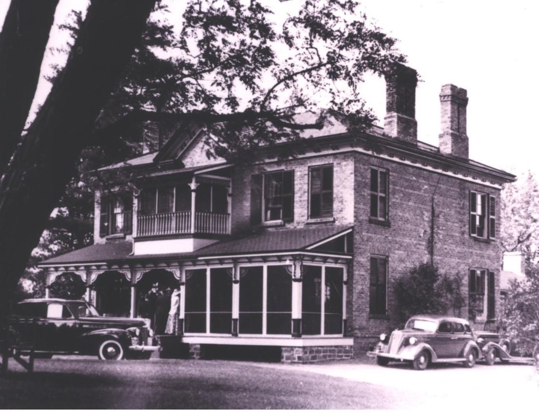
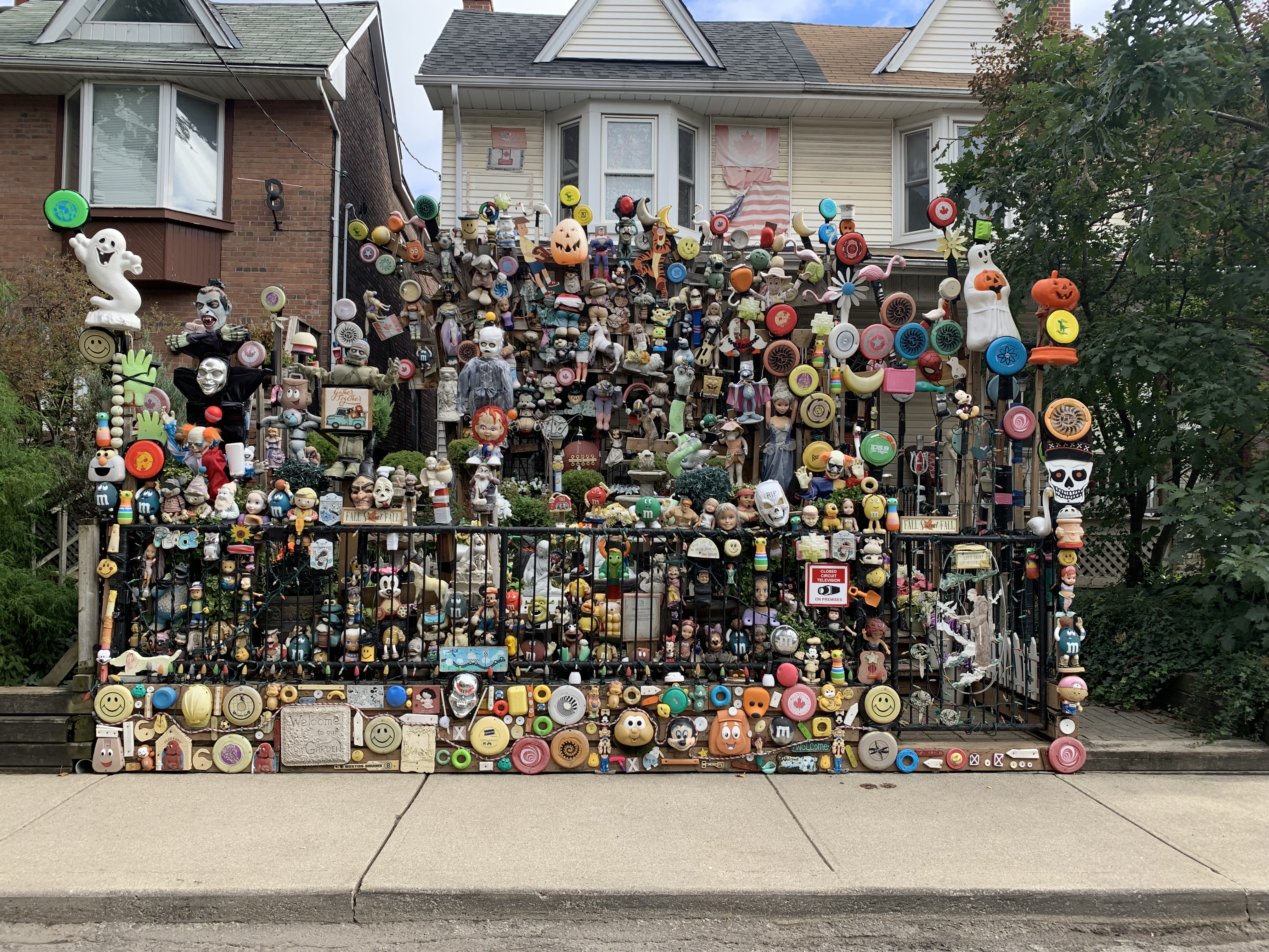
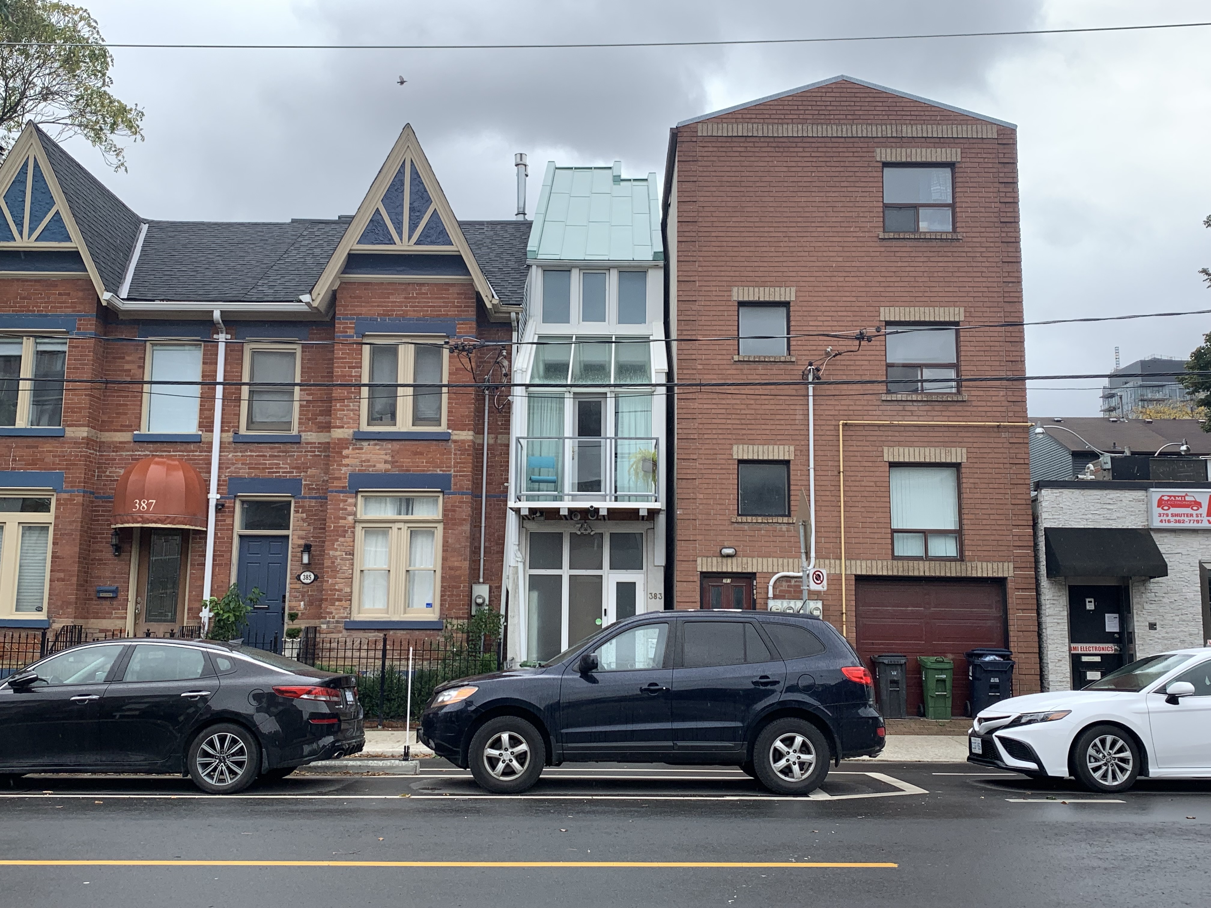
Over the years we’ve featured numerous mansions of the wealthy from the early years of the city of Toronto. However, the story of the working-class people who built the city is equally as important. The working class was drawn largely from recent immigrants who came to Canada fleeing persecution, landlessness, and famine with the idea of free land and lots of available work. What they found was overcrowded living conditions in cramped quarters, low-paying jobs, and years of toil to earn money to bring their families to join them. Very often they would move into places like The Ward where they lived in slum conditions with multiple families packed into small rental units. They also worked for years in the hopes that one day they could own their own little cottage that they could call their family home.

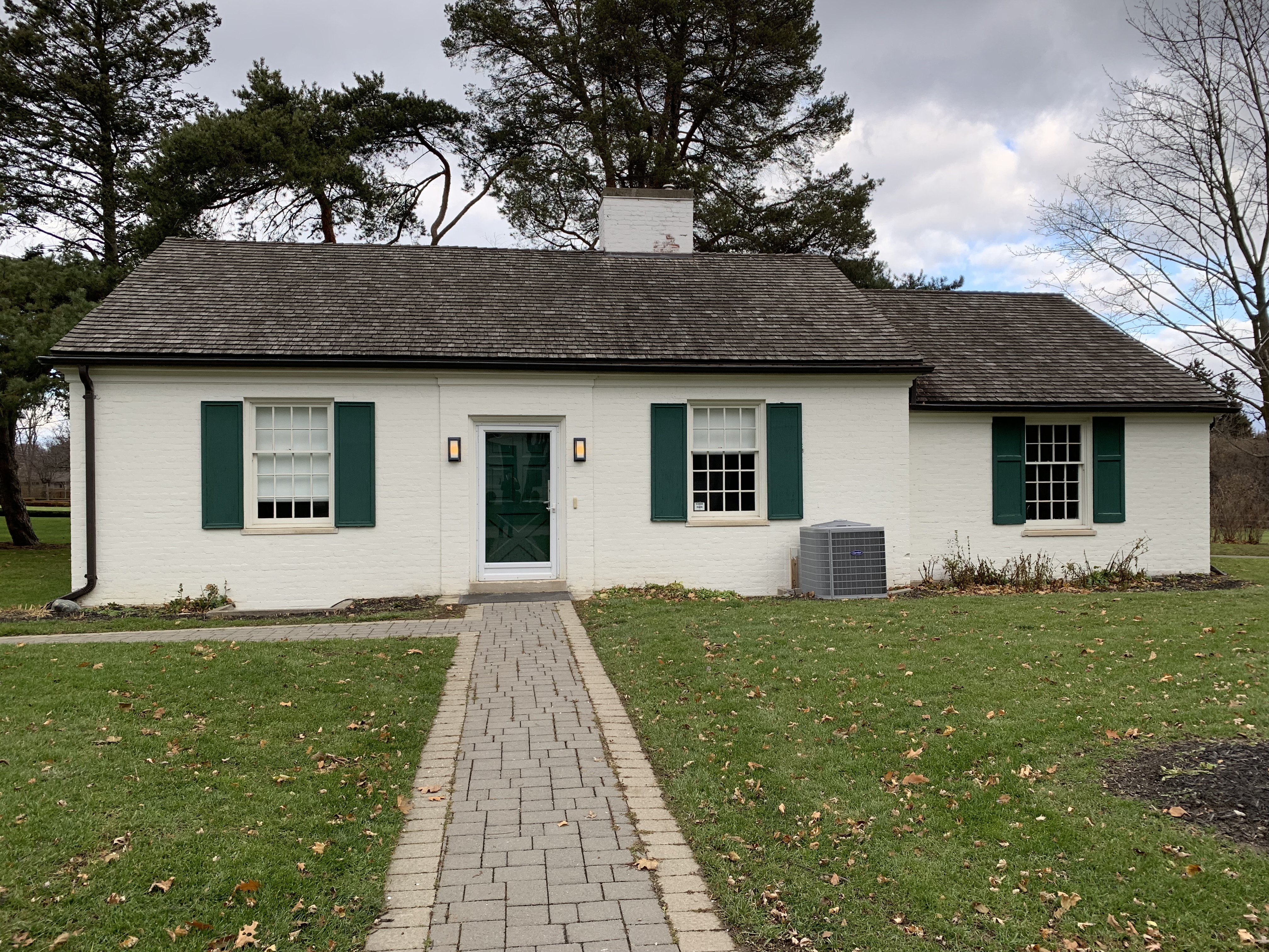
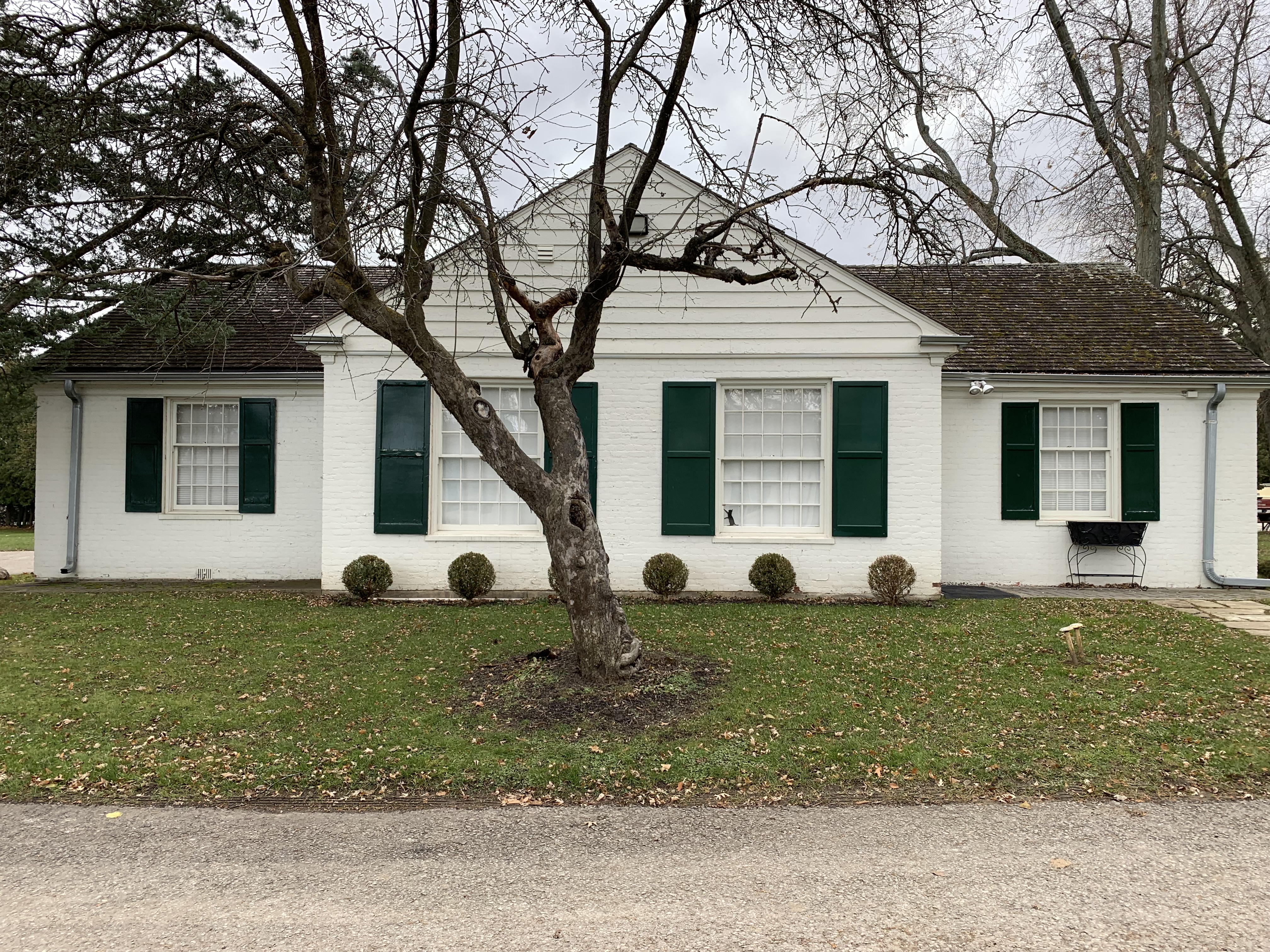
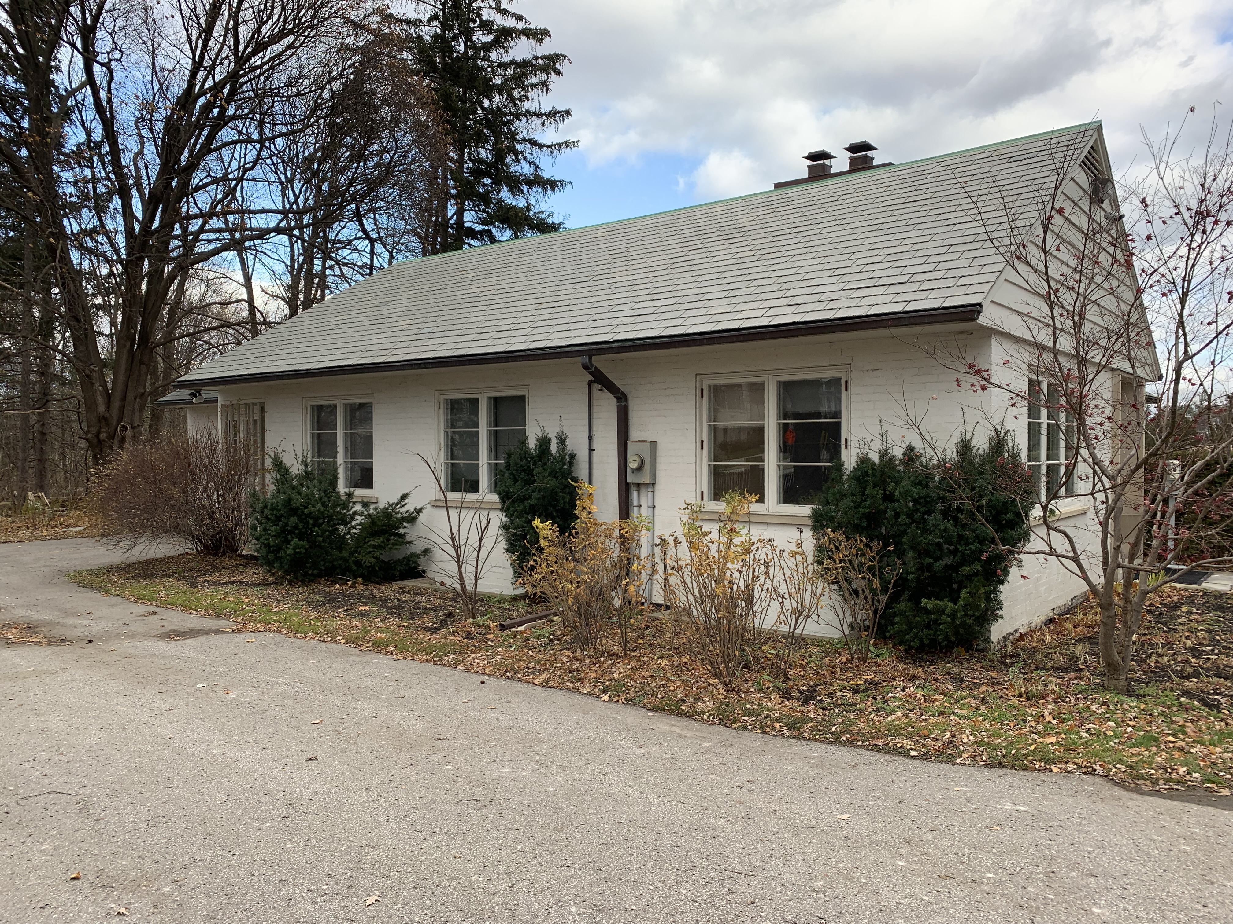
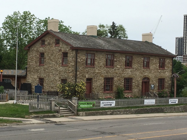
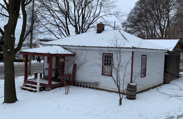
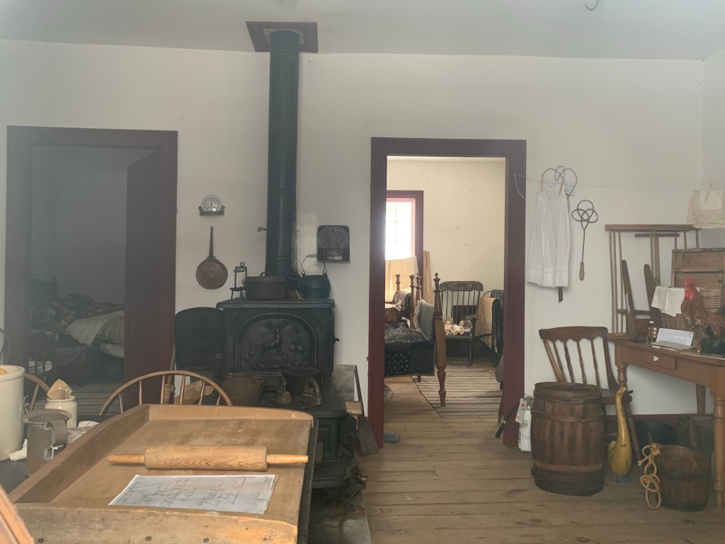
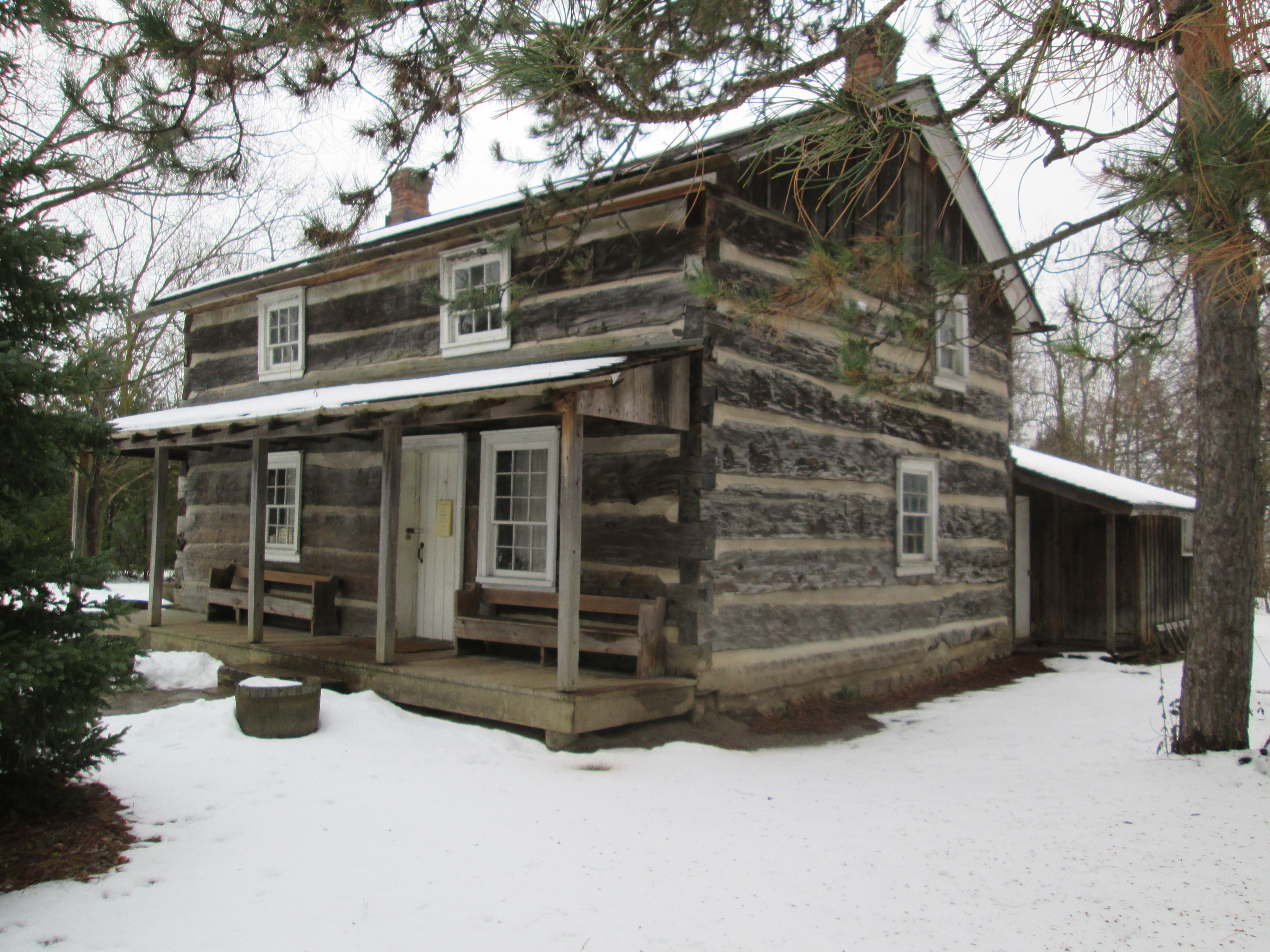
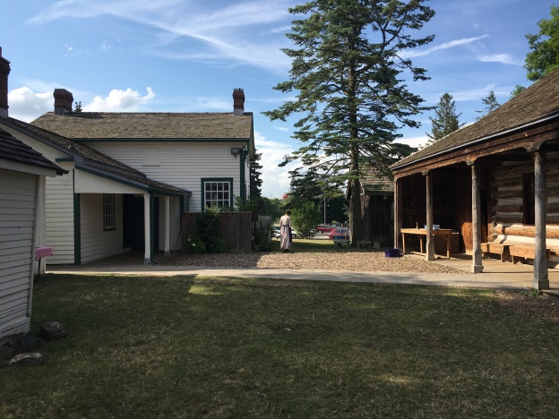
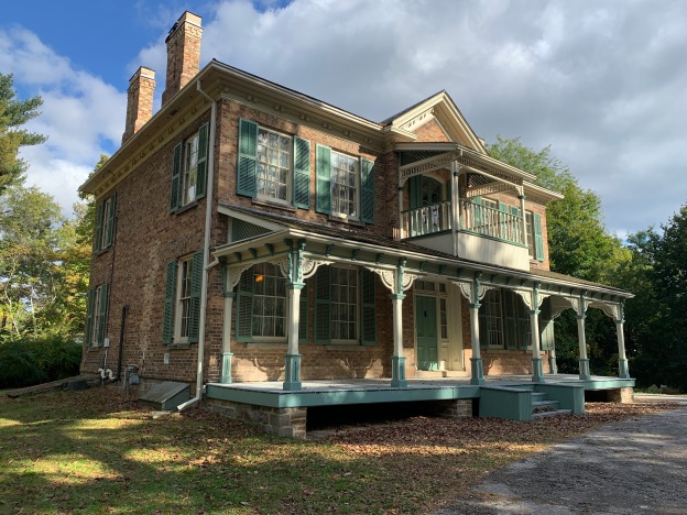
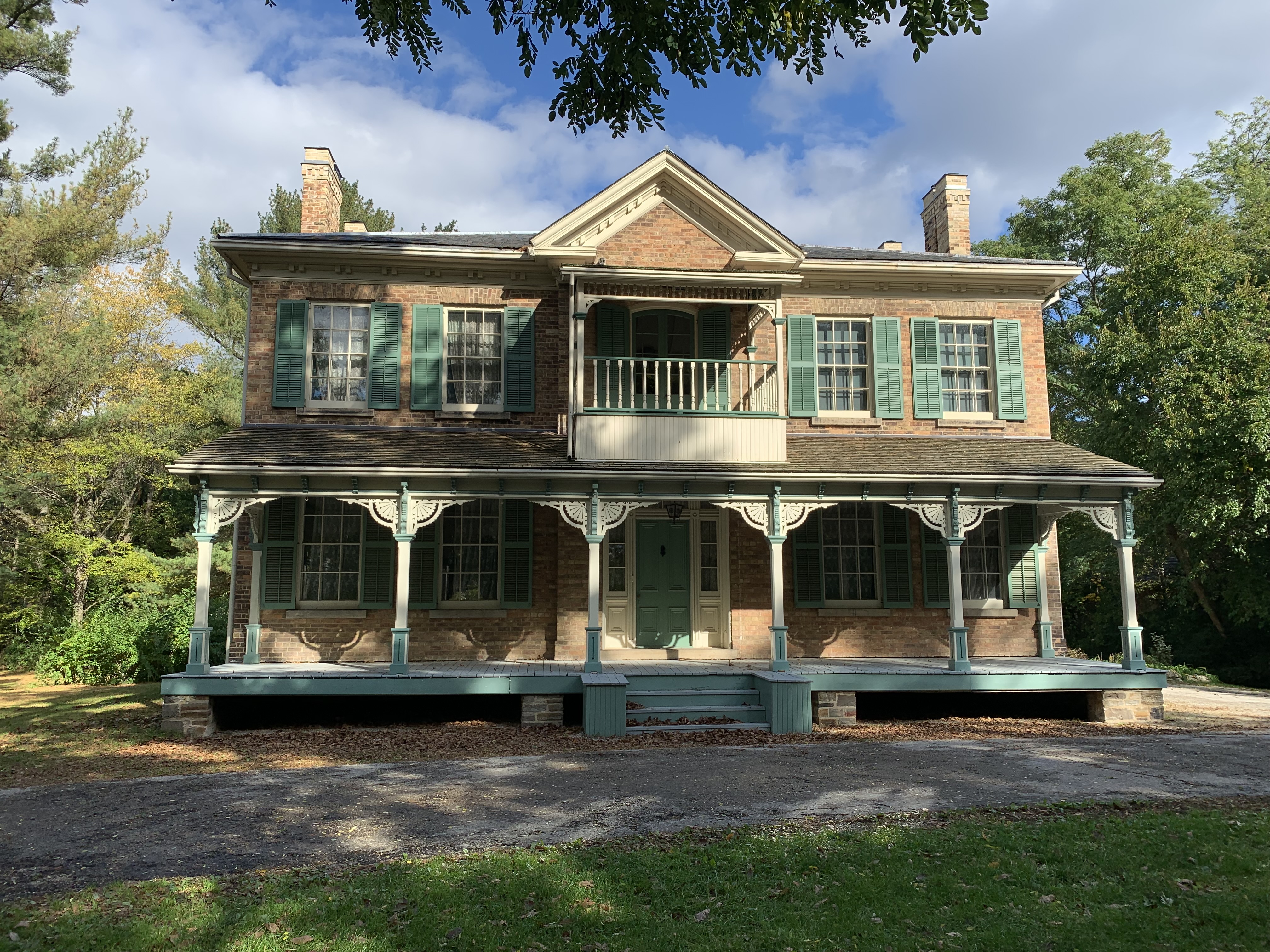
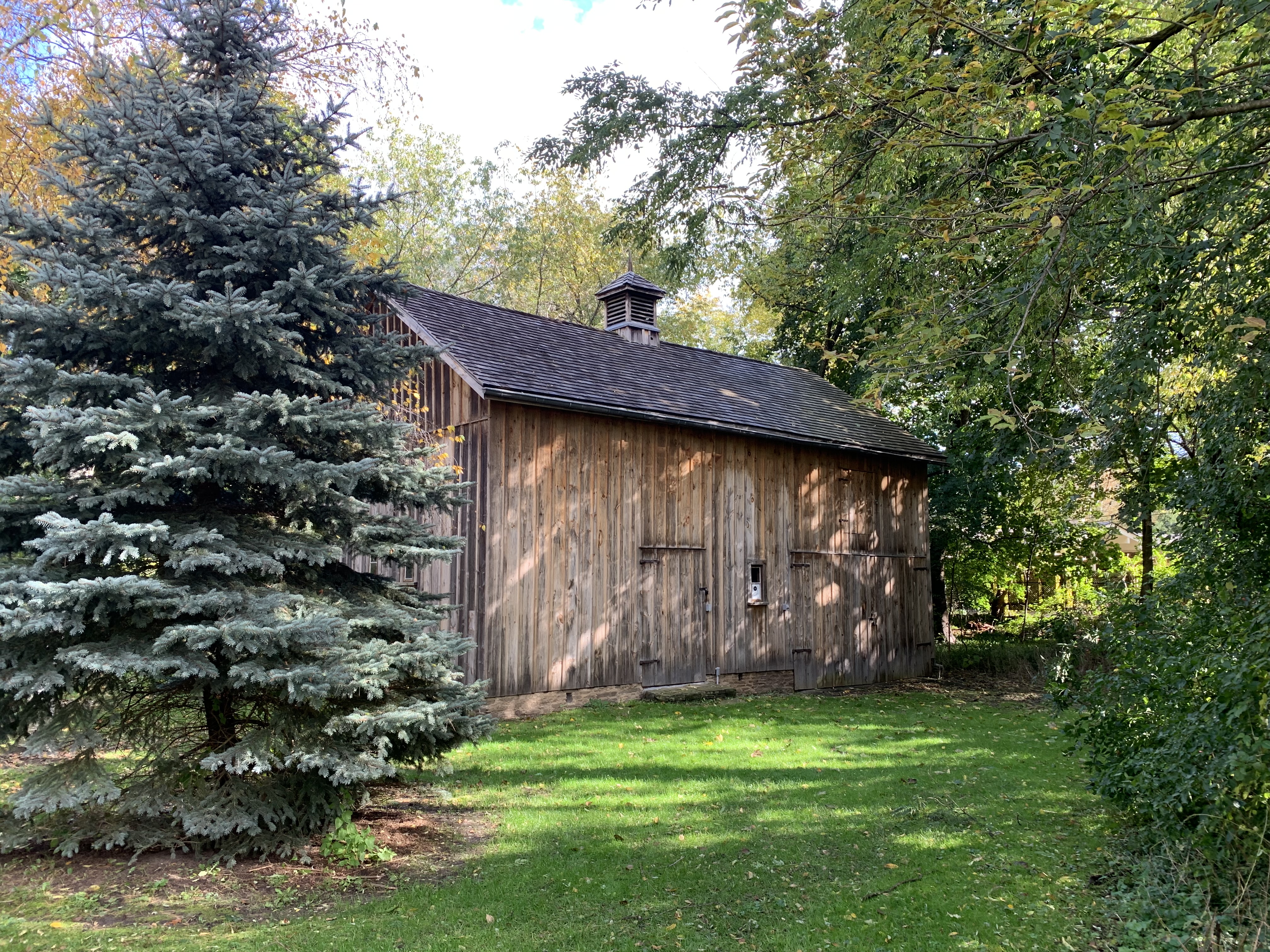
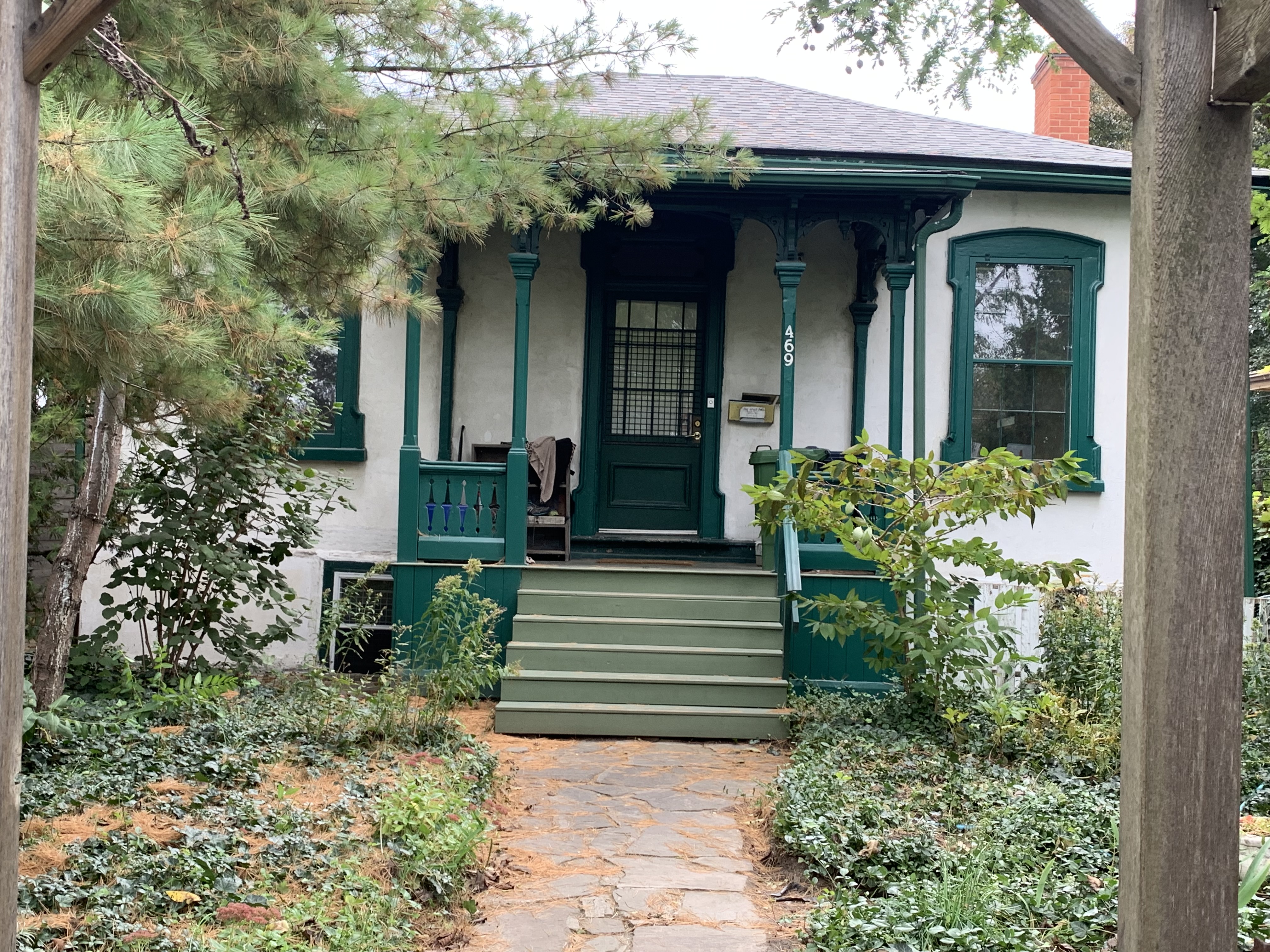
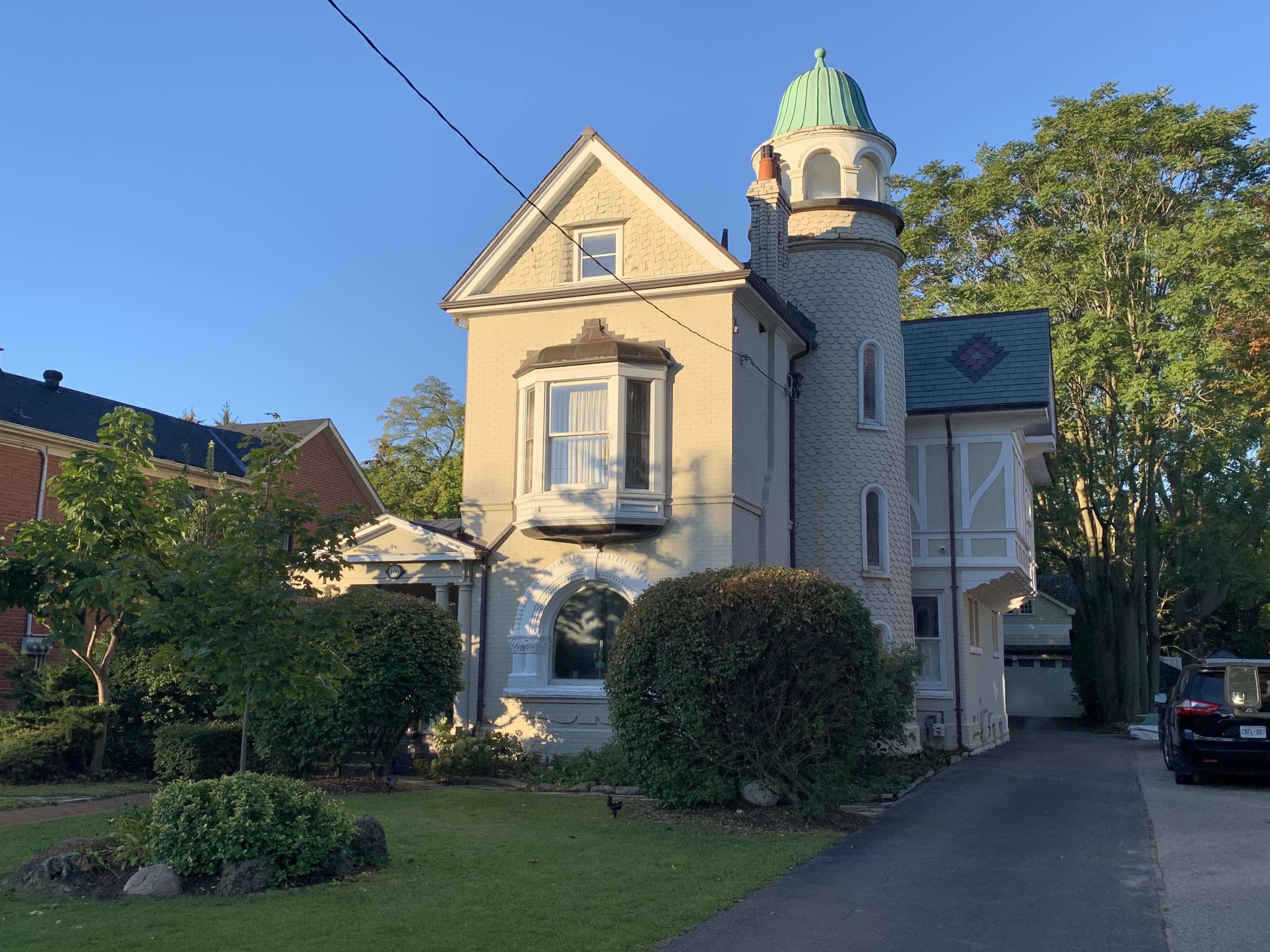
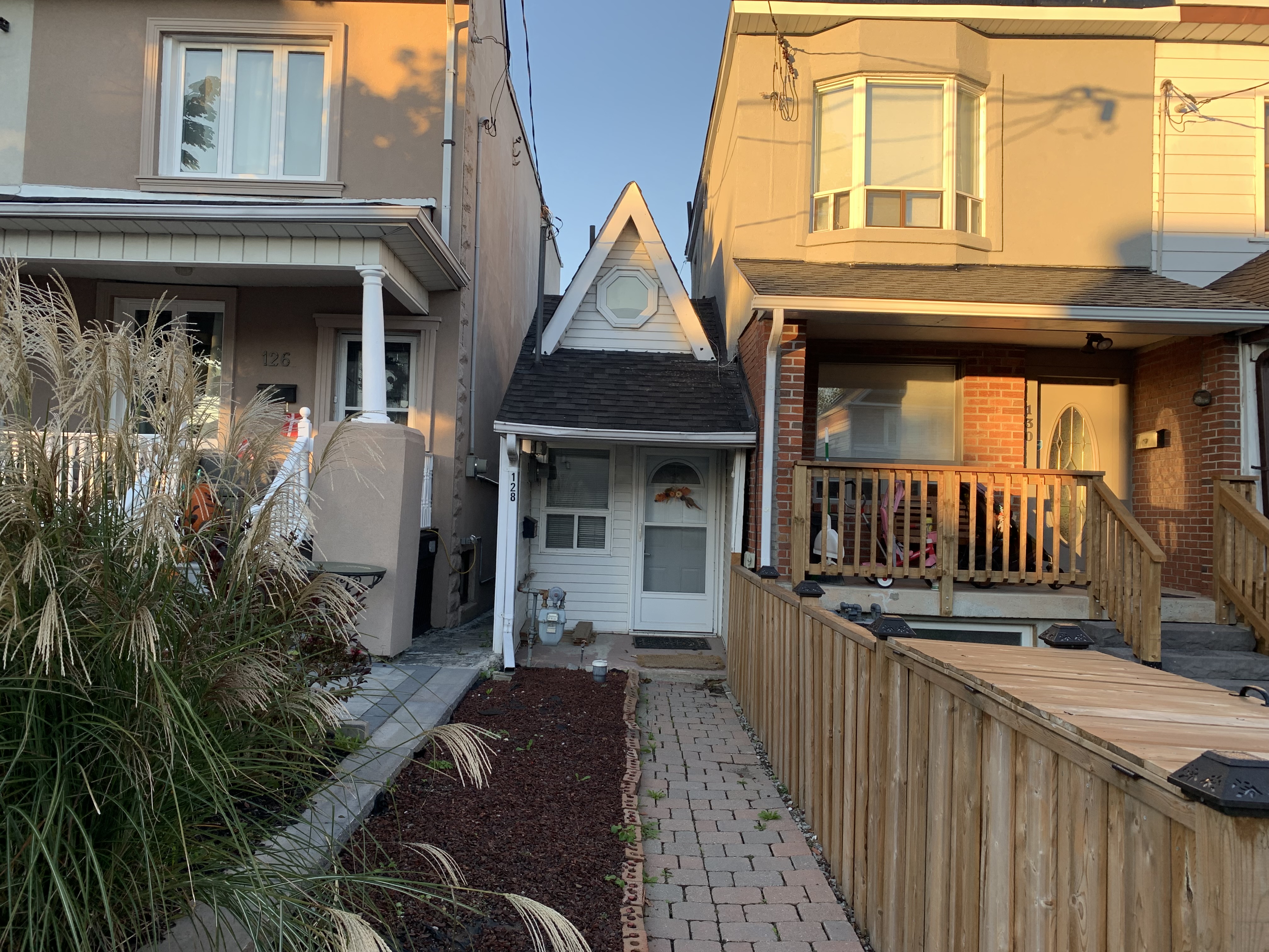
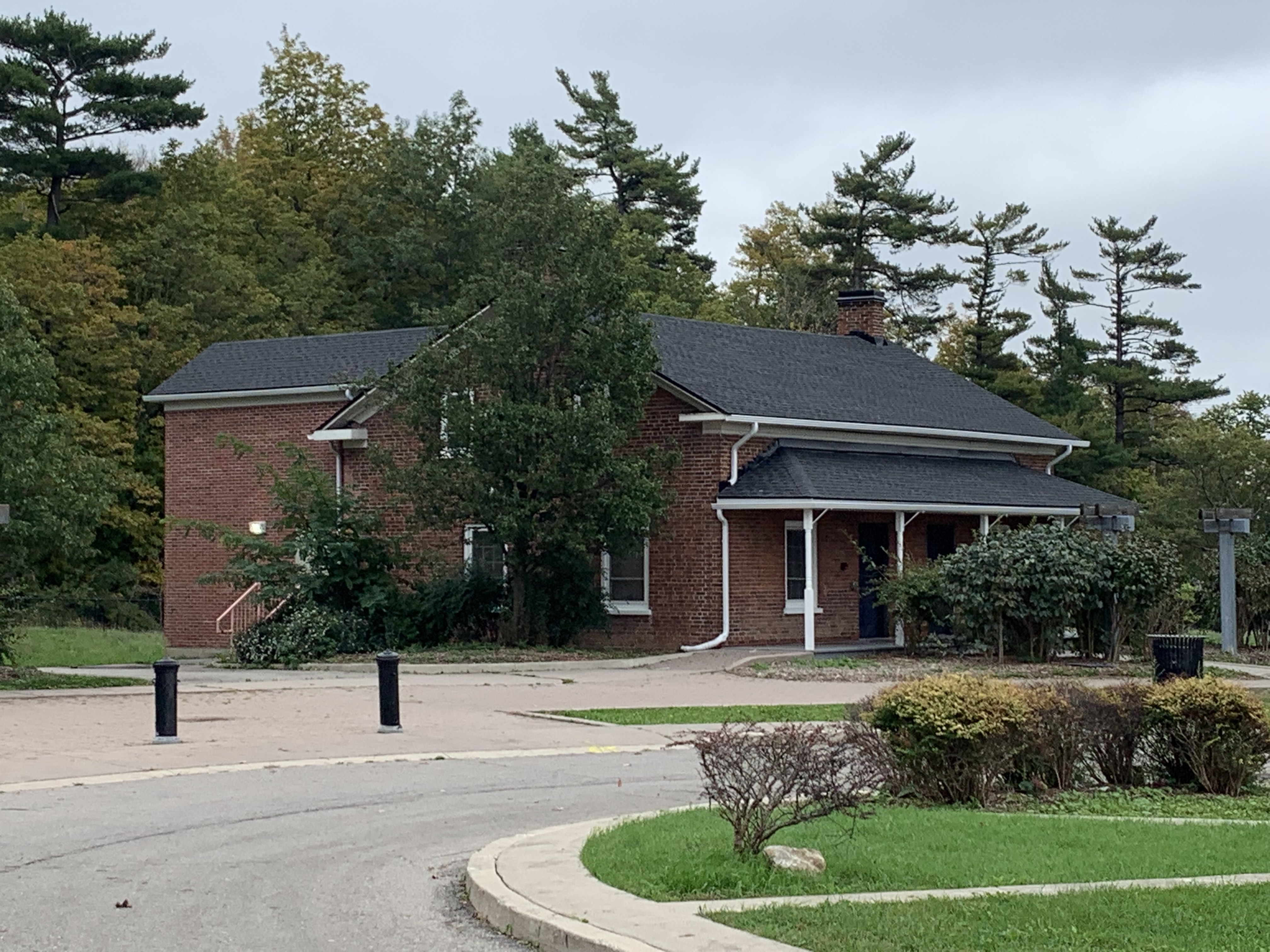
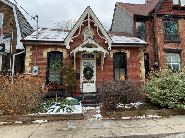
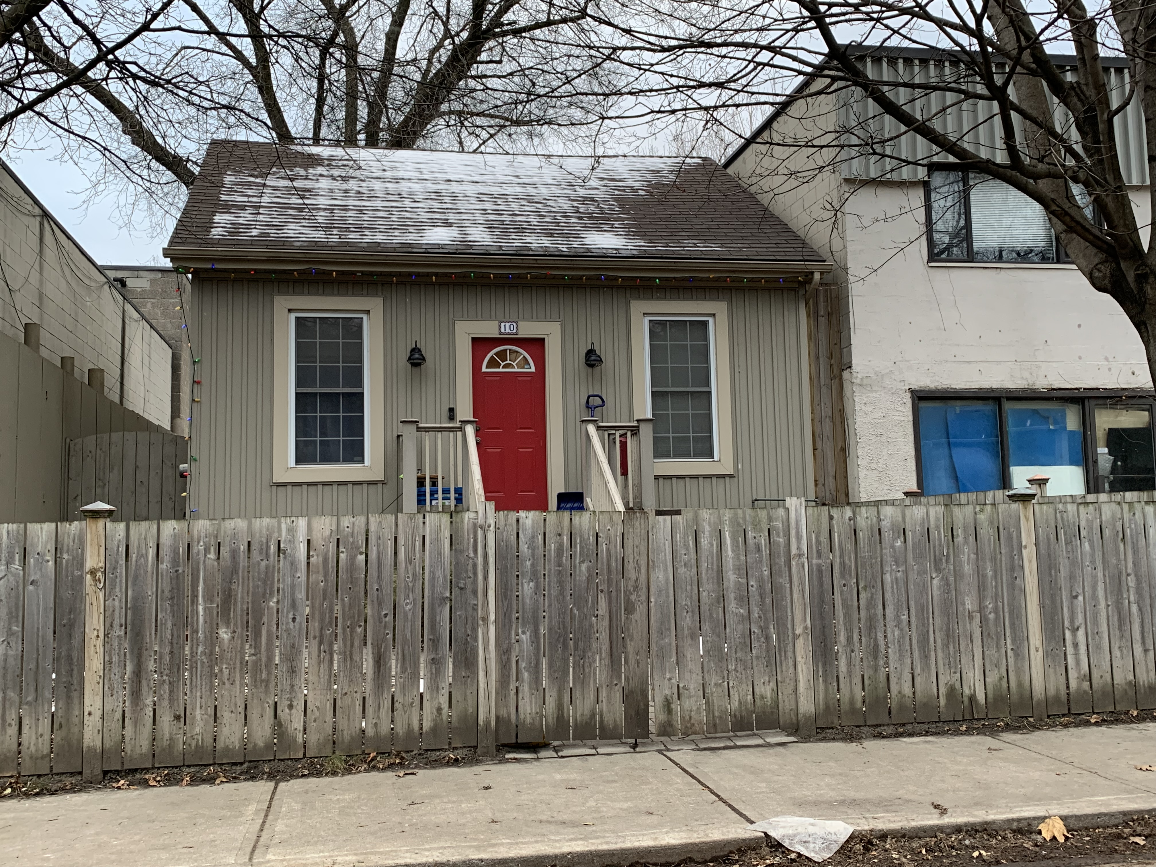
There were five designs for these workers homes but the most basic was the one-storey cottage. Beginning around 200 years ago, these cottages were usually built around a central hall plan with four rooms. Two bedrooms on one side of the hall and a parlour and kitchen on the other side. Sometimes the kitchen was in an extension on the back and there were three bedrooms. Washroom facilities were in the outhouse in the back yard. Most people had to walk to their workplace and so these homes were built close to the industrial areas. In some cases, such as Gooderham & Worts, the employer built the homes for their employees. Most of these homes were very basic but some, like 52 De Grassi in the cover photo, were much more ornate. To investigate some examples of these homes I went to Leslieville, which was a working-class community on the east side of the Don River. I parked across from 10 Lewis Avenue and went for a walk. I wonder if the 9 over 9 windows are original to this cottage.

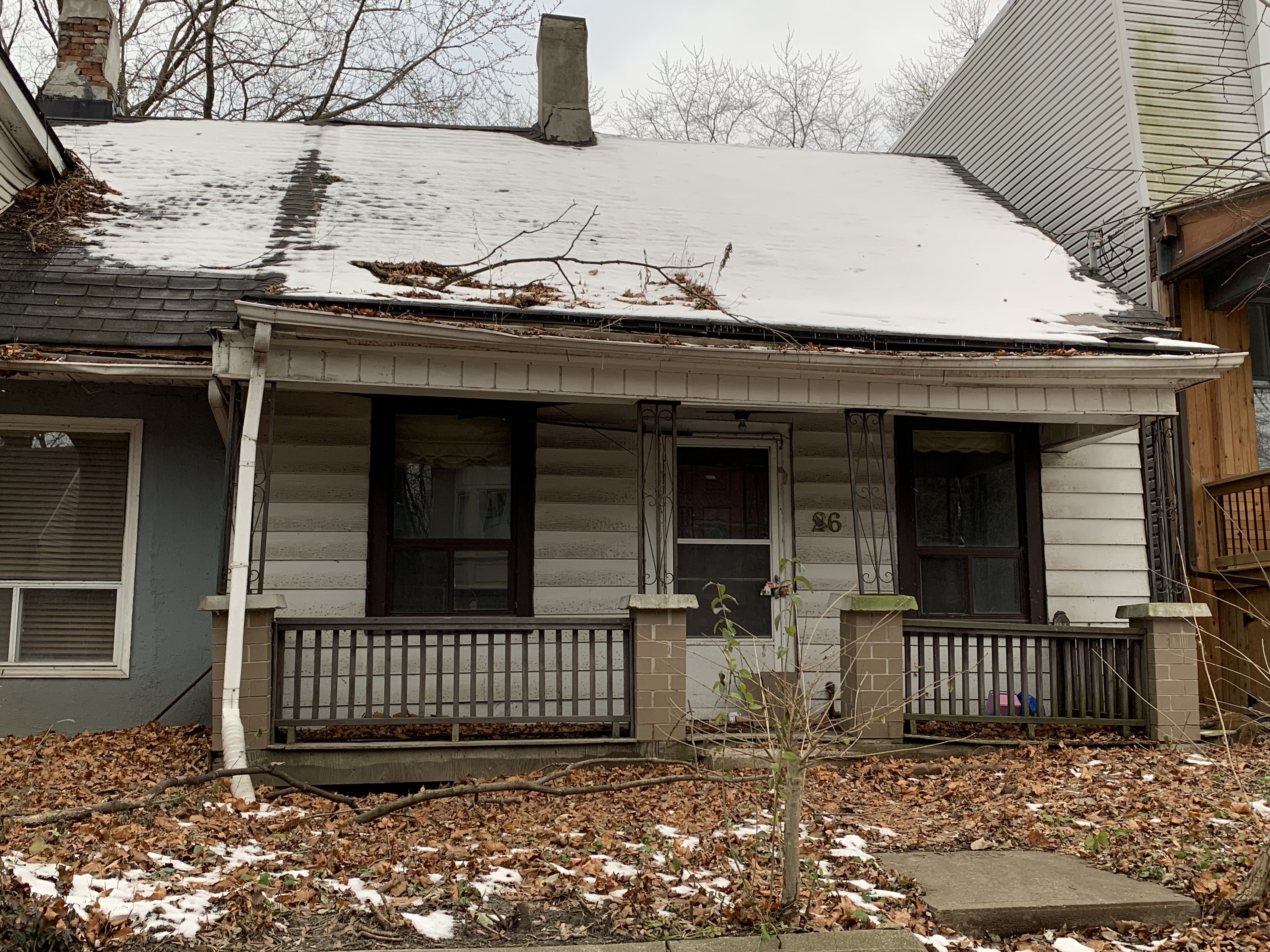
The cottage at 26 Lewis Street is an example of one that could use a little bit of attention. The roof seems to have a bit of a sag to it and the front drain pipe is becoming detached from the roof. Many of the worker’s cottages that used to line our streets in the working-class neighbourhoods have been lost to poor maintenance over the years.

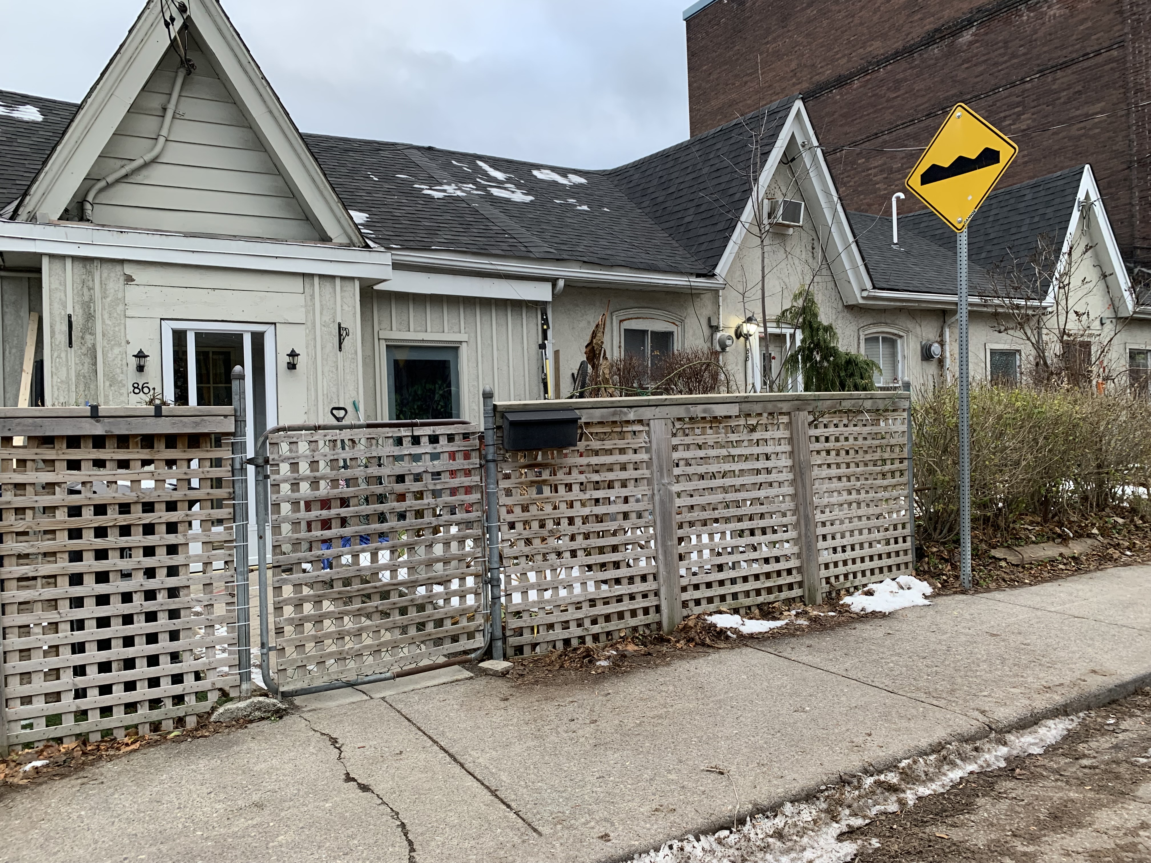
86-90 Lewis Street is a row of three attached cottages. Unlike many of the small cottages in Leslieville, this row of housing was added to the original heritage register in 1973. At the time, they were just four years shy of reaching the century mark.

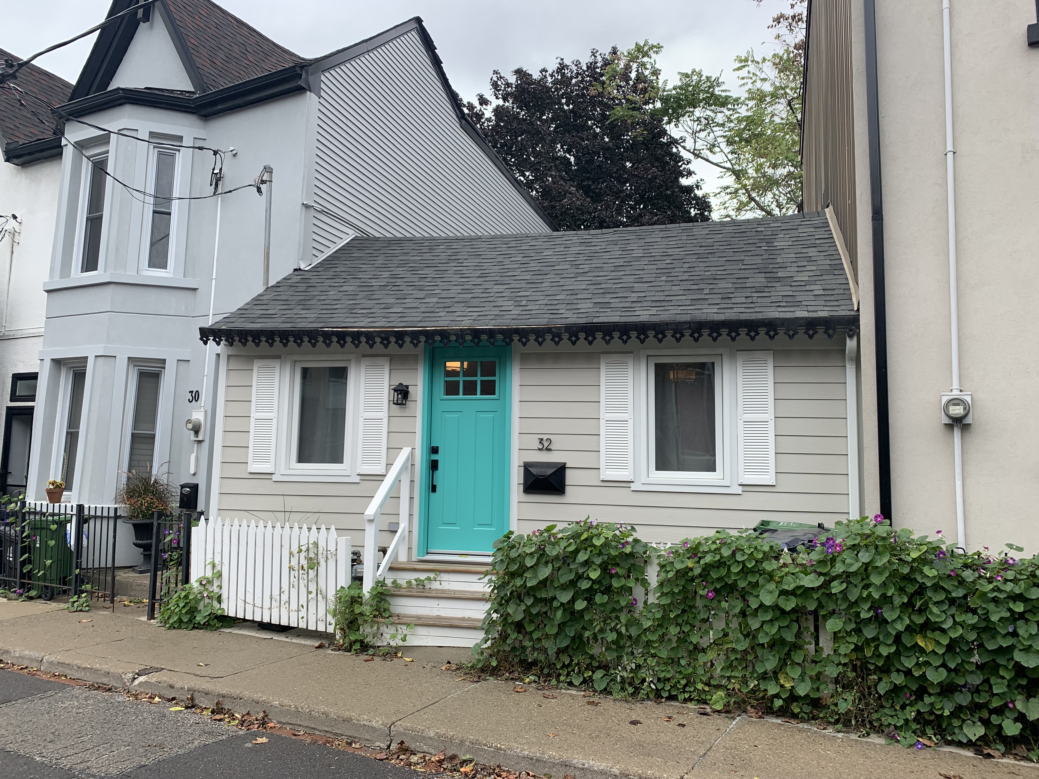
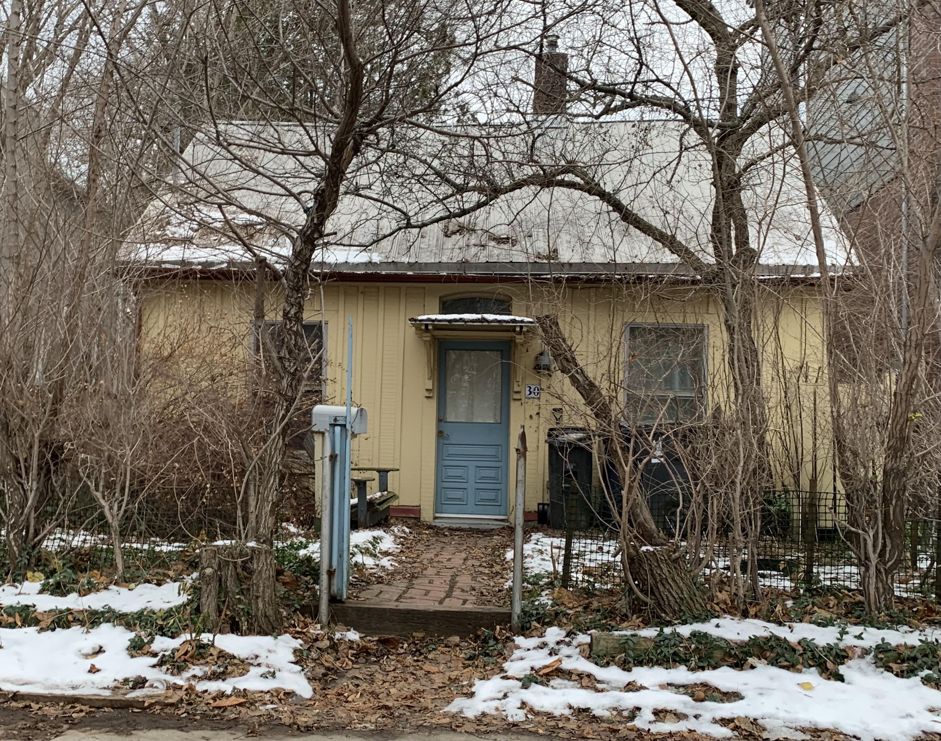
Walking around the corner and going east on Queen Street you will quickly come to Saulter Street. This street also contains a selection of interesting residential styles including several of the little one-storey cottages. The home at 30 Saulter Street is board and batten construction where the small strips of wood, or batten, are used to seal the spaces between the boards. A small window in the transom above the door lets more light into the home.

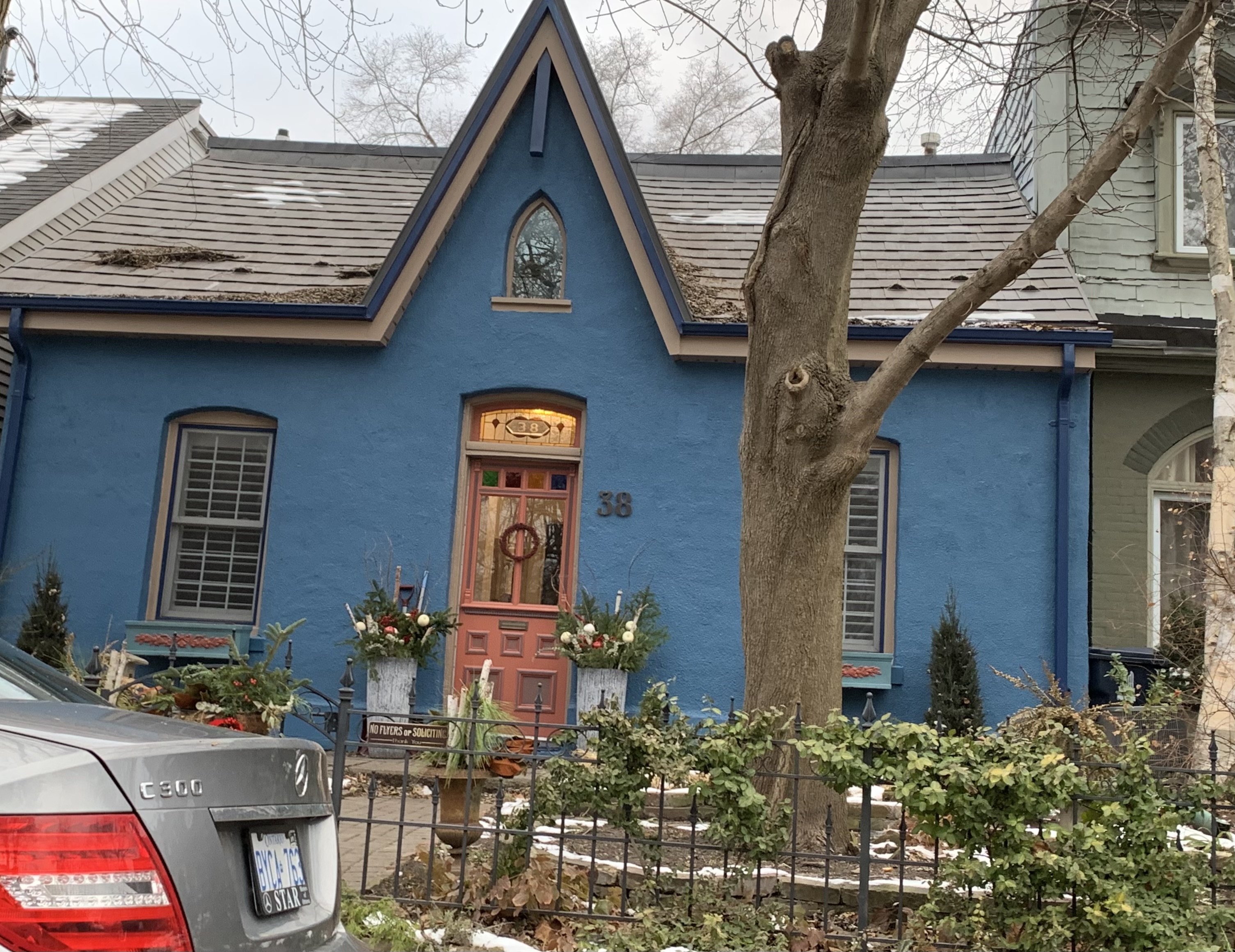
The cottage at 38 Saulter Street has been painted blue and has the house number in the glass in the transom window. It also has a neat little Gothic window in the centre gable.

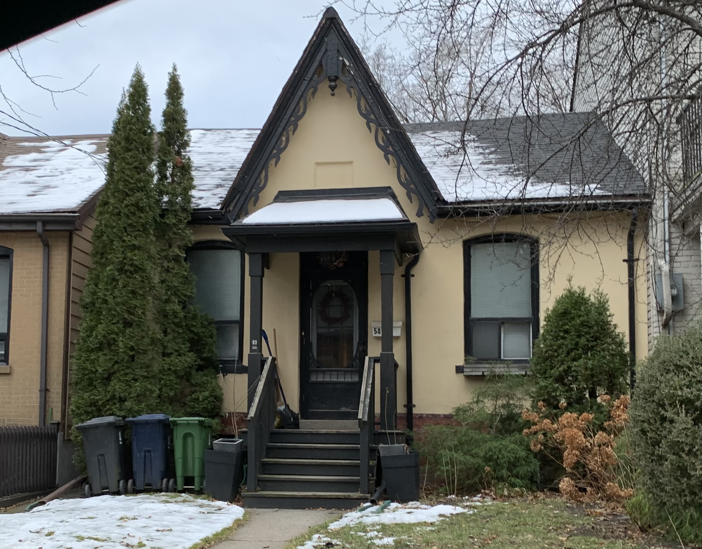
A few of these small cottages were decorated with some fancy gingerbread. 58 Saulter is one of those that has a decorative bargeboard.

Audley Street is just a few houses long but it starts off with a pair of attached cottages at numbers 2-4. Number 2 has angel stone on the front gables and both have had their brickwork painted over.

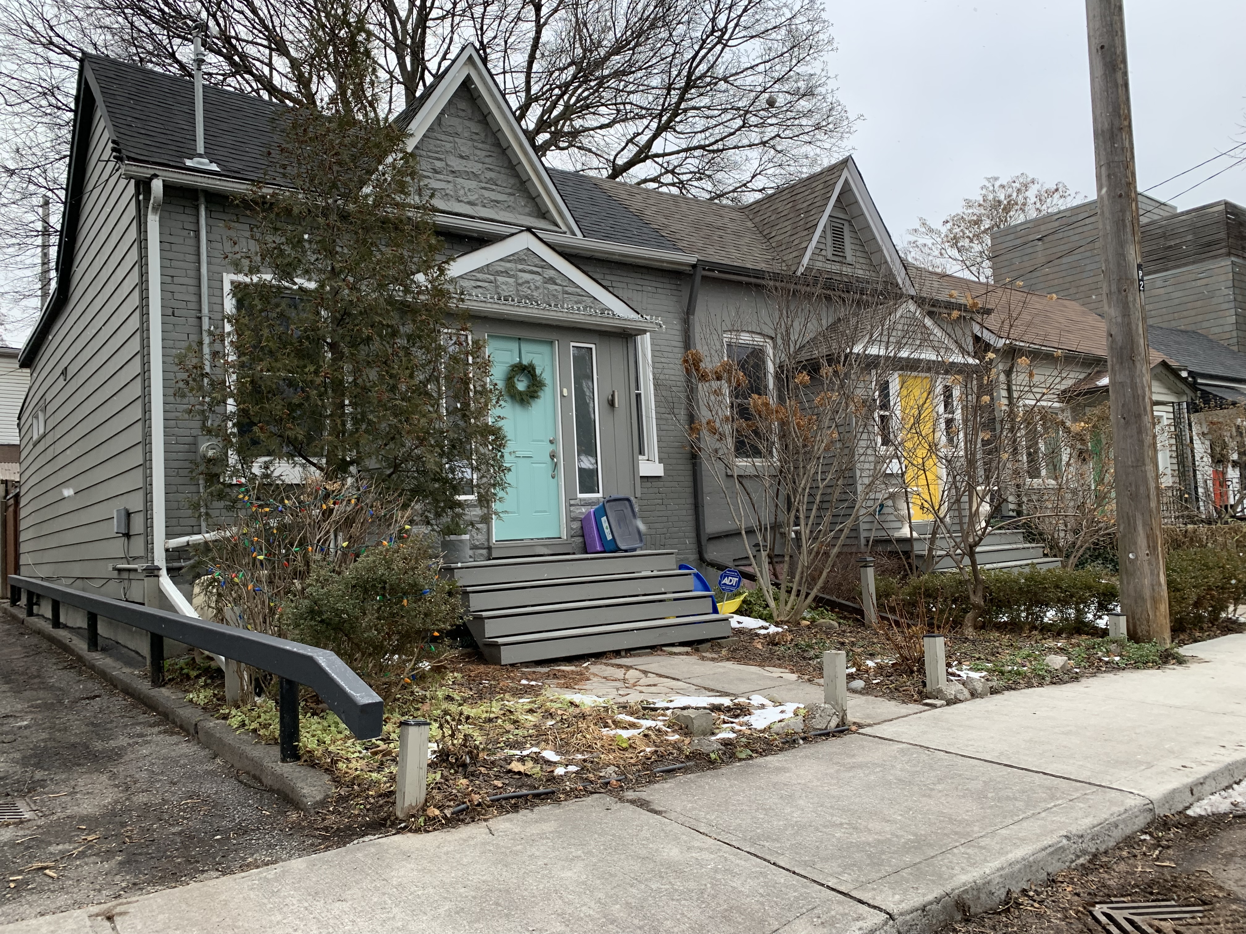
The homes between 2 and 14 Audley Street are all original cottages except for number 10 which is a replacement. Number 12 has had a veneer of angel stone added to the front but then it looks like the stone was painted a drab colour. Thankfully they painted the door frame green to give it a bit of colour.

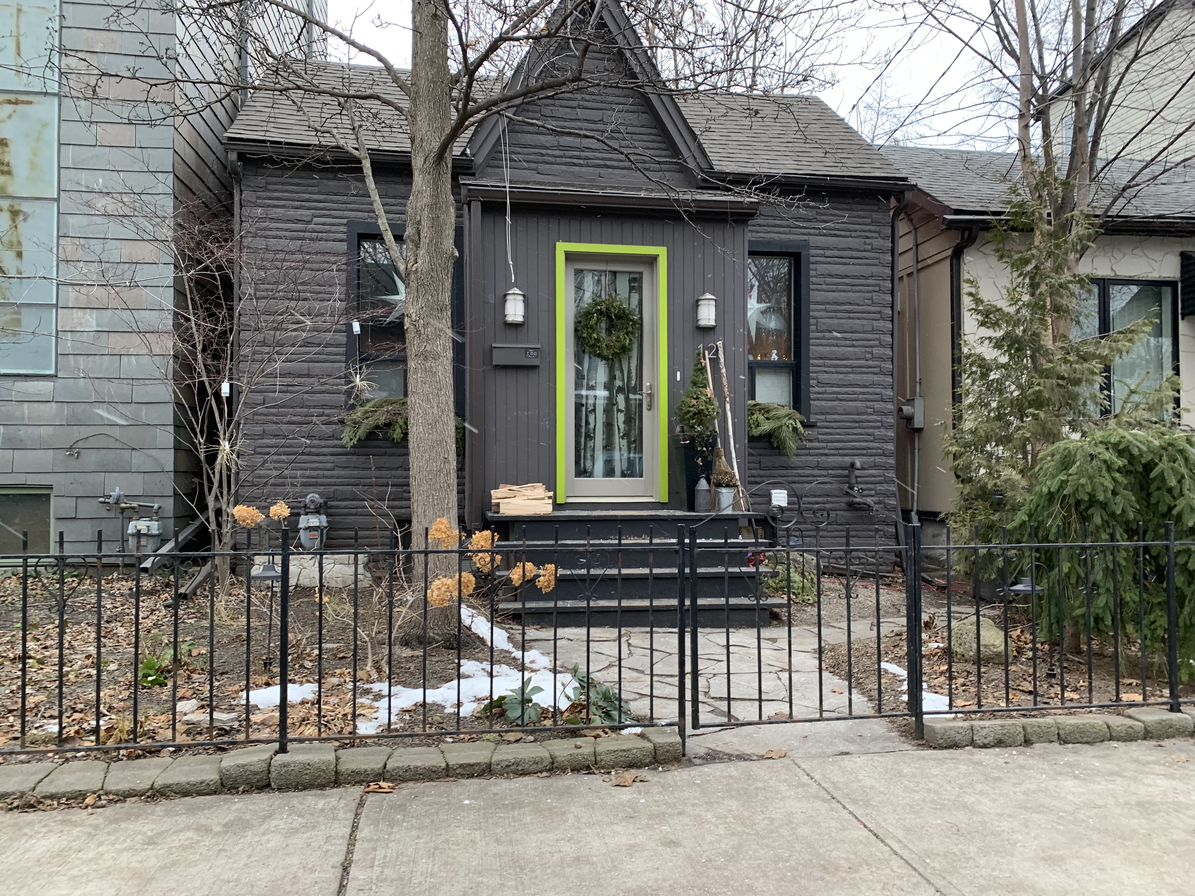
79 Knox Avenue is another of these homes that have been decorated with some fancy scrollwork on the gable as well as on the ends of the drainpipes. The main windows have some interesting glazing and the south one has some stained glass in the upper panel.

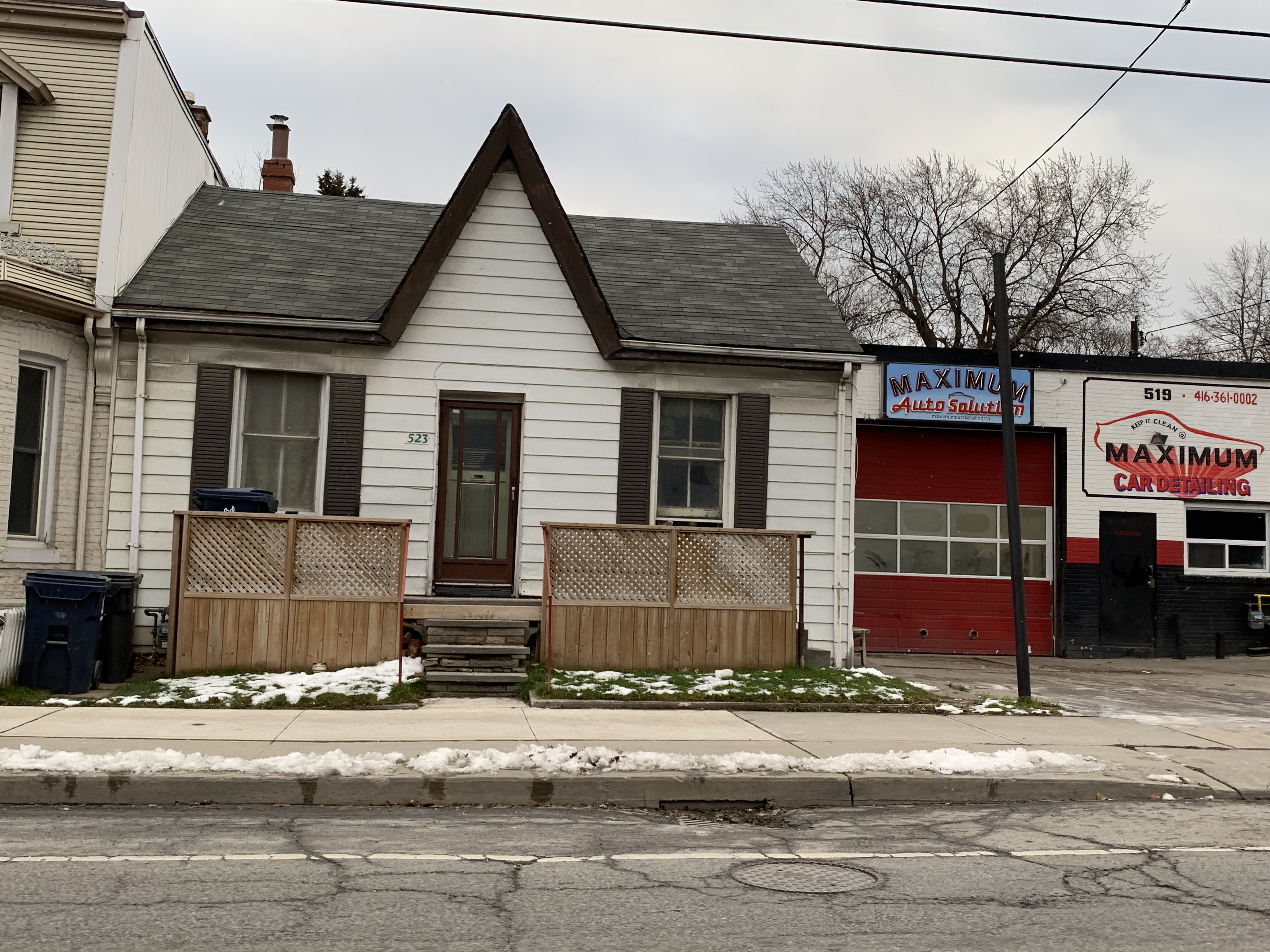
There are a few of these cottages scattered on almost every street throughout Leslieville, including along Eastern Avenue. The cottage at 523 Eastern Avenue is still occupied and looks to be in pretty good repair although the siding isn’t original.

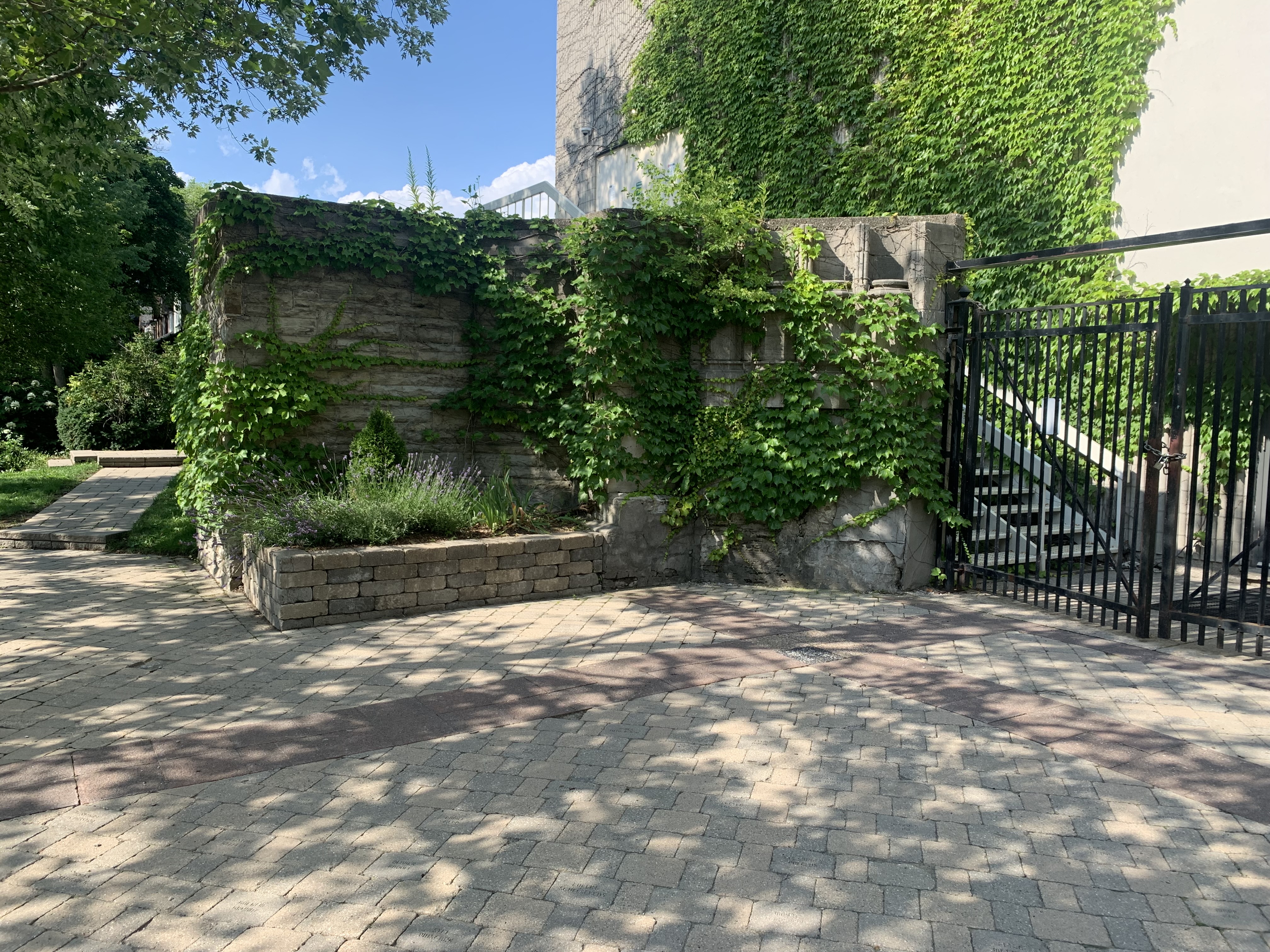
Walking, or driving, around Leslieville can be an exercise in the appreciation of our city’s architectural heritage with respect to the accommodation of our early working-class heroes.

Further reading on this subject can be found in the excellent book “Modest Hopes” by Don Loucks & Leslie Valpy.

Google Maps Link: Leslieville

Like us at http://www.facebook.com/hikingthegta

Follow us at http://www.hikingthegta.com

Also, look for us on Instagram

Doube’s Trestle Bridge

Sunday, December 19, 2021

On June 1, 2021 The Great Trail reverted back to its origial name of The Trans Canada Trail, which better defines this 28,000 kilometre long national trail. There’s a 53.8 kilometre section of the trail that is known as The Kawartha Trans Canada Trail. I set out to cover a small section in the middle that contains the famous Doube’s Trestle Bridge. There are a few parking spots on Orange Corner Road where you can enjoy this location which is just a short drive north of the GTA.

Starting in the 1850s, several railway lines were run north from communities along Lake Ontario including Whitby, Port Hope, Cobourg, Trenton and Belleville. These lines were intended to draw business from the larger towns to the north to their harbours and access to Toronto and Hamilton markets. Eventually these lines were connected by east west lines running between these northern towns. Peterborough and Lindsay were not connected and part of the solution was to run a line between the two. This line had to cross Buttermilk Valley and they built a 1500 foot (457 metres) wooden trestle to carry the rail line. It stood about 100 feet (29 metres) above the valley floor on the Omemee-Peterborough Line which was locally known as The Missing Link. The line was taken over by The Canadian National Railway in 1921 and track and trestle improvements were completed to accommodate heavier trains. The trestle was filled in from both ends and the centre span over the creek was converted to a steel trestle 500 feet long (150 metres). By the end of 1988 the line was abandoned and the rails lifted. Although the line was purchased in 2000 as a potential rail trail corridor it was the construction of the Trans Canada Trail that really got things moving as this was identified as a major link. By the end of 2010, 53 kilometers of the Kawarthas Trans Canada Trail was 95% complete and it would be finished in 2014. The railings below identify the steel bridge structure.

The view looking south from the bridge shows the small size of Buttermilk Creek compared to the wide ravine that stretches out on either side. About 12,000 years ago the last ice age was retreating and there was a large sheet of ice up to a kilometer thick covering this area. A large river of meltwater was flowing under the ice creating the valley below and depositing the large drumlins made of sand and gravel that dot the local countryside.

The view looking north is equally impressive with the tops of the cedars far below.

The south west end of the trestle has a park bench where you can sit and rest and look out over the valley. There’s a small trail here that will allow you to get a view of the side of the trestle. Going very far down this trail would be unadvisable because it would be easy to slip and require a rescue.

The photo below was taken from the book The Last Trains From Lindsay by Keith Hansen and shows the trestle and berm in May 1974. It gives a good idea of the height of the trestle and the size of the berm created when the ends were filled in. Also notice how the trees have been kept cleared off of the berm.

Just beyond the trestle there was a herd of cattle wandering around in the trees on the side of the hill. When they saw that I had a camera they all came down closer to the fence. They started to “Moo” at me as if I was supposed to open the gate and let them out. That wasn’t happening, there was already enough horse poo on the trail without letting 50 cows have a go at it.

There are two old trestle overpasses between Orange Corner Road and Highway 7. They allowed farmers to move livestock and equipment from one side of the tracks to the other as the rail lines often cut through the centre of a farmer’s property. This is the second of the two as you walk west and this one shows the depth of cut that the line made when it emerged from the Buttermilk Creek Valley and back onto the local topography. This part of the province is dominated by some pretty impressive glacial formations including large drumlins on the farmlands on both sides of the trail.

One of the least likely things to see on top of a tall berm is a stranded canoe. It’s obviously not going to be paddled too far in its current condition. It looks like it should have some wildflowers planted in it so that at least the local polinators can enjoy it.

Fire was always a threat in the days of steam engines because of sparks and cinders that would blow out of the smoke stack. To reduce the potential to start a fire the railway would keep the trees cleared away from the tracks for 50 feet on either side. That would have left the berm along this railway exposed to the sun and the wind and it would not have been a very nice hike on days with extreme weather conditions. Fortunately the slopes of the berm have been allowed to grow into a nice little strip of woodland.

Highway 7 passes over the old rail line on a high level concrete bridge and this is the point at which I turned around. According to the trail map at the trestle bridge, this is 3.5 kilometres from the parking spots on Orange Corner Road.

You really get to appreciate the height of the trestle above the surrounding farmland on the eastbound part of the trail. The filled-in section of the former wooden trestle runs well above the roof of the barn and the farm house just beyond it.

The views from the trestle will change with the seasons making this a year-round trail but we wonder how great it would be on a cold windy day in the middle of winter.

Google Maps Link: Doube’s Trestle Bridge

Like us at http://www.facebook.com/hikingthegta

Follow us at http://www.hikingthegta.com

Also, look for us on Instagram

Windfields Estate

Sunday, December 12, 2021

Windfields Estate is one of several grand estates that were built for the wealthy when Bayview Avenue north of Eglinton was home to those who could afford to escape the city. Windfields Estate is now home to the Canadian Film Centre who invite the public to enjoy the grounds. It is also connected to Windfields Park and to check the two of them out we took advantage of parking at York Mills Arena and walked down through the park system until we reached Windfields. There isn’t really any public parking on the grounds so unless you live in the area, this is likely your best option.

The site amounts to 20 acres of an original 200-acre lot. Peter Whitney was a United Empire Loyalist who cleared the land for farming. His family would sell the west half of the farm to William Bell in 1873 and the County Atlas from 4 years later shows where it was located relative to modern Bayview Avenue and York Mills Road. Wilket Creek has been highlighted in blue while the area that would become Windfields Estate is outlined in green.

From the parking lot, you can follow the paved trail or walk closer to Wilket Creek. If you take the lower route you will come to a set of stairs that lead back up to the main trail.

The park is fairly narrow as it follows the creek south toward Windfields Park. Where the greenbelt widens out into the park there is a buried culvert that used to carry a private road across the creek. The road has been removed but it followed the depression toward the modern subdivision in the distance.

There is a small dam on Wilket Creek that would have retained a pond of water for the horses to enjoy. Currently, there are still a couple of layers of wood in the bottom of the two sluice gates and by adding additional ones the farmhands at Windfields were able to control the size of their pond.

As long as Bayview Avenue crossed the Don River on a single lane bridge it remained a farming area. With the development of the high-level bridge over the river in the late 1920s, the area opened for the development of estates for the wealthy who were looking for places to indulge their horse riding pleasures. The farm was bought by Bayview Heights Limited in 1928. The 20-acre estate lot was then bought by Edward Plunkett (E. B.) Taylor in 1932 so that he could develop an equestrian estate for his wife Winnifred. She apparently gave the name Windfields to the estate while walking through the fields on a windy day. It is interesting to note that the apple orchard which is shown on the count atlas is still in place. The smaller trees set in between the apple trees are plums and pears.

The estate property was landscaped with two hedgerows to compliment the existing three small woodlots. There are 55 gardens and more than 200 trees outside of the main woodlots. There is also a row of about 15 Japanese Cherry Trees that will be interesting to observe in the spring rather than trying to get into High Park to see their Japanese Cherry Trees. The grounds were laid out in the typical estate style of the times and the worker’s cottages, stables and greenhouse estalished a pattern simular to a small English village. The gardens behind the house transitioned to the pool at the back of the yard.

The mansion is in the process of having some restoration work done on it. The north end, at the left in this photo, was added after the Second World War.

The most attention to detail was given to the front door. There’s a Palladian window in the gable above the door and a swan’s neck pediment above the door.

In 1946 three workers’ cottages were added to the property creating a little cluster of buildings which included the stables and the greenhouse. The one below was known as Cottage C.

Each of the three cottages has its own design with the one below having two mirrored units. They were added in 1946 and built to a design by architect Earl C. Morgan and referred to as cottage AB.

Cottage D is the smallest of the units. Just to the west of the cluster of cottages are two buildings that were added by the City of Toronto after they took over maintenance of the parklands. There’s a garage and a workshop which have been built to blend into the style of the cottages and stables.

The stables were designed at the same time as the house and also in the Georgian Revival style of architecture. The side of the stables that faces the house is adorned with a portico with columns. The stables housed the Taylor family’s personal horses that they would ride around their estate and very like the estates of some of their horse-loving neighbours. You can read about several of them in our feature Bayview Estates.

The estate was even provided with its own greenhouse so that fresh flowers and garden plants could be grown year-round. It was added in 1952 and built from a kit sold by Lord and Burnham who have been designing premium greenhouses since 1849. The small building at the end closest to the house was used as a potting shed.

The gatehouse was also designed in 1946 at the same time as the workers’ cottages. A swimming pool and cabana, or change room, was also built behind the main house that same year. The gatehouse is set apart from the other buildings and was used by E. P. Taylor as his office. In 1969 the Taylors bequeathed the property to the borough of North York although members of the family continued to live there until 1987. The next year the Canadian Film Centre was founded by Canadian film-maker Norman Jewison. What started as a film school has grown into a training facility for people involved in many aspects of film, television and other digital media.

In 1961 on Edward Taylor’s breeding farm in Oshawa, known as Windfields Farm, Northern Dancer was foaled. After being named “Canadian champion two-year colt” in 1963 he went on to have an even bigger year in 1964. This is when he won the Kentucky Derby, among other prestigious races, becoming the first Canadian bred horse to do so. He was retired to stud work and sired some other famous racehorses including Nijinsky who won the English Tripple Crown. The newest building on the site was opened in 2014 and is named the Northern Dancer Pavillion. It was built over the old swimming pool and cabanas.

The Canadian Film Centre provides an interactive map that will allow you to explore the site and even lets you identify the types of trees on the grounds.

Associated blogs: Bayview Estates, Japanese Cherry Trees – High Park.

Google Maps Link: Winfields

Like us at http://www.faceook.com/hikingthegta

Follow us at http://www.hikingthegta.com

Also, look for us on Instagram

St. Alban the Martyr Cathedral Toronto

Sunday, December 5, 2021

This is the story of a cathedral that was almost built, but not quite. Up until less than a hundred years ago, the spire on St. James Church was the tallest structure in early Toronto. It represented the Church of England in the early city. When John Strachan was made the First Bishop of the Anglican Diocese of Toronto in 1839 he was allowed to use the St. James Church but there was a problem. The parishioners had financed the church and were unwilling to turn it over to the Bishop for his use. The home church of the Bishop is known as a cathedral and is the most powerful church in the diocese. From the middle-ages, cathedrals have been grandly designed and were intended to reflect the majesty of God. In 1843 Strachan opened the cathedral establishment fund with the intention of giving Toronto one of these grand buildings.

Neither Strachan nor his successor would see the building started, it would have to wait until 1883. Arthur Sweatman was the third Bishop of Toronto and he oversaw the purchase of 4.5 acres of land in the newly developing Seaton Village area just west of the expanding city. The plot was made available by a syndicate that was developing a prestigious housing development in the area. They put up $5,244, half of the purchase price, and promised another $2,000 if the choir and chancel were completed by 1886. The archive picture below shows the construction of the east end of the cathedral during 1886.

The diagram below is from Wikipedia and shows the most common parts of Christian Cathedrals. The basic layout has been in place since Roman times and the intention is to create the most spectacular building in the region. When St Alban the Martyr Cathedral was planned it was intended that Toronto should have such a building.

Sod was turned on August 20, 1885, but the cornerstone wouldn’t be laid until the following year. Funding for the building wouldn’t be consistent and work was slow to progress. When Canada went into a depression in the 1890s money was diverted to building local parishes which were badly needed by the expanding city. The portion of the cathedral in the picture below, taken on July 14, 2021, was completed by 1891 and that was about as far as they got.

The archival sketch below shows the cathedral as it stood in 1898. By this time they had consecrated the choir and the crypt below it. They moved their worship services into the crypt while they waited a few years, or so they thought, for the rest of the cathedral to be completed. This turned out to be the end of the original design.

The synod of the diocese renewed its commitment to completing the cathedral in 1910. The new plans called for the elimination of the two western towers which were to be replaced with a single central tower. This would have been placed on the south side in the corner where the transept met the aisle. Twenty-five years after the cornerstone was laid the same trowel was used to initiate the new construction. Problems arose immediately when the tenders came back $200,000 over budget. World War 1 broke out before there was a resolution and the project was once again put on hold. Construction wouldn’t begin again until 1956 when the western end of the building was closed in with a short brick structure. The idea of a cathedral at St. Alban the Martyr had already been over since 1935.

The aerial photo below from Toronto Archives shows the choir end of the cathedral with the foundations of the transepts and the nave forming the outline of a cross. The Bishop’s house can be seen circled just above the cathedral and three of Toronto’s bishops would live here before 1935.

The original plans for the cathedral included a 135 foot (41 meters) tower on the southwest corner while a shorter one adorned the northwest corner. This image below was taken from The West Annex News and gives you a good idea of what the other three-quarters of the building would have looked like if completed as designed.

Starting in 1918 St. James Church downtown began to lobby to be the cathedral for the Toronto Diocese although it wouldn’t happen until the middle of the Great Depression. In 1935 St. James Church was confirmed as the cathedral and St. Alban was downgraded to a local parish. The bishop moved downtown and the church carried on until 1964. That’s when St. George College rented the property and they continue to occupy it today. They built their school buildings on the old foundations for the proposed cathedral.

Their rather typical educational building sits on top of some pretty impressive stone footings that were intended to support a much grander building.

The footings at the western end of the building haven’t been built on but it doesn’t look like there are any grand towers in their near future.

A lot has changed since the original conception with its two grand towers. These were downgraded to a single tower in 1910 and finally, in 1956 they settled for one of the most unimaginative spires in Christendom.

Between 1885 and 1886 the church also built a home for the bishop of the Anglican Diocese of Toronto. The diocese went by the short name of “See” and this was the home of the bishop from 1885 until 1935.

We close with a view of the west end of the proposed cathedral. This is where the parishioners would have entered for the services.

Some of the grand cathedrals in Europe took centuries to be complete but in Toronto, we lost the will to finish our cathedral almost as soon as it was planned.

Google Maps Link: St. Alban the Martyr

Like us at http://www.facebook.com/hikingthegta

Follow us at http://www.hikingthegta.com

Also, look for us on Instagram

Time Travel in Toronto

November 28, 2021

Throughout the GTA there are several homes and historic sites that are open to the public, although usually with a small admission price to cover upkeep costs. They are typically decorated in the style of a different era. This means that if you chose to, you could visit each one in sequence and watch the changes over time. This post collects the various historic homes and sites and presents them in chronological order. A link will take you to the feature article on the site, if available, where a Google Maps link can help you locate them for yourself.

1814 Fort York

Fort York contains an amazing collection of buildings that date to the War of 1812, although many of them were replaced in 1814 after they were destroyed in the Battle of York on April 27, 1813. This is the first stop on our time journey as we start with our oldest museum.

As you go through the buildings notice how low the ceilings are. This is due to the fact that two hundred years ago people were generally shorter than today. (The track lighting and interpretive signs are obviously recent additions)

1820s Todmorden

If we move ahead a decade we come to Todmorden Mills, a reminder of the city’s early industrial era. Mills were operated by water power and the Don River provided power to a series of three paper mills belonging to the Taylors. Only the lower one, which was at Todmorden, still survives. There’s also an old brewery and a pair of early industrialists homes. During the 1820s Trade Unions were still illegal and people were apprenticed for 7 years to learn a trade. General labour required long hours worked six days per week for sustenance wages.

1830s Montgomery’s Inn

If we move ahead another decade we can get a glimpse of how people survived as they traveled in the 1830s. A journey had to be broken into smaller sections so that horses could be allowed to rest and passengers could rest their weary bones that had been shaken up on the poor roads. Inns and taverns were built at convenient distances along the main roadways. Montgomery’s Inn was built in 1830 by Thomas and Margaret Montgomery.  It served as a rest and watering place for travelers along Dundas Street as they passed through the town of Islington. It served food and beer to travelers while providing fodder and water for their horses. Rest could also be had for those who needed to break their journey into several days’ travel.

1835 TollKeeper’s Cottage

Those same travelers often made their way along snow-clogged roads in the winter with their sleds but in the spring and fall, these same roads could become almost impassable due to the mud and ruts. One solution was the creation of plank roads where cut boards were laid side by side to create a wooden road. These were expensive to build and required constant maintenance. A system of tolls was established and people were employed to collect them. This small cottage was built for the family whose job it was to collect tolls along Davenport Road at the intersection with modern Bathurst street. Inside it is furnished with the items that kept a family of 9 as comfortable as the times would allow.

Inside the cottage is the wood stove for heating and cooking that had to keep the family from freezing in the winter.

1845 McKenzie House

Our next two stops are related to the Upper Canada Rebellion of 1837. William Lyon McKenzie was the prime instigator for the rebellion. He used his printing business to incite discontent with the ruling Family Compact which would lead to rebellion. This museum takes you into a typical printing shop of the era.

This museum even includes a set of MaKenie’s own printing types.

1850s Gibson House

David Gibson was a consistent supporter of Mackenzie and when the rebellion failed he was exiled and his house and barns were burned down in retaliation. When he returned in 1851 he built the next house on our museum tour. Here we get a glimpse into the life of a provincial land surveyor in the 1850s.

1855 Colborne Lodge

Colborne Lodge was built in 1837 but became a full-time home in 1855. This stop on our journey shows us how the wealthier people lived in the mid-1850s. The Howards built the first indoor flush toilet in the city and devised a method of delivering heated water to a showerhead.

When Jemima became ill, John Howard nursed her at their home. Her sick room shows the level of medical intervention that could be expected in this period.

1860s Black Creek Pioneer Village

The next stop on our time travel trip lands us in the 1860s on the farm of Daniel and Elizabeth Stong. Their early houses and farm buildings were so well preserved by the family that they became the basis for Black Creek Pioneer Village. Many other buildings have been moved here and a small town has been recreated. A blacksmith shop, printing shop, hotel, store, carriage works, church, and manse, among other buildings, can be explored. Christmas By Lamplight has been an annual favourite because it allows one to sample treats and decorations from the mid-1860s.

Women of the 1860’s would cook using the fireplace and the small oven on the side and could turn out quite impressive dinners with the means that they had at hand.

1870s Don Valley Brick Works

Although not specifically operated as a museum, the Don Valley Brick Works demonstrates this industry as it operated in the 1870s. It was owned by the Taylor brothers who also operated the mills at Todmorden.

1910 Zion School

Throughout the 19th-century and into the 20th-century it was common for children to go to school in a one-room schoolhouse. The teacher was responsible for teaching all grades and so you didn’t want to get on their bad side because you would have them again next year. This school was vacant for several decades before it was restored and opened as a museum showcasing school as it was around 1910.

1914 Thomson Park

Thomson Memorial Park in Scarborough contains the Scarborough Historical Society and a few locally historical buildings that have been moved into a small cluster. This stop on our time trip lands us just prior to the start of the First World War.

WW 1 Benares House

Benares House is not in Toronto, it is in Mississauga, but we’ve included it here because it showcases life during The Great War (WW1) for the average farming family in the area. Keeping up with the chores around the farm was a constant challenge with so many of the men off fighting the war in Europe.

1920s Spadina House

Our final stop on our journey brings us to 100 years ago and the house of a wealthy Toronto politician and businessman. Spadina House and gardens have been furnished and decorated to reflect the 1920’s, a period of prosperity that followed The Great War and preceded the economic depression of the 1930s.

While time travel might not be possible, a structured tour through Toronto’s museums could be the next best thing. Where will you start?

Like us at http://www.facebook.com/hikingthegta

Follow us at http://www.hikingthegta.com

Also, look for us on Instagram

Benares House

Sunday, November 21, 2021

In 1835 Edgar Neave took possession of two lots just north of the hamlet of Clarkson. He built a house out of fieldstone that he named Benares and then in 1836, he sold the property to Captain James Beveridge Harris. His family had a long history of service in the British Military and James sold his commission and used the money to buy Benares and move his family there. His wife, Elizabeth Molony, gave birth to eight children although three of the boys died in their youth. Arthur Harris inherited the farm and eventually it was passed on to another two generations of the family. The map below is from the 1877 county atlas and shows the Harris farm occupying the northeast corner of the intersection where the Clarkson post office stands on the northwest corner. Benares House is circled in green.

There was a fire in 1857 and much of the original home was destroyed. The replacement was built in the Georgian Style and made of honey-coloured bricks. The two-story home has five bays with a central doorway adorned with sidelights. The open veranda presents a touch of Queen Anne styling and features no balustrade. Above it is a small balcony with turned balusters, lattice, and spool work. The fifth generation of the Harris family decided to donate the house and its contents to the city of Mississauga while the surrounding property was developed into subdivisions.

The inside of the house is filled with all the things that a family could collect over a four-generation period. Throughout the GTA there are several historic homes that have been turned into museums and each is furnished in the style of a specific era. Benares House recreates the typical family home during World War One. Included in the collection of personal belongings that the Harris family donated are many early family photographs. Some of these include pictures of the house over the decades. The one below includes a few of the cars that were at the home sometime in the 1930s.

The house has four unique chimneys, two on each end, that are internally bracketed, and double linked giving them eight outlets. The house still features its original shutters and the mysterious name that Edgar Neave gave the single-story stone home. In the early 1800s, it was common to name your house after some exotic place that you had traveled to. Varanji (also Benares or Banaras) is a city in northern Inda and is the holiest of seven cities that were important in the development of Hinduism and Jainism. They also feature in Buddhism.

At the rear of the house is the old family dairy. This is thought to be part of the original 1835 section of the house and is built of stone rather than bricks as was used on the main block of the house. In the mid-nineteenth century milk was not a drink of choice and farmers who had milk cattle would consume the milk almost immediately or turn it into butter or cheese as there was no effective way to store milk for extended periods. Prior to the invention of pasteurization and homogenization drinking milk was a risky business because of bacteria and “milk sickness”. Pasteurization heats the milk up and kills the bacteria that are present while homogenization takes milk from many sources and mixes it together. This reduces the risk of people getting sick from milk tainted by poisonous plants, such as white snakeroot, that the animal has eaten.

The family photo below shows a horse and sled in front of the old barn sometime in the early 1920s.

The barn is believed to date to the 1830s and has been kept well maintained over the better part of two centuries. The farm was mainly used for produce and so the Harris family didn’t keep a lot of livestock. The barn was used to house their carriage and the horses that pulled it. They adapted it for the family automobile as the years passed and their mode of travel changed dramatically.

Although the house has five bays on the front there are only three sets of openings per floor on the rear. The stone extension of the earlier house can be seen at the back of the newer block and stands out as being only a single story. It’s interesting that they chose a shade of bricks that matches the stonework so well.

The 1835 bake oven could still be used to turn out a loaf of bread or a fresh-baked apple pie. The county atlas above shows the house surrounded by two rectangles of little dots. This is the way orchards were represented and I can imagine a fair amount of that fruit was baked in this oven over the years.

At the rear of the outdoor oven is the old well pump. The modern convenience of hot and cold running water makes us tend to forget that at one-time water was pumped by hand from a well and carried into the house in buckets. Early pumps had a single-cylinder that brought a sudden gush of water when the lever was activated. When dual cylinder pumps were invented they doubled the amount of water delivered because as one cylinder was emptying into the bucket the other was refilling. Once as common as the kitchen faucet is today, there are still lots of examples on farms and around older buildings. Many of them are still in working order while others have been repurposed as lawn and garden decorations.

Benares House sits in a park-like setting and was opened as a museum in 1995. The original 190 acre site has been reduced to just 5.7 but the home still sits among lots of mature trees. It’s certainly worth checking out if you are in the area.

Google Maps link: Benares House

Like us at http://www.facebook.com/hikingthegta

Follow us on http://www.hikingthegta.com

Also look for us on Instagram

UTM Nature Trail

Sunday, November 7, 2021

In the 1960s the University of Toronto decided to expand with an additional campus on each of the east and west ends of the city. Eventually Scarborough and Mississauga each got a new university campus. The University of Toronto Mississauga (UTM) was develped on two adjacent pieces of land. The northern section was a millionaire’s estate while the southern section belonged to the Erindale Sand and Gravel Company. The old gravel pits have been redeveloped for the various buildings of the university while much of the old estate remains intact, forested and is home to the UTM Nature Trail. We set out to explore the nature trail and the local history. The 1961 aerial map below is from the Toronto Archives and shows the relative location of the mansion, the pond and the cottage going from the top of the image to the bottom.

Erindale Park was a lake when the dam was intact but is now a large park with plenty of free parking. It’s best to park there and then cross the Credit River on the footbridge. There’s a trail that goes to the right and follows the river upstream to where it climbs the ravine from the flood plain up to the table lands above.

The UTM Nature Trail begins at the top of the hill. The trail is a little less than 3.5 kilometres long and follows the edge of the ravine, providing some interesting views of the river below. Although the trail is a loop it isn’t all nature trail. Part of the loop passes through the University campus following a sidewalk route. We turned back when we got to that part.

The land that forms the northern section of the UTM property was granted to Peter Adamson in 1836 and he held it until 1854 when it was sold to Edward Shortliss. In 1869 Louise deLisle foreclosed on the mortgage and took the property away from Shortliss. Louise deLisle placed it in trust for the use of the Schreiber family. Weymouth Schreiber moved to Springdale (now Erindale) in the late 1870’s and lived there for awhile until a home was built on the northern portion of the property. Three houses were eventually built with Lislehurst being raised in 1885. The name likely pays respect to deLisle. Two other houses and a cottage were built but one of the homes was lost to a fire in 1913. The remaining home would be dismantled around 1930 and the materials used to enlarge Lislehurst when Reginald Watkins bought the property. He designed a false Tudor style home facing the river which features exposed beams and stucco. The University of Toronto acquired the 12,000 square foot home in 1968 when they bought the property to develop a western campus. Since then the home has usually been occupied by the Principal who has the luxury of 8 bedrooms and 5 bathrooms. They also enjoy the short commute down the old laneway which is now known as Principal’s Road. The house is well posted as private property but as it is clearly visible from the UTM trail it has been decorated for Halloween.

Reginald Watkins bought the property in 1930 and began to renovate it into a grand estate. One of his most endearing creations was an artificial pond with a concrete bottom. He built a stone arch bridge across the pond which is still in use by pedestrians as well as almost everyone who passes by with a camera. You can reach the pond by following the old laneway away from Lislehurst. Between the house and the pond a set of laneway curbs runs to the edge of the new growth forest. Therein lies the foundations from another of the outbuildings from the estate.

Near the pond stands a large carving called Curiosity Knowledge Wisdom. It depicts an owl, pileated woodpecker, raccoon and a fawn on the front with a male cardinal on the back. It was donated to the campus on September 29, 2013 by two members of the class of “81 and their two children.

If you follow Principal’s Road past the maintenance buildings you will find a small story and a half cottage that was built in the 1870s by the Schreiber family. At various times it has served as a groundskeepers home, a guest cottage and the gardeners house. When the Schreibers moved around 1900 they left Stanley Plumb as caretaker and he moved into the cottage. Watkins rennovated the cottage when he updated Lislehurst. When UTM bought the property they first used the cottage for the Artist in Residence. It is currently used to stage mock crime scenes for the forensic students to try and solve. While Lislehurst has a heritage designation the cottage does not.

The car that was left parked behind the cottage has been stripped of everything that could be reused. The inside of the car shows signs of having been set on fire. I think it could have been a Chrysler Sebring based on the shape.

The trails on campus were lightly used on this Sunday afternoon with the exception of a few students. The upper trails were in pretty good shape but the lower trail along the river was quite muddy.

Chiggers, or Berry Bugs, look like tiny bright red dots. The one pictured below was on a log but they commonly hang around on the tips of tall grass waiting to crawl onto people and animals that pass by. They feed on animal skin and can leave a serious bite that causes an itchy rash known as Trombiculosis.

Orange Jelly Slime grows on dead softwood trees. It isn’t poisonous but appareantly it doesn’t hold together if cooked so it needs to be eaten raw. It’s also said to be basically tasteless so perhaps if I was lost and starving…

We saw evidence that there are plenty of deer on the UTM campus where they can avoid the crowds of people who are enjoying Erindale Park. You can read about when the park was Erindale Lake in our story Erindale Hydro Electric Dam.

Google Maps Link: UTM Nature Trail

Like us at http://www.facebook.com/hikingthegta

Follow us at http://www.hikingthegta.com

Also look for us on Instagram

Parkdale Pumping Station

Sunday, October 31, 2021

As Toronto grew and its rivers and lakefront became increasingly polluted the city understood that it needed to ensure a good supply of clean water. In 1913 the newly appointed Commissioner of Public Works R. C. Harris presented his plan. It was called the “Report of the Commissioner of Works on Additions and Extensions to the Toronto Waterworks Pumping and Distribution Plant.” The plans were put on hold for the First World War and not revived until 1926 when the need was becoming increasingly urgent. The revised report called for the construction of a new water works at Victoria Park complete with filtration, reservoir and pumping facilities. We know it today as The R. C. Harris Filtration Plant. A large filtered water tunnel across the lakefront would link it to a pumphouse and surge tower at John Street and another set in Parkdale. A reservoir at St. Clair and Spadina with an overhead storage tank was proposed to serve the city as it expanded northward. Most of this work would be completed between 1930 and 1955 and although we’ve visited most of the infrastructure, and parkland that was created in the process, we’ve not looked at the Parkdale Pumping Station.

The dominant feature of the Parkdale Pumping Station is the Surge Tower. Thousands of people pass the tower on the Gardiner Expressway or Lake Shore Boulevard every day and at one time or another they’ve likely wondered about the Neo-Classical tower that stands just east of High Park. Two surge towers were built but only the Parkdale one survives. The one on John Street was octagonal in design but was demolished to make way for Skydome to be constructed in the 1980s. It has been replaced with an unimaginative structure which along with the Parkdale surge tower is used to maintain a constant pressure on the main water line. The round Parkdale tower is seen below and in the cover photo.

The pumphouse building in Parkdale is purely functional without a lot of ornamentation.It was completed in 1952 when city planners were driven by costs and public works were not seen as atristic statements.

A stylized TWW (Toronto Water Works) adorns the main entrance to the pump house.

The heart of the water system is the R. C. Harris Filtration Plant at the foot of Victoria Park Avenue. Four towers were designed on the network with the one here being known as the Alum Tower. Water passing under the tower has alum dropped into it which causes any contaminant to settle out in a process known as flocculation. More about the filtration plant and its architecture can be found at the link above and also at the end of this article.

Water is pumped to one of several reservoirs located around the city. The Spadina Reservoir was the first part of the Toronto Water Works Extension to be completed with work finishing in 1930. At the time, a water tower was planned so that water pressure could be maintained during a power outage. Cutbacks brought on by the Depression meant that the tower was never built, however the footings were constructed and now form a circle in the park land on the top of the reservoir.

The image below was drawn in CAD using the original design documents and shows what the tower would have looked like if constructed. It was taken from “Toronto’s Tower Of Pure Water” by Steven Mannell.

The Yorkville Water Works originally supplied water to the small community just to the north of Toronto. When Yorkville was amalgamated with the city, the water works were expanded and renamed the High Level Pumping Station. In 1952 it was expanded again, this time to become the control centre for the entire city network. It controls the water from 4 water treatment plants, 18 pumping stations, 10 underground reservoirs and 4 water towers.  These in turn supply water to over 3 million people. To read how a small town water supply became the organizational heart of the Toronto Water Works Expansion check out the link above.

The Parkdale Surge Tower is a visible reminder of the ambitious public works project that now supplies water to nearly 20% of the people in Ontario. The tower doesn’t have a large public park like other parts of the water delivery system, but High Park and Sir Casimir Gzowski Park are nearby.

Related Blogs: R. C. Harris Filtration Plant, Spadina Reservoir, Yorkville Water Works

Google Maps Link: Parkdale Pumping Station

Like us at http://www.facebook.com/hikingthegta

Follow us at http://www.hikingthegta.com

Also look for us on instagram

Toronto’s Oddest Architecture

October 24, 2021

Toronto has more than enough “cookie-cutter” houses but it also has some rather odd examples of private homes. This post collects some of them from various parts of the city and includes a Google Maps link to each one of them. Which one would you live in if you had the choice?

Leslieville is an area on the east side of the Don River which was formerly one of the industrial areas of the city. There are a lot of small side streets lined with working-class homes. The home at 37 Bertmount Avenue stands out from the rest because of the collection of toys, dolls, and collectibles that adorn the front lawn. The collection started as a hobby when the lady of the house lost her husband over 20 years ago. The collection is ever-changing as she adopts various holiday themes. Halloween items have taken prominent positions in the display.

The items on the front lawn appear to be mostly children’s toys and dolls leading to the nickname “The Doll House”. If you take the time to look carefully you just might see one that looks like something you used to own yourself.

The house at 157 Coxwell Avenue has had a makeover and what formerly looked like a mixed-up Rubik’s Cube is only slightly less out of place among its neighbours. The three-story tower was built in 2003 on four stilts that are sunk 48 feet into the ground. Designed by architect Rohan Walters the house takes full advantage of the 23-foot wide lot. Each floor is 16 feet wide and parking is provided under the house. There’s an open patio on the roof and the front door is reached across a private bridge. It was recently sold and the new owners have remodeled the outside to get rid of the blue, red, yellow, and green plywood panels that made it impossible to miss.

The house at 469 Broadview Avenue has the distinction of being the oldest, continually inhabited house in the city. The earliest section of the home was built prior to 1807 for John Cox who owned a store in the town of York. Alterations and additions over the years have hidden the original log structure. An electrician working in the home in 1995 discovered the original log home hiding inside the walls. This house now looks completely out of place surrounded by larger, more modern homes. There are a couple of log homes in the city that might be a few years older but this is the oldest one that still stands in its original location.

Just 8 feet wide, the house at 363 Shuter is the narrowest detached home in the city, although it isn’t the smallest. That honour goes to a home which is also featured in this article. The original home on this lot was built in 1880 and was just a single story. Renovations over the years have hidden the original home and added two more floors. The home is filled with light and has a finished basement and landscaped backyard. It was recently on the market for $750,000.

Bright Street is a small residential street in the old Corktown area of the city. This working-class Irish enclave was named after Thomas Bright who owned the land until his death in 1857. After that, it was sold off into building lots. The intersection of Bright Street and Queen Street was adjusted, leaving all the lots on the street with irregular shapes. In the 1860s the victorian Bay and Gable terraces on either side of number 32 Bright Street were built but the rights to the lot where the little bungalow stood weren’t secured for development. With the angle of the roadway changed the bungalow sits at a funny angle to the street and its neighbours.

Toronto also has a what appears to be half of a house. It is actually one sixth of a row of Victorian row houses each featuring the Toronto signature “Bay and Gable” design. They were built in the early 1890s and a land developer began buying them up in the 1950s. By the 1970s five of them had been bought up but the sixth one was owned by someone who refused to sell. five of them were demolished leaving 54 1/2 St. Patrick Street looking like half of a duplex.

Cube houses were developed in the Netherlands in the 1970s. It takes a cube shape and stands it on an angle atop a small podium. They were designed to optimize space and the first three were built in 1974. Forty were built in Rotterdam and another 39 in Helmond. It was a short-lived fad and no more would be built until 1996. That is when 3 were built at 1 Sumach St. in Toronto. These three homes are now in the way of a 35 story tower and their fate is unknown. It was originally thought that they could be moved somewhere but there are currently no plans. I guess we’ll see what happens to the only 3 cube houses in the world, outside of the Netherlands.

Known as the Herman Heintzman House it was built in 1891 with part of the Heintzman Piano fortune. Located at 166 High Park Avenue the home features a round tower that hides the staircase to the second floor. The tower has an open air gallery at the top.

The Parashos family has turned their home at 1016 Shaw Street into a showpiece for their Greek heritage. Columns, urns, and sculptures all adorn this house whose red clay tile roof is lined with statues.

128 Day Avenue has the distinction of being the smallest house in the city at just 2.2 metres wide and 14.3 metres long. It has a living room, kitchen and small sleeping area on the main floor and a small basement. Originally the lot was intended to be a laneway but the city wouldn’t cut the curb for vehicle access. Therefore, in 1912 Mr. Weeden decided to build a small house there. He lived there with his wife for 26 years before selling it. It’s had several owners since then and sold for $180,000 in 2010.

From the smallest to one of the largest and best examples of a Gothic Revival home in the city. The house is known as Oaklands and was built in 1860 with the tower added in 1869. The home is now part of De La Salle college.

Toronto has a wide variety of different architectural styles but there’s plenty of places that have a style all their own. These are just a few of the better-known ones.

Like us at http://www.facebook.com/hikingthegta

Follow us at http://www.hikingthegta.com

Also, look for us on Instagram

Sugarbush Heritage Park

Sunday, October 10, 2021

When Jonathon Baker and his wife arrived on their new property in Vaughan in 1816 the land was covered with huge pine trees interspersed with smaller maple trees. They cut the pine trees for wood to build their home and barns and left the maple trees to mature in their place. From the beginning, they started tapping a few trees for maple sugar and maple syrup. These were the only sources of sugar that were readily available. They cleared half of their two hundred acre allotment and left 80 acres on the east end of the property and another 20 on the west end. In the year 2000, the City of Vaughan bought the eastern wood lot to preserve it because it was one of the largest remaining in the quickly expanding city. It was opened in 2011 and is now protected by heritage designations. There’s parking for several cars in a free parking lot at the park.

The two wood lots remain with the east one on Bathurst having been turned into the Sugarbush Heritage Park. The one at Dufferin and Langstaff is largely untouched except for flood control ponds that have been created on the edge of the forest. The 1877 county atlas below shows the Baker farm outlined in green. This farm had been in the family since 1816 when Jonathon Baker Sr. purchased it. By this time it was being operated by Jonathon Baker Jr.

After starting with a tapping a few trees for personal use, the wood lot was slowly turned into a profit centre. They continually added more trees to the collection process, going from 70 in 1870 to over 8000 by the year 1980.

The aerial photo below is from the 1975 survey and was taken from the Toronto Archives. It shows the Baker Sugar Bush outlined in green while the rest of the property is outlined in blue. The woodlot on the west end of the property was also used as a sugar bush and remains undeveloped until this time. It has been marked with an orange line. The Baker house is seen in its original position but it has since been moved near the entrance of the wood lot. In the upper left the Cober cemetery is circled in green and is the final resting place for many of the Baker family.

Before the sap started running the family had to go through the woodlot and blaze the trees. This involved inspecting each tree and selecting a new location for that years spiles. A small area of the outer bark was removed with a hatchet to make a smooth spot to bore the holes. This was important after the metal spiles were introduced because it allowed the spile to fit tightly and let the bucket hang straight. A brace and bit was used to bore the holes for 150 years until a tree tapper was bought in 1956. As you walk the trails you can step up to any one of the big old maple trees and look for the old bore holes. There’s lots of them between 5 and 6 feet off the ground. Some trees have dozens of visible holes because they were tapped for decades. It is reported that some of the trees from 1816 were still being tapped in the 1980s.

In the early days a 12″ long wooden spile was used to tap the trees. The wooden sap buckets sat on small benches near the base of each tree and the spile had to be long enough to reach out past the bottom of the tree which sloped outward. By around 1900 the spiles were replaced with tin ones that allowed the pail to be hooked on the spile. Then, around 1959 the spiles started to be replaced again with smaller plastic ones that worked with tubing instead of buckets. A careful eye might still identify a spile or two laying on the forest floor.

In 1959 forty trees were tapped using a new method of collecting the sap and transporting it using tubing that ran between the trees. Eventually this process would expand until almost every tree was connected with tubing. A few trees were still collected using the old tin buckets so that roadways could be left open to allow the tractor to pass through. There is still some tubing left lying around the forest floor in a few places.

Children will enjoy the Story Walk that has been set up along the trails. There are seventeen panels that tell the story of a panda and a parrot and what they learn about friendship and the joy of the world around them. Although there are 2.4 kilometers of trails in the park the Story Walk is set up on a shorter loop so the little ones don’t have to complete the entire thing.

A healthy forest will have several different types of fungi which serve to break down the wood of dead trees. One of the less common ones is Wolf’s-Milk Slime Mold which grows on large dead logs between June and November. When they’re young, if the tiny balls are popped a pinkish orange slime oozes out. Because this is about the consistency of toothpaste, this slime is also known as Toothpaste Slime. As they age the interior will harden and become ochre in colour. Wolf’s-Milk Slime Mold fruiting bodies are only a few millimeters across at the biggest and sometimes there could be only a single one which makes spotting them tricky. Several of the old maple logs lying on the forest floor are covered with this mold so it is a good place to look for it if you haven’t seen it before.

Turkey Tail Mushroom is also known as Tramentes Versicolor because of its multi-coloured appearance. It has been used for centuries in traditional medicines to relieve respiratory ailments. More recent studies show that it can improve the efficiency of chemotherapy in patients with colon or breast cancer.

The City of Vaughan operates several types of gardens where residents can grow their own fruits and vegetables. Allotment Gardens are ones in which people can rent a small plot on a yearly basis. There is only one in the city and it is located at Sugarbush Heritage Park where there are 20 plots available and a waiting list to get one.

The second house on the property replaced the original log home around 1863. As seen in the aerial photo above, it formerly stood central to the property with access from Langstaff Road. It was moved near the edge of the sugarbush so that it could be used for community purposes.

The other house on the property also belonged to the Baker family and was moved from its original location on Bathurst Street. It was repaired after years of vandalism and turned into the park washrooms.

In 1839 Peter Cober donated a small parcel of land on his property at Lot 12, Concession 2 in Vaughan Township for a cemetery.  Today it is known as the Baker-Cober Cemetery because the land was donated by the brothers-in-law Peter Cober and Michael Baker.

I’m looking forward to returning here in a couple weeks time to see the forest with its fall colours on full display but it makes a great place to go for a walk at any time of the year.

Google Maps Link: Sugarbush Heritage Park

Like us at http://www.facebook.com/hikingthegta

Follow us at http://www.hikingthegta.com

Also look for us on Instagram