Category Archives: Uncategorized

Nassagaweya Canyon

Saturday March 19, 2016

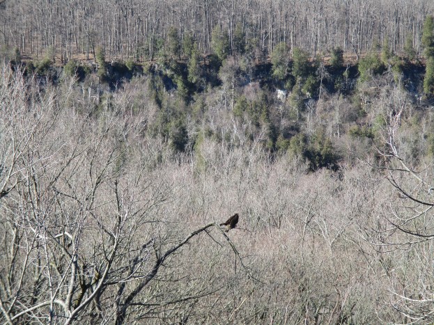
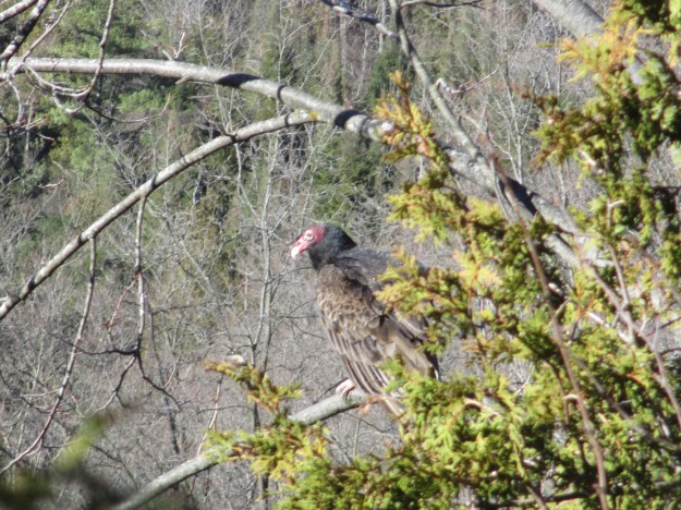
The cover photo shows a turkey vulture sitting in a tree looking out across the Nassagaweya Canyon.  This canyon is a deep cut in the Niagara Escarpment and it takes it’s name from an Indian word meaning “Meeting of two rivers”.  Sixteen Mile Creek and Bronte Creek both occupy the canyon.  When the escarpment was formed a large river cut through the bedrock and created an island of rock which is known as the Milton Outlier.  It has Rattlesnake Point on the southern end.  Four ice ages have further carved the river channel and widened it to the present size as glacial meltwaters flowed through the canyon.

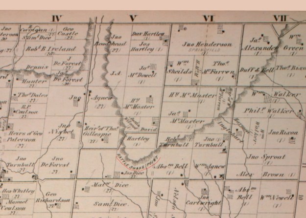
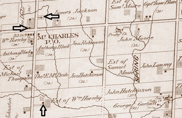
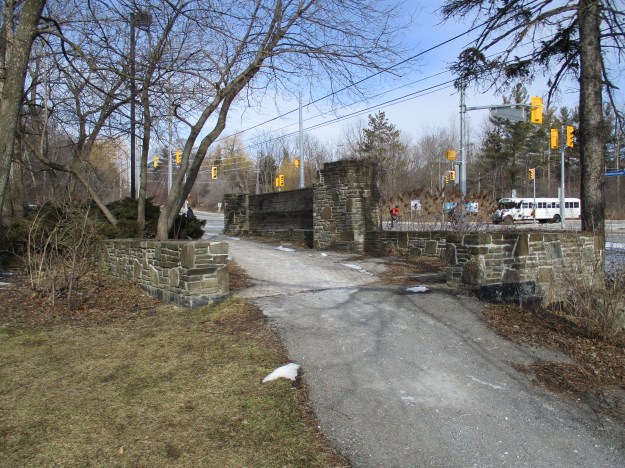
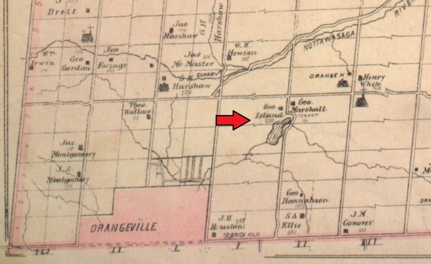
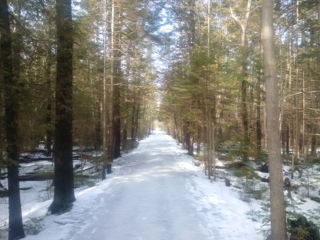
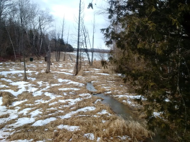
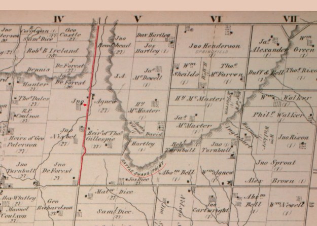
When the county atlas was drawn in 1877 the 4th line was continuous and ran along the Nassagaweya Canyon floor next to Limestone Creek.  The portion of road through the canyon has since been closed.  The northern section is now known as Canyon Road and the part south of Rattlesnake Point is known as Walker’s line.  We parked on Canyon Road where it dead ends near the north end of Nassagaweya Canyon. The closed roadway is still open as a trail which leads toward a connection with the Nassagaweya Canyon Trail, The Bruce Trail and a Bruce side trail.  One possible factor in the closing of this road allowance is the wetlands that it passes through and it’s three crossings of Limestone Creek.  I’ve marked the road in red and the property of John Agnew with a red arrow.

Rattlesnake Point

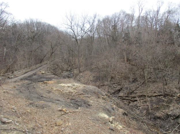
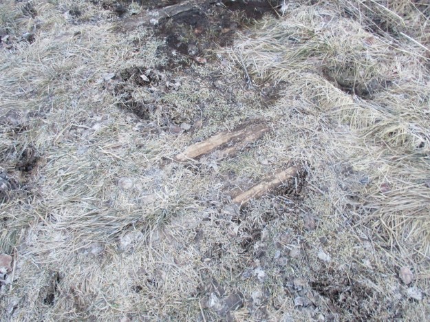
The early settlers who owned the land grants on either side of this road struggled with the maintenance and elected to create a corduroy road.  Logs were placed perpendicular to the roadway to make the road passable.  These roads were bumpy at best and a danger to horses because the logs often shifted.  They were not as refined as plank roads like the Gore and Vaughan Plank Road.  The picture below shows a section where the logs from the corduroy road are showing through the mud and grass.

IMG_0424

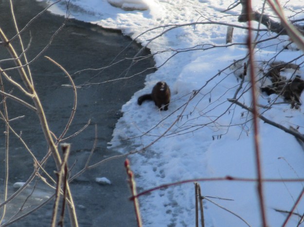
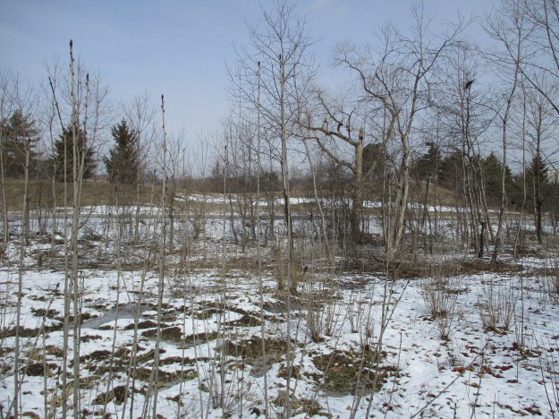
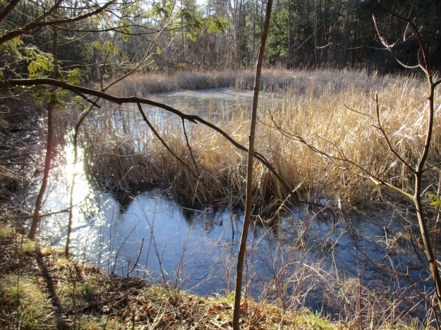
Along the old roadway there is clear evidence of human engineering in the form of drainage pipes, ditches and embankments.  At one point we noted a ridge on the west side of the road that didn’t look natural or man made.  Beavers build retaining walls for their ponds by scooping dirt up using their tails.  The trees around the pond don’t show any sign of recent chewing and so it looks like the beaver pond has been abandoned for a little while.

IMG_0437

The old road allowance connects with several other trails including the main Bruce Trail which is marked with a white blaze.  The blue blazes indicate Bruce Trail side trails and the orange is the 7.2 kilometer Nassagaweya Canyon Trail.  Following it to the right will bring you to Crawford Lake and the restored village of Longhouses there.  Following it, as we did, to the left takes you up the Milton Outlier where the trail follows the canyon edge to Rattlesnake Point.

IMG_0442

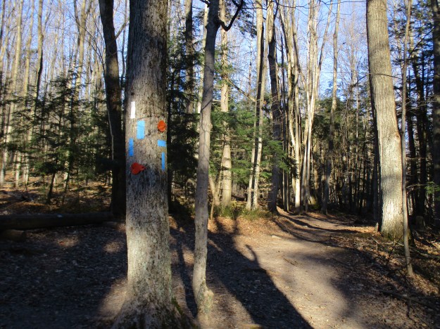
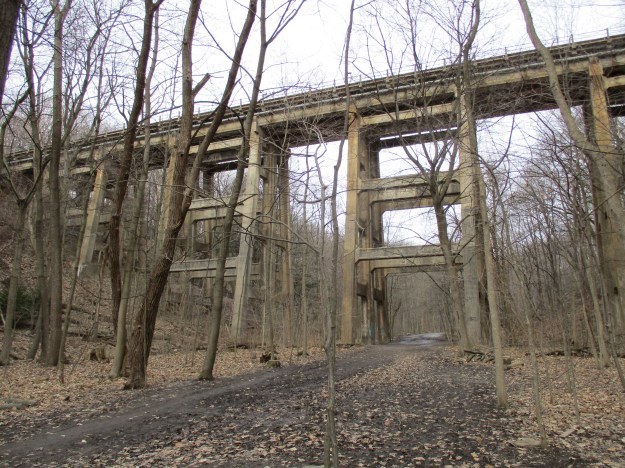
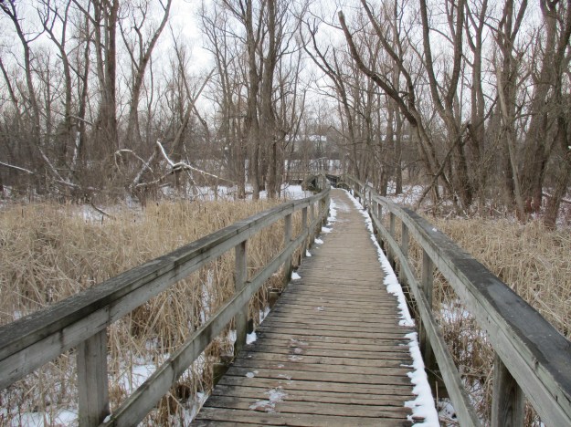
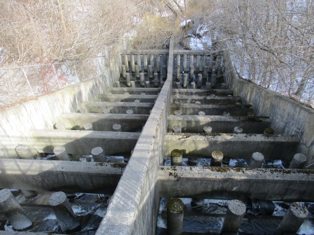
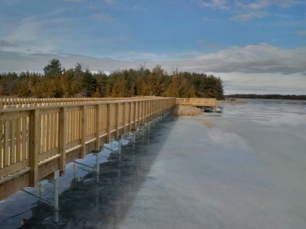
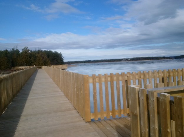
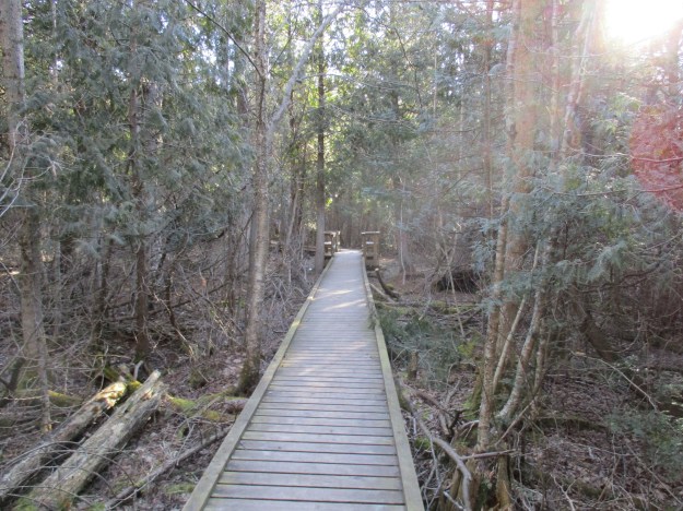
The blue side trail indicated above with two markers in a T formation is the Jack Leech Porter trail.  It is named after a member of the Iroquoia Section and had a boardwalk installed in the mid-1980’s.  In 2010 it was decided to replace the old 480-foot boardwalk with the new one which features a 16-foot bridge over Limestone Creek.  An 8-foot rest area is built into the boardwalk and can be seen in the picture below.

IMG_0443

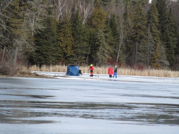
The Nassagaweya Canyon provides a perfect habitat for Turkey Vultures.  They nest on the sides of the cliffs and in April or May produce up to three eggs.  The little ones are fed with regurgitated carrion which makes a smell that attracts predators.  The remote edges of the canyon cliffs provide protection for the nests from these threats.  The vultures spend the winter south of New Jersey and have recently returned to the canyon.  We were approaching Rattlesnake Point when we saw several pairs of vultures circling and resting in trees.  Making our way along the edge of the cliff allowed us to get some close-up shots of the birds.

IMG_0469

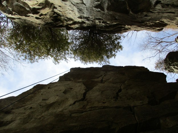
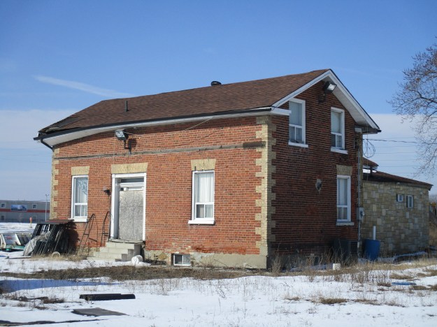
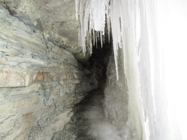
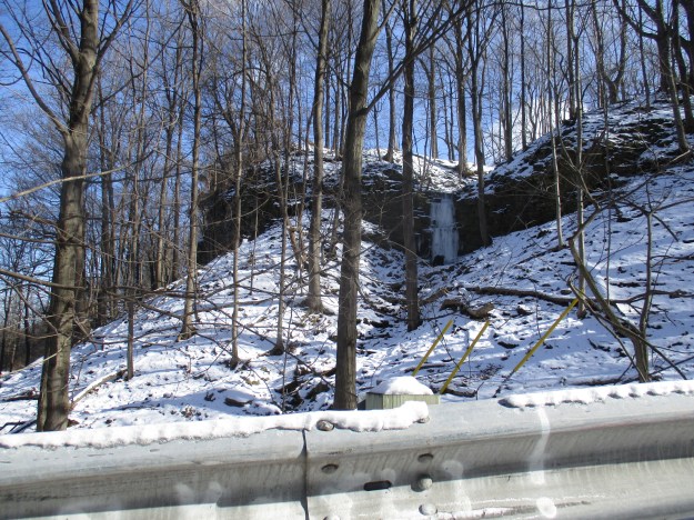
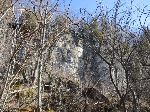
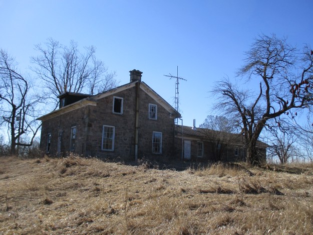
When we visited Rattlesnake Point last weekend we noted an old farm house near the mouth of the canyon.  From our vantage point, we had wondered if it might be abandoned and if we should investigate it some day.  We decided that climbing down the side of the cliff to reach the canyon floor was the only way to find out and so we set out to do so.  We are in no way suggesting that this is a good idea or that you do this.  This picture shows the limestone cliff face near Rattlesnake Point from part way down the side of the canyon. Traversing the valley would allow us to turn the Nassagaweya Canyon Trail into a loop instead of the usual two-way walk.

IMG_0476

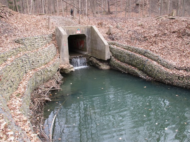
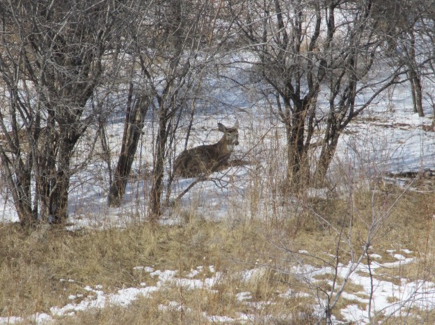
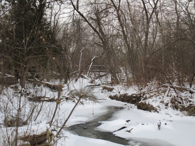
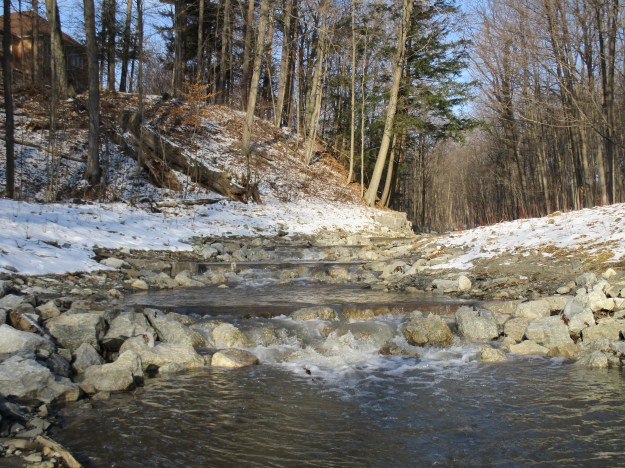
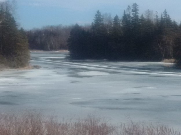
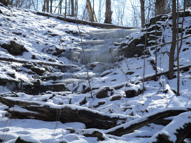
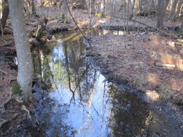
Limestone Creek is a tributary of Bronte Creek and flows through the canyon.  We found a solid tree that had fallen across the creek to use as our bridge.  The forest through the canyon valley is quite young and most of the trees appear to be less than 40 years old.

IMG_0446

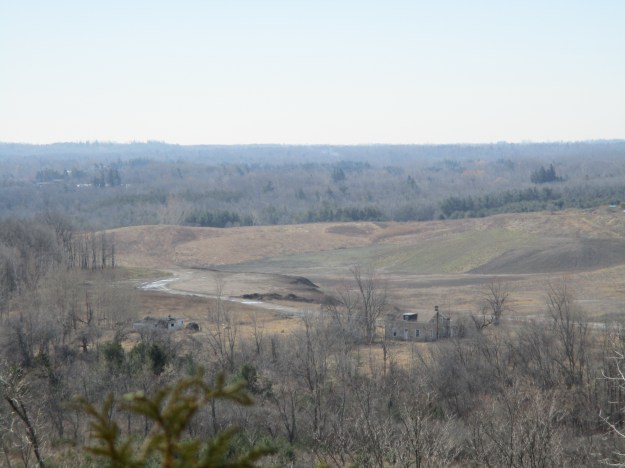
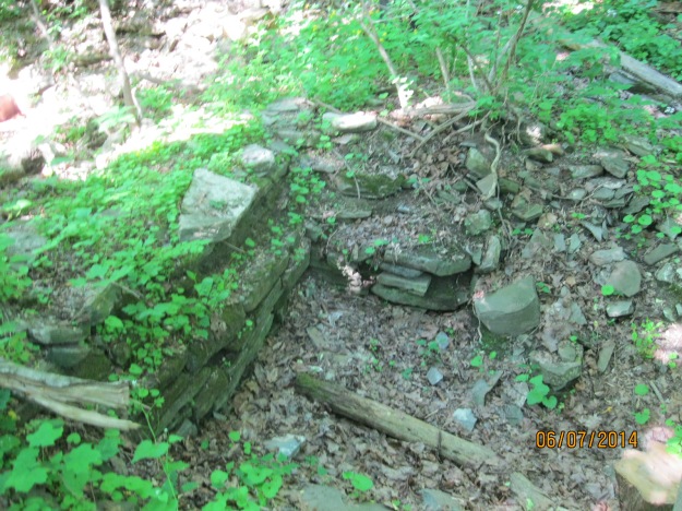
The mouth of the canyon at the south end is full of glacial deposits of sand and gravel. Farmers had to clear their fields of rocks every spring and they were lined up along the edge of fields in place of a fence.  This old stone fence marks the line where a field on the right has recently gone back to forest while the one the left was sold for the mining of aggregates. This property belonged to John Agnew in 1877 as shown on the county atlas above.

IMG_0483

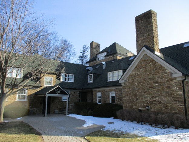
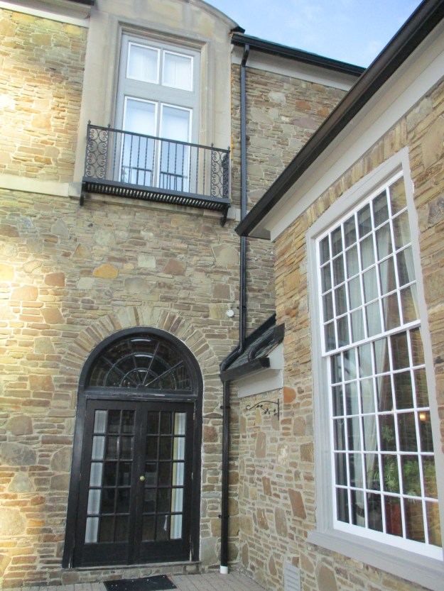
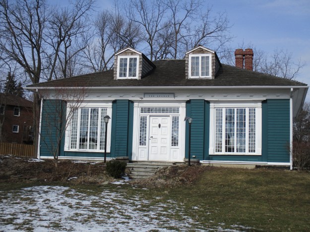
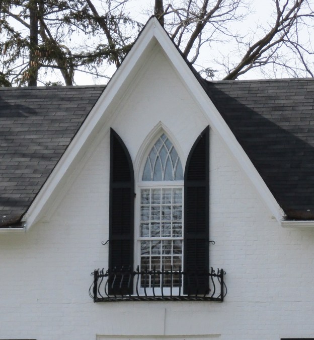
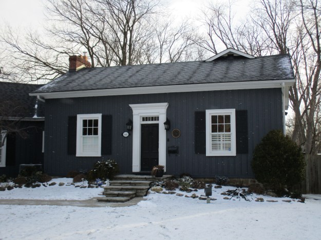
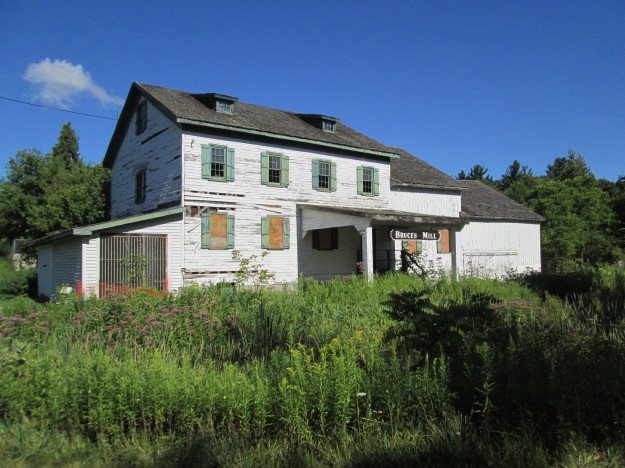
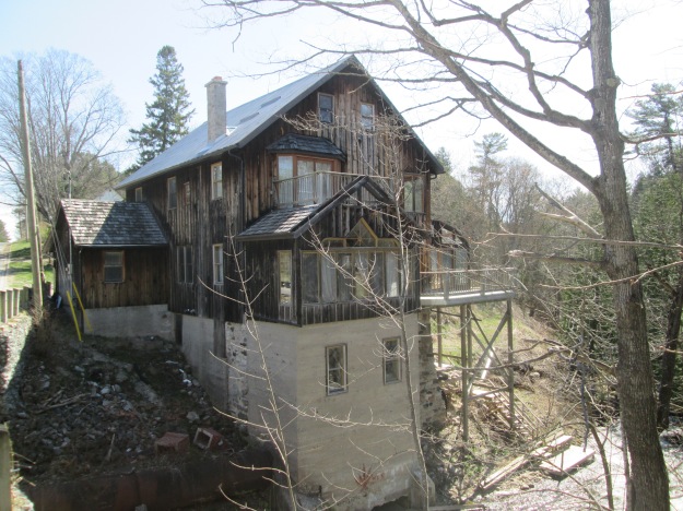
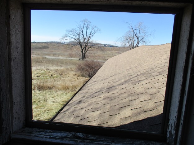
The abandoned house we were seeking is on the edge of the old quarry.  This story and a half Georgian style home has a small dormer on the front which sits just slightly off centre.

IMG_0489

 The house hasn’t been abandoned for very long as there is little damage from weather or vandals.  The view from the upstairs hallway looks out over the extension at the rear of the house toward the site of the quarry.  The tree to the left of the house has an abandoned dog house beneath it.

IMG_0498

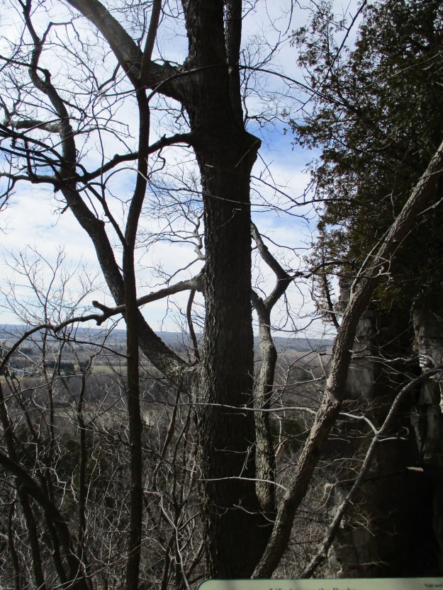
We had to ascend the canyon’s western wall to where we could see people on the Bruce Trail walking along the top of the cliff.

IMG_0521

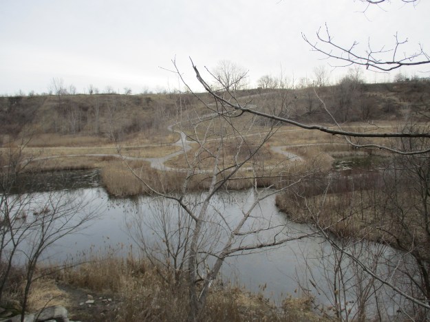
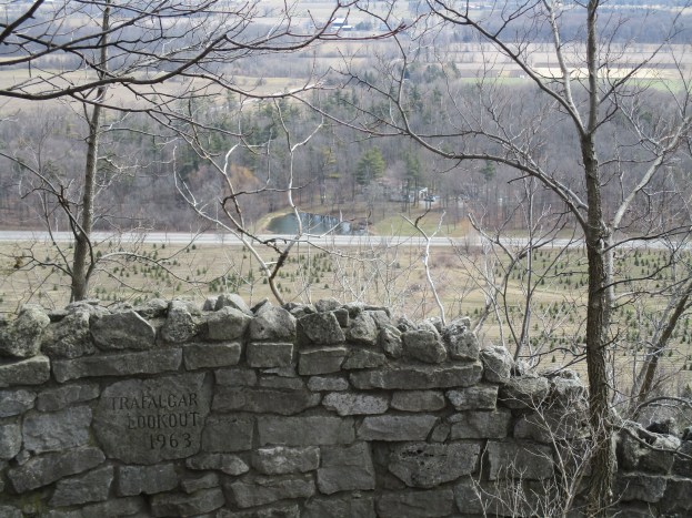
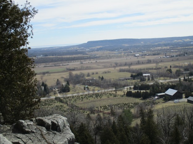
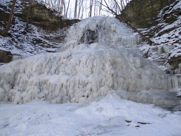
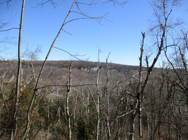
This is the view from the top of the canyon looking back across to the Milton Outlier.  We had descended the 144 feet to the canyon floor at the left end of the white limestone cliffs on the far side.

IMG_0523

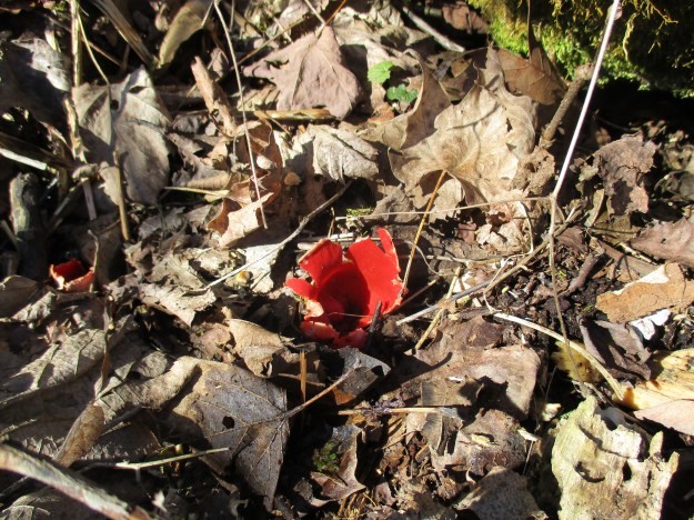
Scarlet Elf Cup is a type of fungus that grows in early winter through to early spring.  They are bright red on the inside and were used by the Oneida people to stop the bleeding on umbilical cords when an infant bled longer than usual.  We found large patches of them growing along the closed roadway.

IMG_0517

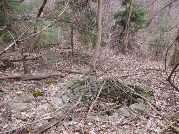
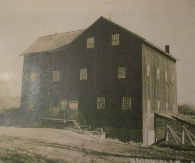
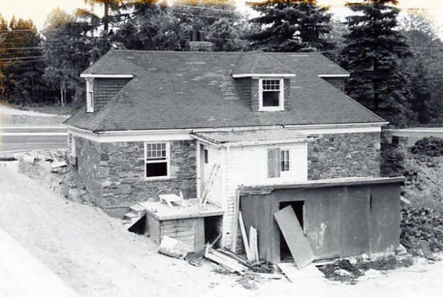
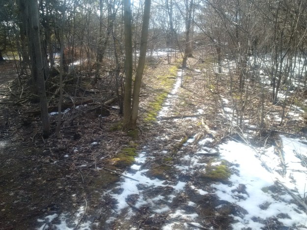
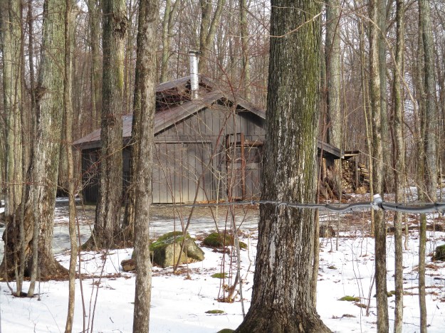
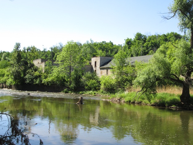
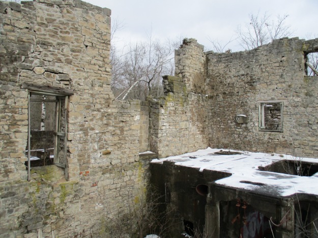
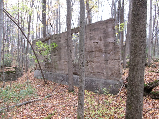
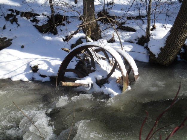
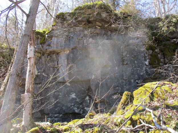
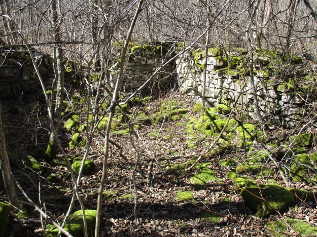
Along the old 4th line road allowance stand the remains of this old building, likely abandoned long before the road was.

IMG_0534

Google Maps link: Nassagaweya Canyon Trail

Like us at http://www.facebook.com/hikingthegta

Follow us at http://www.hikingthegta.com

Beltline Railway – Moore Park

Sunday March 13, 2016

Long before the discussion of subway vs LRT Toronto had it’s first commuter railway in service in 1892.  The Belt Line Railway was intended to take advantage of the building boom the city had been experiencing in the 1880’s.  The Belt Land Corporation was formed in 1890 and new communities named Moore Park, Forest Hill, Fairbank and Fairbank Junction were planned. They purchased large tracts of land and subdivided them into lots and then built a commuter rail system with 44 stops to service them.  Many of these stations were little more than a wooden shack similar to a bus shelter.  These were known as whistle stops and the train only stopped if requested.  The grand masterpiece of all the stations was the one at Moore Park.  It is seen in the cover photo and was intended to service the richest community on the line.  With four towers surmounted with conical roofs, often called “witches hats”, it was intended to speak of the elegance of the neighbourhood.  The fact that the station was really still on the edge of town can be seen in the presence of a chicken standing at the door waiting to get in.

The building boom came to a crashing end when a recession set in.  The lots stood empty and the speculators had their capital tied up without return.  The ridership never showed up and the company was unable to support the failing railway.  At 5 cents per station ($1.00 in today’s economy) it was too expensive and there was no way to continue beyond the first 28 months of passenger service.  Service was discontinued and the station was abandoned.  We started our exploration of this part of the old railway at the site of the Moore Park station on Moore Avenue where I parked on Brendan Road.  Today the former site can be seen clearly again because of the removal of ash trees in the wake of the Emerald Ash Borer’s devastation.  Notice also the steep slope of the rail line which was too much to haul freight up.  After passenger service ended this section of tracks was abandoned.  The rails were removed from this section of railway and shipped to France during World War 1.  After the war the station was demolished.

IMG_0417

The old map below shows the route of the railway with Moore Park being on the right hand side at the northern edge of the city as it existed in 1890.  The CPR bridge and the Belt Line station are also shown on the map.  The ravine with Yellow Creek that forms the western boundary is marked as Vale of Avoca.

Toronto_Belt_Line_Railway_Map

Moore Park was a land speculation concept of John Thomas Moore who envisioned an exclusive enclave for the very rich on the edge of Toronto.  Mud Creek and Yellow Creek each have a deep ravine and the table land between them remained undeveloped.  Moore built the original bridge east of Yonge Street on St. Clair (3rd Concession) over Yellow Creek to allow access to his subdivision.  He named that bridge the Vale of Avoca and the replacement one bears the same name.  To support his community he attracted the Belt Line Railway to the eastern ravine where Mud Creek flowed.  With the housing crash, most of the lots in Moore Park remained undeveloped until decades after the demise of the railway that was intended to serve it.  The railway lands lay abandoned until the city purchased them in 1990 with the intention of creating a linear park 4.5 kilometers long.  In 2000 the Beltline Park was renamed Kay Gardner Beltline Park after a local city councilor.

The Belt Line pond formed when the rail line was built and has been the site of recent restoration efforts.  The water level is low right now but ducks have begun to pair up in preparation for mating season and there were two pairs in the pond.

IMG_0410

As you progress south along the old rail bed there are seven circular stone formations along the east side of the trail.  They may have been old wells but if so, they have been filled in almost to ground level.  Their construction suggests that they may have been contemporary with the construction of the rail line and therefore could have been ash pits. Regardless of their historic use the abundance of plant pots and fertilizer products suggests that they may have gained a whole new purpose for some urban agriculturalist.

IMG_0405

Many of Toronto’s ravines have been altered over the years until they would hardly be recognized by the original land owners.  They have been used for landfill sites and many of them contain several feet of buried garbage in the bottom.  Along one area of Mud Creek the sides of the hill are covered with broken concrete from a building demolition.

IMG_0400

When the railway released its promotional schedules it began to refer to Mud Creek as Spring Creek because it sounded better.  In places where the creek has been left natural it it still a beautiful place in spite of its unflattering name.

IMG_0398

The North Toronto subdivision of the Canadian Pacific Railway (CPR) was the main line between Toronto and Montreal.  It passes over both the Vale of Avoca and the Belt Line railway and prior to construction of the Half Mile Bridge, trains had to back from Toronto Junction into downtown.  When the North Toronto Station was built at Yonge Street passenger traffic increased greatly and it was decided to double track the line.  In 1918 old steel trestles were replaced over both of these ravines with concrete ones which were built of similar construction.  The bridge over Mud Creek is 386 feet long and 80 feet high.

IMG_0395

Gabion is a word we borrowed from the Italian language and it means cage.  We use it as a term to describe a civil engineering feature that is used to control erosion.  A wire cage is filled with stones and placed along the banks of a stream.  In this case along Mud Creek the gabion on the right hand side of the picture is already drooping into the stream because the dirt has eroded away below it.

IMG_0399

Mud Creek was redirected from it’s natural course to flow through the Don Valley Brick Works to provide a source of water for use in the brick making industry.  Many of the bricks used in historic Toronto were manufactured at this site with clay that was dug out of the rear of the property.  When the clay was exhausted the factory was closed and left abandoned.  Recent efforts to rehabilitate the property have resulted in the partial filling in of the huge hole left from the open pit clay mine.  It has been turned into a park with ponds where people can walk and enjoy the wildlife that has made itself home here.

IMG_0389

The trail leads to the Don Valley Brick Works buildings which have been transformed into a farmer’s market, heritage museum and parkland.

IMG_0387

Beyond the Brick Works the trail connects to Milkman’s Lane.

Google Maps link: Belt Line Trail

Getting there by transit: From Davisville Station walk two blocks south past Merton to the trail.  The south end is accessible via route 28 which also runs from Davisville Station.

Like us at http://www.facebook.com/hikingthegta

Rattlesnake Point

Saturday March 12, 2016

Rattlesnake Point is located on a mesa-like outlier where the Niagara Escarpment makes a rise in elevation from about 240 meters to 440 meters.  A glacial ravine divides it from the vertical rock faces of the escarpment to the west.  This ravine, known as Nassagaweya Canyon, is partially filled in with glacial stream deposits.

On the 1877 County Atlas map below the escarpment is marked by a series of scalloped lines that indicate a quick change in elevation.  Just west of Milton the shape of the escarpment reminded the surveyors of the shape of a rattlesnake’s tail.  The southern promontory of this geological formation was known as Rattlesnake Point at least 140 years ago when the map was drawn.  Timber Rattlesnakes were seen here by the hundreds sunning themselves on the rocks but they have been gone for over 60 years.  The land is rugged and covered with rocks but the map shows that it has all been granted as homesteads to settlers.  Joseph Dice owned the property with Rattlesnake Point on it while his father, Matthew owned the one just below it.  The little square of small dots beside the larger one on Joseph’s property indicate an apple orchard planted near the house.  In a twist of the macabre, Joseph died on Aug. 1, 1917 when the wagon load of hay he was harvesting rolled over.  He jumped clear from the wagon but the horses bolted and they dragged the wagon wheel over his abdomen, fatally wounding him.

Rattlesnake Point

Joseph Dice never opened the road allowance up the side of Rattlesnake Point and it is shown as a dashed line on the map above.  It has since been opened and now features a tight hairpin curve as you climb the escarpment.  Whereas the land on top of the escarpment was predominantly open in the 1870’s it has now been largely reforested. Some of the new tree cover was planted in straight rows while other areas have been reclaimed naturally over the years.

IMG_0339

Eastern White Cedar trees can live to be hundreds of years old.  Starting in 1998 the Niagara Escarpment Ancient Tree Atlas Project began identifying trees that are between 500 and 700 years old.  These cedar trees cling to the cliff face where their ecosystem has remained undisturbed during the clearing of the table land for farming.  They also tend to be small in size making them less desirable than the trees that the farmers harvested for fence posts and other building materials.  Prior to opening the park to sport rock climbing it was necessary to conduct a study to make sure that none of these ancient trees were disturbed. At Rattlesnake Point one cedar, for instance, was identified at 588 years old but only 3.2 meters tall.  The cedar tree clinging to the rock face in the picture below is not that specific tree but demonstrates how they can find a way to survive almost anywhere.

IMG_0305

The Trafalgar Lookout is seen in the cover photo and is near to one of the rock climbing areas.  in 2006 a series of bolts were installed on the top of the cliff face in areas where the vertical face was clear of vegetation.  These bolts are inspected regularly to provide a safe anchor for top-roping.  Once the rope has been run through the anchor it is dropped over the side.  At this location there is a set of stairs to provide access to the cliff bottom.  Top-roping is usually how most rock climbers get started.  We saw a licensed  instructor teaching first timers how to rope off at the top of the cliff.  A second type of climbing, known as lead climbing, is done near the same location on a tall thin fragment of rock that stands a few feet out from the cliff face.  In lead climbing a rope is clipped to the rock wall every few feet to limit the amount of a potential fall.  The climber removes the clips as they ascend and fixes them to their belt.  On the way back down they replace them for the next climber.  We watched the guy in the picture below as he made his way up onto that thin sliver of rock.  Notice the collection of clips on his belt.

IMG_0362

The picture below is taken from beside the rock face that the individual above was climbing.  Looking up you can see some small cedars clinging to the rock face on the side where climbing is not allowed.

IMG_0371

The hackberry tree is a member of the hemp family and can live up to 200 years.  It has a light grey bark which has extensive ridges and warts on it.  It will bloom between late April and early May and produces both male and female flowers on the same tree making it a monoecious plant.  The natives used hackberry bark to treat sore throats, sexual diseases and menstrual cramps.  They also ate the fruit in a form of a porridge.  Today, the fruit is eaten fresh or in the form of jam.  Leaves from the tree provide food for deer and small mammals and birds eat the fruit.  The hackberry tree does not grow farther north than Halton and is part of the Carolinian Forest, the richest vegetation zone in Canada.

IMG_0369

Around 12,000 years ago, at the end of the last ice age, glacial melt and raging rivers carved out sections of the escarpment.  The Nassagaweya  Canyon is one of these meltwater channels.  The canyon runs between the Milton Outlier which contains Rattlesnake Point and Crawford Lake with it’s historic village of Longhouses.  The mouth of the canyon is filled with glacial outwash till and is home to sand and gravel quarries like the one in the picture below.

IMG_0330

Lowville Valley extends 5 kilometers between Rattlesnake Point and Mount Nemo.  It is drained by Bronte Creek which was a powerful river when the glaciers were melting.  Lake Ontario can be seen in the distance.

IMG_0384

Eastern chipmunks hibernate in the winter and are a sign of the return of spring.  They live in solitary except during mating season which happens in early spring and again in early summer.  We saw several pairs of them playing their little chipmunk games.  A litter of four or five will emerge from the den about six weeks after they are born.  Within two weeks the newborns will set off to build their own dens.  Those that don’t end up as prey to hawks, snakes or a wide variety of predatory mammals will live for three years or possibly longer.

IMG_0346

Looking to the east you can see the towers of Mississauga and on a clear day, the CN tower.

IMG_0379

Rattlesnake Point contains several trails including the Bruce Trail, the Vista Adventure trail and Buffalo Crag trail.  The Nassagaweya Canyon trail also connects at Rattlesnake Point.

Google Maps link: Rattlesnake Point

Like us at http://www.facebook.com/hikingthegta

Mt. Charles – Ghost Towns of the GTA

Sunday Mar. 6, 2016

Mount Charles is a lost town at the corner of Dixie and Derry Road.  In the 1870’s it was a small community of about 50 people but they had two wagon making shops to serve the needs of local farmers.  The Second Purchase, or Treaty 19, was signed in 1818 in which the First Nations surrendered most of what is now Peel County.   In 1819 it was surveyed and our modern Derry Road was simply a narrow trail cut through dense forest by the surveyors.  Charles King Sr. arrived 1819 and took the 100 acre land grant on the north east corner of Dixie and Derry.  Seven years later his son, Charles Jr., received the adjoining land grant.  The community started to grow under the name of Kings Crossing or King’s Corners.  Charles Jr. opened a post office in 1862 in his store on the south east corner (where the gas station is today).  To avoid confusion with other communities they decided to drop King in favour of Charles.  There are no hills, let alone mountains, in the area so the name Mount Charles may contain a bit of jest as well.  By the time of the county atlas in 1877 the Kings had sold their homestead and it was owned by James Jackson.  The pioneer cemetery is located on this lot.  Also shown on the atlas are the two homes featured in the story below.

Mt. Charles (3)


One of two surviving houses in Mount Charles is the former farmhouse of the Dale family. John Dale was a farmer and may also have been the Justice of the Peace.  This three bay house also features an odd off-centre doorway.  In Georgian styled homes the doorway is almost always centrally located in a well balanced layout.  This home has recently been restored and is in use.

IMG_0247

The Dale family farm is now home to the Ontario Khalsa Darbar which is one of the largest Sikh temples in Canada. Formally known as a gurdwara, or doorway to the Guru, this is the place of worship and celebration for the Sikh faith.  This temple can attract up to 10,000 people for special days and in spite of it’s size can be over-crowded.

IMG_0250

By the 1870’s the town was typical of rural Ontario with it’s own blacksmith shop, a carpenter shop in addition to the wagon makers.  Being on a well traveled road, they also had need of an inn for travelers to rest their horses and wet their dry throats.  The Primitive Methodists had a church in town until around 1859 when they appear to have joined with the congregation in the town of Palestine at the next crossroads.  The community had already been sharing a school with Palestine.

Built in 1860 the Hornby House went through several owners and so is listed on the heritage register as the Hornby-Scarlett Ambler-Courtney House.  It is shown on the atlas at the end of a long lane way on the estate of William Hornby.  Hornby also owned a corner lot in down town Mt. Charles.  The house was moved from its original location on the lot so that it could be saved during the development of the farm as a subdivision.  The five bay, one and a half story house has ornate brickwork with highly decorative wooden trim.

3491

It now serves as the Old Scarlett House Restaurant and is located near the corner of Dixie Road and Courtney Park Drive East.

3489

Charles Irvin and his wife Jane were both born in the 1790’s when the colony of Upper Canada was just getting it’s start.  They came to Mount Charles where Charles worked as a weaver.  Weavers provided a valuable service in the community because they freed the women up from the task of weaving all their own cloth.  Weavers usually kept a small herb garden to grow plants used to dye the wool.  Irvin became locally famous and his loom is now located in Black Creek Pioneer Village in the Charles Irvin Weaver’s Shop.  The cemetery, which still contained a church on the county atlas, is the other remaining evidence of the community that once thrived here.  Several of the King family are buried here including both Charles Sr. and Jr.

IMG_0255

Mt. Charles is a ghost town that has been slowly wiped from existence by the huge industrial zone around the airport.  Until a few years  ago there were several other buildings which have since been lost.  The south west corner contained three buildings in 2003, including the old blacksmith shop, but they have since been demolished.  We followed Etobicoke Creek south along the west end of Toronto Pearson International Airport where a formal trail begins near Courtneypark Drive.  We followed the trail south along the airport, at times right along side the fence.  In 1937 the Toronto Harbour Commission began to buy farms in the area of Malton for the purpose of establishing an airport.  When it opened in 1939 it was known as Malton Airport and the Chapman farmhouse served as both the offices and the original terminal.  The archive photo below shows the house in 1937.

1024px-F._Chapman_farm_house_-_the_first_office_and_terminal_at_Malton_Airport_1937

The trail is a great place for people who love to watch airplanes landing and taking off. Being in an industrial zone it was nearly empty and we saw plenty of wildlife which might be in hiding during lunch hours on a week day.  We crested a hill in time to see half a dozen white tail deer who vanished into the thickets along the Etobicoke Creek.  Today the view through the fence is quite different then it was in the 1937 picture above.

IMG_0274

There are several local species of mammal that look similar and can be distinguished by their colouring and habitat.  Along Etobicoke Creek we saw at least three different examples of the American Mink.  They have dark brown fur with a white patch on the chin. They are very fast and refuse to pose for pictures.  Their diet consists of small animals but can include rabbits and the occasional sea food in the form of crayfish and sometimes also unwary birds.

IMG_0237

White tail deer give live birth to their fawns between late April and early July.  This doe was sitting in the woods quietly observing us.

IMG_0298


The former town of Mount Charles may have disappeared under the development of the airport but there still remains a few reminders of the community that was.

Google Maps link:  Mount Charles

Like us at http://www.facebook.com/hikingthegta

Follow us at http://www.hikingthegta.com

Union Mills – Unionville

Saturday March 4, 2016

When millwright Ira White arrived at the north end of what would become Unionville in 1839 he recognized the east half of lot 13 in the 5th concession to be an ideal site to harness the water power of Bruce Creek.  He built a sawmill first and then set about cutting the wood for the grist mill he built where the creek crosses Main Street in Unionville.  This street was originally the winding lane to the mill but soon became lined with homes and businesses as the community grew around the mills.  It is believed that White named his mills Union Mills when Upper and Lower Canada were united in 1841.  When a name was needed for the post office Unionville was selected.  An archive photo of the mill is seen in the cover picture.  The area along the main street has now been declared as a cultural heritage district because of it’s unique collection of heritage buildings that demonstrate many architectural styles from log houses to condos.

Toogood pond was named after Arthur Toogood who owned the property prior to the town of Markham buying it in 1980.  We parked on Main Street in the public lot across the street from the original site of Union Mills and walked along Bruce Creek toward the dam.  An early name for the mill pond was Willow Pond and the reason for this can still be seen today in the old willow trees that line the sides of Toogood Pond.

IMG_0174

On the east side of Toogood Pond is a pavilion with restrooms that are open and heated at this time of year.  There is also a viewing deck and restaurant.  This picture is taken from the fishing platform that is built out into the pond on the west shore.

IMG_0177

William Berczy led a group of about 67 families of Pennsylvanian German settlers into the woods north of Toronto and founded what would become Markham.  They completed 15 miles of Yonge Street between Eglinton Avenue and Elgin Mills and one of his group was Philip Eckardt.  Berczy Creek flows into Toogood Pond and is named after Berczy.  The trail criss-crosses the creek several times before reaching 16th Avenue which runs along the south side of lot 16.  One of the bridges across the creek can be seen in the picture below. By walking east on 16th avenue for 1 kilometer you will come to Bruce Creek which leads back to the pond.  A little side detour to Kennedy Road will bring you to a surprising log home and pioneer cemetery.

IMG_0186

The oldest surviving home in the community of Unionville is known as the Philip Eckardt Log House. Lot 17 in the 6th concession was first granted to Frederick Westphalen in 1794, when he arrived with Berczy, and he received his crown patent in 1803.  In order to receive the full ownership of the property a settler had to complete some basic requirements including the clearing of 5 acres of land, the construction of a home at least sixteen by twenty feet and the opening of the road allowance along the property.  Therefore, there was a log house on the property before Philip Echkardt arrived in 1808 and it is very likely that the home credited to him was already there when he purchased the lot.  The house was used to host Lieutenant Governor Simcoe when he visited the area.  It has been altered several times over it’s 200 year life and siding has been added over the original log construction.

IMG_0072

After following Bruce Creek south from 16th Avenue you return to the top of Toogood Pond.  This pond has two creeks that flow into it and supports a large wetland.  A long wooden boardwalk has been constructed that crosses both Berczy Creek and Bruce Creek.

IMG_0196

The original wooden crib dam at the bottom of the mill pond has been replaced with the modern concrete 5 sluice gate construction.

IMG_0166

To allow the passage of fish around the Toogood Pond dam a fishway has been constructed. Fish can make their way up this little stream along the west side of the dam.  At the top they have to make a small jump to get into the pond.

IMG_0173

One of the reasons for the unique style of the buildings in historic Unionville is the 140 years that the Planing Mill produced the wood and gingerbread for local tradesmen.  The original planing mill was built in 1840 by William Eaken and operated until severely damaged in 1978.  The building was destroyed by a fire in 1983 but replaced with this modern structure in 1987.

IMG_0022

The Stiver Brothers grain mill is the last remaining one of its kind in Markham and a style of building more commonly seen along the railway lines in the prairies.  Unionville was the centre of a rural farming community and around 1900 grain elevators began to appear beside the railway station.  in 1916 Charles and Francis Stiver repaired a grain elevator beside the train station that had been damaged by fire.  The Stiver Coal and Seed company was in the business both of buying and selling seeds.  They provided seed for planting as well as animal feed.  Originally the chopping work needed to make the animal feed was done at the Union Mills.  When they were destroyed in a fire in 1934 the Stiver brothers added a feed mill to their operations.  The Stiver Brothers closed the business in 1968 and by 1993 the building was empty and deteriorating.  It has recently been restored and was opened again in 2014 as a cultural centre.

IMG_0008

John Noble Raymer came to Markham township in 1809 and his cheese factory is believed to be one of the first in Upper Canada.  John operated a family farm but in 1866 he traveled to Evans Mill, New York to study the art of cheese making.  When he returned he opened a cheese factory on the family farm.  It was so successful that he decided to expand with a second factory in Unionville.  He purchased a half acre property on the east side of main street just above the Union Mills.  In 1870 he built and opened his cheese factory in Unionville.  After he died of smallpox in 1874 the business carried on until 1878 when it was closed and the building sold.  The front wing and porch were added when it was converted into a home.

IMG_0041

The Crown Inn is the oldest surviving inn in the community and it is also on the east side of Main Street just above the site of the Union Mills.  It was built around 1860 by a man named William Size who lived with his parents in the Union House which was an inn across the street.  He operated his hotel in direct competition with his parents. One of the first hotel keepers here was Avery Bishop whose great-grandson was Billy Bishop a World War One flying ace.  The Toronto Island Airport is named after Billy Bishop.

IMG_0040

The Union Mills may be gone but the mill pond and historic community it spawned remain almost untouched by time.

Google Maps link: Toogood Pond Unionville

Like us at http://www.facebook.com/hikingthegta

Ghastly Tales of Sawmill Valley Creek

Saturday Feb. 27, 2016

This hike focused on an area around Sawmill Valley Creek which features one of the earliest homes in the area, an haunted historic grand estate as well as the possible burial site for Tootsie the Elephant. The Glen Erin trail and the Sawmill Valley Trail connect everything.  We parked on Dunwin Drive just north of Dundas Street and followed it north to Brookmede Park.

This part of Dunwin Drive used to be the laneway for the Miles Park Farm.  In 1912 a Toronto undertaker named A. W. Miles built a country home and small zoo in Mimico.  By 1936 the neighbours were complaining and city council was telling him to shut it down.  He decided to buy 200 acres of land on the north west corner of Dundas Street and fifth line west (Erin Mills Parkway) near Erindale.  The park was an instant success with bears, monkeys, llamas and peacocks.  Donkeys and camels were also residents along with many other animals but none were more popular than Tootsie.  Born in Burma, Tootsie the elephant loved children.  Unfortunatey, Tootsie perished along with 70 other animals in a fire on Valentines Day 1943.  Children from all around came to attend her funeral and the burial which took place on the farm.  In spite of the tragic loss, the farm continued to operate into the 1950’s before being sold for development.  The bones likely are buried under modern Brookmede park as there is no record of their discovery during construction on the property.  The picture below shows the park and possibly even the final resting place of Tootsie the elephant.

IMG_0144

A small tributary feeds into Sawmill Valley Creek and we followed it from Brookmede Park to where it joins Sawmill Valley Creek near Mississauga Road. Along one section it descends the ravine in a hydraulic energy dissipator. This is designed to slow the water down and remove the energy as it falls so that it arrives at the bottom of the ravine without the energy to cause erosion or do damage. Looking at the series of concrete steps and cylinders running down the hillside it makes me wonder about the waterfall that must have been in this location at one time.

IMG_0148

In 1927 William Watson Evans built Glenerin Hall in a glen near Erindale on Sawmill Valley Creek.  The 85 acre estate was intended as a summer retreat for the millionaire and his family so they could get away from their Rosedale home in Toronto.  This was the era of grand estates and several were built in the area but only a few survive.  The tower and the music room at the front were added a couple of years later but sadly, Evans died in 1932 before getting to enjoy his estate for very long.  At his request he was buried nearby.  The home was used as a school by over 100 students, mostly girls, and their teachers during World War 2.  The students, from Hornby England, spent the last part of the war in safety here.  One of the interesting uses of the property began in 1945 when the Simpsons purchased it.  They converted it into a convalescent retreat for employees who were injured on the job or underwent surgery.  All expenses were paid from anywhere in Canada including full salary while you were here recovering.  When the Simpsons had to cut expenses in the early 1960’s this was quick to go.  It was later used as a monastery, a real estate development sales office and also served as home to Mississauga’s first Jewish community.  It is now the Glenerin Inn and spa.  It is featured in the cover shot as well as below.

IMG_0128

They say that there is a spirit in the house and it is a site frequently visited by those seeking the paranormal.  Although reported as a full apparition in the doorway they claim he is most often seen tending the fire in the great hall.  Some believe it is the spirit of William Watson Evans as he continues to host his guests in the home.

IMG_0125

When Glenerin was built there was a gatehouse on the corner of the lane way at Mississauga road.  The picture below, from the Mississauga Library, shows the gatehouse in 1978.

Gatehouse 1978

Today the foundation for the gatehouse have been converted into a sign for the subdivision that stands on the property.  The subdivision is named Ivor Woodlands after Roy Ivors who owned the Winding Lane Bird Sanctuary on the property to the north of the Inn.

IMG_0134

In the woods not too far from the Evans  Estate is an old utility pole which brought electricity when the building was first constructed.  Electrical insulators were introduced in the 1850’s along with telegraph wires.  Electrical transmission adopted the same poles and the glass insulators were used for this application as well.

IMG_0106

Sawmill Valley Creek has recently been landscaped for erosion control.  What was formerly a long series of cascade waterfalls has been turned into a series of steps made of cut stone blocks.

IMG_0098

The Grange was built sometime around 1828 for Sir John Beverly Robinson who was the first Chief Justice of Upper Canada.  He was also considered to be the leader of the Family Compact which controlled the government leading to The rebellion of 1837.  The regency styled house with it’s ornate windows was indicative of the status of it’s owner.  Robinson only owned the house until 1833 when it began a rapid change of ownership until around 1910 having seen up to ten owners during this time. Then the Adamson family took up residence here and they stayed until 1973. Sometime during the Adamson years the exterior of the home was given an exterior layer, or veneer, of brick from the local Cooksville Brickyards.  The building was given to the city of Mississauga by the land developers and used by the Boy Scouts until 2004.  It has now had it’s bricks removed and been fully restored to it’s original splendor.  The Heritage Resource Centre of Heritage Mississauga is now the occupant of this home.

IMG_0139

Community Canoes are a way of re-purposing old canoes and turning them into bee friendly gardens.  Due to a phenomenon called  Colony Collapse Disorder we have lost over one third of our bee colonies since 2007.  Bees are essential in the pollination of most of the fruits and vegetables we eat as well as the colourful flowers we enjoy.  They also pollinate many of the plants that the animals in our diets live off of.  On June 13, 2015 Heritage Mississauga planted a community canoe on the lawn of The Grange.  We had previously encountered a community canoe along Garrison Creek during our exploration of Military Burying Grounds.

IMG_0142

Google Maps link: Glenerin Inn

Like us at http://www.facebook.com/hikingthegta

Unionville – Dating By Design Styles

February 23 and 26, 2016

Gothic Revival, Queen Anne or Italianate?  What do design features reveal about the age of a building?  The town of Unionville was founded in 1794 by Philip Eckhardt who had surveyed the county under a ten year contract with the British government.  The town remained a rural community into the early 20th century and has retained many of it’s heritage homes.  Unionville has now been recognized as a cultural heritage district because of the historical community that has been preserved here.  The town boasts homes built from several major architectural styles that were popular over the decades. This post explores some of the defining features of those architectural styles using examples from the town, mostly from walking the main street.  Friday’s pictures are the ones with snow.  The examples are from Unionville but the styles can be used to give date ranges to buildings throughout Southern Ontario.

Georgian (1790-1875)

The Georgian Style was named after the first four British kings named George who ruled between 1714 and 1830.  The design is usually 3 bays (openings) and sometimes 5.  The plain windows are rectangular with small panes, often 6 over 6.  The roof tends to be of a medium pitch.  This example was built in 1835 and at one time served as the town jail.

IMG_0079

The Regency Cottage (1810-1840)

This style of home was made popular in England when the Prince Regent had the Royal Pavilion redesigned using elements from eastern temples. Regency cottages tend to have low pitched roofs, compared to the Georgian, and a 3 bay construction. The front door is elaborate with two sidelights mounted on the pilasters and a transom across the top of the door frame. The windows tend to be large, running from floor to ceiling.  They are typically divided by thin glazing bars into small rectangular shapes.  The Eckardt house was built in 1829 for a member of one of Markham’s oldest families.  Philip Eckhardt had been a founding leader of the Berczy settlement in Markham and was responsible for the early construction of Yonge Street.

IMG_0045

Gothic Revival (1830-1890)

This style became popular in England in an attempt to recreate the styles of the gothic and medieval periods.  They tend to have steeply pitched roofs , pointed arched windows set in high gables and decorative brickwork.  The house below has a regency cottage lower story but a Gothic Revival centre gable with the arched window.

IMG_0054

The Gothic Revival style was frequently used on churches in Ontario and there are two great examples in Unionville.  The Primitive Methodist Church, now the United Church, was built in this style in 1879.

IMG_0090

The Italianate (1840-1890)

The Italianate style was developed in England as a return to the architecture of the country villas of the Italian Renaissance.  The style makes a middle ground between the plain Georgian and the extensive gingerbread of the Gothic Revival styles.  This style typically uses a lot of brackets under the eaves and repetition of the ornamentation. Round headed windows in a decorative surround like the ones on Dr. Albert Pringle’s house below from 1877 are a common feature of Italianate style homes. Pringle served as the community doctor from 1878 to 1883.  This house has a high pitched roof typical of Gothic Revival instead of the low pitched roof more common on the Italinate style.  There are several homes in Unionville that exhibit a mix of styles.

IMG_0058

Second Empire (1860-1900)

Second Empire was the official style used in France and her colonies during the reign of Nalopeon III.  One of the distinguishing features of this architectural style is the mansard roof. Francois Mansart (died 1666) is credited with developing this roof style which increases the amount of usable space in the upper floors.  He is considered by some to be the most accomplished French architect of the 17th century.  Mansard roofs have a four sided double slope where the upper slope is very shallow and the lower one very steep.  This brings the roof and shingles down the side of the building where they are usually punctuated by windows in the lower sections.  Second Empire buildings tend to be square, often with a wing projecting from one side.  The windows tend to be round-headed and bay windows are often used.  The house below was built in 1879 for Esther Summerfeldt and displays Second Empire styles.  The Summerfeldts arrived in Markham in 1794 with the Berczy settlers and lived on a local farm.  After her husband’s passing Esther moved into Unionville where she commissioned this house to be built.

IMG_0056

The Queen’s Hotel was also built in the style of Second Empire.  The use of the mansard roof allowed the third floor to be used for guests because it allows for full head room almost to the outside wall.  The hotel was built in 1860 but was badly damaged by fire in 2015.  Restoration is ongoing but notice the large white door on the second floor.  This led onto a balcony that ran the length of the building.  The iron brackets for the balcony are part of the ornate detail which includes yellow brick quoins and lintles.

IMG_0037

Queen Anne (1880-1910)

Named after Queen Anne who ruled from 1702-1714 the style actually has little to do with architecture from her period.  It emerged in the late Victorian era when variety and complexity dominated life.  They tend to have asymmetrical towers and bays and windows of all shapes and sizes.  Decorative bricks, wood and shingles were also used.  The example below has vertical wood siding.

IMG_0075

Edwardian Classicism (1910-1930)

This style emerged in reaction to the increasingly complex styles of the late Victorian Era. They feature simplified roofs, often pyramidal, with large dormers featuring two windows. Verandas tend to have heavy columns with brick piers.  The most popular examples are known as the Four Square because they are two bays over two bays.  The example below has had the front veranda modified into a full porch.  The original brick piers can still be seen on the outside.

IMG_0087

Unionville Vernacular (1790-1920)

A vernacular architectural style refers to those elements that are specific to the location. The use of local tradesmen as well as wood and trim produced at the Unionville Planning Mill give the town a unique flavour.  A four leaf clover motif appears on many homes.  The extensive use of gingerbread can also be attributed to the local planning mill.  The Andrew Eckhardt house featured below was built some time before 1856.  It features a gothic window with 12 panes, 6 over 6 windows and extensive trim.  It sits on a foundation of field stones while concrete foundations indicate a 20th century construction.

IMG_0046

The Miller’s house is a good example of a vernacular home.  It resembles a Gothic Revival with it’s steep gabled roof but has rounded windows like the Italianate instead of pointed.

IMG_0091

This date stone from the Evangelical Lutherin Church contains the earliest date I have seen inscribed anywhere in Ontario.  A frame church was originally built in 1794 and replaced with a brick one in 1862.  After the centre of town shifted south to the railway, the church was taken apart and moved in 1910.

IMG_0068

The history of Unionville and an exploration of Toogood pond park await a future post.

Google Maps: Unionville

Like us at http://www.facebook.com/hikingthegta

Island Lake

Saturday Feb. 20, 2016

The story of Island Lake dates back to the retreat of the last great ice age in North America. The Wisconsin Glaciation period ran from about 85,000 to around 11,000 years ago.  When the glacier was advancing it swept up all manner of debris and carried it along.  As the ice retreated it left the Great Lakes, the Scarborough Bluffs and the Oak Ridges Moraine. The soil and rocks that make up the glacial debris are deposited by the glacier as it retreats in a land feature known as moraine.  Occasionally a large chunk of ice will calve off of the glacier and get buried in the moraine created by the outwash from the melting ice.  When these ice chunks eventually melt they leave a hole in the moraine.  These holes, known as kettle lakes, can be up to 10 meters deep and fill up with water.  North east of Orangeville a kettle lake formed on a piece of land that would later belong to George Island.  The 1877 county atlas below shows the Island property, along with the kettle lake that formed there.  First line east is seen to deviate to go around the east end of the kettle lake.

Island Lake

Michael Island came to Mono from Ireland in about 1830 and settled on this land grant.  He raised a family including his son George who was born in 1834.  Mary Ann Shaw and George were married in 1866 and had six sons and a daughter.  Mary Ann died in 1909 and George followed in 1913 but by this time their son Frank C was running the farm.  In 1967 it was decided to create a reservoir for Orangeville and the Island farm was flooded by the construction of two dams.  These dams are used to control the outflow of the reservoir into the Credit River.

IMG_20160220_130601_hdr (2)

Originally known as Orangeville Reservoir, the park has been developed into a playground for all four seasons.  Along with cross country skiing trails there are snowshoes for rent so you can fully experience the season. Ice fishing huts are also set up on the lake.  We saw cracks appearing in the ice and some parts of the lake were already marked as off limits.

IMG_0693

A series of trails extend throughout the conservation area but we chose to focus on the 8.2 kilometer Vicki Barron lakeside trail.  The trail makes it’s way around the entire lake except the most eastern portion which is a wildlife sanctuary.  It crosses the lake at the two eastern islands using a series of bridges before heading back toward the parking lots.  The trail is named after Vicki Barron who worked for Credit Valley Conservation for 24 years and retired in 2001 as the General Manager. The first 2.5 kilometers of trail were opened that same year.  The trail has now been completed around the lake with plans to link it to other trails in the neighbourhood.  The Credit Valley Trail is currently in the planning phase and envisions a trail from Island Lake to Lake Ontario. The trail is seen below as it runs through the straight rows of trees that reveal a planted forest.

IMG_20160220_135714 (2)

There are many areas were the sun has melted the ice and snow clear and in one of these stretches we encountered an unusual fellow hiker.  This wooly bear caterpillar normally spends the winter hibernating under a rock or piece of bark.  There was a 52 degree Celsius change in temperature between this Saturday (12 C) and last Saturday when it was minus 40 C with the wind chill while we were visiting Frozen Waterfalls near Ancaster.  The sudden warm up likely tricked this little one into thinking spring had arrived.  Legend has it that the thicker the black bands on the caterpillar, the harsher the winter.  This specimen has a wide red-brown band in the middle which should indicate a mild winter. Perhaps…

IMG_20160220_141924 (2)

When Michael Island arrived on his 100 acre parcel of land it contained the kettle lake, a cedar swamp and the rest was a forest of mature trees.  He started to clear the land and build a farm to make a life for himself and his family.  As George and his brothers grew up they would have helped with the farm chores including building and maintaining fences. The straight line of moss seen in the photo below is revealing an old fence line.

IMG_20160220_134730 (2)

In 1949 Frank Zamboni invented the first ice resurfacing machine and it has since taken on his name.  To encourage ice skating, the park resurfaces a trail on the lake as can be seen in the picture below.

IMG_20160220_142642 (2)

There are several of these wooden bridges built to connect the trail and provide places to sit, relax and enjoy the day.  These bridges were built with the help of many partners in a program known as Bridge The Gap that connected the north and south shore trails.

IMG_20160220_134256 (2)

The longest of these bridges runs from the north side of the lake to the first of two islands. The original kettle lake is located off the end of these islands.  The trail map posted in the park shows approximate water depths.  Much of the lake is about 6 feet deep but there is one area marked at 22 feet.  This is the location of the kettle lake on the Island family farm and is somewhere in the middle of the picture below.

IMG_20160220_145713 (2)

With the water level reduced for the winter the beach and bandstand are left to wait for the summer crowd to return.

IMG_0682

Along the south side of the lake is a small stream flowing into it.  This is seen on the historical atlas where it entered the original version of Island Lake.  These are the headwaters of the Credit River and will eventually flow into Lake Ontario at Port Credit.

IMG_20160220_111856 (2)

Near the parking lot are a couple of buildings.  There are a pair of old blue School Crossing signs that mark the site of The Outlook Inn.  This is an Outdoor, Environmental and Earth Education Centre operated by the Upper Grand District School Board.  Behind the parking lot is a shorter trail known as the Sugar Bush Trail which runs for 2.3 kilometers.  The picture below shows the sugar shack where maple sap is boiled down to make maple syrup.  A large stockpile of wood has been cut in preparation for the sap which will be running around the middle of March.

IMG_0669

We saw plenty of wildlife tracks in the snow and with swimming and canoe rentals it looks like a park that requires more than one visit.

Google maps: Island Lake

Like us at http://www.facebook.com/hikingthegta


Old Mills of Southern Ontario

Feb. 20, 2016

February 15-21, 2016 is Heritage Week in Ontario and we have a large number of old mills that form a significant part of our industrial heritage.  Mills were very often the first buildings in a location where a town would eventually start.  When the counties and townships were surveyed in the 1790’s in preparation for settlement, the surveyor was charged with identifying suitable mill seats.  These were typically places where there was a large enough water supply to turn the wheels of a saw mill or grist mill.  Rivers would be dammed and a mill pond created to provide water storage for dry seasons.  Places where a large head, or water drop, could be created allowed for greater power production.  The buildings that ran Victorian industry were known as mills and they did more than just cut wood and grind grain.  Over the past couple of years we have visited a number of the old mills in and around the GTA and present here a pictorial of various mills and the links to their respective stories.

The first mill in York (Toronto) was constructed in 1793 at the request of Lieutenant-Governor Simcoe and this was the first industrial site in Toronto.  It was known as the King’s Mill after King George III of England who was the reigning monarch at the time. The mill went into operation the following year when the mill wheels and gear systems arrived from England where they had been forgotten the year before.  A series of fires caused the destruction of the mills on this site until the fourth one, known as Gambles Mill, was destroyed in 1881.  After sitting in ruins until 1914 it was restored and today we call it The Old Mill.

Old mill 1

The Barber Paper Mills in Georgetown were founded in 1837 by the Barber Brothers who had helped James Crooks open Upper Canada’s first paper mill in Crook’s Hollow in 1825. The paper mills in Georgetown operated for 111 years until they closed in 1948.  The buildings were abandoned in the 1970’s and now may be partially restored as part of a development proposal.

IMG_5155

The Barber brothers built themselves a dynamo to power their paper mills.  This was one of several power mills that were set up in the late 1800’s to generate electricity for our early industry.  The remains of the Barber Dynamo are located about 3 km downstream from the paper mills.

IMG_5265

The Darnely Grist Mill was operated by James Crooks and this old structure was completed in 1813.  As noted above, Crooks opened the first paper mill in the colony near this grist mill.  The building was converted into another paper mill in 1860 when Crooks died.

IMG_0110

In 1843 the Barber Brothers, William and Robert, decided to expand their Georgetown mill operation by buying William Comfort’s farm and mill site just south of Streetsville.  In 1852 they built a 4 storey wollen mill.  When it burned in 1861 their workers just built a new one and opened again only three months later.  Within 10 years it was the fourth largest textile mill in Ontario.  Their mill and the worker’s housing they provided became known as Barbertown.

resize

The Rockwood Woolen Mills were started in 1867 by three brothers named Harris along with a brother in law.  They became known for quality blankets, sheets and underwear. Their original building burned down in 1880 and was replaced with a stone building in 1884.  During the first world war they worked 24 hours a day to supply blankets to the military but by 1925 they were closed.  Fire destroyed the building in 1965.

IMG_7460

In 1842 William and Robert Bruce bought a mill site that had been started in 1829 by Casper Sherk.  They built the grist mill pictured below in 1858 using some of  the wood from the original mill.  Bruce’s Mill still features a nine foot wide Fitz Overshoot Waterwheel housed behind the steel grate on the left side of the building.

IMG_7280

Alton still has more than one mill still standing.  The cover photo shows the 1881 knitting mill that was built by Benjamin Ward.  The picture below is of another mill from the same year.  William Algie operated Beaver Knitting Mills which became famous for it’s fleece lined underwear.  It is seen from across the mill pond in this picture.

IMG_7922

In the early 1830’s the government set up a 9,800 acre reserve for native peoples in the area that is now known as Coldwater. In 1832 over 500 bushels of grain were harvested and the need for a grist mill became apparent.  A saw mill was constructed first and by July 1833 it was busy cutting the wood for the grist mill.  By April 1834 the grist mill was completed and opened for business.  The saw mill was closed in 1874.  In 1880 the mill changed hands again and extensive modifications began.  The third story was added and by the end of the decade the undershot water wheel was replaced with more efficient turbines.  These turbines are still on display behind the mill.

IMG_5607

John Nicol arrived in 1828 and built a grist mill on this site.  As the farming community grew around the mill it was converted to also be a feed mill.  It provided flour to farmers and feed to their livestock until 1900 when it burned down.  The community was without a mill until 1907 when it was replaced with this current building.  The settlement came to be known as Nicolston when the post office arrived.  The turbines are still on display on the property.

IMG_4610

Some records indicate a government operated mill in Marchmont as early as 1834.  When the original mill burned in 1884 the town went without one for about three years.  A new mill was built in 1887 by Charles Powley who installed two runs of mill stones.  He used one for grinding flour and one for making livestock feed for the local farmers. In 1947 it was converted to a full time feed mill and the flour rollers were removed.  The mill records indicate 13 different people operated the mill until it closed for good in 1987.

IMG_4057

North of the GTA in the Meaford area the Georgian Bay Milling and Power Company built a power mill in Trout Hollow.  They supplied electricity to the town to light the streets and provide power to local industries.  The remains of the old power mill and the Trout Hollow dam can still be found along the river side.

IMG_0799

Some of the mills remain intact while others have been destroyed by fire and left to the elements.  There are others, like Millwood Mills on the Humber River, which are mere foundations that can best be located by tracing the outlines of the former raceways.

IMG_2114

There are plenty of other mills in and around the GTA, some already explored and others awaiting their turn.

Like us at http://www.facebook.com/hikingthegta

Frozen Waterfalls of Ancaster

Saturday Feb. 13, 2016

The original town of Ancaster in England is named from the Latin word “castra” which means camp.  It was the site of a military camp in the time of the Roman Empire.  The local town of Ancaster was named after it and was officially founded in 1793 making it one of the first communities in Upper Canada.  United Empire Loyalists had already begun to settle here by the time Lieutenant Governor John Grave Simcoe decided to build a series of roads for the military defense of the colony.  The town grew up around a flour mill that was located near a pair of waterfalls.  In and around Ancaster there are several other waterfalls that can be reached by a series of hiking trails.  Starting near the Ancaster mill we made our way toward Canterbury Creek and the two sets of falls that are located there.  Being -26 with a wind chill near -40 it was necessary to dress in layers to avoid being as frozen as the waterfalls we meant to explore.

Canterbury Creek is a tributary of Sulphur Creek. Lieutenant William Milne was a naval commander who lived between 1766 and 1844.  He entered the navy in 1799 as midshipman.  Milne had been in command of the HMS Carrier on Nov. 14, 1807 when it captured a french privateer ship for which he was later awarded a medal. He proved to have great valour in several campaigns and when he was shipwrecked and captured by the French in 1809 he was aquitted in a court-marshal because of the strong testimony of the French commander.  William bought the property that contains Canterbury Falls and sold it to his son in 1832.  It passed out of the family in 1845 and went through various owners until 1960 when the Anglican Church of Canada bought it for a summer camp retreat. Canterbury Falls are also known as Milne Falls and they are 9.5 metres tall and 3.3 metres wide at the crest.  They are known as a ribbon waterfall because they are much taller than they are wide.  They are also known as terraced because they have a step part way down. The picture below shows the frozen falls and the major terrace half way down.  The foot bridge at the top of the falls is on the Bruce Trail and was completed in 2008 by the Iroquoia Section who maintain the trail through this part of the escarpment.

IMG_0611

Just to the east of Canterbury Falls is another small falls known as Little Canterbury Falls. These falls do not have a strong water flow and dry up during the summer months.  They are best viewed during the spring when the usual melting snow swells the creek.

IMG_0613

The sun was shining brightly and steam was rising in the freezing air near the old mill in Ancaster.

IMG_0620

The first three mills that stood on this site were of wood construction and each was lost to fire in it’s turn.  This was a common fate of wooden mills because grinding flour is a dusty business.  When the harvest season was underway it was common to work late into the night with candles and lanterns providing the only light.  Open flames, lots of dust, dry wood and tired employees can be a recipe for disaster.  The current stone structure was erected in 1863 with the intention of making sure it would last.  The limestone for the building was quarried on site and the walls are four feet thick at the base.  After being restored, the mill opened as a restaurant in 1979.

IMG_0635

The mill falls and raceway.

IMG_0633

A set of turbines sits in Ancaster Creek beside the old Ancaster Mill reminding us of a time when water was the primary source for power for this industry.  Water would have been forced through the turbine after dropping from the mill pond above.  The turbine would spin, transferring power to a series of belts and drives that led to the mill stones.  These stones would then turn to grind grain into flour or to make livestock feed.

IMG_0628

Old Dundas Road Falls is located on Old Dundas Road just outside of Ancaster.  It is on private property but the owners allow people to access the falls.  The falls are 24 metres tall and 10 metres wide making them a ribbon falls like those on Canterbury Creek.  These falls are also known as a complex cascade because of the way in which the water tumbles over a series of steps on the way over the falls.  These falls were being played at by a couple of kids who were trying to break the ice away from the face of the falls.  They can be seen at the base of the falls in the picture below.

IMG_0638

Once you pass the Old Dundas Road waterfalls the road continues to the bottom of the hill where there is a small amount of parking.  A trail leads from the road in to the final frozen waterfall of the day.  Sherman falls is located on Ancaster Creek and is 17 metres high and 8 wide.  It has also been known as Whitton Falls and Smith Falls.  Clifton and Frank Sheman founded Dominion Founderies and Steel Company (Dofasco) in 1912.  This steel company would help to bring an industry to Hamilton that was instrumental in the development of the city.  They lend their name to the falls.

The cover photo shows the falls from behind the ice curtain that hangs in front of it.  The hard dolostone of the upper layer has been undercut as the softer Rochester Shale has eroded away below it.  A second layer of dolostone forms the distinct ledge part way down the falls.  The same erosion of softer shale under harder dolostone creates the characteristic ledge on each of the falls featured in this location.  The cover photo was taken from under the ledge half way down this waterfall.

IMG_0640

Ancaster has plenty of history left to be explored on another occasion.

Google maps link: Ancaster Mill

Like us at http://www.facebook.com/hikingthegta