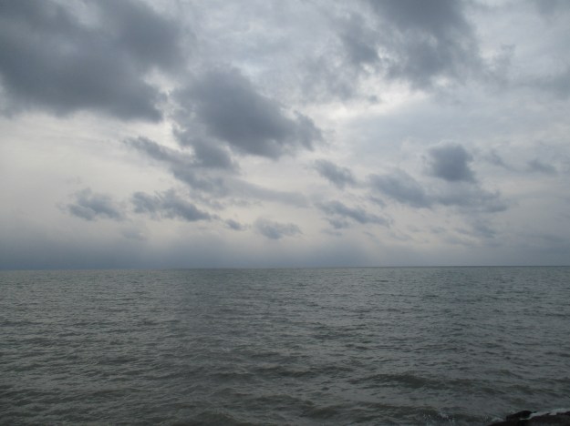
Category Archives: Uncategorized

Erosion – Cathedral Bluffs Scarborough

Sunday Feb. 7, 2016

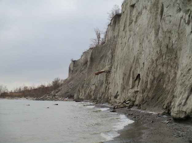
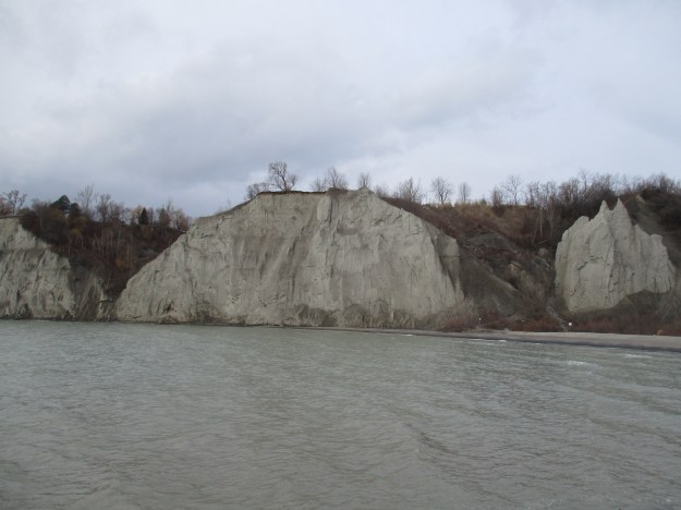
The Lake Ontario shoreline is constantly changing due to the effects of erosion and this can be seen in full measure at the Cathedral Bluffs in Scarborough.  We previously looked briefly at the formation of the Scarborough Bluffs in Sand Castles with a post going west from Bluffer’s Park.  Today we go east from there toward the Cathedral Bluffs and will see the effects of erosion in several forms.

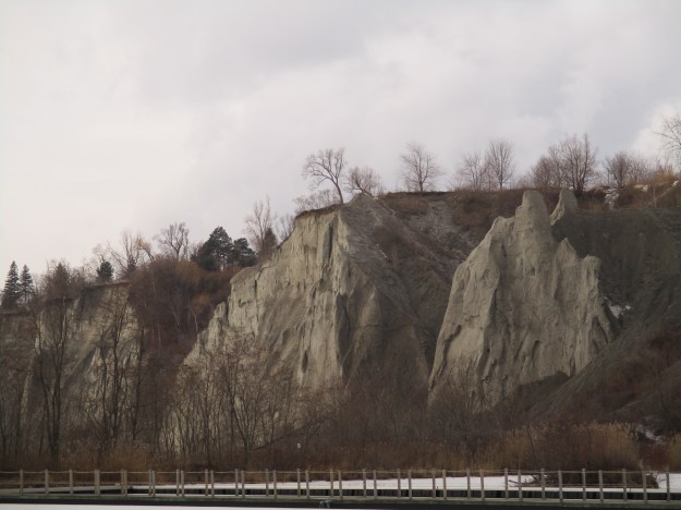
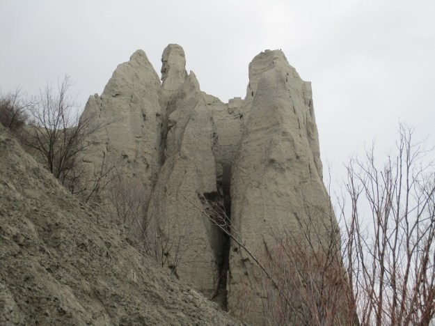
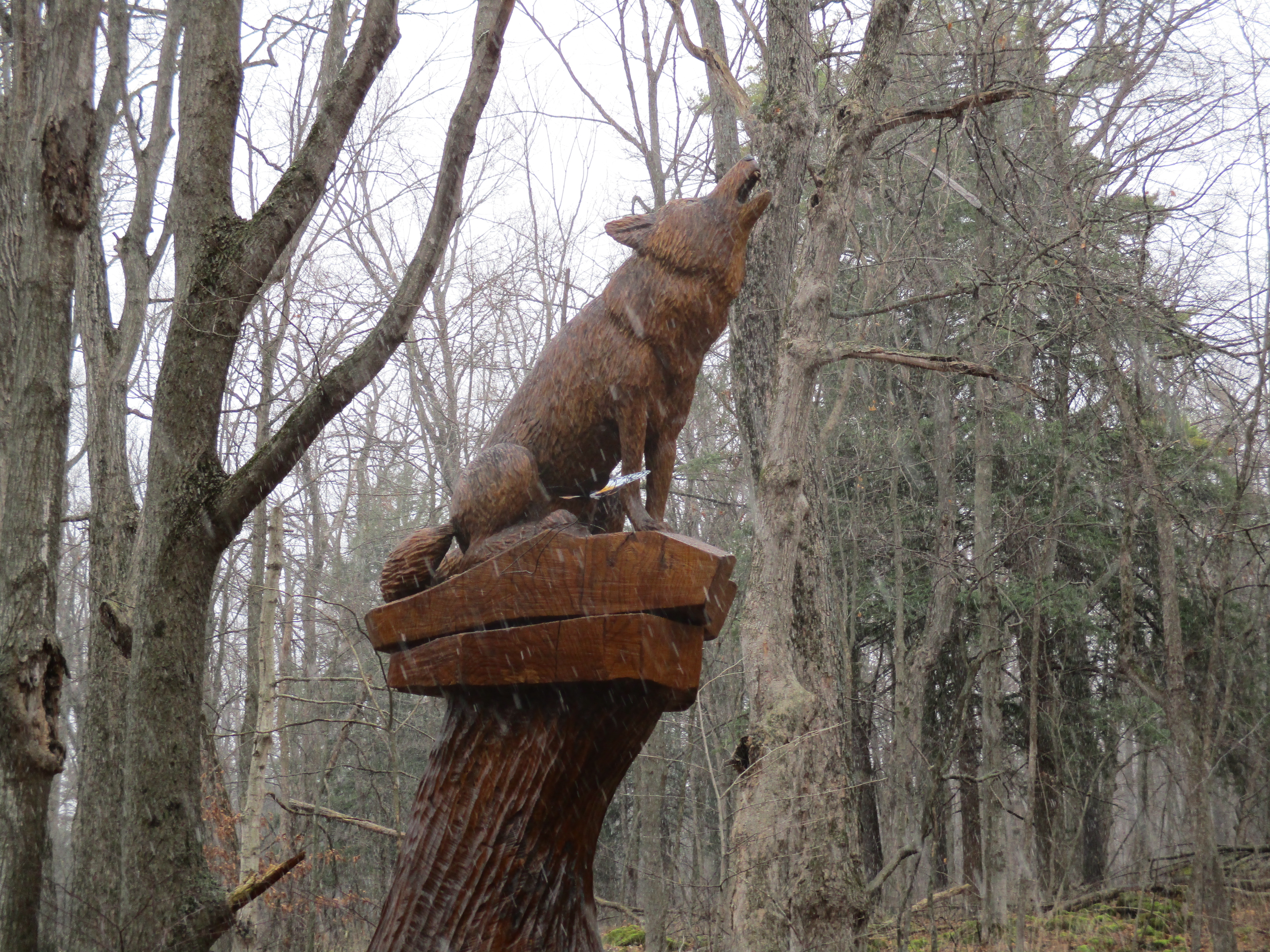
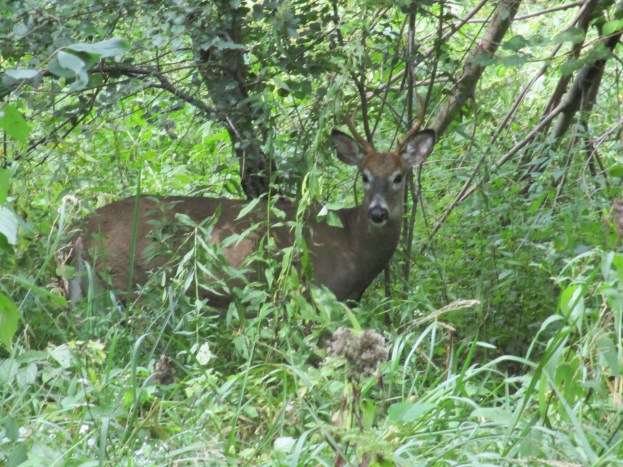
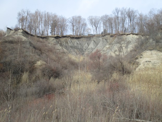
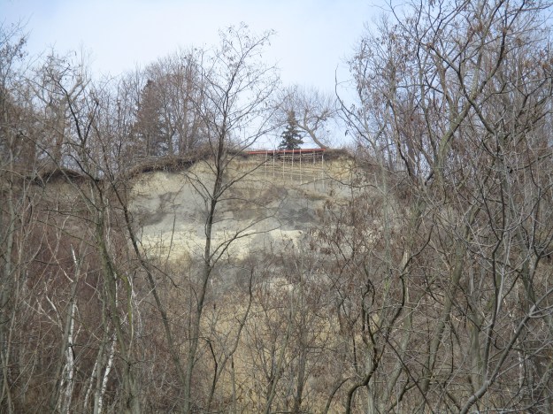
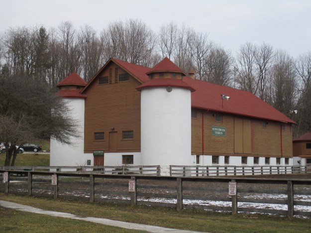
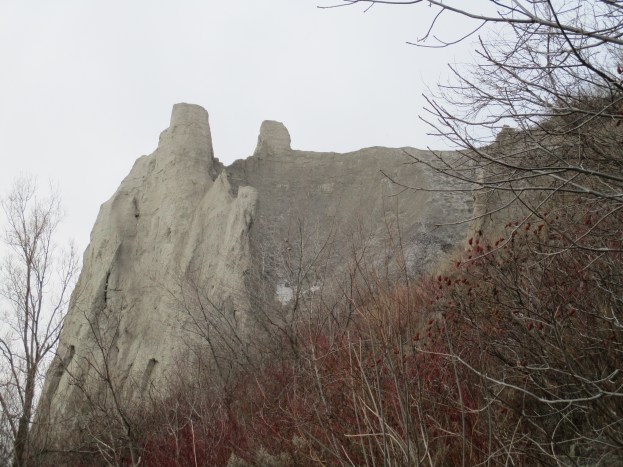
The cover photo above shows a small section of the bluffs where several homes sit above a horseshoe shaped section of the bluffs that has collapsed in several places.  Sloping sand piles, or talus, can be seen in half a dozen spots reaching nearly to the top of the bluffs. In some places homes at the top have been losing about 30 cm of their back yard per year and the Toronto Regional Conservation Authority has been implementing measures to reduce this and preserve the bluffs.  The section of sand pictured below provides home to a large number of bank swallows who live in a relatively narrow band dictated by the density of the sand in the section.  The bluffs provide home to many birds and butterflies as well as white tail deer and coyotes.  They also serve as a green migratory route for wildlife that is moving between the various ravines in the area.

IMG_0521

As you walk along the Bluffer’s Park Marina an interesting attempt to overcome erosion can be seen on the top of the bluffs.  Someone has built shoring for the edge of their property.  Normally if you want to shore up a structure you transfer the weight onto something solid.  That isn’t possible here because the sand is up to 96 metres deep. Although erosion has been slowed down through the implementation of shoreline controls it continues in spite of mankind’s best attempts to control nature.  This piece of property will eventually disappear and perhaps so will the next one north of it.

IMG_0517

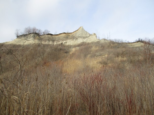
Several actions are being taken to help reduce the rate of erosion on the bluffs.  Gentle slopes are being developed rather than the vertical surfaces.  The picture below shows shrubs, reeds and grasses that are growing along the base of the cliffs.  The common reed grows in wetlands and is considered an invasive species but it is encouraged here because of it’s root system which is serving to hold the sand together and reduce the amount that gets washed away.  The fact that it’s yellowish stocks are growing half way up the side of the bluffs shows how much water is retained in the sand.

IMG_0529

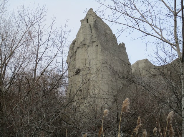
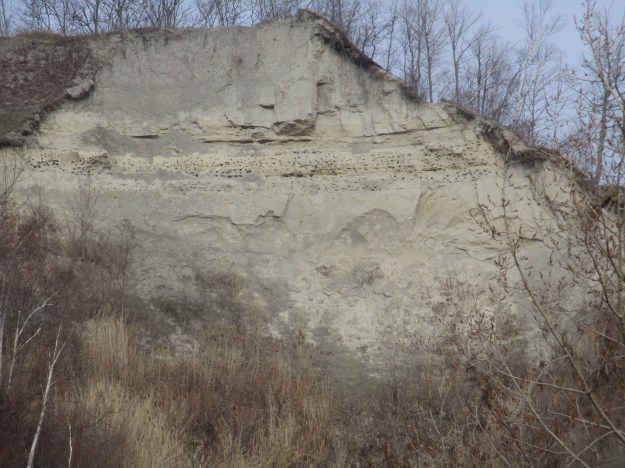
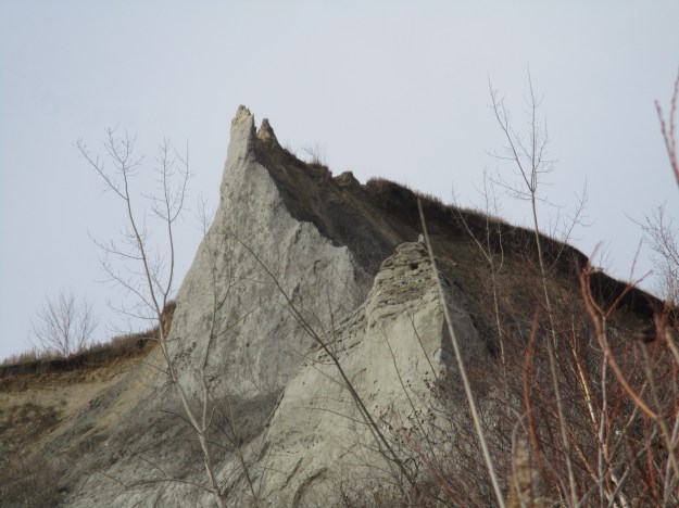
The bluff in the picture above looks quite different when viewed from the side.  Another strip of bird nest holes runs along the same layer of sediment in the bluff and can be seen at the front corner of the nearest point in the picture below.

IMG_0534

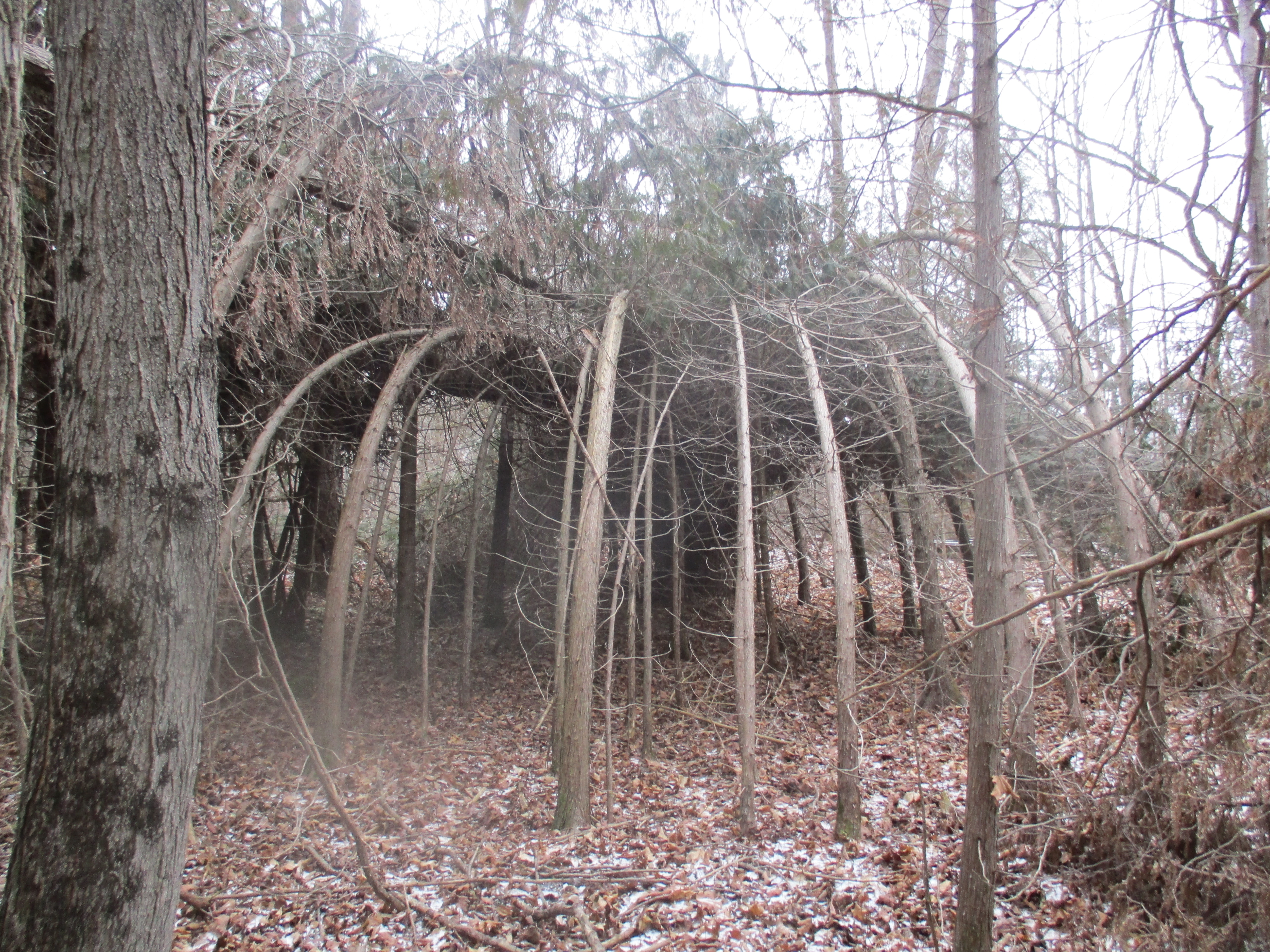
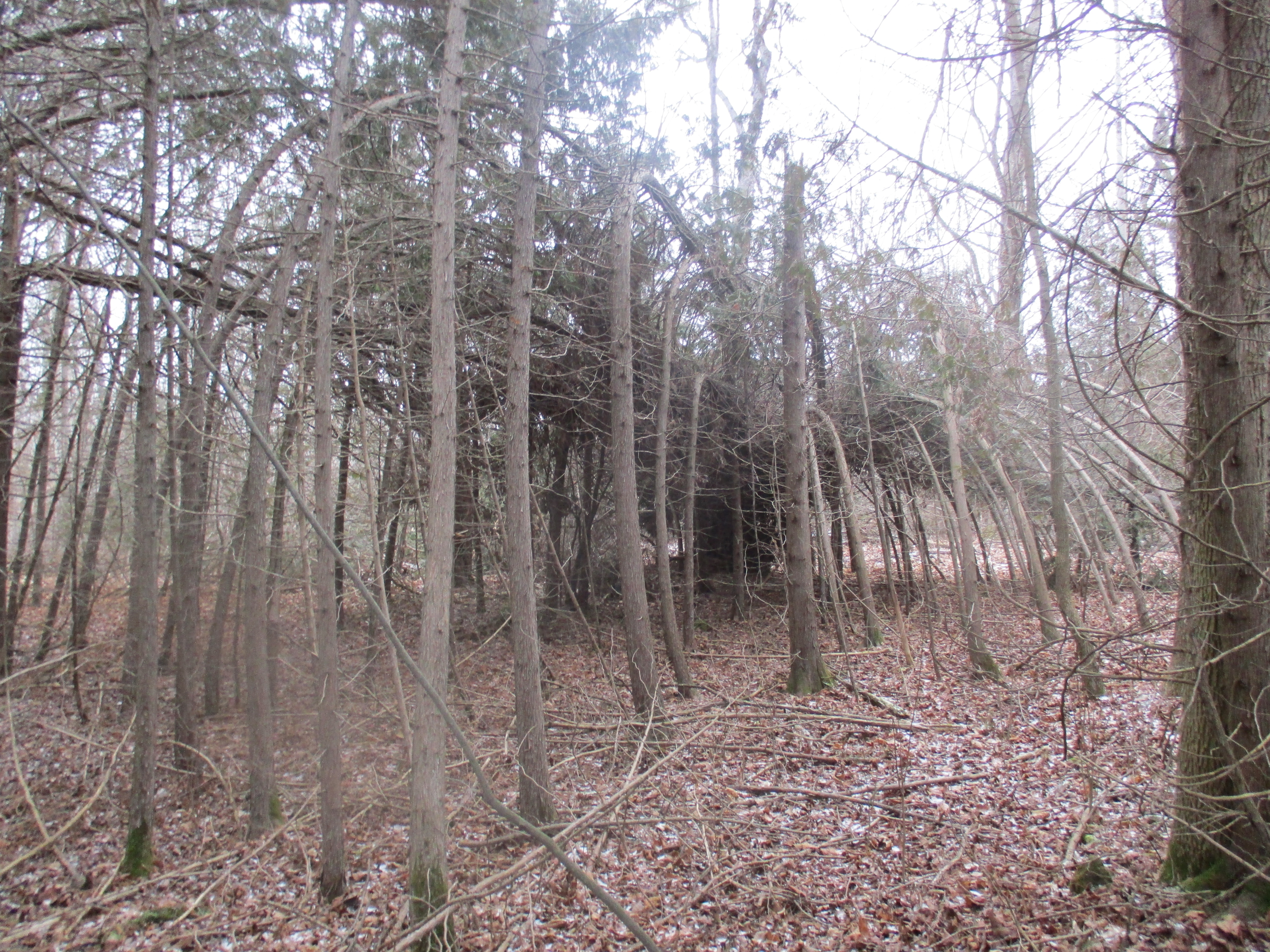
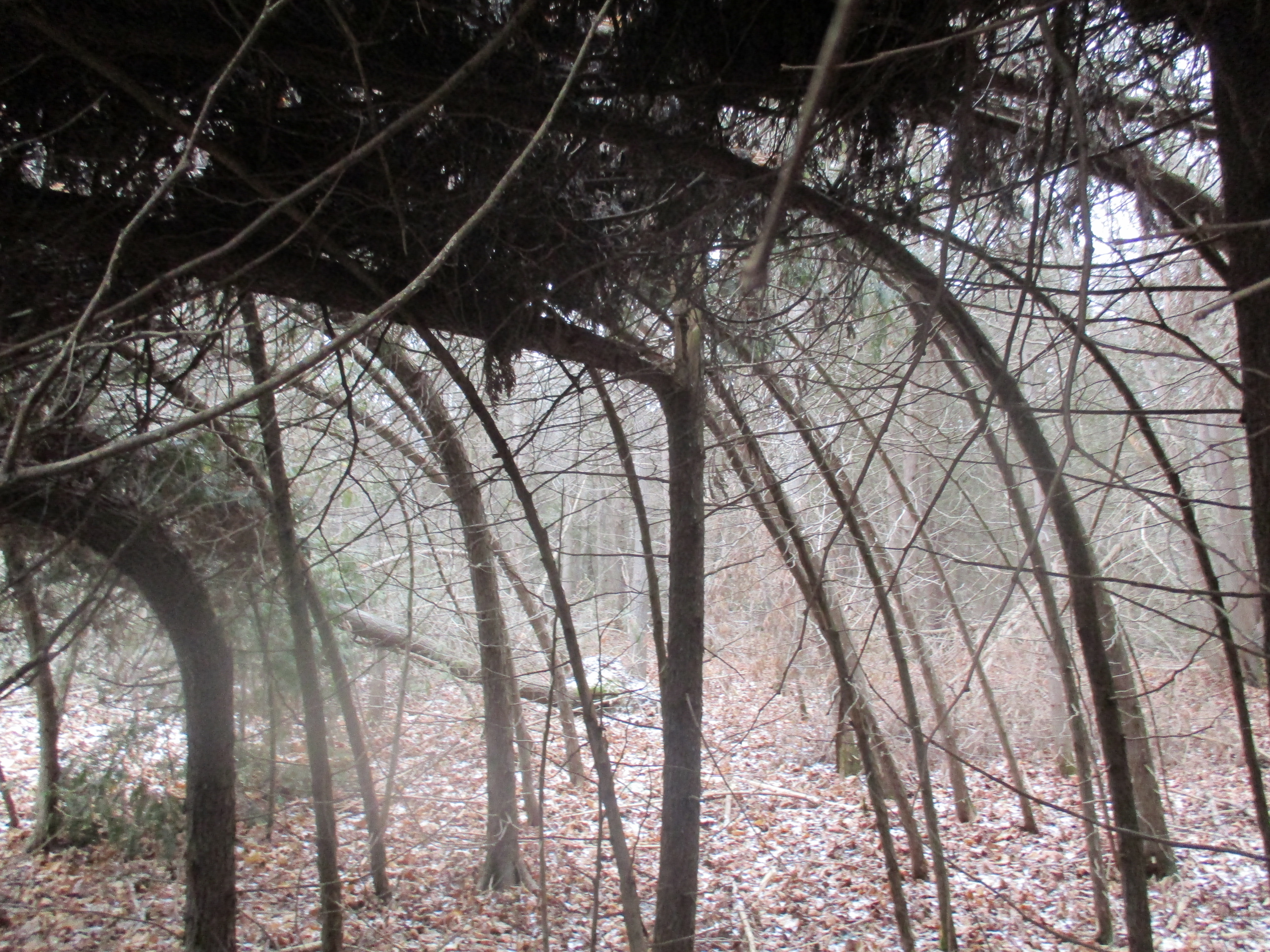
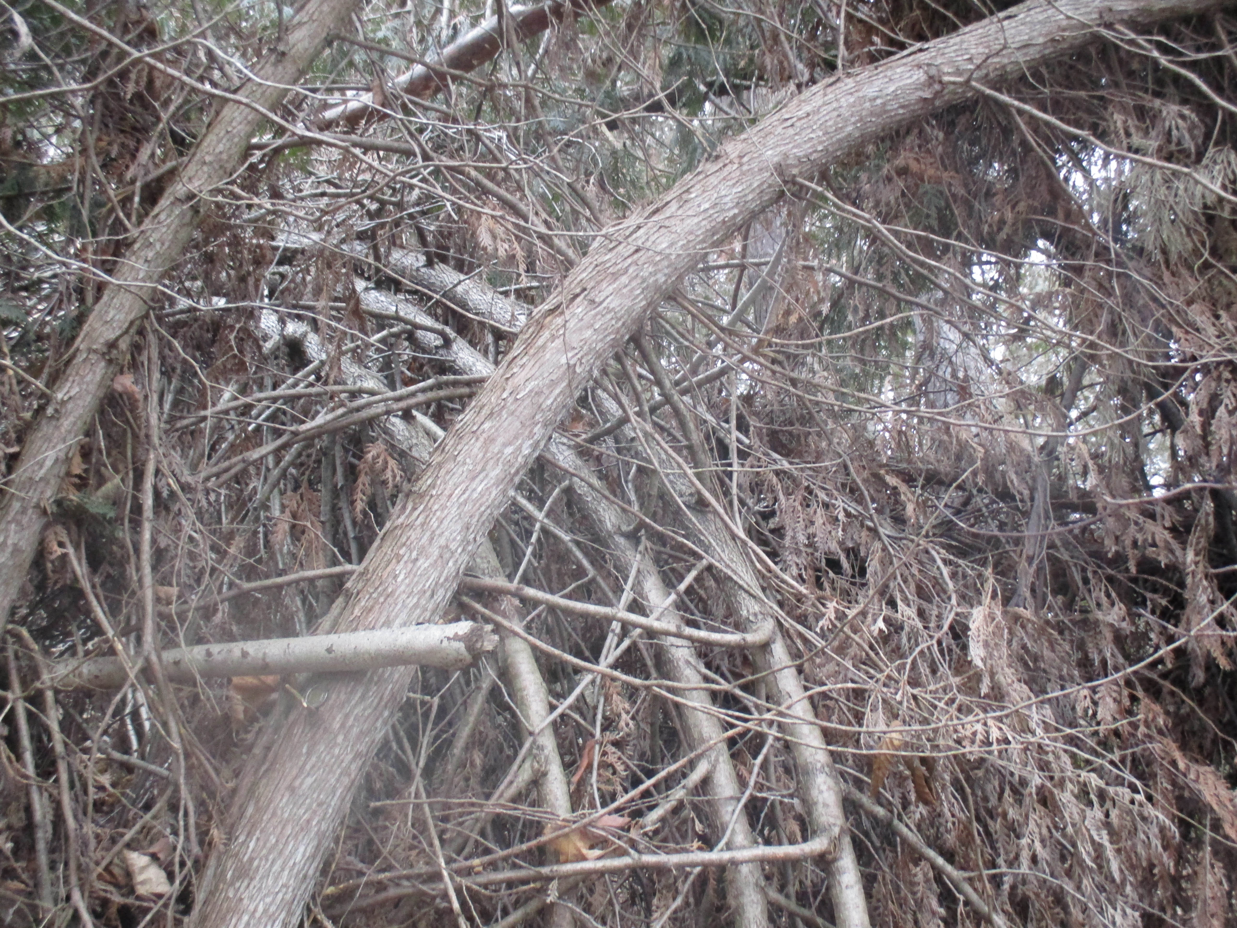
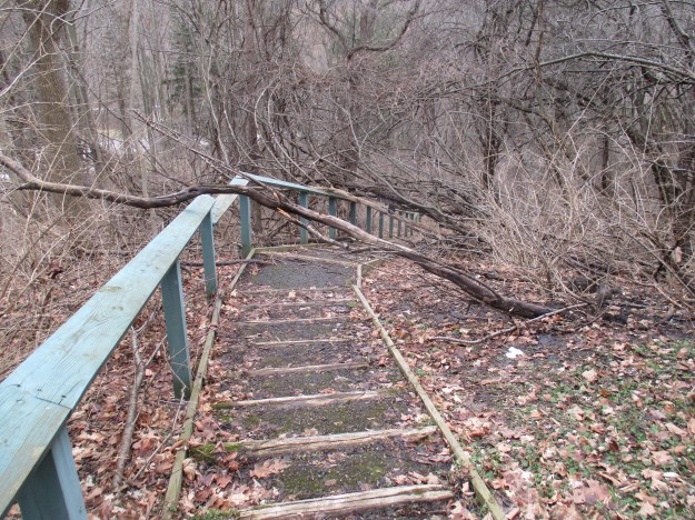
Between the sections of bluff there are several ravines that have been cut through the sand.  Invariably there is a rivulet of water running in the bottom and it is always clouded with sand.  This swells when there is a rain storm.  On the right hand side of the picture below is an outcrop of sand which is being held together by the roots of the shrub growing on top.

IMG_0549

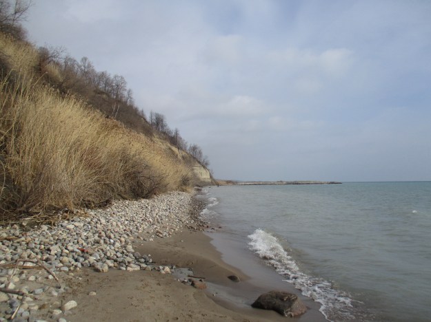
A shingle beach is one made up of stones ranging in size from 2 milimetres up to around 200.  Quite often they occur naturally and serve to protect the beach from the erosive effects of the waves in a process known as armoring.  When the stones are placed intentionally they are called riprap and often include pieces of concrete and brick from demolished buildings.  To control erosion much of Toronto and the surrounding areas have been given hard shorelines through riprap and concrete forms.  Along this beach there are stretches of riprap made up of rounded stones that have been deposited as a buffer between the waves and the reeds on the edge of the bluffs.

IMG_0547

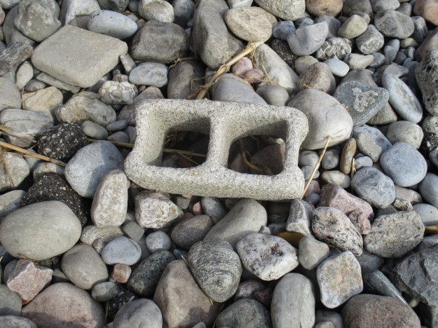
Among the stones on the beach is this concrete block which has been eroded down through abrasion.  The repeated effect of the smaller stones knocking against the sharp corners of the block has worn them off.  The waves only reach this far up the beach when there is a storm and the waves are at their most powerful.

IMG_0553

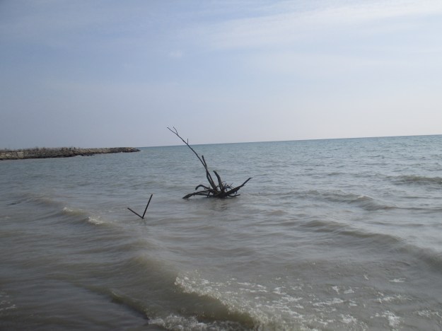
Past the shingle beach is a stretch where the reeds have reached almost to the water’s edge.  A recent collapse of the side of a higher range of bluffs has closed the beach at this point.  The waves will carry this away as the lake continues it’s relentless assault on the shoreline.  The sandy beaches that line the shore of the lake west of the bluffs are made of material which has been deposited from here.  The predominating current of the lake is known as longshore drift and on the north side of Lake Ontario it is in an westerly direction.  Water entering the lake from Lake Erie through the Niagara River carries the lake water east along the southern shore toward the St. Lawrence River.  This creates a motion in the lake that carries sand from the bluffs to the west and deposits it to form a series of ten beaches.  These range from Bluffer’s Park beach in the east to Sunnyside and Marie Curtis in the west. Notice the white birch tree that is hanging over the edge of the bluff just beyond this mudslide in this photo.  It will find itself in the lake shortly.

IMG_0566

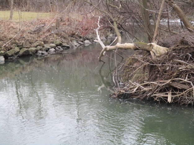
Behind me the roots of one of the dogwoods rise out of the water.  It’s journey from cliff top to water front has been completed.

IMG_0570

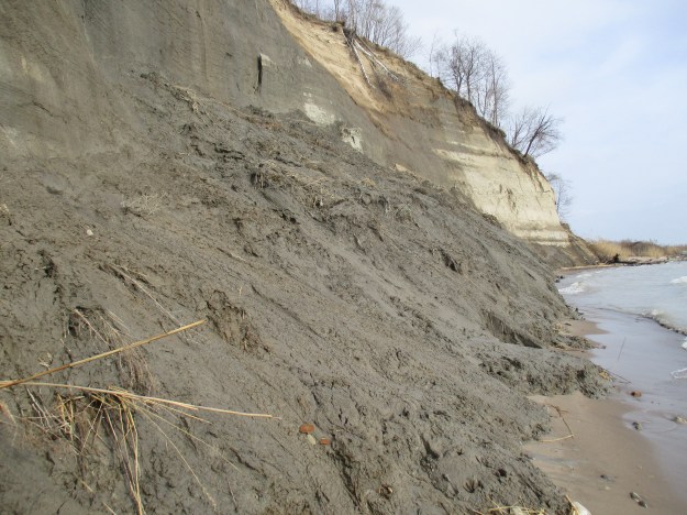
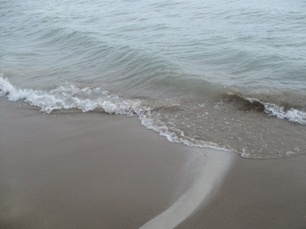
The picture below shows one of the places where the water in the bluffs is draining across the beach and carrying fresh sand from recent collapses into the lake.  The beach is protecting the bluffs from the action of the waves and gentle slopes reach up to the bluffs. In spite of this, the sand continues to relentlessly erode away.  A $6.5 million dollar investment east of here has been made in the interest of protecting homes that are falling over the edge of the cliff but one must wonder how effective it will be in the long run.

IMG_0581

Looking toward Lake Ontario the lighter sands of the bluffs are carried into the waves. The lake will carry this sand until it deposits it along the Leslie Spit, now that the spit guards the Toronto Islands from the east.  The Toronto Islands were a peninsula guarding the harbour in 1793 when York was founded.

IMG_0576

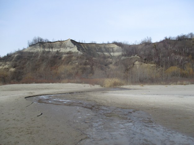
The Scarborough Bluffs extend east from here and include a ravine that was formerly known as the Grand Canyon of Scarborough, before it was partly filled in.  Perhaps we’ll get a chance to investigate there soon.

Google maps link: Cathedral Bluffs

Like us at http://www.facebook.com/hikingthegta

Lotten – Cawthra Estate Mississauga

Sunday Jan. 31, 2016

York (Toronto) was just ten years old in 1803 when Joseph Cawthra emigrated from Yorkshire in England.  He was granted 400 acres of land extending north from Lake Ontario.  Cawthra raised nine children and soon found that farming wasn’t for him so he moved to York where he established an apothecary and then a general store.  They built houses at King and Sherbourne and later at King and Bay.  The land grant was broken up when the lake front portion was given to Mabel Cawthra and her husband Agar Adamson for a wedding gift.  The Adamson Estate was featured in a previous post.

In 1926 Grace Cawthra-Elliot and her husband Colonel Harry Cawthra Elliot built a new home on the family property near Port Credit using bricks covered with plaster.  The old dirt road that accessed the home has since been named Cawthra Road and widened to 6 lanes in places.  The home was built to remind them of the families roots in England in a style known as Georgian Revivalist.  The house is five bays long designed symmetrically around the centre door.  Each window has twelve over twelve double hung sash windows. They feature plain lintels above each window and plain lugsills below.  At two and one half stories the upper floor has quarter round gable windows with radiating muntins.  Some say it also has the ghost of a servant who can be seen looking out the quarter round windows at Cawthra Road.

IMG_0383

The house was designed to make a statement with the front door where the symmetry continues down to the centre line.  Four pilasters support a simple entablature above the doorway.  Side lights mounted on either side of the door are made of wrought iron as are the shutter hinges and closures.

IMG_0379

The front of the house featured a extensive lawn with landscaped gardens along either side.  The gardens were accessed by three sets of steps which today lead into the new growth of trees which have taken over the property.

IMG_0425

The Cawthras had a swimming pool dug in the front yard, at the end of the south gardens. The swimming pool was filled with water collected on the property and at one time was much larger than the remnant that lies behind the chain link fence.  The two steps that can be seen in the picture below would have been under water in the 1930’s when the pool was one of only a couple in Mississauga.  We previously featured pictures of Mississauga’s first swimming pool, constructed in 1918, in our story on Riverwood Estate.

IMG_0422

The north side of the house also featured extensive gardens.  A wide lawn stood between the house and the family’s prized rose gardens.  Their orchard was at the end of the rose gardens and provided a quiet place for Grace and Harry to sit and quietly enjoy their country home.  The picture below shows the rose bushes whose green leaves provide a welcome change from the usual browns of mid-winter.

IMG_0396

The north gardens were flanked by a row of pine trees on either side.  This row of trees is clearly visible from Cawthra Road as you drive by, once you know where to look for it.

IMG_0400

The Cawthras built themselves a walled garden where they could grow flowers and vegetables and keep them protected from the local rabbits and deer.  The wall was three bricks thick and stood over 8 feet tall.  They featured arched entrance ways and, like the house,  were built with bricks brought from Yeadon Hall, the family home at College and St. George in Toronto.

IMG_0408

The property was legally known as lot 10 in the original survey and so they called it Cawthra Lotten.  The house can be seen behind the gate post.  Joseph recieved the grant in 1804 and by 1808 he had completed the requirements to take full possession of the property.  These requirements normally included the clearing and fencing of a few acres, the construction of a small house and the clearing and maintaining the road allowance along the sides of the property.  The house was added in 1926 and Grace lived here from then until she passed away in 1974.  The city of Mississauga purchased the property at that time and operates it as a limited use park because it contains specimens of Jefferson salamanders.  They are one of the salamander species considered most at risk in Ontario. Fences are in place to keep people from disturbing their habitat.  We have previously featured pictures of the eastern red-backed salamander, one at least risk, in our Vandalized Memorial post.

IMG_0428

Having parked at the end of 9th street we made our way through the woods that cover the former lawns of the estate.  The forest floor is littered with the trunks of ash trees that were recently cut down.  Most of the ash trees in southern Ontario will be killed by the Emerald Ash Borer.  This insect will have completed it’s devastation by 2017 having killed 99% of the 860,000 ash trees in Toronto alone.  The city of Mississauga is in a similar situation and is actively removing ash trees and replacing them with other native trees. The picture below shows the remains of ash trees lying on the ground among the pink ribbons of the newly planted replacement trees.

IMG_0363

Google maps link: Cawthra Estate

Like us at http://www.facebook.com/hikingthegta

Sunnybrook Park

Saturday January 30, 2016

In the early 1900’s Toronto’s wealthy elite bought large country estates on the edge of the city where they kept their horses and engaged in fox hunts for leisure.  They moved to the Bayview and Lawrence area where they could live in opulence in their grand English styled mansions. Most of these lots featured the steep ravines of the West Don River and it’s tributaries.  Several of these grand homes are featured in Bayview Estates and today we look at the former estate that now contains Sunnybrook Hospital and Sunnybrook Park.

Joseph Kilgour along with his older brother Robert had made their fortune in the paper industry.  In 1874 they started Kilgour Brothers in Toronto where they specialized in paper bags and cardboard boxes.  The business grew into one of the largest of it’s kind in the country under the name Canada Paper Box Company.  In 1909 Joseph and his wife Alice bought a 200 acre lot south of Lawrence Avenue where he established Sunnybrook Farms.  It was one of the first country estates along Bayview Avenue and one of the largest as well.  Starting at Bayview (first line east) and Blythwood it stretched across to Leslie Street (second line east).  Joseph died in 1926 and although Alice would live for 12 more years she transferred the land to the city for a park just two years later. Joseph and Alice built themselves a grand country manor in the English tradition.  The home had high wood beam ceilings and oak paneling on the walls. The open gallery made it ideal for hosting parties and displaying a couple of his hunting trophies.  An archive photo of the inside of the Kilgour mansion around 1910 is seen below.  Note the rooms that exit off each side of the gallery.

Interior of Joseph Kilgour home. - [ca. 1912]

The house has since been removed and Sunnybrook Hospital was built in it’s place. Having parked on Stratford Crescent, just east of Bayview, I walked through the Sunnybrook Hospital grounds keeping the single smoke stack in view at the rear of the facility.  At the back of the hospital campus is a former access road that leads down to the stables and a parking lot at the bottom of the ravine.  The sign at the top of the hill says that access to Leslie Street is closed.  One of the conditions of the park is that there should never be a road running between Bayview and Leslie.  For that reason the bridge at the bottom of the hill has been closed. The bridge also supports a cast iron water pipe as it crosses the West Don river from the former mansion to the stables.

IMG_0299

Major Kilgour was one of the best known horse men in North America.  His reputation for keeping a well bred stable of hunting horses was celebrated, as was the farm he built.  He named the estate Sunnybrook Farm and it was considered to be the perfect model hobby farm in it’s day.  The stables were used by the Metropolitan Toronto Police for their mounted unit to house their mounts until they moved their horses to the horse pavilion at Exhibition Place in 2005.

IMG_0303

Kilgour built one of the first indoor riding arenas in Canada.  It also featured a viewing gallery with the provision of a section for a minstrel in the gallery.  Groomsmen’s quarters provided living space for the men who took care of his horses.

IMG_0304

The stables were built adjacent to the Don River with the table lands above used for horse riding and frequent fox hunts.  Today this area can be reached by a road to a parking lot or by 86 stone stairs that climb the ravine behind the stables.  The former plateau has been converted to a series of sports fields.

IMG_0310

Kilgour and his prized hunter Twilight would host fox hunts with 30-40 members of the Toronto Hunt’s Hounds riding in pink outfits on the plateau above the stables.  The Toronto Archive picture below is from around 1910 and shows Joseph and Twilight.

Joseph Kilgour and his hunter Twilight. - [ca. 1910]

As I made my way along the edge of the playing fields in search of the 116 stone stairs that would lead me back down to river level I was surprised to see a group of a dozen robins. Robins will stay over winter on occasion and with this year’s warm weather it’s possible some may have. These ones seem quite plump and I wonder if they didn’t get pushed a little north by the recent blizzard in the United States.

IMG_0314

As the sign said “No winter maintenance.”

IMG_0316

After making my way back down to the river level I stopped to check out a 150 year old log cabin that has been reconstructed in the park.  The Rotary Club of Don Mills moved this pioneer home here and dedicated it on July 16, 1975 to the people of Toronto.  The dedication plaque quotes John Milton from Paradise Lost “Accuse Not Nature, She Hath Done Her Part, Do Thou But Thine.”  This is a suitable motto for Hiking the GTA as well. Nature did it’s part, yours is to get out and simply enjoy.  Leave the wild flowers behind, but not your garbage.

IMG_0320

Last year in February we walked across Etobicoke Creek to investigate what turned out to be a coyote mating ritual.  Based on current conditions I’m not sure I’ll be walking on any of the local waterways this year.  If you follow the West Don River upstream from Sunnybrook Park you enter an area known as Glendon Forest.  This forest is one of the largest natural areas in central Toronto and is a unique wildlife habitat that waits to be explored in the near future.  Two waterways join the Don River in Sunnybrook Park. Burke Brook enters the Don River just upstream from the stables and Wilket Creek enters just downstream.

IMG_0333

For many years Sunnybrook Park was known as Kilgour Park and a set of elabourate stone gates marked the entrance off of Bayview Avenue.  The archive picture below is from 1933 and shows what the entrance to the roadway that I had used to access the river and stables in the valley looked like at the time.  Sunnybrook Park was granted as a perpetual free park for the citizens of Toronto but with permission of the family heirs a section was transferred to the government for construction of the hospital.  The gates were removed in the mid 1940’s when the hospital was built but a second set of gates remain in the park. The ones in the park have a plaque commemorating the 1928 donation of the park by Alice Kilgour.

Sunnybrook fence at Bayview

Sunnybrook Hospital has it’s own tales to tell.

Google Maps link: Sunnybrook Park

Like us at http://www.facebook.com/hikingthegta


Sand Castles – Scarborough Bluffs

Sunday Jan. 17, 2016

Glacial Lake Iroquois covered downtown Toronto with about 60 metres of water which would have covered all but the dome of the Rogers Centre and left it sticking out of the lake some four kilometres from the shore.  The lake had been left behind when the last great North American glacier retreated.  Lake Iroquois cut a prominent bluff along it’s shore which can still be traced through the area today.  The lake suddenly drained through the Hudson River about 12, 200 years ago when the weight of ice in northern Ontario and Quebec caused the crust to tilt.  The lake drained to a much smaller size called Lake Admiralty whose shore line was about 5 kilometres south of Toronto in an area known locally as the Toronto Scarps.  Since then water levels have been rising due to post glacial rebound as the tilt is slowly reversed. The former shoreline of lake Iroquois has become an escarpment known as the Iroquois Shoreline.  Casa Loma overlooks the city from the top of this escarpment.  The Scarborough Bluffs are also part of the ancient Lake Iroquois shoreline.  A 1912 picture of the bluffs from the Toronto archives is presented below.

Scarborough Bluffs. - [ca. 1912]

The Scarborough Bluffs had been eroding at a pace of a metre per year until recent erosion controls have slowed the pace.  The sand that has been falling into Lake Ontario is carried by the westward rotation of the lake and deposited near the harbour in Toronto. Over the centuries this deposit has formed Toronto Islands.  When Elizabeth Simcoe came with her husband to found the town of York (Toronto) in 1793 she took an active interest in the land around her.  Her journal provides key insights into the founding of the town and pioneer life in it.  She hiked up and down the Don River as well as around the islands.  She fell in love with an area east of the city that reminded her of home.  Along with her husband, Lieutenant Governor John Graves Simcoe, she contemplated building a summer home on top of the bluffs and calling it Scarborough.  From this we get the name of the township and the city that grew there.  The picture below shows some of the bluffs in Bluffer’s Park where I parked.  Brimley Avenue is one of the few places where one can drive down the bluffs to the beach level.

IMG_0219

The cliffs at Scarborough, North Yorkshire in England are made of limestone and not sand like the ones near York.  However, the local ones reminded Elizabeth of the cliffs near her home and so she named them the Scarborough Bluffs.  The picture below is taken from worldtravelguide.net and shows the remains of the 12th century Scarborough Castle on top of the cliffs in England.  These cliffs have changed relatively little since Elizabeth viewed them in the 1790’s.

scarborough england

The sand formation of the Scarborough Bluffs occurred when the area was the bottom of a large river delta.  The first 46 metres (150 feet) contain the fossils of plants and animals while the upper 51 metres (200 feet) is a mix of boulder clay and sand that was left during the retreat of the last ice age.  The Rogers Centre would rise to about the same height as the bluffs if it was built beside them.  The bluffs run for a distance of about 15 kilometres east from Victoria Park Avenue to the mouth of Highland Creek.

IMG_0170

A thousand years ago the bluffs were a full kilometre farther out into the lake.  In the 1950’s and 1960’s it was fashionable to build homes on top of the bluffs overlooking the lake.  This destabilized the sand below and sped up erosion.  Many of these cottages have already had the ground disappear from below them.  To slow erosion the city has built hard shorelines with large chunks of rock along portions of the bluffs.  Even with these controls in place the piles of sand are under constant attack from wind, rain and ice.  The various shapes of sand that are pictured here will certainly be different a year from now.  The picture below shows the cracks that appear in the sand and where new sections can collapse at any time.

IMG_0179

A storm was brewing out over the lake but it was a nice enough day along the bluffs and several people were here taking pictures.  Some were climbing the bluffs which speeds up erosion and ends up with an ever growing list of people who get trapped and need to be rescued.  If this happens to you, expect to get an expensive bill in the mail.

IMG_0231

This part of the bluffs has eroded with an open core down the middle.

IMG_0193

I walked along the edge of the bluffs where the sand has collapsed into fresh piles of talus. Some appeared to have come down since the last good rain.  They say that if you listen closely to the bluffs you can hear the sand shifting inside.  Looking down the bluff face there is a large corrugated storm pipe sticking out.  This is set in a ravine that can’t be seen from this angle but the length of pipe sticking out is an indication of the amount of erosion that has taken place since it was laid.  The pipe itself has corroded and icicles hang from a large hole about 2 metres from the end.

IMG_0196

Bluffer’s Park, including the upper meadow, is a great place for bird watching.  In season the meadow is also home to many species of butterflies.  The cardinal in the picture below provided a bright red splash of colour in the trees near the ponds.

IMG_0159

Storm water collects on all the paved surfaces in the city and runs along roadways picking up contaminants. These are carried into the storm drains and eventually out into the the lake. Toronto has implemented a Dunker’s Flow system in Bluffer’s Park. The picture below shows where the storm water is released at the bottom of the bluffs after being collected up top.

IMG_0210

Karl Dunkers, of Sweden, invented a system for storm water purification.  Storm water is released into the first of five cells where it begins to have impurities filtered out.  The picture below shows the settling ponds and the walkways in between some of them.  Each walkway has a screen suspended below it that causes solids to drop out of the water before it passes into the next cell.  The final cell is a naturalized wetland where marsh grasses provide a living filter before the water enters the lake.  When the sediment in the filtration cells reaches a certain level it is removed.

IMG_0220

Two small peninsulas have been created to provide protection for the bluffs and to give vantage points for people to enjoy the view.  This picture is taken from the closer of the two.

IMG_0225

One of the unique features of the Bluffer’s Park facilities is the shape of the buildings themselves.  Built in 1973 they fit in nicely with the shapes of the eroding bluffs behind them.

IMG_0239

Google maps link:

https://www.google.ca/maps/@43.7080024,-79.2341376,15z

Like us at http://www.facebook.com/hikingthegta

Crooks’ Hollow – Upper Canada’s First Industrial Complex

Saturday Jan. 16, 2016

The Spencer Creek reach between Bullock’s Corners and Crooks’ Hollow is one of the best dammed stretches of water we have investigated so far.  Beginning with the old dam foundations of William Bullock’s grist and saw mills and continuing upstream to the Christie Dam we found the remains of at least ten of these old structures.  One might expect that the earliest industrial park in Upper Canada would be in York (Toronto), Bytown (Ottawa) or Kingston (first capital of the Province of Canada, 1841) but it was in fact at Crooks’ Hollow near Hamilton.  We started our hike in Bullock’s Corners where at this time of year about the only place you can park is at the park on Park Street.

Bullock’s Corners centres around the site of a large grist and saw mill built in 1841 by William Bullock.  The mills continued to operate until 1866 when they were converted to a blanket factory.  A three story stone building was erected after the original one was destroyed by fire and it continued under various owners until damaged by a flood in 1938. The remnants of the dam mark the site.  Adjacent to it was the mercantile block William built in the 1840’s.  It consisted of general, flour and feed stores as well as shoe and harness maker’s shops with some apartments above.  The foundations of a former storage shed are shown below.

IMG_0012

John Green Came to Spencer Creek in 1797 and built a mill, establishing the town name for Greensville.  Bullock’s Corners and Greensville are separated by Spencer Creek and in the early days by language as well.  Bullock’s Corners was home to the mill owners and was an English speaking town.  Greensville was home to many of the mill workers who spoke predominantly French.  Green’s mills were later sold to Andrew Todd Kirby. Although Crooks’ Hollow originally only encompassed the small area around James Crooks’ mills upstream, the term has now been applied to all the industrial operations as far down stream as the Kirby dam.  The picture below shows a more recent Kirby dam, made of concrete, with square stop logs still in the creek bed.

IMG_0036

In addition to about 2200 dams in Ontario there are the remains of countless former dams. Along Spencer Creek you can find the remains of several construction methods that were employed over the years.  The earliest dams were made of wood cribs filled with rubble. Due to the high maintenance requirements, and the dangers presented by them, these were often replaced with large field stone dams.  After 1900 concrete became the standard for dam construction.  The Cockburn Property was taken over by the town of Dundas in 1909 and contains the remains of the old stone dam from his sawmill.  Along this stretch are the more complete remains of another modern concrete dam and mill.  This dam includes the mill foundations in the foreground, just behind that is the rectangular turbine housing and then the slope of the spillway.  The earthen berm on the far bank of the creek once extended to the side of the spillway.

IMG_0052

The Crooks’ Hollow Dam was built in 1913 to create a reservoir for the provision of water to the town of Dundas.  It was 5 metres tall and 30 metres wide with 4 spillways consisting of three overflow weirs and one stop log bay.  The picture below from wikipedia shows the dam in 2010 when all four spillways were in action.  The dam was assessed for safety concerns in 2007 and it was determined that the concrete had deteriorated to the point where it was becoming a potential danger during times of high flooding.  Even the concrete repairs that can be seen on the first spillway below were determined to be unsafe.

800px-Crooks_Hollow_Dam_March_2010

It was decided that the dam needed too many repairs to be practical and it was recommended that it be removed.  Restoring the creek to it’s former level would provide additional benefits in water quality and wildlife habitats.  The dam was demolished in 2013 and the remaining abutments were turned into viewing platforms.

IMG_0059

Water was drawn from the bottom of Crook’s Hollow reservoir and taken by pipe to the town of Dundas to provide for the needs of the community.  After town water became available in Dundas the reservoir was used by a golf course for irrigation purposes.  The cast iron pipe that once carried drinking water still runs along the side of Spencer Creek. It is now broken in several places and trees are growing on top of it.  The picture below was taken near the Kirby Dam and there is a small waterfall known as the Greensville cascade which descends the hillside in this same location.

IMG_0030

Just upstream from the Crooks’ Hollow dam are the remains of a much earlier stone dam known as the Morden Dam.  This little cascade waterfall was hidden for 100 years below the Crooks’ Hollow reservoir but is revealed now that the dam is gone.

IMG_0061

James Crooks was born in Scotland in 1778 and came to Upper Canada when he was 13. He served in the war of 1812 where he fought in the Battle of Queenston Heights in which General Issac Brock perished.  In 1814 he moved to a 400 acre lot on Spencer Creek which he had purchased in 1811.  Here he set up the first major industrial complex in Upper Canada.  His milling empire consisted of a grist mill, a tannery, distillery and a linseed oil company.  In 1826 the British Government imposed a heavy tariff on paper imported from the United States.  A 500 pound reward was offered for the first successful paper mill in the colony. With the help of the Barber family James Crooks won that prize for the paper mill he built just downstream from the grist mill.  The Barbers later moved to Georgetown and built the Barber Paper Mills and the Barber Dynamo.  The map below shows Crooks’ Hollow as it existed in the late 1820’s.

IMG_0090a

The Darnley Grist mill was completed in 1813 by Crooks and was named after Lord Darnley of Scotland who was a famous ancestor of Crooks.  The mill was made of stone quarried downstream near Morden’s mill.  It originally had a 9 metre overshot waterwheel that supplied power to the four run of stones inside.  It’s first mission was providing flour for the British army during the war of 1812.  In 1860 when Crooks died the mill was sold and converted into another paper mill.  In the 1930’s the Greensville Paper Company replaced the wood floors with poured concrete.  The mill was later abandoned in 1943 after it was destroyed by a fire.  The picture below shows a couple of remaining window frames inside the mill.  The cover photo also features an internal view of the old paper mill.

IMG_0104

The Darnley Cascade is a 4 metre high waterfall just upstream from the mill site.

IMG_0120

The Christie Conservation Area Dam is 180 metres long and was completed in October 1971.  It features two sluice gates and 8 spillways that flood an area the size of 900 Olympic size swimming pools.  It is designed to provide flood control for areas downstream including Webster’s Falls and the town of Dundas.  This picture is taken from the top of the Christie dam looking down on Spencer Creek, which is full of ducks.  The picture also shows the steel structure from a previous dam.

IMG_0134

There are several dams and lots of foundations that space didn’t allow us to present here but which are worth the exploration as well.

GPS coordinates for the paper mill: 43.27648N 80.00685W

Google maps link:

https://www.google.ca/maps/@43.2770014,-80.0015295,16z

Like us at http://www.facebook.com/hikingthegta

Guelph Radial Trail – Acton Section

Dec. 19, 2015

Revised Jan. 6, 2016

The Toronto Suburban Railway (TSR) ran between Guelph and Toronto providing commuter service until it was shut down and abandoned on August 15, 1931.  Since that time the line has been dismantled and much of the right of way has been re-purposed, some of it as a hiking trail.  We decided to visit a small section of the Guelph Radial Trail near Acton.  We parked on the edge of town near where Mill Road has been closed off at the bottom end of Fairy Lake.

Mass transit in Toronto got started in 1849 when cabinet maker Burt Williams designed and built 4 horse drawn stage coaches which he operated from St. Lawrence Market to The Red Lion Inn in Yorkville.  On Sept. 11, 1861 the Toronto Street Railway began with a similar route and made some expansions over a 30 year franchise it held with the city.  In 1891 a new 30 year franchise was granted to the Toronto Street Railway under William Mackenzie and James Ross who agreed to eliminate horse drawn buses as part of their deal with the city.  Over the next 30 years the city annexed large areas and was unable to force the Toronto Street Railway to service them under their contract.  When the contract expired in 1921 the city created the Toronto Transportation Commission (TTC) to operate mass transit.

The first trail to the left takes you to the Guelph Radial Trail but first passes through a wooded area where we noticed an odd patch of trees.  There are bent trees throughout the woods but we found one spot where they all appear to have been taken from a large oval and tucked into a knot the middle.

IMG_1948

I had originally thought this looked like a circular cluster that had been produced by a spinning wind event but could find nothing on record.  A local resident confirmed that the ice storm of Dec. 22, 2013 had, in fact, caused the cedars to bend over to the ground where they stayed until the spring.  Some recovered but many didn’t leaving this reminder of just how powerful the weather can be.  This individual and his son, like countless others, helped clear the trails in the aftermath of the storm.  The long side of the oval is seen in the picture below.

IMG_1936

From the inside the bent trees it’s possible to see a few that have cracked but most of them appear to have been folded over without breaking.

IMG_1945

Just below the horizontal branch on the largest tree in the picture below is a “toonie” which shows that trees up to 4″ in diameter have been bent over.

IMG_1957

The 1877 county atlas shows Acton as having grown to the east of Fairy Lake along regional road 25 (2nd line) .  A grist mill stood at the outlet on the smaller of the two arms of the lake. Mill Street ran from the mill to Dublin Line (1st line).  We began our hike near the point where Mill Street touches the lower end of the lake.

Acton

William Mackenzie, along with his partner Donald Mann, decided to expand their Toronto Street Railway service by adding radial lines to other communities.  In 1911 they surveyed the route for the Guelph Line which would run from Lambton yards for 49 miles to Guelph. Construction began in July 1912 and most of the track was installed in 1914.  The Great War slowed construction as did the building of a 711 foot bridge to cross the Humber  River.  One of the cars for the railway is seen crossing the Humber River trestle in the archive photo below.

humber-bridge_radial-car

Mackenzie and Mann took steps to keep the costs down and this resulted in many curves to avoid purchasing expensive prime land for construction.  This caused the rail line to have to run slowly and this was partially responsible for it’s low ridership, especially in later years.  The line ran on private land, in some cases adjacent to highway 7, as it made it’s way toward Guelph. Personal automobiles led to the demise of the line and by 1929 it was operating at a loss.  In 1931 the daily ridership was down to just 300 passengers and service was suspended on Aug. 15.  The line was abandoned and the rails removed and re-used overseas during WW2. Today the Guelph Radial Trail covers part of the line from Limehouse into Guelph and has painted the trees with an orange blaze to mark the trail

IMG_1975

We visited remnants of the TSR in several places this summer and presented photographs in the following stories.  The crumbling remains of the bridge across Silverthorne’s grist mill tail race in Meadowvale and the rotting pilings in the mill pond at Eldorado Park are just two examples.  Today commuters sit on highway 7 and dream about a rail service on a private right of way that could run from Guelph to Toronto.  Perhaps the TSR was just 100 years ahead of its time.

The lot on the corner of today’s regional road 25 and 25 side road was owned by James Bell in 1877 when the atlas above was drawn.  He was born in 1841 to Samuel and Ann Bell who had built the stone barn and house on the property.  The remains of the barn are featured in the cover shot along with the unique silo.  This silo is unlike most that remain in rural Ontario which are made of poured concrete.  This one has been constructed of preformed concrete blocks that were made to look like cut stone.  The Bell’s would have obtained livestock feed at the mill in Acton until the farm became more prosperous.  Later a silo was added to store feed that was grown and milled on the farm.  The block construction of the silo dates it to around the turn of the last century.  The barn has collapsed in on itself and the old beams can be seen in the bottom. Hand made nails give an indication of the age of construction.  James and Agnes Bell were married on Oct. 26, 1877 and the stone house and barn were abandoned after a new brick house was built closer to the front of the property.

IMG_1990

The old stone house stands near the barn and it too is slowly falling over.  The rear wall looks like it has about one more good wind storm left in it before it becomes a pile of rubble on the ground. When the Bells cleared the land they found an abundance of field stones which had to be removed to make the land suitable for farming.  These stones provided building materials for the barn and house as well as the fence lines to separate their fields.

IMG_1982

We arrived at regional road 25 and walked back through Acton to the car.  We noted an old steel pipe carrying water from Fairy Lake right past the mill and through the heart of town. There’s obviously lots more here for another time.

Like us at http://www.facebook.com/hikingthegta

The Longhouse People of Crawford Lake

Saturday Nov. 21, 2015

Crawford Lake is one of a handful of meromictic lakes in Ontario and this fact led to the discovery of a pre-contact native village.  It was snowing off and on as I parked in the Crawford Lake conservation area where having correct change would have saved me including a small donation in the envelope.

In the late 1960’s a University of Toronto professor became convinced that Crawford Lake had the characteristics to be a meromictic lake.  Most lakes have the water turn over at least once per year.  As the water cools it becomes denser causing it to sink.  The water at the top mixes with the water at the bottom providing a more even temperature and oxygenation.  In meromictic lakes the surface area is less than the depth and the water doesn’t mix.  In Crawford Lake there are three sections of lake and only the top 15 metres mixes annually.  The middle depth of the lake acts as a buffer while the bottom 9 metres or more never gets disturbed.  This part of the lake is always cold and has no oxygen.  Life doesn’t exist down here and the layers of sediments tell the history of things falling in the lake. Samples taken from the lake bottom revealed 1,000 years of history.  Sediment layers representing the period between 1300 and 1600  have high levels of corn pollen trapped in them in varying concentrations.  This led to the conclusion that an agricultural society had existed near the lake, closer to the shore when the concentrations were higher.  When settlers arrived, cut down the trees and created fields ragweed spread and the upper layers of sediment reflect this.  Crawford Lake is calm in the picture below.

IMG_1607

Local land owners confirmed that they had found artifacts on their properties and when Thomas Howard sold to the conservation authority in 1971 he donated an ungrooved ax or celt he had found here.  It is part of a 10,000 artifact collection that has been uncovered between 1973 and 1989.  The post holes for the frames of 11 longhouses have been discovered and three of these have been reconstructed. Two others have been partially formed including the frame outline seen below.  The positions of the fire pits have been exposed.

IMG_1566

Completed longhouses would have looked like the ones at Crawford Lake except that experts agree there were no ‘panic bars’ on the doors and no little electrical outlets on the outsides.

IMG_1537

It is unknown exactly which peoples lived here.  It may have been the Wendat (Huron) or Attawandaron (Neutral) but either way they were part of the Iroquoian speaking nations and are referred here as Iroquoian for simplicity.  Inside each of the longhouses an individual clan lived. Smaller longhouses may have had 30 people while larger ones up to 100 .  Individual families lived across from each other and shared a common fire.  The lower levels were used to sleep on because they were close to the fire and below the constant smoke.  Upper levels were used for storage with food being hung in the rafters where smoke kept both insect and rodent away.  It is common to find the carbonized remains of food around the fire pits or in the dump sites and these frequently include corn, beans and squash.  For some reason there was no squash found at the Crawford Lake village.

IMG_1576

The art of making stone tools is known as knapping.  It took a great deal of skill to master it but then a piece of chert could be turned into a razor sharp projectile in just 15 minutes.  Along with arrowheads, spear tips, knives and drills were knapped.  Among the findings at the site was a tip known as a turkey-tail arrowhead.  It is out of place by up to 3,000 years suggesting that the idea of collecting antiques may have extended to this culture as well.  The turkey-tail point is displayed along with other arrowheads and is on the tallest shaft in the middle of the picture below.

IMG_1549

Pottery was made by the women and the vessels could be as large as 15 litres.  Each family decorated their pottery in a unique manner that was passed on from mother to daughter. Specific markings on pottery have been used to trace the movements of families and clans over time.  The pottery fragments recovered in the village have been carefully put back together including the 47 pieces of this jug.

IMG_1545

This tract of land was eventually sold to the British Crown to be granted to European settlers and the natives who had lived here for centuries would never return.

Along the Crawford Lake Trail is a series of wood carvings known as the Hide and Seek Trail. Ontario has almost 200 species that are considered to be at risk, seven of which are represented with larger than life wood carvings.  The Eastern Wolf in the carving below is pictured howling, as they commonly do, to communicate within their packs and alert other packs to stay away. They are found in Ontario and Quebec but are now predominantly in Algonquin Park.  They are unable to survive in the small patches of forest left in the more urban parts of the province.

IMG_1584

In 1883 George Crawford bought the lake and 100 acres of land which he transferred it to his son Murray a couple years later.  They operated a saw mill on the south end of the lake to take advantage of the ample timber on the surrounding lands.  In 1898 the name of the lake was changed from Little Lake to Crawford Lake when they opened the Crawford Lake Company. When times were tough during the depression the Crawford family ran a resort on the lake. They also built themselves a cottage and boathouse.  In 1969 the lake and property was sold to the conservation authority and the cottage has since been destroyed.  All that remains is the concrete from the front porch and a set of steps leading down to where the boathouse once stood.

IMG_1600

This cedar tree stands along the side of the trail and is unique in that all three stems are twisted from top to bottom.

IMG_1610

Crawford Lake was formed at the end of the last ice age and has been collecting it’s local history lesson ever since.  Steam was rising off of Crawford Lake even as the snow was falling onto it.

IMG_1616

Crawford Lake Trail and the interpretive reconstruction of the Iroquoian village has been made wheelchair accessible so no one has to miss out.

IMG_1612

I only investigated the village and Crawford Lake Trail but the conservation area contains 7 hiking trails including part of the Bruce Trail.  It looks like you can spend a whole day here and still miss things.

Google Maps Link: Crawford Lake

Like us at http://www.facebook.com/hikingthegta

Follow us at http://www.hikingthegta.com

Rattray Marsh

Saturday, Sept. 19, 2015, and Monday, Sept. 11, 2017

Rattray Marsh contains fossils that help form it, abundant wildlife and 100-year-old abandoned structures. And that’s just in the corner we explored.  We set out to enjoy the last Saturday of summer and decided to visit the Rattray Marsh.  There is very little parking at the marsh and so we parked at the Bradley Museum.

James Rattray was born in 1887 and after having served in WW1 he made a fortune in the mining industry.  He was friends with Percy and Ida Parker who owned the Riverwood Estate.  In 1945 he bought the Fudger mansion along with 148 acres including the mouth of Sheridan Creek.  The historical atlas shows that the creeks emptying into Lake Ontario along this stretch all had a marsh where they emptied into the lake.  Today, the marsh on Sheridan Creek is the only one left between Toronto and Burlington.  The rest of them have been filled in and when James Rattray died in 1959 developers started making plans to build homes on this one too. The Credit Valley Conservation bought the property in 1972 after local residents petitioned to have the marsh saved.  It was opened as Rattray Marsh Conservation Area in 1975.

The shoreline along this part of the lake is made up of flat stones that have been rounded through years of wave action.  They have been washed up on the beach in a wall known as a shingle bar.  This rock barrier slowed and sometimes stopped, the flow of Sheridan Creek into the lake.  The waters pooled behind this wall and silt settled on the bottom where aquatic plants took root forming the marsh over time.  The picture below shows the mouth of Sheridan Creek and the rock barrier, or shingles bar, that maintains the marsh.

IMG_0250

The threat to the marsh actually started long before the developers made specific plans to fill it in. Without realizing it they had already initiated a slow process that would do so.  As development occurred on properties upstream the amount of sediment in the marsh increased.  Buildings, roads, and parking lots don’t absorb water like fields and forests do. Water runs off quickly and carries soil and other dirt into the creek.  The water slows down in the marsh where this silt settles and quickly buries the natural ecosystem.  To restore the marsh some of this sediment was removed to expose the native soil and allow the seeds trapped inside to germinate.  White carp have also invaded the marsh and are disturbing the sediment on the bottom through their feeding.  This has destroyed plant life and the habitat it provided. The carp have been isolated and are now kept out by fences in the marsh like the one pictured below.

IMG_0271

We did a little beach combing looking for interesting rocks and fossils.  The wall of shingle stones along the shoreline is full of fossils.  The remains of these long-gone creatures now serve to keep the creek out of the lake and helped the marsh to form.  There were many small stones with multiple fossils of worms in them.

Along the lake shore at the creek mouth, there is a deteriorating break wall that was installed to help preserve the marsh from erosion.  A little east of here a large concrete chamber stands looking out over Lake Ontario.  The top is broken off and several small trees are taking root inside.  This was likely built in 1918 when Fudger had the house built on the property,  He was obsessed with fire protection and built his house out of concrete.  This appears to be an old pump house, perhaps part of a fire suppression system.

IMG_0286

Turtlehead flowers grow in moist soil and bloom from late in August through to October. They get their name from the shape of their white, red or pink flowers which look like a turtle with its mouth open.  Turtlehead flowers have been used in traditional medicines for centuries.  They make an excellent remedy for skin sores as well as reportedly being used for birth control by some native tribes.  They are a favourite food for white tailed deer like the young male featured in the cover photo.

SAMSUNG

Aside from carp, Rattray Marsh has also been invaded by the emerald ash borer.  This little green insect kills 99.9% of all ash trees it comes into contact with.  Unfortunately, most of the tree cover in the marsh and surrounding area is ash.  The picture below shows trees with an orange mark on them.  These are infested with the ash borer and will be cut down and replaced with new plantings.  Trees that are not infected can be protected against the insect at a cost of about $200 per tree for an injection that must be repeated every two years.  Injected trees have a little metal tag on them.

IMG_0234

On Monday, September 11, 2017, we returned to the marsh to explore the boardwalks and see what the back half of the park holds.

The Trans Canada Trail and the Waterfront Trail pass through the 90-acre park on a common boardwalk. There is a secondary trail which is 1.8 km long and a small 0.3 km loop known as the Knoll Trail.  Credit Valley Conservation has recently completed upgrades and replacements to much of the boardwalk around Sheridan Creek and they reopened on September 2, 2017.

IMG_1192

Rattray Marsh was rather low on water and we could see where it had been several feet deeper recently.

IMG_1186

Google Maps Link: Rattray Marsh

Like us at http://www.facebook.com/hikingthegta

Follow us at http://www.hikingthegta.com


Hermit Hollow – Hillsburgh

Tuesday Sept. 15, 2015

After having visited The Ghost Town Of Sixteen Hollow and Trout Hollow I wanted to complete the trilogy and visit the collapsed house in Hermit Hollow.  I parked off of Station Road where the old Credit Valley Railway station once stood.  I walked south on the old rail line then walked the length of the main street.

After the coming of the railway potato growing became an important part of the Hillsburgh economy.  In 1881 the first carload of 210 bags of potatoes was shipped from Hillsburgh to Toronto.  Before long up to 3,000 bags a day were being shipped.  For a few years the town even celebrated Potato Fest.  The cover photo shows a plastic button from the 1973 festival. Beside the railway station stood large potato sorting and storage sheds.  An underground potato storage facility near the railway station has been converted into a house.  Note the concrete storage entrance on the side of the house and the extensive berm for storage.  All of the windows have been reduced in height and bricked in and a doorway has been closed off where the propane storage tank stands.

IMG_0008

In 1821 William Howe bought lots 22 and 23 in the seventh concession of Erin township.  He built a general store and trading post on the 7th line.  His second, larger store, blew up due to careless smoking and storage of gunpowder. A third store was then built which operated into the 1970’s.  All of the old tin advertising for Coke, Black Cat Cigarettes and the Orange Crush door handle are all gone from the store front and now it survives as an office building.

IMG_0133

Nazareth Hill arrived a couple of years later and built a hotel on lot 25.  He surveyed his property for town lots and named the community after himself.  As Hillsburgh grew it swallowed Howville.  It was incorporated as a police village in 1899 with a population of 500.

The first school house dates to 1844 and survives today as a private residence.  A one room brick school was completed in 1864 with an addition for the juniors on the front in 1878. In 1960 six acres were purchased from the Nodwell farm and Ross R. McKay school was opened with four class rooms.  The picture below shows the old school which has served local farmers as Hillsburgh Feed since 1963.  The 1864 school room is hiding in the back beside the feed silos.

IMG_0015

William How is buried in the pioneer cemetery near the middle of town.  After many years of neglect the stones were gathered up and placed in a central location.

IMG_0018

William Nodwell came to Canada from Ireland in 1838 and settled on Lot 24.  His first log home burned down within a year.  Nodwell then sold half of the lot and constructed another log house and barns.  In 1868 the brick house shown below was built.  This view shows the front of the now abandoned house with it’s second story oriel window.  In 1895 the house at the corner of the lane was added for use by family members.  In 1926 Mungo Nodwell took over running the farm which was well known for the  potatoes he grew.  Today there is an open proposal to develop this farm for a subdivision and the electric fence that used to surround the school yard has been replaced with a row of trees.

IMG_0120

A second town hall was built in 1887.  The date stone is interesting because it has no “h” on the end of the town’s name.  Notice the two maple leaves above the date and the beaver below. The Beaver was the name of the town newspaper in 1887 and cost 25 cents per year, paid in advance.

IMG_0049

Six of Hillsburgh’s seven church buildings remain.  The first, and only missing, church was the Union Church and it stood beside the pioneer cemetery.  As each of the denominations grew they left the Union Church and got their own buildings.  From the south end of town is the Baptist Church (1862), Christian Church (1906) and St. Andrew’s Presbyterian (1869) which burned in 1965 and was rebuilt in the original walls.  Beside the river stands the United Church which was reassembled here in 1926 and the Anglican Church seen below.  It was built in the early 1890’s but closed in 1918 and served as a honey extracting plant after that.

IMG_0051

Hillsburgh didn’t have a fire hall until the church fire of 1965.  After that it had a two door building that stood beside the river.  When the arena was replaced it was moved to Station Road.  Today there is a semi-circle of concrete on the ground behind the arena to mark the tower where the fire hoses were hung to dry.

IMG_0056

The Exchange Hotel was built in 1883 and was one of three hotel buildings that remain in town. Until recently It had stables in the back for the traveler’s horses and lettering on the arch which said “Good Stabling”.  It is the only three story building in Hillsburgh.

IMG_0078

Church Street was home to the Methodist Church.  This was also the site of the town’s third cemetery which lies below the lawn.

IMG_0089

The Barbour house, dated 1889, is on Orangeville Street and is one of half a dozen houses in town which are dated in the 1880’s and 90’s on a diamond shape date stone.  These were built by Alexander Hyndman whose own 1879 house stands beside the Christian Church.

IMG_0128

On the south east corner of the 8th line and 27th side road lies one of the headwaters of the Credit River.  In 1906 this property belonged to the Caledon Trout Club and later was a fish hatchery.  From here the water flows through Hillsburgh’s three existing ponds and into the Credit River.  A little boat dropped in this trickle of water could eventually emerge in Lake Ontario at Port Credit beside the much larger ship The Ridgetown.

IMG_0127

Leaving town on the 7th line there are two large hills.  In the hollow on lot 18 stood an old shack covered with asphalt siding.  During the early 1970’s a hermit lived in this house.  It was already in a state of decay at that time and collapsed by the middle of the decade.  Today one wall remains leaning against a tree and the rest is in advanced decay on the ground.  In good hermit fashion the property is strewn with old tin cans and empty bottles.

IMG_0137

An old car from the 1940’s or early 1950’s lies rusting in the tall grass at the back of Hermit Hollow.

IMG_0150

Hillsburgh retains many historical buildings and is an interesting time capsule of rural Ontario.

Like us at http://www.facebook.com/hikingthegta

Cheltenham

Saturday July 4, 2015

Having explored the Cheltenham Brickyards and Badlands we walked up Mill Street and into the village of Cheltenham.  The dominant feature in the area is the Niagara Escarpment which offered prime building material, close to the surface.  Large red pieces of whirlpool sandstone were cut and used for major public buildings in Toronto and other urban centres.  In Chingaucousy Township, outcroppings of Queenston shale proved perfect for making terra cotta (Terra Cotta) and bricks (Cheltenham).  The Credit River winds its way through farms, past mills and industrial sites and provided power and transportation to the early settlers.

Charles Haines emigrated from Cheltenham, England and arrived in York (Toronto) in 1817.  Charles drew a half lot on the Credit River that had excellent prospects for a mill seat.  His first grist mill in 1827 was built of logs and had a single run of stones.  As the needs of the farming community increased a larger mill was required and Haines built a new one with three run of stones.  Haines was taking advantage of increased grain production in Peel as well as grinding American grain.  Under colonial tariffs it was lucrative to turn American grain into Canadian flour and sell it to England.  The grist mill burned down in 1945 and only the foundations remain. This is why Cheltenham has no mills on Mill Street.  The picture below shows the remnants of the dam structure as seen from the south side of the river.

IMG_6269

As you look across the Credit River you can see remains of the dam on that side as well.  More imposing is the structure of the saw mill.  The first saw mill was erected by Haines around 1835.  The existing structure is reported to be the third one on the site.  It was built around 1886 and is one of the few remaining saw mills that are close to Toronto.  It is also featured in the cover photo in a shot from Mill Street.

IMG_6259

Across from the old saw mill, also on Haines property, is a building called the Honey House.  In this building Theodore Haines, followed by his son Rusty, keep an apiary.  Cheltenham is surrounded with meadows where a wide variety of flowers are in bloom.  Here, the bees can collect nectar which is basically sucrose and water.  They use an enzyme to convert the sucrose into glucose and fructose and then eliminate all but about 18% of the water, making honey. This building is made of yellow and red brick, possibly from Interprovincial Brick, in the most interesting pattern I have yet featured.

IMG_6266

Although the bumble bee doesn’t make honey it is useful in it’s own way.  Like the honey bee, it collects pollen from flowers and transfers it to other flowers, completing the process of pollination.

IMG_6185

This house was built by Frederick Haines Sr. beside the general store following the fire of 1886.  In addition to running the general store and the grist mill Frederick was a key figure in the town.  The dichromate brick in this house gives beautiful decoration to the home. The extended bay windows give the house a symmetry around the arched entrance.  The building was used as an antique store during the 1960’s and 1970’s before being used as a retreat for the United Church.  It has now come full circle and serves as a private residence once again.

IMG_6238

When a fire destroyed several buildings on the main street they were quickly rebuilt.  The General Store is located in a building made of local sandstone and limestone which replaced an earlier frame structure.  It was built in 1887 and has served a wide variety of uses over the years.  As well as being the general store and post office it has also been a bank, library, tailor’s shop and a doctor’s office.  When the telephone came to the community it housed the first local switchboard.  Also, Cheltenham’s first gas pumps were located in front of this building.

IMG_6235

William Henry opened a frame inn beside the general store in 1848.  Lost to the fire of 1886 it was replaced with the brick building that stands here today.  The Cheltenham Hotel has dichromatic brick using yellow for corner quoins and window lintels to offset the red brick, making the building look more substantial.

IMG_6233

The town has a large collection of historic buildings including several homes on the main street. The one pictured below with the fine scroll work sits across from the end of Mill Street.  It was built around 1875  by Charles King who had purchased the property from Fred Haines in 1870. The front lawn still sports the well and water pump.  This pump was made by R. McDougall & Co. in Galt.  McDougall was a manufacturer of heavy steel equipment from the late 1880’s until they were bought out in 1951.  They specialized in lathes, but also made water pumps, including the one at Earl Bales house and at Spadina House.

IMG_6240

Charles Haines built his second house in 1835 on the top of the hill over looking the valley with his milling empire and the town it spawned.  The house is pictured below prior to restoration in 1988.

Top of the Hill-page1

The restored Haines house has now been converted to a bed and breakfast which is conveniently called Top Of The Hill.  The owners are related to Charles and Martha and the house has been in the family since it was built.  In 1988 the house was stripped of some of its additions and lifted up to get a new basement.  Guests of the B&B can relax among family antiques and read the diary written by Charles’ son, Charles, which describes life in the pioneer town.

IMG_6277

The Credit River flows through town and makes a beautiful tapestry to portray the trees and the nearly still Canadian Flag.

IMG_6214

Charles Haines lies buried in the cemetery across the road from the fire hall.  His legacy includes transferring the name Cheltenham from the UK to Upper Canada.  Several heritage buildings in town were built by himself or his direct descendants.

IMG_6261

Cheltenham is a picturesque village which retains much of its historic form and buildings.  For this reason it is designated as a Cultural Heritage Landscape and many of its buildings are designated under the Ontario Heritage Act.

Visit http://www.facebook.com/hikingthegta