Dixie – Ghost Towns of the GTA

Sunday Dec. 28th, 2014

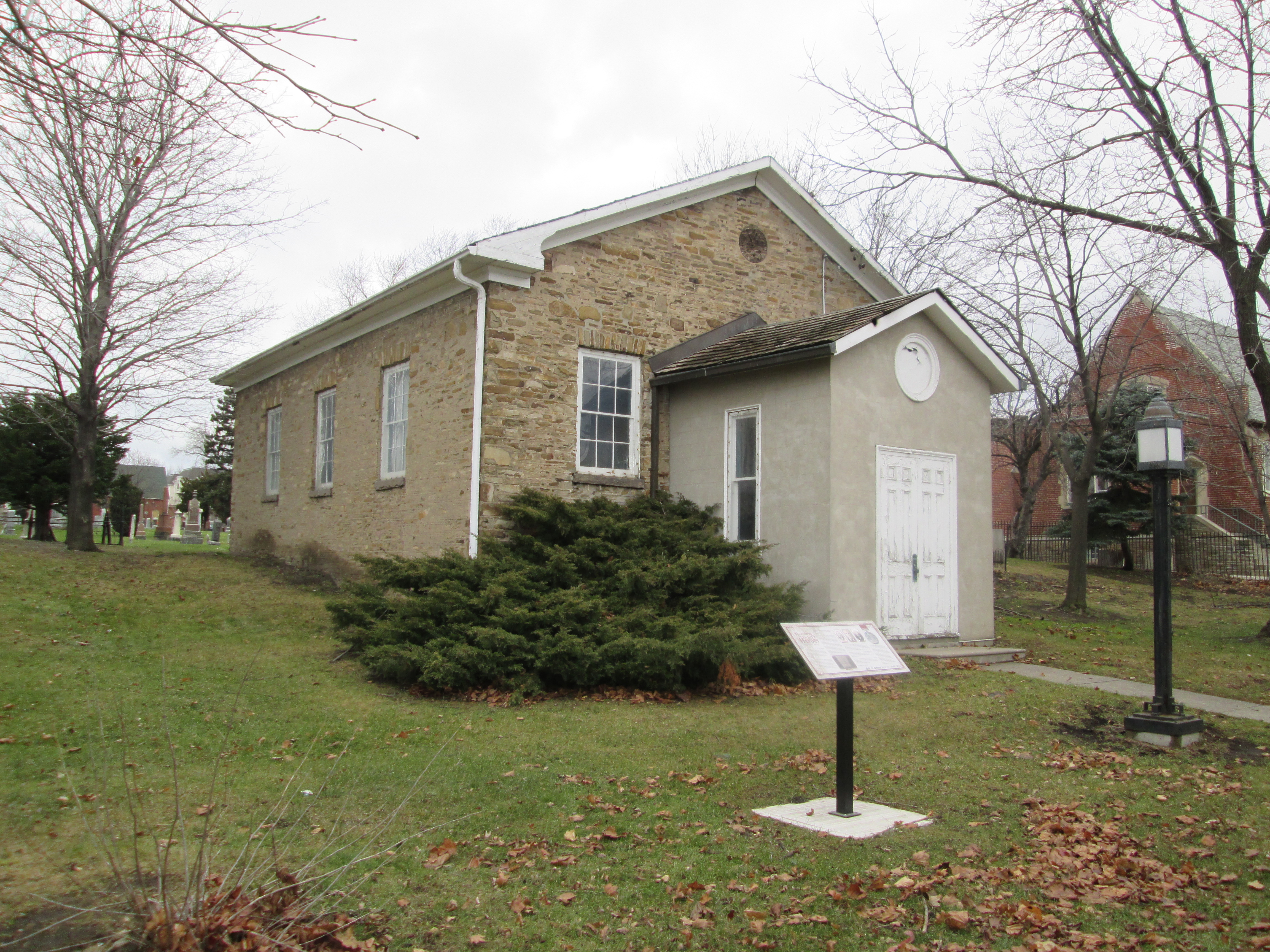
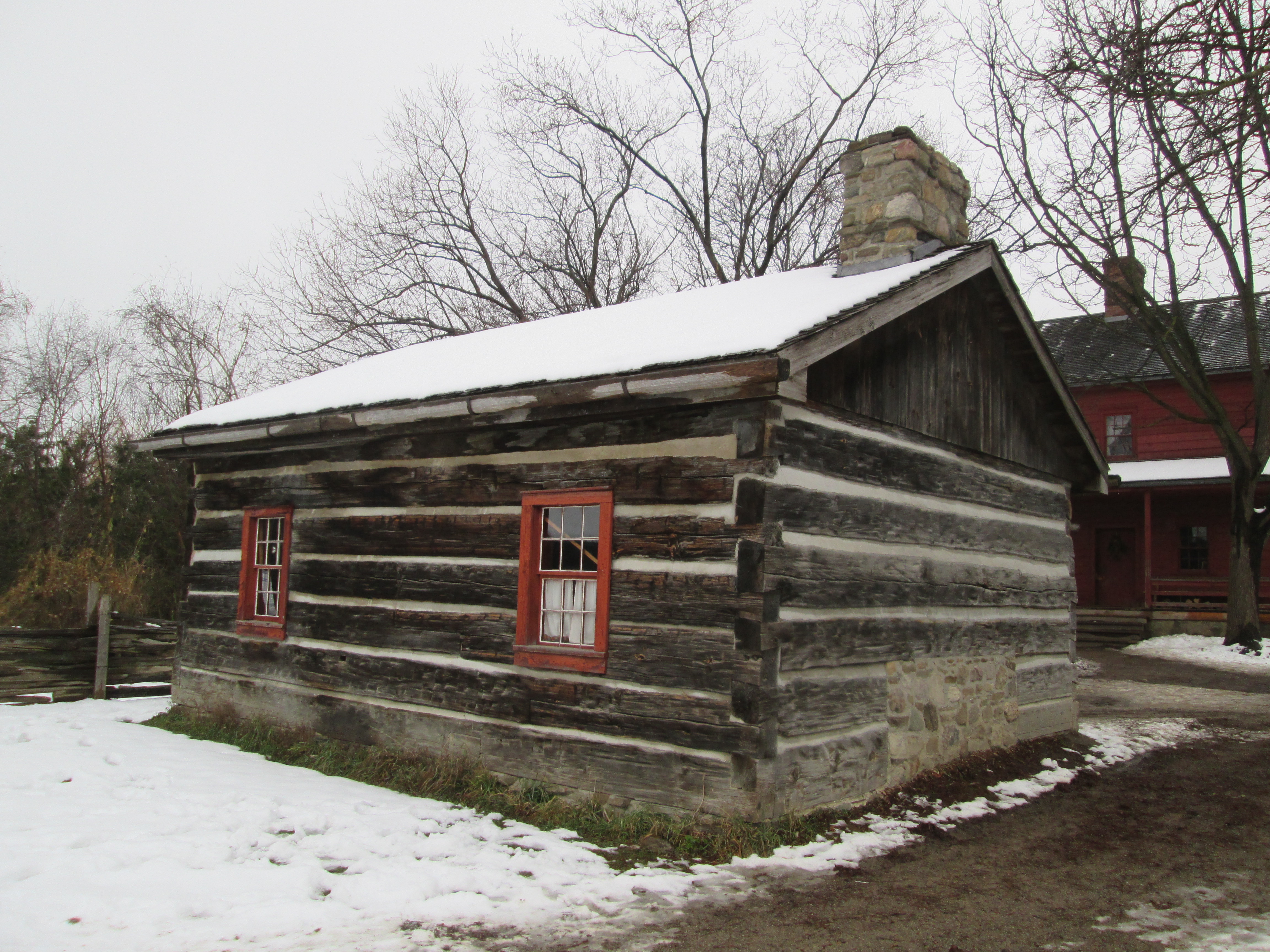
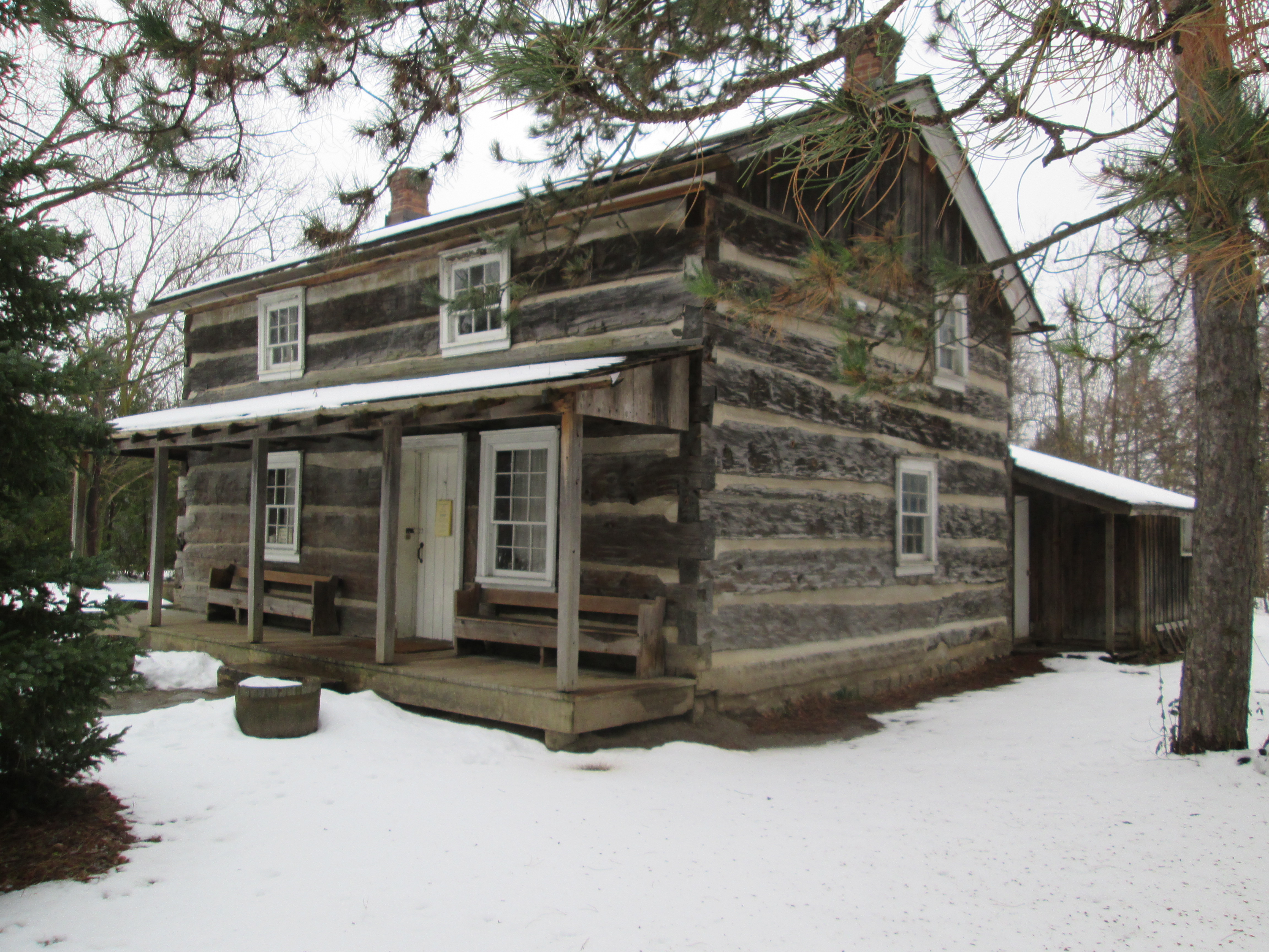
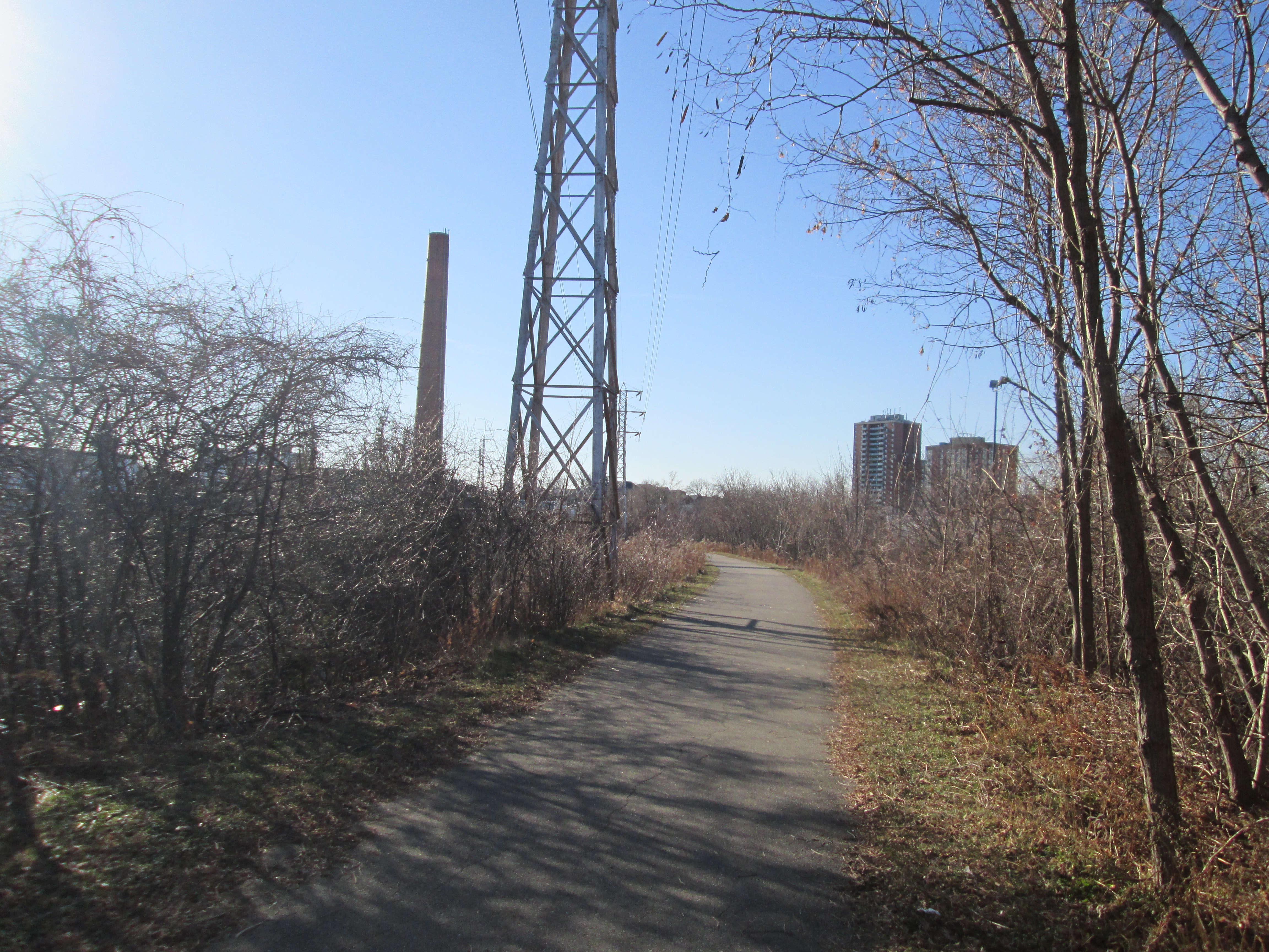
Just two degrees with a biting wind.  Not a great day for moving but my brother didn’t get to pick the weather.  He had been living in the former town of Dixie on property that once belonged to Joseph Silverthorne who was the founder of the town.  Joseph’s house, known as Cherry Hill house, was featured during the exploration of Summerville.  A break from moving is a great opportunity to explore and so we set out for the Dixie Union Chapel.  Dixie Union is the oldest surviving union chapel in Canada.

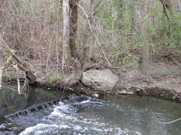
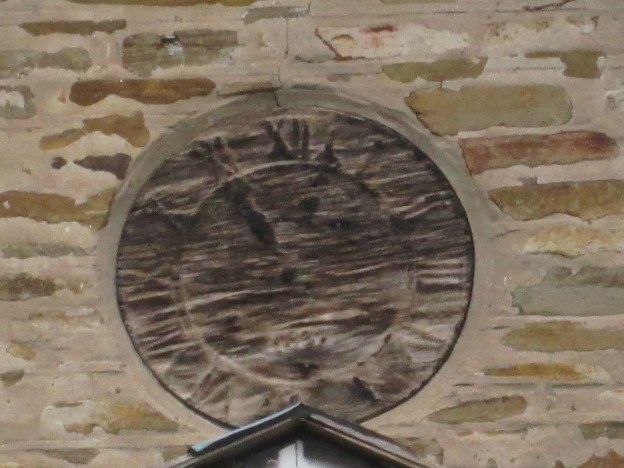
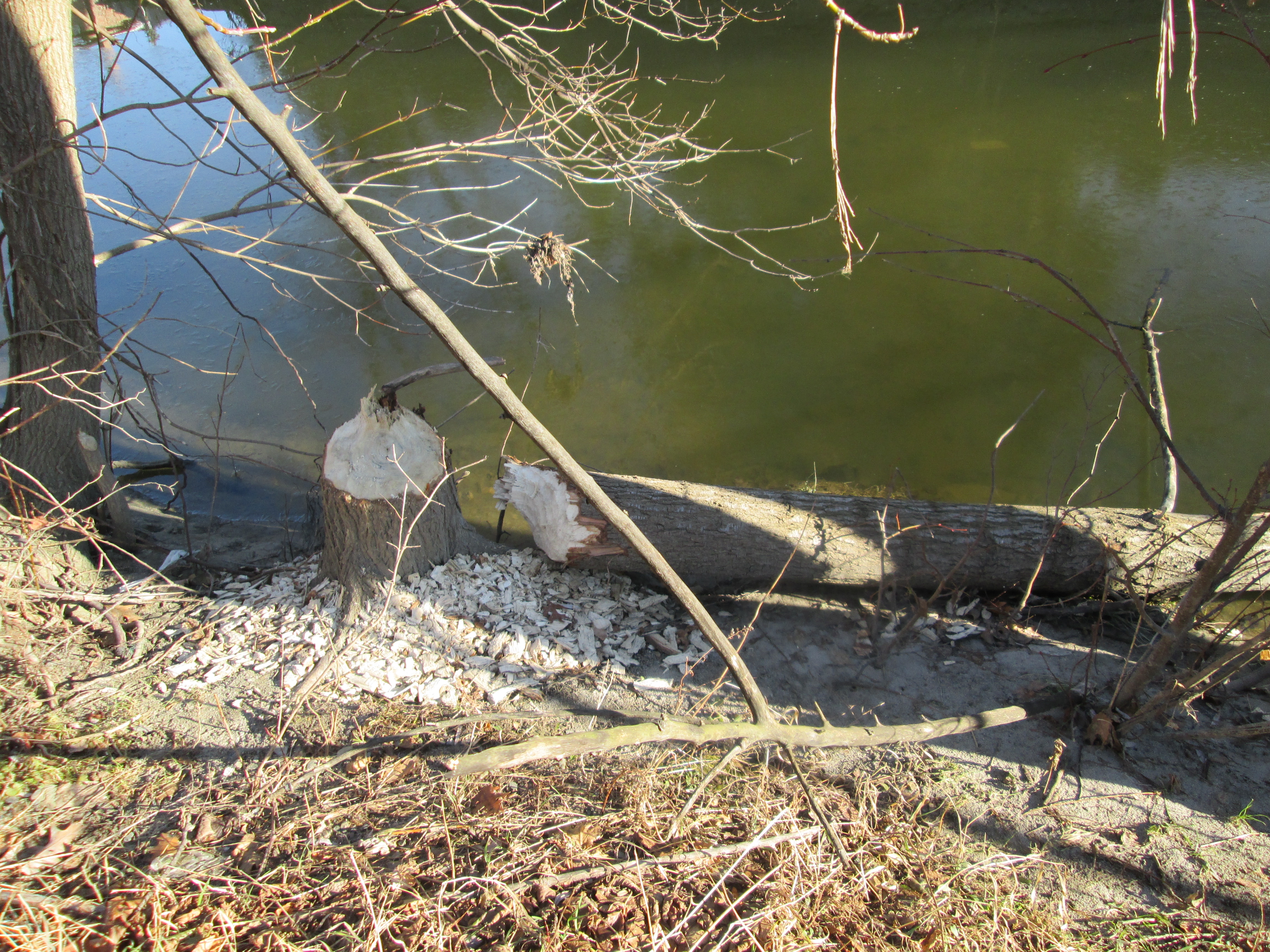
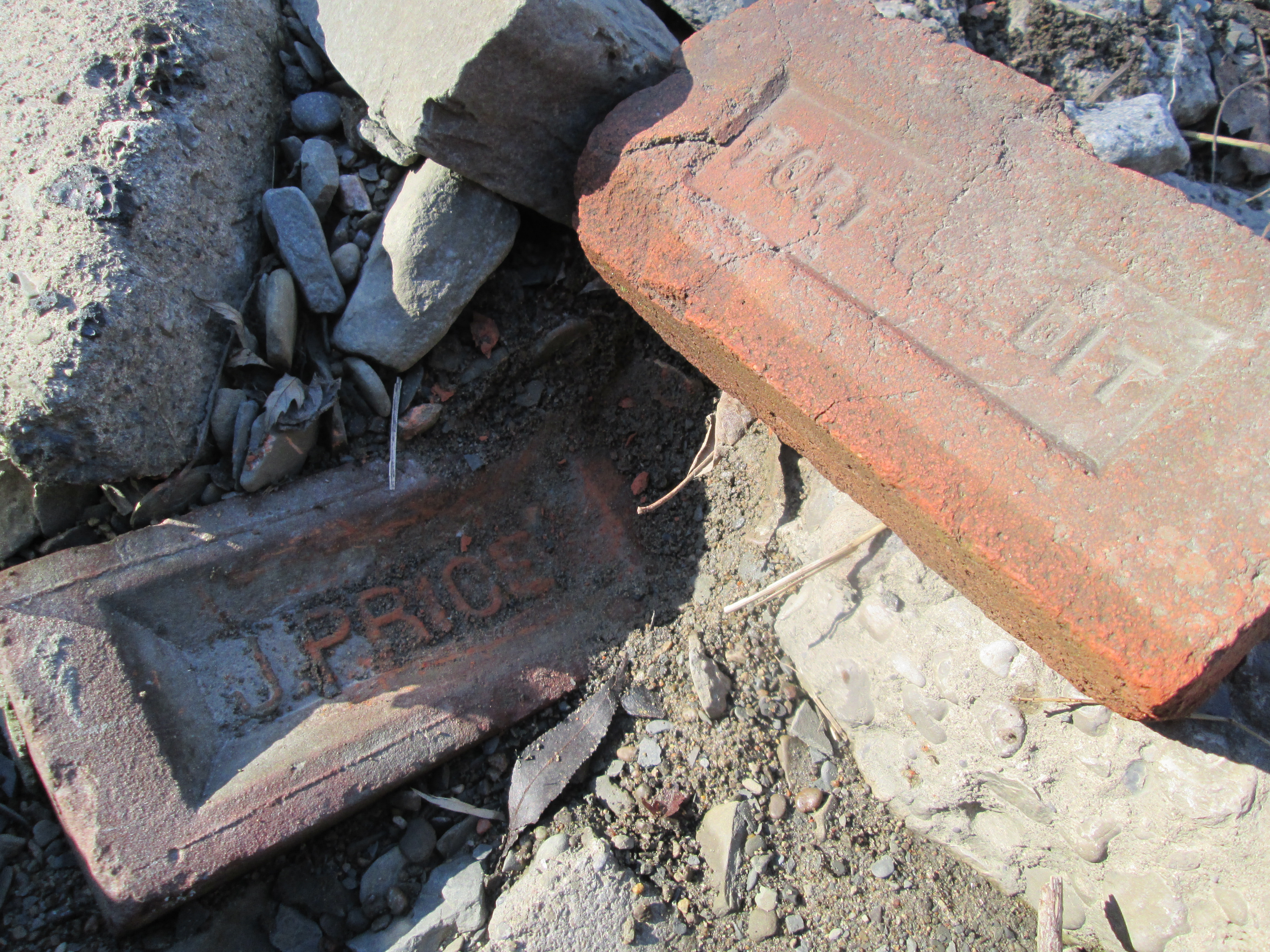
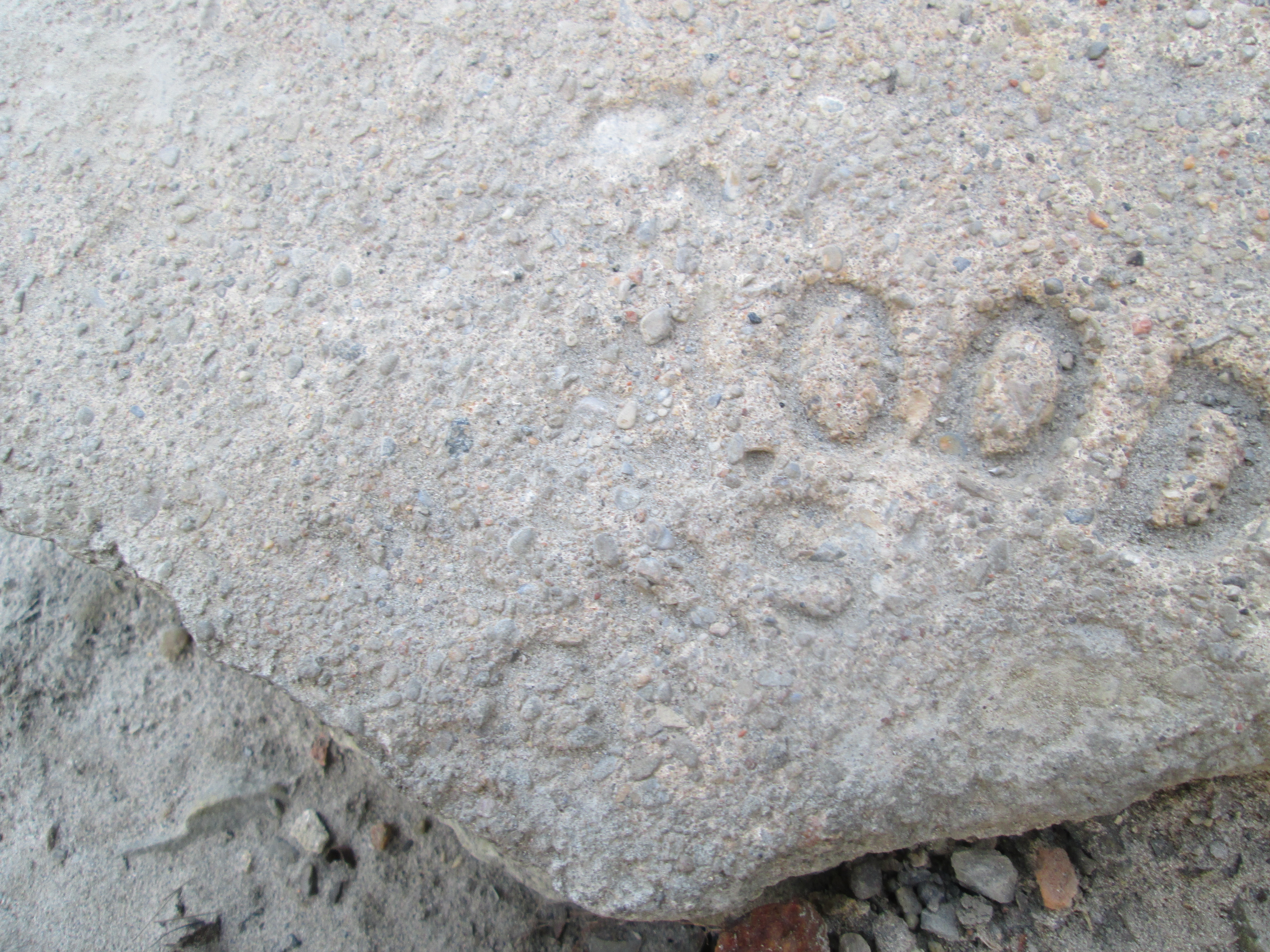
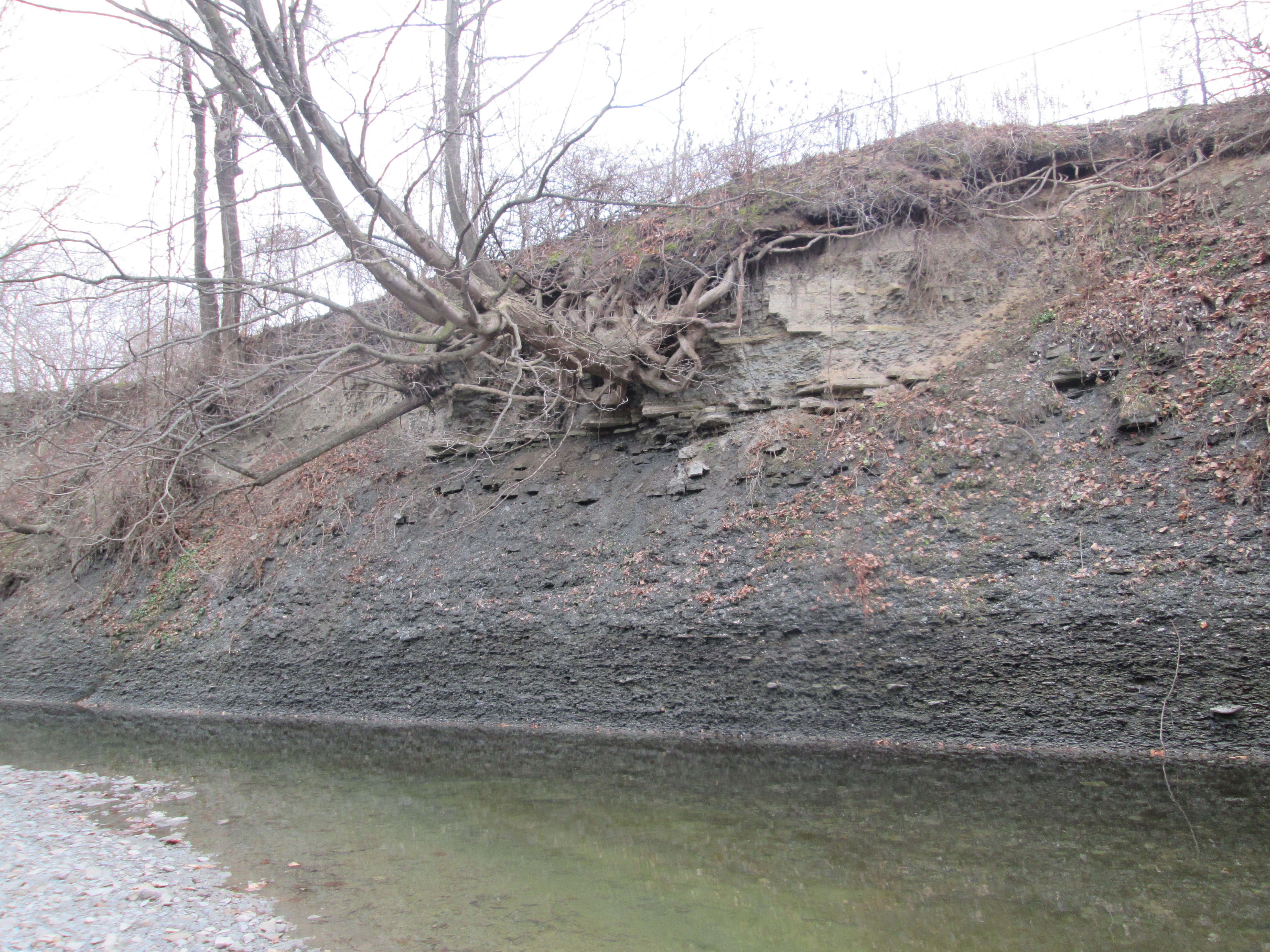
Early settlers in the Dixie area were too few in numbers to be able to afford to build their own churches.  The solution was for several denominations to go together and build a union chapel that they all could use.  Eventually congregations would grow and get their own churches, as happened here.  In Dixie the Anglicans, Methodists and Presbyterians got together and built Dixie Union Chapel. The first chapel was a log one which was started in 1811.  The war of 1812 interrupted construction and it was not finished until 1816.  In 1837 the project of hauling stone from the Etobicoke creek was begun in preparation for construction of a new building.  There is some suggestion that Silverthorne’s mill was taken down around this time and the stone may have been recycled in the present chapel.  Like the earlier log building the Stone Chapel, (as it was also known) suffered a delay in construction.  This time due to the Rebellion of 1837.  There is a wooden clock in the front of the church just below the roofline.  The cover picture shows the time as 11:02 and it is dated at the bottom with 1837.

IMG_1737

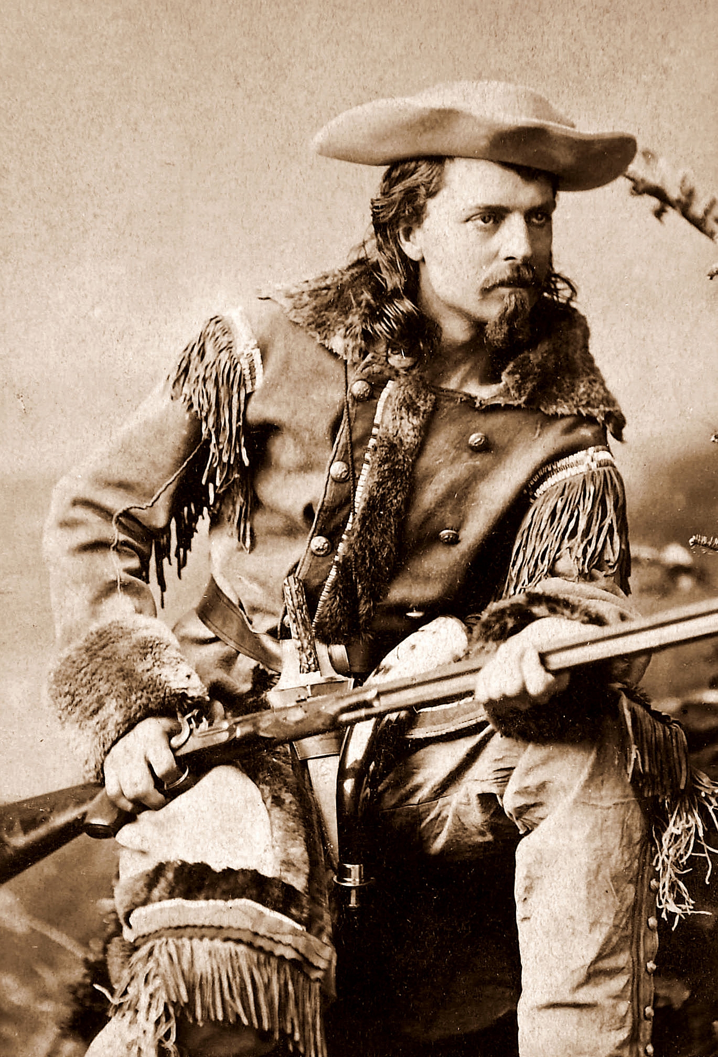
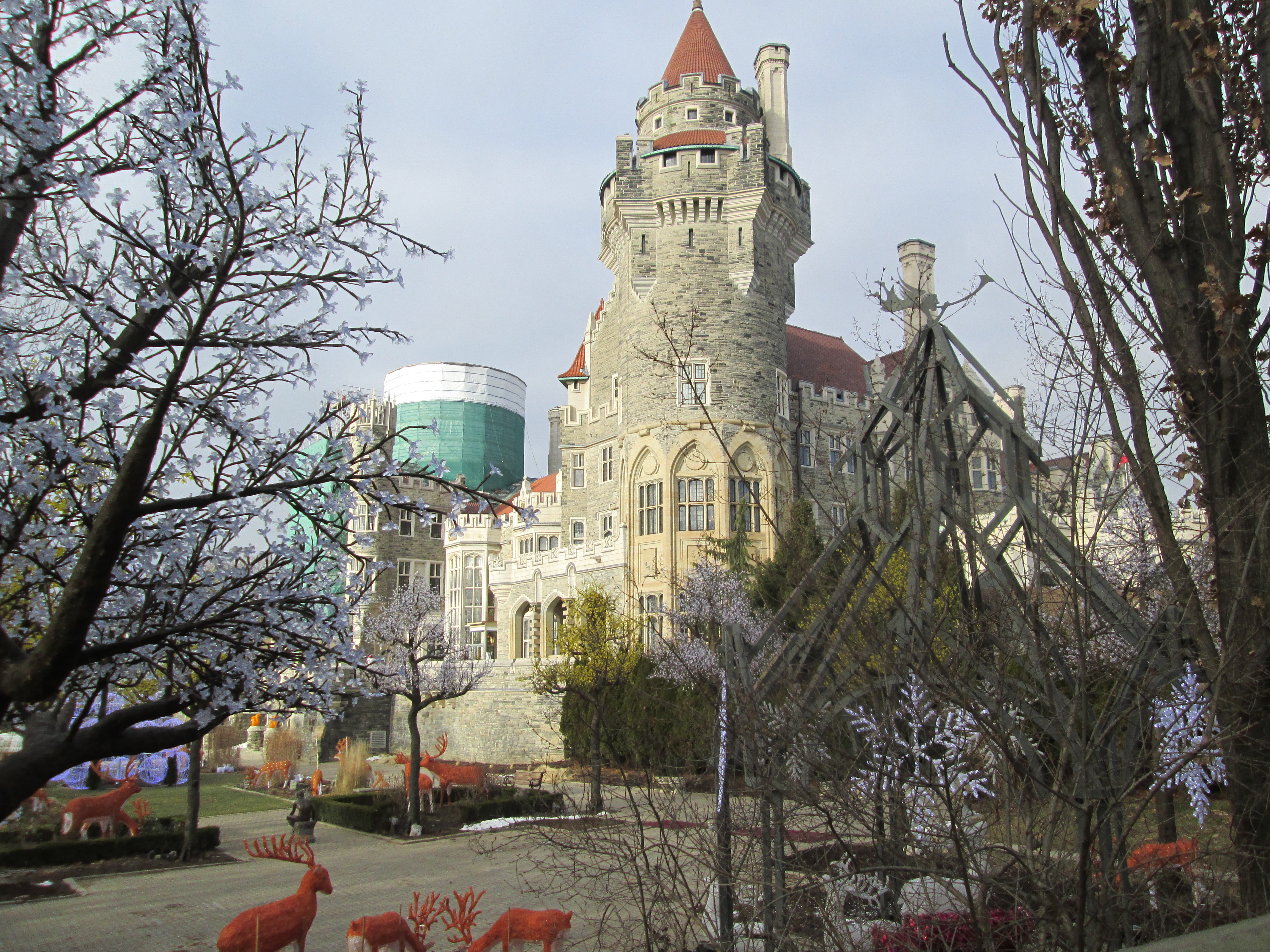
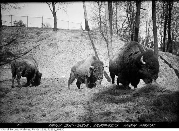
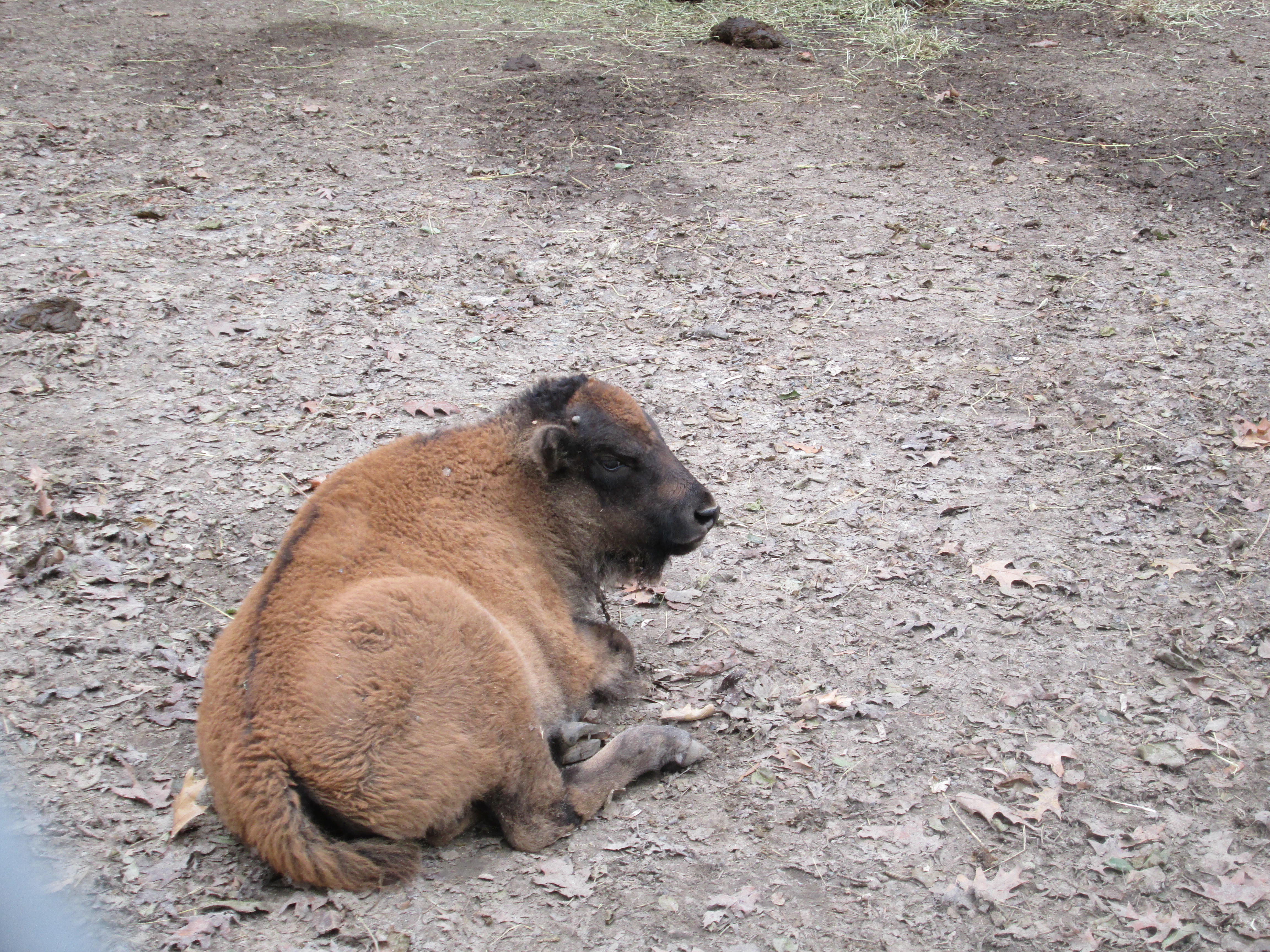
Buffalo Bill Cody was famous for his travelling show which presented the old west.  He got his nick name “Buffalo” because of a contract he had in which he sold buffalo meat to the Kansas City Railroad workers.  American Bison is the correct name for what is often called buffalo. Cody is reported to have killed 4,282 bison in an 18 month period.  A brief write up about bison is included in the previous post High Park – Zoo.  The Cody family were the first settlers in what became Dixie and donated the land for the church.  Buffalo Bill Cody was baptized there in 1847.

Buffalo_Bill_Cody_by_Sarony,_c1880

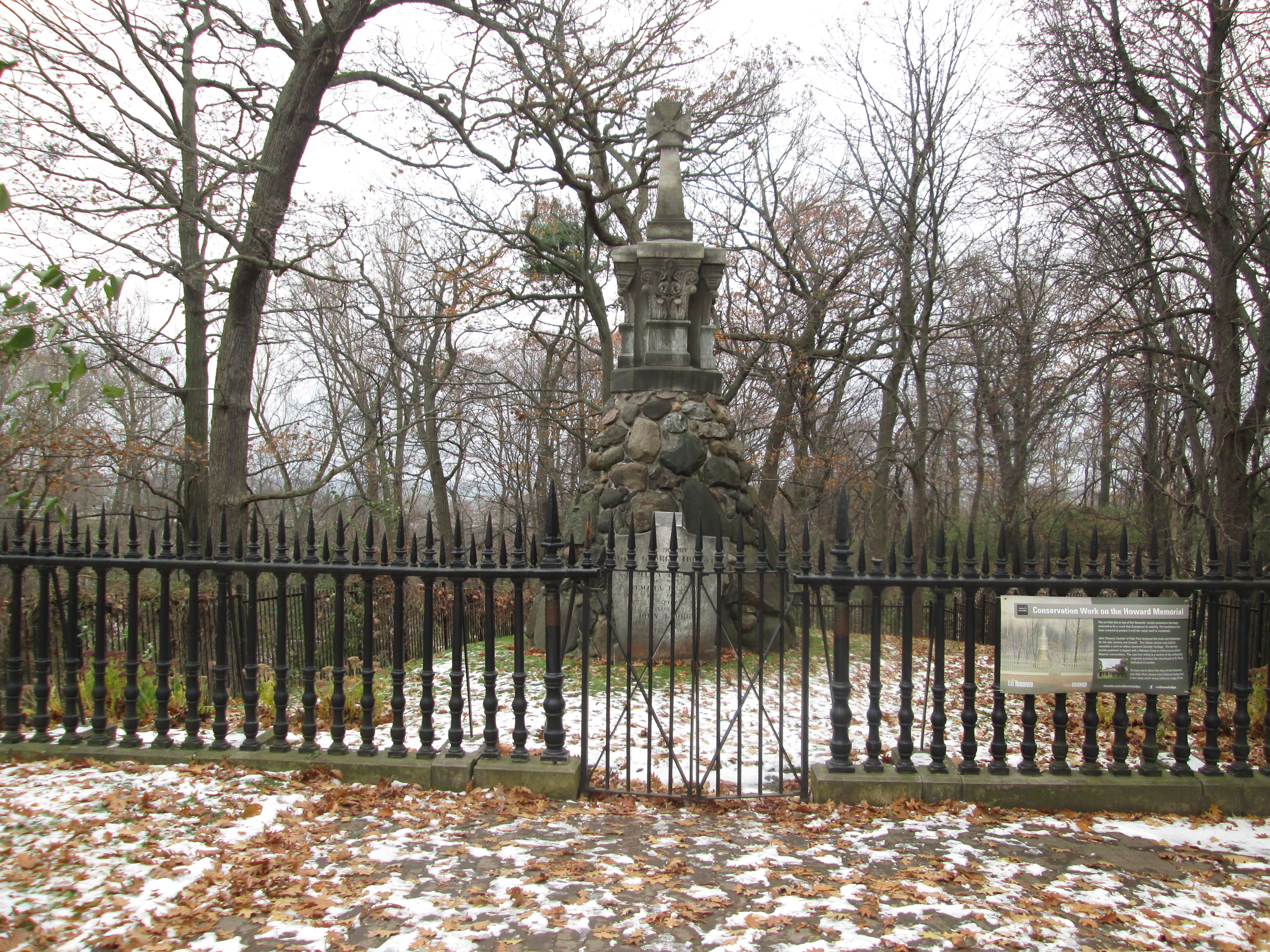
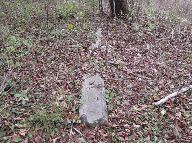
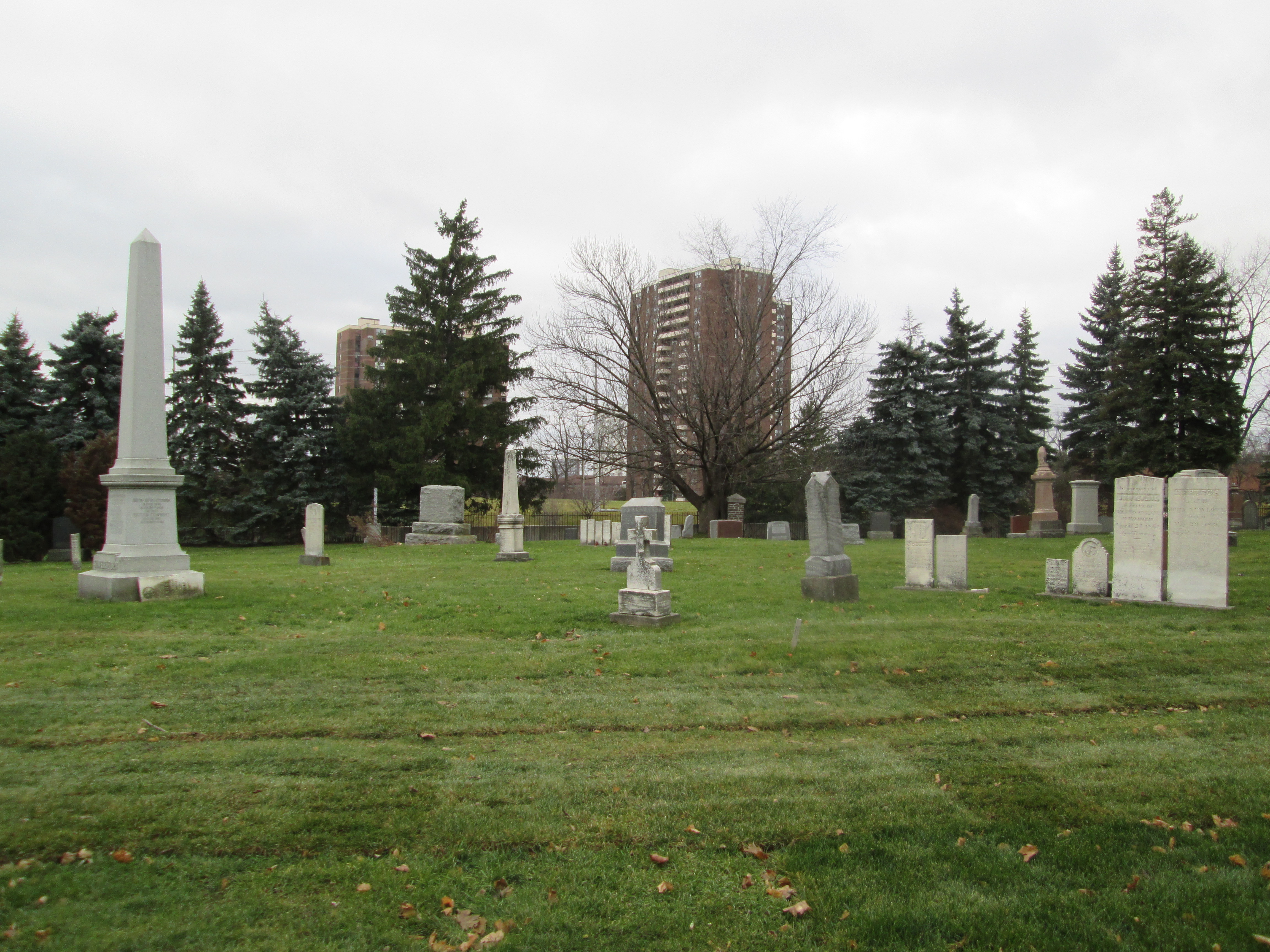
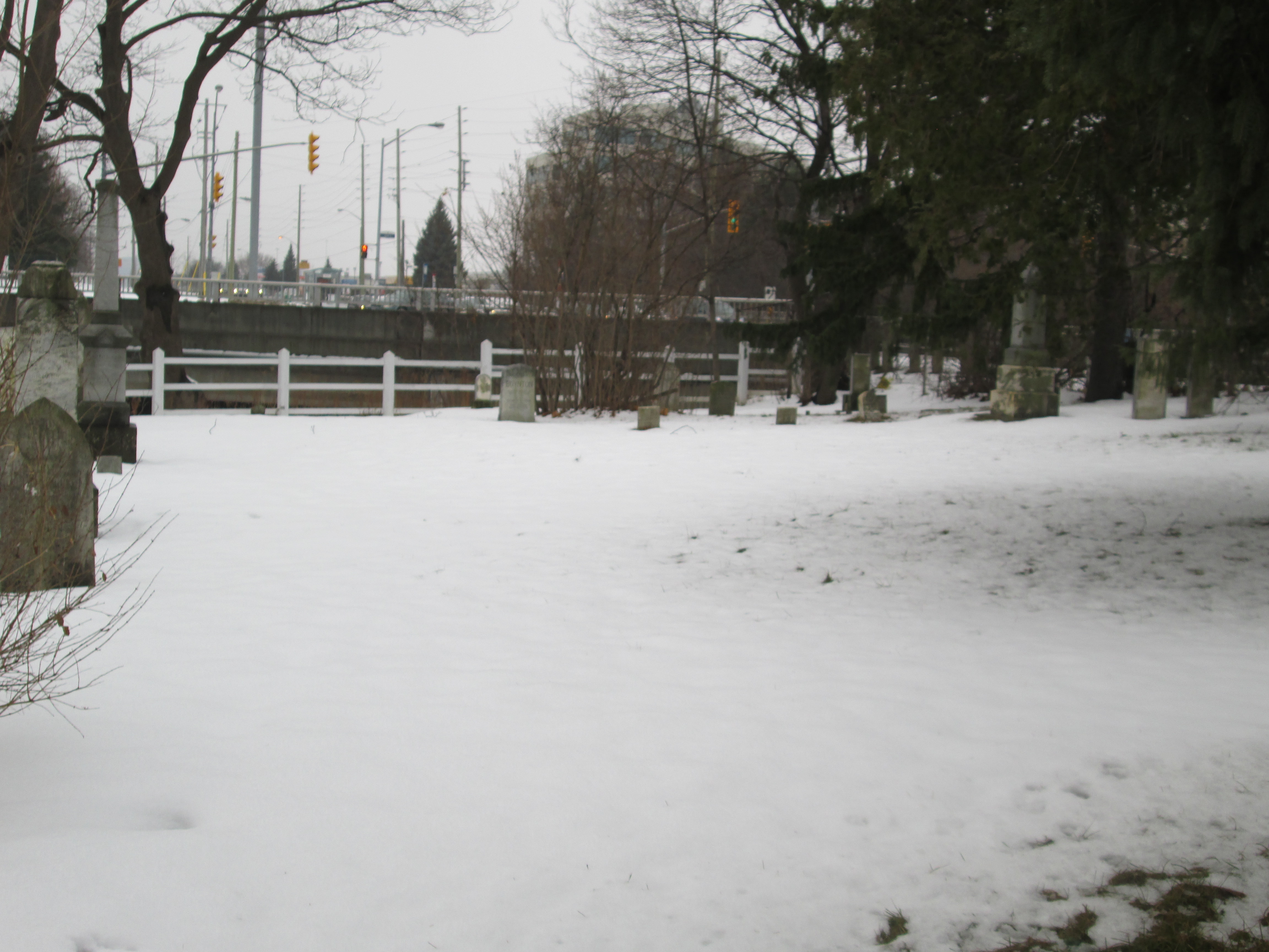
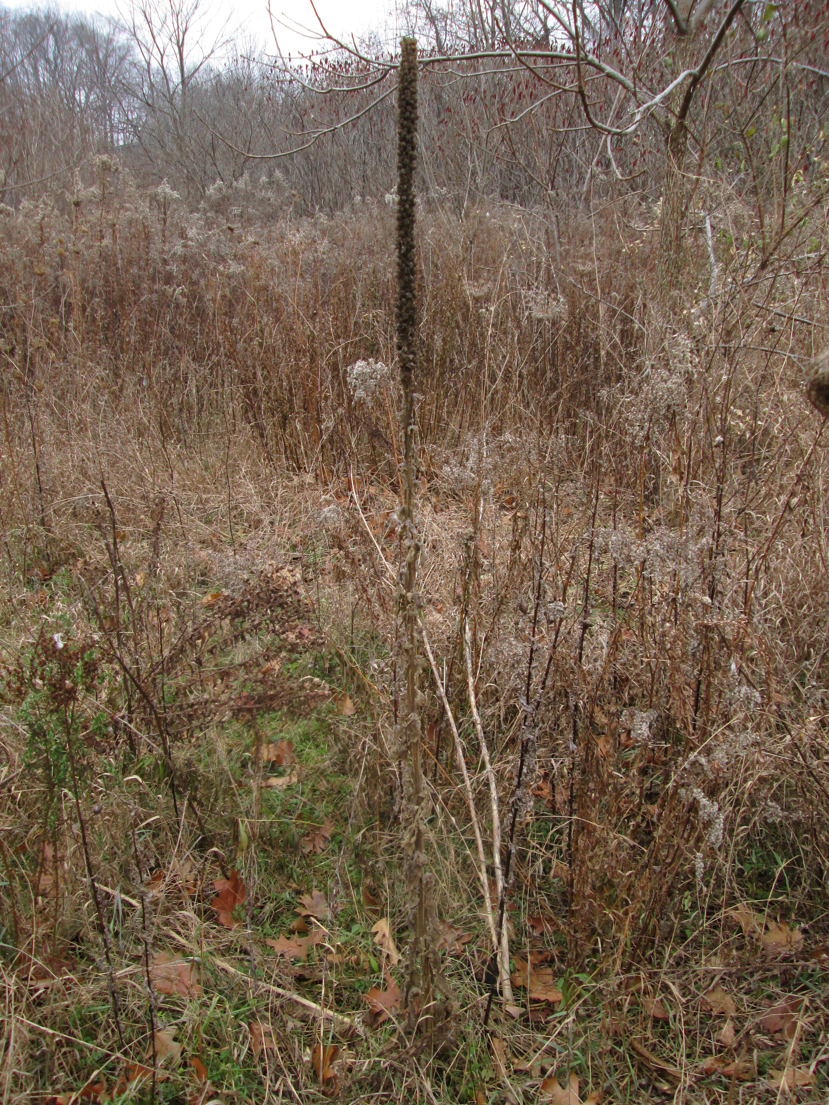
This is the only graveyard in Mississauga that existed prior to the war of 1812.  There are six known burials of militiamen who served in that conflict.  Some older tombstones here run at a 45 degree angle to the general grid pattern of the grave markers.  These “angled” ones run with their feet facing the east to allow the dead to rise facing the dawn on judgement day.  Other denominations tend to have their tombstones run parallel to the property lines.   As this is a union cemetery there is a mix of these two traditions making this rather unique.  In the picture below the tall marker on the left is for the Silverthorne family, including Joseph.  The two white stones on the right, along with the four shorter ones to their left, are angled facing east.

IMG_1751

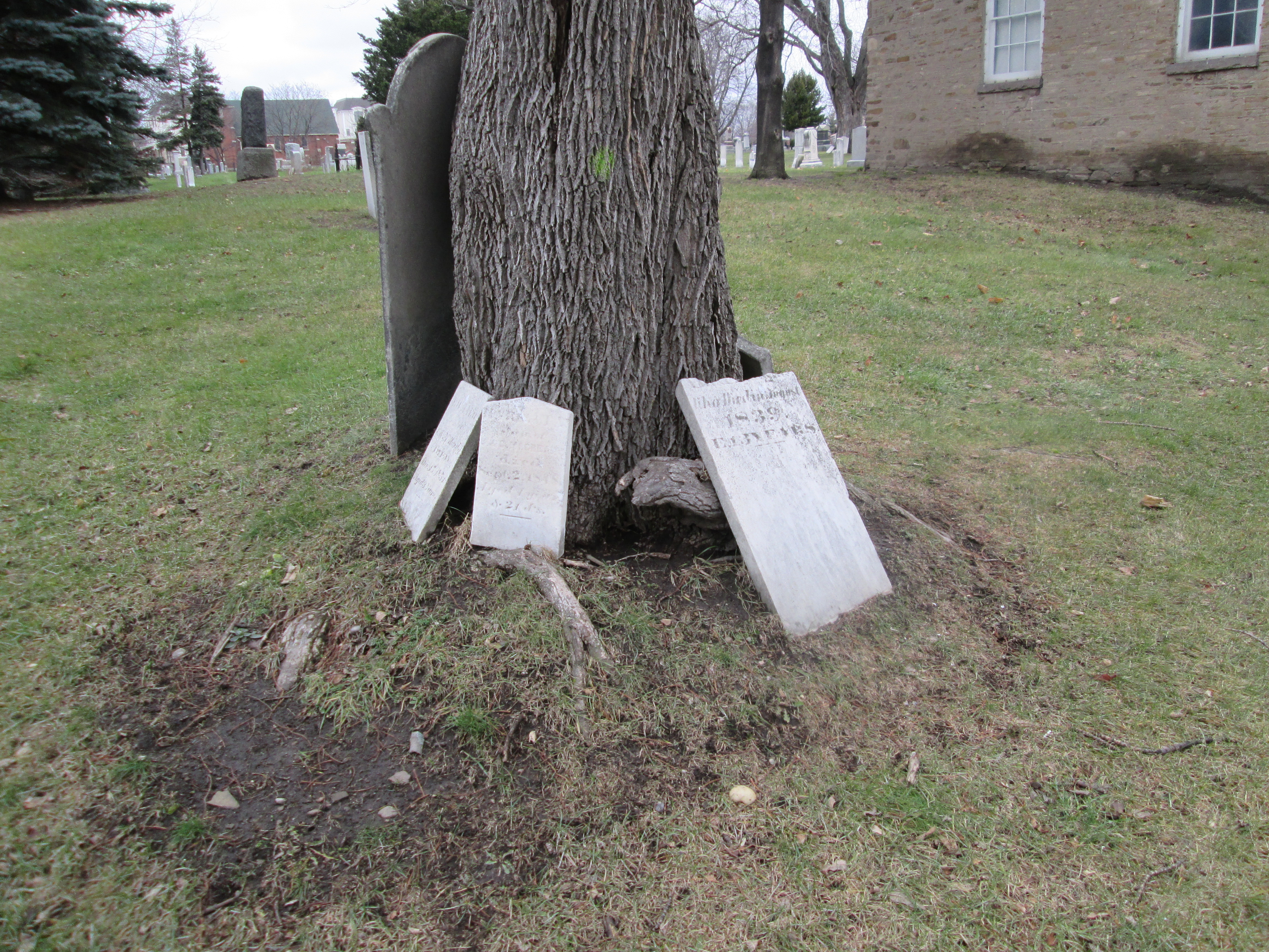
Unfortunately the weather and possibly vandals have taken their toll on the older stones in this cemetery.  Many of them are broken off and are leaning against trees, fences and the chapel itself.

IMG_1748

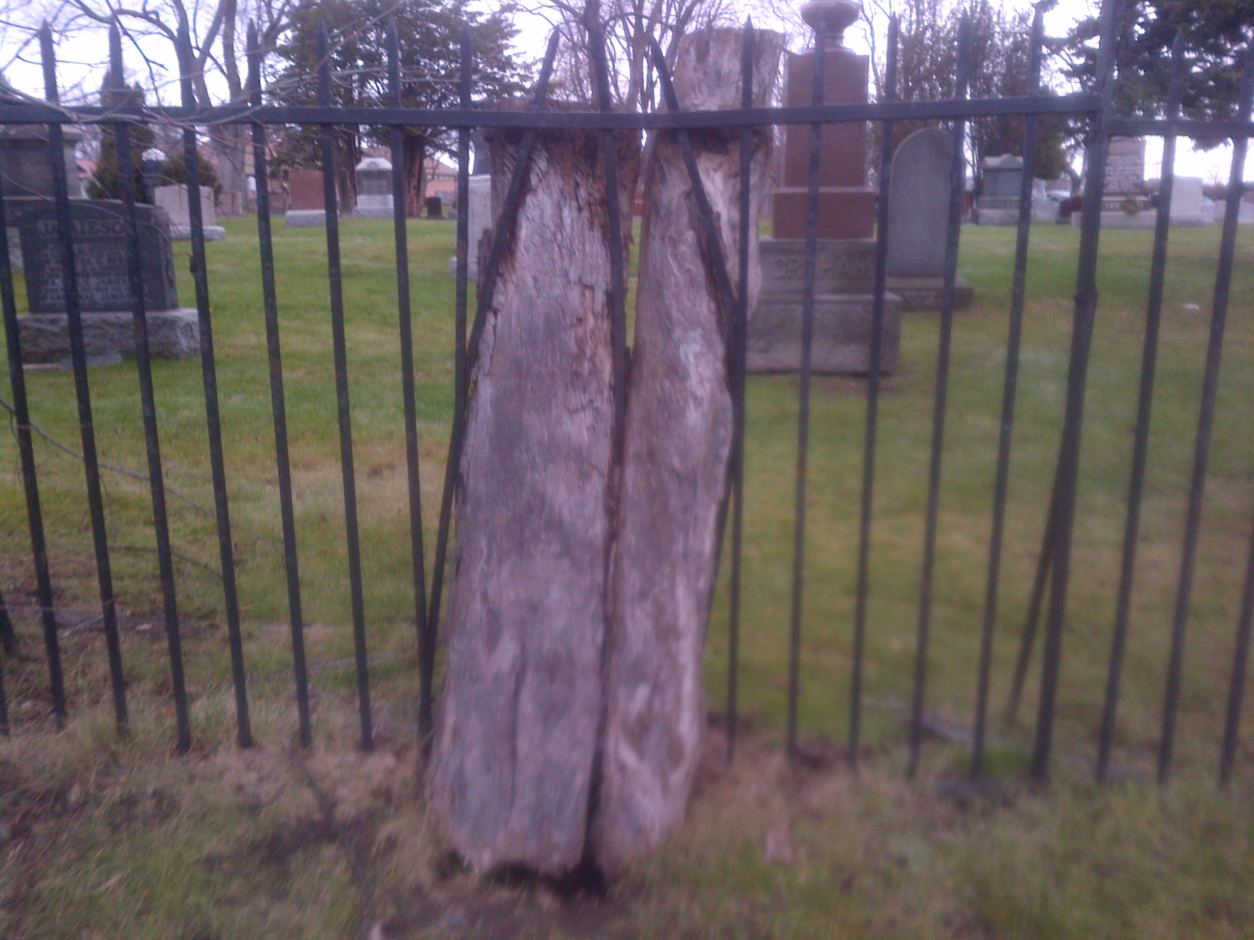
This tree looks like it tried to escape by bending the bars on the fence.  Some day the trunks will rot and drop out of the fence leaving people to wonder how the wrought iron got bent like that.

Mississauga-20141228-00524

The old steel lamp posts at the front of the building would have been forged by the local blacksmith.  Having three congregations in the building pretty much guaranteed the services, usually volunteered, of most tradesmen.  This kept the cost of building and repairs to a minimum.  Today lamps like this are back in style and can be bought by the container load from China.

IMG_1738

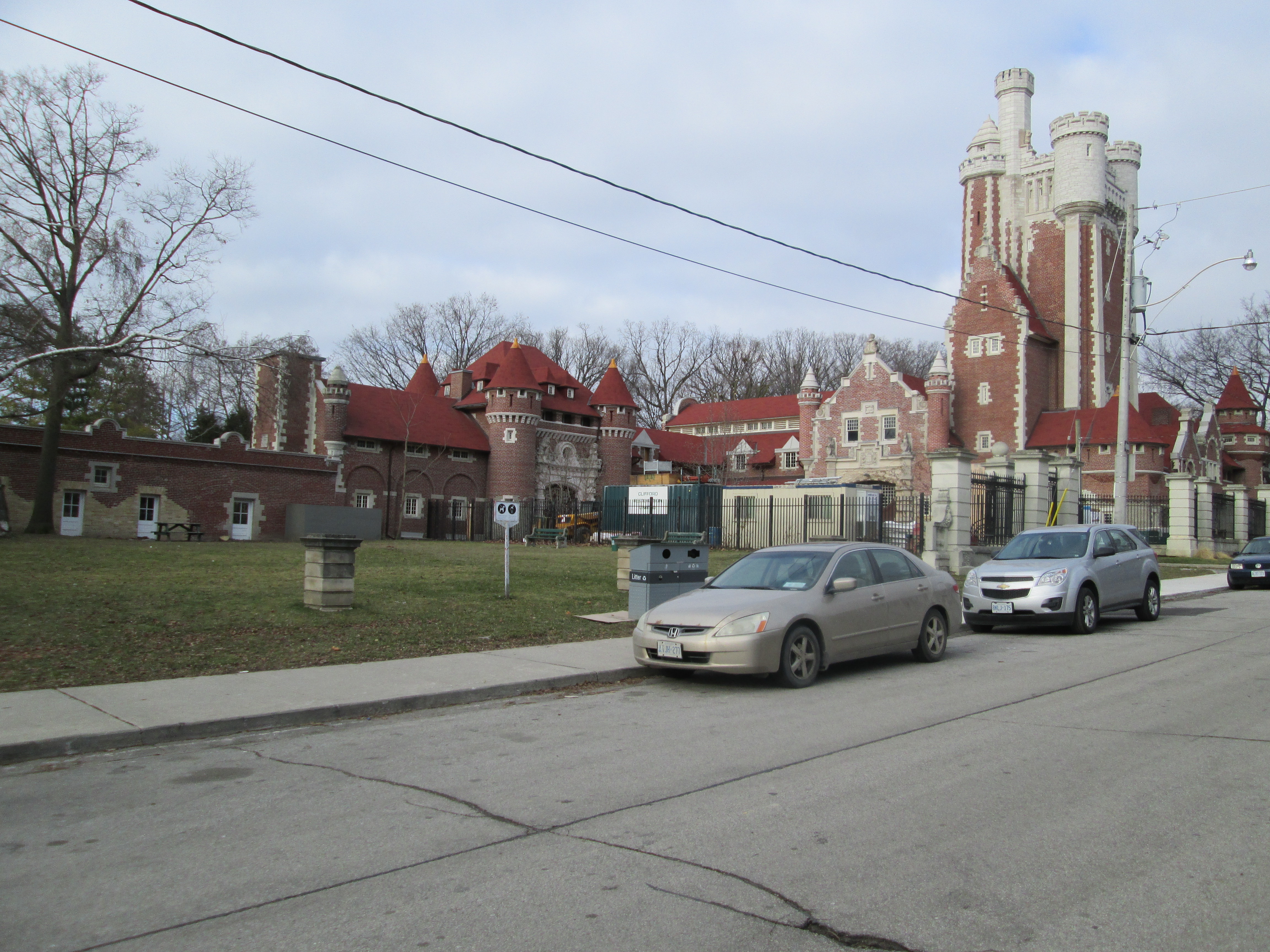
In 1870 the Anglicans built a brick church just to the east of the  Dixie Union Chapel which they called St. John The Baptist.  It was remodeled in 1922 but was destroyed by fire after a lightning strike in 1925.  The church was reconstructed in a similar style as the 1870 building.

Mississauga-20141228-00530

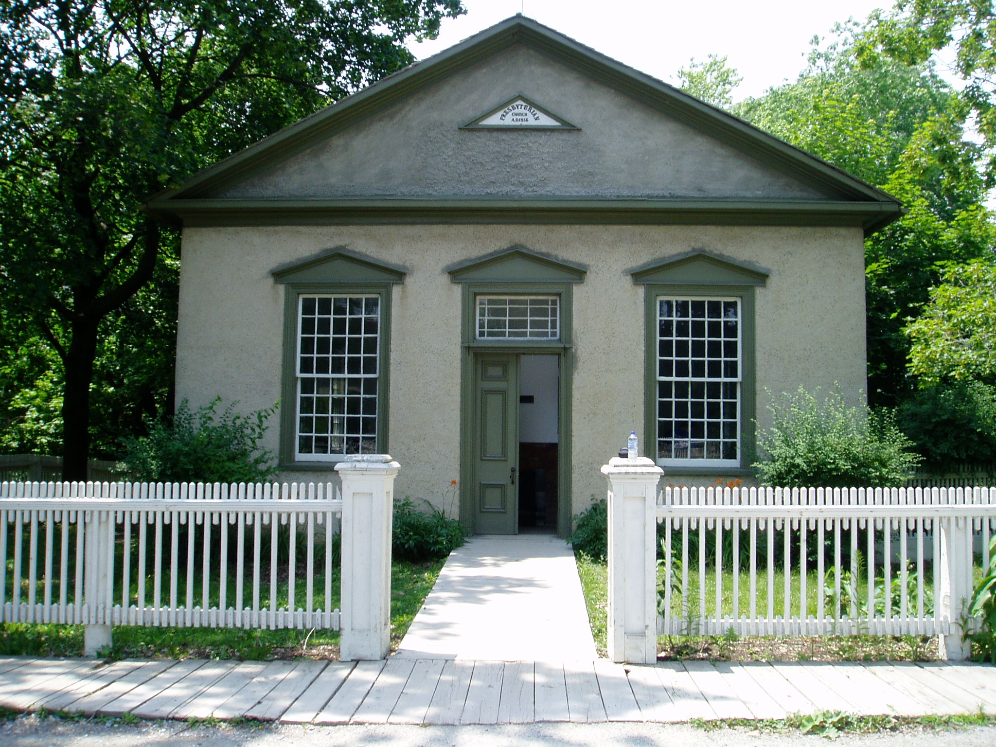
The Presbyterian congregation erected their own building at the north end of the cemetery in 1910.  This building now serves a similar function to the old Dixie Union Chapel.  According to the sign out front it also hosts a Korean Methodist and an Eastern Orthodox Congregation.

Mississauga-20141228-00527

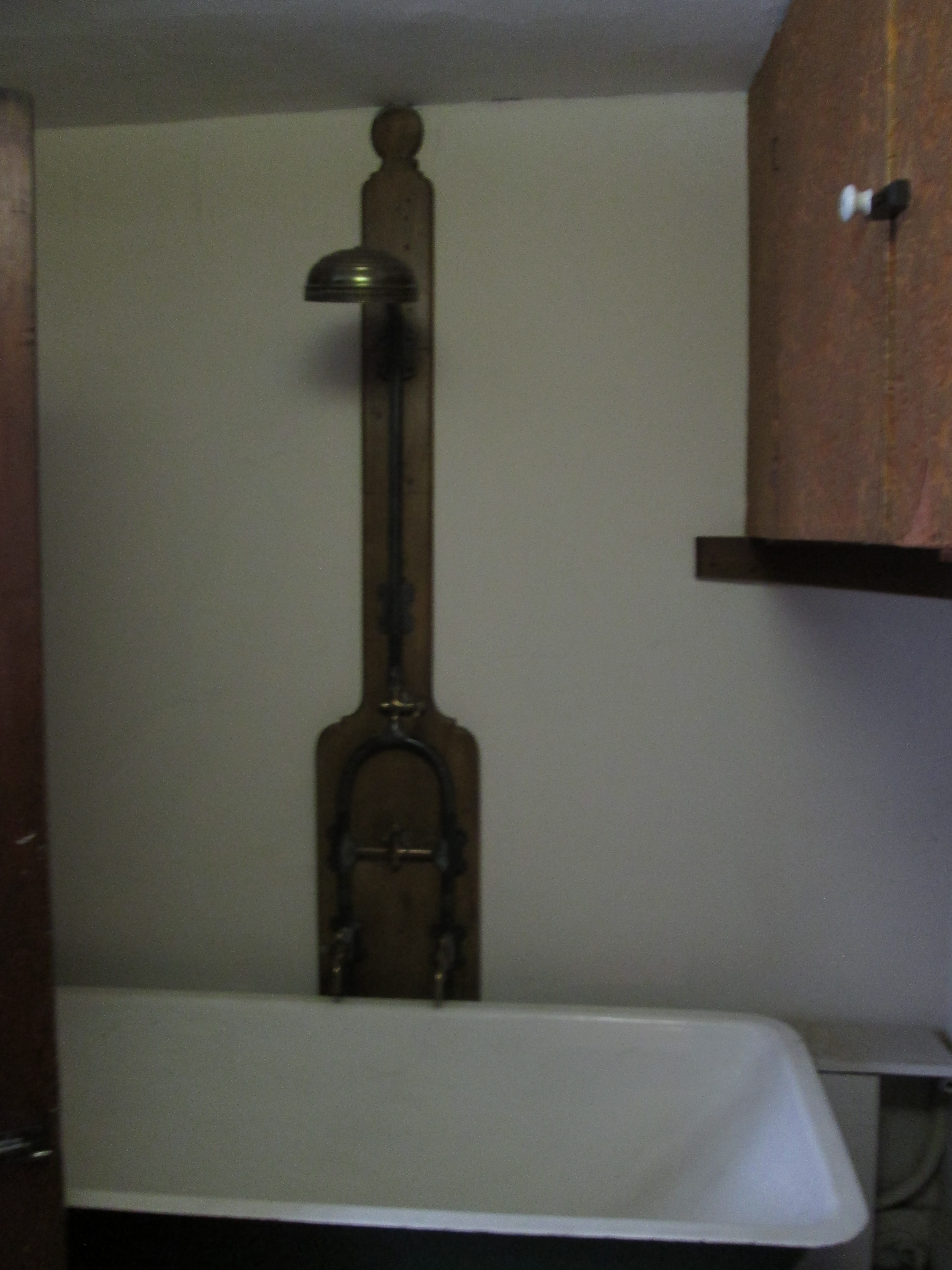
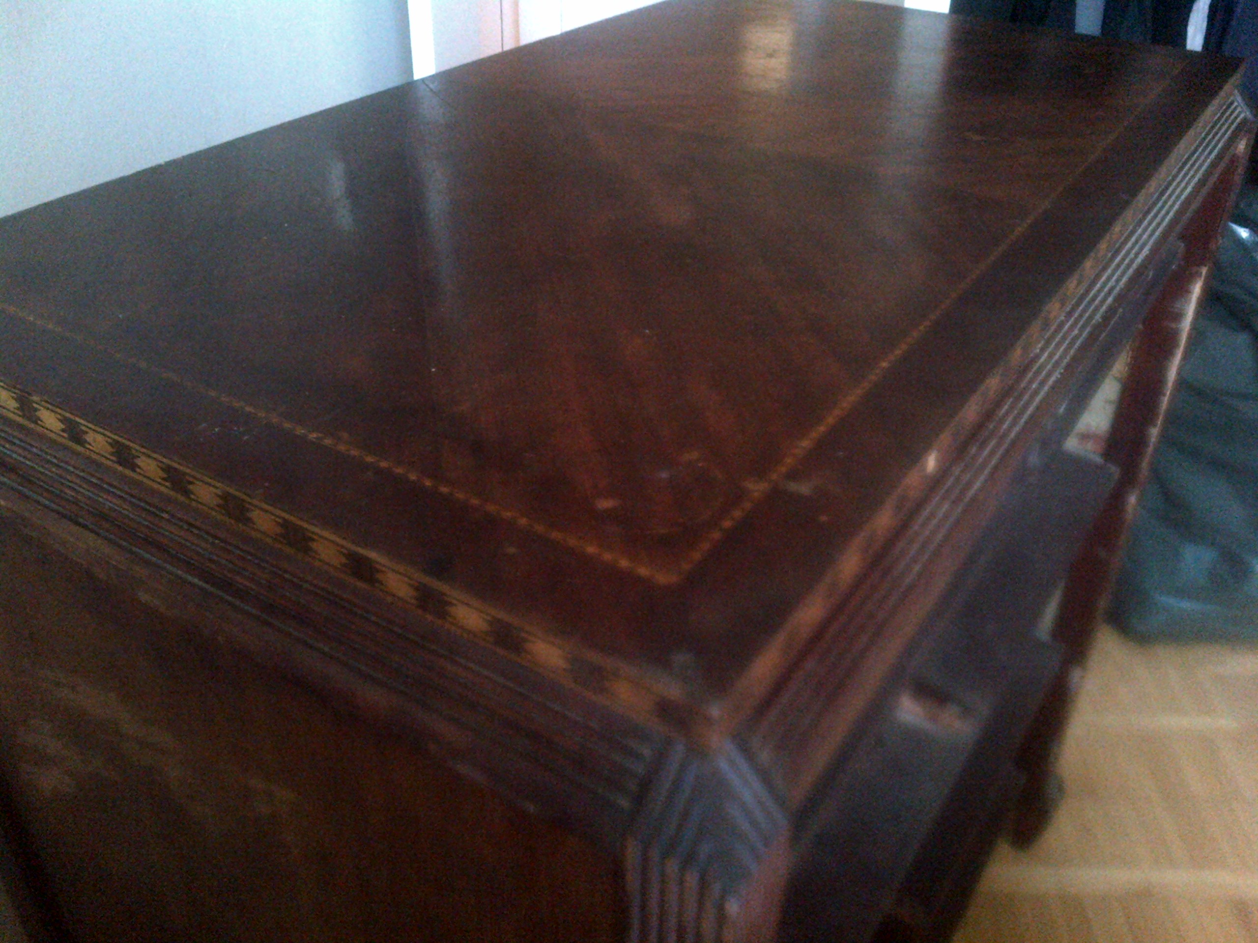
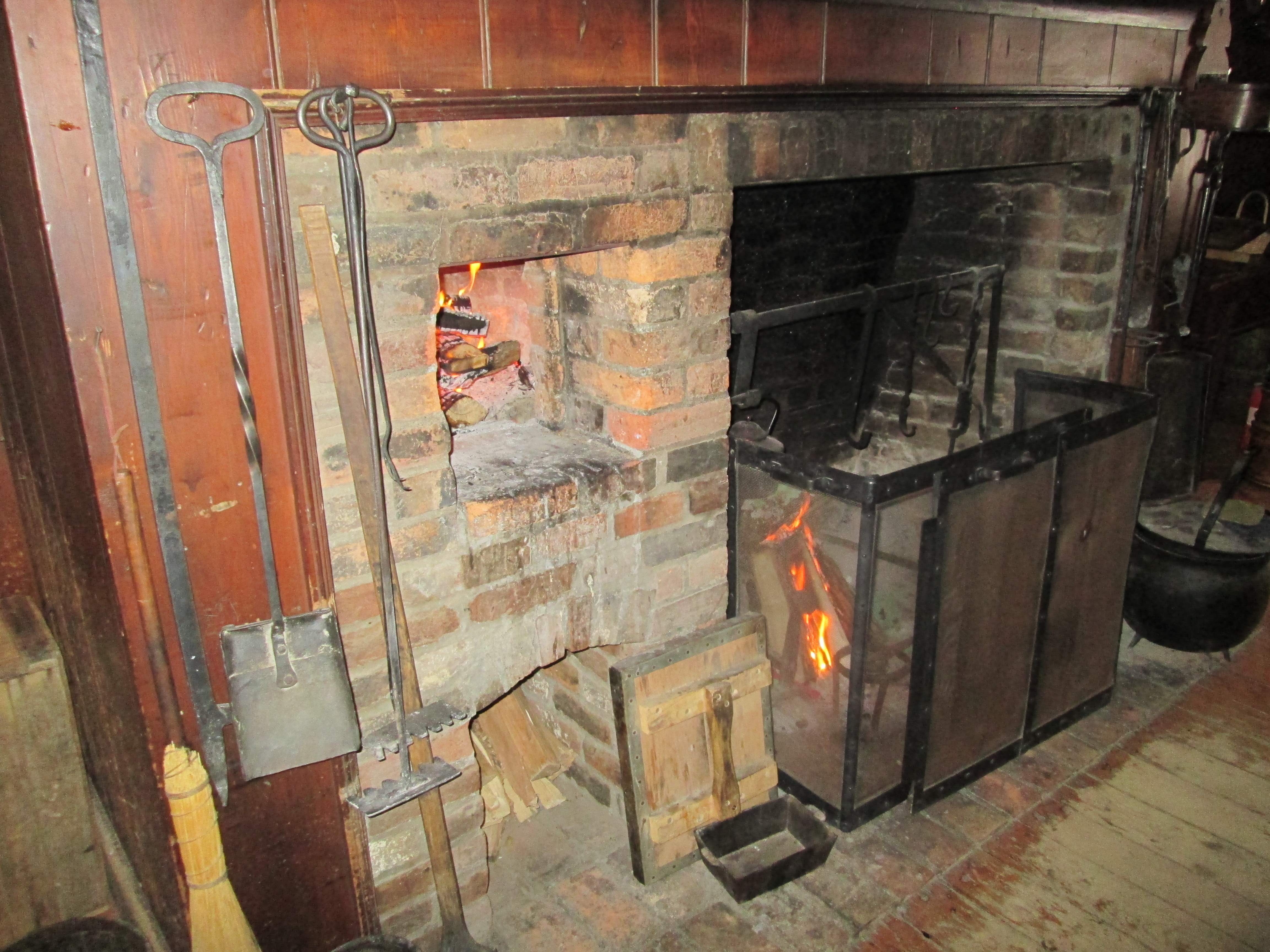
While helping my brother move I was admiring the detailed inlay of the wood around the edge of an antique dresser.  It was manufactured by North American Furniture Company in Owen Sound and sold at Simpsons.  At one time Owen Sound was a hub of furniture manufacturers with over 25 in the early 1900’s.  The North American Furniture Company operated from 1910 to 1939.  It was nice of my brother to furnish this item for this post. LOL

Mississauga-20141228-00518

That’s all for 2014.  It was a year full of adventure, exercise and investigation.  I loved it all. Happy New Year everyone and here’s to some great hiking in 2015!

Like us at http://www.facebook.com/hikingthegta


Spadina

Sunday Dec. 21, 2014

Following Queen Victoria’s coronation in 1837 Lot Street was renamed Queen Street.  The original name Lot Street was due to it’s use as the base line for the land survey in the town of York (Toronto). William Warren Baldwin bought a 200 acre land grant running north from Lot Street.  He named his estate Spadina after the native word for hill or sudden rise of land.   This rise of land is part of an ancient shoreline from when Lake Ontario was larger and known as Lake Iroquois.  The Scarborough Bluffs are also part of this shoreline.  Here he built the first Spadina house in 1818 and laid out Spadina Avenue to link it to the city.  He set a trend for York’s wealthy to establish large estates along the crest of the bluffs overlooking Davenport Road.  This became the wealthiest neighbourhood in the city by 1900.  Baldwin and his son, Robert, are credited with bringing government reform to Canada. While the Rebellion of 1837 failed to overthrow the Family Compact that was running the government, the Baldwins worked within the system to bring about change.  The former Spadina estate with it’s various modern uses was the subject of today’s exploration.  It is marked in red on the 1877 county atlas below. The sun was shining and it was a couple of degrees above freezing as I parked on Spadina just north of St. Clair.

Baldwin

The St. Clair reservoir is located on the south east corner on property that was sold to the city in 1913.  The reservoir was part of a larger project of public works planned and developed by R. C. Harris in the 1920’s.  The R.C. Harris Filtration Plant on Victoria Park was the first part of the Water Works system to be built.  After the Lake Ontario water had been purified it was pumped to reservoirs throughout the city for storage and delivery.  The reservoir at St. Clair was the first to be completed in 1930.  The cover photo shows the date stone with it’s inscription TWW (Toronto Water Works) and MCMXXX (1930).  The picture below shows the valve house at the top of the reservoir and the pipe tunnel portal below.  A grand staircase climbs the reservoir between them.

Spadina 19

When the reservoir was designed there was a fear that power failures could cause loss of water to the homes north of the reservoir.  Harris envisioned a water tower that would provide a 30 minute supply of water to homes in district 3.  The steel water tower would have cost $43,000 but Harris also designed a $70,000 neo-classical cladding for the outside to match with the pump houses.  With the great depression deepening city council didn’t approve the water tower.  Harris built the foundations for the water tower in the hopes that it would later get approved.  Improvements in the delivery of electrical power made the water tower obsolete and in the end it was never built.  On the south corner of the reservoir there is a mysterious concrete circle, the foundations for the planned water tower.

Spadina 7

The reservoir overlooks Nordheimer Ravine.  Samuel Nordehimer emigrated to Canada from Bavaria in 1844.  Along with his brother Abraham they opened a piano factory in The Junction.   A & S Nordheimer became one of Canada’s best known piano manufacturers.  Castle Frank Brook flows through the ravine on it’s way to join the Don River.  Castle Frank Brook is named after the home of Lieutenant-Governor John Graves Simcoe and his wife Elizabeth.  Constructed in 1793, Castle Frank was the first of many grand estates built north of the town of York.  The sketch below shows what the home of the Simcoes looked like.

Castle Frank

Castle Frank Brook was buried in the 1970’s when the Spadina subway line was extended.  It now flows through a sewer pipe under the ravine.  As I walked along the ravine I saw a rather unique tree house.  This one has a smiley face cut in the side for windows.

Spadina 14

Soil erosion on the hillsides has left a lot of tree roots exposed.  The root system of a plant is normally close enough to the surface to take advantage of nutrient and water availability. However, where water is scarce, roots have been known to extend over 60 meters into the ground.

Spadina 13

The bridge across Nordheimer ravine was built in 1929 as part of the infrastructure improvements that went along with construction of the reservoir.  An earlier wooden bridge was replaced with the current one which is modeled after the Bloor Street Viaduct, also built by R.C. Harris.  Crossing the bridge and continuing south you quickly come to the edge of an old escarpment looking out across the downtown core of the city.   Spadina Road was designed as a grand thoroughfare between Queen Street and Davenport Road.

Spadina 24

With 98 rooms the largest private home ever built in Canada is Casa Loma.  It was constructed between 1911 and 1913 for Henry Pellatt.  Henry had made his fortune by developing Niagara Falls for electrical production and bringing hydro to the city of Toronto.  We had found the remnants of his power corridor while hiking Humber Bay to Bloor Street on May 24.  The front lawn was laid out for Christmas.

Spadina 28

When Pellatt was envisioning Casa Loma he was also thinking about his horses.  He had elegant stables built in 1905 in anticipation of building his castle.  He lived here while the castle was under construction.  There was an 800 foot tunnel built underground from the stables to Casa Loma.  During the second world war a top secret installation here assembled ASDIC, an early version of sonar that was to prove key in winning the war in the Atlantic.

Spadina 43

William Warren Baldwin built the third house to stand on the Spadina property in 1866 completing it in 1913.  Spadina house was donated to the city in 1982 and opened as a museum in 1984.  It has been decorated to showcase life in the 1920’s.

Spadina 61

While exploring Earl Bales Park on July 19th an old water pump made by R. McDougall & Co. in Galt was found in the woods.  One of their water pumps was installed at Spadina house where it served the needs of the house for several decades.

Spadina 77

A set of gardens is laid out in the back of the house similar to the 1905 gardens.  A smaller garden near the house grows plants that would have been cultivated there in 1880.  After having walked once around the rear gardens of the home I returned to find a red fox walking across the front lawn.  Normally a nocturnal hunter, this specimen appeared to be quite comfortable as long as he could keep a distance between us.  A hundred years ago Pellatt and his friends might have been out with their fox-hounds chasing this guy’s ancestors.

Spadina 74

Like us at http://www.facebook.com/hikingthegta

Mimico Creek – Queensway to Lake Ontario

Saturday Dec. 20, 2014

It was minus 5 with almost no breeze.  The Canadian flag reflected on the creek in the cover photo hangs almost motionless.  With the sun shining it made for beautiful day to mark the end of fall.  Returning to the parking lot at Jeff Healey park we set out heading south to see what we could see.  Steep shale embankments on the west side of Mimico Creek forced us to cross to the east side.  It wasn’t too long before we began to see a lot of trees that had recently been chewed off by beavers.  Beavers have strong jaws for cutting down trees and can bite through a 1.5 cm tree in a single bite.  Larger trees, like the one in the picture below, are not used for construction of lodges or dams.  Their bark is used for food and the upper branches are taken for building materials.

IMG_1585

The beavers have started to build a dam across the creek.  Left on their own they will continue to build their dam higher as they raise the water level in the creek.  The dam is strengthened with mud and stone that is dug up off the bottom of the creek with their tails.

IMG_1578

Beavers like to build a lodge which they use as a home for the winter.  The entrance to the home will be from under the water but the home will eventually be built up to have room above the water to make a dry comfy home.  This one is currently under construction.  The beavers will raise the water level to close to a meter above the lodge entrance to keep it clear of ice during winter.

IMG_1582

Along the creek bed a lot of old building materials have been dumped.  The Port Credit brick in the picture below is like one described in Middle Road Bridge on Aug. 16th from a brickyard that closed in 1920.  The J. Price brick is from a brickyard that operated on Greenwood Avenue in Scarborough from 1912 to 1962.  Greenwood Avenue ran along a seam of clay which made it home to several brick makers during the 1900’s.  John Price ran his brick yards producing a soft mud brick which is used for residential construction.  The term “John Price Brick” is still used generically to refer to this type of brick.

IMG_1592

When the Price brickyards closed in 1962 the soft mud press was moved to the Don Valley Brick Works.  The picture below shows Price’s soft mud brick press as photographed during an excursion to the Brick Works on Nov. 16th.

IMG_1054

A little farther along we found an old beer bottle.  The stubby, as it was affectionately known, was introduced to Canadian beer drinkers in 1961.  Market research showed that women drank less beer than men and it was thought that making the bottle skinnier would appeal more to that untapped market.  By the mid 1980’s all the stubbies had been eliminated in favour of the American style long neck bottle.  The picture below shows a 1977 stubby.

IMG_1605

This is what it may have looked like when it was new.

stubby_beer_bottle_labatt_133

William Gamble built a saw mill on the Mimico Creek on the west side near the railway crossing. It is likely that it was located on the land that can be seen upstream, framed by the rail bridge. Gamble also owned the King’s Mill before it was destroyed by fire in 1881.  Today we know that restored mill as The Old Mill.

IMG_1618

The creek had been splashing on this branch creating it’s own form of Christmas decorations.

IMG_1624

We found a couple of records of past lives along the creek bed.  Below is a perfectly preserved shell from when this area was the bottom of Lake Iroquois.  Davenport Road marks the approximate shoreline of this ancient inland lake.

IMG_1625

The past life recorded on this piece of rock is from a much more recent era.  However, it is only possible to make out that the last 4 letters on the first line say “wood” while the second line ends with “sons”.

IMG_1631

In 1997 the first single rib inclined arch bridge in North America was built across the Mimico creek near the mouth.  The creek is 90 meters wide at this point but was reduced to 44 meters to keep construction costs down.  The bridge deck was also reduced to just 2.5 meters to keep the project on it’s $650,000 budget.  The narrowing of the creek provided wetlands around the bridge attracting wild life to the area.

IMG_1636

Where Mimico Creek empties into Lake Ontario is protected by a in-filling.  The shoreline has been altered to create a safe harbour for boat launches.  An earlier boat launch on the west side of the creek has been replaced with a new one in the sheltered cove.  On the horizon near the left side of the picture, way off in the distance, is a large ship.

IMG_1647

Visit us at http://www.facebook.com/hikingthegta for a gallery of unpublished pictures.


Black Creek Pioneer Village – Elizabeth (Fisher) Stong

Sunday Dec. 14, 2014

My wife and I were married at the Fisherville church which is now located at Black Creek Pioneer Village.  We have made a tradition of enjoying their Christmas By Lamplight and Christmas Dinner ever since.  Black Creek Pioneer Village is in fact, one of our favourite places. It was 4 degrees with a light mist adding to the atmosphere of the historical buildings.

Elizabeth Fisher was born on October 30, 1798 and was just 17 when she married Daniel Stong in January of 1816.  Daniel was 24 and, like her brother, had served in the war of 1812. Elizabeth never knew her father who in 1796 had received the land grant for lot 25 concession 4 in York township, now the southeast corner of Jane and Steeles , but had died before clearing the land.  Elizabeth had inherited the 100 acre lot when her brother died during the war of 1812.

Daniel and Elizabeth arrived at her lot in 1816 to find a forest of giant oak and pine trees. Clearing land provided the wood for building their first home.  Before winter fell they had completed the tiny three room log house that would serve them for the next 16 years.  The fire place is seen in the stone set in the wall below the chimney.  Inside, this provided the cooking hearth and a source of heat for the winter.

IMG_1514

In the early years Elizabeth had only the simplest cooking utensils, designed to work over an open fire.  Some typical examples hang beside the fireplace.

IMG_1523

In 1817 Elizabeth gave birth to their first child, Mary Ann, followed by a second daughter the following year named Catharine.  As the family was growing, Daniel was working on building a farm out of the virgin forest.  Keeping livestock over the winter was difficult so it was common to butcher the animals in the fall and preserve the meat.  A smokehouse was added right outside the front door in 1820.  It was divided into two rooms, one for butchering and the other for smoking the meat.

IMG_1509

In 1821 the Stongs celebrated the birth of Jacob, their first son.  A second son, John, was born the next year. Salted pork was one of the primary meats used to carry the family over the winter.  Daniel raised pigs which he housed in his piggery.  Being steps from the house made it easy for taking care of the animals but it must have smelt pretty nasty when the wind blew from the south.

IMG_1515

A grain barn was added in 1825 to the prospering farm.

IMG_1502

Between 1826 and 1831 Joseph, Michael and Samuel were added to the family bringing the total number of people in the three room house to 9.  Daniel and Elizabeth had one bedroom, the two girls the other and the boys slept in the living room.  The boys had the luxury of being closest to the fireplace in the winter.  In 1832 Daniel built a second home for the family.  The two story red house in the picture below is where their 8th and final child, Daniel jr. was born.  Shown in the picture from left to right are the piggery, first home, smokehouse and second home.  This little homestead was where Elizabeth raised her brood of children.

IMG_1553

The second house featured a greatly improved cooking area complete with a seven second bake oven on the left side.  If Elizabeth could hold her hand in the oven for more than seven seconds it meant that it wasn’t hot enough yet.

IMG_1532

An old expression which will be familiar to most of us is “Sleep tight, don’t let the bed bugs bite.”  This bed in the second home is turned back to display the ropes that supported the mattress.  The ropes would need to be tightened frequently to allow for a comfortable sleep.

IMG_1535

In the rebellion of 1837 Daniel and his oldest son Jacob joined the rebel farmers and William Lyon MacKenzie to fight for responsible government.  After the rebellion was crushed Daniel was arrested and held in jail.  With the hangings of two rebels in Toronto, and 8 children at home to take care of, this must have been a horrible time for Elizabeth.

Tragedy struck in 1845 when Michael died at the age of 17.  He was buried on the north west corner of the property in what would become known as Townline Cemetery.  Eventually this cemetery would become the resting place for most of the Stong family and their neighbours. The land for the cemetery and Townline Church were donated by Daniel.

IMG_1540

In 1854 her oldest daughter Mary Ann died at the age of 37.  That same year her oldest son Jacob bought the east 80 acres of the farm to raise his own ten children on.  He built this two story brick house that still stands near the corner of Steeles and Keele.  This old farmhouse once had a large front porch as can be seen in the changed brick colours below the upper windows and angling out to the corners of the house.

IMG_1558

In 1868 Elizabeth lost her husband and lifelong partner Daniel.  The large family that she had borne became her security in her older years.  Many of the adjacent farms were occupied by her children.  Samuel lived on the farm on the north side of townline (Steeles).  The house from that property was built by the Stongs around 1855 and has been moved to it’s present location within the village.

IMG_1500

Elizabeth was to suffer the passing of her other daughter in 1882 before she herself passed on March 30, 1885.

The farm was operated by Daniel, his son Jacob, grandson Alfred and great grandson Oliver. Oliver Stong farmed the family homestead until 1952.  Unlike most pioneer families, the Stongs never tore down the early buildings to re-use the materials.  The property was purchased by the Toronto Regional Conservation Authority in 1958 because of it’s unique collection of historic buildings and opened as Black Creek Pioneer Village in 1960. The east end of the property is now home to York University.

Like us at http://www.facebook.com/hikingthegta

Follow us at http://www.hikingthegta.com

Beltline Railway – York Beltline Trail

Sunday Dec. 7, 2014

Minus 7 but sunny and calm.  A beautiful day for late fall.  I parked on Danesbury Ave. just west of the Allen Expressway.

By the 1890’s Toronto had filled most of the vacant land inside it’s existing borders.  Access to areas to the north was not easy as many of today’s bridges didn’t yet exist.  A lengthy trip up and down steep ravines left the areas undesirable and eliminated any chance of commuting downtown for work.  Sir James David Edgar developed a plan.  He started to accumulate large tracts of land for new development.  The plan was complete with a commuter railway to service the population.  In 1889 he set about building the Beltline Railway that was to become a 40 km loop around the edges of the city.  The Toronto Belt Land Corporation was set up to sell lots to home buyers.  By 1892 the loop had been completed including 44 stations.  Some of these were built on a grand scale like the Moore Park station while other stops would have been a whistle stop, more like an early version of a bus shelter.  Of these stations only the Don Station survives having been moved to Roundhouse Park at the foot of the C.N. Tower.  Unfortunately for Edgar a recession hit and the housing market crashed.  The lands sat undeveloped and the passengers he envisioned never showed up.  At 5 cents per station the fare was equal to $1.00 per station today.  This also contributed to the early demise of the railway.  After only 28 months passenger service had ended.   Following the collapse of his railway and land speculation scheme James Edgar was undaunted.  He went on to serve as a railway critic for the Liberal government.  Elected in 1884 he became the 7th speaker of the house in 1896.

The map below is from 1892 and shows the belt line railway and the land outlined in red near the top where Edgar planned his subdivisions.

1892BeltLineMap-AlexanderCablesmaybe1910

The rail line was used in various ways over the next 100 years.  The section through the area of land speculation has become industrial along the rail corridor and it served the factories into the late 1980’s.  A large part of the former rail line has now been converted into a 9 km trail system that exists in 3 separate sections.  The Ravine Beltline Trail, which runs through Mud Creek Ravine south of Mount Pleasant Cemetery and past the Don Valley Brick Works, is the most southerly portion. The section from Mount Pleasant through to Allen road is the longest and is known as the Kay Gardner Beltline Park.  When Allen road was built the rail line right of way was expropriated. The section west of here is known as the York Beltline Trail.  This was the target of this shorter walk and the area of land speculation.  As you enter the trail off of Roselawn Ave. at Geograd Gardens the trail is maintained to the right but not to the left.  Here it runs down to the back of the apartment buildings toward Allen road.

IMG_1481

Someone has built a cat colony behind the factories down here.  I saw three of the locals but there is room for a half a dozen or more.  The white and grey cat in the cover photo is on the ground here behind the green cat condo.

IMG_1485

This black and white kitty was enjoying a sunny afternoon and keeping a close eye on me. Either I had food, could be ignored or needed to be ran away from.  In typical cat fashion, I was ignored.

IMG_1484

Two original bridges remain from the railway.  The trail crosses Dufferin Street on the rail line’s original bridge.  This bridge, along with the Yonge street bridge, are a lasting reminder of the rail industry in the last part of the 19th century.  Here we see a steel bridge on concrete abutments.  Based on the construction of the Yonge street bridge it is likely that the abutments were originally cut blocks of stone.  The concrete may have been added for restoration purposes.

IMG_1478

Near Fairbank Road a couple of the industrial buildings have been the canvas for a painter.  This appears to be too good to have been done by a random graffiti artist.  Perhaps this is the way to deter them.

IMG_1476

Metro Sportswear Limited was founded in 1957 by a Polish immigrant named Sam Tick.  In 1985 it started calling it’s down filled jackets by the name Snow Goose.  When they expanded into Europe in the early 1990’s that name was taken and so Canada Goose was born.  The smoke stack on the left of the power transmission tower is at Canada Goose’s factory on Bowie street. Here the trail ends.  The Beltline track ran up beside the Grand Trunk Railway and joined it for the trip back to Union Station..

IMG_1469

The Grand Trunk went bankrupt and was absorbed by the government into the Canadian National Railway in Jan. 1923.  CN railways operated this section up until 1988.  Today the junction of the CN’s track to Union Station is in the early stages of being reclaimed by plant life.

IMG_1471

Another time we will explore the other two sections of the Beltline Railway trail system.

Like us at  www.facebook.com/hikingthegta

Follow us at http://www.hikingthegta.com


Mimico Creek – Queensway to Royal York

Saturday Dec. 6, 2014

It was a cloudy day, threatening sunshine, and just around the freezing mark.  We parked in Jeff Healey Park on Mimico Creek.  Jeff Healey was a blind Canadian Jazz/Rock guitarist and singer. Jeff grew up on Bonnyview dr. just across from Woodford Park where he liked to toboggan in the winter.  After his death to cancer in 2008 the city renamed the park in his honour.  Efforts are currently underway to redevelop the park into a disabilities friendly park which will include large scale musical instruments for the local children to jam together on.

The name Mimico comes from the Ojibwe word that means “pigeon”.  The passenger pigeon, after which the area is named, was considered to be the most numerous species in the world at the time that Europeans came to North America.  Today they are extinct.

William Gamble, who later operated the King’s Mill (now Old Mill), opened a saw mill on Mimico Creek, giving rise to the town of Mimico.  It was initially comprised of three estates or land grants.  We started off on the west side of Mimico Creek.  Mimico creek is cut through layers of shale.  This shale is full of fossils and we found the fossil plant in the picture below.  This fossil is standing up and passes through several layers of shale deposits.  This is known as a polystyrate fossil.  This makes it appear to have been lucky enough to stand up for thousands of years without rotting while the rock formed around it.

IMG_1396

We crossed the creek on a series of stepping stones.  A bush of large oak trees grows along the east side of the creek just north of here.  Both white oak and red oak grow in abundance.  The red oak in the picture below was split into two main trunks as were most of the local examples. A hole in one of the trunks has been taken over for a home by some lucky squirrel.  A large fungus provides an awning over his doorway.

IMG_1406

On Sept. 6th when we visited Riverside Park in Streetsville we described the Goldenrod Gall Fly and it’s life cycle.  Finding two goldenrod galls on the same plant stem is rare but the picture below shows an even more rare triple gall.

IMG_1414

One of these plants was broken down and so we investigated the gall on it.  Just before winter the gall fly chews an escape route for the following spring.  This leaves a soft spot on the outside where the gall is chewed almost to the outer skin.  Breaking the damaged one open revealed the little insect inside.

IMG_1418

Mimico Creek appears calm and perfectly clear today.  When it floods it races down the creek valley carrying rocks and trees with it.  Along the west shale bank the creek has thrown up a three foot high wall of stones.  It can be seen as the whiter rock just above the water line.  The cover photo shows a picture of the creek at a point north of here where there has been an old dam or flood control built in the creek.

IMG_1460

Common Mullein is a biennial plant, meaning that it takes two years to mature.  The tall thin stalks stand out among the other field plants.  The stalks contain a core that is light and dry and perfect for tinder to start a fire in an emergency situation.  Even in the rain or winter snows the insides of these plants can provide a dry source of fire starter.  The stalk is often used as a hand drill to create friction to start a fire with.

IMG_1427

This is a first year common mullein.  The leaves are soft and pliable, rounded at the ends and fuzzy.  These leaves are unique and no other plant in Ontario has similar leaves.

IMG_1451

Life is tenacious as this tree bears witness.  It clings to the side of the shale embankment by a massive system of roots.

IMG_1461

A brick factory was founded in Cooksville in 1912 under the name of the National Brick Company.   After changing names several times it became Domtar (Shale Division) in 1953.  The site was closed down in 1991 but produced a brick that became known as Canada Brick.  Along the side of the creek we found a sample.

IMG_1467

The brick works as it appeared in 1983 at the north east corner of Dundas Street and Mavis Road in Mississauga.  Filled in, the site is now home to a Home Depot, grocery store and townhouse development.

LG_m308

Like us at http://www.facebook.com/hikingthegta

Follow us at http://www.hikingthegta.com


High Park – Zoo

Saturday Nov. 29, 2014

It was zero degrees and quite nice when the sun was out.  We parked in the parking lot near the Grenadier restaurant where there is plenty of free parking.   High Park is too big to be explored in a single session so we returned to pick up from where we left off at Colborne Lodge last week.  John George Howard had donated 120 acres of his land to the city for High Park in 1873. His remaining 45 acre estate, including Colborne Lodge, had been added to the park in 1890 when he died.  The city has acquired two other parcels of land to bring the park up to almost 400 acres.  We went down the hill past the area known as the dream site.  Here there is an outdoor theatre.

Along the way we found a place where a group of cardinals were feeding.  In most bird species the males are brightly coloured while the females have more earth colours. This helps the female hide in the nest to protect the eggs.  This was a rare group of cardinals that actually sat still long enough to get their picture taken.  The female has a little red on her wings and tail feathers as well as a red beak and crest.

IMG_1295

The male cardinal is bright red all over except a little black around his beak.  Male cardinals will use themselves as a distraction to keep you from finding the female during nesting season.  The male will attract your attention and then deliberately lead you away from the nest.

IMG_1305

We found a random tree in the park that has been sparsely decorated for Christmas.

IMG_1318

In 1967 the Toronto International Sculpture Symposium was held in the park.  It was located not far from the swimming pool and ice rink.  Of the 10 permanent sculptures there are still 5 remaining.  One of these is known as Three Discs and was created by Menashe Kadishman who is a world famous Israeli artist.  This is the only one of his sculptures in Canada.  Standing beside it the height appears to be between 25 and 30 feet.

IMG_1321

In 1893 a zoo was added to the public attractions at High Park making it one of the oldest continually running public zoo’s in North America.  Originally the zoo area contained pens for deer.  Over the years the zoo has contained specimens of animals from all over the world. Today it is home to emu, highland cattle, sheep and peacocks as well as the animals pictured below.  Admission is free making it a great place to visit often.

The zoo still houses a form of deer, this northern species is commonly called reindeer. Reindeer are also known as caribou and are featured on the back of the Canadian 25 cent coin. They are unique among the deer family in that they are the only ones where both the male and female grow antlers.  The male antlers, like the ones below, tend to be grander and more complex.  The female antlers are thinner and simpler.  The male in the picture below had an injury on his forehead that is currently healing.  The medication has caused his fur and parts of his antlers to turn purple.

IMG_1354

The Yak is native to the Himalayas.  It is designed for cold weather, being able to easily withstand -40 C.  It’s lungs are large and it’s blood is designed for high elevations.  This is the smelliest animal in the zoo, another feature that makes it suitable for the Himalayas.

Yak

In the early 1800’s it was estimated that there were 60 million bison in North America.  By 1900 that number had dropped to as low as 1,000 animals.  Preservation efforts have restored their numbers to about 350,000.  American Bison are often called Buffalo but are in fact only distantly related to the buffalo. High Park has had bison for over 100 years, meaning that they have been part of the conservation effort from the earliest days.  The cover picture shows the bison as they appeared in 1926.  This little female bison was born this spring and can live for 25-30 years.  It’s possible that she is one of a long line of bison born in High Park and descended from the bison in the cover photo.

IMG_1387

The archive photo below shows a buffalo pen at the zoo in 1908.

High Park zoo. - [1908?]

When we got back to the car we found a 1974 Monte Carlo in the parking lot.  These cars were one of my favorites back when they were new because I always like the exaggerated folds on the side panels.  In 1973 the US federal government had mandated a 5 mph front bumper and extended it to include the rear bumper for 1974. This car features both and the tail lights are date coded 74.  The idea was that a car should be able to withstand a 5 mph impact without damage to the lights, engine or safety equipment.

IMG_1394

Much of High Park remains unexplored, awaiting future expeditions.

Like us at www.facebook.com/hikingthegta for a gallery of unpublished photos.

High Park – Colborne Lodge

Saturday November 22, 2014

Colborne Lodge was built by the founder of High Park and is tied to the Upper Canada Rebellion of 1837.  It was the first hike of the season with snow on the ground.  At minus 2 it wasn’t very cold but proper winter hiking clothes, and boots with good treads were required.  You can park on West Drive in the north east corner of the park just south of Bloor street.  At 398 acres, High Park is the largest park in the City of Toronto.  John Howard created the park in 1873 with a grant of 120 acres.  Another 40 acres, including his home, passed to the city in 1890 upon his death.  The city purchased two other adjacent parcels of land to create the modern park.

Wendigo creek rises in this corner of the park and flows into Grenadier Pond.  Along the edge of the creek we walked through a patch of tall grasses known as Invasive Phragmites, or European Common Reed.  These grasses were about 12 feet tall and can grow to 15.  They choke out native plants and release toxins into the soil.  The heads of the reeds look fluffy at this time of year but are actually quite coarse.  In these reeds we disturbed an American Bittern.

IMG_1171

Near where Wendigo creek empties into Grenadier Pond we saw these circles in the newly forming ice.  One possible explanation for the circles is rising water from springs below the pond.

IMG_1176

John George Howard came from England with his wife Jemima in 1832.  He was Toronto’s official surveyor and was the first professional architect in Toronto.  He designed many of Toronto’s early buildings including banks, jails and the provincial lunatic asylum.  In 1836 he purchased a 160 acre property which included Grenadier Pond.  In 1837 John built a house named Colborne Lodge on the highest point of land on his property along the lake Ontario shoreline.  This was the same year as the Rebellion of Upper Canada.  By naming his home after Lieutenant Governor John Colborne, who was commander-In-Chief of all British armed forces in North America, Howard was making a bold statement about which side of the rebellion he stood on.  In 1855 they moved here full time and he began a series of expansions and modifications that would continue until the time of her passing in 1877.  The picture below shows the house as it appears today, virtually unchanged from the 1890 photo in the cover picture.

IMG_1199

Built in the 1850’s the indoor washroom is the oldest in Toronto.  The idea of indoor washrooms was not immediately accepted because people saw them as unsanitary and likely to lead to cholera.  The outside of the washroom door was wall papered like the hallway and guests would not be told that it was there.  This is a picture of the oldest flush toilet in the city.

IMG_1245

The shower was gravity fed from a heated tank on the second floor.

IMG_1248

Jemima was one of the first recorded cases of breast cancer in Toronto.  She retired to the second story  bedroom where she was kept sedated with medication, mostly consisting of heroin.  Several times she wandered off and was lost in the park for up to a day at a time.  Early on, she was almost transferred to the provincial lunatic asylum, but she stayed in this room from 1874 until her death at the age of 75.   A night table is set up in the room with some typical medicine bottles from the 1870’s.

IMG_1243

The house contains almost all original furniture, much of it made by John himself.  When his wife got sick he made a commode for her and disguised it as an elegant chest of drawers.

IMG_1244

In 1874 John began to build a double tomb to memorialize his wife’s grave and eventually his own.  He built a 10 tonne monument and topped it with a Maltese Cross.  He purchased a piece of the 1701 wrought iron fence that had surrounded St. Paul’s Cathedral in London until a road widening made it obsolete.  Paying $25 to use the trans-Atlantic cable, he secured the purchase only to have the ship sink in the  St. Lawrence River.  John then paid for divers to salvage the gates from the shipwreck.  The tomb is visible from Jemima’s bedroom window and it was John’s way of showing her that although she would be leaving first, they would be together for eternity.  She died Sept. 1, 1877 and he followed on Feb. 3, 1890 at the age of 86.  John left provision that the servants be allowed to remain in the house for as long as they lived.  Their respect for the Howard family is shown in the fact that they maintained the property until the First World War.  The Howard family tomb and it’s 300 year old gates is pictured below.

IMG_1187

James Rogers Armstrong opened a dry goods store in York in 1828.  By the 1840’s he had established a foundry named J. R. Armstrong and Company specializing in stoves.  In 1856 he retired at the age of 69 and left his foundry under the management of his son, James Rogers Armstrong.  The stove in the Howard house is a model known as The Royal and was manufactured by Armstrong in 1874.  This can be seen in front of the oven door when the picture below is enlarged.

IMG_1253

Bees stop flying when the temperature goes below 10 degrees C.  The queen bee huddles in the centre of the nest and the worker bees crowd in around her to keep her warm.  The bees rotate through the nest during the winter so that no bee gets too cold.  They consume their honey for energy to allow themselves to shiver and produce heat.  The nest in the picture below had fallen out of the tree and you can see bees still inside.  These ones likely won’t be making it through the winter because the nest is badly broken open.

IMG_1209

Like us at http://www.facebook.com/hikingthegta for a gallery of unpublished photos.

Don Valley Brick Works

Sunday, Nov. 16, 2014

It was minus two with light snow flurries but one of those pleasant days when fall is trying to be winter. There is plenty of pay parking on the site of the brick works (Google Maps link).

In 1882 William Taylor was digging holes for fence posts on his farm when he uncovered some good looking clay.  Checking with a local brick maker, he was told that the clay was ideal for bricks.  William and his two brothers operated the paper mills at Todmorden.  By 1889 they had opened up the Don Valley Pressed Brick Company.  By the early 1890’s they were winning international awards for the quality of their bricks.

There were earlier wooden buildings but the oldest of the 15 remaining ones, and the first one made of Don Valley bricks, is the 1891 dry press brick plant.  This building held most of the early production and was built in the first two years of operation.

IMG_1121

This is the view from the top of the quarry looking down on the last remaining kiln chimney, built in 1906.  This chimney, as well as three others, provided a continuous draft over a series of kilns. As can be seen in the cover photo each chimney contained one word that together spelt out Don Valley Brick Works.  Only the “Valley” chimney remains.

IMG_1073

On April 19, 1904 a great fire destroyed much of the downtown of Toronto.  When it was over, there were 104 buildings which had burnt down.  The city enacted new laws to reduce the risk of another serious fire and these included a move toward more brick construction.  Over the next few years much of the Toronto skyline would be built using Don Valley bricks.  Some of the major buildings constructed of their bricks include Sick Kids Hospital, Toronto General, Osgood Hall, Massey Hall, and Old City Hall.  The fire proved to be a major boom for the brickworks and they expanded quickly over the next few years.  By 1907 production was up to 100,000 bricks per day.  The picture below from the Toronto Archives shows Front Street after the fire.

800px-4TorontoFire

In 1909 the business was sold by the Taylor brothers to their brother-in-law Robert Davies. Davies invested a lot of money into the brickworks and erected four of the buildings that remain today.  In 1910 he built the sales office pictured below.

IMG_1048

That same year another production facility was added beside the 1891 building where soft mud, stiff mud and dry bricks were produced.  It still houses the original shakers, dust collectors and sieves as pictured below.

IMG_1134

In 1912 a sand and lime storage facility was added.  The picture below is taken from the rear of the building.  This building features prominently in most old photos, including the aerial ones, of the 43 acre site due to the conveyor belt that always runs into a window on the back.  In the cover photo the conveyor on the right is carrying raw materials from the quarry into this building.  The picture of the complex in the cover photo includes the Half Mile Bridge which is described in a separate post.  We can date the photo to the early 20’s by the buildings and the steel construction of the half mile bridge.

IMG_1083

Large quantities of water are essential for the production of bricks.  The Taylor brothers diverted nearby Mud Creek to flow through their brick factory site.  In the picture below  there is a water channel that runs down the centre of the picture.  A rock wall lines the left side of the channel. The 1926 water treatment plant is the single story building that actually straddles the waterway. The front view of the 1912 sand and lime storage shed is on the right with the flower art sticking out of one third story window.

IMG_1100

During the second world war there were many German soldiers taken captive.  It was feared that if Germany invaded England these prisoners would be freed to fight again on the side of Germany.  A shortage of food and people to guard the prisoners led to the decision to inter some of them in prison camps in Canada.  One of these camps was at Todmorden and the inmates were forced to work at the Don Valley Brick works.  If you own a brick home built in the early 1940’s chances are that German POW’s made the bricks.

The business was sold again in 1956, this time to United Ceramics of Germany who went on an expansion program.  Seven new buildings were added between 1956 and 1961.  These included another dry press brick production building and in 1956 a building with 3 rows of kilns.  These kilns were fired at 1800 Fahrenheit and it would take a cart of bricks 2 days to pass through the 5 stages of the oven.

IMG_1060

An old brick press machine still sits in the welcome centre.

IMG_1091

The view from near the front of the pit looking north to the back.  In the early 1900’s the north face became an international geological site when it was discovered that there were fossils indicative of warmer climates.  From this they deduced that there was more than one ice age.  To get perspective on the size of the pit take notice of the person walking on the trail below.

IMG_1077

I climbed the hill on the north face to get a clear view back across the quarry to the cluster of old buildings.  The Bloor Viaduct (1918), also known as the Price Edward Viaduct, can be seen just beyond the compound.

IMG_1081

When the clay and shale were exhausted the pit was shut down and some of the equipment was sold off. The site sat abandoned for close to 20 years while the weather and lack of repairs took it’s toll on the buildings.  Wild parties and graffiti artists left their marks in the various facilities as well.

Starting in the mid 1990’s the site has been under restoration.  The quarry was partly filled in using excavations from the towers downtown including the Scotia Bank tower.  Mud Creek has been used to form 3 ponds and native vegetation has been re-established.  The site is now managed by Evergreen which has transformed it into an environmental showcase.  The building below was constructed to qualify for LEED platinum status as a building with one of the smallest carbon footprints in the world.  It uses part of the old holding building where bricks were kept before they went to the kilns.

IMG_1141

There is much more to be seen at the brick works and more opportunities to explore.  The guided tour sounds interesting but was not operating when I was there.

A list of our top 15 stories can be found here.

Google Maps link: Don Valley Brick Works

Like us at http://www.facebook.com/hikingthegta

Follow us at http://www.hikingthgta.com


Fisherville – Ghost Towns of the GTA

Wed. Nov. 12, 2014

Fisherville was named after the Fisher family. Jacob Fisher emigrated from Pennsylvania with 22 members of his family in 1797. They were granted a tract of land which was on both sides of Steeles, east of Dufferin Street. They ran a sawmill on the West Don River and later a grist mill which operated with different owners until about 1912.  This property was instrumental in the distribution of Insulin throughout Canada under the name of Connaught Labs.

Two mills are marked on the 1887 map of the park area, along with their mill ponds.  A grist mill located on the second property south of Steeles Ave. is the site of Jacob Fisher’s original mill.  I have been unable to find any trace of the saw mill on the second property north of Finch and believe that it was removed during construction of the flood control pond in G. Ross Lord Park.

Fisherville Mill

The cemetery from the Presbyterian Church stands on a little rise of land between the East Don River and the retirement home that stands on the former church property. Several stones have been rescued and placed in a common monument.  Isabella Watson, whose marker is seen below was born in 1793.  That’s the same year that Toronto was founded as York.

Fisherville stone

Perhaps the only surviving building from Fisherville is the Presbyterian church which was built in 1856.  The cover picture features a painting of the church as it appeared when it was still located near the north east corner of Dufferin and Steeles.  The church cemetery remains but the former church site is now a retirement home.  Below is a picture I took of the church in 2006 in Black Creek Pioneer Village where it was moved in 1960.

OLYMPUS DIGITAL CAMERA

I parked in the back of the second parking lot in G. Ross Lord Park.  I had only a half hour to explore before I needed to be on my way back to work.  The main trail leads past the park facilities and down the hill toward the East Don River.  At the bottom of the hill, I made a left and crossed two foot bridges over the river.  Around the bend, a single row of pine trees marks the earthen wall of the old dam.  The row of trees is broken in the middle of the picture and this is where the river flows through.  At this point the earth wall has been removed and the dam in the river destroyed.  In the middle of the picture is an old chimney typical of a coal fired steam plant that would have been common around the turn the last century.  I believe this is part of the Sanofi Pasteur facility that occupies a large farm in former village of Fisherville.

IMG_1035

Jacob Fisher, after whom the village was named, set up a mill on the East Don River as early as 1797.  Considering that Lieutenant Governor Simcoe had only arrived in Upper Canada in 1793 to begin settlement, this is a very early date.  Jacob Fisher constructed the earthen berm across the valley to retain the river water and create a mill pond.  A wooden dam would have been built across the river itself.  The concrete dam in the picture below would have been introduced in the late 1800’s or early 1900’s to prevent the ongoing repair that a wooden dam required.  It was dynamited after the flood of Hurricane Hazel. (All traces of the old dam were removed from the river in the spring of 2017.  The earthen berm still runs across the floodplain with a row of pine trees growing on top to mark the site.)

IMG_1036

Backtracking to the nearest bridge I entered the woods and climbed the little hill on my right.  A deer trail runs along the park side of the Sanofi Pasteur fence.  Following this trail, I made my way to the line of pine trees.  Where the mill pond berm meets the park embankment there is a section of the earthen wall that is cut away.  This is where Fisher drew the water from the mill pond to turn the water wheel on his grist mill.  The picture below is taken from the outside of the pond looking up the old raceway.  The two larger trees just to the right of centre are growing in the raceway.

IMG_1027

Just behind where this picture was taken is a square area outlined by pine trees that are growing on the valley floor.  The mill was located inside this area.  It was common to plant trees around buildings to provide shelter from winter winds and summer sun.  From aerial photos I have determined that the mill was removed between 1962 and 1971.  There is nothing left of the original foundation but this strip of concrete that would have supported a later addition or repair.

IMG_1032

Returning to the trail I took another picture which more clearly shows the location of the old mill.  Just to the right of centre the pine trees dip down and there is a darker area of trees where they are deeper than a single line.  This is the location of the mill as seen from the west side of the river.

IMG_1039

I first explored this park and found the remains of the old dam in 1997 when I started working in the neighbourhood.  It took 17 years to finally stand where the mill once stood.

Google Maps Link: Fisherville

Like us at http://www.facebook.com/hikingthegta

Follow us at http://www.hikingthegta.com