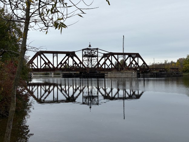
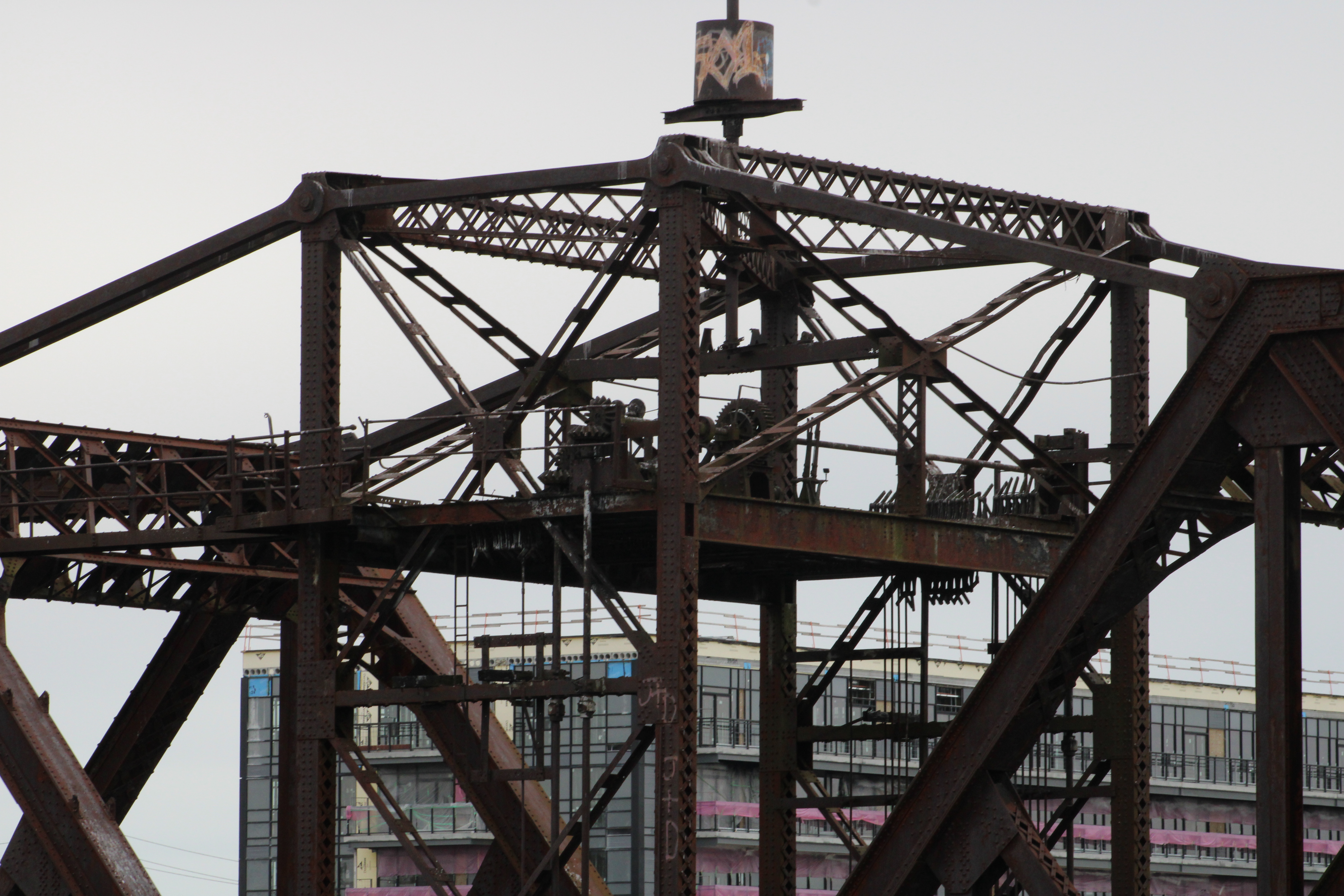
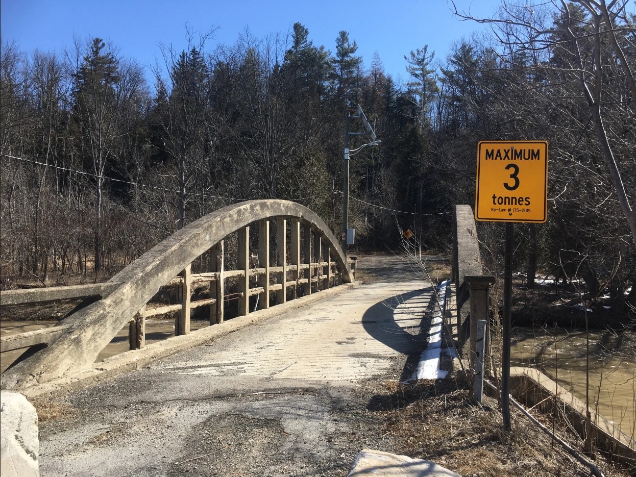
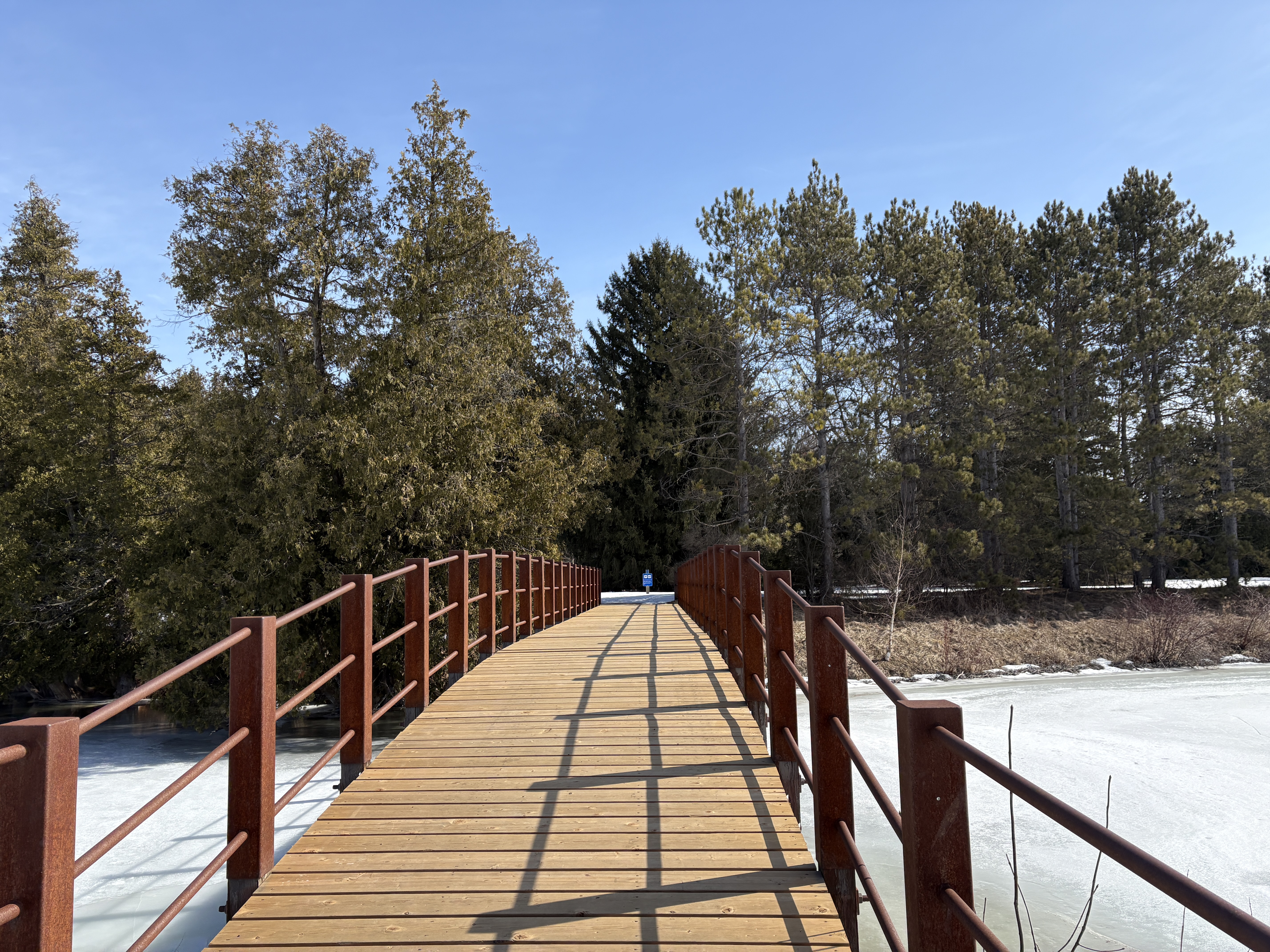
I recently visited Welland to see a new client and while passing through town I noticed an abandoned swing bridge. Naturally, this provided an opportunity to get some pictures and learn a little about the local history. The bridge is known as Bridge 15 on the Welland Canal and was built in 1910 to replace an earlier wooden bridge at this location. The bridge style is a Baltimore Truss Swing Bridge. A Baltimore Truss bridge is reinforced by an additional brace in the lower section of the truss. This is intended to prevent buckling in the beams and to reduce deflection. This style of bridge was primarily used for railway construction but is not very common with few remaining examples.
The bridge was built to carry the Canada Southern Railway (CASO) across the Welland River. The railway was founded in 1868 and went insolvent following the financial crisis of 1873. It was taken over by railway magnate Cornelius Vanderbilt who claimed it for the price of guaranteeing the bonds that had been issued against it. As ships became bigger the various bridges through town became an obstacle and a newer, straighter canal was envisioned that would move the canal away from this part of the river. The Welland Canal Relocation Project moved the rail line to the Town Line Tunnel to the east of the river.
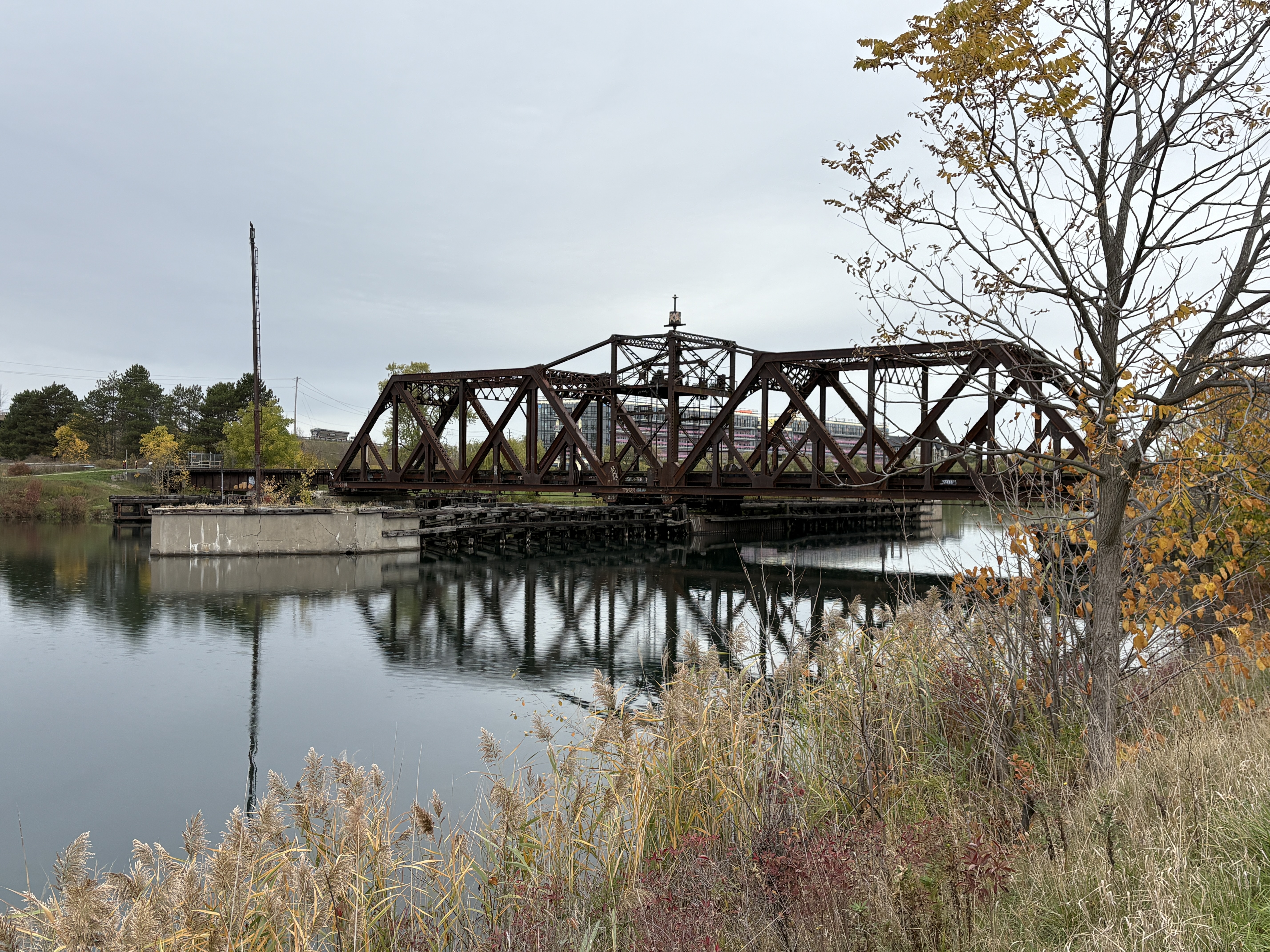
When the bridge was built, the Third Welland Canal was in operation and navigation was only possible on the east side of the bridge. Electrical power was brought by cable from the west shore to the centre of the bridge. When the Fourth Welland Canal opened in 1932 navigation was possible on both sides of the bridge. This meant that the overhead power cable was no longer feasible. An underwater power cable was run from the shore to the tower on the northern concrete fender. (These fenders protected the bridge from collisions with ships when the bridge was in its open position.) A power cable was run between the tower on the northern fender and the one on the southern fender, pictured below.
Visible in this picture is the structure at the top of the bridge where electricity was supplied to operate the controls and swing the structure.
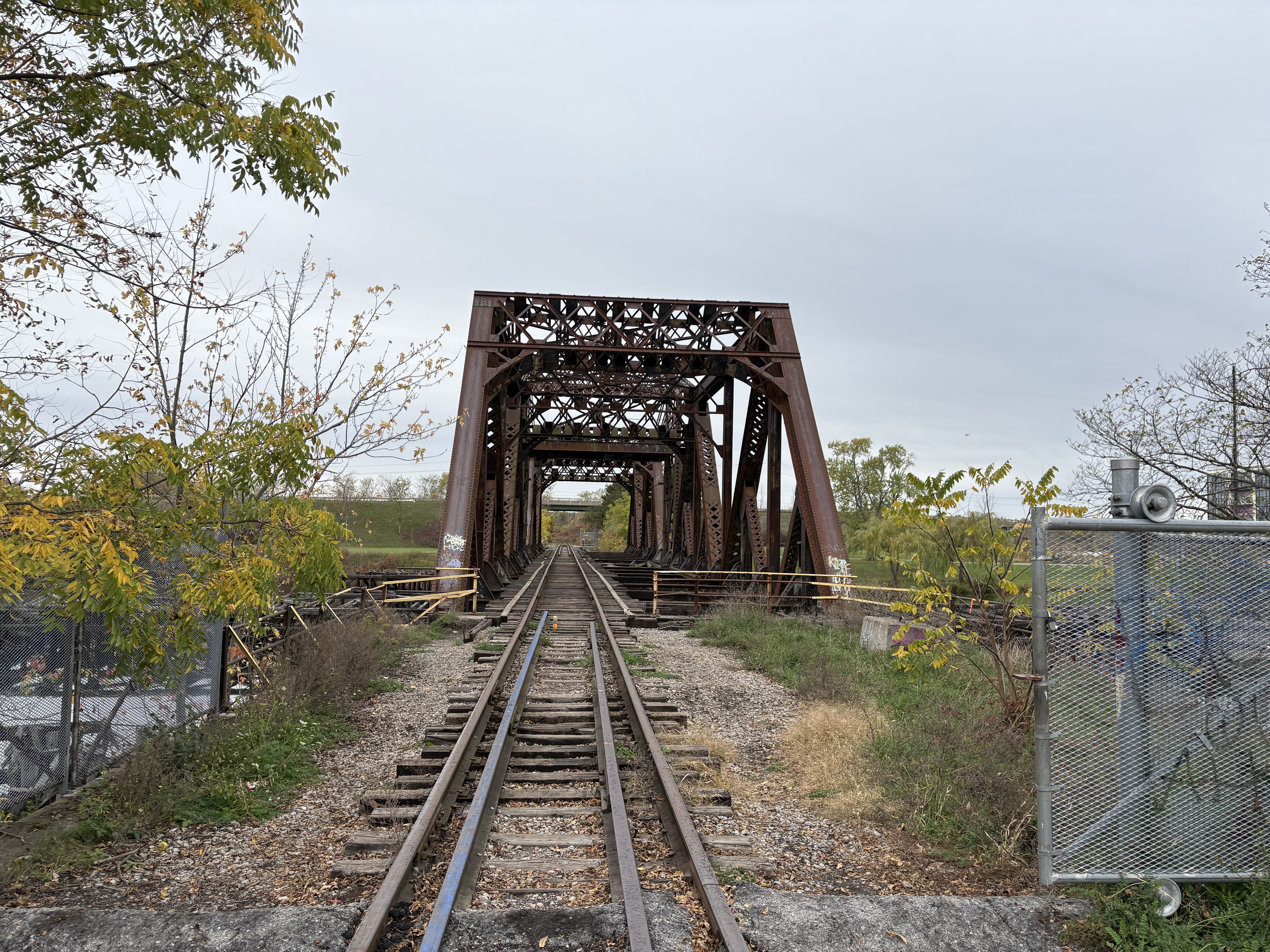
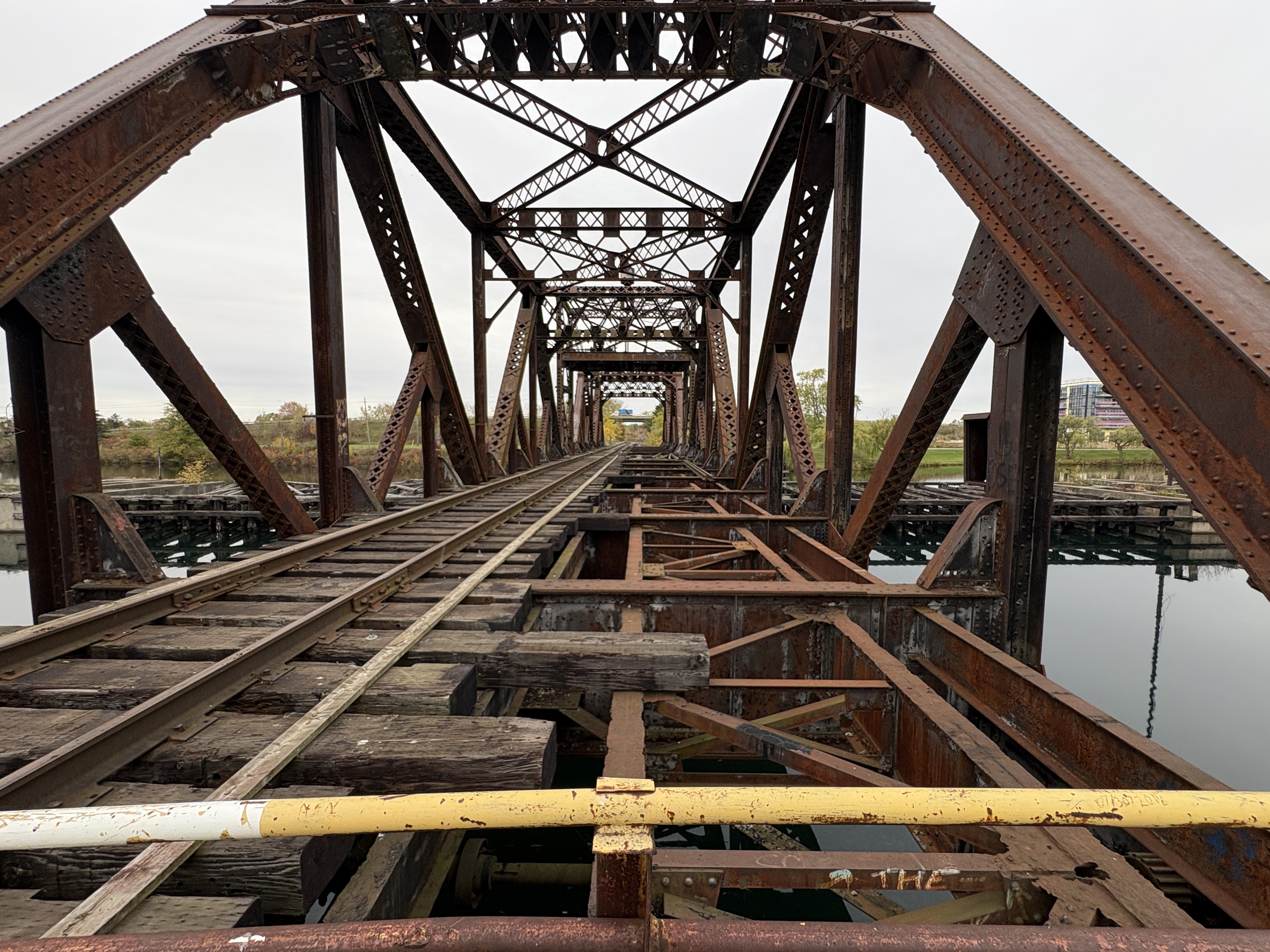
Originally there were two tracks crossing the bridge but one was removed after the main line was relocated in 1973. The other side remained in use until the late 1980s.
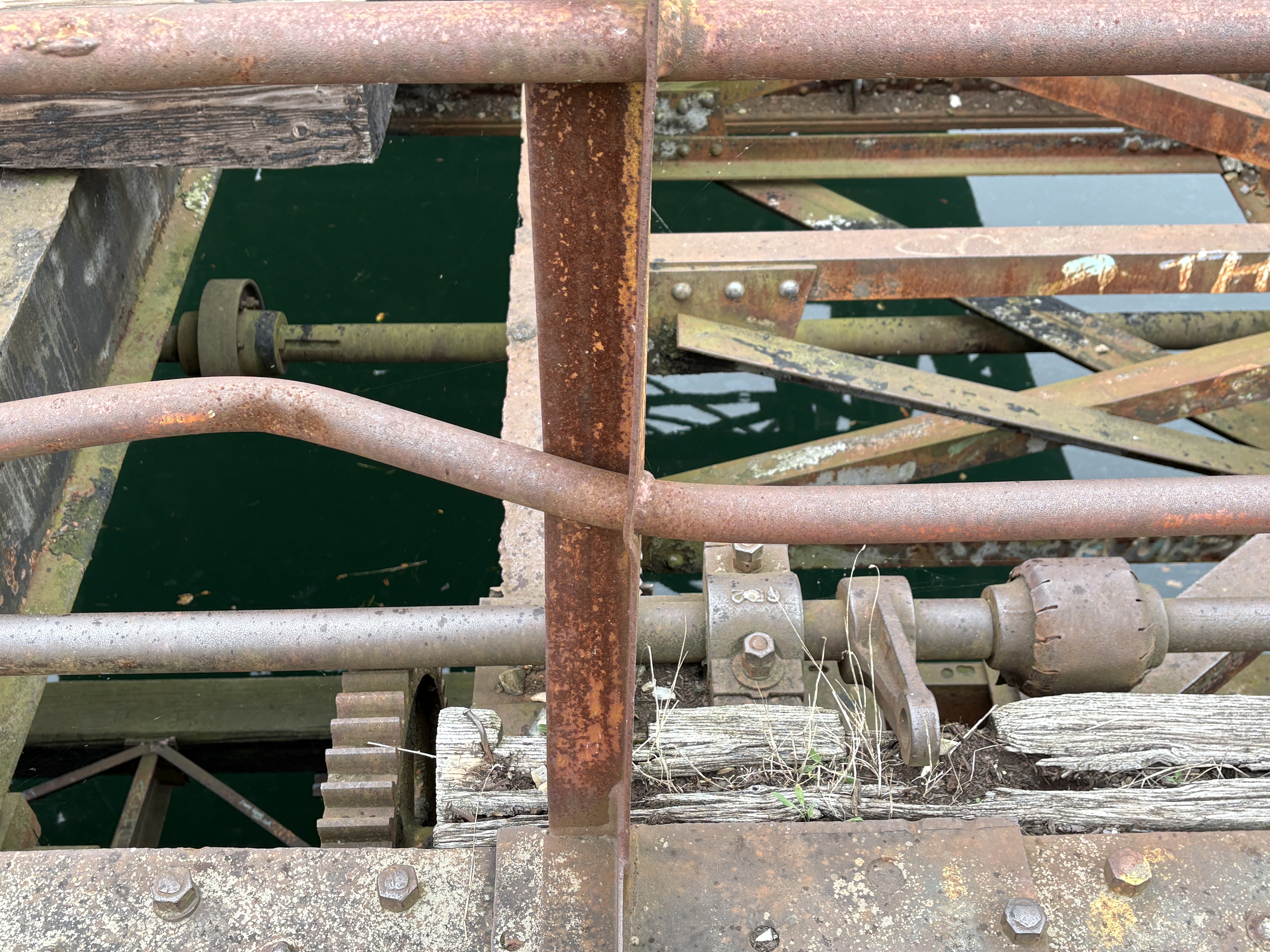
The bridge is now marked with no trespassing signs and the danger is quite real as there’s plenty of ways to get injured on this rusty old relic. Where the rails are missing the gears and turning mechanisms can be clearly seen.
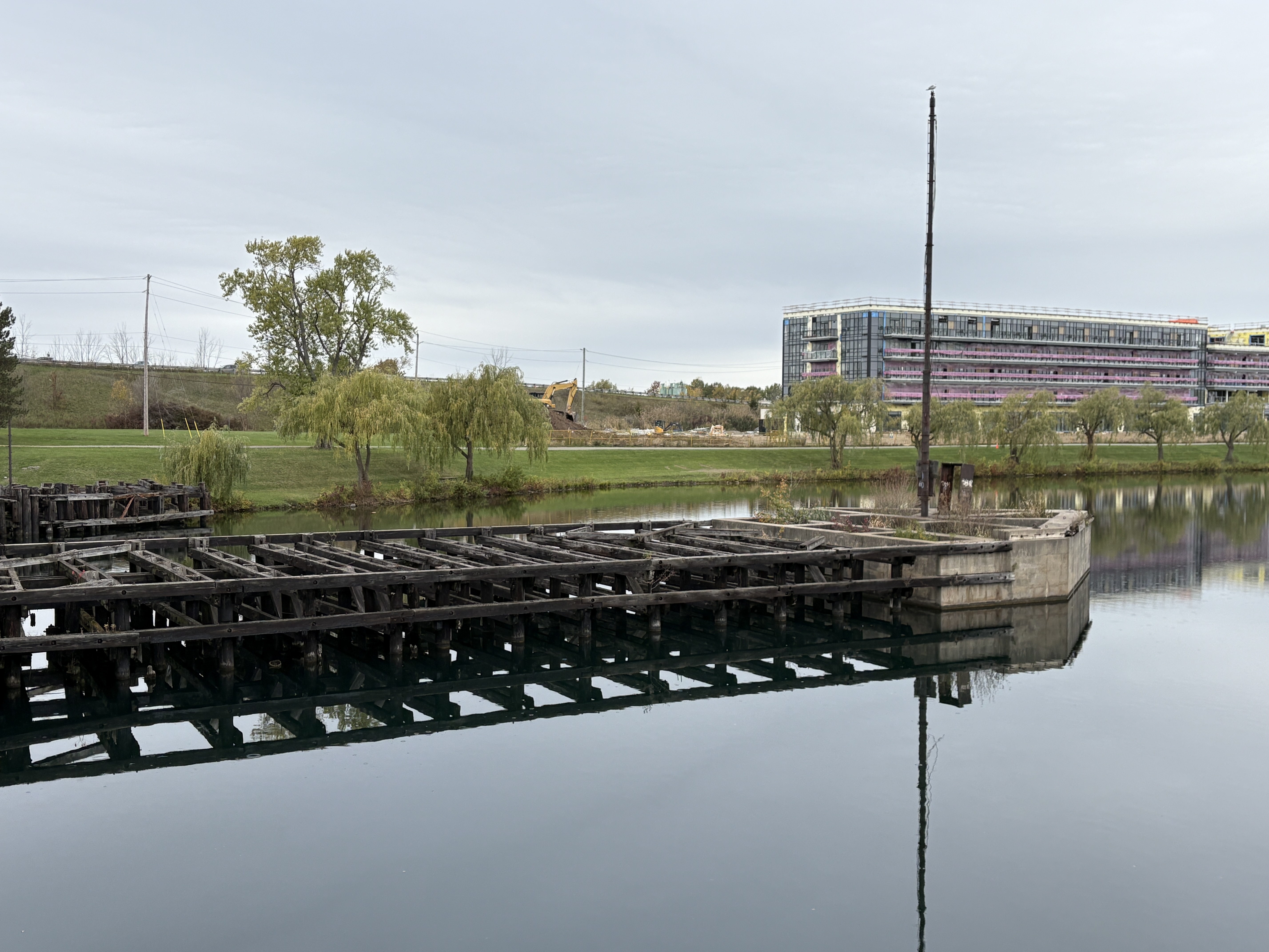
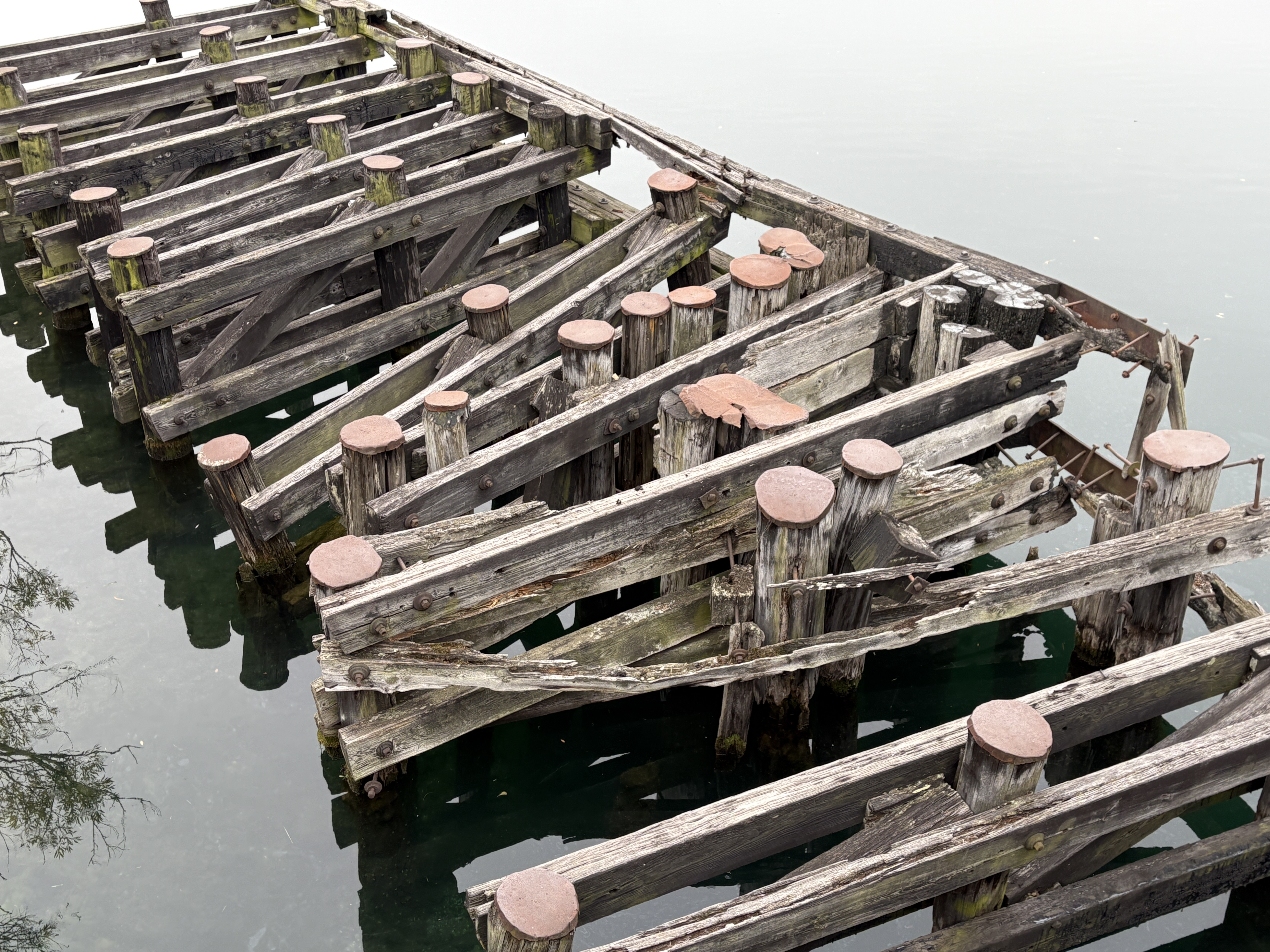
Piers were sunk into the river bed on either bank of the river to protect the bridge abutments from impacts with wayward ships. These are rotting and slowly falling back into the water.
After 115 years the bridge is now a relic to a time gone by when the trains rolled over the bridge and ships passed by on either side when it was open. The railway line is gone and ships now pass a couple of kilometres east of the river in a new channel.
One of the purposes of this blog over the years has been to photograph historic sites in case they are destroyed and lost forever. In the 11 plus years that we have been active we have photographed hundreds of historic buildings and properties. Unfortunately, we are already seeing several of these places being lost forever. This post highlights several of the ones that no longer exist.
There are many places along the Bruce Trail that have interesting stories to tell. One of them is the remains of a house on the River And Ruin Side Trail. The house has been a ruin for a hundred years but it appears that recently the remains have been vanadalized and there is even less of it left now. There are more pictures and our full article here.
The Nodwell House in Hillsburgh was built in 1868 and was used by several generations of the family. The old farm was bought for a housing development and the home has since been demolished. The story of the family and the home can be found at this link.
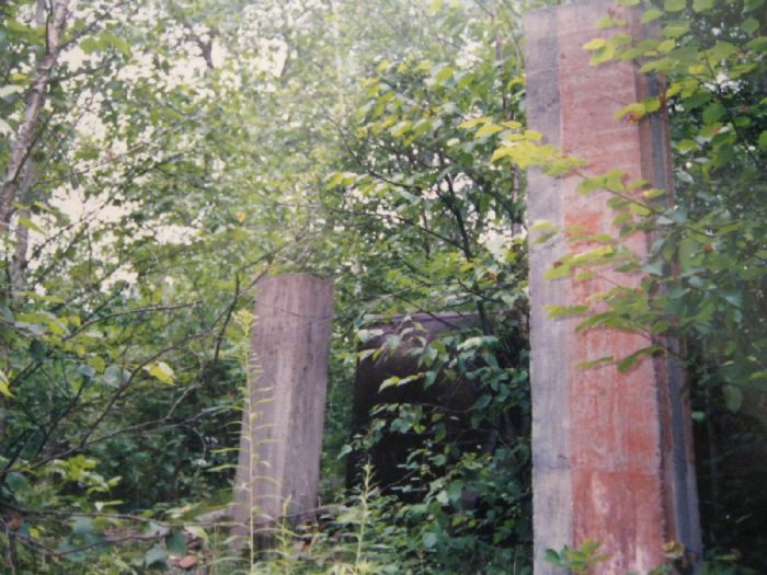
Camp Calydor had several uses including a TB hospital, a German POW camp and a Jewish retreat. The remains used to stand in the forest in Gravenhurst but even these have been demolished for a housing development. The full story can be read here.
Cabot Head Lighthouse was built in 1895 and although it still exists, the road is closed and the lighthouse is also closed to the public. There’s more pictures and the full story here.
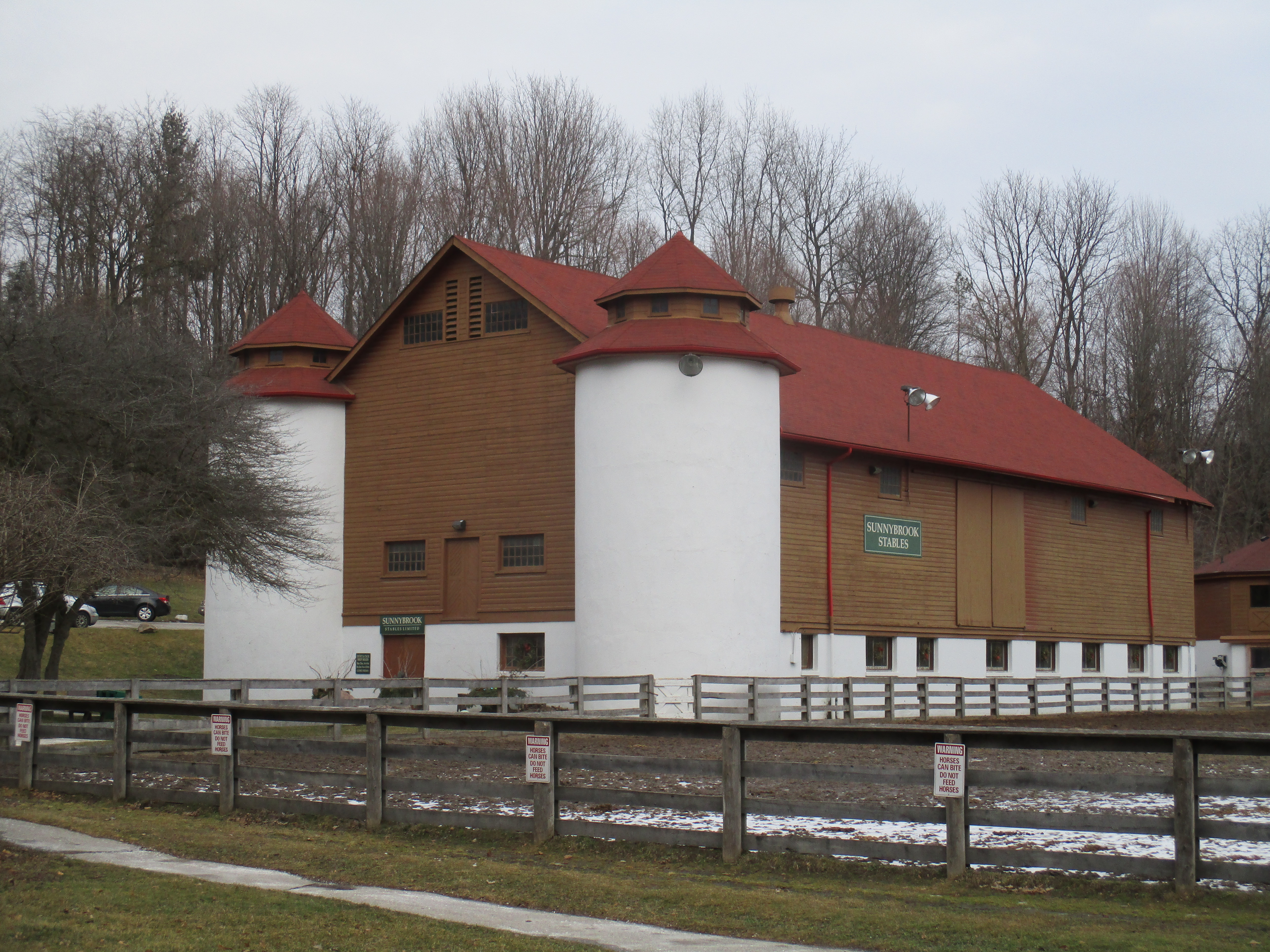
Sunnybrook Farm was created in 1909 and the barn was raised shortly thereafter. When the farm was transferred to the city as a park the horse barn was used to house police horses. It burned down in 2018. There are more pictures and the story can be found here.
Cheltenham had an apiary for two generations that operated near the old saw mill. This building burned down a couple of years after we took this picture. There’s more pictures and the full story at this link.
The Toronto Dry Dock Company was established in time to produce war ships for the military during World War 1. The business closed years ago and the buildings have recently been demolished as part of the Port Lands redevelopment. More pictures and the story can be found here.
The Old Major Mackenzie bowstring bridge was built in 1914 and was abandoned when the road was rerouted. It has since been removed. You can find the full story and more pictures here.
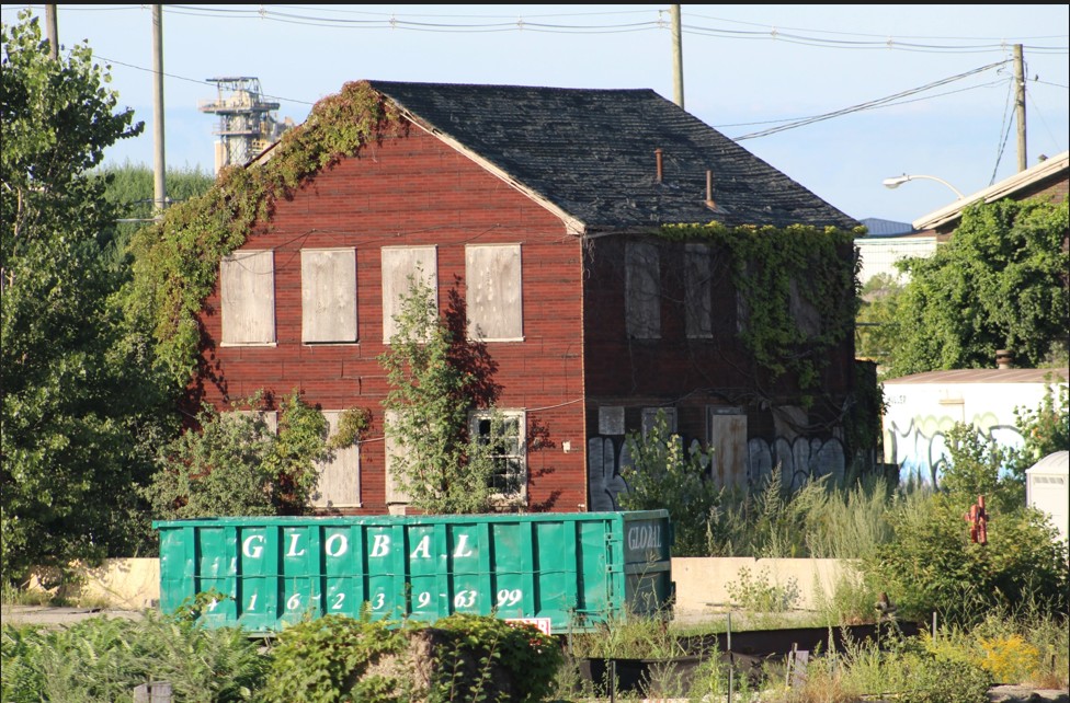
The Speyside General Store was the last surviving structure from the early days of Speyside. It stood vacant for a couple of decades and then fire destroyed part of it in 2024. The building has since been demolished. The story of Speyside and the general store can be found at this link.
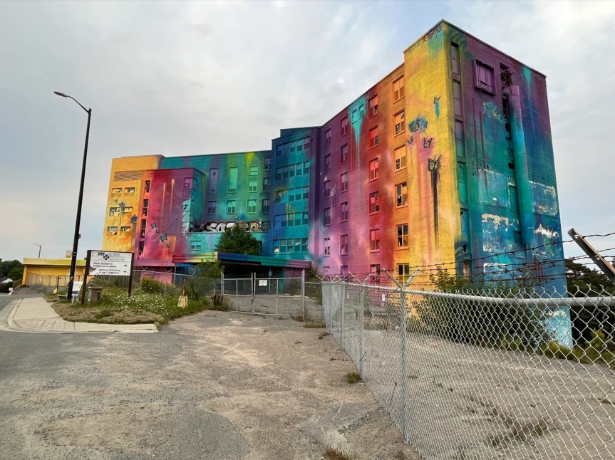
The Sudbury Regional Hospital dates to 1944 but was closed in 2010. A mural was painted on the outside, much to the displeasure of some of the community and the structure was finally demolished in September 2025. More pictures and the story can be found at this link.
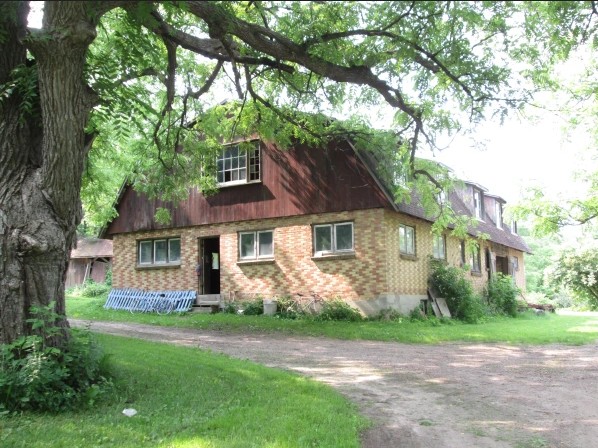
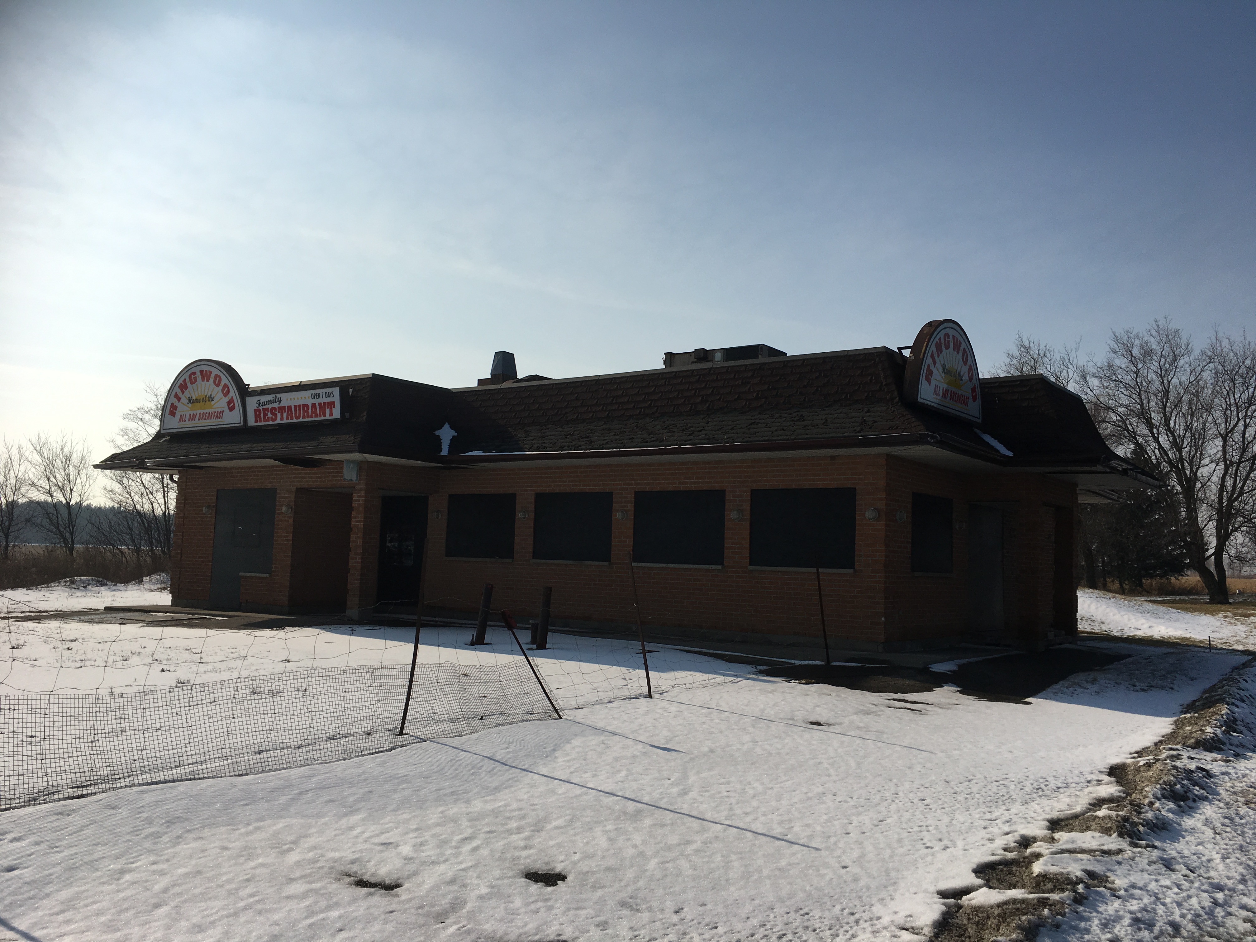
The former community of Ringwood has several abandoned historic buildings that are all likely to end up demolished. The first to go was the Ringwood Diner which was taken down last year. More pictures of the abandoned buildings in Ringwood and the story can be found at this link.
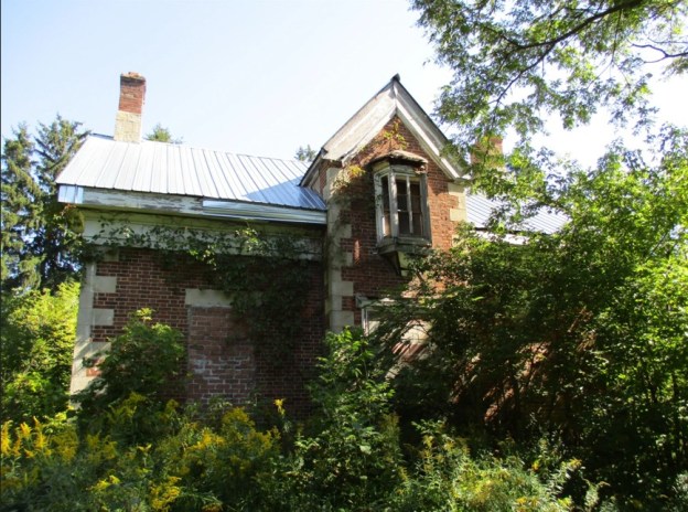
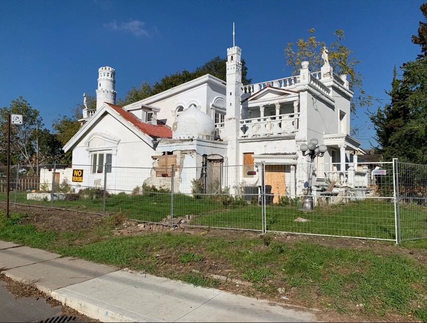
One of the most eccentric homes in Toronto was built by an individual who kept adding all kinds of different architectural styles to his home. After he passed the home fell into disrepair and has since been demolished. More pictures and the story at this link.
Historic sites continue to be lost due to neglect, fire and new development. It appears that both the Mountain Sanitorium in Hamilton and the London Insane Asylum may both have been demolished but these are still unconfirmed. No doubt other properties will lose their heritage structures as time goes along.
Google maps links are within the stories themselves
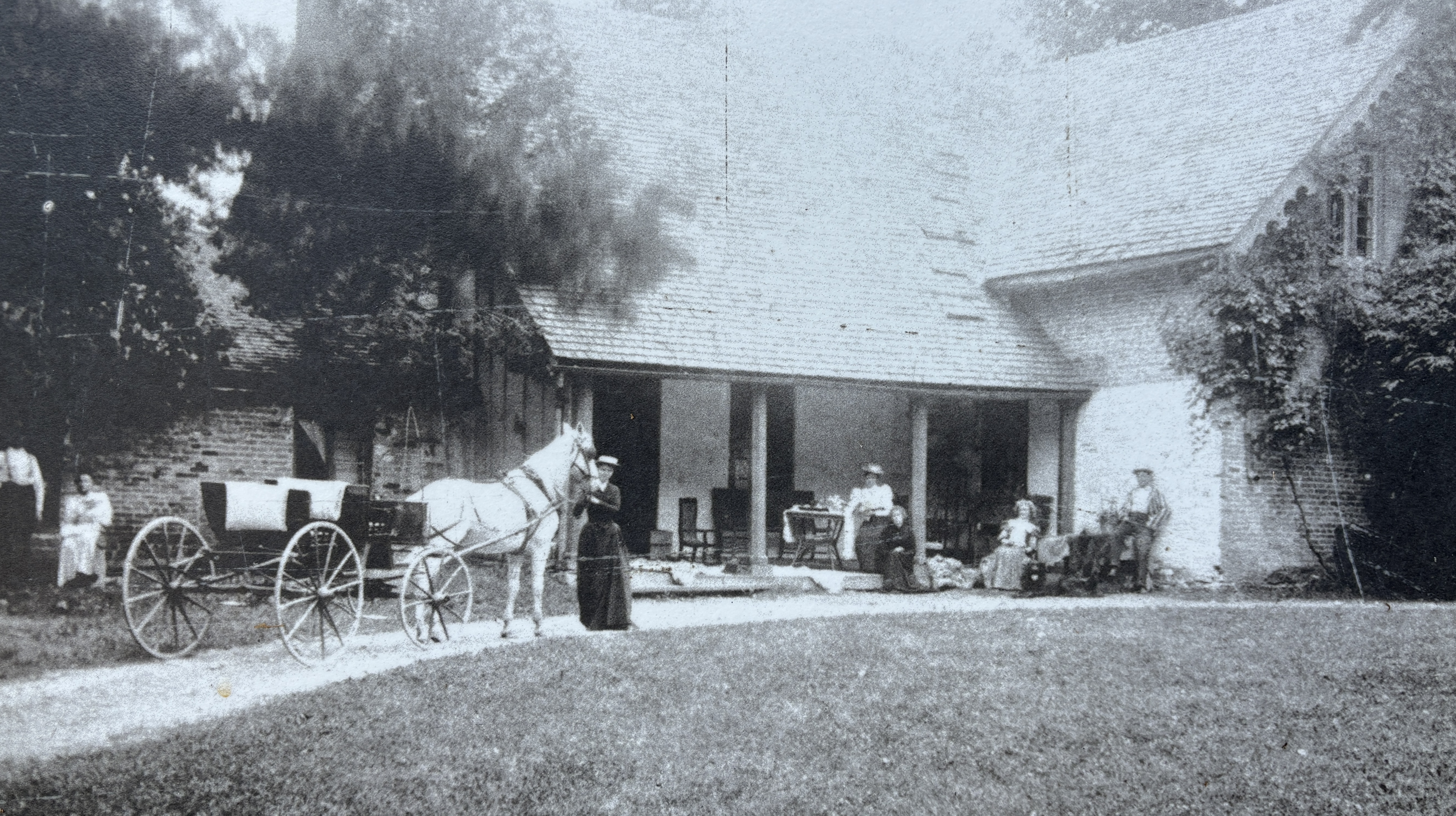
A former country estate has become surrounded by Kitchener/Waterloo but still retains its earlier charm. Now known as Woodside, the home was originally built in 1853 by James Colquhoun. When he passed away in 1877 the property underwent several tenants until it sat empty for several years. The image below shows the home in the Victorian Era.
Between 1886 and 1893 the house was occupied by the King Family. John and Isabel King lived here with their four children. Isabel, Janet, Dougall and William who enjoyed their childhood in this quiet setting. William would go on to become the tenth Prime Minister of Canada.
William Lyon Mackenzie King was the grand child of William Lyon Mackenzie who was instrumental in leading the Rebellion of 1837 in Upper Canada.
William became the leader of the Liberal Party in 1919 and held that position until 1948. He was elected Prime Minister in 1921 and held the position until 1926. Arthur Meighen was the Prime Minister for about three months between June 29, 1926 and Sept. 25, 1926. King would then take back over from then until Aug. 7, 1930. He would return again as Prime Minster from Oct. 23, 1935 until Nov. 15, 1948.
When the King family moved out the house went through several more tenants until it sat empty until the early 1940s when it was in danger of being demolished for a housing development.
The home was reconstructed in 1942 using original materials and furnished to represent the 1890s when William Lyon Mackenzie King lived there. William and his family were consulted during the renovations to help with the authenticity of the decor. It was designated as a National Historic Site in 1952.
4.5 Hectares of property has been retained along with many of the original pathways and gardens. A lily pond and Tulip Tree have been retained behind the house as well as several acres of forests and lawns.
Jack In The Pulpit seeds come out in the summer after the plant is done flowering. These seeds will turn bright red in the fall and can be planted under a small amount of soil. Jack in The Pulpit can grow for 100 years from the same underground corm.
Like other National Parks in Canada, Woodside is free to visit this year.
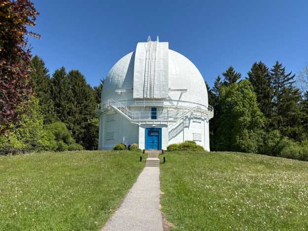
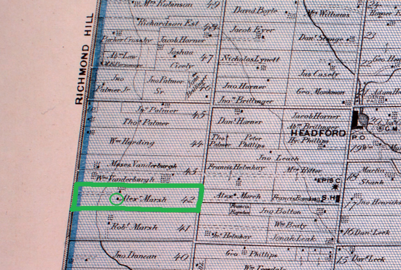
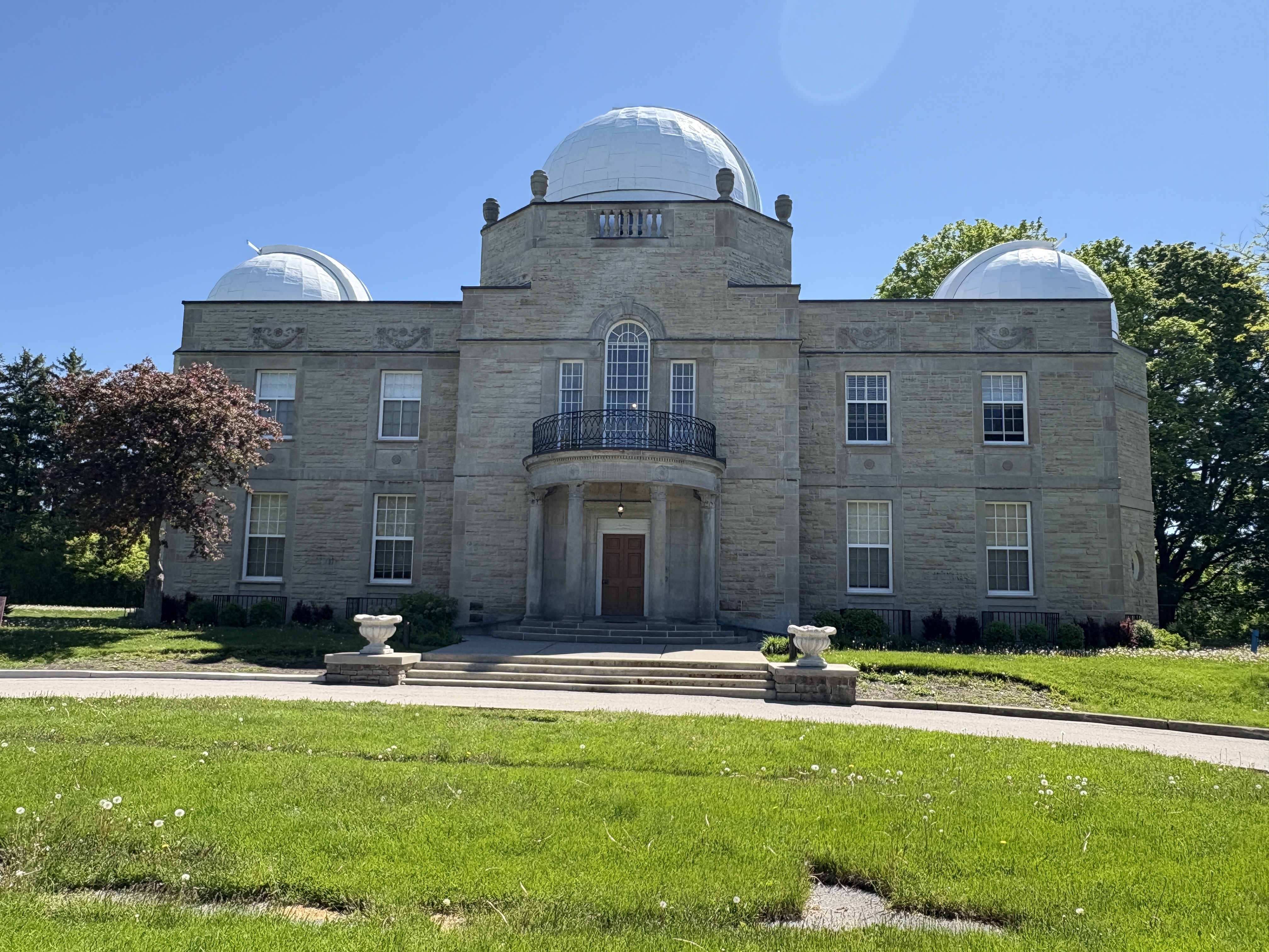
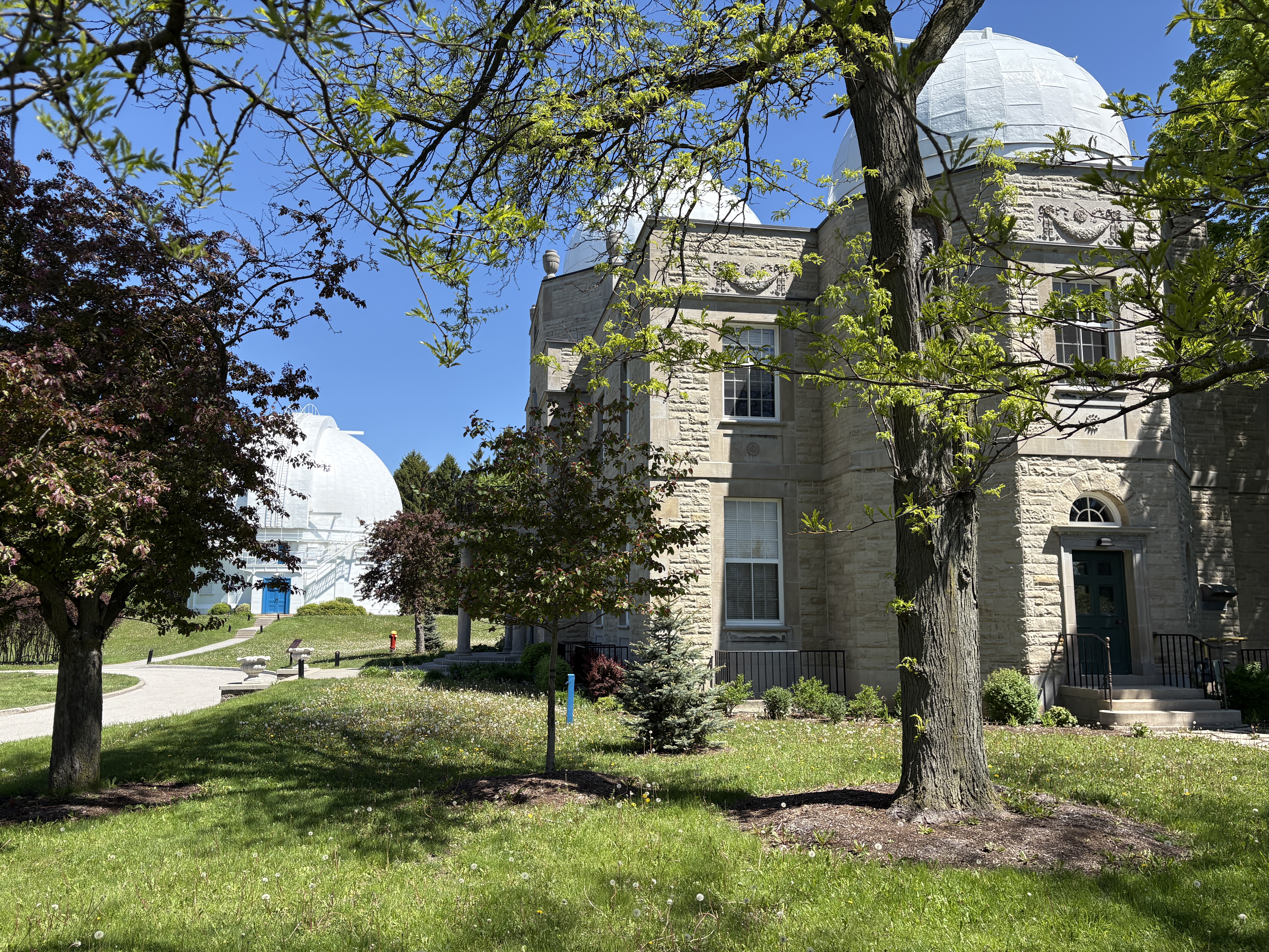
Richmond Hill is home to a hidden gem and National Historic Site in the David Dunlop Observatory. When the David Dunlop Observatory was opened in 1935 it was located on an isolated farm outside Richmond Hill. The location was Lot 42 in the first concession east of Yonge Street. Lot 42 had been granted to Robert Marsh who passed it on to Alexander Marsh in 1852.
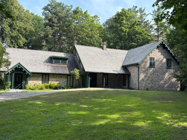
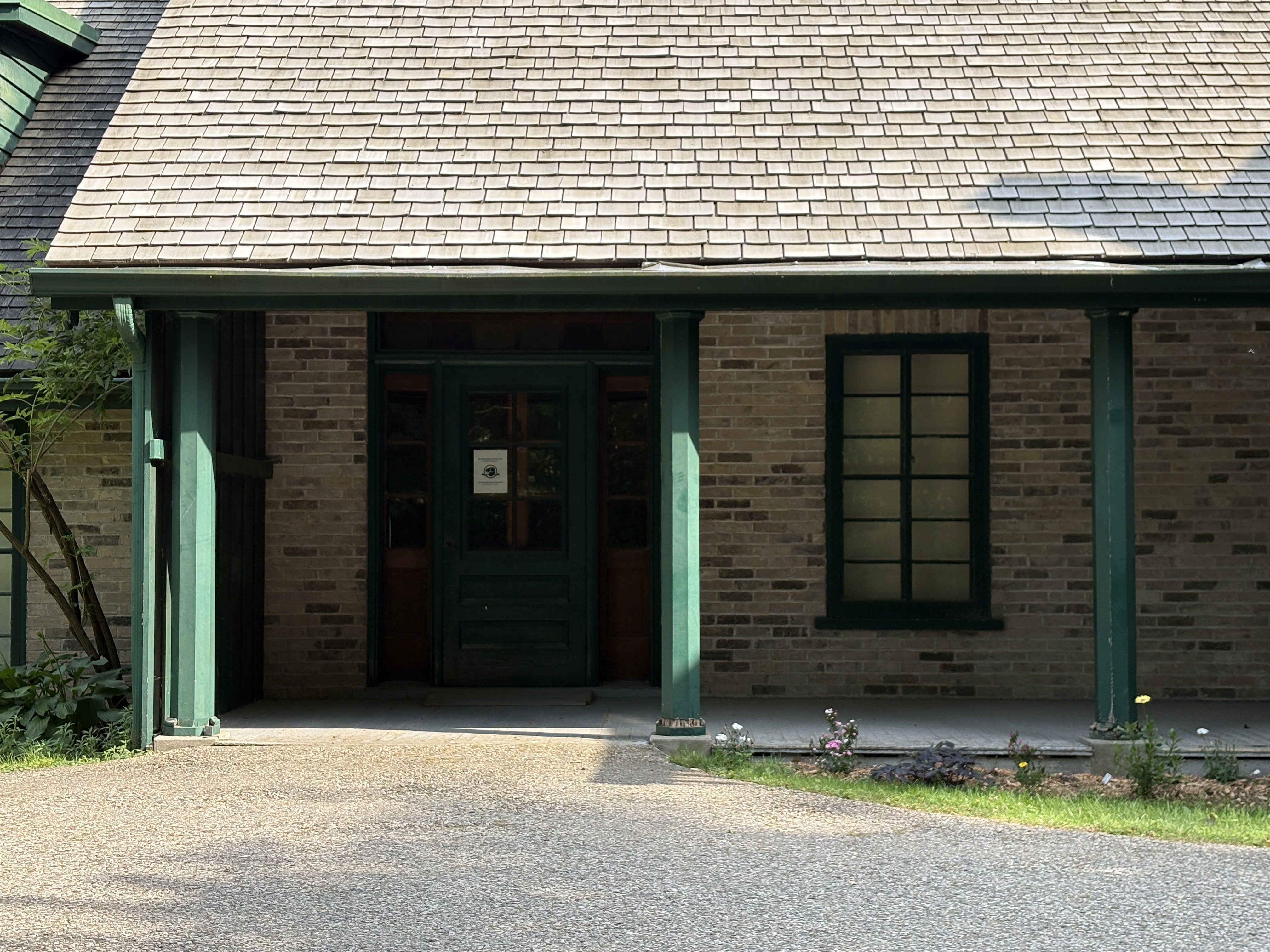
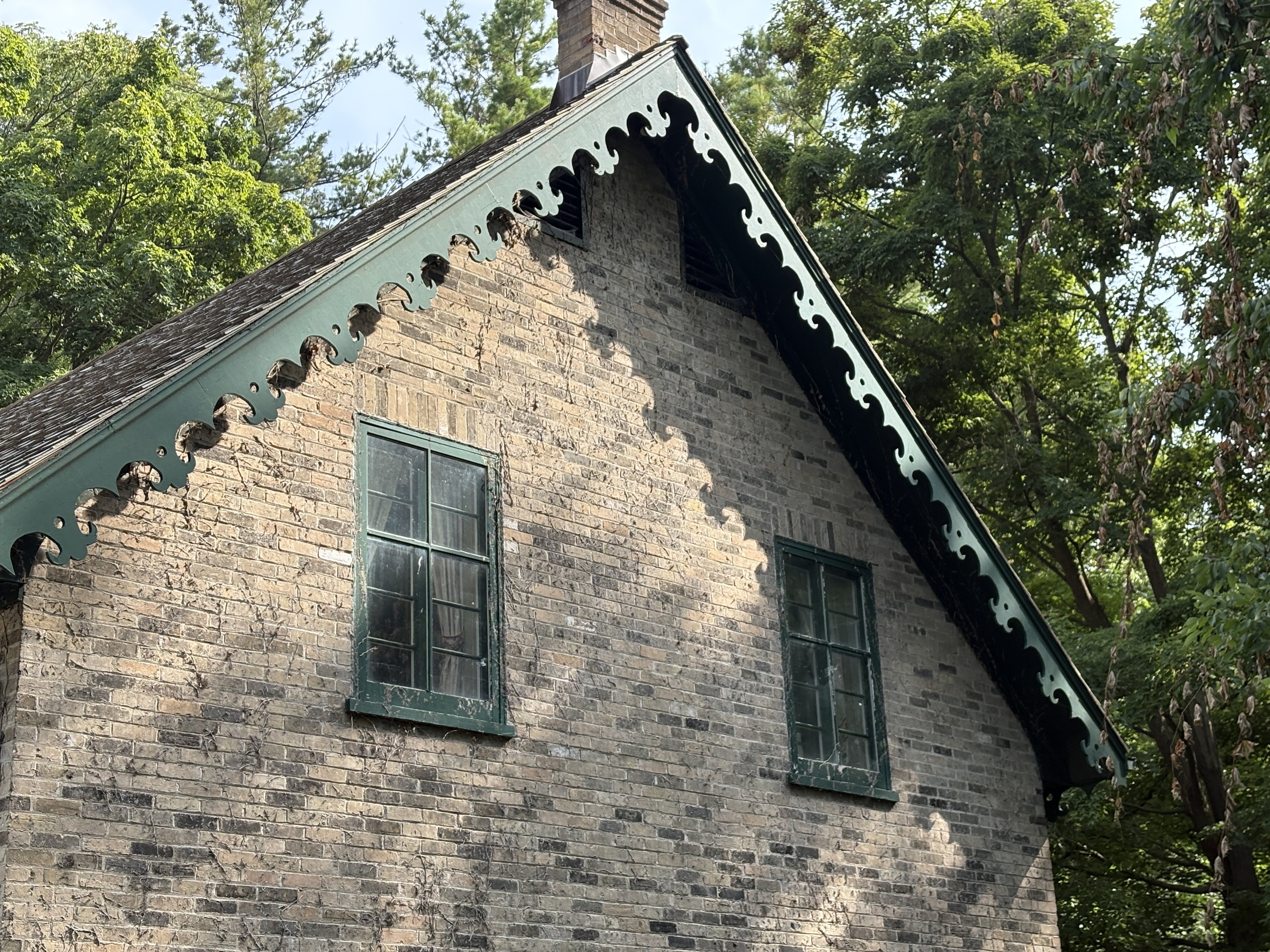
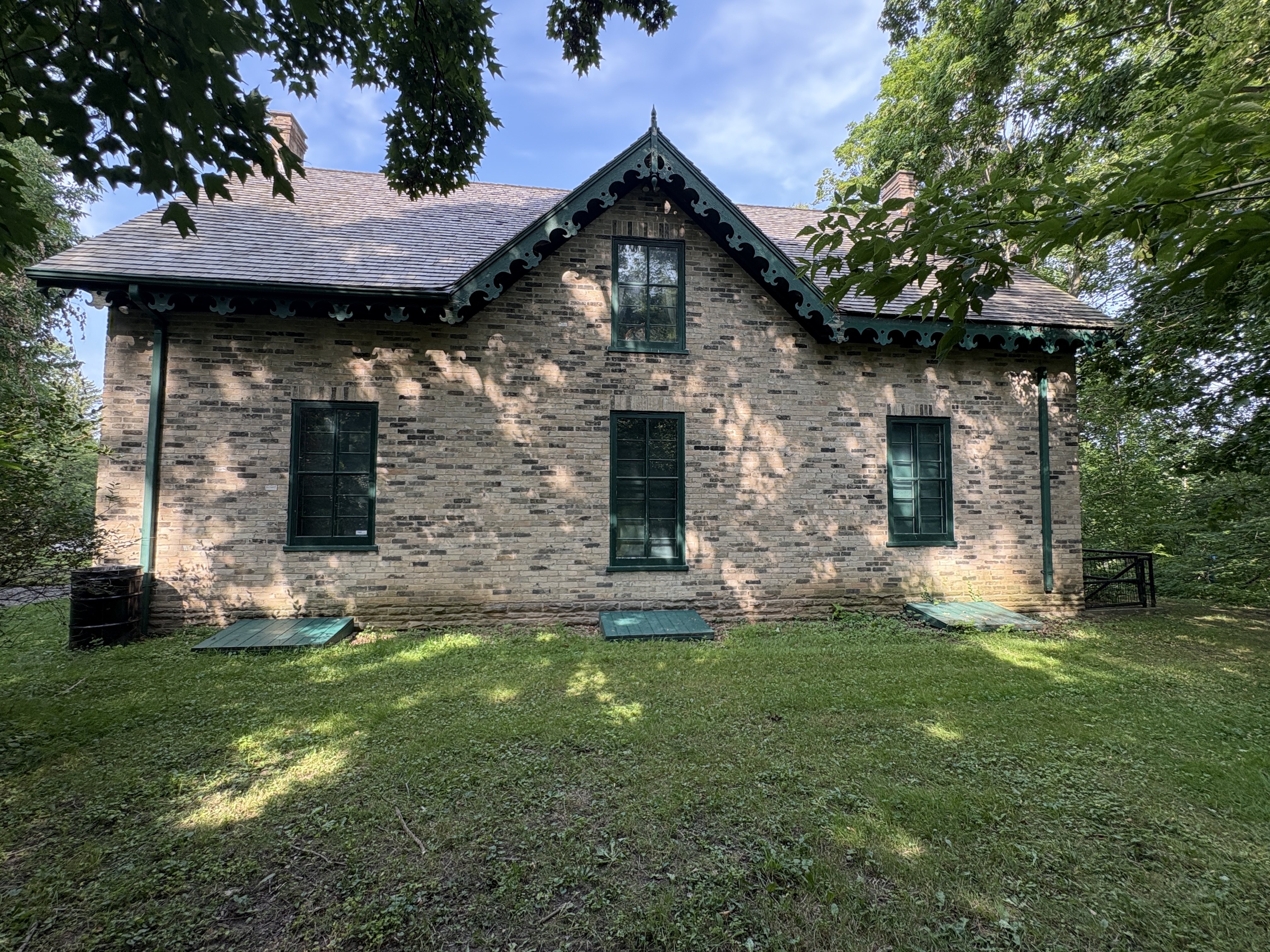
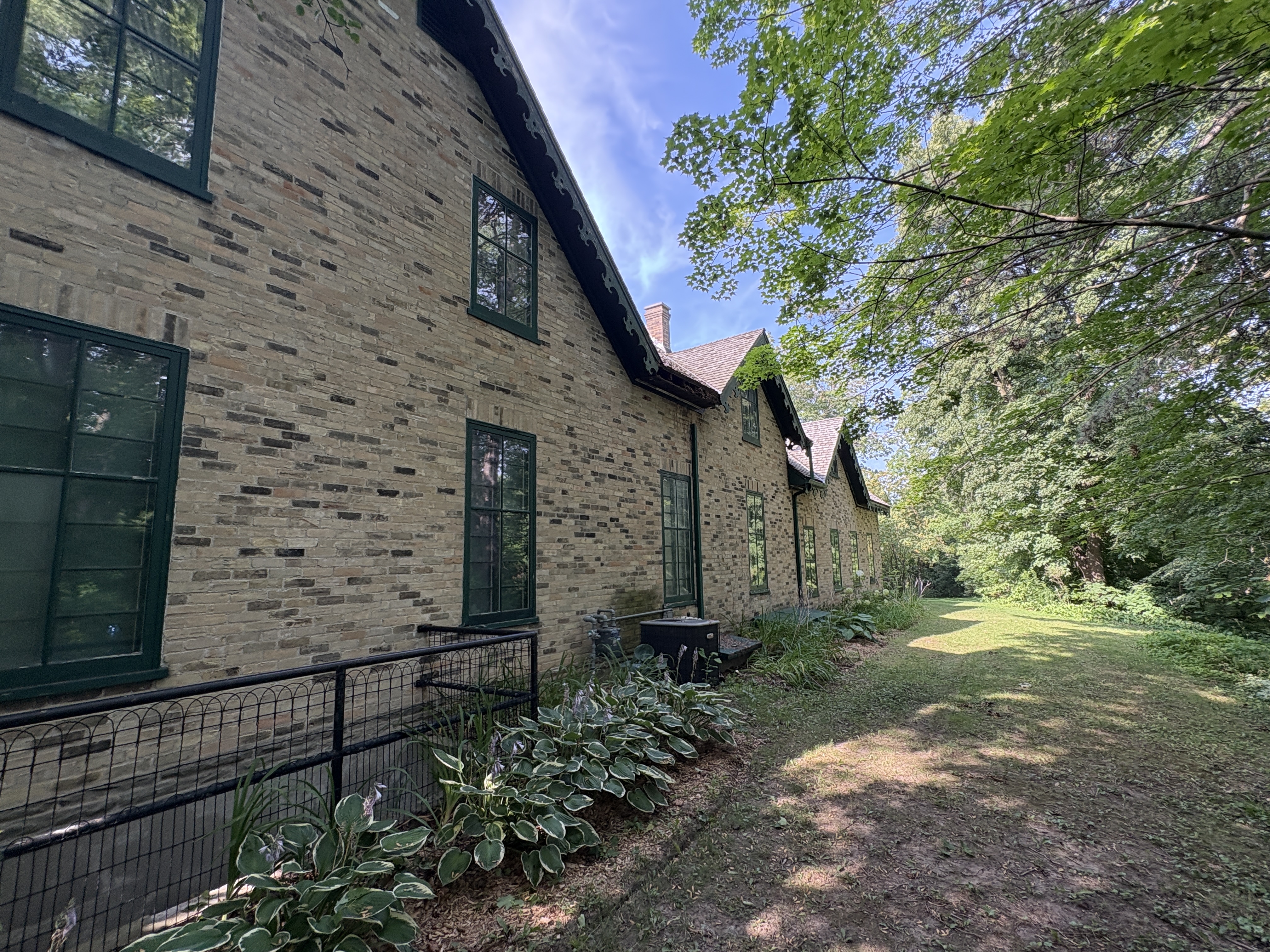
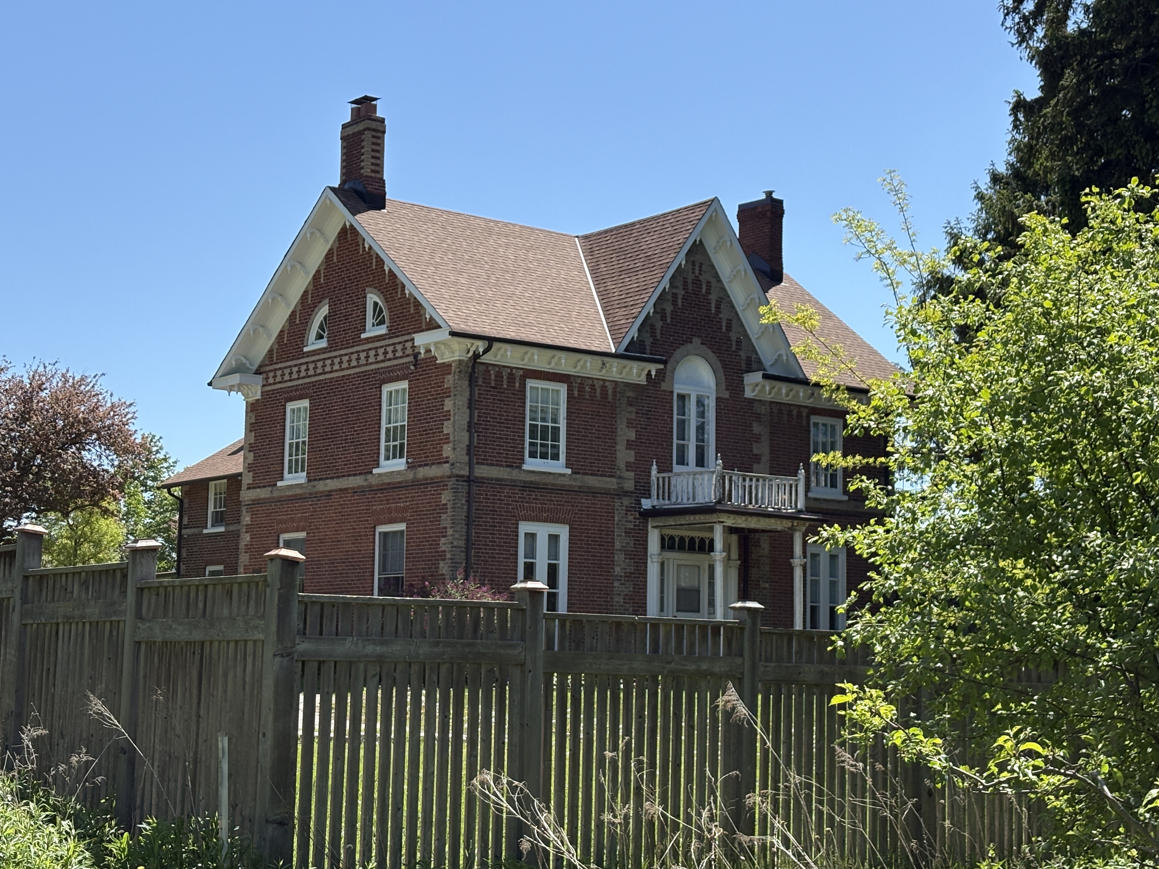
Alexander decided to replace his father’s home with a new one built in 1864. The home became known as “Elms Lea” and was beautifully designed with three symmetrical bays. The dichromate brickwork gives the home it’s elegant styling. The home has a “T” plan with the kitchen in the tail. When the farm was taken over for the observatory, this house became the home of C. A. Chant and later the directors of the David Dunlop Observatory lived here. It is now a private residence and is guarded by “No Trespassing” signs.
The University of Toronto had a telescope located downtown but by the early 20th century it had become almost useless due to light pollution. It was decided to move it out of the city and after rejecting a couple of potential sites a potential home was located on a high point of land about 20 kilometers north of Toronto. C. A. Chant had been working with David Dunlop on the idea of a new location for a larger telescope. After David died, his wife Jessie Donalda Dunlop purchased the Marsh farm and donated it in his name to the University of Toronto for their telescope. The Administration Building was designed in the Beaux-Arts Classicism style. The front facade has a symmetrical design with a second story balcony. The three domes each had a telescope but only one remains in this building.
The administration building and the observatory were built at right angles to each other and in line with the points of the compass.
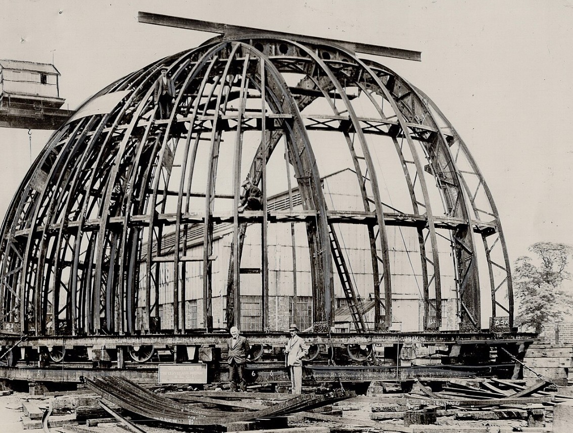
In 1933 earthworks were built on top of the knoll giving the observatory an even higher elevation compared to the surrounding tablelands. That same year a concrete core was poured to support the 5,000 pound mirror. The observatory was designed in England and preassembled there at Newcastle Upon Tyne. It was then taken apart and shipped to Toronto to be assembled on site. The image below is from Wikipedia and shows the assembly in England prior to shipping to the installation site.
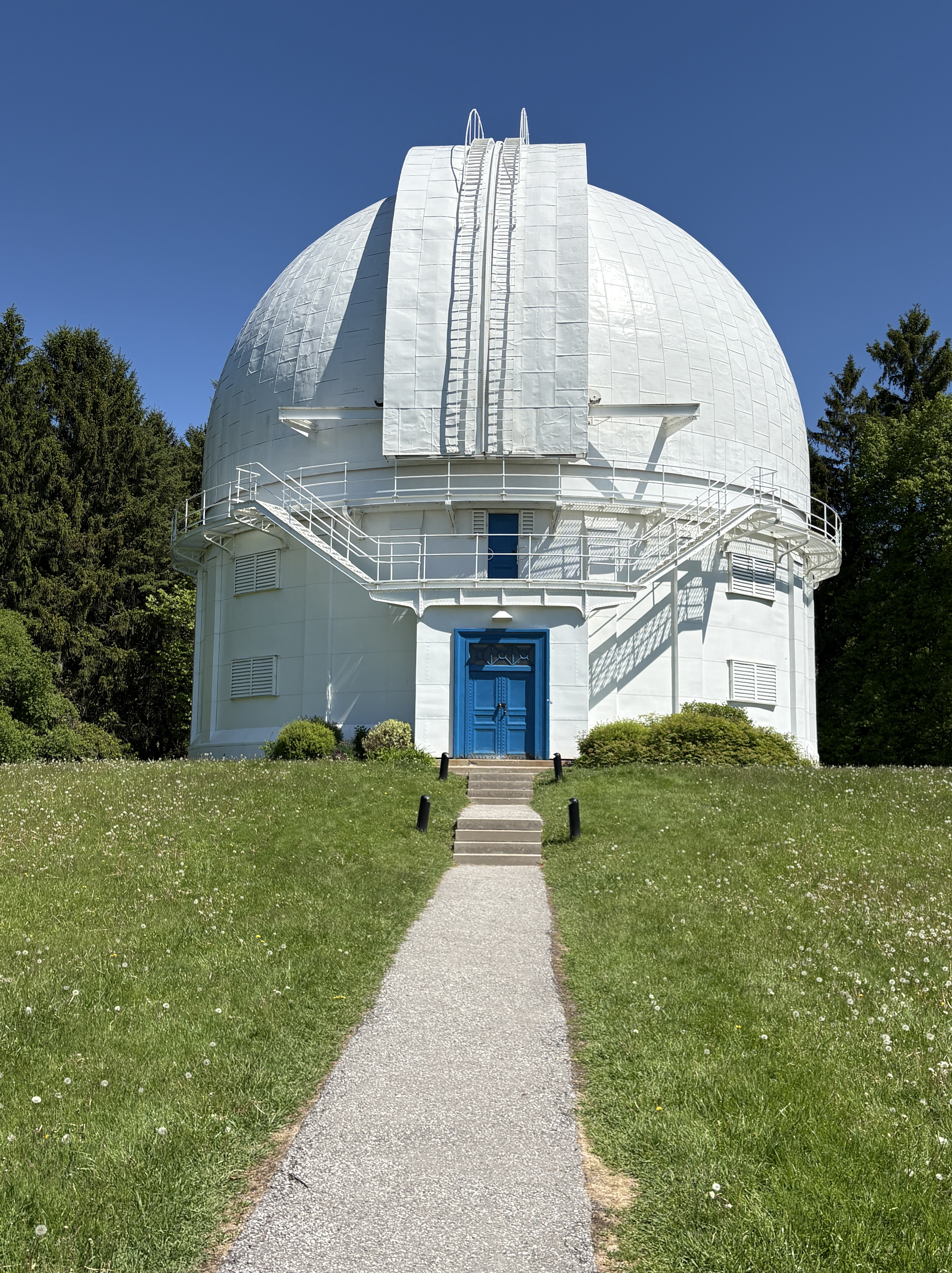
The observatory building is 61 feet in diameter and has a rotating copper dome with a set of retractable shutters. The grand opening was May 31, 1935 and was attended by Prime Minister William Lyon Mackenzie King. The 74 inch reflecting telescope was the largest in the British Commonwealth and second largest in the world at the time of opening. It made it possible for the University of Toronto to be the first Canadian school to offer a graduate degree in astronomy. In 1972 C. T. Bolton used the telescope to confirm the existence of black holes for the first time by showing that Cygnus X-1 is a black hole. Canadian rock band Rush would bring the presence of this particular black hole to the attention of their fans with the masterpiece “Cygnus X-1”. This extended story was told in two parts in 1977 and 1978 and is considered by some fans to be one of the crowning achievements of their career.
In 1959 there were changes made to the approach of the buildings to add an elliptical driveway and a sundial. In the 1960s a new entrance was made from Hillsview Drive. This laneway was designed in such a way that the headlights of approaching cars wouldn’t disturb the telescope.
There are nine trails that take you around the property with some of them having a granular surface while one is paved with asphalt. All of the trails are listed as beginner level and are accessible.
The combined trails are almost 4 kilometers long with mostly open sky but a few shaded areas with trees. As I had arrived during the middle of the day on a Monday there were very few people here and the trails were all mine.
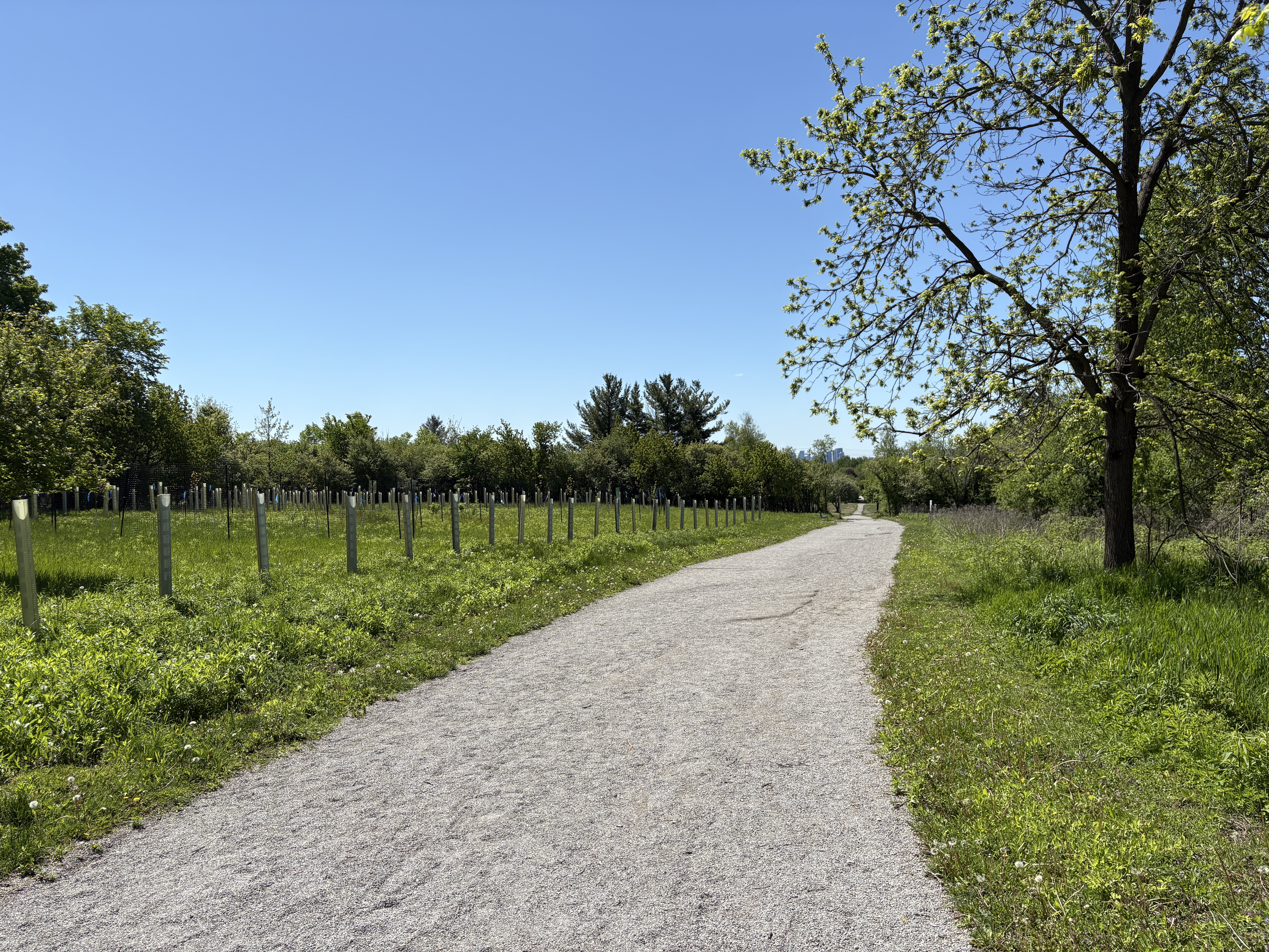
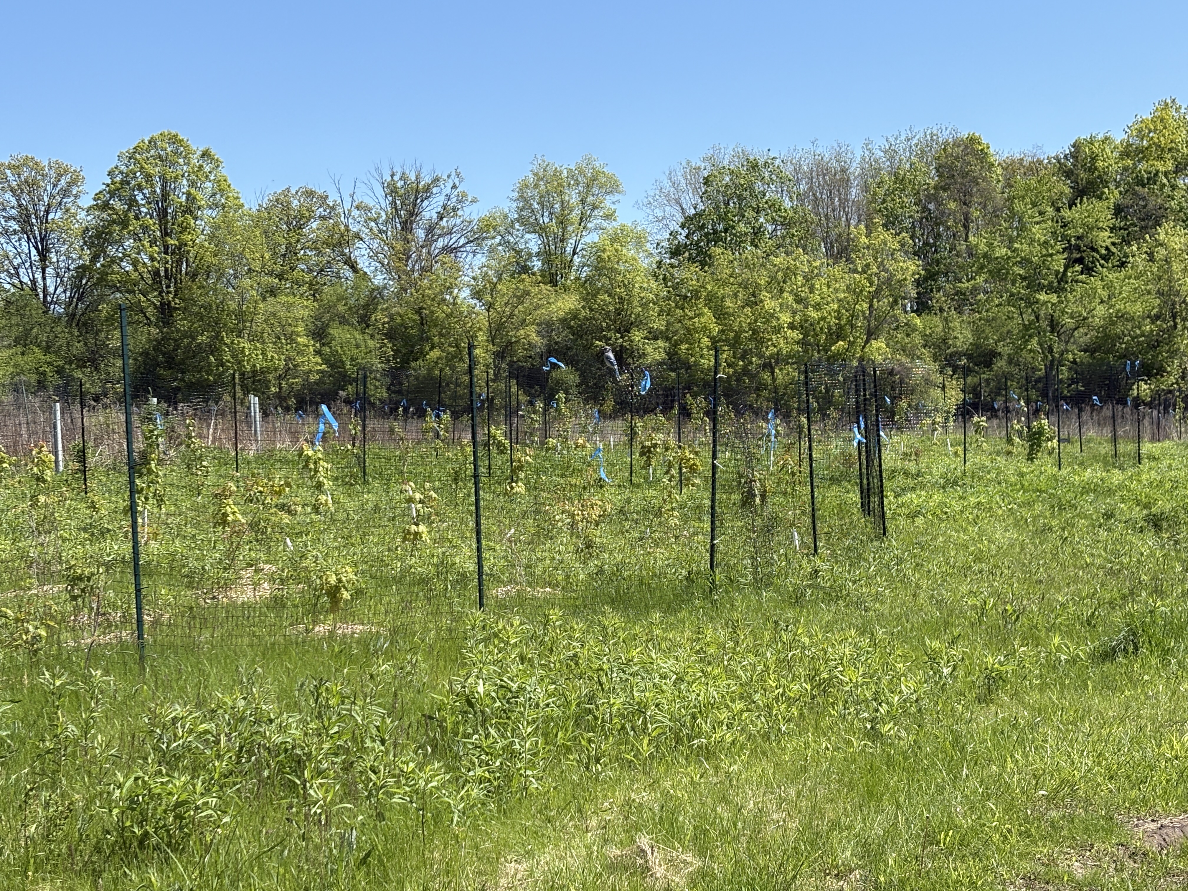
The University of Toronto has had several tree planting programs to introduce native and non native trees. There is a significant number of trees on the property that weren’t here when it was a farm. New plantings are still being added and are surrounded by a fence to keep the deer from getting to them. The sides of the trails are dotted with deer tracks so it looks like there may be quite a few living here.
The David Dunlop Observatory has many programs throughout the year to teach people about astronomy and the grounds look like a natural place within the city to watch for meteor showers. Best of all parking is free, if somewhat limited.
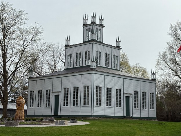
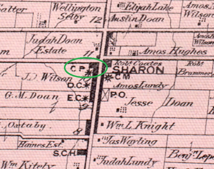
The community of Sharon holds one of Canada’s National Historic Sites. The Sharon Temple was built under the direction of David Willson. David had been born to Presbyterians in New York in 1778 and converted to being a Quaker when he married Phebe Titus, a member of The Society of Friends. He emigrated with his family to Upper Canada in 1801 and joined the Yonge Street Meeting of The Society of Friends. After serving there for seven years he had a theological disagreement with the group when he rejected some of the mysticism while embracing music and personal education. As a result, he was expelled from the Society. So, in 1812 he founded The Children Of Peace who were also known as Davidites near his home in Sharon. David was an avid proponent of Responsible Government and worked to get William Lyon Mackenzie elected in his riding on the Reform Platform. Members of the Children of Peace participated in the armed Rebellion of 1837 with Mackenzie. Willson later helped both Robert Baldwin and Louis-Hippolyte Lafontaine get elected in his riding. They met in 1844 in the Second Meeting House of the Children of Peace in a move that led directly to the formation of Responsible Government for Upper and Lower Canada. The 1877 county atlas image below shows the community of Sharon with “CP” representing the Children of Peace and circled in green.
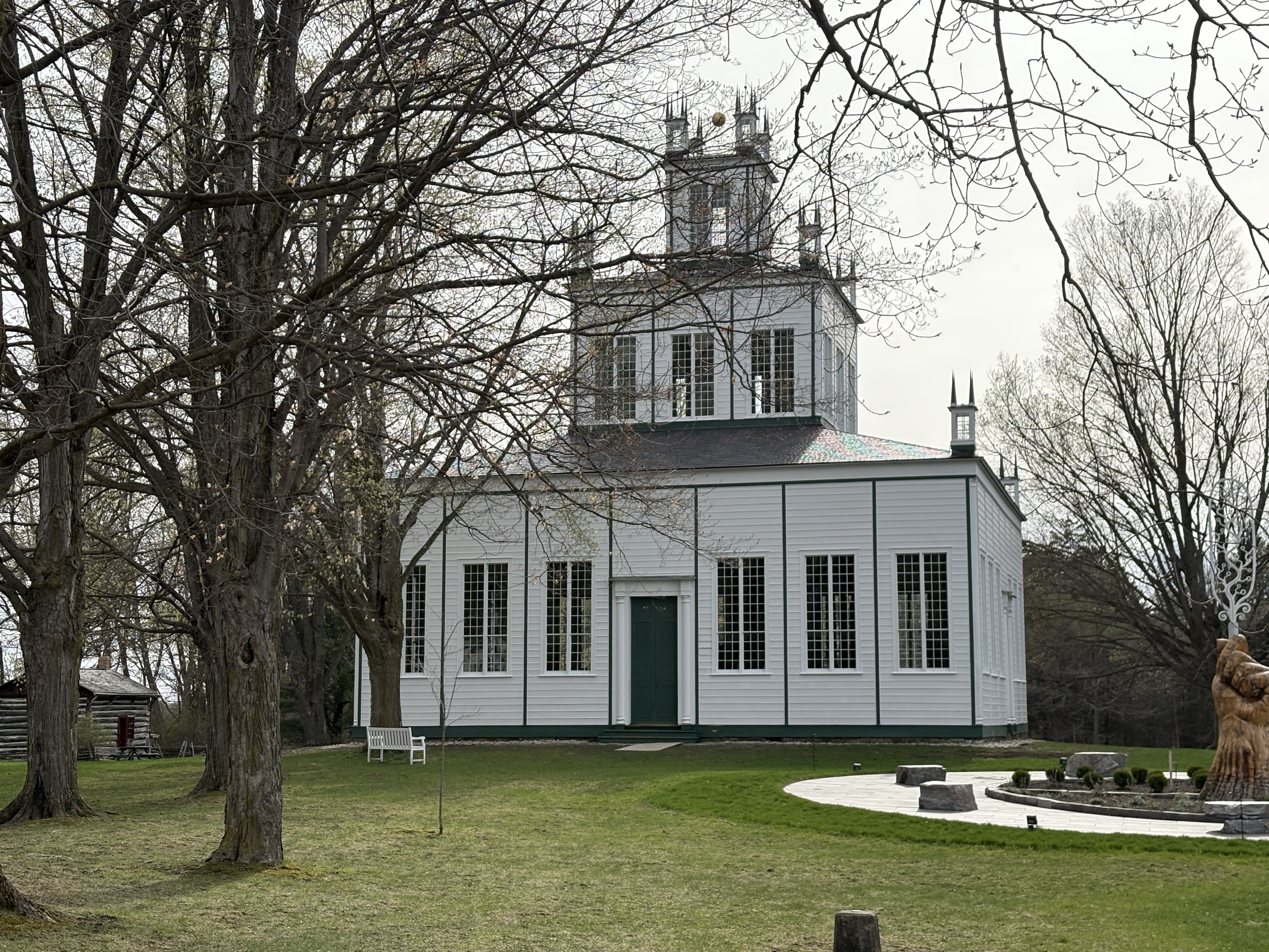
The Children of Peace left quite a legacy including building several structures on the property. The centre piece is the Temple which was built between 1825 and 1832 and designed to represent Solomon’s Temple and the description of the New Jerusalem from the Bible. David Wilson died in 1866 and the importance of the Children of Peace declined in the following years. By 1886 the final service was held in the temple and it was closed. The York Pioneer & Historical Society rescued the building from demolition in 1917 and had it restored as a museum the following year. It was listed as a National Historic Site in 1991. The Children of Peace developed a co-operative economy that led to Upper Canada’s first credit union in 1832. They also had the first farmer’s co-operative for marketing wheat and lending money to member farmers in need. The Children of Peace also started the first homeless shelter in the province and had the first civilian band in Canada.
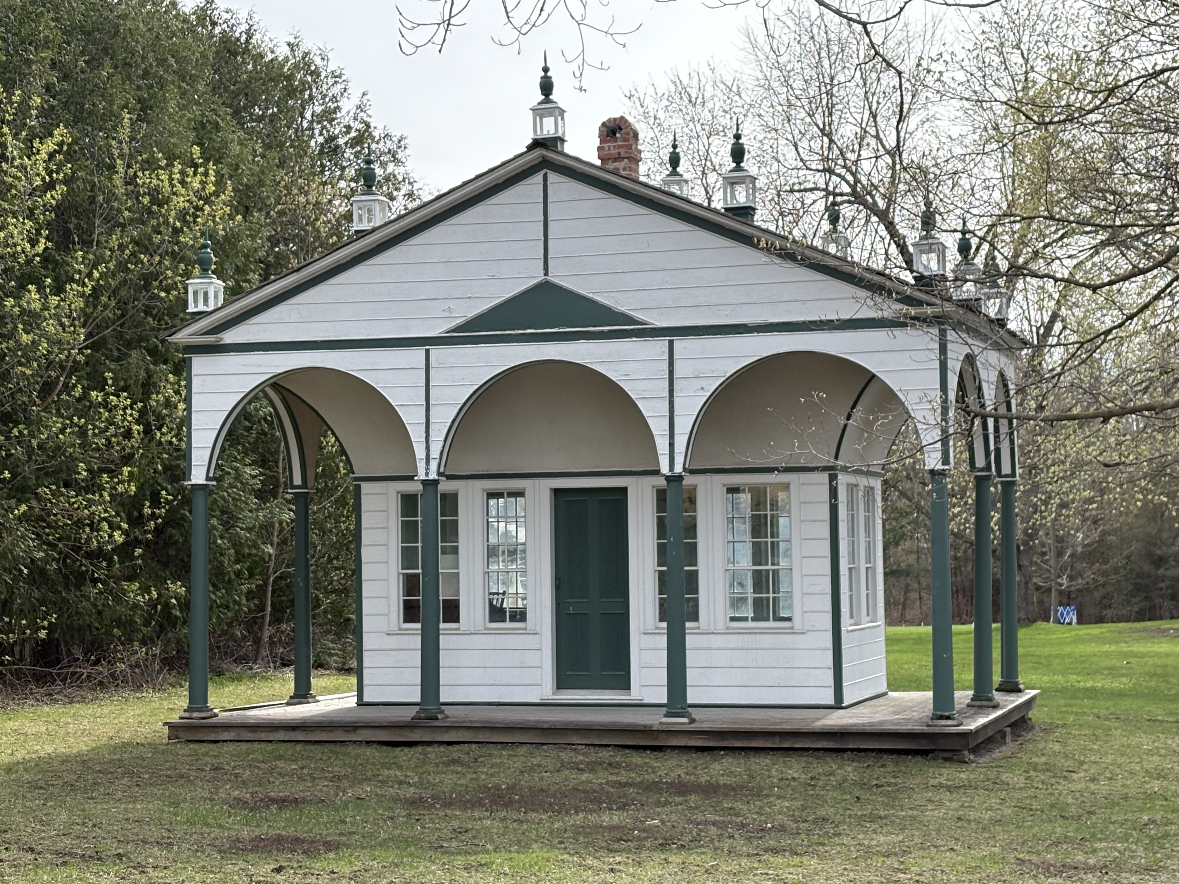
David Willson had a separate building constructed to serve as his study. It is very similar in design to the temple and was completed in 1829. It was built so that Willson would have a place to work on his writing. Inside is a desk and chair and an 1820s style wood stove that was used for heating the space on cold winter nights. David wrote many theological volumes as well as books of hymns for the church.
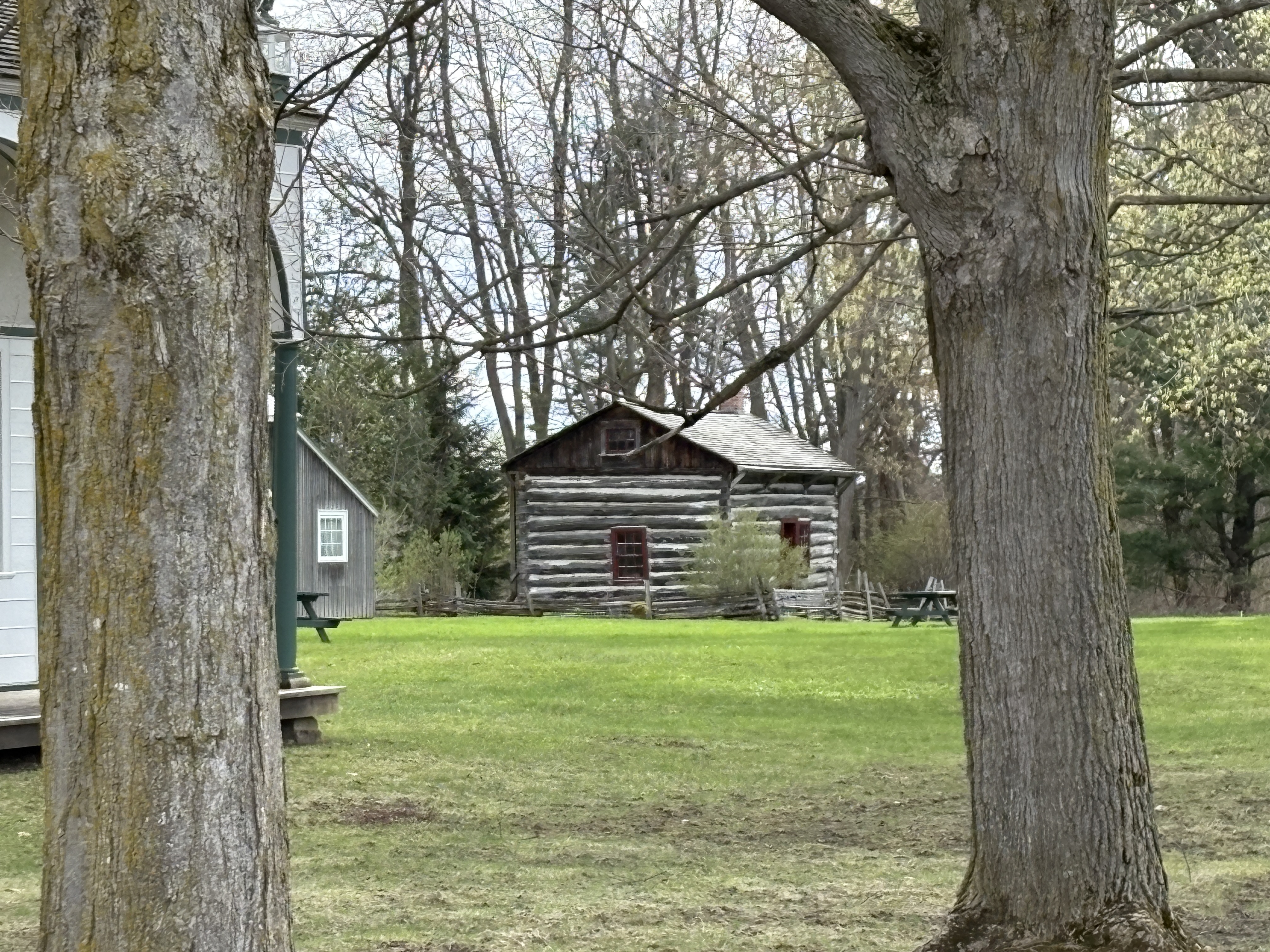
There is a log house on the property which was moved from the farm of Jesse Doan. It was the original homestead on the farm and was built out of logs gained from clearing the land. The red paint used to colour the door frame and window frames was made from mixing buttermilk with a red powder. Jesse was related to Ebenezer Doan who was the master builder of Sharon Temple. The cabin was purchased by the North York Women’s Institute and moved to the temple grounds on May 9, 1957 where it was restored. It is currently part of the museum exhibit and houses some of the artifacts that used to be stored in the temple.
There is much more to be seen inside and on the grounds of the temple but it is closed until the end of May. When it is closed you are not allowed to explore the grounds which contain the 9 historical buildings that make up the collection. Aside from those pictured here there is a cookhouse. the Doan House where the master builder lived, an outhouse, drive shed, lean-to and a granary.
For several decades I have noticed an old church on the east side of Highway 10 just north of Melancthon. I finally decided to go up Melancthon Sideroad 280 to have a look. What I found is that it has been closed for over 8 years.
The first settlers in Melancthon arrived in the 1840s and soon the Beachell Hotel and Tavern was a popular rest stop in the area. The town grew quickly and by 1851 there was a post office in the general store. Although the area tended to be largely Protestant there was a sizable Catholic population in Melancthon Township. A hewn-log Catholic church was built in 1858 which also served as a school and was later named St. Patrick’s Catholic Church. This building was used for twenty years before it was decided to replace it with a brick building. As the community of Melancthon slowly disappeared, the attendance in the church dropped off. By 2017 there were only about 40 people left in the congregation and the building was deteriorating badly. It was decided to leave the building and amalgamate with the Trinity United Church in Shelburne. The building has stood empty now for the past 8 years and its fate is in the hands of the Catholic Diocese of Hamilton.
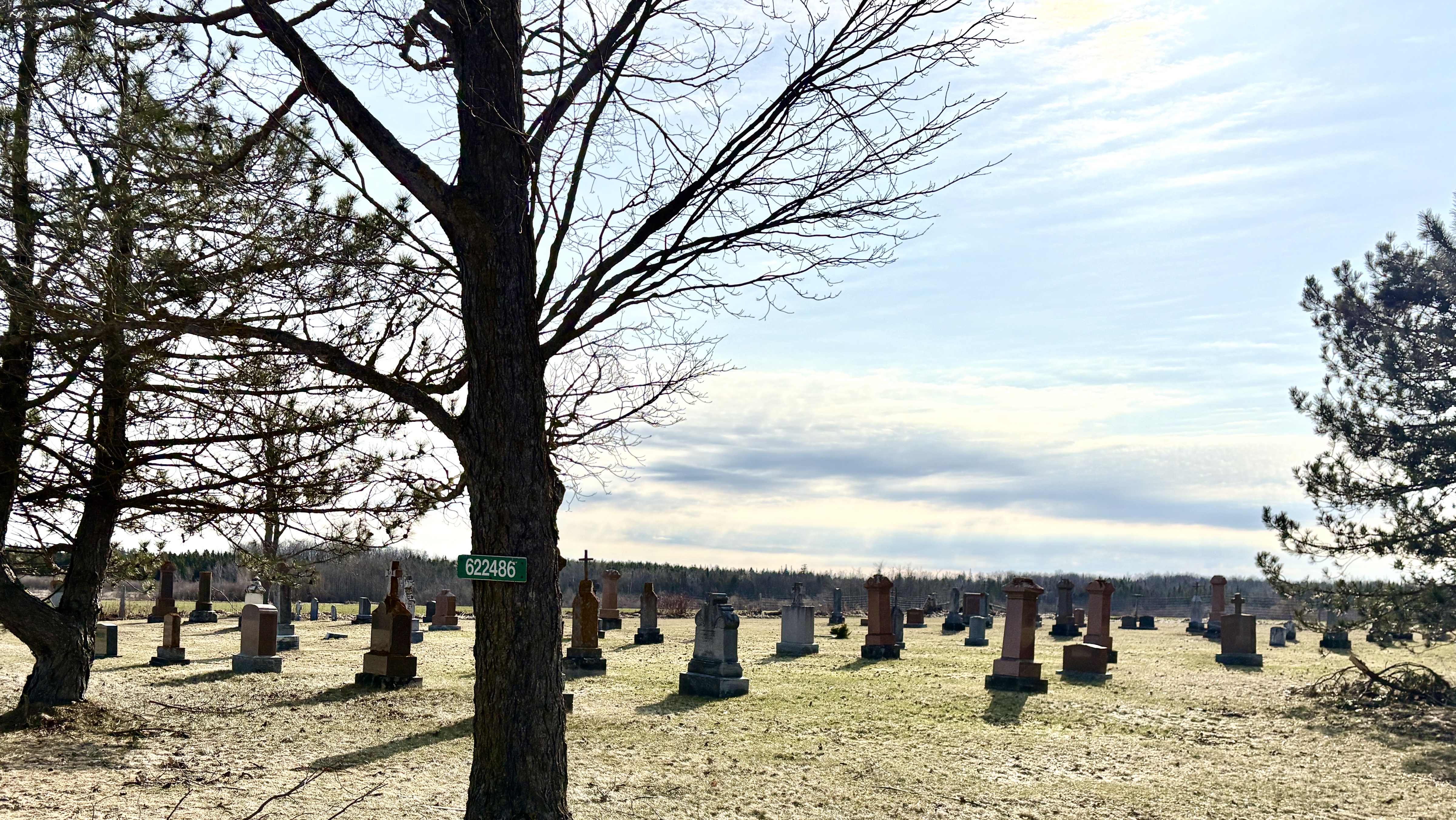
Melancthon soon had 4 hotels, a blacksmith, undertaker and several stores. An Orange Lodge was built in 1858 and a Methodist Church in 1860. A town hall was added in 1874. Things changed rapidly after the First World War as the lumber industry was finished and changes in agriculture styles left the town in a continual downward spiral. Soon, all the commercial buildings and industries were gone and now only the church remains. In the cemetery beside the derelict building are 171 headstones that mark the graves of some of the areas earliest pioneers.
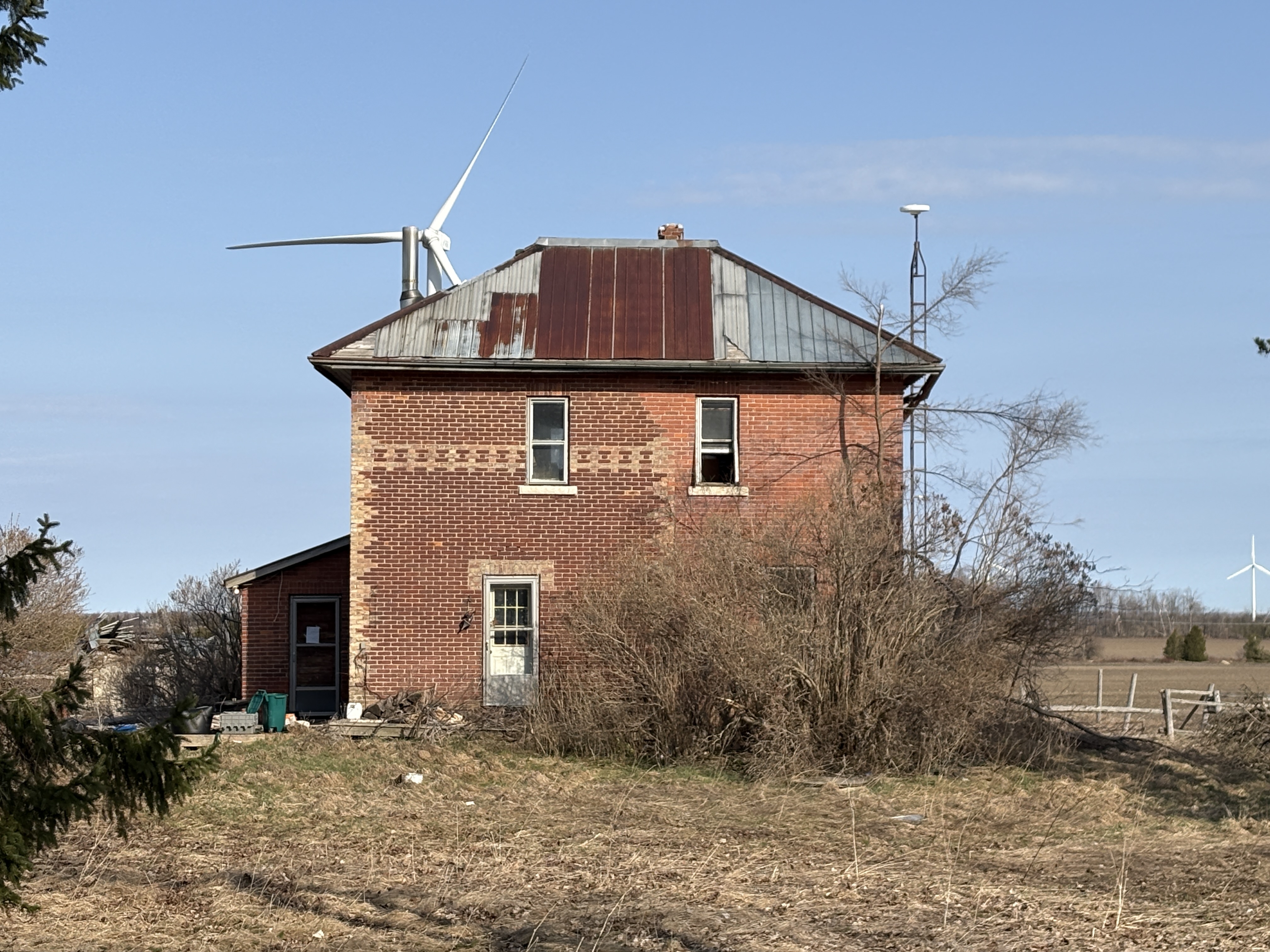
An abandoned house sits on the 300 acre farm across the road from the church. The only thing that is springing up in Melancthon these days is windmills for generating electricity. For miles around, the Amaranth Wind Farm is a sight for sore eyes. One of the windmills can be seen peeking out from behind the house in the picture below.
The fate of the church remains to be determined but if the complete loss of the rest of historical Melancthon is any indication, the days are numbered until it is gone too.
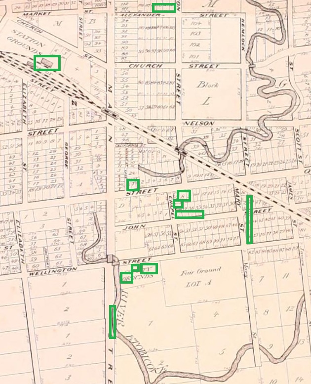
Peel County was surveyed in 1818 but the intersection of Sideroad 5 and Concession 1 in Chinguacousy Township (modern Queen and Main, aka The Four Corners) remained largely undeveloped until 1834. That was the year that John Elliot divided his land and started selling development lots for homes. The community was renamed Brampton after his home in Cumberland, England. By 1846 the population grew to about 150 and the community had 2 stores, 2 blacksmith shops, 2 tailors, a tannery, a tavern, and a cabinet maker. The community has done a remarkable job of preserving its civic buildings and that is the focus of this article. The image below shows the town in 1877 and is marked with the locations of the places that are detailed in this article.
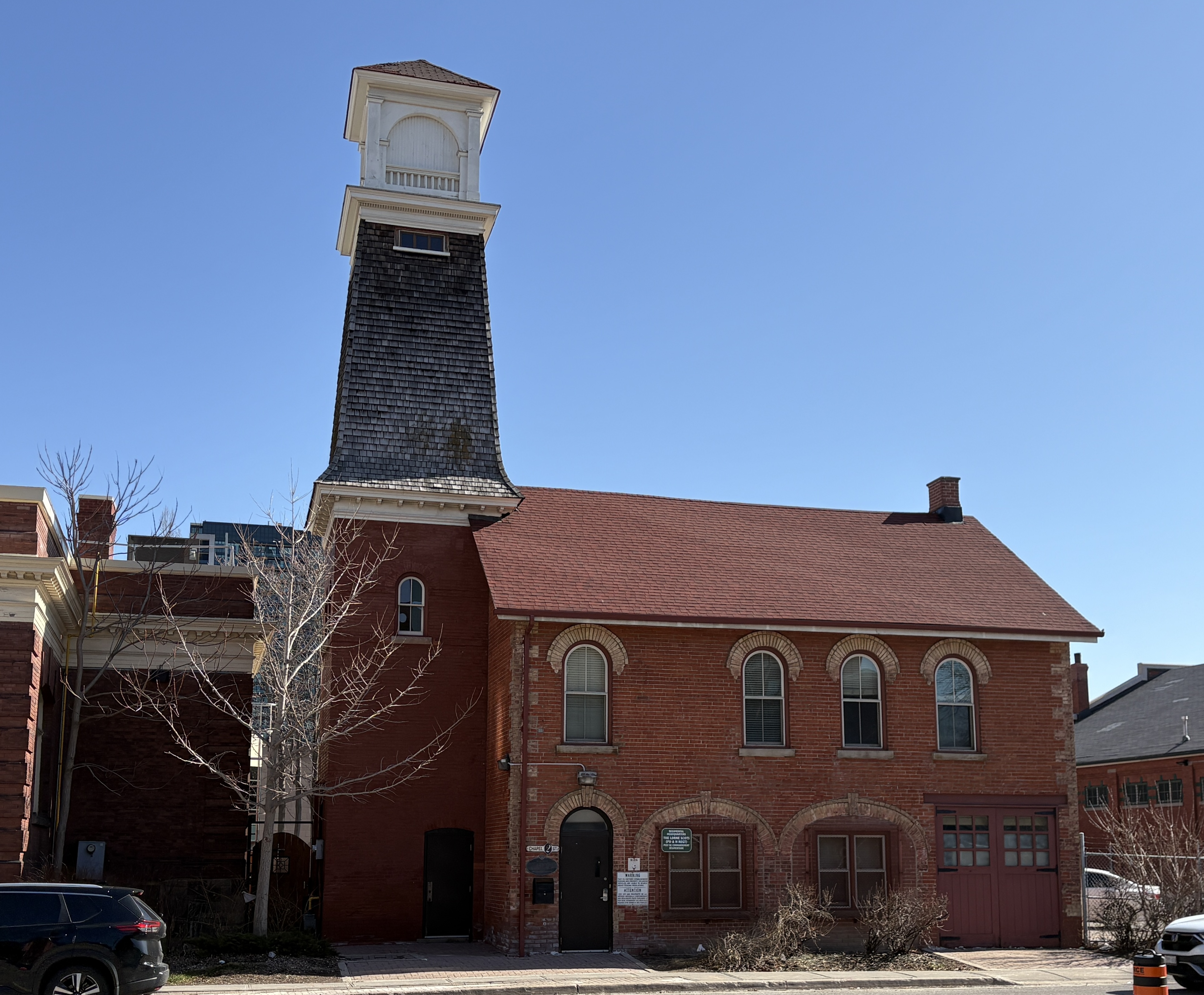
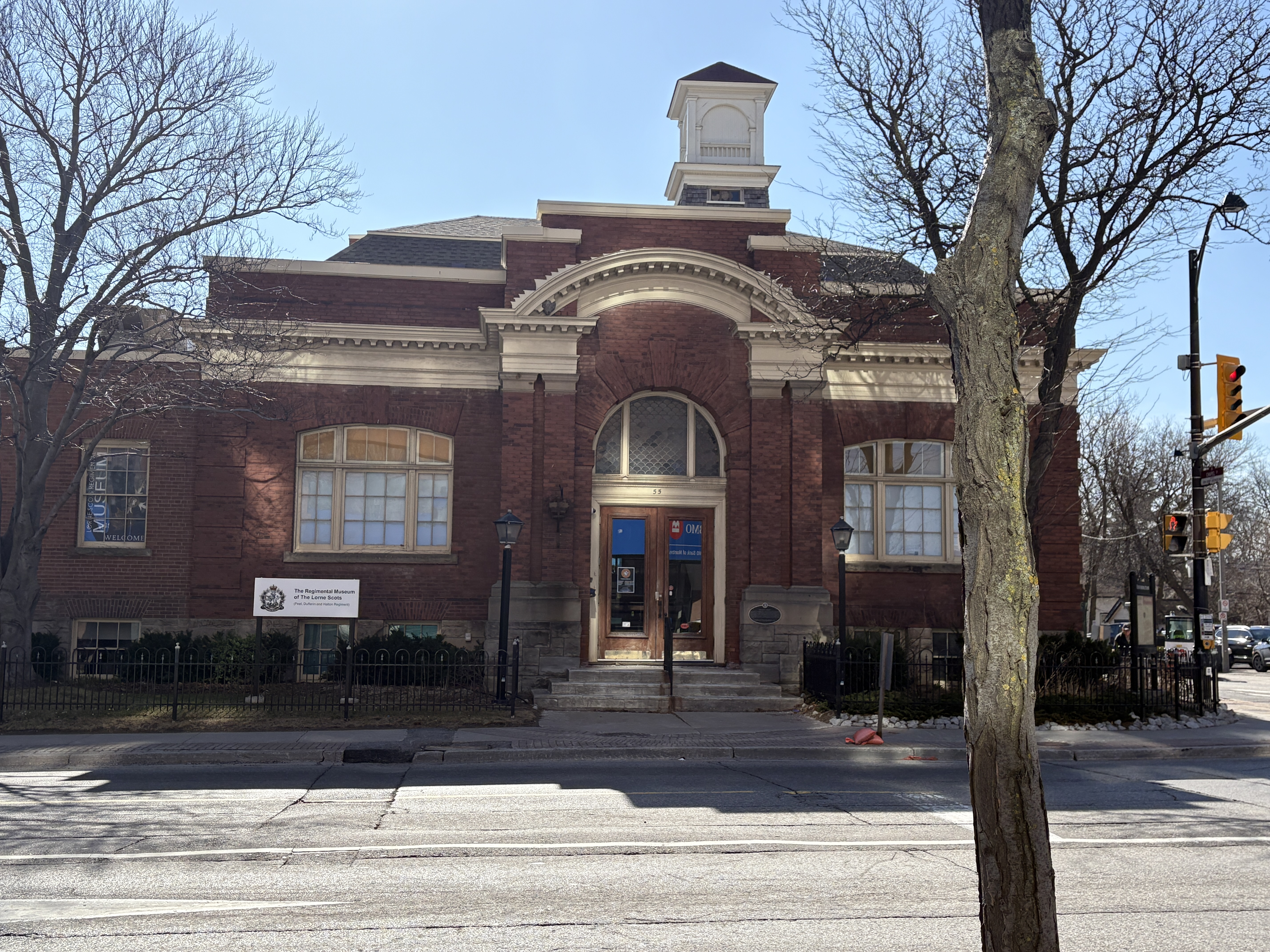
Originally built as the market and fire hall this building was constructed in 1854 as a single story structure. It originally had three arched doors on the ground level to allow access to the market. These were eventually closed and one of them was replaced with the double doors on the right hand side in the picture below. When a second floor was added, it became the council chambers which lasted from 1860 to 1911. The three windows on the second floor at the right hand side of the picture were for the council chamber. The tower was added in 1862 so the fire department could dry their hoses. The fire department used the building until the 1970s and now it is used as the regimental headquarters for the infantry regiment Lorne Scots.
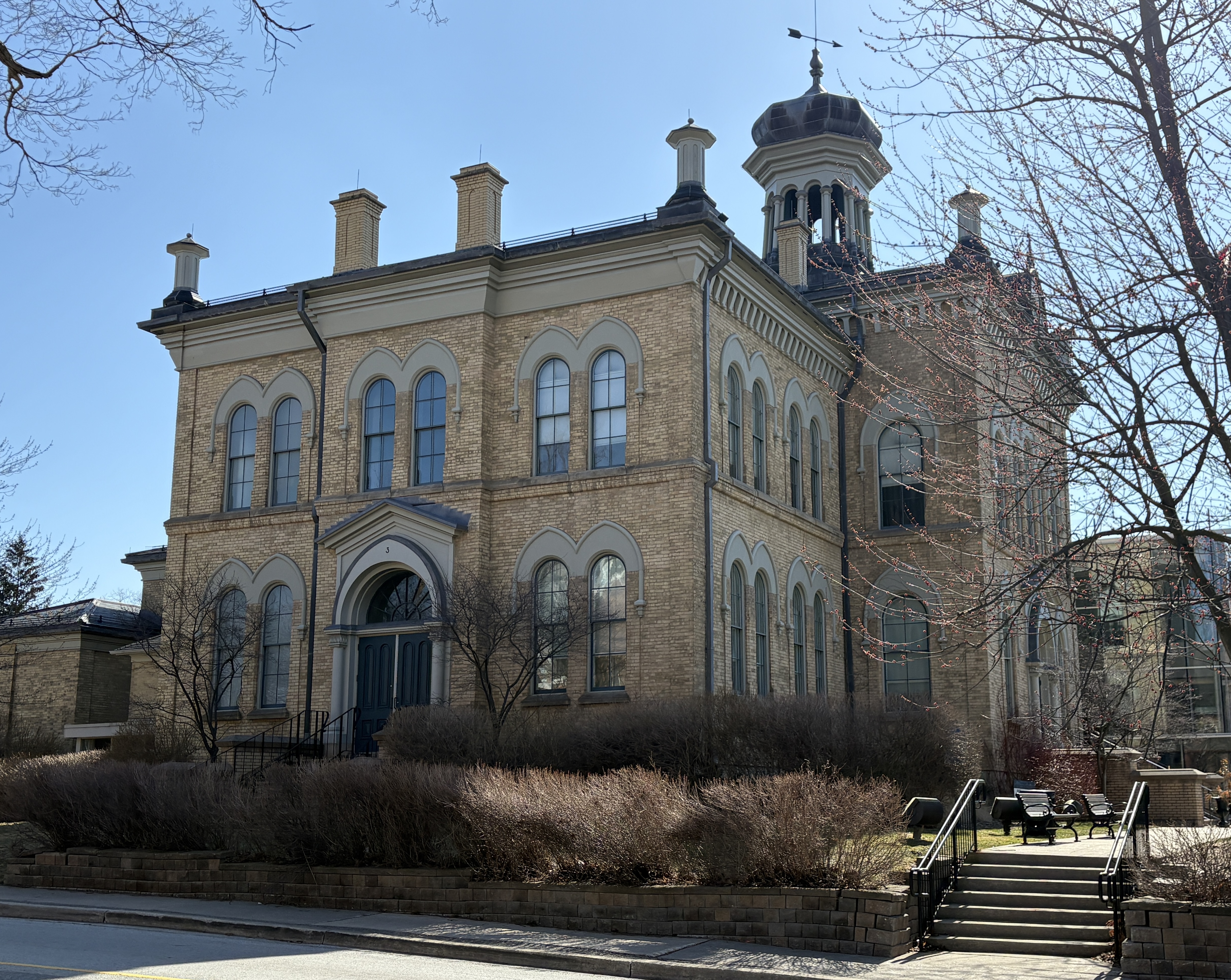
In 1867 Brampton was chosen as the County Seat for Peel County. This meant that a courthouse was built along with a jail. The stone for both of these buildings was quarried from the Etobicoke Creek on the south end of town. One of the defining features of the court house is the onion shaped dome on the top of the building.
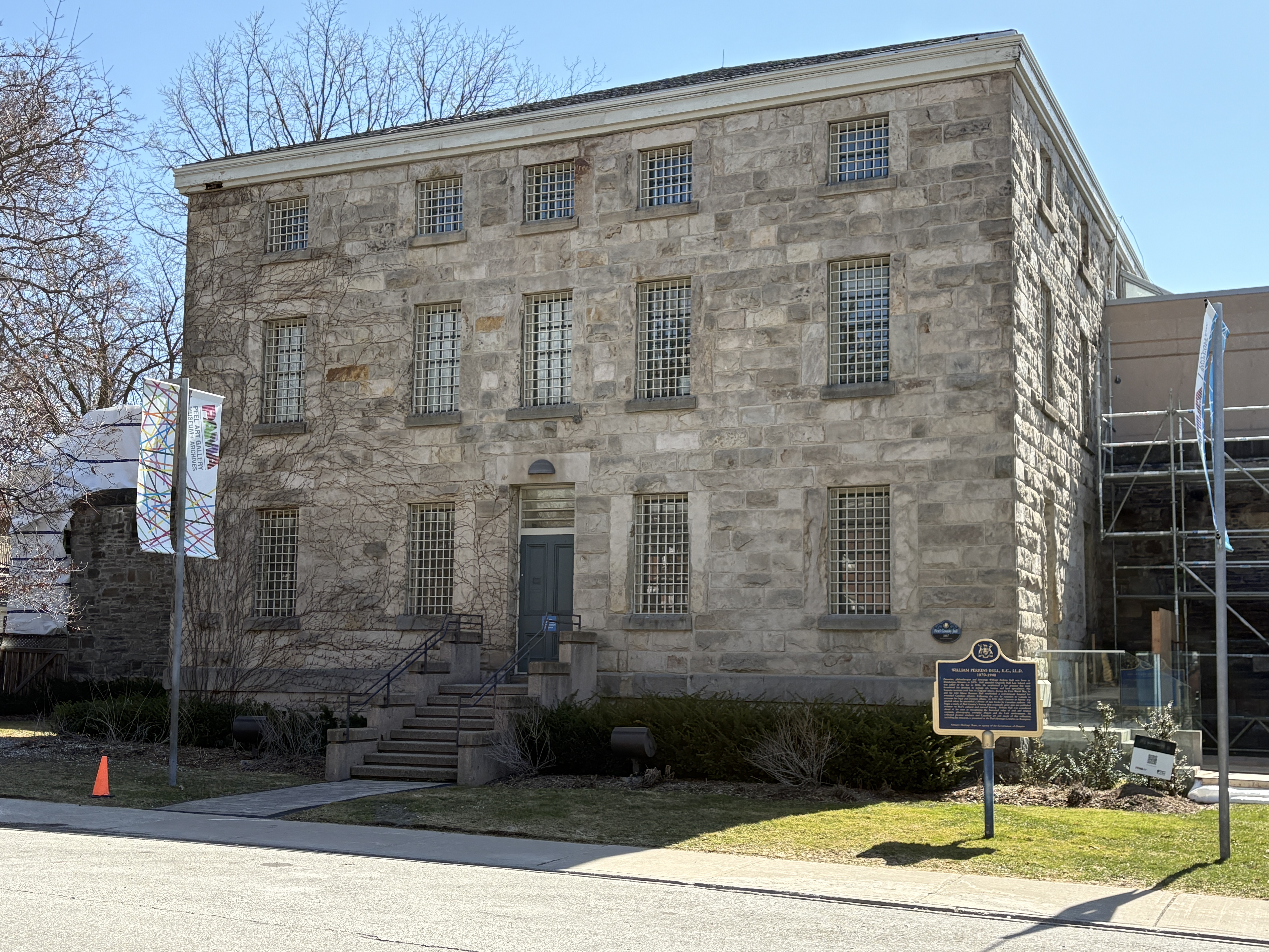
The Peel County Jail was also built in 1867 and was originally designed to hold 30 inmates. At times it was pressed into service for twice that many. Inside there are tiny 1 metre by 2 metre cells in which inmates would spend their nights. In the history of the jail, three people were hung for murder. These hangings took place in 1907, 1941 and 1946. Many people passed through this jail before it was closed in 1977. One of the most infamous was also one of the last ones. Huey Newton, who founded The Black Panthers, was held here in 1977 while awaiting extradition to the US on murder charges. For the inside view of a similar jail, see our article on the Owen Sound Jail.
The Dominion Building was erected in 1888 and officially opened in 1889. It served as the Post Office, City Planning Building and Police Headquarters. It was designed by Thomas Fuller who was the Government of Canada’s Chief Architect. Most of the building is clad in bricks but the Queen Street elevation is clad in Credit Valley sandstone that was quarried at the Forks of the Credit. The style is Romanesque Revival which Fuller also used on the original Centre Block of Parliament Buildings in Ottawa. The Dominion of Canada Coat Of Arms is carved above the windows on the third story while the clock tower was added a later date.
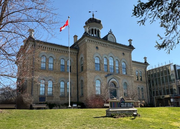
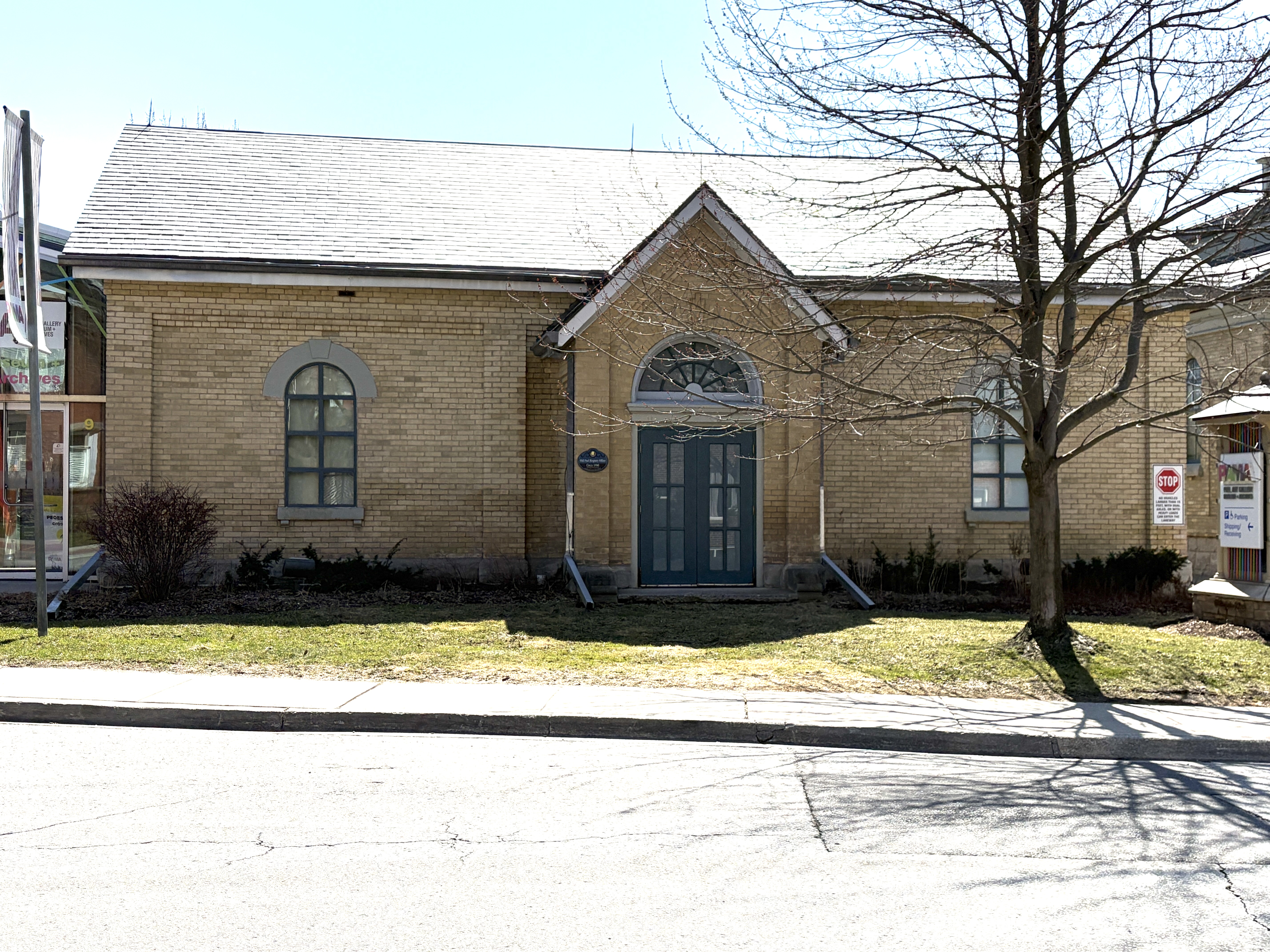
The County Registry Office was built in 1890 on the piece of land beside the jail. Also known as the Land Registry Office, this building was used to register land titles, transfer deeds between people and to store records. It was in use until 1959 as the registry office. In 1967 it was converted to Peel County Museum and Art Gallery.
Andrew Carnegie was a steel magnate who became one of the richest people ever in the United States. He lived in an era when wealthy people used their money for the betterment of society. A local example of this is the Massey Family who donated Massey Hall to the city of Toronto. Carnegie used his fortune to fund free public libraries. Between 1881 and 1917 he funded the construction of 156 libraries across Canada. The one in Brampton was funded by a $12,000 donation and the corner stone was laid in 1906. It was expanded in 1952 and has since been used by the Brampton Board of Trade and the Brampton Concert Band.
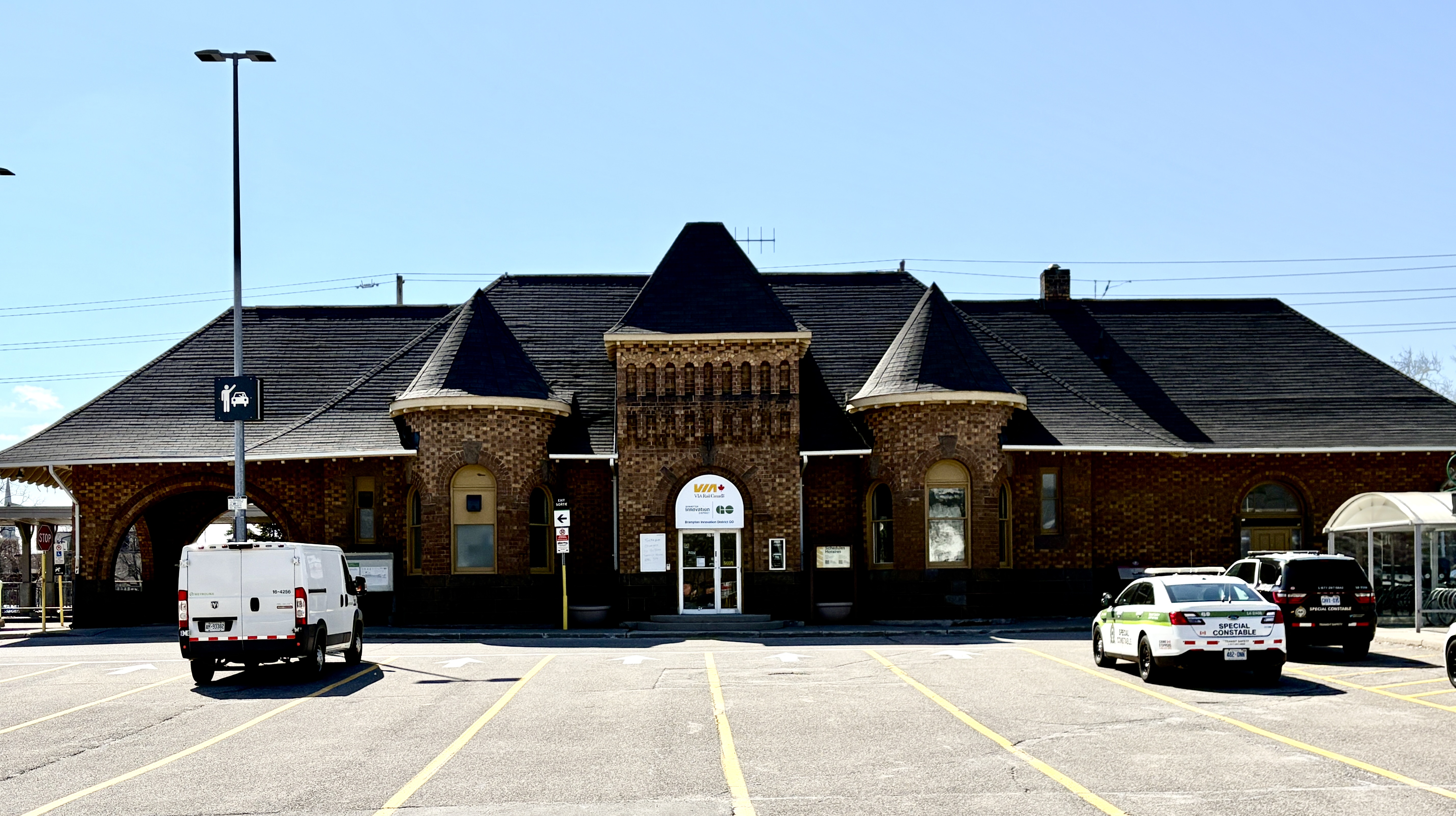
The Grand Trunk Railway arrived in town in 1856 and built a station near the downtown area. When the railway was booming at the turn of the century, it began to replace its earlier stations with new more impressive ones. The new station opened in 1907 with a combination of Romanesque Revival and Arts and Crafts styles to the architecture. Industry was attracted to the area around the station and many of these early industrial buildings still stand. The Hewetson Shoe Factory and Dominion Skate building being two examples.
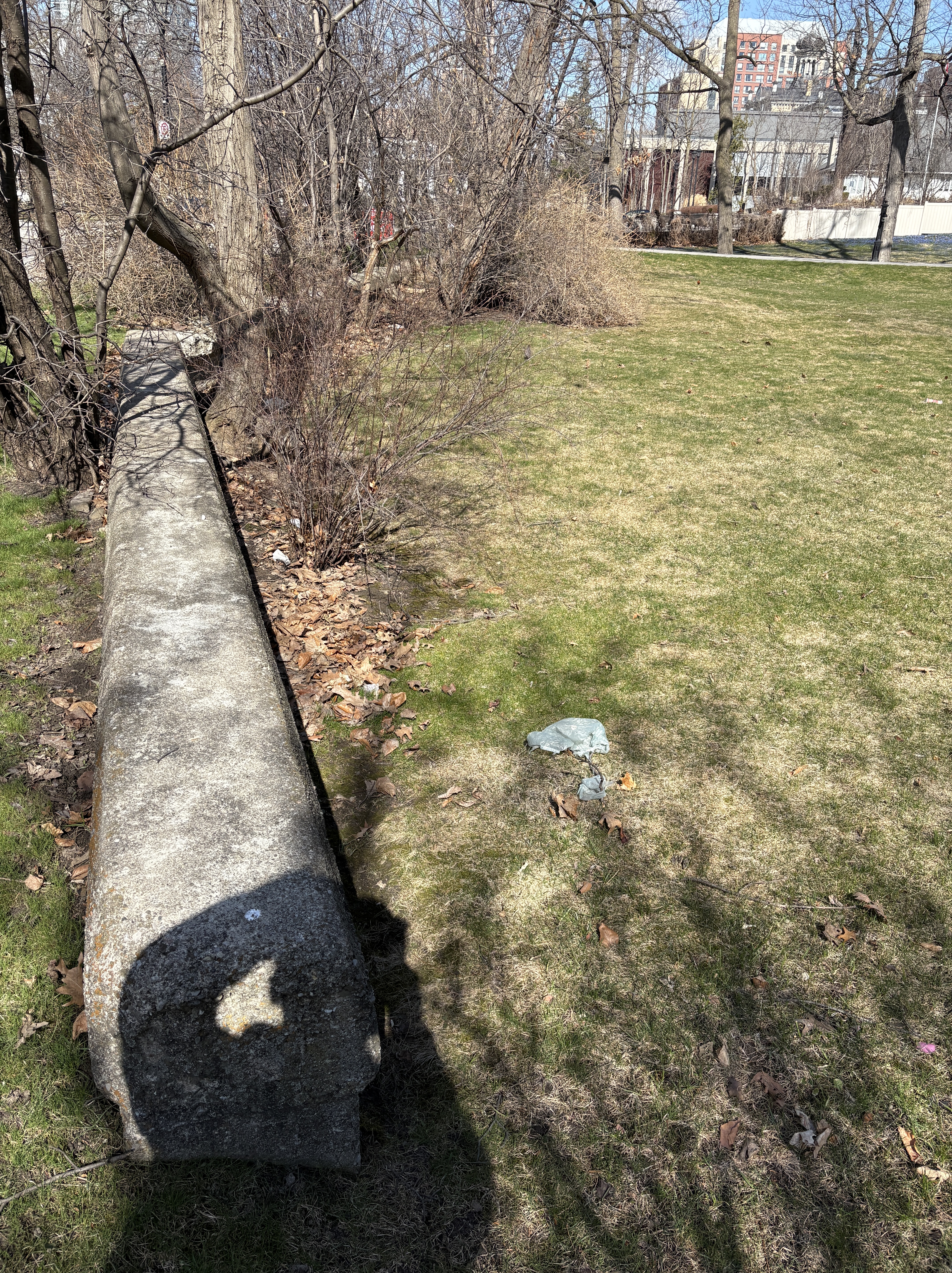
Etobicoke Creek flooded the downtown area almost every spring because it was a slow moving creek that couldn’t always contain all the flood waters from the spring melt. Part of the creek ran along side Main Street and a retaining wall was built in 1914. Part of this old wall can still be found in front of homes on Main Street. The old creek bed has been filled in and the bridges that allowed access to homes and businesses have been removed but there’s still traces of the old creek in downtown.
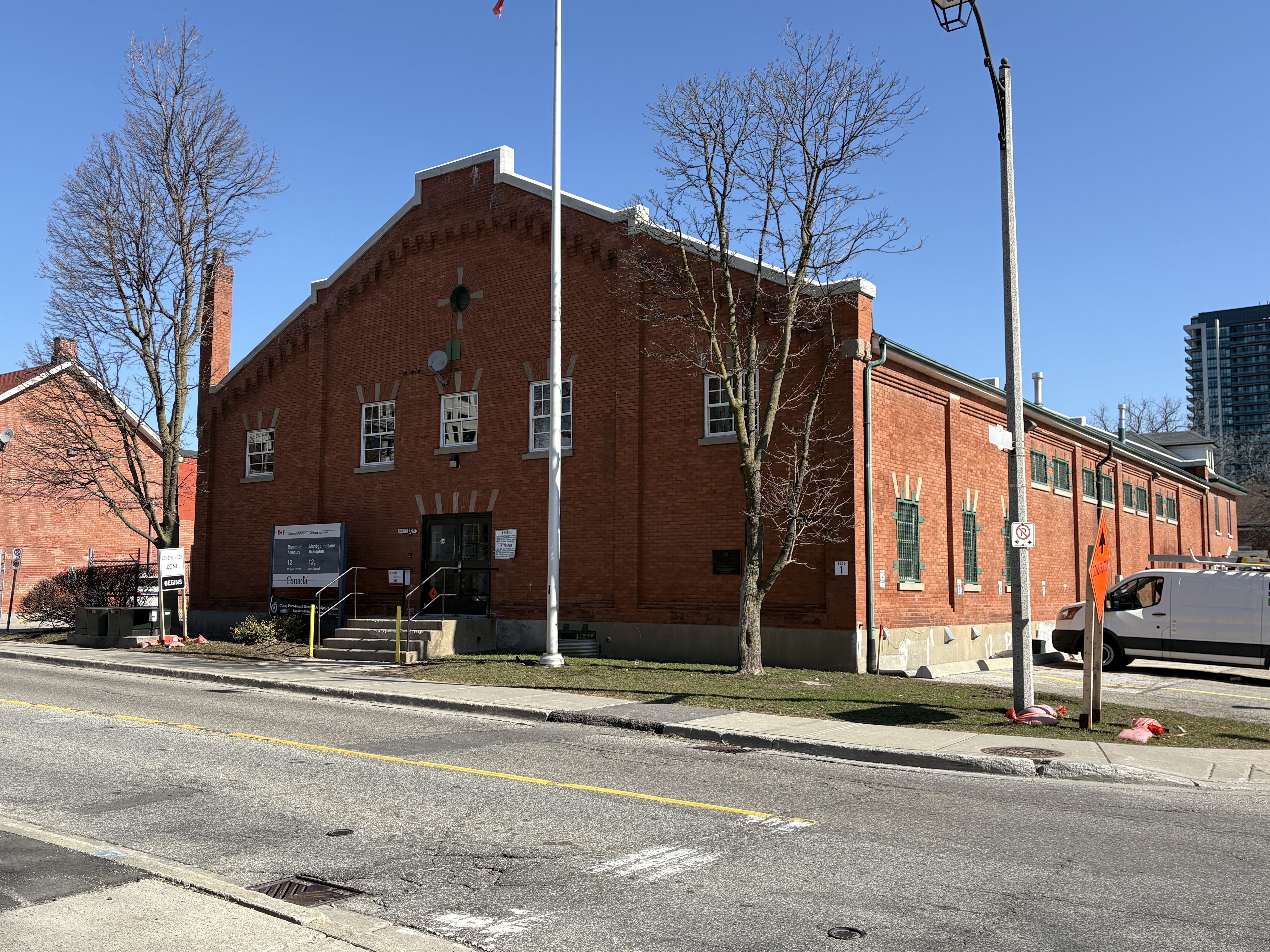
The Brampton Armoury was built in 1915 and was one of 56 armouries built across the country during the First World War. Between 1912 and 1914 these buildings were erected as drill halls and the one in Brampton was built on the “Type B Standard Plan”. The Lorne Scot Regiment has called the hall home since 1936.
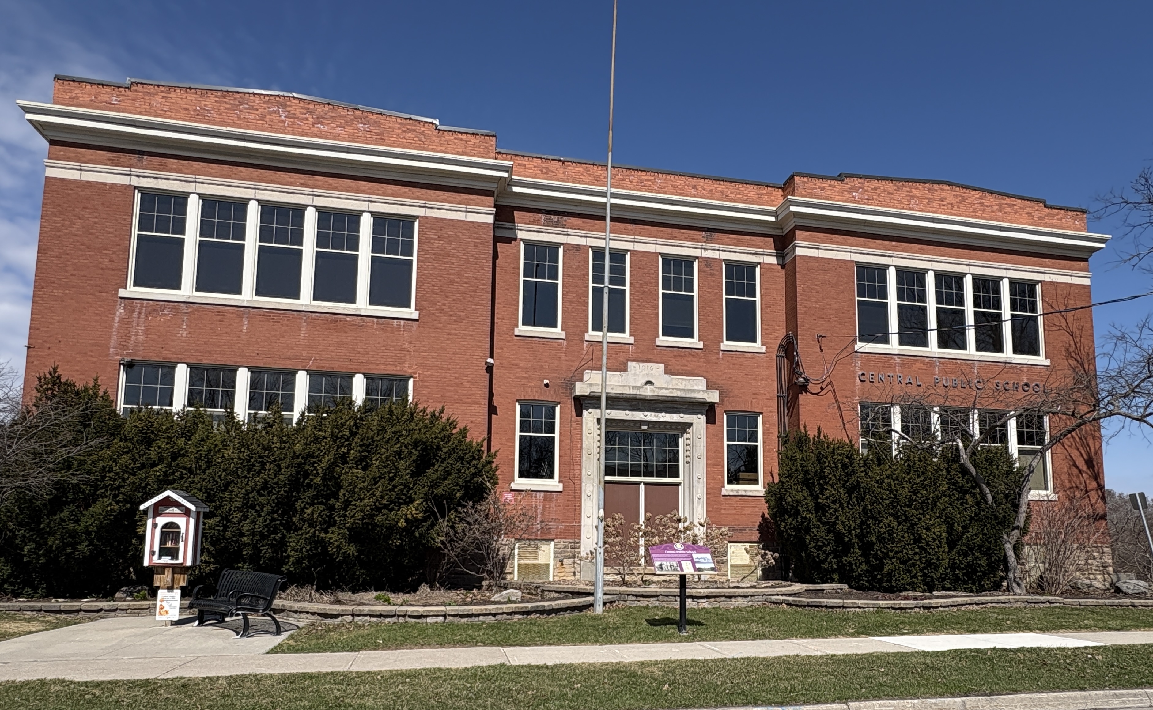
Central Public School is the oldest surviving school building in the downtown area. The site of the school had been the location of a previous school building that became overcrowded and needed to be updated. The new school opened in 1916 but was still under construction until 1920. The school operated until the end of the 1983 school year when it was closed and students enrolled in some of the newer schools in the area. The building was bought by the city and repurposed as a community centre.
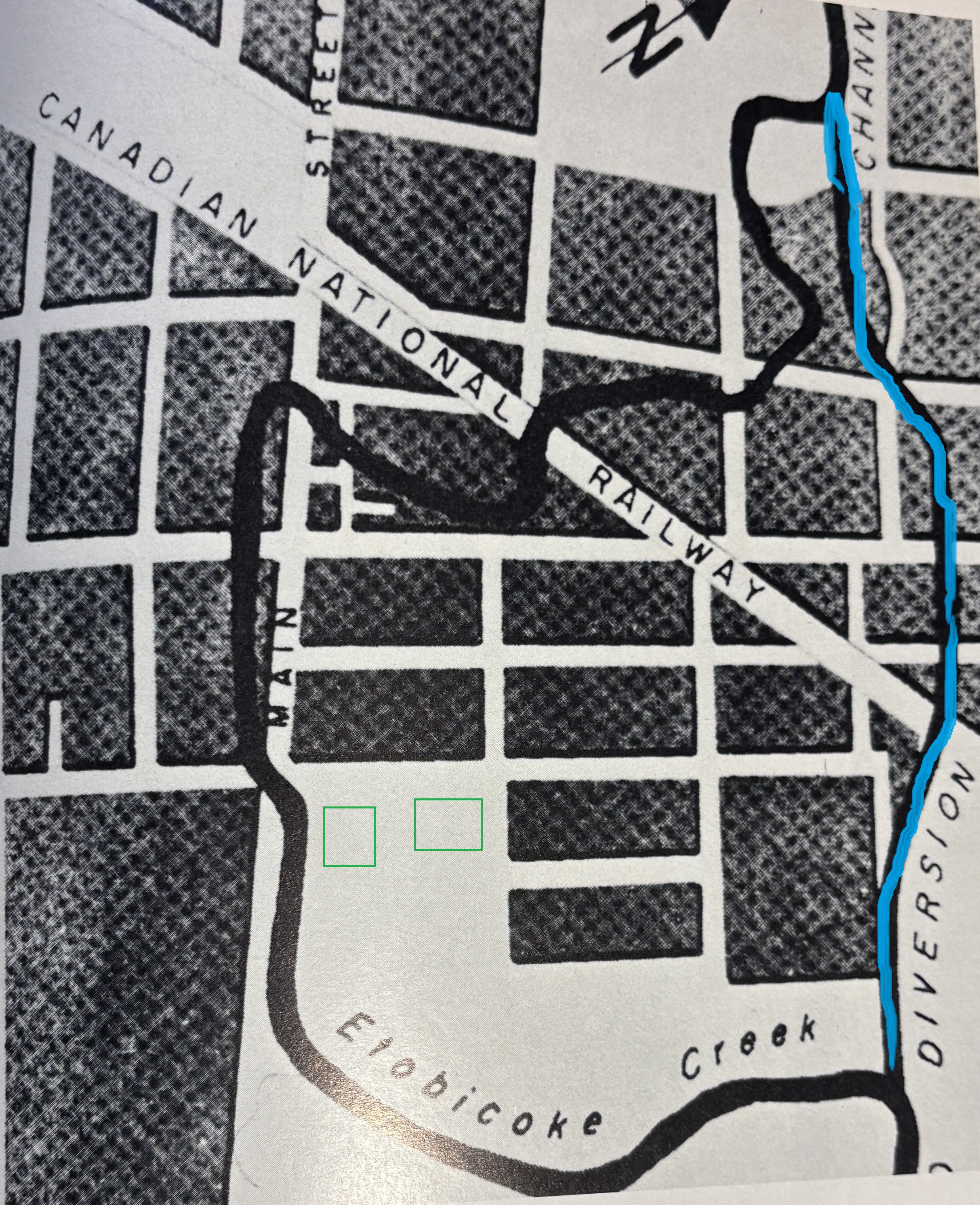
On March 16, 1948 the Etobicoke Creek overran its banks and flooded the downtown core in four feet of water. Floods had occurred in 1854, 1857 and 1873 but nothing was done. Flooding continued and occasionally people lost their lives. In the 1948 flood there was half a million dollars worth of damage and it was the deciding factor in building a diversion channel. Etobicoke Creek wound its way through downtown Brampton and the sharp curve just above Queen and Main Streets slowed the water down and caused the flooding to be worse. The course of the new channel is shown in blue on the map below, taken from Brampton An Illustrated History. The court house and jail at Main and Wellington are drawn in green as a reference.
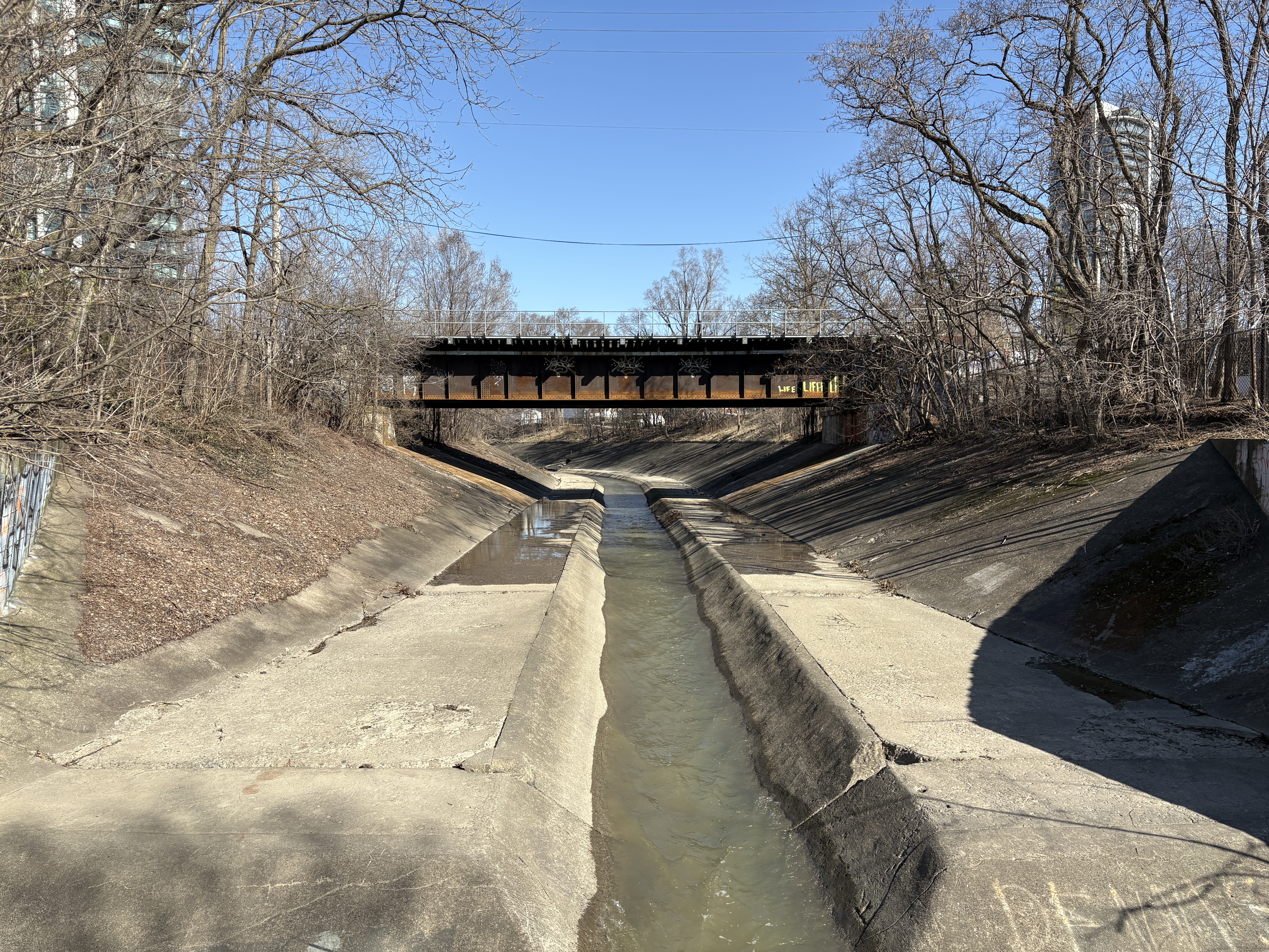
Starting in June 1950, the diversion channel was built at a cost of $250,000 and Ontario Premier Leslie Frost officially opened it on Nov. 10, 1952. Less than two years later, on Oct 15, 1954 the diversion channel would carry the waters of Hurricane Hazel away and spare the downtown from the destruction caused in other areas. The image below was taken at the end of Wellington Street. The straight lines allow the water to flow faster and although the channel was full to the top it was able to contain the swollen creek.
There is a considerable amount of other historic buildings in old Brampton but the amount of proposals for 40 or 50 story buildings suggests that this might not always be the case. If you’re interested in seeing it for yourself, Brampton has a great walking tour.
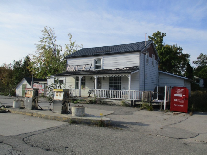
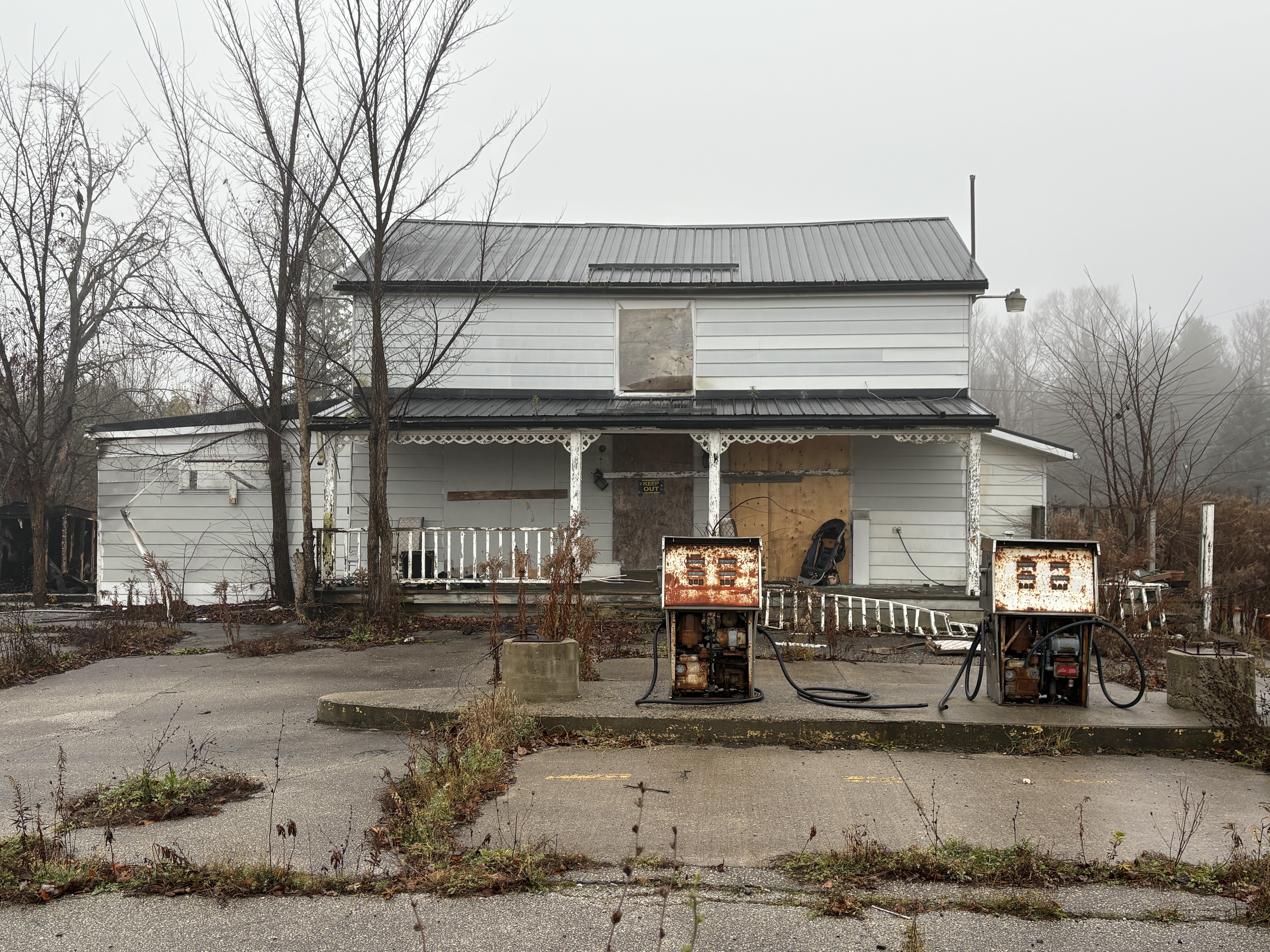
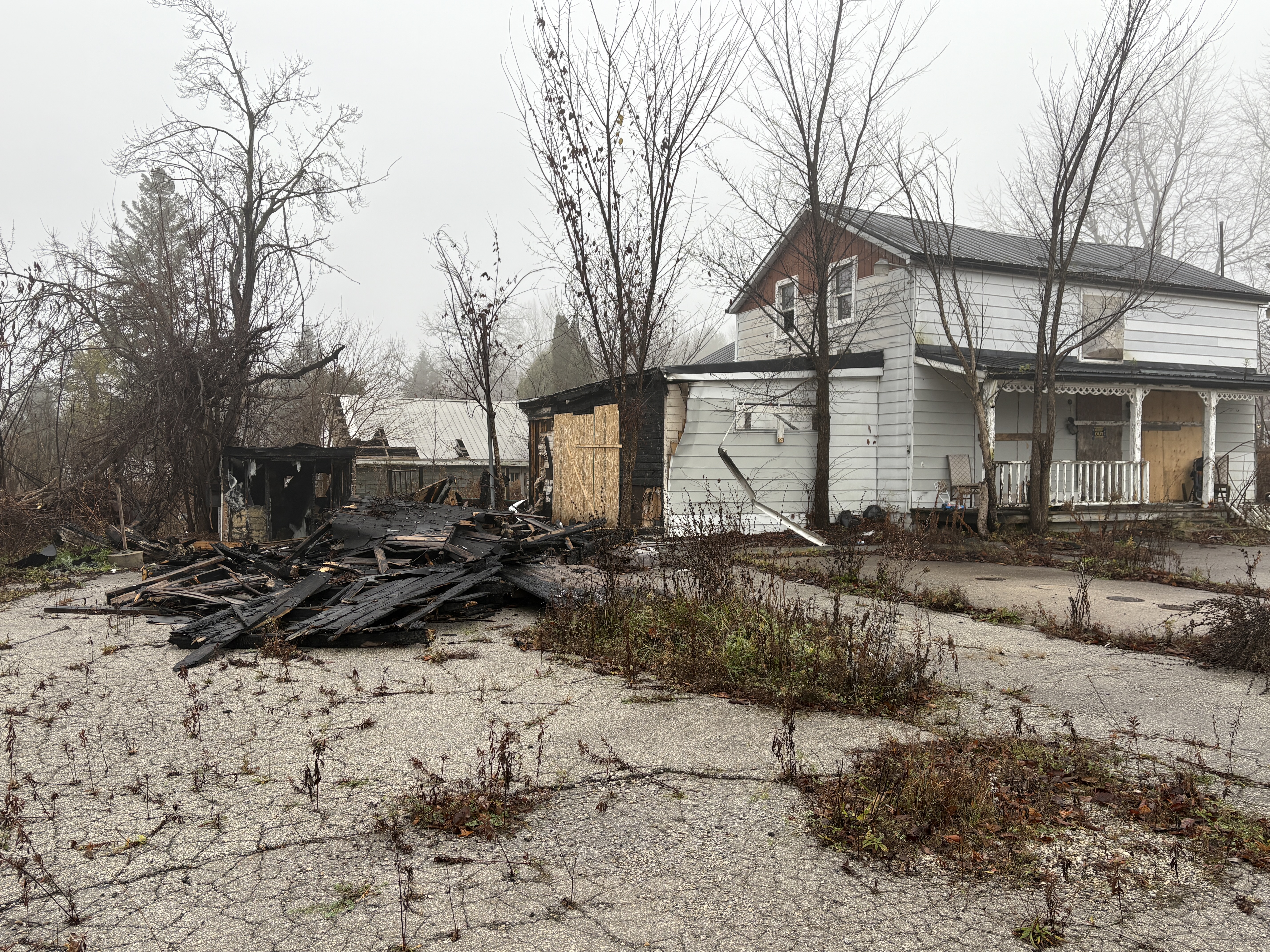
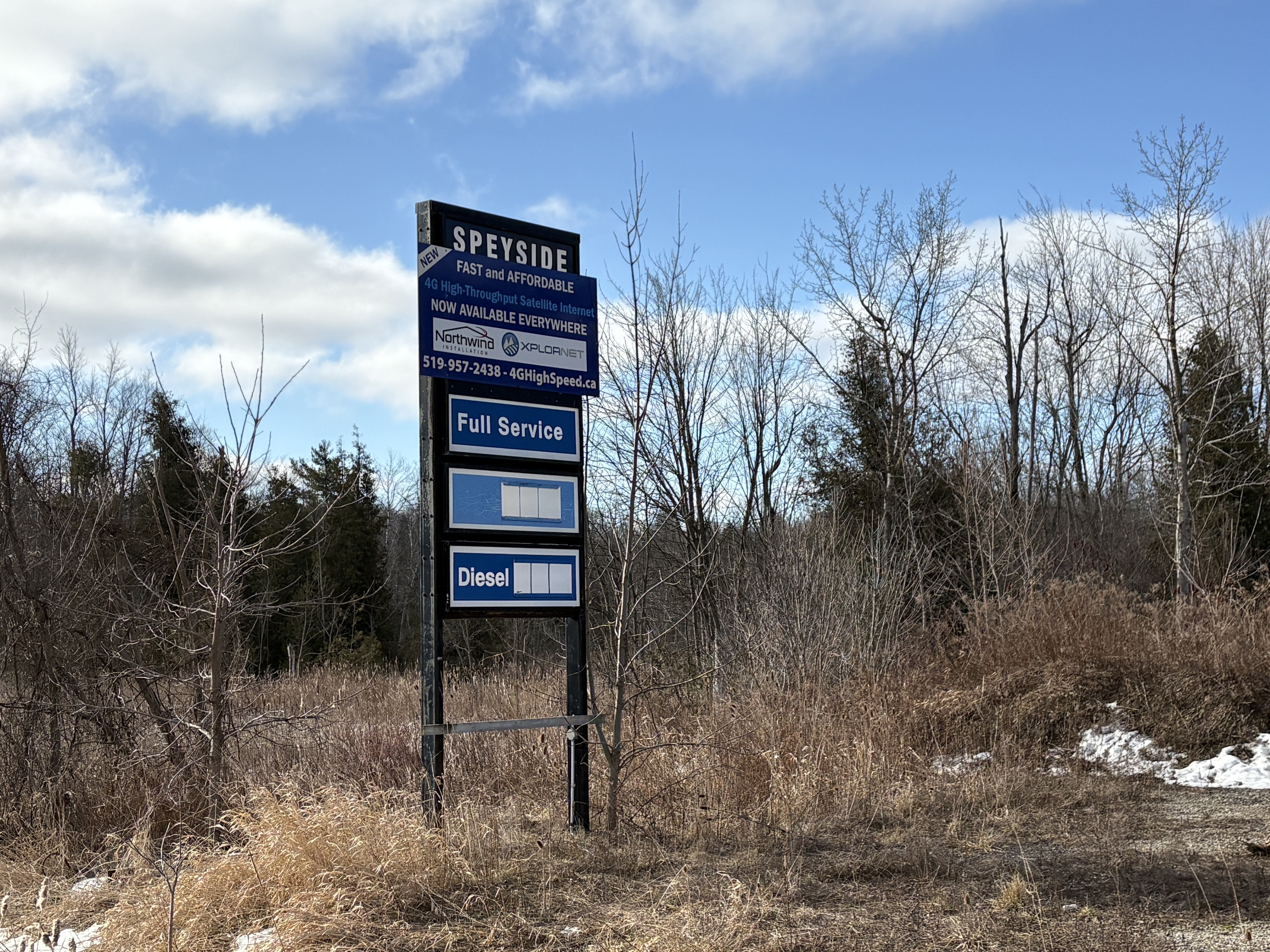
The village of Speyside had two hotels, two general stores, a tannery, a large stone quarry and a village hall. The cover picture is from September 2015 and shows the only remaining building from the original Speyside. Newer homes have been added over the years but all the original buildings except for this one had been demolished. The Speyside store and gas station operated until the early 2000s when it closed. It has sat vacant for close to 2 decades with the exception of some squatters from time to time. The image below shows the building in November 2024.
This structure operated as a store under many names and was even moved back from the road 17 feet in 1942 when the highway was paved. On August 29, 2024 a fire broke out in the shed on the end of the building. When I passed by in November it looked like the store was still intact and only the shed had been destroyed.
Directly across the street from the store stood the original log cabin that served as a post office from 1873 until 1914. The first postmaster was rumoured to have been illiterate and relied on the school children from SS #10 to help him sort the mail. The post office closed in 1914 when rural mail delivery made it obsolete.
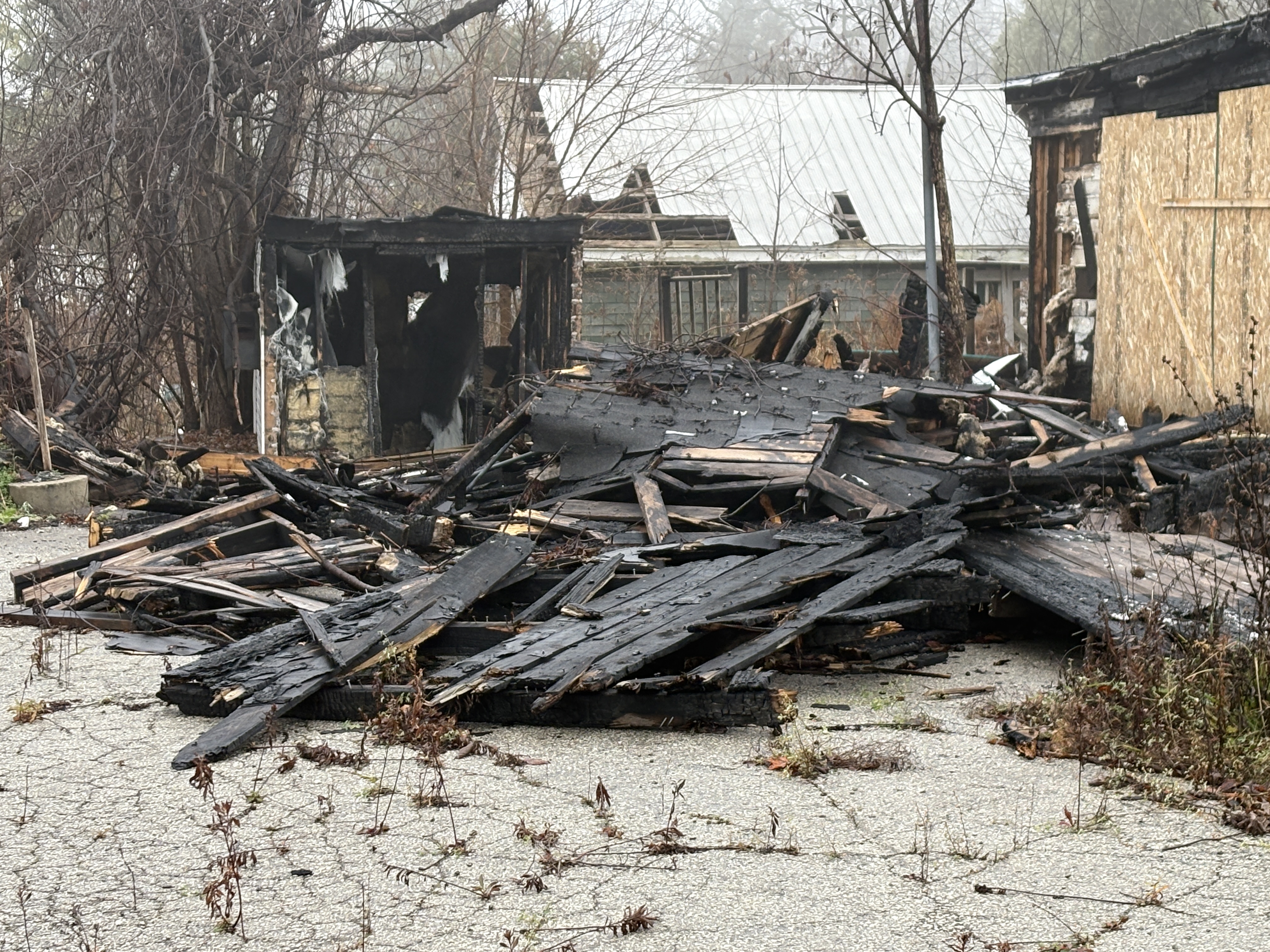
For years I have been photographing thousands of historic buildings and this blog grew out of that passion. I have always been aware of the many historic buildings that have already been lost and wanted to get a photographic record of the ones that remain. Just in case one day they are lost. Sadly, that has been the fate of the lone historic building from 19th century downtown Speyside. On a recent trip past, I noticed that the store had been demolished. Apparently the fire had done more structural damage to the store than appeared from the outside.
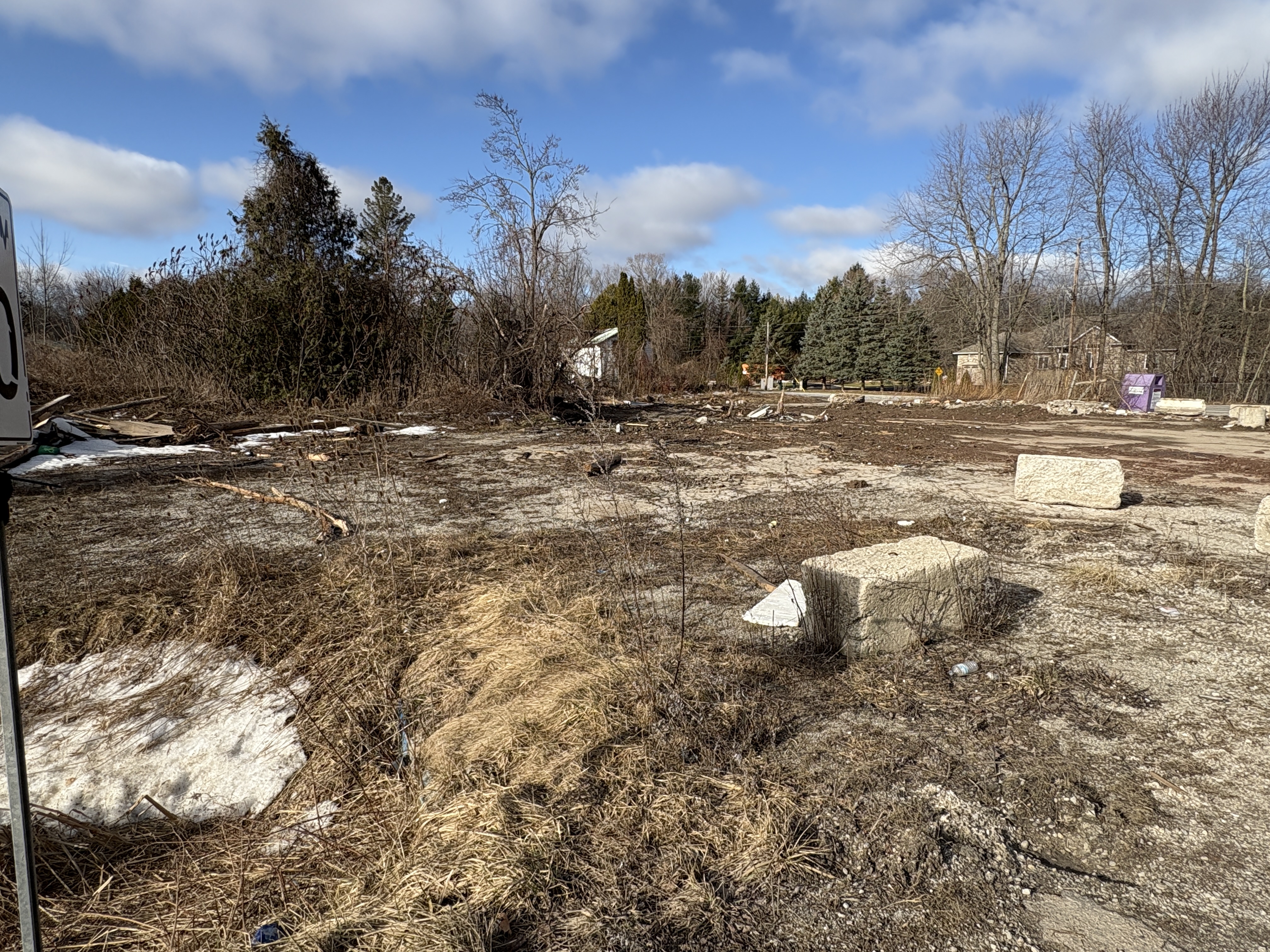
At any rate, there’s just the old store and gas station sign standing sadly in the grass beside the site of the former Speyside general store.
So, the chapter closes on another small piece of our local history. But, at least we have this record of it.
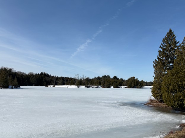
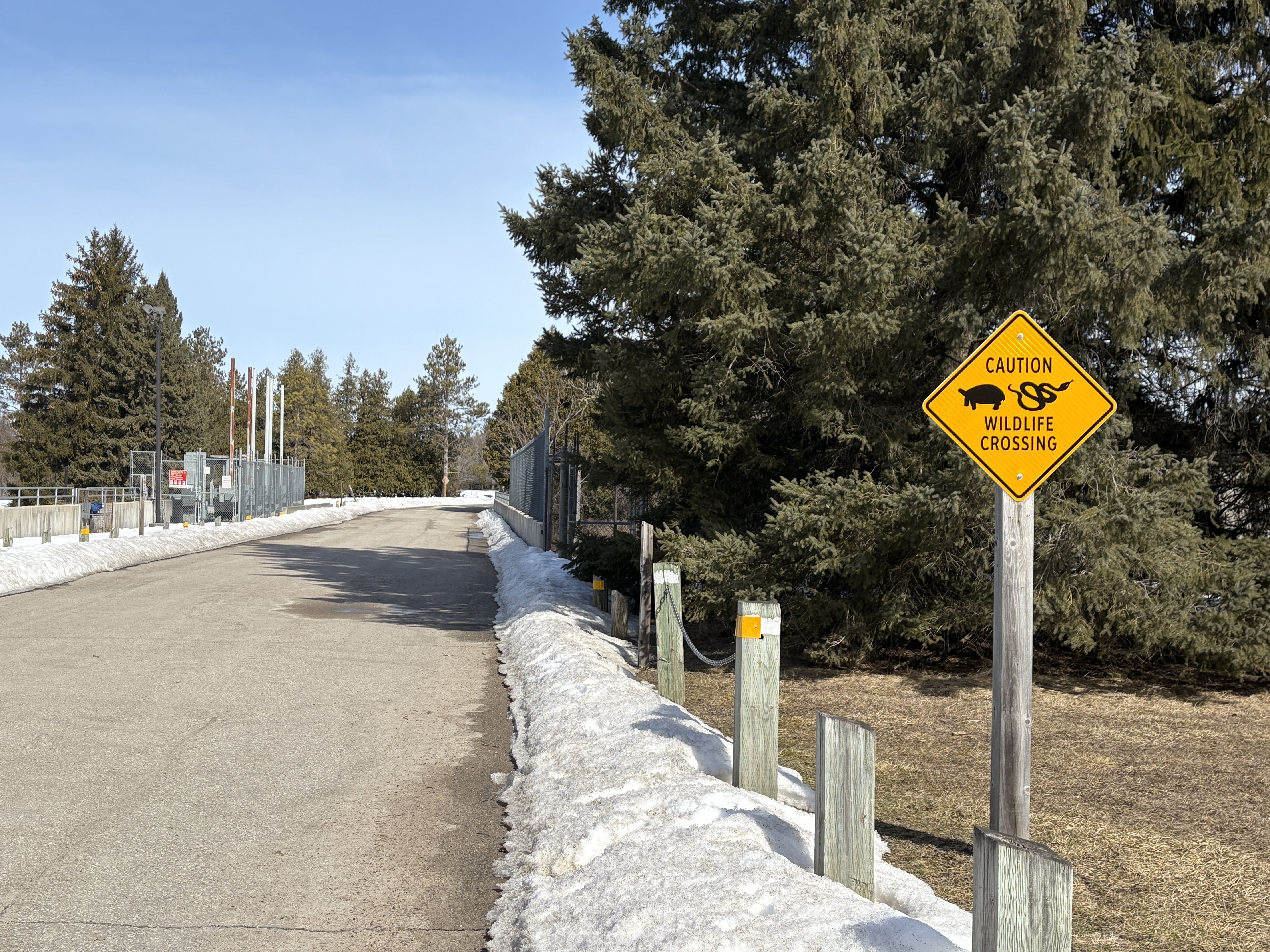
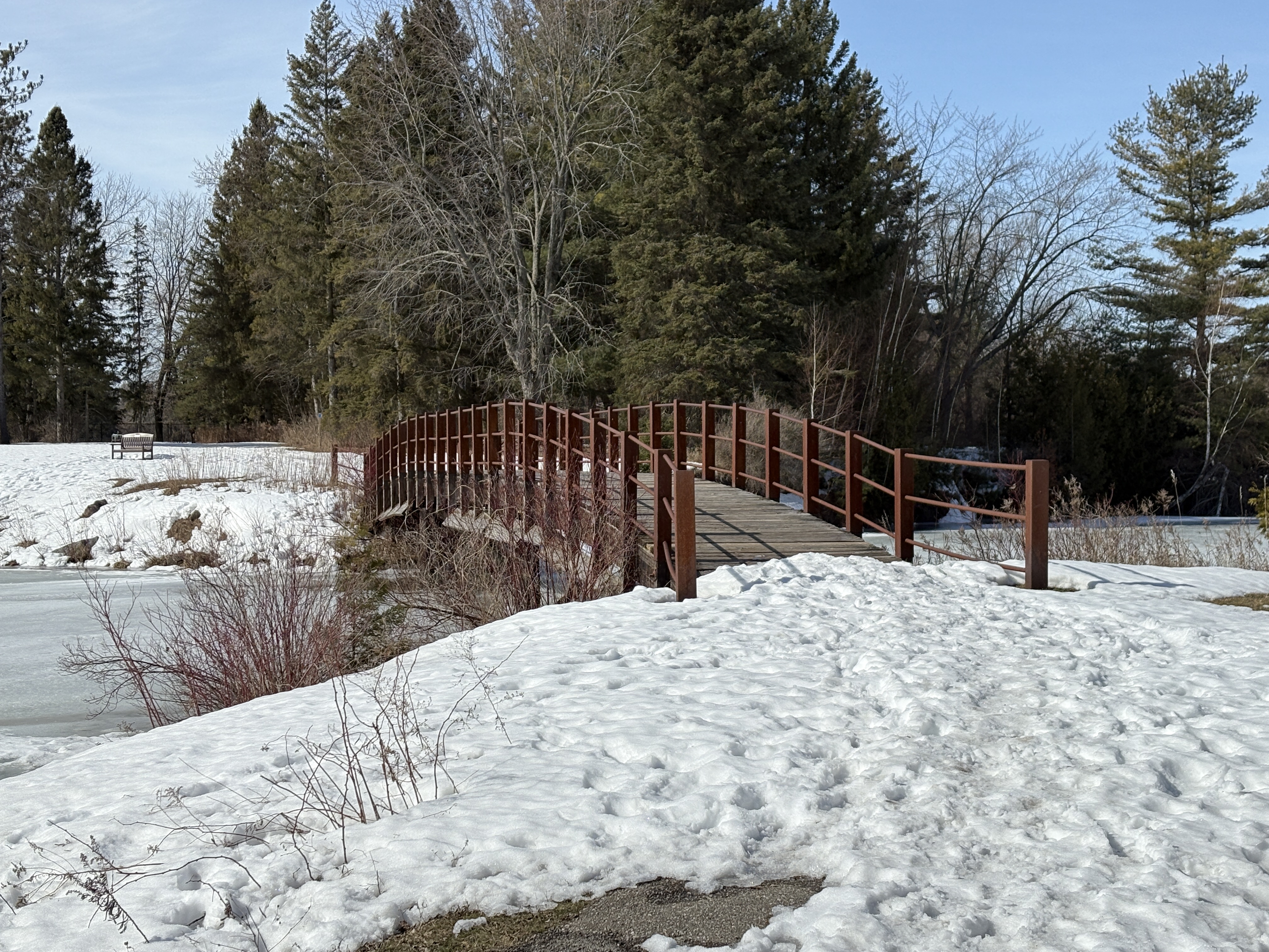
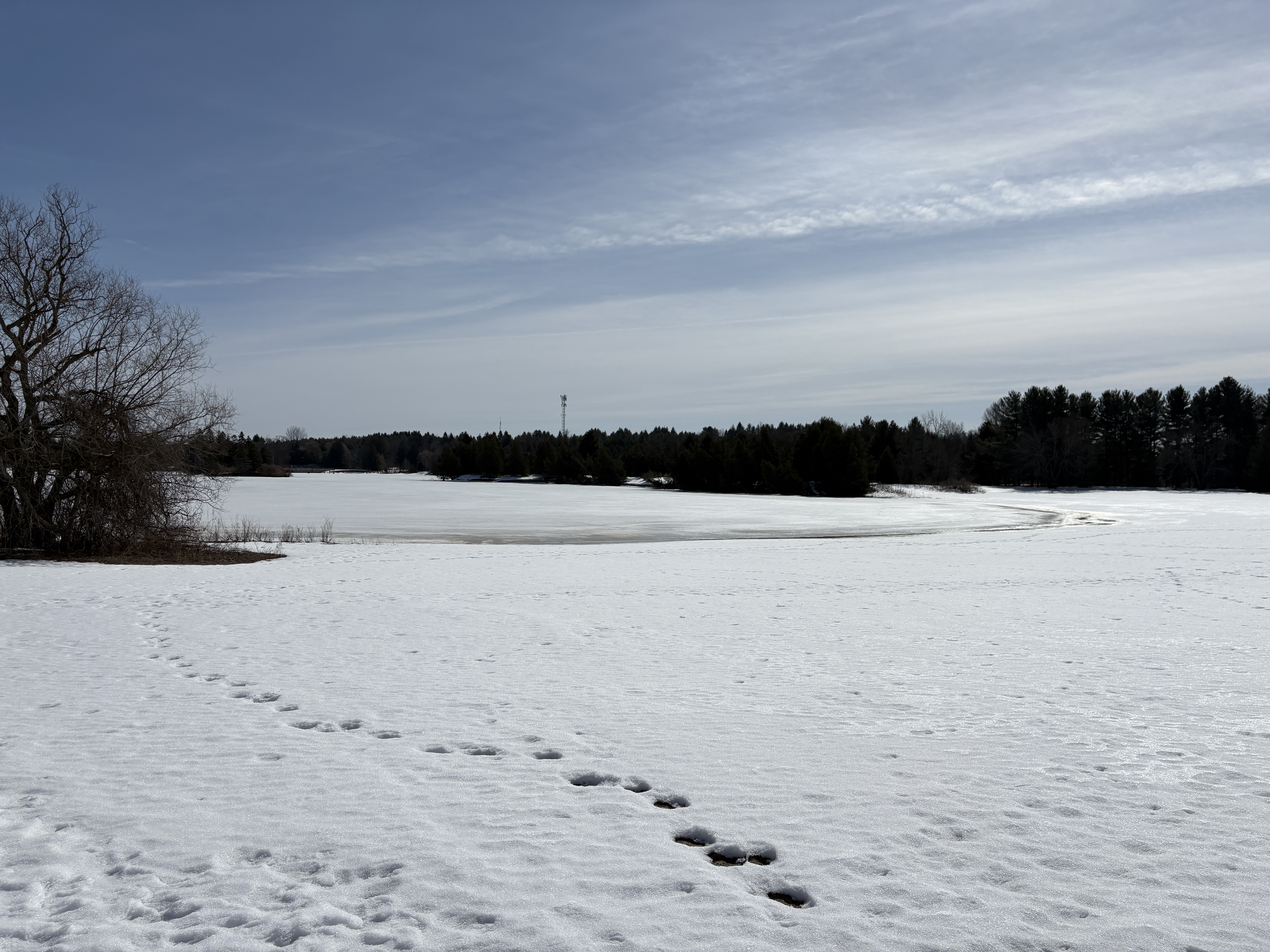
Earl Rowe Provincial Park was always a favourite place to visit for a swim when we were growing up. At that time the park was only a decade old or so. The park was the brainchild of Earl Rowe who was the local Member of Parliament. Earl was a Conservative politician who was a member of both the provincial and federal governments as well as being the 20th Lieutenant Governor of Ontario. In the 1950s the idea for the park was born and the first land was purchased in 1957. The image below shows the approach to the dam on the Boyne River and has a sign which indicates that snakes and turtles could be seen crossing the road. In spite of the sunny day we didn’t see any. Perhaps the snow banks were still a little too tall for them to climb.
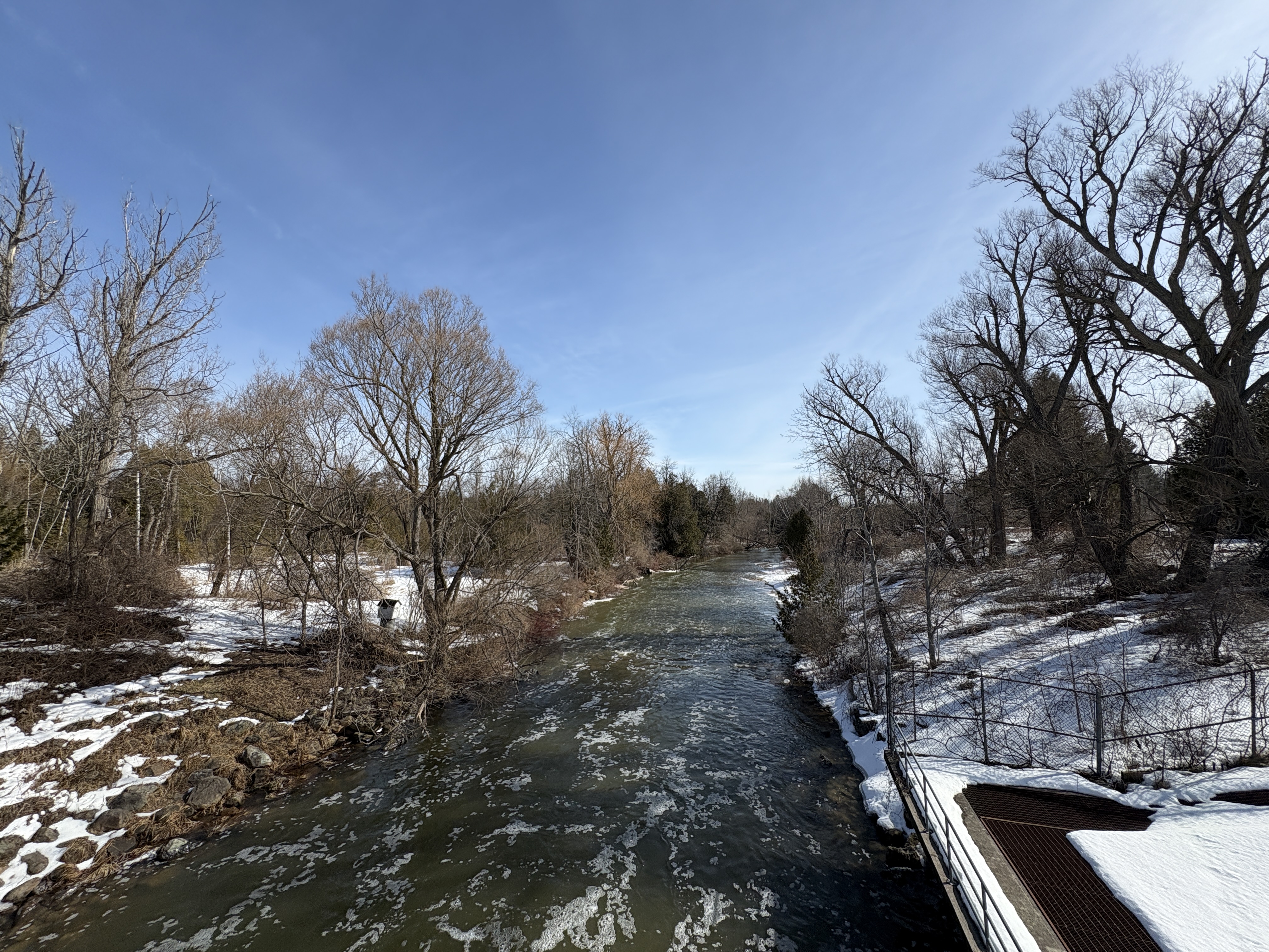
The first land purchase was from Dorothy and Bill Braden in 1957 when he was asked to sell some land on the south side of the Boyne River. The farm was 210 acres and he later agreed to sell an additional 60 acres on the north side of the river. The agreement included the provision that he would be given the position of park manager. With this understanding he resigned his job and started to plan the future park. The image below shows the Boyne River as it flows away from the dam.
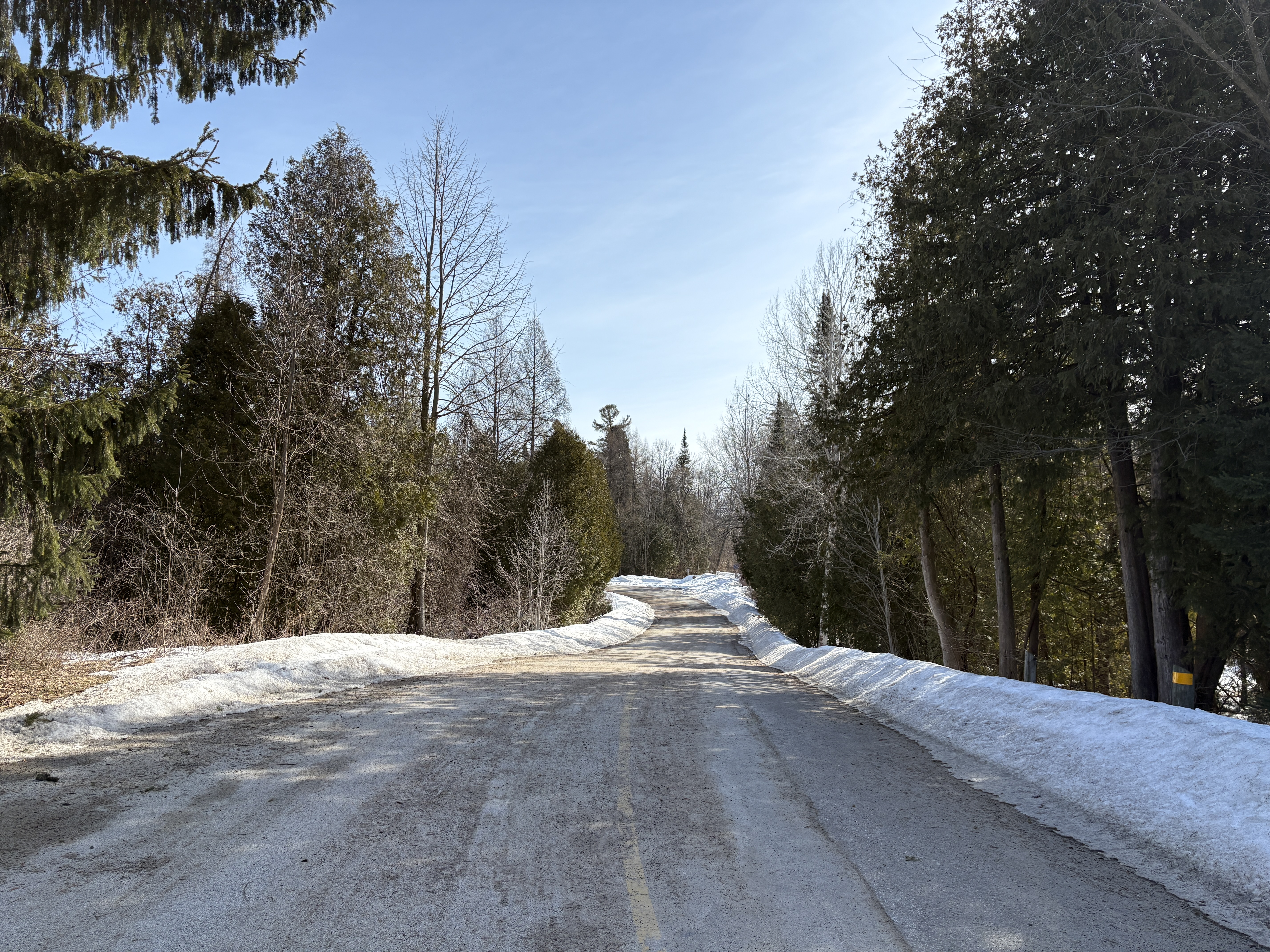
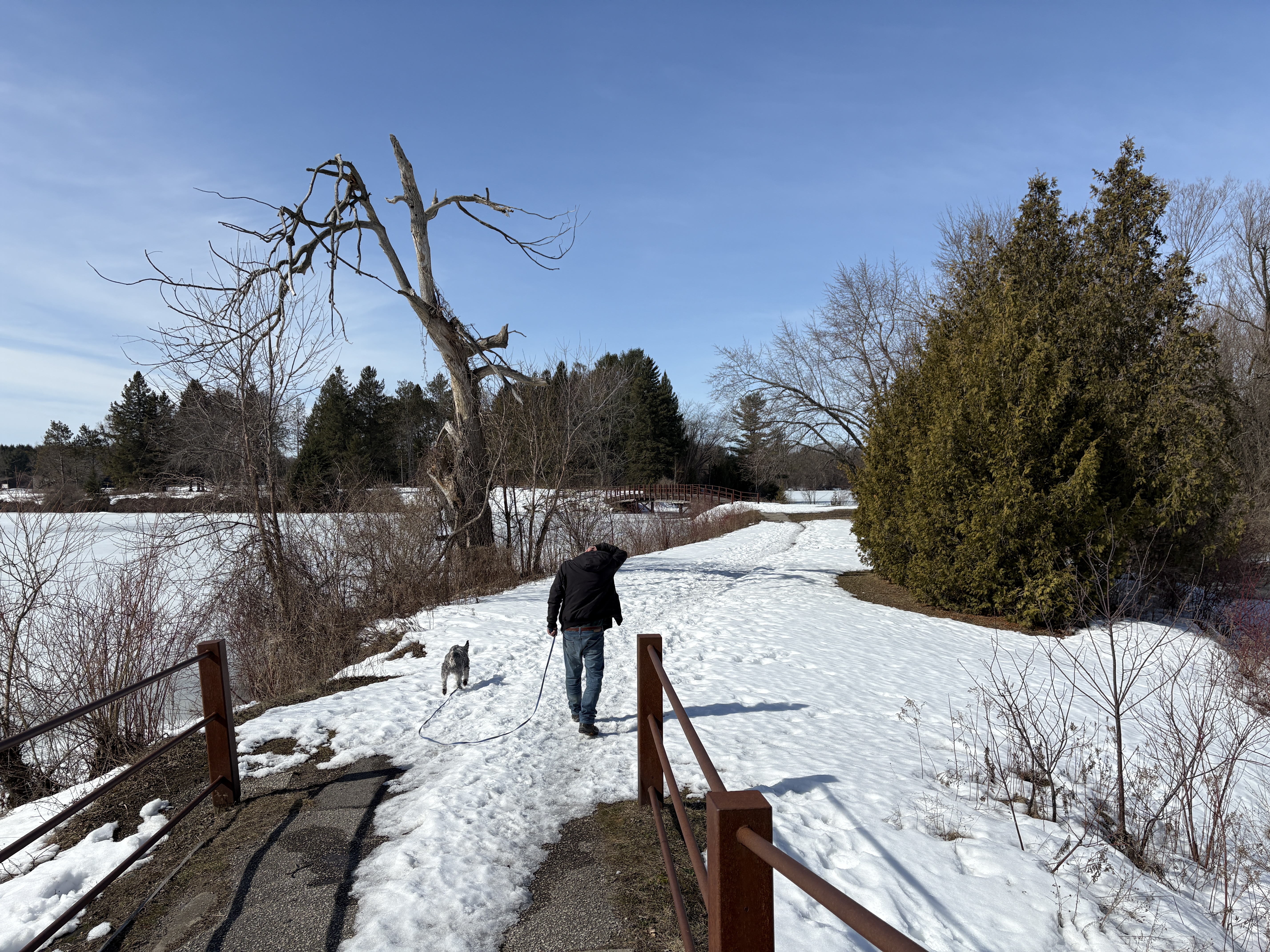
Creating a park out of a farm is a lot of work but Braden was up to the task and started hiring people to lay out the roads, build fences and create campsites. Washrooms and water were also needed and all of this was set up over the next few years. We stuck mostly to the roads on this visit although my brothers dog was quite interested in exploring the muddy and snow covered side trails. These are best left for when the ground is dry and you can walk them without creating a mess and damaging the plant life along the way. This is the road leading away from the dam and around the front section of Earl Rowe Lake.
William John Fletcher was a member of the founding family of Alliston and when he passed away in 1962 his farm became available. The Parks Department was quick to purchase it because it contained the old Fletcher mill site, the natural location for a dam along with the flood plain behind it. The dream of creating a big park with a lake became a reality and several other surrounding farms were purchased to create an 800 acre park.
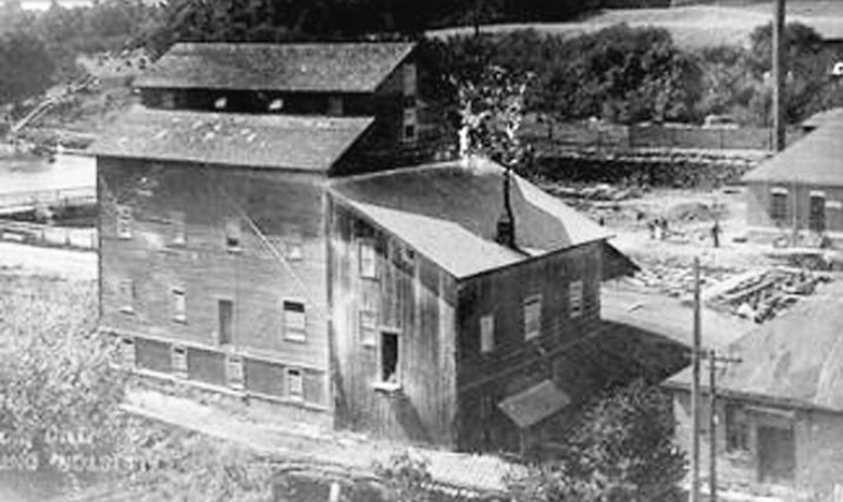
A lake was planned and a new dam built at the old dam site. Meanwhile the flood plain that had served as the former mill pond was sculpted to create a lake complete with islands and foot bridges. This undated archive photo of Fletcher’s mill shows one of his mills. The saw mill was erected in 1848 and the grist mill was opened in 1853. The grist mill closed in 1911.
There are six defined trails that run through the park and we basically stayed to the ones that connect West Beach with East Beach and forming a loop back to the parking lot.
The mill pond had been gone for decades but when the planks were finally dropped into the new dam the old flood plain was soon under water again. A fish ladder has been installed which allows fish to navigate around the dam and spawn in the upper parts of the Boyne River.
The lake now provides opportunities for people to go kayaking, canoeing, paddle boating and fishing. Many truckloads of sand were brought in to create two beaches. I remember the sand being blisteringly hot in the middle of the summer. For now it is still covered with snow.
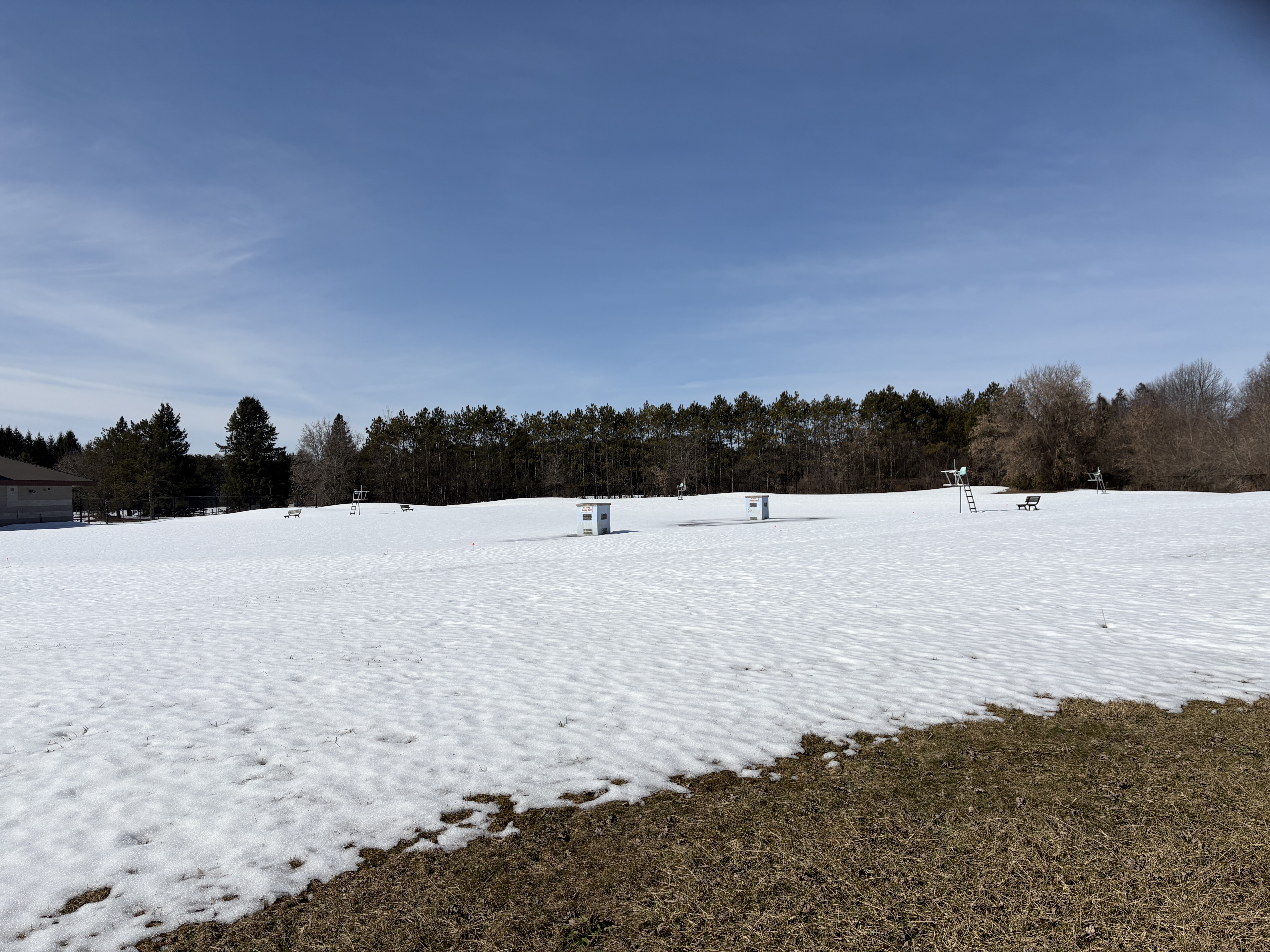
An outdoor swimming pool was added which was said to be the largest in Ontario at the time. It was licensed for a maximum of 1,500 people. When we visited, the only sign of the swimming pool was the lifeguard stations rising out of the snow.
Earl Rowe Provincial Park is interesting in the winter but I remember many good times here in the summer and may need to return this year to enjoy the park in another season.
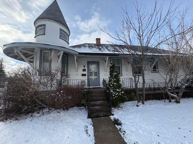
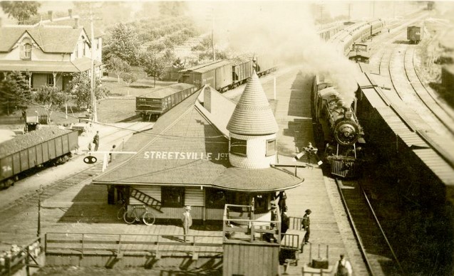
The city of Mississauga is made up of several historic communities and many of these had their own train stations in the 19th century as the railway lines were expanding across Canada. Heritage Mississauga lists five stations on the Credit Valley Railway (CVR). Summerville Station which was built in 1878 and has apparently been in storage since 1978. Cooksville Station was built in 1878 and destroyed by fire in 1883. Meadowvale Station was built in 1878 and demolished in 1976. Erindale Station was built in 1879 and demolished in the 1950s. Streetsville Junction Station was built in 1879 and replaced in 1914 with a new station. The station was then moved to its present location. The historic image below shows Streetsville Junction as it appeared in 1913, prior to being decommissioned and moved to its current location the following year. The “front” of the station was built facing the line to St. Thomas as this was correctly assessed as the busier of the two lines. The line to Orangeville approached the station from the rear.
George Laidlaw was instrumental in the construction of several railways in Ontario including the Toronto & Nipissing which passed through Goodwood. He was also behind the Toronto, Grey & Bruce which saw the Horseshoe Curve Rail Disaster in 1917. The CVR was incorporated Feb. 15, 1871 to build from Toronto to Orangeville with a stop in Streetsville. In 1872 an amendment was made to the charter to allow a line through Cataract to Elora and an 1873 amendment allowed construction to St. Thomas.
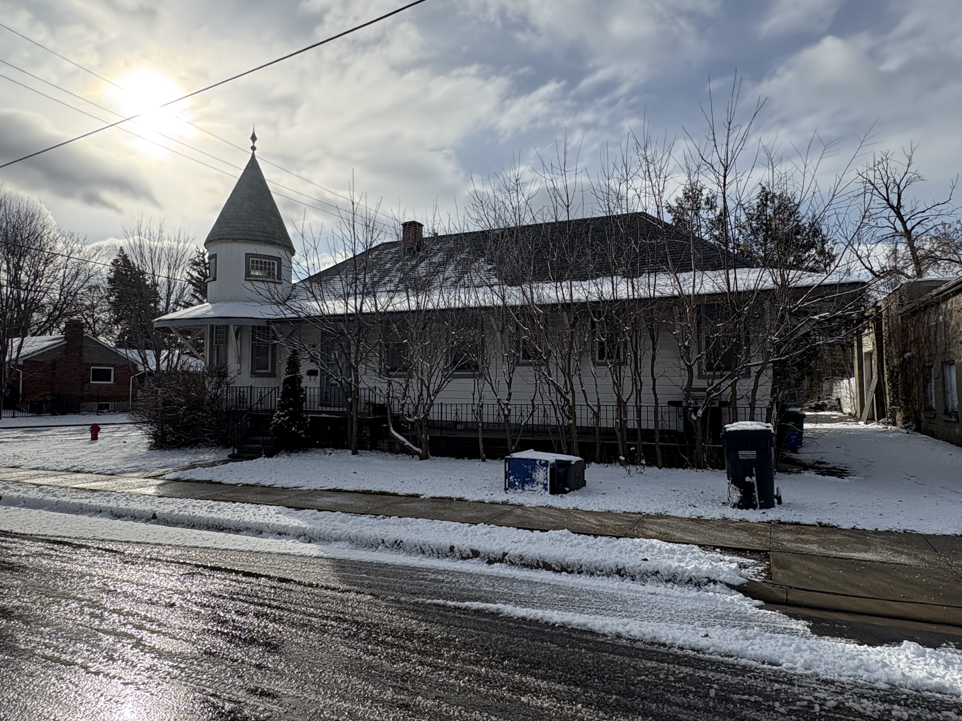
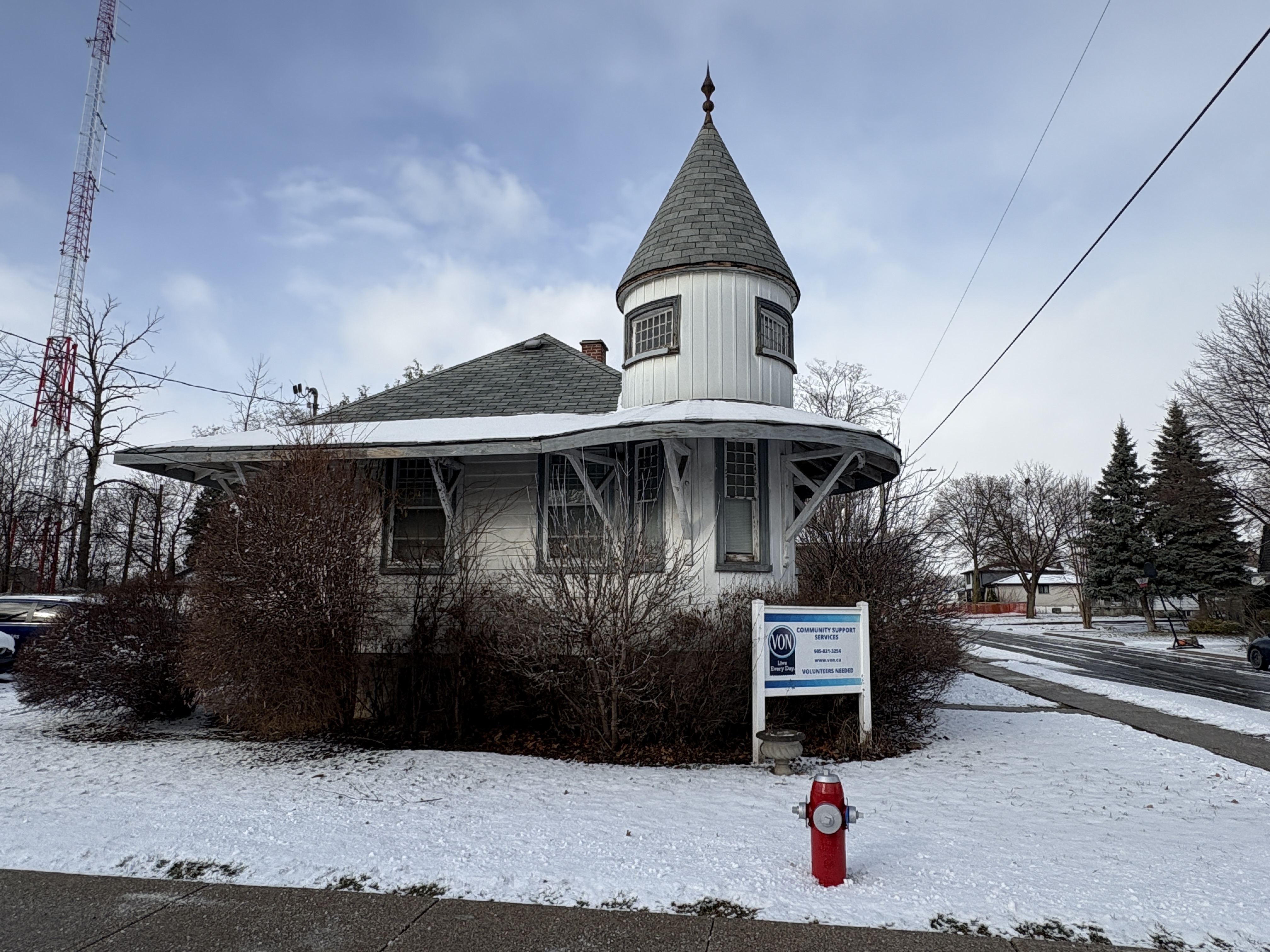
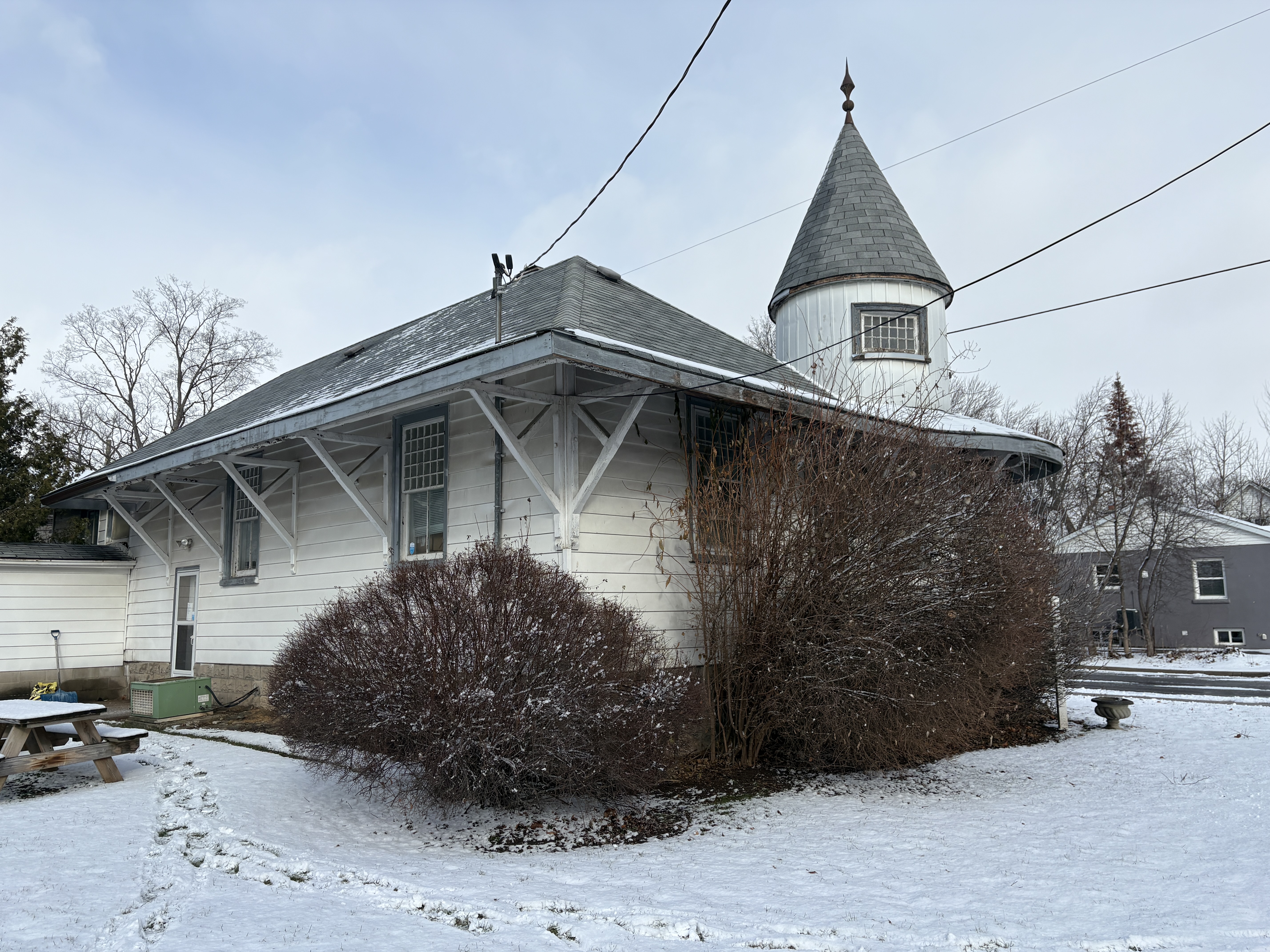
The station in Streetsville was built about 1.5 kilometres north of the main part of town at the point where the CVR split with one set of tracks going to Orangeville and the other going to St. Thomas. The rectangular building features a two storey turret on the south-east corner. The tower was decorative as well as practical as it allowed view down both sets of tracks to see what traffic was on the line at Streestville Junction. The tower still shows its board and batten construction although the rest of the building has been clad over in aluminum siding.
Survey work on the line began in 1873 and grading followed the next year. Track laying began in 1876 and the first train arrived in Streetsville on September 1, 1879. This is also the month that the 1,146 foot long trestle at the Forks of the Credit was completed. The line was finished in 1881 but it was already in talks with the Great Western Railway because of financial troubles. On November 30, 1883 the CVR and the London Junction Railway were amalgamated into the Ontario & Quebec Railway. This was then absorbed into the Canadian Pacific Railway (CPR) on January 4, 1884.
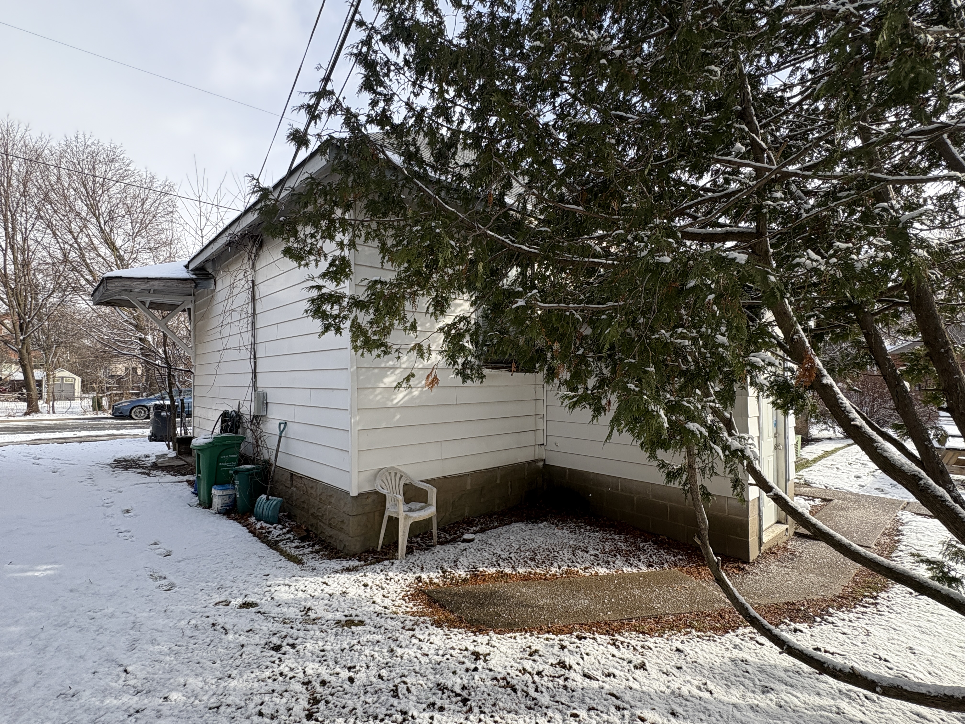
Due to the fact that the CVR station was built outside of Streetsville it wasn’t convenient for the residents to use. A small passenger shelter was built at the end of Old Station road to accommodate them. As passenger service increased it was decided to build a new Streetsville Station which opened in 1914 about halfway between the two existing stations. At that time the old junction station was set to be demolished. Ephraim Evans bought it and had it moved to its present location on Ontario Street. He converted it into a residence and today it serves as the Community Support Services building for the VON.
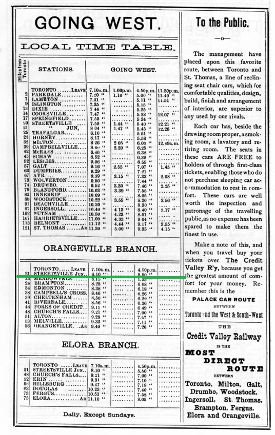
This 1883 timetable was taken from Old Time Trains on www.trainweb.org and further reading can be found there. Streetsville Junction was on the Orangeville Branch and is underlined in green.
It’s nice to see this historic train station preserved as an example of 19th century railway station construction.