Category Archives: Don River

Frank O’Connor – Estates of the GTA

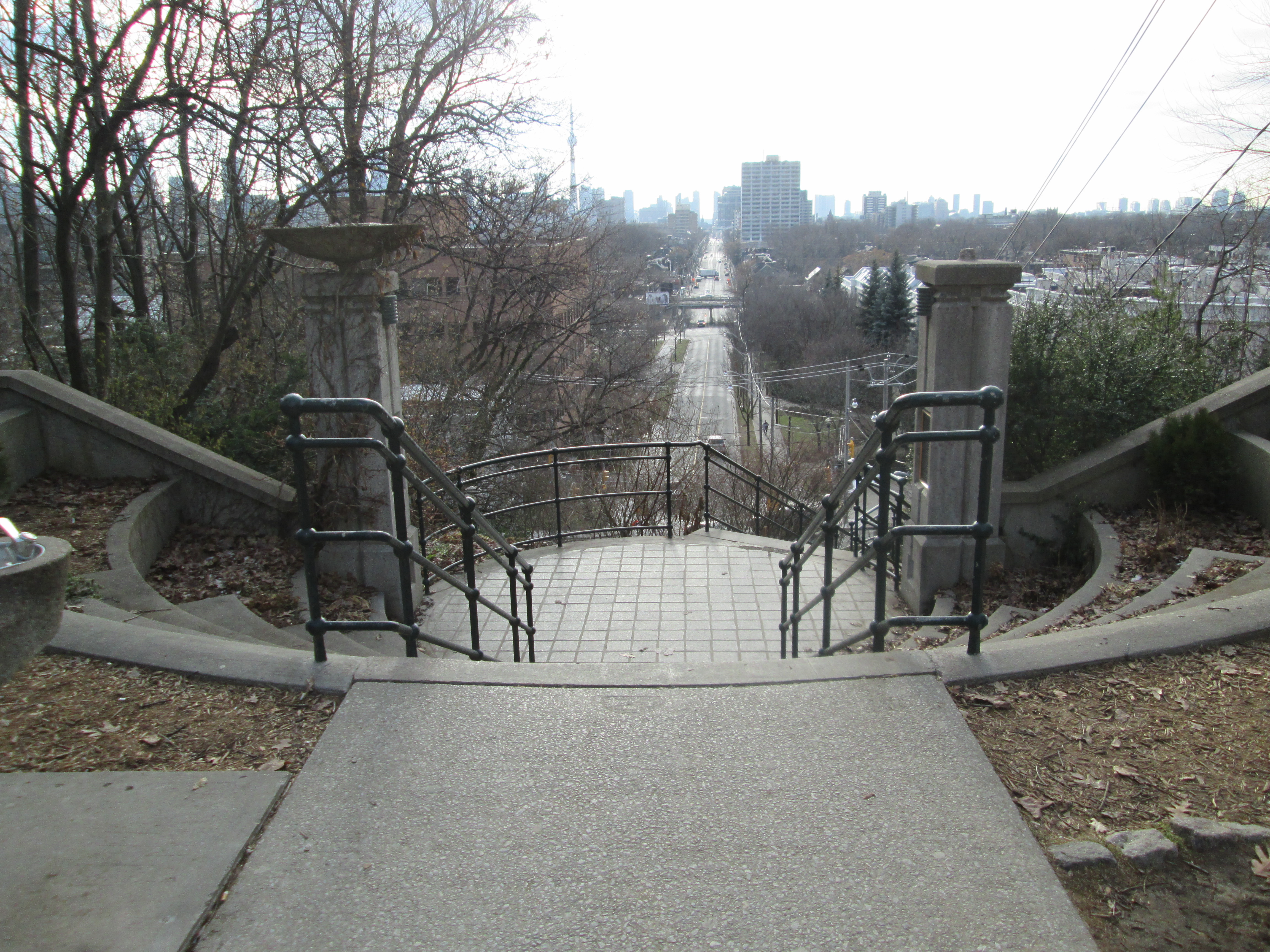
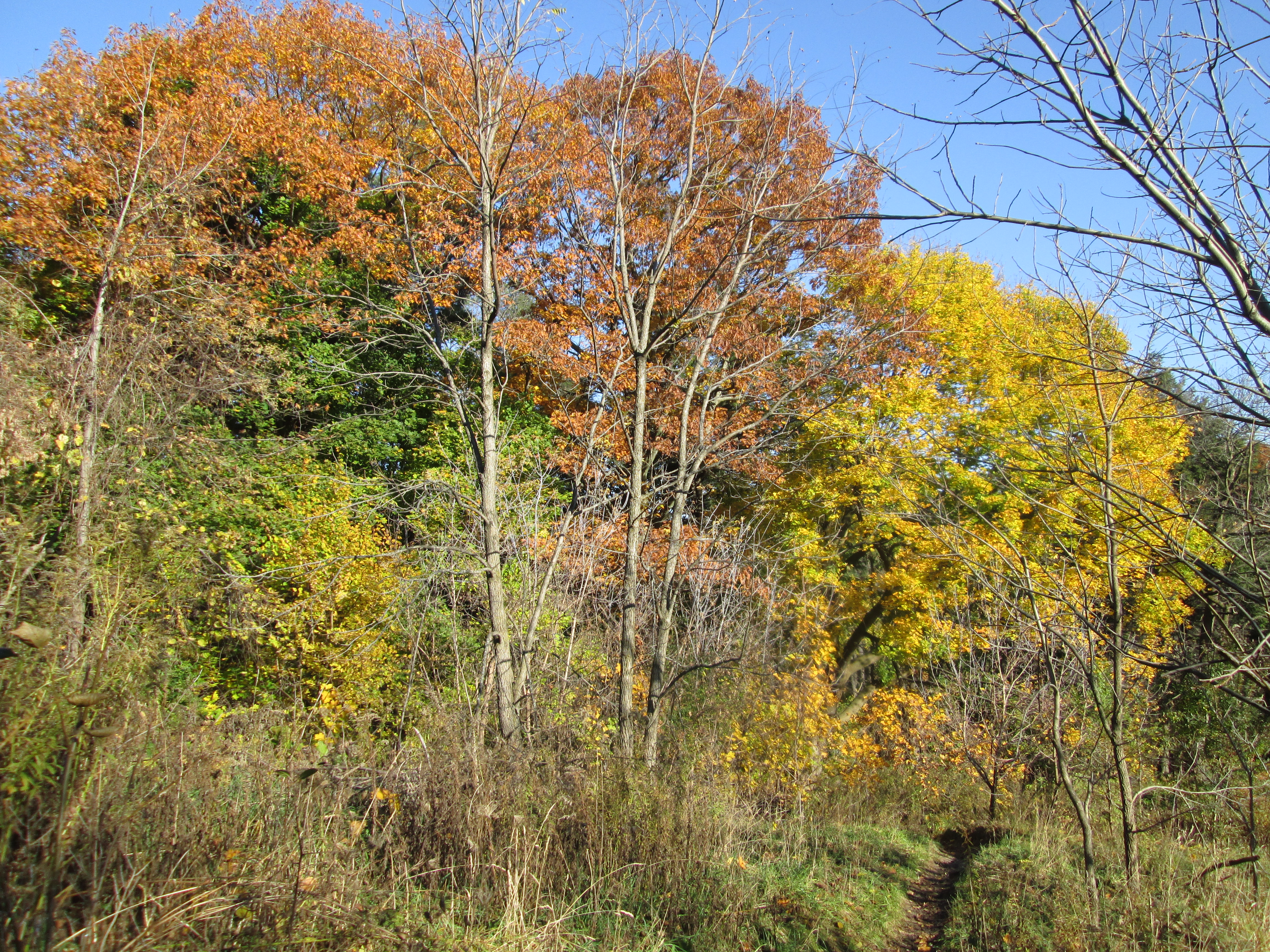
Sunday Feb. 22, 2015

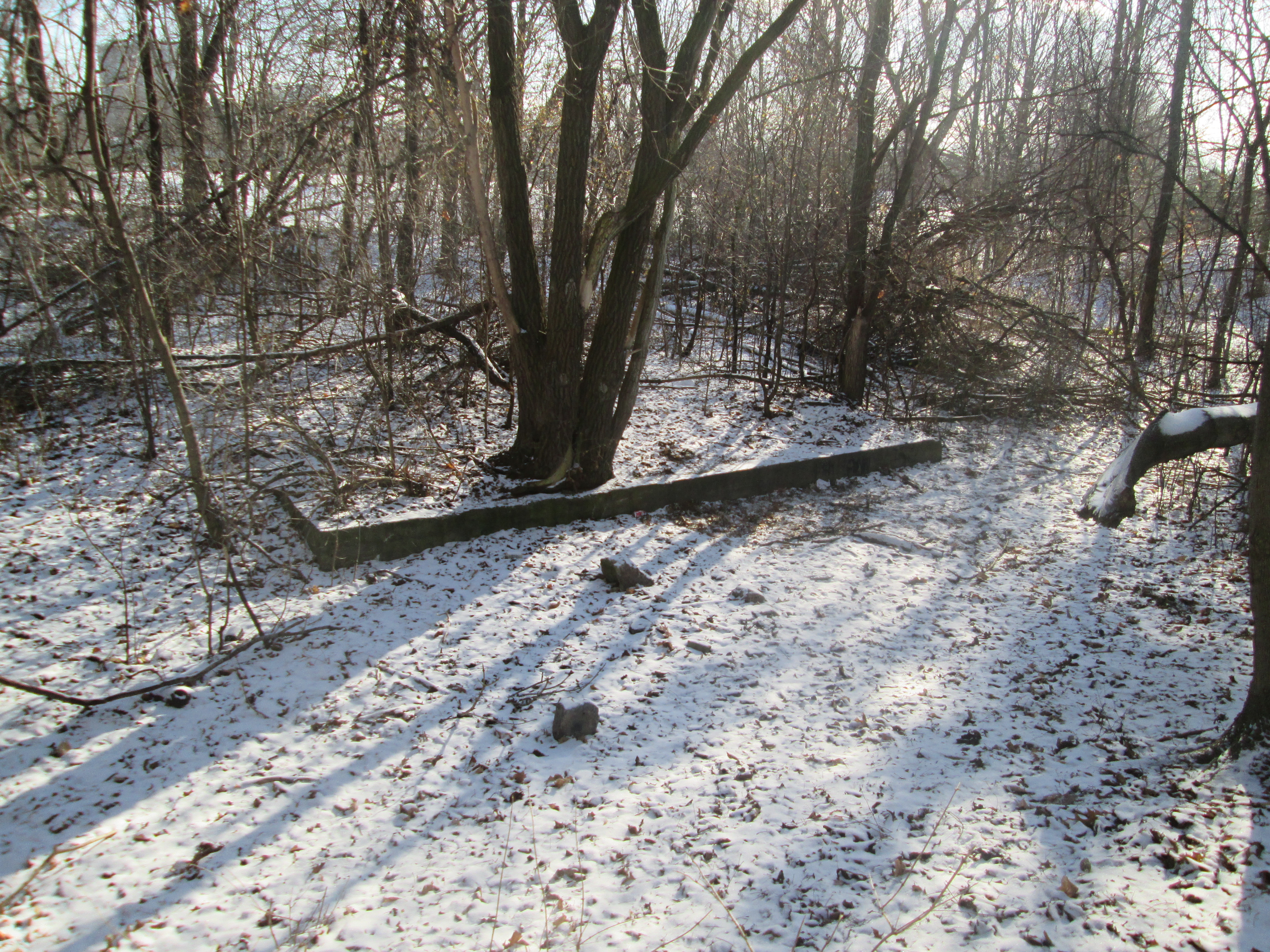
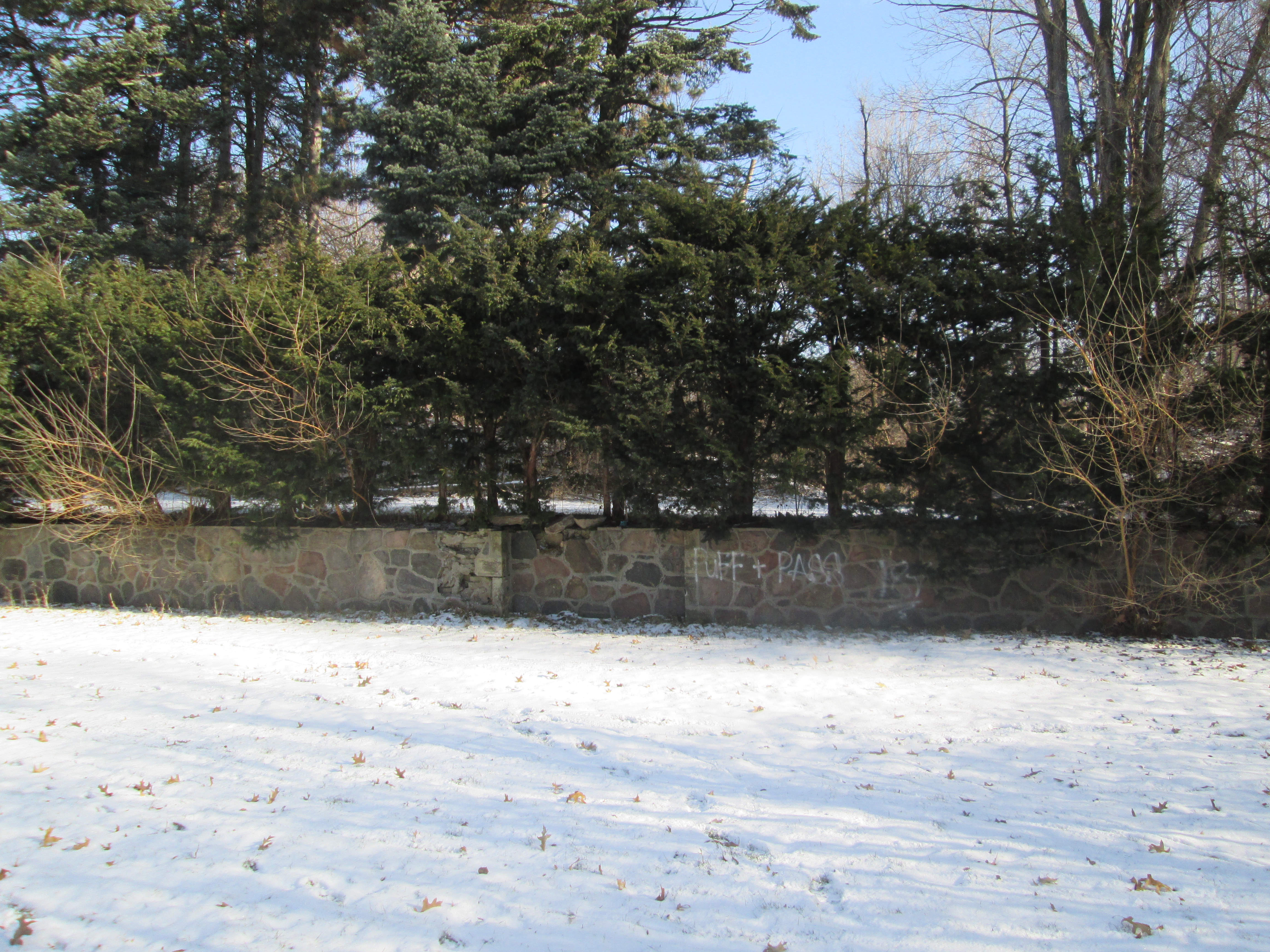
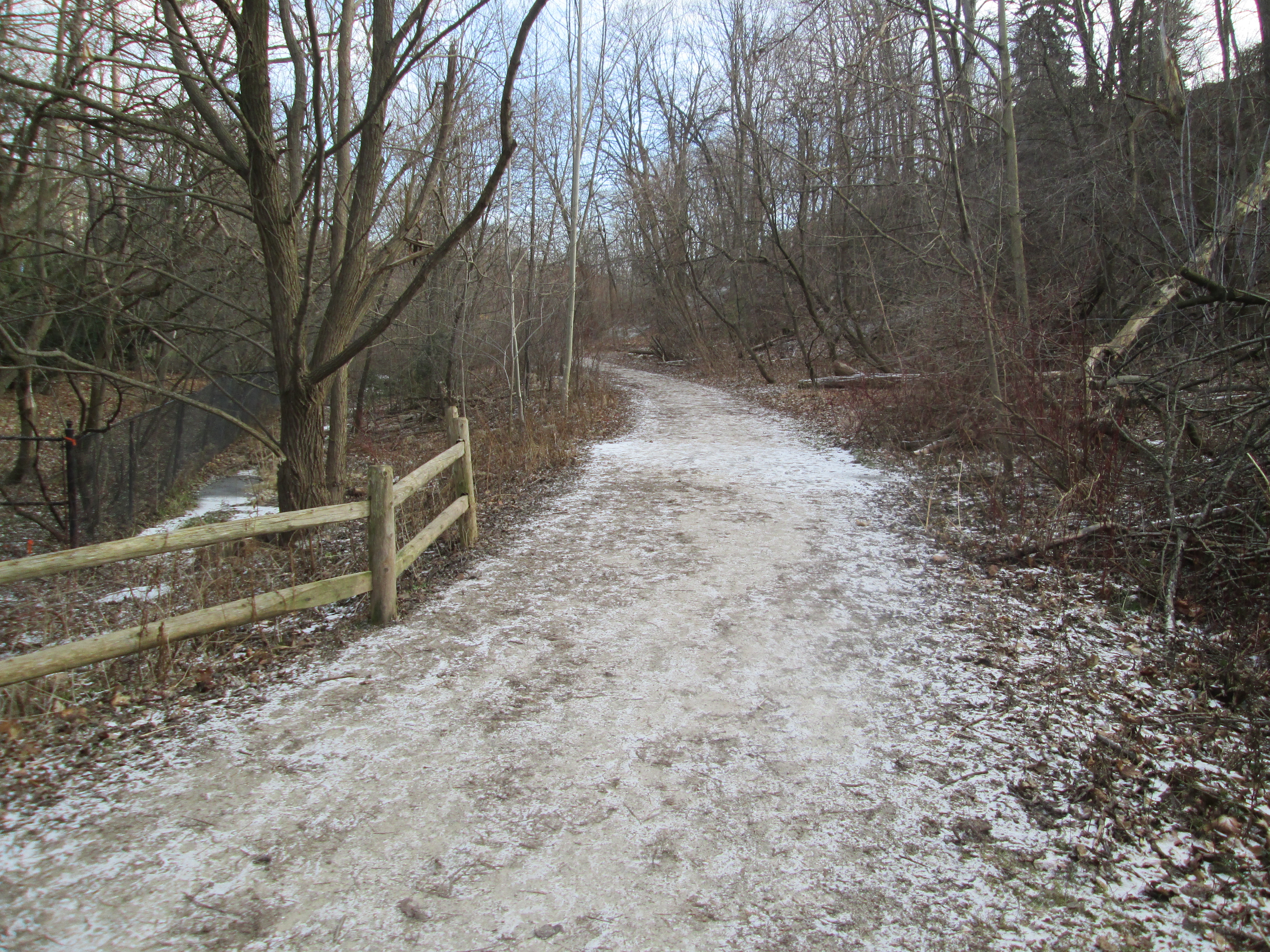
Family emergencies precluded any extended hike this weekend but I was able to take a few minutes to visit an historic estate in my neighbourhood.

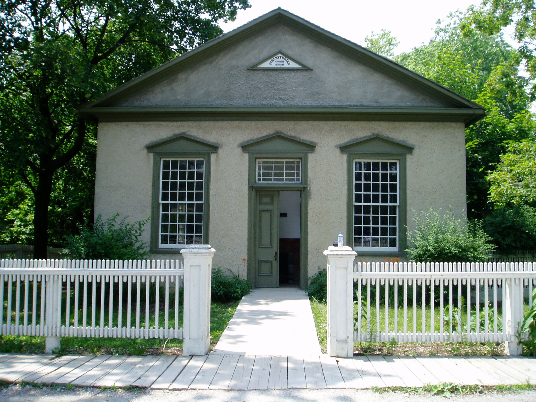
Frank O’Connor was born in Desoronto in 1885 and after marrying Mary Ellen Hayes he moved to Toronto.  In 1913 they opened a small candy store at 354 Yonge Street.  The city was busy celebrating the 100th Anniversary of the Battle of York (Apr. 27, 1813) from the war of 1812. To capitalize on the current air of patriotism the O’Connors decided to name their candy store after Canada’s most famous war heroine and mark the 100th anniversary of her legendary walk.

On the evening of June 21, 1813 the American military entered the Secord home in Queenston and forced Laura to serve them dinner.  After dinner she overheard their plans to carry out a surprise attack on the small British force at Beaver Dams (Thorold).  The following morning she began a 10 mile journey through swamps and briers to the stone house where the British lieutenant James Fitzgibbon was stationed.  As she climbed out of the swamp several hours later she was surrounded by a band of Iroquois who escorted her to her destination.  After an ambush by 400 Indian warriors, the American forces were ready to surrender and Fitzgibbon took 462 prisoners.  Laura Secord’s advance notice of the impending attack led to a decisive British victory and the use of her name led to a successful candy franchise.  Today there are over 120 Laura Secord stores, making it Canada’s largest chocolatier.

20130413ad1921

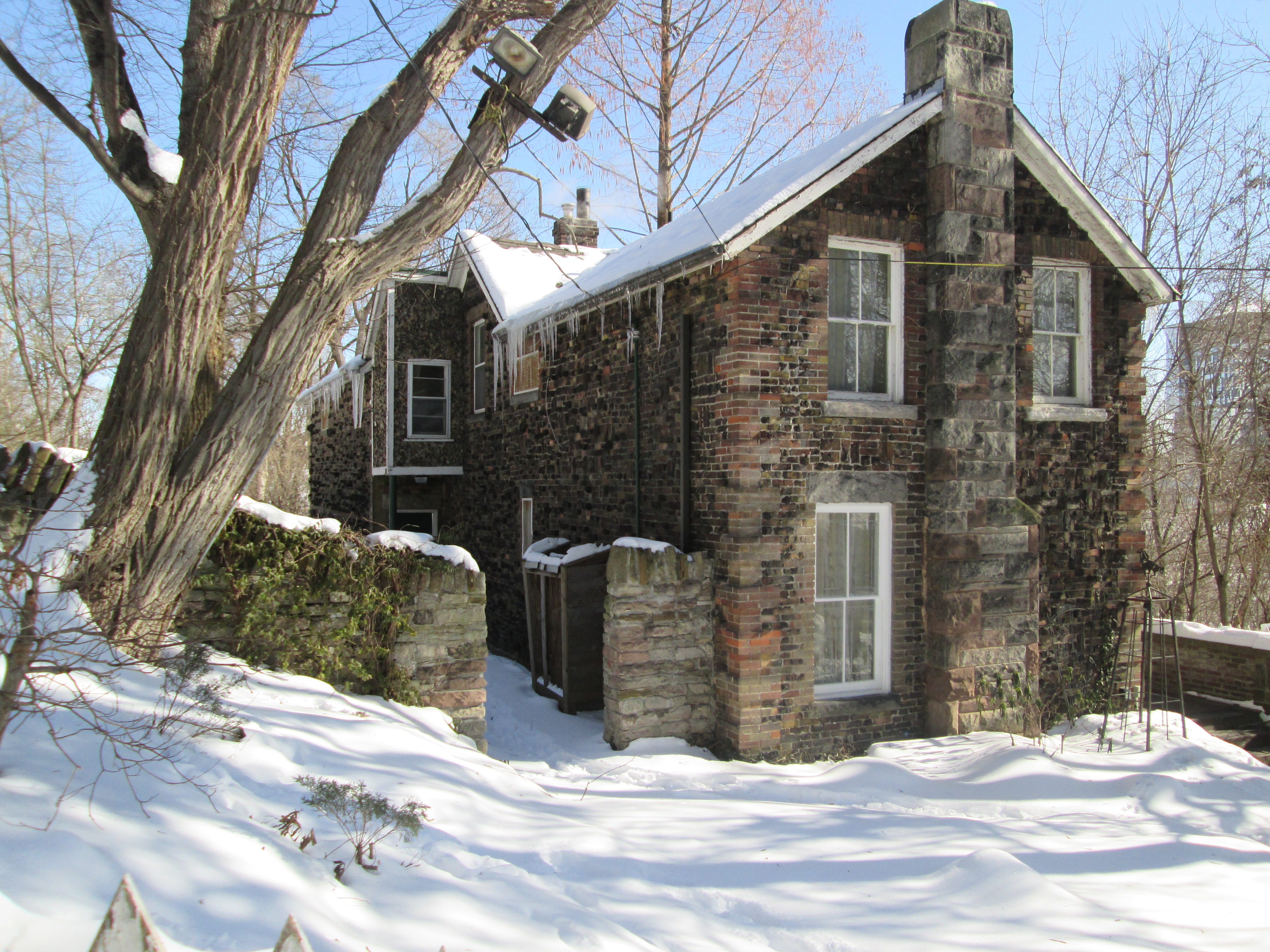
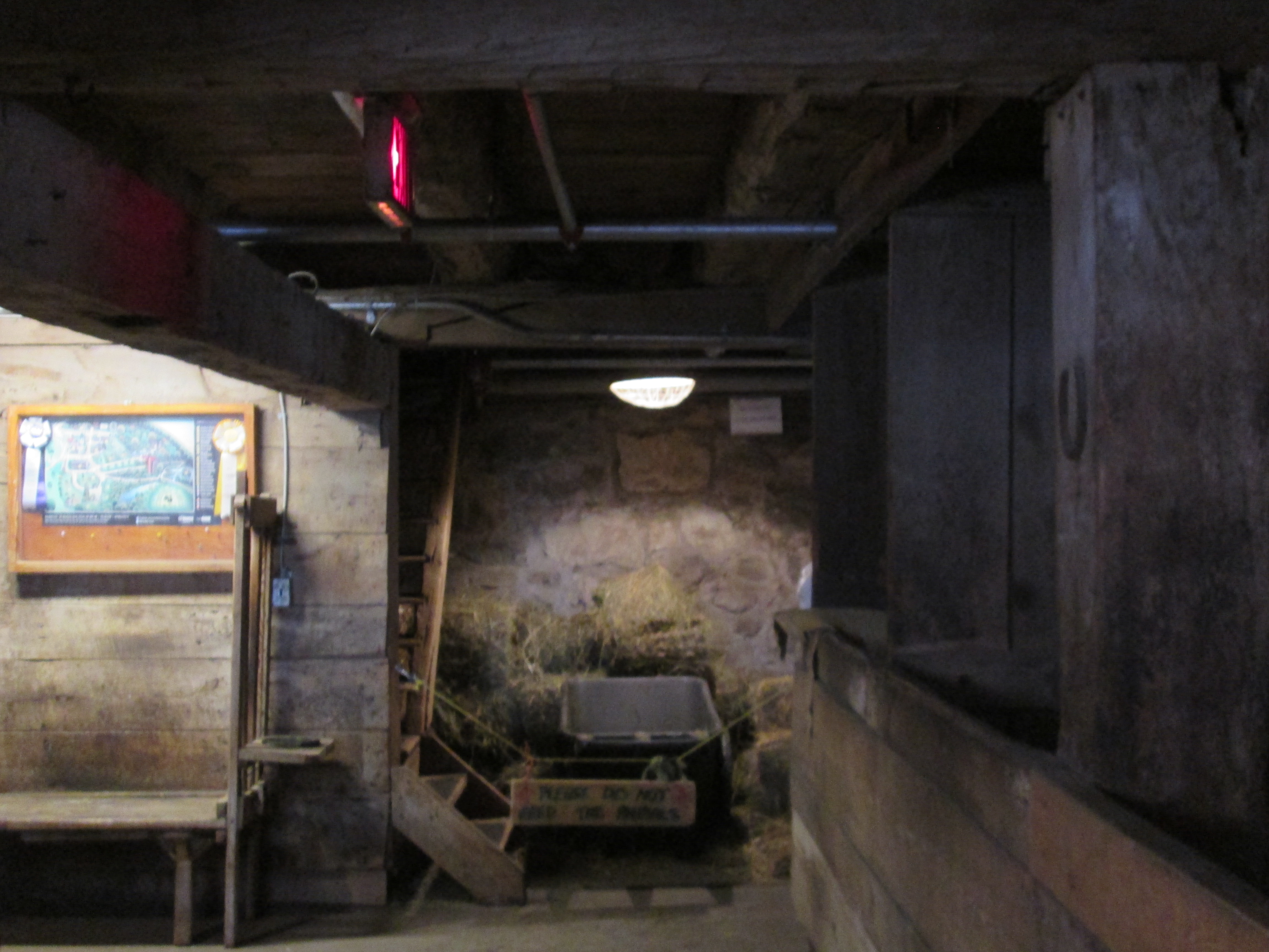
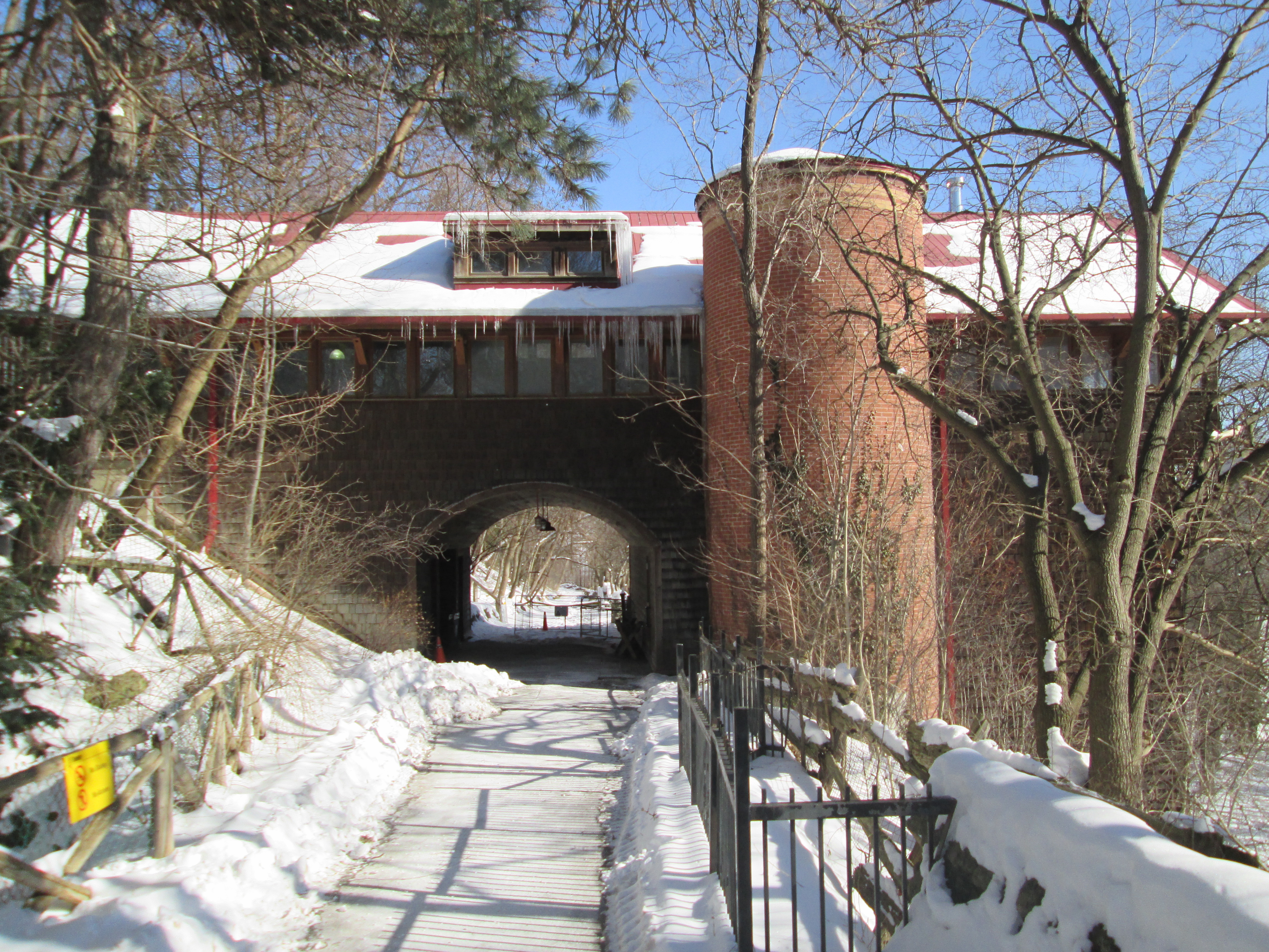
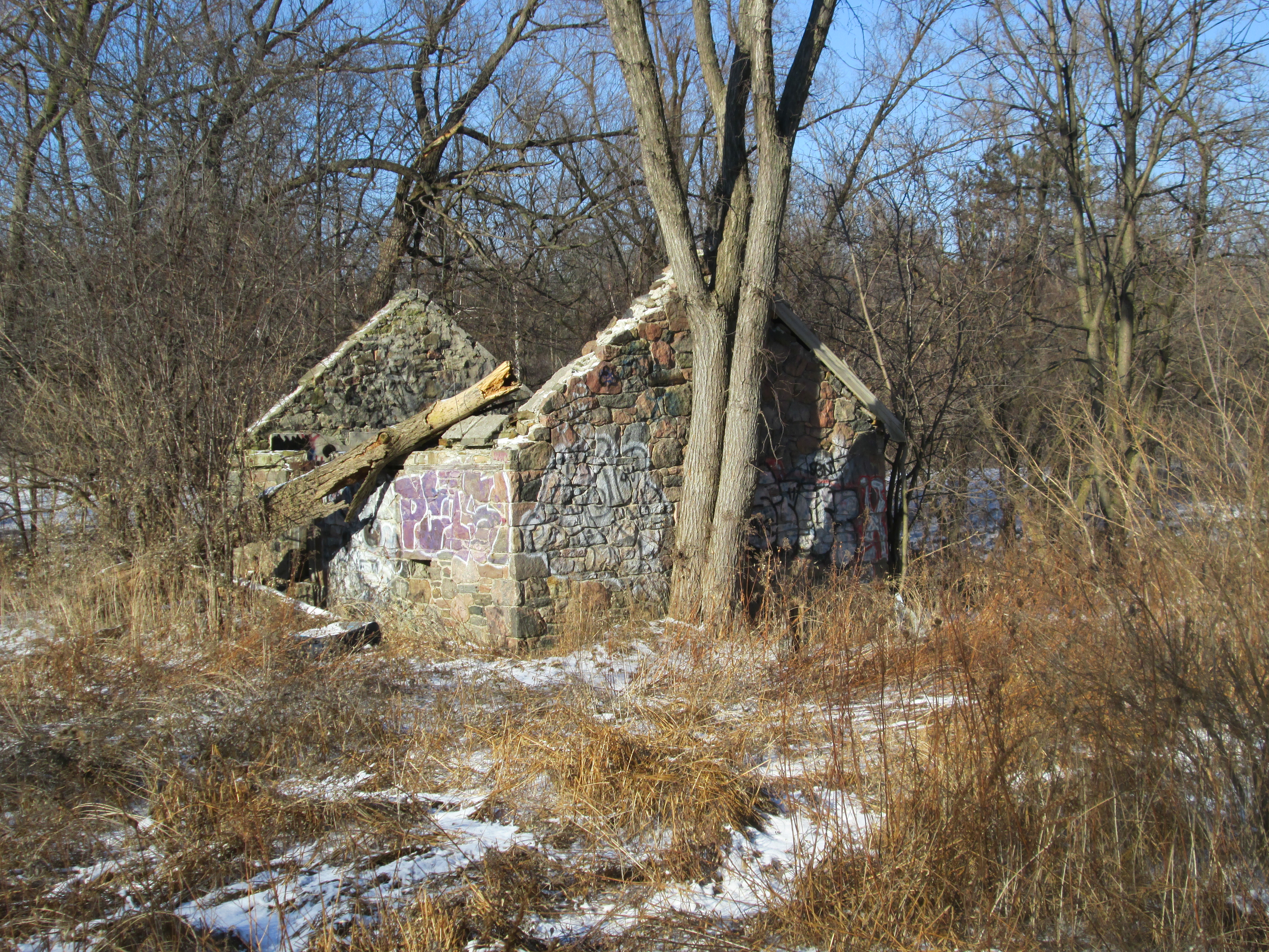
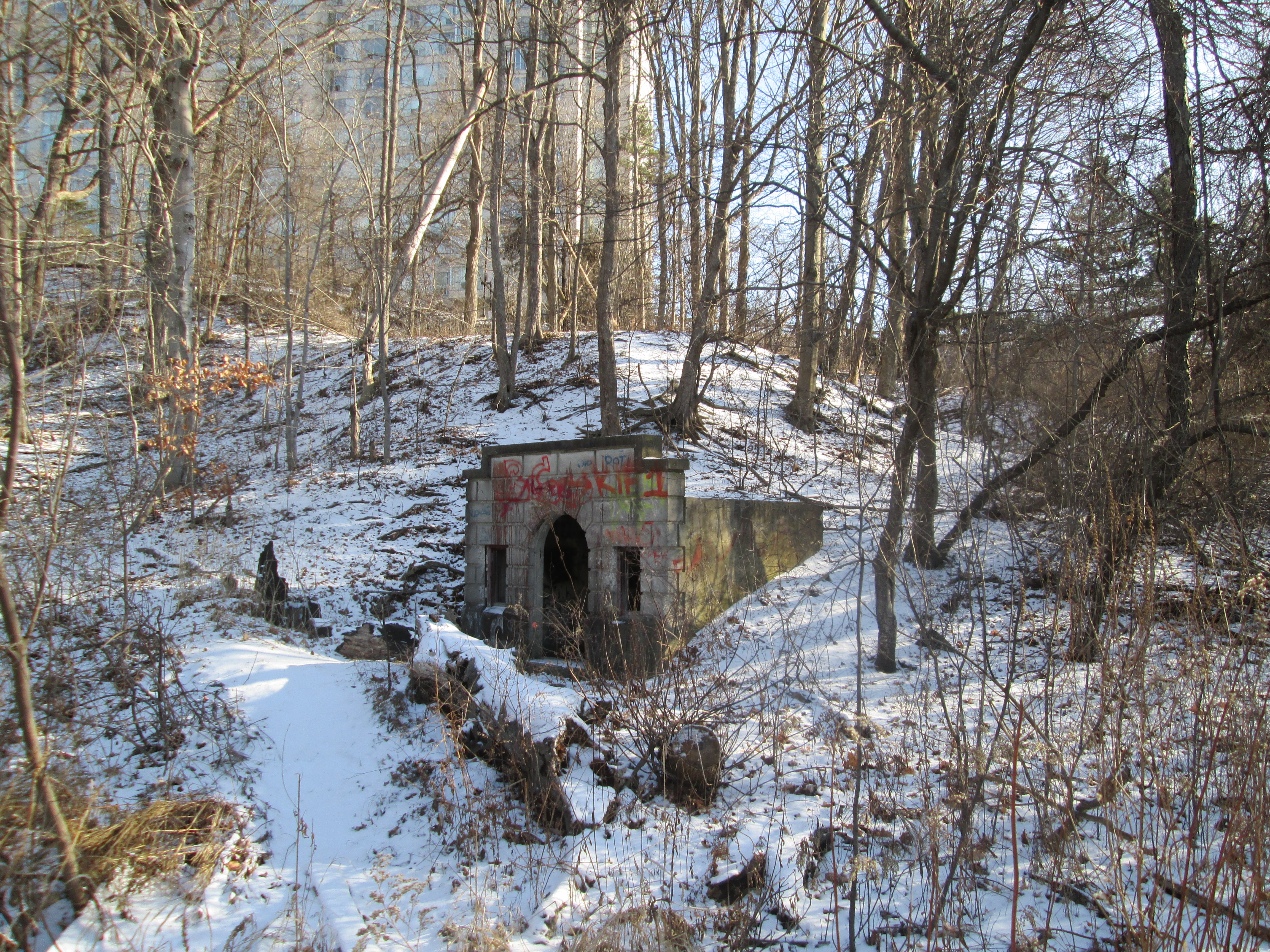
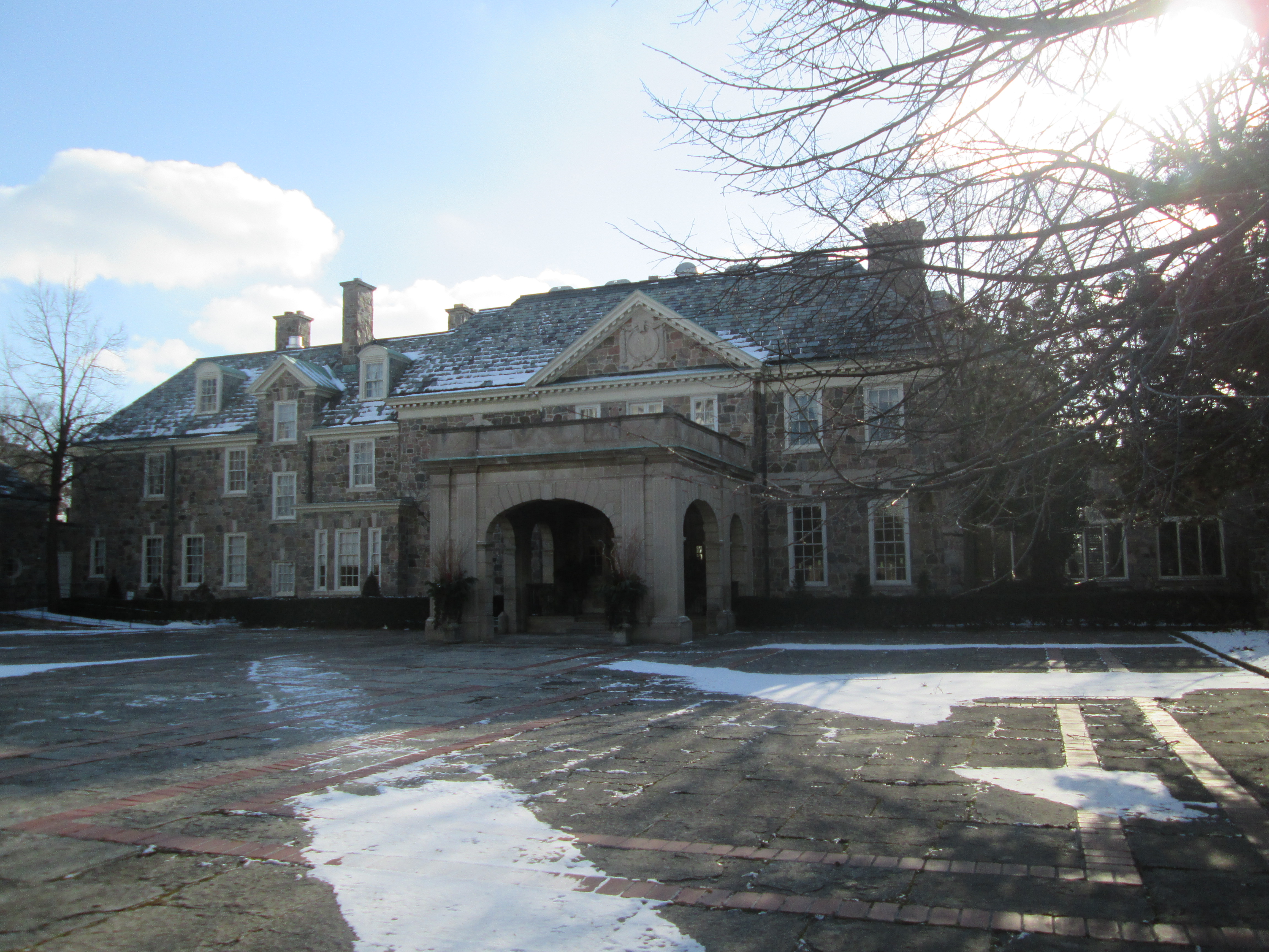
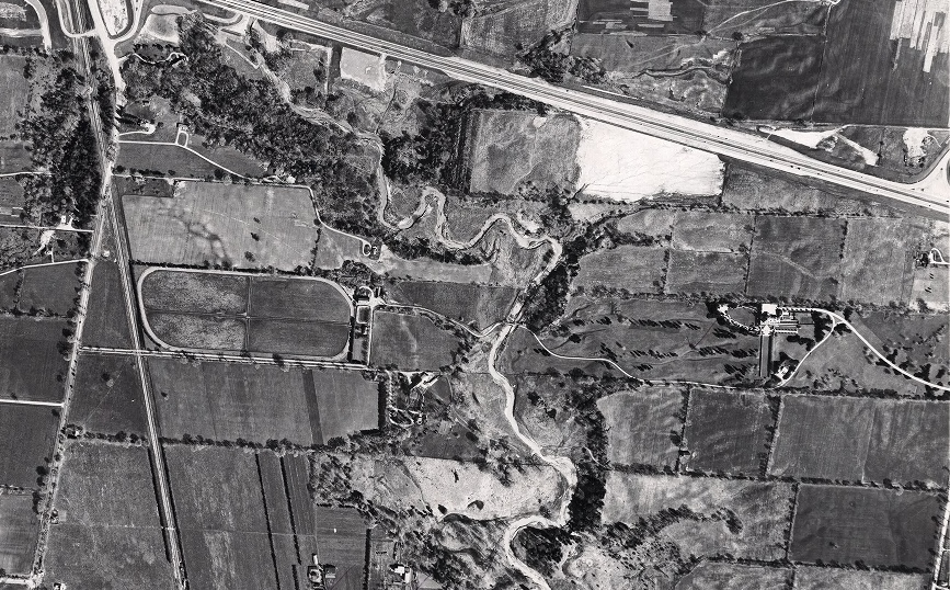
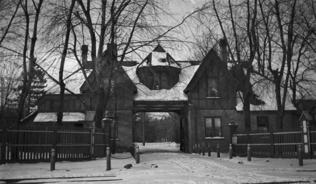
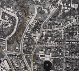
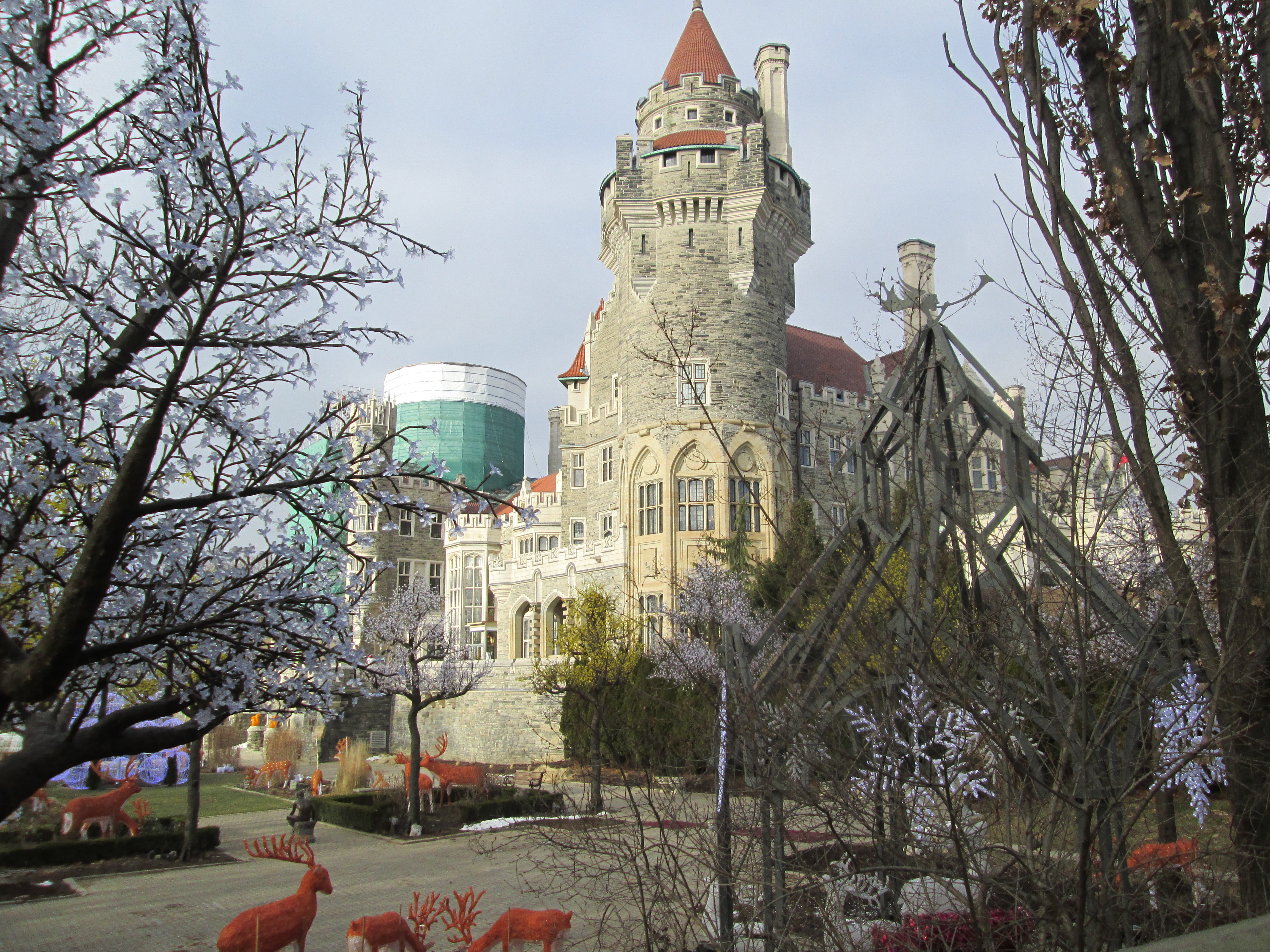
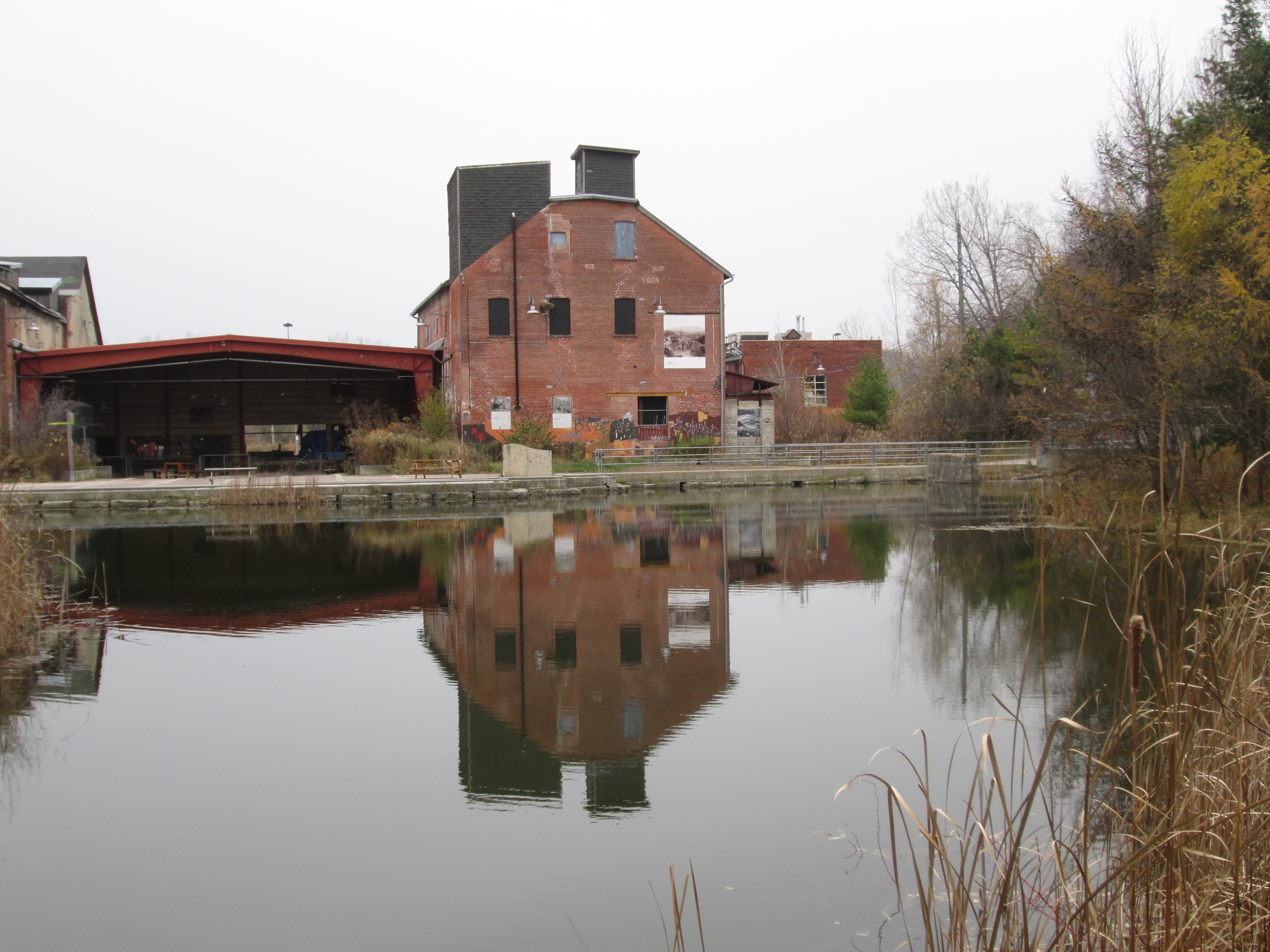
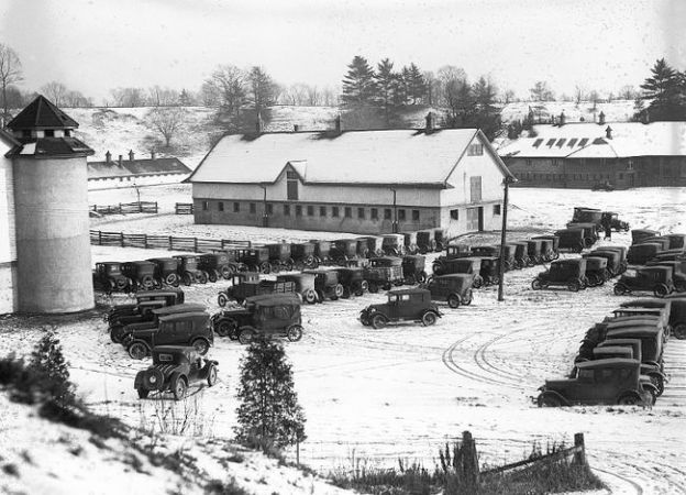
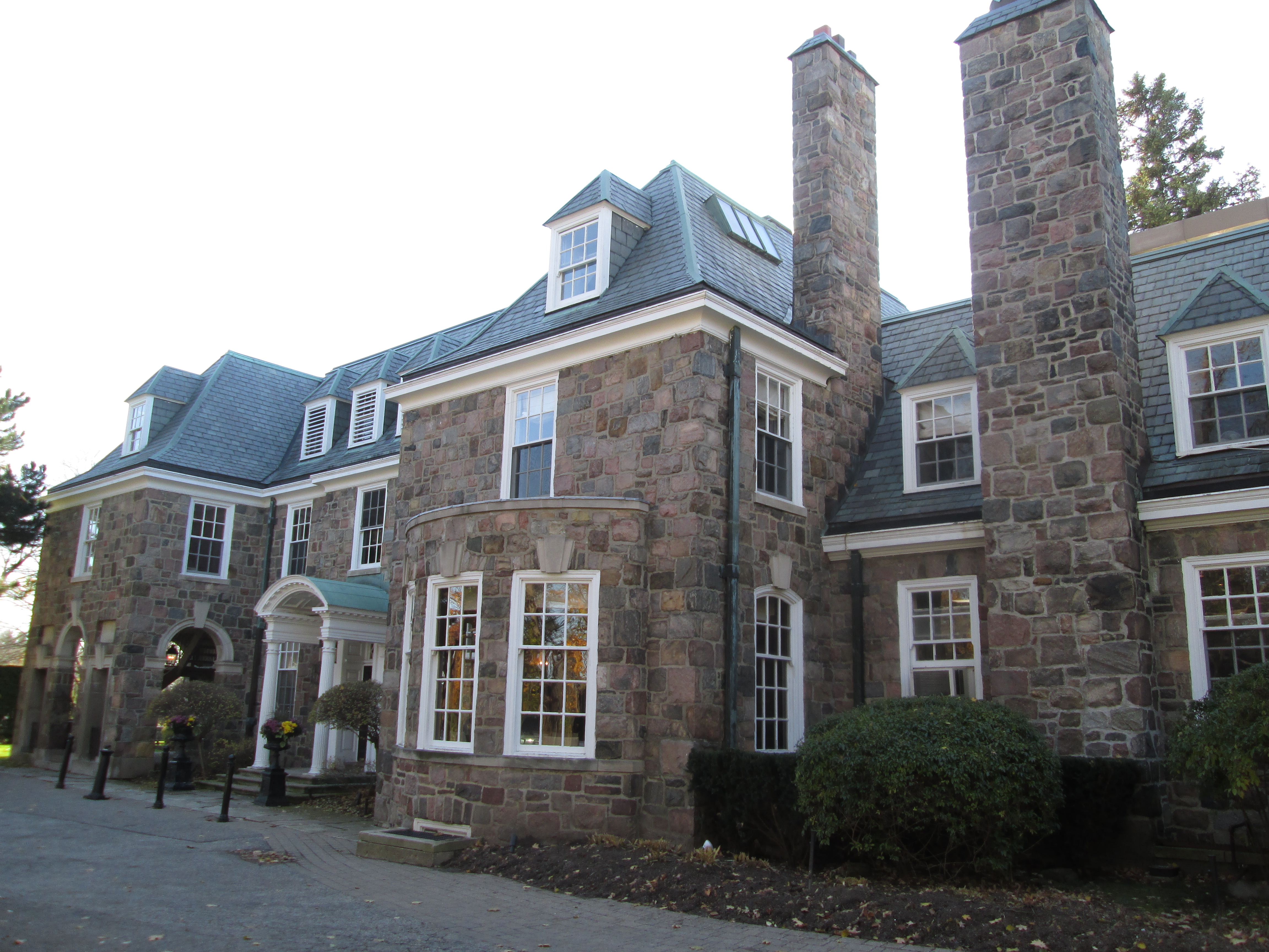
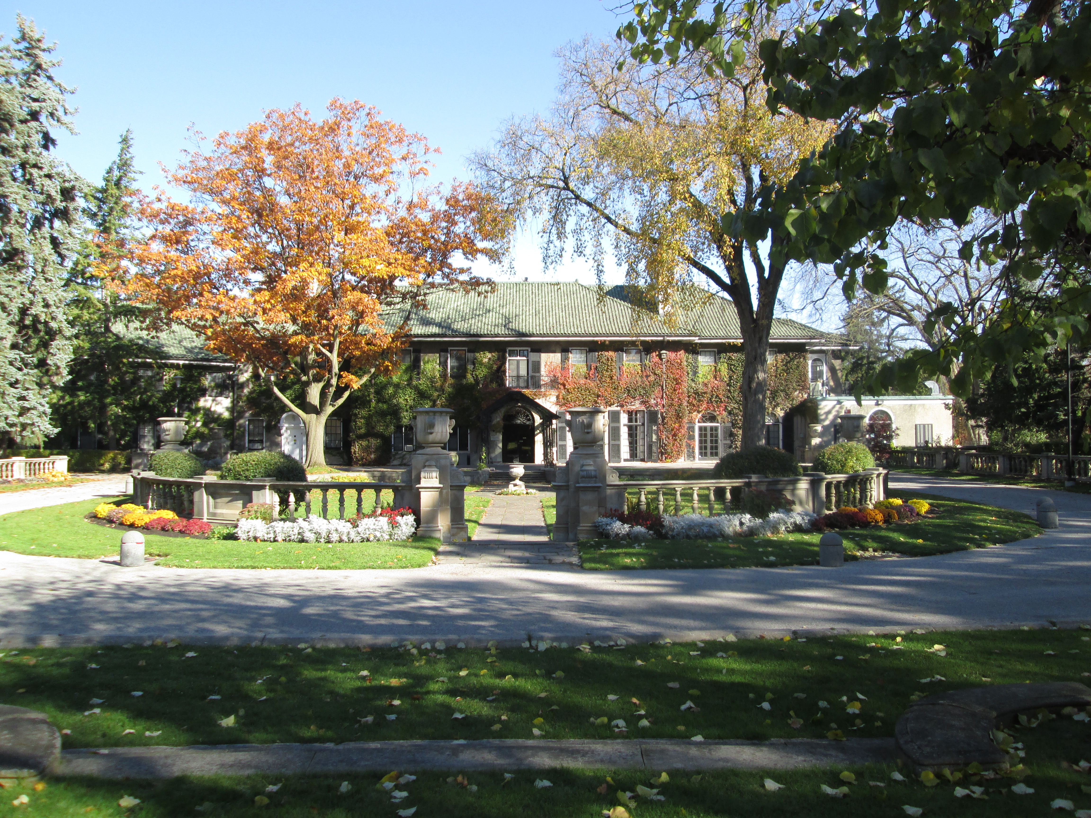
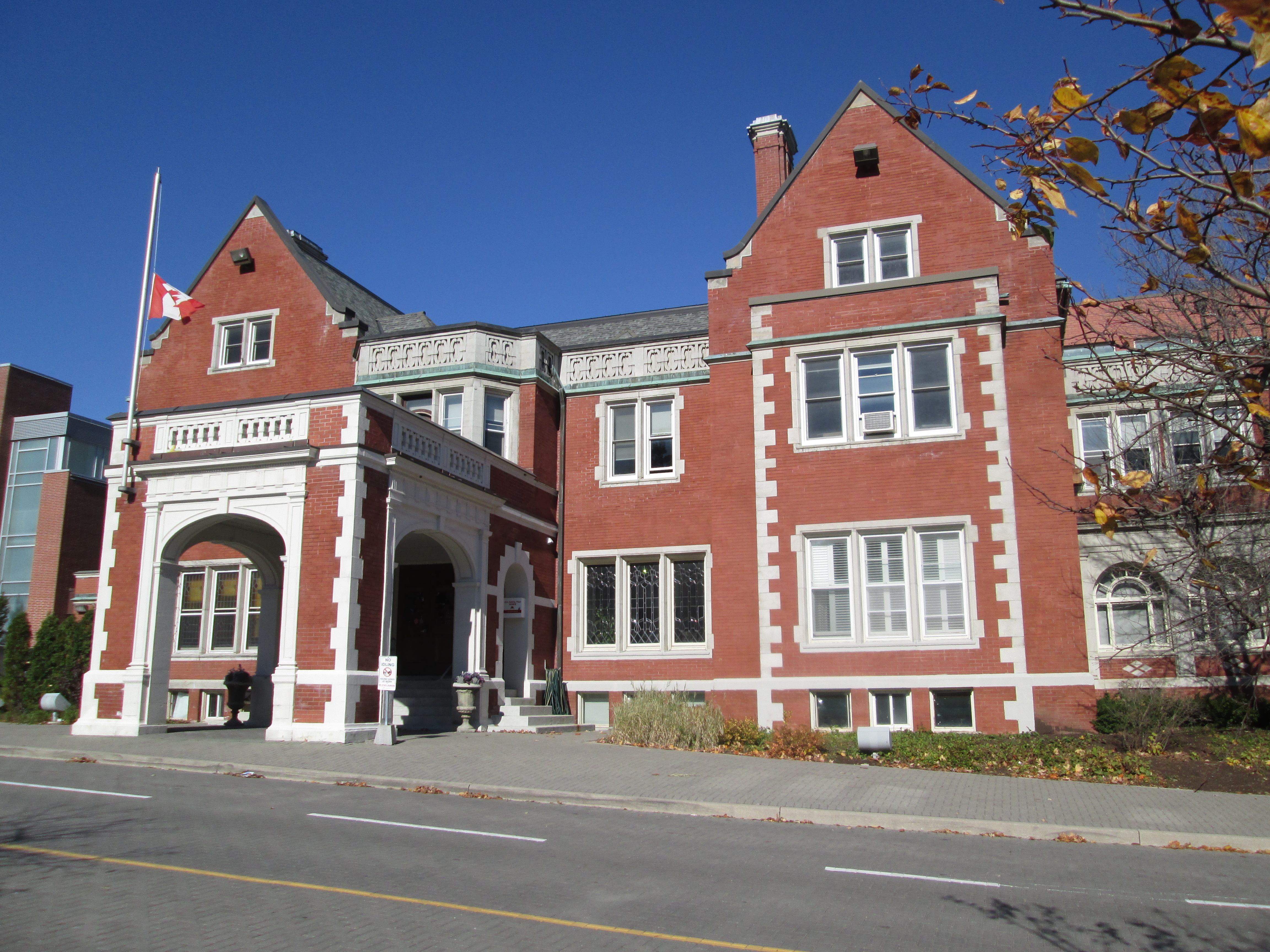
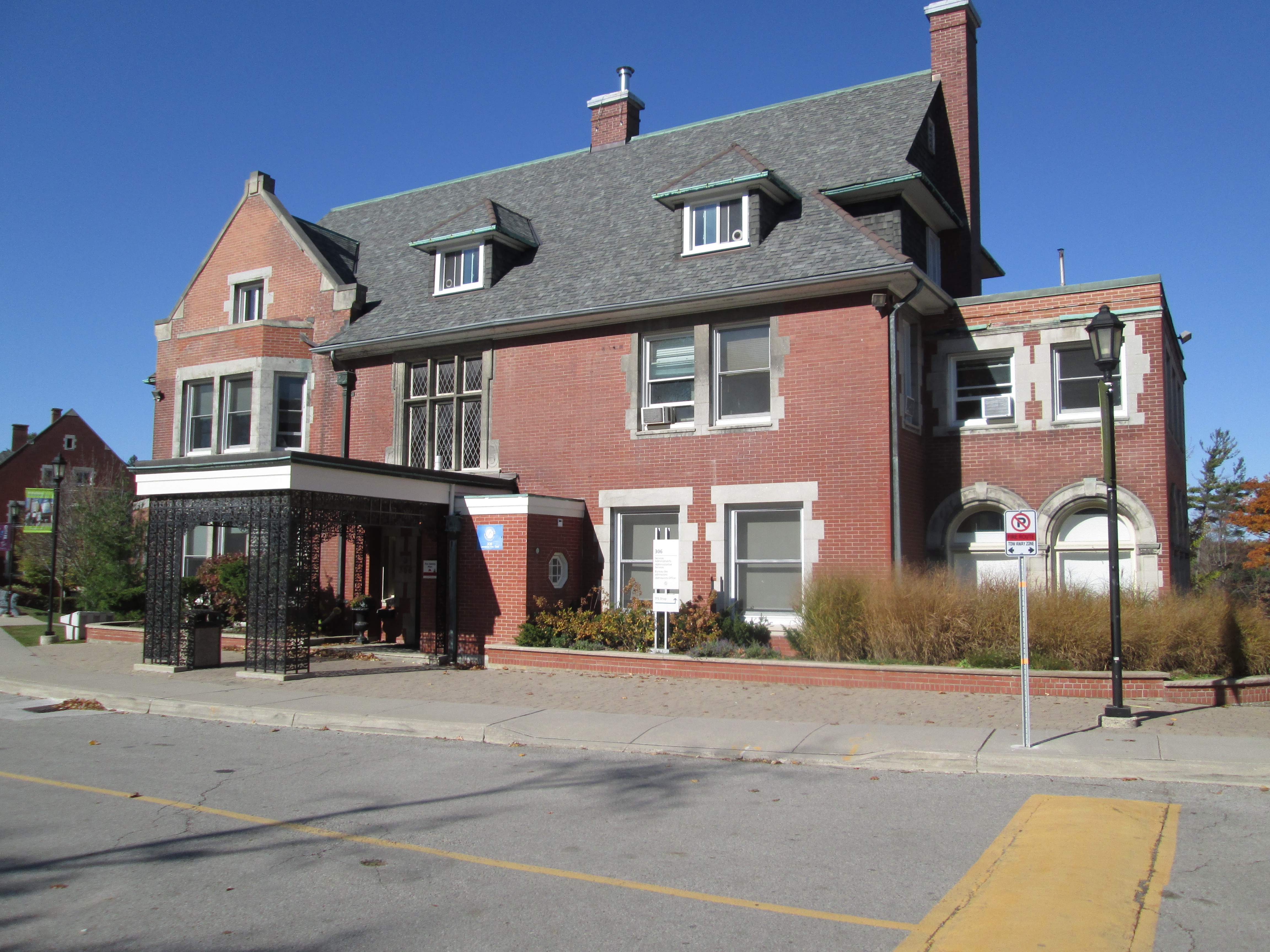
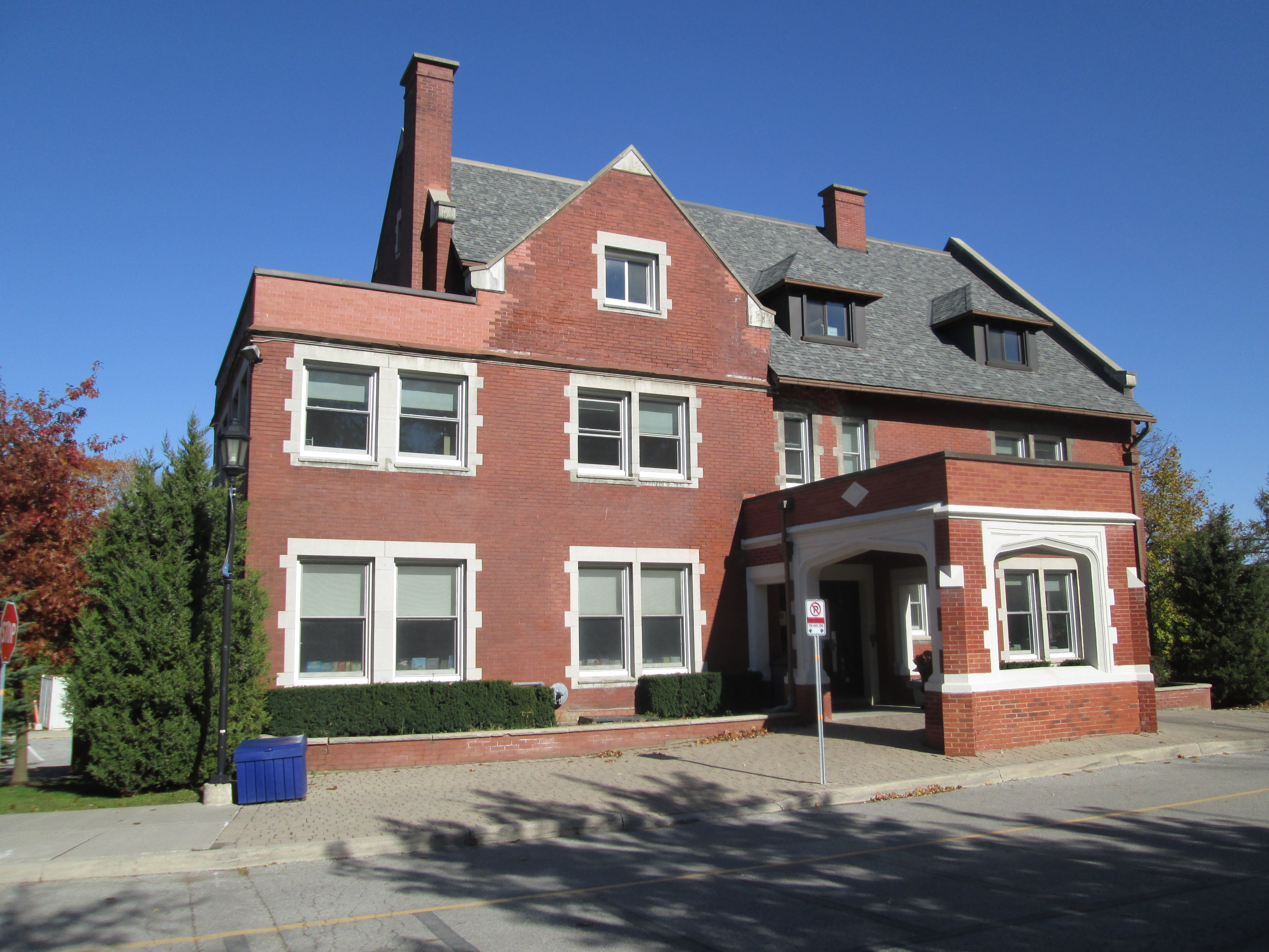
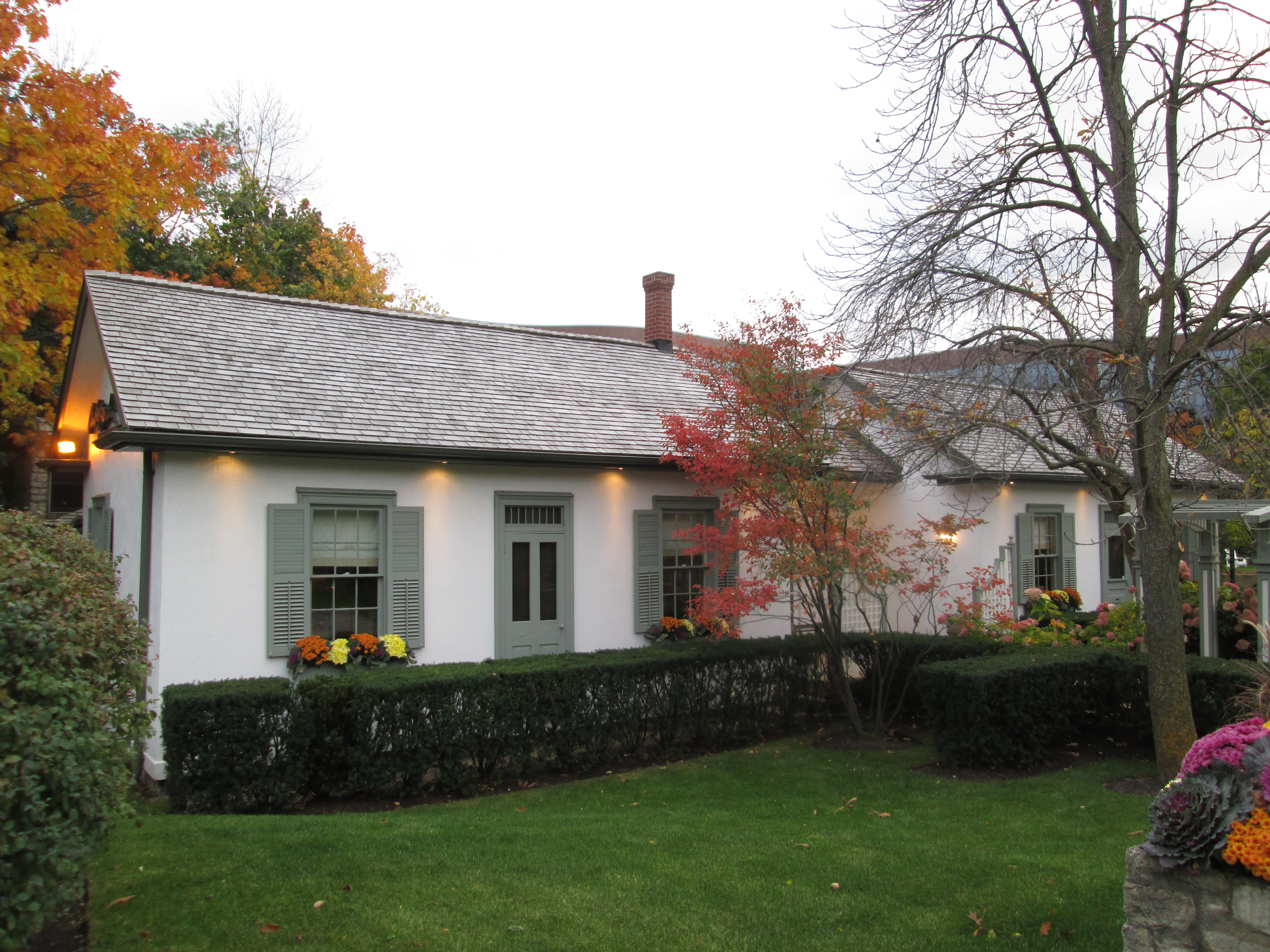
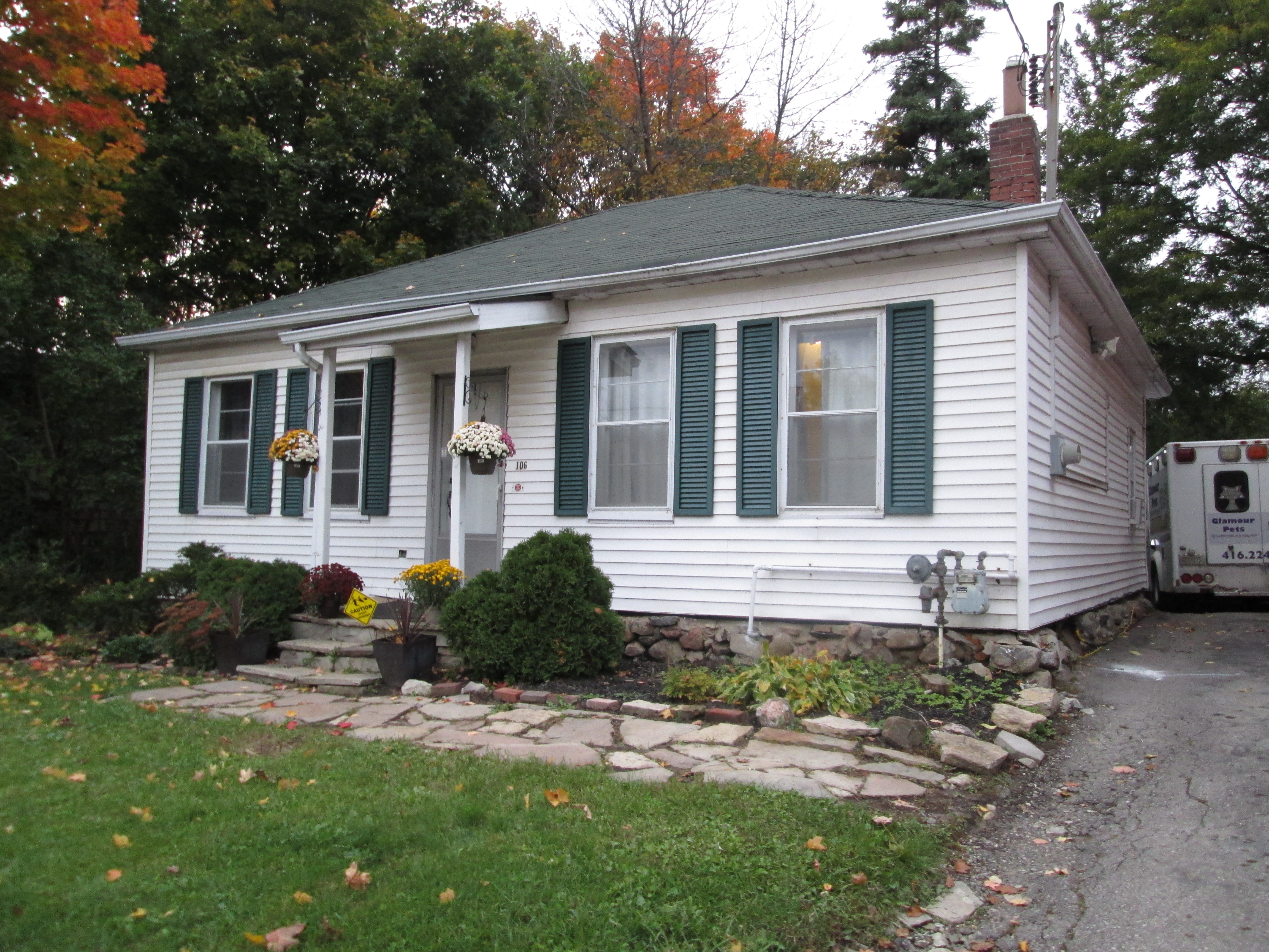
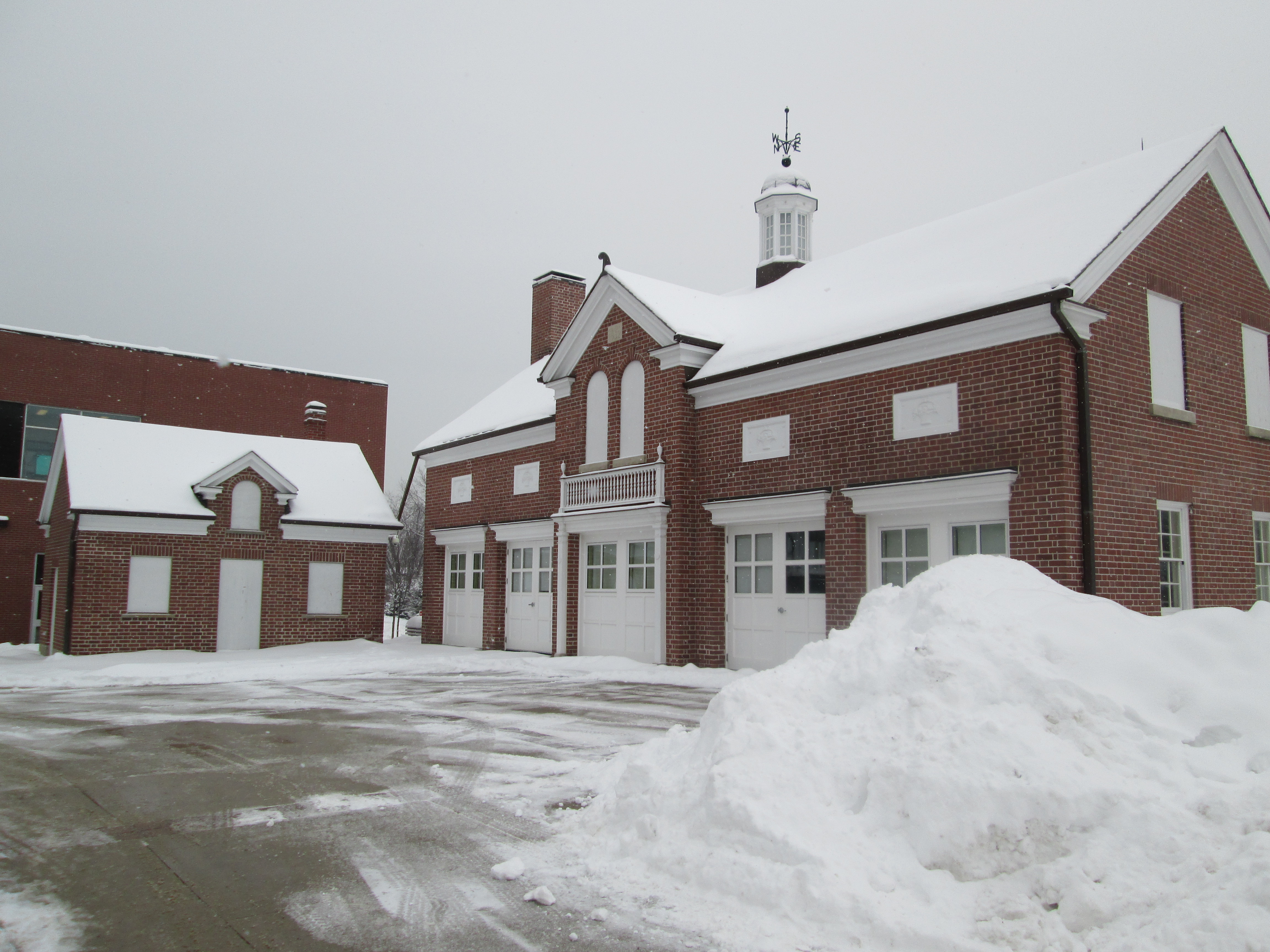
In the early 1930’s Frank O’Connor had become wealthy enough to purchase 600 acres of land north west of Lawrence Avenue and Victoria Park Avenue on which to build his estate.  He built stables, barns and raised a herd of Ayrshire cattle.  His prime Clydesdale and thoroughbred horses were shown each year at the Royal Agricultural Winter Fair in Toronto.  Frank named his farm Maryvale after his wife, Mary.  The restored house stands near today’s Rowena Park.

IMG_2547

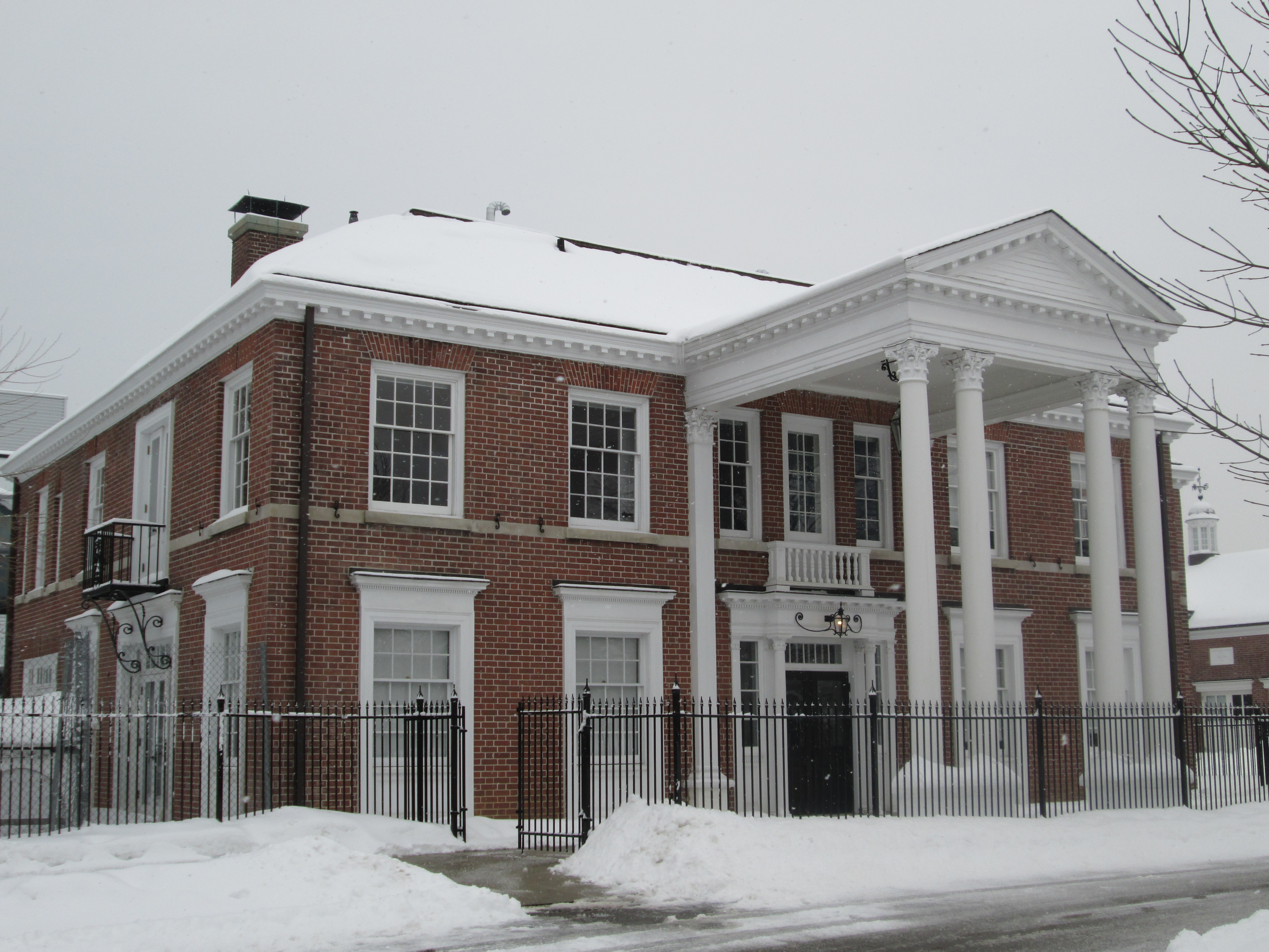
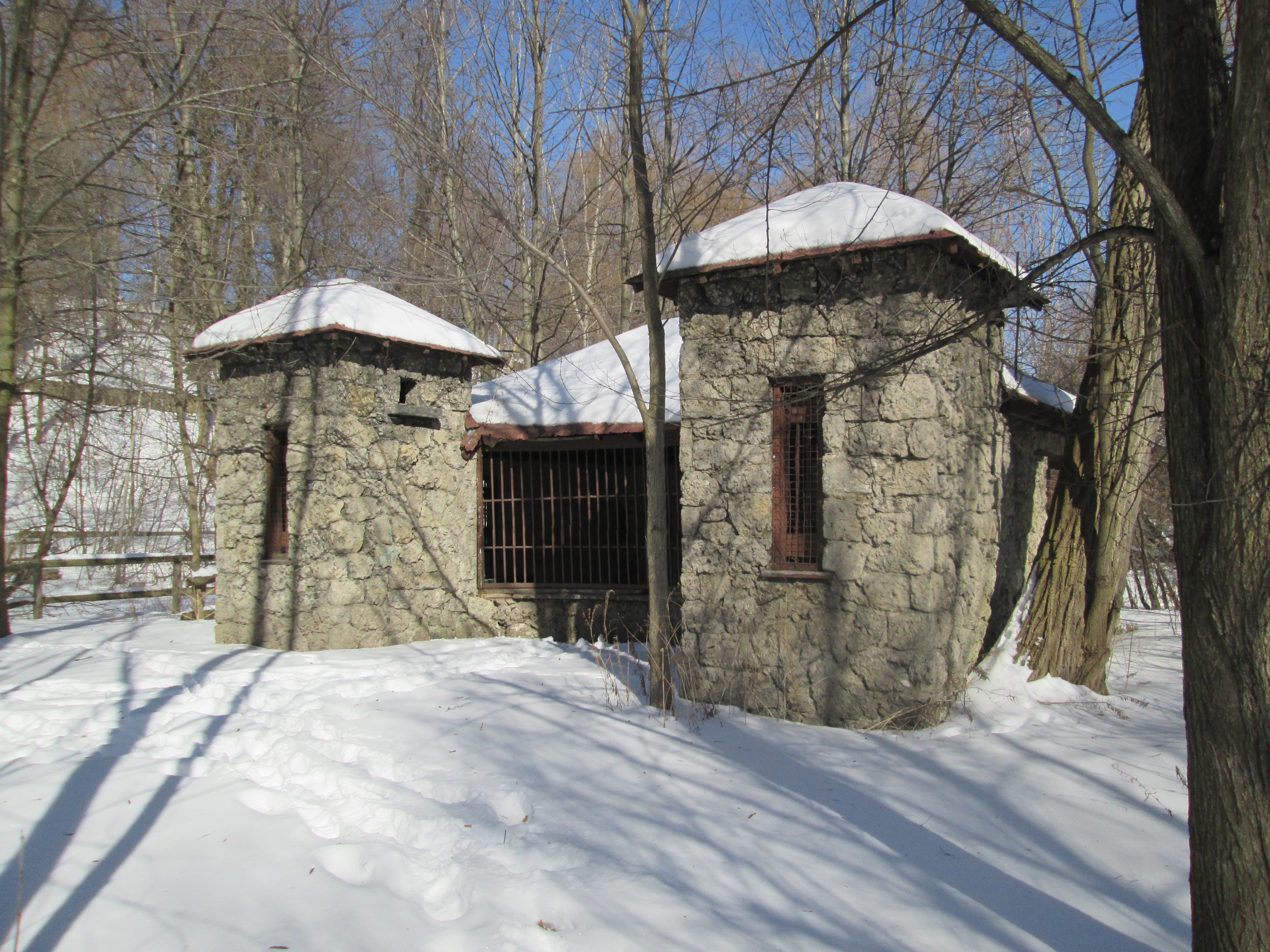
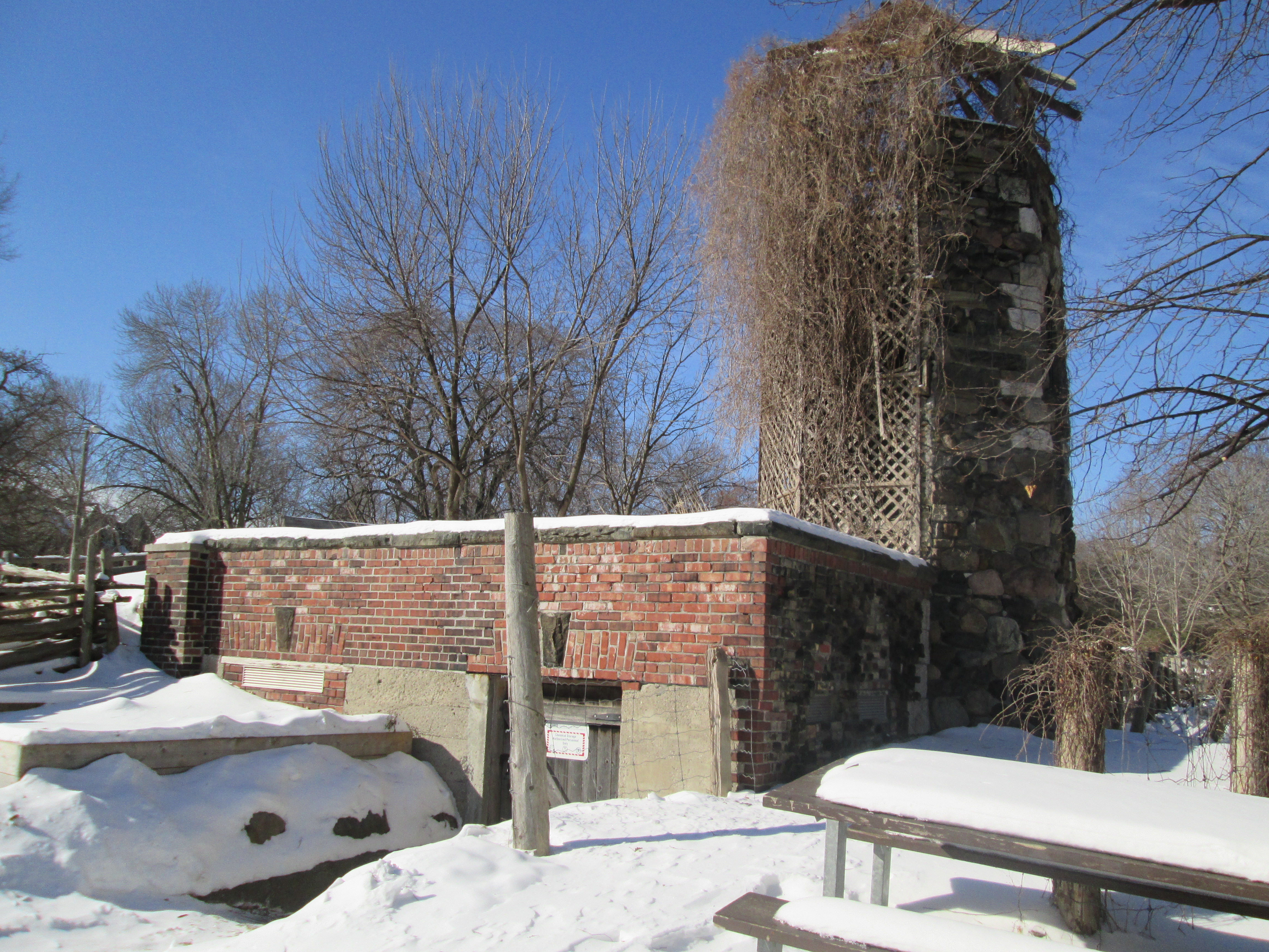
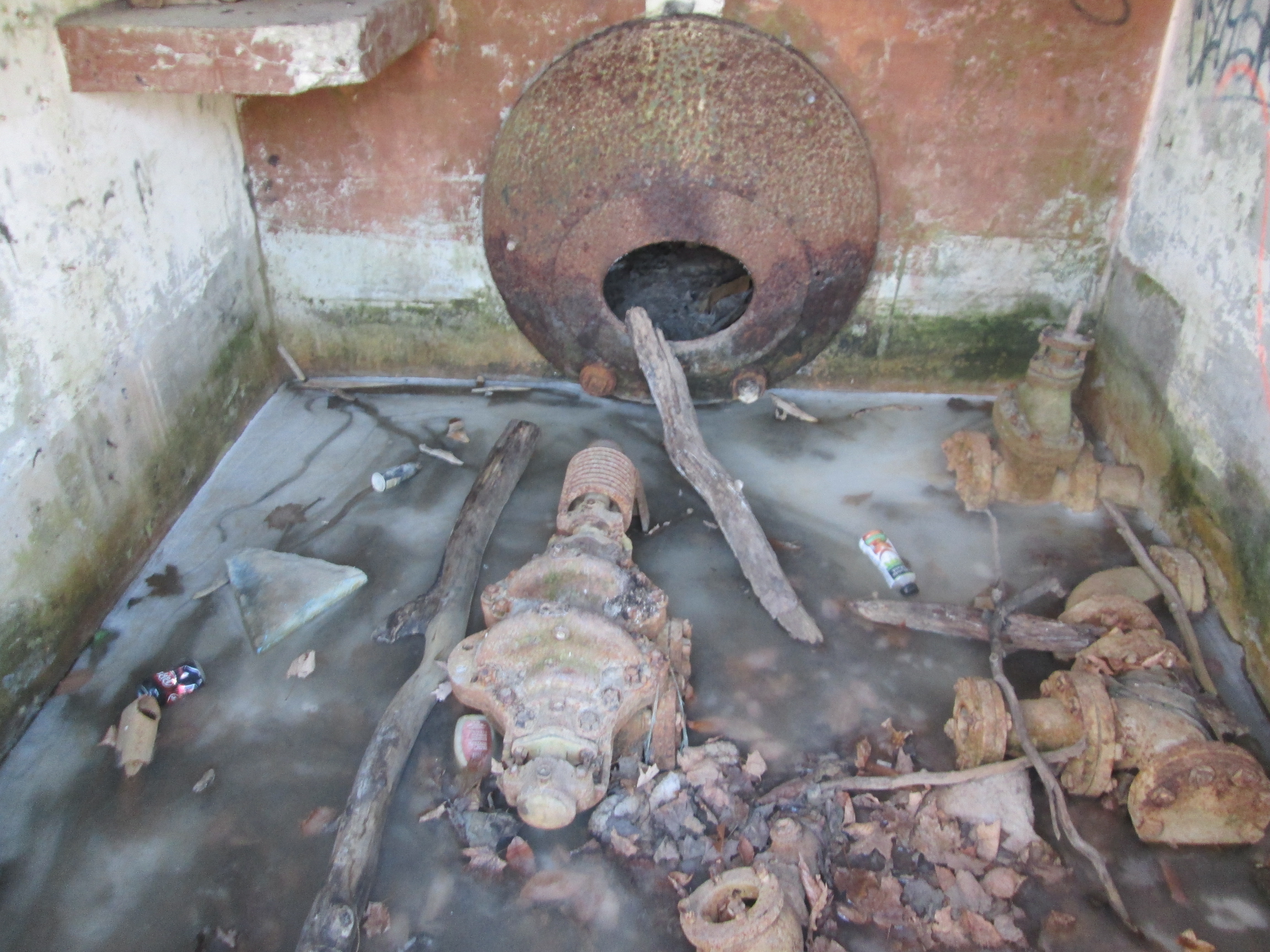
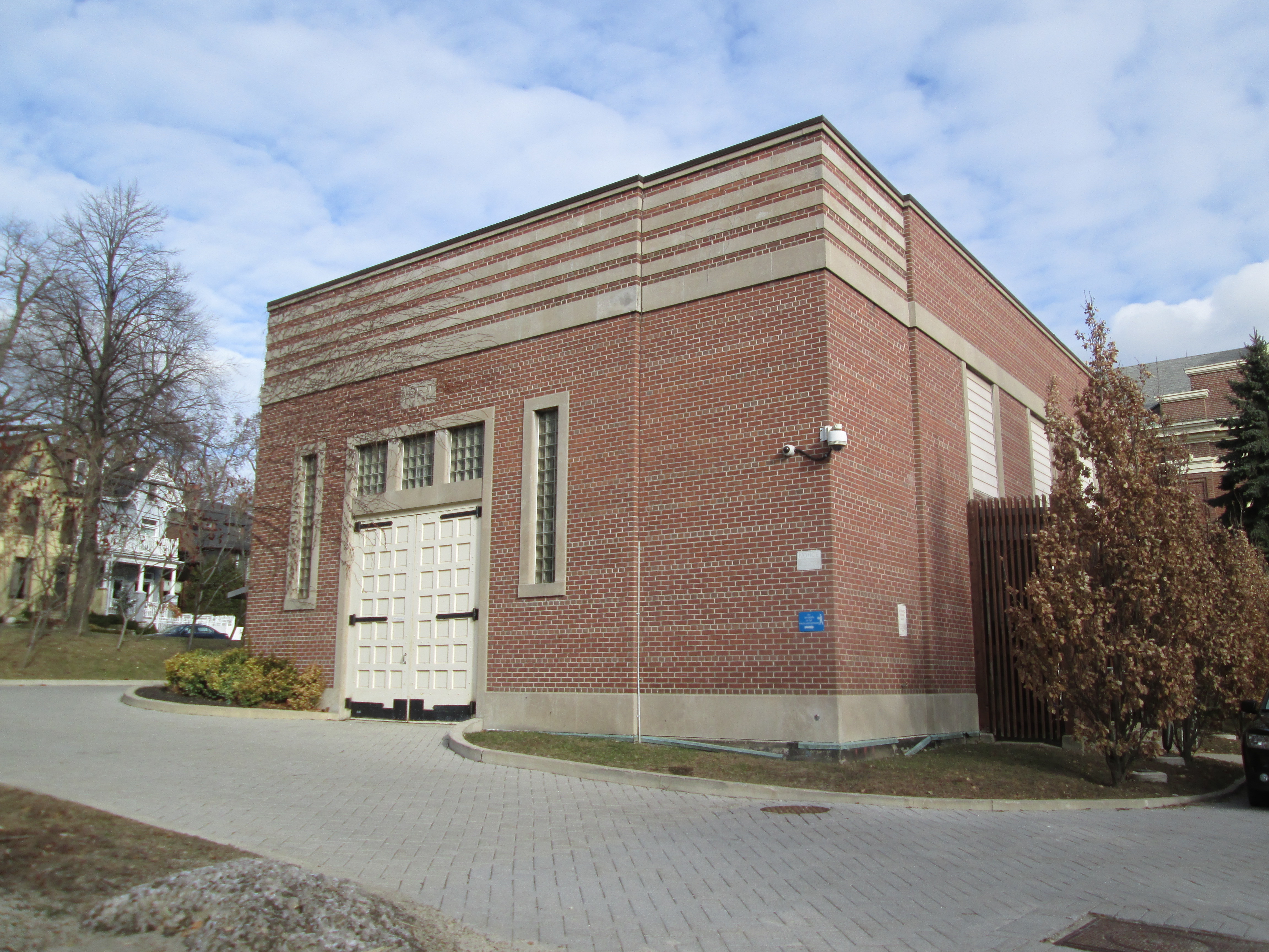
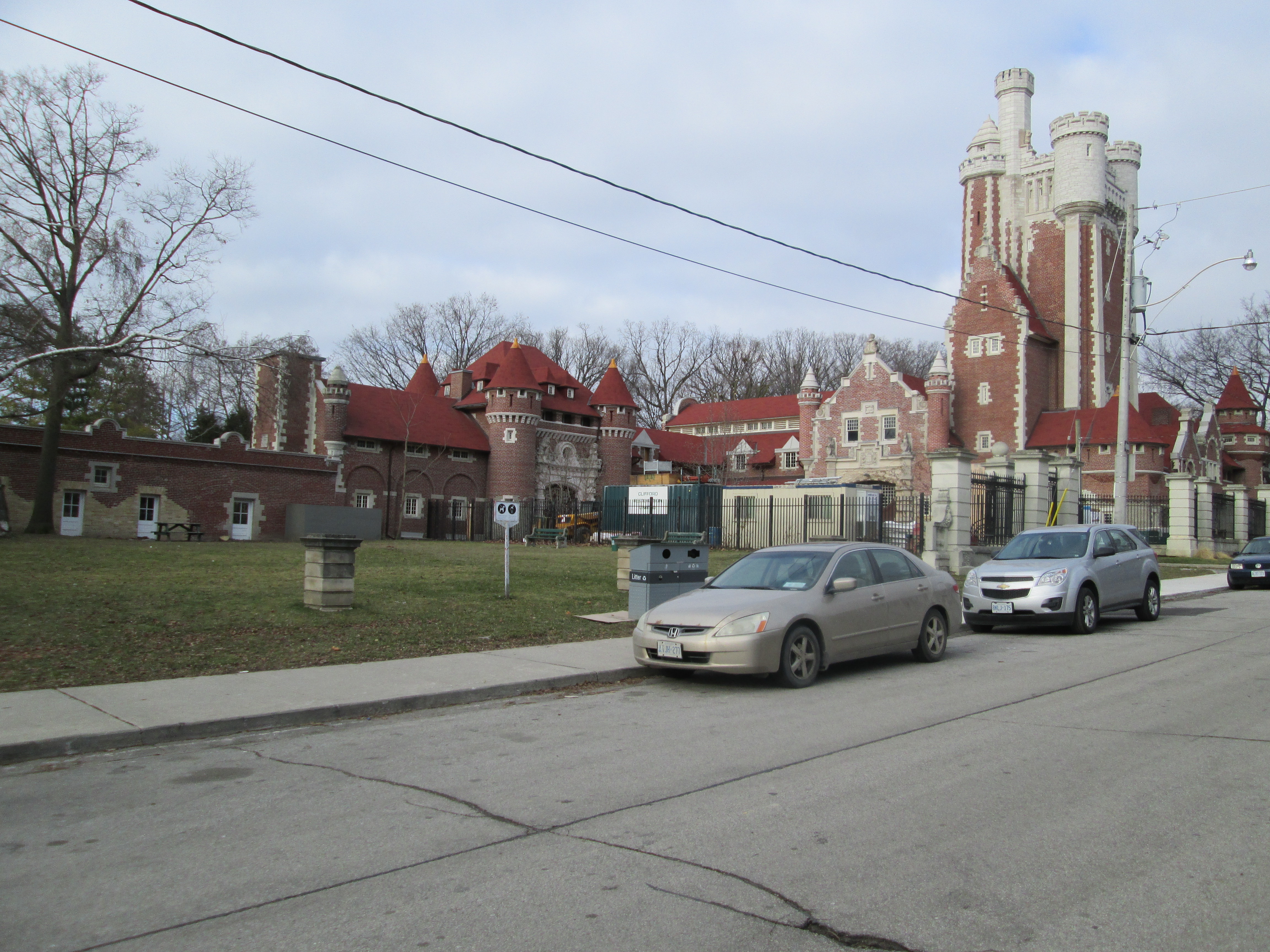
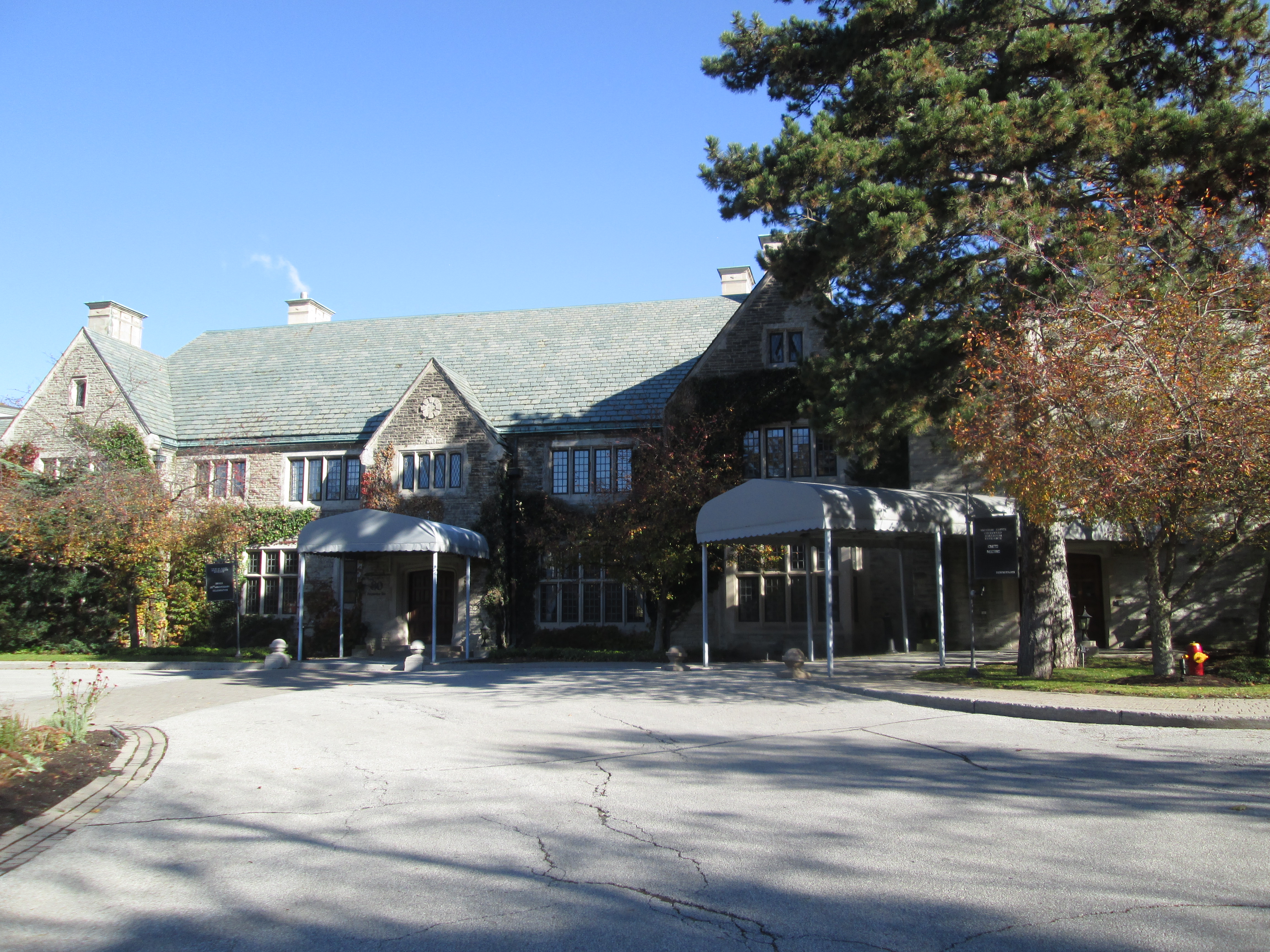
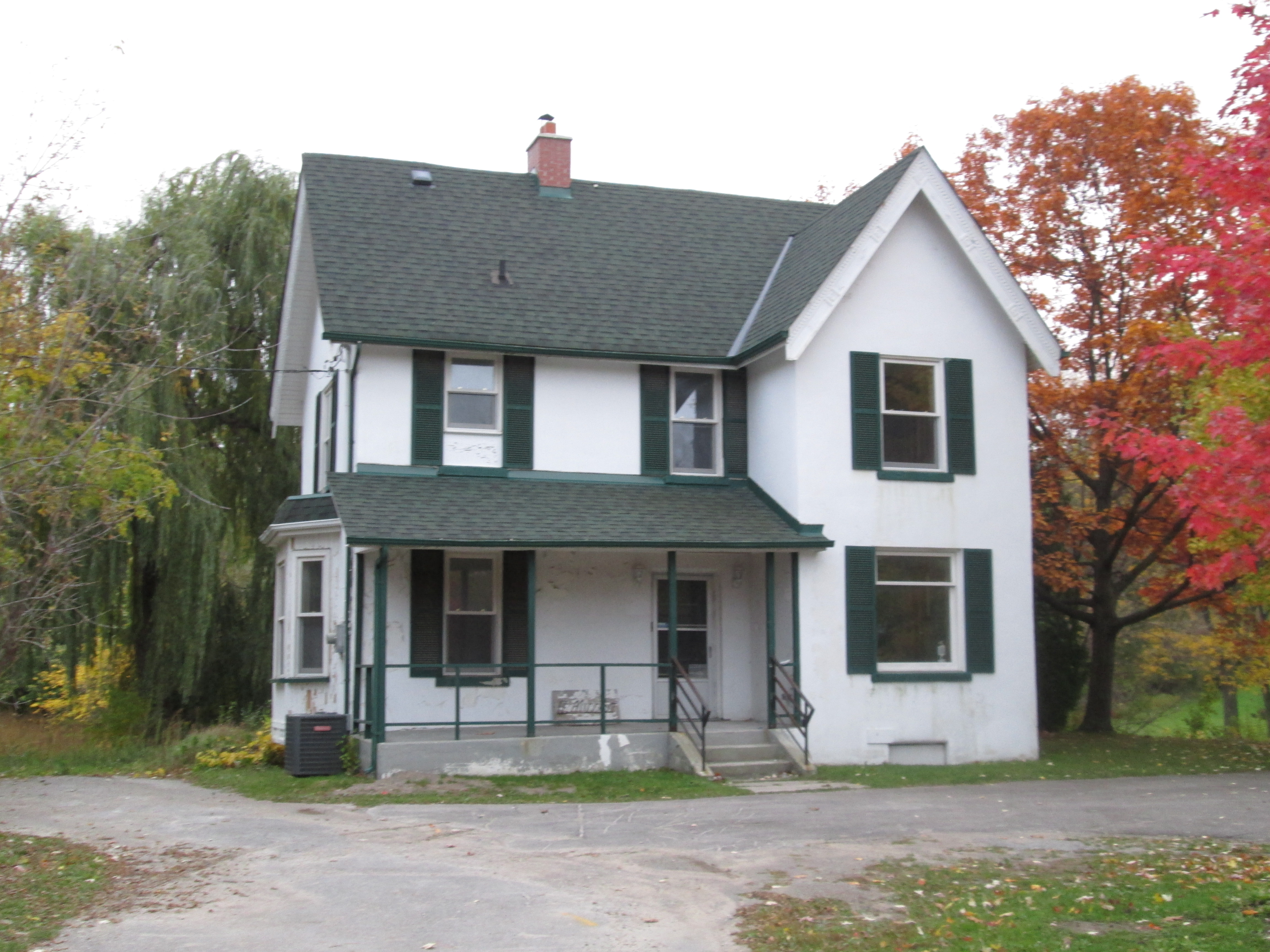
The coach house has been restored for use as a conference centre while the smaller maintenance building on the left remains shuttered and off limits to the public.

IMG_2553

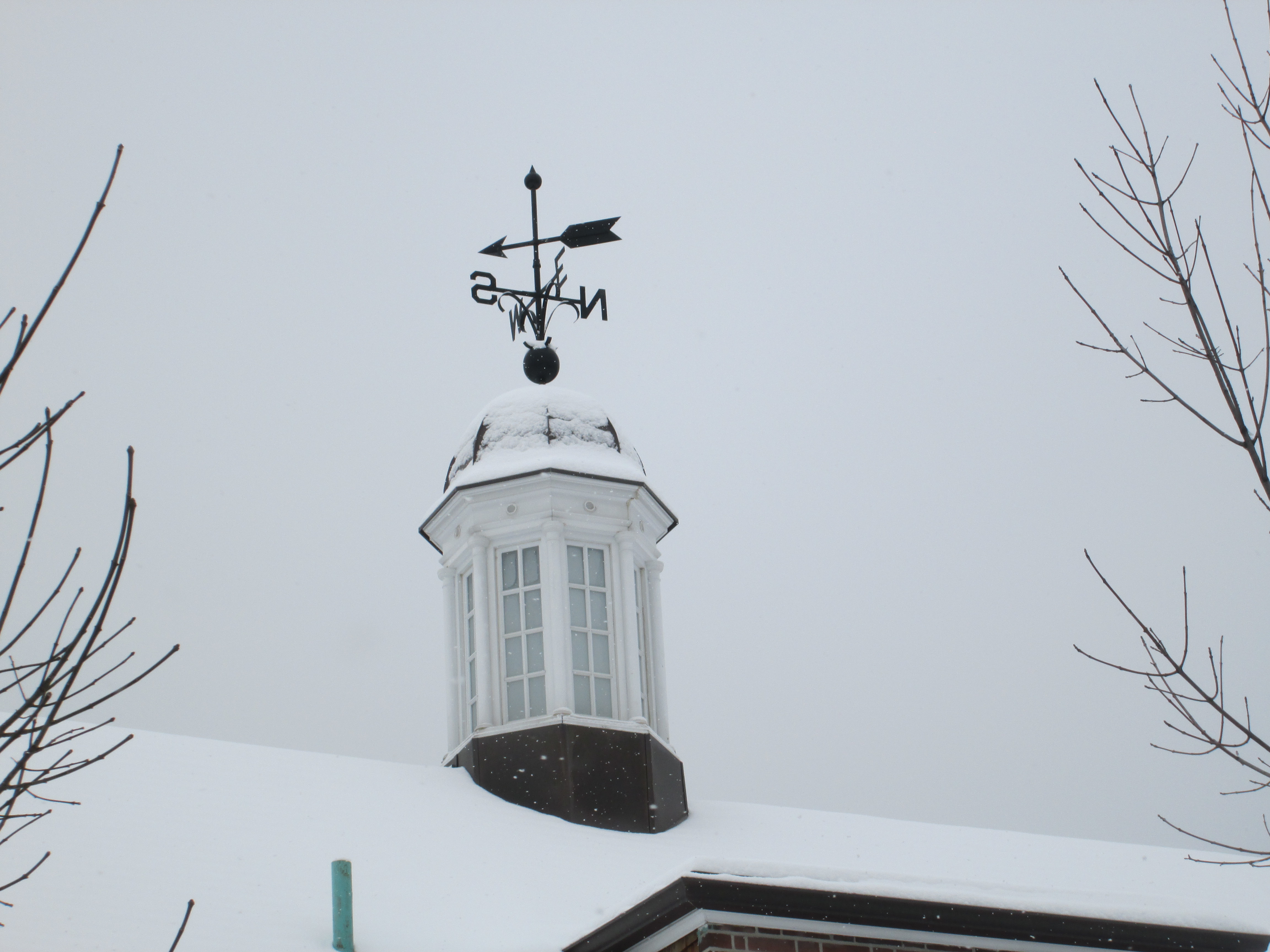
The cupola on the coach house has a weather vane on it with the four points of the compass and an arrow to indicate the direction of the wind.

IMG_2551

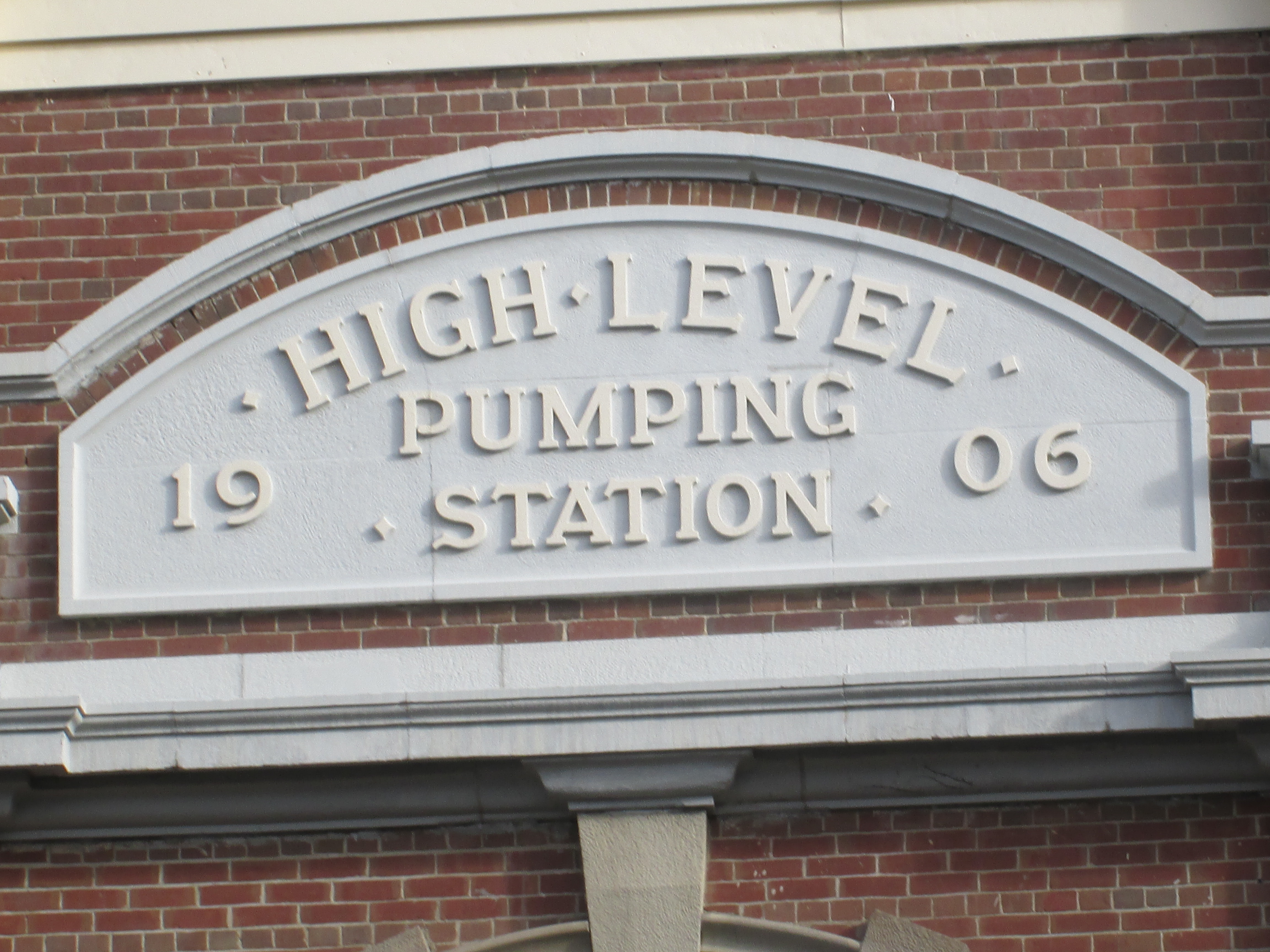
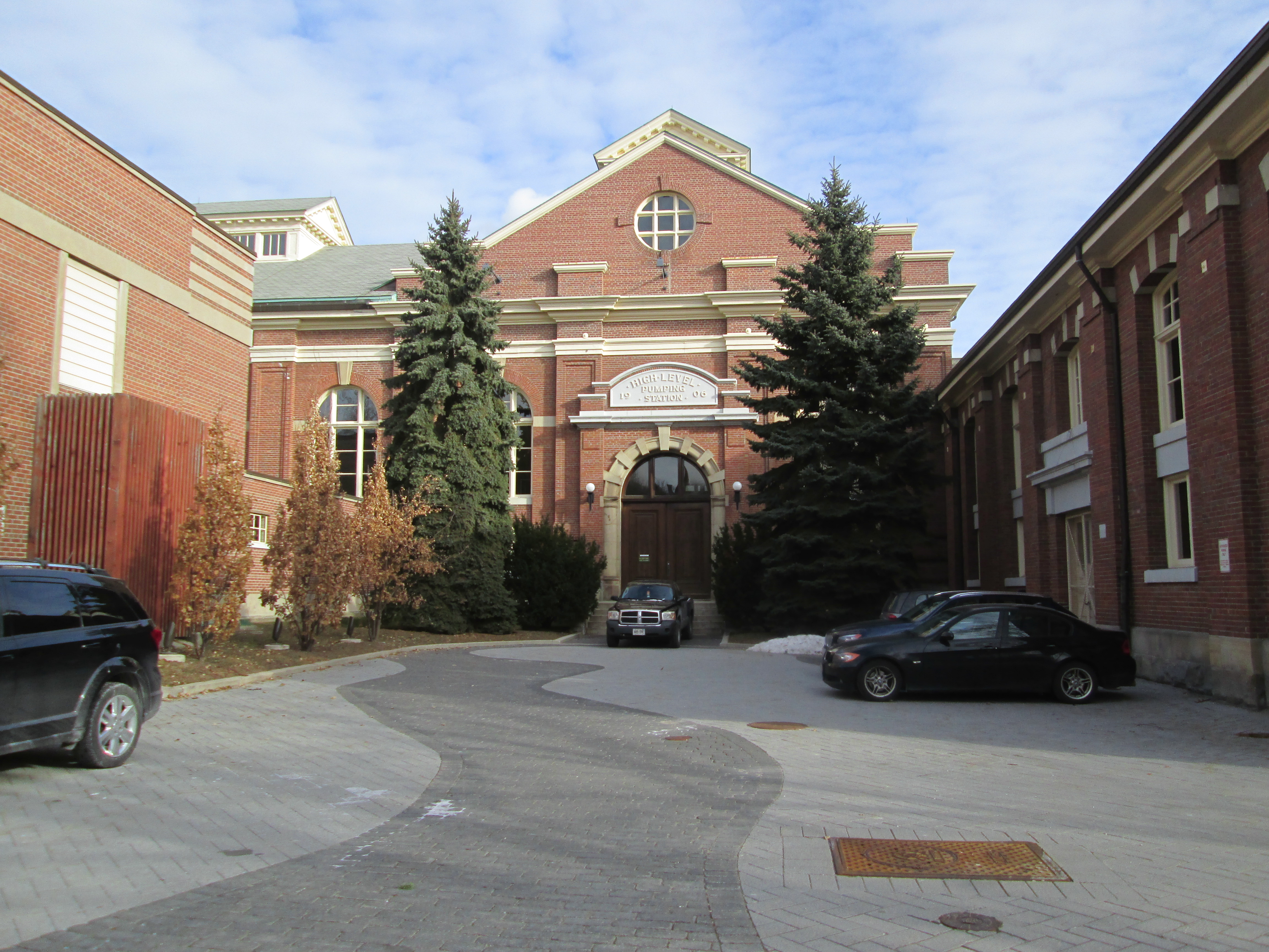
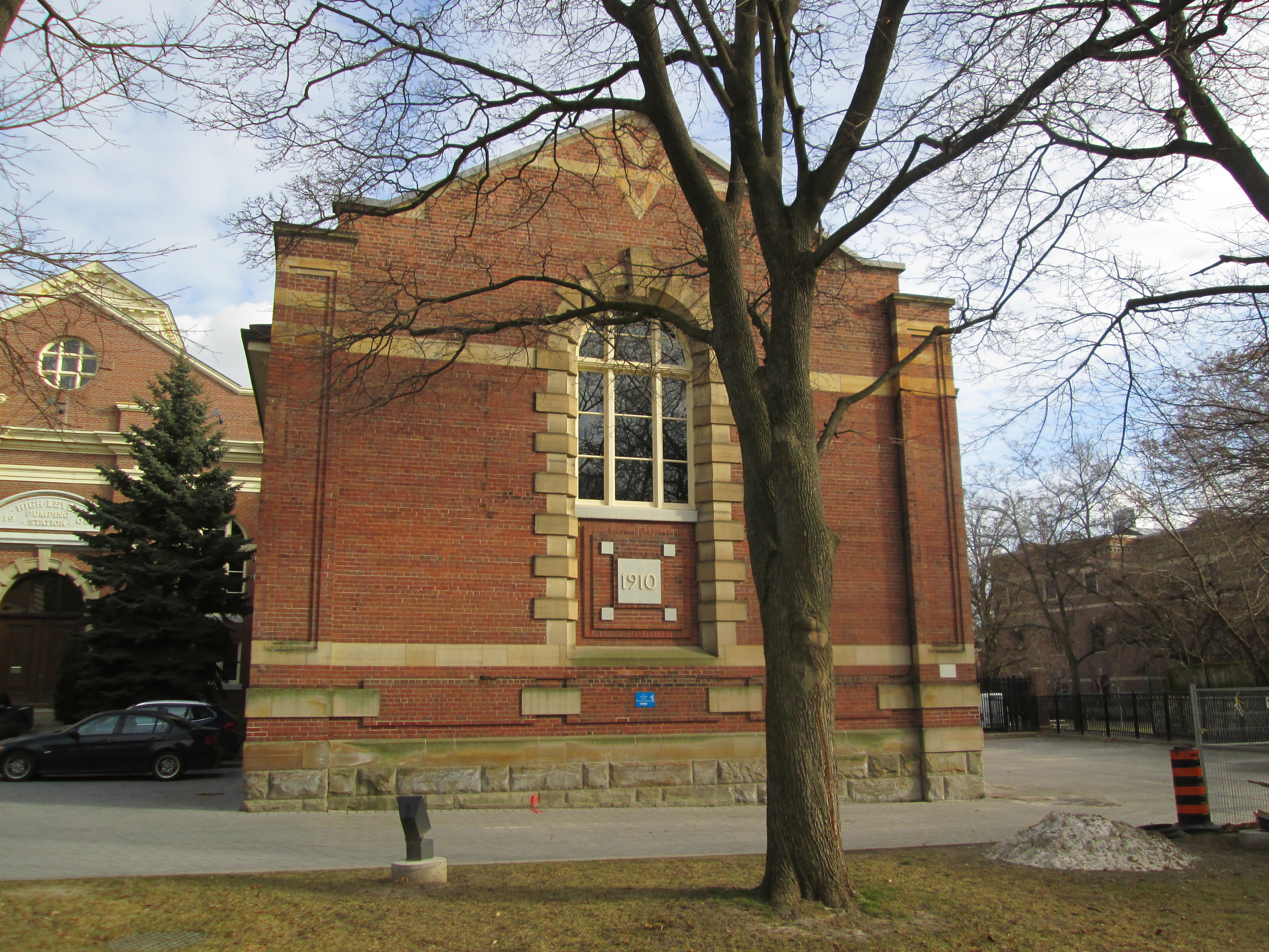
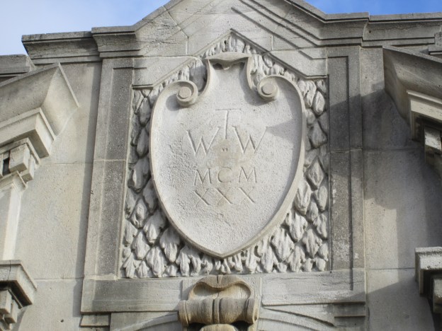
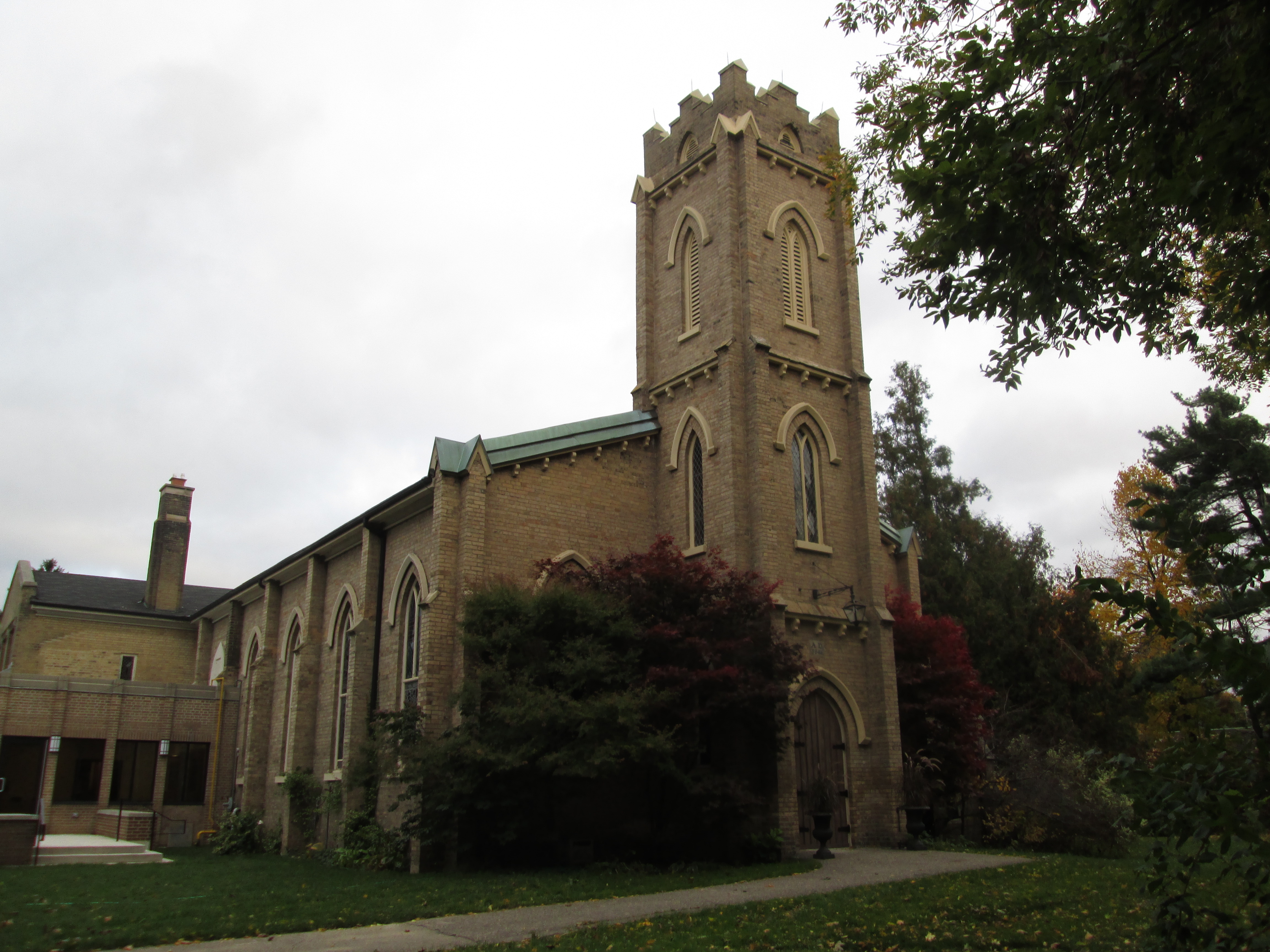
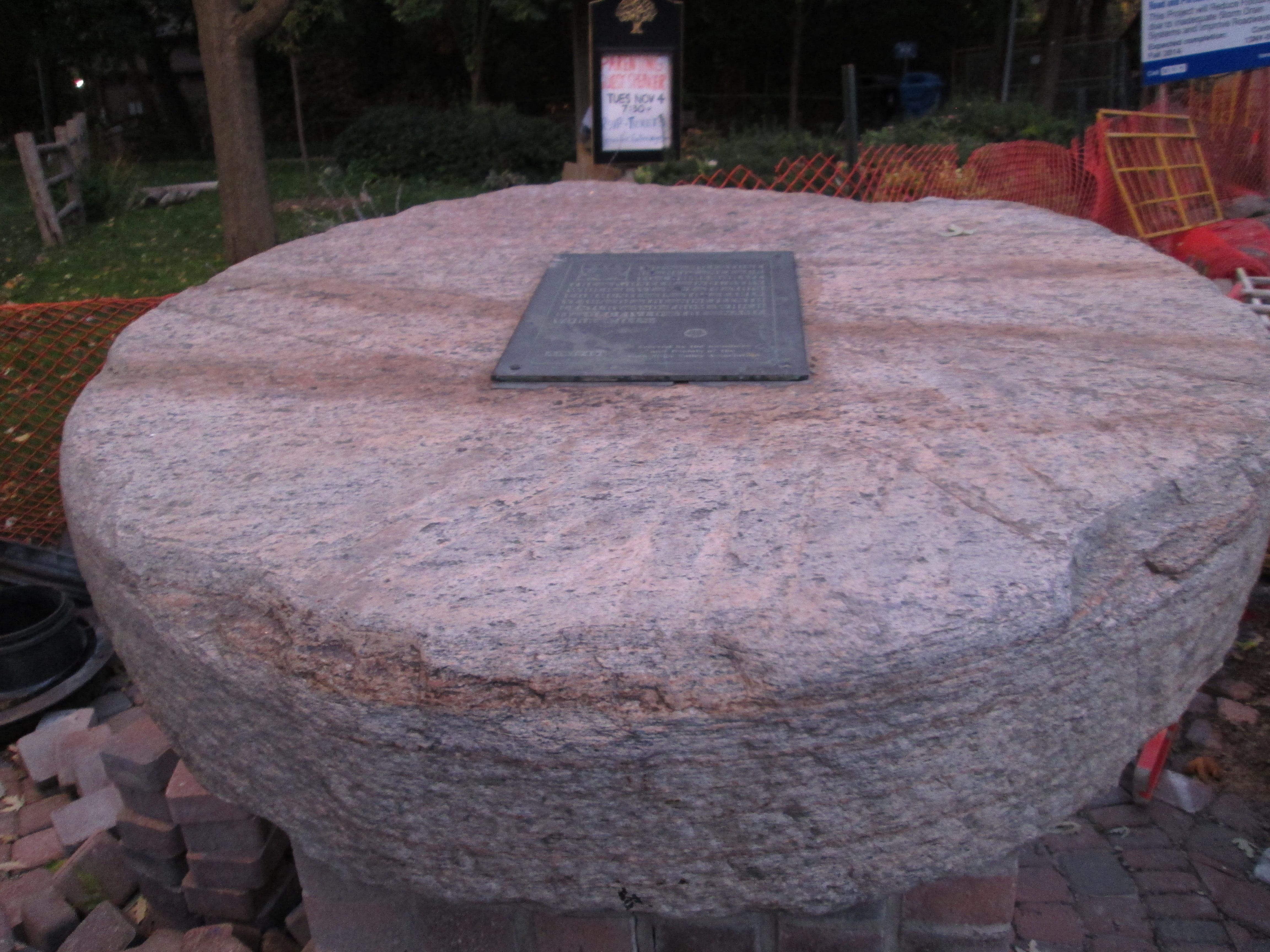
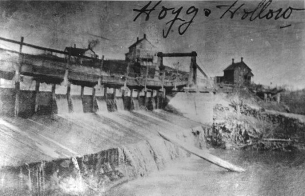
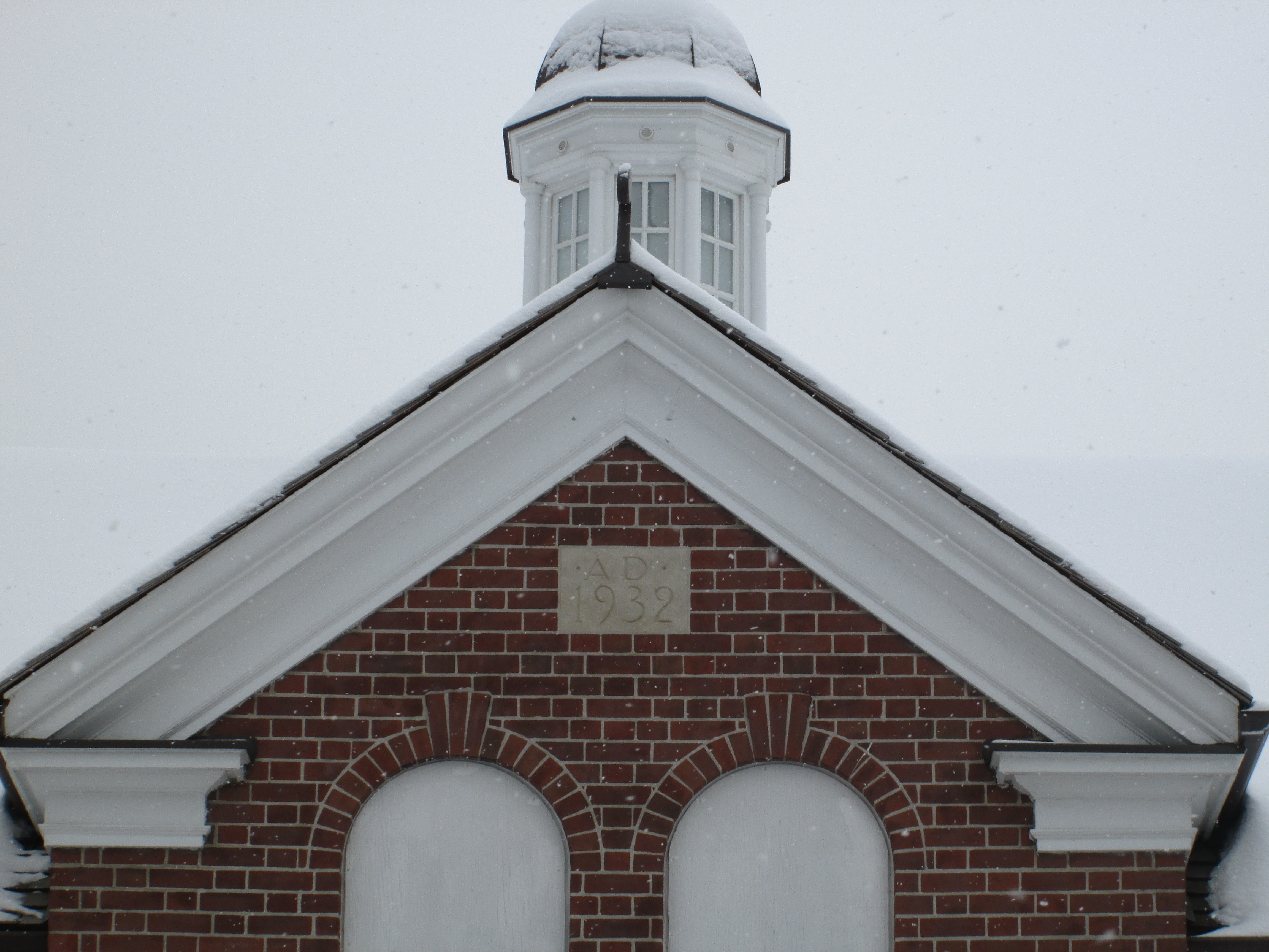
All three of the remaining buildings were constructed at the same time.  The date stone was placed in the coach house and it reads 1932.

IMG_2555

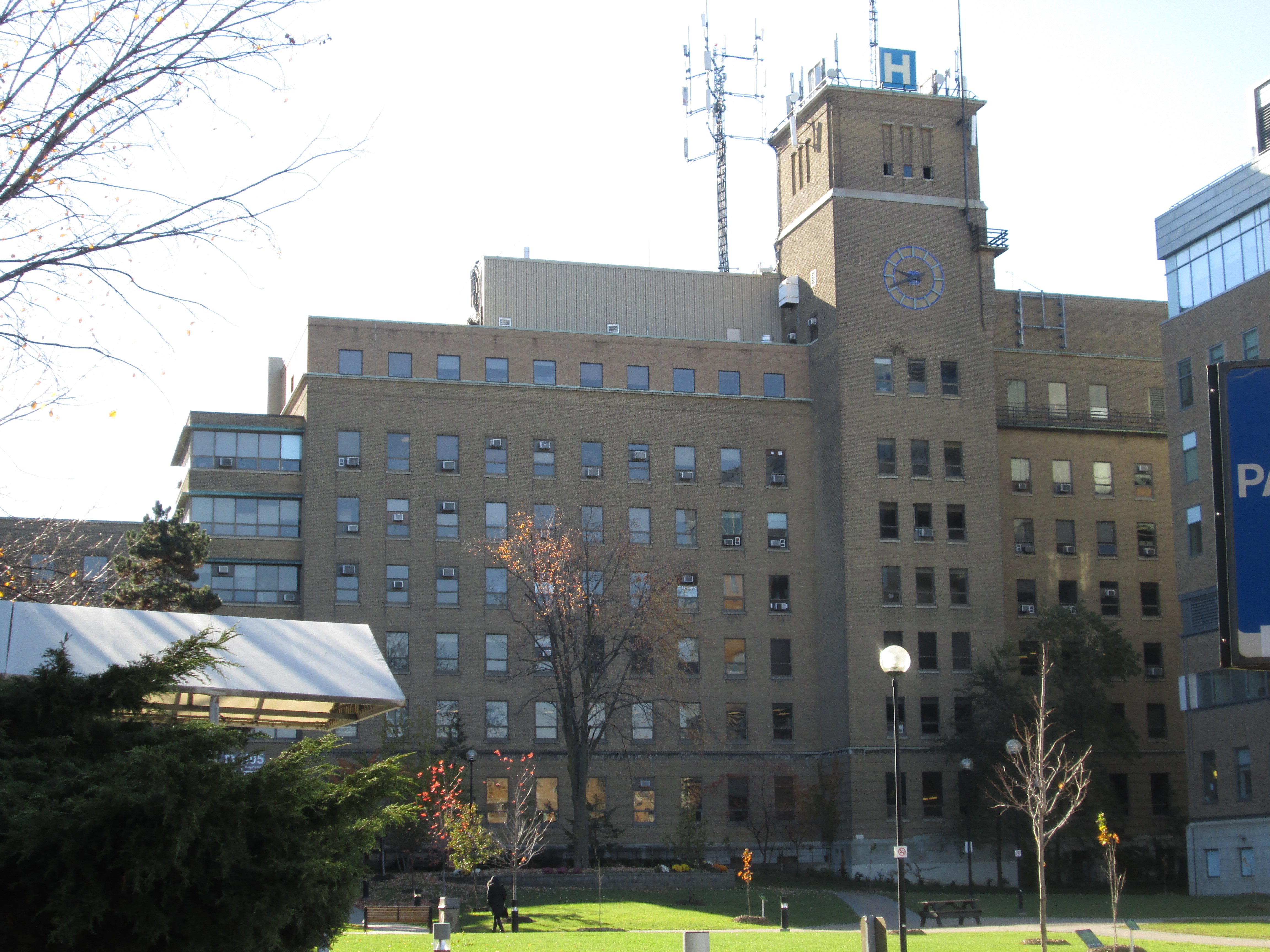
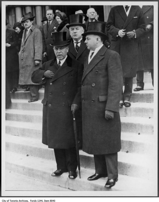
Frank O’Connor was a key player in the Liberal Party of Ontario and helped Mitchell Hepburn win the 1934 Ontario election to become the Premier of the province.  He was also involved in the federal election of 1935 in which Liberal leader William Lyon Mackenzie King became the 10th Prime Minister of Canada.  The cover photo shows Prime Minster King on the left, Premier Hepburn on the right and O’Connor in the back (like a typical back-bencher) on the steps of the legislature.  For his loyalty, O’Connor was awarded with a senate position in 1935.  O’Connor routinely gave his fortune away to several charities and when he died in 1939 he bequeathed his estate to a local religious community.  Over the year’s the estate was sold off for development and by the year 2000 the three remaining buildings were unoccupied and in danger of demolition.  The efforts of local community groups as well as federal, provincial and local governments were required to make the restoration possible and save the buildings, which have since been designated as historical sites.  O’Connor Drive is named after Senator Frank O’Connor.

Like us at http://www.facebook.com/hikingthegta

Riverdale Farm

Monday Feb. 16, 2015

Minus 19 feeling like minus 27 but it is Family Day in Ontario thus requiring that I do something with my day off other than sit around and worry about how cold it is.  I parked on Carlton Street near West Riverdale Park.

John Scadding had come to Upper Canada with Lieutenant-Governor Simcoe and after working as a government clerk he was granted land near York.  In 1856 the city purchased 119 acres from the Scadding estate on which to build a jail farm (Don Jail) and a park.  On Aug. 11, 1880 Riverdale Park officially opened.  In 1888 some deer were donated and by 1894 there were enough exotic animals to open Riverdale Zoo.

Around the same time that the animals were being collected, the city was hatching a plan to straighten the Don river where it flowed through the lower part of the city.  The Lower Don snaked back and forth and flowed through a series of marshes and wetlands similar to the Humber Marshes.  By placing the Don into a straight deep channel they hoped to make shipping accessible to the local industry.  Flooding and mosquitoes were also supposed to be better controlled by eliminating the marsh land  The project started where the river flowed through this piece of property.  The river was moved to the east and the section on the site of Riverdale Zoo was cut off from the rest of the river.  The ponds that exist on the lower zoo property are, in fact, left over pieces of the river.  In the May 1888 map below the river is shown on the Riverdale Park and Jail farm near the right side of the map.

s0725_fl0012_MT00092C_don straightening

Sitting in the middle of this section of the old river is an island which can only be reached by means of a stone arch bridge.  There are only three buildings remaining from the days of the Riverdale Zoo and one of them stands on the island.  Known as the Island House it still has the bars in the windows from its days as The Monkey House.  The picture below is from Dec. 14, 1921 when there were no trees on the little island.

below we see a stone bridge leading to what is variously known as the Island House or the Monkey House in the middle of a pond. All still exist.   1921

The Monkey House today serves as a storage shed for garden equipment.

IMG_2457

The residence was built in 1902 by captives of the Don Jail.  It served as a zoo keeper’s residence, staff building, animal hospital and temporary morgue for the Necropolis across the street.  The bricks on this home are made of regular pressed brick as well as a material that looks like coal slag.  The bricks have not been placed in even rows and some stick out from the side of the building giving it a most unusual look.

IMG_2474

The Donnybrook ruins stand near the cow paddock.  This building was originally a two story building with a tower but only the lower floor remains.  When the floor was poured, a hippopotamus sat in the wet concrete and left his rump print for posterity.  Kids have been sticking their feet in wet cement ever since.

IMG_2441

Riverdale Zoo, like other Victorian zoos, took little care to display the animals in their natural settings.  The city began to look for a new location for a modern zoo and a site in Scarborough was selected.  The new zoo opened in 1974 and the Riverdale zoo closed on June 30, 1974.

poi-template_clip_image002_0013 (1)

Over the next 4 years most of the zoo buildings and cages were torn down except for the three described above.  It was decided to turn the zoo into a working farm as an educational site for local school children.  Riverdale Farm opened in 1978 as a free public park.  Several new buildings were constructed to illustrate life in a 19th century farm.  The Simpson House is a replica of an 1852 home that stood on the Francey farm in Markham.

IMG_2421

Inside the pig and poultry barn there are several different types of chickens, ducks and turkeys.

IMG_2427

The Francey Barn was built in 1858 in Markham and was donated to Riverdale farm.  It is a rare surviving sample of a Pennsylvania bank barn.  Designed and built into a hill side or river bank these barns have ground floor access to both the upper and lower floors.  The picture below shows the huge hand hewn timbers that the barn was constructed from.  The trees on an individual’s land grant would be used to build their homes and barns.  This barn was taken apart, moved here and re-assembled in 1975.  Having grown up in small town Ontario I was taken back to my youth by the familiar smell inside the barn.

IMG_2434

When the dutch came to Ontario from Pennsylvania they brought some of their traditions with them.  The Mennonite’s call their places of worship a meeting house and one of the largest church groups in Ontario is called The Meeting House.  In keeping with the theme of the farm, the drop in centre is called the Meeting House.

IMG_2444

In the Francey barn are many antique items including old sleighs and carriages.  One that I found particularly interesting is this old wooden barrel washing machine.  Gilson was a manufacturer of washing machines, dryers, gas engines and furnaces that operated in Guelph from 1907 until 1977.  By 1920 enamel barrels had replaced the wooden ones to make cleaning easier and the machine much quieter.  Electric washing machines were first made in 1907 and the machine in the picture below was likely made within the first decade of production.

IMG_2486

Across the street from the farm sits the Necropolis.  This burying ground was opened in 1850 when the “potter’s field” cemetery at the north west corner of Yonge and Bloor was found to be on prime development land and was closed and moved.  A crematorium was added in 1933. Some of the early founders of the city are interred here including the old rebel himself, William Lyon Mackenzie.

IMG_2423

For now the Polar Bears have moved to the new Toronto Zoo where they have a much more natural habitat than the concrete pond they used to call home and the animals on the farm now enjoy a pastoral setting.

Polar bear cubs

Thanks to my brother Allan who suggested I visit this site.  It was a lot of fun and may need some more exploration in the summer.

Like us at http://www.facebook.com/hikingthegta


Graydon Hall

Saturday January 10, 2015

Minus 12 with a wind chill of minus 26 but sunny and really not as bad as it sounds.  As long as I was in the valley I didn’t notice any wind chill at all, and dressed in my new parka, I was quite comfortable.  I parked on Olsen Dr. near the little walkway that goes down to the intersection of Don Mills road, Duncan Mill road and Graydon Hall drive.  I entered the Don River Ravine on the east side just off of Duncan Mill road.  This property originally belonged to the Duncan family who operated a sawmill on the East Don River in the mid 1800’s

Henry Rupert Bain made his fortune first in his own brokerage firm then as a gold investor during the depression.  In 1934 he bought 100 acres of land from the Duncan family on which to build his estate.  One of the features of his estate was terraced gardens with cascading waterfalls.  Bain built a pump house near the river to pump water up to his estate for his gardens.  There are the remains of two old buildings here.  The building closer to the river is made of rough fieldstone and is likely much older than the other one.  Inside, it has been divided into two rooms with modern concrete blocks.  This suggests that it has been remodeled at the time the second building was added.  It contains some electrical potheads made by G&W Electric in Chicago and a large oil storage drum.  A roadway ran just south of the building crossing the river on a bridge until the late 1980’s.  Bain’s barns and race track were on the west side of the river and accessed by this road.  The bridge has been torn up and the concrete was just tossed in the woods near the pump house.

IMG_1971

Closer to the embankment is the pumphouse.  It is made of preform concrete block in the Art Deco style that was popular in the 1930’s and 1940’s.

IMG_1977

Inside the pump house water was fed into the pipe-head at the back of the room.  The flash of my camera revealed a large pipe which curves to the right about ten feet in.

IMG_1979

Alder trees grow along the riverbank just north of the Duncan Mill Road bridge.  The alder is unique in that it is a cone bearing deciduous tree.  The tree has it’s male and female parts on the same branches.  The longer male catkins produce pollen in the spring which is wind blown to the rounder more cone shaped female catkins.  Like other trees that rely on the wind for pollination, the alder will flower prior to the leaves forming in the spring.

IMG_1992

I walked along the east side of the river, crossing under the Duncan Mill road bridge and the bridge on Don Mills road.  Under the Don Mills road bridge someone has crawled out and strung up a swing.

IMG_1996

Completed in 1936 Graydon Hall may have been named after the Gray family that operated a grist mill on the Don river just below the property.  The grist mill remains today on the property of the Donalda Golf course.  When Bain completed his estate it boasted a private 9 hole golf course, race track, stables, polo field and kennels for raising hunting dogs.  The cover photo shows Henry Bain standing near his garden fountain.  This fountain statue of a lady kneeling and holding a bowl is now housed at the Art Gallery of Ontario.  The 29 room house was built for $250,000, a sum equal to $4,250,000 today.  Notice the large front canopy that was common on estate mansions of the early 20th century.  Similar structures can be seen in Bayview Estates on the three Clifford mansions that now form the Toronto French School.

IMG_2012

Much of the rear ground of the property is still preserved as parkland in the form of Graydon Hall Park.  A small rectangle of concrete which stands in a hollow slightly uphill from the house is all that remains of a small building.   This may have been the upper end of the pumping system.

IMG_2006

The terraced gardens remain along the back of the house.  Between the gardens and the river stretched four acres of pools and waterfalls as the water made it’s way back downhill.

IMG_2009

On the east side of Graydon Hall road stands a pair of gate pillars that mark the old laneway to Graydon Hall.  Prior to the construction of Graydon Hall Drive in 1964 the estate was approached by a looping driveway off of Woodbine Avenue.  This portion of Woodbine was removed in the 1960’s for construction of the Don Valley Parkway.  A new access was created off of the recently extended Don Mills Road.

In the 1957 aerial photo below the property of Henry Rupert Bail is seen.  The 401 cuts across the top of the picture.  Graydon Hall stands roughly in the middle of the picture on the right hand side.  A private roadway leads from the house, past the small building and down the lawn to the river.  The road crosses the river near the pump house and reaches the barns and racetrack.  Don Mills Road has not yet been extended this far north yet but it will soon cut between Graydon Hall and the river.

gray

In 1954 Bain died of complications from a horse riding accident.  His property was sold in 1964 to developers who constructed apartment buildings on the estate.  The house remains and now serves as a banquet hall.  A cardinal provides a little splash of red among the evergreens along the old lane way as I made my way back to the car.

IMG_2019

Like us at http://www.facebook.com/hikingthegta

Follow us at http://www.hikingthegta.com

Yorkville Water Works

Friday January 2, 2015

I parked on Russell Hill Road near the entrance to the St. Clair reservoir to enjoy the sunshine and a rare Friday off work.  Nordheimer Ravine runs just south of the reservoir.  I had been introduced to the ravine while exploring the Baldwin Estate known as Spadina.  The toponym (place name) ‘Nordheimer Ravine’ appears to have been in use since at least the 1940’s.  Castle Frank Brook ran through the ravine across Baldwin’s property and then through Samuel Nordheimer’s estate.  A brief history of Nordheimer was also introduced in the Spadina post. Samuel Nordheimer had married Edyth Boulton in 1871.  He built her a grand estate he called Glenedyth, after the forest glen where it was set and her name.  In the process he demolished the 1818 home of Russell Hill leaving just a street name to remember the original landowner by. The gatehouse of Glenedyth is featured in the cover photo.  Nordheimer died in 1912 and his son Roy inherited the estate.  When the son died in 1921 a subdivision plan was approved and the estate commemorated in the street names Boulton and Glen Edyth.  Roycroft Drive, named after Roy, was also one of the streets in this 1923 plan but was closed to traffic in 1971.  The trail from the reservoir to Boulton Drive roughly follows this old road allowance.

IMG_1854

Following Castle Frank Brook brings you out to Boulton Drive where the brook flows under a row of houses.  The brook itself was buried in a sewer pipe around 1930 to facilitate development of the subdivision.  The edge of the ravine can be seen in this picture with the brook flowing out from under the houses to the north and under Boulton Park where I’m standing.

IMG_1856

Samuel Nordheimer dammed the brook on his property to create a pond for the garden setting of his estate.  In 1874 the town of Yorkville refused to buy water from the City of Toronto and entered into an agreement with Nordheimer to buy water from his pond.  A combined Pumping house and engineer’s house was built in 1875.  The water in the pond became so foul that the drinking water in Yorkville became a problem.  In 1883 the town voted to be annexed by the city of Toronto in order to gain access to potable drinking water.  The pump house was integrated into the the city water plan and renamed High Level Pumping Station.  High Level referred to both the station’s position on top of the Iroquois Bluffs and it’s function of pumping water to the higher elevation area’s of the expanding city to the north.  The first pump house remains today as a private residence.

IMG_1867

The pumping station expanded with the growth of the city with major construction in 1889 (now demolished).  A large central block was added in 1906.

IMG_1858

The 1906 block in the middle, the 1910 addition on the right and the 1952 expansion on the left.

IMG_1857

The 1910 expansion with it’s ornate yellow brick pattern on the top of the building.

IMG_1859

The 1952 expansion was the final one.  The High Level Pumping Station has taken on a role as the nerve centre of Toronto’s water system.  It controls the water from 4 water treatment plants, 18 pumping stations, 10 underground reservoirs and 4 water towers.  These in turn supply water to over 3 million people.  It has come a long way from it’s inception as the Yorkville Water Works.  The 1952 expansion is seen in the picture below.

IMG_1860

The 1953 aerial photograph below shows area that once belonged to Samuel.   The Nordheimer Ravine comes out of the top left corner. Someone has marked the Castle Frank Brook sewer pipe in a brown marker where it flows between Glen Edyth on the left and Boulton on the right.   The brook itself used to wander back and forth across what became Boulton Drive.  The black circle at the bottom centre is Nordheimer’s pond with it’s fountain in the middle.  The first pumping station is the small building right at the edge of the pond at “one o’clock” if the pond were a clock face.  The new pumping station and it’s additions are at the top of the pond at “twelve o’clock”.

HLPS 1953

Samuel and his brother Abraham will be remembered for their contribution to music in Toronto more than to the water supply.  The Nordheimer piano was considered a local masterpiece in the 19th century.  The program below is for a concert in St. Lawrence Hall on February 19th 1862.  The first note below the agenda proudly informs everyone that “The piano used on this occasion is from Mssrs. A & S Nordheimer’s Ware-rooms.”

grandconcert

Access covers have long been dated and I found the oldest one in my knowledge on the High Level Pump Station propery.  This cover was installed at the time of the 1910 expansion.

IMG_1879

Like us at http://www.facebook.com/hikingthegta


Spadina

Sunday Dec. 21, 2014

Following Queen Victoria’s coronation in 1837 Lot Street was renamed Queen Street.  The original name Lot Street was due to it’s use as the base line for the land survey in the town of York (Toronto). William Warren Baldwin bought a 200 acre land grant running north from Lot Street.  He named his estate Spadina after the native word for hill or sudden rise of land.   This rise of land is part of an ancient shoreline from when Lake Ontario was larger and known as Lake Iroquois.  The Scarborough Bluffs are also part of this shoreline.  Here he built the first Spadina house in 1818 and laid out Spadina Avenue to link it to the city.  He set a trend for York’s wealthy to establish large estates along the crest of the bluffs overlooking Davenport Road.  This became the wealthiest neighbourhood in the city by 1900.  Baldwin and his son, Robert, are credited with bringing government reform to Canada. While the Rebellion of 1837 failed to overthrow the Family Compact that was running the government, the Baldwins worked within the system to bring about change.  The former Spadina estate with it’s various modern uses was the subject of today’s exploration.  It is marked in red on the 1877 county atlas below. The sun was shining and it was a couple of degrees above freezing as I parked on Spadina just north of St. Clair.

Baldwin

The St. Clair reservoir is located on the south east corner on property that was sold to the city in 1913.  The reservoir was part of a larger project of public works planned and developed by R. C. Harris in the 1920’s.  The R.C. Harris Filtration Plant on Victoria Park was the first part of the Water Works system to be built.  After the Lake Ontario water had been purified it was pumped to reservoirs throughout the city for storage and delivery.  The reservoir at St. Clair was the first to be completed in 1930.  The cover photo shows the date stone with it’s inscription TWW (Toronto Water Works) and MCMXXX (1930).  The picture below shows the valve house at the top of the reservoir and the pipe tunnel portal below.  A grand staircase climbs the reservoir between them.

Spadina 19

When the reservoir was designed there was a fear that power failures could cause loss of water to the homes north of the reservoir.  Harris envisioned a water tower that would provide a 30 minute supply of water to homes in district 3.  The steel water tower would have cost $43,000 but Harris also designed a $70,000 neo-classical cladding for the outside to match with the pump houses.  With the great depression deepening city council didn’t approve the water tower.  Harris built the foundations for the water tower in the hopes that it would later get approved.  Improvements in the delivery of electrical power made the water tower obsolete and in the end it was never built.  On the south corner of the reservoir there is a mysterious concrete circle, the foundations for the planned water tower.

Spadina 7

The reservoir overlooks Nordheimer Ravine.  Samuel Nordehimer emigrated to Canada from Bavaria in 1844.  Along with his brother Abraham they opened a piano factory in The Junction.   A & S Nordheimer became one of Canada’s best known piano manufacturers.  Castle Frank Brook flows through the ravine on it’s way to join the Don River.  Castle Frank Brook is named after the home of Lieutenant-Governor John Graves Simcoe and his wife Elizabeth.  Constructed in 1793, Castle Frank was the first of many grand estates built north of the town of York.  The sketch below shows what the home of the Simcoes looked like.

Castle Frank

Castle Frank Brook was buried in the 1970’s when the Spadina subway line was extended.  It now flows through a sewer pipe under the ravine.  As I walked along the ravine I saw a rather unique tree house.  This one has a smiley face cut in the side for windows.

Spadina 14

Soil erosion on the hillsides has left a lot of tree roots exposed.  The root system of a plant is normally close enough to the surface to take advantage of nutrient and water availability. However, where water is scarce, roots have been known to extend over 60 meters into the ground.

Spadina 13

The bridge across Nordheimer ravine was built in 1929 as part of the infrastructure improvements that went along with construction of the reservoir.  An earlier wooden bridge was replaced with the current one which is modeled after the Bloor Street Viaduct, also built by R.C. Harris.  Crossing the bridge and continuing south you quickly come to the edge of an old escarpment looking out across the downtown core of the city.   Spadina Road was designed as a grand thoroughfare between Queen Street and Davenport Road.

Spadina 24

With 98 rooms the largest private home ever built in Canada is Casa Loma.  It was constructed between 1911 and 1913 for Henry Pellatt.  Henry had made his fortune by developing Niagara Falls for electrical production and bringing hydro to the city of Toronto.  We had found the remnants of his power corridor while hiking Humber Bay to Bloor Street on May 24.  The front lawn was laid out for Christmas.

Spadina 28

When Pellatt was envisioning Casa Loma he was also thinking about his horses.  He had elegant stables built in 1905 in anticipation of building his castle.  He lived here while the castle was under construction.  There was an 800 foot tunnel built underground from the stables to Casa Loma.  During the second world war a top secret installation here assembled ASDIC, an early version of sonar that was to prove key in winning the war in the Atlantic.

Spadina 43

William Warren Baldwin built the third house to stand on the Spadina property in 1866 completing it in 1913.  Spadina house was donated to the city in 1982 and opened as a museum in 1984.  It has been decorated to showcase life in the 1920’s.

Spadina 61

While exploring Earl Bales Park on July 19th an old water pump made by R. McDougall & Co. in Galt was found in the woods.  One of their water pumps was installed at Spadina house where it served the needs of the house for several decades.

Spadina 77

A set of gardens is laid out in the back of the house similar to the 1905 gardens.  A smaller garden near the house grows plants that would have been cultivated there in 1880.  After having walked once around the rear gardens of the home I returned to find a red fox walking across the front lawn.  Normally a nocturnal hunter, this specimen appeared to be quite comfortable as long as he could keep a distance between us.  A hundred years ago Pellatt and his friends might have been out with their fox-hounds chasing this guy’s ancestors.

Spadina 74

Like us at http://www.facebook.com/hikingthegta

Don Valley Brick Works

Sunday, Nov. 16, 2014

It was minus two with light snow flurries but one of those pleasant days when fall is trying to be winter. There is plenty of pay parking on the site of the brick works (Google Maps link).

In 1882 William Taylor was digging holes for fence posts on his farm when he uncovered some good looking clay.  Checking with a local brick maker, he was told that the clay was ideal for bricks.  William and his two brothers operated the paper mills at Todmorden.  By 1889 they had opened up the Don Valley Pressed Brick Company.  By the early 1890’s they were winning international awards for the quality of their bricks.

There were earlier wooden buildings but the oldest of the 15 remaining ones, and the first one made of Don Valley bricks, is the 1891 dry press brick plant.  This building held most of the early production and was built in the first two years of operation.

IMG_1121

This is the view from the top of the quarry looking down on the last remaining kiln chimney, built in 1906.  This chimney, as well as three others, provided a continuous draft over a series of kilns. As can be seen in the cover photo each chimney contained one word that together spelt out Don Valley Brick Works.  Only the “Valley” chimney remains.

IMG_1073

On April 19, 1904 a great fire destroyed much of the downtown of Toronto.  When it was over, there were 104 buildings which had burnt down.  The city enacted new laws to reduce the risk of another serious fire and these included a move toward more brick construction.  Over the next few years much of the Toronto skyline would be built using Don Valley bricks.  Some of the major buildings constructed of their bricks include Sick Kids Hospital, Toronto General, Osgood Hall, Massey Hall, and Old City Hall.  The fire proved to be a major boom for the brickworks and they expanded quickly over the next few years.  By 1907 production was up to 100,000 bricks per day.  The picture below from the Toronto Archives shows Front Street after the fire.

800px-4TorontoFire

In 1909 the business was sold by the Taylor brothers to their brother-in-law Robert Davies. Davies invested a lot of money into the brickworks and erected four of the buildings that remain today.  In 1910 he built the sales office pictured below.

IMG_1048

That same year another production facility was added beside the 1891 building where soft mud, stiff mud and dry bricks were produced.  It still houses the original shakers, dust collectors and sieves as pictured below.

IMG_1134

In 1912 a sand and lime storage facility was added.  The picture below is taken from the rear of the building.  This building features prominently in most old photos, including the aerial ones, of the 43 acre site due to the conveyor belt that always runs into a window on the back.  In the cover photo the conveyor on the right is carrying raw materials from the quarry into this building.  The picture of the complex in the cover photo includes the Half Mile Bridge which is described in a separate post.  We can date the photo to the early 20’s by the buildings and the steel construction of the half mile bridge.

IMG_1083

Large quantities of water are essential for the production of bricks.  The Taylor brothers diverted nearby Mud Creek to flow through their brick factory site.  In the picture below  there is a water channel that runs down the centre of the picture.  A rock wall lines the left side of the channel. The 1926 water treatment plant is the single story building that actually straddles the waterway. The front view of the 1912 sand and lime storage shed is on the right with the flower art sticking out of one third story window.

IMG_1100

During the second world war there were many German soldiers taken captive.  It was feared that if Germany invaded England these prisoners would be freed to fight again on the side of Germany.  A shortage of food and people to guard the prisoners led to the decision to inter some of them in prison camps in Canada.  One of these camps was at Todmorden and the inmates were forced to work at the Don Valley Brick works.  If you own a brick home built in the early 1940’s chances are that German POW’s made the bricks.

The business was sold again in 1956, this time to United Ceramics of Germany who went on an expansion program.  Seven new buildings were added between 1956 and 1961.  These included another dry press brick production building and in 1956 a building with 3 rows of kilns.  These kilns were fired at 1800 Fahrenheit and it would take a cart of bricks 2 days to pass through the 5 stages of the oven.

IMG_1060

An old brick press machine still sits in the welcome centre.

IMG_1091

The view from near the front of the pit looking north to the back.  In the early 1900’s the north face became an international geological site when it was discovered that there were fossils indicative of warmer climates.  From this they deduced that there was more than one ice age.  To get perspective on the size of the pit take notice of the person walking on the trail below.

IMG_1077

I climbed the hill on the north face to get a clear view back across the quarry to the cluster of old buildings.  The Bloor Viaduct (1918), also known as the Price Edward Viaduct, can be seen just beyond the compound.

IMG_1081

When the clay and shale were exhausted the pit was shut down and some of the equipment was sold off. The site sat abandoned for close to 20 years while the weather and lack of repairs took it’s toll on the buildings.  Wild parties and graffiti artists left their marks in the various facilities as well.

Starting in the mid 1990’s the site has been under restoration.  The quarry was partly filled in using excavations from the towers downtown including the Scotia Bank tower.  Mud Creek has been used to form 3 ponds and native vegetation has been re-established.  The site is now managed by Evergreen which has transformed it into an environmental showcase.  The building below was constructed to qualify for LEED platinum status as a building with one of the smallest carbon footprints in the world.  It uses part of the old holding building where bricks were kept before they went to the kilns.

IMG_1141

There is much more to be seen at the brick works and more opportunities to explore.  The guided tour sounds interesting but was not operating when I was there.

A list of our top 15 stories can be found here.

Google Maps link: Don Valley Brick Works

Like us at http://www.facebook.com/hikingthegta

Follow us at http://www.hikingthgta.com


Fisherville – Ghost Towns of the GTA

Wed. Nov. 12, 2014

Fisherville was named after the Fisher family. Jacob Fisher emigrated from Pennsylvania with 22 members of his family in 1797. They were granted a tract of land which was on both sides of Steeles, east of Dufferin Street. They ran a sawmill on the West Don River and later a grist mill which operated with different owners until about 1912.  This property was instrumental in the distribution of Insulin throughout Canada under the name of Connaught Labs.

Two mills are marked on the 1887 map of the park area, along with their mill ponds.  A grist mill located on the second property south of Steeles Ave. is the site of Jacob Fisher’s original mill.  I have been unable to find any trace of the saw mill on the second property north of Finch and believe that it was removed during construction of the flood control pond in G. Ross Lord Park.

Fisherville Mill

The cemetery from the Presbyterian Church stands on a little rise of land between the East Don River and the retirement home that stands on the former church property. Several stones have been rescued and placed in a common monument.  Isabella Watson, whose marker is seen below was born in 1793.  That’s the same year that Toronto was founded as York.

Fisherville stone

Perhaps the only surviving building from Fisherville is the Presbyterian church which was built in 1856.  The cover picture features a painting of the church as it appeared when it was still located near the north east corner of Dufferin and Steeles.  The church cemetery remains but the former church site is now a retirement home.  Below is a picture I took of the church in 2006 in Black Creek Pioneer Village where it was moved in 1960.

OLYMPUS DIGITAL CAMERA

I parked in the back of the second parking lot in G. Ross Lord Park.  I had only a half hour to explore before I needed to be on my way back to work.  The main trail leads past the park facilities and down the hill toward the East Don River.  At the bottom of the hill, I made a left and crossed two foot bridges over the river.  Around the bend, a single row of pine trees marks the earthen wall of the old dam.  The row of trees is broken in the middle of the picture and this is where the river flows through.  At this point the earth wall has been removed and the dam in the river destroyed.  In the middle of the picture is an old chimney typical of a coal fired steam plant that would have been common around the turn the last century.  I believe this is part of the Sanofi Pasteur facility that occupies a large farm in former village of Fisherville.

IMG_1035

Jacob Fisher, after whom the village was named, set up a mill on the East Don River as early as 1797.  Considering that Lieutenant Governor Simcoe had only arrived in Upper Canada in 1793 to begin settlement, this is a very early date.  Jacob Fisher constructed the earthen berm across the valley to retain the river water and create a mill pond.  A wooden dam would have been built across the river itself.  The concrete dam in the picture below would have been introduced in the late 1800’s or early 1900’s to prevent the ongoing repair that a wooden dam required.  It was dynamited after the flood of Hurricane Hazel. (All traces of the old dam were removed from the river in the spring of 2017.  The earthen berm still runs across the floodplain with a row of pine trees growing on top to mark the site.)

IMG_1036

Backtracking to the nearest bridge I entered the woods and climbed the little hill on my right.  A deer trail runs along the park side of the Sanofi Pasteur fence.  Following this trail, I made my way to the line of pine trees.  Where the mill pond berm meets the park embankment there is a section of the earthen wall that is cut away.  This is where Fisher drew the water from the mill pond to turn the water wheel on his grist mill.  The picture below is taken from the outside of the pond looking up the old raceway.  The two larger trees just to the right of centre are growing in the raceway.

IMG_1027

Just behind where this picture was taken is a square area outlined by pine trees that are growing on the valley floor.  The mill was located inside this area.  It was common to plant trees around buildings to provide shelter from winter winds and summer sun.  From aerial photos I have determined that the mill was removed between 1962 and 1971.  There is nothing left of the original foundation but this strip of concrete that would have supported a later addition or repair.

IMG_1032

Returning to the trail I took another picture which more clearly shows the location of the old mill.  Just to the right of centre the pine trees dip down and there is a darker area of trees where they are deeper than a single line.  This is the location of the mill as seen from the west side of the river.

IMG_1039

I first explored this park and found the remains of the old dam in 1997 when I started working in the neighbourhood.  It took 17 years to finally stand where the mill once stood.

Google Maps Link: Fisherville

Like us at http://www.facebook.com/hikingthegta

Follow us at http://www.hikingthegta.com

Bayview Estates

Sunday Nov. 2, 2014

It was bright and sunny but cold, minus 1 on the thermometer with a wind chill of -9.  Warmly dressed I set off from home on foot.  I headed to Sherwood Park to cut out to Blythwood Ave.  A few trees in the park are holding onto their leaves.  These three trees are distinctive in their colouring.  The yellow one on the right is a maple, the rusty one in the middle is an oak and the orange on one the left is an aspen.

IMG_0857

In the early 1920’s it became fashionable for Toronto’s wealthy to want a country estate on the edge of the city.  The area of First Line East (Bayview Avenue) and 5th Side Road (Lawrence Ave) was ideal with Don River Ravine lots.  One of the largest tracts was 175 acres which belonged to Alice and Joseph Kilgour.  It is at the end of Blythwood and stretched from Bayview to Leslie. Many original buildings including the barns and stables remain in use.  The cover picture shows the estate as it looked in the 1920’s.  When she passed away in 1928 Alice gave the property to the city on condition that it never be developed.  The influx of injured soldiers during the second world war created a need for a new hospital which was originally to be called Soldier’s Military Hospital. Today it is known as Sunnybrook Health Sciences Centre. Tucked away in behind the newer hospital is the original building with it’s clock tower.  The date stone shows that it was laid on Nov. 10, 1945.  As we come to Remembrance Day 2014 it is fitting to think of the sacrifices that so many made to secure our freedoms.  Sometimes we remember the dead but forget that so many were injured that we needed a new hospital just to cope with them all.

IMG_0858

In 1928 James McLean, the president of Canada Packers, bought 50 acres of land overlooking the Don river on which to build his estate.  He called the property Bay View, leading to the changing of the name of First Line East to Bayview Avenue.  When McLean and his family moved into the house in 1931 they employed 4 gardeners for the upkeep of the grounds.  Today the home is known as McLean house and it is on the grounds of Sunnybrook Hospital.

IMG_0867

Many of the Bayview Estate owners had horses and McLean was no different so a separate coach or carriage house was built to store the carriage and the tack.

IMG_0865

John James Vaughan was the vice president of T. Eatons Company in 1930 when he had Donningvale built on 31 acres of land on the Don River.  It was grandly appointed with mahogany and large fireplaces.  It too is now located on the property of Sunnybrook Hospital.

IMG_0870

In 1920 Edward Rogers Wood purchased 85 acres of land nestled into a glen on the Don river where he set about creating the aptly named Glendon Hall. Wood had made his fortune as president of the Bank of Commerce and Canada Life starting when he was just 30.  The property had been in use as a farm and the land was fully cleared of trees.  Wood brought in mature trees and built gardens that became internationally known for their beauty and the speed with which they were built.  Wood had spent forty years as a millionaire quietly donating his fortune to hospitals, churches, and universities.  In 1959 when his wife Agnes passed away it became known that they had made their last and greatest gift by leaving their estate to the University of Toronto.  In turn, U of T gave it to York University in 1961.  The property now is in use as York University Glendon Hall.

IMG_0882

Bayview Avenue was originally known as First Line East and then later as East York Line because it divided Toronto from East York.  Until 1929 it was a dirt country road which crossed the West Don River on a single lane bridge.  When Bayview  was widened it was also moved to the west and given a new bridge across the valley.  The first Bayview  Bridge was built in 1891 and has been abandoned for 85 years and the old road allowance is becoming grown over.

IMG_0886

Just past the new Bayview bridge on the west side of the river is the full contents of an old home. A fridge, stove, washing machine, and many other items have been thrown down the embankment.  Lying among the oak leaves I found a 1944 Coke bottle.  This is the oldest soft drink bottle that I have brought home so far this year.

IMG_0894

Clifford Sifton was influential in Canadian politics at the turn of the twentieth century.  He was the minister of immigration and was key in the development of the Crows Nest Pass agreement. American railways were extending their lines into southern B.C. to take advantage of the minerals that had been found there.  At the same time, prairie farmers were complaining about the high rates charged for moving their grain.  This made it political suicide for the government to fund the railway expansion.  Sifton negotiated a deal that funded the Canadian Pacific Railway extension through the pass and secured permanently lower rates for the farmers.  This also served to protect Canadian interests in lower B.C.

In 1923 he built this 22 room mansion on 26 acres of land on the former Lawrence property on the north west corner of Lawrence and Bayview.  Like the other estate owners in the area, Sifton was into his horses and kept riding stables on the property.  The area just north of here is known as The Bridle Path because of it’s horse trails that used to cater to the Bayview Estate owners.  Sifton only got to enjoy his dream of living on a country estate for a few years as he died in 1929.

IMG_0920

This house was built for Clifford’s son, Clifford Sifton Jr.  It was complete with a swimming pool.

IMG_0918

A third house was built on the estate for his other son, H. Arthur Sifton.  These three homes are now part of the Toronto French School.

IMG_0917

For about 30 years from 1925 to 1955 the Bayview and Lawrence area was a pastoral country home to many of Toronto’s most influential people.  Today, their grand homes are almost forgotten in the bustle of mid-town Toronto.  Toronto’s millionaires have located onto The Bridle Path making it the most affluent community in Canada.

According to my pedometer I made it back home after 16173 steps.

Looking for places to explore?  Check out Greatest Treks and Greatest Treks 2 for 30 of the most popular hikes.

Like us at http://www.facebook.com/hikingthegta

Follow us at http://www.hikingthegta.com


York Mills – Ghost Towns of the GTA

Saturday, Oct 18, 2014

When Yonge Street was cut through the forest by The Queen’s Rangers in 1796 it opened up the area for settlement.  Small towns formed at almost every intersection.  An intersection such as Yonge Street and York Mills Road where a river passed through with good mill sites was assured of attracting industry.  This area is known as York Mills after it’s post office but is also well known as Hoggs Hollow.

I parked on Mill St. in the parking lot on the east side of the West Don River.   It was overcast and 7 degrees.  The first mill was opened as early as 1804 by Samuel Heron.  Millford Mills was opened in 1817 and supplied the first name to the town.  This mill was bought by James Hogg in 1824.  In 1856 a subdivision plan was developed for Hoggs property by his sons which was to be called Hoggs Hollow.  Only a few houses were built at this time and the lots were not all built upon for over 100 years.  James Hogg built the York Mills Hotel in 1857 and it is one of only half a dozen remaining original buildings in the community.  Having changed hands many times, today it serves as the Miller Tavern.  Hogg added a general store beside it on the south.  He also had a tannery and a distillery.  The general store served for awhile as a change room for skaters using the York Mills Skating Rink which was formed each winter on the site of today’s parking lot.  The cover photo shows the tavern and the general store, turned change room, as it appeared in the 1950’s.  Today the tavern has been restored to it’s original brickwork and the old store is gone, having been destroyed by fire.

IMG_0639

The York Mills Presbyterian church was built on the east side of Yonge Street on land provided by James Hogg.  When the family developed the subdivision plan the church was moved across the street on the hill side, directly opposite of the tavern.   The church was closed and demolished in 1889 and the cemetery was eventually forgotten.  It was rediscovered in 1955 when the area was being developed for residential use.  Twenty five graves were uncovered with two of them belonging to members of the Hogg family.  A historical plaque marks the spot today.  In the 1877 Historical Atlas the church is marked by “Pres” right below the name York Mills.  Their cemetery is marked with an asterisk just above it.  Too bad no one checked the old map before they dug.

York mills

The Yonge Street bridge in Hoggs Hollow was destroyed in 1954 during Hurricane Hazel and was replaced with a wider one a year later.  The archive photo below shows the bridge following the hurricane.

Hoggs Hollw Bridge Hazel Damage

North of York Mills Road are two of only three mill worker cabins that were built in the Hoggs Hollow subdivision.  They have been preserved and moved to their current location on Yonge Street where they guard the entrance to a fancy restaurant.  Ironically, it is a place the original inhabitants of these homes likely couldn’t have afforded to eat at.

IMG_0641

On the east side of Yonge just north of York Mills Road is the old walkway up the side of the hill to St. John’s Anglican Church.  The church was started in 1816 and the present building was erected in 1843.  The church has the only active cemetery in York Mills and there are many prominent early settlers buried there.  I saw one grave marker dated 1820.  This church is marked as EC in the historical atlas for England Church and an asterisk marks the grave yard.

IMG_0644

Walking through the cemetery brings you to the Lychgate.  A lychgate is a roofed gate found on traditional English churchyards.  The word lych come from the Saxon word for corpse.  The corpse would rest under this roof while part of the service was read before advancing into the grave yard for burial.

IMG_0652

When Yonge street was built in 1796 it was thought that the valley was too steep and so the old road runs across the eastern rim of the valley.  When Yonge Street was straightened a few years later this became known as Old Yonge Street.  Turning to the right will bring you back to York Mills road.  Just to the east is the former site of the York Mills Baptist Church erected in 1833. The church was closed in 1945 and demolished in 1948.  The cemetery was just to the east of the church and it remains today, tucked in a small lot behind a hedge.  The church is marked as BC in the atlas and has the usual asterisk to mark the graveyard.  The gate has a unique old latch that drops over the gate post.

IMG_0658

The church built a manse for their pastor’s family in 1840 on the lot to the east of the cemetery.

IMG_0659

Returning to Old Yonge Street you can follow it back to Mill Street where the name changes to Donino street.  A couple of short blocks later is a memorial to the towns milling past.  The grinding wheel from the last mill to close in the valley (1926) is preserved here.

IMG_0663

A time capsule has also been buried in the parkette.  It is set to be opened in 2040.

IMG_0664

As you return to the car you reach the house of George Pratt.  George ran a mill in the area of York Mills park.  He built this house in 1886.

IMG_0633

The old mill dam is almost under the Mill Street bridge.

IMG_0634

Old photos show a large wooden dam in Hoggs Hollow.

Hoggs Hollw Dam

Like us at http://www.facebook.com/hikingthegta

Forks Of The Don

Sunday, Sep.. 14, 2014

Sunny and warm with a temperature around 16 degrees.  My seventh wedding anniversary and a few minutes for a short walk while my wife gets ready to go out with me for dinner.  I parked in E. T. Seton park off of Thorncliffe Park Drive.  Taking a left when you reach the bottom of the hill will bring you across an old bridge and into a parking lot.  This parking lot is on the site of several former buildings.   The bridge crosses the East Don River and right beside the bridge is a trail that goes down and under the old rail bridge.  Soon you will hear rushing water which tells you  that you have come to a waterfall at an old dam.

In 1846 the Taylor Brothers built a paper mill near this dam to join the saw and grist mill already here.  This became known as the upper mill.  The Taylor’s had two other paper mills.  The middle mill was just above Todmorden and the lower mill was at Todmorden.  Mid-nineteenth century paper was often made out of rags.  Homespun wool and cotton was mixed with straw and jute and cooked with soda and lime.  It was then washed, drained, pressed and dried to be made into various paper products.  All traces of this operation have either been removed or are hidden in the tall weeds.  At least the old mill dam is still easy to find.

IMG_3347

The Don river is divided into the East and West and just south of Overlea Blvd., right where Don Mills Road crosses the river,  is where they meet.  The forks of the Don can be approached from either bank as well as the little point of land that juts out between where the branches meet in the picture below.  The cover photo features the dam from between the East and West Don.

IMG_3348

Don Mills road was named for the saw and grist mills that it provided access to.  Originally it ran from the mills at the forks of the Don down to Parliament street.  It was later extended as far north as York Mills road, passing through various people’s well established land grants.  Since this road was independent of the actual mandated road allowance it was called the Independent Mills Road for a time. More recently it has simply been known as Don Mills Road. When it was widened to four lanes in the 1950’s a section south of Gateway Blvd leading down the hill was abandoned.  It remains today as part of a trail and a parking lot at the bottom of the hill.

IMG_3352

The old Don Mills bridge now carries a trail instead of a road across the railroad tracks. The bridge is constructed of steel beams bolted and pinned together.  I arrived here while the Terry Fox run was going on.  Crossing this bridge I could feel the sway caused by the runners as they pounded their feet.  It must have been interesting when cars and trucks were crossing here. The new Don Mills Road bridge can be seen in the background.

IMG_3353

Monarch butterflies are likely the most commonly known species of butterflies in Ontario.  They migrate south each winter to central Mexico.  Point Pelee Park is the most southerly point in Canada and on Sep. 17, 2014 (2 days ago) they reported over 2,000 monarchs spent the night in the park on their way south.  From this they estimate that populations will be up next summer. The butterfly in the picture below is a male.  Male monarchs have two little black spots on their rear wings (seen near the back end of the body) that are used to release a scent to attract the females.  Monarch’s taste bad due to a chemical in the milkweed they eat and that provides them with protection from being eaten by birds.  Another type of butterfly that looks almost identical is the Viceroy.  Viceroy’s are slightly smaller and have a second black ring around the back of their rear wings.

IMG_3361

Visit us at http://www.facebook.com/hikingthegta