Category Archives: Historic Site

The Stone Cottage at Bond Lake

Sunday, January 3, 2021

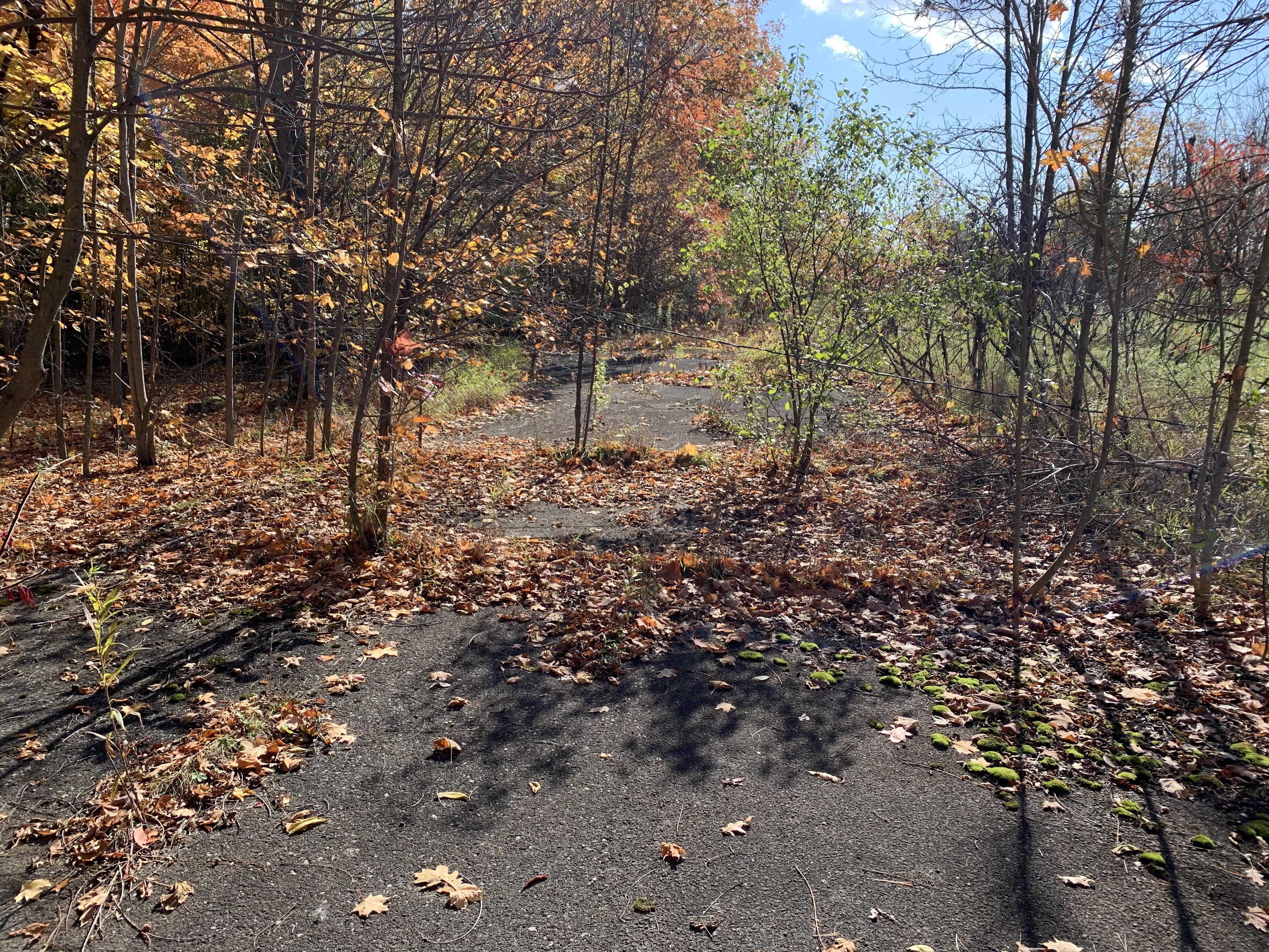
Bond Lake has an extensive history and in earlier blogs we touched on some of the electric railway uses of the area. Returning, we set out to discover what else remained to be seen at Bond Lake.

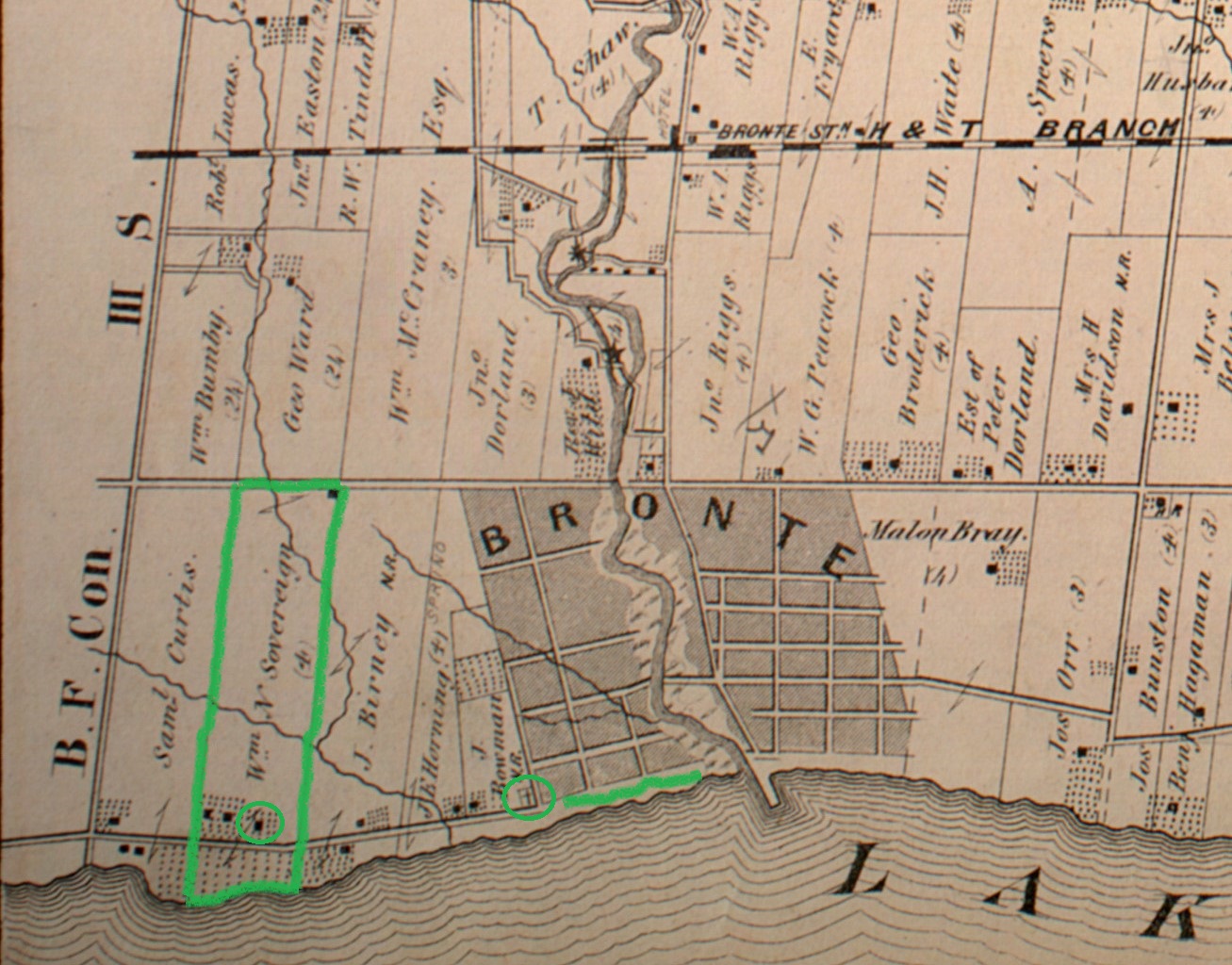
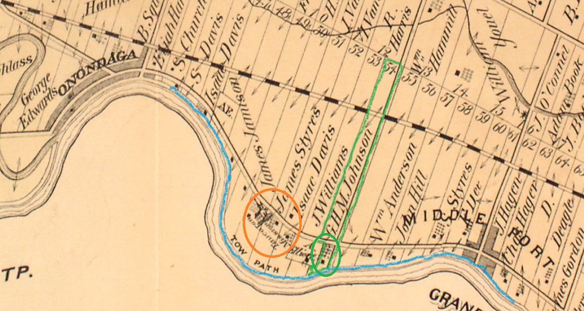
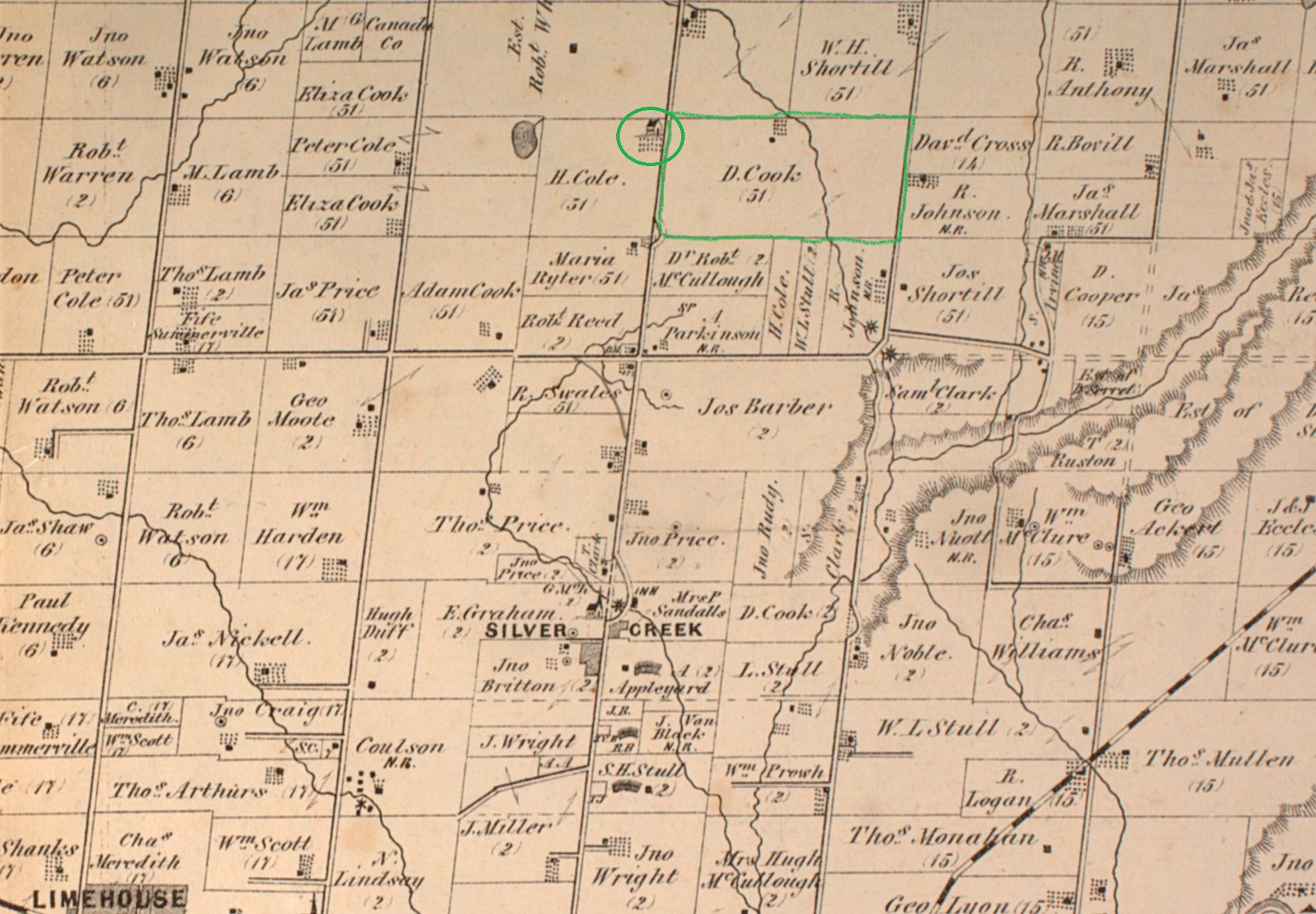
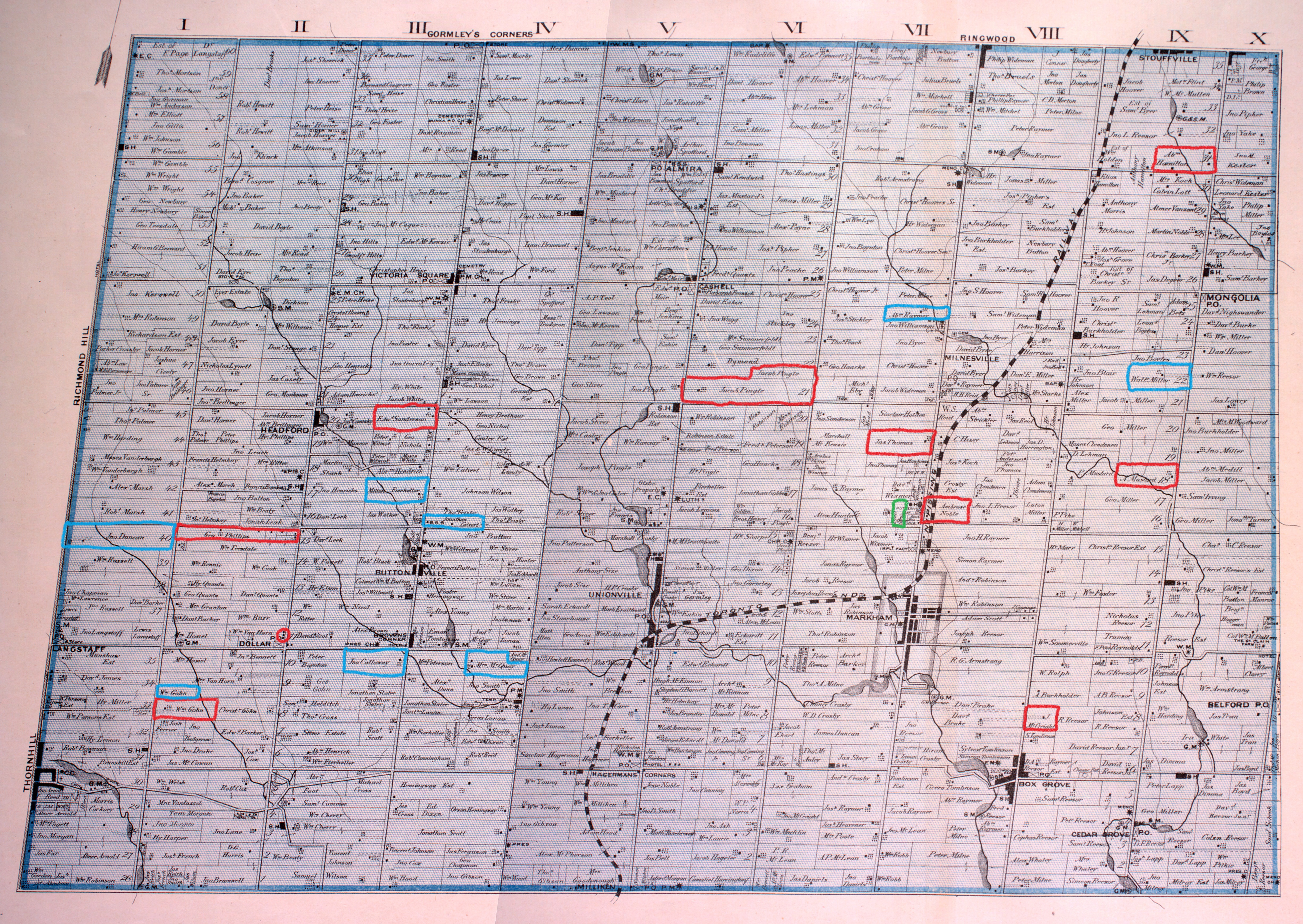
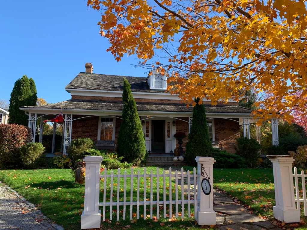
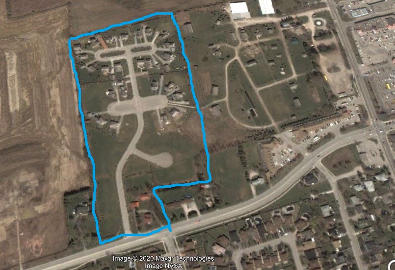
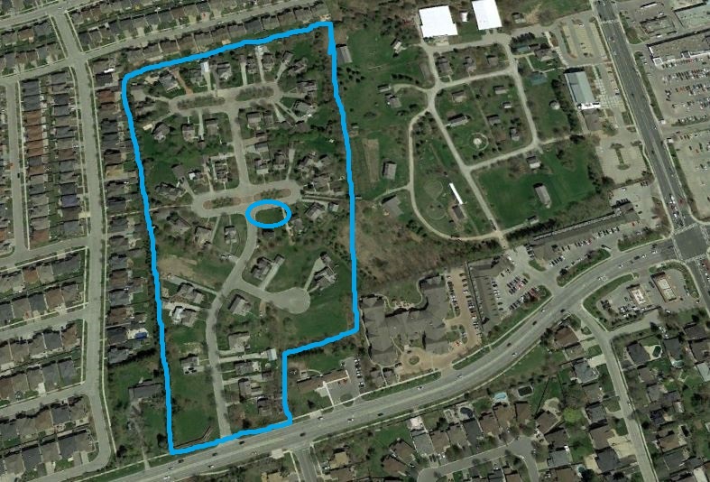
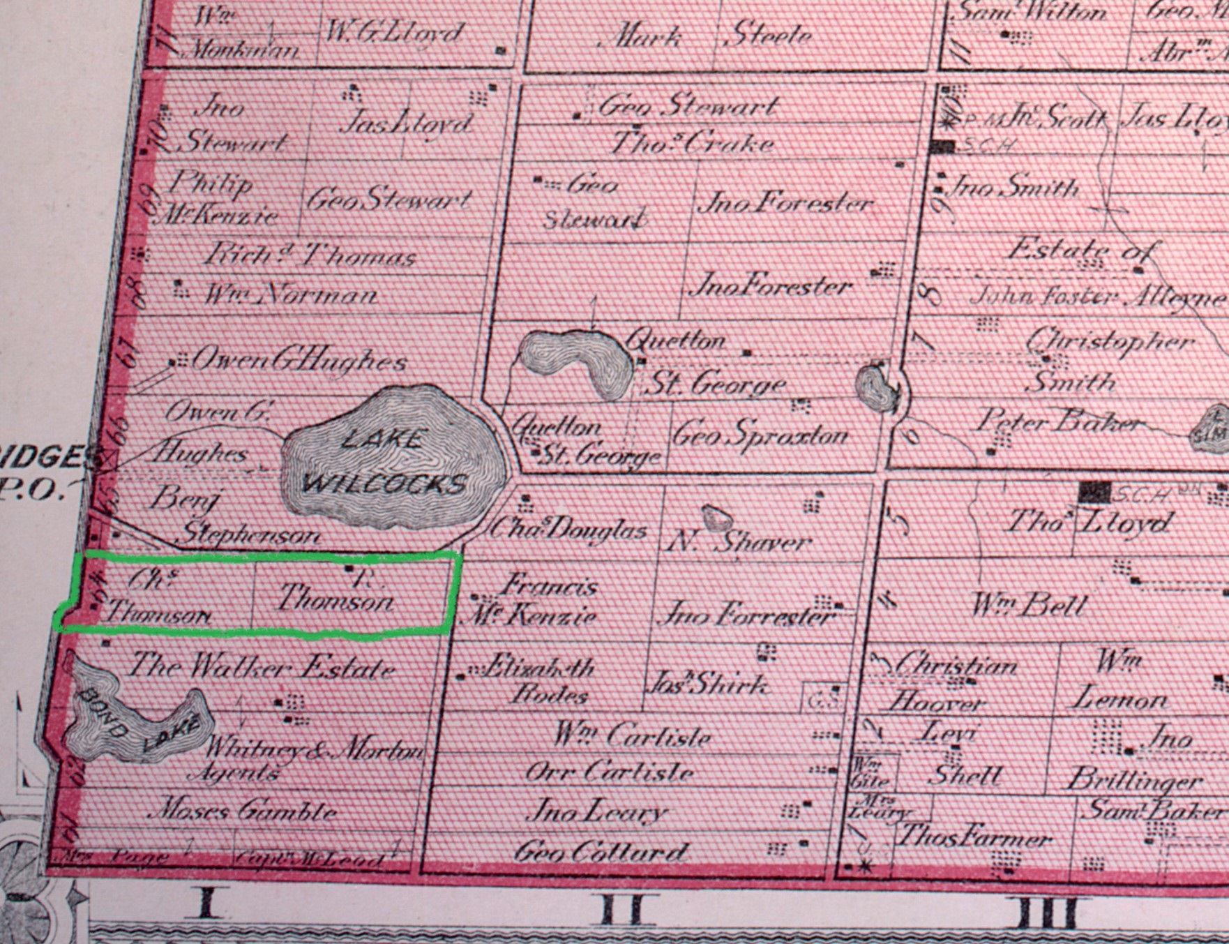
The original land grant had been given to William Bond who briefly settled in there in 1793 constructing homes and building 8 miles of Yonge Street in the area. By 1795 he had already sold the land but had left his name on the lake. The county atlas below shows the area in 1877 when it consisted of several small farms including that of the Thompson family. Moses Gamble and his heirs would own all of this land by the middle of the 20th century and today it has been over-run with single family homes. The story of Bond Lake and the years in between can be found in our feature Bond Lake.

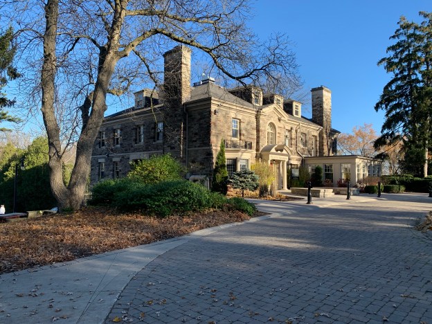
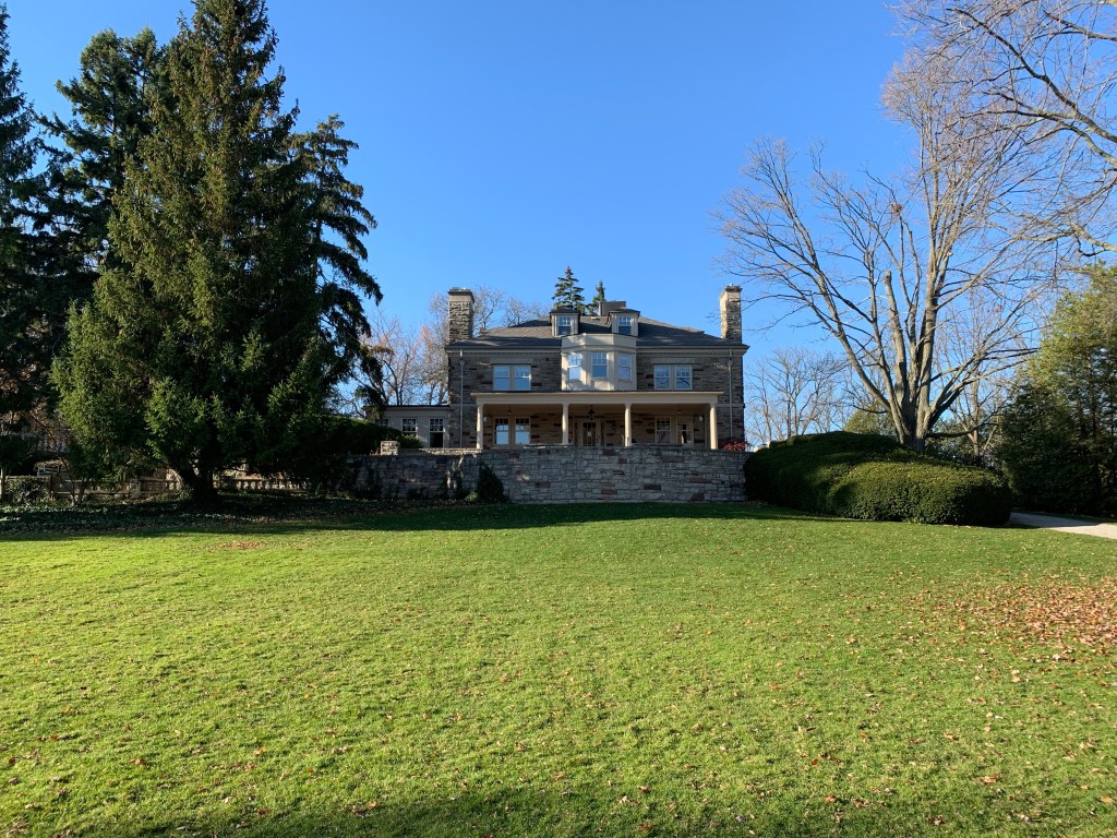
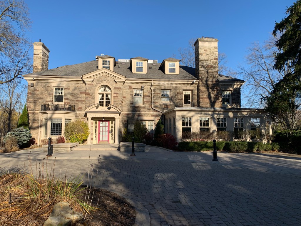
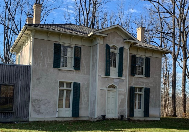
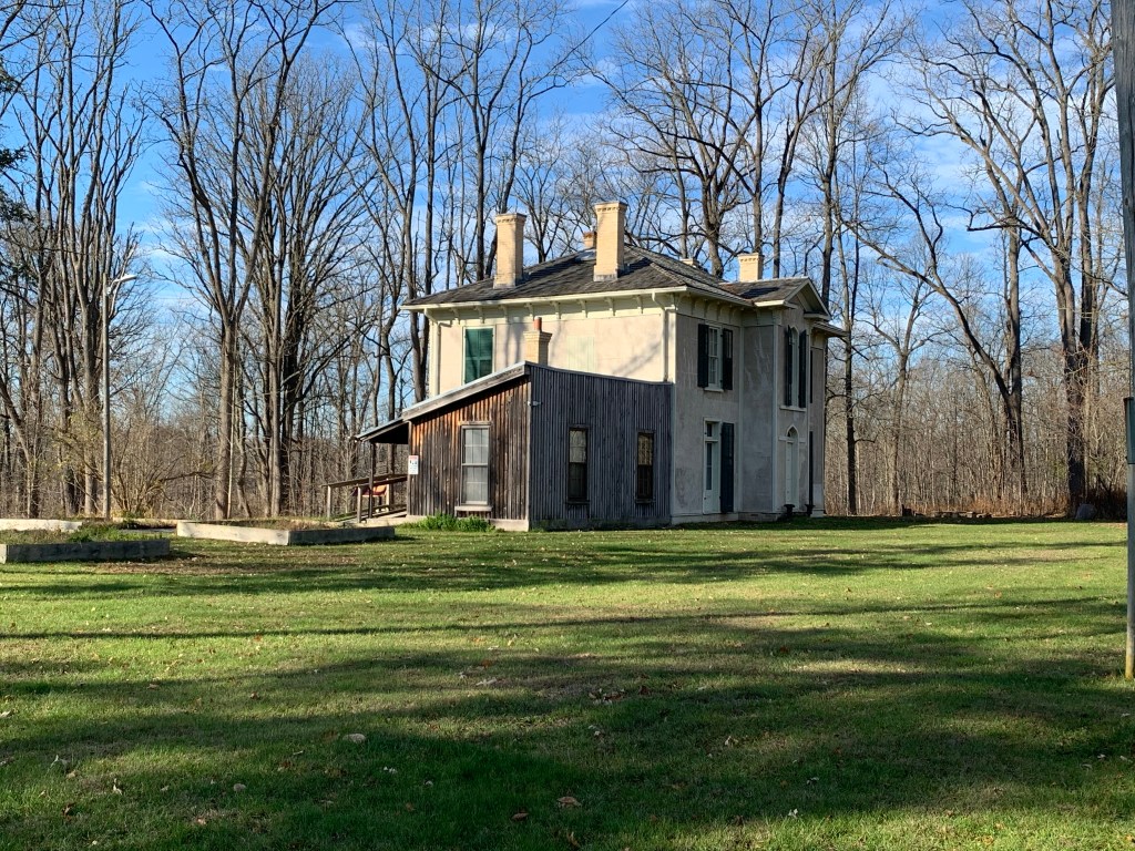
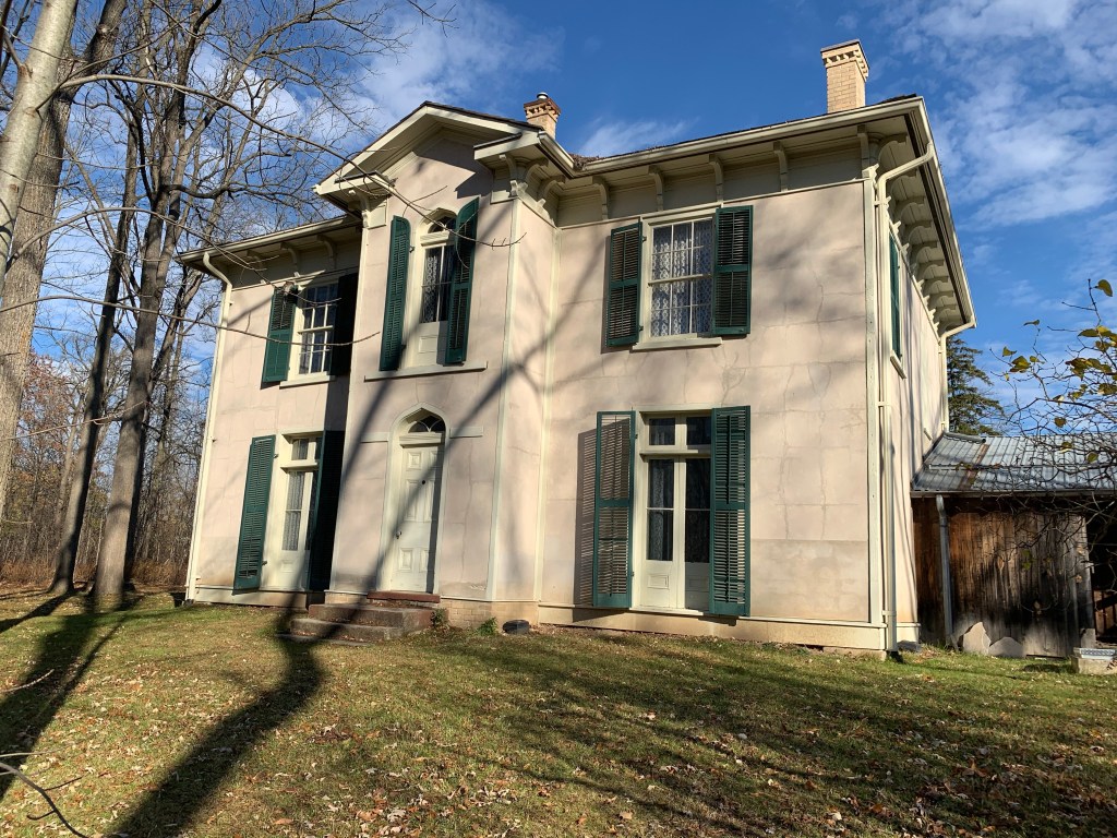
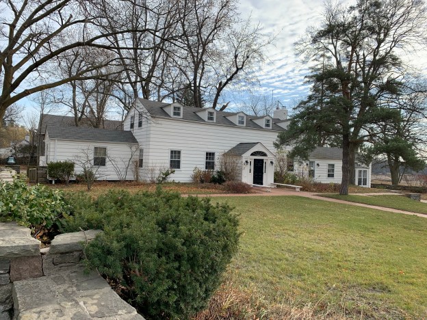
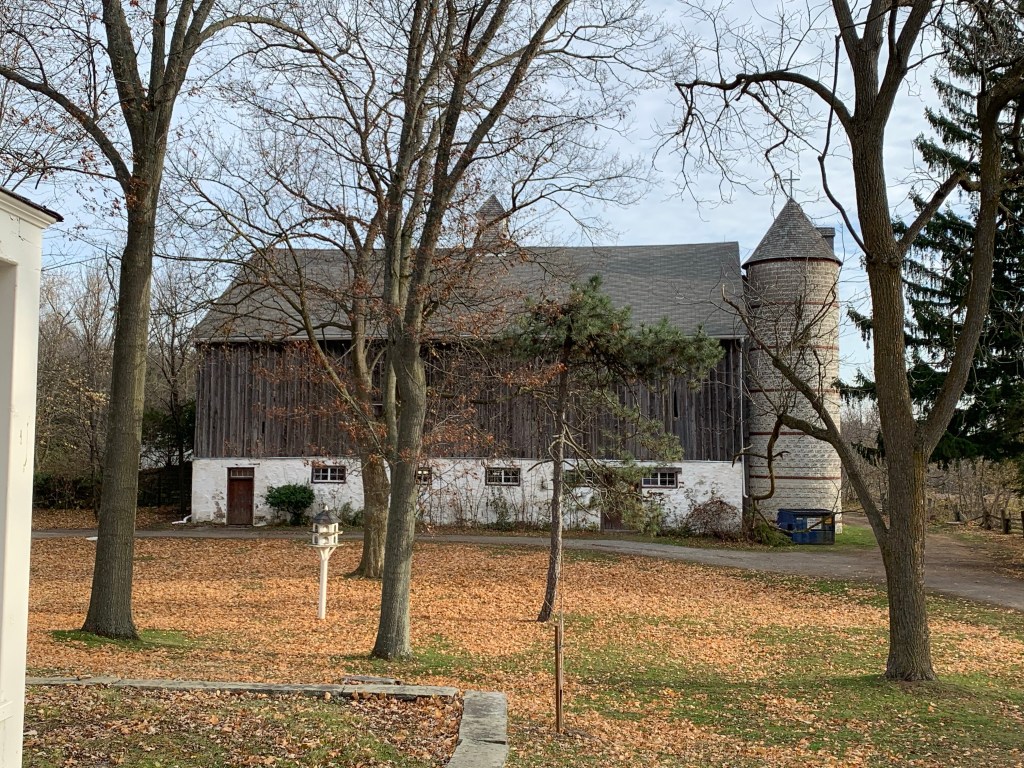
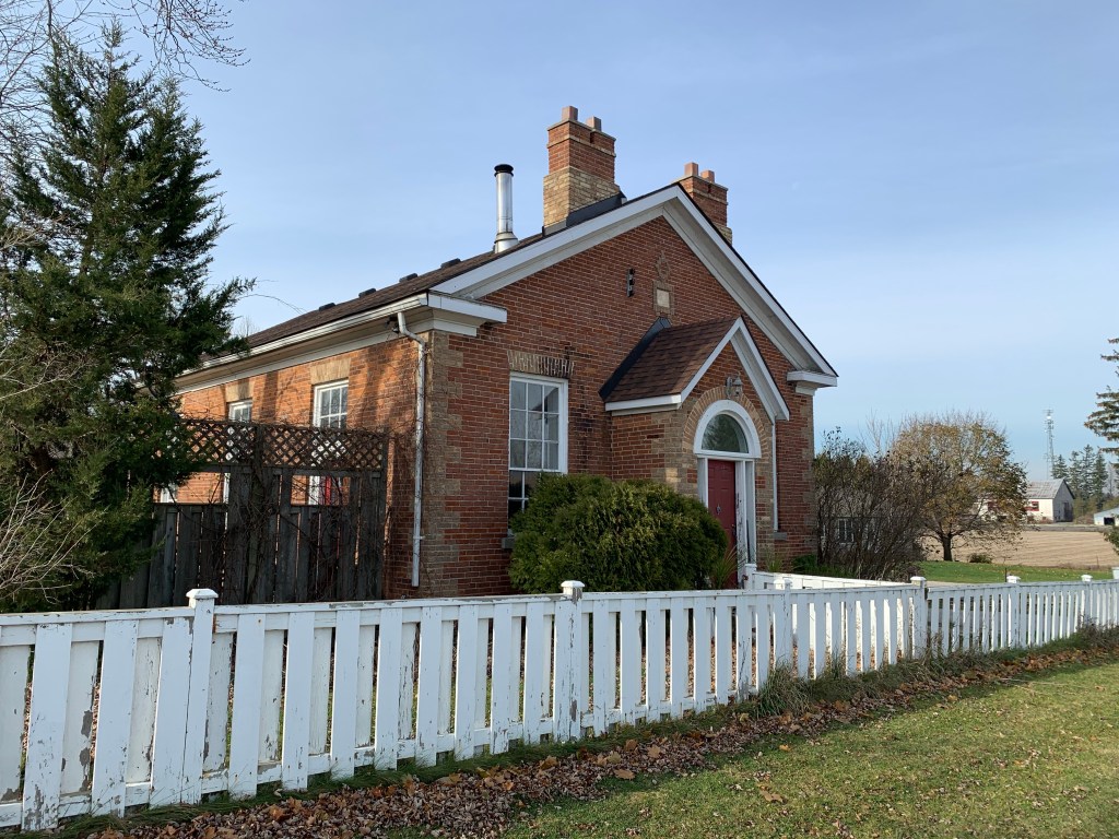
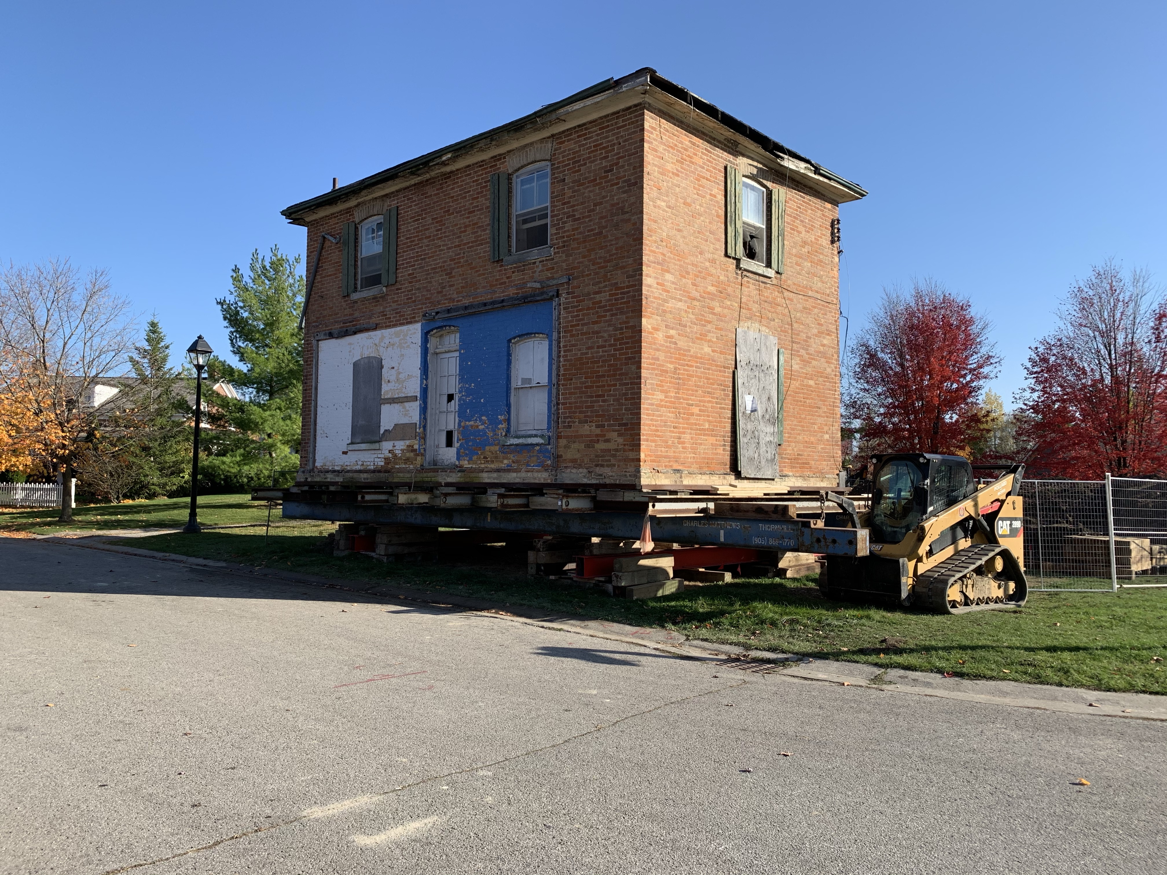
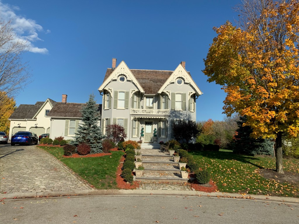
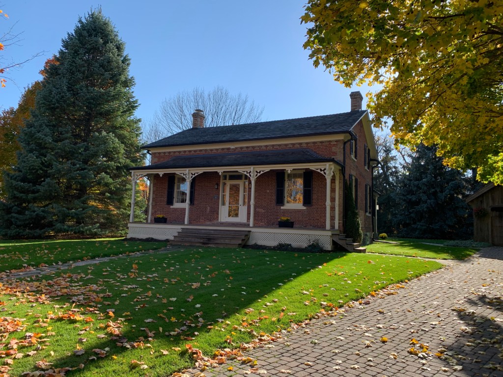
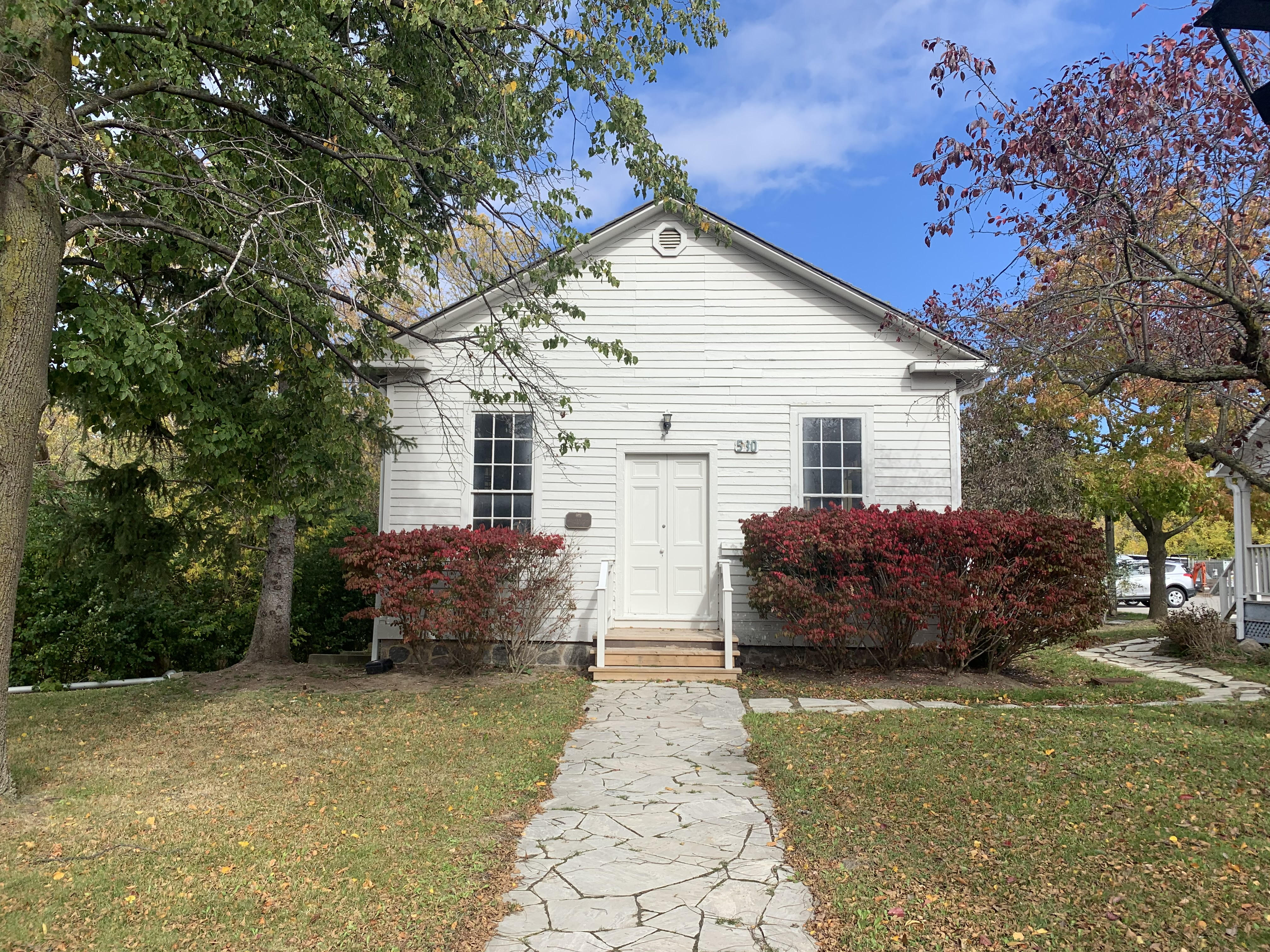
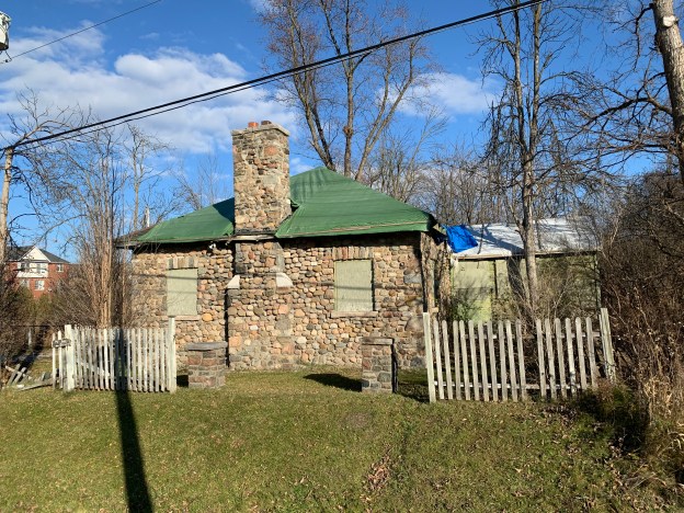
The Thompsons ran their farm until 1908 when the General Manager of the Merchant’s Life insurance Company of Toronto, a man named John H. C. Durham, bought the place. He turned it into his country estate and in 1912 had the old farm house remodeled to suit himself. Then in 1915, he had a cobblestone cottage built to house the farm manager and his family.

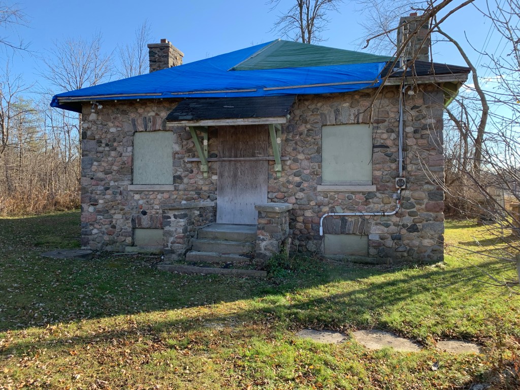
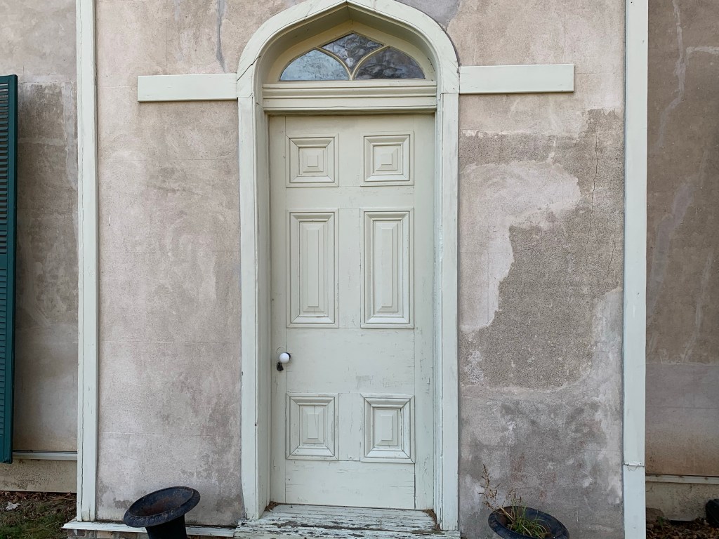
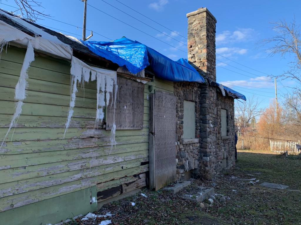
The cottage is square with a stone chimney on both the east and west walls. The roof is hipped with the four sides meeting in the middle. Rounded river stones face the building with larger ones used to form rough quoins on the corners. Above the windows are wedge shaped stones that form a rough arch. These are known by their French name of “voussoirs”.

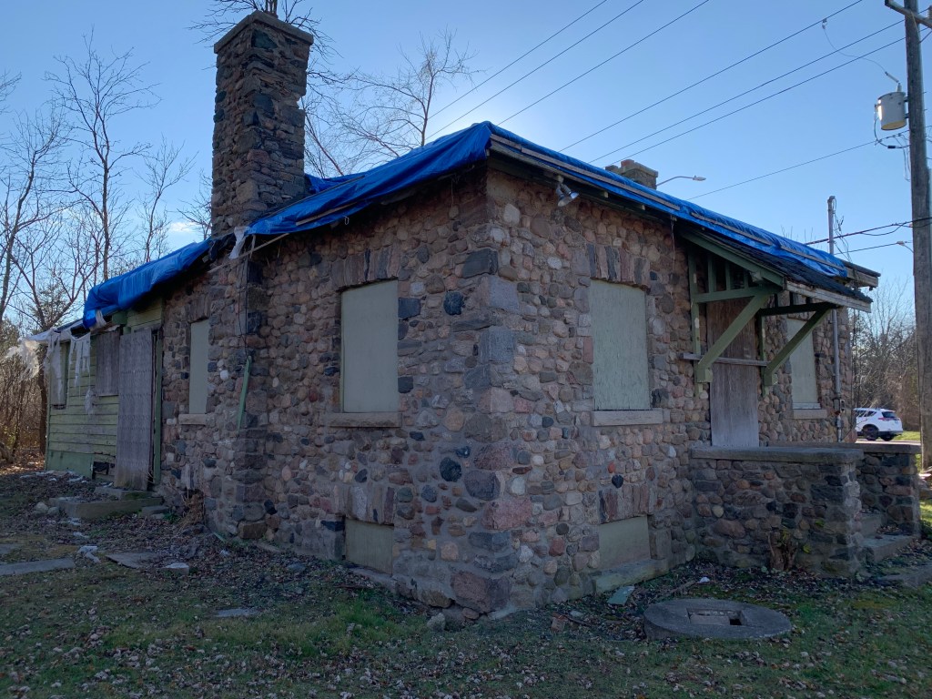
The south wall has had a frame addition at some point over the years. Records show that the original stone building had double hung, 6 over 6 windows while the addition was 3 over 2. This building is on the heritage list and has had an earlier attempt to preserve it by adding a tarp over the holes in the roof. That appears to have been done quite some time ago. The home itself and the land around it was sold in 1940 to the Gamble family who were increasing their hold on the area around Bond Lake.

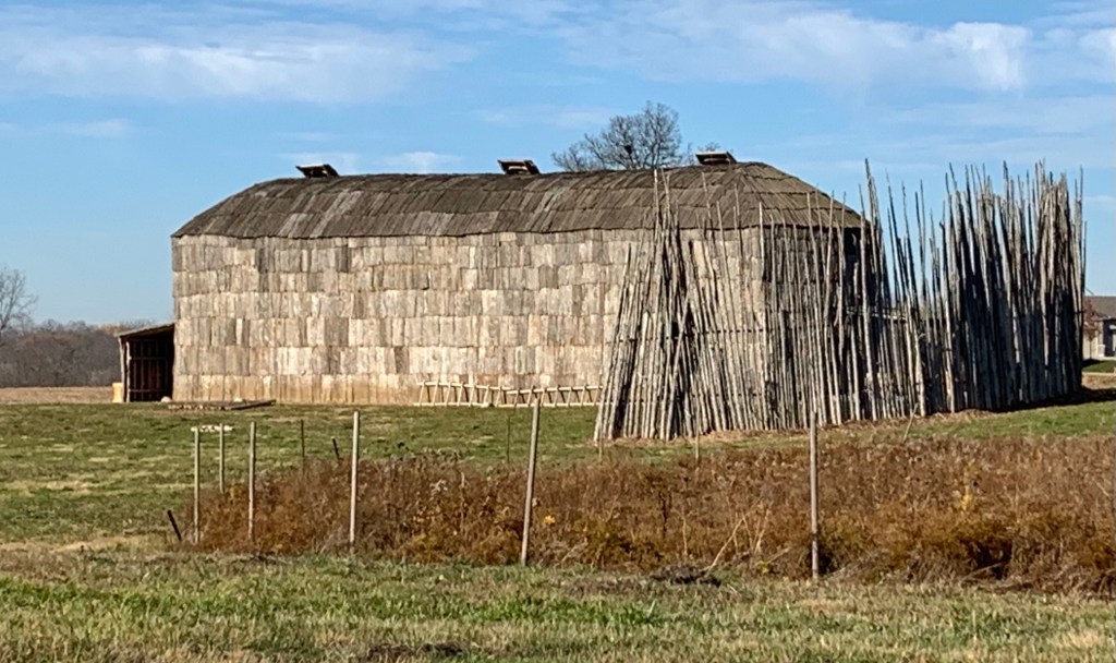
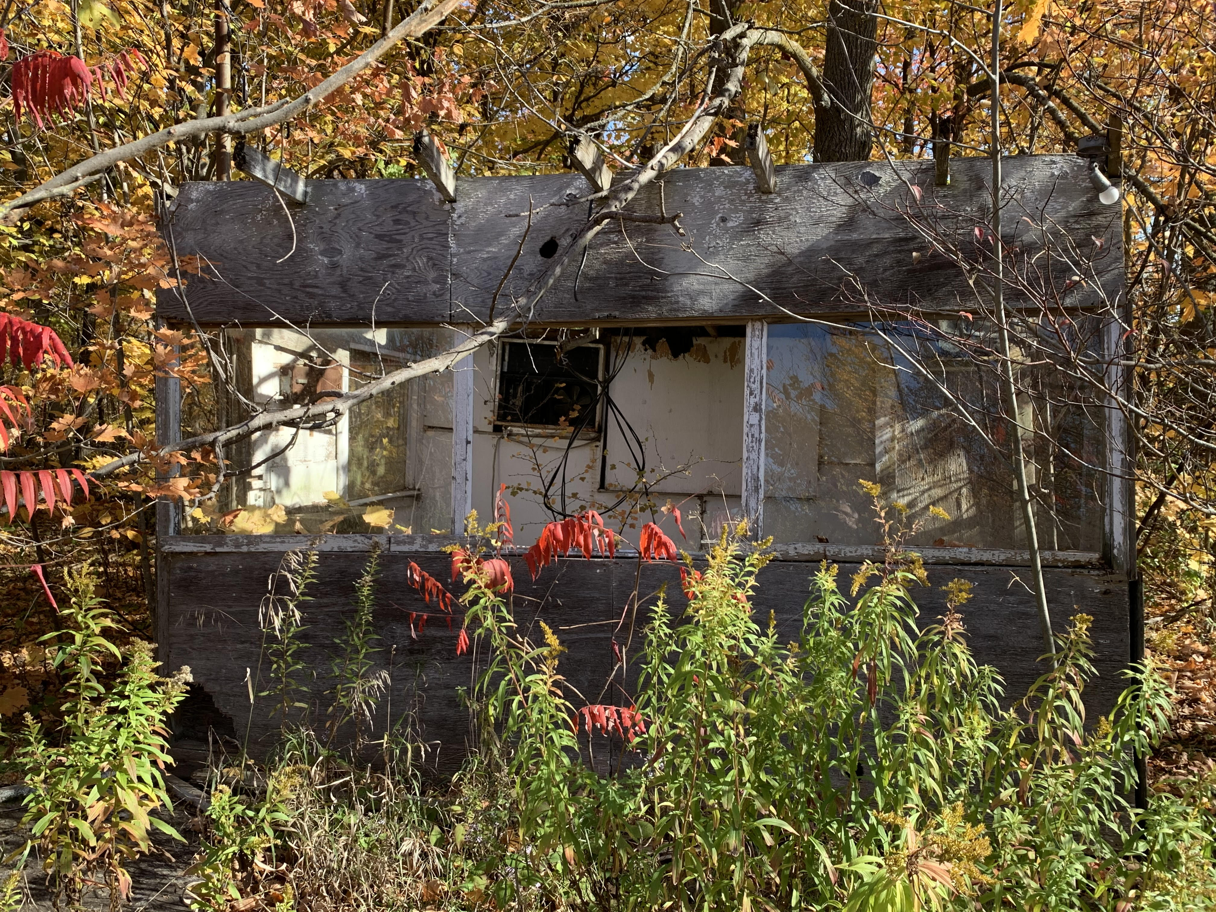
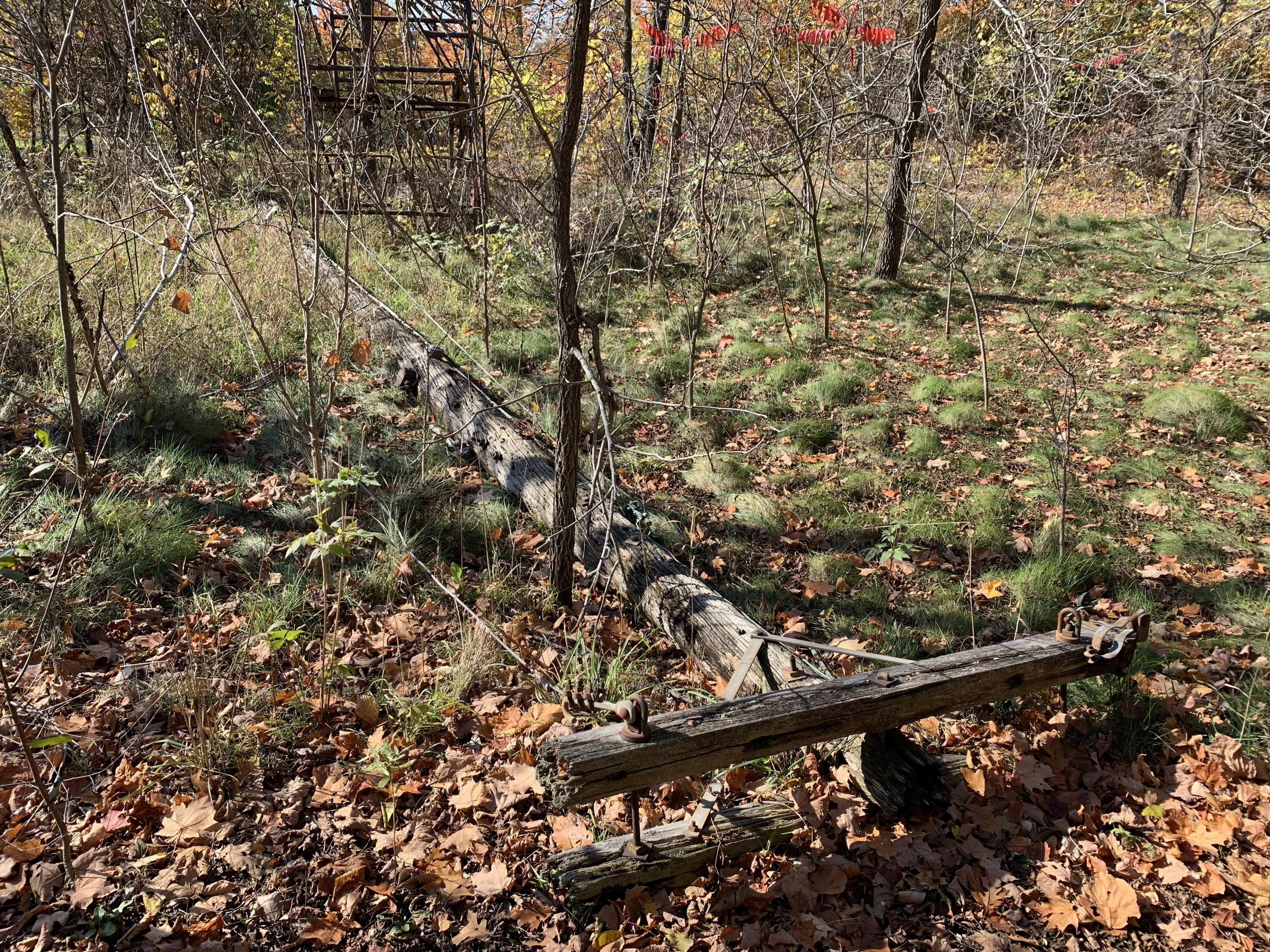
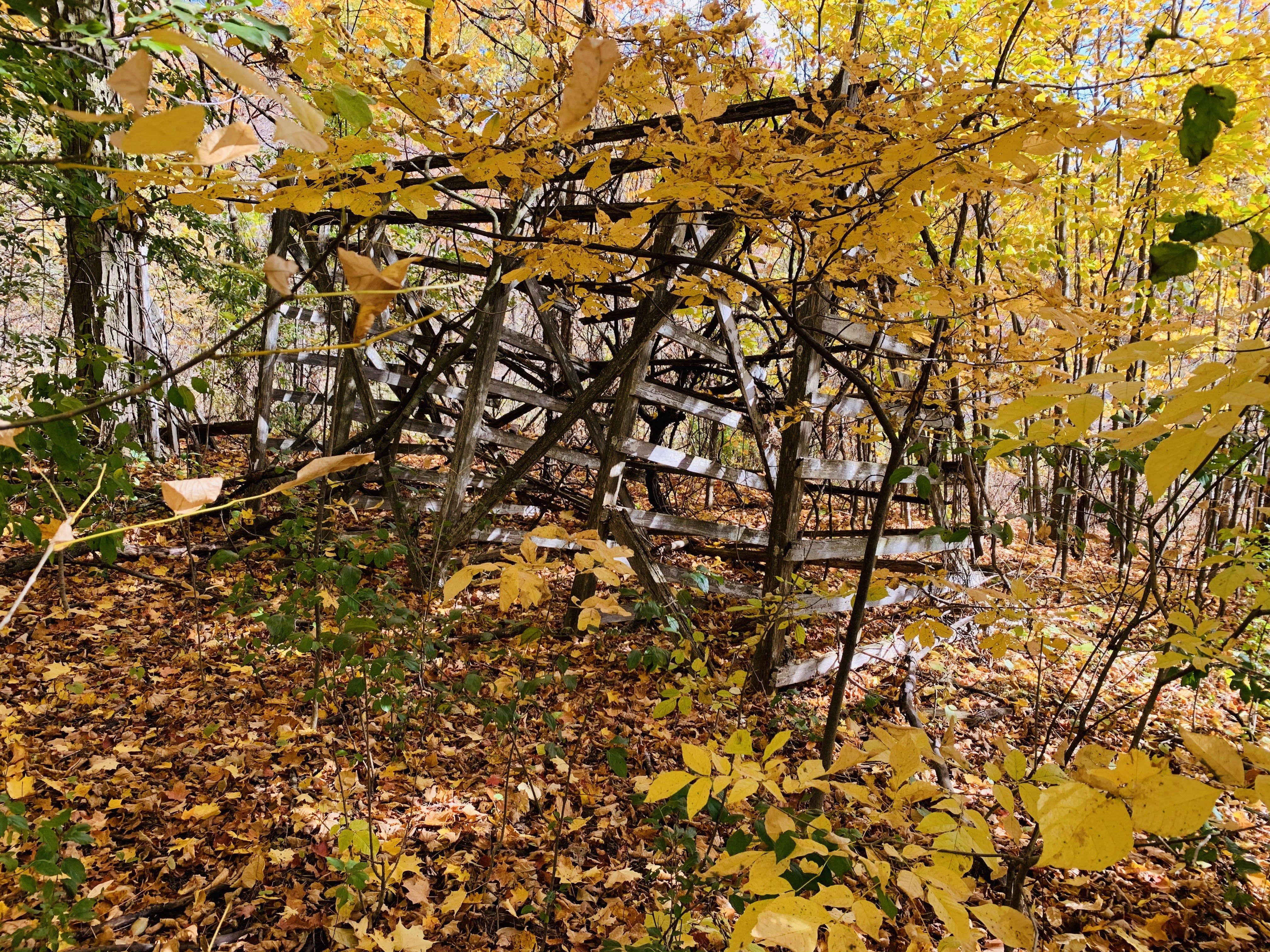
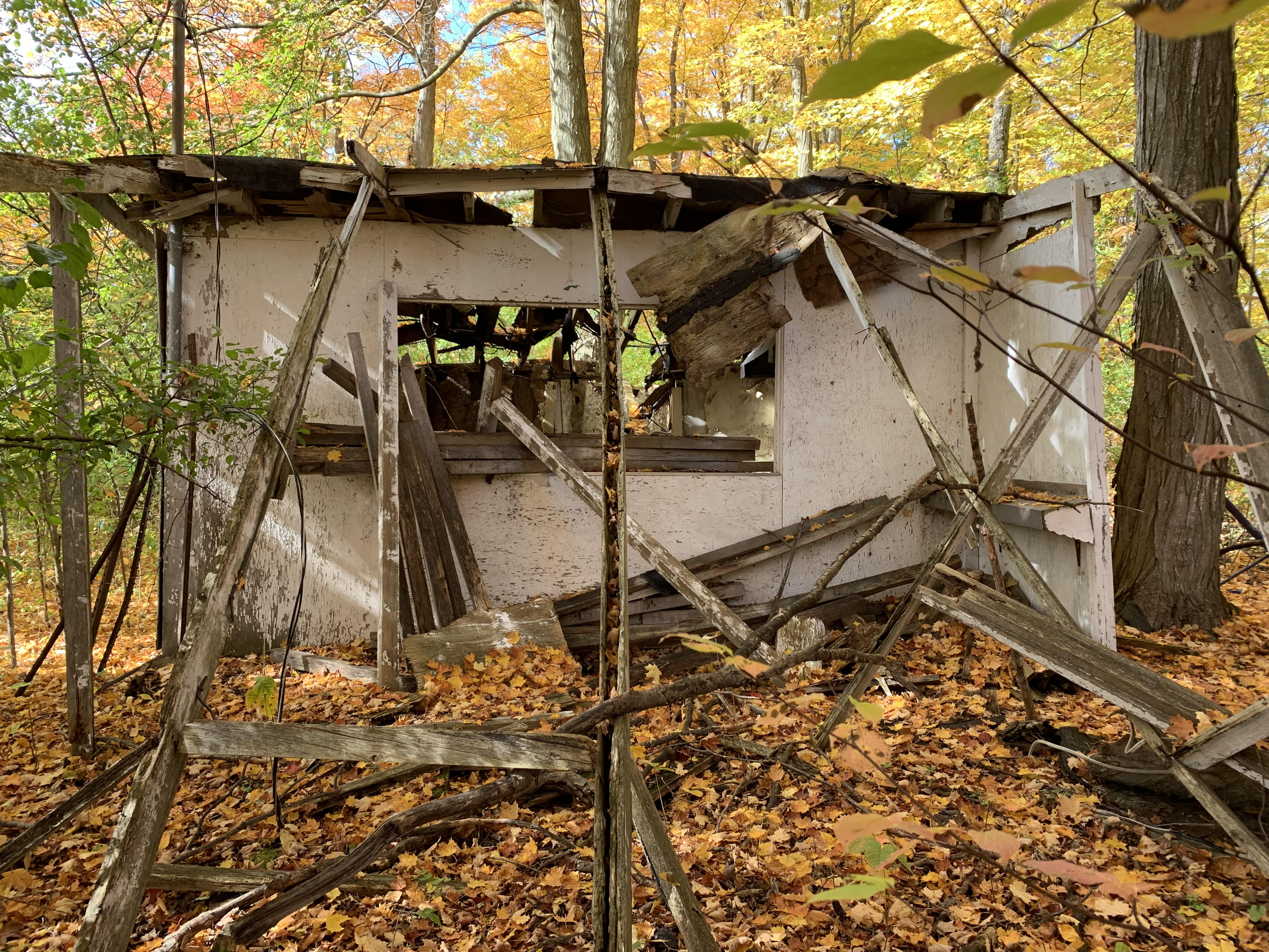
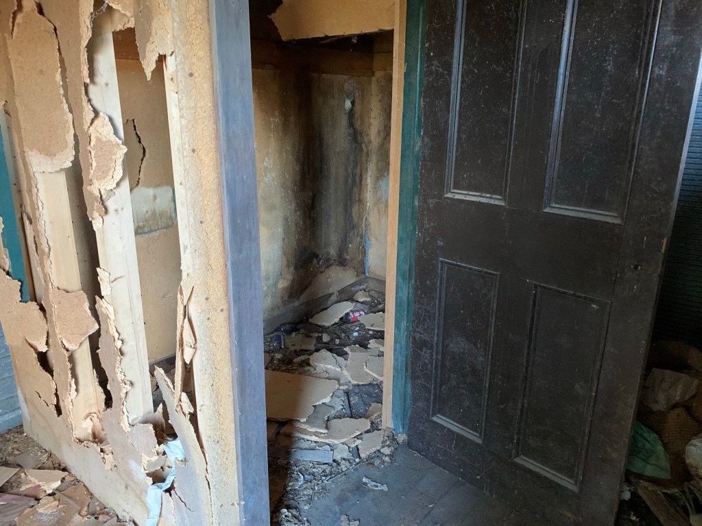
One of the many little buildings that once surrounded the lake, this one has seen its best days. Outside it has a lazy kind of lean to it but inside it has been semi-demolished.

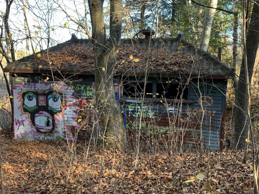
Inside this building has been trashed which is a pure shame. I understand that people like to get together with friends and have a drink and smoke something and they may not be able to do it at home. Buildings like this provide some shelter from the weather and perhaps some discretion as well. However, I don’t understand why people can’t stop by for a party and enjoy themselves without having to ruin the place. It seems to be self-defeating behaviour as far as I can tell.

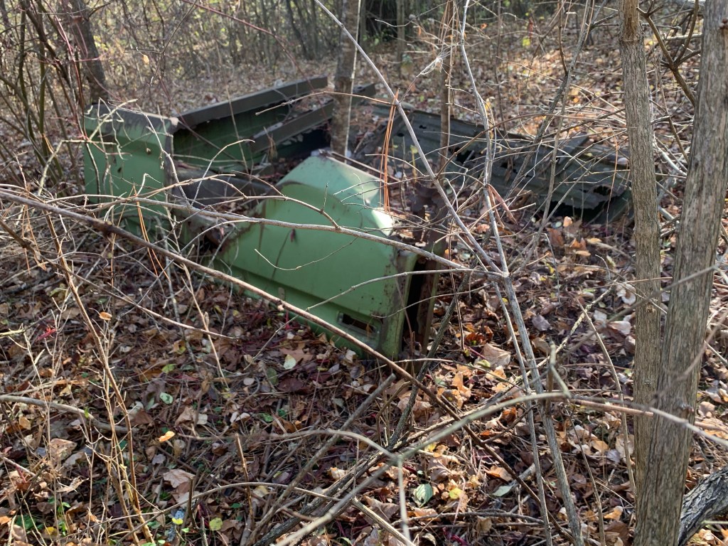
We found the remnants of several old cars, or at least the chassis of them. This one was a green truck and had more of the body still remaining. Most likely this was some kind of 1970’s G.M. pick up truck.

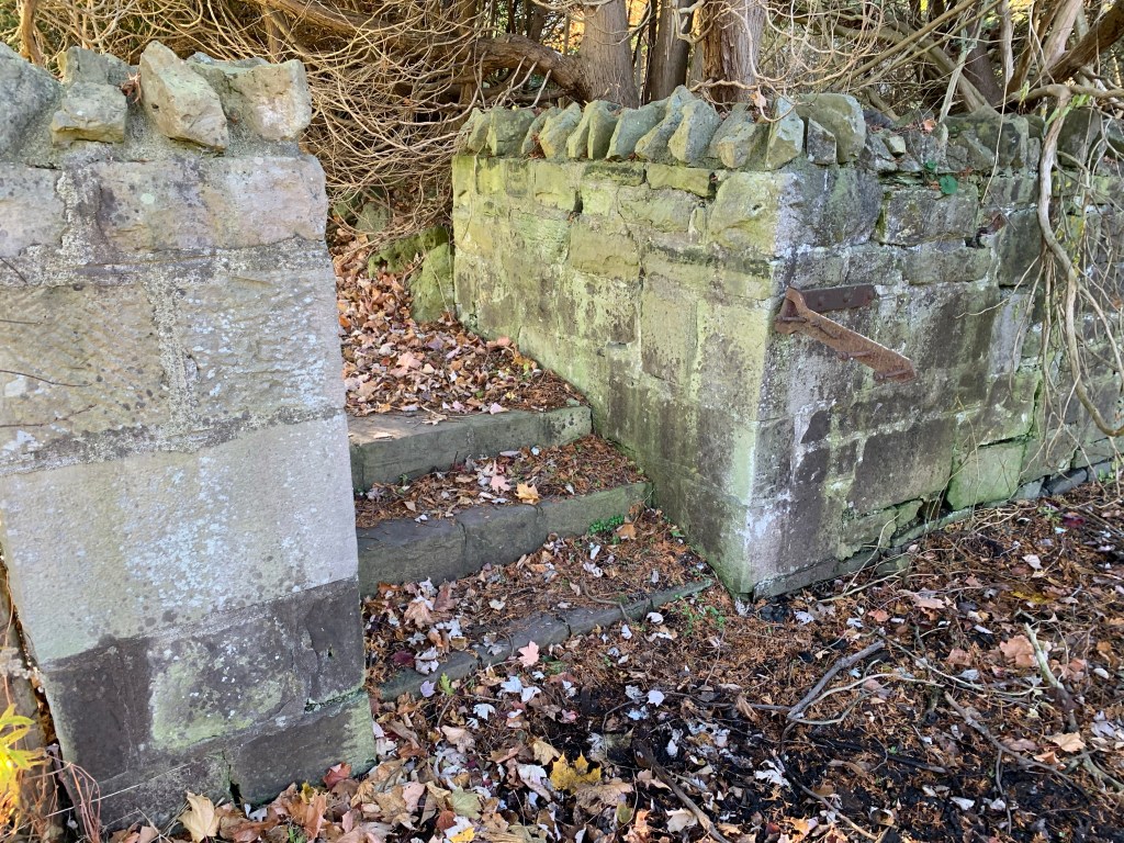
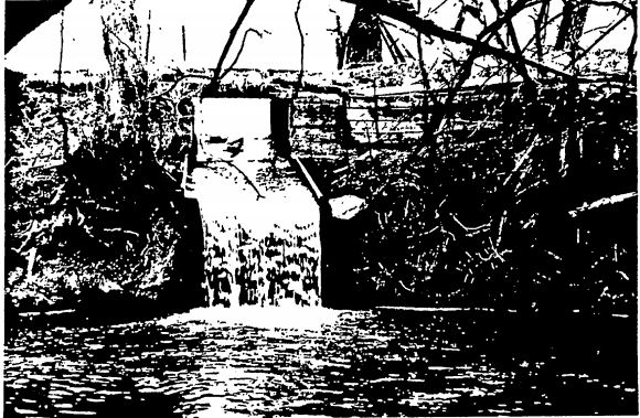
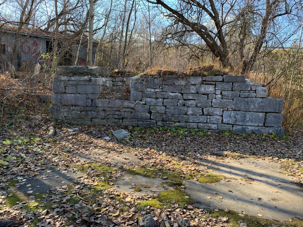
Sets of cut stone blocks form the mounting pads for the old steam generators for the Toronto & York Radial Railway. These also contain the old fire places where the coal was burned to create the heat for the generators. In this shot the maintenance shed can be seen in the background. It is still in quite good shape considering the number of years since it was last used to service electric railway cars and equipment.

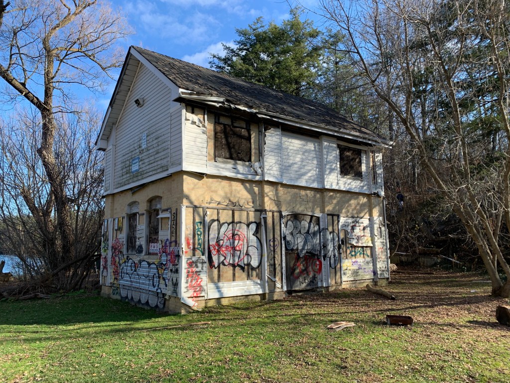
The substation at the Electric Railway Generating Plant is in worse condition every time we visit the area. Having suffered a fire, and with major holes in the back roof, it seems that this historic building may soon be history.

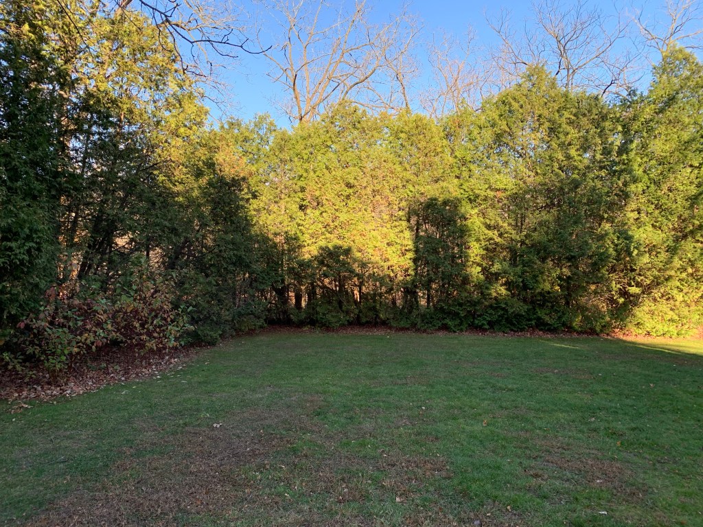
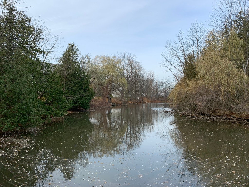
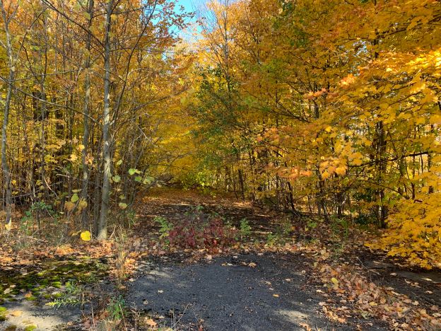
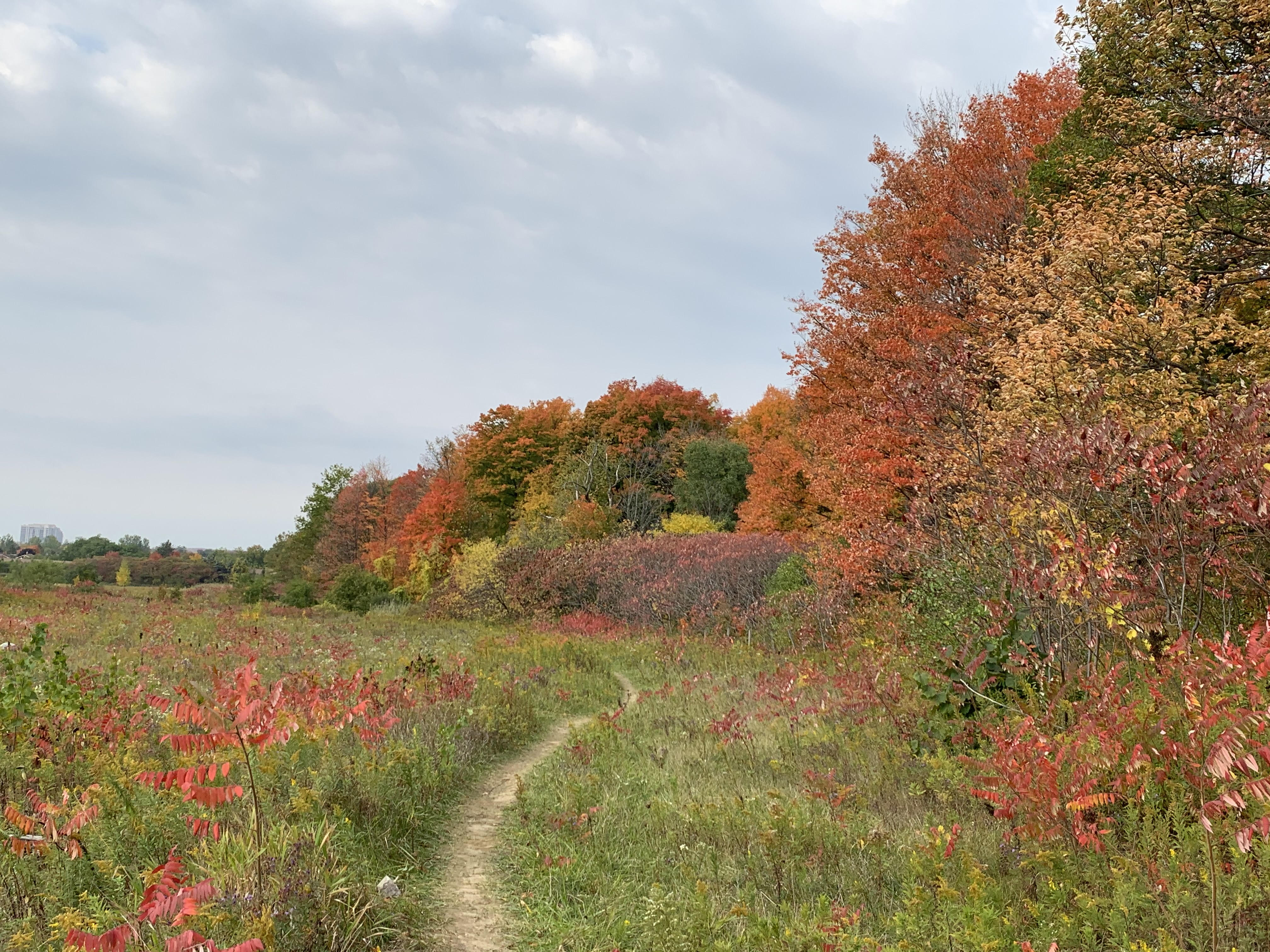
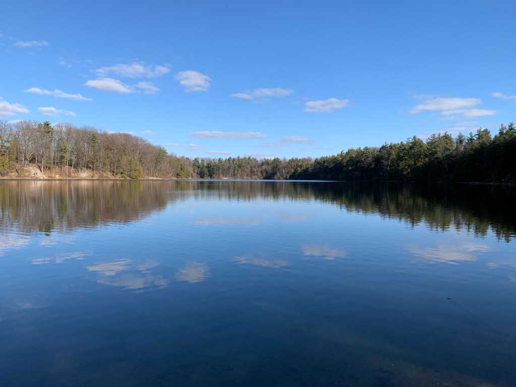
Bond Lake was still, and with the light fluffy clouds reflected off the surface of the water, it was quite calming to relax for a minute and just observe.

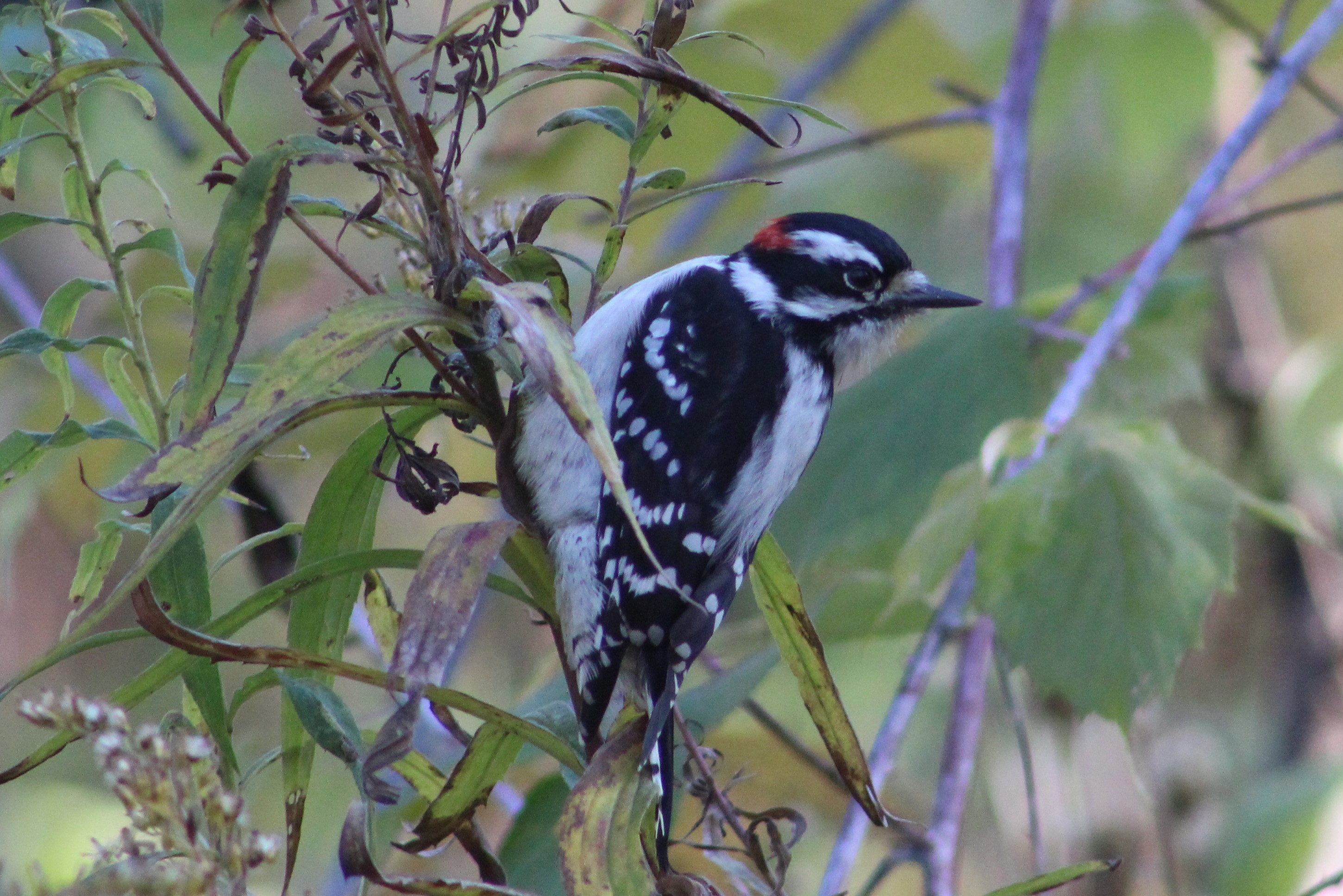
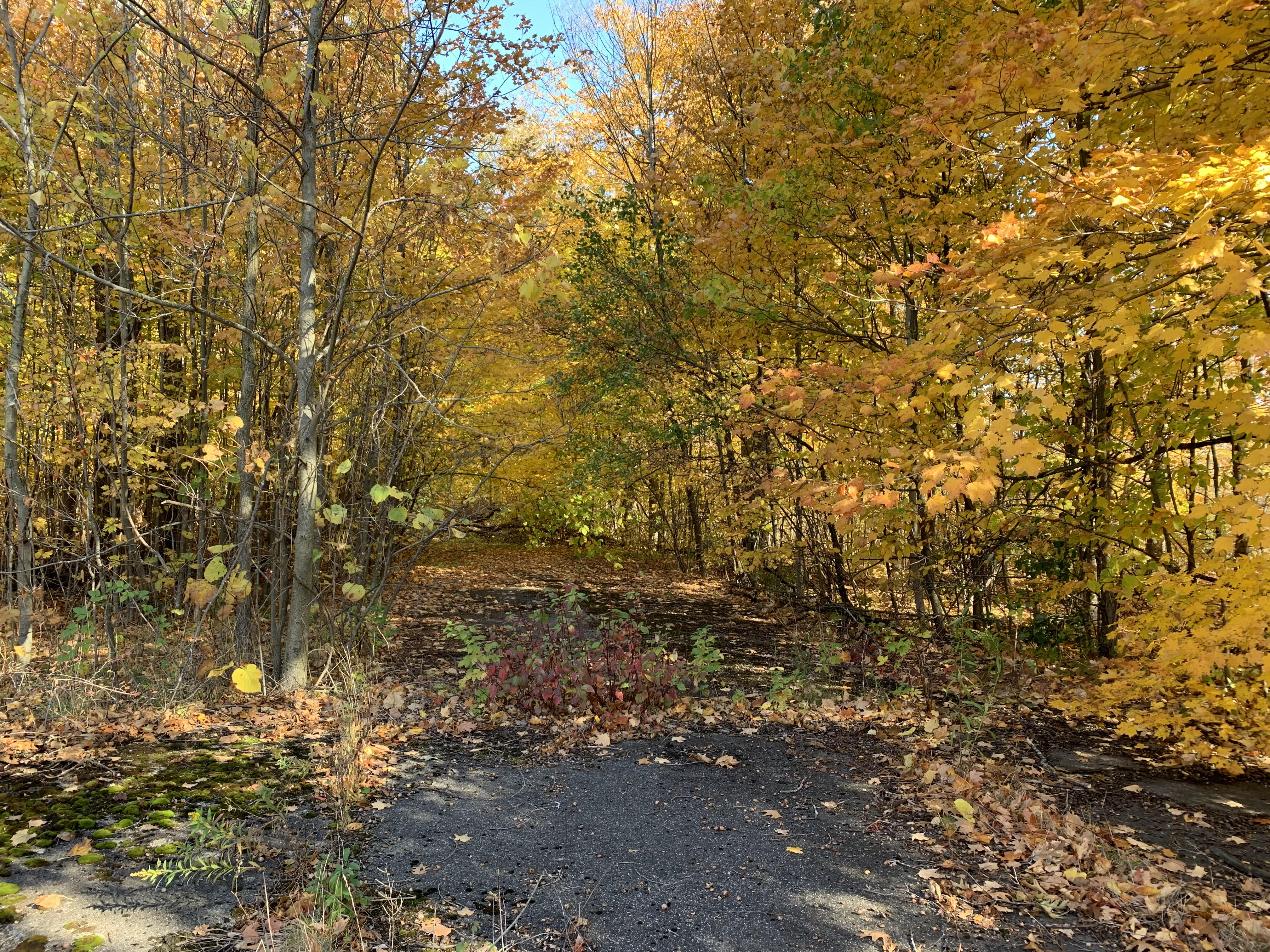
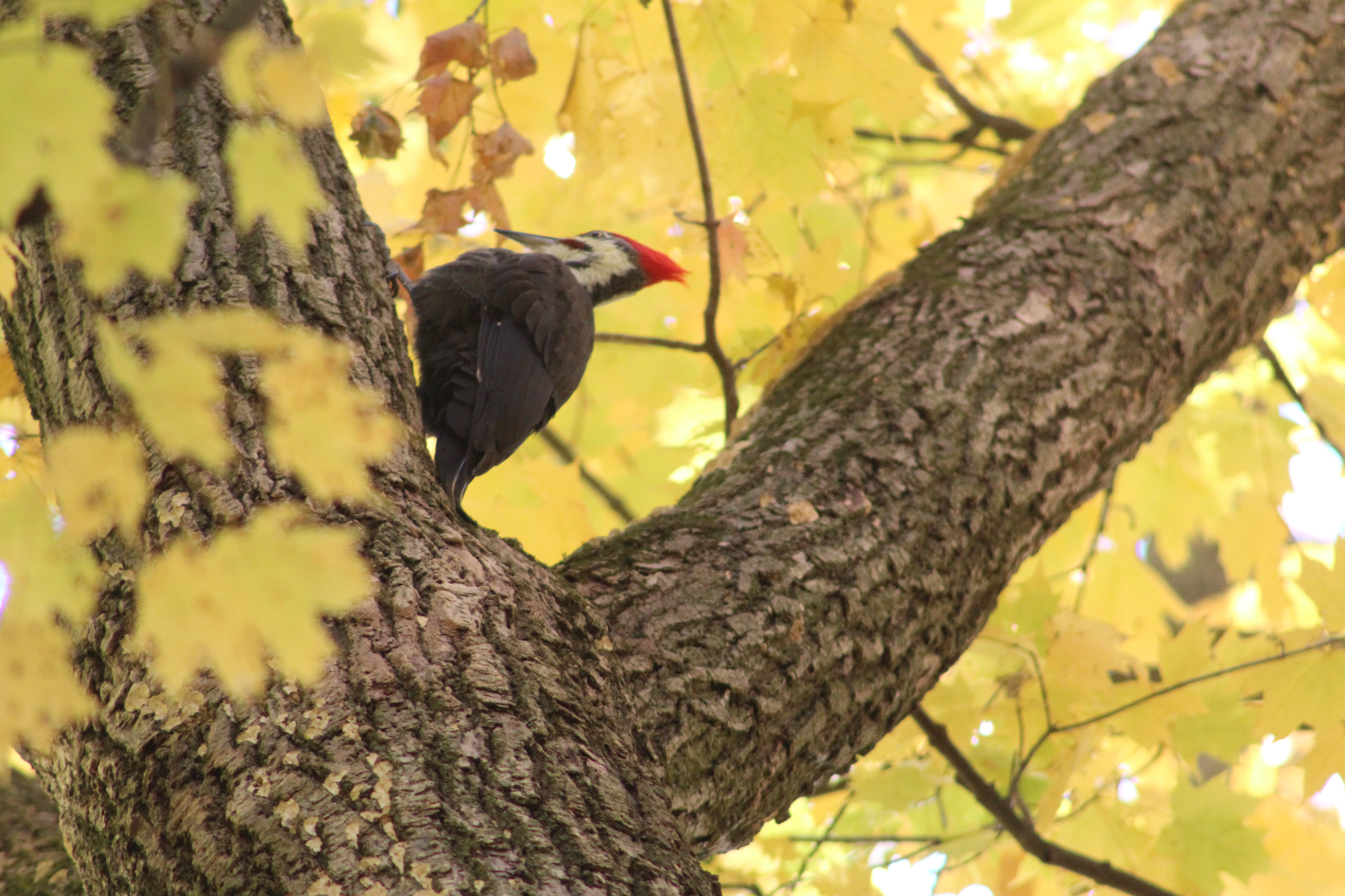
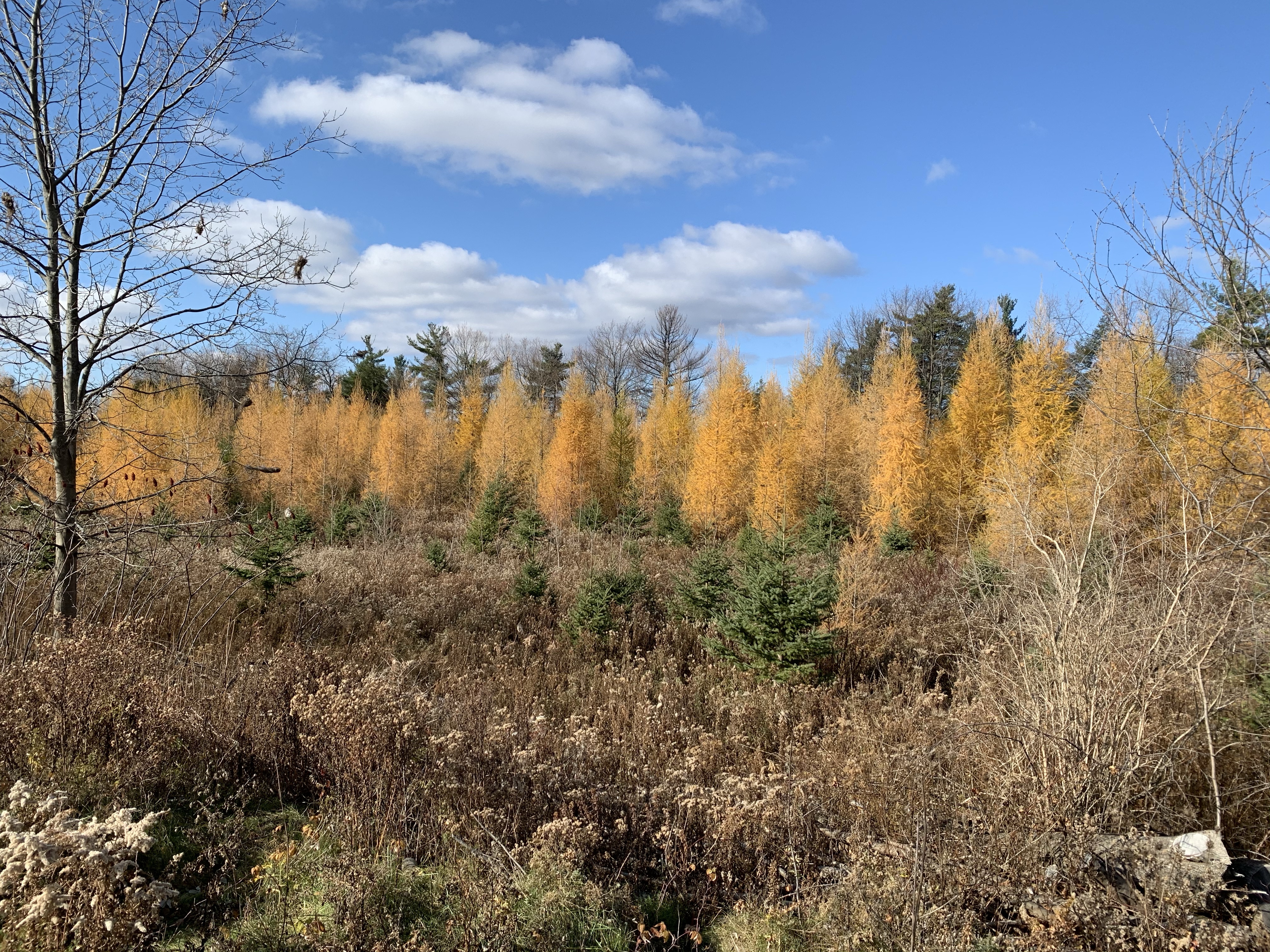
Tamarack is also known as Larch and is a coniferous deciduous tree. This means that it bears cones like an evergreen but loses its leaves like a Maple or Oak tree. On the south east side of Bond Lake several extensive patches of Tamarack have been planted and since they turn colour later than the broad leaved trees, they provide a late season splash of yellow to the woods.

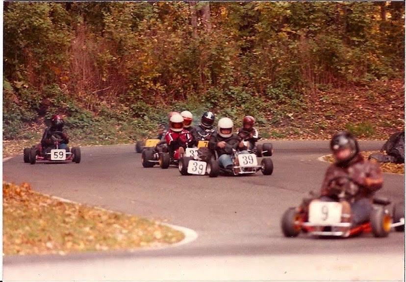
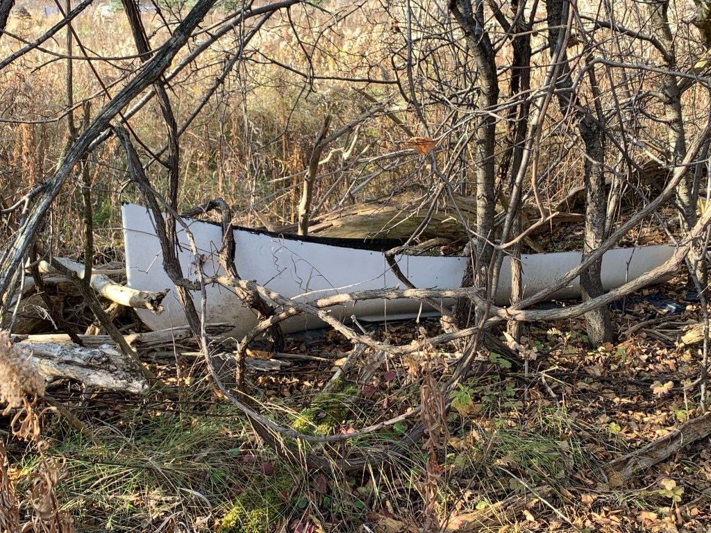
This canoe was one of two small craft that we found in the edge of the woods. The area has been home to many forms of recreation over the years including reportedly being used as a home for motorcycle gangs. I wonder if there’s a classic bike hiding around here somewhere?

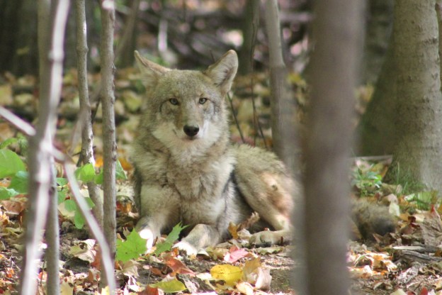
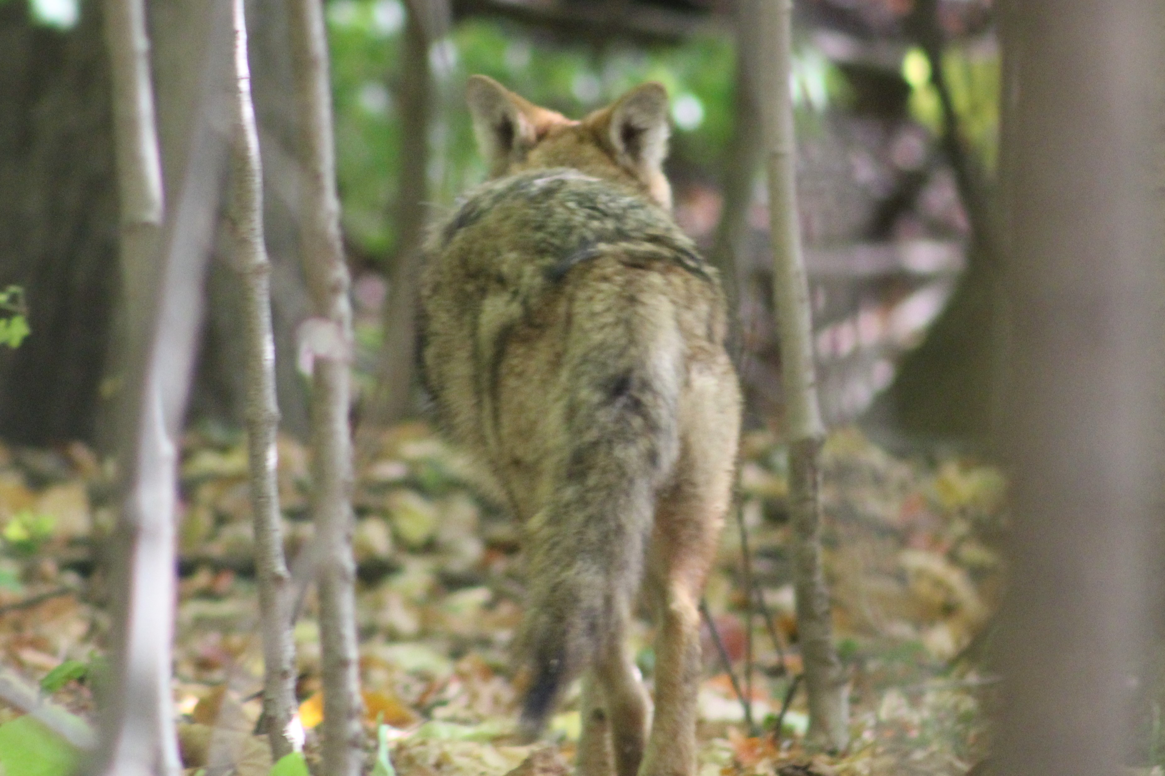
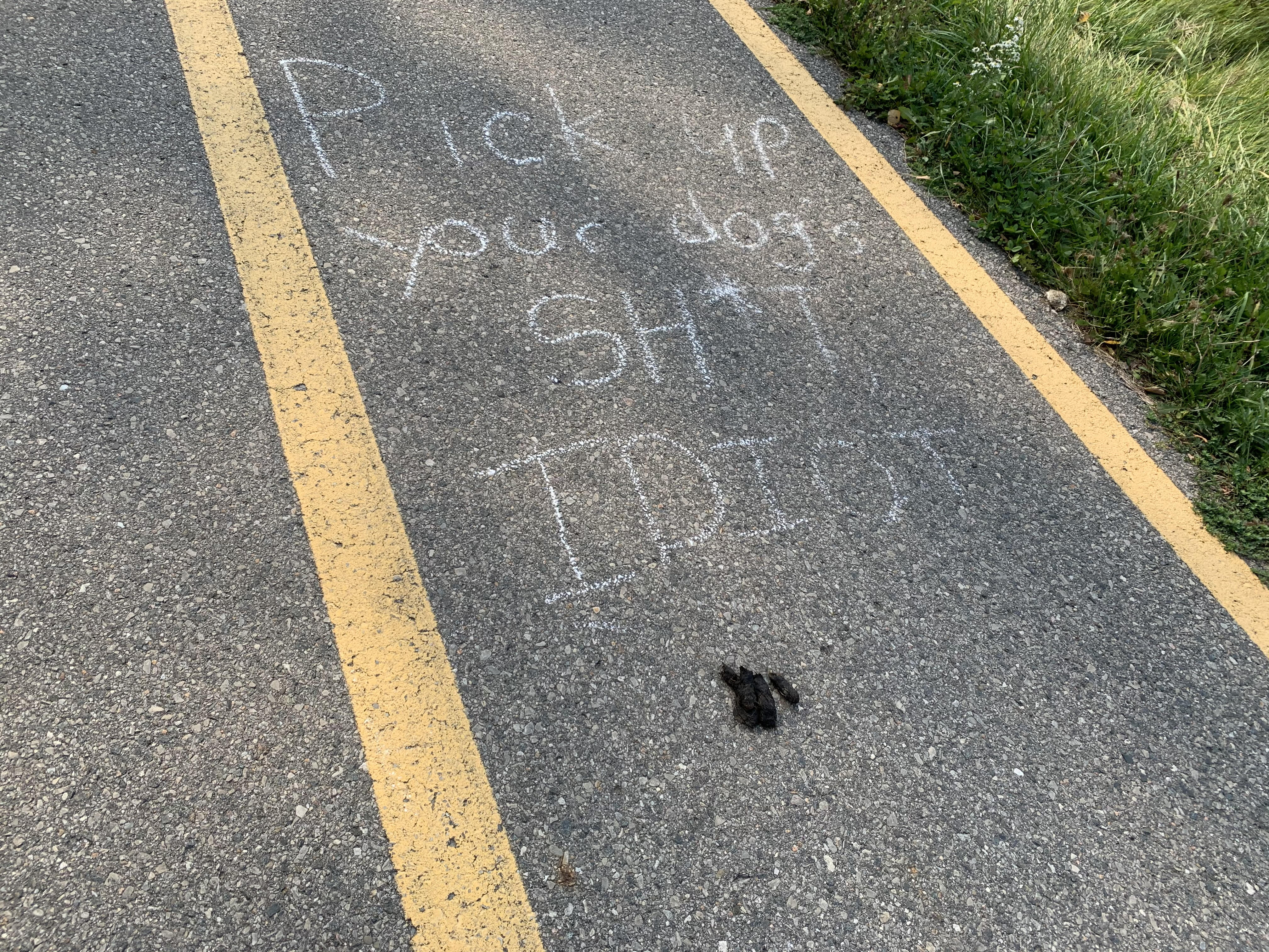
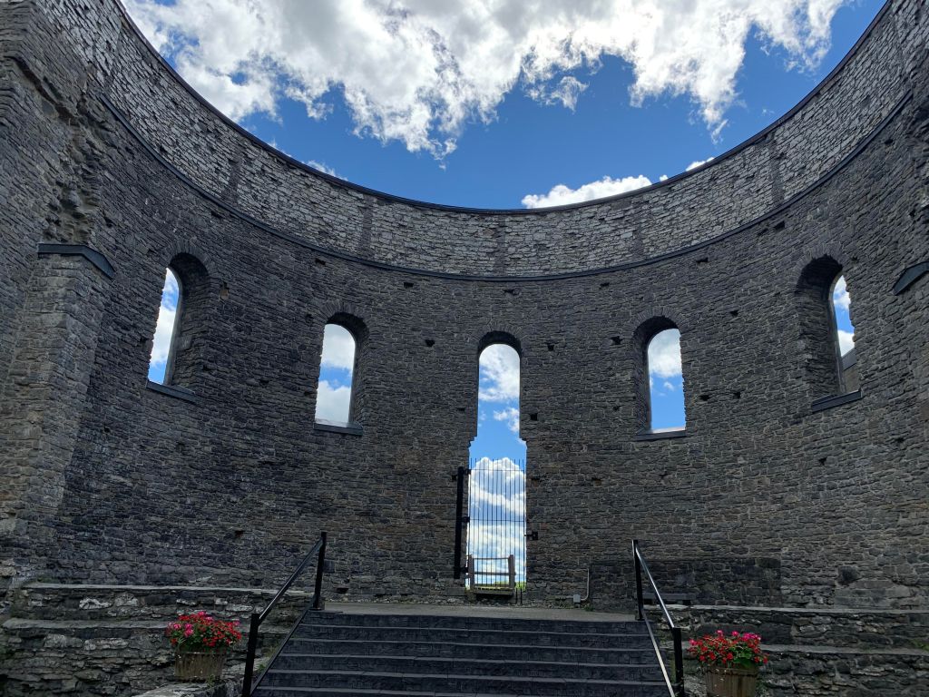
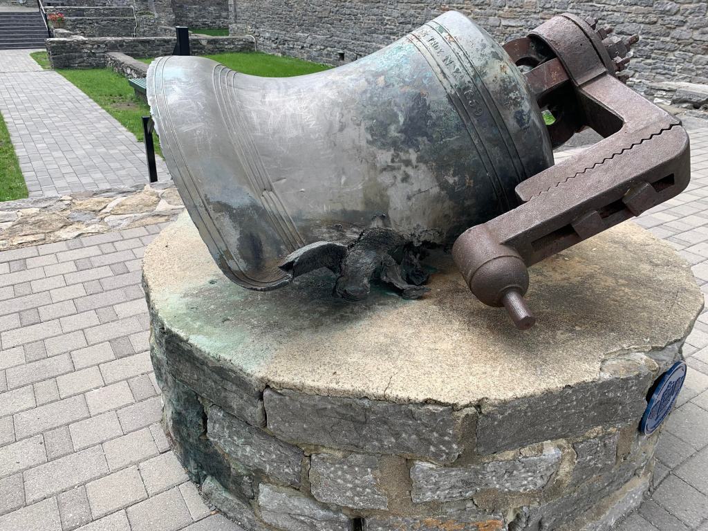
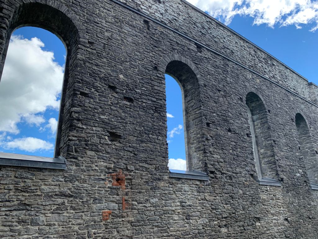
I suspect that only a few of the local dog walkers have the true picture of everything that awaits the thorough explorer at Bond Lake.

Associated blogs: Bond Lake, Electric Railway Generating Plant, and the Toronto and York Radial Railway

Google Maps Link: Bond Lake

Like us at http://www.facebook.com/hikingthegta

Follow us at http://www.hikingthegta.com

Also look for us on instagram

Paletta Lakefront Park

Sunday, December 20, 2020

The site of Paletta Lakefront Park covers 14 acres and is considered to be the finest among the waterfront parks in Burlington. The original land grant has a long history of changing hands starting in 1809 when lot 8 in concession 4 was given to Laura Secord. The Secord family didn’t settle on their property in Nelson Township and conveyed the lot to John Beaupre in 1810 before moving to the Niagara region. Laura Secord would go on to play a pivotal role in The Battle of Lundy’s Lane in 1813 during the War of 1812.

After being sold about 15 times the property was bought in 1912 by Cyrus Albert Birge and William Delos Flatt. It was used as a fruit farm and people from around the area would visit for the purpose of fishing, swimming or boating.

Cyrus Albert Birge was an industrialist who started off with the Canada Screw Company and by 1910 he was the VP of the new Steel Company of Canada. He died on December 14, 1929 leaving his wealth to his daughter Edyth Merriam MacKay. She tore down the existing home on the property and set about building an 11,000 square foot mansion. The finest materials were used which she sourced on trips to Europe and the Southern United States. The house included servant quarters, a dumbwaiter and large ballroom.

The mansion sat empty from 1990 until 2000 when restoration began. The work was expensive and $2 million dollars were donated by Pat Paletta whose name has now been given to the estate. The view from the mansion to the lake is quite spectacular and has changed over the years as some of the grounds have been planted with new trees.

Horse riding was a favourite pass time and horses were kept in a stable on the property. These stables are one of last surviving ones in the urban part of Burlington.

A miniature house was built for the children to play in. This was known as the doll house and was constructed in the early 1930’s for Dorthy McKay and her friends so that they would have their own special place. It was complete with running water and electricity.

There were three formal gardens, various lawns and fruit trees that all required the help of a full time gardener. The former gardeners house is the fourth historic structure that is being preserved in the park. This building served as a gatehouse from the time of its construction in 1912.

On the east side of the property there are three lawns, each separated by a row of cedar hedges. The cedars have run wild and are thirty feet tall. Beyond the hedges is another section of the park where a small creek flows through a more natural area that is home to a lot of wildlife.

The past 90 years have seen the original hedge rows get a little on the wild side.

A long stone wall runs along the length of the gardens but the gate has been removed over the years.

The lake provides a perfect backdrop and the park has become a common place for weddings and other types of social events. It’s a lot quieter this year.

This is a beautiful example of a grand estate that was built during the early years of the Great Depression.

Google Maps Link: Paletta Lakefront Park

Like us a http://www.facebook.com/hikingthegta

Follow us at http://www.hikingthegta.com

Also look for us on Instagram

Bronte Bluffs Park

Saturday, November 28, 2020

Just west of the mouth of Bronte Creek is a geological feature that dates back 13,000 years to the end of the last ice age. At that time, the lake level was about 100 feet higher than today and that version of Lake Ontario is referred to as Glacial Lake Iroquois. It is responsible for various land formations all around the lake including the Scarborough Bluffs and Iroquois Shoreline Woods Park. We decided to go and see this feature and explore the area and we used free parking in one of the lots on West River Street.

The map below shows the area as it was in 1877 including the Sovereign property which originally stretched all the way to Bronte Creek. The Sovereign House featured below is one of the three at the end of the property by the lake, possibly the one circled. Also circled is the site of the Bronte Cemetery which was on land donated by the family.

Philip Sovereign was one of the first settlers on Twelve Mile Creek, now known as Bronte Creek, when he arrived in 1814. His property on the west side of the creek mouth would be the site of the first school house in the community when he had a small log building erected the following year. His son Charles would be the teacher in the school by the time he was 17. The Sovereign family was instrumental in the early development of Bronte and their house was built in 1825. After Charles passed away in 1885 the house had several tenants the most notable being in the years 1911-1914. During this time Mazo de la Roche lived here. She was the author of the “Jalna” series of books whose 16 novels were among the most popular of the era. The house was moved on Aug. 23, 1988 to Bronte Bluffs Park where it was restored and now houses the Bronte Historical Society. Several trails run east from the house along the bluffs and lead to stairs that provide access to the beach.

Hawks are one of the few animals with colour receptors in their eyes making them incredible hunters even at great distances. Their keen eyesight also allows them to be diurnal, hunting during both the day and night hours. They can take their prey from the air as well as off the ground and can dive at speeds up to 150 miles per hour to capture it. The one sitting in a large tree outside of Sovereign House allowed me to get pretty close before pooping in my general direction and flying off. Such attitude!

There were several swans on the lake and three of them were an obvious family unit. The cygnet, or baby swan, was still grey in colour and slightly smaller than its parents. Swans are not very graceful when they take off as they need about 30 yards just to become airborne and about that much again to achieve a safe height above the land or water. The picture below shows one just as it is landing.

There was a small flock of Bufflehead ducks on the lake. These birds dive for their food and at times the entire group would disappear at the same time. The males have the large white patch that wraps around the back of the head while the females have a smaller white patch on the cheek.

While we were watching from the top of the bluffs a young couple appeared on the beach below. They both dashed into the water but she only went about knee deep. He didn’t hesitate, diving in and getting completely wet. Except for those two people there was no one else enjoying the lake on this sunny day. Even so, the Halton Police were still out on patrol, perhaps looking for those people who froze while swimming.

Chris Vokes Memorial Park is named after Major General Christopher Vokes who served Canada during the Second World War. He was from Oakville and passed away there in 1985. The war memorial in the park is dedicated to the soldiers who died in two World Wars plus the Korean War. It is actually the second war memorial to be built in Bronte, the first one being placed in 1956 at 2457 Lakeshore Road West.

Bronte harbour was home to fishermen and stone hookers who provided much of the early industry in the town. Lake Trout, Whitefish and Herring were cleaned at the docks and packed into ice for shipping to the large city markets. Up to 22 fishing boats operated out of the harbour until the 1950’s by which time most of the fish stocks had been depleted. The stone hooking industry ended after 1910 when portland cement replaced stone as a primary building material for foundations. There are several information signs around Bronte describing the local history and there is one dedicated to the fishing industry as well.

The Methodist Church sent missionaries to Upper Canada as both Primitive Methodists and Episcopal Methodists, often competing to both start a church in a community. The Episcopal church formed in Bronte and built a white structure of wood on the south side of Lakeshore. The two Methodist groups united in 1884 and a period of growth followed. By 1912 the church had outgrown its building and the next year a new brick building was opened across the street. Since this building was a gift from the Walton Family in memory of their father the church became known as Walton Memorial church. It has been part of the United Church since 1925.

Bronte Cemetery is located on land that was owned by Philip Sovereign and both he and his son Charles are buried here. A large portion of the headstones in Bronte Cemetery commemorate those who drowned working in the fishing and stone hooking industries along the lakeshore. Ironically, some of those who drowned and were later recovered and buried may be among those whose remains have subsequently been lost to the lake. Over the years about 70 feet of the cemetery has been eroded into the lake as it relentlessly beats on the shore

Philip Sovereign died in 1833 and was laid to rest in the cemetery he donated to the community.

Bronte Bluffs Park made for an interesting visit and somehow you get the feeling that you may have just scratched the surface of all that is to be seen. Hmmm…

Related blogs: Scarborough Bluffs and Iroquois Shoreline Woods Park

Google Maps link: Bronte Bluffs Park

Like us at http://www.facebook.com/hikingthegta

Follow us at http://www.hikingthegta.com

Also look for us on Instagram

Chiefswood

Sunday, November 22, 2020

A little west of the GTA, near Brantford, stands a truly unique home. It was built in the 1850’s for a native chief and his English bride and is recognized as Canada’s first truly multicultural home. The county atlas section below shows that area in 1877. The property of George H. M. Johnson is outlined in green and the house is circled in green. The church where our love story starts is circled in orange. The tow path along the Grand River is marked in blue and is a feature from the canal system that once ran along the river.

George Henry Martin Johnson was born in 1816 at Six Nations of the Grand River Territory and grew up to become a chief on the Haudenosaunee Confederacy Council. He also spent time as an interpreter for local preachers and government officials. Meanwhile, Emily Susanna Howells was born in Bristol, England in 1824. Four years later her family moved to the USA where they became active in the underground railroad transporting slaves to Canada. It was when Emily moved to Canada to live with her sister and brother-in-law at Tuscarora Parsonage that she met George Johnson and fell in love with him. After being secretly engaged for 5 years they were married in August of 1853.

George started building the house in 1853 to be given to her as a wedding present. The nature of their multi-cultural marriage caused George to incorporate some unique features into the design, creating a house that would eventually become a Canadian National Historic Site

The house has a central hall plan with two rooms on either side and four more upstairs. Four fire places kept the place warm in the winter and eventually a summer kitchen was added to help keep the heat down in the summer. The symmetry on the inside of the home was mirrored on the outside in a unique way. The front and the back of the house are identical. There is no “front” and “rear” entrance because both sides of the home are identical. This is because the multicultural marriage was honoured in the very architecture of the home. Emily’s family and friends would arrive by horse and carriage and would be welcomed on the side of the house facing the road.

George’s family would arrive by canoe along the Grand River and be greeted on that side of the house. Neither side of the family was given any preference, although the side facing the river seems to be in a little better shape today. It took three years to complete the building and the family didn’t move in until 1856. The Johnson Family lived here until 1884 and, after various tenants, it was willed to the Six Nations in 1937.

Emily Pauline Johnson was born at Chiefswood and was raised enjoying some of the benefits from both of her cultural ancestries. She went on to become one of Canada’s premier poets and story tellers whose work often focused on the plight of her native ancestors. At the time she was referred to in some circles as half-breed but her fame rises above all that. On the hundredth anniversary of her birth she was honoured with a postage stamp. She has the distinction of being the first woman, other than the queen, to be featured on a postage stamp. She was also the first author and the first indigenous person on a Canadian stamp. One of her poems was called “Both Sides” and reflects the fact that her family entertained people from both sides of the river.

It was recognized as a National historic Site in 1953 and opened as a museum in 1963. Since then it has been renovated a couple of times. Plans are in the works to create a more popular tourist attraction by adding interpretive signage and upscale camping sites. Near Chiefswood, they have already constructed a replica of a longhouse for teaching purposes. This building is very similar to the ones reconstructed at Crawford Lake.

The house is open for tours, and would certainly be interesting to see inside, but that wasn’t an option when I was there so I enjoyed it from the outside.

Google Maps link: Chiefswood

Like us at http://www.Facebook.com/hikingthegta

Follow us at http://www.hikingthegta.com

Also look for us on Instagram

Scotsdale Farm

Saturday, November 7, 2020

Scotsdale Farm is a 531 acre farm that was given to the Ontario Heritage Trust in 1982. It has several historic buildings and is frequently used as a location for shooting movies. There are several trails that pass through the farm including a side trail from the Bruce Trail. There is limited parking on the site and with frequent movie crews taking up space it is recommended to arrive early. The 1877 county atlas below shows the property outlined in green. The school house near the end of the laneway is still standing and has been circled in green.

Parking is located near the house but you have to walk back up the tree lined lane to get to the trails that lead to the south. The trails also continue behind the barns and out toward the eight line.

The first house on the property was a small log house which was built in 1836 by Christopher Cook. His son David, along with his wife Almira, expanded the house in the 1860’s. They sold the property to Stuart and Violet Bennet in 1938 and they further expanded the home into the American Colonial style that it bears today.

There’s a guest cottage beside the house where people could have a little privacy while visiting the estate. Underground steam pipes provided heating for the cottage but it was still closed off for the winter each year.

From the back of the house you look out over the two barns and the silo. The precast blocks used to build the silo date it to around 1900. The barn closest to the house was used for horses. The Bennetts kept six or seven Arabian horses that they used for riding.

The barns were built prior to 1880 and there were separate ones for the cattle and horses. This is the cattle barn where the short-horn cattle were kept that were the specialty of the Bennetts.

There’s a wishing well by the pond and another one in the back of the house. The cedar and willow trees that line the pond make it an excellent place to take pictures.

You can walk across the concrete dam that is used to contain the pond water used by the farm for their livestock. Snow’s Creek is a tributary to Silver Creek and is one of two creeks that flow through the property. It was quite relaxing looking at the geese on the far end of the pond but they looked to be gathering together for their trip south for the winter.

Trails follow the old lane way that was the rear entrance to the property.

The little pigskin puffballs have gone to spore. When these are broken open they release their green spores. These are cast to the winds by the millions but very few will actually germinate and grow into the next season’s puff balls.

Conks are a type of polypore mushroom that grows on dead or dying trees. They are characterized by the thousands of small pores on their flat undersides through which spores are released. This fallen tree has several that were growing while the tree was standing and many more that grew after the tree fell. That is why some of these conks are growing at 90 degrees to the ground.

Just north of the driveway is school section number 14 which was built in 1871. Like many one room school houses this one was heated by a wood stove. Parents were expected to help with the supply of wood and often children would walk to school carrying a log or two for the stove. Students had to walk up to six miles to school and so the days were long but when the weather was bad or the crops were being harvested is was understood that they wouldn’t attend.

Scotsdale Farm is an interesting place to visit and the trails connect to Irwin Quarry and Fallbrook. Both of these are in the Silver Creek Conservation Area.

Google Maps Link: Scotsdale Farm

Like us at http://www.facebook.com/hiningthegta

Follow us at http://www.hikingthegta.com

Also look for is on Instagram

Jacob Rupert’s Octagonal House

Friday, November 13, 2020

The home of Jacob Rupert is known as the Round House of Maple even thought it is an octagon with eight sides. Built in 1865, this home was truly made of local materials. The wood was cut on the property and the bricks were made from clay dug up on the site. It is believed that the Rupert daughters trimmed the wood for the interior. The front doors are quite grand with side lights and lots of little windows to let the sun in. The style was developed in the 1850’s by a man named Orson Squire Fowler whose book promoted this unique shape of home. It was popular for the next fifty years before more conservative architecture arrived with the Edwardian Period. This home stands on Major MacKenzie Drive just a little west of Keele Street.

Most of these homes were built with a flat roof with a small cupola on top. This one is adorned with patterned brick under the paired roof brackets.

At one time there were more examples of this style of house even though they were not overly popular. Today there are about 2000 remaining with only about 20 of them being in Canada.

The floor plans show how the space was used inside Jacob’s house. The house design was considered easier to heat and cooler in the summer because of the reduced outer walls. It also claimed to be filled with more natural light. The circle would have been the ideal shape but it was hard to build and difficult to furnish. Since architects were used to working with 135 degree angles they easily adapted the “bay window” into the shape of an eight sided house.

It’s nice to see that the house continues to be in use even though it seems out of context among the cookie cutter homes that surround it today.

Also see our feature on the historic town of Maple, to which this house belongs.

Google Maps Link: Jacob Rupert’s House

Like us at http://www.facebook.com/hikingthegta

Follow us at http://www.hikingthegta.com

Also look for us on Instagram

Markham Heritage Estates

Saturday, October 24, 2020

Markham has an old-age home for homes. Between 1981 and 1988 over 40 structures that were listed on the Markham Heritage Inventory were demolished to make way for construction projects. The citizens were upset and the city council decided to do something about it. They created the first heritage subdivision in the country. The Markham Heritage Estates were established in 1988 to provide a place for heritage homes that otherwise faced demolition. The first option is to retain the homes on their original site but this is not always possible. In those cases, the city has set aside 42 lots that it sells below market value to approved heritage homes. The savings in property price is used to encourage the homes to be moved and restored. For anyone with a keen interest in heritage homes a walk around this subdivision can be most enjoyable.

The section of the County Atlas below shows Markham Township in 1877. A small green rectangle marks the site of the Markham Heritage Estates. I looked up many of the homes in the subdivision and have marked them on the map. The lots marked in red contain homes that are featured in the article below. The lots marked in blue have had their home moved into Markham Heritage Estates. Several other homes in the estates have not been identified on the map due to a lack of information being available.

Houses arrive in the subdivision in various states of disrepair. There is one recent arrival that has several broken windows, holes in the roof and is missing the front porch. It will be interesting to see what this place looks like when the restoration team is finished with it.

The houses shown below are just a selection from the subdivision and are presented in order of age. All of them were on their respective lots when the county atlas was drawn in 1877. The Ambrose Nobel house is Georgian in style and was built in 1830 near the corner of Markham Road and 16th Avenue. The house belonged to the local tanner who operated his business on the same property. The most unusual feature of this home is the fact that it has two front doors. It is believed that Nobel used the door on the left as an entrance to his office for the tannery.

Peter Phillips (originally Phillipsen) built this lovely Gothic Revival home in 1835. Prior to this house being moved it was the last home remaining in the former community of Leek’s Corners.

Robert Gundy purchased the lot on which this house was built in 1818. After operating the farm for a few years he built this regency inspired home in 1840. Gundy was a reformer who is listed as having supported William Lyon Mackenzie in the rebellion of 1837. Gundy died in 1867 after which the house was occupied by Edward Sanderson.

Also constructed in 1840 is the house of Peter G. Mustard. It is a simple 3 bay Georgian style home that was moved the the Heritage Estates in 2003 in preparation for a realignment of the 9th line.

Joachim Pingle emigrated from Germany in 1794 and settled in Markham as one of the first Berczy Settlers. Jacob Pingle who was his son built a gothic revival style house in 1840 that had a wrap around veranda on three sides. It is a rare example of a home with the main entrance on the end, shown, rather than on the long side.

David Leek built this house in 1840 in the former community of Dollar. It is unusual in that it is one of very few examples of second empire style in the township of Markham. The mansard roof is the key architectural component of this style of building where the roof forms part of the upper walls. David Leek was a prominent member of the Headford Methodist Church which was known as Leek’s Chapel at one time.

The Udell-Hamilton house was built in 1850 for Mary Udell and her four children. It originally stood on a lot just south of Stouffville that had belonged to her husband Mathew. He was accused of printing counterfeit money for the Markham Gang and had been arrested and jailed in 1845. The house was sold in 1871 to Abraham Hamilton who converted the story and a half home into a full two stories and added the two bays at the front. This is one of my favourite homes in this little enclave.

David Gohn built this regency style one and a half story cottage in 1855 on Leslie Street near Highway 7. Of all the houses in the subdivision it is the one which was relocated here first and perhaps was moved the farthest of all the rescued heritage homes.

James Thomas used elements of the regency cottage and the Georgian style in 1856 when he built this home. It has an interesting window under the front gable. It has the over-all rounded shape of the Italianate style with pointed arches within that are Gothic in design. The combination of four major design styles makes this one of the more unique homes in Markham.

John McCreight built this two story farm house in 1874. This house is unusual in that it has a T section that comes out of the side instead of the back of the house. This puts both the front and back doors on the same side of the house. A nice wrap around veranda connects the two entrances.

The Google Earth capture from 2002 shows how few homes have been moved in during the first 14 years and how they have been concentrated at the north end of the site. To the east is the Markham Museum and Historic Village where another 30 historic buildings are preserved including homes, barns, a saw mill, train station and church. It is currently closed and will definitely be on the “to-do” list.

The Google Earth image from 2018 shows how much the subdivision has filled in. The new arrival that is waiting for restoration will fill in the last vacant spot in the middle loop. The loop at the top is known as David Gohn Circle and has an information sign on each of the little islands in the middle. These give the descriptions of the houses on the street as well as a brief history. I hope that will be completed on the second loop when all the lots have been filled. It makes the subdivision all the more interesting.

Markham Heritage Estates can be enjoyed as a walk around but it is most popular during Markham Doors Open events when you can visit the insides of the buildings.

Google Maps Link: Markham Heritage Estates

Like us at http://www.facebook.com/hikingthegta

Follow us at http://www.hikingthegta.com

Also look for us on Instagram

North Halton Kart Club

Saturday, October 17, 2020

The North Halton Kart Club used to operate on the Fifth Line south of Limehouse but it has been closed for a third of a century. It seemed like a good idea to go and see what remains of a place that so many enjoyed over the years. Before going for your own visit you will need to get permission as it is on private property and the owner doesn’t like trespassing.

To access it we parked in the Limehouse Conservation Area and took the Limehouse Side Trail to the main Bruce Trail. The main trail heads north toward The Hole-In-The-Wall and the Limehouse Kilns but we turned in the opposite direction. We were a little wary of the Bruce Trail because of stories of overcrowding and lack of parking. Arriving early, there were only two other cars in the parking lot. However, a few hours later there were no available parking spaces and cars were lined up along both sides of the laneway.

Along the trail on the way to the kart track we observed a small bird known as a Downey Woodpecker. They primarily eat ants and beetles and can often be seen pecking on trees in search of them. They supplement their diet with seeds and berries and this one was in the grass finding things to eat. In the winter they will also be seen at bird feeders eating suet. The small red dot on the back of the head marks this example as a male.

The North Halton Kart Club was founded in 1959 with only three members but they were off to the races and had 30 members by the following summer. This allowed them to rent a piece of land from a farmer in Limehouse and build their first peanut-shaped track which is marked in yellow on the Google Earth capture below. The track was originally unpaved but that only lasted a few races before the members set about fundraising and donating to have it paved in the summer of 1960. The karts were maintained by their owners and had to meet strict inspection before being allowed onto the track. Their engines ranged from 2.5 – 12 horse power and could reach speeds of up to 60 miles per hour. A second track is outlined in orange while other points of interest are marked in blue on the picture below.

Races were typically run on Sunday afternoons between 2 and 5 and would provide an outing for the whole family. Even the children got to have their turn, some of them beating their elders. Today the track has become overgrown in most places and if you look carefully in the picture below there’s a downed power line crossing the track at about a driver’s neck level.

The scoring booth sat at the corner of the original track and is the best preserved of the remaining buildings on the site. With broken windows and a smashed in door the weather will soon take this structure down.

An expanded second track was built with a loop that extended into the forest and back again. Much of this track has been covered over with new soil, especially at the top end, but the asphalt is just a centimeter or two below the surface.

At the top end of the forest loop is a small berm that was built to help keep the karts from jumping the track. From behind the berm looking back toward the forest loop you can see the berm even more clearly.

Walking into the trees behind the berm proved to be a good idea because we saw a Pileated Woodpecker ripping big chunks out of the sides of several trees as he searched for food. The small red stripe on the cheek near the beak marks this example as a male.

Terry Dalton was an active member of the North Halton Kart Club from 1978 until the end of the 1987 season when the track was closed for good. Terry provided me with some pictures that were taken when the track was in use as well as some valuable insight into what remains today. The picture below was supplied by Terry and shows karts coming back from the loop in the forest.

Scaffolding still stands in the centre of the track area but the power lines are down. Several lamp posts, which were installed in 1961, are on the ground as well. There are still a couple of loud speakers mounted around the area, including one near the old grandstands. The flag pole still stands in the middle of the site but the flag no longer waves. It’s interesting to note that when the park first opened the familiar Maple Leaf Flag wouldn’t be developed for another five years.

The grandstands used to provide seating for family members and guests to watch the races. Sometimes people would sit here and wait for their turn to take a few spins around the track. Today the seating faces the empty track but there is a new growth of trees that obscures the view. The grandstands appear to be one good windstorm away from falling over and perhaps those young trees are all that is holding it up these days.

The snack booth stood just behind the grandstands and it is in bad shape. The front has fallen off as has part of the roof and one side. Looking through the missing wall you can see the hood from the grill where food was prepared for those who were watching the day’s entertainment. There was a red squirrel standing in the window frame chattering at me like a server but the days of hot food, cold drinks and salty snacks are long gone.

The Maintenance Shed needs a little maintaining of its own. The back wall has fallen out of the building exposing a storage shelf of paint cans. The roof is gone and it too looks like it will be laying on the ground before too many more seasons pass by.

Below is another photo of the track when it was in operation which gives the area a bit of context. Once again it was provided by Terry Dalton who is in cart number 68 getting ready to round the turn and head toward the scoring booth.

In 1987 the property owners decided that the liability insurance the club carried was inadequate and attempted to force them to increase it. This was more than the club could afford and so at the end of the season a 27-year race to have fun came to an end. The lights were switched off for the last time and the 33 winters since then have taken their toll on everything.

It is said that the North Halton Kart Club attracted people from all over including many who were not regulars to the club. Paul Tracy and Scott Goodyear are reported to have raced there during their early years behind the wheel. Today, kart racers have to attend other tracks scattered around the province. Ironically, one of these tracks is at Mosport while the old North Halton Kart Klub track is looking more like mossport since nature has been working on reclaiming it.

This site provided one of my personal favourite explorations since the pandemic started and we began to visit forestry tracts and nature reserves instead of the busier trails.

Be sure to check out other sites while you are in the area. The Hole-In-The Wall and the Limehouse Kilns can be explored together.

Google Maps Link: Limehouse Conservation Area

Like us at http://www.faceboof.com/hikingthegta

Follow us at http://www.hikingthegta.com

Also look for us on Instagram

Cook Woodlot

Saturday, October 10, 2020

The Cook Woodlot was once part of the property belonging to Thomas Cook who played an important role in the community of Carrville in Vaughan Township. The county atlas below shows his property outlined in green while the woodlot comprised the section closest to the Northern Railway line. Settlers would often clear most of their lot but left a woodlot that served them as a source of lumber and firewood. There is limited parking on Halo Court and residents would likely prefer people to park on Peter Rupert Avenue if they plan to visit. Notice that Peter Rupert owned the land below the woodlot and he lends his name to the avenue. His property extended west to Keele Street and was the site of Rupert’s Chapel in the former community of Sherwood, a Ghost Town of the GTA.

Cook woodlot is large enough to be home to a variety of animals. The oak trees seem to support a large number of squirrels. These in turn support a number of predators including red-tailed hawks and coyotes. The coyote in the picture below was sitting in the trees when I spotted it. It allowed me to get three successively closer pictures before it got up and took off.

I took two more pictures as it retreated. Although it took its eyes off of me it made sure I wasn’t following it. They have keen hearing and can detect the squeak of a mouse from 100 yards away.

Pear-shaped Puffballs grow on decaying logs and stumps. These ones were still fresh and had a white mass in the centre that hasn’t gone to spores yet. Some of these have been partially eaten by insects and they are considered choice edibles. Although, again, we promote a no picking type of hiking adventure.

An earlier crop of puffballs have reached the stage where they have released most of their spores. They have a small opening near the top of each of the small balls. When they are poked with a stick they still have enough spores to release a small green/brown cloud. Between the effects of wind and rain these spores will be released in an effort to spread the fungus to new hosts.

At the edge of the forest the trail turns and runs along the former pasture on Peter Rupert’s property. At the far end it comes to a paved trail that leads south to Rutherford Road and a large storm water pond. To the north it runs along the western edge of the wood lot and passes a couple more storm management ponds.

Cardinals have a curved beak and powerful set of jaws that allow them to crack hard seeds and nuts. Cardinals have one of the greatest varieties of seeds and nuts in their diet of any species in the local bird population. They eat about 40 different types of grass and sunflower seeds and during summer supplement 30% of their diet with various insects. This allows them to survive quite well in the winter as most of their food sources stay above the snow level.

There appeared to be a large population of juvenile DeKays Brownsnakes. One feature of the young snakes is their small patch at the back of the head. While we saw four different snakes there was one that stood out from the others. This specimen was more red than brown in colour.

On the lighter side, we found several places along the paved path where someone has written messages on the trail. It would appear that they made at least a second trip as I venture that very few people carry a piece of chalk in their pocket when they walk. The part that caught me funny was the fact that most of the feces on the trail wasn’t from a dog. Some contained a lot of seeds and was likely from racoons while other piles had a lot of fur in them suggesting that the local coyote was using the trail in more ways than one. It makes me think that someone should write on there: “You don’t know sh*t, this is coyote”, etc.

Thomas Cook left us a little more than a woodlot. You can’t fully tell his tale without touching on the community of Carrville. This was a mill town in support of a flour mill that was built by Michael Fisher in 1816. Thomas Cook and his brother William emigrated from England in 1831 and Thomas bought the mills from Fisher. He added other mills and built a store in 1856 which contained the post office from 1865 to 1923, of which he was the first post master. The Carrville Mill Dam was originally built in 1816 and must have been repaired many times. It still exists, but on private property, and is designated under the Ontario Heritage Trust. This dam served Cooks mills and it is said that his name is carved in the structure. The picture below was taken from the August 26, 1987 Town of Vaughan council act designating the dam.

The Primitive Methodists began meeting at Cook’s Mills as early as 1848 and in 1850 at the urging of Thomas they erected a white frame church near Bathurst Street. The land belonged to The Evangelical Association and they shared the building until 1857 when it was vacated by the Methodists in favour of their new church building. This church has been moved about a kilometer east on Rutherford Road and can be found in Wood Park.

Thomas Cook wanted the church to have its own land and so he donated it in 1857. He also provided the clay for the bricks which were made nearby on the property. To keep costs down he provided housing for the work crew while they erected the church building. He was known to provide the minister who served the church with lodging and a horse for his personal use. It was known as Cook’s Mills Primitive Methodist Church until it became Carrville Methodist in 1884. They joined the United Church in 1925 and continued to serve the community until the congregation could no longer support themselves and merged with the United Church in Maple. The building now serves as a community centre for the Jewish group Maon Noam.

Thomas Cook also donated land for a cemetery beside the church. Burials date back to 1860 and the cemetery is still active with interments in the past few years. A single tall white grave marker stands near the centre of the cemetery marking the resting places of Thomas Cook, his wife and two children.

Thomas was born in 1801 and after coming to Canada contributed greatly to his new home. He died on Christmas Day in 1877 and although there is a woodlot named after him there is no information plaque there to tell the story of his legacy.

Perhaps one day we’ll return with a feature story on Carrville as a feature story in our Ghost Towns of the GTA series.

Google Maps Link: Cook Woodlot

Like us at http://www.facebook.com/hikingthegta

Follow us at http://www.hikingthegta.com

Also look for us on Instagram

St. Raphael’s Ruins

Sunday, September 6, 2020

St. Raphael’s Catholic church was built in 1821 and is located just a few kilometres in Ontario near the border with Quebec, about 20 kilometres north-east of Cornwall. It was built by Alexander Macdonell who was to become the Vicar General for the Roman Catholic Church in Upper Canada. The church served a congregation of Gaelic-speaking Scottish Highlanders who had emigrated to Canada in 1786 and settled in the eastern townships of what would become Ontario. The church was originally under the jurisdiction of the Bishop of Quebec but this only lasted until 1826. St. Raphael’s is recognized as the founding church for all the English congregations of Catholics in the province. The sketch below shows what the church looked like in the early days of the 20th century.

St. Raphael’s remained the largest parish of Roman Catholics in Upper Canada during the 19th century. Plans for the church were drawn up in 1815 with the first load of stone being paid for in 1816. It took only five years to pay off any construction costs because the building was consecrated in 1821. Consecration services are not allowed to be held on buildings that have any outstanding debt on them.

The front of the church featured a three bay composition framed by giant pilasters on each corner. The masonry was expertly crafted and withstood the fire that destroyed the rest of the building.

The church was laid out in a cruciform shape as was common with Catholic churches that were being built in Quebec around the same time. There is a semi-circular apse at the rear of the church and all the widows throughout were round-headed and originally supported stained glass artwork.

The church building still dominates the countryside because of its grand scale. The roof rested directly on the walls with no support pillars needed. This meant that there was an unobstructed view for the full 1000 people that it seated.

The picture below shows the view from where the priest stood looking out over the congregation.

In 1970 when the church was just shy of its 150th anniversary a fire broke out and destroyed the roof, the bell tower and gutted everything inside. The walls were all that remained when the mess was cleaned up. The congregation decided to keep the historic building as it was rather than demolish it or try to rebuild. In 1974 the first phase of stabilizing the structure was undertaken with the tops of the walls being sealed. over the years there has been work done on it three times and even so it was recently closed to the public for a safety inspection after a stone fell out of one of the walls.

The fire destroyed the bell tower and sent the bell crashing to the floor of the church. The heat melted one side of the bell and left a large lump of slag where the knocker used to be.

The walls are over a meter thick with a layer of cut stone on each side and then filled with rubble in the middle.

There is a large graveyard at St. Raphael’s that wraps around two sides of the church and contains the remains of many of the local pioneers. The church ruins have been designated as a national historic monument which recognizes that the church has played a significant role in Canadian history.

St. Raphael’s was a beautiful church inside as the archive photo below shows. The wood work on the beams was carved with intricate details and the inside walls were lined with plaster.

St. Raphael’s may be too far away from the GTA to make it a practical day trip but if you happen to be headed to Montreal it is well worth the time to make the short detour.

Google Maps Link: St. Raphael’s

Like us at http://www.facebook.com/hikingthegta

Like us at http://www.hikingthegta.com

Also look for us on Instagram