The Vandalized Memorial – Taras Shevchenko Museum

Dec. 13, 2015

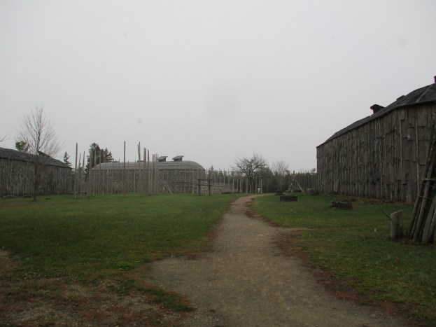
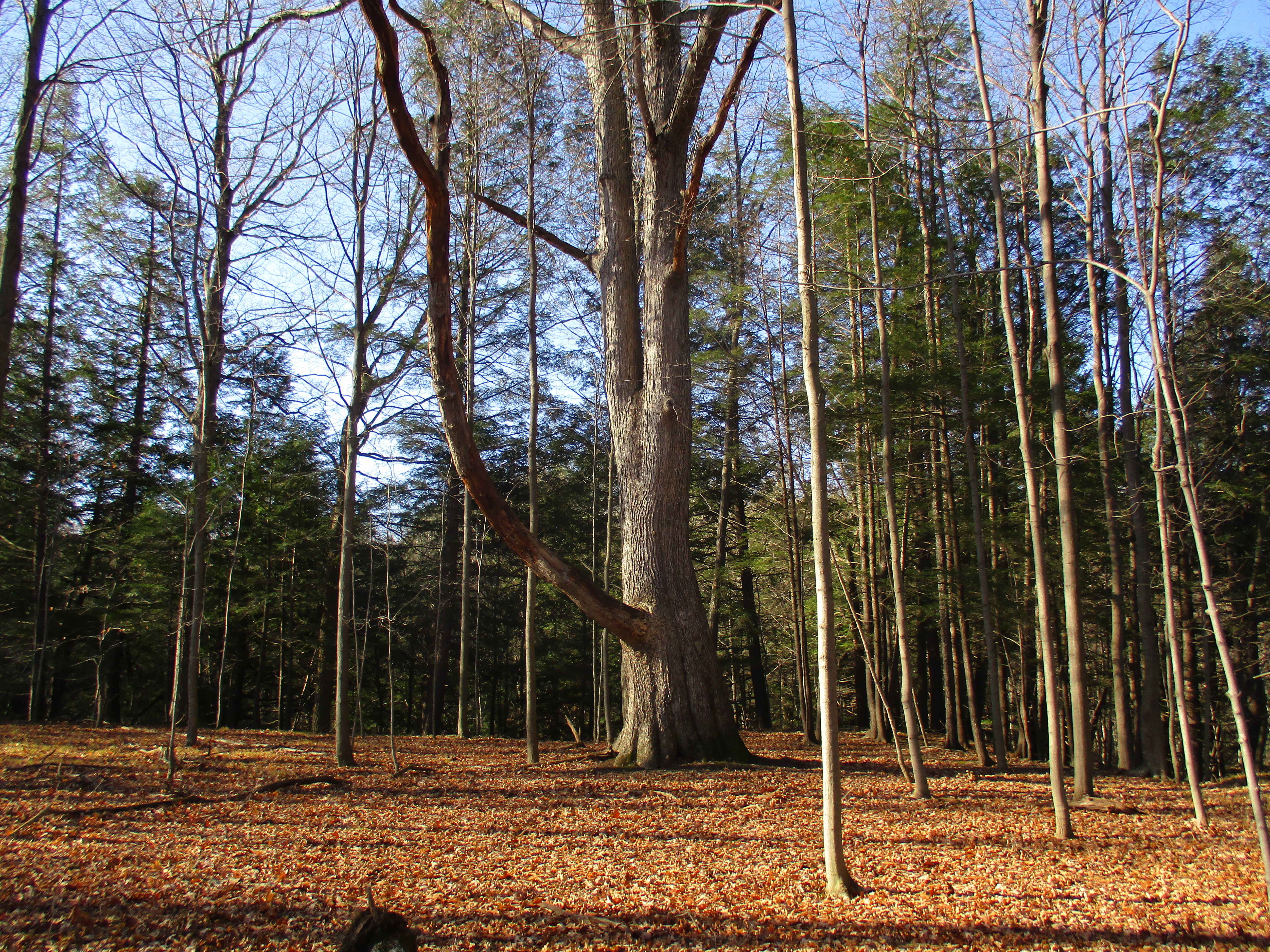
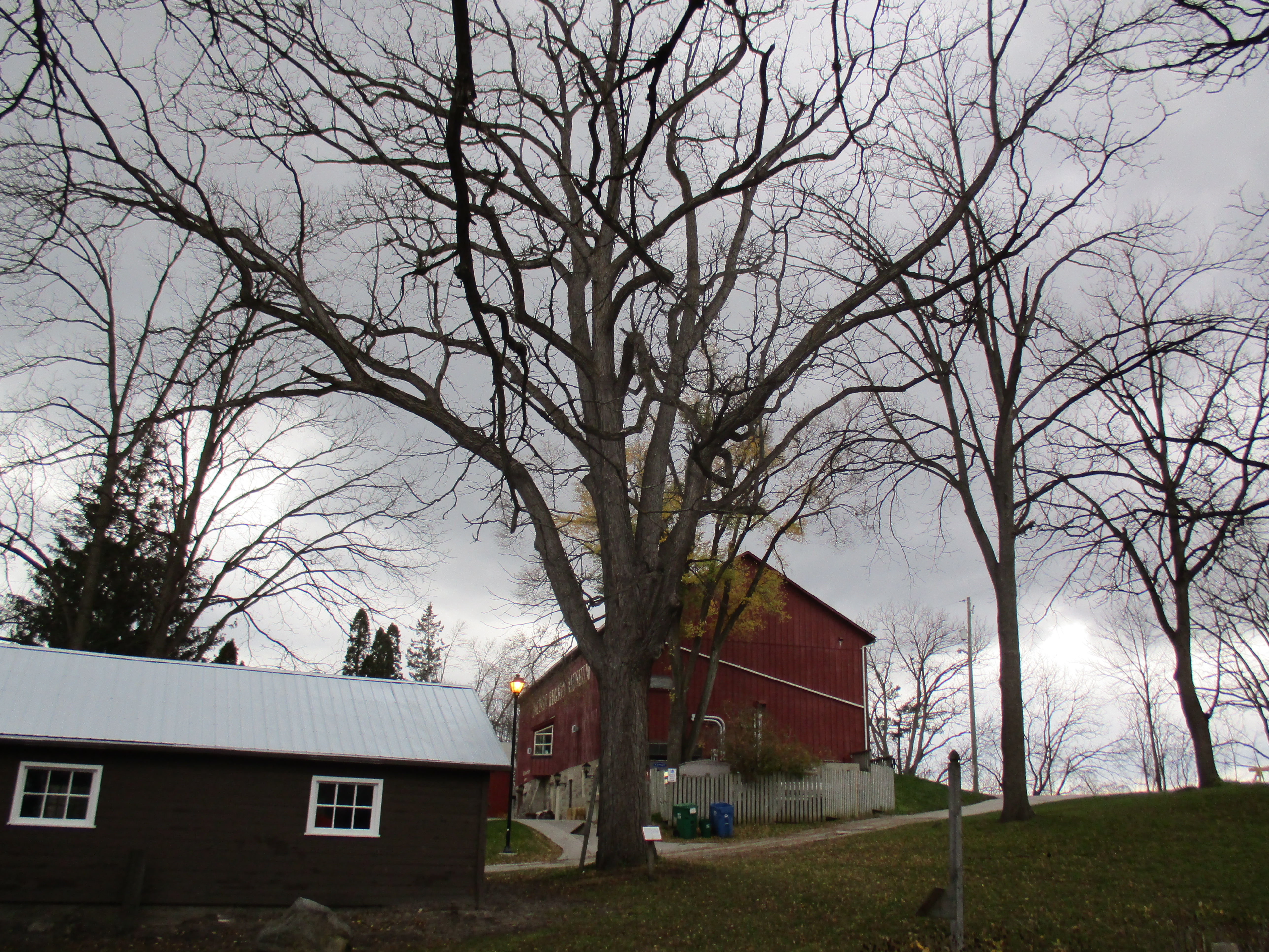
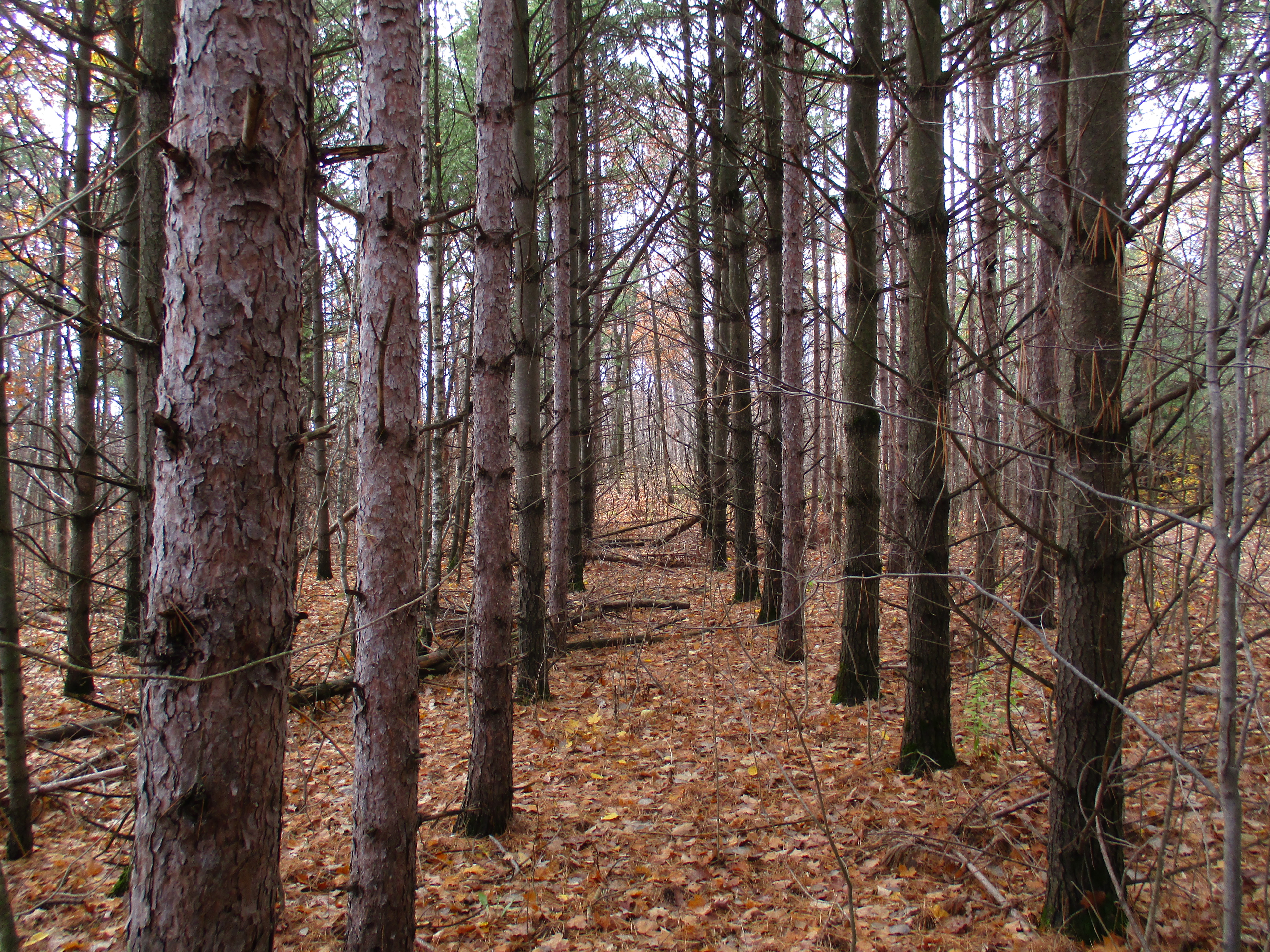
On the side of Sixteen Mile Creek stand the remains of a memorial park that has been vandalized on multiple occasions. The scattered remnants stand abandoned waiting to see if they will fall victim to land developers or be restored as a public park. We parked on the fourth line where it dead ends south of Dundas Street and set out in the light rain and 6 degree temperatures.
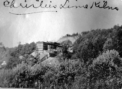
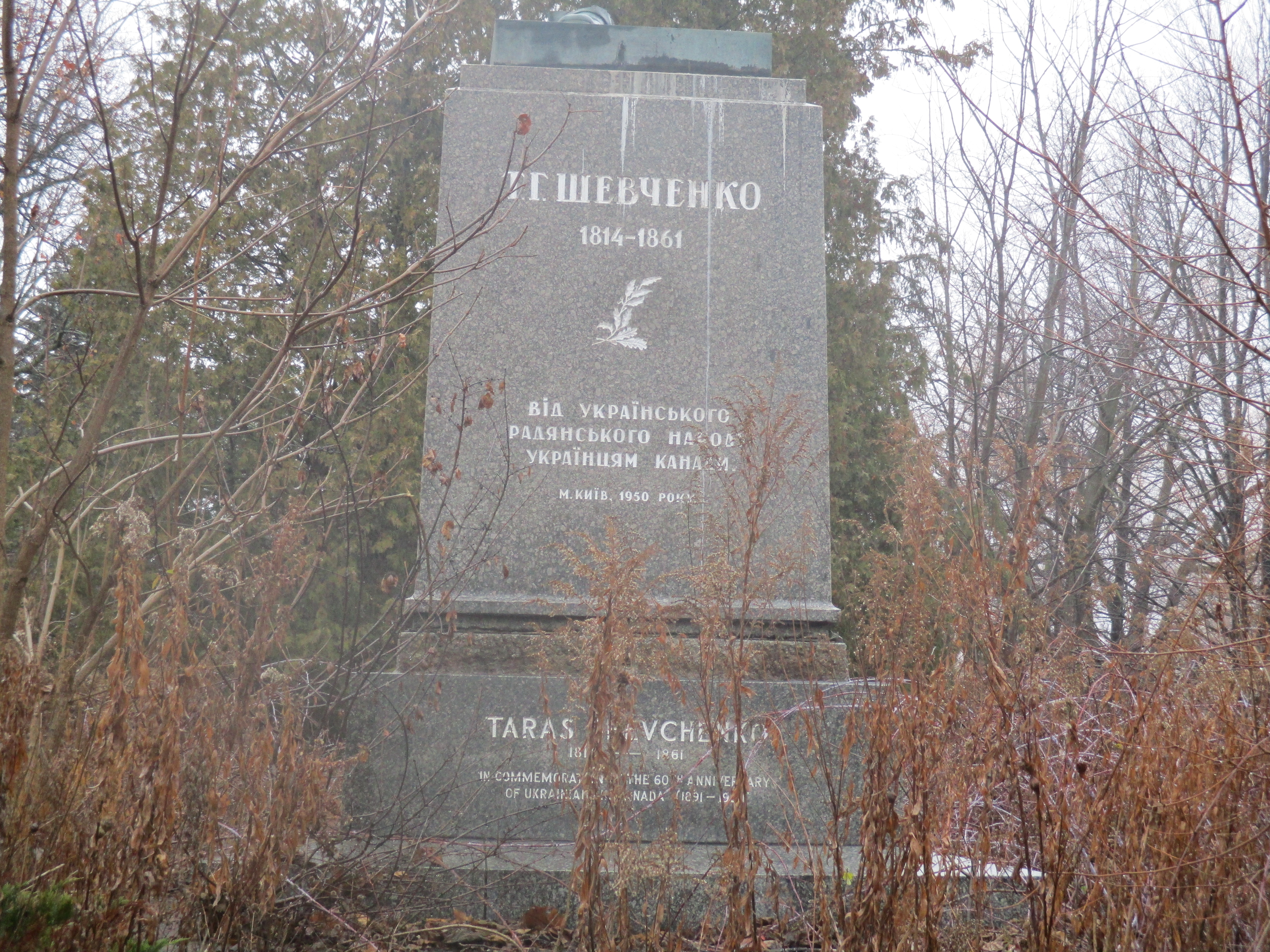
Taras Shevchenko was born in Ukraine in 1814 in the feudal system of the era. He was orphaned at the age of 11 and went on to become one of the country’s most prolific writers composing over 1000 works. Some consider him to be the Ukrainian version of Shakepeare. When his writing was seen as agitating against the czarists regime he was sentenced to serve in a military outpost and banned from writing. Although he could have lived in luxury from his work he chose to live humbly like the people he loved.  He died in 1861 just the day after his 47th birthday.  Ukrainians began to emmigrate to Canada in 1891 and by 1939 there was already a plan to erect a statue in honour of Taras. The Second World War prevented the community from getting things started but in 1950 it was picked up again. The plan was revised this time with a park and statue envisioned for the following year. Ten thousand people attended a performance in Maple Leaf Gardens on June 30th, 1951 which featured 1,500 performers. The following day the park was opened with up to 45,000 in attendance. An archive picture from the opening ceremonies is shown below.

mem_ph4

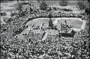
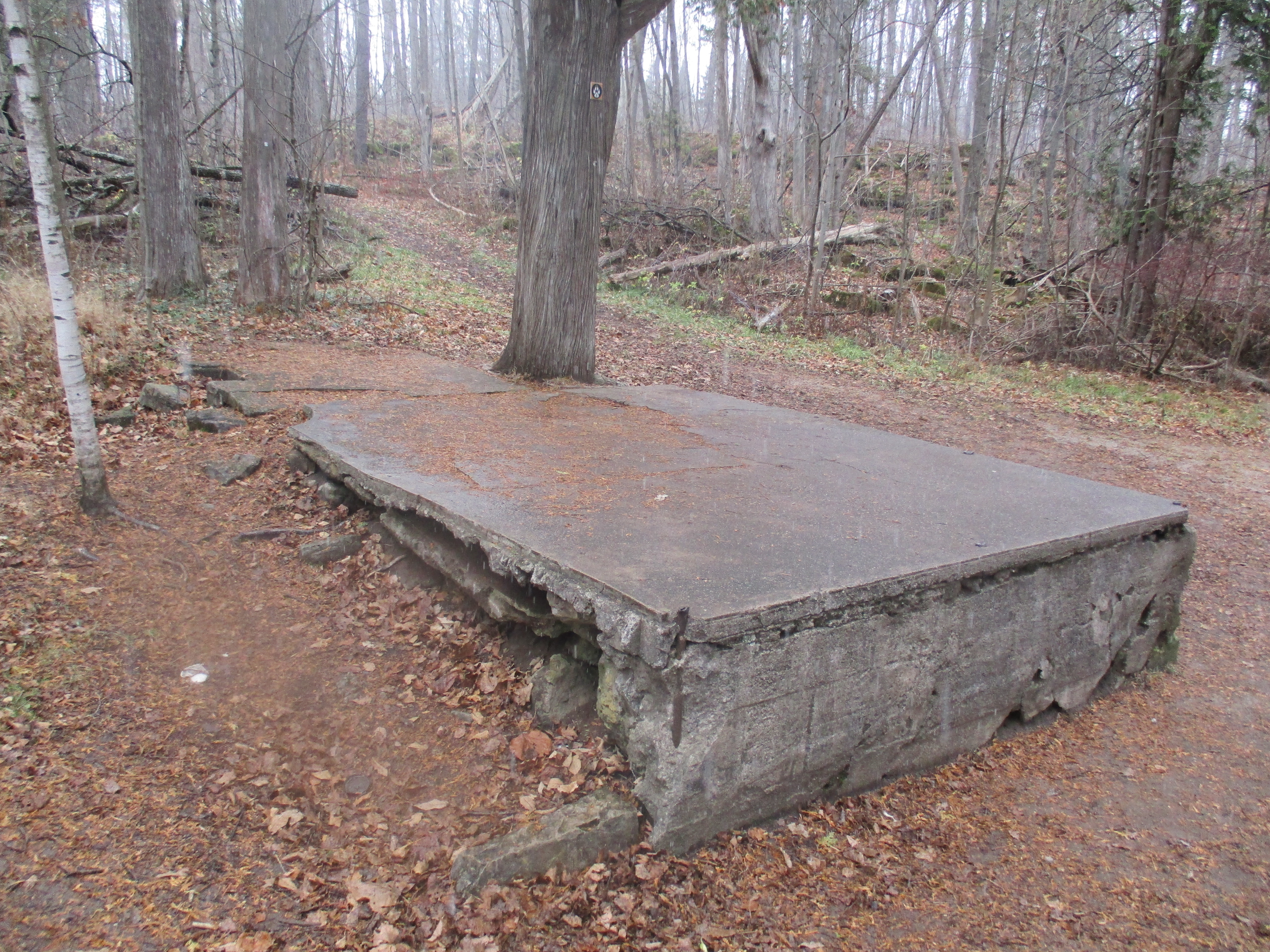
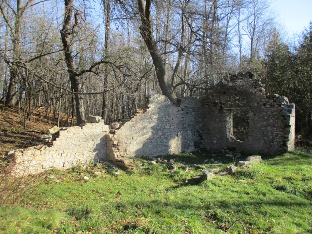
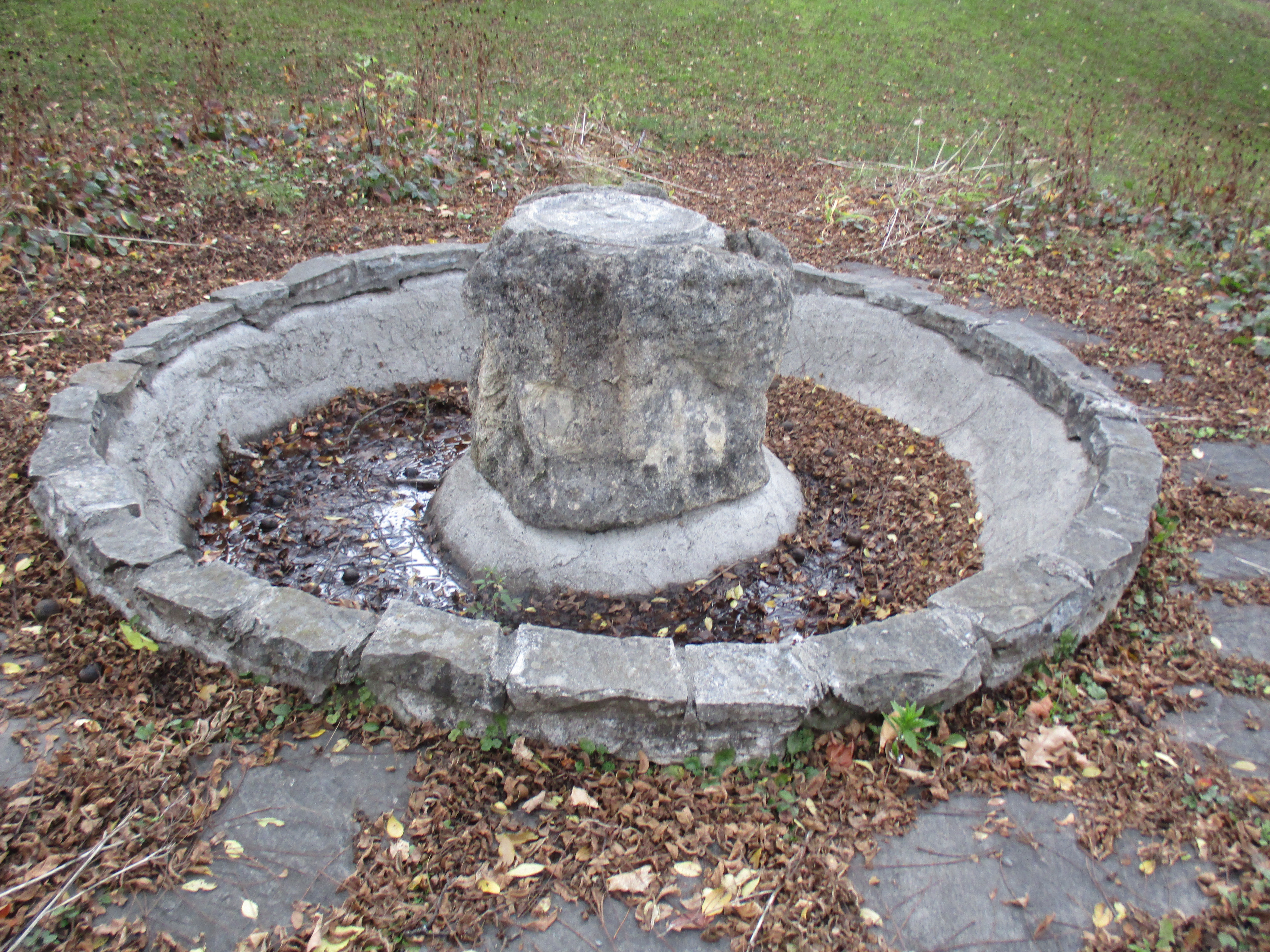
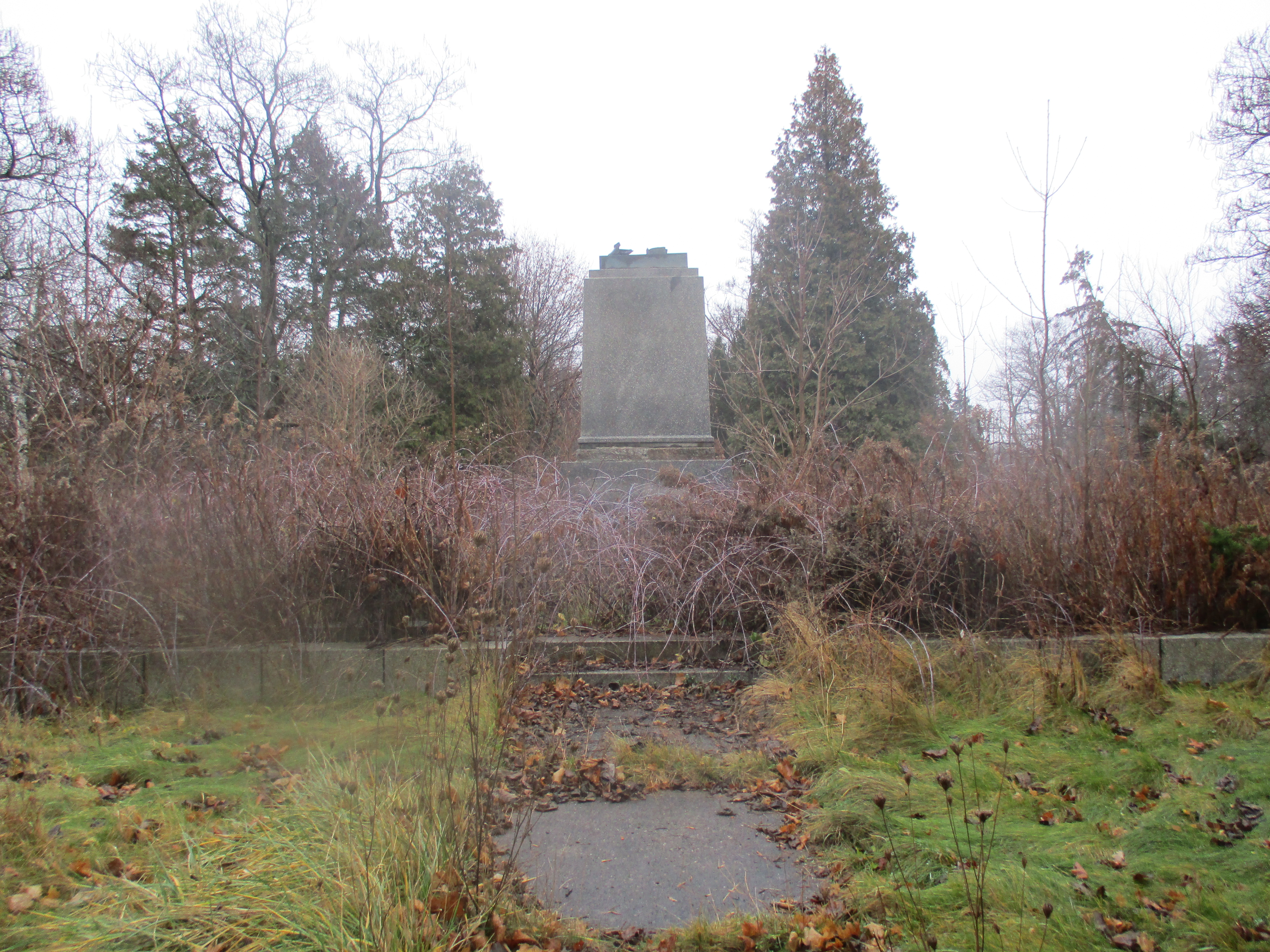
The 15 foot tall statue stood on top of a 70 tonne granite monument. It was a gift to Canada from Ukraine and was shipped here in 121 pieces which included the pedestal and garden stones. The total weight was 51 metric tonnes and the assembly work was completed by two local brothers. The statue was controversial from the start with a split between Communist and Czarist Russia causing the statue to be under 24 hour guard for some time after it opened. The Taras Shevchenko monument is seen below as it looked when the park opened on July 1, 1951.

Tass

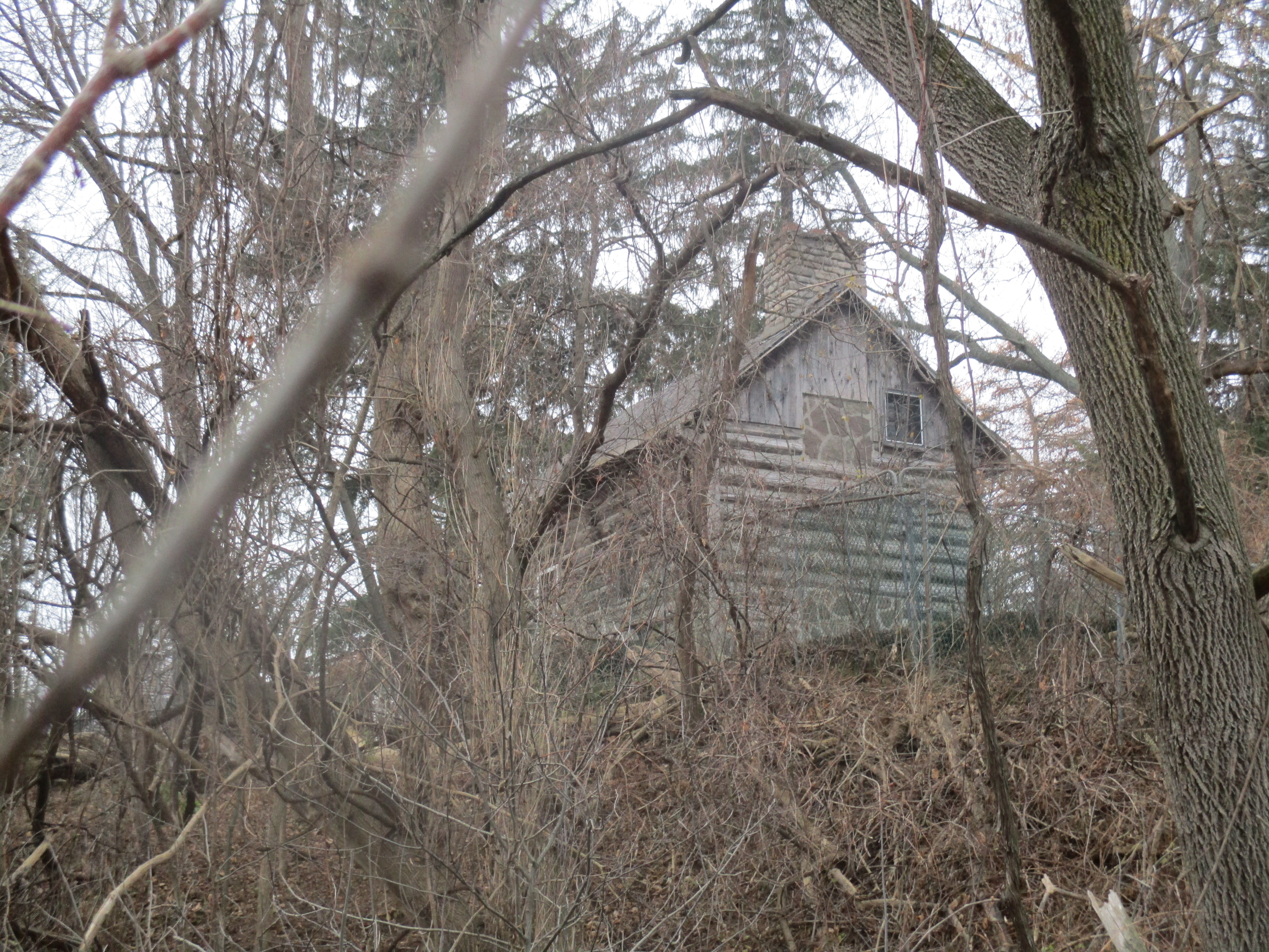
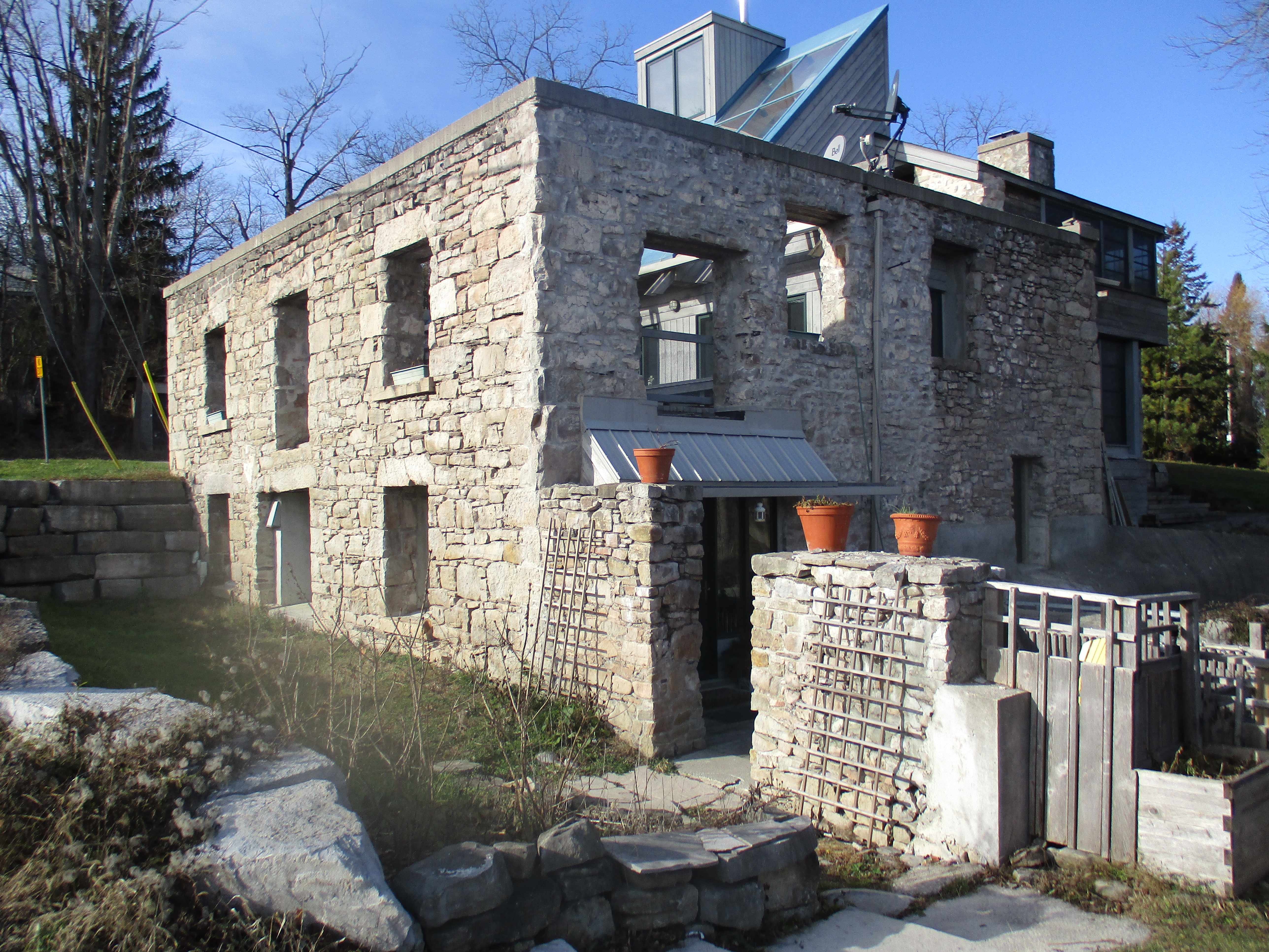
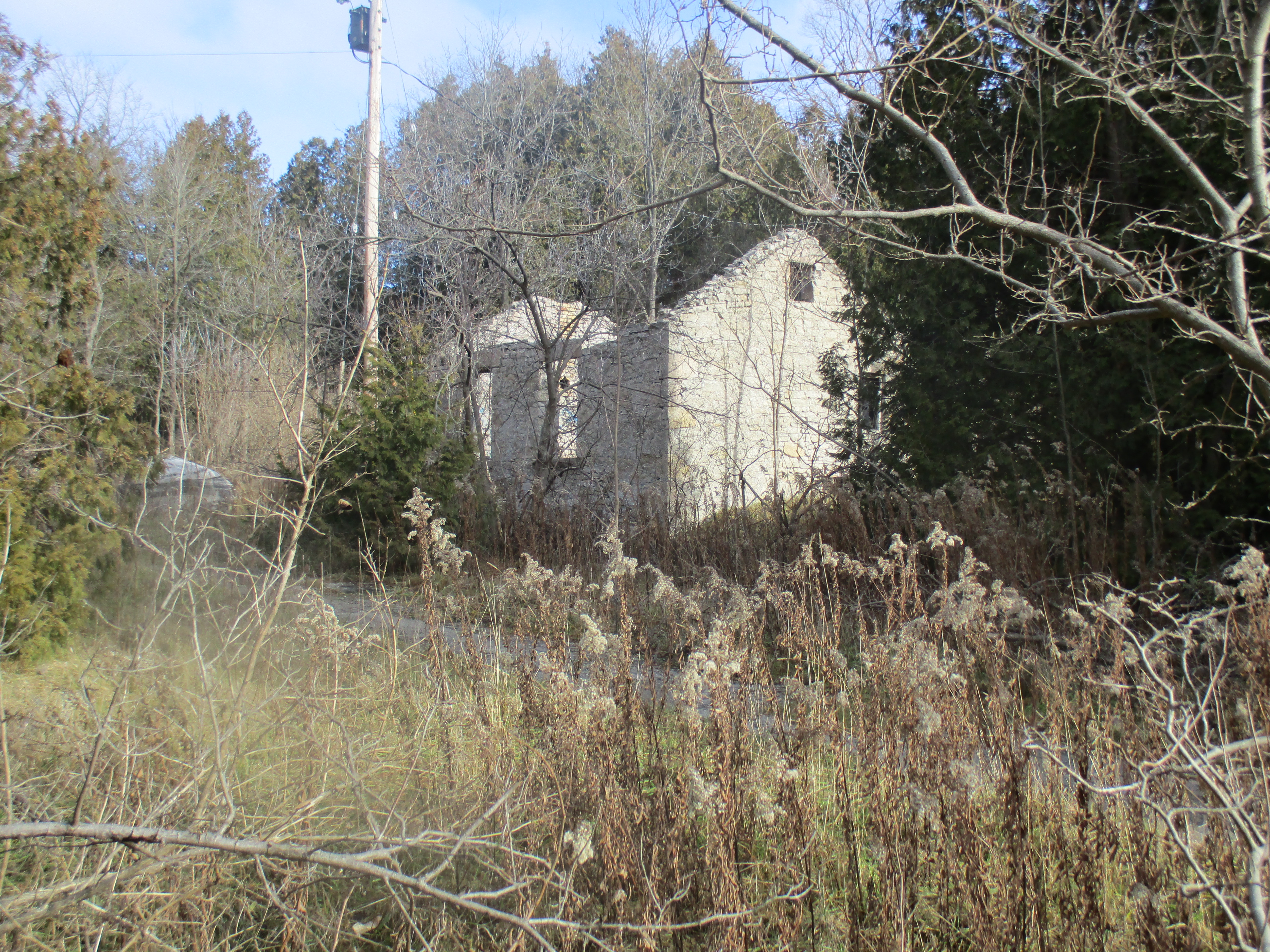
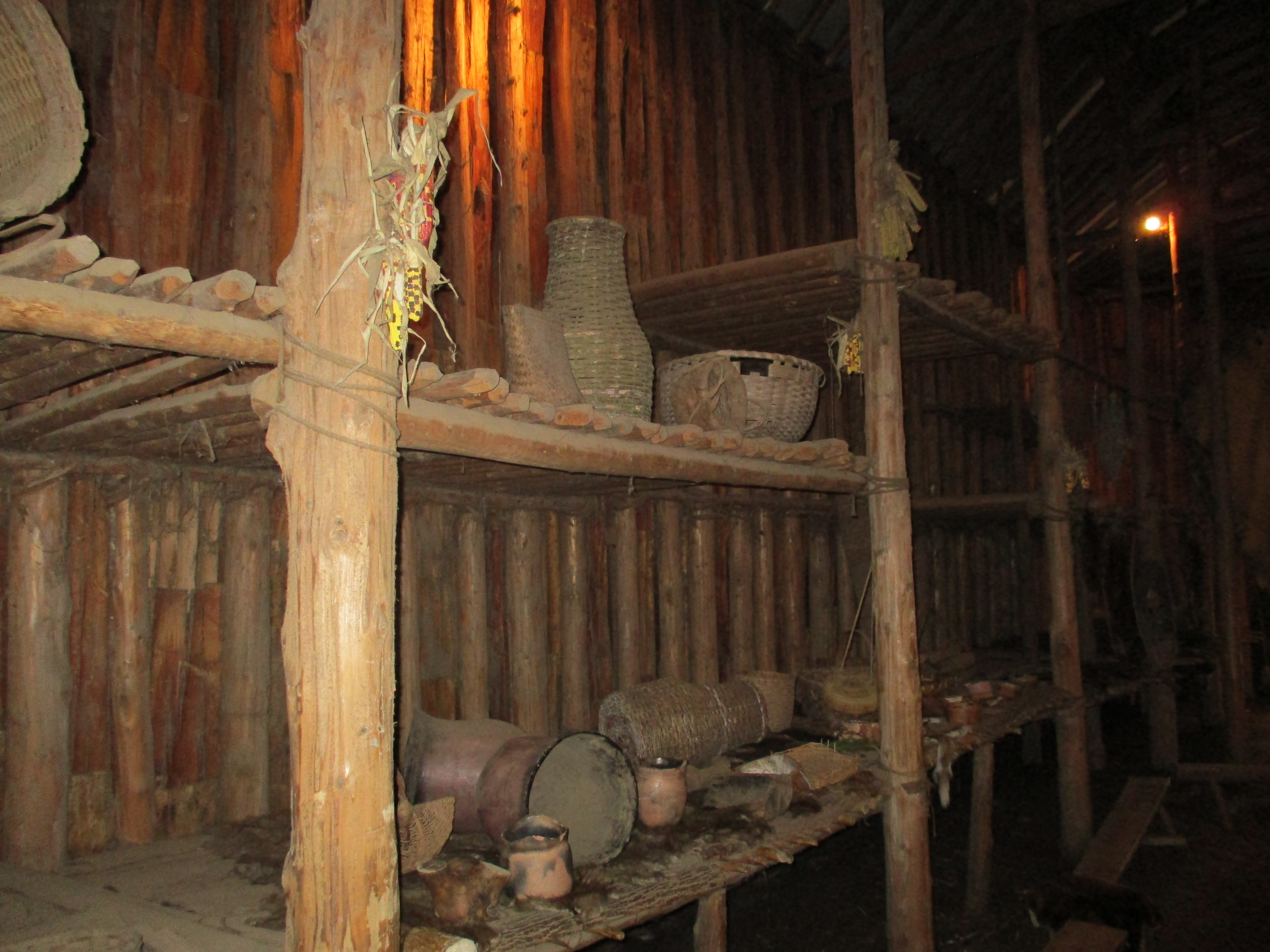
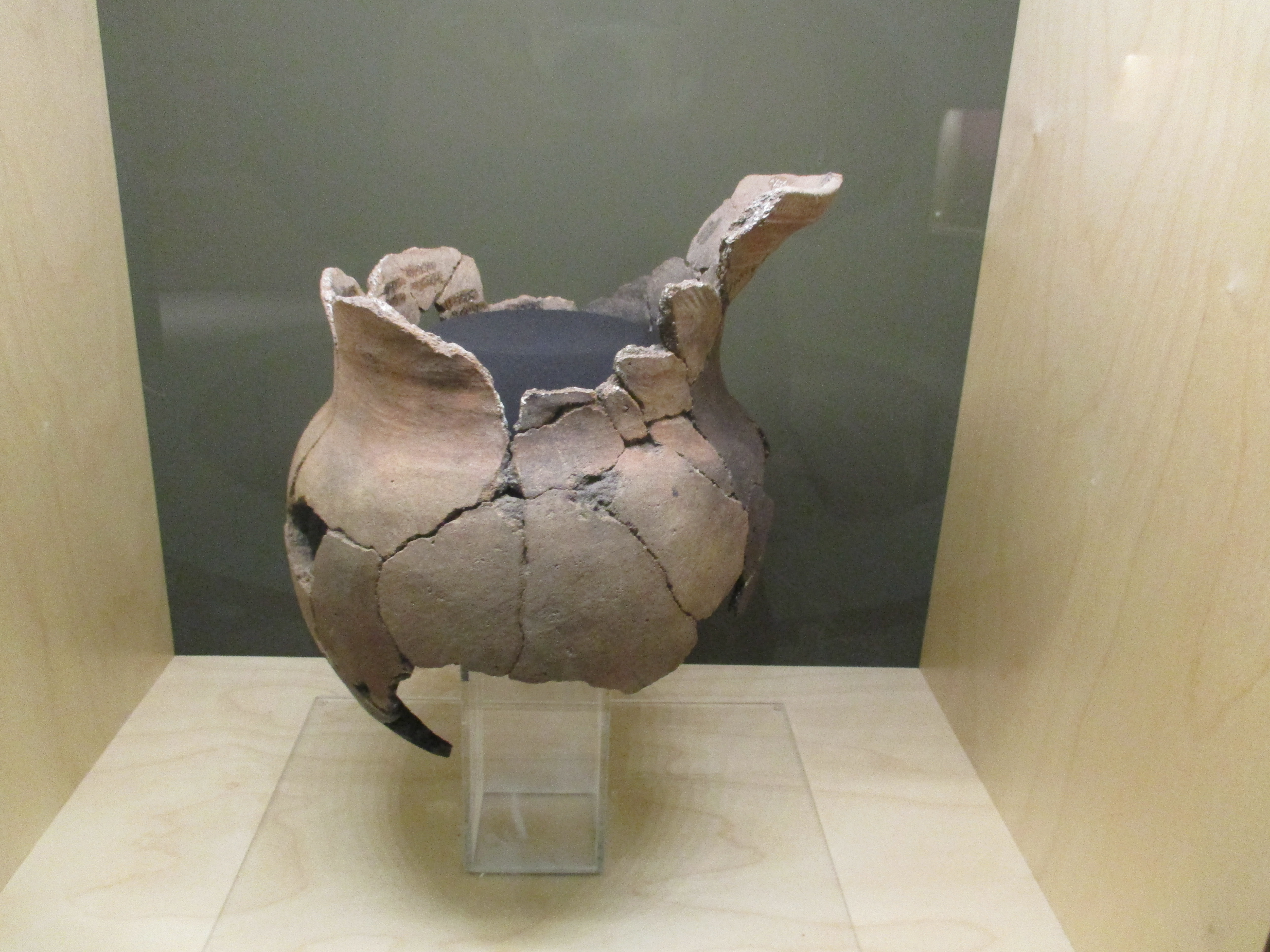
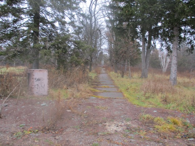
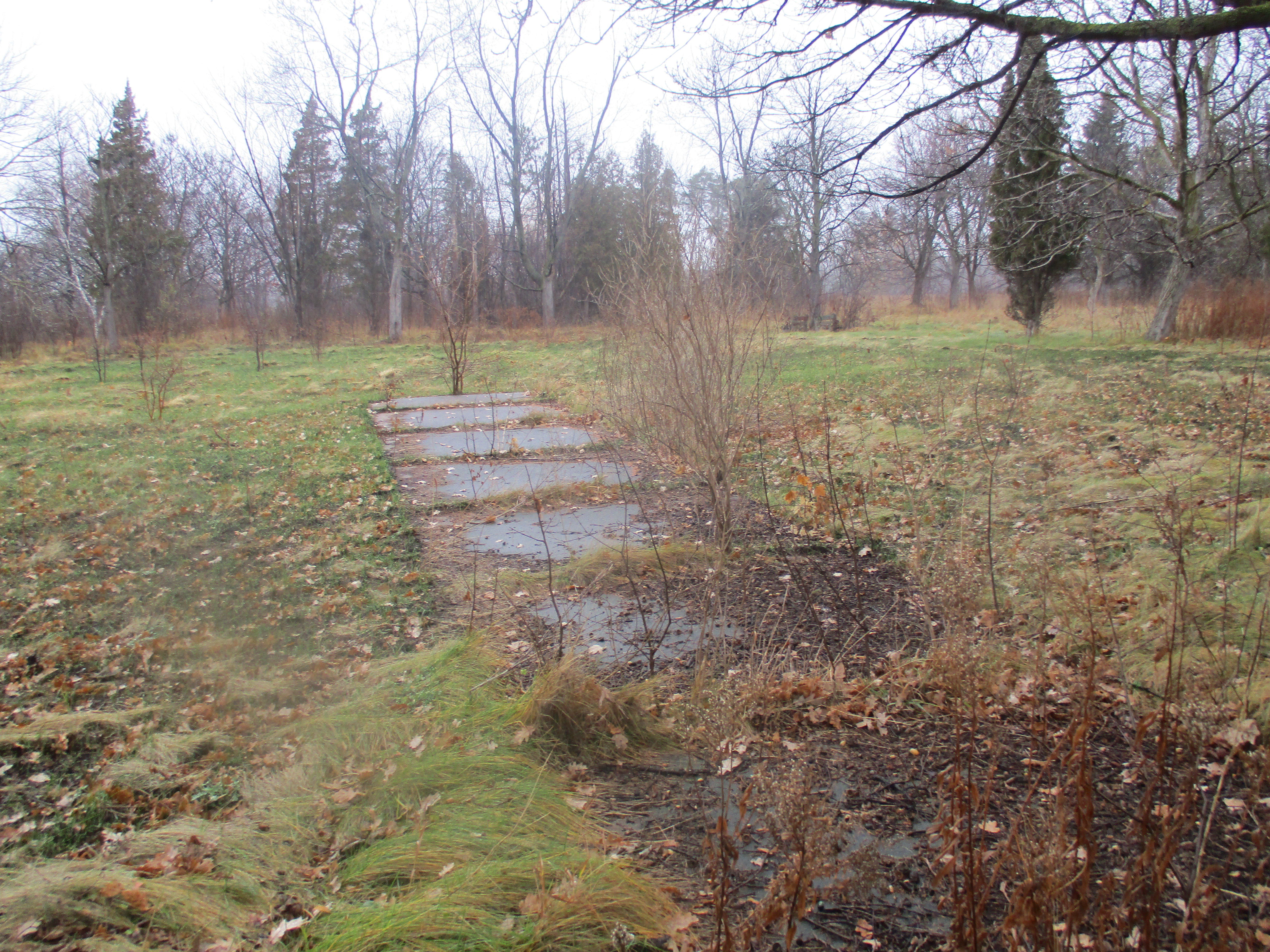
The Taras Shevchenko Museum opened a year later on July 1, 1952.  It housed over 500 exhibits, mostly from the museum in Kiev.  It included 23 of Taras’ oil paintings as well as carvings and Easter eggs.  On September 16, 1988 the museum was destroyed by an arson. The death mask, an original bronze copy of the mold was the only thing rescued from the museum. It has been moved to the new museum which was opened at 1604 Bloor Street W.  Today an old sidewalk runs to the field where the museum stood until 27 years ago.

IMG_1904

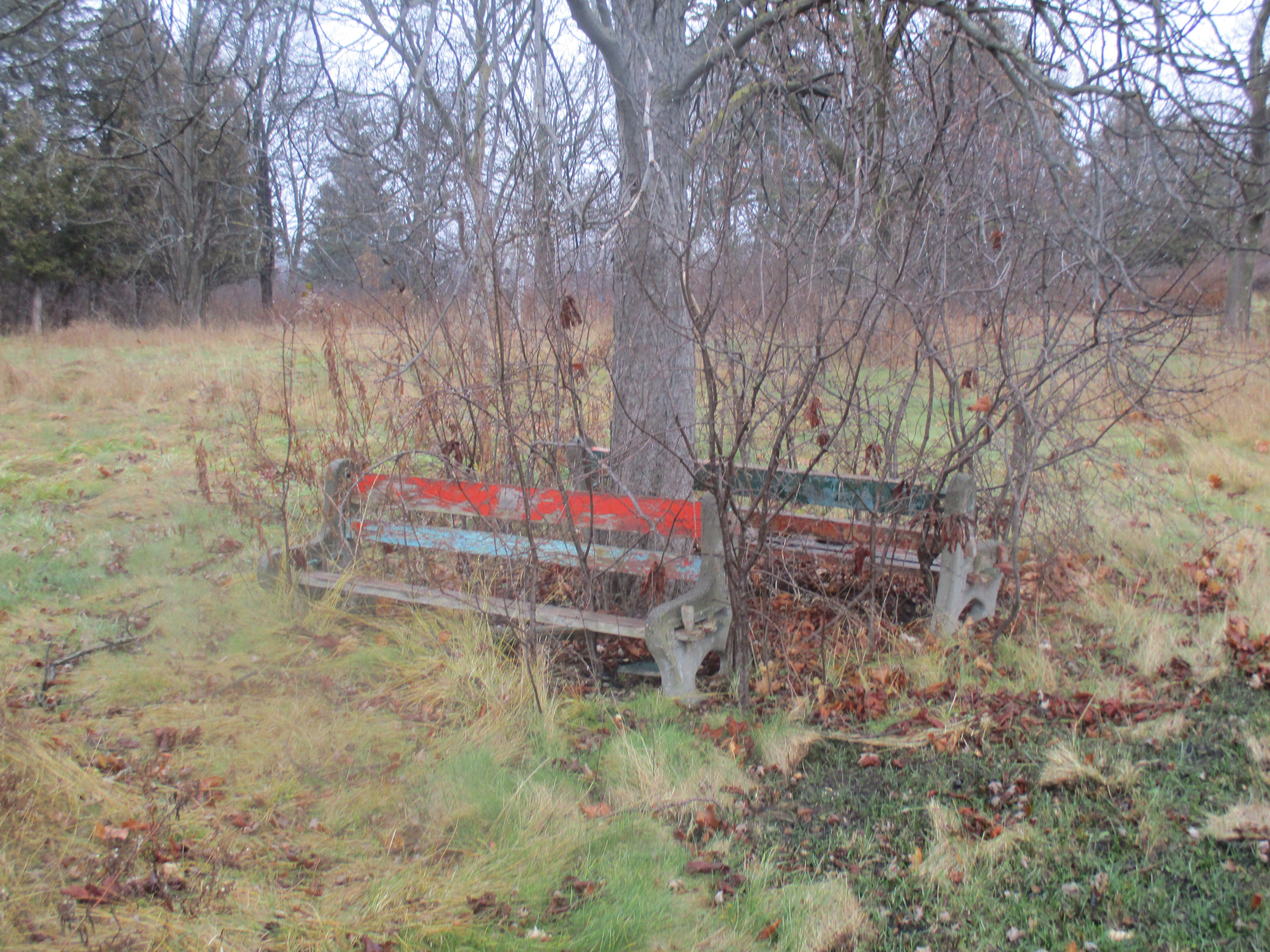
Park benches are scattered around the formerly landscaped park. 16.5 acres were planted with over 600 trees and 500 pounds of grass seed. The grass near the bench shows signs of a recent grass fire that threatened to consume the remnants of the park.

IMG_1925

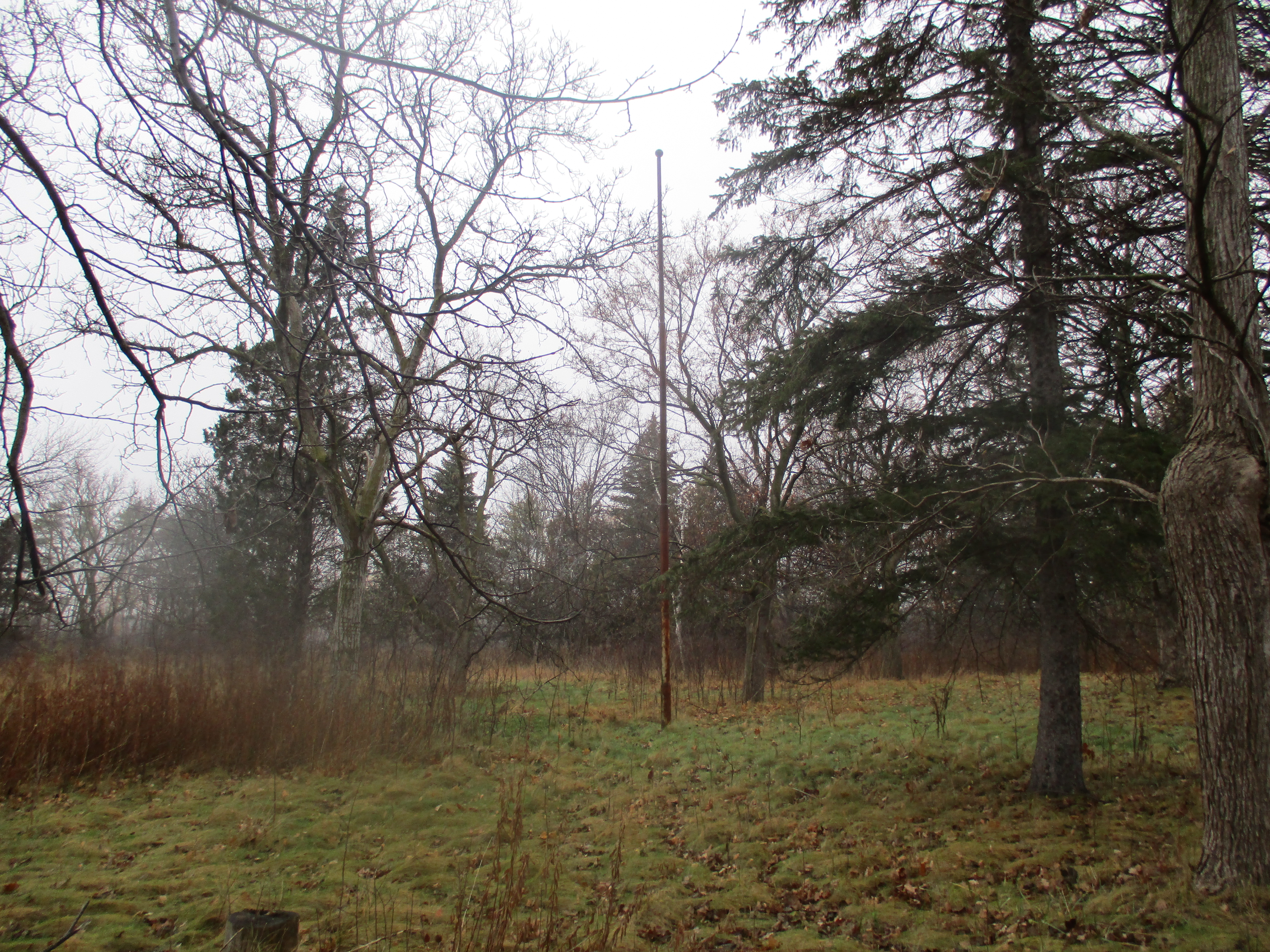
The old flag pole still stands in the open field near the monument.

IMG_1908

Sometime around Christmas 2006 thieves drove a truck up to the statue. They attached ropes to the statue using a ladder stolen from the caretaker’s property and pulled it to the ground. The scrap value was estimated at $20,000 by police and only the head was recovered. It alone weighs 170 lbs and has been placed in the new museum on Bloor Street.

IMG_1912

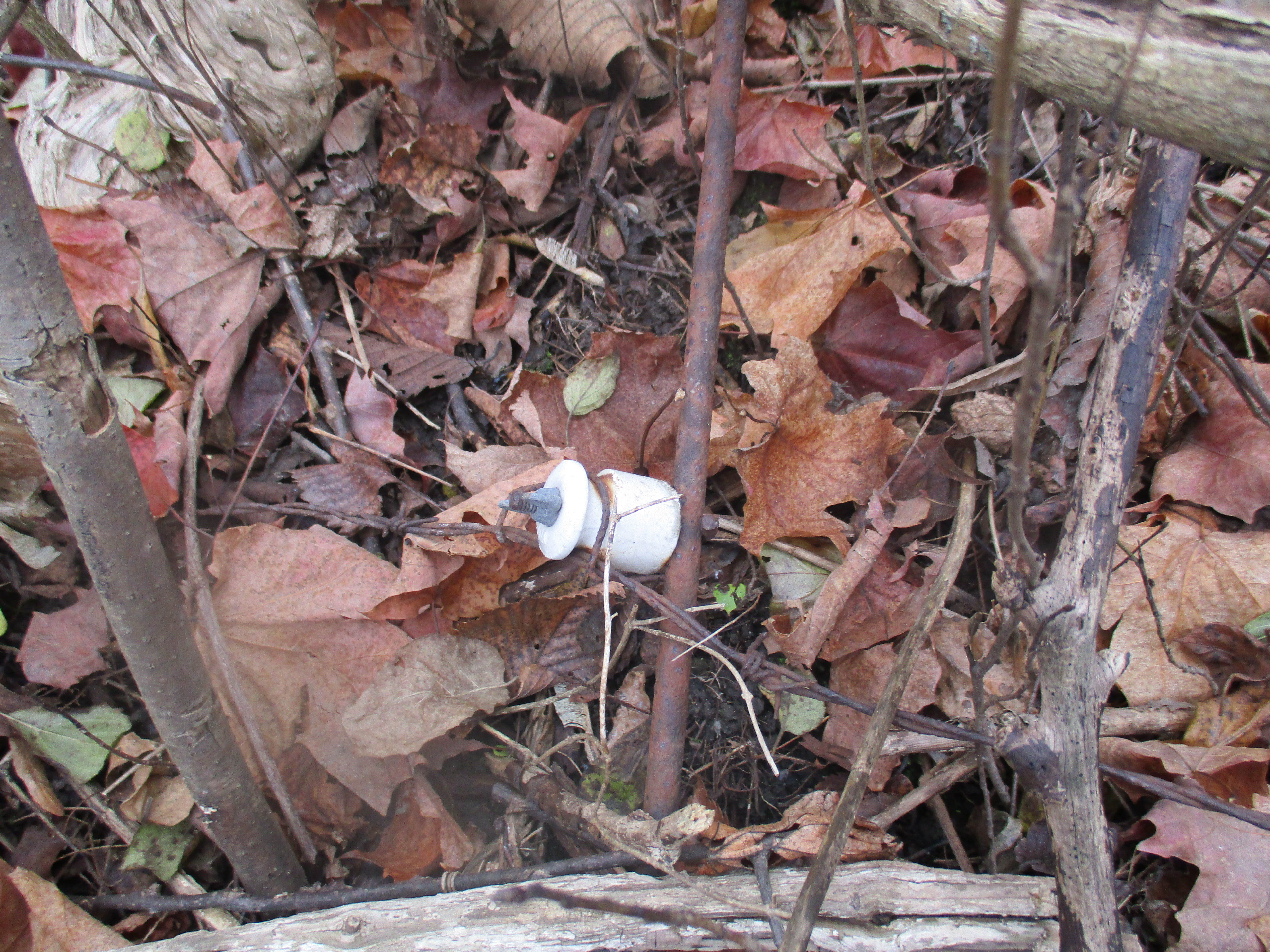
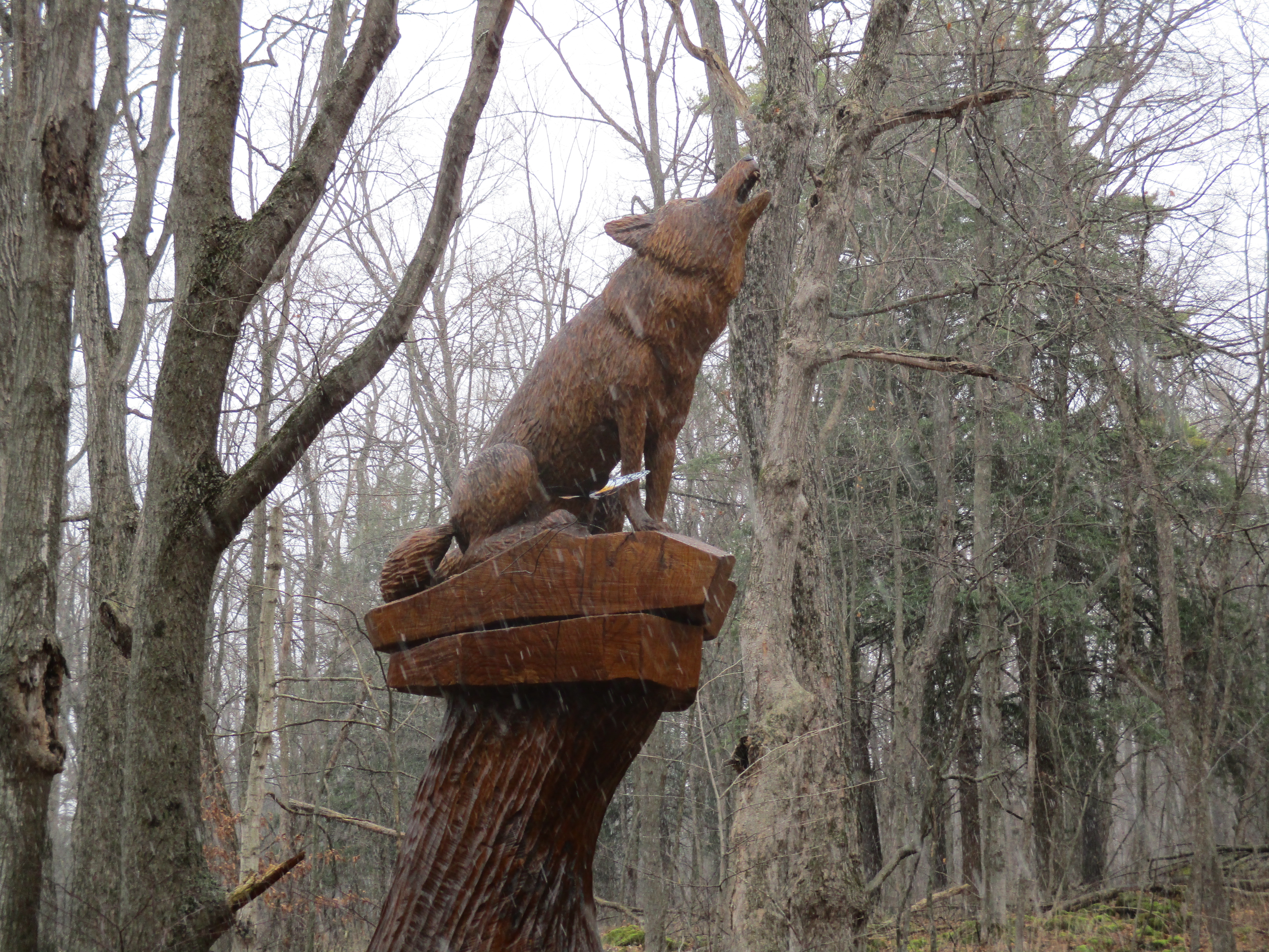
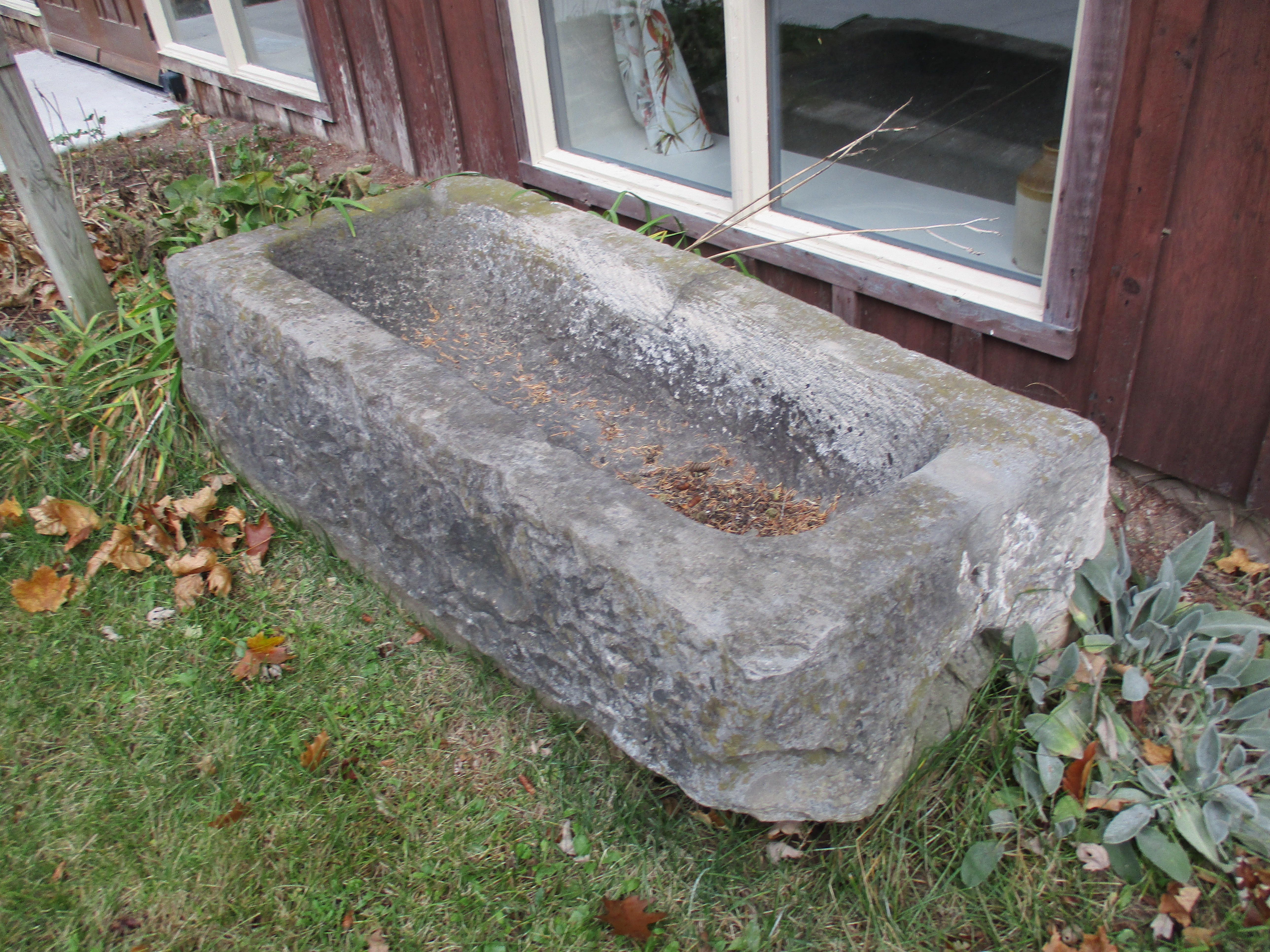
There was a smaller statue of Taras sitting in a chair reading a book near the entrance to the park but it was stolen in 2001 just a few days after the July 1st celebration of the park’s 50th anniversary. There also used to be ornate iron gates that welcomed visitors off of Dundas street but they too appear to have been stolen for their scrap value. The cover photo shows the entrance to the park with the broken monument in the background. Even the granite marker naming the park has been vandalized by graffiti.

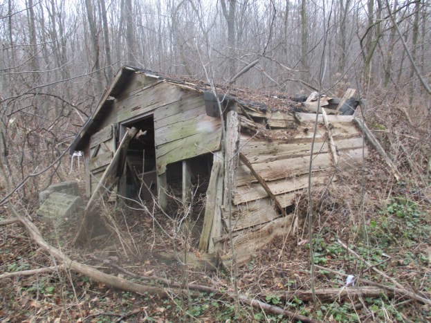
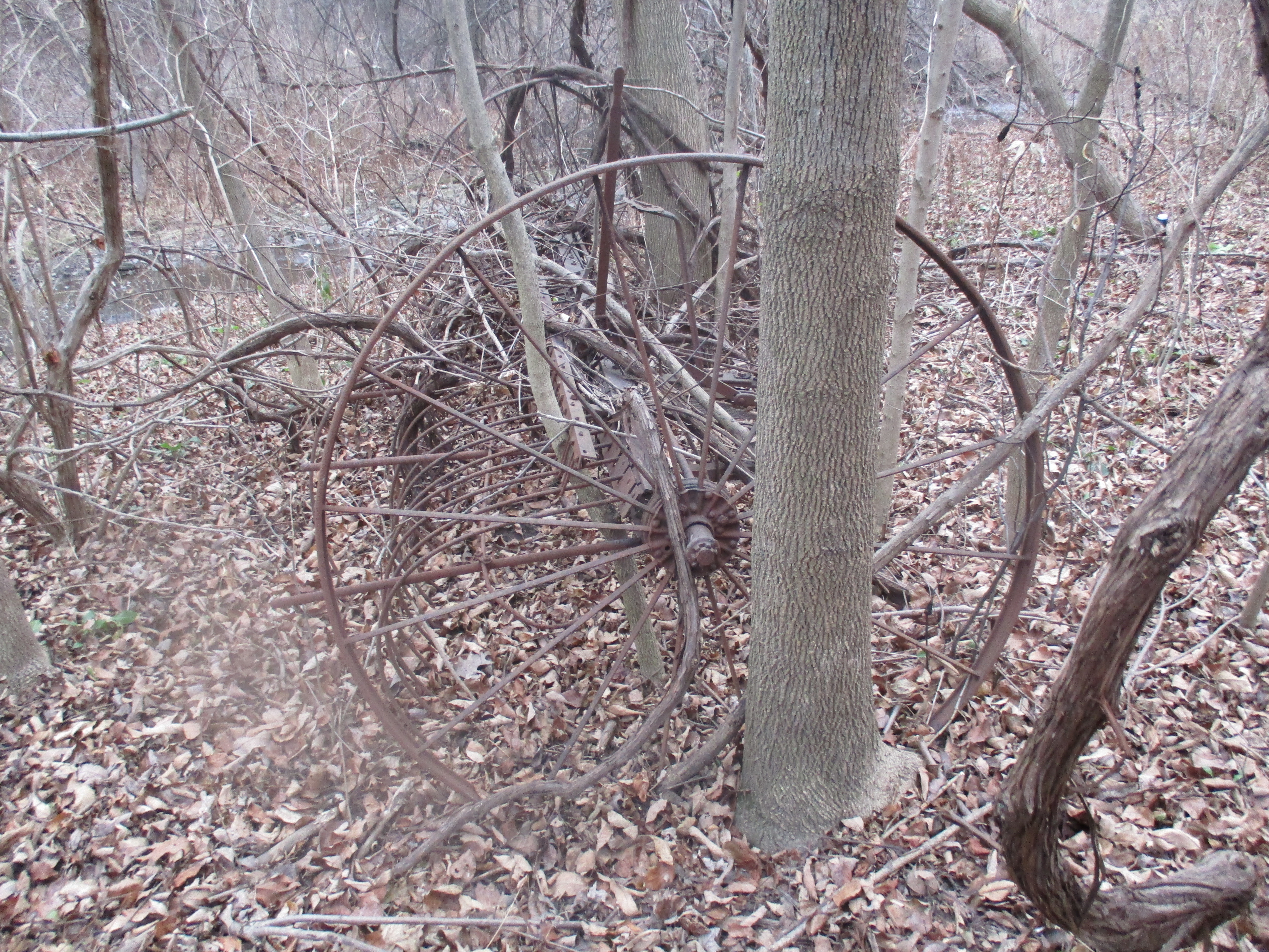
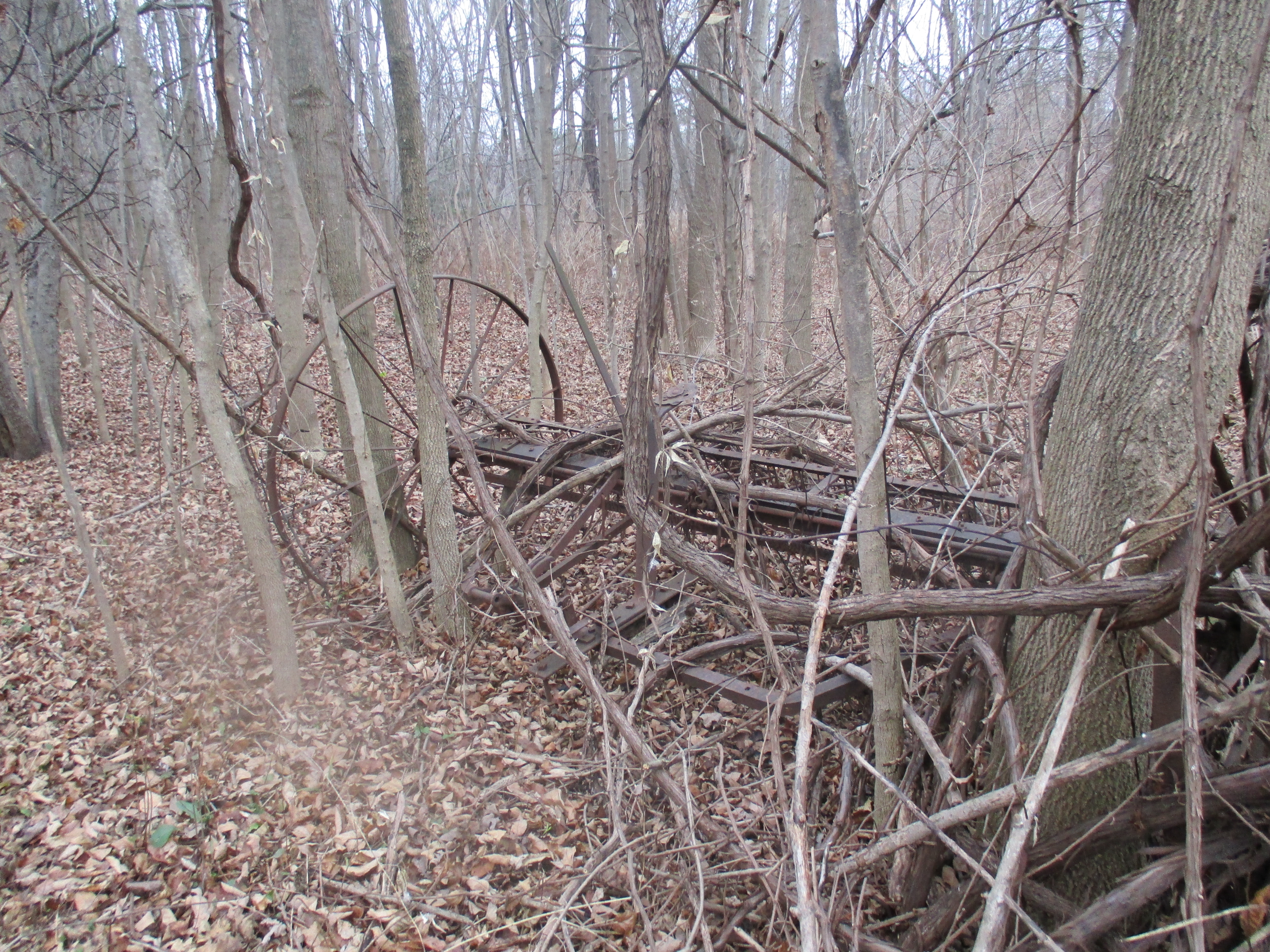
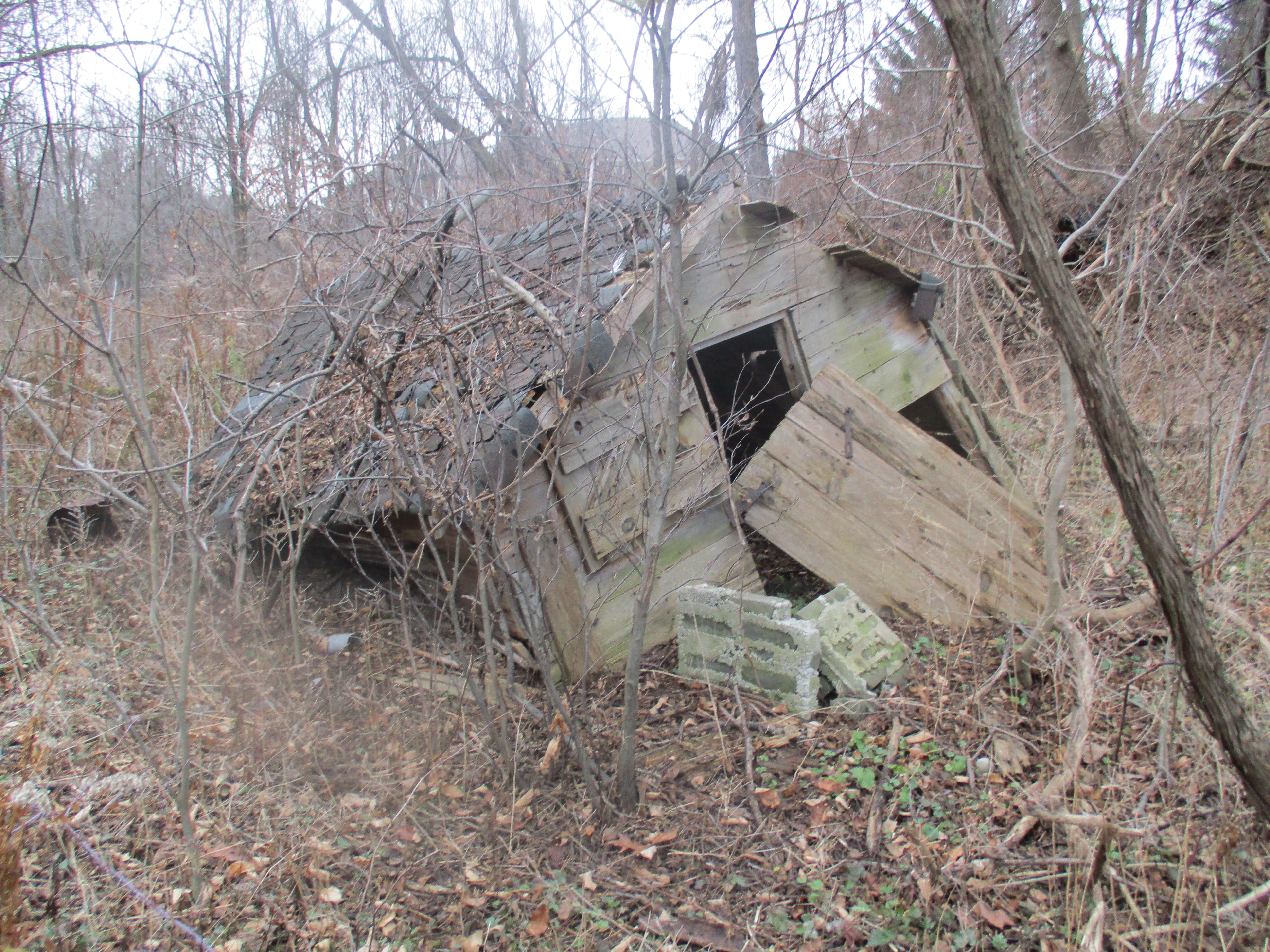
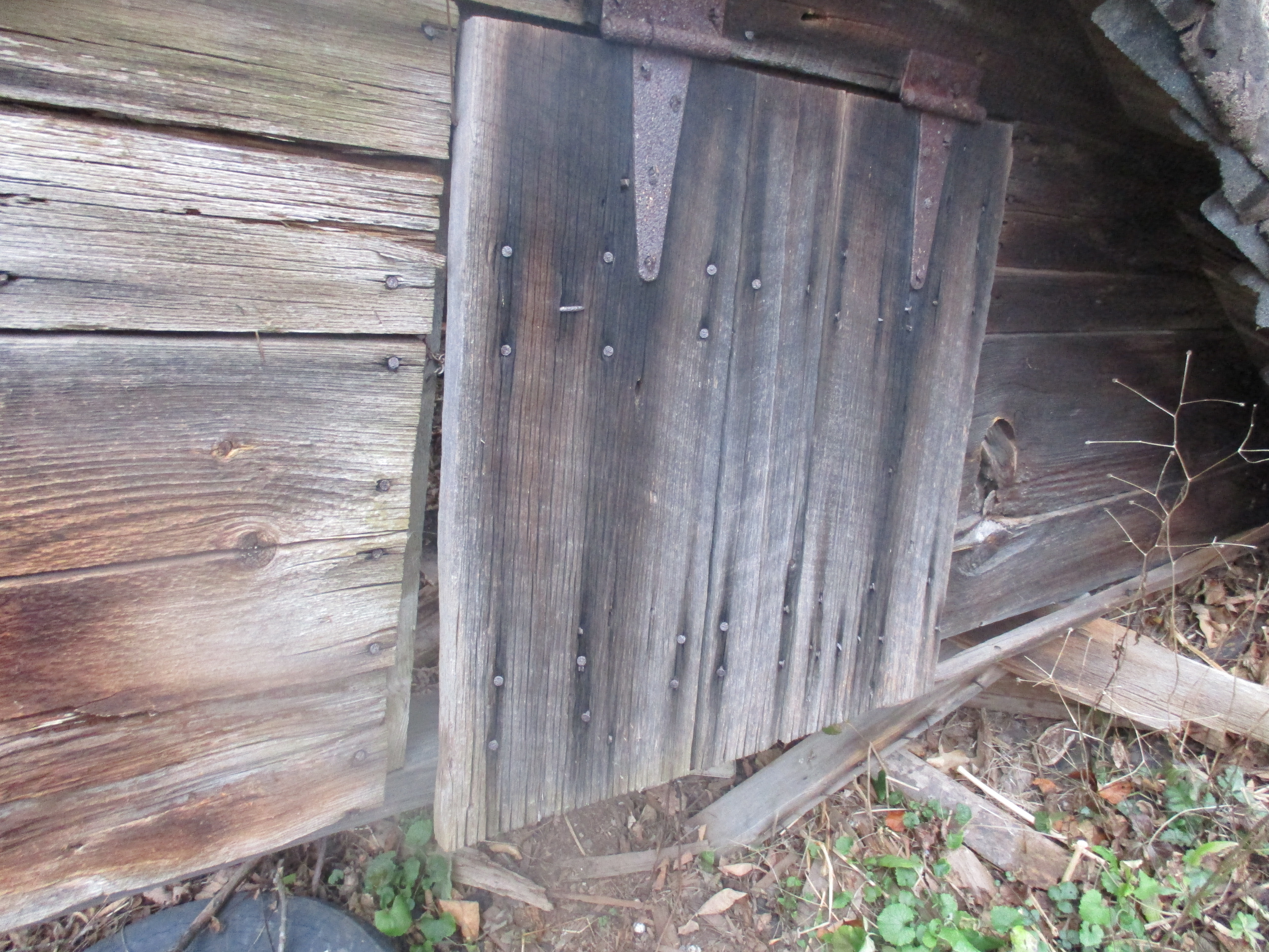
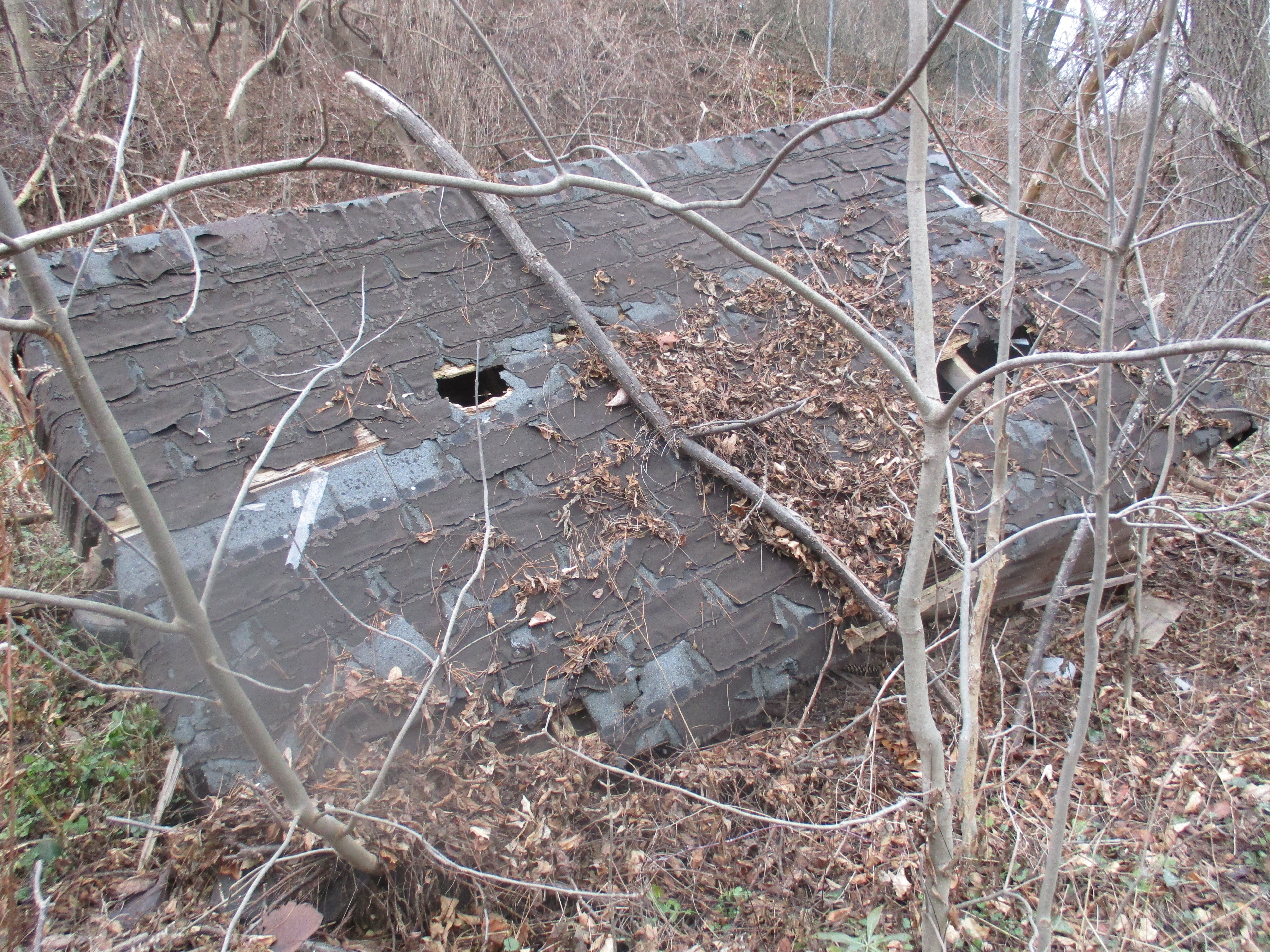
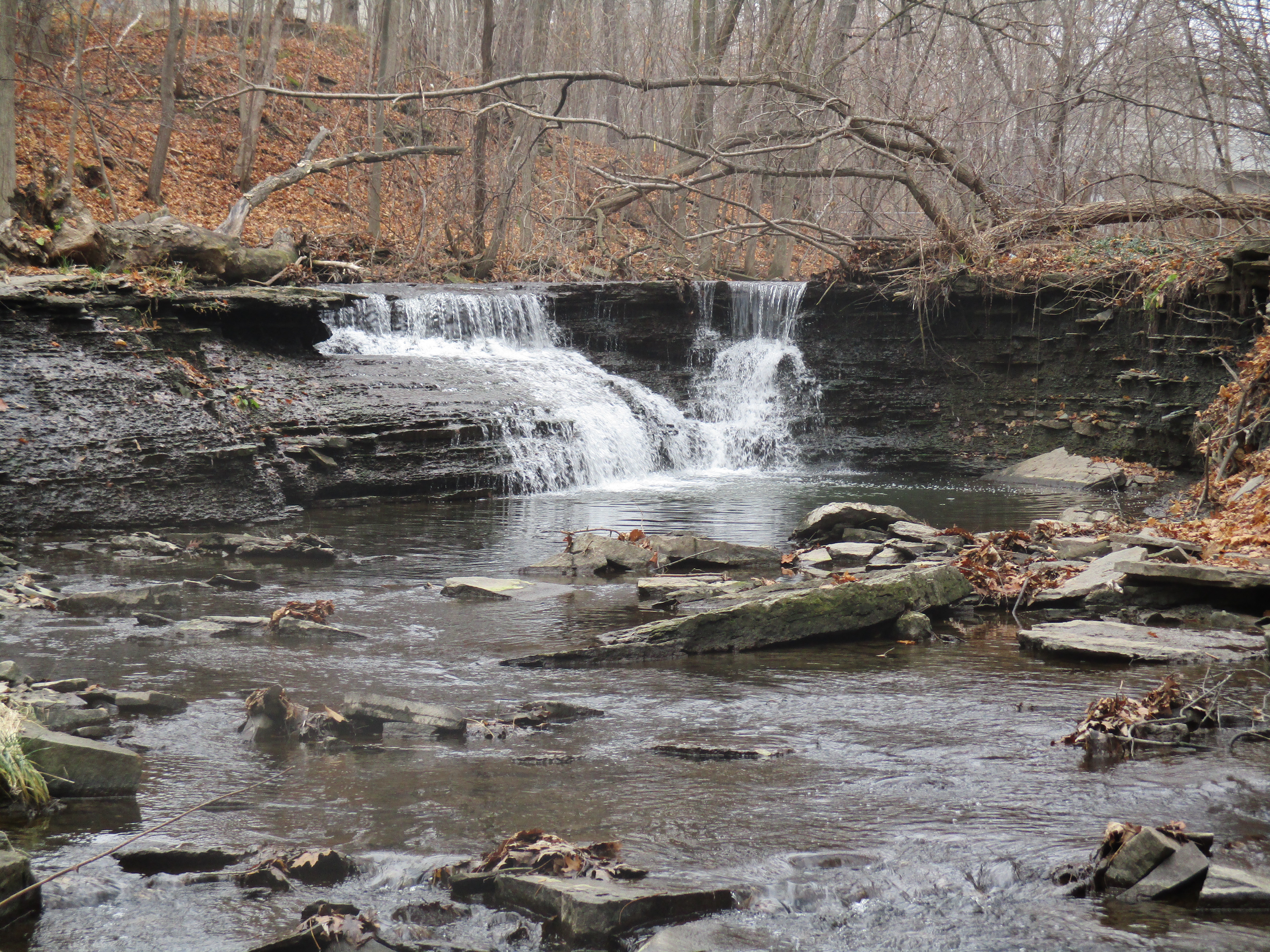
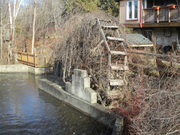
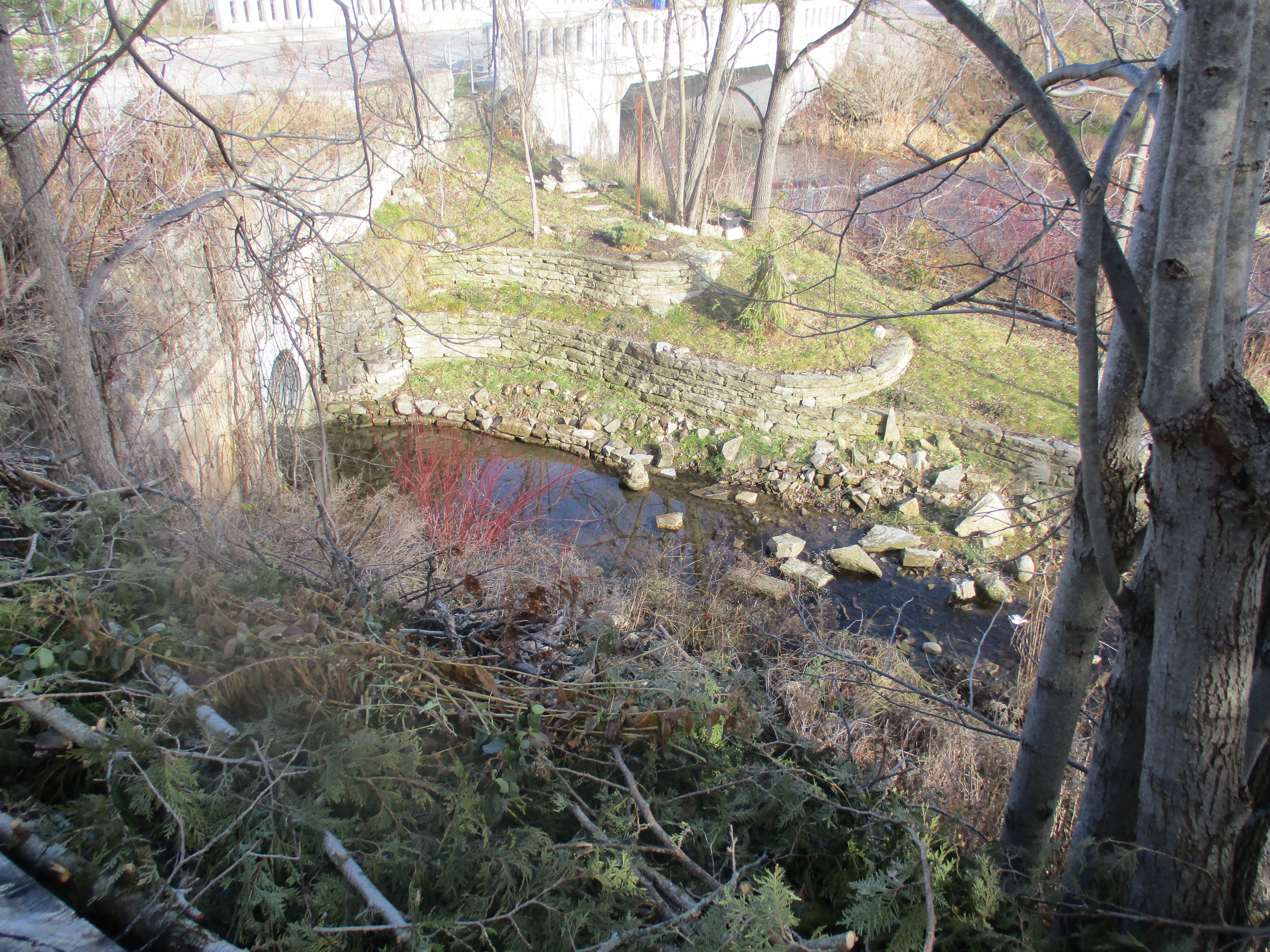
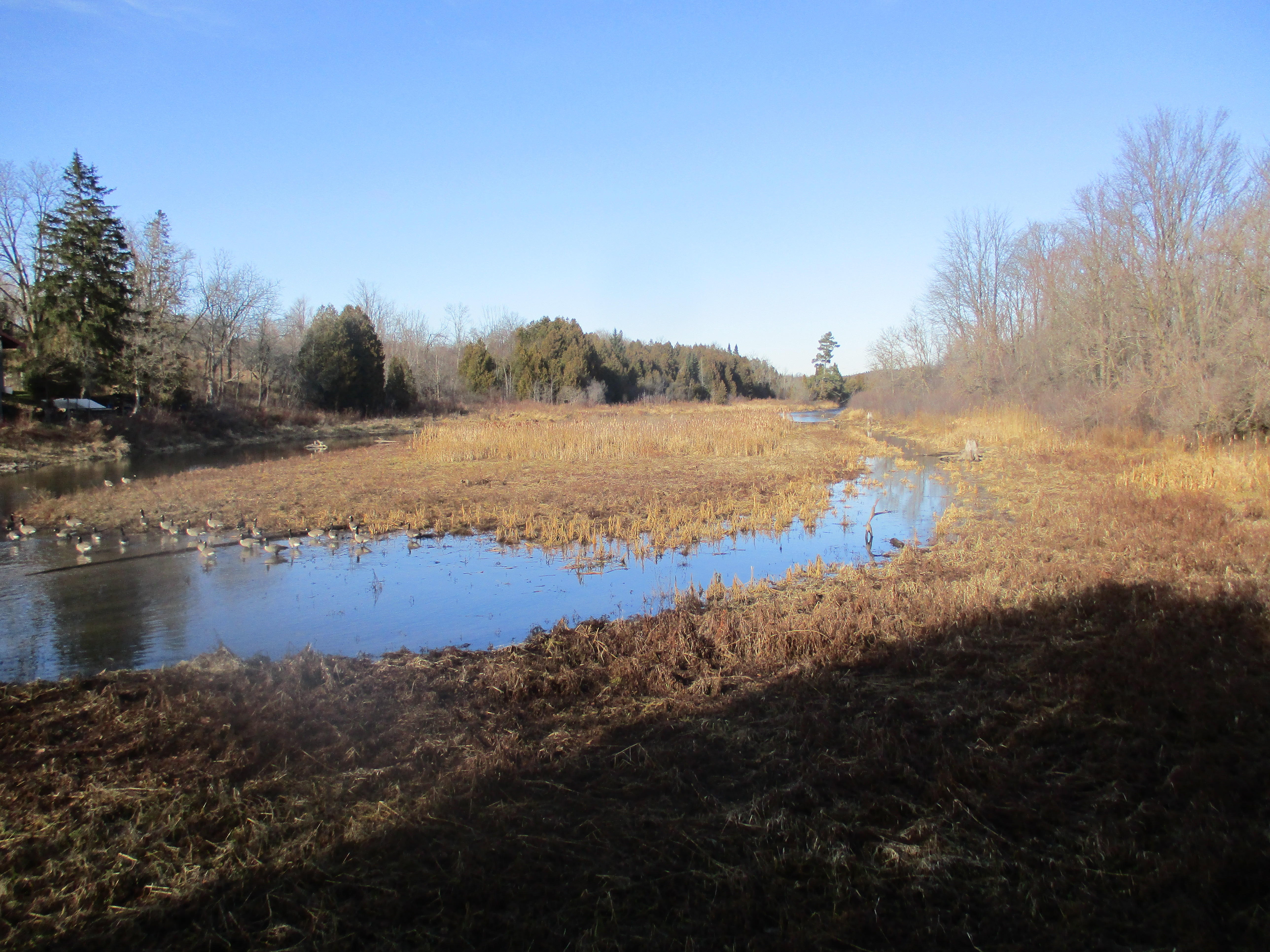
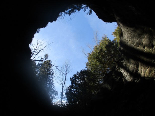
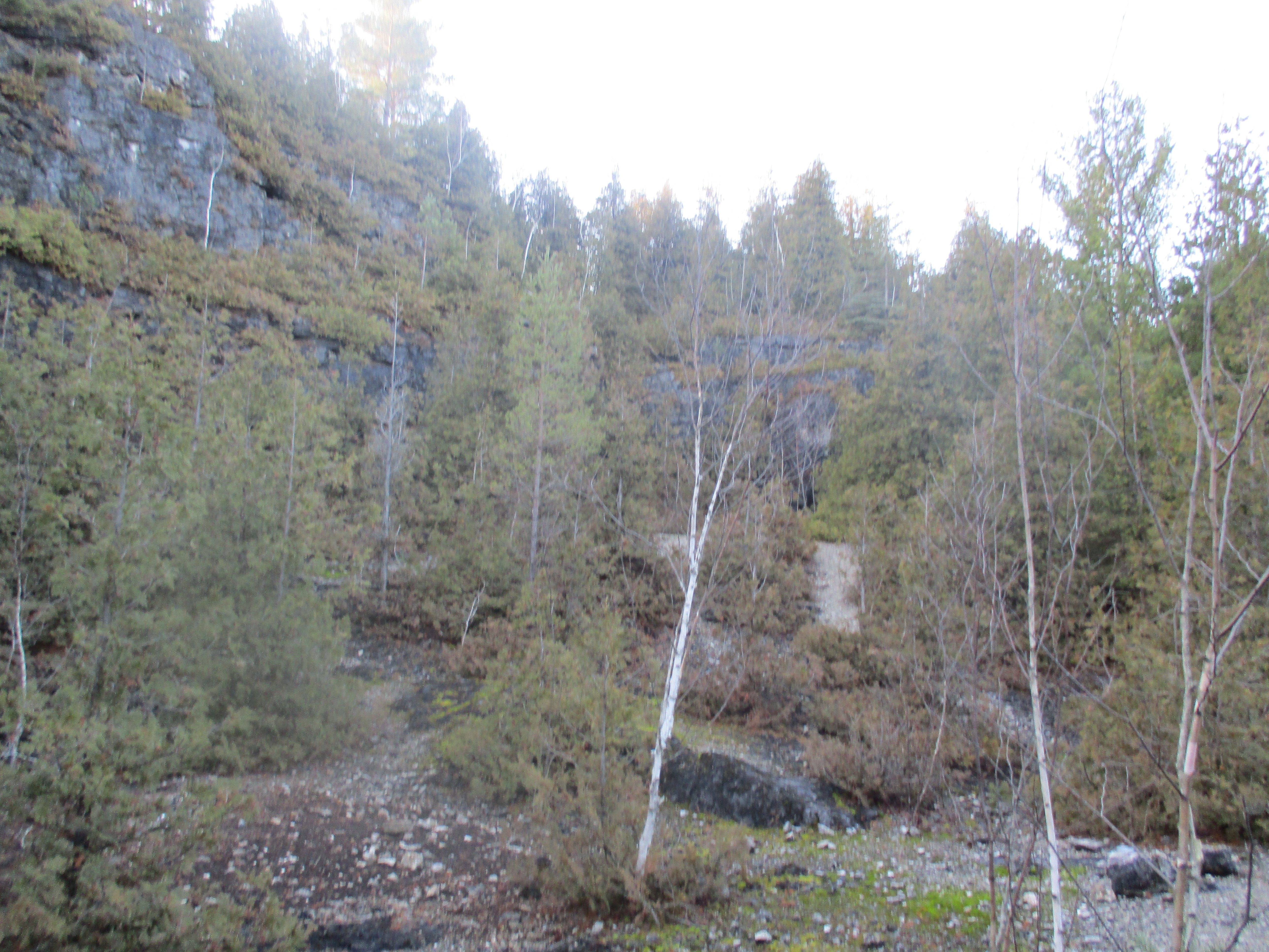
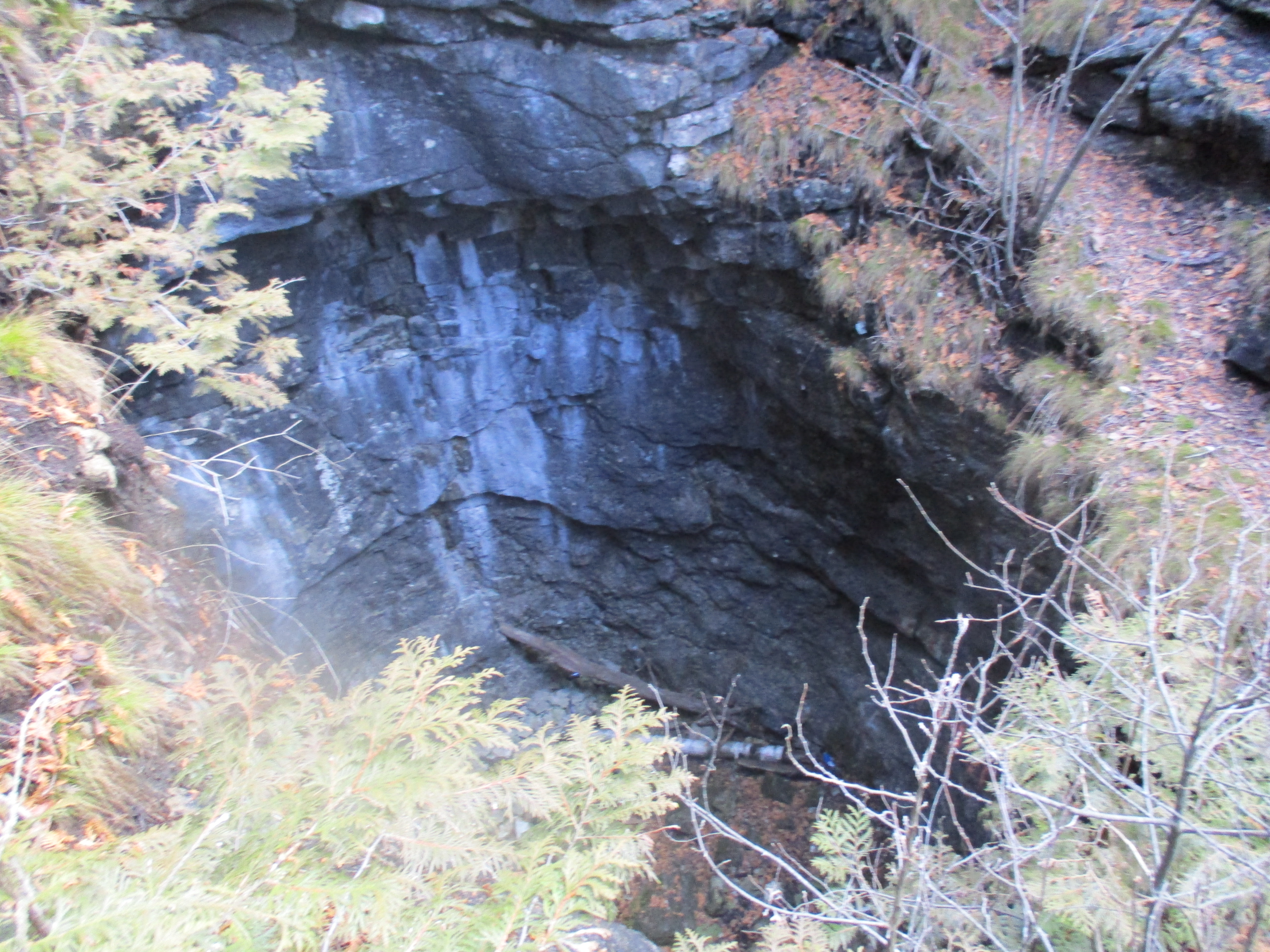
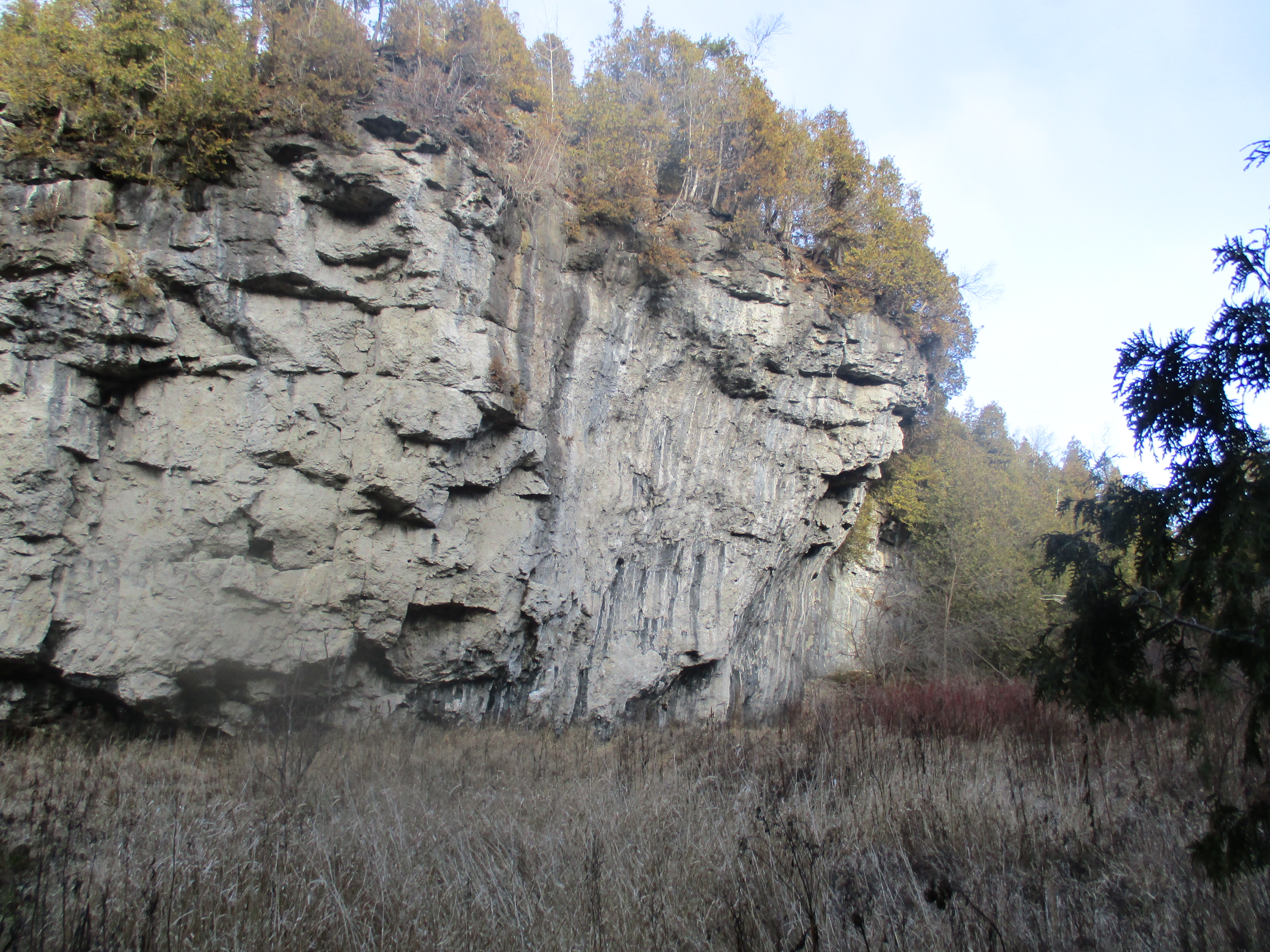
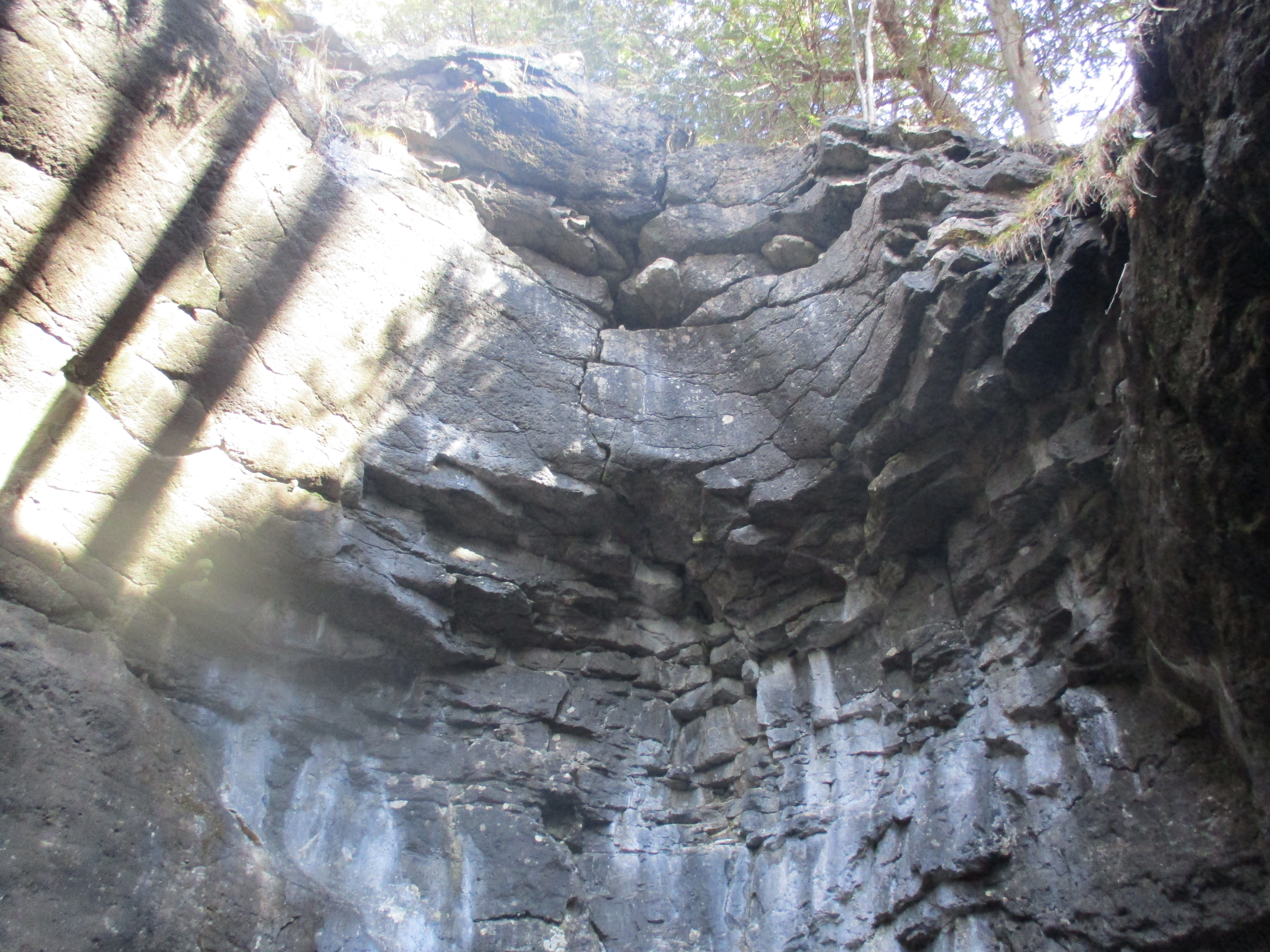
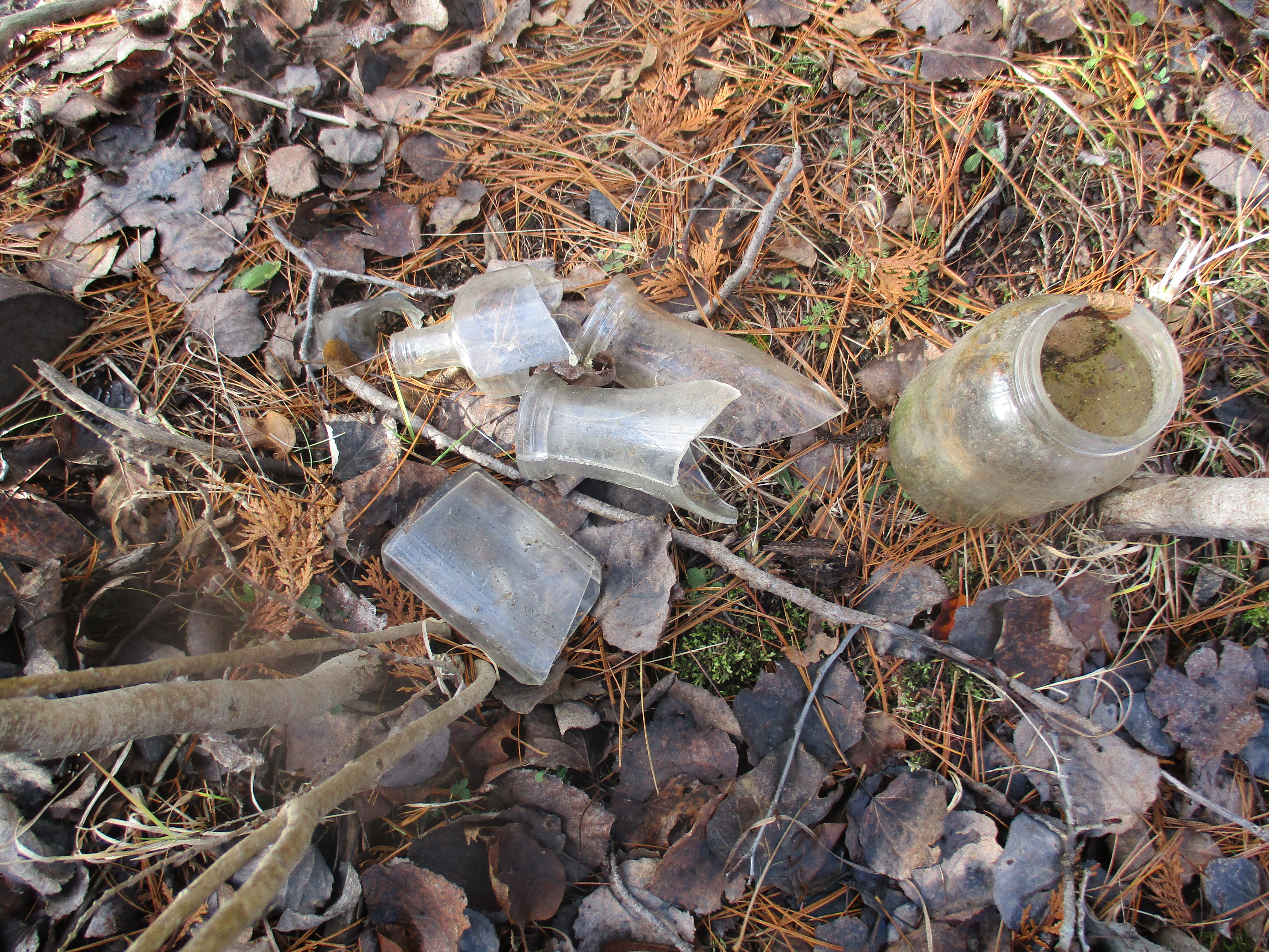
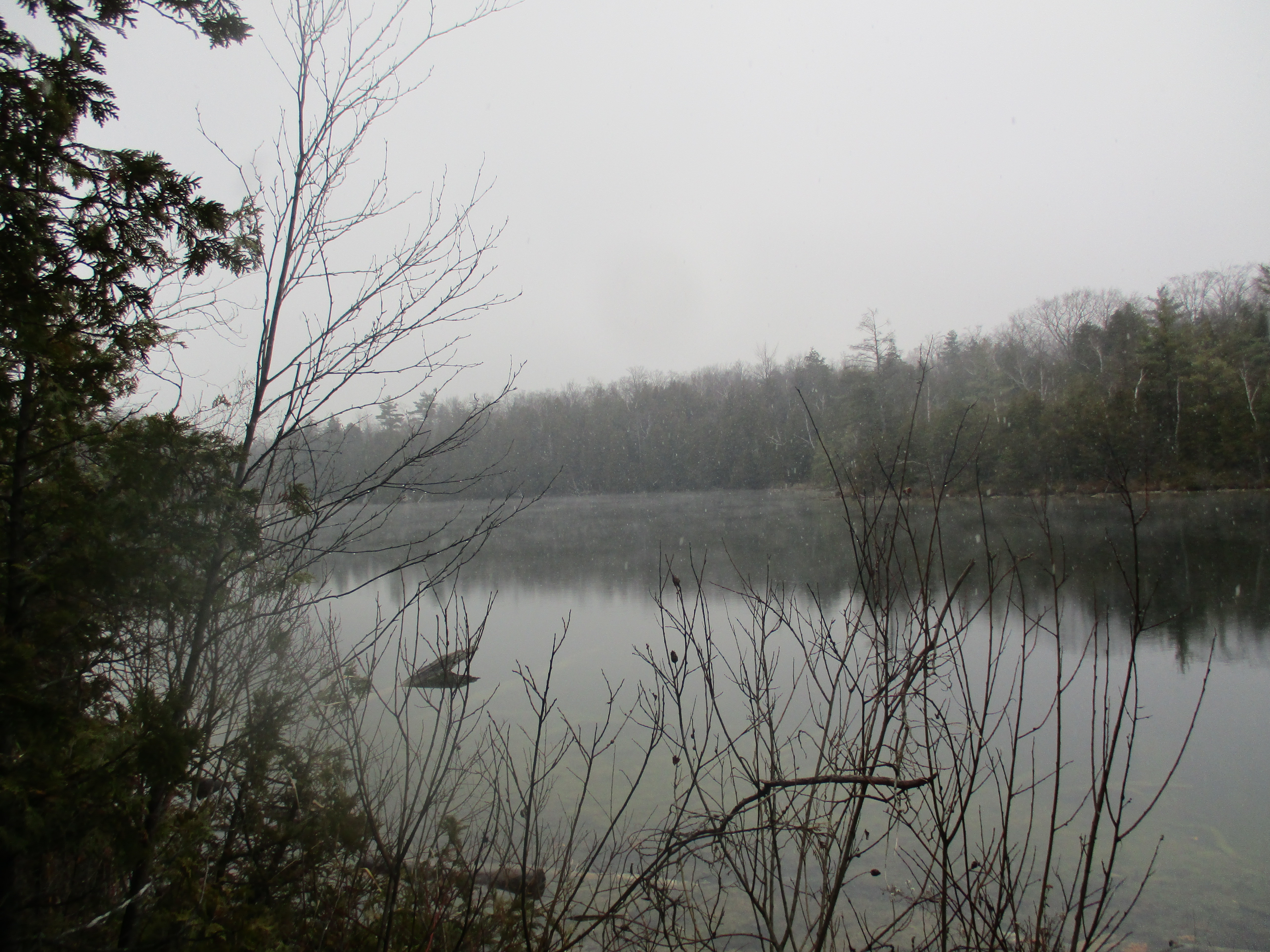
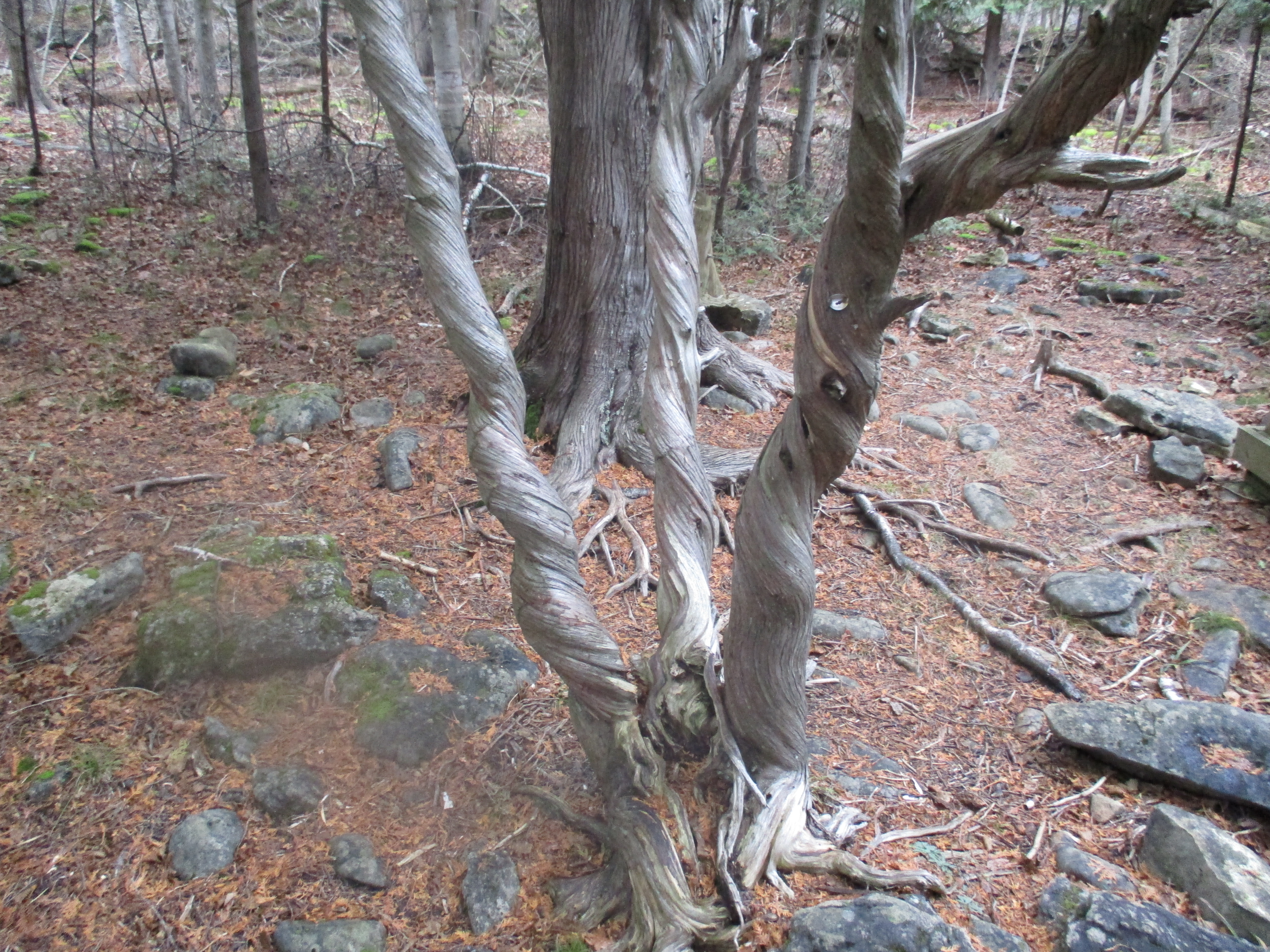
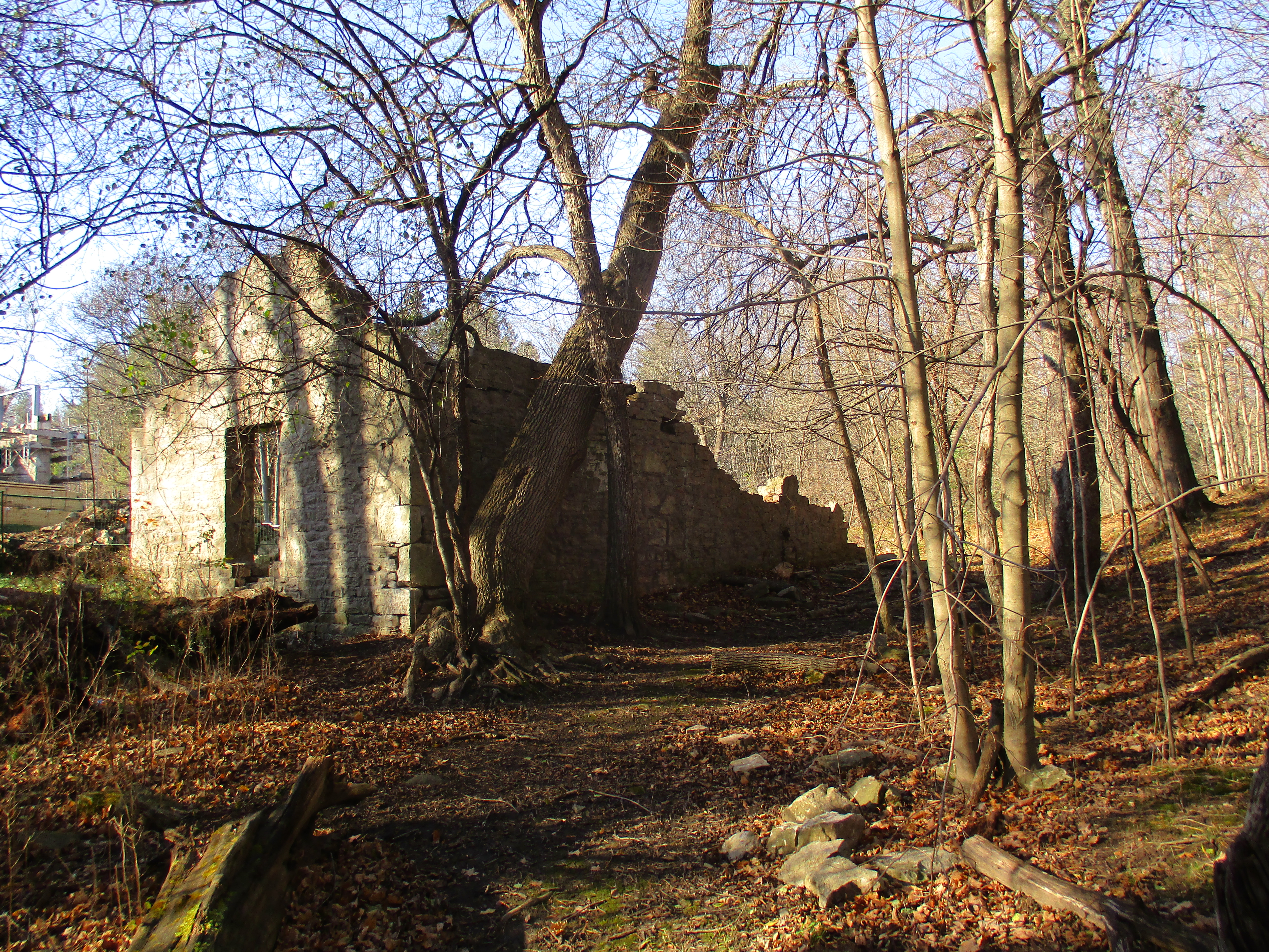
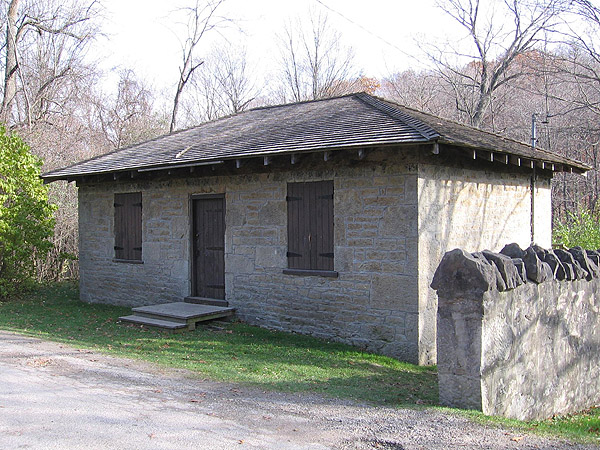
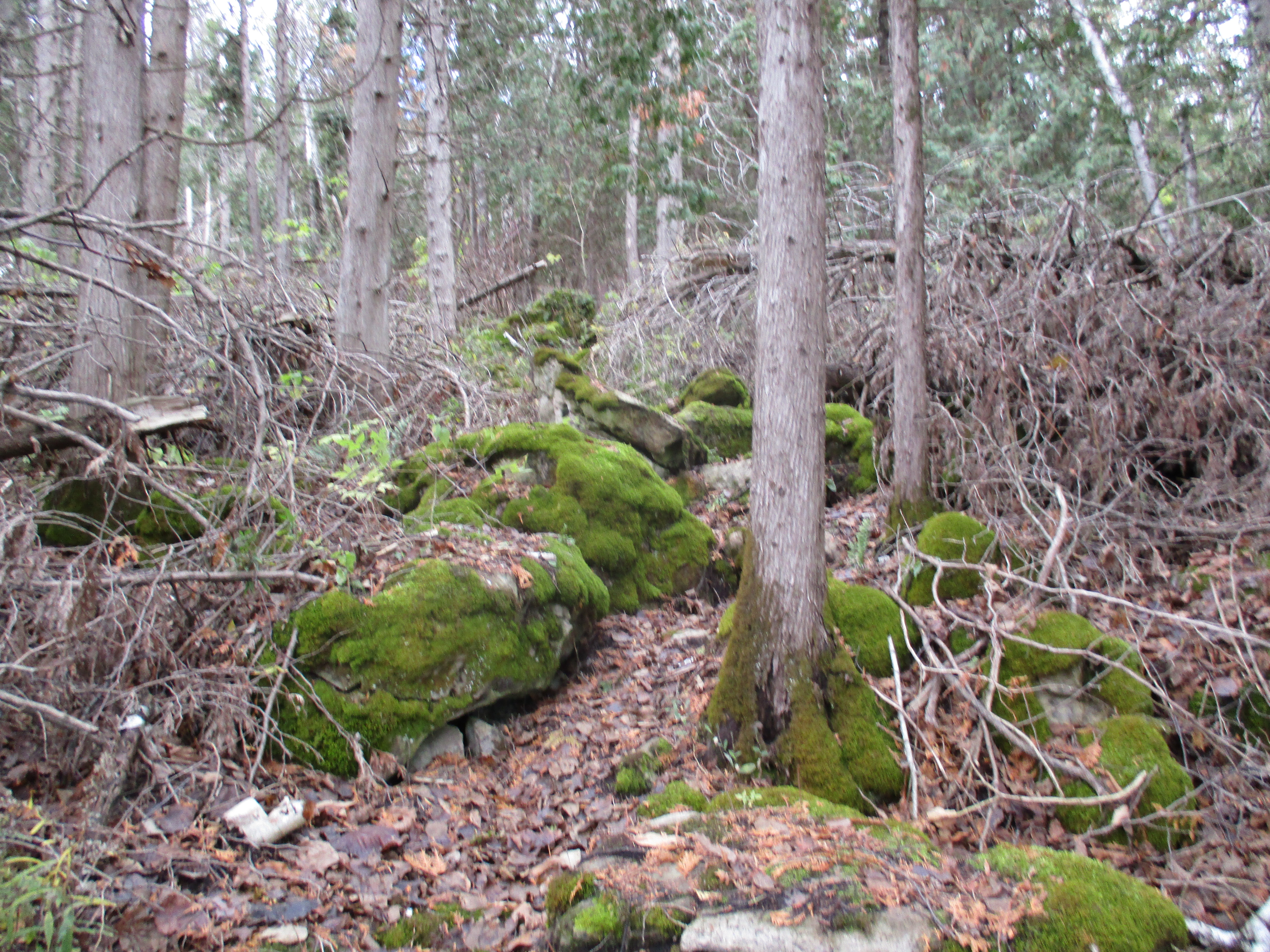
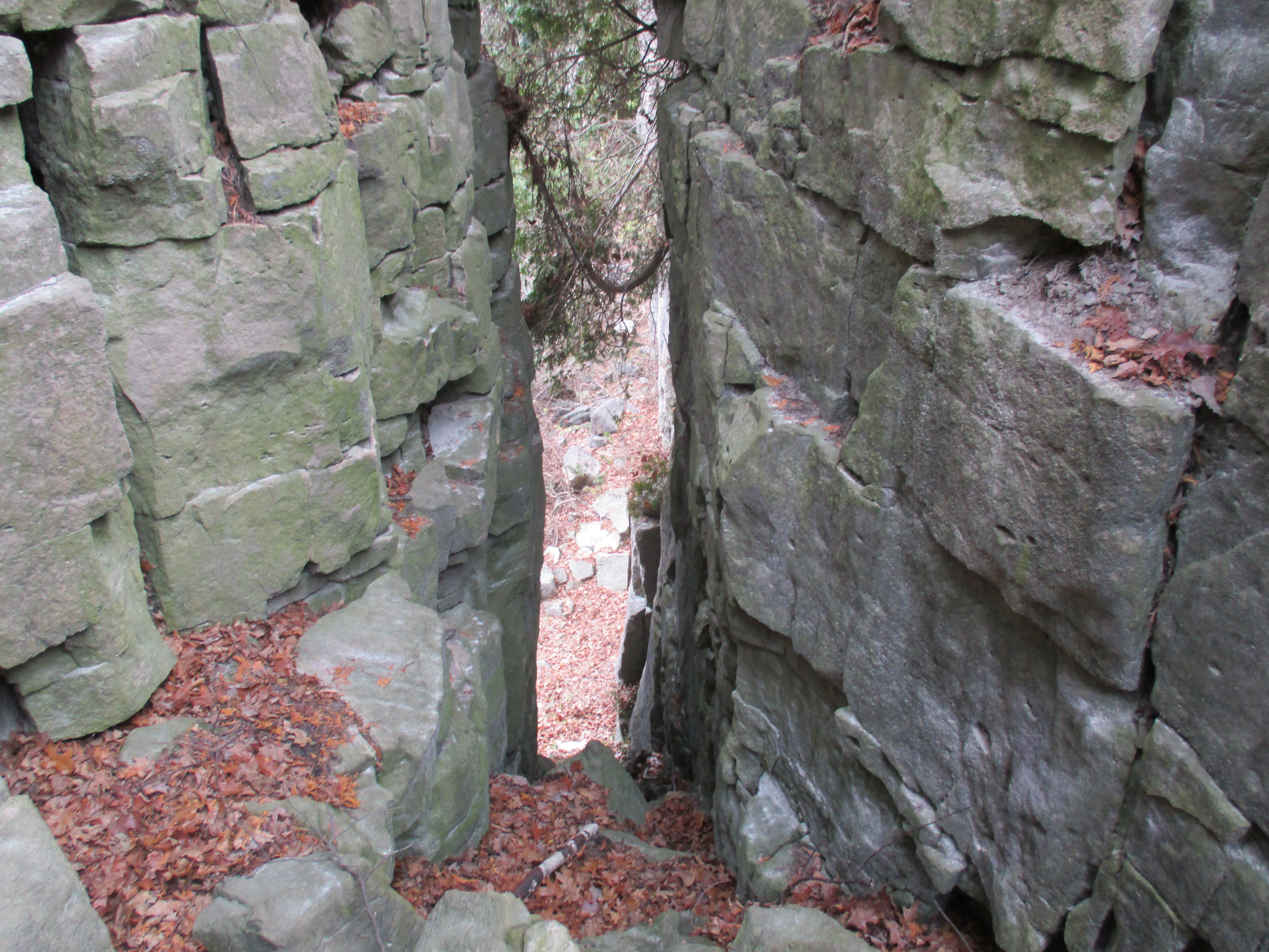
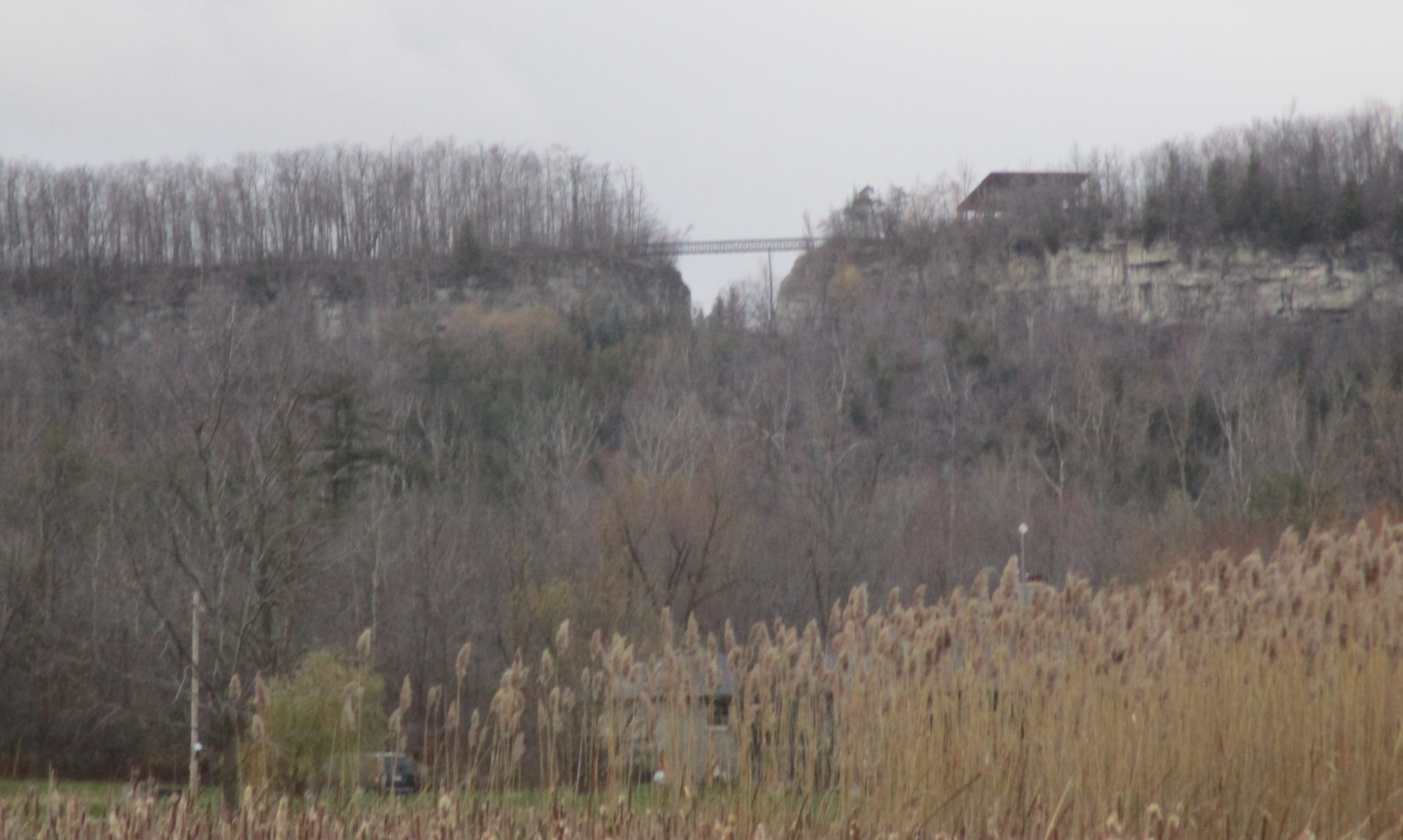
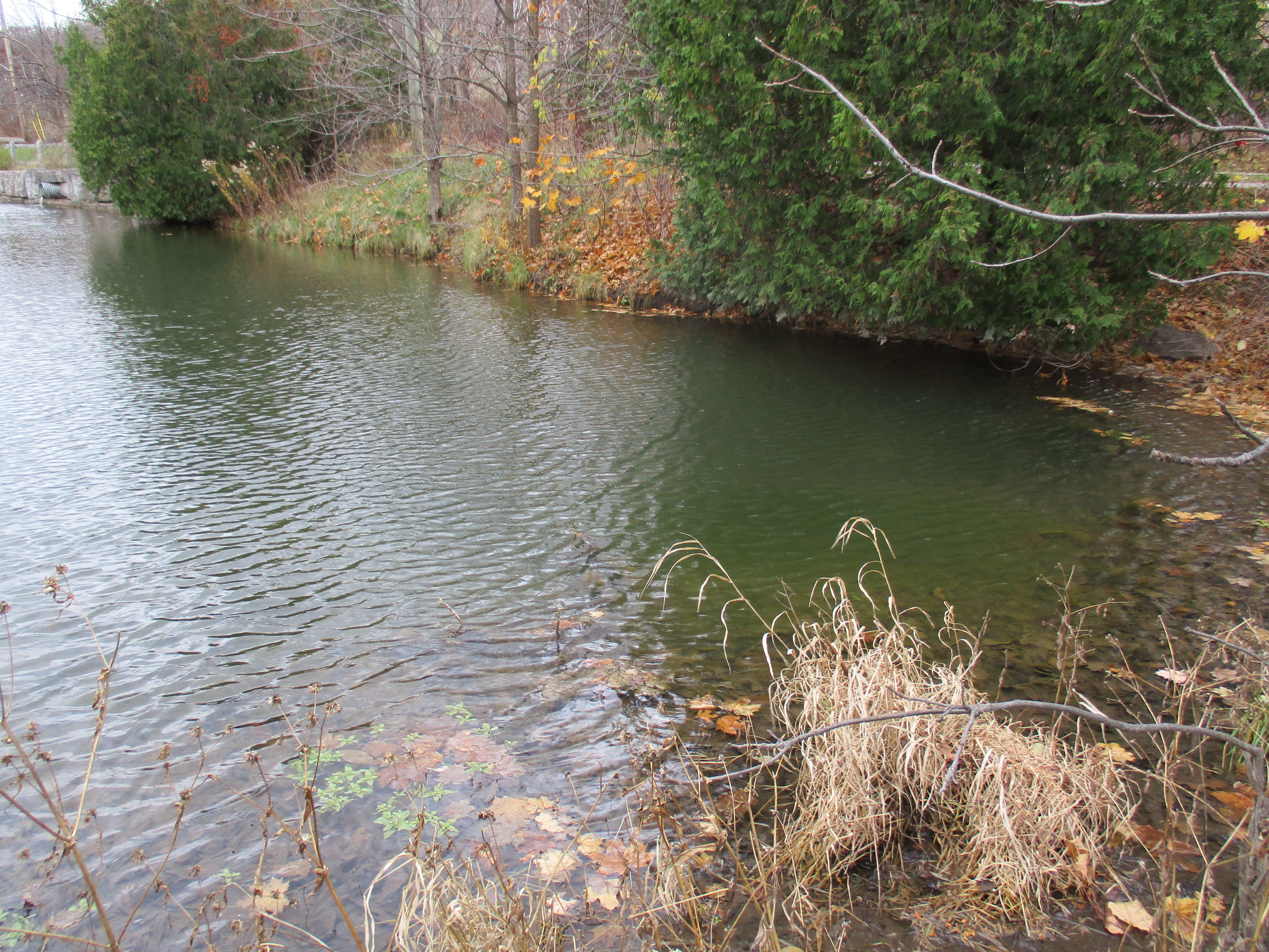
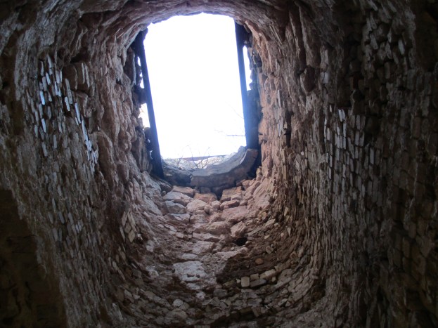
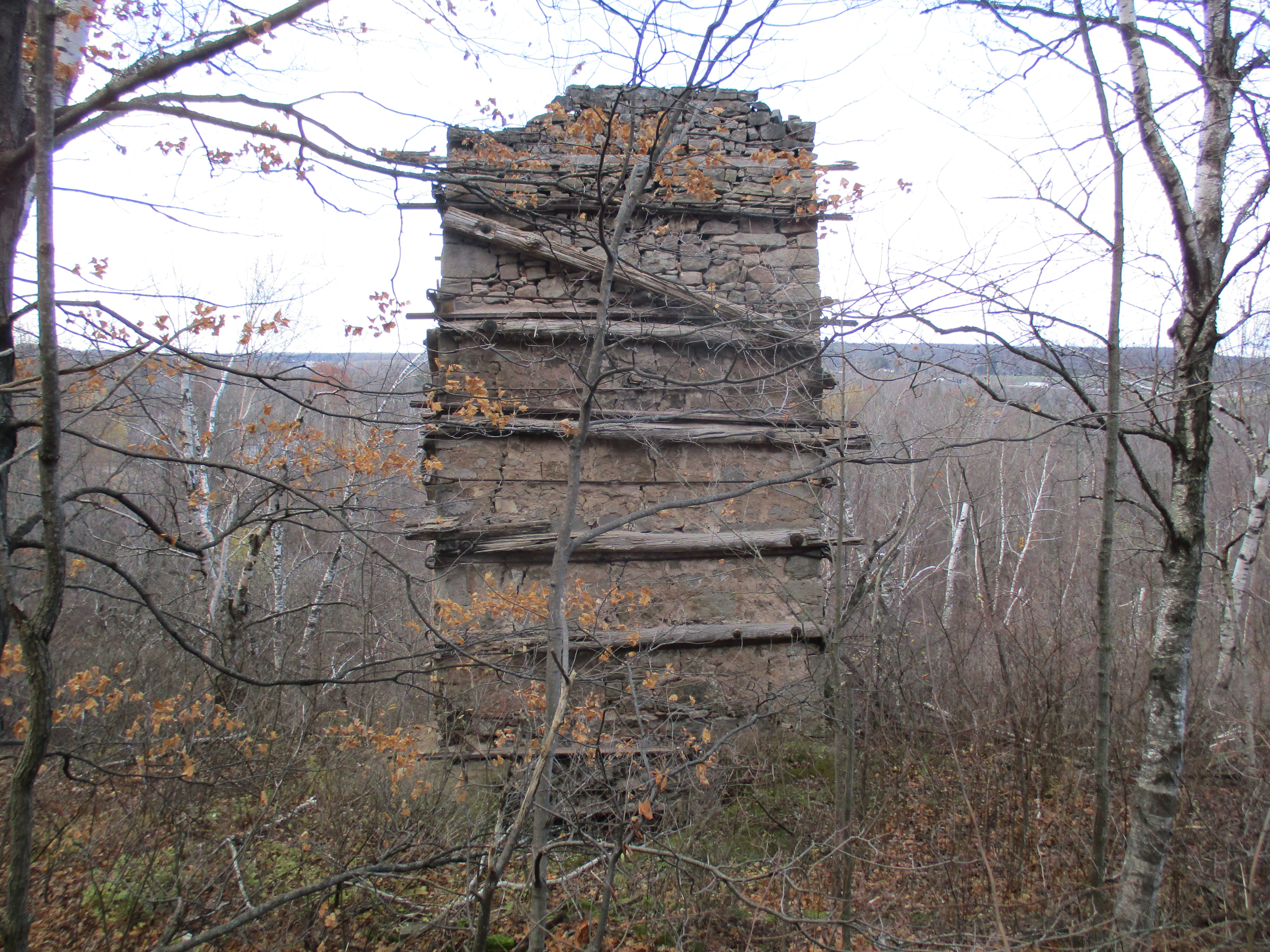
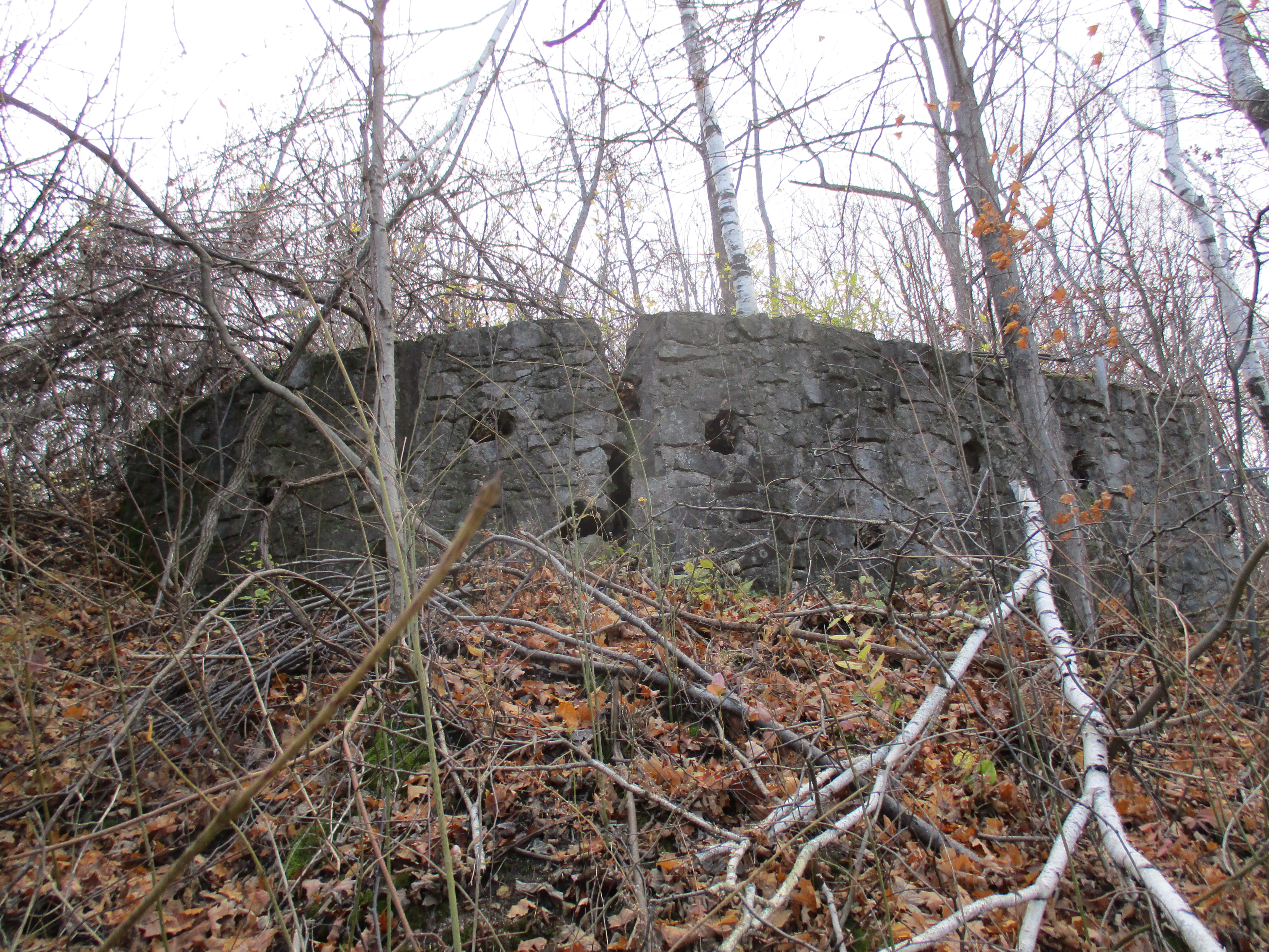
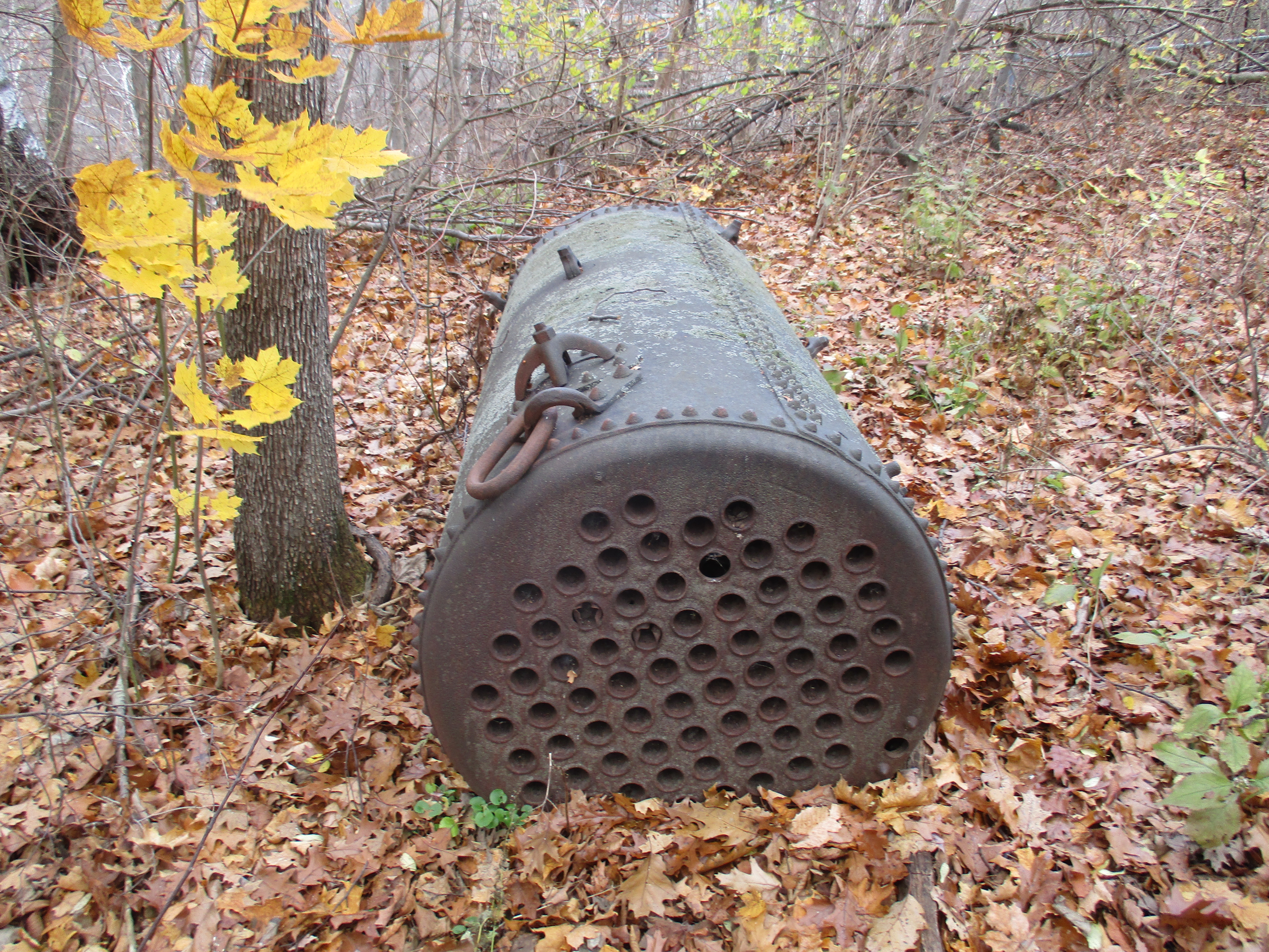
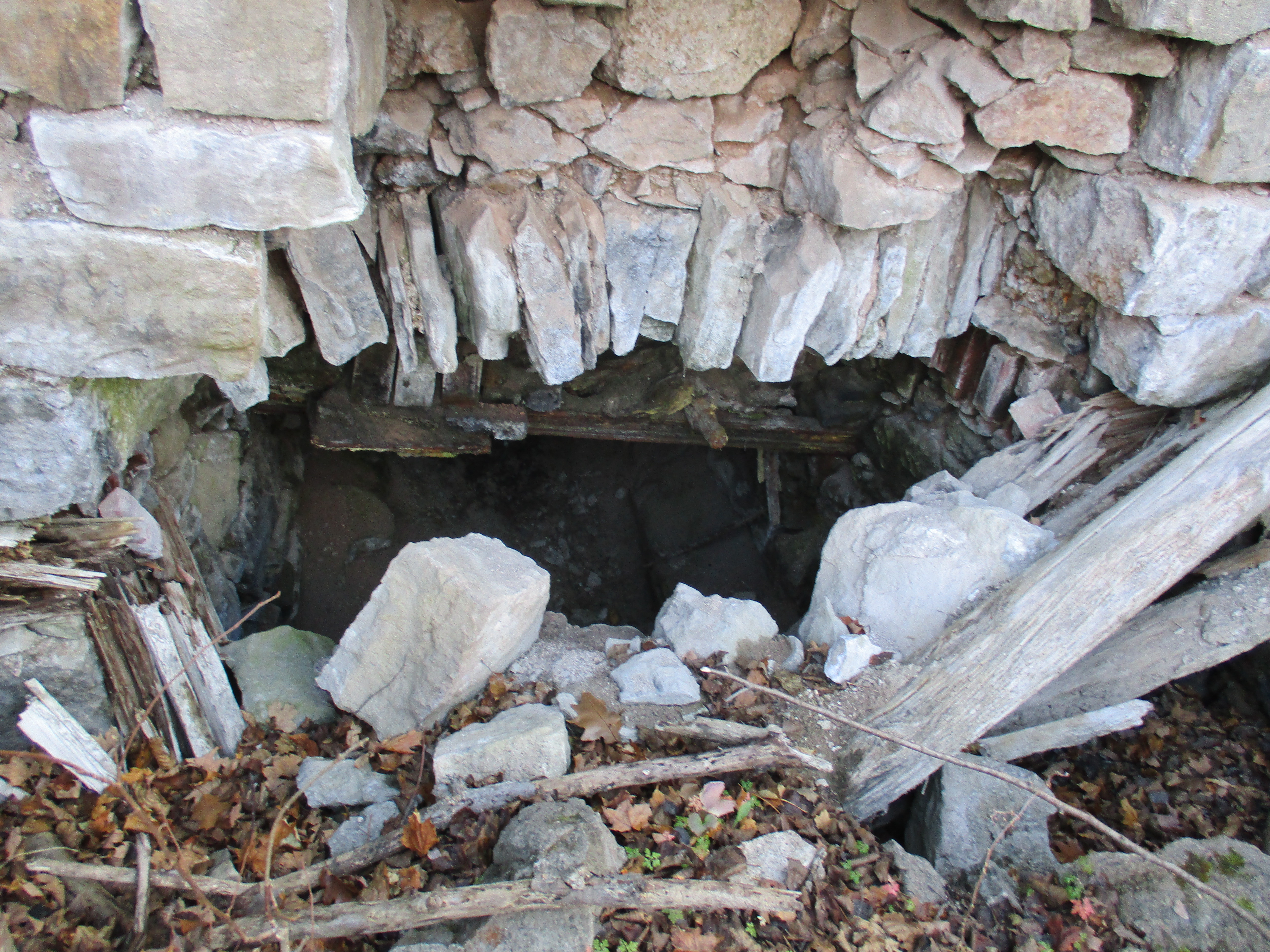
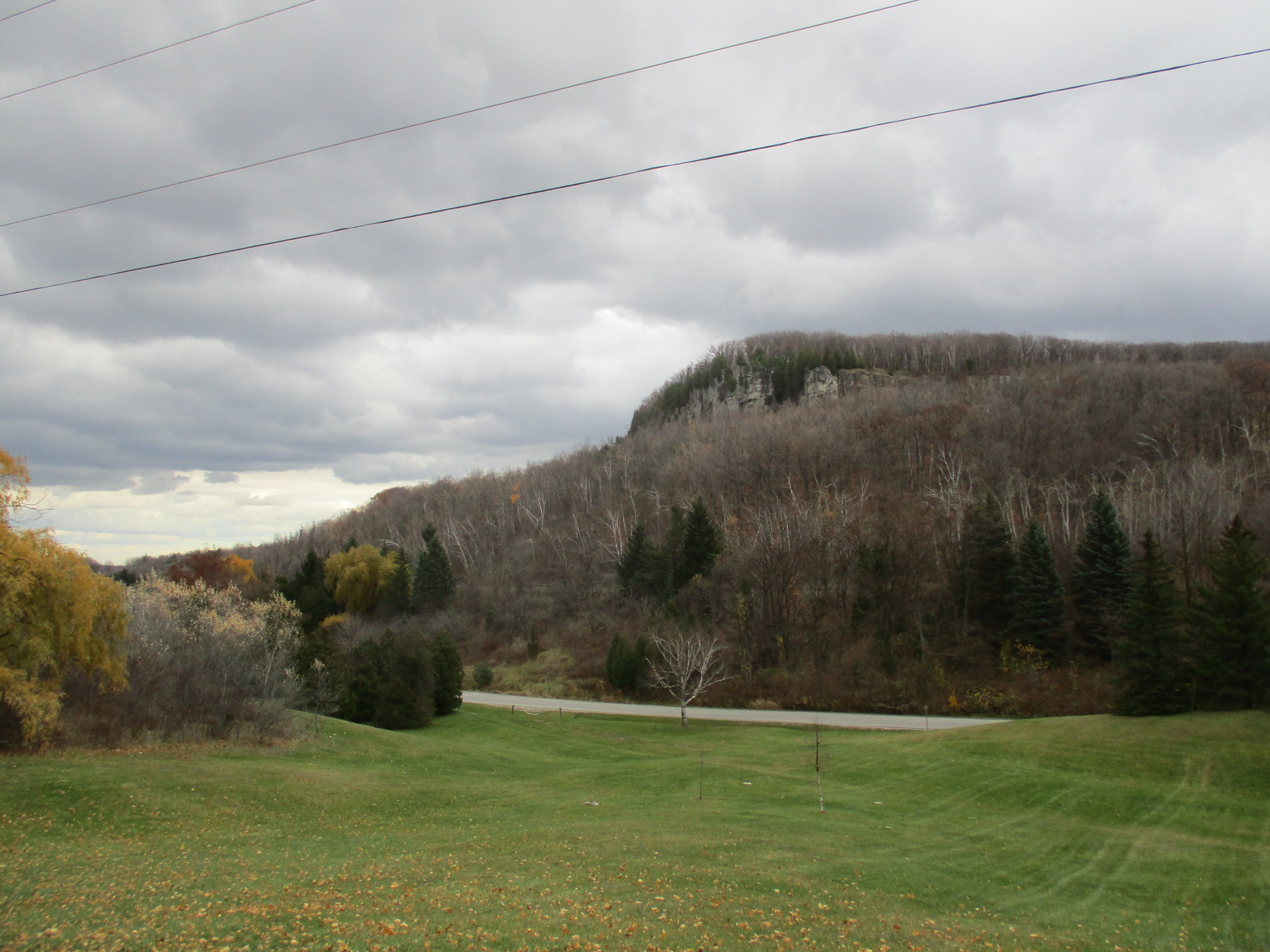
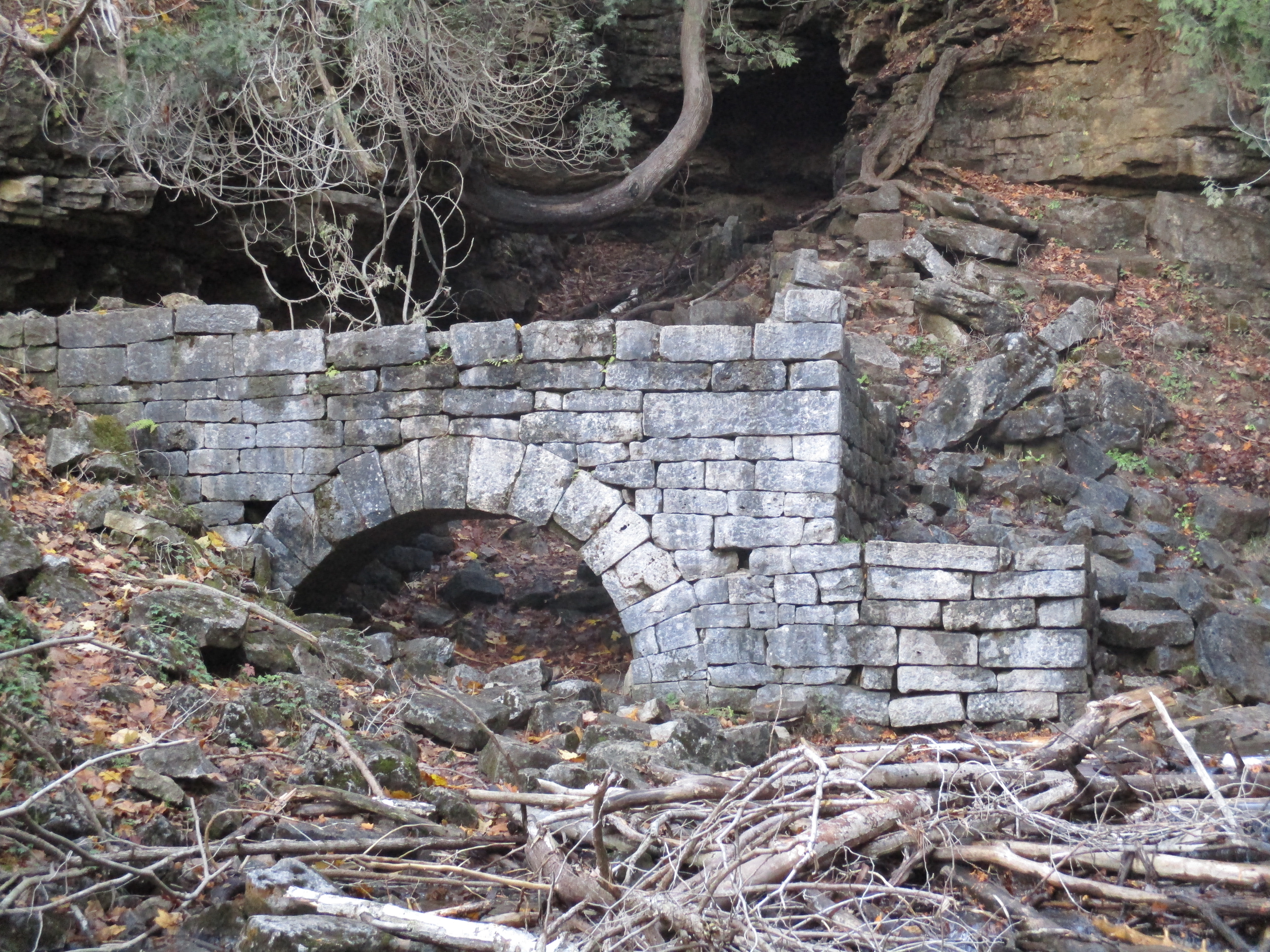
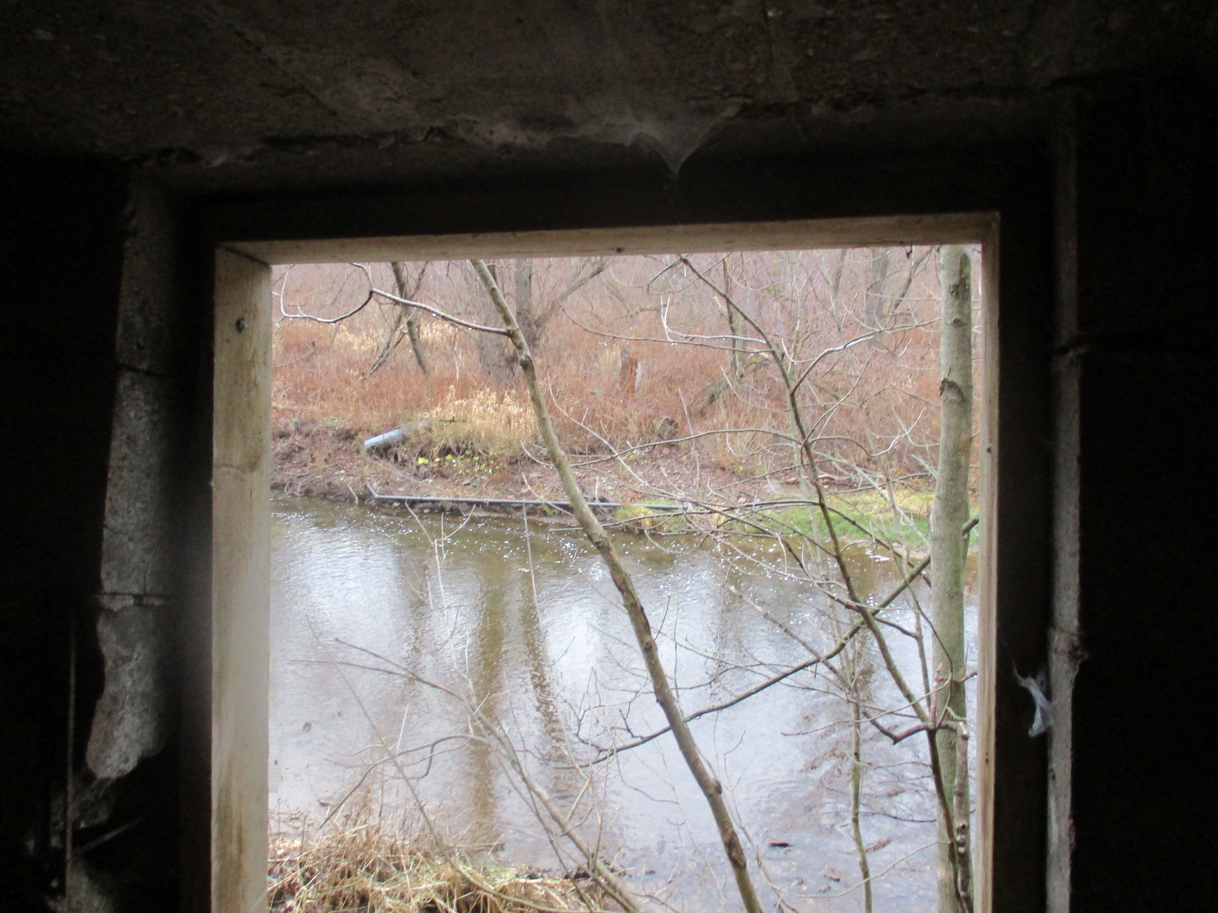
We followed the trail to where an old access road leads down to the level of Sixteen Mile Creek. There is a limited range one can travel upstream on this side before you must climb the ravine to cross a shale cliff. Near here is an old pump house on the side of the creek. There are intake pipes in the river as well as pipes running to the top of the hill. The pump house appears to have been associated with a children’s campground that occupied 47 acres adjacent to the Memorial Park. The children’s campground was closed in 1998.  The picture below shows the view through the open door facing the creek.  Pieces of PVC pipe can be seen on the far embankment and in the water.

IMG_1879

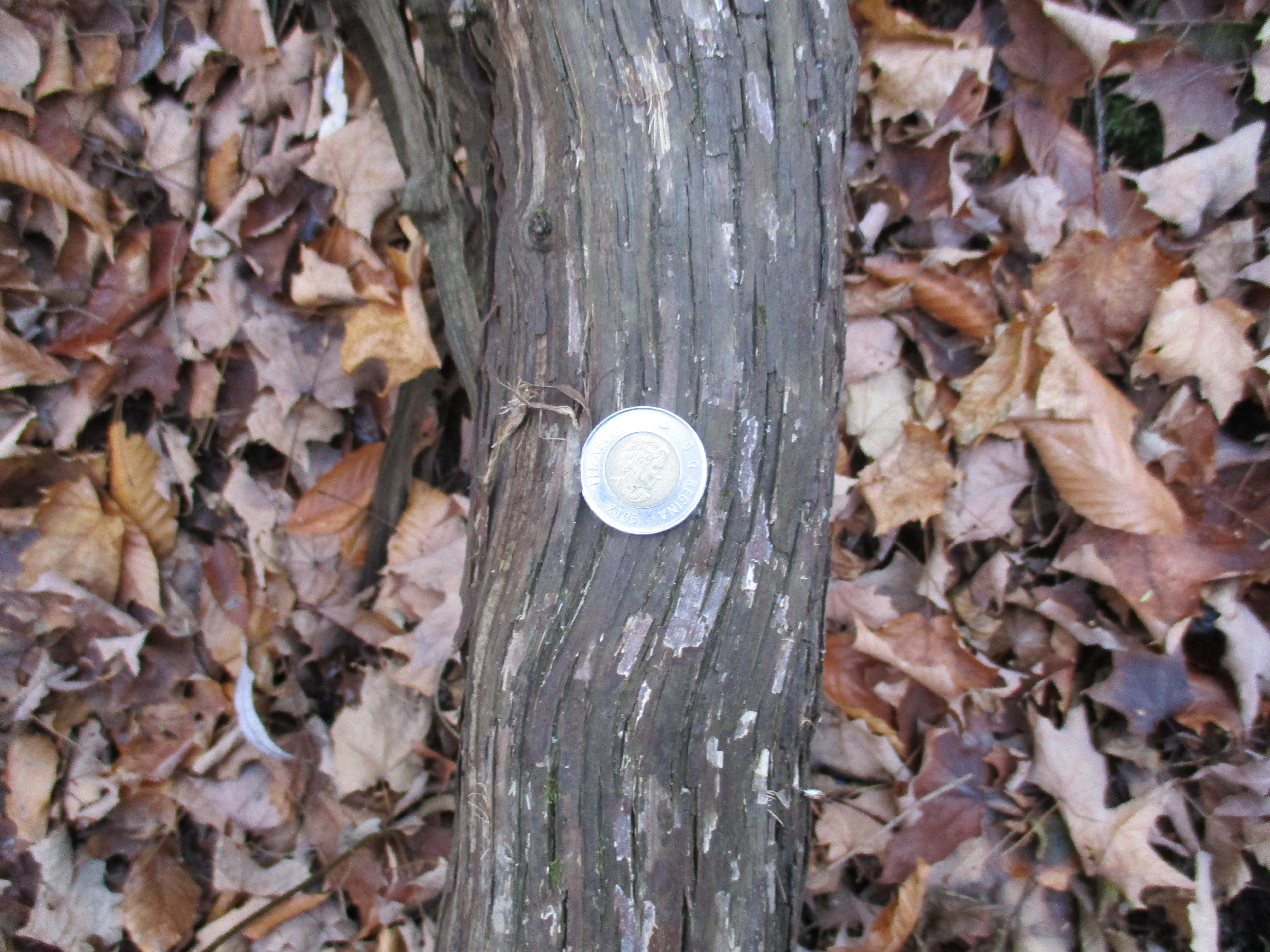
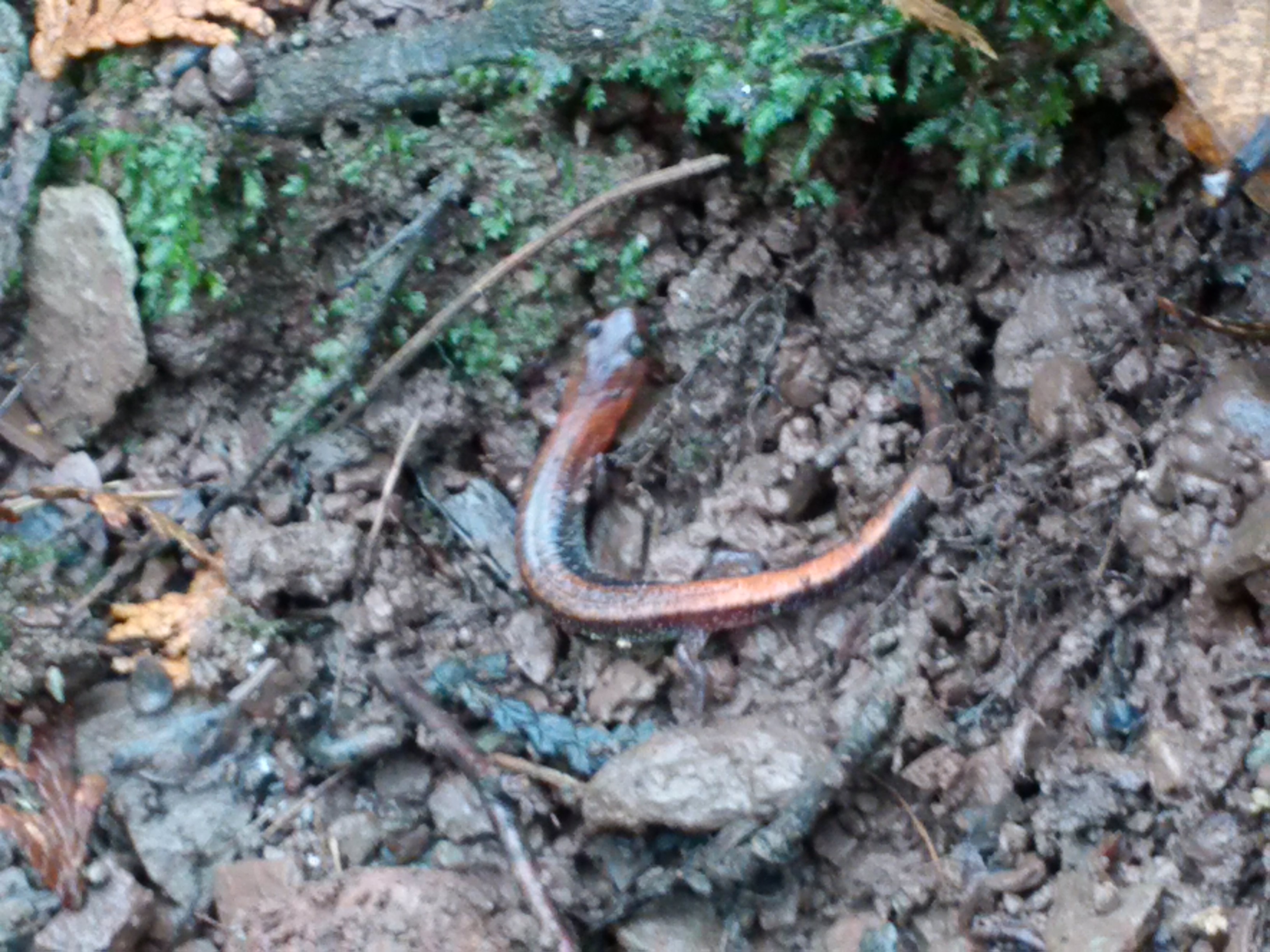
The eastern red-backed salamander lives in woodlands and is considered to be the salamander species of least concern for preservation in Southern Ontario. They typically breed in the fall but can also breed in the spring. They can reach population densities as high as 1,000 salamanders per acre. This salamander has a short hibernation period compared with other salamanders and have been known to be seen even in winter. The slow start to the winter season this year seems to have kept this one still active.

IMG_20151213_124021 (2)

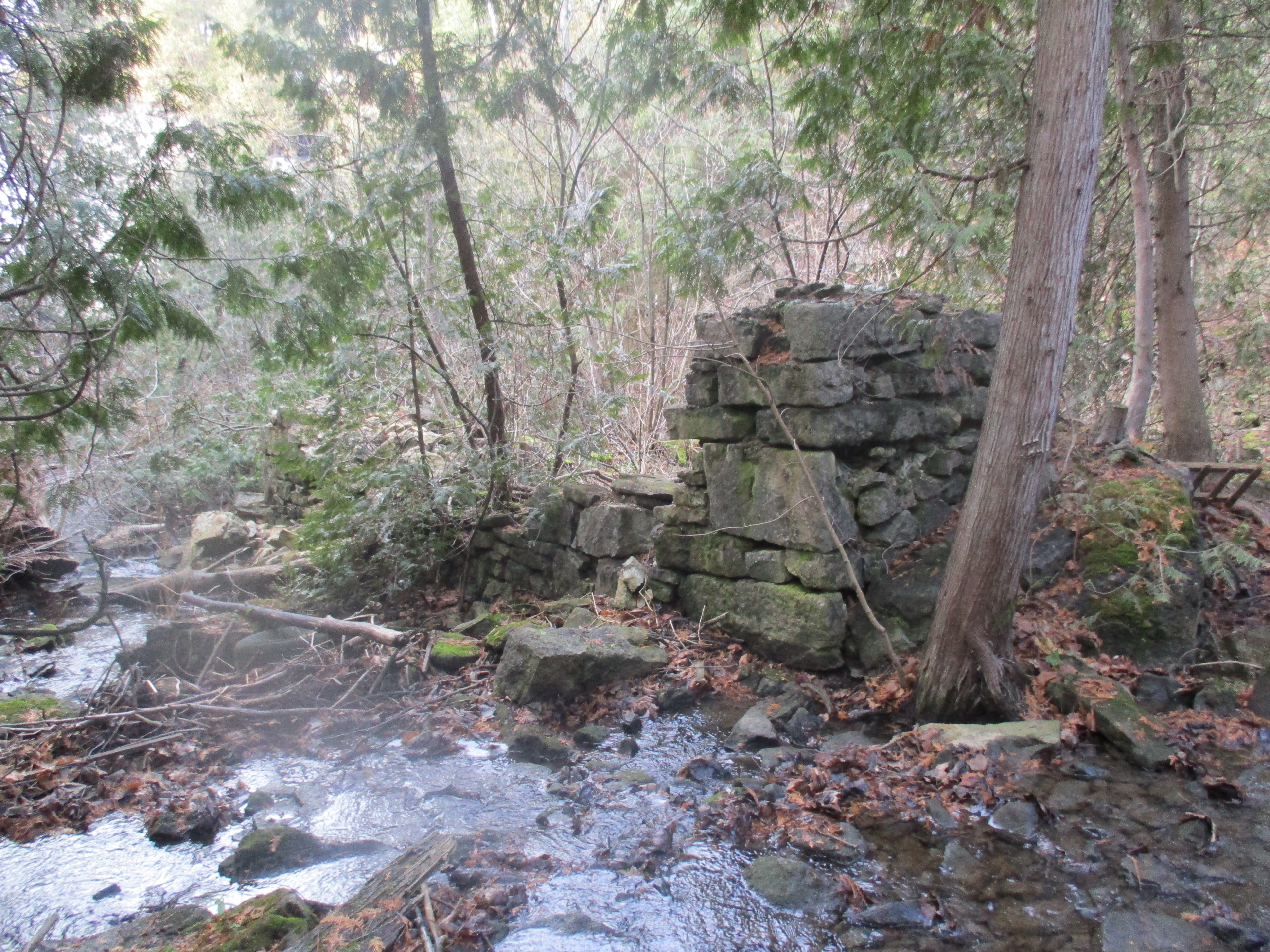
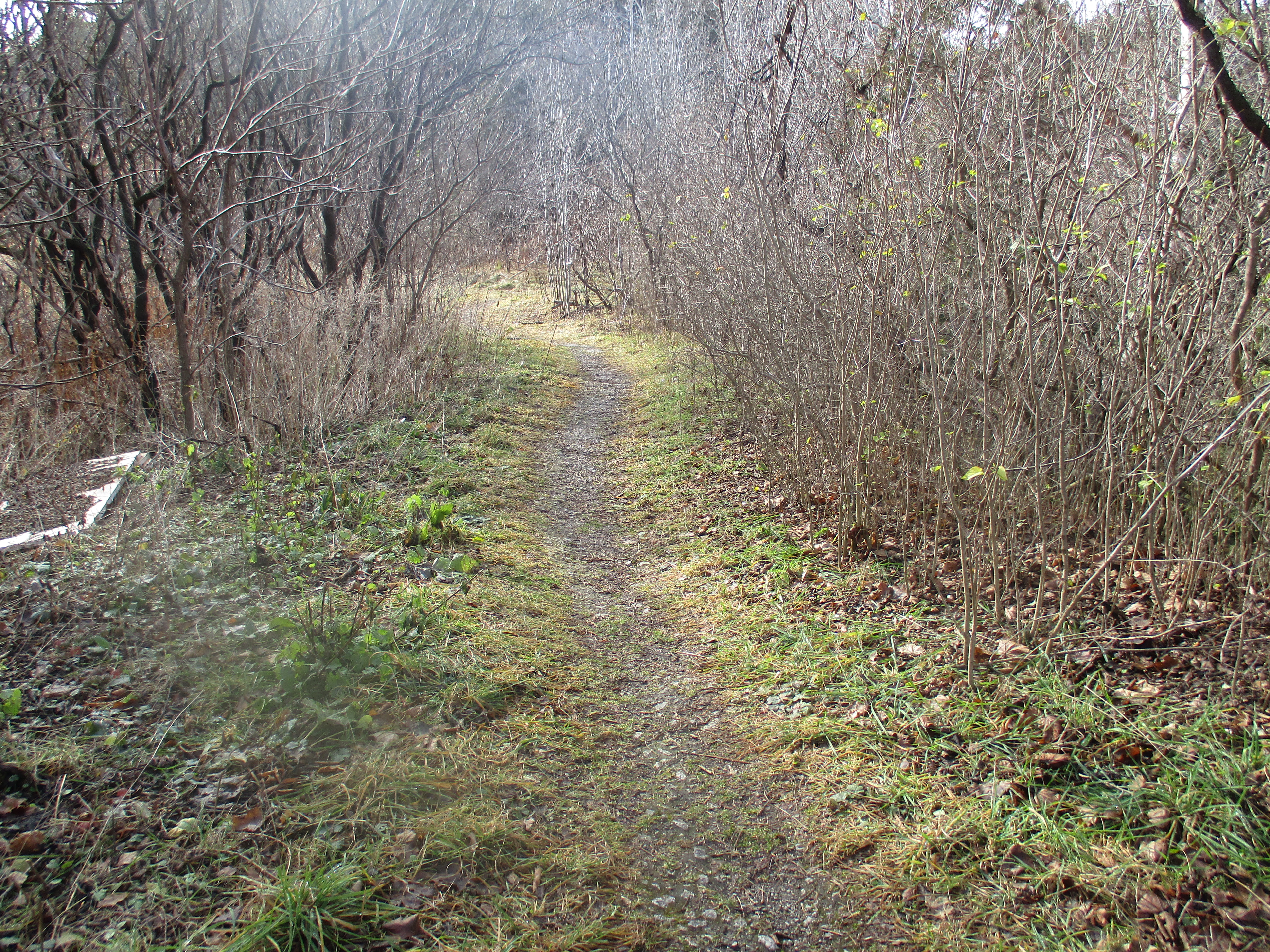
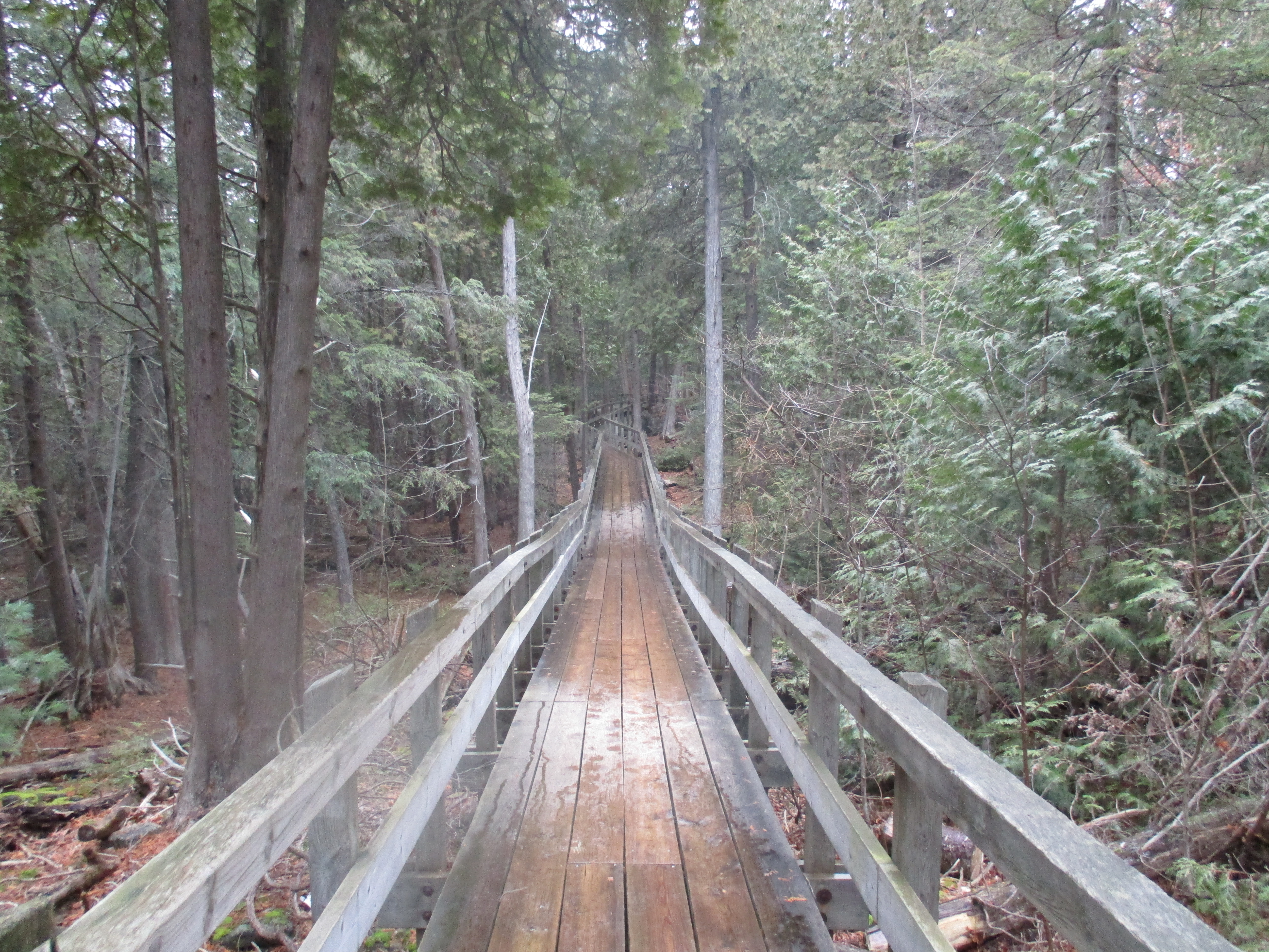
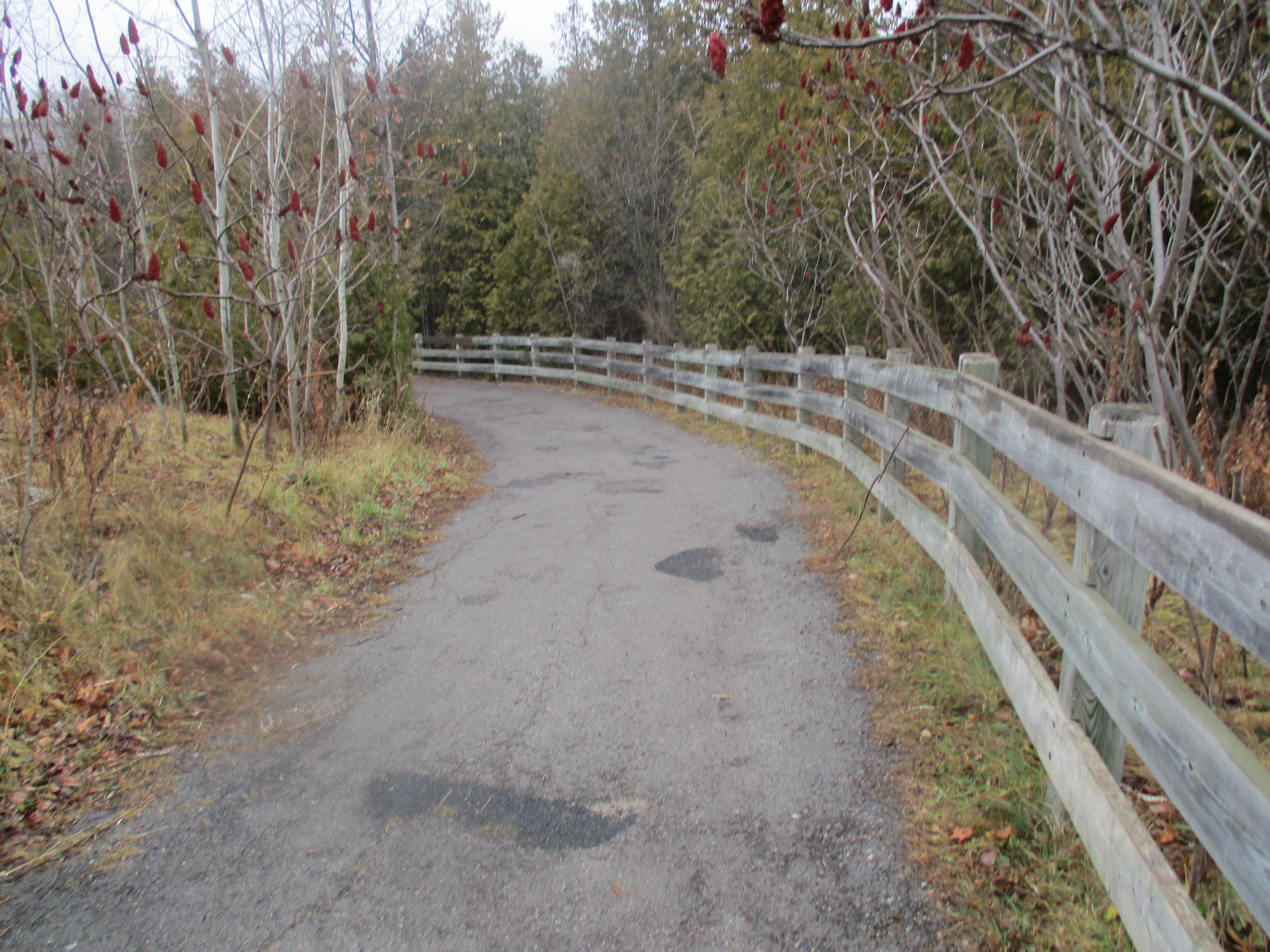
Before the current Dundas Street bridge was built the road used to climb the side of the ravine in a switchback that connected with the fourth line. That road was closed to traffic and now provides a link to the hiking trails. We previously visited this site when investigating the Ghost Town of Sixteen Hollow.

IMG_1930

The future of the Taras Shevchenko memorial park is uncertain. The park owners had been in negotiations with the City of Oakville to donate the property as a city park when the statue was stolen. At the same time the surrounding land from the children’s camp has been bought by developers who plan 205 single family homes and 125 townhouses on their land. They have been actively trying to acquire the memorial site for part of their development. I’m not sure what is in store for this repeatedly vandalized memorial.

IMG_1916

Like us at http://www.facebook.com/hikingthegta

Also visit:

https://www.facebook.com/ShevchenkoMuseum/

Shalebank Hollow

Saturday Dec. 5, 2015

Mullet Creek flows through an area known as Shalebank Hollow in Mississauga.  Freshly reforested, the area still retains some evidence of it’s farming past.  Normally I like to look for the unique history of the places we hike but this week I must be satisfied to present a few pictures we took while on a short exploration.  With the passing of our father on Thursday, getting away from things briefly seemed even more necessary than usual but there isn’t time for the regular research and writing.  Therefore, please enjoy the following photo journal of some of the things we saw.

An early horse drawn hay rake known as a dump rake has been left sitting close to Mullet Creek and the trees have grown around it.  These rakes were operated from a seat above the curved steel teeth of the rake where the farmer lifted the implement as he went back and forth to create a windrow of hay.

IMG_1797

IMG_1792

There are many old “stubby” beer bottles along here plus this worn 1973 Pepsi bottle.

IMG_1789

An old building on the floodplain for Mullet Creek has almost completed it’s collapse.

IMG_1810

IMG_1802

IMG_1805

IMG_1808

On the hill above the collapsed building stands what may be the original log home on the property.

IMG_1814

In the woods are the remains of an old electric fence complete with ceramic insulators.  This type of fence was used to keep livestock from wandering away.

IMG_1825

This old steel stove liner is being used in a shelter built in an old deer stand.

IMG_1833

Where Mullet Creek crosses Mississauga Road there is this beautiful and restful waterfall that was featured in Mullet Creek’s Secret Waterfalls.

IMG_1838

Look for a full feature story coming next week.

Like us at http://www.facebook.com/hikingthegta

Eden Mills – Back To The Garden

Saturday Nov. 28, 2015

The historic village of Eden Mills is home to 350 people who share the dream to become North America’s first carbon neutral village.  Starting on Nov. 7, 2007, Eden Mills set themselves the ambitious goal of balancing the amount of CO2 that the village emits with the amount it absorbs. Having hiked to The Devil’s Well in the morning we decided to take a short detour on the way home and check out the village. We parked in the parking lot for the community hall and explored a little.

The original inhabitants of the area were the Neutral Confederacy.  They were a group of North American natives who lived up to their name by trading with both the Hurons and Iroquois, two tribes who were at war with each other.  Their territory covered much of what is now Southern Ontario with their numbers reaching toward 40,000 prior to the onset of Europeans who came with their diseases that the natives had no immunity to.  The Neutral may well have been the builders of the Longhouses at Crawford Lake.  The Neutrals lived in harmony with nature much more like the Garden of Eden than the later town which bears it’s name.  With the arrival of three mills on the Eramosa river starting in 1842 the town of Eden Mills was born.  Founded by David Kribbs it was originally known as Kribbs Mills.  Both saw and grist mills were built and they went through many owners in the first few years.  We see paintings of quiet mill ponds with scenic mills and a peaceful community in the countryside.  In reality mills were noisy and usually polluted land, air and water.  The local rivers were used to dispose of saw dust and other waste.  The mills themselves were responsible for making the place less like Eden than the name suggests.  The former Kribbs grist mill stands on the side of the Eramosa river.

IMG_1770

When the community began their carbon neutral project they started by determining the baseline for their carbon footprint in January 2008.  With the help of University of Guelph students they set up measurements to be able to quantify their success and provide evidence of their claims.  The 2007 figure of 4,708 tonnes of annual emissions presented the village with a huge challenge. The good news was that over half of the annual emissions were being stored by the local forest. Plans were made to plant certain species of trees that sequester carbon better than others. Sugar Maples absorb four times more CO2 than white spruce or pine trees of a similar age. Over 40,000 trees have now been planted to supplement the existing forest cover.

The picture below shows the tail race for the grist mill which passes under the roadway and returns the water back to the river. It is made of a circle of cut stone with the landscaping being designed to match.

IMG_1773

The Eden Mills pond has been drained but it creates a scenic playground in the heart of town.  It is managed and maintained by the Eden Mills Millpond Conservation Association Inc. which is a registered charity started in 1990.

IMG_1760

The dam walls and other structures were restored by a group of volunteers who devoted hundreds of hours of labour to complete the work.  This group has also been the inspiration for the current carbon neutral initiative.  A set of wooden steps can be seen at the left in the picture below that have been fixed to the far end of the concrete dam.  They lead down to the summer swimming area of the mill pond.  The pond also supplied water for the saw mill through a head race that was fed from where the spillway is seen as a cut-out section on the dam.

IMG_1759

A wooden water wheel is shown in the cover photo and below.  It hasn’t been used in awhile as the overgrowth of vines shows.  This wheel spins in a counter-clockwise direction and is known as a breastshot wheel.  The wooden buckets had water dropped in them at a point near the centre line of the wheel’s edge or just above it.  Breastshot wheels are not as efficient as overshot wheels but were commonly used where high volumes of water flow were available.

IMG_1767

The community hall stands beside the mills.  The original building was built in 1893 but burned down in 1917.  It was immediately rebuilt and has now become a good example of the steps taken toward reducing the carbon footprint of the village.  Following a series of upgrades in 2013, it was estimated that the carbon impact of the hall would be reduced by 63%.  They installed a new metal roof and insulated the ceiling.  The windows were replaced with triple glazed Low-E argon windows for increased energy efficiency.  One of the propane furnaces was replaced with an air-to-air heat pump and two heat recovery ventilators were added.

IMG_1762

Individual households participate in biannual surveys to help track the progress of the village in reducing, replacing and absorbing CO2.  As of Dec. 1, 2013, they have achieved 75% of the target to become carbon neutral.  Another one of the main objectives was to ensure they all had fun while working on this project.  By all accounts, they have been successful at this too!

The Niagara Escarpment provides an abundance of stone for building materials and the older buildings in Eden Mills are made from cut stone blocks.  David Darby was the town tailor making and mending clothes for the community.  Darby built this stone house in 1859 showing that his trade came early to the village of Eden Mills, just as it did in the Garden of Eden.

IMG_1776

Built in the year of Confederation the Eden Mills Hotel is another example of local stone architecture.

IMG_1775

The General store is the only three-story building in the village.

IMG_1774

As the village of Eden Mills works toward being the first carbon neutral village in North America they are also becoming more and more like the garden from which their name is taken.

More information can be found at http://www.goingcarbonneutral.ca/

Google Maps link: Eden Mills

Like us at http://www.facebook.com/hikingthegta

Follow us at http://www.hikingthegta.com

The Devil’s Well

Saturday Nov. 28, 2015

If you drive in the GTA chances are you already think you have the world’s biggest pothole in your neighbourhood.  In reality, you likely do.  Represented as the world’s largest intact glacial pothole, The Devil’s Well has been submitted for inclusion in The Guinness Book Of World Records.  Intrigued, we decided to visit and so we parked in the Lion’s Club parking lot on Main Street in Rockwood and entered the park on Valley Road (see note).  Valley Road crosses the Eramosa River on an old concrete bridge from where it used to lead past mill worker’s cottages to the site of the Harris Woolen Mill.

Another trail leads you into an old quarry.  Here, the Rockwood Quarry extracted 10 metres of amabel dolomite and operated a small lime plant.  The quarry was closed in the 1960’s and is being taken back by cedar trees.  The floor of the quarry has several surveillance pipes drilled into the bedrock.  The older ones have been filled in with rocks while newer ones are locked.

IMG_1644

We followed well used trails as we made our way from the old quarry to the site of the giant pothole known as The Devil’s Well. It’s possible to walk full circle around the top of the pothole but there is no way to climb down into it due to it’s barrel shape.  The pothole is 13.1 metres deep and is 6.4 metres wide just below the rim at the top.  The bottom tapers down to 4.9 metres.  To get inside we would have to find another way down.

IMG_1657

We descended to the level of Richardson Creek hoping to find a way into the ravine that contains The Devil’s Well.  We had noted a couple of steel anchors in the rock face along the top of the ridge.  From the bottom we were able to see that there are dozens of rock climbing aids left screwed into the 25 metre cliff.  The pothole has only been cut a little over half way through this rock wall and cannot be accessed from down here.

IMG_1679

We spent a few moments exploring Richardson Creek while we were there.  It runs for less than a km from highway 7 to the Eramosa River but this is just enough to feature this picturesque little cascade waterfall.  Standing above the falls, to the left in this picture, are the remains of an old cut stone dam.

IMG_1690

Just below the dam stand two walls of an old stone building, most likely a saw mill that once used the mill pond just upstream.  The 1877 County Atlas shows the mill pond on Richardson Creek but does not denote a mill.  Likely the mill was already abandoned by that time as frequently happened when local wood supplies were exhausted.

IMG_1688

Much of the Niagara Escarpment is made of dolostone and limestone which contain high amounts of calcium and magnesium carbonates.  These can disolve in the mild acid content of most natural water.  The sinkholes, caves, springs and fissures created by this process are known as karst.  Karst topography is a common feature in our recent escarpment hikes.  Some geological studies of The Devil’s Well suggest that karst led to the forming of empty pockets within the rocks.  The rapid flow of melt water from the retreat of the Wisconsinan ice sheet created rivers along the margins and under the glacier.  Just as modern industrial processes use high pressure water and an abrasive additive to cut through steel and granite, the force of this water acting with small rocks carved out six obvious potholes along a fissure in this piece of the escarpment.  As five of these potholes enlarged they coalesced to create a short ravine with worn sides and smooth concave pockets to mark the remnants of the potholes.  The sixth pothole stands intact at the eastern end of this chain.  This intact pothole has come to be known as The Devil’s Well and is claimed to have the largest volume of any existing complete pothole in the world. We ended up using a nearby cedar tree for support as we climbed down into this ravine to get to the potholes.  This and other parts of the hike are not for novice hikers and should never to be attempted alone.  The view below is from standing in pothole number four, looking into number five with The Devil’s Well just beyond the rear wall and accessible through it.

IMG_1703

The wall to the pothole has not collapsed like the preceding ones, leaving an intact pothole behind it. There is a small crack at the bottom where you can enter from pothole #5.  The cover photo shows the view looking up out of the inside of the Devil’s Well where the trees above give an idea of the perspective.  This view is from the inside of The Devil’s Well looking back at the entrance.

IMG_1712

I did some very rough calculations to get an idea of the volume of this pothole.  This is only possible as an estimate due to the fact that it is wider in the middle than at the top and not exactly round either.  Most potholes are eroded in a slight barrel shape with the overhang quite noticeable from inside the Devil’s Well, as can be seen in the photo below.  If the city were to fill in the potholes in my neighbourhood they could fill hundreds with a single dump truck.  It seems that they should send a couple dozen trucks if they wanted to fill in this giant pothole.

IMG_1721

The surrounding property has been used for homes for mill workers at the Harris Woolen Mills as well as for a quarry operation following the time when it was an original land grant. Before the days of modern garbage collection people recycled most things.  Glass and metal that was deemed useless would be dumped on a corner of the property that wasn’t being used. This was often in a ravine or on the edge of a swamp.  Many partial antique medicine bottles and other broken glass jars can be found in several of these sites in the park.

IMG_1729

Richardson Creek empties into the Eromosa River which winds it’s way through the limestone bluffs in the Rockwood Conservation Area.

IMG_1732

The quarry was closed in the 1960’s and the Old Quarry Road has been left carry a foot path.

IMG_1733

The remains of a burned out building guard the site of the old quarry.

IMG_1737

So the next time your tire drops in that pothole on your way to work, just remember, it really is just a very small one compared to the glacial pothole known as The Devil’s Well.

Note:  This area is posted as no trespassing.  Most land owners are happy to talk about the heritage on their property and I have rarely been denied the ability to take some pictures and preserve the local history.  The biggest concern is usually that people will follow who won’t ask permission and the property owner may choose to prosecute.  Please always govern yourself accordingly.

Like us at http://www.facebook.com/hikingthegta

The Longhouse People of Crawford Lake

Saturday Nov. 21, 2015

Crawford Lake is one of a handful of meromictic lakes in Ontario and this fact led to the discovery of a pre-contact native village.  It was snowing off and on as I parked in the Crawford Lake conservation area where having correct change would have saved me including a small donation in the envelope.

In the late 1960’s a University of Toronto professor became convinced that Crawford Lake had the characteristics to be a meromictic lake.  Most lakes have the water turn over at least once per year.  As the water cools it becomes denser causing it to sink.  The water at the top mixes with the water at the bottom providing a more even temperature and oxygenation.  In meromictic lakes the surface area is less than the depth and the water doesn’t mix.  In Crawford Lake there are three sections of lake and only the top 15 metres mixes annually.  The middle depth of the lake acts as a buffer while the bottom 9 metres or more never gets disturbed.  This part of the lake is always cold and has no oxygen.  Life doesn’t exist down here and the layers of sediments tell the history of things falling in the lake. Samples taken from the lake bottom revealed 1,000 years of history.  Sediment layers representing the period between 1300 and 1600  have high levels of corn pollen trapped in them in varying concentrations.  This led to the conclusion that an agricultural society had existed near the lake, closer to the shore when the concentrations were higher.  When settlers arrived, cut down the trees and created fields ragweed spread and the upper layers of sediment reflect this.  Crawford Lake is calm in the picture below.

IMG_1607

Local land owners confirmed that they had found artifacts on their properties and when Thomas Howard sold to the conservation authority in 1971 he donated an ungrooved ax or celt he had found here.  It is part of a 10,000 artifact collection that has been uncovered between 1973 and 1989.  The post holes for the frames of 11 longhouses have been discovered and three of these have been reconstructed. Two others have been partially formed including the frame outline seen below.  The positions of the fire pits have been exposed.

IMG_1566

Completed longhouses would have looked like the ones at Crawford Lake except that experts agree there were no ‘panic bars’ on the doors and no little electrical outlets on the outsides.

IMG_1537

It is unknown exactly which peoples lived here.  It may have been the Wendat (Huron) or Attawandaron (Neutral) but either way they were part of the Iroquoian speaking nations and are referred here as Iroquoian for simplicity.  Inside each of the longhouses an individual clan lived. Smaller longhouses may have had 30 people while larger ones up to 100 .  Individual families lived across from each other and shared a common fire.  The lower levels were used to sleep on because they were close to the fire and below the constant smoke.  Upper levels were used for storage with food being hung in the rafters where smoke kept both insect and rodent away.  It is common to find the carbonized remains of food around the fire pits or in the dump sites and these frequently include corn, beans and squash.  For some reason there was no squash found at the Crawford Lake village.

IMG_1576

The art of making stone tools is known as knapping.  It took a great deal of skill to master it but then a piece of chert could be turned into a razor sharp projectile in just 15 minutes.  Along with arrowheads, spear tips, knives and drills were knapped.  Among the findings at the site was a tip known as a turkey-tail arrowhead.  It is out of place by up to 3,000 years suggesting that the idea of collecting antiques may have extended to this culture as well.  The turkey-tail point is displayed along with other arrowheads and is on the tallest shaft in the middle of the picture below.

IMG_1549

Pottery was made by the women and the vessels could be as large as 15 litres.  Each family decorated their pottery in a unique manner that was passed on from mother to daughter. Specific markings on pottery have been used to trace the movements of families and clans over time.  The pottery fragments recovered in the village have been carefully put back together including the 47 pieces of this jug.

IMG_1545

This tract of land was eventually sold to the British Crown to be granted to European settlers and the natives who had lived here for centuries would never return.

Along the Crawford Lake Trail is a series of wood carvings known as the Hide and Seek Trail. Ontario has almost 200 species that are considered to be at risk, seven of which are represented with larger than life wood carvings.  The Eastern Wolf in the carving below is pictured howling, as they commonly do, to communicate within their packs and alert other packs to stay away. They are found in Ontario and Quebec but are now predominantly in Algonquin Park.  They are unable to survive in the small patches of forest left in the more urban parts of the province.

IMG_1584

In 1883 George Crawford bought the lake and 100 acres of land which he transferred it to his son Murray a couple years later.  They operated a saw mill on the south end of the lake to take advantage of the ample timber on the surrounding lands.  In 1898 the name of the lake was changed from Little Lake to Crawford Lake when they opened the Crawford Lake Company. When times were tough during the depression the Crawford family ran a resort on the lake. They also built themselves a cottage and boathouse.  In 1969 the lake and property was sold to the conservation authority and the cottage has since been destroyed.  All that remains is the concrete from the front porch and a set of steps leading down to where the boathouse once stood.

IMG_1600

This cedar tree stands along the side of the trail and is unique in that all three stems are twisted from top to bottom.

IMG_1610

Crawford Lake was formed at the end of the last ice age and has been collecting it’s local history lesson ever since.  Steam was rising off of Crawford Lake even as the snow was falling onto it.

IMG_1616

Crawford Lake Trail and the interpretive reconstruction of the Iroquoian village has been made wheelchair accessible so no one has to miss out.

IMG_1612

I only investigated the village and Crawford Lake Trail but the conservation area contains 7 hiking trails including part of the Bruce Trail.  It looks like you can spend a whole day here and still miss things.

Google Maps Link: Crawford Lake

Like us at http://www.facebook.com/hikingthegta

Follow us at http://www.hikingthegta.com

The Haunted Hermitage

Sunday, Nov, 15, 2015

The ruins known as The Hermitage are said to be one of the best spots for ghost watchers because of it’s haunted past.  Reverend George Sheed bought this property in 1830 when he moved to Ancaster to become the first resident Presbyterian Minister.  He built a frame house on low ground close to the stream. The property seems to have had some odd things going on from the very beginning.  The first service conducted in the new church was the funeral for Reverend Sheed who had passed away suddenly in 1832.  As you walk back though the former estate grounds, now part of the Bruce Trail, you pass a small pond that was almost perfectly calm on this sunny morning.

IMG_1529

Otto Ives came to Upper Canada in 1833 and purchased the land from Sheed’s estate.  Legend has it that Ives and his wife hired a coachman named William Black to assist them.  Black became obsessed with Otto Ives’ niece who had moved to Canada with them.  Finally he worked up the nerve to ask Otto for the young woman’s hand in marriage.  William Black was quickly rejected and told he was beneath the family and could never hope to marry into it.  When he failed to turn up for work the following morning Ives went looking for him.  Whether found hanging in the rafters or a tree it is recorded that heartbreak caused Walter to take his own life. Otto then cut the body down and took it for burial.  Suicides could not be buried in the church cemetery and so the body was transported via a manure wheel barrow to a burial site near Lover’s Lane. They say that the ghost haunts the property today looking for his lost love.  There are many claims of sightings and the park is now closed at night as a result.

George Gordon Brown Leith bought the property in 1855 and he built a two story home in a park-like setting that came to be known as The Hermitage.  The front and side walls were made of hammered limestone while the rest was made of random field stones.   The house has been in ruins for years with the walls being propped up from the inside.  For safety the walls either needed to be lowered to waist height or be secured.  It was decided to rebuild the walls. Restoring the Hermitage is a $600,000 project and was started in July.  Each stone was removed, numbered and set aside.  A new foundation was poured and steel support beams installed to support the walls.  The stone masons are busy putting the walls back in place.  In the end we will have a set of restored ruins.

IMG_1457

Behind the two story home an extended carriage house also contained a workroom and space for wood storage.  This building itself was 85 feet long.  There was also a smaller building which housed the nursery.  Their ruins can be seen in relation to the Hermitage in the picture below.

IMG_1467

At the rear of the house was a two room building that housed the laundry.  One of these rooms had a cistern built into the floor.  The ruins of the laundry are relatively more intact than the stable or nursery.  The cover photo shows the inside of the laundry while the picture below is from the rear.

IMG_1473

Beside the parking lot on Sulphur Springs Road stands the gatehouse which was built around the same time as the rest of the structures.  It was also called The Lodge and was occupied by the gatekeeper and his family. His duties included opening the gate for the family and their guests and escorting people back to the house.  For many years it was lived in by the grand daughter of George Leith.  Today the gatehouse hosts a museum on the property.

Gatehouse

By the 1860’s the farm was quite prosperous with 150 acres cleared and cultivated out of the total 250.  The family of 8 shared the home with five servants and lived in relative opulance for the time period.  Slowly the family died off with Mr. Leith going first in 1887 followed by his wife in 1900.  Their daughter, Mrs. Alma Dick-Lauder, lived in the house after they were gone.  In October 1934 there was a fire that totally destroyed the buildings leaving only ruins.  In another small example of unusual behaviour on the property, Mrs. Lauder lived in a tent while she had a smaller new home built inside the ruins.  She lived there until her death in 1942 when the farm began to return to the forested condition it enjoys today.  Among the trees grow wild grapes, some of which have reached massive sizes as the vine below illustrates.

IMG_1477

The park is full of deer tracks, some of them very fresh.  I followed what looked to be the freshest ones and soon came to a set of deer bones scattered on the ground.  Thinking the tracks were much newer than this, I carried on and came to an old orchard.  This is a prime area to see deer, especially at this time of year when they can find some apples to eat.

IMG_1485

At the end of the orchard stands a giant old red oak tree.  I estimated that it must be six feet across at the base of the trunk.  These trees can live to be 600 years old.

IMG_1494

In the park is a section which belongs to a private residence. These structures were built by Leith for the farmer who lived there and tended the farm for him.  There is a house, granary and a barn.  It is clearly fenced off and as I admired the old architecture I wondered if those might not be three arrowslits in the top of the wall on the second story of the barn.  How many times has a musket poked out of one of those I wondered?

IMG_1498

Finally, my following deer tracks paid off as I came to a buck and doe grazing.  They both posed for some great shots but the buck was especially proud of himself.  Following wild animals through the woods is hazardous because they are unpredictable and they are, therefore, safer enjoyed by photo and video.

IMG_1508

After a few pictures he decided to strut off into the woods as if I didn’t concern him at all.

I didn’t feel anything that was unusual while I was around the Hermitage.  Perhaps the restoration project has caused the ghost of William Black to find temporary new lodgings.  And then again, was that a musket in the arrowslit on the old barn?

Like us at http://www.facebook.com/hikingthegta

The Gap

Saturday Nov. 14, 2015

In 1962 a quarry blasted a huge gap in the Niagara Escarpment and set off a chain reaction that led to the escarpment being declared a World Biosphere Reserve by UNESCO.  The gap in the escarpment can be seen from the 401 which is 3 km away.  We parked at the turn around loop on Dublin Line and made our way along a small trail that departs from the cul-de-sac.  It was 2 degrees but feeling like minus 2 as we started up the side of the escarpment.  We followed a trail that led between the moss covered boulders, seeking the Bruce Trail that runs along the top of the escarpment.

IMG_1321

The escarpment is over 700 km long and is full of valuable natural resources.  The area around Milton is important as a source of dolomitic limestone which is used in construction.  The location is critical because there is about 30 meters of good limestone very close to the surface. It is also close to the highway for transportation and the GTA which is the largest market in the country.  We needed to get to the top of the escarpment and found a natural gap in the rock where we were able to climb up.

IMG_1351

Even from before the creation of the gap there had been a movement to keep quarries under some tighter controls.  The Sixteen Mile Creek Conservation Authority was formed in 1956 and three years later they had acquired an 88 acre chunk of the escarpment to prevent quarry expansion. This would become Mount Nemo Conservation Area with Rattlesnake Point being created in 1961. Then, like a missing front tooth, came the visible scar of the gap.

From the top of the escarpment you can see the towers in the city.  The CN tower has been a landmark for 40 years but now, taking their place on the right of the tower, are the so called Marilyn Monroe towers in Mississauga.

IMG_1355

Concerned, Ontario Premier John Robarts commissioned a 1967 report on protecting the escarpment, the first of it’s kind.  In 1973 the government passed an act creating the Niagara Escarpment Commission which began to control development.  The Coalition on the Niagara Escarpment (CONE) was established in 1978 to make recommendations on preserving the escarpment.  Through their efforts the Niagara Escarpment Plan would be passed by the government in 1985.  In 1990 the Southern Ontario portion of the escarpment was designated a World Biosphere Reserve.

The processing plant can be seen from the highway, not only through the gap, but rising above the limestone cliffs to the east of it.  This processing plant was built in 1974 and the earlier one closed down.  It has since been removed and the site put into the rehabilitation plan.

IMG_1382

This large size cable spool had rolled down the side of the excavation berm and come to rest on the fence.  The steel fence post is about 2 feet shorter than the spool making it about 7 feet in diameter.  Made in Japan, this Canada Belt product contained 925 feet of cable on the spool. There were a lot of empty Texaco lubricant tin buckets, a Zenith washing machine, a lawnmower and other trash in the same area.

IMG_1388

In 1989 the Bruce Trail Association started a campaign to bridge the gap and connect their conservation lands on either side.  $150,000 was raised through donations to build the 40 metre bridge.  This allowed the trail to be relocated onto a better route.  The bridge was officially opened in May 1991.

IMG_1421

Over the years the quarry grew to take in larger and larger sections of the escarpment.  In 2006 they applied for and later received an extension to the licensed area of the quarry.

IMG_1431

Parts of the original quarry have now been put into a regeneration project.  There will be wetlands and wild life habitat created.  Every year since 1993 Scouts Canada has planted trees in the closed section of the quarry as part of their Earth Day celebrations.  In 2008 they planted their 100,000th tree.  Both forests and meadows are being created as well as lakes.  When we got back to the natural gap in the rock and had descended, we decided to make our way along the front face of the limestone cliff.  The large loose chunks hanging out over our heads and broken pieces under our feet were a constant reminder that they fall on a regular basis.

IMG_1440

We found this hardened lime at the bottom of the cliff in a couple of places.  It was drilled in several spots with little animal holes.

IMG_1448

Based on current mining rates it is expected that the Dufferin Quarry site will run out in about 25 years or less.  When the rehabilitation is complete over 400 ha of parkland will be handed over to the conservation authority creating one of the largest public land holdings in the entire GTA. The picture below was taken on November 1, 2015 during our Hilton Falls excursion.  It shows the quarry lake and the back of the processing plant.  The bridge across the gap is also seen in the distance in the centre of the picture.

IMG_1128

Part of the recent approval for expansion that was granted included the company dealing with the industrial scar of the gap.  In the short term they have planted as many trees as possible to screen the gap.  When the quarry closes they will implement a more permanent solution.  Filling the gap back in is one option but would restrict the animal traffic that now uses it. This could be overcome by creating a tunnel with fill on the top.  Building a new land form behind the gap to create the illusion of it being closed is yet another option being investigated.  A more creative idea includes building a terrace across the gap with trees planted on it.

IMG_1301

Many believe that it was the destruction of this small section of the escarpment that led directly to the creation of the NEC and ultimately to recognition by the UNESCO (United Nations Educational Scientific and Cultural Organization).

Other popular hikes in the area include Rattlesnake Point and Mount Nemo.

Google Maps: The Gap

Like us at http://www.facebook.com/hikingthegta

Follow us at http://www.hikingthegta.com

Adam Alexander Homestead – Halton Region Museum

Saturday, Nov. 7, 2015

Four different men, all named Adam Alexander, owned and operated this innovative family farm between 1836 and 1961.  Today it has been converted to house the Halton Region Museum.  Having visited Kelso’s Kilns we made our way through the conservation area toward where we had parked on Kelso Road.  Light rain was falling but we took the time to look around the outside of the buildings.

In 1826 Aberdeen in Scotland experienced a severe drought that led to some of the worst crops in the previous sixty years.  Potatoes and turnips didn’t form at all and many people left for greener places.  Among them were Adam and Margaret Alexander who decided to move to Upper Canada.  They brought their four children, including Adam Alexander II,  with them on the voyage to Montreal which typically would have lasted about 44 days.  From Montreal, it was on to Ancaster which had become Upper Canada’s second largest town, next to Kingston.  The Alexanders lived in Ancaster for ten years and Adam was able to ply his trade as a stone mason. One significant project that he worked on was Dunburn Castle built for Allan McNabb between 1832 and 1835.  The old postcard below shows the castle around the turn of the century.

Dunburn

In 1836 Adam purchased this 200-acre lot of land at near the foot of the escarpment just west of Milton.  The land was covered in a forest of trees that were up to 200 feet tall and four feet across at the base.  The trees that were cut down to make the first clearing were used to build a log cabin for the family.  The original log house has been removed.  A different log house has been moved to the approximate location of the original one.  This cabin was found in a forest tract north of Campbellville and the details of its construction are not known.  It has two rooms inside and is typical of first homes built by Scottish and Irish settlers.

IMG_1282

Clearing the land was a major chore and it took over 25 years for the Alexanders to slowly cut down all the original forest cover.  Trees were normally cut during the winter when other farm work was greatly reduced.  As soon as the frost was out of the ground the work of grubbing the stumps would begin.  A grubbing axe was used to dig around the stump and cut off the smaller roots.  Pulling oak tree stumps was hard work and would often take a whole day to remove a single stump.  It was normal to leave the stumps in the ground for a few years to let the roots rot and crops were grown around the stumps while they waited. The Alexanders saved and bought a stump puller to ease the work.  The walnut tree in the picture below was planted in 1893 to celebrate the birth of Adam Alexander IV.

IMG_1270

When the family had been settled long enough to have a productive farm they turned their attention to a more comfortable dwelling.  Adam Alexander used his skills as a stone mason to build a home out of local limestone.  The style was Gothic Revival which was popular from 1830 until about 1900.  One of the most common elements of the style is the pointed arch, often used in windows.  The original home is seen in the cover photo and these pointed window arches are seen on all the second story windows.  The house was damaged by fire and rebuilt in 1918 at which time the windows were changed to the more vernacular ones seen today.  Steeply pitched roof lines with front facing gables are also common to the Gothic Revival style.  This element used to adorn the centre of the original house but was removed after the home was rebuilt.

IMG_1277

The family prospered selling cash crops like wheat, butter, potatoes, timber and wool.  They also raised cattle sheep and pigs.  The family was self-sufficient and built their own blacksmith shop for shoeing the horses and making repairs to equipment.

IMG_1264

By the 1880’s they family had built a large Pennsylvania style barn.  The barn was renovated in 2001 and a third story was added.  The barn can be seen in the photo above of the walnut tree. In 1898 Adam Alexander III tapped into a stream flowing in the escarpment above the property. He piped the water to the barn and house where he installed water motors.  These motors created electricity to power farm and household equipment.  In the barn a fanning mill, circular saw and grain crusher were a few of the automated devices Alexander ran.  In the house, the chores were simplified with an electric washing machine, cream separator, butter churn and meat chopper.  While other local farms were lit with kerosene and run by manual labour the Alexanders had comparative luxury.  The water was also used for a small fountain in the yard of the house.

IMG_1269

Parts of the farm were sold off over the years including a small piece for the erection of a one-room school.  When the Credit Valley Railroad was being constructed the Alexanders sold a strip of land for its construction.  Finally, in 1961 Adam Alexander IV retired and sold the farm to the Sixteen Mile Creek Conservation Authority for use as a park and flood control facility. Starting the following year the farm buildings were slowly converted to house the Halton Region Museum.  The pond was created in 1967 to feed the snow making machines but it was soon discovered that it was far too small and now has been left to develop a more natural condition.

IMG_1287

Travellers have always needed service centres to keep the fluid topped up in their vehicles.  The stone trough pictured below was supplied by Halton County and carved out of local limestone. Originally located on Steeles Avenue west of Hornby it was provided for horses to get a drink along the road.  It has been moved to the Alexander farm as part of the museum display.

IMG_1256

Old millstones were sometimes converted into tire setting stones.  They would be used to hold a wooden wagon wheel while an iron tire, shaped like a loop, was slipped around the outside. The heated metal was allowed to cool on the wheel leaving it set in place.

IMG_1252

There are plenty of other trails remaining in the area for possible future exploration.

Like us at http://www.facebook.com/hikingthegta

Follow us at http://www.hikingthegta.com

Kelso’s Kilns

Saturday, Nov. 7, 2015

Near Kelso are several abandoned lime production facilities that preserve part of our industrial heritage regarding the extraction and processing of construction materials.  We decided to look for evidence of two of these plants that operated between the south side of the Credit Valley Railway (CVR) and the edge of the escarpment.  We parked on Kelso Road and set off to make our way to the foot of the escarpment with our eyes set on the vertical cliff face that shows up in archive photos of the kilns.

The area around Milton has always been known for aggregate extraction and the production of lime, limestone and bricks.  It was settled beginning in 1819 by Scottish immigrants to the extent that the area became known as the Scotch Block.  In 1844 Alexander Robertson settled in the area of Milton and began raising his 8 children.  His son, David, started Milton Pressed Brick and Sewer Company as seen in Pine Point Park.  Another son, Duncan started the Robertson Lime Company in the 1880’s on a strip of land between Kelso Road and the escarpment.  The company was operated by him and then his son Donald until 1929 when they sold the business to Gypsum Lime and Alabaster Limited.  Robertson built his company on the embankment along side the CVR (now CPR).  Original stone construction and later concrete additions and repairs remain near track level while the remains of kilns stand slightly uphill.

IMG_1196

Gypsum Lime and Alabaster Limited sold to Dominion Tar (Domtar) in 1959 and they closed the facility a few years later.  Two concrete silos stood on the west end of the structure joined by a bridge across the top.  Birch trees are growing in and around the structures, which look like a giant pair of sunglasses.  These were possibly used in the production of quick lime by adding water to the burnt lime from the kilns.

IMG_1191

The picture below is credited to Robert Sandusky and is from 1957.  It shows the Gypsum Lime and Alabaster Limited facility in the background.  The three lime kilns are in operation and one of the two silos can be seen on the right.  The location of this bridge on Sixteen Mile Creek is now lost under Lake Kelso.

1957 lime kilns

The view from near the foundations of the Robertson Lime Company.  Lake Kelso can be seen between here and the 401.  A dam and flood control facility for Sixteen Mile Creek created this lake in 1962.  It was a mostly cloudy day which gave way to light rain toward the end of our hike. There is still some colour left in the trees but mostly in the willows and oak trees.

IMG_1180

We ended up on the wrong side of the fence and had to walk down the tracks to Appleby Line. This isn’t recommended.  From here we made our way south and found an entrance behind the site of the Christie lime kilns.  David Christie built two draw kilns each 55 feet tall on the site. The first was completed in 1883 and the second in 1886.  The cover photo shows the view up inside one of these kilns.

IMG_1226

The picture below shows the furnace where the wood was burnt to provide heat to break down the limestone.  Temperatures in the oven could reach as high as 1800 degrees F.  The person who filled the furnace was known as a fireman and he made $1.00 per day.  He had to load about 8 cord of wood into the two kilns each day.  The four quarry workers each made $1.25 daily.  The foreman was paid $400 per year.  Workers got Sunday off and many of them attended the church building on the corner of the Christie Homestead.  It has since been converted into a house.

IMG_1220

Chunks of limestone were moved from the quarry behind the kilns to the kiln site.  From here they were dumped into the top of the kiln to be burnt into lime.  The picture below shows the top abutment for the bridge that carried the limestone to the kiln.  There are still pieces of the log supports in the holes in the side of the abutment.

IMG_1227

The archive photo below shows the Christie Kilns in 1911.  Notice the bridge running from the top of the kiln to the embankment behind. The supports and trusses for the bridge can be seen behind the kiln.

Christie Lime Kilns

A small tramway was installed to bring limestone to the kilns and it was opened in July 1922.  Rock could be brought from the quarry to the kiln in under 2 minutes via a steel rope half the size of the one we found on The Cox Property.  This was a marked improvement over the previous method using horses to haul the stone to the kiln.  The horses were suitably impressed too!

IMG_1207

Between the two draw kilns and slightly to the rear are the remains of a third kiln.  This kiln is shorter and of a different construction.  This set kiln was used by loading limestone in and packing firewood around it.  The method was slow and required a cool down period before the product could be removed.  This kiln was likely abandoned when the draw kilns were installed.

IMG_1230

There is a footbridge to get across the CPR tracks and so we took it back into the park.  From here we could see the vertical cliff face that we had been close to after exploring the Robertson Lime Company foundations.

IMG_1290

Growing along the side of Kelso Road are some wild grapes.  Care should be taken to ensure that you are in fact looking at wild grapes and not moonseed, which is poisonous.  One way to tell is to look at the seed shape which predictably looks like a moon in the moonseed plant.

IMG_1293

Google Maps Link: Kelso

Like us at http://www.facebook.com/hikingthegta

Follow us at http://www.hikingthegta.com

Hilton Falls

Sunday November 1, 2015

Hilton Falls makes a scenic 10 metre drop over the escarpment beside the ruins of a thrice abandoned saw mill. We decided to visit the falls and investigate a section of the escarpment we had never been through before. We parked on the sixth line at the parking lot for the Halton Regional Forest Britton Tract and set off on an extended hike to the falls.

The Britton Tract has been managed by Halton Region since 1952 and contains the Bruce Trail as well as several side trails.  The escarpment here is dolomite which can hold water in pools close to the surface providing a large amount of water in streams and wetlands.  It also leads to the growth of extensive amounts of moss on the rocks.  The trees don’t tolerate the wet conditions and many fall before they reach their full size giving the forest a youthful appearance.

IMG_1018

The autumn meadowhawk, as implied by it’s name, is seen in late summer or fall.   However, the name may suggest a bird rather than a dragonfly.  This dragonfly has relatively large eyes as compared to most members of the genus.  They feed on insects including the beloved mosquito and they themselves are eaten by fish.  Large Mouth Bass are known to catch them as they touch the water when the male and female are locked  in the process of mating.  It’s Latin name means “with rock” and refers to their habit of sunning themselves on the rocks along the shoreline of lakes and steams.

SAMSUNG

Along the side of the blue trail we found a glacial pothole. These potholes generally are wider in the middle than either the top or bottom. Early concepts of their creation suggested that aboriginal people had carved them. Smaller ones supposedly being used for cooking. They are also called “Moulin Potholes” and are now believed to have been formed when water poured through a hole in a melting glacier and eroded the stone beneath. They range in diameter to over 25 feet and the one pictured below is about 15 feet deep.

IMG_1048

As we made our way through the woods we saw an old stone wall on the left of the path.  Stone fences were the easiest solution for disposing of rocks during the annual clearing of farmland. This particular tract of land was difficult to farm and the fields have been left to go wild again. Now the stone walls are running through the forest where once they would have divided fields.  Like other surfaces in the area the stone fence is covered with a thick layer of moss.

IMG_1069

The water in the wetlands is controlled by means of a modern sluice gate.  The pipe on the top houses the cylinder that presses a metal plate down to seal the flow of water.

IMG_1073

Following Sixteen Mile Creek we came to a place where the sunlight sparkled on the water as it vanished over the crest of a waterfall.

IMG_1092

In 1830 Henry Young gained title to lot 8 in the fifth concession.  He allowed Edward Hilton to build a saw mill in 1835 which Hilton operated until 1837.  This was when he decided to leave to fight in what came to be known as the Upper Canada Rebellion of 1837.  The mill was left to rot and it appears Hilton didn’t return for about twenty years.  Hilton gave his name to the falls although he only operated a mill here for a short time.  Hilton Falls plunges over the escarpment and provided the power to turn the water wheel for the saw mill.

IMG_1114

In 1856 the site was purchased by Dr. George Hamilton Park who had the mill rebuilt.  He likely bought it under speculation and it was operated under several names until 1863 when it burned down.  At the foot of the falls stand the remains of the water wheel housing from Dr. Park’s mill.  This cut stone structure supported a wood and iron wheel that was reported to be 40 feet in diameter.  Estimations of the site suggest that 26 feet was more likely the size.  The water was brought from a mill pond above the falls through a flume to the top of the wheel.  The stone arch provided an exit for the water after it turned the wheel.  The wheel housing and the mill were solid construction.  The saw mill was 30 feet wide, 50 feet long and stood 18 feet tall.  The wheel housing can be seen below as well as in relation to the falls in the cover photo.

IMG_1110

Along the way back we decided to take a brief trek along a side trail near the sluice gates. Here we discovered this small pond.  The white rock along the far shore of the pond is another large glacial pothole.

IMG_1122

Ontario’s crown forests cover almost two thirds of the province.  When almost all of the original tree cover was harvested in the first century of settlement the government set out a program to encourage reforestation.  Tax grants were made available to people who planted a portion of their land with forests.  The land in the escarpment was poor for farming and was often reforested with trees planted in straight rows as seen below.

IMG_1054

This small red oak tree has it’s bright red leaves shining in the fall sunlight.  This tree can grow very fast and in 10 years can reach up to 20 feet tall.  As noted earlier, the growing conditions here will likely cause it to die before it reaches it’s potential of 500 years old.

IMG_1015

The Niagara Escarpment was named a World Biosphere Reserve by UNESCO in 1990. Development and land use are strictly controlled along the escarpment.  Mineral extraction is one of the permitted uses of the escarpment under tightly controlled conditions.  The Milton Quarry is across the street from where we parked and has filled up with water.  On the far side of this photograph is a white building.  Behind it a foot bridge carries the Bruce Trail across “The Gap” in the escarpment.  This gap can be seen from the 401 and was created in 1962 when the quarry was opened.  The trail over The Gap makes for a fun hike that I hope to repeat soon.

IMG_1124

Taking the scenic route it was 5.9 km to the falls but the more direct route back was only 4.26 km for a total hike of 10.25 km.  This is a lengthy hike but there is a shorter means to access the falls from Hilton Falls Conservation Area.

Like us at http://www.facebook.com/hikingthegta