J. H. Pinchin Apple and Turkey Farms

Saturday June 13, 2015

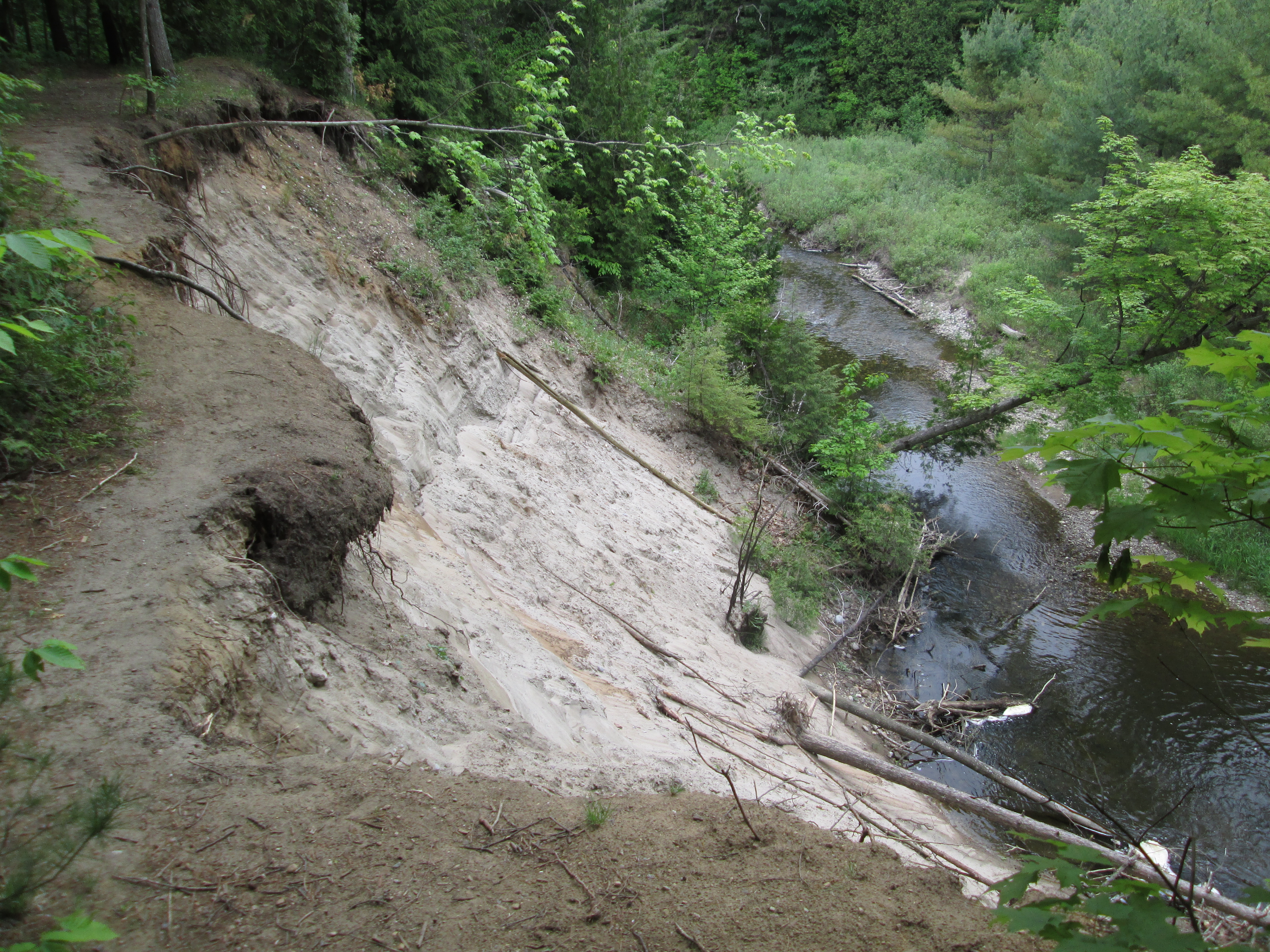
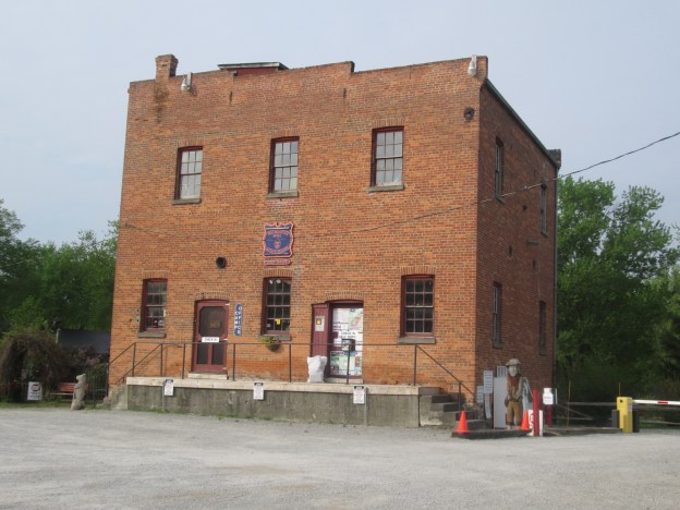
It was 16 degrees and time to take a look at a little spot on the Credit River which is home to the oldest house in Mississauga.  We parked in the parking lot of the Leslie Log House which is now located on the former J. H. Pinchin and Sons Apple and Turkey Farms.

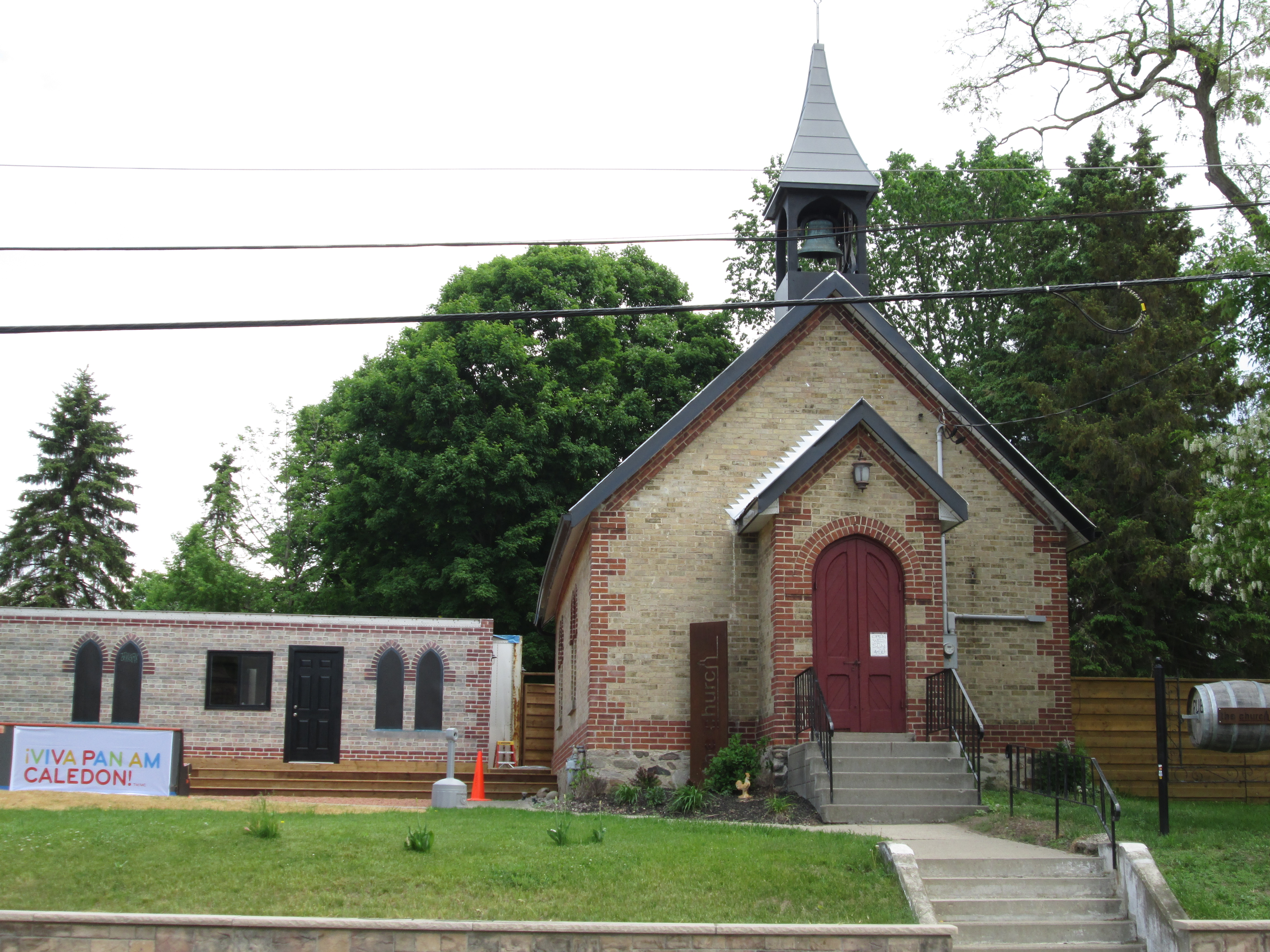
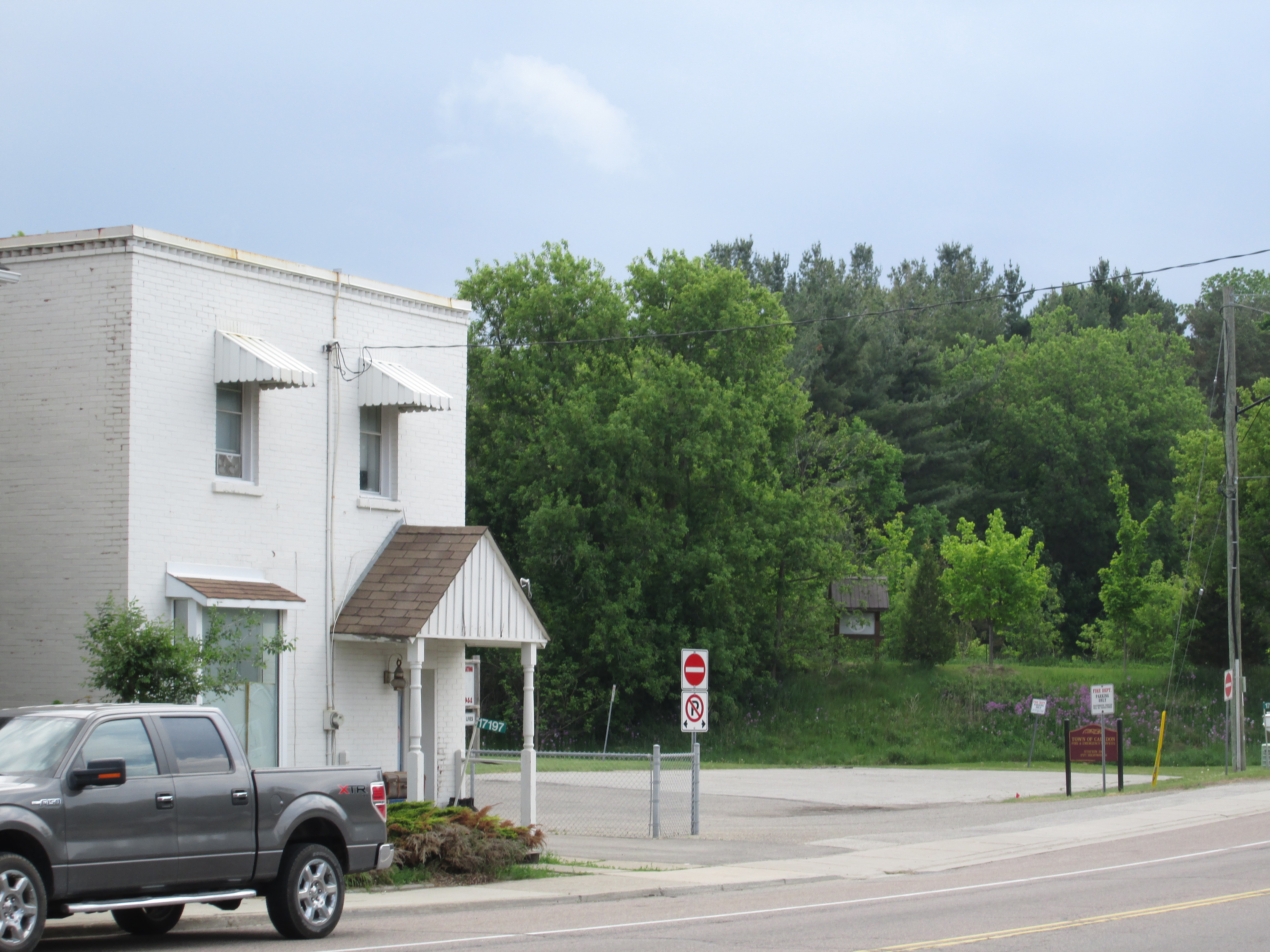
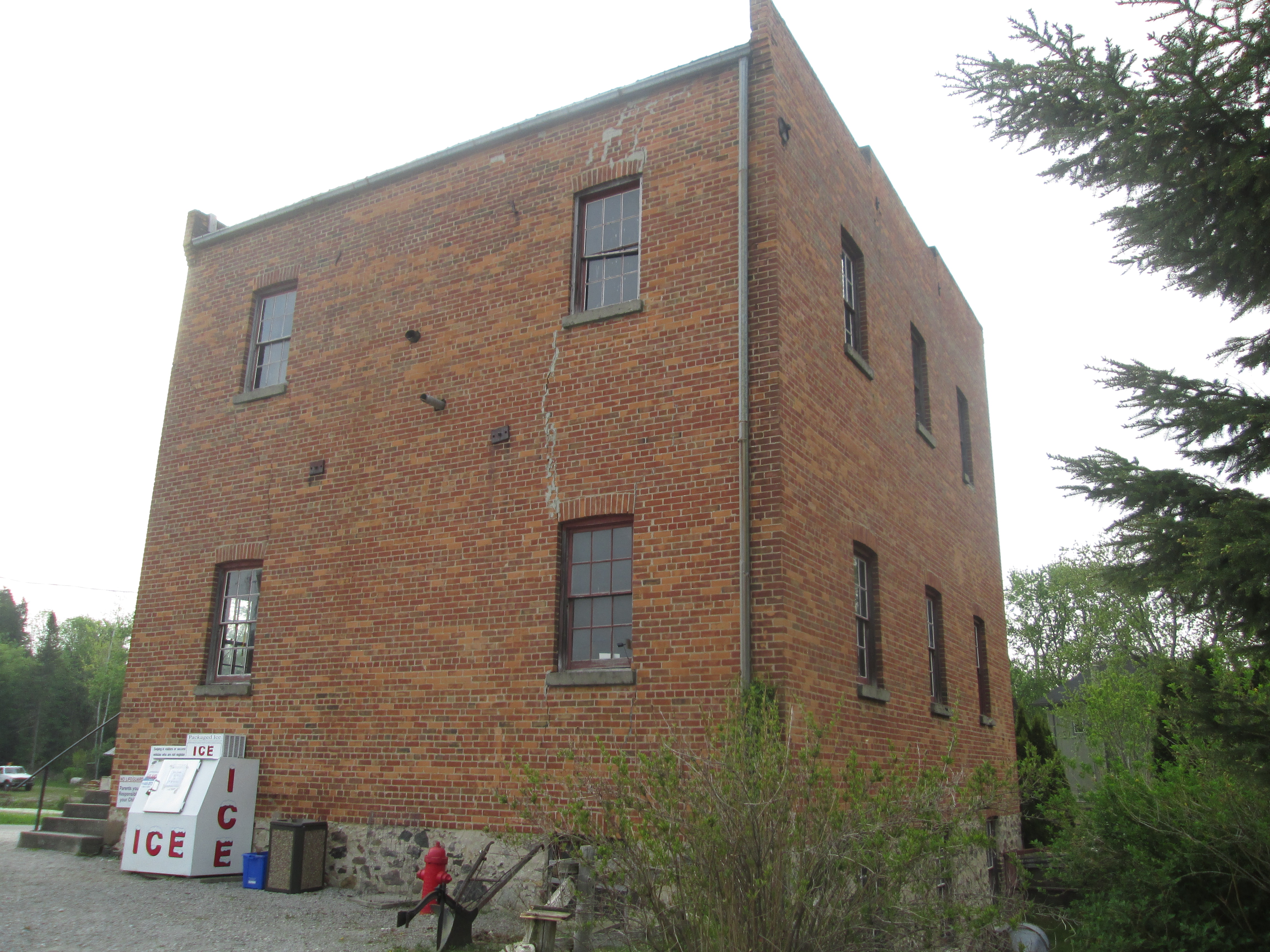
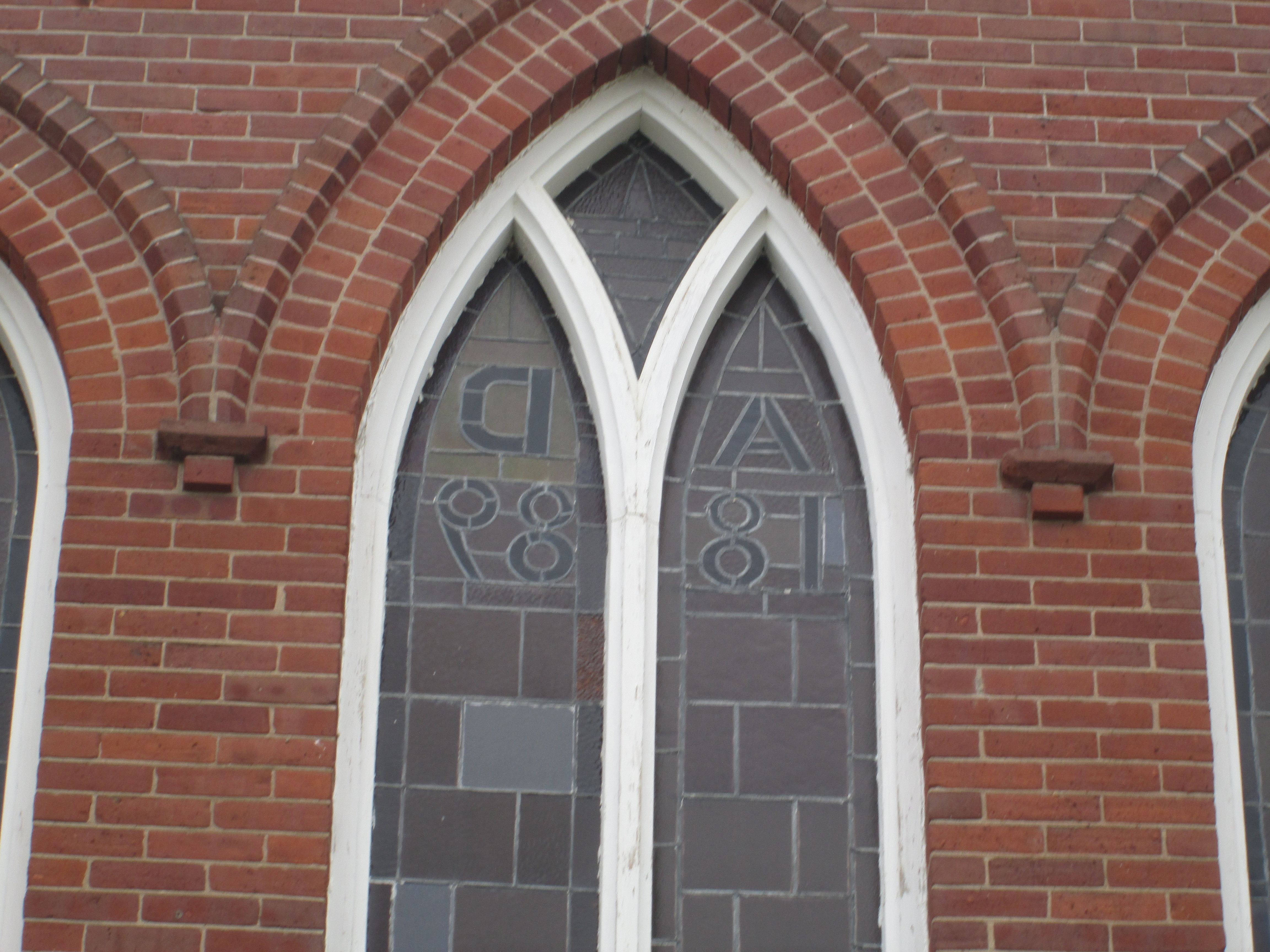
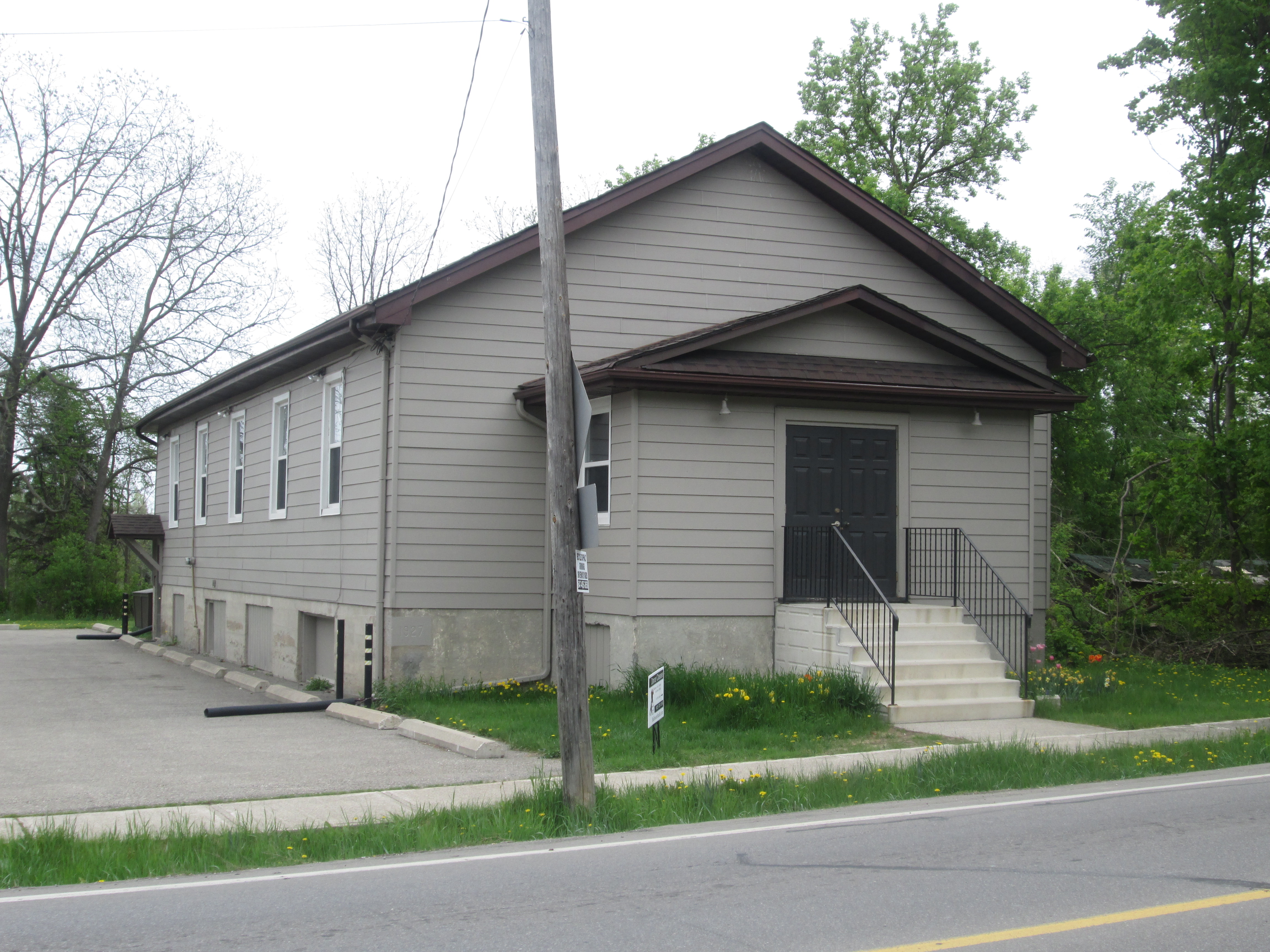
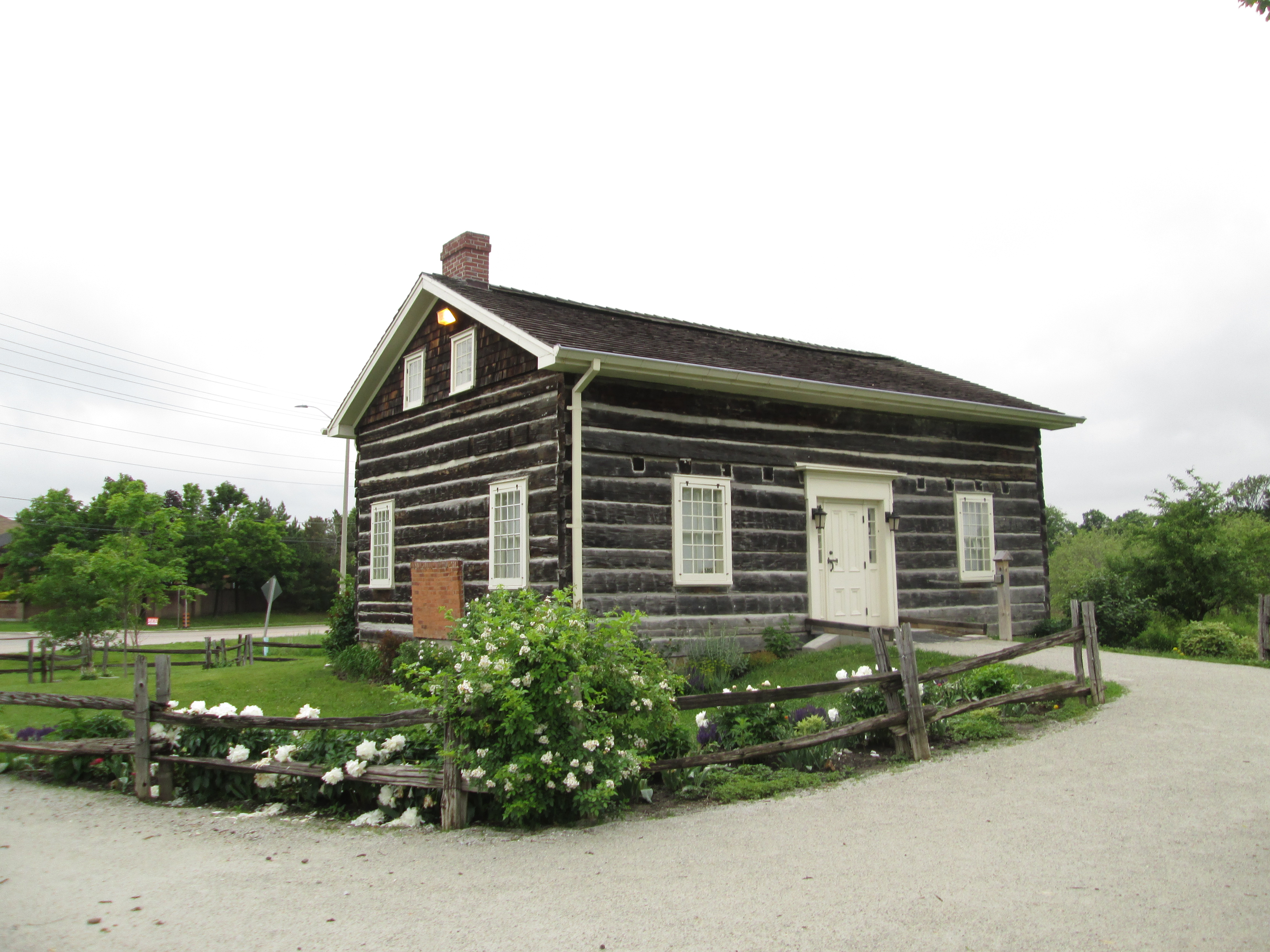
John and Esther Leslie came to Upper Canada in 1824 and leased 200 acres in the area now known as Meadowvale.  This 26 foot by 36 foot house was where they started their family of seven children.  Their son Robert Leslie was a master builder who is credited with building several local houses which have been featured in previous posts.  Robert built the Barber house in Streetsville and the Hammond house in Erindale.  Another of their sons, George, moved to the area east of the Don River in Toronto which is now known as Leslieville.  The log house was moved to this location in 1994 because it’s original farmstead had been redeveloped for industrial uses.  The house is now in use as the home of The Streetsville Historical Society.

IMG_5388

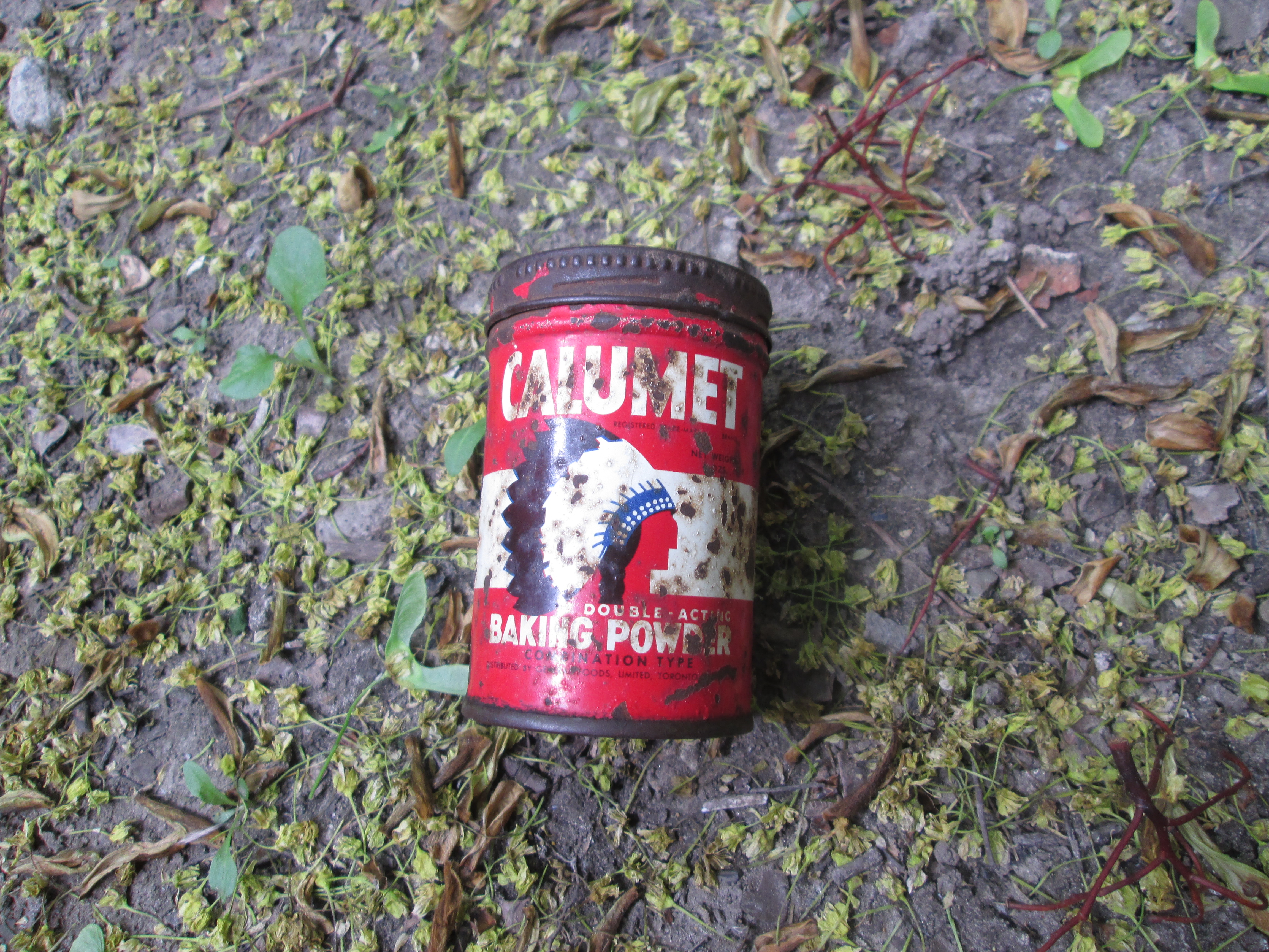
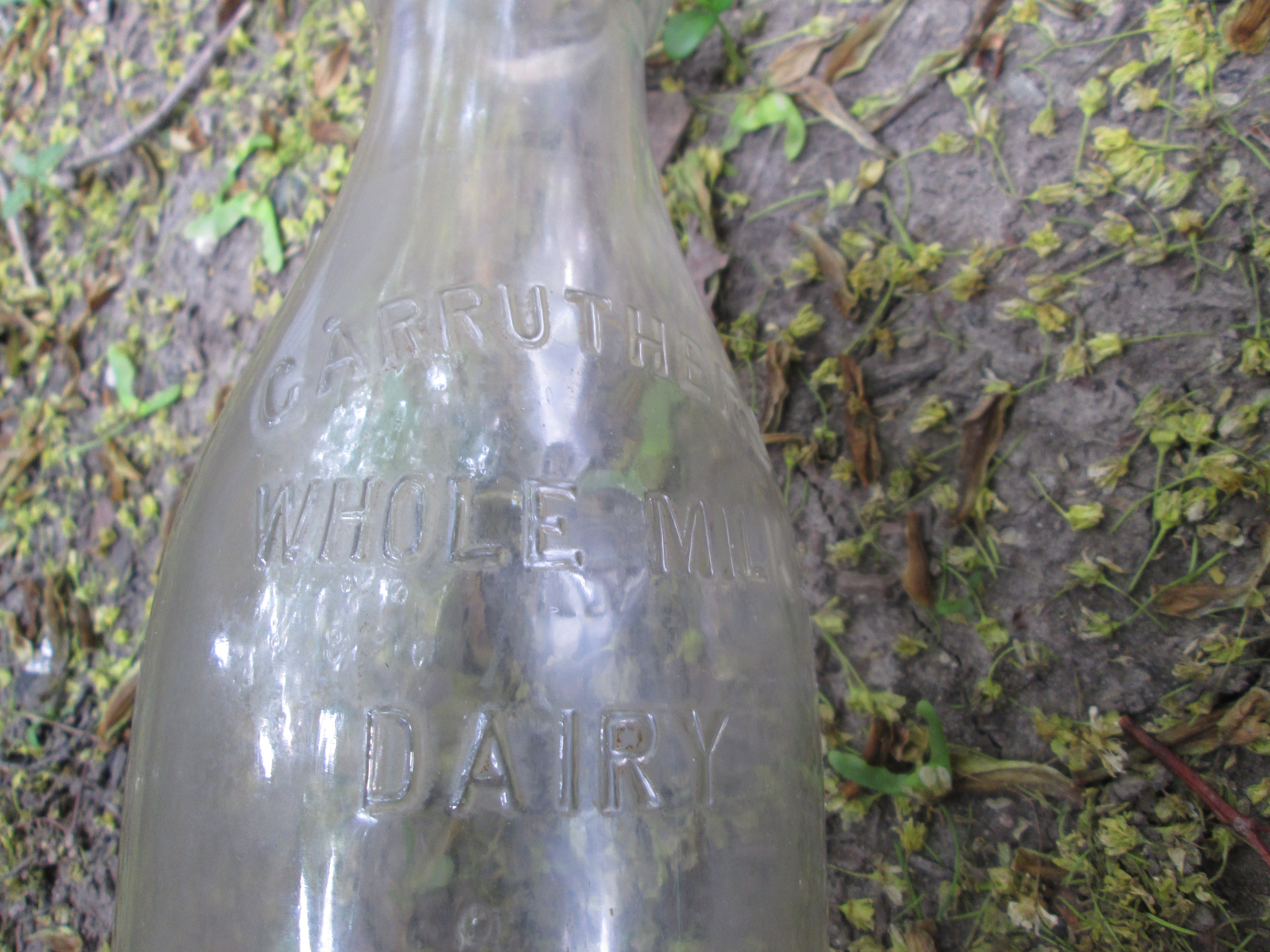
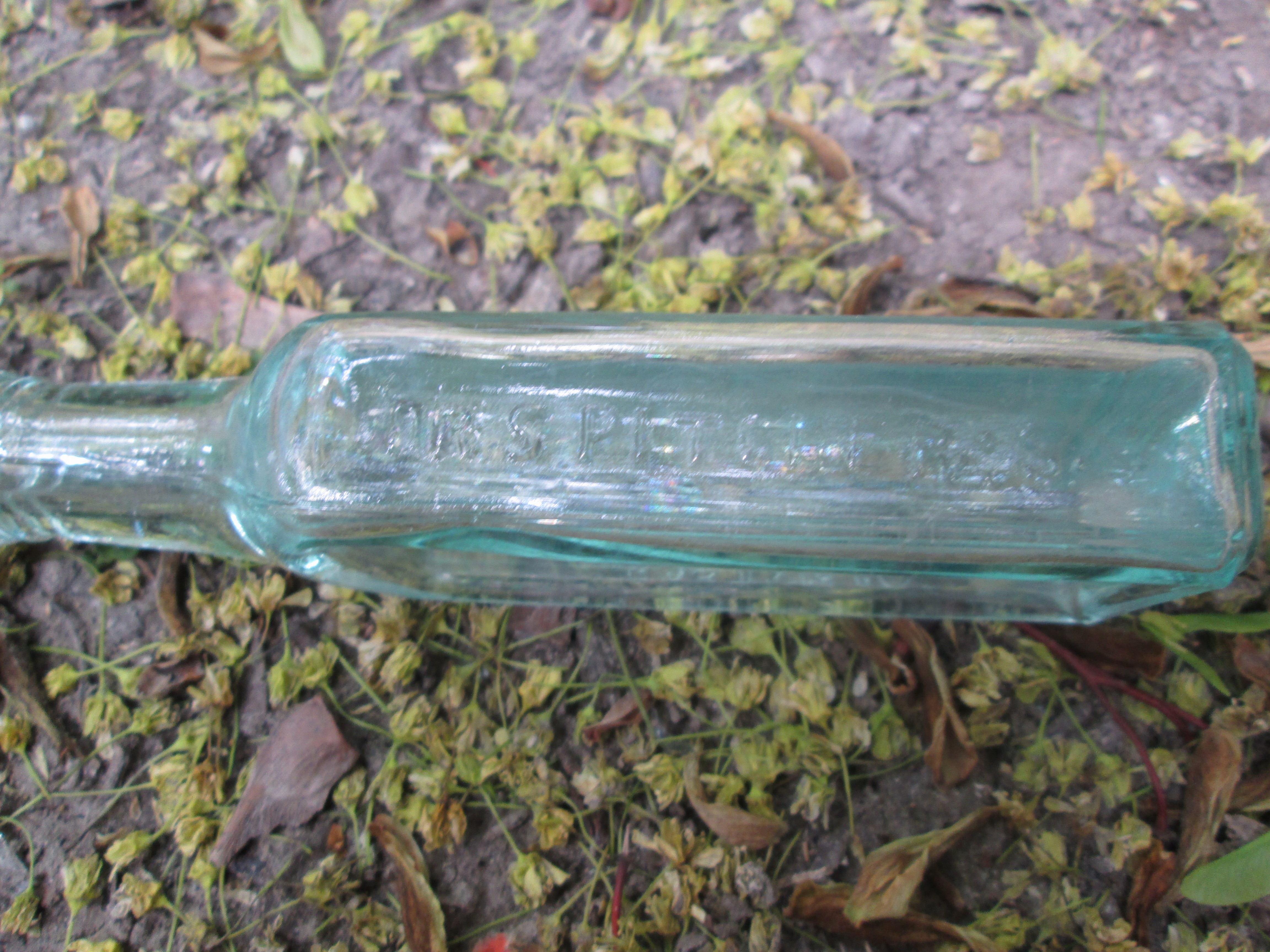
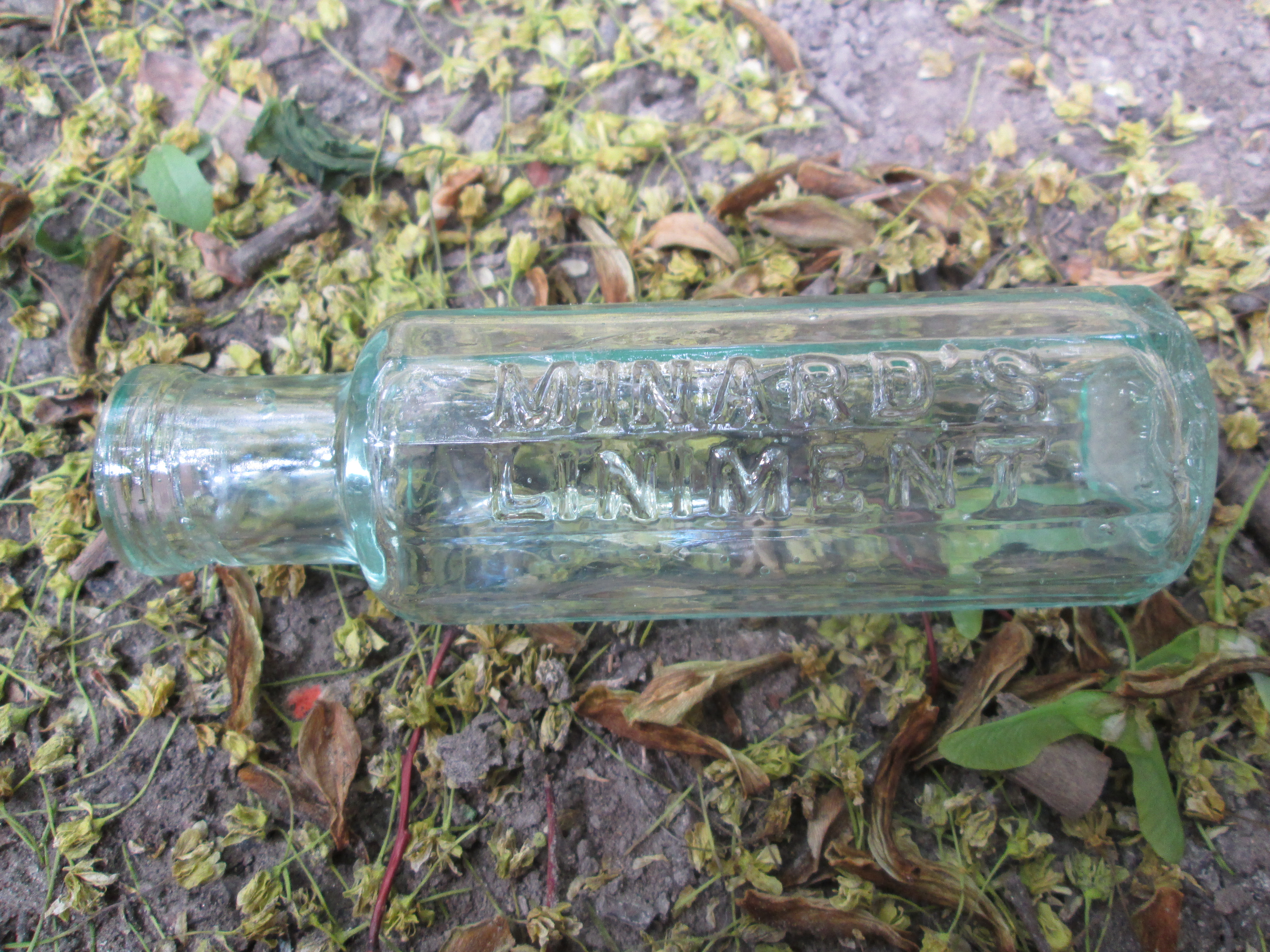
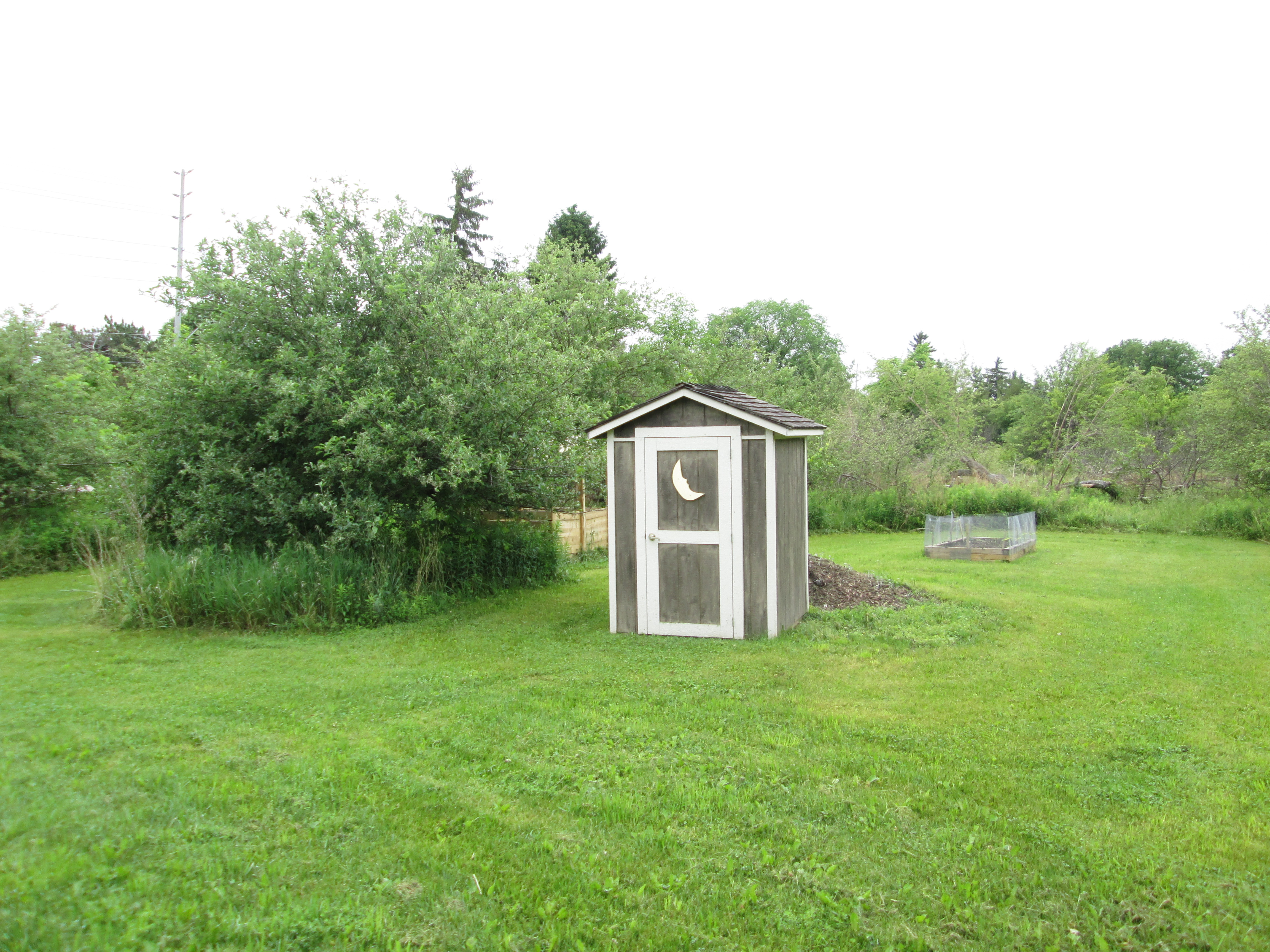
In the back yard behind the Leslie log house is a shed that looks like an outhouse.  This farm was settled in 1833 and like other older properties it may have had several outhouse positions over the years.  As holes were filled with waste a new hole was dug and the shed moved over it. There is a group of bottle collectors who seek out old outhouse locations and re-dig the holes. Very often old medicine bottles were dropped into the outhouse hole for disposal before the days of organized garbage collection. The bottle had a soft landing and frequently survived intact.  The contents of the hole turns to soil over time much like fertilizer in the garden.  I’ve never gone digging for bottles but have seen pictures of some pretty amazing finds including a gold pocket watch that likely elicited a curse as it fell.  Outhouses were freezing cold in winter, smelly in summer and full of bugs.  I’m thinking that reading in the washroom is a modern invention.

IMG_5392

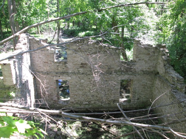
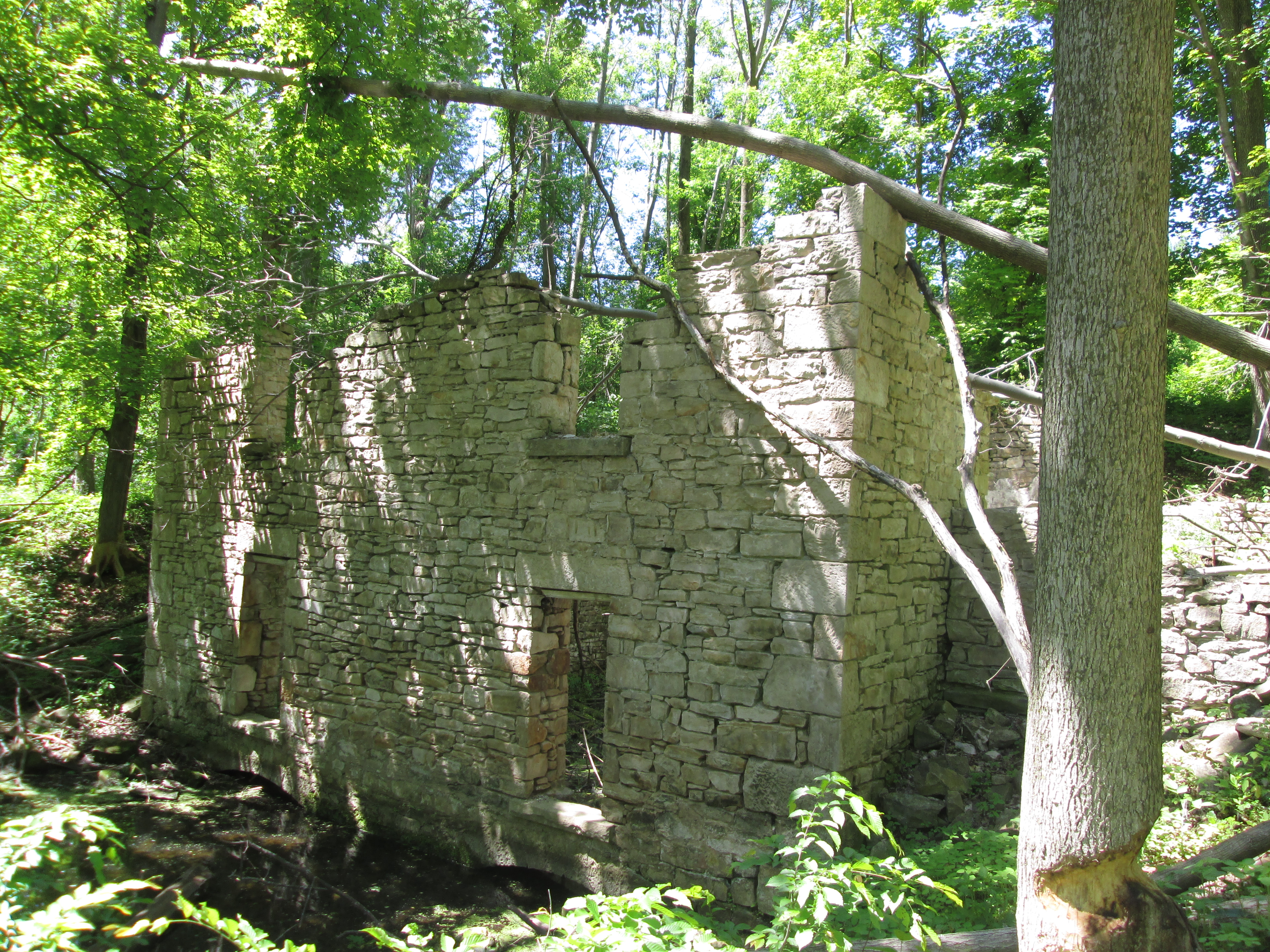
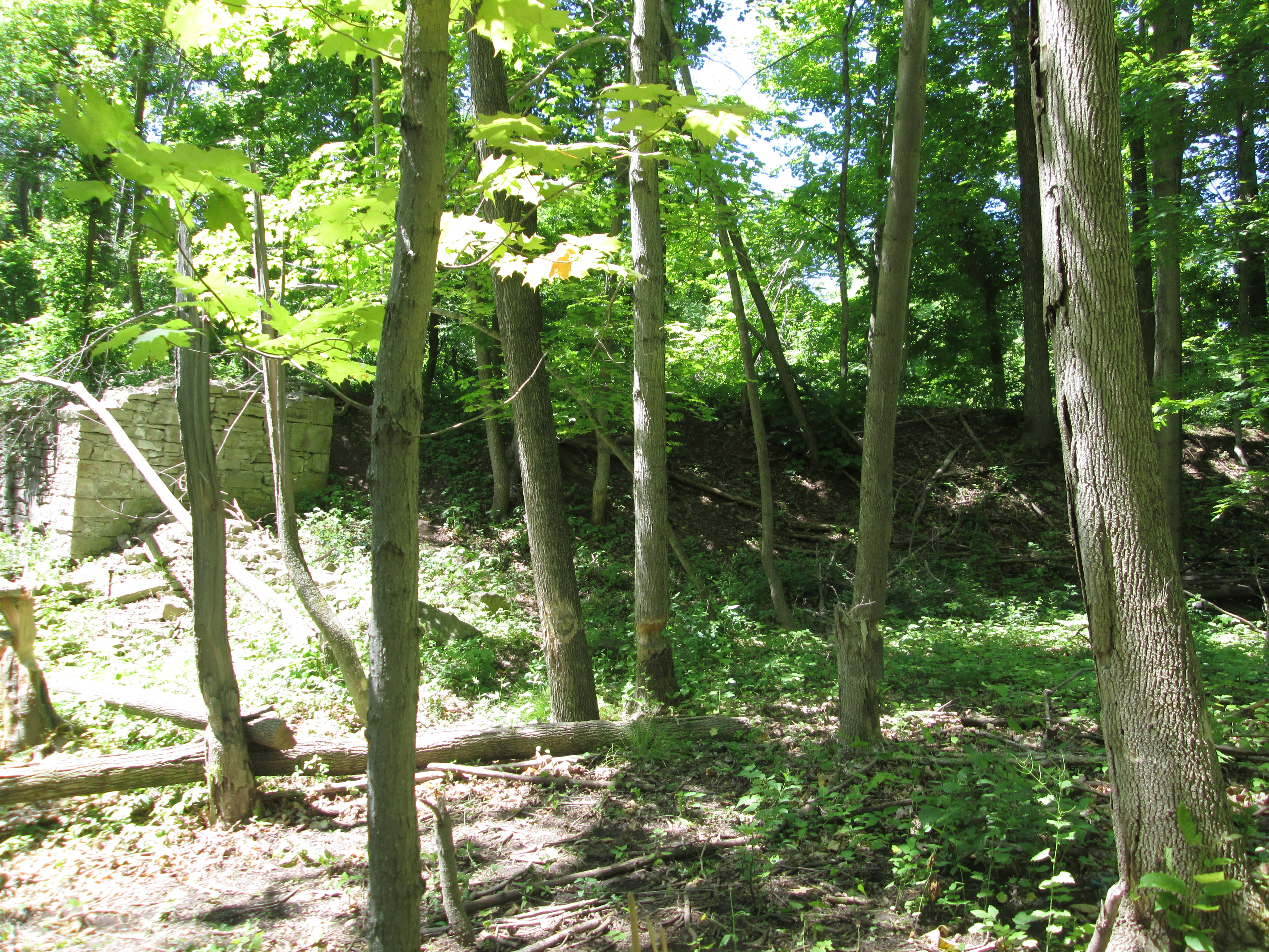
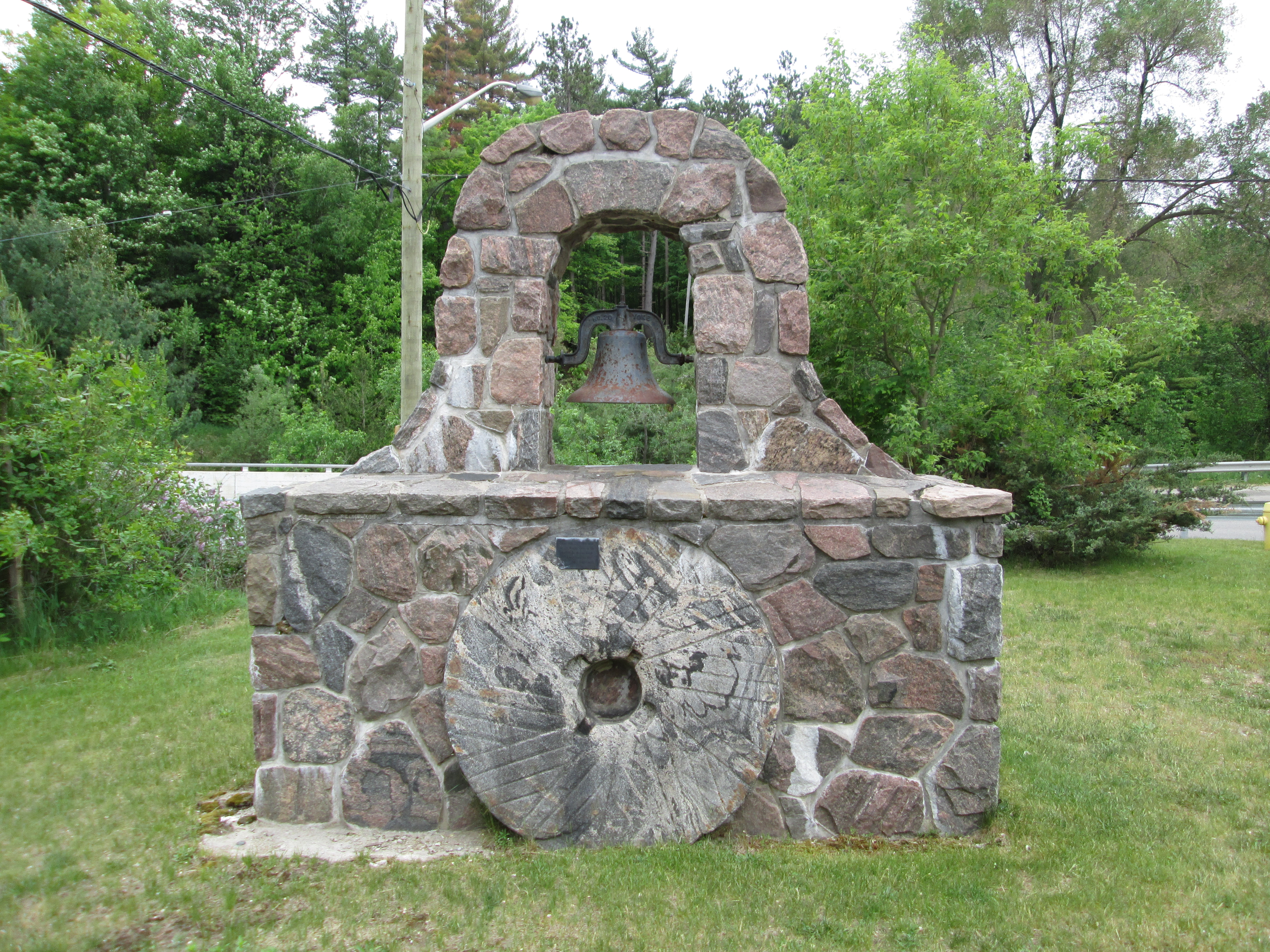
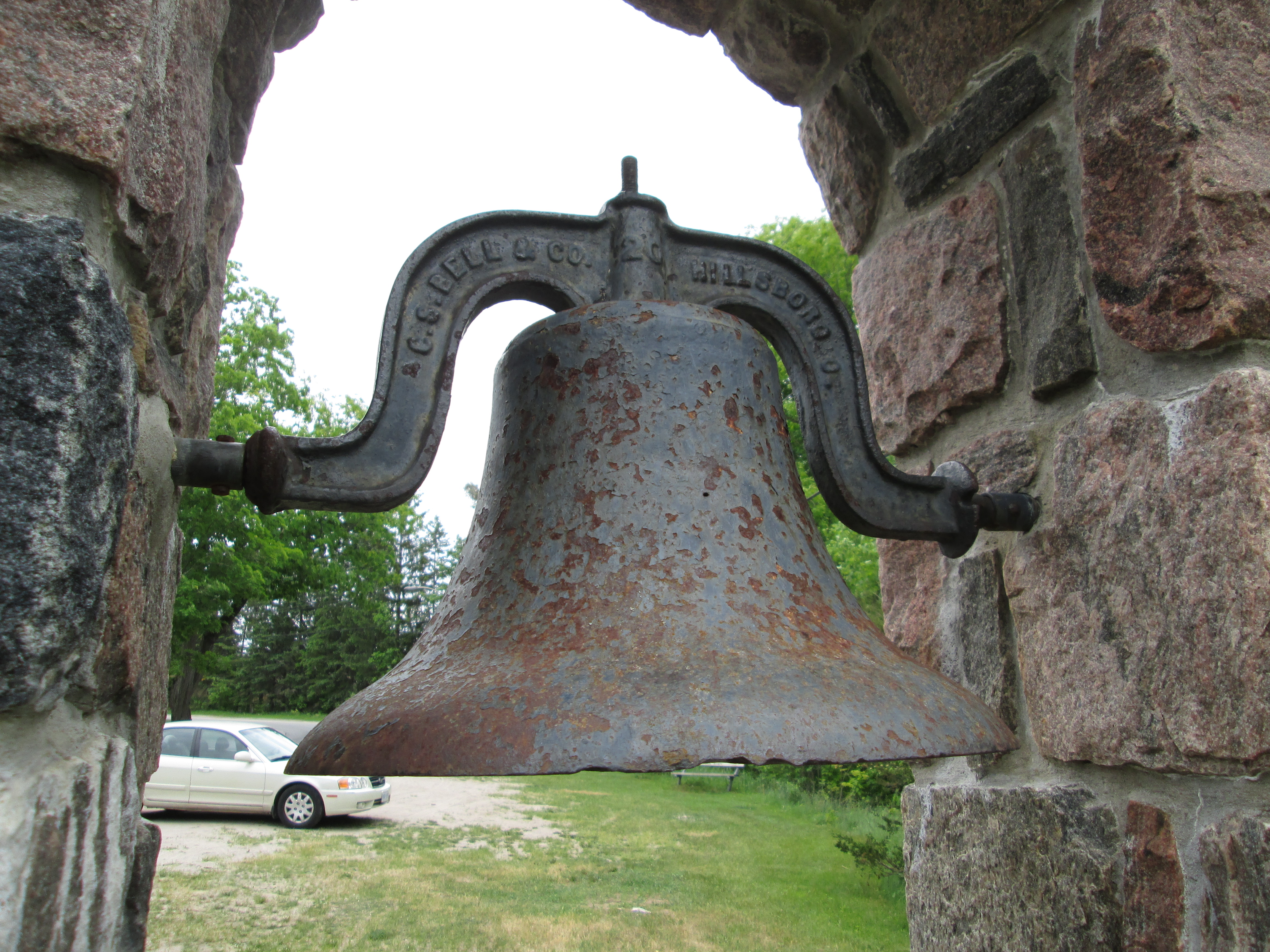
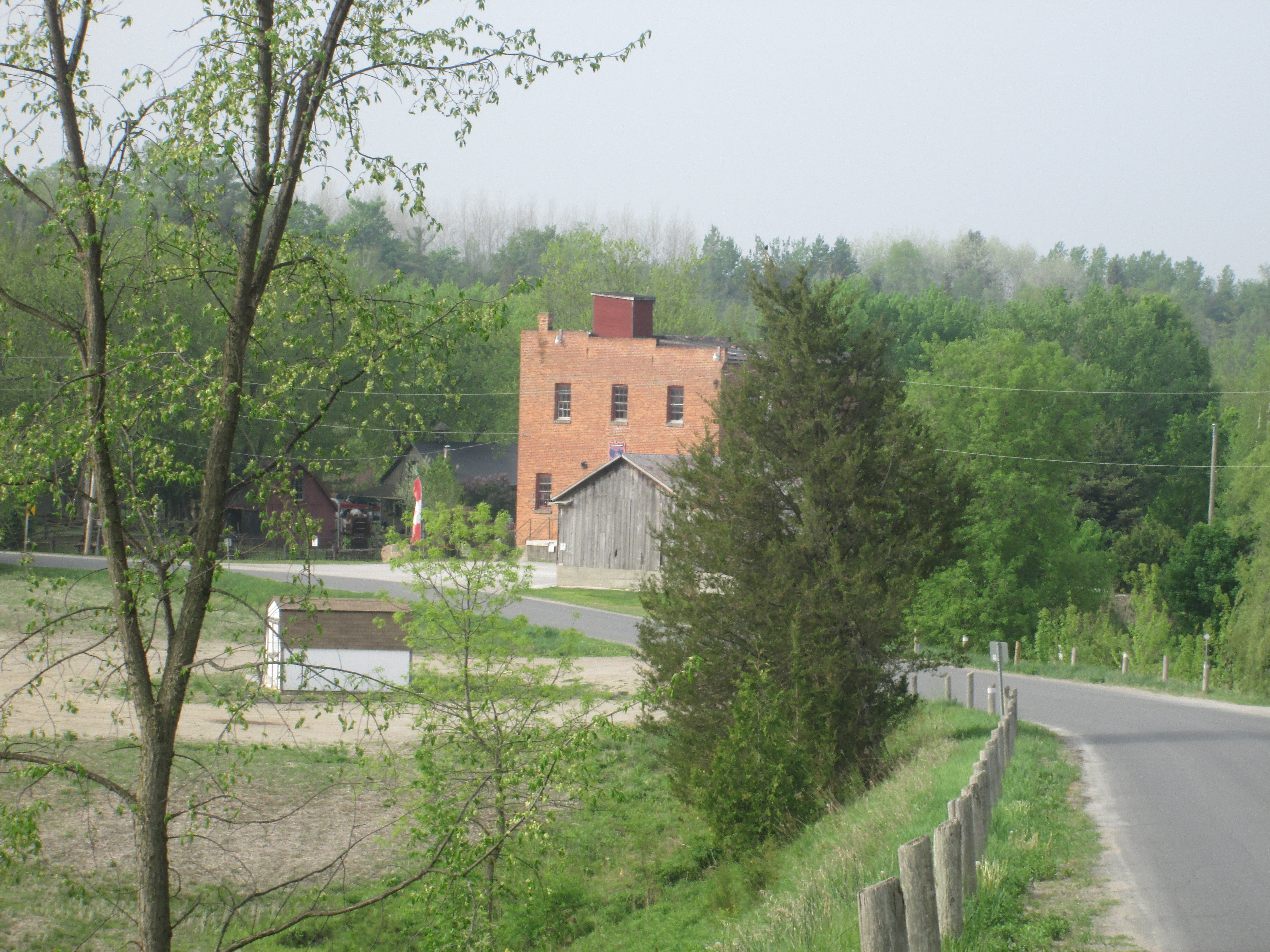
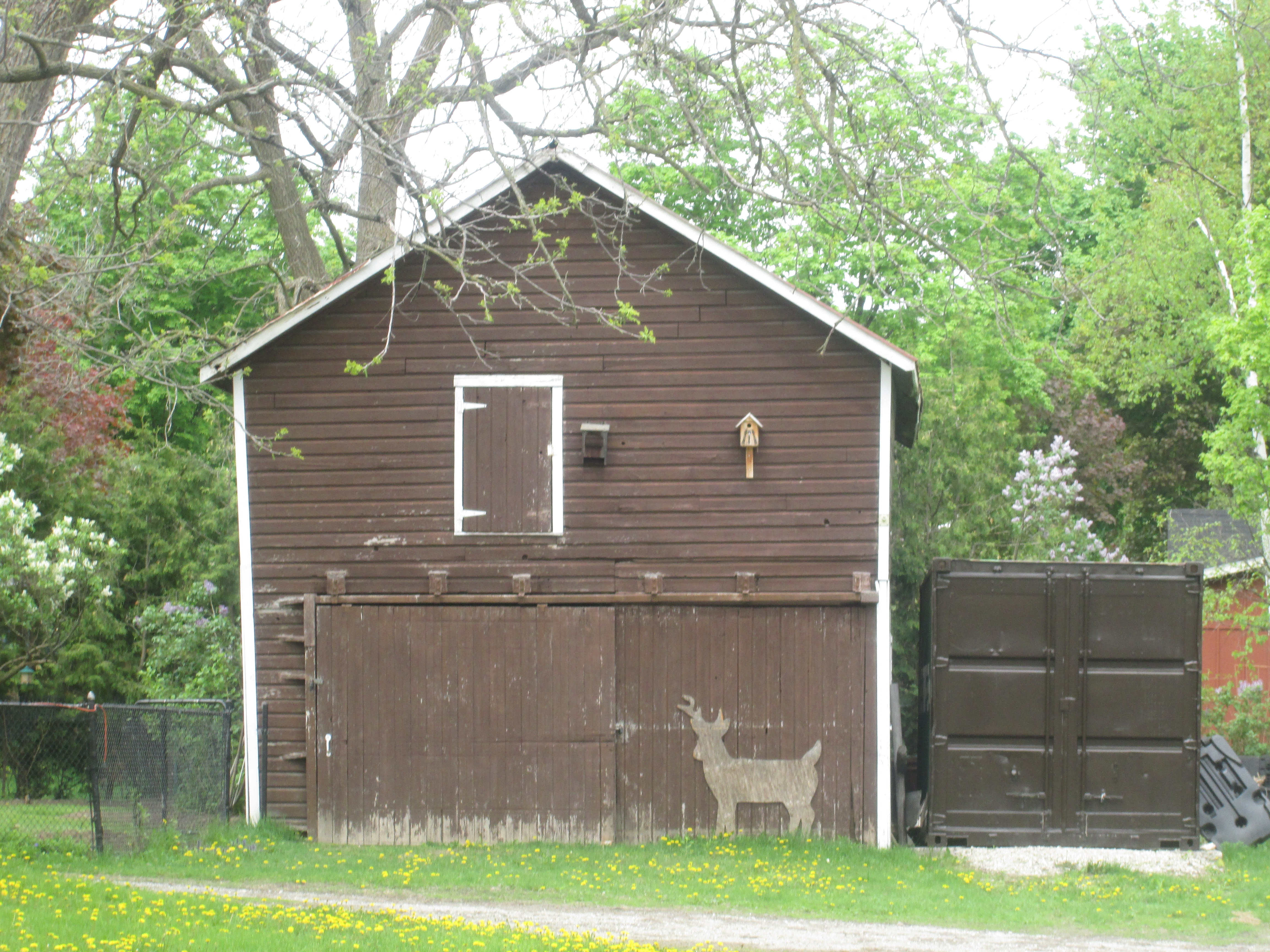
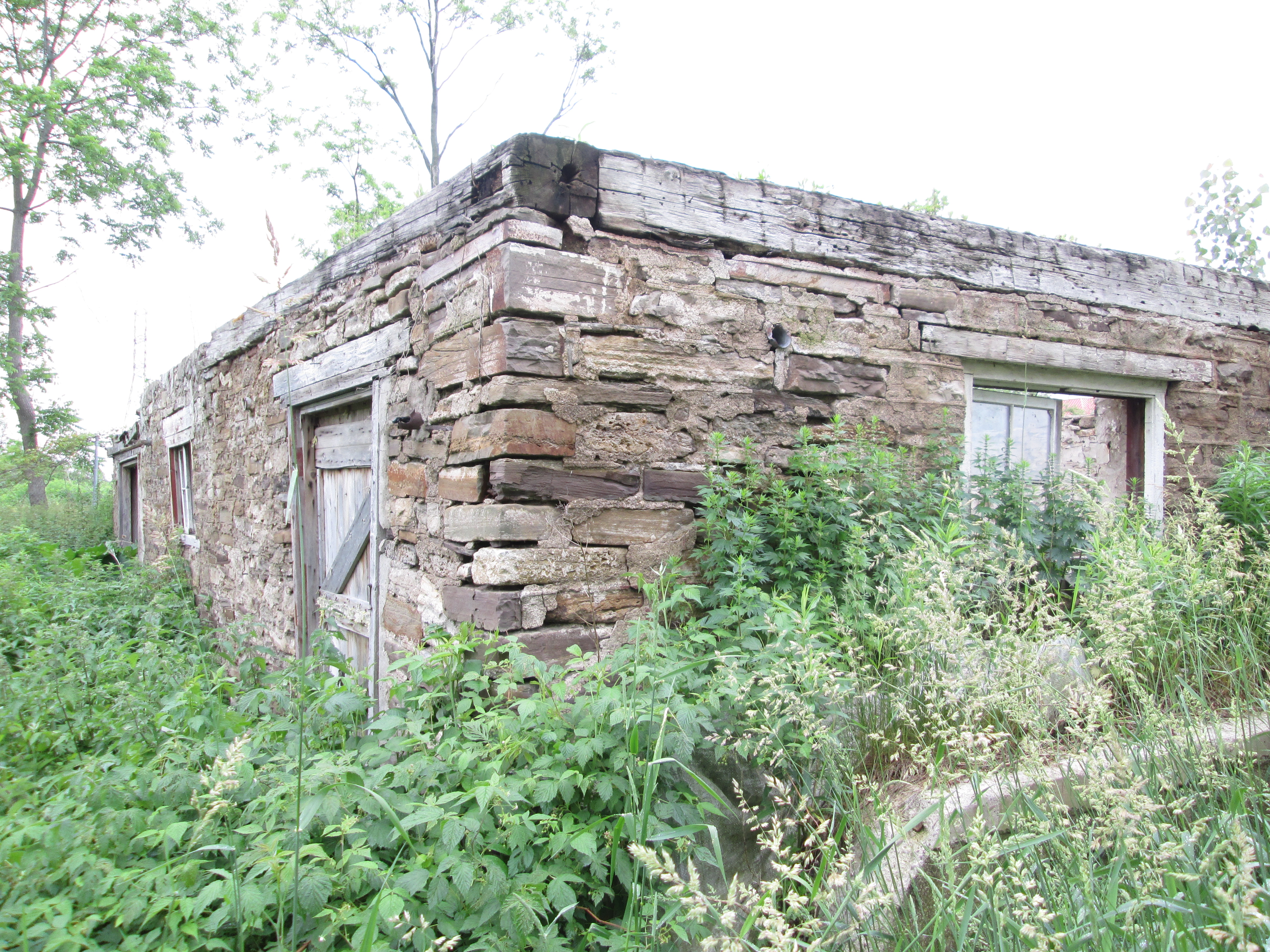
Behind the Leslie house are the foundations from a small barn or shed that originally belonged to the Pinchin Family.  James Herbert Pinchin bought this farm in 1926 and named it Riviere Farms. He raised apples and turkeys and children. In 1927 J.H. Pinchin was the secretary of the Clarkson-Dixie Fruit and Vegetable Farmer’s Co-Op. He held the position of secretary until at least 1939. The foundations of this building are field stone collected from around the farm when the land was cleared. Farmers collected stones every spring from their fields and used them for fences, foundations and sometimes entire buildings.

IMG_5401

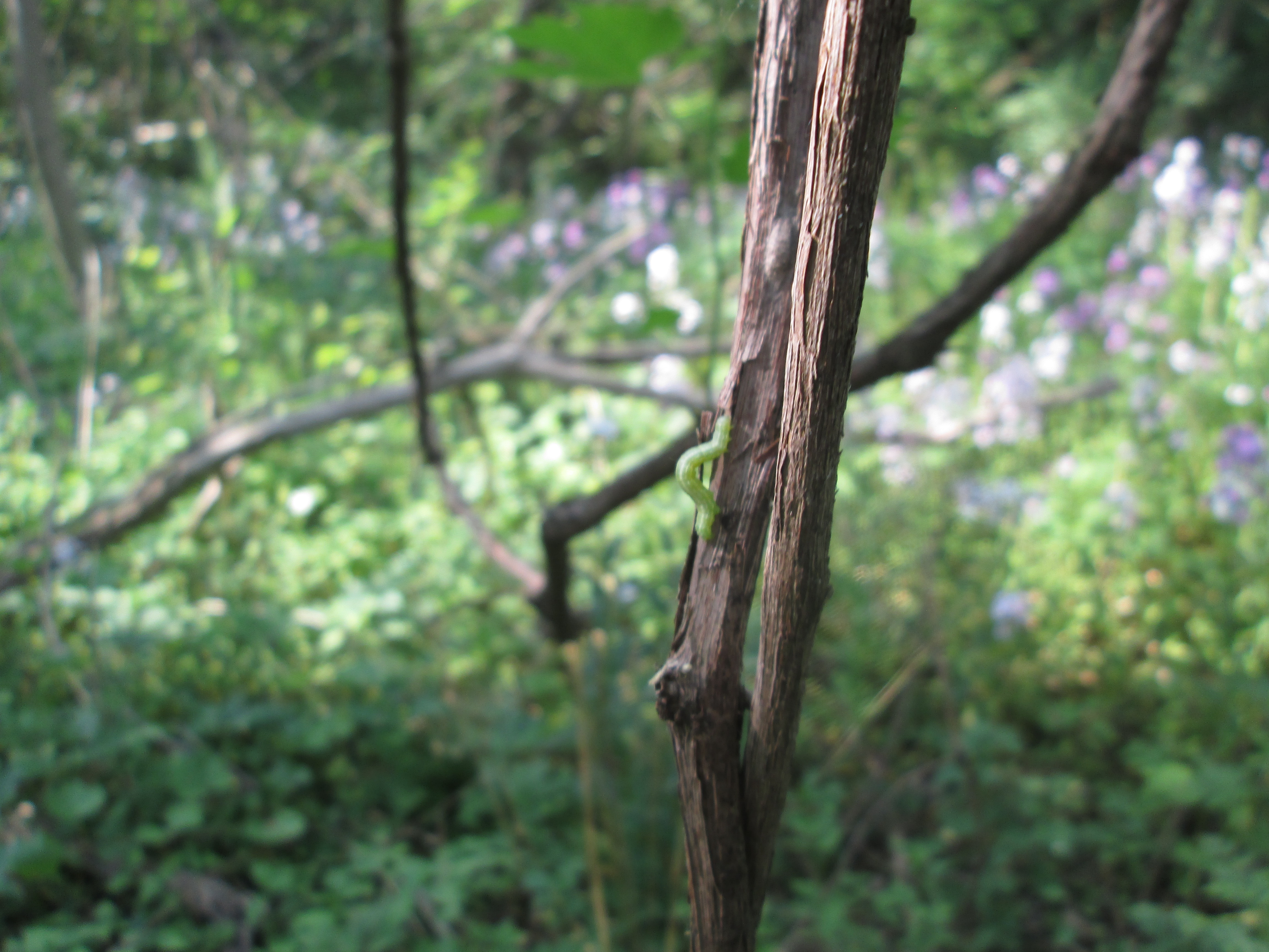
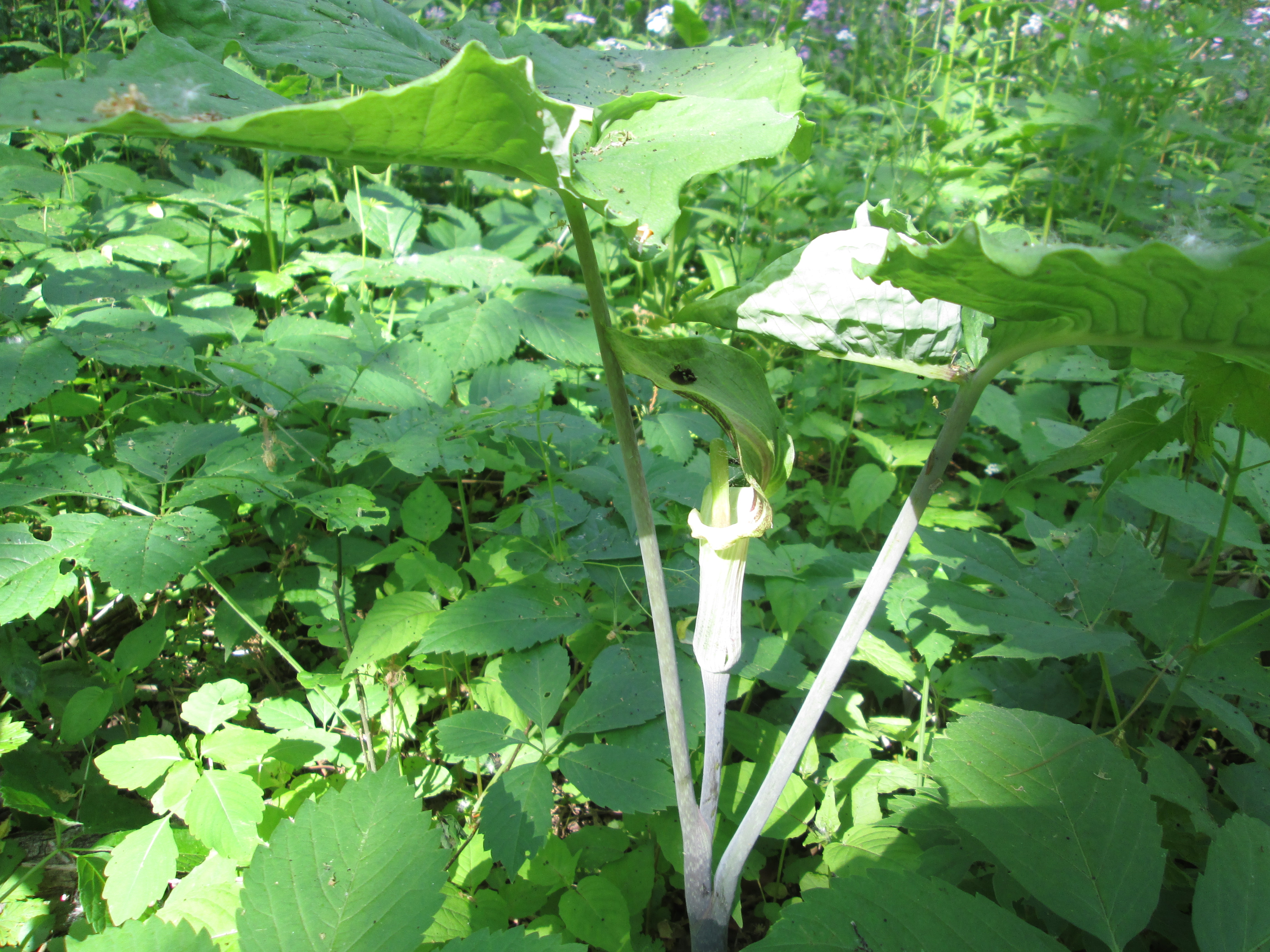
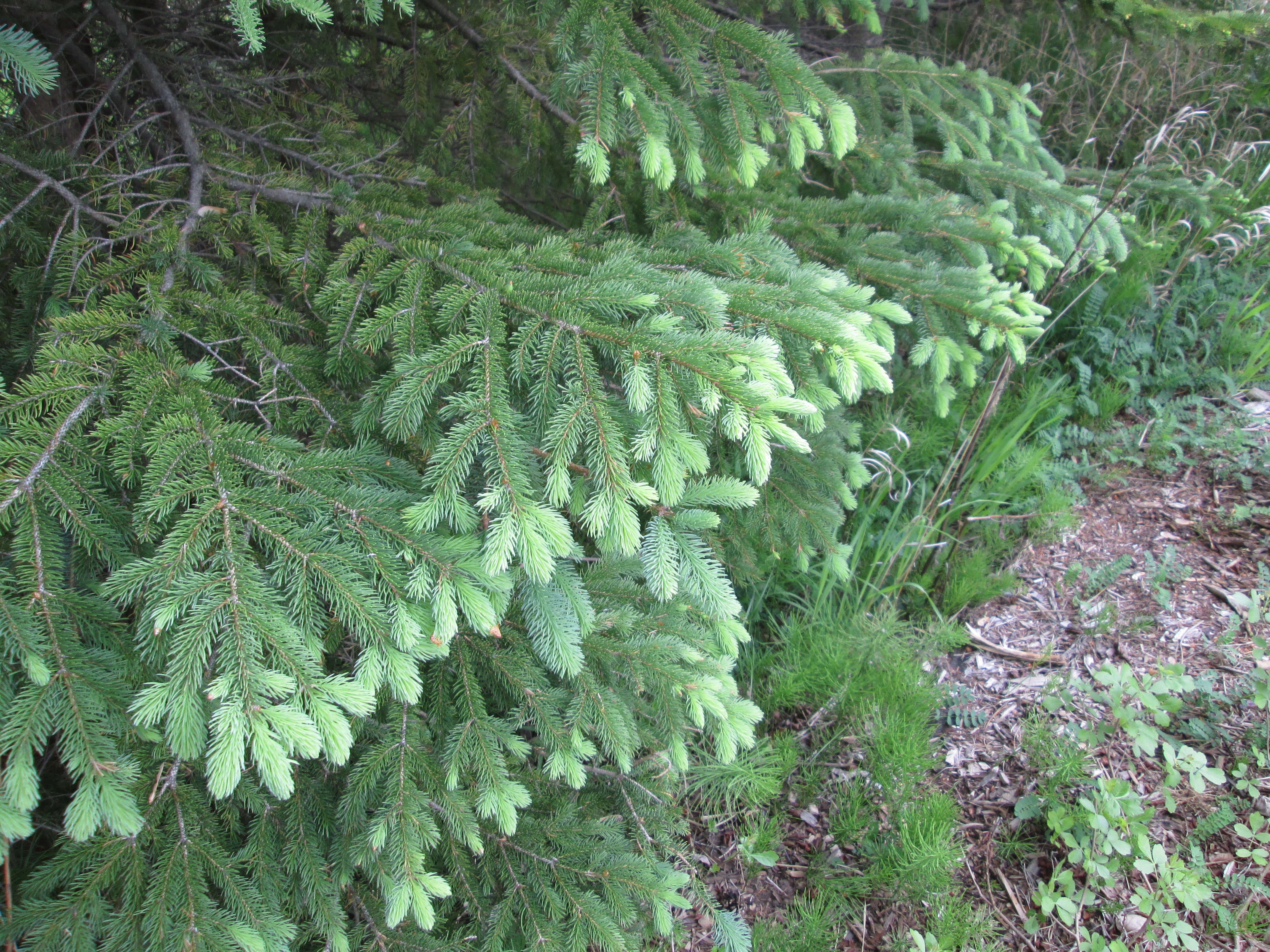
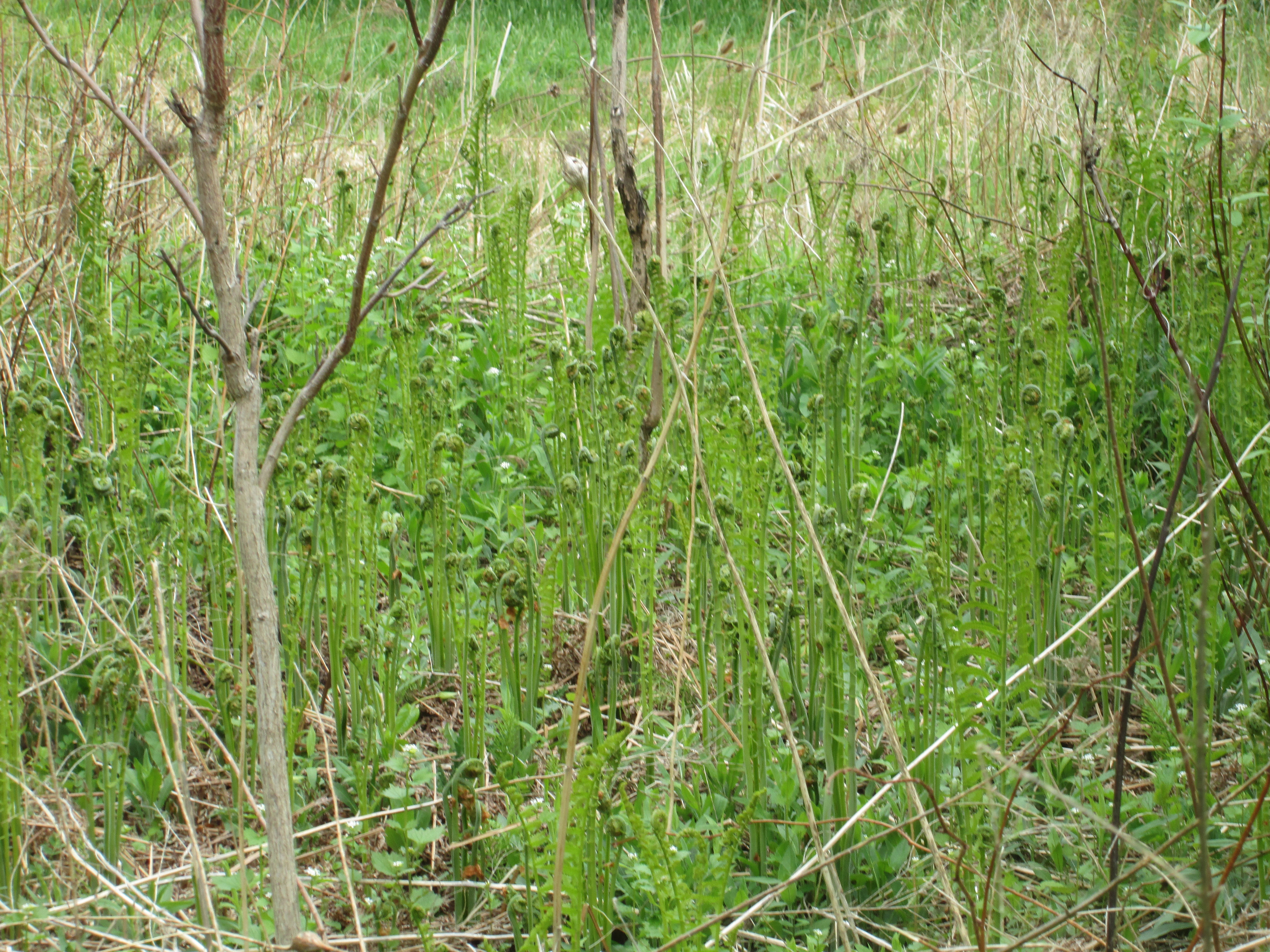
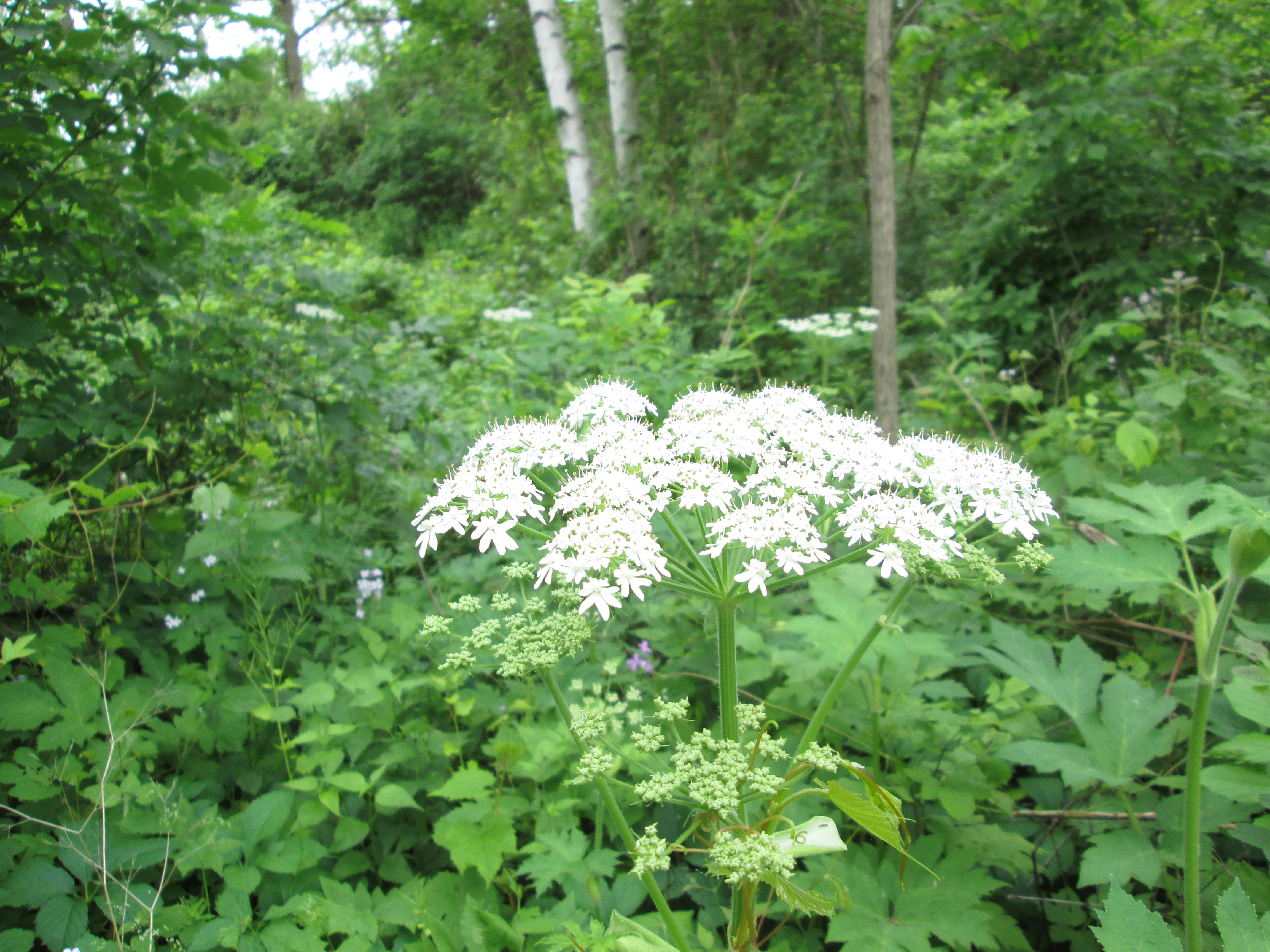
Angelica is one of several plants which are similar in appearance.  The toxic Giant Hogweed looks almost the same but grows much taller.  Queen Anne’s Lace is another similar plant which is smaller.  All of these plants should be avoided if you are unsure of the identification because of the dangerous burns the giant hogweed plant can inflict.

IMG_5410

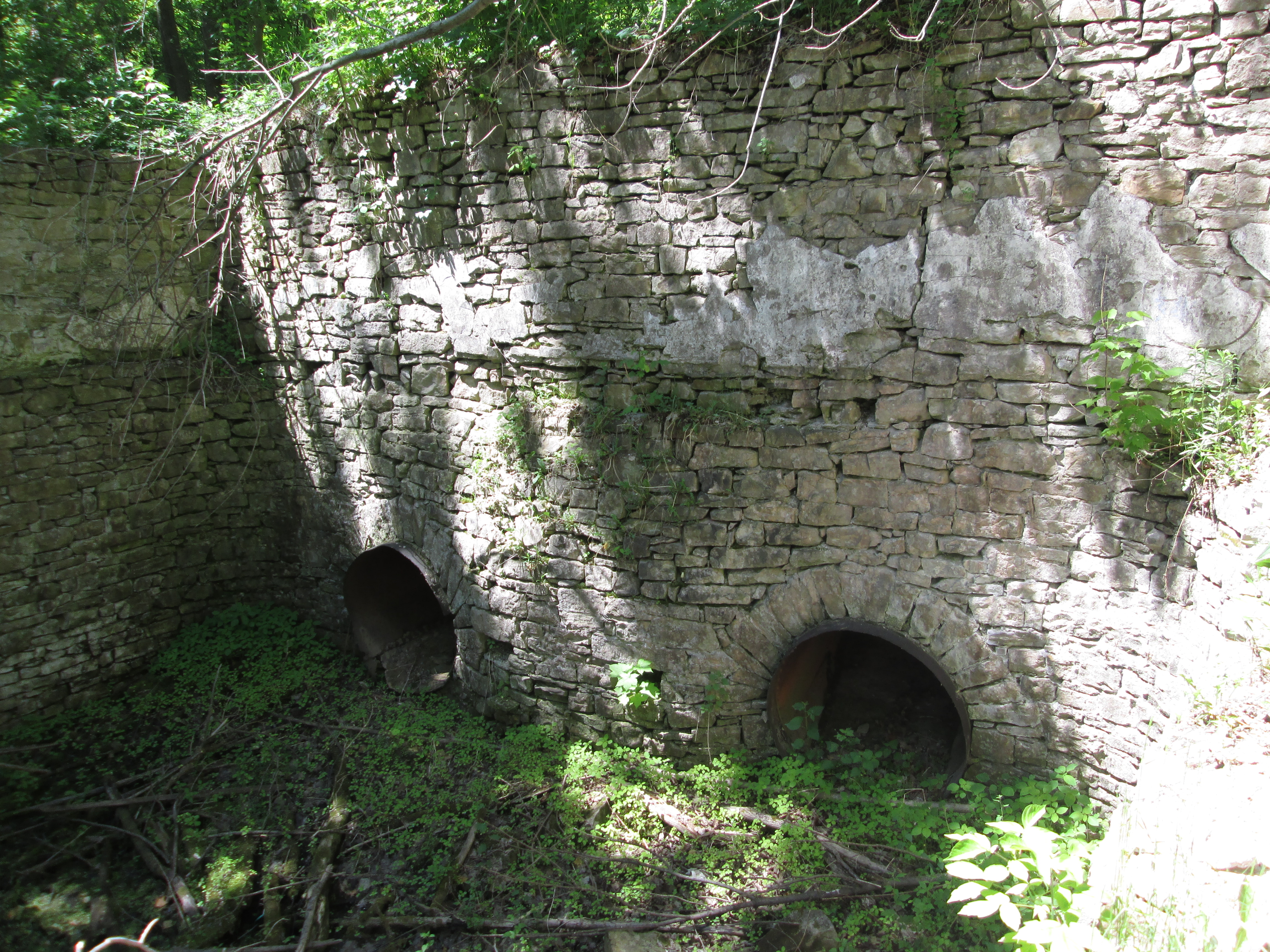
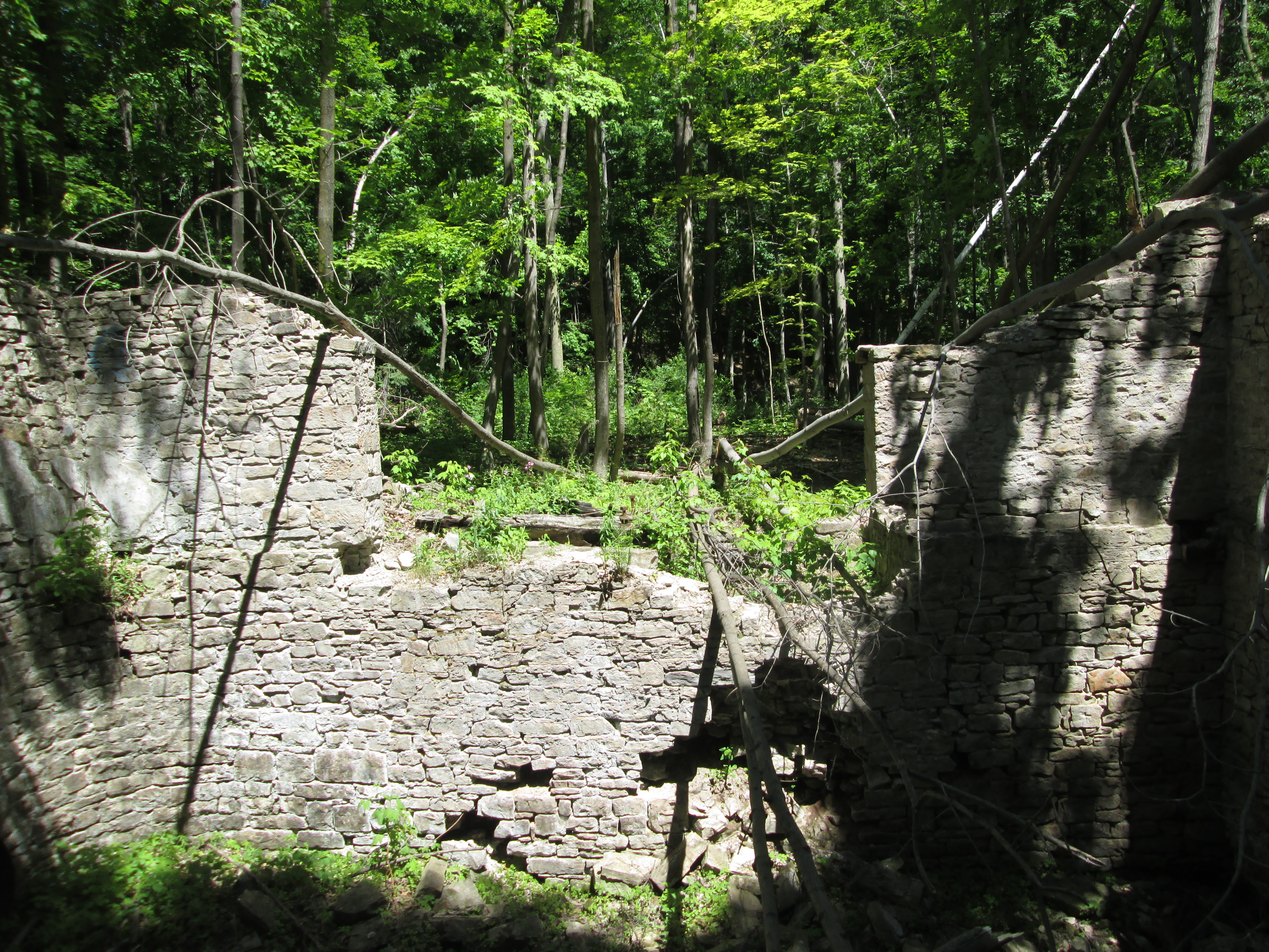
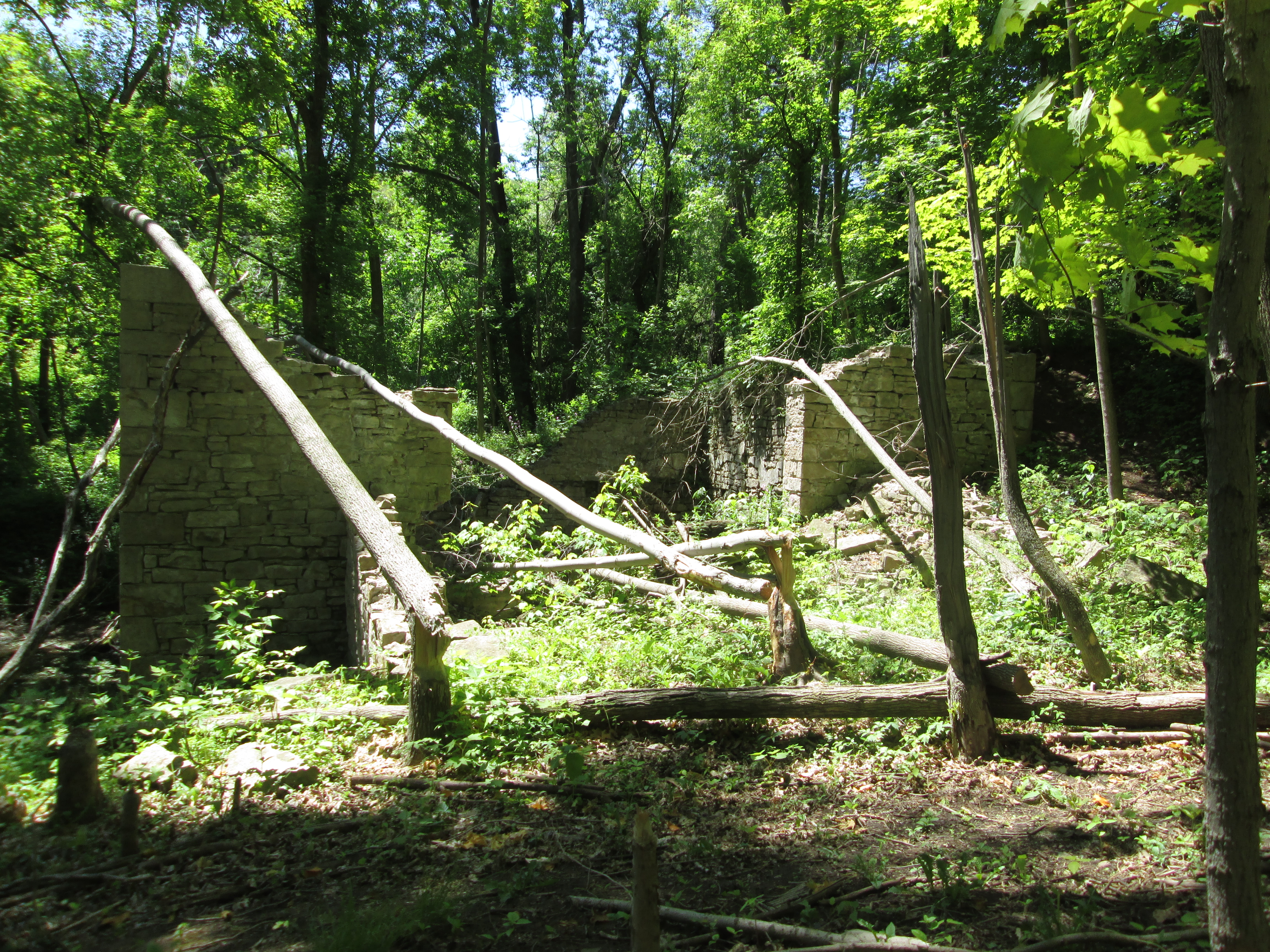
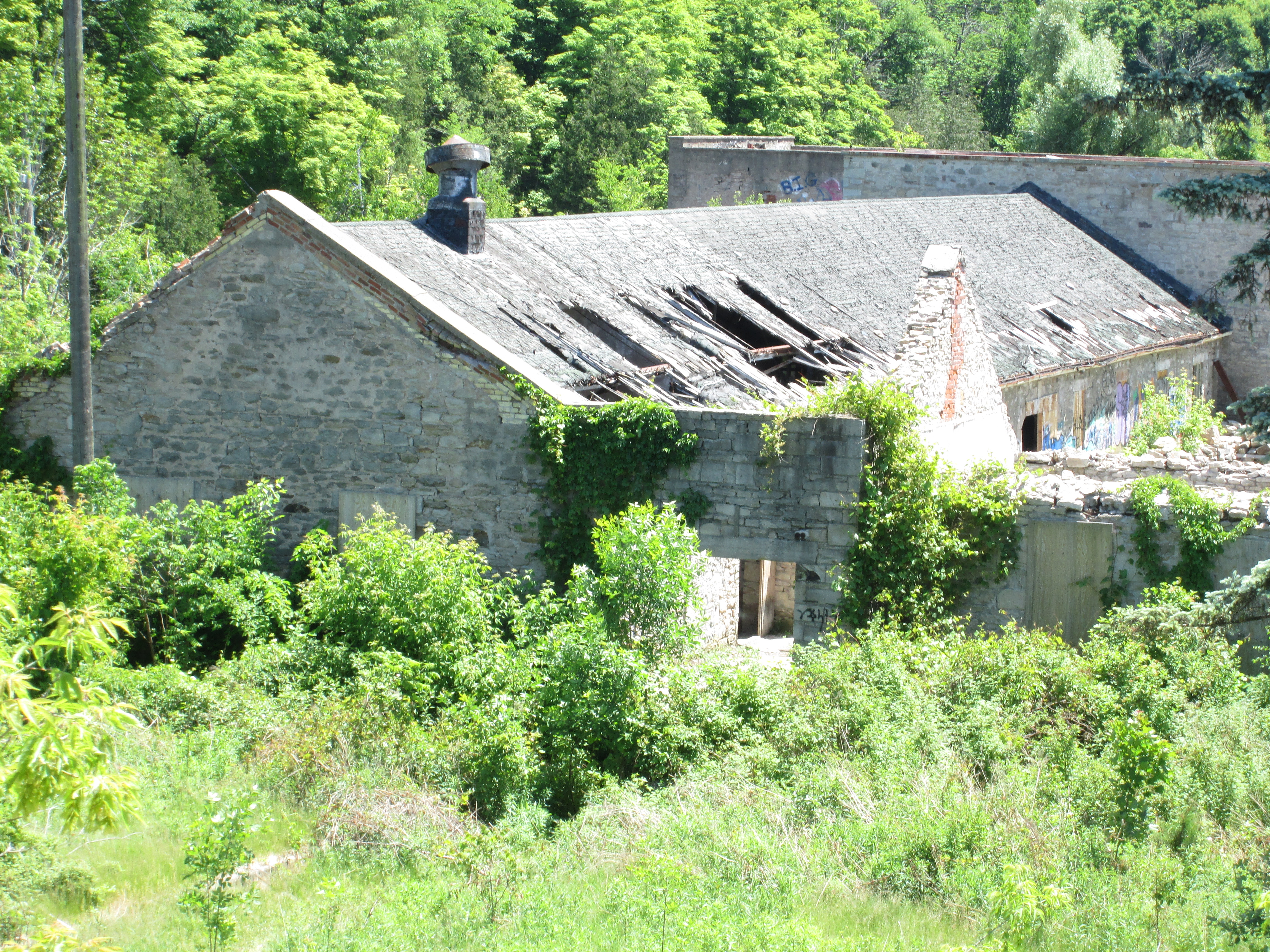
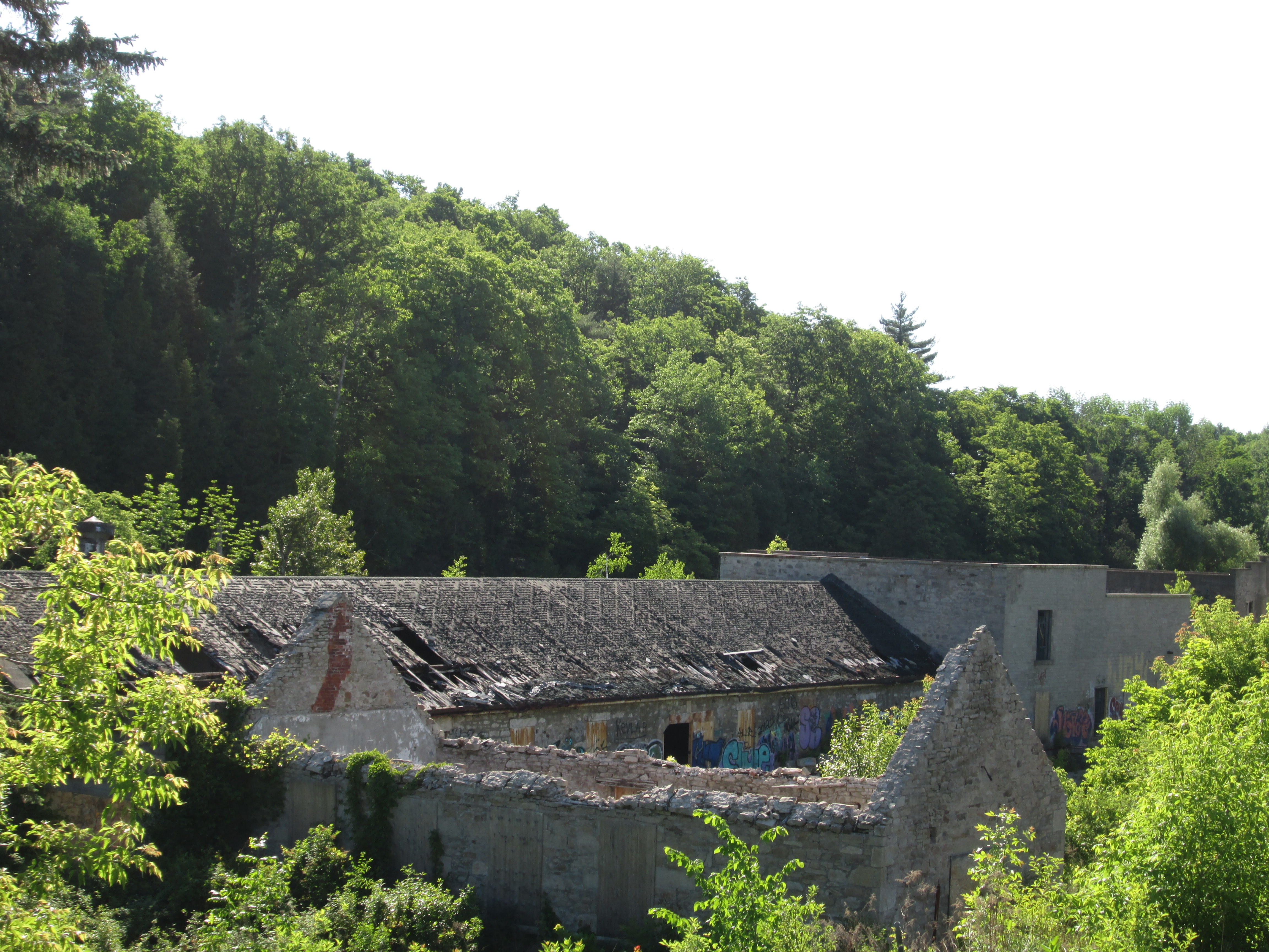
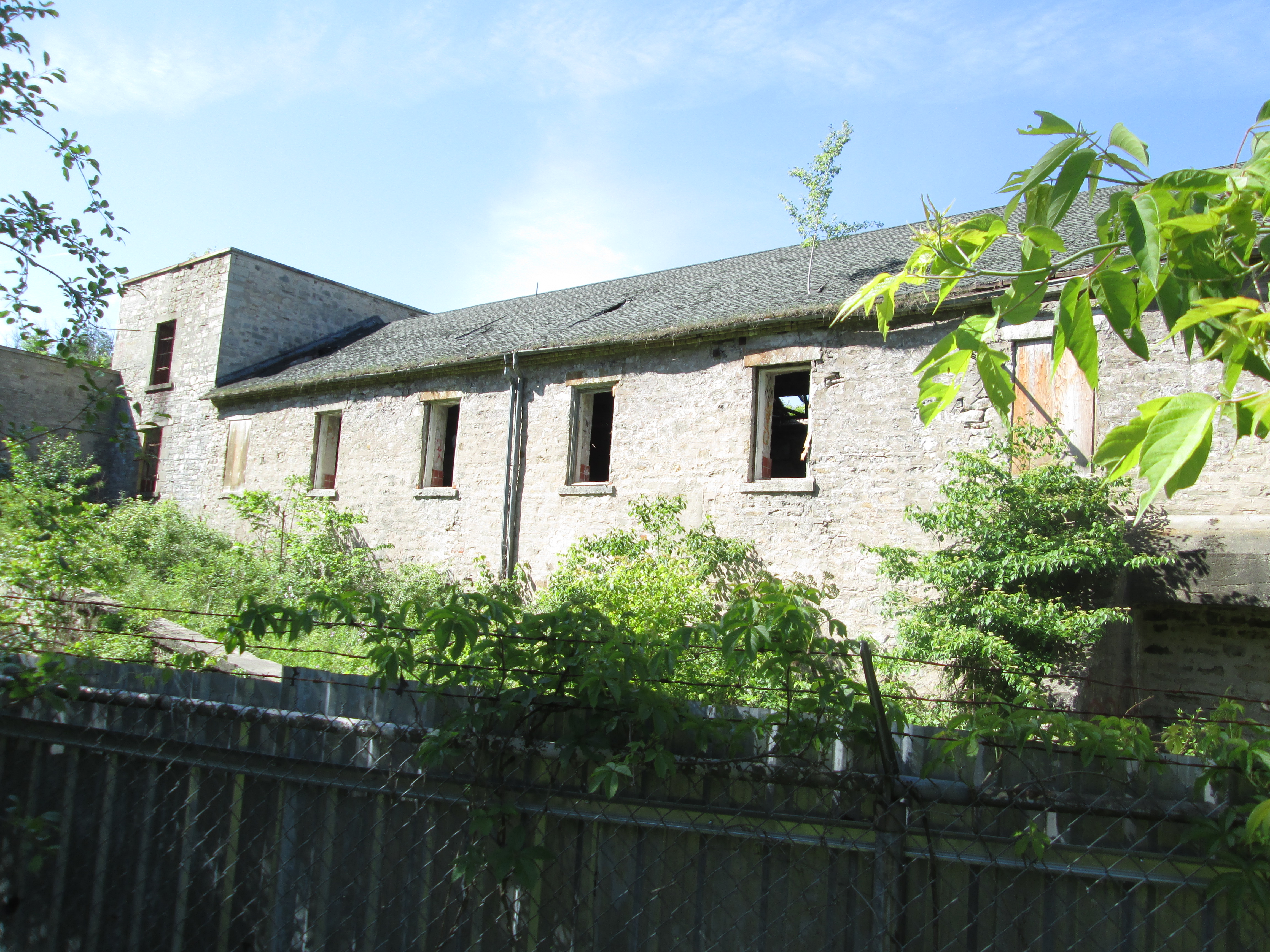
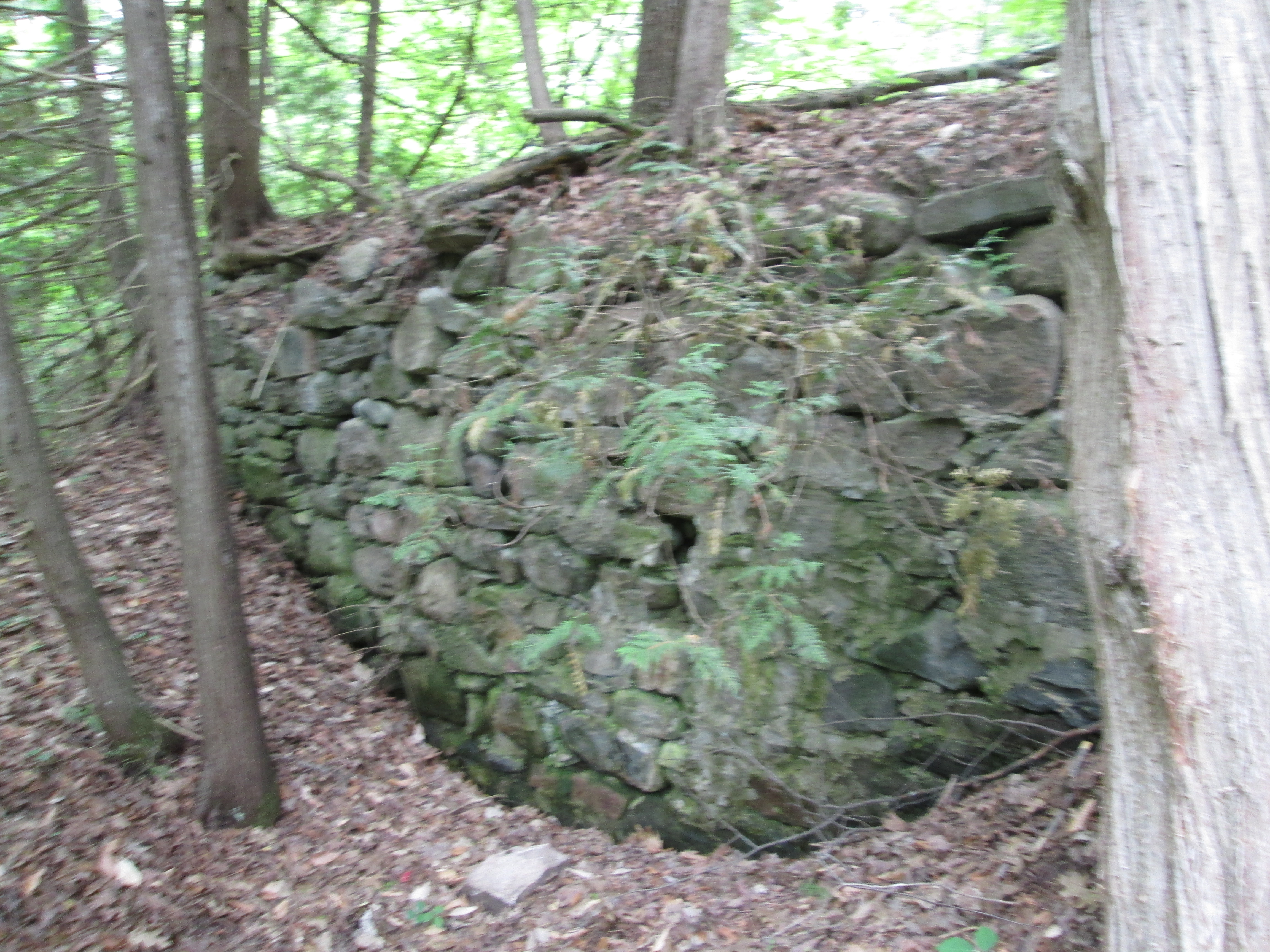
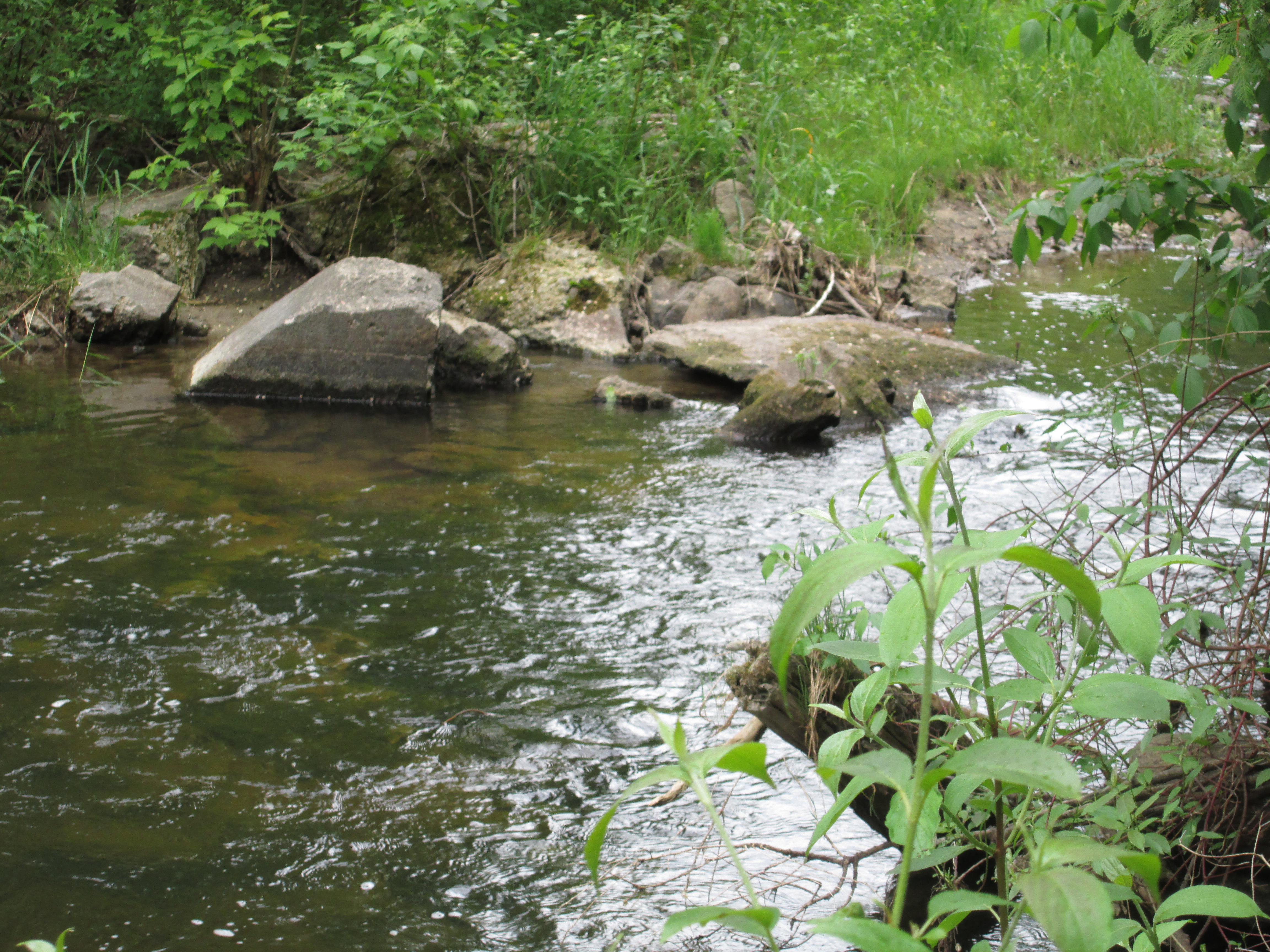
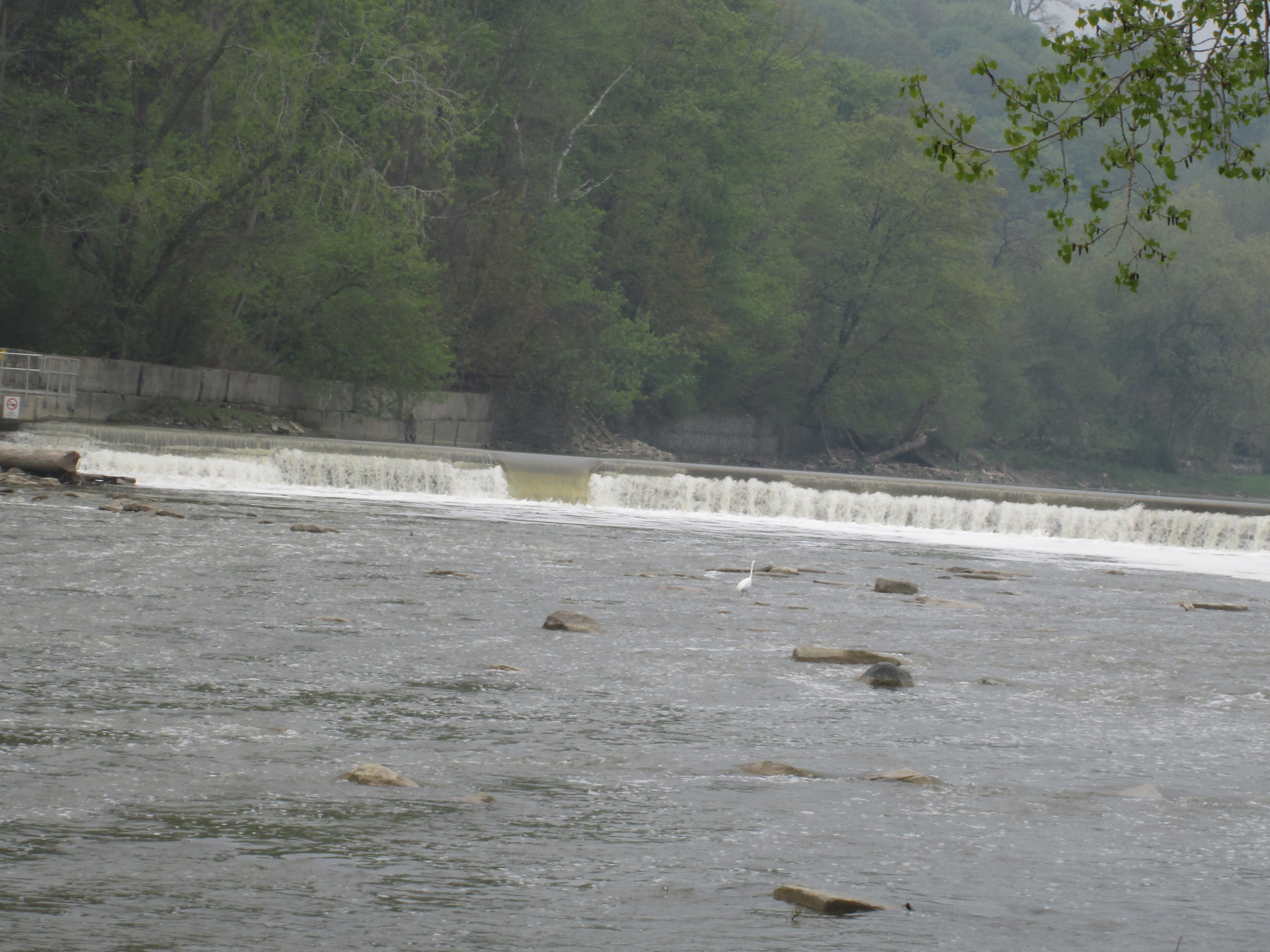
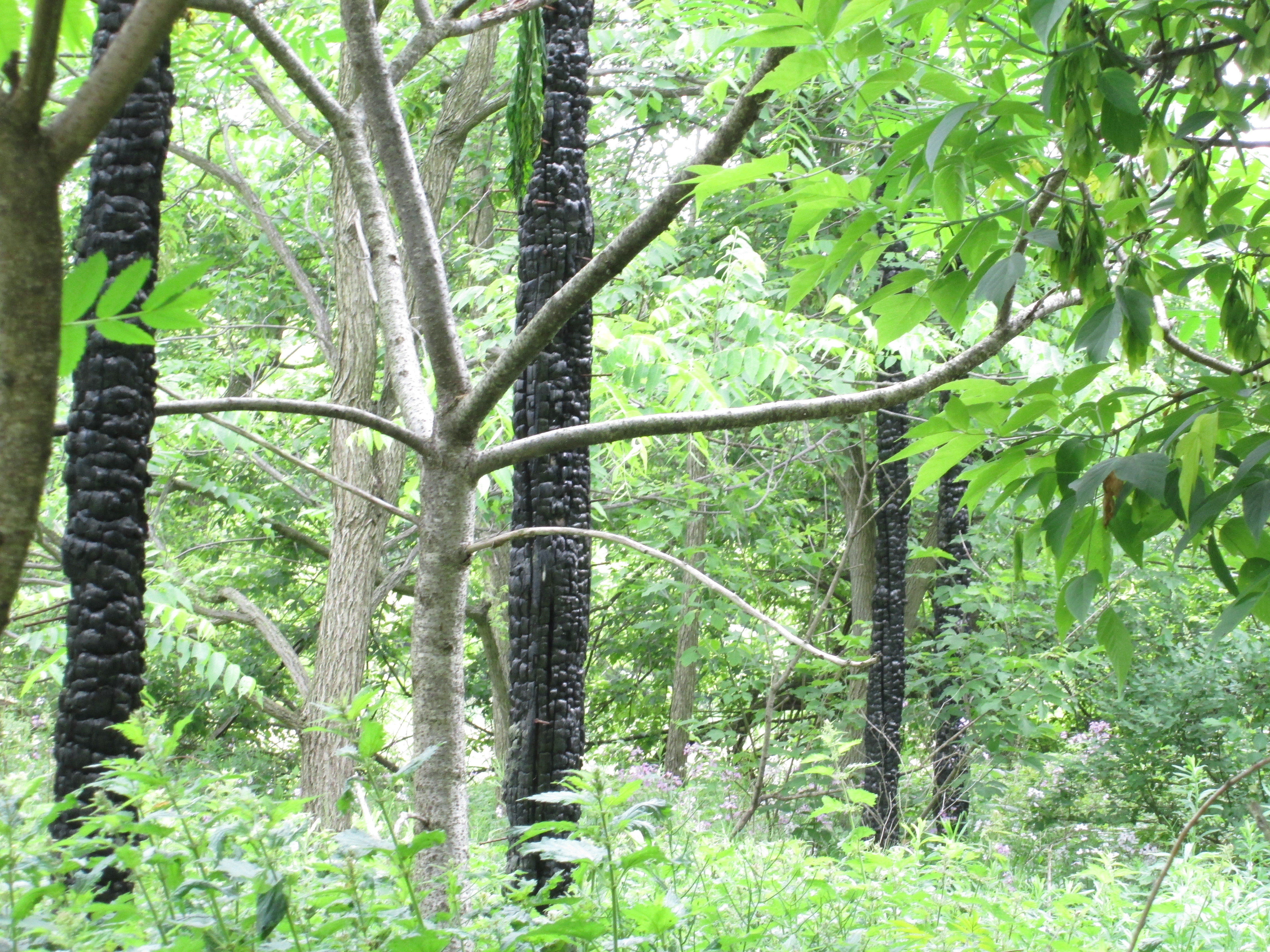
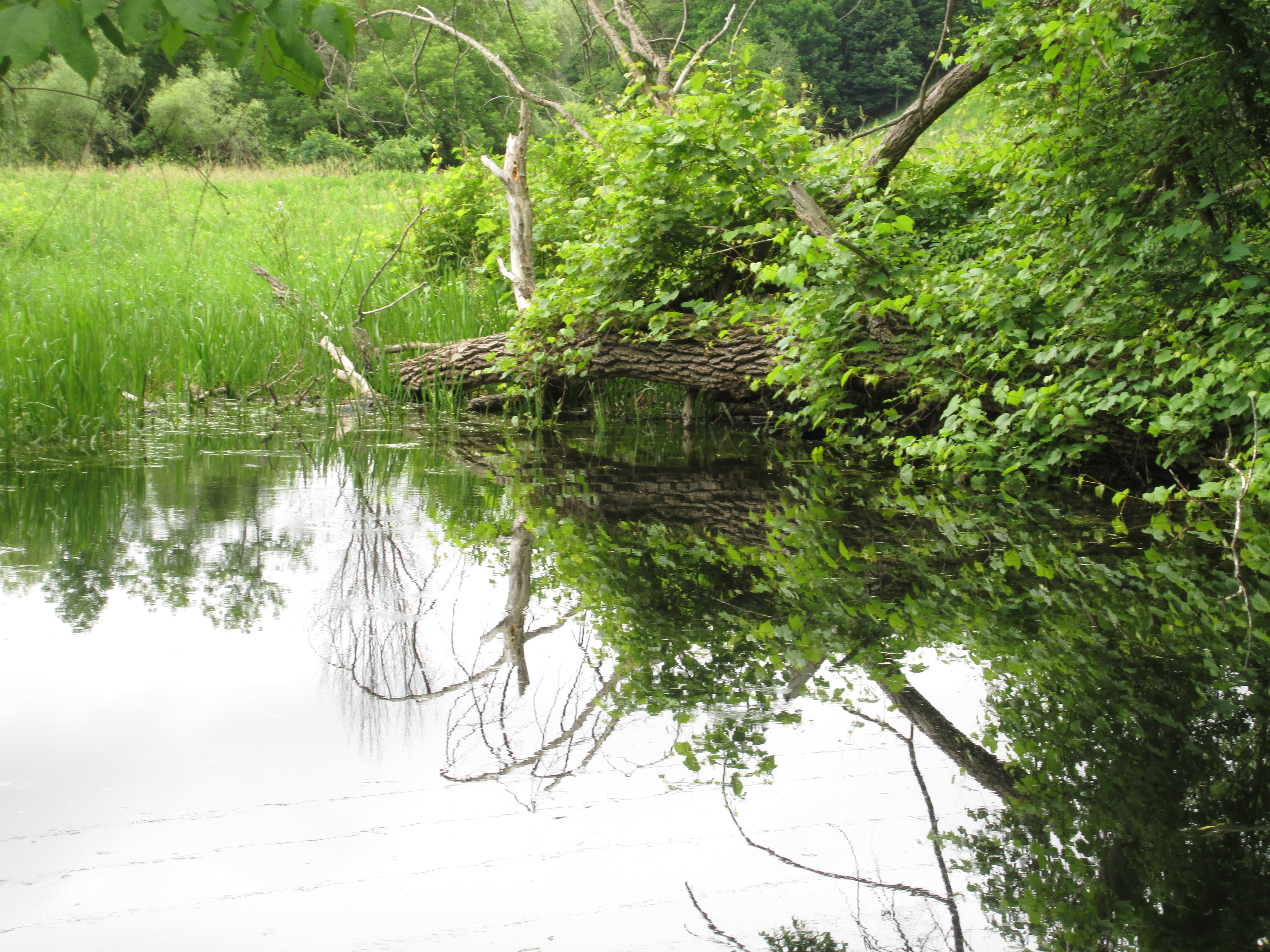
As you follow the curve of the river downstream you come to a series of burned out wooden posts standing like sentinels in the trees.  These small trees have grown up inside the foundations of a former turkey barn.  The barn is in the 1971 aerial photo but must have burned down some time shortly thereafter based on the way the forest is taking over again.

IMG_5448

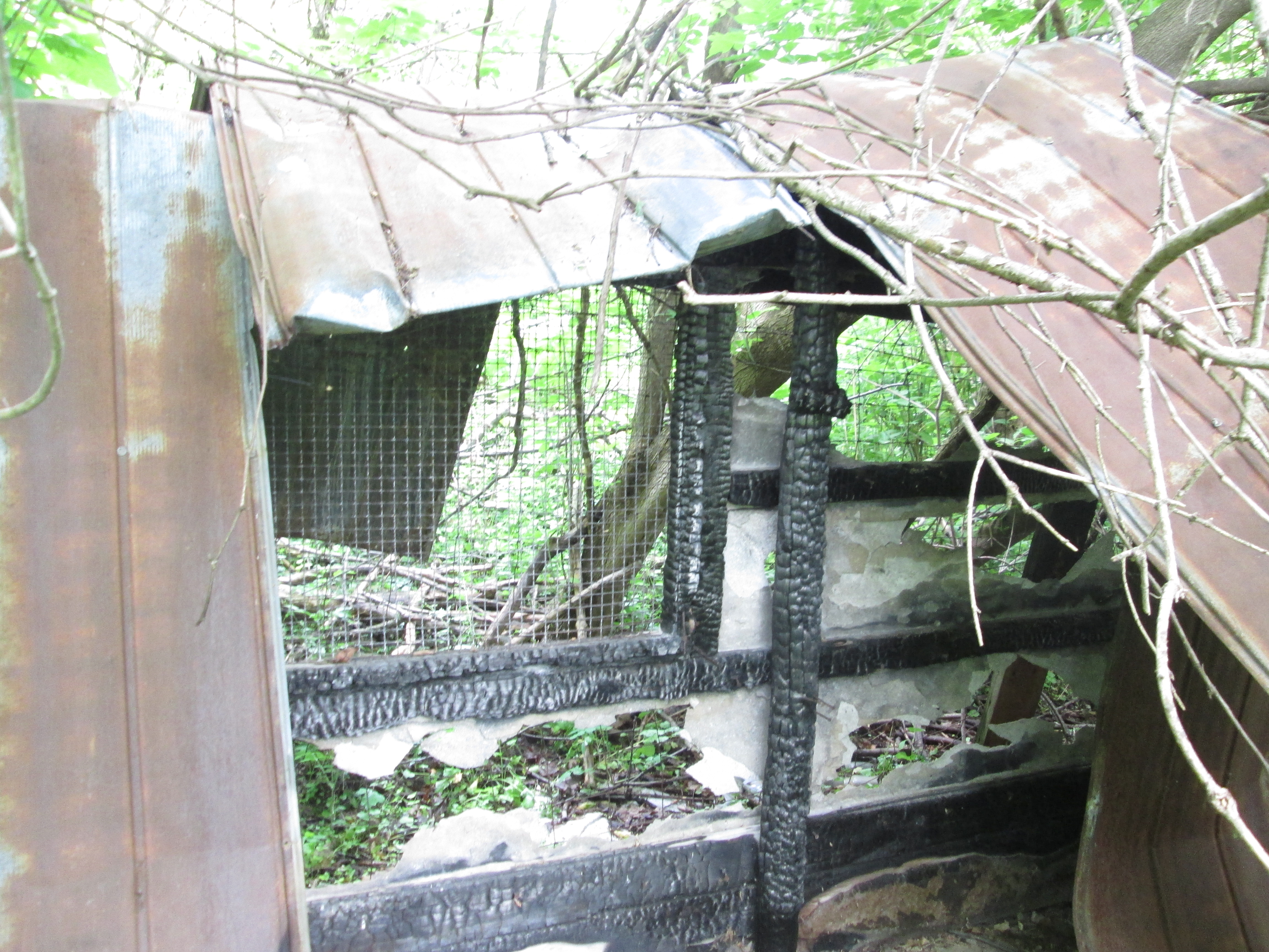
The old turkey barn has some of its original cages still intact.

IMG_5487

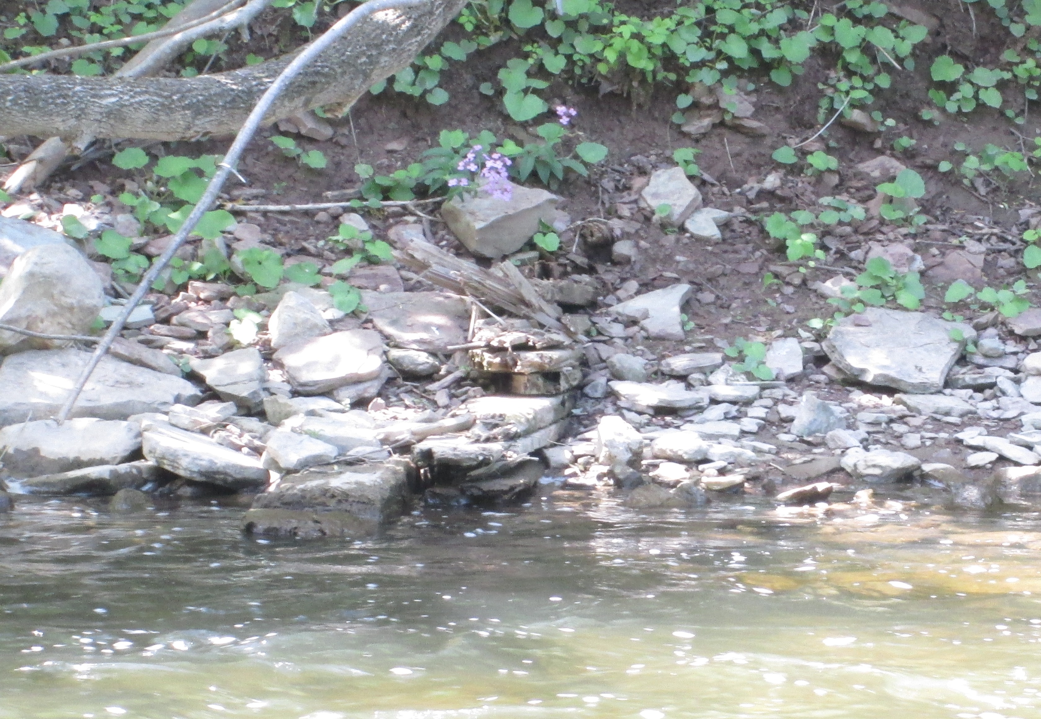
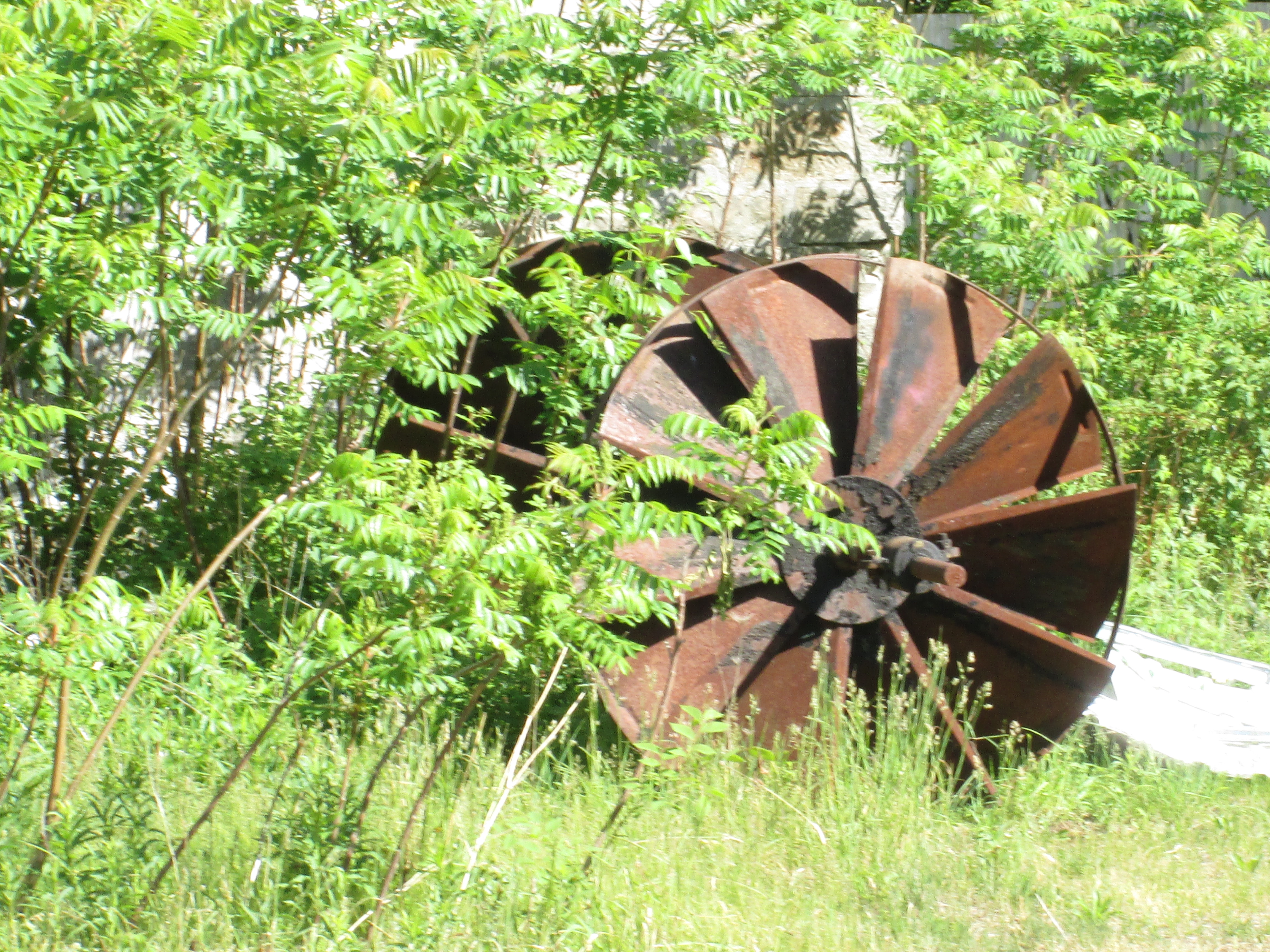
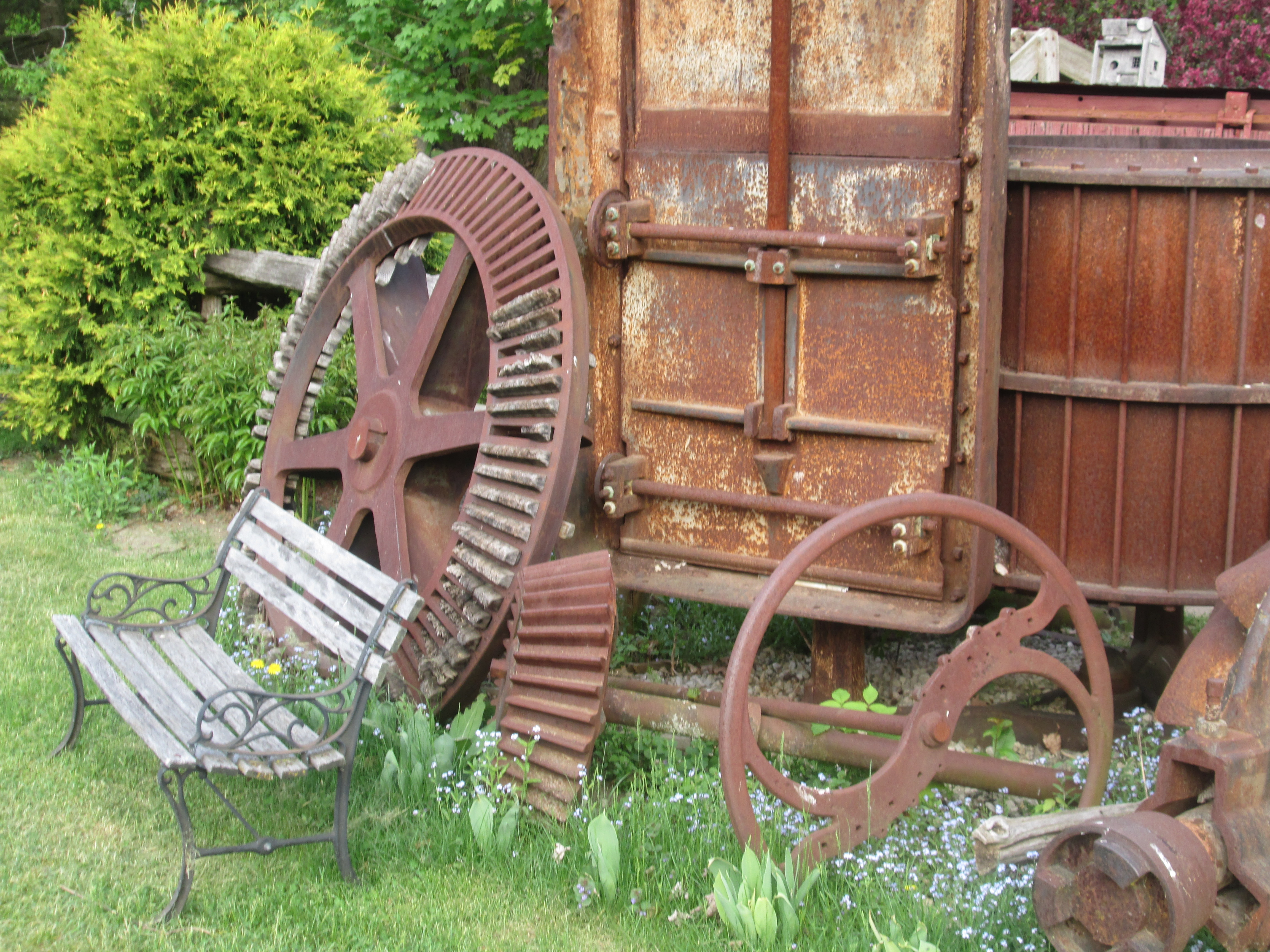
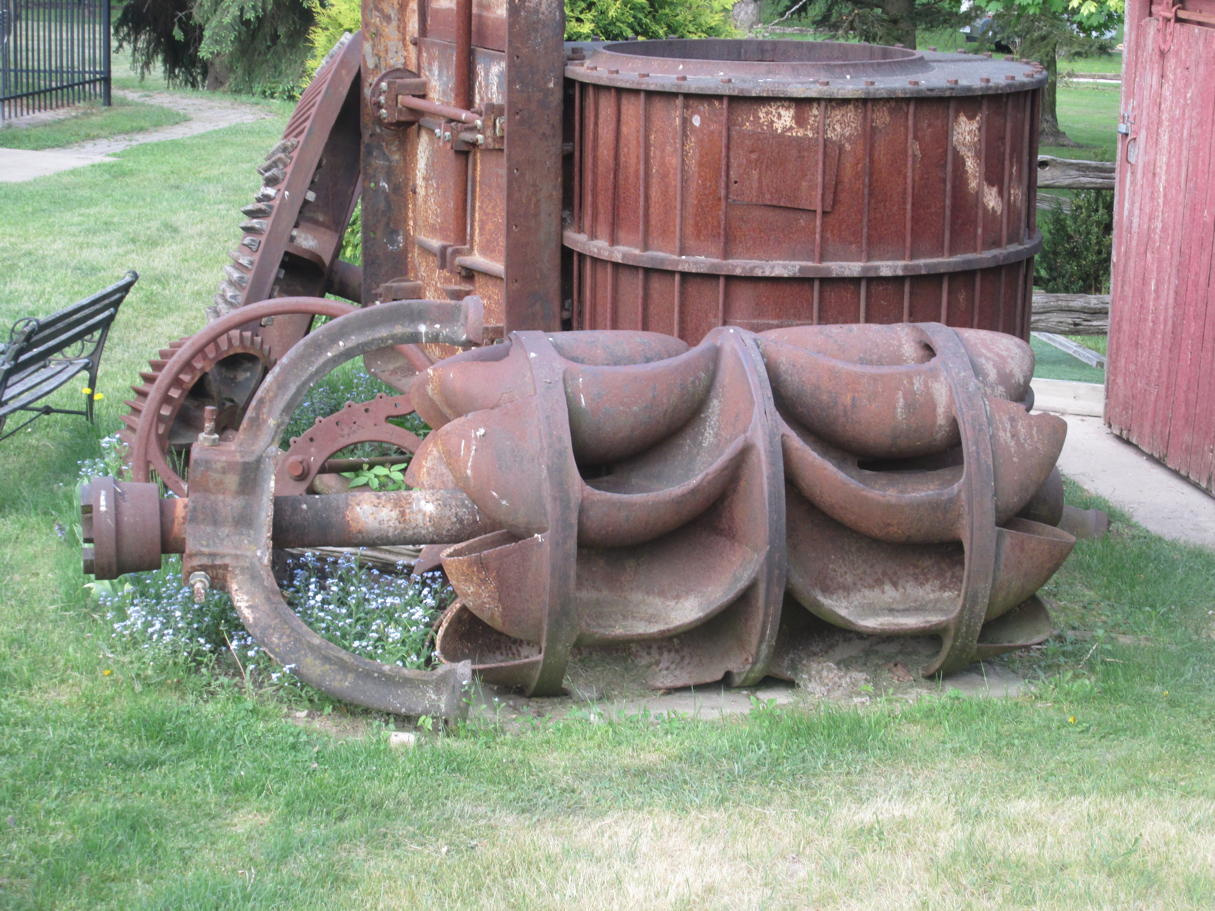
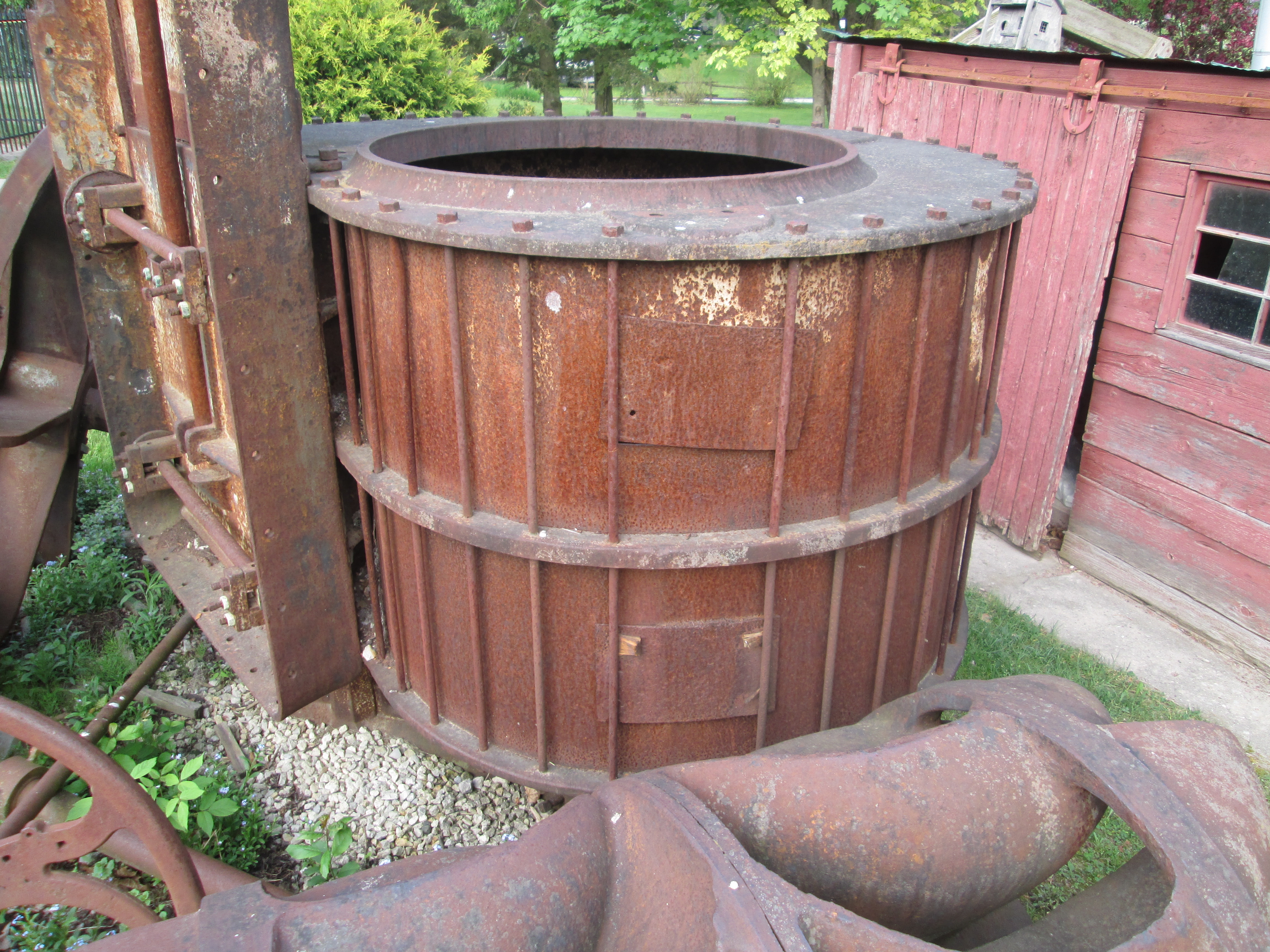
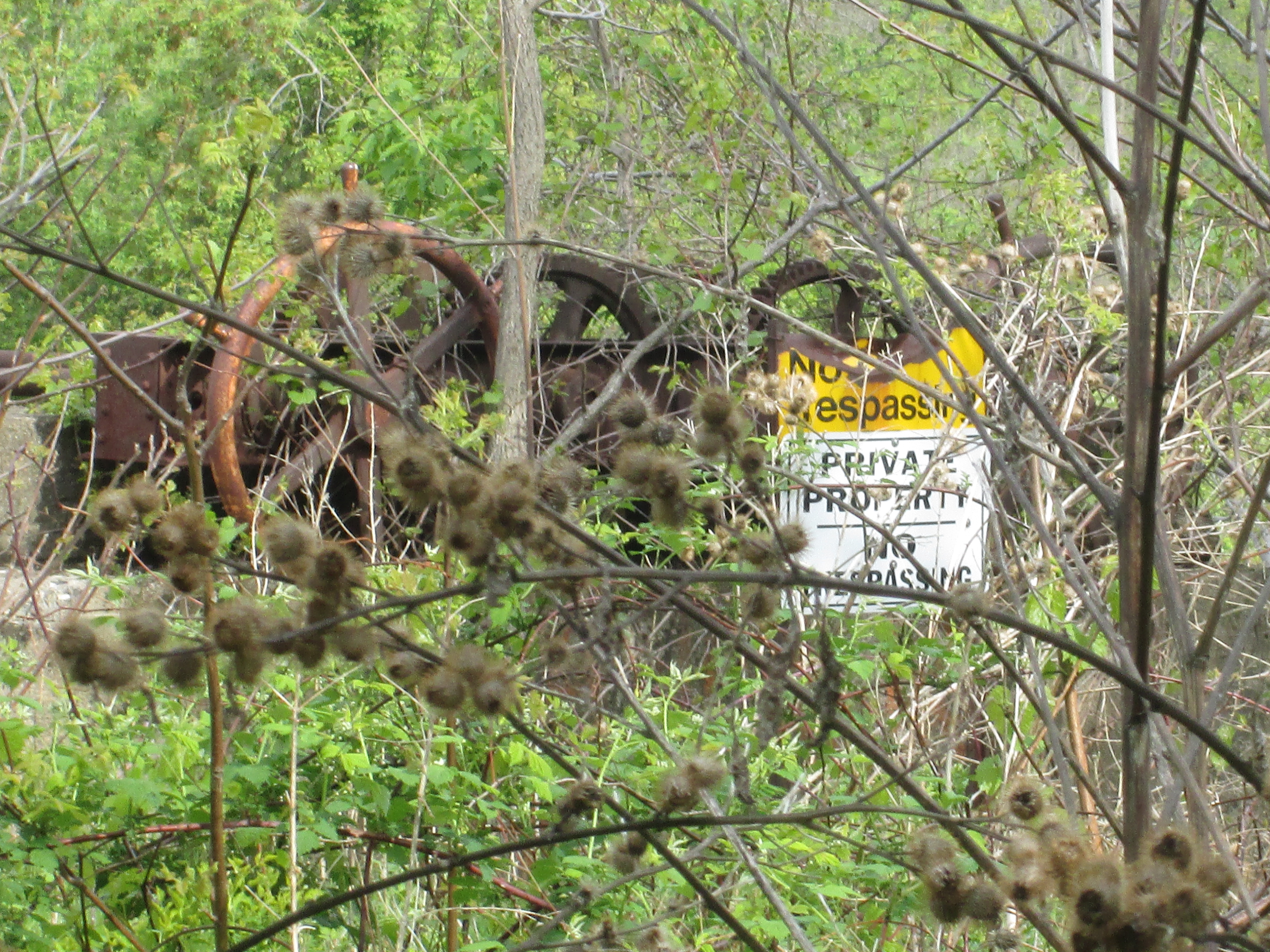
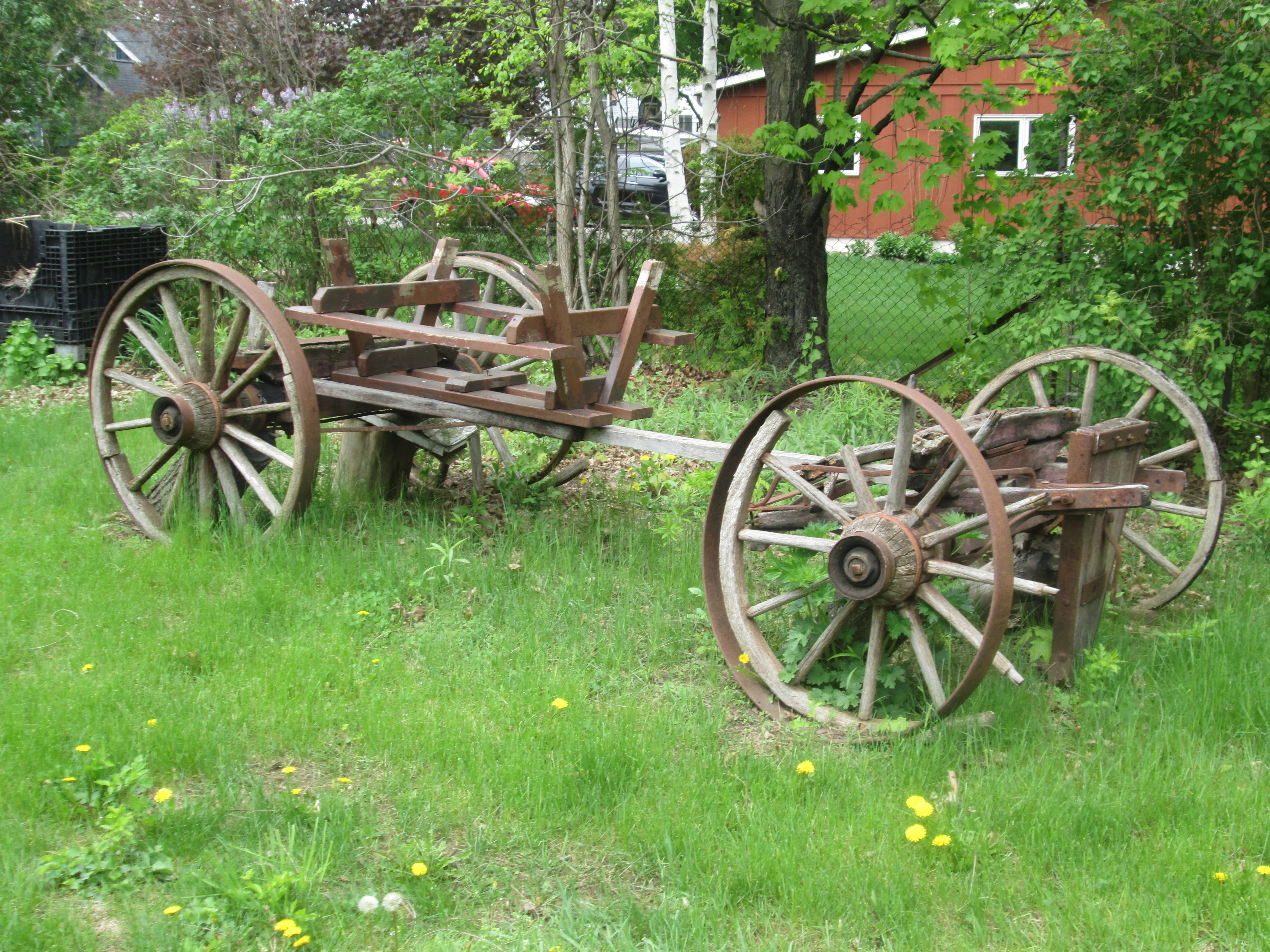
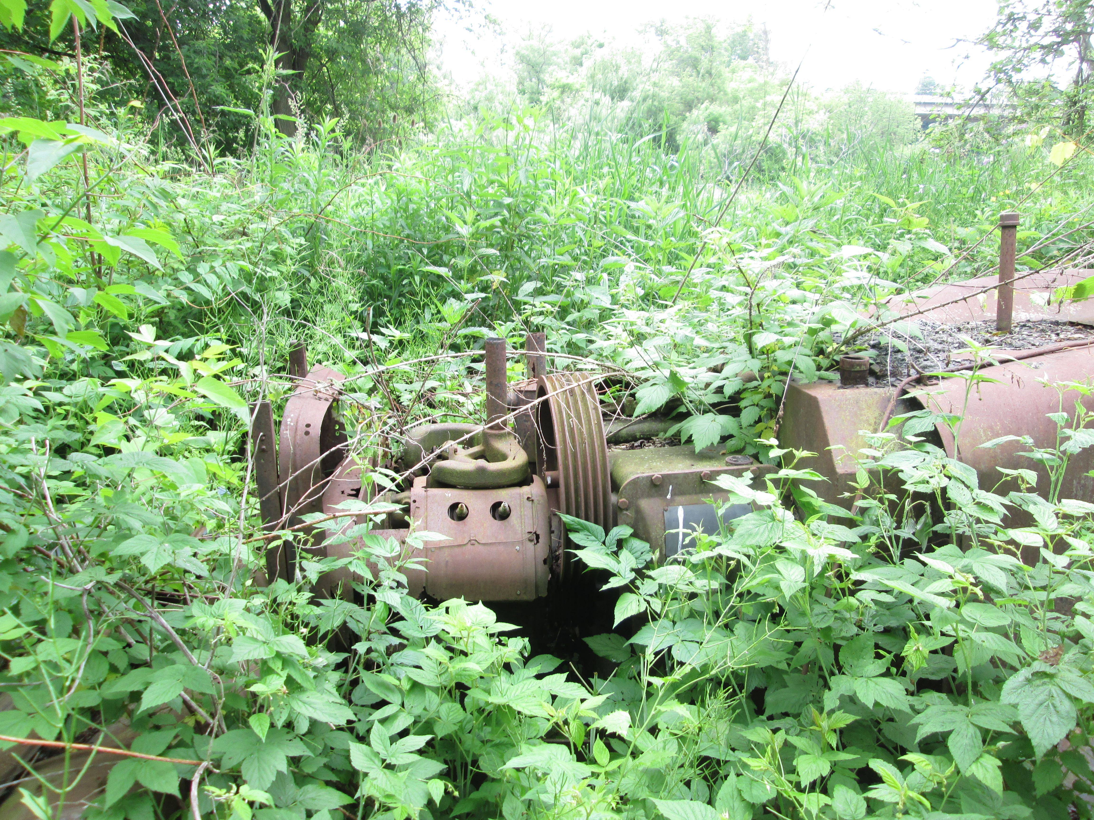
In May 1927 James Pinchin announced in the Credit News that the Farmer’s Co-op had secured the rights to use the Bean Power Sprayer between Islington and Oakville.  When John Bean retired in 1880 he bought a ten acre almond orchard in California.  He found that he had to spray for bugs but that no suitable sprayer existed.  So he invented one and started manufacturing them in 1885.  Very soon the company became the largest manufacturer of orchard spray equipment in the world. Behind the remains of the burned out turkey barn is the remains of a Bean power sprayer.

IMG_5460

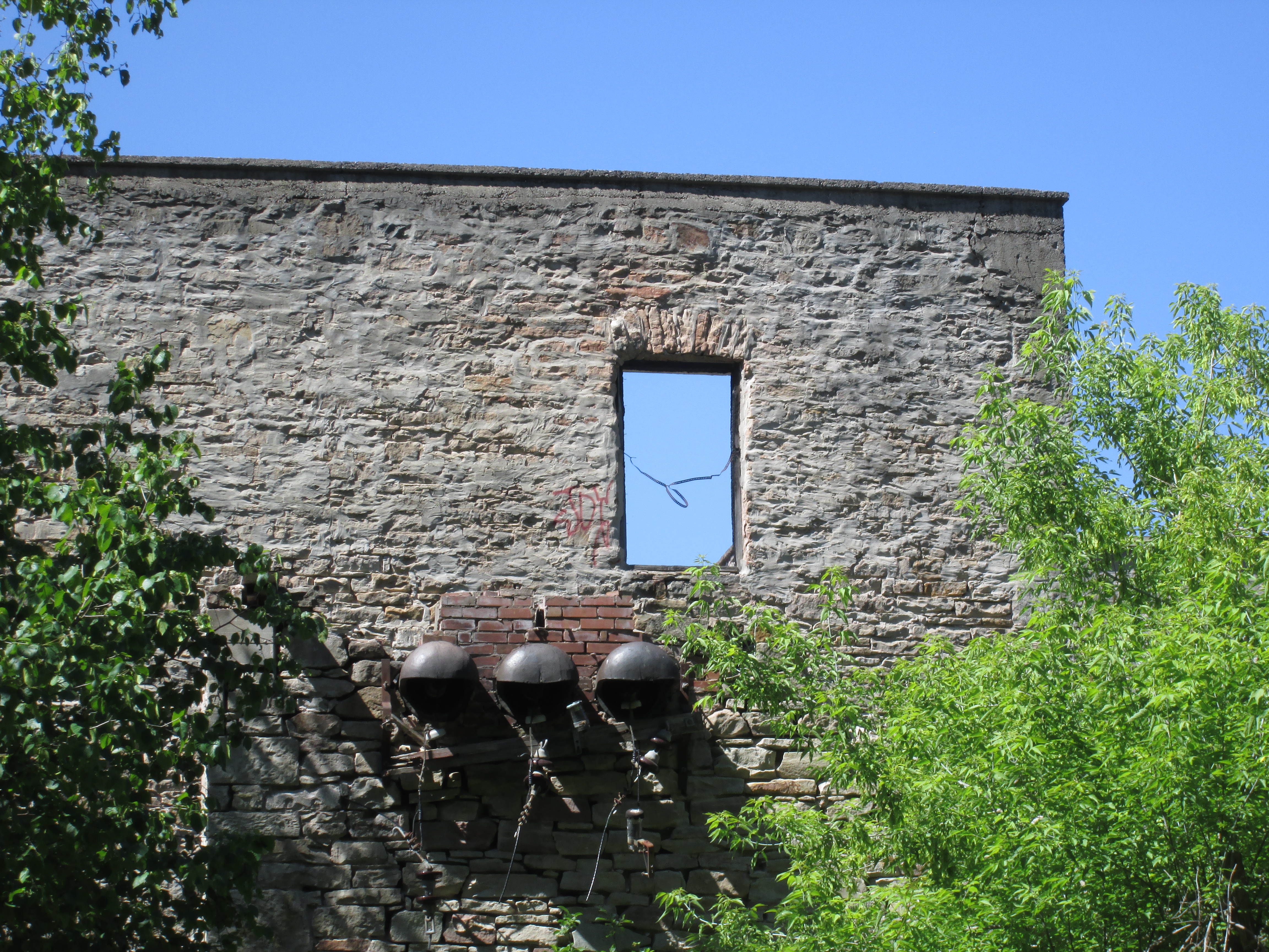
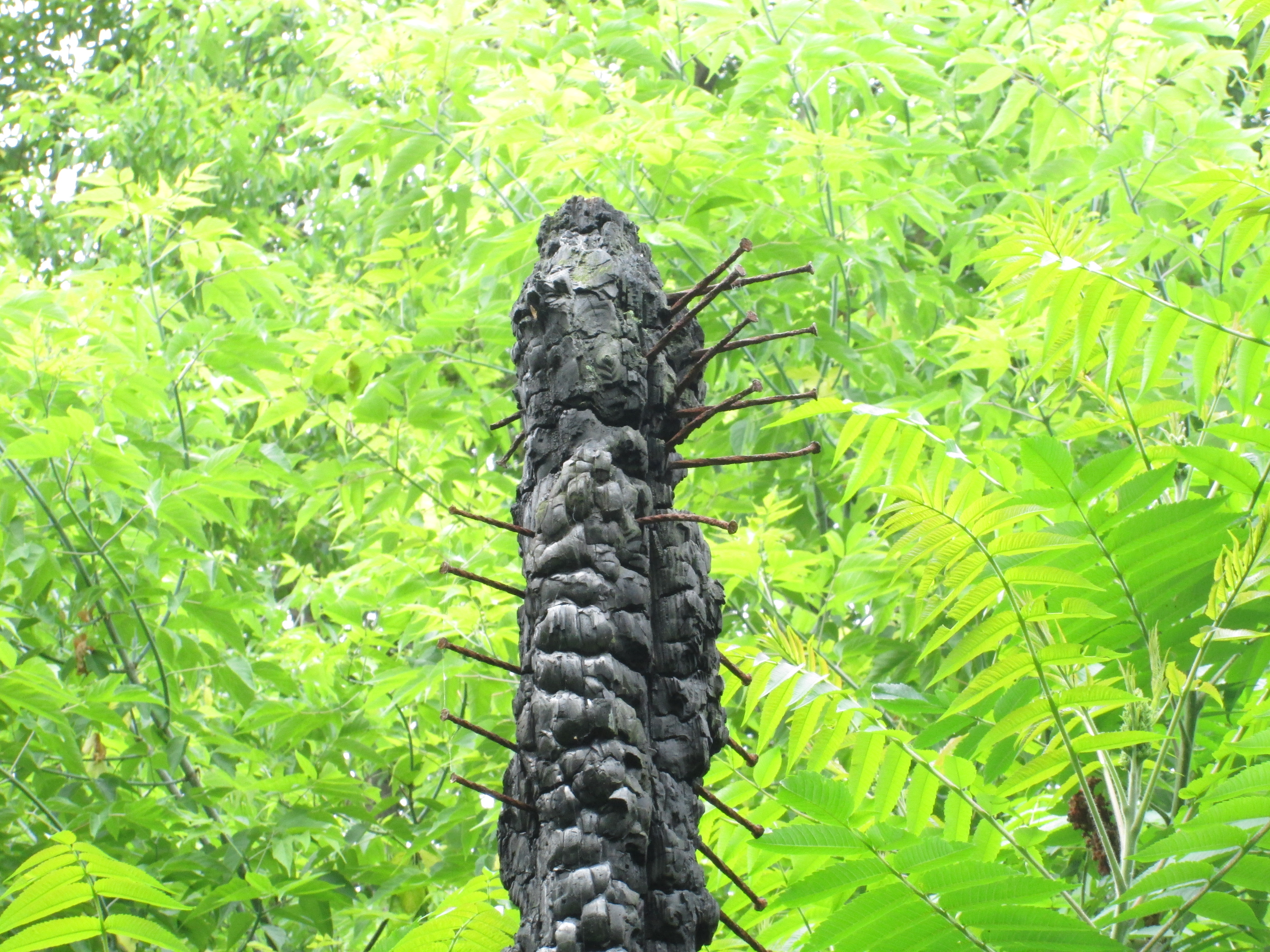
If you are thinking about exploring this location please take note of the number of nails in this support beam from the old turkey barn and choose your footwear carefully.

IMG_5429

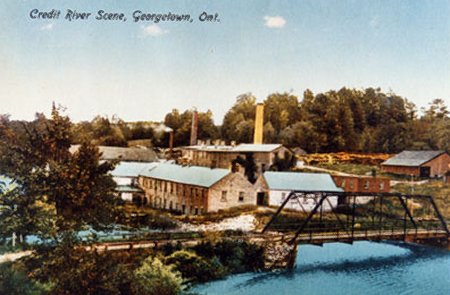
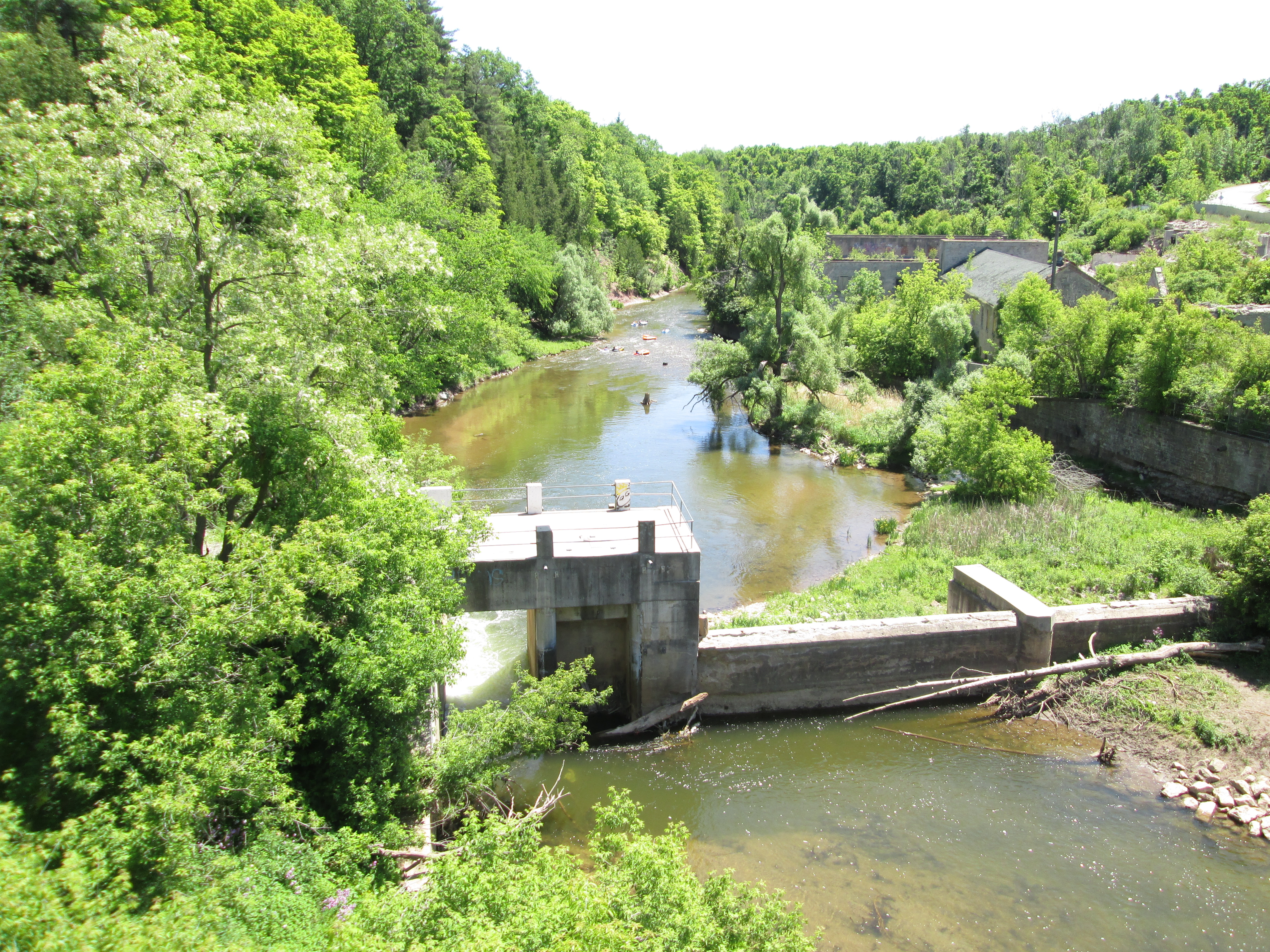
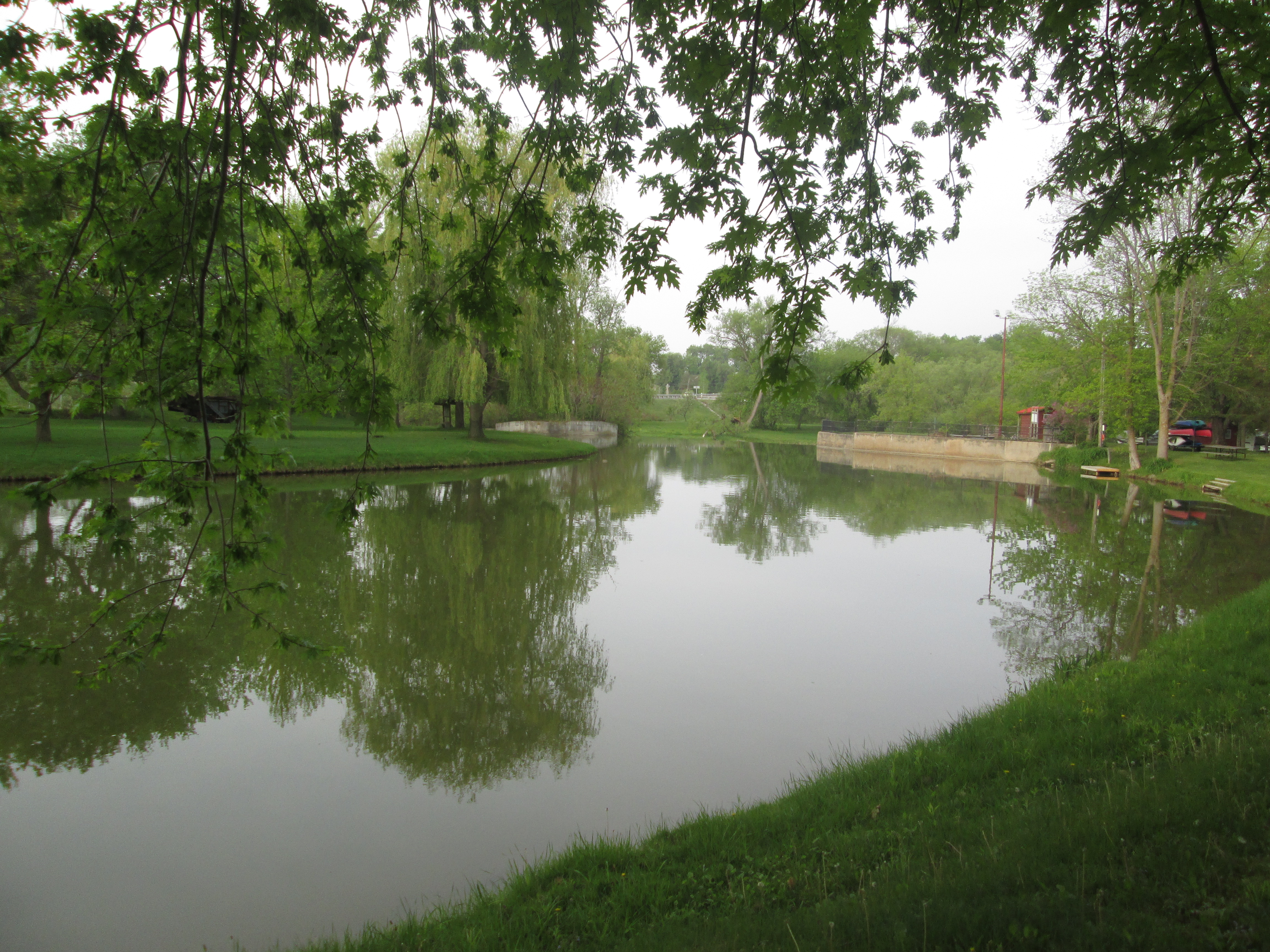
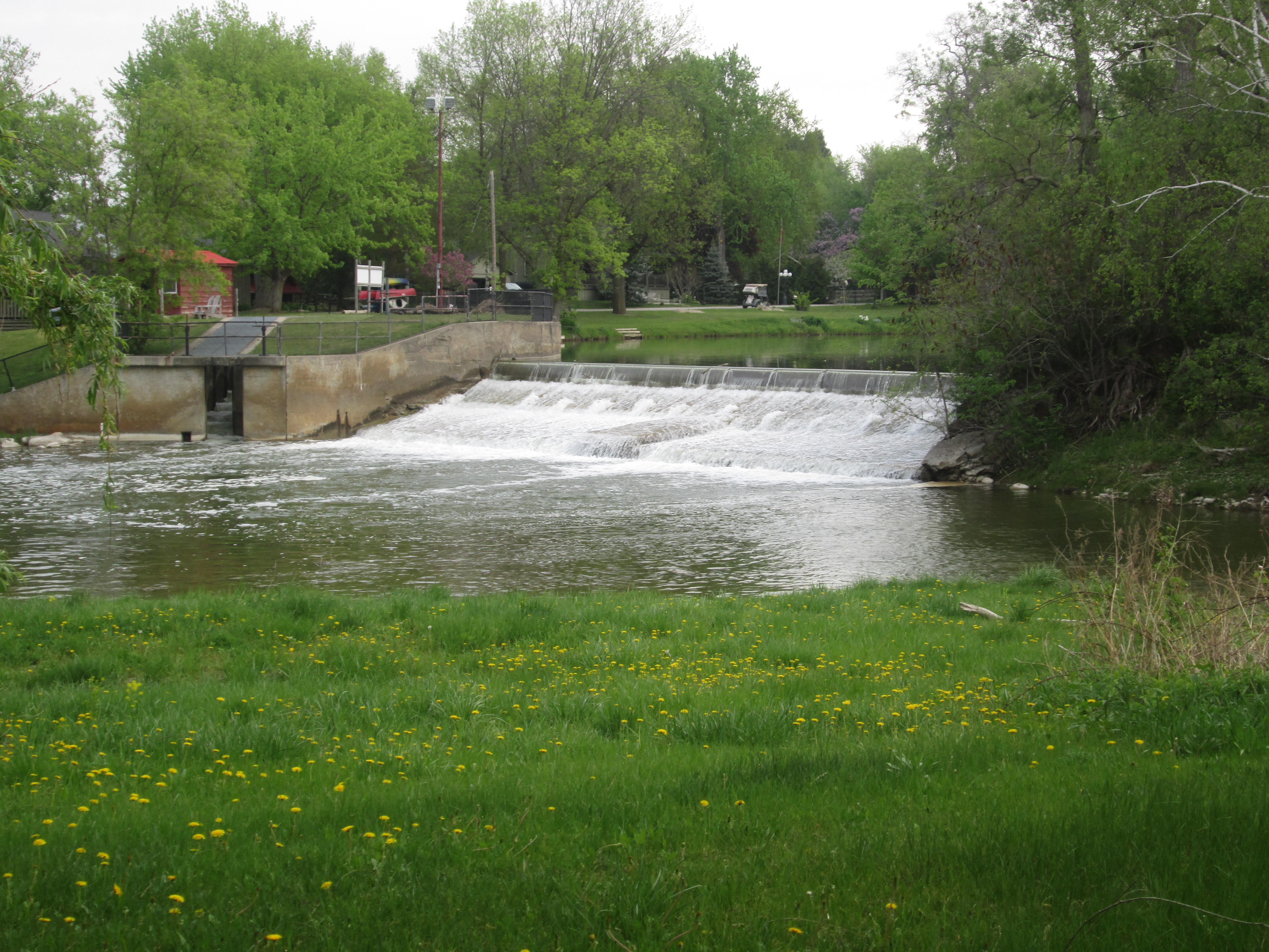
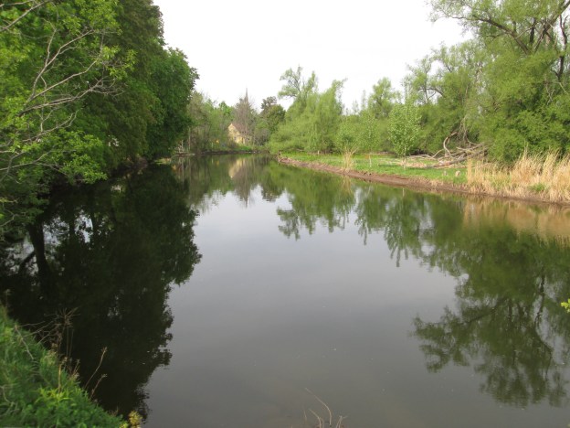
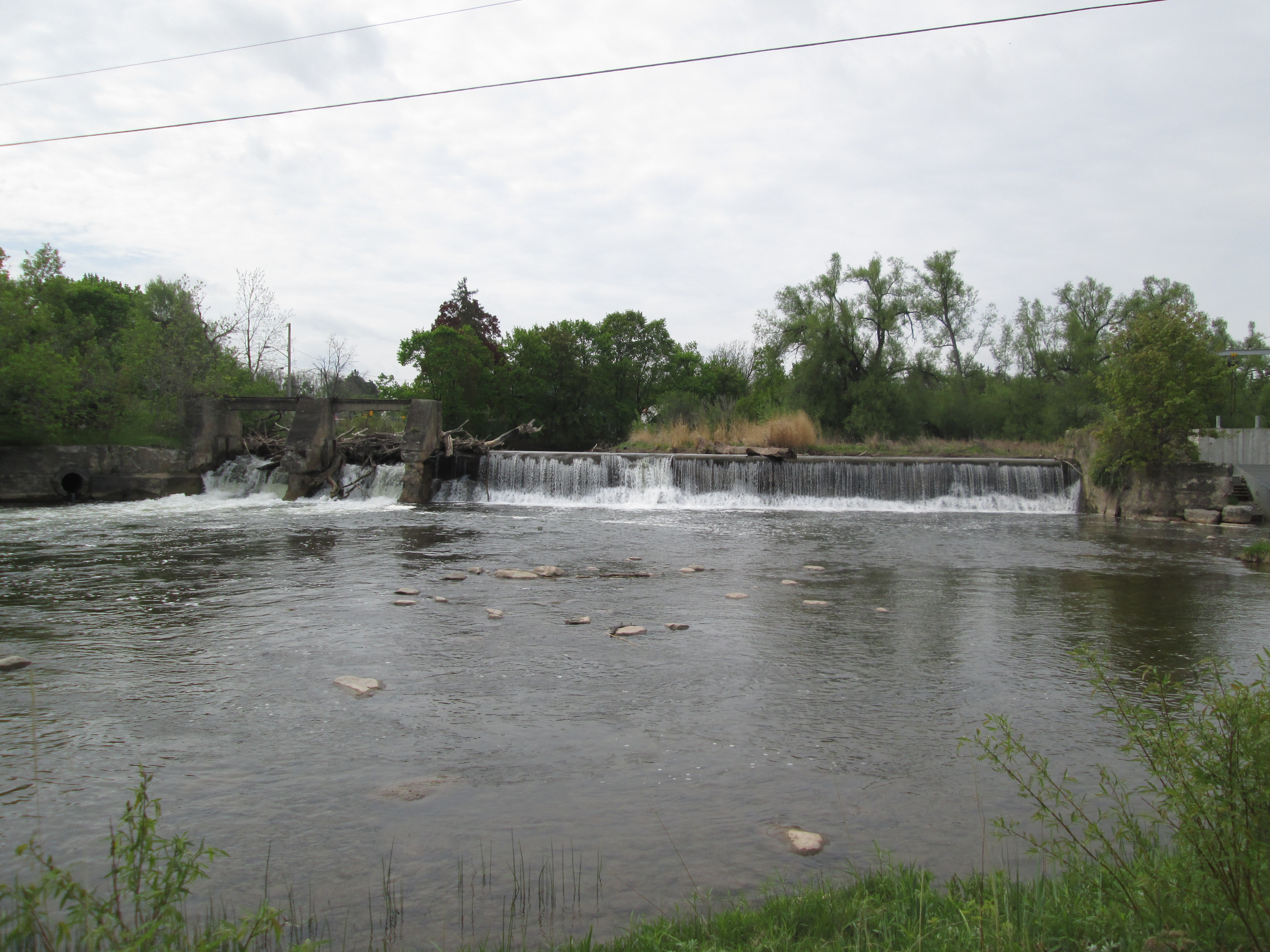
The Pinchin family lived on this farm for about 90 years and when you see the beauty of the property and the Credit River that flows through it you can understand why.  Victor Pichin took over running the farm from his father and continued until around 2010.  Victor moved to the retirement home across the street where he passed away in his 93rd year.

IMG_5424

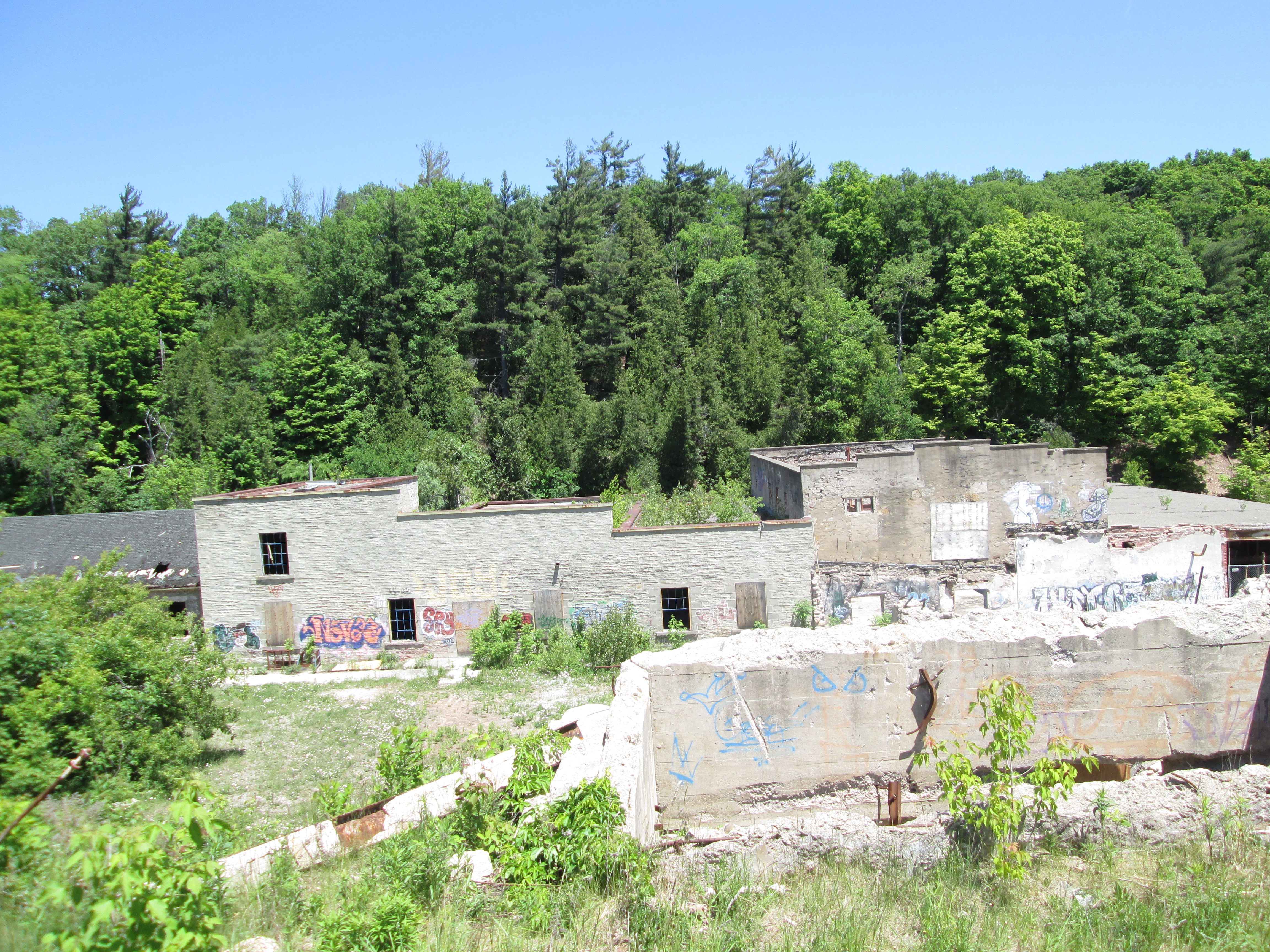
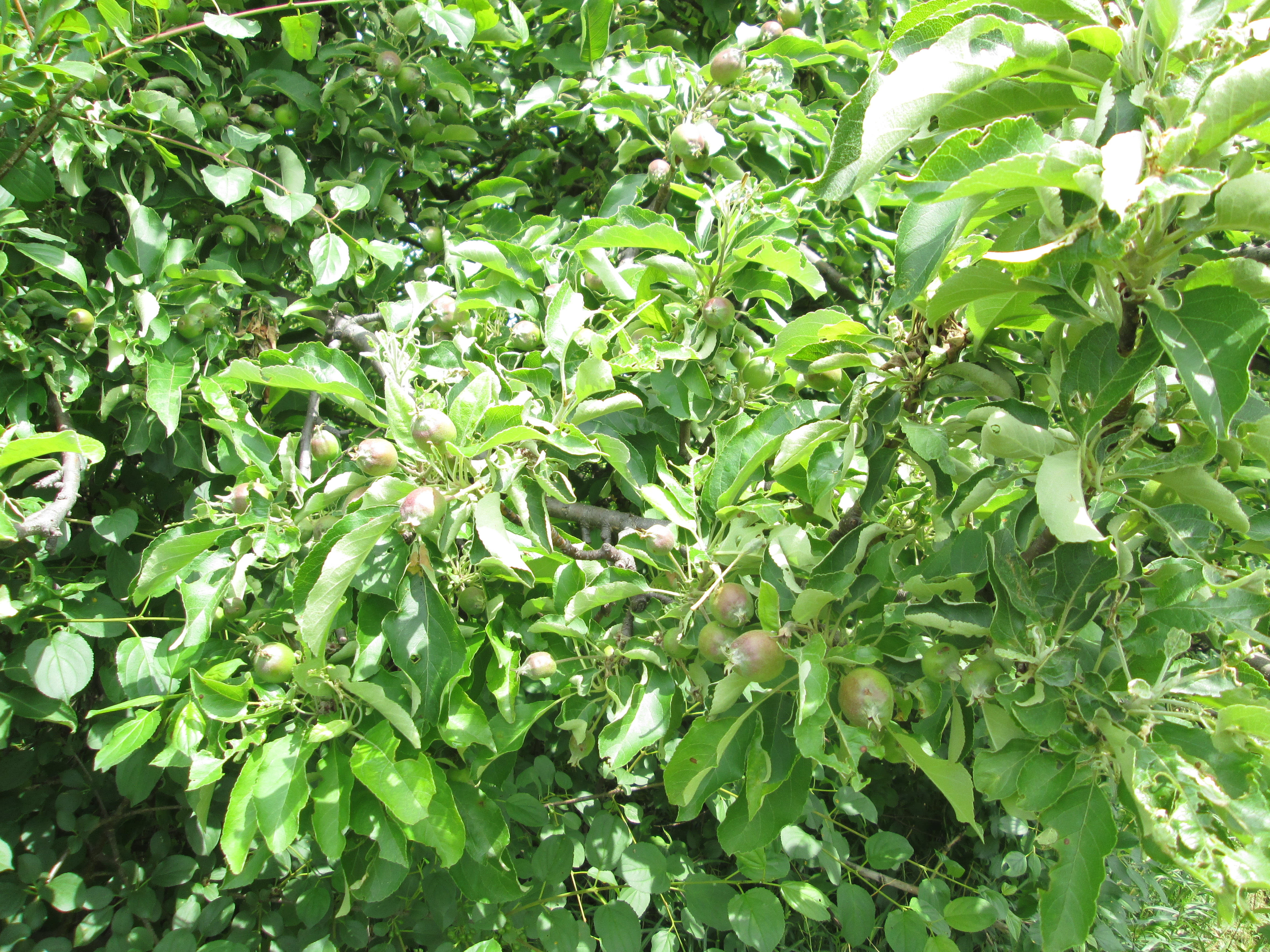
The orchards must have looked and smelled amazing a month ago when the apple, pear and plum trees were all in blossom.  For 90 years people came to this farm for the “pick your own” fruit or to get their holiday turkeys. Today, the property belongs to the City of Mississauga and it is not clear what they will eventually do with it. So far they have torn down several buildings which is not a great start.  The trees in the orchard are loaded with this year’s crop of fruit.  It was reported that the farm produced 400 bushels of fruit per acre when it was in operation.

IMG_5539

Visit us at http://www.facebook.com/hikingthegta for additional photos.

The Barber Dynamo – Georgetown

Saturday June 6, 2015

After visiting the Barber Paper Mills we crossed the Credit River and made our way toward the Barber dynamo.  The walk back to the dynamo is about 3 km and will take you up and down the 100 foot sides of the ravine three times.  The former Grand Trunk Railway bridge is about half way back to the site.

The Grand Trunk Railway Bridge was built in 1855 and earned the nick-name the Iron Bridge. It crosses the 2000 foot wide river valley using 8 spans of 96 feet each and extensive berms on either side. The bridge rises 115 feet above the river. It was expanded in 2010 to accommodate a double track as part of GO Transit’s expansion of services.  Provision has been made for a third track in the future.  When you reach the rail bridge you will have the option of an upper or lower trail. Choose the upper trail as the climb is less severe here than further down the trail.

IMG_5242

The paper mills were a growing business in the 1880’s when John Roaf Barber was running the company.  Born in Georgetown in 1841, John became the plant manager in 1861 and took over full control upon his father’s passing in 1880.  John was a visionary who had converted his mill to the use of paper pulp and was producing some of the finest paper in Canada.  The Barbers had already moved their mills once to get a better head of water to run the water wheels.  Now the water supply was proving to be inadequate again for the size of the business.

After you pass the train bridge you will descend back to the river level before climbing once more as you approach the dynamo.  The trail will split with one trail headed further downstream while the one to the right heads to the dynamo.  You will see a long earthen wall with a small bridge set into it.  This is the weir that was built to help retain the power mill pond.  The bridge sits above a former sluice gateway that has since disappeared.

IMG_5366

When J.R. Barber was thinking about his shortage of power in the mill, the early uses of electricity were limited to a few street lighting applications.  No one had thought about generating it and transmitting it across wires for use in industry.  He contacted C. F. Brush, an early manufacturer of dynamo equipment, in Ohio and told him of his plans.  Originally it was deemed impossible but Barber persisted and convinced Brush to manufacture a 100 hp dynamo for him when Brush’s previous largest one had been 30 hp.  Barber selected a site downstream where he could dam the river and create a head of water 6.6 meters tall.  This height of drop was used to power the turbines that ran the dynamo.

The cover photo shows the ruins as you approach them from the west where the water entered.  Directly behind the dynamo building is a 3 meter deep intake channel.  The dynamo was a three story building.  Turbines were on the first floor, dynamo equipment on the second and living and eating quarters on the third.  The east wall in the picture below shows the remains of the second story windows which were the same as those on the first floor.  At water level a pair of stone arches were the outlets for the water after it was used to turn the turbines that powered the mill.  The water flowing out of these arches formed the tail race and was returned to the river downstream.

IMG_5259

Water from the inlet was fed into a “Y’ branch penstock, the two ends of which can be seen below.  These in turn were connected to the turbines that were mounted in pairs in front of the water inlet ducts.  The turbines were 1.5 meters in diameter and may be the very ones pictured in the Barber Paper Mills post.

IMG_5265

This view is from the south side of the dynamo looking across to the power house (now gone) on the north side.  When I was last here there was a pair of beautiful stone arches in that square hole.  Shafts ran through these arches to connect the dynamo to the turbines in the main room on the lower floor.  The arches are now only so many stone blocks smashed on the floor inside.

IMG_5271

The larger of the two dynamos operated here was the 100 hp one that was mounted in the power house, a small extension on the north side of the building.  A smaller 60 hp unit was mounted inside on the second floor.  The 100 hp unit supplied power to the machinery at the mill while the smaller unit provided lighting.  Each was connected to the mill by one of two wires strung on telegraph poles installed for the purpose.  The larger unit was bolted down to rail ties. The remnants of the rail ties and mounting bolts can be seen in the picture below.

IMG_5370

The weir can be seen in this picture as a the dark line running across the middle of the photo. The wall of the crumbling building can be seen at the left side of the weir.

IMG_5292

By following the line of the old earthen berm toward the river it is possible to locate some of the original wooden crib that was the main part of the dam.  Several flat rows of wood are stacked up just near the water line in the picture below.  They would have been under water 127 years ago when they were installed.

IMG_5375

The paper mill is under attack from developers.  The dynamo building is under attack from beavers.  John Roaf Barber chose this site because it was a suitable place to dam the river to create the pond he wanted to use to power his mill.  The local beavers also think it is a great place for a pond.  They are chewing down trees to make their dam and lodge out of.  Several of the trees they have chewed through have fallen onto the old dynamo building.  The same factors that led to the dynamo being constructed here are also speeding up the destruction of this historic building.

IMG_5291

The Eastern Tiger Swallowtail on the plant in the picture below is a female.  The female can be identified by the band of blue spots along the hind wing.

IMG_5251

When public power came to Georgetown it was under the persuasion of J. R. Barber.  He closed the dynamo in 1913 and let the Alexander family live there.  Tragedy struck in 1918 when their young son fell off of the railway bridge and died.  The dynamo was closed and left to the mercy of the weather, vandals and the beavers.

Like us at http://www.facebook.com/hikingthegta


Barber Paper Mills – Georgetown

Saturday June 6, 2015

The Barber Paper Mill ruins are comprised of several Victorian era industrial buildings that are slowly decaying in Georgetown.  It was sunny and 11 degrees with enough breeze to blow the bugs away.  The next stop up the Credit River north of Norval is the Barber Dynamo.    We decided to access it from the north side which meant parking on Maple Ave. in Georgetown right beside the ruins of the Barber Paper Mills.  An exploration of the Dynamo pretty much requires a look at the paper mill that led to it’s creation.

The Barber family came to Upper Canada in 1822 and settled in the Niagara Peninsula.  In 1825 they helped James Crooks win a $500 bounty from the government for establishing the first paper mill in the colony.  In 1837 they decided to go into business for themselves and moved to Hungry Hollow (now Georgetown) and bought the woolen mill that belonged to George Kennedy who, in 1820,  was the founding father of Georgetown.  As the business expanded they started a second woolen mill just south of Streetsville in what would be known as Barbertown. By 1852 their woolen industry outgrew both buildings and a new larger one was built in Streetsville.  It was at this time that the new paper rolling building was completed.  This allowed the mill to expand from a 91 cm cylinder to a 122 cm paper rolling machine.  Wallpaper was added to their list of products and by 1862 it is said that they had the largest wallpaper factory in North America.

IMG_5314

Beside the Paper Mill building stood the machine and maintenance shop.  It has lost all of it’s roof and can be seen in the foreground of this picture.

IMG_5135

The archive photo below from 1910 shows the paper mills as they looked in their prime.  The paper machine building and maintenance shops can be seen near the bridge.  The little brown building behind the bridge was the offices, now demolished.  A horse barn and wood storage lot stand where Maple Avenue now runs.  The two smoke stacks were on boiler and digester rooms where the paper pulp was made.

Barber paper Mill 1910

The dam across the Credit River for the paper mill was replaced with the current concrete one some time between the picture above from 1910 and a subsequent one from 1930.  This picture is taken from the modern bridge which was built in 1973.

IMG_5311

In 1869 John Roaf Barber took over the mill operation at the age of 30.  By 1886 the business was growing and the mill ran into an old problem.  Insufficient water power to keep the machines running.  At the mill site the head of water (height which it could be made to drop to do work) was only 4.5 meters.  A spot was found about 3 km downstream where a head of 6.6 meters could be obtained. The solution was to build the Barber dynamo which will be explored in a companion post.  The mill was using two sets of turbines like the one pictured below.  It appears that there may be at least 3 of these sets of turbines in the grass behind the sorting building which means the old ones from the dynamo may have been brought here as well. When the dynamo was brought into service in 1888 it made the paper mill the first industry in North America to generate and transmit electricity to operate it’s machines.

IMG_5351

This is the river view of the paper machine building.  Paper had been made out of cotton and linen rags until 1869 when a pulp mill was added so that paper could be made from oat, wheat and rye straw.  By 1879 wood pulp was replacing straw and John Roaf Barber was on the leading edge of the new process.  The building below produced some of the countries finest wood based papers and ironically today there is a small tree growing on the roof above the first window.

IMG_5334

The power connection station on the river side of the building is a later addition as is testified to by the red bricks inset into the field stone construction of the rest of the building.  There were originally two lines running from the dynamo to the mill.  One was used for lighting and one to power the machines.  After 1913 the mill was converted to Ontario Hydro.

IMG_5200

This shot is taken from Maple Avenue and shows the south end of the property.  The incoming sorting and storage building is in the rear while the foundations for the incinerator building or the shipping building can be seen in the foreground.

IMG_5319

We crossed the bridge to a blue marked side trail that is part of the Bruce Trail. Forget me nots grow along the north side of the Credit.  Legend has it that when God was naming the plants, this little one called out “forget me not” and God chose that for it’s name.  Prior to joining Canada in 1949 the Dominion of Newfoundland used the forget me not flower for their Remembrance Day flower. The poppy has since been adopted but some still prefer the traditional blue flower instead.

IMG_5189

Normally born between late May and early July white tail deer fawns weight 4 to 8 pounds at birth. Fawns are supposed to hide for the first week while their mother forages. After this they will be with the mother until weaned in the fall. They will lose their white spots within the first year but they help camouflage them when they’re infants.  This little one is barely taller than the log it stands in front of and at first I thought it was a dog.

IMG_5361

The paper mill was sold by the Barbers to Provincial Papers in 1913 who operated it until it closed in Nov. 1948.  Various tenants occupied the buildings until the mid-1970’s when it was closed and left to rot.  As for the fate of paper mill ruins?  That remains undetermined but in 2008 the site was named as a cultural heritage property.  In 2015 it made Heritage Canada’s top 10 list of most endangered heritage sites.  The current owners proposed a 14 story condo with much of the remaining heritage buildings retained.  Problems with clean-up of soil contaminated by years of heavy industry have left the project on hold and the property is on the market again for a cool 5 million dollars.  Leaving it behind we continued along the river toward the site of the Barber Dynamo.

Like us at http://www.facebook.com/hikingthegta

Follow us at http://www.hikingthegta.com

R. C. Harris Filtration Plant

Sunday May 31, 2015

It was cloudy with occasional light rain.  Having been downtown I decided to drive east to visit the so called Palace of Purification.  Otherwise known as the R. C. Harris Filtration Plant.

Roland Caldwell Harris became Toronto’s Commissioner of Works in 1912.  One of Harris’ first projects was the Prince Edward Viaduct which spans the Don River and connects Bloor Street to the Danforth.  Harris’ vision for the bridge included adding a lower deck for rail transport.  It was an addition that saved the city millions when the TTC opened the Bloor-Danforth line in 1966.  In 1913 Harris presented a vision for the Toronto Water Works Extension which was basically clean, safe drinking water for everyone.  The project got delayed due to the First World War and subsequent budget restraint. The city by-law to expropriate the Victoria Park site was repealed and the land didn’t come under city control until 1923.  When Harris saw the drawings for the buildings in February 1928 he declared them to be plain and unattractive.  The reworked design is what we have today and was recognized in 1992 as a National Historic Civil Engineering Site.  It is a grand civil structure built in the popular Art Deco style and set in a terraced park.  Built between 1932 and 1941 it had a major addition in the 1950’s.

Lake Ontario has about 1% of the earth’s surface fresh water.  It is Toronto’s only source of drinking water, but unfortunately, is frequently polluted by run-off and waste.  For this reason Harris envisioned an intake well out in the lake, 2.6 km from the shore.  Water is then bought in through the centre of the site by the pumps in the pump house.  Built in 1935 this building is the closest to the lake.

IMG_5027

Inside the pump house the original pumps remain.

IMG_5029

Outside, the swallows have built dozens of nests in the shelter of the stonework.

IMG_5039

The service building with it’s alum tower stands just north of the pump house.  Water passes under the alum tower on its way to the filtration plant on the next terrace up the hill.  Alum is dropped into the water to help contaminants floc so that they will drop to the bottom of settling pools or be more easily filtered out in the filtration plant.

IMG_5081

The picture below shows the terrace with it’s niche and bronze fountain.  Harris designed his architecture to be viewed and this is meant to be lined up with the long filtration plant on the terrace behind.

IMG_5045

The main entrance to the filtration plant.  A stylized TWW (Toronto Water Works) adorns the wood right above the main door.  It also appears on either side of the arched windows.  The wing on the left was built in 1932 and was in use when the plant opened in 1941.  The wing on the right was added in the 1950’s.  Unlike most public buildings, the style wasn’t changed with the addition as a means of cost cutting.  Harris had supplied pipes and connections so that capacity could be easily doubled to nearly 1 billion litres per day.  Inside this building are 40 filtration beds where water is cleaned before being pumped to a network of reservoirs and water towers throughout the city.

IMG_5019

Inside the filtration plant.  It’s no wonder it got the nick-name Palace of Purification.

IMG_5007

Seawall construction in 1933.

water-april1933

Along the front of the facility there is a seawall that meets Lake Ontario.  It has a curved lip at the top to direct large waves back into the lake.

IMG_5064

Just to the east the mouth of a storm drain opens onto the beach.  The concrete slabs that look like teeth are disipators designed to release energy from the water before dumping it on the beach.

IMG_5092

Early Toronto had several grand parks that attracted people out for an afternoon’s leisure. Victoria Park was set on rolling hills at the water’s edge at the end of the street that bears its name. In the late 1870’s ferries from downtown began bringing passengers to enjoy the gardens. There were different rides available such as a steam powered carousel, donkeys and tethered balloons. A small zoo, dancehall and waterfront trails along with tight-rope walking displays completed the attraction to the park. It was bought out in 1899 and for a while there was an outdoor school and camp operated here. In 1927 the city bought the site and later chose it for its new water filtration plant. Aerial photos show a building on the beach at the east end of the site that was already in disrepair in 1947. By the 1980’s it had been demolished leaving only a few walls standing. The shot below looks out through a second story window opening onto the foundations on the beach below.

IMG_5101

Meant to be viewed from the lake, the R.C. Harris Filtration plant can be seen with the 10 bays of the east wing stretching out to the right.

IMG_5058


Don’t forget to visit http://www.facebook.com/hikingthegta


Palgrave

Saturday May 30, 2015

It was a day after my father’s 80th birthday and so the plan was to meet in Barrie to celebrate. The choice between driving up the 400 or leaving earlier and making a side trip was less difficult than determining where that side trip would lead.  In the end we chose to look at the Palgrave dam and mill pond.

Palgrave  was originally called Buckstown after the owner of the Western Hotel which was opened in 1846.  This name survived until 1869 when the post office was established and the name was changed to Palgrave.  Due to the large amount of lumber in the local forests this became an important industry in the early development of the town.

It is the season for moth and butterflies to be in their larvae or caterpillar state.   Inch worm is a term that is applied to the caterpillar of the geometer moth, a large family of 35,000 species. Ironically the word geometer applies better to the caterpillar than the moth as it comes from the Latin “geometra” or earth-measurer.  This is because the caterpillar has only 2 or 3 prolegs on the back end.  Their looping gait makes it look like they’re measuring the ground as they go along.

IMG_4898

Palgrave grew up around a saw mill and a grist mill.  These two industries were essential to the development of a community.  The saw mill provided basic building materials while the grist mill provided basic food supplies for humans and livestock.  A dam would be built to create a constant supply of water.  The mills are gone but the mill pond remains, complete with its own secrets.  In August 2011 a body was found in the pond which belonged to a 42 year old woman who had been kidnapped from her home in Brampton.  Raqual Junio was murdered by her estranged husband and her body dumped in the old mill pond.

IMG_4926

The view of the dam from below the waterfalls.

IMG_4938

The jack-in-the-pulpit plant exhibits a wide variance in size with this example being near the upper end of 65 cm (26 inches).  Identifiable by it’s flowers contained in a spadix and the hood drooped over top this was the only specimen in the immediate neighbourhood.  Once cooked or properly dried this plant can be eaten as a root vegetable.  The raw plant, however, contains raphides that are like tiny little needles that cause a burning sensation and possible severe irritation if eaten. The plant grows from the same corm for up to 100 years.

IMG_4909

On March 5, 1880 town lot 4 was sold to the Reverend W.F. Swallow for $70 for use as a church property. It had been the site of a store and saloon prior to that.  In  1882 they purchased lot 3 beside it for use as a cemetery.  Prior to this, Anglicans had to take their loved ones to Bolton for burial.  St. Alban’s Anglican Church was built in 1882 in the English Gothic Revival style that was popular at the time.  St. Alban’s retains it’s original bell tower and entrance vestibule.   The church was closed in 1996.  The cemetery was closed in 2007 and the remaining bones were dis-interred and moved to Bolton for reburial.  The church is now used as a saloon, as the property has come full circle.  The one story building on the left has been built on the site of the former cemetery.

IMG_4950

The Elm Tree Hotel was just one of the hotels in town but survives with it’s unique three point roof.  This hotel appears to have been built in 1878 after the arrival of the railway in town.  This spurred growth and the town doubled in size in a year from 150 to 300 residents.  Several other old buildings remain in town but there is little information available on-line about their history.

IMG_4952

The Elm Tree hotel no longer has it’s elm tree.  It was cut down to allow for the widening of highway 50 through town.  The picture below was taken in 1914 and borrowed from Wikipedia.

.Palgrave_elm_tree_hotel

Canadian artist David Milne lived in town from 1929 until 1932 and painted several scenes.  The painting Kitchen Chimney is in the National Gallery of Canada and the Elm Tree Hotel can be seen in the background at the left.  His painting “The Village” is also in the National Gallery and is used as the cover photo for this post.  St. Alban’s church with its bell tower can be seen at the left.

Kitchen Chimney

In 1877 the Hamilton & North-Western railway was built through the middle of town.  The railway was later taken over by the Grand Trunk Railway in 1888 and ended up as a part of the Canadian National.  Passenger service ended in 1960 and the tracks were removed in 1986. The rail bed has since been turned into a hiking trail.   The trail can be seen in the picture below on the little rise where the wooden trail sign stands.

IMG_4954

The Primitive Methodists built their church and cemetery in 1878 on lots 17, 18 and 19.  Their cemetery remains and the church has served the United Church since it’s inception 1925.

IMG_4956

The Pan American Games are the third largest international multi-sport games in the world. Started in 1951 in Buenos Aires it now contains 41 member nations.  The games are played every four years in the summer before the next Summer Olympic Games.  Toronto is host to the 2015 Pan Am and Parapan Am games which run from July 10-26.  The dressage and jumping competitions will be held in Palgrave at the Caledon Equestrian Park.  We were able to stop by and have a look at some of the local horses getting warmed up.

IMG_4959

It is so nice to see the fresh green of the new growth on the ends of the pine tree branches.

IMG_4921

The Barrie Light Company

Saturday May 30, 2015

After visiting with my parents in Barrie there was an opportunity to make a short visit to a site near town.  A street with the name Finlay Mill Road pretty much needs to be investigated and we were only a km away.  Light rain was falling with the threat of a downpour.

Willow creek crosses Finlay Mill road where a half dozen mills, a soap factory, distillery and two power generating plants once stood.  This was the industrial core of Midhurst.  Preserved here are a set of mill stones and the school bell that was used in SS No. 6.  The original building dates to 1866 but a second building containing this bell was built in 1887 where it was used until 1962.

IMG_4973

Charles Singleton Bell operated a bellfoundry in Hillsboro Ohio starting in 1875 under the name C.S. Bell.  In 1882 he changed the name to C.S. Bell & Co. when his son joined the company, a name he operated under until 1894. Starting in 1894 he changed the name again, this time to The C.S. Bell Company when the company was incorporated.  The name stamped on the bell below dates it to 1882-1894 which is correct for the 1887 date for the second school building. The number 20 on the stem identifies it as a 20″ bell.  C.S. Bell and Co. sold school bells in diameters ranging from 20 to 28 inches.  Farm bells were smaller than 20 inches while bells over 30 inches in diameter were made for churches and fire halls.

IMG_4977

On April 15, 1878 the town of Barrie enacted legislation creating the Barrie Water Company and the Barrie Gas company.  Town by-law 345 in 1888 gave exclusive rights to James Burton, George Ball and Samuel Lount to provide electric power to the town.  They formed the Barrie Light Company.  They built two generating plants on Willow Creek.  On June 4 1888 they successfully transmitted power to a station on the end of Bayfield Street.  In August, with great fanfare, they lit 17 street lights in downtown Barrie.  At the same time the Barrie Gas Company’s 10 year contract for street lighting expired and was never renewed.  By the mid-1890’s people began to feel that the private companies were charging too much and public ownership was proposed.  The Barrie Light Company was sold to the city for $22,501.  Barrie’s population reached 6,500 by 1910 and the electrical consumption started to exceed production capacity at the two old generating stations.  The solution was to switch to Ontario Hydro which was completed by 1912.  The old production facility was abandoned and later demolished.

The foundations from the 1888 power generating station remain on the west side of Willow Creek.

IMG_4981

Concrete pieces are strewn across the creek where the power facility once stood.

IMG_4982

Remains of foundations can be seen in the trees on the other side of the creek.

IMG_4983

Just beyond the first power mill Willow Creek flows through an area where erosion of the sandy hillside makes following the trail a very risky concept.

IMG_4980

Dragonflies and Damselflies are two separate species which are often confused. The easiest way to tell them apart is in the rest position of the wings.  Dragon flies sit with their wings spread out while damselflies sit with them folded above the back.  The female Ebony Jewelwing damselfly has a small white spot on the tips of the wings while the male is all black.  The female is pictured below.

IMG_4969

It began to rain harder and lacking a paddle we decided not to venture farther up the creek. The foundations of a second power station remain to be located on a future visit when hopefully the surrounding area will yield more of the secrets of historic Midhurst.


The Ridgetown – Port Credit

Saturday, May 23, 2015

It was one of those spring mornings that start off cool, at only 10 degrees, but quickly warms up.  After several recent visits along the Credit River it seemed like a good time to visit the mouth of the river.  Port Credit is an unusual town in that it didn’t grow up around a mill or a cross-roads.  It was a planned community laid out by the government to support the harbour that was being built as a back-up to the harbour in York (Toronto).  The Port Credit harbour is at the river mouth and is sheltered by a pair of break walls and The Ridgetown, a partially sunken bulk freighter which can be seen in the cover photo.  The Ridgetown was also featured in the Adamson Estate on Cooksville Creek.  There is plenty of free parking in town near the library.  We crossed Lakeshore Road where the post office sits on the corner of Stavebank Road.

The Port Credit Post Office, Customs House and Armoury was built in 1931 as part of a “make-work” program during the Depression.  The site had been reserved for government use since 1820 and when the decision was made to build a new public building in Port Credit it was ideally suited.  The Department of Public Works had specific criteria which included “good drainage, easily accessible, in a commercial district, visually prominent, and on a corner lot”.  Post Offices were also to be “fairly” close to the harbour or railway station.  31 Lakeshore Road East met all these criteria.  The building is constructed in a style known as Edwardian Classical which was popular during the reign of Edward VII (1901 – 1910).  Public works had suspended it’s building program at the start of WWII and picked it back up in 1927 with its existing building designs. This is how the Post Office building came to be 20 years out of date in its architecture.

IMG_4702

On the west bank of the river stands the lighthouse.  The first lighthouse in Port Credit was built in 1863 but it was separated from the mainland by a flood in 1908.  By 1918 the lighthouse had closed and it stood vacant until it burned down in 1936.  The present lighthouse was built in 1991 and is a replica of the earlier one.

IMG_4707

The Port Credit harbour has been active since 1834.  Between 1880 and 1910 the harbour was home to an industry called stone-hooking.   Large flat slabs of shale were raked up off of the bottom of the lake for use in the construction boom in Toronto.  At its peak there were 23 ships registered as stone-hookers in Port Credit.  Today the harbour is protected by two stone breakwalls as can be seen in the 1972 aerial photo below.  The Credit River empties into Lake Ontario where it’s mouth is protected by an angled line of rock.  Running straight out into the lake to the right of this is a second, longer, wall of rock.  We chose to climb out to the end of each of them.  In 1974 the ship The Ridgetown was added at 90 degrees to the end of the straight breakwall to shelter most of the open end of the marina.

Port Credit Harbour

The first breakwall runs out from the eastern bank of the Credit River.  The Ridgetown can be seen in the distance and one of many Mute Swans is watching us in the foreground.

IMG_4717

Built for $475,000 in 1905 as a flagship for the Pittsburgh Steamship Company the William E Corey was shipwrecked within 3 months.  After $100,000 in repairs it was ready for service again.  In July 1963 it was placed into British registry and renamed Ridgetown.  Two years later it was sold to Upper Lakes Shipping Limited who operated it until 1969.  Between 1970 and 1973 it served as a temporary breakwall for the construction of the Ontario Hydro Power Plant at Nanticoke.  After this it was brought to Toronto where it spent the winter of 1973.  In June 1974 it was loaded with rocks and sunk to protect the mouth of the Port Credit Marina. The picture below shows the ship when it was the William E Corey.

001461a

As we made our way out the lengthy breakwater we got some great views of The Ridgetown.

IMG_4801

Finally, we reached the end of the breakwater and our goal of The Ridgetown.  On the right of the ship can be seen the end of the first breakwater that we investigated.

IMG_4814

Looking back at the Port Credit shoreline gives you an idea of how long the breakwater is.  The hike along this breakwater is challenging.  The biggest danger comes from dozens of Canada Geese and Mute Swans that have taken to nesting along its length.  They are prepared to defend their nests and several of them got into hissing at us.  On the way back it started to feel like we were running the gauntlet.

IMG_4815

The Trumpeter Swan is the largest living bird that is native to North America.  At 28 pounds the largest of the males are also the largest birds capable of flight.  They can be distinguished from the more common Mute Swan by their black bill and feet.  Of all the swans in the mouth of the river and along the two break walls this is the only one we noticed that was a Trumpeter Swan. It was also the only one which was tagged, in this case with a bright yellow “K94”.  This is part of a project to reintroduce these swans which were near extinction.

IMG_4755

Port Credit has a cultural heritage designation and there is plenty more to be explored in the area.  J. C. Saddington Park and the Imperial Oil Lands were explored on March 4, 2017 and can be found here.

Google Maps Link: Port Credit

Like us at http://www.facebook.com/hikingthegta

Follow us at http://www.hikingthegta.com

Nicolston Mill

Monday May 19, 2015

Victoria Day in Ontario and so I had the day off work.  The weatherman was calling for rain starting later in the morning so I decided to make a quick exploration before it started.  As it turns out there was no need to rush because it didn’t rain.

John Nicol arrived in 1828 and built a grist mill on this site.  As the farming community grew around the mill it was converted to also be a feed mill.  It provided flour to farmers and feed to their livestock until 1900 when it burned down.  The community was without a mill until 1907 when it was replaced with this current building.  The settlement came to be known as Nicolston when the post office arrived.  As the town grew it gained a post office, hotel, blacksmith shop, school, a woolen mill and general store.  The town slowly disappeared and the mill was closed in 1967.  It was the last water-powered mill to close in South Simcoe.  The mill area has been converted to an RV campground and it is posted as no trespassing unless you are registered as a camping guest.

IMG_4614

The river above the mill dam was quiet and is marked as no fishing.

IMG_4615

The mill dam at Nicolston has a series of steps to it as well as an overflow at the side (not pictured)

IMG_4618

Many fish migrate between the sea or open lakes and fresh water streams and these fish are known as diadromous.  When settlers arrived and started to put dams up across the local rivers and streams they caused a major disturbance to the migration patterns of fish.  In 1837 Richard McFarlan built and patented a fish ladder to let fish get around his dam in Bathurst New Brunswick.  Nichols mill dam has a fish ladder as can be seen in the picture below.  I wonder if maybe Darwin had seen a fish climbing a set of stairs and that inspired his theory of evolution?

IMG_4620

Various wheels transfered the power from the wheel or turbine to the grinding stones inside the mill.  The wooden ribs are slowly falling out of the largest wheel.

IMG_4634

Nicolston’s Mill has a large water turbine on the side lawn. Water forced this wheel to turn and transfer energy to a series of wheels and drives like those pictured above.

IMG_4633

The spiral casing held the turbine blades causing them to spin by the force of the water rushing through the chamber.

IMG_4636

After visiting the mill I decided to take a drive into the countryside to see what I could see.  I found an old closed road that appeared to still have an accessible road allowance.  Along here I found the remnants of a shed which contained several interesting artifacts that appeared to need a good home.

The Calumet Baking Powder Company dates to 1889 when it was established in Chicago Illinois. The company is named after a local word for peace pipe and the area of Calumet City. The company adopted an Indian Head for a logo which later appears to have been copied for the Chicago Black Hawks logo. The baking powder was known as double acting because it started to work while it was being mixed but continued working in the oven as well. In 1929 when General Foods bought them out, Calumet became a brand name for General Foods to distribute under. This little tin was a free promotional sample which was distributed by General Foods Toronto.

IMG_4645

I also found a Carruther’s Whole Milk Dairy bottle with a small chip in the lip.  Located at 1315 Davenport Road they marketed their milk with the slogan “Carruthers’ Milk – Stands for happiness and good health, and is essential to both.”  They are listed in the 1928 Department of Agriculture listing of Cheese Factories and Creameries.

IMG_4656

In May 1868 Dr. Samuel Pitcher was granted a patent for a product known as Castoria.  It was sold as a laxative.  In 1871 Charles Henry Fletcher bought the rights and renamed the product Fletcher’s Castoria.  The bottle I found says Dr. S. Pitcher on it making it one of the first three year’s production.

IMG_4660

Minard’s Liniment was invented in the 1860’s by Dr. Levi Minard in Nova Scotia.  Made with camphor it provided instant relief for sore muscles.  Minard’s liniment is still sold today but you have to travel to the back roads of Ontario to come up with a bottle from the 1880’s like the one pictured below.

IMG_4661

The town of Nicolston isn’t much more than a mill and a new subdivision on the hill overlooking it.  This is the view of the mill as you drive up the hill and out of town on the 5th line.

IMG_4607


Norval on the Credit

Saturday May 16, 2015

Seventeen degrees under mostly cloudy skies but as the cover photo shows, when the sun came out it was a beautiful day.  Earlier in the spring we had made several visits to the Credit River, working our way north.  The next set of mills north on the river were at Norval on the Credit, now known simply as Norval.

In 1818 the natives ceded the last piece of riverfront for use by settlers.  The earliest pioneer in Norval was Alexander McNab, a loyalist who arrived in 1820.  His brother, James, was a veteran of the War of 1812.  James built grist and saw mills on the Credit.  The village was known as McNabville or McNab’s Mills until the post office opened in 1838 when the name was changed to Norval.  The village grew because it was a transportation hub and a main stage coach stop along the route from Toronto to Guelph.  It had several hotels, the usual blacksmith and carriage shops plus less frequent industries like broom makers and an ashery.  The photo below from 1910 shows the flour mill, grist mill and cooperage (where the barrels were made for shipping the flour).  We parked on the side of Adamson Street North looking out over the Credit River and the former mill pond, which can be seen in the cover photo.

p10194f

Where Winston Churchill Blvd runs through Norval it is called Adamson Street after General Peter Adamson who bought the mills in 1838.  In 1845 Gooderham & Worts expanded their interests by purchasing the mills in Norval.  They acquired other mills along the Credit River including both Alpha Mills and Silverthorne Grist Mill in 1860. As you walk along you can see the east end of the Norval dam through the barbed wire fence. The picture below shows the hand wheel and gears that opened and closed the gates to control the water level in the mill pond.

IMG_4394

The current bridge over the Credit on Adamson Street was opened in 1989 and replaced a wrought iron bridge from the 1880’s.  From this bridge we spotted the Red Breasted Grosbeak in the picture below.  Only the male has the bright red splash on the chest.

IMG_4404a

The original McNab house was built on the west side of the river, below the dam.  When Adamson took over the mill he put an addition on the house.  Today you can walk through the spot where the house had been without seeing a trace.  The Norval dam is seen pictured below from the west side of the river.  The cement construction indicates that this replacement dam was built in the 1900’s.  Earlier wooden dams were rebuilt on a regular basis as they didn’t last through severe floods.  The sluice gates stand on the left (east end) of the dam.  A fish ladder runs up the west side of the dam and the area near it is a fish sanctuary.

IMG_4421

The sluice gates as seen from the west side of the river.  The steel wheels and rods that lifted the gates can be seen on the top of each one.  The sluice gates have trapped a significant amount of trees and branches that are building up behind them now that it is no longer kept clear.

IMG_4430

The head race ran across Adamson Street and over to the mills which stood where McNab Park is today.  The flour mill burned down in 1930 and the grist mill was destroyed by Hurricane Hazel in 1954.  With the mills out of use, in 1961 the head and tail race were filled in and two of ten bridges in town were eliminated.  The remains of the mill foundations were removed when highway 7 was expanded in 1972.  From Mcnab Park you can see the foundations for an earlier bridge on the east side of the Credit.  With the arrival of the Guelph Plank Road in 1851, the Grand Trunk Railway in 1856 and the Toronto-Guelph Suburban Railway, Norval and it’s mills prospered.

IMG_4470

Fiddleheads are very tasty when fried in butter.  They contain antioxidants and are high in omega 3 and 6 fatty acids.  They are harvested when the young fern tips are still tightly curled. Unfortunately, this field has opened up a little too much.  We were probably three days too late to enjoy this year’s crop.

IMG_4445

The Presbyterian congregation was the first to erect a frame church in town some time around 1838.  They replaced it with a brick church in 1878 and added the parsonage to the rear of the church in 1888.  In 1925 when many Presbyterian churches joined the newly formed United Church the Norval Presbyterian church elected not to join.  Lucy Maude Montgomery, author of Anne of Green Gables, lived in the parsonage from 1926 until 1935 while her husband was pastor of the church.  During this time she wrote 5 of her 20 novels.  The church is seen in the picture below with the parsonage to the left.

IMG_4512

The Weslyan congregation built a frame church in 1850 and replaced it with a new building in 1889.  Rather than the usual date stone the Weslyan congregation chose to date their building in the stained glass so that it can be read from inside the church and is in reverse from the street.  The Weslyans elected to join the United Church and today the Seventh Day Adventist congregation shares the building with the United Church.

IMG_4525

The only congregation remaining in it’s original church building is the Anglican Church.  Their building was erected in 1846.

IMG_4601

IMG_4534

The carriage maker’s shop can usually be identified by the second story door used to dry painted parts.  We saw plenty of deer tracks but had to settle for the deer on the door of this building as our only sighting.

IMG_4593

Perhaps this is a locally made carriage.

IMG_4596

Norval is a village that is full of historic buildings and bridge foundations.

Google Maps link: Norval

Like us at http://www.facebook.com/hikingthegta

Follow us at http://www.hikingthegta.co,

The Old Mill

Sunday May 10, 2015

It was 20 degrees with rain in the forecast and the Japanese Cherry Trees in High Park were in full bloom.  Unfortunately, several thousand other people went to view them as well and there was simply no parking.  (This would have been a good time to use the subway). Fortunately, the Old Mill is very close and has some interesting things to explore.  Parking in the parking lot on the east side of the Humber River we chose to walk as far north as the old dam and then from there back to the mill.

False Solomon’s Seal is growing in the woods along the east bank of the river.  This plant can be eaten in the spring when the stems are still tender.  The native peoples used it for it’s strong laxative properties.  When it is a young plant is strongly resembles another highly toxic plant so please make sure that it is positively identified.

IMG_4195

Robins lay their eggs in clutches of 3 to 5 eggs.  They hatch about two weeks after they’re laid and the bald babies with their eyes closed are protected by both male and female birds.  A couple of weeks later and the young birds are already proficient fliers.  A mating pair will raise two or three broods in a season.  Only about 25% of the young will survive the first year with the longest known life span being 14 years.  Robins take the egg shells and throw them at some distance from the nest.  This is to keep predators from robbing the nest.

IMG_4261

The Humber was dammed just north of the Old Mill.  Today, most of this has been removed for flood control following Hurricane Hazel in 1954.  An egret stands fishing in the waters just below the water falls.

IMG_4284

In the 19th century people had a love for the plumage of the egret and this led to their demise. Egrets are monogamous with both male and female protecting the young in the nest. The little ones are fiercely aggressive with the stronger ones often killing the weaker so that they don’t all reach the fledgling stage. Over hunting lead to their near extinction and the implementation of some of the first conservation laws protecting birds.

IMG_4287

The cormorant in the picture below looked like he was having fun.  He rode the river straight toward the fastest part of the water falls.  He did his last second launch and landed gracefully to score a perfect ten.

IMG_4308a

An earlier mill bridge over Catherine Street was made of steel truss with a wooden decking and it was lost in the spring ice break up of 1916. The picture below shows the bridge on Mar. 29th in the ice field.  Two days later it was gone.

old mill bridge

The bridge was replaced the same year by this three arch stone structure.  Stone arch bridges date back to Roman times and the frequent loss of bridges on the Humber led to the decision to construct this more substantial one.  Frank Barber had pioneered the use of concrete in Canadian bridge construction in 1909 and by 1913 had designed all nine that had been built in Upper Canada.  His design for the bridge at the old mill has survived 99 spring ice break ups and Hurricane Hazel while others up and down the river have been lost.  The Humber River divided York County and the Township of Etobicoke at the time of construction and their crests are carved in stone on either side of the centre arch.

IMG_4283

Water from the dam on the river was brought under Catherine Street via the head race which flowed through this passage.

IMG_4210

From here it was dropped onto the water wheel.  This type of water wheel is known as over-shot because the water comes from above.  Close examination of the wall in front of the wheel shows that the tail race used to pass through here but has been closed off with new stone. There is a straight line up the wall that marks the old passageway.

IMG_4220

The first mill in York (Toronto) was constructed in 1793 at the request of Lieutenant-Governor Simcoe and this was the first industrial site in Toronto.  It was known as the King’s Mill after King George III of England who was the reigning monarch at the time.  The mill went into operation the following year when the mill wheels and gear systems arrived from England where they had been forgotten the year before.  The government elected to lease the mill and ended up with a long series of mill operators.  The first mill was a  saw mill but while Thomas Fisher was the miller he replaced it with a grist mill in 1834.  William Gamble bought the mill and replaced it with a new larger mill.  This mill was destroyed by fire in 1849. The fourth mill was built on the same location by Gamble.  During this time it was known as Gamble’s Mill and the upper story was used to store apples.  During the winter a wood burning stove was kept going to keep the apples from freezing.  This practice ended badly when the stove overheated in the winter of 1881 and burned the mill down.  It sat abandoned until 1914 when Robert Home Smith, who was instrumental in developing the Port Lands, bought 3000 acres in the area of the mill to create a subdivision.  He converted part of the site into the Old Mill Tea Garden.  Various additions were made over the next 80 years as the area became a focal point in the community. In the  1990’s significant restoration and reconstruction of the original grist mill was undertaken and in 2001 the Old Mill Inn was opened with 57 luxurious suites.  The picture below shows some of the original stonework from the 1849 mill with the new English Tudor style hotel on top.

IMG_4230

The stone on the lower portion of the mill is darker and may represent the foundations of Fisher’s mill.  The cover photo shows the abandoned mill as it looked in 1913 just prior to the start of redevelopment.

IMG_4233

I close with this majestic tree simply because it’s nice after months of brown and white photo’s to have a vibrant green one.

IMG_4198

Google Maps Link: The Old Mill

Like us at http://www.facebook.com/hikingthegta

Follow us at http://www.hikingthegta.com