Category Archives: Uncategorized

South Marine Drive Park

Sunday August 21, 2016

The Scarborough Bluffs run for fifteen kilometers from Victoria Avenue east to Highland Creek.  At their highest point they rise ninety meters above the water and have been described as a geological wonder. They are the only bluffs of their kind in North America.

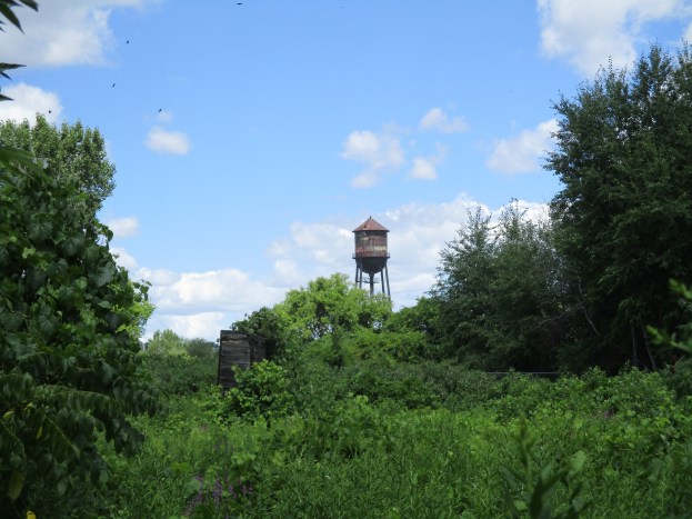
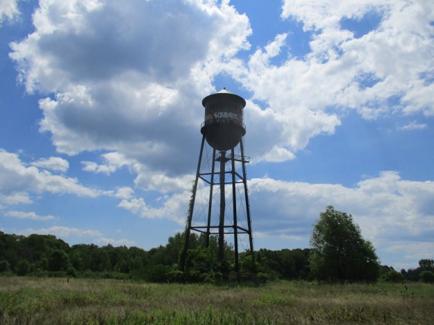
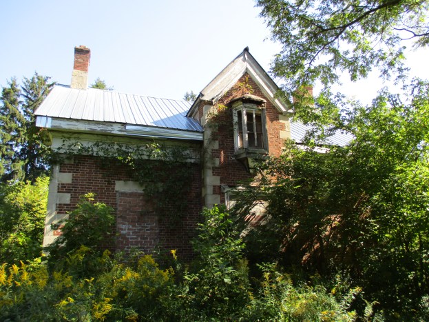
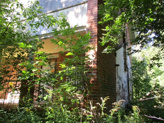
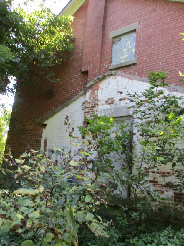
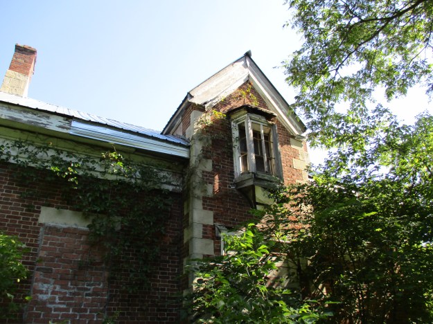
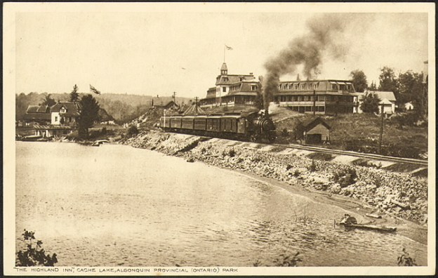
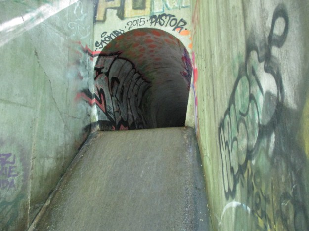
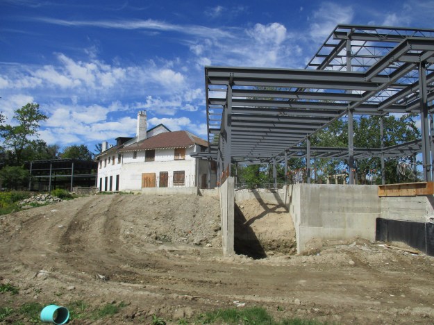
Hiking the GTA has made several visits to the bluffs starting with Guidwood Park in April 2015.  At that time the historic inn sat closed and in need of repairs.  The Guild Inn is currently undergoing restoration along with the addition of a multi-purpose event hall.  It was time to go and see how that was coming along as well as explore the construction roadway that leads down to the bottom of the Scarborough Bluffs.  The $20 million dollar restoration will include a 40,000 square foot addition to the original inn.  The Guild was the only Depression Era artist colony in Canada.  Over the years the Guild had been expanded with several additions, including a hotel tower.  After the inn closed in 2001 the tower was removed.  The current restoration strips the inn back to it’s original building and adds new structures to both ends.

IMG_3131

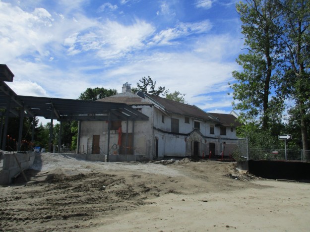
The restoration is scheduled for completion in December 2016.  The city is paying for the removal of mold and asbestos while the developer will pay to renovate the inn to it’s 1932 appearance.  A banquet hall is being built on the one end while an outdoor pavilion is going on the other end.  The developer has signed a 40 year agreement with the city.

IMG_3134

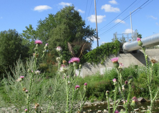
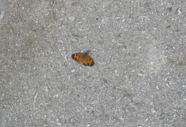
Parking is currently restricted to a lot on the east side of the old construction roadway.  The road was littered with old leaves and this Northern Crescent butterfly was quite well disguised among them.  I only caught sight of it when it moved.  It feeds on many species of the aster family of which we have many in Ontario.  The Northern Crescent has only recently been recognized as a separate species from the Pearl Crescent.  The latter of which has black lines in the large orange patches on the hind wings.

Northern Crescent

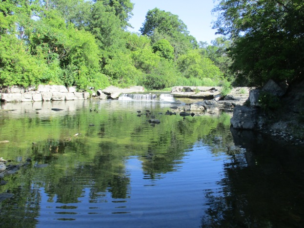
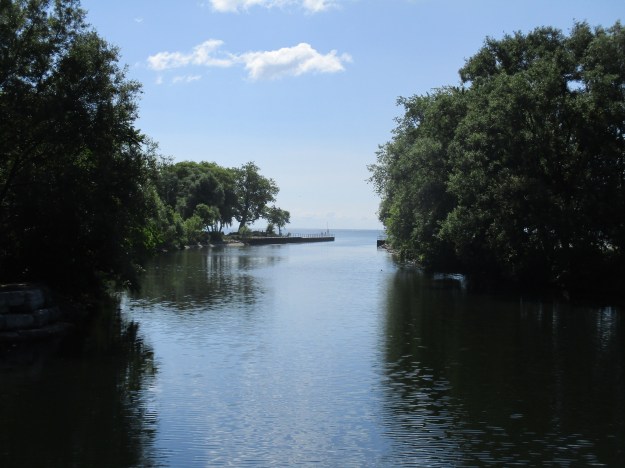
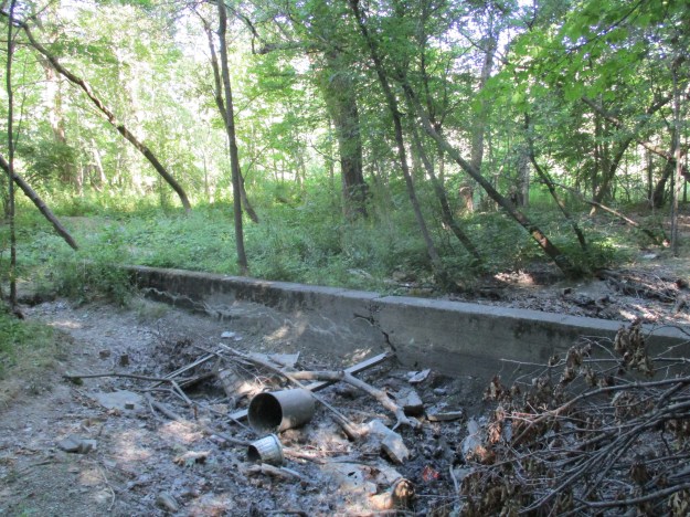
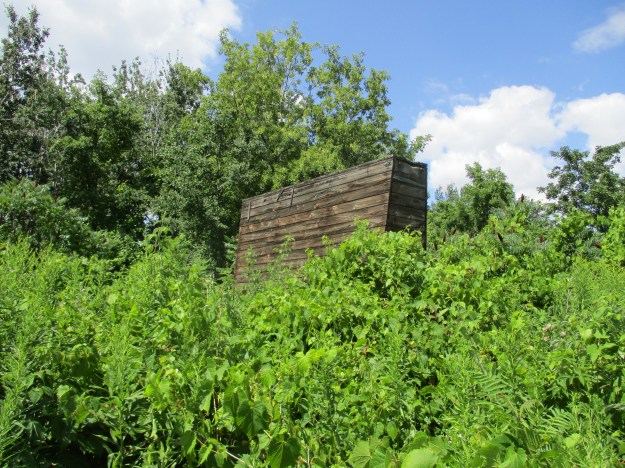
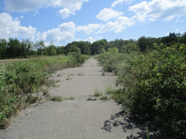
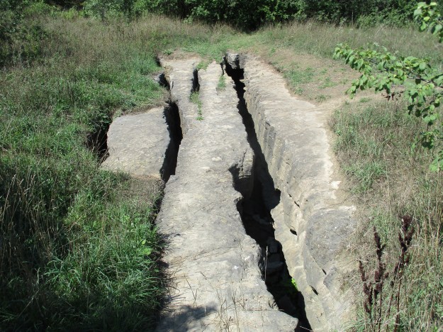
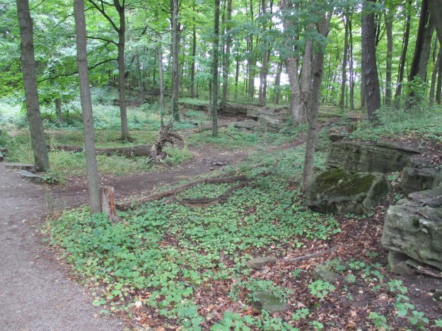
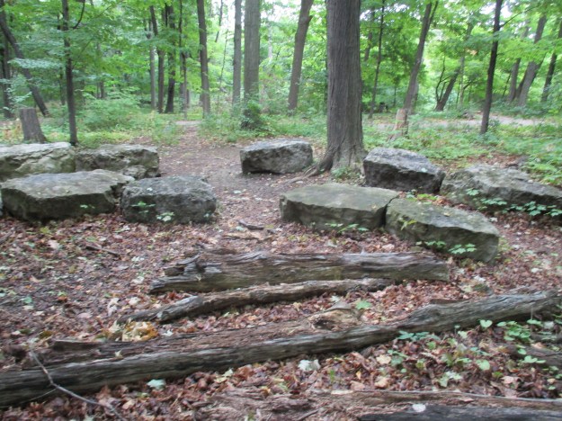
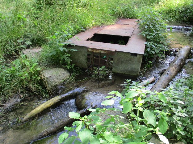
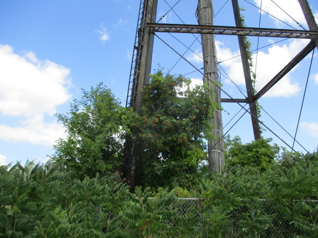
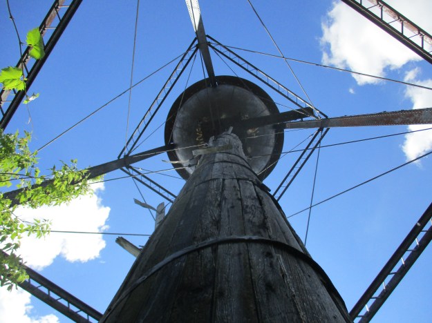
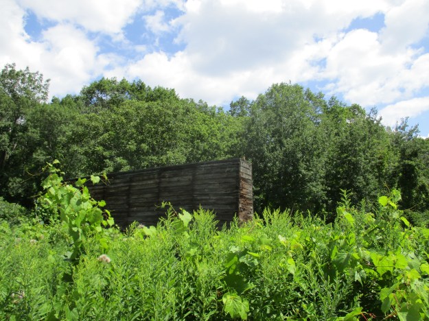
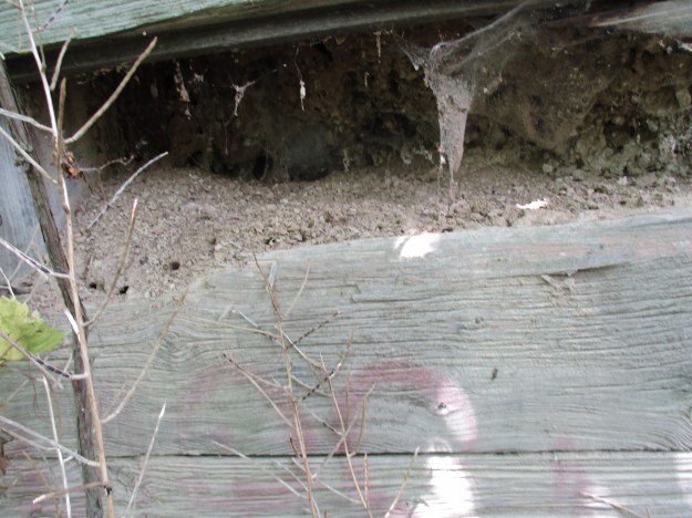
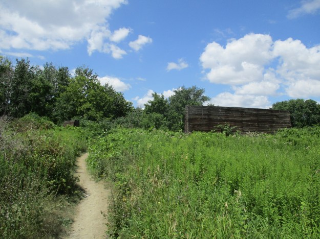
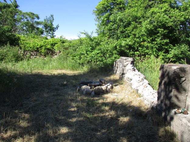
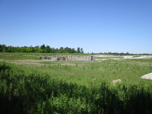
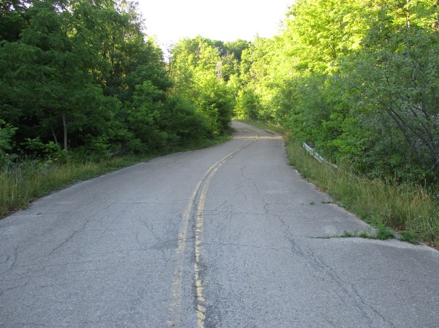
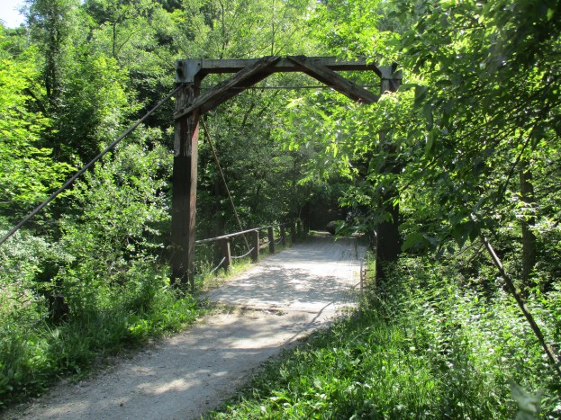
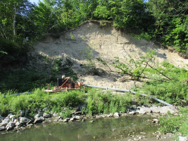
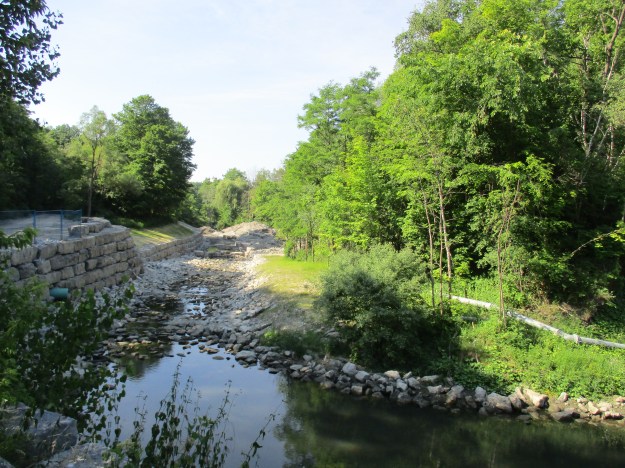
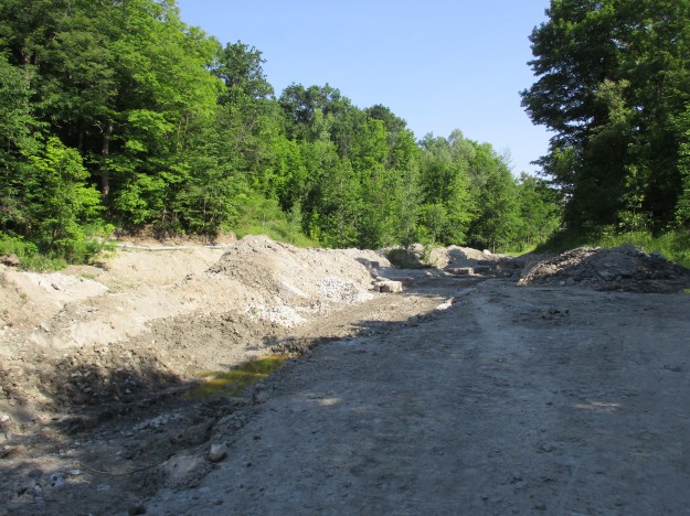
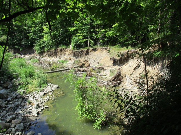
There are only a couple of places where a vehicle can get to the bottom of the bluffs.  Bluffer’s Park is one of them and it sits near the western end of the bluffs.  This roadway is not open to public vehicles and is currently in use for heavy construction equipment.  One of the ways in which the city is trying to slow down the erosion of the bluffs is to create hard shorelines and South Marine Drive was created for that purpose.  Old construction material, demolished buildings and slabs of pavement are known as rip rap when dumped along the shoreline as seen below.  There is a project currently in process on the shoreline in front of The Guild.

IMG_3074

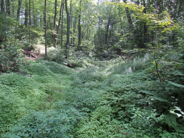
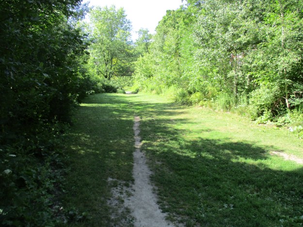
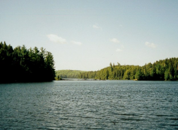
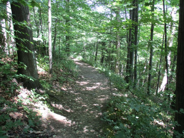
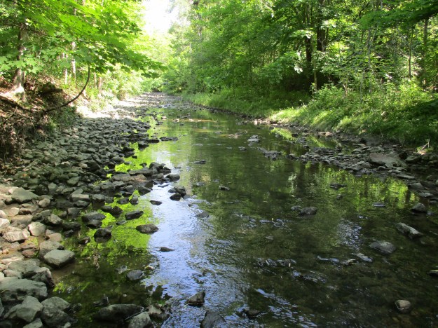
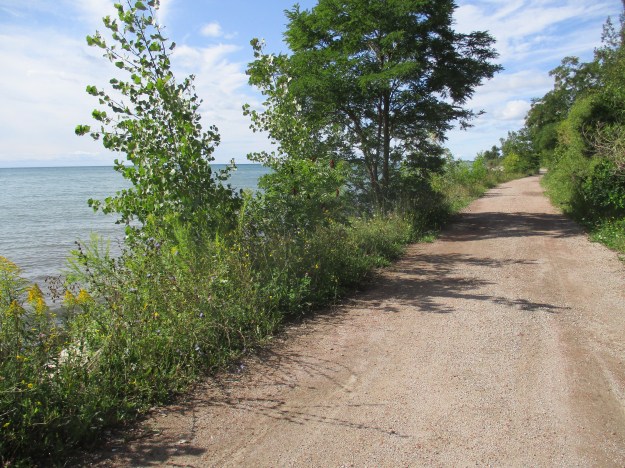
This roadway has been turned into a linear park known as South Marine Drive Park.  It runs for several kilometers along the south edge of the bluffs and was largely abandoned this morning except for a couple of hikers and a few cyclists.  With the views of the bluffs, and the breeze off the lake, I was surprised to see so few people.  Access is very limited though as you must come in from one end or the other.

IMG_3083

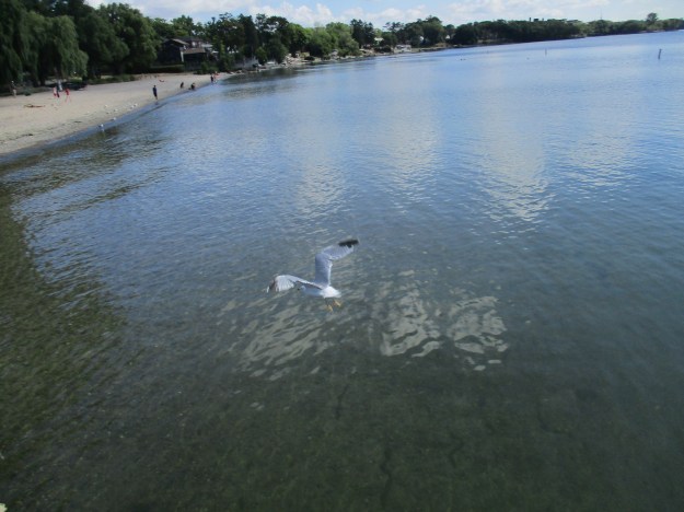
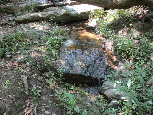
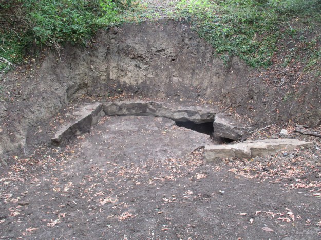
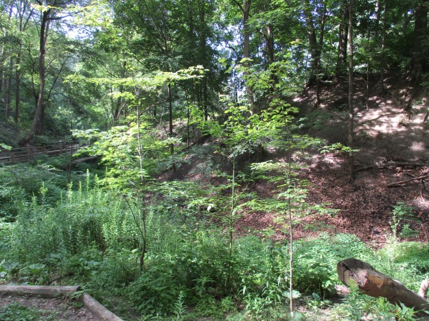
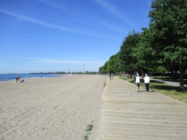
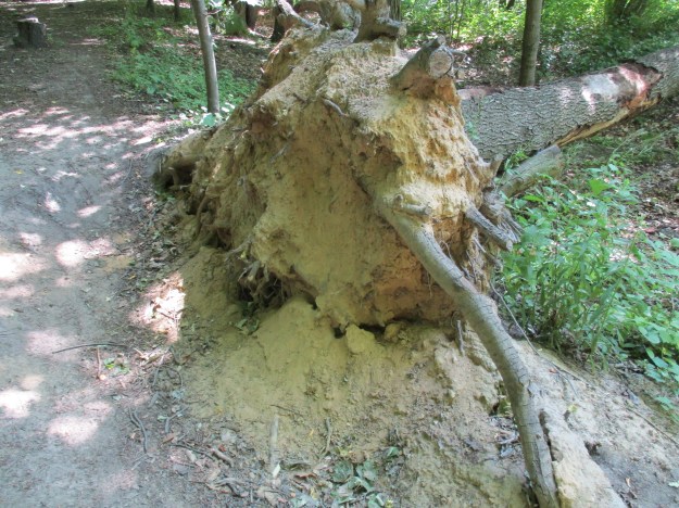
The sand in the bluffs was laid down in a river delta prior to the last ice age.  The melting ice sheet created a larger lake where Lake Ontario is today and this was known as Lake Iroquois.  It cut through the old river delta and exposed the bluffs.  This lake suddenly drained into a smaller lake known as Lake Admiralty which has since become Lake Ontario.  The exposed sand face has been eroding quickly ever since and in spite of all our efforts, continues to do so.  The roots of the trees and grasses hold the top layer together but when the sand below disappears it is only a matter of time before the tree crashes down the hill side.  The sand will make its way into the lake and eventually come to rest on one of Toronto’s many beaches, all of which are west of the bluffs.  The lake has a slow rotation that means that water takes six years to make its way around the lake and out into the St. Lawrence River.

IMG_3091

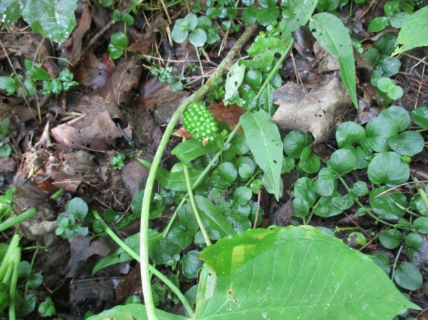
Jack-in-the-Pulpit can live up to 100 years.  The corm, similar to an onion,  grows underground and it will produce one flower if it is male or two if it is female.  The plant has the ability to change sex over it’s lifetime with only the female plant producing berries.  These berries will turn bright red and provide food for wild turkeys and wood thrushes.  The berries are listed as toxic to humans most likely because of the raphides of calcium oxalate that are present in the plant.  The sap of the plant makes an instant pain reliever when applied to a wound.  The natives used the plant in this way as well as making a red dye from the berries.  The picture below shows the unripe green berries in their cluster.

IMG_3129

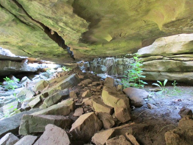
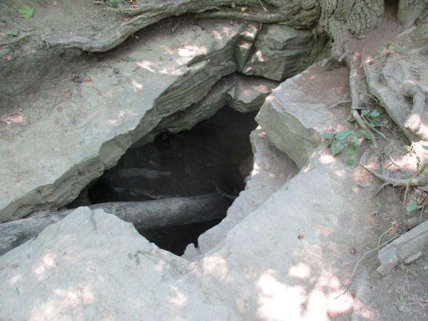
The trees along this section of the bluffs are hanging over the edge as they start their journey to the bottom.

IMG_3094

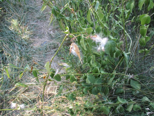
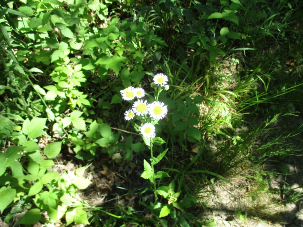
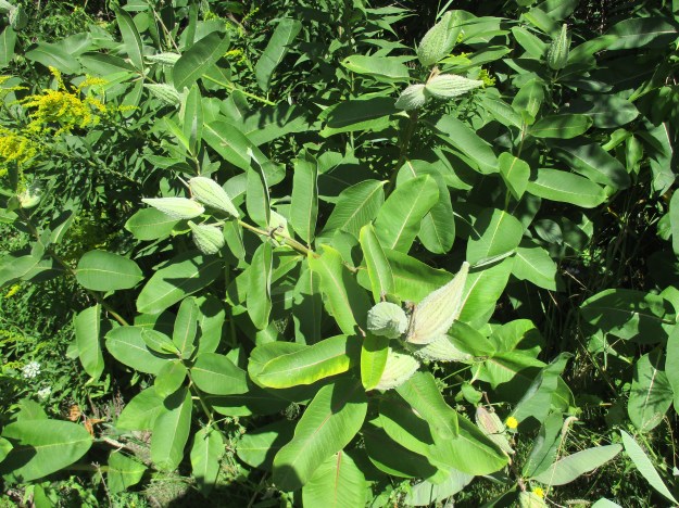
Milkweed provides the only home for monarch butterfly larvae and the park has quite a large number of the plants growing along the side of the roadway.  The seed pods are getting ripe.  They will soon pop open sending the little white seeds floating on the wind.

IMG_3121

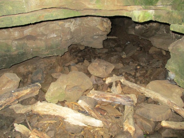
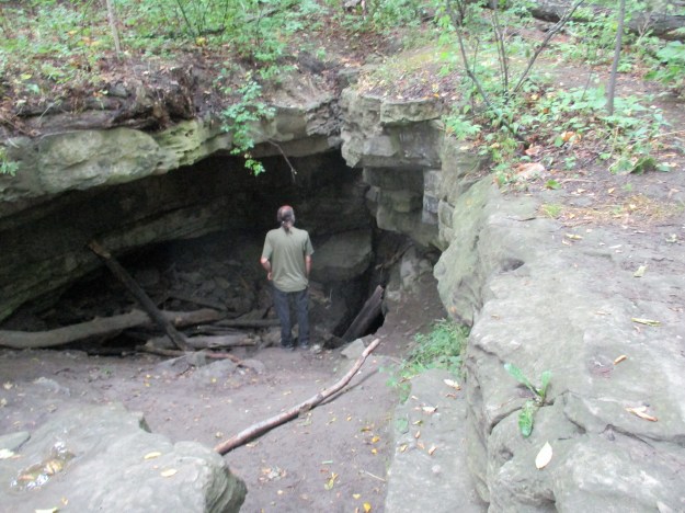
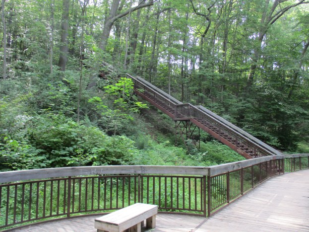
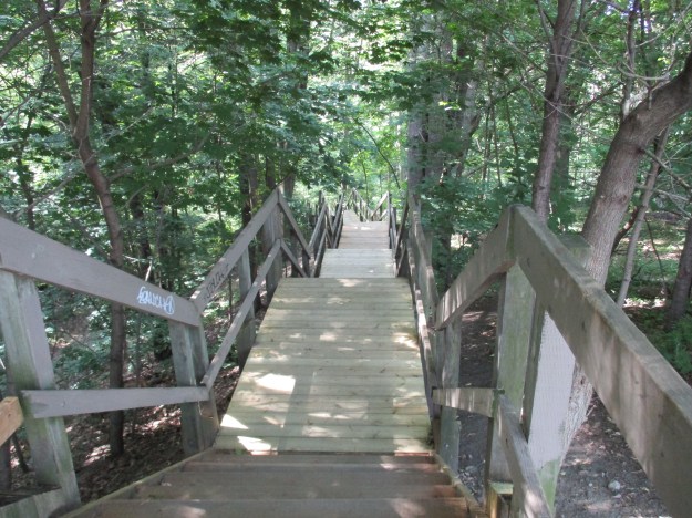
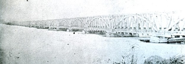
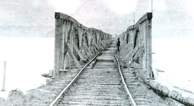
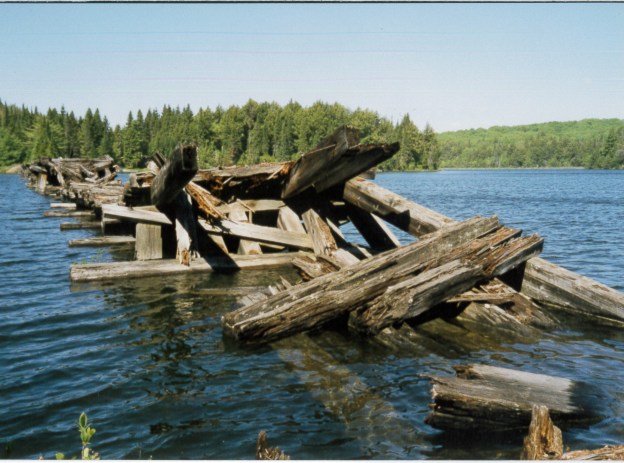
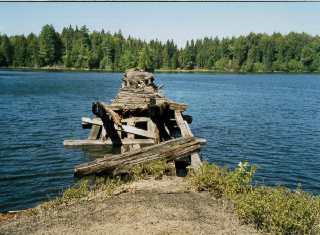
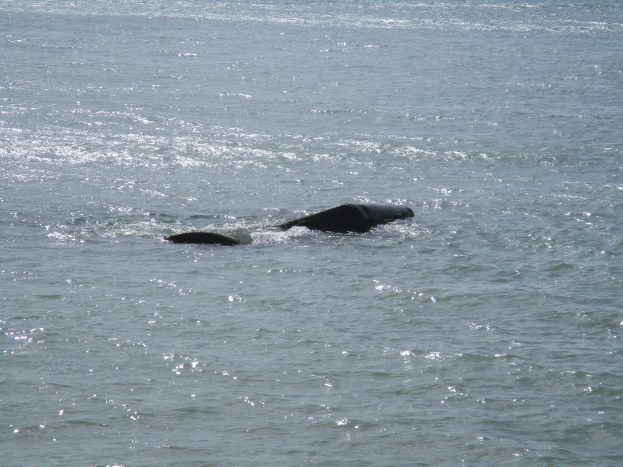
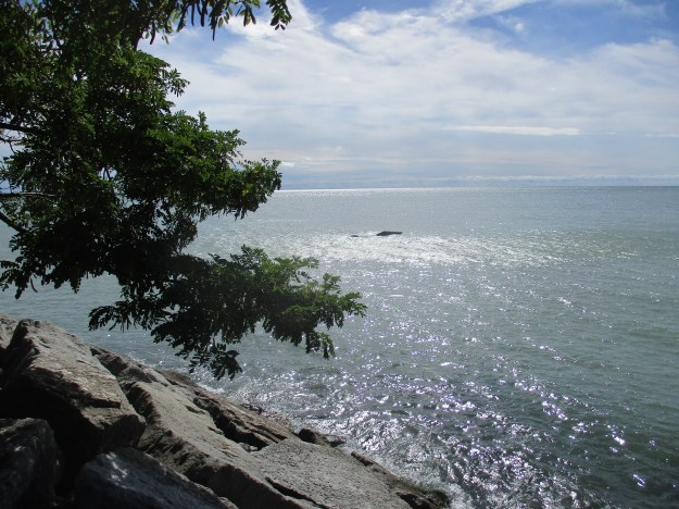
Following the trail will bring you to Gates Gully where the Doris McCarthy Trail leads back up to the Kingston Road.  Just before you reach the gully one section of a sunken ship can be seen sticking out of the lake.  On August 3, 1915 the steamship Alexandria was wrecked near the entrance to the gully. The Alexandria was built in 1866 and served both as a passenger ship and a cargo ship.  On this night it was bringing 300 tons of beans and tomatoes when it was blown too close to the shore and was grounded.  The ship broke into sections and was completely destroyed.  The locals made short work of stripping everything of value above the water line.  They say that many cellars were well stocked with sugar, vinegar and canned goods for the coming winter.  In maritime tradition Captain William Bloomfield was the last man off the ship at about 2:00 am the following morning.  All passengers were brought to safety and led up the bluffs through Gates Gully. The steamer remains in the lake 100 years later, just to the east of the gully.  The picture below shows the wrecked ship as seen from the shore.  The cover photo shows the ship in close up.  There is a place rusted through the rectangular part of the hull right at the waterline.  A rounded piece of hull on the left of this is briefly exposed with each rolling wave.

IMG_3113

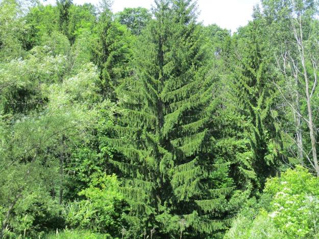
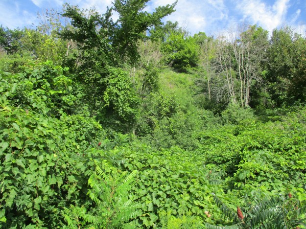
There are plenty of places where the slopes of the bluffs are covered with shrubs and trees.  This helps to stabilize the slopes and you will notice on the return trip that this section has some well vegetated areas.

IMG_3073

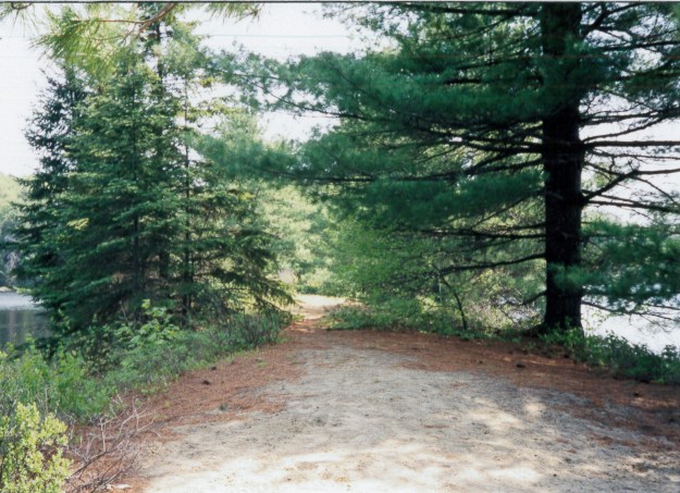
Having reached this point it is about a 45 minute walk back to the parking lot at the Guild.

Other posts in our Scarborough Bluffs Series:  Guildwood Park, Sand Castles (Bluffer’s Park), Erosion(Cathedral Bluffs), Gates Gully, East Point Park

Google Maps link: South Marine Drive Park

Like us at http://www.facebook.com/hikingthegta

Follow us at http://www.hikingthegta.com

Marie Curtis Park

Aug. 6, 2016

The Etobicoke Creek runs through Marie Curtis Park which means that half of the park is in Toronto and half in Mississauga.  The park has had many uses over the years including being the site of two streets of homes, 42nd and 43rd streets.  These were some of the homes that were destroyed during Hurricane Hazel.

In 1787 the British Crown purchased the area along the north shore of Lake Ontario from The Mississaugas of the Credit.  The natives had been using the creek as a transportation route for centuries and there is some speculation that there may be artifacts 10 to 20 meters out in the lake.  Lake Ontario has been slowly increasing in size for the past 12,000 years.  At that time it was known as Laurentian Lake and was responsible for carving the Scarborough Bluffs out of it’s shoreline.  When the lake suddenly drained through the Hudson River it shank back to a much smaller size that we named Lake Admiralty.  Earlier native settlements would have been located at the mouth of the creek as it existed at the time on the shore of the smaller lake.  The mouth of the creek has been modified over the years and today it is protected from erosion by a concrete channel.  The picture below is taken from the pedestrian bridge looking out to where the mouth of the creek meets the lake.

IMG_2945

The British set about surveying the lands for settlement and counties were established.  Etobicoke Creek was used as a boundary between York and Peel.  Today the city of Toronto is on the east side of the creek while Mississauga is on the west.  Colonel Samuel Smith fought for the British during the American Revolution but was part of 7,000 soldiers captured following the Battle of Yorktown in 1881. After the war Smith moved to New Brunswick but eventually took a land grant at the mouth of the Etobicoke Creek.  He purchased other lands and put together a 1,000 acre estate.  Smith would later serve as the Administrator of Upper Canada.  I parked on the little stub of 43rd street beside Maurice J. Breen Park.  The trail heads north under the train tracks and into Enfield Park where the remains of the Long Branch Dam are on the Etobicoke Creek.  The concrete structure can be seen with a small waterfall in the cover picture.  Prior to Hurricane Hazel there was a road that crossed the creek on top of this waterfall.  The wall of the dam extends to the edge of the ravine and has, unfortunately, collected a lot of garbage as can be seen in the picture below.

IMG_2867

Colonel Smith’s son sold the property in 1871 to James Eastwood who sold a portion of it in 1883 to be developed as an amusement park.  Over the next few years lots were subdivided for cottages and the Long Branch Hotel was built.  In the 1920’s the Etobicoke Flats, the area at the mouth of the creek, was developed for homes and cottages.  The trail extends south of Lakeshore Road to Marie Curtis Park where a foot bridge allows the Waterfront Trail to pass over the Etobicoke Creek.  The Waterfront Trail extends for over 1600 kilometers along the Canadian shores of Lakes Ontario, Erie and St. Clair using the Niagara, Detroit and St. Lawrence Rivers to connect and extend everything.

IMG_2921

The western portion of the property was sold in 1891 and became the Long Branch Rifle Ranges.  In 1910 a series of wooden baffles was installed on the rifle range, many of which remain on the site today.

IMG_2979

The military built Small Arms Limited in the 1940’s and manufactured rifles and machine guns here.  The water tower and one building is all that remains of this industry.  The Arsenal Lands was explored in a previous post as well as a separate pictorial.

IMG_2953

The property of the former Small Arms facility is now over grown but has a lot of old roadways running through it.

IMG_2956

On October 16, 1954 Hurricane Hazel hit Toronto flooding every waterway and killing 81 people.  Long Branch was especially hard hit as the Etobicoke Creek flooded three streets around it’s mouth.  Houses were swept away by the rushing waters, several of them into the lake and seven people were killed here.  Many other houses were carried off their foundations and crashed into trees.  One such house was held back by two trees and 35 people survived by climbing onto the roof.  Marie Curtis was the Reeve for Long Branch (1953-1962) at the time and she is recorded as saying the trees were responsible for saving many lives.  The sanitary sewer which had been buried three feet under the creek now stood a foot above it and it was broken.  Homes in the area were condemned to prevent an epidemic.  The government expropriated 192 properties and cleared 300 buildings at a cost of $1.6 million dollars.  Marie Curtis campaigned to have the lands converted into a 35 acre park which was eventually named after her.  Just south of the bridge this black swallowtail butterfly was darting from flower to flower on a patch of Canada thistles.

IMG_2888

Prior to Hurricane Hazel there was a sandbar in the lake at Long Branch and the houses extended to the shoreline of the lake.  At that time the Etobicoke Creek took a sharp 90 degree turn before entering the lake.  The beach that exists on the east side of Marie Curtis Park today was created from the sandbar by back filling.

IMG_2931

Dog Strangling Vine is a relative to milkweed and has a similar pod of seeds.  The plant is an invasive species that chokes out native vegetation.  The seed pods can produce up to 28,000 seeds per square meter.  The seeds are easily spread by wind and animals.  They also cling to clothing and hikers should be careful to remove any from their clothes and the treads of their boots if they pass through a patch of the plant when it is in seed.  The picture below shows seed pods that have broken open.  The plant is hard to eradicate because aside from the seeds it also grows from broken pieces of the roots.

IMG_3009

Marie Curtis Park has a lot of history and some interesting places for a small parcel of land and was well worth the exploration.

Google Maps link: Marie Curtis Park

Like us at http://www.facebook.com/hikingthegta

Follow us at http://www.hikingthegta.com

Eramosa Karst

August 20, 2016

In 1998 the Hamilton Conservation Authority (HCA) was called to a construction site to examine a hole in the ground.  They discovered a geological feature known as a karst cave.  The Toronto Caving Group was called in to examine the cave and they identified a whole series of sinklholes, dry valleys, underground streams and springs.

Ben Vanderberg founded the HCA in 1966 shortly after joining the Spencer  Creek Conservation Authority.  Ben recognized the significance of the area and started working toward acquiring the property for preservation.  Vanderberg retired from the HCA in 2002 and MPP Brad Clark gave him a gift he really wanted at his retirement party.  He announced that the Ontario Government would transfer ownership for 180.5 acres of Eromasa Karst lands to the HCA. The karst was designated as an Area of Natural and Scientific Interest (ANSI).  The map below shows the trail system that has been put in place to allow the general public to locate the various karst features in the park.

karst

Animals create carbon dioxide when they exhale and machines emit it into the air.  When rainwater picks up this carbon dioxide it becomes a weak form of carbonic acid.  Decaying plant matter also puts into the soil where it can attach to the water molecule.  This carbonic acid can slowly dissolve the carbon based bedrock of the escarpment creating features known as karren.  These little pockets and grooves make places for the carbonic acid to sit and eat away over time.  This creates sinkholes, underground streams, caves and springs.

The Nexus Cave is 335 meters long, making it the 10th longest cave in Ontario.  It begins where the Nexus Creek drops through a sinkhole into the underground cave.  The picture below shows Phoenix Creek dropping into it’s sinkhole.  Nexus Creek goes underground in a similar fashion.

IMG_3051

The entrance to Nexus Cave is seen in the picture below.  The harder dolomite on the surface has been cut through in several long cracks.  This is the capstone for the Niagara Escarpment and is known as the Lockport Formation.  This dolostone is made of magnesium carbonate and is harder than the calcium carbonate shale just below it.  This shale is known as Rochester Shale.

IMG_3061

The entrance to the cave is not very tall but it is possible to see the gap that has been created between these two layers of stone.  The cover photo shows the entrance to this cave looking out from the inside.  This cave is considered to be the most accessible dolostone cave in Ontario.

IMG_3063

Walking farther along the orange trail will bring you to the Nexus Window.  A karst window is a place where the roof of a cave has collapsed allowing access into the cave.  Quite often it is possible to look in through a karst window and see the underground stream flowing across the floor of the cave.  This summer has been too dry and there is no water flowing through the cave today.

IMG_3068

When it is dry it is possible to get a look down inside where the water has cut a passage through the limestone.

IMG_3070

Stewart Creek has a sinkhole as well.  Scientists injected biodegradable dyes into the streams above the various sinkholes in the park so that they could monitor down stream to see which spring was the output of each underground stream.

IMG_3058

The Pottruff Blind Valley is an example of place where a creek no longer flows above ground. This ravine was cut through the escarpment by water at the end of the last ice age.  Since then the carbonic acid in the water has dissolved a hole where the water disappears into an underground channel.  The ravine still bears the original sink hole but the water now goes below ground farther upstream at the Phoenix  Creek and Stewart Creek sinkholes.  Water only reaches here when the flow is too great for the previous sink holes to handle.

IMG_2845

Pottruff Cave very likely started off like the Nexus Cave entrance.  A series of deep fissures in the dolostone over a sink hole eventually collapsed leaving the cave mouth open.  The entrance to Nexus Cave, like all the karst features, is still growing as the stone continues to dissolve.  Nexus too will eventually collapse leaving it looking more like Pottruff Cave.  The state of decay for each of the karst features gives scientists a way of estimating their relative ages.

IMG_2833

Pottruff Springs marks the location where the creek re-emerges from underground.  The creek flows underground until it reaches the base of the Eramosa Escarpment which is a 3 meter slab of dolostone that sits on top of the Lockport Formation of the Niagara Escarpment.  The pool of water forms here and continues as a stream on its way toward Lake Ontario.

IMG_2839

Limestone is a prime construction material and the Niagara Escarpment provides good quality stone near the surface.  When this part of the province was surveyed for settlement in the late 1790’s the land grants were generally 200 acres.  These lots varied greatly in the nature of the land and not all of it was ideal for raising crops or livestock.  The pioneers learned to take advantage of the resources their property offered and so limestone was quarried here.  The original Pottruff homestead was built out of limestone blocks cut from this location.

IMG_2837

Near the old quarry is a grouping of limestone slabs that are laid out like the seats in an amphitheatre.

IMG_2849

Near the old foundations for the Pottruff home there are the remains of a paved driveway.

IMG_2811

Some of the rose hips in the conservation area are still quite green but this bush is getting it’s prime conditions and is turning red already.  Rose hips are the fruit of the rose plant that forms after successful pollination of the rose flowers.  They have been used in many ways over the centuries and have one of the highest concentrations of vitamin C available.  Fresh rose hips are a great source of vitamin C as they carry 25 times as much as citrus fruit.  Dried rose hips can lose a great deal of their nutritional value.

IMG_3042

The trails at the Eramosa Karst are a little confusing and it is easy to get turned around because the orange trail has orange side trails on it.  I suggest that before you leave the parking area you take a picture of the main map on your cell phone so you have a reference while on the trails.

Google Maps link: Eramosa Karst

Like us at http://www.facebook.com/hikingthegta

Follow us at http://www.hikingthegta.com

Glen Stewart Ravine

July 17, 2016

The Glen Stewart Ravine is home to a Red Oak and Red Maple forest mixed with Witch Hazel which is a rare forest type in Toronto.  In 2008 it was determined that the forest was suffering due to loss of the understory.  The ravine slopes had been cut through with secondary trails that compacted the soil and exposed the tree roots.  These trails have been closed off and in some places they have been planted over.  Other areas are being left to regenerate naturally.  The park has undergone a major restoration and planting program in an effort to create a forest that will be healthy and self sustaining for generations to come.

The Glen Stewart Ravine is a great place if you are one of those people who like to exercise by running up the stairs in the park.  The steel stairs in the cover photo rise 114 steps from the ravine floor to Balsaam Avenue.  These stairs replaced a set of wooden stairs similar to the set featured below that currently descends the ravine from Kingston Road.  More stairs climb the ravine to an entrance on Beech Street.  The Balsaam Avenue stairs and the wooden boardwalk below them had deteriorated to the point of becoming unsafe and both were replaced.

IMG_2680

The picture below shows some of the trees that have been planted to replace invasive species that were removed as part of the restoration process.  Spring of 2016 saw the planting of over 800 trees and shrubs, including one lone white pine, as well as 2,500 grasses and herbs.  The three red oak trees planted here go along with 20 other small red oak trees and 3 mature ones to help restore this rare red oak forest.

IMG_2689

Chicken of the Woods is considered to be one of the “foolproof four” mushrooms.  This easily identifiable mushroom is recommended for those who are nervous about collecting their own mushrooms for fear of poisoning themselves.  The underside of the fungus does not have gills but rather is covered with fine pores.  This mushroom grows on decaying trees and will rot the inside of a living tree if it gets started on one.  They can be harvested year after year or twice in a season, if you only take the outer few centimeters.  The younger fungi are brighter in colour and the older ones develop a bitter taste.  The plant gets its name from the fact that it can be substituted for chicken in recipes.

IMG_2694

The eastern slope of the ravine has a lush undergrowth in this little dell along the side of the Balsaam  Avenue stairs.  The ravine supports a diverse population of migratory birds with more anticipated when the restored forest is mature a few decades from now.

IMG_2691

South of these stairs is a section where the former erosion control has been removed.  The wood cribs that had been installed were rotting and in danger of collapse.  They were replaced with a new environmentally sensitive product called Enviroloc.  These fabric sand bags are designed to allow vegetation to grow on top providing a more natural stabilization of the slopes.  The picture below shows some of the restored slopes.

IMG_2692

Ames Creek flows through the ravine.  It’s waters come from ground seepage in the sandy soils of the slopes.  This seepage is one of the reasons for the boardwalk along the floor of the ravine.  During heavy rain events the trail was turned into a muddy mess.  The new boardwalk provides an accessible trail as far as the rest stop that can be seen near the Balsaam stairs in the cover photo.  The picture below was taken from the boardwalk and shows the creek where it flows through a wetland.

IMG_2709

The new stairs to Balsaam Avenue were built with helical piers.  This construction method screws the piers into the soil until they meet a specified amount of resistance.  This allows the piers to support the load of the stairs without having to do major excavation on the slopes.  The railings on the stairs and the boardwalk are made of hemlock which was chosen because it is naturally disease resistant.  The picture below shows the new boardwalk looking north.  The new stairs can be seen in the distance.

IMG_2734

The creek and ravine are almost void of signs of their past usage except for this old covered discharge system.

IMG_2713

Ames Creek is forced underground into a storm water pipe just before it reaches Glen Manor Drive East.  Years ago developers filled the ravine in and buried the creek.  Glen Manor Drive East and West frame a narrow strip of park which has the former creek running below it.

IMG_2717

On June 10, 1925 about 70 percent of the Presbyterian churches in Canada joined with the Methodists and Congregational churches to form the United Church of Canada.  The idea was to form a Canadian Church which would be inclusive of all nationalities. The few Presbyterian churches in Southern Ontario that refused to join were cut off from the resources of the main group.  Many congregations lost everything and had to start over with new buildings and new missions.  The corner stone for the Beaches Presbyterian Church was laid on July 17, 1926, just one year after the split in the church.   The Beaches Church is on the east side of Glen Manor Drive, roughly where the filled in portion of Glen Stewart Ravine has been built over.

IMG_2721

Glen Manor Drive brings you to the part of Toronto known as The Beaches.  The sand here has been carried by the motion of the lake from where it has been picked up east of here.  Erosion of the Scarborough Bluffs is dropping houses into the lake near Gates Gully.   The boardwalk runs for 3 kilometers along the sandy shore line from Balmy Beach to Ashbridges Bay.  The tall smoke stack in the back ground is at The Hearn, an abandoned power plant in The Port Lands.  It stands on the former marsh of Ashbridges Bay at the mouth of the Don River.

IMG_2722

Wild Blackberries are less common than wild raspberries but they are growing in the Glen Stewart Ravine.  The blackberry is not actually a berry in the botanical sense in that it is an aggregate fruit made up of many little drupelets.  Blackberries and Raspberries are related but one difference can be seen when picking the fruit.  The torus, or stem, of the fruit remains on the plant with a raspberry leaving a hollow core on the fruit.  The blackberry torus remains in the fruit.

IMG_2748

Google Maps Link: Glen Stewart Ravine

Like us at http://www.facebook.com/hikingthegta

Follow us at http://www.hikingthegta.com

Small Arms Testing Site – Mississauga

Saturday Aug. 6, 2016

The Waterfront Trail on the lake shore in Mississauga runs through The Arsenal Lands.  Many of the users who pass between the 106 year old military testing range and the remnants of a small arms manufacturing site have no idea what the structures they see really are.  There is parking at Marie Curtis Park with access to the Waterfront Trail.  The water tower in the cover photo was near the heart of the factory complex while the wooden baffle in the foreground was on the testing range.

The picture below looks from Marie Curtis Park looking east to the water tower.  It was built in 1941 to provide water for the arms factories.  Notice the platform just below the tank that runs from the ladder on the leg to the standpipe in the middle.  Ascending, where the ladder passes the walkway around the outside of the tank you have to lean out, climb up and over.  This will happen again if you were to climb onto the roof.  Graffiti at the top shows that some one has been up there.

IMG_2961

In 1868 the Ontario Rifle Association was formed for the training of militia to help defend our newly founded country.  They used the garrison common at Fort York until 1891 but the increase in the use of the CNE grounds and the addition of a passenger wharf at the foot of Dufferin Street made firing rifles at the fort increasingly unsafe.  A property on the west side of Etobicoke Creek was purchased and used as the Long Branch Rifle Ranges.  Much of the wooden crib around the central water pipes on the water tower has started to fall off since the bands have broken away.  The ladder that was used to access the very top of the tower can be seen rising up the leg on the left

IMG_2964

After serving as Canada’s first Aerodrome it was purchased by the Department of National Defence in 1935 and a small arms factory was opened in 1940.   World War Two ended in 1945 and war-time production was completed in December with over 900,000 rifles and 126,000 machine guns having been produced.  Various military parts were produced in the facility from then until it closed for good in 1974.

IMG_2955

In 1910 Canada’s Department of Militia and Defense (renamed the Department of National Defense in 1922) acquired the property and built the wooden baffles that remain in place today.  On the short rifle range there are 16 remaining baffles after 105 years exposed to the elements. Originally there were 30 of these which were hollow and filled with sand and soil.  They were intended to stop any stray bullets from leaving the range but also served to provide sound barriers for the adjacent small arms factory.  They are the oldest surviving military baffles of their kind in Ontario.

IMG_2977

The inside of one of the baffles showing the sand that filled them.

IMG_2984

At the back end of the rifle range is a fifteen foot high and thirty-five foot wide concrete backstop which was constructed around 1925.  It’s surface is dotted with the impacts of hundreds of bullets from over the years.

IMG_2985

The end view of the backstop showing how thick the concrete is.  The three electrical insulators at the top give an idea of the scale.

IMG_3005

The trail winds back out of the testing range between the historical baffles.

IMG_2975

I believe that this is one site where the city should consider putting up a few interpretive plaques to let the many trail users appreciate the history they’re passing through.  A more detailed story can be found in a previous post called The Arsenal Lands that was photographed in the winter of 2015.

Google Maps link: Marie Curtis Park

Like us at http://www.facebook.com/hikingthegta

Follow us at http://www.hikingthegta.com

Canada Goose Side Trail

July 2, 2016

The Canada Goose Side Trail is on the former homestead of one of Esquesing Township’s earliest settlers and any geese seen along the trail will be on their way to the lake that has been created by the quarry that now operates at the rear of the property.

There is Bruce Trail parking on Regional Road 43 (22 side road) but I parked on the 4th line just north of the corner where a little side trail leads to the official parking lot.  The Canada Goose side trail begins on a curve in the road, right on a blind curve.  There are no shoulders on the road so this is an important place to take care when emerging from the trees.  The trail roughly parallels the fourth line along a ridge of escarpment.  It runs for about 3 kilometers before it reaches the main Bruce Trail (White on the map).  The map below is taken from the 1877 county atlas and I’ve traced the rough outline of the hike, which includes other trails as detailed below.

Canada Goose side trail

The trail leads into the woods through a patch of tiger lilies.  Tiger lilies get their name from the spots on their bright orange petals.  They are also known as ditch lilies because they commonly grow in ditches.  This lily is toxic to house cats and can produce vomiting and even death.  In humans a tincture made from the plant is used to control vomiting during pregnancy.  Baked tiger lily buds taste a lot like baked potato.

IMG_2514

John Nickell Jr. was born in 1821 on Lot 22, Concession 4 in Esquesing Township.  John Nickell Sr. had come from Ireland in 1819 and obtained the land grant that still bears his name on the county atlas above.  John Jr. lived on the farm and continued to work it until 1897, the year before he died.  The records show that John Jr. was born in the log cabin built by his father on the rear of the property and that he was the first European male born in the township.  The old silo from the barn still stands only a few meters away from where the quarry now extends.  The construction of a concrete silo must have occurred sometime near the end of the productive life of the farm.  This type of construction wasn’t common until after 1900.

IMG_2513

The stone foundations for the barn stand adjacent to the silo.  John Nickell Sr. would have built his first barn on the ground and only later it would have been raised onto a foundation or replaced with a new larger barn.  Prior to the mid 1800’s the normal barn construction was timber frame.  By the middle of the century stick framing replaced it using mass produced nails and boards.  It’s likely that the homestead had both types of barns at one time.  The county atlas shows an orchard beside the house and farm buildings.

IMG_2510

The homestead of John Nickell, like his neighbours to the north, sat on top of 30 meters of dolomitic limestone that was accessible near the surface.  This stone is critical to the construction industry and aggregates like those produced here find their way into most GTA roads and building projects.  The Dolly Varden – Acton Quarry is listed on the 1904 Ontario Geological Survey and some early lime kilns are still to be found on quarry property.  Dufferin Quarries owns and operates 222 hectares of land that is licenced for limestone extraction and are in the application process for an expansion.  They also operate the quarries near Milton where The Gap in the escarpment is seen from the 401.  The picture below shows the rock face where a fresh cut is being made.  Broken stone lies at the bottom of the rock face waiting to be transported to the main part of the quarry for processing.

IMG_2519

Here is a classic example of hiding in plain sight.  This bird has built it’s nest to match the size and shape of the broken tree pictured below.  There is a little wall to stop the wind from blowing in from the west.

IMG_2528

The Canada Goose Side Trail has some challenging footing.  It passes through several different types of forests.  You’ll be walking on hard path, rocks, through wetlands and over stumps and roots.

IMG_2533

Robin’s Plantain is a member of the aster family along with 23,600 other recognized species.  Robin’s plantain has had several other names over the years including hawkweed a name given it by the ancient Greeks who thought that hawks used the sap to improve their eyesight.  It has a common family name of fleabane.  The plant grows up to two feet tall on a single stock.  Four or more flower blossoms grow at the top of the stock. The plant was used by Native Americans steeped in a tea for it’s medicinal properties.  It was believed to be both a diuretic and analgesic.  It was used to stop bleeding, for coughs, diarrhea and urinary tract infections.

IMG_2536

The main Bruce Trail crosses the fourth line and continues east toward Limehouse on the fifth line.  The trail uses these stiles to cross over fences and over half of the Bruce Trail is on private land so there are many of these stiles along the trail.

IMG_2547

The fourth line makes it’s way back toward where I parked.

IMG_2548

There are lots of trails in the area of Limehouse.  Following the Bruce Trail into town instead of cutting off on the Benton Brown Side Trail will bring you to the Limehouse Conservation Area where the historic Lime Kilns are.

Google Maps link: Canada Goose Side Trail

Like us at www. facebook.com/hikingthegta

Follow us at http://www.hikingthegta.com

Nodwell House – Homestead Farm

August 4, 2016

William Nodwell came to Canada from Ireland in 1838 and settled on Lot 24, concession 8 in Erin Township.  Nazareth Hill hadn’t yet given his name to the town that grew around the farm.  At the time of the county atlas in 1877 the mill ponds hadn’t been created on the Gooderham and Worts property across the street.

Nodwell map

His first log home burned down within a year.  Nodwell then sold the east half of the lot to Angus McMurchy and constructed another log house and barns.  In 1868 the brick house shown in this pictorial was built.  The cover view shows the front of the now abandoned house with it’s second story oriel window.  This is the view of the side of the house as you approach from the driveway.

IMG_0103

William Nodwell died in 1845 leaving the farm to his two sons.  Robert bought out Thomas by trading him another farm for his half of the homestead.  A frame barn (now demolished) and shed were added in 1857.  This is the side entrance to the house and possibly the most frequently used of the three.

IMG_0105

In the 1890’s the Nodwells were known for raising short-horn cattle.  The family was active in St. Andrews Presbyterian Church which was located on the corner of their property.  The picture below shows the side porch of the house.

IMG_0107

In 1895 the house at the corner of the lane was added for use by family members.  In 1926 Mungo Nodwell took over running the farm which was well known for the  seed potatoes he grew.  They also kept a herd of dairy cattle and delivered milk in town with horse and wagon.  This view shows the back corner of the house and the side door which has been bricked closed.

IMG_0109

Ross R. Mackay public school is built on land donated by Mungo Nodwell in 1960 from the side of his dairy pasture.  For the next decade an electric fence would separate the cows from the school children.  The east side, or rear of the house, has had a back porch removed.  This room would have served as a place for the removal of dirty shoes and work clothes before entering the house.  Some would call this a mud room.

IMG_0111

In 2004 Mungo’s daughter Nina sold the farm and moved to Markdale.  Access to all windows has been closed off with bricks since then.  This shot shows the basement window.

IMG_0106

The great room in the house had a plank table that could seat 12 and the family was known for it’s hospitality.  This is the front view of the house facing toward the west and the main street of Hillsburgh.

IMG_0119

As I was admiring the oriel window a blue jay arrived to get to the nest that hides behind the front facing.

IMG_0117

On the east side of the laneway stands the driving shed.  The Nodwell’s kept many of their farming implements in there when the farm was active.

IMG_0096

A look up into the ceiling of the driving shed.

IMG_0100

All of the tools were removed from the driving shed except for this level.

IMG_0102

The back of the driving shed.

IMG_0097

Today there is a proposal to develop Homestead Farm into a subdivision.  Fortunately it looks like the old Nodwell house will be preserved.  More on the history of Hillsburgh can be found in this previous post.

Google Maps link: Hillsburgh

Like us at http://www.facebook.com/hikingthegta

Follow us at http://www.hikingthegta.com

Rice Lake’s Sunken Railway

July 26, 2016

On March 6, 1834 the Cobourg Rail Road Company was chartered to build a railway from Cobourg to Peterborough crossing Rice Lake.  This was one of the first two Railroad charters issued in Canada and it came just a few years after the first railroads were built in the UK.  In the summer of 1996 I set out to investigate the remains of the railway.
The concept had begun in 1831 when several businessmen from Cobourg contracted the Provincial Land Surveyor, F. P. Rubidge, to survey possible routes for a railway from Cobourg to Rice Lake.  The following year a map showing a proposed route following several valleys ran to the community of Sully (Harwood).  Money didn’t show up but the Rebellion of 1837 did and the plan got forgotten until 1846.  This is when Samuel Gore revived the idea as the Cobourg and Rice Lake Plank Road and Ferry Company.  Gore intended to bring lumber and other natural resources to the Cobourg harbour for shipping, thus creating a thriving port community.  His plank road didn’t survive past the first couple of winters but pictures of a similar plank road called The Gore and Vaughan Plank Road were published in a previous article.
In 1852 a new plan was chartered for the Cobourg and Peterborough Railway.  The official sod turning for construction was performed by the wife of the Cobourg mayor on Feb. 7, 1853.  During that first year farmers along the way contributed wood from the forests and labour from their horse teams. The old plank road bed was used but in 1854 a labour shortage was caused by the Crimean War and labour rates rose to $1.00 for a 12 hour day.  German labour was brought in and tragically, 14 of them perished that year to cholera.  When completed at the end of 1854 the trestle was nearly 5 kilometers long making it the longest railway bridge in North America at the time.  The archive photo below shows the trestle set on piles that had been driven into the lake bed.  Each truss was 24 meters long and it took 33 of them to make the crossing.  In the deepest part of the lake a 36 metre swing bridge was installed to allow navigation from one end of the lake to the other.
rice-lake-trestle-c-p-nac-pa127491
The view below from Google Earth shows Harwood and the railway causeway reaching out into the lake.  Starting in 1855 John Fowler took over as chief engineer and he began to fill in the cribs below the trusses in an effort to secure them from the winter’s damage.  The trestle from Harwood to Tic Island was filled in and this can still be seen from aerial photography.  The railway manager, D’Arcy Boulton continually defended the railway claiming that Samuel Zimmerman hadn’t properly completed the line when he turned it over and started work on a rival line out of Port Hope.  Boulton suggested that a half a million cubic yards of fill could be dumped into the remaining open cribs and that would solve the trestle problem permanently.  The cover photo shows the causeway as it stretches away from shore as it appeared in 1996.  It is one of four pictures from that trip that have been scanned and added to this article.
Harwood
The first train from Cobourg to Peterborough ran the 45.8 kilometer track for free on December 29, 1854 to show off the new railway. Celebrations were a little premature as ice damaged the trestle just three days later on January 1, 1855 and the line was shut down until it could be repaired in the spring.  The seventeen truss sections that ran south between the draw bridge and Tic Island were shoved hard enough that the span on the abutment on the island was displaced by four feet.  Ice damaged the bridge again in the winters of 1856-57, 1859-60 and fatally damaged it in 1860-61.  Parts of the trestle collapsed and some claim that a rival railway had removed some of the bolts from the truss sections.  The trestle was permanently closed and the railway from Hiawatha to Peterborough abandoned.  The archive photo below shows damage to the trestle following the shifting of the ice.  Notice how the rail is twisted near the person standing on the bridge.
rice-lake-trestle-c-p-nac-pa127486
 Finally I had reached the end of the causeway and found a couple of fishermen trying their luck.  The causeway stretches off toward Tic Island which is hidden by the cluster of trees that have found a home on the rocks.
Harwood 3
The line was sold in 1866 to the Marmora Iron Works for $100,000 but the citizens of Cobourg had invested ten times that much in the railway.  The company planned to bring iron from a mine on Crowe Lake to Trent Bridge at the northern end of Rice Lake by rail.  From there a barge would move the ore to Harwood for shipping on the old railway to Cobourg.  The venture went well until 1873 when the economy went bad and the iron market collapsed.  This led to the closure of the mine and by 1877 the company was again bankrupt.  Parts of the rail line were absorbed into the Grant Trunk Railway in 1893.  The picture below shows the rail end in Harwood at Rice Lake around 1865 with a barge tied up at dockside.
Harwood 1865
Hiking to the end of the causeway involves a lot of climbing over tree roots and around rocks.  The picture below shows the width of the causeway as it stretches from the shoreline.  The water level in Rice Lake was raised by about eight feet in the 1920’s when the Trent Severn Waterway was constructed.  The rail berm I was hiking on was originally built 4 feet above the high water mark.
Harwood 2
In 1996 it was possible to make your way a considerable distance from the shore along the old causeway.  This picture is taken from the end looking back to the shore.
Harwood 4
It’s now been 156 years since a train made the crossing but the remains of the Cobourg & Peterborough Railway still have their story to tell.
Google Maps link: Harwood

Cache Lake Trestle – Algonquin Park

Sunday July 17, 2016

John Rudolphus Booth was born on April 5, 1827 in the Eastern Townships of Lower Canada (Quebec).  He left the family farm at the age of 21 to take a job as a carpenter on the Vermont Central Railroad.  Booth moved to Ottawa in 1852 where he started a machine shop.  When it was lost in a fire he decided to try his hand at making shingles.  The business was a success and soon he could afford to lease, and later buy, a small saw mill at Chaudiere Falls in Ottawa.  J.R. was able to win the contract to supply the wood for the parliament buildings that were being constructed in Ottawa following Queen Victoria’s selection of the site in 1858. This gave the business a major boost and by 1892 his lumber mill operations were the largest of their kind in the world.

The pictures in this story were taken in May 1998 on a camping trip to Algonquin Park with my youngest brother.  The picture below shows the Cache Lake trestle in the distance.  The trestle is above the water line for the first half of the span on the east end but the section on the west (right hand side) is concealed.  We determined to visit both ends of the trestle by canoe.

Cache 2

In 1867 Booth purchased the lumber rights for 250 square miles of pine forest on the Madawaska River in what is now Algonquin Park.  Over the next few decades he increased his holdings to over 7,000 square miles of forest.  He increased his mill capacity by running 13 band saws and by 1891 he was consuming two million logs per year.  Some of his lumber holdings were so remote that it took two years for the logs to reach the mill.  Booth began to experiment with barges to move logs and then decided to employ railways to bring his resources to his mill in Ottawa.  The picture below is from the western abutment of the trestle as seen from the canoe.

Cache 7

In 1888 Booth chartered a series of railways which in 1893 were amalgamated into the Ottawa Arnprior & Parry Sound Railway (OA&PS).  Construction began in July 1892 with forty crews at work.  Two years later there were 1,100 men working on building the OA&PS.  By the end of 1895 the line extended for 168 miles west from Ottawa and had reached Cache Lake.  In the spring of 1896 work began on driving pilings into Cache Lake for the trestles that would cross two bays.  The first freight train from Parry Sound to Ottawa ran on October 9, 1896.  Things were unstable from the beginning and the Cache Lake trestle shifted on Nov. 11, 1898 causing a delay to the mail train.  We took our canoe in close to the trestle as we crossed the lake but when we pushed ourselves away the paddles sank deep into the rotten wood.  We landed the canoe along the eastern berm where we could safely tie off and get to the top.  The picture below shows the old rail bed as it approaches the start of the trestle.
Cache 4
The line was sold to the Grand Trunk Railway (GTR) in 1905 who expanded services with a tourist hotel.  The GTR was absorbed by the Federal Government into the Canadian National Railway (CNR) in 1923 when the  Great Depression caused it to go bankrupt.  By the end of the 1940’s only a small number of passenger trains serviced Algonquin Park.  The western end closed in 1952 and the eastern one in 1959.  J.R. Booth continued to run his business empire almost until his death in 1925 at the age of 98.  The picture below shows the trestle as it looked 18 years ago.  The cover photo is from the water’s edge.

Cache 1

With the rail service discontinued, and an active campaign to remove man made structures from the park, the rail line was also cleaned up and left to naturalize.  More recently there is an attempt to make the former rail bed into a hiking trail.  Some sections in the park are being linked together but the abandoned trestle will require a new trail around Cache Lake.  The picture below shows a rail berm on Galeairy Lake with a concrete culvert .  Many of the trestles in the park were filled in to make them stable and it is likely that a wooden trestle still exists inside this berm.  If it had been economically possible a similar repair may have been made on Cache Lake.

Cache 5

Cache Lake contains some interesting remnants from the former days when steam engines sped across the trestle above it’s waters.  That history is slowly being broken up and carried away like the piece of trestle seen below in the outflow from the lake.

Cache 3

The GTR built the Highland Inn in 1908 as a four season tourist attraction for the park.  They built it near the park offices and provided service from the GTA as a means of boosting passenger traffic.  The Highland Inn was the first tourist hotel opened by the GTR and it was such a success that by 1913 a tent city was used for overflow.  The expansion that year was substantial including new wings on both ends and a 3 story central tower.  The new additions were not winterized like the original structure had been indicating that the anticipated winter usage had not materialized.  When the CNR took over in 1923 they continued to promote the hotel until the failure of the railway trestle a decade later combined with the depression to force them to close the Highland Inn.  It was operated by the Paget family from 1937 until 1956 when it was purchased from them by the Ontario Government.  A 1954 policy to return the park to a natural condition led to it being torn down in 1957 and burned.  The Highland Inn and Algonquin Park Station are seen in this archive photo.  All that remains is the train platform and a fire hydrant.  The footings for the water tower can also be located near the mature red oak forest that was planted in place of the inn.  The picture below is from the Toronto Public Library.  The park offices are on the left and the water tower is just on the right edge of the picture.  Algonquin Park Station is partially hidden behind the train as it pulls away from the inn.

Highland Inn 1910

Google Maps: Cache Lake

Like us at http://www.facebook.com/hikingthegta

Follow us at http://www.hikingthegta.comin Park Station. Highland inn is long gone and only the train platform and a fire hydrant remain. 

Warden Woods

Sunday June 26, 2016

Warden Woods features the Gus Harris Trail which was named after Scarborough’s fifth mayor.  There is street parking on Herron Avenue which commemorates the original land owner.  From here you can enter the park from the corner of St. Clair Avenue and Warden Avenue.

A major storm on August 19, 2005 was classified as a tornado remnant and caused significant damage in north Toronto.  Flood control planning traditionally considers the likely outcome of an event they refer to as “1 in 100 years”.  The storm on this day exceeded these estimates.  Taylor-Massey Creek was one of the creeks that suffered the most damage as a result of the increased water flow.  Manholes and sanitary sewers were exposed in the creek and bridges and pathways were damaged.  The city conducted emergency repairs but the long term health of the creek was in question for several reasons.

The Taylor Massey Project (TMP) had begun just two months earlier in response to invasive species in Warden Woods, pollution and a potential massive redevelopment on adjacent properties.  For several months the team collected inventories of plants and marked major ecological zones on a topographical map of the park.  They convinced the city that a formal assessment was required and this was contracted in 2006.  Eleven major vegetation communities were identified including some areas of mature forest.

Woods

The 1877 county atlas section below shows the major roads around Warden Woods outlined in red.  The section outlined in green is a rare section of forest that escaped the clear cut logging of early Ontario.  Taylor-Massey Creek is traced in blue where it passes through the park.  The park follows the creek west and takes on the name Byng Park when it enters the former property of Thomas Sheard (part of the original forest on the map).

Warden (2)


Sand is a common feature in Scarborough and Warden Woods is no exception.  The area was once the bottom of a large river delta that has been exposed since the end of the last ice age.  Glacial Lake Iroquois cut the Scarborough Bluffs out of this sand bank around 12,000 years ago.  A much larger Taylor-Massey Creek drained a retreating glacier into this lake.  It cut through the sand and glacial till to form the ravine that shapes the park.  The sides of the creek continue to erode, especially during severe storm events.  The pump in the picture below is being used by a work crew to drain a section of the creek for restoration.

IMG_2343

Erosion has been an issue in the creek for many years and when the areas surrounding the park were developed in the 1950’s and 1960’s the creek was given erosion control in the form of gabion baskets.  Gabion baskets are wire cages filled with rock, like the ones featured on Etobicoke Creek where a painted turtle had become trapped.  Gabion baskets have a limited life span before they need to be replaced.  The storm in 2005 and subsequent ones have caused may of these baskets to fail already.  Looking down stream from here the old gabion baskets have been removed and replaced with large limestone slabs known as armour stone.

IMG_2345

Farther downstream the water has been diverted and the stream bed prepared for the placement of the armour stone.

IMG_2349

Like most GTA parks, Warden Woods has several places where the locals gather to enjoy a cold one and relax.  In Warden Woods they each have a well contained fire pit and places for seating.  There is one close to St. Clair Avenue on the east side of the creek that has a strange winding set of stairs leading fifteen feet up into the air.  A small platform for sitting on is set near the top.  I’m not sure how safe this is so there are no pictures from up there.

IMG_2351

There is also a sign at this party spot that asks the users to keep it tidy.  It appears to be working as the place is the cleanest outdoor drinking spot I have ever found in a park.  Usually these places are littered with broken glass and beer bottle caps.  At one of these party holes  there are two bags in the tree by the table.  One for those things that can be recycled and one for those that can’t.  It’s the only place I’ve ever seen a sign like this and the only really clean “outdoor patio” I’ve come across.

IMG_2352

Taylor-Massey Creek is a third order tributary to the East Don River.  Stream classification was first proposed in 1952 by Arthur Newell Strahler who created 12 orders of streams.  A first order stream is the smallest and the world’s largest rivers are twelfth order.  When two first order streams combine they become a second order stream.  Two second order streams combine to make a third order stream.  If a two and three combine the two ends and the three remains a three.  Taylor-Massey Creek drains an area of 360 square kilometers and has two second order tributaries that feed into it.  As the area to the east of Warden Avenue has been developed for industrial use and later for housing it has had a lot of impervious surfaces that replaced former farmland or forest.  The waterways have been forced underground into concrete channels.  One of them enters into the creek from this unprotected opening.

IMG_2357

The Taylor-Massey Project collected information on bird sightings in Warden Woods between 2004 and 2007.  Sixty-one different bird species were reported including the Blue Jay, one of which is featured in the picture below.  There are no lights on the trails in the park and this is considered to be a prime reason for the highly varied population of birds that nest here.

IMG_2362

There are five bike trails in the park that give you the chance to get off the main path.  There is one bridge to allow you to cross to the other side.  It was built in 1975 and is featured in the cover photo.

IMG_2363

This tree has blown over exposing the sand that it has been trying to grow on.

IMG_2365

This section of the creek is eroding badly and likely will be the subject of ongoing work to preserve and restore the watershed.

IMG_2374

It will be interesting to see what the creek looks like in five or ten years when the restoration is complete and the vegetation gets established again.

IMG_2360

As the picture above shows, Taylor-Massey Creek is a beautiful place to explore.

Google Maps Link: Warden Woods

Like us at http://www.facebook.com/hikingthegta

Follow us at http://www.hikingthegta.com