Author Archives: hikingthegta

Country Hospital For Sick Children

Saturday, October 22, 2016

This hike was a return to the location of our first blog which was little more than a collection of pictures that didn’t have a story to tell.  What came out of this visit was much different than the original blog which we called Humber River at Finch and Islington.

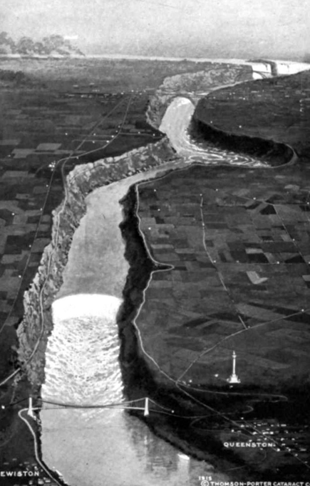
The site is formally known as lot 36 and part of lot 35 and was owned by Alex Card and Jason Carruthers at the time of the 1878 county atlas.  Alex Card’s property was accessed from Kipling and his driveway is shown in white on the map below.  The laneway extended past the house to a grist mill that was operated near the Humber River.  In 1926 The Hospital For Sick Children was looking for a country location to build a satellite facility. They wanted to replace their John Ross Robertson Lakeside Home For Children which was on Hanlan’s Point.  This small facility had been opened on Toronto Islands in 1883 but was only in service four months per year.

thistletown

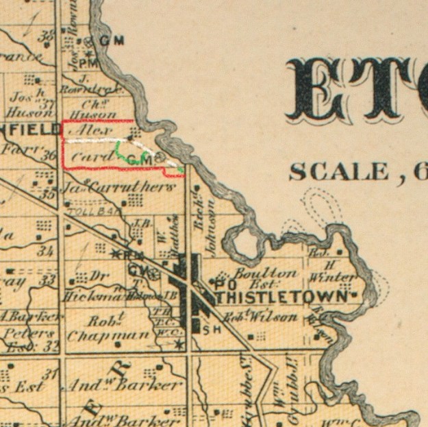
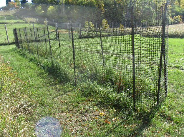
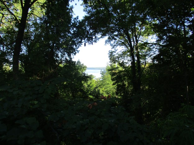
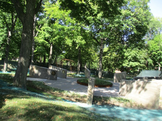
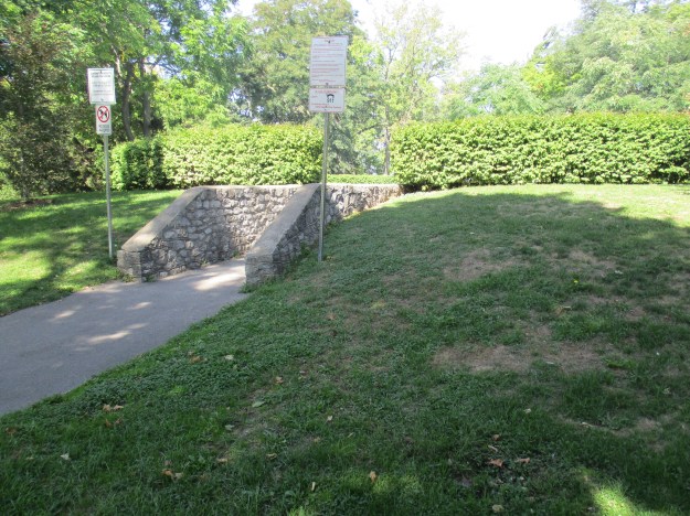
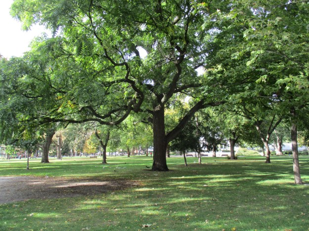
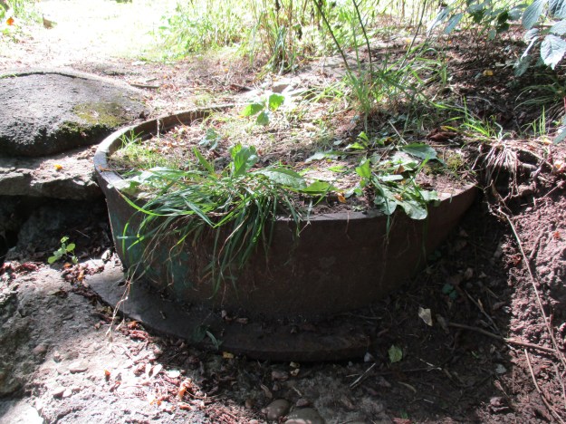
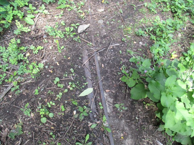
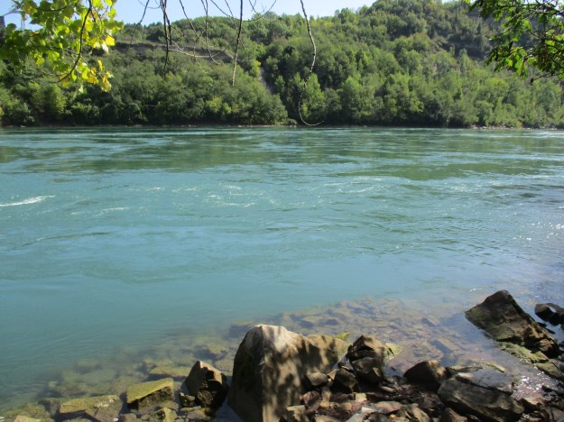
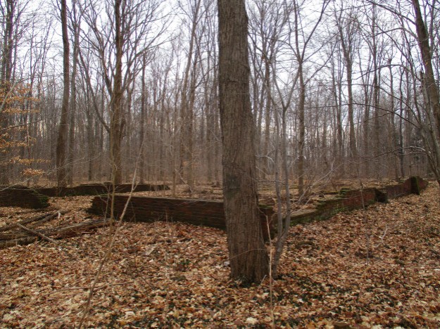
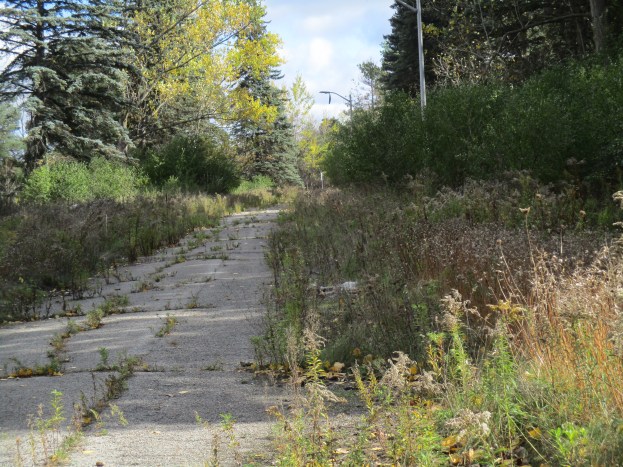
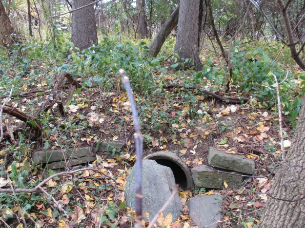
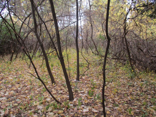
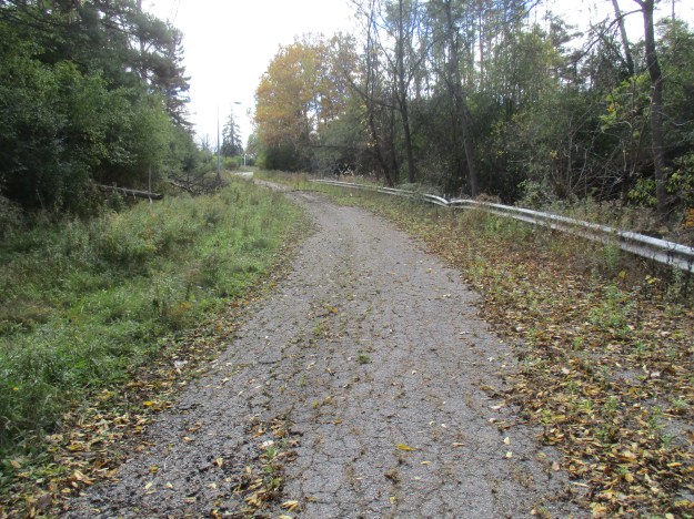
When they settled on lot 36 they used Card’s laneway off of Kipling and decided that an entrance off of Islington would be created with a sweeping laneway, shown in green, that would showcase the hospital.  Ten acres of land were purchased off of Carruthers to allow the laneway to be extended and this short stretch is also marked in green on the map above.  At this time Finch Avenue did not extend across the river and when it was extended in the late 1980’s the 10-acre corner was cut back off of the property.  Due to the fact that these few acres were owned by the hospital, they escaped development when the rest of Carruthers property was sold off.  Today it is known as Finch Islington Park and is a largely unused area which is returning to its forested condition.  The exploration started here before making its way across Finch Avenue.  Among the new growth stand rows of mature trees that once lined this entranceway.  This portion of the old laneway has almost vanished but an old culvert still reveals where the road once crossed a seasonal flow of water.

img_4234

The former road surface on the south side of Finch Avenue has been reclaimed by the forest.  New growth trees stand out in a strip between the mature pine trees on either side of the former roadway.

img_4235

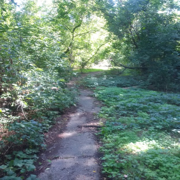
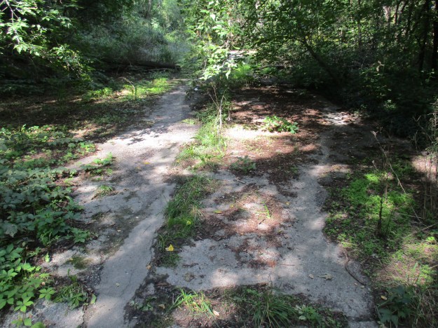
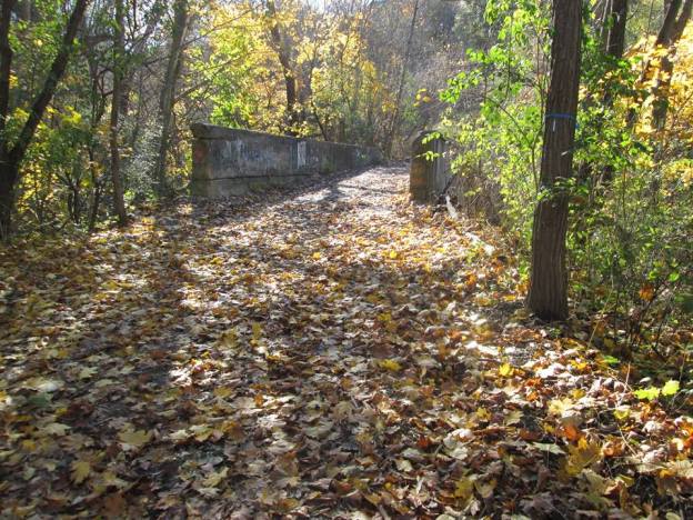
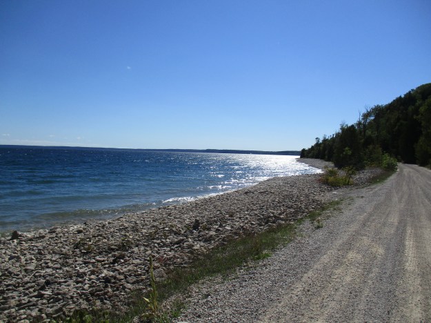
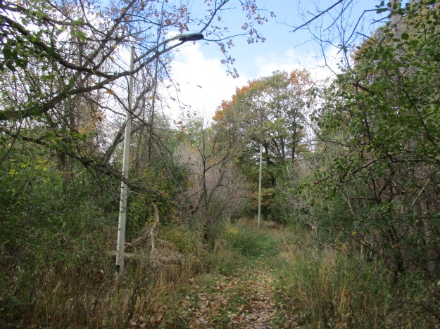
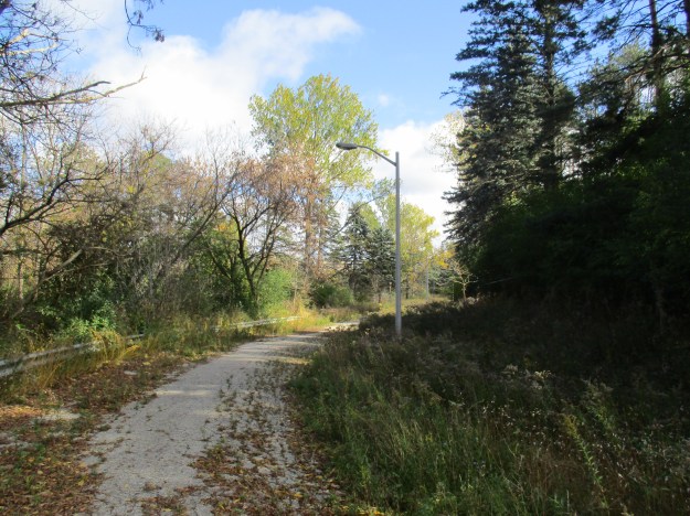
It was decided that the old laneway from the mill was too steep and so only the lower portion was incorporated into the new driveway.  The old laneway is still discernable but unlike the roadbed north of Finch, it isn’t paved.

img_4245

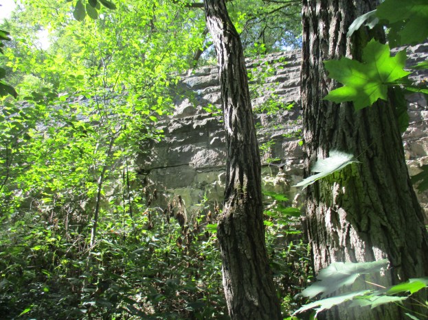
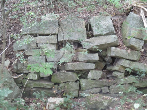
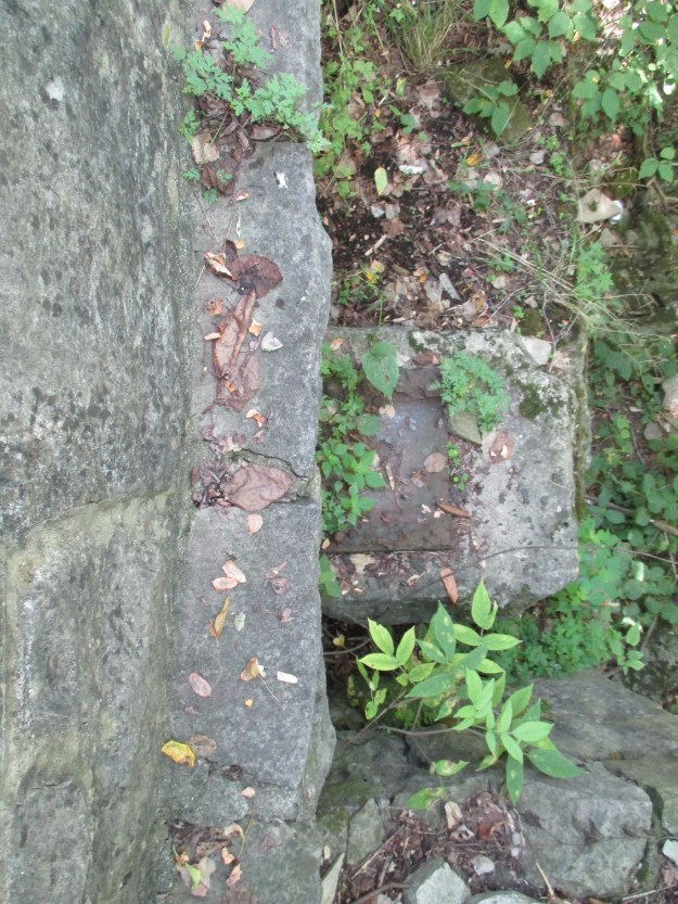
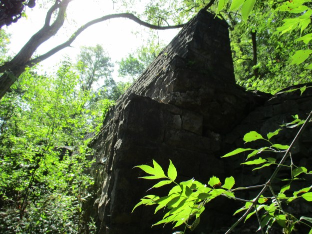
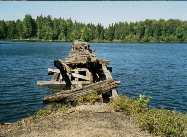
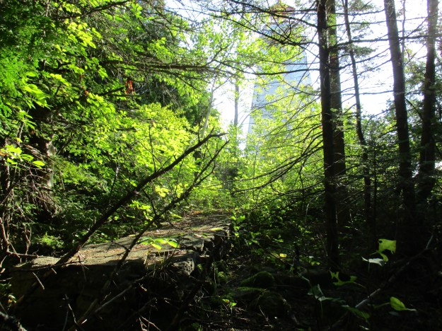
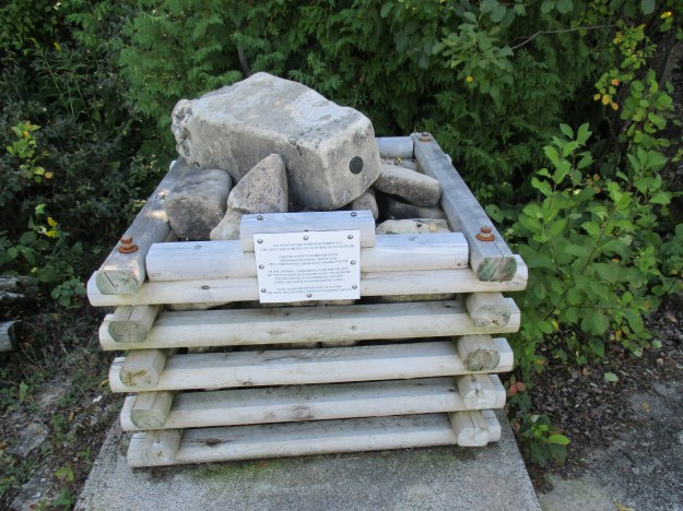
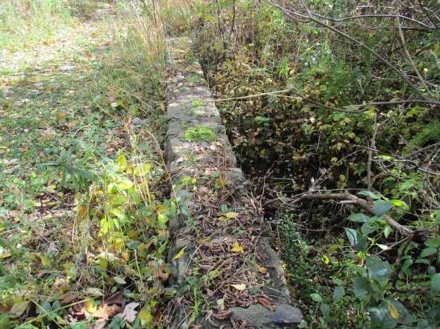
Along this old laneway is a stone bridge across a small tributary to the Humber River.

img_4251

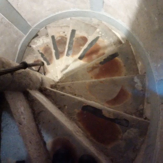
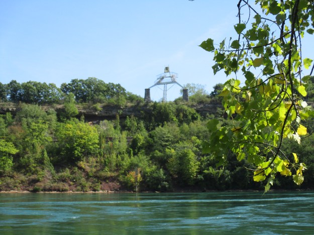
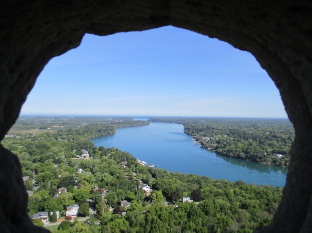
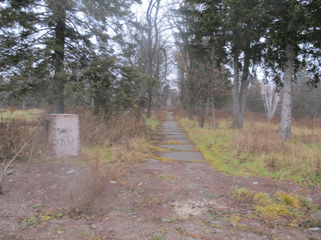
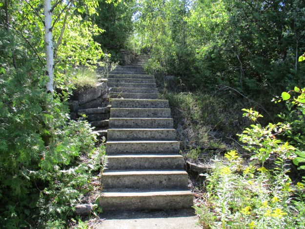
The old laneway will eventually bring you to a portion of the Humber River Recreational Trail but we turned back when we came to the back of the old power plant.  Another row of streetlights led us to this set of stairs.  At one time this led from the back of the hospital to the laneway and then to the gardens beyond.

img_4264

At the bottom of the stairs, a small footbridge crosses the same tributary that we had seen on the older laneway.

img_4267

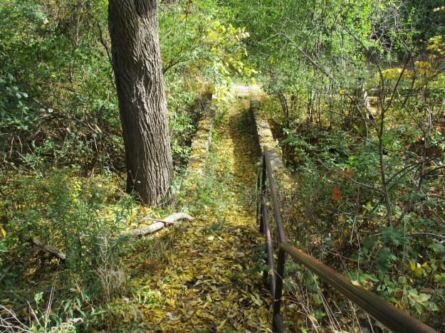
The little footbridge leads out to where the laneway curves toward the river and Islington Avenue.

img_4271

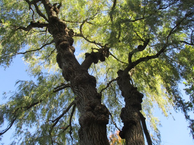
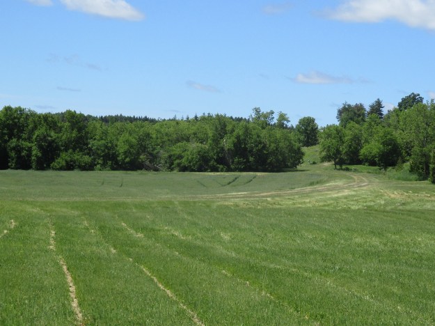
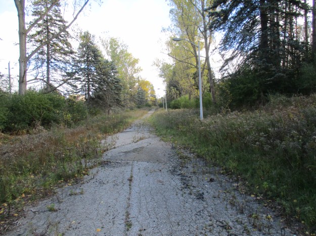
The road curves where it approaches the Humber River and makes its way south toward Finch Avenue.  Mature pine trees can be seen running parallel to the road which was planted for a hundred feet along either side.  This was done in 1930 to compliment the 50,000 seedlings that had been planted prior to opening.  Stands of pine trees had been planted around the hospital in the belief that their scent helped cure those who suffered from lung ailments like tuberculosis.

img_4273

Running parallel to the river the laneway runs almost to Finch Avenue where it dead-ends just before the fence along the road allowance.  Somewhere along this section of the 19th-century roadway once stood the grist mill.  Today you can clearly see the pattern of alternating pine and deciduous trees that was planted along either side of the road.

img_4276

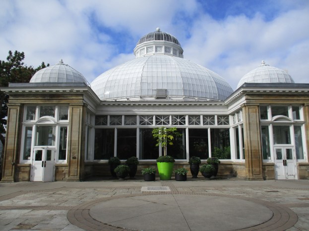
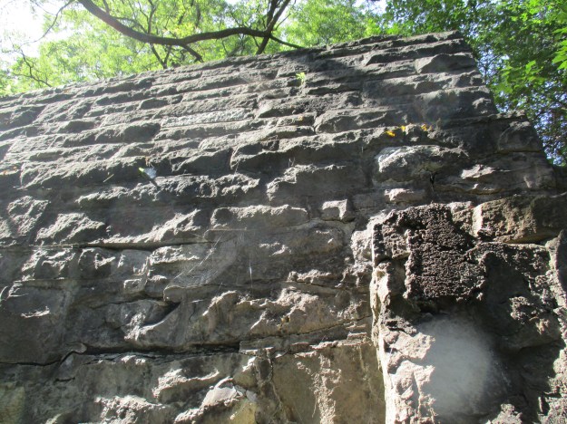
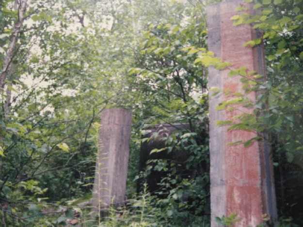
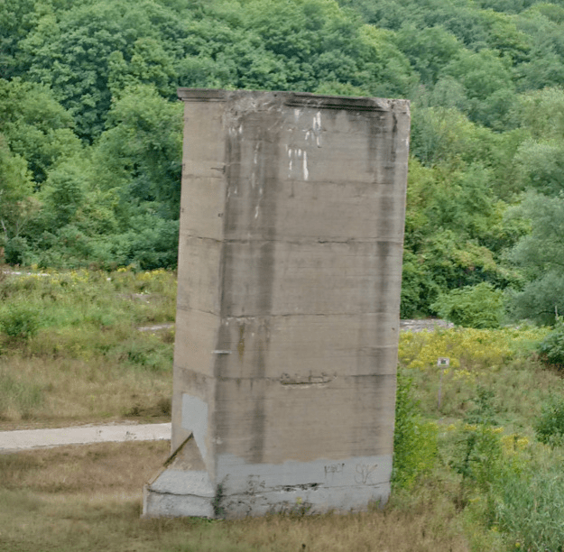
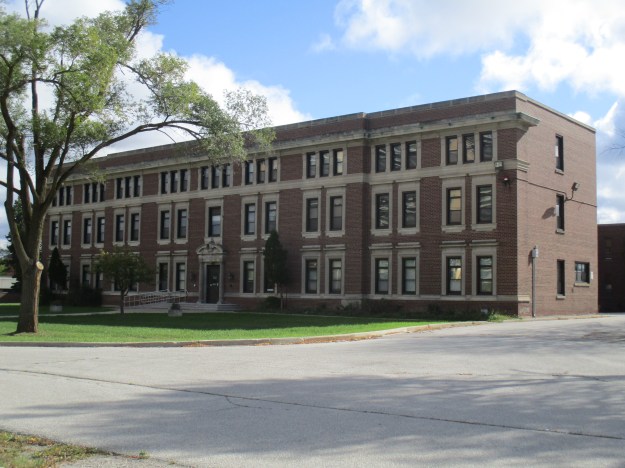
Construction on the country addition to The Hospital For Sick Children was started in May 1927 and it officially opened on October 10, 1928.  It was built to house 112 patients as well as the doctors and caregivers.  The north face of the building is shown in the picture below.  and it housed the staff.  A rear section can just be seen in the picture and it housed the patients.  They were taken outside daily for treatment with “sunshine and fresh air” and the rear dorms had a place to roll beds outside as well.  The hospital was a long distance from the city so it incorporated a power plant, water and sewage treatment and high-pressure firefighting system.

img_4294

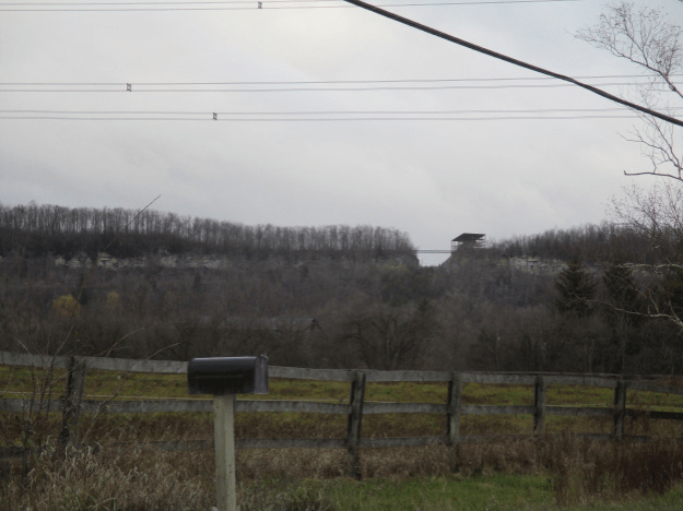
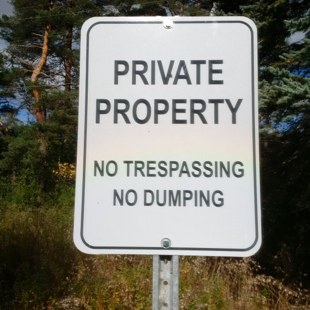
By the 1950’s its operation had become outdated with modern treatments in downtown hospitals replacing most of them.  Following power loss due to Hurricane Hazel in 1954 it was soon closed.  In 1957 the hospital was purchased by the Department of Health for use as a mental health hospital for juvenile patients.  In 1960 they added a centre for autistic children and in 1967 the name was changed to Thistletown Regional Centre for Children and Adolescents. These signs are new and appear all over and include a variety that claims that the area is patrolled. For this reason, I am not suggesting that people should visit this location.

img_20161022_135507

Link to original blog for this location: Humber River at Finch and Islington

Google Maps Link: Finch-Islington Park

Like us at http://www.facebook.com/hikingthegta

Follow us at http://www.hikingthegta.com


Humber Arboretum

Saturday, October 15, 2016

The Humber Arboretum was started in 1977 by the horticulture students of Humber College.  Today it covers 250 acres behind Humber College’s North Campus.  It covers an area of the West Humber River Valley between highway 27 and the 427 and features botanical gardens, meadows, and natural areas.  It also features a large variety of trees that have been dedicated to the memory of various individuals.  It is a little tricky to find but look for the first left east of highway 27 off of Humber College Boulevard (see the map link at the end).  This is Arboretum Boulevard and is on college property.  There is free parking in lot 1 and a large sign announcing the arboretum.  There are over 6 kilometers of trails in the park which will allow you to walk among the various ponds and gardens where you can watch for a wide variety of wildlife.

The trees start to prepare for winter by withdrawing useful chlorophyll from the leaves and storing it in the woody parts of the tree for use next year.  This removes the green colour from the leaves and causes them to turn various colours.  Without the chlorophyll to protect the colours of the leaves they are soon broken down by UV light leaving just the brown tannin in the decaying leaf.  This Red Oak is starting to change at the end of this one branch.

img_4149

The arboretum claims to have over 1,700 species of plants and animals and serves as a living classroom for students at the North Campus.  The common snapping turtle featured below and in the cover photo is about the size of a toonie.  This is just a little baby of a species that can grow to be 75 lbs and live for 100 years in the wild.  The snapping turtle has distinctive ridges on the carapace as well as a serrated shell, especially along the tail end.  This turtle species has the latin name Chelydra Serpentina because of its snake-like neck that can reach to bite near the rear legs.  This little one may be from this spring’s hatching.  It was making its slow way across the path that was shared with bicycles and joggers.

img_4194

We moved the snapping turtle to the grass near the edge of one of the three little ponds that have been created on the arboretum grounds.  These ponds have been planted to provide habitat for wetland species that are being conserved and presented here.  Students conduct experiments and gain hands-on work experience.

img_4178

One of the projects is an attempt to help save the endangered butternut tree that was native to this region.  A severe fungal canker threatens the trees but students have teamed up with the Ministry of Natural Resources to plant 5 new samplings in an enclosure in the arboretum.  Plans include planting up to 20 additional trees. Currently, the only method of propagating new trees is to graft a healthy plant onto another plants root stock.  Students are looking for new ways to grow healthy trees.  The enclosure pictured below has some new cedar trees planted by the students.

img_4145


Golden Weeping Willow is a hybrid tree that was first mentioned in 1888.  The latin name Salix Alba records that it is a  hybrid because all hybrids have the letter x in the name.  Primary Willow branches grow upward but all secondary branches grow down giving it the “weeping” aspect which it inherited from the Babylon Willow.  These trees are distinctive and are among the first signs of spring as their branches take on a golden hue before the leaves start to come out on most of the other trees in Toronto’s urban forest.

img_4191

Dekay’s Brown Snakes hibernate communally through the winter and breed upon emerging in the spring.  The female carries the fertilized eggs internally until between 3 and 31 babies emerge in late summer.  They are small, just 8-11 centimeters, and will grow to about 50 centimeters at a maximum.  When they feel threatened they can give off a strong musky odour but this one seemed calm enough.

img_20161015_121100_edit

The Centre For Urban Ecology was completed in the fall of 2007 at the arboretum.  It is used by both students and adults to study and promote ecological stewardship.  The building is LEED Gold Certified and incorporates sustainable design elements.  The roof has vegetation growing on it to help with storm water management.  Rainwater is collected and used for irrigation for the landscaping and sewage and gray water is filtered on-site before being released.  The Humber Arboretum and Centre For Urban Ecology are a joint venture between Humber College, The City of Toronto and Toronto Region Conservation Authority.

img_4181

Alder Trees belong to the same family as Birch Trees.  Alders are unique among deciduous trees in that they have cones.  The picture below shows male catkins but the tree will also have female ones that resemble small pine cones.  The inner bark of the alder tree contains salicin which is an important part of aspirin.

img_4193

Green Mountain Sugar Maple can grow up to 60 feet tall and 50 feet wide.  They can grow up to one foot per year in good growing conditions.  This tree is a staple in the manufacture of maple syrup, a major industry in Ontario.  It is estimated that in 2011 members of the Ontario Maple Syrup Producers Association grossed $53 Million from 4 million litres of syrup.

img_4144

We were probably about a week too early for the best colours, but the Humber Arboretum is a place that can be enjoyed all year.

A map of the trails at the arboretum can be found here.

Google Maps Link: Humber Arboretum

Like us at http://www.facebook.com/hikingthegta

Follow us at http://www.hikingthegta.com


The Battle Of Queenston Heights

October 13, 2016

The war of 1812 had been declared on June 18, 1812, partially because the British were stopping American ships and forcing British citizens found on board into military service to feed their war against Napoleon in Europe.  On August 15th General Brock had captured Detroit.  This followed the capture of the American Fort Mackinac in July.  With two early losses the Americans were looking for a victory and taking the town of Queenston would give them a bridgehead into the Niagara Peninsula.  The following map is marked to show the key locations as identified throughout the text.

queenston-heights

American forces had been gathering at Lewiston and by 3:00 am on October 13th there were 600 men ready to board boats and cross the river to invade Queenston.  300 British forces waited in the graupel and drizzle and successfully pinned the few Americans who landed on the beach.  This picture shows the landing area, however, there are a great deal more trees on the hillside than there were on that morning.  The town of Queenston lays to the left along the river. (1. on the map)

img_3798

Captain John Ellis Wool knew of a small fishing path that led up the steep cliff face of the Niagara Gorge.  The British had believed the gorge, cut as Niagara Falls was beginning its slow path toward Lake Erie, to be unassailable.  The picture below was taken from the approximate place where the invaders reached the top of the cliff.  Climbing up this side would have been similar to climbing up the American side that can be seen across the river. (2. on the map)

img_3805

The British had a small number of soldiers manning an 18-pound cannon that was firing on the invading troops, trapping them on the beach and preventing reinforcements from crossing the river.  The cannon stood behind a redan, an earthen mound shaped like a half moon. Captain Wool led his men in a bayonet charge that quickly overtook the position. The curve of the redan can still be seen and an 18-pound cannon stands, looking down on the Queenston Harbour. (3. on the map)

img_3822

General Isaac Brock gathered 200 troops in the town and prepared to launch a counter-attack to reclaim the redan.  As they began the rush up the hill from town General Brock was leading the charge and was shot in the chest and killed.  His aide-de-camp, John Macdonell, led another charge to try to regain the hill top.  He took Brock’s horse, Alfred, but both horse and rider were killed in the charge.  The site of Brock’s death is marked in the town of Queenston with the memorial cairn pictured below. (4. on the map)

img_3939

Defence of the Niagara Peninsula, and Upper Canada, now fell into the hands of Major-General Roger Hale Sheaffe.  He was positioned at Fort George (Niagara-On-The-Lake) with his troops of the 41st Regiment, Royal Artillery and Militia.  Sheaffe had already left Fort George by this time and was marching his troops to Queenston.  Meanwhile, the Americans were prevented from expanding their position on top of Queenston Heights by the efforts of John Norton.  Along with a band of 100 Iroquois, Norton was able to harass the American troops and keep them pinned near the redan.  To honour the part that native peoples played in this battle, and throughout the war, a memorial has been created. (5. on the map)

img_3918

The American troops did not receive any of the support they expected from the militia. Many of the militia saw the bodies floating in the river and quickly decided that they were not required to fight on foreign soil and so refused to cross the river.

Major-General Sheaffe decided not to confront the American troops head on and so he took his troops toward St. Davids.  This allowed him to come up behind the Americans who were defending the redan.  It was around 3:00 pm when Sheaffe’s troops reached the top of the escarpment and rested briefly in a field while another 150 men joined them from Fort Chippewa.  By 4:00 pm they were ready to advance on the Americans and after firing an opening volley of musket balls they led a bayonet charge.  The Americans had their backs to the cliff and were faced with the choice of jumping to their deaths or surrendering.  (6. on the map) The turkey vultures in the picture below are looking out across the river to the two remaining towers from the Queenston-Lewiston Suspension Bridge. (7. on the map)

img_3873

In the final analysis, the battle was another disaster for the American troops.  They failed to take and hold the town of Queenston and in the battle they had over 300 men killed or wounded.  The British took 925 captives following the surrender of the redan.  For the British, the toll was much lighter.  They had only 14 dead, including Brock and Macdonell, and 77 injured.  More importantly, the civilians saw that there was a solid hope of defending Canada against an American invasion.  Many of the citizens had families living in the USA and had not committed to one side or the other but were waiting to see which side to support.  General Brock’s death became the rallying point that united the population to protect their country.

Brock and Macdonell were taken to Fort George where their remains were interred.  In 1823 a 135-foot monument was started that would have a viewing platform at the top.  When it was completed in 1824 it was inaugurated on October 13th, the anniversary of Brock’s death and his and Macdonell’s remains were moved to the monument.  It was first opened to the public on October 13, 1827.  On April 17, 1840, the monument was severely damaged by a bomb in an attack that may have been linked to the Rebellion of 1837.  The damaged monument had to be torn down and Brock and his aid were taken to Queenston for their third burial.  The archive photo below shows the damage to the monument with almost all of the outdoor platform destroyed.

1st_brocks_monument_damaged

A second monument was designed and construction began on the 185-foot tall structure. Brock and Macdonell were moved here.  On October 13th, 1853, they were interred for the fourth time, now in the base of the new monument.  The monument would be completed and opened to the public on October 13th, 1859. (8. on the map)

img_20160916_085303

A set of winding stairs leads you to the top of the monument.  There are 235 of them and it took me almost exactly twice as long going up as it did coming back down.

img_20160916_112348

When you reach the top of the stairs there is a small viewing platform that lets you look out from the round windows just below the statue of Major-General Brock.  The statue of Brock on top of the monument is nearly 16 feet tall.  He is positioned in a classic military pose of leadership.

img_3838

In the spring of 1814, the British built a small redoubt with a blockhouse in the middle to defend the main road.  They named it Fort Drummond and the earthworks remain, not far from Brock’s monument. (9. on the map)

img_3924

In Queenston Heights park there is a cairn to mark the southern terminus of the Bruce Trail.  Having visited the northern terminus on Monday, a mere 890-kilometer hike away, I was interested in visiting this cairn while I was in the park. (10. on the map)

img_3856

There is a hiking trail that links all the points of interest from the battle but it is poorly marked and may take less than the intended 45 minutes because you will miss some things.

Google Maps link: Brock’s Monument

Like us at http://www.facebook.com/hikingthegta

Follow us at http://www.hikingthegta.com

Allan Gardens

Sunday, October 9, 2016

George William Allan was born in the town of York in 1822 on his father’s Park Lot and would go on to be an important figure in Canadian politics.  Allan served with the Bank Rifle Corps during the 1837 Rebellion and became a Toronto Alderman in 1849.  He was Toronto’s 11th Mayor serving from 1855 to 1858 when he became a member of the Legislative Council.  Following Confederation, in 1867 he became one of the first members of the Senate.  Allan was a member of the Upper House until his death in 1901.

On March 24, 1819, George Allan (sr) purchased Park Lot 5 which was one of the 100 acre lots that ran from Lot (Queen) Street to Bloor Street.  These long narrow lots (660 feet wide by 6,600 feet long) were generally given to men of importance and this lot had originally been granted to Cheif Justice William Osgood who lost the land patent for failing to build a house and live on the land.  Lieutenant Governor John Graves Simcoe had planned the lots as a means of attracting an upper class to help manage the town of York.  Unlike most settlers, these men had only to built a home and live there or rent it out to gain ownership. The grounds around Allan Gardens contain some of the downtown core’s mature trees.

img_4054

The city grew quickly and soon these Park Lots became prime development sites with each property owner able to do pretty much whatever they wanted to.  They could build roads across their lots where they desired and this is the reason that most of the east-west streets in this section of town only run a few blocks and then end.  George Allan built a palatial home on the south end of the lot that became known as Moss Park because of all the moss that grew on it.  The desire for profit led to the quick development of most of the Park Lots with the result that there were very few areas set aside for public parks.  In 1858 George Allan donated 5 acres of land to the Toronto Horticultural Society to create what has become one of Toronto’s oldest parks.  The use of symmetry extends from the greenhouses to the grounds themselves and a pair of walkways enter from opposing corners to meet in front of the greenhouses.

img_4065

In April 1854 Allan had released his plans for the development of Moss Park with villa style lots.  The area that would become Allan Gardens was laid out with four homes on each side and a large oval park in the middle.  Two years later the Toronto Horticultural Society had been given use of 5 acres to develop as public gardens which they would later expand to 11 acres.  September 11, 1860, marked the official opening of the Horticultural Gardens with the Prince of Wales on hand for the ceremony.  A pavilion had been built that year for the opening ceremonies and a second pavilion was built in 1879 however, it burned down in 1902.  It was replaced in 1910 by the Palm House which is seen in the cover photo.  The picture below shows the inside of the Palm House, looking up.

img_4076

This Toronto Archives picture of the Palm House from 1913 shows the building shortly after construction and without any of the additional greenhouses that now flank it north and south.

f1231_it0541

A photo of the building today shows a much different skyline in the background.  Also of interest is the change in the location of the doors.  Gone is the single central door which has been replaced with two doors located on either portico.  The four corinthian columns across the front have also been removed.

img_4064

George Allan died on July 24, 1901, after which the park was renamed Allan Gardens in his honour.  Today there are six greenhouses with a combined area of over 16,000 square feet. A seasonal display pays tribute to the harvest with this statue which is out of its gourd for a fancy dress.

img_4078

The tropical house was moved from Exhibition Park to this location in the 1950’s and has a chrysanthemum display as a feature this month.  The ‘pumpkin’ below will continue to bloom and will create a colourful display as the month progresses.

img_4081

Additional greenhouses were built in 1924 and 1956 to expand the conservatory’s collection of plants and flowers.

img_4092

The Arid House (Cactus House) was also moved from Exhibition Park in the 1950’s and contains many different species of cactus.  The Golden Barrel Cactus, also known as Mother-In-Law’s Cushion, is native to Mexico where it is endangered in the wild.  Mature plants can live for 30 years and will only begin to have flowers after about 20 years.  The small yellow flowers that grow near the centre turn into a fruit that contains seeds for the next generation of plant.  These cacti also spread through a root system and corms. Allen Gardens has several of these cacti that are quite large but none that are near the one-meter size that they can attain.

img_4102

Allan was a strong supporter of the arts and was a champion for Paul Kane and James Audubon in the years before they became popular.  It is fitting that the park he created is home to a statue of Robert Burns which was erected in 1902.

img_4053

Allan Gardens originally did not extend to Jarvis Street and that side of the property was built up by the late 1870’s.  Two historic churches remain one on either corner of the grounds, with the Baptist Church being on the corner of Carlton and Jarvis.  This Gothic Revival church was built in 1874 from Queenston Shale and opened in 1875.  This is the third building to be occupied by this congregation which had organized in 1829 on Lombard Street.  The lone remaining house in this block is now used as the Toronto Baptist Seminary and is next door to the church.

img_4110

A couple of other houses and a Collegiate Institute have been removed and now St. Andrew’s Church stands alone on the north corner.  It was built in 1878 of Credit Valley Stone and was used by the Presbyterian Congregation that moved here from their old building at Church and Adelaide.  Estonian and Latvian refugees acquired the church in 1951 after being displaced during World War II.

img_4113

The Allan Gardens greenhouses are open year around from 10 am to 5 pm every day.  They have seasonal features that make repeated visits enjoyable.

Google Maps link: Allan Gardens

Like us at http://www.facebook.com/hikingthegta

Follow us at http://www.hikingthegta.com

The Second Queenston-Lewiston Bridge

September 16, 2016

The first bridge between Queenston on the Canadian side of the Niagara River and Lewiston on the American side was built in 1851.  It was a suspension bridge and was destroyed by in a wind storm and not replaced until 1898.  That was the year that the Second Falls View Suspension Bridge was moved to this location.  In the years in between the towns were served by a ferry that crossed the river.  The first suspension bridge is seen in this photograph from closer to the time of replacement.

first

The original Falls View Suspension Bridge was built just south of the American Falls in 1867 and opened officially on January 2, 1869.   Twenty years later, on January 9th, the bridge was destroyed in a storm.  By commissioning a bridge of the same design a lot of time was saved and construction began on the Second Falls View Bridge on March 22, 1889, and lasted for only 38 days.  Just 117 days after the collapse of the first bridge, on May 7th, the second bridge was opened.  It was also known as the Niagara Clifton Bridge and can be seen in the Currier and Ives painting below.

1024px-new_suspension_bridge_-_niagara_falls

Built in 1897 and opened in 1898 the Upper Steel Arch Bridge, or Honeymoon Bridge, was built 14 feet closer to the American Falls than the Second Falls View Bridge.  After it was opened the suspension bridge was dismantled and moved to serve as a replacement Queenston-Lewiston Bridge.  The Honeymoon Bridge would eventually collapse on January 27, 1938, when ice build-up in the river pushed the abutments over.  An arch bridge known as the Rainbow Bridge was built as a replacement and has been in service since November 1, 1941.  If you follow York Street past the last houses it is blocked to vehicles by large stones but pedestrian traffic is still allowed.  The old road bed can be easily followed because the pavement is visible in many places.

img_20160916_120112

After it’s installation in Queenston the suspension bridge served until November 1, 1962, when the current Queenston-Lewiston Bridge was opened.  The new arch bridge is modeled on the same design as the Peace Bridge making it, in a round-about way, the second time this design has replaced this same suspension bridge.  The trail is marked with blue slashes on the trees, and look, they left the gate open!

img_3950

Along the abandoned road there are places where earlier attempts have been made to reinforce the embankment.  In some places, the vines and bushes have almost obscured the old blocks of cut limestone.  In another spot, a large chunk of stone has broken away from the embankment and rolled onto the former roadway.

img_3953

A large steel support for the crane that was used to remove the suspension bridge stands to the side of the abutment.  Nature is turning it into a planter.

img_3956

The towers and abutments were made of cut limestone blocks.

img_3957

From the level of the river, you can get a good view of the two towers that remain on the American side of the river.  A steel sculpture and observation deck were added in 1981 by Owen Morell.

img_3965

The old abutments look pretty impressive from below.

img_3958

A curved steel rail is embedded in the old roadway near the abutment.

img_3970

Looking over the side of the abutment you can see one of several places where steel support columns have been cut away.

img_3971

The suspension bridge was dismantled in 1963 and sold to a scrap yard.  The archive photo below shows the bridge with most of the road deck removed.

demo

Google Maps link: York Street Queenston

Like us at http://www.facebook.com/hikingthegta

Follow us at http://www.hikingthegta.com


The Niagara Gorge

September 16, 2016

Niagara Falls may be the fastest moving waterfall in the world having cut The Niagara Gorge from Queenston to Niagara Falls over the past 12,500 years.  The Niagara River runs for about 58 kilometers and is the natural outlet for Lake Erie.  That lake is about 99 meters higher in elevation than Lake Ontario and half of that difference occurs at the Niagara Falls.  Having spent a day of my holidays in the area of Niagara Falls and Queenston the common theme in all my pictures was the Niagara River.

The Niagara River extends for about 35 kilometers from Lake Erie dropping less than three feet in height until it reaches the Upper Niagara Rapids.  It drops another 15 meters through the kilometer rapids as it reaches the brink of the falls.  There are a couple of interesting things along the stretch of rapids above the falls.  It was here in 1786 That John Burch built a saw and grist mill which was the first industry on the Canadian side of the river.  These mills were torched by the American Army when it retreated on July 26, 1814, after the Battle of Lundy’s Lane.  In the middle of the river, near the powerhouse, sit the remains of an old dumping scow.  On August 6, 1918, the scow broke loose from the tug it was tethered to and started drifting toward the falls with two men on board.  They opened the dumping chutes on the bottom and the scow grounded on the shale in the river just before they would have been carried over the falls.  They were rescued the following day on a line shot out from the roof of the powerhouse.

img_3705

In 1906 The Electrical Development Company of Ontario opened a beautiful building as home to their powerhouse.  This building supplied the Toronto market and was in operation until 1974.  In 1950 a treaty was signed by both the Canadian and American Governments limiting the amount of water that can be diverted from the falls and the hours in which it can be done.  During “tourist hours” the flow must not be less than 2832 cubic meters per second and it can be cut to half of that overnight.

img_3722

The Canadian Falls drops an average of 57 meters and there is a 52 meter deep plunge pool at the bottom.  Six million cubic feet of water goes over the falls every minute.  The process that erodes the falls and causes it to carve through the solid rock is known as cavitation.  As the water goes over the falls it picks up speed and loses internal pressure.  This allows air to escape as bubbles or cavities.  When the water comes to rest these cavities collapse sending out shock waves that help disintegrate the rock at the base of the falls.  The falls are expected to cut back for another 15,000 years at their current pace before they reach an old riverbed about 6 kilometers upstream.  At that time erosion will increase rapidly and the falls may be replaced with a series of rapids.  It should take about 50,000 years before the remaining 20 miles to Lake Erie is cut through.

img_3765

Looking downstream you see the American Falls on the right.  It ranges between 21 to 34 meters and carries less than 7 percent of the river’s water.  It is less spectacular because of the talus at the bottom caused by collapses and landslides.  It is estimated these falls could dry up in 2,000 years or so.

img_3757

The Bruce Trail runs from Queenston to Tobermory and follows the Niagara Escarpment for an 890-kilometer hiking trail.  Earlier in the week, I had used a day of holidays to visit the northern terminus of the trail and so it was fitting to visit the southern one as well.  The southern one stands in Queenston Heights Park near where the Niagara Gorge begins. This is also near the point where the original Niagara Falls began cutting a path through the escarpment on its slow journey to Lake Erie.

img_3856

Queenston Heights Park is the site of one of the battles of the War of 1812.  It was during the Battle of Queenston Heights on October 13, 1812, that Isaac Brock was killed.  The current monument to Brock was built to replace an earlier one which was blown up in 1840.  For a small fee, you can climb the 235 spiral stairs inside the monument.  From the small portals at the top you will have a great view over the area.  In the picture below the casino and tall hotels in Niagara Falls Canada can be seen.  This shows you the distance that the falls have cut through the escarpment.

img_3904

Looking to the east, past Queenston, the Niagara River appears peaceful as it flows to Lake Ontario.  The tableland below the escarpment does not have any gorge because the falls began to the west of here.  The cover photo shows the start of the escarpment on the American side of the river and the site of the original Niagara Falls.

img_3908

The building below is the one that housed The Colonial Advocate, a paper published by William Lyon McKenzie which called for government reform.  The seeds of the rebellion of 1837 were planted from this newspaper.  In front of the house stand two honey locust trees that are part of 5 he planted on April 18, 1824, when he started his paper.  One of them can be seen just behind the chimney in the picture below.

img_3935

A blue marked trail leads away from York Street in Queenston and heads toward the river.  As you follow it you will see old pavement indicating that you are on the road that led to the old Queenston-Lewiston Bridge.

img_3952

This archive photo from 1915 shows the Queenston-Lewiston suspension bridge.  Notice how exposed Brock’s Monument is compared to the forest it now stands in.  The bridge stands at the foot of the escarpment and the 90-degree turn in the river can be seen upstream.  This is the site of the Whirlpool Rapids.  When the erosion of the gorge reached this point, about 5,500 years ago, it encountered an old riverbed that had been buried in the previous ice age and creating the bend in the river.  The water racing downstream from the falls is forced under the surface here creating the whirlpool effect can be seen on the surface.

queenston-1915

The Quennston-Lewiston Bridge was replaced in 1962 with the current bridge.  The suspension bridge was removed the same year but abutments remain on the Canadian side of the river.

img_3967

An observation deck has been built above the remaining bridge abutments on the American side of the river.

img_3965

The water in the Niagara River has an interesting shade of green due to dissolved minerals in the water.  Every minute over 60 tonnes of minerals are carried over the falls, mostly limestone but some shale and sandstone as well.

img_3964

This part of the province has some of our earliest history and there is plenty to explore on future trips.

Google Maps Link: Niagara Falls

Like us at http://www.facebook.com/hikingthegta

Follow us at http://www.hikingthegta.com

Hiking the GTA #200 – Greatest Treks 2

Tuesday, September 27, 2016

Hiking the GTA made it’s initial post on April 20, 2014, as a way of organizing and commenting on my photos from that day’s hike.  As the number of stories grew, so did the number of readers.  When we reached 100 posts we paused to look back at the fifteen most popular stories in an article we called “Greatest Treks”.  With its brief summary, picture, and link for each story it proved useful in helping people look for places to explore.  Today, we mark our 200th post with Greatest Treks 2.  Following the same format, here then, are the fifteen most popular stories from our second 100 posts.

15. Gore & Vaughan Plank Road  Jan. 14, 2016

The Gore and Vaughan Plank Road Company was established in 1855 to build a plank road along Dufferin Street.  The planks for the Gore and Vaughan Plank road were sixteen inches wide by 8 inches thick and sixteen feet long.  Planks were held together with four foot long spikes that were driven in, two feet apart, in opposing directions, one of which is shown in relation to my shoe in the picture below.

gore

14. Rice Lake’s Sunken Railway  Jul. 26, 2016

The first train from Cobourg to Peterborough ran the 45.8-kilometer track for free on December 29, 1854, to show off the new railway.  The route crossed Rice Lake and when completed at the end of 1854 the trestle was nearly 5 kilometers long making it the longest railway bridge in North America at the time.  By 1861 the trestle was abandoned but the part below the waterline still remains in Rice Lake.

Harwood 3

13. Cache Lake Trestle  Ju. 17, 2016

In the spring of 1896 work began on driving pilings into Cache Lake for the trestles that would cross two bays.  The first freight train from Parry Sound to Ottawa ran on October 9, 1896.  This trestle was abandoned in 1933

Cache 1

12. Gates Gully Scarborough  May 7, 2016

Gates Gully runs from Kingston Road to Lake Ontario and provides one of the few places where there is access down the side of the Scarborough Bluffs.  Over the years it has been home to natives, smugglers, soldiers, and rebels.  The Bellamy Ravine Creek flows through the bottom of the ravine where it makes a 90-meter drop from the tablelands to the lake.  It also features one of the few houses that is currently falling over the bluffs.

gates

11. The Haunted Hermitage  Nov. 15, 2015

The two-story house that would become known as The Hermitage was built in 1855 using hammered limestone for the front and side walls and field stones for the rest.  It has been in ruins for years but the remaining walls have been recently restored.  Widely sought by paranormal seekers it is said to be haunted by the ghost of William Black.  This picture shows the remains of the building that housed the laundry.

herm

10. The Devil’s Punchbowl  Dec. 26, 2015

The Devil’s Punchbowl, along with the Lower Punchbowl, is one of the few places where you can see all the geological layers of the Niagara Escarpment.

punch

9. La Grande Hermine  Sep. 16, 2016

The wrecked ship that sits along the side of the QEW near St. Catherines is featured in this short story.

img_20160916_132430_hdr

8. Camp Calydor Gravenhurst  Aug. 2, 2015

Known as Camp 20, Calydor was a P.O.W. camp in Gravenhurst which housed German officers.  Previously a tourist resort and then a tuberculosis sanitarium, it was used as a resort again before being closed for good.

calydor

7. The Vandalized Memorial  Dec. 13, 2015

Taras Shevchenko was born in Ukraine in 1814 in the feudal system of the era. He was orphaned at the age of 11 and went on to become one of the country’s most prolific writers composing over 1000 works. Some consider him to be the Ukrainian version of Shakespeare. His memorial was opened in Oakville in 1950 but has been vandalized on multiple occasions.

taras

6. The Ghost Town Of Sixteen Hollow  Sep. 12, 2015

The area known as Sixteen Hollow was home to an industrial community that became a ghost town by the 1880’s.  Today there is not much left except the church and a few remnants including the remains of a former bridge across the ravine.

sixteen-jpg

5. Bronte Creek’s Haunted House  Jun. 25, 2016

Bronte Creek Provincial Park covers almost 2000 acres of land or about 10 land grants.  Created in 1975 it sits along Bronte Creek between Burlington and Oakville.  The park includes the homestead of Henry Breckon who, some believe, still haunts the house he built in 1899.

IMG_2297

4. Horseshoe Curve Rail Disaster  Jun. 12, 2016

When the train left Markdale on Sep. 3, 1907 making a special run to the Exhibition in Toronto everyone anticipated a day of fun and not the horror that would leave 7 dead and 114 injured.  This post looks at what remains of the site today including the curve that can still be seen in the field pictured below.

IMG_1966

3. The Longhouse People Of Crawford Lake  Nov. 21, 2015

Crawford Lake is one of a handful of meromictic lakes in Ontario and this fact led to the discovery of a pre-contact native village.  An ungrooved axe or celt had been found here by a previous land owner and it is now part of a 10,000 artifact collection that has been uncovered between 1973 and 1989.  The post holes for the frames of 11 longhouses have been discovered and three of these have been reconstructed.

crawford

2. Lotten – Cawthra Estate Mississauga  Jan. 31, 2016

In 1926 Grace Cawthra-Elliot and her husband Colonel Harry Cawthra Elliot built a new home on the family property near Port Credit using bricks covered with plaster.  The old dirt road that accessed the home has since been named Cawthra Road and widened to 6 lanes in places.  The property has been protected from development because it is also the habitat of Jefferson Salamanders, a species seen to be at risk.  Grace called the property Lotten because it was lot ten.

lotten

1 The Gap  Nov. 14, 2015

In 1962 a quarry blasted a huge gap in the Niagara Escarpment and set off a chain reaction that led to the escarpment being declared a World Biosphere Reserve by UNESCO.  The gap in the escarpment can be seen from the 401 which is 3 km away.  This hike explores the Gap and the history of the quarry behind it.

the-gap

Here’s a link to the post: Greatest Treks which looks back on the 15 most popular stories of our first chapter.  Thanks for taking the time to read some of our stories or enjoy the pictures and perhaps we’ll cross paths on a trail somewhere down the road.

Like us at http://www.facebook.com/hikingthegta

Follow us at http://www.hikingthegta.com

The Grotto

September 12, 2016

A week of holidays in September is ideal because there are less tourists and, chances are, the weather will not be too hot for hiking.  Many years ago I visited the southern cairn on the Bruce Trail at it’s location in Queenston.  My Bruce Trail Guide Book has many stretches of the trail highlighted as completed but it had never worked out for me to visit the northern cairn in Tobermory.  Well, today was the day, but first a trip around the Big Tub Harbour to check out the lighthouse at the northern tip of the Bruce Peninsula.

Charles Earl and Abraham Davis were Tobermory’s first settlers and the town grew quickly in the late 1800’s as it was established as a major fishing community.  Tobermory has two harbours, both shaped like a bath tub and known as Big Tub and Little Tub.  At the top end of Big Tub Harbour Charles Earl maintained an oil lantern on the end of a high pole to guide ships into the safety of the harbour.  This job paid him $100 per year which was a considerable salary in that day.  In 1885 a hexagonal lighthouse was built on the site and political sway landed the job for Abraham Davis who was Earl’s rival.  Four lighthouse keepers held the job until 1952 when the light was automated.

img_3478

The lighthouse keepers at Big Tub had a small cottage just behind the tower.  The foundation remains lie hidden in the trees and can be seen in the picture below with the outline of the lighthouse in the background.

img_3493

In the 1930’s a small wooden vessel named Kagawong began ferrying vehicles from Tobermory to South Baymouth on Manitoulin Island.  Two other ferries operated on this route and on September 10th, 1974 the Chi-Cheemaun made her maiden voyage.  Having just celebrated her 32nd year in service on the previous weekend the ship, whose name means “big canoe” in Ojibwa, has now carried over 100,000 vehicles and 250,000 passengers across Lake Huron to connect with the next section of Highway 6 on Manitoulin Island.

img_3496

The Bruce Trail is the oldest marked hiking trail in Canada.  Extending for 890 kilometers from Tobermory to Queenston Heights Park it also has over 400 kilometers of side trails.  The cairn in Tobermory was unveiled in June of 1967 as part of the celebrations of Canada’s Centennial.  It is located right on the waterfront in Tobermory’s commercial district and all the local parking has a two hour limit.  This makes it hard to park near the cairn and go for a lengthy hike to start out your end-to-end journey.  There is free parking at the Visitor Information Centre a short distance away from which you can set out on an extended hike.  Inside, they suggested a more scenic hike would be found out of the immediate area of town where the trail winds along the coast of the peninsula.

img_3467

Cyprus Lake, in Bruce Peninsula National Park has access to the Bruce Trail as well as others for the price of parking ($11.75 at this time).   The parking lot leads to Head of Trails where you can choose from several hikes including a 5.2 kilometer one around Cyprus Lake.  Three other trails lead to the shore of Georgian Bay.  According to the person at the park entrance the trails vary in difficulty with Horse Lake (1.2 kilometers) being moderate, Georgian Bay Trail (1 kilometer) being easy and Marr Lake (0.8 kilometers) difficult.  The Bruce Trail along this section is listed as very difficult.  I decided to take the Marr Lake Trail which is accessed from the Cyprus Lake Trail. The picture below shows Cyprus Lake and an Inukshuk that someone has built quite a distance out into the lake.

img_3513

Marr Lake is separated from Georgian Bay by a boulder beach.  This beach is visible on the other side of the lake in the picture below.

img_3523

This photo shows the boulder beach which must be crossed as you connect the Marr Lake Trail with the Bruce Trail that runs along the shore of Georgian Bay.

img_3529

The Bruce Trail to the right leads to The Grotto.  A grotto is a cave that has been created by water along a shoreline.  Natural grottos are a type of karst topography and usually occur in limestone like the Niagara Escarpment.  Carbon dioxide mixes with rainwater to form a weak carbonic acid that slowly breaks down the limestone or dolomite and turns small cracks into large caves.  The grotto in the park can be climbed down into and makes a great place to explore.  The cover photo also shows the grotto and reveals the beautiful colours of the water in the little cove near the cave.  People were swimming here as well as jumping from he cliffs which is banned in the park.  Being caught can lead to a fine and eviction from the park.  Miscalculating and hitting a boulder or shale ledge could be much worse.

img_3540

Another five minute walk along the Bruce Trail will bring you to Indian Head Cove.  This scenic spot is much more easily accessed than the grotto.  There are many places where you can climb up and down the escarpment to reach the cold, clear water or ascend to a spectacular view of Georgian Bay.

img_3551

After leaving the cove, the Horse Lake Trail can be taken to go back to the parking lot.  The Bruce Peninsula National Park has so much more to offer than just the small section that was explored in this visit and could be the subject of several future adventures.  Here is a final look from the top of the escarpment down into the cove in front of The Grotto.

IMG_3538.JPG

Google Maps link: The Grotto

Like us at http://www.facebook.com/hikingthegta

Follow us at http://www.hikingthegta.com

La Grande Hermine

Friday September 16, 2016

If you have driven the QEW to Niagara Falls you have likely noticed the abandoned ship that sits in Jordan Harbour near St. Catharines.  Having spent one of my holidays in Niagara exploring the falls and several historical sites I decided to stop for a few minutes on the way home and get some pictures.

img_3976

Built in 1914, La Grande Hermine (The Big Weasel) spent 77 years in service as a Quebec ferry and cargo ship.  In 1991 the 140 foot hull was outfitted with a wood veneer that converted it into a replica of La Grande Hermine the largest of the three ships Jacques Cartier used when he explored Canada. This ship is not the same one that was outfitted as La Grande Hermine and used as a floating restaurant and bar in Expo ’67.  That ship was moved to Quebec City.

img_20160916_132541_hdr

The vessel was later decked out as a pirate ship that was used at Halloween to raise money to support a children’s hot-lunch program.

img_20160916_132658_hdr

Unpaid dock fees led to the ship being moved from Montreal in 1997 and it was brought to Niagara with the intention of converting it into a casino.  While the paperwork was caught up the owner died and the ship was left abandoned in Jordan Harbour.

img_20160916_132650_hdr

It had become a playground for kids and in January of 2003 the ship was destroyed when a fire got out of control.  The ship now leans to one side as it half floats and half rests in the weeds of Jordan Harbour where it has become something of a local attraction.

img_20160916_132546_hdr

This stock photo below shows the La Grande Hermine looked like when it arrived in Jordan Harbour.

1999_09_10_neg10_beaconboat_sidee4

There’s no real hiking involved with a visit to La Grande Hermine but it is a pretty cool place to stop for a few pictures.

Google Maps link: La Grande Hermaine

Like us at http://www.facebook.com/hikingthegta

Follow us at http://www.hikingthegta.com

Cabot Head Lighthouse

Monday September 12, 2016

Updated August 19, 2021

Both the road and lighthouse are closed indefinitely. Please enjoy the place as it was in 2016 as documented below.

The waters of Georgian Bay hide the hulls of countless shipwrecks, at least nine of which lay near Cabot Head.  During the 1850’s shipping traffic on Georgian Bay was increasing and on Dec. 11, 1856 the first known shipwreck in the area of Cabot Head was recorded.  It was a small schooner owned by George Newcombe of Owen Sound.  In 1863 a 10-ton schooner Pioneer was sunk in the entrance to Wingfield Basin.  Three more schooners were lost Son & Heir (1869), Shannon (1884) and John R. Bentley (1886). A steamer named Kincardine was lost in 1892 and finally in 1895 the Government decided to take action.  They called for tenders to build a lighthouse and fog horn station at Cabot Head.

Being on holidays I was Hiking the GTA (Giant Toronto Area) which this day included the Giant’s Rib known as the Niagara Escarpment on the Bruce Peninsula.  On my way home from Tobermory I decided to take a side trip to see the Cabot Head Lighthouse.  The road through Dyers Bay passes by this cairn with a large steel propeller on it.  It was found in Wingfield Basin in 1986 and rescued a year later.  No one knows what ship this came off of but it was manufactured in Saginaw Michigan.

img_3569

In 1963 a road was built from Dyers Bay to the Cabot Head Lighthouse.  Prior to that all supplies were either brought in by boat or carried by trail from Gillies Lake.  The road is about 9 kilometers long and hugs the shoreline for a very scenic drive.  You’ll have time to enjoy the view as you creep along trying to avoid the giant potholes.  The worst ones are hiding in the places where trees shelter the road.  These shady spots don’t dry out making them more prone to potholes.  As an added bonus the shade makes the holes harder to see, so be careful.

img_3573

The lighthouse went into operation on May 18, 1896 with William Campbell as the first lighthouse keeper.  The original lighthouse as well as the automated light tower can be seen in the cover photo.

img_3615

The lighthouse incorporated a house for the keeper to live in.  On the main floor there was a kitchen space with bedrooms and closets on the second floor.  In 1958 a cottage was built for the keeper to live in.  Being a lighthouse keeper was a well paid and prestigious job.  It involved the maintenance of increasingly complex technology and normally provided secure employment in spite of the hardships that went with the isolation. Cabot Head lighthouse had seven different keepers in the century between 1896 and 1987 when the job was made obsolete.

img_3587

Atop the lighthouse keeper’s residence, 80 feet above the lake, sat a red octagonal lantern.  In the beginning the lantern was lit with flat wick kerosene lamps.  These were reflected using parabolic metal reflectors called catoptric.  The light from these could be seen 16 miles out into the lake in clear weather.  Kerosene lamps and later electric light changed how the job was conducted.  In 1968 the automated tower seen in the cover photo was added and the light pictured below was installed.  It flashed once every 15 seconds to warn sailors of the shoreline.  It was later replaced and then the automated tower was converted to solar power in 2005.  The original light from the automated tower is stored on the third floor of the lighthouse tower.

img_3603

From the top of the lighthouse the view across the lake seams quiet enough.  Looking out the depth ranges to about 20 meters for the first two kilometers.  Then it suddenly drops to 90 meters, which is equivalent to the height of the bluffs above the shore.

img_3601

When the lighthouse was built they also constructed a foghorn to alert ships during foggy weather.  Also built in 1896, it used a steam driven horn for the first ten years. A Toronto company invented the Diaphone in 1903 and one was installed at Cape Head in about 1906 or 1907 following a fire to the fog horn building.  This device created a noise using compressed air and a cylinder that could be heard for ten miles.  In 1971 the fog horn was replaced with a electronic signal coming from the new tower.  The foundations are all that remain of the fog horn station.

img_3608

According to the Canada Shipping Act, 2001,  every vessel in Canadian waters must carry nautical maps or charts issued by the Canadian Hydrographic Service (CHS).  In 1964 they mapped this part of Georgian Bay under the guidance of Captain A. J. Kerr.  They set up rock posts as markers to locate features during their survey.  This one was found lying on its side about 150 meters south of Cabot Head and was moved to the fog horn foundations in 2012 with the permission of CHS.  Today hydrographic features are located using GPS information.

img_3610

A set of concrete steps leads from the lighthouse to the fog horn base.

img_3611

A new display at the lighthouse commemorates the native people who originally found this area to be ideal for fishing.  A twenty minute walk from the lighthouse brings you to Wingfield Basin which has a small mouth opening onto a protected 1/4 mile diameter basin where small boats can find refuge during storms.  A commercial fishery was established here in 1900 but over-fishing and the introduction of lamprey eels destroyed the fishing and it was closed.  Today the main fish that are caught commercially are splake and whitefish.

img_3624

As you drive back out to Dyers Bay road take note of the change in the rocks along the shore line.  An extensive stretch is covered with boulders that have been rounded over the years by being pounded together.  There is an odd section that contains flat pieces of shale instead of the rounded boulders.  Adjacent to this place the limestone of the escarpment face is exposed in the only place where it comes close to the shore.

img_3635

The lighthouse is manned by volunteers who have worked hard to turn it into a museum.  Maintaining the building and grounds costs money and is solely funded by donations.  This is an historic landmark that is well worth the drive and the donation!

Google Maps Link: Cabot Head Lighthouse

Like us at http://www.facebook.com/hikingthegta

Follow us at http://www.hikingthegta.com