Hiking the GTA #100 – Greatest Treks

April 24, 2014 to July 18, 2015

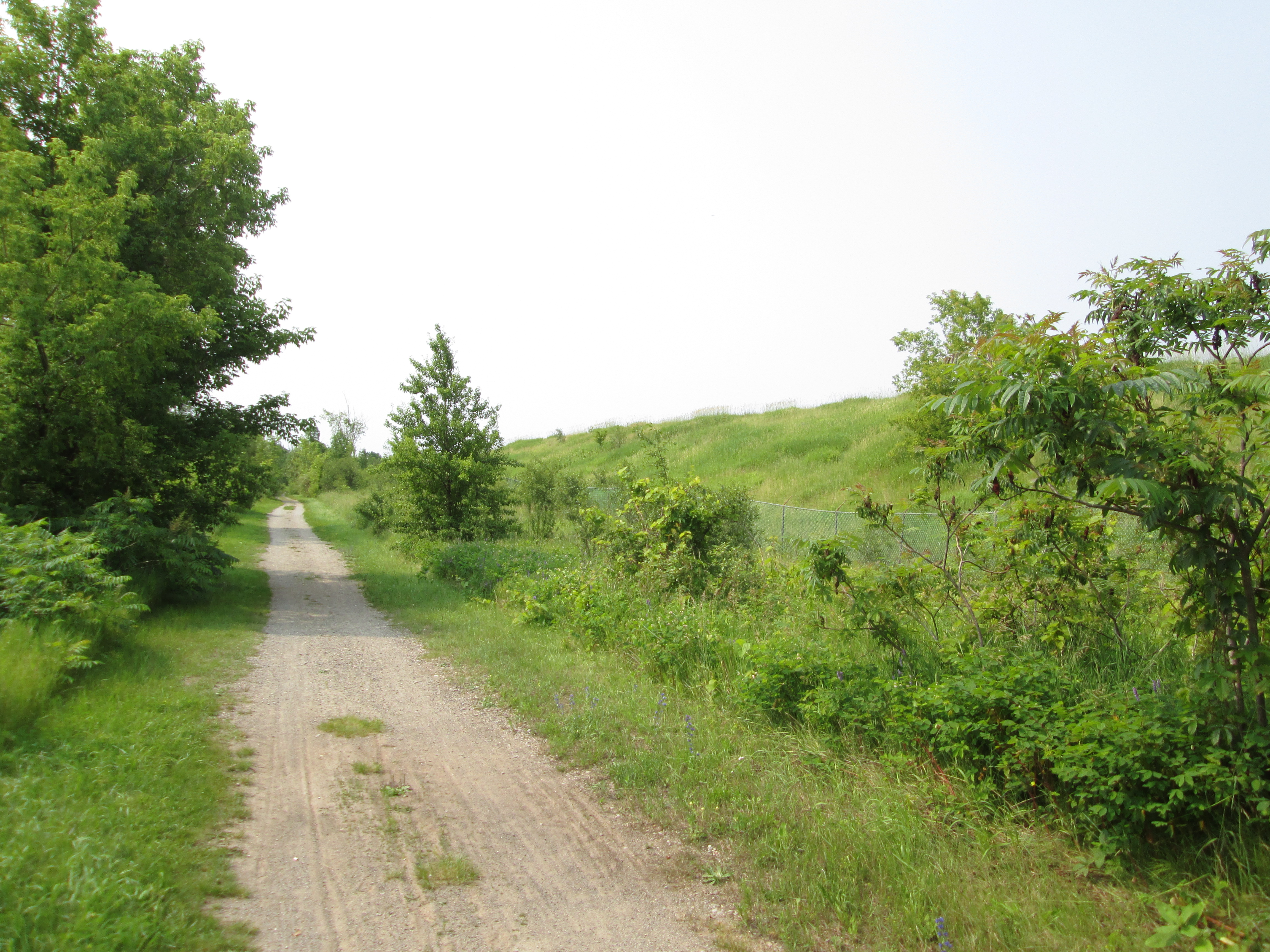
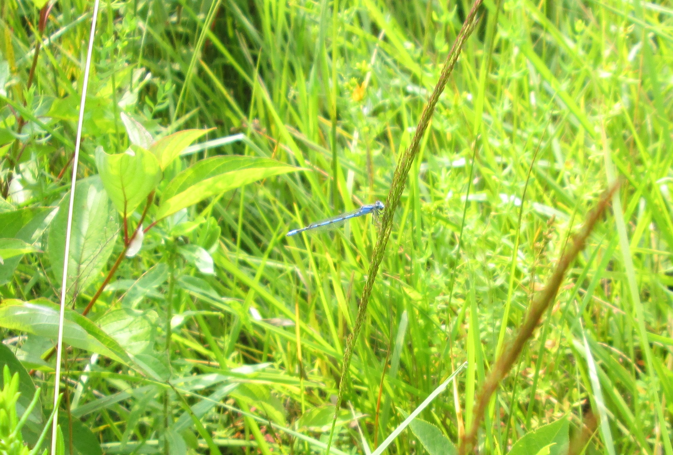
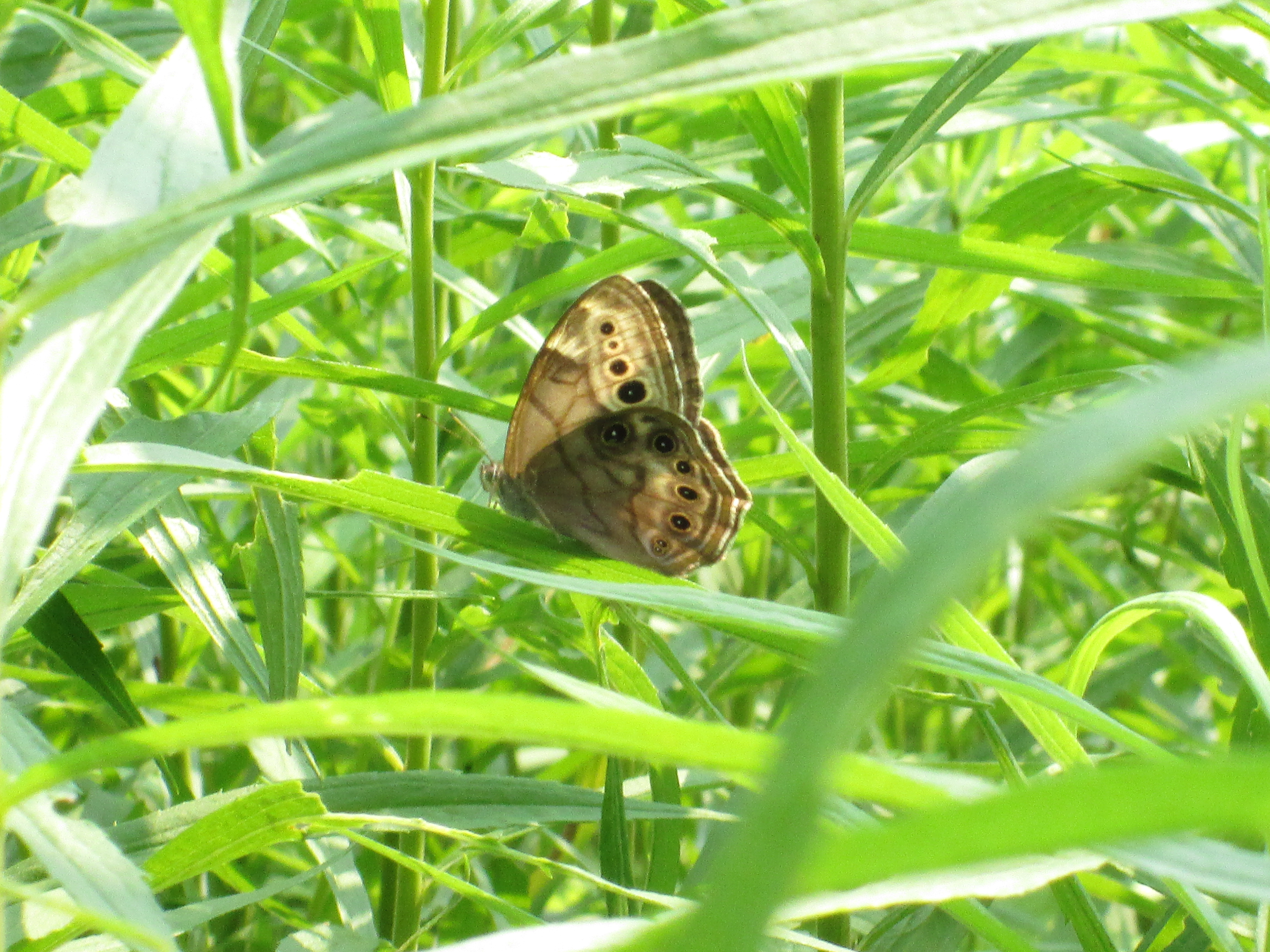
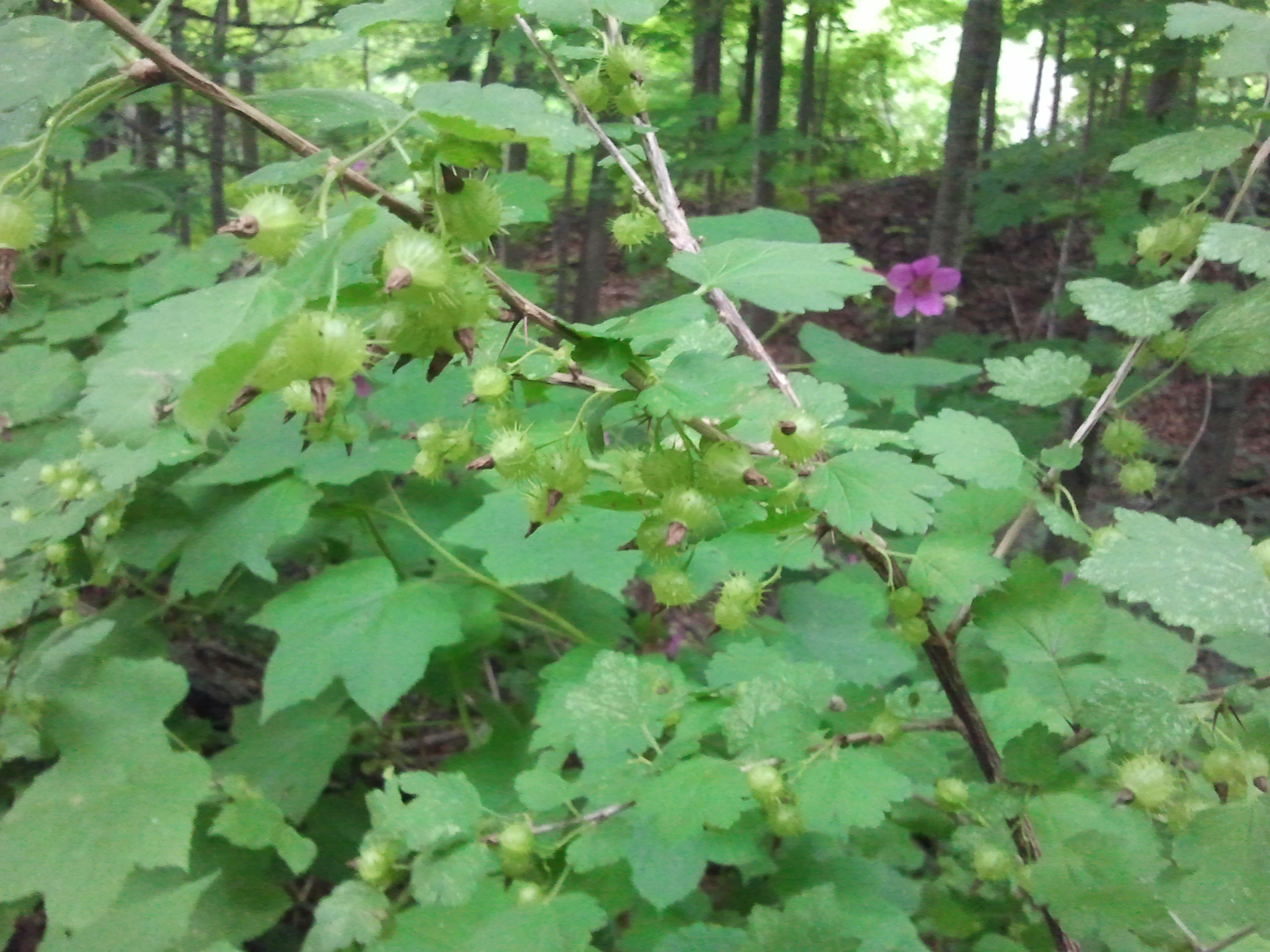
The following is a look back on some of the most popular hikes in the past 100 blogs. Companion posts will include some of the more interesting plants and animals photographed along the way.

After years of hiking up down down the ravines in the GTA and collecting thousands of pictures I needed a better way to organize and describe my photos.  A friend suggested WordPress and so I took the pictures for Saturday April 24, 2014 and created my first post.  Since then I’ve had the opportunity to hike much of the Humber, Don and Credit Rivers along with a wide variety of other spots.  My mom has become an avid reader and I’ve picked up some other readers along the way.

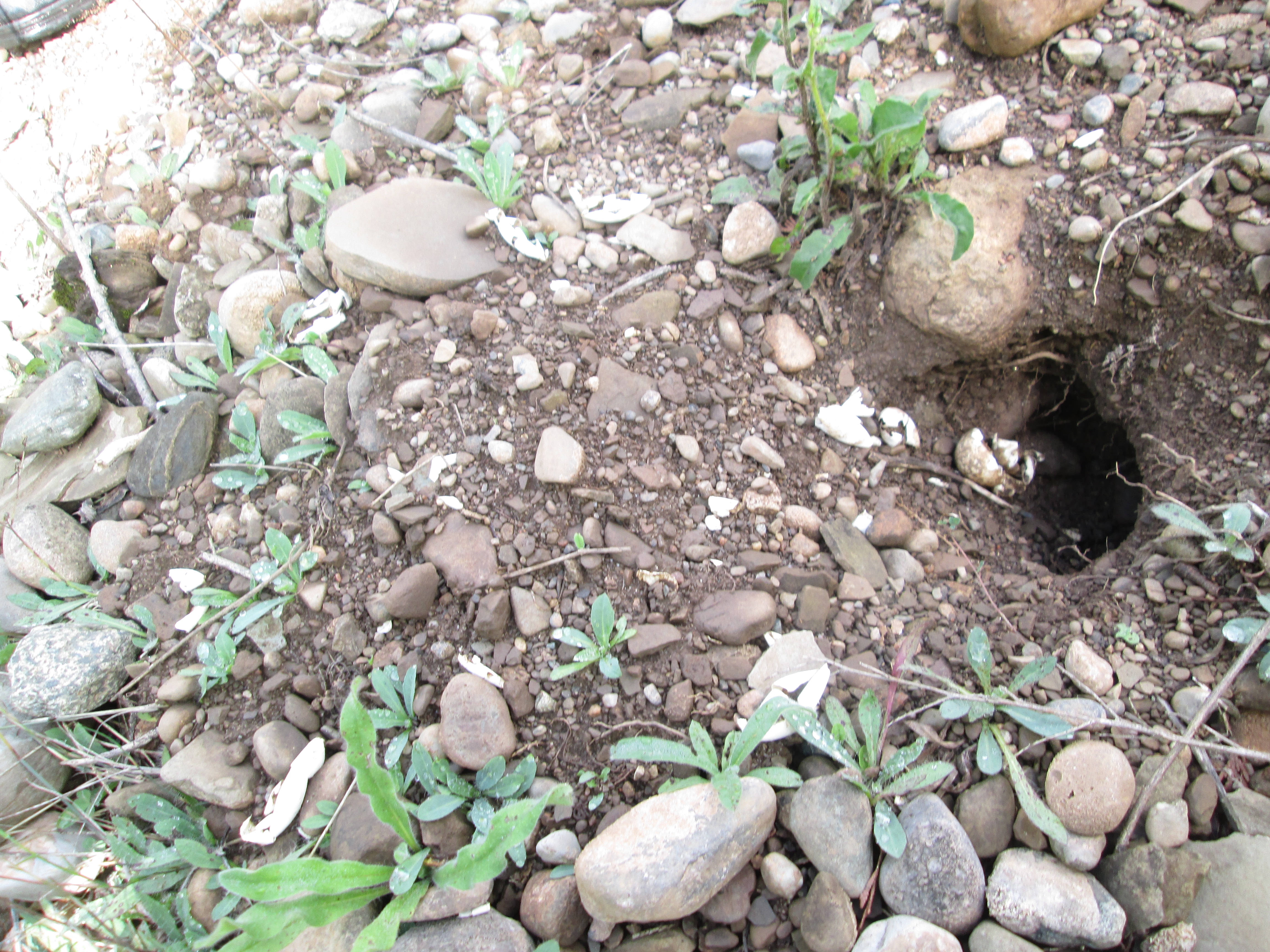
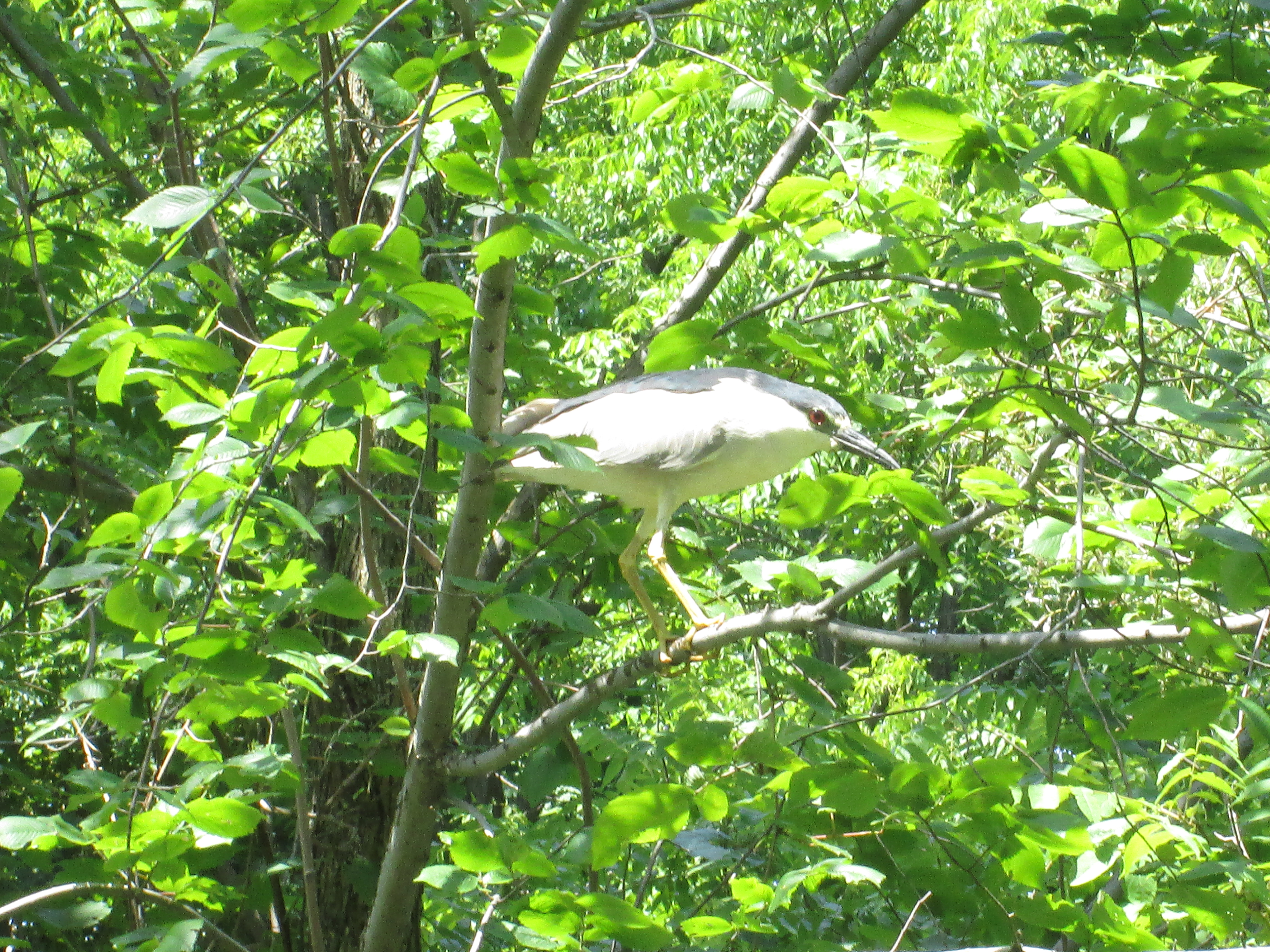
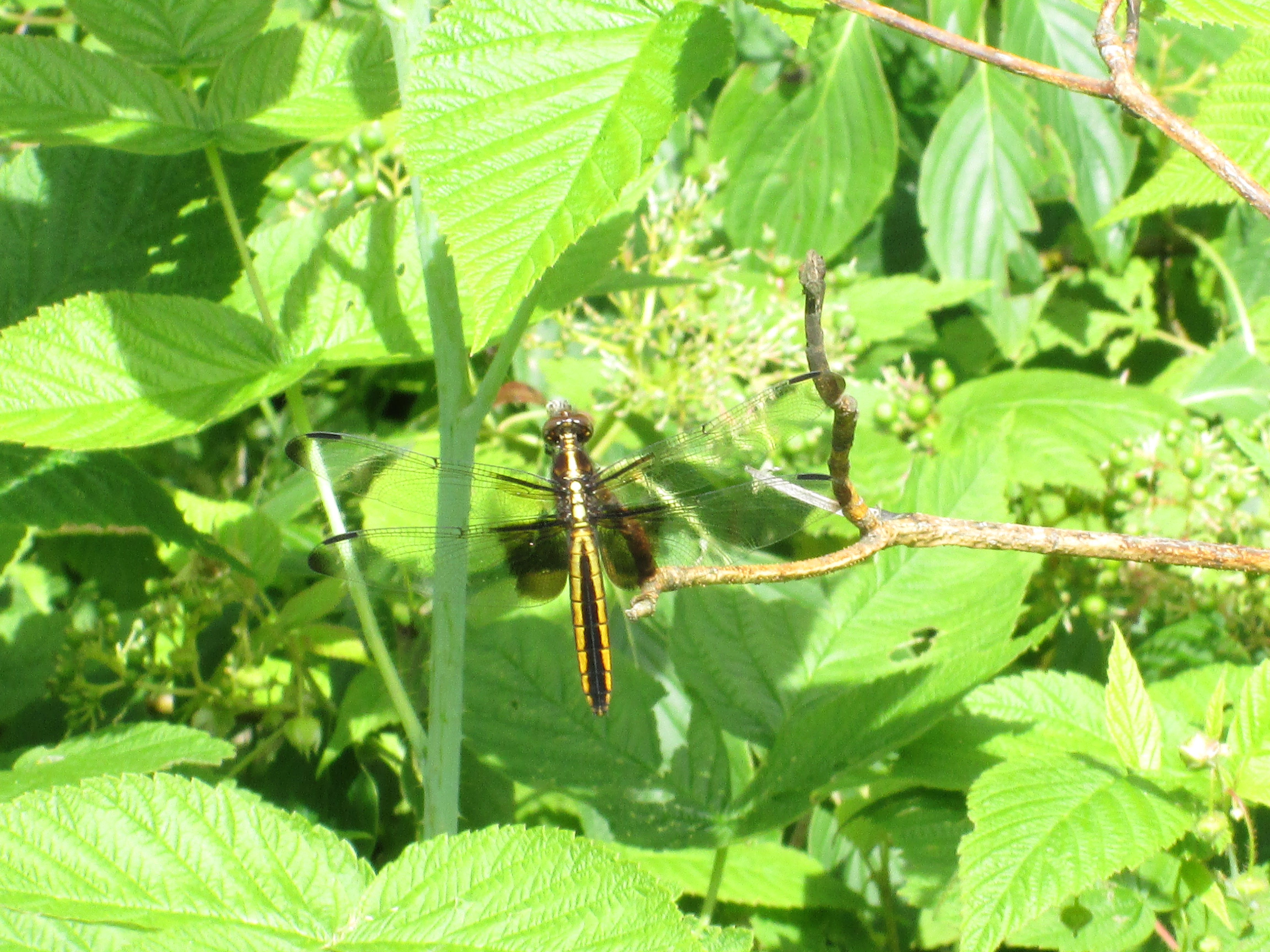
We’ve visited some very interesting historical places, seen a lot of wildlife and the abundant nature the area has to offer.  We never missed a weekend due to rain-outs.  One hike this past winter never got published when I couldn’t differentiate between the polar bear picture and the egret due to the driving snow storm .  To celebrate this, my 100th post, I thought I’d take a look back at those stories that were the most popular in this first chapter of the ongoing adventure that is Hiking The GTA. Below are the top 15 posts and a link to the full story should something catch your fancy.

15. High Park – Colborne Lodge – Hike Date: Nov. 22, 2014

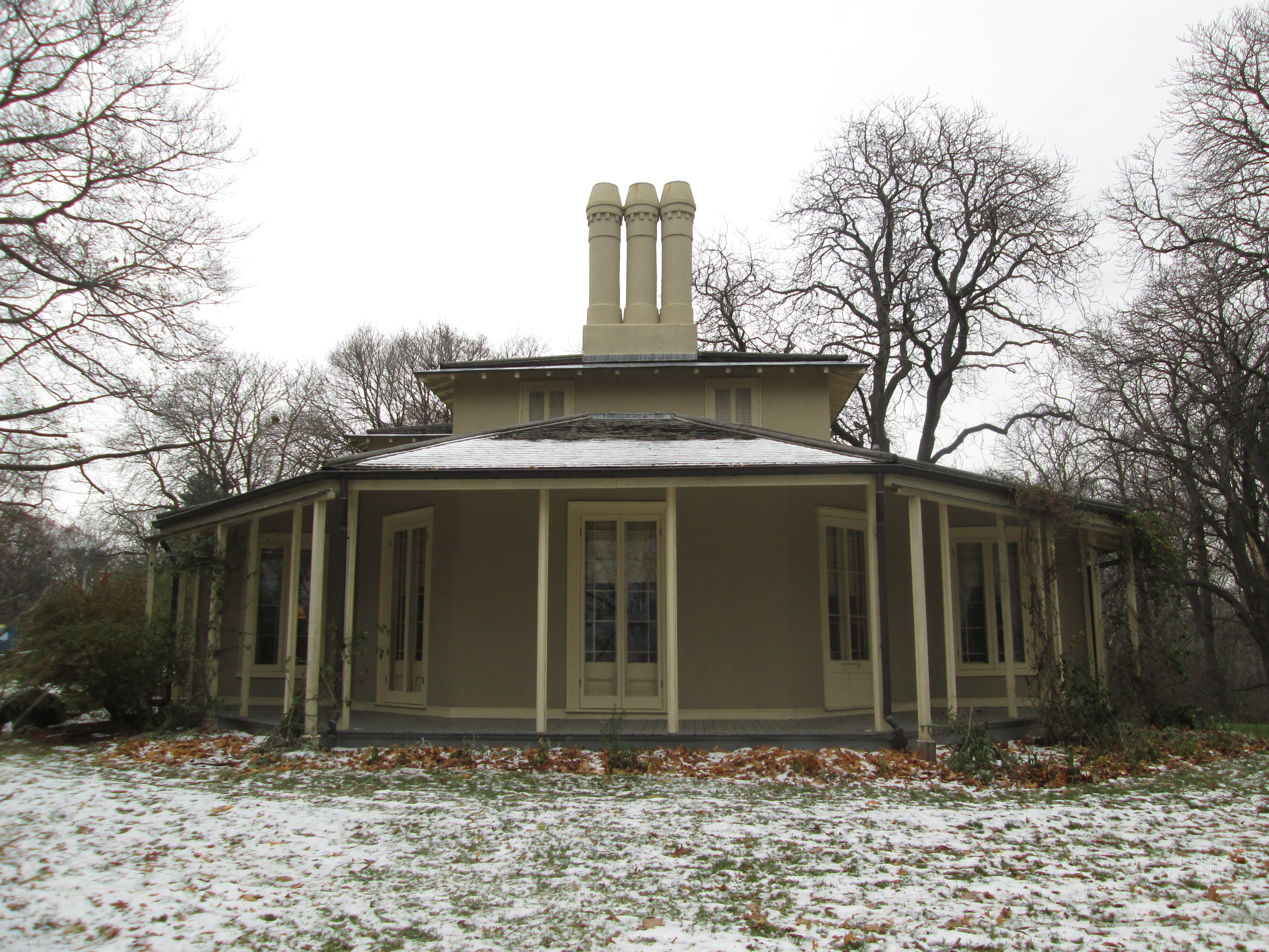
John Howard donated the land for High Park in 1873.  He built his house, Colborne Lodge in 1837 and it remains largely unchanged today.  This post explores the west side of the park including Grenadier Pond.

IMG_1199

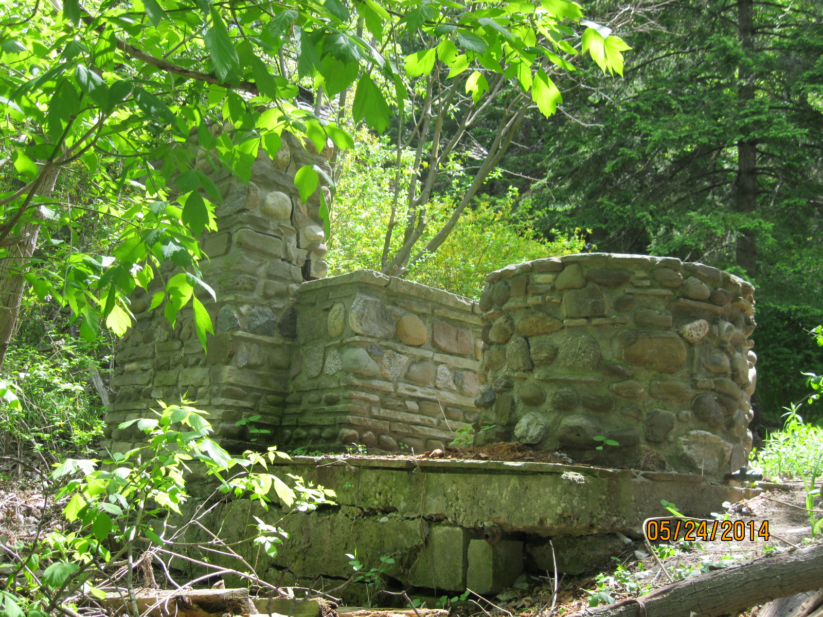
14. Humber Bay to Bloor – Hike Date: May 24, 2014

One of the earliest hikes in the blog, this one covers the lower stretch of the Don River.  Near Bloor Street an abandoned building overlooks King’s Mill Park.

IMG_2041

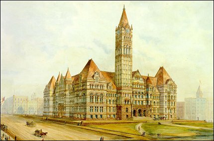
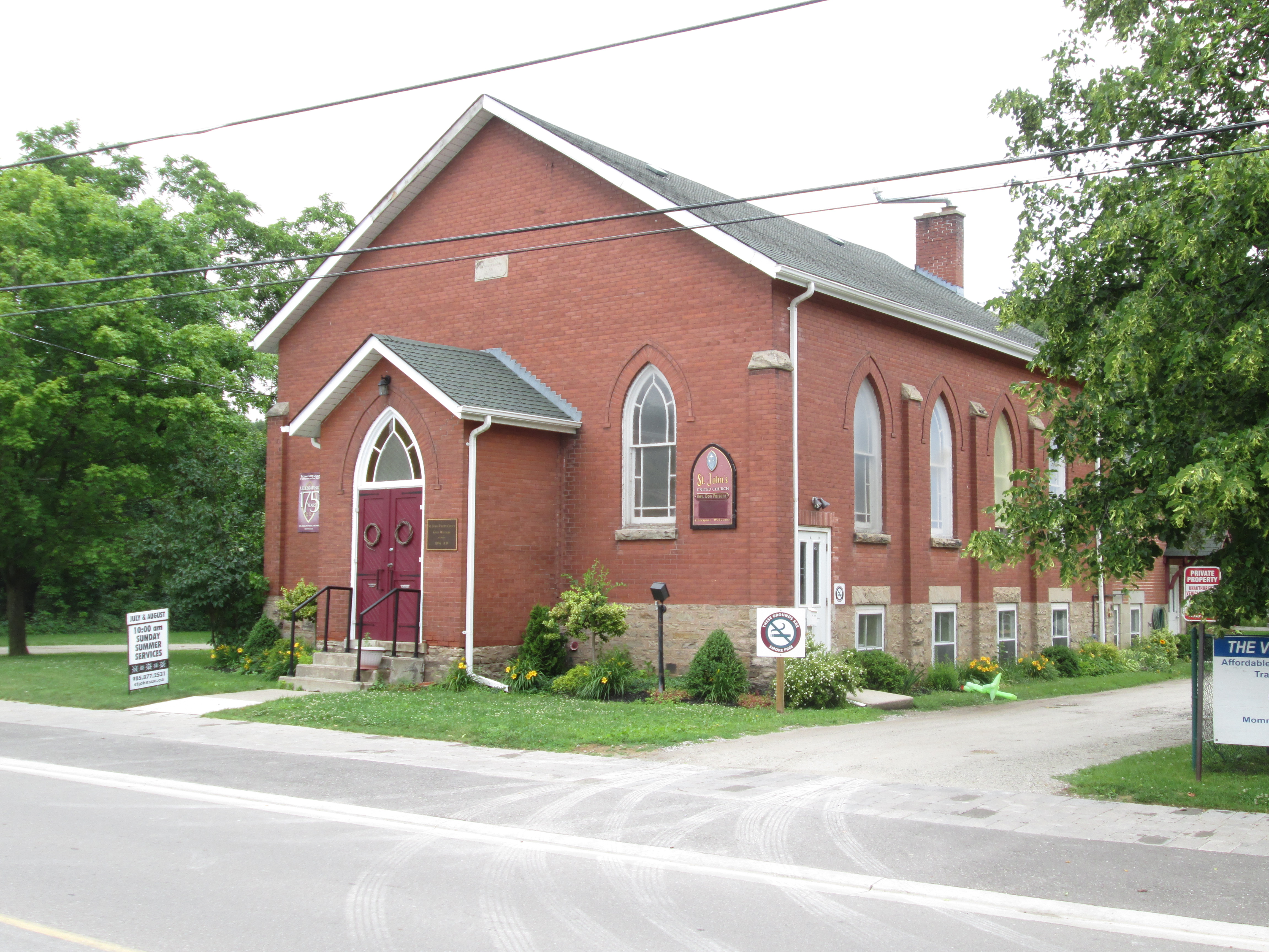
13. Guildwood Park – Hike Date: Apr. 19, 2015

Home to the Guildwood Inn, this former artist colony features artwork from several of Toronto’s demolished buildings.

IMG_3833

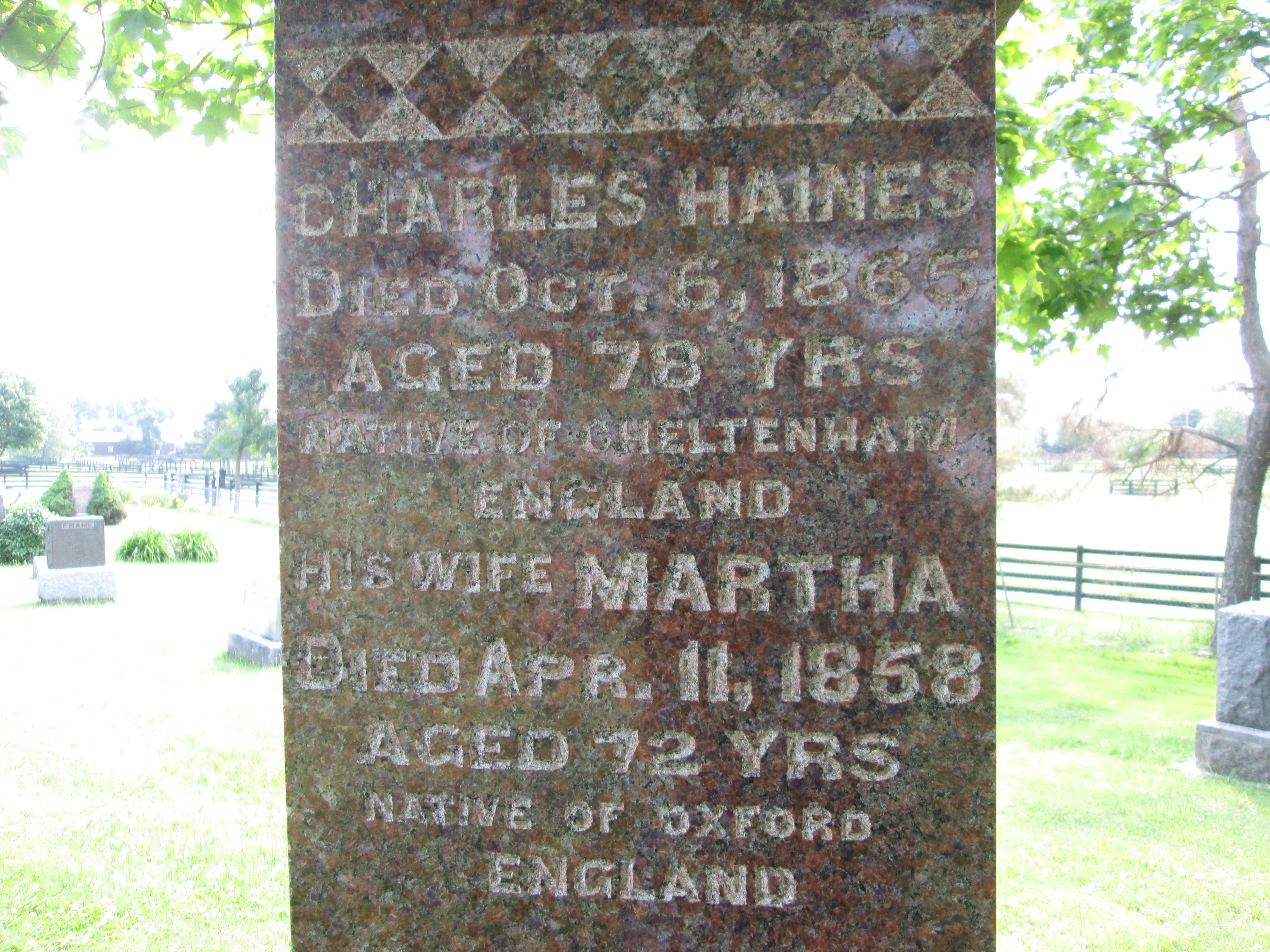
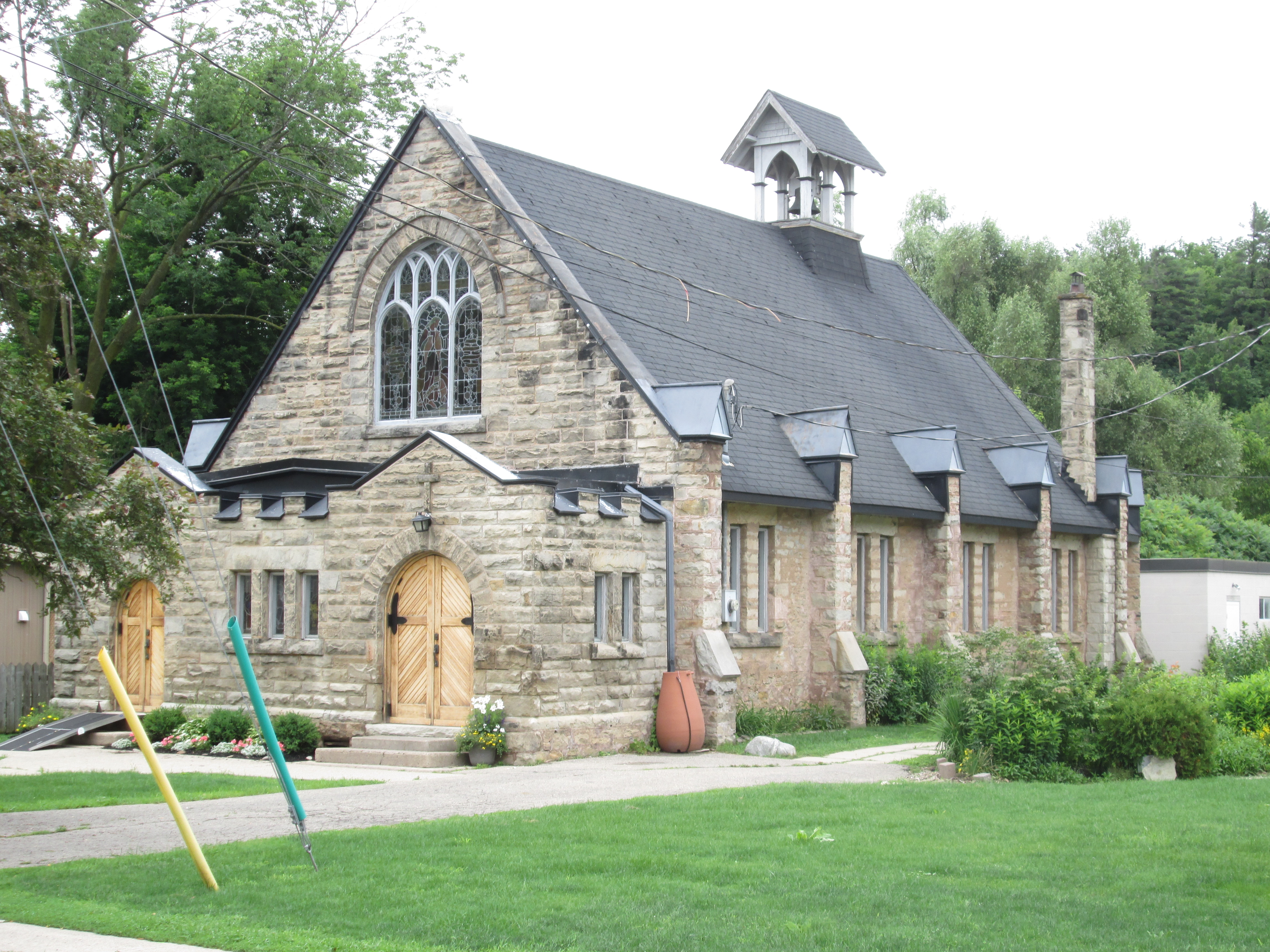
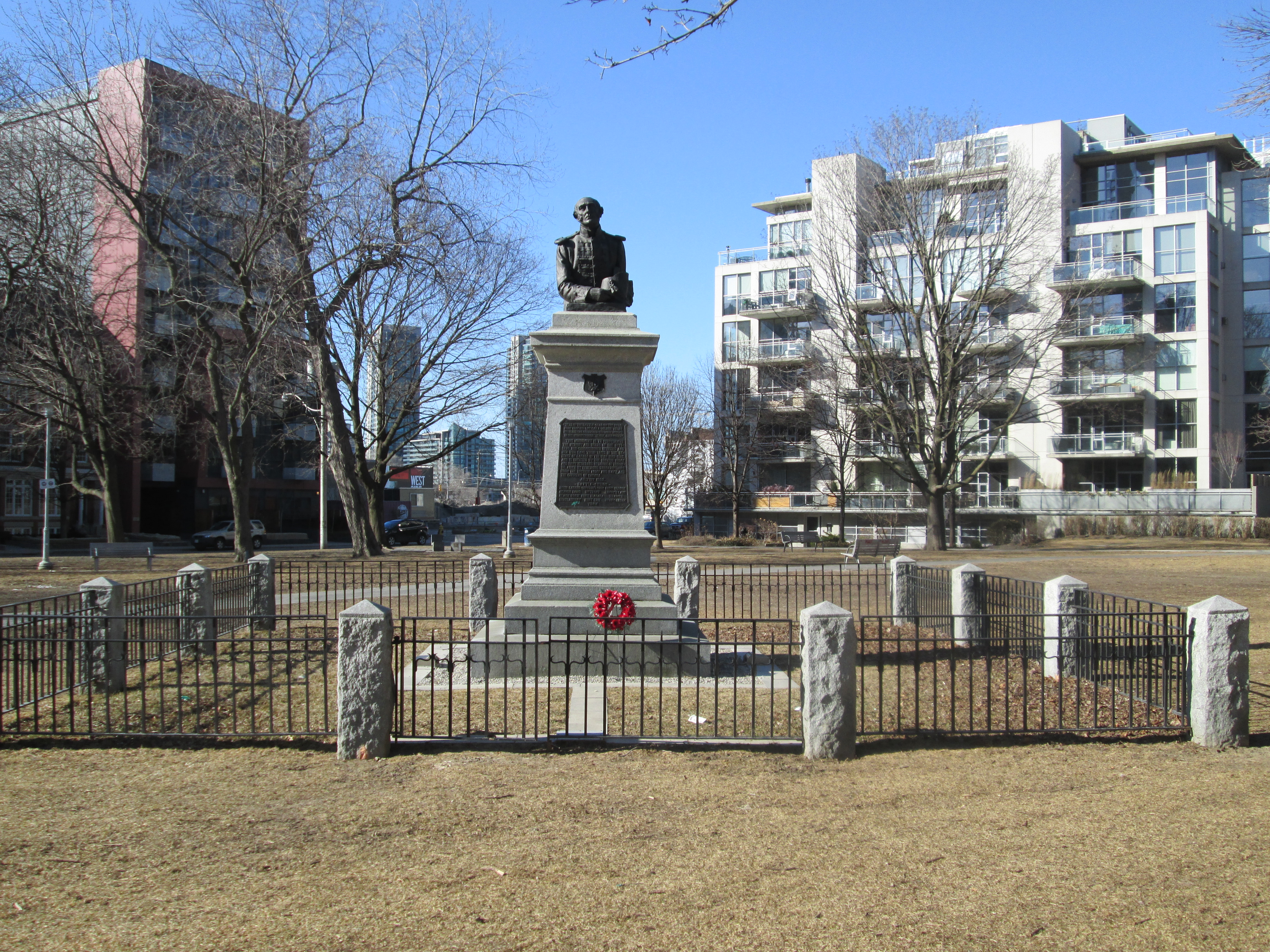
12. Military Burying Grounds – Hike Date: Mar. 22, 2015

The first burial in York (Toronto) occurred in 1794 when Lieutenant Governor Simcoe buried his one year old daughter in the woods behind Fort York.  This became the site of the Fort York cemetery until it was declared full and a second military burial grounds was opened at the west end of the Fort York Commons.

IMG_2952

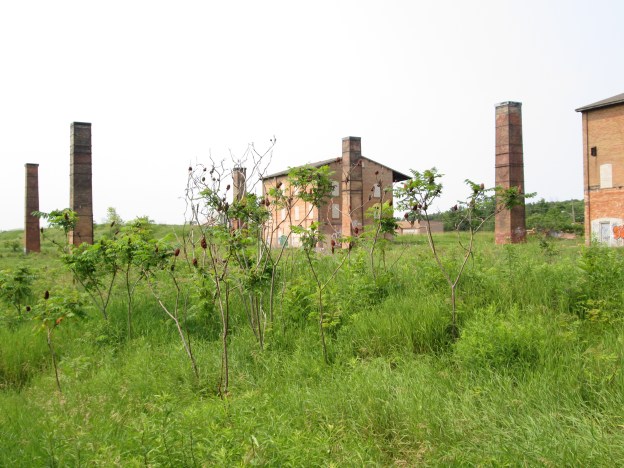
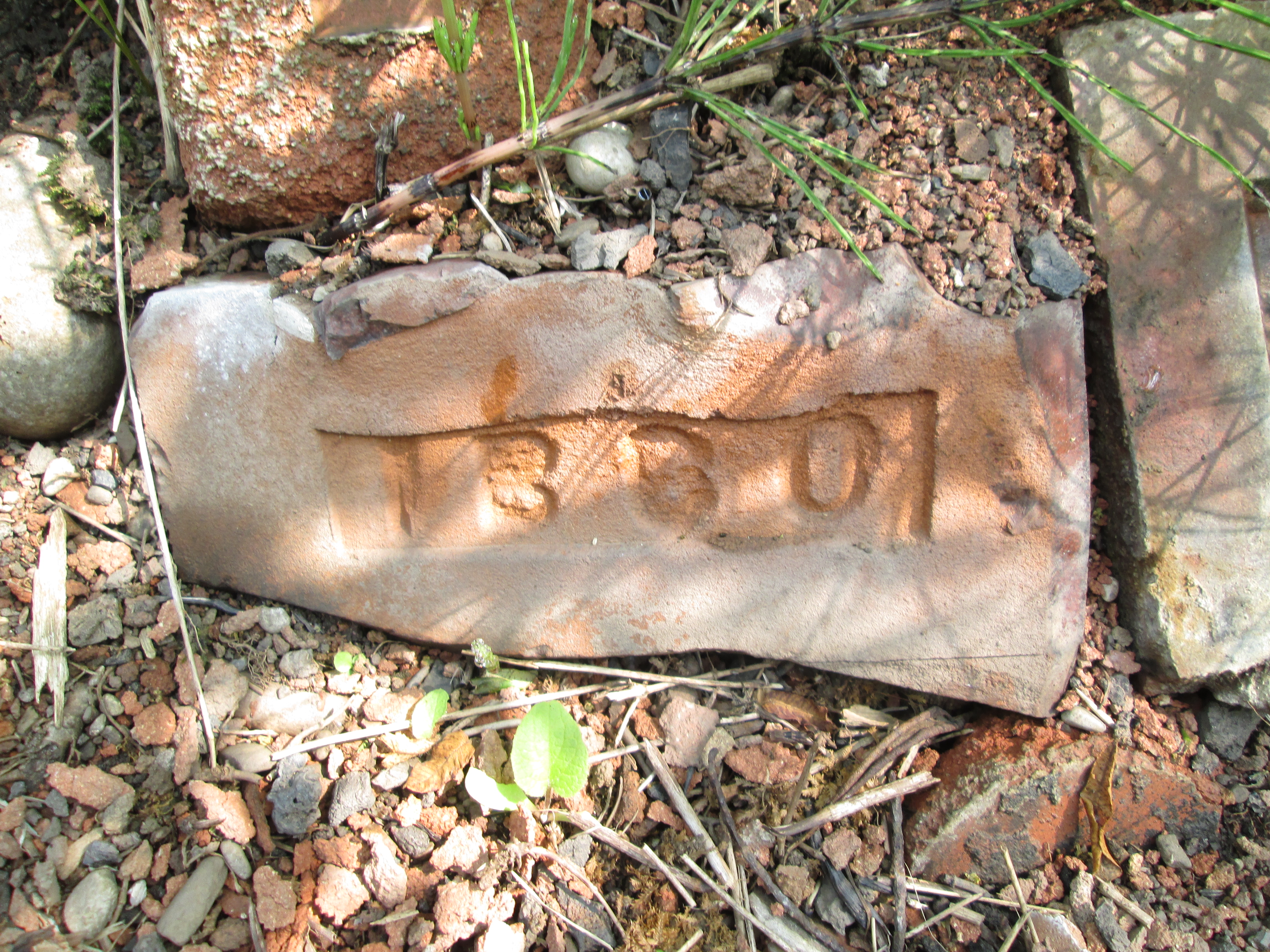
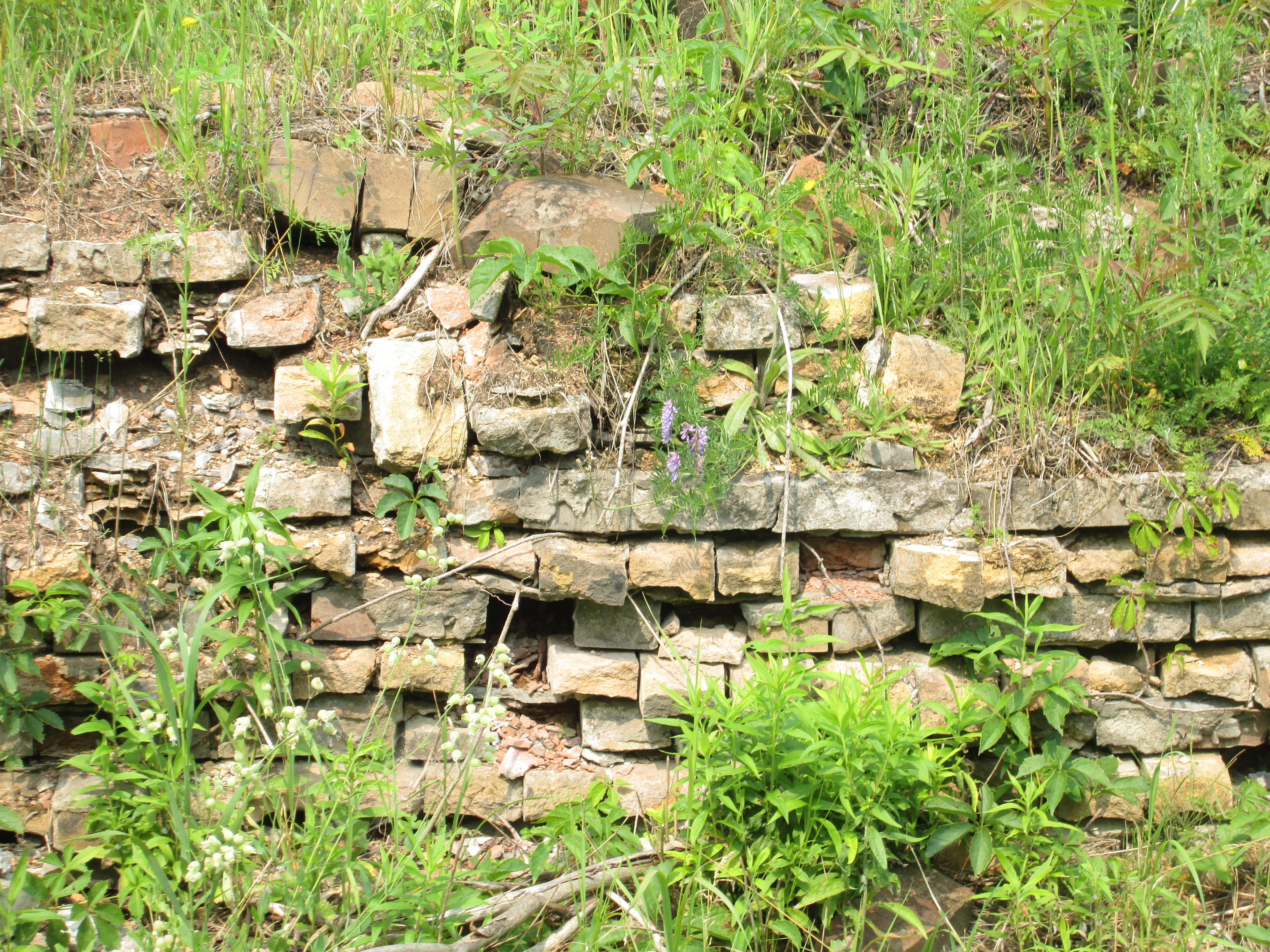
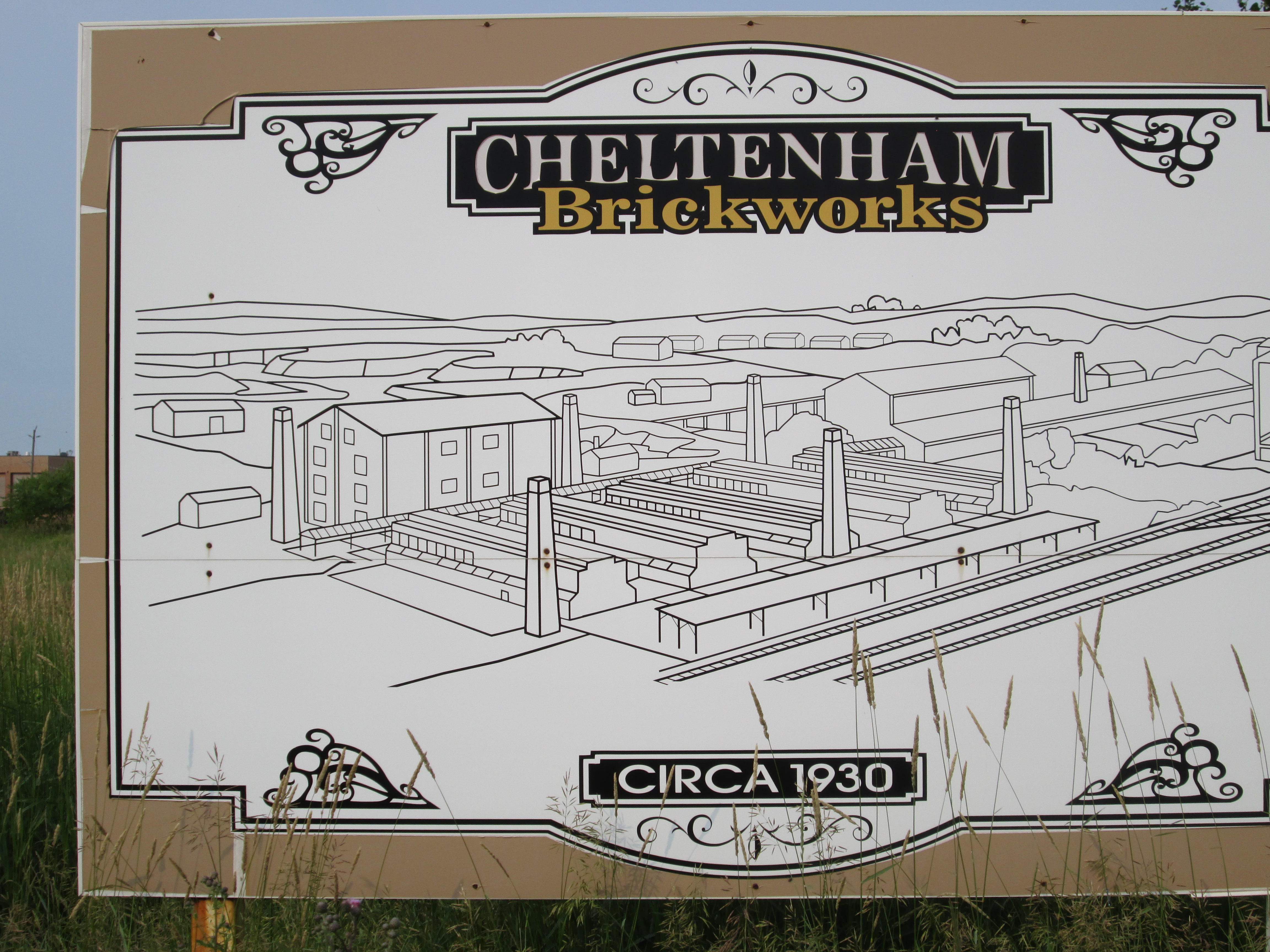
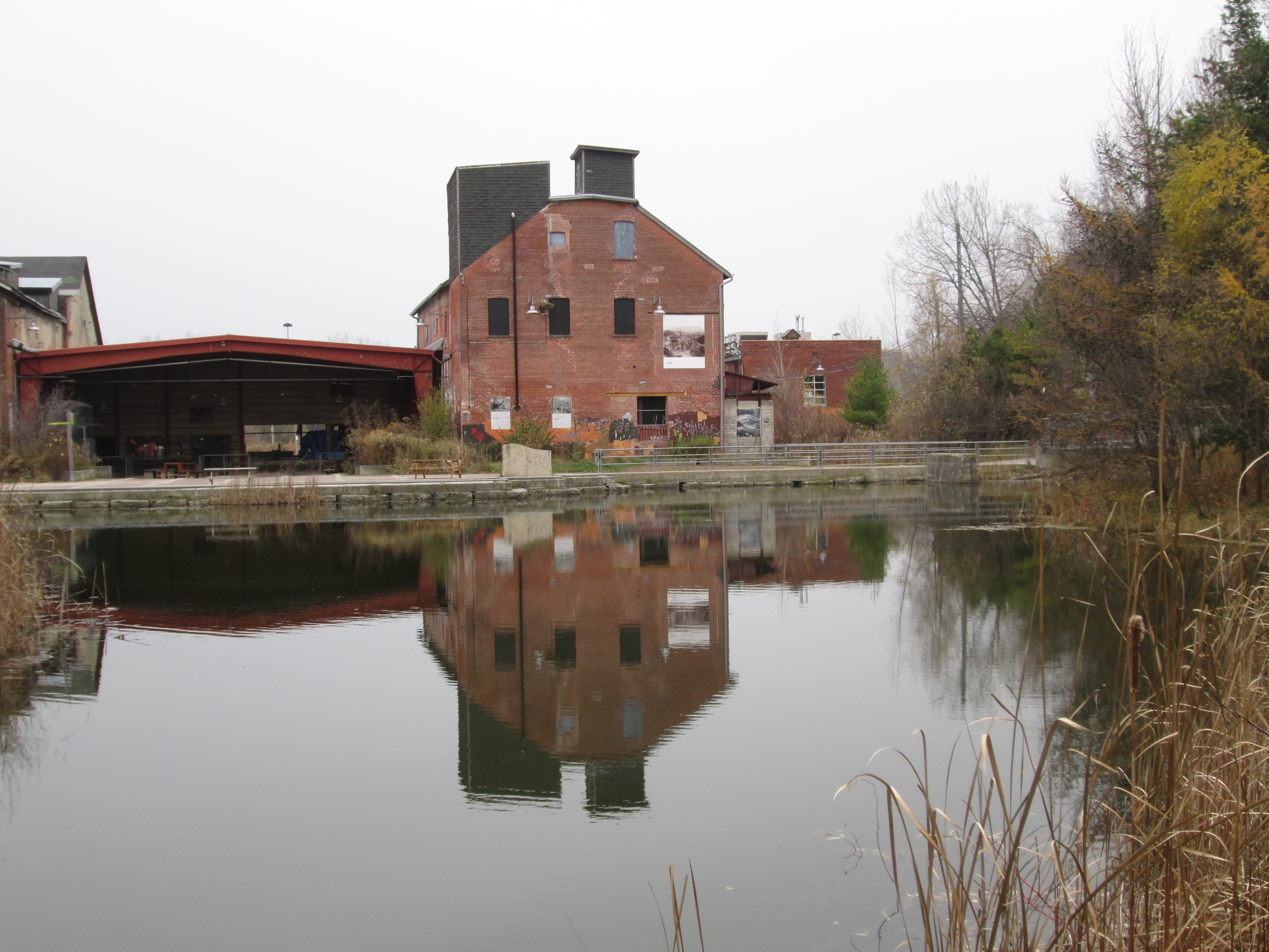
11. Don Valley Brick Works – Hike Date: Nov. 16, 2014

Starting in 1882 and lasting for close to 100 years, the Don Valley Brick Works produced much of the brick used in constructing early Toronto.  This post explores the various buildings as well as the old pit, now converted to a park.

IMG_1083

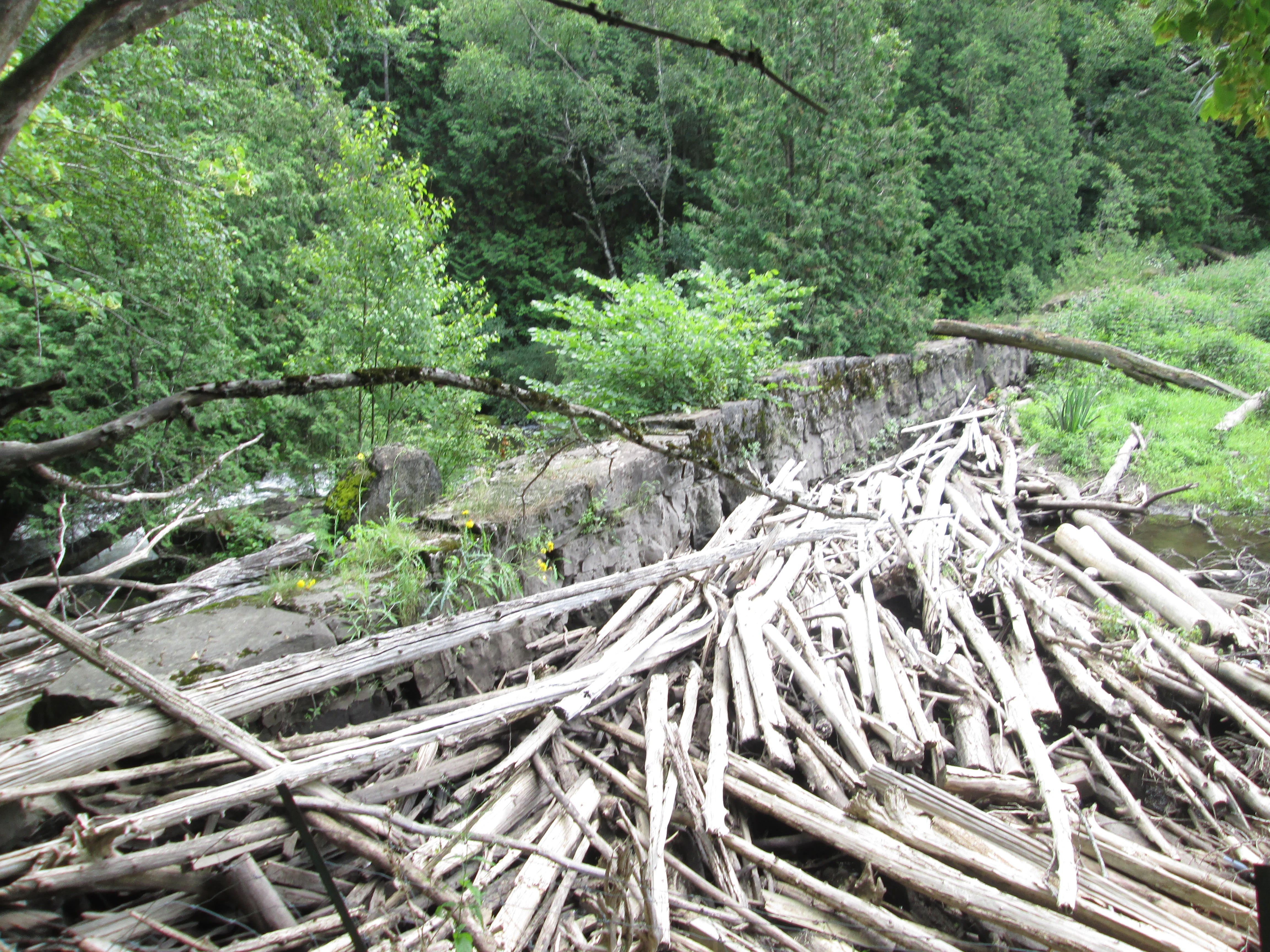
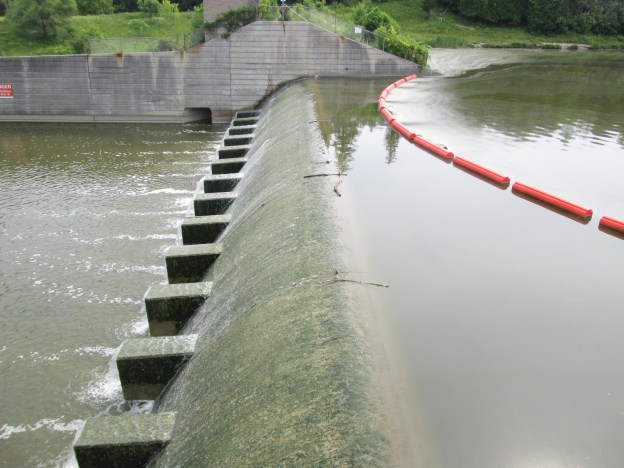
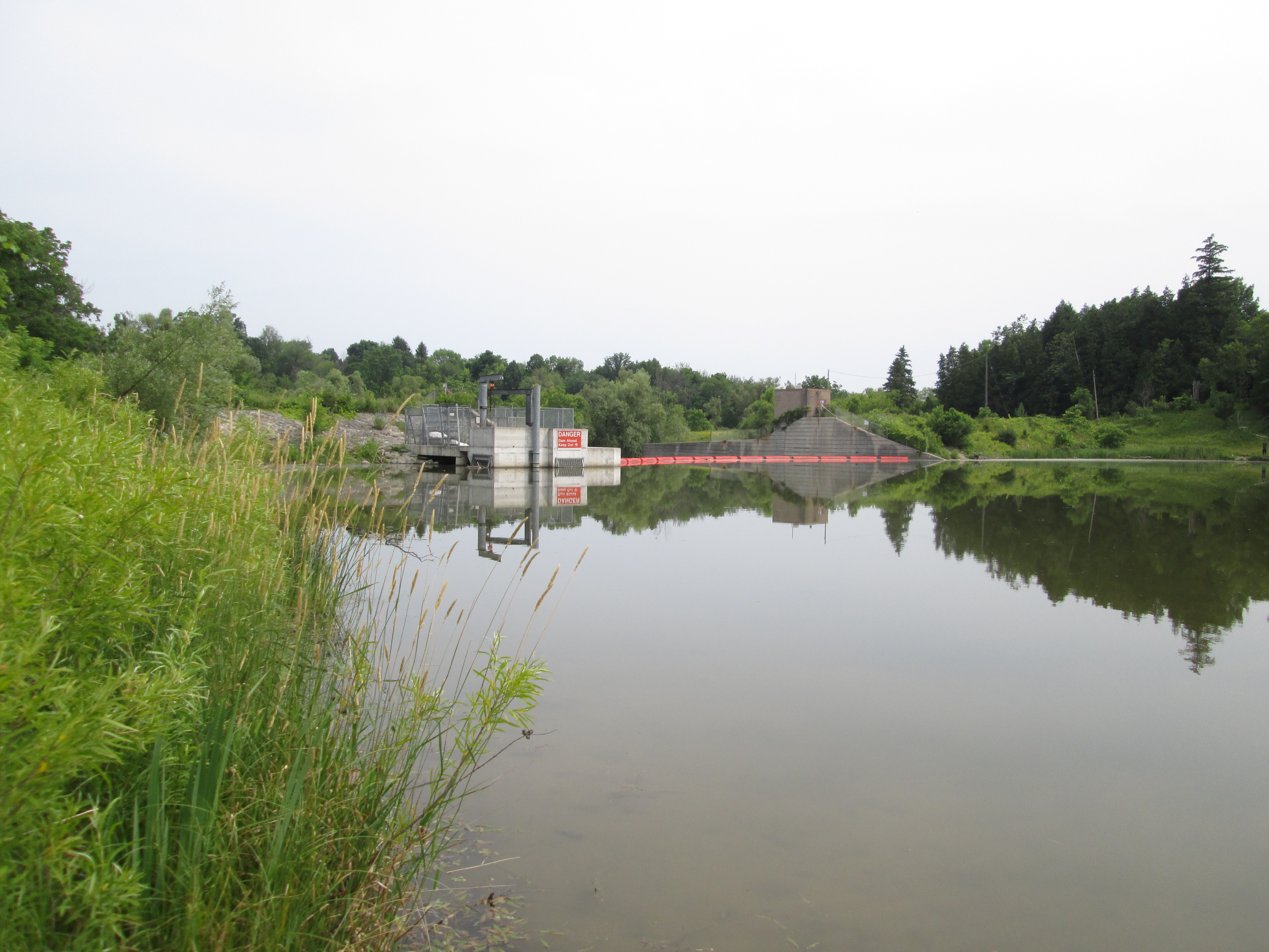
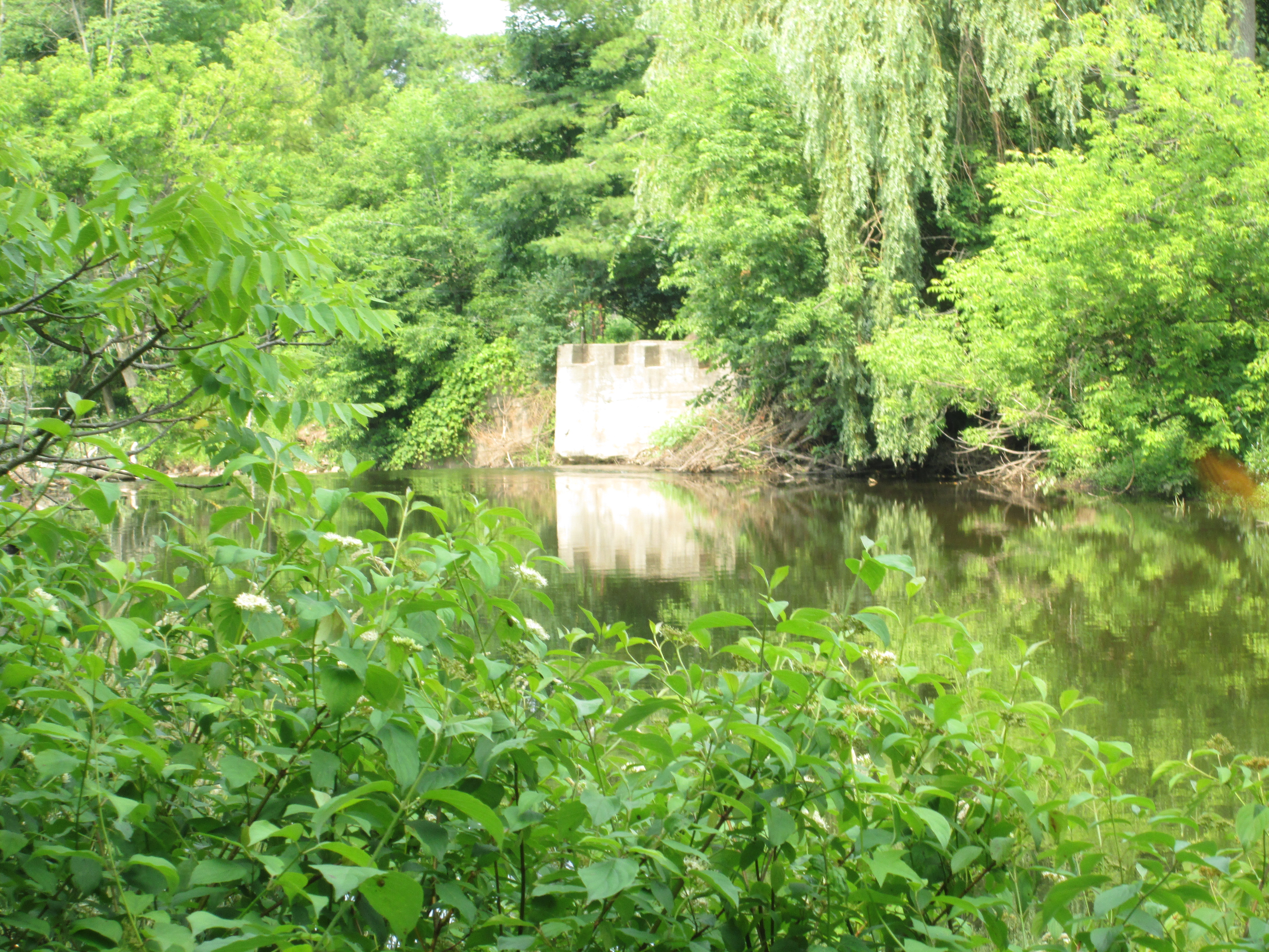
10. Erindale Hydro Electric Dam – Hike Date: Oct. 19, 2014

Constructed between 1902 and 1910 the electric power generation plant in Erindale operated until 1923.  This hike explored the old dam, the surrounding park and the intake housing for the head race to the power station.

IMG_0683

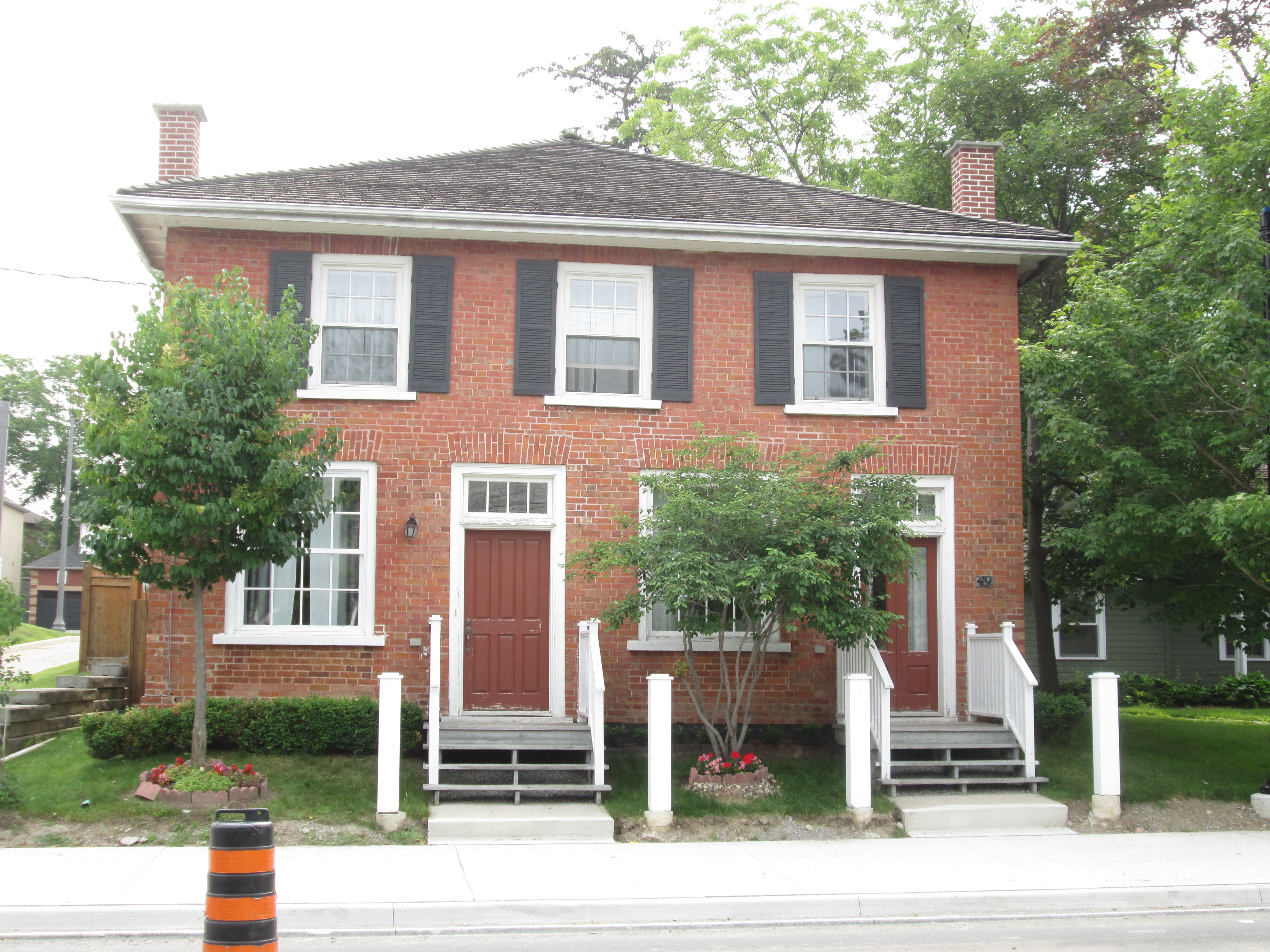
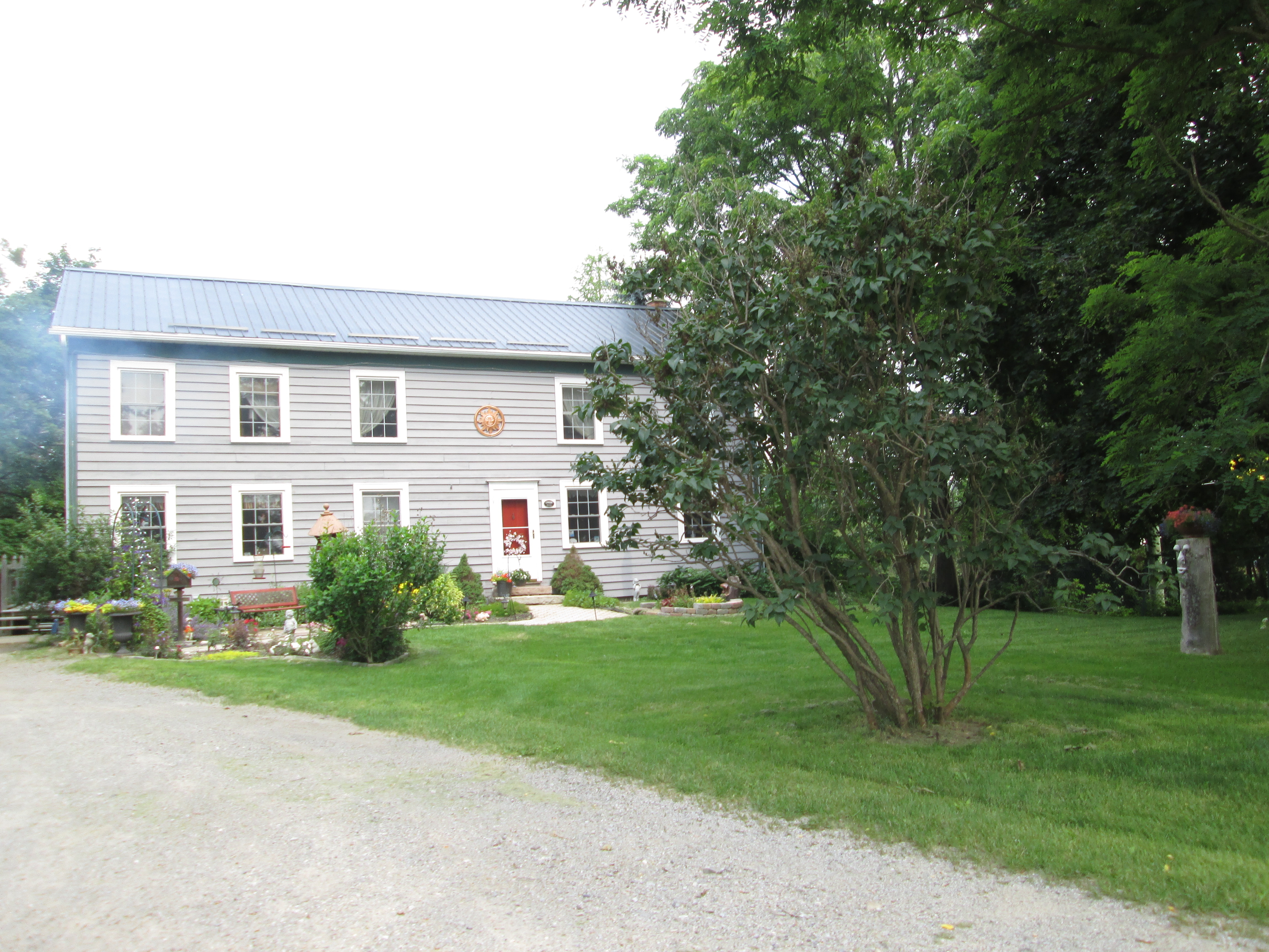
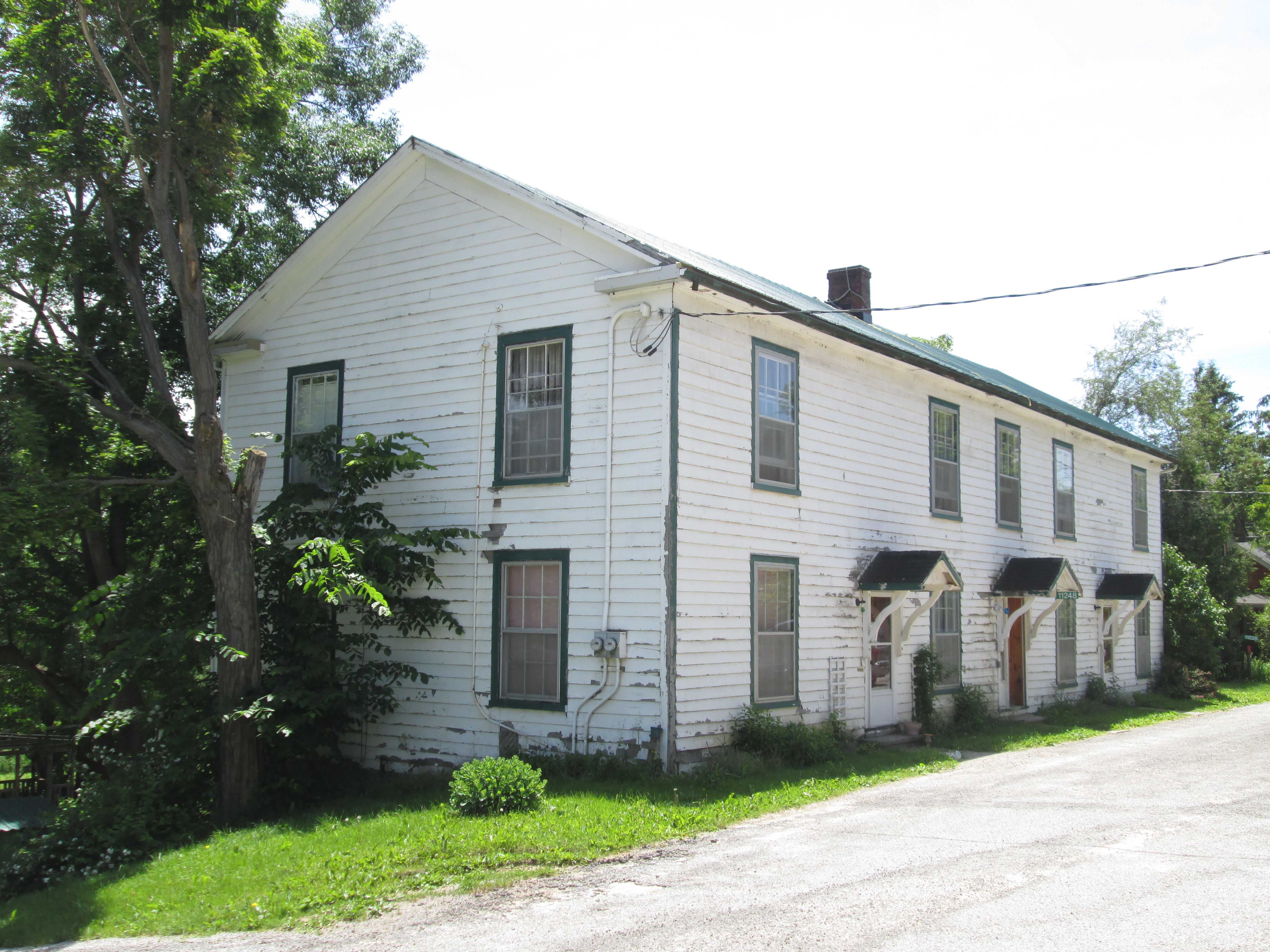
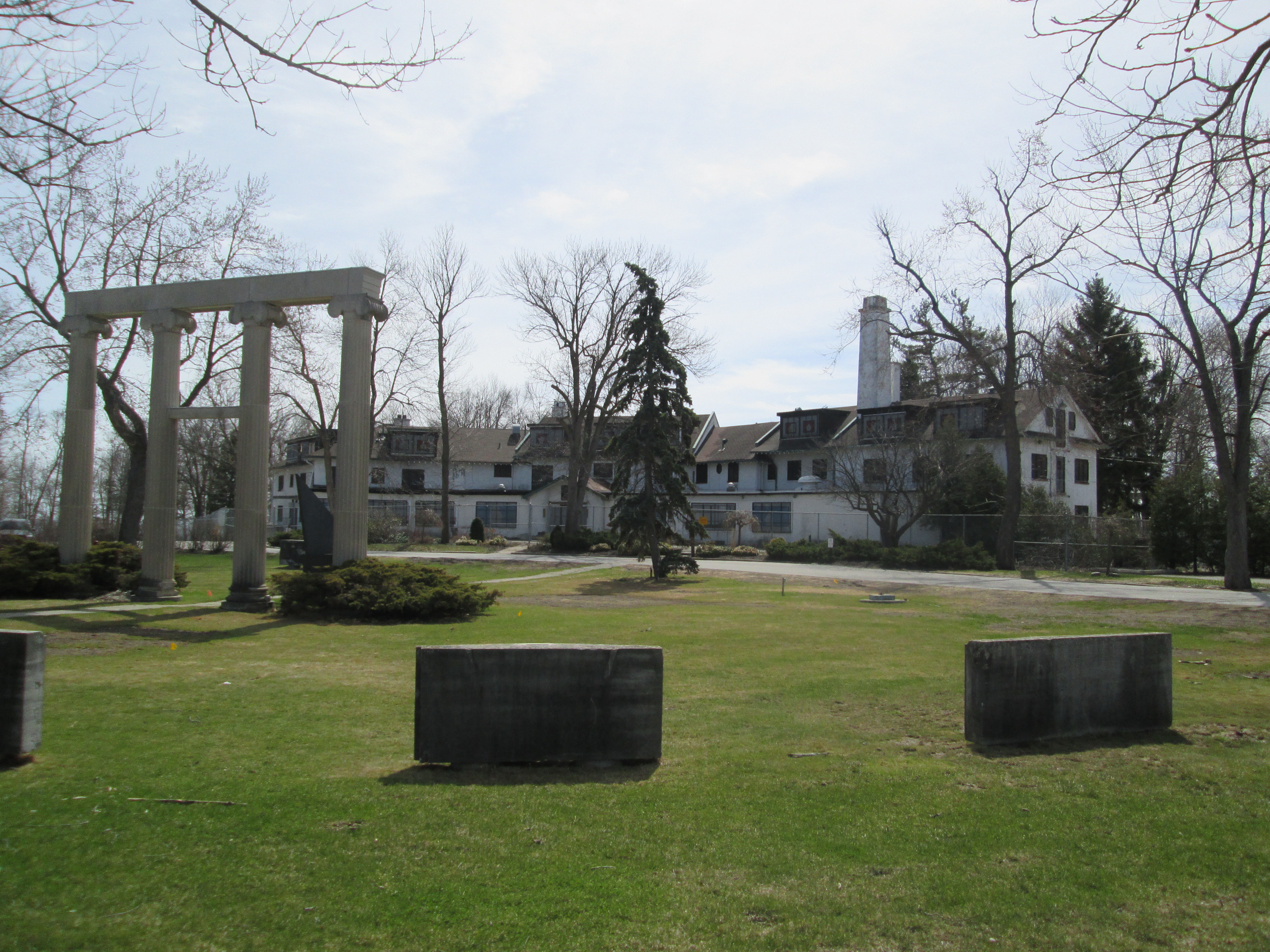
9. Bayview Estates – Hike Date: Nov. 2, 2014

The area of Bayview Avenue and Lawrence Avenue was home to several grand estates owned by Toronto’s millionaires in the early 1900’s.  This post visits several of these estates and stops by the pre-1929 Bayview Ave. bridge, pictured below.

IMG_0886

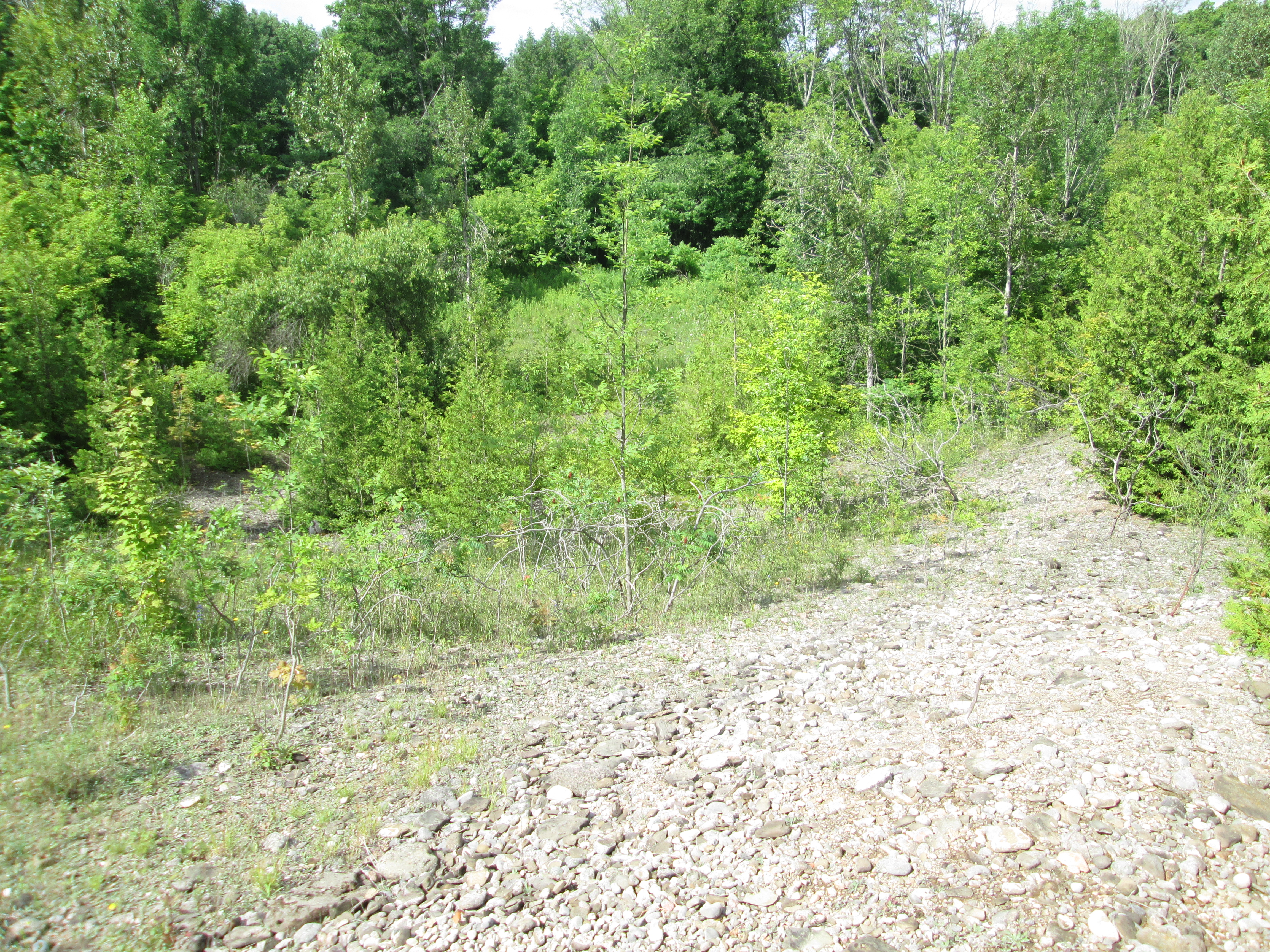
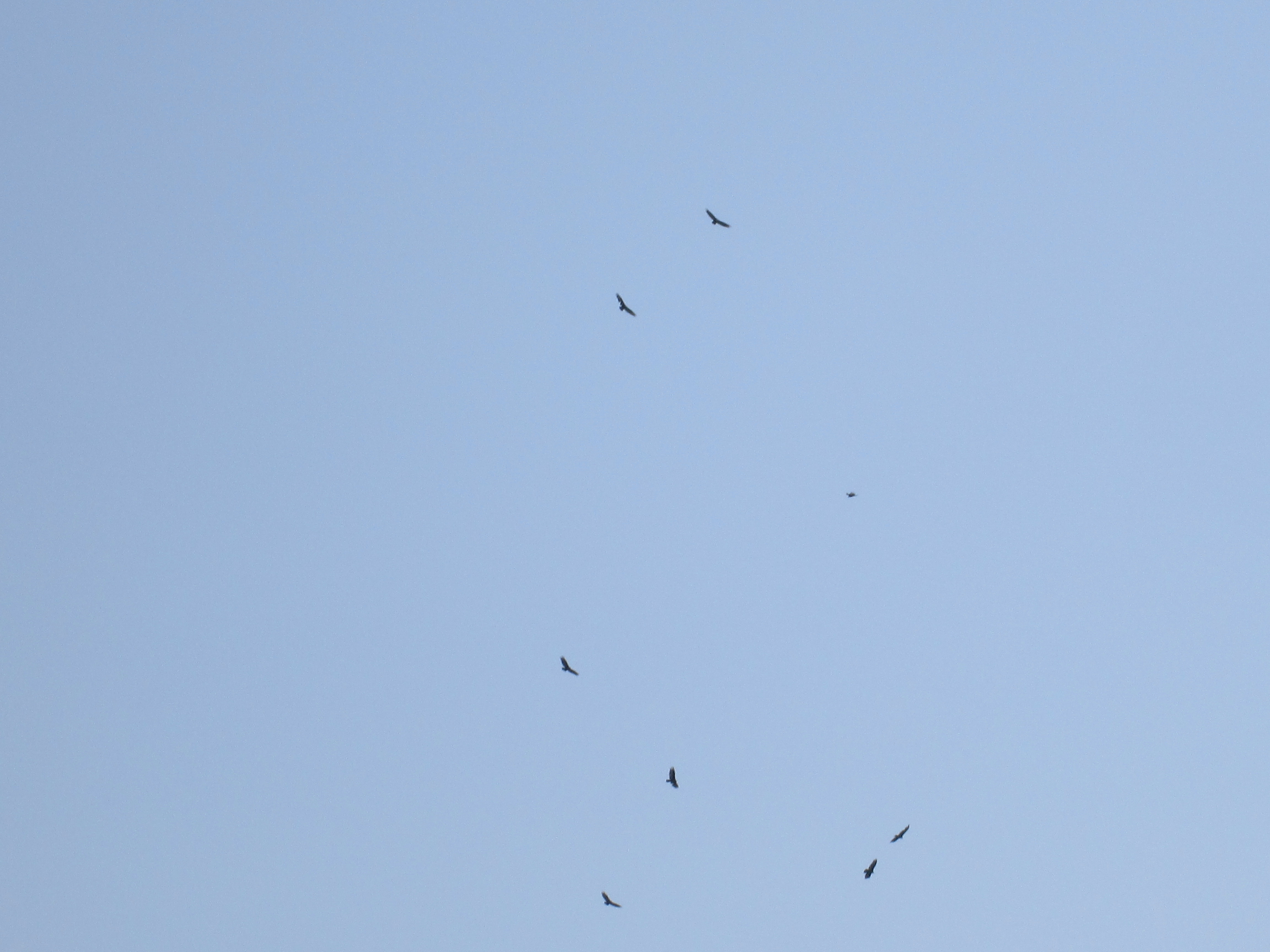
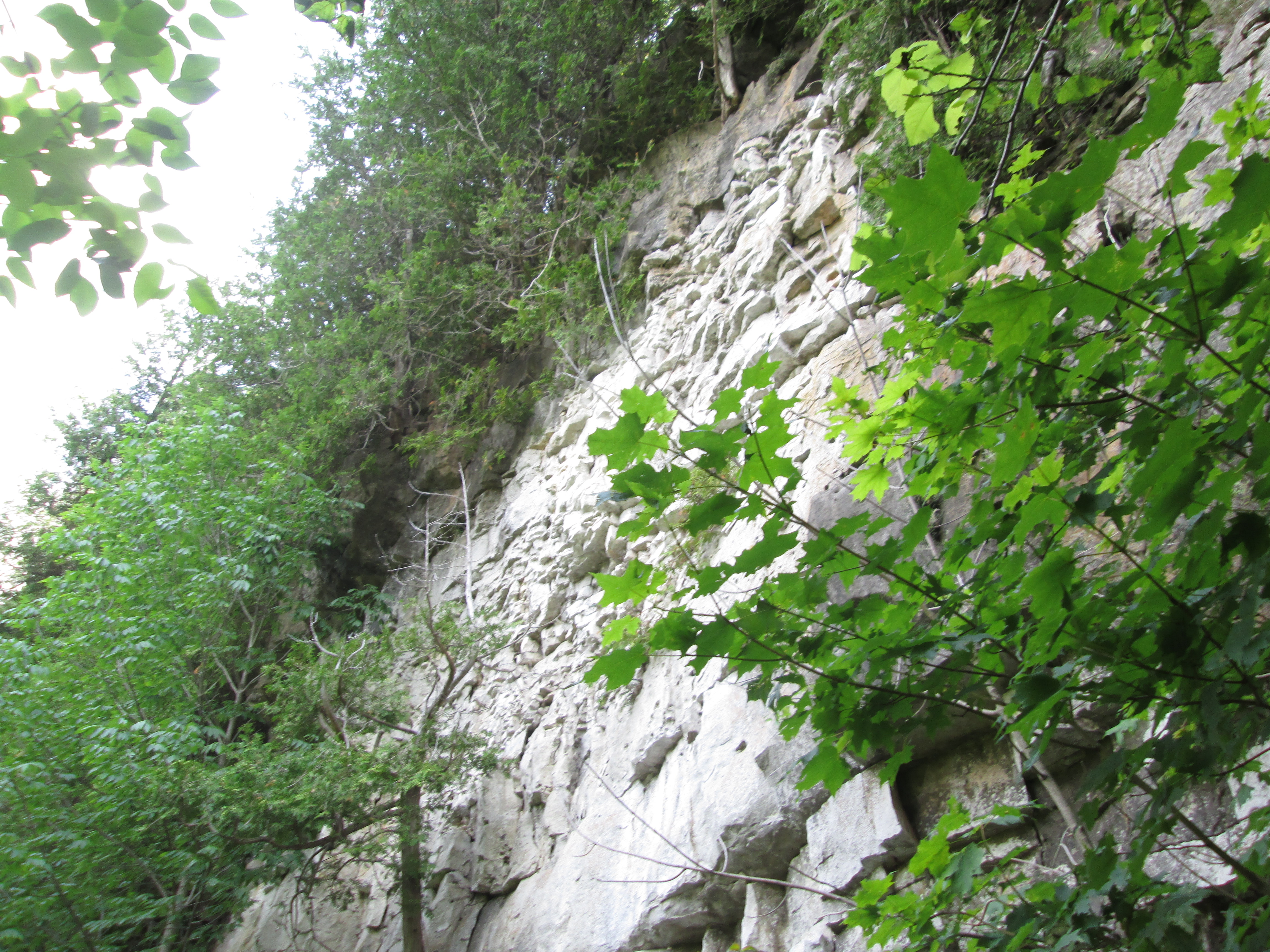
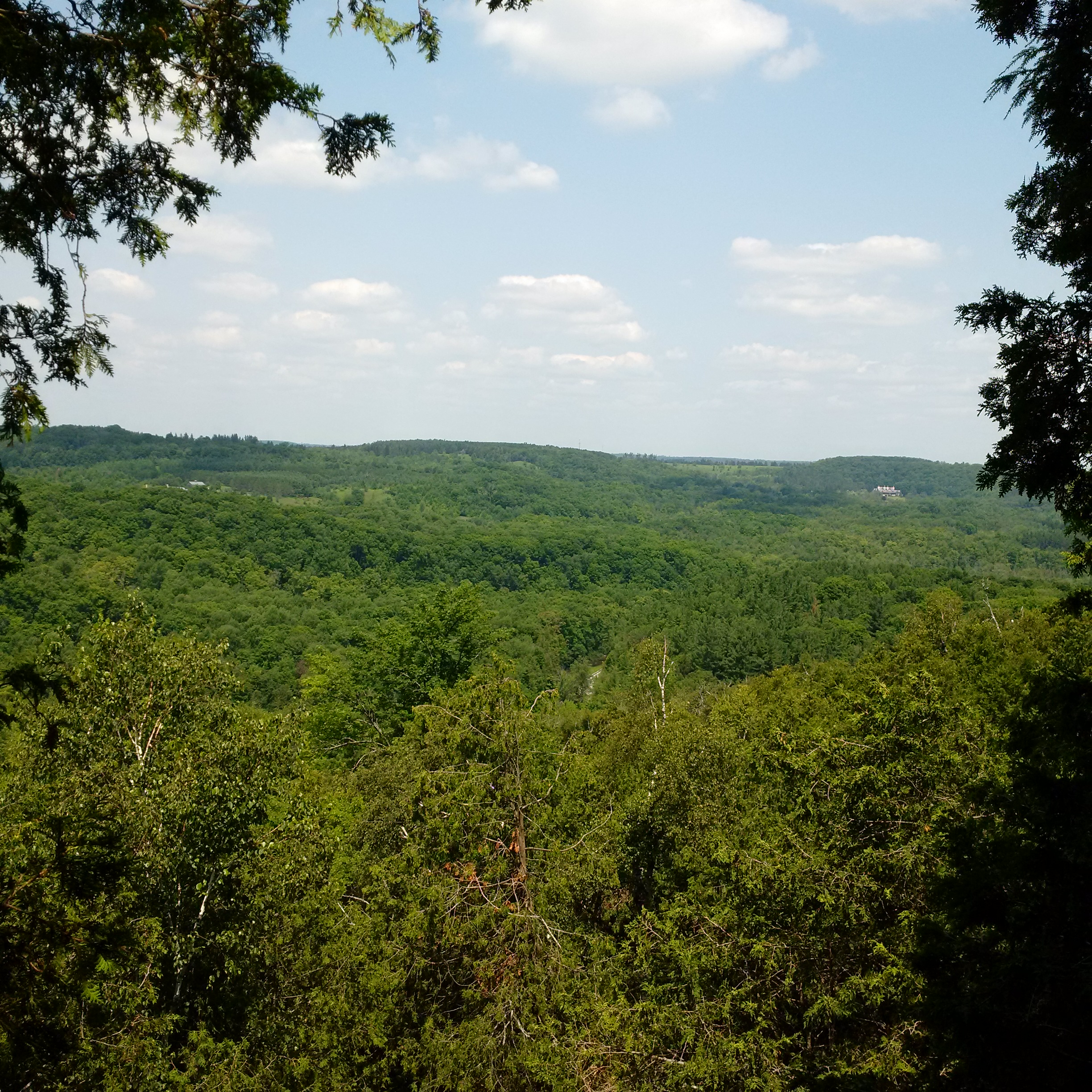
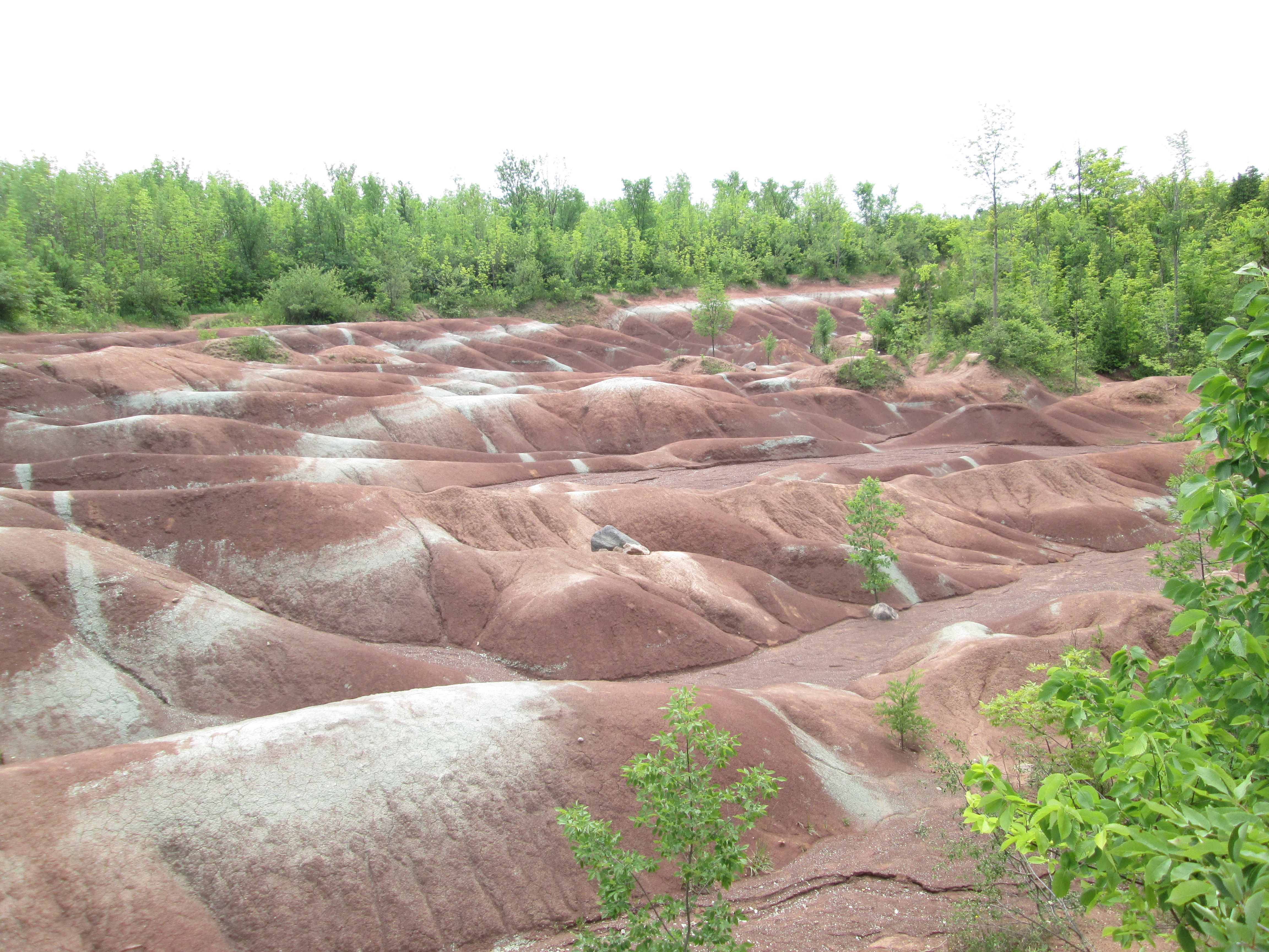
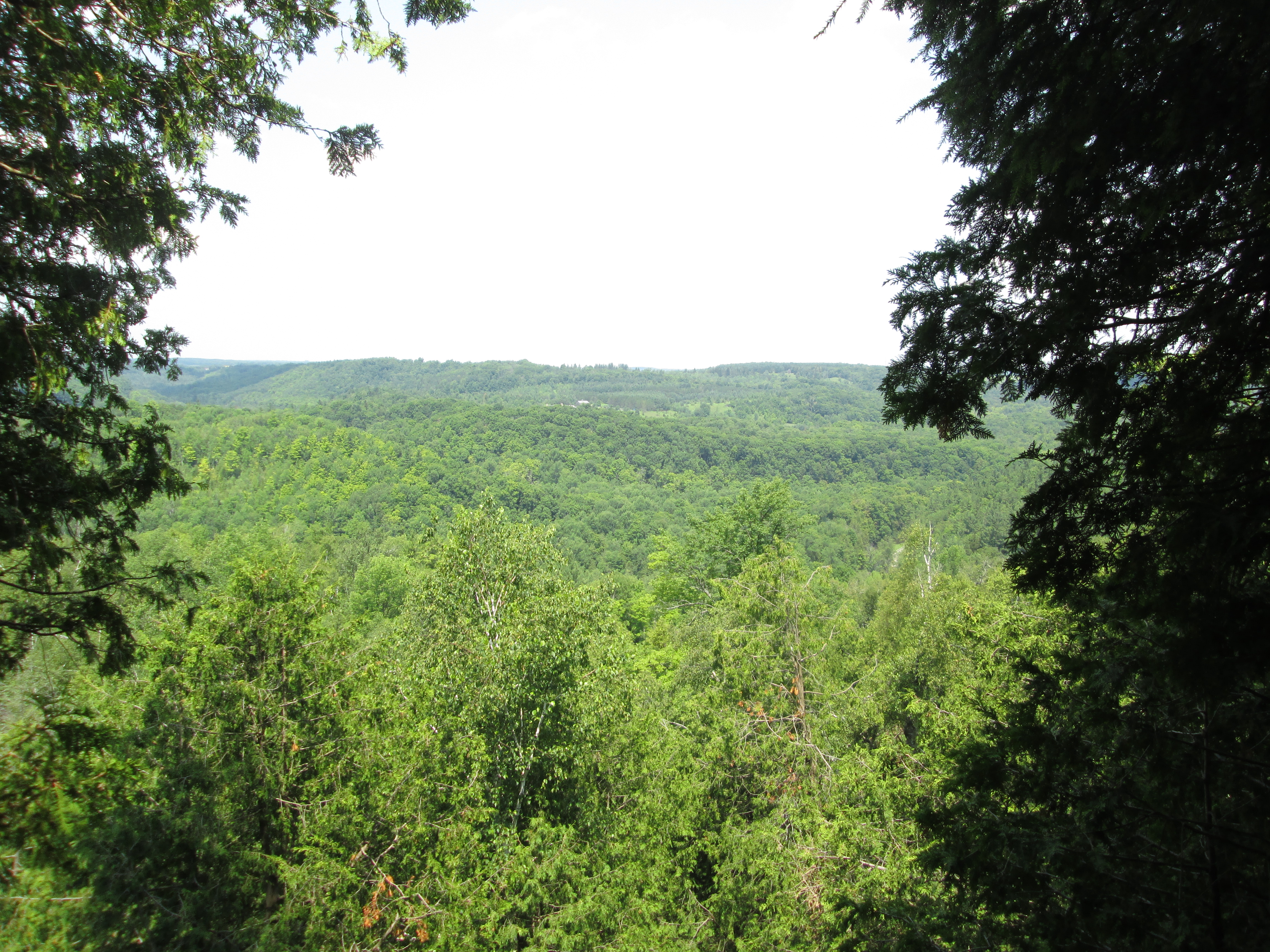
8. The Devil’s Pulpit – Hike Date: July 11, 2015

The area around the Forks of the Credit was home to quarries during the late 1800’s.  This post explores an old lime kiln and climbs the 100 metre face of the Devil’s Pulpit.  The picture below shows the view from the top.

IMG_6501

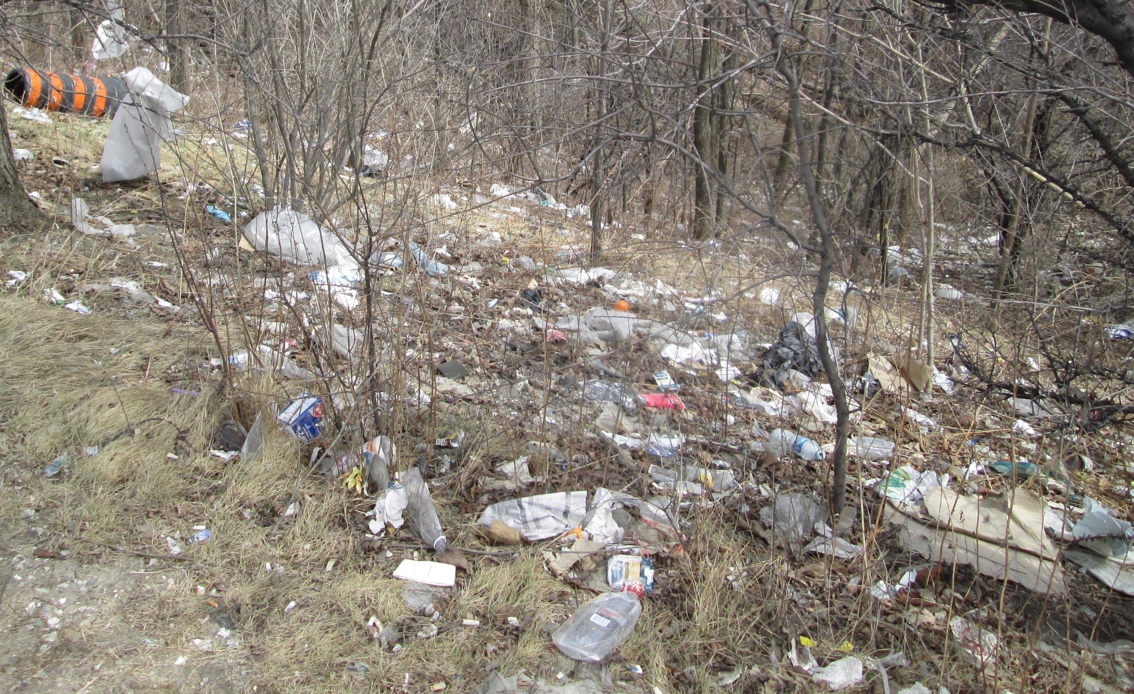
7 . Garbage Park Toronto – Hike Date: Apr. 13, 2015

This post was an example of me skipping stones in the big pond called city hall.  I was attempting to get the city to clean up an incredibly polluted stretch of parkland.  I went back and did a regular historical feature on the site in a later post called Dufferin Creek.  The Toronto Star featured the story in their column called The Fixer on April 22, 2015.  You can read their story here.

???????????????????????????????

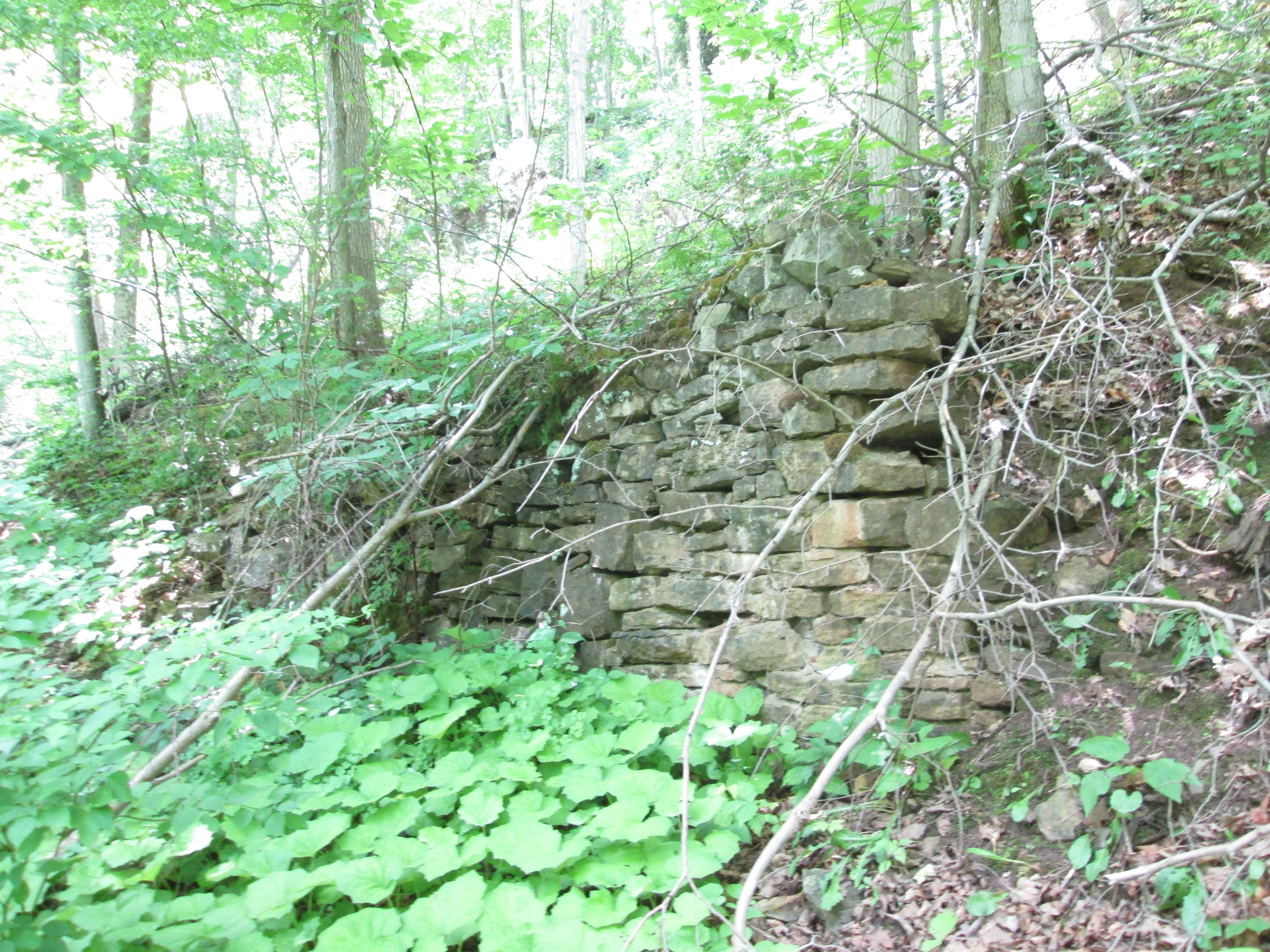
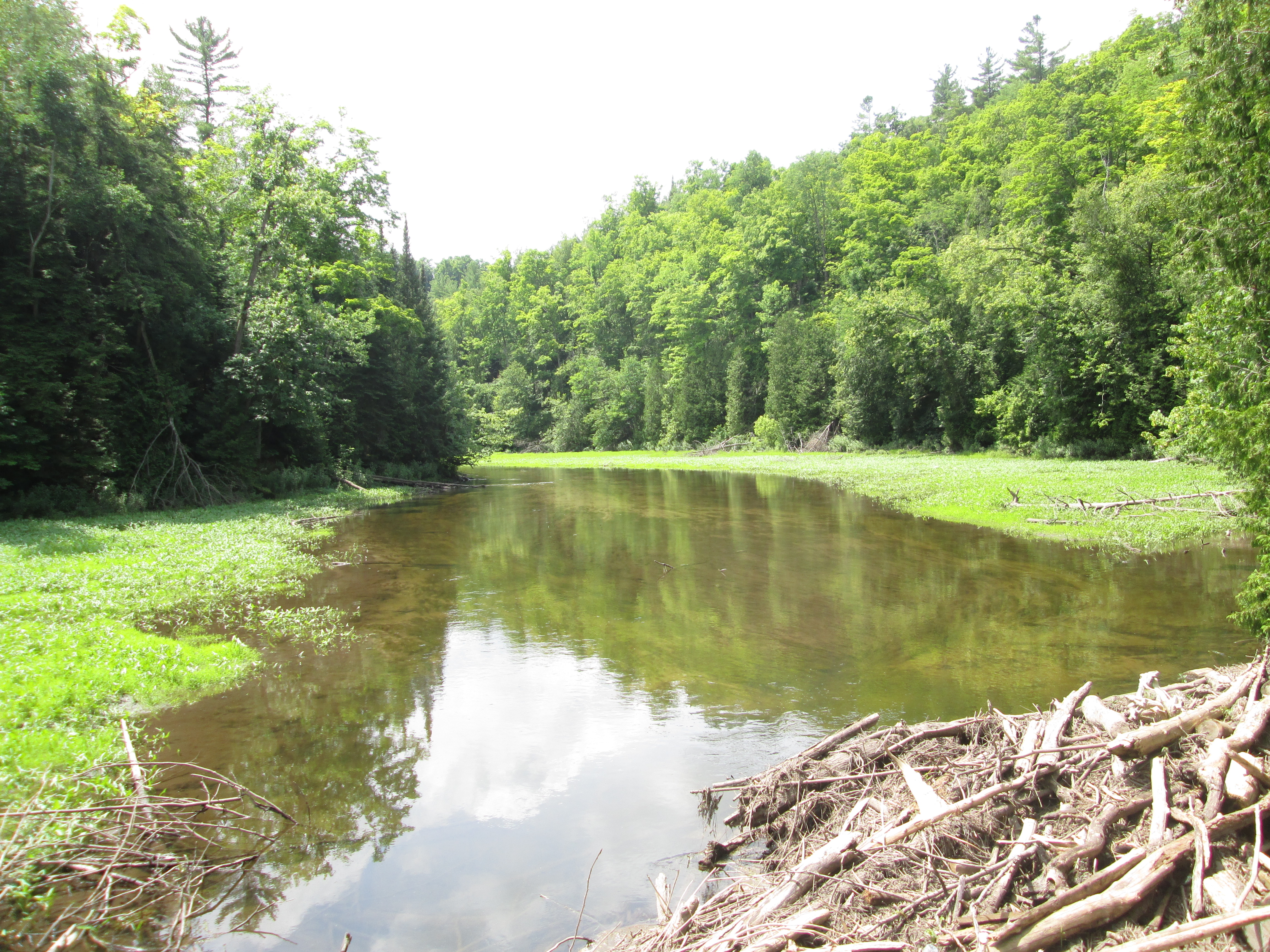
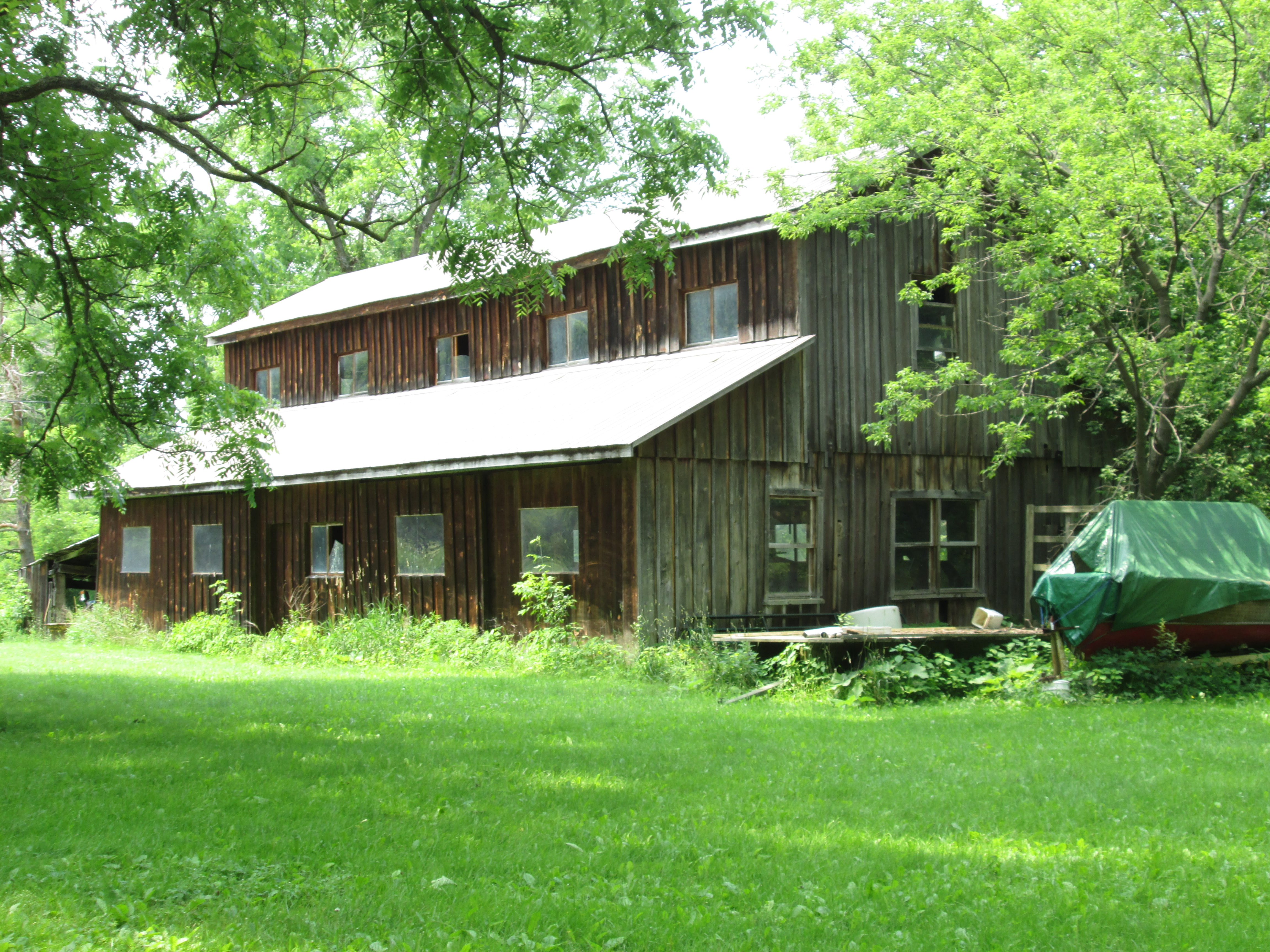
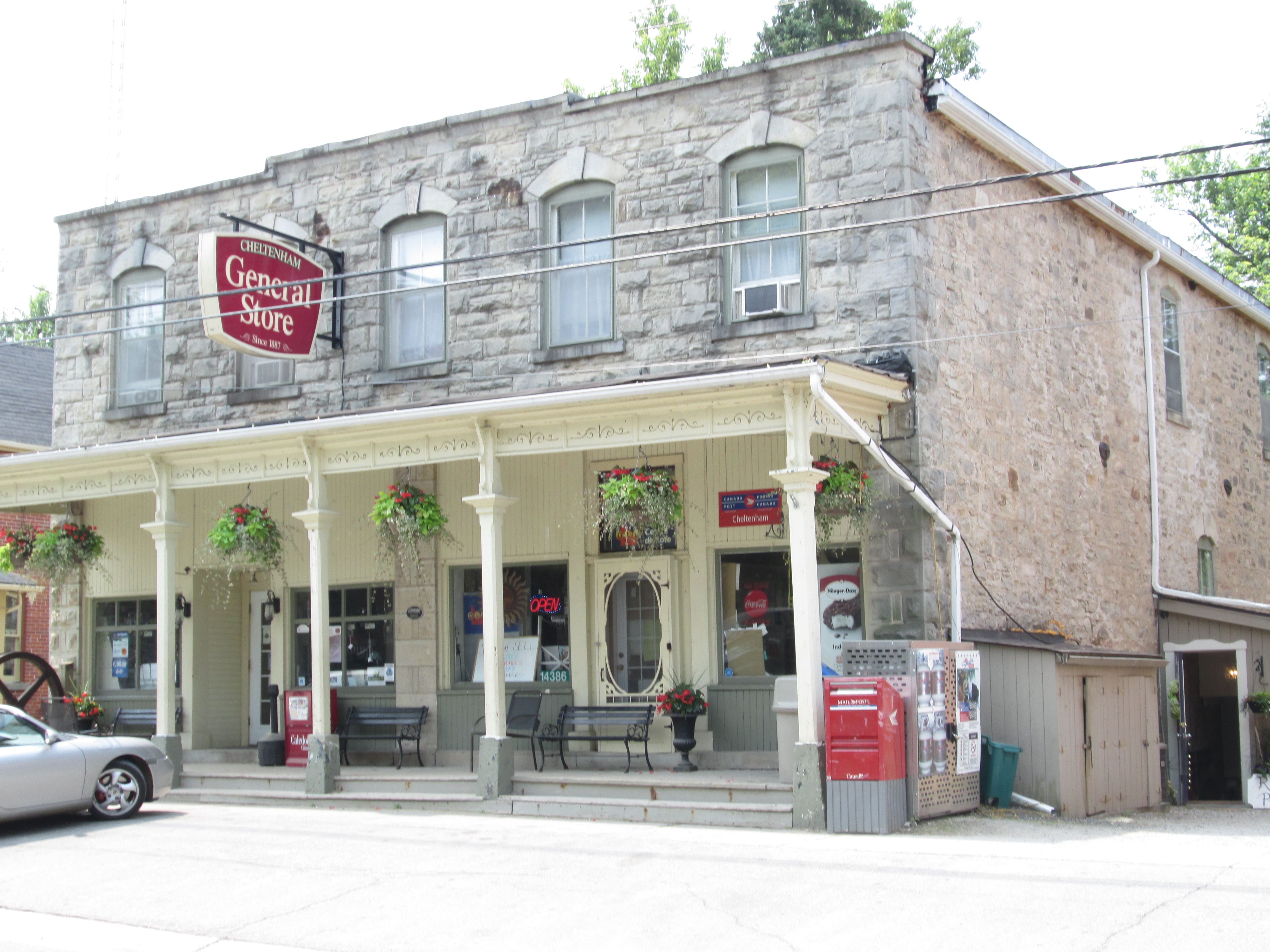
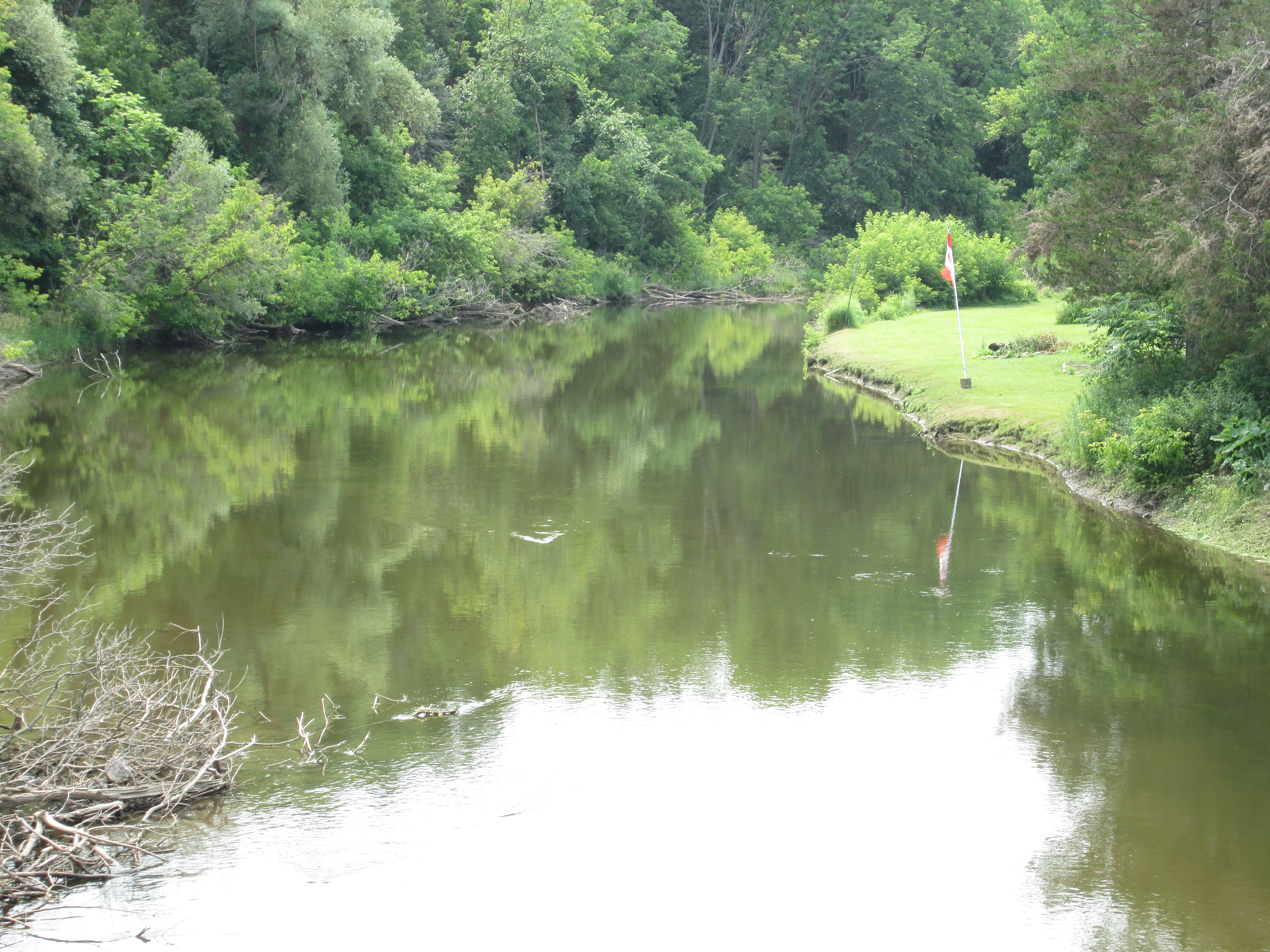
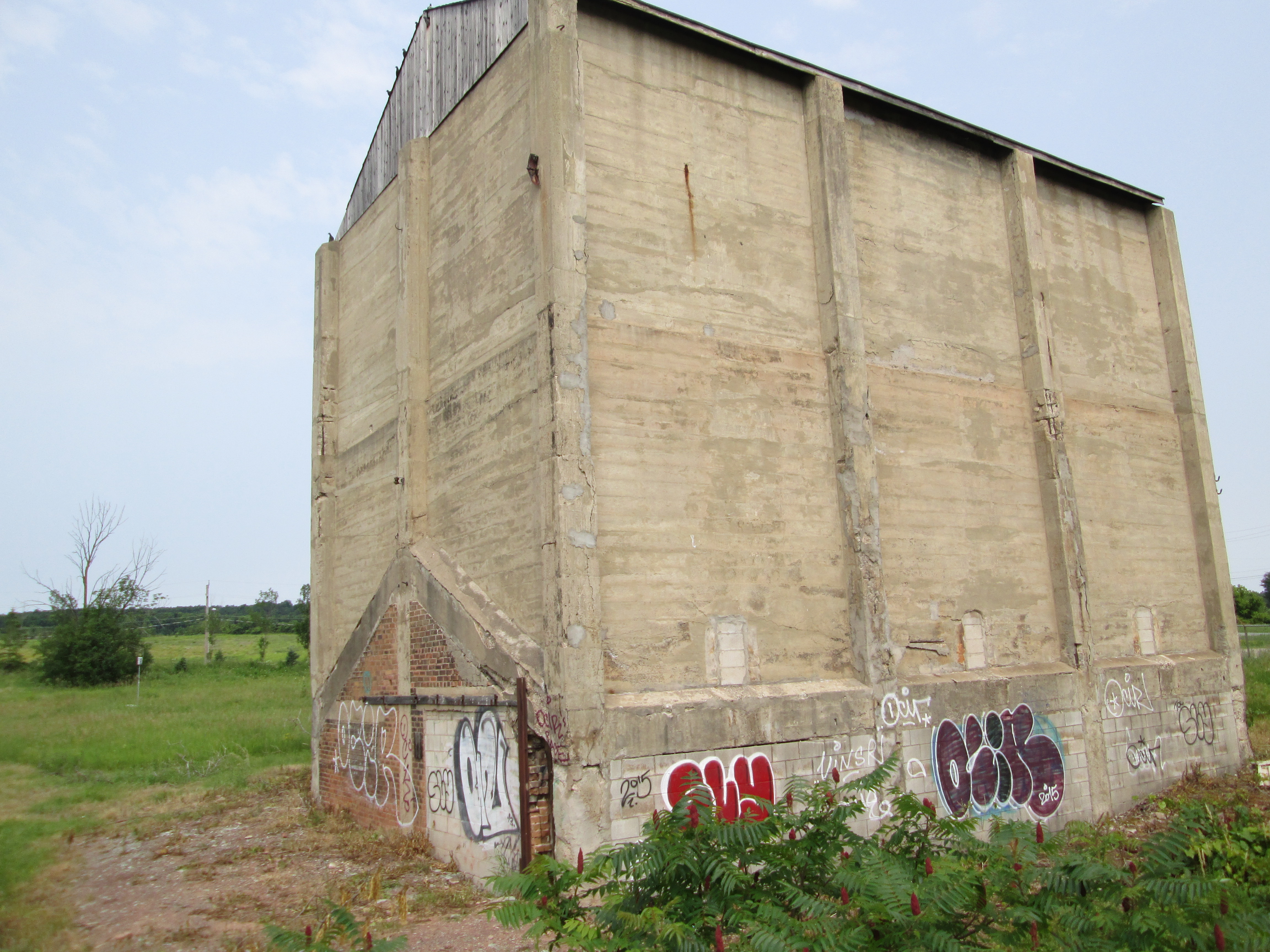
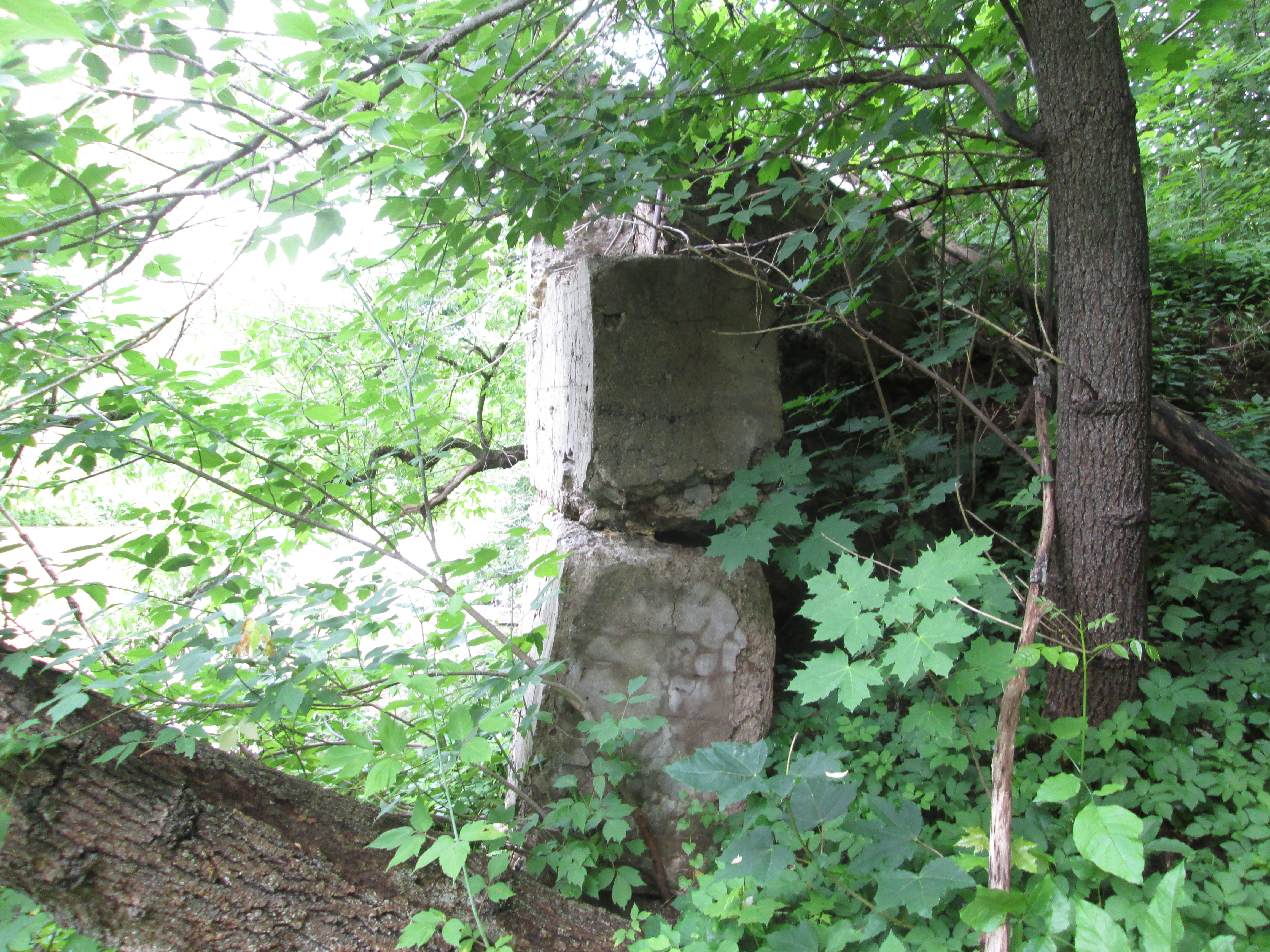
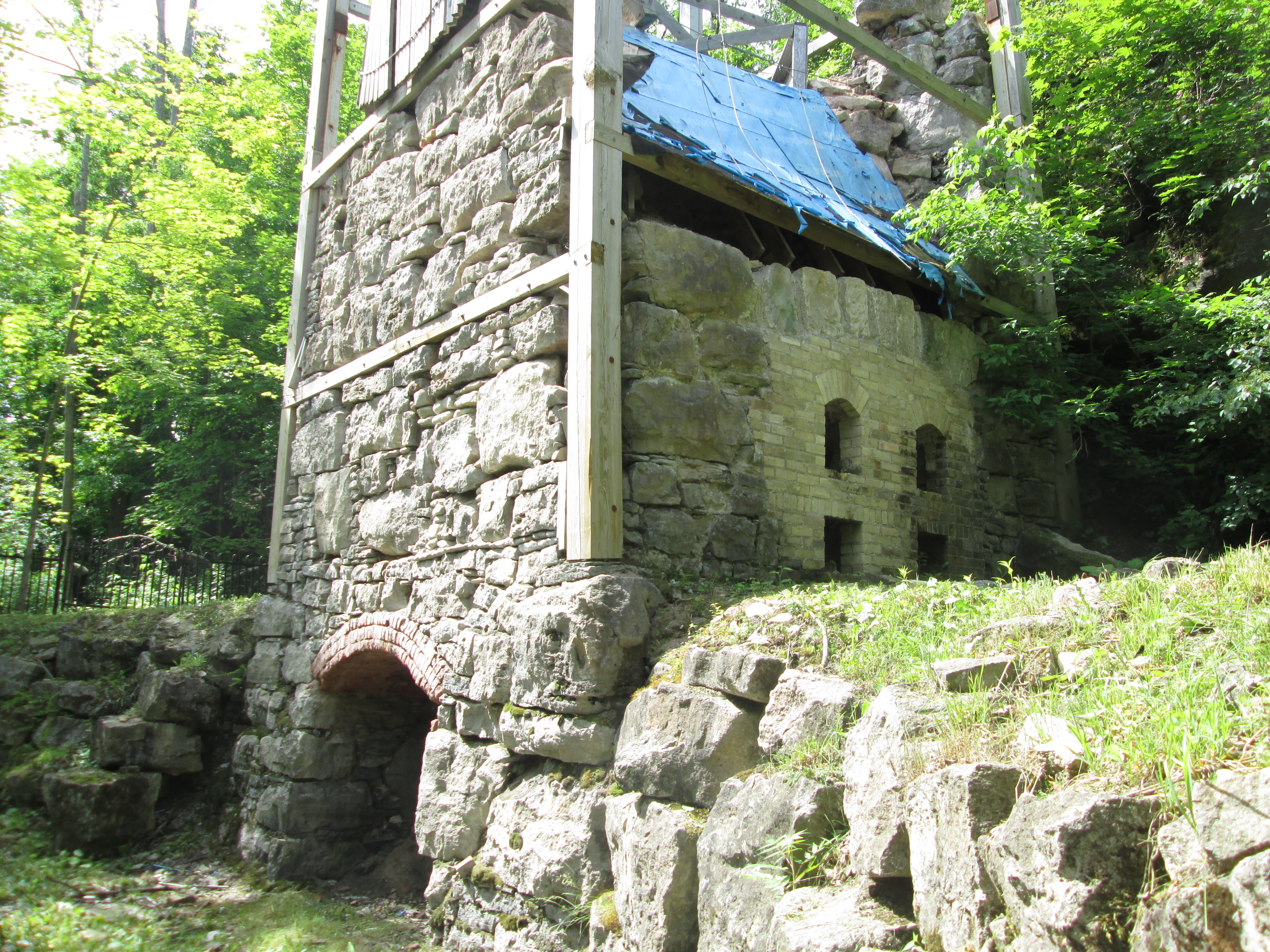
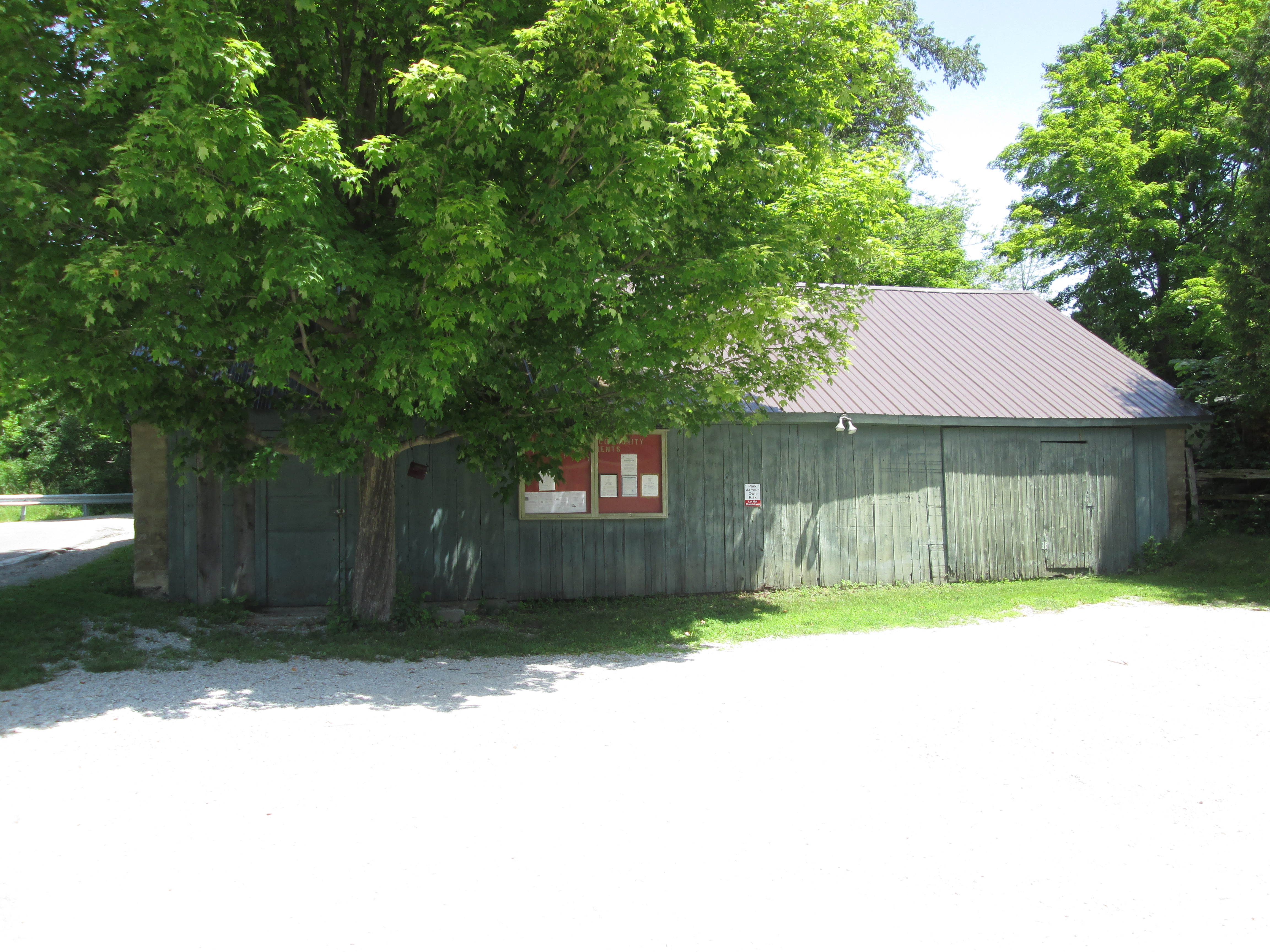
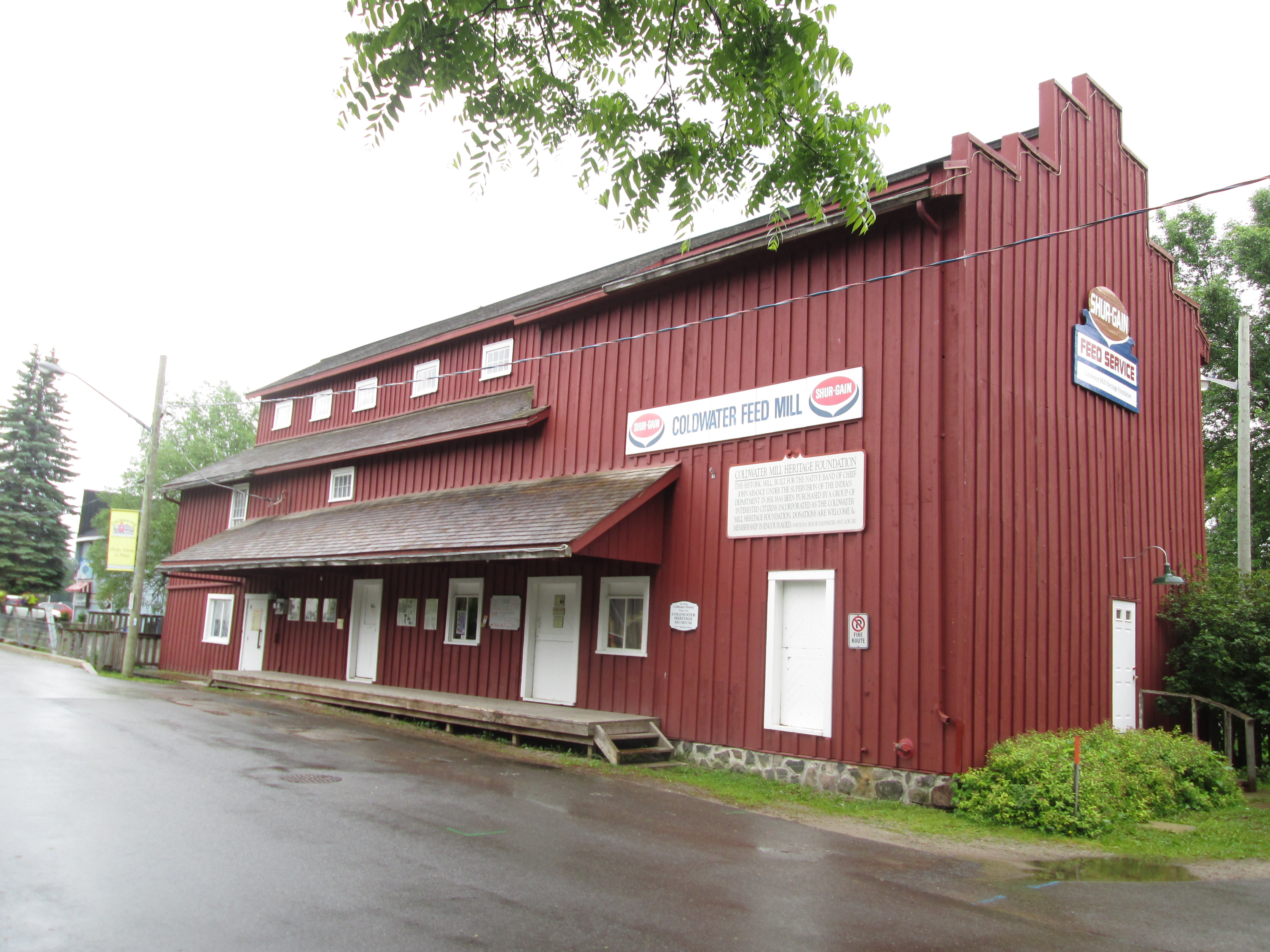
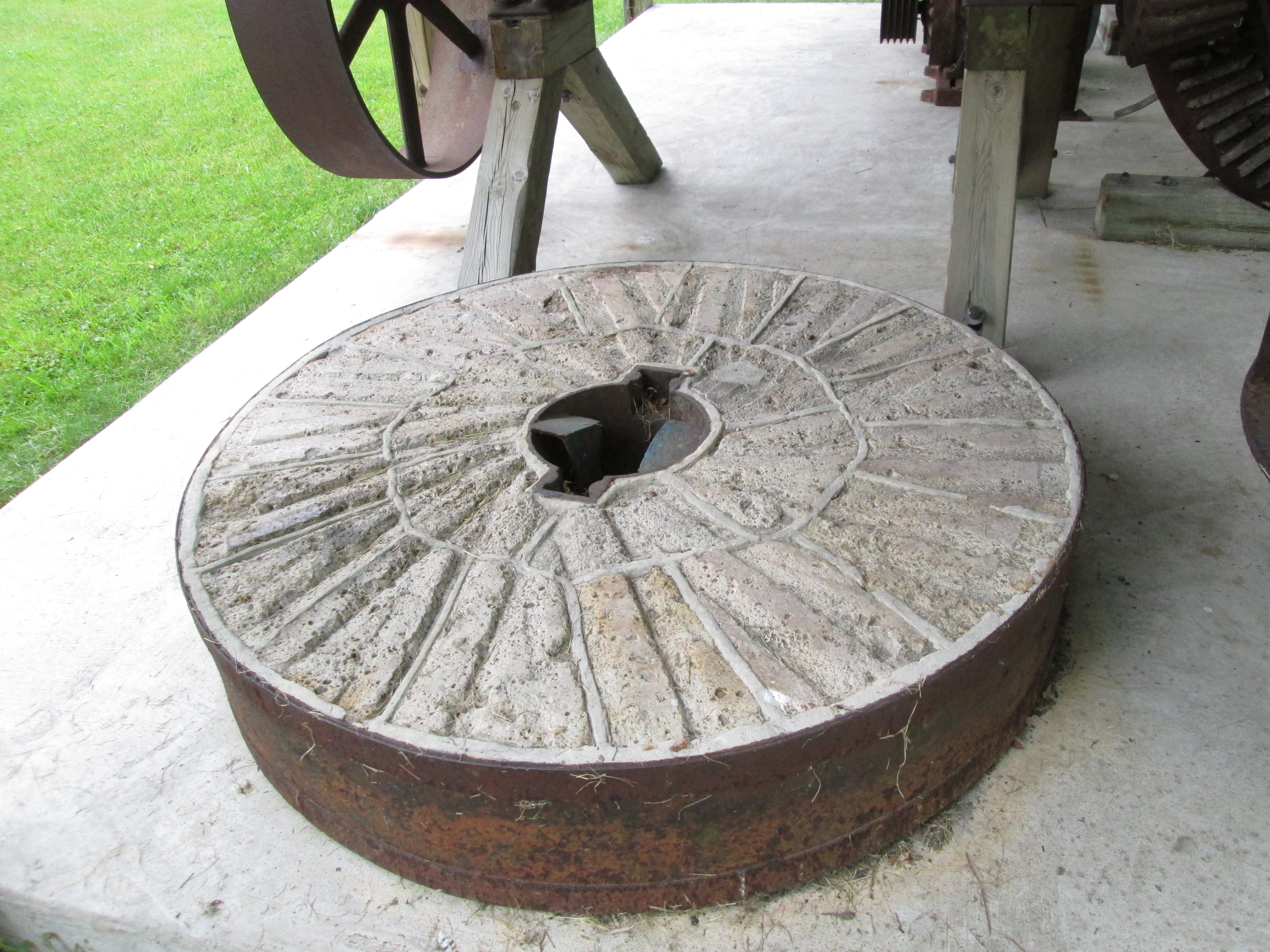
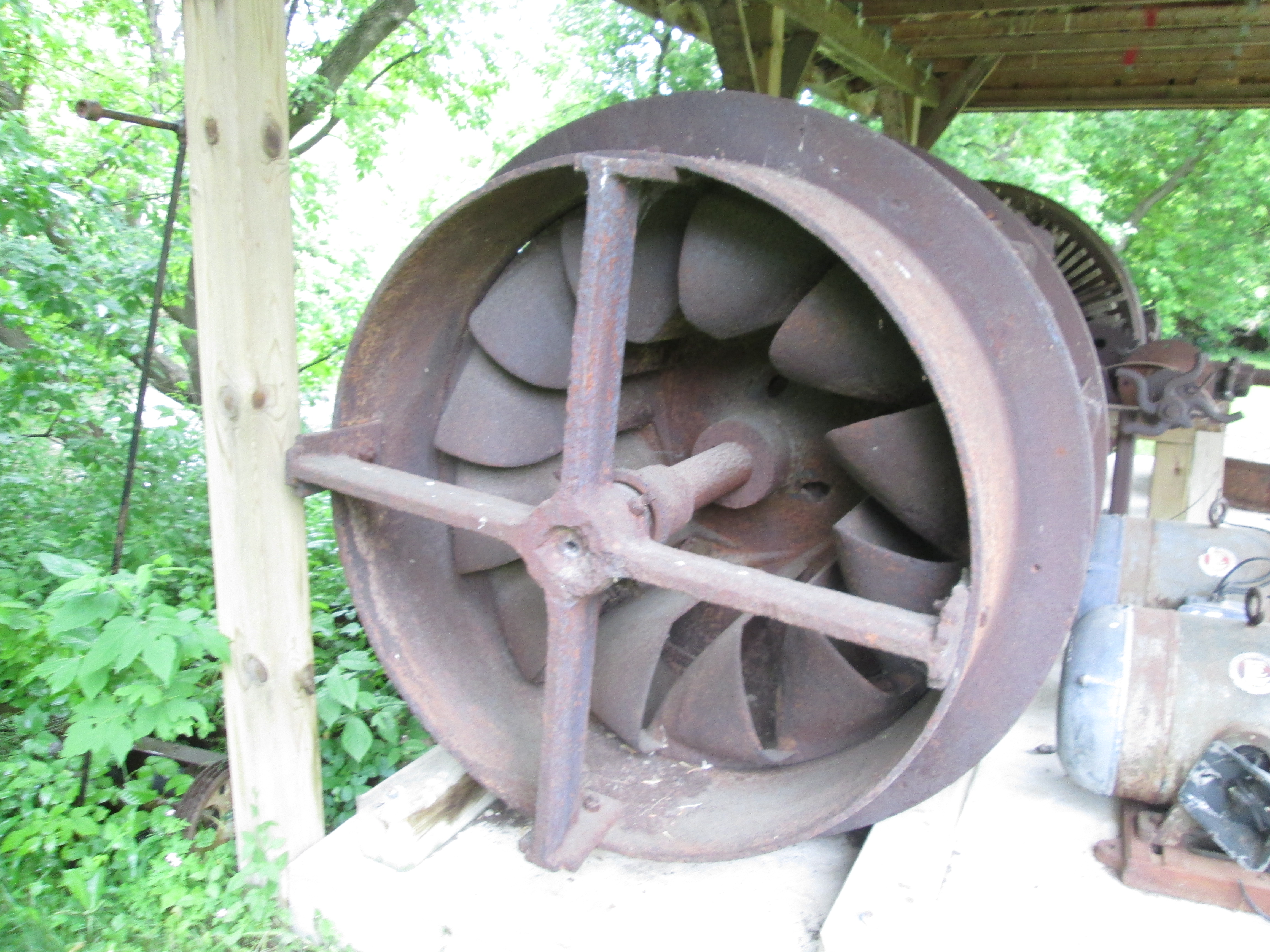
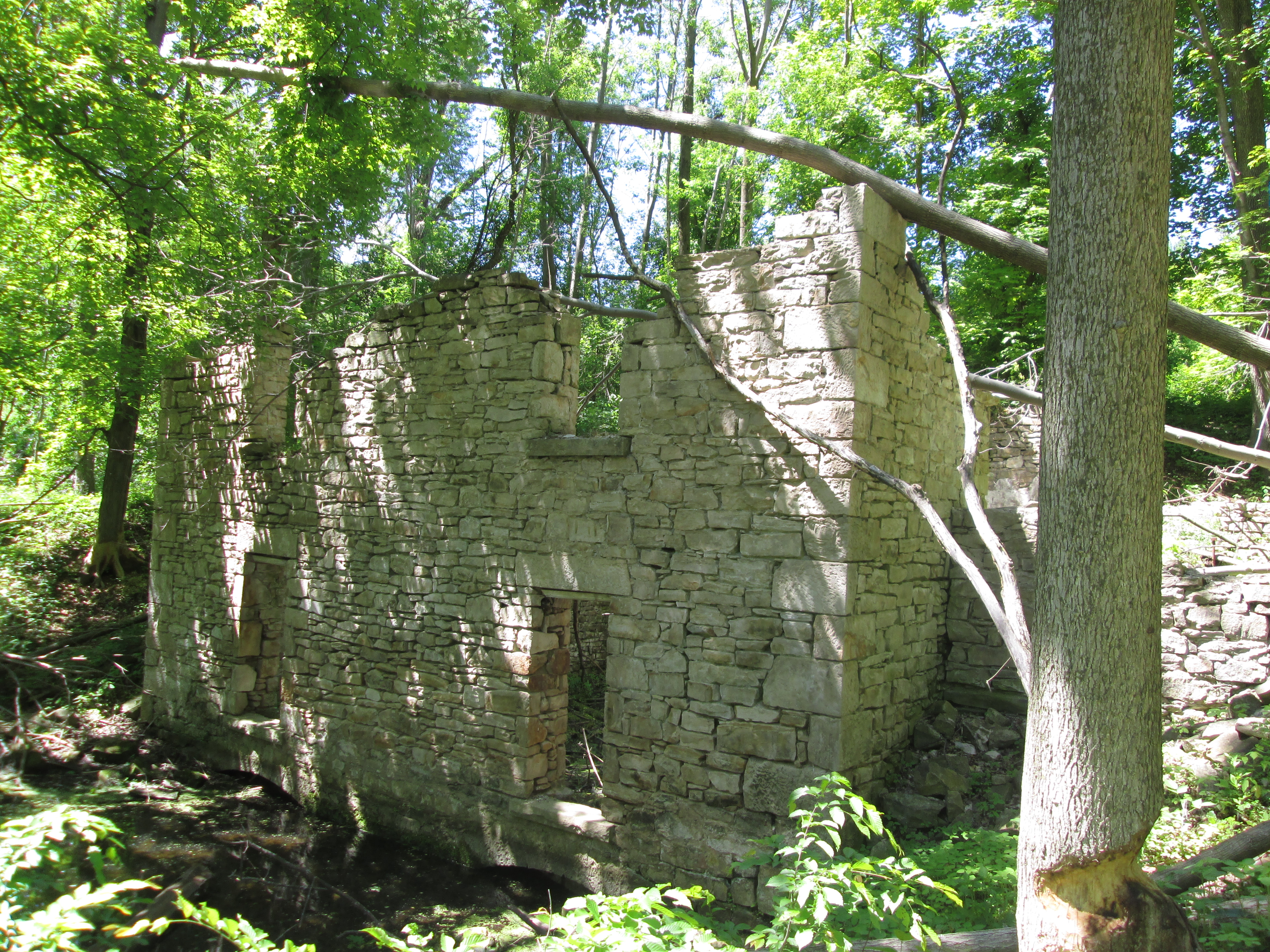
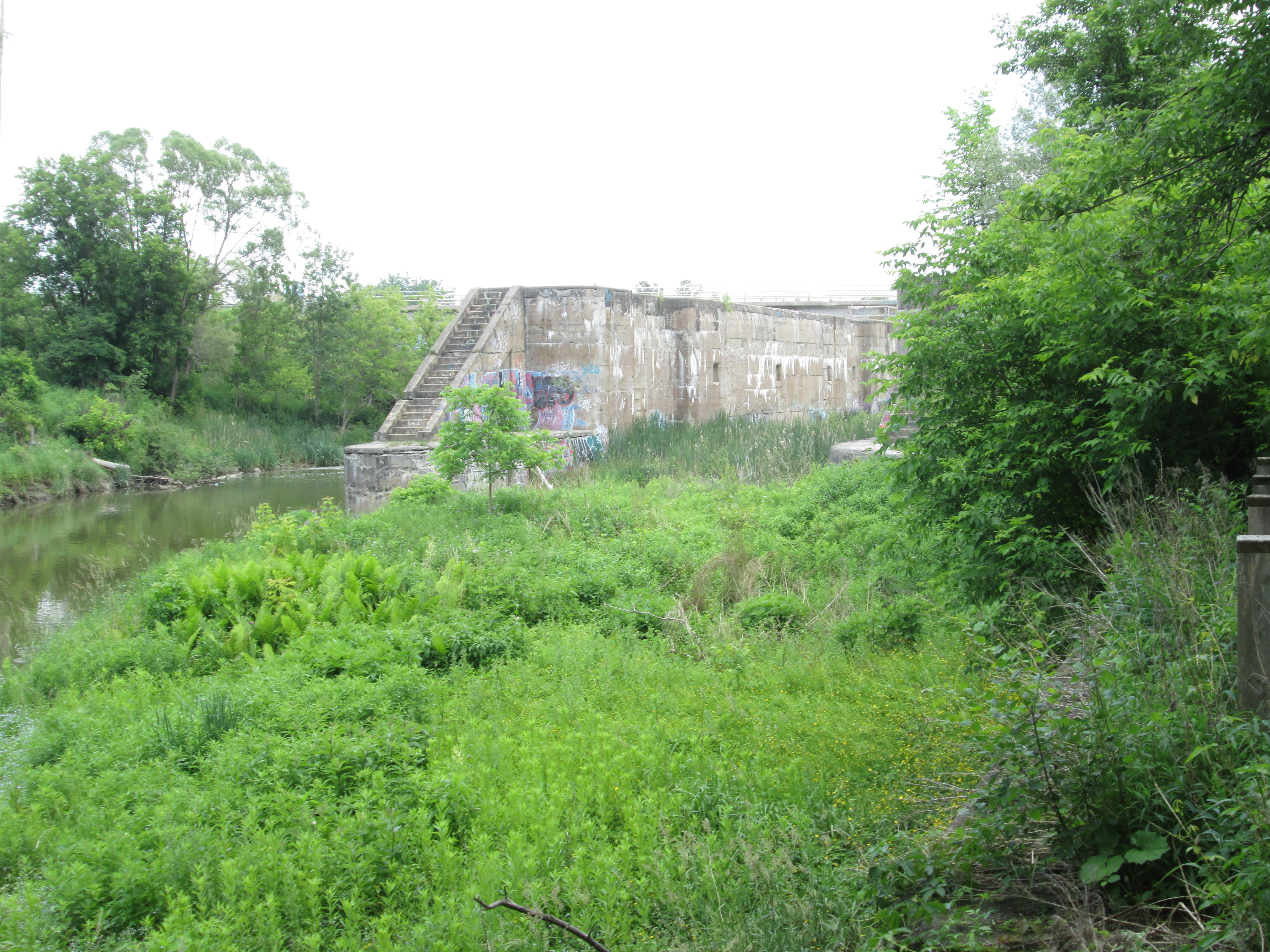
6. Barber Dynamo – Hike Date: June 6, 2015

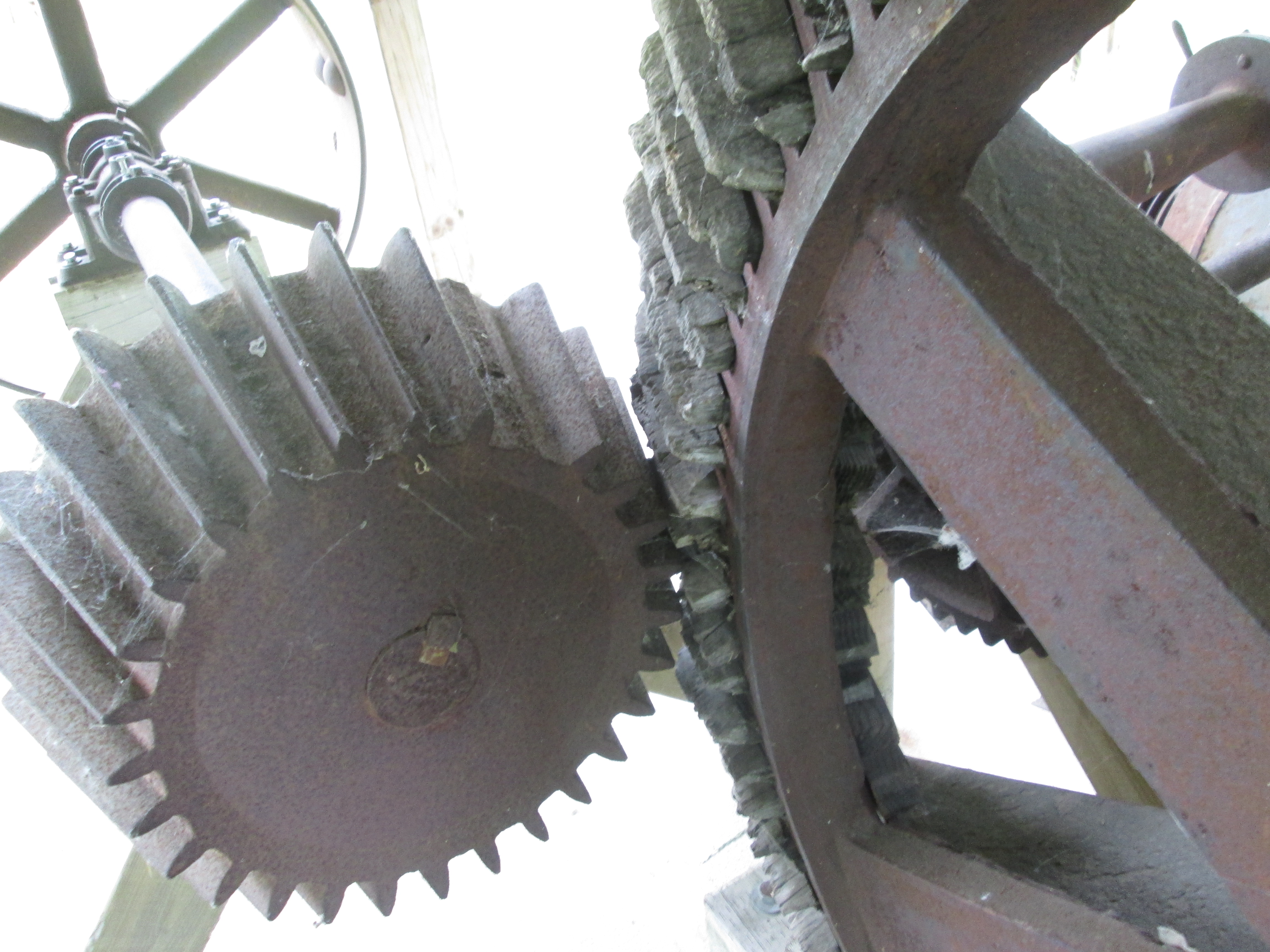
Built in 1888 the Barber Dynamo provided electricity to the Barber Paper Mills until 1913 when electrical power was brought from Niagara Falls.  This historic building stands about 3 km downstream from the paper mill.

IMG_5259

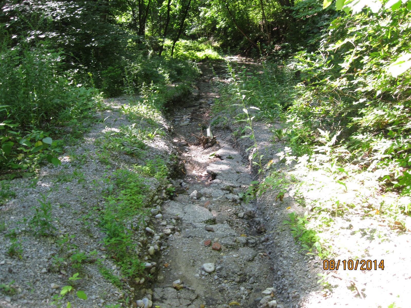
5. Pottery Road – Hike Date: Aug. 10, 2014

Pottery road likely followed part of an old Indian trail that ran along the Iroquois Bluffs.  When the Bayview extension was built in 1959 Pottery road was cut in two and the part west of Bayview was left to be reclaimed by nature.

IMG_2799

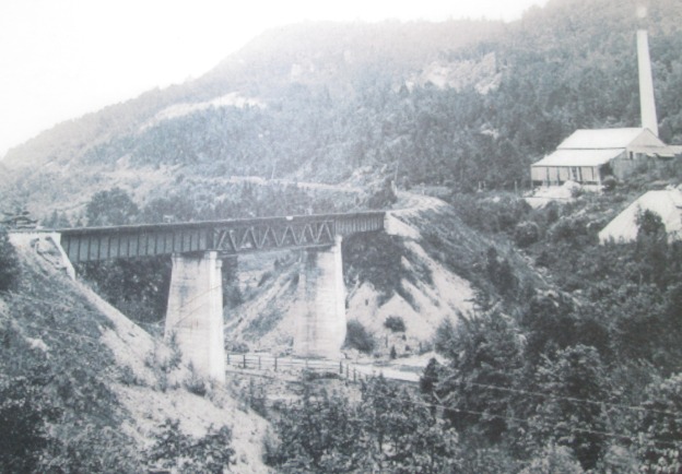
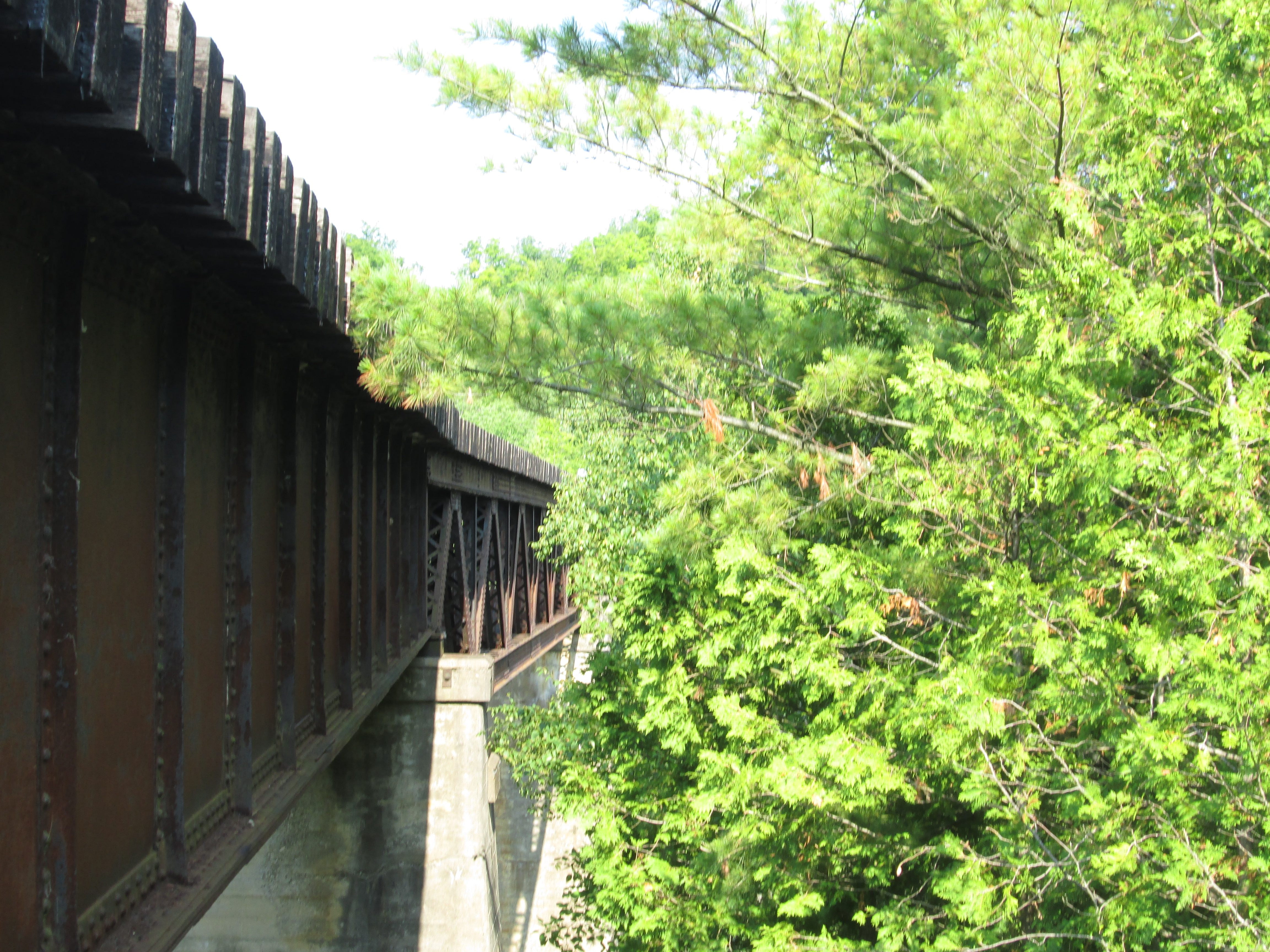
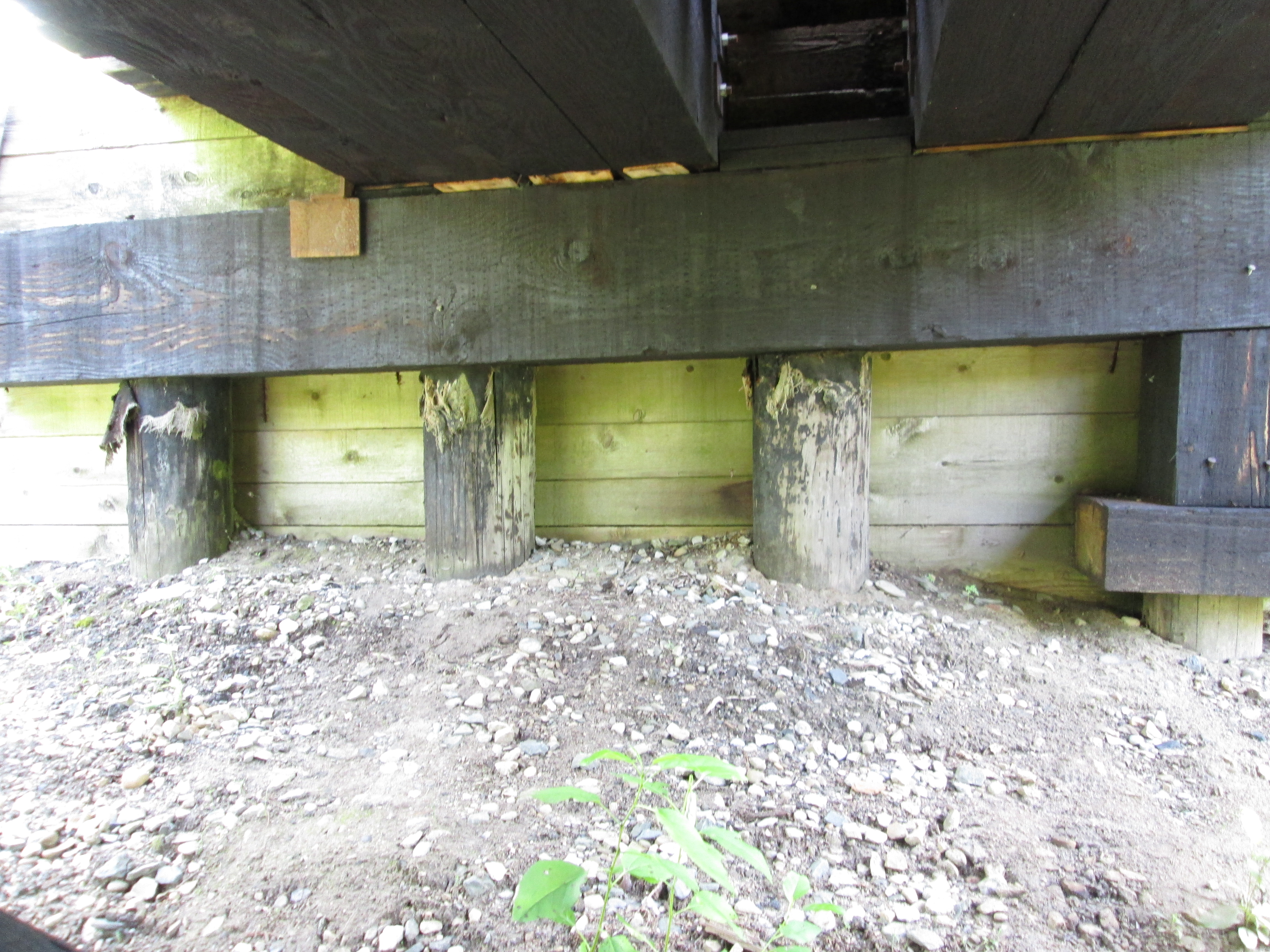
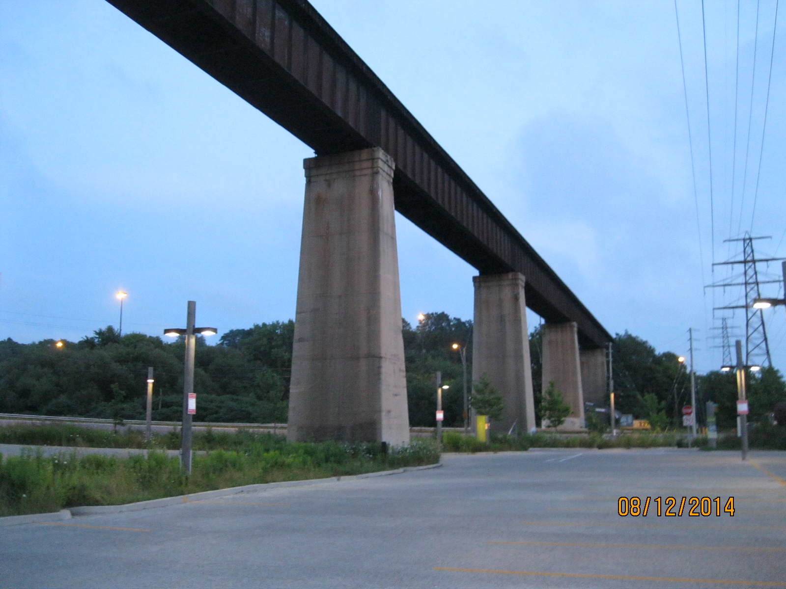
4. Half Mile Bridge – Hike Date: Aug. 13, 2014

Built in 1888 this bridge brought the CPR into Union station.  Prior to it’s contruction the CPR train had to back up all the way from The Junction to Union Station.  This bridge across the Don River Valley was abandoned in 2007 and trees now grow beside the rails along the former right of way.

IMG_2908

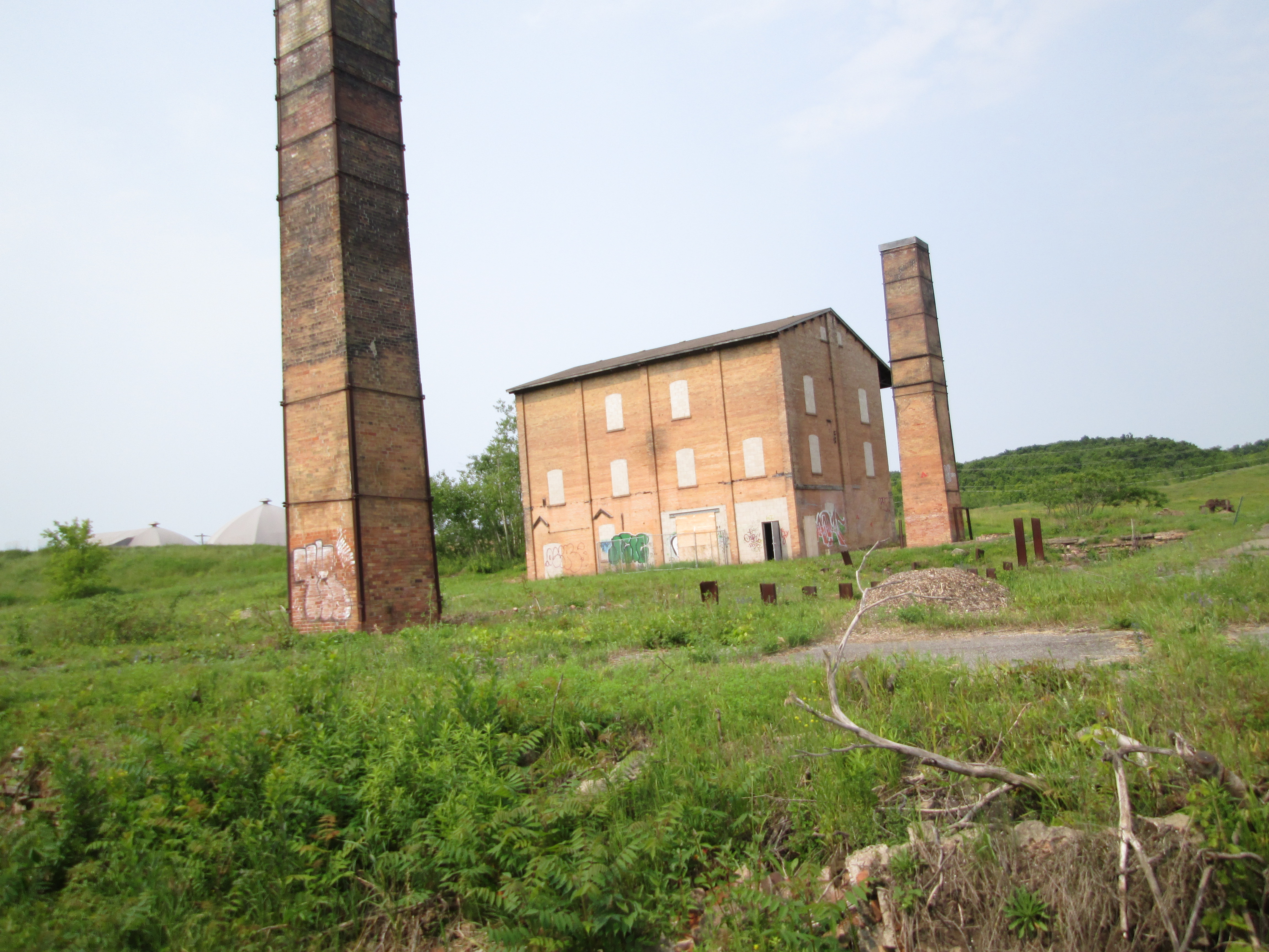
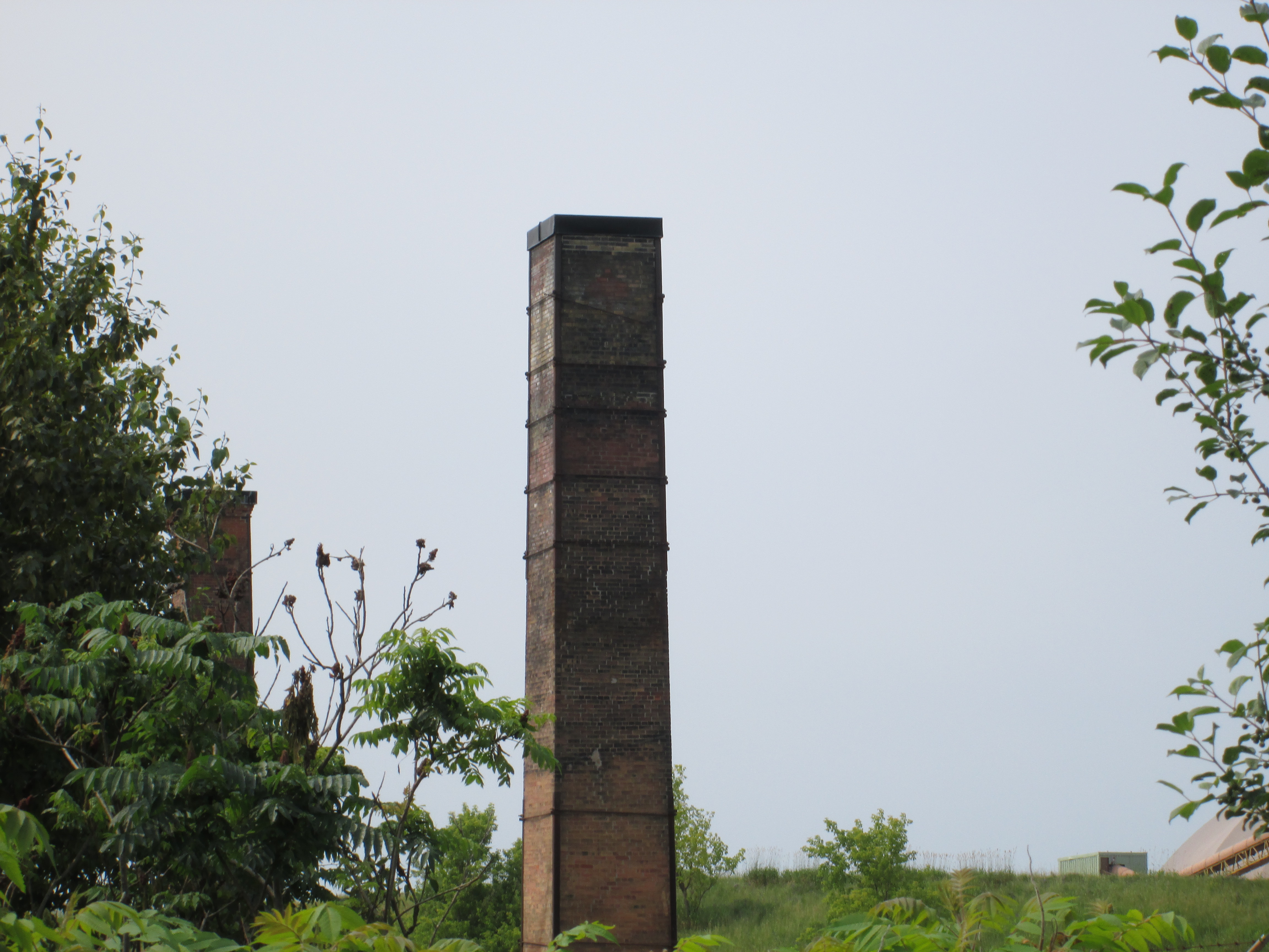
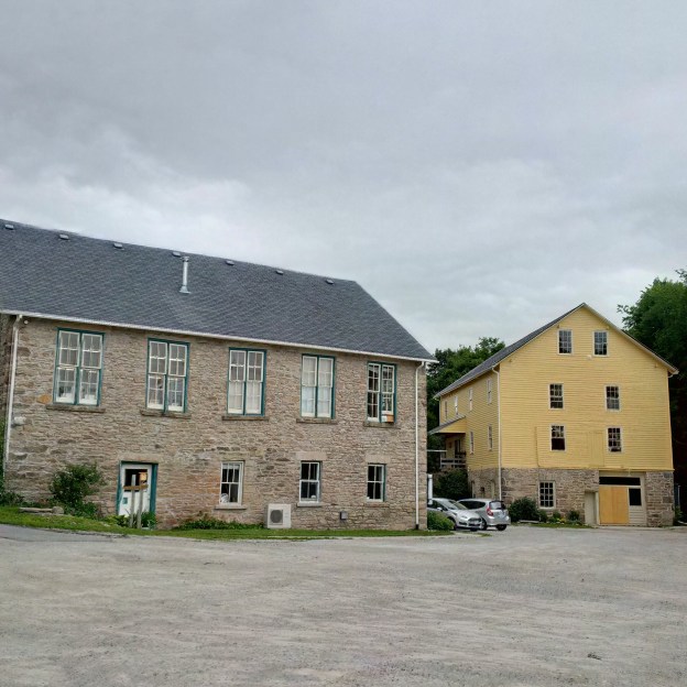
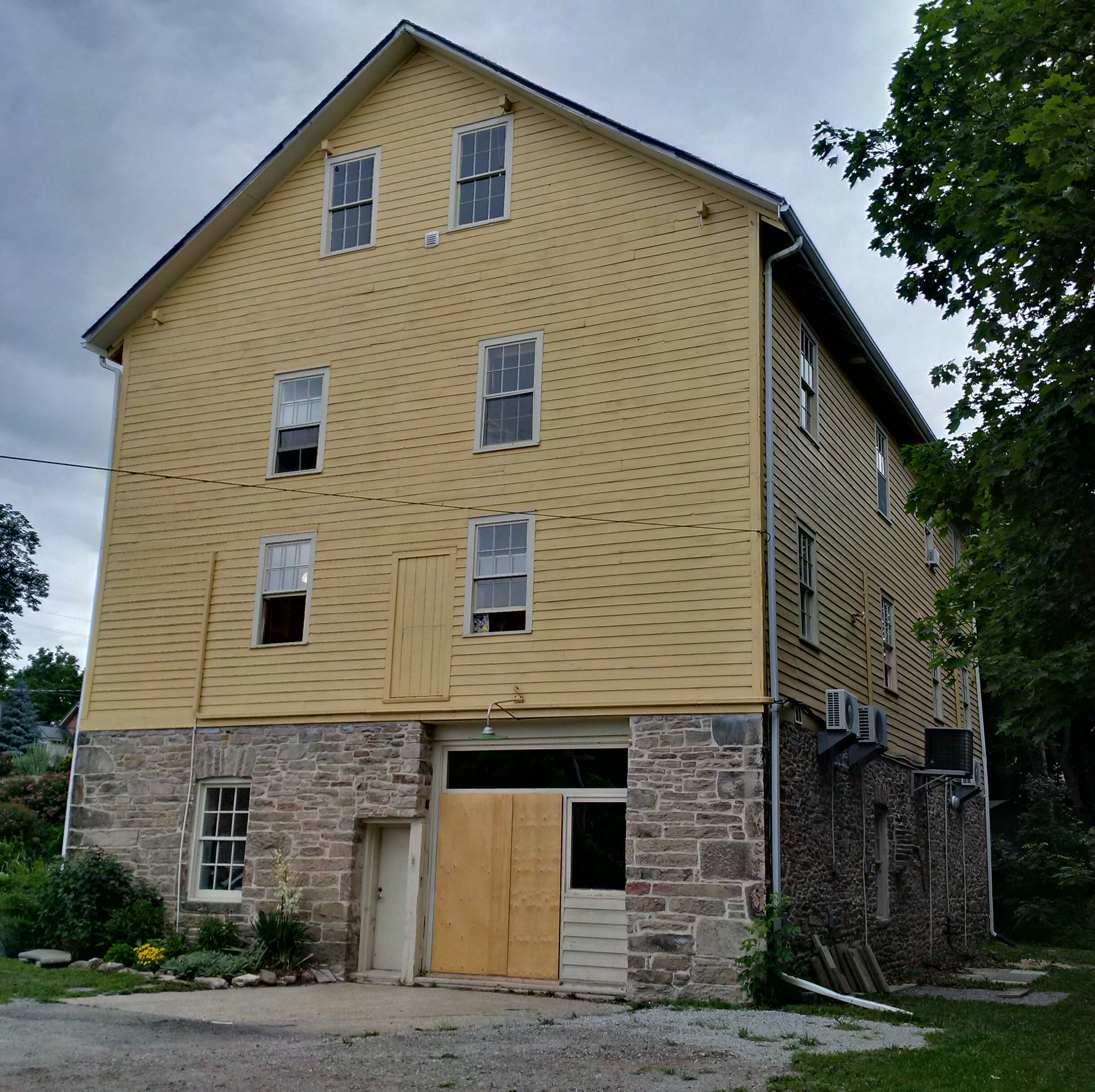
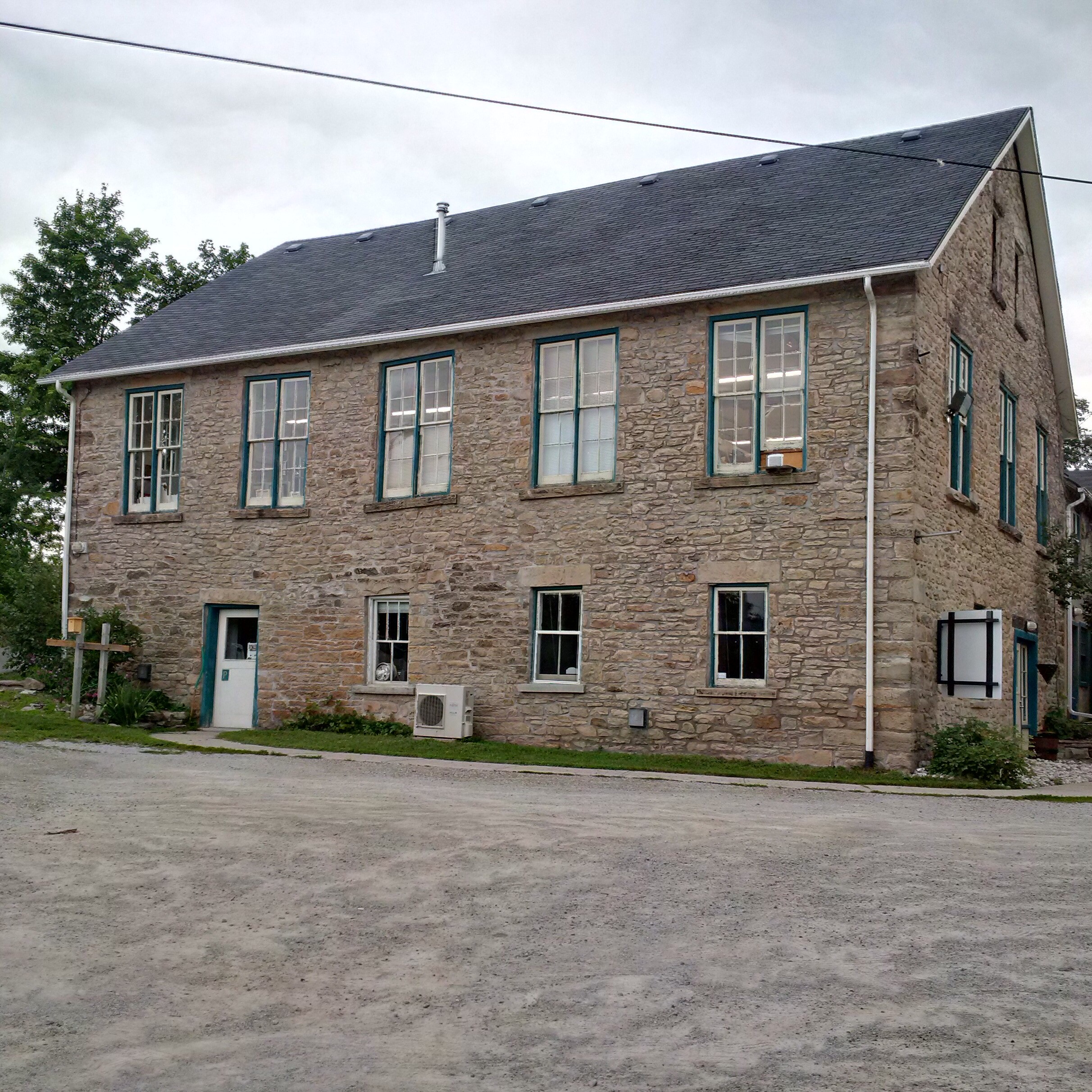
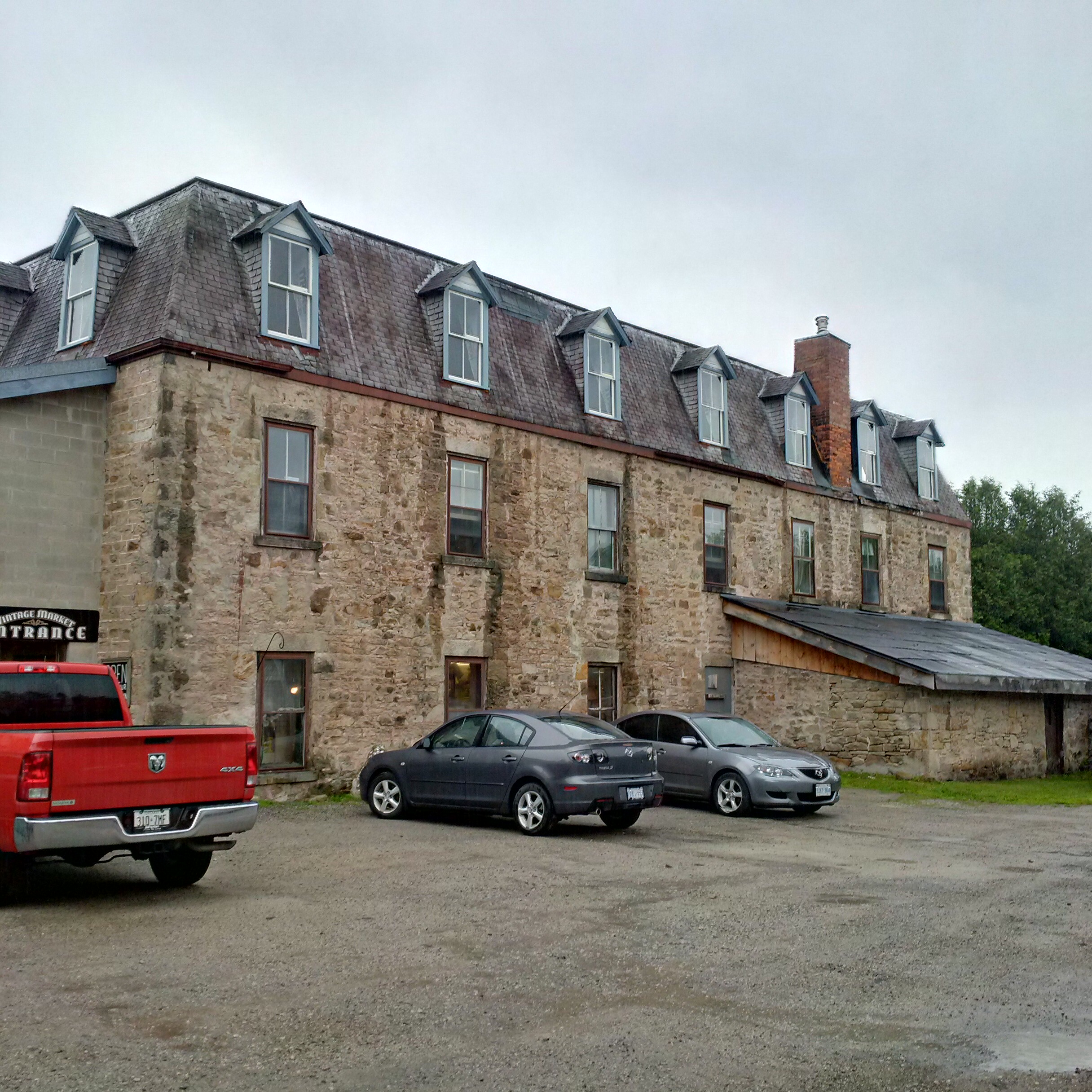
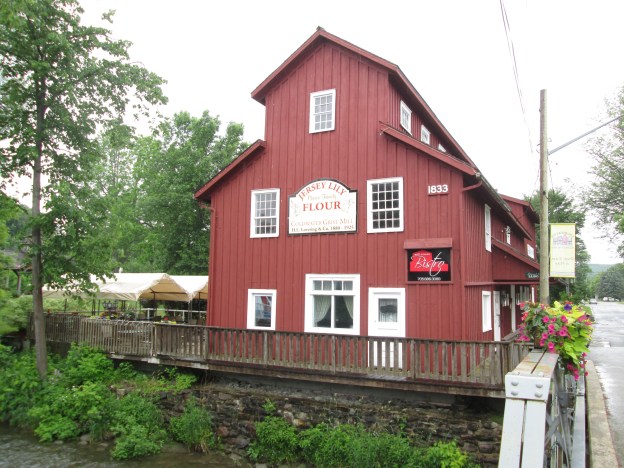
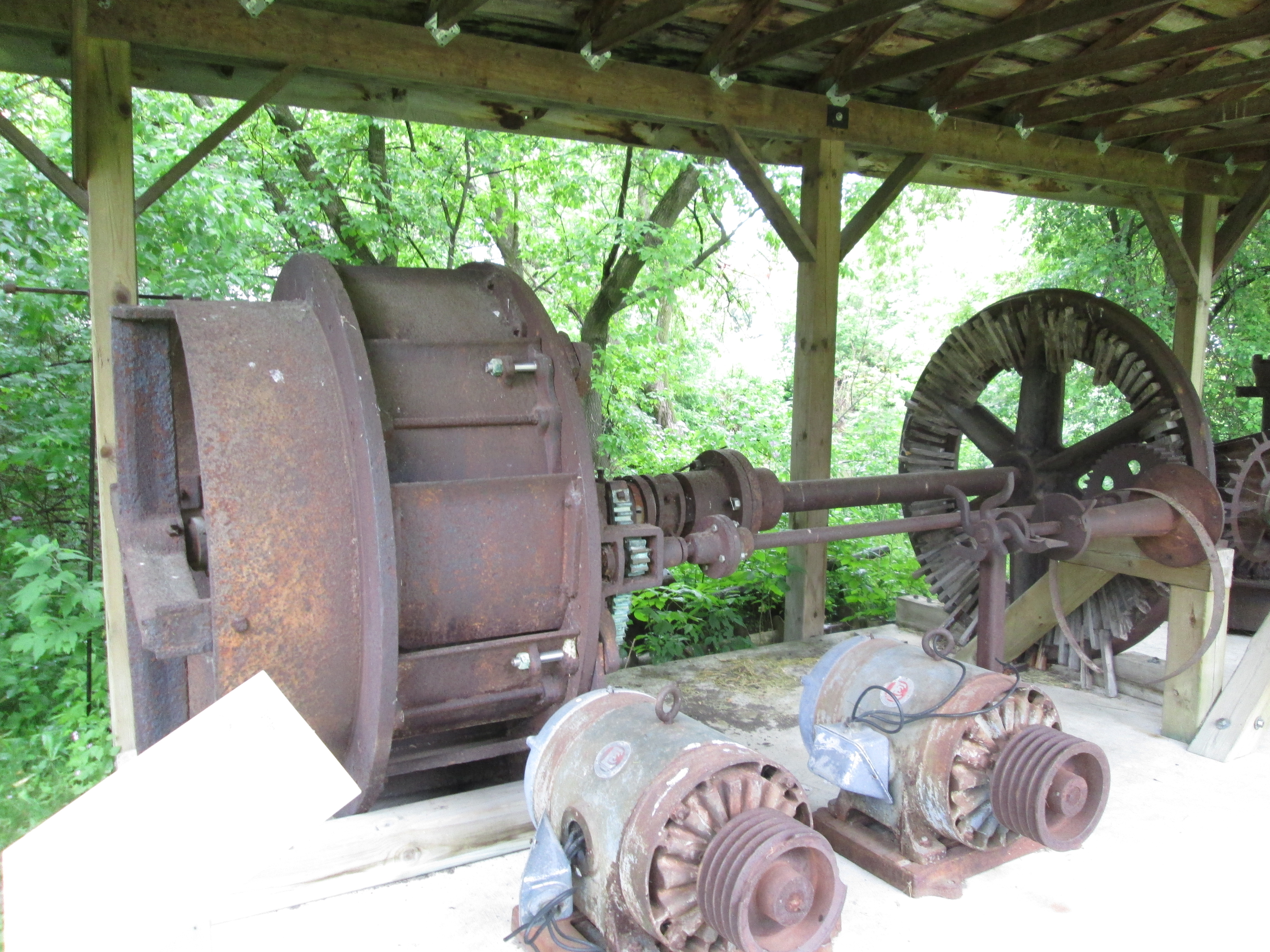
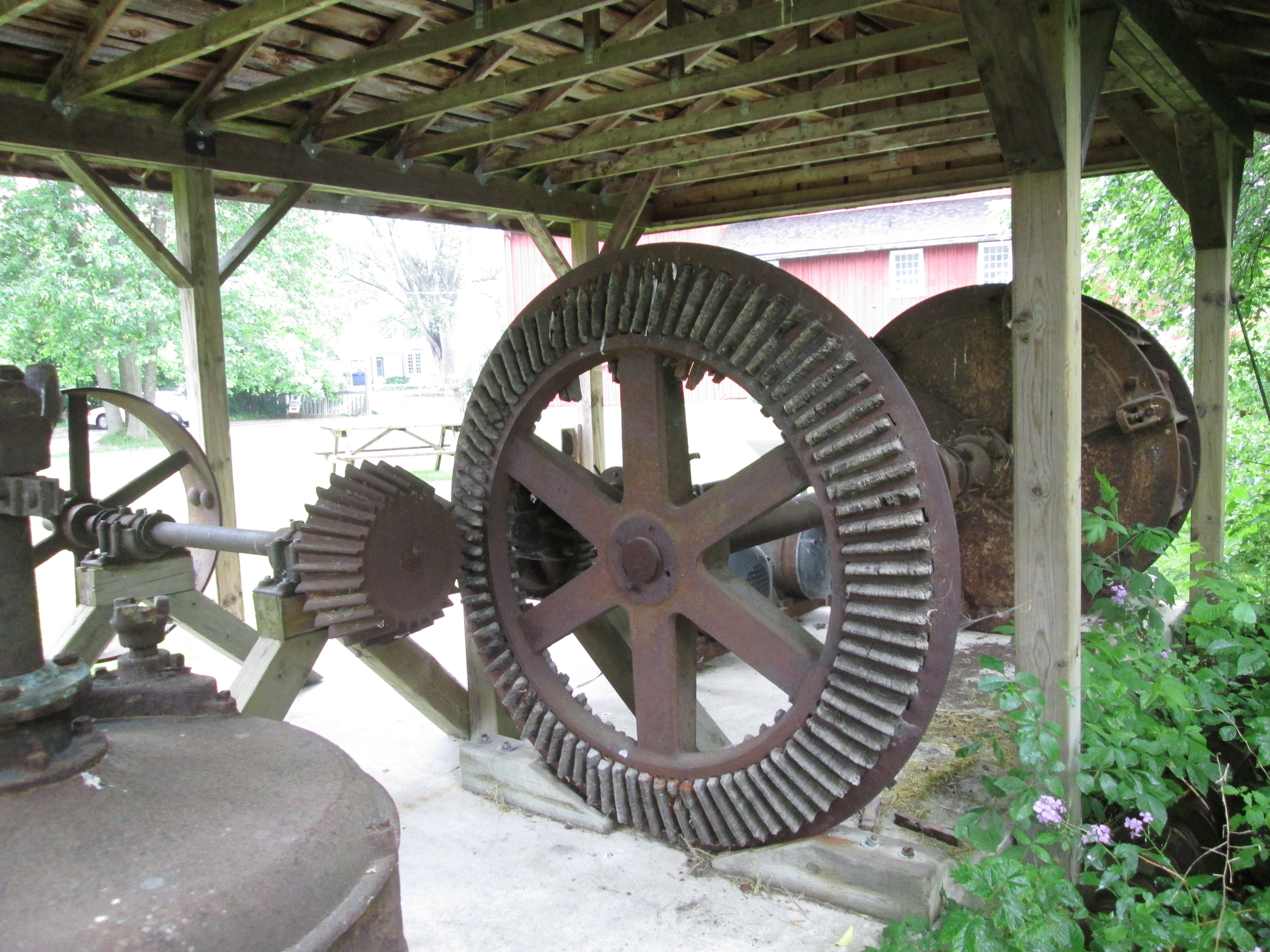
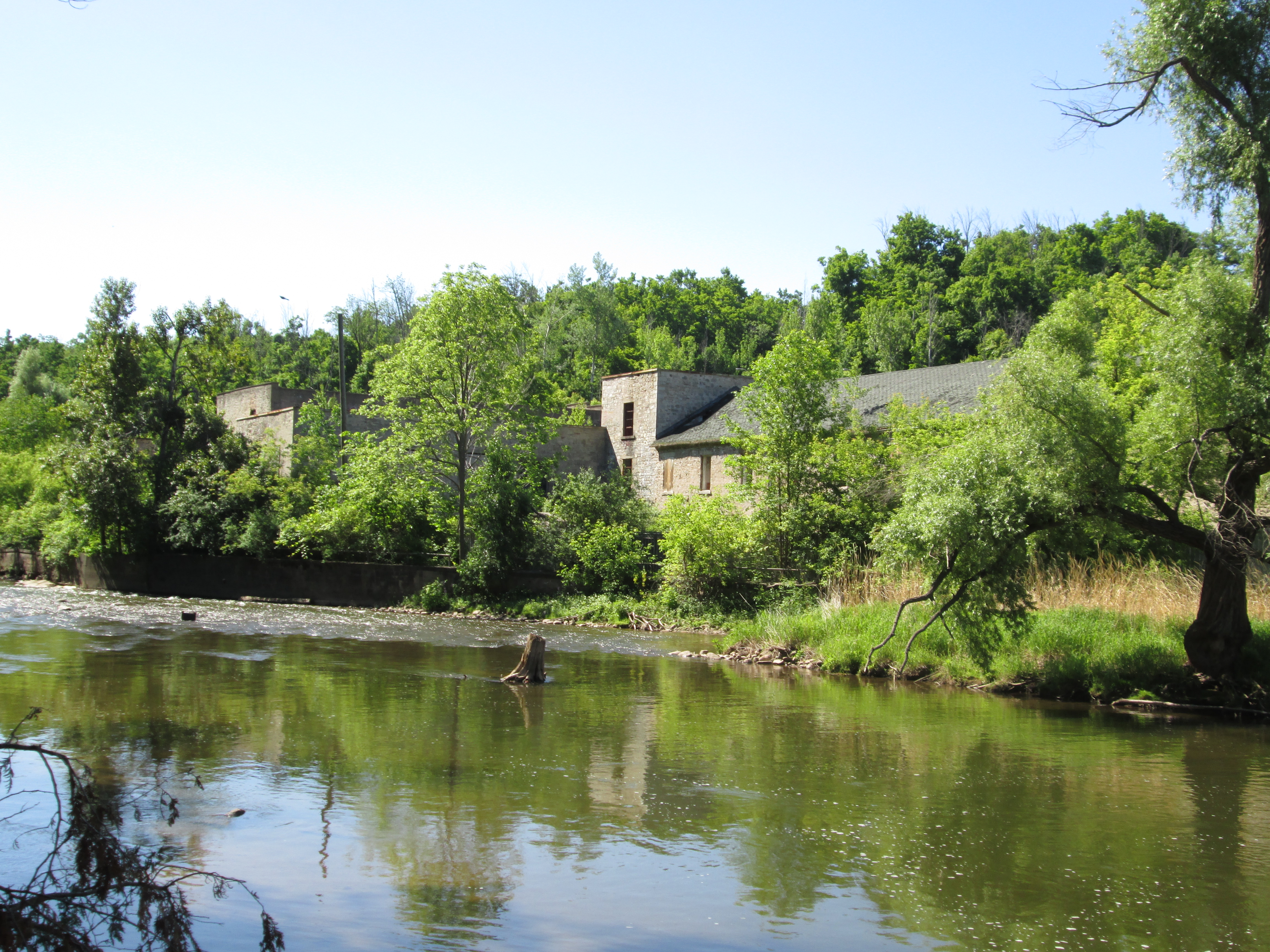
3. Barber Paper Mills – Hike Date: June 6, 2015

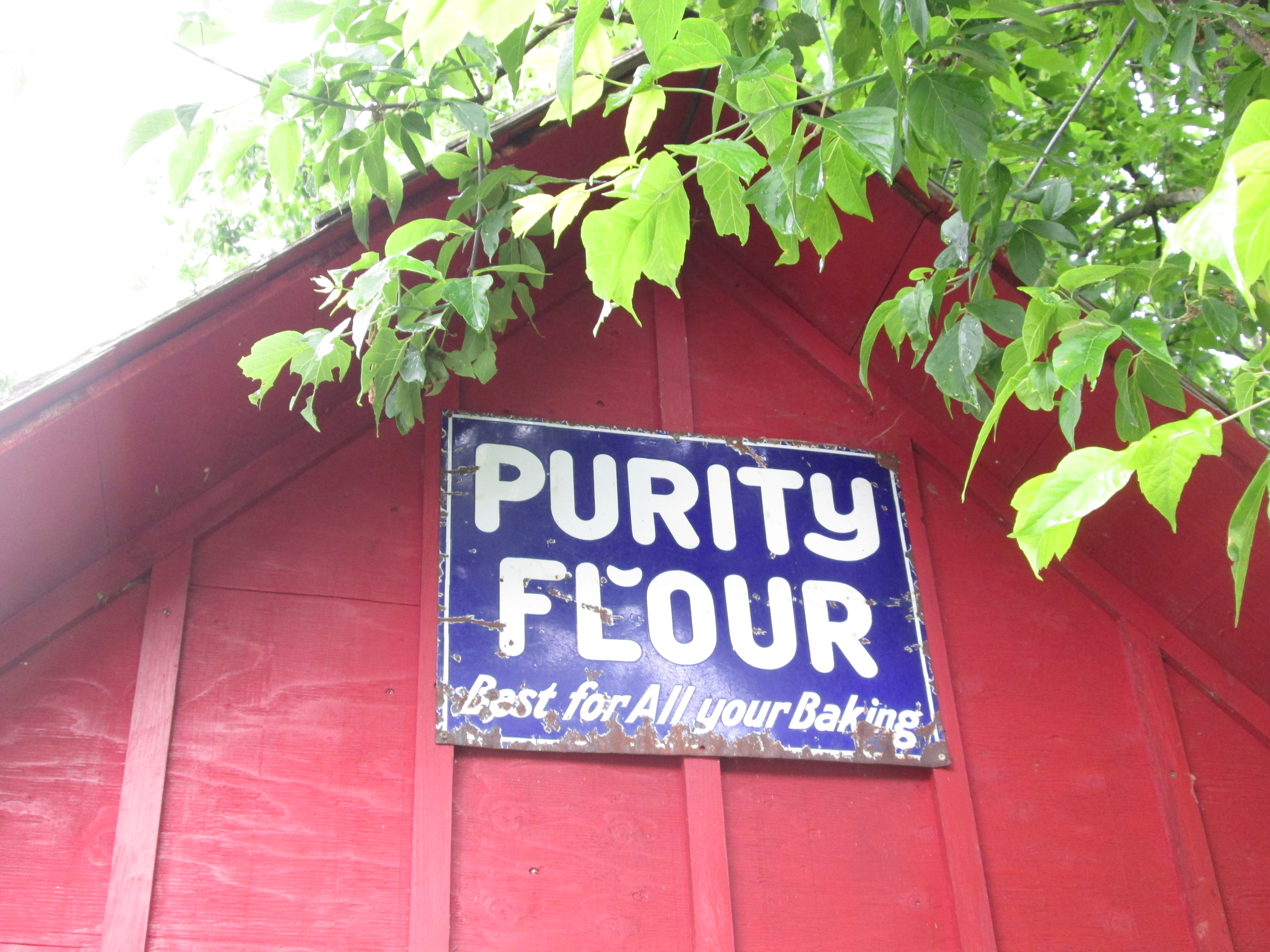
Situated on the side of the Credit River in Georgetown, the Barber Paper Mills were the first industry in Canada to build it’s own dynamo and transmission lines to provide electrical power to their mill.  A paper mill was operated here from the mid 1800’s until 1948 when it was closed.

IMG_5155

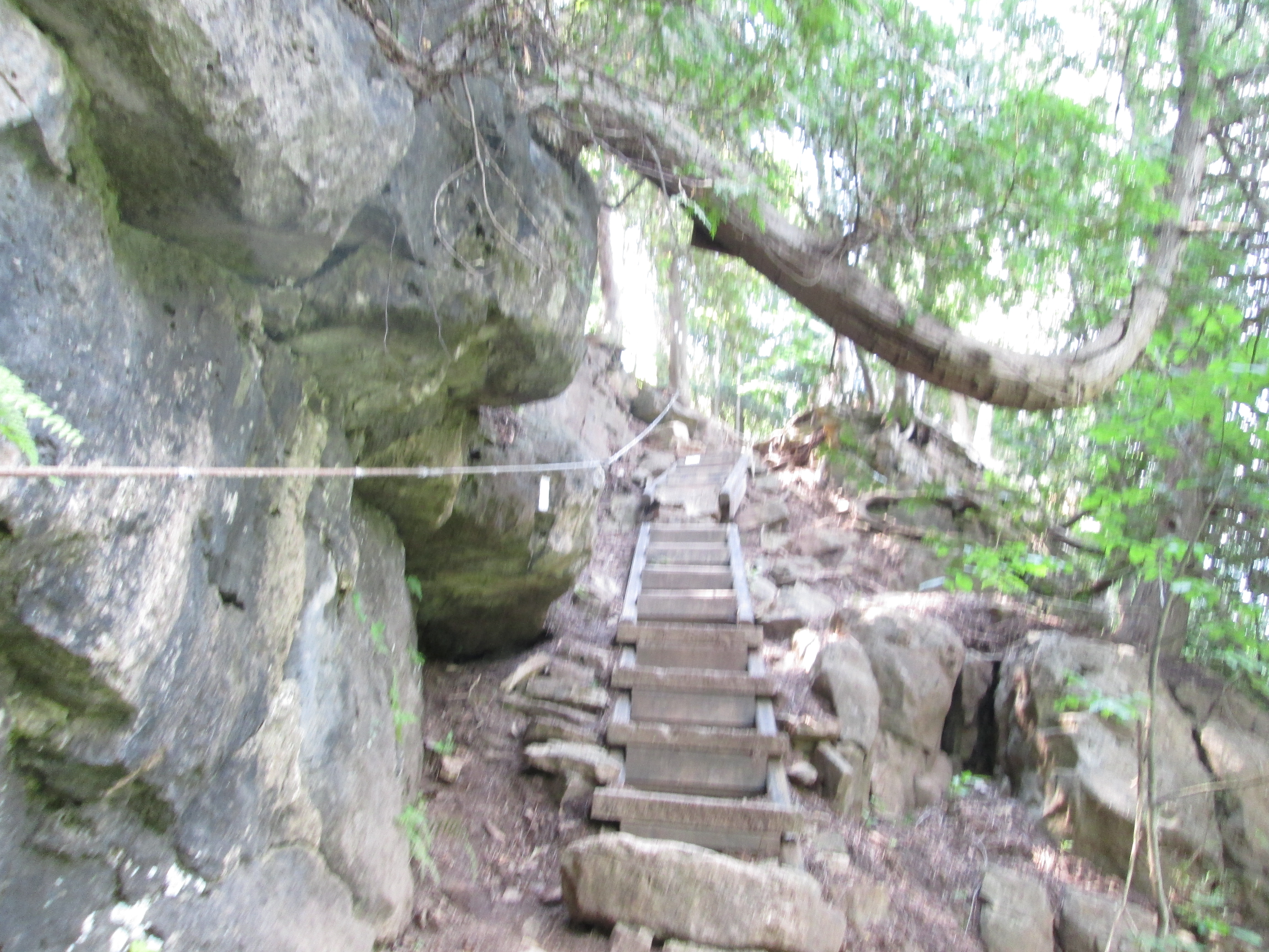
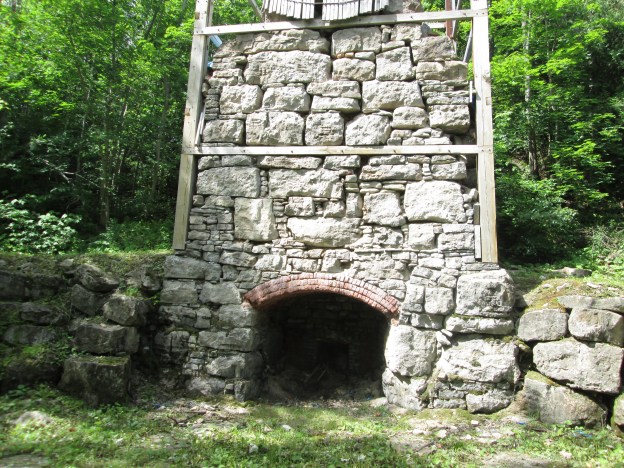
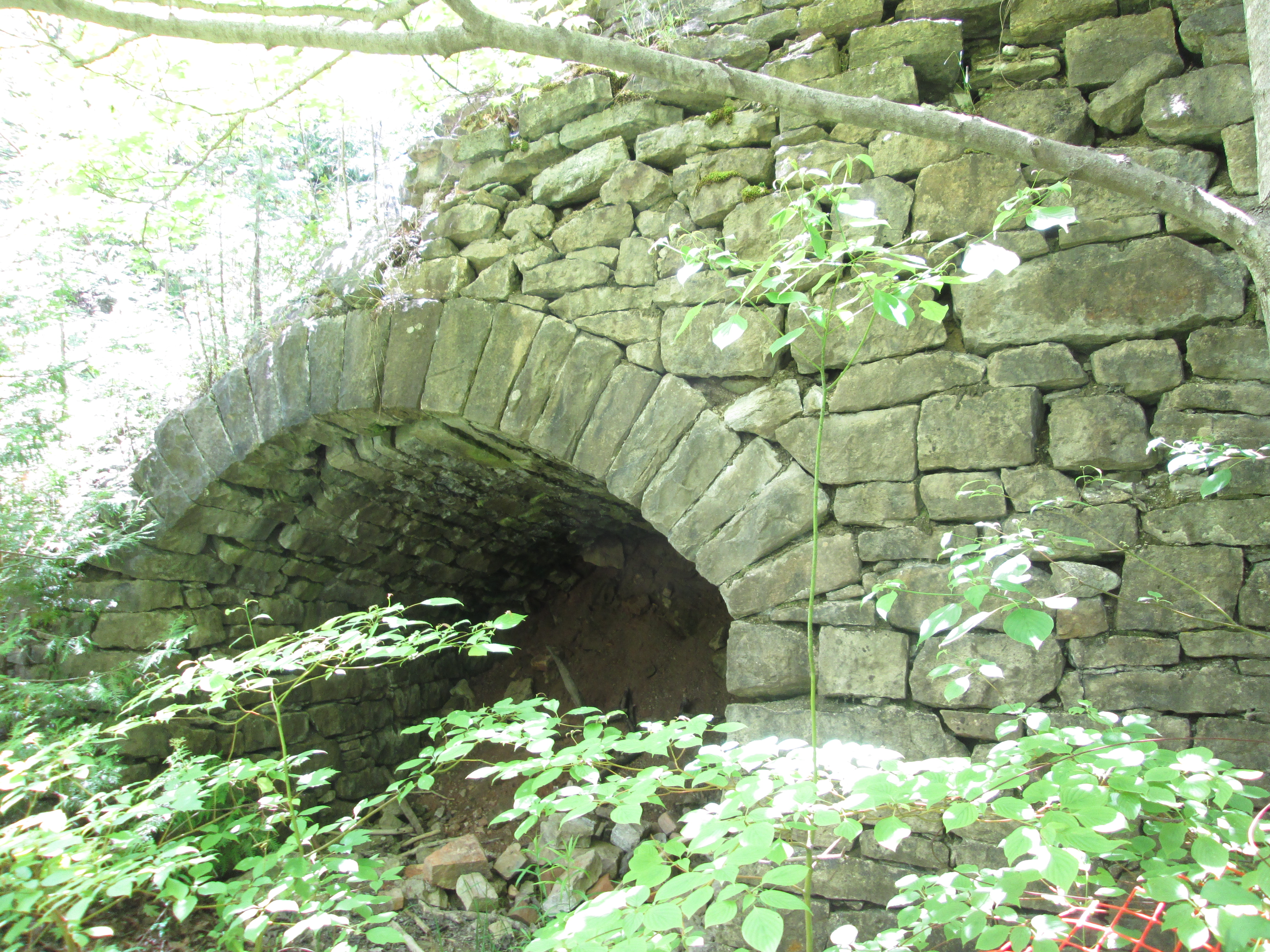
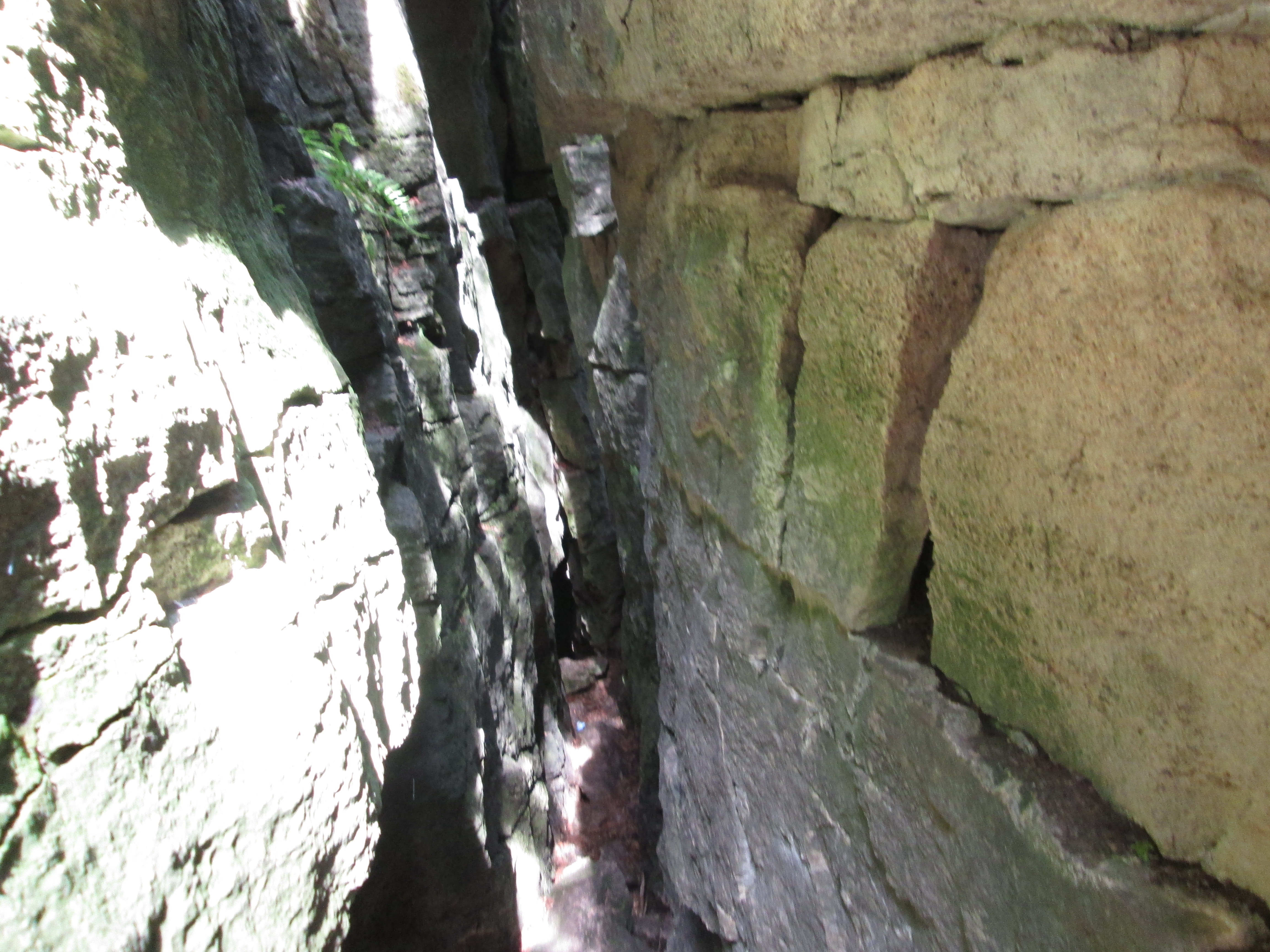
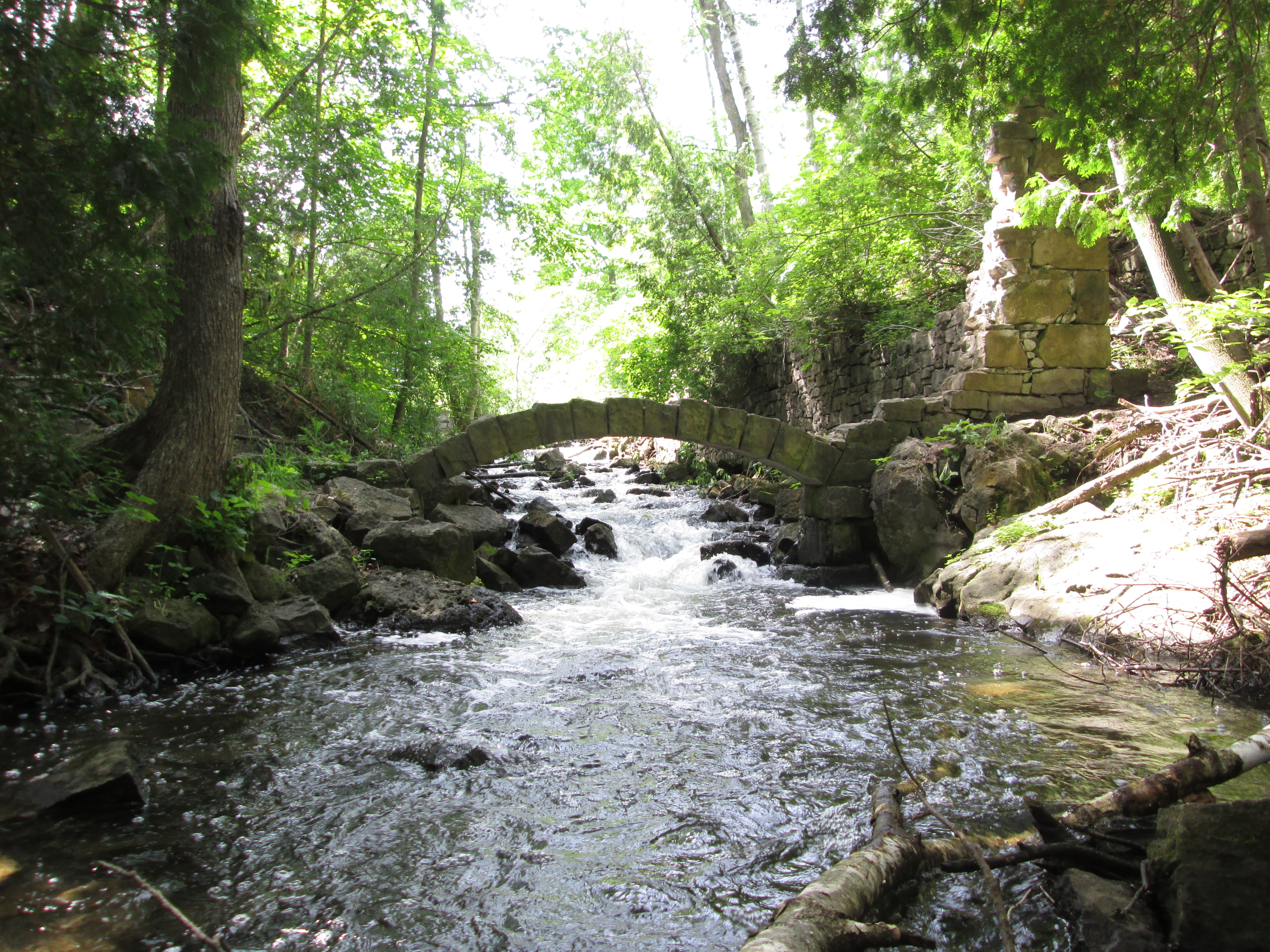
2. Limehouse – Hike Date: June 20, 2015

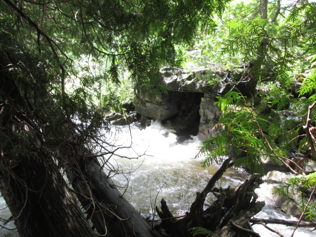
The village of Limehouse developed around a local lime industry.  The remains of set kilns from the 1840’s and an 1860’s style draw kiln along with the foundations of a lime mill with it’s stone arch and a powder house make this an historically interesting hike.  The Bruce Trail runs through an area known as the Hole in the Wall where you can climb through cracks in the rock face.

IMG_5685

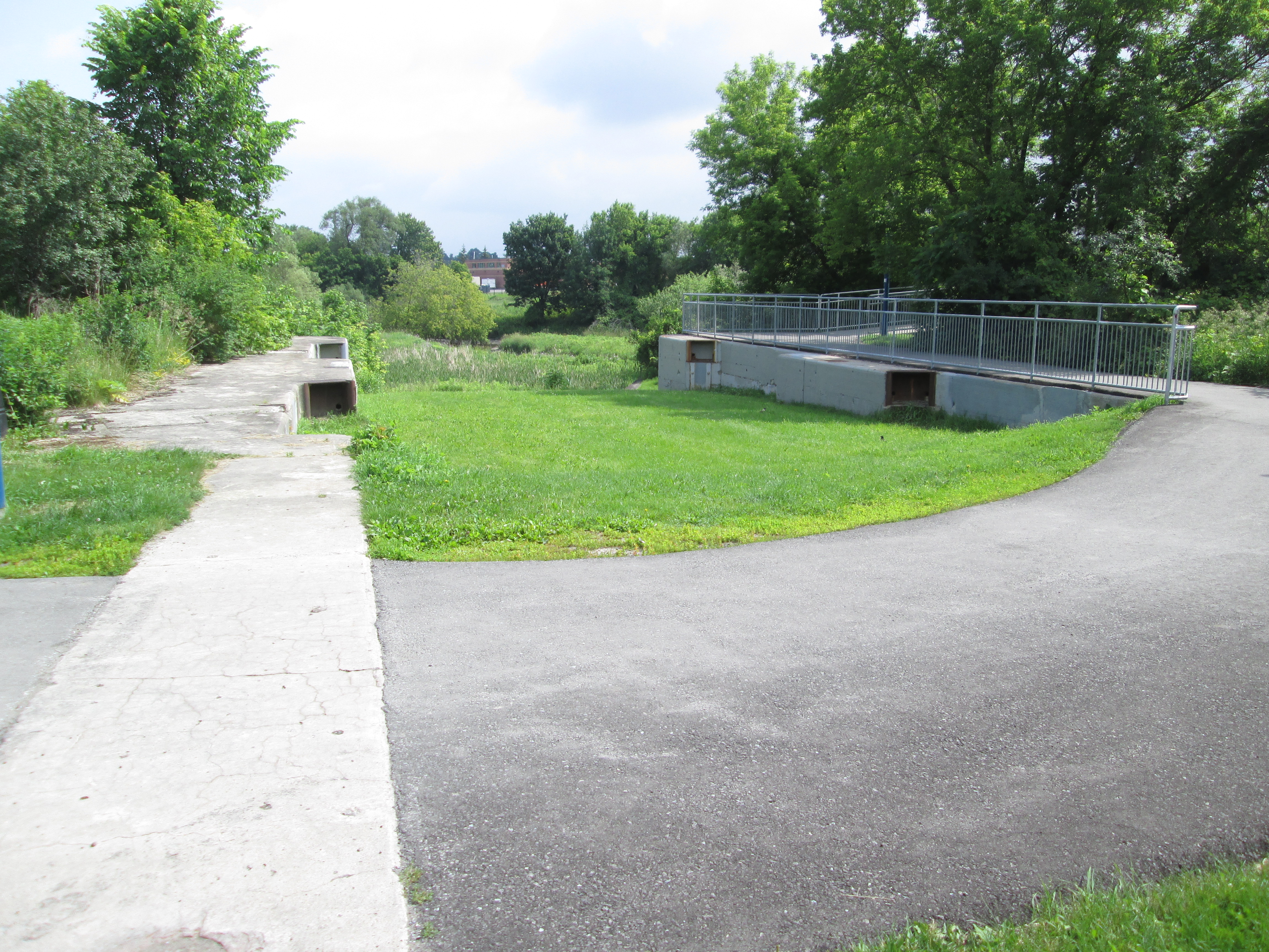
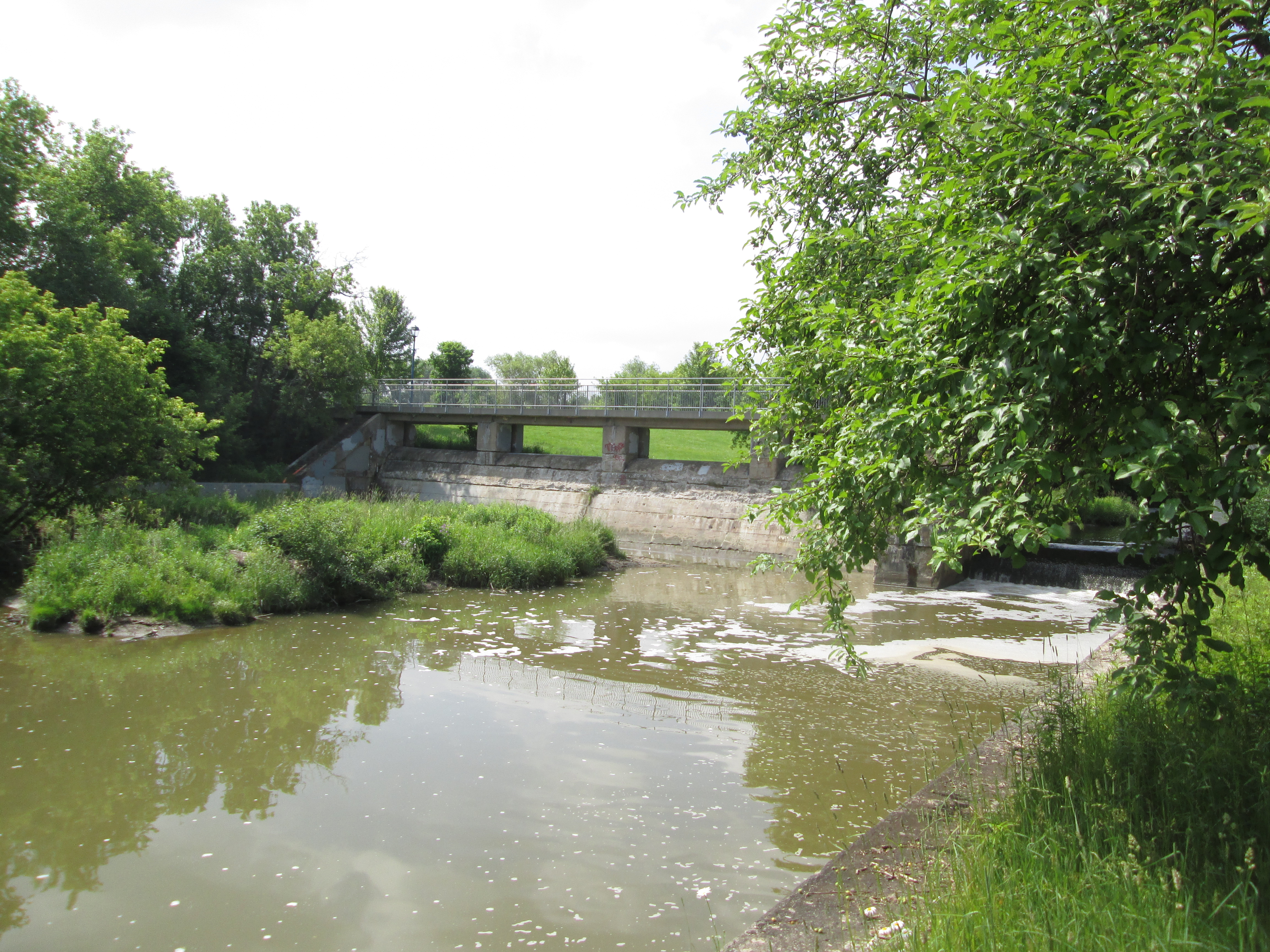
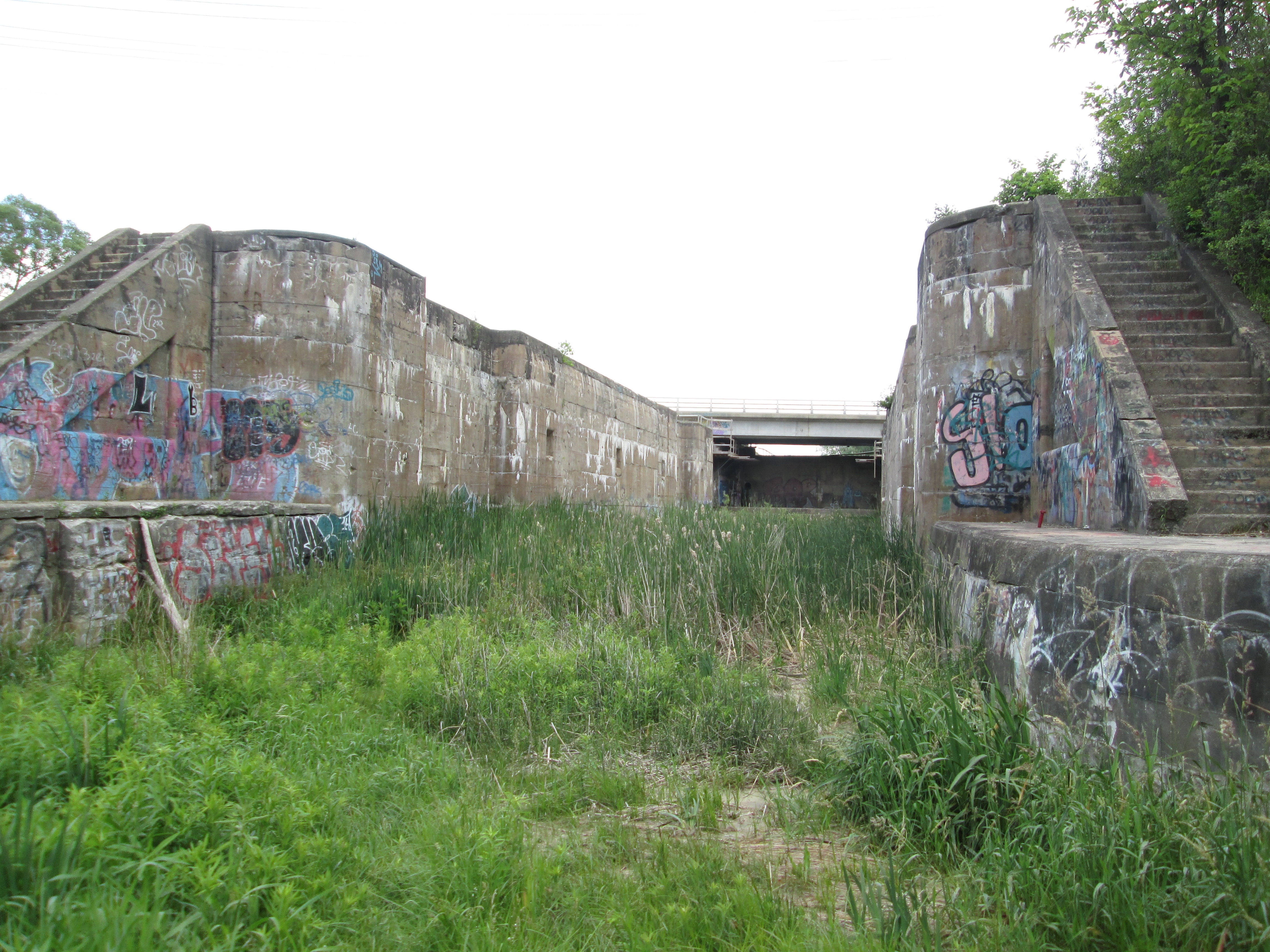
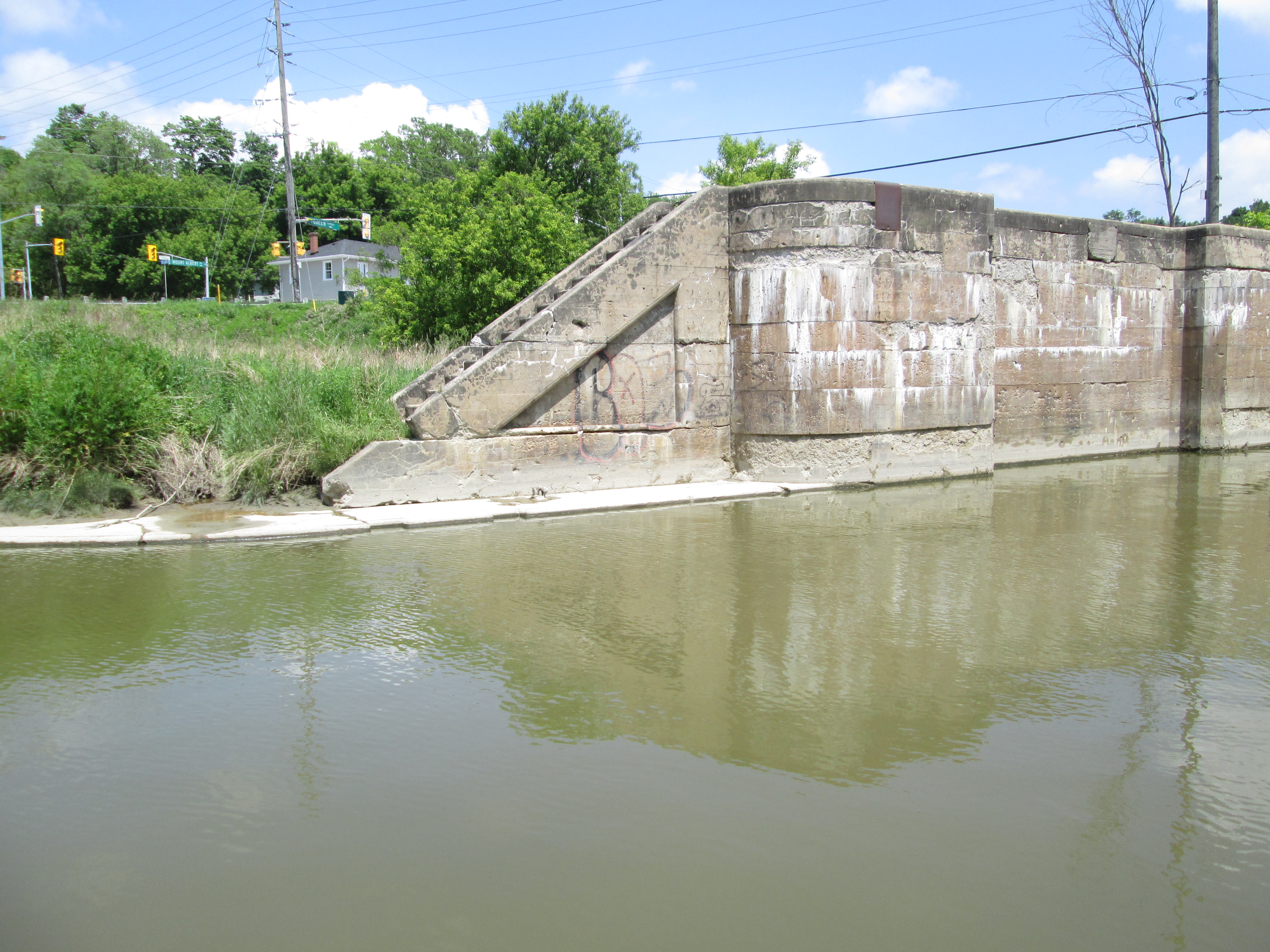
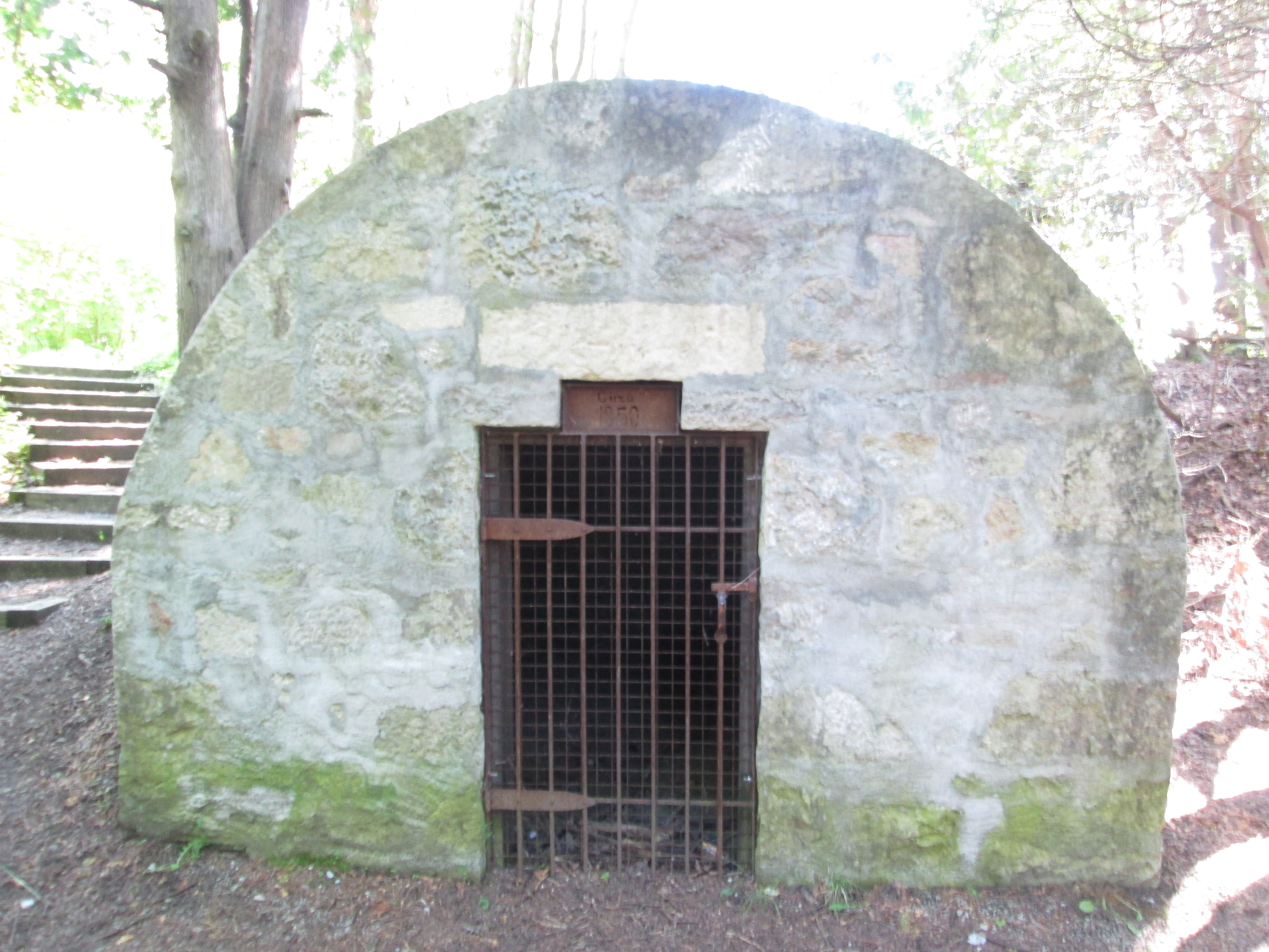
1. Newmarket Ghost Canal – Hike Date: June 21, 2015

Although two previous plans to build a canal system using the Holland River had been abandoned when found to be impractical and too expensive, the idea was resurrected in 1904. The canal would run from Cook’s Bay on Lake Simcoe to Newmarket using three locks and four swing bridges.  Cost over-runs and insufficient water supply to fill the locks caused it to be cancelled in 1912 when construction was nearly complete.

IMG_5851

Who knows what the future holds?  One thing I’m sure of is this.  If I get the opportunity to do another 100 hikes I’m going to see some awesome things.  Thanks to everyone for coming along on chapter one and let’s see what’s in store in chapter two of the adventure that is Hiking The GTA.

Visit us at http://www.facebook.com/hikingthegta

Forks Of The Credit – The Stonecutter’s Dam

Saturday July 18, 2015

It was the hottest, stickiest day so far this year.  It was already 22 degrees, feeling like 30 at 9:00 in the morning.  By the time we got back to the car the humidity was making it feel like 39 degrees.  You need to carry a lot of water on days like this to avoid dehydration and possible heat stroke.

Peel County was surveyed in 1818-1819 with settlement starting the following year.  Settlers found a rugged terrain that was difficult to farm.  Lot 9 concession 4 was typical of the area and included a stretch of the escarpment where the Credit River cascades through a ravine.  The property didn’t suit farming but there was plenty of Queenston shale and limestone as well as gravel deposits.  It would be used for quarry purposes from the mid 1800’s until the 1930’s.  In 1986 the Ontario Heritage Foundation acquired the property in a combined purchase and donation from Bert Willoughby. Now known as the Willboughby Property it is west of the Devil’s Pulpit which we visited last week. Historical research conducted in 1988 identified several items of cultural heritage significance, a few of which are presented below.

We parked on the end of Scott street and entered the park near the old gravel pit.  As we entered the laneway to the former caretaker’s house we found a single yellow daylily.  These plants usually grow in small clusters so finding a single flower is unusual.  They get their name from the fact that the flowers only last for a single day.  They bloom overnight or in the morning and wither up the following night.  A new flower may grow on the same stem and if the flower is cut off it will continue to bloom for several days.  They come in many brilliant colours with this one having brown stamen which are the male parts and a yellow carpel, or female part.  This example is known as a lemon lily.

IMG_6624

At the west end of the property a  gravel pit operated until the 1930’s.  Nearby stood a barn and workshop as well as the caretaker’s house and a windmill.  The gravel pit has started to grow over with trees as can be seen in the picture below.  We found evidence of the other structures but they appear to have all been removed.

IMG_6631

As you follow the trail along you will come to the Crow’s Nest side trail.  To the left this trail runs past the Hillis Quarry overlooking the Forks road.  To the right it runs past Crows Nest Quarry and several smaller pits where limestone and sandstone were cut from the hill side.  We took the side of the trail along the Hillis Quarry which eventually loops back toward the river.  Along here an old pump house stands.

IMG_6672

Behind the pump house stand two old bridge abutments made from blocks of cut stone.  These supported a siding from the Credit Valley Railway (CVR) that ran to the quarries.  The cut stone from these quarries was used to build some of the grandest buildings in Ontario in the late 1800’s.

IMG_6687

What we call Old City Hall in Toronto was actually the third city hall.  It was completed in 1899 using 1,360 train car loads of cut stone.  The grey stone came from the Credit River Valley and may have crossed the bridge shown in the previous picture.  The brown stone was brought from New Brunswick.  The picture below shows the water colour that was created to promote the idea of building a new city hall.

oldhall3

The CVR retaining wall along the siding is part of the built or human heritage on the property. With the rails pulled up and trees growing on the former rail bed this almost appears to be a random wall built in the woods.  The retaining wall is yet another example of the use of cut stone on the property.

IMG_6691

The rail siding to the quarries on the Willoughby property joined the CVR near the train station. The train station sat in the clearing at the hairpin turn on the Forks of the Credit road.

IMG_6693

The Willoughby dam is about 100 metres upstream from the Forks of the Credit road along a Bruce Trail blue side trail in the bottom of the valley.  With a rise of 1.5 metres it is a migratory obstacle to all but jumping species of fish such as salmon and trout.

IMG_6705

Along the side of the river we found a recently hatched nest of Eastern Snapping Turtle eggs. This turtle is considered to be of Special Concern in Canada.  The empty shells look like little curled up strips of paper running down into the hole.

IMG_6633

Up river from the concrete dam is a mid 1800’s structure made of blocks of cut stone.  The stonecutter’s dam has a unique stone penstock that can be seen in the cover photo.  The penstock is a stone tunnel extending from the downstream side of the dam.  The intake in the wall of the dam was higher than the exit causing the water to fall through the penstock to deliver energy to turn a turbine or water wheel.  The picture below shows the back side of the dam where a large amount of wood has been washed up over the years.  Many dams were washed out in the major floods of 1878 and 1954 but the stonecutter’s dam has survived. When the Willoughby property was acquired and a conservation plan was developed the restoration of this dam and it’s associated mill structures was reviewed but unfortunately dismissed.

IMG_6717

The mill pond behind the stonecutter’s dam is filling up with silt and weeds.  The dam was considered to be impassable to migratory fish but a single salmon was recently caught upstream and this suggests that some can go through (or get tossed over by fishermen).

IMG_6719

If you follow the trail past the dam you will have to continue into Belfountain. The Willoughby property has been used for farming, quarrying and has now been turned into a park that hides it’s abundant history among the new growth forest.

The Black-Crowned Heron in the picture below was photographed a couple of days earlier but this bird was auditioning for a spot in the blog by posing for pictures.  This stocky little heron stands up to two feet tall and can weigh two pounds.  Unlike the great blue heron, night herons do not have long necks and legs.

IMG_6600

The Forks of the Credit contains ample space for future explorations of it’s natural beauty and historical artifacts.

Visit us at http://www.facebook.com/hikingthegta

Milne Dam Conservation Area

Sunday July 12, 2015

It was 25 degrees and partly cloudy.  Having hiked small portions of the Rouge River in the past I decided it was time to feature some part of it in a blog.  I drove to the founding place for the town of Markham to investigate the Milne Dam.  I parked just off of Highway 7 near Milne Lane, a lane way that once led to the Milne property and dam.

William Berczy was born in 1744 and came to Upper Canada with Lieutenant Governor John Graves Simcoe and basically co-founded York (Toronto).  With a group of German settlers he cleared part of the town site for York as well as building a powder magazine for the Queens Rangers to help protect the town.  His men then cleared Yonge Street from Eglinton to Elgin Mills, a span of 15 miles.  With 64 families Berczy then settled in Markham Township in an area which came to be known as German Mills.  The settlement didn’t thrive but Berczy did and his son Charles became Toronto’s first postmaster.

Alexander and Peter Milne built a dam and a mill on The Rouge River in the 1820’s.  The business prospered and soon there was a woolen mill, fueling mill, ashery and general store. Soon a community named Markham was growing along Markham road to the north of the mills.  The Milnes were also responsible for building mills in the area of Edwards Gardens and in Milne Hollow.  In 1911 Archie Milne, grandson of Peter, built the first concrete arc dam in Canada.  It was washed out in a flood in 1929 but replaced right away.  When it was washed out in the flood of Hurricane Hazel in 1954 it wasn’t replaced.  The Toronto Region conservation Authority bought the property in the 1950’s when they began to acquire the lands in the city’s floodplains.  They replaced the dam in 1973 as part of a master flood control plan and created Milne Dam Conservation Area.

The cover photo shows the side view of the dam where the water falls over the rim and onto the diversion weir at the bottom.  From there it flows to another small dam before being released through a spillway into the open river again.  The picture below is from down stream looking back up at the ten foot dam.  The Milne Fishway can be seen at water level on the right.

IMG_6532

The photo below shows the view up into the fish ladder.  The Milne fishway was constructed in 2001 and opened in 2005 at a cost of over $1 million.  Prior to that, the dam had presented a migration obstacle for fish but now another 45 km of the Rouge River was opened to migration. Records show that Rainbow Trout, Brown Trout, Smallmouth Bass and 10 other species have used the ladder to reach upstream.  During periods of migration, such as spring time, a cage is placed on the top end of the fishway.  This allows the removal of undesirable species such as sea lampreys.  Sea lampreys attach themselves to fish with a suction cup-like mouth and feed on them until they die. The Milne dam is the final barrier to lampreys to keep them out of the upper Rouge River.

IMG_6540

The Toronto region has been subject to flooding from the earliest days of it’s founding.  The first written records of floods start in 1797.  The first major destruction was caused by 5 inches of rain that fell in 24 hours in 1878 and washed out mills, bridges and dams.  Other floods happened over the next 66 years until 1954 when Hurricane Hazel hit.  With a death toll of 81 people it was time to get serious about flood control.  15 dams and flood control ponds were planned of which only three were built so far.  Claireville dam in 1964, G. Ross Lord dam in 1973 and Milne Dam in 1973.  The view below is from above the dam looking out across the smooth surface of the Milne Reservior behind the dam.  The orange floats collect debris and prevent it from going over the dam.

IMG_6545

These mushrooms look like Fly Agaric which is a psychoactive drug capable of producing hallucinations.  It actually more closely resembles Amanita Crenulata, of the same family, which is highly poisonous. The ring around the stipe tends to be a single fuzzy ring rather than several concentric rings. These mushrooms are the type that are typically shown, although most often red, in pictures featuring elves and fairies.  In a strange twist, children’s books are filled with pictures of poisonous or hallucinogenic mushrooms.

IMG_6591

There are some real quiet places along the side of the reservoir where you can sit and watch the fish jump in the air.  As I sat on a log, and roasted in the heat, the yellow tree branch hanging over the water reminded me to enjoy summer while its here because its over far too soon.

IMG_6557

With lots of wetlands and woodlands the park is home to a wide variety of wildlife.  It’s excellent for migratory birds and I caught a great blue heron in flight along the far shore in the picture below.

IMG_6573

The black raspberry has a distinct taste from it’s red cousin but they were juicy and plentiful. Not to mention how good they taste when put on top of rich french vanilla ice cream.

IMG_6565

Where the Rouge River crosses under Markham road stands one of the early businesses in Markham.  Archibald Barker bought this piece of property in 1844 and took out a mortgage in 1852 which likely indicates the date the house was built. The building was constructed to house a store on the south half and the Barker residence on the north half.  Aside from running the store, Barker was a notary public and ran the Rouge Mills.  This building stood near the mill complex and may have provided a place for workers to purchase supplies.

IMG_6525

Markham has plenty of history waiting to be investigated in future posts but the Milne Dam Conservation Area is a great place to visit and as I only hiked around one corner of the 305 acre park I’m certain to be back.

Visit us at http://www.facebook.com/hikingthegta


The Devil’s Pulpit

Saturday July 11, 2015

It was 23 degrees and sunny without a cloud in the sky.  We parked along the side of the Credit River just before Dominion Road.  The cover photo shows the area of the Forks of the Credit trestle around 1900.  We set out to investigate the remnants of several elements of this picture. We visited the trestle, the kilns where the chimney is and the white rock face on the cliff wall above and to the left of the kiln known as The Devil’s Pulpit.

This area was surveyed in 1819-1820 with the earliest settlement being at the site of present day Belfountain at the top of the escarpment.  With the coming of the Credit Valley Railway (CVR) the area of the Forks of the Credit became an industrial hub focused on the quarry industry.

At its peak Forks of the Credit had 33 houses, a store, a hotel and a brick school with a Mechanic’s Institute.  Mechanic’s Institutes were places where adults could access the use of books.  Often funded by industrialists with the intention of having better access to educated employees these preceded and often turned into public libraries.  The school still stands on Chisholme Street which is roughly where the third line would have passed had the hill not been so steep.  The picture below shows the date stone indicating that this was Caledon School Section 19 and it was built in 1884.  The date stone also reads Pro Bono Publico or For The Public Good.

IMG_6480

Medina or Whirlpool sandstone was noted in an 1863 geological survey however there was no easy way to get it from quarry to potential market.  The CVR was established in 1872 and one of the key objectives in it’s charter was to provide a link between the aggregate resources in the Credit Valley and the markets in Toronto and Hamilton.  It came through the area in 1879 and ignited an industry that would prosper for 20 years.  The CVR built a 1,146 foot wooden trestle, 85 feet high to cross the valley.  At the time it was the longest curved trestle in Ontario but safety concerns led to much of it being filled in by dumping gravel through the trestle.  The archive photo below shows the trestle before being filled in with the Devil’s Pulpit in the background.  Compare this with the cover photo after infilling.

forkstrestleold

Only three spans over the Credit River and the Forks of the Credit Road remain open with the balance of the old wooden structure now hidden below a berm of gravel.

IMG_6381

The original wooden trestle was replaced with concrete support and three steel spans in the early 1900’s. The centre span has steel truss work as can be seen in the picture below, taken from the south abutment, and is also seen in the cover photo.

IMG_6390

Portions of the original round wood trestle still support the tracks on both abutments.

IMG_6384

Vipers Bugloss or Blueweed grows in barren places and we found a few plants growing in the rocks beside the trestle.  The leaves, especially those closest to the root, can be infused in a tea. This tea is reported to alleviate headaches, fevers and inflammatory pains.  it is also said to give a general feeling of well being, relieving melancholy.

SAMSUNG

Turkey Vultures are carrion eaters and are the most common of North American vultures.  Like other North American vultures they are not closely related to the European vultures they resemble.  Convergent evolution is the term used to explain two series of random mutations that come out with the same results.  A hundred or more turkey vultures were riding the air currents above the river and the picture below shows just a few of them.

IMG_6408

Between the trestle and the top of Chisholme street a siding used to run from the main CVR line to the Hoffman lime kilns.  Twelve draw kilns were built in a ring 30 metres long and 15 metres wide.  The whole set-up was enclosed in a sheltering building.  Several quarries operated in the Forks of the Credit in the late 1800’s supplying cut stone for buildings such as the Legislative Assembly of Ontario building at Queens Park in Toronto.  A layer of Dolostone covered this sandstone and Hoffman built the lime kilns in 1896 to take advantage of this resource.  Moss covers the walls of the pathway between the stone kilns.

IMG_6462

Each of the 12 draw kilns were loaded and burned individually and with separate heat control. The kilns were started in a sequence such that there were always some being loaded, some in mid cycle and some being emptied of cooled down lime. The picture below shows inside of one kilns with it’s fire brick lining.  Similar kilns can be found at Limehouse.

IMG_6455

The chimney stood 30 metres tall to exhaust the smoke and heat from the kilns but only the lower few metres remain standing.

IMG_6450

The Bruce Trail works its way up the side of the escarpment past discarded boulders and small run off streams.  After climbing a little farther you come to an open quarry face of what was known as The Forks Quarries and now is referred to as The Devil’s Pulpit.

IMG_6495

As you reach the upper portion of the 100 meter climb a series of stone and wooden stairs have been provided.  A steel cable is anchored into the rocks for added safety.

IMG_6496

The view from atop the Devil’s Pulpit is quite spectacular at any time of the year but especially so in the fall when the leaves are changing.  A small white strip near the centre of the picture below, and about a third of the way up, is the railway and is almost lost in the valley below but gives perspective to the distance that can be seen from up here.  It can be seen when the picture is expanded.

Devils Pulpit

The climb to the top of the escarpment is a lot of work but it is well worth it.  The Bruce Trail continues out along the right of way for the third line but we went back down the hill.  The descent is easier and quicker than the ascent but be sure to watch your footing.  You don’t want to get back down too quickly!

Google Maps Link: Forks of the Credit

Like us at http://www.facebook.com/hikingthegta


Cheltenham

Saturday July 4, 2015

Having explored the Cheltenham Brickyards and Badlands we walked up Mill Street and into the village of Cheltenham.  The dominant feature in the area is the Niagara Escarpment which offered prime building material, close to the surface.  Large red pieces of whirlpool sandstone were cut and used for major public buildings in Toronto and other urban centres.  In Chingaucousy Township, outcroppings of Queenston shale proved perfect for making terra cotta (Terra Cotta) and bricks (Cheltenham).  The Credit River winds its way through farms, past mills and industrial sites and provided power and transportation to the early settlers.

Charles Haines emigrated from Cheltenham, England and arrived in York (Toronto) in 1817.  Charles drew a half lot on the Credit River that had excellent prospects for a mill seat.  His first grist mill in 1827 was built of logs and had a single run of stones.  As the needs of the farming community increased a larger mill was required and Haines built a new one with three run of stones.  Haines was taking advantage of increased grain production in Peel as well as grinding American grain.  Under colonial tariffs it was lucrative to turn American grain into Canadian flour and sell it to England.  The grist mill burned down in 1945 and only the foundations remain. This is why Cheltenham has no mills on Mill Street.  The picture below shows the remnants of the dam structure as seen from the south side of the river.

IMG_6269

As you look across the Credit River you can see remains of the dam on that side as well.  More imposing is the structure of the saw mill.  The first saw mill was erected by Haines around 1835.  The existing structure is reported to be the third one on the site.  It was built around 1886 and is one of the few remaining saw mills that are close to Toronto.  It is also featured in the cover photo in a shot from Mill Street.

IMG_6259

Across from the old saw mill, also on Haines property, is a building called the Honey House.  In this building Theodore Haines, followed by his son Rusty, keep an apiary.  Cheltenham is surrounded with meadows where a wide variety of flowers are in bloom.  Here, the bees can collect nectar which is basically sucrose and water.  They use an enzyme to convert the sucrose into glucose and fructose and then eliminate all but about 18% of the water, making honey. This building is made of yellow and red brick, possibly from Interprovincial Brick, in the most interesting pattern I have yet featured.

IMG_6266

Although the bumble bee doesn’t make honey it is useful in it’s own way.  Like the honey bee, it collects pollen from flowers and transfers it to other flowers, completing the process of pollination.

IMG_6185

This house was built by Frederick Haines Sr. beside the general store following the fire of 1886.  In addition to running the general store and the grist mill Frederick was a key figure in the town.  The dichromate brick in this house gives beautiful decoration to the home. The extended bay windows give the house a symmetry around the arched entrance.  The building was used as an antique store during the 1960’s and 1970’s before being used as a retreat for the United Church.  It has now come full circle and serves as a private residence once again.

IMG_6238

When a fire destroyed several buildings on the main street they were quickly rebuilt.  The General Store is located in a building made of local sandstone and limestone which replaced an earlier frame structure.  It was built in 1887 and has served a wide variety of uses over the years.  As well as being the general store and post office it has also been a bank, library, tailor’s shop and a doctor’s office.  When the telephone came to the community it housed the first local switchboard.  Also, Cheltenham’s first gas pumps were located in front of this building.

IMG_6235

William Henry opened a frame inn beside the general store in 1848.  Lost to the fire of 1886 it was replaced with the brick building that stands here today.  The Cheltenham Hotel has dichromatic brick using yellow for corner quoins and window lintels to offset the red brick, making the building look more substantial.

IMG_6233

The town has a large collection of historic buildings including several homes on the main street. The one pictured below with the fine scroll work sits across from the end of Mill Street.  It was built around 1875  by Charles King who had purchased the property from Fred Haines in 1870. The front lawn still sports the well and water pump.  This pump was made by R. McDougall & Co. in Galt.  McDougall was a manufacturer of heavy steel equipment from the late 1880’s until they were bought out in 1951.  They specialized in lathes, but also made water pumps, including the one at Earl Bales house and at Spadina House.

IMG_6240

Charles Haines built his second house in 1835 on the top of the hill over looking the valley with his milling empire and the town it spawned.  The house is pictured below prior to restoration in 1988.

Top of the Hill-page1

The restored Haines house has now been converted to a bed and breakfast which is conveniently called Top Of The Hill.  The owners are related to Charles and Martha and the house has been in the family since it was built.  In 1988 the house was stripped of some of its additions and lifted up to get a new basement.  Guests of the B&B can relax among family antiques and read the diary written by Charles’ son, Charles, which describes life in the pioneer town.

IMG_6277

The Credit River flows through town and makes a beautiful tapestry to portray the trees and the nearly still Canadian Flag.

IMG_6214

Charles Haines lies buried in the cemetery across the road from the fire hall.  His legacy includes transferring the name Cheltenham from the UK to Upper Canada.  Several heritage buildings in town were built by himself or his direct descendants.

IMG_6261

Cheltenham is a picturesque village which retains much of its historic form and buildings.  For this reason it is designated as a Cultural Heritage Landscape and many of its buildings are designated under the Ontario Heritage Act.

Visit http://www.facebook.com/hikingthegta

Cheltenham – Brickyards and Badlands

Saturday July 4, 2015

We parked at the site of the Cheltenham Brickyards.  It was 22 degrees and sunny, a beautiful Saturday morning.  It was time for us to investigate the brickyards as well as the community of Cheltenham, which will form a companion post.  The brickyards are fenced off so it’s handy to have a camera where the lense can fit through chain link fencing.

Cheltenham is situated on the Niagara Escarpment and the surrounding area has plenty of easily accessible shale deposits.  In the early 1900’s it was discovered that this shale made especially good dry pressed bricks.  Frederick Bruce McFarren was born Oct. 25, 1889 in Toronto and would become one of the best known figures in the Canadian clay brick industry. In 1914 he produced his first bricks in the Cheltenham Brickyards under the name of Interprovincial Bricks.  The brick in the picture below is marked “I B 8 0” for Interprovincial Bricks. Like other less than perfect examples, it has been discarded along the sides of the old railway tracks.

IMG_6150

The Brickworks was sold by McFarren to Cooksville Brick in 1928 but Frederick retained a management position there until at least 1955.  McFarren was responsible that year to oversee the conversion of the plant from coal fire to natural gas. The building closest to Mississauga Road is the concrete coal storage shed.  Built of poured concrete with concrete buttresses it was used to store the coal that fed the kilns until 1955.  

IMG_6170

Two, three story brick buildings remain on site.  These were known as crushing or mixing sheds and stood just to the north of the kilns and chimneys.  The two buildings feature brick buttresses and overhanging gable roofs.  The cover photo shows all five remaining kiln chimneys along with one of the crushing sheds.  Also seen in the picture below are concrete bases for brick storage sheds and steel beam supports for manufacturing buildings.

IMG_6154

Five of the original six brick chimneys are still standing.  These four sided chimneys are built of bricks and reinforced with metal banding.  Originally they were set in pairs but the south eastern one is missing today.  Long buildings containing kilns ran between the chimneys.  The chimneys were used to exhaust the underground ventilation tunnels from the downdraft kilns.  The tunnels and some underground works still remain.  Intercontinental Brick introduced the first continuous or “railway” tunnel type of kiln in Canada in 1922.  The kilns at Intercontinental Brick were built by G. W. Booth.

IMG_6166

Two manufacturing plants existed on the site and although they have been removed the brick walled earthworks still remain.

IMG_6273

The Hamilton & North Western Railway was incorporated in 1872.  In 1888 they were absorbed into the Grand Trunk Railway.  The GTR was taken over by the Canadian National Railway in 1923.  Mcfarren chose the site of his brick factory carefully.  He needed a place where the raw materials for his bricks could be extracted on site so that he wouldn’t need to pay to transport it.  He also needed easy access to shipping, preferably by rail.  In 1912 a site was selected near the GTR tracks, close to Cheltenham for labour and with easy access to the local shale.  The picture below shows the now abandoned railway tracks and the berm on the right that hides the still active shale pit.

IMG_6108

Another local innovation was the bringing of electrical power from Georgetown to power the plant.  Interprovincial Bricks was sold to E. P. Taylor in 1954 and to Domtar in 1955.  It was under Domtar ownership that the brickyards were finally closed in 1964. Meanwhile McFarren had purchased Streetsville Brick with the money he made from the original sale in 1928, renaming it McFarren Brick in 1929.  McFarren is remembered in Streetsville with a park named after him.

The Familiar Bluet is a damselfly, sitting with wings folded, and is common in Southern Ontario. They were darting all around us and one is hiding on the stalk of grass in the centre of this photograph.

IMG_6121

The picture below shows what the brickyards may have looked like around 1930.  Several additional buildings can be seen, some of which were workers housing.  Notice the kilns running between the six chimneys.

IMG_6084

Eyed Brown butterflies seemed to be everywhere along the sides of the old railway line.  As weather patterns change this butterfly is becoming more common in northern areas.  The less common Smoky Eyed Brown has 5 spots on the forewing instead of just four as on the example in the picture below.

IMG_6096

Just north of Cheltenham are the Cheltenham Badlands.  The area of the Great Lakes was formerly an inland sea known as the Michigan Basin where over time a delta was formed of iron rich soil.  This mud was slowly compressed into what is now known as Queenston shale.  The iron in the shale gives it its red colour.  This shale was exposed when cattle grazing removed the protective vegetation cover.  Farming has been discontinued at this site since 1931 but the erosion is ongoing.  The clay seen here is similar to that found at the site of the Cheltenham Brickyards.  A hiking trail used to cross the badlands but people won’t stay on the trails and the erosion is increasing.  Therefore, the area has recently been fenced off while a new preservation plan is developed.

IMG_6256

The Cheltenham Brickyards have a cultural heritage designation because they reveal an important use of the local landscape.  Proximity to raw resources and transportation allowed the nearby community to continue to prosper after the decline of the saw mill and grist mill industries.  Look for more on the founding of Cheltenham in an upcoming post.

Visit us at http://www.facebook.com/hikingthegta


Glen Williams

Saturday June 27, 2015

It was cloudy and rain was in the forecast but at 18 degrees it was quite comfortable.  We parked at the Barber Paper Mills and started to hike north up the east side of the Credit River. A blue marked side trail, part of the Bruce Trail, runs for 12 km between here and Terra Cotta. With the sky turning black we decided that maybe the weather man was right and getting caught in the rain would be better left for a warmer day.  Along the trail a small patch of Gooseberries are growing.  Gooseberries are related to the currant family and were valued in the middle ages for their cooling properties in fevers.  They are currently harvested for jams and preserves.

SAMSUNG

The story of Glen Williams is very much the story of the Williams family.  Benajah Williams arrived in 1825 and built a saw mill and a flour mill on the Credit river in what would become known as Williamsburgh.  He was born in 1765 in New York but as a staunch Loyalist he emigrated to Upper Canada.  The Williams family supplied all the services that a rural community needed with Joel being the blacksmith, David the tanner, Isaac made cabinets, Jacob ran the Glen Woolen Mill and Charles had a general store and was first postmaster.  The Glen Woolen Mill was a town fixture until it burned down in 1954.

Benajah’s original sawmill was built in 1826 and, along with his flour mill, formed the nucleus of the community.  In the 1850’s he replaced it with the current mill.  It operated as a water powered saw mill before being converted into a hosiery factory and finally serving as an apple processing plant.  It belonged to Rheinhart Vinegars at the time of it’s closure in 1985.  It was restored in 1989 and painted yellow earning the nick name “The Yellow Mill.  Benajah passed away in 1851 leaving Charles to run  much of the town’s industry.

IMG_20150627_114852_hdr

Beside the Yellow Mill stands the old stone building which housed the Georgetown Electric Light Company.  The two structures are shown together in the cover photo.  This two and a half story building was erected in 1893 on the foundations of the grist mill.  It provided electricity to Glen Williams for  20 years until 1913 when hydro was brought from Niagara Falls.  At this time both it and the Barber Dynamo a few km downstream were shut down.  It is an interesting building because the stone mason didn’t take the time to level the windows and so they slant on various angles.

IMG_20150627_114749_hdr

Charles Williams opened a general store and post office in 1852.  When he applied for a post office licence it was refused on the grounds that there was already a post office in another town called Williamsburgh.  Charles settled on the name Glen Williams after the little glen in which the town sat.  The building was recently home to The Copper Kettle but is presently under renovations.

IMG_20150627_115710_hdr

The Good Templars approached Charles Williams in 1870 asking for a piece of land on which to build a town hall for the community that they could also use for their temperance meetings. Charles deeded them the town lot adjacent to his General Store.  The town hall was built in 1871 and has served the community in many capacities including as a stage for Canadian author Lucy Maud Montgomery to perform dramas.

IMG_20150627_120705

On the corner opposite to the town hall stands two connected buildings.  The first is the home of James Laidlaw who built it in 1858.  The building beside it belonged to the local tailor Thomas Frazier who operated his shop here starting in 1847.  Later it belonged to Laidlaw who ran a store here.  Timothy Eaton was a clerk in this building in 1853 and 1854 starting when he was 19.  Timothy would go on to found Eaton’s Department Store.

IMG_5954

Benajah Williams and his family were Methodists and the first services in town were held in 1836.  The frame church was built in 1837 and given a veneer of bricks in 1903.  This church stands on one side of the Credit River.

IMG_5960

On the opposite bank stands the St. Alban The Martyr Anglican Church.  It has an interesting shape with the bell tower at the rear instead of the front by the street.  The first services held in this building were in June of 1903.  I wonder if the Methodists decided to give their church a facelift of bricks in response to the construction of the Anglican church.

IMG_5983

These two churches stood on either side of the Glen Williams mill pond.  The mill dam stretched between the two churches until it was destroyed by a flood in 1950.  Glen Williams has been subject to much flooding over the years with major floods in 1912, 1930, 1964 and 1965. Remanants of the dam can be seen on both sides of the river.

IMG_5965

On the north end of town Joseph Tweedle operated a saw mill in the 1860’s.  In 1872 Richard Hurst replaced the saw mill with the large stone structure that stands here today.  In 1882 it was purchased by Samuel Beaumont who opened the Beaumont Knitting Mills.  Products from the mill included blankets, socks and mittens.  This mill at one time competed with Jacob Williams Woolen Mill and Benajah Williams hosiery factory in a local hub of the textile industry.

IMG_20150627_121241_hdr

Having previously teased you with teasles in the Barbertown post I thought it fitting to post a picture of the young plant as it starts to open.  Later in the season it will bloom with a purple ring but for now it looks more like it belongs in a movie about an invasive species of plant from outer space.

SAMSUNG

Thanks to my brother for providing some of the pictures in this post.  He’s the guy who puts the “we” in “we”.

Visit us at http://www.facebook.com/hikingthegta for additional photos.

Newmarket Ghost Canal

Sunday June 21, 2015

It was the first day of summer and although the sky was threatening rain it wasn’t actually supposed to happen.  I decided to check out the remains of the partially constructed Newmarket Canal.  I parked in the conservation parking lot off of Green Lane near the second concession.  The East Holland River crosses here and heads north out of
Newmarket.  I walked about 15 minutes south of Green Lane to where the third lock on the abandoned canal was built to start my investigation of the canal.

The idea of building a canal to link Lake Ontario and Lake Simcoe had it’s beginnings in the 1820’s.  Following the War of 1812 greater consideration was given to the moving of goods and people and a period of canal building began.  The first Welland canal opened in 1829, the Rideau in 1832 and Trent-Severn in 1833.  An idea was brought forward to link Lake Ontario near Toronto with Lake Simcoe and then Georgian Bay.  The project never got past the drawing board however and was abandoned until Rowland Burr resurrected it in the 1850’s.  In 1857 he had some success and the government commissioned the Lake Ontario and Georgian Bay Canal.  The idea was to use the Humber and Holland Rivers to reach Cook’s Bay on Lake Simcoe. With all the dredging and locks that would have been required the cost became too great and the idea was put on the shelf.

William Mulock was born in 1844 and was a member of parliament from 1882 until 1905. Serving as the MP for Newmarket, Mulock revived the idea in response to his constituent’s requests to do something about rising railway prices.  Mulock envisioned the canal extending only as far as Newmarket with a possible future extension to Aurora.  In 1904 Mulock proposed the canal which began construction in 1906.  The first section from Lake Simcoe to Holland Landing would require no locks but there would be three locks between there and Newmarket. The third lock was intended to lift boats 11 feet but as can be seen below has been filled in and is now part of Bayview Park.

IMG_5801

The dam has also been partially filled in as the first three sections are near ground level behind the dam. A sluice gate allows the river to bypass the old lock.

IMG_5805

Black Raspberries grow along the sides of the trail between lock number three and Green Lane. It looks like there will be a nice crop coming soon for those who live in the area.

IMG_5815

Four swing bridges were constructed of which only the one near Green Lane remains.  This one was built on the Kelley Farm and was locally known as the Kelley Bridge.  The blue swing mechanism can be seen under the new pedestrian bridge in the picture below.  The bridge would have swung across to rest on the concrete support to make way for a ship to pass through the canal.

IMG_5790

The gears that ran the swing bridge remain in place although the bridge was never used in that manner.  It was used as a stationary steel truss bridge to carry Green Lane over the Holland River until 2002 when it was replaced with the newly widened road and bridge.  The earlier truss bridge was removed in 2004 for safety reasons and the swing bridge works painted to help preserve them.

IMG_5795

The paved path works its way up the west side but I chose the less used dirt path on the east. The trail leads to a hydro corridor and then through a marsh.  I kept following a set of human footprints that led me across two small streams and through a field onto an abandoned piece of roadway.  From there I could see the second lock.  Great Blue Heron seem to like the river and local marshes.  I saw at least three different ones as I made my way along the river.

IMG_5868

A red car hood has been tossed off of the bridge on the second concession and into the East Holland River.  A tree is taking advantage and growing inside the car part.

IMG_5842

Lock number two was the tallest of the three rising 26 feet.   An old concrete bridge still spans the river on the second line but it was added after the canal was abandoned and a swing bridge was no longer required.  This is now an abandoned bridge across an older abandoned canal lock.  Rogers Reservoir was intended to contain some of the water required to operate the canal and the canal walls extend well beyond the actual lock here to form the sides of the reservoir.

IMG_5850

The trail continues into Holland Landing where lock number one stands abandoned.  It’s lift was 16 feet and is the only one of the three locks that the river still runs through.  Holland Landing has it’s own collection of historic buildings including an 1870 court house and two churches from the 1840’s.  It’s interesting to ponder what might have become of the village if it had been home to one of the locks on a functioning canal system.

IMG_5908

The project ran way over budget and construction was about 2/3 complete in 1911 when the Federal Government changed after 15 years of Wilfrid Laurier’s Liberals to Robert Borden’s Conservatives.  Construction was stopped while the new government reviewed the project, ultimately determining that there simply wasn’t enough water to make it work.  Calculations showed it would take over 2 weeks to fill the locks and so the project was abandoned.  No further work was done until 1924 when a crew was sent around to make the locks safe.  The picture below of the first lock shows the mounting position for the swing bridge for Old Yonge Street which has since been removed.

IMG_5887

Although his proposal for a canal to Newmarket ended in disaster, earning the nickname “Mulock’s Madness”, he managed to have a very successful career after leaving politics.  He worked in the justice system serving as Chief Justice of The Supreme Court of Ontario from 1923 until 1936.  He passed away in his 100th year having earned his own nickname, “The Grand Old Man of Canada”, and a street name in Newmarket.

A story published in Newmarket Today on Feb. 9, 2019 contains considerable detail much of it setting the record straight on some fake facts that can be found on the internet.  Included among them is the idea that there was insufficient water to operate the canal.  Richard MacLeod is an expert on Newmarket history (The History Hound) and his article can be found here.

Like us at http://www.facebook.com/hikingthegta


Limehouse

Saturday June 20, 2015

It was a beautiful morning at 16 degrees with just a trace of clouds in the sky.  We set out for the village of Limehouse which is situated on the Black Creek, a tributary of the Credit River.

The village of Limehouse started off known as Fountain Green.  Limestone was easily accessed near the surface and was needed for mortar for construction materials.  By 1840 there were two separate lime manufacturing sites in the village.  When the Grand Trunk Railway came to town in 1856 the means of distribution came as well, and the industry expanded quickly.  Soon it was employing over 100 men in a 24 hour business.  The following year the town got a post office and took the name Limehouse.

The first mill in Limehouse was a saw mill built in 1820 and operated by Adam Stull.  The mill was owned by several people over it’s 120 year history before finally closing in the 1940’s.  The steel flume that carried water to the saw mill turbines is a later addition, likely sometime after 1900.

IMG_5732

The earliest lime kilns were the set kilns of the 1840’s which could burn 6 to 30 tons of rock in a 7 day cycle.  Lime would be added in along with wood and burned.  Wood had to be added through the sides for three or four days to keep the heat up.  The oven then needed a cool down period before the lime could be removed.  Set kilns were often built in rows or clusters. The one pictured below is part of a row which has two larger kilns on either end and five smaller ones in between.

IMG_5761

Blasting powder was used to break large chunks of rock out of the quarry.  Around 1850 a powder house was built in a slight depression on the quarry floor.  It was located here to limit the damage it would cause if there was ever an accident.  The walls are made out of limestone with a plaster coating on the outside.  Inside it would have had wooden shelves to store the dry powder on.  The powder house had deteriorated to half it’s height but was restored in 2004.

IMG_5636

Along the trail from the Powder House to the mill ruins grow woodland strawberries. Strawberries are members of the rose family and as such are not true berries.  Wild strawberry plants have been cultivated to grow the large plants with large juicy berries that we see commercially.  Wild strawberries seldom grow larger than 1 cm but they pack a lot of taste in a little bite.

IMG_5644

In the 1860’s a new style of kiln called a draw kiln was developed that could burn 6-18 tons of limestone per day.  The example in the picture below was 16 metres high and has four fireplaces on either side.    It was constructed of limestone masonry with a double layer of fire brick inside.  It took a day to heat the kiln up but after the interior was hot it could be run continually.  Limestone was fed in from the top, which was level with the edge of the quarry. The burnt lime was removed from the bottom of the kiln.  In 2009-2010 the fireplaces, where the fuel was burned, were restored but the fire brick lining from the stack of the kiln has since collapsed into them.  The rest of the kiln is braced to prevent further collapse until it can also be restored.

IMG_5666

Extensive ruins of the Lime-Mill cross the Black Creek just below the old mill pond.  The lime mill ground lime in much the same way a grist mill ground grain. This arch is an original feature of the mill race.  Older photos show at least two more rows on the top.  The Halton Hills Branch of the Architectural Conservancy Ontario asks that people please keep clear of the arch to assist in it’s preservation.

IMG_5685

The Widow Skimmer is a species of dragonfly found in Ontario.  The adult female has a yellow striped body and both sexes have black bands on the wings.  A dragonfly can be distinguished from a damselfly because it sits at rest with it’s wings spread open.

IMG_5691

In 1917 the Toronto Suburban Railway (TSR) came through Limehouse on the way to Guelph.  It passed over the mill pond and crossed the 5th line where there was a small station.  The railway was closed in 1931 and the railway pilings remaining in the former mill pond are about all that remains.

IMG_5700

Limehouse has a series of caves and cracks that have become known as the Hole In The Wall. We climbed in and out of them in several places.

IMG_5722

An upper mill stone, also known as a runner stone lays face down along the trail just beyond the mill ruins.  This stone was turned using the iron hook in the middle.

IMG_5749

The coach house behind the church likely dates to 1876 like the church building it served. Parking has always been a problem and is made even worse when your vehicle is a horse.

IMG_5772

The Methodist Episcopal Church in front of the coach house was built in 1876.  I can find no explanation for the word Horeb on the front of the church.  The Methodist congregation had been meeting in the Limehouse Presbyterian church which also housed the Episcopalian congregation before they moved into their own building.  The Presbyterian church was frequently referred to as the Limehouse Union Church, much like the chapel in Dixie.  We didn’t stop to photograph the 1861 Presbyterian church on the edge of town because of a two car crash in front of it’s cemetery.  I was in less of a hurry to get in than they were, or so it seemed.

IMG_5775

Limehouse had three hotels in it’s heyday.  The one in the picture below belonged to Miles Mcdonald who was a local carpenter.  He also built the Prebyterian church just up the street, helping it to open debt free in October 1861.

IMG_5779

The fire of 1893 that destroyed the woolen mill and blanket factory as well as a paint factory gave the town a major setback.  Lack of insurance led to the industries never being rebuilt.  The quarry was getting closer to the homes in town and so by 1915 the lime industry was closed down.  A major industrial hub was left to quietly decay.  The Credit Valley Conservation Authority purchased the area in 1967.  Since then they have begun raising funding for restoration with some projects already complete.  Interpretive signs are being added as well.

Like us at http://www.facebook.com/hikingthegta

Coldwater Mill

Sunday June 14, 2015

Today we had the honour of celebrating my parent’s 60th wedding anniversary.  They had a celebration after the morning service in their church near Orillia.  They married in 1955 and raised 5 boys.  After the celebrations we had a choice of heading home down highway 11 from Orillia or going to Coldwater and getting on the 400.  With an historical mill in Coldwater the choice was simplified.  The picture below is just a quick sketch of what my mom and dad may have looked like on their wedding day.

a7c6bad19f2916a1fd12731a07389ac6

In the early 1830’s the government set up a 9,800 acre reserve for native peoples in the area that is now known as Coldwater.  About 500 Ojibwa moved into the reserve and started to grow grain.  In 1832 over 500 bushels of grain were harvested and the need for a grist mill became apparent.  The government thought that the mill would provide employment for some of the local people and so contracted to have mills constructed near the rapids at Coldwater. Although a government project, the mill appears to have been funded by the natives themselves.  A saw mill was constructed first and by July 1833 it was busy cutting the wood for the grist mill.  By April 1834 the grist mill was completed and opened for business.  Within 2 years the natives decided that milling was not for them and they leased the mill to Miles Stennet and moved to Christian Island in Georgian Bay.  By 1849 they decided to sell the mills and thus began a series of ownership changes.  The saw mill was closed in 1874.  In 1880 the mill changed hands again and extensive modifications began.  The third story was added and by the end of the decade the undershot water wheel was replaced with more efficient turbines.

IMG_5593

This mill stone is one of two original ones brought here in 1833 from France.  This type of stone is known as a French Burh Stone.  It is made up of segments of burh stone which are cemented together and held in place with a band of iron.  This stone is about 1.5 metres across and weighs 760 kg.  The flat surfaces are called “land” and the grooves are called “furrows”.  The furrows move the flour toward the outside of the stone as well as letting air in to reduce the heat that is created during grinding of the grain.  A stationary bedstone and a spinning runner stone made up a pair, or run, of stones.  The original stones at Coldwater were removed in 1889 and replaced with metal rollers.

IMG_5580

The first turbine was a small Francis turbine which was replaced in about 1906 by a larger one manufactured by Barber Hydraulic Turbines of Meaford Ontario. The turbine weighs 3100 pounds and has a maximum speed of 81 rpm.  It was operated with a 10 foot head of water to produce the energy to operate the mill.  The turbines from the mill were put on display when the mill was restored in 1995.  Water entered through this end of the turbine to rotate the shaft that contained the cast bevelled gear.

IMG_5574

The photo below shows the turbine and shaft connected to the large beveled gear. Two small electric motors for generating electricity were installed in 1955 and they are on display here as well.

IMG_5575

The beveled gear had 84 wooden teeth.  Wood was used for the teeth for several reasons.  From a noise and vibration point of view these were much quieter.  They also reduced the risk of a spark which could set the dusty old wooden building on fire.  Lastly, they provided a predetermined failure mode if the wheels got jammed.  The wooden teeth would break and not the steel ones making repairs easier and faster.

IMG_5581

The smaller beveled gear rotated the drive shaft that transferred power to the mill stones.

IMG_5583

In 1924 the steel rollers for making flour were removed and the mill became strictly a feed mill providing fodder to the local farmers.  When the mill adopted the steel rollers for flour making in 1889 they marketed their product under the name “Jersey Lily” as can be seen in the cover photo.  The shed behind the mill has a Purity Flour sign which would be more at home in Manitoba.

IMG_5569

In 1955 the mill was converted to electrical power and the turbines shut down for the last time. They sat idle in the mill race until 1983 when they were removed.  Changes in farming and the introduction of personal feed mills on farms led to the mill closing in 1994.  Arend and Connie Meiling had owned the mill since 1989 and now considered tearing it down and selling the lumber.  The Coldwater Mill Heritage Foundation got involved and bought the mill. In 1995 they started an extensive restoration of the mill which is now protected under an architectural and historical designation.