Tag Archives: Credit River

The Ridgetown – Port Credit

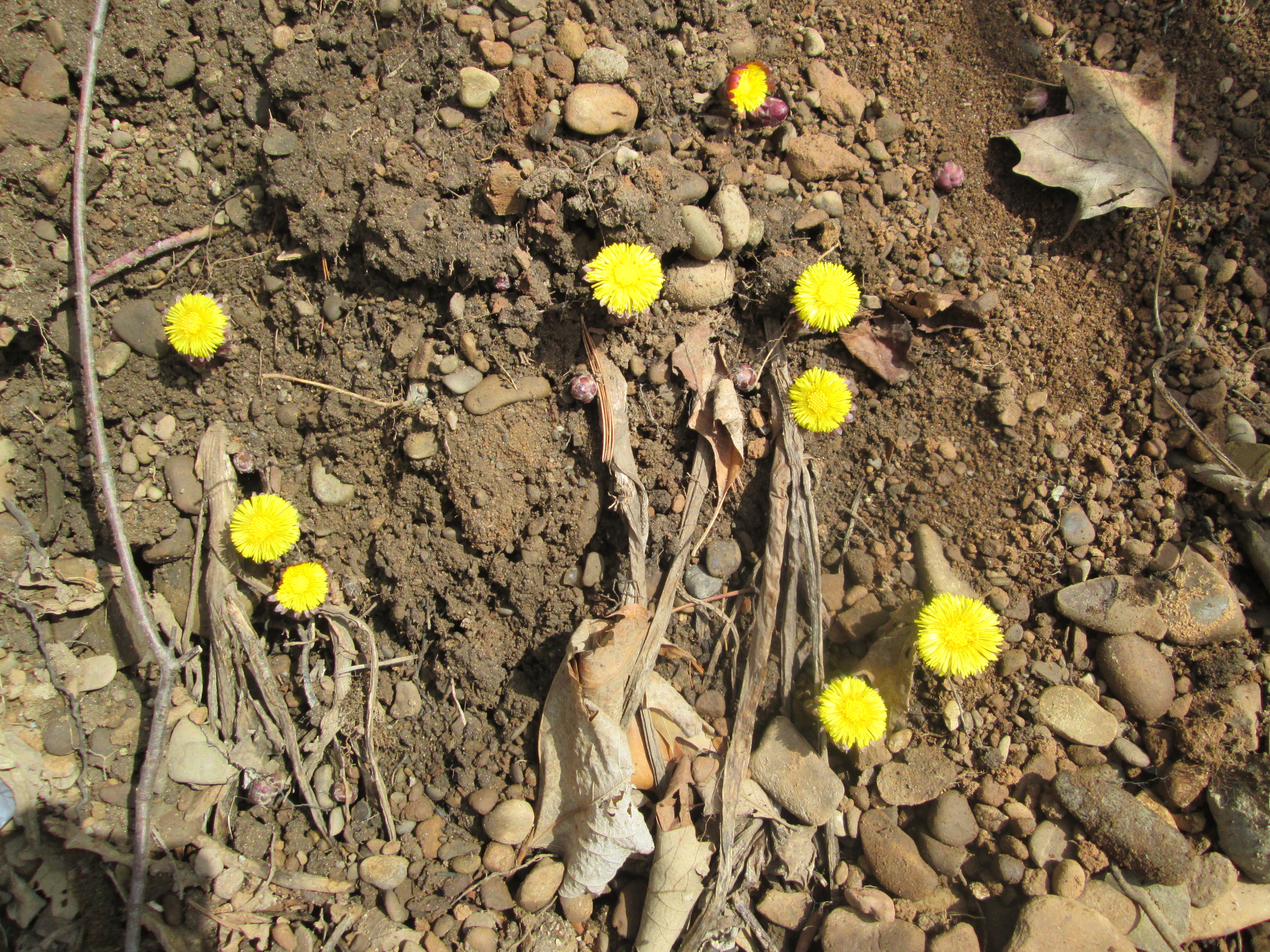
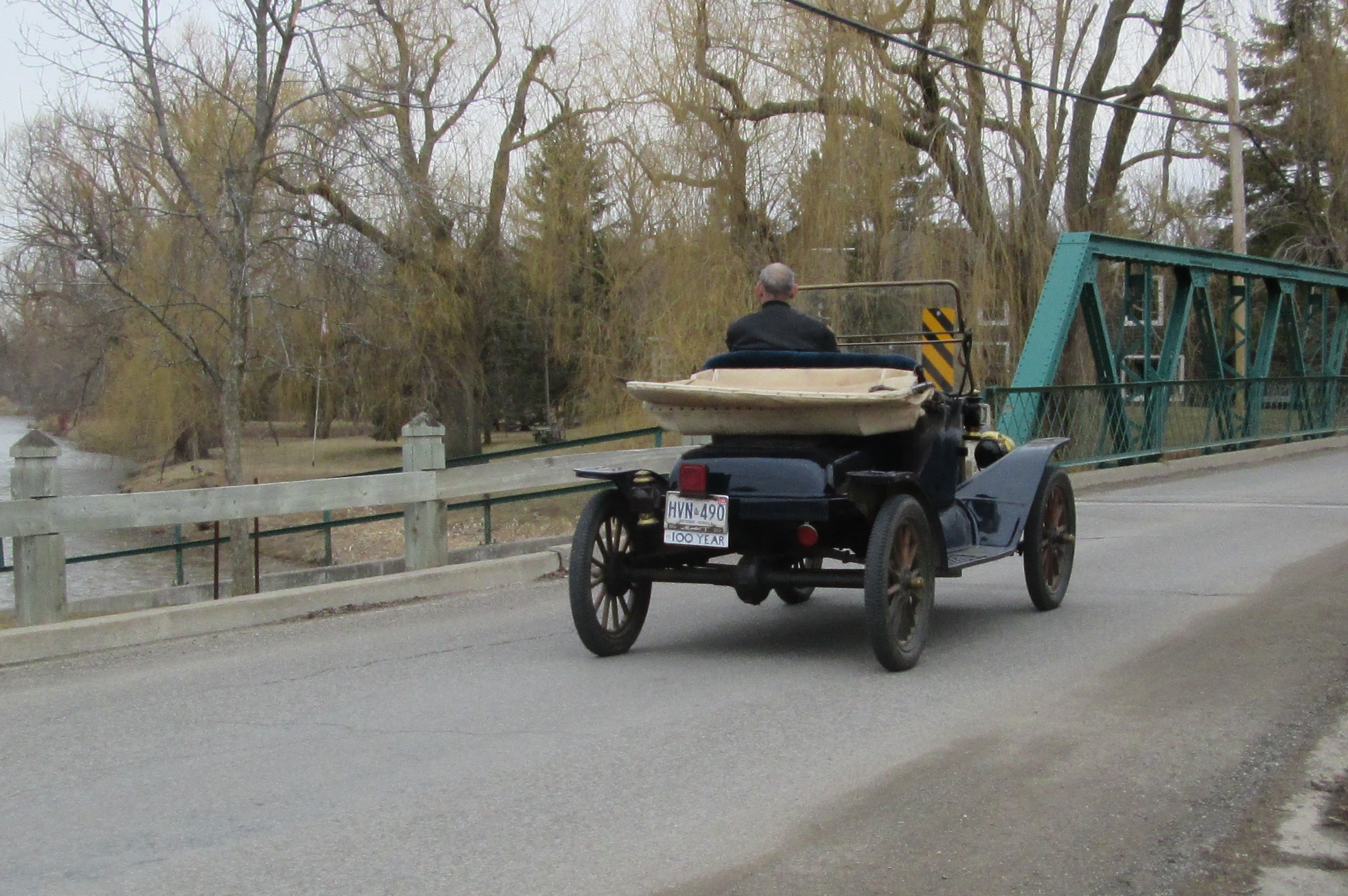
Saturday, May 23, 2015

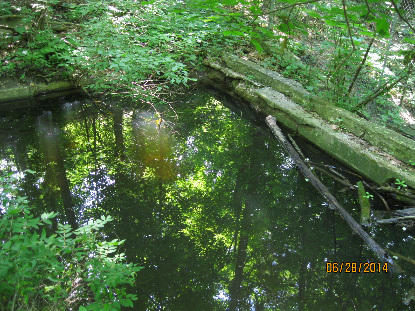
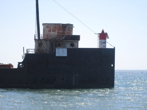
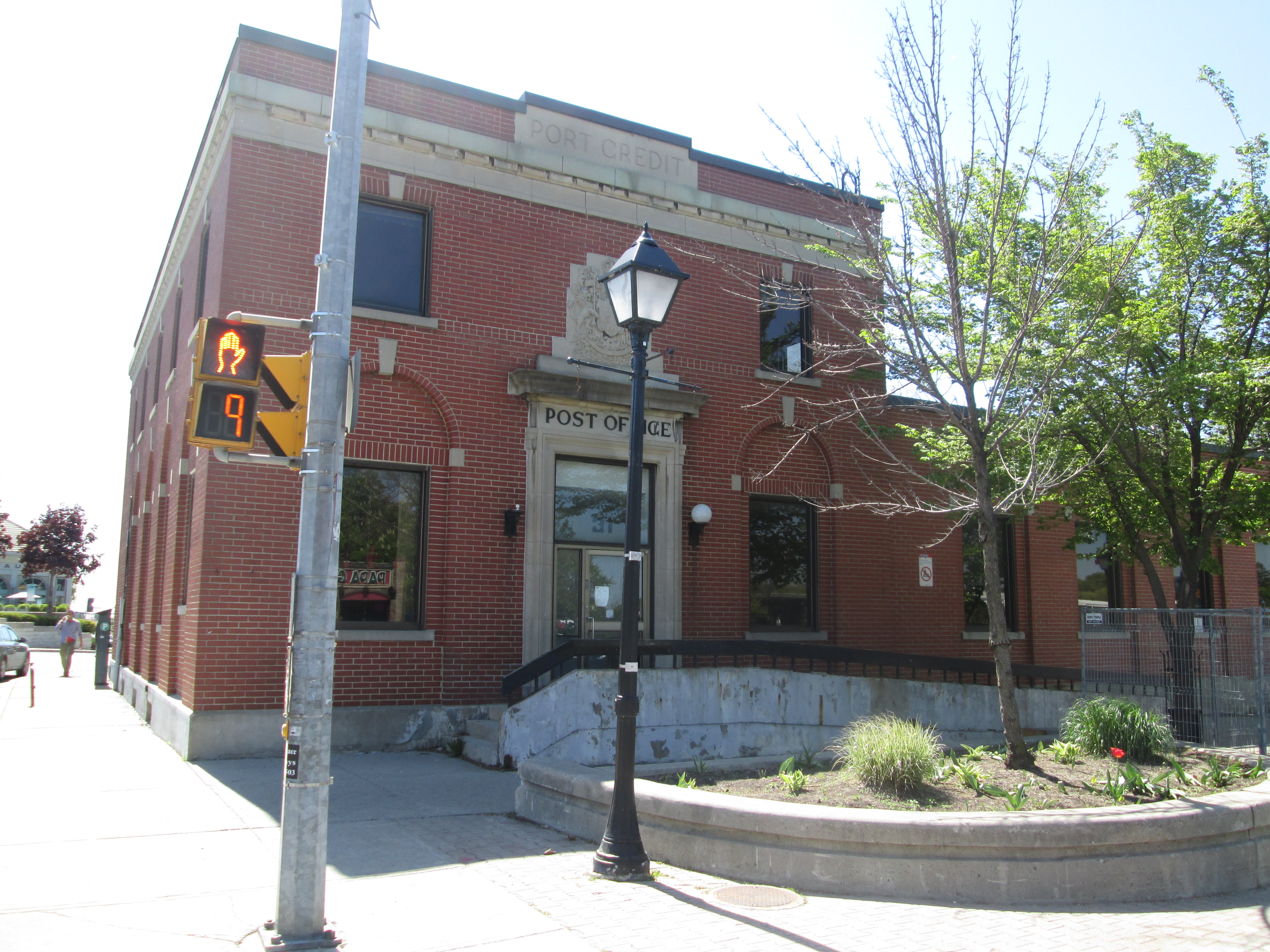
It was one of those spring mornings that start off cool, at only 10 degrees, but quickly warms up.  After several recent visits along the Credit River it seemed like a good time to visit the mouth of the river.  Port Credit is an unusual town in that it didn’t grow up around a mill or a cross-roads.  It was a planned community laid out by the government to support the harbour that was being built as a back-up to the harbour in York (Toronto).  The Port Credit harbour is at the river mouth and is sheltered by a pair of break walls and The Ridgetown, a partially sunken bulk freighter which can be seen in the cover photo.  The Ridgetown was also featured in the Adamson Estate on Cooksville Creek.  There is plenty of free parking in town near the library.  We crossed Lakeshore Road where the post office sits on the corner of Stavebank Road.

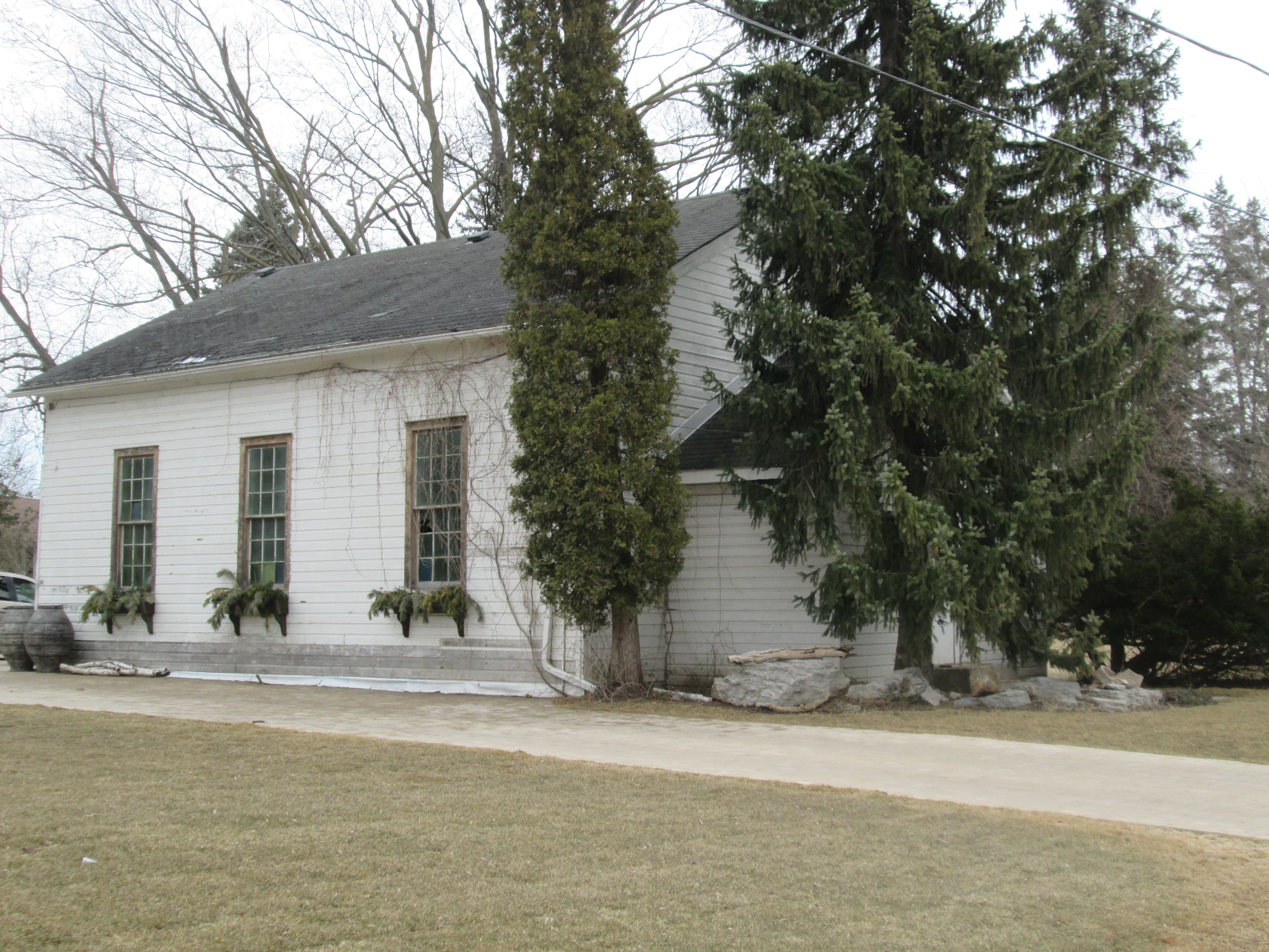
The Port Credit Post Office, Customs House and Armoury was built in 1931 as part of a “make-work” program during the Depression.  The site had been reserved for government use since 1820 and when the decision was made to build a new public building in Port Credit it was ideally suited.  The Department of Public Works had specific criteria which included “good drainage, easily accessible, in a commercial district, visually prominent, and on a corner lot”.  Post Offices were also to be “fairly” close to the harbour or railway station.  31 Lakeshore Road East met all these criteria.  The building is constructed in a style known as Edwardian Classical which was popular during the reign of Edward VII (1901 – 1910).  Public works had suspended it’s building program at the start of WWII and picked it back up in 1927 with its existing building designs. This is how the Post Office building came to be 20 years out of date in its architecture.

IMG_4702

On the west bank of the river stands the lighthouse.  The first lighthouse in Port Credit was built in 1863 but it was separated from the mainland by a flood in 1908.  By 1918 the lighthouse had closed and it stood vacant until it burned down in 1936.  The present lighthouse was built in 1991 and is a replica of the earlier one.

IMG_4707

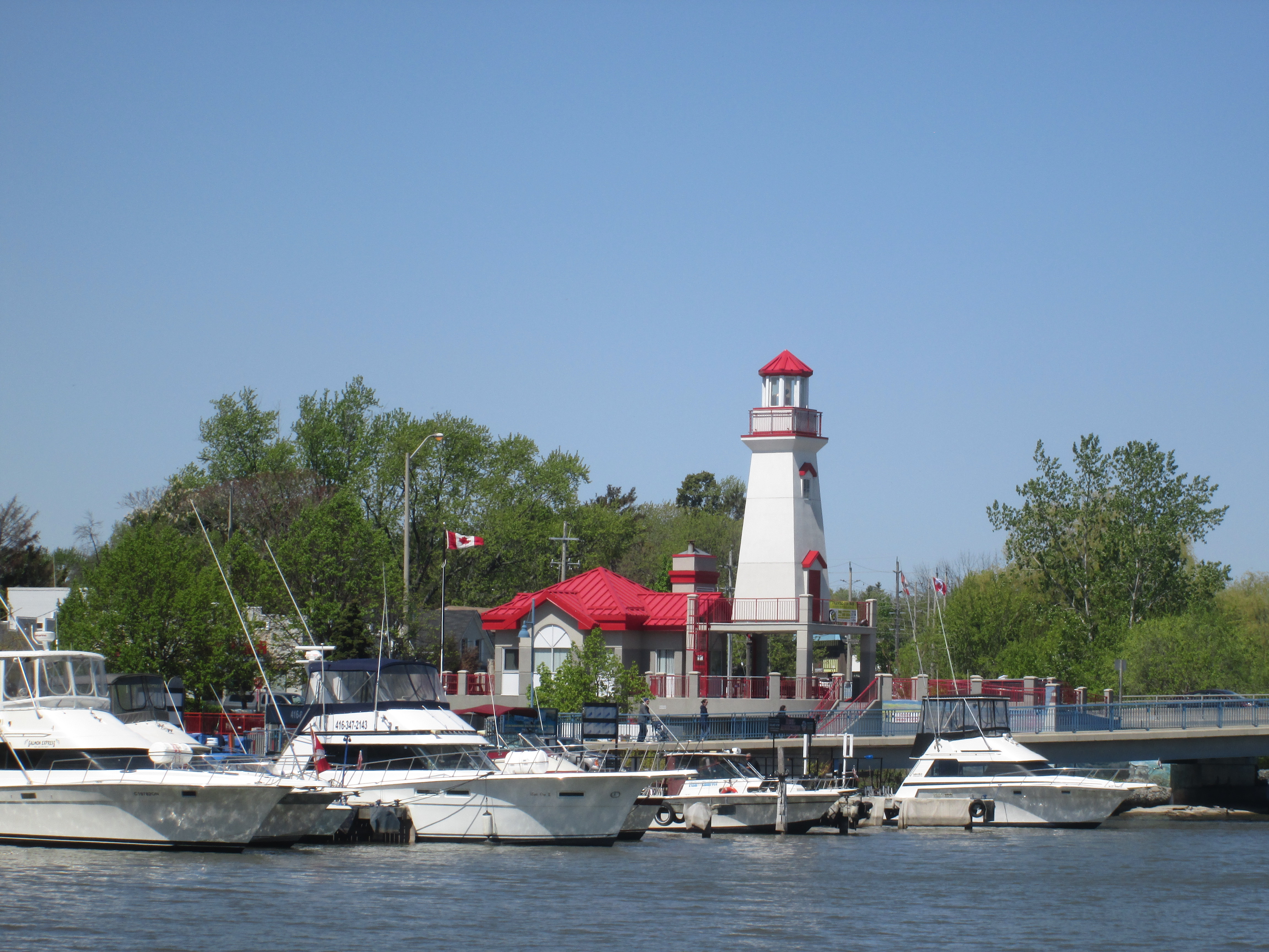
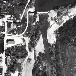
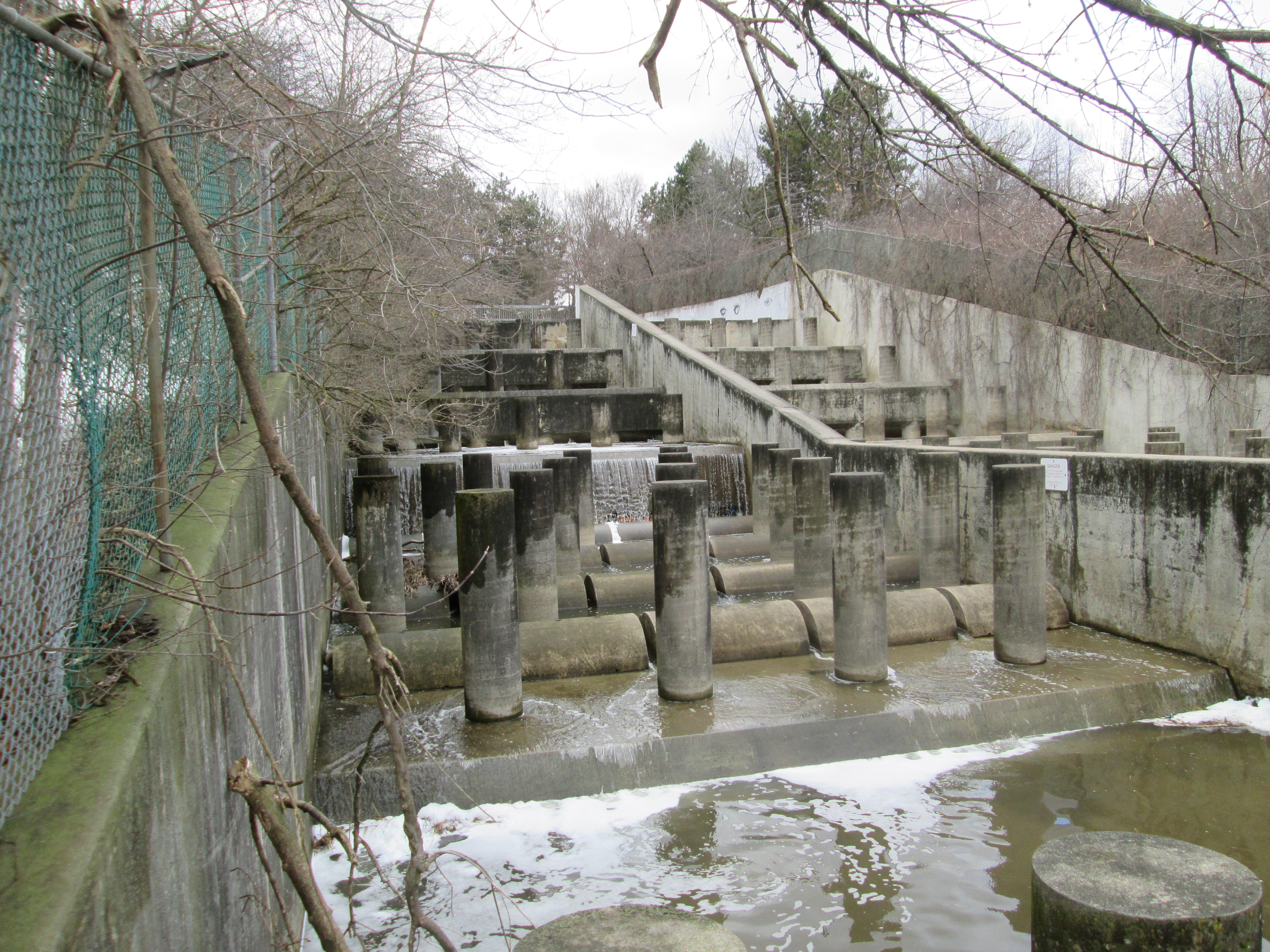
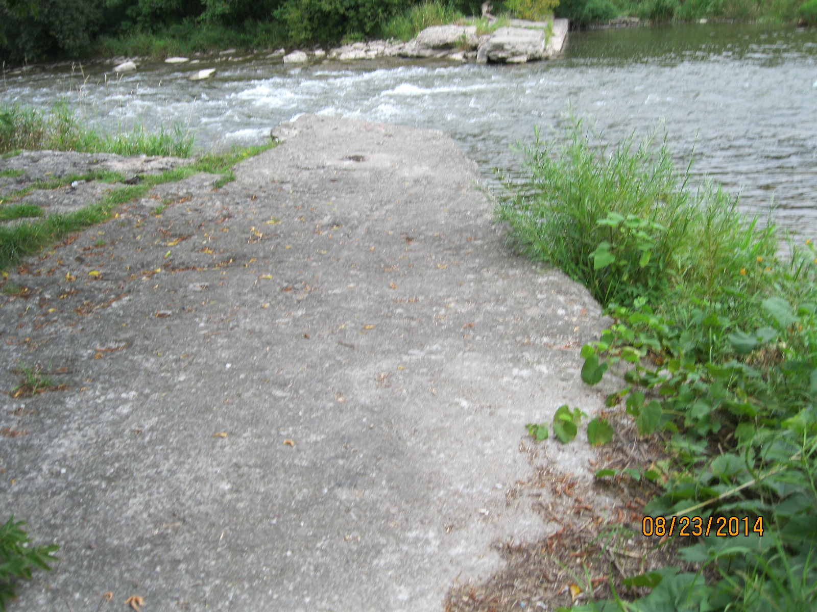
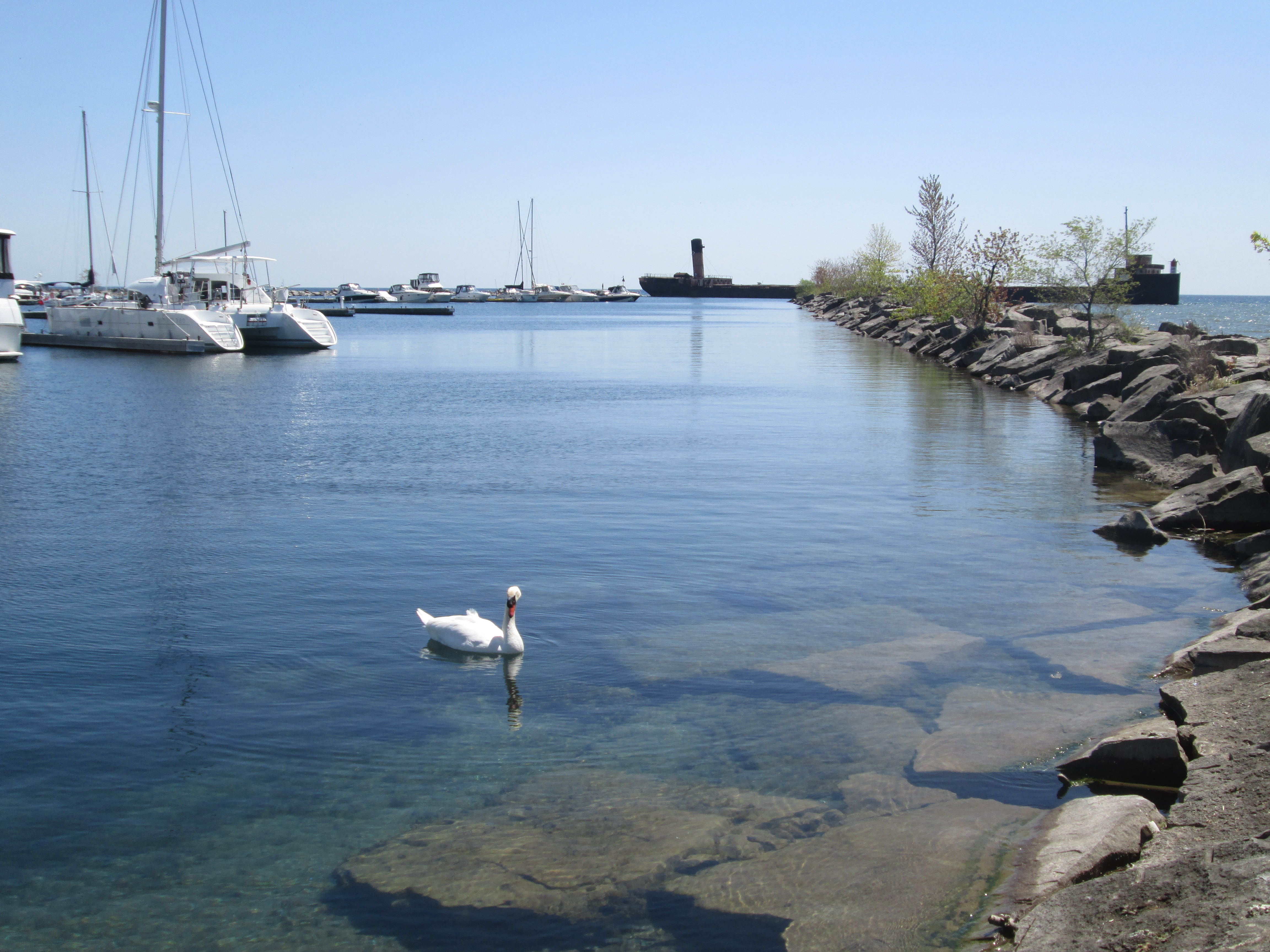
The Port Credit harbour has been active since 1834.  Between 1880 and 1910 the harbour was home to an industry called stone-hooking.   Large flat slabs of shale were raked up off of the bottom of the lake for use in the construction boom in Toronto.  At its peak there were 23 ships registered as stone-hookers in Port Credit.  Today the harbour is protected by two stone breakwalls as can be seen in the 1972 aerial photo below.  The Credit River empties into Lake Ontario where it’s mouth is protected by an angled line of rock.  Running straight out into the lake to the right of this is a second, longer, wall of rock.  We chose to climb out to the end of each of them.  In 1974 the ship The Ridgetown was added at 90 degrees to the end of the straight breakwall to shelter most of the open end of the marina.

Port Credit Harbour

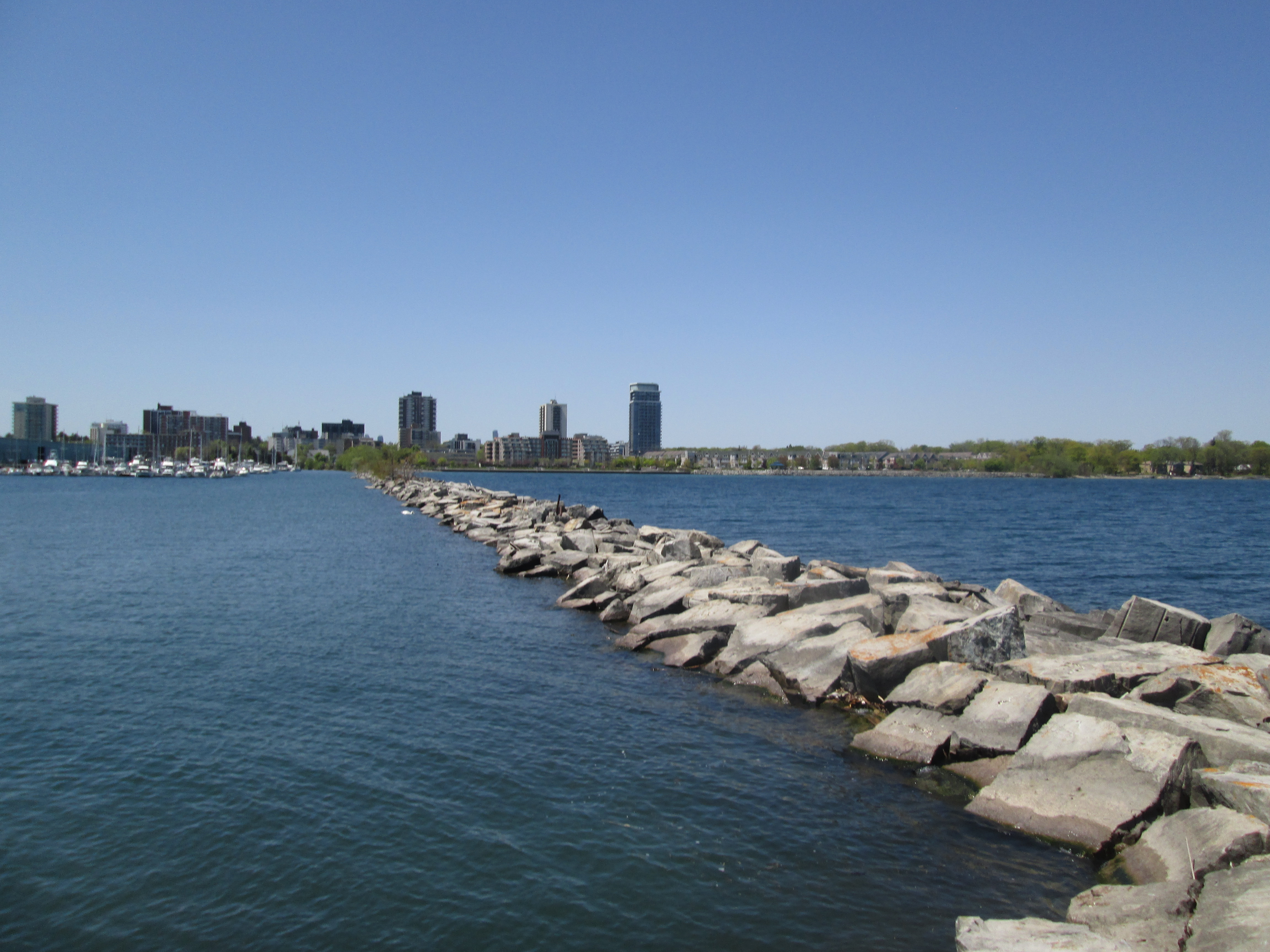
The first breakwall runs out from the eastern bank of the Credit River.  The Ridgetown can be seen in the distance and one of many Mute Swans is watching us in the foreground.

IMG_4717

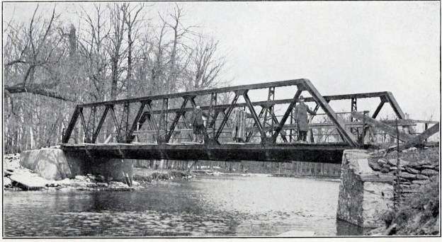
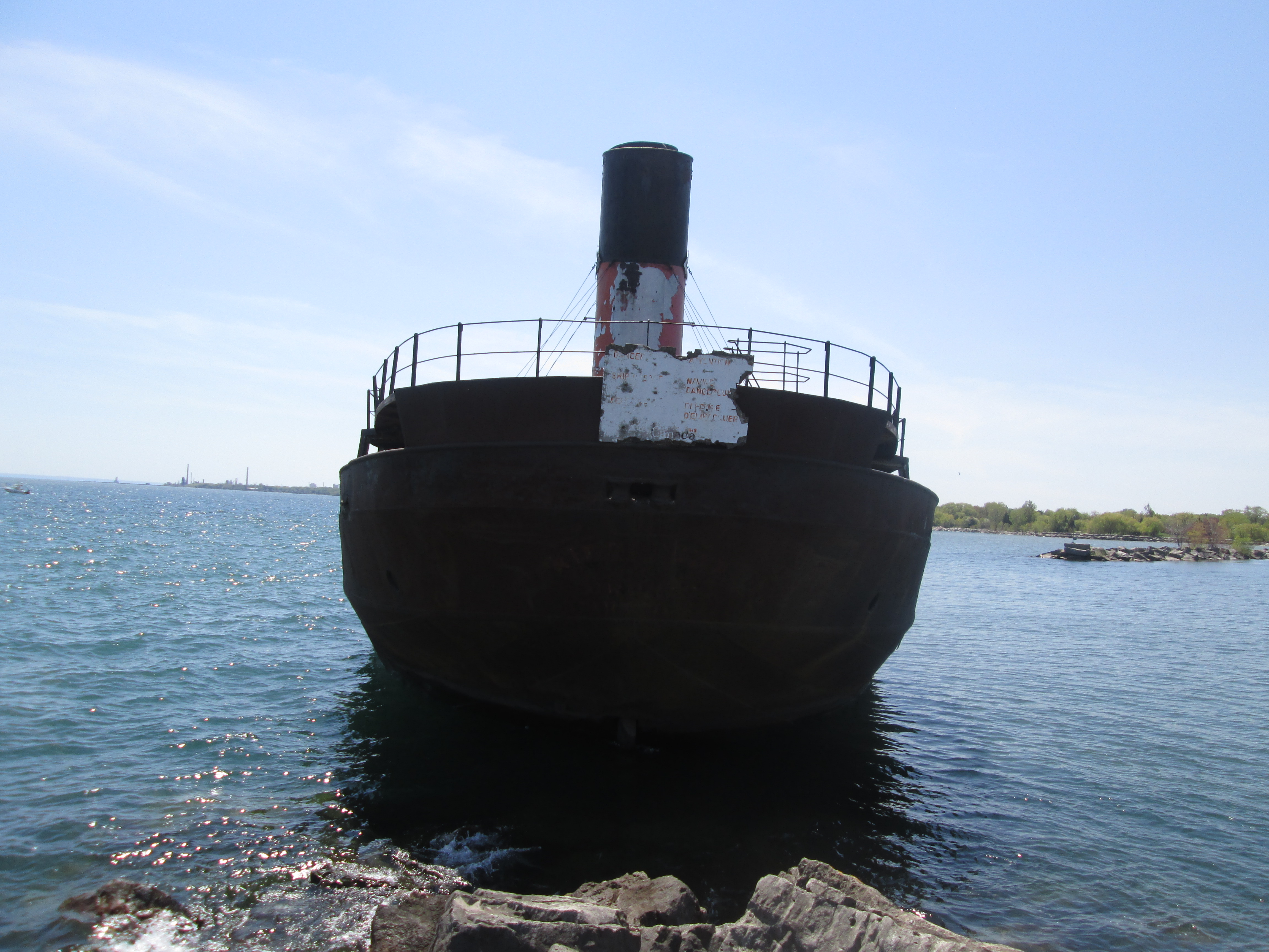
Built for $475,000 in 1905 as a flagship for the Pittsburgh Steamship Company the William E Corey was shipwrecked within 3 months.  After $100,000 in repairs it was ready for service again.  In July 1963 it was placed into British registry and renamed Ridgetown.  Two years later it was sold to Upper Lakes Shipping Limited who operated it until 1969.  Between 1970 and 1973 it served as a temporary breakwall for the construction of the Ontario Hydro Power Plant at Nanticoke.  After this it was brought to Toronto where it spent the winter of 1973.  In June 1974 it was loaded with rocks and sunk to protect the mouth of the Port Credit Marina. The picture below shows the ship when it was the William E Corey.

001461a

As we made our way out the lengthy breakwater we got some great views of The Ridgetown.

IMG_4801

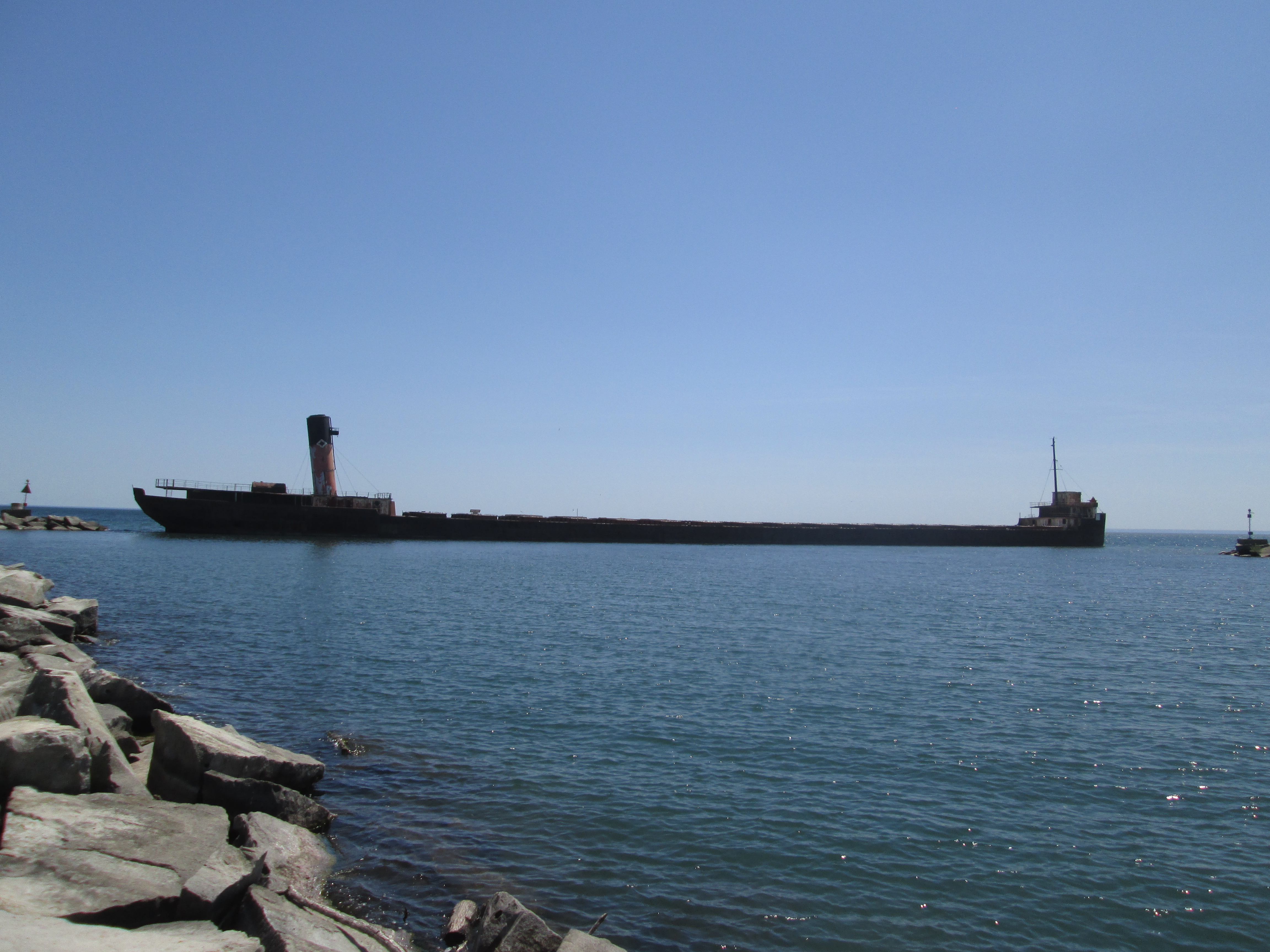
Finally, we reached the end of the breakwater and our goal of The Ridgetown.  On the right of the ship can be seen the end of the first breakwater that we investigated.

IMG_4814

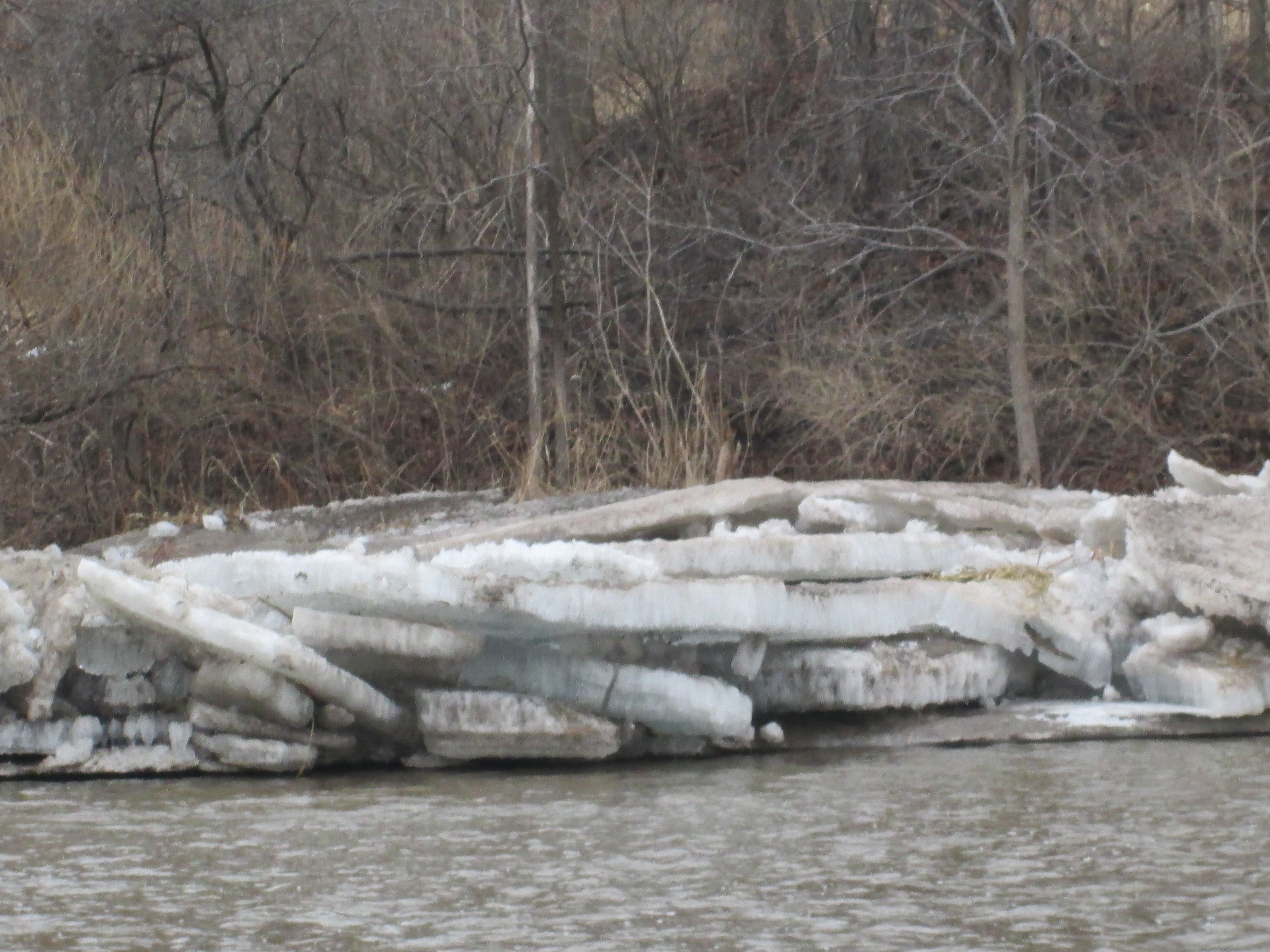
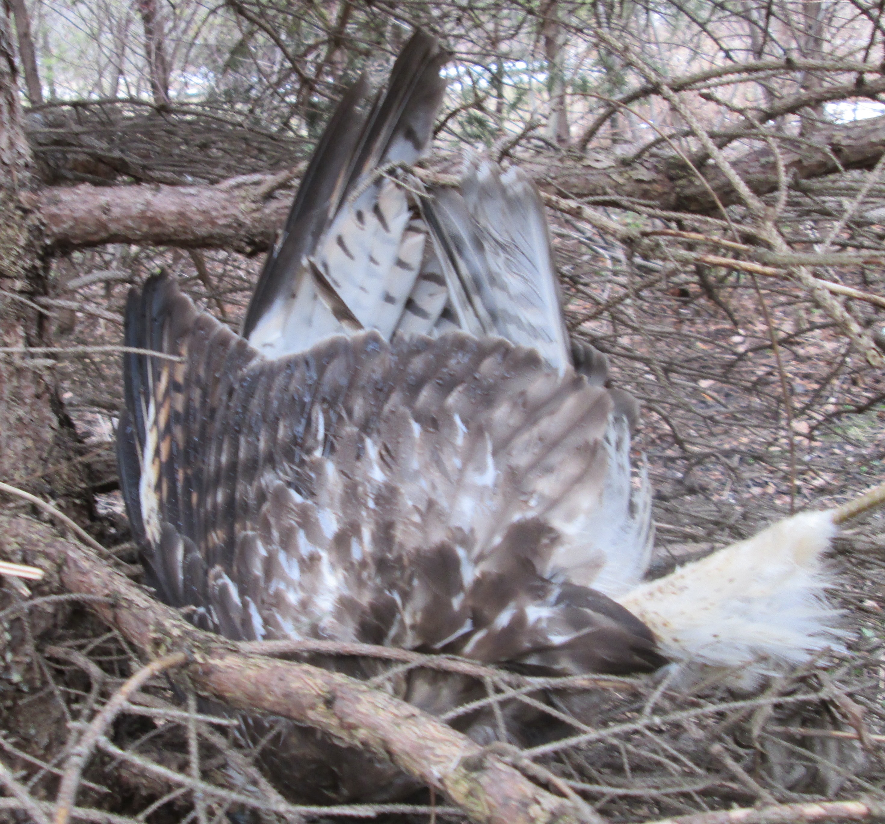
Looking back at the Port Credit shoreline gives you an idea of how long the breakwater is.  The hike along this breakwater is challenging.  The biggest danger comes from dozens of Canada Geese and Mute Swans that have taken to nesting along its length.  They are prepared to defend their nests and several of them got into hissing at us.  On the way back it started to feel like we were running the gauntlet.

IMG_4815

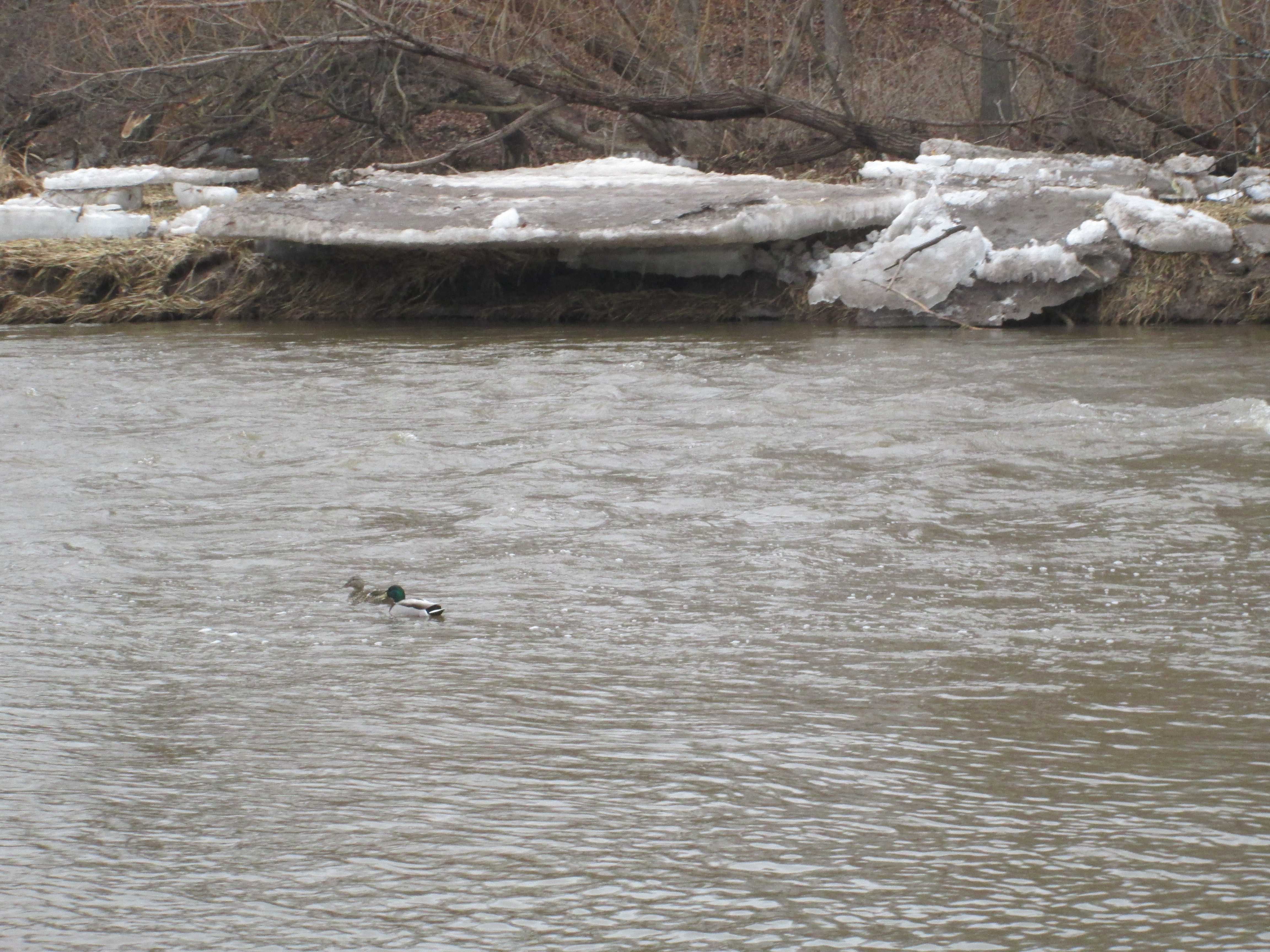
The Trumpeter Swan is the largest living bird that is native to North America.  At 28 pounds the largest of the males are also the largest birds capable of flight.  They can be distinguished from the more common Mute Swan by their black bill and feet.  Of all the swans in the mouth of the river and along the two break walls this is the only one we noticed that was a Trumpeter Swan. It was also the only one which was tagged, in this case with a bright yellow “K94”.  This is part of a project to reintroduce these swans which were near extinction.

IMG_4755

Port Credit has a cultural heritage designation and there is plenty more to be explored in the area.  J. C. Saddington Park and the Imperial Oil Lands were explored on March 4, 2017 and can be found here.

Google Maps Link: Port Credit

Like us at http://www.facebook.com/hikingthegta

Follow us at http://www.hikingthegta.com

Churchville

Friday April 3, 2015.

It was by far the warmest hike of the year so far at 12 degrees feeling like 18.  Before we got back to the cars we were carrying sweaters and coats.  It was Good Friday and perfectly applicable that we should go to church.  So we went to Churchville to explore the historical little village and the conservation area that separates it from Meadowvale.  We parked in the same lot as last week where the Second Line dead ends below the New Derry Road.  Crossing under the bridge we made our way north intending to make it as far as Steeles Avenue.

One of the first plants to respond to the warmer days and increased sunshine is the dogwood. Also known as Cornus Sericea they grow wild in wetlands throughout Canada.  Their bark takes on a brighter red colour before the leaves come out.

IMG_3167

When the Derry Road Bypass (now just Derry Road) was built in the mid 1990’s the Second Line was closed where the bypass intersected it.  After investigating a woodlot just north of the bypass we headed west back toward the Credit River.  The picture below shows the closed second line looking south toward Meadowvale.

IMG_3181

The Credit Valley Railway (CVR) was incorporated in 1871 with a mandate to build a railway from Toronto to Orangeville with various branches westward to Waterloo.  The railway stopped at Meadowvale where the station was at the corner of Old Creditview and Old Derry (now marked by a single old telegraph pole).  It bypassed Churchville on the east and made it’s next stop in Brampton.  By 1881 the CVR was in trouble and was incorporated into the Canadian Pacific Railway.  We crossed the old CVR tracks where some of the tie down plates are dated 1921 as seen below.

IMG_3209

Perhaps the first new growth of the spring are these Coltsfoot flowers that are growing along the banks of the river.  Coltsfoot are unique in that the flowers appear without the previous formation of any leaves.  After the seeds are distributed the flower disappears and the leaves grow, making at appear to be a plant without flowers.  The name comes from two Latin words which mean to act on, or cast out, a cough.  We now know that the plant has certain toxic alkaloids that destroy the liver and some countries have banned it’s medicinal use.  The plant which is the first sign of new life this spring turns out to be toxic to life, if ingested.  In the picture below it looks like a dandelion but is too early and also lacks the green leaves.

IMG_3227

Built in 1907 the current one lane bridge over the Credit River in Churchville replaced several earlier wooden bridges that crossed the river in the centre of town.  The bridge style is known as a steel pony truss bridge.  A truss bridge is one of the earliest designs of bridges and was very common during the 19th and early 20th century.  A truss bridge uses a design of triangles to keep the elements of the bridge stressed either through tension or compression.  Where the sides extend above the roadway but are not connected across the top it is known as a “pony truss”. This bridge is one of only two single lane bridges remaining in Brampton.  A 1911 picture of the bridge is featured in the cover photo.  It was taken at about this time of year and large slabs of ice are melting beside the bridge abutments.  Of note are the three people who are standing on the outside of the bridge railing in the historical photograph.

IMG_3253

Amaziah Church founded the town in 1815 when he built mills on the Credit which were at first known as Church’s Mills.  With a population of 80 it got it’s own post office and the new name of Churchville in 1831.  By the 1850’s it had peaked at over 200 people and was home to 5 mills and over 20 small businesses plus three general stores.  The crash in grain prices following the Crimean War hurt the small milling community and between 1866 and 1877 all of the mills closed.   In 1875 a fire destroyed much of the town, which was never rebuilt.  The failure of the CVR to come into town in 1877 was a final blow to ensure it wouldn’t recover from it’s decline. Of the 98 homes that once stood in the village less than 20 remain.

This building dates to 1840 and may have originally been a wagon shop belonging to Thomas Fogerty.  It served as the final general store for the community and lasted until the 1960’s when it was converted into a residence.  The original store windows have been hidden when the front porch was enclosed.

IMG_3251

Formerly known as the May Hotel this 1830’s structure is one of the oldest surviving buildings in Churchville.

IMG_3235

At one time there were three churches in town.  The Anglican and Episcopalian churches have been lost and the only one remaining is the Weslyan Methodist, built in 1856.

IMG_3256

The old plow in the picture below has been sitting in one place for so long that a group of small trees is growing up in the middle of the frame.

???????????????????????????????

The first burial in the Churchville cemetery was Amaziah Church in 1831.

IMG_3244

The town of Churchville sits on the floodplain for the Credit River and has experienced repeated flooding over the years.  When the town was recognized as a Cultural Heritage District it was decided to do something to protect the historic homes in town.  In 1989 a protective berm was built between the river and the homes along it’s east side.  Behind houses it has been built with a concrete wall and between houses the gentle slope of the berm can be seen.  The picture below is taken from beside the former volunteer fire department station.

IMG_3249

Tagged on the plate as a 100 year vehicle it was appropriate that we saw it entering the 1907 bridge.

???????????????????????????????


Alpha Mills

Saturday Mar. 21, 2015

Spring officially started last night at 6:45 local time.  This morning was cloudy and dull with a wind that made the two degrees feel more like minus six.  A winter hang-over I guess.  We parked at the end of Alpha Mills Road where a walkway leads to the Credit River off Plainsman Road.

In 1825 Christopher Row(e) built a mill on lot 7 Concession IV where the river curves to the east, just north of Streetsville.   When J. Deady took over running the mill he renamed it Alpha Mills. It can be seen near the centre in the cover picture from the 1877 Peel County Atlas on property shown as belonging to Gooderham and Worts.  By 1877 there were 30 mills on the Credit River with 10 of them being textile related.  This was a localized industry that included the Barbertown Mills.

By the mid 1850’s Gooderham and Worts (G&W) had become the largest distillery in Canada and today their downtown manufacturing empire is preserved as 40 heritage buildings.  It is the largest collection of Victorian era industrial architecture in North America.  G&W began adding other mills to their holdings including Norval in 1845 and Hillsburgh in 1850.  In 1860 they acquired Alpha Mills and branded it as Alpha Knitting Mills.  G&W operated the mill until around the turn of the 20th century. William Gooderham’s grandson Albert would go on to purchase and gift a piece of property for Connaught Labs to the University of Toronto in 1917.  The 1971 aerial photo below shows the mill pond as the flat black area in the upper right corner.  The mill dam and water fall stretch across the river with the Alpha Knitting Mill building standing to the left just beside the dam.

Alpha

Not long after the photo above was taken the buildings and dam were removed and one of the most detailed diversion weirs I’ve ever seen was built in it’s place.  Storm water flows out of a buried channel and into these eight slots.  The concrete is curved upward to prevent things from washing over the edge and choking the system below, in this case it is this winter’s ice sheets.  The curve of the concrete gives the optical illusion that the water is flowing up hill.

IMG_2861

From the bottom of the storm drain looking back up there are 8 rows of concrete pillars with half-round steps in between.  For most of the length they are divided down the middle by a concrete wall.

IMG_2930

The long cold stretch of below freezing weather throughout February of this year froze the Credit River to a depth of up to two feet,  When the snow finally started to melt, the water level in the river increased under the ice, snapping it into large sheets which then washed up on the shore.  In the picture below they are stacked up four high.

IMG_2902

As we walked north up the west side of the river we crossed large chucks of river ice.  The piece of wood in the picture below has been trimmed clean by the local beaver.  It is rounded at both ends and all the bark removed.  Rather than construction material, this has been a food source for an example of Canada’s largest rodent. Once on shore, the river ice tends to melt in one of two ways.  The example in the picture below shows a slab of ice cut through by hundreds of small holes.

IMG_2905

In other places the ice is full of thousands of fine cracks that cause it to shatter into little shards. Either way, the ice is melted much faster than if it just melted along the exposed surfaces.

IMG_2904

I don’t usually post pictures of dead animals, although we see all kinds of them, but this Kestrel was wedged upside down in a pine tree.  There was no obvious cause of death and it appeared to have happened very recently.  Quite possibly it flew into the tree in the dark and broke it’s neck although this kind of accident must be quite rare.  It is considered rare, but birds do suffer heart disease, making this another possible explanation.  Or this kestrel might simply have been doing it’s impersonation of Kessel.

???????????????????????????????

Having made our way to Creditview road we crossed on the bridge and started back up the other side. While walking along the river at this time of year it is important not to walk on any shelf of ice that might be close to the river edge.  I suspect that, had we stepped on this shelf when we passed, we wouldn’t have enjoyed the water quite as much as the two ducks in the picture below.  Like these ducks, it was obvious that the bird kingdom has started to count itself off into breeding pairs.  Cardinals, Buffleheads and Canada Geese were also seen to be paired up.

IMG_2908

There is only a short stretch of the east river bank that is safely passable at this time of the year. The bank of the river on this side is full of new growth and bramble.  At one time several of the homes on top of the ravine had built wooden or concrete stairs to access the river side.  The tree that has taken out this abandoned set of stairs looked like fair warning and so we returned to Creditview Road.  Sir Monty Drive provides a short cut back to the park without having to walk too far on roads.

IMG_2909

The park on the east side of the river is accessed from Sir Monty Drive and has a maintained trail on it.  This part of the river is known as River Run Park.  Large clusters of teasels grow along the trail.

IMG_2916

Someone has taken the time to cover this old well with a roof but the current dwelling is at the top of the ravine.  Perhaps an earlier home stood closer to this water source making the task of bringing water to the hill top unnecessary.

IMG_2917

Visit us at http://www.facebook.com/hikingthegta for a gallery of additional photos.


Winding Lane Bird Sanctuary

Saturday Oct. 11, 2014

A chilly start to the day at only 5 degrees.  The sun was out and the sky was bright blue.  To access Sawmill Valley Creek near Dundas and Mississauga road it is easiest to park in Erindale Park and walk across the bridge over the Credit River.

Many of the trees are still green, which is nice.  When the cool evenings of the fall signal the onset of winter, deciduous trees begin the process of collecting and storing the useful resources in the leaves.   The tree stores the green chlorophyll pigment and other photosynthetic parts of the leaf in the roots, trunk and branches of the tree for use again the following spring.  The removal of the green from the leaves produces the bright colours we enjoy.

IMG_0611

Sawmill Valley trail enters the north west corner of Mississauga Road and Collegeway.  As you follow the trail you will soon come to the start of a fence.  If you follow to the right of the fence you will find yourself on an old winding laneway.

IMG_0577

This is the laneway of Roy Ivor, also known as the birdman of Mississauga.  In 1928 Roy, along with his assistant Bernice Inman-Emery, started the Winding Lane Bird Sanctuary.   During the 50 years he ran the bird sanctuary he cared for thousands of birds.  He was a regular contributor to National Geographic during the 1950’s as well as teaching countless school children about birds.  Ivor died in 1979 shortly before he would have turned 100.  He is buried close to home at St. Peters Anglican Church in Erindale.  Bernice ran the sanctuary from the time of his death until she moved to a retirement home in 2007.  The sanctuary has been closed since then and all of the bird cages have been removed.  Recently the property has been purchased by the city for incorporation into the adjacent parkland.

Ivor’s house is featured in the cover photo showing how it looked before it burned down on December 29th 1970.  A portion of the large central chimney remains standing.

IMG_0582

The outline of the east wing of the house is still clearly visible.  When the house burned down a trailer home was brought in and parked over this end of the foundation.  Here life went on pretty much as it had before.

IMG_0585

Each Burdock seed pods contain hundreds of stems that stick to clothing and fur.  Inside the pods are little tiny seeds that get transported around and then discarded to start new plants elsewhere.  In the early 1940’s Swiss inventor George de Mestral was out walking his dog when both of them got covered in burdocks.  Curious about how the burdock attached itself to his clothes he looked at one under a microscope.  He noted the little hook on the end of each one of these little spines.  De Mestral patented Velcro in 1955 based on the hook and loop system used by burdock.  The hooks can clearly be seen on the burdock in the picture below.  Inside the burdock pictured below is a lady beetle.  There are over 5,000 species of lady beetles but all are protected by noxious body fluids based on cyanide.  Their bright colours are used as a warning to birds that might consider eating them.

IMG_0579

Geo-caching is an activity that rose to world popularity in May 2000.  When GPS restrictions were removed a high-tech game of hide and seek began.  A cache is hidden which includes a log book, pen or pencil and often trinkets.  People hunt for the caches based on a set of co-ordinates using a GPS.  When the log book is found it is signed and carefully re-hidden.  Geo-caching never achieved the prominence that is made possible in the era of cell phones with GPS.  One possible explanation for this is 9/11.  Security scares have become common with police bomb squads having been called in after suspicious activity has been reported.  Several schools and even Disneyland have been locked down.  We found a geocache with a skeleton in it.  Since we were the first to find the cache, and that quite by accident, the skeleton may be symbolic of a dead pass-time.

IMG_0593

Other Erindale hikes featured on the historical atlas below include:

  1. Erindale Orchards, 2. Erindale Hydro Electric Dam, 3. Credit River at Erindale and 6. Mullet Creek’s Secret Waterfalls.


sawmill valley legend

Like us at http://www.facebook.com/hikingthegta


Hyde Mill Streetsville

Sat. Sep. 20, 2014

A beautiful morning for the final Saturday of summer.  We parked on Mill street in Streetsville. Taking the little trail that heads north on the west side of the Credit River we passed through and area where the young bushes were cropped off a foot off of the ground.  Deer had grazed as they made their way along the river bank.  We followed them toward the walls of an old mill we had seen when we were in Riverside park a couple weeks ago.

At the mill site water was diverted from the stream or mill pond to the water wheel by a small stream that was usually man made.  Where the water was brought to the wheel was called the head race.  The water wheel, or later a turbine, was used to transfer the energy from the falling water to turn the gears inside the mill.  This would drive the grinding wheels in a grist mill or the saw blades in a saw mill.  The water was then returned to the river by means of the tail race. We found the tail race to the mill and knew that it would lead us there.

IMG_0211

The remains of an old vehicle, likely a late 1940’s or early 1950’s, lay at the bottom of the hill. This car may have been here for quite a long time as it is damaged beyond identification.

IMG_0232

A second car lies decaying in the same area.  This car is in much better shape although it has been stripped clean of every usable part.  The trunk lid still contains an old decal showing how to use the tire jack.  From the part number on the decal we were able to identify this car as a 1977 Ford Galaxy 500.  These two vehicles must have been dumped down here before the trees grew up on the embankment above.  They may have been stolen and dumped down here or just abandoned here by their owners.  Either way, it is hard to see why they were left here and not removed by the city.  There is now a new acronym for those wishing to make fun of Fords. (F)ound (O)n (R)iver (D)rowned.

IMG_0249

The car in the foreground of the picture below shows what the Galaxy 500 would have looked like when it was new.

77FordLTD

Heman and Mary Hyde ran a large inn at Church and Main street for 40 years and this, along with proceeds from their saw mill, placed them among the wealthy in early Streetsville.  Their son, John “Church” Hyde, built his own little merchant-miller empire.  By 1840 he had built a mill on the west side of the river near the end of Church street.  The mill expanded into a saw and grist mill, cooperage and stave factory.  Staves are the thin wood boards which were used by a cooper to make barrels.  He also built quarters for his workers at the mill site.  In 1906 the mill was converted to produce hydro electricity for the town of Streetsville.  It was Ontario’s first municipally owned power plant.  The plant continued to be the source for power for the town until 1943 when Streetsville joined Ontario Hydro.  The plant continued to provide auxiliary power until 1960 when it was shut down.  In the photo below are two tunnels under the building where water was used to turn turbines.

IMG_0262

There are two holes where shafts from the water turbines came up from these water tunnels below.

IMG_0279

A steam pipe like the one below helped us to locate the Millwood Mills during a hike back in June.  This also helps to identify this part of the mill as being of the newer 1906 construction.

IMG_0289

The mill is designated as a heritage site because of the remaining door and window frames which can be seen in the cover photo.  Since it is now intended to be preserved I find it odd that the interior of the mill is allowed to become overgrown with small trees. In a few years these trees will push over the walls and ruin this historical building.

IMG_0291

When the mill was restored in 1906 a new dam was built across the Credit River.  The foundations remain in a pattern of squares on the river bed.

IMG_0295

Fall would officially begin a day later, but there was a hint of colour coming in some maple trees already and the sumac trees are bright red.  Fall’s showcase of beauty is about to begin.


IMG_0175

As we had hiked up the west side of the river we had seen the remains of yet another mill, this one on the east bank of the Credit river.  Hmmm….

IMG_0197

Google Maps link: Hyde Mill

Like us at http://www.facebook.com/hikingthegta

Follow us at http://www.hikingthegta.com


Credit Meadows Park

Saturday Sep. 13, 2014

A rainy Saturday morning and only 11 degrees.  We parked in the parking lot on Creditview Road just north of where the Credit River crosses near Britannia Road.  This is the second lot north of Britannia and was home to Ephraim Steen who lived here from 1842 until he died in 1921.  Ephraim also owned land on the other side of Creditview as well as the land where Riverside Park and subdivision now stand in Streetsville.  This lot of land was taken over by the conservation authority in the late 1950’s and named Credit Meadows Park.

We didn’t wander too far from the cars but there is always something to see.  There is frequently one or more great blue herons that like to fish on either side of the bridge. We watched one feed across the river from us.  Herons in this part of the Credit are likely feeding on Blacknose Dace which are one of the most common minnows in the river.

IMG_3252

Near the parking lot is a stand of mature trees which includes several old black walnut trees. They can live for 130 years and attain heights of 40 meters.  The tree in the cover photo has had a tree fort built in it many years ago but only the ladder remains today.

Pileated Woodpeckers feed on beetle larvae and ants that live in trees.  They are known to bore out large, roughly rectangular, holes in trees while searching for food.   The tree in the picture below features a shelf mushroom just below the woodpecker hole.  These mushrooms are also known as The Artist’s Conk.  They have a soft white underside that is perfect for carving in. When they dry they become as hard as a piece of wood and can last for many years.  They usually will stand up on the flat side where they grew on the tree.  They can grow to be 50 cm in length by 30 cm wide.

IMG_3261

We found a branch growing a fungi called Turkey Tail.  Turkey Tail grows on fallen hardwood. This fungi is known for it’s medicinal properties especially as a supplement for conventional cancer treatment.  It is helpful for overcoming the side effects of chemotherapy.

IMG_3294

Wood frogs are easy to miss as they blend in well with their surroundings.  The small specimen in the centre of the picture is only a couple of centimeters long.  Wood frogs winter close to the surface and have the ability to withstand being frozen and thawed many times during the winter.  They convert their body fluids to urea and glucose, both of which don’t freeze as easily as water.

IMG_3307]

Wild Grapes, also known as River Bank Grapes have been climbing the larger trees in GTA parks for many years.  They can reach the tops of the largest trees and are capable of smothering the tree and killing it.  The woody vine can be several inches thick where it sprouts from the ground. The vine in the picture below is about four inches thick and easily supports the weight of an adult.  My picture of a Canadian Tarzan, however, will have to remain in my personal collection.

IMG_3314

This mushroom is known as a Dung Loving Bird’s Nest.   When mature they have a cap that has a few spore capsules that look like eggs in a bird’s nest.  It is designed to use the force of falling rain to distribute it’s spores and can throw it’s spore capsule up to two meter’s with the force of a single raindrop.  These mushrooms have already launched their spores.

IMG_3329

The Yellow Waxcap mushroom is edible but is not recommended as there is a poisonous mushroom that looks very similar.  They appear in late summer and there were many of them scattered throughout the woodlot.

IMG_3331

Riverside Park Streetsville

Saturday Sept. 6, 2014

It was a cool morning following a night of rain.  We decided that there was time for a short hike. Parking on Riverside Place we walked the path down to the east bank of the Credit River.  We thought we just might find evidence of Timothy Street’s mill, after which the town of Streetsville was named.  Streetsville has retained it’s small town feel even as it has been surrounded by the city of Mississauga.  In 1953 two of the first suburbs in Canada were built near Streetsville.  The one on the north east was called Riverside and opened in 1955.  The park at the bottom of the hill along the river may have contained the mill pond.  The tree in the cover shot is a massive black willow that stands near the side of an old mill race.  It is likely over 100 years old and witness to many changes in the river valley.

We watched a female downy woodpecker looking for lunch on a dead tree.  The downy is the smallest woodpecker in Ontario.  The males can be distinguished from the females by the red cap on the back of the head.  The downy and the hairy woodpecker look almost identical, yet they come from different genera.  Downy woodpeckers average about 6 inches while the hairy is normally around 15 inches in size.  They have the same markings except the white feathers on the tails.  Being unrelated they cannot inter-breed raising the question as to why they look so much alike.  Scientists use the term “convergent evolution” to describe two apparent random sets of independent mutations that, against all odds, somehow produced the same result.

IMG_3189

The Goldenrod Gall Fly is a small brownish fly that lives it’s entire life cycle around the plant.  In the spring the male will wait on a plant for the female to arrive so he can dance for her.  After mating she deposits her eggs directly into the stem of the young goldenrod plant.  The eggs hatch in about 10 days, roughly the same time as the adult completes it’s two week life cycle and dies.  The larva live their whole lives inside the plant where they chew a nest.  Their saliva causes the plant to grow a gall around the larva, up to the size of a golf ball.  Just before winter the larva will chew an escape tunnel out almost to the outer skin.  Then it converts most of its body fluid to glycol, a substance like anti-freeze, and sets down for the winter.  In the spring the larva wakes up and molts into the pupa from which the adult fly will hatch.  The adult will escape through the tunnel it dug the fall before.  When it reaches the end of the tunnel it inflates special pouches in it’s head to “blow apart” the skin of the gall.  The male fly then begins its two week life cycle on the outside.  Goldenrod galls are easy to find but it is rare to see two galls on a single plant.

IMG_3196

Wild cucumbers grow along the edges of Toronto’s rivers and streams.  They are related to cucumbers, squash and other gourds but unlike other members of it’s family, are not edible. The fruit will contain 4 seeds which drop out of the bottom after the pod has ripened.  The plant dies each fall and re-grows in the spring from the seeds of the year before.

IMG_3200

Milkweeds produce a pod which contains hundreds of little seeds.  These little seeds each have a silky tassle which allows them to be blown by the wind to aid distribution.  Milkweed is essential to the life cycle of monarch butterflies.  They lay their eggs on the plant and the emerging caterpillars eat it.  Monarch butterflies travel 4,800 km to Mexico to winter every year. In the winter of 2013-2014 only 44% of the butterflies arrived compared to the year before.  In order to improve the future of these butterflies the David Suzuki Foundation has a program promoting the planting of milkweed in Toronto.

IMG_3203

We found the old Streetsville mill but it was on the other side of the Credit River.  Exploration awaits…

IMG_3219


Barbertown – Ghost Towns of the GTA

Saturday August 23, 2014

Overcast and 21 degrees but feeling more like 26 with the humidity.  We parked in the little parking lot on the east side of the Credit River just south of Eglinton Ave.

We encountered a patch of poison ivy that had started to turn red.  Poison Ivy is distinctive with it’s three leaf pattern on each stem.  It likes carbon dioxide and has doubled both it’s habitat and strength since the 1960’s.  Late in August the berries turn white as seen in the photo below.  The berries are eaten by birds and bears and are still viable after passing through them.  Some people can have a severe allergic reaction to poison ivy.

IMG_3016

We saw a small Dekay’s Brown snake lying on a branch sunning itself.  They can grow to about 50 cm but the young, which are born in late summer, are 8-11 cm in length.  This snake is not poisonous but can emit a foul smelling musk if it feels threatened.

IMG_3021

In 1843 the Barber Brothers, William and Robert, decided to expand their Georgetown mill operation by buying William Comfort’s farm and mill site just south of Streetsville.  In 1852 they built a 4 storey wollen mill.  When it burned in 1861 their workers just built a new one and opened again only three months later.  Within 10 years it was the fourth largest textile mill in Ontario.  During the first world war it was converted to a flour mill which it continues as today.  The second mill remains on the left in the photo below but has been covered over with stucco and aluminum siding.  The cover photo shows the mill as it looked in 1950.

IMG_3053

Mills used to be built tall to take advantage of shafts and pulleys that were turned by the water wheel.  In this four story mill the wool was carded on the top floor then moved to the third floor where it was spun into yarn.  On the second floor it would be woven into blankets and assorted textiles.  On the first floor it was was cleaned, checked for quality and prepared for shipping.

Carding wool is a process which runs the wool through a carding material.  We get the word “carding” from the Latin word “carduus” which means teasel.  When the Barbers ran their mill, their workers would have used the heads of the teasel plant to draw out the fibres of the wool into long strands that could be spun.  Today carding is performed with a set of paddles with many closely spaced pins on them.  Teasel plants still grow around the mill property.  By mid summer the plant can be up to 2 meters tall with large purple heads on them.  The flower forms a purple ring that works its way down the the head as it blooms.  The ones pictured below have finished blooming.

IMG_3017

The Barbertown bridge was built in 1898 to carry workers from about 40 cottages that were built along Base Line (now Eglinton Road).  The staff of the mill reached 200 at one point and used this bridge to access the cottages on the other side of the river along Barbertown Road.  The bridge originally carried a roadway as wide as the cross beams on the bottom.  A narrower foot bridge has been installed for modern pedestrian traffic.

IMG_3056

A sluice gate is used to control the flow of water at a mill site.  By raising and lowering the gate a mill could control the speed of the water wheel.  At Barbertown the sluice gate was raised and lowered by a hand crank that would have been operated by two people. When water power was finally abandoned here in 1974 the sluice was filled in. Today a tree grows where a deep ditch full of water once ran.  The tree has grown almost completely around the steel rod as if to still the works of man even further.

IMG_3057

The Barber dam was washed out in 1974 and never replaced.

IMG_3064

William Barber built himself a two story house in 1862 on the corner of Barbertown Road and Mississauga Road.  It survives today as a restaurant. An 1860’s carriage parked near the front of the house reminds us of how these roads and the Barbertown Bridge were originally used.  I can picture William coming out in the morning and getting onto perhaps this very carriage.  After an inspection of the mill, perhaps a trip down Mississauga Road into Port Credit to arrange the sale or shipment of some of his textiles.

IMG_3106

Rail corridors were strung with telegraph wires allowing transmission of information about train positions.  When electrical power was spreading in the early 1900’s the utility poles were converted to carry power as well.  Glass insulators were patented in the 1880’s and were used where each wire was attached to the pole.  In the picture below many of the original ones have been broken off but several good examples remain.  The light blue ones are possibly older than the clear glass style but to know for sure a date is usually embossed on the right side of the molder’s logo.

IMG_3072

We disturbed a Red-Tailed Hawk who was having a little snack.  Although they eat mainly rodents they are not opposed to a little water fowl once in while as this one was enjoying. Females are up to 25% larger than males and this was therefore likely a female.

IMG_3098

Like us at http://www.facebook.com/hikingthegta

Follow us at http://www.hikingthegta.com


Riverwood Part 3 – Zaichuk Property (Mississauga)

Sat. June 28, 2014

Having made our way through the Bird and Riverwood Estates we followed the trail that led up the hillside and left the main trail near the river to be hiked on our return trip.  The upper trail leads past an old red brick foundation from a house that used to stand on the crest of the hill.  John and Theodosia Zaichuck had purchased the northern lot from Ida Parker in the 1940’s and this would have been one of their buildings.  As you near the crest of the hill you pass a small pond on the side of the hill.  When you cross the open field on the trail you will be following the track of an old horse raceway.

Just around the first curve you come to the remains of an old baling machine.  Around 1940 the first machines were made that tied up a bale of hay.  The machine has a set of rakes that collect the dried hay and packed it into a cube.  The cube is tied with two strings and cut into lengths called bales.  Each bale could weigh 70 – 100 lbs.  These were manually stacked into mountains in barns for use by horses, cows and sheep during winter.

IMG_2413

We found a Massey Ferguson Logo and the number 9 on one side of the baler.  Massey Ferguson is an international company today, but it had it’s origin just east of Toronto in Newcastle.  In 1847 Daniel Massey opened a simple shop to make farm equipment.  Hart Massey took over his father Daniel’s business in 1855.  He moved it from Newcastle to Toronto where he competed with Alanson Harris.  He merged with Harris in 1891 creating Massey Harris.  Hart wanted to give back to the city and he did so by creating Hart House for U of T students.  He also purchased a lot at Shuter and Victoria streets to create an auditorium for the citizens of Toronto.  Massey Hall opened on June 14, 1894.

Another merger, this in 1953 with Harry Ferguson of England, created what would become Massey Ferguson in 1958.

IMG_2410

The MF 9 bailer was sold in 1970 and shared an owner’s manual with the MF 12.  In the manual’s cover picture below the hay is being thrown onto a wagon.  The wagon in the cover photo for the previous hike on Riverwood Estate may have been an earlier version of a hay wagon.

MF 9

The old orchard that runs down the middle of the field attracts deer in the fall who come to enjoy the fruit.  There are several pieces of farm equipment scattered around the Zaichuk property.  A few in the field and many more in the woods on the south end of the field.  The Tiller featured in the cover photo is near the old orchard.  At the west end of the orchard a tangle of grape vines conceals a manure spreader.  Animal manure was saved up to be spread on the fields every year to replace the nutrients in the soil and improve crops.  The auger took the manure and threw it over quite a wide distance.  I remember driving along country roads as a child and seeing these machines at work.  You didn’t pass a field when the farmer was fertilizing it with the car windows rolled down.

IMG_2418

Walk back across the field toward the large willow at the south end.  Behind the willow you will find the basement from an older building  This was a small barn or a perhaps a house.

IMG_2422

The trees to the east of this foundation contain a large field of garbage.  There are a lot of broken soda bottles here from the 40’s to the 60’s.  A decade ago over 50 intact specimens were rescued from a possible similar fate.  These include a near perfect 1959 Hires Root Beer, a 1954 Wishing Well and a 1959 Canada Dry.  There is also a large amount of household garbage, including the kitchen sink.  This 1960’s gas can looked like it has seen better days.

IMG_2424

The remains of a transplanter lay in the edge of the woods. The water tank is mostly rusted away but the frame is still intact. Seedlings were fed into the machine from trays in front of the operators.  A couple of decades ago these various pieces of equipment were still mostly intact and could have easily been used for an interpretive display of mid-century farming methods.

IMG_2432

The picture below shows an early transplanter.

AA421222-2EC9-4B4D-8D6D-56FD42148AD0
There are many other things to be seen in the south woods, including parts of an old truck and an old refrigerator.  This area is best explored in late April to mid May before the leaves are out if you are interested in finding some of the many artifacts that are strewn about.

Milkweed grows in patches throughout the Zaichuk property and also on the Bird property.  This weed has been in decline due to the use of herbicides, to which it is particularly sensitive.  Monarch Butterfly larva live on milkweeds and the decline in the plant has been matched with one in the butterfly.

IMG_2409

There is a paved pathway that follows the river and will lead back to the parking lot.

Like us at http://www.facebook.com/hikingthegta

Riverwood Part 2 – Riverwood Estate (Mississauga)

Sat. Jun. 28, 2014

Having begun in the lower parking lot off of Burnhamthorpe we had made our way through the Bird property and arrived at the double row of pine trees that mark an old driveway.

In 1833 Peter McDougall acquired 200 acres of land as  a crown grant.  The property changed owners a few times until 150 acres of it was purchased in 1913 by W. R. Percy and Ida Parker. In 1914 they built a stone cottage on the top of the hill and used it in the summer to get away from their home in Toronto.  The lane way leads up the side of the ravine to the cottage.

IMG_2472

Climbing the lane you come to the stone cottage.  It was built on the foundations of a previous building near an existing barn.  In the 1930’s Ida Parker sold the lower parcel of land, including the stone cottage, to her daughter Margaret MacEwan. The cottage was expanded in the 1950’s with the intention of matching the style of the earlier piece.  It was quite well done and the part of the cottage below that looked like the older was in fact the newer part.  I have read in one place that this may be the pickle factory put to a new use.

IMG_2454

The barn dates to 1865 and is a remnant of the early farming on the property.  Although it has been re-clad with new exterior boards, the interior still contains the original timber frame.

IMG_2455

In 1918 Percy commissioned the building of a new home on the property to be called Riverwood.  It was built of stone which was hauled up from the river on the lane way past the stone cottage. The main part of the building, behind the grand fireplace, was a large party room.  Several Canadian Prime Ministers are said to have frequented the home. William Lyon Mackenzie King visited  here often during his 22 years as Prime Minister.  This was also one of the first homes in Toronto Township to have electricity.  Along the front driveway sits an old wagon, featured in the cover shot.

IMG_2462

This stone cistern was originally used to hold water that was pumped up from the Credit River.

IMG_2464

Riverwood sits on a point of land between two small ravines.  Chappell ravine on the north side and on the south, MacEwan ravine.  When the house was built a swimming pool was built on the MacEwan ravine.  The sides and front of the pool are lined with concrete and a set of stairs is built into the south corner.  When it was built it was the first swimming pool in what is now the city of Mississauga.  It was cold and hard to keep clean so it was eventually abandoned and a new pool was built on the front lawn.

IMG_2446

The pool is accessible by a stone walkway from the back yard of the house.  The walkway passes in front of the pool and leads to the tennis court beyond.  In the 1920’s it was very fashionable to have your own tennis court and no estate was complete without one.  It is said that Prime Minister Pierre Elliot Trudeau played tennis here.  Careful examination can still reveal some of the white lines on the court surface.

IMG_2467

If you return to the main trail near the pine trees that mark the old lane way you can make your way further north in the park.  Soon you will come to this old set of stone stairs. Even with some missing, there is still over 100 steps on the hill side.  These will take you back up to the back yard of Riverwood.

IMG_2443

Percy lost his fortune in the stock market crash of 1929 and died in 1931.  Ida Parker struggled after this and sold off the property in three pieces.  She sold the southern portion to her daughter in the late 1930’s.  In the 1940’s she sold the northern farm lot to John and Theodosia Zaichuk.  (We’ll visit that property in Riverwood part 3).  Finally she sold Riverwood itself to Hyliard Chappell in 1954.  Chappell was the federal Liberal MP from 1968 to 1972, serving in Trudeau’s government.  It was likely during this time that Trudeau visited what was then known as Chappell House.

A summary of our 15 top hikes is presented here.

Google Maps link: Riverwood Park

Like us at http://www.facebook.com/hikingthegta

Follow us at http://www.hikingthegta.com