Yearly Archives: 2015

Hermit Hollow – Hillsburgh

Tuesday Sept. 15, 2015

After having visited The Ghost Town Of Sixteen Hollow and Trout Hollow I wanted to complete the trilogy and visit the collapsed house in Hermit Hollow.  I parked off of Station Road where the old Credit Valley Railway station once stood.  I walked south on the old rail line then walked the length of the main street.

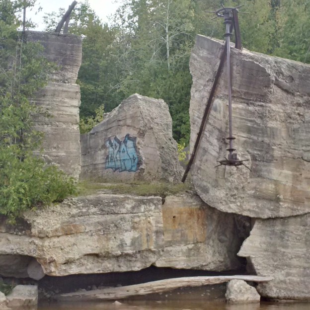
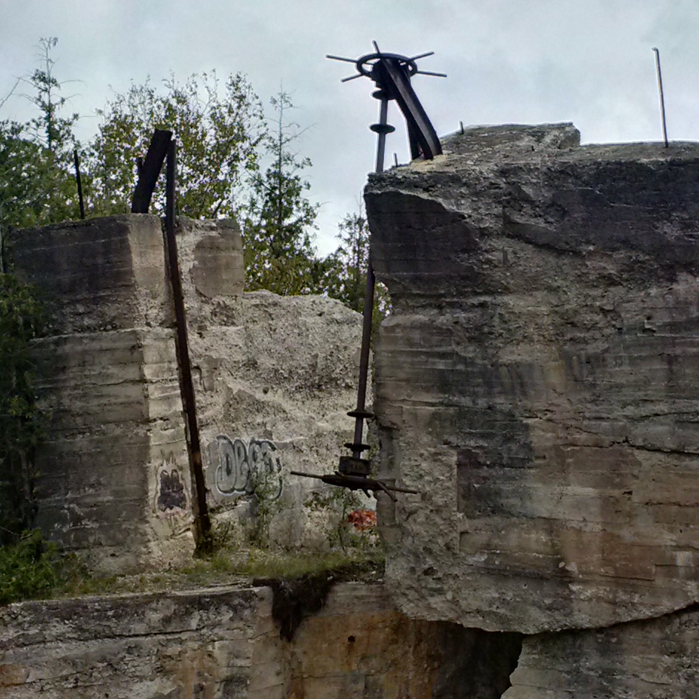
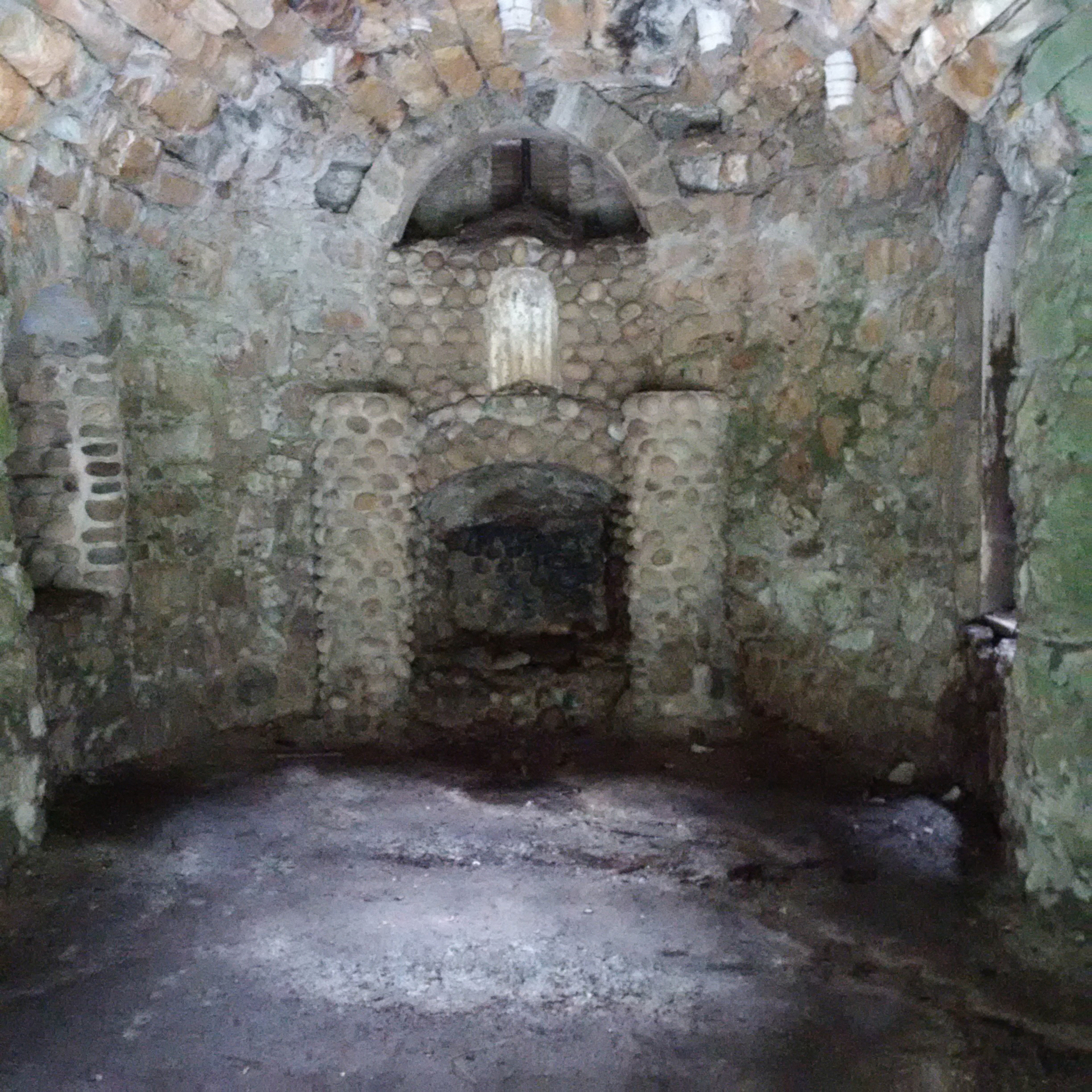
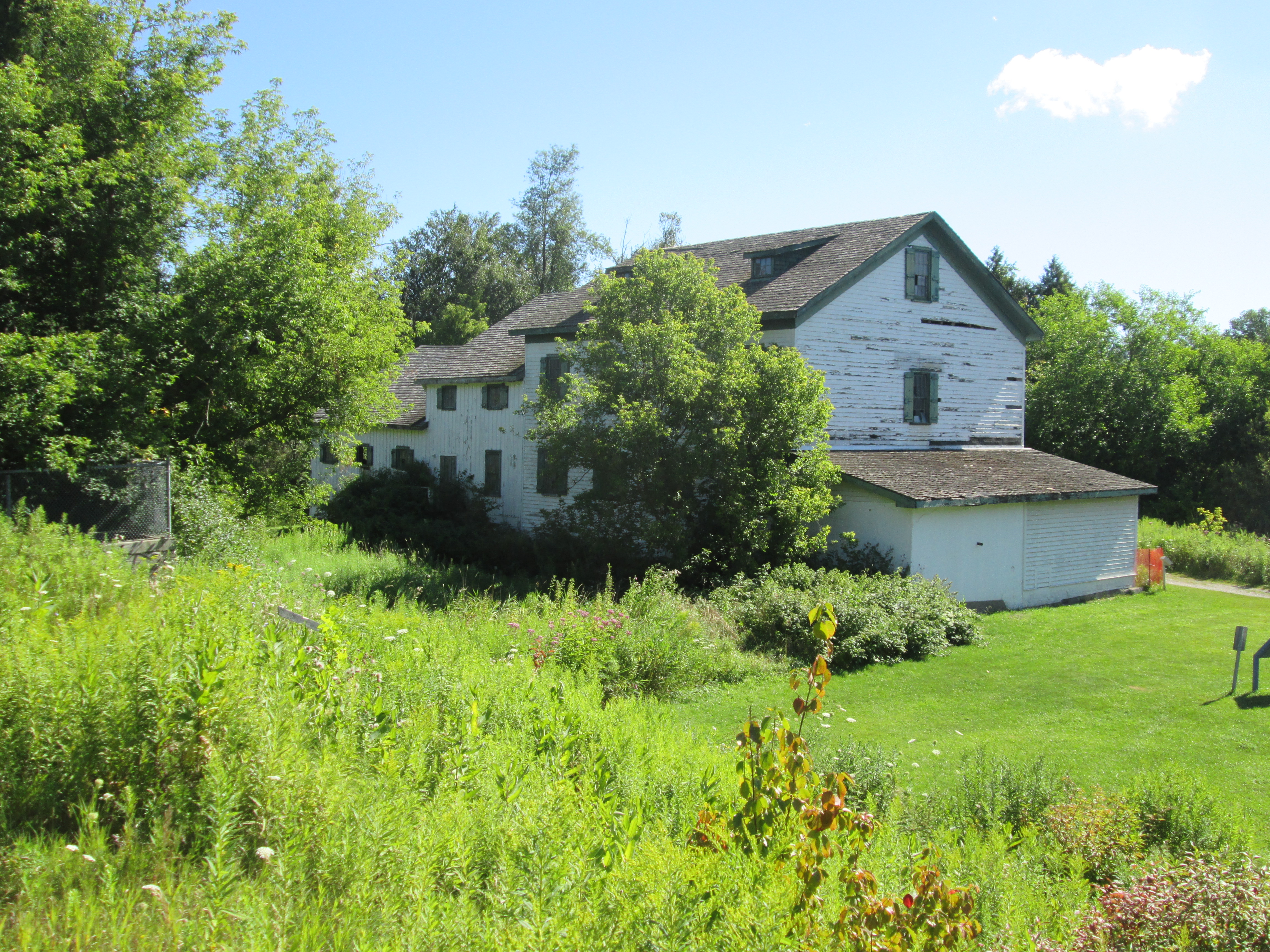
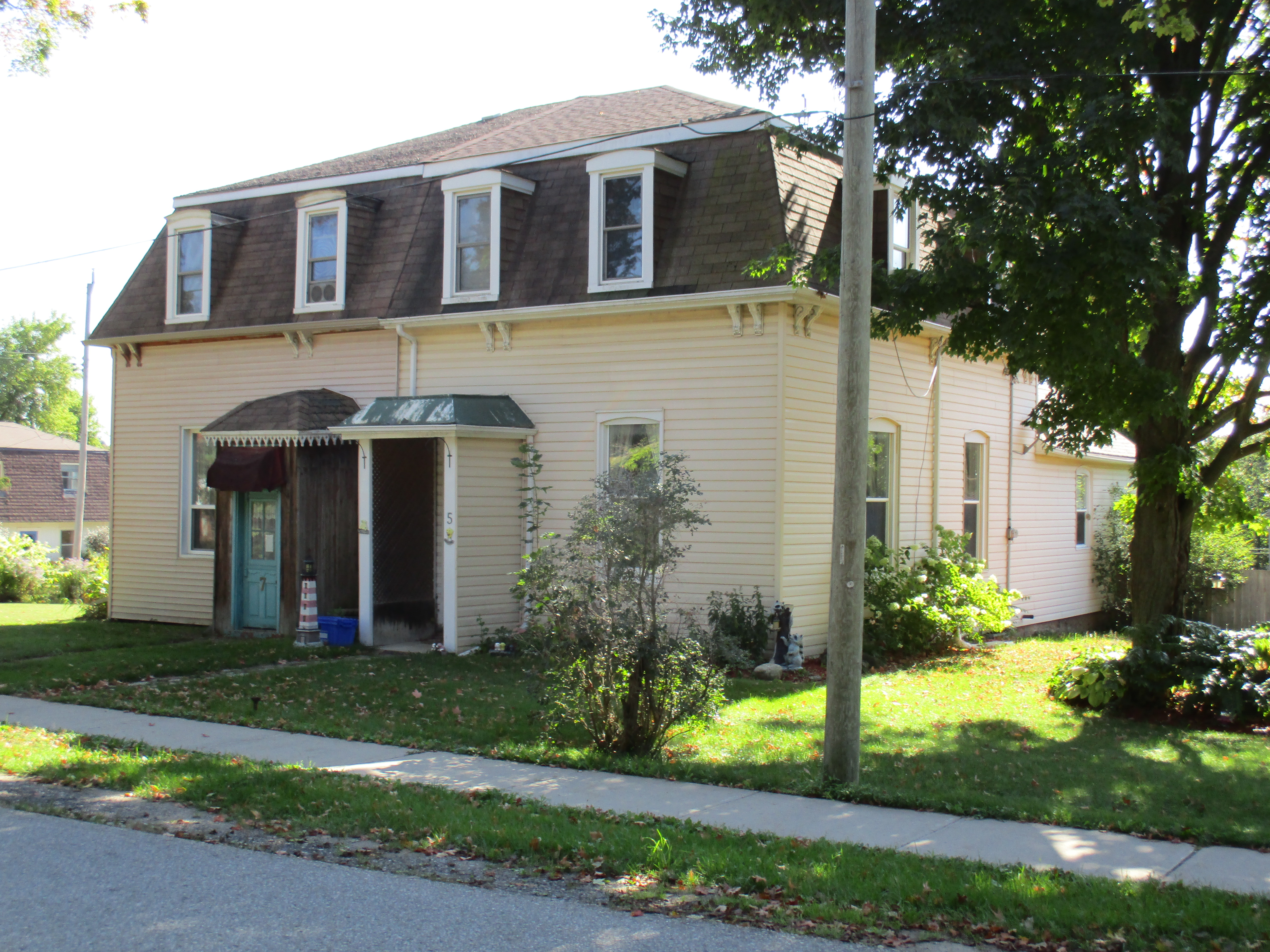
After the coming of the railway potato growing became an important part of the Hillsburgh economy.  In 1881 the first carload of 210 bags of potatoes was shipped from Hillsburgh to Toronto.  Before long up to 3,000 bags a day were being shipped.  For a few years the town even celebrated Potato Fest.  The cover photo shows a plastic button from the 1973 festival. Beside the railway station stood large potato sorting and storage sheds.  An underground potato storage facility near the railway station has been converted into a house.  Note the concrete storage entrance on the side of the house and the extensive berm for storage.  All of the windows have been reduced in height and bricked in and a doorway has been closed off where the propane storage tank stands.

IMG_0008

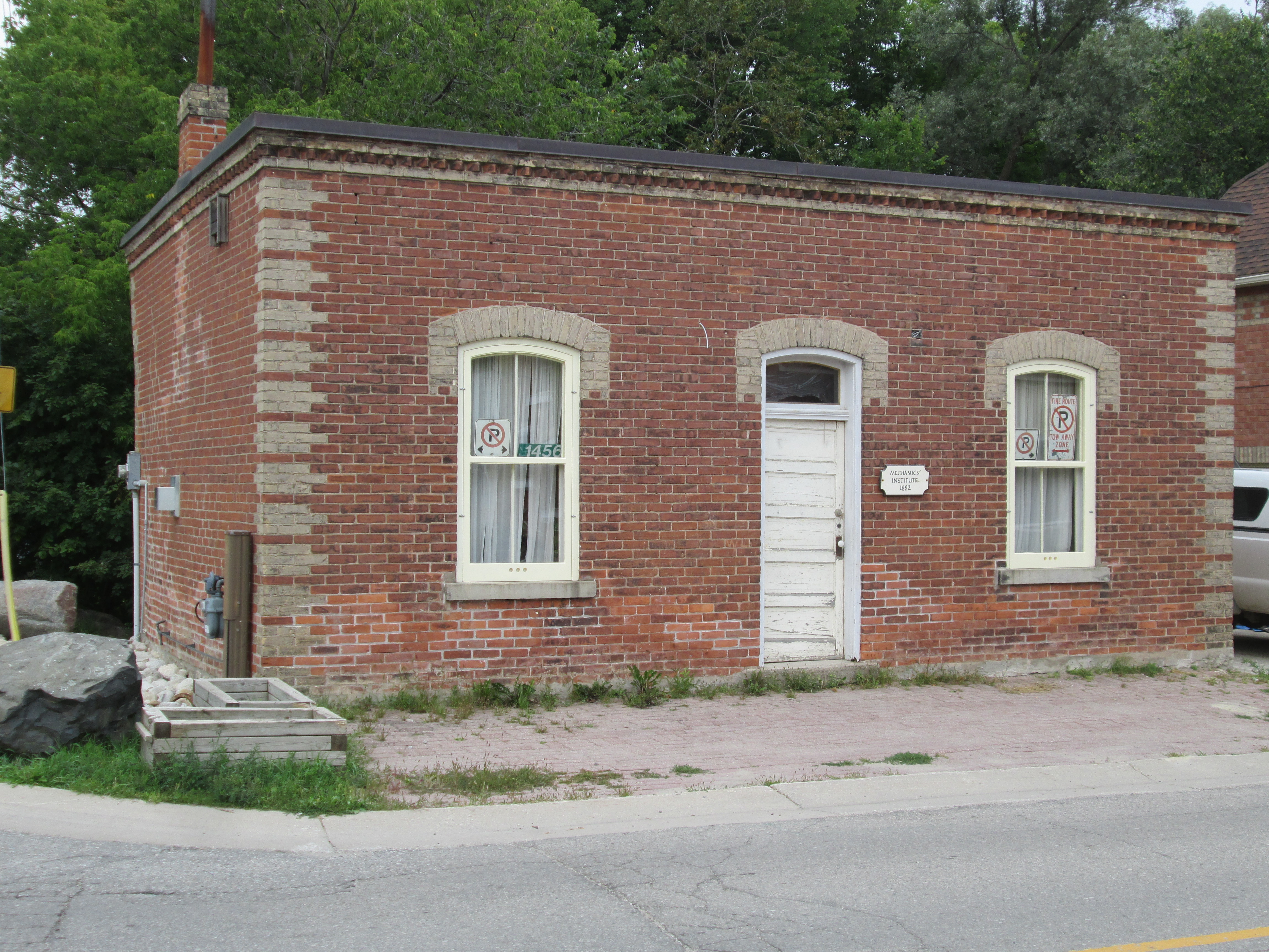
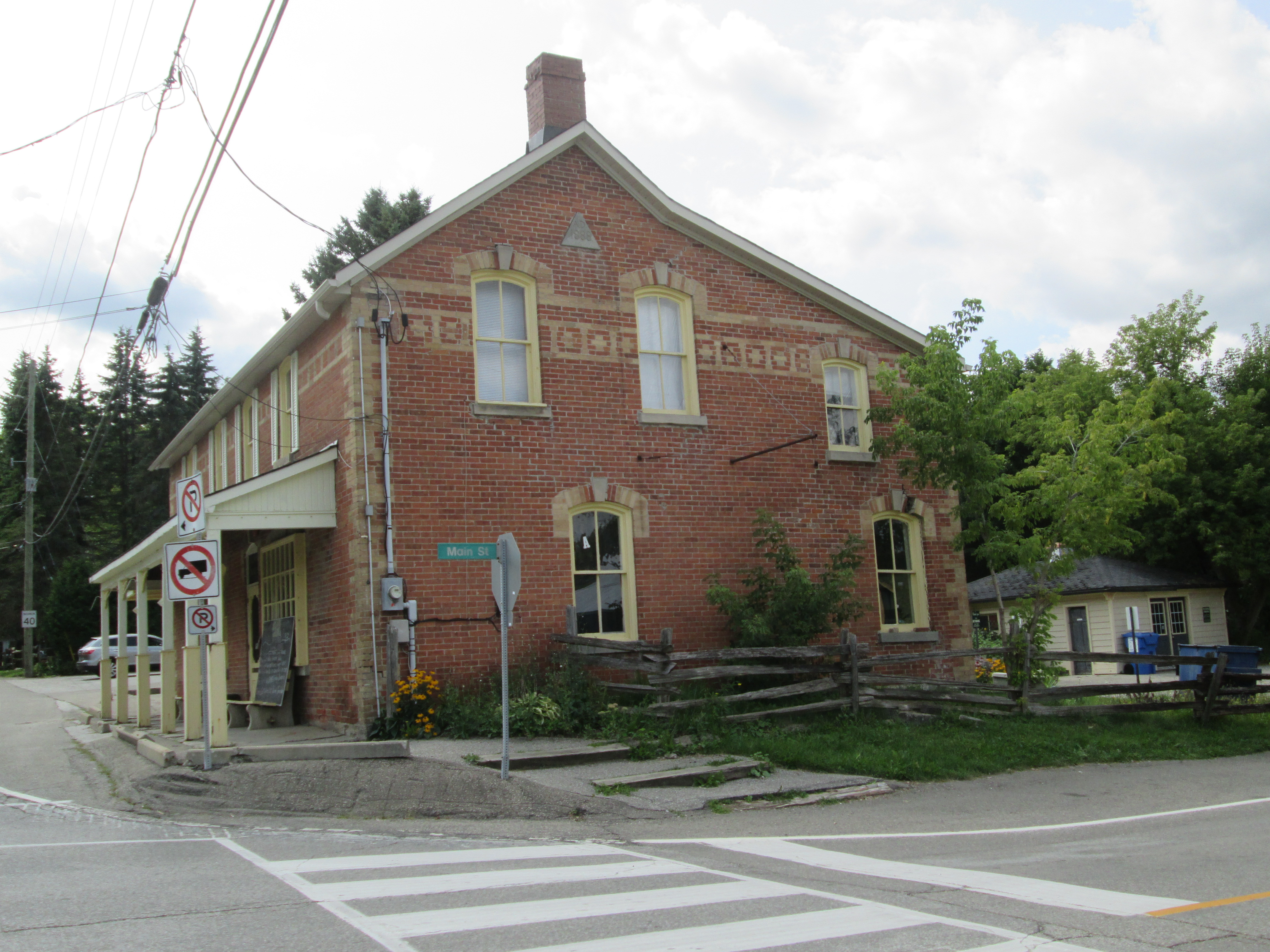
In 1821 William Howe bought lots 22 and 23 in the seventh concession of Erin township.  He built a general store and trading post on the 7th line.  His second, larger store, blew up due to careless smoking and storage of gunpowder. A third store was then built which operated into the 1970’s.  All of the old tin advertising for Coke, Black Cat Cigarettes and the Orange Crush door handle are all gone from the store front and now it survives as an office building.

IMG_0133

Nazareth Hill arrived a couple of years later and built a hotel on lot 25.  He surveyed his property for town lots and named the community after himself.  As Hillsburgh grew it swallowed Howville.  It was incorporated as a police village in 1899 with a population of 500.

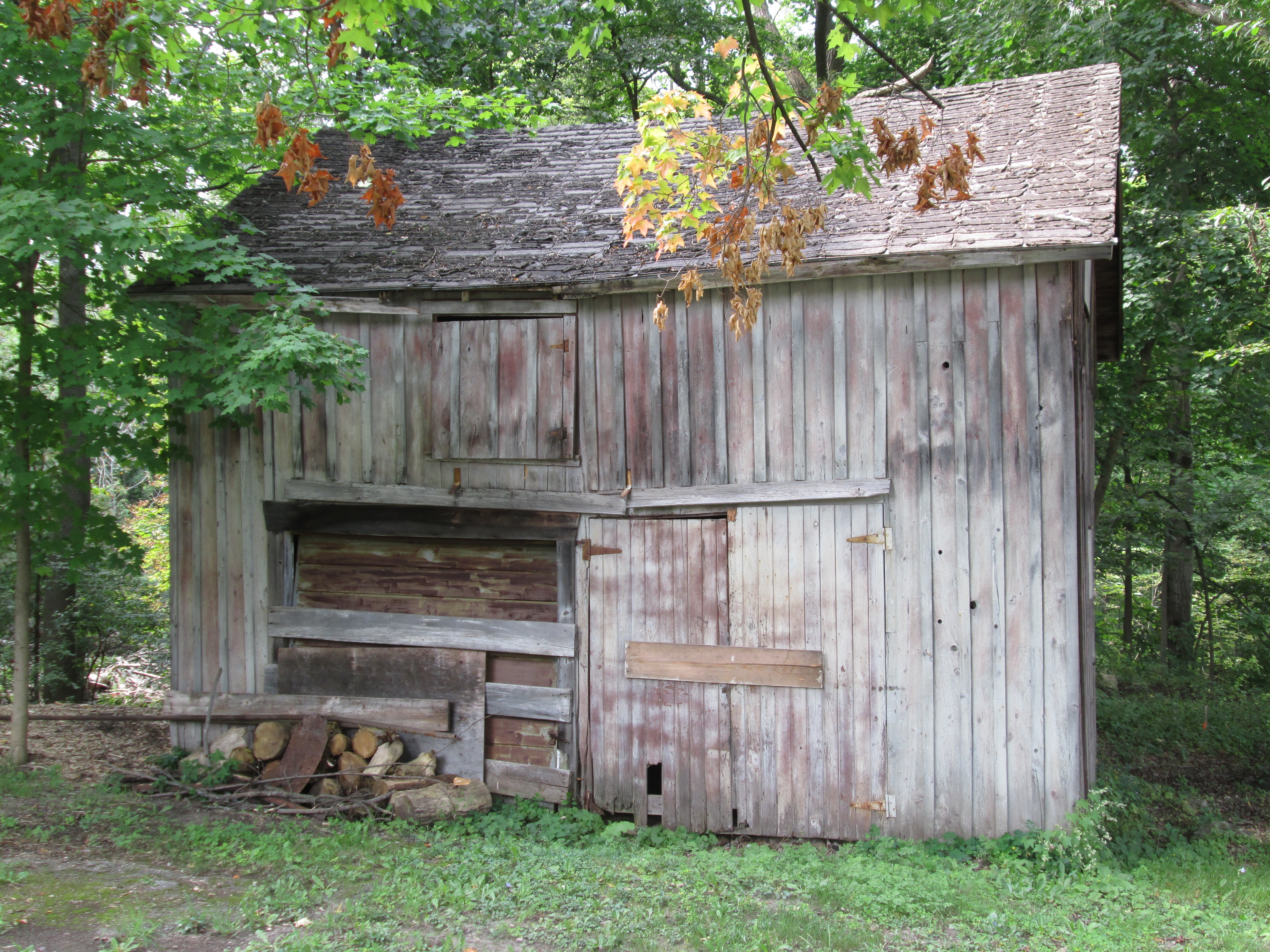
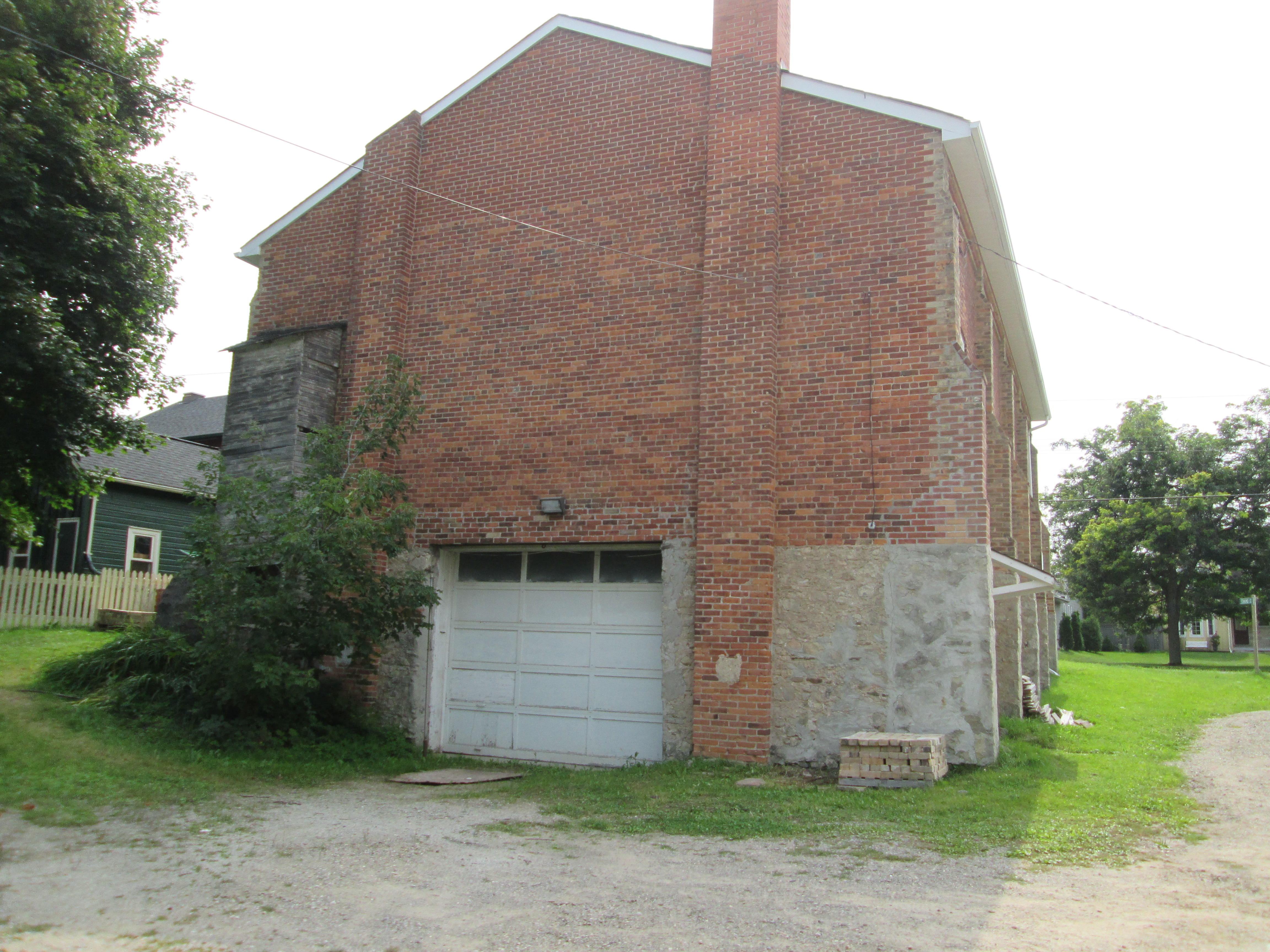
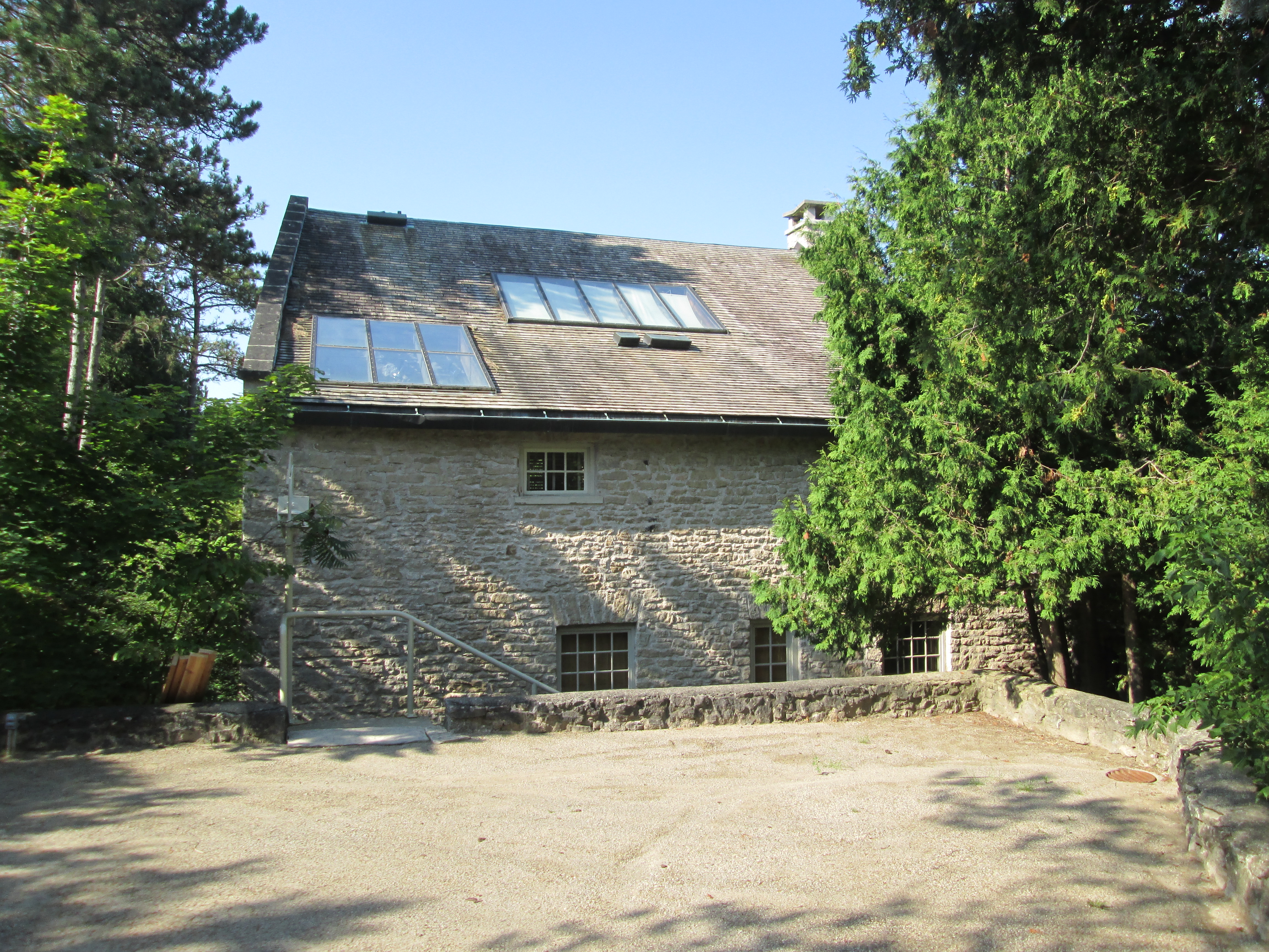
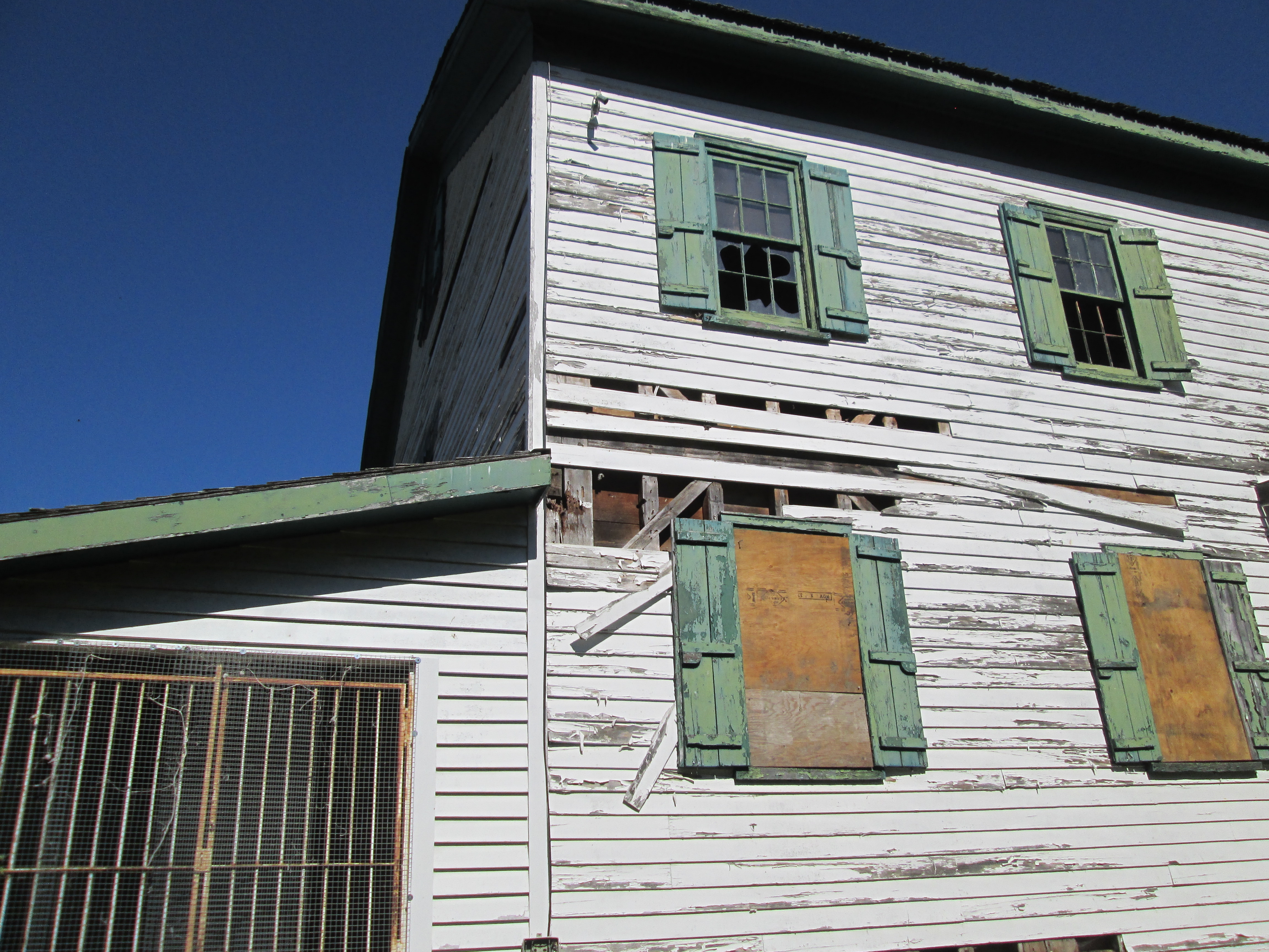
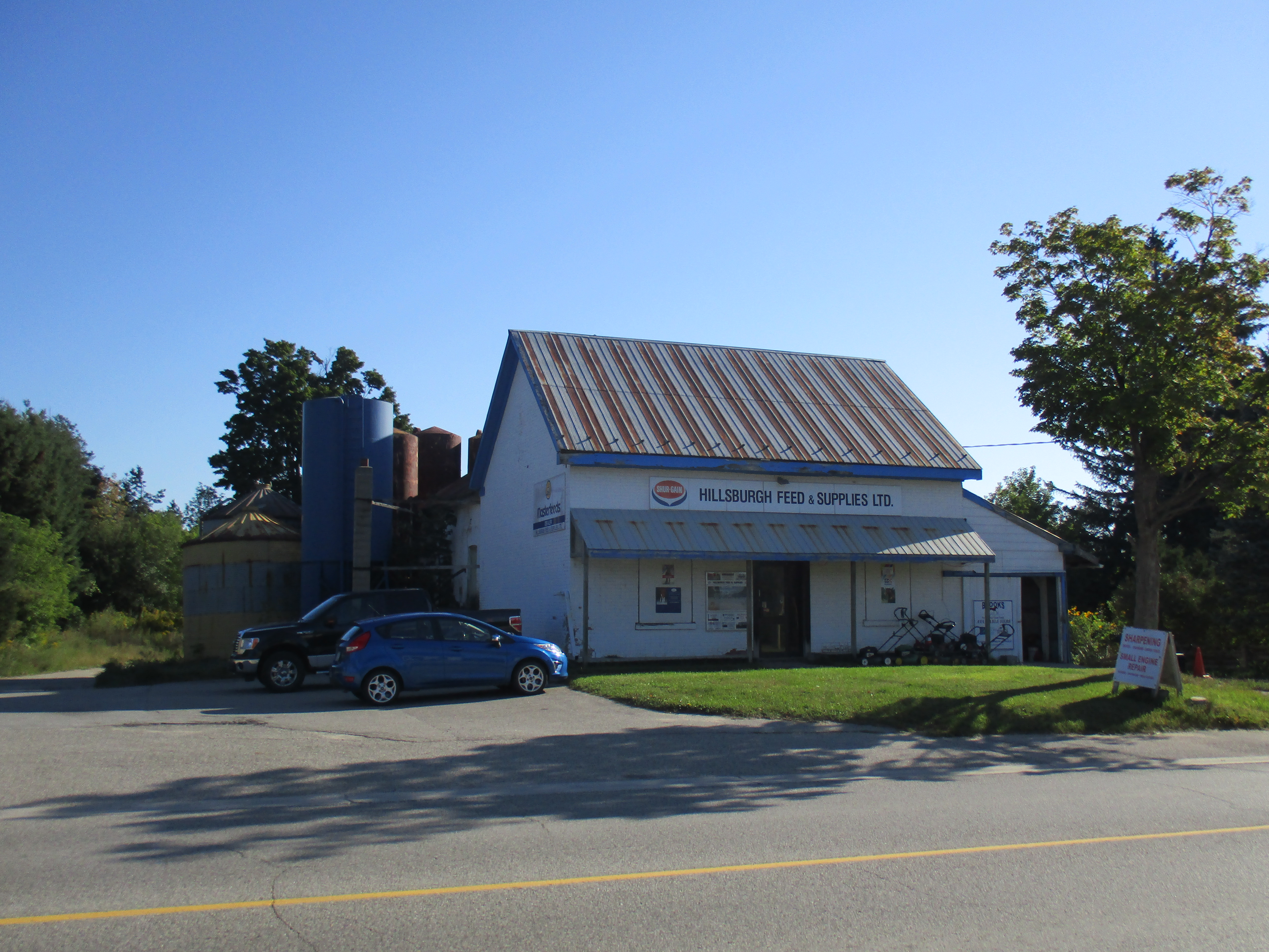
The first school house dates to 1844 and survives today as a private residence.  A one room brick school was completed in 1864 with an addition for the juniors on the front in 1878. In 1960 six acres were purchased from the Nodwell farm and Ross R. McKay school was opened with four class rooms.  The picture below shows the old school which has served local farmers as Hillsburgh Feed since 1963.  The 1864 school room is hiding in the back beside the feed silos.

IMG_0015

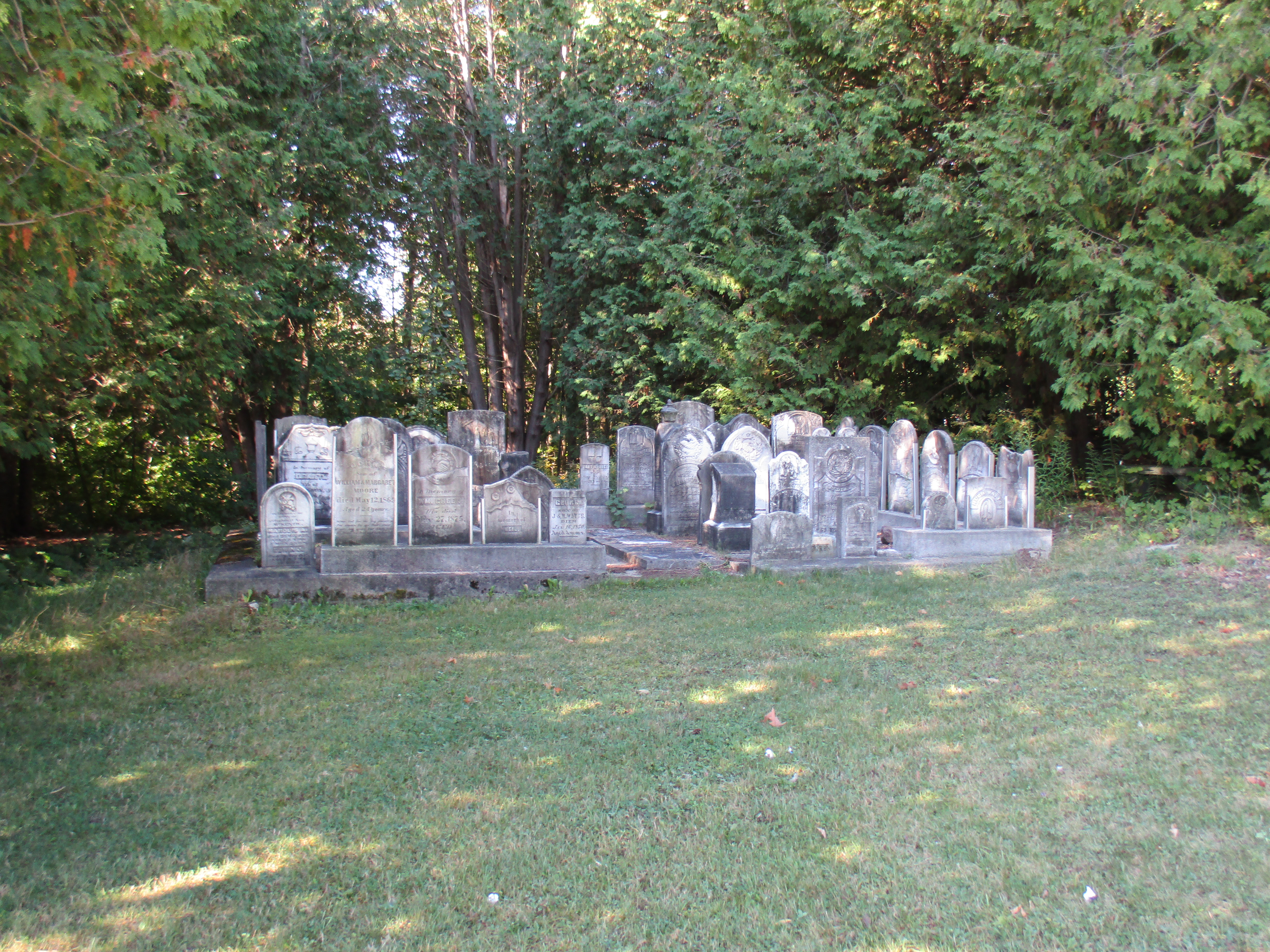
William How is buried in the pioneer cemetery near the middle of town.  After many years of neglect the stones were gathered up and placed in a central location.

IMG_0018

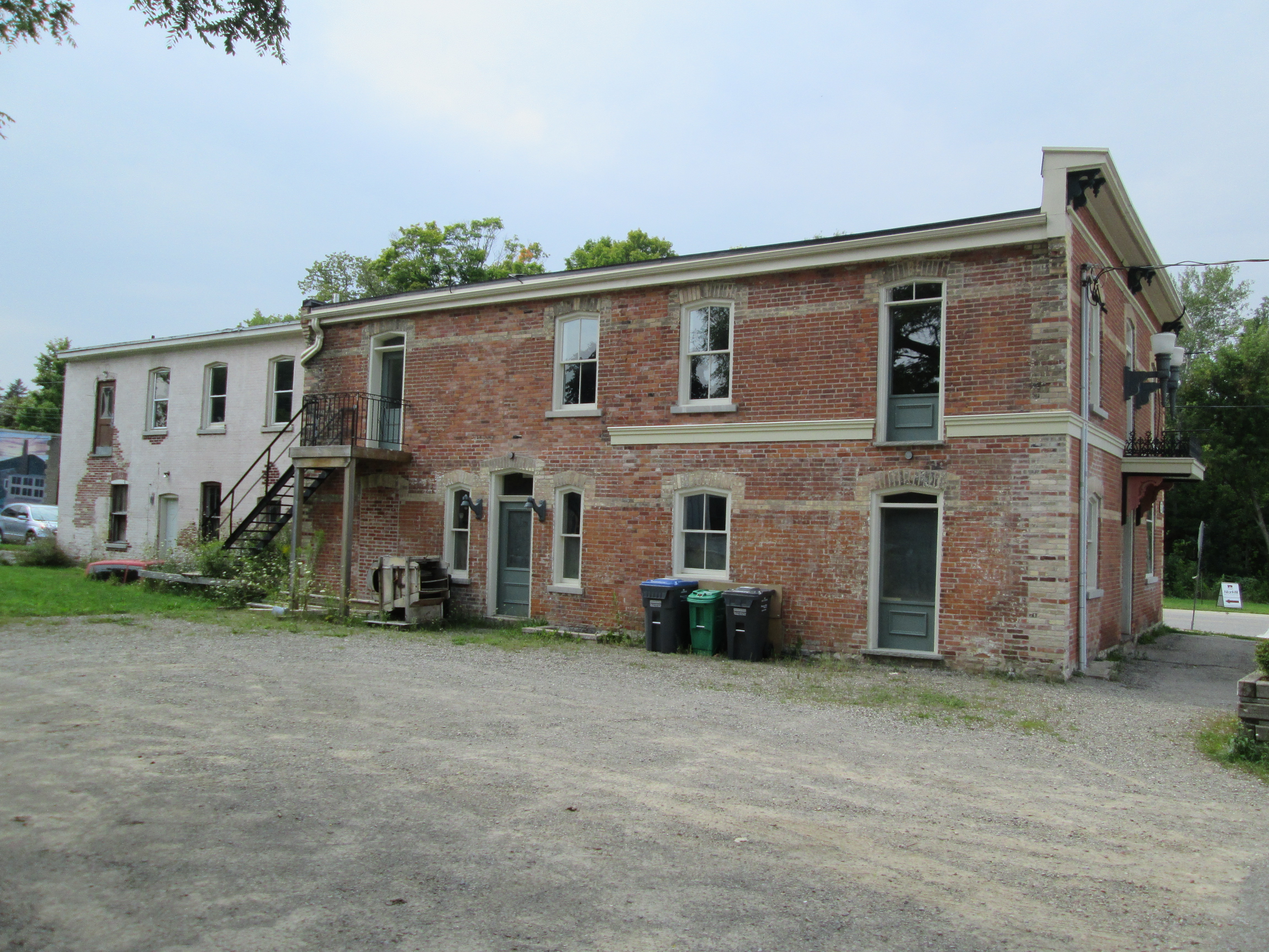
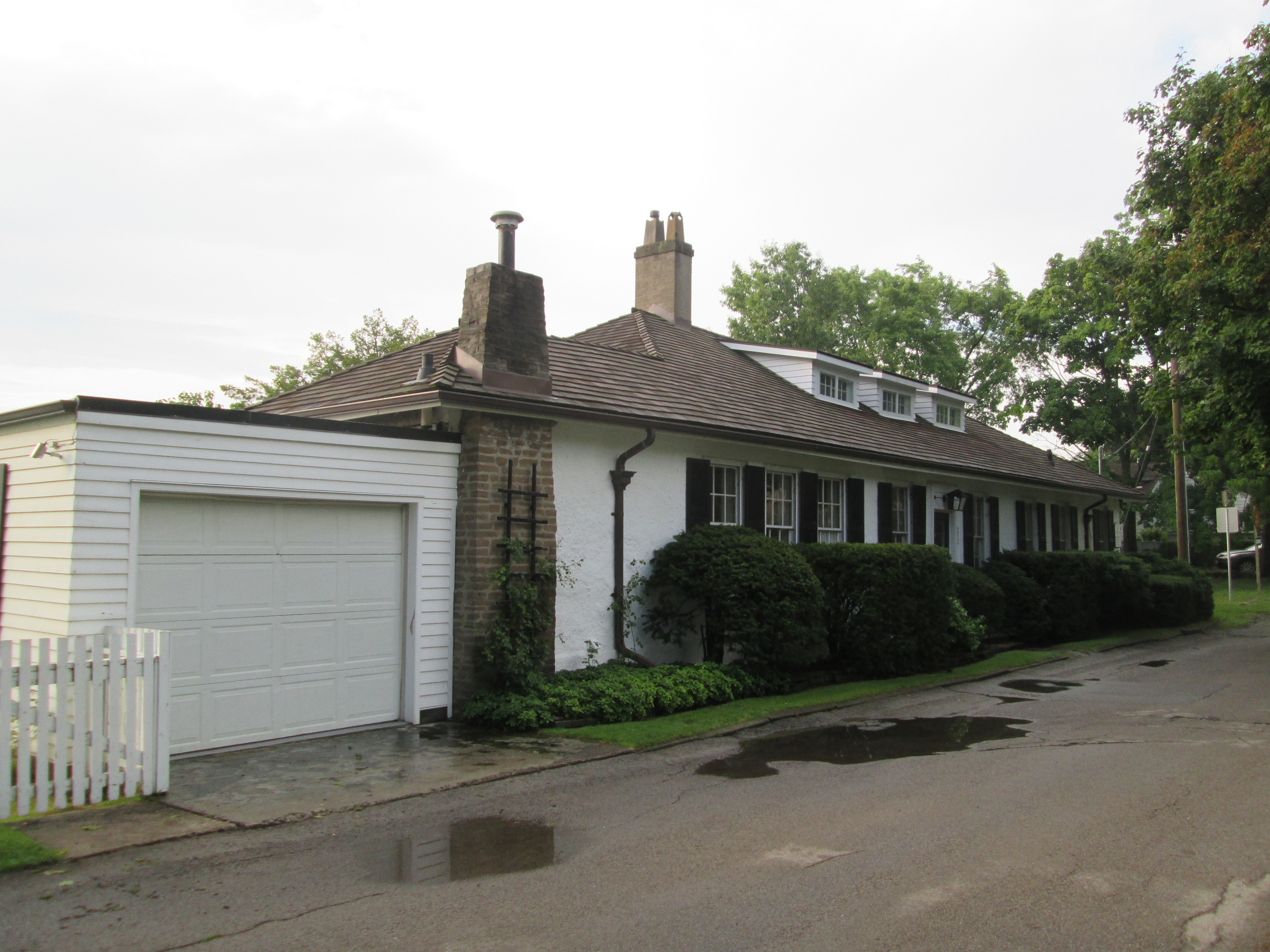
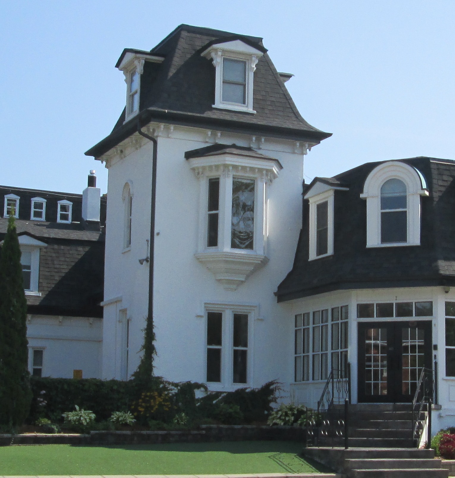
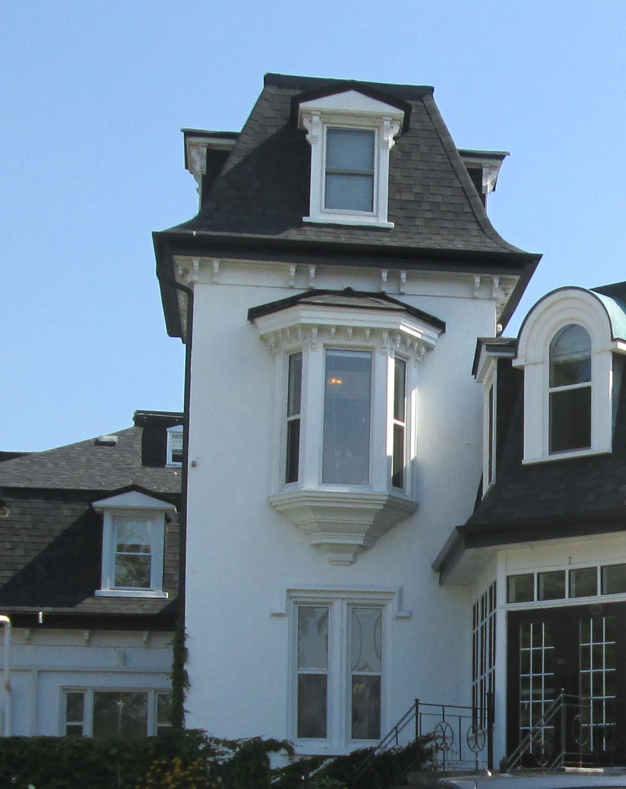
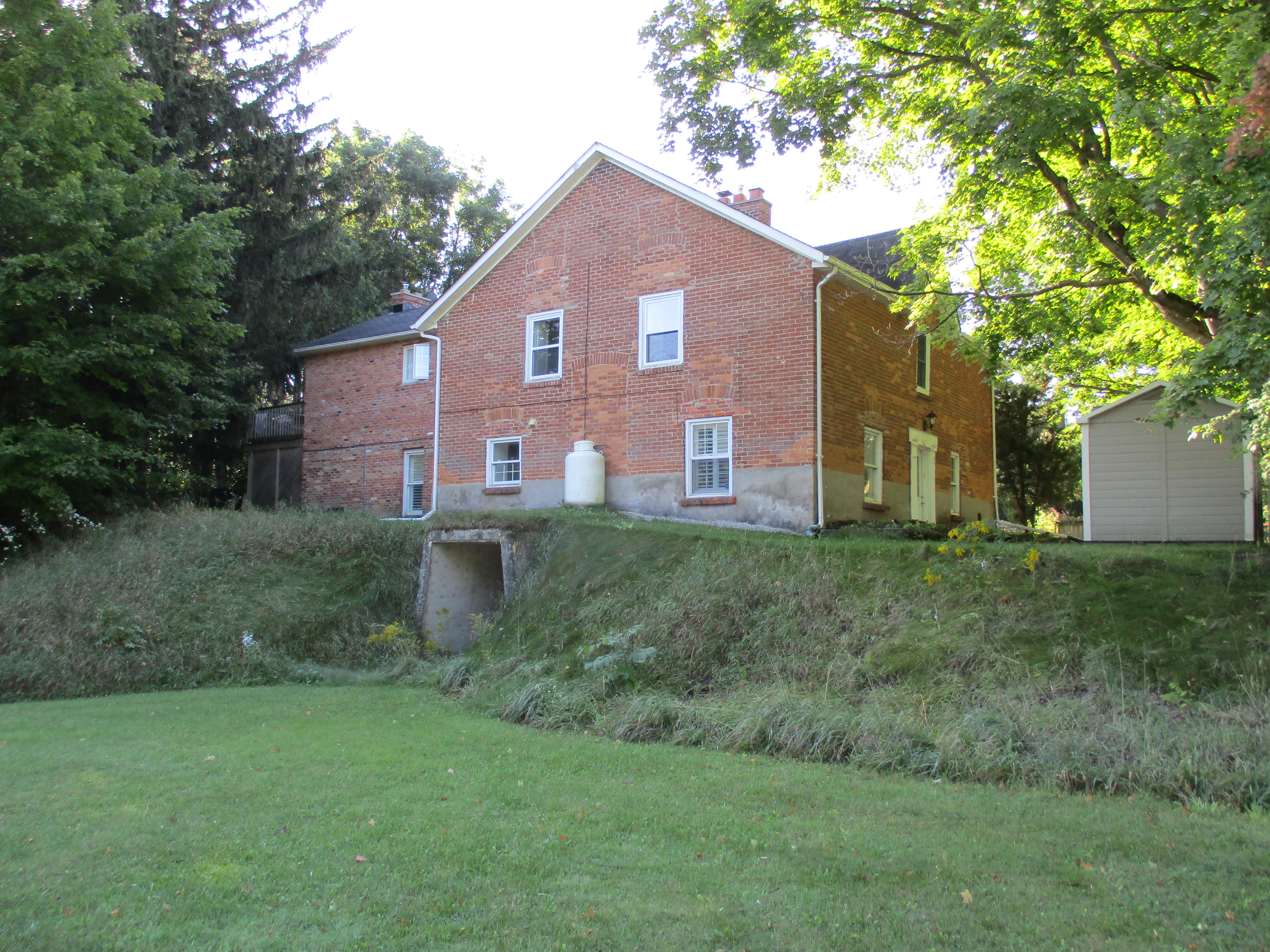
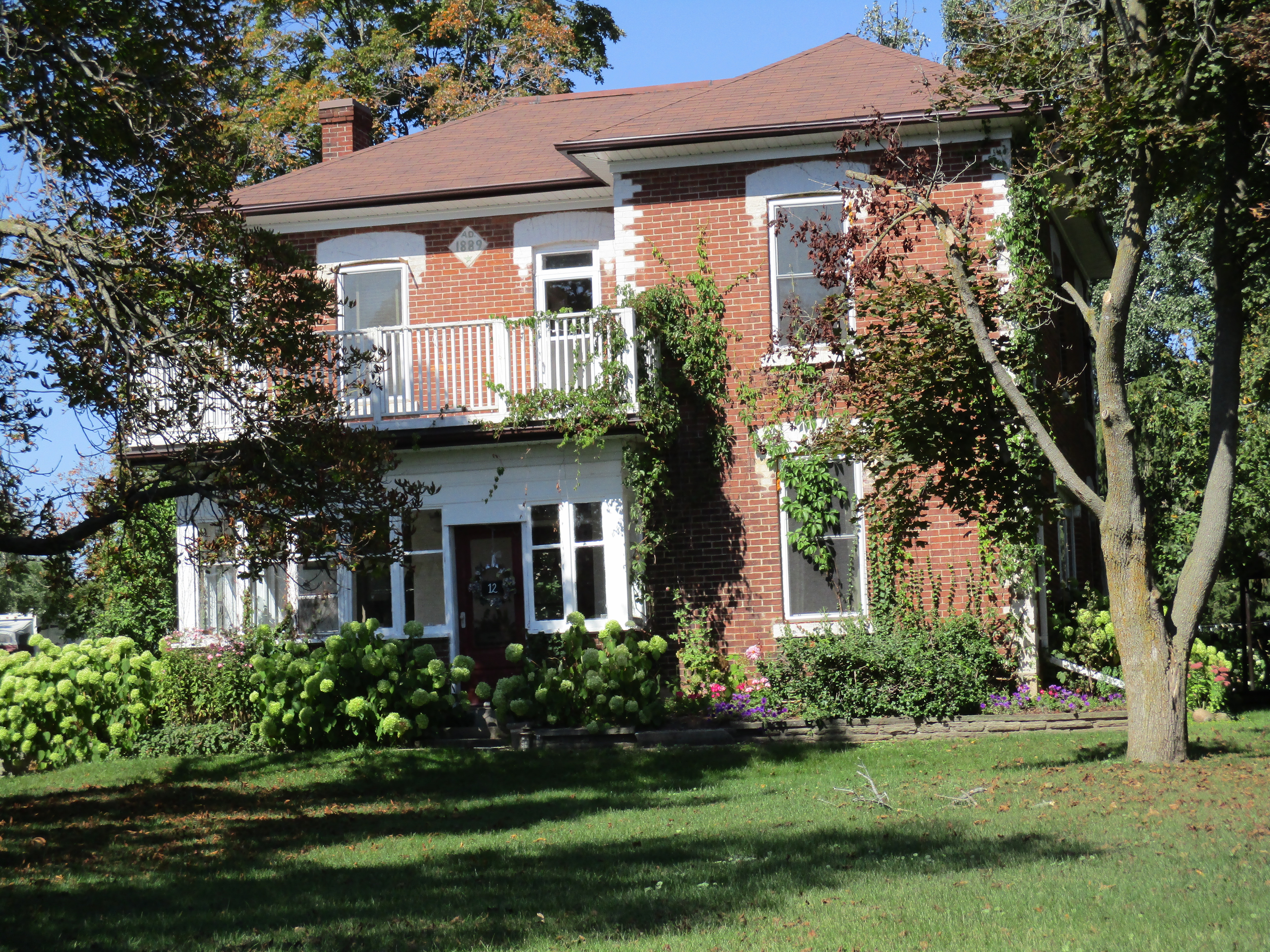
William Nodwell came to Canada from Ireland in 1838 and settled on Lot 24.  His first log home burned down within a year.  Nodwell then sold half of the lot and constructed another log house and barns.  In 1868 the brick house shown below was built.  This view shows the front of the now abandoned house with it’s second story oriel window.  In 1895 the house at the corner of the lane was added for use by family members.  In 1926 Mungo Nodwell took over running the farm which was well known for the  potatoes he grew.  Today there is an open proposal to develop this farm for a subdivision and the electric fence that used to surround the school yard has been replaced with a row of trees.

IMG_0120

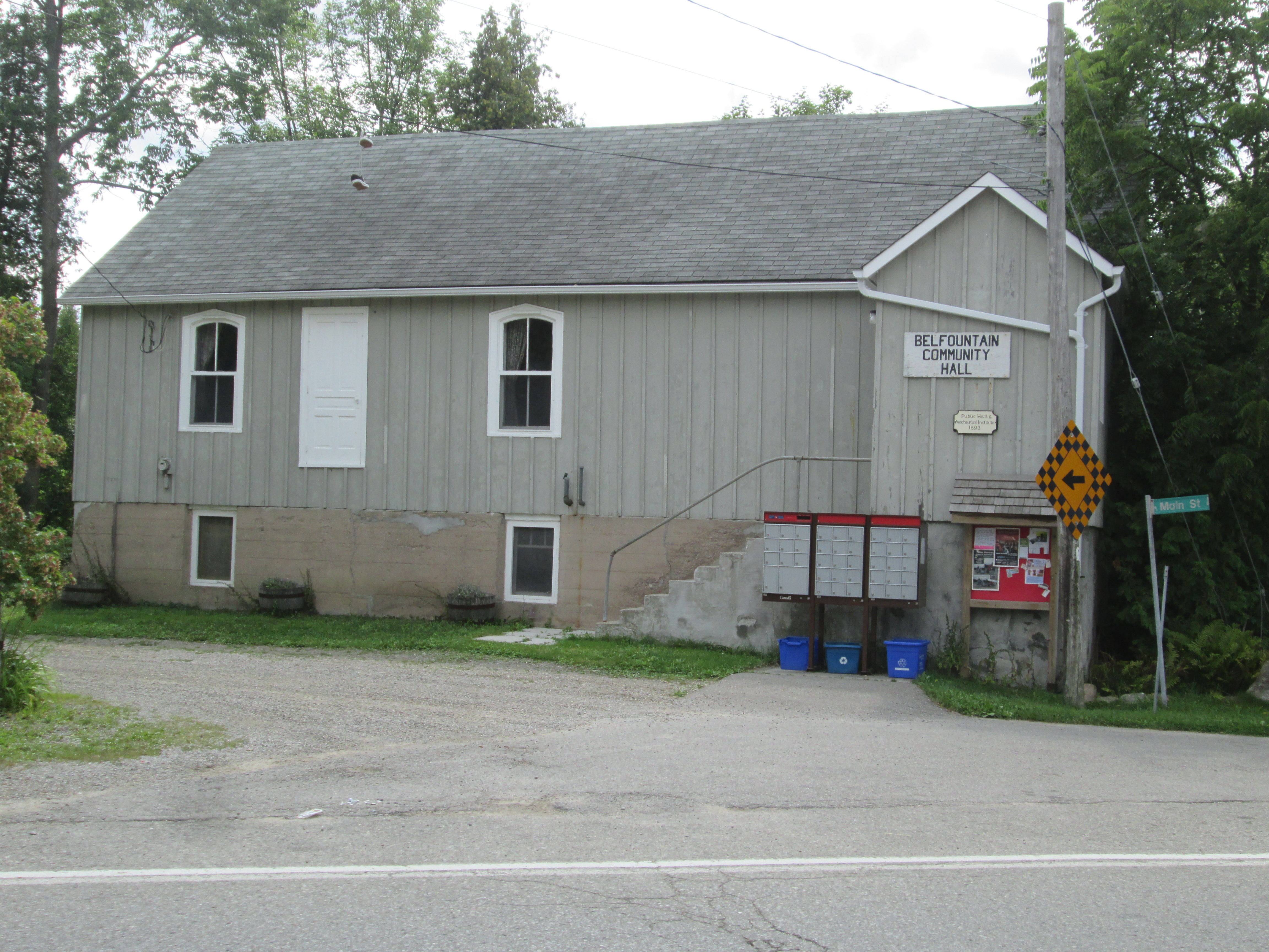
A second town hall was built in 1887.  The date stone is interesting because it has no “h” on the end of the town’s name.  Notice the two maple leaves above the date and the beaver below. The Beaver was the name of the town newspaper in 1887 and cost 25 cents per year, paid in advance.

IMG_0049

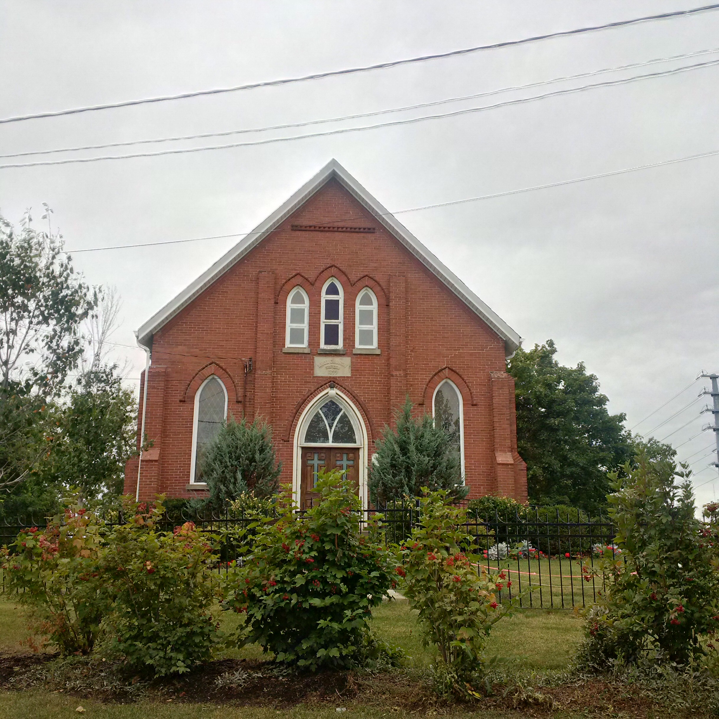
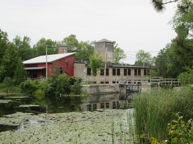
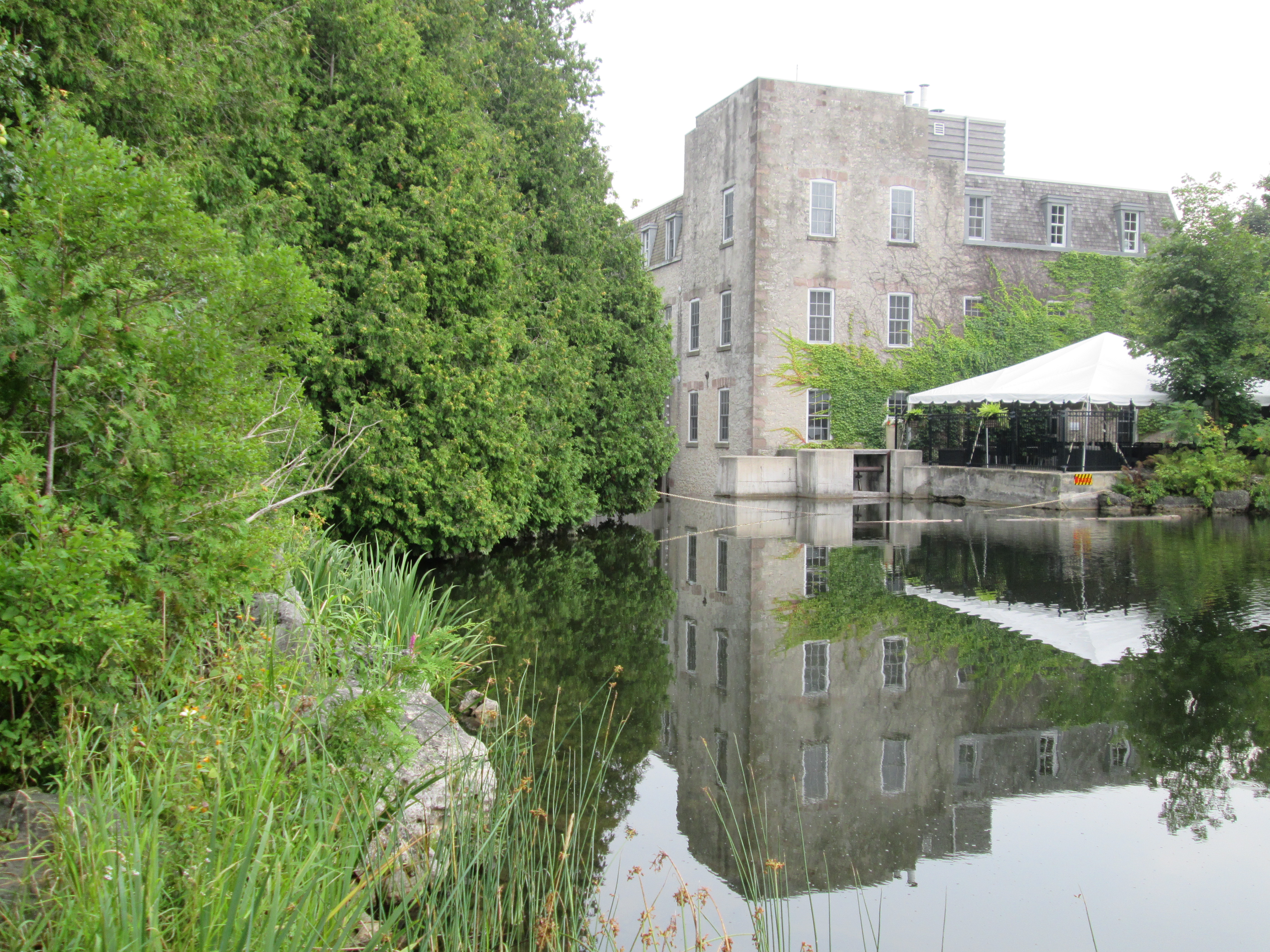
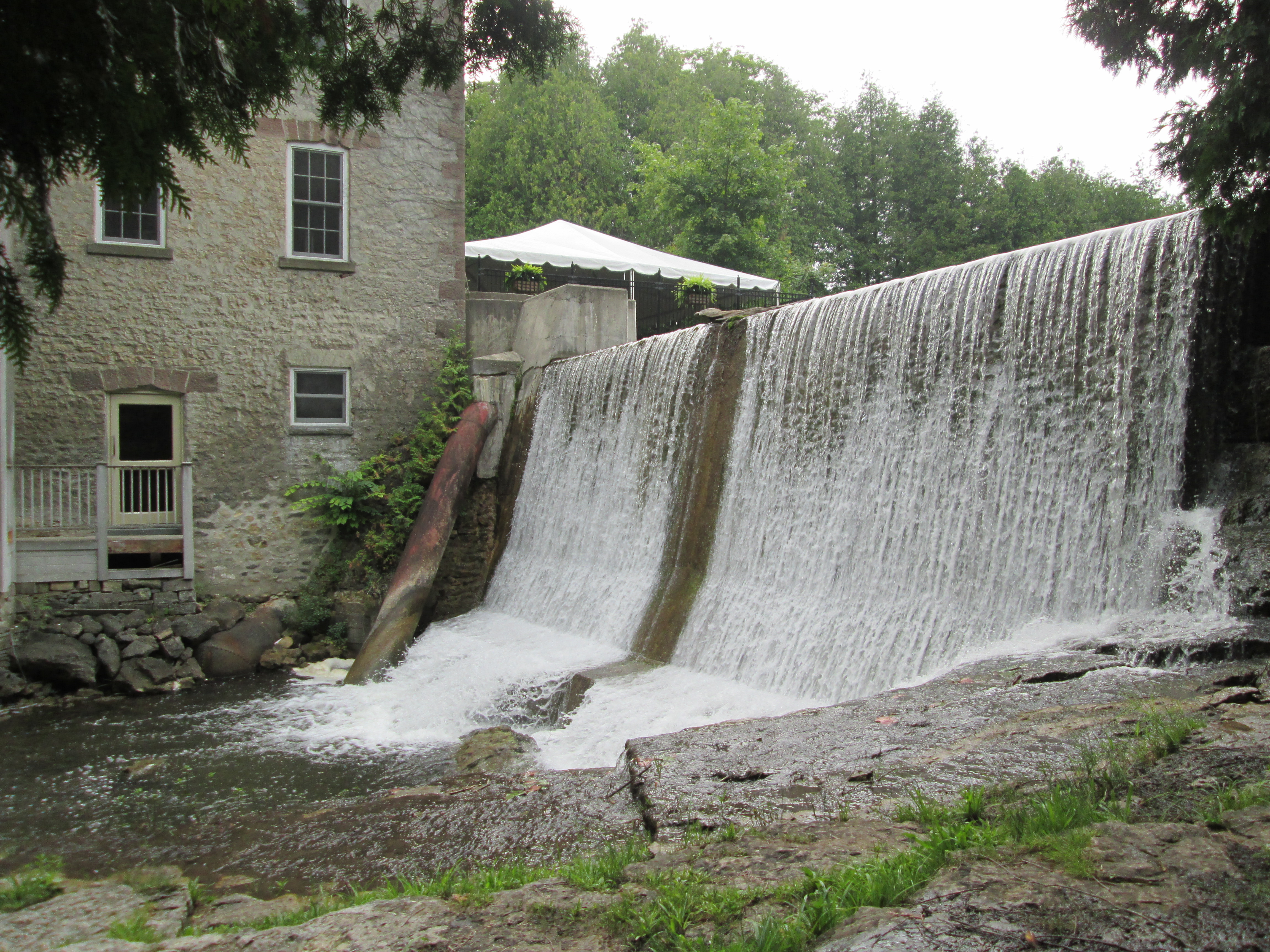
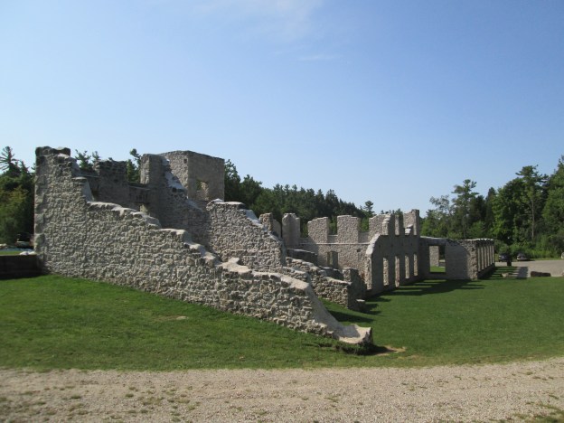
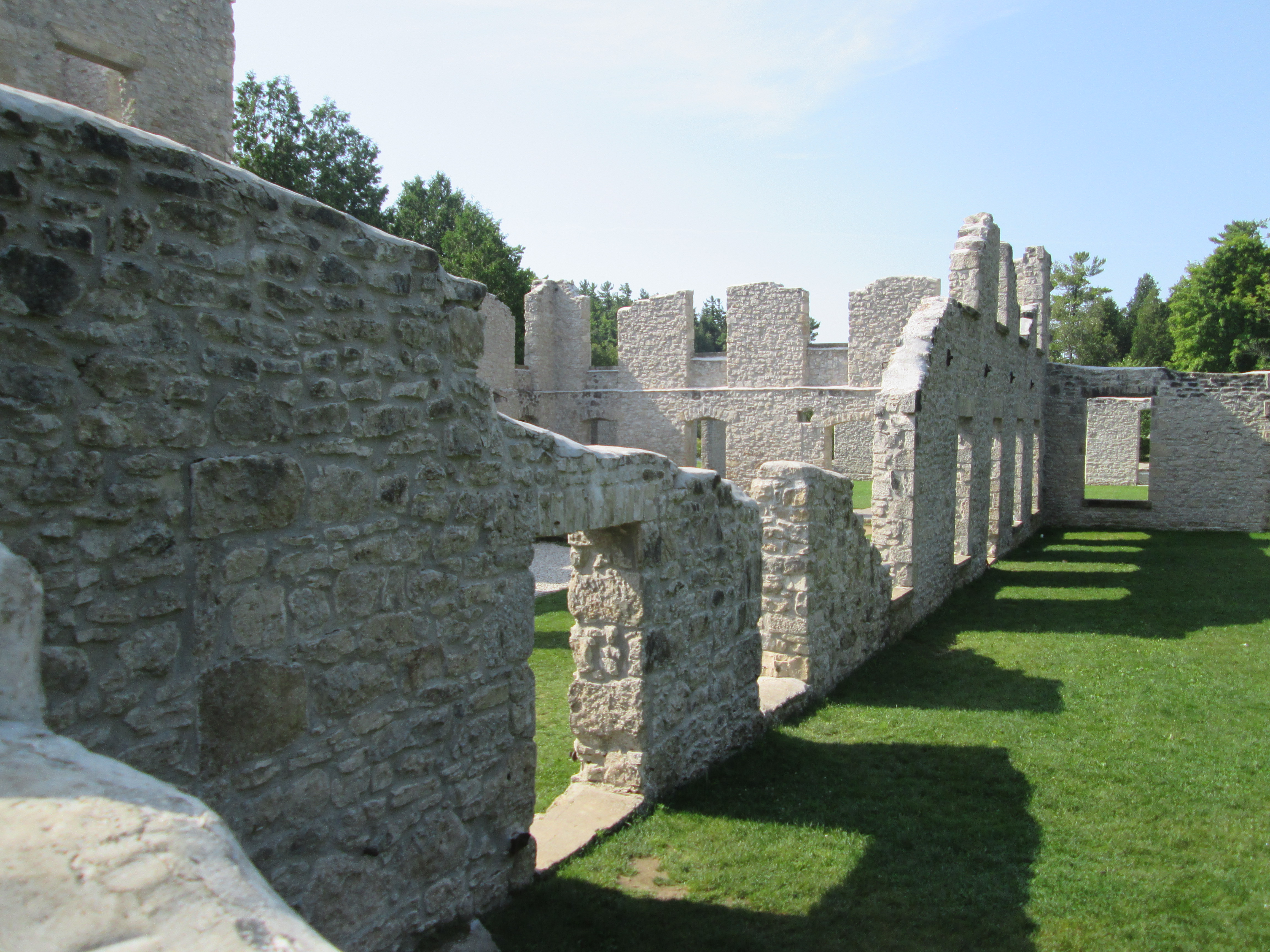
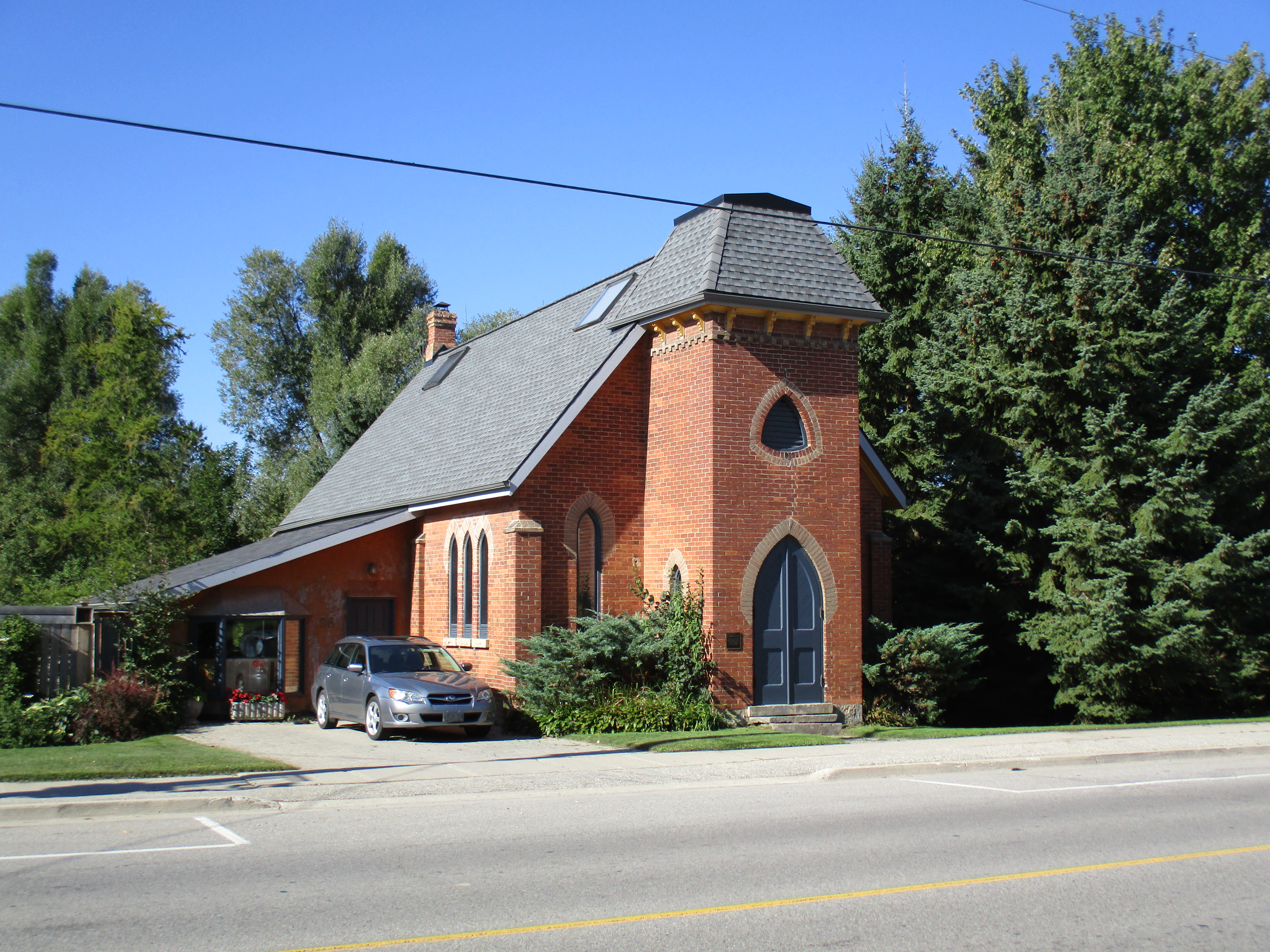
Six of Hillsburgh’s seven church buildings remain.  The first, and only missing, church was the Union Church and it stood beside the pioneer cemetery.  As each of the denominations grew they left the Union Church and got their own buildings.  From the south end of town is the Baptist Church (1862), Christian Church (1906) and St. Andrew’s Presbyterian (1869) which burned in 1965 and was rebuilt in the original walls.  Beside the river stands the United Church which was reassembled here in 1926 and the Anglican Church seen below.  It was built in the early 1890’s but closed in 1918 and served as a honey extracting plant after that.

IMG_0051

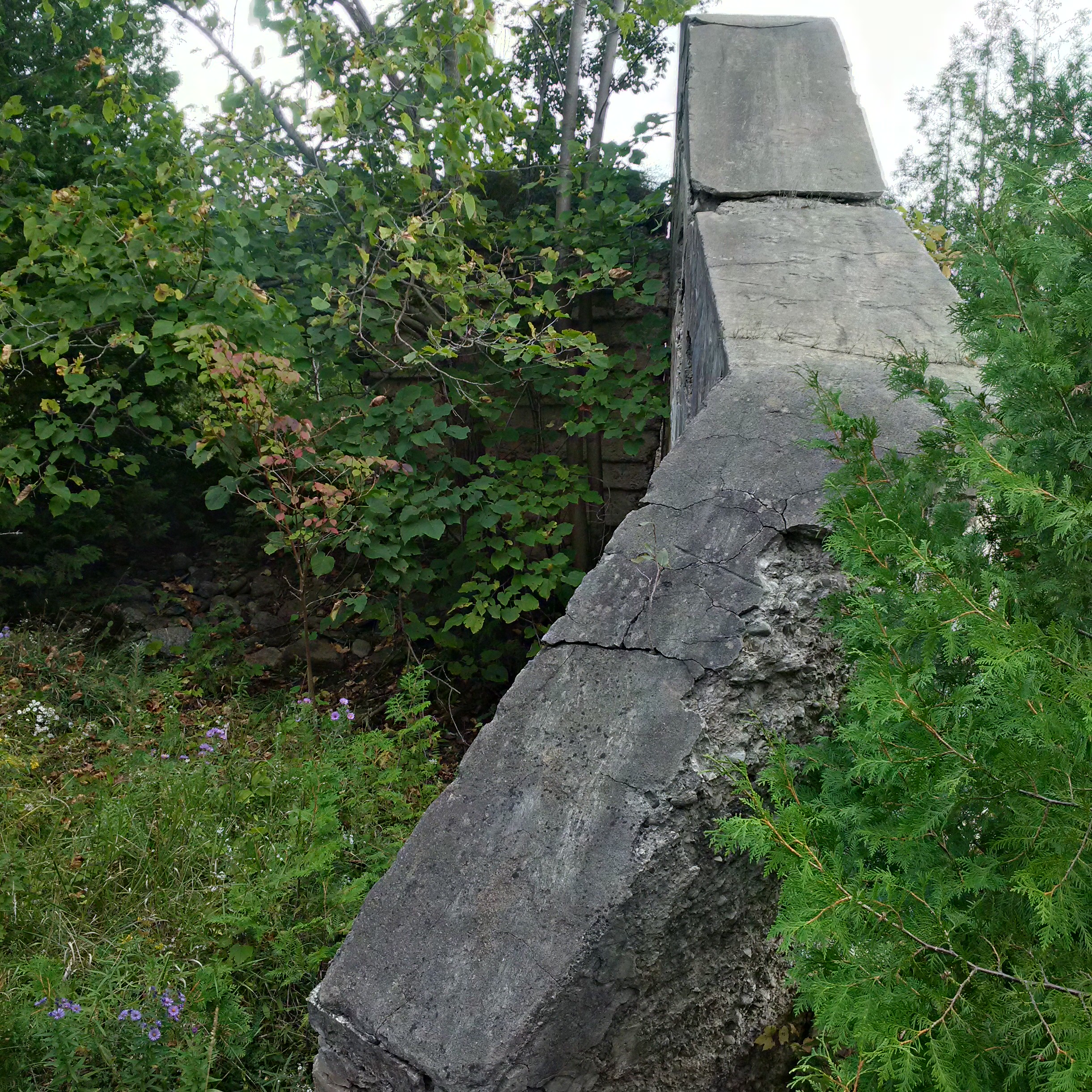
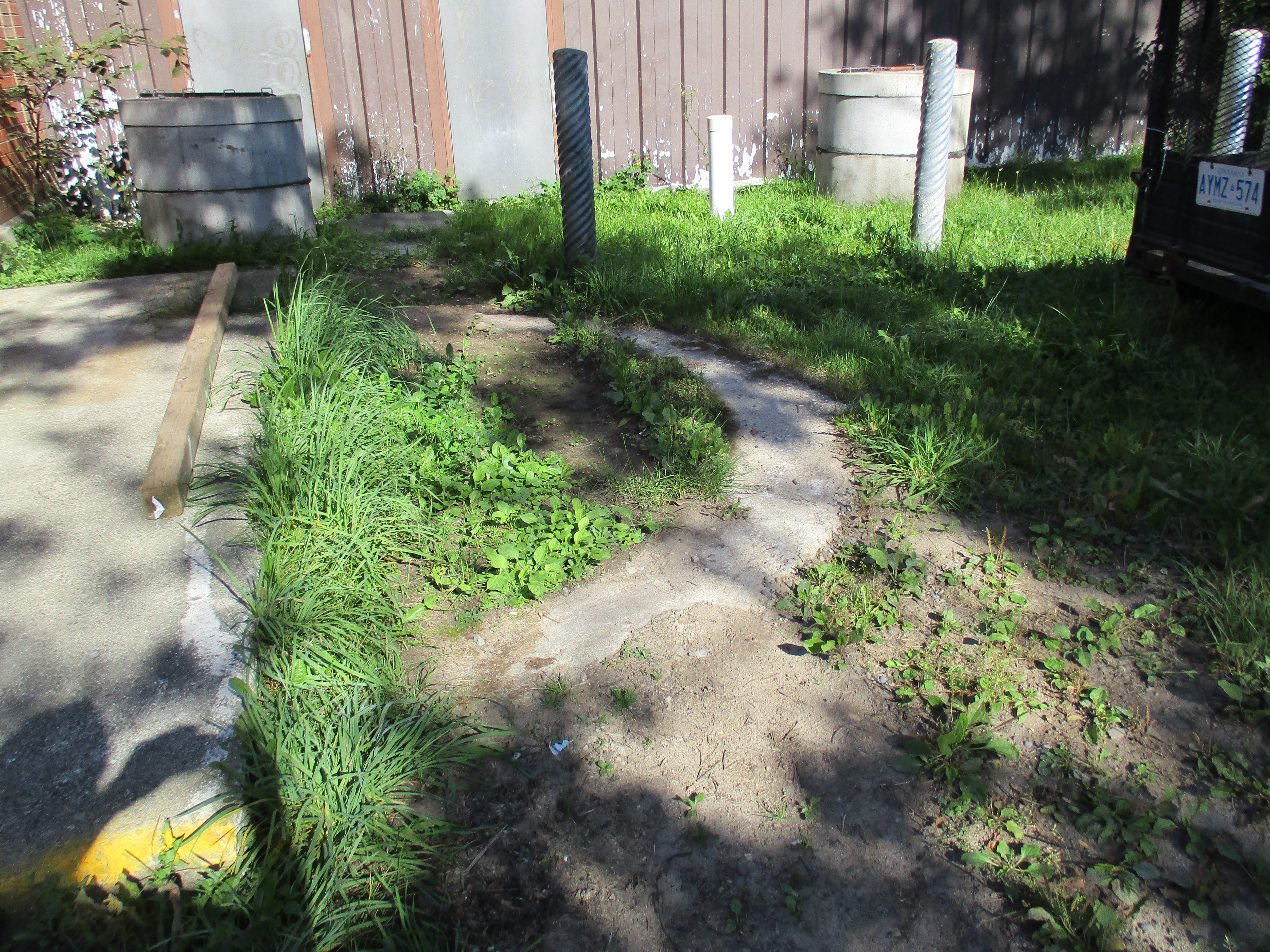
Hillsburgh didn’t have a fire hall until the church fire of 1965.  After that it had a two door building that stood beside the river.  When the arena was replaced it was moved to Station Road.  Today there is a semi-circle of concrete on the ground behind the arena to mark the tower where the fire hoses were hung to dry.

IMG_0056

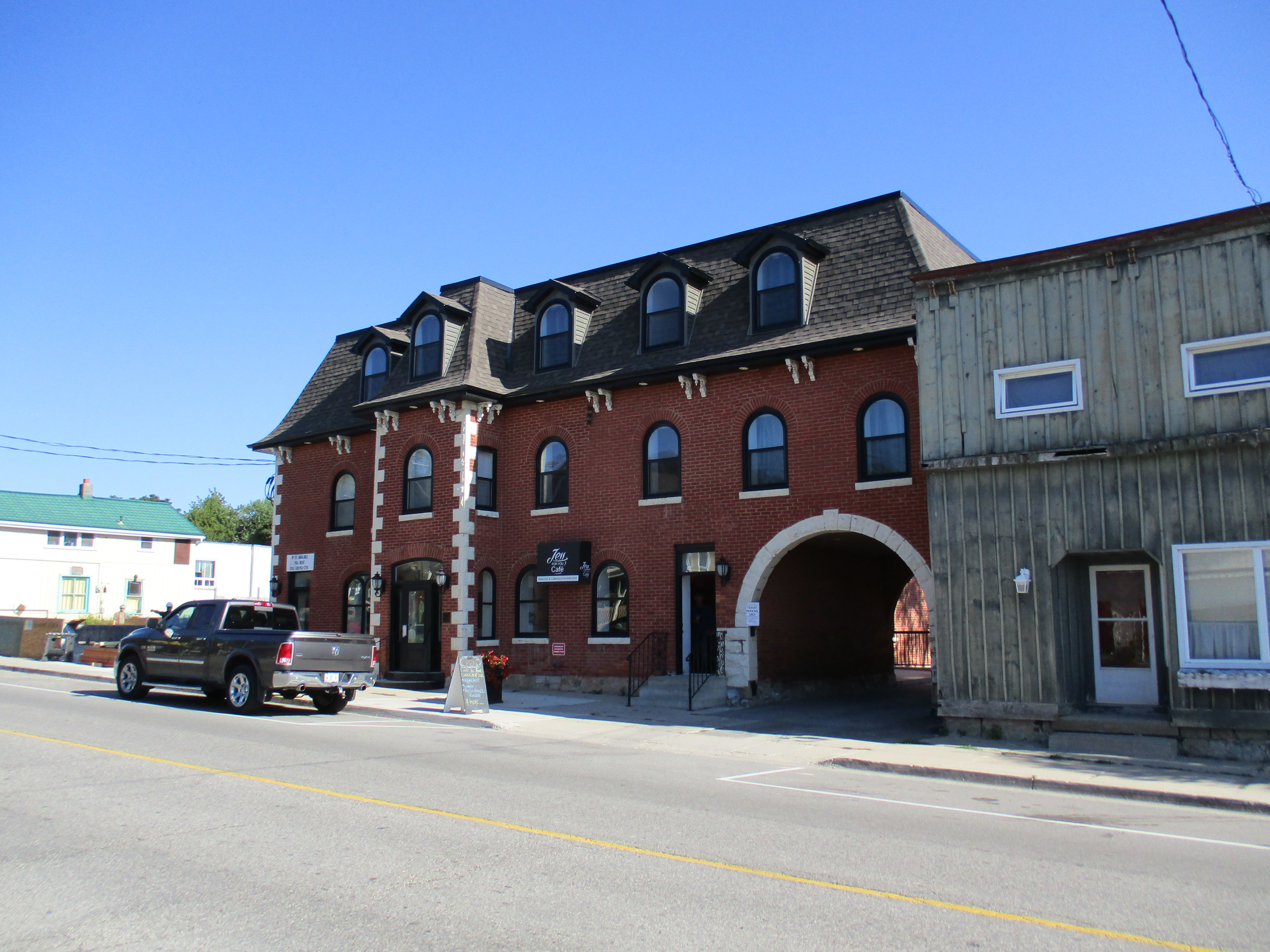
The Exchange Hotel was built in 1883 and was one of three hotel buildings that remain in town. Until recently It had stables in the back for the traveler’s horses and lettering on the arch which said “Good Stabling”.  It is the only three story building in Hillsburgh.

IMG_0078

Church Street was home to the Methodist Church.  This was also the site of the town’s third cemetery which lies below the lawn.

IMG_0089

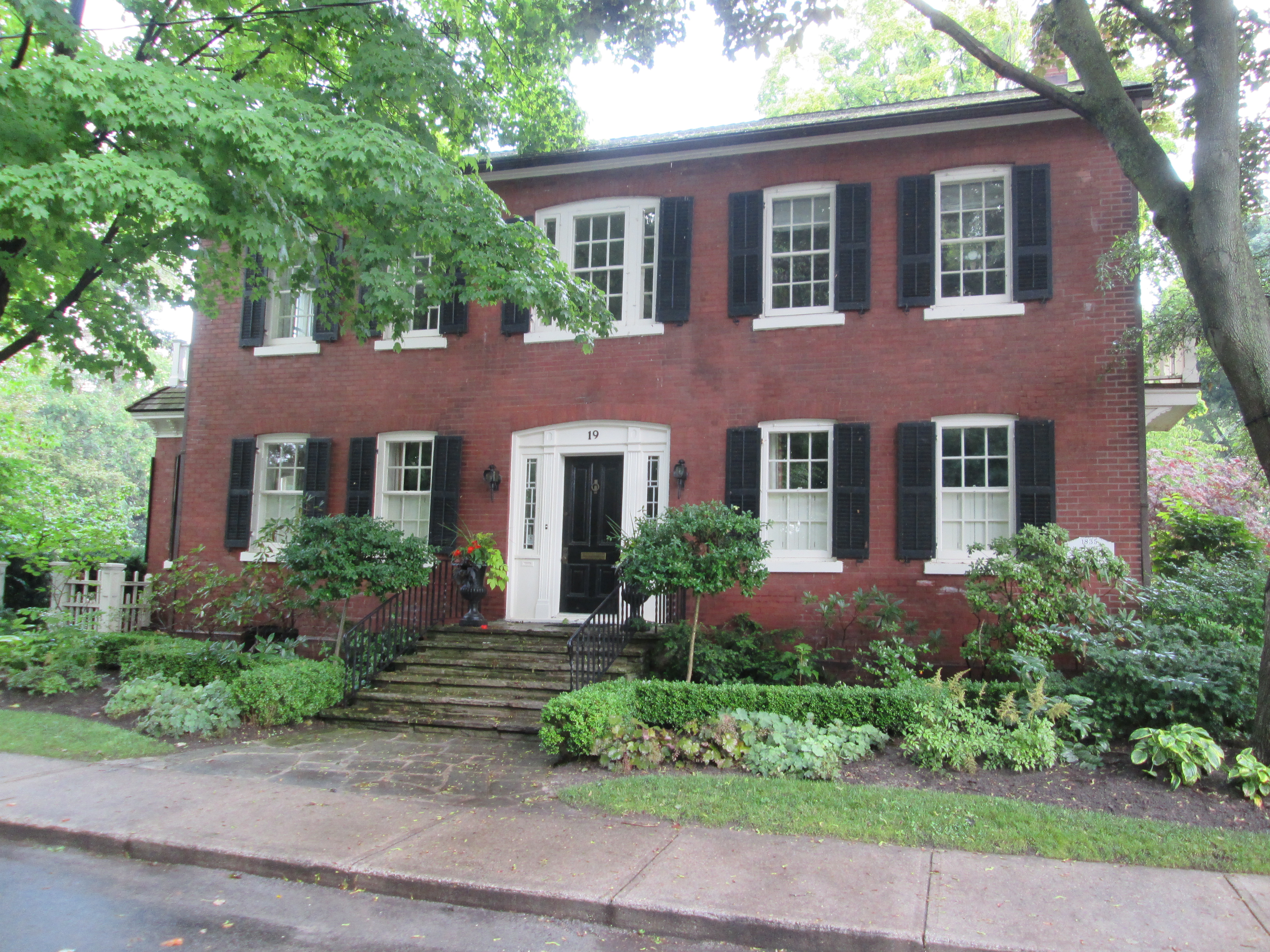
The Barbour house, dated 1889, is on Orangeville Street and is one of half a dozen houses in town which are dated in the 1880’s and 90’s on a diamond shape date stone.  These were built by Alexander Hyndman whose own 1879 house stands beside the Christian Church.

IMG_0128

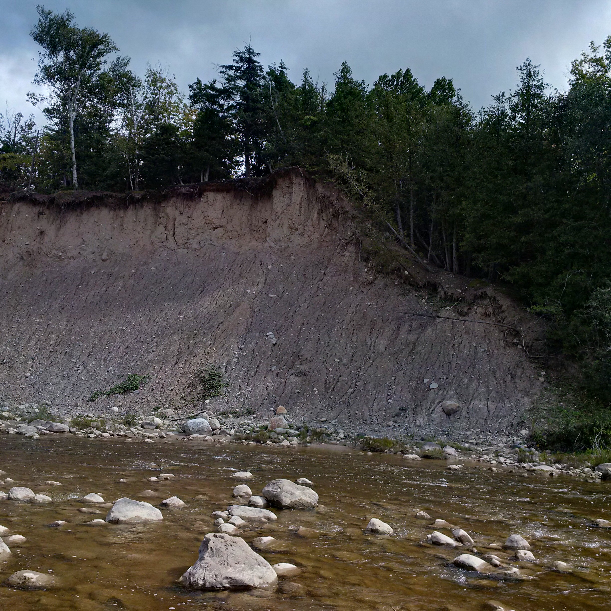
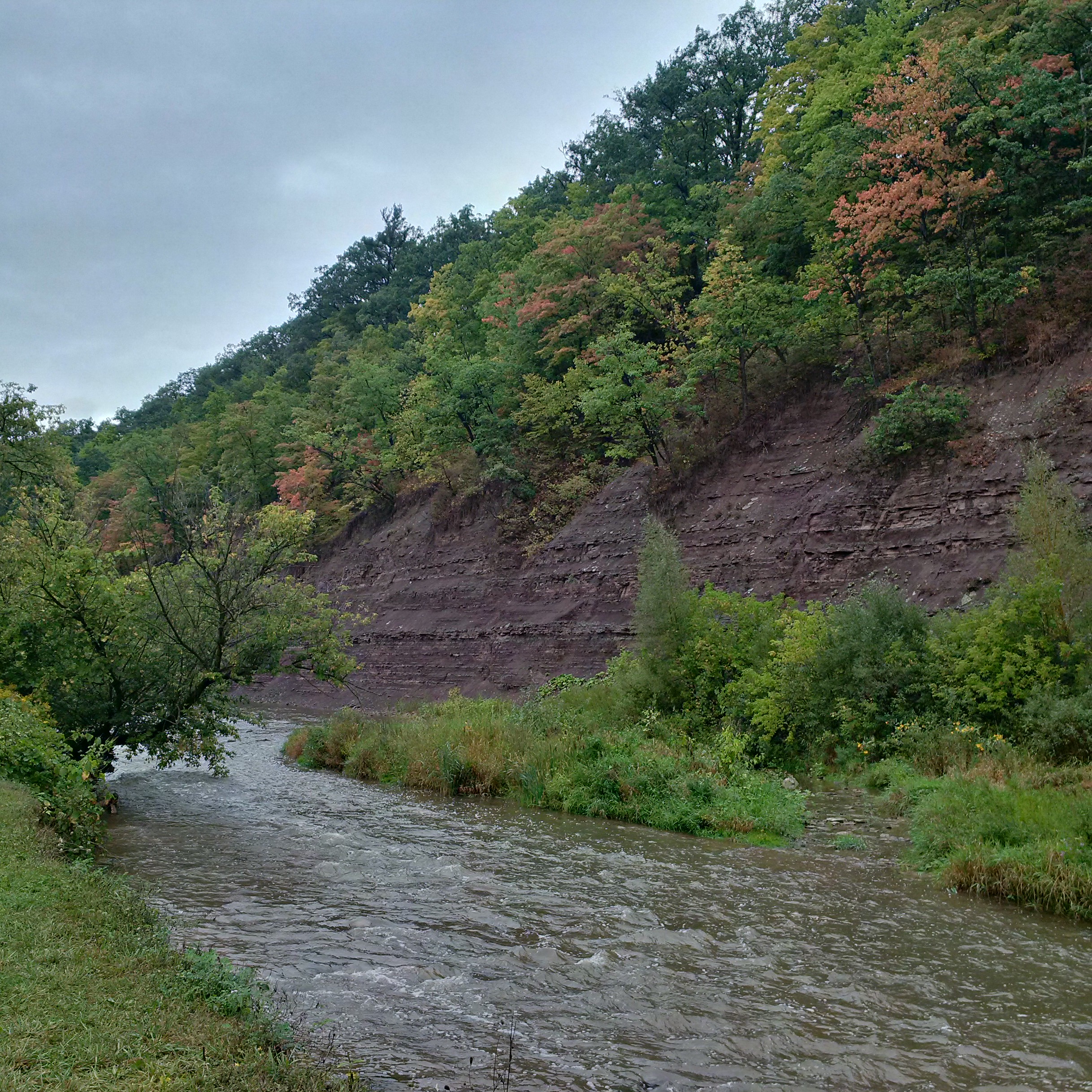
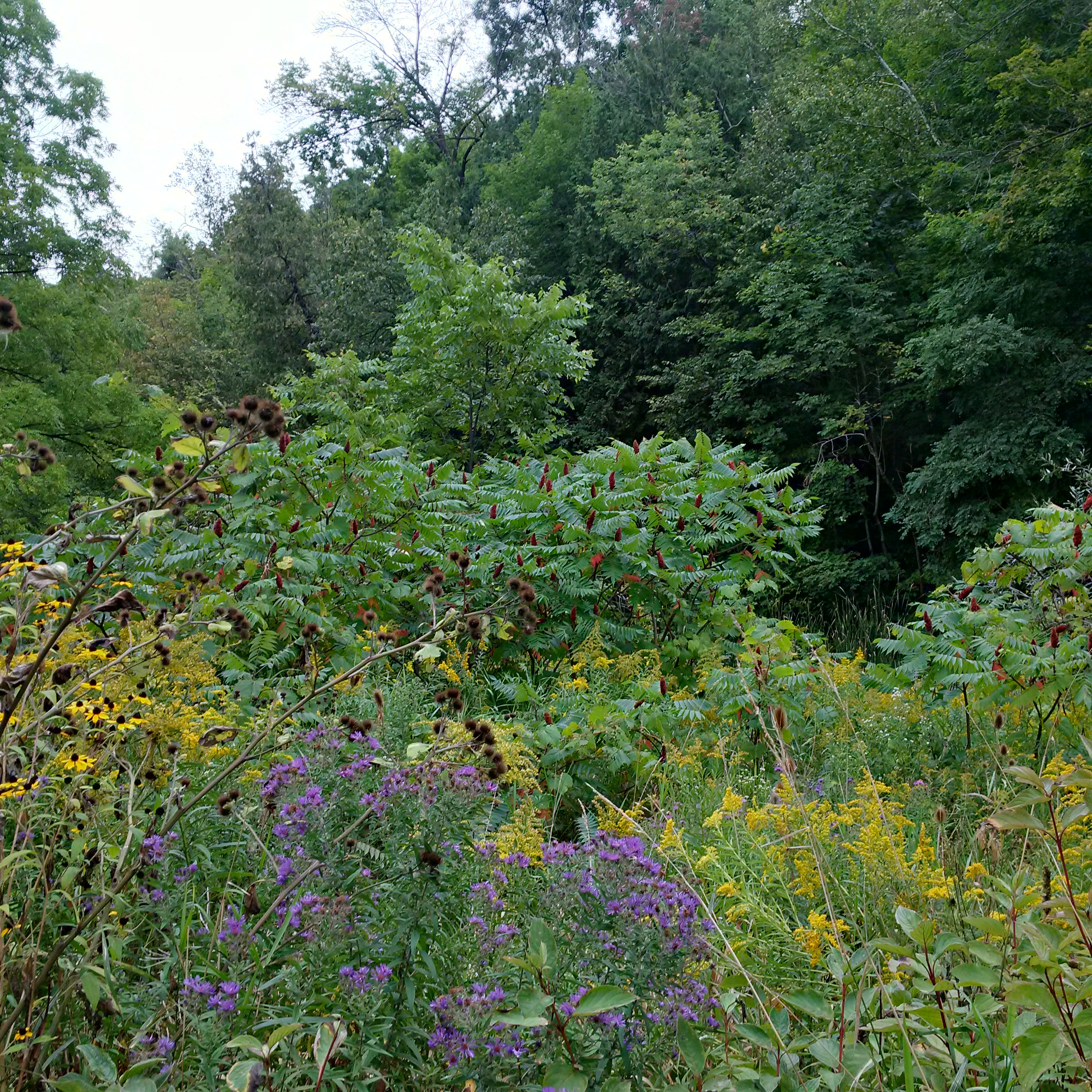
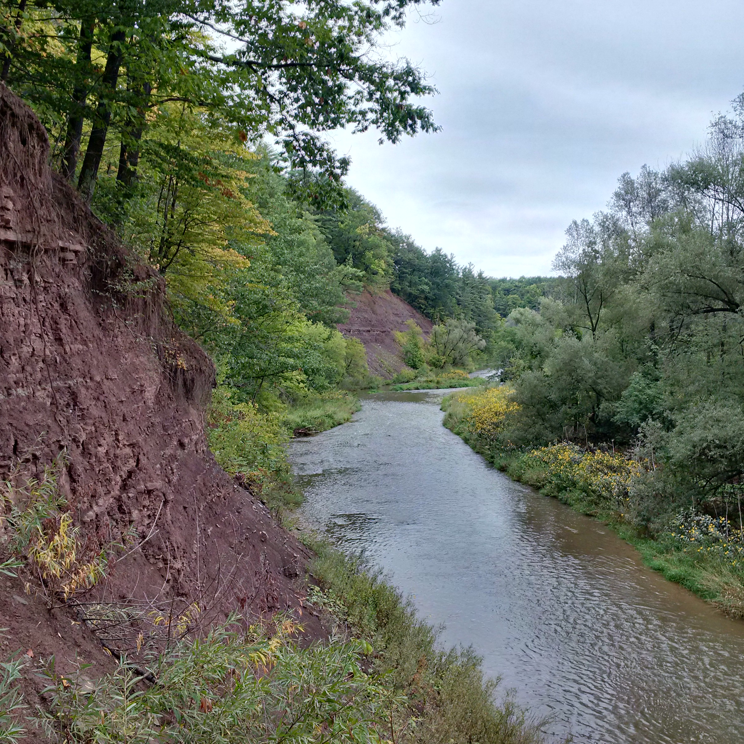
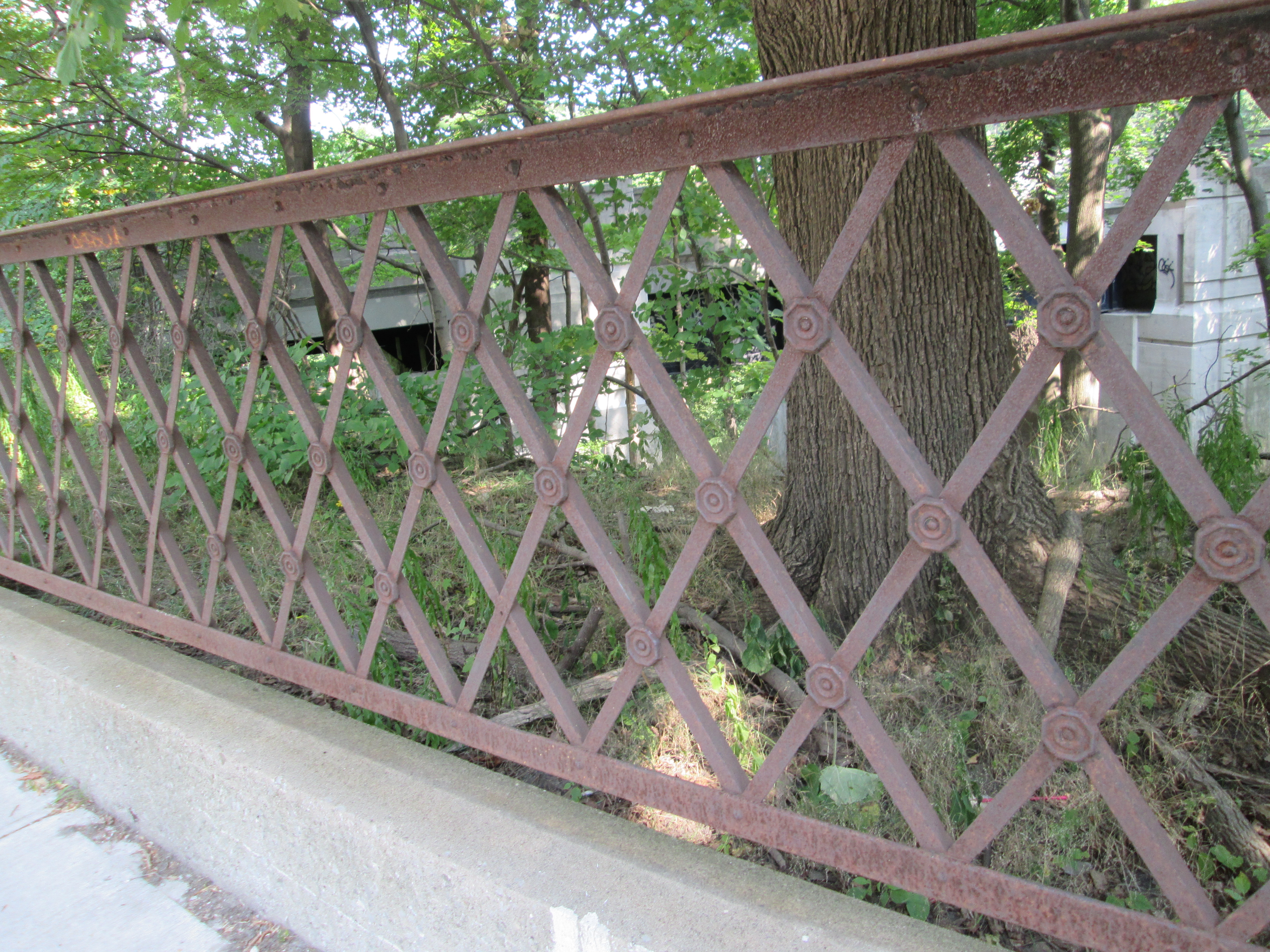
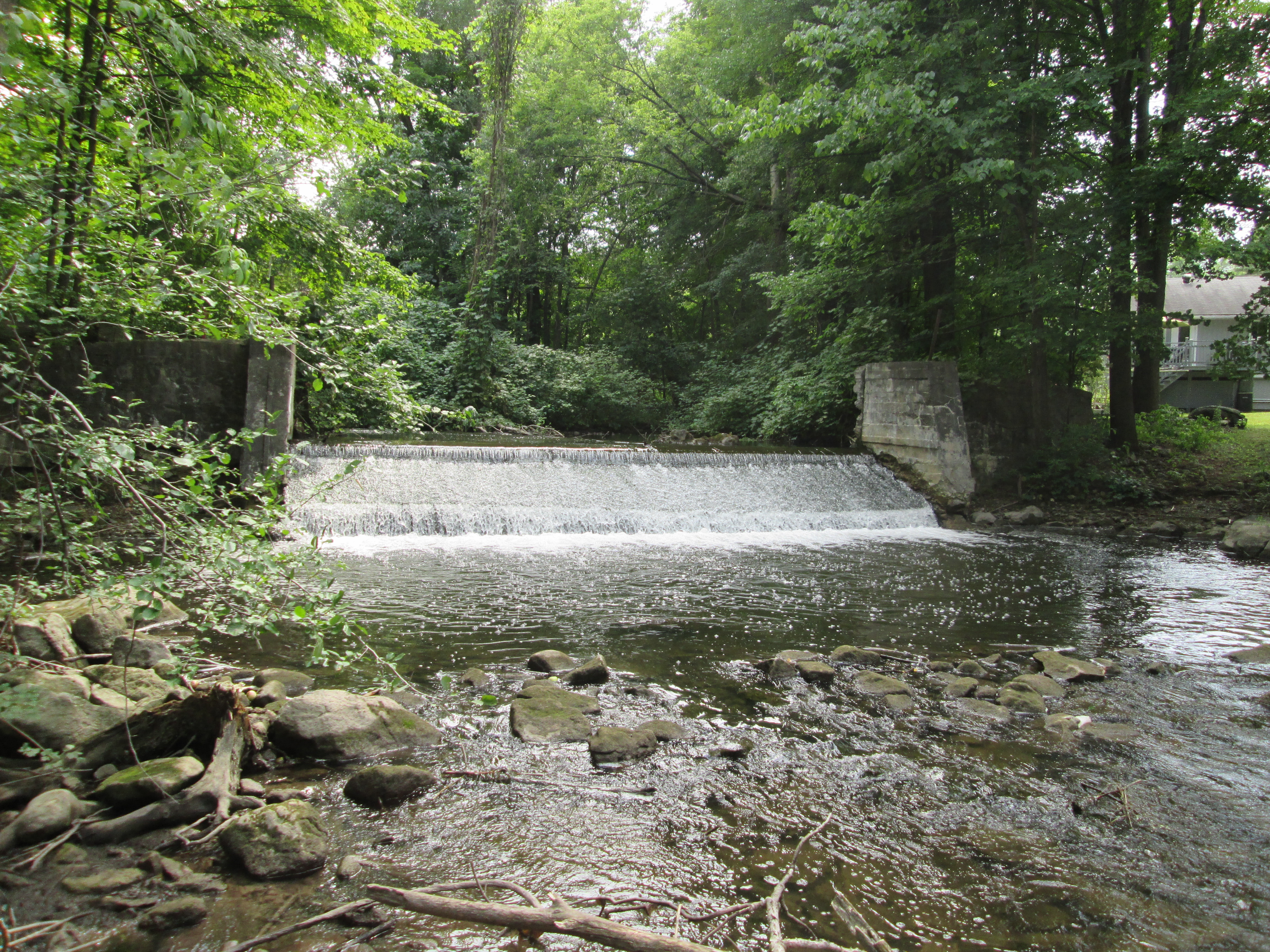
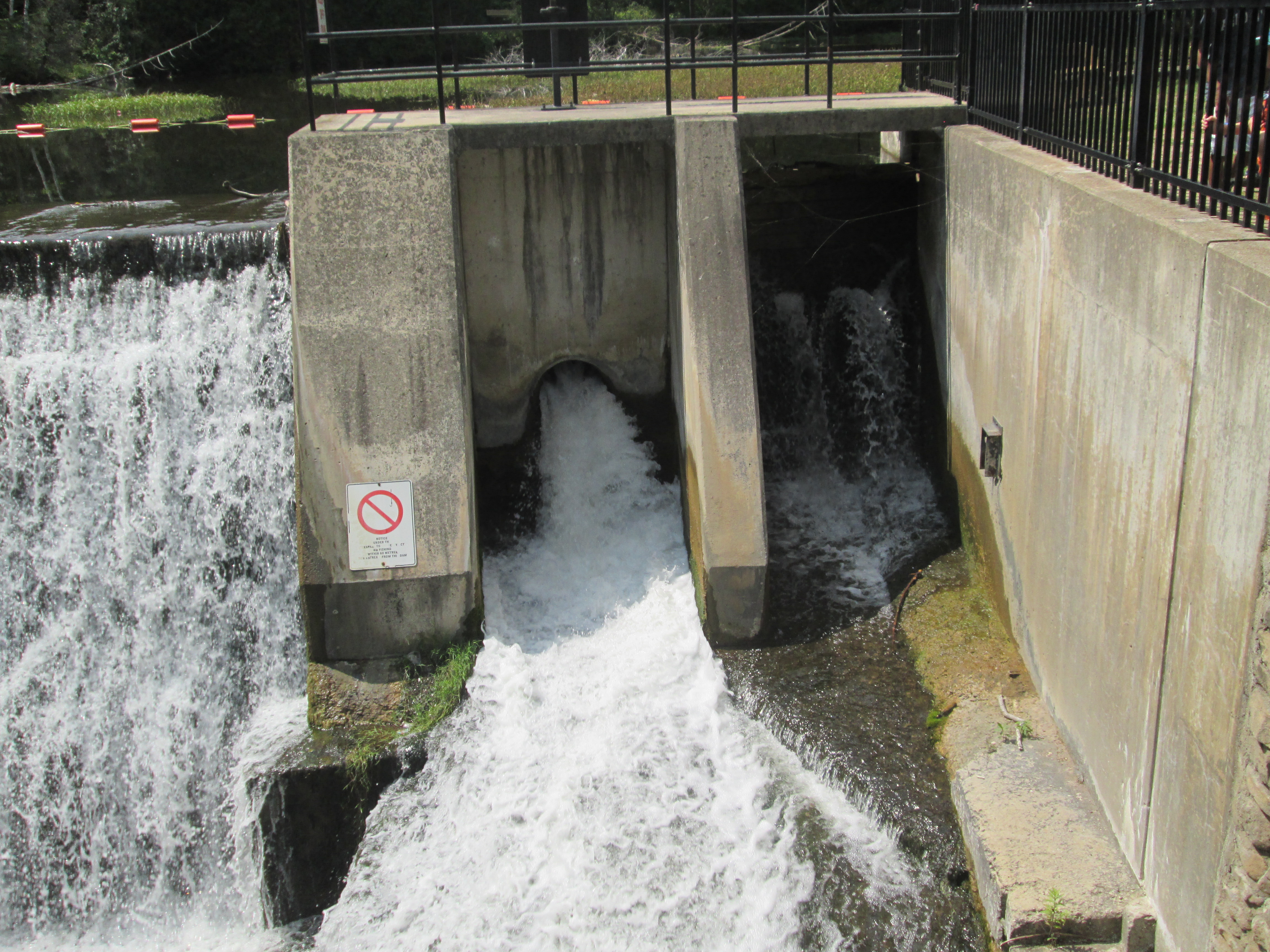
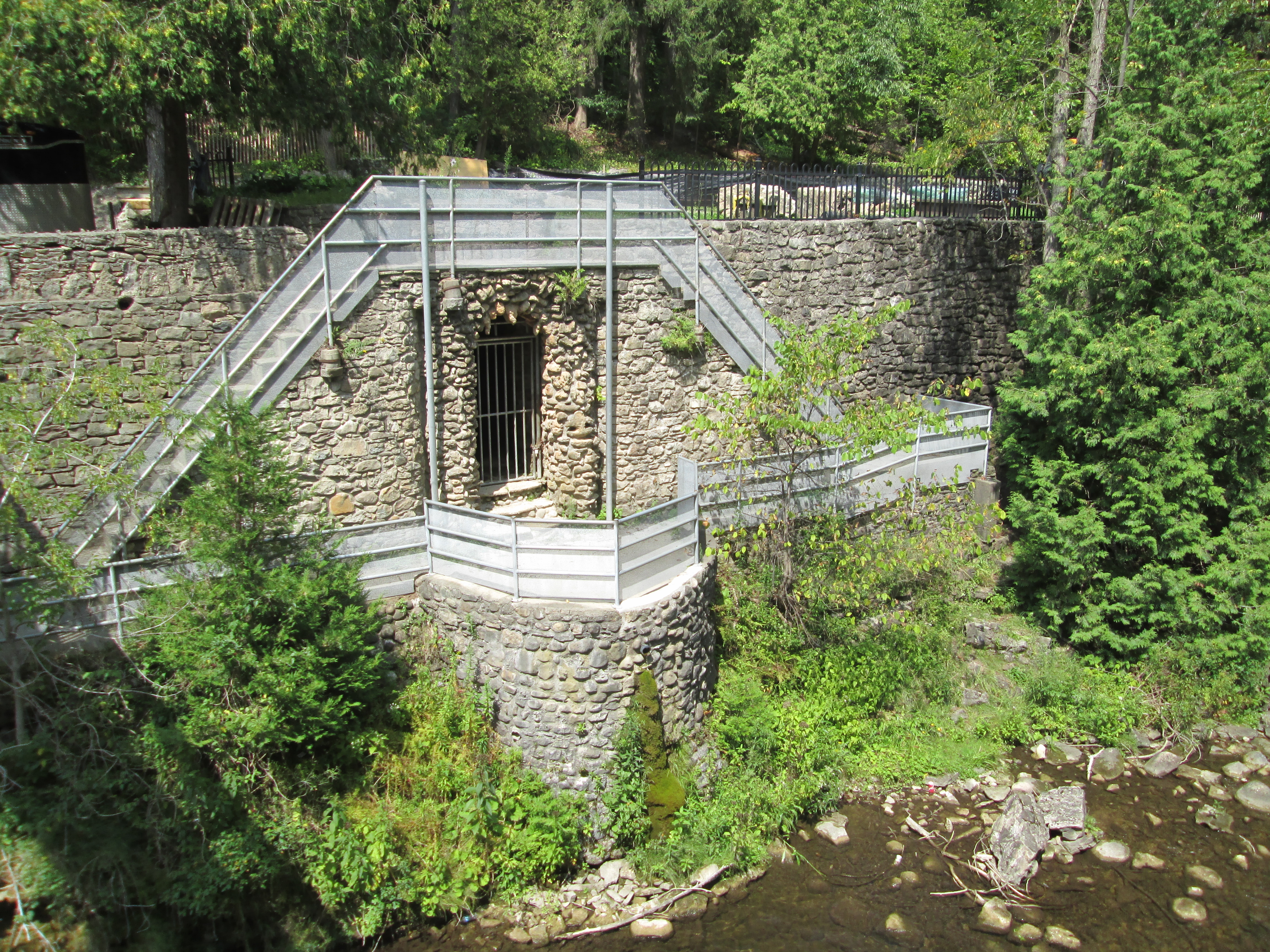
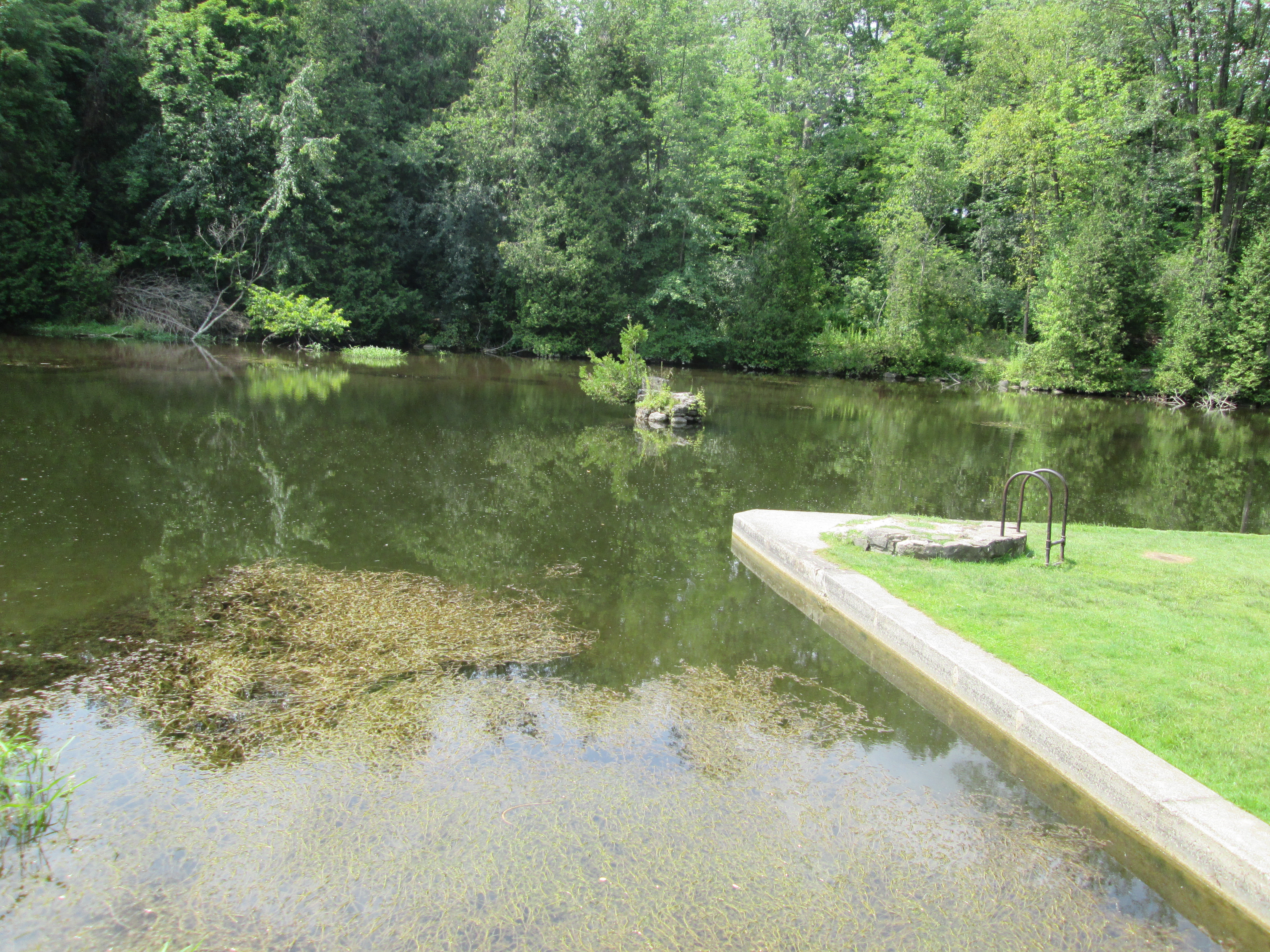
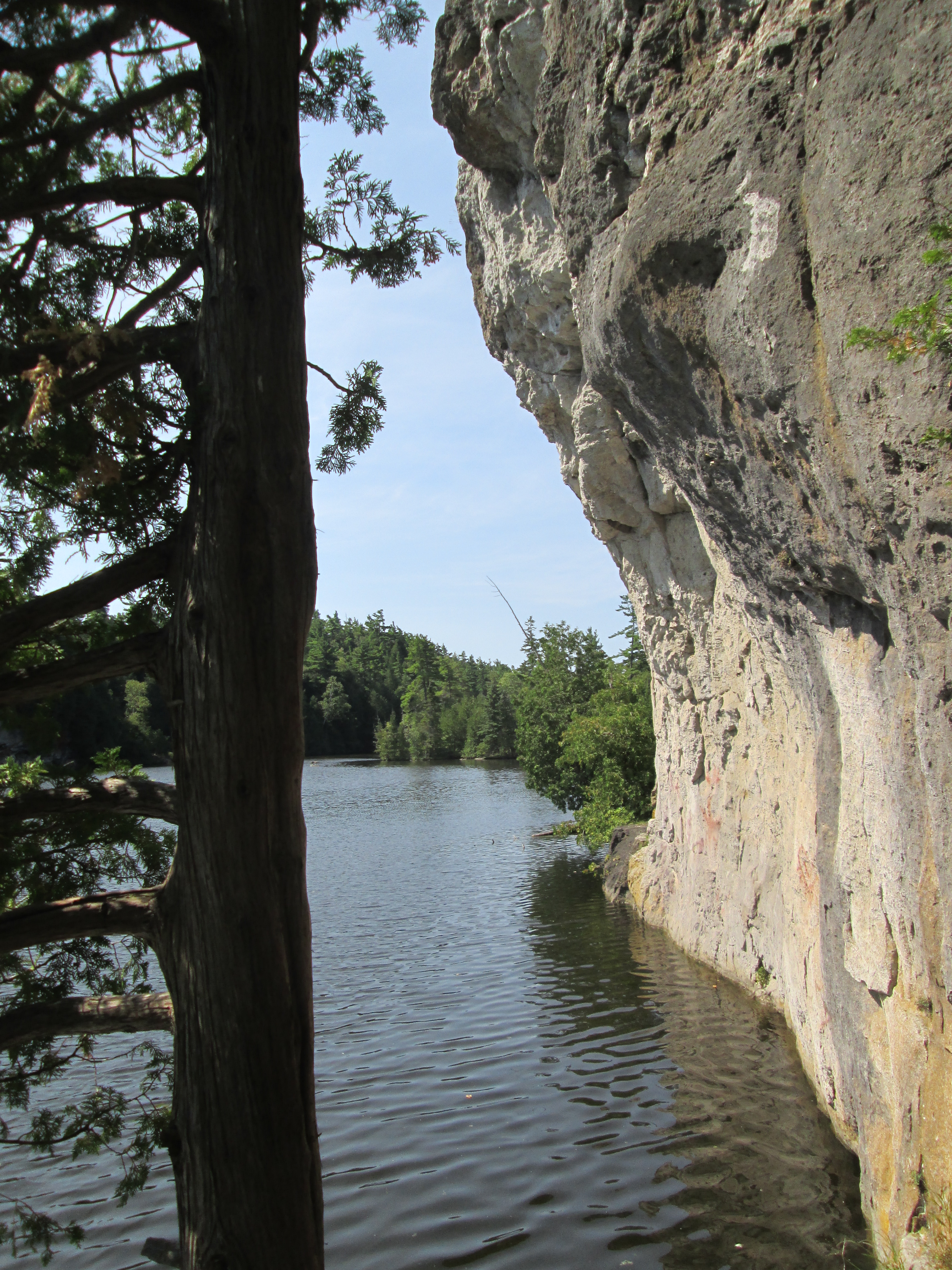
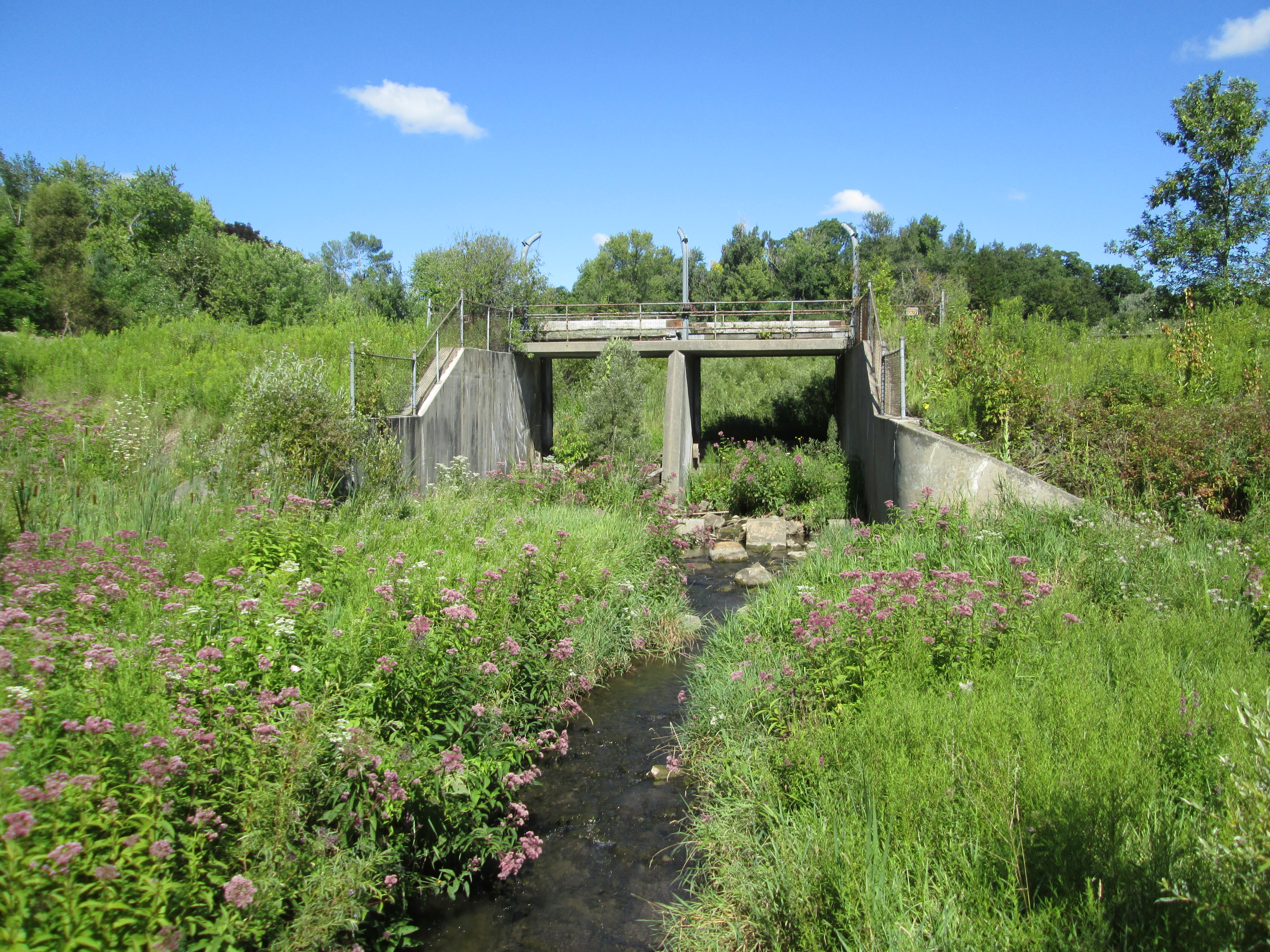
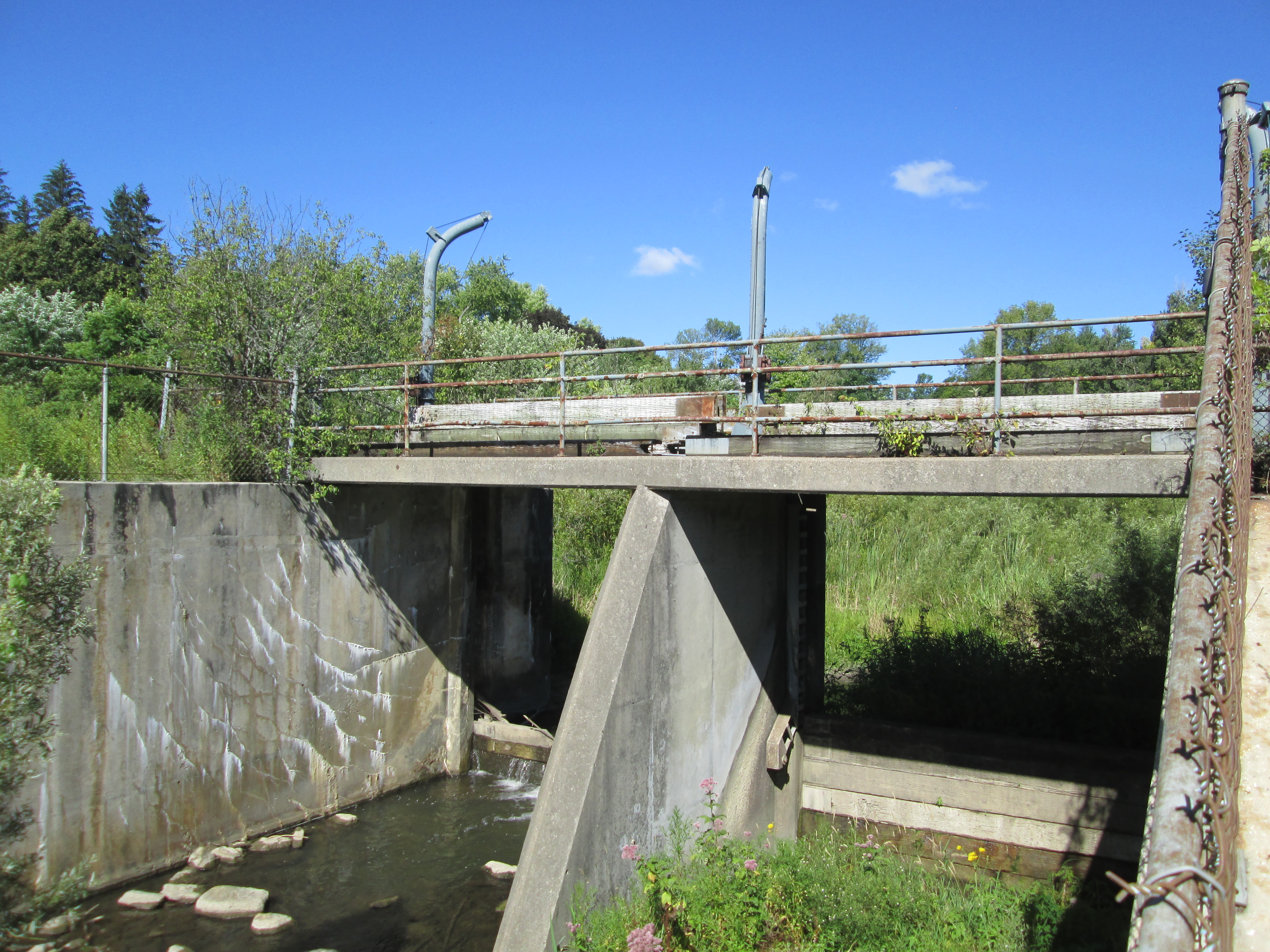
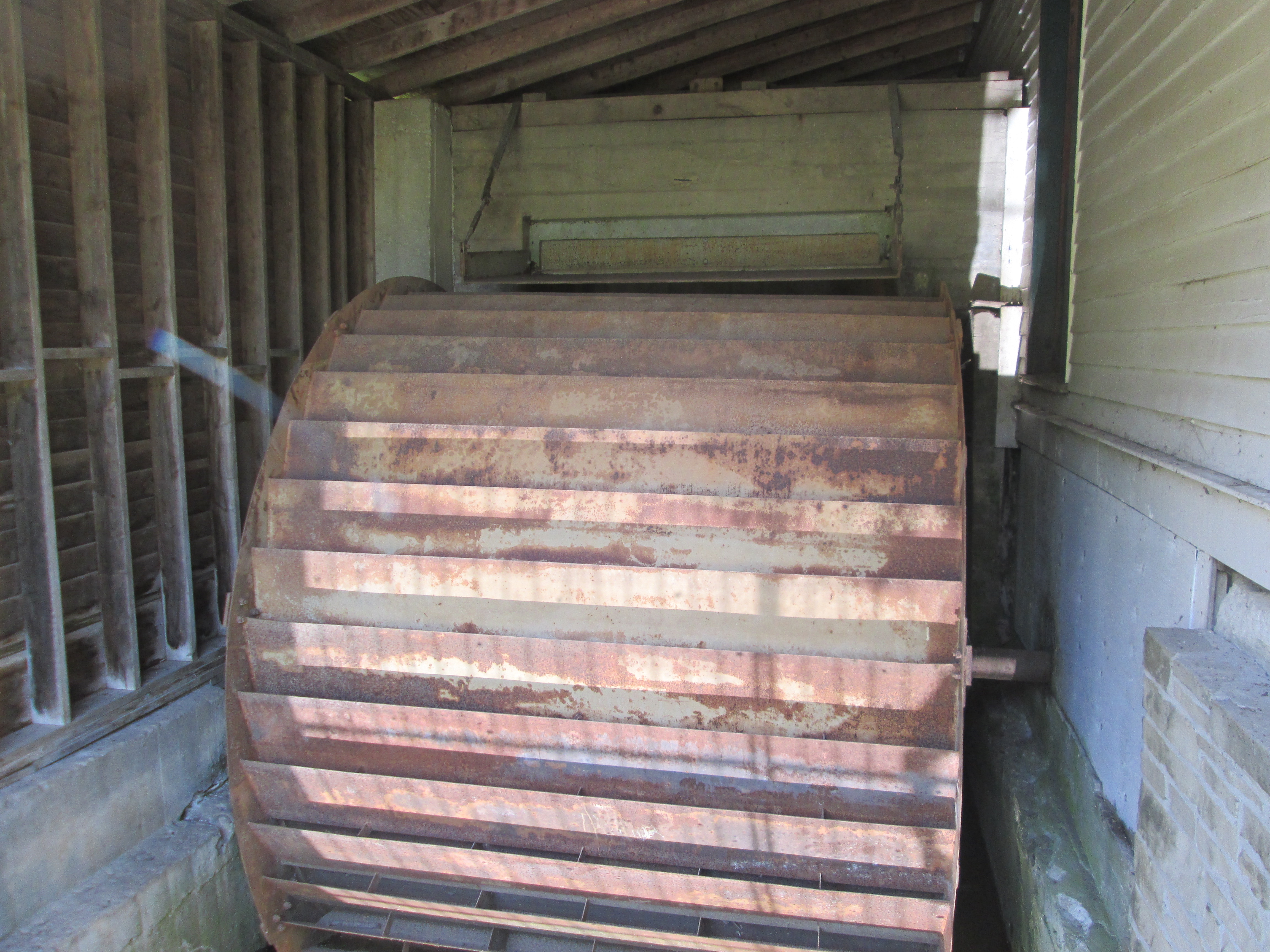
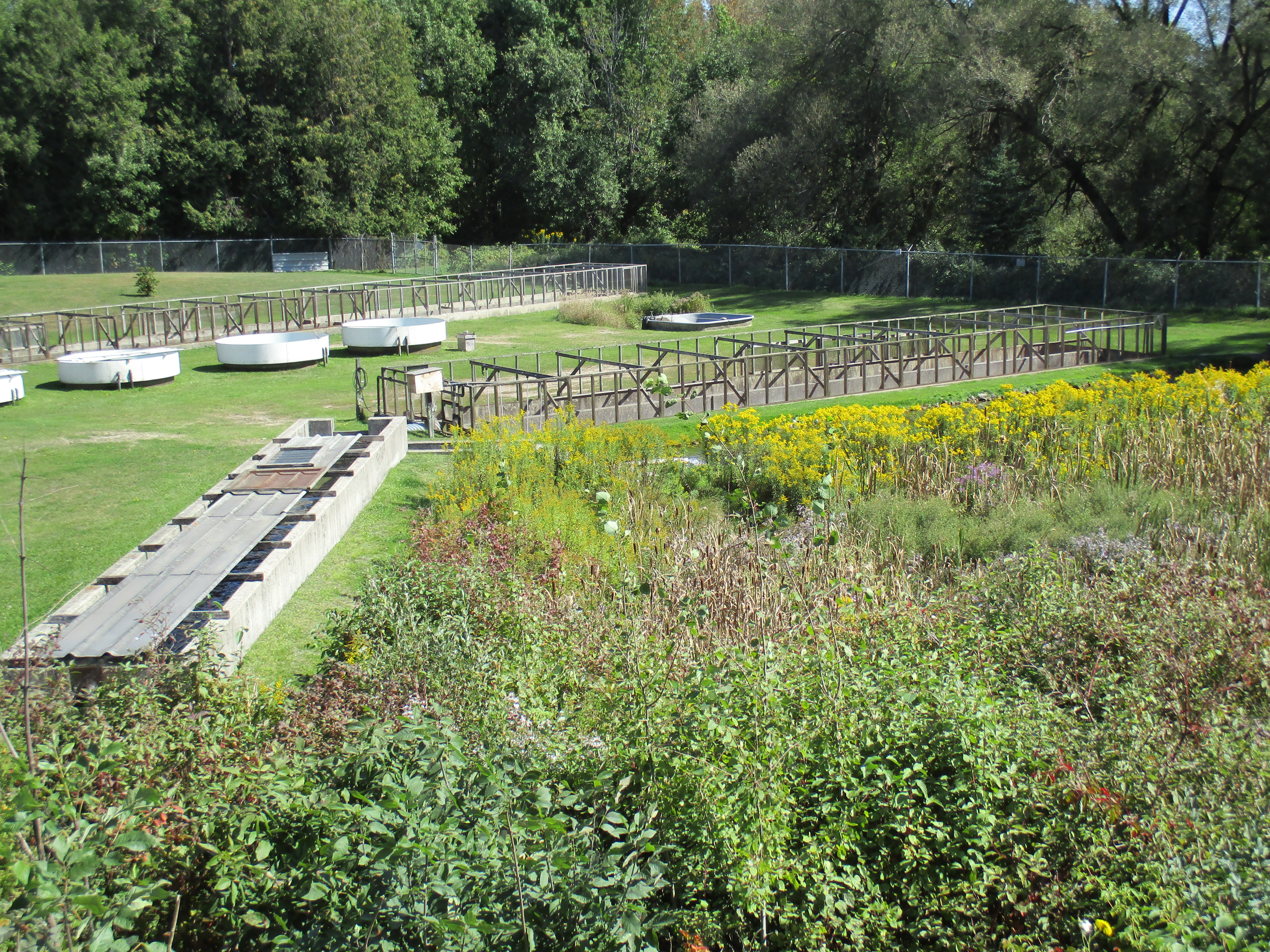
On the south east corner of the 8th line and 27th side road lies one of the headwaters of the Credit River.  In 1906 this property belonged to the Caledon Trout Club and later was a fish hatchery.  From here the water flows through Hillsburgh’s three existing ponds and into the Credit River.  A little boat dropped in this trickle of water could eventually emerge in Lake Ontario at Port Credit beside the much larger ship The Ridgetown.

IMG_0127

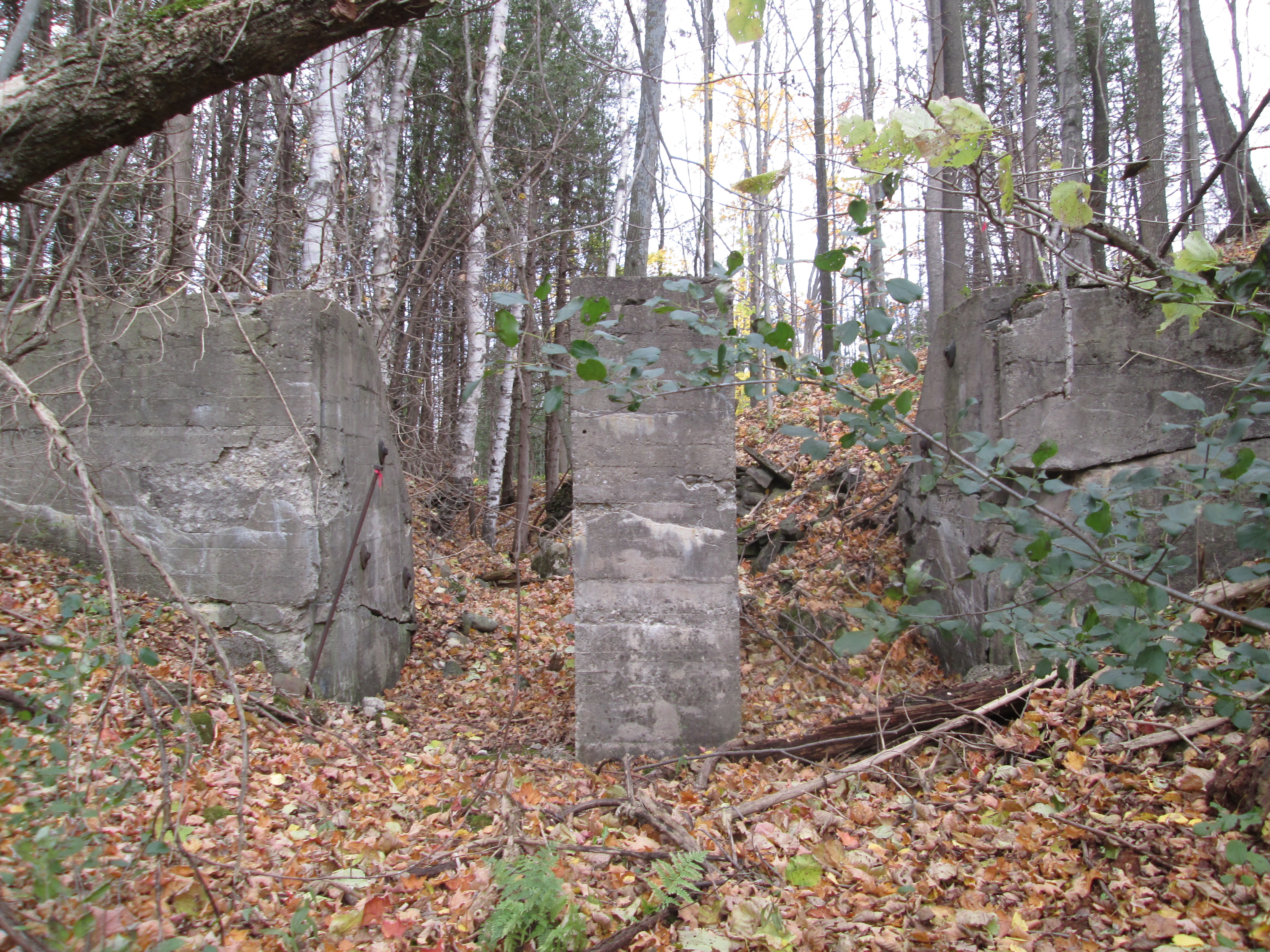
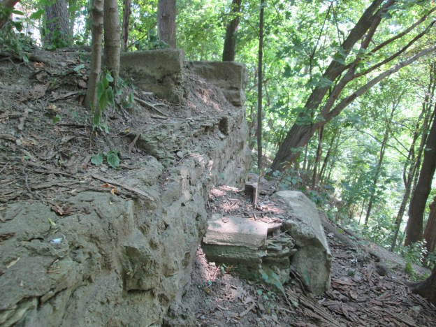
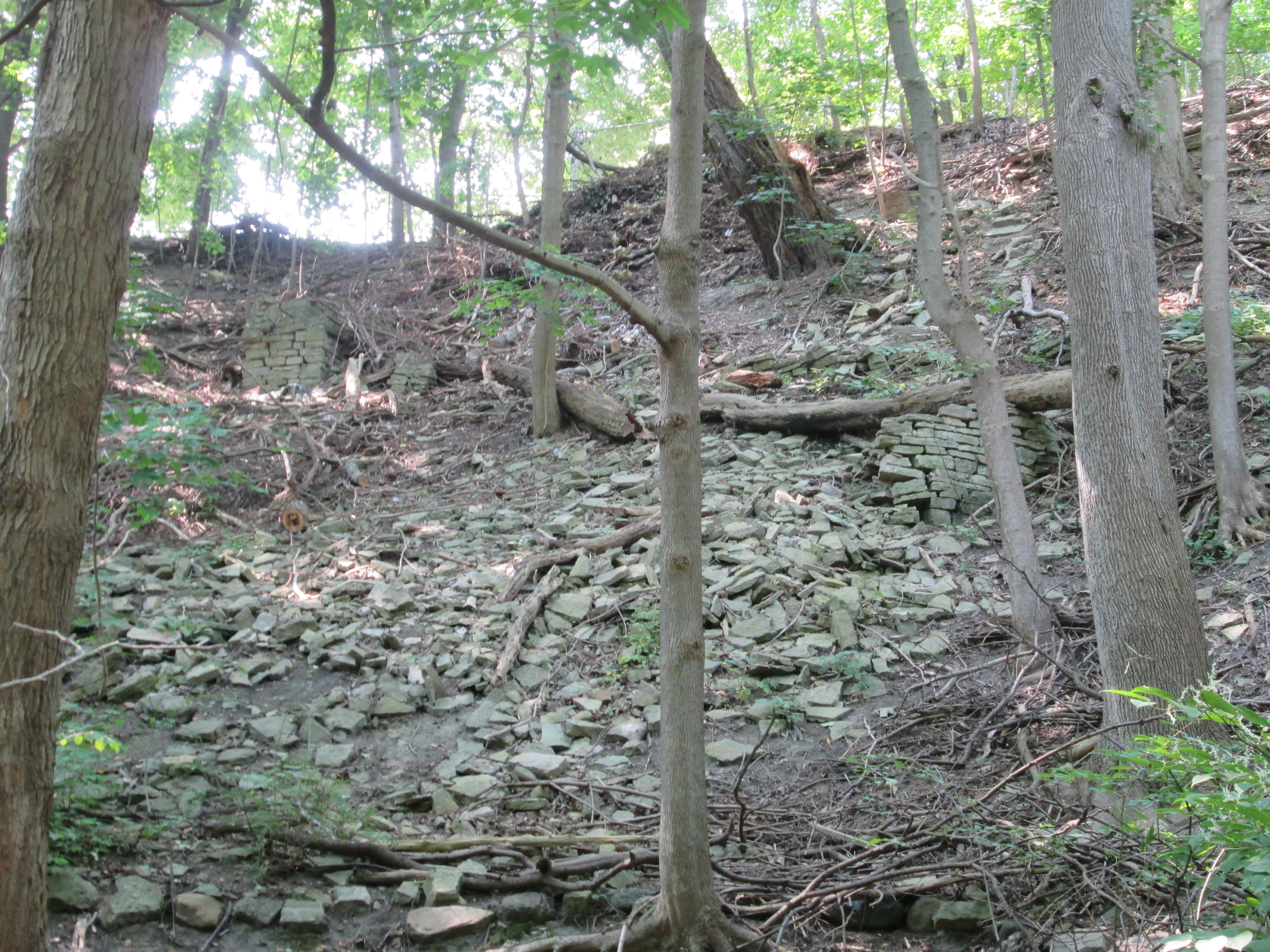
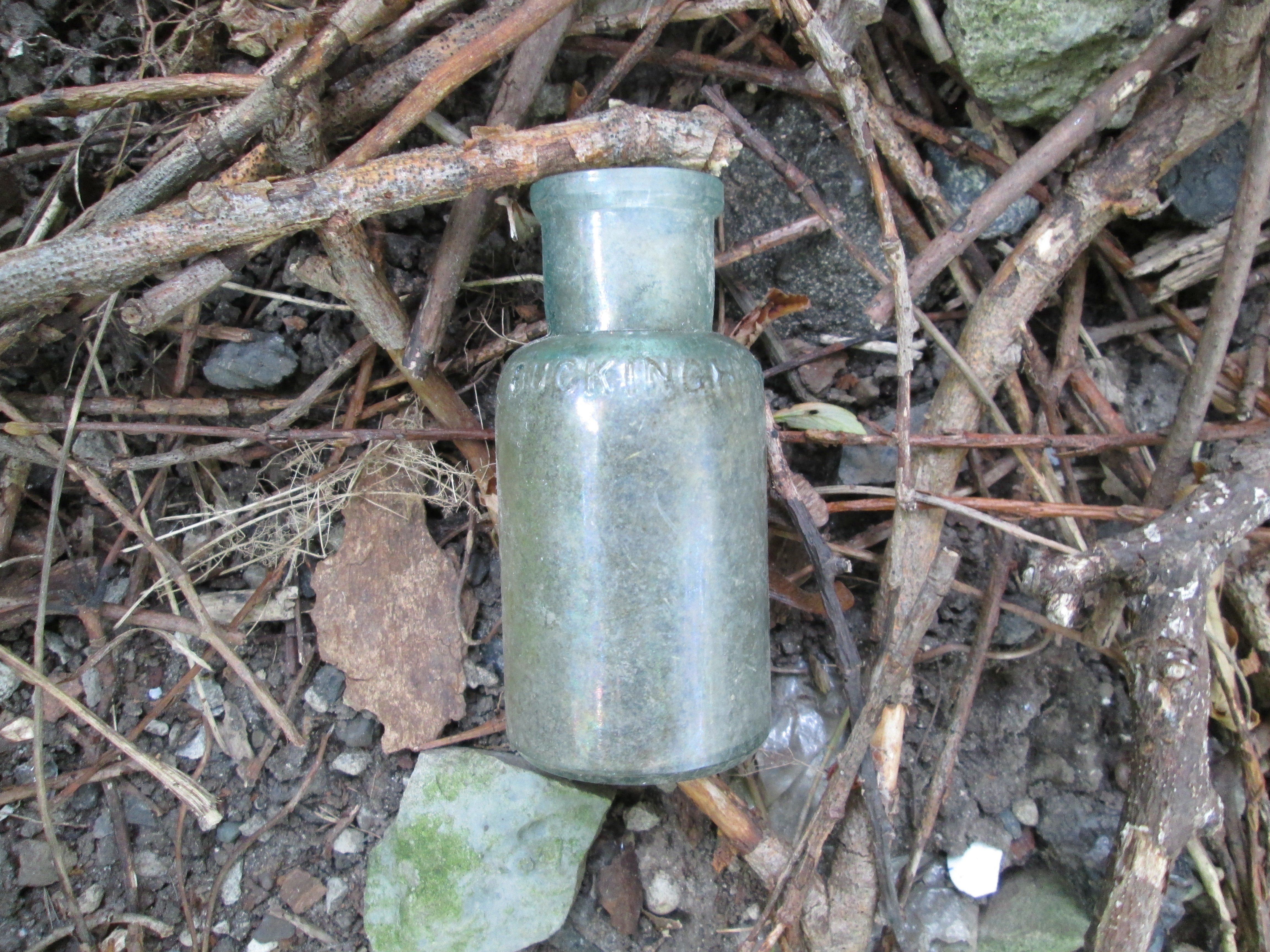
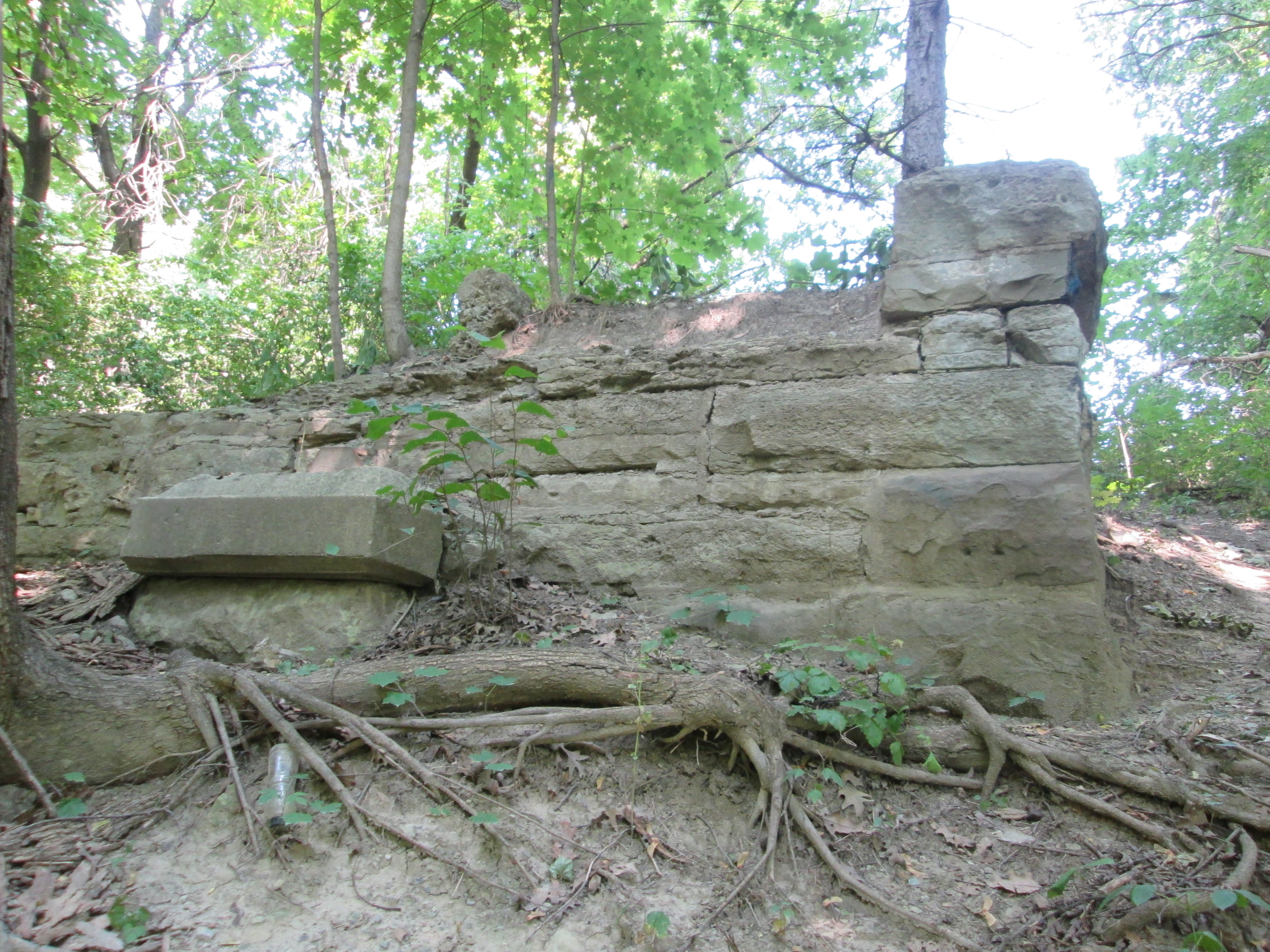
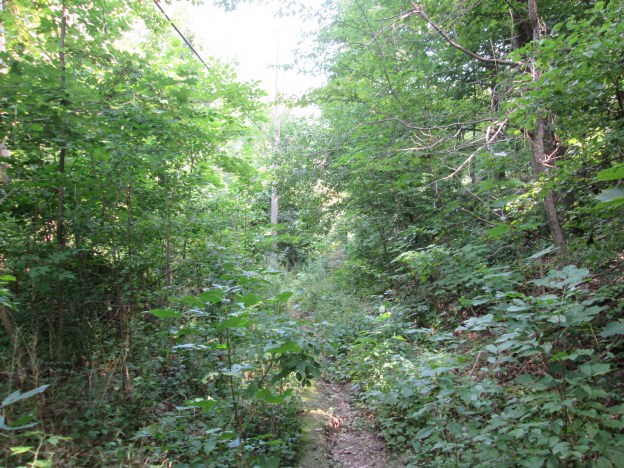
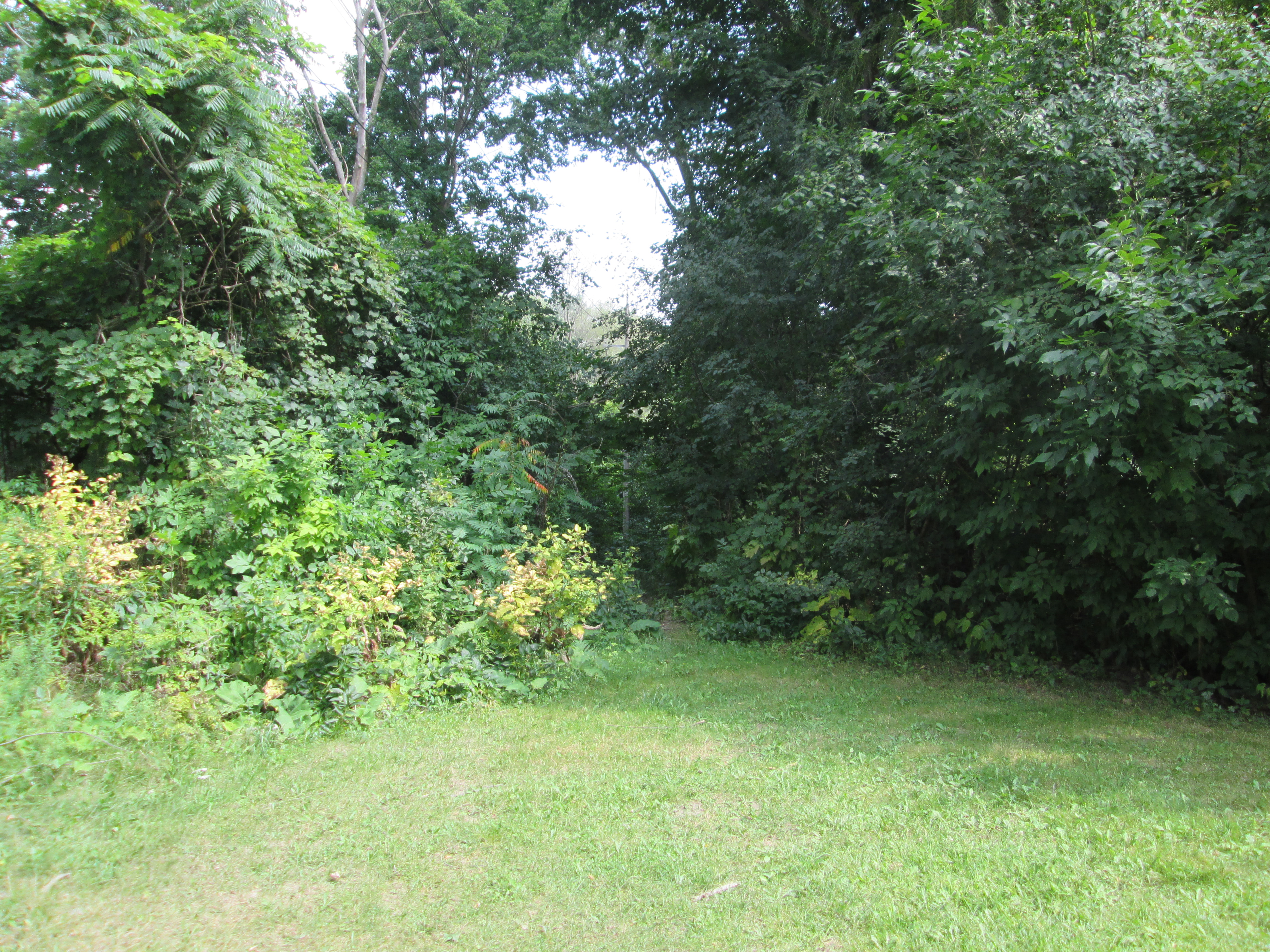
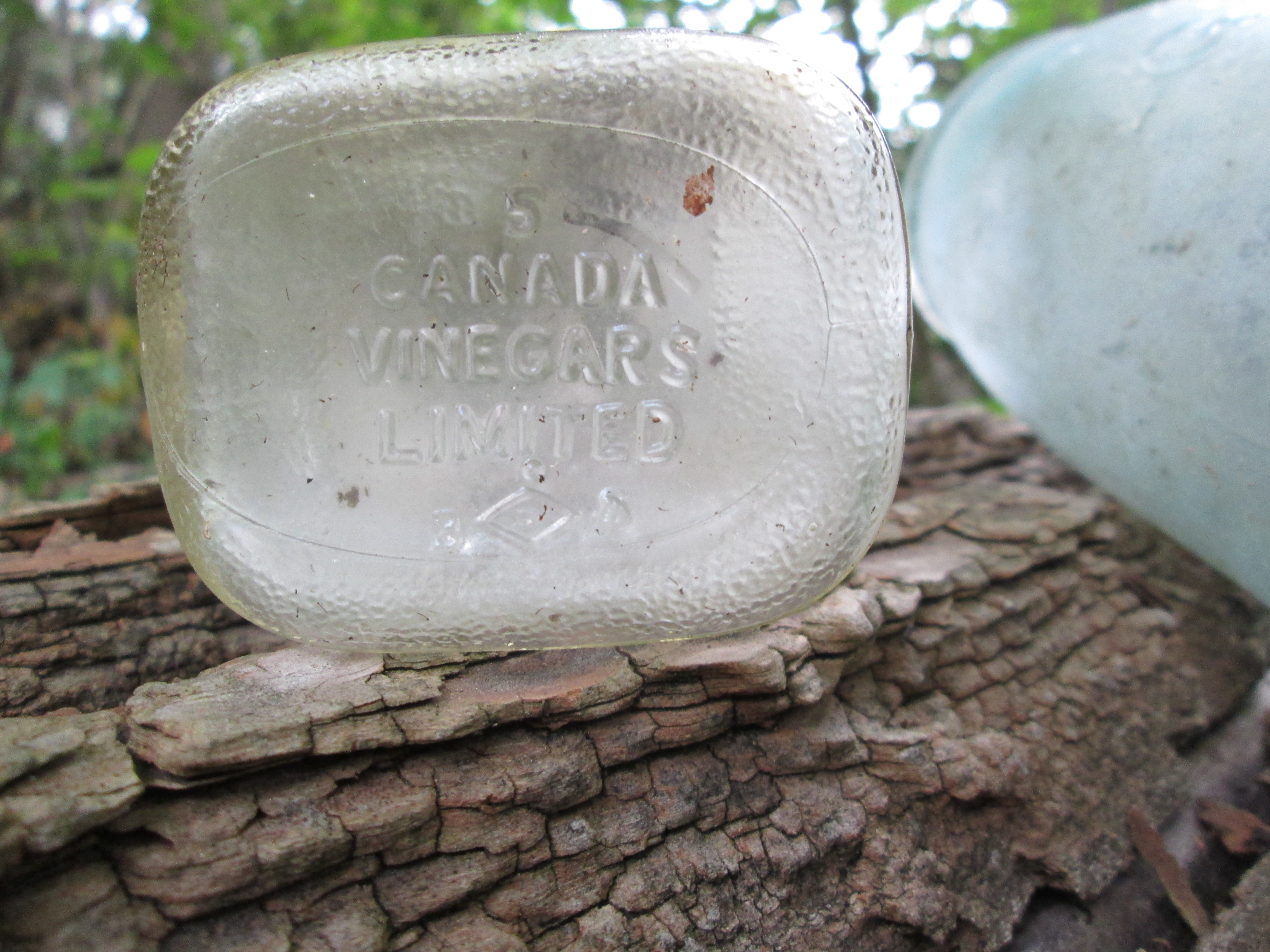
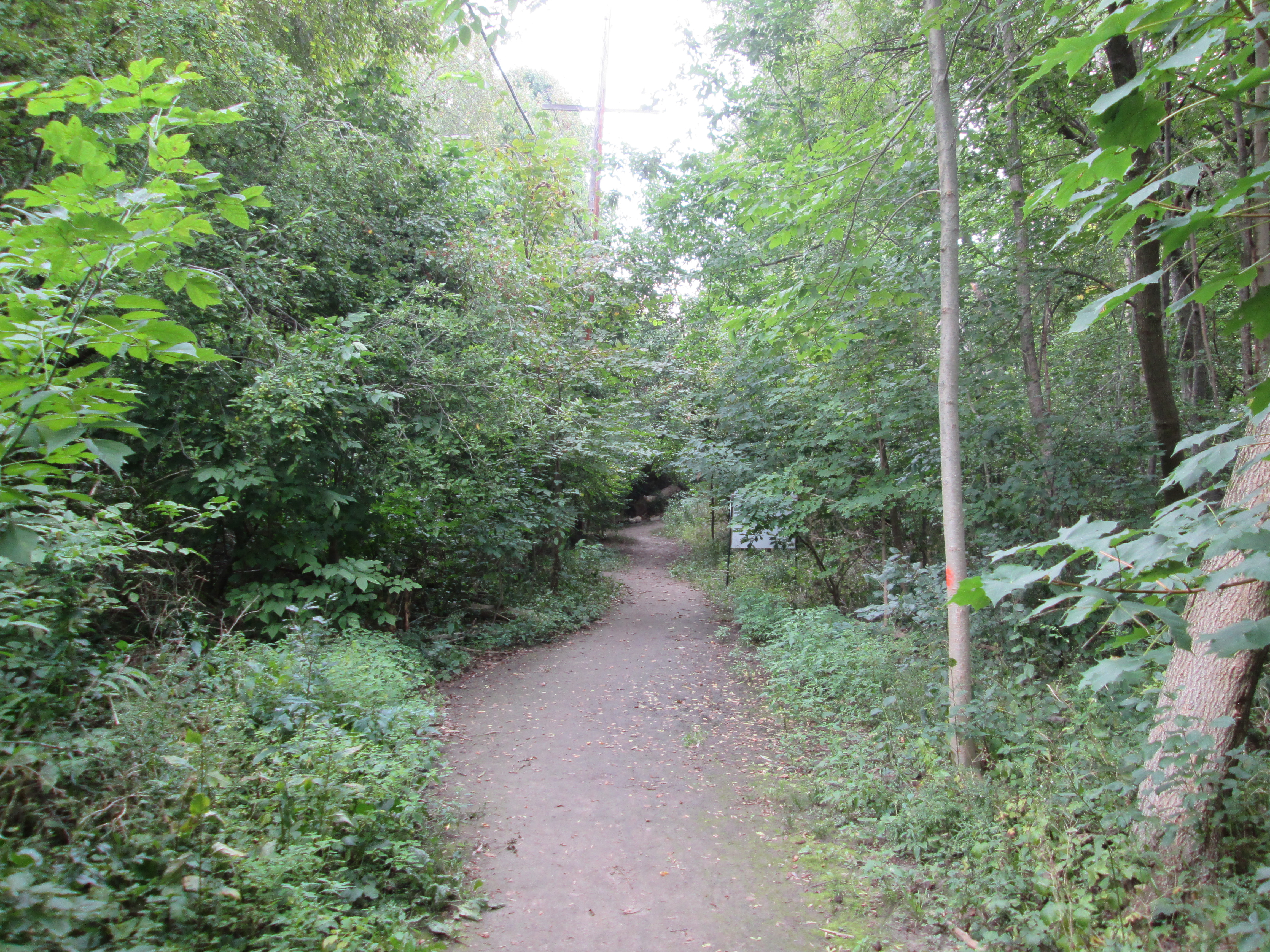
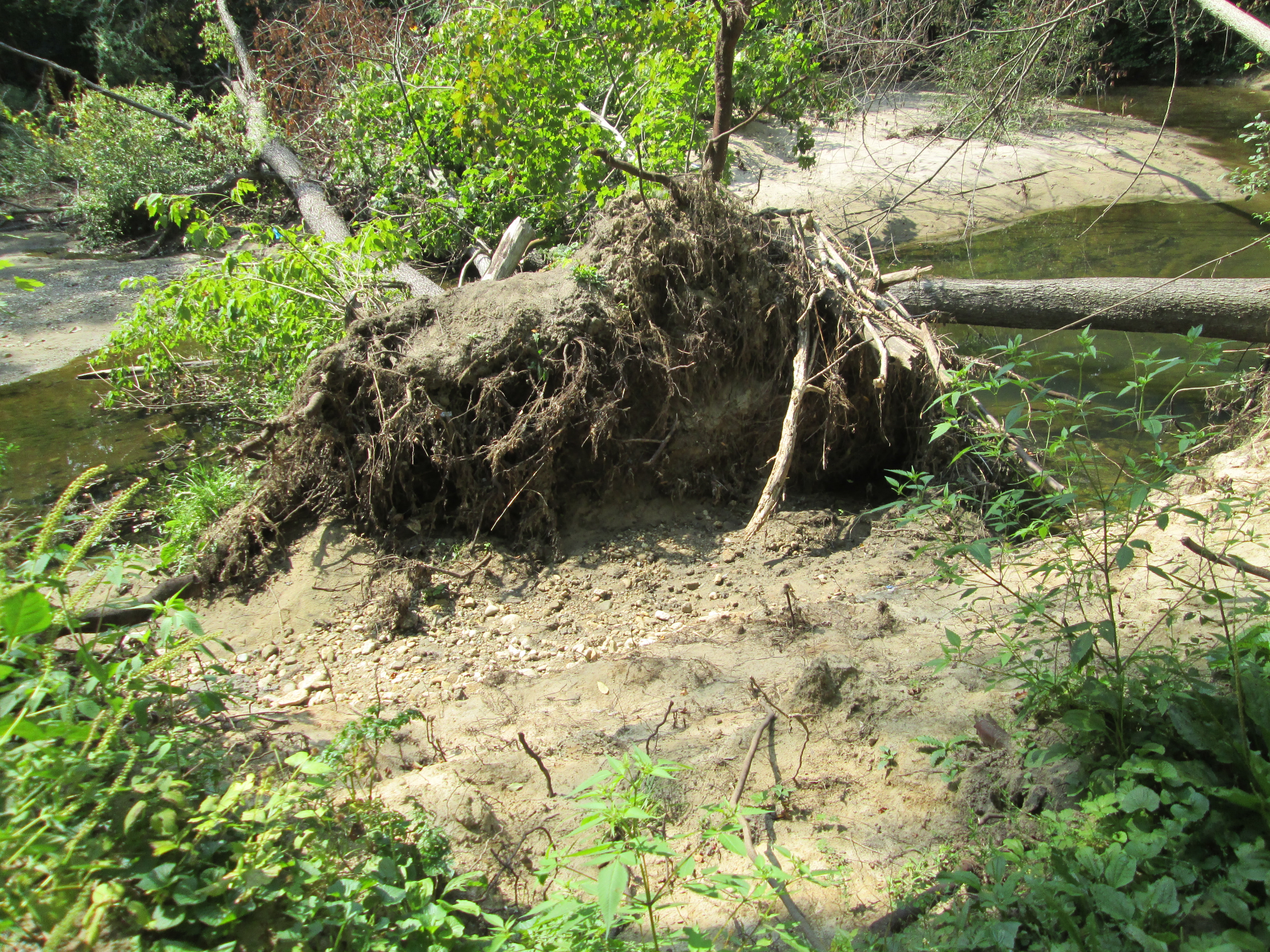
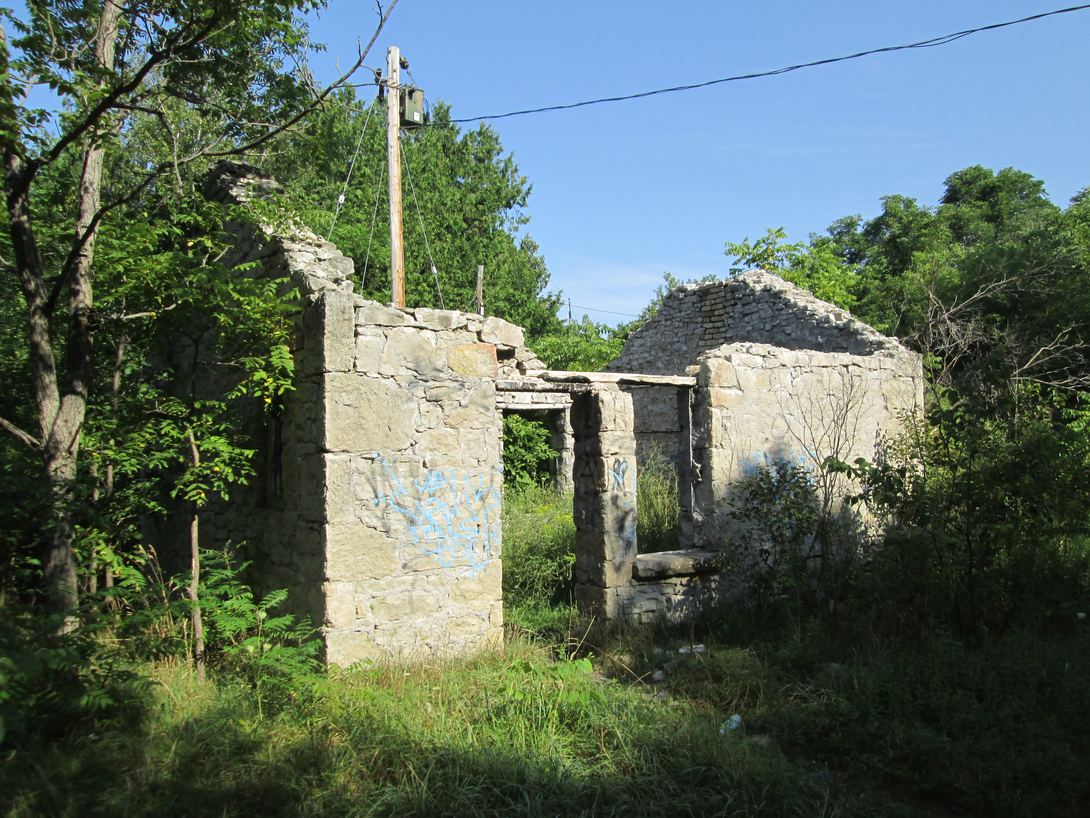
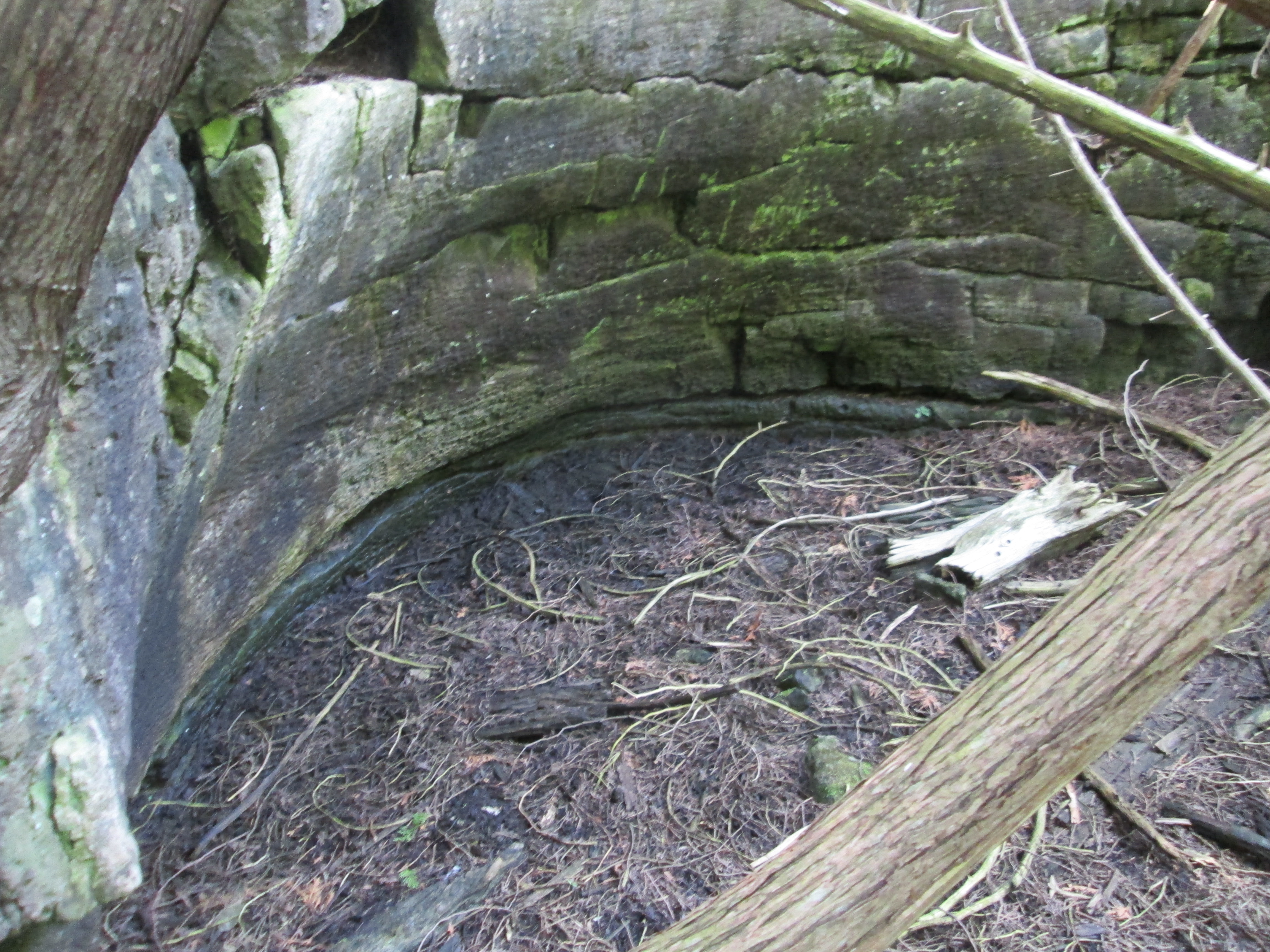
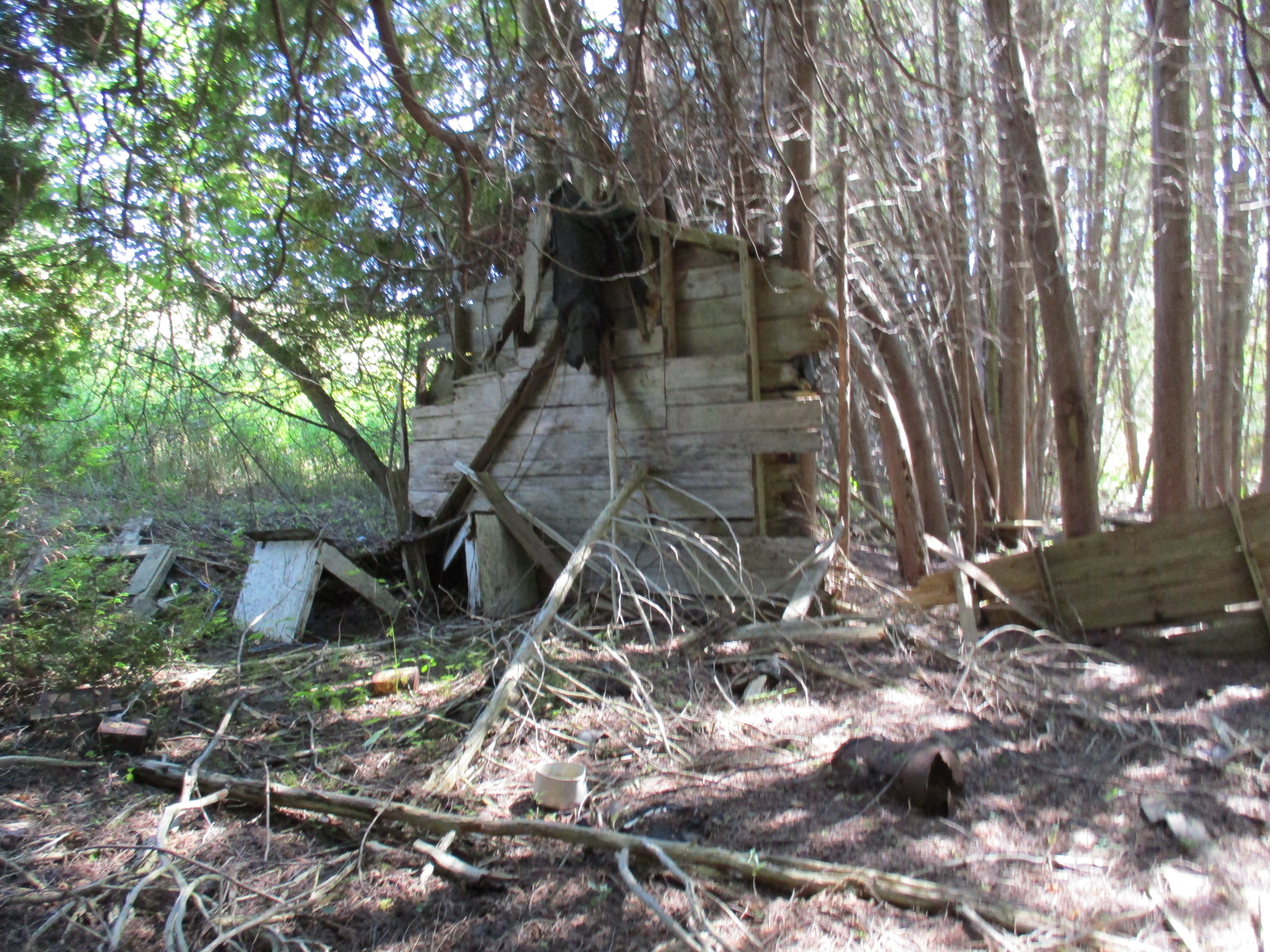
Leaving town on the 7th line there are two large hills.  In the hollow on lot 18 stood an old shack covered with asphalt siding.  During the early 1970’s a hermit lived in this house.  It was already in a state of decay at that time and collapsed by the middle of the decade.  Today one wall remains leaning against a tree and the rest is in advanced decay on the ground.  In good hermit fashion the property is strewn with old tin cans and empty bottles.

IMG_0137

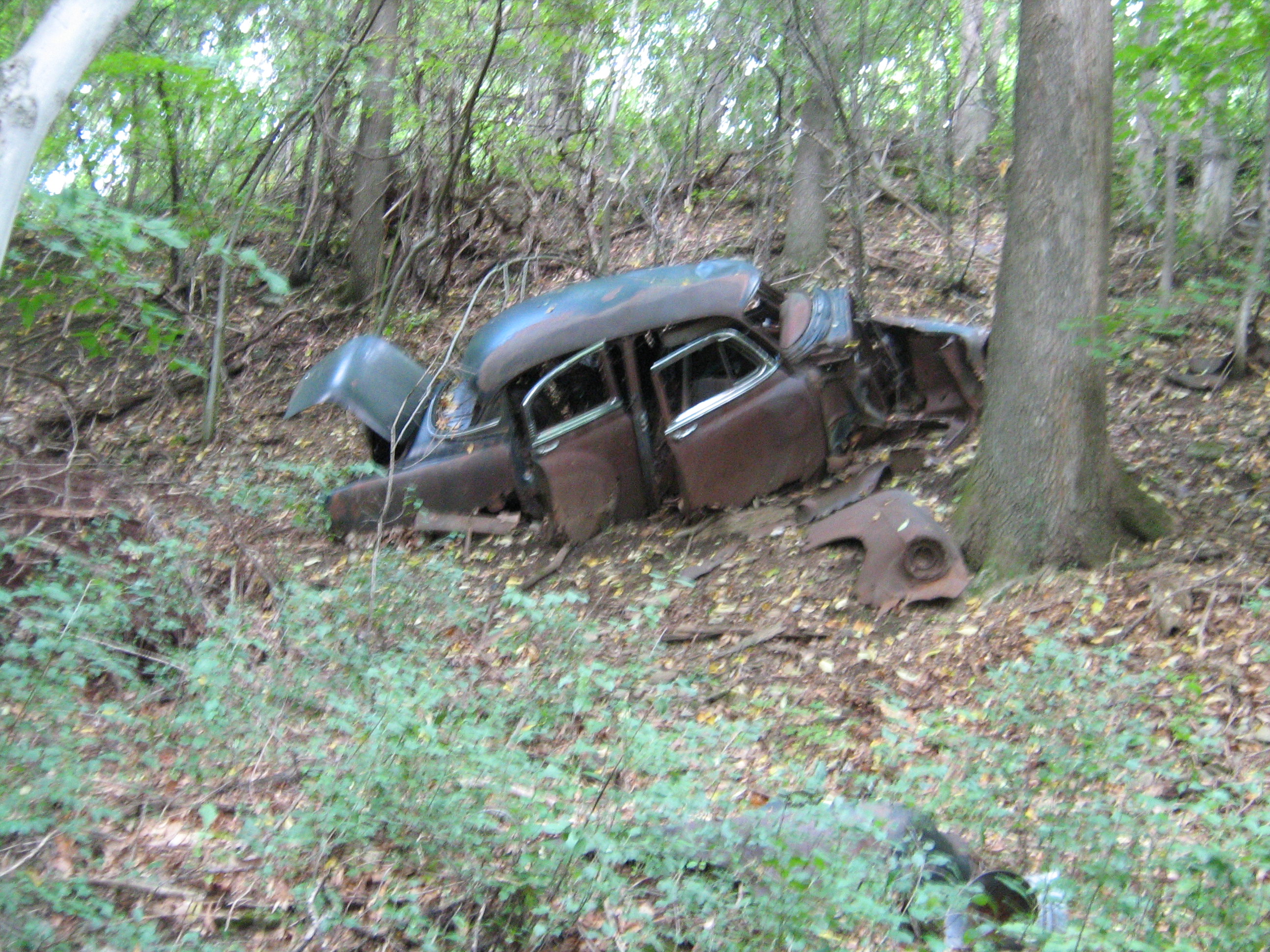
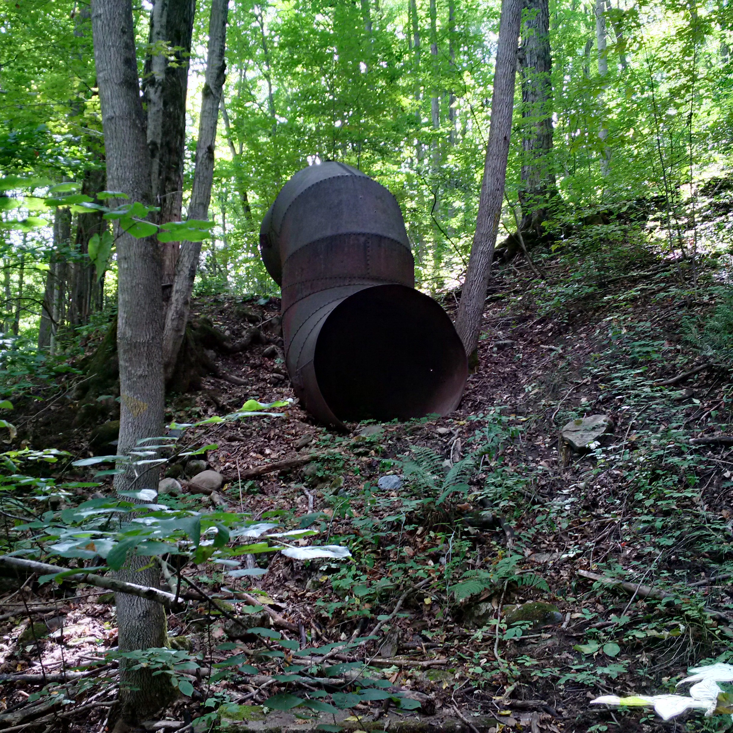
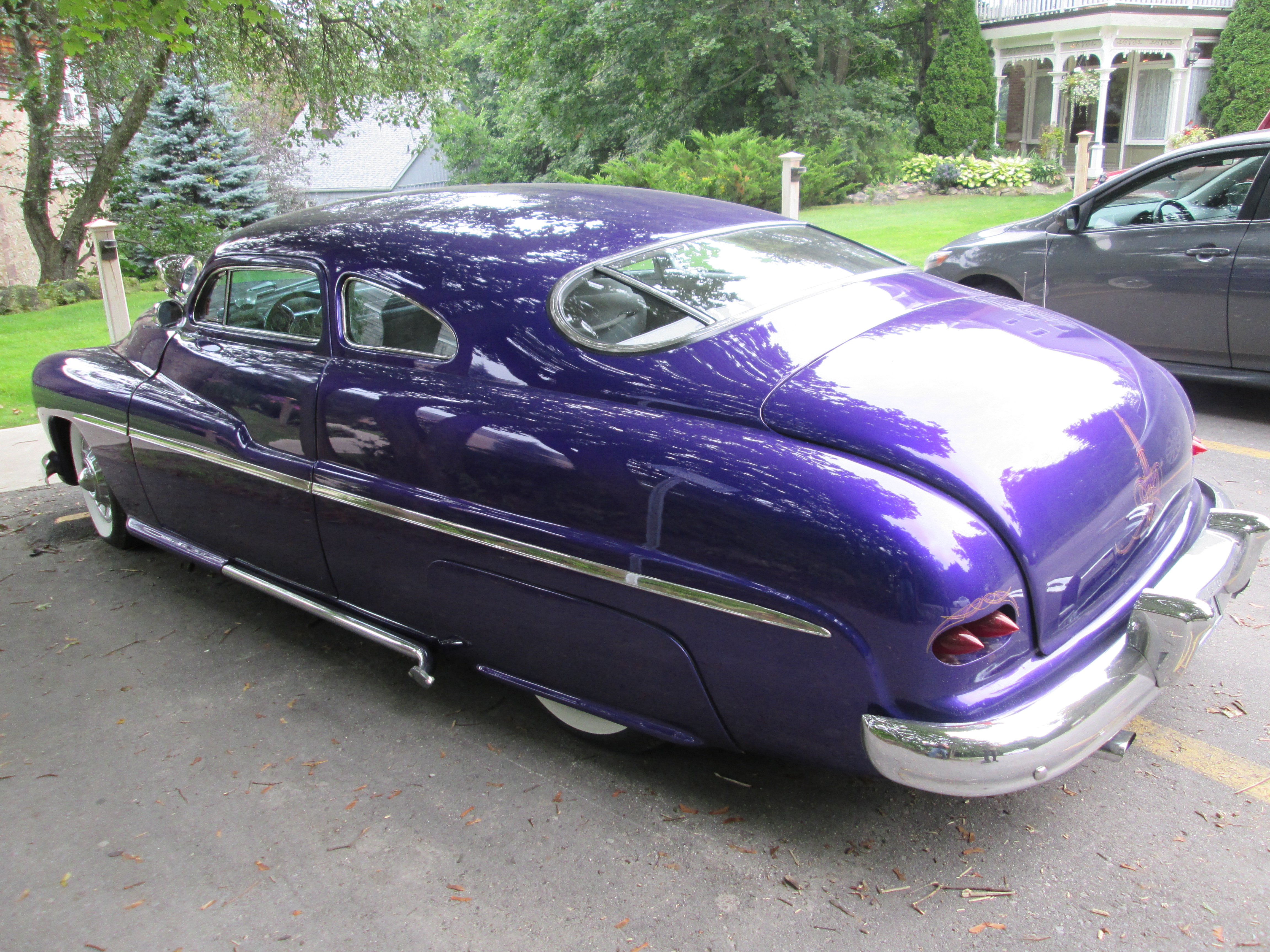
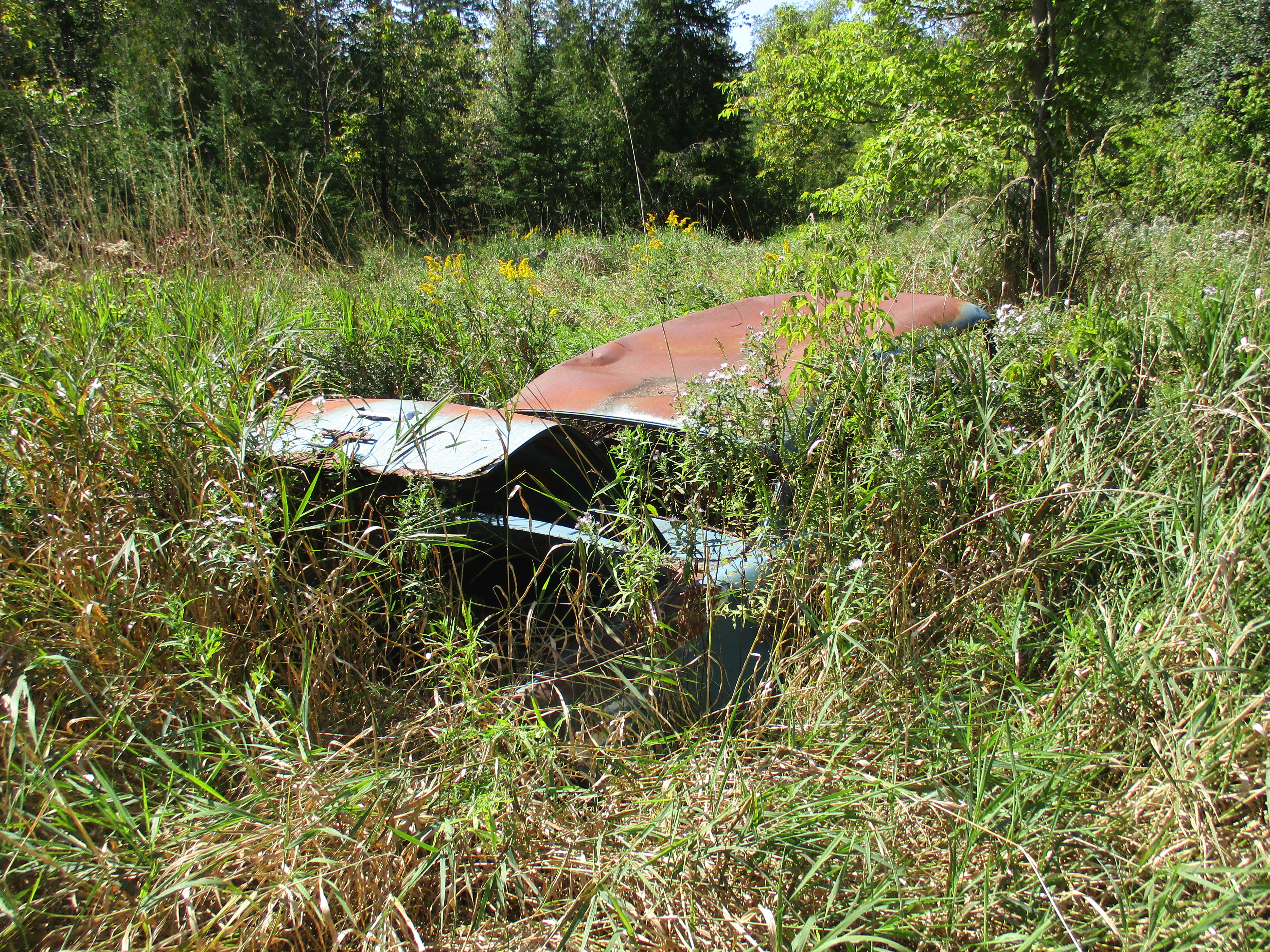
An old car from the 1940’s or early 1950’s lies rusting in the tall grass at the back of Hermit Hollow.

IMG_0150

Hillsburgh retains many historical buildings and is an interesting time capsule of rural Ontario.

Like us at http://www.facebook.com/hikingthegta

Trout Hollow

Sunday September 13, 2015

Trout Hollow has been abandoned three different times and today is a ghost town.  I was on a grand tour that took me from Toronto to Orillia, over to Meaford and then back to Toronto. Down time was needed in Meaford and so one of my brothers and I set off to further explore some of the Georgian Triangle Area (GTA).  After having visited Sixteen Hollow on Saturday and now finding myself in Trout Hollow I decided I had better complete a trilogy and visit Hermit Hollow while I have a week’s hollowdays from work.

We parked on 13 sideroad off of the 7th line a little south west of Meaford.  The area we accessed as we went down the old road allowance is known as Trout Hollow.  Following the yellow side trail where it goes to the right off of the road allowance brings you past one of many 1940’s era cars that have been pushed down the hillside prior to the growth of the current forest cover.  Rainbow trout run in the Bighead River and there are often anglers in the hollow trying to catch a fish.  However, as we shall see, that is not the reason for the name of Trout Hollow.

trout car

In June of 1855 William Trout Sr. bought 200 acres of land on the Bighead River where there were good trees and plenty of water power for a saw mill.  Things were a little fishy from the beginning in that mill and property was secretly deeded to the Trout boys from the beginning. William hinted that he would leave the mill to them so that his children would take good care in helping him build and operate it.  Work was slowed when the Trout men were called away to contribute their millwright skills at a mill being raised near Inglis Falls.  The raceway, head protecting dam and flume were completed and the winter of 1856 was used to prepare the log crib that when filled with gravel would dam the creek.  A log house was constructed in 1855 for the use of the mill workers.

Wood was plentiful and there were settlers coming into Meaford making the Trout mill quite profitable.  In 1861 the census shows William H. Trout (Jr.) had an inventory of 66,000 board feet of lumber. A slight recession following the end of the Crimean War led the Trout family to convert their saw mill into a handle factory which they automated with the help of John Muir. John had previously invented an alarm clock bed that dumped the occupant at the prescribed hour.  The Trout Handle Factory produced handles for rakes, brooms and yokes.   A fire in February 1866 destroyed the buildings and all the inventory.  Trout saw mill was finished and the site abandoned.  For a brief period in the 1870’s The Pleasant Valley Grist Mill operated on this site but it soon closed and Trout Hollow lay silent for 25 years.

The Bighead River can be seen winding it’s way into the town of Meaford from the lower left corner of the shaded area in the 1877 County Atlas map below.  Tracing it back you come to the right of way for the 12/13 side road where it takes a detour down the side of the ravine to improve the angle and make it less dangerous.  The modified road allowance is seen crossing the river in Trout Hollow which has vanished by this point and is not noted on the map.  In 1858 this road accessed only the mill in Trout Hollow and did not cross the river.  There was a public uproar when it was decided to use government funds to repair the wood braced roadway down the hill side with stone.

Trout Hollow Map

In 1904 an electrical power generation plant was built that resulted in the concrete dam across the river than can be seen in the picture below.  The story of the power plant can be read in the Georgian Bay Milling and Power Company post. Today the two abutments remain with the smaller one being in the distance but actually on this side of the river.  The dam on the far side has lost the protective embankment to erosion and is leaning into the river.

Bighead Dam Meaford

The dam was damaged in a storm in 1912  but was repaired and used until the power company closed in 1923.  The crank wheels that raised and lowered the sluice gates have been ripped off of the left anchor and now dangles toward the river.  The block of concrete that holds the remaining anchor is sliding toward the river and will likely soon topple in.  The cover photo shows a look up the sluice gates and shows the extent of the collapse.

IMG_20150913_131050_hdr

The abutments on this side of the river are little more than a short wall of concrete.

IMG_20150913_130330_hdr

This high bank of Algonquin Beach Gravel is in constant erosion.  Where it once provided the upstream berm for the power dam it now has crept back to the point where it allows the river to run behind the dam during flood time.  This is accelerating the deterioration of the old dam and sluice gates.

IMG_20150913_132423_hdr

Along the berm that forms the wall of Trout Lake is a second set of sluice gates.  These gates controlled the water in a narrow finger lake that fed the Georgian Bay Milling and Power Company.  The picture used below was taken in October 2014 during that exploration.

IMG_0789

Along what is now known as Flume Trail you can still see traces of the wood from the open flume that carried the water from Trout Hollow lake to the power generating station.

IMG_20150913_144634_hdr

The metal down tube remains on the side of the hill where it was once connected to the wooden flume.  From here the water was dropped to the settling basin where the turbine wheel was located.

IMG_20150913_142118_hdr

The road is shown as crossing the river in the 1877 county atlas but there is no longer any sign of a bridge.  The power line shows where the road approaches the river on either side.  A few decades ago it was possible for certain high school students to drive across the river here when the water levels weren’t too high,

IMG_20150913_134950_hdr

The failure of the industries in Trout Hollow reminds us of the hardships faced by small businesses in the Victorian era.  Lack of resources and capital often caused them to fail when the economy changed and they were frequently unable to recover from tragedies such as the fire in Trout Hollow.

Google Maps Link: Meaford

Like us at http://www.facebook.com/hikingthegta

Sixteen Hollow – Ghost Towns of the GTA

Saturday Sept. 12, 2015

The area known as Sixteen Hollow was home to an industrial community that became a ghost town by the 1880’s.  We decided to ignore the light rain that was falling, don a light jacket for the first time in months, and go to check it out. There is free parking in the parking lot under the Sixteen Mile bridge on Dundas Street.

Dundas Street was surveyed in 1795, two years after the founding of York (Toronto), as a link to Hamilton.  The road was opened in 1806 after the Mississauga Purchase transferred the land to the British.  George Chalmers arrived in 1825 and opened a merchant shop where Dundas Street met Sixteen Mile Creek.  Next, he built a dam on the creek north of Dundas and opened both a saw and grist mill.  Sixteen Hollow was known for awhile as Chalmer’s Mills and was a thriving community with a tavern, stables, a distillery, a blacksmith shop several houses and an ashery.  In the early 1840’s Chalmers over-extended himself and became bankrupt.  He ended up selling everything to John Proudfoot and the community briefly became Proudfoot’s Hollow. The town continued to grow and a three story inn catered to stagecoach and weary traveler alike. Tailors and weavers as well as the makers of barrels, wagons and footwear all called The Hollow home. When the railroad bypassed the town, and Oakville grew, Sixteen Hollow suffered a fatal blow in the collapse of the grain market.  By the 1880’s the mill was closed and only two houses and the church remained.  The map below from the National Archives is dated 1847 with a question mark but show’s the community early in the days of John Proudfoot.

TTHS002288517f

North of the bridge, in the area that was once covered by mill pond, we observed a female cross orbweaver spider.  This large specimen was riding out the rain curled up in a plant stem.  This species of spider is known to be mildly venomous with bite reactions lasting from 2 days to three weeks.  It takes it’s name from the cross shaped markings on the body near the head.

IMG_20150912_092518_hdr

The first reliable bridge to replace the mill dam crossing was built in 1885 and was a steel truss bridge. It was replaced in 1921 with a concrete bridge that rose in elevation as it went westward eliminating the need for the switchback on the ravine side.  A four lane bridge was built in 1960 which replaced it.  The bridge decking was removed from the 1921 bridge but the piers were left standing.  Notice in the picture below, and the cover photo, the metal capped point of concrete on the front side of the pier.  This was on the upstream side and used to break up ice during the spring thaw to protect the bridge from damage.  It indicates that the creek flowed around this pier in the 1920’s.  Today the creek runs well to the east of here, just above the goldenrod field, and is visible in the cover photo.  in 2008 another four lane bridge was added running along the line of the 1921 bridge piers.

IMG_20150912_113941_hdr

The historical county atlas shows the grand detour that Dundas Street took as it passed through Sixteen Hollow and crossed the creek.  The road passes across the middle of the map from the right to the left as one travels westward.  Just before the mill pond the road takes a curve and descends the hill behind the Presbyterian church (still a wood frame structure in 1877).  It crosses on or near the dam and then does a long hairpin curve south and back as it climbs the west ravine.  By 1877 there are few buildings shown on the map and only one mill, near the church.

Sixteen hollow

Fall was in the air and there are trees that are starting to change colour.  The process of changing colour actually starts in the spring.  The tree has a relatively short growing season which usually ends in about June.  At this time they already have the bud for next year’s leaf ready but dormant until the spring thaw.  Chlorophyll in the leaves is constantly being broken down by sunlight and replaced.  As the day light hours grow shorter and the nights longer the tree prepares for winter.  It starts to form a kind of scab between the leaf and the branch which cuts off the transfer of nutrients to the leaf.  When the green chlorophyll is no longer replaced the yellow, red and orange pigments in the leaves are exposed.  They too break down in UV light and eventually only the brown tannins are left as pigments.

IMG_20150912_093333_hdr

Yellow and purple flowers paint a picture of late summer.  Black-eyed susan, also known as brown-eyed susan, are related to the sunflower and provide the yellow on the left below. New England asters like a lot of sunshine and their purple flowers colour the open areas throughout The Hollow. The yellow goldenrod plants on the right are also a member of the aster family and they are often mixed with their distant cousins.  The sumac trees in the background have not started their change to bright red yet.  This is one of the first and brightest transformations of the fall.  The word sumac comes from the ancient word used for red in several languages.

IMG_20150912_115600_hdr

Sixteen Hollow is a quiet place today but it’s past history was much different.  Humans put a dam across the river and built an industrial community which has now vanished.  The Sixteen Mile Creek is also much shallower today than when Upper Canada was settled.  Clearing of the land led to lower water levels in Ontario.  Water levels at the end of the last ice age were much greater as can be seen in the depth of the creek bed relative to the shale embankments along the sides.

IMG_20150912_125720_hdr

One of the central meeting places in an early community was the church.  Sixteen Hollow had a Presbyterian church on the east bank of the river by 1844 and it is the only remaining building from the historical village.  This frame structure was 40 feet long, 30 wide and 18 tall.  The building was expanded  in 1899 and given a brick veneer on the outside.  Electric lights were installed in 1943 in time for the centennial celebrations the following year.  The basement was added in 1994 for it’s 150th anniversary.

IMG_20150912_135748_hdr

Sixteen Hollow is no longer a thriving town but there is a lot of space to hike along the Sixteen Mile Creek.  We had previously looked at a small section going north from here on Canada Day.

Like us on Facebook at http://www.facebook.com/hikingthegta


The Vale Of Avoca

Saturday Sept. 5th, 2015

In need of a shorter hike this week we set off to visit The Vale Of Avoca.  We investigated the collapsed ruins of an old saw mill, the eastern abutments of an old bridge and a 90 year old example of recycling as we explored a section of Yellow Creek.  It was 21 degrees early in the morning and quite comfortable, except for the unending mosquito attacks.  Only the female mosquito bites after which they live off the blood while 100-200 eggs develop.  They normally live for up to two weeks or until they land on me, which ever comes first.

We parked on Roxborough just off of Mount Pleasant.  From here the trail goes to the left and follows the creek to the lower portion of the Belt Line Trail.  We turned to the right and entered the Rosedale Ravine which we followed north to The Vale of Avoca, the name given to a section of this ravine.  As we walked north we came to the Canadian Pacific Railway bridge. This intricate concrete bridge replaces an earlier trestle bridge for which the cut stone foundations remain.

IMG_7973

In 1837 the Heath Family purchased the north west corner of Yonge Street and the Third Concession Road (renamed St. Clair Ave. in 1914).  They named the area Deer Park and built a hotel where patrons could feed the local deer.  Their lot was subdivided and by the 1870’s the community was well established.  Today the Heath’s are commemorated by a street name. Deer Park extended as far east as the ravine carrying the Yellow Creek, which St. Clair didn’t cross.  In 1888 John Thomas Moore began to market his community of Moore Park which would be constructed between Yellow Creek and the ravine to the east of it containing Mud Creek.  To support his community he built bridges across both ravines and also attracted the Belt Line commuter railway.  Just prior to reaching St. Clair an old abandoned bridge crosses the channelized creek in the bottom of the ravine.  This concrete bridge sits on an earlier stone foundation.

IMG_7980

Moore’s bridge across Yellow Creek was built of iron and didn’t follow the alignment of the third concession.  It angled slightly south west and aligned with today’s Pleasant Boulevard.  By 1922 the bridge was starting to become a safety concern and approval was given to build a replacement. It was decided to straighten the alignment of the road and provide for four lanes of traffic and two of street cars.  The new bridge was built over a period of two years and is 509 feet long and 89 feet high.  It opened in 1924 and cost the equivalent of $9M in today’s economy.  The bridge is a steel and concrete triple span bridge.  The picture below shows the steel arches under the bridge as well as three concrete arches at the other end.  The bridge and the valley they span were renamed The Vale Of Avoca in 1973. The name is taken from a poem by Thomas Moore called The Meeting of The Waters.  It is said that Thomas Moore the poet and John Thomas Moore the community builder were related.

IMG_7989

The Toronto Archives photo below shows the bridge looking west toward Pleasant Boulevard. Notice the lattice work iron railings on either side.

Construction photographs of St. Clair Avenue E. viaduct

When The Vale of Avoca opened in 1924 the old iron bridge was immediately removed.  The iron railings from John Thomas Moore’s bridge were cut up and recycled as fencing along the side of Avoca Avenue.  The Vale of Avoca bridge can be seen in the background.

IMG_7997

The archive photo below from 1925 shows the work in process of removing the old bridge.

Old Bridge

Just north in The Vale of Avoca lie the remains of an early sawmill. The  mill dam created a pond that stretched back upstream flooding part of what is today’s Mount Pleasant Cemetery.  This seems hard to believe looking at the present condition where the cemetery is on such higher ground.  The ravine that formerly held Yellow Creek through the cemetery property has been filled in with ten metres of soil that were excavated when the Yonge subway was built in the 1950’s.  The earthen works of the dam provided the first bridge across Yellow Creek at this location, prior to Moore’s bridge.  Today most of the structure of the mill has collapsed into a mess of shale on an otherwise soil covered embankment.  The horizontal tree in the middle of the picture below is resting on, and perhaps knocking over, part of one wall.  Near the left side of the picture there stands one of the other corners of the building.

IMG_8020

In the midst of the ruins of the collapsed mill I found the bottle pictured below.  It is embossed Buckingham Cleaner but bears no other markings.  The seam on the edge ends just below the lip suggesting a date between the late 1880’s and the introduction of the bottle machine in 1906.  Researching Buckingham Cleaner suggested to me that people in Buckingham have no excuse for dirt as you have a lot of cleaning services available.  The original product in this bottle is a little harder to find information about.

IMG_8012

We returned to St. Clair and crossed Yellow Creek on The Vale Of Avoca.  On the east bank of the creek just south of the bridge stand the remains of the abutments and footings for the 1888 bridge.  The original bridge abutment was made of cut stone.  A rectangular slab of concrete near the left of the picture is from a repair conducted just prior to replacement.  The cover photo also shows the former bridge abutment looking out across The Vale Of Avoca.

IMG_8030

The common Garter Snake lives in a wide variety of habitats and is completely harmless.   Various species of snakes either lay eggs or give live birth.  The garter snake is one of the species that gives live birth and the female can have as many as 70-80 snakes in a single litter.

Snake

The teasel has nearly finished blooming for this year.  A few still have their purple ring of tiny flowers but these are only the ones which get less direct sunlight.  A group or cluster of tiny flowers such as these is known as an inflorescence.  The little flowers are actually specialized leaves known as bracts which bloom in a ring around the middle of the inflorescence and then progress toward the ends of the oval flower head.

IMG_20150825_125318

The Villa St. Clair was built in 1892 and added to Toronto’s list of heritage properties in 1984.  It has a small tower, or turret,  which looks out across The Vale Of Avoca.

IMG_8035

visit us at http://www.facebook.com/hikingthegta

Old Post Road

Sunday August 30, 2015

Post Road runs through the most affluent neighbourhood in Canada and ends in it’s first planned community.  Between the two, the road is broken by Wilket Creek where there is no bridge crossing.  I had time for a short hike while my wife was sleeping off a stomach illness.

At the start of the 20th century the area of Bayview and Lawrence was becoming home to some of Toronto’s wealthiest people.  They started to build grand estates complete with horse stables for their riding pleasure.  We previously looked at some of these old homes in Bayview Estates.  In 1929 the bridge over the West Don River at Lawrence Avenue was rebuilt but the area north of it was still rolling farm land.  The area we now call The Bridle Path was marked by horse trails and was seen as a good place for an exclusive enclave of grand homes because of it’s limited road access.  In 1937 E. P. Taylor, who had designed Canada’s first planned community in Don Mills, bought a large plot of land north of the Bridle Path for his estate.  His wife named it Windfields and today it is owned by the Canadian Film Centre.  The park behind the estate is known as Windfields park.  George Black was partners with Taylor and he built the home on Park Lane Circle where he raised Conrad Black.  To keep the neighbourhood to the wealthy a North York by-law was passed requiring single family homes on a minimum two acre lot size. The streets in the neighbourhood take their names from horse racing and Post Road is the most northerly road in the Bridle Path and thus represents the post position, or starting position for the community.

Post road runs for about 700 metres east from Bayview Avenue through an area where there are only half a dozen homes.  This picture looks from where the paved portion of Post Road ends, east toward Wilket Creek.  You can park here for free.  The cover photo is taken from part way down the old roadway where a hydro line is visible passing through the new growth.

IMG_7927

There is only a little trail left of the roadway where it descends the hill toward the creek.  As is common with many closed portions of road there is always someone who thinks they should be used as dumps.  The west end of Post Road has it’s little caches of trashes.  I found a vinegar bottle from 1958 indicating that the trash was dumped after the development of the area had been well under way.  Canada Vinegars Limited was once the largest manufacturer of vinegar in North America.  They were located at 112 Duke street (now Adelaide) not to far from Toronto’s first post office.

IMG_7722

At the bottom of the hill there is no sign of any bridge remains.  Aerial photos from 1947 show the roadway but there was already no bridge here at that time.  This picture looks north up the creek bed.  On the left side there is a sewer access dated 1980 indicating that the overgrowth on the roadway is only 35 years old because heavy equipment was through here at that time.

IMG_7930

With the water level very low in the creek I was able to cross onto the east side.  The trail on this side is much more open and well used.  It appears that lacking personal gyms and pools for exercise, the inhabitants of the poorer side of Post Road resort to using the park more than their rich counterparts on the other end of the road.

IMG_7933

There are signs of former activity along Wilket Creek as you make your way north along the waterway.  There are several concrete formations that may have been related to mill dams or possibly to flood control.

IMG_7940

The creek bed and surrounding flood plains are composed of a lot of sand and the sides of the creek are in constant erosion.  There are fallen trees all along the creek including this one which has fallen over but continues to have green leaves on it.

IMG_7943

Goldenrod is starting to come into it’s bright golden flowers.  These flowers are essential to the bug community and you will see a wide variety of bees, beetles and assorted other insects on them.  This example is playing host to a colony of ebony bugs.

IMG_7834

Much of the floodplain for Wilket Creek is filled with new growth trees and is a quiet area to hike where I saw very little wildlife.  The trail leads to Banbury Park and Windfields Park.

IMG_7944

Post Road is split in the middle by Wilket Creek and there is no bridge to link the wealthiest properties on the west side with the planned community of Don Mills on the east side.  You stay on your side, and I’ll stay on mine!

Our top 15 stories as selected by readers.

Google maps link: Post Road

Like us at http://www.facebook.com/hikingthegta

Follow us at http://www.hikingthegta.com

Alton – Victorian Industrial Village

Saturday August 29, 2015

Shaw’s Creek drops 108 feet through a mile long series of rapids making it ideal for water powered industry.  At one point there were 8 dams and 12 mills operating along this stretch of the creek.  We parked on Mississauga road and started to follow a fisherman’s path along the north side of the creek.  It was overcast and 15 degrees but it soon became very hot and humid.

The community of Alton got it’s start in 1834 when Thomas Russell brought his family to lots 23 and 24 and the industrial history of Shaw’s Creek got underway.  Within a couple of years other families arrived and saw and grist mills sprang up on Shaw’s Creek along the rapids.  Mill owners built grand homes for themselves as well as smaller homes for the mill workers.  One of the early mills was McClelland grist mill which was built in 1845 of frame construction.  In 1881 Benjamin Ward built a four story stone building on the same site and opened Alton Knitting Mill. Ward’s son-in-law John M. Dods purchased the mills in 1892 and it became known as the Upper Mill, or Dod’s mill.  The picture below shows the mill from upstream on the north side of the mill pond.

IMG_7782

Two metal penstocks remain beside the building at the far side of the dam.  The mill operated on a turbine whose intake can be seen just at water level in the previous photo.  As water levels dropped the Dods were forced to install a coal powered generator for additional power.

IMG_7798

The mills burned in 1917 and during restoration the third floor was converted into a water tower and sprinkler system to prevent future loss to fire.  The mill operated until 1965 when it was closed and the equipment sold off.  It has since been renovated into a conference centre known as Miilcroft Inn.  The Little Mill pictured below was once a storage facility that was connected to the main mill by a catwalk made by Dick’s Foundry in Alton.

IMG_7805

The Manor House is a large brick home which remains on the mill property.  It belonged to the Ward and later the Dod families and has been landscaped with gardens and fountains.

IMG_7824

In 1938 Edsel Ford, Henry’s son, introduced a new line of vehicles under the name of Mercury to fill a market niche between the standard Ford models and the luxury Lincoln models.  From 1939 to 1951 the Mercury Eight was the only model offered under the Mercury name plate.  We found this beautiful 1949 model parked in front of the Manor house whose porch can also be seen below.

IMG_7816

With a store and a post office in 1855 it was time for a name and Alton was chosen.  Soon it was home to a steam powered furniture factory operated by the King brothers, an axe factory, tannery,  a foundery and saw mills, grist and flour mills as well as woolen mills.  The building below sits on Queen Street and looks like an old wagon shop.

IMG_7854

Behind it is one of several old dams and foundations located along the length of Shaw’s creek as it passes through the village.

IMG_7857

The mechanic’s institute functioned as a library and was funded by local industrialists who thought that educating their employees was a win-win situation.  William Algie sponsored the construction of the Alton mechanic’s institute in 1882 just a year after he founded his Beaver Woolen Mills.  We had previously encountered a mechanic’s institute in the Forks of the Credit as seen in The Devil’s Pulpit.

IMG_7869

Alton had five hotels when it was at it’s peak and it is lucky to have even one of them left today. The remaining building was originally known as the Dixie House but was badly damaged in a fire in 1890.  It was rebuilt and today is known as Palmer House.  It has two very large ornate lanterns on the second level, above the entrance.

IMG_7866

In 1857 Charles Wheelock in his duties as provincial land surveyor identified nine mill privileges along Shaw’s Creek of which eight were eventually developed. In 1880 William Algie purchased privileges 5 and 6 on which sit the present mill and mill pond respectively.  In 1881 he opened Beaver Knitting Mills which became famous for  it’s fleece lined long underwear.  The mill with it’s water tower, chimney and overgrown mill pond can be seen in the cover photo.  The modern  concrete dam can be seen below along with it’s art piece Head In The Ocean which takes it’s name from the fact that it was originally installed in the Bay of Fundy where the world’s highest tides covered it daily.

IMG_7890

The mill was partially destroyed by fire in 1908 at which time it was reduced from 3 stories to today’s two story building.  The fourth floor of the water tower was replaced with concrete during the restoration.  When William Algie died in 1915 the mill was acquired by Dod’s knitting company who ran it until 1932 when it closed.  The mill was used as a rubber factory from 1935 until 1982 producing balloons for Disney and condoms for soldiers during WWII, among other things.  With the mill restored as The Alton Mill Studios a plan is underway to restore the mill pond and hopefully restore green power to the facility.  An archival picture below shows the mill as it once looked.

Beaver Mill Alton

On the hill above the mill stood the miller’s house.  It has a large wrap around veranda that looks out over the mill pond and his milling empire.  It also features a second story balcony solarium.

IMG_7907

Alton had three churches including a Presbyterian, Methodist and this Congregational Church dating to 1877. The building has also served as a town hall and has a unique garage door in the rear.

IMG_7846

Back near the car on Mississauga road we encountered a pair of wild turkeys with half a dozen young ones or poults.  By 1909 the wild turkey had been wiped out in Ontario mostly due to loss of forest cover for the poults to be raised in.  Between 1984 and 1987 4, 400 wild turkeys were re-introduced into locations across the province.  With broods of 10 to 12 per year their numbers now total over 100,000 and they are hunted in both a spring and fall season.

IMG_7843

There are many other remnants of dams and plenty of historic buildings that space doesn’t allow to appear here but which are well worth the exploration.

Here’s a checklist of popular hikes to take in before the season is over.

Visit us at http://www.facebook.com/hikingthegta

The Bell Fountain – Belfountain

Saturday August 22, 2015

Set in the Caledon hills the town of Belfountain has a beautiful park with a swing bridge and water falls.  It was another excellent summer Saturday with an early morning temperature of just 13 degrees, a perfect day for a hike to a swing bridge.

The area was surveyed by 1820 but the rugged terrain made farming difficult and settlement was slow.  There was plenty of cherry and white pine trees and William Frank built a saw mill on the West Credit river in 1825.  Selling cherry wood for furniture and pine for construction he soon was able to dam the river where he built a grist mill.  The grist mill was purchased by Jonathon McCurdy who built another saw mill adjacent to it giving the community the temporary name of McCurdy’s Mills.  Belfountain was surveyed in 1846, registered in 1853 and by 1860 more saw mills, a tannery and another flour mill had been added.

Around 1850 Peter McNaughton set up a barrel making shop in town.  He wanted his cooperage to be easily distinguished and so he built his house like a barrel.  It was 12 feet wide and 12 feet tall with a pyramid for a roof.  He used wooden staves and steel bands in the construction and this earned the town the nickname “Tubtown” for awhile.  By the time this house was moved to Erin the town had taken on the name Belfountain.  We parked on Mississauga road on the edge of town where an old barn and the foundations of a farmhouse remain.

IMG_7606

In 1908 Charles Mack bought the property that would become Belfountain Park.  It had been owned in the 1860’s by George Hughson and had been the home to four of Belfountain’s mills.   Mack had made his fortune as an inventor, most notably of the cushion rubber stamp which he sold to banks and post offices.  He wanted to create a park that would be memorable to those who visited and he has been successful for over a hundred years.  Mack built his own little version of Niagara Falls and added a swing bridge to view it from.  The current bridge replaces the 1909 bridge that I used to cross as a youngster.

IMG_7653

Beside the waterfall is a  sluice gate and the round pipe from a penstock used for water power. There was a dam here prior to Mack building his waterfall and so the new dam continued to be used by local mills.  The mini Niagara Falls dam has been determined to be short of current Ontario code for dams and is under environmental assessment to see how it can be restored and the danger to downstream properties alleviated.

IMG_7626

The gardens and falls area are lined with stone walls and stairways.  A local stonemason named Sam Brock was hired to do most of the decorative work and build the cave.

IMG_7623

Mack built what he called Yellowstone Cave, complete with concrete stalagmites and stalactites. To me the cave looks more like a shrine of some kind and, perhaps, in some way it is a shrine to one man’s eccentricity.

Belfountain 1

Mack also built a fountain out of inverted bells with an upright bell at the top as a pun on the town’s name.  I’ve used the same pun in the title and cover photo.  After running for more than 100 years the bells are covered in a thick layer of moss but the water still flows.

IMG_7631

A series of beautiful planters and gardens surrounded the area of the bell fountain.  Benches and lookouts were also provided for visitors.

IMG_7655

A swimming and boating area above the water falls has been allowed to silt in so that it is no longer usable. In the 1970’s this was a great place to get cooled off on a hot summer day. Concrete steps now lead down into the water and muck.  After Charles Mack passed away his widow sold the park which was used commercially until the Credit Valley Conservation authority bought it in 1959.  They are currently in the works of a master plan to restore the heritage features and to make the area more enjoyable for visitors.

IMG_7635

There are four generations of Monarch butterflies born each year in Ontario.  The picture below is of a butterfly which has just emerged from it’s chrysalis and it was still in the process of drying it’s wings.  The third generation of monarchs is born in July and August and will live for two to six weeks in which time it will lay the eggs for the fourth generation this year.  The fourth generation will be born in September and October.  This generation will not be like the three before it in that it is programmed to live for six to eight months and not just a few weeks.  This fourth generation will migrate south to places like Mexico to survive the winter.  When they return in the spring they will lay the eggs for next year’s first, short lived, generation of Monarch butterflies.

IMG_7616

By 1870 Belfountain had become home to about 300 people.  The two local communities of Forks of the Credit and Brimstone were home to quarry workers and essentially were company towns.  The skilled tradesmen and quarry managers lived in Belfountain which, due to it’s mills, had become the economic centre of the region.  Quarry workers get thirsty and need a place to spend their pay cheques.  The ornate patterned brick building at the corner of Mississauga Road and Bush Street was opened as a tavern in 1888.

IMG_7661

The Community Hall was built in 1893 of board and batten construction.  The precast concrete brick foundation dates to the 20th century and indicates that the building was raised at some point.  The hall was closed in 2015 due to safety concerns and it is unknown where the funding for restoration will come from.

IMG_7670

Belfountain, with it’s bell fountain and mini Niagara Falls, makes a great place to visit and is especially nice when the fall colours are in full display.

There’s still plenty of summer weather left though so get out and enjoy it.  Perhaps visit one of the more popular places as picked by readers in this top 15 list.

Also, visit us at http://www.facebook.com/hikingthegta

Rockwood Woolen Mill

Sunday August 16, 2015

This hike explored the Rockwood grist mill, an abandoned house, the Harris & Co. Rockwood Woolen Mill and some glacial potholes.  I parked in the Lion’s Club park on Main Street near the river.  The first settler to the Rockwood area was John Harris.  He arrived in 1821 and built a small house and a saw mill.  Before long other mills were added including flour, stave, woolen and grist mills. Henry Strange was the Deputy Surveyor for the area and he opened a lime quarry which was used for the stone for the early mills.  The early name for the community was Strange’s Mills.

The grist mill was built on the side of the Eramosa River just east of main street.  It is made of local limestone and has been converted into a private residence.  The dam and mill pond remain intact but are now marked as private property.

IMG_7437

Valley road leads into the park from the grist mill along the north side of the river and passes this small burned-out building.  A trail from here leads to The Devil’s Well.

IMG_7441

John Harris built the first mills and this attracted further settlement and spurred the development of other mills and trades.  John and his wife Jane had six sons and adopted one daughter.  In 1867 his three oldest sons and one son-in-law joined together to start a woolen mill.  Under the name of Rockwood Woolen Mills they developed a reputation for quality products.  They advertised in the local papers for people to bring their fleece to the mill and trade it for their woven products.  They sold blankets and sheets as well as underwear and tweeds.  They also sold bleached cotton and yarn which they claimed to be “full weight and fair inspection”.  The picture below and the cover photo show the remaining ruins in the park.

IMG_7495

The original woolen mill on this site was built from wood and burned down in 1880.  It was replaced in 1884 with a structure made from stone.  The tower has date stones to commemorate both the original construction in 1867 and the replacement building from 1884. The ruins of the mill have been stabilized by adding a layer of concrete along the upper edge of every wall.  This prevents the stone from being removed by weather and vandals and will help preserve the structure for future generations to marvel at.

IMG_7502

The mill was powered by various means over it’s history.  Originally it was powered by water which was diverted from the river to power the turbines.  The arch below contains the raceway from the original turbine power system.  The original stone bridge structure across the raceway now supports a new pedestrian and vehicular bridge. Later the mill was converted to steam and finally to electrical power before it closed.

IMG_7513

The mill reached it’s production peak during the First World War when it had to operate 24 hours per day to produce thousands of army blankets for the military.  Due to intense competition from other mills the business was closed in 1925.  The Harris family then converted the site into a park to showcase the local scenery and the glacial potholes.  The park was called Hi-Pot-Lo Park and was a popular destination for awhile. The park was acquired by the conservation authority in 1959 and converted into Rockwood Conservation Area.  The mill was destroyed by fire in 1965 and was reduced to the ruins that remain today.  This picture shows the Rockwood Woolen Mill as it appeared in 1890.  The company kept adding little out buildings which gave the complex it’s disorganized sprawl.

IMG_7479

This Great Blue Heron was catching small fish along the side of the Eramosa River.  In the picture below it has a fish in sight which was in it’s belly seconds later.

IMG_7552

There are over 200 glacial potholes in the Rockwood Conservation Area and another hundred scattered around the nearby area.  These potholes are believed to have formed during the melting phase of the most recent ice age.  Water containing fist sized rocks was caught in a swirling action that eroded these large circular cut-outs.  Along the pothole trail there are many complete and semi-circular potholes.

IMG_7497

Painted turtles have four distinct subspecies that can be identified by the markings on their shells.  The eastern has aligned plates and southern has red markings on the top shell which allows us to determine that this is not one of either of those.  The midland has a grey patch on the bottom shell while the western has a red pattern below.  This specimen was a little too far out in the river for me to flip over to identify which one it was.

IMG_7520

Some of the glacial potholes extend to 200 feet deep including one called the Devil’s Kettle.  This spot along the river shows where the rock has been worn away in a large circle above and below the present waterline.

IMG_7515

As you drive down Guelph Line toward the 401 you cross the former right of way for the Guelph Suburban Railway (1917-1931) one of several Radial Railways stemming from Toronto in the early 1900’s. This spring we investigated a set of decaying, century old, bridge abutments from the railway over the Silverthorne grist mill tail race.  We then followed the right of way through Eldorado Park, it’s entertainment enterprise.  At Limehouse we saw the pilings for the trestle that used to cross the mill pond. This portion of the railway was purchased by the Halton County Radial Railway for the purpose of opening a railway museum.  This museum is a great place to visit as it houses many historic rail cars and features a ride on the rails.  At the roadside is this car from the London & Port Stanley railway.  It operated as an electric railway from 1913-1957.

IMG_7577

A listing of the reader-selected top 15 hikes can be found here.

Google Maps Link: Rockwood Conservation Area

Like us at http://www.facebook.com/hikingthegta

Follow us at http://www.hikingthegta.com

Kerosene Castle – Oakville

Saturday Aug. 15, 2015

This hike examined some of the early history of Oakville as well as the Kerosene Castle.  It was another of those very hot and humid summer days when the morning temperature read 21 but felt like 28.  Having parked on the end of King Street we set off to look at the mouth of 16 Mile Creek where it empties into Lake Ontario.  The picture below shows the view looking downstream toward the harbour break wall with it’s lighthouse.  Note the masts to the many ships that dock in the harbour.

IMG_7341

William Chisholm was born in Nova Scotia in 1788 and in 1827 he purchased 960 acres of land at the mouth of 16 Mile Creek.  William Chisholm’s nickname was White Oak and it is thought that the name Oakville may come from this.  Chisholm quickly established a shipbuilding business and had the first privately owned harbour in Upper Canada.  The large supply of white oak trees supported the shipbuilding industry and may also have been the source of the town’s name.  In 1834 the harbour was officially recognized as a port of entry for Canada and Chisholm became the first customs inspector.  The building on the right in the picture below is the 1856 Customs House and Bank of Toronto Building. The left part of the building is known as Erchless Estate and was home to the Chisholm Family.

IMG_7347

Behind the Customs House is an art exhibit called the Moose and Wolves.  It was donated by the people of Neyagawa Japan, which is the sister city to Oakville.

IMG_7353

This building served as the post office from 1835 until 1856 with William Chisholm as post master.  A lower mill stone is being used as a landing at the bottom of the stairs.  William died in 1842 and his son Robert Kerr Chisholm became post master and customs inspector.

IMG_7367

Electric lighting arrived in Oakville in 1892.  An old paint factory from 1870 was converted into a generating station.  There were 152 street lights in Oakville in the early days running for 7 hours per night at a daily cost of $3.50.  The generator experienced ongoing problems and was replaced with power generated in Niagara Falls in 1909.  The building was later used as a tea room under the name of The Electric Light Cottage.  It currently serves as a private residence.

IMG_7362

Many of the early homes in Oakville belonged to people in the shipbuilding or sailing business. The smaller homes on Thomas Street from 1852 belonged to Duncan Chisholm, shipbuilder, and were known as the workmen’s houses. This 5 bay home pictured below was built in 1835 by David Patterson who was also a shipbuilder.  He apprenticed in Dublin but moved to Oakville in 1827 to work at the Chisholm Shipyard.  In 1857 Patterson was appointed “pathmaster” which meant that he was in charge of the roads.  Men had to work an annual amount of statute labour maintaining roads or pay a fee instead.  Patterson organized the labour and collected the fees to pay for materials. When he died in 1877 the house was sold and the brick veneer was added to the outside in the early 1880’s.

IMG_7374

George and Mary Lyon were married in England in 1868 and sailed for Canada that same summer.  They bought 50 acres of land on Trafalgar Road near the Oakville Townhall.  This cabin dates to about 1810 and was already standing on the property.  George added a lean-to for his buggy and 9 children to the tiny home.

IMG_7386

This is the home as it looked in 1973 when construction workers found it while clearing the property for new development.

IMG_7387

We sat for a few minutes on the rocks along the side of Lake Ontario in Lakeside Park and enjoyed the morning activity on the lake.  A swim club was doing laps around a floating marker and boats were coming and going through the mouth of 16 Mile Creek.  Along with canoes and kayaks there was also one guy on a stand up paddleboard.

IMG_7398

We moved the car to Inglehardt street so that we could investigate the Kerosene Castle as well as look for evidence of the Oakville Oil Refinery.  Richard Shaw Wood built a coal oil refinery on the side of 16 Mile Creek to convert coal to kerosene.  It quickly became one of the largest kerosene refineries in Canada.  Kerosene had been around for centuries but burned with a black smoke that made it useless for interior lighting.  In 1846 a Canadian named Abraham Gesner perfected a method of distilling it into a clear liquid that would burn cleanly. In 1856 Wood built a mansion across the street from the refinery. The mansion would take on the name of the Kerosene Castle and would serve as a family residence until the mid 1900’s.  The house was then divided into a nursing home on one side and apartments on the other.  In 1978 it was converted into MacLachlan College.

IMG_7404

When I was reviewing the pictures I took I found that one of the eight that featured the tower has what appears to be a face covering the entire centre window on the front of the tower. This is especially creepy when blown up a bit.  Another picture taken seconds later from a slightly different angle shows nothing abnormal.  This window is known as an oriel window and along with the tower was the main reason for the property to gain an historical designation.

IMG_7400 faceIMG_7401 no face

On July 13, 1866 the refinery burned down, likely as a result of a faulty new still that had just been installed.  Burning oil floated on 16 Mile Creek and lit the water up all the way to the harbour.  Oil seeped out of the ground for more than a century afterward.  We were unable to access the creek area where the refinery stood as it has been redeveloped for private housing. The picture below shows the Kerosene Castle around 1890.

IMG_7416

We found the neck of a clay jug on the creek embankment.  This jug was known as a blue flowered jug and was produced by Nicholas Eberhardt.  Eberhardt came to Canada in 1860 from France.  Between 1863 and 1865 he worked for Toronto’s Don Bridge Pottery.  After 1865 he operated his own pottery making business.  The fragment we found contains the markings N Eberhardt, Toronto CW.  The CW is interesting because it identifies the jug with Canada West, a title used for the area of Ontario between 1841 and 1867.  Following 1867, and Confederation, the name was changed to Ontario.  This jug was therefore manufactured between 1865 and 1867.

IMG_7410

Richard Shaw Wood operated the Oakville Oil Refinery on the side of 16 Mile Creek across the road from the Kerosene Castle.  Although it was destroyed and not rebuilt it was not the end of the oil industry in Oakville.  Just east of here along the Lakeshore is the Suncor Refinery.  Two other refineries along the lake shore have been closed in recent decades.

IMG_7428

Why not enjoy a summer hike in one of the top 15 places as selected in this special edition.

Like us at http://www.facebook.com/hikingthegta


Bruce’s Mill

Sunday Aug. 9, 2015

It was one of those perfect summer afternoons.  The skies were sunny and it was 21 degrees without humidity.  I decided to visit Bruce’s Mill Conservation Area to check out the remains of the 160 year old grist mill in the park.

Situated in the headwaters for the Rouge River, Whitchurch Township became the home of many German settlers.  In order to be able patent a land grant, and gain full rights of ownership, a settler had to meet certain requirements.  They had to build a home of at least sixteen by twenty feet and occupy or rent it within three years.  Five acres of land had to be cleared and surrounded by a fence.  The road allowance along the property had to be cleared and maintained, free of stumps.  After taking the oaths to the crown one would then own their land grant, usually 100 acres.  On the 1877 historical atlas map below the fifth concession is marked with “V” at the top of the page.  Stouffville Road runs across the top of the map (under the blue line). Thomas Lewis owned lot 35 and below that on lot 34 is a pond on property belonging to Robert Bruce.  It is marked with a GM for Grist Mill and a water wheel symbol.  This is the location of Bruce’s Mill.

Bruce's Mill

Casper Sherk built the first grist mill on this site in 1829 and he may have been the settler who first owned the land grant.  On the map above a road has been built below the mill running between modern Warden and Kennedy Roads.  This road is not part of the normal grid of the land survey and is therefore a “given road” built to allow customers access to the mill.  Sherk built an earthern berm and a wooden dam to create the mill pond.  The berm remains but the dam has been replaced sometime after 1900 with the modern concrete one with it’s dual sluice gates.  In the picture below the grasses hide the berm which is equal in height to the concrete structure.

IMG_7307

In 1842 William and Robert Bruce bought the mill and some adjoining property and changed the name of the mill to Carrick Mills in honour of their home in Scotland.  The sluice gates at the mill are still remarkably complete.  Wooden slats remain in both sluice openings and extra’s are carefully stacked on top.  Three hoists are standing on top as if waiting to lower the boards back in and stop the flow of water.  In the past the mill pond was used for swimming and fishing but it is currently filling up with wetland plants, creating a bird and butterfly watcher’s paradise.

IMG_7286

The present mill, as seen below and in the cover photo, was built in 1858 using wood from the original mill in the storage area at the north end of the building.  There are wooden boards on the ground under the front awning to cover a hole where grain was off loaded into the mill.  A similar system was used at the Marchmont Grist Mill.

IMG_7280

The Bruce’s built a two and a half story mill of wood construction on a stone foundation.  Glass was expensive and larger pieces were easily broken so smaller panes were typically used.  This mill has two sets of 3 over 3 windows in each opening.  The wire mesh on the right hand side in the picture below protects the water wheel and the tail race from intruders.  The mill is in a state of disrepair as boards drop off of the sides and windows are broken.  A hole in the roof is letting water into the building.

IMG_7275

Initially water was brought from the mill pond to power the water wheel by means of a wooden flume.  Later this was replaced with a penstock or round metal pipe.  The concrete structure in the picture below supported the penstock as it came out of the mill pond.

IMG_7293

Bruce’s mill has a twelve foot diameter steel water wheel.  Most water wheels were made of wood and were perhaps 40 inches rather than the nine foot wide Fitz Undershot Waterwheel installed at the mill.  Samuel Fitz began building waterwheels in Hanover Pennsylvania in 1840. In 1852 they began construction of steel waterwheels which became the mainstay of their business. Steel wheels last much longer than wooden ones and can be used in the winter when ice clings to the porous wood making a wooden wheel inoperable.

IMG_7304

In their online marketing materials the Fitz Waterwheel Co. presents a picture of the waterwheel at Bruce’s Mills.  The external building that now houses the waterwheel had not been added at that time.  Also, notice the penstock running along the ground where it is bringing water from the mill pond to the wheel.  The pressure from the penstock turns the wheel from the bottom, making it a rare undershot wheel.

Fitz Wheel at Bruce

The Toronto Region Conservation Authority bought the property in 1961 and the mill was closed in 1962.  Bruce’s Mill was one of the last operating mills in Ontario to close.  The TRCA has operated the site as Bruce’s Mill Conservation Area since 1965.  Walking garlic, also known as crow garlic or stag garlic, is not native to North America.  Farmers consider it to be a noxious weed because cows that graze on it can have a garlic odour to their beef and dairy products.  It has a sharp aftertaste not present with cultivated garlic.

IMG_7241

Treetop Trekking is a new sport that is increasing in popularity.  In 2002 the first park in Canada was established in Rawdon Quebec.  With four parks in Quebec the company expanded into Ontario where it now has four additional parks.  The park in Bruce’s Mills Conservation Area opened in 2013 and contains a 700 foot zip line.  In the picture below a person in blue can be seen near the centre of the picture zipping above the butterfly gardens on the aptly named Monarch Zipline.

IMG_7337

A look at the rear of Bruce’s mill as it slowly falls apart.  It would be a grand place to restore and use for weddings and other functions.

IMG_7287

Check out the most popular hikes in this special feature.

Like us at http://www.facebook.com/hikingthegta

Follow us at http://www.hikingthegta.com