Category Archives: Uncategorized

London Asylum for the Insane

Friday, June 14, 2019

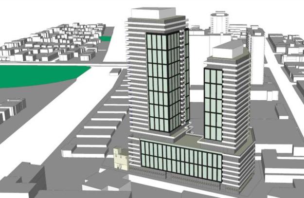
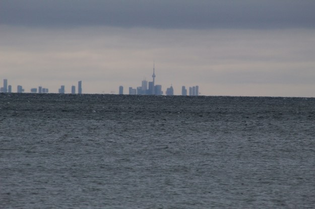
The 160-acre property that houses the former London Psychiatric hospital has been sold to a local developer for 17 million dollars.  Most of the buildings will likely be demolished with the exception of three historically designated ones.  So, with a Friday off work I decided to go on a road trip outside the GTA and see what is there and get some pictures while they can still be taken.

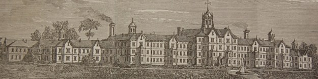
The original name for the facility was The London Asylum for the Insane when it opened in November of 1870.  The original building had 500 beds and these were filled almost immediately.  In 1928 it was renamed the Ontario Hospital for the Mentally Ill.  It became The London Psychiatric Hospital in 1968.  The Western Archives photo below shows the main building before it was demolished to make way for more modern buildings that stand at the front of the lot today.  The remaining historical buildings are all at the rear of the property.

old-asylum

The original idea for the asylum included various types of therapy.  Natural surroundings were considered ideal to medical recovery in the late Victorian Era.  The hospital also applied various work programs to the patients to help prepare them to be integrated back into society when they were well.  Men worked at farming and gardening while the women were taught sewing.  The wings of the replacement facility extend from a round central hub.  This building was opened in 1968.

IMG_4044

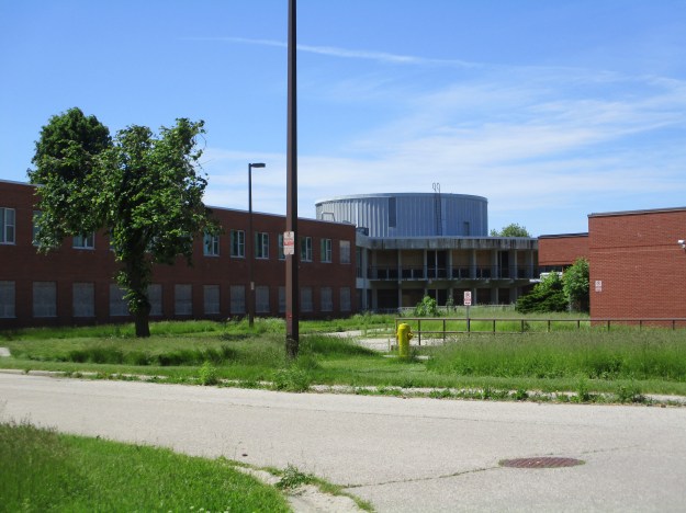
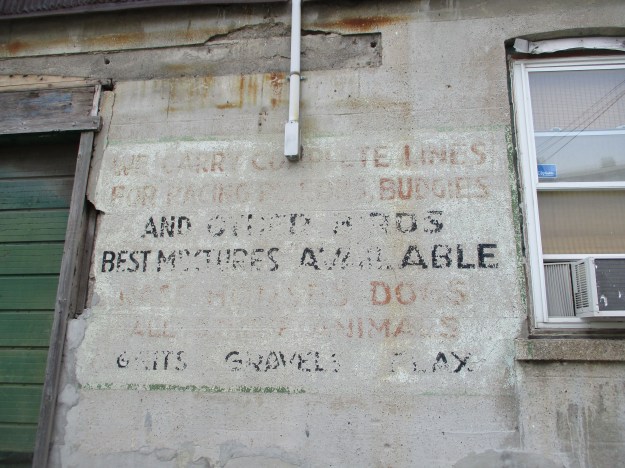
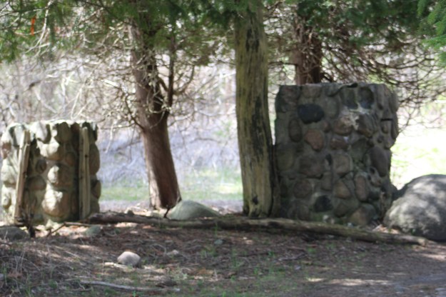
Insanity was a simple diagnosis that could be applied to any socially unacceptable behaviour including masturbation, depression or senility.  Patients were not always treated in ways that we would find acceptable today.  Some of the treatments were considered too much, even in those days.  Between 1895 and 1898 one doctor performed over 200 surgeries on women’s reproductive systems to help try and cure hysteria.  Apparently an hysterectomy would be a suitable cure.  The buildings on the site are a mix of the mid-20th century replacement structures and the original buildings from the 1870’s and 1880’s.

IMG_4638

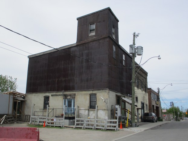
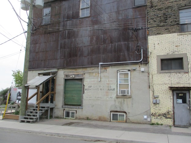
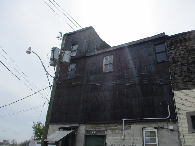
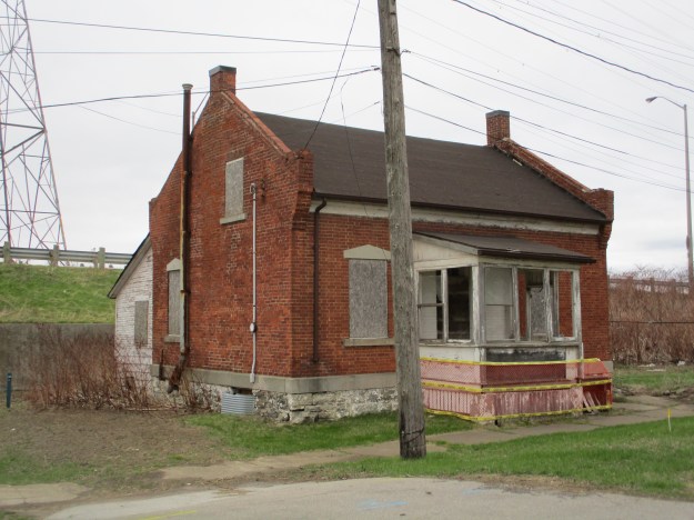
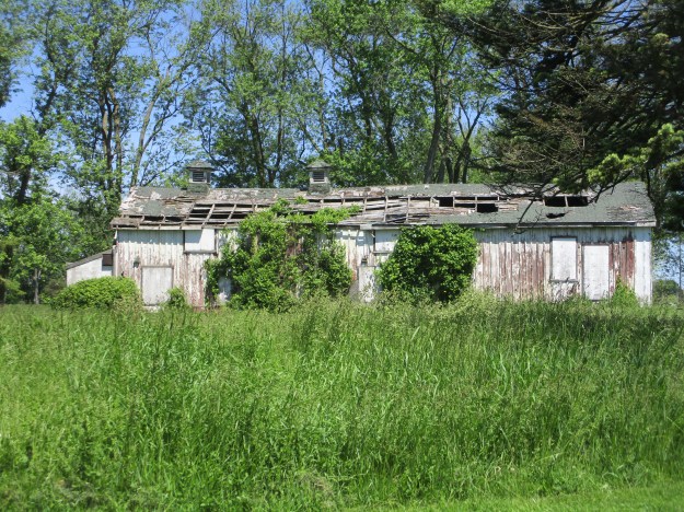
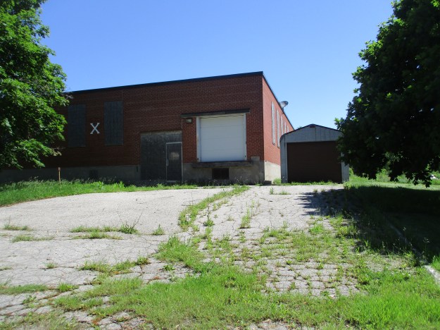
This building will need to be removed as it appears to have been allowed to deteriorate to the point of self-demolition.

IMG_4030

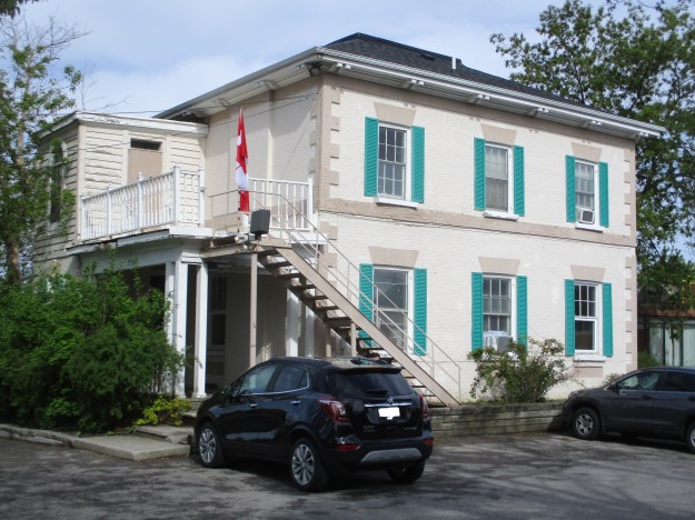
The redevelopment plan calls for the preservation of the old recreation hall.  Also known as the assembly hall, this building was erected in 1920.

IMG_4031

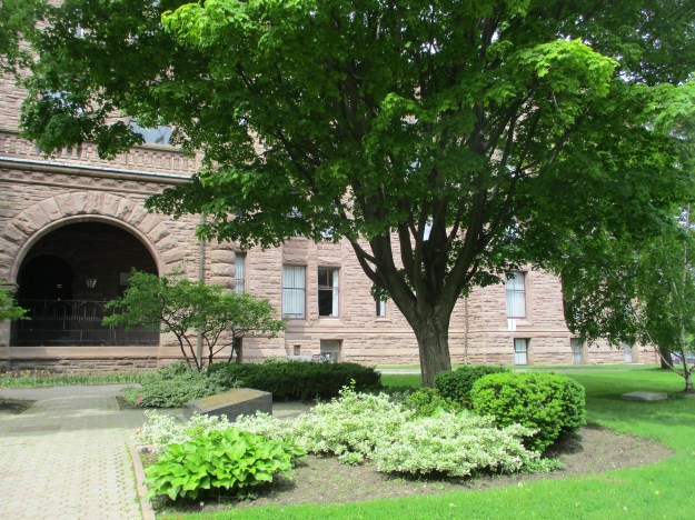
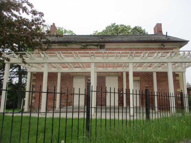
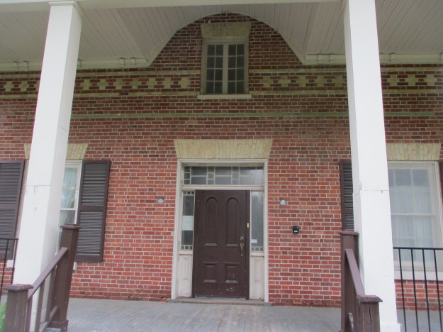
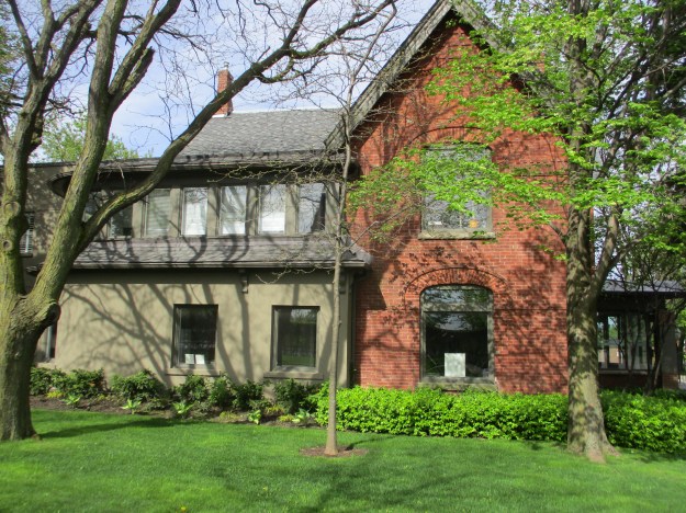
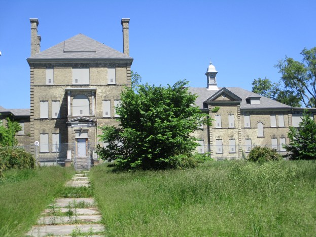
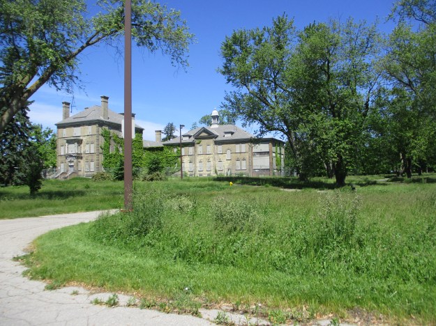
The infirmary for the asylum is still standing and is also featured in the cover photo.  It was built in 1902.  There is a central administration block and two wards on either side.

IMG_4035

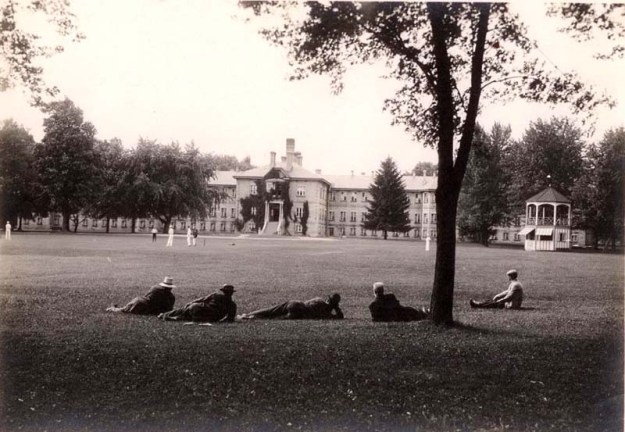
Patients sit on the lawn in front of the infirmary in this historical photo from the Western Archives.

patients-on-the-lawn

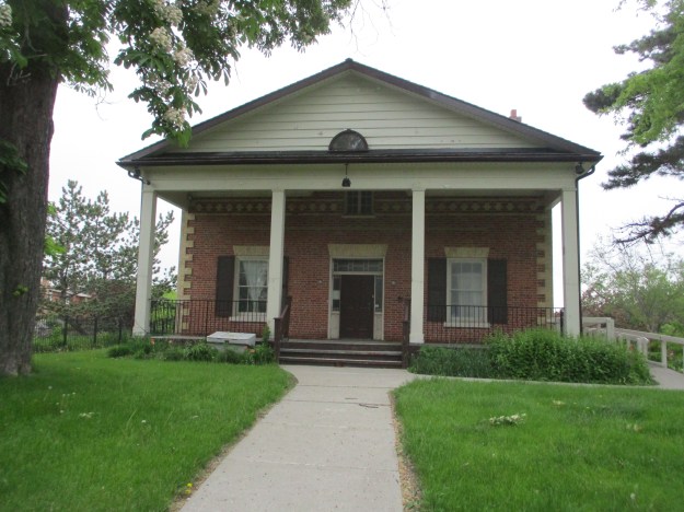
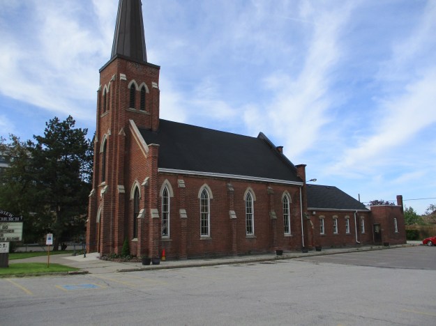
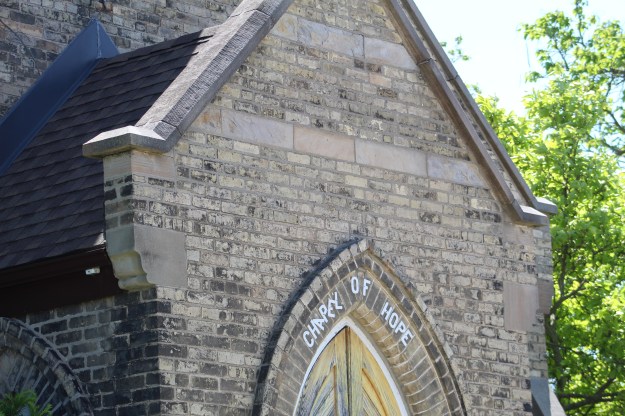
The non-denominational chapel on the hospital grounds was built partly using labour from the patients.  It was constructed in 1884 in the Gothic Revival style that was popular for churches in that era.

IMG_4036

The church was known as the Chapel of Hope and was used for thousands of weddings in recent years.  The last wedding was held here on September 30th, 2014.  With the land sold for development it is unclear what the future of the chapel is but is is protected under a heritage designation.

IMG_4635

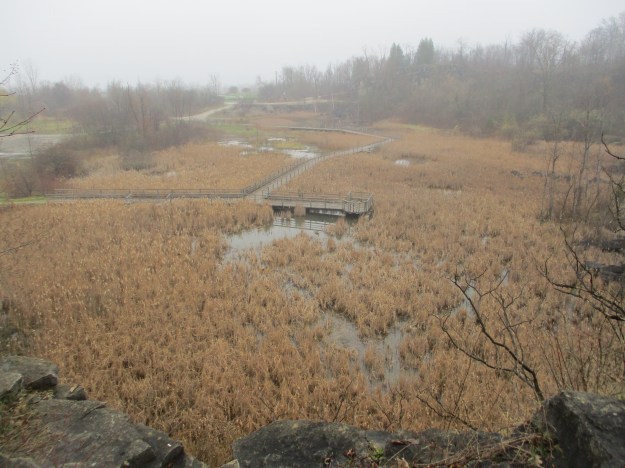
The modern buildings will likely all be removed in the name of progress and residential, office space and a large component of  park land will replace them.  Several of the older buildings may be incorporated into the development due to their designation as historic structures.

IMG_4634

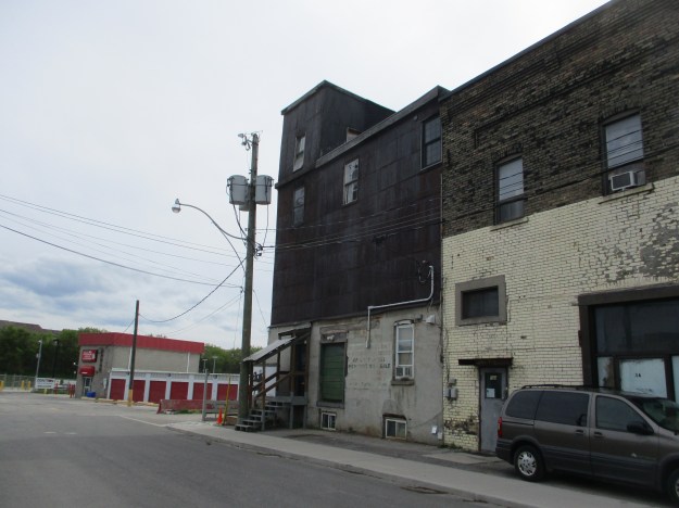
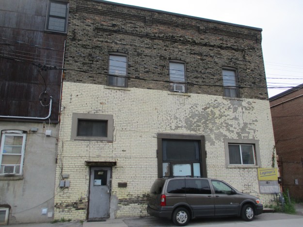
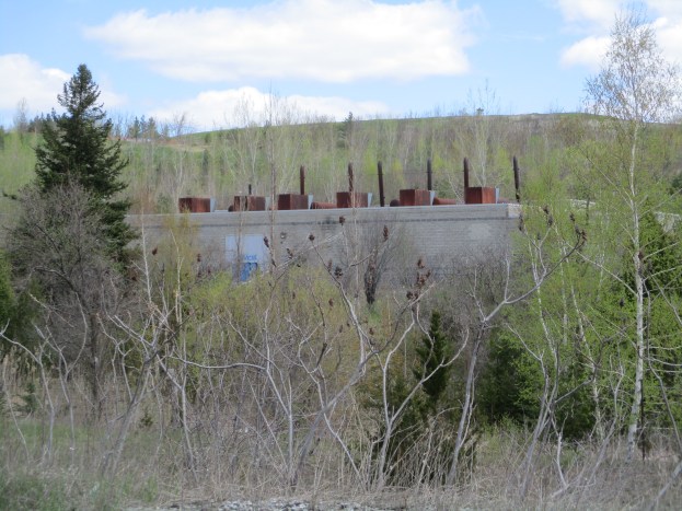
There are several of these unremarkable building on the site that were built during the 1964 renovation of the property.

IMG_4028

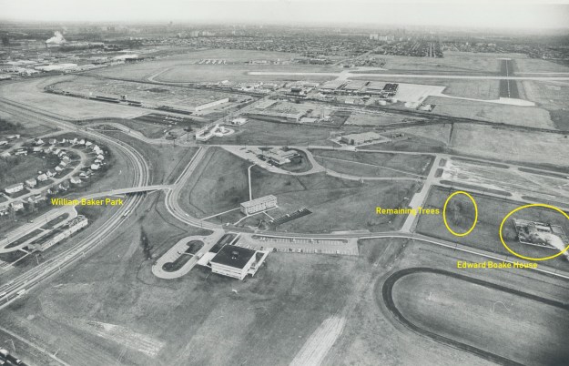
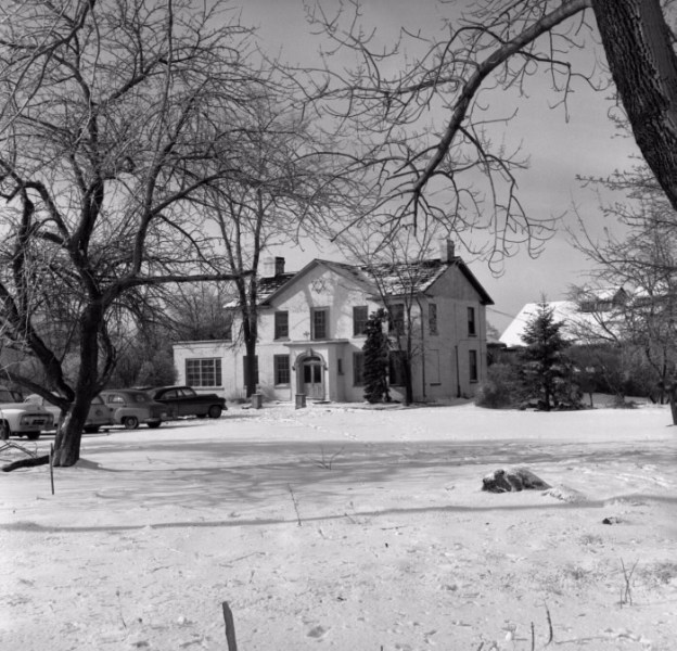
Unfortunately I didn’t get a picture of the stables so it is a good thing that they will be preserved in the redevelopment.  It will be interesting to see what becomes of this piece of property.  In the GTA we had a similar hospital at the Mimico Branch Asylum

Google Maps Link: London Psychiatric Hospital

Like us at http://www.facebook.com/hikingthegta

Follow us at http://www.hikingthegta.com


Queen’s Park

Sunday, June 9, 2019

The land that we know as Queen’s Park actually belongs the The University of Toronto and the name is often used to mean the Ontario Legislative Buildings which occupy the centre of the park.  The City of Toronto has leased the land from the university for 999 years at the rate of $1.00 per year.  The grounds to the north and south of the buildings contain many statues and other historic artifacts as well as providing green space for local residents to enjoy.  The park grounds have also served as a place for peaceful protesting over the years,  I decided to walk around the park and enjoy the statues and information plaques as well as the interesting architecture of the legislative buildings.

King Edward VII ruled from the time of Queen Victoria’s death in 1901 until he died in 1910.  The statue of Edward on his horse was originally located in India but when the Indian Government decided to get rid of symbols of British rule they elected to give it to Toronto.  Edward had visited Toronto in 1860 as the Prince of Wales and had officially opened Queen’s Park.  In 1969 it was installed in the north end of Queen’s Park.  Due to restorations the north end of the park is currently closed except for the major pathways.  It isn’t possible to get close enough to the statue to read the inscriptions.

IMG_4533

The picture below is from the Toronto Archives and shows the building as it looked in 1903.  The three front arches over the main entrance would be featured on the front cover of the album Moving Pictures by Rush.

Parliament Buildings, Queen's Park

When the legislative assembly buildings were designed there was intended to be a clock in the tower on the left side of the main entrance.  The clock turned out to be more expensive than planned and the funding was withdrawn.  The end result was a pair of ornate round windows.

IMG_4558

Sitting on the south lawn of Queen’s Park is a pair of cannons that were captured during the Crimean War.  The war was fought over the rights of the Christian minority in the Holy Lands which was under the control of the Ottoman Empire.  The war lasted from 1853 to 1856 with the British and French supporting the Ottoman Empire against Russia.  The two cannons were sent to Toronto in 1859 as a gift from Queen Victoria.  Many of the captured cannons were melted down to make Victoria Cross medals for heroic soldiers.

IMG_4566

Oliver Mowat was the third premier of Ontario, a position that he held for nearly 24 years.  Mowat was the premier from 1872 until 1896 which included the period of time that the legislative assembly buildings were under construction.  He was the first person to sit as premier in this building.  Mowat was also one of the Fathers of Confederation and as a Liberal was a political rival of Sir John A MacDonald.  This monument has stood near the front entrance since 1905.

IMG_4567

Carvings adorn the building and all sorts of fanciful gargoyles can be found as you walk around the structures.  Some of them are funny, some are lifelike while others are a little on the macabre side of things.  This image shows how painful it can be to have your head eaten by a demon.

IMG_4575

In other cases the faces are very lifelike.  It is speculated that since the stone masons were not allowed to sign their work they may have decided to include an image of themselves.  If this is true then the four faces near the front entrance may reveal the identity of some of the men who spent countless hours carving the tons of stones that make up the building.

IMG_4560

There is also a suggestion that the face on the east side of the building may be a parody of Queen Victoria.

IMG_4589

Carvings of dragons and lions are found all around the exterior of the building.

IMG_4577

On the east lawn of the legislature is a maple tree that was planted on November 14, 1968.  It represents the one billionth forest tree seedling that was distributed from the Ontario Government Nurseries since the program had begun in 1909.  Ontario has provided incentives to farmers to turn their unused lands back into forest.  This is one of the main reasons that you will find fences running through the forest.  They mark previous field divisions.   In 2008 the Ontario Government began a program they called 50 Million Trees which has seen over 27 million trees planted to date.  In reversal of a 110 year history of planting trees, the Ontario Government recently cancelled the 50 Million Tree program.

IMG_4009

Queen’s Park has been used for the provincial seat of government for the Province of Ontario where a beautiful building stands in the middle of a beautiful park in downtown Toronto.  It is certainly an interesting place to wander around.

Google Maps Link: Queen’s Park

Check out our reader selected top 20 stories from the first five years of blogs at this link:

Back Tracks: The First 5 Years

Like us at http://www.facebook.com/hikingthegta

Follow us at http://www.hikingthegta.com

The John Charlton House

Monday, June 6, 2019

Situated at 220 Charlton Avenue is a very unique house in a subdivision of cookie cutter homes built in the late 1980’s.  The John Charlton House faces the wrong way on the street as the lane way was formerly known as 7281 Dufferin Street or Lot 2, Concession 2 in the Town of Vaughan.  It was placed on the historic register as having been built in 1861.  As this house is situated between my workplace and Swiss Chalet, I decided to stop and get some pictures to record this small part of the local history.  The 1877 county atlas shows the estate as just above the Presbyterian Church from the ghost town of Fisherville.

Charlton Estate

A large front porch was added in the 1940’s which radically changed the story and a half house.  It looks a little overwhelming on the front of the house.

IMG_3946

The rear of the house has three doors, two of which share a common lintel.  There is also a tiny window just below the roof which likely marks the top of the hallway.  In a modern house this would often be a washroom window but this house likely didn’t have indoor plumbing when it was built.  An outhouse would have served the family needs.

IMG_3939

A large fireplace is located on the west face of the house.  The quoins are made of a lighter colour brick as is the stretcher course along the top of the first story.

IMG_3940

The front of the house shows the three bay construction.  A single window faces Dufferin Street from the second floor.

IMG_3943

The porch was added with a curved ceiling so as to allow light to still get into the upper window.  Below the window a line in the brickwork reveals an earlier, smaller, front porch.  The four panel door detailing is repeated in the panels on either side of the door.  The transom window above the door also has fine detail in the glass.  These are some of the details that have led to the preservation of this house.

IMG_3942

The historic designation suggests that there may be a date in the white circle under the east gable that is covered over with paint.  Upon closer examination I suggest there is no date and no paint either.  There is a series of three short horizontal lines bisected by a vertical line up the middle.  This is most likely a signature of the builder.  In the same document there is belief that the builder was Isaac Hafenbrach who built the Octagonal Barn on Lot 1 Concession 3.  That barn was disassembled in 1978 and moved to the Country Heritage Park in Milton.

IMG_4424

Throughout the GTA there are too few of these old houses that survived from our pioneer era.  Some are moved into strip mall parking lots and repurposed while others get to remain on their original sites.

Google Maps link: Charlton House

Here is a readers choice listing of the top 20 stories from our first 350 posts.

Back Tracks : The First 5 Years

Like us at http://www.facebook.com/hikingthegta

Follow us at http://www.hikingthegt.com

Downsview – Ghost Towns of the GTA

Sunday, May 26, 2019

The intersection of Keele Street and Wilson Avenue was home to the community of Downsview although most of the original settlement has been erased through road widening and urban sprawl.  The name has become attached to the de Havilland Aircraft plant and later the Downsview Air Force Base that came to the northern edge of town in 1928.  The 1878 county atlas below shows the five remaining points that we set out to visit. Starting at the bottom with John Perkins Bull who named his home Downs View because it was on the high point of some flat land, leading to the name of the community.  The local flat land would attract the aircraft industry to the area.

Downsview 1878 map revised

John Perkins Bull was born in Toronto on April 30, 1822 and when he turned twenty he received Lot 8, Concession 4 from his father as a coming of age gift.  He immediately started clearing some of his 200 acres and in 1844 built the house that he named Downs View.  Bull took on the nick name Squire after he served as Justice of the Peace, served as Deputy-Reeve, was prominent in promoting the agricultural welfare of the area.  He was also an active and influential member of the Wesleyan Methodist Church which originally met in his home.  Squire Bull didn’t like the commute on those early roads which were either a muddy disaster or were plank roads with tolls on them.  See the upper right corner of the map for the Dufferin and Sheppard toll gate and click on this link for more information.  Squire Bull decided to work from home and often had to lock up the guilty in the basement of the house.  He married twice and was father to three boys and three girls who grew up in this house.

IMG_3864

This picture of the house is from the Toronto Library and is dated 1955.  This is before rapid development took the house out of the country and planted it in the middle of a subdivision.  Before long it would become a retirement home as it remains today.

Perkins Bull House 1955

The Downsview United Church began as a Wesleyan Methodist Church around 1830.  By 1844 services were being held in the home above where they continued until the first frame church was constructed around 1850.  It was replaced with the current brick Gothic Revival church in 1870.  A small addition was made on the chancel in 1882.  From the side you can see the other major additions.  A Sunday School was added in 1937 where you can see the section with the lower roof.  A Christian Education Wing was added at the back in 1955 and the original spire was replaced after it was damaged in a storm.  The building has just completed a restoration and is the most recognizable building in the former community.

IMG_3868

The George Jackson House was built some time after 1885 when he inherited the property from his father.  The Jackson family owned the property from 1830 until 1967.  The house was briefly used as a nursing home before being converted to professional offices in 1981.

IMG_3875

This is one of only three heritage buildings left from the community with the other two presented above.   The Jackson house was designated, in part, because of the basket weave brickwork pattern under the steep gables.  This mixing of Queen Anne with Romanesque styles was popular in the late 1880’s.

IMG_3871

This 1976 aerial photograph of Downsview Airforce Base shows the Edward Boake House before it was demolished.  It was built in 1860 by Edward and Sarah Boakes who called it Locust Lodge.  It remained in the family for generations until it was expropriated by the Air Force who already owned the family farm surrounding it.  On the left side of the picture you can also see the officer’s housing known as William Baker Park.  It has also been demolished.  In front of the Boake house is a double row of trees which are the only mature trees in the immediate area.

Boake House

These are the trees that the Boake family looked out upon from their windows.  Today they stand in an area known as Boakes Grove where no grove has stood for 150 years.

IMG_3877

Downsview Park has done a great job of planting trees that will one day form a mature forest in this part of the park.  This trail runs roughly along the former fence line that separated the house from the fields of the family farm.  The park has also installed a new multi panel interpretive centre near this site to explain the history of the area.  Unfortunately they chose to etch the information into stainless steel plates that were quite hard to read with the sun on them.  They do contain a wealth of information that is worth the time to read on a cloudy day.

IMG_3880

In 1954 a local group decided that a synagogue and Jewish school were needed in the area and before long had a potential congregation of 200 families signed up.  The property that belonged to Fred Mowatt at the time of the county atlas had now become the Ness Estate and it was purchased for $35,000 to serve as their synagogue.  The picture below shows the home in 1956 as the Conservative Beth Am Synagogue.

Downsview synagog

The farmhouse was integrated into a new building and the congregation made several further expansions including the large front building in 1965.  By the mid-1970’s the congregation was shrinking as the area of Bathurst Street became a larger Jewish community.  In 1977 the last 228 families decided to close the synagogue and merge with the Beth David B’nai Israel congregation on Bathurst.  The ceremonial transfer of the Torah from Beth Am Synagogue took place on January 28, 1978.  The Rameses Shriners used the building next and it appears that during 1984 or so the original house was either demolished or reduced to a single floor.  Today the building serves as a sales centre for a 12-story condo development called The Keeley that will soon replace it.  There was a brief attempt to designate the building as an example of modernist architecture, mainly because of the front entrance to the 1965 addition.  A 45-foot mural had remained across the front of the building that was specifically created for the synagogue but this was moved to the Beth David Synagogue in 2013.

IMG_3893

That effort failed and this week a sod turning ceremony was held in front of the building.  Which means that as soon as the developers get the demolition permit the building will be gone.  What I’d like to know, based on reviewing a couple dozen annual aerial photos of the site is this.  What lies behind this door and is it a Shiner addition or was it put on the original house by the synagogue?  Is there still part of the original farmhouse inside the building?  As I work close by, I hope to see for myself if I can.

IMG_3891

The former town of Downsview still has a few traces left in spite of the rapid development of the area in the 1960’s and 1970’s.

Google Maps Link: Downsview

Explore our top 20 posts with this retrospective: Back Tracks: The First 5 Years

Like us at http://www.facebook.com/hikingthegta

Follow us at http://www.hikingthegta.com


Chalmer’s Milling Co.

Sunday, May 26, 2019

Dawes Road in Toronto has an unusual piece of history in the form of a grain elevator.  While grain elevators were common a hundred years ago, very few still survive.  With a new proposal put before the city in March to develop the site for two condo towers it seemed like a good time to photograph it before the developers arrive.  The picture below is an aerial photograph from 1968 which shows the mill circled in yellow.  Danforth Avenue runs across the top of the clip while Dawes Road runs on a slight angle as far as the former Grand Trunk Railway tracks to the south.

Chalmers

When it comes to research on the internet it is easy to find conflicting information.  Construction dates range to as early as the 1850s with 1890 also being a prominent date.  The city’s land use maps suggest 1906.  The land developers have to present a historic context in their proposals and they also claim it to be a 1906 wooden crib grain elevator and feed mill.  The use of construction materials would suggest that the 1906 date is correct as the first-floor cement would not have come into popular use until after 1900.

IMG_3883

The mill was operated under at least two names starting with Chalmer’s Milling Company which is listed in the 1920 Federal Register of Mills in Canada.  The register wasn’t published every year but Chalmer’s appears in it until the 1948 edition.  After that, the next edition is 1954 and it shows Elizabeth Flour and Feed Mill Co. at this site.  Two years later there is no operating mill listed here nor was there again up until 1972 when the registry was discontinued.    The upper floors were divided up into 9 silos for different feed grains.  These were brought in through the front door and lifted to the upper floor by means of the elevator in the corner.

IMG_3884

The sign on the side of the building is badly faded but it provides a clue as to what was in the nine silos.  It reads: We carry complete lines for racing pigeons, budgies and other birds. Best mixtures available. Racehorses, dogs, all other animals. Grits, Gravels, Flax

IMG_3885

The inside of the grain elevator may look something like the elevator at Roblin’s Mill in Black Creek Pioneer Village where the following picture was taken.  The belt and cups were used to move flour and grain from one floor to another.

img_0458

Two condo towers are proposed for the site 26 and 33 stories.  The grain elevator will be retained and given to the city as a public asset within the parklands that will surround the site.

IMG_3882

Chalmers Milling Company was listed in the 1947 directory of flour mills as producing 60 barrels of flour per day.  The brick structure that housed the grinding rollers is currently divided into three rental residential units.  Unfortunately, it doesn’t appear to have the historic designation of the grain elevator beside it and isn’t likely to get one.  The two story former flour and grist mill will be demolished to make way for the new condo towers as will three buildings to the north of the site.

IMG_3890

The image below is from the development submission to the city and shows the old grain elevator looking insignificant beside the 33-story tower.

chalmers condos

On the positive note, at least the grain elevator will survive as a cultural arts centre.  I wonder what kind of interpretive signs will be installed, if any.

Google Maps Link: 10 Dawes Road

Check our top 20 stories from the first five years of hiking the GTA at this link:

Back Tracks: The First Five Years

Like us at http://www.facebook.com/hikingthegta

Follow us at http://www.hikingthegta.com

The Crows Nest Side Trail

May 18, 2019

The Forks of the Credit has a lot of interesting history, much of which can be easily accessed from The Bruce Trail or one of several side trails in the area.  Parking is very limited along the side of Forks of the Credit Road near Dominion Street.  Our intention was to cover both the Trimble Side Trail and the Crow’s Nest Side Trail as well as having another look at the Stonecutter’s Dam.  The map below comes from the Belfountain Conservation Area Management Plan and shows the Trimble Trail in brown and the Crow’s Nest Trail in Blue.  It also shows the location of many of the historical features of the Willoughby Property.

Stonecutter

We saw several people going down the road on skateboards with a vehicle following them to take them back to the top for another joy ride down the hill and around the hairpin turn.  The Trimble Trail enters the Willoughby Property beside the river.  There is a great deal of local history on the property which had been explored and described in our previous post called Stonecutter’s Dam.  Therefore we won’t go into much of that detail again here.  From the vantage of the trail you can see the curving trestle of the Credit Valley Railway that was instrumental in developing the market for the sandstone that was being quarried in this area.  We looked at that trestle and an old lime kiln ring in our post on The Devil’s Pulpit.

IMG_3793

One of the ways to tell a Downey Woodpecker from the slightly larger Hairy Woodpecker is by the size of their bill.  A Downey Woodpecker bill is small and thin and only about half as long as the head of the bird.  The Hairy Woodpecker has a thicker bill that is at least as long as its head.  The Downey pictured below is a female bird as it lacks the characteristic red marking on the head that is unique to the male.

IMG_4196

Jack-in-the-pulpit is one of the longest lived perennial plants as the corm can survive for up to 100 years.  The plant contains oxides in the form of raphides that cause a burning sensation if ingested.  Under magnification they resemble tiny shards of glass.  One folklore tale suggest certain native people would poison meat with the cut up corm of the plant and leave it for their enemies to find and consume.

IMG_4227

At one time there were literally hundreds of dams strung across the rivers and creeks in the GTA.  Early ones were often wood cribs filled with rocks and required annual repairs that were often quite dangerous.  Earthen berms were built across the floodplains and later concrete dams were constructed.  Through disasters like Hurricane Hazel and then flood control projects most of these have been removed.  Perhaps the oldest surviving dam is a masonry one on the West Credit River that has come to be known as The Stonecutter’s Dam.  The area was known for quarries and this resource was put to good use here as this bit of workmanship has outlasted many newer dams.

IMG_3796

The penstock was also made of blocks of cut stone and has been churning away for decades since it last supplied power to a local industry.  There remains no plans to restore this dam and it has become inaccessible due to erosion along the end.  It is now posted to keep people from finding their way onto it.  More pictures of the dam can be seen in our earlier post The Stonecutter’s Dam.

IMG_3798

The Crow’s Nest Side Trail is a 1.1 kilometre loop that takes you around some test pits from the old quarry but avoids the original site.  It leads off the Trimble Trail on a boardwalk but soon turns into a dirt path.

IMG_3807

Dryad’s Saddle can grow to be up to 12 inches across and can be found from May until about November.  They are considered edible and we found places where people had recently harvested them.  Also known as Pheasant’s Back the soft edge parts of the cap can be sauteed and eaten.

IMG_4205

The trails were remarkably empty considering how nice the day was.  That is usually a good thing if you are hoping to see the local wildlife.  The Trimble Trail had people coming and going from the conservation area but the Crows Nest Trail was deserted.

IMG_3815

A fence line separates the Crows Nest Trail from a steep drop onto Forks of the Credit Road.  In many places this fence has become secured to the trees which have grown around it.  The picture below shows one of the trees with a fence roughly in the middle of the tree.

IMG_4079

There were white trilliums scattered throughout the woods but the red ones were somewhat more elusive.  Finally we came across a large patch of them as we approached Belfountain Conservation Area.  The red trillium does not have any nectar and so isn’t pollinated by the same assortment of bees and insects that visit the white ones.  They rely on flies that are attracted by the smell of rotting meat that is given off by the leaves.  On close inspection the six stamen in the centre of the flower are different to the nectar bearing ones on the white flowers.

IMG_4072

We checked out a small trail beside the bridge and found that it led to an apiary.  With our bee colonies in severe decline we decided not to interfere in any way.  Although the trail may have gone further we didn’t.  Instead we made our way back to the car.

IMG_4102

The Willoughby Property is interesting because of the wealth of history that it holds.  It is the type of place that you can still find new things with subsequent visits.

Google Maps Link: Crow’s Nest Trail

Check out the top 20 posts from the first five years of Hiking the GTA at this link:

Back Tracks – The First Five Years

Like us at http://www.facebook.com/hikingthegta

Follow us at http://www.hikingthegta.com

Rouge National Urban Park – Beare Hill Park

Saturday, May 11, 2019

The City of Toronto has begun the process of transforming the former 75-hectare Beare Road Landfill into Beare Hill Park.  The original plan for the landfill when it opened in 1967 called for rehabilitation as a park when the landfill was closed.  We wanted to see if there were any signs of activity at the site and to explore some trails we hadn’t been to in the adjacent Rouge National Urban Park.  We returned to the free parking on Twyn Rivers Drive from where we had previously explored The Mast Trail.

We crossed the road into Celebration Forest where there is a ring of benches and a sign that recognizes people who were instrumental in creating Canada’s first National Urban Park.  Mayapples were growing in a large colony that is quite easy to spot at this time of the year.  The plants grow from rhizomes and spread over a fairly large area.  Only some plants produce the single flower that turns into the “apple”.  Sterile plants have a single leaf and produce no flower while the plants that do flower will have two leaves.  The flower and fruit are produced between the two leaves.  The flowering plants were just opening their leaves while the sterile ones were well advanced.

IMG_3791

Black Morels are one of the first fungi to emerge in the spring.  They can be found in May in Ontario and are considered to be a choice edible.  True morels are hollow and are attached to the stalk at the base.  If you cut into the cap and find that it has the stalk attached at the top it could be a false morel and shouldn’t be eaten.  This was the only example we noticed and we would never suggest anyone harvest anything when there is just a single specimen.

IMG_3929

The eastern garter snake can be hard to distinguish from other similar looking snakes.  The butler’s garter snake, red-sided garter snake and northern ribbon snake all look similar.  The ribbon snake will have smooth lines to the stripes while the garter snake will have a checkered pattern.  The eastern garter snake has a yellow chin and belly but the rest of the colouring can be quite varied.  Garter snakes give live birth to between 4 and 80 babies in late July to early October.   They have a life expectancy of about ten years and can grow up to 1.5 metres long.

IMG_3908

Some of the trails were still a little muddy and a few of the side trails were almost impassable.

IMG_3815

The trillium is Ontario’s official flower and many people believe that it is illegal to pick them.  That actually isn’t true although a recent bill in the legislature would have made it punishable with a $500 fine.  It is probably a good thing that people think it is illegal because it is so damaging to the plant.  Trilliums grow slowly and can take between 7 and 11 years to produce their first flower.  After that they will flower every year until they reach the end of their lifespan of about 20 years.  If you pick the flower and three leaves around it the plant loses the ability to supply nutrient to the underground stem and the plant will die.

IMG_3820

The access road for the former Beare Road Landfill is now closed except for service vehicles and park users.  The road leads from this point back to the parking area near the park visitor centre.  The former Pearce House now serves as the visitor centre and is the starting point for our previous exploration of the Vista Trail.

IMG_3849

The Beare Road Landfill was allowed to expand their tonnage of garbage in 1971 following a proposal to turn the site into the Beare Road Ski Facility following closure.  The elevation and grade were modified to create a facility for up to 800 skiers at one time.  The picture below, taken from the Beare Road Park Master Plan,  shows the landfill in 1974 around the time the ski hill was proposed.  At this time the former gravel pit has been filled in and the hill is starting to rise.

Beare Landfill 1974

By September of 1982 when the site closed there was over 9 million tonnes of garbage placed in a 60 metre hill.  After the landfill had been allowed to settle a cap of clay around 1.5 metres thick was installed over the top to seal and vegetation has taken over since then.  The plan for skiing, hang gliding, an alpine slide and go carts was scrapped and replaced with a 2013 plan calling for mixed use trails.  These trails are expected to be completed and ready for public use by Fall of 2019.

IMG_3780

The former landfill continues to produce methane gas as the refuse rots below the surface.  In the 1990’s a private company installed a series of gas wells and pipes throughout the site to collect it.  They constructed a generating plant that converts the methane gas, and supplemental natural gas, into electricity that is sold back to the grid.  One of the challenges with developing a park will be keeping the public safe from this equipment, and vice-versa.

IMG_3784

Painted turtles can live up to 25 years and grow until their shells reach about 25 centimetres with the male being slightly smaller.  There are several varieties but the Midland is the one native to the GTA.  They can be hard to distinguish without looking at the underside and these ones weren’t willing to participate.  Looking at the abdomen can also give you a clue to the age of the turtle.  They develop growth rings similar to a tree and these can be counted to determine the age.  Turtles are born with the first ring in place so it must be counted as “0”.

IMG_3861

We had followed the trail north that was closest to the rail line and so the return hike called for the trail closest to The Little Rouge.  There are places along the creek that show signs of a much larger flow than the current level.

IMG_3786

Following the trail closest to Little Rouge Creek will bring you back to Twyn Rivers Road at the site of Maxwell’s Mill.  Parts of the mill remain and you will exit back onto the road by passing through the entrance gates for the mill.

IMG_3941

We went to Rouge Park to explore some more of this local resource with the idea that we would watch out for ticks during and after our hike.  We sprayed our boots and lower pant legs with “Off”  and stayed out of the grass and we never saw a tick.  That kind of ticked us off.  LOL.  It will be interesting to see what becomes of Beare Hill Park because I understand that there are the remains of an old stone well in the remnant of original forest on the property.

Check out our top 20 post from the first five years of Hiking the GTA here:

Back Tracks – The First 5 Years

Google Maps Link: Twyn Rivers Drive

Like us at http://www.facebook.com/hikingthegta

Follow us at http://www.hikngthegta.com

Bruce Trail – Kerns Road to Guelph Line

Saturday, May 4, 2019

It seemed like a good time for a hike on the Bruce Trail and this time we planned to do a little larger section using two cars.  We parked one on Guelph Line and moved with the second one to Kerns Road beside Kerncliffe Park.  There is free parking in both places.

Kerncliffe Park is located just below the Bruce Trail and is the site of a former quarry.  Nelson Quarry closed in 1981 and has been the site of an ongoing rehabilitation project since then.  The 40-acre park was completed in 2005 and features gravel trails with a boardwalk and observation decks in the wetlands.  It can be accessed from the Bruce Trail via the Ian Reid Side Trail.  The old rock faces that were blasted to access the limestone have now been taken over by swallows who find this to be a perfect habitat.  Geese and red-winged blackbirds have found a home in the wetlands.

IMG_0072

Pileated Woodpeckers are the largest species of woodpecker that is native to Ontario.  Both the male and female have a bright red crest that sweeps off the back of the head.  The male is distinguished by the red stripe on the cheek, as seen on the specimen below.  Their main food is the carpenter ant and they dig large square holes in trees to look for them.  The mated pair stay in their territory all year long and tend to nest in the largest tree in the area.  For this reason they are prone to being killed in lightning strikes.  The oldest known pileated woodpecker was almost 12 years old when it was caught for the second time in a banding operation.

IMG_3574

Once again we found a ruined car that had been dumped in the woods and left to rot.  This one has been stripped of everything and has been here long enough that there is a tree growing up through the middle of the engine compartment.

IMG_0080

Positive identification wasn’t possible because no identifying stickers or plastic parts could be found.  We did notice that the front bumper incorporated the side signals in a unique three cut-out pattern.  Identical looking side markers can be found on the 1970 Chevy Impala.

IMG_0101

These little white puffballs have already released their spores through the hole in each one.  These were likely purple spored puffballs that have overwintered.

IMG_3615

Raccoons are primarily a nocturnal animal and seeing one out in the daylight is much less common.  Some believe that a raccoon that is out in the daytime might have rabies.  This could be true but is not necessarily so.  In the spring time when females are nursing young they may be out foraging in the daylight.  Any signs of paralysis in the rear legs, erratic walking patterns or foaming at the mouth should be considered signs of possible rabies infections.  The little raccoon in the picture below was walking slowly and seemed confused so there is a risk that it is not well.

IMG_3569

Several species of violets are in bloom.  The ones pictured below are Marsh Blue Violets and are sometimes called Purple Violets.  They are the provincial flower for New Brunswick.

IMG_3591

We saw very few other hikers on this morning except a few dog walkers, none of whom had their dogs on leashes.  Having too many people on muddy trails is not a good idea anyway.  There are those who don’t wear the correct boots and are afraid to walk in the mud in the middle of the trail.  They make secondary trails along the edges which can sometimes trample sensitive plants and wildlife habitat.  It can also lead to property owners denying access to hikers and forcing the trail onto roads.  Please stay on the trail.

IMG_0110

Dutchman’s Breeches get their name from the flowers which looks like a tiny pair of breeches.  The flowers grow on racemes with up to 14 flowers on the stalk.  The plant can be toxic and some people could get contact dermatitis from touching it.  Native Americans found the plant useful for skin conditions and as a blood purifier.  It was also used to aid people with syphilis.

IMG_3601

After we had covered almost 10 kilometres of muddy trail it was time to head for home.  We regularly check ourselves for ticks after each hike regardless of where we’ve been.  This is the first time we have ever found a tick after hiking on the Bruce Trail.  Never assume the area is clear because the risk is always there.

Check out our top 20 posts from our first five years of hiking: Back Tracks – The First 5 Years

Google Maps Link: Kerns Road

Like us at http://www.facebook.com/hikingthegta

Follow us at http://www.hikingthegta.com

Burlington Canal

Saturday, April 27, 2019

The western end of Lake Ontario has a baymouth barrier formed of sand carried from the Scarborough Bluffs by the longshore drift of the lake.  It shelters Burlington Bay and became the site of a canal proposal in 1823.  James Crooks was instrumental in getting the idea going and had been the man behind the first paper mill in Upper Canada.  Work on the canal began in 1826 and was completed in 1832.  We decided to go and check out this early engineering project for ourselves.  There is plenty of free parking just south of the Burlington Lift Bridge and from there we enjoyed walking along Hamilton beach.  After crossing the lift bridge the beach becomes Burlington Beach although high water levels in the lake are causing the sand strip to disappear.

IMG_3406

When the canal was cut through the sandbar it was recognized that piers would need to extend into the lake to calm the waters in the canal and prevent it from silting up with sand.  Wooden piers were installed but these kept being damaged in the winter storms.  In 1830 it was decided to replace the wood piers with stone ones.  Large stones were brought up from the bottom of the lake by stone hookers.  These were then taken and thrown into wooden cribs to build more permanent piers.  The story is told of Jem Horner whose leg got crushed between a scow and one of the cribs.  Apparently his fellow workers carried him up the beach a ways and dumped him in an old building before returning to work.  Jem was later found in agony and a doctor had to amputate his leg.  Jem later died but they say his one legged ghost still walks the beach strip looking for his leg and also for revenge.

IMG_0037

The lighthouse keepers house was built of wood and constructed in 1838 beside the wooden lighthouse and the wooden ferryman’s house.  A passing steamer caught the piers and wooden structures on fire in 1856 and they were all destroyed.  This one and a half story cottage was built to replace it.  Originally it faced the canal but was moved a short distance to the present location around 1900.

IMG_0022

in 1838 a wooden lighthouse was built to help guide ships into the canal.  When it was lost to the fire of 1856 a new lighthouse was commissioned.  It was built in 1858 and stands 55 feet tall.  Built of white dolomite it was in service until 1961 when it was decommissioned having become redundant.  When the new lift bridge was built in 1962 the lighthouse was obscured from the lake.  There is a concrete light on the east end of the south pier that was built in 1909 to guide ships into the canal.

IMG_0011

It originally had a pair of oil lamps which the lighthouse keeper had to tend daily.  They were later replaced with a third order Fresnel lense.  This lense has been removed and placed in storage for the day when the lighthouse is restored.

IMG_3344

The long-tailed duck breeds in the arctic and will migrate into Southern Ontario for the winter months.  The long-tailed spends a higher percent of time under water than any other duck.  When it is foraging it can spend four times as long submerged as it does on the surface.  It is also one of the deepest diving ducks being able to go 60 metres to forage.  A banded one was once tracked for 17 years in Alaska.

IMG_3381

Environment Canada maintains an automated weather reporting station on the south pier.  The 1909 pier light can be seen in the background.

IMG_3387

Two bridges can be seen with the lift bridge in the foreground.  The Burlington Bay James N. Allan Skyway bridge was built in two phases.  The steel arch span was built in 1958 while a concrete span was added in 1985.

IMG_0032

The lift bridge is the fifth movable bridge to cross the canal since it opened.  It is 116 metres long and weighs almost 2,000 tons.  Originally the bridge carried two lanes of traffic and a set of tracks for the Hamilton-Northwestern Railway but in 1982 the tracks were removed so that four lanes of traffic can cross the bridge.  It lifts about 4,000 times per year and we were on it when it was about to rise.  You have to get off ASAP as you are not allowed to go along for the ride.  The bridge lifts 33.5 metres but they have to make sure it is all the way up before the ships start to enter the canal. If there is a malfunction and the bridge drops the larger ships may need a mile to come to a stop.

IMG_0052

The house that stands at 900 Lakeshore Court in Burlington was the first house built on the beach strip north of the canal.  George Frederick Jelfs had emigrated to Hamilton in 1871 had been appointed the police magistrate for Hamilton in 1893.  Two years later he had this house built for a summer home.  In 1907 Jelfs was instrumental in keeping Hamilton from annexing the strip of beach north of the canal.  The City of Burlington is now thinking about taking over this property and now it appears to have had a recent fire.  This could be a case of another heritage home bites the dust.

IMG_0044

The opening of the canal had a direct impact on the growth of Hamilton.  With a sheltered bay for a harbour heavy industry began to line the shores of the lake.  Of the 6,500 vessels that pass through the canal each year about 1,000 of them are cargo ships.

IMG_3444

From the Hamilton Beach you get a view of the city of Toronto that makes it look like it is built out on top of the water.

IMG_3279

The beach looks like a great place to spend a hot summer day enjoying the water and the breeze off the lake.  The whole area is also accessible by the Waterfront Trail which passes along the entire length of the sandbar.

Check out a review of the twenty most popular posts from our first five years at this link. Back Tracks – Five Years of Trails

Google Maps Link: Burlington Canal

Like s at http://www.facebook.com/hikingthegta

Follow us at http://www.hikingthegta.com

The Leucistic Robin

Sunday, April 28, 2019

For the second year in a row I have had the pleasure of seeing a leucistic robin along the East Don River.  This is the same bird I photographed last year living in the same small area between the Rainbow Tunnel and the DVP Tunnel along the East Don Trail.

Leucistic animals have a genetic disorder that causes pigmenattion to not reach some of their feathers or fur.  Unlike albinos they do not have pink eyes or skin.

IMG_3478

The cover photo shows that the leucistic bird still gets the worm.  In this picture the worm has been swallowed and the bird has turned an ear to finding another one.

IMG_3493

Leucism can result in a great variety of white colouring but the skin and eyes are always normal colour.

IMG_3487

Unfortunately, prejudice exists in the wild as well and leucistic animals are less likely to breed because they get shunned during mating season.  This one was feeding among a group of other robins as if it was part of a flock.

IMG_3476

The feathers on the back of the neck of this robin are pure white and when in flight the wings show a great deal of white as well.

IMG_3486

Robins do not use the same nest every year but they may return to the same area if the food and nesting sites were plentiful.

IMG_3481

A robin can live for up to 14 years in the wild but the average is only two years.  It was very cool to see this one again, assuming the white headed robin in the picture below is the same bird.

img_4060

Check out our top twenty stories from the first five years as reviewed at this link.  Back Tracks – 5 Years of Trails

Google Maps Link: Moccasin Trail Park

Like us at http://www.facebook.com/hikingthegta

Follow us at http://www.hikingthegta.com